BEYOND MAPS & SIGNS

A WAYFINDING STRATEGY GUIDE FOR THE CENTRAL OHIO GREENWAYS
March 2024
Acknowledgments
MORPC STAFF
Kerstin Carr, Ph.D., Chief Regional Strategy Officer & Senior Director of Planning
Melinda Vonstein, AICP, Central Ohio Greenways Program Manager
Johnathan Miller, AICP, Senior Planner
Jessie Sampson, Greenways Intern
Cheri Mansperger, Associate Director of Geospatial Analysis
Dave Dixon, Director of Data Analytics & Strategy
DESIGNING LOCAL
Matthew Leasure, PLA AICP LEED AP, Landscape Architect & Urban Planner
Meredith Reed, Urban Planner
Garrett Rubin, Landscape Architect
Cody Holland, Graphic Designer
URBAN DECISION GROUP
Rick Stein, AICP, Principal & Owner
Tyler Spears, Senior Consultant
Sierra Saumenig, AICP, Senior Planning Consultant

COG BOARD
Chair Michael Andrako , Franklin County Engineer’s Office
Laura Ball, City of Westerville
Kacey Brankamp, Capital Crossroads Special Improvement District
Sarah DeMeo, Ohio Hispanic Coalition
Jody Dzuranin, Ohio to Erie Trail
Bertie Fields, Black Girls Do Bike
William Habig, Granville Township
Beth Hugh, Korda
Adrienne Joly, City of New Albany
Dan Kaderly, Metro Parks
Kari Kauffman, Experience Columbus
Tamisha Matus, Union County Health Department
Angela Mitchell, Black Women in Nature
Alex Nouanesengsy, LCATS
Eric Oberg, Rails-to-Trails Conservancy
Andrew Overbeck, MKSK
J.M. Rayburn, City of Dublin
Wayne Roberts, Friends of Madison County Parks & Trails
Letty Schamp, City of Hilliard
Kelly Scocco, City of Columbus
Kim Shields, Grove City
Zach Sunderland, COTA
Mara Villaseca, PhD Candidate at OSU
Julie Walcoff, Toole Design
Brad Westall, City of Columbus


STEERING COMMITTEE STAKEHOLDERS
Mark Allen, Department of Natural Resources
Mike Andrako, Franklin County Engineer’s Office
Brian Ashworth, City of Columbus Public Service
Laura Ball, City of Westerville
Desmond Bryant, Columbus Chamber of Commerce
Megan Carmel, Department of Natural Resources
Saundra Dove, Heart of Ohio Trail
Jody Dzuranin, Ohio to Erie Trail
Elizabeth Ellman, City of Bexley
Terry Fischer, Bike Buckeye Lake
Cait Harley, ODOT
Beth Hugh, Korda Engineering
Kari Kauffman, Experience Columbus
Eric Oberg, Rails to Trails
Tobi Otulana, Toole Design & Yay Bikes!
Andrew Overbeck, MKSK
JM Rayburn, City of Dublin
Wayne Roberts, Friends of Madison County Parks & Trails
Mallory Roth, Columbus Chamber of Commerce
Kelly Scocco, City of Columbus Public Service
Stephen Studenmund, Columbus Metro Parks
Brad Westall, City of Columbus Recreation & Parks
Black Girls Do Bike
Black Women in Nature
Capital Crossroads Special Improvement District
City of Bexley
City of Columbus Public Service
City of Columbus Recreation & Parks
City of Dublin
City of Grandview Heights
City of Westerville Parks & Recreation
Columbus Metro Parks
Columbus Metropolitan Library
Delaware County
Experience Columbus
Franklin County Engineer’s Office
Friends of Madison County Parks & Trails
Heart of Ohio Trail Board
Knox County
Ohio Department of Transportation
Ohio Gravel Grinders
Ohio to Erie Trail
Prairie Township
Rails to Trails Conservancy RAPID5
Remember Us Urban Legends Yay Bikes!

With generous support from the Ohio Department of Transportation’s State Planning & Research program
A special thanks to the Steering Committee members, whose wisdom and generosity significantly shaped this work.
of Contents 1.0 2.0 3.0 4.0 5.0 Project Overview ............................................................ 30 The Experience of Trails ................................................ 56 Data Sources .................................................................... 76 Strategy 2: Maps & Signs .............................................122 The Central Ohio Greenways Board.................................................................. 34 COG Board Plans & Initiatives to Date ............................................................ 36 The Challenge 38 Key Issues & Constraints 39 The Project .......................................................................................................................... 44 The Process..........................................................................................................................46 Benchmark Trails 48 The Product 52 Trails: An Emotional Journey ................................................................................. 58 Cultivating the COG Experience 60 Trail User Typologies 66 Where Wayfinding Fits In ........................................................................................ 70 Data Sources for This Guide 78 On-trail Asset Inventory 80 Asset Inventory Inputs ................................................................................................ 82 Off-trail Destination Analysis..................................................................................88 Destination Typologies 89 Optimizing Trailheads for Wayfinding ........................................................... 95 Classifying Trailheads...................................................................................................98 Locating Trailheads 106 Providing Community Information at Trailheads 114 Making Places of Trailheads .................................................................................. 116 Strategy 1: Trailheads ..................................................... 92 Modifying Maps & Signs 125 Current COG Sign System 128 Creating System-Wide Signage Coherence 130 Color System Updates ................................................................................................132 Design Detail Updates .............................................................................................. 134 Directional Content 136 Wayfinding Nomenclature 138 Local Sign Adaptations............................................................................................. 142 Welcoming Trail Users: At-Trail Signs & Maps ........................................144 Instilling Trail User Confidence: On-Trail Signs 154 On-Trail Signs (Continued) 158 Keeping Trail Users On-route: Off-Trail Signs........................................... 160 SBR1 or Ohio to Erie Trail?....................................................................................... 166 Directing People to Trails: To-trail Signs 168
Table
6.0 7.0 8.0 9.0 10.0 A Strategy 3: Technology.................................................172 Strategy 4: Public Art & Creative Elements.......... 206 Strategy 5: Trail Ambassadors & Trail Towns ....... 240 Wayfinding Program Evaluation ............................. 264 Wayfinding Case Study .............................................. 276 Appendices ......................................................................312 Employing Technology to Support Wayfinding ....................................175 Keeping It Simple ......................................................................................................... 178 Using QR Codes 180 Best Practices in QR Code Design & Functionality 182 Offering Content Worth Linking To ................................................................ 183 Improving Map Apps .................................................................................................184 Understanding Google Maps 188 Understanding OpenStreetMap 189 Mapping Trail Amenities ........................................................................................ 191 Creating a Route Repository ................................................................................ 194 Sharing Routes 196 Making COG’s Trail Map More User-friendly 198 COG Map Design Edits ............................................................................................ 202 Using Creative Elements to Support Wayfinding............................... 209 Using Creative Elements as Wayfinding 210 Why Public Art is Different 212 What Public Art Is¹ ...................................................................................................... 214 Who Is an Artist?¹ ..........................................................................................................215 What Public Art is Not¹ 216 Public Art in Central Ohio 217 Other Creative Elements......................................................................................... 218 The High (and Low) Cost of Public Art ......................................................... 220 Locating Creative Elements at Specific Junctures 222 Locating Creative Elements Along a Route 228 Ensuring Representative Pieces........................................................................232 Planning for Creative Interventions ............................................................... 236 Leveraging the Social Aspect of Wayfinding ................. 243 Leveraging the Social Aspect of Wayfinding.......................................... 245 Cultivating Trail Ambassadors 248 Becoming a Trail Town 256 Evaluating Wayfinding Interventions .......................................................... 266 Trail Count Data 268 Trail Counter Placement Guidelines 270 COG Trail Segments, Defined 272 A Trailhead to Transform Easton ...................................................................... 278 The Easton Trailhead Master Plan 280 Case Study Area Signage Recommendations 282 Trailhead Placemaking Recommendations ........................................... 288 From the Easton Trailhead to Easton Town Center ...........................304 Final Thoughts: The Good News 310 Glossary of Terms .......................................................................................................... 314 Delaware County Destinations & Intersections 316 Knox County Destinations & Intersections 317 Franklin County Destinations & Intersections......................................... 318 Madison County Destinations & Intersections........................................322
Executive Summary
The Central Ohio Greenways are considered an exemplar among regional trail systems in the United States, with total mileage and quality that rivals many similar systems. COG’s success traces, in part, the COG Board’s early investment in professionally designed wayfinding signs and brand standards to help trail users better navigate the trail network. These signs are highly regarded and have served the trail network well, but with the COG network’s growth and efforts to entice new users to the trails, the Board recognized a need to go further with its wayfinding strategy.
The decision was made to pursue a fresh wayfinding strategy initiative to evaluate current sign systems and recommend how they might be more effectively employed — but also to think beyond signs and maps to develop a nationally recognized trail wayfinding strategy that encompasses non-traditional elements like public art and Trail Towns initiatives.
The resulting COG Wayfinding Strategy Guide creates new openings for regional collaboration to help people navigate the trail network. It does not require that partners discard their prior wayfinding efforts; rather it aims to provide strategies that help them elevate these efforts in the service of making Central Ohio’s trails and active transportation networks as easy to navigate as its roadways. Creative wayfinding strategies, as defined throughout this guide, will make trails more accessible, fun, and comfortable than ever before for all who travel them.
 Source: Central Ohio Greenways
Chapter 1
Project Overview
Central Ohio Greenways trails serve as the backbone of Central Ohio’s outdoor recreation and transportation network. To maximize their use and utility, the goal is for these trails to become as navigable as the region’s roadways. But trail users today can encounter wayfinding challenges that create stress and threaten to reduce their future trail use. This chapter outlines such challenges, the process used to address them, and how this Wayfinding Guide can be used to help trail users find their way.
CHAPTER 1 TAKEAWAYS
Honor the work that has made this guide possible. This guide builds on years of diligent effort by the COG Board and its partners to create a world-class trail network.
Understand this is not a sign design or rebranding effort.
This guide is intended to facilitate the creation of a wayfinding system for the COG network. It is not a branding document, nor does it impose design guidelines on or attempt to replace any local sign systems.
Appreciate the complexity of this trail segment. The four-county Ohio to Erie Trail segment being studied includes local, state, regional, and national trails and routes.
Accept the assistance available through COG & MORPC.
This guide, many of the resources it describes, and all the resources of the COG Board are for the benefit of all MORPC communities. Take advantage!
FINAL | MARCH 2024 8 A WAYFINDING STRATEGY GUIDE FOR THE CENTRAL OHIO GREENWAYS
 Source: Central Ohio Greenways
Chapter 1 Project Overview (Continued)
The Central Ohio Greenways Wayfinding Strategy Guide (hereafter, “the guide”) provides Ohio’s trail managers, trail advocates, and other community leaders with a tool to help their communities and regions plan for and implement cohesive trail wayfinding strategies. The COG Board selected for this project a segment of the Ohio to Erie Trail that runs through Madison, Franklin, Delaware, and Knox counties in Central Ohio. It provides an excellent subject for analysis due to its complexity and its importance as the most prominent national (Great American Rail-Trail), state (Ohio to Erie Trail), and regional (Camp Chase, Alum Creek, and Heart of Ohio Trails) routes through Central Ohio. The intention is that the wayfinding strategy developed for this trail segment — through research and benchmarking, an asset inventory and data analysis, and stakeholder engagement — will be employed throughout the COG network and serve as a model for regional trail wayfinding across Ohio.
FINAL | MARCH 2024 10 A WAYFINDING STRATEGY GUIDE FOR THE CENTRAL OHIO GREENWAYS
Source: Central Ohio Greenways
WAYFINDING STRATEGY GUIDE ELEMENTS STRATEGIES
GOAL: All Central Ohio Greenways users feel secure, exploratory, and inspired on their journeys.
1
TRAILHEADS
will orient trail users to both the trail and the places it runs through, and welcome them with vital amenities.
2
MAPS & SIGNS
will keep trail users moving effortlessly to, from, and along a trail by providing the information they need, at precisely the point at which they need it.
Wayfinding elements will be predictable, consistent, and simple to understand. Wayfinding elements will be at the proper scale for cyclists, walkers, and those using mobility devices. There will be clarity at all decision points. Trail users will not need to stop for any reason unless desired.
TRAILHEADS
Chapter 4
MAPS & SIGNS
Chapter 5
3
TECHNOLOGY
will enable trail users to access current information on routes, amenities, and destinations.
FILTERED THROUGH
Wayfinding elements will feature inclusive design and universal icons that are accessible to all users. They will prioritize the needs of new trail users, and the needs of trail users over providers.
4
CREATIVE ELEMENTS
will help trail users create mental maps that enable them to better navigate the trail over time.
Wayfinding elements will provide users with the right information, at the right time, in the right format. Trail users will have the assets they need, when they need them.
Wayfinding elements will include many types of environmental cues, including public art. Memorable places will support the creation of robust mental maps.
.
RESULTING IN
TECHNOLOGY
Chapter 6
5
TRAIL AMBASSADORS
will be the social support for trail users within trail-adjacent communities that help them find their way.
Wayfinding elements will allow trail users the opportunity to connect with each other and with communities’ people, places, and cultures.
CREATIVE ELEMENTS
Chapter 7 TRAIL AMBASSADORS
Chapter 8
11 EXECUTIVE SUMMARY
TACTICS
WAYFINDING PRINCIPLES DON’T MAKE ME THINK! KEEP ME MOVING! MEET ME WHERE I AM! ANTICIPATE MY NEEDS! MAKE IT MEMORABLE! HELP ME CONNECT!
Chapter 2
The Experience of Trails
In the world of mobility, trails are unique — vibrant, social, sensory, natural places that enliven those who travel them. They can also be places that evoke primal fears, like being lost and alone, unable to access basic necessities. Elevating the positive and mitigating the negative feelings associated with trail travel requires a proactive approach to trail experience cultivation. This chapter envisions an ideal trail experience and explores how wayfinding fits into it, identifies various types of trail users, and explores what all trail users need to feel secure, exploratory, and inspired on their journeys.
CHAPTER 2 TAKEAWAYS Be user-centered.
Center trail users’ feelings and take an active role in both fostering their positive and mitigating their negative feelings of trail travel.
Consider how to welcome all trail users.
Trail users’ activities and personal characteristics may be very different, but all people share the desire for belonging and being cared for.
Plan for the ideal trail user experience. Ideally, all COG users will feel secure, exploratory, and inspired on their journeys.
Think beyond maps & signs.
Wayfinding is a cognitive process, but it is also a corporeal and social one, suggesting the need for wayfinding strategies that go beyond signs and maps.
FINAL | MARCH 2024 12 A WAYFINDING STRATEGY GUIDE FOR THE CENTRAL OHIO GREENWAYS
Chapter 2
Wayfinding Defined
Successful wayfinding systems are at once unremarkable, with cues that function so seamlessly they barely register, and noteworthy, with cues so delightful they aren’t recognized as wayfinding elements at all. Wayfinding is a particularly critical element of the trail experience to perfect because it is so highly correlated with a users’ overall experience of their journey. As most trail users can attest, a bucolic trail experience quickly becomes distressing when they are thrust into traffic without warning or direction.
This guide utilizes the following wayfinding definition: “...the cognitive, social, and corporeal process and experience of locating, following, or discovering a route through and to a given space.”1
That is, while wayfinding absolutely involves cognitive functions, such as map reading, it is also social (as in people asking directions or following others who seem to know where they’re going) and corporeal (as in people relying on their senses and emotions to
navigate). This expanded definition is useful because it reinforces the need for a wayfinding strategy that goes beyond maps and signs to include a wide range of elements that encompass the full scope of how human beings find their way.
Bringing these elements together successfully will ensure that all Central Ohio Greenways users feel secure, exploratory & inspired on their journeys. That is, the overarching goal of this strategy is for trail users to be: 1) oriented to where they are and where they are going, and confident they can get their needs met at any time (i.e., secure), 2) enticed off-trail to partake of local assets and amenities, assured of their ability to find their way back to the trail when they’re done (i.e., exploratory), and 3) delighted by a punctuating experience on or near the trail, which may pertain to the art, history, culture, performance, or other unique aspect of a place (i.e., inspired).
1 Symonds, Brown, and Iacono, “Exploring an Absent Presence.”
13 EXECUTIVE SUMMARY
Chapter 3
Data Collection & Application
Creating a trail wayfinding strategy required developing good data about its current assets, as well as the amenities and destinations nearby. This chapter details the datasets, tools, and processes used to gain insight into this segment of the Ohio to Erie Trail, which informed the strategies and action items provided throughout this guide.
CHAPTER 3 TAKEAWAYS
Inventory all trail assets.
A wayfinding strategy should respond to current trail conditions, which likely will not be known unless an inventory is conducted.
Access the tool & the data.
The data collection tool and all data collected during this exercise is available to MORPC communities upon request.
Plot all major destinations within a mile of the trail.
Understanding the nearby destinations allows for signs that better orient trail users.
FINAL | MARCH 2024 14 A WAYFINDING STRATEGY GUIDE FOR THE CENTRAL OHIO GREENWAYS
Chapter 3 Data Sources
Data from the following sources was foundational to the creation of a wayfinding strategy responsive to conditions along this Ohio to Erie Trail segment:
EXISTING DATASETS
The team used data from several sources to support mapping and analysis.
ON-TRAIL ASSET INVENTORY
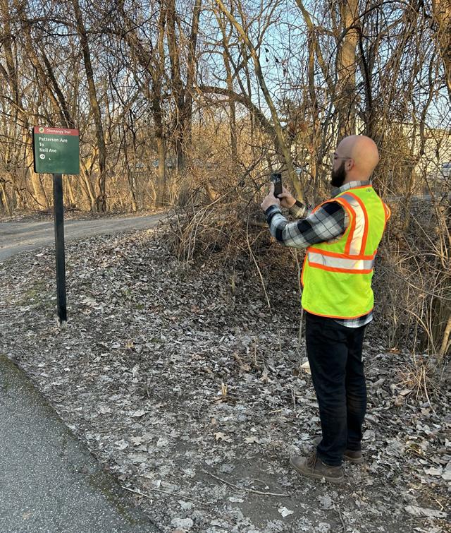
The team developed a data collection tool and used it to inventory every asset along the trail, to ascertain current conditions and identify where gaps in assets provided opportunities for improved wayfinding.
OFF-TRAIL DESTINATION ANALYSIS
The team created a list of major destination typologies and mapped all within a mile of the trail.
15 EXECUTIVE SUMMARY
Source: Maria Cardillo
Chapter 4
Strategy 1: Trailheads
Trailheads are the backbone of any trail wayfinding system. As gateways to both trails and the places they run through, trailheads have extraordinary capacity to influence trail users’ wayfinding experience — and thereby their overall experience of trails. This chapter reviews the current state of wayfinding support offered via trailheads along the Ohio to Erie Trail in Central Ohio and provides recommendations for optimizing these spaces to better serve trail users with the information and amenities they need.
CHAPTER 4 TAKEAWAYS
Provide information infrastructure.
All trailheads should have kiosks that provide up-todate information about the trail and trail-adjacent destinations and amenities.
Commit to information management.
Information presented at trailheads does not have to be professionally designed, but it does have to be owned by an entity willing and able to maintain it.
Expand your trailhead imagination. Build new trailheads when possible, but keep in mind that many community hubs can also meet trail users’ needs.
Make trailheads welcoming places.
Trailheads should be places that welcome all people to the trails; this may require a community engagement process.
FINAL | MARCH 2024 16 A WAYFINDING STRATEGY GUIDE FOR THE CENTRAL OHIO GREENWAYS
Chapter 4
Recommendations & Action Items
1. CLASSIFY TRAILHEADS ACCORDING TO THE ACCESS & AMENITIES THEY PROVIDE TRAIL USERS.
1.1. Map current trail access points & trailheads.
1.2. Inventory the assets of current access points & trailheads.
2. LOCATE TRAILHEADS EQUITABLY, NO FARTHER THAN 3 MILES APART, DIRECTLY ON THE TRAIL OR NO FARTHER THAN ½ MILE OFF THE TRAIL ALONG A COMFORTABLE ROUTE. SITUATE THEM NEAR MAJOR DESTINATION CENTERS, TRAIL JUNCTIONS, AND/OR TRANSIT HUBS WHENEVER POSSIBLE.
2.1. Use community facilities as trailheads.
2.2. Arrange for local businesses to provide some trailhead functions.
2.3. Build new trailheads.
3. GET CREATIVE WHEN CONSIDERING WHAT COMMUNITY INFORMATION COULD BE MADE AVAILABLE ON TRAILHEAD KIOSKS.
3.1. Use trailhead kiosks to post information not meant for signs.
3.2. Provide regular care for kiosks and their content.
4. MAKE TRAILHEADS INTO DESTINATIONS BY PROVIDING BASIC AMENITIES, OPPORTUNITIES FOR SOCIAL INTERACTION, AND PLACEMAKING ELEMENTS THAT PEOPLE WILL REMEMBER.
4.1. Engage the community to envision memorable trailheads.
4.2. Enliven trailheads by reducing car traffic near them.
4.3. Add amenities to current trailheads.
17 EXECUTIVE SUMMARY
Chapter 5
Strategy 2 : Maps & Signs
For as much as wayfinding is about more than maps and signs, maps and signs are fundamental to any wayfinding strategy. Well-designed, well-placed signage allows trail users to achieve “mindless wayfinding,” reducing their stress and confusion. This chapter shows how current signs along the Ohio to Erie Trail can be modified to provide trail users better wayfinding information and provides guidance on directing users to a trail, along a trail or route, and off-trail for amenities and exploration.
CHAPTER 5 TAKEAWAYS
Adopt a common sign system or modify local signs.
Work together on a regional scale to adopt the COG sign system, or keep local signs and replace them as necessary with signs that feature the design modifications in this guide.
Prioritize trail access points.
Invest in providing as much information as possible at trail access points, where the trail welcomes all users.
Make “Ohio to Erie Trail” more prominent than “Route 1”.
Make “Ohio to Erie Trail” the most prominent route information, and de-emphasize the State & U.S. Bike Route System number 1.
Sign destinations at a predictable cadence. Use the prescribed hierarchy to determine what destinations to sign, when, and how many times.
FINAL | MARCH 2024 18 A WAYFINDING STRATEGY GUIDE FOR THE CENTRAL OHIO GREENWAYS
Chapter 5
Recommendations & Action Items
1. MAKE MINOR SIGN DESIGN MODIFICATIONS TO CREATE COHERENCE ACROSS THE SYSTEM.
1.1. Replace old signs with updated designs.
1.2. Replace “Ohio Bike Route 1” with “Ohio to Erie Trail” sign hats.
1.3. Agree on trail nomenclature.
1.4. Sign on- and off-trail destinations predictably.
1.5. Align local signs using post wraps, signs, and hats.
2. WELCOME PEOPLE TO TRAILS WITH WAYFINDING SIGNS, MAPS, TRAIL RULES, AND EMERGENCY CONTACT INFORMATION.
2.1. Place wayfinding signs at all trail access points.
2.2. Provide emergency information at all trail access points.
2.3. Install map kiosks at all trailheads.
2.4. Sign all trailhead facilities.
2.5. Re-envision rules signs to better serve trail users.
3. PLACE CONFIRMATION SIGNS AT ALL DECISION POINTS AND APPROXIMATELY EVERY TWO MILES ALONG THE TRAIL.
3.1. Post confirmation signs frequently.
3.2. Label all bridges & cross streets.
3.3. Refrain from using mile markers on the trail.
3.4. Reinforce caution messages, rules, and directions with pavement markings.
4. SIGN SMARTLY TO KEEP PEOPLE ON THE CORRECT ROUTE WHEN IT DEVIATES FROM THE TRAIL.
4.1. Ensure roadway route segments & detours are well marked.
4.2. Use caution signs when a route continues offtrail.
4.3. Remove rogue signs from the trail.
5. POST SIGNAGE TO ALERT PEOPLE OF NEARBY TRAIL ACCESS POINTS.
5.1. Alert people to every trail access point.
19 EXECUTIVE SUMMARY
Chapter 6
Strategy 3: Technology
With technology as ubiquitous and powerful as it is today, it can be tempting to invent technical solutions to all problems. Indeed, when it comes to trailoriented wayfinding, opportunities for digital signs, interactive kiosks, and new apps abound. This chapter considers these and other digital means to improve wayfinding, then recommends the few that will most significantly impact a trail user’s experience.
CHAPTER 6 TAKEAWAYS
Don’t create new problems.
Technical solutions can be effective, but they should not be attempted in the absence of a plan to maintain them over time.
Link to local information.
QR codes provide an elegant solution to the challenge of providing trail users with local information, especially that which is likely to change.
Update the most popular routing apps.
It is possible — and critical — to work with Google Maps and/or OpenStreetMap to improve the quality of local trail data.
Develop routes, offer rides, and improve the COG map.
User-friendly trail maps, paired with curated routes and itineraries, lower the bar for people to explore the trails.
FINAL | MARCH 2024 20 A WAYFINDING STRATEGY GUIDE FOR THE CENTRAL OHIO GREENWAYS
Chapter 6
Recommendations & Action Items
1. KEEP THE TRAIL WAYFINDING SYSTEM SIMPLE AND LOW-TECH.
1.1. Install digital signs & kiosks only in very limited circumstances.
1.2. Improve digital data to enhance the utility of existing trail navigation applications.
2. USE QR CODES TO PROVIDE INFORMATION ABOUT OFF-TRAIL DESTINATIONS & AMENITIES.
2.1. Generate, locate & track QR codes according to best practices.
2.2. Standardize the content that QR codes link to.
3. HELP MAKE THE MOST COMMONLY USED WAYFINDING APPS WORK BETTER.
3.1. Manually update specific sites on OSM.
3.2. Send updates to Google Maps’ content team.
4. DEVELOP COG TRAIL-ORIENTED ITINERARIES AND COMPILE THEM INTO A PUBLICLY AVAILABLE ROUTE REPOSITORY.
4.1. Curate trail-based itineraries and share them.
4.2. Promote recommended routes with programming.
5. UPDATE THE COG METRO BIKE AND TRAIL USER MAP TO IMPROVE ITS USER FRIENDLINESS.
5.1. Make design and content modifications to the COG map.
21 EXECUTIVE SUMMARY
Chapter 7
Strategy 4: Public Art & Other Creative Elements
For many reasons, installing public art and other creative elements along a trail is a worthy goal unto itself. Locating these elements strategically can also further wayfinding goals, by helping people associate places with specific visual cues. This chapter outlines the various types of creative elements that can elevate a trail experience, the process of ensuring they are representative of their communities, and where to locate them to maximize their wayfinding benefit for trail users.
CHAPTER 7 TAKEAWAYS
Understand what public art is and is not.
Public art is a specific type of creative element that must be understood and treated differently than others. There may be special rules that govern how it is funded, created, installed, maintained, and deaccessioned.
Locate creative elements strategically.
While creative elements should be in as many places as possible, locating them at wayfinding problem spots is a creative way to help trail users find their way.
Be resourceful when sourcing creative elements. There are creative elements to fit all budgets, and many communities have successfully garnered in-kind support when they’ve brought engaged citizens to the planning table.
Be intentional about representation.
Creative elements should be born of a robust community engagement process in order to authentically express the values and personality of those who live near them.
FINAL | MARCH 2024 22 A WAYFINDING STRATEGY GUIDE FOR THE CENTRAL OHIO GREENWAYS
Recommendations & Action Items
1. LOCATE PERMANENT PUBLIC ART AND OTHER CREATIVE ELEMENTS AT GATEWAYS, DECISION POINTS & TRANSITION ZONES WHENEVER POSSIBLE.
1.1. Install public art at trail gateways.
1.2. Install creative elements at trail decision points.
1.3. Install pavement markings at trail transition zones.
2. USE CREATIVE ELEMENTS AS ROUTE CONFIRMATION CUES WHENEVER POSSIBLE.
2.1. Confirm routes using color, light, design & repetition.
2.2. Introduce new routes with temporary installations.
3. ENSURE THAT ALL CREATIVE ELEMENTS ARE REPRESENTATIVE OF TRAIL-ADJACENT COMMUNITIES AND EXPRESS THE DISTINCT PERSONALITY OF THOSE PLACES.
3.1. Hire local creatives and buy supplies & equipment locally.
3.2. Insist on equitable solicitation processes.
3.3. Involve community members in the curation and development of creative elements.
3.4. Conduct ideation sessions that elicit what the community wants from its art.
4. TRACK SITES THROUGHOUT THE REGION THAT WOULD BE APPROPRIATE FOR CREATIVE INTERVENTIONS AND MAKE A PLAN TO WORK THROUGH THEM.
4.1. Maintain an ongoing list of creative element opportunities.
23 EXECUTIVE SUMMARY
Chapter 7
Chapter 8 Strategy 5: Trail Ambassadors
“Trail Ambassadors” is a broad term encompassing all the many people involved in helping trail users find their way. Because trail users often solicit information from locals — recommended destinations, directions, and comfortable routes, for example — it makes sense to regard these people as the vital trail wayfinding resources they are. This chapter explores ways to cultivate this human infrastructure and advance wayfinding support for trail users within trail-adjacent communities, in particular through a formal Trail Towns commitment.
CHAPTER 8 TAKEAWAYS
Identify outreach partners.
Figure out who is already doing the work of outreach to Trail Ambassadors, or who is best positioned to take it on, and invite them to participate in a broader, more coordinated effort.
Create a Trail Ambassadors network.
Invest in strategies that develop Trail Ambassadors’ capacity to engage trail users, in particular shared opportunities for education, networking, and resource development.
Help establish the Central Ohio Trail Towns program. Support MORPC’s efforts to develop a Trail Town program and help spread the word about it.
FINAL | MARCH 2024 24 A WAYFINDING STRATEGY GUIDE FOR THE CENTRAL OHIO GREENWAYS
Chapter 8
Recommendations & Action Items
1. CULTIVATE TRAIL AMBASSADORS WHO WILL ENGAGE WITH TRAIL USERS AND HELP THEM FIND THEIR WAY.
1.1. Help Trail Ambassadors network & share information.
1.2. Provide wayfinding materials for distribution.
1.3. Create opportunities for intentional trail user engagement
2. WORK WITH REGIONAL PARTNERS TO DEFINE & IMPLEMENT A TRAIL TOWNS PROGRAM IN CENTRAL OHIO.
2.1. Help educate community members & leaders about the Trail Towns opportunity.

25 EXECUTIVE SUMMARY
Source: Black Women in Nature
Chapter 9 Wayfinding Program Evaluation
Trail counts are the most effective way to measure the impact of wayfinding and other trail improvement interventions — all of which are made in an attempt to attract more people to the trails. This chapter discusses how to place trail counters to collect the most useful data and how to use that data for further wayfinding enhancements.
CHAPTER 9 TAKEAWAYS
Evaluate impact with trail counters.
Permanent trail counters that track trail use over time can be used to assess the impact of various wayfinding interventions.
Capture the most useful data at trail access points. Place trail counters at trail access points to best assess how wayfinding improvements are impacting trail use behavior.
Collect other types of data as possible.
Dive more deeply into how trail users are responding to wayfinding interventions with surveys, focus groups, and interviews.
Define trail end points.
Commit to what a trail is before analyzing count data to ensure it can be compared over time.
FINAL | MARCH 2024 26 A WAYFINDING STRATEGY GUIDE FOR THE CENTRAL OHIO GREENWAYS
Chapter 9
WAYFINDING INTERVENTIONS IN THIS GUIDE
Wayfinding Program Evaluation
TRAILHEADS
Naming and classifying trailheads
Building new trailheads
Using public facilities as trailheads
Upgrading trailhead amenities
Adding trailheads to wayfinding signs
Improving the quality of information on kiosks, maps, and signs at trailheads
SIGNS & MAPS
Trail counts are the most effective way to measure the impact of wayfinding and other trail improvement interventions — all of which are made in an attempt to attract more people to the trails. This chapter discusses how to place trail counters to collect the most useful data and how to use that data for further wayfinding enhancements.
Modifying signs to provide better wayfinding information
Adding destinations and distances to all Wayfinding and Trail ID Signs
Placing “to-trail” signs in the public right-of-way whenever possible
TECHNOLOGY
Ensuring all trail access points are included on routing apps
Employing QR codes to link to information about trail-adjacent destinations and amenities
Creating a publicly available route repository
Making COG’s bikeways map more user-friendly
CREATIVE AMENITIES
Placing public art and other creative amenities at trail decision points and transition zones
Using creative elements to affirm the continuation of a route
TRAIL AMBASSADORS
Cultivating a network of people to provide social support for trail users
27 EXECUTIVE SUMMARY
Chapter 10
Wayfinding Case Study: Easton Town Center
This guide has detailed five strategies to improve wayfinding along the Ohio to Erie Trail: Trailheads, Maps & Signs, Technology, Public Art & Other Creative Elements, and Trail Ambassadors & Trail Towns. In this chapter, all five strategies are depicted at one site along the Alum Creek Trail, near Easton Town Center, to demonstrate how they can work together to leave trail users feeling truly inspired on their journeys.
CHAPTER 10 TAKEAWAYS
Express yourself through place.
The things that make a community special can (and should) find expression in the physical attributes of their trail-based places.
Improve bicycle & pedestrian infrastructure.
Prioritize bicycle and pedestrian connections at trail access points to ensure trail users have a seamless transition to nearby destinations.
Make trailheads mobility hubs.
Trailheads can be places at which people access bicycle, pedestrian, micromobility, motor vehicle, and transit-oriented mobility options.
Greet trail users at off-trail destinations with amenities.
People who accept an invitation to venture offtrail should be well served when they arrive at their destination.
FINAL | MARCH 2024 28 A WAYFINDING STRATEGY GUIDE FOR THE CENTRAL OHIO GREENWAYS

The Easton Trailhead would be unlike anything Central Ohio has ever seen — the first trailhead to bring outdoor recreation, retail, entertainment, public art, mobility options, community programming, and social interaction together in one destination, on a truly grand scale.

PROJECT OVERVIEW 1.0

Central Ohio Greenways trails serve as the backbone of Central Ohio’s outdoor recreation and transportation network. To maximize their use and utility, the goal is for these trails to become as navigable as the region’s roadways. But trail users today can encounter wayfinding challenges that create stress and threaten to reduce their future trail use. This chapter outlines such challenges, the process used to address them, and how this Wayfinding Guide can be used to help trail users find their way.
Source: Central Ohio Greenways
Central Ohio Greenways (COG) is a trail network of national significance that spans 230+ miles and connects Central Ohio to other parts of the state and country. Residents and tourists travel more than 12 million miles annually on COG trails for purposes of transportation and outdoor recreation, bringing myriad benefits to the region. With Central Ohio expected to surpass 3.1 million residents by 2050,1 COG will take on increased significance as a driver of economic activity, transportation choice, environmental services, tourism opportunities, healthy lifestyles, and cultural activity. The COG Board’s Regional Trail Vision proposes adding more than 500 miles of trails to the network by extending trails, filling gaps in trail corridors, and creating neighborhood connections. These efforts will align with LinkUS, RAPID 5, and other largescale regional initiatives to prepare Central Ohio for significant population growth over the next 25 years.

1 Mid-Ohio Regional Planning Commission. 2024–2025 Population Growth Forecasts.
2 The Regional Impacts of the Central Ohio Greenways in Franklin County 2022.
12M+ MILES TRAVELED ANNUALLY2 48K+ USERS ANNUALLY 230+ MILES
mi.
1” = 6
The Central Ohio Greenways Board

The 25-member Central Ohio Greenways Board (COG Board) was formed in 2015 as a committee of the MidOhio Regional Planning Commission (MORPC) to increase the number of people using the regional trail system through trail network expansions, increased programming, improved branding and marketing, new partnerships, and improved wayfinding.

COG VISION
Create a world-class network of trails easily accessible to every Central Ohioan
COG MISSION
Increase Greenways trail mileage and use of trails for recreational and transportation needs
Source: Central Ohio Greenways
COG Board Plans & Initiatives to Date
This Wayfinding Strategy Guide builds upon years of work to improve trail conditions for all Central Ohioans:
STRATEGIC PLAN & ACTION ITEM UPDATE (2016/23)
The COG Board’s initial strategic plan and an update to its immediate action items
TRAILHEADS FOR ALL (2023)
Trailhead research conducted by MORPC’s Easton Future Vision Fellow
TRAIL TOWN FRAMEWORK & EXPANSION (2022/23)
A framework for establishing a regional Trail Town program and an expansion that explores Trail Towns in urban and suburban contexts
REGIONAL VISION MAP
An annually updated, regionally adopted plan to expand trail miles
COLUMBUS OUTDOOR TRAILS PASS (2021)
A trail use encouragement program that incentivizes biking and walking to 42 trail-based destinations
ECONOMIC IMPACT STUDY (2021)
A study capturing the ROI of greenways investments on Franklin County, Ohio’s economy and quality of life
REGIONAL TRAIL VISION PRIORITIZATION (2021)
A study assessing which trail infrastructure investments have the potential to impact the region most dramatically, with a focus on Franklin County
URBAN GREENWAY DESIGN GUIDE (2021)
A community resource outlining the various types of urban greenways and recommendations for implementing them
CLARITY REPORT FOR READINESS & FEASIBILITY (2019)
A report assessing the feasibility of raising $250 million to expand the trial network in Central Ohio
DESIGN GUIDELINES (2019)
A guide highlighting basic bicycle facility design requirements
A WAYFINDING STRATEGY GUIDE FOR THE CENTRAL OHIO GREENWAYS FINAL | MARCH 2024 36
BRAND GUIDELINES, DRAFT (2018)
A guide stipulating COG’s brand marks and signage standards
TRAIL USE SUMMARY (2017)
A report detailing Trail Miles Traveled and Average Annual Daily Trail Traffic along each of COG’s trail segments from 2014–2017
BEST PRACTICES REPORT (2015)
An addendum to the Strategic Plan benchmarking COG against 7 trail organizations throughout the country



37 1.0 PROJECT OVERVIEW
ALL Conceiving trailheads for equitable and safe connectivity. August 2023
TRAILHEADS FOR
The Challenge
Wayfinding is falling short of what trail users need. Losing people is my biggest concern.
LAURA
BALL Parks and Facilities Development Administrator, City of Westerville
The Central Ohio Greenways are considered an exemplar among regional trail systems in the United States, with total mileage and quality that rivals many similar systems. COG’s success traces, in part, to the COG Board’s early investment in professionally designed wayfinding signs and brand standards to support trail users’ navigation. These signs are highly regarded and have served the trail network well, but with the COG network’s growth and efforts to entice new users to the trails, the Board recognized a need to go further with its wayfinding strategy.
COG users today report places on the trail where there are too many different signs to make sense of, others with no signs to orient them, and still others where they’re not sure they’re still on an official trail route at all. COG’s trail system is challenged with multiple layers of jurisdictional oversight that impact key aspects of the user experience. In Central Ohio and most regions throughout Ohio, trail wayfinding is planned and implemented by local trail or park managers. This allows for tremendous variety that animates the trail system with local flavor, but variations in sign design and placement, as well as nomenclature standards, can be a source of confusion, frustration, and unintended — even dangerous — consequences for our trail users. The challenge is to remedy these wayfinding breakdowns with strategies that simultaneously foster system-wide cohesion and accommodate the creativity and diversity of all hard-working trail partners.
A WAYFINDING STRATEGY GUIDE FOR THE CENTRAL OHIO GREENWAYS FINAL | MARCH 2024 38
Key Issues & Constraints
FUNDING CHALLENGES
The data collection, communications, physical assets, and human infrastructure necessary for an optimal trail experience requires a significant commitment of difficult-to-fund operational expenditures.
LAYERS OF NAMES & DESIGNATIONS
One segment of trail may have several names, and trail routes may utilize shared roadways for certain sections.
A BALANCING ACT
Cohesion within the wayfinding system should coexist with respect for local communities’ unique contributions to signage and programming.
SUNK COSTS, LONG LIVES
Many communities have already invested in brands and signage, and are not in a position to exchange their signs until the end of their 10- to 20-year lifespan.
AN ACTIVELY EXPANDING NETWORK
The trail network is in flux as new trails, access points, and connections — all of which must factor into the wayfinding system — are developed.
REGIONAL SCOPE
Trails that cross through more than one jurisdiction may be managed by different entities that have unique goals, brands, expertise, and rules. No one entity has authority over the entire trail network.
RESOURCE DISPARITIES
Communities have varying levels of resource to devote to trail maintenance.
39 1.0 PROJECT OVERVIEW






SIGN SYSTEMS ENCOUNTERED
SIGN SYSTEMS IN USE

LEGEND
COG
OHIO TO ERIE TRAIL
COLUMBUS PARKS & REC
METRO PARKS
ODOT
DANVILLE LOCAL
DELAWARE COUNTY
GALENA
GENOA TOWNSHIP
HEART OF OHIO
KNOX COUNTY
LONDON
MOHICAN VALLEY
MOUNT VERNON
WESTERVILLE

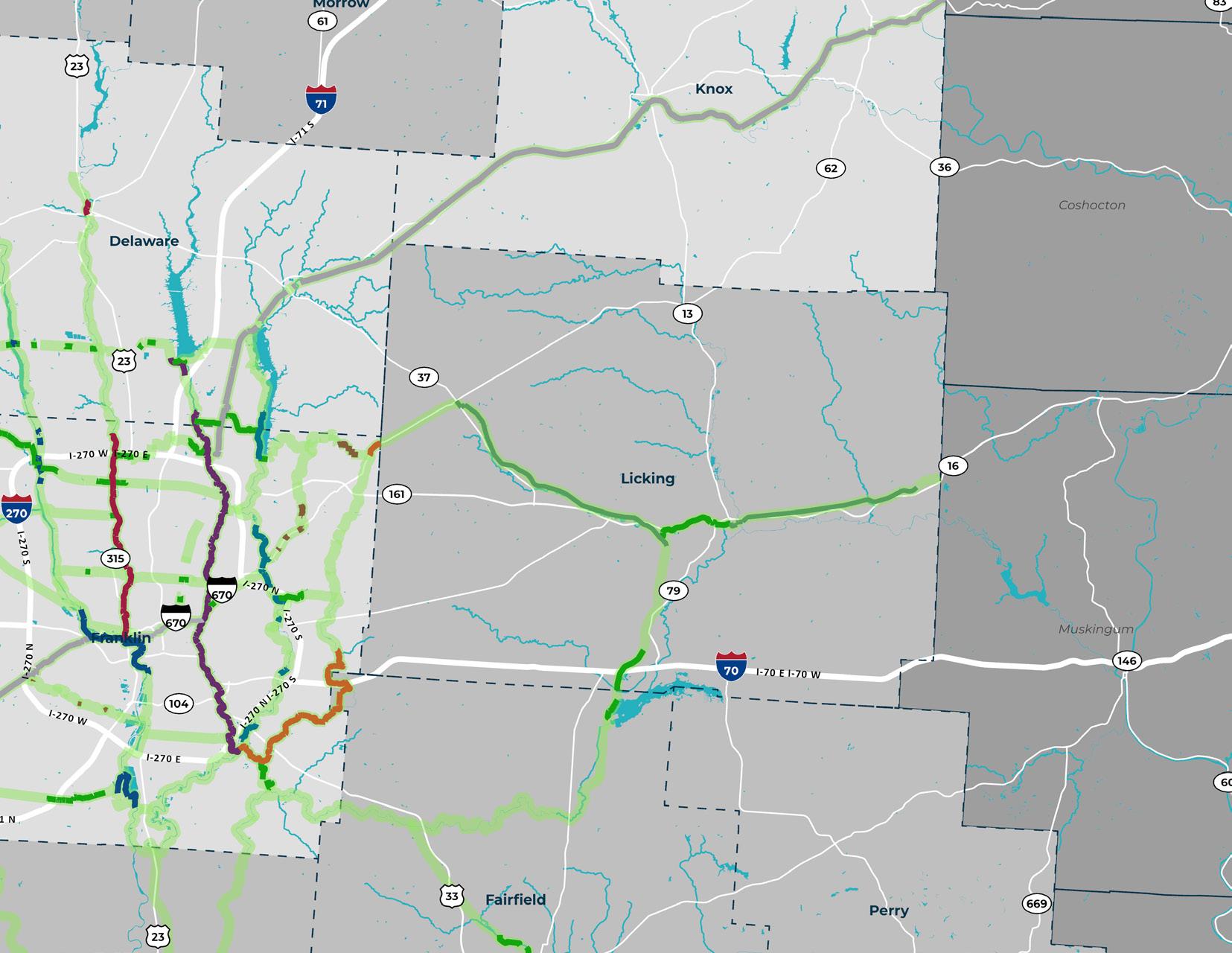
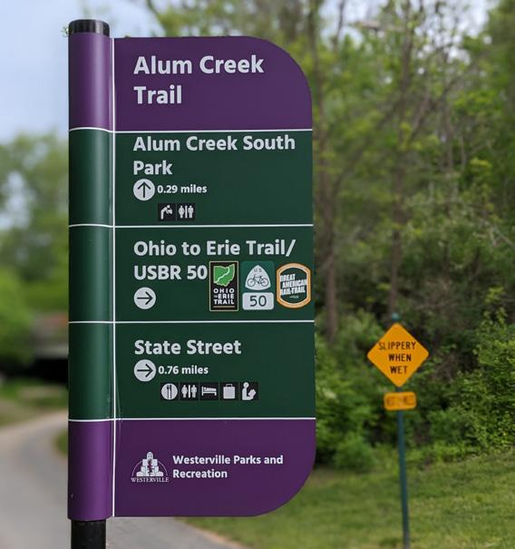
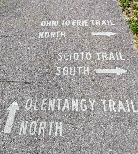
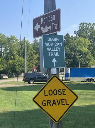
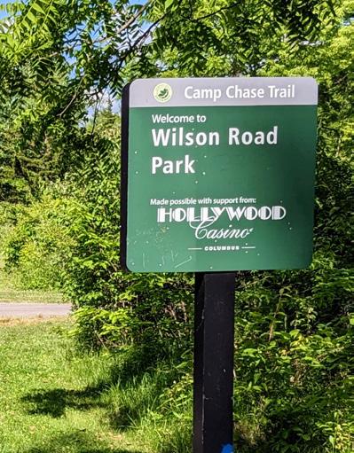
As it passes through Central Ohio, the Ohio to Erie Trail features 15 different types of signs. Many communities use the standard Central Ohio Greenways sign system or a slightly modified version of it. 1” = 6 mi.
The Project
The COG Board decided to invest in a wayfinding strategy initiative that would at once unify regional and statewide trail networks across jurisdictional boundaries and celebrate the uniqueness of diverse communities along its trails. The task was to evaluate current sign systems and recommend how they might be more effectively employed, but also to think beyond signs and maps to develop a nationally recognized trail wayfinding strategy that encompasses non-traditional elements like public art and Trail Towns initiatives.
The resulting COG Wayfinding Strategy Guide builds on the foundation of wayfinding investments the COG Board and its trail partners have made to date and creates new openings to collaborate strategically on helping people navigate the trail network. It does not require that partners discard their prior work; rather it aims to provide strategies that help them elevate their wayfinding efforts in the service of making Central Ohio’s trails and active transportation networks as
easy to navigate as its roadways. Creative wayfinding strategies, as defined throughout this guide, will make trails more accessible, fun, and comfortable than ever before for all who travel them.
The COG Board selected for this project a segment of the Ohio to Erie Trail that runs through Madison, Franklin, Delaware, and Knox counties in Central Ohio. This segment was also the focus of MORPC’s Trail Town Framework, which provides a blueprint for implementing Trail Town programming throughout the region. It provides an excellent subject for analysis due to its complexity and its importance as the most prominent national (Great American Rail-Trail), state (Ohio to Erie Trail), and regional (Camp Chase, Alum Creek, and Heart of Ohio Trails) routes through Central Ohio. The intention is that the wayfinding strategy developed for this trail segment will be employed throughout the COG network and serve as a model for regional trail wayfinding across Ohio.
A WAYFINDING STRATEGY GUIDE FOR THE CENTRAL OHIO GREENWAYS FINAL | MARCH 2024 44

If we can figure [wayfinding] out here, we can figure it out anywhere!
ERIC OBERG
Midwest Regional Director, Rails to Trails Conservancy
The Process
RESEARCH & BENCHMARKING
The project team gathered information from numerous sources, including academic research, other wayfinding and signage plans, local COG trail studies, and online media; these are cited throughout the document. Trails in peer communities were reviewed to inspire ideas about what might be possible within the COG system.
ASSET INVENTORY & DATA ANALYSIS
The team rode every mile of the Ohio to Erie Trail segment within the project scope — photographing, labeling, describing, and mapping each asset along the way — to allow for a rich analysis of gaps and opportunities. Many existing data sets were also used for mapping and to inform the identified strategies.
STAKEHOLDER ENGAGEMENT
The team convened a series of 7 Steering Committee meetings with more than 22 contributing members, as well as individual meetings with 25 trail user groups and other key stakeholders. Their feedback significantly influenced the content of this guide.

A WAYFINDING STRATEGY GUIDE FOR THE CENTRAL OHIO GREENWAYS FINAL | MARCH 2024 46
 Source: Jody Dzuranin
Benchmark Trails
LOVELAND BIKE TRAIL
This 70-mile rail trail is a fan favorite, with great wayfinding, great trailheads, and lots to do off-trail.
INDIANAPOLIS CULTURAL TRAIL + MONON TRAIL
The 8.1-mile Cultural Trail is a shared-use path between three public spaces in downtown Indianapolis that connects to the 25-mile Monon Trail, both of which feature fantastic placemaking amenities.
JOE LEWIS GREENWAY
The 27.5-mile urban greenway in Detroit, MI will connect 23 neighborhoods and 3 nearby cities; its first trailhead is an impressive public space with a playground and a unique shelter design.
THE ATLANTA BELTLINE
This 22-mile former railway corridor is an urban redevelopment project integrating public parks, multiuse trails, transit, and affordable housing.
THE GREAT ALLEGHENY PASSAGE
This 150-mile rail trail between Pittsburgh, PA and Cumberland, MD is a classic of the genre, and where the Trail Town movement was born.
EMPIRE STATE TRAIL
This 750-mile multi-use trail in New York State is a great example of signage and trailhead design. Its Walkway
Over the Hudson experience is an exemplar of regional cooperation and destination marketing.
GRAND ROUNDS SCENIC BYWAY SYSTEM
This 50-mile stretch of on- and off-road amenities linking Minneapolis’s parkways is known for being extremely easy to navigate.
THE TOWPATH TRAIL
This 101-mile multi-use trail in Northeast Ohio is a regional experience offered through the robust support of many institutional partners and trail friends.
A WAYFINDING STRATEGY GUIDE FOR THE CENTRAL OHIO GREENWAYS FINAL | MARCH 2024 48
Source: Indianapolis Cultural Trail, Inc.


Source: ColinHunter.net

Source: The New York Times

Source: Prime Passages

49 1.0 PROJECT OVERVIEW
Source: BiteLines Atlanta Food Tours
COMMON THEMES
1. SAFETY
In case of emergency, how can responders locate trail users?
2. ACCESS
Does everyone in the community have access to the trails?
3. URBAN/RURAL
Different areas have very different needs and usage patterns.
4. TECH V. PRINT
Tech is everywhere, but print still has its place.
What is the appropriate use of each?
5. UNCERTAINTY
The current state of trail amenities and the wayfinding system is largely unknown.
6. TOO MANY/TOO FEW SIGNS
Some trail segments have too many signs, while others don’t have enough.
7. PLACEMAKING
Trails need a “wow factor” that shows off what makes them uniquely of Central Ohio and all that makes this place special.
8. COMMUNITY LOVE
How can signs highlight local amenities and also remain current?
A WAYFINDING STRATEGY GUIDE FOR THE CENTRAL OHIO GREENWAYS FINAL | MARCH 2024 50
9. WELCOME
There is a strong desire to welcome people, particularly newcomers, to the trails.
10. COORDINATION
Several local initiatives dovetail with this one — how can these connections be maximized?
11. LAYERS
Many trail systems, municipalities, and organizations can be involved in one trail segment, without necessarily having authority over it.
12. TRANSITIONS
Trail users find road/trail connections to be scary and unclear, making it unlikely they will venture off-trail into nearby communities.
13. DISORIENTATION
It is difficult for trail users to know where they are on the trail, and how far it is to key destinations.
51 1.0 PROJECT OVERVIEW
The Product
The Central Ohio Greenways Wayfinding Strategy Guide (hereafter, “the guide”) provides Ohio’s trail managers, trail advocates, and other community leaders with a tool to help their communities and regions plan for and implement cohesive trail wayfinding strategies. The guide does not create new brand or design guidelines, nor does it compel the use of any existing guidelines. Rather, it:
• Outlines a process for inventorying assets along trails to help communities and regions identify relevant trail information and locally and regionally significant destinations
• Advances uniform standards for wayfinding content, design, and placement that allow a seamless experience for trail users as they travel across jurisdictions
• Provides a blueprint for the successful development of signs, digital wayfinding applications, and other communication tools
• Goes beyond maps and signs to showcase how placemaking and other such efforts can support trail users’ navigational competency
The table on the next page outlines the guide’s format, and how all of its elements fit together.
A WAYFINDING STRATEGY GUIDE FOR THE CENTRAL OHIO GREENWAYS FINAL | MARCH 2024 52
WAYFINDING STRATEGY GUIDE ELEMENTS
GOAL: All Central Ohio Greenways users feel secure, exploratory, and inspired on their journeys.
1
TRAILHEADS
will orient trail users to both the trail and the places it runs through, and welcome them with vital amenities.
Wayfinding elements will be predictable, consistent, and simple to understand.
2
MAPS & SIGNS
will keep trail users moving effortlessly to, from, and along a trail by providing the information they need, at precisely the point at which they need it.
Wayfinding elements will be at the proper scale for cyclists, walkers, and those using mobility devices. There will be clarity at all decision points. Trail users will not need to stop for any reason unless desired.
3 TECHNOLOGY
will enable trail users to access current information on routes, amenities, and destinations.
FILTERED THROUGH
Wayfinding elements will feature inclusive design and universal icons that are accessible to all users. They will prioritize the needs of new trail users, and the needs of trail users over providers.
4
CREATIVE ELEMENTS
will help trail users create mental maps that enable them to better navigate the trail over time.
Wayfinding elements will provide users with the right information, at the right time, in the right format. Trail users will have the assets they need, when they need them.
RESULTING IN
TECHNOLOGY
Chapter 6
Wayfinding elements will include many types of environmental cues, including public art. Memorable places will support the creation of robust mental maps. .
CREATIVE ELEMENTS
Chapter 7
5
TRAIL AMBASSADORS
will be the social support for trail users within trail-adjacent communities that help them find their way.
Wayfinding elements will allow trail users the opportunity to connect with each other and with communities’ people, places, and cultures.
Chapter 8
53 1.0 PROJECT OVERVIEW STRATEGIES
TACTICS
TRAILHEADS Chapter 4
MAPS & SIGNS Chapter 5
TRAIL AMBASSADORS
WAYFINDING PRINCIPLES
ME
ME WHERE I AM! ANTICIPATE MY NEEDS!
IT MEMORABLE! HELP ME CONNECT!
DON’T MAKE ME THINK! KEEP
MOVING! MEET
MAKE

The ideal trail experience is something you don’t have to think too much about. You just follow what appears to be a natural path and all your needs are met before you even realize you have them.
TOM BILCZE President, Ohio to Erie Trail Board
Source: Central Ohio Greenways

Chapter 1 Takeaways
1
HONOR THE WORK THAT HAS MADE THIS GUIDE POSSIBLE.
This guide builds on years of diligent effort by the COG Board and its partners to create a world-class trail network.
2
UNDERSTAND THIS IS NOT A SIGN DESIGN OR REBRANDING EFFORT.
This guide is intended to facilitate the creation of a wayfinding system for the COG network. It is not a branding document, nor does it impose design guidelines on or attempt to replace any local sign systems.
3
APPRECIATE THE COMPLEXITY OF THIS TRAIL SEGMENT.
The four-county Ohio to Erie Trail segment being studied includes local, state, regional, and national trails and routes.
4
ACCEPT THE ASSISTANCE AVAILABLE THROUGH COG & MORPC.
This guide, many of the resources it describes, and all the resources of the COG Board are for the benefit of all MORPC communities. Take advantage!
55 1.0 PROJECT OVERVIEW

THE EXPERIENCE OF TRAILS 2.0

In the world of mobility, trails are unique — vibrant, social, sensory, natural places that enliven those who travel them. They can also be places that evoke primal fears, like being lost and alone, unable to access basic necessities. Elevating the positive and mitigating the negative feelings associated with trail travel requires a proactive approach to trail experience cultivation. This chapter envisions an ideal trail experience and explores how wayfinding fits into it, identifies various types of trail users, and explores what all trail users need to feel secure, exploratory, and inspired on their journeys.
Source: Central Ohio Greenways
Trails: An Emotional Journey
The Central Ohio Greenways (COG) Board’s mission is to “increase the number of people using [its] regional trail system.” Since 2015, this goal has been laudably achieved by many people and organizations working to provide, program, and promote trails throughout the region. Now, as the COG Board continues to refine the trail system for a broader audience of users than ever before, a deeper exploration of what makes for an exceptional trail experience, for many different types of people, is warranted. This begins with a consideration of the trail user experience:
How do people feel as they’re traveling our trails? How do we want them to feel?
What factors influence trail users’ feelings? Do these factors change depending on their personal characteristics?
How can we design trails to generate positive feelings in trail users?
A WAYFINDING STRATEGY GUIDE FOR THE CENTRAL OHIO GREENWAYS FINAL | MARCH 2024 58
The questions on the previous page center trail users’ feelings because a person’s positive experience of trails arises from an ongoing series of positive feelings they have while traveling on them — and the negative feelings they don’t. This may seem an obvious point, but in fact it is still uncommon for trail planning initiatives to orient around the goal of “increasing users’ joy,” for example, in spite of research highlighting the role of urban design in human well-being.1 If more people are to take more trips on trails, positive experiences for them must be actively cultivated. Even more importantly, sources of negative experiences that can override otherwise positive ones must be eliminated. The task of trail managers, then, is to anticipate the pain points and artfully employ strategies to reduce trail users’ anxiety and, as necessary, overcome their negativity bias so that one bad experience does not scare them off trails forever.
POSITIVE FEELINGS to
cultivate
Freedom | Joy | Inspiration
Exhilaration | Contentment | Connectedness
NEGATIVE FEELINGS to mitigate
Frustration | Isolation | Sadness
Confusion | Panic | Anger
59 2.0 EXPERIENCE OF TRAILS
1 Montgomery, “Happy City.”
Cultivating the COG Experience
Maslow’s classic hierarchy of human needs provides a helpful way to think about which feelings to cultivate in the creation of a wayfinding system for COG trail users. Maslow stipulates that only when humans feel safe and have their physiological needs met are they able to pursue love, belonging, esteem, and self actualization.1 In the context of the built environment, such as a trail, people experiencing the space should foremost feel secure, and then ideally exploratory and inspired. This line of thinking generates a bold new project goal:
All Central Ohio Greenways users feel secure, exploratory & inspired on their journeys.
A WAYFINDING STRATEGY GUIDE FOR THE CENTRAL OHIO GREENWAYS FINAL | MARCH 2024 60
1 Hopper, “Maslow’s Hierarchy of Needs Explained.”

Planning for Feelings
Imagine that a human experience–oriented planning effort with the mantra “reduce frustration, increase joy” is tasked with planning a trail extension. When they consider whether the trail will reduce frustration, the answer is a clear “yes” — after many years of advocacy, neighborhood residents will be connected to a high-demand retail center.
When they consider whether it will increase joy, the answer is murkier. It may cause relief in the people who can finally ride their bicycles to the grocery store…but joy? If the planning effort is committed to people experiencing joy, it will have to go farther. Perhaps in this case, a public art installation, trailhead, or scenic river overlook is called for.
Source: Central Ohio Greenways

Feeling EXPLORATORY Feeling SECURE Feeling INSPIRED Ideal Trail User EXPERIENCE
The trail user is enticed off-trail to partake of local assets and amenities, assured of their ability to find their way back to the trail when they’re done.

The trail user is oriented to where they are and where they’re going, and confident they can get their basic needs met at any time.
ENHANCED IDEAL ESSENTIAL
Steering Committee members shared what they need to feel secure, exploratory, and inspired on a trail.
WHAT DO YOU NEED TO FEEL SECURE ON A TRAIL?
Other people around
Lighting
Clearly marked exit points
Emergency phone numbers and call buttons
Knowledge of where I am and the distance to the next trail access point
Cell phone service
Consistent, litter- and glass-free surfaces
Access to basic amenities like water or restrooms
A WAYFINDING STRATEGY GUIDE FOR THE CENTRAL OHIO GREENWAYS FINAL | MARCH 2024 64
WHAT DO YOU NEED TO FEEL EXPLORATORY ON A TRAIL?
Public and private spaces clearly delineated to show where exploration is allowed
A hint about what there is to see, with phrases like “Views Up Ahead”
Knowledge about whether nearby businesses are bike friendly
Info about where there is a bike stand for repairs
Distances on signage so a side trip doesn’t mean getting lost
A clear line of sight to what there is to explore
Info on the trail as to what to expect and info beforehand to get ready for the trip (website, pre-made routes, etc.)
Connection to a public place like a famous park
WHAT DO YOU NEED TO FEEL INSPIRED ON A TRAIL?
Cultural connections
Public art
When you can’t hear traffic sounds
Something, anything unique
Quality materials
The sense that bike/pedestrian facility is the priority, we’re not just being tacked onto an arterial road
Beautiful viewsheds
A well maintained and intuitive trail
Pleasant people
Nice rest stops
Really old trees
Neighborhood pride
A diversity of users enjoying the trail
Educational installations
Creative illumination
65 2.0 EXPERIENCE OF TRAILS
Trail User Typologies
As work is done to create an ideal trail experience for all users, planners quickly confront the reality that all trail users are not the same. People traveling trails need different things to feel secure, exploratory, and inspired, depending on both how they’re using the trails and their personal characteristics. Indeed, while there tends to be an overemphasis on how trail users’ activities contribute to their trail experience, and an underappreciation of how their personal characteristics do, both matter equally.
Creating a matrix of all possible trail users’ activities and personal characteristics, in order to more perfectly meet the needs of each, is impractical at best. That said, everyone designs to their biases, to their own imagined users (see “Thought Experiment,” page 69), and recognizing and overcoming that requires intentionality — if the trail is to welcome all users. Because regardless of who they are, what they look like, how they’re using the trail, their mobility or cognitive
capacity, one thing true of all trail users is they want to feel like they belong, that someone out there is concerned for their safety and comfort.
TRAIL USE
A person’s trail activities will obviously dictate the trail assets they need or prefer, and thereby the information they need to find them.
PERSONAL CHARACTERISTICS
It may be less intuitive that a person’s race, gender presentation, or age would have anything at all to do with their wayfinding experience. But Symonds, et. al. writes that the wayfinding process is, “...experienced differently according to a person’s class, gender ability, ethnicity, age and sexuality amongst other things…”1 This is due to the fact that wayfinding is a process in which specific bodies, with specific qualities, limitations, and cultural significance, must find their way in the world.
1 Symonds, Brown, and Iacono, “Exploring an Absent Presence.”
A WAYFINDING STRATEGY GUIDE FOR THE CENTRAL OHIO GREENWAYS FINAL | MARCH 2024 66
CYCLISTS
Local recreation
Distance touring
Sport/training
TRAIL USER ACTIVITIES
PEDESTRIANS
Transportation ROLLERS
Casual walking Running Distance hiking Pets
Skateboarding Roller blading Scooting Mobility devices
TRAIL
67 2.0 EXPERIENCE OF TRAILS
USER PERSONAL CHARACTERISTICS RACE GENDER PHYSICAL & COGNITIVE ABILITIES AGE
Steering Committee members shared how trail use might influence trail users’ needs and preferences.
Steering Committee members shared how personal characteristics might influence their needs and preferences.
There is a higher need for shade and benches among people with mobility challenges.
Hikers and walkers need water more frequently.
Through travelers desire fewer places to stop.
Exercise folks want mile markers.
Transportation cyclists want more info on connections with roads and streets.
Touring folks need places to camp or stay.
Public scooter riders need to know about geofencing areas.
Higher-difficulty trails may require emergency services.
People attending an event may need directions to the venue.
Many people, especially women and people of color, may need clear lines of sight and lighting to feel safe.
Neurodivergent users may need lower levels of visual or sound stimulation.
Language is a factor — signage needs to be universally understandable.
Those with cognitive challenges may not be able to read complex maps.
Color blindness is a potential limiter with color-based wayfinding systems.
A WAYFINDING STRATEGY GUIDE FOR THE CENTRAL OHIO GREENWAYS FINAL | MARCH 2024
Imagined Trail Users

Quick, imagine a trail user!
What image just popped into your head? What did the person look like? What were they doing? What language were they speaking? How old were they? Were they physically fit? What color was their skin?
Everyone has their biases, and that is nothing to be ashamed of. However, it would be negligent to disregard these biases in the planning process, as this will almost certainly result in design outcomes that exclude large swaths of the population. There is nothing more effective than a conversation to elicit specific trail users’ needs, but even if this isn’t feasible for all groups, it is always possible to imagine “what if” a trail user were different from our initial impression (taking care not to stereotype, of course). It can be assumed that trail users and those we want to invite to the trail are representative of the region’s diverse population. Trail users are all of us — new Americans; BIPOC (Black, Indigenous, People of Color) teenagers; older adults with cognitive issues; neurodivergent children; mothers with strollers; adults learning to cycle for the first time, and many others. In what ways might these personal profiles influence what each person needs from a trail’s wayfinding system?
Source: Central Ohio Greenways
Source: Central Ohio Greenways
Where Wayfinding Fits In
Wayfinding is about more than maps and signs.
It is a cornerstone of the experience of trails for all who travel them. Successful wayfinding systems are at once unremarkable, with cues that function so seamlessly they barely register, and noteworthy, with cues so delightful they aren’t recognized as wayfinding elements at all. Unsuccessful wayfinding systems, meanwhile, can be “utter disaster”:
“Let the mishap of disorientation once occur, and the sense of anxiety and even terror that accompanies it reveals to us how closely it is linked to our sense of balance and wellbeing. The very word “lost” in our language means much more than simple geographical uncertainty; it carries overtones of utter disaster.” 1
Wayfinding is a particularly critical element of the trail experience to perfect because it is so highly correlated with a users’ overall experience of their journey. A study of people attempting to navigate a transit system found that, “...the majority of transit related stress occurs during the navigational process,” especially at nodes of transfer, and that, given humans’ negativity bias, a single bad experience has the potential to color a traveler’s entire experience of transit — even if the majority of their trip was positive.2 It is reasonable to assume these findings apply to trail systems as well, particularly in metropolitan areas with complex networks of trails with on-road segments. As most trail users can attest, a bucolic trail experience quickly becomes distressing when they are thrust into traffic without warning or direction.
A WAYFINDING STRATEGY GUIDE FOR THE CENTRAL OHIO GREENWAYS FINAL | MARCH 2024 70
Of the many definitions of wayfinding, Dr. Paul Symonds offers one that best supports the strategy outlined in this guide:
“Wayfinding is the cognitive, social, and corporeal process and experience of locating, following, or discovering a route through and to a given space.”3
Wayfinding here is defined as the process of moving from point A to point B (or point A to point A, or point A to points B, C, and D, etc.) along a route, in keeping with all other such definitions of the term. It also includes a nod to the most commonly understood mechanism by which this process occurs — the cognitive processes associated with, for example, reading maps and signs, identifying landmarks, and analyzing the most efficient path between two points. What makes this definition
different, and useful, is that it further highlights the social and corporeal elements of the wayfinding process. That is, while wayfinding absolutely involves cognitive functions, it is also social (as in people asking directions or following others who seem to know where they’re going) and corporeal (as in people relying on their senses and emotions to navigate). This expanded definition reinforces the need for a wayfinding strategy that goes beyond maps and signs to include a wide range of elements that encompass the full scope of how human beings find their way.
1 Lynch, “The Image of the City.”
2 Ferry and Popp, “‘Wayfeeling’.”
3 Ibid.
71 2.0 EXPERIENCE OF TRAILS
WAYFINDING PRINCIPLES
With wayfinding defined, it is necessary to identify the principles that will guide the application of this wayfinding strategy. A quick online search for “wayfinding principles” yields many different examples, with some common themes. The utility of each has been evaluated and synthesized into the following original format. Notably — each principle is expressed as if spoken by a trail user, again centering what they need to have an exceptional trail experience.
KEEP ME MOVING!
Wayfinding elements will be at the proper scale for cyclists, walkers, and those using mobility devices.
There will be clarity at all decision points.
Trail users will not need to stop for any reason unless desired.
DON’T MAKE ME THINK!
Wayfinding elements will be predictable, consistent, and simple to understand.
A WAYFINDING STRATEGY GUIDE FOR THE CENTRAL OHIO GREENWAYS FINAL | MARCH 2024 72 x
MAKE IT MEMORABLE!
Memorable places will support the creation of robust mental maps.
“Wayfinding elements” will include many types of environmental cues, including public art.
MEET ME WHERE I AM!
Wayfinding elements will feature inclusive design and universal icons that are accessible to all users.
Wayfinding elements will prioritize the needs of new trail users, and the needs of trail users over providers.
HELP ME CONNECT!
Wayfinding elements will allow trail users the opportunity to connect with each other and with communities’ people, places, and cultures.
ANTICIPATE MY NEEDS!
Wayfinding elements will provide users with the right information, at the right time, in the right format.
Trail users will have the assets they need, when they need them.
73 2.0 EXPERIENCE OF TRAILS
 Source: Central Ohio Greenways
Chapter 2 Takeaways
1 BE USER-CENTERED.
Center trail users’ feelings and take an active role in both fostering their positive and mitigating their negative feelings of trail travel.
2
CONSIDER HOW TO WELCOME ALL TRAIL USERS.
Trail users’ activities and personal characteristics may be very different, but all people share the desire for belonging and being cared for.
3
PLAN FOR THE IDEAL TRAIL USER EXPERIENCE.
Ideally, all COG users will feel secure, exploratory, and inspired on their journeys.
4
THINK BEYOND MAPS & SIGNS.
Wayfinding is a cognitive process, but it is also a corporeal and social one, suggesting the need for wayfinding strategies that go beyond signs and maps.
75 2.0 EXPERIENCE OF TRAILS

DATA SOURCES 3.0

Creating a trail wayfinding strategy required developing good data about its current assets, as well as the amenities and destinations nearby. This chapter details the datasets, tools, and processes used to gain insight into this segment of the Ohio to Erie Trail, all of which informed the strategies and action items provided throughout this guide.
Source: unsplash.com, Mark Stosberg
Data Sources for This Guide
Data from the following sources was foundational to the creation of a wayfinding strategy responsive to conditions along this Ohio to Erie Trail segment:
EXISTING DATASETS
The team used data from several sources, listed on the following page, to support mapping and analysis.
ON-TRAIL ASSET INVENTORY
The team developed a data collection tool and used it to inventory every asset along the trail, to ascertain current conditions and identify where gaps in assets provided opportunities for improved wayfinding.
OFF-TRAIL DESTINATION ANALYSIS
The team created a list of major destination typologies and mapped all within a mile of the trail. These places should be signed from the trail according to guidelines set out in Chapter 5.

A WAYFINDING STRATEGY GUIDE FOR THE CENTRAL OHIO GREENWAYS FINAL | MARCH 2024 78
Source: unsplash.com, Glenn Carstens-Peters
Existing Datasets
Used for Analysis
MORPC BIKEWAYS DATASET (FEB 2023)
A GIS Shapefile of Central Ohio bikeways was used to identify all trail intersections (i.e., “decision points”).
MORPC SIDEWALK INVENTORY (OCT 2022)
A GIS Shapefile of Franklin and Delaware Counties’ sidewalks and public right of ways was used to determine the walkability of all trailheads.
COTA BUS STOPS + PARK & RIDES (SEP 2023)
COTA’s online database provided bus stop and Park & Rides locations, which were used to determine transit access to trailheads.
COG METRO BIKE & TRAIL USER MAP (NOV 2023)
Two layers from this online map — current trails by name and color, and the entire COG network, including trails not yet fully complete — were used to convey the project scope and to help define trail segments. Another was used to identify parks for the destination analysis.
OHIO-TO-ERIE TRAIL LINE (RIDE WITH GPS)
The South Central and North Central Ohio to Erie Trail segments on ohiotoerietrail.org were used to generate the trail line on maps throughout this document.
ESRI BUSINESS ANALYST DATA (ESRI/DATA AXLE)
Esri’s Business Analyst (BA) Streets data was used to generate the roads, waterways, county boundaries, and other background layers for all project maps; BA Business data (Data Axle) identified public facilities for potential trailhead development; and BA Demographic Data helped inform the Vulnerability Index.
U.S. CENSUS & AMERICAN COMMUNITY SURVEY
Demographic data from these sources was used to create the Vulnerability Index.
AERIAL IMAGERY (VARIOUS PUBLIC SOURCES)
Aerial imagery from Google Earth/Maps and Streetview; Esri World Imagery; and county GIS departments was used for analysis, review of survey data, and mapping purposes. In particular, it was used in conjunction with the team’s Asset Inventory data to confirm trailhead features, confusing areas, and on-road trail sections.
79 3.0 TRAIL ASSET INVENTORY
On-trail Asset Inventory
Over the course of 2 months, 5 team members spent 120 hours collecting assets along an estimated 103 miles of the Ohio to Erie Trail through Central Ohio, employing the Survey123 data collection tool developed for this purpose. Every trail asset (i.e., physical object) on or within sight of the trail along that stretch, for a total of 1,112 assets — both wayfinding-related and not — was inventoried. This dataset* was “cleaned up” on the ArcGIS backend to eliminate errors and ensure consistency before being used to inform the wayfinding strategy.
*Contact MORPC for access to this dataset.

Not knowing what’s out there is our biggest challenge.
KELLY MESSER Project Manager (Civil Engineer), Columbus Recreation & Parks
A WAYFINDING STRATEGY GUIDE FOR THE CENTRAL OHIO GREENWAYS FINAL | MARCH 2024 80
Source: Maria Cardillo
The
Data Collection Tool
Documenting trail assets required developing a data collection tool that would integrate with the Esri ArcGIS platform MORPC uses. Though several of Esri’s ArcGIS mapping and data collection tools were considered, it was Survey123 that proved the easiest and most cost effective to develop. Survey123 is a dynamic form builder that is free to use (with an Esri subscription), requires very little user training, and can be accessed from any cell phone* or desktop with an Internet connection. With it, those tasked with inventorying trail assets could easily capture geotagged images and provide a description of them. The app developed using Survey123 featured the fields on the following page.
*App users should carry paper forms for capturing data, in case there are issues with cellular service along the trail.
An Easy-to-use Asset Collection Tool
Contact MORPC for access to the online form developed to facilitate the Ohio to Erie Trail asset inventory.

81 3.0 TRAIL ASSET INVENTORY
Asset Inventory Inputs
ASSET LOCATION
A map appears with crosshairs automatically situated on the site where the user is positioned. This can be manually adjusted if necessary.
ASSET IMAGE(S)
Photos of the asset can be uploaded or taken within the app.
ASSET TYPE
A drop-down menu with each asset type listed appears; several of the options, when selected, offer additional asset types.
ASSET NAME
A text box allows users to give a unique descriptor to the asset (for example, the name of a public art piece).
NOTES
A 500-character text box allows users to provide additional information about an asset (for example, its condition or unique features, such as noting a pet waste station associated with a trashcan).
ISSUES
A drop-down menu allows users to indicate an issue with the trail. (Options: Tree Down, Flooding, Inaccessible, Poor Signage, Under Construction, Other)
ACCESS SURFACE TYPE + ADA COMPLIANCE
A drop-down menu allows users to record the type of trail surface encountered (Options: Grass/Field, Dirt, Paved, Gravel, Other)
ADA COMPLIANCE
Users can indicated with a “Yes” or No” whether a trail segment is accessible (if known).
TRAIL NAME
Users are able to select the trail(s) on which they have collected an asset.
With a location selected and verified, a photo or photos uploaded, and all fields filled out, users click submit, then refresh their browser and prepare to collect additional assets.
A WAYFINDING STRATEGY GUIDE FOR THE CENTRAL OHIO GREENWAYS FINAL | MARCH 2024 82


83 3.0 TRAIL ASSET INVENTORY
TRAIL ASSETS INVENTORIED
ARTS/CULTURAL/HISTORICAL
BENCH
BRIDGE
CAMPING
FOOD/BEVERAGE DISTRICT
INFORMATION KIOSK
LODGING
OVERLOOKS/VIEWING POINT/ ENVIRONMENTAL
PARKS
REST AREA
PUBLIC PARKING
RECREATION
RESTROOM
SIGN
TRAIL ACCESS
TRASH CAN
OTHER
Public art, such as murals; historical signs or plaques
Standard benches, standalone or in a set of two (3+ would be a “Rest Area” asset type)
Bridges ridden under or interesting/unique bridges ridden over; further identified by the road name
Campgrounds or campsites directly alongside the trail
Areas with restaurants, bars/breweries, or other businesses serving food or drinks
Standalone kiosks along the trail (kiosks at a trailhead collected under “Trail Access” asset type)
Hotels or motels directly alongside the trail
Significant bodies of water, wetlands, viewing areas, and scenic areas, etc.
Large public areas of maintained green space, playgrounds, picnic tables, and shelter (parks functioning as trailheads collected under “Trail Access” asset type)
More than two benches or shelters with picnic tables not associated with a park or trailhead; also included bike repair areas with seating
Parking areas not associated with a trailhead
Sports fields not associated with parks
Public (mostly portable) restrooms not associated with a park or trailhead
All types of signs, including safety, trail information signs, and pavement markings; locations with more than one type of sign could be recorded as such
Both trailheads, which provide many trail user amenities, and trail access points, which provide none; features including restrooms, benches, water, maps, parking, etc. could be recorded for “Trailhead” asset types
Standard trash cans found along the trail
Anything not listed above; for example, a standalone pet waste station
A WAYFINDING STRATEGY GUIDE FOR THE CENTRAL OHIO GREENWAYS FINAL | MARCH 2024 84
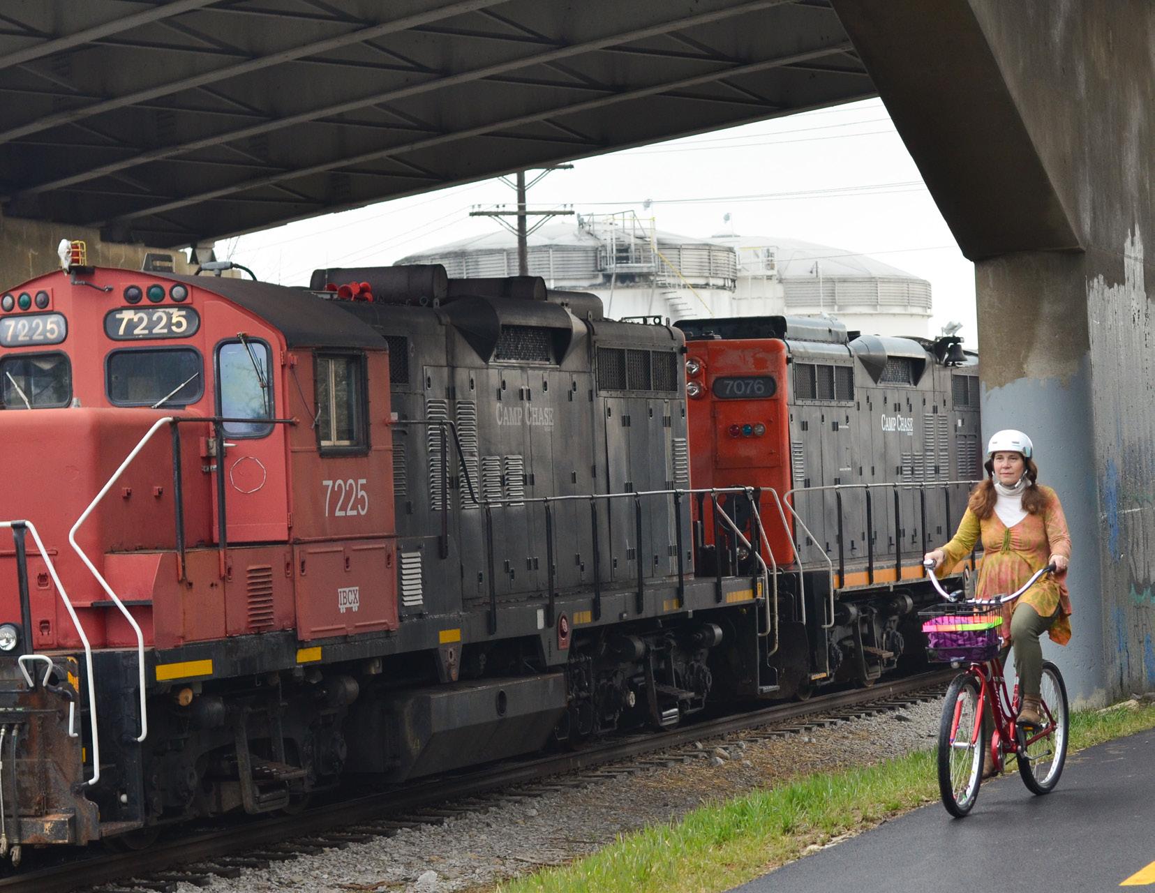 Source: Central Ohio Greenways
1,112

120
Each colored dot represents a trail asset that was identified during the inventory process. Dots were generated on the map in real time as assets were entered into the Survey123 data collection tool. 103
MILES Documented
HOURS Ridden
ASSETS Collected
87 3.0 TRAIL ASSET INVENTORY ASSETS COLLECTED 86 TRAIL ACCESS POINTS 34 TRAILHEADS 51 ACCESS POINTS 11** KIOSKS 11** PARKS 11** RESTROOMS 0*** CAMPING, LODGING, FOOD & BEVERAGE 29 ARTS/CULTURAL/ HISTORICAL 106 BENCHES 20 BRIDGES 26 OVERLOOKS/ VIEWING AREAS 3* PUBLIC PARKING AREAS 4 RECREATIONAL 13** TRASH CANS 771* TOTAL SIGNS 444 SAFETY SIGNS 384 TRAIL INFO SIGNS 88 ON-GROUND MARKINGS 134 OHIO TO ERIE TRAIL SIGNS * Signs were sometimes counted in more than one category. **If this asset type was associated with a trailhead, it was recorded under the Trailhead category, which was nested under Trail Access ***These amenities may have been available nearby, but this exercise captured only assets within sight of the trail.
Off-trail Destination Analysis
The topic of how to treat off-trail destinations within the trail system was one that generated lively discussion and debate. On the one hand, trail users orient themselves by knowing where they are relative to major off-trail landmarks, and want to visit them from the trail. On the other, if the route to a destination from the trail does not yet provide all trail users a comfortable journey, is it responsible to include it on signs? After much consideration, the team settled on a strategy of signing any major landmarks within a mile of the trail, but providing caution signs as necessary if the route to them lacks bicycle or pedestrian infrastructure. With further conversation, destination typologies were established to guide sign placement recommendations. These can be found in Chapter 5.

A WAYFINDING STRATEGY GUIDE FOR THE CENTRAL OHIO GREENWAYS FINAL | MARCH 2024 88
Source: City of Sunbury, Ohio
Sunbury, Ohio’s historic district offers many good excuses for an off-trail excursion.
 Source: Franklinton Cycleworks
With Crew Stadium just a short walk from the trail, the Columbus Crew offers a free bike valet at each home game.
 Source: Central Ohio Greenways
Chapter 3 Takeaways
1
INVENTORY ALL TRAIL ASSETS.
A wayfinding strategy should respond to current trail conditions, which likely will not be known unless an inventory is conducted.
2
ACCESS THE TOOL & THE DATA.
The data collection tool and all data collected during this exercise is available to MORPC communities upon request.
3
PLOT ALL MAJOR DESTINATIONS WITHIN A MILE OF THE TRAIL.
Understanding the nearby destinations allows for signs that better orient trail users.
91 3.0 TRAIL ASSET INVENTORY

STRATEGY 1: TRAILHEADS 4.0

Trailheads are the backbone of any trail wayfinding system. As gateways to both trails and the places they run through, trailheads have extraordinary capacity to influence trail users’ wayfinding experience — and thereby their overall experience of trails. This chapter reviews the current state of wayfinding support offered via trailheads along the Ohio to Erie Trail in Central Ohio and provides recommendations for optimizing these spaces to better serve trail users with the information and amenities they need.
Source: Central Ohio Greenways
How Trailheads Facilitate Wayfinding
Trailheads will orient trail users to both the trail and the places it runs through, and welcome them with vital amenities.
WAYFINDING PRINCIPLES IN ACTION
Trailheads can anticipate trail users’ needs by providing them basic location information and the most essential amenities.
Trailheads can help trail users connect with each other and the communities they are passing through by providing gathering space and information on how to safely reach offtrail destinations.
Trailheads can be unique, memorable landmark destinations, with placemaking elements that help trail users create mental maps of a particular trail segment.
A WAYFINDING STRATEGY GUIDE FOR THE CENTRAL OHIO GREENWAYS FINAL | MARCH 2024 94
Optimizing Trailheads for Wayfinding
RECOMMENDATIONS
1
Classify trailheads according to the access & amenities they provide trail users.
2
Locate trailheads equitably; no farther than 3 miles apart; directly on the trail or no farther than ½ mile off the trail along a comfortable route; and near major destination centers, trail junctions, and/or transit hubs whenever possible.
3
Get creative when considering what community information could be made available on trailhead kiosks.
4
Make trailheads destinations by providing basic amenities, opportunities for social interaction, and placemaking elements that people will remember.
95 4.0 STRATEGY 1: TRAILHEADS
Optimizing Trailheads for Wayfinding
CURRENT CONDITIONS
This chapter deals with the classification, location, information environment, and placemaking potential of trailheads. Trailheads here are distinguished from trail access points. Trailheads are defined as major access points that serve as information and amenity hubs, and ideally as landmark destinations, along a trail, while access points are simply junctures at which a trail can be entered or exited.
This section of the Ohio to Erie Trail has 86 access points but just 34 trailheads. There are 15 places along the trail where the distance between trailheads spans more than 3 miles, which is the maximum distance that Steering Committee members agree is optimal.
The trailheads that do exist are overwhelmingly spartan and utilitarian, with amenities scattered throughout ill-defined spaces. Only 15 of them have an information kiosk, and most of these are underutilized (even damaged), with missing or dated information. Many do have printed trail maps posted, but otherwise there is little wayfinding information available. Connections with transit are very poor across the board.
Taken in combination, these factors suggest that trail users and community members may be underserved by trailheads along this corridor.
A WAYFINDING STRATEGY GUIDE FOR THE CENTRAL OHIO GREENWAYS FINAL | MARCH 2024 96


97 4.0 STRATEGY 1: TRAILHEADS
Source: Urban Decision Group
Classifying Trailheads
RECOMMENDATION 1
Classify trailheads according to the access & amenities they provide trail users.
The more access and amenities a trailhead offers trail users, the more positively it will impact their wayfinding ability and overall trail experience.
Classifying trailheads according to the amenities they provide allows trail managers to readily assess the quality of their trail access points and plan for future upgrades. The following classification system segments trailheads into Basic, Enhanced, and Premier categories, based on the minimum levels of access and amenities that stakeholders felt necessary for an inspired trail experience. Trailheads should feature additional amenities when possible.

A WAYFINDING STRATEGY GUIDE FOR THE CENTRAL OHIO GREENWAYS FINAL | MARCH 2024 98
Source: Urban Decision Group
ACTION ITEMS
1.1
MAP CURRENT ACCESS POINTS & TRAILHEADS.
Ride the trail network to identify all places where a trail can be accessed by users. Using an Esri- or Googlebased tool, if possible, map these locations.
1.2
INVENTORY THE ASSETS OF CURRENT ACCESS POINTS & TRAILHEADS.
Visit each trailhead along the trail to record the amenities that can be found at them. Update the map using different colored dots for each trailhead to identify their classification.
99 4.0 STRATEGY 1: TRAILHEADS
Access to Streets & Roadways
Information Kiosk/Map
Bike Parking
Seating
Transit Access*
Sidewalk Access
Restrooms
Water Access
Placemaking Elements
Shelter(s)
Facilities Staff
Unique Design
*Where applicable; rural areas may not have transit.
A WAYFINDING STRATEGY GUIDE FOR THE CENTRAL OHIO GREENWAYS FINAL | MARCH 2024 100
BASIC ENHANCED PREMIER TRAILHEAD LEVELS FEATURE REQUIREMENTS ACCESS POINTS
TRAILHEADS
WHAT ADDITIONAL TRAILHEAD FEATURES
DO YOU THINK COULD BE IMPORTANT TO OFFER?
Bike share
Lockers
Shade
Water filling stations
Bike repair stations
Camping
Showers
Playgrounds & splash pads
River access & boating, with rentals
Fireplace
Beautiful landscaping
Grills & picnic tables
Craft brewery, ice cream shop, coffee shop, restaurant
Bike shop
Vending machines (snack & bike parts)
E-bike & cell phone chargers
Public art
Cooling or misting stations
Handicap accessible recreation options
Restrooms 24/7
Cultural sites
Open-air markets
Educational opportunities for kids Little libraries
Workout equipment
101 4.0 STRATEGY 1: TRAILHEADS
BASIC TRAILHEADS INCLUDE
A well-maintained information kiosk and map
At least one bench or other form of seating
Racks for at least 5 bicycles (standalone U-shaped racks preferred)
Car access only
ENHANCED TRAILHEADS INCLUDE
All the amenities of a basic trailhead
Access to free, potable water
A transit stop within 1 mile along a comfortable route (where applicable)
Sidewalks leading to the trailhead
Temporary restrooms
PREMIER TRAILHEADS
INCLUDE
All the amenities of basic and enhanced trailheads
A transit stop within ¼ mile along a comfortable route (where applicable)
Permanent restrooms
Shelter from the elements
Staffing, at least during regular business hours
A unique design and/or placemaking elements such as public art or interpretive signs
A WAYFINDING STRATEGY GUIDE FOR THE CENTRAL OHIO GREENWAYS FINAL | MARCH 2024 102 Information
Audubon Park Restroom Bike Trail Exit
Parking
Add placemaking elements, sign pointing to a transit stop, and maybe a staff (park ranger)
TRAILHEAD FACILITY
103 4.0 STRATEGY 1: TRAILHEADS
All amenities available to trail users during normal hours of operation.
EXISTING TRAILHEAD FEATURES
Information Kiosk/Map
Bike Parking Seating
Transit Access < 1m
Sidewalk Access
Restrooms
Water Access
Transit Access < .25m
Placemaking Element(s)
Shelter(s)
Facilities Staff
Unique Design
ROTARY PARK
HANBY PARK
WILSON PARK
PRAIRIE TRAILHEAD KNOX CO VISITORS CENTER
MCNAMARA PARK
BRIDGE OF DREAMS
KOKOSING GAP
BATTELLE DARBY PARK
COOPER PARK
JAMES O. CASTO PARK
DANVILLE (KOKOSING)
MEMORIAL PARK (MT VERNON)
CENTERBURG (HOOT)
LAYMON RD (KOKOSING)
HAYDEN PARK
ALUM CREEK
A WAYFINDING STRATEGY GUIDE FOR THE CENTRAL OHIO GREENWAYS FINAL | MARCH 2024 104
MILLER PARK
BROWN FAMILY CENTER ROBERTS PASS
CASTO PARK SOUTH
PATTON RD (OTET)
HENRY RD (HOOT)
MEMORIAL PARK PATHWAYS PARK
GALENA TRAIL LOT
DANVILLE (MOHICAN VALLEY)
SANDEL LEGACY
HUFFMAN RD (HOOT)
E. CENTER ST, LONDON
HOOVER SCENIC TRAIL LOT
KILDUFF RD (KOKOSING)
STULL RD (KOKOSING)
SUNBURY NORTH (HOOT)
7
2
105 4.0 STRATEGY 1: TRAILHEADS
34 TRAILHEADS
BASIC
ENHANCED
PREMIER
ACCESS POINTS
0
86
Locating Trailheads
RECOMMENDATION 2
Locate trailheads equitably; no farther than 3 miles apart; directly on the trail or no farther than ½ mile off the trail along a comfortable route; and near major destination centers, trail junctions, and/or transit hubs whenever possible.
Trailheads must be located at a predictable cadence along the trail to reliably provide users with the information and amenities they need to navigate stress-free. But, given their function to provide trail users with vital information and amenities, “trailheads” don’t have to be typical trailheads. Other community assets can be called upon to meet those needs. Many already-established community spaces can serve as trailhead-like facilities, including public libraries, transit hubs, recreation and visitor centers, private businesses, and more.


A WAYFINDING STRATEGY GUIDE FOR THE CENTRAL OHIO GREENWAYS FINAL | MARCH 2024 106
Source: Columbus Metro Library
Source: Columbus Recreation & Parks
ACTION ITEMS
2.1
USE COMMUNITY FACILITIES AS TRAILHEADS.
Identify currently existing community spaces (for example, libraries, recreation centers, and visitor centers) that can provide premier trailhead–level amenities, then formalize the arrangement and advertise the space as a trail amenity.
2.2
ARRANGE FOR LOCAL BUSINESSES TO PROVIDE SOME TRAILHEAD FUNCTIONS.
Partner with businesses on or near the trail that hope to attract trail users, as they will generally provide premier trailhead–level amenities, including restrooms, water, trail maps, and staff who can impart wayfinding information.
2.3 BUILD NEW TRAILHEADS.
Build new trailheads to fill identified gaps in the system, taking into account where there are available sites near transit, major trail junctions, destination centers, and historically underserved areas; where community spaces near the trail might be able to accommodate trail users; and community feedback.
107 4.0 STRATEGY 1: TRAILHEADS
More Amenities, More Problems?
The desire to provide awe-inspiring amenities tends to quickly collide with the reality of maintaining them. There are, of course, the everyday ravages of weather and time. But also, trails lay at the intersection of many social challenges — homelessness, crime, racism, vandalism, mental illness, and more — that require a dedicated team of municipal staff and community members to resolve. In the meantime, bicycle repair stations get tools stolen; public murals get graffitied; public restrooms become…gross. It can be demoralizing to see hard-fought amenities destroyed,
or to feel like certain amenities are off-limits because it is too costly to maintain them. What can help is casting a wide net when assembling a trail team. These groups should go beyond trail managers and park rangers to include social workers, law enforcement agents, housing advocates, community organizations, artists and designers, youth groups, and others, as appropriate. Together it is possible to productively address social needs to make trails and all public spaces welcoming for all.
A WAYFINDING STRATEGY GUIDE FOR THE CENTRAL OHIO GREENWAYS FINAL | MARCH 2024 108
 Source: Urban Decision Group
A Vulnerability Index
To derive the degree of vulnerability being experienced by people and households along the Ohio to Erie Trail, the team identified nine variables that, combined, could tell the story more comprehensively than any single indicator. These included:
• Households with Income Below the Poverty Level1
• Households Receiving Food Stamps/SNAP1
• Nonwhite Percent of the Total Population2
• Poverty Index1
• Percent of Households Containing at least one Disabled Person1
• Percent of Owner-occupied Households with No Vehicles1
• Percent of Renter-occupied Households with No Vehicles1
• Median Home Value3
• Median Household Income3
Each of these variables were normalized, then equally weighted and averaged across almost 7,000 individual 30-minute walksheds spanning the 4-county study area. The resulting index was applied to the region and illustrated using contiguous 1-mile hexagon shapes with colors ranging from dark to almost-white purple. The lower the index value (as indicated by darker shades), the more likely it is that the surrounding area is considered “at risk” and vulnerable to historic disinvestment patterns.
Maps on the following pages overlay the Vulnerability Index with trailhead locations to illustrate that the most at-risk communities along this segment of the Ohio to Erie Trail are also those with a dearth of trailheads. This suggests a need to prioritize vulnerable Franklin County neighborhoods, in particular, when siting new trailheads and other trail amenities.
1 American Community Survey 2017–2021
2 2020 Decennial Census
3 ESRI (third-party data provider); vintage 2023
A WAYFINDING STRATEGY GUIDE FOR THE CENTRAL OHIO GREENWAYS FINAL | MARCH 2024 110

Locating Trailheads: From Outsiders to Ownership
The data is clear that trails are an overwhelmingly positive asset in any community, but that does not mean everyone welcomes them. Trails can symbolize outsiders, bringing crime in some communities, gentrification in others.1 Locating trailheads can therefore be a tricky business. As a general rule, it is best to prioritize investment in places that have historically seen less than their fair share and ensure all people have access to high-quality trailheads. But how can these investments represent the interests and needs of the neighbors they purport to serve? Listening to these neighbors’ needs and desires will support the creation of spaces that are authentically for them, with opportunities for them to connect to regional assets as desired. A placemaking process may encourage neighbors to express who they are with welcoming elements such as art that reflects their community, spaces that feel meaningful and comfortable to them, and amenities they have prioritized. With neighborhood-centered engagement, community members are more likely to welcome trail access and take ownership of trail amenities.
111 4.0 STRATEGY 1: TRAILHEADS
1 Harris, et al. “Contested Spaces” Workout stations — like these at the Kokosing Gap Trailhead in Danville — are a way to provide value to a wide array of community members.

7.8 miles 5.3 miles 6.3 miles LEGEND TRAILHEAD DISTANCES > 3.0 MILES TRAILHEADS DISTANCE BETWEEN TRAILHEADS EXCEEDS 3 MILES <=0.40 MOST VULNERABLE 0.41–0.50 0.51–0.60 0.61–0.70 0.71–0.80 0.81–0.90 > 0.9 LEAST VULNERABLE VULNERABILITY INDEX

There are 15 stretches along the Ohio to Erie Trail where the distance between trailheads exceeds 3 miles, with the greatest gaps being in the areas of highest demographic need. This suggests that at least 15 additional trailheads or trailheadlike facilities should be offered to better serve trail users.
3.9 miles 4.3 miles 3.3 miles 3.6 miles 4.2 miles 6.9 miles 10.7 miles 3.1 miles 3.5 miles 4.5 miles 3.3 miles 4.2 miles 1” = 6 mi.
LEGEND POTENTIAL TRAILHEAD LOCATIONS

CURRENT TRAILHEADS
TRAILHEAD-LIKE PUBLIC FACILITIES
POTENTIAL NEW-BUILD TRAILHEAD SITES
The potential new-build trailhead sites were not formally evaluated for suitability. Rather, red dots were placed approximately equidistant from other trailheads to illustrate what adequate coverage might look like.
YMCA Hilltop
Milo-Grogan Community Rec
Howard Community

This map demonstrates that there are numerous public facilities, particularly in Franklin County, that can potentially serve as trailheads (green dots). Up to nine additional trailheads should be considered in the approxmiate areas denoted by red dots.
Holton Community Center Experience Columbus Visitor Center Shepard Public Library Sawyer Community Rec Center Beatty Community Rec Center Center
Easton Town Center Community Center 1” = 6 mi.
Knox County Visitors Bureau
Providing Community Information at Trailheads
RECOMMENDATION 3
Get creative when considering what community information could be made available on trailhead kiosks.
Among the most critical functions trailheads serve is to provide trail users the information they need to confidently travel the trail, and to venture off it for exploration. People need to know the commitment they are making when they enter a trail — where they can go and how far to get there — as well as how to get help and where to find essential amenities. Much of this information will be conveyed on the maps and signs that greet trail users at all trailheads.
There may be additional information that communities want to share, and kiosk space to fill. This presents an opportunity to get creative in showcasing the various businesses, events, points of interest, historic fun facts, and more. Developing this content can be an exercise in creating branded, centrally-developed
pieces to post, or it can be a home-grown process implemented by volunteers. Either way, it is essential that a commitment to ongoing content management is made by an entity able to follow through on it. The following guidelines will help to ensure trailhead kiosks are kept attractive and useful:
• Fill al available display space.
• Clean any glass or plastic surface regularly.
• Repair broken kiosk parts as soon as possible.
• Replace fliers, particularly those exposed to sun or moisture, often.
• Ensure brochure displays are fully stocked.
• Change out at least some content monthly or seasonally.
• Direct people off-trail responsibly, with consideration for the quality of the route to get them to and back from the destination.
A WAYFINDING STRATEGY GUIDE FOR THE CENTRAL OHIO GREENWAYS FINAL | MARCH 2024 116
ACTION ITEMS
3.1
USE TRAILHEAD KIOSKS TO POST INFORMATION NOT MEANT FOR SIGNS.
Post information about nearby areas and amenities that will not get communicated via trailhead maps and signs on well-maintained kiosks.
3.2
PROVIDE REGULAR CARE FOR KIOSKS AND THEIR CONTENT.
Ensure that kiosks are clean and well cared for, and that all content within them is current and attractive. Establish a monthly process of content review, creation, and replacement to ensure all elements remain in good condition.

117 4.0 STRATEGY 1: TRAILHEADS
Source: Friends of the Madison County Parks & Trails
Making Places of Trailheads
RECOMMENDATION 4
Make trailheads into destinations by providing amenities, opportunities for social interaction, and placemaking elements that people will remember.
Trailheads with unique features improve users’ experience of the trail and, because they are memorable, improve their ability to navigate the trail over time. People remember their favorite trailheads!
The trailhead itself should be art.
BRAD WESTALL Greenways & Trails Director, Columbus Recreation and Parks

A WAYFINDING STRATEGY GUIDE FOR THE CENTRAL OHIO GREENWAYS FINAL | MARCH 2024 118
Source: Columbus Recreation & Parks
ACTION ITEMS
4.1
ENGAGE THE COMMUNITY TO ENVISION MEMORABLE TRAILHEADS.
Invest in a community engagement process to elicit authentic feedback from a cross section of the general public (not just trail enthusiasts) about what would make a trailhead a place they’d want to be. Be creative in bringing their vision to life.
4.2
ENLIVEN TRAILHEAD SPACES BY REDUCING CAR TRAFFIC NEAR THEM.
Make trailheads more bikeable, walkable, and accessible by transit. Places without motor vehicle traffic are often more vibrant than car-oriented ones, because they can be accessed by all types of people, for all types of purposes.
4.3
ADD AMENITIES TO CURRENT TRAILHEADS.
Start small and continue adding trailhead amenities as funding allows, until each trailhead in the system has achieved premier status. Then, go beyond to add creative amenities and placemaking elements that make the trailhead experience one to remember.
119 4.0 STRATEGY 1: TRAILHEADS
Steering Committee members shared their favorite trailheads and what made them memorable.
WHAT IS THE BEST TRAILHEAD YOU’VE ENCOUNTERED?
Hilliard Heritage Trail (OH)
Yellow Springs (OH)
Schuylkill Banks (PA)
London (OH)
Granville (OH)
Westerville (OH)
Clinch Park, Traverse City (MI)
Dayton Bike Hub (OH)
Foster Falls (VA)
Loveland (OH)
Xenia Station (OH)
Ohiopyle, GAP (PA)
Scioto Mile, Columbus (OH)
A WAYFINDING STRATEGY GUIDE FOR THE CENTRAL OHIO GREENWAYS FINAL | MARCH 2024 120
Olde Hilliard area with their food hall
Public art
Ice cream shop
Views of the skyline & river
Seating being used by trail users and workers in the area
Information about the community
Other riders, lots of people around
Felt like I was welcomed and wanted
Good design
WHAT MADE IT MEMORABLE?
Camping area
Clean and well maintained
Natural amenities highlighted by multiple access points and a plethora of amenities (bathroom, water, food, playground, etc)
White water course
Selfie station
Trailside cafe
Ice water
Had the basics covered, plus direct access to parks, other recreation, and shops
Super wide trail
Beautiful landscaping
On-trail farmers market
Playground
Amenities for all ages
Scenic location with lots of related experiences and amenities
Attention to detail
Restroom, food, water play, water access
121 4.0 STRATEGY 1: TRAILHEADS
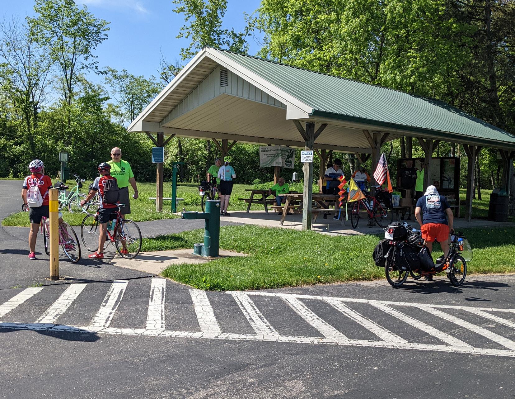 Source: Friends of the Madison County Parks & Trails
Chapter 4 Takeaways
1 PROVIDE INFORMATION INFRASTRUCTURE.
All trailheads should have kiosks that provide up-todate information about the trail and trail-adjacent destinations and amenities.
3 EXPAND YOUR TRAILHEAD IMAGINATION.
Build new trailheads when possible, but keep in mind that many community hubs can also meet trail users’ needs.
2 COMMIT TO INFORMATION MANAGEMENT.
Information presented at trailheads does not have to be professionally designed, but it does have to be owned by an entity willing and able to maintain it.
4 MAKE TRAILHEADS WELCOMING PLACES.
Trailheads should be places that welcome all people to the trails; this may require a community engagement process.
123 4.0 STRATEGY 1: TRAILHEADS

STRATEGY 2: MAPS & SIGNS 5.0
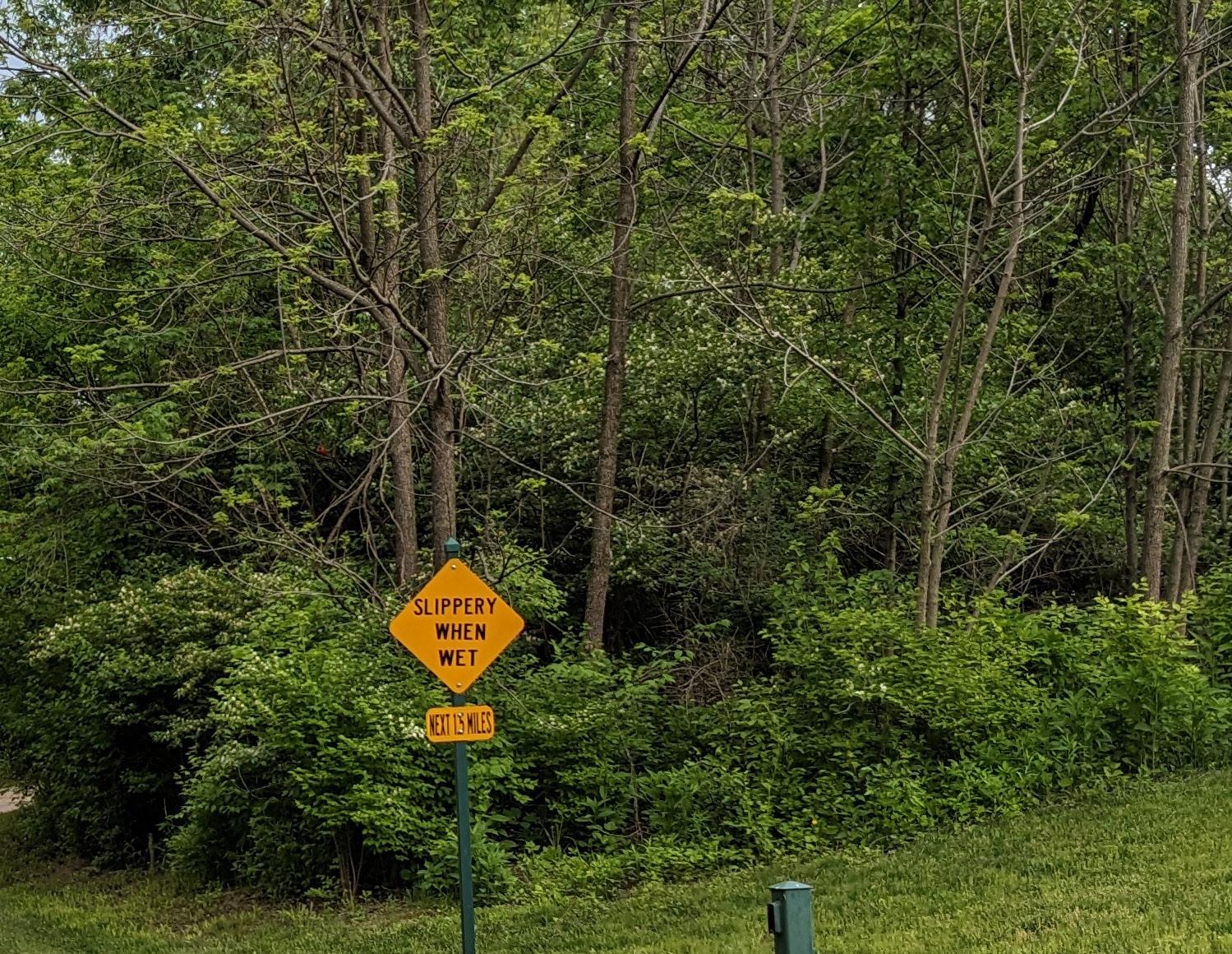
For as much as wayfinding is about more than maps and signs, maps and signs are fundamental to any wayfinding strategy. Well-designed, well-placed signage allows trail users to achieve “mindless wayfinding,” reducing their stress and confusion. This chapter shows how current signs along the Ohio to Erie Trail can be modified to provide trail users better wayfinding information and provides guidance on directing users to a trail, along a trail or route, and off-trail for amenities and exploration.
Designing Local
Source:
How Maps & Signs
Facilitate Wayfinding
Signage will keep trail users moving effortlessly to, from, and along a trail by providing the essential information they need, at precisely the point at which they need it.
WAYFINDING PRINCIPLES IN ACTION
Signage can anticipate trail users’ needs by providing them location and destination information before they know they need it.
Signage can keep trail users from having to think by being predictable, consistent, and simple to understand.
Signage can meet trail users where they are by emphasizing wayfinding information and featuring universal design elements that all users can understand.
Signage can keep trail users in motion by being appropriately scaled to all user types, including cyclists, walkers, and those using mobility devices.
A WAYFINDING STRATEGY GUIDE FOR THE CENTRAL OHIO GREENWAYS FINAL | MARCH 2024 126
Modifying Maps & Signs
RECOMMENDATIONS
1
Make minor sign modifications to create coherence across the system.
2
Welcome people to trails with wayfinding signs, maps, trail rules, and emergency contact information.
3
Place confirmation signs at all decision points and approximately every two miles along the trail.
4
Sign smartly to keep people on the correct route when it deviates from the trail.
5
Post signage to alert people of nearby trail access points.
127 5.0 STRATEGY 2: MAPS & SIGNS
Modifying Maps & Signs
CURRENT CONDITIONS
This chapter deals with signs and maps, the most fundamental of all trail wayfinding tools — and perhaps the most challenging to get right. As demonstrated in this guide’s introductory chapter, signs along this section of the Ohio to Erie Trail vary widely in content and design. They can be ill-placed, over-placed, or notat-all placed to optimally serve trail users. The map at right shows particular pain points along the trail, though others deserve attention as well.
Trails lack geospatial context. When I’m on them, I have no sense of where I am in relation to anything else.
LIZ KOELKER Director of Planning & Community Development, City of Grandview Heights
WHAT BARRIERS TO SIGNAGE IMPLEMENTATION DO YOU ANTICIPATE? SIGNS
Getting all agencies to participate
Prioritizing this among other projects
Current signs are good enough, or haven’t reached their lifespan yet
Graffiti continues to do damage
Funding trail maintenance not as easy as building trails; better to include in new project requests
The time it takes to make changes to existing signs
Designing the signs for long-term accuracy (they can get outdated quick)
A WAYFINDING STRATEGY GUIDE FOR THE CENTRAL OHIO GREENWAYS FINAL | MARCH 2024 128
Signs point in different directions for OTET at S Old 3C Highway.
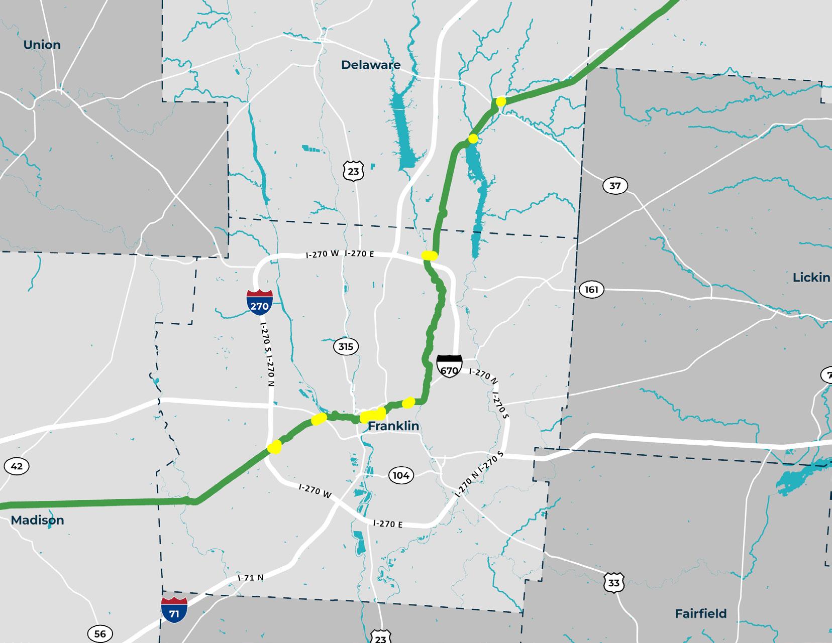
The sign is hidden and easy to miss at the intersection of Rainbow Ave & High St.
Poor signage leads to confusion along McKinley Ave to the Camp Chase Trail
Poor signage leads to confusion along Leonard Ave from the I-670 junction.
Poor signage leads to confusion along W Schrock Rd.
The intersection of Georgesville Rd & Sullivant Ave lacks signage.
Poor signage leads to confusion along Cleveland Ave through Downtown.
During the asset inventory process detailed in Chapter 3, the team encountered particular difficulty navigating the areas in yellow.


Current COG Sign System
The COG signs currently in use were designed and installed in 2016, though several signs types, for example the mile and trail markers, were never deployed. Those in most frequent use include the Trail ID, Directional, and Wayfinding signs, though some Trailhead Kiosks are featured throughout the network.


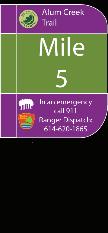
DIRECTIONAL MILE MARKER TRAIL ID TRAILHEAD KIOSK
WAYFINDING
Existing Way nding Signage in-use throughout trail system with opportunity for further development and enhancement
Not in-use
A WAYFINDING STRATEGY GUIDE FOR THE CENTRAL OHIO GREENWAYS FINAL | MARCH 2024 130


Not in-use


Existing non-way nding signage should also be consistent to further aid user/trail orientation
131 5.0 STRATEGY 2: MAPS & SIGNS
TRAIL MARKER REGULATORY INTERSECTION PARK RULES INTERPRETIVE The quick brown jumped over the lazy dog. The quick brown fox jumped over the lazy dog. The quick brown jumped over the lazy dog. The quick brown jumped over the lazy dog. The quick brown jumped over the lazy dog. The quick brown jumped over the lazy dog. The quick brown lazy dog. The quick brown jumped over the lazy dog. The quick brown jumped over the lazy dog. The quick fox jumped over the lazy dog. The quick brown jumped over the lazy dog. Park Rules brown fox jumped over the lazy dog. The quick brown fox jumped over the lazy dog. The quick brown fox jumped over the lazy dog. The quick brown fox jumped over the lazy dog. The quick brown fox jumped over the lazy dog. The quick brown fox jumped over the lazy dog. The quick brown fox jumped over the lazy dog. The quick brown fox jumped over the lazy dog. The quick brown The quick brown fox jumped over the lazy dog. The quick brown fox jumped over the lazy dog. The Ohio to Erie connection MORSE ROAD
Creating System-Wide Signage Coherence
RECOMMENDATION 1
Make minor sign modifications to create coherence across the system.
Multiple stakeholders mentioned the desire for trail wayfinding signs to mimic those on the nation’s highways, which are so standardized and ubiquitous that travelers always know what to expect. Unless a regional sign system is negotiated, such consistency is unlikely to be achieved on this segment of the Ohio to Erie Trail. If partners opt to retain their local signs, some system-wide coherence will be sacrificed — though it is possible to better align all types of signs using the minor design modifications and add-ons described in this section.

A WAYFINDING STRATEGY GUIDE FOR THE CENTRAL OHIO GREENWAYS FINAL | MARCH 2024 132
Source: Designing Local
ACTION ITEMS
1.1
REPLACE OLD SIGNS WITH UPDATED DESIGNS.
Phase in signs with high-impact sign design modifications as old signs reach the end of their useful lifespans.
1.2
REPLACE “OHIO BIKE ROUTE 1” WITH “OHIO TO ERIE TRAIL” SIGN HATS.
Emphasize the more widely understood Ohio to Erie Trail route name over the state bike route number.
1.3
AGREE ON TRAIL NOMENCLATURE.
Reach a common understanding of key trail-related terms and how they apply within the COG network.
1.4
SIGN ON- AND OFF-TRAIL DESTINATIONS PREDICTABLY.
Use the prescribed hierarchy to prioritize destinations and sign them at a predictable cadence.
1.5
ALIGN LOCAL SIGNS USING POST WRAPS, SIGNS, AND HATS.
Signify that local trails are part of a broader network by adding Ohio to Erie Trail and/or COG signs, hats, or wraps on all sign posts along the appropriate trails and routes.
133 5.0 STRATEGY 2: MAPS & SIGNS
Color System Updates
The COG brand guidelines assign a color to each trail. With the planned expansion of the COG Regional Trail network, the COG color palette must be expanded. This guide identifies four additional colors for new trails. The primary COG green is intended for all minor trails and connecting trails.
A WAYFINDING STRATEGY GUIDE FOR THE CENTRAL OHIO GREENWAYS FINAL | MARCH 2024 134
TRAIL SYSTEM BASE COLORS COG GREEN CMYK 53.33.100.12 HEX 7C8536 CMYK 70.67.65.74 HEX 221F1F CMYK 0.0.0.0 HEX FFFFFF
135 5.0 STRATEGY 2: MAPS & SIGNS ORIGINAL COLORS ADDITIONAL COLORS TRAIL COLOR ASSIGNMENTS CMYK 26.100.64.17 HEX A11C42 CMYK 19.69.100.6 HEX C26629 CMYK 25.50.100.7 HEX B8802B CMYK 88.39.38.7 HEX 00788A CMYK 100.77.22.6 HEX 0A4D85 CMYK 67.95.27.13 HEX 692E6B CMYK 42.46.48.7 HEX 948078 CMYK 39.58.79.25 HEX 855E3D CMYK 84.23.64.5 HEX 038C75 CMYK 87.37.96.33 HEX 1A5E33 CMYK 70.11.90.0 HEX 57A854 CMYK 36.29.29.0 HEX: A8A8A8 CMYK 22.17.18.0 HEX C7C7C7 CMYK 10.7.7.0 HEX E3E3E3 CMYK 36.100.20.2 HEX: A80575 Camp Chase Trail Emerald Trail NEW Major Trail Big Walnut Creek Trail Scioto River Trail Alum Creek Trail NEW Major Trail NEW Major Trail NEW Major Trail Olentangy River Trail Darby Creek Trail Blacklick Creek Trail Rocky Fork Trail
OTET NEW ACCENTS
MUTCD +
Other Trails
GREY (MAP TINTS)
Design Detail Updates
With modest design modifications, current signs will become better aligned and more effective wayfinding tools. The recommended sign design updates include:
• Making the COG green more widespread and eliminating the dark green currently in use
• Enlarging fonts and icons to emphasize the most important wayfinding information
• Reducing the size of all logos and making all except the Ohio to Erie Trail logo white
• Including a new Ohio to Erie Trail hat on every Wayfinding Sign along the route (replacing the 1 hat as necessary)
• Including mileage to all destinations posted on the sign
• Using universal icons from the National Park Service
• Adding major regional destinations on all signage
Side-by-side sign design comparisons on the following pages will demonstrate how these changes make the signs easier to read and more relevant to trail users.
A WAYFINDING STRATEGY GUIDE FOR THE CENTRAL OHIO GREENWAYS FINAL | MARCH 2024 136
137 5.0 STRATEGY 2: MAPS & SIGNS
ONE COLOR ARROWS UNIVERSAL NPS ICONS LOGOS
Directional Content
Each of the following destination types should be signed at the intervals recommended. Discretion will be necessary to prevent over-signing in urban areas and at access points with multiple destinations. Consolidate signs, and opt for Wayfinding Signs that have space for up to three destinations, whenever possible. The COG Board and the MORPC Technical Assistance Program can be engaged for advice on implementing these guidelines.
MAJOR CITIES
All cities of more than 100,000 people should be signed at least once every 25 miles. Within Ohio, this would include Columbus, Cleveland, Cincinnati, Toledo, Akron, and Dayton.
TRAIL TOWNS
All “trail towns” (i.e., municipalities, business districts, and neighborhoods that offer trail user amenities) can be signed up to 3x beginning at 10 miles out. Upon passing a trail town, the next 2 trail towns and the next major city should always be signed, regardless of the distance to them.
PREMIER TRAILHEADS & COG TRAILS
All premier trailheads and intersections with a COG Trail should be signed once at 1 mile out.
OTHER DESTINATIONS
All roads, parks, basic and enhanced trailheads, community institutions, and points of interest should be signed once at their location only, and included on trail maps.
A list of destinations and intersections to sign for Knox, Delaware, Franklin, and Madison counties is provided in the Appendix.
A WAYFINDING STRATEGY GUIDE FOR THE CENTRAL OHIO GREENWAYS FINAL | MARCH 2024 138
Wayfinding Nomenclature
For clarity among both professionals and the general public, it is important that everyone uses the same terminology when discussing features of COG’s trail network. The most relevant terms are therefore defined on the next page.
TRAIL NAMING & HIERARCHY
Two areas of particular concern for systemwide sign coherence are how trails should be named and how trails with multiple names should be treated on individual signs. A key distinction here is that between a multi-use trail, which is a physical path, and a route, which is an idea imposed on one or more trails to suggest a course of travel. Signs should prioritize trail names over route names, and local trails and routes should be prioritized over regional, state, and national ones. Trail names should be spelled out at the top of a sign, while the routes a trail is part of can be indicated with logos or icons. Routes should not be called trails going forward. In addition, trails should not feature “Connector” in their names, and any that currently do should be renamed.
 Source: Central Ohio Greenways
GOG Trail
Terms
Access Point
Any improved place at which a trail can be entered or exited; may or may not feature a trailhead
Trailhead
A major access point that serves as an information and amenity hub, and ideally as a landmark destination, along a multi-use trail; to be classified accordingly:
Basic Trailhead—A trailhead that features, at minimum, a well-maintained information kiosk and map, at least one bench or other form of seating, and racks for at least five bicycles; provides car access only
Enhanced Trailhead—A trailhead that features, at minimum, all the amenities of a basic trailhead, plus access to free, potable water; transit stop within one mile along a comfortable route (where applicable); sidewalks leading to it; and temporary restrooms
Premier Trailhead—A trailhead that features, at minimum, all the amenities of basic and enhanced trailheads, plus access to a transit stop within ¼ mile along a comfortable route (where applicable), permanent restrooms, shelter from the elements, staffing (at least during regular business hours), and a unique design and/or placemaking elements such as public art or interpretive signs
Connector Trail (formerly, Community COG Connector Trail)
Secondary on- and off-street pedestrian and bicycle facilities that provide access from a community to the COG Trails (formerly, Trails of Regional Significance)
Decision Point
A point at which a trail diverges or intersects with others, forcing a trail user to determine which trail keeps them on their intended path
Transition Zone
A point at which a route goes from a trail to a roadway
A WAYFINDING STRATEGY GUIDE FOR THE CENTRAL OHIO GREENWAYS FINAL | MARCH 2024 140
Multi-use Trail
Any type of facility that is fully separated from roadway traffic, including*:
Shared-use (or Multi-use) Path—A bidirectional path for pedestrians and cyclists that is physically separated from motor vehicle traffic, within an independent or street right-of-way
Sidepath—A type of shared-use path located immediately adjacent and parallel to a roadway
Greenway—A rail-trail or other type of trail along a waterway or open greenspace
COG Trail (formerly, Trail of Regional Significance)
A primary trail, predominantly off-street, that is multi-jurisdictional and connects people to major destinations
Route
An idea imposed on one or more trails to suggest a course of travel (note that the Ohio to Erie “Trail” is actually a route)
Trail Spur
An extension of a multi-use trail that dead ends at a nearby point of interest
Mobility Hub
A central point that provides access to trails, sidewalks, roadways, public transit, micromobility, ridesharing, and other transportation options
Trail Towns
Communities through which a trail passes that support trail users with services, promote the trail to its citizens, and embrace the trail as a resource to be protected and celebrated; an official designation program
*Note that the term “Connector,” which referred to a trail or route connecting two greenways trails in a heavily built environment (for example, Columbus’s “Downtown Connector”), is now obsolete. Trails formerly called Connectors should be renamed as Trails.
141 5.0 STRATEGY 2: MAPS & SIGNS
REPRESENTATIVE SITE LEGEND COG TRAIL TERMS
This map shows how COG trail terms should be applied. It highlights exemplars of each trail term defined on the previous page, as found in the Easton area near the Alum Creek Trail.
Multi-use Trail (formerly, Sharedor Multi-use Path)
A shared-use path connects the south side of Morse Rd with the Alum Creek Trail.
Trailhead (proposed)
This plan proposes a new trailhead to be built at Pathways Park at Sunbury Rd and Easton Way.
COG Trail (formerly, Trail of Regional Significance)
The Alum Creek Trail is multijurisdictional and connects people to major destinations.
Greenway Trail
The Alum Creek Trail is also a greenway trail, meaning it is largely bordered by green space. Greenway trails are a type of multi-use trail.
Access Point
The Alum Creek Trail can be accessed where it intersects Agler Road.
Sidepath
Decision
The Alum at Innis continuing trail users
Route
The Ohio misnomer. of many segments including
A 1.25-mile path along the Mock Road will connect Linden residents to the Alum Creek Trail at Sunbury Rd.

Trail Spur (proposed)
With a new trailhead at Sunbury Rd and Easton Way, Easton Way could receive infrastructure improvements to make it easier for people to travel from the trail to Easton Town Center.
Mobility Hub
The Easton Transit Center and Park and Ride, operated by COTA, is a major hub for public transit in the Columbus area.
Trail Town
Central Ohio does not currently have any designated Trail Towns, but Easton Town Center will be a contender when the program launches.
Decision Point
Alum Creek Trail diverges Innis Park, with one path continuing on and another leading users to the parking lot.
Ohio to Erie Trail is a misnomer. it is a route comprised trails and on-road segments throughout Ohio, including the Alum Creek Trail.

Local Sign Adaptations
Using branded sign add-ons, it is possible to both retain local signs and tie trails to the COG network and the Ohio to Erie Trail. At minimum, Access Point Identifiers can show the trail is affiliated with the COG network (in addition to providing useful emergency information). The connection can be more strongly reinforced if any type of COG wayfinding sign is added to a sign post. Highlighting that a trail is part of the Ohio to Erie Trail route can be accomplished with logo hats or sign posts. Each of these elements can be used in combination with others to achieve the desired effect, as shown here on three local sign systems.


A WAYFINDING STRATEGY GUIDE FOR THE CENTRAL OHIO GREENWAYS FINAL | MARCH 2024 144
OHIO TO ERIE TRAIL
Thomas W. Hopper Legacy Trail
Downtown Columbus 13.1 miles Alum Creek Trail Bexley 10.8 miles ACCESS POINT 000.XXX Easton Way 3.6 miles


5.0 STRATEGY 2: MAPS & SIGNS
OHIO TO ERIE TRAIL
ACCESS POINT 000.XXX
Thomas W. Hopper Legacy Trail
BIKE ROUTE
Welcoming Trail Users: At-Trail Signs & Maps
RECOMMENDATION 2
Welcome people to trails with wayfinding signs, maps, trail rules, and emergency contact information.
When people arrive at a trail access point, especially a trailhead, they want to know the commitment they are making by entering the trail. The maps and signs available to them here are critical to set the tone for their entire journey. People need to know where they are; how far they are from their destination or the next trail exit, trailhead, and/or source of amenities; and who to call if they need help. With this information in hand, they can settle in to enjoy their trail travel experience.

A WAYFINDING STRATEGY GUIDE FOR THE CENTRAL OHIO GREENWAYS FINAL | MARCH 2024 146
Source: Urban Decision Group
ACTION ITEMS
2.1
PLACE WAYFINDING SIGNS AT ALL TRAIL ACCESS POINTS.
Greet users to the trail with a sense of where they are, where they can go, and how far it is to get there.
2.2
PROVIDE EMERGENCY INFORMATION AT ALL TRAIL ACCESS POINTS.
Work with emergency personnel to assign each trail access point a unique identifier that is then provided on post wraps or hats at each of them.
2.3
INSTALL MAP KIOSKS AT ALL TRAILHEADS.
Use maps kiosks to orient people to where they are within a local and regional context.
2.4
SIGN ALL TRAILHEAD FACILITIES.
Mark trailhead structures with a sign that identifies its amenities, hours of operation, and management.
2.5
RE-ENVISION RULES SIGNS TO BETTER SERVE TRAIL USERS.
Undertake a process to discern how to communicate trail rules so they more effectively support people navigating the trails.
147 5.0 STRATEGY 2: MAPS & SIGNS
At-Trail Signs & Maps
(Continued)
ACCESS POINT IDENTIFIERS
Access Point Identifiers assign a unique identifier to each trail access point so that trail users in need can more accurately report their location to emergency personnel. Access Point Identifiers, whether stickers or metal signs, should be posted on Wayfinding Signs at all trail access points.
TRAILHEAD FACILITY SIGNS
Trailhead Facility Signs identify an official trailhead and quickly inform people of its amenities, hours of operation, and management. Trailhead Facility Signs should be posted on all structures serving as trailheads.
COG WAYFINDING SIGN
COG Wayfinding Signs alert trail users to the trail and routes they are traveling; list up to three off-trail destinations, plus the distances to and amenities available at them; and provide trail sponsor and emergency contact information. COG Wayfinding Signs should be posted in both directions at all trail access points.
A WAYFINDING STRATEGY GUIDE FOR THE CENTRAL OHIO GREENWAYS FINAL | MARCH 2024 148
NEW
NEW EASTON TRAILHEAD All amenities available to trail users during normal hours of operation.


REVISIONS
REDUCE CONFUSION
Use the logo hat (instead of the route number) for all signs along the Ohio to Erie Trail.
Ohio to Erie Trail
SCIOTO - ALUM CREEK CONNECTOR
SIMPLIFY & AMPLIFY
Use fewer colors and bigger fonts to reduce visual clutter and allow for easier comprehension.
BIKE ROUTE

STREAMLINE
Identify routes the trail is part of with onecolor logos.
ALTERNATE
Put recognition logos on one side of the sign and a map link or emergency contact information on the other.
149 5.0 STRATEGY 2: MAPS & SIGNS
Alum
5th
Downtown
0.25
Alum Creek Trail
Creek Trail North
Ave.
Connector Trail 0.75 mile
mile
SIGN
CURRENT REVISED 1 3 4
COG ON-TRAIL DIRECTIONAL SIGN OHIO TO ERIE WAYFINDING SIGN COG WAYFINDING SIGN MUTCD RIGHT-OF-WAY SIGN MUTCD TO TRAIL SIGNAGE
2
COG WAYFINDING SIGN
O H Easton Town Center 1.1 miles Alum Creek Trail Westerville Cleveland 8.1 miles 157 miles Central Ohio Greenways Columbus Recreation & Parks Franklin County Metro Parks
At-Trail Signs & Maps
(Continued)
OHIO TO ERIE TRAIL WAYFINDING SIGN
The Ohio to Erie Trail Wayfinding Sign is similar to the COG Wayfinding Sign, and serves the same function. Its primary use to is to sign the Ohio to Erie Trail outside the COG network, or in places that have not adopted COG-branded signage. Ohio to Erie Trail Wayfinding Signs should be posted in both directions at all trail access points at which COG signs are not being utilized. The 1 on its hat should be replaced with an Ohio to Erie Trail logo.
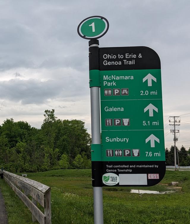
A WAYFINDING STRATEGY GUIDE FOR THE CENTRAL OHIO GREENWAYS FINAL | MARCH 2024 150
Source: Urban Decision Group
REVISIONS
REDUCE CONFUSION
Use the logo hat (instead of the route number) for all signs along the Ohio to Erie Trail. The black space at the top of the sign can now be used soley to identify the trail name.
Reduce visual noise by making all logos and icons white.
151 5.0 STRATEGY 2: MAPS & SIGNS
2 SIMPLIFY
CURRENT REVISED
1
OHIO TO ERIE TRAIL WAYFINDING SIGN
Genoa Trail Ohio to Erie & Genoa Trail McNamara Park 2.0 mi Galena Sunbury 5.1 mi 7.6 mi Trail controlled and maintained by Genoa Township McNamara Park Galena Sunbury Trail controlled and maintained by Genoa Township 2.0 mi 5.1 mi 7.6 mi
At-Trail Signs & Maps
(Continued)
TRAILHEAD MAPS
Printed Trailhead Maps orient trail users without forcing them to access location information digitally (which may be difficult-to-impossible in remote locations or when devices are inoperable). Though they are soon dated when conditions change, maps printed with evergreen information are a comfort to people and should continue to be offered in spite of their shortcomings.
Trailhead Maps should feature a map with trail users’ location on the local municipal grid and a smaller inset map that shows their location along an entire length or section of trail. Municipalities, major parks and roadways, blueways, and evergreen destinations can be labeled, but nothing more granular than that, nor anything likely to change. A QR code can link to additional information — for instance, off-trail destinations or transit connections. Trailhead Maps should be installed at all trailheads.

A WAYFINDING STRATEGY GUIDE FOR THE CENTRAL OHIO GREENWAYS FINAL | MARCH 2024 152
Source: Urban Decision Group
SAMPLE DESIGN
OPPORTUNITIES
GUIDELINES
IDENTIFY THE TRAILHEAD
Associate the trailhead to its name by placing it at the top of all maps.
ORIENT USERS
A universal location icon at the trailhead’s location lets users know where they are. COG trails should use a bold lineweight and their assigned color. The map background color and some associated features, such as parks and open spaces, should utilize tones of the standard COG green. Gray tones should be used to denote water bodies, buildings, streets, and other features.
PROVIDE MORE CONTEXT
An inset map shows the broader context of a user’s location.
LINK TO MORE
More information can be provided via digital maps using a simple QR code.
153 5.0 STRATEGY 2: MAPS & SIGNS
1 2 4 3
MAP KIOSK
At-Trail Signs & Maps
(Continued)
RULES SIGNS
Rules Signs inform trail users of how to behave on the trails by delineating acceptable and unacceptable behavior. They typically feature a bulleted list of 8–10 rules trail users are expected to follow to ensure everyone’s safety. Most of these are inconsistently enforced; Rules Signs are therefore largely disregarded. They may be problematic in other ways as well — for example, by being off-putting to those who are not yet convinced they are welcome on trails, or incomprehensible to those who cannot read or read English. To ensure they are serving trail users well and having their desired effect, a regional conversation about best practices in communicating trail rules, on signs and through information campaigns, should be held. Rules Signs should be installed at all trailheads; rules may be reinforced with pavement markings at problem areas.


A WAYFINDING STRATEGY GUIDE FOR THE CENTRAL OHIO GREENWAYS FINAL | MARCH 2024 154
Source: Urban Decision Group

155 5.0 STRATEGY 2: MAPS & SIGNS
Pinellas County, Florida offers an example of a sign that could be posted on a trailhead kiosk to communicate behavioral expectations to all trail users in a clear, friendly, helpful style.
Instilling Trail User Confidence: On-Trail Signs & Markings
RECOMMENDATION 3
Place confirmation signs at all decision points and approximately every two miles along the trail.
As people travel on a trail, they need to know they are on the correct route, which way to turn when a trail diverges, and how far until the next resting or stopping point. When this information is not sufficiently available, trail users may feel forced to fumble with their navigational devices, disrupting their flow and creating a potentially dangerous situation. Regular confirmation of their path increases trail user confidence and reduces their stress.

This Directional Sign demonstrates how reducing logo size makes room for more useful wayfinding information, like destinations and distances to them.
A WAYFINDING STRATEGY GUIDE FOR THE CENTRAL OHIO GREENWAYS FINAL | MARCH 2024 156
Source: Urban Decision Group
ACTION ITEMS
3.1
POST CONFIRMATION SIGNS FREQUENTLY.
Post Directional Signs or Trail ID Signs at every trail decision point and approximately every two miles along the trail.
3.2
LABEL ALL BRIDGES & CROSS STREETS.
Place road signs on both sides of all bridge underpasses and road/trail intersections.
3.3
REFRAIN FROM USING MILE MARKERS ON THE TRAIL.
Place no mile markers along an unfinished trail network, as they will quickly become inaccurate and confusing to trail users..
3.4
REINFORCE CAUTION MESSAGES, RULES & DIRECTIONS WITH PAVEMENT MARKINGS.
Place messages in white paint on the pavement at sites where trail users could benefit from an additional layer of information to make good decisions.
157 5.0 STRATEGY 2: MAPS & SIGNS
On-Trail Signs & Markings
(Continued)
COG TRAIL ID SIGN
Trail ID Signs are used to alert trail users to the trail and routes they are traveling. Trail ID Signs should be posted at every trail decision point along a major route and, in the absence of other wayfinding signs, at least every two miles along that route to confirm it continues as expected.
BRIDGE & ROAD CROSSINGS
A simple COG-branded road sign was developed to help orient people to where they are within the broader transportation network. Road Signs should be posted on both sides of all bridge overpasses and both sides of all road/trail intersections.

A WAYFINDING STRATEGY GUIDE FOR THE CENTRAL OHIO GREENWAYS FINAL | MARCH 2024 158
Source: Urban Decision Group


159 5.0 STRATEGY 2: MAPS & SIGNS NEW COG ROAD SIGN Alum Creek Alum Creek Trail North 5th Ave. Downtown Connector Trail 0.75 mile 0.25 mile BIKE ROUTE SCIOTO - ALUM CONNECTOR Ohio to COG TRAIL ID SIGN COG ON-TRAIL DIRECTIONAL OHIO TO ERIE WAYFINDING SIGN COG WAYFINDING SIGN MUTCD RIGHT-OF-WAY MUTCD TO TRAIL CURRENT REVISED COG TRAIL ID SIGN Easton Town Center 5.0 miles INTERACTIVE MAP EMERGENCY CALL 911 Ranger Dispatch: 614.620.1865 Alum Creek Trail MORSE ROAD
On-Trail Signs & Markings
(Continued)
COG DIRECTIONAL SIGN
COG Directional Signs tell trail users what trail they are on, the distance to other trails and roads, and, with the recommended edits, what amenities are available at the destinations advertised. Similar to Trail ID Signs, but smaller and less expensive, these are better suited to local trails than the major routes on which Trail ID Signs would be used. COG Directional Signs should be posted at every trail decision point and, in the absence of other wayfinding signs, at least every two miles along a trail.

A WAYFINDING STRATEGY GUIDE FOR THE CENTRAL OHIO GREENWAYS FINAL | MARCH 2024 160
Source: Urban Decision Group
REVISIONS

EMPHASIZE KEY INFO
Remove the COG logo to left-align and enlarge the trail name.
CLARIFY
Enlarge the directional arrows and add universal amenities icons.
161 5.0 STRATEGY 2: MAPS & SIGNS
DIRECTIONAL SIGN Alum Creek Trail Alum Creek Trail North 5th Ave. Downtown Connector Trail 0.75 mile 0.25 mile BIKE ROUTE SCIOTO - ALUM CREEK CONNECTOR
to Erie Trail COG ON-TRAIL DIRECTIONAL SIGN SIGN MUTCD RIGHT-OF-WAY SIGN 1 2 CURRENT REVISED
COG
Ohio
Ohio Dominican University 1.3 miles Downtown Columbus 5.7 miles Alum Creek Trail Shepard Library 1.5 miles
On-Trail Signs & Markings
(Continued)
PAVEMENT MARKINGS
Pavement markings can be used to augment the sign system and reinforce critical trail information, such as cautions, detours, rules, abrupt stops, or tricky turns. Pavement Markings should be used at the discretion of trail managers at sites where additional information would benefit trail users.
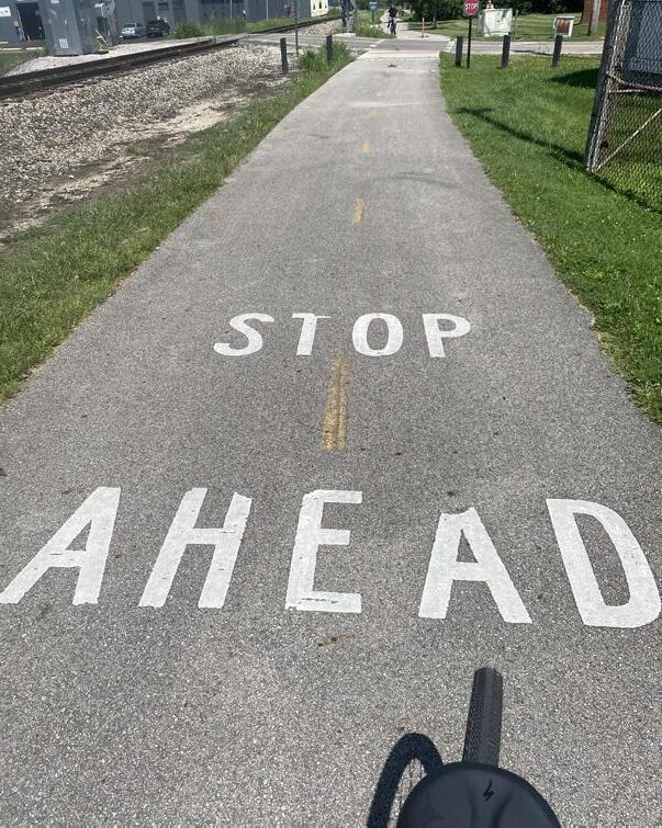
A WAYFINDING STRATEGY GUIDE FOR THE CENTRAL OHIO GREENWAYS FINAL | MARCH 2024 162
Source:
Designing Local

A long-term trail detour during construction at The Ohio State University was communicated with trail stickers and a green dashed line that made following the route a seamless experience.
Source: The Ohio State University
Keeping Trail Users On-route: Off-Trail Signs
RECOMMENDATION 4
Sign smartly to keep people on the correct route when it deviates from the trail.
There are times when it is necessary to direct a trail user off-trail, for instance when the route continues on-road, when there is a detour, or when there are nearby destinations that provide essential amenities. In these cases, people need fair warning and they need to be assured that they can safely follow whatever route is indicated. If a route must be partially onroad, Caution Signs should be placed at the trail access point to alert trail users of this. Trail Detour Pavement Markings should be placed where a detour begins and frequently thereafter until the trail resumes.
CAUTION SIGNS
Route Continues on Roadway
A WAYFINDING STRATEGY GUIDE FOR THE CENTRAL OHIO GREENWAYS FINAL | MARCH 2024 164
CAUTION TRAIL DETOUR
ACTION ITEMS
4.1
ENSURE ROADWAY ROUTE SEGMENTS & DETOURS ARE WELL MARKED.
Use frequent Route Continuation Signs and Trail
Detour Pavement Markings to direct people along route segments that deviate from the trail.
4.2
USE CAUTION SIGNS WHEN A ROUTE CONTINUES OFF-TRAIL.
Alert trail users to when a route will continue from the trail to a roadway. Pair Caution Signs with Road Signs as appropriate.
4.3
REMOVE ROGUE SIGNS FROM THE TRAIL.
Remove all signs posted by private individuals that direct people off-trail for any reason.
165 5.0 STRATEGY 2: MAPS & SIGNS
Off-Trail Signs
(Continued)
ROUTE CONTINUATION SIGNS
Route Continuation Signs keep people headed the right way until the trail resumes when a route features an on-road segment. Because they are on a roadway, they must be designed such that drivers of motor vehicles can readily see and understand them. Depending on the municipality and the signs’ location, their design may need to align with the Manual on Uniform Traffic Control Devices (MUTCD), which outlines standards by which traffic signs, road surface markings, and signals are designed, installed, and used. The Route Continuation Signs here were redesigned according to what would be acceptable within the MUTCD guidelines and, if the MUTCD does not apply, what would align with COG signs. Given the option, non-MUTCD signs are preferred, as they reinforce the COG and Ohio to Erie Trail brands. Route Continuation Signs should be located at turns and no less than every quarter-mile along an on-road route.

A WAYFINDING STRATEGY GUIDE FOR THE CENTRAL OHIO GREENWAYS FINAL | MARCH 2024 166
Source: Designing Local
ROUTE CONTINUATION SIGNS
REVISIONS
USE FEWER WORDS
Using the universal bike icon eliminates the need for “Bike Route,” leaving more space for relevant information.
REINFORCE THE BRAND
Tie COG to the Ohio to Erie Trail by using the COG green and the trail name.
167 5.0 STRATEGY 2: MAPS & SIGNS
CURRENT MUTCD
REVISED
NON-MUTCD
1 2
TRAIL
ERIE TRAIL
Scioto Trail BIKE ROUTE SCIOTO
OHIO TO
Off-Trail Signs
(Continued)
BRANDED DESTINATION SIGNS
Branded destination signs are not required but can be placed at any trail access point at which trail users would exit for a major destination, and stacked on posts with other signs.
HOME-GROWN SIGNS
All signs placed on a trail by private individuals to promote their off-trail business should be removed.
BRANDED DESTINATION SIGNS

A WAYFINDING STRATEGY GUIDE FOR THE CENTRAL OHIO GREENWAYS FINAL | MARCH 2024 168
ALL SERVICES ALL SERVICES
 Source: Ben Ko, Yay Bikes!
SBR1 or Ohio to Erie Trail?
Ohio’s State and U.S. Bike Route System offers more than 3,000 miles of designated bike routes that connect Ohio’s municipalities to one another and to other states. Having a designated bike route confers benefits to local communities including association with a larger route network and to Adventure Cycling, an organization that promotes and leads rides along the routes. When a route is designated, through a process involving ODOT and AASHTO, ODOT purchases and installs signs with the bike route number along the entirety of the route. These signs are useful to long-distance cyclists, who use the routes to plan their trips, but less so to the majority of trail users who are traveling local trails. Therefore, route numbers should not be the most prominent information posted when a route overlays a local trail. Trail signs should instead emphasize local trail names and regional trail route names (i.e., the Ohio to Erie Trail, as opposed to SBR1); the route number can be featured on signs as shown in the Trail ID and Wayfinding signs in this section.
established by the American Association of State Highway and Transportation Officials (AASHTO). The first U.S. Route was designated in 1982. Today there are 41 U.S. Bike Routes that travel across 26 states and the District of Columbia.
There are segments of five U.S. Bikes Routes in Ohio encompassing 1,400 miles and providing
bike connections to the rest of the country — from Washington, D.C. to San Francisco and from Cleveland to Atlanta. They include U.S.BR 21, 25, 30, 44, 50, and their alternatives.
In addition, Ohio has over 1,600 miles of proposed State Bike Routes throughout the state. They are a combination of trails and on-road facilities. Together these routes connect more than 400 Ohio communities for intrastate travel, recreation and tourism.


A WAYFINDING STRATEGY GUIDE FOR THE CENTRAL OHIO GREENWAYS FINAL | MARCH 2024 170
WHAT Ohio’s State and U.S. Bike Route System builds off routes included in the U.S. Bike Route System (U.S.BRS) that was
50 50 50 50 CANTON 30 30 30 130 21 21 21 50A DAYTON 20 20 20 10 65 65 33 39 65 65 77 85 95 80 71 25 25 25 25 21 21 23 44 44 44 44 90 62 36 36 47 23 47 52 60 70 Wabash Cannonball Trail Heritage Trail Ohio to Erie Tri-County
TJ Evans & Panhandle
Richland
Little Miami Scenic
Great Miami River Trail Hockhocking Adena Bikeway North Coast Inland Trail Hike & Bike Trail AKRON CLEVELAND TOLEDO CINCINNATI YOUNGSTOWN Great Ohio Lake to River Greenway COLUMBUS
Triangle Trail
Trails
B&O Trail
Trail
REVISIONS
ROUTE CONTINUATION SIGNS
ELEVATE WHAT’S IMPORTANT
Enlarge the Ohio to Erie Trail name and eliminate the oval and 1.
USE THE TRAIL NAME & BRAND
Use the Ohio to Erie Trail name instead of the route number, and the trail’s color scheme.
ADD THE DISTANCE
Add the distance to the trail and enlarge the arrow to be more clear about the direction.
171 5.0 STRATEGY 2: MAPS & SIGNS
CURRENT MUTCD NON-MUTCD REVISED
3 1 2 0.5 mi OHIO TO ERIE TRAIL
Directing People to Trails: To-trail Signs
RECOMMENDATION 5
Post signage to alert people of nearby trail access points.
Trail Access Signs show people the places they can access a trail and help them understand more broadly how accessible the trail system is. They should be posted as closely as possible to each trail access point, to the extent possible given various property ownership and right of way scenarios, on sites that where they will be seen. A MUTCD-friendly and a COG-branded version have been provided for whatever is most appropriate in context. Given the option, non-MUTCD signs are preferred, as they reinforce the COG and Ohio to Erie Trail brands. Trail Access Signs should be placed in high-traffic areas within approximately one block of every trail access point.
A WAYFINDING STRATEGY GUIDE FOR THE CENTRAL OHIO GREENWAYS FINAL | MARCH 2024 172 COG/OTE BRAND COG BRAND MUTCD TO-TRAIL SIGNS
TRAIL ACCESS TRAIL ACCESS OHIO TO ERIE TRAIL TRAIL ACCESS
ACTION ITEMS
5.1
ALERT PEOPLE TO EVERY TRAIL ACCESS POINT.
Post Trail Access Signs in high-traffic areas within approximately one block of every trail access point.
173 5.0 STRATEGY 2: MAPS & SIGNS
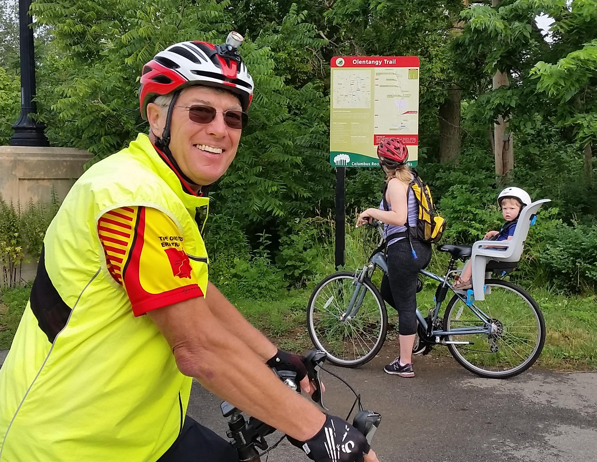 Source: Central Ohio Greenways
1
Chapter 5 Takeaways
MODIFY LOCAL SIGNS TO BETTER ALIGN REGIONALLY.
Work together on a regional scale to coordinate sign systems, and replace signs as they expire with those that feature the design modifications in this guide.
2 PRIORITIZE TRAIL ACCESS POINTS.
Invest in providing as much information as possible at trail access points, where the trail welcomes all users.
3
MAKE ‘OHIO TO ERIE TRAIL’ MORE PROMINENT THAN ‘ROUTE 1’.
Make “Ohio to Erie Trail” the most prominent route information on trail signage. State & U.S. Bike Route System numbers should be secondary information on signs.
4 SIGN DESTINATIONS AT A PREDICABLE CADENCE.
Use the placement guidelines to determine what destinations to sign, when, and how many times.
175 5.0 STRATEGY 2: MAPS & SIGNS

STRATEGY 3: TECHNOLOGY 6.0
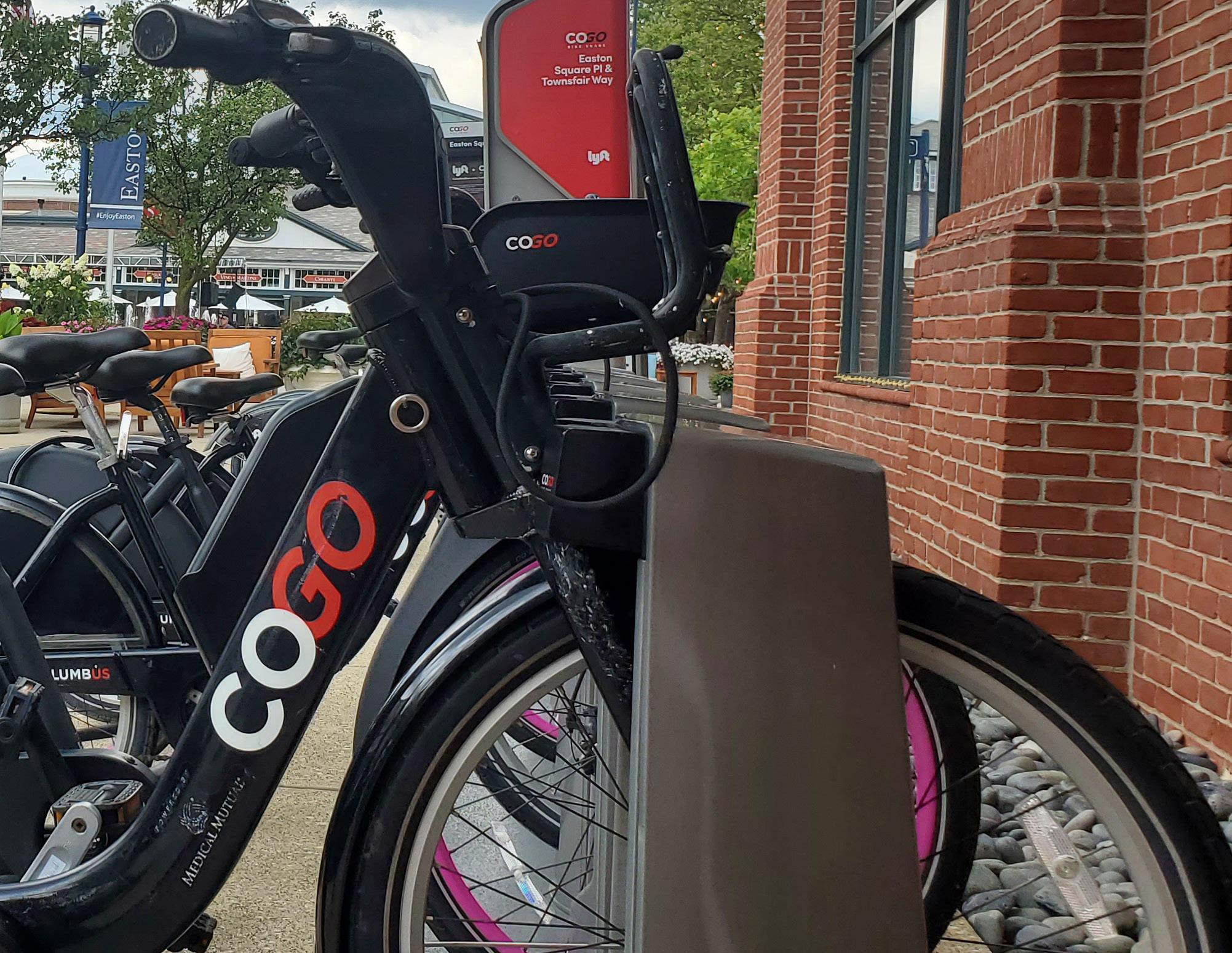
With technology as ubiquitous and powerful as it is today, it can be tempting to invent technical solutions to all problems. Indeed, when it comes to trail-oriented wayfinding, opportunities for digital signs, interactive kiosks, and new apps abound. This chapter considers these and other digital means to improve wayfinding, then recommends the few that will most significantly impact a trail user’s experience.
Source: Central Ohio Greenways
How Technology Facilitates
Wayfinding
Technology will enable trail users to readily access current route, trail amenity, and destination information.
WAYFINDING PRINCIPLES IN ACTION
Technology can anticipate trail users’ needs by providing them the most direct route to their chosen destination utilizing the trail.
Technology can help trail users connect with the communities they are passing through by providing information about nearby points of interest and how to reach them.
A WAYFINDING STRATEGY GUIDE FOR THE CENTRAL OHIO GREENWAYS FINAL | MARCH 2024 178
Employing Technology to Support Wayfinding
RECOMMENDATIONS
1
Keep the trail wayfinding system simple and low-tech.
2
Use QR codes to provide information about off-trail destinations & amenities.
3
Help make the most commonly used wayfinding apps work better.
4
Develop COG trail–oriented itineraries and compile them into a publicly available route repository.
5
Update the COG Metro Bike and Trail User Map to improve its user friendliness.
179 6.0 STRATEGY 3: TECHNOLOGY
Employing Technology to Support Wayfinding CURRENT CONDITIONS
Central Ohio’s trail system is overwhelmingly low-tech, but, even so, there are several technical tools that trail users here rely on to find their way.
One in widespread use throughout the system is the QR code, a type of barcode that stores digital information that can be accessed when scanned by a digital device (for example, a smartphone camera). They are typically displayed at trailhead kiosks to refer trail users to online maps of the local area and amenities. The codes, which are managed locally, are inconsistent in terms of their appearance and the content they link to, making it difficult for trail users to depend on them for the information they need.
Others tools include the mapping platforms Google Maps and OpenStreetMap (OSM), which serve up routes on their sites and through the many apps that pull from their data. Given their popularity, it is critical that these platforms provide accurate routing information — but because they are currently missing key information, particularly trail access points, both now function sub-optimally to route people to and along Central Ohio trails.
The MORPC Metro Area Bike Map, the COG Trail User Map, and the Outdoor Trails Pass can be enhanced to become powerful tools to help people easily navigate the trails.
A WAYFINDING STRATEGY GUIDE FOR THE CENTRAL OHIO GREENWAYS FINAL | MARCH 2024 180
 Source: Urban Decision Group
Keeping It Simple
RECOMMENDATION 1
Keep the trail wayfinding system simple and low-tech.
Technology should make life easier, not create additional challenges. Technical solutions that require significant funding and/or specialized expertise to implement may prove difficult to maintain over time — and do not necessarily remove the need for other resource-intensive tasks, such as content management. Such solutions should not be implemented without a very carefully considered plan for ongoing upkeep.

A WAYFINDING STRATEGY GUIDE FOR THE CENTRAL OHIO GREENWAYS FINAL | MARCH 2024 182
pexels.com, Life
Source:
Folk
ACTION ITEMS
1.1
INSTALL DIGITAL SIGNS & KIOSKS ONLY IN VERY LIMITED CIRCUMSTANCES.
In addition to general challenges with high-tech solutions, digital signs and kiosks run the risk of vandalism and can infringe on the serenity of nature that is important to many trail lovers. Kiosks also tend to be cost effective only when based on an advertising model that is only viable given a certain level of traffic.
Still, digital signs and kiosks may have their place within particular contexts (for example, trailheads near shopping centers or in busy downtown areas).
1.2
IMPROVE DIGITAL DATA TO ENHANCE THE UTILITY OF EXISTING TRAIL NAVIGATION APPLICATIONS.
Free, widely used wayfinding apps already exist; a new app for the region would generate an ongoing, unnecessary data maintenance challenge. It is a better use of resource to ensure that Google and OpenStreetMap work as intended to efficiently route trail users.
183 6.0 STRATEGY 3: TECHNOLOGY
Using QR Codes
RECOMMENDATION 2
Use QR codes to provide information about off-trail destinations and amenities.
QR codes are an elegant solution to the problem of providing critical information to trail users that is likely to change. They are free to generate, easy to print and post, and can link to any content desired. QR codes should be used on trail kiosks to provide trail users with information about off-trail communities and the amenities and experiences they provide. Local communities have discretion over and responsibility for the content they link to. Having consistent standards across communities will help trail users know what to expect when they scan QR codes throughout the network.

tinyurl.com/COG-TRAIL-MAP
This QR code follows best practices for code design — black and white with no extraneous designs, a shortened URL, and a call to action.
A WAYFINDING STRATEGY GUIDE FOR THE CENTRAL OHIO GREENWAYS FINAL | MARCH 2024 184
SCAN FOR TRAIL MAP
ACTION ITEMS
2.1
GENERATE, LOCATE & TRACK QR CODES ACCORDING TO BEST PRACTICES.
Create and deploy QR codes in ways known to maximize their utility.
2.2
STANDARDIZE THE CONTENT THAT QR CODES LINK TO.
Link to mobile-optimized websites that offer trail users the same (or similar) content regarding the local communities they are traveling through, no matter where they are along the trail.
185 6.0 STRATEGY 3: TECHNOLOGY
Best Practices in QR Code Design & Functionality
LOCATE QR CODES THOUGHTFULLY.
Only place codes in places where people can pull over to scan them without endangering fellow trail travelers.
DESIGN QR CODES FOR MAXIMUM READABILITY.
QR codes may not scan correctly if they are too small, blurry, degraded, or created using low-contrast colors. To maximize their usefulness and lifespan, print them as a black and white square, with no design elements in the center.
ADD TEXT ALONGSIDE QR CODES.
Codes should be accompanied by text that informs trail users of what action to take and what they will get for it (for example, “Scan for a local map.”). Add a shortened URL that directs people to the desired website, in case they cannot get the QR code to work properly.1
USE JUST ONE QR CODE PER SITE.
There should only ever be one QR code linking to one website at a location.
CHECK QR CODES PERIODICALLY.
QR codes should be tested from time to time to ensure they are still scannable, and that they have not been co-opted by fraudsters (who can place stickers over the real QR code to redirect people to malicious websites).2 Replace any problematic codes immediately.
TRACK QR CODE USE.
There are two types of QR codes — static and dynamic. Static codes are typically free to generate, but cannot be edited or tracked. Dynamic codes require a paid subscription service, but allow users to edit a QR code and track where and how often it is being used. Such an investment may be useful on a short-term basis to test whether codes are scanned more after a Trail Town designation, for example, or longer-term as part of a trail-oriented communications strategy.3
1“QR Codes: Design Guidelines.”
2City National Bank. “What You Need to Know About QR Code Fraud.”
3Vall V. “Are QR Codes Free to Use? Yes and No.”
A WAYFINDING STRATEGY GUIDE FOR THE CENTRAL OHIO GREENWAYS FINAL | MARCH 2024 186
Offering Content Worth
Linking To
For the foreseeable future, QR codes will be the tool that communities can use to provide trail users actionable information about their trail-adjacent assets. The content these codes link to is vitally important and should be to a sufficient standard that trail users can expect similar information, no matter what QR code they scan or where. Likewise, the format of these sites will be an important consideration for ease of use.
OPTIMIZE THE FORMAT & PLATFORM
Trail users will be scanning these websites on their mobile phones, so the sites should be designed specifically for mobile. Esri’s ArcGIS StoryMaps is a compelling choice of platform for its ability to integrate with maps and “tell the story” of a place.
PROVIDE RELEVANT CONTENT
At minimum, each site should contain the following:
• A “Welcome to ______” image and/or paragraph to orient people to where they are
• An interactive local map with routing capabilities
that pinpoints local destinations, including sources for water, restrooms, shelter, and food; this map should not be a static document file but rather a dynamic interactive map
• Travel advisories, if destinations require travel along challenging routes
With further capacity to create and maintain a website, additional information can be featured:
• Local history and lore, recent news stories, and other content that showcases what makes the community special
• Recommended daily itineraries, for those with time to spare
UPDATE CONTENT REGULARLY
Content on the sites linked to should be updated on a consistent basis to provide trail users the most current possible information — ideally, monthly or seasonally.
187 6.0 STRATEGY 3: TECHNOLOGY
Improving Map Apps
RECOMMENDATION 3
Help make the most commonly used mapping apps work better.
The routes delivered by any mapping app are only as good as the data they pull from. And there are so many mapping apps available that ensuring correct data for each could be a daunting task — were it not for the fact that most widely used wayfinding apps source their data from Google Maps and/or OpenStreetMap (OSM). The solution to better routing for trail users therefore requires improving the data that pulls from these two mapping platforms. It is relatively straightforward to do so, though the platforms have their differences and municipalities may find that one suits their needs and capacity better than the other. Ideally, both will be updated with current data and checked periodically to ensure that changes are reflected on the maps, so that trail users are always equipped with the most accurate routing tools possible.

A WAYFINDING STRATEGY GUIDE FOR THE CENTRAL OHIO GREENWAYS FINAL | MARCH 2024 188
pexels.com,
Source:
Ingo Joseph
ACTION ITEMS
3.1
MANUALLY UPDATE
SPECIFIC SITES ON OSM.
Set up a free user account on OpenStreetMap to update its maps, making use of the tutorials as necessary. Consider developing a citizen science project for volunteers to undertake the work of data collection and mapping.
3.2
SEND UPDATES TO GOOGLE MAPS’ CONTENT TEAM.
Send missing or incorrect data a prescribed by Google’s file upload requirements. An agent will be assigned the case, and they will respond in approximately 30 days to the update request.
189 6.0 STRATEGY 3: TECHNOLOGY

Steering Committee members shared the routing tools they use, and what frustrates them about how they work (or don’t) to give them the information they need.
Source: pexels.com, Kampus Production
WHAT ROUTING TOOL(S) DO YOU USE?
Google Maps (x4)
Apple Maps
Garmin (x2)
Ride With GPS (x2)
Google Street View
TrailLink
AllTrails
Bikemap
Analog maps
Experience Columbus
Outdoor Trails Pass
Trail maps on websites (x2), for closures & detours
WHAT FRUSTRATES YOU WHEN YOU USE (OR ATTEMPT TO USE) DIGITAL WAYFINDING APPS?
Missing data
Service coverage
Unclear if route proposed is actually safe; route stress level
Level of traffic stress is not included, nor is crime data
Not knowing about detours & closures (x2)
Battery intensive
Lack of context
Google Maps looks for fast, not always on trail
Suggested routes that are not anticipated
Unsure if routes is via trail or on street
People search Cincinnati to Cleveland and it doesn’t follow the Ohio to Erie Trail in many places
Understanding Google Maps
Google Maps is a proprietary web mapping platform and consumer application offered by Google. Its data feeds into the Cyclemeter, Bikemaps, Google Maps, and Ride with GPS wayfinding apps, among others. It is the most-downloaded mapping app, and most people use it in some form or another. The path to better bicycle and pedestrian routing, then, must go through Google. When working to improve Google Maps data, there are several factors to keep in mind:
EASE OF SUBMISSION
Updating Google Maps data is a matter of becoming a Maps Content Partner and sending an update request their portal, then waiting for them to review it and make the change. Google accepts data from verified organizations in the form of Shapefiles, CSVs, and KMLs, which works well for large data uploads. They also have a Local Guides program that allows individuals to register and contribute map updates.
MORE SECURITY, LESS CONTROL
Google Maps data is secure, in that their staff are the only ones with the ability to alter it. However, because all changes must go through Google, they will occur according to Google’s capacity.
LOW-MAINTENANCE
After data is submitted to Google in their required format, they handle the processing and maintenance of it.
LONG WAIT TIMES
It can be 30 days or more before requested changes appear on Google Maps.
A WAYFINDING STRATEGY GUIDE FOR THE CENTRAL OHIO GREENWAYS FINAL | MARCH 2024 192
Understanding OpenStreetMap
OSM is a free, open geographic database updated and maintained by a community of volunteers. Its data feeds into the Bicycle Map, Open Street Browser, Cartogiraffe, CycleIOSM, Cycle Map, Bike Citizens, Strava, Komoot, Trailforks, AllTrails, MyHikes, and Ride With GPS wayfinding apps, among others. It is popular for the fact that it is free and democratic, with a community of millions collaborating to provide content. When working to improve OSM data, there are several factors to keep in mind:
EASE OF EDITS
OSM data can be edited at a desktop or with mobile devices out in the field, even by community volunteers, if necessary.
LESS SECURITY, MORE CONTROL
Anyone with a free OSM account can easily edit and change other users’ data, without appealing to a higher authority.
A PROCESS FOR MASS DATA SUBMISSION
OSM requires users who wish to upload large amounts of data at once to undergo a community approval process, which may be cumbersome.
INCONSISTENT UPDATES
While updates made directly on OSM’s site appear almost immediately, some wayfinding apps pull data from OSM only periodically and will take time to register the changes.
193 6.0 STRATEGY 3: TECHNOLOGY
Testing a Routing Hypothesis
When trail data — in particular, trail access point data — is missing from the most popular mapping platforms, the bike routes they recommend send people far out of their way.
Hoping to remedy this wayfinding challenge along the Ohio to Erie Trail, the team tested the hypothesis that both Google Maps and OSM would provide more direct, trail-based routes if provided current trail access point data.
Trip origin and destination points near trails in the Hilltop neighborhood of Columbus and the rural village of Howard, were selected, and a simple routing query was submitted in OSM (Hilltop) and Google Maps (Howard) to see what happened. In both cases, the team found that trail access points were missing, causing bike routes between two points near the trail to be unnecessarily long and indirect.
The team provided trail access points to both mapping platforms and waited until they were accepted. Afterwards, they resubmitted their routing query and discovered that in both contexts, and with both mapping platforms, routes employed the new trail access points and were much more direct as a result (the maps at right show what this process looked like in Google Maps and OSM). The team then updated OSM and Google Maps with all 18 missing trail access points along the Ohio to Erie Trail, as shown on the next page.

A missing trail access point in Howard, Ohio caused Google Maps to route people far out of their way on a trip from East Knox Elementary to the Hellbender Preserve.

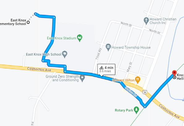
Google made the change and thereafter routed people more efficiently using the trail.
A WAYFINDING STRATEGY GUIDE FOR THE CENTRAL OHIO GREENWAYS FINAL | MARCH 2024 194
The team alerted Google Maps to the missing trail access point at Rotary Park.

OSM failed to use the Camp Chase Trail for routing due to a missing trail access point.

OSM allowed the team to directly add the trail access point.
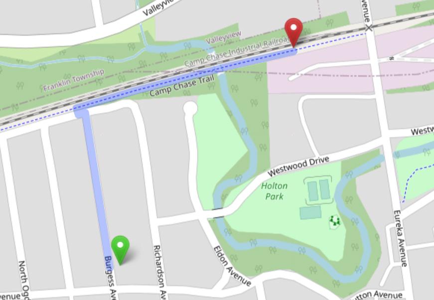
OSM began factoring the trail into its route almost immediately.
Mapping Trail Amenities
Having experienced success at improving bike routes with trail access points, the team reached out to Google with additional trail data to see if they would use it as well. This included all trailheads, their location (latitude and longitude) and amenities, and a link to COG’s website. This was submitted as a Points of Interest .csv file, as per Google’s requirements for data sharing.
Though Google rejected the amenities data, they accepted the remainder of what was submitted. This means that all 34 Ohio to Erie Trail trailheads within the project scope now appear on Google Maps with their name and precise location, a photo, and a link to centralohiogreenways.com.
195 6.0 STRATEGY 3: TECHNOLOGY
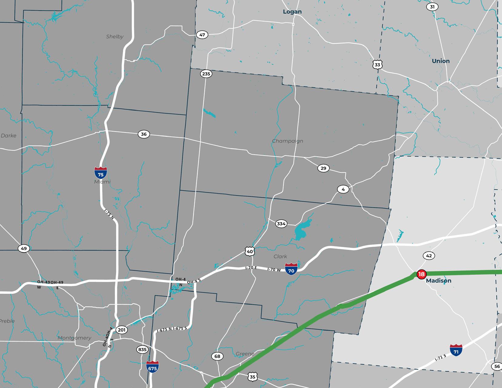
MAP CODE LOCATION PLATFORM(S) MISSING FROM 1 Bridge of Dreams Trailhead Google 2 Heart of Ohio Trail Farm Access Google 3 Memorial Park Access OSM 4 Big Walnut Elementary School Access Path Google & OSM 5 Farina Ct Entrance Google & OSM 6 Zoar Street Access Google 7 Char-Mar Ridge Reserve Access OSM’ 8 Commerce Park Dr Access Google & OSM 9 County Line Road Access OSM 10 Maddalena Ln Access Google 11 McVay Alley Access Google 12 Treva Ct Access Google & OSM 13 Access from State Rd (Yogi’s Hoagies) Google & OSM 14 Access behind Starbucks Google 15 Morse Road trail access OSM 16 Wilson Road Park Trailhead Google & OSM 17 Stonewell Court Access OSM 18 E Center St Access Google & OSM

There were 18 trail access points along the Ohio to Erie Trail that did not register in OpenStreetMap, Google Maps, or both.
Upon adding them, both mapping platforms began using the trail to route cyclists and pedestrians more efficiently.
Creating a Route Repository
RECOMMENDATION 4
Develop COG trail–oriented itineraries and compile them into a publicly available route repository.
Providing pre-made routes to trail users, particularly those who are new to the trails, is a way to help them practice their navigational skills in a low-risk context. Paired with programming that allows them to travel with a group of exploratory friends and neighbors, this strategy can boost the confidence of even the most reluctant trailgoer.
There are many route planning and navigation apps on the market (for example, Strava, Ride With GPS, and MapMyRide) that make it possible to create and share routes. These have become very powerful tools, but choosing to use them — and choosing which one of them to use — requires careful consideration.
BENEFITS TO ROUTING & NAVIGATION APPS
• They are a turnkey solution that do not require a technical team to implement or support.
• They offer an exceedingly impressive suite of route planning tools.
• They have a built-in community of users, reducing the need to market a separate website.
• They can be branded and fit seamlessly with other marketing strategies.
• They offer a way to foster community among people using the routes.
DRAWBACKS TO ROUTING & NAVIGATION APPS
• They are privately operated and can shut down or change their offerings at any time.
• They offer less control of data and communication than home-grown solutions.
• They charge monthly or annual fees for the premium accounts with the best features.
• They require ongoing interaction from account managers in order to stay fresh and relevant.
A WAYFINDING STRATEGY GUIDE FOR THE CENTRAL OHIO GREENWAYS FINAL | MARCH 2024 198
ACTION ITEMS
4.1
CURATE TRAIL-BASED ITINERARIES AND SHARE THEM.
Offer pre-vetted routes that allow people to explore the trails with confidence, and assess whether a publicly accessible routing and navigation app is the best tool for this purpose.
4.2
PROMOTE RECOMMENDED ROUTES WITH PROGRAMMING.
Provide opportunities for group rides on the recommended routes that introduce people to them in a fun, social context.
199 6.0 STRATEGY 3: TECHNOLOGY

Experiencing Trail Itineraries
In 2021, MORPC and Experience Columbus forged a partnership to offer the Columbus Outdoor Trails Pass program, which incentivizes travel to 42 trailbased destinations. There are two itineraries from which to choose — Scenic Parks or Fresh Air, Fine Art & Fantastic Brews — and people who check in along the way are entered into drawing for local gift certificates. The program had more than 1,300 sign-ups and 600 check-ins in 2023. Experience Columbus and MORPC update the pass annually to improve the user experience and marketing associated with it.
Sharing Routes
COG can expand and enhance its Outdoor Trails Pass program with a repository of routes and itineraries that makes use of its trail network. Whatever application is selected for this purpose would ideally offer the following route planning features:
• Turn-by-turn navigation
• The ability to download routes to a navigational device and print cue sheets
• Offline maps for the mobile version
• Route elevation and estimated time for completion
• Searchable routes based on distance and difficulty
• The ability to embed routes in another website
Additional features, when available, would foster community around the offered routes:
• A dedicated group page
• The ability to create ride reports with photos
• The ability to promote events
FINAL | MARCH 2024 200
Source: Central Ohio Greenways
I love how the Ride with GPS technology platform allows us to offer a free mobile app for our end user to access curated routes while also providing a website-embedded visualization platform for the same library. Visitors to ohiogravelgrinders.com can see our routes throughout the state and region on a map and retrieve route information instantaneously.
RAY GEORGE Founder Ohio Gravel Grinders

Touring With the Ohio Gravel Grinders
Ohio Gravel Grinders (OGG) is an informal group that has enjoyed riding the graveled back roads of Ohio (and beyond) since 2012. In 2020, the group launched a Ride With GPS Club Account with Tourism Tools enabled, to allow for dynamic mapping. This account now has more than 2,600 members and, along with the dedicated OGG website, features hundreds of turn-by-turn routes, ride recap blog posts, information resources, event postings, and more, making it easy for newcomers to get involved and regulars to stay connected. OGG is a testament to the power of online tools to foster community and get people riding.
201
Source: Ray George
Making COG’s Trail Map More User-friendly
RECOMMENDATION 5
Update the Columbus Metro Bike and Trail User Map to improve its user friendliness.
The Columbus Metro Bike and Trail User Map (hereafter, “the COG Map”), which is linked from the COG website, is currently the only publicly accessible map providing a comprehensive view of the entire COG system (current and planned), plus community amenities, transit connections, and level of traffic stress for all roadways. Though it does not support routing, the map is used by cyclists and hikers — in particular, those on long-distance recreational trips — to build their routes using other tools. Its utility could be expanded with modifications to improve its user friendliness.

A WAYFINDING STRATEGY GUIDE FOR THE CENTRAL OHIO GREENWAYS FINAL | MARCH 2024 202
Source: pexels.com, Masood Aslami
ACTION ITEM
5.1
MAKE DESIGN AND CONTENT
MODIFICATIONS TO THE COG MAP.
Continue updating the COG Map with content and design changes that make it more widely applicable and user friendly.
203 6.0 STRATEGY 3: TECHNOLOGY

Users access the COG Map through a link on the COG website. Enhancements to this map will make it more accessible and user friendly.
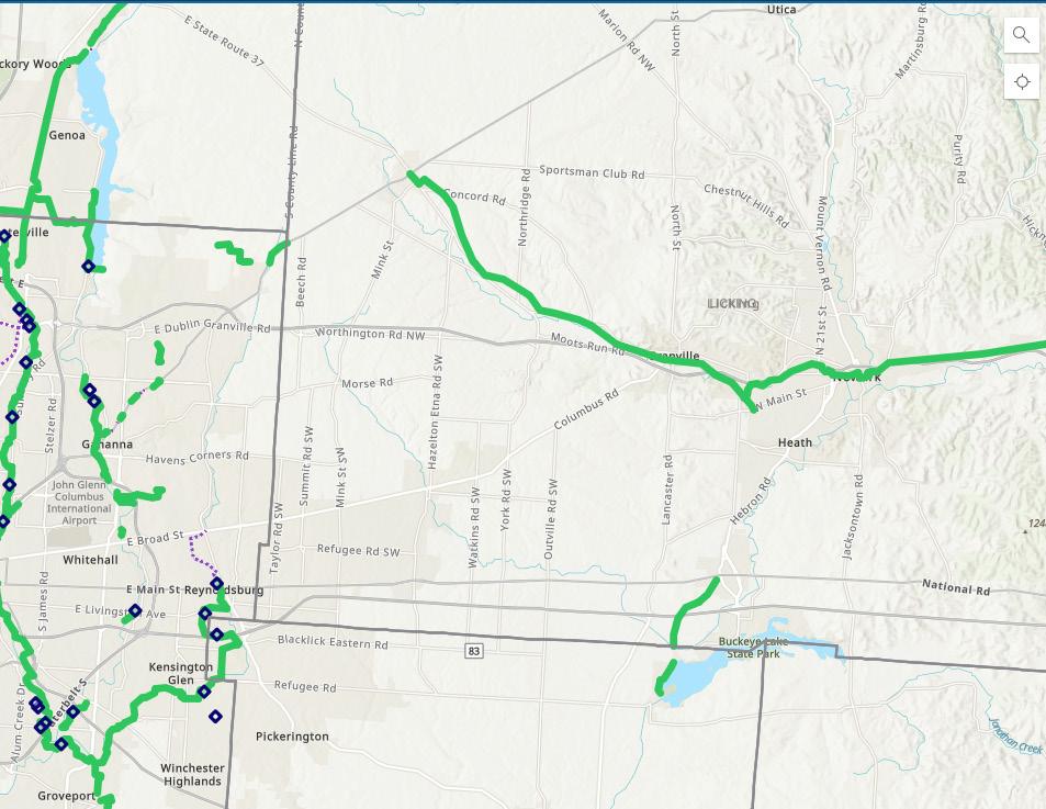
COG Map Enhancements
The COG Map is the only map that features the COG trail network in its entirety, as well as on-road and roadway-adjacent bicycle facilities, planned trail extensions, community institutions, and trail user amenities. It is intended for a general audience, but presents as a professional planning tool. The following guidelines support making the COG Map more useful for the average trail user as they plan their trips.
LANDING PAGE
The COG Map should be intuitive to use at first glance. Offer a sidebar or pop-up that introduces the map, its contents, what can be done with it, and key insights into functionality (in particular, if users will need to zoom in to see different layers of content). The map itself should populate with the all COG Trails in their assigned colors. An obvious navigation bar and legend should appear on the far right or left side of the screen.
MAP CONTENT
Include the following on the map, in addition to what is currently provided:
• Names of all trails and trailheads, with brief descriptions of them
• Trail Towns
• Trail-based water, restrooms & bike repair stations
• Trail closures
• Trail access points
• Transit stops
• Recreation and tourism centers
• Major points of interest
• Images of assets (as available)
Users should have the ability to toggle each category on and off as they prefer.
A WAYFINDING STRATEGY GUIDE FOR THE CENTRAL OHIO GREENWAYS FINAL | MARCH 2024 206
NAVIGATION BAR & LEGEND
Combine the navigation bar and legend into one menu, with a list that expands when each item is clicked to reveal more granular options and how they are identified on the map. Top-level menu categories should include:
• COG Trails
• Multi-use Trails
• Trail Amenities
• On-road Bike Facilities
• Roadway Bike Friendliness
• Community Institutions
• Multi-modal Connections
• Points of Interest
• Trail Alerts
EXTRANEOUS & CONFUSING CONTENT
Provide only information that average trail users would find useful and remove all empty, outdated, or redundant layers. Define all terms that may not be commonly understood using the COG Trail Term guidance on page 140. Periodically review map contents to ensure accuracy and legibility.
TECH INTEGRATIONS
Assess whether the map could integrate with trail users’ navigational apps or otherwise support routing.
207 6.0 STRATEGY 3: TECHNOLOGY
 Source: pexels.com, Ivan Samkov
Chapter 6 Takeaways
1 DON’T CREATE NEW PROBLEMS.
Technical solutions can be effective, but they should not be attempted in the absence of a plan to maintain them over time.
2 LINK TO LOCAL INFORMATION.
QR codes provide an elegant solution to the challenge of providing trail users with local information, especially that which is likely to change.
3
UPDATE THE MOST POPULAR ROUTING APPS.
It is possible — and critical — to work with Google Maps and OpenStreetMap to improve the quality of local trail data.
4
DEVELOP ROUTES, OFFER RIDES, AND IMPROVE THE COG MAP.
User-friendly trail maps, paired with curated routes and itineraries, make it easier for people to explore trails for the first time. .
209 6.0 STRATEGY 3: TECHNOLOGY
STRATEGY 4: PUBLIC ART & CREATIVE ELEMENTS 7.0

Mural:
Moovin’ and Groovin’, Roger J. Williams
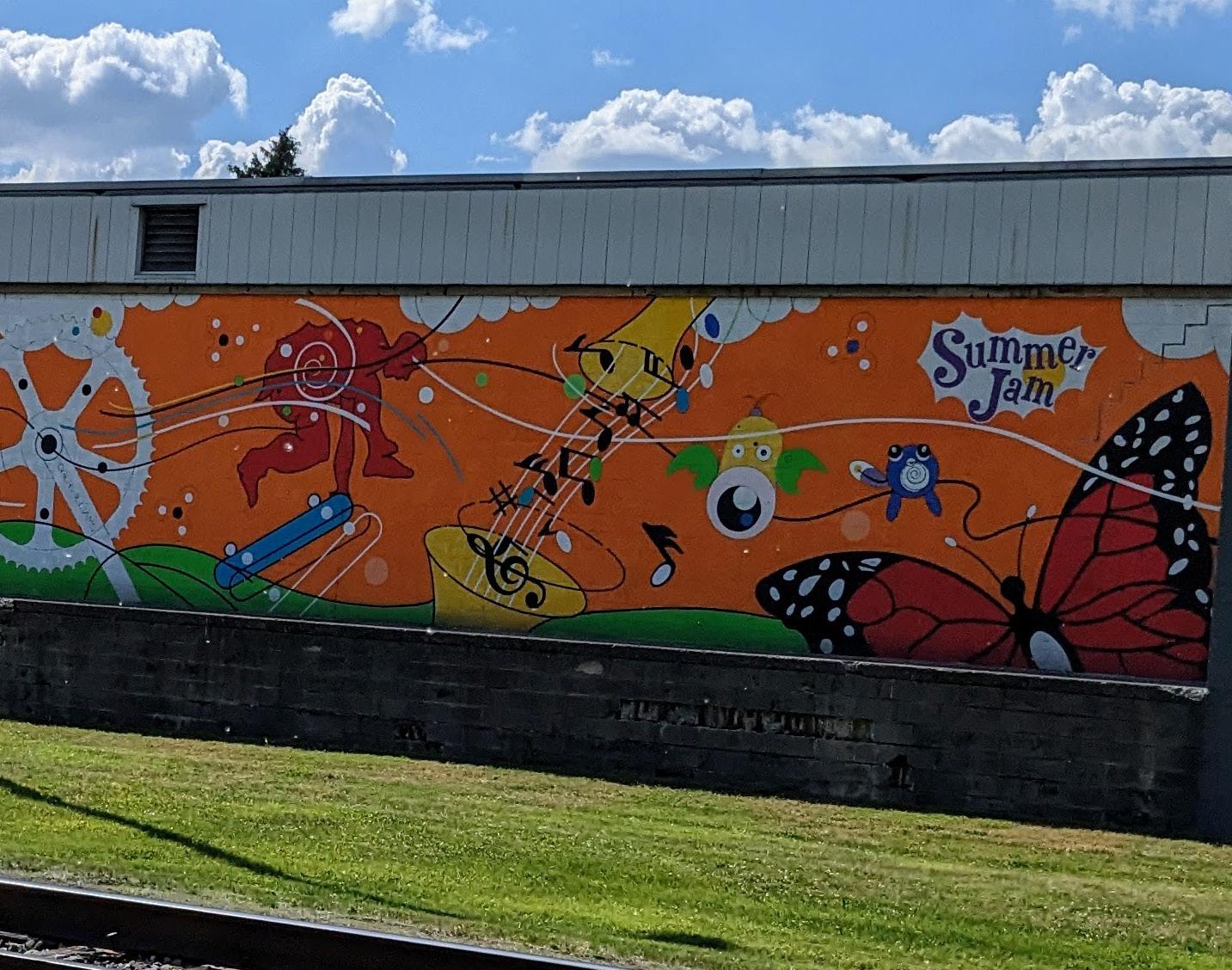
For many reasons, installing public art and other creative elements along a trail is a worthy goal unto itself. Locating these elements strategically can also further wayfinding goals, by helping people associate places with specific visual cues. This chapter outlines the various types of creative elements that can elevate a trail experience, the process of ensuring they are representative of their communities, and where to locate them to maximize their wayfinding benefit for trail users.
Source: Urban Decision Group
How Creative Amenities
Facilitate Wayfinding
Public art and other creative elements will help trail users create mental maps that enable them to better navigate the trail over time.
WAYFINDING PRINCIPLES IN ACTION
Creative elements can help trail users connect with the communities they pass through by associating places with their unique cultural expressions.
Creative elements can provide trail users memorable cues that orient them to their location and which direction to turn.
A WAYFINDING STRATEGY GUIDE FOR THE CENTRAL OHIO GREENWAYS FINAL | MARCH 2024 212
Using Creative Elements to Support Wayfinding
RECOMMENDATIONS
1
Locate permanent public art and other creative elements at gateways, decision points & transition zones whenever possible.
2
Use creative elements as route confirmation cues whenever possible.
3
Ensure all creative elements are representative of trail-adjacent communities and express the distinct personality of those places.
4
Track sites throughout the region that would be appropriate for creative interventions and make a plan to work =
213 7.0 STRATEGY 4: PUBLIC ART & OTHER CREATIVE AMENITIES
Using Creative Elements as Wayfinding
CURRENT CONDITIONS
There are 13 creative elements visible from this 120-mile trail segment. They are all outstanding, and form the backdrop to many Ohio to Erie Trail selfies, but long stretches of the trail have no artistic elements at all. Some stakeholders have even called the trail “boring.” There is a strong demand for more creative elements along the Ohio to Erie Trail through Central Ohio.
How do we market how great Knox County is? How do we elevate current spaces to make them must-stop destinations?
JEFF GOTTKE President Knox County Area Development Foundation

Columbus Ohio Rocks is a community rock snake in Galloway that keeps growing.
A WAYFINDING STRATEGY GUIDE FOR THE CENTRAL OHIO GREENWAYS FINAL | MARCH 2024 214
Source: Urban Decision Group
There are 13 sites with creative elements along this segment of the Ohio to Erie Trail — murals, sculptures, creative bike racks, historic structures, and community art projects. Long stretches of trail, however, feature no creative elements at all.

London
Community Mural
Movin’ & Groovin’ mural
Lady Wisdom mural
Create Your Own Path mural
Historic
Columbus Union Station
Arch
Columbus State metal sculpture
Camp Chase Bike Trail mural
Columbus Rock Snake
LONDON bike racks
I Heart KGT sign
Red metal sculptures
Kokosing Gap Trail Railroad
High point on the Heart of Ohio Trail monument
Why Public Art is Different
Public art and other creative elements serve many functions on a trail — among them, contributing to a sense of place, instigating delight, welcoming all types of users, engendering a feeling of safety and care, spurring further development, celebrating the communities nearby and, yes, supporting wayfinding.
A laudable goal would be to install as many creative elements within the trail system as possible. The first step toward this end is to distinguish among various types of creative elements, and specifically to understand what public art is and is not; indeed, many of the pieces commonly considered to be public art are actually another form of creative element.
Public art is a special type of creative element that must be considered differently than the others for several reasons: first, because public art offers the most authentic expression of a place; second, because public art can be paid for with funding sources that other types of creative elements cannot; and third, because public art requires a particular type of care, which may even be prescribed within municipal law. These factors
do create a higher bar for placing public art, but to be clear — public art, for all its challenges, is possible. And it is a very powerful tool when employed effectively.
AUTHENTIC LOCAL EXPRESSION
Public art is created by an artist, for a specific site, in partnership with a local community. It is undertaken through a formal engagement process curated by a team of professionals and community members. The process by which public art is created is intended to ensure that the final piece accurately reflects the values and personality of those who live in its vicinity.
Public art therefore represents a significant investment in the people who exist near the place where it will be installed. Other types of creative elements typically do not result from as substantial a community engagement process, and therefore may or may not be considered authentically local (though as with all art, pieces may come to be identified with a place, and its people may come to identify with it, over time).
A WAYFINDING STRATEGY GUIDE FOR THE CENTRAL OHIO GREENWAYS FINAL | MARCH 2024 216
PUBLIC ART FUNDING
Many places have a “% for Public Art” funding mechanism that allocates a percentage of capital construction or renovation budgets within the municipality for purchasing, commissioning, installing, and maintaining public art. Other sources of funding include the National Endowment for the Humanities and private foundations. These programs each have stipulations regarding how money can be spent to advance public art projects.
THE CARE OF PUBLIC ART
Public art may be governed by municipal codes that outline precise mechanisms for procuring, maintaining, and, if necessary, deaccessioning pieces. It is important to know all applicable laws before investing in the creation and installation of public art, to fully understand the implications of choosing to display it.
WHAT CONCERNS DO YOU HAVE ABOUT INSTALLING PUBLIC ART ALONG TRAILS?
As exciting as it is to imagine trails filled with creative elements, the stakeholder group had some concerns as well (with the exception of one person!).
Vandalism
Maintenance
The approval process
Funding Naysayers
Ensuring the meaningfulness of art in context
None, let’s do it!
217 7.0 STRATEGY 4: PUBLIC ART & OTHER CREATIVE AMENITIES
What Public Art Is
Public art is defined as artist-designed, site-specific work that includes any of the following:
• Sculpture, statues, or monuments in any material or combination of materials
• Painting
• Murals
• Graphic arts, including printmaking and drawing
• Photography
• Crafts in clay, fiber and textiles, wood, metal, plastics, glass and other materials
• Mixed-media, or any combination of forms of media, including collage
• Functional art, such as street furniture
• Environmental art consisting of landforms and artistic landscape composition1

A WAYFINDING STRATEGY GUIDE FOR THE CENTRAL OHIO GREENWAYS FINAL | MARCH 2024 218
Source: Matthew Gray Palmer
The American Issue, Matthew Gray Palmer
Who Is an Artist?
ARTIST, DEFINED
An artist is an individual generally recognized by critics and peers as a professional practitioner of the visual, performing, or literary arts, as judged by the quality of that professional practitioner’s body of work, educational background, experience, public performances, past public commissions, sale of works, exhibition record, publications, and production of artwork.
NON-ARTISTS
Members of the architectural, engineering, design, and/or landscaping firms retained for the design and construction of a development project are not considered to be artists (however creative they may be).1

219 7.0 STRATEGY 4: PUBLIC ART & OTHER CREATIVE AMENITIES
1 Golden. The Routledge Handbook of Urban Design Practice. (Pending)
Source: Designing Local
What Public Art is Not
Public art does not include:
• Reproductions by mechanical or other means of original works of art, except for limited editions, controlled by the artist, of original prints, cast sculptures, photographs, or other works of art
• Decorative, ornamental, or functional elements designed by the building architect or consultants engaged by the architect, which are traditional and typical elements of architectural design
• Elements generally considered to be conventional components of a landscape architectural design including, but not limited to, plant materials, pools, paths, benches, receptacles, fixtures, and planters, except street furniture and environmental art consisting of landforms and artistic landscape composition
• “Art objects” that are mass-produced, or of a standard design, such as playground sculptures or fountains, except pieces of historical significance
• Performing arts
• Directional or other functional elements, such as supergraphics, signage, color coding, and maps, except where sculptural pieces define gateways in the city
• Electrical, water, or mechanical service for activation of the work
• Exhibitions and educational programs related to the work
• Art that displays slogans, logos, mascots, or commercial advertising1
1 Ibid.
A WAYFINDING STRATEGY GUIDE FOR THE CENTRAL OHIO GREENWAYS FINAL | MARCH 2024 220
Public Art in Central Ohio


221 7.0 STRATEGY 4: PUBLIC ART & OTHER CREATIVE AMENITIES
Source: The Columbus Dispatch Knox Co Landmarks Foundation
Source: Easton Town Center
VisitDublinOhio.com
Source:
Bike Arch, Jerry Ulibari Leatherlips, Ralph Helmick
Freedom Silo, Raine Clotfelter
MTVarts Theatre Mural, John Donnelly
Other Creative Elements
The following are other types of creative elements that should be utilized as much as possible throughout the trail network. The line between different types of creative elements can be blurry — for example, a bike rack designed and fabricated by an artist for a specific site could perhaps be considered public art, but bike racks ordered through a vendor would never be, regardless their level of customization. Aside from the public art–specific considerations noted previously, these distinctions do not matter. The general public will delight in all creative elements equally.
CREATIVE AMENITIES
Non-standard, site-specific elements that have been designed by an architect, designer, or landscape architect
PLACEMAKING AMENITIES
Mass-produced, creative objects that may be permanent or temporary in nature
SITE FURNISHINGS
Mass produced, often strictly functional objects
CREATIVE AMENITIES


A WAYFINDING STRATEGY GUIDE FOR THE CENTRAL OHIO GREENWAYS FINAL | MARCH 2024 222
Source: localloveandwanderlust.com
Source: Designing Local
PLACEMAKING AMENITIES

Source: Designing Local
SITE FURNISHINGS

Source: Urban Decision Group

Source: Designing Local

Source: Urban Decision Group
223 7.0 STRATEGY 4: PUBLIC ART & OTHER CREATIVE AMENITIES
The High (and Low) Cost of Public Art
Public art can be — but does not have to be — expensive; there is a public art project to fit all budgets. Prices will vary based on current market conditions, materials costs, the artist(s) selected, installation sites, and environmental conditions and constraints, among other factors. The projects shown here range from $10,000 to more than $1 million.
APPROXIMATELY $25K TO IMPLEMENT


APPROXIMATELY $10K TO IMPLEMENT
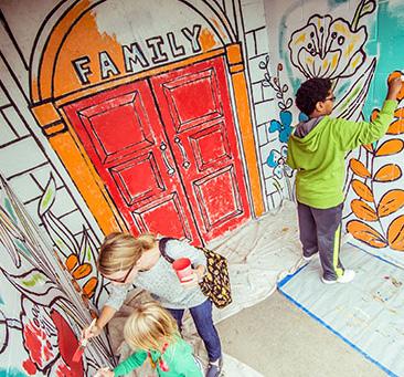

APPROXIMATELY $50K TO IMPLEMENT


A WAYFINDING STRATEGY GUIDE FOR THE CENTRAL OHIO GREENWAYS FINAL | MARCH 2024 224
Springboard for the Arts
Jon Reynolds Jeffie Brewer
Source: Jeffie Brewer
Source: Teacher Tom
Source: Matt Evans
Source: ARCH20 Joan Mitchell Foundation
The Rumba, Jack Mackie Matt Evans
Snowcone, Diana Koncan & Lily Jeon Sun Sails, Rachel Hayes
APPROXIMATELY $100K TO IMPLEMENT
APPROXIMATELY $500K TO IMPLEMENT

Source: The Guardian

Source:@womensart1
Source: Audubon Great Lakes

APPROXIMATELY $250K TO IMPLEMENT

Source: Vivienne Mackie

Source: Jonathan Hillyer
APPROXIMATELY $1–2M TO IMPLEMENT

Source: inhf.org
Source: NPR: travelinspiredliving.com

225 7.0 STRATEGY 4: PUBLIC ART & OTHER CREATIVE AMENITIES
Do Not Mistake Our Softness for Weakness, Shasti O’Leary Soudant
The Muse of Discovery, Meg White Los Trompos, Héctor Esrawe & Ignacio Cadena
Sixteenth Ave Tiled Steps, Aileen Barr & Colette Crutcher
Field of Corn, Malcolm Cochran Little Bibbi, Thomas Dambo
The High Trestle Bridge, RDG Dahlquist Art Studios
The Van Gogh Trail, Daan Roosegaarde
Locating Creative Elements at Specific Junctures
RECOMMENDATION 1
Locate public art and other creative elements at gateways, decision points & transition zones whenever possible.
Placing creative elements strategically can at once increase the visual and emotional appeal of a trail, and improve its navigability. These should therefore be situated whenever possible at trail gateways (i.e., trailheads and other access points), decision points (i.e., intersections of two or more trails), and transition zones (i.e., places where a route goes from trail to road).
Creative elements do not replace the need for maps and signs, but can increase their efficacy when located alongside them. Giving the creative treatment to known tricky spots allows people to make mental notes of how they should handle them, and provides
a convenient waypoint for verbal directions. For example, after missing a turn, a trail user might say to themselves, “When I see the obsidian monolith, I need to prepare for a sharp turn to the left.” Or when a trail user asks for directions, a Trail Ambassador might say, “Keep heading this way until you pass over the light bridge, then take the first right and continue on.”
That said, creative amenities typically offer something worth lingering over, whether interactive elements or curious features. There should be ways for people to enjoy each piece at leisure, such as places to safely pull out of the flow of traffic and shaded benches to sit on.
A WAYFINDING STRATEGY GUIDE FOR THE CENTRAL OHIO GREENWAYS FINAL | MARCH 2024 226
ACTION ITEMS
1.1
INSTALL PUBLIC ART AT TRAIL GATEWAYS.
Give trailheads a unique identity by installing community-inspired public art pieces at each of them.
Include public art in any plan to build a new trailhead, so that it is factored into its design and capital budget.
Augment the public art with other creative elements that allow people to appreciate or interact with it.
1.2
INSTALL CREATIVE ELEMENTS AT TRAIL DECISION POINTS
Place public art or other creative elements at sites where a trail user might be confused about which direction to take to follow their chosen route. Use permanent installations so that people come to count on them as navigational guideposts.
1.3
INSTALL PAVEMENT MARKINGS AT TRAIL TRANSITION ZONES.
Use creative pavement markings, when possible, to alert a trail user that they have exited the trail onto a on-road section of the route, or that they are at an intersection of the trail and road. For routes with long on-road portions, mark each intersection to confirm for trail users that they remain on the correct path.
227 7.0 STRATEGY 4: PUBLIC ART & OTHER CREATIVE AMENITIES

Looking for the Astronaut Dog
This vignette, in a Washington Post article describing upcoming changes to the Metro’s wayfinding system, perfectly captures how public art can support trail users’ ability to navigate.
“A customer survey showed 39 percent of registered SmarTrip users took a wrong rail station exit in the past year. Nearly 30 percent of respondents told Metro they have used the wrong platform, while 23 percent said they boarded a train going in the wrong direction. Seventeen percent of riders said they have taken the wrong line.
Among them was Sandra Pape, who exited the Metro earlier this year — fresh off a flight from Alabama — and began looking for her D.C. hotel. She had left the wrong end of the L’Enfant Plaza station and quickly got lost in a labyrinth of brutalist buildings.
On a return trip this week with her sister, Pape used a large mural of a dog in a NASA spacesuit above an exit as a signpost. “We look for the Weimaraner in the spacesuit,” she said.”1
1 George. “Metro tests new signage.”
Space Set, William Wegman
Source: The Washington Post
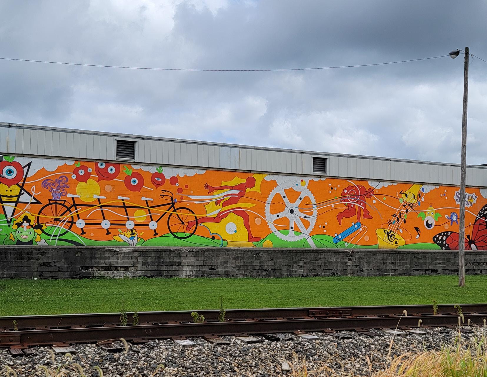 Source: Urban Decision Group
Moovin’ and Groovin’, Roger J. Williams
COG-branded crosswalks such as these could enhance crosswalk safety and keep people on a route that has diverged from a trail. Though creative crosswalks are still being studied in the U.S. and are not widely approved for major roadways, the treatment should be applied when possible (for example, when a trail crosses a private parking lot driveway).
ON-ROAD

ON-ROAD SEGMENTS OF THE OHIO TO ERIE TRAIL LEGEND
The places indicated in maroon on this map are those where the Ohio to Erie Trail route is on-road.
= 6 mi.
ROUTE SEGMENTS 1”
Locating Creative Elements
Along a Route
RECOMMENDATION 2
Use creative elements as route confirmation cues whenever possible.
Various types of creative elements, revealed at just the right moment, can reassure trail users that they continue to travel on the correct path. In particular, many trail managers have found that a creative application of color, lighting, design, and repetition provides trail users with visual cues that allow them to settle in and enjoy their journey. On some trail segments, pavement markings, lighting, and/or site furnishings are of a particular color (for example, the
rainbow bike path at Utrecht Science Park). On others, the trail or nearby trail communities are acknowledged with specially designed sign post attachments (for example, the Cultural Trail in Indianapolis, IN). Still others feature the same, or similar, artistic elements throughout (for example, the Johnny Cash Trail in Folsom, CA). These types of interventions can be relatively low-cost and high-impact, and they have the potential to serve both artistic and functional needs. After all, a trail in need of lighting may as well use colorful glow-in-the-dark paint and LED lights to enhance trail users’ experience!
A WAYFINDING STRATEGY GUIDE FOR THE CENTRAL OHIO GREENWAYS FINAL | MARCH 2024 232
ACTION ITEMS
2.1
CONFIRM ROUTES USING COLOR, LIGHT, DESIGN & REPETITION.
Repeat creative elements along a trail segment to indicate that it constitutes a continuous route. Install creative, colorful lighting and site furnishings so that functional elements become notable and contribute to overall system coherence.
2.2
INTRODUCE NEW ROUTES WITH TEMPORARY INSTALLATIONS.
Avoid temporary creative elements in tricky wayfinding spots at which people need a consistent waypoint, but consider short-term installations as a way to entice people into new trail segments so that they can learn how they work and where they go.

Artist Virginia Kistler’s “Zoetrope of Life” adorns utility posts throughout the Italian Village in Columbus, defining the neighborhood with similar, repeating creative elements.


233 7.0 STRATEGY 4: PUBLIC ART & OTHER CREATIVE AMENITIES
Source: Designing Local

Source: MLive.com
Graffiti Rocks at the University of Michigan
Source: The Michigan Daily


A unique approach to trail confirmation emerged from a stakeholder conversation with teens from Columbus’ northeast neighborhoods, through the organization Remember Us Urban Legends, who indicated they’d like to see graffiti and spray paint art along the trails (as well as the Mona Lisa, vampire- and gorilla-themed art, and bird houses...). Placing large boulders along an urban trail and designating them “Graffiti Rocks” for community members to paint at will could be a way to simultaneously appeal to young people and provide those who might otherwise do harm a sanctioned, constructive outlet for expression. The rocks would offer ever-changing visual interest and a unique way to let people know they remain on the right path, at almost no cost.
Source: mfophotos (Flickr)
A WAYFINDING STRATEGY GUIDE FOR THE CENTRAL OHIO GREENWAYS
A graffiti rock at the University of Michigan, in Ann Arbor’s George Washington Park, is frequently repainted with different themes.

Source: Designing Local
An “Eerie-Sistable” Sticker Scavenger Hunt

Erie, Colorado opted to gamify their public art plan’s public engagement process with 30 spooky Halloween stickers and two 6-foot posters distributed throughout the town for people to seek and find. Each artistdesigned sticker was paired with a QR code linking people to the plan description and requesting that they take a survey about their public art preferences. The project was just a few thousand dollars to implement, and created a community buzz that generated widespread excitement about the plan. A similar effort to introduce a new route or trail segment is one way to effectively use temporary public art on a trail.
Source: Designing Local
235 7.0 STRATEGY 4: PUBLIC ART & OTHER CREATIVE AMENITIES
Adam Brouilette
Ensuring Representative Pieces
RECOMMENDATION 3
Ensure all creative elements are representative of trail-adjacent communities and express the distinct personality of those places.
People often intuit where they are based on how a place feels, whether they can articulate why or not. Creative elements therefore work best to reinforce wayfinding when they are authentically of the places in which they’re located. Prioritizing local sourcing and community engagement can help ensure trailbased creative elements effectively create a sense of place for trail users. It won’t be possible to place representative creative elements on trails without involving the community in its creation and/or curation. A community-oriented process is more resourceintensive than a top-down approach, but pays off in the extent to which a community embraces the trail and feels welcomed by it.

A WAYFINDING STRATEGY GUIDE FOR THE CENTRAL OHIO GREENWAYS FINAL | MARCH 2024 236
Source: Urban Decision Group
Lady Wisdom, Sarah Hout
ACTION ITEMS
3.1
HIRE LOCAL CREATIVES AND BUY SUPPLIES & EQUIPMENT LOCALLY.
Buy materials sourced and sold locally if possible, and hire local artists if the required expertise exists within the community.
3.2
INSIST ON EQUITABLE SOLICITATION PROCESSES.
Stipulate within any process to engage arts professionals that underrepresented artists, particularly artists of color, are highly encouraged to apply. Provide all artists with compensation for their concepts, to ensure that all can afford the time it takes to prepare them for submission.
3.3
INVOLVE COMMUNITY MEMBERS IN THE CURATION & DEVELOPMENT OF CREATIVE ELEMENTS.
Ensure that any curation committee is representative of its neighborhood. Create art using a participatory process if possible.
3.4
CONDUCT IDEATION SESSIONS THAT ELICIT WHAT THE COMMUNITY WANTS FROM ITS ART.
Invite all community members to places they would naturally go, at a time convenient to them (with free food and child care), to discuss the types of artistic themes, content, and styles that would inspire them.
237 7.0 STRATEGY 4: PUBLIC ART & OTHER CREATIVE AMENITIES


London Community Mural Project
In 2019, the Friends of Madison County Parks and Trails, in partnership with MATCO Services, began developing plans for a trail user welcome area on the east side of London, Ohio. The idea was to create a multi-panel mural installation using the 16 bricked-in windows of an old title factory building MATCO Services owns on Roberts Pass Trail. As more community members became involved, plans expanded to include a minipark at the site — and people stepped up to support the plan with new ideas, donations, and sweat equity.
Local artist Clay Hurley created digital images of various scenes from London and Madison County’s history, from prehistoric times (with a woolly mammoth) to modern day. FMCPT then had Hurley’s images enlarged, transferred to vinyl, coated, and hung alongside brass plaques that explain them. Trail users and others are able to enjoy the art on benches surrounded by landscaping with native plants, or by getting up close on the walking path alongside them.1
1 Zurbrick. “Mural series completed.”
Source: Jody Dzuranin.
Source: Madison County Friends of the Parks and Trails
PUBLIC ART
HOW CAN WE ENSURE THAT PUBLIC ART ON OUR TRAILS
REFLECTS WHAT THE GENERAL PUBLIC WOULD LIKE TO SEE?
Engagement
Hire local artists
Involve them in the curation
Broad social media campaign or contest to gather ideas
Work with Columbus Arts Commission
Representation
Make sure the art is LOCAL. By a local artist and representing the community it is placed in. Make it something locals associate with and take pride/ ownership in.
Pay them real money
Engage with local art-focused groups
Council to select
Ensuring the art has longevity
Ensuring the artists have experience doing public art
Learn from a public art process, i.e., Dublin
Reach out to art classes at schools or community centers for participation
239 7.0 STRATEGY 4: PUBLIC ART & OTHER CREATIVE AMENITIES
Planning for Creative Interventions
RECOMMENDATION 4
Track sites throughout the region that would be appropriate for creative interventions and make a plan to work through them.
With hundreds of trail sites that could benefit from creative elements, innumerable creative options — both public art and otherwise — and a wide array of funding opportunities to pursue, it is critical that a methodical approach is taken to the implementation of artistic elements throughout the system. As noted, the foremost sites to evaluate will be those located at trail gateways, decision points, and transition zones, though trail segments should also be considered. Not all will be appropriate for creative elements, but those that are can be prioritized and included in funding requests accordingly. New-build trails and facilities, meanwhile, should default to incorporating public art and other creative elements into their plans to ensure the sites accommodate them. Professional assistance is available as necessary to identify proper sites, creative interventions, and funding mechanisms.

A WAYFINDING STRATEGY GUIDE FOR THE CENTRAL OHIO GREENWAYS FINAL | MARCH 2024 240
Source: Ennis-Flint
ACTION ITEM
4.1
MAINTAIN AN ONGOING LIST OF CREATIVE ELEMENT OPPORTUNITIES
Using the maps in this chapter as a starting point, identify sites with known wayfinding challenges and/ or a dearth of public art or other creative elements.
Prioritize and track these sites, and begin assessing the feasibility of funding and installing creative elements at them over time.
241 7.0 STRATEGY 4: PUBLIC ART & OTHER CREATIVE AMENITIES
 Source: Central Ohio Greenways
Chapter 7 Takeaways
1
UNDERSTAND WHAT PUBLIC ART IS AND IS NOT.
Public art is a specific type of creative element that must be understood and treated differently than others. There may be special rules that govern how it is funded, created, installed, maintained, and deaccessioned.
2
LOCATE CREATIVE ELEMENTS STRATEGICALLY.
While creative elements should be in as many places as possible, locating them at wayfinding problem spots is a creative way to help trail users find their way.
3
BE RESOURCEFUL WHEN SOURCING CREATIVE ELEMENTS.
There are creative elements to fit all budgets, and many communities have successfully garnered in-kind support when they’ve brought engaged citizens to the planning table.
4
BE INTENTIONAL ABOUT REPRESENTATION.
Creative elements should be born of a robust community engagement process in order to authentically express the values and personality of those who live near them.
243 7.0 STRATEGY 4: PUBLIC ART & OTHER CREATIVE AMENITIES
8.0

STRATEGY 5: TRAIL
AMBASSADORS & TRAIL TOWNS

“Trail Ambassadors” is a broad term encompassing all the many people involved in helping trail users find their way. Because trail users often solicit information from locals — recommended destinations, directions, and comfortable routes, for example — it makes sense to regard these people as the vital trail wayfinding resources they are. This chapter explores ways to cultivate this human infrastructure and advance wayfinding support for trail users within trail-adjacent communities, using community profiles as inspiration.
Source: Central Ohio Greenways
How Trail Ambassadors
Facilitate Wayfinding
Trail Ambassadors will be the social support for trail users within trail-adjacent communities that help them find their way.
WAYFINDING PRINCIPLES IN ACTION
Trail Ambassadors can anticipate trail users’ needs by providing them the right assets and information at the right time.
Trail Ambassadors can help trail users connect with the communities they are passing through by giving them multiple reasons to engage with the people and the place.
Trail Ambassadors can make a trail experience memorable by being fun, kind, and resourceful trail guides.
A WAYFINDING STRATEGY GUIDE FOR THE CENTRAL OHIO GREENWAYS FINAL | MARCH 2024 246
Leveraging the Social Aspect of Wayfinding
RECOMMENDATIONS
1
Cultivate Trail Ambassadors who will engage with trail users and help them find their way.
2
Work with regional partners to define & implement a Trail Towns program in Central Ohio.
247 8.0 STRATEGY 5: TRAIL AMBASSADORS & TRAIL TOWNS
 Source: Central Ohio Greenways
Leveraging the Social Aspect of Wayfinding
CURRENT CONDITIONS
This chapter deals with the human infrastructure necessary to support trail users — because wayfinding strategies don’t have to be confined to the impersonal. Wayfinding is a social activity! Creating opportunities for trail users to interact with locals and fellow travelers is a smart way to help them figure out where to go and how to get there. Herein, someone who directly interacts with trail users to provide them the information and resources they need for an exceptional trail experience is referred to as a Trail Ambassador. Each community along the trail has Trail Ambassadors — trail friends volunteers, library staff, park rangers, pizza shop owners, and many others. At this time, however, there is no widespread, coordinated effort to cultivate current or potential Trail Ambassadors, or to create a network of them, along the Ohio to Erie Trail study segment.
Trail Towns is a designation program that denotes a town’s official commitment to the trail that runs through it. In areas of higher density, in which the boundaries of a trail-supporting entity are murkier, it may be more accurate to refer to Trail Communities; however, within this guide, “Trail Towns” should be understood as applying in all contexts. Within Ohio, the North Country Trail Association and the Buckeye Trail Association operate Trail Towns programs, but neither operate in the 4-county study region. At this time, there are no designated Trail Towns along the study corridor (though a number of communities already function in a similar capacity).
249 8.0 STRATEGY 5: TRAIL AMBASSADORS & TRAIL TOWNS
TRAIL TOWNS
HOW CAN WE SUPPORT FOLKS FROM TRAIL COMMUNITIES TO OFFER WAYFINDING INFORMATION?
Engage local artists
Create events
Social media campaign
Videos showing community
Trainings
Work with local businesses
Printed maps
Table at community events
Provide info kiosk templates
Make required to designate
Customize to their needs

A WAYFINDING STRATEGY GUIDE FOR THE CENTRAL OHIO GREENWAYS
Source: Central Ohio Greenways
A lack of trail friends groups shows, through the accumulation of trash and the overall appearance of a lack of care. There becomes a lower perception of the trail that compounds when visitors post comments, photos, and videos showcasing its deteriorated state.
JODY DZURANIN Executive Director, Ohio to Erie Trail

The Special Role of Trail Friends
Trail friends organizations, staffed by volunteer trail stewards who fill critical gaps in municipal capacity, occupy a special place within the trail ecosystem. With tireless commitment, these groups have advocated for and funded the construction of many miles of trails throughout Ohio, and worked to maintain them over many years — cutting back vegetation, installing and repairing infrastructure, creating signs, clearing debris, and more. This is a time of transition for these organizations. Trail networks are reaching completion and volunteers are aging; trail friends must pivot to new purposes and employ different means of engagement than they have before. Some have transitioned from building trails to adding amenities, while others have created new positions focused more on marketing and trail user engagement than physical infrastructure. As these organizations evolve, and if they are to survive to serve a new generation of trail users, it will be critical to support them in attracting new volunteers and doing business in new ways. This is important work, as there are few organizations better positioned to coordinate Trail Ambassadors within local trail communities.
251 8.0 STRATEGY 5: TRAIL AMBASSADORS & TRAIL TOWNS
Source: Central Ohio Greenways
Cultivating Trail Ambassadors
RECOMMENDATION 1
Cultivate Trail Ambassadors who will engage with trail users and help them find their way.
Anyone can be a Trail Ambassador. Any person, whether municipal staff, nonprofit staff or volunteer, business owner, or community resident, can help trail users by providing them the information and resources they need for an exceptional trail experience. This support can take myriad forms, but from a wayfinding perspective, the most important thing a Trail Ambassador can do is be available, approachable, and knowledgeable about local trail conditions, off-trail destinations, and comfortable routes. For practiced Trail Ambassadors, this way of being is likely a given. For newer ambassadors, there may be much to learn. Regardless, all Trail Ambassadors can benefit from participating in opportunities for idea sharing, education, community, and resource development to help them better help trail users.

A WAYFINDING STRATEGY GUIDE FOR THE CENTRAL OHIO GREENWAYS FINAL | MARCH 2024 252
Source: Central Ohio Greenways
ACTION ITEMS
1.1
HELP TRAIL AMBASSADORS NETWORK & SHARE INFORMATION.
Create occasions for Trail Ambassadors to meet, get to know one another and their communities’ resources, and exchange ideas for trail user engagement.
This could be in the form of an annual conference, monthly video calls, quarterly “(trail) town hall” events, trail tours on bike or foot, informal conversations at the local trailhead, or any other platform that gets people interacting. Topics could include trail history, trailadjacent destinations and how to comfortably get to them, the broader trail network and where it can take someone, trail user engagement strategies, the Trail Towns commitment and benefit, and local resources for trail users.
1.2
PROVIDE WAYFINDING MATERIALS FOR DISTRIBUTION.
Ensure that everyone in a position to help trail users has printed maps to distribute, or a business card or postcard with a QR code linking to trail information.
1.3
CREATE OPPORTUNITIES FOR INTENTIONAL TRAIL USER ENGAGEMENT.
Offer creative ways for Trail Ambassadors to interact with community members and trail users that invite conversation about the types of experiences that can be accessed from a trail and how to locate them.
253 8.0 STRATEGY 5: TRAIL AMBASSADORS & TRAIL TOWNS
Knox County
COMMUNITY PROFILE
The Knox County Convention and Visitors Bureau in Mount Vernon, Ohio, which serves as a trailhead along the Ohio to Erie Trail, is an example of a social space that facilitates wayfinding. Staff there are attuned to trail users’ needs, and ready with directions, lunch recommendations, and other support as needed. They are also working to improve after-hours support with better exterior lighting and 24/7 restrooms.
The Knox County Convention & Visitors Bureau is located at the CA&C Visitor Center in the heart of Knox County. Having our information center, office, and public restrooms along the Heart of Ohio and Kokosing Gap Trail is a great asset to the community. Visitors and community members look to our location to help them navigate their journey through the county.
By providing trail maps, points of interest brochures, and general information about our region, we offer a welcoming environment for visitors on the trail to take a moment to rest, recharge, and decide how they’d like to continue their adventure.
TOTH Marketing Manager, Knox County Convention and Visitors Bureau
A WAYFINDING STRATEGY GUIDE FOR THE CENTRAL OHIO GREENWAYS FINAL | MARCH 2024 254
OLIVIA
 Source: Knox County Convention & Visitors Bureau

Source: Black Women in Nature
Black Women in Nature
COMMUNITY PROFILE
Black Women in Nature is a nonprofit organization in Central Ohio centered on helping Black Women improve their overall wellbeing, build sisterhood, and reconnect to their ancestral roots by exploring the outdoors, often on trails. Many of the women have never spent time in nature, in part because they have not felt safe or represented in outdoor spaces. Hiking the trails among a community of peers, with leaders who have planned and vetted a safe route beforehand, gives them confidence to enjoy and replicate the experience on their own.
Understanding how to read trail maps takes time and consistency. If you aren’t familiar with them, it can be a huge barrier to accessing trails. We always make a point of scouting before leading a group hike. This helps increase our comfort and ability to navigate trails. Now we see more Black women who may not have been as familiar using trails, with the confidence and knowledge to safely enjoy them while reaping the holistic benefits of the outdoors.
257 8.0 STRATEGY 5: TRAIL AMBASSADORS & TRAIL TOWNS
ANGELA MILLER Co-Founder, Black Women In Nature
Heart of Ohio Trail Friends
COMMUNITY PROFILE
The Heart of Ohio Trail trail friends organization recently added a new board position — Volunteer and Community Engagement Coordinator. As their trail reaches completion, the organization is working to develop a larger pool of volunteers to call on for trail maintenance and beautification. As part of that effort, Lucinda Miller frequently rides the trails and invites people into conversation about where they’re going and whether they need anything. She’ll position herself on a bench near the Centerburg selfie station and offer to take trail users’ pictures there, then ask them about their journey. If they’re local, she’ll invite them to volunteer alongside her.
Caring for a trail on behalf of its users is an important job, and it takes people to make it happen! One of the best ways I know to grow our community of Trail Friends and Trail Ambassadors is simply to be on the trail…whether sitting at the Midpoint of the Ohio to Erie Trail Selfie Sign in Centerburg offering to take users’ pictures, or riding or walking on the trail talking with people. I want everyone to know they, too, have opportunities to give back to their fellow trail travelers by volunteering to help keep our trail the great resource that it is.
LUCINDA BERRY-MILLER, PH.D. Board Member, Heart of Ohio Trail Friends
A WAYFINDING STRATEGY GUIDE FOR THE CENTRAL OHIO GREENWAYS FINAL | MARCH 2024 258
 Source: Lucinda Berry-Miller, Ph.D.
Becoming a Trail Town RECOMMENDATION 2
Work with regional partners to define & implement a Trail Towns program in Central Ohio.
In 2007, The Progress Fund, a nonprofit Community Development Financial Institution serving Pennsylvania, West Virginia, and Maryland, created the Trail Town Program to help revitalize communities along the Greater Allegheny Passage through outdoor recreation and small business development. Since that time, the program has grown beyond the GAP to more than 150 towns in the U.S. and Canada, and more than half of U.S. states. In 2021, the COG Board hired Amy Camp, a Trail Towns consultant and author of “Trail Towns: Deciding on Trails,” and Toole Design, a firm devoted to improving conditions for walking, biking, and transit, to create the Central Ohio Trail Towns Framework. A follow-up effort in 2023 considered how a Trail Towns program might differ when applied in a suburban or urban context, as opposed to a rural
context as it has been historically. The COG Board has now established a Trail Towns Working Group to further explore what a Trail Towns program might look like in Central Ohio.
Becoming a Trail Town is a laudable goal for any community, but Trail Towns is not a rubber stamp program. Trail users have come to expect a level of service and welcome from a place when they see a Trail Towns sign, and any incongruous experience threatens the program’s brand reputation. Building community support for a long-term Trail Towns commitment is critical to ensure that all framework elements are addressed and sustained over time. COG is carefully developing a Trail Town effort that is sustainably resourced and supported at the local, regional, and state levels, which means the program may take some time to fully launch.
A WAYFINDING STRATEGY GUIDE FOR THE CENTRAL OHIO GREENWAYS FINAL | MARCH 2024 260
ACTION ITEM
2.1
HELP EDUCATE COMMUNITY MEMBERS & LEADERS ABOUT THE TRAIL TOWNS OPPORTUNITY.
Participate in efforts to define Central Ohio’s Trail Town program, then ensure that community members and leaders are aware of the opportunities available through it.
‘Trail Towns’ is both an investment and an attitude. To be a trail town is to pay attention to trails, to invest in them, and make a concerted community-wide effort to improve trail-to-town connections.
AMY CAMP Owner, Cycle Forward
261 8.0 STRATEGY 5: TRAIL AMBASSADORS & TRAIL TOWNS
 Source: Athens County Library
Athens County Library
COMMUNITY PROFILE
The Athens County Library system’s “Book-a-Bike” program pioneered free, library-based bike rentals in the State of Ohio — and was one of the nation’s first such programs in 2013. The library loans out various types of bicycles and locks, making bicycling accessible to all residents of Athens, Glouster, The Plains, Nelsonville, Chauncey, and Albany so that they can better utilize the county’s robust trail system. Though not the original intention of the program, a positive side benefit is that the process of renting a bicycle provides an opportunity for library staff to interact with patrons on a range of topics, among them possible destinations and routes to them. To facilitate these conversations, staff have developed printed materials that they distribute to help trail users find their way.
The Book-a-Bike program is one of our most highly visible and popular programs, providing access to bicycles for pleasure, wellness, and transportation, whether patrons don’t have access to bikes themselves or they’re wanting to share the biking experiences we have in our region with friends and family from out of town. The program gives us an opportunity to connect interested patrons to the valuable resources available in our community without having to make a significant investment themselves.
NICK TEPE Executive Director, Athens County Library
263 8.0 STRATEGY 5: TRAIL AMBASSADORS & TRAIL TOWNS
Friends of Madison County Parks & Trails
COMMUNITY PROFILE
The Friends of Madison County Parks and Trails (FMCPT) is a non-profit organization staffed by an allvolunteer team dedicated to supporting the Madison County Park District and the City of London. Their primary goal is to complete and maintain the critical link of the Ohio to Erie Trail through Madison County, but they have also innovated to develop a campsite along their trail that provides a perfect pretext for interacting with trail users. A campsite greeter from the group, wearing a fluorescent shirt identifying them as a trail volunteer, welcomes every camper and provides them with a feedback card on which they can share where they’ve come from, where they’re going, and anything about the campsite or trail they think is worth mentioning. Through in-person conversation and anonymous feedback forms, trail users can both get their needs met and provide the Friends useful information on what might need their attention.
Trail Friends groups help drive trail development, improvement, use, and care. They leverage available resources to help develop and maintain safe, trailfriendly, and scenic experiences for trail users. Such groups help trail users feel welcomed, provide local information while promoting their local community to trail tourists, and drive happier trail experiences for all.
A WAYFINDING STRATEGY GUIDE FOR THE CENTRAL OHIO GREENWAYS FINAL | MARCH 2024 264
THE FMCPT BOARD
 Source: Friends of Madison County Parks and Trails

Source: Central Ohio Greenways
Chapter 8 Takeaways
1
IDENTIFY OUTREACH PARTNERS.
Determine who is already doing the work of outreach to Trail Ambassadors, or who is best positioned to take it on, and invite them to participate in a broader, more coordinated effort.
2
CREATE A TRAIL AMBASSADORS NETWORK.
Invest in strategies that develop Trail Ambassadors’ capacity to engage trail users, in particular shared opportunities for education, networking, and resource development.
3
HELP ESTABLISH THE CENTRAL OHIO TRAIL TOWNS PROGRAM.
Support MORPC’s efforts to develop a Trail Town program and help spread the word about it.
267 8.0 STRATEGY 5: TRAIL AMBASSADORS & TRAIL TOWNS

WAYFINDING PROGRAM EVALUATION 9.0

Trail counts are the most effective way to measure the impact of wayfinding and other trail improvement interventions — all of which are made in an attempt to attract more people to the trails. This chapter discusses how to place trail counters to collect the most useful data and how to use that data for further wayfinding enhancements. Source:
EcoCounter.com
Evaluating Wayfinding Interventions
The goal of this plan, as outlined in Chapter 2, is to improve trail wayfinding such that all Central Ohio Greenways users feel secure, exploratory & inspired on their journeys. To some extent, determining whether this goal has been achieved will only be possible with survey instruments, trail user interviews, and focus groups, and these methodologies should be explored. But because this goal is in service of a larger one — getting more people to use trails more often — simply counting trail users can provide insights into whether wayfinding improvements are having the desired effect. Trail user counts are less resourceintensive than other methods, and have the benefit of assessing what people do, as opposed to what they feel or say they will do.
It is reasonable to assume that effective wayfinding interventions, even seemingly minor ones, could lead to increased trail activity in the vicinity of the changes. For example, one can imagine how the addition of a nearby destination to a single Wayfinding Sign in each direction of travel could increase the number of people
exiting the trail to visit it. This information would be captured by permanent trail counter(s) installed at the trail access point for that destination.
Trail counters are best suited to evaluating directional wayfinding interventions that change how people are traveling, and less suited to evaluating orientation- and continuation-focused interventions that keep people on the same path. Such improvements may indeed make people feel more confident and increase trail use, but because increases in trail use can be attributed to too many factors, trail counter data alone would not suffice to tell this story.
Data managers hoping to evaluate wayfinding or other trail interventions using trail counts should keep regular “field notes” to track possible confounding variables that have occurred during the period of data collection; all counts should further be cross-referenced against weather patterns.
A WAYFINDING STRATEGY GUIDE FOR THE CENTRAL OHIO GREENWAYS FINAL | MARCH 2024 270
WAYFINDING INTERVENTIONS IN THIS GUIDE
TRAILHEADS
Naming and classifying trailheads
Building new trailheads
Using public facilities as trailheads
Upgrading trailhead amenities
Adding trailheads to wayfinding signs
Improving the quality of information on kiosks, maps, and signs at trailheads
SIGNS & MAPS
Modifying signs to provide better wayfinding information
Adding destinations and distances to all Wayfinding and Trail ID Signs
Placing “to-trail” signs in the public right-of-way whenever possible
TECHNOLOGY
Ensuring all trail access points are included on routing apps
Employing QR codes to link to information about trail-adjacent destinations and amenities
Creating a publicly available route repository
Making COG’s bikeways map more user-friendly
CREATIVE AMENITIES
Placing public art and other creative amenities at trail decision points and transition zones
Using creative elements to affirm the continuation of a route TRAIL
AMBASSADORS
Cultivating a network of people to provide social support for trail users
271 10.0 EASTON CASE STUDY
Trail Count Data
In 2022, MORPC piloted enhanced technology to improve trail user counts in two locations — Olentangy Trail at Northmoor (north of the trail access point at Northmoor Place) and Alum Creek Trail at the Sunbury Road access point. Eco-Counter’s Urban MULTI trail counter was the product selected for this purpose; it has the ability to differentiate between cyclists and pedestrians, determine their direction of travel, and transmit information directly to a client dashboard for real-time data collection. Satisfied that the product worked well and that they could support a regional trail count effort through the Eco-Counter dashboard*, MORPC sought and received multiple grants to install nearly 30 additional counters throughout the region.
Permanent trail counters will provide a baseline for trail use in all of Central Ohio’s weather conditions. With this, it will be possible to conduct analyses of how wayfinding-related interventions — for example, the impact of a Trail Town designation or building a new trailhead — affect trail use over time, simply by noting trail counts before and afterwards and accounting for possible confounding variables (which may include weather conditions; trail-adjacent development; widespread changes in public behavior, for example during a global pandemic; municipal and school calendars; and improved or reduced transit access, among others). Surveys or interviews could be employed to dig deeper into the “whys” of any changes in the number of trail users at a particular site.
*Contact MORPC to discuss participating in this effort.
A WAYFINDING STRATEGY GUIDE FOR THE CENTRAL OHIO GREENWAYS FINAL | MARCH 2024 272

Source: EcoCounter.com
Trail Counter Placement Guidelines
Collecting trail count data to evaluate wayfinding interventions is foremost a matter of selecting appropriate locations at which to install the counters. MORPC has funding to install nearly 27 new permanent trail counters throughout the region. These may replace or supplement outdated count technology now deployed in 24 locations throughout the network.
MITIGATING INTERFERENCE
Proper trail counter siting entails, first, ensuring sensors are not subject to interference by flooding or snowfall, power lines, non-trail traffic, congregating trail users, geographic features, or other disruptive/obstructive elements. Trail count data should be monitored to identify sites registering abnormally low or high trail use, so counter issues can be quickly resolved.
ASSESSING WAYFINDING
To evaluate wayfinding-related impacts on trail use, trail counters should be placed at trail access points, preferably those with major residential developments and/or activity centers nearby — i.e., places with people who can come and go, and reasons for them
to do so. Siting them at these locations can facilitate assumptions about the success of directional interventions in helping people locate, exit, and/or successfully make their way back to a trail.
AVOIDING DOUBLE-AND NO-COUNTS
There are generally two styles of trail access points. Some trail access points are T-shaped, with a single entry point perpendicular to the trail. These can, in theory, have one counter that tracks people entering and exiting the trail, if it can be placed far enough from the corners to avoid counting them both as they approach and after they turn, and far enough from any crowds that may congregate. If this is not possible, counters will need to be placed on either side of the entry runway to capture people going in either direction. Other trail access points are long stretches that run parallel to a trail (for example, those alongside a parking lot or event plaza). These will always require two counters placed at the far edges of where people can enter the trail, to register people headed in either direction but not random, non-trail activity.
A WAYFINDING STRATEGY GUIDE FOR THE CENTRAL OHIO GREENWAYS FINAL | MARCH 2024 274
These sites have in common that they are places where people can enter the trail and have reason to exit the trail for exploration and inspiration. As such, they would be good places at which to locate trail counters.

London Trailhead & Campground
Knox Co Visitors Bureau Howard
Centerburg
Sunbury Historic District
Kenyon College
State St (Westerville)
Grandview Heights / Yard
Broad St @ Georgesville Rd
Galloway Sports Complex
Easton Town Center
Shepard Library Crew Stadium
Holton Community Center
Battelle Darby Creek
COG Trail Segments, Defined
One challenge that has emerged in the collection of trail count data is that, as the trails grow and change, it becomes unclear how they should be defined. Illdefined trails means that data collected on them cannot be compared longitudinally. To consistently report trail count data over time, it is important to have clarity and agreement about where each trail in the system begins and ends. This will further support trail wayfinding by ensuring signs and maps reflect consistent trail names. The team therefore analyzed each COG trail segment — both existing and planned — to assess how they are currently defined and whether that makes sense within the context of the expanding trail network.
The COG Regional Trail Vision includes 22 unnamed segments of trail that, when fully constructed, will operate as distinct trails. In partnership with local stakeholders, COG should assign each of these segments a public-facing name and a color from the COG Wayfinding color palette identified on page 135.
The project team has initiated this process with an exercise that yielded new classifications for many COG trails, and new names and beginning and end points as well, according to the following criteria:
• Trails should go in one primary direction (for example north/south or east/west)
• Trails should be of significant length to avoid short segments that may confuse riders
• Names should reflect a relevant geographic and/or cultural significance of something nearby or along the trail
The trails analyzed for this effort are indicated on the following map.
A WAYFINDING STRATEGY GUIDE FOR THE CENTRAL OHIO GREENWAYS FINAL | MARCH 2024 276

The 22 unnamed trail segments indicated here have been given preliminary names and beginning and end points as a starting point in the conversation about how to define them going forward.

Manchester Evening News
Source:
Chapter 9 Takeaways
1 EVALUATE IMPACT WITH TRAIL COUNTERS.
Permanent trail counters that track trail use over time can be used to assess the impact of various wayfinding interventions.
2 CAPTURE THE MOST USEFUL DATA AT TRAIL ACCESS POINTS.
Place trail counters at trail access points to best assess how wayfinding improvements are impacting trail use behavior.
3 COLLECT OTHER TYPES OF DATA AS POSSIBLE.
Dive more deeply into how trail users are responding to wayfinding interventions with surveys, focus groups, and interviews.
4 DEFINE TRAIL END POINTS.
Commit to what a trail is before analyzing count data to ensure it can be compared over time.
279 10.0 EASTON CASE STUDY
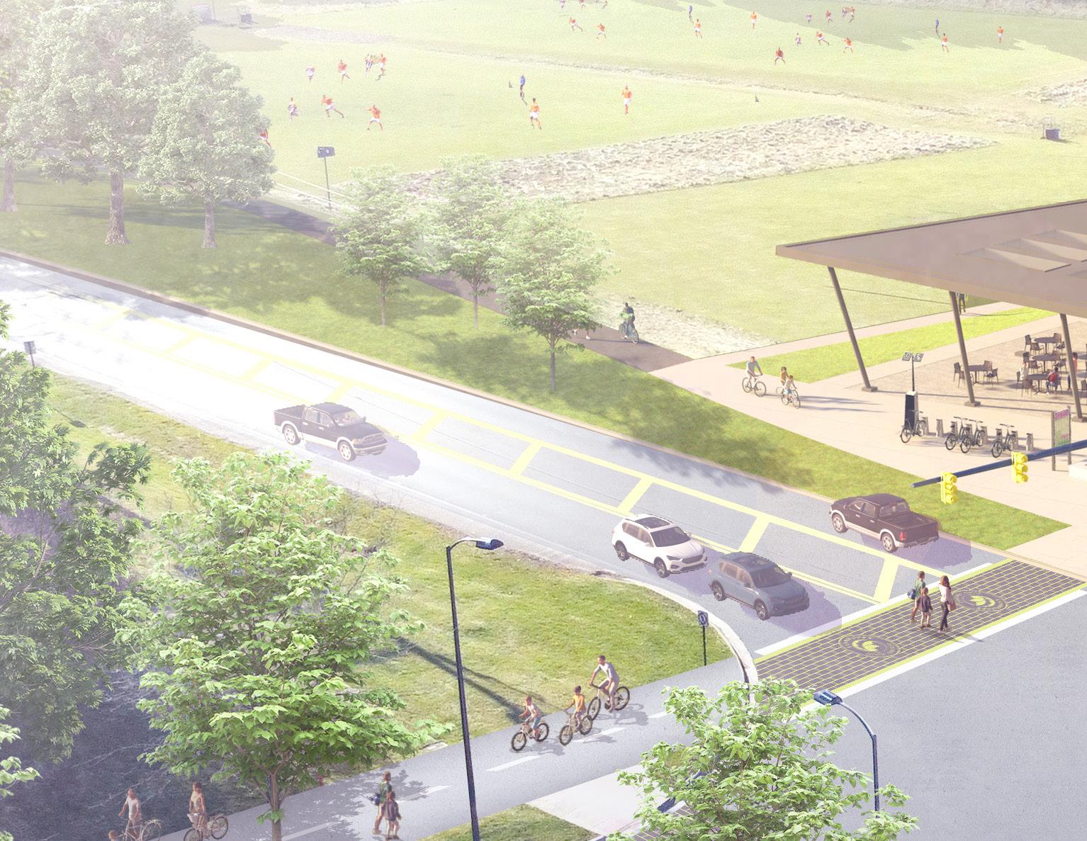
WAYFINDING CASE STUDY 10.0

This guide has detailed five strategies to improve wayfinding along the Ohio to Erie Trail: Trailheads, Maps & Signs, Technology, Public Art & Other Creative Elements, and Trail Ambassadors & Trail Towns. In this chapter, all five strategies are depicted at one site along the Alum Creek Trail, near Easton Town Center, to demonstrate how they can work together to leave trail users feeling truly inspired on their journeys.
A Trailhead to Transform Easton
As the Alum Creek Trail in Columbus, Ohio travels between Morse Road to the north and Innis Road to the south, it passes through the soccer fields of Pathways Park, just a half-mile from Easton Town Center. Easton, as it is known, is a sprawling shopping center with restaurants, hotels, and entertainment, in addition to retail. But trail users are given little notice of its existence or how close it is to the trail.
Conditions at this site, including the potential for a public–private partnership to implement major trail and roadway improvements, may be unique in some ways. However, it is also true that many conditions here are illustrative of those presented throughout this guide. For example, this trail segment suffers from a lack of signage that makes navigating several decision points challenging. There are two unsigned bridge underpasses. There is no trailhead or information kiosk or public art. There is a potential Trail Town nearby,
with no good way to get to it. And even if trail users do make their way to Easton, no signs guide them to bike parking once they’ve arrived, and no businesses explicitly welcome trail users.
This section of the Alum Creek Trail is ripe for redevelopment that thoughtfully connects trail users and the Easton business community. The treatment outlined here employs all the recommendations from this guide to demonstrate how they can transform key sites along the trail. This site plan, then, can be considered the culmination of Central Ohio’s wayfinding strategy — a vision for what is possible when the collective goal is to inspire. Its specific elements may not represent what all communities would find authentic or desirable, but all communities can work towards their version of this plan implementation, to the benefit of all trail users in the Central Ohio region.
A WAYFINDING STRATEGY GUIDE FOR THE CENTRAL OHIO GREENWAYS FINAL | MARCH 2024 282
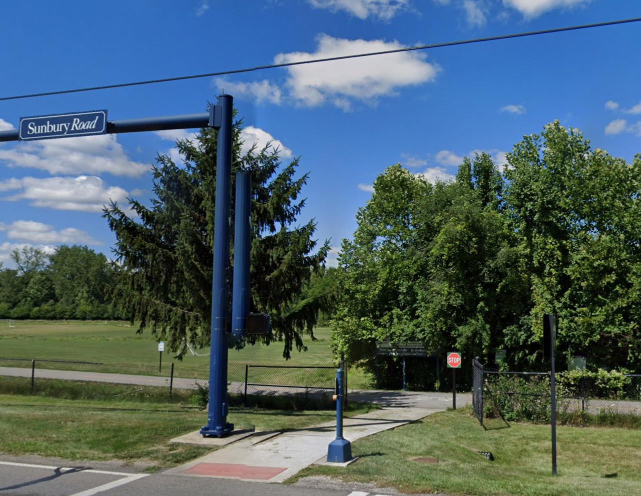
This site at the intersection of Sunbury Road and Easton Way offers soccer fields but little else; because it is in a flood plain, its development potential is limited. However, a premier trailhead in the area now populated with trees could support soccer families and draw new crowds to the area by offering them a unique, exciting destination and connecting them to both the trail and all Easton Town Center has to offer.
StreetView
Source: Google
The Easton Trailhead Master Plan
Many sites along the Alum Creek Trail and within the Easton Town Center shopping area, as well as a major route between the two, were selected for wayfinding interventions in this plan. The blue dots on this map highlight where these improvements are recommended. The following pages show renderings of what each site could look like, and what the experience of encountering them might be, as a trail user travels from south to north, taking an excursion to Easton along the way.

A WAYFINDING STRATEGY GUIDE FOR THE CENTRAL OHIO GREENWAYS FINAL | MARCH 2024 284
Interpretive
Trailhead Development Gateway Feature
Site
Trail Intersection Improvement
Improved Underpass
Roadway Intersection Improvement
Interpretive Site
Gateway Feature

CoGo Station & Bike Hub
Gateway Feature & Intersection Enhancement
Trail Enhancement (Placemaking Elements)
Recommended Route to Easton (Infrastructure Enhancements)
CoGo Station & Bike Hub
Development
Area
Case Study Area Signage Recommendations
Most of the sign typologies delineated in Chapter 5 would be used to adequately sign the Alum Creek Trail and Easton Town Center.
TRAIL ID SIGNS
Two Trail ID signs placed just after Morse Rd and Innis Rd would note the distance to Easton Trailhead.
ROAD SIGNS
The Morse Rd and Innis Rd underpasses would have road signs posted on both sides of the bridges.
TRAILHEAD FACILITY SIGNS
The Easton Trailhead’s main structure would post the trailhead facility sign on both sides, to be visible from the rear parking lot and from Sunbury Rd.
WAYFINDING SIGNS
Two Wayfinding signs, one facing north and the other facing south as trail users leave Easton Trailhead, would provide the distance to several destinations each.
MAP & INFORMATION KIOSKS
Map kiosks would be positioned at the trailhead and also at each Bike Hub location throughout Easton. A digital information kiosk idenitical to those featured throughout Easton Town Center could be placed at the trailhead to provide information on routes to and from the shopping center, where to park bikes during an excursion there, what amenities are available, safety tips, programming alerts, the COG network more broadly, transit stops and schedules, and more.
TRAIL ACCESS SIGNS
Signs along Easton Way, particularly at the intersections of Morse Crossing, Easton Loop W, Easton Square Pl, Chagrin Dr, and Brighton Rose Way, would alert Easton guests of the nearby Alum Creek Trail access.
A WAYFINDING STRATEGY GUIDE FOR THE CENTRAL OHIO GREENWAYS FINAL | MARCH 2024 286

Easton Town Center: A Premier Trailhead Experience

The Easton Trailhead would be unlike anything Central Ohio has ever seen — the first trailhead to bring outdoor recreation, retail, entertainment, public art, mobility options, community programming, and social interaction together in one destination, on a truly grand scale.
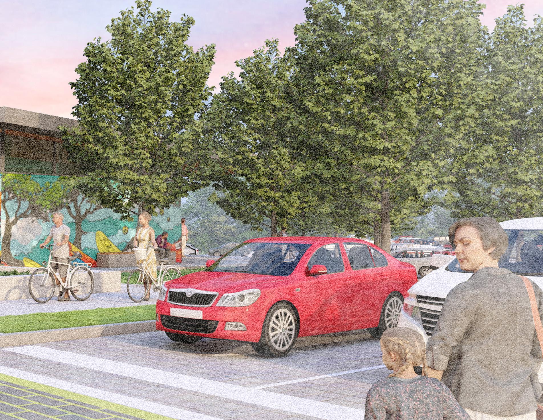
Overall Site Plan

The site is envisioned as a destination that positions people to experience Easton Town Center, but it can also serve as a staging ground for better recreational access to Alum Creek.
Launch Pervious Walking Path Activity Lawn/ Rental Area
Drop-off
Pavilion Area Parking Area (+/- 100 Spaces)
Kayak Lockers Sunbury Road Kayak
Kayak
Repaired Fields Stormwater Basin
Trailhead Detail

Bike Parking Drop-off Area Bike Lockers Entry Sign & Information Kiosk Secured Vending & Concession/Rental Area
(6) Picnic Tables/ Informal Seating CoGo Station
Restrooms
Trailhead Placemaking Recommendations
Placemaking is the task of making a place where people want to be. It is designing a space in which people have things to do, meaningful experiences, and opportunities to see and be seen. Easton Town Center has a reputation for excellence in placemaking, which would no doubt extend to a new trailhead and its grounds. Key placemaking elements in this plan include the artfully designed, multi-functional trailhead shelter; the public art and other creative amenities; the various seating options; the mix of activities to enjoy nearby (soccer, bicycling, roller blading, walking, and kayaking); the creative pavement markings and unique finishings; and the interpretive elements to augment trail users’ experience of nature as they cross both gateway bridges. People linger in places like this. They find excuses to visit places like this. They remember places like this — so they can find their way back more readily next time. The Easton Trailhead, as depicted here, is precisely the type of memorable place a premier trailhead is intended to be.

A WAYFINDING STRATEGY GUIDE FOR THE CENTRAL OHIO GREENWAYS FINAL | MARCH 2024 292
VIEWSHED
Easton Trailhead Southern Approach
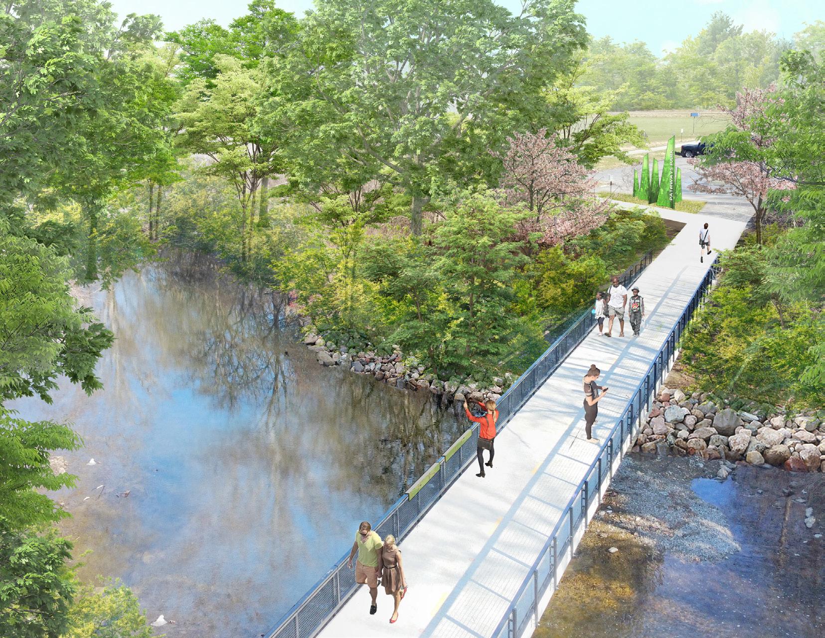
The bridge offers a peaceful transition between the trail and the trailhead. Subtle interpretive signage informs trail users about the natural landscape. A new kayak launch nearby provides another recreational option to draw people to the area.


VIEWSHED
Easton Trailhead Southern Gateway
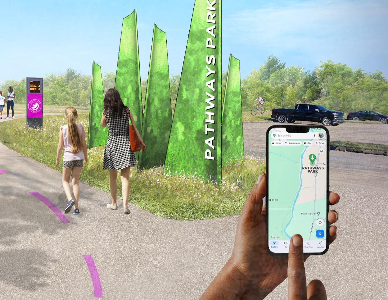
Immediately upon leaving the bridge, a striking gateway feature alerts trail users that there is something different and special about this place. A trail user pulls up an updated wayfinding app to help navigate the space. A digital wayfinding sign in the distance displays the number of trail users that pass by in real time, showcasing to all the trail’s popularity.


Easton Trailhead View From Sunbury & Easton Way

The trailhead is a stunning structure that offers trail users numerous amenities — shelter, concessions and vending machines, movable tables and chairs, restrooms, information, and more.
Easton Trailhead View From the Rear Parking Lot

Vibrant murals announce to guests entering from the parking lot that they are entering a unique place of fun, connection, and enrichment.
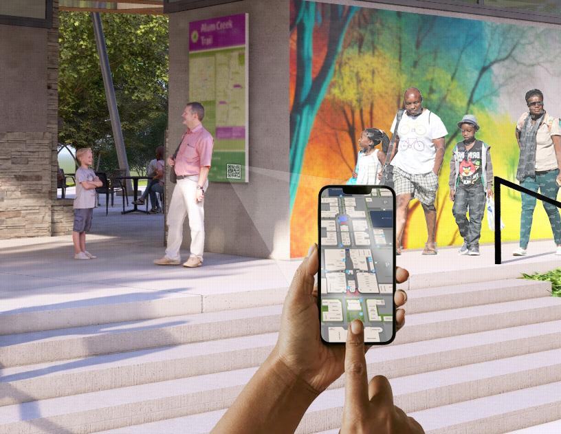
QR Codes posted on sign throughout the trailhead direct people to maps of Easton Town Center and show them how easy it is to take advantage of nearby amenities.


Placemaking Along the Trail at Sunbury Road
People driving by on Sunbury Road note the transformed space and are curious to learn more.
VIEWSHED

Safer Intersections

Creative crosswalks add visual interest, slow traffic, and prioritize pedestrians.
VIEWSHED
VIEWSHED

Easton Trailhead Northern Gateway

A
sculpture akin to that found at the Easton area’s southern gateway bounds the space in a way that trail users find comforting.


Northern Gateway Interpretive Site
Another bridge across Alum Creek welcomes people to the Easton area from the north, again with interpretive signage and natural beauty.
VIEWSHED
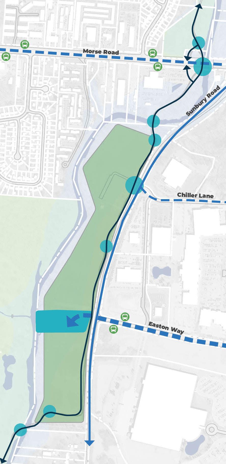
Easton Trailhead Northern Approach

Approaching the Easton area from the north is less confusing with trail signage and pavement markings to keep trail users on the Alum Creek Trail.
VIEWSHED

Northern Approach Bridge Underpass
The bridge is painted with vibrant color and its underpass is lit with colored LED lights. A road sign informs trail travelers of their location within the city. VIEWSHED

An Excursion to Easton Town Center

The site has been transformed into a destination in its own right, but more fun is to be found just a short distance away, at Easton Town Center.

From the Easton Trailhead to Easton Town Center
There are currently two challenging bicycle routes from Pathways Park to Easton Town Center — Easton Way and Chiller Lane. Both roads feature heavy, highspeed traffic for cyclists to navigate as they climb long hills to reach the shopping center, with no supportive infrastructure. A redesign of one or both roadways would be necessary for either of these routes to entice most trail users from the trail into Easton.
A CHILLER LANE ROUTE
A major parking lot serving the park’s northern soccer fields sits directly across from Chiller Lane, which provides a curvy, narrow back door to Easton with no signalization at the intersection and no sidewalks along the route. Given that parking already exists at this location it would be an obvious site for a new trailhead, but for the fact that there is not space along Chiller Lane to easily improve cycling conditions.
AN EASTON WAY ROUTE
Easton Way begins as one lane but soon widens into two, becoming a vast arterial with high-speed
traffic. The road features a narrow sidewalk on each side, but these could not adequately accommodate pedestrian and bicycle traffic were a new trailhead to be developed. However, as the City of Columbus owns the southeast quadrant at Sunbury Rd and Easton Way (making it likely the sidewalk could be widened into a sidepath on the property) and the road beyond that parcel is wide enough for a bidirectional cycle track, this is an ideal route to optimize for trail users hoping to spend time at Easton. The trailhead should therefore be sited at this intersection.*
Once at the shopping center, highly visible bicycle hubs at several locations throughout should be installed to alleviate trail users’ concerns regarding how to access necessary information and amenities, or secure their property, as they explore.
*Locating the trailhead at Sunbury Rd and Easton Way would eliminate the need for another parking lot to the south. This lot could be converted to green space or another soccer field to offset the environmental impact of the new trailhead.
A WAYFINDING STRATEGY GUIDE FOR THE CENTRAL OHIO GREENWAYS FINAL | MARCH 2024 308
Non-Signaled Easton Access Point; Uncomfortable Route

Signaled Easton Access Point; Preferred Route (with Infrastructure Upgrades)
Relocated Parking
Parking Lot to be Re-greened
The only true option to bring cyclists and pedestrians from Easton Trailhead to Easton Town Center is Easton Way, which has the space for necessary infrastructure upgrades and a signaled intersection at Sunbury Rd for safe crossing.
City of Columbus Parcel
High-Comfort Route Along Easton Way
(Condition 1)

Trail users bypass the narrow, hightraffic segment of Easton Way at Sunbury Road with a sidepath that takes them past the new policing station, on land owned by the City of Columbus. A separated path makes the ascent into Easton Town Center far less stressful and strenuous.
Sidepath at Police Substation
High-Comfort Route Along Easton Way
(Condition 2)
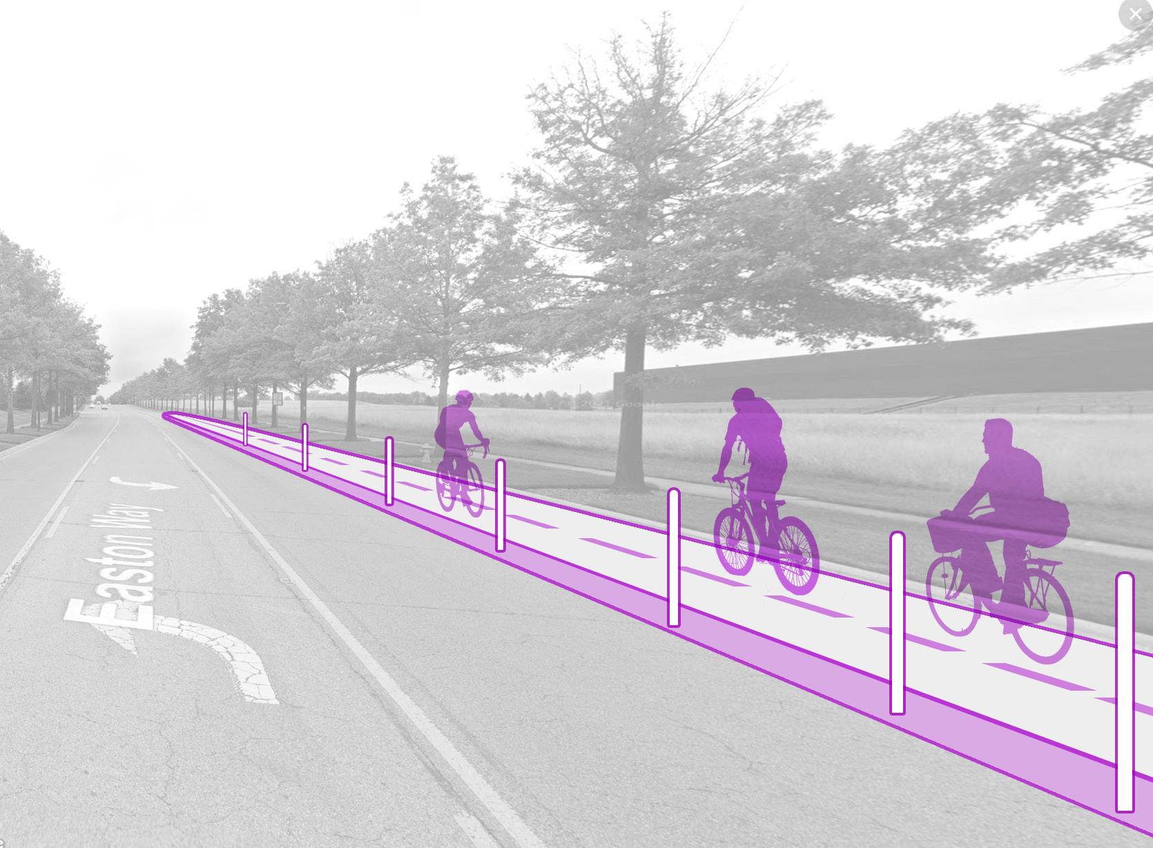
At the driveway to adjacent property, Easton Way widens into an arterial road that would easily overwhelm most cyclists, if not for the new bidirectional cycle track that separates them from motor vehicle traffic.
Track & Road Diet Beginning at Driveway
Protected Cycle
VIEWSHED


Destination Amenities & Social Support at Easton Town Center

Cyclists at Easton Town Center have several dedicated bike parking sites to choose from, each featuring a digital information kiosk, custom-designed bike racks, and CoGo stations for short trips within the shopping center grounds. Trained employees go out of their way to offer trail users resources and information to ease their journeys.
Final Thoughts
With impressive trailhead architecture, landscapedefining public art, trail user amenities, enhanced wayfinding signage, roadway infrastructure improvements, and an exciting destination nearby, the Easton Trailhead case study casts a grand vision for what the trail network in this region can be. Few places along the Ohio to Erie Trail in Central Ohio will be as flashy as this trailhead design, of course, but the good news is they do not have to be. Trails and trailheads should be authentically homegrown, even a bit weird and surprising. After all, Central Ohio is many things, and its trail system will necessarily reflect the variety of stories, cultures, and personalities of the people who call this place home. The unique, local expression of elements in this guide is what will make the Ohio to Erie Trail, and all COG trails, worth traveling.
And there is more good news. In a moment that calls for investment and coordination to improve wayfinding throughout the COG trail system, there is a team of regional partners already committed to making it happen. The many stakeholders who devoted their time to participating in meetings, providing materials, sharing insights, and reviewing content to advance this guide — in addition to their daily work to offer an excellent trail experience — are an inspiration. Together, they have created a foundation from which the Central Ohio trail network can only grow and improve, such that all trail users feel secure, exploratory & inspired on their journeys. It is an auspicious time to be a trail lover in Central Ohio, with many exciting developments just around the bend.
A WAYFINDING STRATEGY GUIDE FOR THE CENTRAL OHIO GREENWAYS FINAL | MARCH 2024 314
Chapter 10 Takeaways
1
EXPRESS YOURSELF THROUGH PLACE.
The things that make a community special can (and should) find expression in the physical attributes of their trail-based places.
2
IMPROVE BICYCLE & PEDESTRIAN INFRASTRUCTURE.
Prioritize bicycle and pedestrian connections at trail access points to ensure trail users have a seamless transition to nearby destinations.
3
MAKE TRAILHEADS MOBILITY HUBS.
Trailheads can be places at which people access bicycle, pedestrian, micromobility, motor vehicle, and transit-oriented mobility options.
4
GREET TRAIL USERS AT OFF-TRAIL DESTINATIONS WITH AMENITIES.
People who accept an invitation to venture offtrail should be well served when they arrive at their destination.

APPENDICES 11.0

Glossary of Terms
Access Point
Any improved place at which a trail can be entered or exited that may or may not feature a trailhead
Blueways
A river or stream corridor of protected open space used for conservation and recreation purposes
COG Trail (formerly, Trail of Regional Significance)
A primary trail, predominantly off-street, that is multi-jurisdictional and connects people to major destinations
Community COG Connector Trail
Obsolete; see Connector Trail
Connector
Obsolete term; rename “Connectors” as “Trails”
Connector Trail (formerly, Community COG Connector Trail)
Secondary on- and off-street pedestrian and bicycle facilities that provide access from a community to the COG Trails (formerly, Trails of Regional Significance)
Decision Point
A point at which a trail diverges or intersects with others, forcing a trail user to determine which trail keeps them on their intended path
Level of Traffic Stress (Bicycling)
LTS-1 — Low Traffic Stress (All Ages)
LTS-2 — Moderate Traffic Stress (Most Adults)
LTS-3 — High Traffic Stress (Confident Cyclists)
LTS-4 — Extreme Traffic Stress (Expert Cyclists)
Mobility Hub
A central point that provides access to trails, sidewalks, roadways, public transit, micromobility, ridesharing, and other transportation options
Multi-use Trail
Any type of facility that is fully separated from roadway traffic, including*:
Shared-use (or Multi-use) Path—A bidirectional path for pedestrians and cyclists that is physically separated from motor vehicle traffic, within an independent or street right-of-way
A WAYFINDING STRATEGY GUIDE FOR THE CENTRAL OHIO GREENWAYS FINAL | MARCH 2024 318
Sidepath—A type of shared-use path located immediately adjacent and parallel to a roadway
Greenway—A rail-trail or other type of trail along a waterway or open greenspace
Ohio to Erie Trail
A route along several trails that takes people through the State of Ohio from the Ohio River to Lake Erie
Route
An idea imposed on one or more trails to suggest a course of travel (note that the Ohio to Erie “Trail” is actually a route)
Trail Advocate
Organizations with a primary mission to support trails and trail users through advocacy and promotion as opposed to physical work; also, their volunteers
Trail Ambassador
Any person who directly interacts with trail users to provide them the information and resources they need for an exceptional trail experience
Trail Friends
Organizations with a primary mission to support trails and trail users through regular, physical involvement with the trail; also, their volunteers
Trail Spur
An extension of a multi-use trail that dead ends at a nearby point of interest
Trail Supporter
Any entity that supports the trail, whether financially, programmatically, or otherwise, but whose primary function is not trail-oriented
Trail Town (Trail Community)
A community through which a trail passes that supports trail users with services, promotes the trail to its citizens, and embraces the trail as a resource to be protected and celebrated; an official designation program
Trail of Regional Significance
Obsolete term; see “COG Trail”
319 11.0 APPENDICES
Glossary of Terms
(Continued)
Trailhead
A major access point that serves as an information and amenity hub, and ideally as a landmark destination, along a multi-use trail; to be classified accordingly:
Basic Trailhead—A trailhead that features, at minimum, a well-maintained information kiosk and map, at least one bench or other form of seating, and racks for at least five bicycles; provides car access only
Enhanced Trailhead—A trailhead that features, at minimum, all the amenities of a basic trailhead, plus access to free, potable water; transit stop within one mile along a comfortable route (where applicable); sidewalks leading to it; and temporary restrooms
Premier Trailhead—A trailhead that features, at minimum, all the amenities of basic and enhanced trailheads, plus access to a transit stop within ¼ mile along a comfortable route (where applicable), permanent restrooms, shelter from the elements, staffing (at least during regular business hours), and a unique design and/or placemaking elements such as public art or interpretive signs
Transition Zone
A point at which a route goes from a trail to a roadway
A WAYFINDING STRATEGY GUIDE FOR THE CENTRAL OHIO GREENWAYS FINAL | MARCH 2024 320

TrailLink, vicki1960
Source:
Delaware County Destinations & Intersections
The following destinations and intersections are either on the Ohio to Erie Trail in Delaware County or nearby (up to 1/4 mile away for parks and 1 mile for other destinations). They should all be signed according to the recommended guidelines when possible.
MAJOR CITIES
• Columbus
TRAIL TOWNS
• Galena
• Genoa Township
• Sunbury
• Westerville
TRAILS OF REGIONAL SIGNIFICANCE INTERSECTIONS
• @ Lewis Center Road
• @ County Line Road
• @ Hoff Road
OTHER DESTINATIONS: ROADS
• E Cherry St
OTHER DESTINATIONS: PARKS
• Freeman Road Park
• Galena Brick Trail*
• Hoff Woods Park
• Hoover Nature Preserve
• Hoover Scenic Overlook Trail*
• JR Smith Park
• McNamara Park*
• Miller Park*
• Old Church Park
• Olde Town Park
• Ruffner Park
• Sun Valley Park
• Sunbury Village Square
• Westerville Bikeway
• Westerville Greenway
• 3 unnamed Community Parks
• 2 unnamed Neighborhood Parks
*There is a Basic or Enhanced Trailhead associated with this park.
OTHER DESTINATIONS: ADDITIONAL BASIC & ENHANCED TRAILHEADS
• Char-Mar Ridge Park Entrance
• Sandel Legacy Trailhead
OTHER DESTINATIONS: COMMUNITY INSTITUTIONS
• Columbus State Community College Delaware campus
• Community Public Library
• OSU Extension Office
OTHER DESTINATIONS: LOCAL POINTS OF INTEREST
• Galena Brick Trail Entrance
A WAYFINDING STRATEGY GUIDE FOR THE CENTRAL OHIO GREENWAYS FINAL | MARCH 2024 322
 Source: Columbus State Community College
Knox County Destinations & Intersections
The following destinations and intersections are either on the Ohio to Erie Trail in Knox County or nearby (up to 1/4 mile away for parks and 1 mile for other destinations). They should all be signed according to the recommended guidelines when possible.
TRAIL TOWNS
• Apple Valley
• Brinkhaven
• Centerburg
• Danville
• Gambier
• Howard
• Mount Vernon
• South Mount Vernon
OTHER DESTINATIONS: ROADS
• US-36
• OH-13
• US-62
OTHER DESTINATIONS: PARKS
• Unnamed Neighborhood Park near Gambier Library
OTHER DESTINATIONS: BASIC & ENHANCED TRAILHEADS
• Memorial Park
• Huffman Rd (Heart of Ohio Trail)
• Heart of Ohio Trailhead
• Ohio to Erie Trailhead (Patton Rd)
• Knox County Convention & Visitors Bureau
• Henry Rd (Heart of Ohio Trail)
• Kokosing Gap Trail Trailhead
• The Brown Family Environmental Center Trail Access
• Killduff Rd (Kokosing Gap)
• Stull Rd (Kokosing Gap)
• Rotary Park Trailhead
• Danville (Kokosing Gap)
• Bridge of Dreams Trailhead
• Danville (Mohican Valley Trail)
• Laymon Rd Trailhead
OTHER DESTINATIONS: COMMUNITY INSTITUTIONS
• Ariel Arena
• Ariel-Foundation Park
• Centerburg Public Library
• Danville Public Library
• Energy Field
• Escape Zone Youth Center
• Gambier Community Public Library
• House Of Youth
• Kenyon College
• Knox County Visitor’s Center
• McBride Field
• Mt Vernon Nazarene Univ
• Mv Nazarene University
• Mt Vernon Public Library
• Tomsich Arena
• Woodward Opera House
• YMCA Of Mt Vernon
A WAYFINDING STRATEGY GUIDE FOR THE CENTRAL OHIO GREENWAYS FINAL | MARCH 2024 324
OTHER DESTINATIONS: LOCAL POINTS OF INTEREST
• Bridge of Dreams
• C&O Caboose
• High Point on the Heart of Ohio Trail
• “I Heart KGT” sculpture
• Red Art Sculpture
• 6 overlook locations
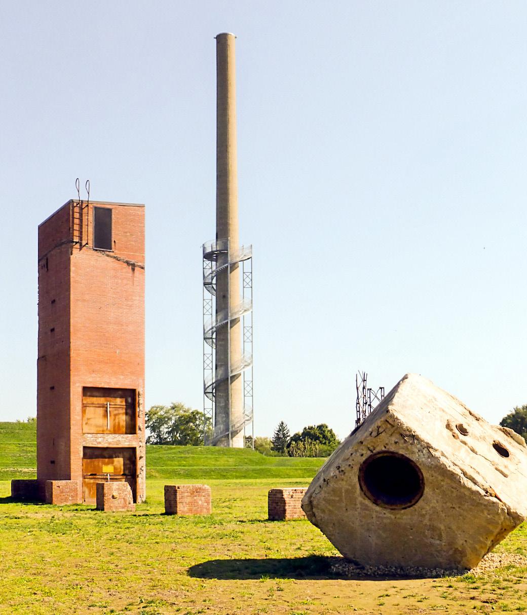
325 11.0 APPENDICES
Source: TrekOhio
Ariel-Foundation Park in Mt Vernon provides a full day’s worth of exploration for trail travelers seeking a break.
Franklin County Destinations & Intersections
The following destinations and intersections are either on the Ohio to Erie Trail in Franklin County or nearby (up to 1/4 mile away for parks and 1 mile for other destinations). They should all be signed according to the recommended guidelines when possible.
MAJOR CITIES
• Columbus
TRAIL TOWNS (MUNICIPALITIES)
• Bexley
• Grandview Heights
• Huber Ridge
• Lincoln Village
• Marble Cliff
• Minerva Park
• Prairie Township
• Valleyview
• Westerville
TRAIL TOWNS (NEIGHBORHOODS)
• Amercrest
• Appian
• Argyle Park
• Arlington Park
• Brandywine
• Brentnell
• Brewery District (including Whittier Peninsula)
• Bridgeview
• Brittany Hills
• Broadleigh
• Cherry Creek
• Cumberland Ridge
• Devon Triangle
• Downtown
• East Columbus
• East Linden
• Eastgate
• Easton
• Framingham
• Franklin Park
• Franklinton
• Gateway
• Georgian Heights
• Gould Park
• Grandview South
• Harrison West
• Hilltop
• Holly Hill
• Hyde Park
• Italian Village
• King-Lincoln-Bronzeville
• Laurel Greene
• Livingston Park North
• Marble Cliff Crossing
• Milo-Grogan
• Mount Vernon
• North Franklinton
• North Hilltop
• Northern Woods
• Northgate
A WAYFINDING STRATEGY GUIDE FOR THE CENTRAL OHIO GREENWAYS FINAL | MARCH 2024 326
• Olde Town East
• Oriole Park
• Parkview
• Port Columbus International Airport
• Riverbend
• Scioto Woods
• Shepard
• Somerset
• South Franklinton
• South Linden
• Southwest Airport
• Southwest Hilltop
• St. Mary’s
• Strawberry Farms
• Teakwood
• Tri-Village
• Valleyview Heights
• Victorian Village
• Walnut Creek
• Weinland Park
• Westbend
• Westbrook
• Westchester-Green Countrie
• Westgate
• Wolfe Park
• Woodland Holt
• Woodland Park
• Woodstream
OTHER DESTINATIONS: ROADS
• I-270
• Cleveland Ave
• Columbus Rd
• Coshocton Rd
• E Cherry St
• I-670
• I-70
• I-71
• N Bickett Rd
• OH-315
• Old US -35
• S Detroit St
• S Main St
• S Market St
• US-62
• W High St
TRAILS OF REGIONAL SIGNIFICANCE INTERSECTIONS
• @ Leonard Ave & Joyce Ave
OTHER DESTINATIONS: PARKS
• Alexander Park
• Alexander/AEP Park
• Alum Creek Freeland Parkland
COH
• Alum Creek Miller Parkland
• Alum Creek Park South*
• Avalon Park
• Battelle Darby Creek Metro Park*
• Battelle River Front Park
• Ben Hanby Park
• Brooksedge Park
• Cassady Park
• Casto Park*
• Cooper Park*
327 11.0 APPENDICES
Franklin County Destinations & Intersections (Continued)
• Creek Ridge Park
• Electric Park*
• Freedom Park
• Genoa Park
• Glenview Park
• Hanby Park*
• Hannah Mayne Park
• Hayden Park*
• Holton Park and Rec Center
• Innis Park
• Majestic Paint Parkland
• McFerson Commons
• Mock Road Park
• Nelson Park
• North Bank Park*
• Olde Town Park
• Parkridge Park
• Ridgewood Park
• Saunders Park
• Sawyer Park
• Sawyer Recreation Center
• Sawyer Senior Center
• Scioto River Parkland
• Sensenbrenner Park
• Shepard Park
• Stonecliff Parkland
• Strawberry Farms Park
• Tanager Woods
• Weiler Park
• West Bank Park
• Westerford Village Park
• Westerville Greenway
• Westmoor Park
• 2 unnamed Neighborhood Parks
*There is a Basic or Enhanced Trailhead associated with this park.
OTHER DESTINATIONS: ADDITIONAL BASIC & ENHANCED TRAILHEADS
• Pathways Park
• Wilson Road Trailhead
OTHER DESTINATIONS: COMMUNITY INSTITUTIONS
• Anti Saloon League Museum
• Big Darby Creek
• Boys & Girls Club Of America (various locations)
• Columbus Children’s Theatre
• Columbus College of Art & Design
• Columbus Metropolitan Library (various locations)
• Columbus Recreation Centers (various locations)
• Columbus State Community College
• Crew Stadium
• Franklin University
• Gladden Community House
• Grandview Heights Public Library
• Huntington Park
• Kaleidoscope Youth Coalition
• Lincoln Theatre
• Nationwide Arena
A WAYFINDING STRATEGY GUIDE FOR THE CENTRAL OHIO GREENWAYS FINAL | MARCH 2024 328
• Ohio Stadium
• Ohio Theatre
• Otterbein University
• Palace Theatre
• Southern Theatre
• State Library Of Ohio
• Supreme Court of Ohio
• Westerville Public Library
• YMCA (various locations)
OTHER DESTINATIONS: LOCAL POINTS OF INTEREST
• Alum Creek and the Underground Railroad
• Big Darby Creek
• Create Your Own Path mural
• Lady Wisdom Mural
• Movin’ & Groovin’ Mural
• Scioto River
• The Confluence

Source: Ohio State Bar Association
Madison County Destinations & Intersections
The following destinations and intersections are either on the Ohio to Erie Trail in Madison County or nearby (up to 1/4 mile away for parks and 1 mile for other destinations). They should all be signed according to the recommended guidelines when possible.
TRAIL TOWNS
• London
TRAILS OF REGIONAL SIGNIFICANCE INTERSECTIONS
• @ Glad Run Rd
• East of Deer Creek Bridge
OTHER DESTINATIONS: ROADS
• OH-38
OTHER DESTINATIONS: PARKS
• 1 unnamed Regional Park
• 1 unnamed Neighborhood Park
• 1 unnamed Community Park
OTHER DESTINATIONS: BASIC & ENHANCED TRAILHEADS
• Start of Roberts Pass Trailhead
• Roberts Pass Trailhead
• Prairie Grass Trailhead
OTHER DESTINATIONS: COMMUNITY INSTITUTIONS
• London Public Library
• Madison Area Youth Center
OTHER DESTINATIONS: LOCAL POINTS OF INTEREST
• Bill Young Memorial
• Bird watching area
• Community mural
• Heritage Trail Metro Park
• London Primitive Trailside Camp Area
• Madison Lake State Park
A WAYFINDING STRATEGY GUIDE FOR THE CENTRAL OHIO GREENWAYS FINAL | MARCH 2024 330
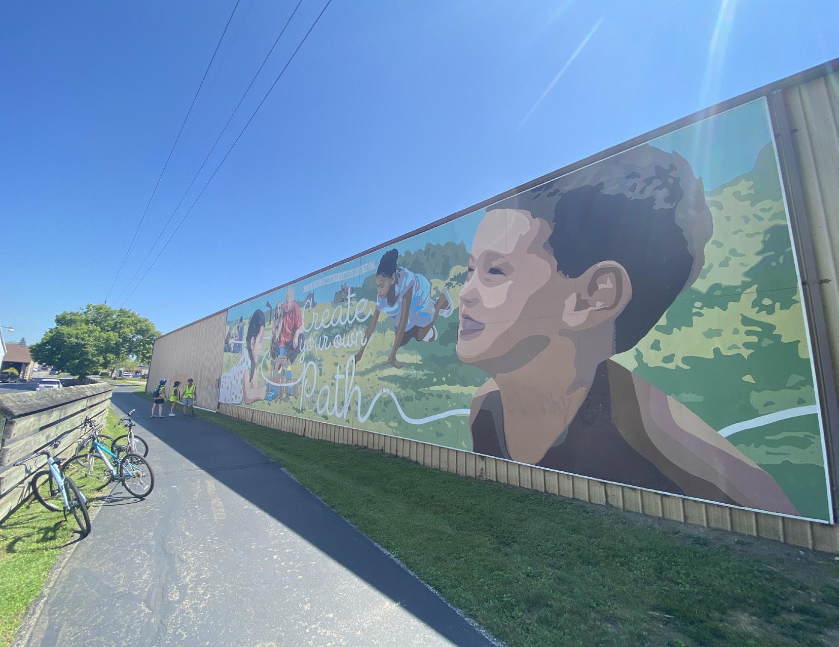 Source:
Urban Decision Group
A WAYFINDING STRATEGY GUIDE FOR THE CENTRAL OHIO GREENWAYS FINAL | MARCH 2024 332


 Source: Central Ohio Greenways
 Source: Central Ohio Greenways


 Source: Jody Dzuranin


 Source: Central Ohio Greenways


 Source: Central Ohio Greenways


 Source: Franklinton Cycleworks
With Crew Stadium just a short walk from the trail, the Columbus Crew offers a free bike valet at each home game.
 Source: Central Ohio Greenways


 Source: Urban Decision Group


 Source: Friends of the Madison County Parks & Trails


 Source: Central Ohio Greenways


 Source: Ben Ko, Yay Bikes!
 Source: Central Ohio Greenways


 Source: Urban Decision Group


 Source: pexels.com, Ivan Samkov


 Source: Urban Decision Group
Moovin’ and Groovin’, Roger J. Williams


 Source: Central Ohio Greenways


 Source: Central Ohio Greenways


 Source: Knox County Convention & Visitors Bureau

 Source: Lucinda Berry-Miller, Ph.D.
 Source: Athens County Library
 Source: Friends of Madison County Parks and Trails


 Source: Columbus State Community College


 Source: