2 minute read
Improving the development and operation of Punggol Digital District The integration of BIM and GIS is expected to deliver better designs and maximise long-term value
IMPROVING THE DEVELOPMENT AND OPERATION OF PUNGGOL DIGITAL DISTRICT
The integration of BIM and GIS is expected to deliver better designs and maximise long-term value.
As development works continue steadily at Punggol Digital District (PDD), Singapore’s first smart and sustainable business park, the technology that underpins Singapore’s national integrated land-use planning will also drive the development of the district, from planning through construction and all the way till when the district is operational. At the core of this network, a Geographic Information System (GIS) solution, created by Esri Singapore, integrates, manages and analyses a variety of data including BIM (Building Information Modelling) data to provide designers and architects with greater insight to influence a structure’s location, orientation, and even construction materials.
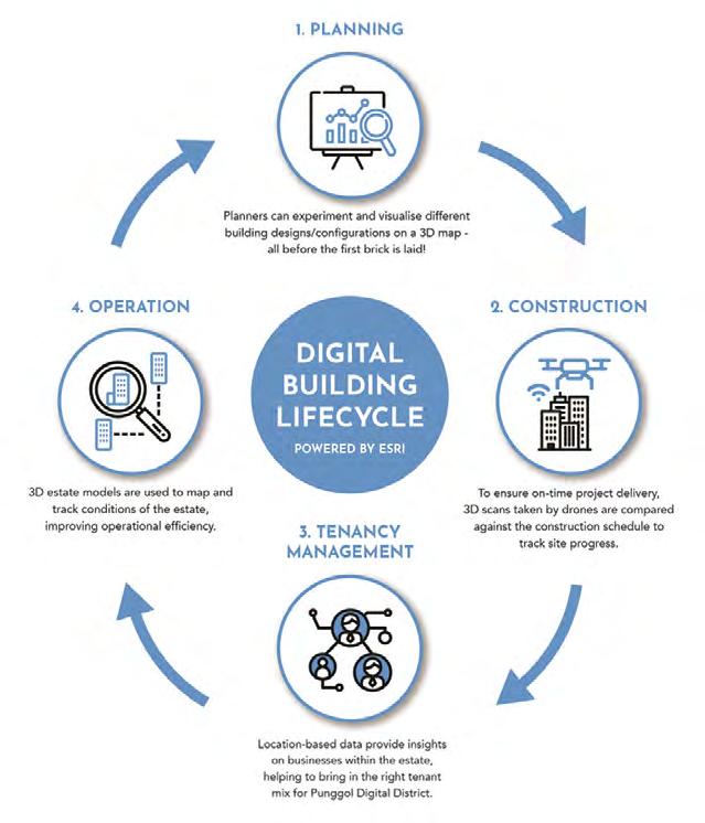
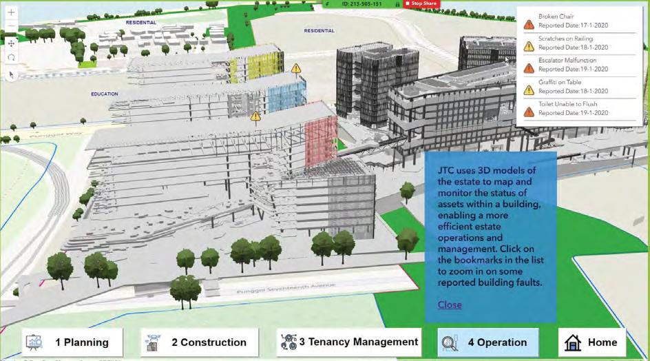
According to Mr Thomas Pramotedham, Chief Executive Officer of Esri Singapore, the seamless integration of BIM and GIS (also considered as GeoBIM) will enable JTC to deliver better designs that maximise the long-term value of upcoming infrastructures and facilities. “This GeoBIM platform capability will enable planners to visualise and experiment the impact of the designs against existing surroundings and landscape on a 3D map to ensure infrastructure and amenities in PDD support the needs of the community today and for generations to come”, he added. The smart approach in building PDD does not end there. During the actual construction, aerial scans are taken by drones to track and monitor construction progress. The aerial scans can also be integrated into a GeoBIM platform to ensure works are in line with PDD’s planned design. Once the construction of PDD has finished, the GeoBIM platform will continue to be foundational in the district’s day-to-day business operations in areas such as marketing and building management. “The system will help JTC, masterplanner and masterdeveloper of PDD, analyse consumer patterns, demographics as well as existing services and amenities in the larger Punggol town, to understand the market potential of the district in order to attract the right tenant mix”, Mr Pramotedham continued. Mr Pramotedham said that beyond managing data on an estate level, the system can ingest BIM and building assets data to provide full operational awareness, through the ability to map and observe asset conditions throughout the facility life cycle. “This capability will allow building managers to analyse patterns of use, make better decisions, and improve overall operational management”, he said.
Mr Ryan Lee, Director of Smart Digital Division, JTC, said, “Technology is empowering us to better plan, make decisions and manage our buildings and estates. In the case of PDD, GeoBIM allow us to virtually experiment various planning configurations, provide a common platform for better communication among the multiple disciplines, create efficient building management workflow processes, amongst many others. The use of GeoBIM brings about immeasurable benefits to the whole building project life-cycle and its community”.
Tenancy management


