8 minute read
Logistica / Logistics / Logistik Consigli per l’uso / Recommendations
from VALTELLINA bloc
Logistica - Logistics - Logistik
ACCESSI
L’accesso alle maggior parte delle aree riportate in questa guida è molto comodo e negli ultimi anni il completamente di diverse opere stradali di una certa importanza ha ulteriormente ridotto i tempi di percorrenza per raggiungere molte di esse. Sia la Valtellina che la Valchiavenna sono comunque state da sempre valli di transito sia per raggiungere la Svizzera (Passo del Maloja, Spluga e Bernina) che per raggiungere il Trentino-Alto Adige (Passo dello Stelvio) o la Val Camonica (Passo dell’Aprica). Inoltre, buona parte delle principali valli valtellinesi sono rinomate località turistiche sia in inverno che in estate. Partendo da Milano è possibile giungere molto rapidamente in cima al Lago di Como, all’imbocco di Valtellina e Valchiavenna, percorrendo prima la superstrada Milano-Lecco (Strada Statale SS36 del Lago di Como e dello Spluga) e quindi proseguendo in direzione Colico-Sondrio. Per arrivare in Valchiavenna, a Colico seguire la SS36 in direzione Chiavenna, raggiungendola in una trentina di chilometri. Da qui, seguire le indicazioni specifiche riportate per ogni area. Per raggiungere tutte le altre aree, rimanere sulla superstrada che da Colico prosegue in direzione Sondrio. Per le aree sopra Morbegno e per la Valgerola, prendere la relativa uscita Morbegno-Valgerola, mentre per la Valmalenco e l’alta Valtellina proseguire in direzione Sondrio lungo la Strada Statale SS38 dello Stelvio. La Valmalenco può essere raggiunta lungo la strada provinciale SP15 seguendo le relative indicazioni all’inizio dell’abitato di Sondrio, mentre per arrivare a Bormio proseguire sulla SS38 per altri sessanta chilometri. Arrivando da Nord, è possibile raggiungere la Valchiavenna dalla valle di Splugen attraverso il passo dello Spluga (chiuso in inverno) oppure da San Moritz per il passo del Maloja. La Valtellina è raggiungibile anche attraverso il passo del Bernina per arrivare a Tirano o dal passo dello Stelvio. Nei periodi invernali controllare sempre le condizioni di viabilità e apertura dei passi. In alternativa, è suggerito di passare da Como-Chiasso, per poi proseguire in direzione Lecco dove immettersi sulla superstrada SS36 in direzione Colico, come sopra descritto.
DOVE E COME ALLOGGIARE
Tutte le aree qui presentate si trovano in località turistiche molto frequentate in tutte le stagioni e per questo motivo offrono molte possibilità d’alloggio tra campeggi, rifugi, residence o alberghi di qualunque categoria. Il campeggio libero è usualmente vietato, mentre (a meno di esplicite segnalazioni), non ci sono normalmente problemi a sostare con camper o furgoni, a patto di rispettare le norme di buon senso e civiltà (non estrarre tendalini, tavolini ecc.). Comunque, prestare sempre molta attenzione nella sosta per evitare di occupare terreni privati o creare situazioni critiche che in alcune aree potrebbero mettere a repentaglio la possibilità di continuare a giocare sui massi.
PREVISIONI E BOLLETTINI METEREOLOGICI
Per informazioni metereologiche è suggerito visitare i seguenti siti, consultandone diversi in caso di previsioni incerte… https://www.arpalombardia.it/Pages/Meteorologia/Previsioni-e-Bollettini.aspx www.3bmeteo.com/ www.ilmeteo.it/ Previsioni attendibili per la Valtellina possono essere consultate anche sui siti svizzeri: https://www.meteosvizzera.admin.ch/ www.rtsi.ch/meteo
Infine, per un’idea ancora più chiara delle condizioni in tempo reale è possibili vedere la situazione attraverso le molte webcam che sono disponibili on-line per le diverse località.
ALTRE INFORMAZIONI
Valchiavenna: Palestra d’arrampicata Boulder Factory https://www.instagram.com/boulder_factory_chiavenna/ Valgerola: per informazioni su tutte le possibilità e i servizi che la Valle offre, è possibile contattare l’Ufficio Turistico +39 393 864 42 23 – www.valgerolaonline.it/ – info@valgerolaonline.it.
ACCESS
The access to the majority of the areas described in this guide is very easy and during these last few years the completion of various road works of a certain importance has further reduced the travel times to reach many of the areas.
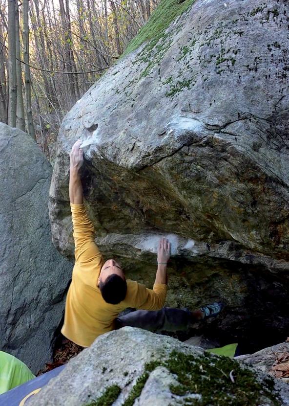
Andrea Pavan, Val di Togno, Tutto Gas, 7b (© Tomaso Viganò)
Both Valtellina and Valchiavenna have always been transition valleys both to reach Switzerland (Passo del Maloja, Spluga and Bernina) as well as for reaching Trentino-South Tyrol (Stelvio Pass) or Val Camonica (Aprica Pass). Further more, a good part of the main valleys in Valtellina are well known tourist areas both during winter time and summer time. Leaving from Milan it is possible to very quickly reach the top end of Lake Como, at the start of Valtellina and Valchiavenna, driving along the Milano-Lecco highway first of all (Lake Como and Spluga State road SS36) and then continuing towards Colico-Sondrio. To reach Valchiavenna, at Colico follow the SS36 towards Chiavenna, reaching it in thirty or so kilometres. From here, follow the specific sign posts shown for each area. To reach all other areas, keep on the highway which from Colico continues towards Sondrio. For the areas above Morbegno and for Valgerola, take the relative exit Morbegno-Valgerola, while for Valmalenco and the upper Valtellina area continue towards Sondrio along the State road SS38 of Stelvio. Valmalenco can be reached along the SP15 provincial road following the relative sign posts at the beginning of the town of Sondrio, while to reach Bormio continue along the SS38 for another sixty kilometres. Coming from North, it is possible to reach Valchiavenna from the Splugen valley driving over Spluga pass (closed during winter) or else from San Moritz across the Maloja pass. Valtellina can be reached even across the Bernina pass to reach Tirano or from the Stelvio pass. During winter always check the conditions and see if and which passes are open. Alternatively, you can go from Como-Chiasso to then continue towards Lecco where you then take the highway SS36 towards Colico, as described above.
WHERE AND HOW TO STAY OVERNIGHT
All the areas described here are situated in very busy tourist areas in all seasons and for this reason they offer many accommodation opportunities ranging from campsites, mountain huts, residence or hotels of differing categories. Free camping is usually forbidden, while (except for explicit signposts), usually there are no problems to park a camper or van, as long as one is civilised and follows the norms of common sense (do not pull out tables and chairs and sun awnings) Nonetheless, be always very careful where you stop and avoid stopping on private land or creating critical situations which in some areas could jeopardize the possibility of continuing to play on the boulders.
WEATHER FORECAST
For meteorological information we suggest you consult the following websites: https://www.arpalombardia.it/Pages/Meteorologia/Previsioni-e-Bollettini.aspx www.3bmeteo.com/ www.ilmeteo.it/ Reliable weather forecast for Valtellina can also be checked out on some of the Swiss websites: https://www.meteosvizzera.admin.ch/ www.rtsi.ch/meteo Finally for an even clearer idea on weather conditions in real time it is also possible to check out the situation through many webcams which are available on-line for all the various areas.
OTHER INFORMATION
Valchiavenna: Climbing gym Boulder Factory https://www.instagram.com/boulder_factory_chiavenna/ Valgerola: for information on all opportunities and services that the Valley offers it is possible to contact the Tourist Office +39 393 864 42 23 – www.valgerolaonline.it/ – info@valgerolaonline.it.

ZUGANG
Die meisten Bouldergebiete in diesem Buch sind ganz bequem erreichbar und die Vollendung einiger wichtiger Infrastrukturprojekte in den letzten Jahren hat die Anfahrtszeit bei vielen noch zusätzlich verkürzt. Sowohl Valtellina als auch Valchiavenna waren schon immer Transit-Zonen, um in die Schweiz (Pässe Maloja, Splügen und Bernina), ins Trentino-Südtirol (Stilfser Joch) oder ins Val Camonica (Aprica Pass) zu gelangen. Außerdem sind die meisten Haupttäler des Valtellina berühmte Touristenorte, egal ob Sommer oder Winter. Wenn man in Mailand startet, erreicht man schnell die Spitze des Comer Sees und den Eingang in die Täler Valtellina und Valchiavenna; dazu erst auf der Staatsstraße Milano-Lecco (SS36 del Lago di Como e dello Spluga) und weiter in Richtung Colico-Sondrio. Um ins Valchiavenna zu gelangen, folgt man ab Colico der SS36 in Richtung Chiavenna (ca. 30 km entfernt); ab hier dann den Beschreibungen zu den einzelnen Gebieten folgen. Für alle anderen Gebiete bleibt man auf der Schnellstraße, die von Colico nach Sondrio führt. Für die Gebiete oberhalb von Morbegno und das Valgerola verlässt man die Staatsstraße an der entsprechenden Ausfahrt Morbegno-Valgerola, für das Valmalenco und das obere Valtellina weiter in Richtung Sondrio auf der SS38 dello Stelvio (Stilfser Joch Staatsstraße). Ins Valmalenco kommt man auch über die Provinzstraße SP15, dazu ab Sondrio den entsprechenden Hinweisen folgen. Wer nach Bormio will, bleibt dagegen noch für weitere 60 km auf der SS38. Wenn man aus Norden kommt, kann man das Valchiavenna über den Splügenpass erreichen (im Winter gesperrt) oder über St. Moritz und den Malojapass. Das Valtellina kann man über den Berninapass (Tirano) oder über das Stilfser Joch erreichen. Im Winter sollte man stets vorab die Befahrbarkeit der Pässe prüfen. Alternativ kann man am Grenzübergang Como-Chiasso nach Italien und von dort weiter in Richtung Lecco, wo man auf die SS36 nach Colico stößt.
WIE UND WO ÜBERNACHTEN
Alle hier beschriebenen Bouldergebiete liegen in touristisch gut erschlossenen Regionen und es gibt das ganze Jahr über ein breites Angebot an Übernachtungsmöglichkeiten (Campen, Hütten, Hotels und Pensionen in allen Preisklassen). Freies Campen ist für gewöhnlich verboten, man kann aber (wenn kein explizites Verbot vor Ort) problemlos im Van oder Camper übernachten, vorausgesetzt man respektiert die gängigen Benimmregeln und handelt mit gesundem Menschenverstand (keine Vorzelte, Tische etc.). Man sollte auf jeden Fall immer gut aufpassen, wo man sein Gefährt abstellt und darauf achten, kein privates Gelände zu besetzen oder kritische Situationen zu provozieren. Ein solches Verhalten hätte nur negative Folgen für die gesamte Boulder-Gemeinschaft.
WETTER
Für den Wetterbericht gibt es folgende Seiten, bei Unsicherheit ist es besser, mehrere Seiten zu checken. https://www.arpalombardia.it/Pages/Meteorologia/Previsioni-e-Bollettini.aspx www.3bmeteo.com/ www.ilmeteo.it/ Für das Valtellina gibt es auch auf Schweizer Seiten gute Vorhersagen: https://www.meteosvizzera.admin.ch/ www.rtsi.ch/meteo Zudem gibt es zahlreiche Webcams online, die in Realzeit über das Wetter in den verschiedenen Orten Auskunft geben.
WEITERE INFORMATIONEN
Valchiavenna: Kletterhalle Boulder Factory https://www.instagram.com/boulder_factory_chiavenna/ Valgerola: für Informationen, Angebote und Möglichkeiten im Tal kann man sich im Tourismusbüro erkundigen: +39 393 864 42 23 – www.valgerolaonline.it/ – info@valgerolaonline.it
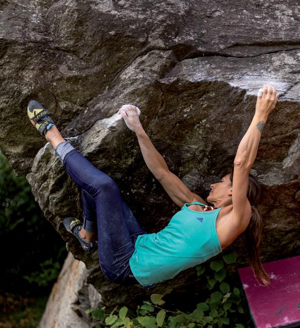
Giovanna Pozzoli, Cimaganda, Settore Pratone, Exodus, 6c (© Tomaso MG Viganò)


