
2 minute read
3.1 Macro level - protected areas and blue corridors
3THE CURRENT PRACTICE OF GREEN INFRASTRUCTURE
This chapter presents some of the successful cases of implementing the GI concept at various spatial levels that concern Slovenia. The handbook also presents some other cases in other places in text or image format; for example, the design of the green areas in the City of Ljubljana (Figure 7), and the design of the Municipality of Ankaran (Figure 28). There are many more (successful) practices and cases, of course. We should mention one of the more successful in the area of promotion, recognition and strategic planning of GI. This is the Strategy for the protection and development of green infrastructure in the Ljubljana urban region, which was prepared by the Regional development agency of the Ljubljana urban region and the Urban Institute of Ljubljana in the framework of the PERFECT project [26.]. It was prepared with the stakeholders at various levels: the representatives of the national, regional and local powers, expert services, research institutions, and managers of protected areas.
Advertisement
For the purposes of evaluating the situation of the protected areas in the Mediterranean sea and
3�1 Macro level - protected areas and blue corridors
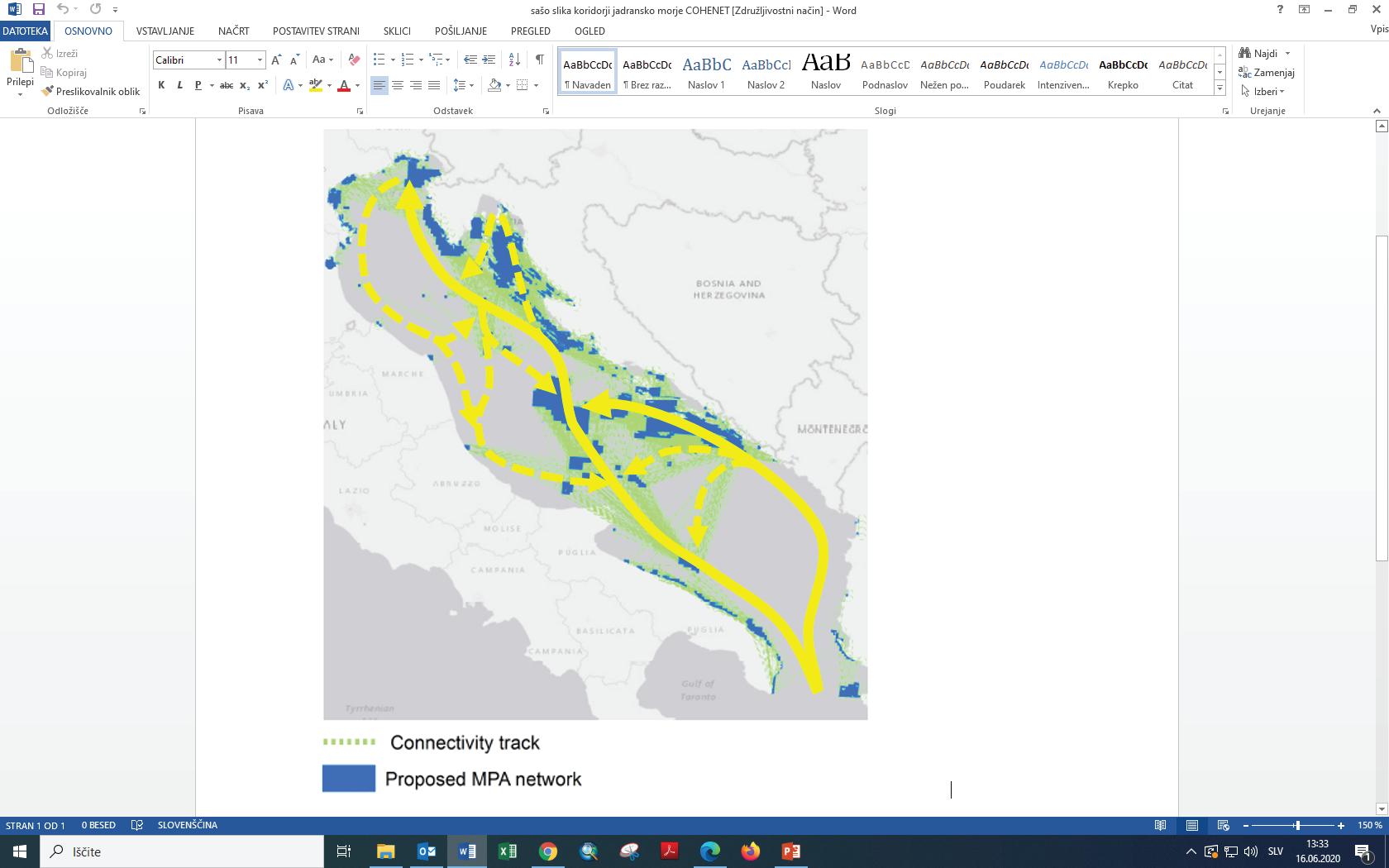
other efficient measures concerning the protection of nature, the harmonisation and the efficiency of the network of the protected sea areas at the Adriatic sea was assessed in the framework of the COHENET project, and a specific proposal was made to improve the efficiency and harmonisation of the protected sea areas with a specific proposal of having new protected areas and to ensure their interconnectivity.
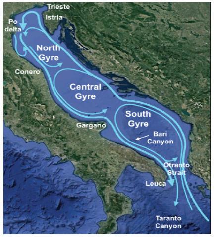
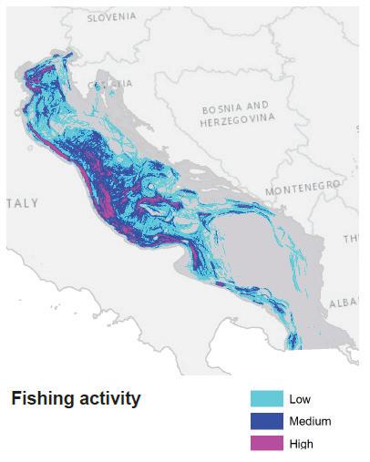
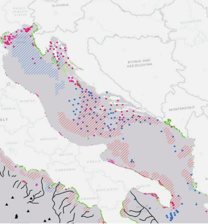
Figure 11: The COHENET project - achieving harmonised networks of protected sea areas: the analysis of the situation in the Mediterranean sea aims to contribute to the part of the European Commission in the development and testing of the method forassessingtheefficiencyandharmonisationofnetworksofprotectedseaareas, andtoprovidetoolsforassessinganydeficiencies of data sources and their consistency.
Sea currents
Fishing activities Protection measures
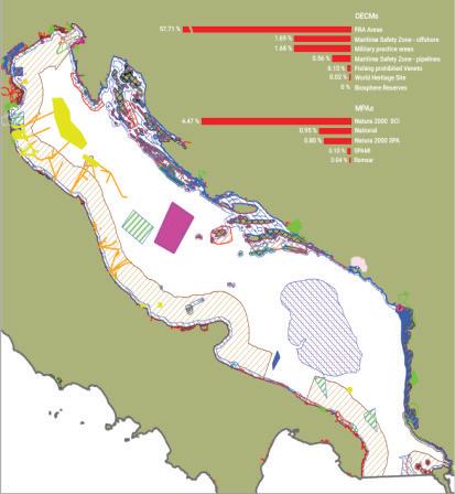
MCA analysis
Marine traffic
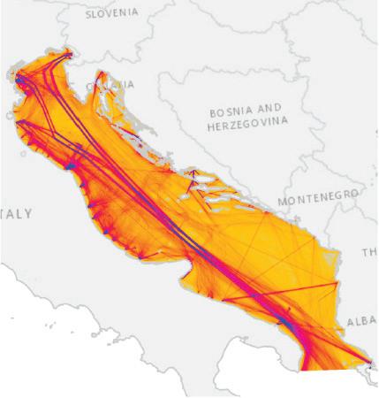
Figure 12: A demonstration of the proposal of protected sea areas in the Adriatic sea by recognising the main blue corridors (yellow) on the basis of a multi-targeted analysis of the data on physical characteristics, important habitats and species, existing limitations of sea usage and the preservation of the main existing uses.


