2 minute read
4.4 Example: The municipality of Ankaran
4�4 Example: The municipality of Ankaran
One of the successful cases of implementing changes in the direction of the implementation of GI on the micro level is the municipality of Ankaran. The municipality was formed with the secession30 from MOK, and also due to opposition to the spatial policy of the municipality of Koper and the policy of Luka Koper. It did take the spatial legal arrangements from the municipality of Koper, however it started to change those immediately. In an open public discussion, the new municipality initially adopted the spatial concept (scenario), which it concretised during the adoption process of the first OPN31 with expert bases with a distinct green policy or valorisation of the ES of the sea area. It adopted the special Strategy for the protection and development of green areas for a municipality that builds on partnerships between public and private32 green, and especially park, areas. It represents the framework for OPN and for the ZUreP-2 assumed Decree on the arrangement of the image of settlements and the landscape.
Advertisement
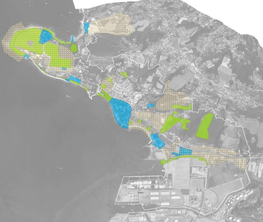
The landscape design for the municipality of Ankaran was made in 201733 and represents the basis for OPN and the design for preparing spatial and administrative plans. The municipality used the Barcelona convention as its starting point for arrangements, with the argument of establishing a link between spatial planning and water management in the coastal zone. In light of the sustainable comprehensive management of coastal areas, the landscape design also discusses the sea part, even though planning and arrangements at sea only exceptionally fall under the jurisdiction of the municipality.
The connectedness of the coast and the sea in terms of usage planning is key, because it has an im-
Basis for elaboration of landscape concept: Visual quality of landscape, recognisability, landscape elements, bio and landscape, existing and planned activities, conflicts and degreded areas�
Other ES benefits: Microclima regulation, CO2 absorbtion, O3 reduction, wind and noise mitigation, flood and drought risk mitigation, self purification, biomass, food and fibres production ��� Rearrangige Restoration Conservation
Figure 20: Considering the ES function of an area and GI planning in the process of preparing an urban and landscape design as a compulsory professional basis in spatial planning; an example of the municipality of Ankaran [39.]
portant influence on the coast, the coastal zone and the sea zone, which is why the 200 metre sea zone was also included in the discussion. Because the Protocol on Integrated Coastal Zone Management in the Mediterranean (ICZM)34 defines that a zone of at least 100 m in width must be defined from the highest winter water line in coastal areas where construction is prohibited, the 100 m starting zone is also considered and treated with special care regarding the connectivity and impact on the sea. The landscape design therefore especially discusses the 100 m coastal zone35, which is completely in line with ZV-1 that enables the expansion of coastal land through the general 25 m zone. The coastal zone may, for public access purposes, be declared by the municipality for the public good.
The landscape design for the municipality of Ankaran especially highlights the importance of the


