1 minute read
3.3 Mezzo level - blue and green corridors at the Slovenian sea and coast


beyond. For example, by recognising the inland blue corridor in the downstream direction of the Danube river to the mouth of the Sava river and then upstream on that river, the story may be successfully linked with the international Sava Commission and its activities concerning flood protection, management of water sources, the achievement of good water statuses and the harmonisation with potential cross-usage, such as sailing and non-sustainable hydro power. The recognition and preservation of corridors allows connections between macro regions as well, for example between the Adriatic-Ionian and Danube macro regions.
3�3 Mezzo level - blue and green corridors at the Slovenian sea and coast
Advertisement
In the framework of preparing the Marine Strategic Plan of Slovenia (PPN), a more detailed discussion of the role of the sea and the corresponding function of the coastal area is being planned.
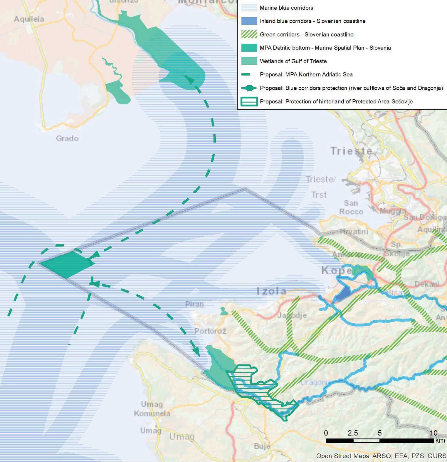
Each core GI area (protected sea areas, Natura 2000 areas, areas with a recognised major stock of ES) is part of the comprehensive network via the green and blue corridors or stone walkways. In designing PPN, we studied and implemented the process of recognising the blue corridors in the Slovenian sea and the blue and green inland corridors (Figure 14).
Figure 14: An overview of the recognised main trajectories of the blue and green corridors and the proposal of new protected areas and blue corridors in the northern Adriatic sea. All corridors and protected areas are an integral part of GI.


