ERFAN ABU MUKH


Ame1110.92@gmail.com | +972504443667 | Baqa -Algharbiyye, Israel
A 31 years old architect who believes that By means of creation or alteration ,leaving a footprint is an aim to seek throughout the journey of architecture and life.
2012-2016 |
Technion Israel Institute of Technology| Haifa
Bachelor of architecture and town planning.
2007-2010 |
High school of science and technology| Baqa al-gharbiyye
February 2018 - July -2019 | Boaz snir architects | Herzliya
Professional training in the design process of diverse private residential projects.
work included : participating in the design process from initial sketches to final technical drawings, Project handling , building permits handling , site supervising, interior design.
November 2019 - December 2023 | Lerman Architects and Planners Ltd |Tel Aviv
participationg in the design process of diverse publich projects with different scales mainly in: *police stations design.
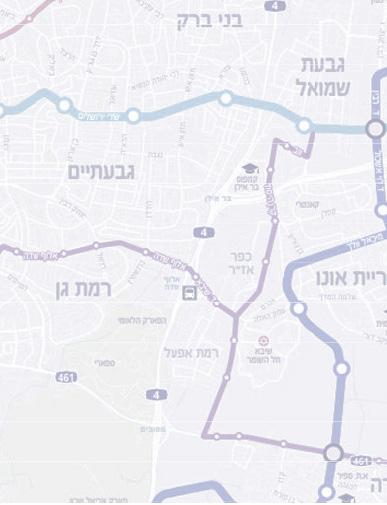
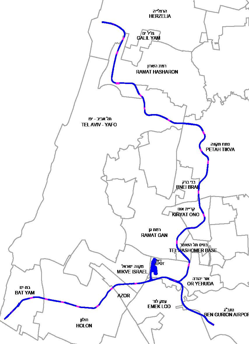
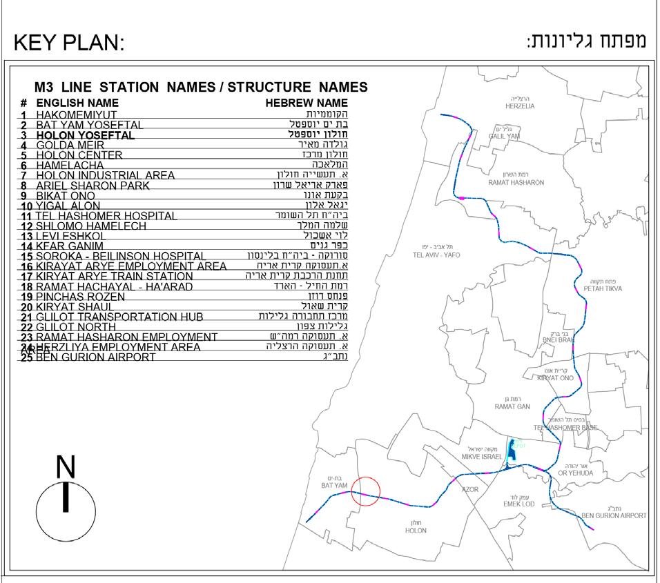
*Metro - Line M3
work included: initial sketches , presentations, final technical drawings, 3D rendering ,building permits handling.
2019-2023 | Independent work
Architectural and interior design of : *private residential projects.
*stores and different public spaces.
Autocad
Revit
Sketchup
V-ray
Adobe Photoshop
Adobe Illustartor
Adobe Indesign
Adobe LIght room
Adobe Premiere
Filmora Wondershare
Microsoft Office
Arabic | Native
English | Fluent
Hebrew | Fluent
Turkish | Intermediate
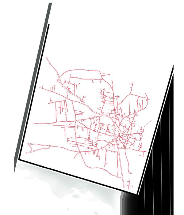
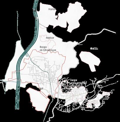
 Baqa Al-Gharbiyye
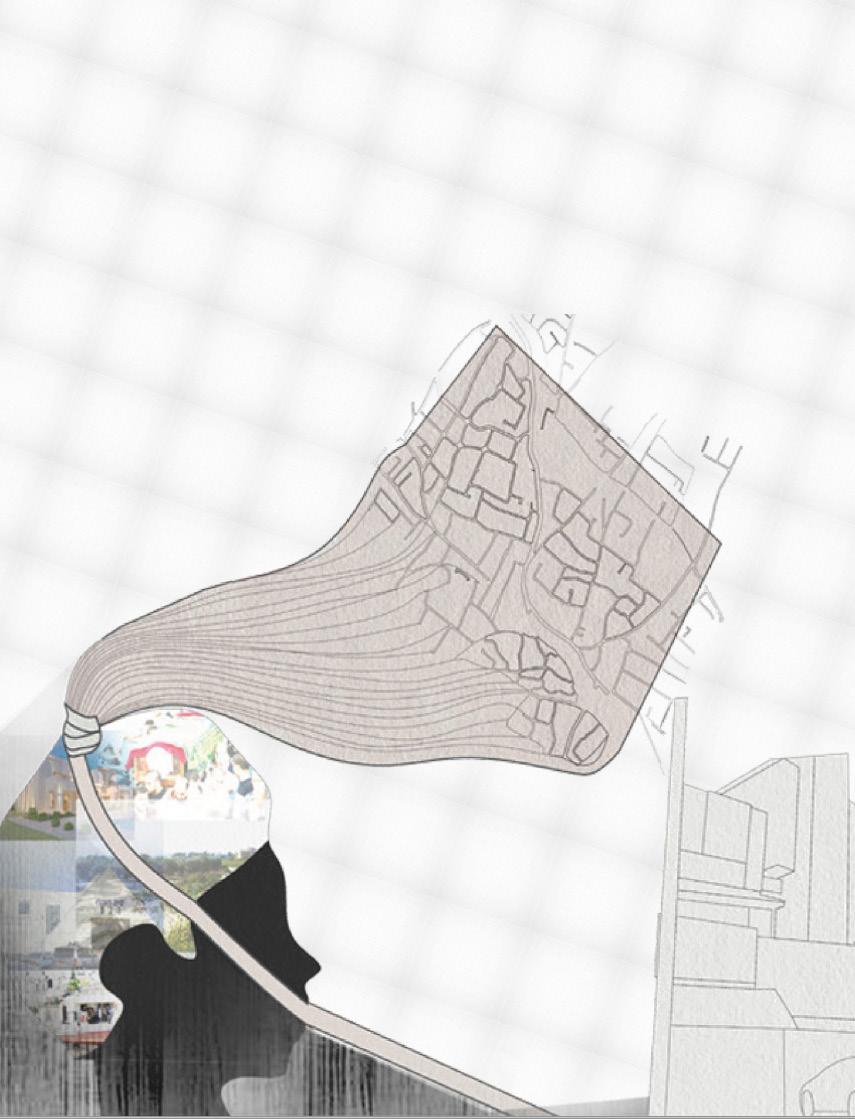
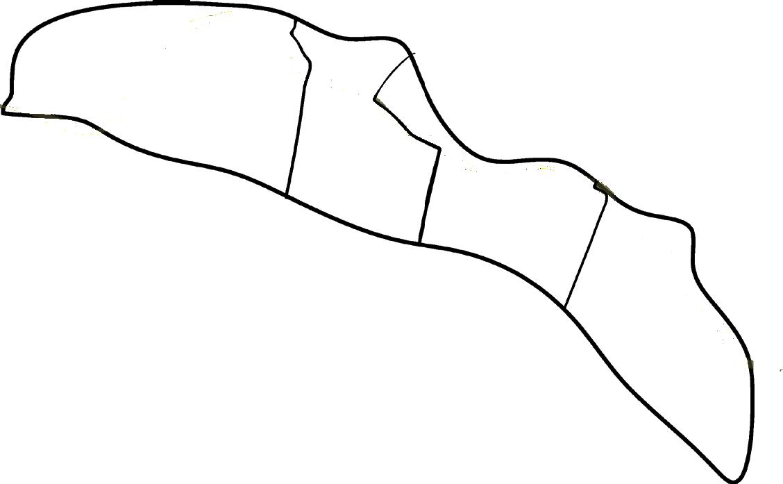
Barriential is a project that recognizes a real yet an unapproachable potential that lays under a set of barriers and it aims to breathe life into this potential. The city of baqa Al-Gharbiyye, an arab city in Israel is a site with boundaries that function as walls or physical barriers blocking the city`s development despite holding within great potential. Due to several political and civil changes,three of four boundaries arent able to to acheive it`s potential, however the fourth one, the southern boundary might be the one with the slightest potential yet the biggest value to the city.The southeren boundary of Baqa Al-Gharbiyye is the BARRIENTIAL discussed in this project that sees both the empty and the full halves of the glass and aspiers to create a different container.
1.1
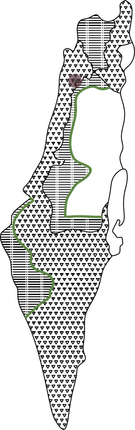
 aka Al-Gharbiyye is a small city of 11,000 dunams and 30,000 citizines
The northern boundary is the two settlements of Metzer and Harish. Harish is one of the seven star axis settlements.(an axis created to break the arab continuity in this area).
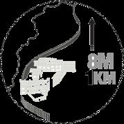
The eastern boundary is a 1 km long concrete wall , a part of the Israeli West Bank barrier , that separates between Baqa al-gharbiyye and Baqa Al-Sharqiyye.(west and east of Baqa).
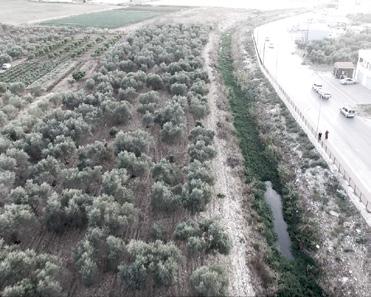
The southern boundary is a valley called «Wady Abu Nar» , a part of Hadera stream ( a seasonal watercourse that flows from highlands in the northern West Bank and empties into the Mediterranean sea at the Israeli city Hadera).
The western Boundary is Highway 6. According to a plan suggested by the government,certain arab cities that lie between the Separation wall and highway 6 will be joined to the West Bank, which immediately raises the question of, will Highway 6 be the next wall
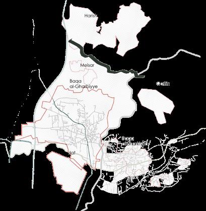
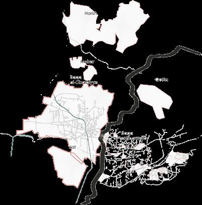
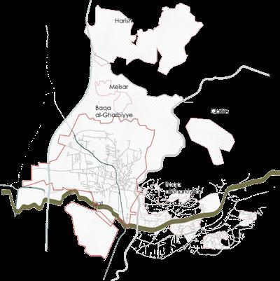
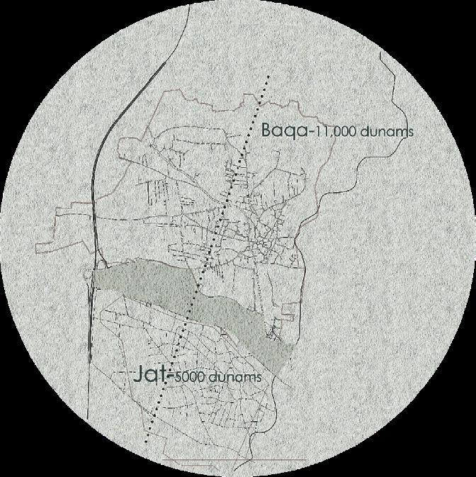
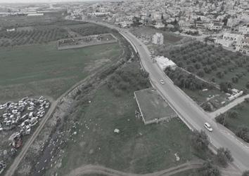
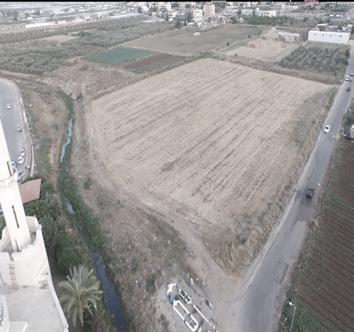
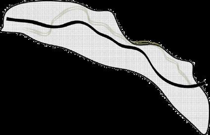
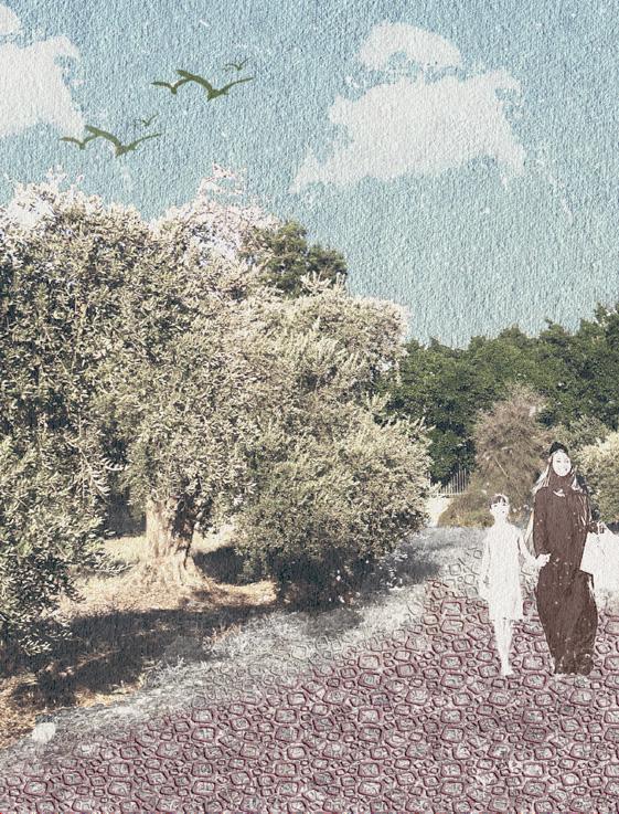
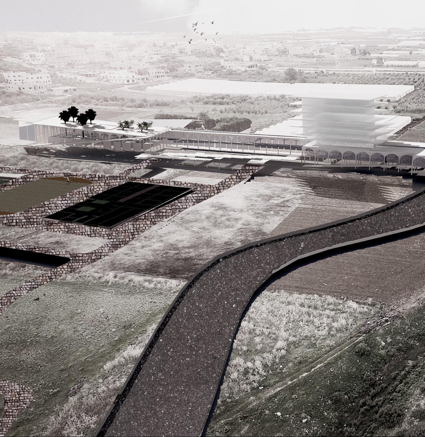
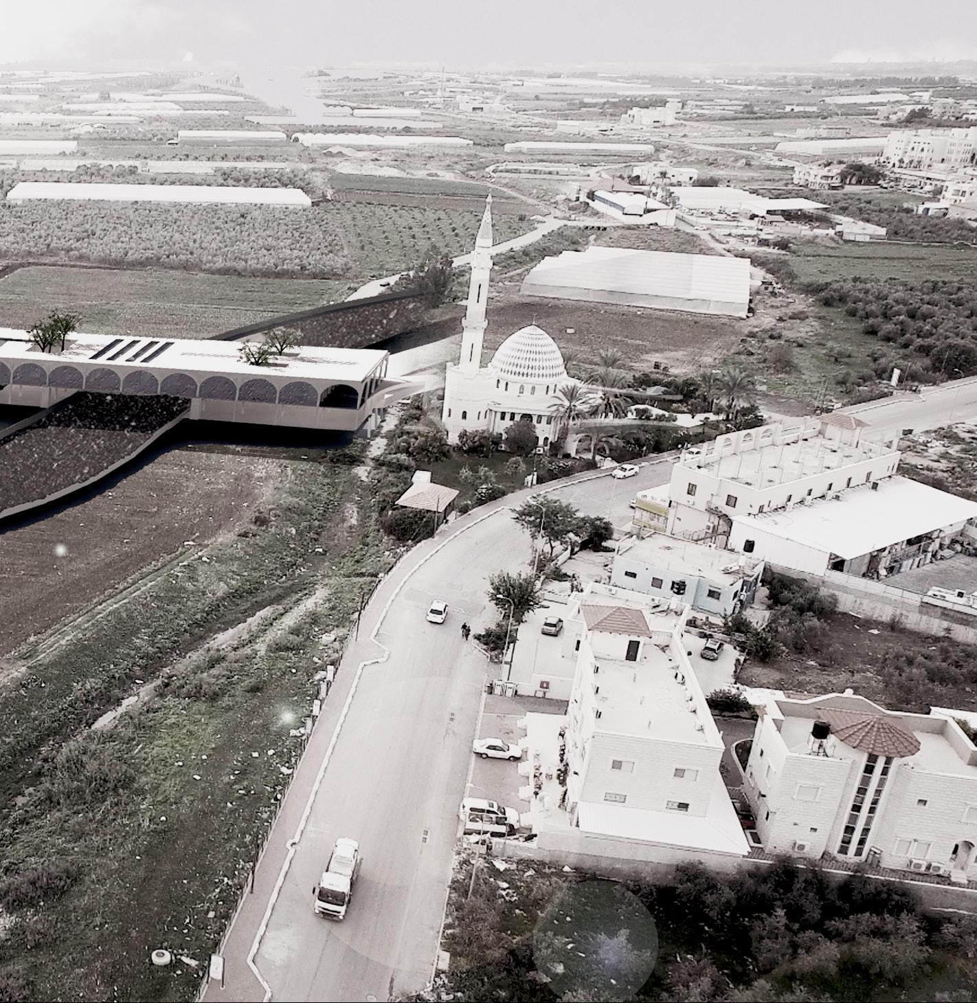
The Abu-Nar stream lies at the southern boundary of Baqa, where beyond this stream there is a 1000 donum valley.Mainly an agricultural area that lies between Baqa and Jat and its in shared ownership of citizens of both cities.The stream meanwhile functions as a physical barrier that people cannot cross to reach to the valley except from three points that are made for cars only , leaving the valley area as the neglected rear space of both cities.PASSIACTIVE WALL is the Barriential to my definition,it is a shared area in the middle of two settlements, and if we look at the other boundaries, they have a bigger space to expand to,but because of the current situation it can`t. this valley area has the most potential for turning into the first urban public area and promenade for baqa al-Gharbiyye and Jat.
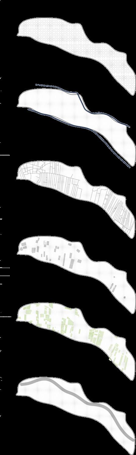
1000 Donum
Two main streets
Three earth roads
Agricultural portions
Green house
Olive grid
New planned highway
JAT BAQA1.3
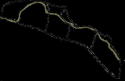
The intervention strategy consists of main acts :
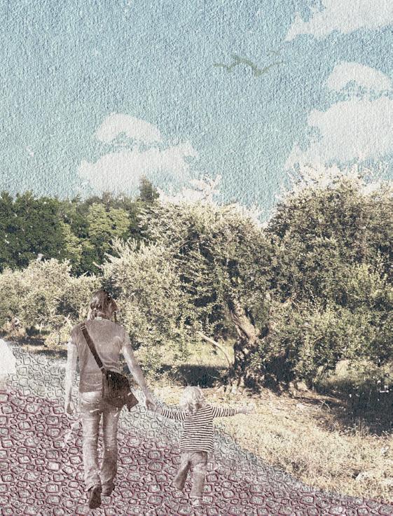
1* The valley area will turn into a recreational space using the existing elements of the space in a new way .
2* The promenade will be an olive promenade , set between all the olive trees , thus emerging from the place and keeping the traditional atmosphere.
3* the promenade path will follow the existing narrow dirt routes in the valley area,this way won`t lead to land expropriation , for the routes are already there and used by cars.
4* Along the promenade there will be different points in which different activities are set .
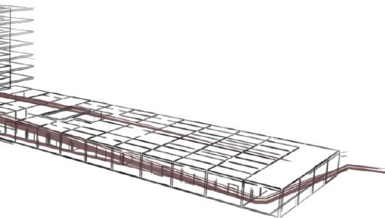
5* The built strips are three bridge buildings set on portions that belong to the municipality. They will serve as buildings for residency , commerce , leisure and offices.
*AS ONE BARRIER
* PROMENADE
*THREE BRIDGES residency commerce leisure office


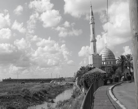
The built strip zoomed in on , lies on an axis that starts with a mosque in Baqa and ends with a school In jat. Therefore, this specific bridge building is set up as a commercial and communal building with an addition of offices. Being a linear built strip ,The concept of designing the building was also inspired by the place and the greenhouse grid, which was similar in length to the strip.
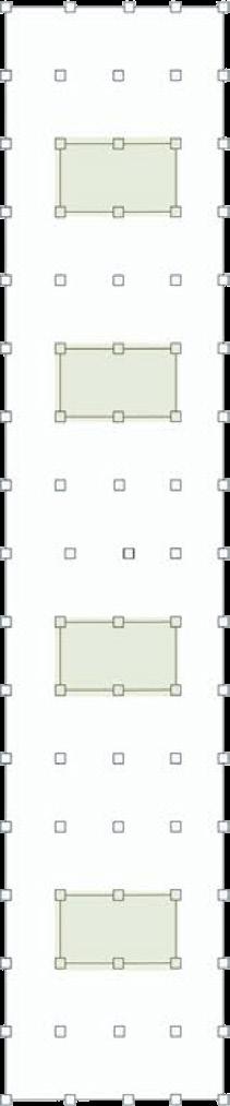
*dividing the linear strip into an 8*8 grid creating an adequate space and subspaces.
*Turning the gird into archs for human scale and dimensions
*creating patios along the building for more sun light and natural air circulation.
8x8 Grid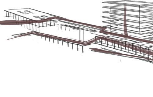
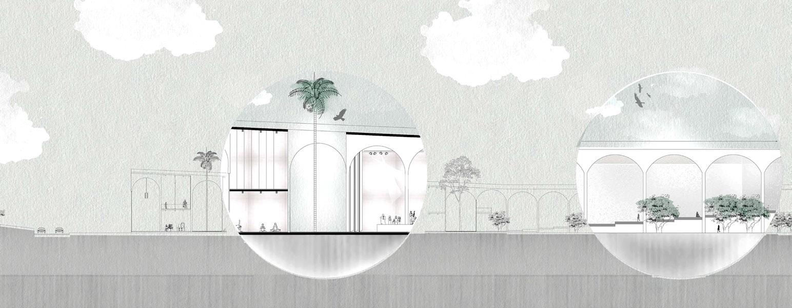
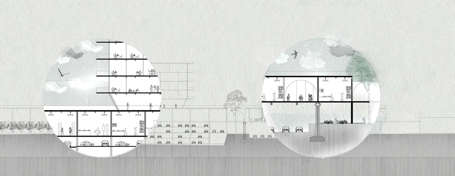 Coffeeshops Flea Market Stores
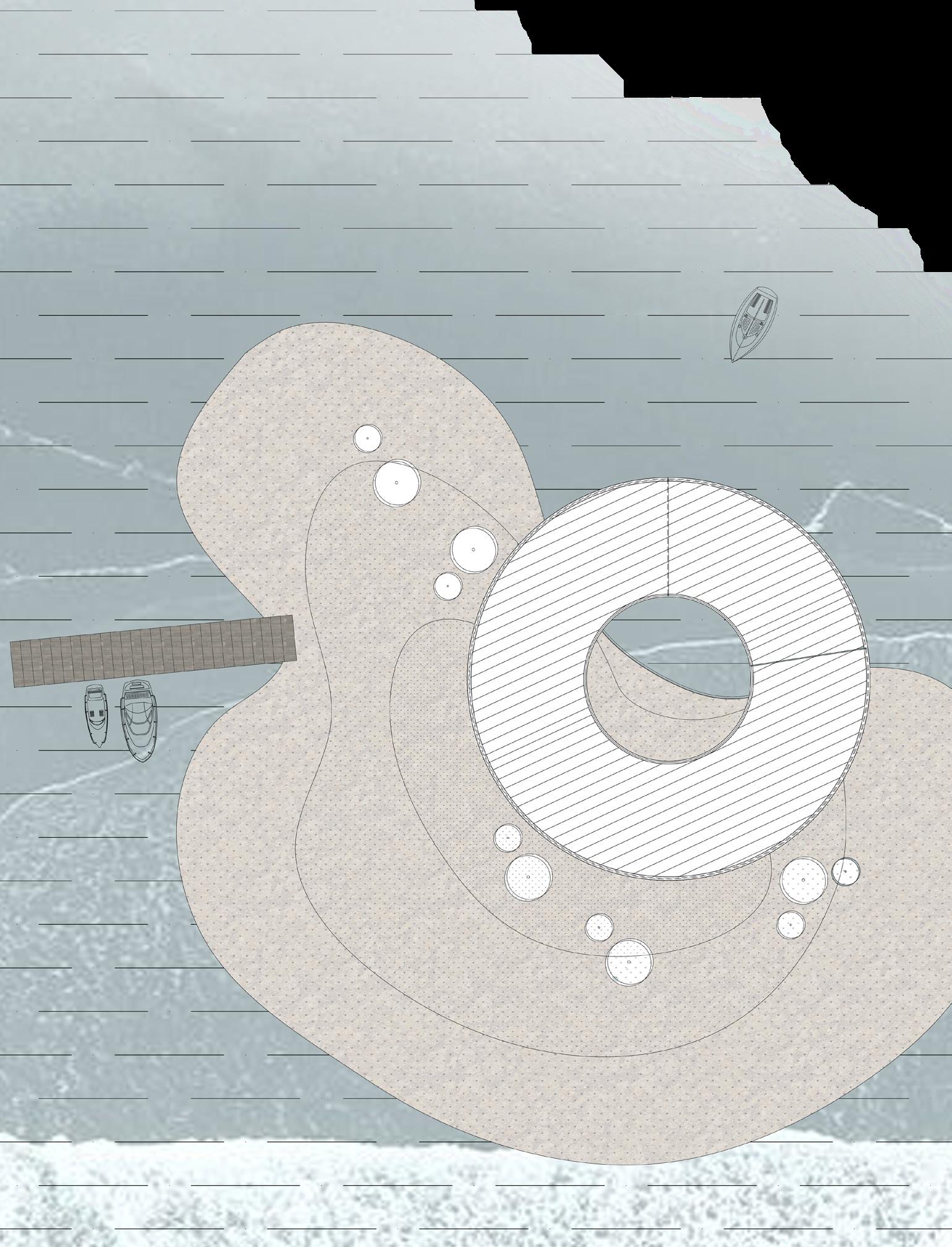
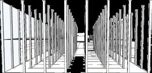
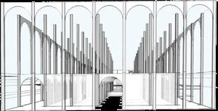
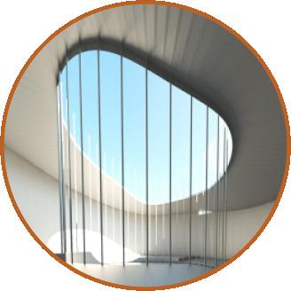
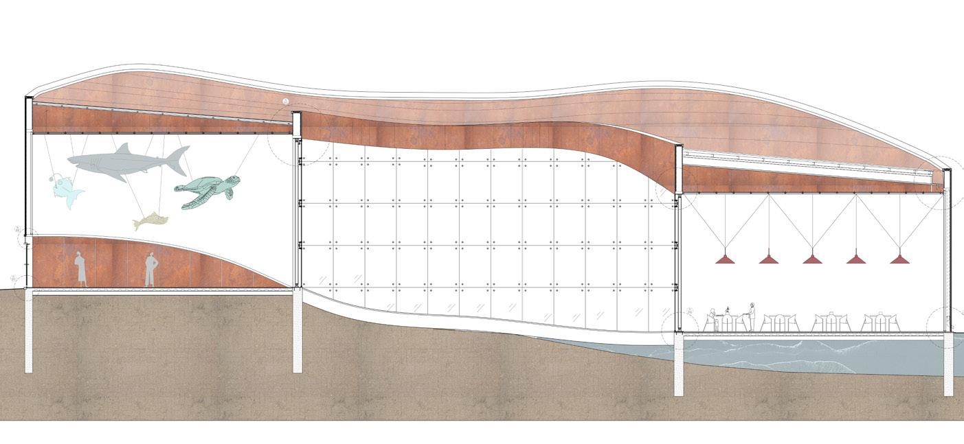
Sea through is a light construction aquarium gallery design project. it is located on an island in the Tiberias lake . The design concept was to invite visitors inside the building to experience the whole gallery in a continuous circular motion with glances at the lake every now and then.

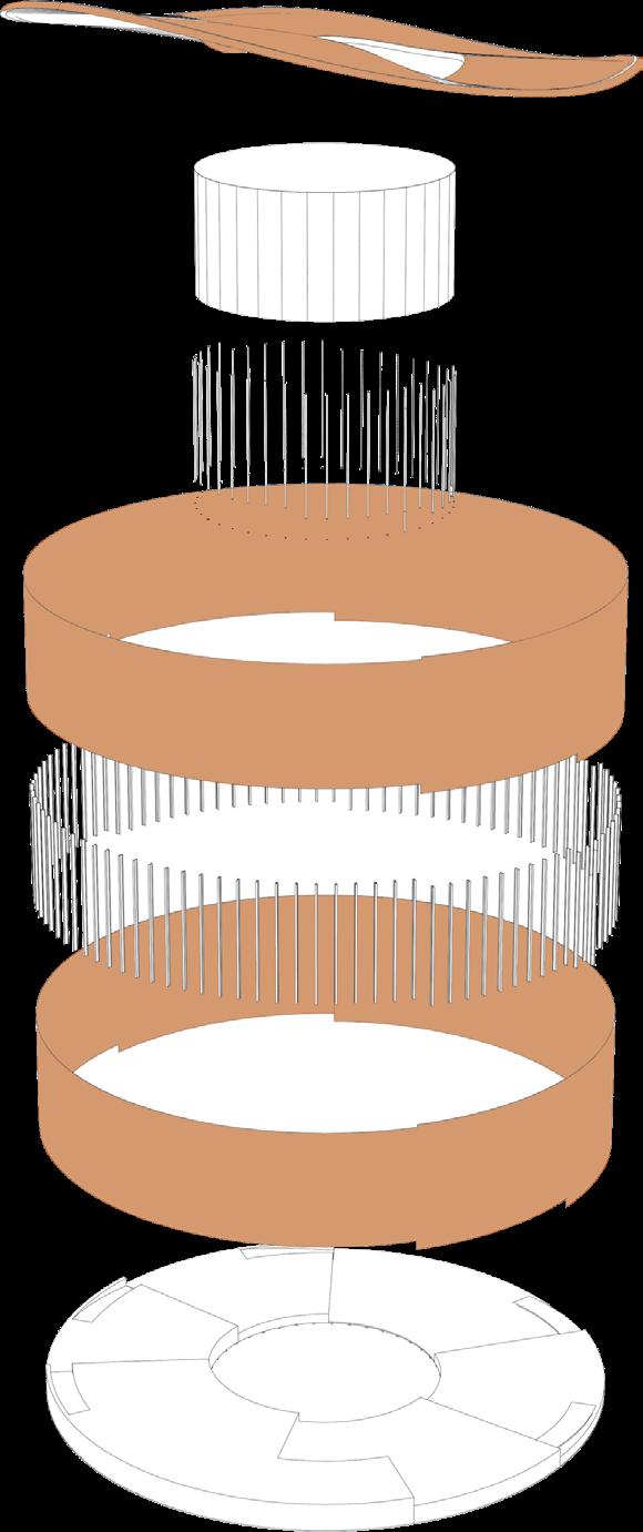

the concept of the structural design was to have two kinds of facades: the spider curtain wall that allows light to enter providing a feeling of lightness. And the more dominant curtain wall made of steel panels that also includes a glass passage.
01
Detailing of the connection of a curtain wall with a shell made of metal profiles.


03
Detailing of profile made wall with metal cladding.
silicone sealant isolation layer
02
Detailing of connecting a window in a curtain wall.

A626 clips
plaster board isolation layer INP profile double sided Black anodized Stand triplex glass tape Steel profile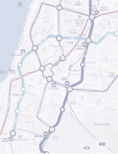
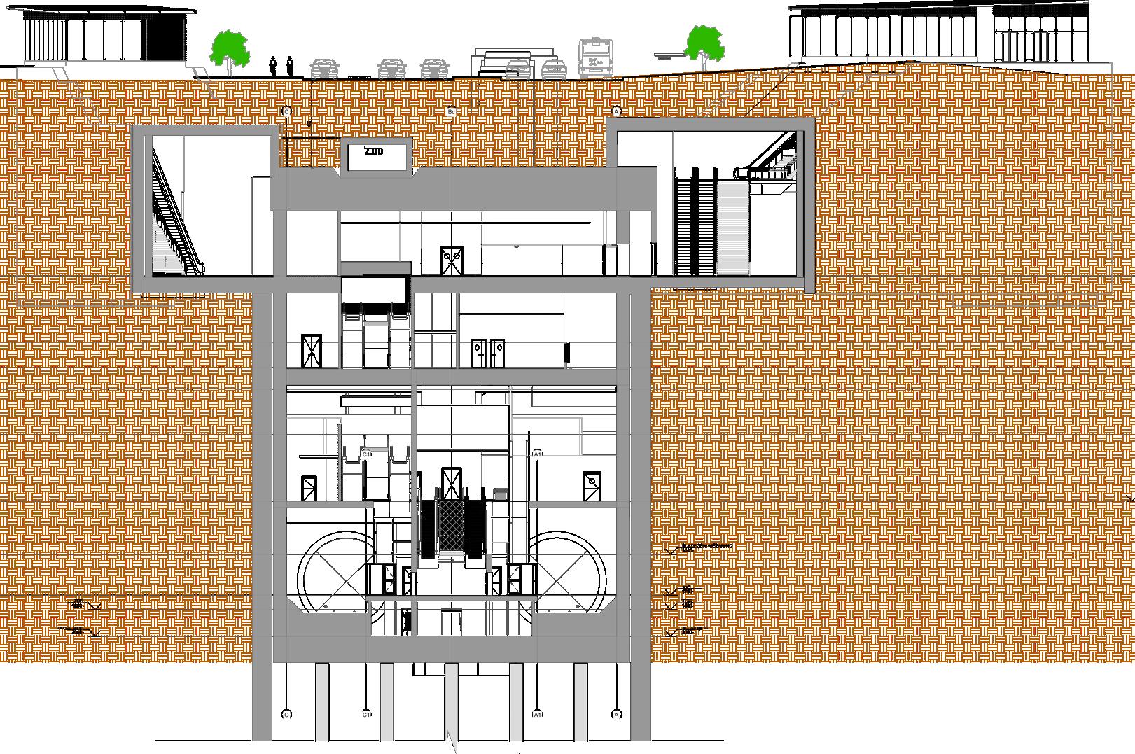
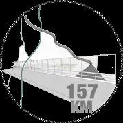
The metro line network includes 3 lines with a total length of 150 km of underground network that will serve the Tel Aviv metropolitan area through 109 stations. 4 Depot complexes are designed to support the network. The objective is to establish a mass transit system that links commuter towns to the center of the Tel Aviv Metropolitan Area and its major business centers, quickly and conveniently, and connecting residential neighborhoods with workplaces via light rail, heavy rail, and other public transport.
480,000 DAILY PASSENGERS
HERZLIYA EMPLOYMENT AREA
RAMAT HASHARON EMPLOYTMENT AREA
GLILOT NORTH
GLILOT TRANSPORTAION HUB
KIRYAT SHAUL
PINCHAS ROZEN
RAMAT HACHAYAL
KIRYAT ARYE TRAIN STATION
KIRYAT ARYE EMPLOYMENT AREA
SOROKA BEILINSON HSPITAL
KFAR GANIM
LEVI ESHKOL
SHLOMO HAMELECH
TEL HASHOMER HOSPITAL
YIGAL ALON
BIKAT ONO
ARIEL SHARON PARK
HOLON INDUSTRIAL AREA
HAMELACHA
HOLON CENTER
GOLDA MEIR
HOLON YOSEFTAL
BAT YAM YOSEFTAL
HAKOMEMIYUT
BEN GURION AIRPORT
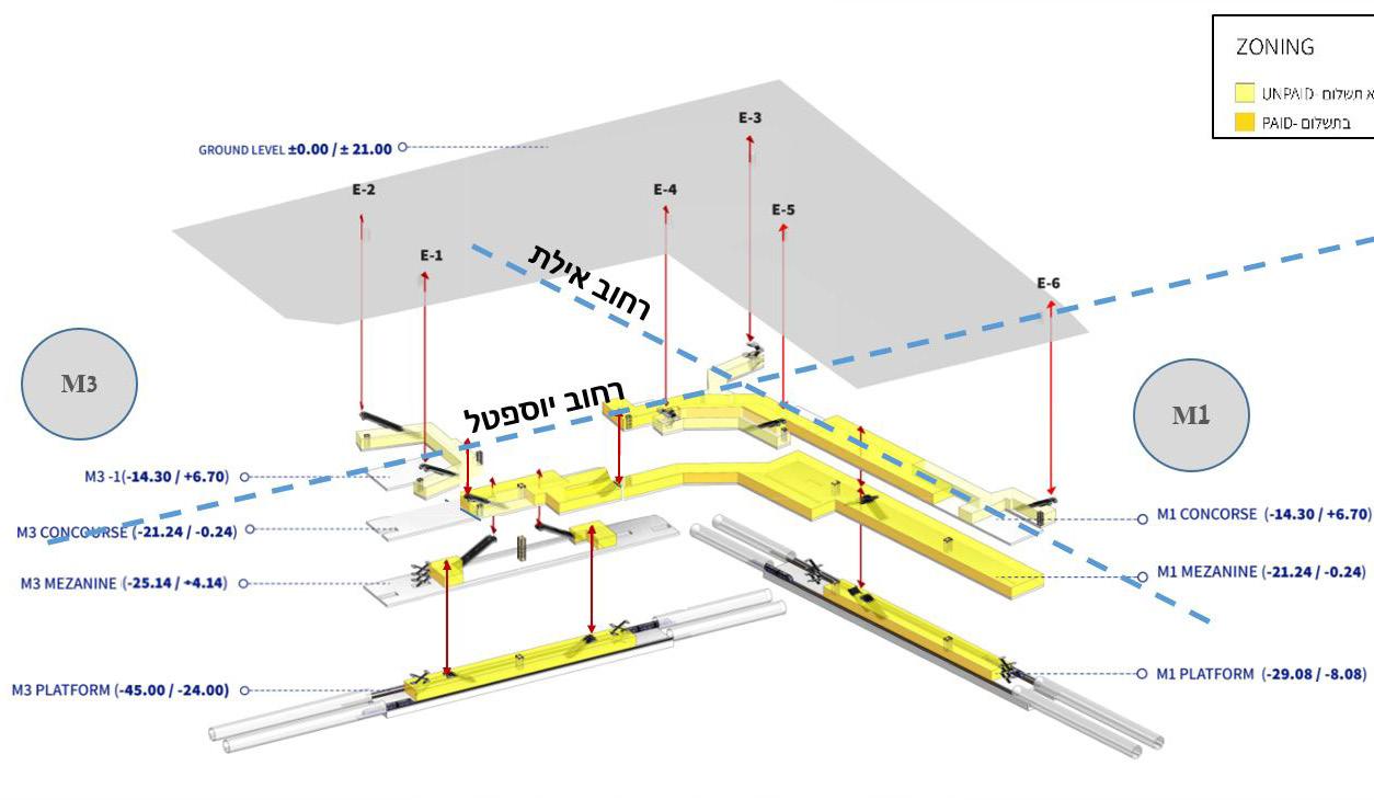
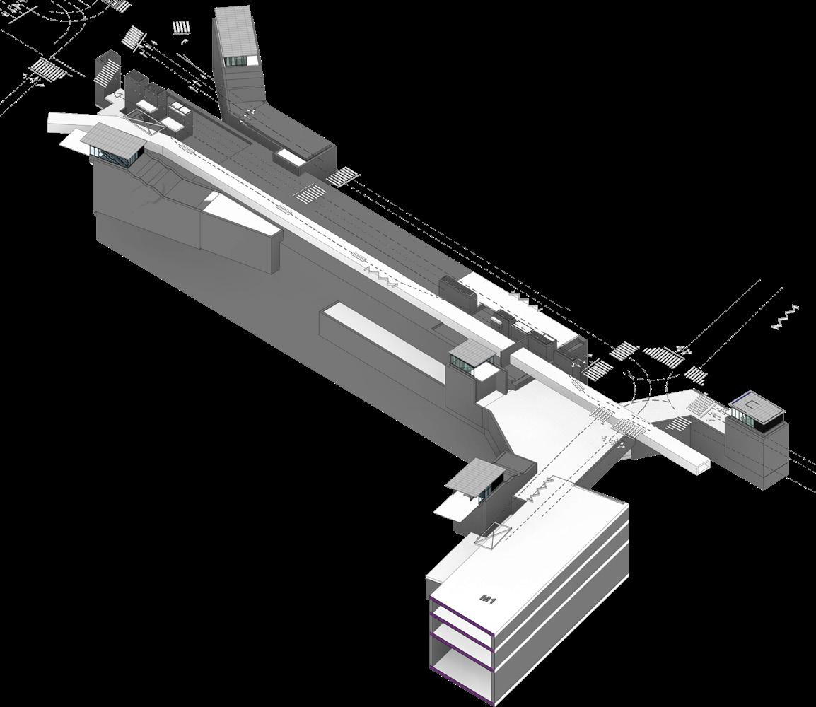
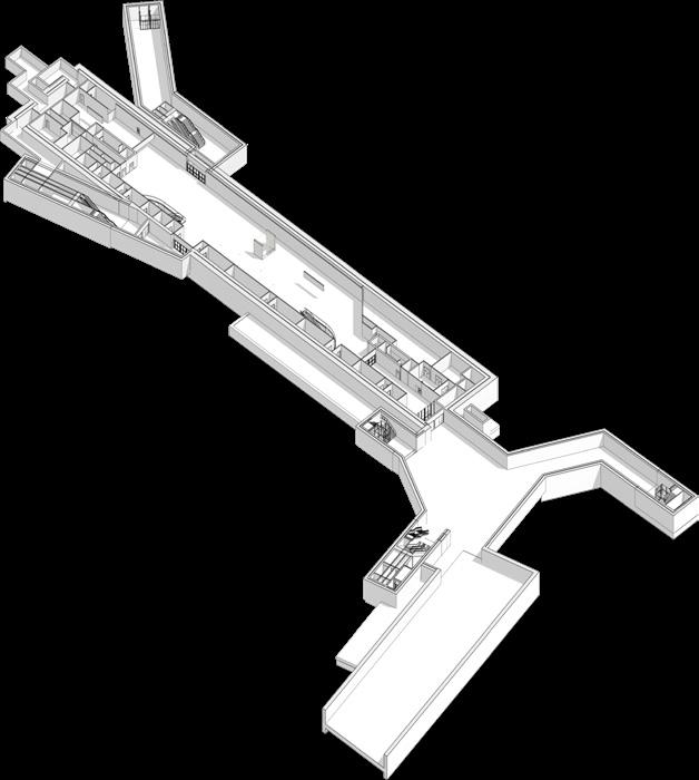
Stations along M3 line
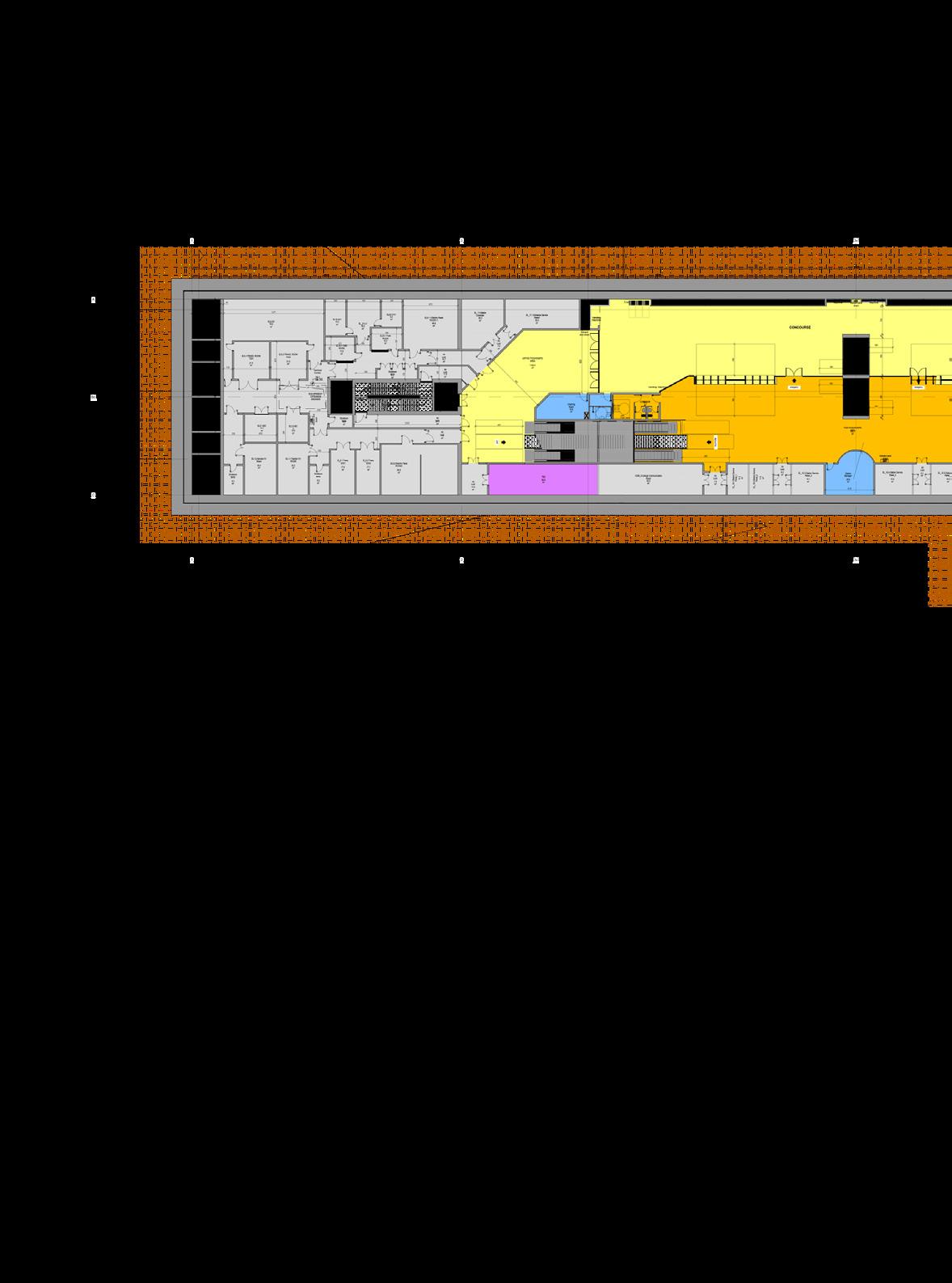
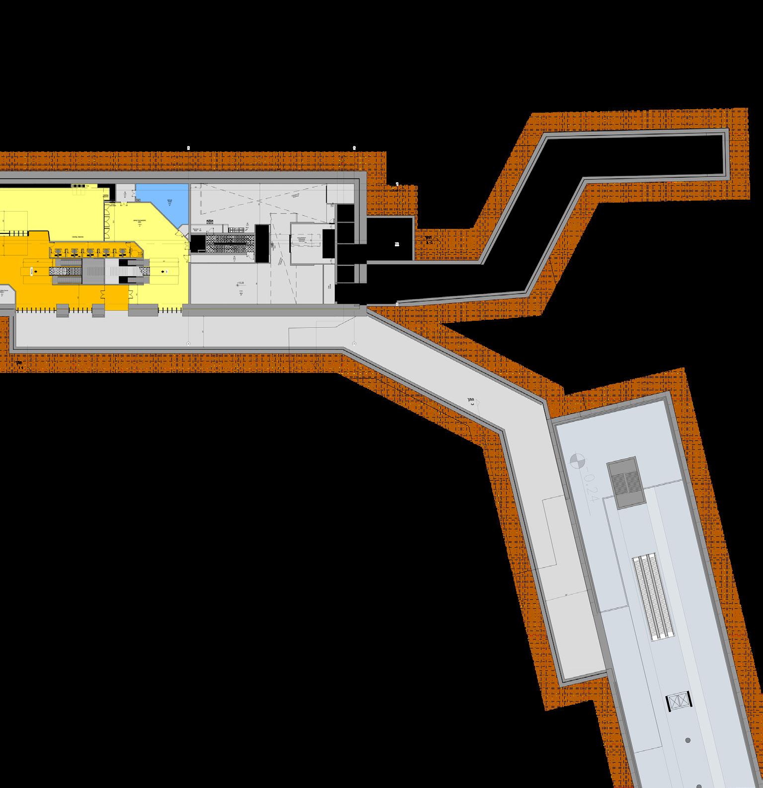
At the western border of the city of Holon, on Yoseftal Boulevard between Eilat Street and Ayalon Lanes.
The station is located near the Israel Yoseftal train station, on the seam between Bat Yam and Holon.
The area around the station is an old residential area facing renewal processes.
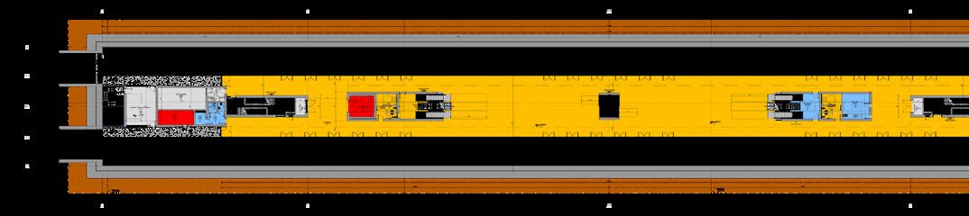
Holon Yoseftal is a complex station shared by the M1 and M3 metro lines. The combination of two metro lines and an Israel Railway station makes the station a significant transportation center.
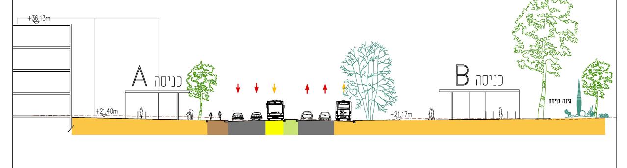
Yoseftal Boulevard is a central part of the metropolitan axis connecting Azor, Holon and Bat Yam. Planned as a main urban street along with intensive land uses including residencies, businesses and commerce, and public buildings.
CENTERS OF INTEREST|(at a distance of up to 800 meters from the station)
The station is on the main road in the city in a central residential area, close to public transportation.
Areas of interest:
At a walking distance of about 5 minutes (400 meters) meters from the entrances to the station are the Israel Railway Station, and municipal public and educational institutions.
At a walking distance of about 10 minutes (800 meters) within the service range are the Puppet Theater Art Museum and Holon Municipality.
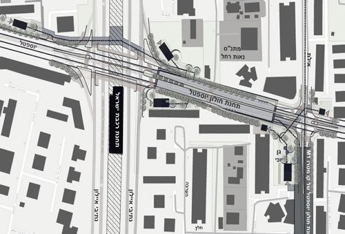
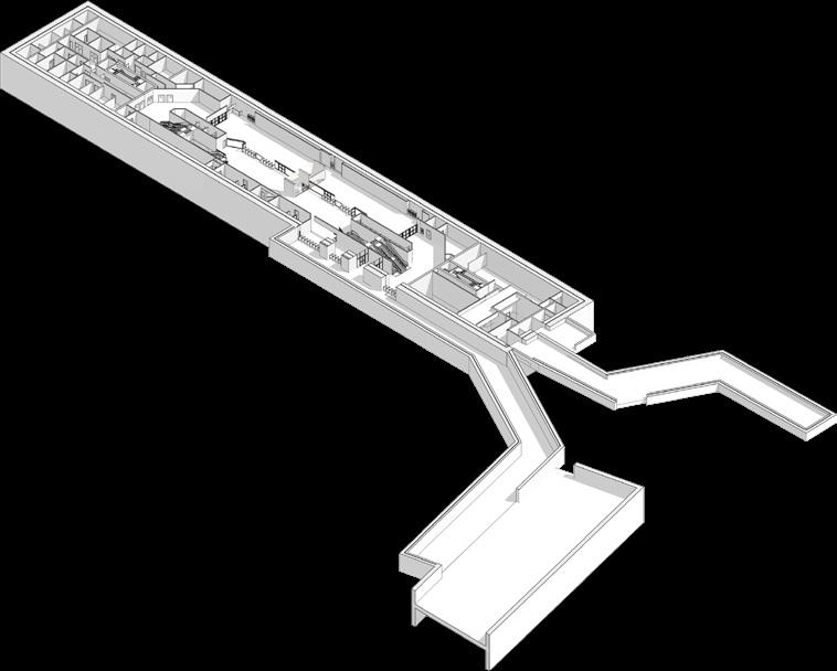
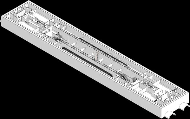
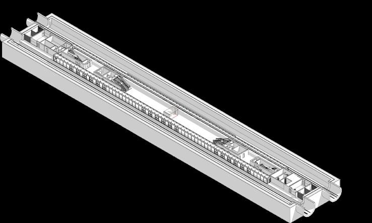
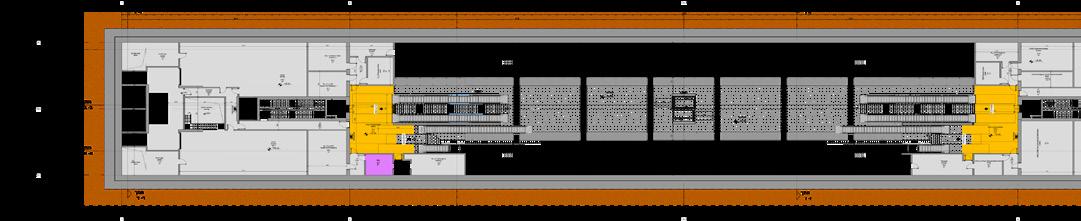
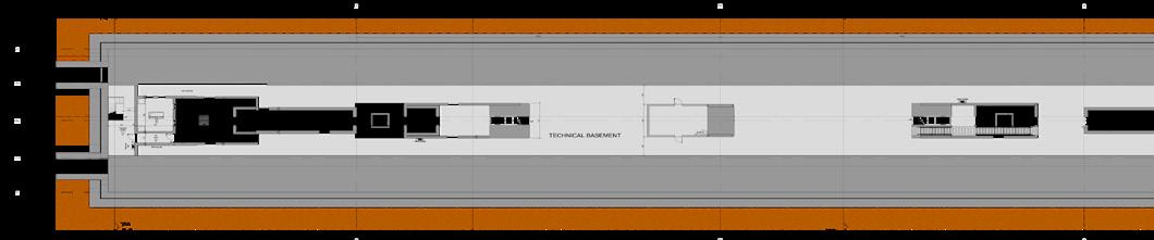
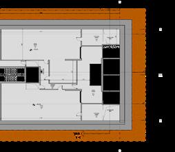
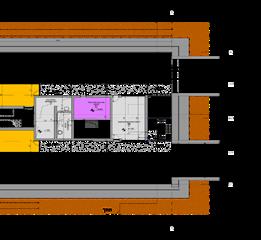
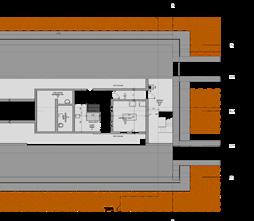
Case study station| HOLON YOSEFTAL
Zonning| UNPAID PAID OPERATE TBD SECURITY| TECHNICAL PROTECTION station`s levels plans
Line M3 is designed to provide accessibility and connectivity to significant employment centers on the metropolitan inner ring border.
* Image is done by collaboration of YAEL &LERMAN architcts ltd.
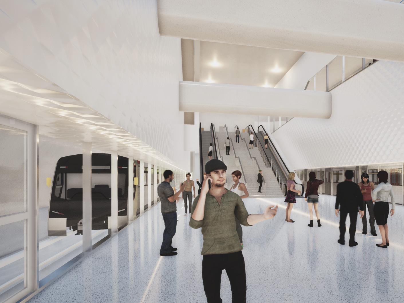
* Render from inside of typical station