escarleth Portfolio
My portfolio is a reflection of who I am as a professional; it showcases projects that have influenced my aesthetic, social consciousness, and values throughout my career, but above all, my professional commitment.
The six projects I present demonstrate the diversity of scales I have worked on, as well as the versatility of my professional work. They provide a chronological narrative, from when I began my journey as an architect to my professional experience in urban planning.
Furthermore, they mark stages of my growth while also illustrating the consistency, sensitivity, and professionalism with which I approach my work.
Municipal Territorial Planning Program of Xalapa, Veracruz
Urban Planning | Urban Policies
Manuel Martin Ortega Hernandez
Center for Tiflological Resources
Architectural and Urban Design | Co-design
Revitalization of Chuo Park, Inclusion in Public Space
Urban Design | Co-design
Focal Building C20N
Architectural Design
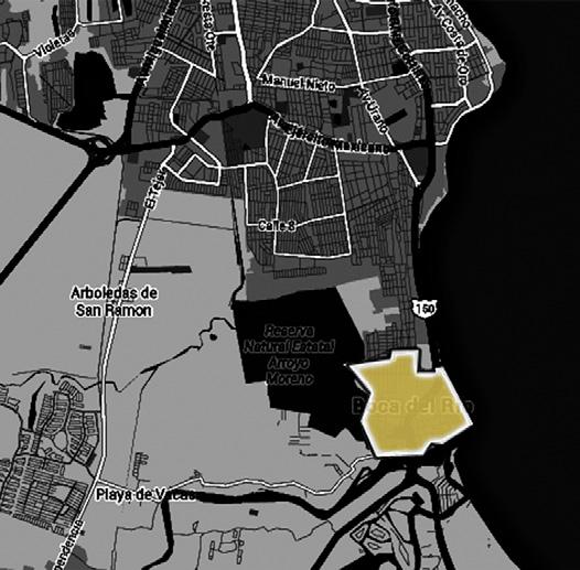
Faculty of Architecture UV, Boca del Rio campus
Architectural Design
House 65, Xalapa
Architectural Design
2017 2017 2016 2016 Content
2021 2018

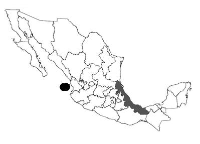
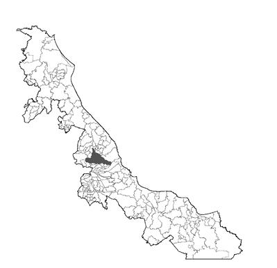
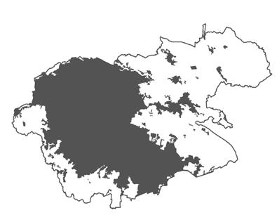
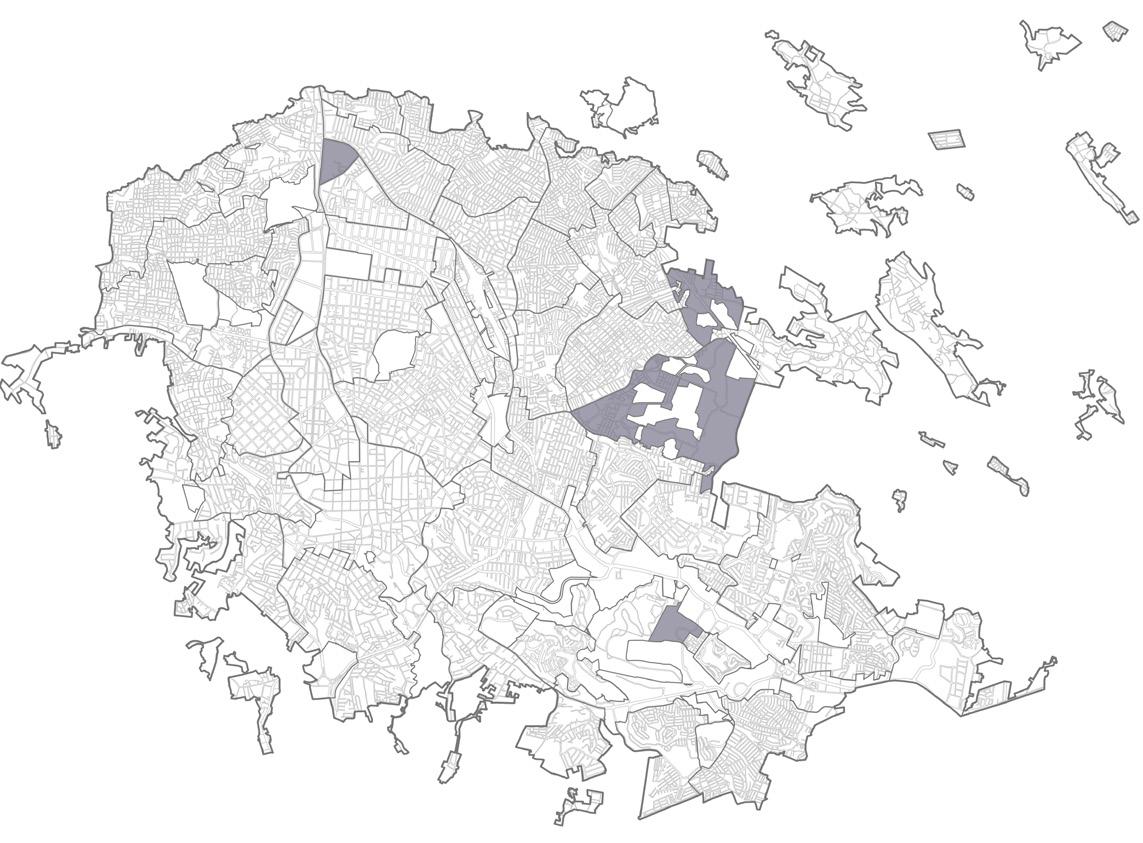
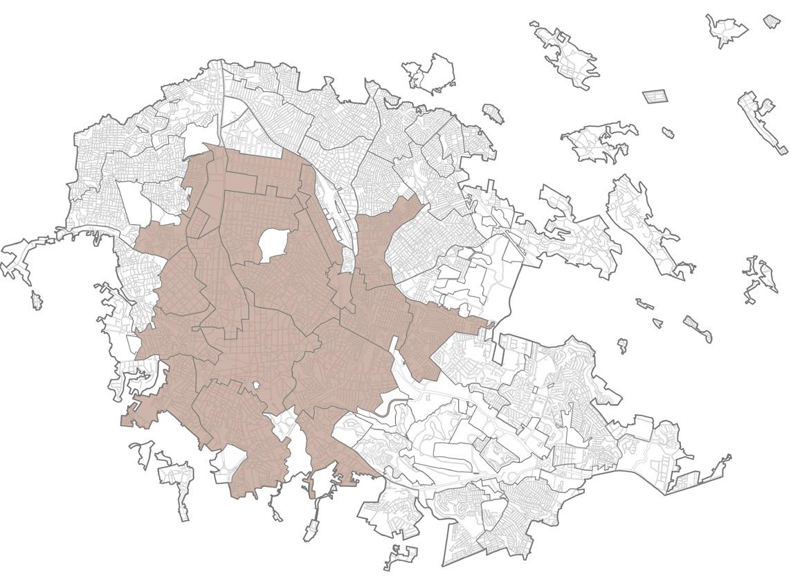
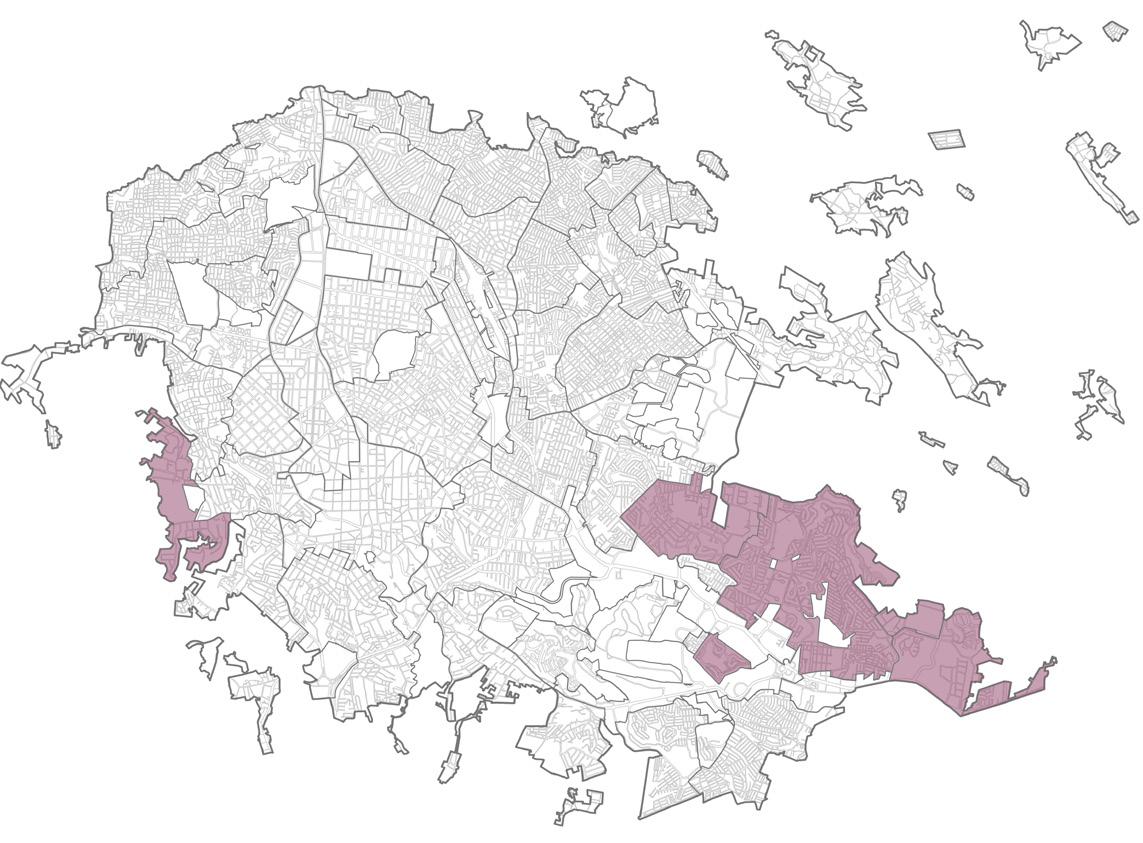
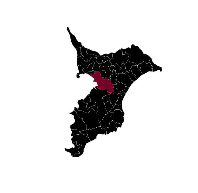
Municipal Territorial Planning Program of Xalapa, Veracruz (PMOTX)
Official Gazette of the State of Veracruz, extraordinary issue 504, Volume I | Dec. 21
Prepared by: Urban Development Directorate of the Honorable Constitutional Municipal Council of Xalapa 2018-2021
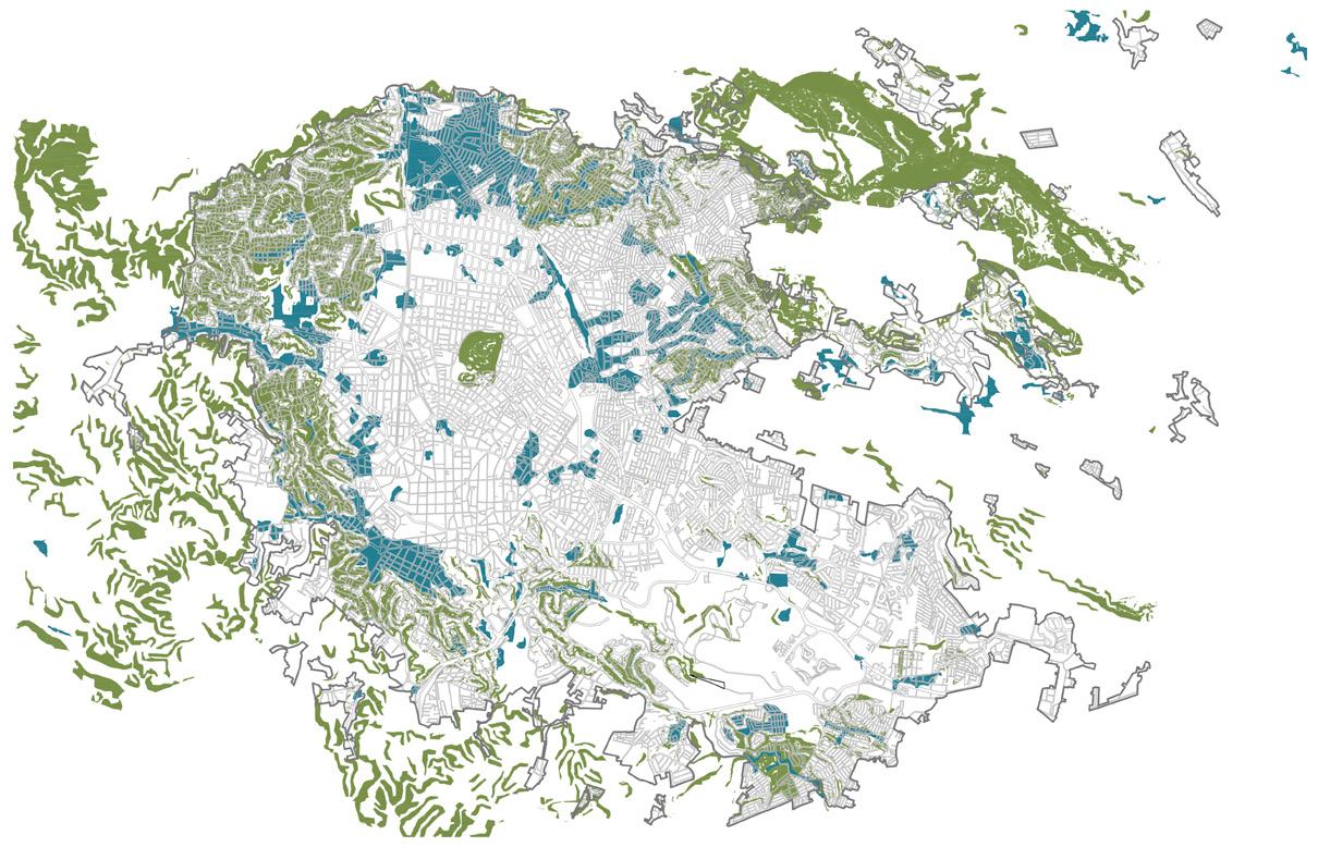
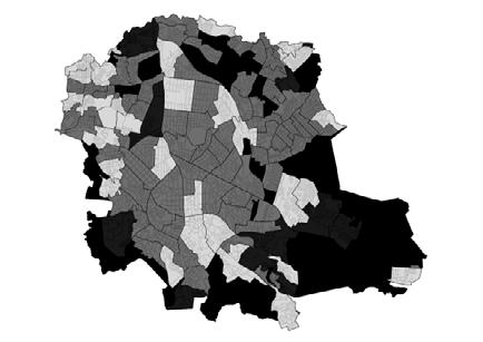
The PMOTX is the update of the city planning instrument for the city where I live, Xalapa. I was fortunate to be a participant and collaborator from the beginning of this project in 2018 until its publication in December 2021.
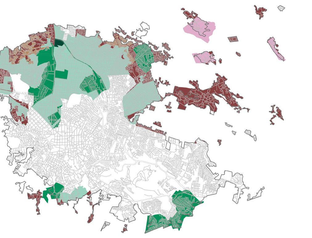
My participation focused mainly on the urban aspects of the municipality. I primarily worked on conducting the urban diagnosis and developing strategies in response to it. We arrived at a very clear picture: the sociospatial segregation of the territory, with the best infrastructure and services concentrated in the south where the population of the highest socioeconomic stratum is located, contrasting with the north, where the greatest threats and the highest degree of marginalization are found.
Below, I present some of the strategies that I consider most significant and in which I had greater initiative and participation.
In the case of the mobility program, it was a topic that I approached with great enthusiasm, and I reached out to groups of visually impaired people that I knew to include them in the proposal.
On the other hand, the housing policy initiative that we developed is also shown as a response to the clear problems of the territory, where there are increasing numbers of uninhabited houses and limited opportunities to obtain well-located housing that improves the quality of life of citizens.
Mexico
PHYSICAL THREATS
Flooding Landslides
AutoCAD Graphics, Post-production: Photoshop. Created by myself.

Metropolitan Area Xalapa
Location Veracruz Municipality Xalapa
CHEMICAL THREATS
Dangerous Substances
High Voltage
Gas Pipeline
GENDER PERSPECTIVE
Neighborhoods with cases of violence against women

2021 DIAGNOSIS
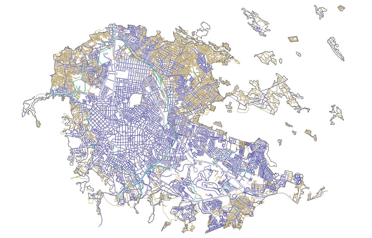
STREET PAVEMENT
Paved road
Earthen road

CONSERVATION POLICY ENVIRONMENT AND
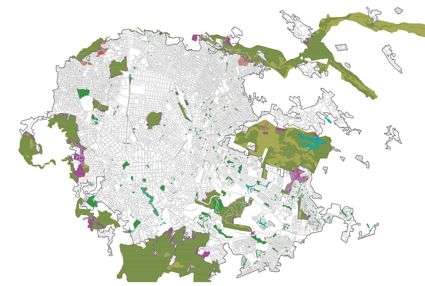
LAND
Land Regularized by INSU
Land Regularized by State
Land Regularized by PEMEX
Unregularized Ejidal Land
Ejidal Land in the Process of Regularization
Legal Fund
AutoCAD Graphics, Post-production: Photoshop.
Ecological
PNA
AREA
PUBLIC OPEN SPACE
Urban Priority Attention Zone
PROTECTED NATURAL
POS
UPAZ
TENURE
Self-made
2021 DIAGNOSIS
STRATEGY 2,244.80 ha 174.50 ha 2,419.31 ha + =
with Vegetation
PNA
with Urban Use Prior to the Declaration of the PNA
of PNA by Human Settlement 134.13 ha 55.91 ha 360.13 ha 1,694.13 ha
ECOLOGY STRATEGY
2035
PNA
Degraded
Area
Invasion
Restoration Area of the PNA
NATURAL AREA POS RER RESTRICTED ECOLOGICAL RESERVE
WATERCOURSE CONSERVATION SUBPROGRAM 1,694.13 ha 304.29 ha 856.50 ha 367.51 ha 3,222.43 ha +
PROTECTED
URBAN
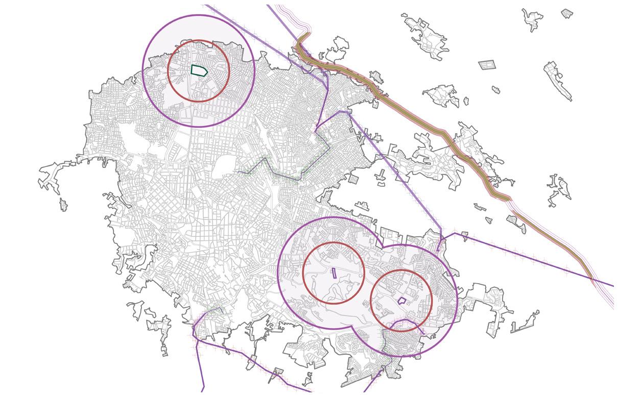
URBAN MOBILITY AND TRANSPORTATION
SUSTAINABLE URBAN MOBILITY PROGRAM
STRATEGY
Accessible Mobility Subprogram
Accessible Mobility proposes a model based on the movements and journeys of people with reduced mobility, prioritizing the fluidity of routes and the creation of mobility sectors that address the urban quality of life of users (Workshop for the Implementation of Transport Corridors, n.d.).
Mitigating Socio-Spatial Segregation

Diversifying Transportation Systems

Improving Primary and Secondary Road Network
Modernizing Interurban Connectivity

CURRENT CONTEXT

INEGI 2020 Census: Xalapa
17.72% Population with Disabilities
Xalapa, attractive Municipality for the Population with Disabilities at a Regional Level
CRISVER
Multiple Attention Centers Associations

Veracruz, Leading in Diabetes
Cases Nationwide
Consequences: Blindness, Reduced Mobility, Loss of Limbs, etc.
The main objectives of this program are:
1. 2. 3.
Enhanced autonomy and security for groups with mobility limitations.
Integration between transportation systems and streets designed for universal accessibility.
Accessibility to high-traffic points for people with disabilities.
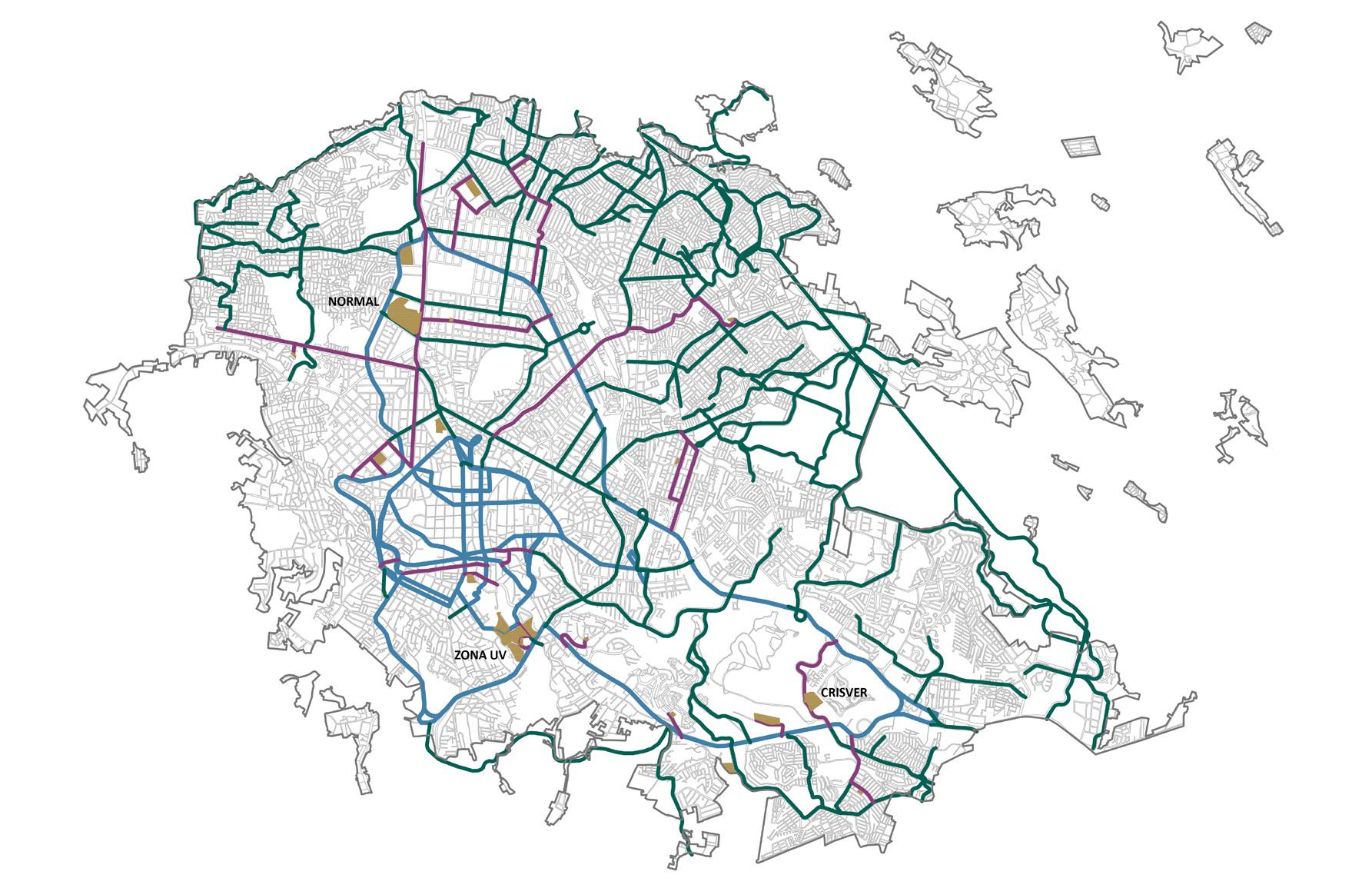
STAGES
Short Term (2025)
Universal Accessibility

Universal accessibility is understood as the condition that any environment, process, object, furniture, or instrument, in this case urban, must meet to be usable and practicable for all types of people in conditions of safety and comfort, in the most autonomous and natural way possible (Accessible City Corporation and Bodeguer & Squella ARQ, 2010).
Population with reduced mobility: people with disabilities, people with a temporary injury, pregnant women, children, older adults, people pushing a stroller, carrying luggage, or groceries, etc.
+
Accessible Urban Transportation Routes
AutoCAD Graphics, Post-production: Photoshop. Created by myself.
Streets Adapted for Universal Accessibility
Identification of Points Served by People with Reduced Mobility
The main objective is to create complete routes in which people with mobility limitations can move autonomously from accessible public transportation routes to the strategic points mentioned earlier.
All these streets, being part of a road structure, must adapt their original characteristics or be constructed to have the elements that allow people to move safely and autonomously along their route. The specifications of these elements are found in section 3.10 Mobility Standards of the PMOTX.
Streets Constructed and Adapted for Universal Accessibility
Medium Term (2035) +
Points of Interest
STRATEGY
Integrated Transportation System

It is aimed at contributing to the integration of public transportation with other modes of transportation, generating intermodality (Equitable City Inclusive City [CECI], n.d.).
Accessible Mobility Subprogram
Accessible Public Transportation
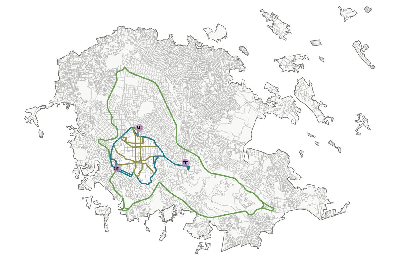
ACCESSIBLE URBAN TRANSPORTATION ROUTE CIRCUNVALACION
It is proposed that this route, along with those included in the Urban Mobility and Accessibility Program, implement accessible urban buses. Accessible urban buses must ensure that all individuals, not just those with disabilities, can access, be comfortable, safe, and move autonomously (Accessibility Institute, n.d.).
SECTORAL PLAN FOR SUSTAINABLE URBAN MOBILITY
Urban
Center Transportation and Accessibility Subprogram
INTERMODAL TRANSPORTATION CENTERS (CIT)
These sites are intended for transferring trips from external routes to the Urban Center to exclusive routes in this sector. They should be equipped to accommodate accessible bus stops, general waiting areas for passengers, as well as digital ticket booths for purchasing or redeeming city route tickets.
At these Intermodal Transfer Centers, passengers will be able to transfer to other private transportation systems, as well as access bike stations, thereby achieving intermodality and user access to it.
INTERMODAL TRANSPORT TERMINAL (TIT)
It is a terminal designed to provide access to the population to different modes of urban transportation. It will be the starting point for the route that circumvents the urban center, and it will also receive external routes from other sectors of the city and the metropolitan area to facilitate the transfer of users to different modes of transportation.
ACCESSIBLE URBAN TRANSPORTATION ROUTE
URBAN CENTER CIRCUNVALACION
The circumvention route will travel from the ITT along 20 de Noviembre Avenue, reaching the Rotonda CIT, continuing along Manuel Ávila Camacho and Ignacio de la Llave Avenues to the Sauces CIT, following Venustiano Carranza Street to the University Zone, continuing along Salvador Díaz Mirón, Santos Degollado, and Xalapeños Ilustres streets to rejoin 20 de Noviembre Avenue back to the ITT. This route will be conducted in both directions, and the streets may vary depending on the direction of travel.
Accessible Urban Transportation Route Urban Center Inner Circuits
From the circumvention route, 3 inner circuits are proposed that depart from the routes identified as the most used based on the diagnosis. These circuits will be one-way only and will be the only routes allowed within the perimeter of the circumvention route.
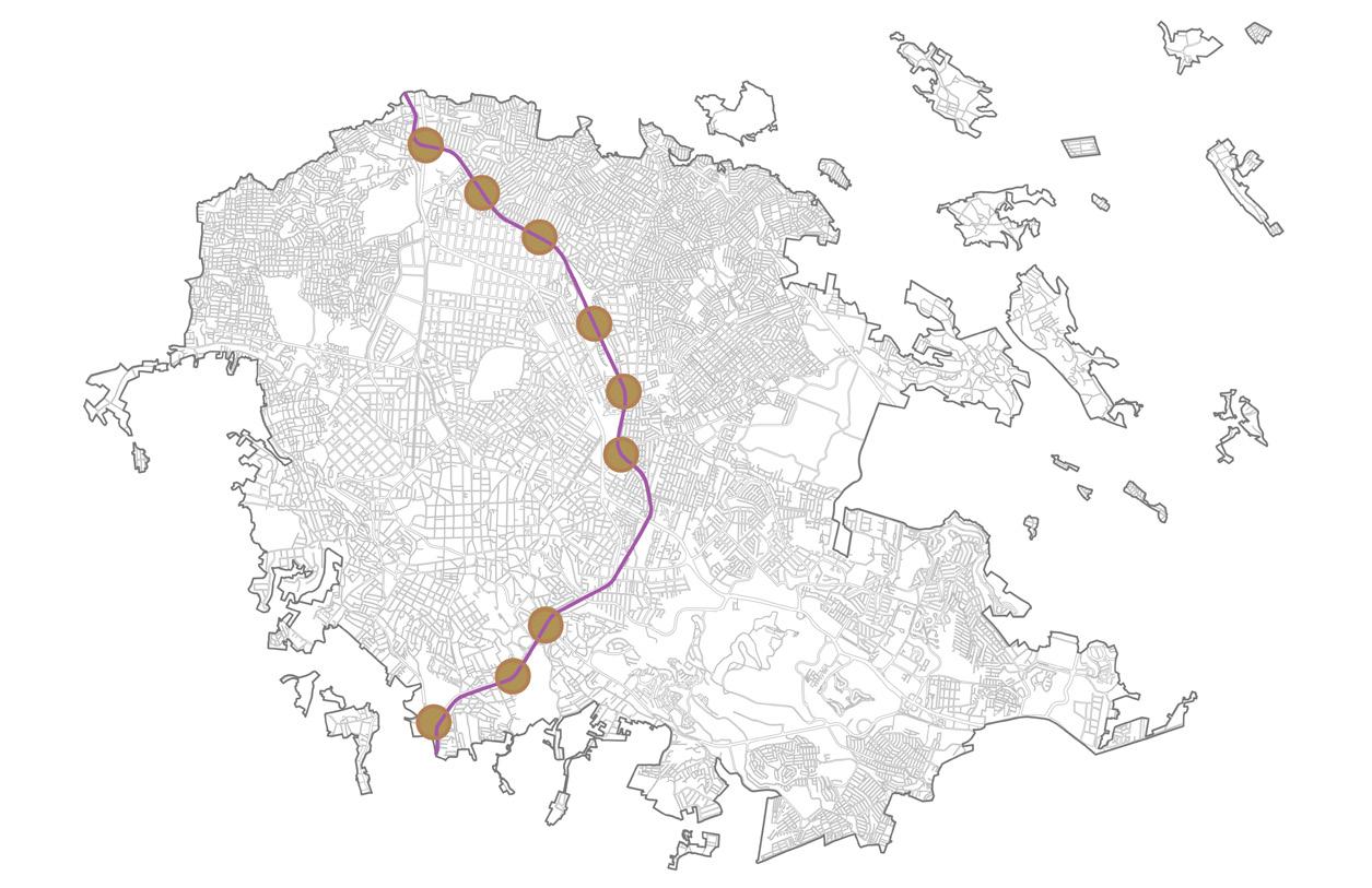
Metropolitan Light Rail Subprogram of the Capital Region
LIGHT RAIL STATIONS
LIGHT RAIL ROUTE
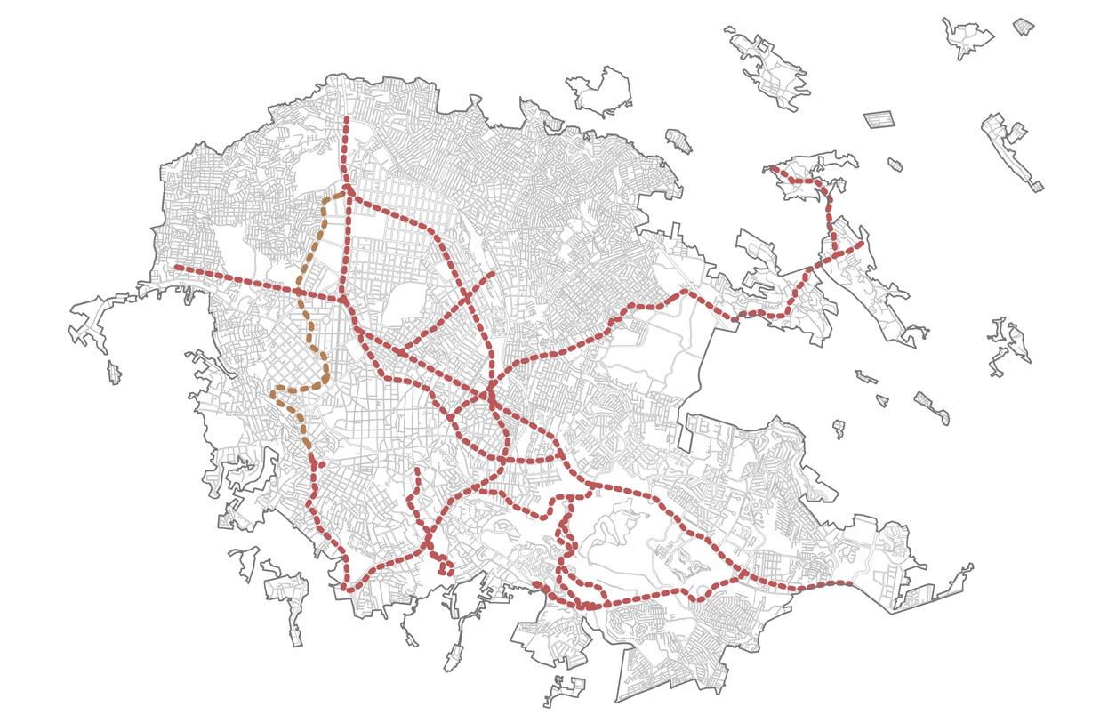
Bikeway Subprogram
PROPOSED BIKE LANE
AutoCAD Graphics, Post-production: Photoshop. Created by myself.
EXISTING BIKE LANE
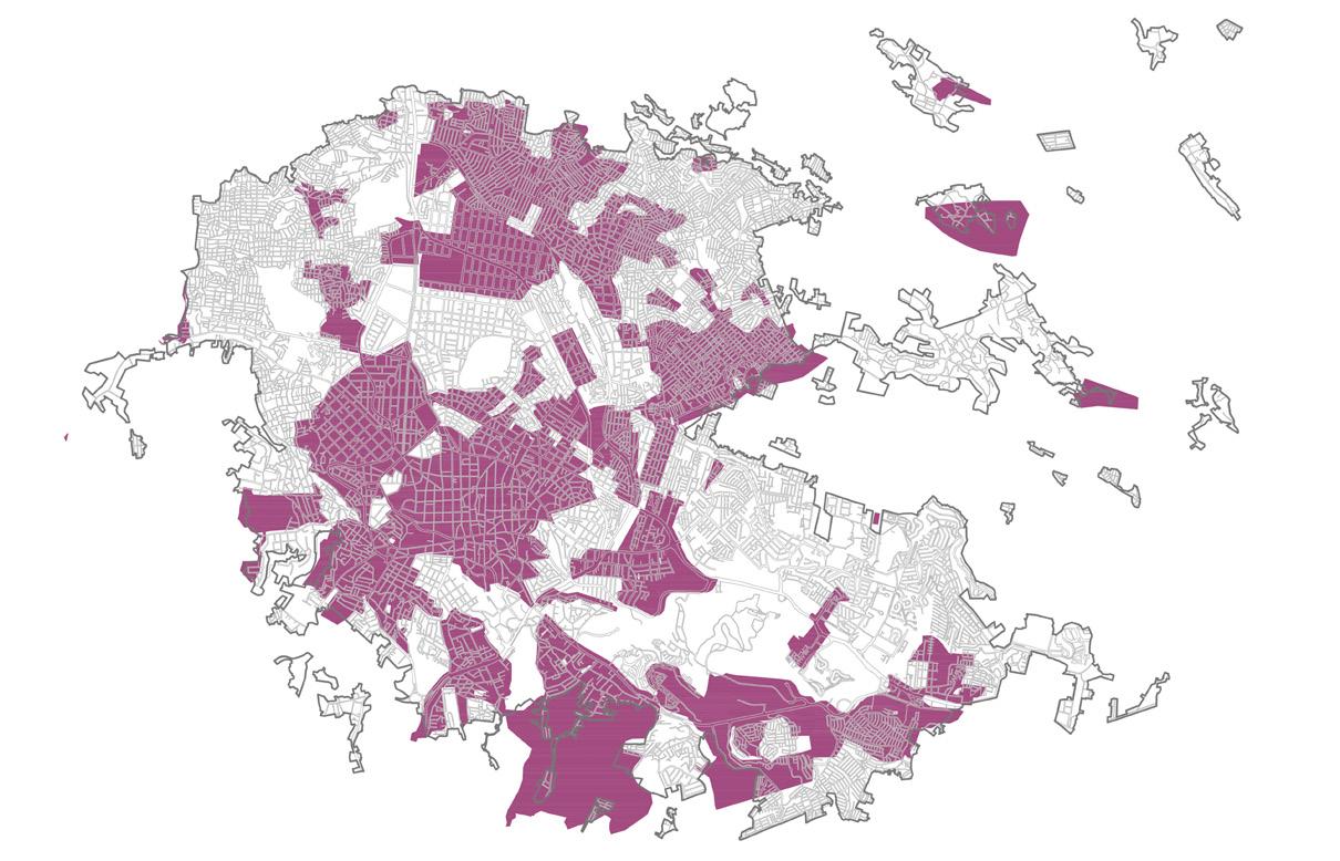
NORMATIVITY
HOUSING POLICY
INITIATIVE
Mitigating Socio-spatial Segregation Regulating and Densifying Urban Land Combating Urban Marginalization


STRATEGY
Minimum Requirements Standards for Social and Priority Housing
The incorporation of regulations is proposed to incentivize and guarantee the creation of social and priority housing. To achieve this, two categories of housing are defined by this Zoning Program to help address the backlog of housing supply according to the most vulnerable groups:
Priority Housing: This type of housing is intended for socially vulnerable groups due to risk, income, or sociodemographic conditions. It will be located in areas with access to amenities and infrastructure, improving opportunities for the population to integrate into areas with job opportunities.
Social Housing: This type of housing is rented or sold at prices not determined by the market but by the economic capacity of interested tenants (Universidad Politécnica de Madrid and Swiss Federal Institute of Technology, n.d.). It will be located in areas designated for housing regeneration and/or social inclusion, prioritizing the diversification of housing typologies in the city.

Municipal Housing System
Urban Development Directorate

Density Bonuses
Density Bonus: It is the granting of an increase in density in exchange for providing some type of public benefit, in this case social housing.
Social Development Directorate
CURRENT CONTEXT XALAPA

INEGI 2020 Census
34,169 Uninhabited Dwellings

Relocation of Dwellings
1,554 Dwellings
541 Dwellings: Gas Pipeline
85 Dwellings: High Voltage Towers
40 Dwellings: Flooding
78 Dwellings: Landslides
810 Dwellings: Invasion of Protected
Natural Area and Restricted Ecological Reserves

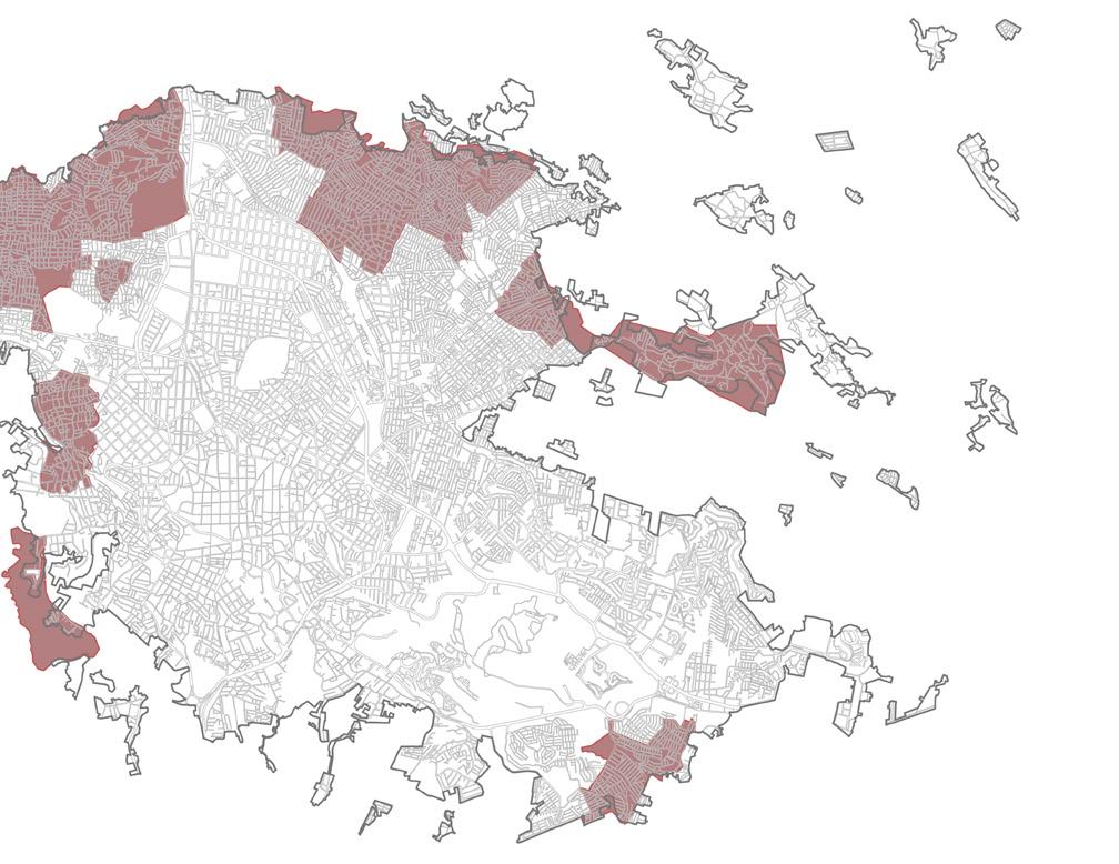
Irregular Human Settlements
832.96 Hectares
The percentage of additional levels per density bonus will be directly proportional to the percentage of mandatory social housing (SH). For example, in a homogeneous area with a CUS resulting in 3 permitted levels:
Civil Protection Directorate
Municipal Registry of Priority Housing
This registry will serve as a database from which two categories of housing can be compiled: Housing to be relocated. Housing for reconstruction or improvement.

All real estate developments consisting of more than 10 dwellings must comply with a 15% quota for social housing within the development
*The restrictions, exceptions, and specifications for this program are established in the Housing Standards of the PMOTX.
Municipal
Registry of Underutilized Properties
This registry is proposed as a tool to compile information on all abandoned or underutilized buildings in the city.
Municipal Registry of Demand for Social Integration Housing
This registry is a fundamental annex to the Subprograms of Social and Priority Housing. It will generate a database consisting of all individuals interested in becoming beneficiaries, divided into two categories:
Priority Housing Beneficiaries
Social Housing Beneficiaries
Municipal Registry of Social Integration Housing Supply
This registry works in conjunction with the previous registry and the Subprograms of Social and Priority Housing. It will comprise a database of all residential developments in the city where priority and/or social housing is offered.
100.00% allowed CUS (3 stories) = 15.00% mandatory minimum SH
133.33% allowed CUS per density bonus (4 stories) = 19.99% mandatory minimum SH
166.66% allowed CUS per density bonus (5 stories) = 24.90% mandatory minimum SH
200.00% allowed CUS per density bonus (6 stories) = 30.00% mandatory minimum SH

Relocation Housing
It is an alternative whereby, although the developer is still obligated to comply with 5% social housing within their housing complex, they may choose to relocate the remaining 10% to the reconstruction or improvement of housing from the Municipal Registries of Underutilized Properties or Priority Housing. Through the management of the Social Development Directorate in coordination with the Urban Development Directorate, the real estate developer can approach to carry out this transfer and convert the corresponding investment of this 10% into the regeneration of housing in the most vulnerable or priority sectors.
+ +
Underutilized Housing
Management
1.
Identify buildings with housing potential or for residential use.
2.
Promote financing options among homeowners to improve and/or enable their housing.
3.
Implement the regulations proposed by the PMOTX for underutilized housing, including the following obligations:
Maintain the buildings. Offer the houses for sale or rent.
4.
Define a tax for cases of underutilization of the property and for the maintenance carried out by the Honorable City Council of Xalapa.
5a 5b
Prescribe the properties where the owner is unknown and to which the Honorable City Council provides maintenance.
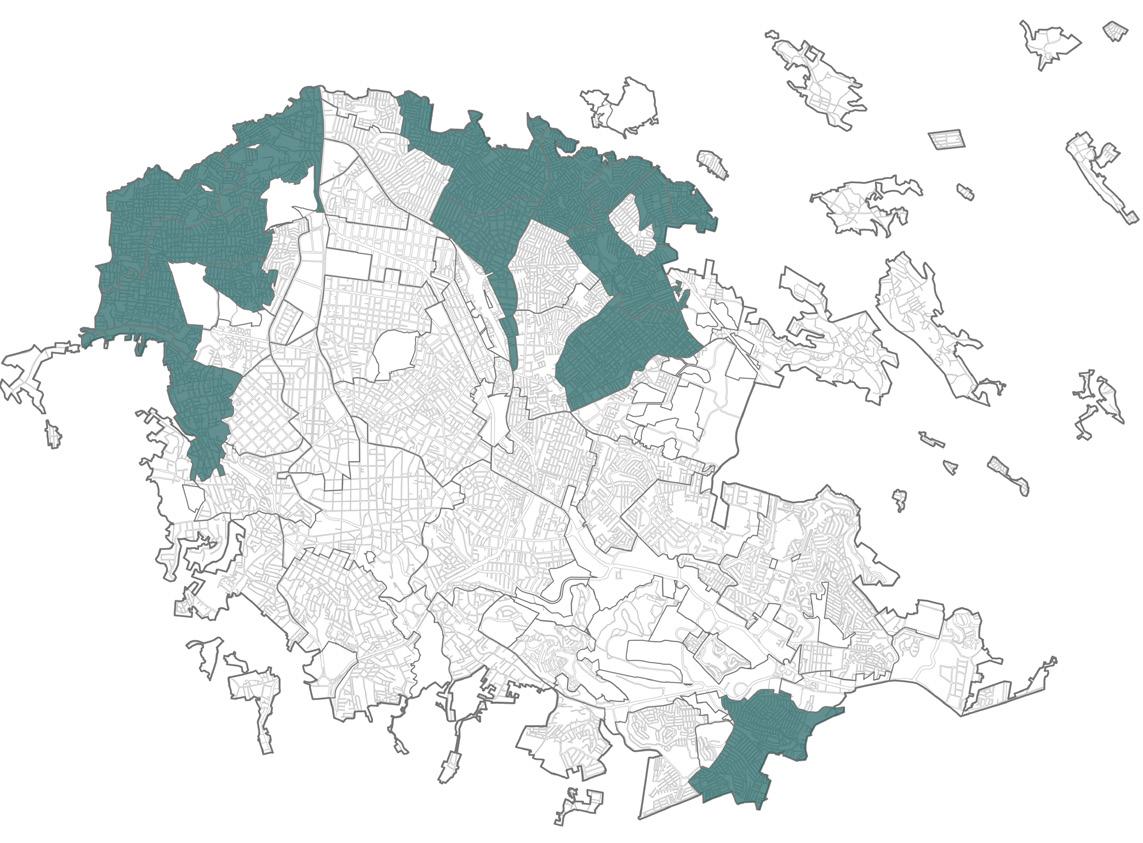
HZPA Homogeneous Zone of Priority Attention
Zone with a high and/or very high degree of urban marginalization.
All real estate developments with more than 10 housing units must comply with 15% of social housing within the development, without the possibility of relocation.
It is the destination for the percentage of social housing from relocation allowed in other homogeneous zones.
SHASI SPECIAL HOMOGENEOUS AREA FOR SOCIAL INTEGRATION
Area specially designated for the development of priority and social housing. They must comply with the established percentages of social and priority housing within the development, without the opportunity for relocation. The percentages of social and priority housing are specified in each of these zones.
Enforce the levy on properties whose owners do not comply with the maintenance tax.
6.
Implement a Social Housing Rental Program using housing obtained by the Honorable City Council of Xalapa through judicial rulings, generating revenue to establish an Urban Development Investment Fund for the city.
*In accordance with the Federal Civil Code.
*The restrictions, exceptions, and specifications for this case are established in the Housing Standards of the PMOTX.
AutoCAD Graphics, Post-production: Photoshop. Created by myself..
SHAHR SPECIAL HOMOGENEOUS AREA FOR HOUSING REGENERATION
Area served with urban amenities, infrastructure, and basic services specially intended for the regeneration of underutilized housing.
HASUSH HOMOGENEOUS AREA OF SOCIOECONOMIC UNSUSTAINABILITY FOR SOCIAL HOUSING
Area where current socioeconomic conditions do not allow for the development of priority housing and/or social housing. All real estate developments with more than 10 housing units must comply with the equivalent of a 15% investment in social housing within the development, transferring it to the reconstruction or improvement of social housing in the designated areas.

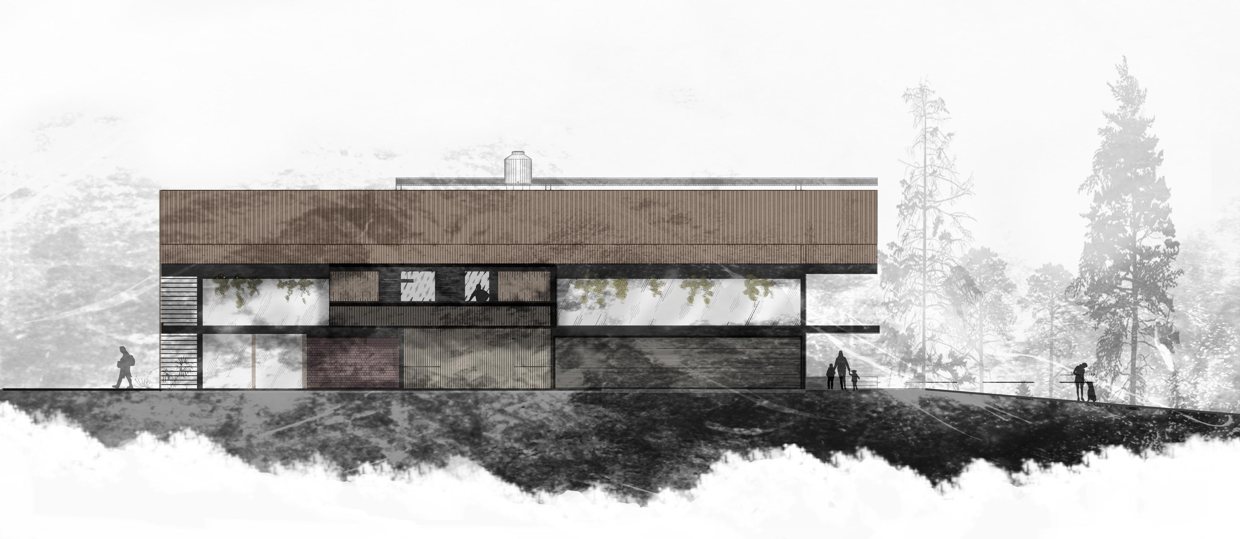
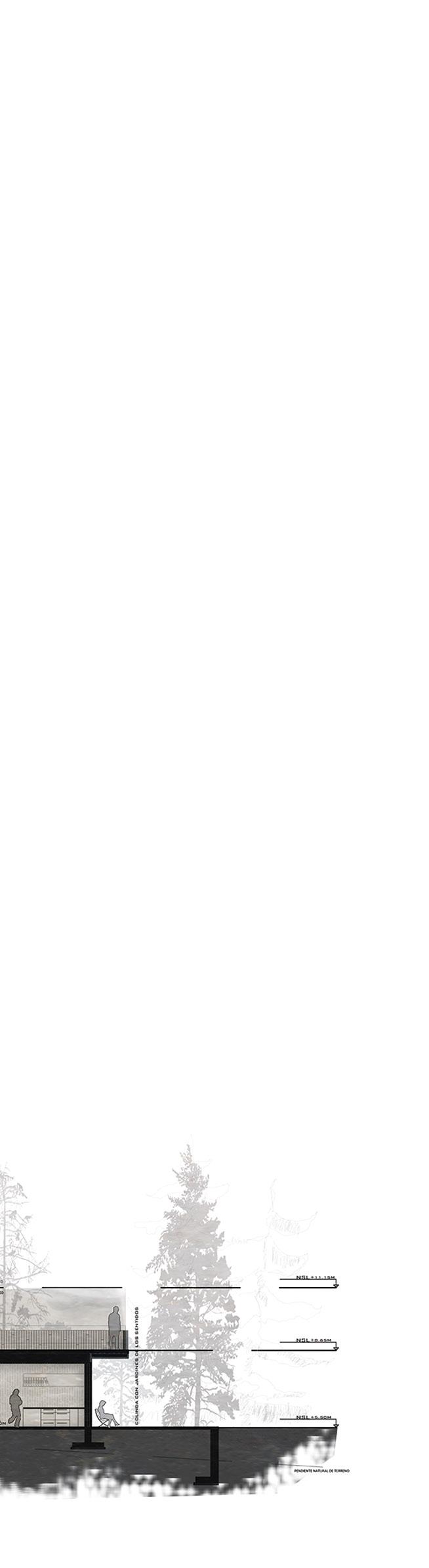
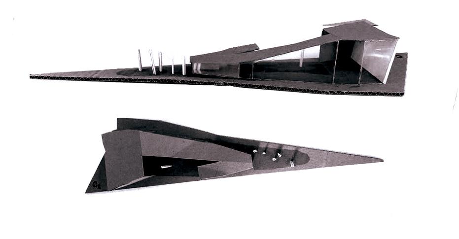
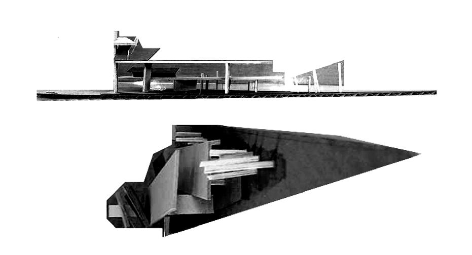
Center for Tiflological Resources
Bachelor’s Thesis | Jan. 18
The MMOH is a center aimed at serving visually impaired individuals in the State of Veracruz, Mexico. Located in the state capital, Xalapa, it focuses particularly on individuals over 30 years old. It is a space dedicated to integrating and rehabilitating blind and visually impaired individuals, but above all, it seeks to serve as a catalyst for the interaction of social groups unrelated to the users as a means of raising awareness.
Manuel Martin Ortega Hernandez
Front façade: MMOH. Self-made.

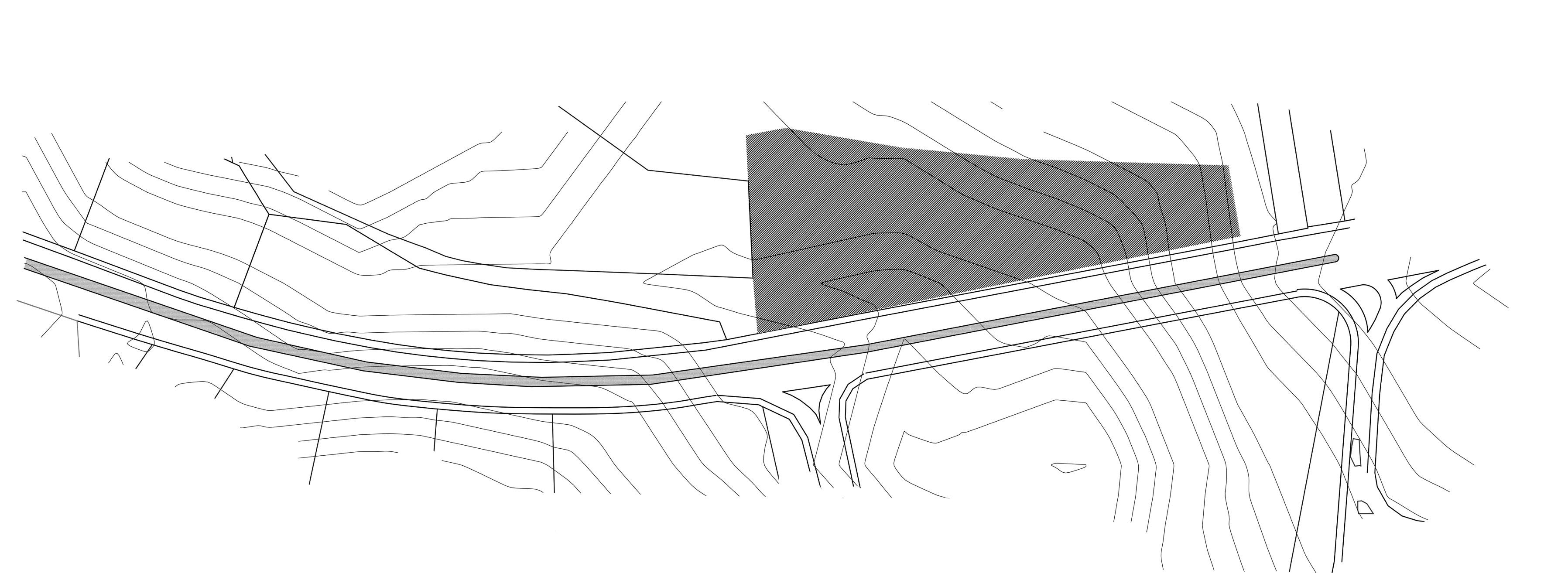
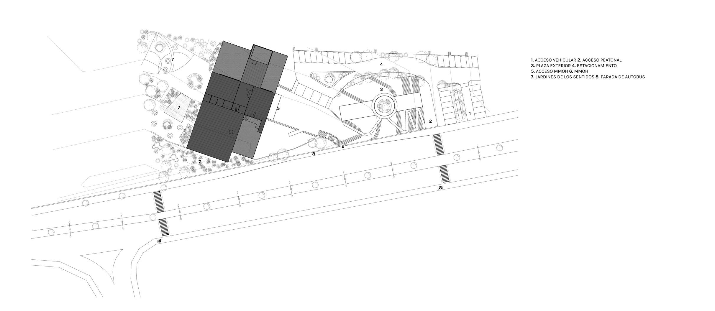
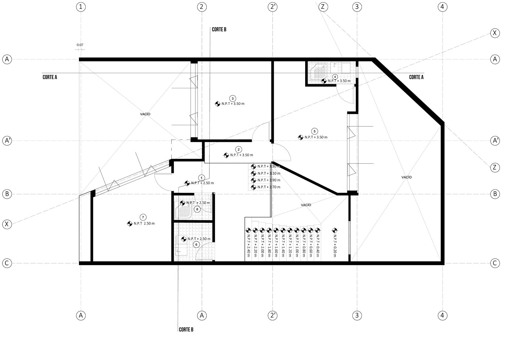
AutoCAD Graphics, Post-production: Photoshop. Created by myself. Context and Topographic Condition: MMOH Site Plan and Exterior: MMOH. ENRIQUE C. REBSAMEN AVENUE TOWARDS ARCO SUR 1. Vehicle Access 2. Pedestrian Access 3. Outdoor Plaza 4. Parking Lot 5. MMOH Access 6.MMOH 7. Gardens of the Senses 8. Bus Stop
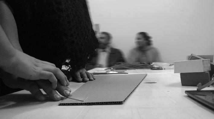
Hands that See Participatory Workshops | Association of Blind and Visually Impaired Students or Workers of the State of Veracruz, A.C.
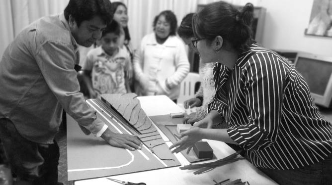
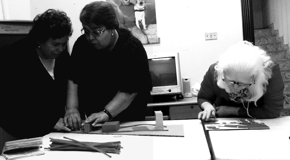
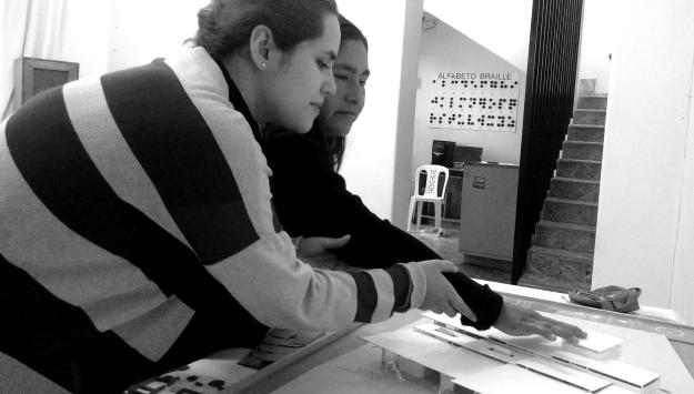
For the development of this project, collaborative work was conducted with the Association of Blind and Visually Impaired Students or Workers of the State of Veracruz, A.C.
As they are the main users to whom the project is directed, their participation was a fundamental basis throughout the projection process, in which they directly participated through various participatory workshops.
The gathering of opinions, but above all, the effort to understand the space from their perspective, was the essence of the entire design process.


WHY? Mobility Communication 97,100 pop Visual impairment 3rd Place Nationally Visual Impairment 1st Place Worldwide ATAXIA Daily Life Areas of Visual Impairment Veracruz Figures Visual Efficiency Sensory Stimulation
The MMOH begins from an exterior that gives way to public space, fostering social interaction. Furthermore, it is an invitation for the senses through its gardens.
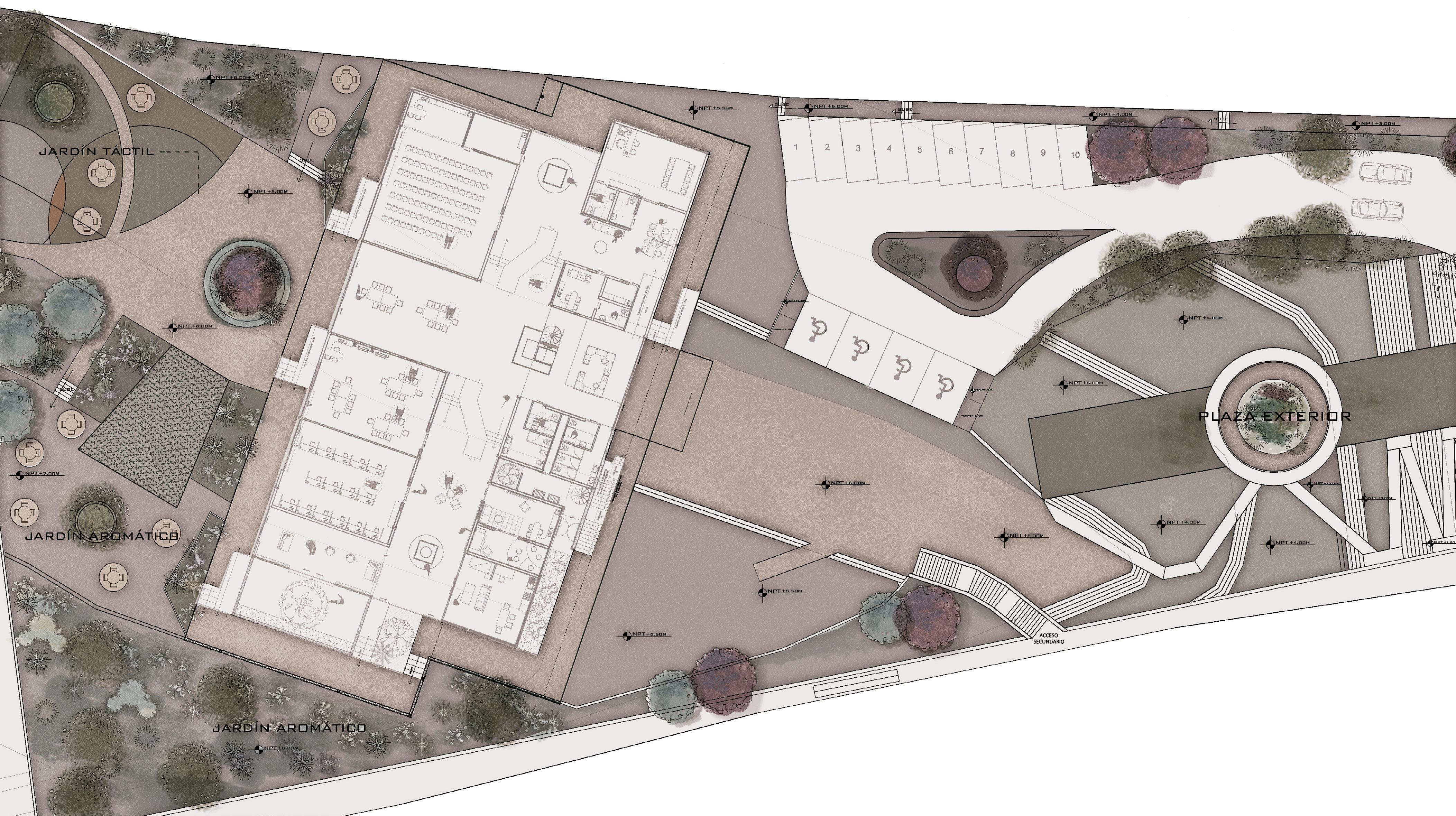
Gardens of the Senses AutoCAD Graphics, Postproduction: Photoshop. Self-made..
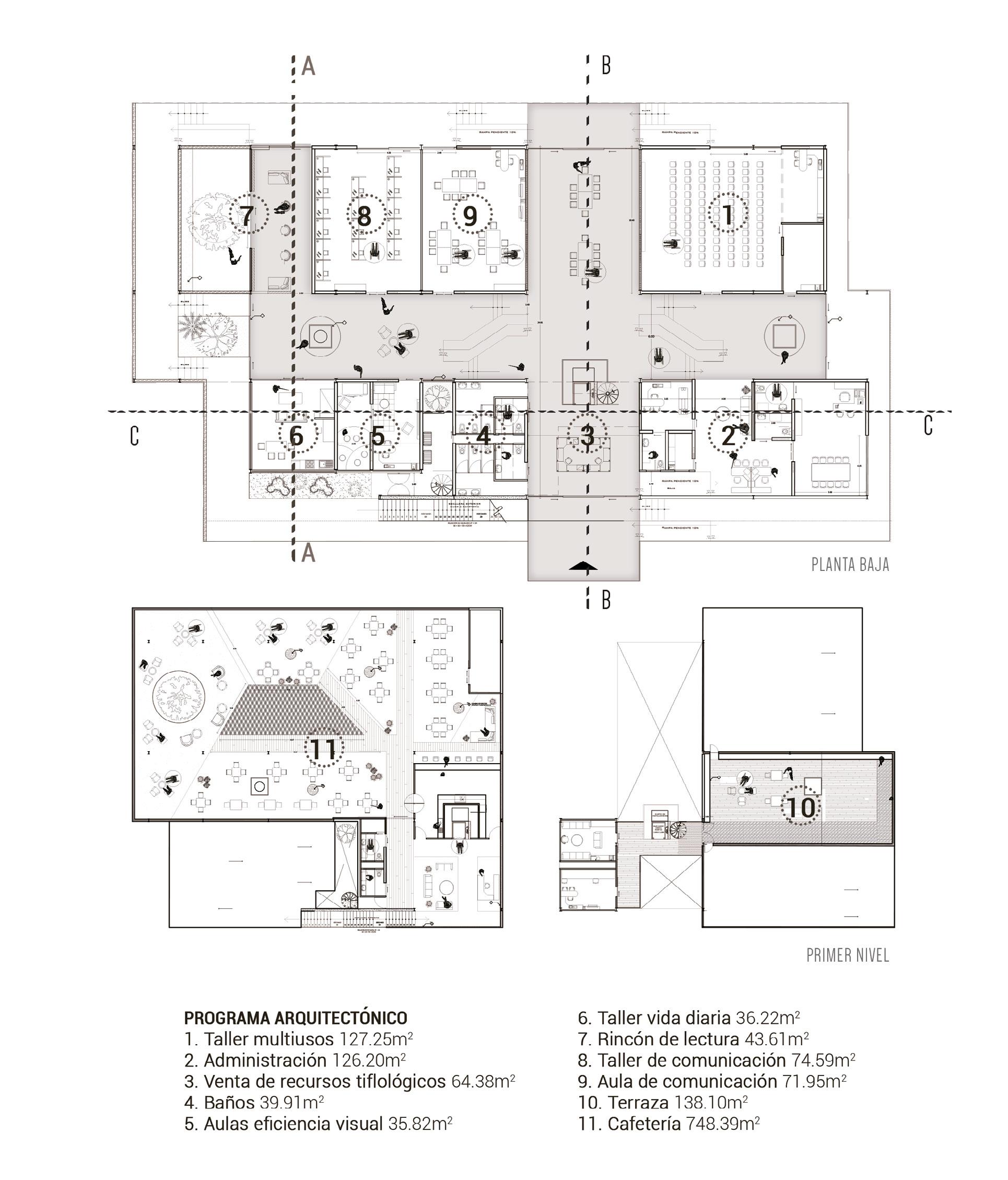
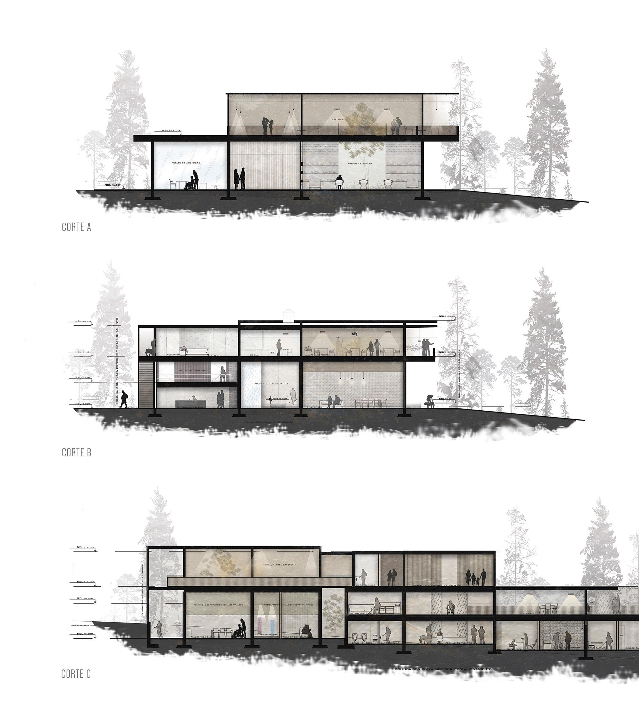
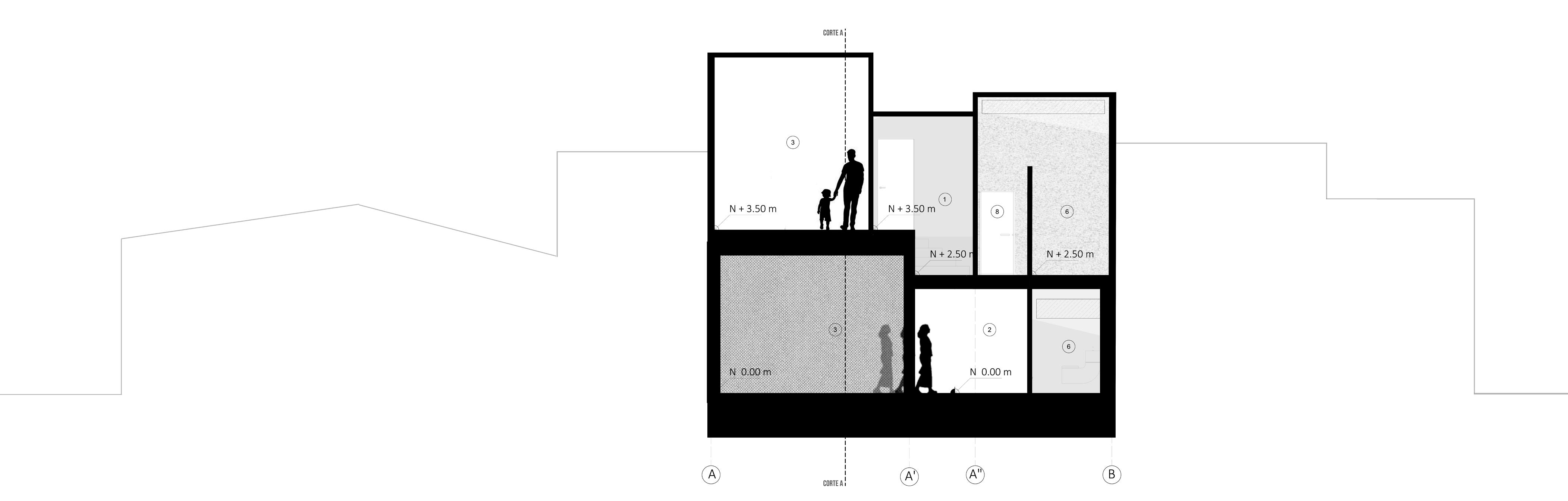
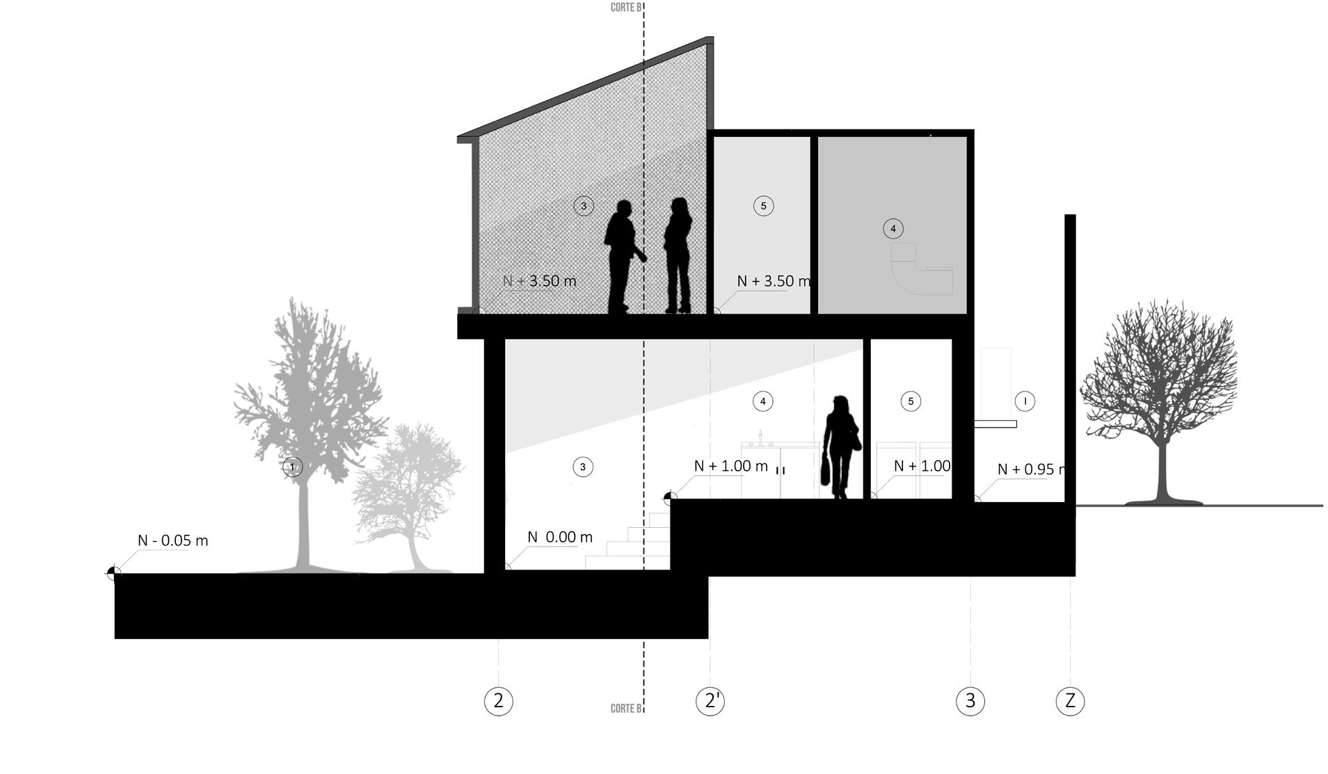
GROUND FLOOR SECTION A SECTION B SECTION C FIRST LEVEL
ARCHITECTURAL PROGRAM
1. Multi-purpose Workshop 127.25m2
2. Administration 126.20m2
3. Sale of Tiflological Resources 64.38m 2
4. Restrooms 39.91m2
5. Visual Efficiency Classrooms 35.82m2
6. Daily Life Workshop 36.22m2
7. Reading Corner 42.61m2
8. Communication Workshop 74.59m2
9. Communication Classroom 71.95m2
10. Terrace 139.10m2
11. Cafeteria 748.39m2
The octagonal design of the building responds to what was learned from participatory workshops, where the functionality of this system for people with visual impairments was expressed. It is divided into different levels, influenced by the topography of the land. On the ground floor, the focus is on addressing the 5 areas of visual impairment as a priority and central attention. On the first level, a terrace and printing classrooms are provided, and finally,
on the second level, a cafeteria is proposed to employ the same members of the association.
The architectural design is guided by the intention of creating a sensory experience for the users, through the use of different textures, light wells, and the integration of vegetation indoors. Furthermore, it aims to uphold the association’s motto of “changing the meaning of being blind.”
AutoCAD Graphics, Post-production: Photoshop. Self-made..
Fachada lateral: MMOH.


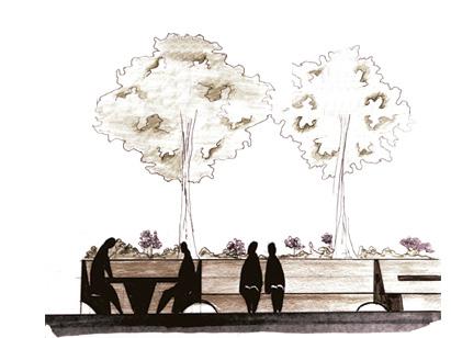
Revitalization of Chuo Park: Inclusion in public space
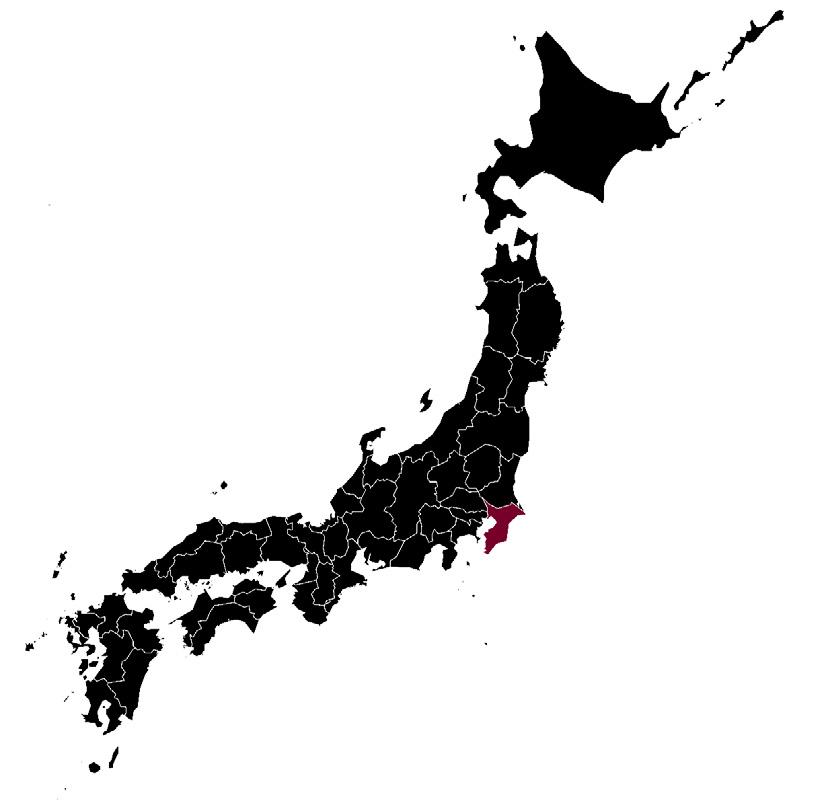
Urban Research | Jun. 17
The revitalization of Chuo (Central) Park is a project located in the central area of Chiba, Japan. This area faced various issues such as the closure of the PARCO chain, a commercial complex aimed at a predominantly young audience, which posed challenges for both public and private spaces.
Therefore, the particular focus for this project was on the inclusion and coexistence of social groups in public space. Based on this principle, and through the analysis of both physical and social aspects, the study area was approached from a central axis that could address the diverse needs of people. Participatory workshops were conducted with residents of the study area to determine the needs required in public space to enhance their enjoyment.
Based on the results obtained from both analyses, it was concluded that the revitalization of the central park was necessary to bring together different social groups and provide inclusive spaces where various activities could take place with the appropriate infrastructure for their enjoyment.
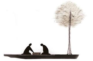
Shogi Area*
Directed towards elderly individuals who need activities that allow them to enjoy their time.
*Japanese chess.

Skating Area
Targeted towards the young population who typically use the park for this purpose.
Chuo Park Proposal. Self-made.
A
Reactivate Fountain Statue of Keller
Stage: Targeted towards events in the existing venue, a coherent manner with
JAPAN
CHUO PREFECTURE
CHIBA CITY
SECTION A
A
Study Areas
Targeted towards young people and students to spend their time after school and enjoy the space both together and alone.
Rest Area
Targeted towards all social groups, providing a comfortable space for sitting, resting, and socializing.
Educational-Sensory Area
Directed towards the general enjoyment of the population, but especially for children to enjoy with an area dedicated for mothers to watch over them while also socializing.
The proposal to revitalize Chuo Park also stemmed from the understanding that the more life the park has, the greater the influx of local people, which would consequently allow for a larger audience for the reactivation of PARCO. It was also proposed to partially close the street between PARCO and Chuo Park on weekends, serving as a blurred boundary between the two spaces.
the
of
Keller
the population attending venue, but integrating it in
park. Stage
Helen
Contexto del Parque Chuo y zona de PARCO.
PARCO CHUO PARK MONORAIL
AutoCAD Graphics, Sketch, Post-production: Photoshop. Created by myself.

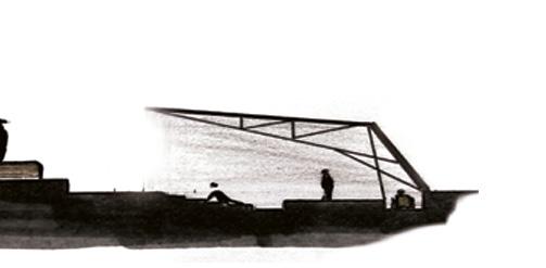
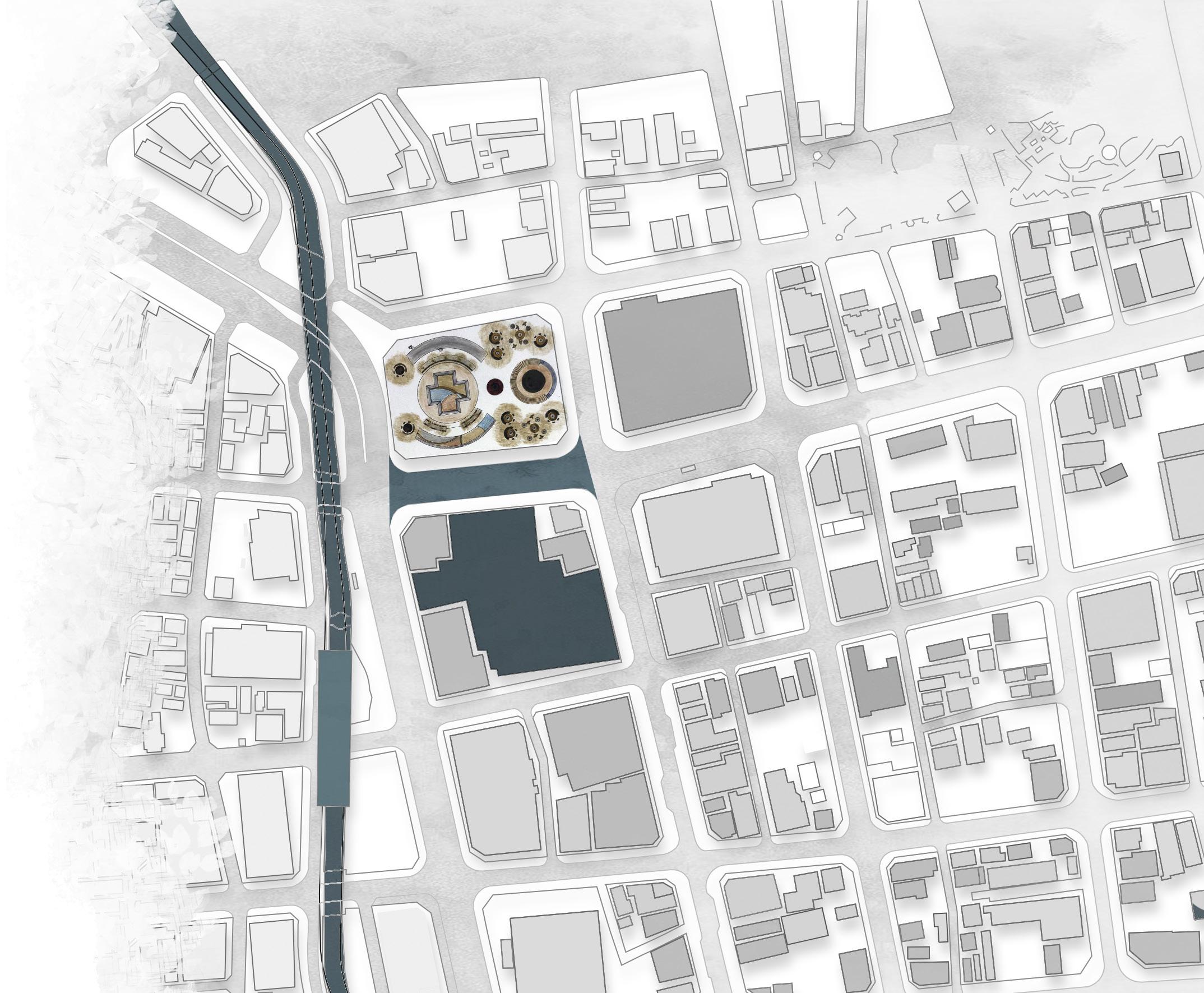
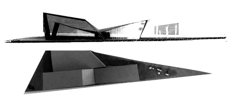
University Project | Dec. 16
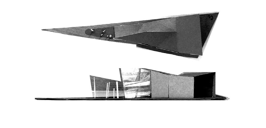
This building arises from the challenge of creating a space on a complicated plot, such as a corner.
The idea was to create a space that would not deviate from the current land uses but at the same time could serve as a meeting place for people since the street vendors currently located there attract a variety of social groups.
As the initial guideline for a private building, it was necessary to find a way to provide a public space to attract people to the location initially. Thus, the distinctive feature of a ramp emerged from the ground, culminating in a public-private park.
Focal Building C20N
Front Perspective C20N. Sketchup Modeling; Photoshop Post-production. Self-made.


Design Concepts
AutoCAD Graphics, Post-production: Photoshop. Created by myself. Models. Self-made.
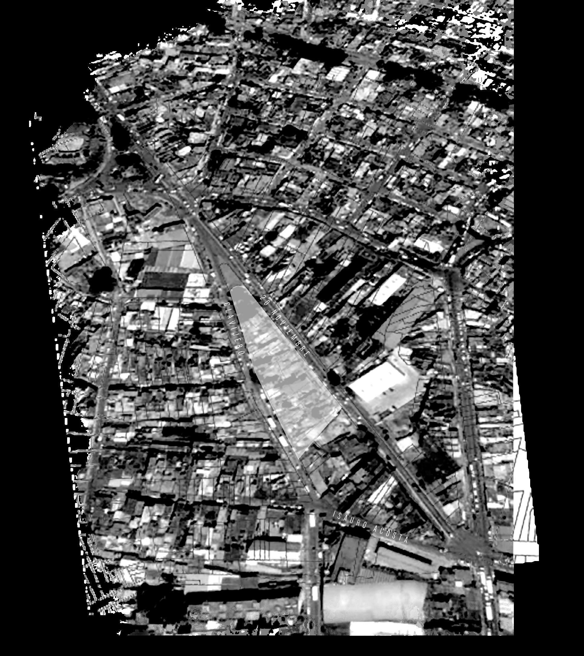
Location 1 3 2 4
Mexico Veracruz
Clavijero 20 Nov Property Delimitation. Self-made.
Xalapa

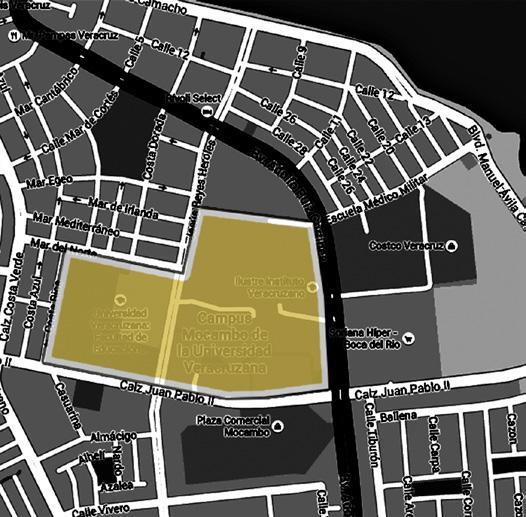
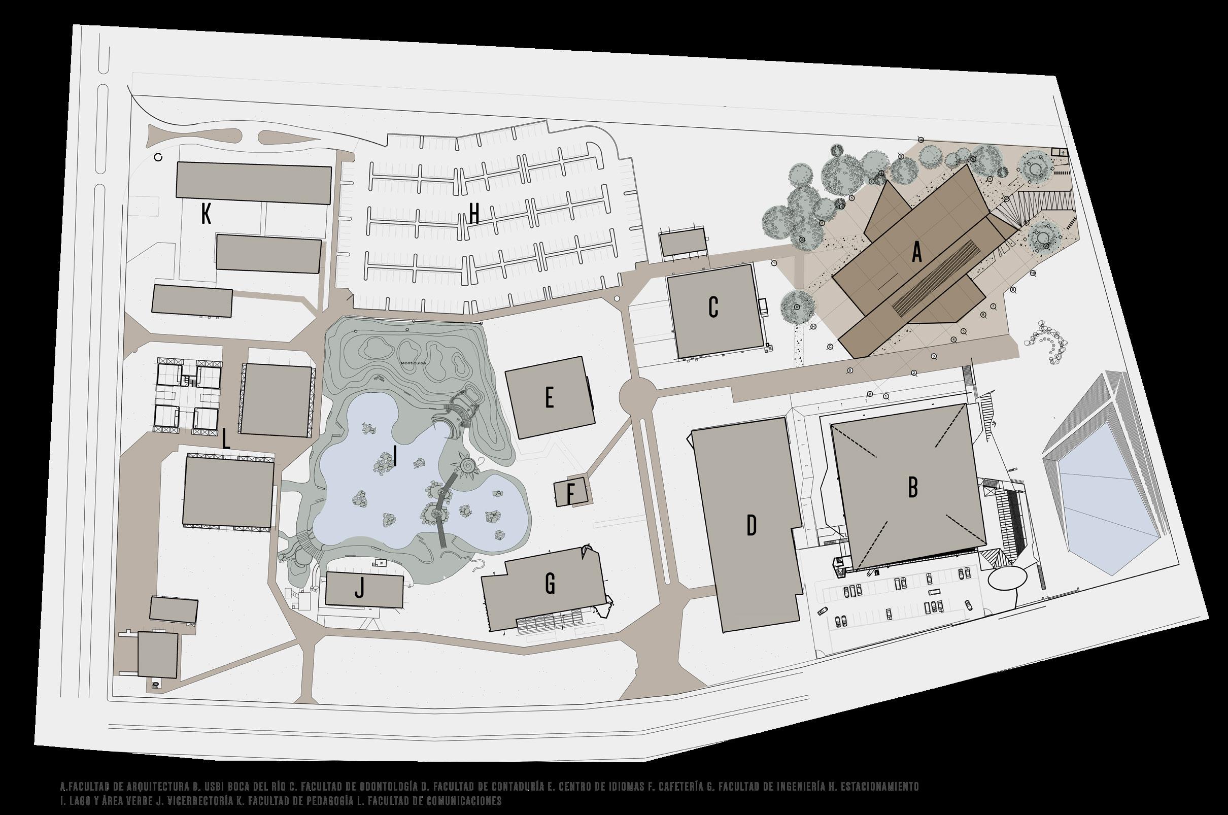
Faculty of Architecture
UV, Boca del Rio Campus
University Project | Aug. 16
Co-authorship: Sandra Irene Prieto Gonzalez
This proposal for the new Faculty of Architecture building arises in response to the voids generated within the contextual space. The idea was to generate a response to the geometry of the surrounding buildings so that it could project through the voids. Thus, a proposal with steeply sloped roofs and great height was created, also considering the hot climate of the site.
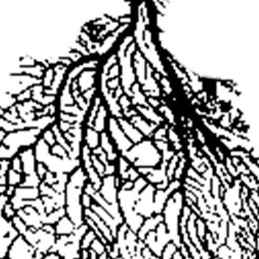
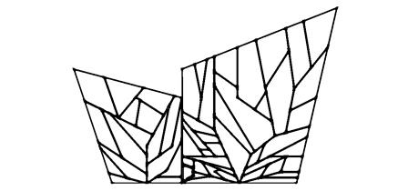
This building is also an approach and experimentation with fractal design. It was proposed to create louvers that would mitigate the entry of sunlight while also generating a feature that would give identity to the project. For this reason, experimentation was carried out with features alluding to the site, ultimately deciding on coral reefs, taking their essential characteristics to abstract them into a louver design that became the main feature of the building.
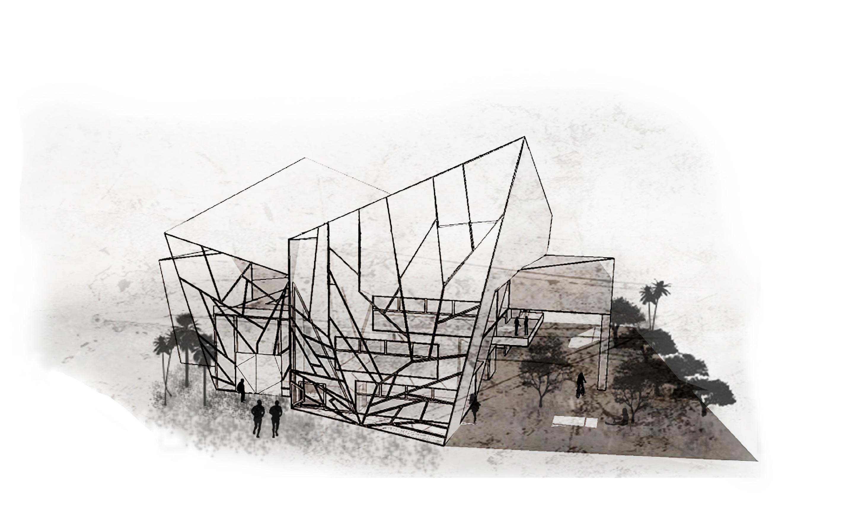 Front Perspective Faculty of Architecture. Sketchup Modeling; Photoshop Post-production. Self-made.


México
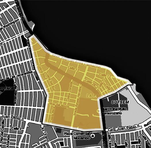
AutoCAD Graphics, Post-production: Photoshop. Created by myself. A. FACULTY OF ARCHITECTURE B. USBI DEL RIO C. FACULTY OF DENTISTRY D. FACULTY OF ACCOUNTING E. LANGUAGE CENTER F. CAFETERIA G. FACULTY OF ENGINEERING H. PARKING LOT I. LAKE AND GREEN AREA J. VICE RECTORATE K. FACULTY OF PEDAGOGY L. FACULTY OF COMMUNICATIONS
Boca del Rio Costa Verde Housing Development UV Campus Veracruz
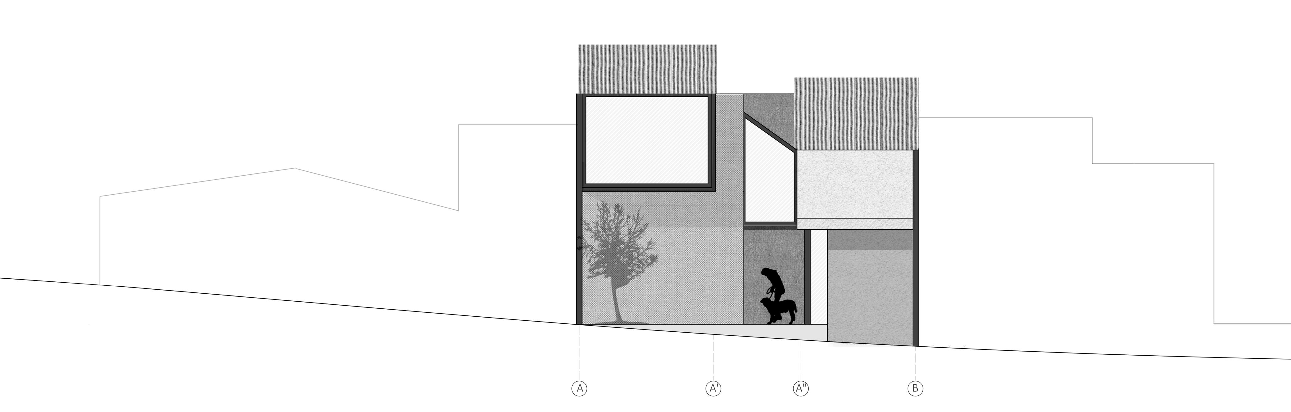
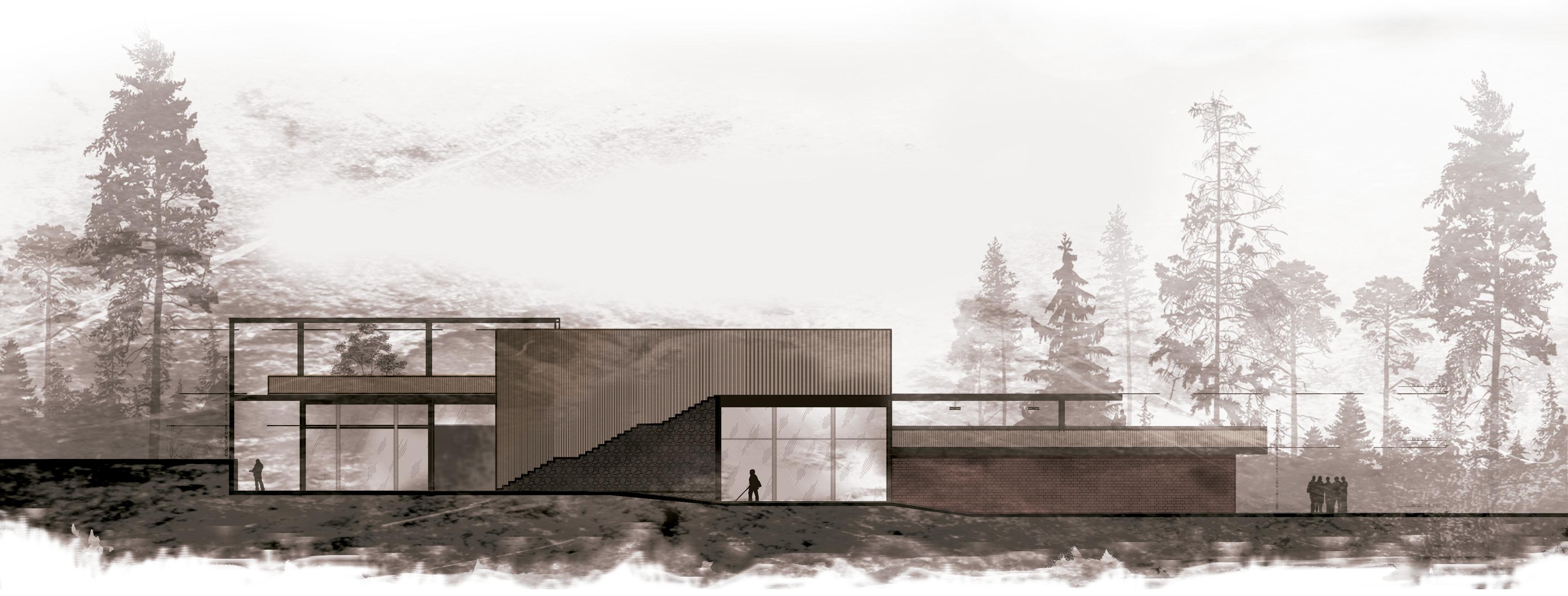
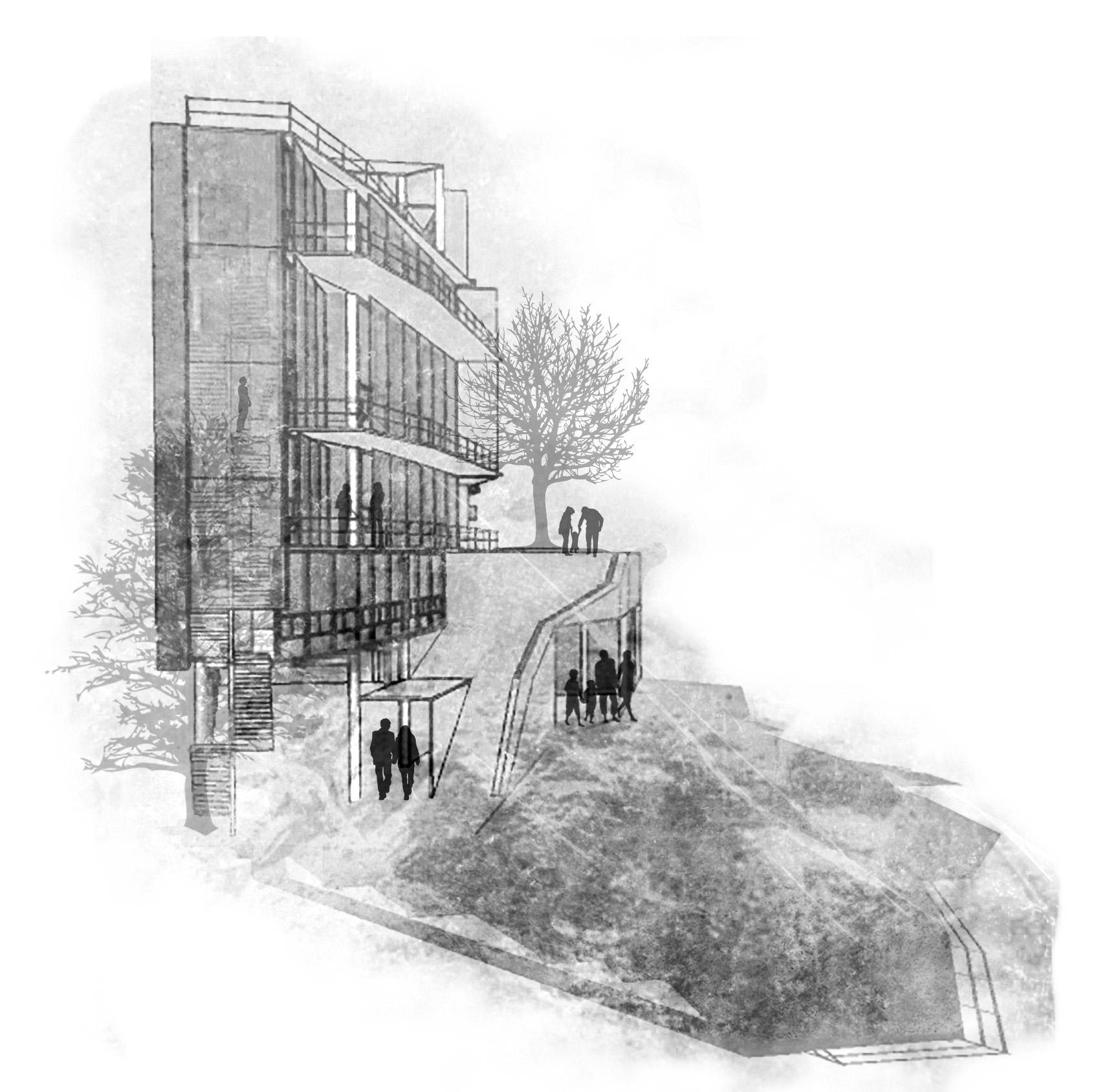
House 65
Xalapa, Veracruz
University Project | Aug. 16
The premise for this project is based on the idea of creating a progressive house that grows with the users as the needs of an expanding family arise.
The design starts from the general idea of creating sensations through the use of light modulated by apparent walls at different heights. The terrain is taken advantage of to generate intermediate heights that create an interesting interplay of intersections in the corridors.
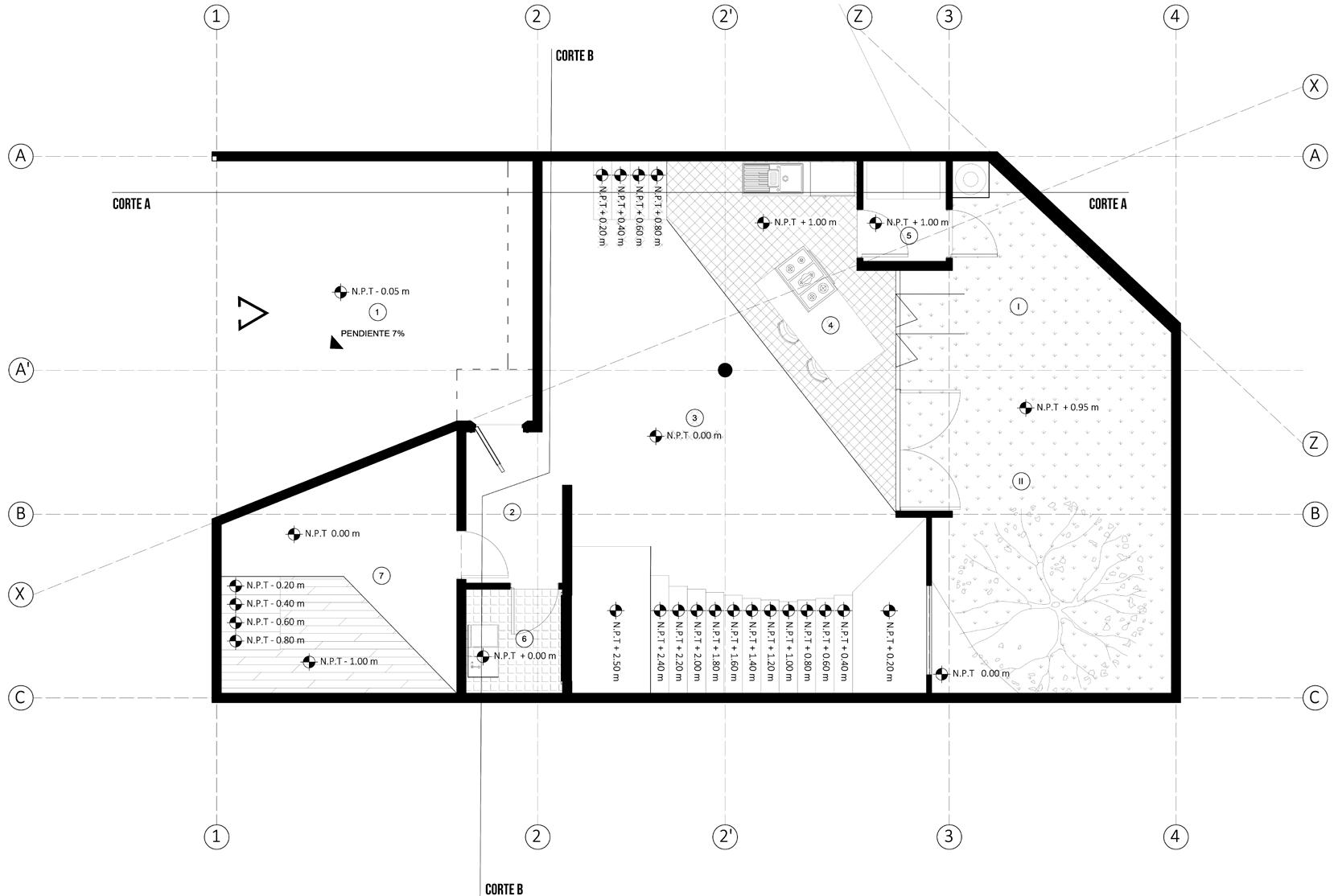
AutoCAD Graphics, Post-production: Photoshop. Created by myself.

Contact me
