



Financial assistance was provided by the Executive Office of Energy & Environmental Affairs (EEA) under the FY22 Municipal Vulnerability Preparedness (MVP) Grant Program. The MVP Action Grant offers financial resources to municipalities that are seeking to advance priority climate adaptation actions to address climate change impacts resulting from extreme weather, sea level rise, inland and coastal flooding, severe heat, and other climate impacts.
Fuss & O’Neill Team
Julie Busa, PhD, Senior Resilience Scientist
April Doroski, CPSS, Water Resources & Climate Resilience Specialist
J. Alexander Maxwell, PhD, Resilience Planner
Michael Soares, Wetland Scientist
Chelsea Zakas, AICP Candidate, Environmental Planning
Town of Andover Project Team
Jeff Cary, GIS Coordinator
Robert Douglas, Director of Conservation
Joyce Losick-Yang, PhD, Sustainability Coordinator
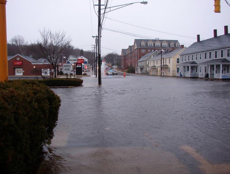
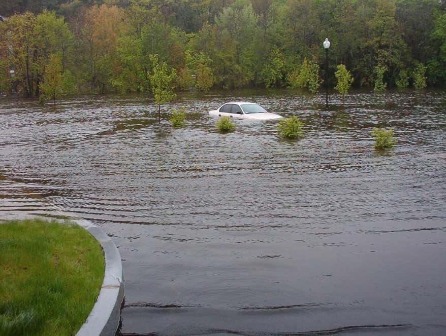
The Town of Andover, like many other communities across Massachusetts, has recently experienced an increase in climaterelated impacts such as severe flooding and major storm events. For example, in May of 2006 and March of 2010, the Town endured significant flooding after heavy rainfall events, which caused many roads to close, schools to cancel classes, and residents to evacuate their homes.
To address these impacts and prepare residents for a changing climate, the Town has engaged the Andover community in the Municipal Vulnerability Preparedness (MVP) program to complete a town-wide vulnerability assessment and develop action-oriented resilience plans aimed at implementing priority climate resilience projects.
Starting in 2018, the Town received an MVP Planning Grant to complete a Community Resilience Building (CRB) workshop to assess current vulnerabilities and opportunities for addressing climaterelated risks. Originally scheduled to take place in the fall of 2018, the CRB workshop was postponed due to a significant natural gas explosion in the community. Followed by months of recovery, two CRB workshops were held in January of 2019 involving over 50 stakeholders including residents, business owners, and Town staff. Prior to the workshop, a survey distributed to stakeholders identified primary hazards of concern in Andover, including flooding, severe storms and heavy winds, failing and aging infrastructure, and extreme heat. Through the CRB process, participants worked together to identify and prioritize community strengths and vulnerabilities in terms of societal, infrastructural, and environmental resilience.
At the conclusion of the workshop, participants voted for their top recommendations for high priority actions, and at the top of the list was the following recommendation:
Undertake a strategic program of land acquisition and adaptation along waterways to provide flood storage and reduce impacts of larger storm events and increased runoff. To accommodate planning and making use of land opportunities as they become available, the Town should consider setting up a dedicated funding source for a land banking and adaptation program, such as local adoption of the Community Preservation Act.
This plan details the process taken to establish climate adaptation goals in the community – and assess and prioritize parcels for future land acquisition, restoration, and climate resilience enhancement opportunities
To take action on this priority recommendation, the Town applied for and received a 2022 MVP Action Grant aimed at identifying opportunities for naturebased flooding solutions and potential future land acquisitions to increase climate and flood resilience along the Shawsheen River in Andover. This plan details the process taken to establish climate adaptation goals in the community – and assess and prioritize parcels for future land acquisition, restoration, and climate resilience enhancement opportunities.
The plan focuses on parcels that could provide flooding relief to some of the most flood-prone areas in Andover, as well as to downstream environmental justice (EJ) communities in neighboring Lawrence. Opportunities to improve natural habitats, water quality, and other ecosystem services were also considered, along with social benefits like increased access to green space, improved river access, and other recreational or quality of life benefits.
The US Environmental Protection Agency (EPA) defines Environmental Justice (EJ) as the fair treatment and meaningful involvement of all people regardless of race, color, national origin, or income with respect to the development, implementation and enforcement of environmental laws, regulations and policies
Massachusetts determines EJ communities based on income, minority population, and English language isolation
The Town of Andover partnered with Fuss & O’Neill to form a core project team, and local residents and key stakeholders were engaged in the development of the plan from the very onset of the project to provide frontline perspectives, assist with the assessment of parcels, and voice thoughts and ideas on the process for prioritizing parcels for land acquisition, restoration, and improvement.
Before assessing any properties along the Shawsheen for their climate resilience potential, members of the Project Team examined specific climate impacts facing Andover and worked with community members to identify a set of climate adaptation goals that could be used to evaluate parcels for future acquisition, preservation, and adaptation to the changing climate.
Climate impacts are unique to every community. Coastal communities may experience the damaging effects of increased storm surges such as severe coastal erosion, while inland communities may experience long lasting droughts, leading to increased wild fire activity.
Using Azavea’s Climate Application Program Interface, increased temperatures and increased precipitation were identified as primary climate impacts.
Climate adaptation is the way in which a community prepares for the inevitable impacts of climate change. Andover, like other communities around the world, is already experiencing some of the effects of climate change. It is vital to act now, to determine what climate related impacts Andover faces and to develop goals that will help the Andover community adapt to these changes.
Between 2025 and 2035, the Town of Andover is projected to receive 2.3 more heat waves and 32% more intense storms per year, along with longer annual dry spells and an increase in peak temperature on the hottest day of the year. With the effects of increased flooding and intense rainstorms being of particular concern to this project, impacts from increased precipitation were further explored using data from Resilient MA’s Climate Data Grapher and the Flood Factor tool.
Estimates from Resilient MA’s Climate Data Grapher showed that total annual precipitation and annual days with precipitation greater than 2 inches are also projected to increase in Andover.
1 Total annual precipitation is expected to increase by 2.34 inches from 2020
1 https://resilientma.org/datagrapher/?c=Temp/state/maxt/ANN/MA/
to 2049 over historical averages from 1971-2000, while the annual days with precipitation greater than 2 inches are expected to increase by 23%. According to Flood Factor, these conditions are likely to help generate a moderate risk of flooding over the next 30 years.2


Observed and projected total annual precipitation (inches) for the Shawsheen Basin
Observed and projected total annual days with precipitation greater than 2 inches for the Shawsheen Basin

2 https://floodfactor.com/city/andover-massachusetts/2501430_fsid

It is estimated that 265 properties will have a greater than 26% chance of being severely affected by flooding over the next 30 years, which represents 11% of all properties in the Town. 209 out of 1,906 homes analyzed using the Flood Factor model will have a risk of flooding, along with 41 out of 97 businesses, and 7 out of 30 schools, houses of worship, museums, and government and/or historic buildings. 14 out of the 58 miles of roads analyzed are also at risk of becoming impassable due to flooding. This was especially true for many areas located along the Shawsheen River. Overall, the analysis of the climate data and projections indicated that increased precipitation is likely to lead to increased flooding and intense rainstorm events, which aligns strongly with the top perceived hazards from community members surveyed prior to the Town’s 2019 CRB workshop.

Following the analysis of climate data, goals for addressing climate adaptation along the Shawsheen were developed based on the results of the analysis, inputs from Town’s 2019 MVP report, and broader consultation with the members from the Andover community during an initial kickoff meeting held at the Andover Memorial Hall Library on September 21st , 2021.
Three overarching goals were established – along with several supporting goals and targets – to guide and inform the future planning process. Goals were oriented around environmental and social concerns related to land acquisition and restoration, including concerns over impacts to downstream environmental justice communities.

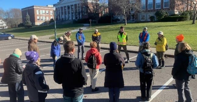
“If people only think of the River when it floods, that is a missed opportunity for true engagement.”Community Engagement Activity during Project Kickoff (photo credit: Joyce Losick-Yang)
1. Reduce vulnerability to flooding and intense rainstorms by increasing the capacity for flood storage and mitigation through nature-based restoration and active management, especially in areas with vulnerable populations and community assets (including those downstream)
1.1. Provide protections for low-lying, flood prone areas, such as North Main Street along the Shawsheen River, Washington Park, Shawsheen Square, and Riverina Road
1.2. Create additional flood storage and/or stormwater parks in areas such as Penguin Park
1.3. Seek to reduce future flood claims and financial losses by increasing protections for a portion of the Town’s 443 flood-insured properties through the National Flood Insurance Program (NFIP)
2. Strengthen connectivity and accessibility of open space and preserved land by expanding and creating linkages to existing trails, recreation opportunities, and conservation areas
2.1. Identify 5 project priorities that include accessibility improvements and/or create targeted outreach opportunities for climate-vulnerable populations
2.2. Identify opportunities to bridge land acquisition gaps that would connect and/or extend existing trails and recreational opportunities along the Shawsheen River such as those included in the Shawsheen River Greenway
3. Educate the local community by creating demonstration areas that highlight the value of acquiring open space, protecting the local watershed, and adapting to a changing climate
3.1. Engage at least 10 community volunteers in citizen science efforts to assess potential properties for acquisition that could help Andover achieve its climate adaptation goals and improve local resilience
3.2. Engage 100 students in Andover and neighboring Lawrence in programming around the local watershed and related climate impacts
Guided by the climate adaptation goals, the next stage of the planning process involved a rigorous assessment of land along the Shawsheen River to identify and prioritize parcels for potential acquisition, restoration, and climate resilience improvements. As detailed below, this process started with a review of current open space planning and over 800 protected parcels along the Shawsheen to identify potential opportunities for improved management of existing preserved land to enhance climate and flood resilience. Following the review of current open space planning, a GIS-based desktop site screening was conducted on over 1,400 protected and non-protected parcels along the Shawsheen to select parcels for inclusion in additional field assessments based on measures of climate resilience. A subset of 52 parcels was selected for additional field assessments – conducted as part of a collaborative process between the project team and citizen science volunteers from the community. Ultimately, each parcel from the field assessments was scored using a standard assessment protocol and then prioritized for its potential for future land acquisition, restoration, and site improvement potential based on several factors related to existing environmental and social conditions.
As mentioned above, the first step in the assessment process was to review existing planning documents and data on protected lands – and leverage local knowledge and expertise of Town staff and other community members – to identify:
1. Any major gaps between the climate adaption goals established at the outset of the project (see table of goals above on p. 6) and the existing preserved parcels and related plans and
2. Potential opportunities for improved management of existing preserved open space parcels likely to enhance climate and flood resilience
The current open space dataset was first mapped using ArcGIS, along with the National Flood Hazard Layer (NFHL) dataset, which represents the current flood risk data from the Federal Emergency Management Agency (FEMA). This mapping created a visual tool for reviewing which of the existing preserved parcels along the Shawsheen River were prone to future flooding –highlighting areas of potential concern.
Existing protected land is land that is either already owned by the Town, or that cannot be developed due to site constraints or conservation restrictions
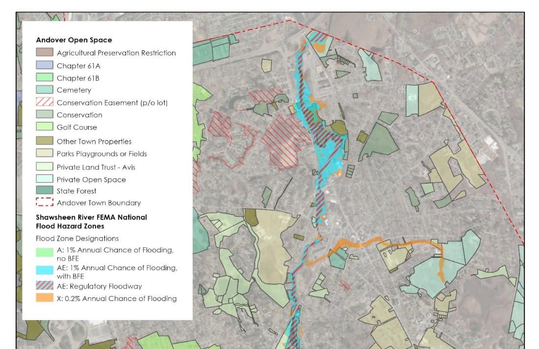
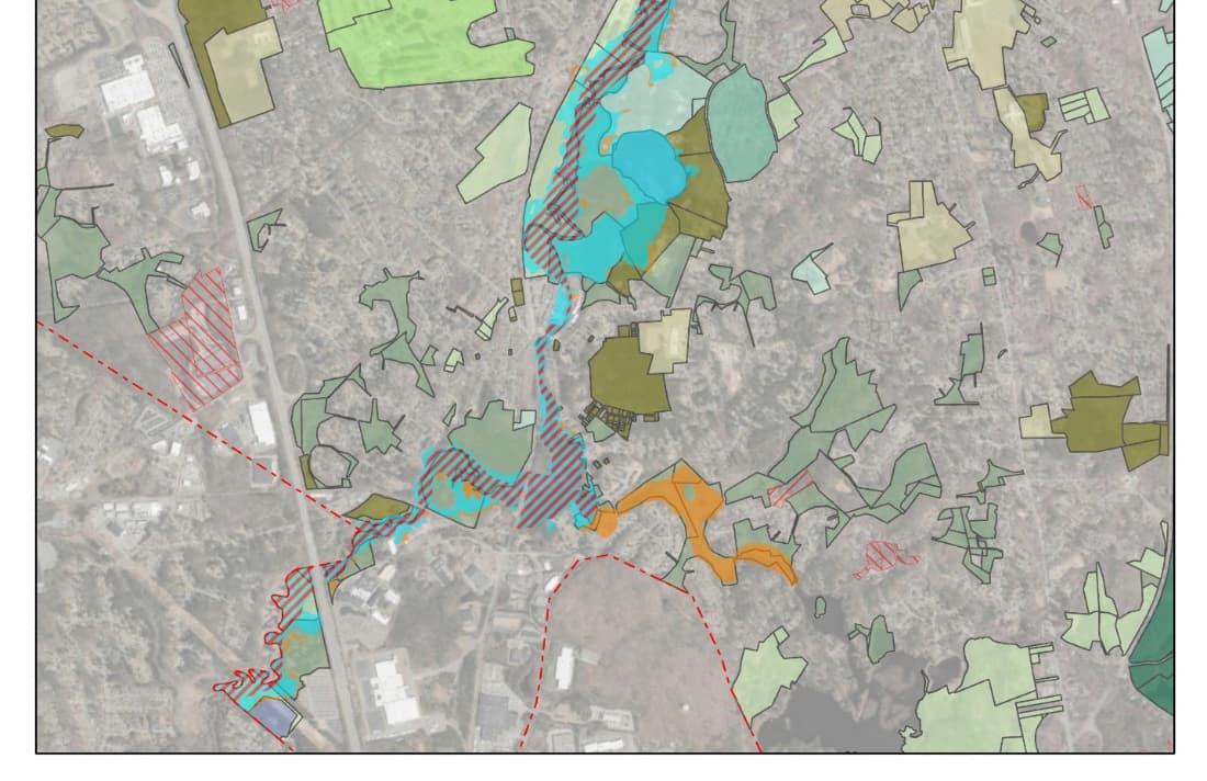
Based on a visual inspection of the open space map, it was recognized that many flood prone areas surrounding the Shawsheen River overlapped with existing protected lands, especially in the areas surrounding Pole Hill, Serio’s Gove Reservation, Pomps Pond, Vale and Shawsheen River Reservations, and the Sacred Heart Reservation. However, the physical connectivity between existing protected lands was broken in several areas (e.g., between Serio’s Grove Reservation and Shawsheen Pines Reservation), and many parcels within the FEMA flood hazard zone were not currently protected. These areas were flagged for further investigation during the desktop site screening and future field assessments.
After visually inspecting the mapping data for areas of concern, the Town’s Open Space and Recreation Plan (OSRP) was also reviewed to identify gaps between the climate adaptation goals and current planning. During this step, the following gaps were identified:
Lack of plans for additional flood storage capacity: The OSRP does refer to the activities of the 2019 Municipal Vulnerability Preparedness (MVP) planning project, however, it does not include specific plans to create additional flood storage on existing protected land. As noted above, the first climate adaptation goal is focused on reducing “vulnerability to flooding and intense rainstorms by increasing the capacity for flood storage.” This is especially needed in low-lying, flood prone areas along the Shawsheen River, such as Washington Park, Shawsheen Square, and Riverina Road, where existing preserved parcels may not be providing enough protection.
Potential conflict between proposed plans and climate resilience infrastructure: Findings from the Town’s 2019 MVP Community Resilience Building (CRB) workshop include suggestions for creating stormwater parks on existing preserved parcels (e.g., Penguin Park).3 Such projects, however, may come into conflict with a separate proposal (noted in the OSRP) for a handicapped accessible pedestrian bridge between a small parcel on North Main Street and Conservation land adjacent to the Shawsheen playing fields and Penguin Park. As the purpose of the second climate adaptation goal is to “strengthen connectivity and accessibility of open space and preserved land by expanding and creating linkages to existing trails, recreation opportunities, and conservation areas,” it was noted that careful consideration should be given to balancing the need for additional flood storage capacity and the need for greater connectivity and accessibility to open, preserved parcels.
Need for additional social metrics: Parcels overlapping with environmental justice (EJ) communities were mapped and highlighted in the OSRP. However, these EJ communities did not coincide with flood prone areas around the Shawsheen River that comprised the study area for this project. It was decided that additional social vulnerability metrics (e.g., household composition, age, housing/transportation, etc.) would need to be incorporated into the desktop site screening process to identify additional areas of concern. The Centers for Disease Control’s (CDC’s) Social Vulnerability Index (SVI) was identified as a useful source of data to provide additional information on socioeconomic status, household composition, and housing for census tracts surrounding the Shawsheen.
3 For a copy of the Summary of Findings, see: https://www.mass.gov/doc/andover-report/download
In addition to the gaps noted above, preliminary opportunities for improving flood resilience were also identified during this review of existing protected land. These opportunities included:
Potential for additional flood storage capacity: The protected parcels near the Sacred Heart Reservation were noted for their unique potential to provide additional flood storage capacity. While the Sacred Heart Reservation overlaps with the FEMA flood zone, its connections to additional lowlying open spaces (e.g., Shawsheen Soccer Fields) were noted for their potential to naturally convey and store flood waters from the Shawsheen River during times of peak flooding, increasing available flood storage capacity. This was flagged for further investigation during the desktop site screening and field assessment processes.
Increasing Landscape Diversity and Connectivity: It was also noted that the existing protected parcels by Serio’s Grove Reservation and Pomps Pond overlap with land with greater ecological integrity and terrestrial resilience. Lands with a higher degree of ecological integrity are often those that have remained intact and free from human impairment, allowing them to support biodiversity and the ecosystem processes necessary to sustain biodiversity in the face of a changing climate. Similarly, lands with more terrestrial resilience are better able to maintain species diversity and ecological function by providing greater landform diversity and connection to surrounding ecosystems. These parcels were flagged for further investigation, as they had potential to be excellent candidates for restoration and climate resilience improvement projects.
After completing the review of existing planning documents and data on existing protected lands, a desktop site screening was conducted on over 1,450 protected and non-protected parcels falling within a 100-m buffer around the FEMA flood zone surrounding the Shawsheen River. Parcels within this study area were screened as part of a collaborative effort between the Town of Andover and Fuss & O’Neill using GIS and a standardized protocol (see Appendix A) for developing screening maps of the following:
Existing preserved lands
Terrestrial resilience
Landscape diversity
Landform diversity
Geophysical settings
All existing open, preserved parcels in the Town of Andover (This includes conservation areas, parks, playgrounds, fields, state forests, and private land trusts and open spaces.)
A site’s capacity to maintain species diversity and ecological function as the climate changes
Estimates of the number and variety of microclimates in a given area
Variation in land position, slope, solar radiation, moisture availability, and susceptibility to wind and other disturbances
Broadly-defined landscape types with a similar geologic environment (e.g., similar bedrock, soils, and elevation zone) that support distinctive plants, animals, and natural communities
Local connectedness
Biological condition
Social vulnerability
Recreation opportunities
Estimates of how easily species can access surrounding areas based on the arrangement of existing roads, industrial agriculture, development, and other human structures
The degree to which a parcel remains intact or free from human impairment
Mapped communities most likely in need support before, during, and after a hazardous event (e.g., flooding)
Locations of existing trails and recreation opportunities
Screening maps for each of these conditions are included in Appendix B.
Once this desktop site screening was completed, a subset of parcels was selected for inclusion in additional field assessments based on one or more of the following criteria:
• Parcel had a range of scores for terrestrial resilience and/or ecological integrity, which might indicate that the parcel has a higher restoration and/or climate resilience site improvement potential
• Parcel is in a low-lying land area (based on land contours) near FEMA flood zones and proximate to downstream development, which might indicate that the parcel has a higher flood storage potential
• Parcel has the ability to be
Of the 1,455 parcels screening, a subset of 52 parcels were selected for further field assessments.
Following the desktop site screening, in-person field assessments were conducted to evaluate site-specific conditions using a field assessment protocol developed by Fuss & O’Neill (see Appendix C). Parcels were assessed for various site conditions, including existing habitats, presence of invasive species, vegetative protection, bank erosion, floodplain connection and buffer condition, restoration and flood storage potential, and the potential for recreational and educational opportunities.
Of the 52 parcels selected for additional field assessments, 36 were assessed by Fuss & O’Neill staff, while an additional 11 were assessed by a group of citizen science volunteers from the community after receiving a virtual training4. Three additional assessments were later conducted by Town staff after access limitations were addressed at Serio’s Grove, Cochran Wildlife Sanctuary, and Camp Maude Eaton.

Assessments could not be conducted in-person on two parcels –parcels 140-37 (85 River St) and 159-2 (71 Lowell Junction Rd) –due to restrictions regarding access to those parcels. Parcel 159-2 (i.e., the current site of James T. Lynch Construction Co., Inc.) was virtually assessed using data from the desktop site screening and observations collected during the assessment of the adjacent Town-owned parcel across the Shawsheen River (i.e., parcel 182-7 – the site formerly owned by Reichhold Chemicals Inc.). Parcel 140-37 was the only one of the 52 parcels identified for further assessment that was ultimately excluded from the field assessments.
Note, while the selection criteria (listed in desktop site screening section) helped reduce the amount of parcels to a more manageable number for the field assessments, it also led to the exclusion of more developed parcels along the Shawsheen River (e.g., Washington Park Condominiums and Shawsheen Plaza), as they often had very low (or no) terrestrial resilience and/or ecological integrity scores due to the extent of disturbance on these sites, indicating little potential for restoration in their current state. The field assessments therefore focused largely on undeveloped sites, or sites that at least contained significant undeveloped area.
However, given that many of the more developed areas along the river are subject to frequent, seasonal flooding, and are sometimes in close proximity to other existing protected parcels and/or parcels included in the field assessments, they should be carefully considered in the development of future flood resilience projects along the Shawsheen. Exploring the potential to relocate existing uses out of the floodplain and restore these parcels to a more natural state may be appropriate in some locations.
After conducting the in-person field assessments, a prioritization tool was developed to guide the Town in prioritizing parcels for potential future land acquisition, restoration, and climate resilience site improvements. Using the inputs from the review of existing protect lands, desktop site screening, field assessments, and community engagement activities, the prioritization tool was designed to provide a systematic, consistent, and transparent method of prioritizing parcels based on factors related to existing environmental and social conditions, and the potential for community enhancement and climate resilience potential.
4 See the following link for a recording of the virtual training: Recording link: https://andover.webex.com/andover/ldr.php?RCID=fd784e1b6a9d0e87b1c0535d7e48a16f (Password: Be2mPmMH)
Appendix D provides a detailed account of the methodology used to develop the prioritization tool, while the following tables and maps summarize the results of applying the prioritization tool to the data collected on the 51 parcels assessed. Of the 51 parcels assessed, 18 were private parcels, and the remaining 33 were existing preserved parcels.
5 Total parcel value based on total building value (where applicable), extra features value (where applicable), and land value according to Town of Andover Assessor’s Department: http://andover.patriotproperties.com/default.asp 6 Parcels highlighted in green are also found on the Town’s 2014 List of Approved Open Space Parcels or the 2020 List of Open Space Parcels to be Added.


The following sections provide recommendations for land acquisitions, restoration, and climate resilience improvements on several of the highest priority parcels, in addition to descriptions of relevant restoration practices and possible funding sources for proposed improvements.
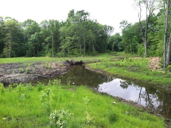
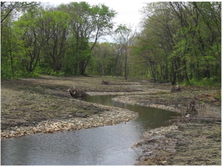
Historic approaches to river management have included straightening, culverting, and channelizing streams. Expanding the river network entails reversing this history to once again increase the complexity of a river system. Increased complexity in a river system is characterized by natural braiding or sinuosity which inherently slows stream flows, controls erosion and limits sediment transport, and helps to desynchronize flood peaks. Where space allows, restoration projects can focus on re-establishing these more natural stream and river configurations. Creation of a secondary stream channel or high flow overflow channels through existing upland can simulate the stream’s natural braiding and sinuosity. Secondary channels can also be combined with the creation of additional flood storage spaces to allow high flows to spill over into specified areas that are designed to hold and/or absorb flood waters.
As development alters river networks, it often reduces connectivity between the river and its surrounding floodplain, which decreases flood storage capacity. Over the years, as development encroached on river banks and flooding of nearby structures became increasingly problematic, many communities, including Andover, attempted to solve flooding problems by moving water through more quickly, lining their rivers with walls or other hard armoring, or otherwise attempting to prevent water from spilling over into the floodplain. Increasing flood storage capacity by reconnecting the river to its floodplain or creating additional flood storage areas and bordering vegetated wetlands restores more natural forms of flood control. Floodplain reconnection is often accomplished through the grading of streambanks to allow water to spread out horizontally into a broad floodplain. In developed areas, this can necessitate directing where the water is allowed to spread, which can be accomplished through overflow or diversion channels that divert high flows away from the main flow path of the existing constricted channel and into a flood storage area such as a floodable park or another area that has been designed to withstand temporary inundation.
Another key method for alleviating flooding is limiting how much stormwater runoff reaches the river at one time. Green infrastructure includes practices which capture water coming off of impervious surfaces and either infiltrating it directly back into the ground where it recharges underground aquifers or slowing it down so that runoff from large precipitation events does not concentrate in the river at the same time. Green infrastructure includes practices like rain gardens, bioretention areas, treebox filters, increased native plantings, etc. These systems can take pressure off the Town’s existing stormwater infrastructure and other flood control measures and are an important element of a holistic solution. Green infrastructure can also be implemented at stormwater outfalls in the form of vegetated step pools to slow water coming out of the stormwater outfall, reducing erosion and allowing for treatment of sediment and nutrient pollutants carried in runoff.
Deflecting stream flow away from the bank and towards the center of the channel is a common restoration practice, as it protects the riverbank from erosion and creates varying pockets of habitat. Flow deflection also deepens the mid-channel flow and provides refuge areas for fish in slower flowing water near the bank.
Nature-based approaches, such as log or rock vanes, root wads, and vegetated soil lifts can be used to improve riverbank stability. Rock or log vanes utilize rocks or logs as structures to cut into the river channel in an upstream direction to disrupt, slow, and reroute the flow of water thereby providing protection for the riverbank. Similarly, root wads can be used to improve bank stabilization by burying dead trees into the riverbank with the root systems still attached. And, vegetated soil lifts use “lifts’ of soil wrapped in geotextile fabric to form an edge for the river.

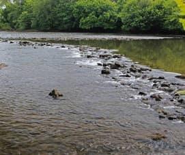
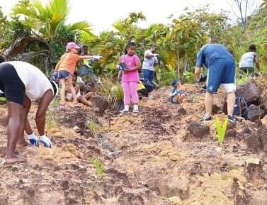
Enhancing vegetation and river corridor quality through nature-based solutions can provide habitat and travel corridors for animals, many of which are dependent on riparian features for survival. Restoring and enhancing habitats plays an important role in mitigating climate change impacts to river ecosystems by connecting noncontiguous areas that enable plants and animals to move as the climate changes.
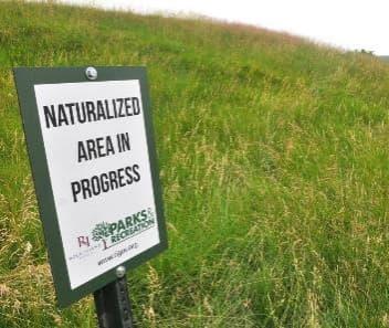
Vegetative buffers are naturally vegetated areas adjacent to streams, ponds, lakes, and wetlands that are not routinely or extensively landscaped, and have little to no impervious surface. Vegetative buffers provide a living “cushion” between upland land use and surface water resources, protecting water quality, the hydrologic regime of the waterway and stream structure. Vegetated buffers filter out pollutants, capture sediment, protect streambanks from erosion, and regulate stream water temperature. Reduced buffer width and degradation of vegetative cover can reduce the benefits to water quality, as well other ecological functions and societal values that vegetated buffers provide. Naturalizing a river corridor, or parcels along a river, can include enhancing or restoring degraded vegetated buffers. Additionally, removal of pavement adjacent to the river corridor would result in a reduction of impervious surface, thereby reducing surface runoff and creating space for natural infiltration.

River cleanups are a simple site improvement practice intended to enhance the appearance of a stream corridor by removing trash, litter, and other debris. In some cases, cleanups can also prevent pollutants from being released into the river, if drums, tires, appliances, medical waste, or other potentially hazardous materials are removed. Typically, cleanups are accomplished using volunteers from the community that are led by a local watershed group and/or supported by municipal agencies. They have great added value in educating volunteers and increasing community awareness about watershed restoration.
Site descriptions and recommended site improvements for several of the top-scoring private parcels are described below. These parcels are those that were considered the highest priority for potential land
acquisition, restoration, and climate resilience improvements. Each site description includes details on the parcel size, current value, and existing conditions, and is coupled with one or more recommended improvements aimed at helping Andover achieve its climate adaptation goals.
Parcel ID(s): 54-13T and 54-14
Parcel Address(es): 10 Stevens St (54-13T) and 20 Stevens St (54-14)
Parcel Size(s): 6.62 acres (54-13T) and 3.44 acres (54-14)
Total 2022 Parcel Value(s): $2,218,200 (54-13T) and $80,900 (54-14)
About the Site: These parcels were the two highest priority parcels for potential land acquisition following the field assessments. These parcels are located in the area of the Shawsheen River south of the Stevens St Bridge, adjacent to the current site of the Andover Commons apartment community and Whole Foods supermarket. A portion of the land in the area is used for commercial uses, as there is a post office building and parking lot located on the high ground above the river in the northeast corner of the site. There is a small parking lot located on the high ground off Stevens St in the northwest corner of the site that is used as additional parking for the US Postal Service.

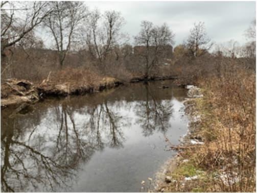
Forested and non-forested wetlands cover much of the remaining area of the site, with more than 90% of the riverbank surfaces and immediate riparian zone covered by vegetation. The banks of the river on the site are stable with minimal signs of erosion and good connections to the surrounding floodplain, with the exception of the Stevens St Bridge, which forms a barrier along the northern edge of the site. Overall, these parcels scored highly for their climate resilience potential and were noted as having excellent restoration potential.
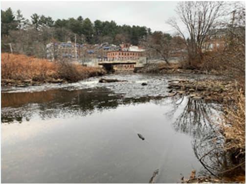
River Cleanup – The first step to any site improvements on the Stevens Street parcels should be the engagement of community volunteers in the removal of trash and debris located at the site. This opportunity could also be used to grow interest in the site and discuss further improvement options with local residents, stakeholders, and potential project partners.
Results from the field assessment indicated several areas of concentrated debris within the floodplain along the eastern edge of the parcel at the bottom of the slope. Old TVs, abandoned bikes, and trash were littered throughout this area of the site. River cleanups are a simple practice to enhance the appearance of a river corridor by removing unsightly trash, litter, and debris. In some cases, mechanical equipment is needed to remove large quantities of rubble, appliances, and trash that have been illegally dumped in the stream or its corridor. Cleanups make the stream a more attractive place for anglers, canoers, hikers, and neighboring landowners. In some cases, stream cleanups can prevent pollutants from being released, if drums, tires, appliances, medical waste, or other potentially hazardous materials are present.
Expanding River/Stream Network – During the field assessments of these parcels, opportunities to expand the river network in this reach of the Shawsheen were also identified. Some smaller alternate channels were observed that only flow at higher water conditions on both sides of the Shawsheen; these could potentially be expanded and reconfigured to increase the sinuosity of the river, slow and spread flow, and help desynchronize flood peaks upstream of the Stevens Street bridge.
Connect to Adjacent Private Parcels through Easements - These parcels are also near several other private parcels along Brechin Terrace (i.e., parcels 54-35, 54-36, 54-37, 54-38, and 54-39) that were included in the field assessments. While the Brechin Terrace parcels are residential, there may be opportunities to work cooperatively with private landowners to explore options for easements, partial land acquisitions, or conservation restrictions that would allow the further expansion of the river network improvements in the area – especially to continue the restoration work onto portions of these parcels at the base of the steep slope towards the back of these properties and immediately adjacent to the river.
Parcel ID(s): 183-11 & 159-10A
Parcel Address(es): 83 Lowell Junction Rd (183-11) & 0 Lowell Junction Rd (159-10A)
Parcel Size(s): 3.08 acres (183-11) & 3.0 acres (159-10A)
Total 2022 Parcel Value(s): $555,100 & $44,100 (159-10A)
About the Site: These parcels are located along Lowell Junction Road in the southern upstream reach of the Shawsheen River. The parcels are surrounded by industrial and residential land uses, in addition to existing preserved parcels at Pole Hill and Serio’s Grove Reservation. Parcel 159-10A is located within the Groundwater Protection Overlay District. Each parcel is predominantly forested, with more than 90% of the riverbank surfaces and immediate riparian zone covered by vegetation. The banks of the river on each site are stable with minimal signs of erosion and good connections to the surrounding floodplain.
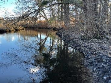
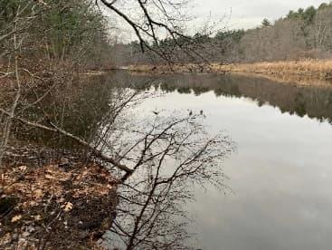
Overall, these parcels had high scores for existing environmental conditions and climate resilience potential. During field assessments, both parcels were recognized as having some existing flood storage potential, with up to 25% of the parcel areas available for flood storage. They also present opportunities to increase connectivity to existing preserved lands that abut each parcel. However, 71 Lowell Junction Road, which is the current site of the James T. Lynch Construction Co., Inc. (parcel 159-2), stands as an important barrier to establishing greater connectivity in this area of the Shawsheen and increasing climate and flood resilience.
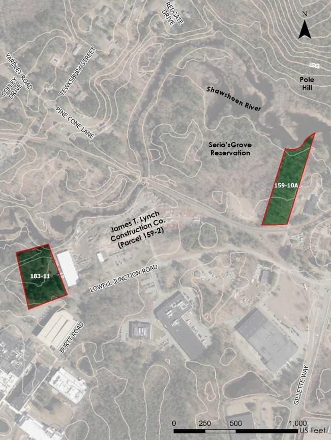
Expand Connections to Existing Preserved Lands – By acquiring one or both of these parcels, the Town of Andover has an opportunity to expand the area of existing preserved land along the Shawsheen near the southern border with Tewksbury (parcel 159-10A would add contiguously to the preserved property at Serio’s Grove). Though this reach of the Shawsheen has areas of greater terrestrial resilience and ecological integrity (as evidenced by the results of the desktop site screening), acquiring these parcels and establishing greater connections to other conservation land (e.g., Pole Hill and Serio’s Grove Reservation) will keep these parcels free from human impairment or impacts of fragmentation and increase the capacity of the area to maintain species diversity and ecological function in the face of a changing climate.
Increase Recreational/Educational Opportunities – Nearby Serio’s Grove Reservation is already home to several launching sites for boaters to pull up and picnic or camp. However, there is no parking available at the reservation and the commuter rail makes the 0 Lowell Junction Rd (159-10A) parcel especially difficult to access by land. Acquisition of these parcels would provide an opportunity to expand public access to open space by boat in this area. The addition of parking – especially at 0 Lowell Junction Rd (parcel 159-10A) – could also be explored to increase access to the area for a wider range of users. This is in keeping with the Town’s second climate adaptation goal, which aims to, “[s]trengthen connectivity and accessibility of open space and preserved land by expanding and creating linkages to existing trails, recreation opportunities, and conservation areas.”
Serio’s Grove Reservation was also once the site of the Serio family homestead, where they lived without electricity or running water. One member of the family, Frank Serio Sr., grew concerned about industrial soap being dumped in the Shawsheen River and helped develop a plan to reduce pollution. Acquisition of these parcels presents opportunities to highlight history and education around water quality and conservation that align strongly with the third climate adaptation goal.
Acquire and Restore Nearby Commercial Parcel – As noted in the site description above, parcel 159-2 (71 Lowell Junction Road), - the current site of the James T. Lynch Construction Co., Inc. – stands as an important barrier to establishing greater connectivity in this area of the Shawsheen. Additional efforts should be made to contact the landowners to discuss opportunities to potentially acquire and restore this impacted site – allowing for greater connectivity to the other Lowell Junction Road parcels and the increased potential for climate resilience in the area.
Parcel ID(s): 35-29
Parcel Address(es): 56 York St
Parcel Size(s): 7.20 acres
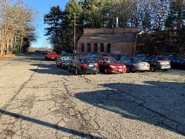
Total 2022 Parcel Value(s): $389,800
About the Site: This parcel is located in the area of the Shawsheen River north of the Haverhill St Bridge and east of Riverina Road, and approximately half of the parcel is currently occupied by a parking lot. On the opposite side of this channelized reach of the Shawsheen River are residential homes that fall within the FEMA flood zone. Surrounding land uses also include commercial and industrial useslargely concentrated towards the southern end of the parcel.
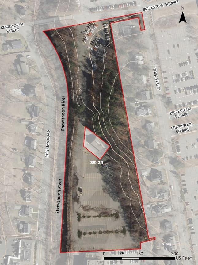
Some forested land is present along the riverbank; however, steep slopes, high flows, and hard armoring create poor connections to the surrounding floodplain. This parcel was also one located in one of the most socially vulnerable areas of the Shawsheen, as it is surrounded by census block groups with relatively high percentages of both elderly (over 64) and young (under 5) populations. During the field assessment, this parcel scored highly for its restoration potential should opportunities to naturalize and limit the amount of impervious surface area on the site be explored and implemented.

Reduce Impervious Surface Area and Create Additional Flood Storage – This parcel is currently covered by an impervious parking lot, which prevents infiltration and generates additional stormwater runoff to the Shawsheen – with implications for both water quality and flooding. Acquiring this parcel, removing impervious cover, and restoring the floodplain in this area could allow for more natural infiltration and the slowing of direct discharges to the river. This in turn could increase flood resilience by allowing some of the nearby runoff to be absorbed into the ground, lessening the amount of runoff to the river during a storm.
As a first step toward restoration, simple removal of the existing pavement and stabilization of the site could be accomplished at relatively lower cost. A more robust floodplain restoration project is recommended as a second phase. The site is a candidate for the creation of additional flood storage capacity by excavating and regrading to allow floodwaters from the Shawsheen to more easily overflow onto the property during high flows. This would potentially help to alleviate flooding impacts in the immediate area – especially those impacts to the residential homes on the western bank of the river along Riverina Road and the commercial area to the south of the current parking lot. Detailed hydraulic modeling would be necessary as a first step to quantify potential benefits and optimize restoration design.
Reducing flooding impacts in this area is especially important as the nearby neighborhood south of Interstate 495 in Shawsheen Heights is mapped as having 13% of its population under the age of 5, putting it at the 94th percentile nationally for this vulnerable population. Similarly, in another nearby neighborhood just south of this site and west of North Main Street along the Shawsheen, over 25% of residents are over the age of 64, putting it in the 87th percentile nationally. Reducing vulnerability to flooding and intense rainstorms by increasing the capacity for flood storage and mitigation –especially in areas with vulnerable populations – is in keeping with Andover’s first climate adaptation goal.
Parcel ID(s): 72-2
Parcel Address(es): 0 Red Spring Rd
Parcel Size(s): 0.332 acres
Total 2022 Parcel Value(s): $4,900
About the Site: This parcel was ranked as the fourth highest priority parcel for potential land acquisition following the field assessments. This undeveloped parcel is in the area of the Shawsheen River south of the Essex St Bridge, adjacent to Red Spring Road, and across the river from the Dundee Office Park. The parcel is an area just upstream of the Oak & Iron Brewing Co. and several residential apartment buildings that are prone to flooding.

The majority of the parcel is steep and forested, with between 70-90% of the riverbank surfaces and immediate riparian zone covered by vegetation. The banks on the site are mostly stable, with some armored stone in place along the easternmost portion of the riverbank. Overall, this parcel was identified as having some flood storage potential, with opportunities to restore the floodplain terrace near the river for overflow/storage. However, accessing the site for restoration of the floodplain will require careful consideration, as slopes are steep in most areas.
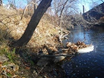
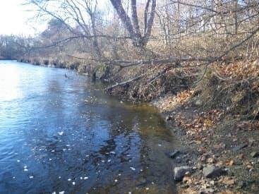
Increase Floodplain Storage – While small relative to other parcels along the Shawsheen, this site represents an opportunity for some additional flood storage to be added in an area where development has encroached on the riverbank and is very prone to flooding. Opportunities to regrade the areas of the site nearest to the river should be explored to determine whether the site could accommodate design measures to slow water, curb erosion, and allow the river to spread out more towards the western part of the site.
The success of restoration at this site will likely hinge on the viability of partnerships with adjacent neighbors to the south. Similar to the Stevens Street parcels described above, this parcel also connects to several other private parcels along Red Spring Road (i.e., parcels 72-3, 72-4, and 72-5) that were included in the field assessments. These are currently residential parcels; however, there may be opportunities to work cooperatively with private landowners to explore options for easements, partial land acquisitions, or conservation restrictions that would allow for additional flood storage to be added in this area. As noted during the field assessment, these adjacent private parcels showed evidence of low-lying areas setback from the river on a floodplain terrace. Additional hydrologic and hydraulic modeling could be used to explore opportunities to create overflow or diversion channels that would divert high flows away from the main flow path and into floodable storage area such as these existing low-lying areas.
Nature-Based Riverbank Stabilization – Additionally, in the area of the site where stone armoring is currently being used to prevent erosion, vegetated soil lifts or other nature-based solutions could be explored to provide riverbank stability. Soil lifts and other soft bank stabilization techniques can not only improve stability, but they can also indirectly enhance river habitats through the creation of a stable riverbank toe and reduced sedimentation from erosion. Vegetated banks have a further benefit of introducing roughness to slow flow velocities.
additional flood storage capacity may be created. Such improvements would alleviate flooding downstream and put this otherwise unused land to use providing protection for local residents and businesses.
Nature-Based Stabilization Connect to Adjacent Private Parcels through Easements – Similar to the Stevens Street Parcels described above, this parcel also connects to several other private parcels along Red Spring Road (i.e., parcels 72-3, 72-4, and 72-5) that were included in the field assessments. These parcels are currently developed for residential uses; however, there may be opportunities to explore easements with private landowners to further expand flood storage along the Shawsheen in this area – especially at the base of the steep slope at the back of these properties and immediately adjacent to the river and the surrounding floodplain.
Site descriptions and recommended site improvements for several of the top-scoring existing preserved parcels are described below. These parcels are those that were considered the highest priority for restoration and climate resilience improvements. Each site description includes details on the parcel, current ownership, and existing conditions, and is coupled with one or more recommended improvements aimed at helping Andover achieve its climate adaptation goals.
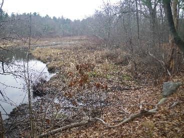

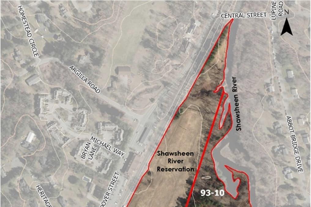
Parcel ID(s): 93-9 & 93-10
Parcel Address(es): 2 R Andover St (93-9) & 14 R Andover St (93-10)
Parcel Size(s): 22.9 acres (93-9) & 4.0 acres (93-10)
About the Site: These two parcels make up the Shawsheen River Reservation, located in the area of the Shawsheen River south of the Central St Bridge, and adjacent to the Vale Reservation. At the Central St Bridge is a canoe launch, and hiking trails connect the parcels to the Vale Reservation. The parcels are bordered on the west side by the commuter rail line, and surrounding land uses include mostly single-family residential.
A variety of habitats are present on the parcels, including aquatic habitat, grassland and meadow, wetlands, and evergreen forest. Between 70-90% of the riverbank surfaces and immediate riparian zone is covered by vegetation, with minimal impact from human activity. The banks of the river on the site are stable with isolated areas of erosion and good connections to the surrounding floodplain. Similar to the Vale Reservation, the Shawsheen River Reservation has a healthy mixture of wetland and non-wetland cover. Overall, each parcel scored highly for their restoration potential given opportunities to expand the river network and adapt mowing regimes to promote greater habitat diversity.
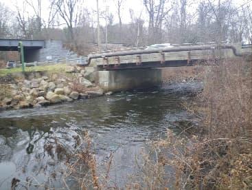
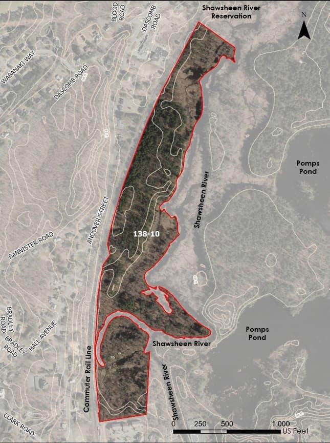
Parcel ID(s): 138-10
Parcel Address(es): 196 R Andover St
Parcel Size(s): 47.0 acres

About the Site: The Vale Reservation parcel was the highest priority existing preserved parcel for potential restoration following the field assessments. The parcel is located in the area of the Shawsheen River just north of the Ballardvale commuter rail station and adjacent to Pomps Pond. This section of Shawsheen River through the Vale Reservation parcel is a popular recreation spot for walkers and paddlers. This parcel provides a variety of habitats, including forested and non-forested wetlands, aquatic habitat, valleys, and ridgetops.
More than 90% of the riverbank surfaces and immediate riparian zone are covered by vegetation, but an outfall towards the northern end of the site is causing localized issues with erosion, as it experiences high velocities and has little scour protection. Overall, this parcel had high scores for climate resilience potential given the excellent opportunities for flood storage and restoration. The parcel also scored highly for its educational opportunity potential given the existing recreation opportunities, variety of educational sites, and ease of access.

Expand the River Network and Enhance Natural Flood Storage Areas – During the field assessments of these parcels, several opportunities to expand the river network and connect to natural flood storage areas in this reach of the Shawsheen were identified. Smaller alternate channels were observed at lower flow conditions near the oxbows and river bends at both reservations, in addition to nearby low-lying areas that showed signs of ponding. In these areas (e.g., the area at the southern end of the Vale Reservation parcel, just north of the Dale St Conservation), opportunities to expand and reconfigure the river network could be explored as a way to increase the sinuosity of the river, slow flow, and desynchronize flood peaks. This could potentially help alleviate flooding concerns along the commuter rail line that borders the western edge of the Vale Reservation parcel and other nearby areas that are more developed and vulnerable to flooding.
Prevent Erosion from Discharge – As noted during the field assessment, there was evidence of erosion near an outfall at the northern end of the Vale Reservation parcel. Scour protection could be added around this outfall to prevent additional erosion and improve the surrounding habitat.
Habitat Enhancement through Reduced Frequency of Mowing – Habitat enhancement was also noted as a key restoration recommendation during the assessment of the Shawsheen River Reservation parcels. Much of this area appeared to be mowed regularly. Mowing regimes should be re-evaluated to determine whether less frequent mowing would better promote habitat diversity and foster growth of high-value natural meadows and grassland habitats in this area. Consideration should also be given to whether mowed areas could be reduced to create wider, more robust riparian buffers.
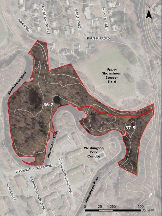
Parcel ID(s): 37-5 & 36-7
Parcel Address(es): 0 North Main St (37-5) & 104 Burnham Rd (36-7)
Parcel Size(s): 2.5 acres (37-5) & 8.45 acres (36-7)
About the Site: These parcels were the second and fourth highest rated existing preserved parcels following the field assessments. They are located in the area of the Shawsheen River south of the Lower Shawsheen Soccer Field, and adjacent to the Upper Shawsheen Soccer Field and Washington Park Condominiums. This area was once a floodplain for the Shawsheen River, but it was filled in the early 1900s. The loss of this floodplain storage capacity – along with other development in the area – has contributed to the flooding issues experienced in Shawsheen Village and the Washington Park Condominiums.

Forested and non-forested wetlands now cover much of the site, with more than 90% of the riverbank surfaces and immediate riparian zone covered by vegetation. However, both parcels were noted as having extensive invasive species coverage. The banks of the river on the site are stable with minimal signs of erosion; however, the opposite bank bordering the condominiums shows signs of erosion. The reservation offers recreation opportunities such as hiking, trail running, leashed dog walking, cross country skiing, and birdwatching, and it can be accessed from multiple locations. Overall, these parcels had high scores for climate resilience potential, and during field assessments, scored highly for their educational and recreational potential as well.
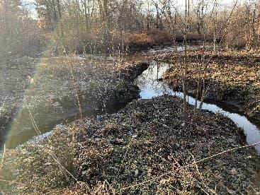
Expanding River/Stream Network – During the field assessments of these parcels, opportunities to expand the river network in this reach of the Shawsheen were identified. It was estimated that more than 50% of the parcel area offered good restoration potential, with many smaller, alternate high-flow channels observed that have established from the natural path of water movement over the sight when river levels are high. These channels could potentially be expanded and reconfigured to activate more frequently, increasing the sinuosity of the river, slowing and spreading flow, and desynchronizing flood peaks near one of the most vulnerable residential areas along the Shawsheen – the nearby Washington Park Condominiums.
Habitat Enhancement through Removal of Invasives – Habitat enhancement through the removal of invasive species was also noted as a key restoration recommendation during the assessment of these parcels. Removal of invasive species can have a positive impact on native plant species and improve the biodiversity of aquatic organisms, which can help increase the ability of local plants and wildlife to adapt to a changing climate.
Increase Recreational Opportunities – Parcel 36-7 already has a well-established trail network and recreation opportunities, including a boat launch near the border with the Lower Shawsheen Field. However, it was noted during the field assessments that access to parcel 37-5 was limited, with a lack of a formal trail system and connections to the neighboring parcel. If efforts are made to restore these parcels and expand the river network into the Sacred Heart Reservation, special consideration should also be made to increase recreational opportunities on parcel 37-5 by extending the trail network into this parcel. Such improvements would be in keeping with the second climate adaptation goal, which is focused on strengthening the connectivity and accessibility of open space and preserved land by expanding and creating linkages to existing trails, recreation opportunities, and conservation areas.

Parcel ID(s): 36-8
Parcel Address(es): 27 Balmoral St
Parcel Size(s): 8.80 acres
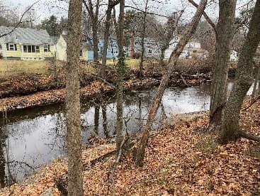
About the Site: This parcel was the third highest ranked existing preserved parcel for potential restoration and site improvements following the field assessments. This parcel is located in the area of the Shawsheen River south of the Balmoral St Bridge and adjacent to several commercial and residential uses. A small surface parking lot is located in the northeast corner of the site, and it is connected directly to the Sacred Heart Reservation. The majority of the parcel is comprised of a large oval track and soccer field.
The immediate riparian zone is vegetated, including trees and shrubs. The banks of the river on the site show isolated areas of erosion, while the opposite bank is extremely steep and shows evidence of downcutting. The majority of this parcel is also located in the FEMA regulatory floodway.
Overall, this parcel had high scores for climate resilience potential, and it presents a unique opportunity to create additional flood storage capacity given its proximity to the river and low-lying areas that could be reconfigured to more easily convey flood water to open areas of the site. The parcel also scored highly for its educational and recreation opportunity potential, given the ease of access (including for those with disabilities), and the connection to existing trails.

Flow Deflection/Diversion to Floodable Field –
As observed during the desktop site screening, the Lower Shawsheen Soccer Field parcel is prone to flooding, as the majority of the parcel sits within the FEMA regulatory floodway. The field also has several moderately-sloped, low-lying areas along the western border with the river that create potential opportunities to cut overflow or high-flow diversion channels along the riverbank that would direct flood water to the field during flood conditions where it would be allowed to spread out and stored for later release back into the river system. Redesigning the field to accommodate temporary inundation would allow the current field to be used as a large flood storage facility during flooding events while maintaining its existing recreational use during sunny day conditions. (Note: Similar ideas have had some community support in the past, as suggestions for creating stormwater parks on existing preserved parcels – e.g., Penguin Park – have previously been recommended during prior Community Resilience Building workshops in Andover.)
As mentioned with other flood storage and restoration recommendations above, detailed hydraulic modeling would be necessary as a first step to quantify potential benefits and optimize the design of any overflow diversion structures and/or field modifications.
The focus of the Town’s current FY22 MVP Action Grant project has been to initiate the first phase of climate action on the Shawsheen by developing this initial plan to identify and prioritize parcels for potential future land acquisition and/or restoration based on environmental, social, and community resilience metrics. The next phase will build upon this plan by quantifying the flood mitigation benefits to be gained from the potential implementation of flood storage and/or restoration projects on several of the top-prioritized parcels. The next step for moving this project forward and further prioritizing flood resilience projects will be to develop hydrologic and hydraulic (H&H) modeling to evaluate the existing and projected future flooding conditions on the Shawsheen River. Modeling will be used to evaluate the immediate upstream and downstream benefits of specific projects for providing flood protections to flood-prone areas. The modeling will also provide a picture of the overall level of benefit for flooding in the Town of Andover as well as whether any of the proposed projects would have measurable benefits continuing downstream into neighboring Lawrence.
Given the ongoing conversation and debate within the Town around potential removal of the Ballardvale Dam, the Town plans to incorporate into this modeling a comparison of how future benefits of the restoration projects differ depending on whether the dam is left in place or removed. This information is expected to be extremely valuable in facilitating conversations around dam removal and the associated flood resilience benefits that would come with such a project and how removal of the dam may play a key role in amplifying the benefits of land acquisition and restoration efforts.
As noted above, while developed parcels were not highly prioritized in this study because of the emphasis on preserving existing habitat and ecological value, existing developed land may ultimately play a key role in the overall resilience strategy for the Shawsheen River corridor. A parallel effort should focus on identifying and approving a priority flood resilience overlay district, such that any parcels which come up for sale within this district should be closely considered by the Town as priority for acquisition and restoration to re-naturalize the river corridor. Proposed modeling efforts may help to identify the most valuable areas upon which to focus this overlay district.
As a clearer understanding of the most effective flood reduction project locations comes into view, stakeholders and members of the Andover and Lawrence communities should be invited to participate in visioning processes to develop conceptual designs for projects at priority sites that integrate with other community co-benefits and truly reflect the community’s needs. Establishing buy-in and consensus will ultimately make restoration efforts more successful and more rewarding.
The outcomes of this second phase of the project will enable the Town to further prioritize potential projects on the Shawsheen and provide quantitative information for the Town to measure the cost benefit ratio of particular acquisition targets and to effectively pursue funding for both land acquisition and the implementation of restoration and climate resilience improvement projects.
Fortunately, as climate resilience and nature-based solutions continue to gain traction throughout Massachusetts and the United States, a variety of funding programs have become available or expanded their funding capacity to help facilitate these types of projects. The following is a list of possible funding sources to provide both financial and technical assistance for land acquisition, restoration, and climate resilience improvement projects on priority parcels.
Section 319 Grants are available for projects that promote restoration and protection of water quality through reducing and managing nonpoint source pollution. These grants are made possible by federal funds provided to MassDEP by the USEPA under Section 319 of the Clean Water Act. Eligible applicants include municipal, state, or regional governments, quasi-state agencies, public schools and universities, and non-profit watershed, environmental, or conservation organizations. Pursuant to federal guidelines for Section 319 funding, projects can only be funded in those areas in which a Watershed-Based Plan has been completed. MassDEP created the Massachusetts Watershed-Based Plan (WBP) tool that can be used to develop proposals for 319 grants.
Website: https://www.mass.gov/info-details/grants-financial-assistance-watersheds-water-quality
Section 604(b) Grants are available for projects which conduct watershed or sub-watershed based nonpoint source assessment and planning. FY2022 funds focus on determining the nature and extent of point and non-point source water pollution, and developing water quality management plans. Eligible entities include Regional Planning Agencies, Councils of Government, counties, Conservation Districts, cities, and towns.
Website: https://www.mass.gov/info-details/grants-financial-assistance-watersheds-water-quality#604(b)grant-program:-water-quality-management-planning-
This funding helps not-for-profit groups with projects that fall under: acquisition of the fee interest in land or a conservation restriction or the due diligence for land or a conservation restriction that was donated. Preferred projects allow for multiple recreation opportunities, involve lands in BioMap2, comprise rare ecotypes or habitats, or are large parcels that abut existing protected land.
Website: https://www.mass.gov/how-to/apply-for-a-conservation-partnership-grant
Division of Conservation Services Land and Water Conservation Fund Grant Program
This funding provides up to 50% of the total project cost for land acquisition, and development or renovation of parks, trails, and conservation areas. Municipalities must have an up-to-date Open Space and Recreation Plan to be considered eligible for funding.
Website: https://www.mass.gov/service-details/massachusetts-land-and-water-conservation-fund-grantprogram
Division of Conservation Services Landscape Partnership Grant Program
This funding program aims to protect large pieces of conservation land. Eligible projects may include: purchase of land in fee simple for conservation, forestry, agriculture, or water supply purposes; purchase of a conservation restriction; purchase of an agricultural preservation restriction; purchase of a watershed preservation restriction. Applications must be submitted jointly by two or more of the following groups: municipality; non-profit, non-municipal public water supplier; non-profit 501(c)(3) organization; government agency.
Website: https://www.mass.gov/service-details/landscape-partnership-grant-program
This funding supports the purchase of forests, fields, wetlands, wildlife habitat, unique natural, cultural, or historic resources, and some farm land for conservation and passive recreation purposes. The general public must have reasonable access to the land. Eligible projects include the purchase of land in fee simple for conservation and passive recreation, and the purchase of a conservation restriction. Municipal conservation and agricultural commissions from communities with an up-to-date open space and recreation plan are eligible to apply.
Website: https://www.mass.gov/service-details/local-acquisitions-for-natural-diversity-land-grant-program
This funding assists cities and towns in acquiring and developing land for park and outdoor recreation purposes. These grants can be used by municipalities to acquire parkland, build a new park, or to renovate an existing park. Any town with a population of 35,000 or more year-round residents, or any city regardless of size, that has an authorized park/recreation commission and an up-to-date open space and recreation plan is eligible to participate in the program.
Website: https://www.mass.gov/service-details/parkland-acquisitions-and-renovations-for-communitiesparc-grant-program
The DER offers small grants to fund wetland, river, and flow restoration projects that are high-priority and provide significant ecological and community benefits to the Commonwealth. The DER considers funding for several types of “priority projects,” including dam removal and river restoration. In addition to small grants, eligible projects also receive technical services (data collection, engineering, design work, and permitting) and project management and fundraising help.
Website: https://www.mass.gov/how-to/become-a-der-priority-project
EEA Planning Assistance grants are available to support projects that are consistent with state priorities for land conservation, reduction of natural resource consumption, and climate mitigation and resilience building. Actions implementing the results of climate vulnerability assessments or priorities identified during a community’s MVP process are eligible for funding, as are low impact development, and other related projects. Up to $50,000 is available per municipality, with the option of pursuing a multi-jurisdictional regional project. Projects must include a minimum nonstate match of 25%.
Website: https://www.mass.gov/service-details/planning-assistance-grant
The MassWorks Infrastructure Program is administered by the Executive Office of Housing and Economic Development, the Department of Transportation, and the Executive Office for Administration and Finance. The program provides public infrastructure funding to support sustainability in Massachusetts, as well as job creation and economic development. Although the program is not specifically for hazard mitigation, the infrastructure improvements covered under MassWorks could help protect communities from natural disasters such as flooding
Website: https://www.mass.gov/service-details/massworks-infrastructure-grants
The MVP Action Grant Program is administered through the Executive Office of Energy and Environmental Affairs. To be eligible for funding, communities must complete the MVP Planning Grant process. The MVP Action Grant offers financial assistance to municipalities that are interested in implementing climate adaptation actions to address the impacts of climate change (extreme weather, sea level rise, inland and coastal flooding, severe heat, etc.). The program funds projects relating to planning, assessments, and regulatory updates; nature-based solutions for ecological and public health; and resilient redesigns and retrofits for critical facilities and infrastructure. The MVP program also emphasizes robust engagement of the public and benefits for environmental justice communities or climate vulnerable populations. In past funding rounds, applicants were able to request $25,000 to $2,000,000 in funding (up to $5,000,000 available for regional projects). A 25% match, either through cash or in-kind services, is required.
Website: https://www.mass.gov/service-details/mvp-action-grant
The SRF provides a low-cost financing option for communities through two programs: the Clean Water Program and the Drinking Water Program. The Clean Water Program provides loans to help municipalities comply with federal and state water quality requirements by focusing on watershed management priorities, stormwater management, and green infrastructure. The Drinking Water SRF Program provides loans to communities to improve water supply infrastructure and drinking water safety
Clean Water Program Website: https://www.mass.gov/service-details/srf-clean-water-program
Drinking Water Program Website: https://www.mass.gov/service-details/srf-drinking-water-program
The WMA grant program is available to WMA permit holders. Andover is not currently a permit holder. The program provides aid for planning assistance, demand management, and withdrawal impact mitigation projects in local communities. Grants are reimbursed at 80% and require a 20% match through in-kind services or cash. The Commonwealth awards approximately 10 grants per year. Both planning and implementation projects are eligible.
Website: https://www.mass.gov/info-details/water-management-act-grant-programs-for-public-watersuppliers
Under Section 206 of the Water Resources Development Act of 1996 (33 U.S.C. 2330), the Army Corps of Engineers can participate in the study, design and implementation of ecosystem restoration projects Projects conducted in New England under this program have included eelgrass restoration, salt marsh and salt pond restoration, freshwater wetland restoration, anadromous fish passage and dam removal, river restoration, and nesting bird island restoration. Projects must be in the public interest and cost effective and are limited to $10 million in Federal cost. Non-Federal project sponsors must be public agencies or national non-profit organizations capable of undertaking future requirements for operation, maintenance, repair, replacement and rehabilitation (OMRR&R), or may be any non-profit organization if there are no future requirements for OMRR&R. The Corps of Engineers provides the first $100,000 of study costs. A nonFederal sponsor must contribute 50 percent of the cost of the feasibility study after the first $100,000 of expenditures, 35 percent of the cost of design and construction, and 100 percent of operation and maintenance costs.
Website: http://www.nae.usace.army.mil/Missions/Public-Services/Continuing-AuthoritiesProgram/Section-206/
The Federal Emergency Management Agency (FEMA) administers two major programs related to hazard mitigation: the National Flood Insurance Program (see Section 3.1 of this plan) and the Hazard Mitigation Assistance Program. FEMA’s hazard mitigation assistance grant programs provide funding to protect life and property from future natural disasters. In Massachusetts, these programs are administered by the Massachusetts Emergency Management Agency (MEMA). FEMA flood hazard mitigation assistance funding is available to Massachusetts communities that have a current FEMA and MEMA-approved Hazard Mitigation Plan through the following programs:
Building Resilient Infrastructure and Communities (BRIC) BRIC provides funds to support public infrastructure projects that increase a community’s resiliency to reduce the effects of future disasters. The program replaced the former Pre-Disaster Mitigation (PDM) program in 2020. The goal of the BRIC program is to reduce overall risk to the population and structures, while at the same time, also reducing reliance on Federal funding from actual disaster declarations. A 25% non-federal share (local government or other organization) is required.
Flood Mitigation Assistance (FMA) provides funds for projects to reduce or eliminate risk of flood damage to buildings that are insured under the National Flood Insurance Program (NFIP) on an annual basis. These are cost share grants for pre-disaster planning and projects, with a federal share (up to 100%) and non-federal share (local government or other organization).
Severe Repetitive Loss (SRL) is designed to reduce flood damages to residential properties that have experienced SRLs under flood insurance coverage. The program provides funds so that measures can be taken to reduce or eliminate risk of flood damage to buildings insured under the NFIP.
Funding is available on an annual basis (as available). SRL provides up to 90% Federal funding for eligible projects.
Hazard Mitigation Grant Program (HMGP) assists in implementing long-term hazard mitigation measures following Presidential disaster declarations. Funding is available to implement plans or projects in accordance with State, Tribal, and local priorities. HMGP grants are post-disaster cost share grants consisting of 75% federal share and 25% non-federal share (local government or other organization).
Public Assistance (PA) Grants provide assistance to local, tribal and state governments and certain types of Private Non-Profit (PNP) organizations so that communities can quickly respond to and recover from major disasters or emergencies declared by the President. Through the PA Program, supplemental Federal disaster grant assistance is provided for debris removal, emergency protective measures, and the repair, replacement, or restoration of disaster damaged, publicly owned facilities and the facilities of certain PNP organizations. The PA Program also encourages protection of these damaged facilities from future events by providing assistance for hazard mitigation measures during the recovery process.
Website: https://www.fema.gov/hazard-mitigation-assistance
The National Fish and Wildlife Foundation (NFWF) New England Forests and Rivers Fund is dedicated to restoring and sustaining healthy forests and rivers that provide habitat for diverse native bird and freshwater fish populations in the six New England states. This program annually awards competitive grants ranging from $50,000 to $200,000 each. Since its creation in 2015, the Fund has awarded 48 grants to restore early successional habitat, modify and replace barriers to fish movement, restore riparian and instream habitat, and engage volunteers in forest habitat restoration and stream connectivity projects. Major funding for the New England Forests and Rivers Fund is provided by Eversource Energy, the U.S. Fish and Wildlife Service, and the U.S. Department of Agriculture’s Natural Resources Conservation Service and Forest Service.
Website: http://www.nfwf.org/newengland/Pages/home.aspx
The USDA Natural Resources Conservation Service (NRCS) works with landowners in Massachusetts to improve and protect soil, water, and other natural resources. NRCS has several funding programs in Massachusetts that help property owners address flooding and water quality issues.
The Emergency Watershed Protection (EWP) Program is designed to help people and conserve natural resources by relieving imminent hazards to life and property caused by floods, fires, windstorms, and other natural occurrences. EWP is an emergency recovery program, which responds to emergencies created by natural disasters. It is not necessary for a national emergency to be declared for an area to be eligible for assistance. EWP is designed for installation of recovery measures. Activities include providing financial and technical assistance to remove debris from stream channels, road culverts, and bridges, reshape and protect eroded banks, correct damaged drainage facilities, establish cover on critically eroding lands, repair levees and structures, and repair conservation practices
Website: https://www.nrcs.usda.gov/wps/portal/nrcs/main/national/programs/landscape/ewpp/
The Emergency Watershed Protection - Floodplain Easement Program (EWP-FPE) provides an alternative measure to traditional EWP recovery, where it is determined that acquiring an easement in lieu of recovery measures is the more economical and prudent approach to reducing a threat to life or property. The easement area is restored to the maximum extent practicable to its natural condition using structural and nonstructural practices to restore the flood storage and flow, erosion control, and improve the practical management of the easement. Floodplain easements restore, protect, maintain and enhance the functions of floodplains while conserving their natural values such as fish and wildlife habitat, water quality, flood water retention and ground water recharge. Structures, including buildings, within the floodplain easement must be demolished and removed, or relocated outside the 100-year floodplain or dam breach inundation area.
Website: https://www.nrcs.usda.gov/wps/portal/nrcs/detail/ ct/programs/financial/ewp/?cid=stelprdb1244478
The Watershed and Flood Prevention Operations Program provides technical and financial assistance to states, local governments and Tribes to plan and implement watershed project plans for the purpose of watershed protection, flood mitigation, water quality improvement, fish and wildlife enhancement, wetlands and wetland function creation and restoration, groundwater recharge, and wetland and floodplain conservation easements.
Website: https://www.nrcs.usda.gov/wps/portal/nrcs/ main/national/programs/landscape/wfpo/
These competitive, matching grant programs are available to public-private partnerships carrying out projects that further the goals of the North American Wetlands Conservation Act (NAWCA). The project must involve long-term protection, restoration, and/or enhancement of wetlands and associated uplands habitats for the benefit of all wetlands-associated migratory birds. Small grants may not exceed $100,000. Partners must match their grant request at a 1:1 ratio.
Website: https://www.fws.gov/service/north-american-wetlands-conservation-act-nawca-grants-us-standard
Title 1 of the Housing and Community Development Act of 1974 authorized the Community Development Block Grant program. The program is sponsored by the US Department of Housing and Urban Development. The Massachusetts program is administered through the Massachusetts Department of Housing and Community Development. CDBG-DR (disaster recovery) funds may be used to restore public facilities and infrastructure, rehabilitate or replace housing, acquire property, promote economic revitalization, and support Hazard Mitigation Planning. CDBG-DR funds are intended to support long-term recovery from a specific natural disaster and may not be applied to recovery activities associated with other disasters. Annual CDBG Program funds may also be used for certain eligible hazard mitigation and disaster recovery activities (Commonwealth of Massachusetts, n.d.).
Website: https://www.mass.gov/service-details/community-development-block-grant-cdbg
The CPA allows communities to create a local community preservation fund through the imposition of a surcharge of not more than 3% of the tax levy against real property. Municipalities must adopt CPA by ballot referendum. To date, over 50% of Massachusetts municipalities have adopted the CPA. Funding can be used for preserving open space and historic sites, creating affordable housing, and developing outdoor recreational facilities.
Website: https://www.communitypreservation.org/about
This funding mechanism provides predictable revenue. The Town can determine whether the fee is based on impervious surface cover or a flat rate. For example, Tulsa, Oklahoma collects a monthly fee of $8.35 from City residents to support its stormwater operations and maintenance program.
This funding mechanism raises revenue without adding a new tax. Property revenue increases from within the district are earmarked for specific projects, such as flood control. TIF offers tax breaks to developers, while DIF channels tax dollars into targeted redevelopment districts. For example, Aurora, IL used a TIF district to raise upfront money to address long-term flooding issues while implementing a commercial redevelopment project.
Website: https://www.mass.gov/service-details/smart-growth-smart-energy-toolkit-modules-districtimprovement-financing-diftax-increment-financing-tif
This funding opportunity provides a predictable revenue stream but can be politically challenging. In Austin, MN residents passed a 20-year, 1/2-cent local option sales tax in 2007 to fund mitigation projects and property buyouts. It generates ~$1.4 million each year.
Community and Corporate Foundations
Community foundations may offer philanthropic project grants, as opposed to money that needs to be paid back. The Town of Andover is served by community foundations including the Essex County Community Foundation.
Website: https://www.eccf.org/
Healthy Watersheds Consortium Grant Program - U.S. Endowment for Forestry and Communities, USEPA, USDA NRCS
The goal of the Healthy Watersheds Consortium Grant Program is to accelerate strategic protection of healthy, freshwater ecosystems and their watersheds. The program supports:
Developing funding mechanisms, plans, or other strategies to implement large scale watershed protection, source water protection, green infrastructure, or related landscape conservation objectives.
Building the sustainable organizational infrastructure, social support, and long term funding commitments necessary to implement large-scale protection of healthy watersheds
Supporting innovative or catalytic projects that may accelerate funding for or implementation of watershed protection efforts, or broadly advance this field of practice. Eligible applicants include non-profit organizations, for-profit companies, tribes, intertribal consortia, interstate, state, and local government agencies including water utilities and wastewater facilities, and colleges and universities. Funding amounts range from $50,000 to $300,000.
Website: https://www.epa.gov/hwp/healthy-watersheds-consortium-grants-hwcg
The Shaping Climate Resilient Communities program helps cities and towns guide development in a sustainable manner, update and implement community plans and protect habitat, water supplies, forests, and farmland by offering services such as workshops, technical assistance, and advise for municipalities in the fastest growing areas of Massachusetts. Priority actions include adopting the Community Preservation Act, updating open space plans, and revising zoning to protect land and water resources.
Website: https://www.massaudubon.org/our-conservation-work/policy-advocacy/shaping-climate-resilientcommunities/about-the-program
This funding opportunity provides planning and technical assistance, including authoring guidance documents and hosting workshops, focused on addressing the following climate issues: habitat resilience, forest carbon storage, and sequestration, and community resilience to climate impacts such as flooding
Website: https://www.openspaceinstitute.org/climate-catalyst-program
Wells Fargo, in partnership with the National Fish and Wildlife Foundation, launched the Resilient Communities Program in 2017. The program is designed to prepare for future environmental challenges by enhancing community capacity to plan and implement resiliency projects and improve the protections afforded by natural ecosystems by investing in green infrastructure and other measures. The program focuses on water quality and quantity declines, forest health concerns, and sea level rise. The program emphasizes community inclusion and assistance to traditionally underserved populations in vulnerable areas. In the northeast, eligible project types include wetland restoration and aquatic organism passage. The program awarded approximately $2 million in grants to projects in 2019. Each grant will range from $100,000 to $500,000 depending on category and will be awarded to eligible entities working to help communities become more resilient. This program has one round of applications per year and awards approximately three to six grants annually.
Website: http://www.nfwf.org/resilientcommunities/Pages/home.aspx
This funding mechanism spreads costs for flood mitigation amongst partners, and adding more partners can increase funding and capacity. In Lincoln, NE, the city government, the University of Nebraska-Lincoln, and a watershed district signed a joint agreement and shared costs to implement a major flood control project.
This funding supports projects that respond to potential or observed climate change impacts to maximize long-term conservation success, focused on achieving wildlife and ecosystem conservation outcomes in the face of a changing climate. The grant requirements are intended to incentivize adaptation implementation
projects and adaptation mainstreaming projects that are innovative and advance learning, and broaden adoption of adaptation approaches to a larger scale.
Website: https://www.wcsclimateadaptationfund.org/program-information
Desktop Site Screening Protocol
Town of Andover
Before applying the desktop site screening protocol, it is important to establish the study area to which the protocol will be applied. The study area used for this project was defined in the project scope as including “properties along the Shawsheen River.” While the parcels directly abutting the Shawsheen River are important to include in the study area for this project, parcels that may not directly touch the riverbank of the Shawsheen River could still be important to examine for their potential to provide additional climate and flood resilience. These parcels might include adjacent wetlands, open spaces, or other valuable parcels that overlap with the flood zone surrounding the Shawsheen River.
After consultation with the Town, the following definition was established to define the study area to be used in this desktop site screening protocol:
Study area: All parcels that intersect with a 100-meter (m) buffer offset from the boundary of the Federal Emergency Management Agency (FEMA) National Flood Hazard zones surrounding the Shawsheen River.
The 100-m buffer was selected based on visual inspection of the flood zones surrounding the Shawsheen River to ensure that the study area captured parcels along the River that were prone to flooding yet might not border the riverbank. This purposive selection criterion was also useful in helping the Project Team avoid scope creep and stay focused on the goals and objectives outlined in the Action Grant.
To establish the study area using ArcGIS, follow the instructions below.
KEY DATASET
Name: FEMA National Flood Hazard Layer (NFHL)
Source: https://www.mass.gov/info-details/massgis-data-fema-national-flood-hazard-layer
About: This dataset represents the current effective flood risk data where maps have been modernized by FEMA.
How to establish the desktop site screening study area using ArcGIS:
Step 01 – Zoom to the Shawsheen River area bounded by the Town of Andover (Note: The Shawsheen River, and its associated perennial streams, can be identified using attributes from the Massachusetts Department of Ecology’s Inland Water Features dataset: https://www.mass.gov/info-details/massgis-data-layers)
Step 02 – Toggle on the FEMA NFHL layer
\\private\DFS\Projectdata\P2020\0400\D10\Deliverables\Task 1.3 - Desktop Site Screening\2021-1110_Desktop_screening_protocol_DRAFT.docx

Step 03 – Create a 100-meter (m) buffer offset from the boundary of the FEMA NFHL polygon layer connected to the Shawsheen River.
Step 04 – Intersect this buffer with the Parcels layer and create a new layer showing only the parcels that overlap with the buffered study area. These parcels are now included in the study area for this project.
(Optional) Step 05 – To differentiate parcels that fall within different flood zone designations and areas of the buffer region, a spatial join may be used to join the flood zone labels (e.g., “0.2% Chance of Flooding, etc.) from the FEMA NFHL dataset to the study area parcels.
After establishing the study area parcels, it is time to conduct the desktop site screening using datasets from MassGIS, FEMA, The Nature Conservancy, the University of Massachusetts Amherst, the Town of Andover, and other sources. Each screening will result in the development of one or more maps to be used as deliverables for this portion of the project, along with inputs of data analysis that will be added as additional attributes to the study area parcel layer.
Key Dataset: Andover Open Space
Source: Town of Andover
About the dataset: This dataset includes information on all existing open, preserved parcels in the Town of Andover. This includes conservation areas, parks, playgrounds, fields, state forests, and private land trusts and open spaces.
How to conduct a screening for existing preserved lands: Applying the “Screen”:
Step 01 – Zoom to study area.
Step 02 – Toggle on the Andover Open Space layer.
Step 03 – Increase the transparency of layers and adjust the drawing order as needed to visualize the open space parcels within the study area.
Creating the Map:
Step 04 – Zoom to the extents of the study area and create a map showing the existing preserved lands within the study area.
Adding Attributes to Study Area Parcels:
Step 05 – Using the attribute table for the Study Area Parcel layer, create a column (labeled “OS_Type”) to identify study area parcels located on existing preserved land. Parcels located on existing preserved lands should be identified in the column by adding the open space type (e.g., “Conservation,” “Other Town Properties,” “Private Land Trust – Avis,” etc.) to the cells where the condition applies. All other cells may be left blank.
\\private\DFS\Projectdata\P2020\0400\D10\Deliverables\Task 1.3 - Desktop Site Screening\2021-1110_Desktop_screening_protocol_DRAFT.docx

o Note: In lieu of visually inspecting each parcel in the study area, a spatial join may also be used to join “OS_Type” data from the Andover Open Space dataset to the attribute table from the Study Area Parcel dataset.
Questions to ask after screening with the dataset:
Instructions: Answer the following questions to the best of your ability using a few sentences.
What parcels within the study area are already preserved? What type of preserved open space are they (e.g., parks, playgrounds, fields, state forests, private land trust, etc.)?
Where are there existing preserved land parcels that are disconnected from one another? Where might there be opportunities to acquire land that would create greater connectivity between existing open parcels?
Key Dataset: Terrestrial Resilience
Source: http://www.conservationgateway.org/ConservationPractices/ClimateChange/Pages/RCNDownloads.aspx#State
About the dataset: This composite dataset was developed by The Nature Conservancy (TNC) to estimate a site’s capacity to maintain species diversity and ecological function as the climate changes. The Terrestrial Resilience dataset helps identify land with the greatest landform diversity and local connectedness. Areas with high microclimatic diversity and low levels of human modification provide species with connected, diverse climatic conditions they will need to persist and adapt to changing regional climates.
How to conduct a screening for terrestrial resilience:
Applying the “Screen”:
Step 01 – Zoom to study area.
Step 02 – Toggle on the Terrestrial Resilience layer.
Step 03 – Increase the transparency of layers and adjust the drawing order as needed to visualize the terrestrial resilience for parcels within the study area.
Creating the Map:
Step 04 – Zoom to the extents of the study area and create a map showing the terrestrial resilience of parcels within the study area.
Adding Attributes to Study Area Parcels:
Step 05 – Using the attribute table for the Study Area Parcel layer, create two columns (labeled “Resil” and “Not_Resil”) to identify study area parcels that are: (1) largely covered by land that is “Slightly more resilient” or above (i.e., “Resil”) or (2) largely covered by land that is “Average/median resilient” or below (i.e., “Not_Resil”). Identifying parcels can be done by marking a “1” in the cells where the conditions mentioned above are met. Parcels that are not covered by land with a resilience score (e.g., “Developed” land) should not be marked (i.e., the cells may be left blank) as they do not fall within the resilience scoring range.
\\private\DFS\Projectdata\P2020\0400\D10\Deliverables\Task 1.3 - Desktop Site Screening\2021-1110_Desktop_screening_protocol_DRAFT.docx

o Note: In lieu of visually inspecting each parcel in the study area, raster data (namely “Resilience,” which represents the resilience score) from the Terrestrial Resilience layer may be converted to points. A spatial join can then be used to join the average of point feature class from the raster file to the polygons from the Study Area Parcels shapefile.
Questions to ask after screening with the dataset:
Instructions: Answer the following questions to the best of your ability using a few sentences.
How resilient are the parcels within the study area?
What parcels score above average for resilience yet are not protected?
What parcels are protected yet score below average for resilience? Are these parcels bordered by parcels with above average resilience scores?
Dataset: Landscape Diversity
Source: http://www.conservationgateway.org/ConservationPractices/ClimateChange/Pages/RCNDownloads.aspx
About the dataset: This dataset is used along with the Local Connectedness dataset to develop the resilience scores used in the combined Resilience Sites dataset. On its own, the Landscape Diversity dataset can be used to estimate the number and variety of microclimates in a given area. These can be used as measures of local climate variation, as they quantify the number of distinct temperature-moisture combinations available to resident species. Parcels with a greater variety of microclimates are more likely to maintain diversity and ecological functions than sites with fewer options, as local microclimates buffer parcels of land from changes in the regional climate.
How to conduct a screening for landscape diversity:
Applying the “Screen”:
Step 01 – Zoom to study area.
Step 02 – Toggle on the Landscape Diversity layer.
Step 03 – Increase the transparency of layers and adjust the drawing order as needed to visualize the Landscape Diversity for parcels within the study area.
Creating the Map:
Step 04 – Zoom to the extents of the study area and create a map showing the landscape diversity of parcels within the study area.
Adding Attributes to Study Area Parcels:
Step 05 – Using the attribute table for the Study Area Parcel layer, create two columns (labeled “Div” and “Not_Div”) to identify study area parcels that are: (1) largely covered by land that is scored as “Slightly More Landscape Diversity” or above (i.e., “Div”) or (2) largely covered by land that is scored as “Average/Median Landscape Diversity” or below (i.e., “Not_Div”). Identifying parcels can be done by marking a “1” in the cells where the conditions
\\private\DFS\Projectdata\P2020\0400\D10\Deliverables\Task 1.3 - Desktop Site Screening\2021-1110_Desktop_screening_protocol_DRAFT.docx

mentioned above are met. Parcels that are not covered by land with a landscape diversity score (e.g., “Developed” land) should not be marked (i.e., the cells may be left blank) as they do not fall within the landscape diversity scoring range.
o Note: In lieu of visually inspecting each parcel in the study area, raster data (namely “Value,” which represents the landscape diversity score) from the Landscape Diversity layer may be converted to points. A spatial join can then be used to join the average of point feature class from the raster file to the polygons from the Study Area Parcels shapefile.
Questions to ask after screening with the dataset:
Instructions: Answer the following questions to the best of your ability using a few sentences.
How diverse are the parcel landscapes within my study area?
What parcels score above average for landscape diversity yet are not protected?
What parcels score below average for terrestrial resilience yet above average for landscape diversity? Are they protected or unprotected?
What parcels are protected yet score below average for landscape diversity?
Dataset: Landforms
Source: http://www.conservationgateway.org/ConservationPractices/ClimateChange/Pages/RCNDownloads.aspx
About the dataset: The Landforms dataset is used as a basis for estimating microclimate diversity because landforms subdivide landscapes into local topographic units with unique moisture and temperature profiles. The landforms reflect local variation in land position, slope, solar radiation, moisture availability, and susceptibility to wind and other disturbances. Landform-based climatic variation can align with, or be greater than, the climatic variation expected over the next century. And because species experience climate at a very local scale (e.g., inches to yards), high microclimate variation allows species to persist at sites even when the regional climate appears unsuitable.
How to conduct a screening for landforms:
Applying the “Screen”:
Step 01 – Zoom to study area.
Step 02 – Toggle on the Landforms layer.
Step 03 – Increase the transparency of layers and adjust the drawing order as needed to visualize the landforms for parcels within the study area.
Creating the Map:
Step 04 – Zoom to the extents of the study area and create a map showing the landforms of parcels within the study area.
Adding Attributes to Study Area Parcels:
\\private\DFS\Projectdata\P2020\0400\D10\Deliverables\Task 1.3 - Desktop Site Screening\2021-1110_Desktop_screening_protocol_DRAFT.docx

Step 05 – Using the attribute table for the Study Area Parcel layer, create a column (labeled “LForm”) to identify the landforms present on study area parcels. The forms of study area parcels should be identified in the column by adding the landform type (e.g., “Slope Crest,” “Steep slope NE cool,” etc.) to the cells where the condition applies. Note that study area parcels may have multiple inputs in the LForm column when multiple landforms are present.
o Note: In lieu of visually inspecting each parcel in the study area, raster data (namely “Landforms”) from the Landforms layer may be converted to points. A spatial join can then be used to join the of point feature class from the raster file to the polygons from the Study Area Parcels shapefile.
Questions to ask after screening with the dataset:
Instructions: Answer the following questions to the best of your ability using a few sentences.
What landforms exist on parcels throughout the study area? Are there any notable landforms on study area parcels that are not present on existing protected land?
Do areas with higher landscape diversity correspond to those with a greater variety of landforms?
Are there protected parcels that scored below average for landscape diversity and lack a variety of landforms?
Dataset: Geophysical Settings
Source: http://www.conservationgateway.org/ConservationPractices/ClimateChange/Pages/RCNDownloads.aspx
About the dataset: This dataset measures geodiversity and identifies broadly-defined landscape types with a similar geologic environment (e.g., similar bedrock, soils, and elevation zone) that support distinctive plants, animals, and natural communities. Successful land conservation allows for each geophysical setting to continue supporting species and communities that thrive in the conditions defined by its physical properties.
How to conduct a screening for geophysical settings:
Applying the “Screen”:
Step 01 – Zoom to study area.
Step 02 – Toggle on the Geophysical Settings layer.
Step 03 – Increase the transparency of layers and adjust the drawing order as needed to visualize the Geophysical Settings for parcels within the study area.
Creating the Map:
Step 04 – Zoom to the extents of the study area and create a map showing the geophysical settings of parcels within the study areas.
Adding Attributes to Study Area Parcels:
Step 05 – Using the attribute table for the Study Area Parcel layer, create a column (labeled “GeoSet”) to identify the geophysical settings present on study area parcels. The geophysical
\\private\DFS\Projectdata\P2020\0400\D10\Deliverables\Task 1.3 - Desktop Site Screening\2021-1110_Desktop_screening_protocol_DRAFT.docx

settings of study area parcels should be identified in the column by adding the geophysical environment type (e.g., “Low Elevation Acidic Grantic,” “Mid Elevation Mafic,” etc.) to the cells where the condition applies. Note that study area parcels may have multiple inputs in the GeoSet column when multiple geophysical settings are present. Parcels covered by “Non-natural” geophysical settings do not need to be labeled and their corresponding cells should be left blank.
o Note: In lieu of visually inspecting each parcel in the study area, raster data (namely “Full_Name,” which represents the geodiversity/geophysical setting) from the Geophysical Settings layer may be converted to points. A spatial join can then be used to join the of point feature class from the raster file to the polygons from the Study Area Parcels shapefile.
Questions to ask after screening with the dataset:
Instructions: Answer the following questions to the best of your ability using a few sentences.
How geologically diverse are parcels within the study area? Are there any notable geophysical settings on study area parcels that are not present on existing protected land?
What is the dominant geophysical environment (i.e., elevation, geology, and soil) of each parcel?
Dataset: Local Connectedness
Source: http://www.conservationgateway.org/ConservationPractices/ClimateChange/Pages/RCNDownloads.aspx
About the dataset: The Local Connectedness dataset is used along with the Landscape Diversity dataset to develop the resilience scores used in the combined Resilience Sites dataset. On its own, the Local Connectedness dataset estimates how easily species can access surrounding areas based on the arrangement of existing roads, industrial agriculture, development, and other human structures. Many human-made structures (e.g., roads, buildings, etc.) create barriers to movement and can make it difficult for species to access microclimates and adjust to a changing climate.
How to conduct a screening for local connectedness:
Applying the “Screen”:
Step 01 – Zoom to study area.
Step 02 – Toggle on the Local Connectedness layer.
Step 03 – Increase the transparency of layers and adjust the drawing order as needed to visualize the Local Connectedness for parcels within the study area.
Creating the Map:
Step 04 – Zoom to the extents of the study area and create a map showing the local connectedness of parcels within the study area.
Adding Attributes to Study Area Parcels:
\\private\DFS\Projectdata\P2020\0400\D10\Deliverables\Task 1.3 - Desktop Site Screening\2021-1110_Desktop_screening_protocol_DRAFT.docx

Step 05 – Using the attribute table for the Study Area Parcel layer, create two columns (labeled “Con” and “Not_Con”) to identify study area parcels that are: (1) largely covered by land that is scored as “Slightly More Connected” or above (i.e., “Con”) or (2) largely covered by land that is scored as “Average/Median Connected” or below (i.e., “Not_Con”). Identifying parcels can be done by marking a “1” in the cells where the conditions mentioned above are met. Parcels that are not covered by land with a connectedness score (e.g., “Developed” land) should not be marked (i.e., the cells may be left blank) as they do not fall within the local connectedness scoring range.
o Note: In lieu of visually inspecting each parcel in the study area, raster data (namely “Value,” which represents the local connectedness score) from the Local Connectedness layer may be converted to points. A spatial join can then be used to join the average of point feature class from the raster file to the polygons from the Study Area Parcels shapefile.
Questions to ask after screening with the dataset:
Instructions: Answer the following questions to the best of your ability using a few sentences.
How connected are the parcels within my study area?
What parcels score above average for connectedness yet are not protected?
What parcels are protected yet score below average for connectedness? Are these parcels bordered by parcels with above average connectedness scores?
What barriers (e.g., roadways, rail lines, open agricultural lands, etc.) may be reducing connectedness on parcels with below average scores?
Dataset: Conservation Assessment and Prioritization System (CAPS) 2020 Five color integrated IEI
Source: http://www.umasscaps.org/data_maps/data.html
About the dataset: Developed by the University of Massachusetts (UMass) Amherst, the Index of Ecological Integrity (IEI) dataset assesses the degree to which a parcel remains intact or free from human impairment. IEI measures the ability of an area to support biodiversity and the ecosystem processes necessary to sustain biodiversity over the long term. The IEI dataset depicts the top 50% of lands with the highest index of ecological integrity (IEI) differentiated by color for the following categories: forest (green), shrubland (orange), coastal uplands (yellow to brown), coastal wetlands (cyan) and freshwater wetlands and aquatic (blue). Darker colors indicate higher-valued cells.
How to conduct a screening for IEI:
Applying the “Screen”:
Step 01 – Zoom to study area.
Step 02 – Toggle on the Index of Ecological Integrity layer.
Step 03 – Increase the transparency of layers and adjust the drawing order as needed to visualize the IEI for parcels within the study area.
Creating the Map:
\\private\DFS\Projectdata\P2020\0400\D10\Deliverables\Task

Step 04 – Zoom to the extents of the study area and create a map showing the IEI of parcels within the study area.
Adding Attributes to Study Area Parcels:
Step 05 – Using the attribute table for the Study Area Parcel layer, create a column (labeled “IEI”) to identify study area parcels that are largely covered by land that falls within the top 50% of lands with the highest IEI. Identifying parcels can be done by marking a “1” in the cells where the conditions mentioned above are met. Parcels that are not covered by land with an IEI value should not be marked (i.e., the cells may be left blank) as they do not fall within the top 50%.
o Note: In lieu of visually inspecting each parcel in the study area, raster data (namely “Value,” which represents the IEI score) from the Index of Ecological Integrity layer may be converted to points. A spatial join can then be used to join the average of point feature class from the raster file to the polygons from the Study Area Parcels shapefile.
Questions to ask after screening with the dataset:
Instructions: Answer the following questions to the best of your ability using a few sentences.
What parcels fall within the top 50% of lands with the highest IEI yet are not protected?
How do the IEI results compare with the results from the terrestrial resilience? Are there areas of overlap between parcels with high degrees of IEI and resilience?
Dataset: Centers for Disease Control and Prevention Social Vulnerability Index (SVI)

Source: https://www.atsdr.cdc.gov/placeandhealth/svi/data_documentation_download.html
About the dataset: The SVI dataset was created to help public health officials and emergency response planners identify and map the communities that will most likely need support before, during, and after a hazardous event (e.g., flooding). The SVI indicates the relative vulnerability of populations from every Census tract in the United States and ranks each tract according to 15 social factors (e.g., unemployment, minority status, and disability, etc.) and further groups them into four related themes:
- Socioeconomic Status (Below Poverty, Unemployed, Income, No High School Diploma)
- Household Composition & Disability (Aged 65 or Older, Aged 17 or Younger, Civilian with a Disability, SingleParent Households)
- Minority Status & Language (Minority, Aged 5 or Older who Speaks English “Less than Well”)
- Housing Type & Transportation (Multi-Unit Structures, Mobile Homes, Crowding, No Vehicle, Group Quarters)
Socially vulnerable populations may not be as able to adapt to climate-related hazards and should be considered in climate adaptation strategies.
How to conduct a screening for social vulnerability:
Applying the “Screen”:
Step 01 – Zoom to study area.
Step 02 – Toggle on (one at a time) each of the SVI layers.
\\private\DFS\Projectdata\P2020\0400\D10\Deliverables\Task 1.3 - Desktop Site Screening\2021-1110_Desktop_screening_protocol_DRAFT.docx
Step 03 – Increase the transparency of layers and adjust the drawing order as needed to visualize the social vulnerability for parcels within the study area.
Creating the Map:
Step 04 – Zoom to the extents of the study area and create a map showing the each of the SVI themes covering parcels within the study area. Create one map for each of the SVI themes (i.e., Socioeconomic Status, Household Composition & Disability, Minority Status & Language, and Housing Type & Transportation)
Adding Attributes to Study Area Parcels:
Step 05 – Using the attribute table for the Study Area Parcel layer, create four columns (one for each of the SVI themes labeled “SS,” “HCD,” “MSL,” and “HTT”) to identify study area parcels that fall within census tracts with the highest vulnerability for each theme. Identifying parcels can be done by marking a “1” in the cells where the conditions mentioned above are met.
o Note: In lieu of visually inspecting each parcel in the study area, data (namely “RPL_THEME1,” “RPL_THEME2,” “RPL_THEME3,” and “RPL_THEME4” which represent the vulnerability scores for the “Socioeconomic Status,” “Household Composition & Disability,” “Minority Status & Language,” and “Housing Type & Transportation” themes respectively) from the SVI layers may spatially be joined to the polygons from the Study Area Parcels shapefile.
Questions to ask after screening with the dataset:
Instructions: Answer the following questions to the best of your ability using a few sentences.
What parcels fall within areas with socially vulnerable populations? In what ways are these populations vulnerable?
Where do vulnerable populations have access to preserved open spaces? Where do they not?
Dataset: Andover Mass. Trails & Rivers Web Map

Source:
https://andoverma.maps.arcgis.com/apps/webappviewer/index.html?id=e09aa89cf7a2437b8812542343816 dfb&extent=-7931045.3023%2C5249938.5644%2C-7905515.3348%2C5265264.1886%2C102100
About the dataset: The Andover Mass. Trail and Rivers Web Map dataset provides the most up-to-date information on the location of trails and recreation opportunities throughout the Town of Andover. Land acquisition, protection, and restoration for climate resilience can also create additional opportunities to connect and strengthen existing social assets throughout the Town. An unprotected parcel between two preserved open spaces with an existing trail might be well suited for providing additional flood storage and a connection to a greater network of trails and other recreational opportunities.
How to conduct a screening for trails and recreation opportunities: Applying the “Screen”:
\\private\DFS\Projectdata\P2020\0400\D10\Deliverables\Task 1.3 - Desktop Site Screening\2021-1110_Desktop_screening_protocol_DRAFT.docx
Step 01 – Zoom to study area.
Step 02 – Toggle on the Andover Trails and Rec layer.
Step 03 – Increase the transparency of layers and adjust the drawing order as needed to visualize the trails and recreational opportunities that exist on parcels within the study area.
Creating the Map:
Step 04 – Zoom to the extents of the study area and create a map showing the trails and recreational opportunities within the study area.
Adding Attributes to Study Area Parcels:
Step 05 – Using the attribute table for the Study Area Parcel layer, create four columns (labeled “Trails,” “Bike_Route,” “Camp,” and “Boat”) to identify study area parcels containing trails/paths, bike routes, camping areas, and/or boat launches. For the “Trails” and “Bike-Route” columns, identifying parcels can be done by marking a “1” in the cells corresponding to the parcels where a trail/path or bike route is present. For the “Camp” and “Boat” columns, the number of each should be marked in the cells corresponding to each parcel.
o Note: In lieu of visually inspecting each parcel in the study area, data from the Andover Trails and Rec layer may be spatially joined to the polygons from the Study Area Parcels shapefile. For data on camping areas and boat launches, the Field Calculator can be used to create a count field and a spatial join between the point shapefiles and the polygon parcel shape files. (See here for guidance: https://support.esri.com/en/technical-article/000008599)
Questions to ask after screening with the dataset:
Instructions: Answer the following questions to the best of your ability using a few sentences.
What parcels contain trails or other recreational opportunities? Are they protected? Are they at risk of flooding?
What parcels do not contain trails or other recreational opportunities, but could be used to not only increase flood resilience but also be used to extend or connect social/recreational assets in the Town?
Are they any parcels that the Town may want to protect but not have public access to avoid human impacts, protect species, etc.?
\\private\DFS\Projectdata\P2020\0400\D10\Deliverables\Task

Desktop Site Screening Maps
Andover Town Boundary
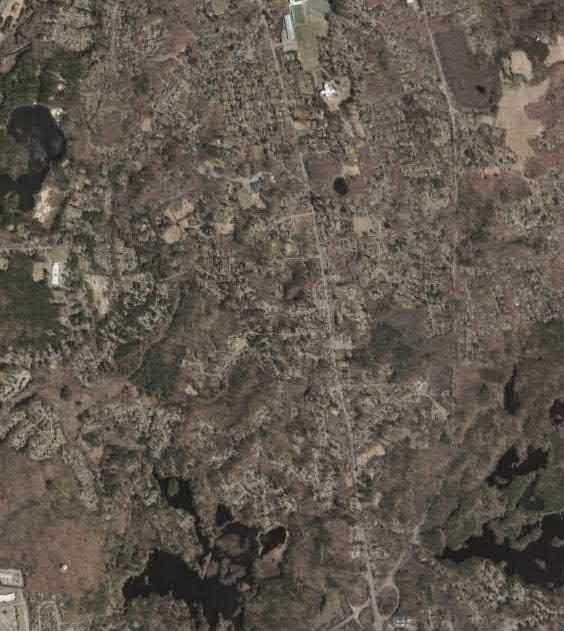
Shawsheen River FEMA National Flood Hazard Zones
Flood Zone Designations
A: 1% Annual Chance of Flooding, no BFE
AE: 1% Annual Chance of Flooding, with BFE
AE: Regulatory Floodway

X: 0.2% Annual Chance of Flooding
Desktop Site Screening
Defining the Study Area: Shawsheen River Flood Zones
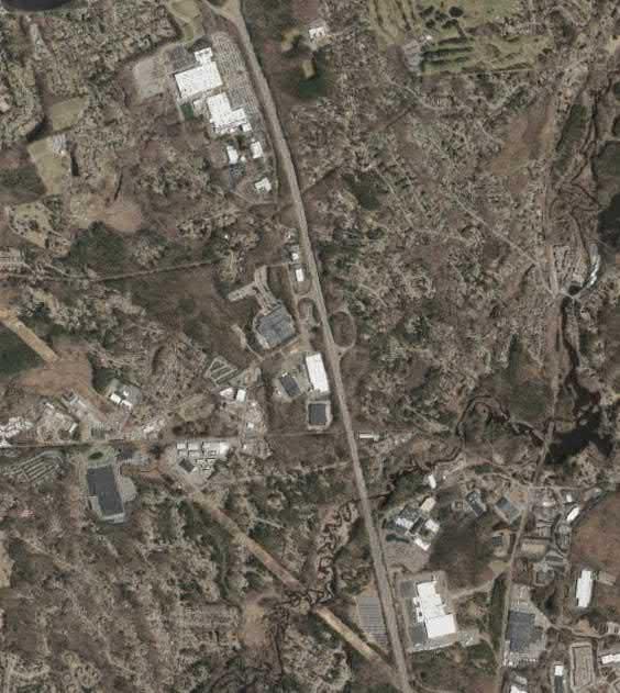
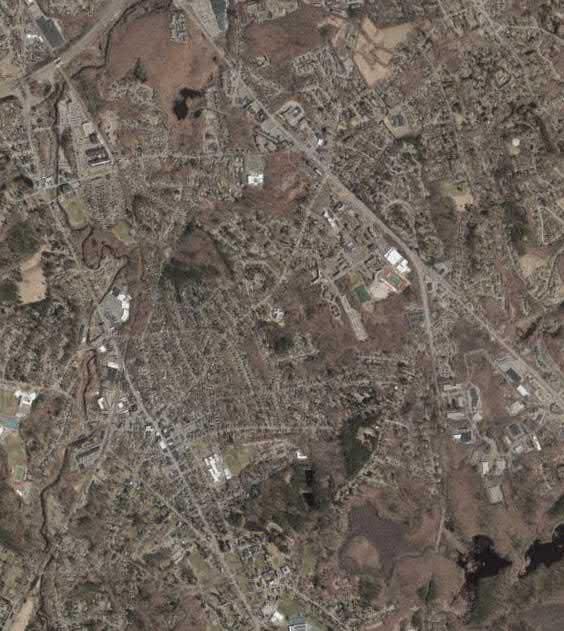

Town of Andover, MA

Andover Town Boundary

Shawsheen River FEMA National Flood Hazard Zones

Flood Zone Designations
A: 1% Annual Chance of Flooding, no BFE
AE: 1% Annual Chance of Flooding, with BFE
AE: Regulatory Floodway

X: 0.2% Annual Chance of Flooding
Flood Zones 100-m Buffer
Defining the Study Area: Shawsheen River Flood Zones 100-m Buffer


Town of Andover, MA


Andover Town Boundary
Sideslope NE Cool

Sideslope SW Warm
Dry Flat


Flat Summit/ridgetop

Wetflat/wetland
Valley/toeslope
Pluvial Flat


Open Water
Desktop Site Screening


Physical Diversity: Landforms
Town of Andover, MA




Date of Assessment: Time of Assessment:
Assessed By (Name of Primary Assessor):
Also Assessed By (Name of Additional Assessor):
Start Location (e.g., upriver landmark/parcel border):
Downriver End Location (e.g., downriver landmark/parcel border):

During the field assessment, assessors are encouraged to take several photos of the site and the specific conditions assessed in this form. Photos can include images of the overall site and images of specific site conditions (e.g., vegetative protection, bank erosion, presence of trails, etc.).

Take photos using your camera or phone and upload them to one of the following cloud storage folders using your web browser:
Microsoft OneDrive - shorturl.at/rvBS9
Google Drive - shorturl.at/wzCLP
All photos should be labeled using the following naming convention: “SiteID_Description.” For example, if a photo was showing bank erosion on the site, it should be labeled “01_BankErosion.” “01” is the site ID number, while “BankErosion” represents that the photo is related to Section 3b of the assessment form (i.e., Bank Erosion). If taking more than one photo of the same site condition, please feel free to add numbers after the description (e.g., 01_BankErosion_02).

Parcel ID (provided by Project Team member):


Sewer/Stormwater Infrastructure Present (e.g., exposed pipes, manholes, sewer outfalls, etc.):

Type:
Material:
Condition:
Notes/Location: Please use this space to provide any additional notes regarding sewer and/or stormwater infrastructure present at the parcel. Also feel free to make notes and mark-ups directly on the site map provided. Note: Please limit the amount of text and print as legibly as possible when making notes and mark-ups.


(Circle # for each side of riverbank)
More than 90% of the riverbank surfaces and immediate riparian zone covered by native vegetation, including trees, understory shrubs, or nonwoody macrophytes; vegetative disruption through grazing or mowing minimal or not evident; almost all plants allowed to grow naturally.
70-90% of the riverbank surfaces covered by native vegetation, but one class of plants is not well-represented; disruption evident but not affecting full plant growth potential to any great extent; more than one-half of the potential plant stubble height remaining.
50-70% of the riverbank surfaces covered by vegetation; disruption obvious; patches of bare soil or closely cropped vegetation common; less than one-half of the potential plant stubble height remaining.
Less than 50% of the riverbank surfaces covered by vegetation; disruption of riverbank vegetation is very high; vegetation has been removed to 5 centimeters or less in average stubble height.

4. Overall River Condition (continued)
b. Bank Erosion: (Circle # for each side of riverbank)
Banks stable; evidence of erosion or bank failure absent or minimal; little potential for future problems. <5% of bank affected.
Grade and width stable; isolated areas of bank failure/erosion; likely caused by a pipe outfall, local scour, impaired riparian vegetation or adjacent use.

Past downcutting evident, active stream widening, banks actively eroding at a moderate rate; no threat to property or infrastructure.
Active downcutting; tall banks on both sides of the stream eroding at a fast rate; erosion contributing significant amount of sediment to stream; obvious threat to property or infrastructure.
c. Floodplain Connection: (Circle # for each side of riverbank)
High flows (greater than bankfull) able to enter floodplain. River not deeply entrenched.
High flows (greater than bankfull) able to enter floodplain. River not deeply entrenched.
High flows (greater than bankfull) not able to enter floodplain. River deeply entrenched.
High flows (greater than bankfull) not able to enter floodplain. River deeply entrenched.

5. Overall Buffer/Floodplain Condition9

a. Vegetated Buffer Width:
(Circle # for each side of riverbank)
Width of buffer zone >50 feet; human activities (i.e., parking lots, roadbeds, clear-cuts, lawns, crops) have not impacted zone.
Width of buffer zone 25-50 feet; human activities have impacted zone only minimally.
Width of buffer zone 10-25 feet; human activities have impacted zone a great deal.
Width of buffer zone <10 feet: little or no riparian vegetation due to human activities.
9
b. Uninterrupted Vegetated Buffer:
(Circle # for each side of riverbank)
Greater than 75% of buffer area uninterrupted, providing continuous habitat and reducing the concentration of flows.
Between 50% and 75% of buffer area uninterrupted, providing continuous habitat and reducing the concentration of flows.
Between 25% and 50% of buffer area uninterrupted, providing continuous habitat and reducing the concentration of flows.
Less than 25% of buffer area uninterrupted, providing continuous habitat and reducing the concentration of flows.

5. Overall Buffer/Floodplain Condition (continued)
c. Floodplain Vegetation: (Circle # for each side of riverbank)
Predominant floodplain vegetation type is young forest
Predominant floodplain vegetation type is turf or crop land
Predominant floodplain vegetation type is shrub or old field Parcel/Near-side Bank 10 9 8 7 6 5 4 3 2 1 Opposite Bank 10 9 8 7 6 5 4 3 2 1
d. Floodplain Habitat: (Circle # for each side of riverbank)
Even mix of wetland and non-wetland habitats, evidence of standing/ponded water
Even mix of wetland and non-wetland habitats, no evidence of standing/ponded water
Either all wetland or all non-wetland habitat, evidence of standing/ponded water
Parcel/Near-side Bank 10 9 8 7 6 5 4 3 2 1 Opposite Bank 10 9 8 7 6 5 4 3 2 1
e. Floodplain Encroachment: (Circle # for each side of riverbank)
No evidence of floodplain encroachment in the form of fill material, land development, or manmade structures

Minor floodplain encroachment in the form of fill material, land development, or manmade structures, but not effecting floodplain function
Moderate floodplain encroachment in the form of filling, land development, or manmade structures, some effect on floodplain function
Parcel/Near-side Bank 10 9 8 7 6 5 4 3 2 1 Opposite Bank 10 9 8 7 6 5 4 3 2 1
TOTAL SCORE


6. Restoration Potential
a. Restoration Candidate: ☐ Yes (5)
b. Estimated Restorable Area: (Circle #)
c. Restoration Potential: (Circle #)
parcel
☐ No* (0) (*Move to next section if “No” is selected)
d. Potential Restoration Practices: (Select all that apply)
Parcel on public land where the area does not appear to be used for any specific purpose; plenty of area available for restoration project(s)
Parcel on either public or private land that is presently used for a specific purpose; adequate area available for restoration project(s)
Parcel on private land where road, building, encroachment, or other feature significantly limits available area for restoration project(s)
5 4 3 2 1
☐ Discharge Prevention
☐ Expand River/Stream Network
☐ Flow Deflection/Diversion
☐ Habitat Enhancement
☐ Naturalize River Corridor/Parcel
☐ Prevent Bank Erosion
☐ Riparian Reforestation
☐ River Corridor/Parcel Clean-up
☐ Other:
Sum of potential restoration practices:

6. Restoration Potential (continued)
e. Accessibility for
Restoration: (Circle #)
Good: Open area in public ownership, sufficient room to stockpile materials, easy access for heavy equipment using existing roads or trails
Fair: Forested or developed area adjacent to site. Access requires tree removal or impact to landscaped areas. Stockpile areas small or distant from site.
Difficult. Must cross wetland, steep slope, or sensitive areas to get to site. Few areas to stockpile available and/or located a great distance from site. Specialized heavy equipment required.
f. Potential Conflicts: (Select all that apply)
☐ Existing Impervious Cover/Development
☐ Lack of Sun (for plantings)
☐ Poor/Unsafe Access to Site
☐ Potential Contamination
☐ Wildlife Impacts
☐ Widespread Invasive Species
☐ Other:
Sum of potential conflicts: TOTAL SCORE (minus sum of potential conflicts)
a. Flood Storage Candidate: ☐ Yes (5)

b. Evidence of Poor Infiltration (e.g., ponding, standing water):
c. Evidence of High Water Table (e.g., stressed/stunted plants):
☐ No* (0) (*Move to next section if “No” is selected)
☐ Yes (5)
☐ Yes (5)
☐ No (0)
☐ No (0)

7. Flood Storage Potential (continued)
d. Flood Storage Area: (Circle #)
e. Flood Storage Potential: (Circle #)
parcel
f. Potential Conflicts: (Select all that apply)
Parcel on public land where the area does not appear to be used for any specific purpose; plenty of area available for flood storage project(s)
Parcel on private land where road, building, encroachment, or other feature significantly limits available area for flood storage project(s) 5 4 3 2 1
☐ Bank Erosion
☐ Existing Impervious Cover/Encroachment
Parcel on either public or private land that is presently used for a specific purpose; adequate area available for flood storage project(s)
☐ Impact/Flooding on Neighboring Parcel
☐ Poor/Unsafe Access to Site

☐ Potential Contamination
☐ Wildlife Impacts
☐ Other:
Sum of potential conflicts:
TOTAL SCORE (minus sum of potential conflicts)
a. Educational Qualities:
(Circle #)

Parcel has multiple, potential educational sites with many good viewpoints and a variety of vegetation classes, species, and/or access to open water.
Parcel has one potential educational site with some good viewpoints and one or more vegetation classes, species, and/or access to open water.
Parcel has no potential educational sites.
b. Accessibility for Education:
(Circle #)
c. Parking:
(Circle #)
5 4 3 2 1
Parcel is a property with public access and trails to the site of potential educational opportunities.
Parcel is a property with public or private access and no existing trails to the site of potential educational opportunities.
Parcel is on a property that does not have public or private access.
5 4 3 2 1
Adequate parking is available less than a 5minute walk from the educational site.
d. Accessible to Those with Disabilities:

Adequate parking is a 5-15minute walk from educational site, or parking is limited to less than 5 cars.
Adequate parking is more than 15-minute walk from the educational site, or no adequate parking is available.
5 4 3 2 1
TOTAL SCORE:
a. Opportunities for Watersports:
(Circle #)
b. Trail-Based Recreation:
(Circle #)
c. Parking:
(Circle #)


Parcel has access to open water suitable to watersports
(e.g., canoeing, kayaking, etc.) with easy access to the water.
Parcel has access to open water suitable to watersports
(e.g., canoeing, kayaking, etc.) with limited access to the water.
Parcel has no access to open water suitable to watersports.
5 4 3 2 1
Maintained trails are present on the parcel.
Trails present on the parcel but not maintained. No trails present on the parcel.
5 4 3 2 1
Great than 5 parking stalls are available less than a 5minute walk from the educational site.
Parking is a 5-15-minute walk from educational site, or parking is limited to less than 5 cars.
Parking is more than 15minute walk from the educational site, or no adequate parking is available.
5 4 3 2 1
TOTAL SCORE:

Please use this space to provide any additional notes regarding the site conditions and/or potential of the site. Also feel free to make notes and mark-ups directly on the site map provided. Note: Please limit the amount of text and print as legibly as possible when making notes and mark-ups.


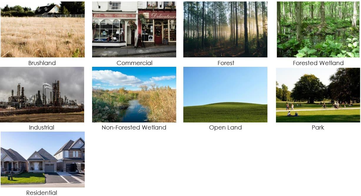


Sewer/Stormwater Infrastructure Examples
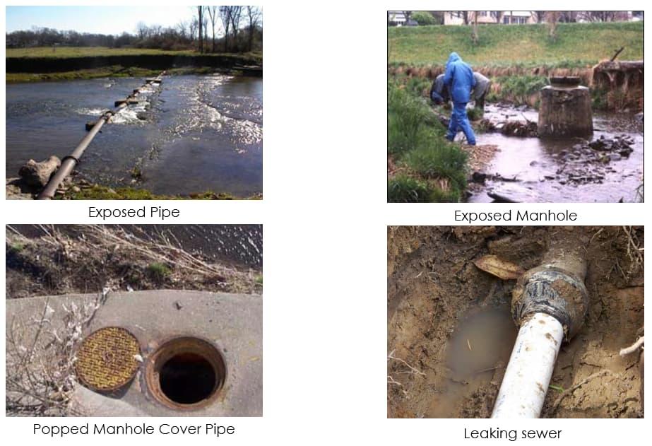


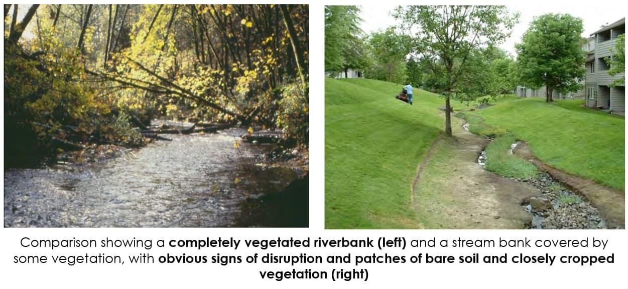


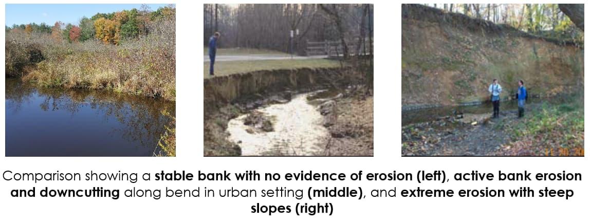

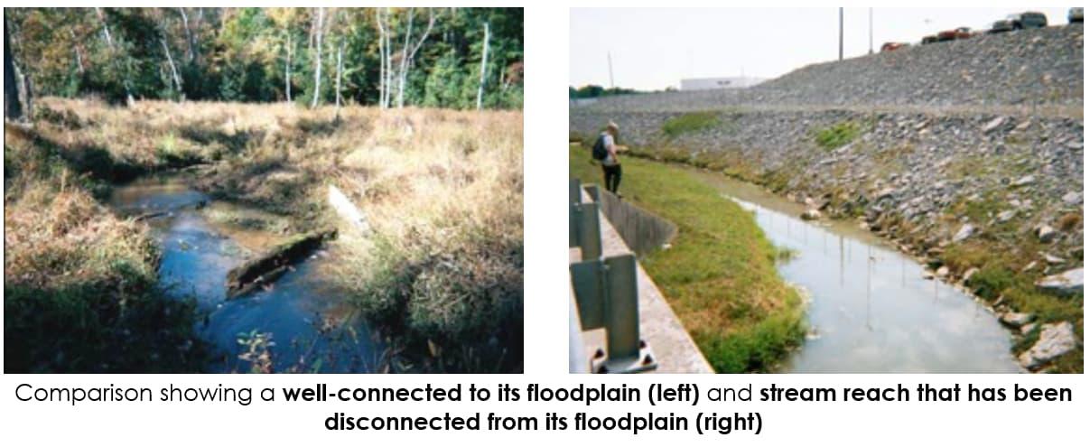


Reference Diagrams to Estimate Percent Cover
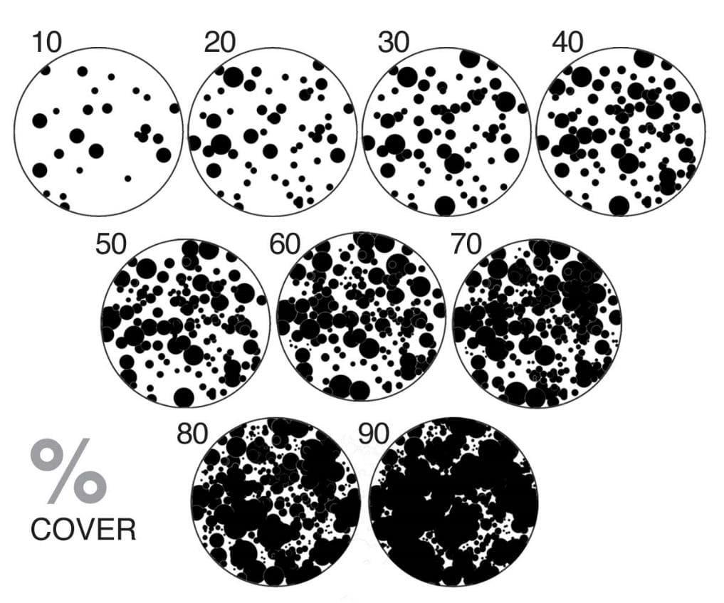


Buffer/Floodplain Condition Examples
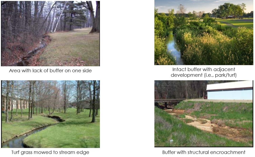


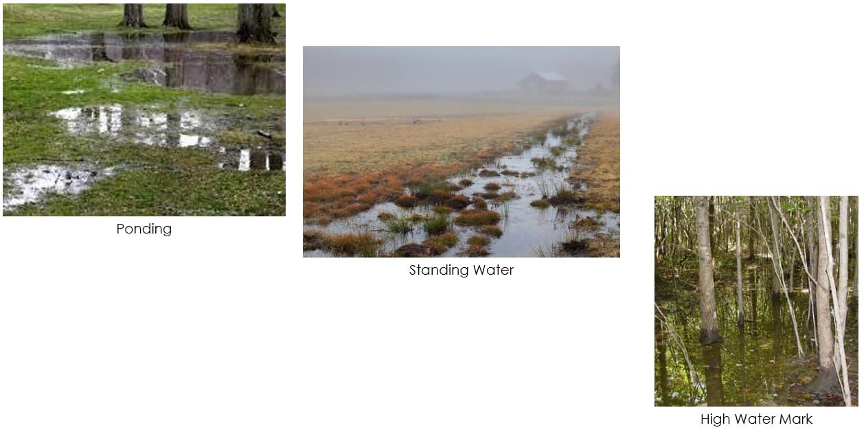


Downcutting
Degradation
Deepening of stream channel cross section resulting from process of degradation.
The removal of streambed materials caused by the erosional force of water flow that results in a lowering of the bed elevation throughout the reach (opposite of downcutting).
Encroachment
Entrenched [stream/river]
Erosion
A gradual advance beyond usual or acceptable limits.
A stream/river that that has eroded downward; incised.
The geological process in which earthen materials are worn away and transported by natural forces such as wind or water.
Infiltration
Invasive Species
Flow Deflection/Diversion
Downward entry of water into soil.
Non-native species that have spread into native or minimally managed systems, causing economic or environmental harm by developing selfsustaining populations and becoming dominant and/or disruptive to those systems
Change the direction of stream flow or to concentrate stream flow. Restoration practices with flow deflection/diversion are predominately used to deflect flow away from eroding stream banks, concentrate the

Term Definition
flow in the center of the channel, redirect water in and out of meanders, and/or enhance pool and riffle habitats.

Flood Storage
Potential
Ponding
Riparian Zone
Capacity of an area to temporarily store (flood) water within the river/stream channel and its floodplain.
Pooling of water on the surface of the ground resulting in formation of ponds or large puddles.
Lands that occur along watercourses and water bodies. Typical examples include flood plains and streambanks.
Memorandum Regarding the Documentation of Parcel Acquisition Prioritization Method and Scoring
TO: Joyce Losick-Yang, PhD, Sustainability Coordinator, Town of Andover FROM: April Doroski, CPSS, Water Resources & Climate Resilience Specialist, Fuss & O’Neill J. Alexander Maxwell, PhD, Resilience Planner, Fuss & O’Neill
Julie Busa, PhD, CSE, Project Manager, Fuss & O’Neill
DATE: April 4, 2022
RE: Documentation of parcel acquisition prioritization method and scoring
After completing the review of 835 existing protected parcels during Task 1.2 of the project, a desktop site screening (Task 1.3) was also conducted during late November and early December on 1,455 protected and non-protected parcels along the Shawsheen River. A 100-m buffer was created around the Federal Emergency Management Agency (FEMA) flood zone surrounding the Shawsheen River and used to select the parcels for inclusion in the screening. All 1,455 parcels were screened as part of a collaborative effort between the Town of Andover and Fuss & O’Neill using GIS and a standardized protocol (see Appendix A) to determine measures of terrestrial resilience, physical diversity, local connectedness, biological conditions, social vulnerability, and trail/recreation opportunities.
Once screening for these attributes was completed, a subset of parcels was selected for inclusion in additional field assessments (Task 1.4) based on one or more of the following criteria:
A range of scores for terrestrial resilience10 and/or ecological integrity11, which might indicate that a parcel has a higher restoration potential
Low-lying land area (based on land contours) near FEMA flood zones, and proximate to downstream development, which might indicate that a parcel has a higher flood storage potential
Ability to access the parcel easily and safely for in-person
A subset of 52 parcels were selected from the total 1,455 parcels included in the desktop site screening based on these criteria. While the selection criteria help reduce the number of parcels to a more manageable number for the field assessments, it also inherently led to the exclusion of more developed parcels along the Shawsheen River (e.g., Washington Park Condominiums and Shawsheen Plaza), as they often had very low (or no) terrestrial resilience and/or ecological integrity scores due to the extent of disturbance on these sites– indicating little potential for restoration potential in their current state. This prioritization ranking therefore focused largely on undeveloped sites, or sites that at least contained significant undeveloped area. However, given that many of the more developed areas along the river are subject to frequent, seasonal flooding – and are sometimes in close proximity to other existing protected
10 Terrestrial resilience scores help identify land with the greatest landform diversity and local connectedness. Areas with high microclimatic diversity and low levels of human modification provide species with connected, diverse climatic conditions they will need to persist and adapt to changing regional climates.
11 Ecological integrity scores assess the degree to which a parcel remains intact or free from human impairment. Ecological integrity measures the ability of an area to support biodiversity and the ecosystem processes necessary to sustain biodiversity over the long term.
parcels and/or parcels included in the field assessments – they should be carefully considered in the development of future flood resilience projects along the Shawsheen. Exploring the potential to relocate existing uses out of the floodplain and restore these parcels to a more natural state may be appropriate in some locations and will be further addressed in the overall climate adaptation land acquisition plan.
From December 7th-12th, 47 parcels were assessed using the field assessment protocol developed by Fuss & O’Neill (see Appendix B). 36 assessments were conducted by Fuss & O’Neill staff, while 11 assessments were conducted by a group of citizen science volunteers from the community after receiving a virtual training12 on December 6, 2021.
Three additional assessments were later conducted by Town staff in December 2021 and in early January 2022, after access limitations were addressed at Serio’s Grove, Cochran Wildlife Sanctuary, and Camp Maude Eaton. Assessments could not be conducted in-person on parcels 140-37 and 159-2 due to restrictions regarding access to those private parcels. Parcel 159-2 (i.e., the current site of James T. Lynch Construction Co., Inc.) was virtually assessed using data from the desktop site screening and information collected during the assessment of the adjacent Town-owned parcel across the Shawsheen River (i.e., parcel 182-7). Parcel 140-37 was the only one of the 52 parcels identified for further assessment that was ultimately excluded from the field assessments.
Data entry from the hardcopy field assessment forms for all 51 of the assessed parcels was then completed by Fuss & O’Neill for use in the future prioritization of parcels for acquisition.

During January and February 2022, data from Tasks 1.2 (Review of Existing Protected Lands), 1.3 (Desktop Site Screening Using Climate Data), 1.4 (Field Assessments), and 2.2 (Community Engagement Activities) were used to develop a prioritization tool to guide the Town in the prioritization of parcels for acquisition in accordance with the goals identified in Task 1.1. The prioritization tool was developed to provide a systematic, consistent, and transparent method of prioritizing parcels for acquisition based on factors related to existing environmental and social conditions, and the potential for community enhancement and climate resilience potential (Figure 1).
Tables 1-4 summarize the variables used in the prioritization tool to score measures of existing environmental conditions, existing social conditions, community enhancement potential, and climate resilience potential.
12 See the following link for a recording of the virtual training: Recording link: https://andover.webex.com/andover/ldr.php?RCID=fd784e1b6a9d0e87b1c0535d7e48a16f (Password: Be2mPmMH)
April 4, 2022 GROUPS
VARIABLES
Intact Biological Condition
Terrestrial Resilience
Priority Parcels (OSTF)

Existing Environmental Conditions
SVI: Socioeconomic
SVI: Household Composition
SVI: Minority
Existing Social Conditions
Private Parcels
SVI: Housing/ Transportation
Educational Potential
Recreational Potential
Flood Storage Potential
Restoration Potential
Community Enhancement
Potential
Priority Parcels for Acquisition
Climate Resilience
Potential
Figure 1 –Representative flow chart showing how variables from existing preserved parcels were fed into scoring categories for use in prioritizing parcels for acquisition
Existing environmental conditions were determined using values for biological condition and terrestrial resilience collected during Task 1.3. Existing biological conditions were assessed using values for ecological integrity known as the Index for Ecological Integrity (IEI). Built on data from the University of Massachusetts (UMass) Amherst Conservation Assessment and Prioritization System (CAPS), the IEI assesses the degree to which a parcel remains intact or free from human impairment. IEI measures the ability of land to support biodiversity and the ecosystem processes necessary to sustain biodiversity over the long term.
Existing resilience conditions were assessed using scores for terrestrial resilience. This composite measure was developed by The Nature Conservancy (TNC) to estimate a site’s capacity to maintain species diversity and ecological function as the climate changes. Terrestrial resilience scores help identify land with the greatest landform diversity and local connectedness. Areas with high microclimatic diversity and low levels of human modification provide species with the connected, diverse climatic conditions they will need to persist and adapt to changing regional climates.
A score was assigned for intact biological condition based on the integrated Index of Ecological Integrity (IEI) value. Ecological integrity represents the ability of an area to support biodiversity and the ecosystem processes necessary to sustain biodiversity over the long term. IEI is scaled by percentile for each community, represented by an index that runs from 0 (low) to 1 (high). The range below indicates the integrated IEI for each parcel.
A higher value represents a higher intact biological condition score.
1
2
3
A score was assigned for terrestrial resilience based on the TNC’s Terrestrial Resilience dataset. This composite dataset estimates a site’s capacity to maintain species diversity and ecological function as the climate changes. The maximum terrestrial resilience value of a given parcel was used for the scoring.
A more positive value represents a highest terrestrial resilience score.
1
2
3
4
5
Existing social conditions were determined using values from each of the four indices including in the Social Vulnerability Index (SVI). The SVI was created by the Centers for Disease Control and Prevention (CDC) to help identify and map the communities that will most likely need support before, during, and after a hazardous event (e.g., flooding). The SVI indicates the relative vulnerability of populations from every census tract in the United States and ranks each tract according to 15 social factors (e.g., unemployment, minority status, and disability, etc.) and further groups them into four related themes:
- Socioeconomic Status (Below Poverty, Unemployed, Income, No High School Diploma)
- Household Composition & Disability (Aged 65 or Older, Aged 17 or Younger, Civilian with a Disability, Single-Parent Households)
- Minority Status & Language (Minority, Aged 5 or Older who Speaks English “Less than Well”)
- Housing Type & Transportation (Multi-Unit Structures, Mobile Homes, Crowding, No Vehicle, Group Quarters)

An SVI score was assigned to each parcel based on the Social Vulnerability Index (SVI) values for each of the four categories mentioned above.
A higher value represents a higher social vulnerability score for each of the four SVI categories (i.e., socioeconomic status, household composition and disability, minority status and language, and housing types and transportation).
1 0 to 0.25
2 0.26 to 0.50
3 0.51 to 0.75
4 0.76 to 1.0
Lowest Vulnerability
Medium-Low Vulnerability
Medium-High Vulnerability
Highest Vulnerability
Community enhancement potential was scored based on educational and recreational potential values collected during the Task 1.4 field assessments for each parcel. As noted in the field assessment protocol (see Appendix B), educational potential was measured as a function of certain qualities of the parcel that would provide opportunities for educational activities (e.g., sites with good viewpoints, variety of vegetation classes, access to open water), as well as accessibility and available parking. Recreational potential was measured as a function of the available opportunities for watersports and trail-based recreation, in addition to available parking.
A score was assigned for educational value based on indicators of educational quality (e.g., good viewpoints, variety of vegetation classes) and accessibility features (e.g., public parcel, and parking availability and proximity).
A higher value represents a higher educational potential score.
2 5 to 8
3 9 to 12
4 13 to 16
5 17 to 20
A score was assigned based on opportunities for water sports, trail-based recreation, and parking availability and proximity.
A higher value represents a higher recreational potential score.
4 10 to 12
5 13 to 15
Climate resilience potential was scored based on measures of flood storage potential and restoration potential collected during Task 1.4. Flood storage potential was measured largely as a function of floodable storage area available on the parcel, while restoration potential was scored as a function of the available area for restoration projects and the types of restoration projects able to be implemented on the parcel.

A flood storage potential score was assigned based on the characteristics observed on the parcel including evidence of poor infiltration, evidence of high water, area available for flood storage, and land ownership type. A higher value represents a higher flood storage potential.
Score Flood Storage Potential Value Description
0 Null No Flood Storage Potential
1 1 to 5
2 6 to 10
3 11 to 15
4 16 to 20
5 21 to 25
Restoration Potential
Lowest Flood Storage Potential
Low Flood Storage Potential
Medium Flood Storage Potential
High Flood Storage Potential
Highest Flood Storage Potential
A restoration potential score was assigned based on the characteristics observed on the parcel including the number of potential restoration practices (e.g., flow diversion, habitat enhancement, river network extension), the estimated restorable area, and accessibility of the site. A higher score represents a higher restoration potential.
Score Restoration Potential Value Description
0 Null No Restoration Potential
1 1 to 6
2 7 to 12
3 13 to 18
4 19 to 24
5 25 to 30
Lowest Restoration Potential
Low Restoration Potential
Medium Restoration Potential
High Restoration Potential
Highest Restoration Potential
After calculating the scores for each of the variables included in the prioritization tool, each score was then normalized on a 0-10 scale using the following equation:
normalized score = 10 × score -minimumvalue
maximumvalue -minimumvalue
Where, “ score” represents the actual score for the respective variable (for the given parcel),
“minimum value” represents the minimum value for scores in the range for the respective variable (for the given parcel), and
“maximum value” represents the minimum value for scores in the range for the respective variable.

From there, the normalized scores for each variable were tallied and normalized on a 0-10 scale, allowing each group (see Figure 1) to be assigned a score of 0 to 10.
F:\P2020\0400\D10\Deliverables\Task
Before summing the scores of each group to calculate a total score, a weight was assigned to each group based on its relative importance (see Table 5).
These weights were established in consultation with the Steering Committee and members of Town staff and applied to the scores for each group using the following formula to calculate the overall summed weighted score for the parcel on a 0-10 scale:
summed weighted score = (0.10)(Existing Environmental Condition Score) + (0.20)(Existing Social Condition& Score) + (0.20)(Community Enhancement Potential Score) + (0.50)(Climate Resilience Potential Score)
Climate Resilience Potential scores were weighted the highest, as the focus of the project was to identify parcels for acquisition based primarily on their flood storage and/or restoration potential. However, scores for Community Enhancement Potential and Existing Social Conditions were also weighted more heavily (at 20% each), as they are strongly related to all three of the climate adaptation goals established in Task 1.1, especially the areas bolded in the bullets below:
“Reduce vulnerability to flooding and intense rainstorms by increasing the capacity for flood storage and mitigation through nature-based restoration and active management, especially in areas with vulnerable populations and community assets (including those downstream)
“Strengthen connectivity and accessibility of open space and preserved land by expanding and creating linkages to existing trails, recreation opportunities, and conservation areas
“Educate the local community by creating demonstration areas that highlight the value of acquiring open space, protecting the local watershed, and adapting to a changing climate”
Existing Environmental Conditions scores were given 10% weight, as lands along the Shawsheen River with higher terrestrial resilience and ecological integrity are inherently valuable to increasing climate resilience if acquired by the Town.
After assigning weights to each group, scores from each group were then weighted and summed for each parcel.
And finally, prior to these summed scores being ranked for the purposes of prioritization, each summed score was also multiplied by a multiplier of 1x or 2x (using the following equation) based on whether the

April 4, 2022
parcel was also listed on the 2014 List of Approved Open Space Parcels or the 2020 List of Open Space Parcels to be Added (noted as OSTF in Figure 1 above for Open Space Task Force).13 If a parcel was included on either list, its summed weighted score was multiplied by 2; whereas, if it was not included on the list, it was multiplied by 1. These multipliers allowed for special importance to be placed on those parcels that have already been identified by the community as priority parcels for acquisition based on the feasibility of acquisition, public support for acquisition, and/or their importance to the community as part of the overall fabric of preserved open spaces.
final prioritized score = summed weighted score × multiplier
Where,
“final prioritized score” represents the final total score used for prioritization (for the given parcel) on a 0-20 scale,
“summed weighted score” represents the summed weighted score calculated as the sum of (0.10)(Existing Environmental Condition Score) + (0.20)(Existing Social Condition& Score) + (0.20)(Community Enhancement Potential Score) + (0.50)(Climate Resilience Potential Score), and
“multiplier” represents the 1x or 2x multiplier based on whether the parcel is included in the Open Space Task Force’s lists of priority parcels

While this tool was developed for use in the Andover community, this approach can be easily applied to prioritize parcels for acquisition in other neighboring communities that border the Shawsheen River (e.g., Lawrence, Tewksbury, North Andover). The data collected as inputs to this tool during Tasks 1.3 and 1.4 of this project can similarly be collected by members of surrounding communities using the desktop site screening protocol and field assessment guide (see Appendix A and B, respectively). Inputs from those activities can then be used in the prioritization tool and weighted according to each community’s priorities and climate goals. Overall, the approach and tools used to help Andover prioritize parcels for acquisition could be useful in establishing a future watershed-scale approach to developing climate resilience projects along the Shawsheen.
13 See Article 36 on page 62 of the Annual Town Meeting Finance Committee Report.
F:\P2020\0400\D10\Deliverables\Task

The following tables (Tables 7 and 8) and figures (Figures 2 and 3) show the results of applying the prioritization tool to the data collected on the 51 parcels assessed during Tasks 1.3 and 1.4 of the project. Of the 51 parcels assessed, 18 were private parcels, while the remaining 33 were existing preserved parcels. Table 7 shows the prioritized list of private parcels for acquisition, and Figure 2 represents how these ranked prioritized parcels were geographically distributed across the study area.
Overall, the top five highest priority private parcels were also those that were included in the 2014 List of Approved Open Space Parcels and the 2020 List of Open Space Parcels to be Added. Therefore, the summed weighted scores of these parcels were multiplied by 2, which elevated them in the rankings.
The top two parcels from the prioritization of private parcels – parcels 54-13T (10 Stevens Street) and 54-14 (20 Stevens Street) – are located in the area of the Shawsheen River adjacent to the United States Postal Service and Andover Commons. These parcels are also in close proximity to several other private parcels along Brechin Terrace (i.e., parcels 54-35, 54-36, 54-37, 54-38, and 54-39) that were included in the field assessments. These parcels may be worth considering alongside 54-13T and 54-14 in any future acquisition, as they may present an opportunity for more extensive restoration and/or flood storage in the area of the river just upstream of the Stevens Street bridge and flood-prone developments.
Two of the other top five prioritized parcels – parcels 183-11 and 159-10A – are located along Lowell Junction Road in the southern upstream reach of the Shawsheen River. These parcels present an opportunity to increase connectivity to existing preserved lands that abut each parcel, including the Serio’s Grove Reservation. However, another private parcel – parcel 159-2 (71 Lowell Junction Road), which is the current site of the James T. Lynch Construction Co., Inc. – stands as an important barrier to establishing greater connectivity in this area of the Shawsheen and increasing climate and flood resilience. Special consideration should be given to including this parcel in any future acquisitions of parcels 183-11 and 159-10A.
Table 8 shows a ranked list of existing preserved parcels based on their total scores14 and scores for existing environmental conditions, existing social conditions, community enhancement potential, and climate resilience potential. Figure 3 represents how these ranked weighted scores were geographically distributed across existing preserved parcels within the study area.
The top-ranked and fifth-ranked existing preserved parcels – parcels 138-10 and 93-9 – are part of the Vale Reservation, which is owned and managed by the Andover Village Improvement Society (AVIS). These parcels scored well above average for existing environmental conditions, community enhancement potential, and climate resilience potential. These parcels are well connected to the surrounding protected lands and trail networks, and they were identified as having several areas for increased flood storage potential.
14 Note: Existing preserved parcels were not considered for acquisition, as they are already protected lands. There was therefore no multiplier applied in the calculation of the total scores for existing parcels, as these parcels would not be included in the Open Space Task Force’s list of priority parcels.
The next highest-ranked existing preserved parcels – parcels 37-5, 36-8, and 36-7 – are part of the Sacred Heart Reservation and Lower Shawsheen Field, which are under the care of the Andover Conservation Commission. These parcels are located in the area across from the Washington Park Condominiums that have historically seen some of the worst flooding impacts. These parcels scored highly because of their location in a socially vulnerable area of Andover and their community enhancement and climate resilience potential. These parcels have excellent connections to existing trails and recreation opportunities, and during the field assessments, these parcels scored well above average for flood storage and restoration potential.
Results from Tables 7 and 8 have been categorized into small, medium, and large-scale parcels based on the following classifications (see Table 6):
Chapter 61B Open Space and Recreational Land – Current Use Tax Program requires a minimum of 5 acres in an eligible land use, while 10 or more contiguous acres of forestland qualifies for the Chapter 61 Forest Stewardship Program. Therefore, parcels were grouped according to the following

size classifications:
Size Classification Description
Small 0.1 to 5.0 acres
Medium 5.1 to 10.0 acres
Large >10.0 acres
Parcels were organized into small, medium, and large-scale parcels to also facilitate future acquisition and potential future restoration/flood resilience project sites based on the levels of funding available.
As this project moves toward the next stage of developing the Climate Adaptation Land Acquisition Plan, the inputs from this prioritization task will be coupled with specific recommendations for acquisition and climate resilience improvements projects on several of the highest priority parcels. These recommendations may include practices such as expanding/restoring riparian buffers, reconnecting floodplains, and developing flood storage areas. The plan will become part of the foundation for the Town’s larger Climate Action Plan development process and will be presented by the Town Sustainability Coordinator as part of a Town Climate Summit planned for April 2022.
April 4, 2022 F:\P2020\0400\D10\Deliverables\Task
15 Total parcel value based on total building value (where applicable), extra features value (where applicable), and land value according to Town of Andover Assessor’s Department: http://andover.patriotproperties.com/default.asp
16 Parcels highlighted in green are also those found on 2014 List of Approved Open Space Parcels or the 2020 List of Open Space Parcels to be Added. Thus, their summed weighted scores were multiplied by a 2x multiplier as described above.
F:\P2020\0400\D10\Deliverables\Task


