
North Central Conservation District


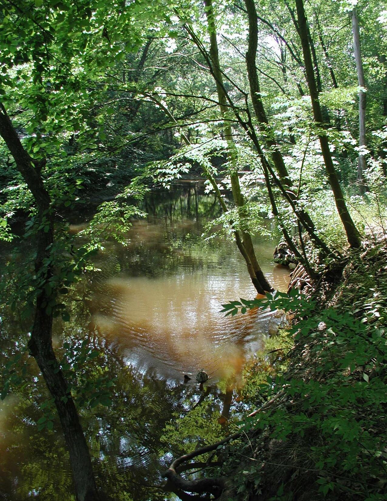
North Branch Park River
Green Infrastructure Design & Watershed Plan Update .. Project Partners Meeting . . December 13, 2024


North Central Conservation District
Green Infrastructure Design & Watershed Plan Update .. Project Partners Meeting . . December 13, 2024
• Recap of the community meetings
• Summary of survey findings
• Watershed plan goals, objectives and actions overview
• Review of green infrastructure preliminary designs
• Next steps/project completion
• Questions and discussion

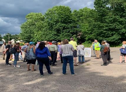
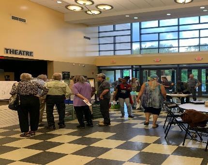
• Held on June 10, 2024
• Collected feedback on green infrastructure design concepts from residents and other stakeholders in the lower portion of the North Branch Park River watershed.
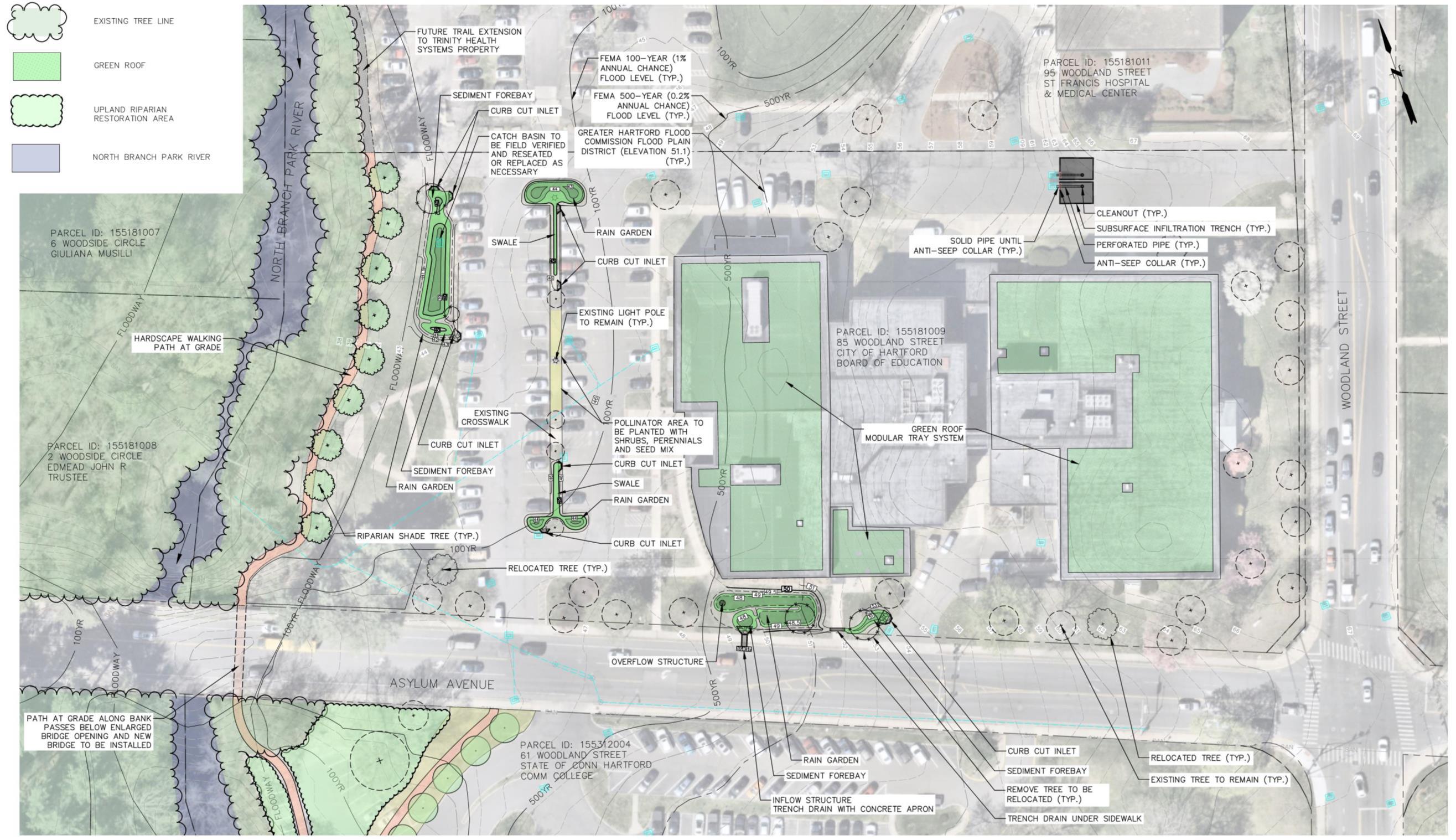
• Field walk of green infrastructure concepts developed for the Classical Magnet School and the state-owned property at 61 Woodland Street, followed by a presentation and interactive design stations.
• Held on September 18, 2024
• Presented an update to the Greater Hartford Flood Commission during a special meeting of the GHFC.
• Included a summary of the project background and goals, the 2024 Watershed Plan update, and the green infrastructure design process.
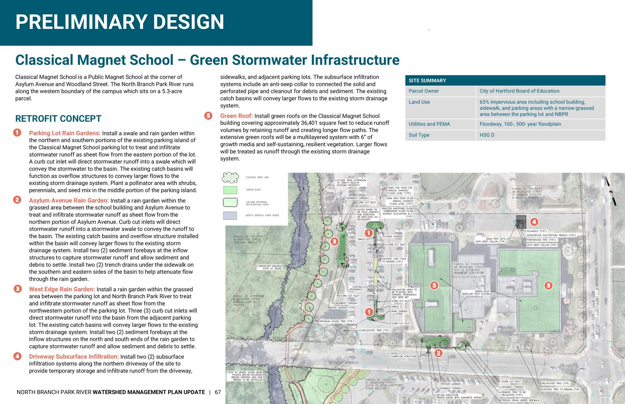
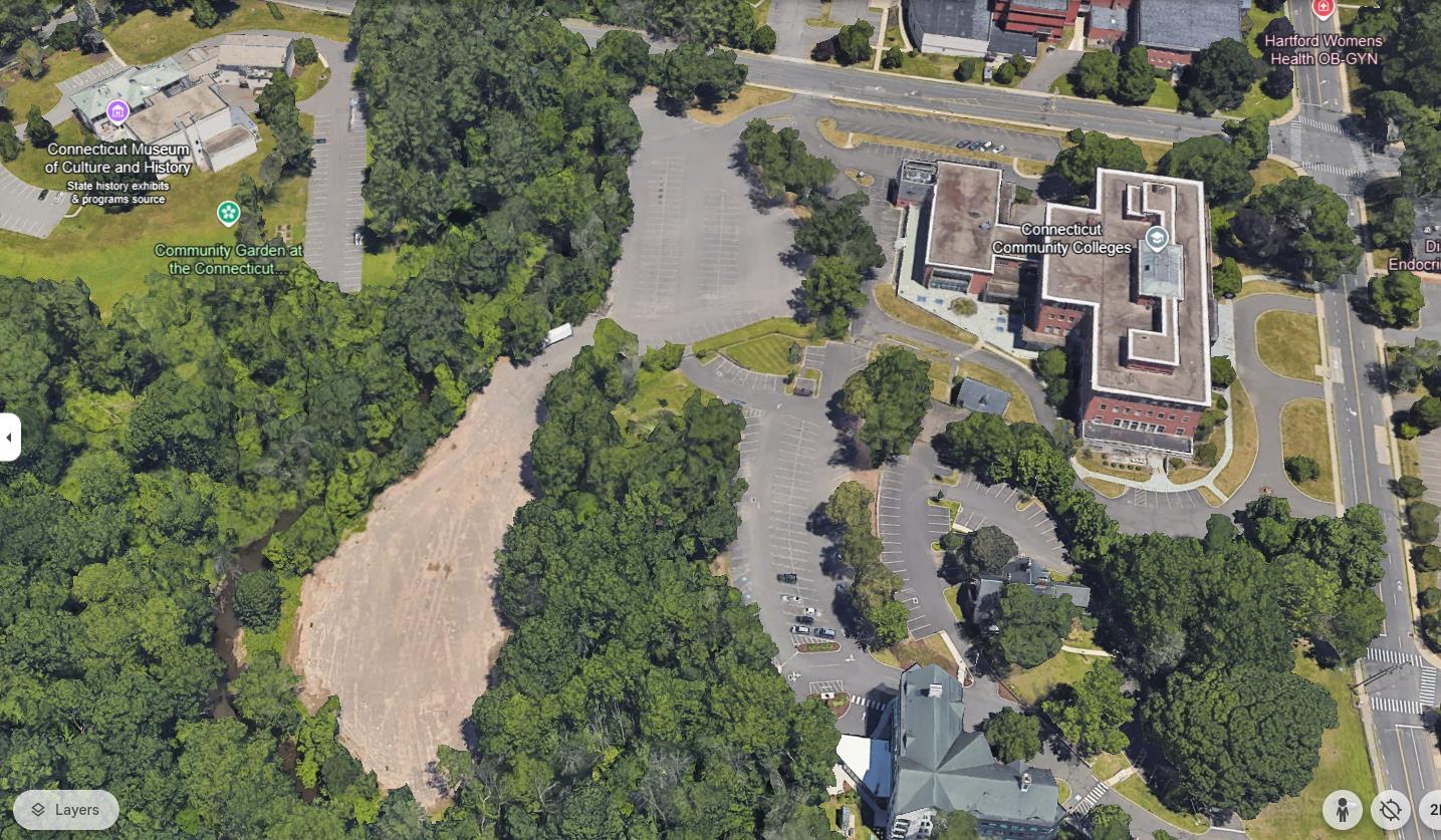
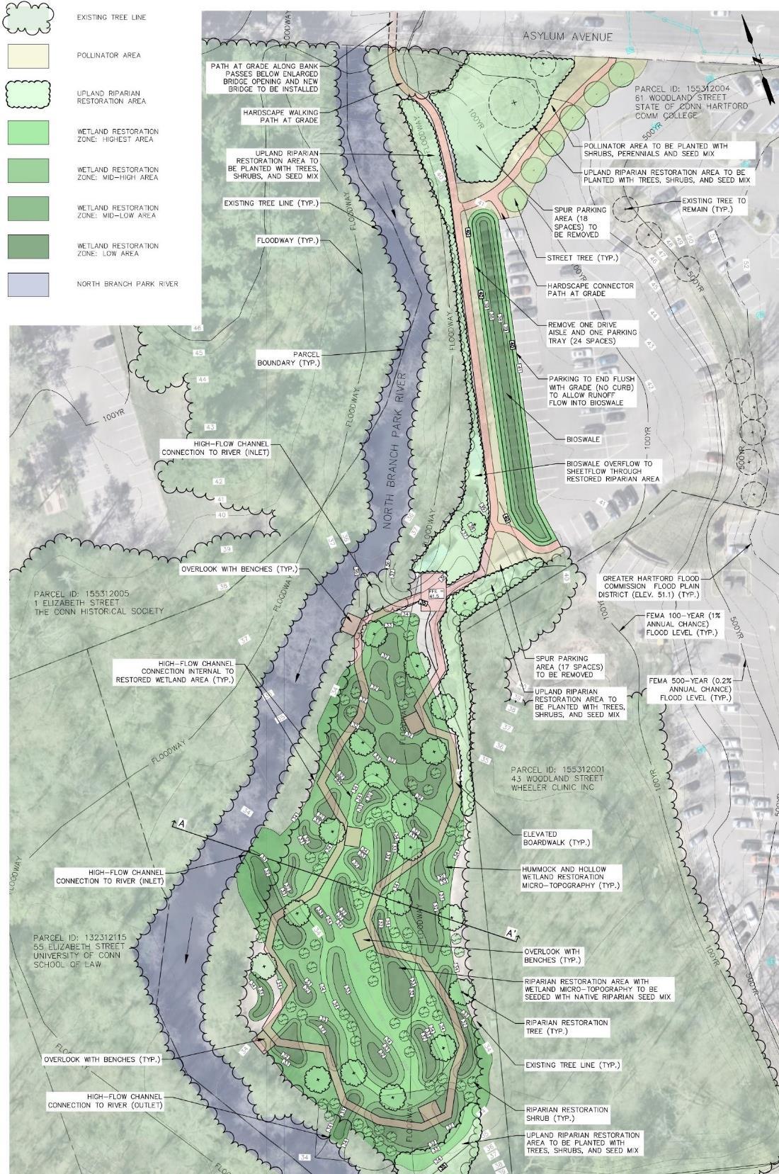
• Preliminary green infrastructure designs were presented for a proposed floodplain restoration project at 61 Woodland Street and green stormwater infrastructure retrofits at Classical Magnet School, as well as possible green infrastructure projects focused on sites north of Albany Avenue (Mark Twain Drive and Cronin Park areas).
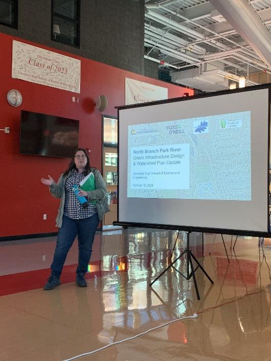
• Held on October 16, 2024.
• Collected feedback on green infrastructure design concepts from residents, students, and other stakeholders in the Mark Twain Drive/Blue Hills portion of the North Branch Park River watershed.
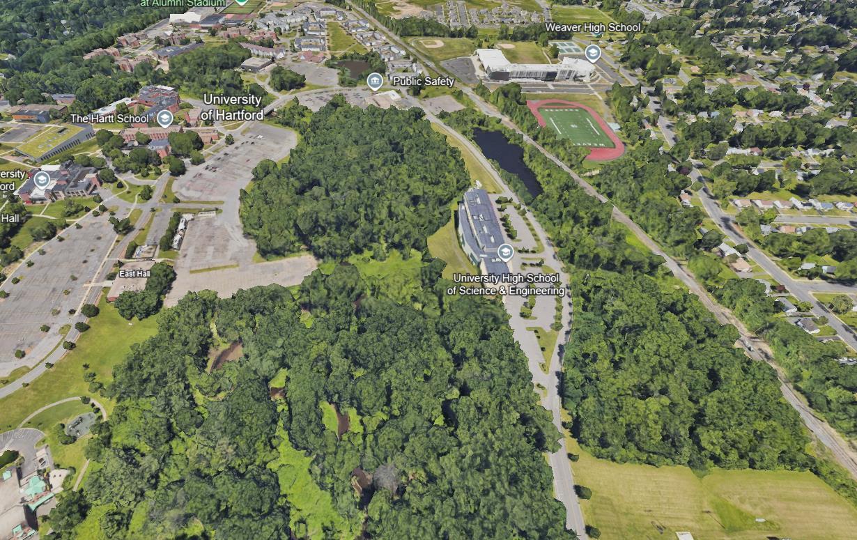
• Field walk around the high school at locations for which green stormwater infrastructure concepts were developed. The concepts include an area north of the high school, the high school parking lot, along Mark Twain Drive, and adjacent to the athletic field. The concepts maximized stormwater management from the proposed separate stormwater pipes from the Blue Hills neighborhood. The field walk was followed by a presentation of the project and concept designs at the high school as well as interactive design stations.
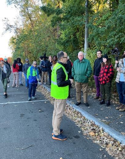
• Held on December 5, 2024.
• This virtual, on-line meeting included “office hours” prior to the start of the meeting for informal discussion of issues of concern to the attendees; a presentation by the project team including Sarah Huang, Office Director for Environmental Justice, CTDEEP, who gave an overview of Environmental Justice issues in Connecticut; followed by questions and discussion after the presentation.
• Strong community interest in and support for the North Branch Park River
• Desire for connection with the environment (e.g., access to the river and restoration)
• Flood risk reduction is important to the community
• Need for coordinated advocacy to ensure all community needs are addressed comprehensively
• Need for coordinated advocacy to legislators and decision-makers to secure funding for projects
• Importance of the community being part of the decision-making process, rather than decisions being made for them
• Importance of the watershed plan being a living document

• Hartford NEXT (NRZs, City of Hartford, CTDEEP)


− EPA grant focused on stakeholder engagement and green stormwater infrastructure
• Blue Hills Civic Association and Connecticut Green Bank
− Partnership to promote green infrastructure and community resilience
• Bloomfield Conservation, Energy & Environment Committee
− Year-end review and prioritization process for 2025 planning efforts
• MDC & City of Hartford
− North Branch Park River Drainage Study & Sewer Separation Design (Granby Street and Blue Hills Neighborhood)
− Granby Street Green Infrastructure Demonstration Project (with EPA)
• Capital Region Council of Governments
− Regional Stormwater Authority Feasibility Assessment (CT DEEP Grant)
− Natural Hazard Mitigation & Climate Adaptation Plan
• CTDEEP
− New Office of Planning and Resilience
− Proposed changes to DEEP Climate Resilience Fund (DCRF) Grant Program
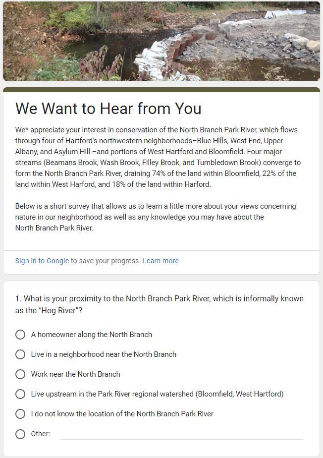
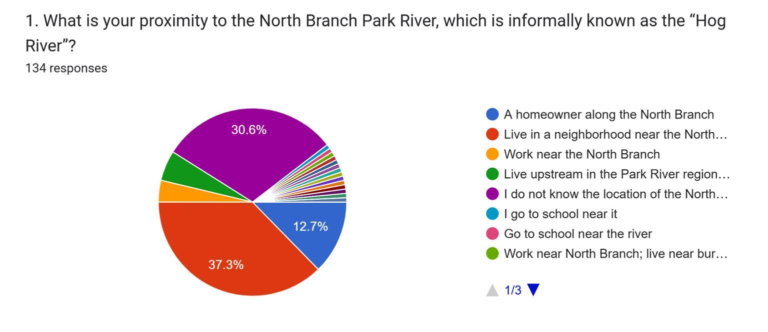
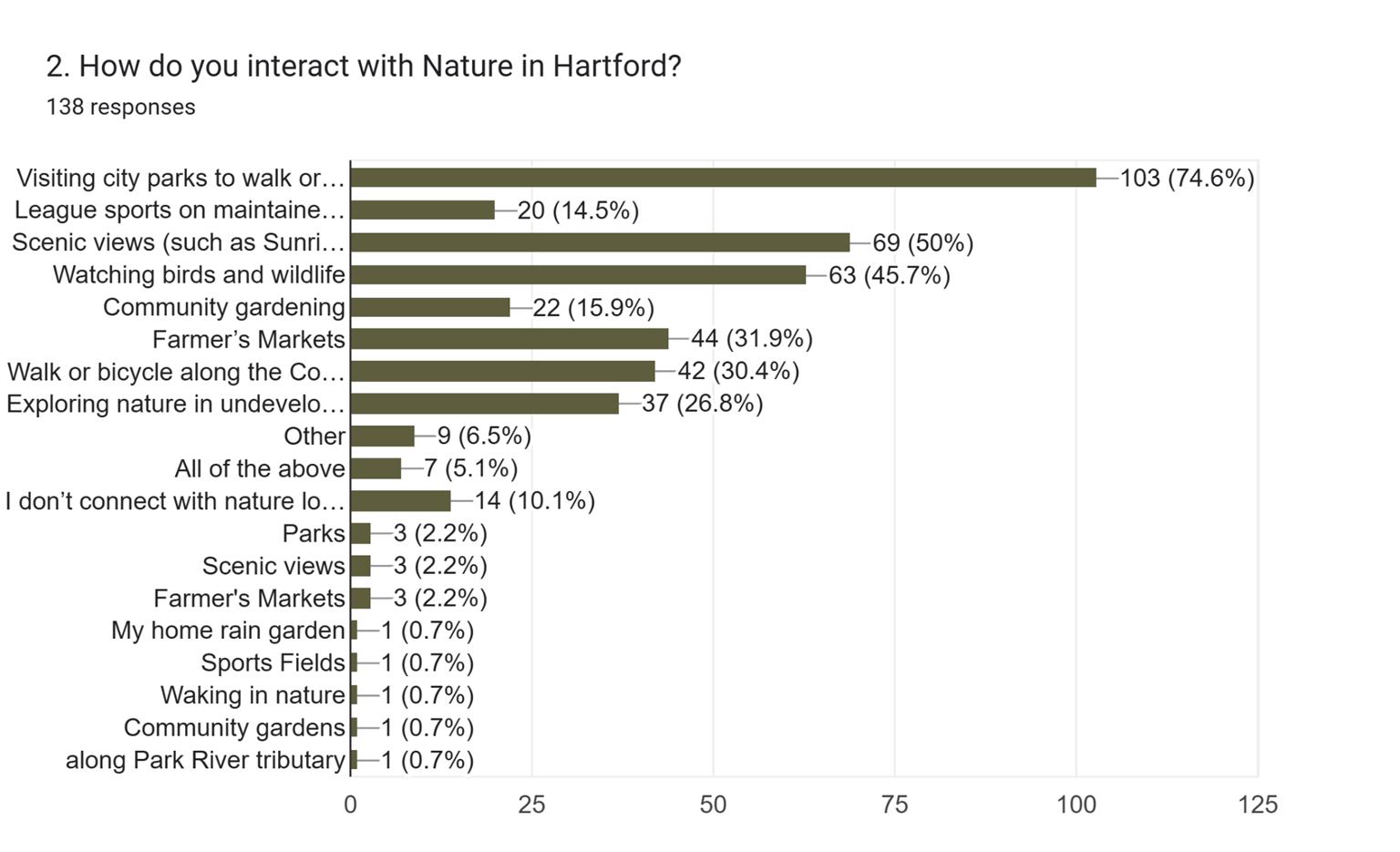
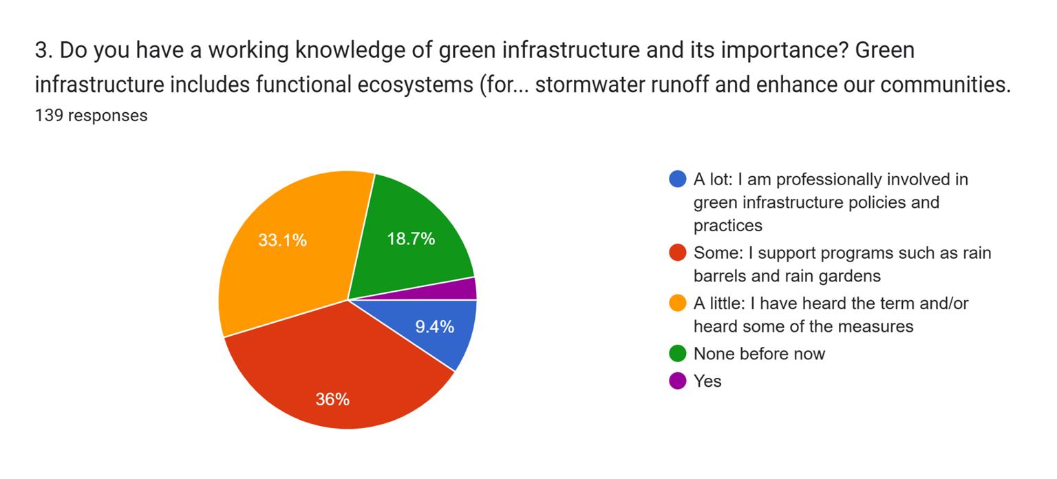
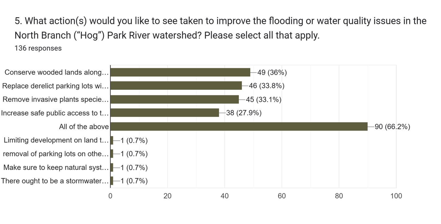
• An online watershed survey was developed to obtain additional feedback from the community and other stakeholders on issues of concern in the North Branch Park River watershed
• 140 responses were received
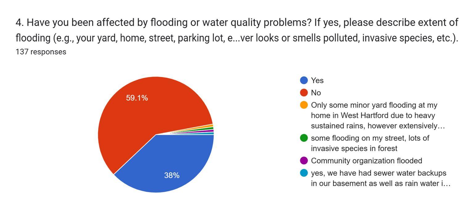
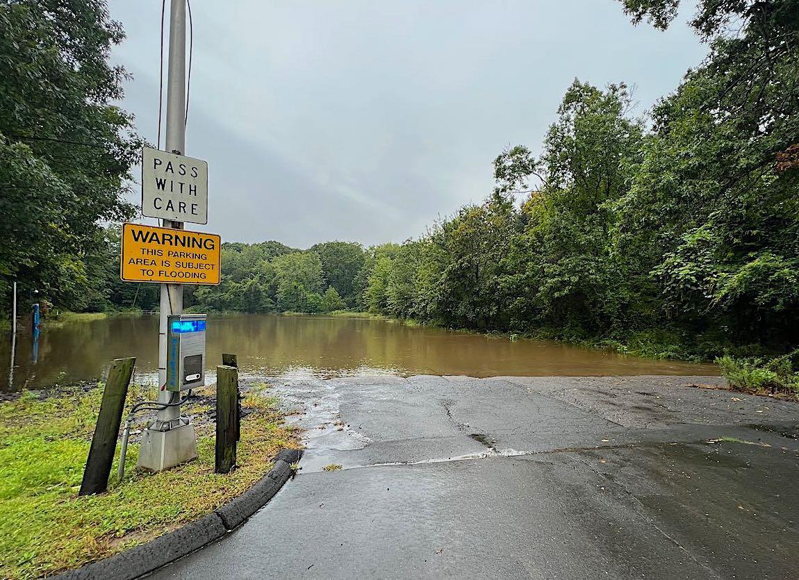
● Frequent Basement Flooding: Regular occurrences, ranging from mild to severe, especially during heavy rain.
● Other Flooding Reports:
○ Backyard and local flooding, including riverfront areas like the boathouse/park.
○ Large puddles on walking paths (woodland and asylum).
○ Sewer overflows impacting basements and running into rivers.
● Contributing Factors:
○ Excessive pavement in urban areas (e.g., Hartford parking lots).
○ Tree falls and property damage due to flood-related conditions.
● Trends: Minor basement flooding over the past 4-5 years, escalating to severe this year.


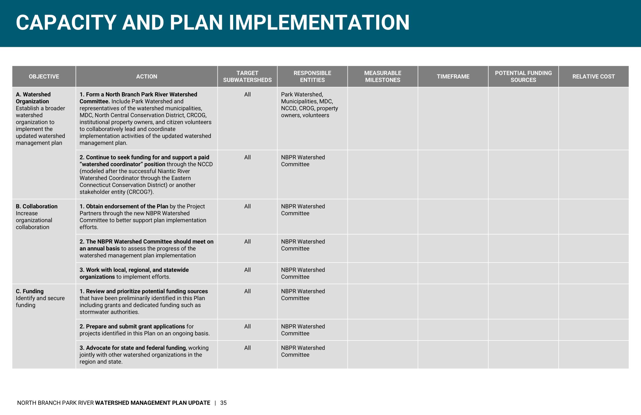
Capacity and Plan Implementation
A. Watershed Organization
B. Collaboration
C. Funding Water Quality
A. Combined Sewer Overflows
B. Green Infrastructure and Low Impact Development
C. Illicit Discharges
D. Monitoring
E. Field Assessments
Land Conservation
A. Upstream Tributaries
B. North Branch Park River Floodplain and Riparian Areas
C. Open Space Protection Program Capacity
Habitat Protection and Restoration
A. Riparian Restoration
B. Urban Forests and Tree Canopy
C. Invasive Species Control
D. Stream Cleanups
Sustainable Growth and Land Use
A. Smart Growth
B. Public Access
C. Urban Landscape Design
Climate and Community Resilience
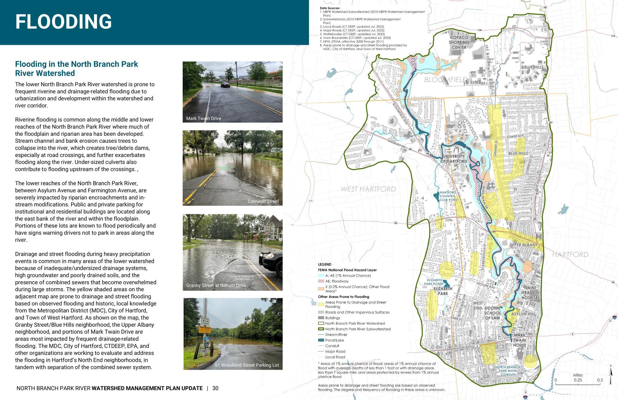
A. Riverine Flooding and Flood Management
B. Stormwater Flooding and Impervious Surface Mitigation
Public Education and Stewardship
A. Youth and Students
B. Campuses and Institutional Property Owners
C. Residents and Homeowners
D. Municipal Staff and Volunteer Commissions
E. Businesses and Commercial Landowners
Substantially modified actions/recommendations


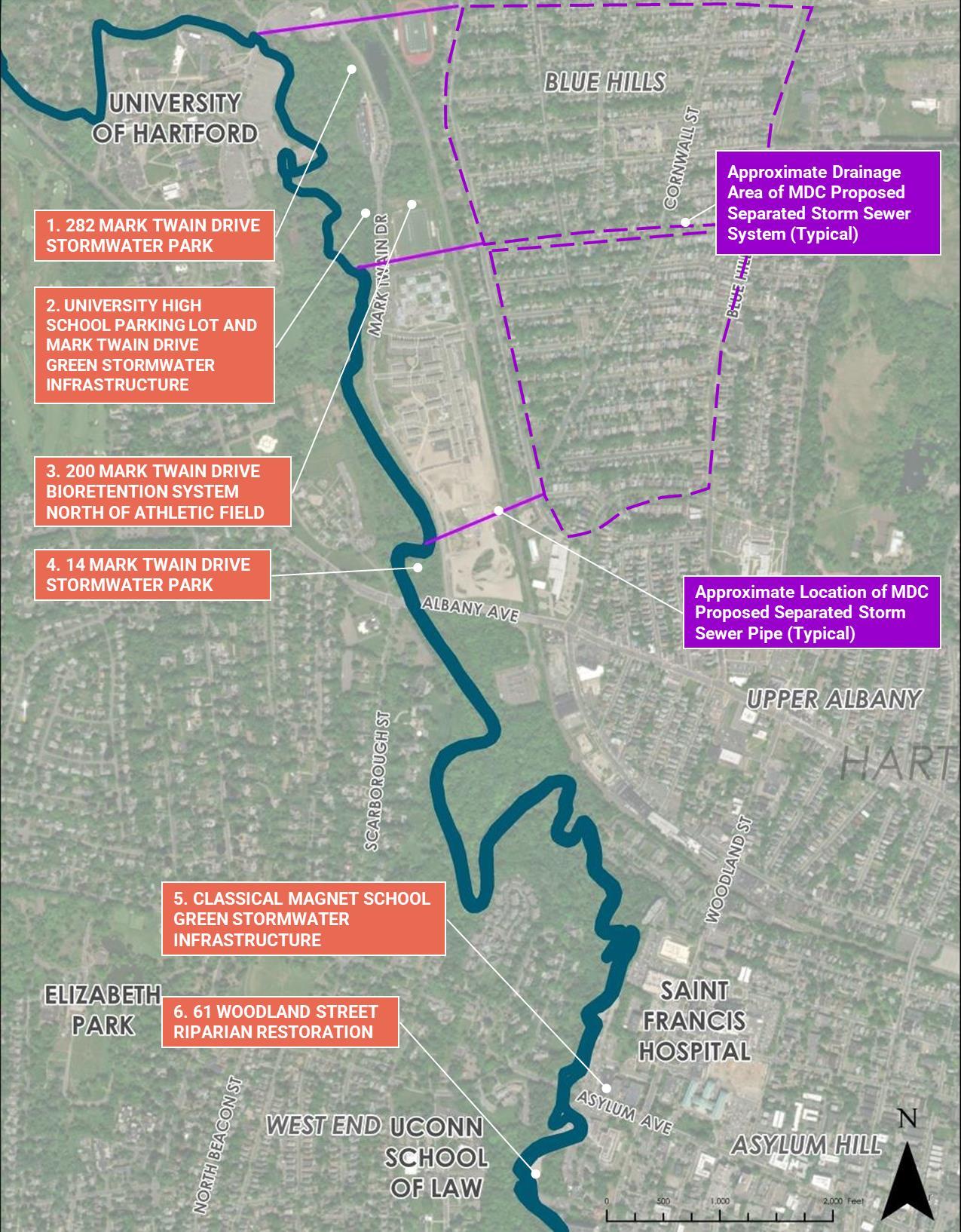
• Stormwater Parks (sewer separation)
• Mark Twain Drive GSI (Green Street)
• Trail Connections
• UHART Parking Lots
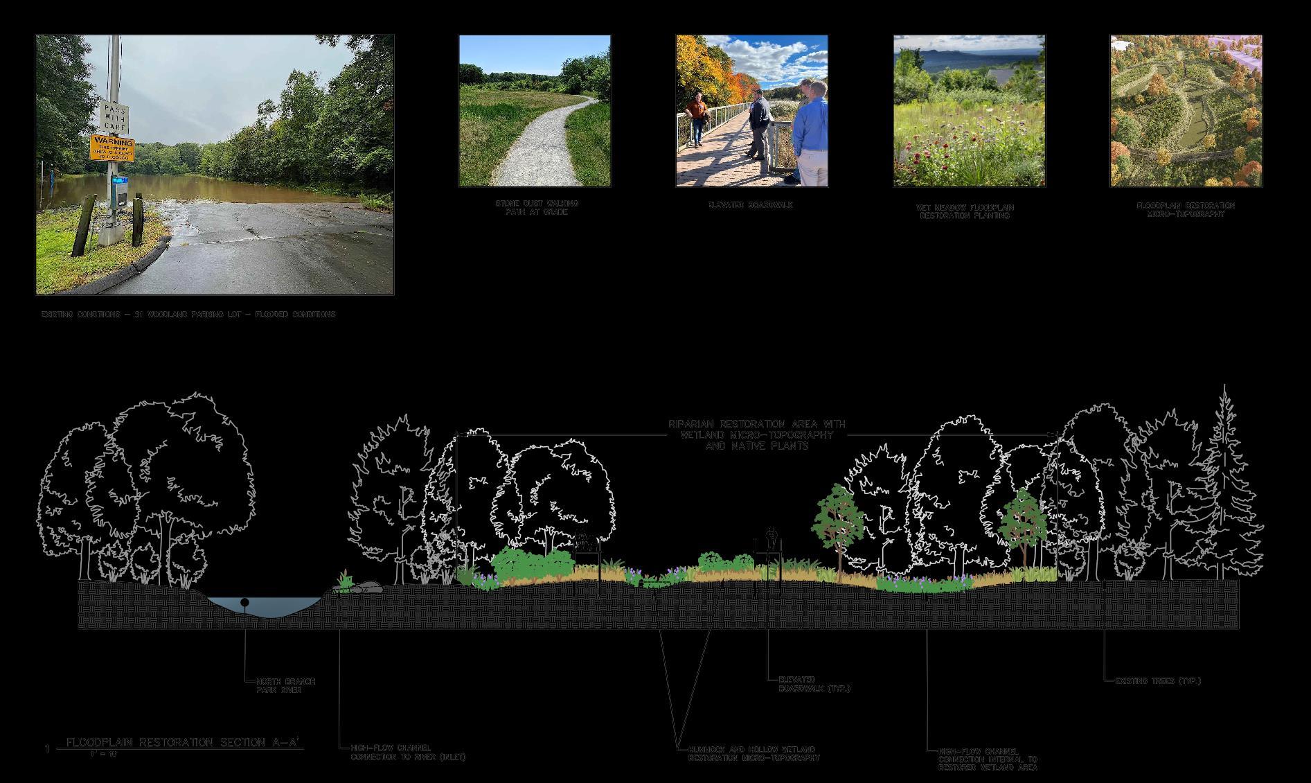
Floodplain Restoration
• Future Separated Stormwater Outfalls
1. 84” outfall near Tower Ave / Weaver HS
2. 72” outfall between 227 and 233 Granby St (previously designed and permitted “Granby 1”)
3. 72” to 84” outfall from 45 Granby St: Westbrook Village easement or pumping station with force main
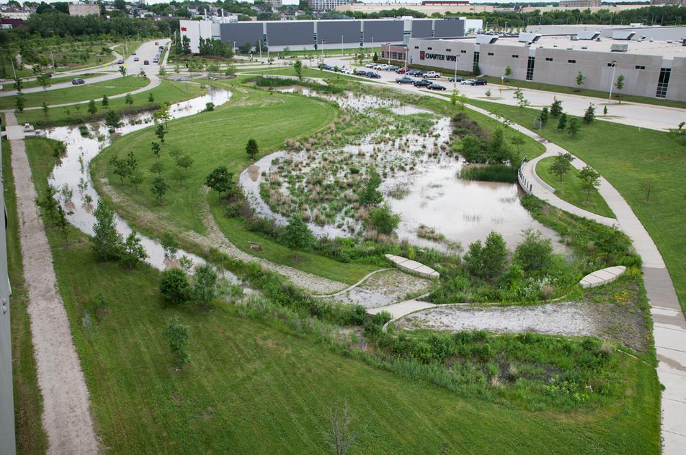
• Off-line stormwater ponds/wetlands at outfalls (“stormwater parks”)
• GSI within upgradient neighborhoods
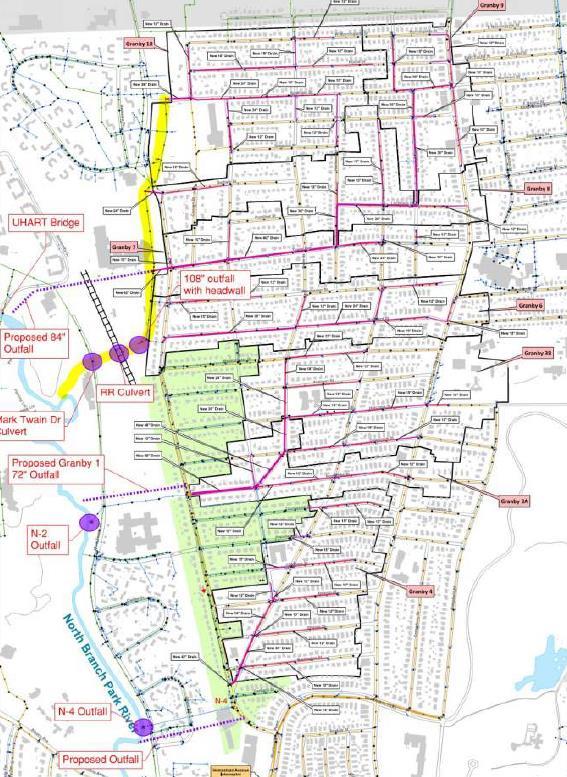
• Manage stormwater for a large area
• Recreational and learning opportunities for the community
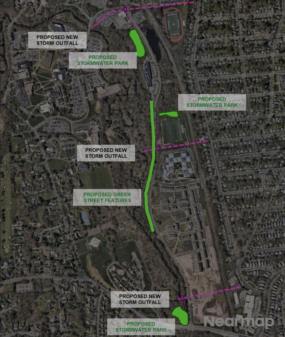
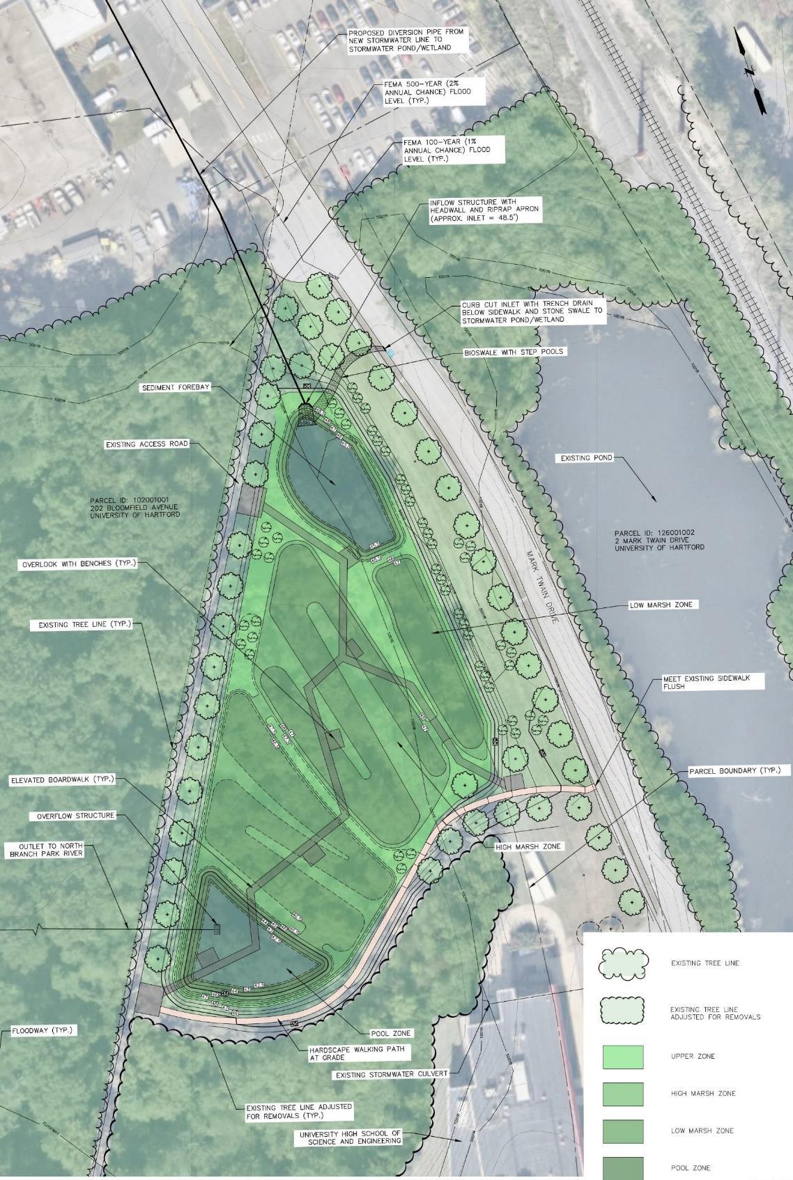
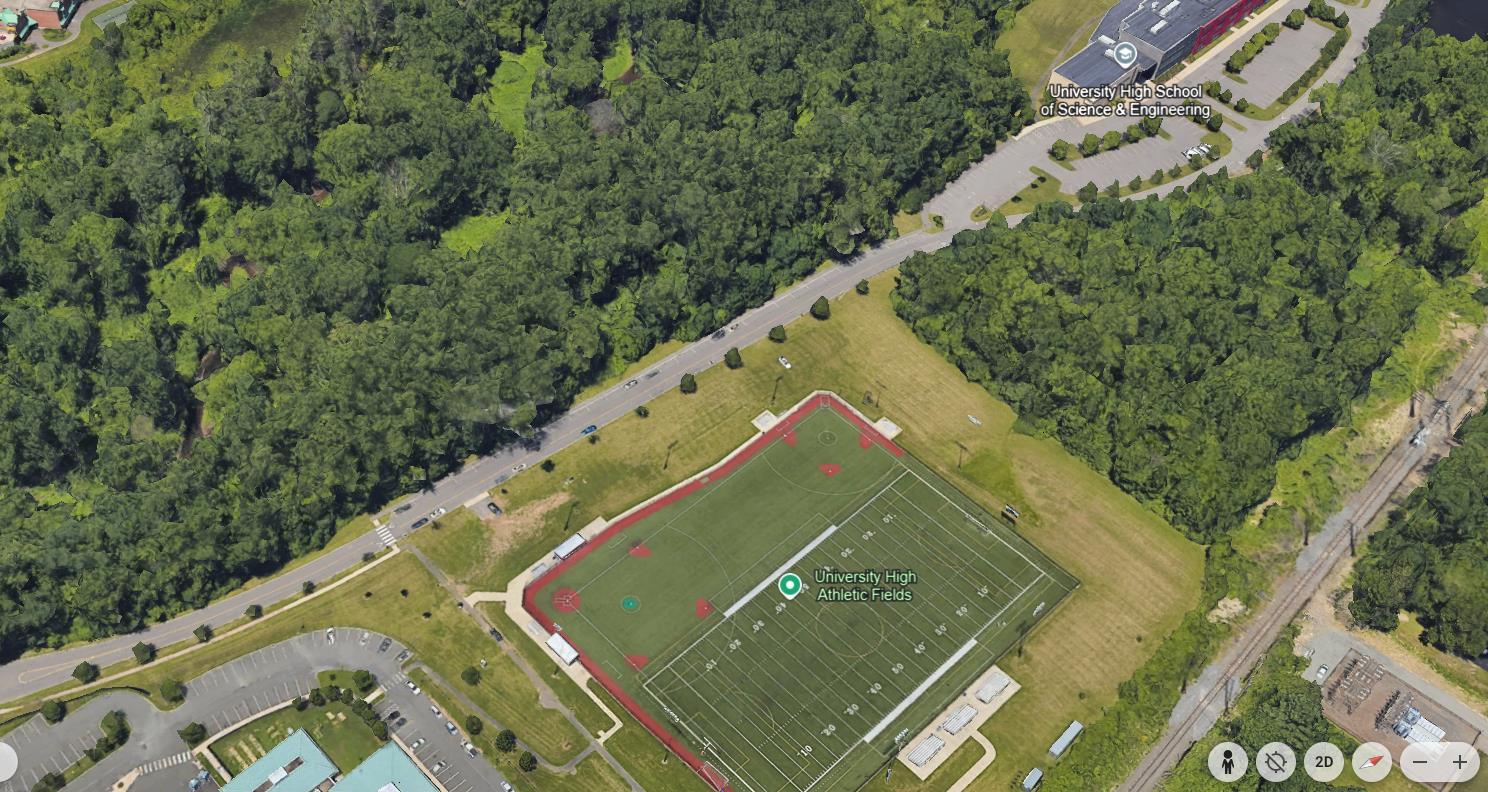
• North of University High School of Science and Engineering
• Divert portion of runoff from potential new 84” stormwater outfall
• Stormwater pond/wetland system designed for water quality
• Raised boardwalk, walking paths, overlooks, learning opportunities
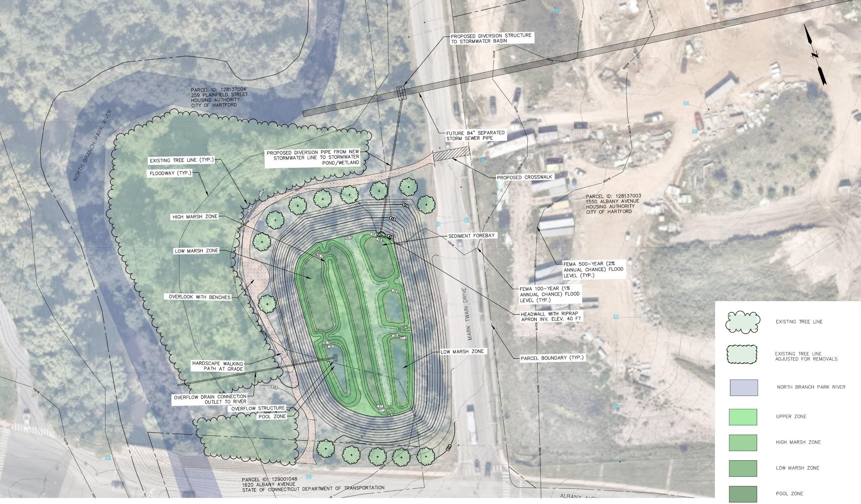
Mark Twain Drive Green Street
• Tree trenches and rain gardens
• Annie Fisher Nature Trail connection
• Relocate on-street parking for UHSSE athletic fields
• GSI at University High School Athletic Fields site
• GSI in University High School parking lot islands
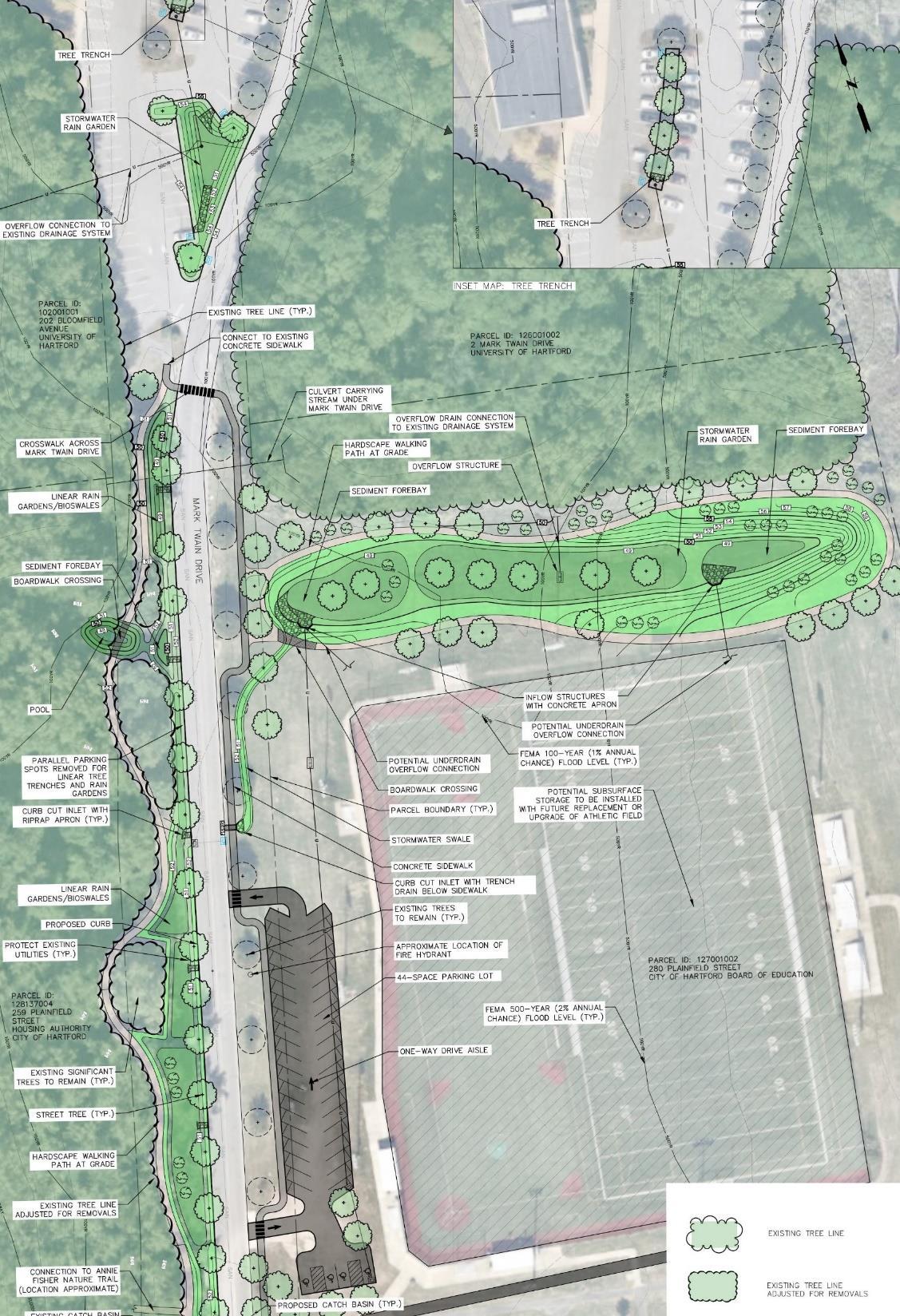
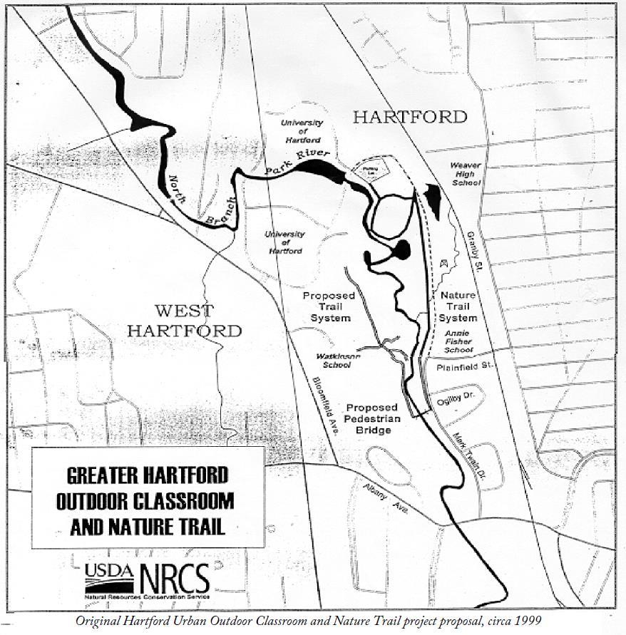
• Annie Fisher Nature Trail
• Built in 2000 as an urban outdoor classroom and nature trail
• Re-establish trail with connections to Mark Twain GSI, stormwater parks, and UHART main campus across the river

• Green Infrastructure Design Development
− 50% design (61 Woodland Street Riparian Restoration)
• Complete Watershed Plan Update
− Draft available by end of December
− Review and comments in January

North Central Conservation District
Contacts: Joanna Shapiro jshapiro@conservect.org
Erik Mas, PE erik.mas@fando.com
Akta Patel, PE akta.patel@fando.com
Andrew Bohne, RLA andrew.bohne@fando.com
Mary Rickel Pelletier maryp@parkwatershed.org
Brian Martin Brian.Martin@tpl.org
Cally Guasti-O’Donoghue cally.guasti@tpl.org