
March 22, 2024 North Central Conservation District


North Branch Park River Green Infrastructure Design & Watershed Plan Update
Project Advisory Committee Meeting #4
•
•
10:00 – 11:00 AM


March 22, 2024 North Central Conservation District


Project Advisory Committee Meeting #4
•
•
10:00 – 11:00 AM


Project Selection and Concept Phases
1. Data Gathering & Review
• Compile GIS mapping
• Inventory public and institutional properties
• Identify existing GI
• Identify planned capital improvements
2. Project Screening & Selection
• Desktop screening
• Property owner interviews
• Field inventories (20 to 40 sites)
• Green infrastructure concepts (up to 15)
• Technical Memo
3. Preliminary Design
• 5 projects
• Field survey
• Test pits & infiltration testing
• Wetland delineation
• Preliminary layout
• Opinion of cost
• Technical Memo
3. Permit Level Design
• 3 projects
• Level of detail to support local/state permitting
• Recreation, Habitat for Fish, Other Aquatic Life and Wildlife
• Elevated Fecal Indicator
Bacteria
− Stormwater runoff
− Combined Sewer overflows
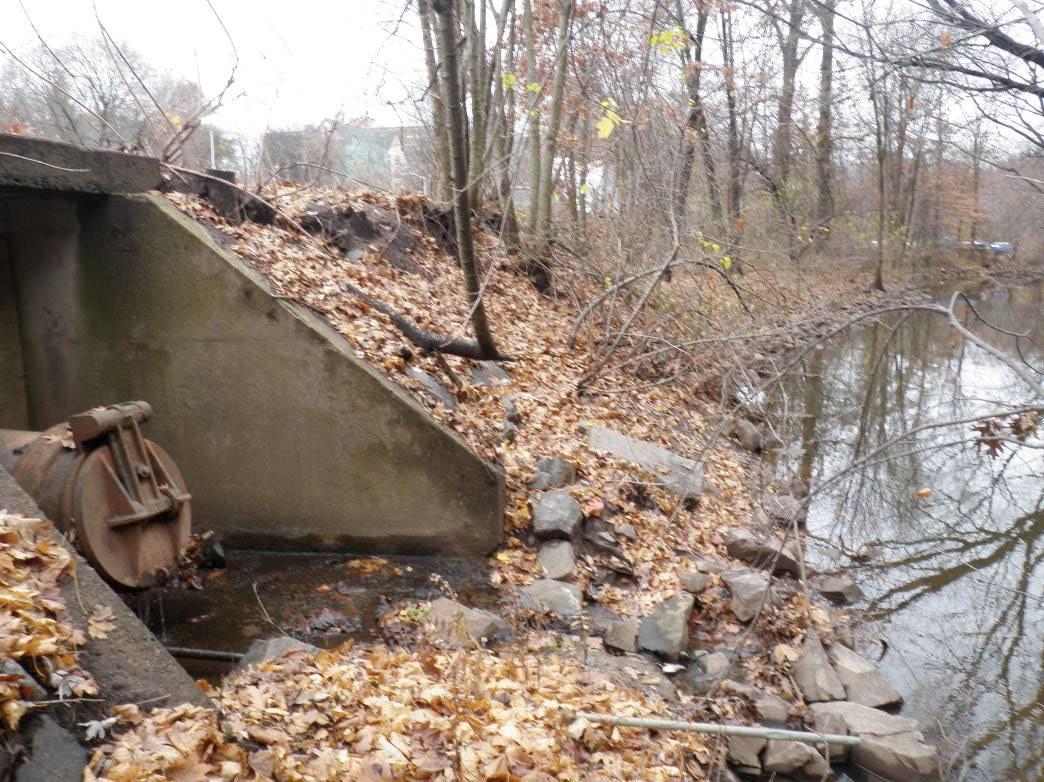
• Channelization, erosion & sediment deposition
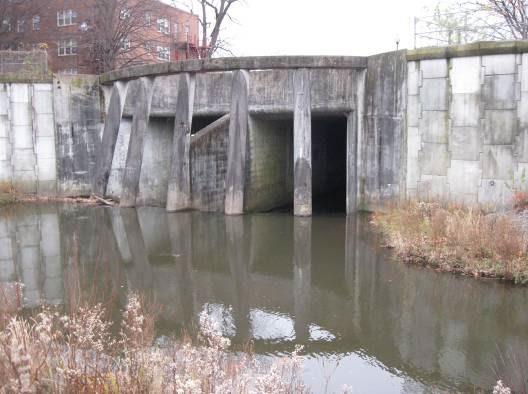
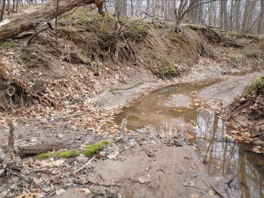
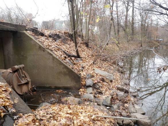
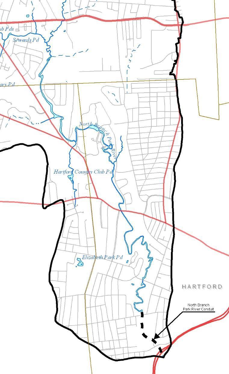
• Broad variability in stream conditions
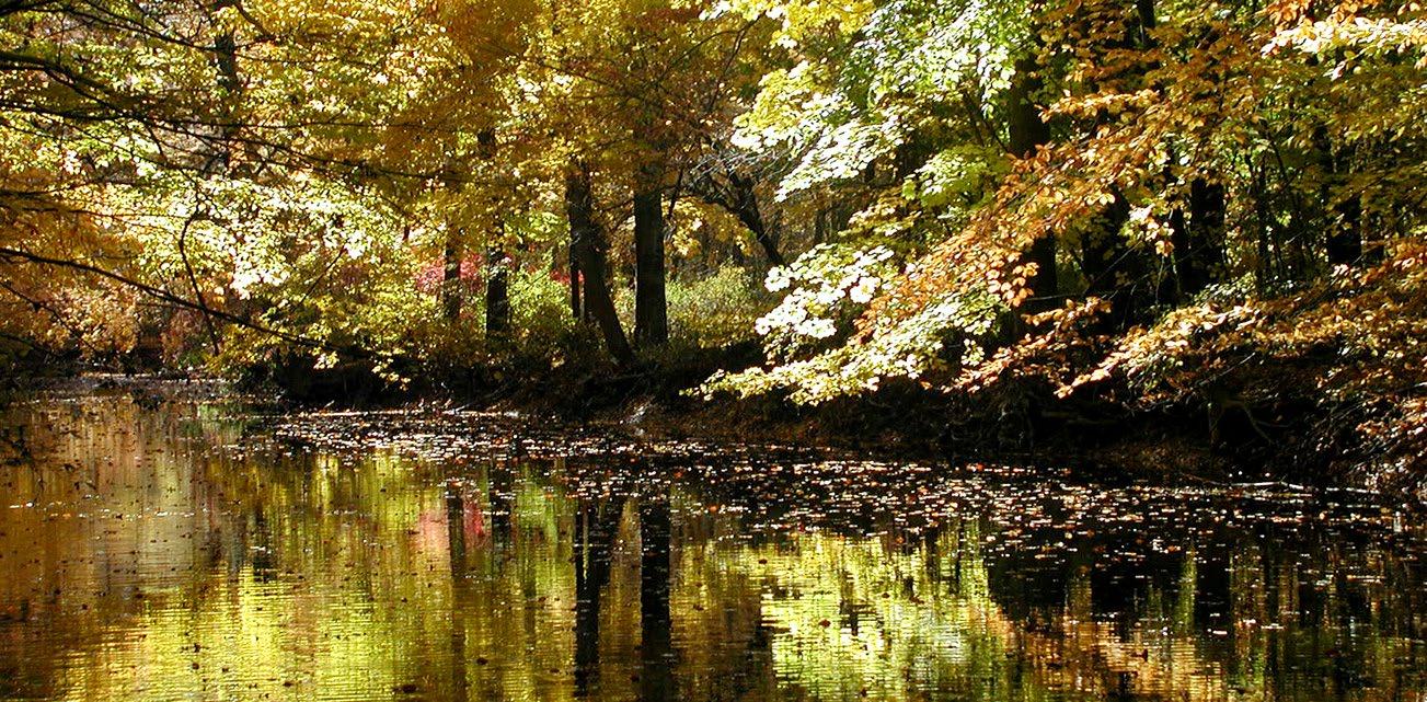
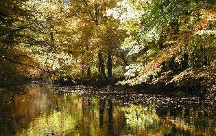
• Healthy riparian corridor improves in-stream conditions (Goodwins Wild)
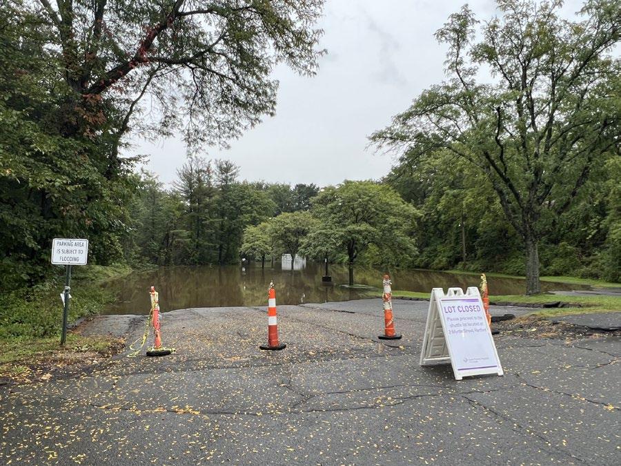
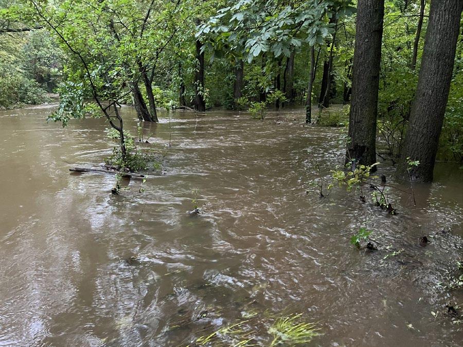
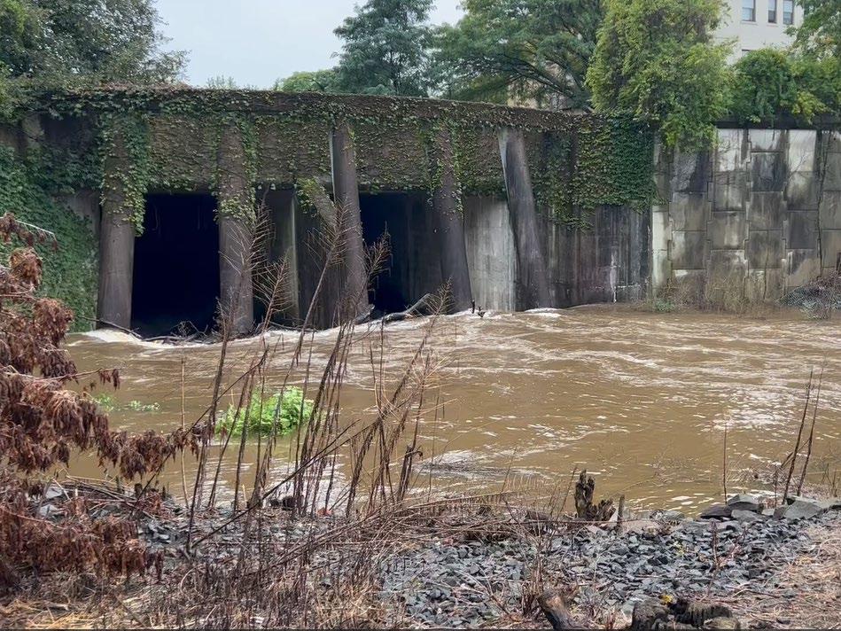
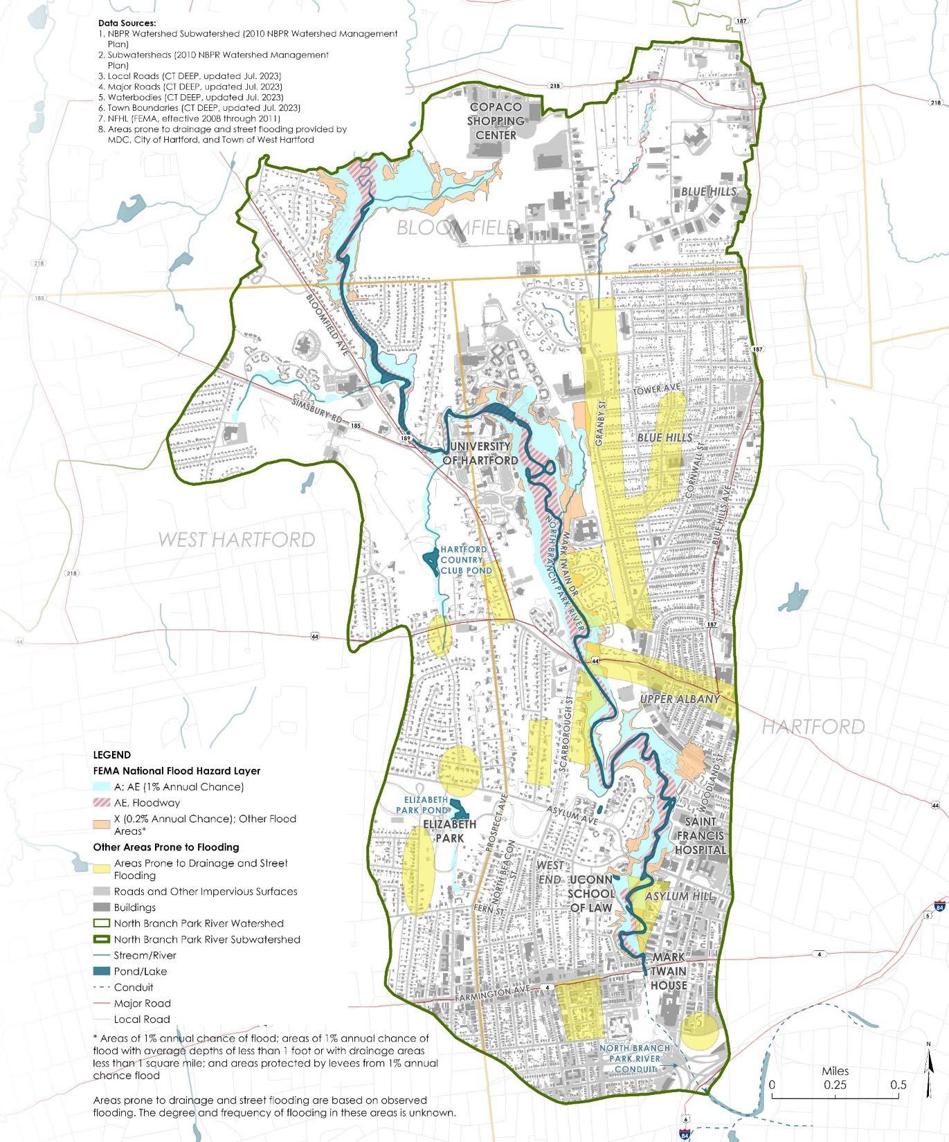
• Landscape scale green infrastructure that improves water quality
• Scenic riparian landscape offering healthy neighborhood amenities
• Increased ecosystem connectivity benefiting migratory and recreational paths
• Shared regional natural resource, a focus of urban/suburban collaboration
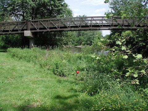
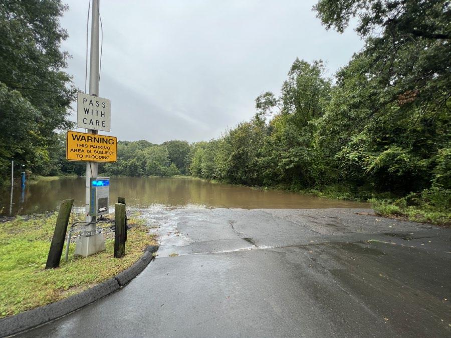
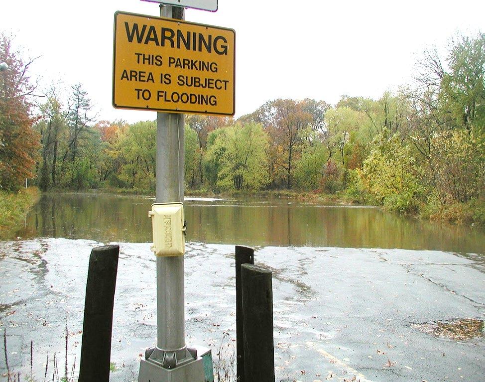
floodplain parkland vs parking lots
• Public/institutional properties
• Within municipal right-of-way
• At existing outfalls
• Site, neighborhood, landscape scale
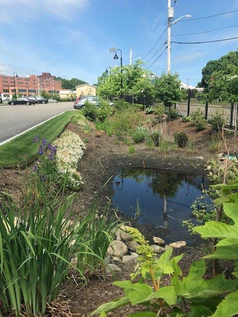
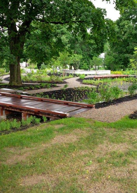
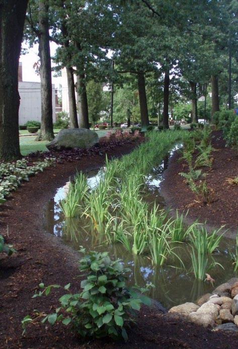

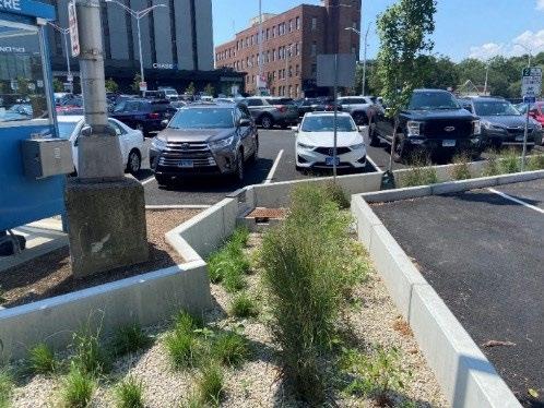

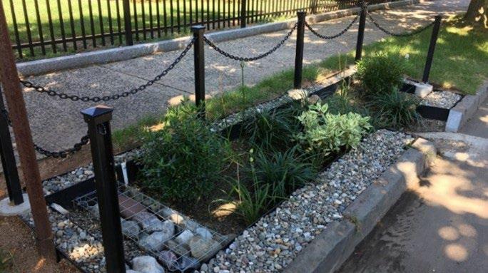
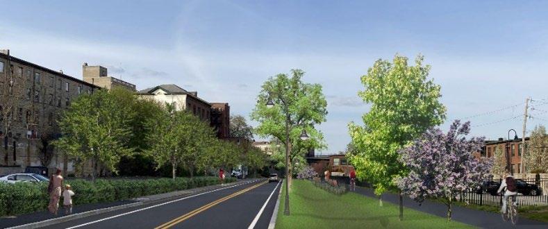 Infiltration basins
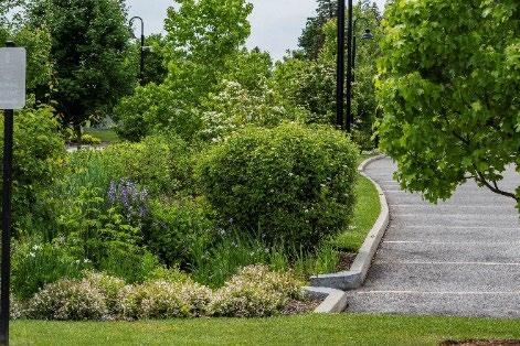
Bioretention systems
Bioretention Planters
Parking Lot Bioretention
Bioretention & Walking Trails Rain Gardens
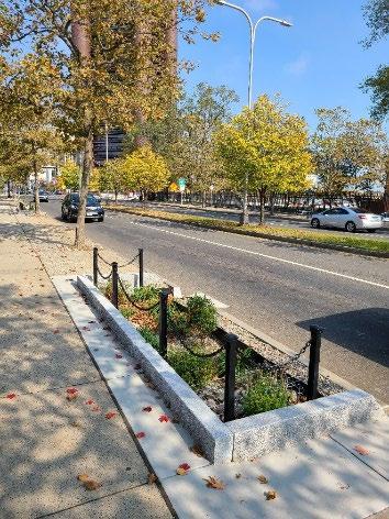
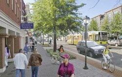
Roadside Bioswales Green Streets
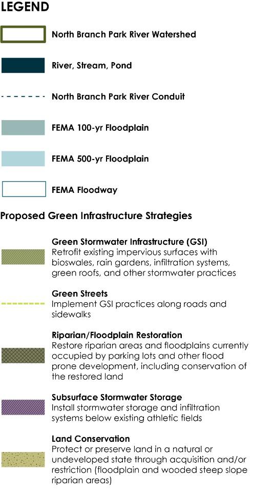
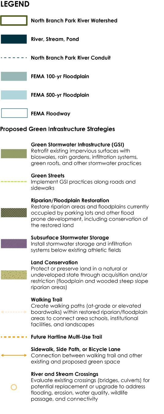
• Riparian & floodplain restoration
• Urban tree canopy
• Urban rewilding
• Land conservation
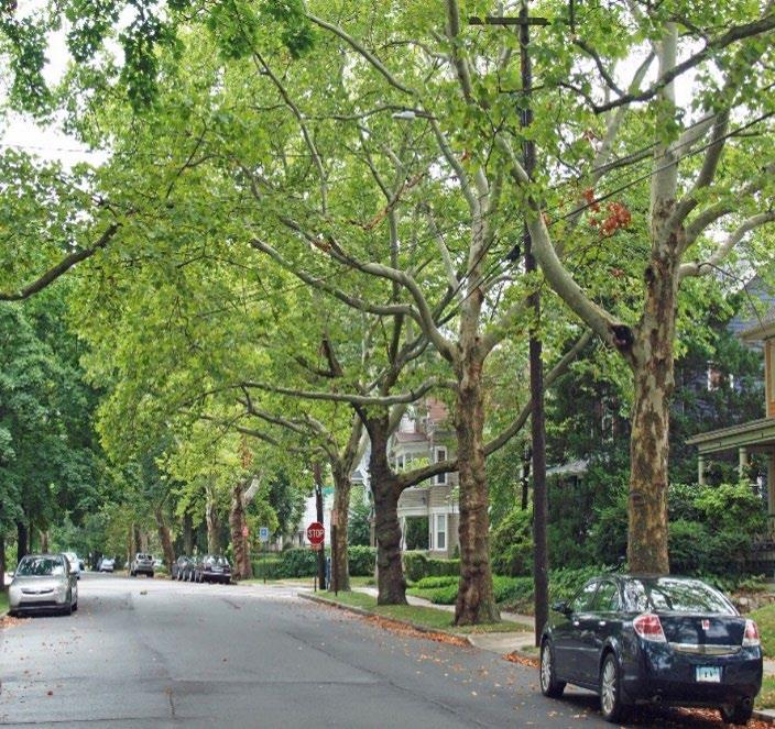
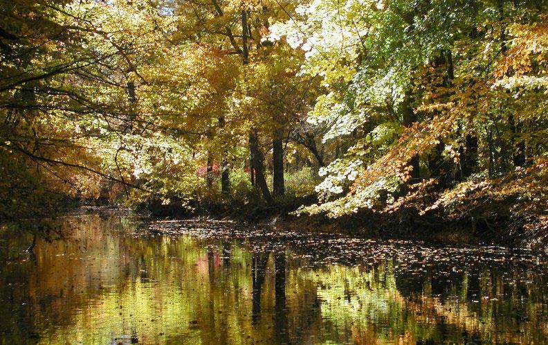
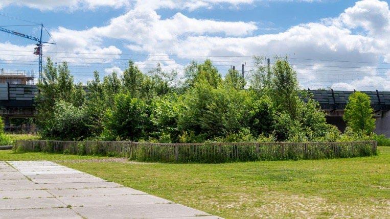
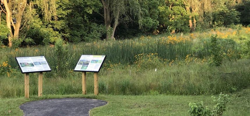
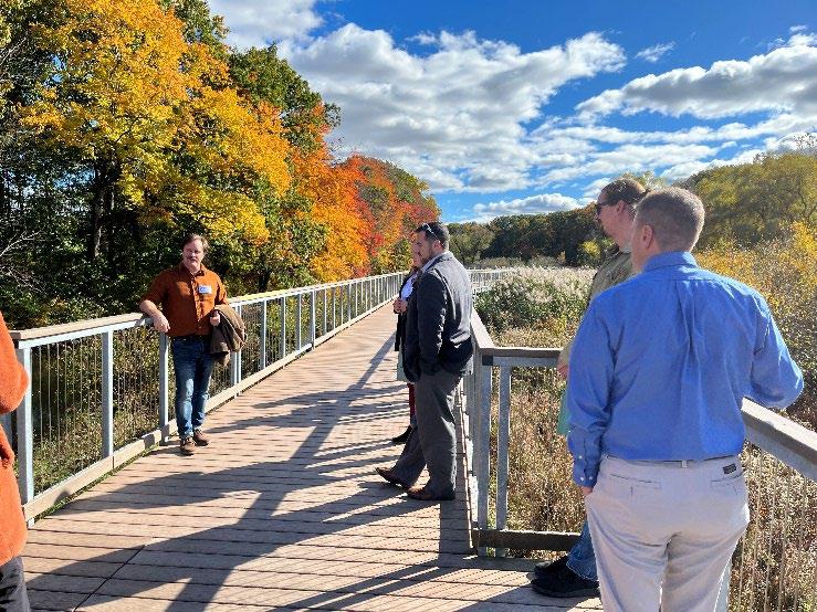 Urban Tree Canopy
Small Urban Forests & Urban Rewilding
Riparian & Floodplain Restoration
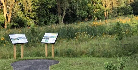
Floodplain Park
Land Conservation – Goodwin’s Wild
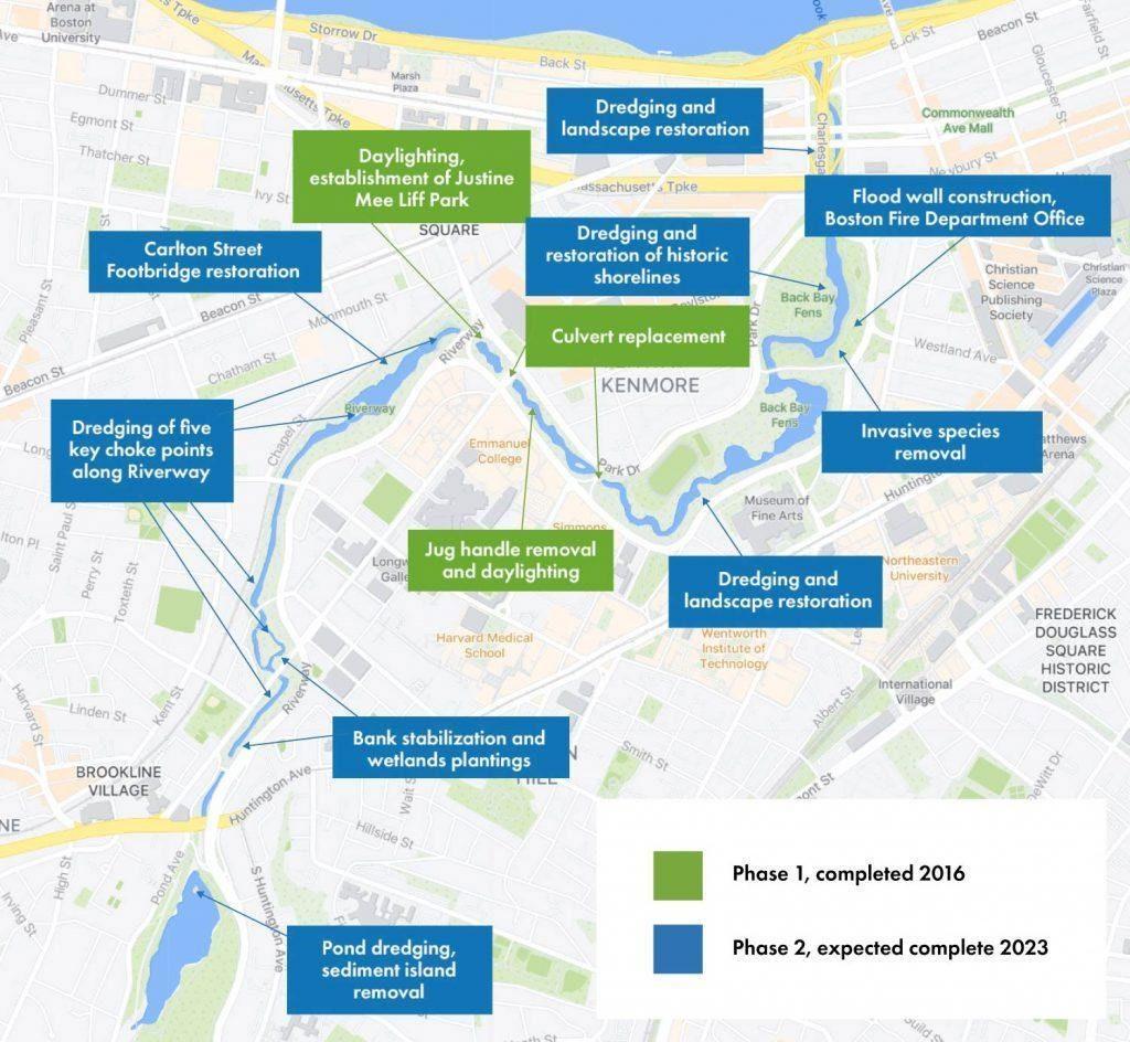
• Targeted dredging of choke points (flooding)
• Bank stabilization and plantings
• Habitat improvements
• Historic landscape restoration
• Stream daylighting
• Stormwater improvements & GSI
• Tree stewardship
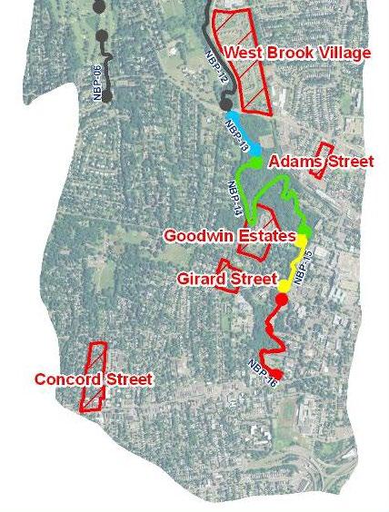
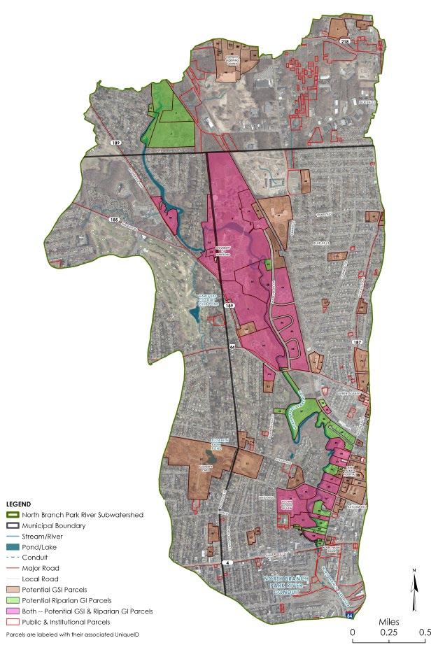
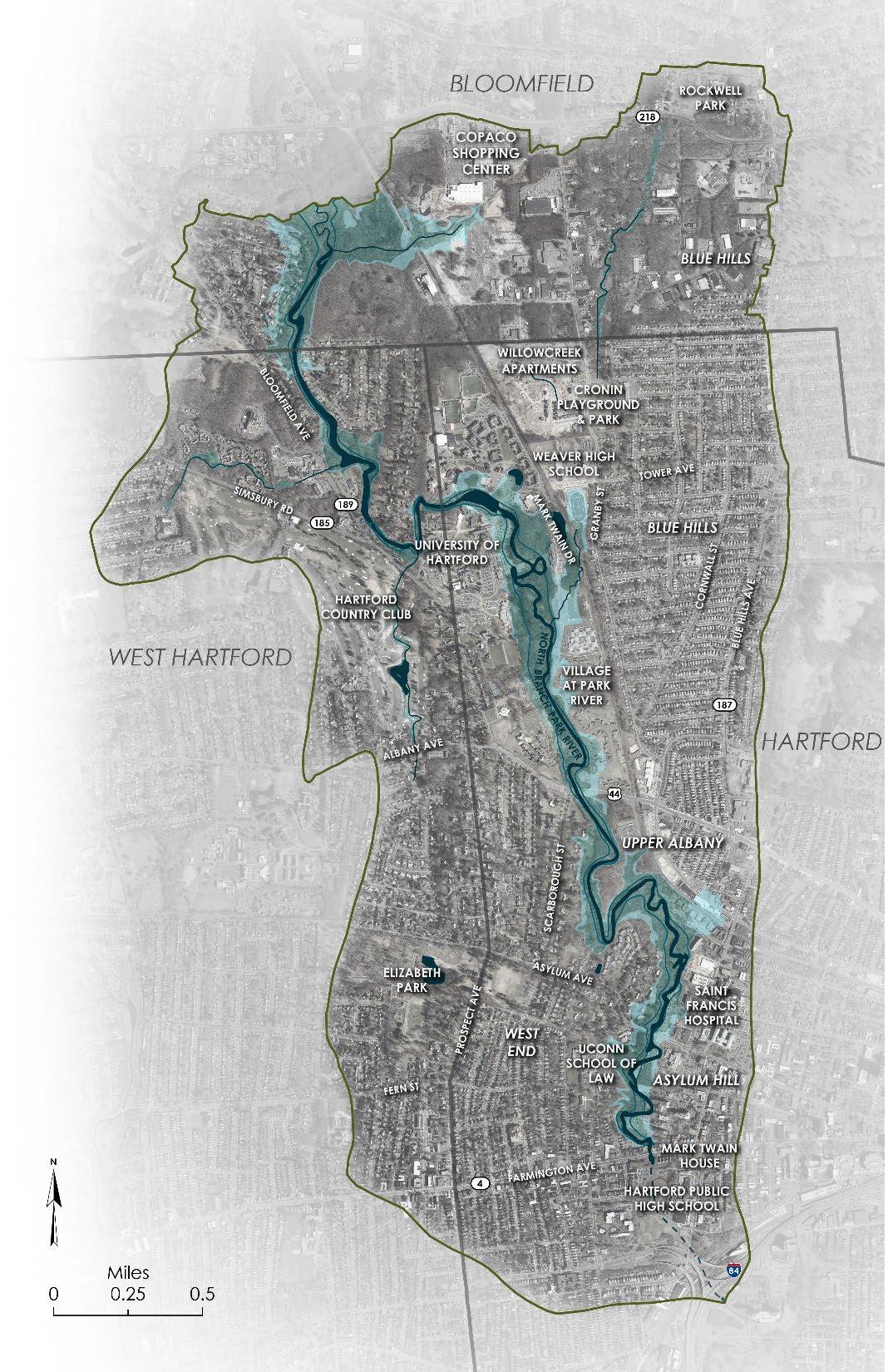
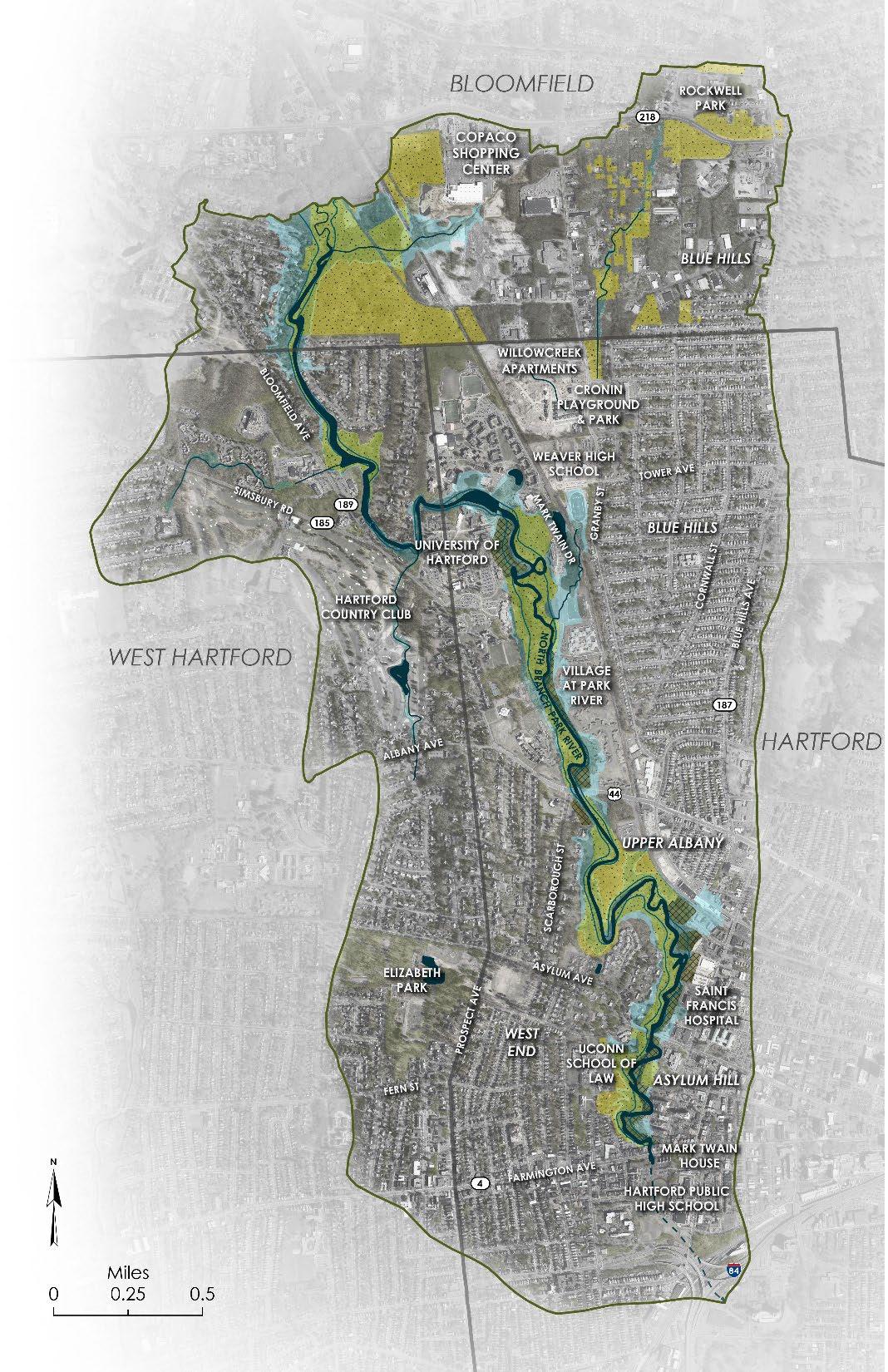
• Public & institutional properties, 98 potential parcels identified
• Green Stormwater Infrastructure (GSI)
− 0.5 acre or more of impervious area
− All soil types considered
• Riparian Corridor Green Infrastructure
− Parcels within 300-foot riparian corridor
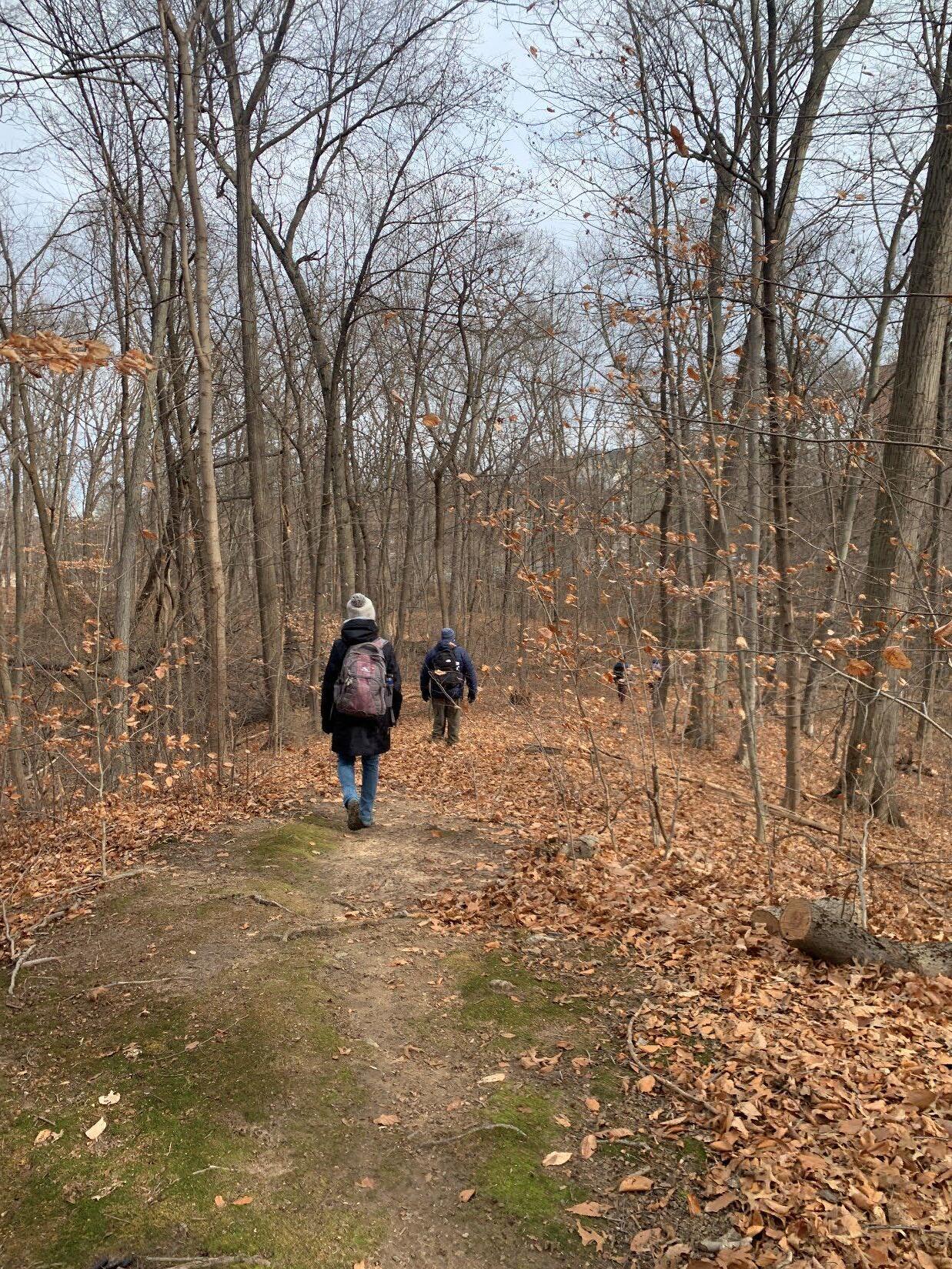
• Field inventories completed in December 2023

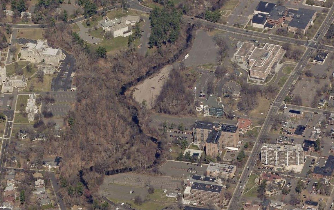
PARKING IN WOODED FLOODPLAIN AND RIPARIAN AREA WOODED FLOODPLAIN AND RIPARIAN AREA
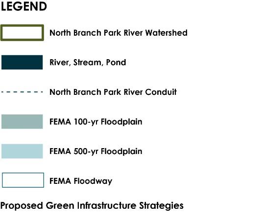
FEMA 100-YEAR
PARKING LOTS IN FLOODPLAIN
PARKING LOTS IN FLOODPLAIN
FLOODPLAIN
FEMA 500-YEAR
FLOODPLAIN

PARKING IN WOODED FLOODPLAIN
PARKING LOTS IN FLOODPLAIN
PARKING LOTS IN FLOODPLAIN
 AND RIPARIAN AREA WOODED FLOODPLAIN AND RIPARIAN AREA
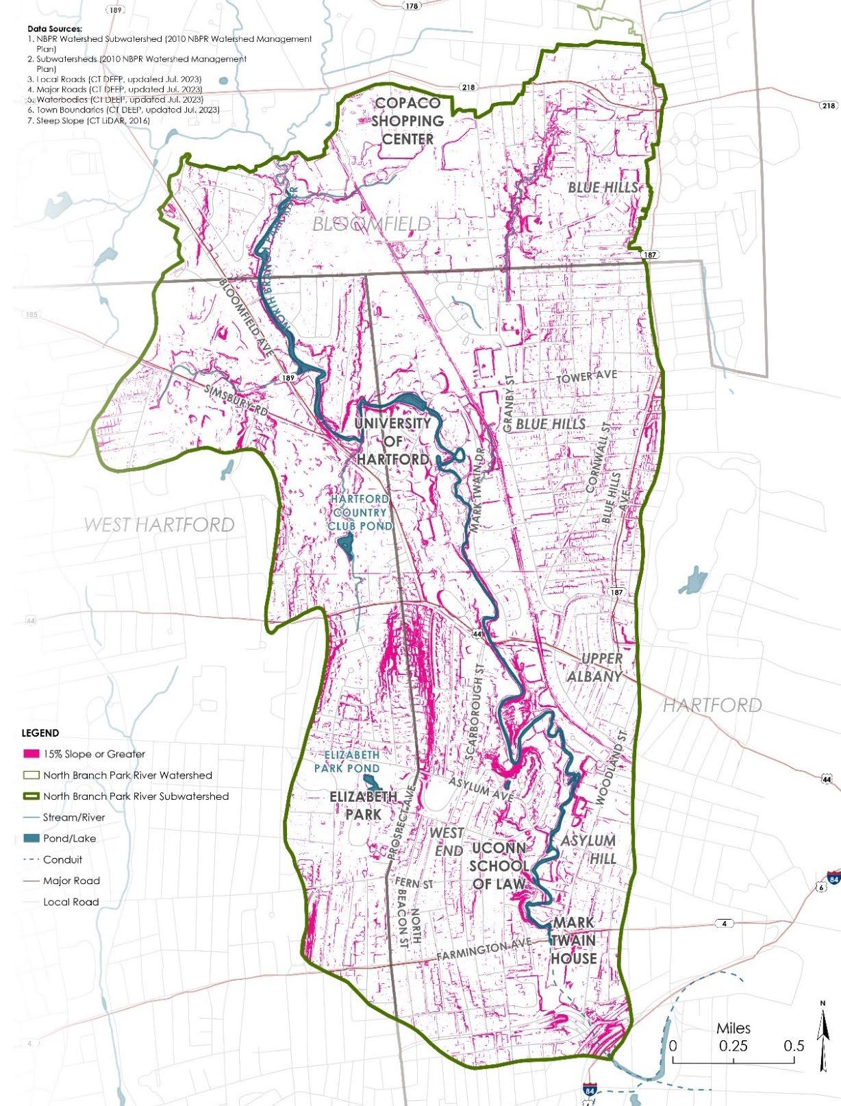
STEEP WOODED SLOPES
• Riparian & Floodplain Restoration
− Flood prone parking lots and development
− Wetland/meadow creation
• Land Conservation
− Riparian corridor, floodplain & wooded steep slopes
− Formal permanent protection
• Challenges
− Loss of parking, future development
− Need property owner cooperation
− Incentives to reduce impervious cover


LAND CONSERVATION OF FLOODPLAIN, RIPARIAN CORRIDOR, AND WOODED STEEP SLOPES
FLOODPLAIN
RIARIAN/FLOODPLAIN
RESTORATION OF EXISTING PARKING LOTS
• Green Stormwater Infrastructure (GSI)
− Retrofit parking lots, roads (green streets), schoolyards
− Treat new separated storm drain discharges
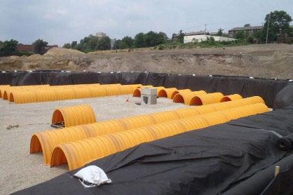
− Subsurface stormwater storage and infiltration systems
• Challenges
− Property owner cooperation
− Combined sewers
− Subsurface and soil conditions
− Incentives to reduce impervious cover
• Paths and Trails
− Walking paths within restored riparian/floodplain areas
− Connections to schools, institutions, and landscapes
− Connections to future Hartline Multi-Use Trail
• River & Stream Crossings
− Potential replacement
− Flooding, erosion, water quality, recreational and wildlife passage
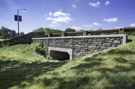
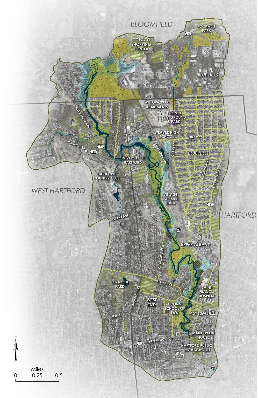
EVALUATE
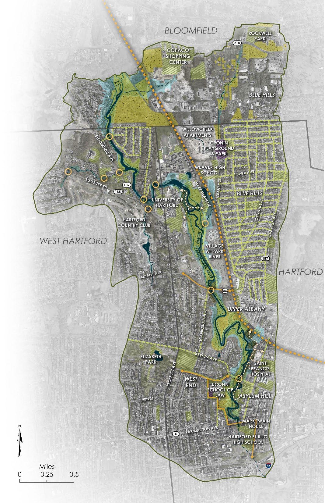
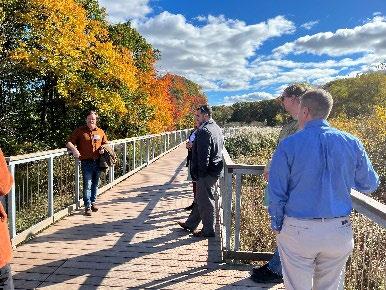 RIVER CROSSING FOR REPLACEMENT
WALKING PATHS IN RESTORATION AREAS
TRAIL CONNECTIONS
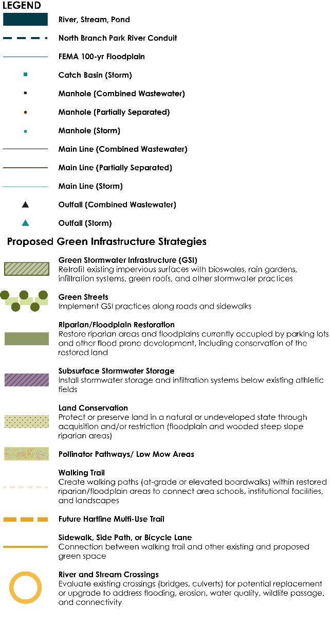
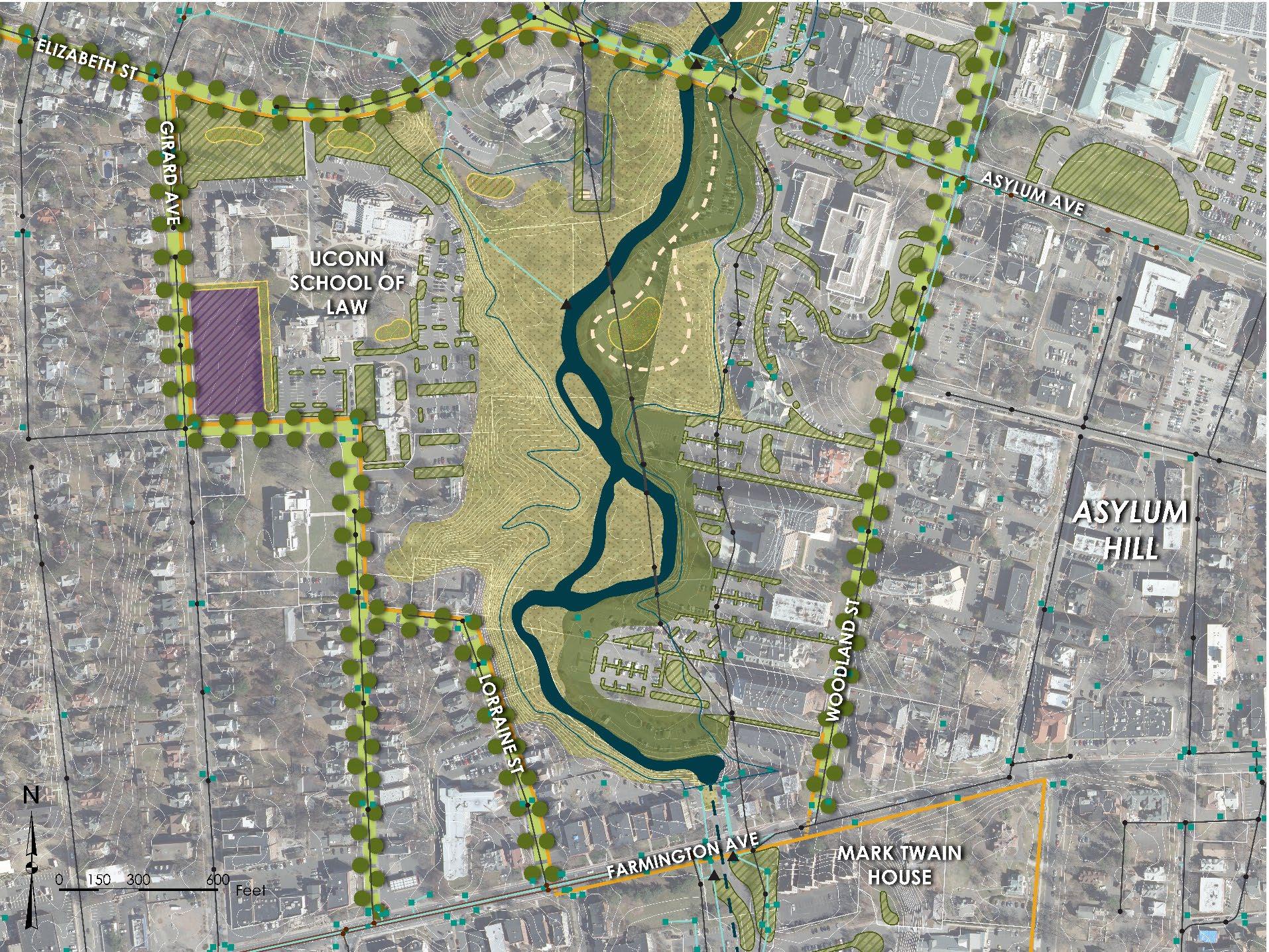
SUBSURFACE STORMWATER STORAGE
GREEN STORMWATER INFRASTRUCTURE (TYP)
GREEN STREETS WITH SHADE TREES AND GSI (TYP)
WALKING TRAILS / LOOP FLOODPLAIN RESTORATION WITHIN EXISTING PARKING LOTS LAND CONSERVATION POLLINATOR GARDEN CSO N-10 CSO N-9
LAND CONSERVATION – RIPARIAN AREA OF TRIBUTARY TO NORTH BRANCH PARK RIVER
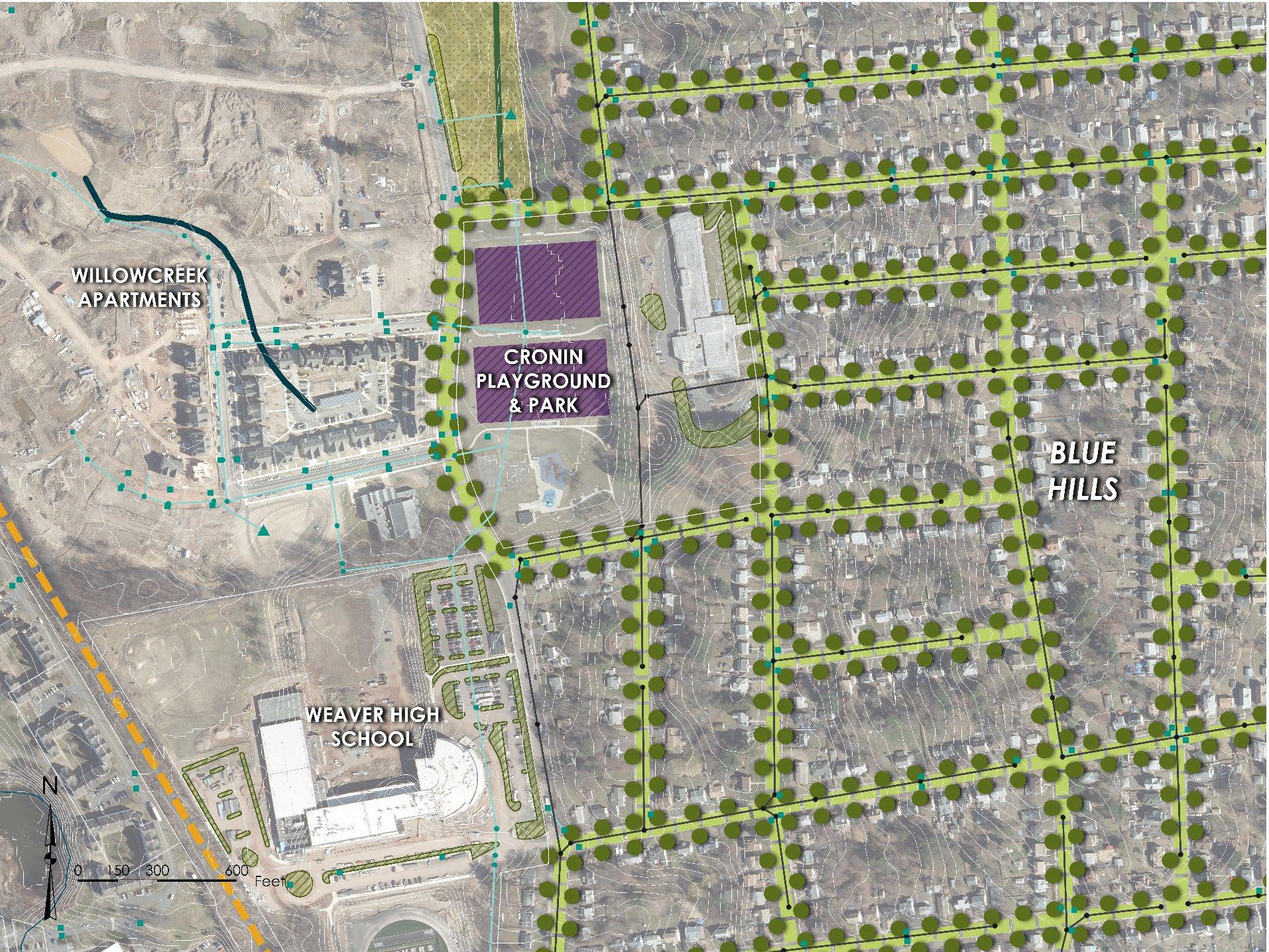
SUBSURFACE STORAGE SYSTEM BENEATH
ATHLETIC FIELDS TO MANAGE STORMWATER FROM FUTURE SEPARATE STORM DRAINAGE SYSTEM
GSI WITHIN PARKING LOT ISLANDS AND EDGES (TYP)
GREEN STREETS IN FUTURE SEWER SEPARATION AREA (TYP)
GSI WITHIN PARKING LOTS (TYP) GSI AT EXISTING STORM DRAIN OUTFALLS (TYP)
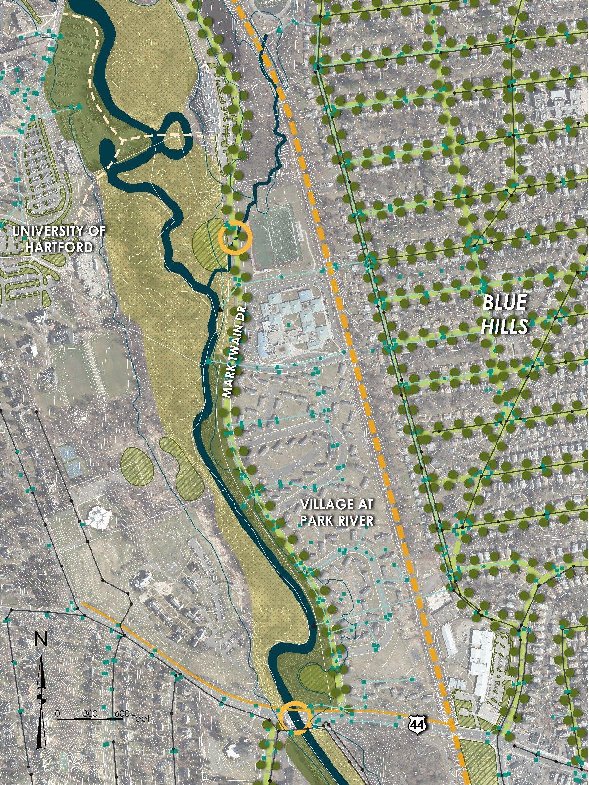 GREEN STREET ALONG MARK TWAIN DRIVE
ONGOING PHASED REDEVELOPMENT WITH LID/GSI
EVALUATE EXISTING RIVER CROSSING (TYP)
WALKING TRAIL
FUTURE HARTLINE MULTI-USE TRAIL
FLOODPLAIN RESTORATION OF UHART PARKING LOT
LAND CONSERVATION
GSI WITHIN UHART PARKING LOTS (TYP) CSO N-2
CSO N-4
GSI WITHIN UNIVERSITY HIGH SCHOOL PARKING LOT
GSI TO TREAT FUTURE SEPARATE STORM DRAIN OUTFALL
GSI TO TREAT FUTURE SEPARATE STORM DRAIN OUTFALL FLOODPLAIN RESTORATION

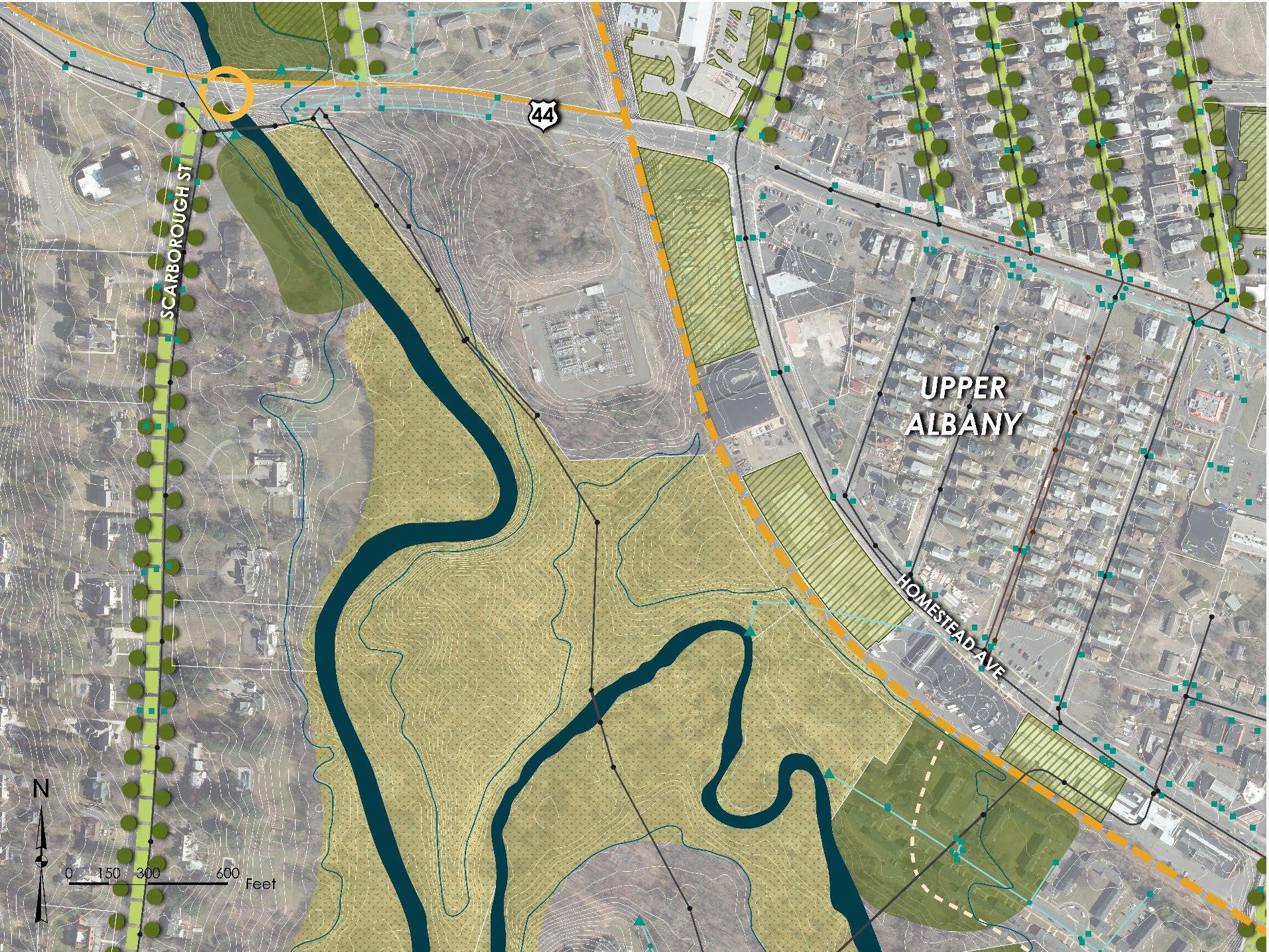
PROPOSED SIDE PATH
EVERSOURCE ELECTRICAL SUBSTATION
GOODWIN’S WILD (OLD GROWTH FOREST)
FLOODPLAIN RESTORATION WITH FUTURE SITE REDEVELOPMENT
GREEN
GREEN STORMWATER INFRASTRUCTURE WITH BROWNFIELD REDEVELOPMENT
LAND CONSERVATION
FUTURE HARTLINE MULTIUSE TRAIL
FLOODPLAIN RESTORATION STREETS IN FUTURE SEWER SEPARATION AREA GREEN STREET SCARBOROUGH STREET• Distribute proposed GI concepts/strategies for review and comment
− Project Partners
− Advisory Committee Members
− Private/Institutional Property Owners
• Select 5 concepts for preliminary design
− With input from upcoming Town Hall style meeting
• Prepare preliminary designs
• Select 3 projects for permit level design
− Need support of property owners




• MDC
− North Branch Park River Drainage Study & Sewer Separation Design (Granby Street and Blue Hills)
− New North Branch Interceptor Replacement along lower NBPR (2027 start at the earliest)
• City of Hartford
− Granby Street Green Infrastructure Demonstration Project (with EPA)
• CRCOG
− Stormwater Authority Feasibility Assessment (CT DEEP Grant)
− Natural Hazard Mitigation & Climate Adaptation Plan
− Climate Pollution Reduction Plan
• CTDEEP
−
Creating new Office of Planning & Resilience (October 2024)
• Bioblitz - Kirsten Martin, USJ Professor of Environmental Science
− Friday, April 26 & Saturday, April 27
− Volunteers
• Town Hall Style Meeting
− Green infrastructure concepts
− Watershed plan goals
− Late May or early June
− Property owners
− Evolution of Park Watershed / Non-Profit Stewardship
• Community/EJ Outreach Meetings and Walkshops
• 2010 Plan Goals and Park Watershed Assessment Survey has been developed and distributed
− Need input from Advisory Committee
− Share with others
− Survey Link: https://forms.gle/f27qzM5q9UnWW8YN9
• Survey responses to date
• Two other specialized surveys will be developed
• Planned outreach to institutional property owners on GI concepts
• Green Infrastructure Design Development
− Distribute GI concepts to Project Partners and Advisory Committee and receive feedback
− Property owner outreach
− Select five (5) concepts for preliminary design based on:
• Benefits to water quality
• Demonstration value & scalability
• Other co-benefits (resilience, habitat, community amenity, etc.)
• Property owner support
− Begin preliminary designs
• Stakeholder Engagement
− Property owners walkshop (April)
− BioBlitz (April)
− Town Hall style meeting with Project Partners, Advisory Committee, and the public (April/May)


Contacts:
Joanna Shapiro
jshapiro@conservect.org
Erik Mas emas@fando.com
Mary Rickel Pelletier maryp@parkwatershed.org
Brian Martin
Cally Guasti-O’Donoghue
Brian.Martin@tpl.org
cally.guasti@tpl.org