5. SITE-SPECIFIC GREEN INFRASTRUCTURE PROJECTS

Green Infrastructure
Design Process
Concept Development
Focus Area Concepts
Preliminary Designs
Permit-Level Designs

Green Infrastructure
Design Process
Concept Development
Focus Area Concepts
Preliminary Designs
Permit-Level Designs
What is Green Infrastructure?
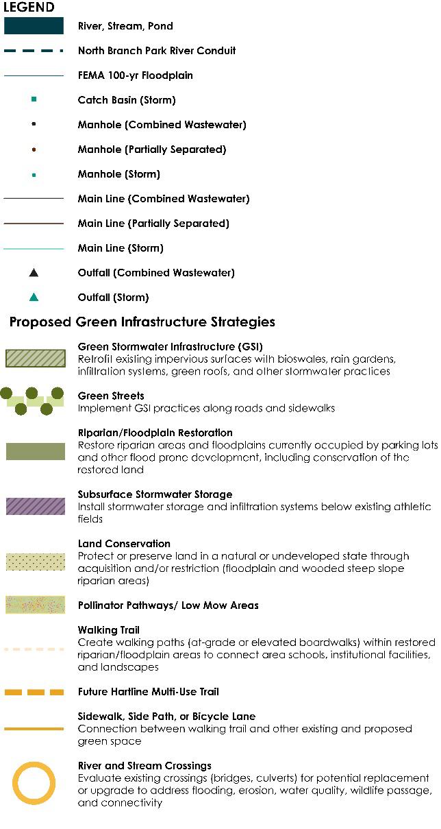
Green Infrastructure (GI) refers to natural and man-made landscapes and practices that reduce stormwater runoff using vegetation, soils, and natural processes to manage water and create healthier urban and suburban environments. These practices capture, manage, and/or reuse rainfall close to where it falls, reducing stormwater runoff and keeping it out of drainage systems, combined sewer systems, and receiving waters.
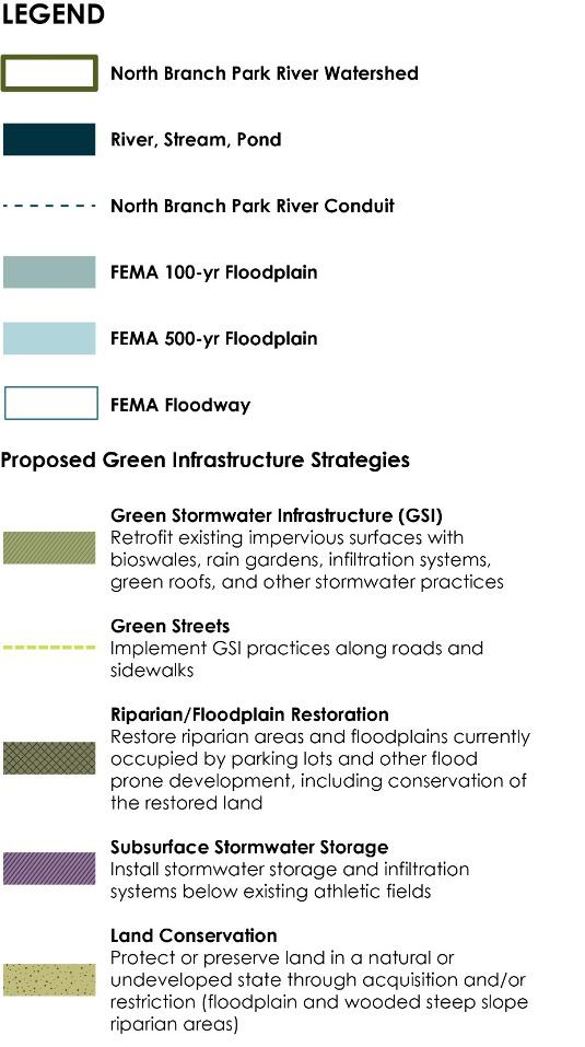
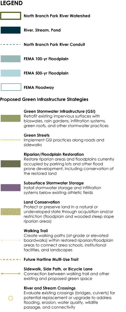
Examples of natural green infrastructure include forests, meadows, and floodplains and land conservation strategies to preserve these features in a natural or undeveloped state Examples of man-made green infrastructure include Green Stormwater Infrastructure (GSI) for managing
stormwater runoff at the site or neighborhood scale, such as bioswales, rain gardens, green roofs, and rainwater harvesting, as well as other types of designed green infrastructure such as urban tree canopy, floodplain and riparian corridor restoration and conservation, and urban rewilding.
The Benefits of Green Infrastructure
In addition to reducing runoff and improving water quality, green infrastructure has been shown to provide many other social and economic benefits as highlighted in the following graphic.
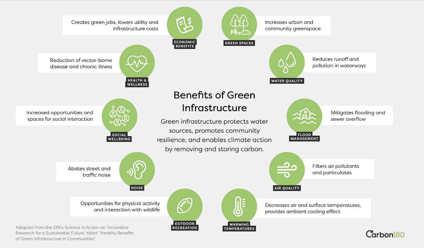
The multiple benefits of green infrastructure (Source: Carbon180).
Green Stormwater Infrastructure (GSI)
Other Natural and Designed Green Infrastructure
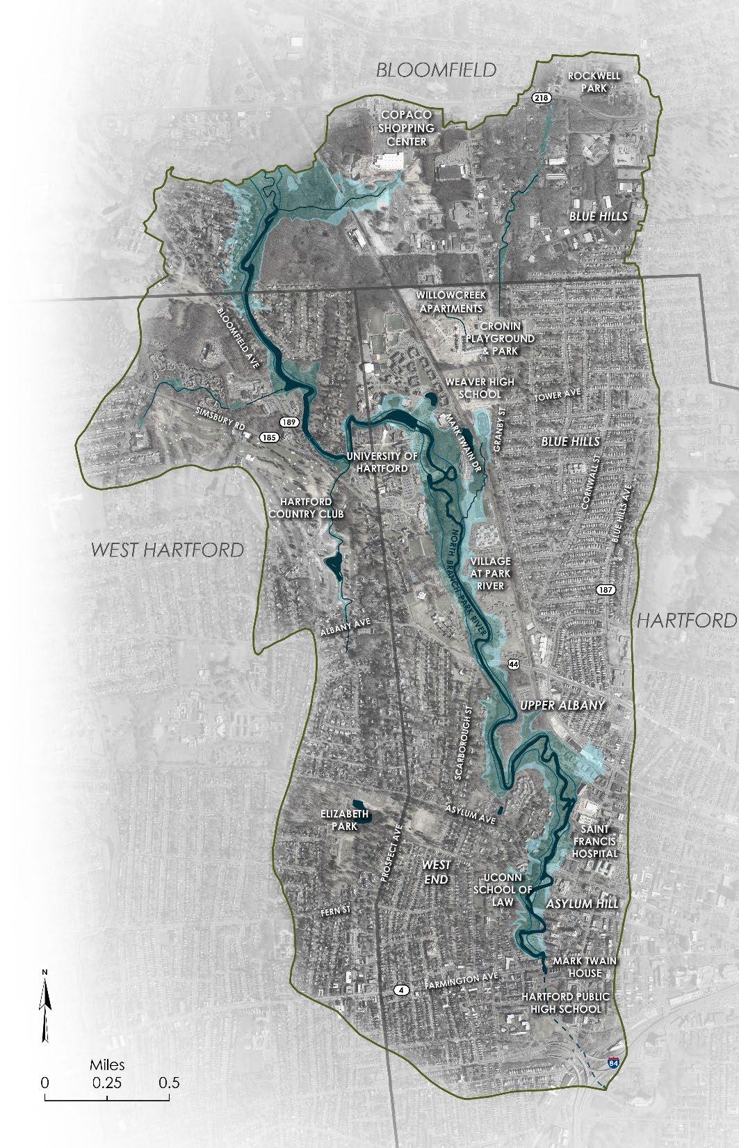
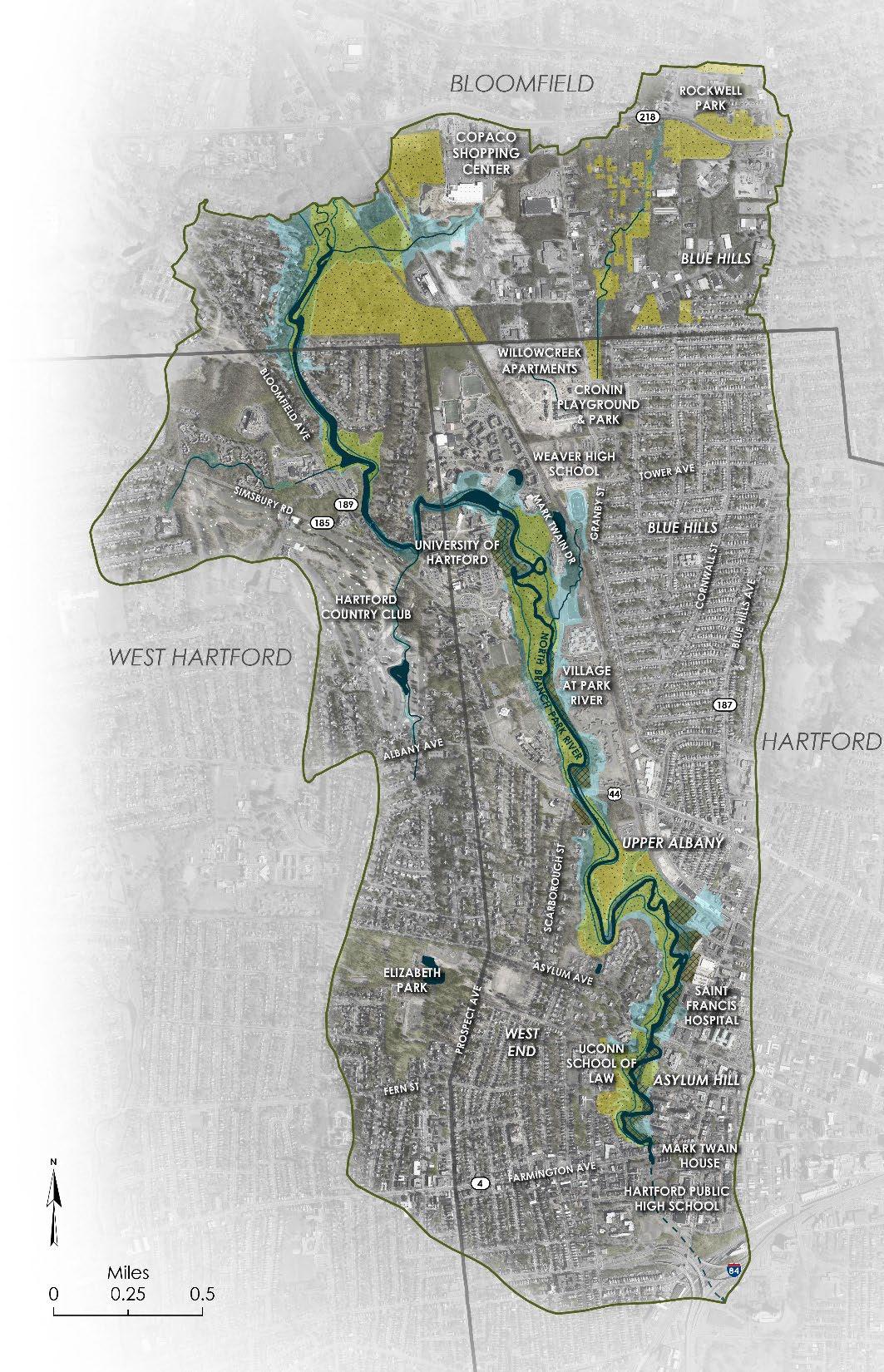
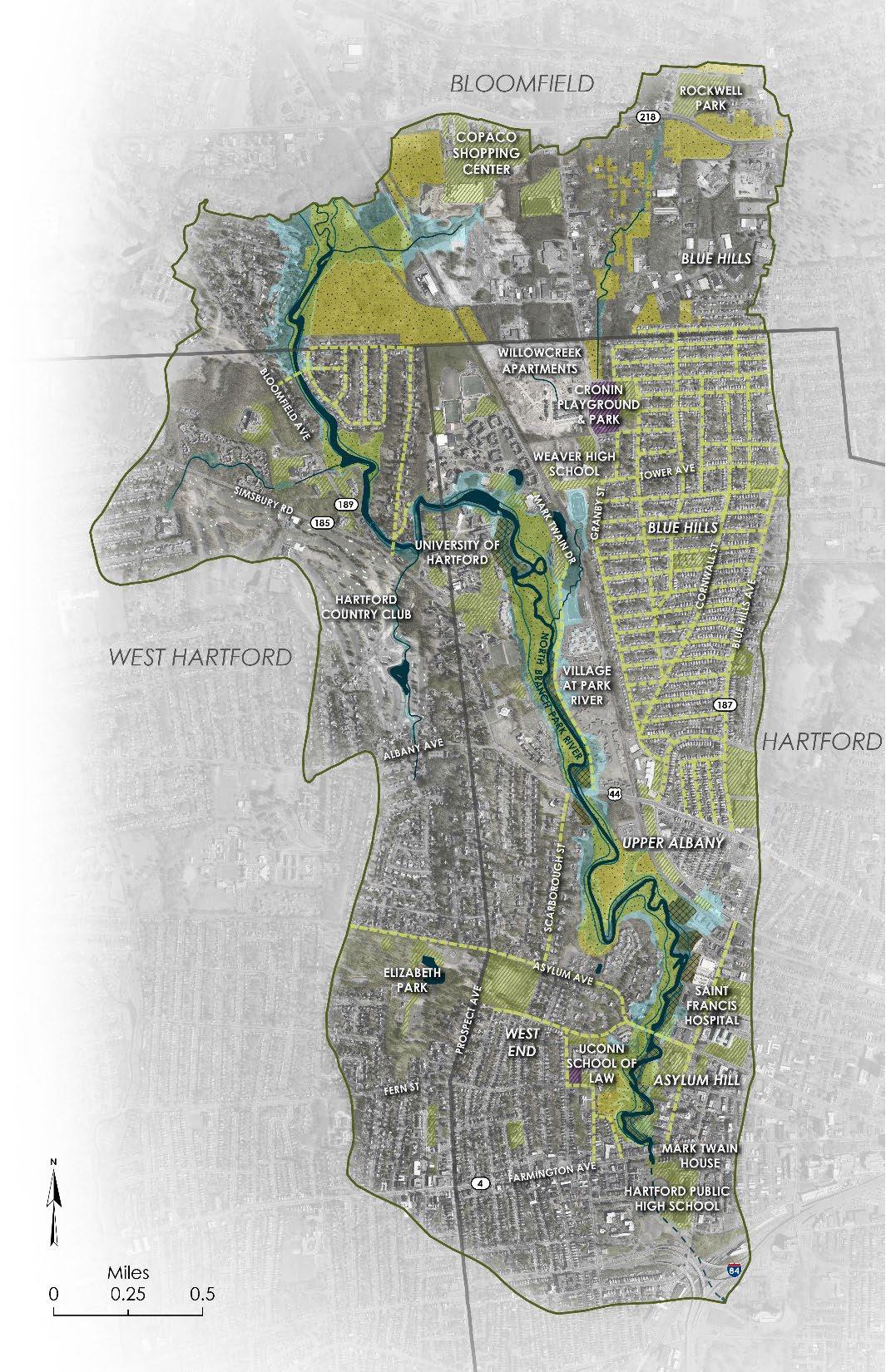
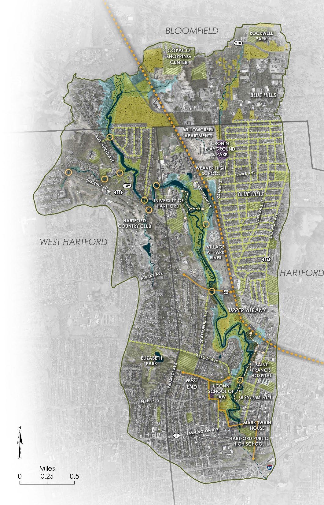
A stepwise approach was used to identify and develop designs for “high-impact” green infrastructure (GI) projects within the North Branch Park River subwatershed, which was identified in the 2010 North Branch Park River Watershed Management Plan as a focus for restoration and green infrastructure implementation. The focus area included targeted portions of the City of Hartford, the Town of West Hartford, and the Town of Bloomfield that contribute pollutant loadings to the North Branch Park River. High-impact projects are generally larger-scale projects capable of achieving substantial reductions in pollutant (fecal indicator bacteria, nutrients, and sediment) loads and runoff volumes, with other benefits including but not limited to CSO reduction, increased resilience to flooding and extreme heat, and community enhancement.
The following major goals guided the selection and design of green infrastructure strategies and projects within the North Branch Park River subwatershed:
• Improve and protect water quality
• Restore and protect the riparian corridor
• Increase flood and community resilience
• Provide healthy neighborhood amenities
• Increase ecological and recreational connectivity
The design process built upon the site-specific green infrastructure concepts presented in the 2010 watershed management plan. The designs were also informed by the project-specific community engagement process, including feedback from the Project Partners, Project Advisory Committee, community members, and other stakeholders.
Green infrastructure projects that were considered as part of the design development process for the North Branch Park River included:
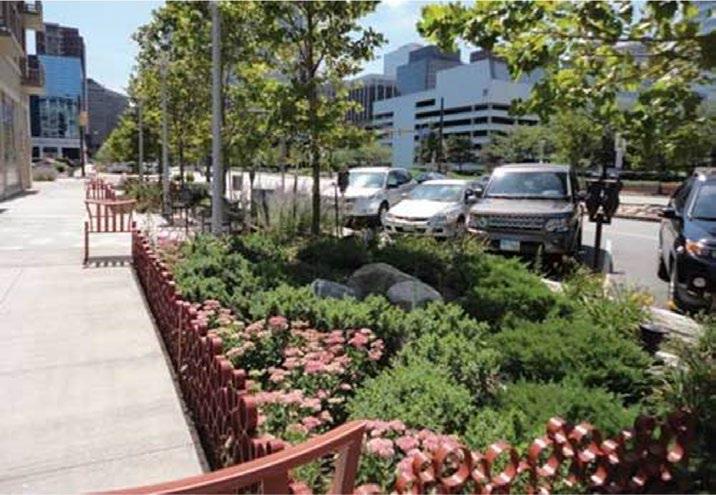
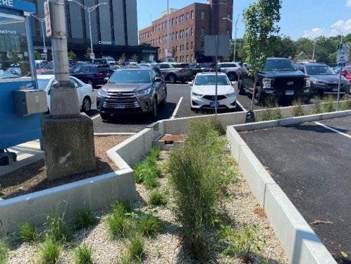
• Green stormwater infrastructure (GSI) installations on public and institutional properties (parking lots, driveways, roofs, at existing outfalls, etc.)
• GSI within the municipal right-of-way (i.e., “Green Streets”)
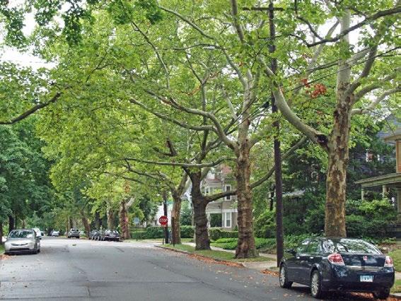
• Tree planting and enhancement of urban tree canopy
• Riparian, stream, and floodplain restoration
• Land conservation to protect or preserve land in a natural or undeveloped state
• Walking paths and trails to connect restored riparian/floodplain areas, schools, institutional facilities, and landscapes.
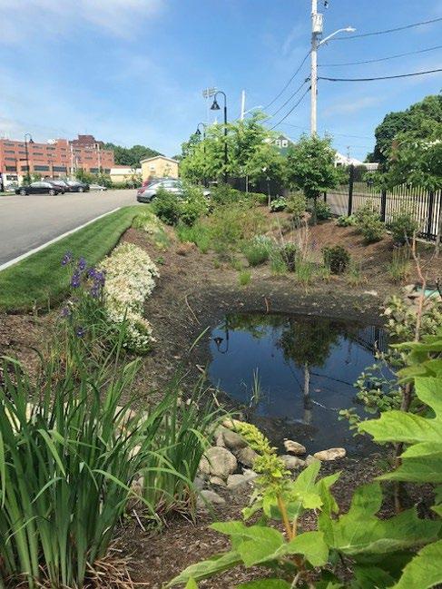
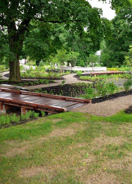
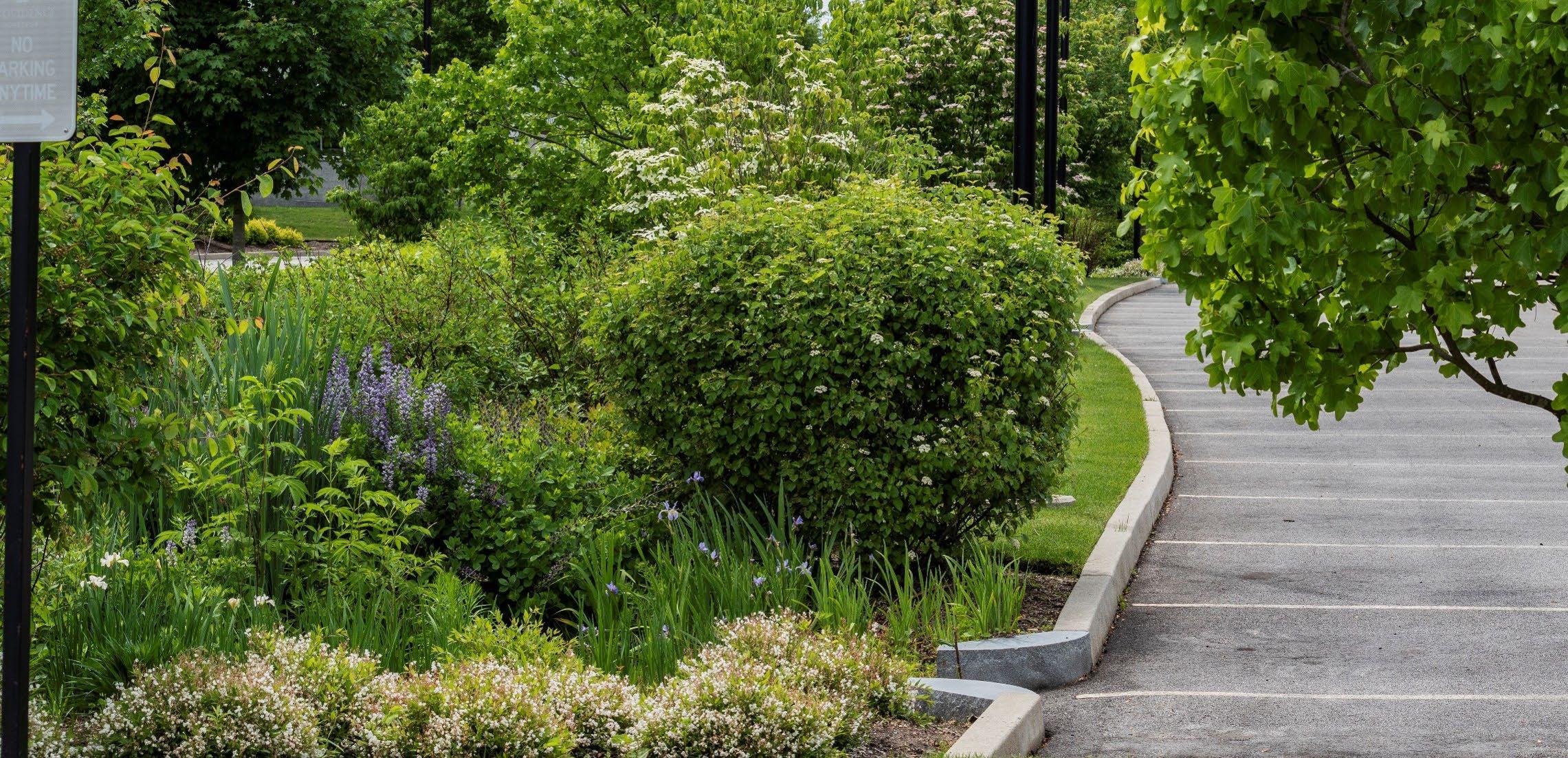
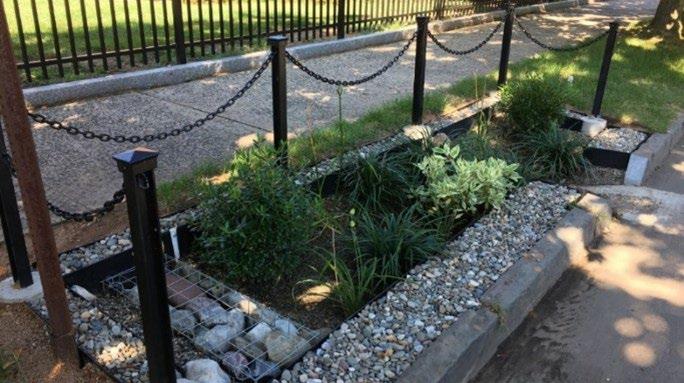
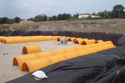
GSI practices that have been shown to be appropriate within the City of Hartford and other areas of the watershed based on cost, maintenance, and effectiveness were considered. These included various types of bioretention systems (bioswales, rain gardens, tree box systems), stormwater wetlands and ponds, subsurface detention/retention systems, rainwater harvesting, green roofs, and infiltration systems where soil and groundwater conditions allow.
Geographic information system (GIS) infrastructure and site data were compiled from available sources for the lower, developed North Branch Park River subwatersheds in Hartford, West Hartford, and Bloomfield. Data sources included the watershed municipalities, the Metropolitan District (MDC), Capitol Region Council of Governments, and statewide GIS data layers. The information gathered consisted of:
• MDC and municipal storm, sanitary, and combined sewer system mapping
• Public and institutional parcel information
• Site data and mapping to help inform GI design including soil type, impervious areas, tree canopy, etc.
• Existing GSI or other stormwater treatment systems and planned stormwater retrofits to meet MS4 Permit impervious area reduction goals or other objectives
• Ongoing and planning capital improvement projects.
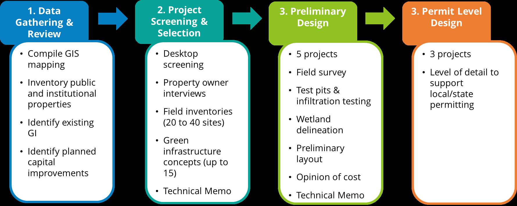
A desktop screening-level review was performed to identify potential green infrastructure opportunities on public sites, within the public right-of-way, on institutional properties, and at major outfalls within the project area. The screening process enabled the project team to systematically identify potential green infrastructure project sites that were not originally identified in the 2010 watershed management plan. The desktop screening made use of the mapping and GIS layers compiled in the data gathering and review process to identify sites within the project area with the strong potential for green infrastructure implementation. The screening-level review considered land ownership, physical site characteristics (soils infiltration potential and depth to groundwater), land use, impervious cover, storm drainage and combined sewer systems, and water quality impairments.
The desktop screening process identified approximately 90 parcels and locations for possible green infrastructure implementation projects. These were reviewed with the Project Partners and Project Advisory Committee, as well as through interviews with property owners (Hartford, West Hartford, Bloomfield, MDC, University of Hartford, and others), to assess potential support for green infrastructure projects on these sites.
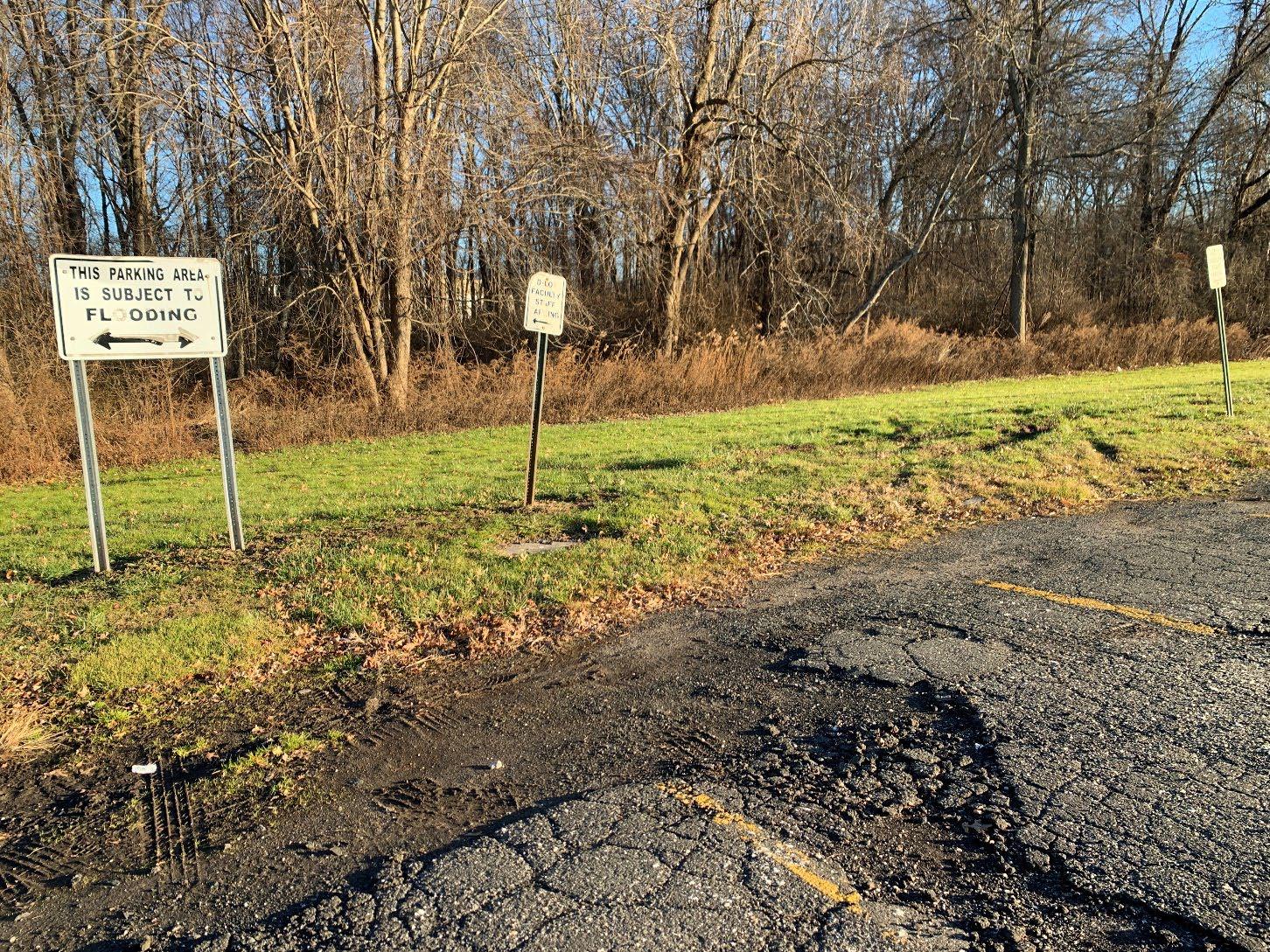
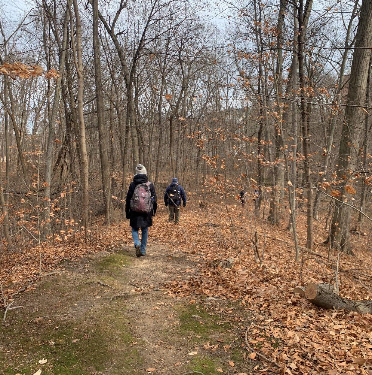
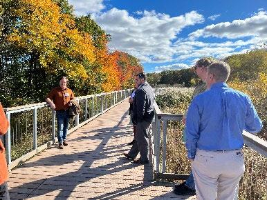
Field inventories were conducted on December 14 and 15, 2023 of the approximately 90 sites identified from the desktop screening process. The purpose of the field inventories was to confirm the physical feasibility of green infrastructure and to inform site selection and project designs. The site visits were used to confirm on-site and adjacent land use and development characteristics, impervious surfaces, drainage patterns, the presence of utilities, areas suitable for potential retrofits, and site constraints such as mapped lowpermeability soils or evidence of shallow groundwater or bedrock that could limit the feasibility of infiltration practices. Visual observations were recorded in a GIS-based field form.
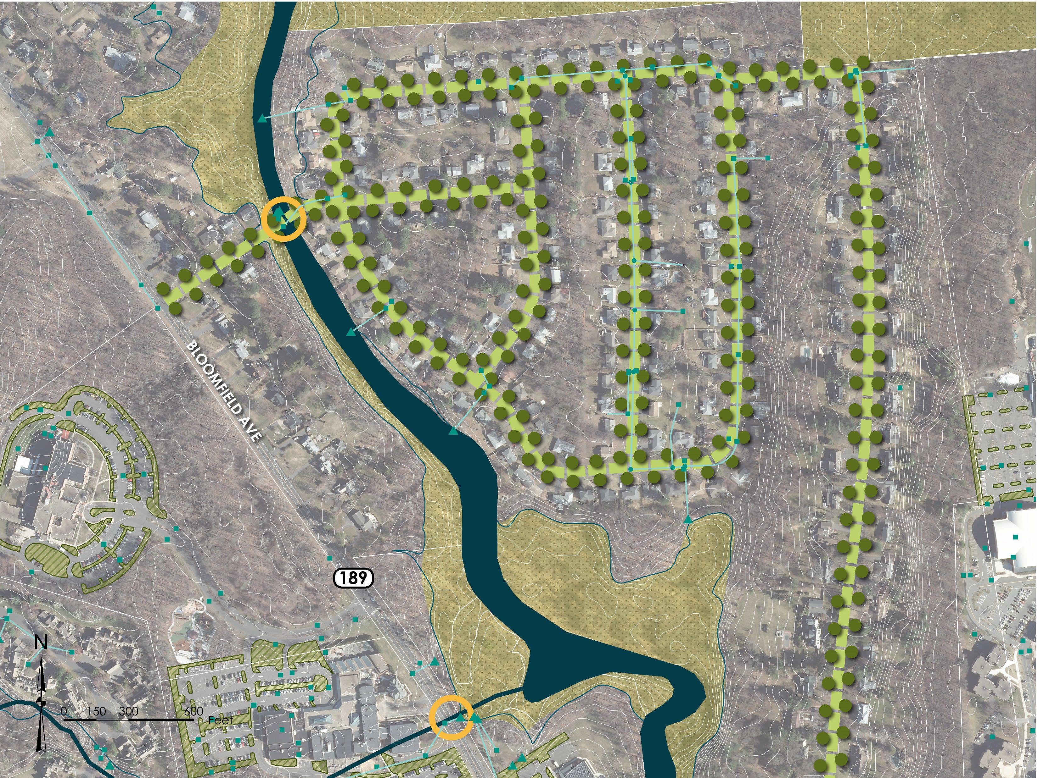
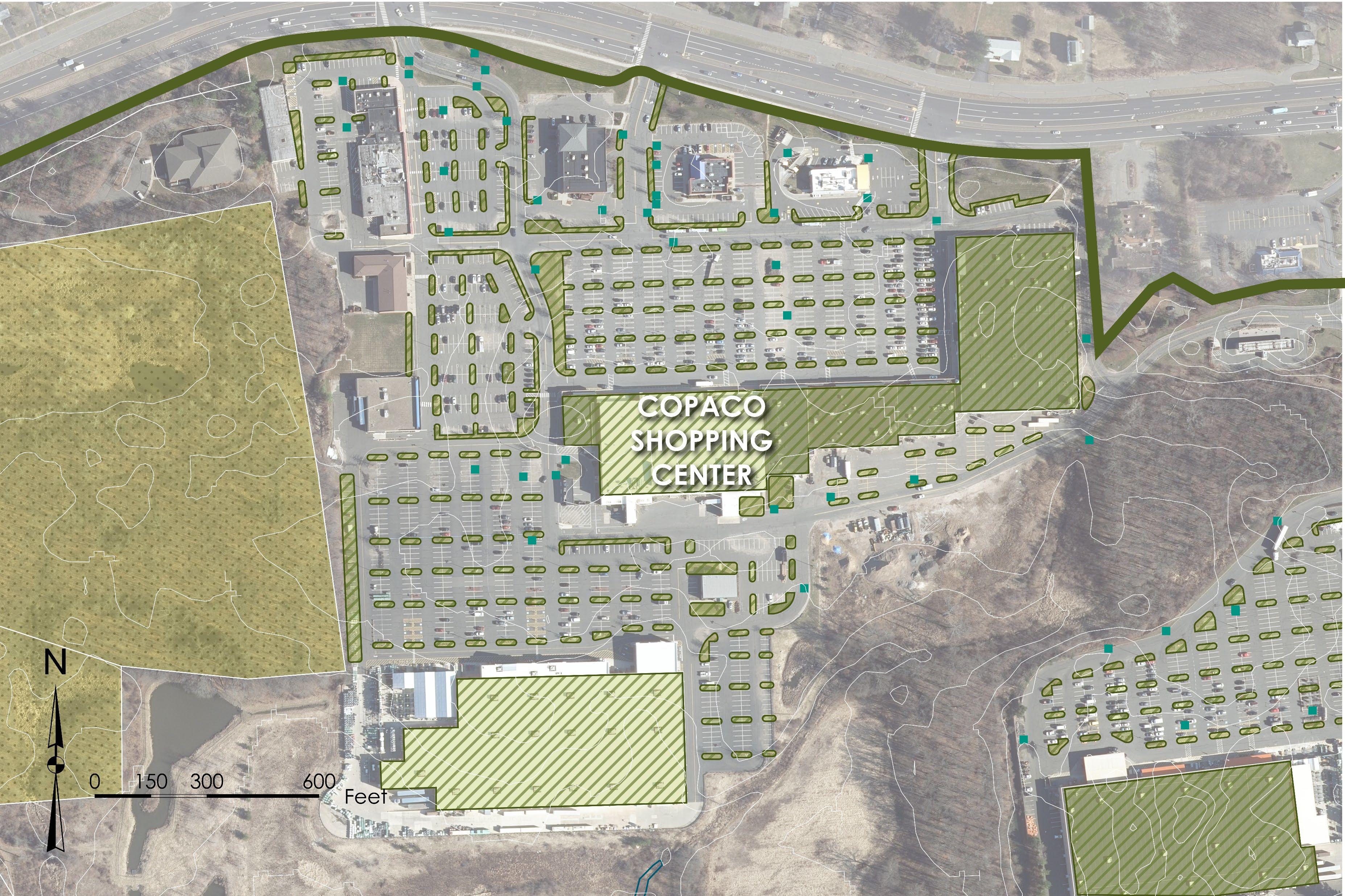
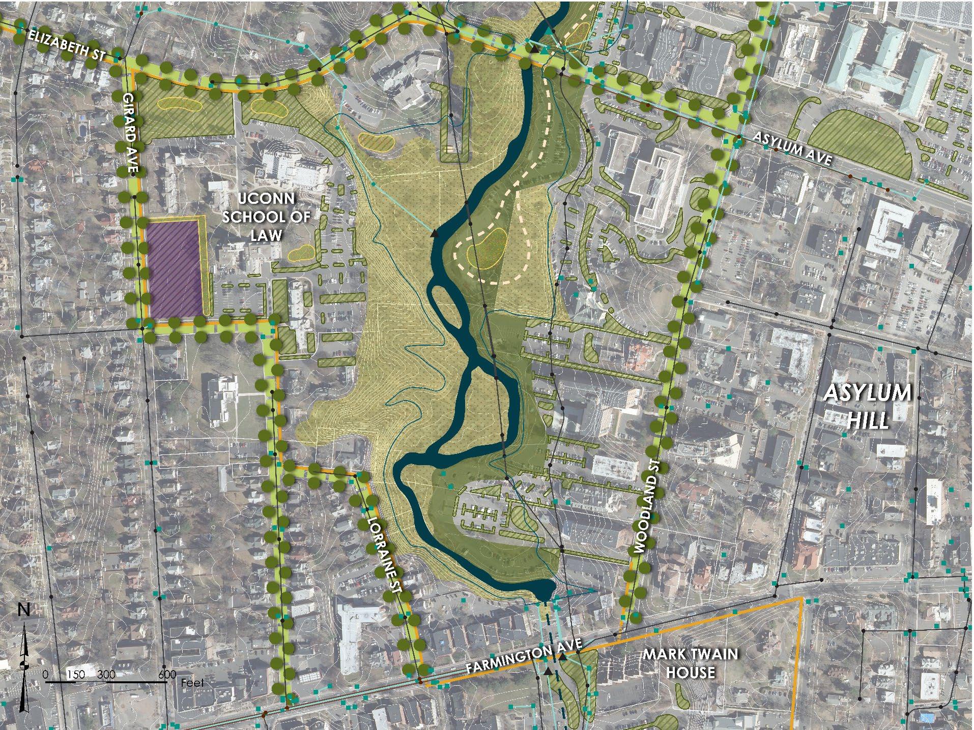
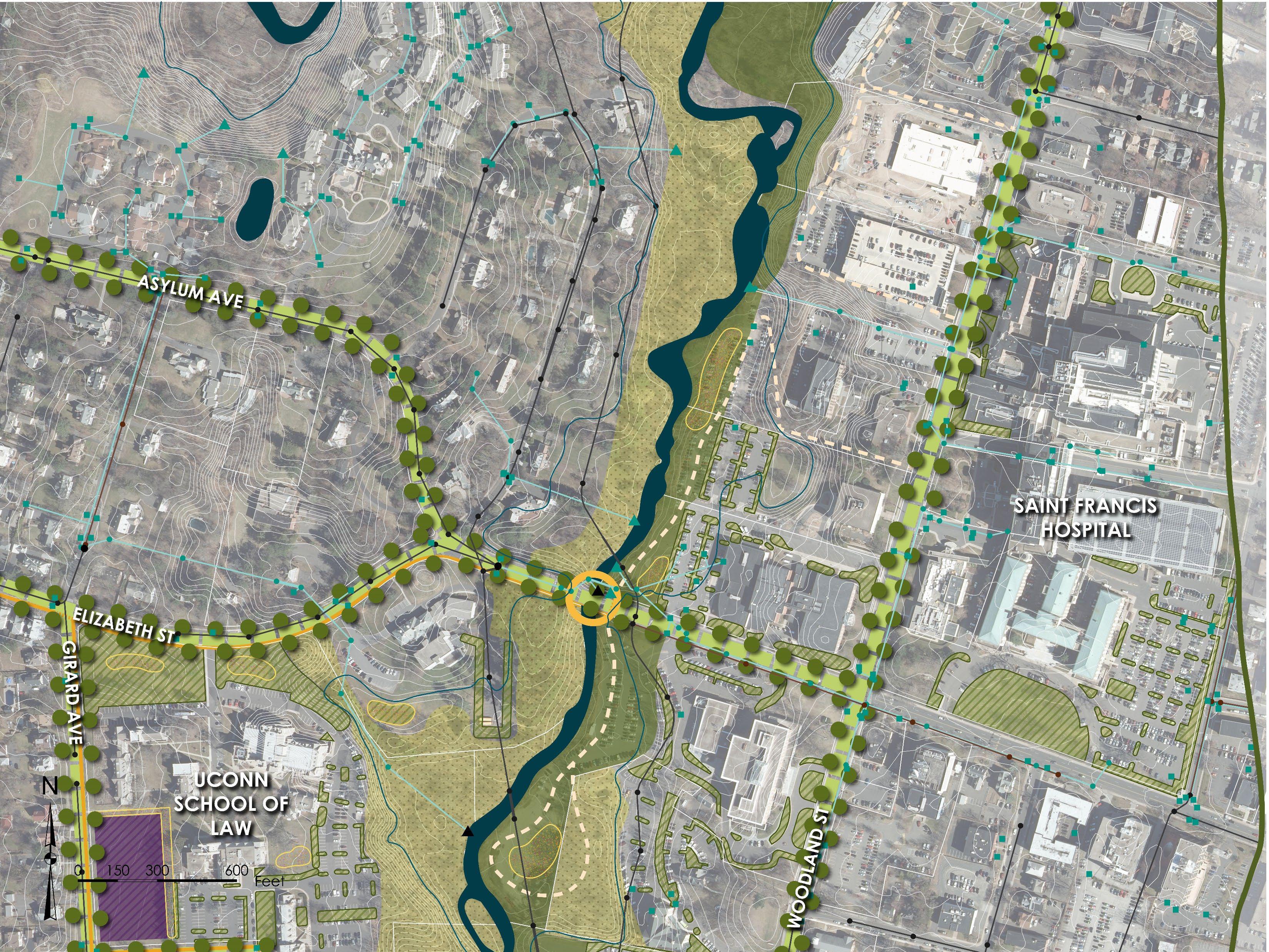
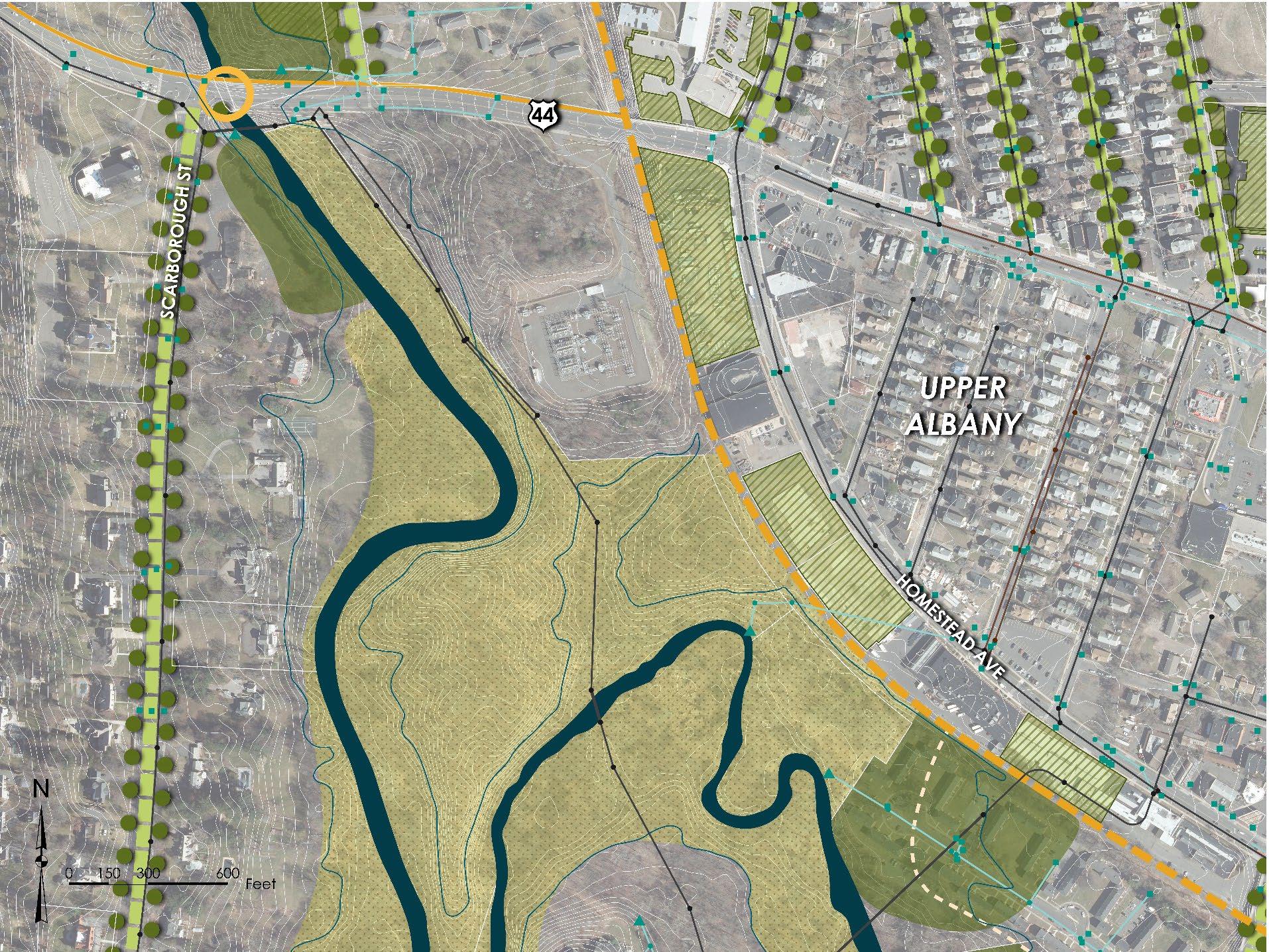
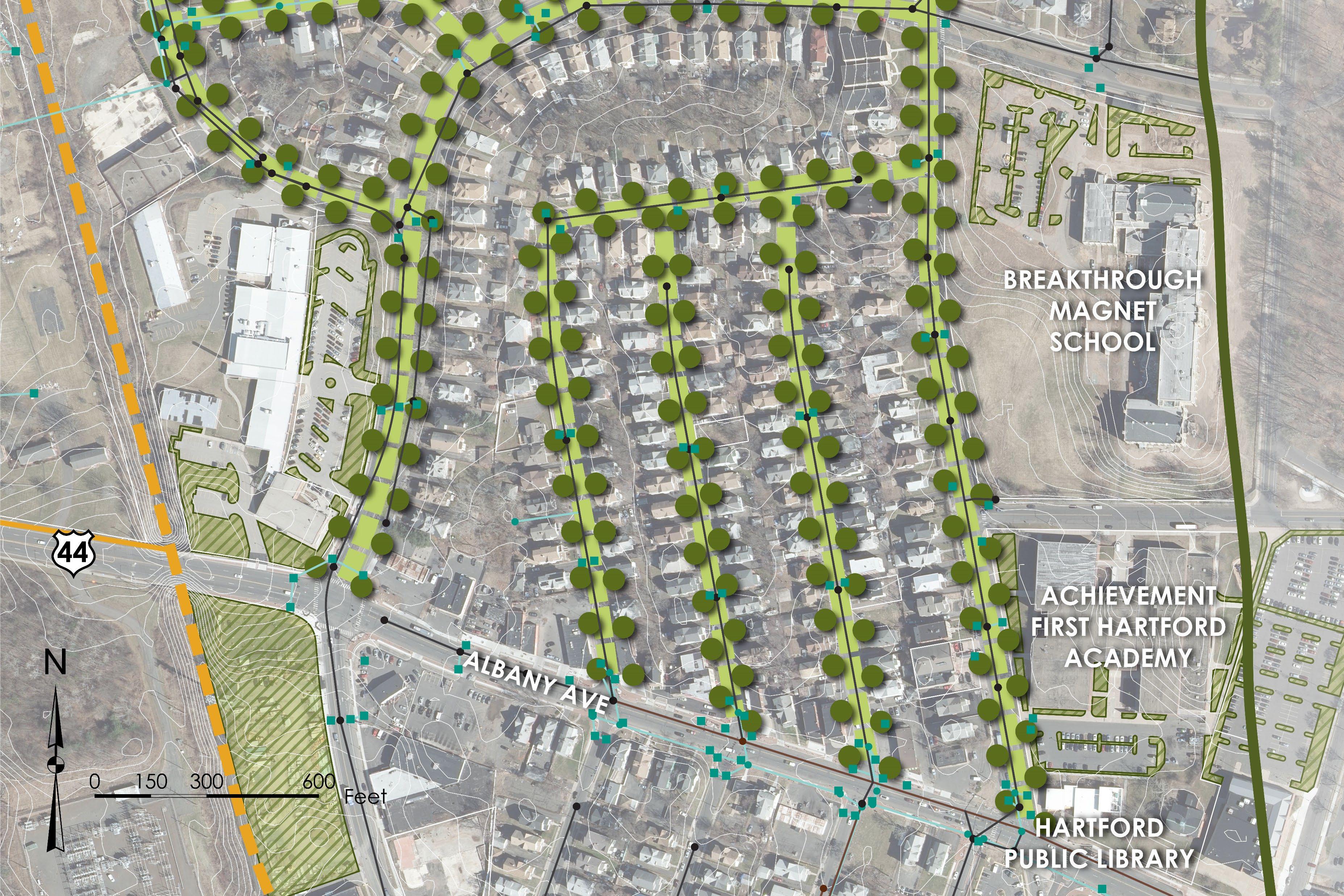
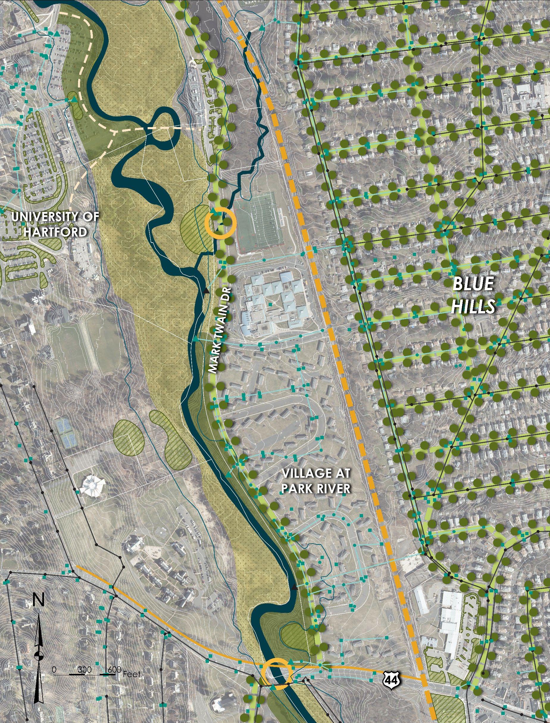
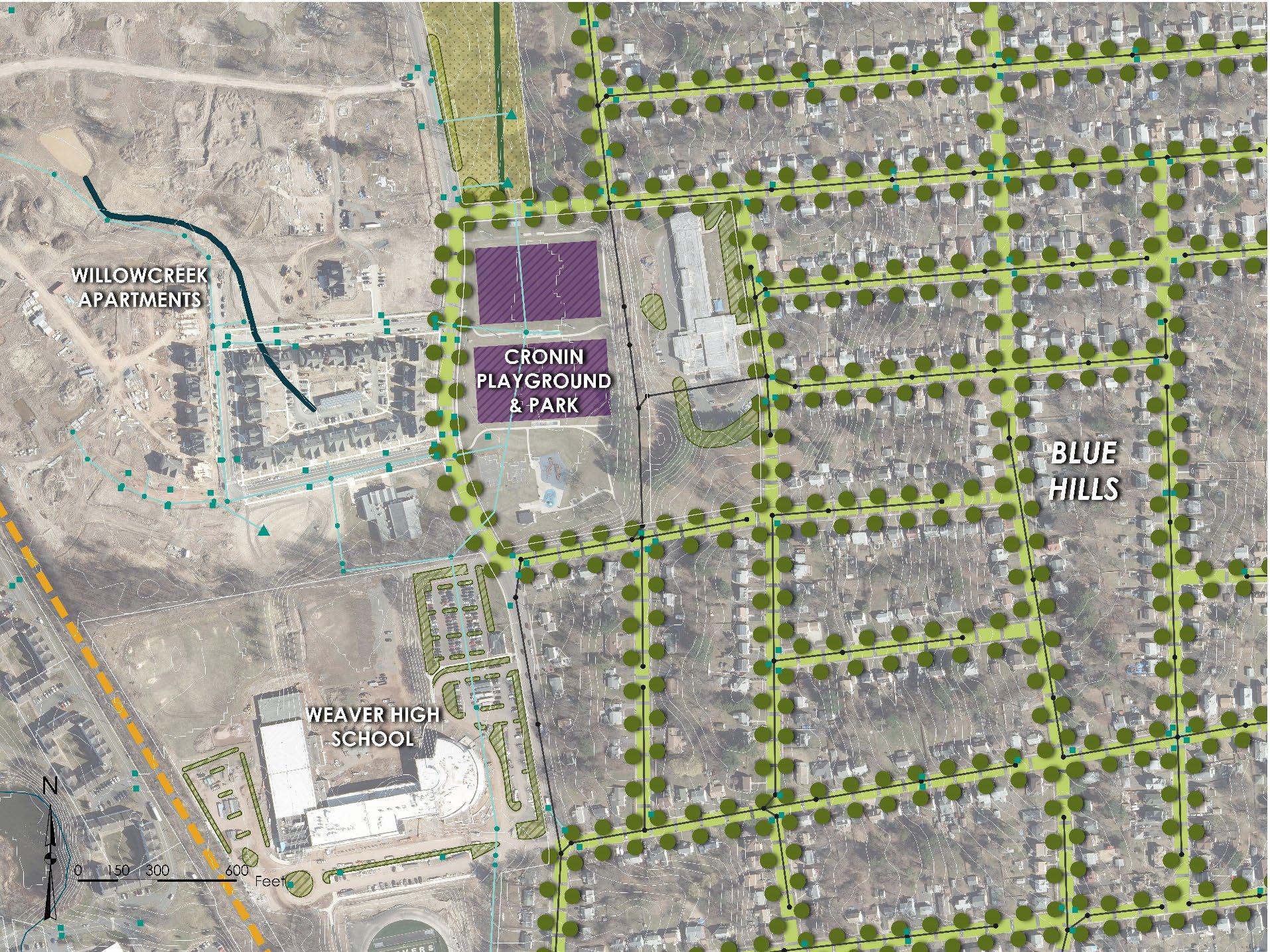
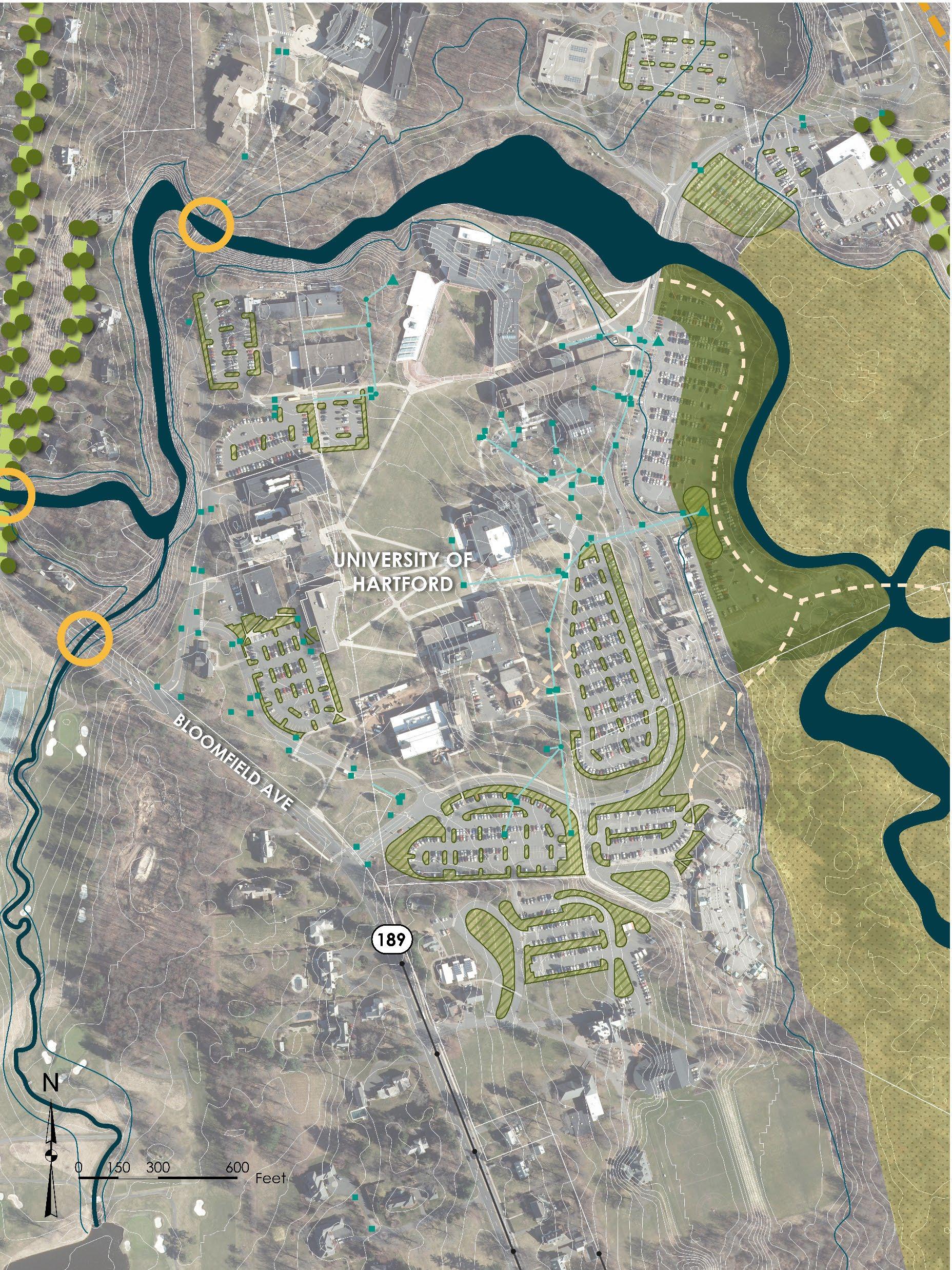
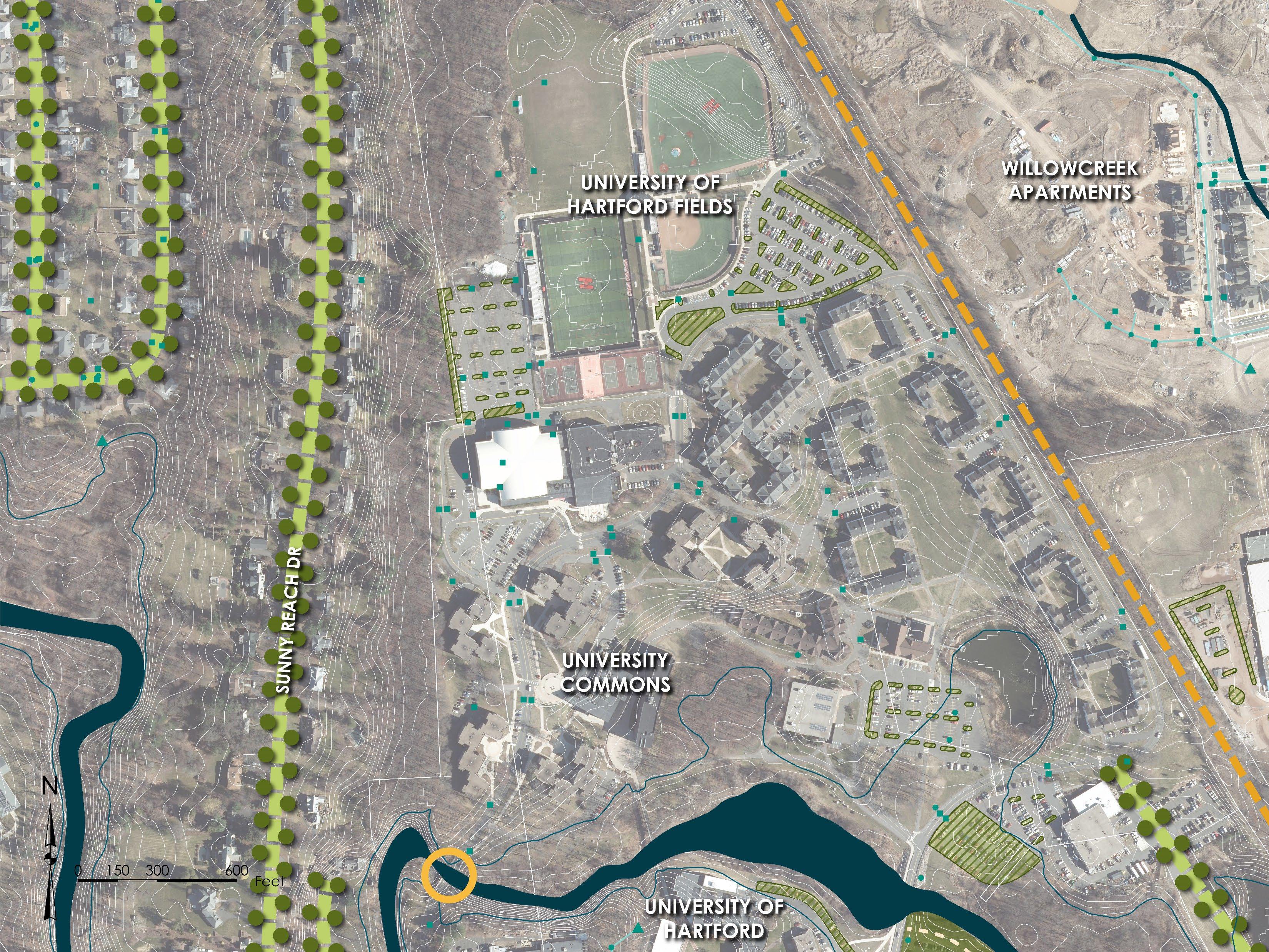
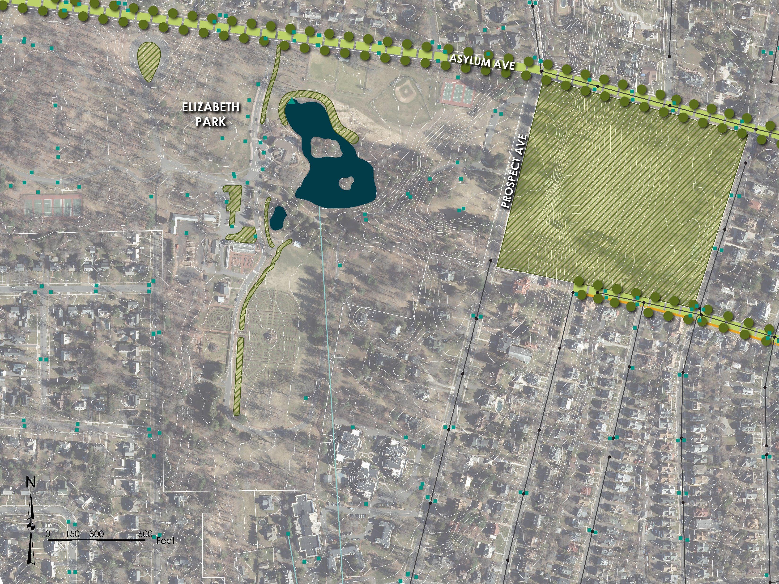
Site and neighborhood scale green infrastructure concepts were developed for locations where field inventories and feedback from property owners suggest potential for effective green infrastructure implementation. These concepts provide a high-level vision for green infrastructure – parcel-based GSI, green streets, riparian and floodplain restoration, land conservation, etc. – within the North Branch Park River subwatershed. Plan view concept graphics were developed for the overall subwatershed to show the application of green infrastructure typologies or strategies at the subwatershed scale. More detailed concept graphics were developed at the site and neighborhood scale, organized into 13 different “focus areas.”
Preliminary designs were developed for five (5) priority projects selected from the green infrastructure concepts. Project concepts
Watershed field inventories
in December 2023
that were advanced to preliminary design were selected based on feedback from the Project Partners, Project Advisory Committee and community engagement process. The preliminary designs include a preliminary layout plan, order of magnitude opinion of construction costs, required permits and approvals, and a brief design narrative.
Permit level designs were then developed for the three (3) highest priority green infrastructure projects selected from the preliminary design phase in collaboration with the Project Partners and Project Advisory Committee. Permit level designs are intended to support the local, state, and/or federal permitting process and include design drawings, an updated design narrative, updated cost estimates, and required permits and approvals.
The following sections present concept, preliminary, and permit-level designs for selected green infrastructure projects in the North Branch Park River subwatershed.
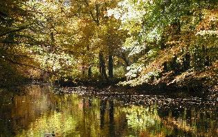
The area along the North Branch Park River, which includes the floodplain, riparian area, and adjacent uplands, is a key integrating feature for green infrastructure.
A floodplain is the area of land next to a river or stream that is susceptible to being inundated by floodwaters. Floodplains provide important social, economic and ecological functions such as floodwater storage and movement, groundwater recharge, water quality protection (trapping of sediment and nutrients), and wildlife and fish habitat. Floodplains are also places where people, human structures, and critical transportation infrastructure can be vulnerable to disruption and damage.
The regulatory floodplain, also referred to as the flood hazard area or zone, is the flood prone area adjacent to a river or stream defined by the return period of its inundation. For example, the 100-year floodplain corresponds to the area inundated by the flood with a return period of 100 years or a 1 percent chance of occurring in any given year (1 percent Annual Exceedance Probability).
The adjacent figure shows the 100-year and 500-year regulatory floodplains, as mapped by the Federal Emergency Management Agency (FEMA), for the North Branch Park River subwatershed.
Riparian Area & Riparian Corridor
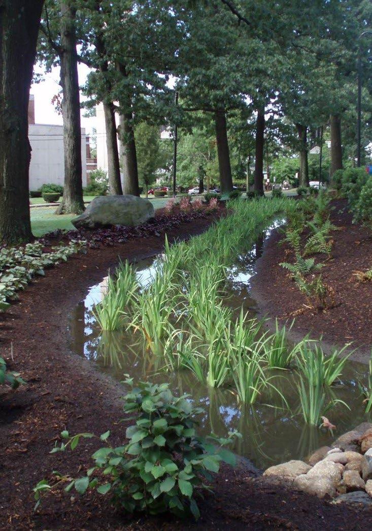
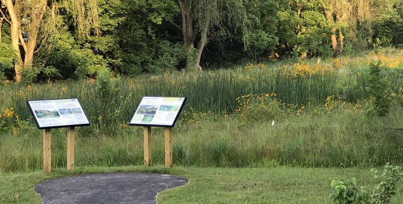
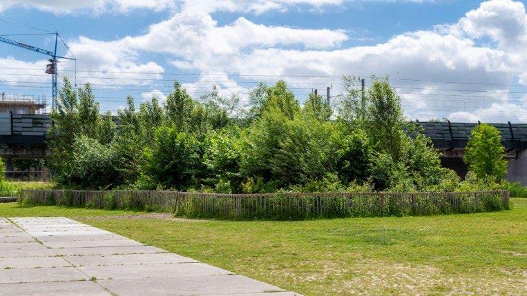
Riparian areas are the transition zone between terrestrial and aquatic systems and typically include streambanks, floodplains, wetlands and other systems adjacent to rivers and streams. Riparian areas characteristically have high water tables and are subject to periodic flooding. Healthy riparian areas (i.e., characterized by stable, healthy vegetation) have high ecological diversity, can maintain or improve water quality, and have both recreational and economic benefits.
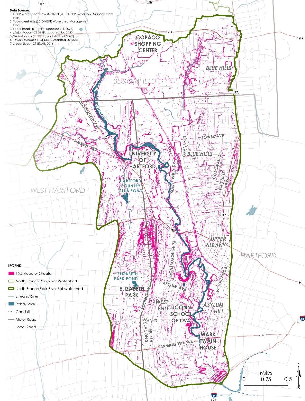
The riparian corridor encompasses riparian areas, as well as adjacent upland areas needed to protect or restore riparian function. For example, steep erodible slopes that could adversely affect the riparian area or the stream are included in the riparian corridor (see adjacent figure for steep slope areas along the North Branch Park River).
The management goal for riparian corridors is to maintain or restore the area to a vegetated condition to help filter pollutants and to protect riparian habitat and species. Mitigation measures can be located within the riparian corridor to protect water quality and riparian values.
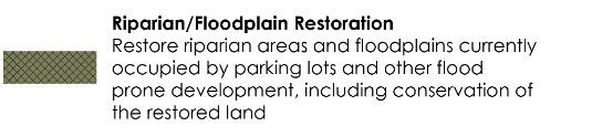
Restore riparian areas and floodplains currently occupied by parking lots and other flood prone development to re-establish natural ecological system processes and functions (water quality, habitat, flood reduction, etc.). Restoration of these areas would involve converting portions of the existing parking lots to a more natural condition and function by removing the man-made infrastructure, removing non-native vegetation, amending the soils, and planting native trees and shrubs. Other modifications to the streambanks, riparian area, and floodplain may be warranted to re-connect the stream to its floodplain and restore lost hydrologic function and habitat.
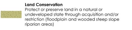
Protect or preserve land in a natural or undeveloped state through acquisition and/or conservation easement or other type of conservation restriction. Target existing undeveloped parcels along riparian corridors and in headwater areas, as well as areas proposed for riparian and floodplain restoration.
• Loss of existing parking and future development potential
• Voluntary cooperation of property owners
• Strategies and incentives to reduce parking and other impervious cover such as shared parking, stormwater user fee and credit system, and structured parking
LAND CONSERVATION OF FLOODPLAIN, RIPARIAN CORRIDOR, AND WOODED STEEP SLOPES
FLOODPLAIN AND RIPARIAN CORRIDOR, INCLUDING WOODED STEEP SLOPES
FLOODPLAIN RESTORATION OF EXISTING PARKING LOTS
RIPARIAN/FLOODPLAIN RESTORATION OF EXISTING PARKING LOTS
Retrofit existing impervious surfaces with bioswales, rain gardens, infiltration systems, green roofs, and other green stormwater infrastructure (GSI) practices. Numerous GSI retrofit opportunities exist on public and institutional properties within the North Branch Park River subwatershed including parking lots, schoolyards, and along roads (green streets). Opportunities also exist for installation of larger subsurface storage and infiltration systems below athletic fields and parking lots.
Several areas of the watershed with combined sewers are slated for future sewer separation (e.g., Granby Street and Blue Hills neighborhood), creating the opportunity to incorporate GSI into the right-of-way (green streets) as part of the sewer separation and GSI treatment of new separated stormwater discharges that will serve these areas.
• Voluntary cooperation of property owners
• Combined sewers in a large portion of the subwatershed. MDC currently prohibits the use of open-bottom stormwater infiltration systems in combined sewer areas due to concerns about groundwater potentially entering the combined sewer system through stormwater infiltration systems.
• Portions of the watershed are underlain by soils with low infiltration capacity (clay soils) and a high groundwater table, which are challenging site conditions for implementation of infiltration-based GSI. This underscores the importance of careful GSI selection and design.
• Strategies and incentives to reduce impervious cover such as stormwater user fee and credit system


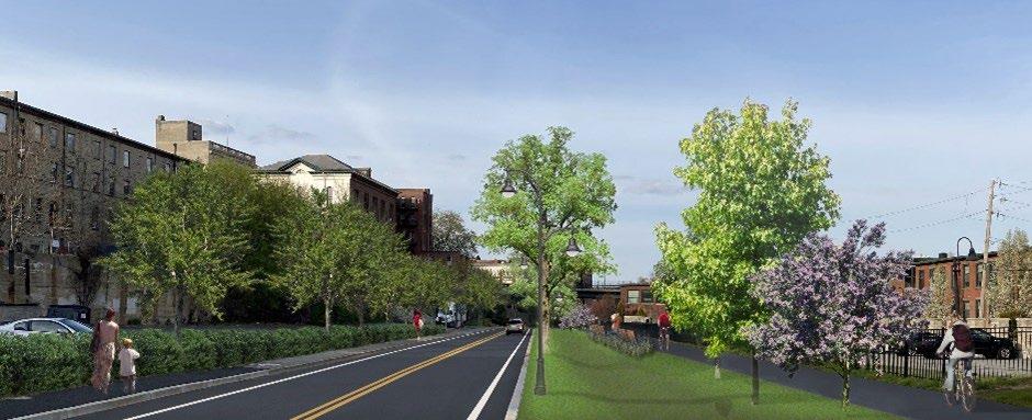
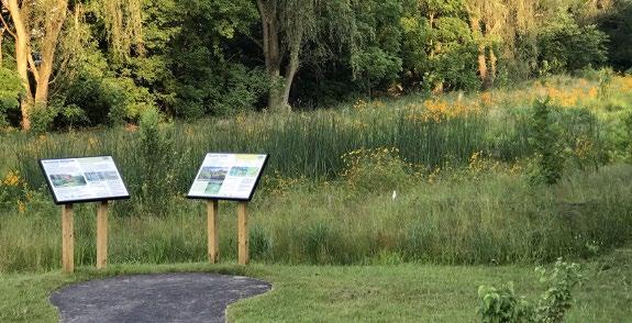
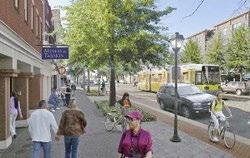
Create walking paths and trails within restored riparian/floodplain areas to connect area schools, institutional facilities, and landscapes to the river corridor and to the proposed Hartline multi-use trail. Boardwalks could be used within the restored floodplain to elevate the walking paths above the flood elevation.
Existing sidewalks, as well as new side paths and bicycle lanes added along existing roads, could provide connections between the walking path/trail network and existing or proposed green spaces in the watershed. The proposed walking paths/trails and green streets can also serve as cooling corridors by providing shaded routes for walking and bicycling.
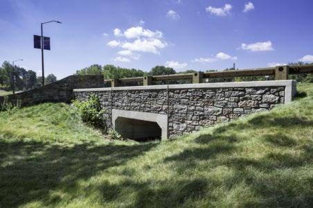
There are numerous road crossings (culverts and bridges) of the North Branch Park River and its tributaries. These crossings have the potential to restrict wildlife (terrestrial and aquatic) passage, restrict flood flows and act as choke points for trees and debris, and contribute to erosion and degraded water quality. The road-stream crossings in the watershed should be evaluated for potential upgrade/replacement and related stream restoration.
• Voluntary cooperation of property owners
• Public concern over proposed walking paths/ trails
• Engineering and fluvial geomorphic evaluation of river and road-stream crossings
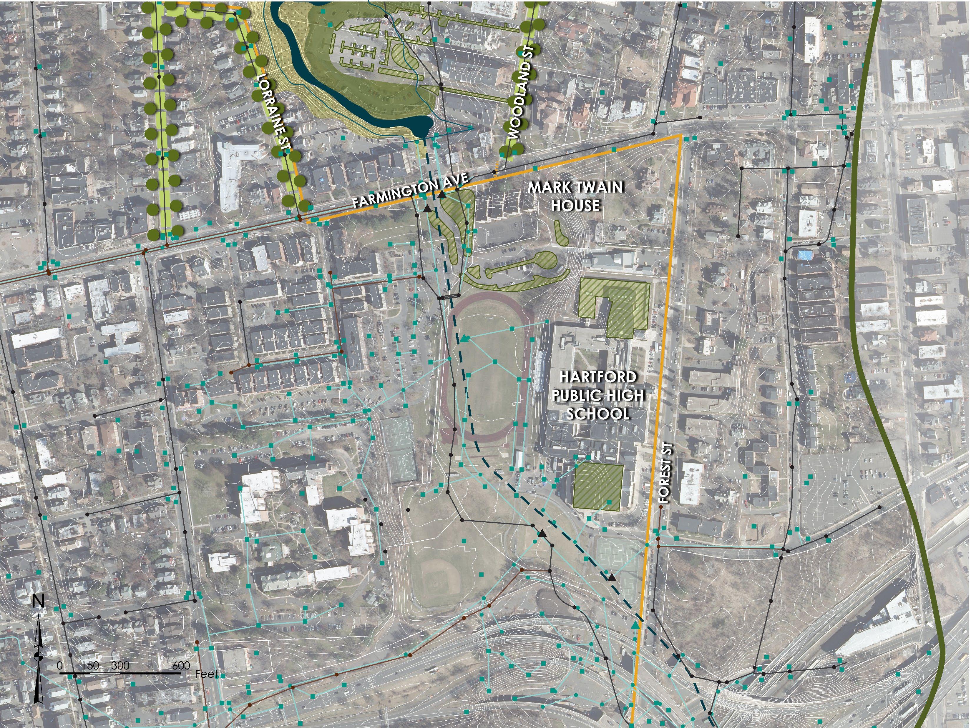

CLEMENS PLACE


HARRIET BEECHER STOWE CENTER

SUBSURFACE STORMWATER STORAGE


CONNECTICUT MUSEUM OF CULTURE AND HISTORY


CLASSICAL HIGH SCHOOL

CONNECTICUT COMMUNITY COLLEGES


WALKING TRAILS / LOOP
POLLINATOR GARDEN
FLOODPLAIN RESTORATION WITHIN EXISTING PARKING LOTS


HARTFORD INTERNATIONAL UNIVERSITY FOR RELIGION AND PEACE

GREEN STORMWATER INFRASTRUCTURE (TYP)
GREEN STREETS (TYP)
LAND CONSERVATION
FLOODPLAIN RESTORATION WITHIN EXISTING PARKING LOTS

WOODSIDE CIRCLE GOODWIN CIRCLE


LAND CONSERVATION
SUBSURFACE STORMWATER STORAGE
CONNECTICUT MUSEUM OF CULTURE AND HISTORY
EVALUATE EXISTING STREAM CROSSING (TYP)
CSO N-9
CLASSICAL HIGH SCHOOL
CONNECTICUT COMMUNITY COLLEGES

FLOODPLAIN
PROPOSED SIDE PATH


EVERSOURCE ELECTRICAL SUBSTATION


FLOODPLAIN RESTORATION WITH FUTURE SITE REDEVELOPMENT
FUTURE HARTLINE MULTIUSE TRAIL


HANDEL PERFORMING ARTS CENTER AT UNIVERSITY OF HARTFORD


GSI


GREEN STORMWATER INFRASTRUCTURE WITH BROWNFIELD REDEVELOPMENT
FUTURE HARTLINE MULTIUSE TRAIL


WALKING TRAIL


UNIVERSITY HIGH SCHOOL OF SCIENCE & ENGINEERING

GSI WITHIN UNIVERSITY HIGH SCHOOL PARKING LOT
FLOODPLAIN RESTORATION OF UHART PARKING LOT
GSI TO TREAT FUTURE SEPARATE STORM DRAIN OUTFALL

UNIVERSITY OF HARTFORD MAGNET SCHOOL
CSO N-2

GSI WITHIN PARKING LOTS (TYP)
LAND CONSERVATION
GREEN STREET ALONG MARK TWAIN DRIVE
FUTURE HARTLINE MULTI-USE TRAIL

EVALUATE EXISTING RIVER CROSSING (TYP)

ANNIE FISHER MONTESSORI MAGNET SCHOOL


ONGOING PHASED REDEVELOPMENT WITH LID/GSI

CSO N-4
FLOODPLAIN RESTORATION
GSI TO TREAT FUTURE SEPARATE STORM DRAIN OUTFALL
LAND
GSI
GSI


GREEN STREETS IN FUTURE SEWER SEPARATION AREA

SUBSURFACE STORAGE SYSTEM
BENEATH ATHLETIC FIELDS TO MANAGE STORMWATER FROM FUTURE SEPARATE STORM DRAINAGE SYSTEM


FUTURE HARTLINE MULTI-USE TRAIL


INTEGRATE GSI INTO FUTURE PARK IMPROVEMENTS CONSISTENT WITH UPDATED MASTER PLAN FOR
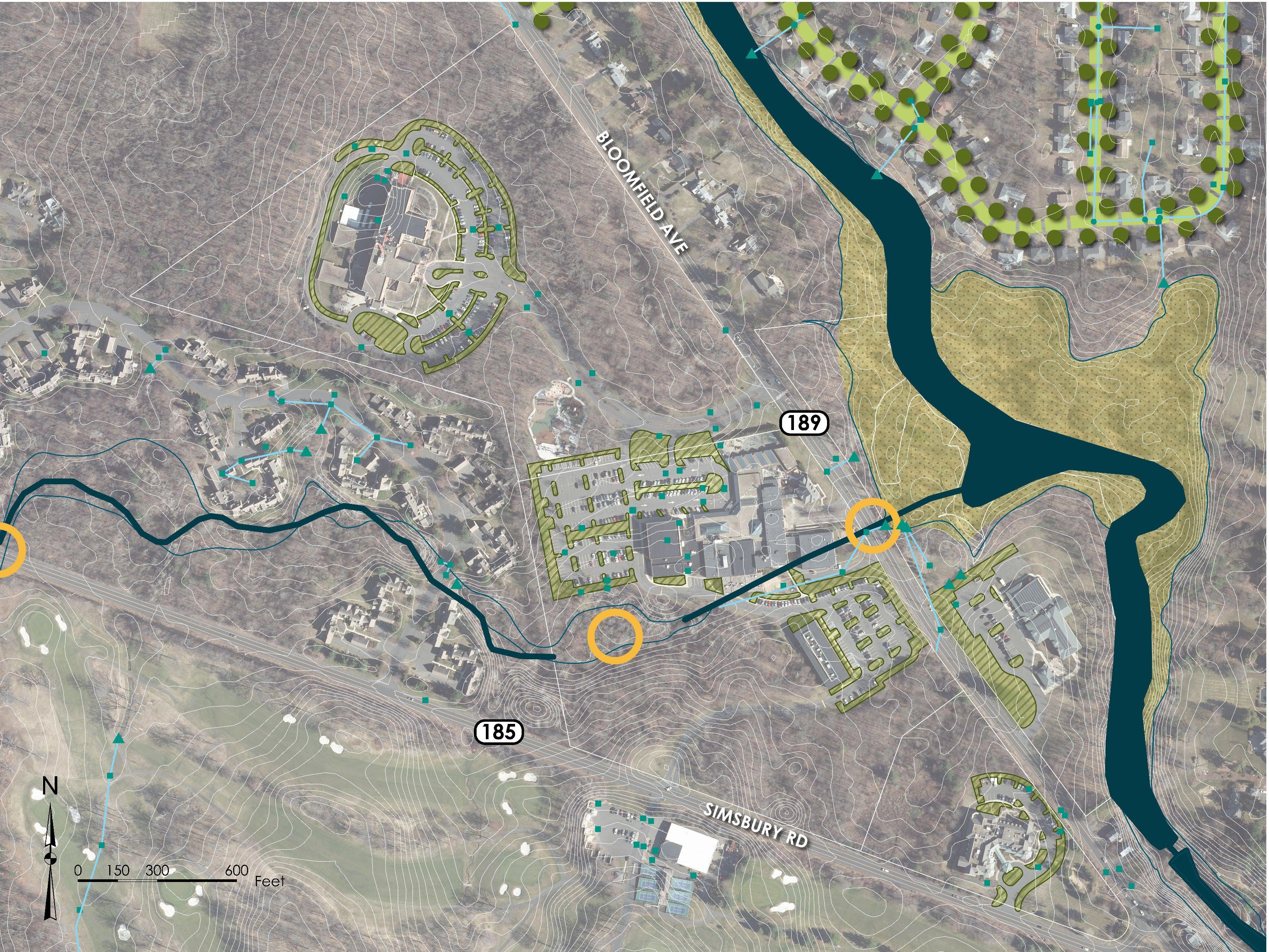

HEBREW CENTER FOR HEALTH & REHABILITATION


GSI WITHIN PARKING LOTS (TYP)
EVALUATE EXISTING STREAM CROSSING (TYP)

JEWISH COMMUNIY CENTER CAMPUS

GSI WITHIN PARKING LOTS (TYP)

PORTAGE ROAD AND SUNNY REACH DRIVE NEIGHBORHOOD

LAND


BROOKDALE WEST HARTFORD