


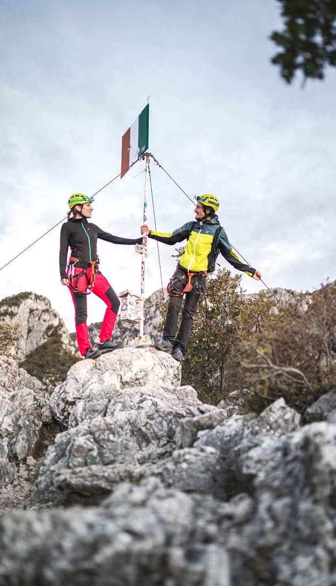
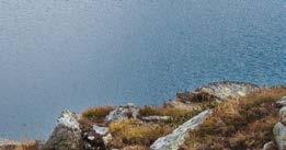
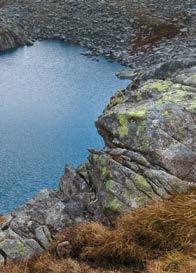
10 ROUTES


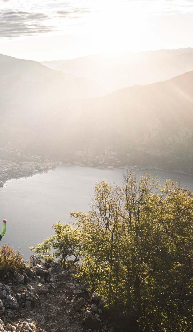
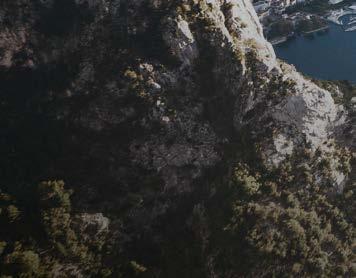
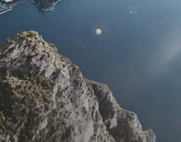
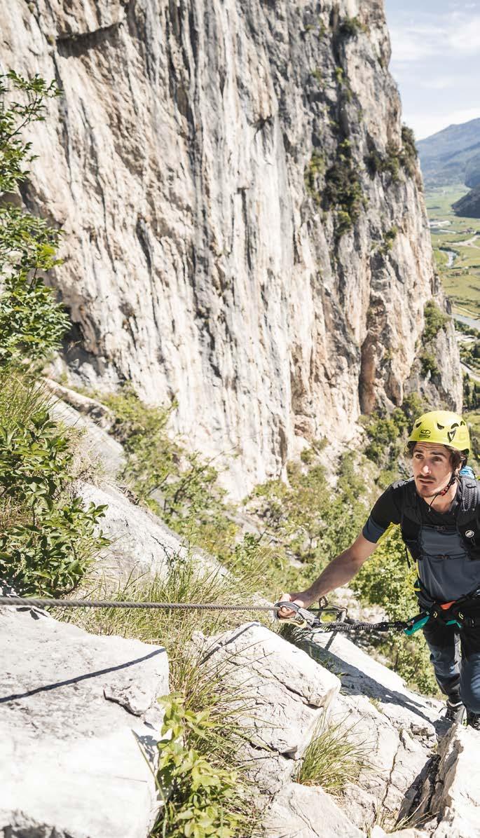
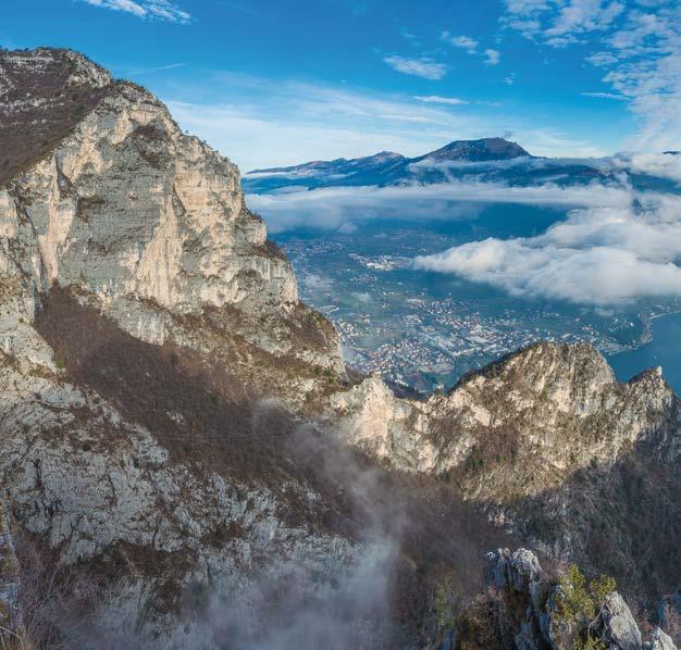
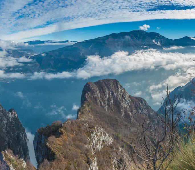
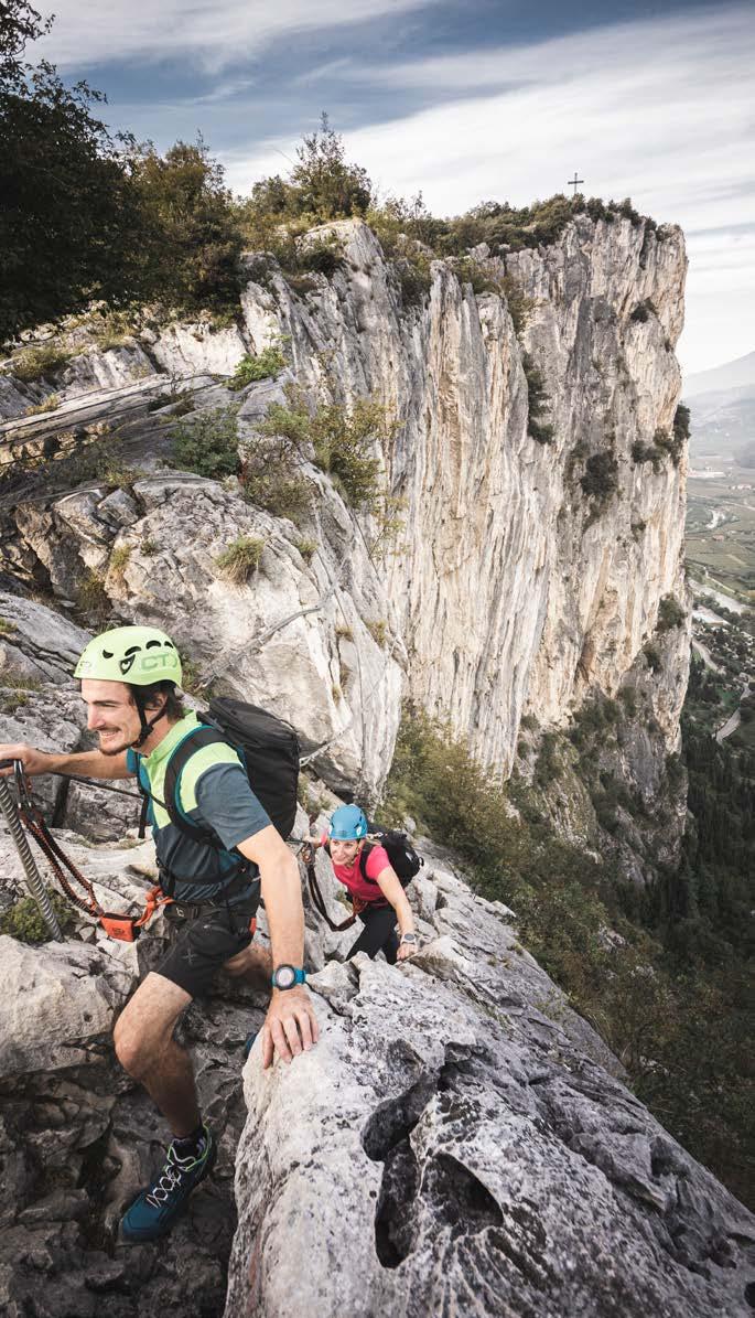
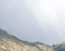
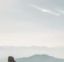
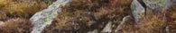
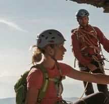
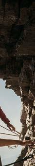
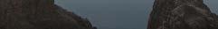
Ci sono pochi posti al mondo dove le vie ferrate sono raggiungibili senza lunghe salite di avvicinamento. O dove anche i bambini si possono cimentare in sicurezza. O dove il brivido del verticale si può provare tutto l’anno o quasi, su ben 10 ferrate concentrate in pochi chilometri.
Uno di questi posti è il Garda Trentino. gardatrentino.it/viaferrata
Es gibt nur wenige Orte auf der Welt, wo die Klettersteige ohne lange Zustiege erreichbar sind. Wo auch die Kinder sich in aller Sicherheit im Klettern versuchen können. Wo (fast) das ganze Jahr auf sage und schreibe 10 Klettersteigen innerhalb weniger Kilometer ein wohliger Nervenkitzel wartet. Einer dieser Orte ist das Garda Trentino.
There are few places in the world where vie ferrate can be reached directly, without long approach climbs. Or where children can also take part in the experience in absolute safety. Or where you can feel the thrill of the sheer drop almost all year round, on no less than 10 vie ferrate, all located in the space of a few kilometres. One of these places is Garda Trentino.


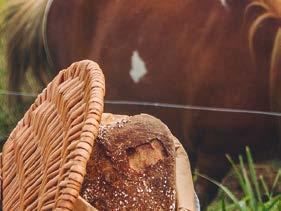
È l’essenza del Garda Trentino: la combinazione unica di attività all’aria aperta e stile italiano, di adrenalina e vivacità, di relax in compagnia e buon cibo.
È nel nostro DNA, dalle sponde del lago di Garda alle Dolomiti di Brenta, passando per Ledro, Comano, Valle dei Laghi e Val di Gresta. VIVI L’ITALIAN OUTDOOR.
Es ist die Essenz des Garda Trentino: eine unvergleichliche Mischung aus Aktivitäten im Freien und italienischem Flair, aus Adrenalin und Lebendigkeit, aus Entspannung in Gesellschaft und gutem Essen. Es ist in unserer DNA verwurzelt, von den Ufern des Gardasees bis zu den Brenta-Dolomiten, durch Ledro, Comano, das Valle dei Laghi und Val di Gresta. ERLEBE DAS ITALIAN OUTDOOR.
It is the essence of Garda Trentino: an unparalleled blend of outdoor activities and Italian flair, adrenaline and vivacity, relaxation in good company and genuine food. It is deeply rooted in our DNA, from the shores of Lake Garda to the Brenta Dolomites, through Ledro, Comano, Valle dei Laghi, and Val di Gresta. EXPERIENCE THE ITALIAN OUTDOOR.


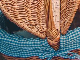
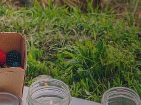
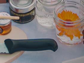
ASCOLTA. ASSAPORA. GUARDA. Dalle rive del lago ai sentieri di montagna, dai vigneti al bosco, dal borgo alla malga: vivi il meglio del Garda Trentino con tante attività esclusive. Prenota subito la tua Garda Trentino Experience.
E con la tua Garda Guest Card hai anche un prezzo speciale!
HÖR ZU. SCHMECKE. BEOBACHTE.
Von den Ufern des Sees zu den Bergwegen, von den Weinbergen bis zum Wald, vom Dorf zur Alm: Genieße das Beste vom Garda Trentino mit einer Vielzahl exklusiver Aktivitäten. Buche sofort dein Garda Trentino Experience. Und mit deiner Garda Guest Card erhältst du zudem einen speziellen Preis!
LISTEN. TASTE. OBSERVE. From lakefronts to mountain paths, through vineyards and woods, from quaint villages to alpine pastures: discover the best of Garda Trentino with exclusive activities. Secure your Garda Trentino Experience today. And enjoy a special price with your Garda Guest Card!
gardatrentino.it/experience


GARY SNYDER
Nel Garda Trentino ci crediamo fermamente e scegliamo ogni giorno di prenderci cura della nostra destinazione. È una scelta necessaria, per rendere il territorio in cui viviamo un luogo bello da vivere, a lungo termine o solo per qualche giorno, oggi e in futuro.
Vuoi aiutarci anche tu?
BASTA POCO PER FARE LA DIFFERENZA.
Im Garda Trentino glauben wir fest daran und entscheiden uns jeden Tag dafür, uns um unsere Destination zu kümmern. Diese Entscheidung ist notwendig, um die Region, in der wir leben, zu einem schönen, lebenswerten Ort zu machen - heute und auch in Zukunft. Egal, man länger oder nur ein paar Tage hier verweilt.
Möchtest du uns auch helfen?
ES BRAUCHT NICHT VIEL, UM ETWAS ZU BEWEGEN.
We firmly believe this, here in Garda Trentino, and we work hard every day to take care of our region. It is a necessary choice to make the place where we live as beautiful as possible so that it can be enjoyed all life long or even just for a few days, now and in the future.
Would you like to help us, too? IT TAKES LITTLE TO MAKE A DIFFERENCE.
gardatrentino.it/makethedifference
Porta a casa i tuoi rifiuti e gettali nei contenitori differenziati
Lass deinen Müll nicht unterwegs liegen, sondern wirf ihnordnungsgemäß getrennt - in die Abfallbehälter.
Take your waste home and throw it in separate collection bins.
Riduci la plastica:
ci sono tante alternative più sostenibili
Reduziere deinen Plastikkonsum: es gibt viele nachhaltigere Alternativen.
Reduce plastic: there are many more sustainable alternatives now.
Se puoi, spostati a piedi o in bicicletta. Noterai tante cose che in macchina sfuggono!
Gehe so oft wie möglich zu Fuß oder fahre mit dem Fahrrad. Du wirst viele Dinge bemerken, die du im Auto nicht wahrnimmst!
If you can, get around on foot or by bike. You’ll notice many more details that you would miss when travelling by car!
Osserva gli animali da lontano.
Dopotutto, il Garda Trentino è anche casa loro.
Beobachte die Tiere aus der Ferne.
Schließlich ist das Garda Trentino auch ihr Zuhause.
Watch wildlife from afar. After all, Garda Trentino is their home too.
Lascia fiori, sassi e frammenti di storia al loro posto: anche chi verrà dopo di te ne potrà godere.
Lasse Blumen, Steine und Geschichtsrelikte an ihrem Platz: So haben auch diejenigen, die nach dir kommen, etwas davon. Leave flowers, stones and fragments of history in their place: those who come after you will enjoy them too.
Immergiti nella realtà locale e informati sulle tradizioni, sulla cucina e sui prodotti tipici. C’è un universo a km 0 da scoprire.
Tauche ein in das Alltagsleben vor Ort und informiere dich über Traditionen, Küche und typische Produkte. Es gibt ein regionales Universum zu entdecken.
Immerse yourself in the local life and learn about traditions, cuisine and typical products. There’s a whole local world to discover.
Quando esci, spegni la luce e l’aria condizionata e chiudi i rubinetti: energia e acqua sono risorse preziose.
Wenn du nach draußen gehst, schalte das Licht und die Klimaanlage aus und schließe immer die Wasserhähne: Strom und Wasser sind kostbare Ressourcen.
When you leave, turn off the lights and the air conditioning and close the taps: energy and water are precious resources.
Vuoi essere certo che l’itinerario che hai scelto sia aperto? Controlla sempre il nostro sito!
Trovare tutte le informazioni essenziali sulle attività sportive non è mai stato così facile. Nelle nuove tabelle vedi a colpo d’occhio le caratteristiche principali di ciascun percorso e, soprattutto, un aggiornamento in tempo reale su eventuali chiusure lungo il tracciato.
Du möchtest sicher sein, dass die gewählte Route offen ist? Sieh stets auf unserer Webseite nach!
Alle wesentlichen Informationen über sportliche Aktivitäten zu finden, war noch nie so einfach. In den neuen Tabellen siehst du die wichtigsten Eigenschaften jeder Route auf einen Blick und, vor allem, eine Echtzeit-Aktualisierung zu eventuellen Schließungen entlang der Strecke.
Want to be sure that the tour you’ve chosen is open? Keep your eye on our website!
Finding all the essential information about sporting activities has never been so easy. In the new tables you can see the main characteristics of each tour at a glance and, above all, instant updates about any closures along the way.
ARCO MOUNTAIN GUIDE
Parcheggio Caneve – Arco +39 330 567285 info@arcomountainguide.com arcomountainguide.com
CANYON ADVENTURES
Via Giacomo Matteotti, 122 – Torbole sul Garda +39 334 8698666 +39 0464 505406 info@canyonadv.com canyonadv.com
FREEALP MOUNTAIN GUIDE SERVICE
Via Vergolano, 16 – Arco +39 347 3794259 info@freealp.com freealp.com
LOLGARDA
Via Ampola, 3 – Tiarno di Sopra (Ledro) Viale Rovereto, 25 – Riva del Garda +39 328 5486497 info@lol-garda.it lol-garda.it
MMOVE INTO NATURE

Via dei Legionari Cecoslovacchi, 14 – Arco +39 334 2193862 info@mmove.it mmove.it
MOUNTIME OUTDOOR ADVENTURES
Via dei Legionari Cecoslovacchi – Arco +39 334 7734133 info@mountime.com mountime.com
TRENTINOCLIMB
Via Nuova, 7 – Pieve (Ledro) +39 345 4547891 info@trentinoclimb.com trentinoclimb.com


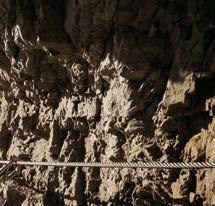
Le vie ferrate presentate in questa brochure e contrassegnate con questo logo, fanno parte dell’OUTDOOR PARK GARDA TRENTINO. Attraverso questo progetto, l’APT e la Pubblica Amministrazione lavorano per garantire, sulle strutture così contrassegnate, uno standard di sicurezza il più elevato possibile, compatibilmente con l’attività che si svolge su terreno naturale e presenta inevitabilmente dei rischi che devono essere autogestiti dai praticanti di detta attività.
Ogni anno professionisti qualificati si occupano di verificare lo stato dell’attrezzatura in parete e di sostituirla dove necessario. In ogni caso, le vie ferrate rimangono collocate in un ambiente naturale.
imprevedibile, esposto a rischi ed eventi meteorologici di ogni tipo. Per questo, sii sempre prudente e adotta tutti gli accorgimenti per garantire la sicurezza tua e dei tuoi compagni di avventura.
Die in dieser Broschüre und mit diesem Logo präsentierten Klettersteige gehören zum OUTDOOR PARK GARDA TRENTINO. +Mit diesem Projekt sorgen der Tourismusverband und die Öffentliche Verwaltung dafür, dass der größtmögliche Sicherheitsstandard nur bei den Klettersteigen garantiert werden kann, die als Teil des Outdoor Park Garda Trentino gekennzeichnet sind.
Jedes Jahr kümmern sich qualifizierte Fachleute darum, den Zustand der Ausrüstung anzukontrollieren, sie gegebenenfalls auszutauschen.
Trotzdem bleiben Klettersteige eine unberechenbare Umgebung inmitten der Natur, die Wetterereignissen jeglicher Art ausgesetzt sind. Deshalb sollte man immer auf der Hut sein und alle nötigen Vorsichtsmaßnahmen ergreifen, um für maximale Sicherheit für sich selbst und seine Gefährten zu sorgen.
The via ferrata presented in this brochure and marked with this logo are part of GARDA TRENTINO OUTDOOR PARK . With this project, the Tourism Board and the Public Administration are working to guarantee, for the infrastructures so marked, the highest safety standards compatible with sport climbing on natural terrain.
Every year, qualified professionals check the condition of the equipment on the via ferrata and replace it where necessary.
In any case, via ferrata are a natural environment, which can be unpredictable and is exposed to all kinds of weather conditions. This is why you should always be careful and adopt all measures required to ensure your own safety and that of your companions.
Le vie ferrate, percorsi attrezzati artificialmente su pareti rocciose per permetterne la salita e/o discesa da parte di escursionisti esperti muniti di specifiche attrezzature che consentano loro di autoassicurarsi e proteggersi dal rischio di caduta dall’alto, presentano difficoltà differenti e, per tale motivo, sono contrassegnate secondo una specifica scala delle difficoltà.
Klettersteige, die künstlich an Felswänden ausgestattet sind, um erfahrenen Wanderern das Auf- und Absteigen zu ermöglichen, die mit spezieller Ausrüstung ausgerüstet sind, die es ihnen ermöglicht, sich selbst zu sichern und vor dem Risiko eines Sturzes aus großer Höhe zu schützen, weisen unterschiedliche Schwierigkeitsgrade auf. Aus diesem Grund sind sie entsprechend einer spezifischen Skala der Schwierigkeiten unterschiedlich gekennzeichnet.
Via ferratas, being artificially equipped on rock faces to allow ascent and/or descent by experienced hikers equipped with specific gear that allows them to self-secure and protect themselves from the risk of falling from height, present different levels of difficulty. For this reason, they are differently marked according to a specific scale of difficulties.
FACILE: tracciato molto attrezzato, poco esposto, lungo il quale le strutture metalliche presenti, quali cavo e/o catena, sono fissati per migliorare e facilitare l’autoassicurazione, oltre che la progressione.
EINFACH: Eine gut ausgestattete Route, wenig exponiert, entlang der Metallstrukturen wie Kabel und/oder Ketten befestigt sind, um die Selbstsicherung sowie das Vorankommen zu verbessern und zu erleichtern.
EASY: A well-equipped route, minimally exposed, along which metal structures such as cables and/ or chains are fixed to improve and facilitate selfsecuring, as well as progression.
POCO DIFFICILE: tracciato più articolato, che presenta canali e camini, passaggi verticali e tratti esposti; normalmente attrezzato con cavo o catena, vari infissi metallici come pioli e/o scale metalliche fissati allo scopo di migliorare o facilitare parzialmente la progressione.
WENIG SCHWIERIG: Eine komplexere Route mit Rinnen und Kaminen, vertikalen Passagen und exponierten Abschnitten; normalerweise mit Kabel oder Kette ausgestattet, sowie mit verschiedenen Metallbefestigungen wie Sprossen und/oder Metallleitern, die angebracht sind, um das Vorankommen teilweise zu verbessern oder zu erleichtern.
MODERATELY DIFFICULT: A more complex route featuring gullies and chimneys, vertical passages, and exposed sections; typically equipped with cables or chains, and various metal fixtures such as rungs and/or metal ladders fixed to partially improve or facilitate progression.
DIFFICILE: tracciato costantemente verticale, molto articolato e con lunghi tratti esposti; attrezzato con funi metalliche e/o catene e vari infissi metallici che richiede un certo impegno fisico, solo in minima parte agevolato dalla presenza di infissi di appoggio.
SCHWIERIG: Eine durchgehend vertikale, sehr komplexe Route mit langen exponierten Abschnitten; ausgestattet mit Drahtseilen und/oder Ketten sowie verschiedenen Metallbefestigungen, die erhebliche körperliche Anstrengung erfordern, nur minimal durch die vorhandenen Stützvorrichtungen erleichtert.
DIFFICULT: A consistently vertical, very complex route with long exposed sections; equipped with metal ropes and/or chains and various metal fixtures that require significant physical effort, only minimally aided by the presence of support fixtures.
MOLTO DIFFICILE: tracciato su rocce molto ripide ed articolate, senza validi appoggi, che richiede anche il superamento di tratti strapiombanti; attrezzato con funi metalliche e/o catene e solo occasionalmente con gradini o pioli artificiali che rendono comunque in ogni caso necessario disporre di notevole forza e resistenza fisica.
SEHR SCHWIERIG: Eine Route auf sehr steilen und komplexen Felsen, ohne zuverlässige Tritte, die auch das Überwinden von überhängenden Abschnitten erfordert; ausgestattet mit Drahtseilen und/oder Ketten und nur gelegentlich mit künstlichen Stufen oder Sprossen, was in jedem Fall erhebliche Kraft und körperliche Ausdauer erforderlich macht.
VERY DIFFICULT: A route on very steep and complex rocks, without reliable footholds, requiring the overcoming of overhanging sections; equipped with metal ropes and/or chains and only occasionally with artificial steps or rungs, making it necessary to have considerable strength and physical endurance in any case.
ESTREMO: tracciato estremamente difficile, verticale e strapiombante, attrezzato prevalentemente con sola corda fissa e/o catena; gli appoggi esistenti sono esclusivamente naturali ed i pioli o gradini fissati sono pochissimi; è necessaria molta forza fisica, soprattutto nelle braccia, e se non si è in possesso di una buona tecnica d’arrampicata, la scalata potrebbe risultare eccezionalmente difficile.
EXTREM: Eine extrem schwierige, vertikale und überhängende Route, hauptsächlich nur mit Fixseilen und/oder Ketten ausgestattet; vorhandene Tritte sind ausschließlich natürlich und es gibt nur sehr wenige fest angebrachte Sprossen oder Stufen; es ist viel körperliche Kraft, besonders in den Armen, erforderlich, und ohne gute Klettertechnik könnte der Aufstieg außergewöhnlich schwierig sein.
EXTREME: An extremely difficult, vertical, and overhanging route, primarily equipped with only fixed ropes and/or chains; existing footholds are exclusively natural and there are very few fixed rungs or steps; a lot of physical strength, especially in the arms, is necessary, and without good climbing technique, the ascent could be exceptionally challenging.
Scegli il percorso in base alla tua effettiva preparazione psicofisica, capacità tecnica ed esperienza. Valuta sempre le condizioni di affollamento, metereologiche, lo stato delle attrezzature a dimora e del tracciato. La decisione e responsabilità finale sulla percorribilità del tracciato è totalmente di chi decide di percorrerlo. Se non sei sicuro, informati o affidati a professionisti abilitati.
Wähle den Weg basierend auf deiner tatsächlichen psychophysischen Vorbereitung, technischen Fähigkeiten und Erfahrung. Beurteile immer die Bedingungen der Überfüllung, des Wetters, den Zustand der festen Ausrüstung und der Route. Die endgültige Entscheidung und Verantwortung für die Begehbarkeit der Route liegt vollständig bei der Person, die sich entscheidet, sie zu begehen. Wenn du unsicher bist, informiere dich oder vertraue auf qualifizierte Fachleute.
Choose the route based on your actual psycho-physical preparation, technical ability, and experience. Always assess the conditions of crowding, weather, the state of the fixed equipment, and the route. The final decision and responsibility for the passability of the route lie entirely with the person who decides to undertake it. If you are unsure, seek information or rely on qualified professionals.
Intraprendi la salita della via ferrata solo in buone condizioni fisiche e in ottima salute.
Unternehme den Aufstieg auf dem Klettersteig nur dann, wenn du dich in guter körperlicher Verfassung befindest.
Only do the via ferrata if you are reasonably fit and in excellent health.
Utilizza adeguate attrezzature e tecniche di assicurazione (casco, imbragatura, set di assicurazione con doppio moschettone a bloccaggio automatico e dissipatore di energia).
Indossa il casco già in prossimità della parete.
Verwende angemessene Ausrüstung bzw. Sicherungstechniken (Helm, Klettergurt, Klettersteigset mit Doppelkarabiner mit automatischer Verschlusssicherung und Klettersteigbremse).
Trage bereits auf dem Weg zur Wand einen Helm, im Fall von Steinschlägen.
Use proper safety gear (helmet, harness, ferrata kit with double self-locking carabiners and energy absorbing systems). Put on your helmet once you get near to the wall in case of rock falls.
4. 5. 6. 7. 8. 9.
Consulta il bollettino meteo e non intraprendere la salita della via ferrata con condizioni meteorologiche avverse, particolarmente in caso di minaccia di temporale.
Konsultiere den Wetterbericht und beginne den Aufstieg der Klettersteige nicht bei widrigen Wetterbedingungen, insbesondere bei drohendem Gewitter.
Check the weather report and do not undertake the via ferrata ascent in adverse weather conditions, especially in the event of a thunderstorm threat.
Ricorda che in presenza di altri escursionisti, vento o pioggia, il pericolo di caduta sassi aumenta.
Andere Bergsteiger, Wind und Regen erhöhen die Gefahr von Steinschlägen.
The risk of rock falls increases if there are others on the via ferrata or with wind or rain.
Durante la progressione aggancia sempre ambedue i moschettoni al cavo di sicurezza; al passaggio degli ancoraggi mantieni sempre almeno un moschettone agganciato al cavo metallico.
Hake beim Übersteigen immer beide Karabiner im Sicherungsseil ein, und lasse beim Passieren des Fixpunktes immer wenigstens einen Karabiner im Metallseil eingehakt.
During progression always keep both carabiners clipped onto the safety cable and when you pass the anchor points make sure at least one carabiner is clipped on to the metal cable.
Nel tratto di cavo tra due ancoraggi non deve trovarsi più di un escursionista.
Nur ein Bergsteiger darf sich im Seilabschnitt zwischen zwei Fixpunkten befinden.
Only one person may be on any length of cable between two anchor points.
Verifica sempre la percorribilità degli itinerari; in inverno si possono trovare neve e ghiaccio che rendono molto pericolosa la progressione.
Prüfe immer die Begehbarkeit der Wege; in den Wintermonaten können Schnee- und Eisfelder das Durchkommen erschweren.
Always check route conditions; in winter you may find snow and ice, making progress very dangerous.
Non intraprendere la salita della via ferrata da soli, in caso di incidente nessuno potrà lanciare l’allerta.
Begebe dich nie allein auf den Klettersteig, da niemand sonst im Notfall Alarm schlagen kann.
Do not do the via ferrata alone: if you have an accident nobody will be able to call for help.
Zeichenerklärung
Key
Punto di partenza
Ausgangsort
Departure point S
Punto di arrivo Ziel
Arrival point
Sentiero Weg Path
Dislivello Höhenunterschied Difference in altitude
Durata Zeit Duration
Esposizione Ausrichtung Exposure
Accesso Zustieg Access
Rientro Rückweg Return
Periodo
Jahreszeit Time of the year
Tratti attrezzati
Ausgebaute Strecken Equipped routes
Tratti non visibili Strecke mit teilweise nicht sichtbarem Verlauf
Trail partially not visible
NUMERO EMERGENZA EMERGENCY NUMBER NOTRUF
EEA-D Esposta Ausgesetzt Exposed
S Riva del Garda
SAT404/404B
Cima SAT (1276 m)
1200 m: di cui 600 attrezzati davon 600 ausgebaut 600 m bolted
h 4.00 + h 2.00 Rientro Rückweg Return E
Tutto l’anno Ganzjährig All year round
Da Riva del Garda salire lungo il sentiero SAT404 fino alla Capanna Santa Barbara e proseguire poi sul percorso SAT404B.
Von Riva del Garda aus geht es über den SAT404 bis zur Capanna Santa Barbara und weiter auf den SAT404B.
From Riva del Garda head up along the SAT404 trail until the mountain hut Capanna Santa Barbara, then continue along the SAT404B trail.
Ci sono due possibilità:
• dalla cima scendere sul versante opposto lungo un tratto attrezzato fino alla forcella dove si prende a destra il Sentiero dei Crazidei (SAT418) e poi il SAT402 che scende a Riva del Garda.
• scendere il tratto attrezzato fino alla forcella, da qui prendere a sinistra per cenge attrezzate con fune metallica (SAT413). Lasciato a destra il sentiero per il Bochet de Concolì, prendere il sentiero SAT404 e raggiungere, con una breve scala (6), la chiesetta di Santa Barbara e quindi la Capanna fino a Riva del Garda.
Es gibt zwei Möglichkeiten:
• vom Gipfel geht es über die entgegengesetzte Seite auf einem gesicherten Weg ab, bis zur Scharte, wo man rechts auf den Sentiero dei Crazidei (SAT418) und dann den SAT402 hinunter nach Riva del Garda geht.
• es geht den gesicherten Weg bis zur Scharte und dann links, den mit Drahtseilen gesicherten Bändern SAT413 entlang. Weiter geht es bergab auf den SAT404 und, über eine kurze Leiter (6), erreicht man zuerst die Kapelle Santa Barbara, dann die Capanna und endlich Riva del Garda.
There are two options:
• from the summit head down the other side along a bolted section until the fork in the trail, where you take the right-hand path, Sentiero dei Crazidei (SAT418), and then the SAT402 which descends to Riva del Garda.
• descend the bolted section as far as the fork and then head left over ledges bolted with metal cables on SAT413, leaving the trail for Bochet de Concolì on your right. Follow the trail SAT404 and reach, thanks to a short ladder (6) first the chapel of Santa Barbara, the mountain hut of the same name and then Riva del Garda.
Sviluppo Ferrata
Beschreibung Klettersteig
Description Ferrata
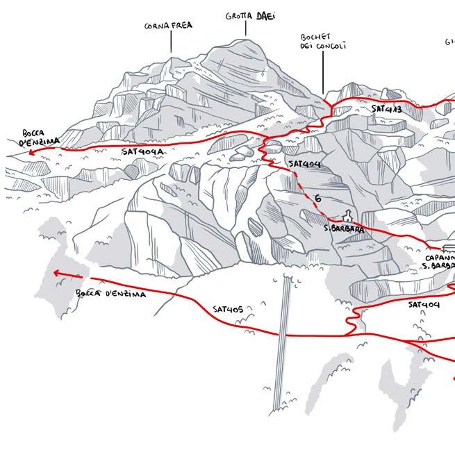
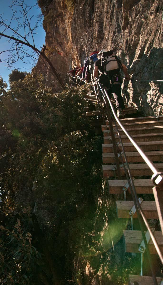
Dopo i primi facili gradoni attrezzati si arriva ai piedi di una parete su cui si sale con una scala di 40 metri (1). Al termine si prosegue su balze rocciose fino a un grande muro di roccia. Con una prima scaletta di 15 metri (2) si raggiunge la grande scala di 70 metri (3). Infine, una breve scala di 15 metri (4) porta nel bosco e da qui su sentiero si raggiunge la cresta rocciosa attrezzata con fune e scale (5) che porta in vetta a Cima SAT.
Den Anfang bilden leicht begehbare, große Stufen. Dann führt eine 40 Meter lange Leiter (1) eine Wand hinauf. Es folgen Felsvorsprünge bis zu einer großen Felswand. Dann führen in den Felsen gehauene Trittbügel (2) über 15 Meter hinauf zur großen, 70 Meter langen Leiter (3). Zum Schluss bringt eine kurze Leiter von 15 Metern Länge (4) auf einen Waldweg, über den es den felsigen Grat mit Seil und Leitern (5) erreicht, der bis auf den Gipfel Cima SAT führt.
After the first easy bolted slabs you come to the foot of a wall which you ascend by means of a 40 metres ladder (1). At the other end, you proceed on rocky outcrops until you come to a big rock wall. A first ladder 15 metres long (2) takes you to the 70 metres ladder (3). Finally, a short ladder of just 15 metres (4) takes you into the woods and from there, a trail takes you to the rocky ridge bolted with cables and ladders (5) which takes you to the summit of Cima SAT.
EEA-PD
S
Panoramica e poco esposta
Schöne Aussicht und wenig ausgesetzt
Panoramic and not particularly exposed
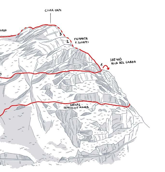
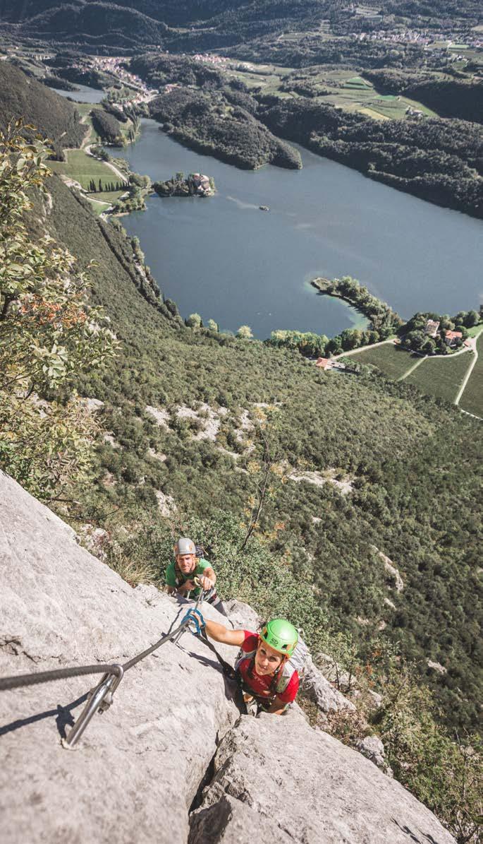
Riva del Garda - Val Sperone
Biacesa (Ledro) (map pp. 30-31)
SAT405/470
SAT470 (Biacesa)
h 4.00 + h 2.00 Rientro
Rückweg Return
h 3.30 + h 1.30 Rientro
Rückweg Return (Biacesa)
Tutto l’anno
Ganzjährig All year round
Cima Capi (907 m)
900 m (500 m da Biacesa): di cui 300 attrezzati davon 300 ausgebaut 300 m bolted
Da Riva del Garda: salire lungo il Sentiero del Ponale e imboccare a destra il sentiero SAT405 Fausto Susatti fino ad incrociare il sentiero SAT470 dei Bech (1).
Da Biacesa (Ledro): seguire il sentiero SAT470 fino all’incrocio con il sentiero SAT405 (1).
Von Riva del Garda: Aufstieg über den Sentiero del Ponale, dann rechts über den SAT405 Fausto Susatti bis zur Kreuzung mit dem SAT470 dei Bech (1).
Von Biacesa (Ledro): Es geht über den Wanderweg SAT470 bis zur Kreuzung mit dem SAT405 (1).
From Riva del Garda: take the Ponale trail and turn to the right to the path SAT405 Fausto Susatti until you come to the junction with the SAT470 dei Bech (1).
From Biacesa (Ledro): take the SAT470 path until you come to the junction with the SAT405 (1).
Dal punto più alto scendere in direzione nord, tratto facile ma in grande esposizione, fino a raggiungere la forcella tra Cima Capi e Cima Rocca. Da qui è possibile scendere verso Riva del Garda o Biacesa.
Per Riva del Garda: scendere verso nord attraversando la parete est di Cima Rocca (4) e la successiva valletta; lasciato a sinistra il sentiero per Bocca Pasumer si raggiunge Bocca Enzima. Scendere sul versante affacciato su Riva del Garda fino alla condotta forzata e al sentiero che porta a Riva del Garda.
Per Biacesa: prendere a sinistra la ferrata Mario Foletti SAT460 che attraversa la parete meridionale di Cima Rocca e porta al Bivacco Arcioni. Da qui scendere a Biacesa dal ripido sentiero, passando dalla chiesetta di San Giovanni.
Vom höchsten Punkt geht es bergab in nördlicher Richtung, auf einer leicht gehbaren, aber sehr ausgesetzten Strecke, bis zur Scharte zwischen Cima Capi und Cima Rocca. Von hier aus kann man nach Riva del Garda oder Biacesa absteigen.
Nach Riva del Garda: Abstieg nach Norden über die Ostwand der Cima Rocca (4) und das nachfolgende Tal und weiter auf den Weg SAT405 zur Bocca Enzima. Der Abstieg folgt auf der Seeseite mit Blick auf Riva del Garda, bis zur Druckleitung und zum Weg, der nach Riva del Garda hinabführt.
Nach Biacesa: Es geht links auf den Mario Foletti-Klettersteig (SAT460), der durch die Südwand der Cima Rocca bis zum Bivacco Arcioni führt. Von dort aus folgt der Abstieg nach Biacesa, and der Kapelle San Giovanni vorbei.
Head down from the top on the north side, an easy but very exposed stretch, until you come to the saddle between Cima Capi and Cima Rocca. From here you can head down towards Riva del Garda or Biacesa.
To Riva del Garda: descend on the north side crossing the east face of Cima Rocca (4) and the valley after it; leave the trail for Bocca Pasumer on your left and come to Bocca Enzima. Head down the side overlooking Riva del Garda until you come to the penstock and the trail leading to Riva del Garda.
To Biacesa: take the ferrata Mario Foletti SAT460 on your left, which crosses the southern face of Cima Rocca and leads to the shelter Bivacco Arcioni. From here head down to Biacesa on the steep trail, which takes you past the chapel of San Giovanni.
Sviluppo Ferrata
Beschreibung Klettersteig
Description Ferrata
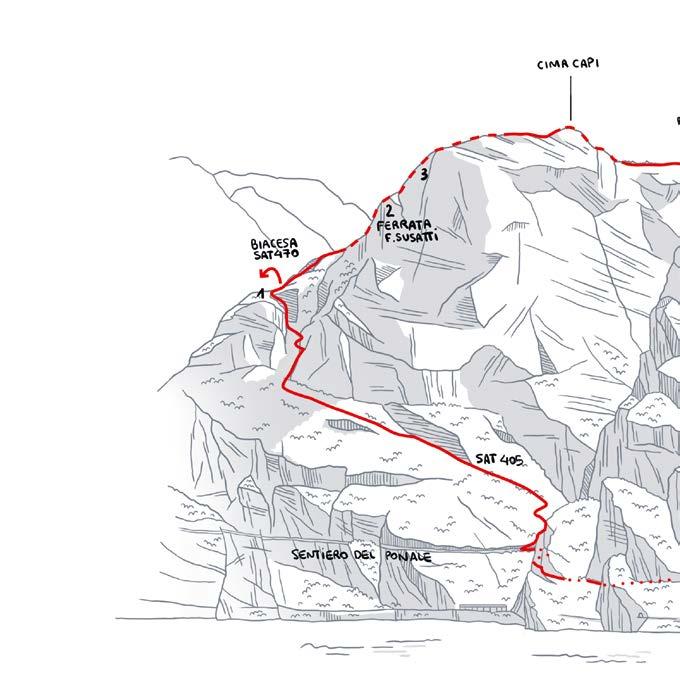
All’incrocio tra il sentiero SAT405 e SAT470 salire lungo il filo di cresta superando un breve salto roccioso grazie a staffe e pioli. Dopo un tratto di sentiero si risale la lama calcarea della Cima Capi con alcuni tratti esposti (2) , fino a raggiungere un blocco roccioso prominente (3) che obbliga a un breve passo atletico. Dopo una spaccatura, facili roccette portano al sentiero che conduce alla cima.
An der Kreuzung von SAT405 und SAT470 geht es auf einer Gratpassage über einen kurzen Felsaufschwung, gesichert mit Klammern und Sprossen. Nach einem Wegstück geht es die Kalkschneide der Cima Capi mit einigen ausgesetzten Passagen (2) hinauf, bis zu einem vorspringenden Felsblock (3), der athletische Beinarbeit verlangt. Nach einer Spalte führen kleine, leicht zu überwindende Felsblöcke auf den Weg zum Gipfel.
At the junction of the trail SAT405 and SAT470 head up along the ridge, using stirrups and rungs to get over a short section on rock. After a section on the trail ascend the limestone outcrop of Cima Capi with some exposed sections (2) until you come to a prominent block of rock (3) where you have a short athletic section. After a cleft, easy rocks take you to the trail which leads to the top.
EEA-F
Necessaria lampada frontale per le gallerie Stirnlampe für die Tunnel notwendig Headlamps needed for the tunnels
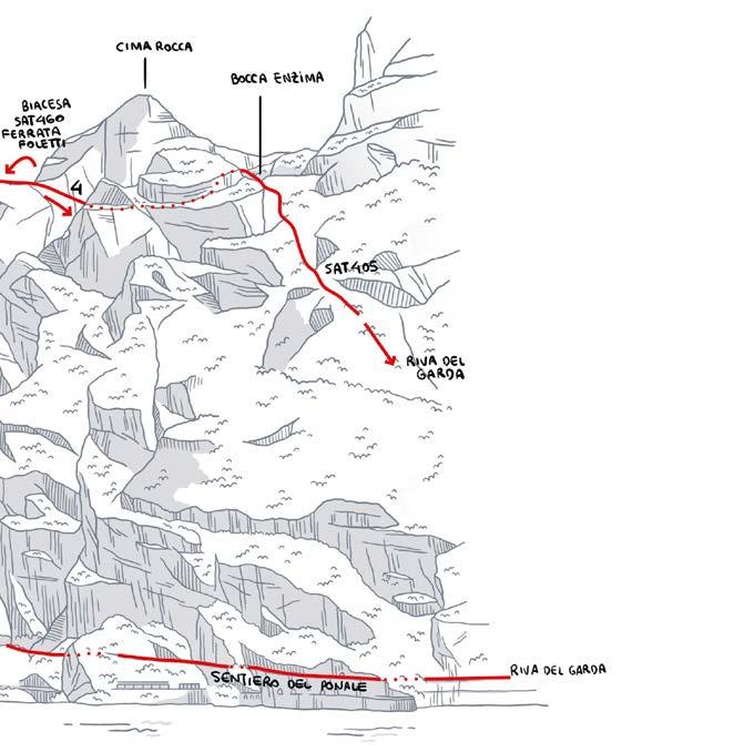
S Biacesa (Ledro)
SAT470/471 - SAT460B/460
Rientro Rückweg Return
h 2.00 + h 2.00 Rientro
Cima Rocca (1090 m)
670 m: di cui 400 attrezzati davon 400 ausgebaut 400 m bolted
Rückweg Return S
Tutto l’anno
Ganzjährig All year round
Dal parcheggio di Biacesa prendere il sentiero SAT470 dei Bech e proseguire sul sentiero attrezzato SAT471 delle Laste.
Vom Parkplatz in Biacesa aus geht es auf den Wanderweg SAT470 dei Bech und dann weiter zum gesicherten SAT471 (Senter delle Laste).
From the car park in Biacesa take the path SAT470 dei Bech and then the bolted trail SAT471 (Senter delle Laste).
Da Cima Rocca scendere verso nord lungo un ripido tratto attrezzato che porta allo sbocco della galleria principale. Raggiunta Bocca Pasumer scendere a Biacesa per il sentiero SAT460 (Val Vasotina).
Von der Cima Rocca geht es in nördlicher Richtung hinab, über eine gesicherte Steilpassage, die zum Zugang des Haupttunnels führt. Einmal bei Bocca Pasumer, geht es über den Weg SAT460 hinab nach Biacesa.
From Cima Rocca head down the north side along a steep bolted section which leads you to the mouth of the main tunnel. Once you reach Bocca Pasumer you go down to Biacesa on the SAT460.
Sviluppo Ferrata
Beschreibung Klettersteig
Description Ferrata
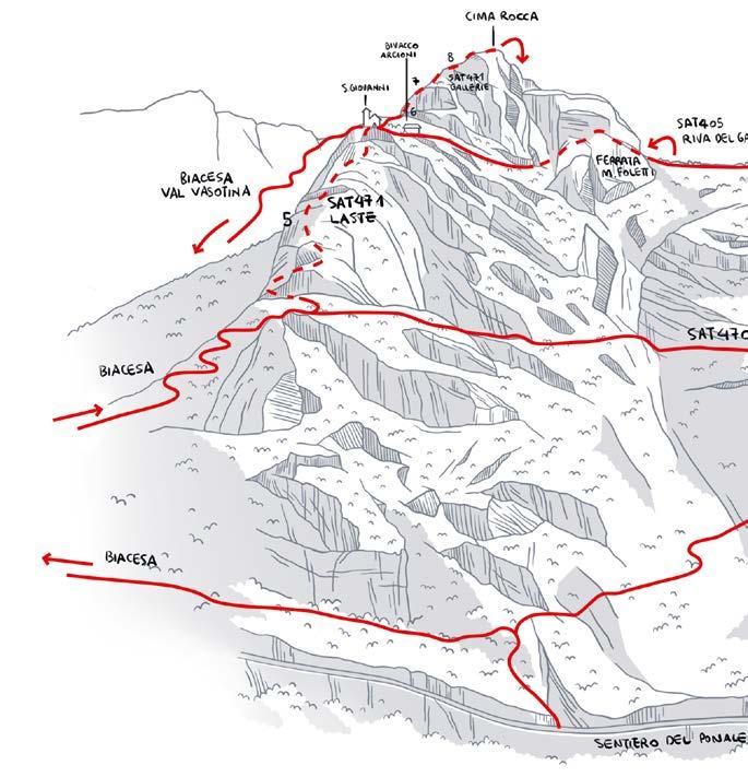
Dopo alcuni tornanti inizia il tratto attrezzato che risale facili placconate fino a una piccola grotta (5). Superando le ultime balze rocciose si raggiungono il Bivacco Arcioni e la Chiesetta di San Giovanni. Proseguendo si imboccano tre gallerie (munirsi di lampada frontale) con scaletta (6-7-8) scavate nella montagna da parte a parte. Si raggiunge la vetta lungo il sentiero che sale a destra.
Nach einigen Serpentinen beginnt die gesicherte Passage über leicht begehbare Platten bis zu einer kleinen Grotte (5). Nach den letzten Felsvorsprüngen erreicht man das Bivacco Arcioni und die Kapelle San Giovanni.
Weiter trifft man drei Tunnel (Stirnlampe notwendig!) mit Leitern (6-7-8), die einmal quer durch den Berg führen. Zu dem Gipfel geht es über den Weg, der rechts nach oben führt.
After a few bends you find yourself at the start of the bolted section, which heads up easy slabs as far as a small cave (5). You get over the final rocky outcrops and come to the shelter Bivacco Arcioni and the chapel of San Giovanni.
Keep going and you come to three tunnels (make sure to have a headlamp) with a ladder (6-7-8) excavated in the rock from one side to the other. You reach the summit along the trail that leads up on your right.
Facile itinerario che risale la parete est fiancheggiando gli strapiombi
Leichte Tour an der Ostwand, von Überhängen flankiert Easy route up the east wall flanked by overhangs
S Arco - Loc. Prabi
SAT431B
h 1.15 + h 0.45
Rientro Rückweg Return
Tutto l’anno Ganzjährig All year round
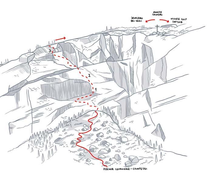
Monte Colodri (400 m)
270 m: di cui 150 attrezzati davon 150 ausgebaut 150 m bolted
A Prabi imboccare il sentiero di fronte al parcheggio della piscina comunale che sale alla base del Monte Colodri, per raggiungere in pochiminuti la partenza della ferrata.
In Prabi geht es vom Parkplatz des Stadtbads los, über den Weg, der zuerst am Fuße des Monte Colodri und dann in wenigen Minuten zum Einstieg des Klettersteigs führt.
In Prabi take the trail in front of the car park of the municipal swimming pool, which leads you to the foot of Monte Colodri and in a few minutes to the start of the ferrata.
Dalla cima seguire il Sentiero dei Lecci e scendere fino a Laghel. Proseguire quindi fino al centro di Arco.
Vom Gipfel aus geht es auf den Weg Sentiero dei Lecci bis nach Laghel und weiter bis zum Zentrum von Arco.
From the summit follow the Sentiero dei Lecci trail and head down to Laghel. Then continue to Arco town centre.
Beschreibung Klettersteig
Description Ferrata
L’attacco della Ferrata si trova alla sommità del conoide di massi alla base della parete est del Monte Colodri. Dopo un primo facile risalto attrezzato si sale attraversando a sinistra lungo cenge inframezzate da brevi muri verticali attrezzati, fino al piede di un’alta parete verticale. Si attraversa a destra, alla base dell’alta parete, fino a raggiungere un diedro verticale (1) attrezzato con staffe e una breve scala. Si raggiunge così una liscia placca attrezzata (2) dove ci si ricongiunge al percorso originario. Si sale in obliquo a verso sinistra lungo la placca attrezzata con pioli e poi una frattura che taglia la parete rocciosa fino all’ultimo risalto. Superato il diedro verticale attrezzato con staffe (3) si esce dalla parete e lungo placche ricche di incisioni carsiche si raggiunge la croce di vetta.
Der Einstieg des Klettersteigs befindet sich auf der Spitze des Geröllkegels am Fuß der Ostwand des Monte Colodri. Nach einem ersten leichten ausgestatteten Absatz steigt man über links verlaufende Bänder, die von kurzen vertikalen Wänden mit Ausrüstung unterbrochen sind, bis zum Fuß einer hohen vertikalen Wand auf. Man überquert dann nach rechts, am Fuß der hohen Wand, bis man eine vertikale Ecke (1) erreicht, die mit Klammern und einer kurzen Leiter ausgestattet ist. Dies führt zu einer glatten, ausgestatteten Platte (2), wo es wieder auf den ursprünglichen Weg trifft. Der Aufstieg setzt sich schräg nach links über die mit Stiften ausgestattete Platte fort und dann über einen Riss, der die Felswand durchschneidet, bis zum letzten Absatz. Nachdem die vertikale Ecke mit Klammern (3) überwunden wurde, verlässt man die Wand und erreicht über Platten, die reich an Karst Einschnitten sind, das Gipfelkreuz.
The start of the via ferrata is located at the top of the boulder cone at the base of the east wall of Mount Colodri. After an initial easy equipped ledge, the route ascends by crossing to the left along ledges interspersed with short vertical walls equipped with fixtures, until reaching the base of a tall vertical wall. It then crosses to the right, at the base of the tall wall, until reaching a vertical corner (1) equipped with brackets and a short ladder. This leads to a smooth, equipped slab (2) where it rejoins the original path. The climb continues obliquely to the left along the equipped slab with pegs and then a fracture that cuts across the rock face until the final ledge. After overcoming the vertical corner equipped with brackets (3), the route exits the wall and along slabs rich in karstic incisions, reaches the summit cross.

VARIANTE PER RIENTRO DA FERRATA DEL MONTE COLT
RÜCKWEGVARIANTE ÜBER DEN KLETTERSTEIG MONTE COLT
RETURN VARIATION ALONG THE FERRATA OF MONTE COLT
Dalla croce del Monte Colodri dirigersi verso nord fino al bordo della parete. Seguire il sentiero attrezzato che scende sul versante ovest fino al sentiero SAT431 e continuare fino al colle antecedente la cima del Monte Colt, nelle vicinanze di un traliccio. Scendere quindi sul sentiero lato est del Monte Colt: il sentiero attrezzato non è tecnicamente difficile, ma è esposto e richiede comunque attrezzatura completa per via ferrata. Una scala metallica permette di superare l’ultima balza rocciosa per scendere nella valletta di Malapreda. Rientro a Prabi da Ceniga.
Vom Gipfelkreuz des Monte Colodri geht es Richtung Norden bis zum Rand der Bergwand und dann auf den ausgerüsteten Kletterpfad hinunter über die Westseite bis zum Weg SAT431; weiter geht es bis zum Hügel, der vor dem Gipfel des Monte Colt liegt und hinab auf dem östlichen Weg des Monte Colt. Der ausgerüstete Weg ist technisch gesehen nicht schwierig, aber äußerst steil und ausgesetzt und erfordert in jedem Fall eine komplette Klettersteigausrüstung. Eine Metallleiter ermöglicht die Überwindung der letzten Felswand, um in das Tal hinab nach Malapreda zu gelangen. Über Ceniga geht es dann zurück nach Prabi.
From the cross of Monte Colodri go north until you arrive at the cliffs. Continue along the bolted trail (there are security wires to hold on too), that goes down westwards until the SAT431 trail and follow the path until you reach the hills just before the peak of Monte Colt, staying close to the pylon. Go down along the path east of Monte Colt: this wired path is not technically difficult, but it is exposed and requires climbing equipment such as boots, harness, helmets. There is a metal ladder to enable you to climb the last rock, before the descent towards Malapreda. Return to Prabi via Ceniga.
Sentiero attrezzato Gesicherter Weg Bolted trail
S Ceniga - Ponte Romano Dro
SAT428/428B/425
h 4.00
460 m: di cui 250 attrezzati davon 250 ausgebaut 250 m bolted
E/S-E
Tutto l’anno (evitando i giorni più caldi) Ganzjährig (außer an sehr heißen Tagen) All year round (avoid hot days)
Dal Ponte Romano di Ceniga seguire la strada verso Maso Lizzone (NO parcheggio). Imboccare a sinistra il sentiero SAT428 e dopo il maso continuare a destra fino alla base della parete rocciosa dell’Anglone.
Von der römischen Brücke in Ceniga geht es nach Maso Lizzone (KEINE Parkmöglichkeit), links auf den Weg SAT428 und dann rechts nach dem Hof, bis zum Fuße der Felswand dell‘Anglone.
From the Roman Bridge in Ceniga follow the road towards Maso Lizzone (NO car park). Take the SAT428 trail to the left, then turn right after a farmhouse and continue until you reach the Anglone crag.
Verso Ceniga seguire prima la sterrata dei Molinei e di Campagnola poi proseguire lungo il Sarca.
Richtung Ceniga geht es zunächst über den Schotterweg dei Molinei und dann di Campagnola am Sarca entlang.
Towards Ceniga, first take the Molinei track and then the Campagnola track along the river Sarca.
Sentiero attrezzato Gesicherter Weg Bolted trail
Sviluppo Ferrata
Beschreibung Klettersteig
Description Ferrata
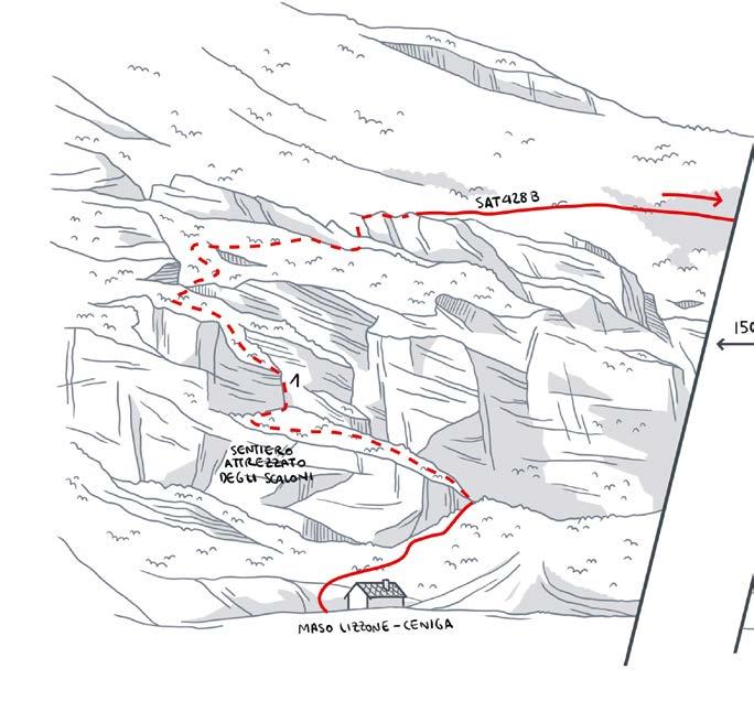
Per brevi roccette e sentiero con tratti esposti si raggiunge una sequenza di scaloni (1) sino a un facile camino e quindi a una placca con gradini intagliati. Dopo un tratto di sentiero, una scalinata in pietra porta al sentiero terminale e in breve al Dos Tondo, dove si incrocia il sentiero SAT428B Delle Cavre. Seguendolo verso nord si raggiunge il bivacco del Crozolam. Ancora verso nord lungo il sentiero SAT425 si incontra il sentiero attrezzato dell’Anglone, che scende prima su una placca rocciosa e poi tra camini e facili roccette fino ai gradoni che portano alla base della parete.
Über kleine Felsblöcke und einen Weg mit teils ausgesetzten Stellen erreicht man eine Reihe von Leitern (1) bis zu einem einfachen Kamin und zu einer Plattenpassage mit eingearbeiteten Trittstufen. Nach einem kurzen Stück führt eine Steintreppe zum letzten Streckenabschnitt und zum Dos Tondo, wo man den SAT428B (Senter delle Cavre) kreuzt.
In Richtung Norden geht es über das Biwak Crozolam und weiter auf dem Weg SAT425 bis auf den gesicherten Weg Sentiero dell‘Anglone, der zunächst auf eine Felsplatte hinab und dann leicht zwischen Kaminen und Felsblöcken hindurch bis zu den Stufen führt, die zu dem Wandfuß bringen.
With short stretches over boulders and a partially exposed trail you come to a sequence of broad steps (1) and an easy chimney, which lead to a slab with steps carved into the rock. After a section of trail, you come to a series of stone steps and the final trail which leads to Dos Tondo. Here you are at the junction with the trail SAT428B (Senter delle Cavre): head north along it to the Crozolam shelter and continue on the path SAT425 until the bolted trail Sentiero dell’Anglone, which first descends onto a rocky slab and then, through a series of chimneys and easy rocks, leads down to wide steps, which take you to the foot of the wall.
S
Per bambini da 140 cm.
Per i bambini più piccoli è necessario l’aiuto di un adulto
Für Kinder ab 140 cm.
Kleinkinder benötigen die Hilfe eines Erwachsenen
For kids from 140 cm.
Smaller children need the help of an adult
Drena - SP84
h 1.30 + h 0.30 Rientro Rückweg Return
Castello di Drena
190 m: di cui 130 attrezzati davon 130 ausgebaut 130 m bolted
Tutto l’anno Ganzjährig All year round W
Dal parcheggio della Riserva Naturale delle Marocche (sulla destra salendo su SP84 in direzione Drena), scendere per un centinaio di metri lungo la strada principale fino alla strada sterrata con segnavia Rio Sallagoni da dove si raggiunge in pochi minuti l’imbocco del canyon.
Vom Parkplatz des Naturschutzgebiets der Marocche (rechterhand auf der SP84 in Richtung Drena) geht es einige hundert Meter auf der Hauptstraße entlang bis zu einem unbefestigten Weg. Von dort dem Wegzeichen Rio Sallagoni folgen. In wenigen Minuten erreicht man den Eingang der Schlucht.
From the car park of the Marocche Nature Reserve (which is on your right as you come up the SP84 towards Drena), head down the main road. After a hundred metres you come to a dirt track with a signpost for Rio Sallagoni. Follow it and in a few minutes you are at the entrance of the canyon.
Dal castello, in direzione ovest verso la Valle del Sarca, scendere per il sentiero che riporta al parcheggio.
Von der Burg aus, in westlicher Richtung zum Sarcatal, führt ein Weg zurück zum Parkplatz.
From the castle, head west towards the Sarca Valley and down the trail which will take you back to the carpark.
Si supera con l’ausilio di staffe il primo sbalzo roccioso alzandosi sulla sinistra della cascata, per poi iniziare la lunga attraversata nella forra con qualche tratto faticoso per i più piccoli per raggiungere una zona più aperta con fitta vegetazione e cascate. Si può rimanere sul sentiero sul lato destro della forra (3) o, guadato il torrente, superare la cascata con un ponte tibetano (4). In pochi minuti lungo un sentiero a gradoni si arriva ad un caratteristico passaggio tra grandi massi (5) e poco oltre, superato un secondo ponte tibetano (6), si raggiunge un piccolo ponte in legno che supera il torrente. Qui ha termine il percorso attrezzato e su sentiero si arriva in breve al castello di Drena. La forra prosegue, ma al momento non è attrezzata in sicurezza (7).
Den ersten überhängenden Teil der Route, eine felsige Passage links des Wasserfalls, erklimmt man mithilfe von Klammern. Dann beginnt die lange Durchquerung der Schlucht, die zumindest für kleine Bergsteiger einige anstrengende Passagen bereithält, bis zu einem offeneren Abschnitt mit dichter Vegetation und Wasserfällen. Man kann nun auf der rechten Schluchtseite (3) bleiben oder durch den Bach waten und dann mithilfe einer tibetanischen Brücke (4) den Wasserfall hinter sich lassen. Nach wenigen Minuten erreicht man über einen Treppenpfad eine malerische Passage inmitten von großen Felsblöcken (5). Kurz danach gelangt man zu einer zweiten tibetanischen Brücke (6) und dann zu einer kleinen Holzbrücke, die über den Bach führt. Hier endet der gesicherte Abschnitt und über einen Wanderweg erreicht man in Kürze die Burg von Drena. Die Schlucht führt weiter, allerdings gibt es im weiteren Teil zurzeit keine Sicherungen (7).
Get past the first rocky outcrop by heading up to the left of the waterfall with the help of some stirrups, then begin the long crossing in the ravine where there are a few challenging sections for younger kids, until a more open area with dense vegetation and waterfalls. You can stay on the path to the left side of the ravine (3) or ford the stream and cross the waterfall on a Tibetan hanging bridge (4). In a few minutes along a series of steps you come to a passage between huge boulders (5) and shortly after, crossing a second Tibetan bridge (6) you come to a little wooden bridge across the stream. This is the end of the bolted section and in a short time the trail leads to Drena Castle. The ravine continues but for now it has no bolted chains (7).
ATTENZIONE - VORSICHT - WARNING
La ferrata è chiusa per manutenzione (giugno 2024). Informati sullo stato attuale di percorribilità.
Der Klettersteig ist wegen Wartungsarbeiten geschlossen (Juni 2024). Erkundige dich, ob der Klettersteig aktuell begehbar ist.
The via ferrata is closed for maintenance (June 2024). Please inform yourself about the current condition of the route.
FERRATA ALPINISTICA Difficile, lunga ed impegnativa
ALPINER KLETTERSTEIG Schwer, lang und anstrengend
ALPINE VIA FERRATA Difficult, long and challenging
S Pietramurata
SAT427 Rientro Rückweg Return
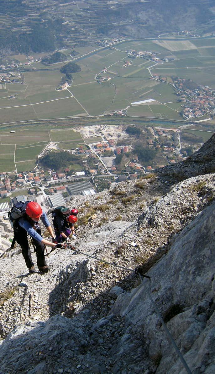
Monte Casale - Rifugio Don Zio (1630 m)
1500 m: di cui 1100 attrezzati davon 1100 ausgebaut 1100 m bolted
h 5.00 + h 3.00 Rientro Rückweg Return E
Primavera e Autunno Frühling und Herbst Spring and Autumn
All’uscita da Pietramurata, parcheggiare ed imboccare la strada che costeggia a sinistra la cava, alla base della parete del Monte Casale. Per ripido sentiero nel bosco si raggiunge il primo tratto attrezzato.
Am Ortsausgang von Pietramurata parken und die Straße, die links an der Höhle am Fuße der Monte Casale-Wand vorbeiführt, nehmen. Über einen steilen Waldweg geht es zur ersten, gut gesicherten Passage.
Park your car on the far side of Pietramurata and take the road on your left which runs along the quarry at the foot of sheer wall of Monte Casale. A steep trail through the woods leads to the first bolted section.
Dal Rifugio Don Zio scendere per il sentiero SAT427 verso l’abitato di Sarche da cui si raggiunge Pietramurata.
Von der Don Zio-Hütte geht es auf den SAT427 hinab zur Ortschaft Sarche und dann zurück nach Pietramurata.
From the Rifugio Don Zio hut take the trail SAT427 towards Sarche and from there continue to Pietramurata.
Evitare le giornate estive a causa dell’esposizione in pieno sole. Portare con sé molta acqua.
An Sommertagen aufgrund ganztägiger Sonneneinstrahlung nicht zu empfehlen. Viel Wasser mitbringen.
Avoid in summer because it is in full sun. Bring a lot of water with you.
Sviluppo Ferrata
Beschreibung Klettersteig
Description Ferrata
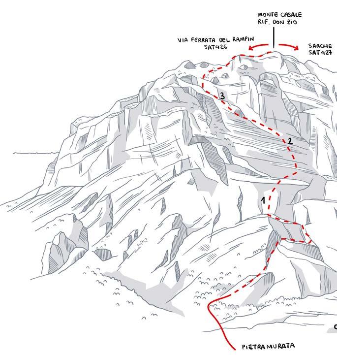
La prima parte è caratterizzata da tratti verticali in fessure e diedri seguiti da un traverso a destra, per poi ritornare in obliquo verso sinistra per brevi pareti rocciose e cenge fino alla sommità del Croz del Pin (1), da dove ci si addentra nella grande placconata che caratterizza la parete del Monte Casale. Aiutati da pioli e staffe (2) si supera la bastionata fino a quota 1200 m dove si trova il libro di via (3). Qui hanno termine le difficoltà, ma non la salita: ci sono altri 400 m di dislivello con brevi tratti attrezzati, prima di raggiungere la cima del Monte Casale e, poco oltre, il Rifugio Don Zio.
Die erste Passage ist durch vertikale Abschnitte in Rissen und Verschneidungen gekennzeichnet, auf die rechts eine Querung folgt, die dann, nach links, erneut in die Schräge übergeht und über kurze Felswände führt, bis hinauf auf den Gipfel des Croz del Pin (1). Von hieraus geht es hinein in das weitläufige plattige Gelände, das die Wand des Monte Casale so besonders macht. Mithilfe von Sprossen und Klammern (2) überwindet man die Felsbastion bis zur 1200 m Höhe, wo das Logbuch liegt (3). An dieser Stelle enden zwar die schwierigen Passagen, nicht aber der Aufstieg: es gibt weitere 400 Höhenmeter mit kurzen gesicherten Passagen zu dem Gipfel des Monte Casale und der Don Zio-Hütte.
The first section has vertical stretches in clefts and dihedrals followed by a traverse to the right and then a diagonal bend back towards the left across short rock walls and ledges up to the summit of Croz del Pin (1). From here you start crossing the smooth expanse which is the wall of Monte Casale. Rungs and stirrups (2) help you across the ramparts up to an elevation of 1200 m, where you come across the logbook (3). This marks the end of the difficult section but the ascent continues with another 400 m of elevation gain with short bolted sections before you reach the summit of Monte Casale and, soon after, the mountain hut Rifugio Don Zio.
EEA-E
Difficile, lunga ed impegnativa
Schwer, lang und anstrengend
Difficult, long and challenging
S Sarche Piccolo Dain (970 m)
h 3.30 + h 1.30
Rientro Rückweg Return
E/S-E
Primavera e Autunno
800 m: di cui 400 attrezzati davon 400 ausgebaut 400 m bolted
Frühling und Herbst Spring and Autumn
Alla rotonda di Sarche prendere la strada per Madonna di Campiglio e dopo 50 m prendere sulla destra la stradina che porta al parcheggio (segnavia via ferrata). Seguire le indicazioni lungo il sentiero nel bosco, che attraversa la base della parete del Piccolo Dain, fino all’inizio della ferrata segnato da una targa metallica.
Am Kreisverkehr in Sarche geht es Richtung Madonna di Campiglio und nach 50 Metern rechts in das Sträßchen, das zum Parkplatz (Wegweiser zum Klettersteig) führt. Der Beschilderung auf dem Waldweg, der am Fuß der Piccolo Dain Wand verläuft, bis zum Einstieg des mit einer Metaltafel markierten Klettersteigs folgen.
From the roundabout in Sarche follow the road for Madonna di Campiglio for just 50 m, then turn right into a narrow street, which leads to the car park (signposted via ferrata). Follow the directions along the trail through the woods, across the base of the Piccolo Dain crag as far as the start of the ferrata marked by a metal plaque.
Dirigersi a nord per ripido sentiero e poi strada sterrata fino al paese di Ranzo. Al capitello di San Vigilio prendere il sentiero che a sinistra scende sotto la parete sud del Piccolo Dain. Brevi tratti attrezzati con cavo permettono di scendere balze rocciose e raggiungere il ripido sentiero che scende a Sarche.
Es geht Richtung Norden, auf einem steilen und später unbefestigten Weg bis nach Ranzo. Beim Kapitell San Vigilio den Weg nehmen, der links unter die Südwand des Piccolo Dain führt. Über kurze, mit Seil gesicherte Passagen geht es über Felsvorsprünge bis auf den steilen Weg der hinunter nach Sarche führt.
Head north along a steep trail and then a dirt track until you get to the village of Ranzo. Near the shrine dedicated to San Vigilio take the trail on the left which leads down under the south face of Piccolo Dain. Short sections bolted with cables allow you to descend over rocky outcrops and reach the steep trail which leads down to Sarche.
Sviluppo Ferrata
Beschreibung Klettersteig
Description Ferrata
Risalire un primo muro verticale attrezzato, al cui termine è possibile abbandonare la salita seguendo un sentiero attrezzato a destra (1). Con un traverso in esposizione (2) si raggiunge un sistema di placche che si superano puntando a un grande pilastro (3). Si risale il pilastro prima lungo lo spigolo sinistro e poi al centro, fino a raggiungere il libro di via (4) alla sommità del pilastro: oltre questo punto le difficoltà sono più contenute, fino alla vetta.
Der Klettersteig beginnt gleich mit einem straffen Stahlseil, das fast senkrecht an der Wand nach oben führt. Am Ende der ersten Wand gibt es eine Rückzugsmöglichkeit über einen gesicherten Pfad nach rechts (1). Nach einer ausgesetzten Querung (2) erreicht man eine Plattengruppe, die man bezwingt, indem man an den großen Pfeiler (3) zugeht. Zunächst steigt man entlang der linken Kante und dann mittig am Pfeiler empor, bis zum Logbuch (4) auf dem höchsten Punkt des Pfeilers. Nach dieser Stelle ist die Route bis zum Gipfel merklich leichter.
Climb a first vertical wall bolted with cables and at the end of which you can choose to turn back by taking the bolted trail to the right (1). An exposed traverse (2) leads to a system of slabs after which you come to a great pillar (3). Head up the pillar, first along the left ridge and then up the centre, until you come to the log book (4) at the top of the pillar: after this point the route to the summit is less demanding.
Breve, ma atletica ed esposta Sportklettersteig, kurz, aber ausgesetzt Short, but strenuous and exposed
S Mori Monte Albano (625 m)
SAT670
h 2.00 + h 0.30
420 m: di cui 200 attrezzati davon 200 ausgebaut 200 m bolted
Rientro Rückweg Return S
Tutto l’anno Ganzjährig All year round
Dal centro dell’abitato di Mori seguire le indicazioni e salire verso il santuario da dove un breve sentiero porta all’inizio del percorso attrezzato (indossare il casco prima di raggiungere il piede della parete rocciosa - area esposta a cadute di sassi smossi da chi sale la ferrata).
Von Mori geht es zur Kapelle Santuario di Monte Albano und dann in wenigen Minuten zum Einstieg des Klettersteigs (trage deinen Helm bereits vor dem Eintreffen am Fuße der Wand auf, da hier die Gefahr von Steinschlägen besteht, ausgelöst durch Kletterer an der Wand darüber).
From the centre of Mori head uphill towards the sanctuary from which a short trail takes you to the start of the via ferrata (put on your helmet before you approach the rock wall – this is an area where stones may get dislodged by people above you on the ferrata).
Seguire il sentiero di rientro segnalato che segue il margine sinistro della parete e riporta al santuario.
Über den ausgeschilderten Abstiegsklettersteig, der am linken Rand der Wand entlang verläuft geht es zurück zur Kapelle.
Follow the signposted path, which follows the left edge of the wall, back down to the sanctuary.
Sviluppo Ferrata
Beschreibung Klettersteig
Description Ferrata
Il primo salto roccioso (1) è volutamente privo di attrezzature, per scoraggiare eventuali persone non preparate. La prima sezione risale una serie di camini (3), inframezzati da brevi traversi (2), attrezzati con numerose staffe con passaggi atletici. Con una attraversata a sinistra (4) si raggiunge la grande cengia a metà parete. Si attraversa sempre a sinistra fino a salire un nuovo camino (5) e quindi sempre con aerea attraversata si raggiunge il libro di via (6). Seguendo la sequenza di staffe si superano una sequenza di placche e diedri verticali (7) che portano fuori dalla parete.
Der erste Felsaufschwung (1) ist frei von künstlichen Tritthilfen – wer hier bereits Probleme hat, sollte auf jeden Fall den Notausstieg nutzen. Der erste Teil der Route führt an einer Reihe von Kaminen (3) hinauf, mit verschiedenen kurzen Querungen (2) dazwischen. Diese sind mit zahlreichen Tritthilfen versehen und stellen auch für Sportkletterer eine wahre Herausforderung dar. Über eine Querung nach links (4) erreicht man nach der Hälfte der Wand das lange Grasband. Am Ende dieses Bandes geht es links weiter bis zu einem weiteren Kamin (5), bevor man über eine stark ausgesetzte Passage zum Logbuch (6) kommt. Mithilfe verschiedener Trittbügel geht es über eine Reihe von Platten und vertikalen Verschneidungen (7) bis zum Ausstieg.
The first rocky outcrop (1) is deliberately without any chains in order to discourage the unprepared. The first section climbs up through a series of chimneys (3), punctuated by short traverses (2), fitted with numerous rungs and with some strenuous stretches. A traverse to the left (4) takes you to the great ledge halfway up the wall. Traverse to the left until you are going up another chimney (5) and then with another lofty traverse you reach the log book (6). Following the sequence of rungs you can get past a sequence of slabs and vertical dihedrals (7) which lead you off the wall.
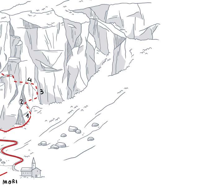
Difficile per verticalità ed esposizione Schwierig weil steil und ausgesetzt Difficult because of steepness and exposure
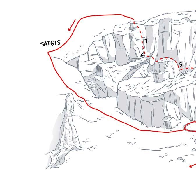
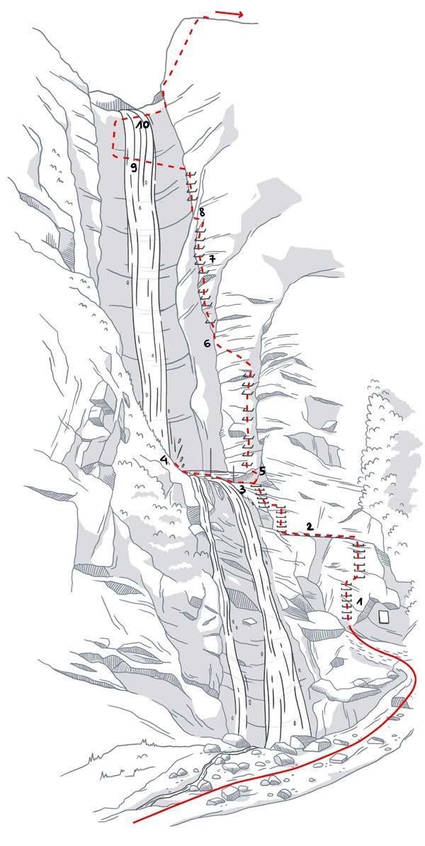
S Ballino Cascata Saiant (1050 m)
h 2.00 + h 1.00 Rientro Rückweg Return
E
300 m: di cui 160 attrezzati davon 160 ausgebaut 160 m bolted
Aprile-Novembre (da evitare quando è presente neve sui pendii superiori o ghiaccio che può scaricare acqua lungo la cascata)
April-November (bei Schnee auf den oberen Hängen und Eis am Wasserfall nicht zu empfehlen)
April-November (avoid when there is snow on the slopes above or ice which may come down from the waterfall)
Dal centro dell’abitato di Ballino seguire le indicazioni per Cascata Sajant: in 20 minuti si raggiunge la base della cascata e l’attacco della ferrata (indossare il casco prima di avvicinarsi ai piedi della parete rocciosa – possibile caduta di sassi).
Vom Ortszentrum Ballino geht es Richtung Cascata Sajant. In rund 20 Minuten ist man am Fuß des Wasserfalls und am Einstieg zum Klettersteig (trage deinen Helm bereits vor dem Eintreffen am Fuße der Wand auf, da hier die Gefahr von Steinschlägen besteht).
From the centre of Ballino follow directions for Cascata Sajant and in 20 minutes you come to the foot of the waterfall and the base of the ferrata (put on your helmet before approaching the wall – risk of falling stones).
Rientro lungo la strada forestale. Rückkehr über den Forstweg. Follow the forestry road to go back.
Non adatta a principianti e bambini (se esperti ed abituati, fare comunque attenzione perché in alcuni tratti la fune di sicurezza è piuttosto lontana per i più piccoli).
Für Einsteiger und Kinder nicht geeignet (auch für Kinder mit Klettererfahrung gilt erhöhte Vorsicht, da das Sicherungsseil für die Kleinen an einigen Stellen nur schwer zu erreichen ist).
Not suitable for beginners or children (even experienced climbers have to watch out because on some sections the safety cable is a bit too far of a stretch for younger children).
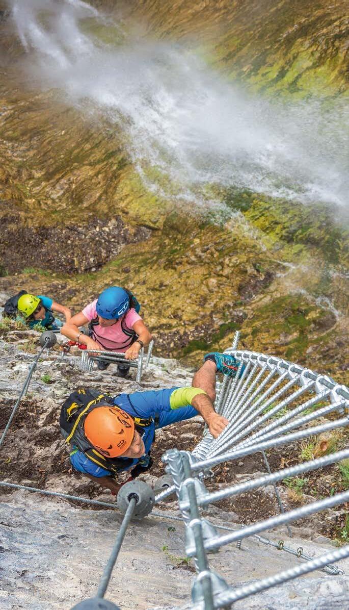
Ferrata breve, ma atletica ed impegnativa, in un ambiente di grande bellezza a fianco della cascata del Rio Ruzza. Superato un primo risalto sulla destra della cascata (1), tramite una successione di staffe ed una passerella di funi (2) si raggiunge un ponte tibetano (3) che permette di superare la pozza sospesa (4) ai piedi della cascata principale. Fino a qui la difficoltà è contenuta. Prima del ponte tibetano inizia il secondo tratto (5), decisamente più impegnativo e spettacolare. Si risale una lunga parete verticale ed in lieve strapiombo sul lato destro della cascata. La scalata verticale è interrotta da brevi attraversate su passerelle di funi (6). A tratti le staffe metalliche lasciano il posto ad appigli scavati nella roccia (7). Si raggiunge così una scala sospesa nel vuoto (8) che porta all’inizio di un caratteristico ponte tibetano (9) che attraversa la cascata a oltre 100 m di altezza. Dopo un nuovo breve tratto in roccia, un secondo ponte tibetano (10) porta all’ultima parete rocciosa, da cui si esce alla sommità nei pressi della strada forestale lungo la quale si rientra a Ballino.
Kurzer, aber anspruchsvoller Action-Klettersteig vor wunderschöner Kulisse in der Umgebung des Wasserfalls Rio Ruzza. Nach einem ersten Vorsprung rechts vom Wasserfall (1) gelangt man über eine Folge von Trittbügeln und eine Seilbrücke (2) zu einer tibetischen Brücke (3), auf der sich das Tosbecken am Fuße des Hauptfalls leicht überqueren lässt. Bis hier weist die Route keine besonders schwierigen Stellen auf. Vor der tibetischen Brücke beginnt der zweite Abschnitt (5), der zwar schwieriger, aber dafür auch umso atemberaubender ist. Es geht nun auf eine lange, leicht überhängende Steilwand rechts am Wasserfall hinauf. Beim Aufstieg in der Vertikalen kommt man über mehrere Seilbrücken (6). An verschiedenen Stellen sind die Metallbügel durch in den Felsen geschlagene Löcher für die Füße ersetzt (7). Über eine freischwebende Leiter (8) gelangt man zu einer charakteristischen tibetanischen Brücke (9), die in über 100 m über den Wasserfall führt. Nach einem weiteren kurzen Felsabschnitt erreicht man über eine zweite tibetanische Brücke (10) die letzte Felswand. Oben läuft der Steig dann aus und mündet in einen Forstweg, über den man den Rückweg nach Ballino antreten kann.
A short but strenuous and challenging via ferrata in a setting of great beauty beside the Rio Ruzza waterfall. Once you get over the first vertical stretch to the right of the waterfall (1), a series of rungs and a wire bridge (2) lead to a Tibetan bridge (3) which allows you to cross the hanging pool (4) at the foot of the main water fall.This first section is not particularly hard. The second section (5) begins before the Tibetan bridge, and this is decidedly more challenging and spectacular. The ferrata leads up a long vertical rock face with a slight overhang on the right hand side of the waterfall. The vertical ascent is interrupted by short traverses on wire bridges (6) and at some points the metal rungs give way to footholds cut into the rock (7). This takes you to a ladder suspended over the drop (8) leading to the start of a typical Tibetan bridge which crosses the waterfall over 100 m above the ground. After another short stretch of rock, a second Tibetan bridge (10) leads to the final rock wall which tops out by the forest road that takes you back to Ballino.
FERRATA ALPINISTICA
ALPINER KLETTERSTEIG
ALPINE VIA FERRATA
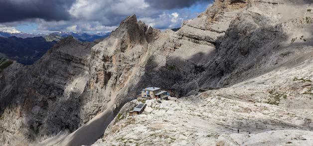
S Rifugio Agostini
Rifugio XII Apostoli
SAT321 h 2.30
Giugno - Settembre Juni - September June - September
Le Dolomiti sono il sogno di ogni alpinista. Pinnacoli di roccia che si innalzano verso il cielo azzurro, dove percorrere ferrate e sentieri che mettono alla prova tecnica e cuore, regalando grandi emozioni.
A pochi chilometri dal Garda Trentino, questo ambiente Patrimonio mondiale UNESCO ti aspetta per dare ancora più spazio alla tua voglia di montagna.
Die Dolomiten sind der Traum jedes Alpinisten. Felsspitzen, die in den blauen Himmel emporragen, mit Klettersteigen und Routen, die Technik und Herz auf die Probe stellen, und für große Emotionen sorgen.
Nur wenige Kilometer vom Garda Trentino entfernt erwartet dich dieses UNESCO-Weltkulturerbe, damit du deiner Bergleidenschaft noch besser frönen kannst.
The Dolomites are every mountain climber’s dream. Pinnacles of rock that reach for the blue sky, where you can experience via ferratas and trails that put your technique to the test and make your heart race, gifting immense emotions.
A few kilometres from Garda Trentino, this UNESCO World Heritage site awaits you, ready to quell, but then reignite, your craving for the mountains.


Ci dispiace, durante le tue avventure outdoor potresti trovare sentieri temporaneamente chiusi o magari qualche “buco” nella segnaletica che identifica i vari percorsi.
Ti chiediamo di portare pazienza:
non si tratta di incuria, ma di lavori in corso!
In questo momento, i Garda Rangers stanno infatti percorrendo i nostri tracciati, lavorando per mantenere puliti e in ordine i sentieri. Si tratta di un gruppo di professionisti specializzati, che credono per primi nel valore di un territorio bello e sicuro. Un territorio che, grazie al progetto di revisione della segnaletica che stiamo sviluppando, sarà anche più facile da esplorare.
Per noi, la cura del territorio è una cosa seria e ci impegniamo ogni giorno per permettere a tutti di camminare, pedalare, salire in sicurezza e su percorsi sempre in ordine.
Possiamo fare tutto questo grazie ai partner che credono nella nostra azienda e decidono di sostenerci.
Es tut uns leid, aber während deiner Outdoor-Abenteuer könntest du auf vorübergehend gesperrte Routen oder ein paar „Lücken“ in der Beschilderung der verschiedenen Strecken treffen.
Bitte hab Geduld: Das ist kein Fall von Nachlässigkeit, vielmehr sind Bauarbeiten im Gange! So gehen die Garda Rangers derzeit unsere Routen ab und kümmern sich darum, die Wege sauber und ordentlich zu halten. Und dank dem neuen Projekt zur Überarbeitung der Beschilderung, werden diese Wege noch einfacher zu erkunden sein.
Für uns sind die Pflege und Instandhaltung der Umgebung, in der wir leben, eine ernste Angelegenheit, und wir setzen uns jeden Tag dafür ein, dass alle in Sicherheit und auf bestens in Schuss gehaltenen Routen wandern, Rad fahren und klettern können. Das alles können wir dank unserer Partner tun, die an unser Unternehmen glauben und uns unterstützen.
During your outdoor adventures, you may find a few trails temporarily closed or maybe some trail signage missing. We apologize for this.
And we ask you to be patient. This is not carelessness but a work in progress! At this time, the Garda Rangers are walking our trails and working to keep them clean and tidy. We are also working on a big signage revision project, which will make our region easier to explore.
For us, environmental care and maintenance are serious matters and we are committed every day to allowing everyone to walk, ride, climb in safety and on wellmanaged trails. We can do all this thanks to the partners who believe in us and support us.
Vuoi aiutarci anche tu?
Puoi farlo scegliendo per la tua vacanza una delle strutture partner Premium. E indicandoci eventuali situazioni critiche che incontri durante il soggiorno: basta compilare il modulo online per farci arrivare la segnalazione!
Möchtest du uns auch helfen? Das kannst du tun, indem du eine der PremiumPartnerunterkünfte für deinen Urlaub auswählst. Und uns von eventuellen kritischen Situationen berichtest, die du während des Aufenthalts erlebt hast: Einfach das OnlineFormular ausfüllen, um uns etwas mitzuteilen!
Would you like to help us, too?
You can do so by choosing one of the Premium partner accommodations for your vacation. And by sending us feedback on anything important that you may notice during your stay: just fill out the online form to let us know!


Cerchi una sistemazione a prova di sportivo?
Scegli una struttura Outdoor Friendly: troverai uno spazio sicuro per riporre l’attrezzatura, la possibilità di lavare i capi tecnici, una colazione rinforzata e un’officina di emergenza… e molti altri servizi dedicati a te che ami lo sport. E se questo non è abbastanza…
Solo prenotando su gardatrentino.it hai la nostra Best Price Guarantee. Ovvero la sicurezza di prenotare al miglior prezzo della rete.
Sie suchen eine sportlergerechte Unterkunft?
Wähle unsere Outdoor Friendly-Hotels! Du bekommst dort einen sicheren Platz zum Verstauen der Ausrüstung, die Möglichkeit zum Waschen von Funktionskleidung, ein besonders nahrhaftes Frühstück und eine Werkstatt für kleine Reparaturen… viele weitere Leistungen für Sportfans wie dich. Und wenn das nicht ausreicht…
Nur wenn Sie auf gardatrentino. it buchen, bekommen Sie unsere Best Price Guarantee. Also die Sicherheit, zum besten Preis im Web zu buchen.
On the lookout for accommodation that meets all your sporting needs?
Choose an Outdoor Friendly one. You will find a secure place where to store your equipment, the possibility to wash your technical clothes, a super-nutritious breakfast, and a workshop to deal with any technical emergency... and many more services dedicated to you, who love sports! And as if that weren’t enough…
Only by booking on gardatrentino.it can you be sure to secure our Best Price Guarantee, and know that you’re booking at the very best price available online
gardatrentino.it/outdoorfriendly


Ingressi alle attrazioni più amate, trasporti gratuiti e attività esclusive, tutto in una card. PRENOTA direttamente in una delle 500 strutture partner: LA TUA GARDA GUEST CARD È INCLUSA!
Eintritt zu den beliebtesten Attraktionen, kostenloser Transport und exklusive Aktivitäten, alles in einer Karte. BUCHE direkt in einer unserer über 500 Partnerbetriebe: DEINE GARDA GUEST CARD IST INKLUSIVE!
Access to the most beloved attractions, free transportation and exclusive activities, everything in one card. BOOK directly in one of our 500 partner facilities: YOUR GARDA GUEST CARD IS INCLUDED!
1 CARD OPPORTUNITIES
Scopri tutti i vantaggi inclusi. Entdecke die gesamten Vorteile.
Discover all the benefits.

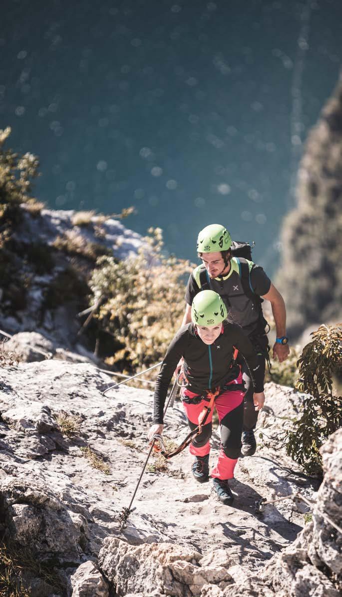
PHOTO CREDITS: Archivio Garda Dolomiti APT SpA (Watchsome, Tommaso Prugnola, Ralf Stute, G.P. Calzà), Fototeca Trentino Sviluppo S.p.A (Pio Geminiani).
Illustration map: Ledolab.it
Illustration via ferratas: Sveva Seneci
Si declina ogni responsabilità per eventuali variazioni e inesattezze per cause non dipendenti dalla nostra volontà.
Wir übernehmen keine Gewähr für eventuelle Änderungen, die unabhängig von unserem Willen sind.
We do not accept any responsabilities for changes occured for reasons not dependent on our will.
Es gibt nur wenige Orte auf der Welt, wo die Klettersteige ohne lange Zustiege erreichbar sind. Wo auch die Kinder sich in aller Sicherheit im Klettern versuchen können. Wo (fast) das ganze Jahr auf sage und schreibe 10 Klettersteigen innerhalb weniger Kilometer ein wohliger Nervenkitzel wartet. Einer dieser Orte ist das Garda Trentino.
SPORTWETTBEWERB
SPORT COMPETITION
There are few places in the world where vie ferrate can be reached directly, without long approach climbs. Or where children can also take part in the experience in absolute safety. Or where you can feel the thrill of the sheer drop almost all year round, on no less than 10 vie ferrate, all located in the space of a few kilometres. One of these places is Garda Trentino.
Cosa c’è in programma oggi? Controlla il calendario!
Was steht heute auf dem Programm? Sieh auf dem Kalender nach!
What’s on today?
Check the calendar!
gardatrentino.it/events

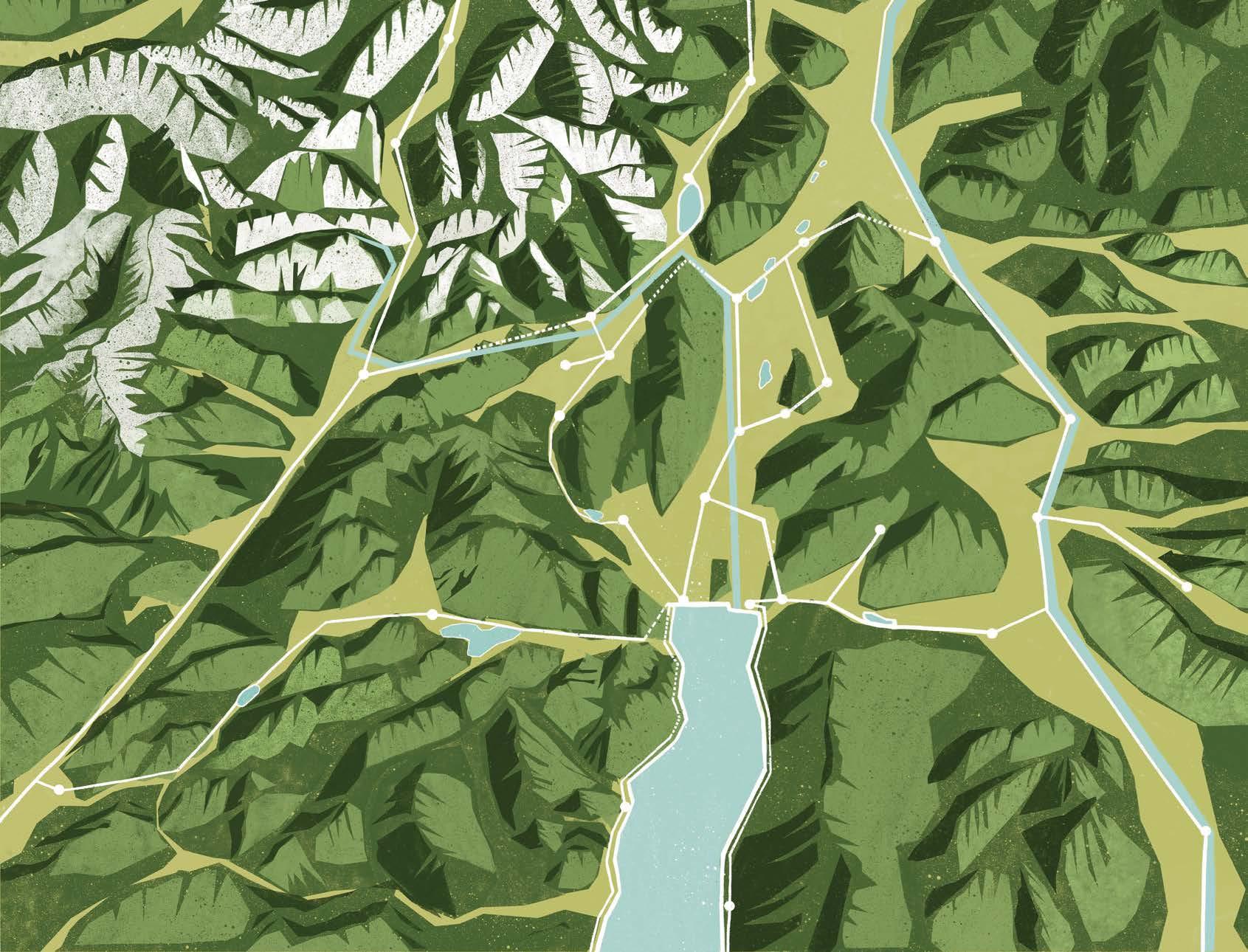
BRESCIA BERGAMO MILANO
VALLE DI LEDRO
Lago di Ledro
BRENNER
TRENTO INNSBRUCK MÜNCHEN ROVERETO
Lago di S. Massenza
BOLZANO INNSBRUCK MÜNCHEN
Laghi di Lamar
Lago di Terlago
VALLE DEI LAGHI
Lago di Toblino
Lago di Lagolo
Lago di Cavedine
Lago di Tenno
RIVA DEL GARDA
VAL DI GRESTA
TORBOLE SUL GARDA
Lago di Garda
GARDA DOLOMITI AZIENDA PER IL TURISMO S.P.A.
MILANO
Largo Medaglie d’Oro al Valor Militare, 5 | 38066 Riva del Garda TN - Italia +39 0464 554444 | info@gardatrentino.it
gardatrentino.it