Emerging Strategic Directions for
Public

Introduction


Public Life is the shared experience of the city created by people when they live their lives outside of their homes, workplaces and cars. It is the everyday life that unfolds in streets, plazas, parks, and spaces between buildings.
Public Spaces are all places publicly owned or of public
and enjoyable by
and
Gehl has worked with over 250 cities the past decades, including several that routinely compete for the top tier spots of the world’s most livable cities index. What Vancouver has accomplished in the Downtown is remarkable: A truly compact, walkable collection of neighbourhoods that exhibit vibrant public life. A decade of neighbourhood first planning has ensured widespread citizen participation and has built a “Living First” Downtown. City leadership and a committed City family have cultivated a well-educated citizenry that value urban design, sustainability and social equity. Vancouverites are justifiably proud of their downtown and connect to it as the citywide heart and melting pot for the region. Vancouver has been and continues to be a global model for successful downtowns across the globe.
The challenges that face Downtown are shared by many well-loved and successful places across the globe today. These include: affordability, polarizing class dynamics, crowding, social isolation, dysfunction, drug abuse, and lack of neighbourliness and community. There is also concern about risks from deteriorating air quality (notably, from forest fires) to flooding and other climate change-related risks. But the major challenge facing global cities today who are able to provide a high quality of life in a compact, connected urban setting is to be able to provide this type of experience for more people. Unfortunately, there is a global shortage of dense, compact, walkable and transit connected urban neighbourhoods. Cities that are able to provide this level of amenity are highly desirable and are becoming out of reach for many people.
Moving from ‘Neighbourhood First’ planning to 'Putting People First’ in the planning and design process is a crucial step for the City of Vancouver to address the challenges ahead. Jan Gehl and his students from the Royal Academy began working closely with the City of Copenhagen 50 years ago using the ethos “measure what you care about”. Today Copenhagen consistently ranks among the world’s most livable cities. But this approach is not only available to the Nordic cities. As former transportation commissioner of New York City’s Department of Transportation, Janette Sadik-Khan has said “if you’re not measuring, then you’re not managing” Empowered by the Gehl methods, Sadik Kahn applied the approach of measuring and quantifying public life to improve the quality life and economic opportunity for New York City’s nearly 9 million diverse residents. In the ethnically diverse City of San Jose, California, city leadership has embraced public life as the driver for investment across multiple departments, recognizing that diverse and inclusive public spaces are crucial for the social cohesion in this diverse metropolis.
Downtown Vancouver is expecting to add 30,000 more residents over the next 25 years. This document lays the groundwork for how to accommodate that growth and maintain and enhance the good living that characterizes Downtown for many, but not all downtown Vancouver residents today. Vancouver can build on the knowledge gained by accommodating this growth in the downtown while increasing social equity and inclusion and leverage this success by then expanding this knowledge and insight to all Vancouver neighbourhoods; thereby providing opportunity and access for more people in more places to share in the success and high quality of life that characterizes the Downtown.
We at Gehl feel that is has been a great privilege to work with the City of Vancouver, its visionary leaders, dedicated city staff and enthusiastic citizens, in shaping this vision for Vancouver Downtown public life. We hope this becomes a useful guidepost for current and future residents to embrace the creation of the type of City Vancouverites want to create and live in.
John Bela, Partner, Director Gehl
Places for People Downtown is a City-led initiative that will provide a framework to shape the public space network in Downtown Vancouver over the next 30 years.
The strategy will explore opportunities for public space and public realm improvements in the street right-of-way (including wider sidewalks, street-to-plaza conversions and laneway improvements), public spaces on City-owned or other public land (including plazas and open spaces), and privatelyowned public spaces (POPS) such as office plazas.
The Emerging Strategies outlined in this document will inform a vision for Downtown Vancouver that enhances public space and public life, and will help shape the development of the Downtown Public Space and Public Life Strategy guiding the next 30 years of development in Downtown Vancouver.
For more information see: vancouver.ca/placesforpeople PSPL - Public Space, Public Life
The purpose of the PSPL is to put people at the forefront of urban design and decision-making in Vancouver, rated as one of the most livable cities in the world, starting with the Downtown Peninsula.
The PSPL is a way to study how Public Life unfolds in the city today and to understand what some of the needs and demands are for future Public Space development. It is a way to benchmark Public Life and provide strategic recommendations for future Public Space development to inform the Places for People Downtown strategy and vision.
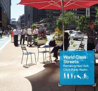
With this PSPL, Downtown Vancouver joins a network of world-class cities that are choosing to put Public Life first. Among them are the cities of Copenhagen, San Francisco, Melbourne, Moscow and New York City.
The Emerging Strategic Directions in this document are based on the research outlined in the PSPL Report, combined with a series of workshops and work sessions with city staff across departments, alongside desktop research of existing City of Vancouver planning documents and visions.
Gehl practice has conducted Public Spaces Public Life studies in cities around the world. A PSPL provides empirical evidence and arguments for improving public space. Once we understand the life of a place, we start looking at what changes are needed in the physical environment to create a more sustainable and livable city for all. Gehl's work is based on the research conducted by professor Jan Gehl. By considering the human dimension as a starting point for design, he has worked to improve cities for over 50 years.


Increase in social interactions reported in the public realm
Increase in people walking and biking — day and night, all week and all year
A variety of public space types and accessible programming within walking distance in all neighbourhoods
Increase in the presence of children, teens and older adults in the public realm
More opportunities for everyday activities in the public realm
Increase in play and recreation across Downtown all year-round
Greater diversity of public seating offerings in streets
Greater variety of stationary activities across Downtown — day and night, all week and all year
Greater reported satisfaction with public realm offerings, especially during cold and rainy seasons
Greater demographic representation of Vancouver population in public spaces across Downtown all yearround
Greater citizen participation in neighbourhood and citywide programs
Greater reported sense of community and belonging
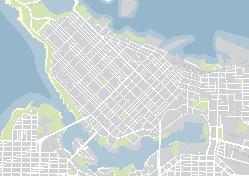
This plan diagram reflects the projects and public space networks highlighted in the emerging strategic directions.
This summary diagram takes a first step towards representing a complete Public Space Plan. The streets and spaces represented on the map form a connected network of existing key public spaces. They connect to neighbourhood amenities, city destinations, parks and to the Seawall, and across all Downtown Vancouver neighbourhoods. They highlights opportunities for public space improvements within the existing public realm.
be read as spaces of more significance than the
This plan connects the projects suggested throughout the 5 strategies in this document. The projects are all components to assist with achieving the Vancouver Downtown Public Space Plan, while highlighting important components to incorporate in planning and designing each of these public spaces, that can inform future redesign of other public spaces in Vancouver Downtown
The projects visualized on this plan reflect location specific projects that connect across the strategies. Suggested projects like the POPS program, activation of setbacks, and commercial street sidewalk zones are visualized individually within the strategic directions. They may apply across all locations within the key public space network (shown in blue on plan), or to a specific typology.
Note: Project #7 is not visualised as a separate project in detail. This project builds on the Bute St Street Lab project (#3) and connects to laneways activation and adding to parks.
Expanding the seasons on VAG Plaza and upgrading the adjacent intersections to accommodate the high number of pedestrians.
Creating a local meeting place (plaza) in conjunction with renewal of the West End Community Centre, convert adjacent laneways and connect to existing park (Barclay Heritage Square)
Building on the success of City programs, like VIVA, continuously utilizing Bute Street as a Street Lab. Include intersections that connect to the key public space network.
Showcase a station area as a high quality public space within the network, as more than just a place to move through. Improvement of connections to surrounding public realm.
Build on the success of the Robson 800 block and expand pedestrian only zone / upgrade connecting intersections.
Mainland Street as Street Plaza. Include connection to Seawall, including intersection across Pacific Blvd. Connect to and consider upgrade of Yaletown Park to better serve local community.
Building on the success of Jim Deva Plaza, creating a local micronetwork that connects Jim Deva to Nelson Park, add shelter from the elements to Nelson Park and consider a laneway convertion in relation to Jim Deva Plaza to 'fill the public space gap' in the area.
Note: As N.E. False Creek is under development no physical spaces are suggested on the map.
1
Foster a Vibrant Downtown Public Realm All
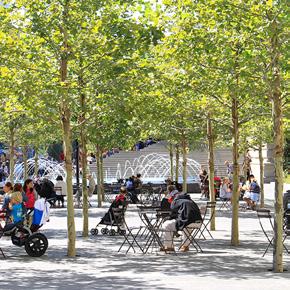
Expand the variety of public spaces and improve access to existing spaces. Broaden the everyday public life profile Downtown and provide more opportunity to enjoy the public realm by diversifying opportunities to enjoy the public realm all day, all week, and all year-round. Focus on inclusive invitations for social mixing and civic togetherness.
4 3 5 2
Co-Create Vancouver
Foster a culture of participation in shaping the public realm. Unlock citizen-generated urbanism and empower neighbourhoods and districts to actively cultivate their own local identities building on the success of existing programs and bringing communities together.
Unite the Downtown peninsula by celebrating its' natural setting. Bring people to the Seawall and bring nature to the City.
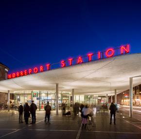
Enhance the arrival experience at entry points to Downtown for people walking, biking, and taking transit. Create genuine expressions of arrival with legible connections to the public space network and dignified places to wait, rest, and spend time. Recognize station areas and transit stops as vital parts of the public space network.
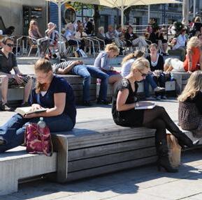
Amplify opportunities for public life, including passive recreation and play on downtown sidewalks and streets. Celebrate all streets as public spaces, leverage their existing qualities and prioritize streets that act as links between neighbourhoods, local assets, and citywide destinations.
Downtown has a diverse and extensive public realm—715,000 m2 of open spaces not including streets, sidewalks or Stanley Park— that is well used by residents, workers and visitors.
As downtown adds up to 30,000 more residents of varying ages, backgrounds and abilities, and up to 75.000 new jobs, the public realm will need to work harder. The City should strategically expand and improve the network of open spaces Downtown.
Expand the variety of public spaces and improve access to existing spaces.
Broaden the everyday public life profile Downtown and provide more opportunity to enjoy the public realm by diversifying opportunities to enjoy the public realm all day, all week, and all year-round.
Focus on inclusive invitations for social mixing and civic togetherness.
Public spaces are within walking distance of all Downtown Vancouverites
Vancouver has been successful in providing public space within a 10 minute walk of most residents and workers.
Downtown Vancouver is a green city, with a mix of public space typologies.
Vancouver has a strong legacy of public realm acquisition and contains significant and high quality public spaces of a variety of scales and character. This is shown especially by the impressive amount of park space.

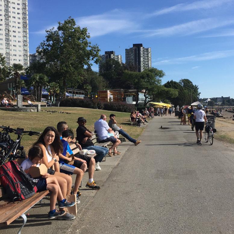
Downtown Vancouver is buzzing with activity in the Summer, when both locals, visitors, employees and tourists enjoy the many things the city has to offer. Areas that invite people to spend time with friends and family are especially popular. Parks see a lot of children and families, while POPS see a lot of office workers out for lunch.

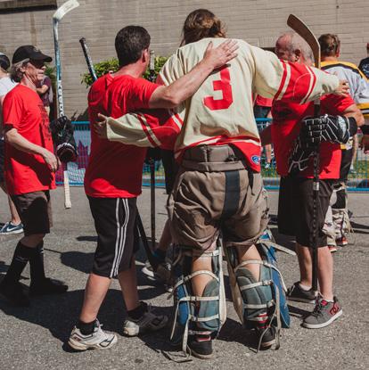
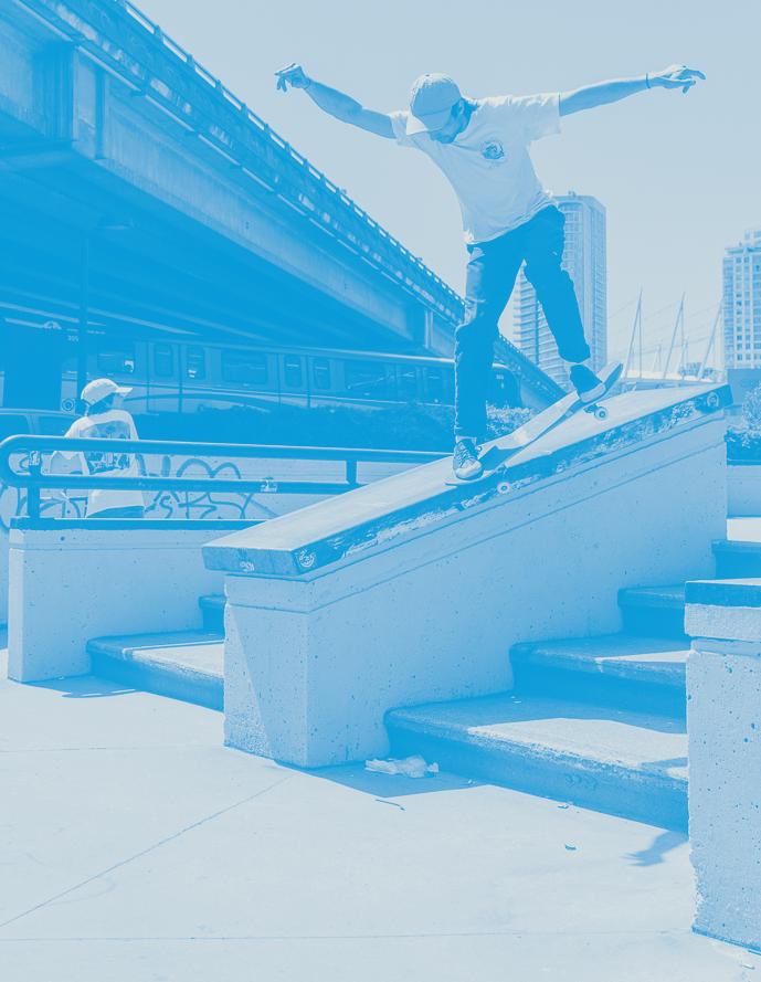
Downtown Vancouver is home to an impressive amount of events throughout the year, of varying scale and character. These 100s of events compete for a limited number of spaces, and need to consider the day-to-day functions of the city and explore opportunities to create new spaces or fit existing spaces to meet this growing demand.
Not everyone has access to the types of open spaces they want
Hardware refers to the physical space and components that provide amenities like seating, shelter from the elements, trees, and play equipment.
Software refers to programmatic layers that activate a space, such as farmers markets, community events, policies, and other activities.
Not all residents are represented in the public realm and not everyone feels invited
Children, teens and older adults are especially under-represented when it comes to stopping and staying. Although children are present in parks that offer play facilities in a safe environment, shielded from moving vehicles.
Lack of diversity in public space offerings, limited opportunities for everyday activities
Larger public spaces provide the capacity for larger events, while sometimes lacking opportunities for everyday activities. This is reflected in the Public Life profile.
This gap analysis summarizes which public spaces have sufficient (+) or lacking (-) hardware and software. The map focuses on public spaces surveyed during the 2017-18 PSPL.
Public Space Gap Analysis
+ hardware / + software
+ hardware / - software
- hardware / + software
- hardware / - software
Particularly challenged in the winter
Potential neighbourhood meeting place
of invitations to stop and stay in the winter
In the Winter less people stop and stay, especially on grey and rainy days. When surveyed, people expressed a desire for more shelter and winter programming, opportunities to stop and stay and lighting to elevate the perception of safety.
The Vancouver Downtown public life profile today shows a that high percentage of activity relates to businesses that offer ‘pay to sit’ seating. Intercept surveys showed a need for a wider range of programming with supporting amenities and affordable or free activities. This challenge is present all year, but increases in the winter where there are few offerings to stop and stay that do not involve paying.
Provide a rich mix of public space experiences, making better use of what is there
1. Build on existing public spaces to ensure that there are offerings for all ages and abilities within walking distance from all homes.
2. Introduce the neighbourhood plazas, which support everyday life activities and local amenities, in each neighbourhood area.
3. Demand more from new developments; each development should provide public spaces that read as fully public.
4. Piggyback off on-going and coming projects, like the West End Community Centre renewal and Robson Street improvements, to create new public spaces and coordinate individual projects to achieve broader public realm improvements.
5. If opportunities emerge, consider acquiring land for new public spaces.
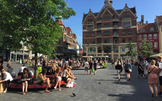
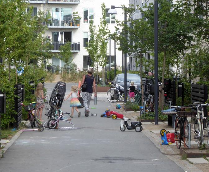
Life Indicators: (1) Greater variety of stationary activities across Downtown (2) A variety of public space types and programming within walking distance in all neighbourhoods.
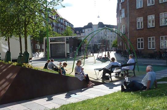
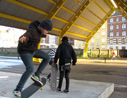
1. Introduce more shelter from the elements, including covered outdoor spaces with room for activities, including active recreation all year and continuous weather protection along buildings on key commercial streets.
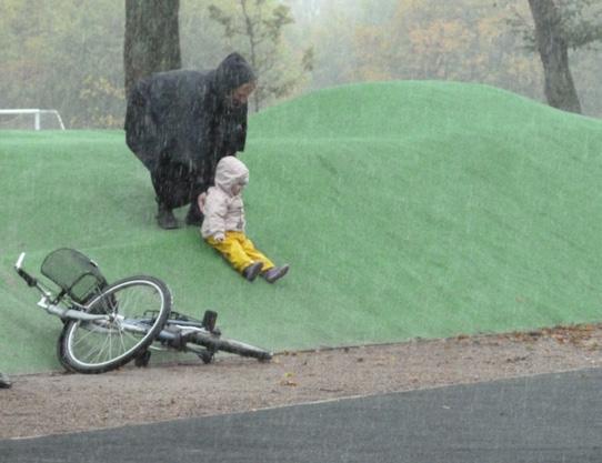
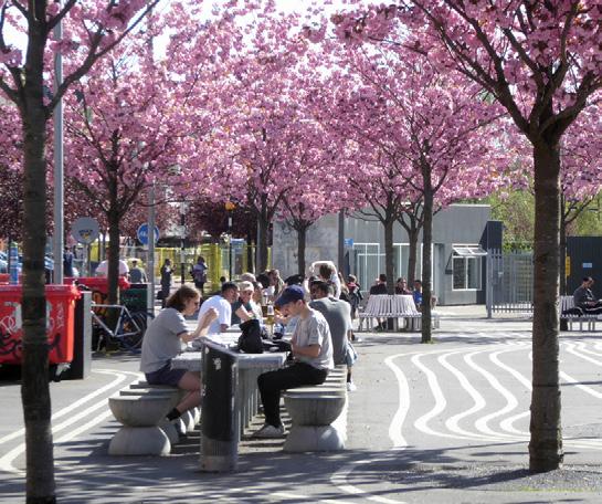
2. Introduce more hardscape public space with room for activities and more varied surfacing in parks. - Grassy areas pose a challenge in the winter, while rubber tiles, decomposed granite paving (permeable) and asphalt are easily used.
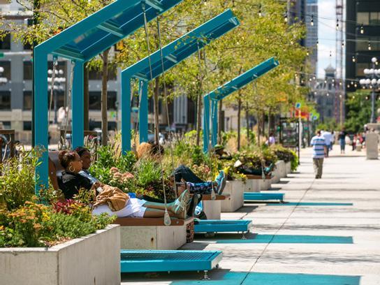
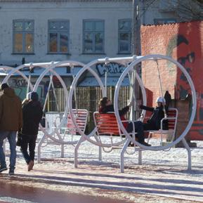
↑ Shelter can come in many forms and sizes thus offering different kinds of use. The Porch Swings at 30th Street Station in Philadelphia allow for smaller or longer breaks in the shade, with high quality seating and good people watching opportunities.
Public Life Indicators: (1) Increased Pedestrian Activity during cold and rainy seasons (2) Increased Stationary Activity during cold and rainy seasons (3) Increased reported frequency and duration of use of the public realm during cold and rainy seasons (4) Greater reported satisfaction with public realm offerings during cold and rainy seasons
A liveable city that caters to everyday life day and night, all week and all year
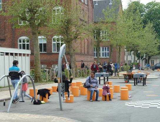
1. Support everyday activities such as dog walking, walking to school, meeting your neighbours, waiting for transit, running errands, play and exercise.
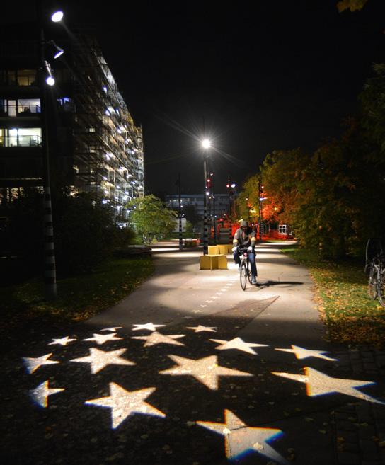
2. Extend the day and season with quality lighting to create a higher sense of safety while at the same time creating 'special moments' that can assist with wayfinding and sense of place.
Public Life Indicators: (1) Greater variety of stationary activities across the public realm — day and night, all week and all year. (2) Greater reported sense of safety.
An inclusive city that prioritizes access & affordability for all
1. Consider all users from 8-80 years old to ensure that the public realm serves everyone.
2. Provide public restrooms, accessibility and drinking water.
3.Support free activities in the public realm, by expanding the offering in the existing public spaces.
4. Engage with under-represented groups to understand their needs and desires of the public realm. Develop an outreach plan.
Public Life Indicators: (1) Greater demographic representation of Vancouver population in the public realm across Downtown all year. (2) Greater reported satisfaction with free programming all year.
Suggested Project
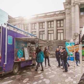
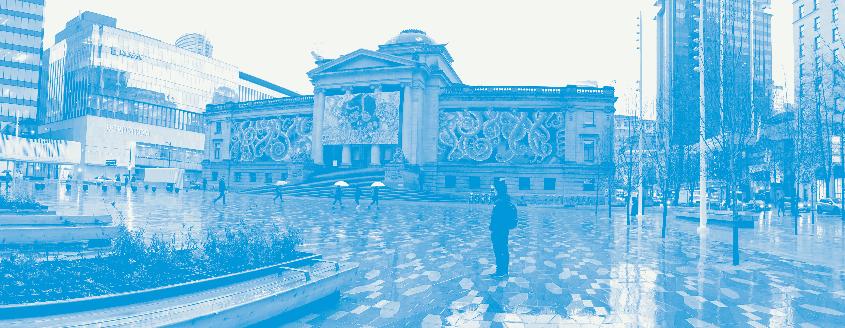
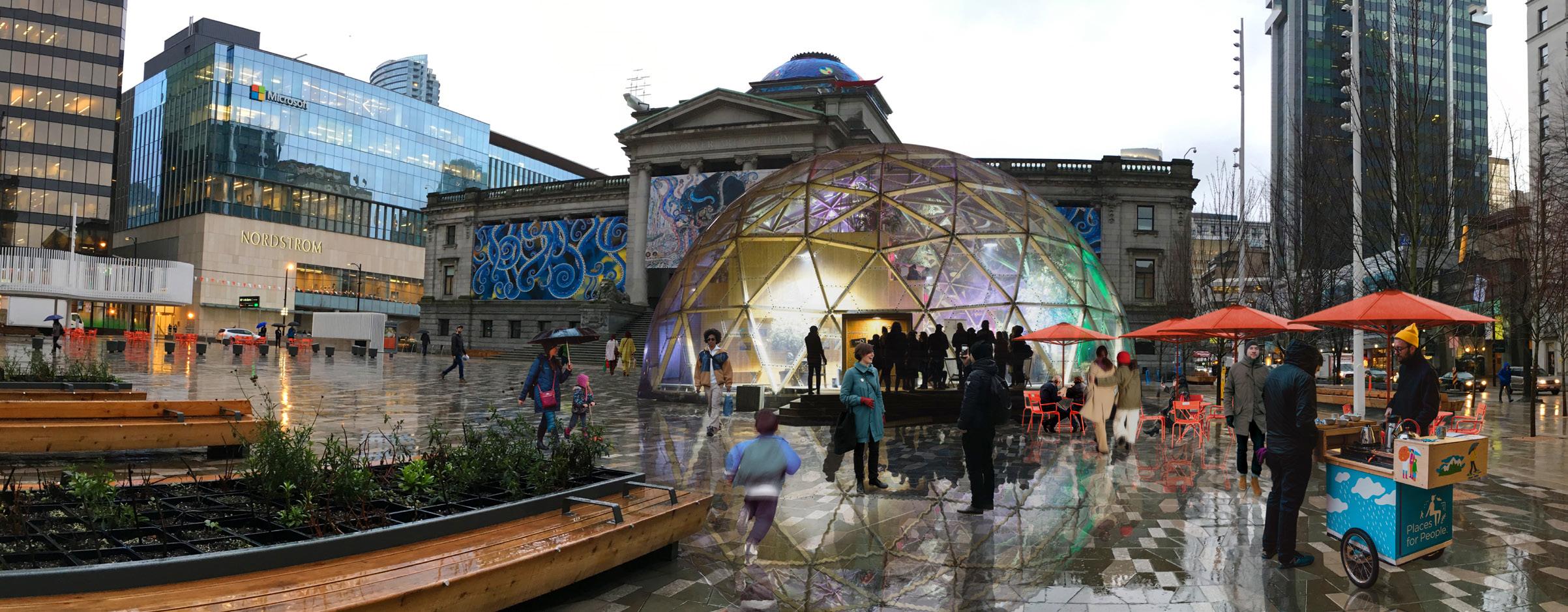
VAG Plaza holds the potential to host a lot more everyday programming and activity. Currently little activity happens outside of events, considering the size and location, and recent public space improvements
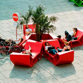
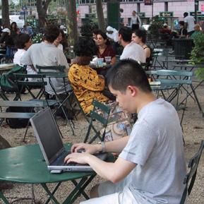
It is recommended to break down the scale of the plaza and introduce more invitations for the everyday, with things to engage in while waiting to visit the art gallery.
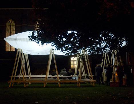
Consider introducing a temporary installation that provides shelter from the elements, but is fully accessible to the public. The structure should be of a scale that matches the size of the plaza, while still keeping parts of the plaza open for events, view to the gallery and other activities.

Suggested Project
Indicators:
An
Today the public realm around the community centre does not reflect the use and users that come to enjoy the many offerings inside the community centre.
The redevelopment of the West End Community Centre poses a unique opportunity to create a local plaza in the West End that serves as a community meeting place and at the same time could be used for local or citywide special events. In addition, this location offers the possibility of greater connectivity between multiple public space in the area, creating a local network with various opportunities to stop and stay.

Suggested Project
Create more opportunities to enjoy parks, throughout the year, with shelter from the elements & activities for all
The city parks and green spaces are especially challenged on rainy and darker days when grass surfaces get muddy, and limited lighting challenges perception of safety.
The parks make up a large percentage of the public realm. Only by expanding options for use throughout the year, they can live up to their full potential.
Introduce more opportunities to enjoy parks, throughout the year by layering programming, adding varied seating and shelter, and introducing more amenities so that parks can be inviting all year long!
Note: Shelter from the elements is a general challenge throughout the public realm on the Downtown peninsula, and introduction of cover should be examined as component throughout all public space typologies in the city
to Spend Time, summer and winter
functional and/or artistic
Public Life Indicators: (1) Increased Stationary Activity in parks during cold and rainy seasons (2) Greater variety of Stationary Activities in parks during the winter (3) Greater reported satisfaction with public space amenities in parks (4) Greater demographic representation of Vancouver population in parks all year.
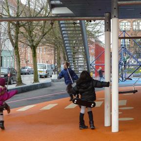
surfaces for walking, and for active recreation all year
for all, mixing urban sports, with games and playful installations
Surfaces variety, from grass, to DG and rubber asphalt/tiles Flexible shelter (movable/foldable) to accomodate all seasons - also related to existing amenities like dog parks and community gardens
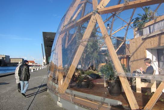
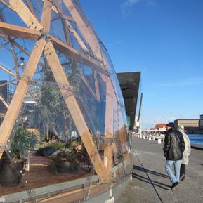
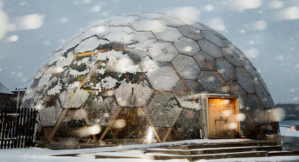
Dome of Visions, Copenhagen DK
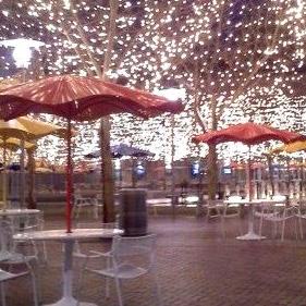
Dome of Visions was conceived to extend the season for public life through the whole year. It is a modular and movable structure, built of wood and plastic and made for reassembly every winter. The dome houses free cultural events and a coffee shop and bar open daily.
http://domeofvisions.com
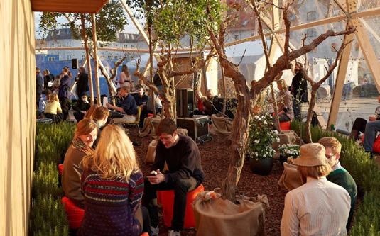
Space within the space — Subdivision allows for varied use and both being solo or in groups within the Dome. Large trees create a sense of intimacy while still allowing daylight to reach the seating areas.
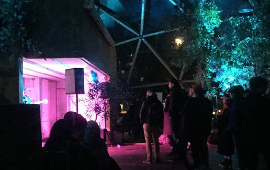
Curated program and events — The Dome has a curator that organizes events, this is in part funded by City arts funds and by leasing out the structure for private events - although this is kept limited and only on specific days known to the public.
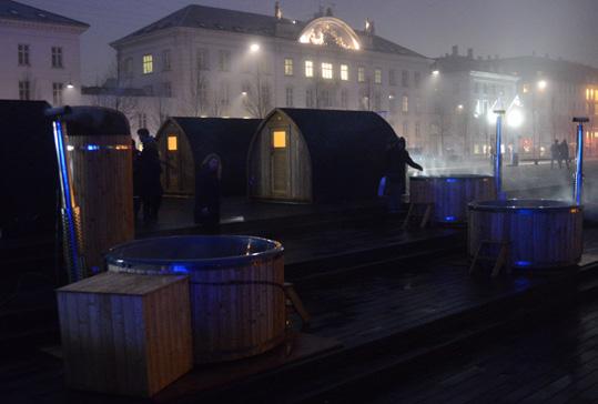
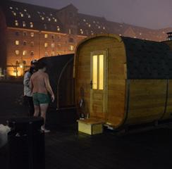
Invite Passive Recreation — Copenhagen’s public saunas invite a unique culture of social interaction around heated spaces. Saunas and heated pools allow people to brave the cold (even the harbour water, sometimes), knowing that a reward awaits.
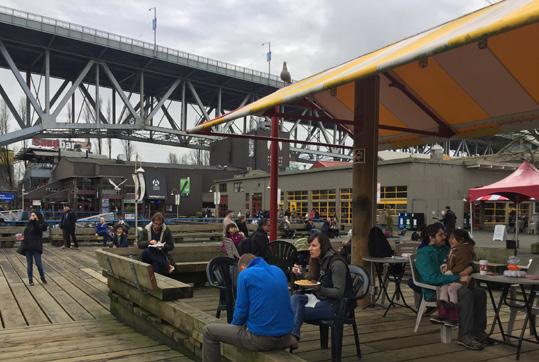
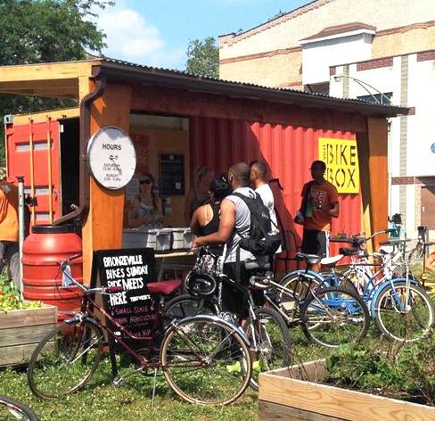
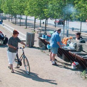
Outdoor Food and Drink — Outdoor markets don’t have to shut down in the winter months. As this local example has shown, people crave an excuse to congregate outside when basic needs are met like food and shelter. Nearby invitations to play, peoplewatch and view art help attract a more diverse cross-section of public life.
adaptable to the seasons
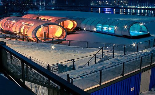
Covered Amenities in the Winter — A network of decks, connected to a floating, harboured barge house a variety of functions throughout the year. In winter, temporary canopies provide shelter for the iconic heated swimming pool, and allow the popular clubhouse to remain open through the cold.
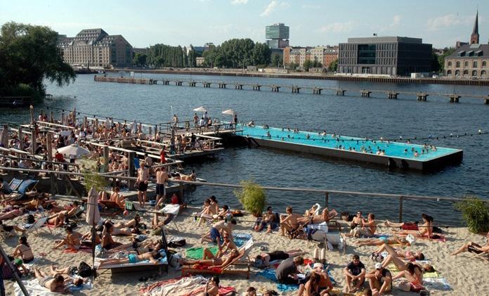
Beach-time in the Summer — In summer, the canopies are removed and the area becomes a popular beach-party spot complete with a volleyball court. The open-air bath provides access to swimming in a unique setting, while the venue offers classes for paddle-boarding and yoga.
Bring the PUBLIC back in the Privately-Owned
POPS are primarily a CBD specific typology and few of them see stationary activity outside of weekday lunch hour.
A POPS policy should be created to reflect Downtown Public Life Targets, and make sure that the POPS are well-integrated in the public space network.
1. Introduce positive signage and design clues leading people to the POPS and clearly communicating that these are public spaces for all to use can assist with getting people there.
2. Name the POPS to put them on the mapconsider if this could be a public engagement project.
3. Introduce a variety of seating and consider how to include shelter from the elements. But, it's about more than just sitting down!
4. Complement lunch hour activity with other break activities, like outdoor gym, urban gardens, games etc.
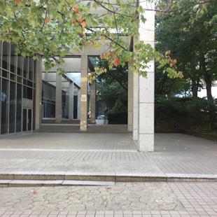

5. Look for opportunities to add activity outside of the lunch hour and take advantage of the POPS that are not surrounded by residential buildings for activities like skateboarding that are otherwise challenging to find locations for.
6. Program like food trucks, coffee carts and kiosks selling newspapers, flowers, snacks, drinks etc, can disincentivize the need for control and security guards in the POPS while at the same time instilling a higher sense of security as they create 'natural surveillance' with eyes on the street.
POPS should meet the 12QC as other public spaces, but need a different approach to make sure they are perceived as public.
Active ground floors provide the opportunity for life inside or immediately in front of buildings to interact with life in the city. This interaction is deeply dependent on visual and physical permeability: people walking by should be able to see activity inside and vice versa. Facades should be detailed, human scaled, and transparent with many entrances.
“Soft” edges provide comfortable spaces to linger. Building entries should offer a gradient between the private space of the building and the public space of the sidewalk. Spill-out seating and fully open ground floors are effective at blurring the boundary between public and private realms.
Another effective strategy is to make the building edge itself inhabitable by providing furnishings near entrances. In residential contexts, balconies, fenestration, and operable windows can provide “eyes on the street” which make places feel safe and comfortable.
Importantly, vehicle infrastructure should not detract from the pedestrian experience. Limit or eliminate interruptions to sidewalks from garage entrances and parkades. Where necessary, consolidate vehicle access in areas less used by the public.
Note: The content on this spread builds on a Gehl public space assessment tool that was introduced in Vancouver during the PSPL data collection on site September 2017. The tool has been used to assess ground floor facade quality in cities across the globe and is based on the research on Cities for People conducted by Jan Gehl. The tool can be found in the Vancouver PSPL Report pg 122-123.
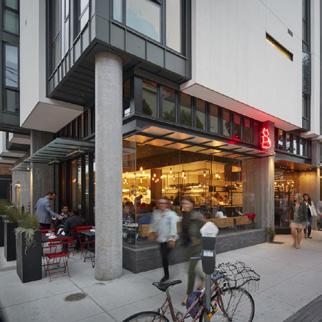
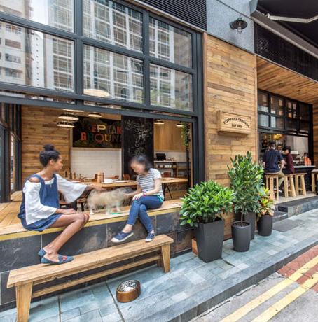
Raise residential entries above sidewalk with graceful public to private transition.
Allow facades to open to the street where possible.
Locate parkades off main pedestrian streets and away from areas with important staying activities or high pedestrian flow .
Provide generous and continuous weather protection for pedestrians and outdoor seating
Corners should receive special treatment as nodes of activity. Chamfered corners can distinguish the intersection as a place and facilitate high pedestrian volumes.
→ Notes:
• Minimize driveways and parking access throughout
floor (avoid tinted or reflective glass).
Ensure a variety of space typologies and scales along length of the block
Provide spillout seating in sunny locations. Design inhabitable building edges or amenity zones in sidewalk, especially around building entrances.
Consistent street wall except where programming or pedestrian volumes suggest set-backs or breaks in facades
Amenity zone should promote seating and staying activity related to retail uses and building entrances.
Provide the highest level of detail, quality materials, and design variety in first one or two stories.
• Design facades around large floorplate retail with the same granular level of detail and transparency as small storefronts.
and fill in the gaps! Consider all day and all year, all ages and abilities.
Consider Public Space Diversity across the Downtown Peninsula and within each local area. Improve existing open spaces so they meet the 12QC for Public Spaces.
• Protection for pedestrians and cyclists
• Eliminating fear of traffic
• Safe crossings
• Room for walking
• Interesting facades
• No obstacles
• Good surfaces
• Accessibility for everyone
• Lively public realm
• Allow for passive surveillance
• Diversity of functions 24/7/365
• Well lit / lighting in human scale
• Attractive & functional edges
• Defined spots for staying
• Objects to lean against or stand next to
• Facades with good details that invite staying
• Wind/draft • Rain/snow
• Cold/heat
• Reasonable viewing distances
• Unhindered views
• Interesting views
• easy orientation
• Lighting (when dark)
• Dimensions of buildings & spaces in observance of the important human dimension in relation to senses, movements, size and behavior
• Low noise levels
• Public seating arrangements conducive to communicating, ‘talkscapes’
• Defined zones for sitting
• Pleasant views, people watching
• Good mix of public and café seating
• Resting/waiting opportunities
• Sun/shade
• Heat/coolness
• Shelter from wind/breeze
• Allow for physical activity, exercise, play & street entertainment
• Temporary activities (markets, festivals, etc)
• By day and night
• In summer and winter
• Good design and detailing
• Good materials
• Fine views/vistas
• Rich sensory experiences: trees, plants, water
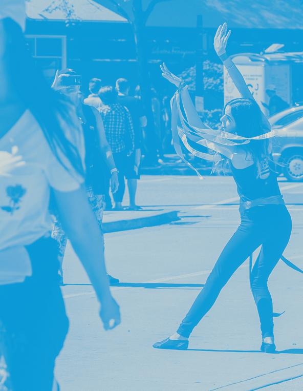
Foster a culture of participation in shaping the public realm. Unlock citizen-generated urbanism and empower neighbourhoods and districts to actively cultivate their own local identities building on the success of existing programs and bringing communities together.
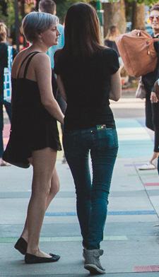
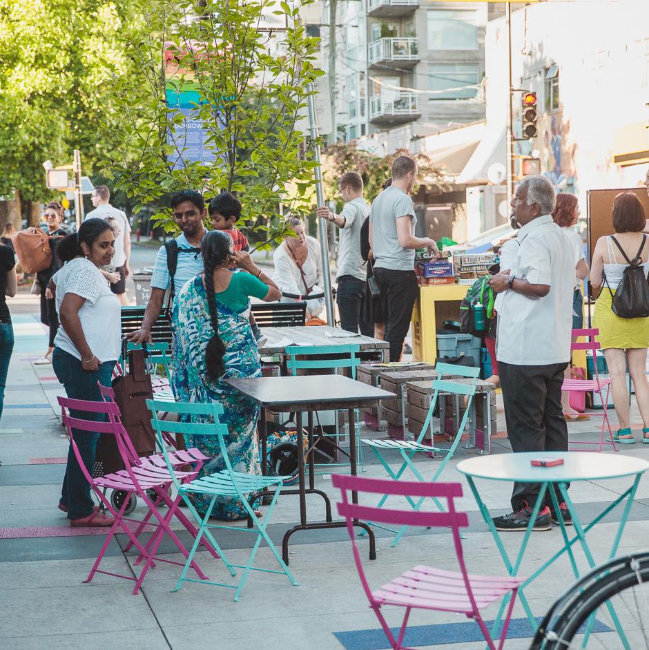

90% of respondents who live and work Downtown feel positive or strongly positive about Downtown
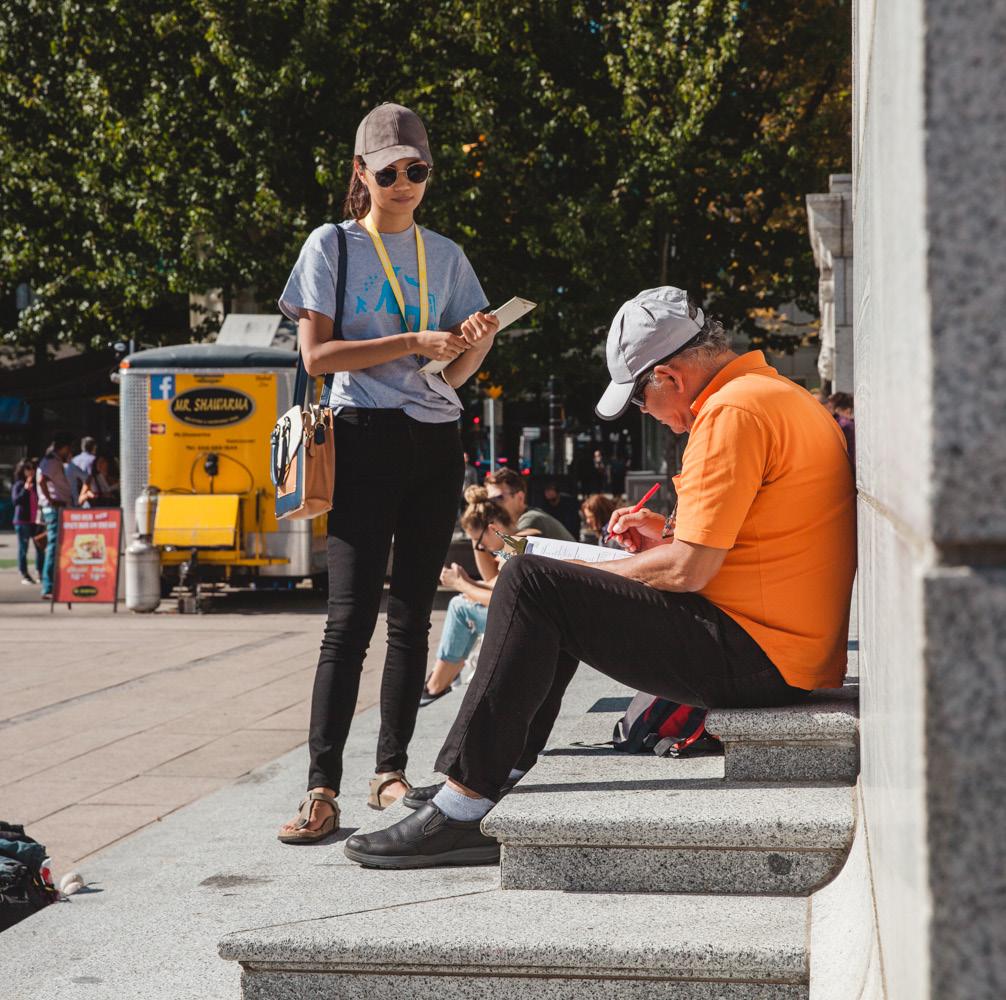
64% of respondents interacted with someone they did not plan to meet
Vancouver is a young city, with a high quality and well-planned public realm. Downtown benefits from a strong planning legacy, from public transportation, to creating a walkable urban environment that is reflected in the high number of people out walking.
Thousand of people participate in City programs across Vancouver. The successes of the VIVA Vancouver program, Green Streets and Street Gardens program, Parklet and Mural Programs are taking the tradition in a new direction, with more direct participation and ownership of the public realm. There is an opportunity to learn from this success, expanding on these programs and fostering new programs.
When surveyed people expressed high satisfaction with Downtown Vancouver in general. Vancouverites love their city and show interest through involvement. The Public Life Survey is a testament to this! With an incredible turn-out and quality of data collected. Vancouverites care about their city!
Social interaction when invited
The Public Life Survey showed that a majority of chance meetings reported in the public realm were prompted by design cues and activities. This indicates that public space design can have an impact on social interaction.
Limited funding challenges program development and participation
Red tape limits user generated urbanism
There is a need to lower the threshold for citizen participation, which today is challenged by complex City codes and procedures.
1 in 4 Vancouverites said that they are alone more often than they would like!
The City has the potential to shift focus from vehicles and infrastructure to Life, Activity and People. To ensure success, there is a need for funding to continue and to expand on existing programs. but the public realm can offer invitations to interact and build social connectedness in the city
64% of people surveyed in public spaces Downtown reported that they interacted with someone there that they did not come with.
PSPL Intercept Data
Few areas show signs of local community expression but when it is present it creates a very rich experience (such as in Davie Village). Lowering the threshold for participation could play a role in this and with programs like VIVA, successful steps in this direction have already been taken. This could essentially play an important role in bringing communities together to create a sense of belonging.
According to Vancouver Foundation many lack a social network and report feeling lonely, with limited social interaction in their daily lives. The Public Life study showed that public space design can have an impact on whether people interact and meet in the public realm. This could be used as leverage to raise funding for public space improvements, as the quality of the urban environment has impacts on the mental health of the population.
Actions
1. Leverage the success of and learn from existing programs that introduce other types of public space activation that is playful, creative, and moves beyond traffic calming and beautification.
2. Remove the red tape. Install ‘One Point of Contact in the City’, with a City steward as a point of contact for citizens so that navigating the city system is easier, with lower barriers to participation.
3. Start with the low hanging fruit. Promote low risk projects like Prototyping Festival on Local Streets with community interest and participation already happening through existing City programs.
4. Secure more funding for existing programs + for developing new programs that layer onto those existing.
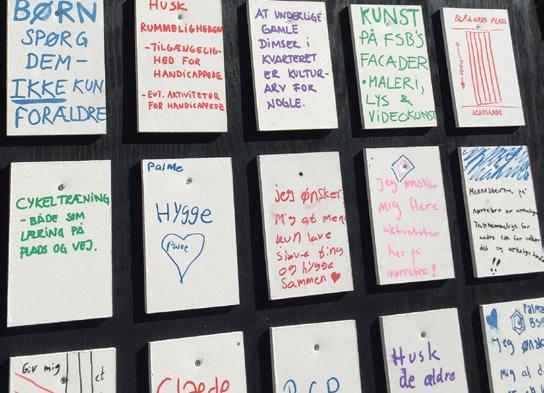
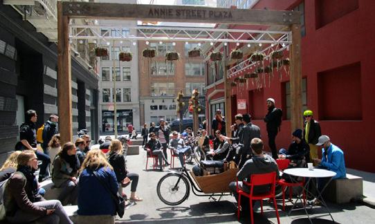

1. Encourage creative expression through artistic installations.
2. Learn from existing events and programs, like Lumiere artistic lighting festival in West End happening every December, and look for opportunities to expand programs beyond events.
3. Expand beyond art as only something beautiful to look at and encourage playful and interactive art that can add activity to streets and public spaces.
4. Secure funding for community art as an added layer component to existing programs and development plans.
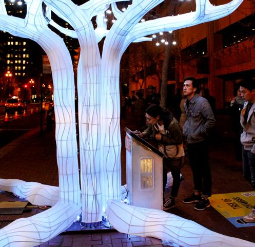
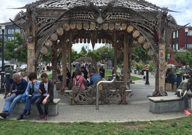
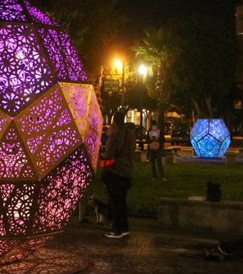
A playful city — Bring on the fun factor!
1. Expand ‘play’ beyond playgrounds, and integrate 'play on the way' or 'art as play' as active components in all types of public spaces.
2. Consider varying the scale and type of playful installations depending on location and audience.
3. Integrate more opportunities for active recreation / urban sports in the public realm for varying skillsets and physical activity level.
4. Consider how play for all ages can play a role in on-going City programs such as VIVA.

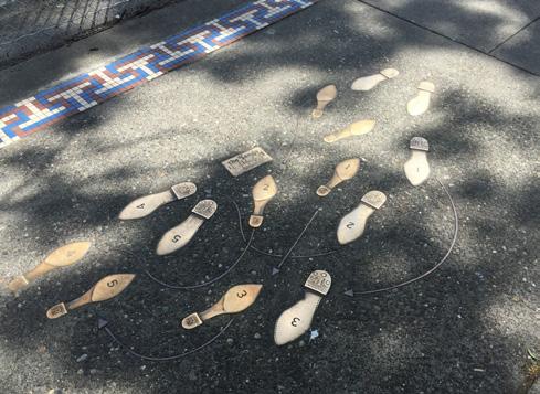
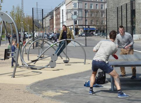
A social city — Build a sense of belonging and community
1. Look for opportunities to install design components and activities that bring people together; pets, children, seating, community events, community gardens etc.
2. Install ‘talk-scapes’, with benches and seating that invite for the chance meeting.
3. Consider how residential setbacks and frontages can contribute to the sense of community and belonging, both in existing blocks and when approving new residential buildings.
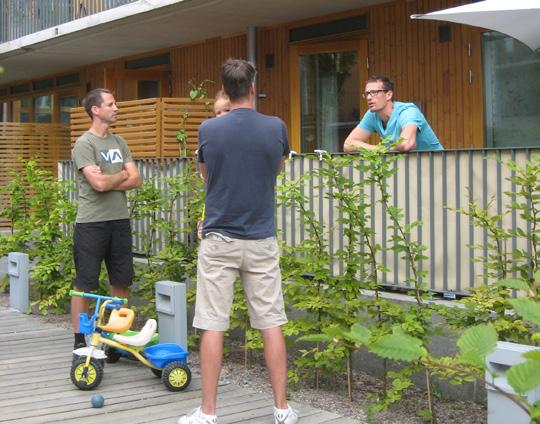

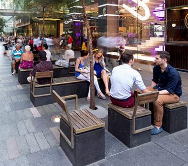
Suggested Project
Bute Street has successfully been a test location for 2 street plazas and in a sense it already functions as an on-street laboratory. By building on the success of the VIVA program and expanding on Bute Street as an urban test lab, there is an opportunity for prototyping with the community and engaging more people in shaping their public realm.
Focus on playful interventions alongside traffic safety, including programs like 'safe way to school', to expand on the existing VIVA and Green Streets programs.
'Street Lab' can be adapted to other streets and public spaces across the Downtown peninsula.
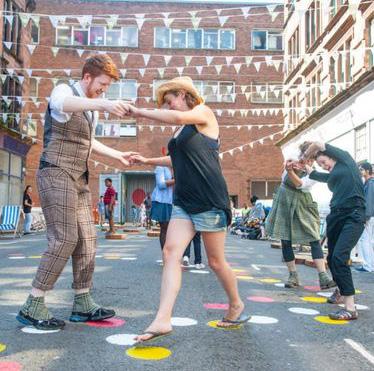
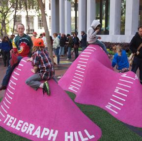
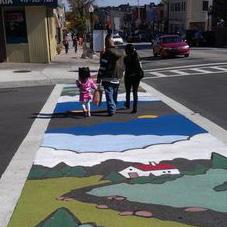
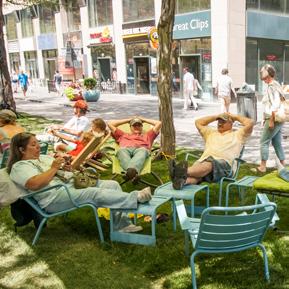
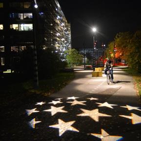
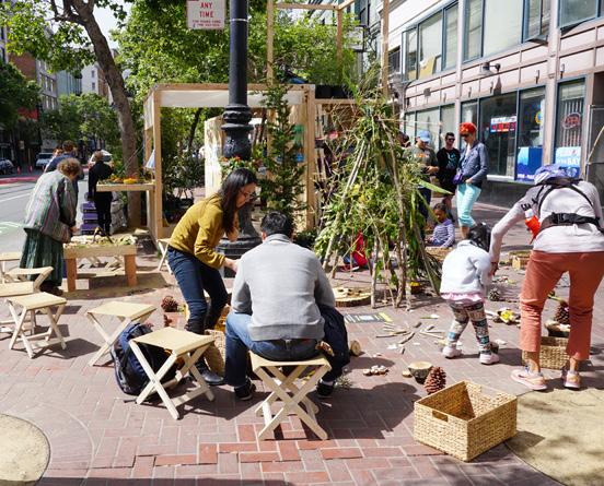
Street Prototyping Festival (MSPF), San Francisco. An exploration of civic engagement and large scale urban intervention
The Festival used citizen-generated installations to test the idea of street life zones. It gave citizens a platform to actively engage in re-imagining Market Street as a place and functioned as a platform for outreach, reaching further out into the local communities than traditional outreach.
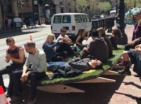
A Place To Relax — 'Relax' merged the concept of a green lawn with a rocking chair to create a dynamic yet peaceful place to sit or lay down on the street.
↓ MSPF is part of the Groundplay iniative that works with ordinary San Franciscans to build temporary installations that turn underused public spaces into joyful community places.
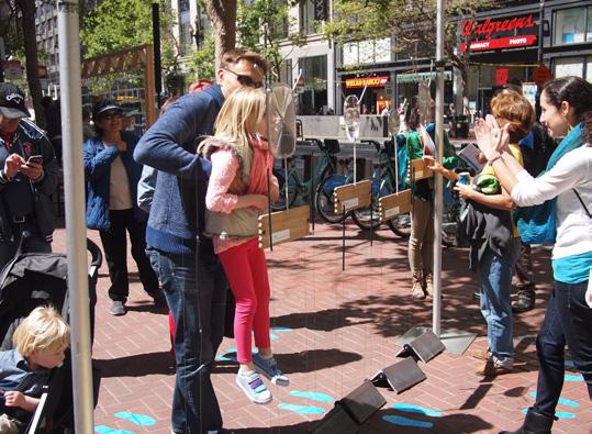
A Place For Play — 'Smaller & Upside Down' invited people to be playful and silly. The assortment of distorted glass brought fun, whimsy, and a sense of discovery to the street.
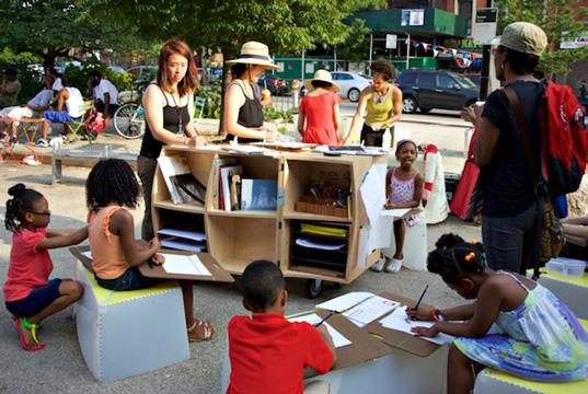
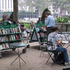
Learning For All — The Uni Project is a nonprofit that creates learning environments in public space across New York City. Using custom-designed installations, they pop up in public spaces to offer reading, drawing, and hands-on experiences for all ages.
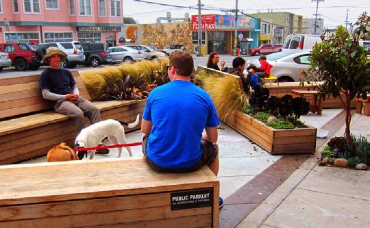
Neighbourhood Hangout — Adjacent to a popular bakery, this parklet is well used both as a spot to sit and eat your delicious breakfast sandwich or to meet up with friends. The addition of plantings adds a softness to this cosy neighbourhood hangout.

Artist Led Community Engagement — Streets don’t have to be boring. As this example shows, bringing the community together to transform a street is beautiful.
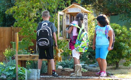
Community Book Exchange — Little Free Libraries offer a simple, free, and face-to-face way to build social interactions, increase literacy, and encourage a love of books for all communities.
A flexible space, characterized by a sunken plaza surrounded on all sides by shared streets and active frontages, including a public library and community centre that opens onto the plaza. This enables a synergy of public life by activating the space and providing a shared outdoor space for the organization.
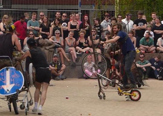
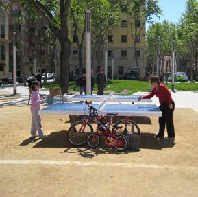
Play for all ages — The plaza welcomes all ages with opportunities for active and passive recreation. The space includes a children’s playground as well as a multi-use sunken court and ping pong tables flanked by public seating.
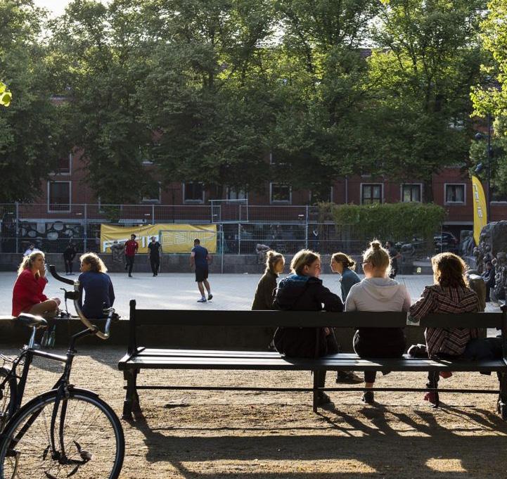
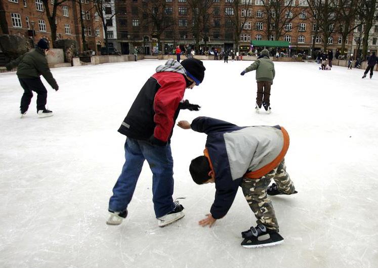
Play for all seasons — In winter the sunken plaza transforms into an ice rink, drawing families to the park and encouraging outdoor play and recreation even in the coldest, most grey months.
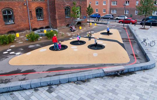
Community Play School yard — School yards can be integrated into public spaces and used as community playgrounds during non-school hours. Amenities may be occupied by passers-by, who are welcomed to play or relax in the space.
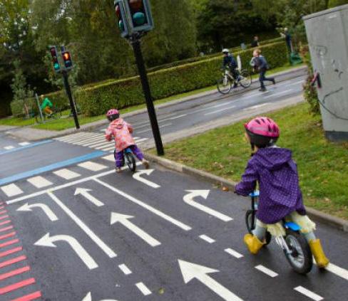
track to teach children how to ride bikes while they learn the rules of the road.
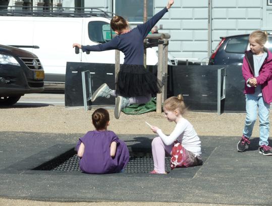
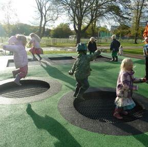
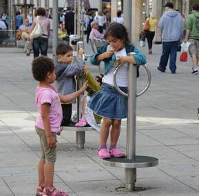
Sidewalk Trampolines (and other) — Small interventions can be added into spaces as narrow as sidewalks, providing opportunities for active play that will be encountered in the ‘between spaces’ along peoples typical routes between home, school and other destinations.
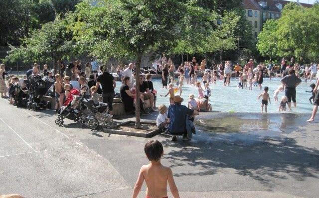
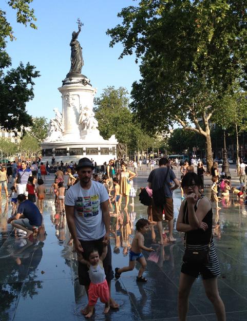
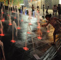
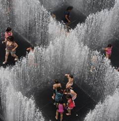
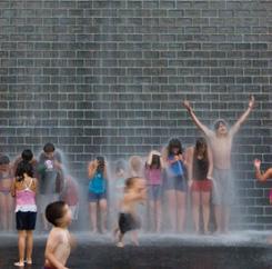
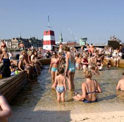
Play with Water — Summer heat encourages a swarm of public life wherever there is an invitation for water play. In winter, these play features are drained and can be occupied by a variety of programs.

Unite the Downtown peninsula by celebrating its' natural setting. Bring people to the Seawall and bring nature to the City.
The linear park is a citywide destination and a local amenity
The Seawall is an international recognized model of a vibrant, green, connected waterfront. It is a greenway (“Seaside Greenway”) of an impressive scale that connects a number of larger waterfront parks, where both locals and visitors come to exercise, picnic, enjoy the sun and the view.
From some streets in the Downtown, such as Granville Street, the natural setting including the backdrop of the mountains, assists with navigating north and towards the Burrard Inlet.
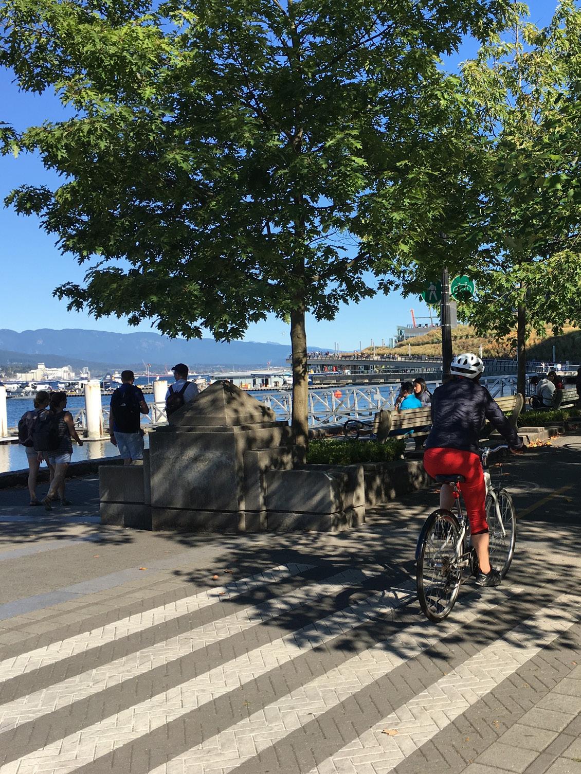
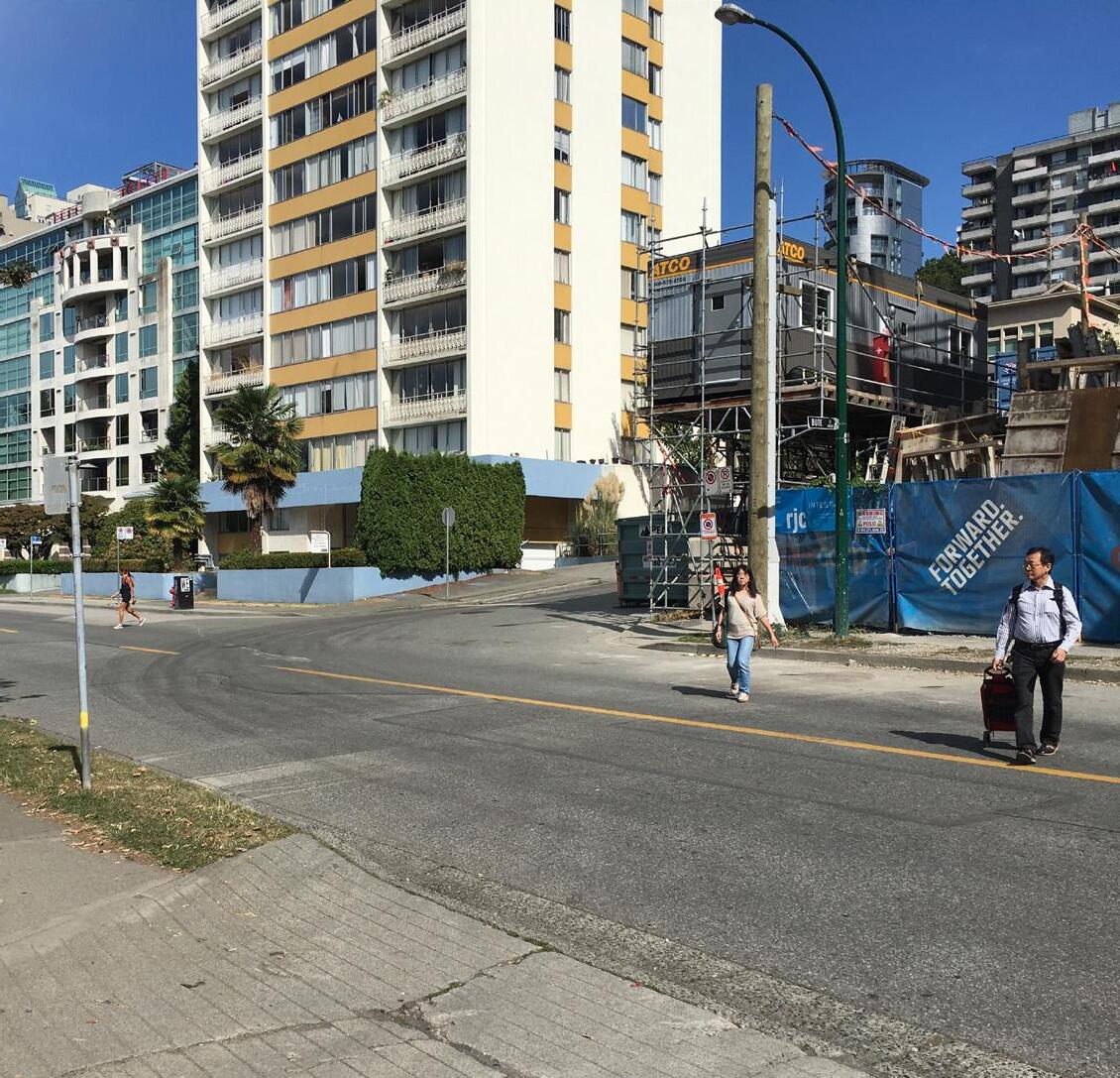
→ Many access points to the Seawall are challenged by lack of crosswalks and little to no wayfinding clues guiding you to and from the Seawall
Connections to the Seawall Seawall Missing or poor connections
Visual and physical missing links to and from the Seawall
From most locations in the ‘core’ there is neither a visual nor a mental connection to the natural setting, which is such a big part of experiencing the city. Getting to the Seawall can be challenging. The ‘last metres’ connecting core to shore (especially on False Creek) offer few options to cross the street in a safe manner, and in some locations steep grade changes add to this accessibility challenge.
Limited identity as a 'city by the water' when not on the Seawall
Although a few streets offer stunning views to the mountains beyond, there are not many locations within the city core from which you experience Vancouver as the waterfront city it is. The City core and the Seawall function as two separate components of the city with only a few moments along the Seawall where buildings meet the water.
Moving along the Seawall is a great experience!
...but it can be challenging getting to and from the Seawall
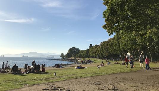
The pastoral park landscape makes for limited programmatic opportunities
The Seawall provides a somewhat limited palette of types of spaces and options for stopping and staying. This becomes particulary evident in the evening when lighting conditions challenge use and in the rainy, colder season when there is limited shelter from the elements and where lawns become wet and less inviting.
 ↓ There is a gap in the Seawall from the convention centre to CRAB Park and from CRAB Park to False Creek by Carrall Street connection.
Opportunity to ‘add layers’ and diversify the experience on
Actions Actions
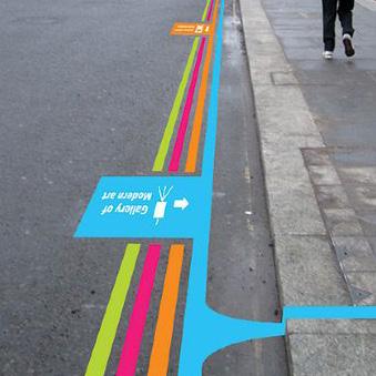
1. Integrate wayfinding cues, beyond signage, in key locations along main pedestrian streets and by key destinations.
2. Utilize level changes of the natural topography for active recreation, integrated public seating and more.
3. Install more comprehensive network of standard and special character crosswalks to get to and from the Seawall in a safe manner, connecting to key streets in the framework plan, and major destinations.
4. Complete connections with pedestrian crossings to and from the Seawall, especially towards False Creek, across and around Pacific Blvd. Upgrade existing intersections across other larger streets and consider if possible to add mid-block crossings where missing.
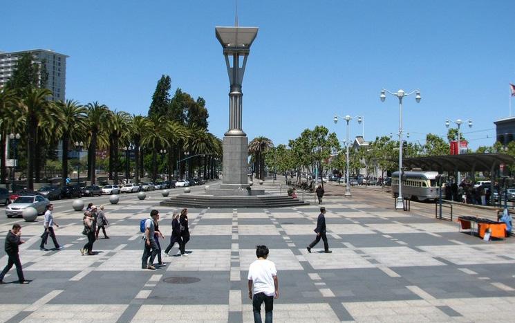
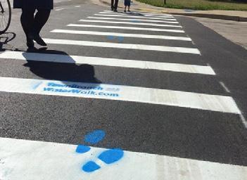
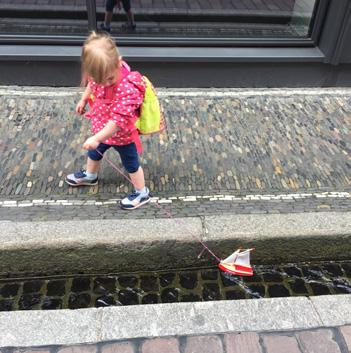
1. Develop ‘anchor points’ on the Seawall, with activities for and by local residents. Identify spots adjacent to primary 'blue - green streets' to ensure easy access.
2. Install beacons / signs that show you the best and safest way to get from the Seawall into the neighbourhoods.
3. Cater for winter activity on the Seawall by providing sheltered areas and winter programming.
4. Consider how the Seawall can complement the range of public space typologies and activities, especially in neighbourhoods with limited public space offerings.
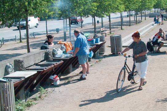
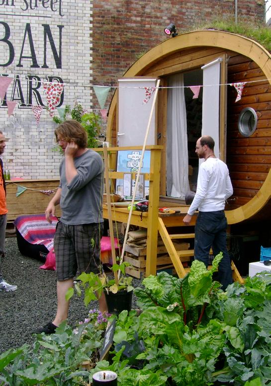
Actions
1. Ensure that bridging the Seawall gap is integrated in the Waterfront Station area redevelopment plan.
2. Consider the opportunity for establishing an urban waterfront by Waterfront Station which would bring the city closer to the water and create a different Seawall experience within the development area, with public access and programming by the water.
2. Install seamless connections for pedestrians and cyclists from CRAB Park to connect with Main Street and from Carrall Street to False Creek for a full Seawall loop!
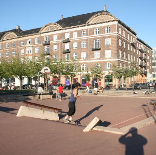
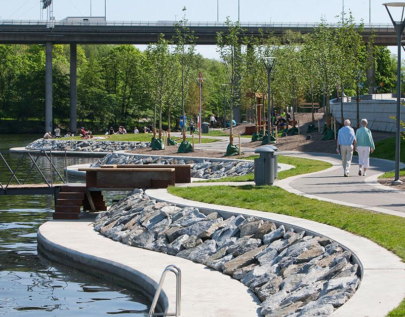
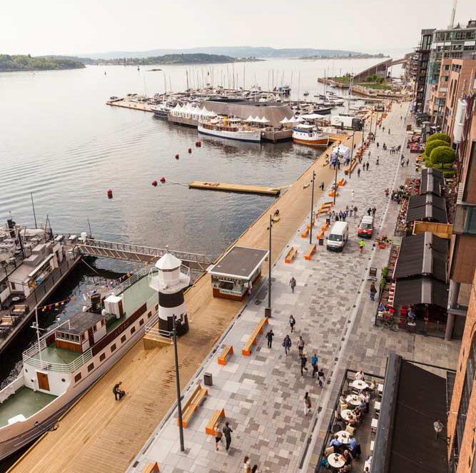
Actions
Manifestation of Vancouver as a City by the Water
1. Create strong connections across the peninsula, with green streets, that utilize native planting and trees leading the way to the shore. Enhance presence of nature in the city core, biodiversity corridors and urban forest canopy.
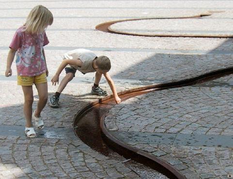
2. Layer 'blue streets' onto 'green streets', with water leading the way to the Seawall, integrating stormwater treatment and water play into the landscape.
3. Develop mental connections to the Seawall with water features in parks and plazas, and visual connections, with art that expresses the natural connect in parks and plazas.
Suggested Project
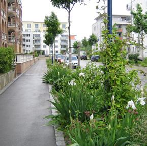
Selecting a number of north-south and east-west connecting residential streets and giving them a more distinct character can assist with wayfinding and create clearly recognisable pedestrian and bike priority streets within the grid. This effort at large builts on the success of existing program, while combining multiple of these and focusing the efforts to select street for maximum effect and clear signaling of pedestrian and cycling priority, connecting the Shore to the Core.
These selected streets, alongside other priority streets, form a type of 'superblock' which, besides assisting navigation, can assist with prioritizing which streets to invest in the future.
- see pages spread 98-99 for notes on street selection criteria
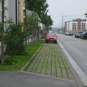
Public Life Indicators: (1) Increased walking and biking on Blue/Green Streets (2) Increased Stationary Activity on Blue/Green Streets (3) More high quality access points to the Seawall from Blue/Green Streets (4) Greater tree canopy coverage on Blue/Green Streets
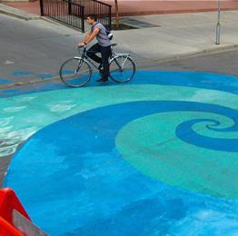
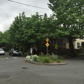
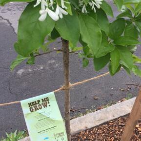
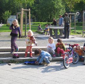
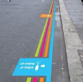
Note: Green/Blue Streets prioritizes pedestrians and people on bikes by slowing down traffic, eliminating through traffic and replacing select onstreet parking with little on-street pocket parks.
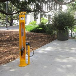
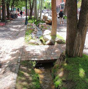
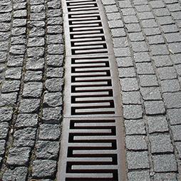
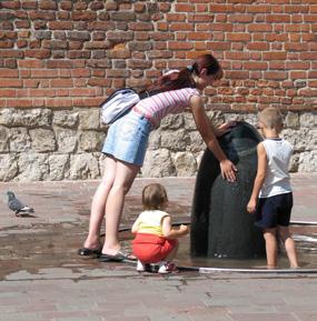
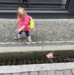
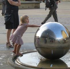
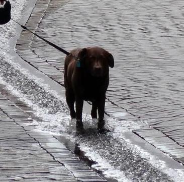
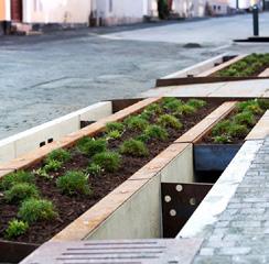
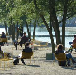
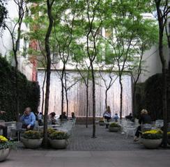
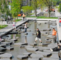
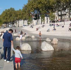
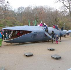
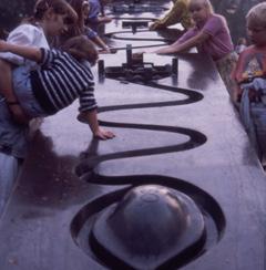
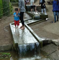
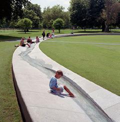
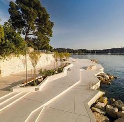
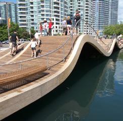
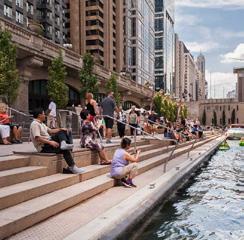
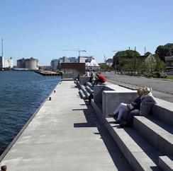
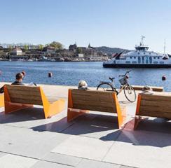
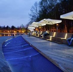
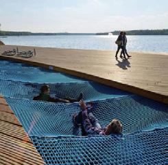
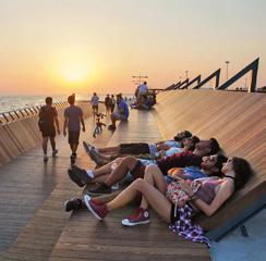
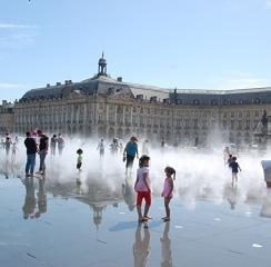

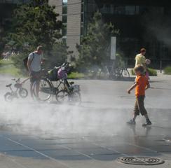
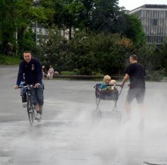
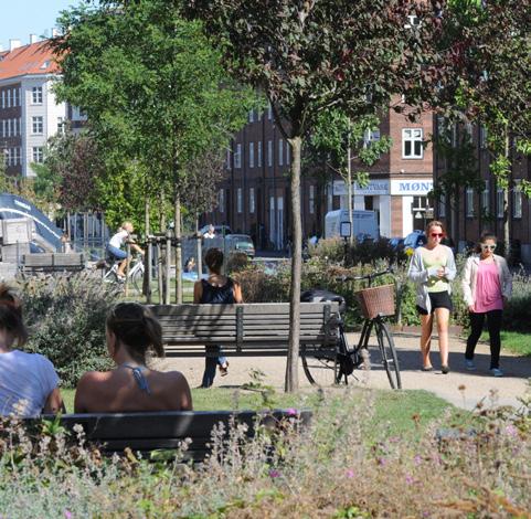
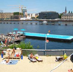
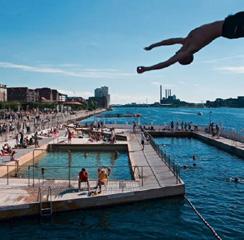
Water can be introduced into the public realm in many formats and scales, along the Seawall, as well as in streets, parks and plazas.

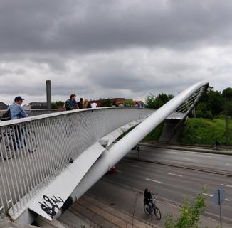
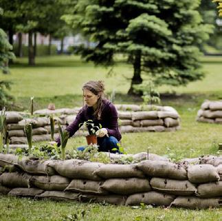
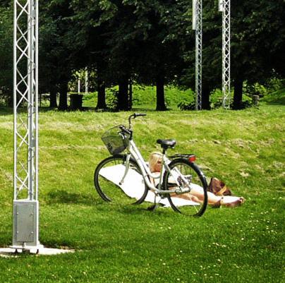
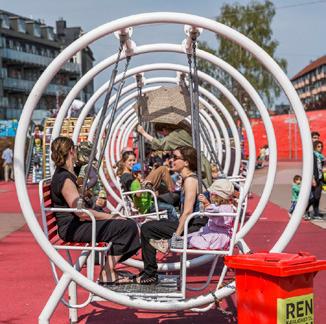
Nørrebroparken & Superkilen
Copenhagen DK
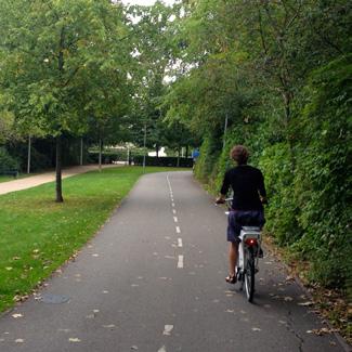
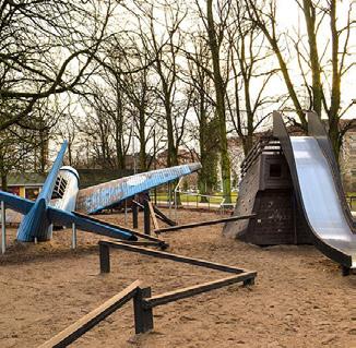
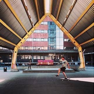
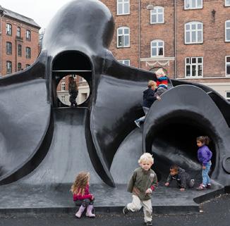
This linear trail network is packed with a variety of active and passive uses along its length. Within a short bike ride there are many invitations for exercise, play, rest and connection to the natural world.
Dedicated bicycle infrastructure dramatically enhances the city’s trail network, helping to encourage one of the highest rates of cycling in the world and inviting people to access the park’s amenities via an active, healthy mobility option.


Strategy 4
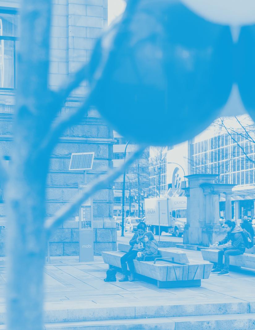
Enhance the arrival experience at entry points to Downtown for people walking, biking, and taking transit. Create genuine expressions of arrival with legible connections to the public space network and dignified places to wait, rest, and spend time. Recognize station areas and transit stops as vital parts of the public space network.
daily commuters at Waterfront Station
daily commuters at Burrard Station
The quality of public transit is reflected in high ridership numbers
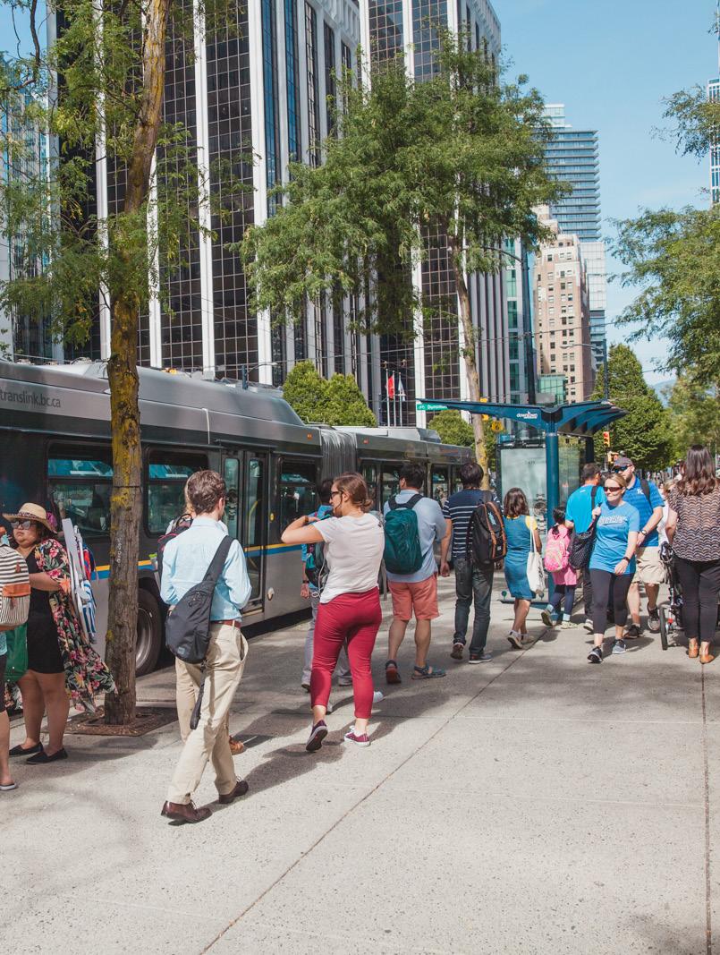
Vancouver has a high quality public transit system, with impressive rider numbers. Every day thousands of people travel to and from the Downtown peninsula on public transit.
Bus stops across Downtown often times offer shelter and/or seating, either in the form of actual bus stops or because they are located near awnings or edges that can be used for informal seating.
The quality of public transit is not manifested physically in the public realm
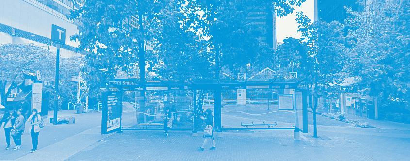
Station areas are challenged by few active facades and a lack of program inviting little public life beyond people passing through. Yet many transfers between modes at the station areas result in a lot of people standing while waiting for transit as few other optional activities are offered. The station plaza is a missing component in the public space network!
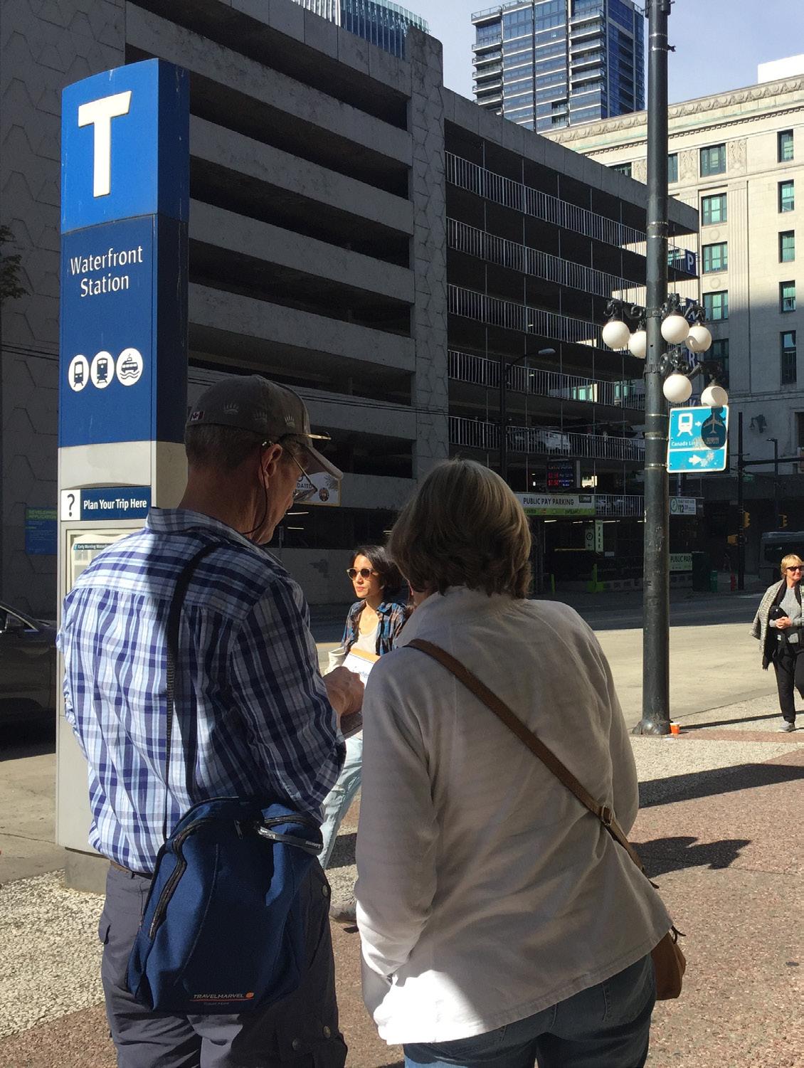
How do you find the station? How do you know that you have arrived?
Wayfinding to and from stations are often challenged by lack of wayfinding and few design cues that lead to and from them.
Goal
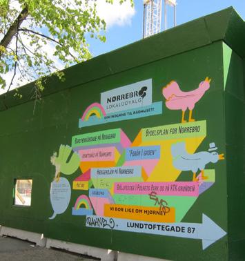
1. Enhance walking experience and wayfinding to and from the station areas by activating dead facades with different types of facade treatment, from green walls, to art, to redeveloping the ground floors to hold public functions.
2. Integrate wayfinding cues, beyond signage, in key locations along main pedestrian streets and near key destinations, guiding people to transit hubs, and from transit hubs to key destinations.
Station areas as high quality, well-integrated public spaces
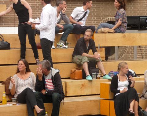
1. Provide seating options that are comfortable for 5, 10, and 20 minutes.
2. Provide protection from rain, wind, sun, and traffic.
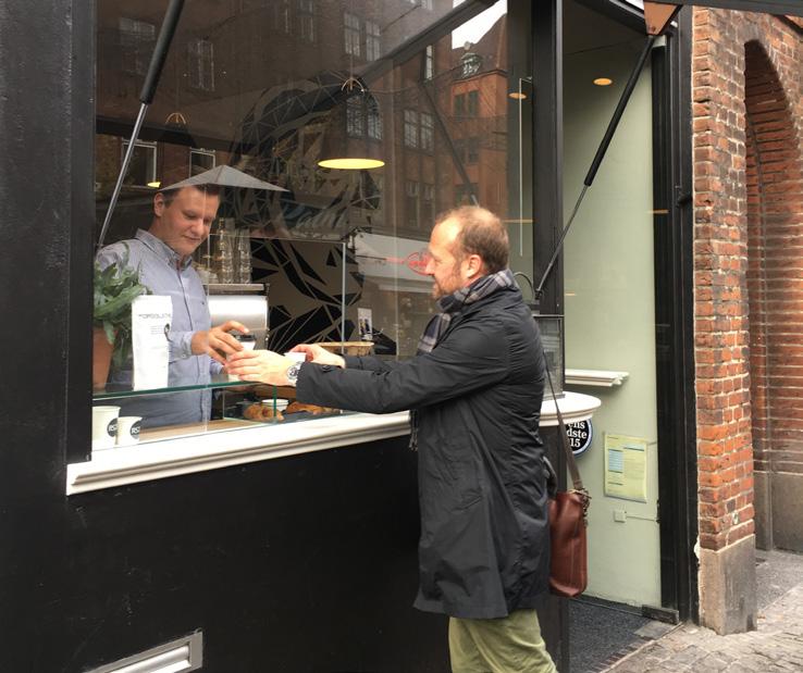
3. Activate edges with public functions and/or install kiosks where people can get refreshments and other small items to enjoy while they wait.
4. Consider how to integrate things to do while waiting for transfers, such as play, exercise, small errands etc. Things that will enhance the waiting experience and add to the quality of life.
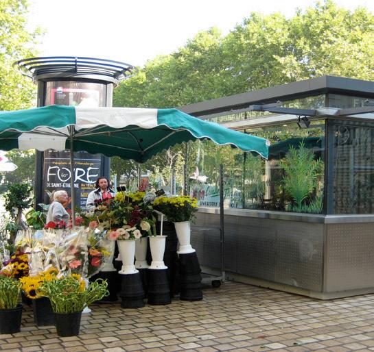
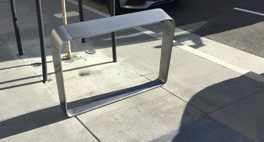
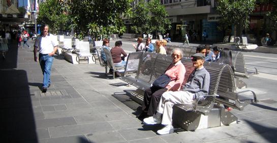

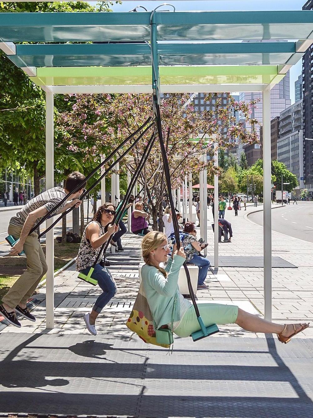
Bus stops are for more than just waiting for transit
1. Offer a high quality transit experience at bus and ferry stops with seating, shelter, free wi-fi etc.
2. Provide protection from rain, wind, sun, and traffic.
3. Consider how to integrate things to do while waiting for transfers, such as play, exercise, small errands etc. Things that will enhance the waiting experience and add to quality of life.

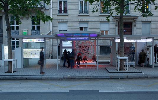
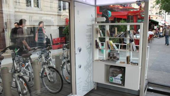

Suggested Project
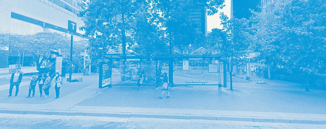
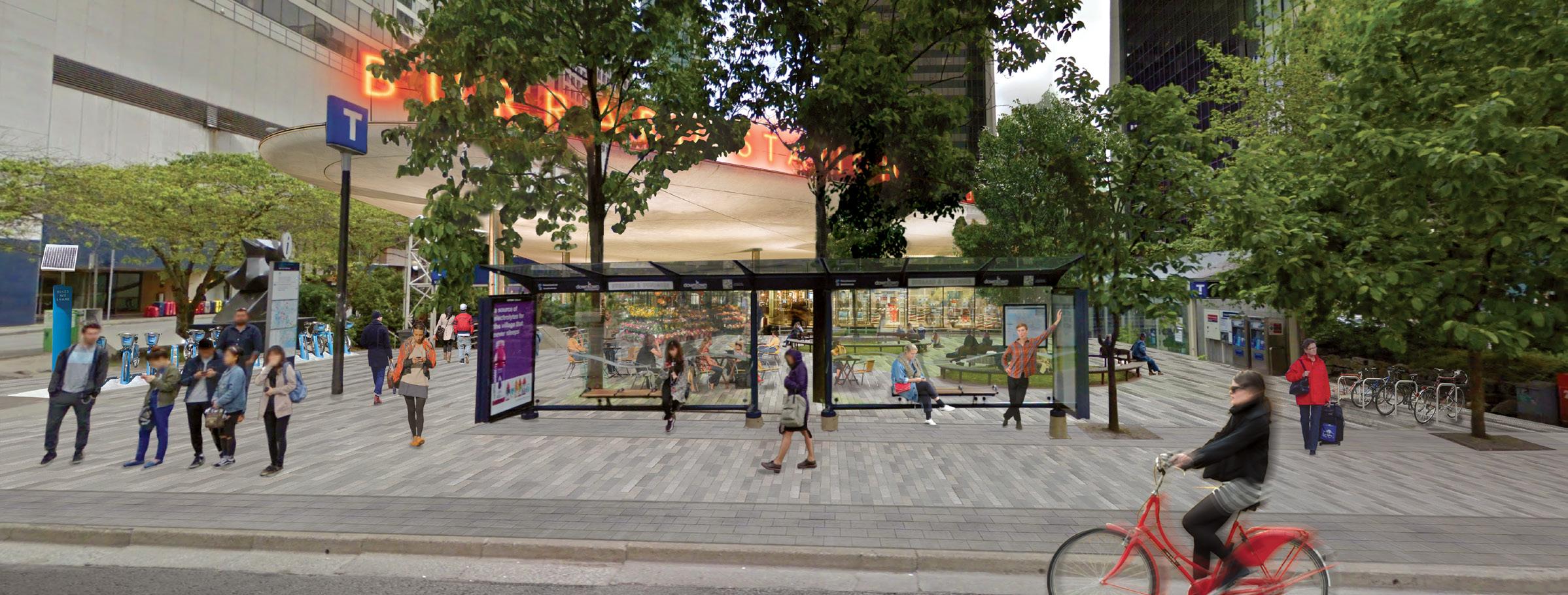
Burrard Street Station today sees very little activity besides people waiting for transit, and those walking in and out of the station from Burrard Street. The configuration of the area and the lack of active edges with public functions makes the plaza less desirable to spend time in.
The high number of transit users and people that transfer between train and bus here could benefit from a station area that offers things to do while waiting. This could be done by: 1. Reconfiguring the plaza as visualized on this spread or 2. Inviting more temporary uses such as food trucks, kiosks, movable seating and programmed activities.
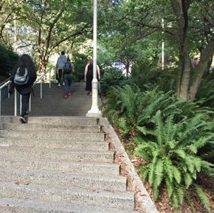


Amplify opportunities for public life, including passive recreation and play on downtown sidewalks and streets. Celebrate all streets as public spaces, leverage their existing qualities and prioritize streets that act as links between neighbourhoods, local assets, and citywide destinations.
Vancouver is a walking city - all year
Vancouver Downtown is a thriving neighbourhood of businesses and residents. Every day, thousands of people walk to work within Downtown and from nearby residential areas, and thousands more commute to Downtown from greater Vancouver.
Downtown is home to cultural and civic institutions and a destination for visitors and tourists who come to enjoy the City's many offerings, especially in the summer.
70%
Continue walking in the winter, compared to the summer survey
76% of facades on Robson Street are vibrant or active 15% of facades on Georgia Street vibrant or active
Each neighbourhood provides amenities within walking distance, from retail to community centres. The majority of the cultural institutions are located in the CBD within the Downtown core, where bigger arenas and event spaces are located towards the edges of the peninsula in relation to the Seawall. All is within walking distance from the city core, although some locations are harder to get to as the walking environment does not invite all ages and abilities to walk in a safe and comfortable manner.
A lot of pedestrian activity is concentrated on the retail streets, while parallel streets see little activity. This is in part due to the nature of the retail streets and their public groundfloor function. But it may also be a function of parallel streets as the parallel streets having a higher % of dead facades, which create a less interesting walking enviroment.
Sidewalks across most streets on the Downtown peninsula are wide, with high quality paving offering a comfortable pedestrian experience. Retail streets currently see the highest numbers of pedestrians and are at or over capacity, which incentivizes inviting people to choose ceremonial and residential streets to relieve some of the pressure from the retail streets.
34% are standing 43% are sitting at café seats
Streets are not treated as a part of the public realm, equal to plazas, parks etc.
The streets in Vancouver are classified into typologies, but this is not always expressed in the visual and physical street profile. At the same time most streets offer few option to spend time, besides sitting at cafés.
Low stickiness on sidewalks, monocultural Public Life Profile
Despite the generous sidewalks some are full, while others see little action. Few people stop and stay, outside waiting for public transit and by outdoor serving.
Limited public seating in streets
On the main commercial streets there is limited access to public seating, while café life is thriving. The predominant Public Life activity recorded during the Public Life Survey was ‘pay to sit’ (commercial seating). The lack of public seating poses an issue of equity and inclusion as seating is limited 'pay to sit'. Street plazas like Bute Street Plaza, which offer varied public seating, show that there is a need for more public seating in and around the retail streets.
90% of all seating on surveyed streets are café seating
Setbacks along streets = Untapped potential!
Setbacks are often underutilized, even when they are perceived as part of the public realm or related to commercial use. Setbacks often become nonspaces of ‘low capacity, low control’ (see pg 105). This presents an opportunity to leverage setbacks to either become fully integrated in the public realm or better serve the building residents.
Actions
1. Build on the success of Vancouver as a walking city by enhancing the walking experience on key streets in the network. Support a varied walking experience throughout the peninsula.
2. Investigate implementing a maximum speed limit across all Downtown streets to signal active mobility priority and to promote traffic safety. Consider a maximum speed of 40km, but with lower speed limits on local streets: 30km or 20km - this would further encourage through-traffic to stay off local streets.
3. Support active mobility with protection and comfort for people that walk, bike, and take public transit.
4. Develop a strategy for removal of on-street parking, with a focus on streets with a need for more sidewalk space and sidewalk furniture zone, include streets with cycling priority that integrate sitting and gathering spaces
Public Life Indicators: (1) Increased Pedestrian Activity across Downtown day and night, all week and all year (2) Greater demographic diversity of people walking and biking across Downtown (3) Greater reported satisfaction with experiences of walking Downtown (4) Fewer accidents involving pedestrians and cyclists (5) Fewer cars Downtown
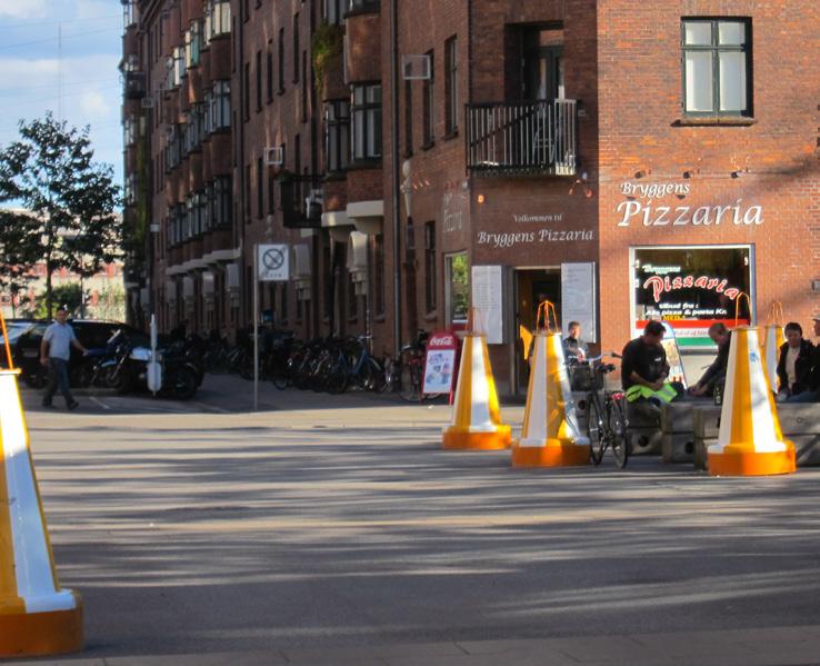
1. Introduce more opportunities for stopping and staying along the sidewalk, and add to the furnishing zone to create more space for resting and meeting.
2, Introduce new layers to green streets, ‘play on the way’, with community art and playful features that build on existing programs.
3. Explore options for larger nodes on the way, like setbacks and existing public spaces directly related to the sidewalk, and off the retail streets, such as Bute Street Plaza.

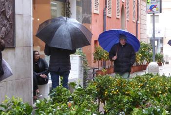
Life Indicators: (1) Greater stickiness in streets (2) Greater variety of Stationary Activities in streets Downtown, other than 'pay to sit' and 'waiting for transit' (3) Greater reported social interaction across Downtown (4) Greater perception of streets
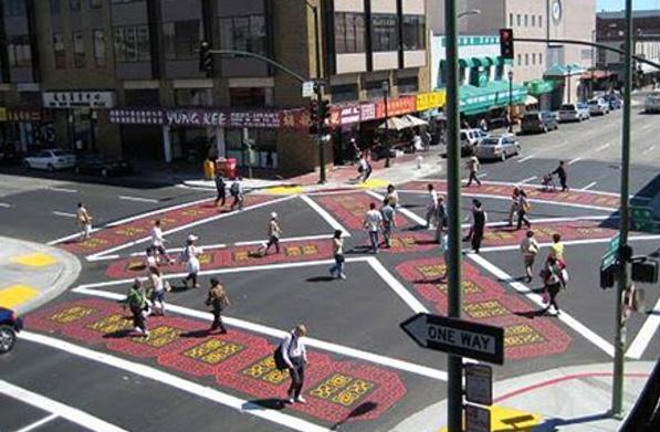
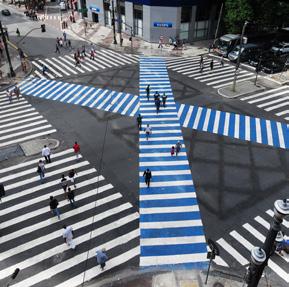
1. Implement high volume crosswalks, potentially pedestrian scrambles, to prioritize people moving across high volume intersections on key commercial and ceremonial streets in the network.
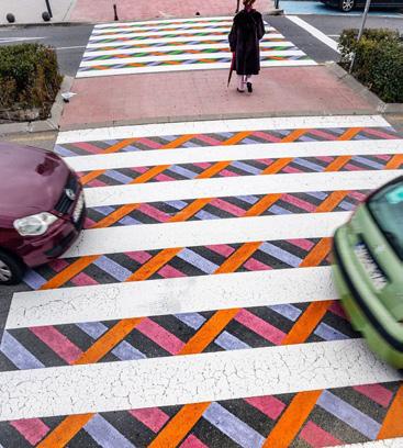
2. Investigate crosswalk upgrades in relation to other highlighted streets in the network. Crosswalk upgrades can consist of items like: - Raised crosswalks for universal access and slowing down traffic - Pulling sidewalk across sidestreets to signal pedestrian priority - Wayfinding components like specialty crosswalk design
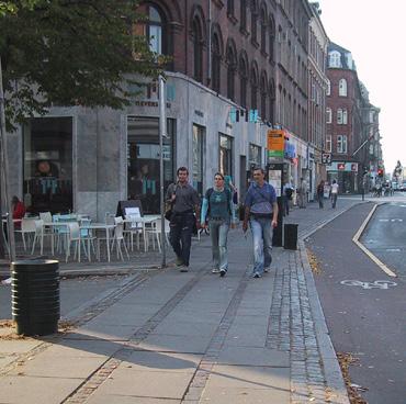
A clarified street hierarchy with distinct
1. Create a defined street grid that assist with prioritizing streets for 'special treatment' as well as create a strong and visible street hierarchy, re Barcelona Superblocks, This can help guide investments, while enhancing navigation and experience for all modes.
2. Celebrate ceremonial street both every day and event, by introducing more invitations to stop and stay. Conider how setbacks and active ground floors can add quality to the experience for people walking.
3. Elevate the experience of the existing commercial streets, by adding more options to stop and stay
4. Designate select streets as green / blue streets to enhance the presence of nature in the city and prioritize people walking and biking on neighbourhood streets that connect across the peninsula.
5. Develop a lighting strategy for the key streets within the network, introducing human scale lighting and lighting that emphazise key areas, like the villages.
The streets highlighted in the network plan are selected based on workshops with City staff, understanding of on-going efforts and projects as well as projects under development. Additionally the streets connect to key public spaces, destinations, amenities and transit nodes in the city as well as to the Seawall and Stanley Park. They connect across all Downtown neighbourhoods and to the new development area North East False Creek.
See page 85 for key street hierarchy network plan
See following spreads for details on street hierarchy by street type
The superblock (in physical terms) is composed of a set of basic roads forming a polygon or inner area (called intervía) that contains within it several blocks of the current urban fabric. This new urban cell has both an interior and exterior component. The interior (intervía) is closed to through vehicles and open to residents, primarily. The exterior forms the basic road network on the periphery, and is approximately 400 metres wide for use by motorized vehicles
Life Indicators: (1) Increased Pedestrian Activity on key streets in the network, day and night, all week and all year (2) Greater reported sense of ease of navigation / wayfinding (3) Greater reported satisfaction with experiences of walking on key streets in the network (4) Increased reported sense of safety in streets.
Ceremonial streets serve an important purpose as citywide connectors for vehicular traffic and public transportation, and as locations for large scale public events, where the streets are closed for traffic and people take over the right of way.
The Ceremonial Streets are also are the widest streets in Downtown Vancouver (apart from a section of Pacific Blvd), and while sidewalks are generous and of high quality overall, the scale of the street challenges the quality of the experience as a pedestrian.
Furthermore, large setback in particular in new developments along Georgia Street, are adding width to the already wide street and break the otherwise well-known and recognized Vancouver model; the point-podium tower model, which combines high density with buildings that meet the street.
1. Enhance the everyday experience along ceremonial streets by improving conditions around transit stops.
2. Add to the pedestrian experience by creating small scale spaces to stop and stay on the way by adding to the existing furniture zone.
3. Break down the scale by making better use of existing building setbacks and regulate setbacks for new buildings to ensure active ground floors.
4. Work with existing building setbacks to create new larger public space nodes along the ceremonial corridors, benefitting people both everyday and event across the seasons.
5. Amplify street crossing, with focus on the intersection where the ceremonial streets meets other key streets and public spaces in the street network.
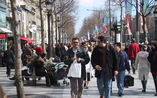
Modes served: Cars, busses, metroline and pedestrians
A prestigious avenue serving both as a city artery and a main destination, while also being the location for some of the cities largest, planned and spontaneous, celebratory events. As part of a cleaner air initiative, the street has been closed for traffic the first Sunday of the month since September 2016.
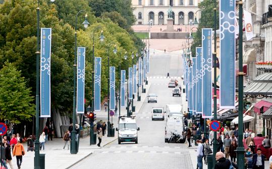
Width 1: 14m / 46ft
Width 2: 24m / 78ft (110m / 360ft if including the park)
Length: 1.2km / 0.75mi
Modes served: Cars, bikes and pedestrians
This city main street consist of two different segments: 1. a fully pedestrianized shopping street with small freight access outside business hours, and 2. a grand avenue fronted by a
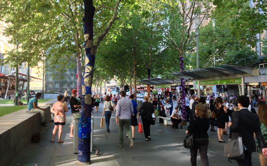
Width: 30m / 100ft - Length: 0.97km / 0.6mi
Modes served: Cars, busses, tram, bikes and pedestrians*
The street has been partially car free since 1992, with time limited exemptions for small freight, buses and private. The street historically had problems with heavy traffic, pollution and loitering, but following the redevelopment initated in the 1990s, the street has undergone a dramatic transformation. It now serves as a city destination, with direct access to high quality public transit, amenities and other key destinations.
* Closed to vehicular traffic between 7pm - 7am
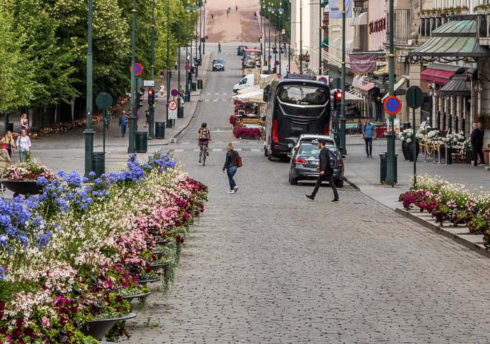
park on one side, leading to the Royal Palace. Both segments are major city destinations and serves city events and market days where it is fully closed for private vehicular traffic. In December the street hosts a large Christmas market and the park is home to an ice skating rink, free for public use.
These commercial streets already work well for retail, with high pedestrian numbers and remarkable stationary activity numbers. But while stationary activity numbers are high, the public life profile is tied to commercial purposes and 'pay to sit' which raises issues of equity and inclusion. As active commercial corridors with a lot of people walking, these streets pose a great opportunity to invite people to stop and stay beyond the retail offerings.
Each of these streets function as both local amenities and city destinations and are characterized by a high percentage of active ground floors. And though sidewalks are in general very generous, the majority of the street is allocated for vehicular traffic and public transportation. These commercial streets are working hard. But while they serve an important role as links between neighborhoods and destinations, they have the opportunity to be a lot more than that.
1. Expand on opportunities for sitting public, recreation, and play. This can be achieved in part by adding to the existing furniture zone.
2. Enhance public transportation experience by expanding the bus stops, with more seating/shelter.
3. Develop a strategy for removal of on-street parking to open up more space for stationary activity and allow part of the existing furniture zone to be reserved for people walking.
4. Consider temporary street closures for traffic, allowing people to take over the street. This can be introduced in segments, and as First Sunday of the month, every other Wednesday Evening eg.
5. Amplify crosswalks for people walking, with tabled crosswalk, 4-way stop for cars (pedestrian scramble) e.g. Focus on intersections that connect to other streets highlighted in the network plan.
6. Enhance the identity of each of the villages, with custom design elements.
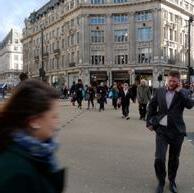
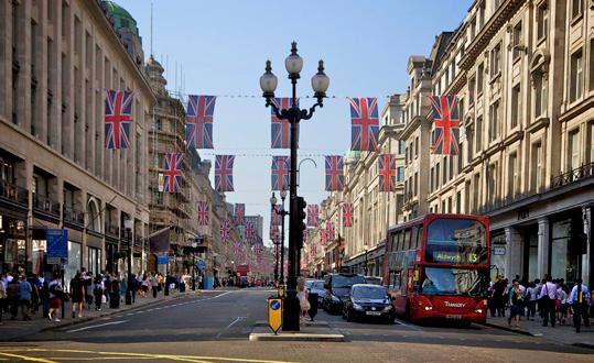
70m / 230ft - Length: 1.1km / 0.7mi
Modes served: Cars, busses, metro (the tube) and pedestrians
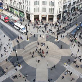
This shopping street in central London is a main tourist attraction, connecting to several destinations in the city. It is home to many events throughout the year, which during some, the street is closed for traffic. It is also the location of the first pedestrian scramble in central London, a commitment to accommodating the large flows of people walking.
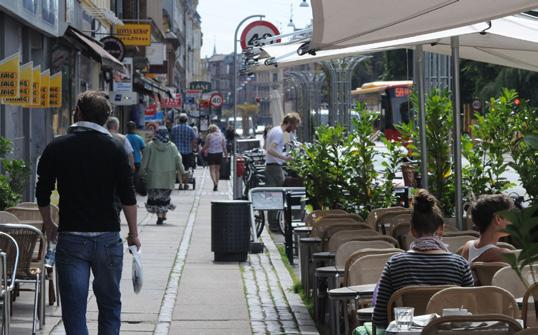
Width 1: 19-21m / 62-70ft - Length: 2.2km / 1.35mi
Modes served: Cars, busses, bikes and pedestrians
Nørrebrogade is a true melting pot of people and experiences. It runs from the edge of the historic city center to outer Nørrebro. It serves as a local shopping street, a destination for visitors, and occationally hosts neighborhood events and markets. Vehicles are allowed on 2km out of the 2.2km
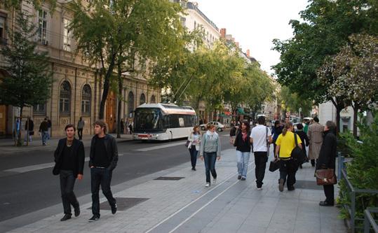
Width: 20m / 66ft - Length: 1.1km / 0.6mi
Modes served: Cars, busses, trams and pedestrians*
Situated in a zone classified as World Heritage Site by UNESCO, this main street is an attraction as well a the primary shopping street in Lyon. It connects major destinations in the city, including two city destination plazas, Place Bellecour and Place Republique.
* App. 800m / 0.5 mi is pedestrianized, with trams.
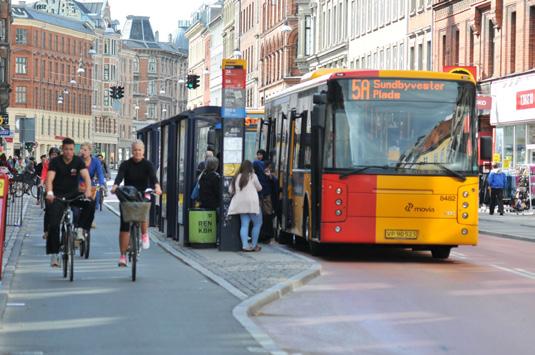
with a short stretch only allowing busses and service vehicles. The transformation from a throughfare was at large initiated in 2005, where wider bikelanes, bus-only lanes and widening of sidewalk furnishing zones, by taking out the on-street parking, was tested temporarily. Today the street is one of the busiest bike routes in the city.
Outside of the ceremonial and commercial streets, which are recognisable both by their scale and their ground floor functions, the street hierarchy across Downtown is very subtle. This is not necessarily an issue in itself, but by designating select streets for added treatments that are visible and distinguishes them from the rest of the grid, investments can be done more targeted, while at the same time creating a stronger hierarchy that can guide people moving through the city by foot and bike as well as by car.
Note. Street selection criteria:
1. Build on the successes of VIVA program, Green Streets and Street Gardens
2. Connect a number of key public spaces, destinations and amenities, parks and transit nodes
3. Connect to both shore lines, the seawall and/or Stanley Park
4. Connect existing city fabric and public spaces to the new development area in NEFC
5. Connects to a bridge that leads to and from Downtown
1. Strengthen connections between residential enclaves, local amenities and city destinations, by improving the streetscape for people walking and biking.
2. Maximize opportunities for trees and other landscaping, to create a high quality walking experience, and biodiversity corridors for wildlife
3. Introduce stormwater treatment elements to enhance the walking experience, to mitigate floodrisk, and to create a stronger connection between the neighbourhoods and the waterfront.
4. Introduce a variety of options for small pauses on the way, including seating, playful water features and street gardens.
5. Investigate how adjacent public spaces relate to the green / blue streets and how connections can be ensured in order to invite people to make better use of existing public spaces.
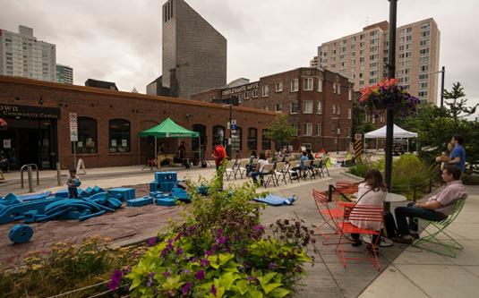
Width: 20m / 65ft - Length: 1.1km / 0.7 mi
Modes served: Cars, busses, bikes and pedestrians
The City of Seattle’s first shared street connects across Downtown, from Denny Park to the Waterfront, with the shared zone currently extending for 0.2mi between 5th St and 1st Ave. It was initiated by Belltown neighborhood residents and demonstrates how inclusive design and community and city collaboration can result in great success.
Photo by TIA International for City of Seattle
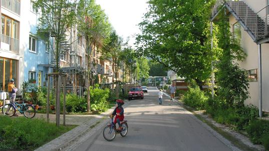
Width variation: 8-12m / 25-40ft - Length (varies)
Modes served: Cars, bikes and pedestrians
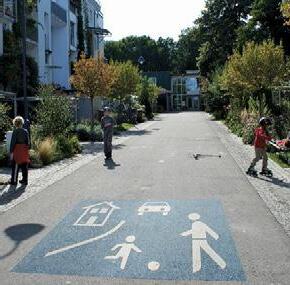
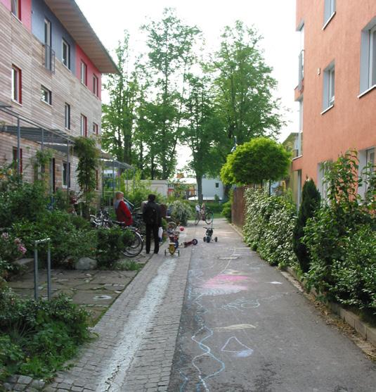
The Vauban woonerfs, 'living streets', combines vehicular access and parking for residents, with the street as a local meeting place for all ages. Semi-private to private frontyards serve each resident with an outdoor space and invites for neighbor interaction.
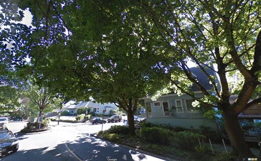
Modes served: Cars, bikes and pedestrians
This predominantly residential street combines traffic calming with street greening and stormwater treatment. There is no uniform solution across the entire stretch, but a variation from speed bumbs, to mini-roundabouts and corner bulb-outs. Bikes and vehicles share the street, while pedestrians are served by a sidewalk. The walking experience is enhanced by an impressive tree canopy that protects from rain and heat, alongside street gardens curated by local residents. Crosswalks mark some crossings for enhanced pedestrian priority.
Suggested Project
As a commercial corridor with a lot of people walking, Robson Street poses a great opportunity to invite people to stop and stay beyond the retail offerings.
East Robson
Existing
It is recommended to expand on opportunities for sitting public, recreation, and play. This can be achieved in part by adding to the existing furniture zone, but developing a strategy for removal of onstreet parking will open up more space and allow the existing furniture zone to be reserved for people walking through. There is an opportunity for the furnishing zone to become a 'Street-Life Zone'.
↓ Test, no curb changes: Expand the furnishing zone by removing on-street parking in select locations, stretches or all along Robson Street as a test project.
1. Adding street greening in existing furnishing zone, consider options for stormwater treatment.
2. Extending the sidewalk by taking out on-street parking. This could also allow moving the furnishing zone along the facades out into the curbside furnishing zone freeing up space for walking. Mix 'pay to sit' and public seating.
1. Adding bike parking in existing furnishing zone
2. Extending the sidewalk by taking out on-street parking. Combining bike parking with bus stops, freeing the sidewalk space from bus stops that obstruct the pedestrian flow on busy days. Consider bus only lanes / bus only marking in area by bus stop.
1. Adding public seating and or playful elements in the existing curbside furnishing zone.
2. Extending the sidewalk by taking out on-street parking. Activate with playful elements and/or public art, and public seating. Consider select key locations for this treatment.
Note: All measurements are guiding
↑ Adding public seating to the street within the existing furnishing zone along the curb, mixing 'pay to sit' and public seating - small pause. Consider locations for shelter.
→ Current condition
Suggested Project
The Robson 800 Block is the first block of fully pedestrianized street on the Downtown Peninsula. And with great success! The streets invites 1000s of people to walk and gather. While the pedestrianized block provides a high quality walking environment, challenges arise at each end of the 800 block, where people walking meet other modes.
It is recommended to build on the success of the 800 block and investigate an extension of the current pedestrianized street by either:
1. Improve the connecting intersections or:
2. Expanding the pedestrian zone to connect between Granville Street and Burrard Street, still allowing vehicles and people on bikes to cross at Howe St. and Hornby St.
Note: Consider small truck loading and unloading to any retail implicated by the street closure, within a defined time period.

↑ Pedestrian street Strøget in Copenhagen extends through the historical city centre for 1.2km and is on a typical summer day visited by 80.000 people
Suggested Project
Mainland Street by Yaletown Station has been incredibly successful in building a culture around wining and dining that brings a lot of activity to the street. This in particular on the northern side, where historical loading docks provide a high quality pedestrian-only environment. Still the street is dominated by vehicles, mostly parked. This limit options for more people to stop and stay as well as to walk comfortably through the street.
It is recommended to test closing Mainland Street for traffic between Davie St. and Nelson St. A closure should include parking removal in order to allow for Public Life to fully flourish in the street.
This will allow more space for other types of stationary activities than restaurant activity and essentially invite a broader user group into the street, that is more representative of the local demographics.
Park Upgrade the connection to Helmcken Park and all the way to the Seawall Integrate Yaletown Station into redesign to create an elevated arrival experience
Note: The proposed street layout (opposite page) including measurements are guiding and to illustrate potential options / phased approaches.
The generous furniture zone predominantly used for outdoor serving leaves little room for walking
More than 50% of the street is allocated for vehicles and trash receptacles Parallel street parking + one-way traffic
Sidewalk space on south side of the street is very limited

Sidewalk extention and generous furnishing zone, introducing more public seating and greening

Event space - can include events catered by the local businesses e.g. outdoor serving splling out into the street and mixing with public seating Wider sidewalk and furnishing zone, public seating and outdoor serving Flush pavement, no curbs, active edge between loading doc and street level

Pedestrian Only: Temporary closure to showcase what Mainland could be and to engage the public in the conversation. Test different types of programming that could be integrated into permanent pedestrianization
Permanent Pedestrianization and/or time designated closure (e.g. 5pm-11pm): Unobstructed throughzone for pedestrians, with space for service and fire access and a wide furnishing zone for program and activities. Consider including shelter in select areas of the furniture zone for all-year use.
Building setbacks in Downtown Vancouver oftentimes reflect private ownership, with little to no access or activation. This is likely to limit the need for maintenance and upkeep from the building owners side. It is recommended to develop a set of guidelines to reshape existing setbacks and to inform and qualify setbacks in relation to new developments.
1. Avoid ambiguous 'non-space' with 'low-capacity and low control'* by either: 1. Securing public access and usability with places to sit or, 2. Allow for building occupants to activate and take ownership.
2. Distinguish between residential and commercial setbacks, but make sure that the space is either publicly accessible or adds quality outdoor space to the building occupants.
3. Smaller setbacks along streets, especially with non-residential functions should be fully integrated in the public realm. They can add to the 'small pause on the way' alongside the furniture zone, especially in locations where it poses challenges to remove on-street parking in favour of sidewalk extension.
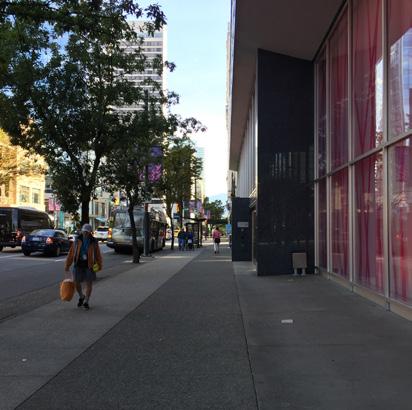
4. Larger setbacks by residential buildings could benefit from becoming fully integrated into the private space for the building residents and essentially serve as 'courtyards'. This could assist with establishing a sense of belonging and community. The opposite should be the case for public functions that could 'fill the gaps' in areas that lack access to a variety of public space typesactivity and programming.
5. Clarify expectations / responsibilities for the property owner regarding the public objectives for these spaces through a clear set of guidelines. Consider a one point of contact in the City to ensure easy process for the property owners.
Smaller setback can serve as additional sidewalk furnishing zone, especially in relation to retail and other public functions
Large setbacks can supplement the public realm network in areas that lack public spaces and/or community meeting places
Suggested Project
The approximate 24km of laneways across the Downtown Peninsula serve a key purpose as service corridors. But as the already converted laneways show they can do much more than that and with great success.
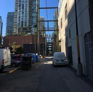
It is recommended to develop a program for 'Laneways for People' with a set of guidelines to inform future laneway conversion, location selection, and type of convertion. The guidelines can assist with targeting investments and measure up against the Citywide Public Life Targets, and ensure that the converted laneways add to the overall public space diversity, while ensuring that the utility function of laneways is preserved in order to maintain streets as places for people.

1. Consider naming all laneways, as in West End, with street signs. Treating them as places will improve navigation in the city and put them on the map.
2. Improve the laneways functions as great pedestrian shortcuts - also at night, by introducing more/better lighting.
3. Consider upgrading some laneways into local micro-networks of public spaces, that both serve as pedestrian priority links as well as places inviting people to stop and stay. Include residential infill where possible to add homes and eyes on the street.
4. Make use of laneways to add to the variety of
public space offerings throughout the city, with a focus on laneway conversions in areas that lack access to and varity in public spaces, can fill the gaps and add to the overall public space network.
5. Convert laneways in relation to amenities or functions that can serve as activators / curators and open up their ground floors towards the laneway. Additionally installing a higher sense of safety.
6. Conduct a gap and transportation network analysis to better understand the operations of the laneway network, that would inform a potential laneway strategy recommending specific sites and opportunities
Micronetwork
Laneway for play and active recreation connecting the West End Community Centre to Barclay Heritage Square
Melbourne is known around the world for the way its transformed its laneways and brought energy and diversity to the city core.
Once trash-filled back alleys were transformed starting in the 90s into pedestrian only passageways lined with delicious food, drinks, and cool art. Melbourne's laneways have become must see tourist stops and neighbourhood gems for locals and tourists alike.
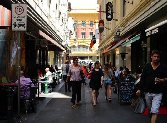
of 270 laneways across Downtown Melbourne has been converted into Places for People (2013)
Source: https://www.melbourne.vic.gov. au/SiteCollectionDocuments/places-forpeople-2015.pdf
In comparison Downtown Vancouver has app 160 laneways with 4 converted / planned converted
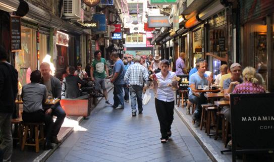
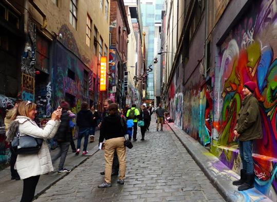
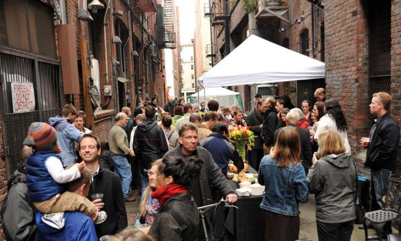
Meet Your Neighbours — Events that fill the alleys with people are great human-scale places to mingle with strangers or get to know your neighbours. The Alley Network Project has successfully transformed the way people view what alleys can be used for.
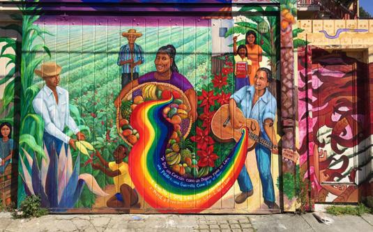
Voicing Community Concerns — Located within the heart of the culturally diverse Mission District,
has been a venue for artists to express their outrage over human rights, politics, and more recently - gentrification.
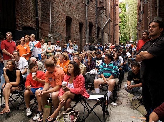
Community Watch Party — The Alley Network Project plans temporary activation of alleys across Seattle to promote local arts, commerce, and healthy living. Projects have included art installations, film screenings, sports viewing parties, and performance art shows.
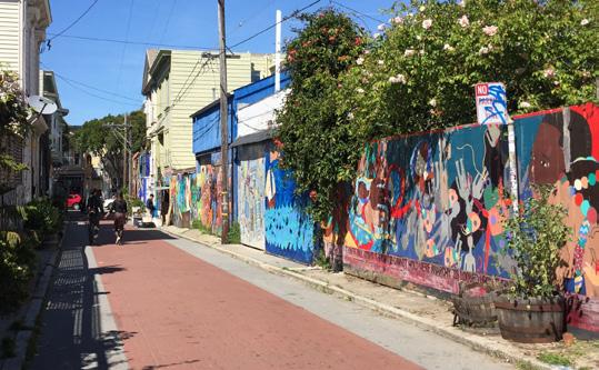
In Constant Flux — Murals are updated or changed frequently, so the experience of the alley is more like an art gallery, than a single art piece. The nearby located non-profit Precita Eyes curate and offer guided tours of the alley.
Protection
Amplify opportunities for people to stop and stay, rest and play and walk in a safe, comfortable and enjoyable manner in the city streets, while maintaining the main function of the street as the city arteries where people move between homes and workplaces, amenities and destinations.
Protection from traffic, with good visibility, slow speeds, and high quality intersections for all users, and sufficient pedestrian crossings
Protection from crime, with human scale lighting, diverse functions 24/7/365 and eyes on the street
Protection from the elements and unpleasant sensory experiences: wind, rain/snow, heat/cold, pollution and noise
2. Connection
Wayfinding Network Accessibility
A complete and continuous network that is fine grained, prioritizes people, offers route choices, and follows real 'desire lines'
Accessible to users of all ages, interests, and abilities with inclusive and consistent design
seating, not just cafe seating
Ample room for people moving in the street, unobstructed and wellmaintained paths, and low-stress negotiation of space for all users
Comfortable places for people to stay, especially near building entrances and corners, with diverse opportunities to stand, lean or sit a comfortable environment
Legible street types, orientation and sense of place; clear views, landmarks and sightlines; integrated wayfinding and connections to amenities and key destinations
Opportunities for culture, commerce and play on the way to occur in a lively public realm 3. Comfort
Space that functions well in both high and low intensity use and comfortable street width-to-height ratio with active, articulated facades
Aesthetics / Experience Social Opportunities Programming
Quality of materials, even surfaces, presence of trees and vegetation, art, views, maintenance and cleanliness
→ The Great Street Quality Criteria provides baseline assessment for each individual street within the network
Opportunities to be social and engage in active or passive interaction
Life Indicators: (1) Increased Pedestrian Activity across Downtown day and night, all week and all year (2) Greater perception of streets as Places for People

"Measure what you care about"
—Jan Gehl
1. Provide a rich mix of public space experiences, making better use of what is there
2.
3. A liveable city that caters to everyday life day and night, all week and all year
4. An inclusive city that prioritizes access & affordability for all
1. Bridge user-generated urbanism and institutional frameworks for empowered communities
2. Creative expression of local identities and public art as an activity generator
3. A playful city — Bring on the fun factor!
Greater Participation in City programs
More citizen ideas and proposals submitted to the City for public realm improvements
More community generated art in the public realm.
Increase in Stationary Activity associated with public art projects
Increased presence of children and teens in the public realm.
Increased play and active recreation for people of all ages
4. A social city — Build a sense of belonging and community
Increase in social interactions reported across Downtown
Organizational Evaluation
Organizational Evaluation
Public Space Observation
Organizational Evaluation
Stationary Activity Counts
Demographic Counts
Demographic Counts Stationary Activity Counts
Intercept Surveys
Intercept Surveys
1. Improved connections and access between Downtown and the Seawall
Counts Decreased jaywalking at connections to the Seawall
Increased walking and biking across Downtown and along the Seawall.
Greater demographic diversity of people walking and biking across Downtown and along the Seawall.
Increased Stationary Activity on the Seawall all year
Greater variety of Stationary Activities on the Seawall
Counts
2. Greater neighbourhood presence on the Seawall with genuine invitations to stay all year-round Stationary Activity Counts
Increased reported frequency and duration of use on the Seawall by locals
3. A true Seawall loop — Bridge the gap
4. Expression of natural assets in the Downtown
Increased walking and biking on the Seawall
Increased Stationary Activity on the Seawall
Increase in play in streets, plazas, and parks Greater presence of water elements in streets, plazas, and parks
Stationary Activity Counts
Surveys
Counts
Stationary Activity Counts
2.
areas as
3. Bus stops are for more than just waiting for transit
Surveys Increased reported satisfaction with experiences of waiting for transit
Increased Pedestrian Activity across Downtown day and night, all week and all year
1. A 'Walking City' day and night, all week and all year Movement Counts
Greater demographic diversity of people walking and biking across Downtown
Greater reported satisfaction with experiences of walking Downtown
Fewer accidents involving pedestrians and cyclists.
Fewer cars Downtown
2. Space for the small pause along the way
Greater stickiness in streets
Greater variety of Stationary Activities in streets Downtown, other than 'pay to sit' and 'waiting for transit'
Greater reported social interaction across Downtown
Greater perception of streets as Places for People
3. Improved street crossing experience connecting neighbourhoods, key destinations and community hubs
Greater demographic diversity of people walking across Downtown
Fewer accidents involving pedestrians at intersections.
Increased Pedestrian Activity on key streets in the network, day and night, all week and all year
Demographic Counts Intercept Surveys
Surveys
Organizational Evaluation
Organizational Evaluation
Stationary Activity Counts Movement Counts
Stationary Activity Counts
Intercept Surveys
Intercept Surveys
Demographic Counts Movement Counts
Organizational Evaluation
Project: Street Life on Robson Street
Project: Build on the success of the Robson 800 Block
Project: More for everyone on Mainland
Tools Public Life Indicators
Greater variety of Stationary Activities in streets Downtown, other than 'pay to sit' and 'waiting for transit'
Greater diversity of public seating offerings
Fewer conflicts between pedestrians and cyclists on commercial streets
Increased Pedestrian Activity on commercial streets day and night, all week and all year
Greater variety of Stationary Activities on commercial streets, other than 'pay to sit' and 'waiting for transit'
Greater demographic diversity of people walking on commercial streets
Project: Setbacks Program
Project: Laneways Program
Increase in Stationary Activities in setback areas
Greater perception of setbacks as Places for People, for public or private use
Fewer m2 of ambiguous 'non-space' in relation to streets across Downtown
Increase in Stationary Activities in laneways
Greater perception of laneways as Places for People
Greater reported sense of community and belonging
Stationary Activity Counts
Public Space Observation
Organizational Evaluation
Movement Counts
Stationary Activity Counts
Demographic Counts
Counts
Stationary Activity Counts
Stationary Activity Counts
4. A clarified street hierarchy with distinct typology treatments and pedestrian-priority connectivity Movement Counts
Greater reported sense of ease of navigation / wayfinding
Greater reported satisfaction with experiences of walking on key streets in the network
Increased reported sense of safety in streets.
Intercept Surveys
Intercept Surveys Intercept Surveys
Decrease in number of inactive groundfloors in laneways
More km of converted laneways