

INTERNATIONAL THE GLOBAL MAGAZINE FOR GEOMATICS WWW.GIM-INTERNATIONAL.COM ISSUE 7 2022 • VOLUME 36 GEODETIC CONTROL NETWORKS: CHALLENGES AND SOLUTIONS BACK IN BUSINESS AT INTERGEO: REUNITING THE GEOSPATIAL INDUSTRY HANDHELD LIDAR IN UNDERGROUND HERITAGE DOCUMENTATION “Geospatial Professionals Play an Essential Part in Bringing the Real World into the Metaverse” Interview with Jürgen Dold, Executive Vice President, Hexagon


DIRECTOR STRATEGY & BUSINESS DEVELOPMENT

Durk
Haarsma
FINANCIAL DIRECTOR Meine van der Bijl
TECHNICAL EDITOR Huibert-Jan Lekkerkerk
CONTRIBUTING EDITORS Dr Rohan Bennett, Frédérique Coumans
HEAD OF CONTENT Wim van Wegen
COPY-EDITOR Lynn Radford, Englishproof.nl
MARKETING ADVISOR Myrthe van der Schuit
BUSINESS DEVELOPMENT MANAGER Jurjen Visser
CIRCULATION MANAGER Adrian Holland
DESIGN ZeeDesign, Witmarsum, www.zeedesign.nl
GIM INTERNATIONAL
GIM International, one of the worldwide leading magazines in the geospatial industry, is published eight times per year by Geomares. The magazine and related website and newsletter provide topical overviews and reports on the latest news, trends and developments in geomatics all around the world.
GIM International is orientated towards a professional and managerial readership, those leading decision making, and has a worldwide circulation.
SUBSCRIPTIONS
GIM International is available eight times per year on a subscription basis. Geospatial professionals can subscribe at any time via https://www.gim-international.com/subscribe/print.
Subscriptions will be automatically renewed upon expiry, unless Geomares receives written notification of cancellation at least 60 days before expiry date.

ADVERTISEMENTS

Information about advertising and deadlines are available in the Media Planner. For more information please contact our marketing advisor: myrthe.van.der.schuit@geomares.nl.
EDITORIAL CONTRIBUTIONS
All material submitted to Geomares and relating to GIM International will be treated as unconditionally assigned for publication under copyright subject to the editor’s unrestricted right to edit and offer editorial comment. Geomares assumes no responsibility for unsolicited material or for the accuracy of information thus received. Geomares assumes, in addition, no obligation to return material if not explicitly requested. Contributions must be sent for the attention of the head of content: wim.van.wegen@geomares.nl.
Geomares
P.O. Box 112, 8530 AC Lemmer, The Netherlands T: +31 (0) 514-56 18 54 F: +31 (0) 514-56 38 98 gim-international@geomares.nl www.gim-international.com
No material may be reproduced in whole or in part without written permission of Geomares. Copyright © 2022, Geomares, The Netherlands All rights reserved. ISSN 1566-9076
P. 10 Interview with Jürgen Dold, Executive Vice President, Hexagon

Jürgen Dold, executive vice president of Hexagon, has been involved in the land surveying profession for about 30 years. At this year’s Intergeo in Essen, Germany, GIM International caught up with him to hear his thoughts on the key changes in the geospatial sector, including hybrid mapping solutions, digitalization and the metaverse.
P. 14 UAV Remote Sensing for Smart Agriculture
The efficient usage of the planet’s agricultural resources, i.e. ‘smart agriculture’, requires the accurate and advanced acquisition, modelling and management of relevant data. This article presents a brief discussion of how drones can play a critical role in smart agriculture, including a focus on their capabilities and applications.

P. 19 Handheld Lidar in Underground Heritage Documentation
Underground cultural heritage is the term used to describe the numerous sites – both natural and man-made – beneath the Earth’s surface that can contribute to knowledge about the history of the planet. This article outlines the use of a GeoSLAM Zeb Horizon scanner at a historical mine complex in Poland featuring multiple passageways and two levels of drifts, some of which were also flooded.
P. 22 Upscaling of TLS through Fusion with Remote Sensing Data
Terrestrial laser scanning is increasingly being fused with air/spaceborne Lidar to characterize vegetation structure across a range of forest ecosystems. This article explores the potential of this approach to support scaling up for larger areas in practice.
P. 27 Reuniting the Geospatial Industry
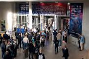
The vibe at Intergeo 2022 felt almost just the same as pre-pandemic times, and a wide range of innovative hardware and software solutions were on display. The geospatial industry is clearly back in business! Moreover, with a strikingly high number of companies already signed up to exhibit next year, it seems to be all systems go for an even bigger and better Intergeo 2023 in Berlin.
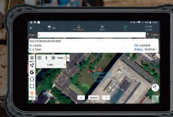
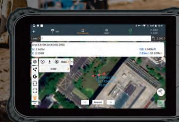
P. 31 Geodetic Control Networks: Challenges and Solutions
What are the key challenges in establishing precise geodetic control networks? This is one of the most important tasks of geodesists and land surveyors, since geodetic control networks are essential for the deformation and environmental monitoring of dams, tunnels, high towers, landslides and bridges, among others. This article discusses the main challenges relating to vertical angles and provides some recommendations for how they can be overcome.
P. 5 Editorial
P. 6 Headlines
P. 34 Report: FIG Congress 2022
P. 41 Organizations
COVER STORY
Just as digital twins depend on geospatial data, so too will the metaverse. We add context to the metaverse from the mapping and surveying perspective in our interview with Jürgen Dold (page 10) and our report on Intergeo 2022 (page 27), in which Hexagon’s Thomas Harring says: “Digital twins are already a kind of metaverse, but the metaverse will be even more complex and in real time. This will drive awareness among consumers and the broader community of the technology and what geospatial data can do.”
CONTENTS 3 ISSUE 7 2022 | INTERNATIONAL |
To subscribe to GIM International go to www.gim-international.com/subscribe
INTERNATIONAL ISSUE 2022 VOLUME 36 GEODETIC CONTROL NETWORKS: CHALLENGES AND SOLUTIONS BACK IN BUSINESS AT INTERGEO: REUNITING THE GEOSPATIAL INDUSTRY HANDHELD LIDAR IN UNDERGROUND HERITAGE DOCUMENTATION “Geospatial Professionals Play an Essential Part in Bringing the Real World into the Metaverse” Interview with Jürgen Dold, Executive Vice President, Hexagon
GOING THE EXTRA MILE SO YOU CAN, TOO!


The new UltraCam Eagle 4.1 delivers the efficiency, flexibility and photogrammetricgrade quality you need to succeed in today‘s rapidly evolving market: Over 28,000 pixels across the flight strip, three exchangeable lens kits, high-resolution PAN sensors and multi-directional Adaptive Motion Compensation (AMC). LEARN MORE in our free webinar:


2022-11-03_GIM_189x129,5mm.indd 1 10/11/2022 11:48:21 P9IV
Exiting the highway to climate hell
Despite certain people still denying that the world has a problem, the majority of scientists agree that climate change is one of the greatest challenges of our time. According to the UN Environment Agency, our planet is now on track to become approximately 2.5⁰ºC hotter by the end of this century. To achieve the current targets as set out in the Paris Agreement, greenhouse gas (GHG) emissions – which are caused, among things, by the use of fossil fuels – must be drastically reduced. This is a global issue, not least because the impacts of climate change are often felt far away from where they are actually being caused. At the time of writing, representatives from nearly 200 different countries are gathering in Sharm el-Sheikh, a seaside resort on the Sinai Peninsula in eastern Egypt and one of the most popular tourist destinations in the Arab world, to discuss this issue in more detail during the COP27 climate summit.
The geospatial industry is ideally placed to play a leading role in mapping, modelling, analysing, mitigating and combating global warming and its harmful effects on human health, society and the world’s delicate ecosystems. In fact, this was a key theme recently at Intergeo 2022 in Essen, Germany, where the traditional press conference on the second day was almost entirely dedicated to the topic of climate change. Trimble’s Scott Crozier described one of the biggest challenges as reducing the GHG emissions as fast as possible. Hexagon’s Thomas Harring warned that we are entering the “next new normal” with a new environment in which one of the biggest issues will be fresh water. To illustrate just how catastrophic climate change can be, he referred to Egypt, where rising temperatures and droughts are affecting one of the country’s vital water sources: the River Nile. Egypt uses approximately 80% of the water flowing through the country for agricultural purposes, but over the course of this century, climate change is predicted to increase the standard deviation of the Nile’s flow by between 30 and 60%. Meanwhile, due to strong population
growth, the number of people living in Egypt will increase by 50 million to 150 million over the next two decades. Needless to say, the country’s agricultural sector faces a huge challenge to maintain the current level of food production. Against this backdrop, one of the few options to ensure food security is to adopt a climate adaptation approach: to focus on modernizing the agricultural sector to ensure that the available water is used as efficiently and sustainably as possible. This is not without difficulties, since ownership of Egyptian agricultural land is traditionally fragmented with a strong focus on self-sufficiency. Therefore, it will be quite a task to get everyone on board with the necessary new developments. Sadly, the situation in Egypt is not an isolated incident, as underlined during the Intergeo press conference by Barbara Ryan, executive director of the World Geospatial Industry Council (WGIC). She mentioned examples of how heavy rainfall due to climate change is leading to floods that are damaging buildings and infrastructure and resulting in the loss of human lives – whether in Germany, North America or Pakistan.
“We are on a highway to climate hell with our foot on the accelerator,” said United Nations Secretary-General Antonio Guterres during his opening speech at the COP27 summit. So the question is, what can the geospatial industry do to help global society to get off that highway as soon as possible? On behalf of GIM International, I encourage you to send us your ideas for a column or an article focusing on how our profession can contribute viable solutions to the challenges associated with climate change.
Wim van Wegen, head of content, GIM International wim.van.wegen@geomares.nl

EDITORIAL 5 ISSUE 7 2022 | INTERNATIONAL |
Airbus Defence and Space 44 CHCNav 7 ComNav 2 FOIF 43 Gintec 4 Hypack 33 Kolida 9 NavVis 38 RIEGL 26 TI Asahi 18 Vexcel 4 Advertisers
Geodata, Collection and Analysis Company Relaunches as ‘Field’
The Norwegian-based company formerly known as KVS Terratec has relaunched under the name Field to form a unique total supplier and become one of Europe’s largest geodata, collection and analysis companies. The story of Field started in October last year, when the technology company KVS Technologies bought Oslo-based Terratec. KVS Technologies first began with inspections of the power grid using unmanned aerial vehicles (UAVs or ‘drones’) and supplied drone services and software to large grid companies that previously used helicopters to inspect the power lines. The company moved away from traditional data capture early on, and today its sensors utilize artificial intel ligence (AI) to recognize power lines and intelligently capture high-quality data of the infrastructure. Just before the merger with Terratec, KVS Technologies landed a major contract with the US company Spright, a subsidiary of Air Methods Corp, for launching its technology and inspection services in the North American power grid market. Terratec (including Blom, Foran AB and TerraPro) was one of the largest providers of geodata services in Europe, collecting data from both land and air for use in mapping, modelling and other georeferenced data projects. The merger resulted in the new KVS Terratec Group with 300 employees. Since that acquisition, the industrial investor DSD has joined the ownership team and the group has acquired Sevendof, a company specialized in building long-distance UAV technology for industrial purposes. Field is now ideally placed to emerge as a total supplier of collection, analysis and digitalization of everything in the physical space.

Mosaic Integrates 360-degree Camera with RIEGL Lidar Technology
of Field. (Image courtesy: Sebastian Dahl)
Leica AP20 AutoPole Wins
Wichmann Innovations Award


The Leica AP20 AutoPole received the prestigious Wichmann Innovations Award at this year’s Intergeo in Essen, Germany. The award honours new technology that stands out for innovation, user-friendliness and practi cality. A panel of industry leaders shortlisted the submis sions. Subsequently, the public was able to weigh in by casting a vote for their favourite finalist. This resulted in Leica Geosystems, part of Hexagon, emerging as the winner. The Leica AP20 AutoPole is an innovative solution for automated total stations that features tilt compensation, automatic pole height readings and unique target identification. The technological convergence in the AP20 addresses core pain points in today’s total station workflows by making it possible to measure with a tilted pole, to adjust height readings in the software automatically and to prevent the station from locking onto unwanted targets.
The Mosaic X highresolution cameras are now compatible with RIEGL’s line of mobile laser scanning systems.
Mosaic’s new Mosaic X spherical camera is now compatible with RIEGL’s mobile mapping systems. RIEGL V-Line scanners are currently some of the highest performing and most widely recognized mobile laser scan systems in the world. Mosaic is a designer and producer of high-resolution 360-degree mobile mapping cameras. The devel opment of the Mosaic X focused on delivering a high-resolution, global-shutter, 360° camera with precise GNSS time stamping to achieve extreme visual clarity and accuracy at once. Due to this, the Mosaic X meets the requirements to be integrated with mobile laser scanning systems such as the RIEGL VMX, VMQ and VMY series. Rostislav Lisovy, co-founder of Mosaic and vice president of engineering, explained the advantages that customers can expect to enjoy: “The pairing between 360° imaging systems and mobile laser scanning systems results in high-precision Lidarbased point clouds, colourized by photo-realistic images. This outcome will then have the benefit of both a precise point cloud and panoramic images – for precise measure ments and evaluation of textures.”
Rudolf Staiger Named as Next DVW President
The members of DVW have unanimously elected Prof Rudolf Staiger as the next president. He will succeed Prof Hansjörg Kutterer who has held the role since 2016. Staiger will take up his position at the German Association for Geodesy, Geoinformation and Land Management at the beginning of 2023. During the DVW’s general meeting in Essen, Germany, on 17 October 2022, members voted on various positions in the association. Hansjörg Kutterer, who has been DVW president since 2016 and prior to that was DVW vice president from 2009, will step down at the end of the year to pursue new profes sional challenges at Karlsruhe Institute of Technology (KIT). Besides the election of Staiger as his successor, Dr Christian Hesse and Prof Jürgen Müller were re-elected as vice president and ZFV editor, respectively. Up until spring 2022, Staiger was a professor at Bochum University of Applied Sciences. He has already held various positions at DVW, including heading the former working group ‘Surveying Instruments and Methods’ until 2010. He will remain in his current role as president of the International Federation of Surveyors (FIG) until the end of 2022. Diane Dumashie was elected as his successor at the recent FIG Congress in Warsaw (Poland) in September 2022.
| INTERNATIONAL | ISSUE 7 2022 6 HEADLINES
Rudolf Staiger and Hansjörg Kutterer during the opening of Intergeo 2022.
won the Wichmann Innovations Award at Intergeo 2022.
“Our solutions are greener, safer and smarter; we want to signal that with the name Field,” states Cato Vevatne, CEO
Acecore and Phase One Join Forces to Offer Turnkey Aerial Inspection Solutions

The Acecore Zoe UAV is robust enough to handle harsh environments.


Acecore Technologies, a Dutch developer and manufacturer of professional-grade UAVs for the data collection and surveillance markets, has entered into a new product collaboration with Phase One, a worldleading developer and manufacturer of medium and large-format aerial photography systems. This marks the next step in offering customers a full turnkey inspection solution.
“It has been two years since we first announced a full integration with Phase One iXM-range cameras,” said Jorrit Linders, founder and CEO of Acecore. “We used to build our own camera control hardware and made it communicate to the pilot on the ground. With the introduction of the P3 we immediately knew our workload would decrease and the integration would become seamless to the end user. It’s exciting to see our product mature and offer an improved user experience together with Phase One.” The turnkey solution from Acecore and Phase One includes a powerful and fully integrated camera-drone combination, tied together by an intelligent Gremsy gimbal. This integrated plug-and-play solution is designed to meet the aerial mapping and inspection industry’s needs in terms of cost efficiency, agility and reliability.
Dubai Municipality Signs Geospatial Data Contracts with Ordnance Survey


Maitha Ali Al Nuaimi, acting director of Dubai’s GISC Department, signing the contract with Juliet Ezechie, director of international at Ordnance Survey, to extend their partnership.
The municipality of Dubai, UAE, has signed two contracts with Ordnance Survey to harness geospatial data and expertise, accelerate innovation and help develop fundamental services for citizens, residents and visitors in Dubai. The partnership will aid in developing and governing the construction system for Dubai. Ordnance Survey (OS) will support the Building Regulation and Permits Agency to improve services for customers and stakeholders in the
building and construction sector in the Emirate. OS will provide Dubai Municipality with expertise to support teams working in the areas of monitoring activities, buildings permits, survey services, executive planning and geographic information systems. The partnership aims to improve planning and construction processes in the Emirate of Dubai, supported by trusted and maintained geospatial data and cadastral operations.
GIM-INTERNATIONAL.COM 7 ISSUE 7 2022 | INTERNATIONAL |
Newly Launched Report Provides Latest Insights on Mobile Mapping
Elevating High-precision UAV-Lidar Mapping
NavVis and several partners, including GIM International, recently conducted a global study among surveying and scanning professionals in the laser scanning, surveying and AEC industries. The goal of the study, carried out by Statista, was to map the trends and emerging needs in the industry and track the usage and impression of new technologies. With the laser scanning and surveying industry undergoing a major shift – think of new mobile scanning devices that can operate automatically or even autonomously, and the relevance of digitalization – it has become even more important to monitor industry trends to understand how emerging technologies can be best utilized by customers and what new initiatives are about to reshape the industry. Dr Felix Reinshagen, NavVis CEO and co-founder, said: “We are thrilled to be back this year with the State of Mobile Mapping Report 2022. We have seen that mobile mapping is driving significant positive change in a variety of industries – from surveying to laser scanning to AEC and more – and the results in the report are confirmation of that. We hope that this report will give an insight into the exciting world of mobile mapping and what changes and innovations are coming next.”
The NavVis VLX mobile laser scanning system enables highquality reality capture.
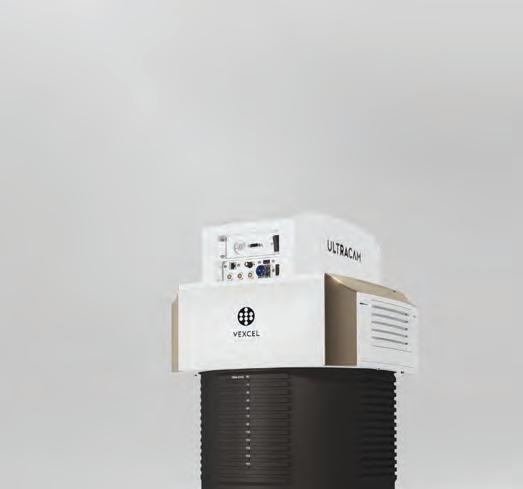
New UltraCam Eagle 4.1 Set to Push Limits of Aerial Mapping


Vexcel Imaging has released the new UltraCam Eagle 4.1, aimed at increasing flight efficiency at truly mapping-grade image quality for precise analysis and interpretation. Based on Vexcel’s fourthgeneration camera technology, the UltraCam Eagle 4.1 collects highresolution panchromatic, R, G, B and NIR information at over 500MP. It can be exploited at different altitudes, thanks to three field-exchangeable lens kits at focal lengths of 90mm, 120mm and 150mm. The Eagle 4.1 is further enhanced by the proprietary Adaptive Motion Compensation (AMC) software approach that addresses image blur caused by multi-directional camera movement during the flight. Featuring new sensors, coupled with new electronics and new lenses, the Eagle 4.1 delivers visually stunning, photogrammetric-grade quality imagery. The difference between the Eagle 4.1 and its predecessors is found in the camera’s panchromatic ‘backbone’. High-resolution PAN sensors collect and resolve object details more faithfully and with higher geometrical accuracy. Consequently, UltraCam panchromatic and full-resolution colour data (produced through pansharpening) features a higher imageresolving power. Imagery is more detailed, more accurate and more actionable. The first production camera has already been sold to Vexcel customer Slagboom & Peeters Aerial Photography in the Netherlands.

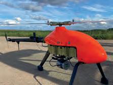
Topodrone, the Swiss-based designer and manufacturer of high-precision Lidar equipment for installation on unmanned aerial vehicles (UAVs or ‘drones’), terrain vehicles and backpacks, has announced the integration of its Lidar Prime scanner with the aOrion Heli-E UAV enabled by Velodyne’s Alpha Prime sensor. This is aimed at bridging the gap in UAV-based mapping solutions between heavyweight and expensive manned aerial Lidar systems and lightweight drone Lidar systems. The system allows users to expand their applications to survey large areas that were previously only possible to survey using manned aeroplanes or helicopters. The Lidar Prime plus aOrion Heli-E system is enabled by the Alpha Prime sensor, Velodyne’s world-class, long-range Lidar sensor. Velodyne’s Lidar combined together with the survey-grade GNSS receiver and high-grade inertial measurement unit (IMU) provides Topodrone with the necessary quality, working range and capabilities for mapping solutions. The system gives users the oppor tunity to capture dozens of kilometres of power lines and dozens or even hundreds of square kilometres of a surveying area when a manual inspection, piloted helicopter or a multicopter would create too much risk, be too costly or be incapable of tackling the challenge.
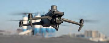
New DJI Mavic 3 Enterprise Series Broadens UAV-based Mapping Possibilities
DJI, a global leader in civilian drones and creative camera technology, has intro duced its new DJI Mavic 3 Enterprise series designed to reimagine what drones can do for business, government, education and public safety. The DJI Mavic 3E and DJI Mavic 3T are compact unmanned aerial vehicles (UAVs or ‘drones’) designed to boost everyday surveying performance by providing professional users with best-in-class, safe and efficient aerial technology. The two new Mavic 3 Enterprise drones are based on the DNA of DJI’s flagship prosumer Mavic 3 series and have been designed to operate in a vast array of commercial missions. Streamlined, portable and compact, a DJI Mavic 3 Enterprise drone can be carried in one hand and deployed at a moment’s notice. Thanks to their flight time of 45 minutes, they are ideally suited for lengthy assignments. “Our mission at DJI Enterprise is to make our drone and camera technology acces sible so that organizations around the world can do their work better. The Mavic 3 Enterprise series delivers on that promise with a powerful all-in-one solution that can get the job done in an easier, smarter and safer way,” said Christina Zhang, senior director of corporate strategy at DJI. “The Mavic 3 Enterprise will prove to be an extremely valuable and beneficial tool for environmental and wildlife protection, construction, surveying, energy, public safety and countless other fields.”
| INTERNATIONAL | ISSUE 7 2021 8 HEADLINES
The DJI Mavic 3T UAV. (Image courtesy: DJI)
A Topodrone Lidar Prime onboard an aOrion Heli-E UAV.
Ouster and Velodyne on the Brink of Merger


Ouster, a leading provider of highresolution digital Lidar, and Velodyne, a leading global player in Lidar sensors and solutions, have entered into a definitive agreement to merge in an all-stock transaction. The proposed merger is expected to drive significant value creation and result in a strong financial position through robust product offerings, increased operational efficiencies and a complementary customer base in fast-growing end-markets. According to the two companies, the key benefits of combining the strengths of Ouster and Velodyne include operational synergies across engineering, manufacturing and general administration support, an optimized cost structure and robust product offerings (including verticalized software) to serve a broad set of customers and a complementary base of customers, partners and distribution channels. These are coupled with reduced product costs and an innovative roadmap to accelerate Lidar adoption across fast-growing end markets.
Hexagon to Update Aerial Data of Eight US States
Hexagon’s Geosystems division has announced that the HxGN Content Program will refresh aerial data of eight US states at 15cm resolution for the 2023 collection season, including Texas, Washington, Florida, South Carolina, Virginia, Maine, Montana and Idaho. Additional states may be added as the season progresses. Most notably, Texas will be refreshed as part of Hexagon’s ongoing partnership with the State of Texas and the Texas Natural Resources Information System (TNRIS), a division of the Texas Water Development Board. The four-year programme emerged from the HxGN Content Program’s Content+ initiative, a cost-effective licensing model for state and local governments that offers the flexibility to obtain single-season aerial data to their desired specifications. The refreshed aerial data will be available starting in Q4 of 2023, adding 1,789,497 square kilometres (763,902 square miles) of high-resolution orthoimagery, stereo imagery and imagery-derived digital surface models to the programme.
9 ISSUE 7 2022 | INTERNATIONAL | GIM-INTERNATIONAL.COM
A 15cm-resolution orthoimage of Austin, Texas. (Image courtesy: HxGN Content Program)
San Francisco’s Lombard Street captured with Ouster OS1 Lidar sensors. (Image courtesy: Ouster)
“Geospatial Professionals Play an Essential Part in Bringing the Real World into the Metaverse”
Jürgen Dold, executive vice president of Hexagon, has been involved in the land surveying profession for about 30 years. At this year’s Intergeo in Essen, Germany, GIM International caught up with him to hear his thoughts on the key changes in the geospatial sector, including hybrid mapping solutions, digitalization and the metaverse.
You have been involved in the land surveying profession for about 30 years. What have been the key evolutions during that time? I think the biggest evolution has been the digitalization journey. In terrestrial surveying, we’ve gone from theodolites to total stations to edge computing, imaging and scanning. It has been a series of evolutionary steps, each one boosting efficiency and further enlarging the possibilities. But each time, the biggest challenge has been to make sure that the new
solution has a powerful enough battery that it can remain fully functional in the field for eight hours a day. These evolutionary steps have been driven by a number of trends, particularly the increase in computational power, miniaturization, cross-functionality, connectivity and new communication possibilities. We’ve seen the shift from GPS to GNSS thanks to the opening up of all the satellite signals, which has resulted in more mobility. And then the solutions were fused
with additional technology to enable scanning and imaging, which unlocked many more possibilities with the same instruments. Around 20 to 25 years ago, I remember some people saying ‘Surveyors don’t need point clouds,’ but we went ahead and started to create a completely new market. Since then, reality capture has become a worldwide business. We’ve gone from bulky systems measuring a thousand points per second to today’s solutions that can capture millions of points per second – that itself is quite an evolution. SLAM technology has been another great development, because it means you can do the maths in the field rather than afterwards, so once again that’s an example of how the industry is being driven by efficiency gains. In terms of airborne mapping, over the past nine decades we’ve evolved from glass plates to film to digital and now we’ve got orthophotos that enable us to create a semantic photorealistic mesh in the digital world. Again, this evolution has tremendously improved efficiency; whereas it used to take several months to capture a thousand square kilometres, it can now be done in a matter of days. And we are constantly looking for new ways to help our customers work more efficiently, so things will continue to evolve at a very fast pace.
Many governments are working on ambitious 3D modelling and digital twin projects. What would be your advice to them?
At Hexagon, we have the advantage of being involved in not only the geospatial industry, but also in the industrial space, and there

| INTERNATIONAL | ISSUE 7 2022 10
GIM INTERNATIONAL INTERVIEWS JÜRGEN DOLD, EXECUTIVE VICE PRESIDENT, HEXAGON
Jürgen Dold delivered the opening keynote at Intergeo 2022. (Image courtesy: Fokuspokus Media)
digital twins have been the de facto standard for many years. In fact, about 25 years ago, one of my first projects was to help Boeing with the digital twin of its 777 aircraft. Even that organization was challenged to adapt to the fully digital world, but the benefits of being able to switch back and forth between the digital twin – in that case, the product design – and the real-world situation in seconds soon became apparent. So what we’re now seeing with digital twins in the geospatial world is similar to what the aerospace industry did 25 years ago, except now we’re digitalizing our surroundings so that we can conduct all kinds of analysis. What does this mean for governments? When you have a comprehensive and complete picture of the real-world situation, you can apply simulations to predict what would happen in certain scenarios. This enables you to anticipate and prepare for problems. I’m excited to see that more and more concrete projects are proving the value of digital twins. For example, a digital twin of Hamburg is being used to analyse the possible building volume in the city versus the existing volume in an aim to make better use of the space. In partnership with Cyclomedia, we have basically created a digital twin of the whole of the Netherlands. And the Digital Twin of Germany project is in full swing: 8,000km2 have already been captured at 42pts/m2 to prove the concept and to prepare for all 350.000km2 of the whole of Germany. Ultimately, this will create a unique dataset of all buildings, trees, infrastructure, water and so on, which will open up endless possibilities in terms of analysing flooding risks, biomass activities and more at a nationwide level. As we say as surveyors, ‘If you don’t measure, you don’t manage’, and my advice is that digital twins are excellent tools for visualizing all kinds of potential scenarios.
As digitalization of the architecture, engineering and construction (AEC) industry gathers pace, what is the current level of knowledge and understanding of geospatial technology in that sector?

One of the challenges for the construction industry has been that it is a fragmented market with lots of subcontractors which
used to take maybe ten surveyors to stake out 50km, now only one surveyor is needed for programming construction machines. In terms of building construction, to achieve seamless integration between the digital and the real worlds you need the design data to be readily available on site. This means you need high-speed communication, a
digital technologies on construction sites. So it’s not that professionals in the AEC industry didn’t understand the benefits, but they were held back by the market structure and the technological possibilities. The technology is now available, so it’s down to the construction companies to take the initiative. But it’s a learning experience and you need to get your own organization on board first, and then you need to get your subcontractors on board too – and preferably in a short period of time. However, there are signs that the industry is catching up fast, with some progressive companies fully digitalizing their office bases and early adopters already using scanning in BIM (building information modelling, Ed.).
INTERVIEW 11 ISSUE 7 2022 | INTERNATIONAL |
WE’VE GONE FROM BULKY SYSTEMS MEASURING A THOUSAND POINTS PER SECOND TO TODAY’S SOLUTIONS THAT CAN CAPTURE MILLIONS OF POINTS PER SECOND
, GIM INTERNATIONAL
BY LYNN RADFORD AND WIM VAN WEGEN
Jürgen Dold.
what could be more
Hexagon is known for its advanced hybrid aerial mapping solutions. How are these solutions currently being used?
Hybrid sensors are simply a great way of multitasking; if you can combine nadir images with oblique images and Lidar to give you geometrical stability, even in urban canyons, then why would you do all those things separately? So a hybrid approach is a logical development which is good for efficiency, as I mentioned earlier, and also more sustainable because you no longer need to conduct multiple flights. Numerous cities are using this approach, and the Dutch government is a great example of how a hybrid solution has been used to capture the entire country. The data will ultimately become available as a
optimization, and then there’s a whole spectrum of other potential applications that could be built on top of the dataset, such as mobility, insurance and so on. One important step in this evolutionary journey relates to managing all the data captured and making the datasets available for everyone. That’s where our HxDR initiative comes in, which is a cloud-based digital platform for storage, visualization and also collaboration.
How does Hexagon put sustainability into practice?

We address the topic of sustainability in multiple ways at Hexagon. It’s not new for us as a company; we’ve been working to reduce the footprint of our own organization
in construction or mining, or where our mapping technology is being used to monitor biomass development. Our subsidiary called R-evolution, which is kind of a start-up within Hexagon, is focused exclusively on sustainability initiatives, with current projects related to solar farms, seagrass fields and more. We established this subsidiary because we truly believe that doing good things for the planet can go hand in hand with business success. Geospatial technology is fundamental to improving sustainability, simply because you can’t manage what you don’t measure. So we and all other professionals in this industry contribute to providing accurate and honest information as the basis for making the right decisions to change the world for the better.
How is the growing focus on data changing the surveyor’s role?
digital twin, which will initially be used for land management at government level. But the utility companies could also use it for planning purposes, telecoms providers for 5G network
for many years in a multitude of ways. Besides that, there are countless examples of projects in which our solutions contribute to sustainability, such as by reducing waste
Having trained as a surveyor, I can say that my first job would be completely different today! As survey instruments become increasingly automated, the same crews are much more productive than before, resulting in much more data which requires processing and analysis in the office, so data management and data science are becoming
| INTERNATIONAL | ISSUE 7 2022 12
Jürgen Dold: “Especially in that specific space in the metaverse where the real world matters, there is huge potential for the geospatial profession to do something good for the future of society – and
rewarding than that?!” (Image courtesy: Fokuspokus Media)
AS A GEOSPATIAL ENGINEER, YOU CAN HELP TO SHAPE THAT PART OF THE METAVERSE WHERE THE REAL WORLD MATTERS
an increasingly significant part of the job. On top of that, artificial intelligence is playing a growing role and further reducing the chance of error in precise measurements – albeit not completely. Despite all the technological advancements and digitalization, we will always need people to go out into the field to measure and understand the physical world that forms the basis for digital models. And geospatial professionals will still need to have a basic knowledge of surveying and the geometrical logic of our planet, such as the ellipsoid and gravity, in order to combine that knowledge with data science. Therefore, I believe the term ‘surveyor’ will continue to exist.
It is a major challenge for the surveying profession to attract both new students into relevant education and skilled professionals into the industry. What are your thoughts on how this could be done?
Many sectors are currently suffering a talent shortage, so this is not only a problem in the geospatial industry. But I think that one of the extra challenges we face is that many people still don’t know what geodesy is; it has somewhat of an image problem. I know that some educational institutions are changing the name of their degree courses from ‘geodesy’ to ‘geospatial engineering’ which could help to broaden our reach. And there are lots of examples of promotional initiatives, such as short one-minute social media videos that are specially designed to appeal to youngsters, and many governments, universities and companies have become increasingly active in targeting local high-school pupils. But maybe we could also inspire people by explaining that, by creating 3D models and digital twins, they can help to connect nations within the European or global community and help to do all kinds of good things for the planet. So it’s about communicating the social value of the surveying profession. Besides that, there is something very fascinating about the connection between the real world and the digital world. We’re already seeing digital twins leading to the metaverse. As a geospatial engineer, you can help to shape that part of the metaverse where the real world matters. If that doesn’t grab people’s attention, I don’t know what will!
Talking of the metaverse, how do you expect it to transform the mapping profession?
The metaverse is definitely a nice buzzword that is currently attracting attention. But what it really means is that the next generation of
the internet will provide more intense, realtime experiences based on a smart digital reality. The geospatial profession will have an essential part in bringing the real world to life in that digital world, because there will be a greater need for more frequent – and in some cases real-time – updates to maintain the digital reality. Once the smart digital reality is up and running, we will be able to add intelligence to the digital world for simulations and analysis. For example, in urban planning, we could run wind simulations to see how a new building would affect the airflow in a city, simulate the movement of real-time assets to improve mobility, or explore how green spaces could be created to combat overheating in the summer. I see this as a great opportunity for our profession.
What are your ambitions in terms of Hexagon’s growth and future direction? Our history is based on the combination of an entrepreneurial approach and very grounded engineering capabilities. We are pragmatic rather than bureaucratic and have a forwardlooking strategy. I would perhaps even describe it as being fearless, because there’s a lot of room for pioneering; our company culture allows us to take risk as long as we manage that risk. This approach has enabled us to grow and stay ahead, so we intend to continue along this path. Additionally, our company is always thinking about the ‘make versus buy’ decision; we try to do as much as we can ourselves, but we’re not afraid to acquire companies if they can add value. In the mapping sector, we have developed the first ‘flying sensor’, which will empower other industries to apply our technology. Besides pursuing growth in our existing markets, we’re also always keen to expand into new ones. The surveillance market is one example. Surveillance traditionally revolves around video cameras, but there are considerable challenges with measuring at night time and capturing the third dimension. We believe that 3D sensor technology could revolutionize that by reducing the dependence on human interpretation of the images. Another market with interesting growth potential is the autonomous market and there are countless possible applications that we’re building out –not only in autonomous driving, but also mining, agriculture and machine control, for example.
How do you view the general market outlook for the geospatial industry in the years ahead?
When the global financial crisis occurred in 2009, I was CEO of Leica Geosystems at the
time, and I remember reading somewhere that almost every generation of senior executives has to manage a crisis because there’s roughly one per decade. But nowadays, it seems like we’re facing a never-ending stream of crises; just as we’re emerging from one crisis, another one starts. So that’s pretty challenging for everyone. However, you can learn something from every crisis. For example, despite all the tragedy, the COVID-19 pandemic showed us that digitalization and rethinking certain approaches can help us in many more ways than we realized, and has resulted in more efficiency and more sustainability. Ultimately, whether there is a pandemic or a financial crisis, we still need to manage the world’s space – and I believe our industry will continue to be part of solving the challenges. So the geospatial sector is actually a very good place to be compared to many other professions.
Do you have a message for our worldwide readers?
Even though we don’t have the huge budgets of the BigTechs such as Apple, we are the ones who have gone ahead and made the real world ‘machine readable’ – because that’s what digital twins are, right? Therefore, especially in that specific space in the metaverse where the real world matters, there is huge potential for the geospatial profession to do something good for the future of society – and what could be more rewarding than that?!
ABOUT JÜRGEN DOLD
Jürgen Dold, executive vice president, has been with Hexagon since 1995. He has served in various management roles at Leica Geosystems, part of Hexagon, and was president of Hexagon’s Geosystems division for ten years. Most recently, he has held strategic leadership roles across divisions, including overseeing Hexagon’s Geosystems and Safety, Infrastructure & Geospatial divisions and leading Hexagon’s focus on the content and platforms necessary to power and operate digital reality applications. In mid-November, it was announced that Dold will leave Hexagon as of 1 January 2023. “While it is with mixed emotions that I announce my resignation from Hexagon, I am very much looking forward to spending more time with my wife and family,” states Dold. “I am proud of all Hexagon has accomplished. It’s been an unforgettable experience full of countless memories and unique achievements working with incredible teams around the world.”
INTERVIEW 13 ISSUE 7 2022 | INTERNATIONAL |
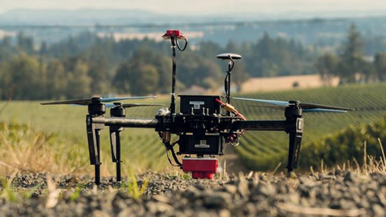
UAV Remote Sensing for Smart Agriculture
As the world population continues to grow, the demand for food is also increasing. At the same time, a series of global and local challenges are threatening ‘food security’. In this context, various technologies and techniques have been proposed and considered in recent decades to secure the efficient usage of the planet’s agricultural resources, i.e. ‘smart agriculture’. This requires the accurate and advanced acquisition, modelling and management of relevant data. This article presents a brief discussion of how unmanned aerial vehicles (UAVs or ‘drones’) can play a critical role in smart agriculture, including a focus on their capabilities and applications.
Smart agriculture brings together a variety of advanced and evolving technologies and applications, including UAVs and satellite remote sensing, sensor networks based on the Internet of Things (IoT), digital-based prediction for insects and diseases, mechanized irrigation, light and heat control, soil management and other associated analytical tasks. Amongst all those technologies, Earth observation (EO) plays an important role in all aspects of pre-diagnosis, modelling and prevention.
As one of the most rapidly advancing aerial EO technologies, UAVs offer advantages over both traditional field measurement techniques and satellite image analysis techniques. A significant amount of time and effort is needed to produce high-quality data from field measurements. In contrast, UAVs offer several advantages:
• Enabling faster, more flexible and more
convenient responses to crop-related problems
• Mapping larger crop fields compared to traditional field measurements
• Facilitating Efficient data collection by using different sensors
• Operating even on cloudy days
• C apturing crop information in higher spatial and temporal resolution
• Permitting accurate derived vegetation maps that support better decision-making.
Furthermore, UAV images have several advantages over images gained from satellites or manned aerial photogrammetry:
• Lower impact of clouds due to lower flight height
• L arge volume of data captured in a short time
• Full control by the user
• Less affected by the atmosphere
• Lower operating costs.
THE USE OF UAVS IN SMART AGRICULTURE
Nowadays, UAVs equipped with an imaging sensor are playing an important role in digital smart agriculture. This technique can be a key element driving improvements in agricultural precision, increases in crop productivity and a greater focus on targeted crop protection.
UAVs can be equipped with different data collection sensors, such as RGB, multispectral (MS), hyperspectral or thermal cameras, or Lidar. Plants reflect light at varying levels depending on their chlorophyll content and biomass. A UAV with a multi or hyperspectral camera measures the reflected energy received from the sun in different areas of the spectrum. The level of energy reflected back from the vegetation and the relation between different spectral bands can enable the health situation of the crop to be indexed. There are various vegetation indexes, including the well-known Normalized Difference Vegetation Index (NDVI) which is based on using the near-infrared (NIR) band. The NDVI is normally used to indicate leaf coverage and plant health, with high NDVI values indicating a high concentration level of biomass. Hence, the NDVI and other vegetation index maps represent great potential for increasing agricultural food production in a more sustainable manner.
Consequently, spectral data captured using a UAV can be analysed to assess whether the imaged crop is fresh or dry and to
| INTERNATIONAL | ISSUE 7 2022 14
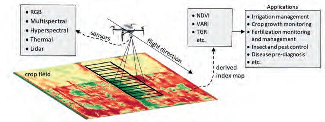
Figure 1: A visualization of the use of UAVs in smart agriculture.
DIFFERENT DATA COLLECTION SENSORS FOR A RANGE OF APPLICATIONS
Figure 2: Two examples of sensors that are able to capture a wider range of wavelengths including near-infrared (NIR).
localize any areas showing early signs of infection by pests or diseases. Moreover, this spectral information – when combined with 3D information from sources such as digital surface models (DSMs) and waterways maps – can be used to improve the efficiency of activities such as irrigation or pesticide treatment while reducing the amount of inputs required. Figure 1 summarizes the use of UAVs for smart agriculture and shows the connection between sensors, vegetation indexes and applications as outlined below.
VEGETATION INDEXES AND MEASUREMENTS
Several spectral vegetation indexes have been proposed and defined to measure plant properties. The invisible specifications can be converted into visible indexes and measurements by producing appropriate colour maps or indicators. Examples of such indexes include:
• Leaf Area Index (LAI): This is defined as the projection of the one-sided green leaf area per unit of ground area. The LAI is an important index of crop growth status. It can be calculated using ground-based methods or remote-sensing methods. Current estimation methods using optical remote sensing are classified into three types: experimental relationships between the LAI and vegetation indices like NDVI, canopy reflectance models inversion, or a mix of both these methods.
• Normalized Difference Vegetation Index (NDVI): This is widely used in smart agriculture to assess the spatial variation of the expected LAI. The NDVI is normally used to indicate leaf coverage and plant health, with high NDVI values representing a higher concentration level of biomass.
• Triangular Greenness Index (TGI): This is based on using RGB images by relying on reflectance values in the visible portion of the spectrum to indicate the chlorophyll content in areas of high leaf cover.
• Visible Atmospherically Resistant Index
(VARI): This index is derived from RGB images for leaf coverage. The VARI index is used to estimate the vegetation elements with low sensitivity to the atmosphere.
• Above Ground Biomass (AGB): This comprises all biomass in living plants above the soil including stems, branches, seeds, foliage, etc. Since above-ground biomass is mostly visible in the carbon pools (such as the oceans), the AGB represents an important indicator of changes or benefits related to carbon mitigation. Accordingly, the AGB is a significant index for monitoring greenhouse gas emissions and other related projects.
• Fractional vegetation cover (FVC): This index includes the ground layer (such as grasses), the mid-layer (such as mid-sized trees) and the canopy layer. The NDVI values of the bare soil reflectance (NDVIs) and the full vegetation reflectance (NDVIv) can be used to determine the FVC.
• Green area index (GAI): This indicates all the green features of a plant, including the leaves, stems and reproductive organs. The complementary Brown Area Index (BAI) refers to non-green areas in the canopy. A generic index known as the Plant Area Index (PAI) indicates both green and non-green parts.
COMMON SENSORS FOR SMART AGRICULTURE
There are several types of sensors that are commonly used in UAV remote-sensing applications in the agricultural and forestry sectors. They can mainly be classified as follows:
Optical RGB cameras: RGB sensors are the most widely used sensors on UAV systems for smart agriculture. They can take highresolution images and are normally less expensive than the other types. In addition to being lightweight and easy to use, they are also easily accessible. The RGB images can be captured in a wider range of
weather situations, including on sunny and cloudy days, providing that certain camera parameters (shutter speed, ISO, etc.) are set up correctly based on the weather conditions to prevent underexposure or overexposure of the image. The fundamental drawback of these sensors is their lower spectral resolution, which makes them inadequate for measuring vegetation-related indices that necessitate spectral data from the non-visible part of the spectrum. Hence, RGB sensors are typically used alongside other types of sensors.
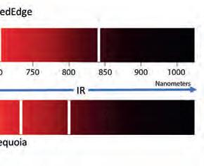
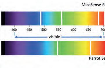
Multispectral and hyperspectral cameras: Spectral data can be very helpful in assessing several biological and physical characteristics of crops. Multispectral or hyperspectral imaging sensors benefit from higher spectral resolution specifications. Images captured by UAVs fitted with these sensors can provide information about the vegetation’s spectral absorption and reflection in different bands. Diseased crops can be spotted early since chlorophyll absorbs visible light in the red channel while strongly reflecting NIR light. The information in the NIR channel can therefore be used to identify such incidences of disease, even if they are not yet visible in the red channel. Technological improvements in sensor production have resulted in lower-weight multispectral sensors which can even be carried on today’s commercial lightweight UAVs. MicaSense RedEdge and Parrot Sequoia are two examples of such sensors that are able to capture a wider range of wavelengths including NIR. Using such cameras, it is possible to derive the NDVI and some of the other abovementioned vegetation indexes. Figure 2 shows the region of the spectrum that is covered by each of the two cameras. Hyperspectral sensors have also been improved to generate lighterweight sensors specifically for drones. These cameras cover a larger range of the spectrum than multispectral sensors but they normally achieve lower spatial resolution. HSC-2 is a sensor that is commonly used for vegetation classification and monitoring. This lightweight hyperspectral camera generates up to a thousand spectral bands in the VIS-VNIR spectral range which is adjustable in the range of 400-1,000nm.
Thermal cameras: When they are warmer than absolute zero, all objects emit infrared light at specific wavelengths proportional
FEATURE 15 ISSUE 7 2022 | INTERNATIONAL |
BY BASHAR ALSADIK, FARZANEH DADRASS JAVAN AND FRANCESCO NEX, UNIVERSITY OF TWENTE, THE NETHERLANDS
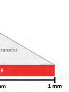
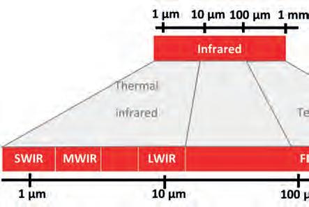
to their temperature. Thermal cameras concentrate on and pick up radiation at certain wavelengths, which is subsequently transformed into a grayscale image to represent heat. Some thermal sensors can interpret the received energy and transform it into the absolute temperature of the object. In this case, images can be displayed in colours, with hotter objects normally indicated by red shades and colder ones by blue. Thermal UAV remote sensing has been successfully used in agriculture for plant health inspection based on the assumption that fresh vegetation is normally less dry in lower temperatures. Moreover, these images can be subjected to further inspection and processing to extract information that can help with irrigation mapping, fertilizer/pesticide management and yield estimation. Additionally, thermal imaging can support the assessment of a plant’s maturity development and can identify crop damage from harmful events such as fires and suchlike. FLIR is one of the main camera brands actively being applied in this context, offering the three main wavelength ranges of short-wave, mid-wave and long-wave infrared (Figure 3).
Lidar: Currently, the 3D point cloud is essential for assessing plant height, crop phenology, water flow and more. A more reliable estimation of these parameters can be achieved when a high-density point cloud is available. A UAV equipped with Lidar is the preferable method of acquiring a dense point cloud due to Lidar’s significant accuracy and the ability to receive multiple returns. Biomass is traditionally measured by quadrats that were not defoliated by cutting or grazing during the growing season. Although the data is accurate, this traditional method of AGB field sampling is time-consuming, costly and laborious. Moreover, collecting AGB data is difficult in larger areas. Lidar data from UAVs
provides a unique opportunity to measure 3D vertical structures. For example, canopy height measurements rely on the laser pulse return from the vegetation and ground in multiple reflections and at different elevations. In recent years, digital terrain models (DTMs) and DSMs have been produced from Lidar data as the basis for monitoring plant structures using UAVs and creating canopy height models (CHMs). To determine the CHM, the DSM is compared at different times during the growing season, with the initial DTM computed using the first measurements. Methods utilizing Lidar have also begun to appear in order to estimate the PAI based on canopy density. The fundamental benefit of these Lidar techniques is their sensitivity to both green and non-green plant components.
USE OF REMOTE-SENSING UAVS FOR SMART AGRICULTURE
The data collected using a UAV equipped with Lidar or imaging cameras can be used for multiple agricultural planning and monitoring purposes, including:
• Crop health monitoring
• Vegetation and soil dryness evaluation
• Fertilizer requirements assessment
• Crop damage and disease detection
• Crop growth observation and harvesting optimization
• Water flow mapping and irrigation management
• Erosion and soil loss monitoring
• Creation of slope and sunlight exposure area maps.
A number of applications are highlighted in more detail below.
Irrigation management: One key use of UAV technology in smart agriculture is crop irrigation management, in which the effectiveness of water utilization is increased
by applying the optimal amount of the resource in the optimal location and at the optimal time. UAVs with appropriate sensor types can be used to locate areas of a crop that require additional watering. This has a positive effect on overall crop production. The thermal camera is one of the most commonly used sensors for this application. By employing thermal imaging to map the variability of water potential in a field, irrigation can be optimized. UAV thermal imaging may be necessary to identify problems such as malfunctioning irrigation systems and uneven irrigation. The use of UAV thermal imaging makes it possible to detect heat stress before the plant suffers permanent harm, or to spot irrigation problems before the symptoms are visibly noticeable. In vineyards, for example, UAV-based irrigation is being used in smart agriculture to enhance water distribution within the vineyard, to aid in achieving uniform maturity and hence to enhance the product quality.
Crop insurance: Global challenges like global warming and more extreme rainfall throughout the year are increasingly resulting in flooding, causing crops to perish due to a lack of oxygen to the roots and a lack of sunlight on the foliage. In such cases, farmers may often submit insurance claims for the damage that has occurred. Before the claim can be honoured, an insurance loss inspector must conduct a crop damage evaluation. Traditionally, these have been challenging to perform and are frequently erroneous because the work is mostly done manually. UAVs hold potential for crop damage assessments since they enable images to be captured over a wide coverage area, thus reducing the time and cost involved, while improving the inspection accuracy and supporting efficient documentation.
Weed mapping: Weed mapping is an important application of UAV-based smart agriculture. Weeds are unwanted plants that develop in crops and can lead to several issues. They negatively influence plant growth because they intensify the fight for limited resources such as water or space to grow. Spraying the crop field with herbicides is the conventional method of tackling or controlling weeds. However, excessive herbicide usage can lead to herbicide-resistant weeds, besides having an impact on crop development and productivity. Additionally, it seriously endangers the environment through pollution, not to mention significantly increasing the
| INTERNATIONAL | ISSUE 7 2022 16
Figure 3: The three main wavelength ranges of FLIR cameras.
cost price. An alternative to this is sitespecific weed management (SSWM), in which herbicides are applied in a spatially variable manner rather than being sprayed over the entire field. This requires the creation of an accurate weed cover map that allows for targeted herbicide application based on UAV imaging. Task weed maps or zone maps show the soil types, topography or pest maps. When machine learning techniques are applied to UAV imagery, it is possible to identify weeds and crops automatically based on their shape, structure and contrast. Herbicides are then applied specifically to the weeds only, which is better for the crop and also has less of an environmental impact.
Crop damage detection: UAVs can be used to create 3D digital maps of the crop and to assess a variety of factors including crop height and the LAI. Furthermore, UAV-based crop imaging data can be analysed by data processing tools to spot changes in plant biomass and health. As a result, infections may be identified in the early stages, allowing farmers to take action to minimize losses. Generally, UAVs play a role by gathering crop health-relevant data to detect a potential infection in the initial stage of infection, before visual indications appear. Moreover, UAVs can be used during the treatment of infections when farmers can use them for targeted spraying as well as for precisely tracking the progress of the intervention.
Fertilizer on crops: The most popular fertilizer in the world is nitrogen; it is a vital component of chlorophyll, which is key to plant survival. Controlling the quantity of fertilizer used for crops benefits both the plants and the budget. Accordingly, many farmers nowadays utilize UAVs and smart agriculture techniques to acquire information and map their crop fields in order to provide plants with the fertilizers they require while using less nitrogen overall. The GAI is the most commonly used index to calculate when and where nitrogen application is required. Normally, the resulting crop map is colour-coded according to the GAI values, with lower GAI values indicating a greater need for nitrogen.
Flooded crop area inspection: For insurance loss evaluations, a UAV can be flown over the regions that have been damaged to gather data using RGB or MS cameras. The data can be processed and displayed using the appropriate cutting-edge technologies to calculate crop loss. To analyse the crop damage and provide
a report of the findings for the farmer, the loss inspector should first build a series of visualizations, similar to an orthomosaic map. The loss inspector may also compute the NDVI, which is effective at spotting vegetation and bare soil, to determine the degree of damage. After developing the categorized NDVI map that displays the bare soil patches in the crop field, the inspector can use the map to identify which areas of the field require closer assessment of the damage level.
WHAT IS SMART AGRICULTURE?
CONCLUSION
This article outlines the emergence of UAV technology for smart agriculture in various applications related to crop monitoring and management, and highlights the benefits of using UAVs in this sector compared to field and satellite-based techniques. Various vegetation indexes are briefly explained, including their links to the types of sensors used on UAVs, such as multispectral, thermal, RGB cameras and Lidar.
Smart agriculture is defined as the application of modern technologies to increase crop yields qualitatively and qualitatively and to improve farming management. It is also known as ‘precision agriculture’ or ‘AgriTech’ in the business world. Smart agriculture is aimed at reducing the costs and risks involved in growing crops, while minimizing the inputs in terms of irrigation, fertilizers, herbicides, pesticides, etc. A major aim of smart agriculture is to efficiently fit between available resources and requirements based on the observed temporal and spatial inconsistency in the crop field.
ABOUT THE AUTHORS
Bashar Alsadik is an assistant professor of photogrammetry at the ITC faculty of the University of Twente in the Netherlands. His main research interests are in photogrammetry and geomatics. He has worked in the academic and industrial sectors for more than 20 years. He is a member of the ITC UAV Centre.


Farzaneh Dadrass Javan is working in the Earth Observation Science (EOS) department at the University of Twente. She obtained her PhD in Photogrammetry from the University of Tehran in 2012. She started her career as an assistant professor at the University of Tehran in the Photogrammetry and Remote Sensing department in 2016. She moved to the University of Twente in September 2020. She is a member of the ITC UAV Centre.
Francesco Nex is a professor in the Earth Observation Science (EOS) department at the University of Twente. His main research interests are focused on the development of innovative solutions fusing elements from photogrammetry, deep learning and adjacent domains such as robotics to promote the application of UAV imagery in a variety of real-world remote sensing and geomatics applications. He is the lead of the ITC UAV Centre.

FEATURE 17 ISSUE 7 2022 | INTERNATIONAL |
Figure 4: UAV equipped with a multispectral camera. (Image courtesy: Trithi Robotics)


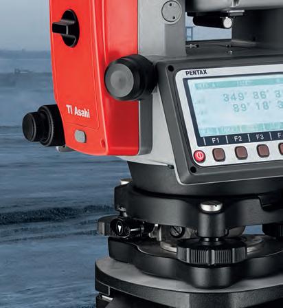


Focusing on true performance TI Asahi Co., Ltd. International Sales Department 4-3-4 Ueno Iwatsuki-Ku, Saitama-Shi Saitama, 339-0073 Japan www.pentaxsurveying.com/en/ Tel.: +81-48-793-0118 Fax: +81-48-793-0128 E-mail: International@tiasahi.com An all-constellation GNSS Smart Antenna with a MEMS sensor for Tilt Compensation. GNSS Receiver Total Station G7N A reflectorless Total Station from 1” accuracy with dual display panels for precise angles and ranges. R-2500NS Series
BY AGNIESZKA OCHAŁEK, TOMASZ LIPECKI AND WOJCIECH JAŚKOWSKI, AGH UNIVERSITY
CAPTURING, PROTECTING AND SPREADING KNOWLEDGE ABOUT HISTORY USING MODERN TECHNOLOGIES
Handheld 3D Laser Scanning in Underground Heritage Documentation
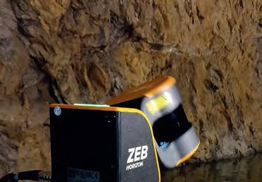
Underground cultural heritage is the term used to describe the numerous sites – both natural and man-made –beneath the Earth’s surface that can contribute to knowledge about the history of the planet. To preserve the surroundings, environments with rich geometrical features, enclosed spaces and places without natural light must be measured and captured in an appropriate way. This article outlines the use of a GeoSLAM Zeb Horizon scanner at a historical mine complex in Poland featuring multiple passageways and two levels of drifts, some of which were also flooded.
Cultural heritage has become widely recognized by the international community as a pro-development factor which helps to spread knowledge about the past in modern societies. In this context, underground sites of both natural and man-made origin can have historical, educational and functional importance. All kinds of mining activities have had a huge impact on the evolution of architecture and construction over the centuries. There is growing awareness of this, as illustrated by the rising interest in transforming former mines and their adits and drifts (entrances and passageways) around the world into museums and tourist attractions.
SAFETY FIRST
In any such transformation project, the first consideration must be safety – both of the workers who are opening up the mine and subsequently of the tourists who will visit
it. Therefore, it is necessary to determine the movement of the rock mass above the passageways, conduct deformation assessments and investigate all other rock mass processes in order to protect the historical significance of the sites and ensure that the future tourist attraction will be secure. All of this requires a lot of data to be collected and managed. This means that engineers and researchers are constantly searching for more efficient spatial mapping and documentation solutions. SLAM technology can offer the answer.
SLAM TECHNOLOGY
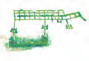
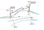
Simultaneous localization and mapping (SLAM) technology has been evolving for many years and is now applied in numerous fields. A device based on SLAM can simultaneously localize (locate itself in the map) and map (create a virtual map of the measured space). It computes a ‘best
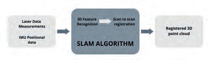
estimate’ of where it actually is. New positional information is gathered every few seconds, features are aligned and the estimation is continuously improved. Probably one of the biggest advantages of SLAM is that it can do what GPS cannot. Since GPS relies on triangulation between satellites, it must be able to ‘see’ the satellites. This means that it does not work underground. SLAM does not have this problem, because it operates within the space itself, recording the surroundings and remembering the route.
In its first step, the GeoSLAM Zeb Horizon handheld laser scanner utilizes both laser scanning data and inertial measurement unit (IMU) data. Thanks to 3D feature recognition, the scanner is able to identify and record its location in any space as the surveyor moves around. In this case, ‘features’ are any areas with a unique geometry, measuring at least 1 metre in size and located no more than 40 metres away from the device – although the GeoSLAM Zeb Horizon has a range of 100m, according to the manufacturer. Based on the features, the scans are registered (scan-toscan registration) to produce a registered 3D point cloud as the final result. This does not required any further matching. Therefore, the noticeable advantage of SLAM technology is the speed at which a final registered point cloud can be obtained.
FEATURE 19 ISSUE 7 2022 | INTERNATIONAL |
Figure 1: SLAM technology.
AND TECHNOLOGY, POLAND
OF SCIENCE
RESEARCH AT THE RIESE COMPLEX IN POLAND
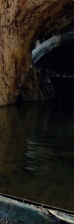
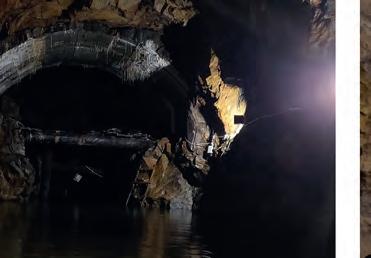
The Riese Complex is located in the Owl Mountains in Lower Silesia in Poland, near the Czech border. The Riese (which means ‘huge’) was one of the largest mining and construction projects by the Germans during World War II. It is unclear whether it owes its name to the number of people working on its construction, the intended amount of concrete used, or the size of the adjacent infrastructure. To this day, the purpose of the building is unknown since the whole project was top secret. Six underground structures have since been discovered. The biggest area of the Riese is the Włodarz
Complex which is open to tourists as an underground museum. It comprises 3,000m including many straight passageways and two levels of underground adits or drifts, some of which are flooded. This was therefore a very challenging environment in which to use the scanner.
FIELD MEASUREMENTS
This project included the use of several surveying technologies in the field; besides conducting measurements with the GeoSLAM Zeb Horizon handheld laser scanner, the team performed terrestrial laser scanning (TLS) with a Faro Focus 3D, classical tacheometry
and GNSS (needless to say, this was done outside the adit).
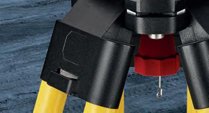
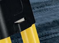
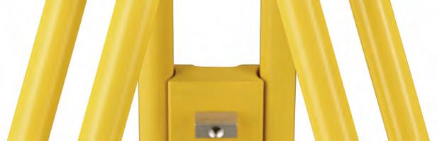
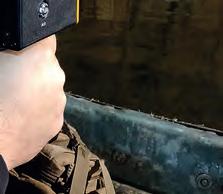
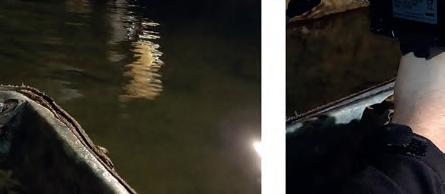
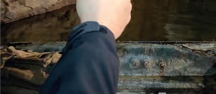
In case of handheld laser scanning, it is recommended to make some preparations before taking the exact measurements. The preparatory steps include planning the capture route and the start and finish locations in relation to the project, making sure that there are enough features for scan registration, planning the loops and loop closures, and estimating the number of scans to register the whole area of interest. Moreover, it is crucial to remember that each loop must be completed (start and finish in the same place) within a maximum of 20 minutes. Closing the loops is very important for the SLAM accuracy, with more loops equalling better accuracy. Since the Włodarz Complex is arranged in a grid layout, it was easy to plan the loops on each level. However, it was important to plan measurements and loops through all the levels. The surveyors made a total of six loops covering all the adits, drifts and levels, including by boat in the case of those that were fl ooded. It took a total of two days to complete all the surveying with the handheld scanner, including planning and learning how to use the device. If a stationary scanner had been used instead, it would have taken considerably longer to complete the measurements – probably up to a week for a really large site. Ultimately, the surveying using the Zeb Horizon itself took a few hours, while the post-processing of the data in the GeoSLAM Hub + Draw software took several additional hours.
| INTERNATIONAL | ISSUE 7 2022 20
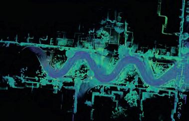
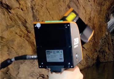
Figure 2: Taking measurements with the GeoSLAM Zeb Horizon in the Włodarz Complex.
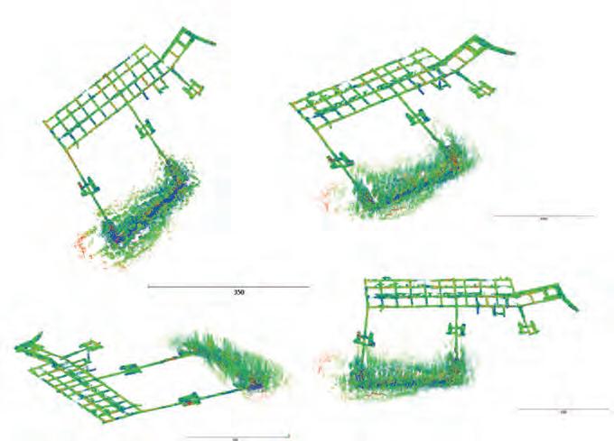
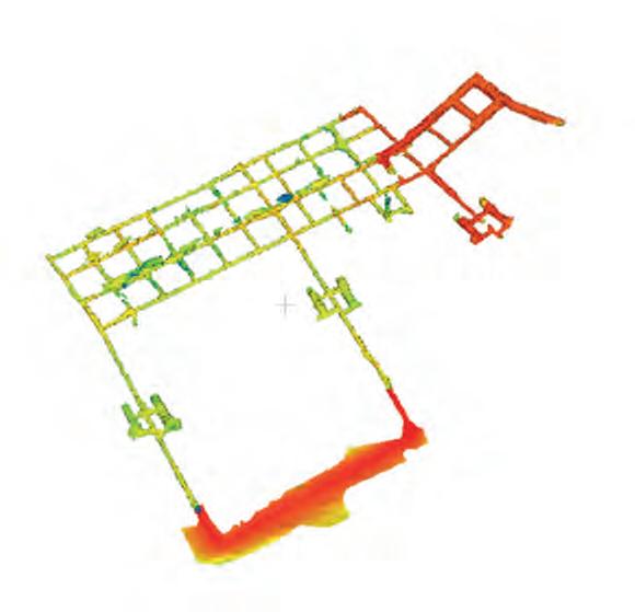
Figure 3: Visualization of the point clouds from the SLAM technology.
Włodarz Complex
Table 1: Data from the Włodarz Complex.
POINT CLOUD PROCESSING
Number of entries Length [m] Surface [m2] Cubature [m3] Shaft Height [m.a.s.l] C oncrete surface 4 2,955 10,996 4 0,520 length: 47m 496-503 Less than 1% diameter: 6m which emphasizes the interdisciplinary nature of this kind of research.
All the scans from GeoSLAM were postprocessed in GeoSLAM Hub + Draw and then exported to .e57 format and visualized and analysed in Cloud Compare (see Figure 3). As the basis for further analysis, such as calculating the volume and area of a given complex, the triangular mesh model was created: a collection of vertices, edges and faces that defines the shape of an inventoried site (see Figure 4). All the information gained from the point cloud, mesh and its postprocessing is shown in Table 1.
CONCLUSIONS
It is important to document architectural and archaeological history, and cultural heritage sites – and especially underground sites – require special treatment in terms of measuring, protecting and also spreading knowledge about them. Laser scanning,
whether handheld or TLS, is a universal non-contact method which – combined with classic geodetic techniques – can be easily used in the inventory of underground sites. The resulting point clouds allow for the creation of spatial models and, after post-processing, support further computer analysis. Handheld scanners (including the GeoSLAM Zeb Horizon) reproduce drifts with sufficient accuracy for the preparation of documentation about underground cultural heritage sites. However, it is not recommended to use SLAM when highly accurate measurements are required (e.g. for deformation evaluation). More precise and detailed techniques such as TLS are needed for more accurate measurements and analysis. Nevertheless, SLAM geodata can be useful for professionals in many fields with a social purpose, such as historians, geophysicists, archaeologists and geologists,
FURTHER READING
Hassani F., Documentation of cultural heritage techniques, potentials and constraints, The International Archives of the Photogrammetry, Remote Sensing and Spatial Information Sciences, Volume XL-5/W7, 2015, 25th International CIPA Symposium 2015, 31 August – 4 September 2015, Taipei, Taiwan (2015)
Ochałek A., Jabłoński M., Lipecki T., Jas´kowski W., Methodology of historical underground objects inventory surveys–contribution, Geoinformatica Polonica (2018) doi: 10.5194/isprsarchives-XL-5-W7-207-2015
ABOUT THE AUTHORS
Agnieszka Ochałek is a graduate of the Faculty of Mining Surveying and Environmental Engineering at AGH University of Science and Technology in Krakow, Poland. Currently a PhD student in the Department of Mining Areas Protection, Geoinformatics and Mining Surveying, Ochałek is conducting research in civil engineering and mining surveying.

aga.ochalek@gmail.com

Tomasz Lipecki is a professor in the Department of Mining Areas Protection, Geoinformatics and Mining Surveying of geodesy and cartography lipecki@agh.edu.pl
Wojciech Jas´kowski is a professor of XXX at AGH University of Science and Technology in Kraków, Poland. Mining geodesy and the protection of mining areas are his main specializations. jaskow@agh.edu.pl
FEATURE 21 ISSUE 7 2022 | INTERNATIONAL |
Figure 4: Mesh made on the basis of the SLAM point cloud.
Upscaling of Terrestrial Laser Scanning through Fusion with Remote Sensing Data
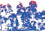
Terrestrial laser scanning is increasingly being fused with air/spaceborne Lidar to characterize vegetation structure across a range of forest ecosystems. This article explores the potential of this approach to support scaling up for larger areas in practice.
Terrestrial laser scanning (TLS) is an important tool for plot-scale measurements of tree and forest structure. These local measurements are meaningful to support quantification of a forest’s carbon balance and long-term forest monitoring. Typically, the upscaling from individual trees to local plot measurements to regional or national estimates is facilitated by the coupling of TLS data with airborne and spaceborne Lidar. There has recently been an increase in the fusion of TLS data with air/spaceborne Lidar
to characterize vegetation structure across a range of forest ecosystems.
TLS data can already provide accurate estimations of tree volume and biomass. This is crucial to monitor carbon changes as a result of climate change, as well as for forestry and forest management. Moreover, the rich 3D datasets that TLS can provide are becoming ever-more widely used in environmental science in general, and ecology in particular. Specifically, there are
many open and important science questions regarding the relationship between tree form and function that 3D information is helping to unpick. In addition, a range of other areas relating to biodiversity, habitats and movement of birds, insects and small mammals are also a function of forest structure. Next, branch architecture traits could further be related to leaf and wood properties at the whole tree level. Unfortunately, the upscaling to larger areas in practice is limited to the amount of resources that can be allocated to
| INTERNATIONAL | ISSUE 7 2022 22
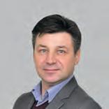
Figure 1: The left-hand image shows a RIEGL RiCOPTER with RIEGL VUX-1UAV laser scanner flying over a wet tropical forest plot in Australia. The right-hand image shows a RIEGL VZ-400 terrestrial laser scanner mounted on a tripod in a wet tropical forest plot in Australia.
EXPLORING
3D INFORMATION ACROSS SPATIAL SCALES IN FOREST ECOSYSTEMS
the collection of TLS data over larger areas (>10ha). In this context, the potential of other laser scanning platforms (spaceborne, airborne, unmanned aerial vehicles) is interesting in the context of fusion with TLS data.
In general, data fusion can be regarded in two different ways. On the one hand (type 1), fusion can refer to the combination of two individual datasets into one unique new dataset. In this case, the resulting (fused) dataset builds on the strengths of each sensor and gives a more complete view of the sampled object. Two datasets with a different point of view are co-registered and combined into one point cloud in order to reduce the occlusion which is present in both separate point clouds. This type of fusion is typically interesting when both individual datasets are representing the same level of spatial detail. On the other hand (type 2), separate datasets can be spatially aligned (co-registration) but not converted into a single unique dataset. This is typically the case when the individual datasets have very different levels of detail. However, due to the complementary spatial extent, this type of fusion is not only interesting to study changes of structure over time, but is also crucial in the context of calibration and validation for spaceborne remote sensing products.
TERRESTRIAL AND UAV LIDAR FUSION
To cover larger areas while maintaining a comparable level of detail compared to TLS, unmanned aerial vehicles (UAVs) equipped with laser scanners (UAV-LS) are being explored as a possible solution to speed up the scanning process over larger areas (>1-100ha). Currently there are multiple commercial UAV systems available, with a large variation in data quality. Recent UAV-LS systems have produced point clouds with point densities ranging from 50 to >4,000 points per square metre. UAV-LS demonstrates significantly higher point density at lower cost and with higher flexibility, but with significantly smaller spatial coverage when compared to traditional airborne laser scanning (ALS).
The fusion of TLS and UAV-LS into a single fused dataset is particularly interesting as these two techniques capture different parts of the forest (Figure 1). Due to its abovecanopy view, UAV-LS could account for the canopy parts which are occluded in TLS and improve structural metrics derived on plot and

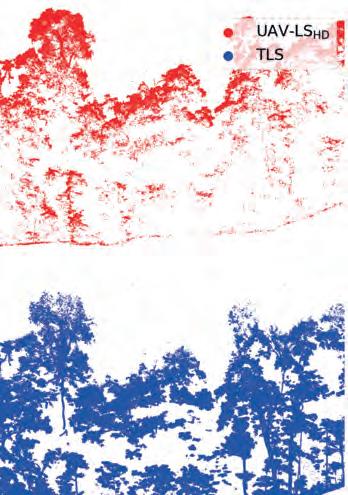
UAV-LS flight in a wet tropical forest plot.
tree level. Therefore, high-density UAV-LS data is preferred, especially for dense and structurally complex tropical forests. A good spatial alignment of the UAV-LS and TLS point cloud can be achieved when a critical number of common spatial features are present to act as tie points (Figures 2 and 3).
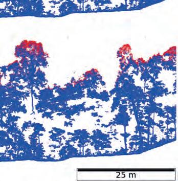
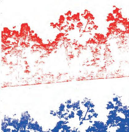
The fused point cloud can not only be used to improve structural metrics, but also as a reference to investigate the potential and limits of the standalone TLS and UAV-LS. Moreover, the fused point cloud could be applied as a local calibration tool to improve standalone UAV-LS structural estimations at the landscape scale.
TERRESTRIAL AND AIRBORNE LIDAR FUSION
As outlined above, a key challenge in making the best use of these new sources of 3D information lies in combining them in such a way as to bring the best, most useful
information of each source together into a single dataset. The major advances in measurements of individual tree structure from TLS and UAV-LS are in part limited by scale. ALS is embedded in forestry management and practice, as well as in environmental science, in part because it can cover large areas rapidly.
The relatively long heritage of ALS means that there are a wide range of established tools and workflows for extracting tree and forest information, and currently more so than for TLS and UAV-LS. ALS typically provides estimates of canopy height, stem density and potentially vertical structure. Needless to say, the trade-off is the detail: ALS provides less than a hundred points per square metre, compared to potentially thousands from UAV-LS (and more from TLS), and generally with much lower canopy penetration and larger footprint size (Figure 4). But ALS is, and will
FEATURE 23 ISSUE 7 2022 | INTERNATIONAL |
Figure 2: Illustration of fusion results at plot level for TLS and multiple returns of a high-density
BY LOUISE
KIM CALDERS, SUZANNE MARSELIS AND MAT DISNEY
TERRYN,
Figure 3: Illustration of fusion results at tree level for TLS and multiple returns of a high-density UAV-LS for a tropical tree. Subplots ‘a’ and ‘b’ represent different zoom-ins on the tree.
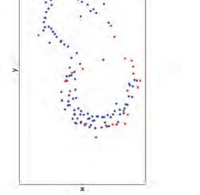
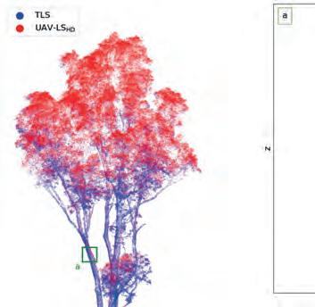
remain, a vital bridging tool, particularly in linking plot-scale measurements to spaceborne ones. ALS underpins many local, regional and national estimates of canopy cover (particularly in urban environments), carbon stocks, growth and yield, as well as habitat types, forest change maps, etc. As a result, there is a hugely important time series of ALS going back several decades in some places.
A lot of development in combining ALS with TLS has been focused on how to relate these more aggregated ALS-derived canopy properties to tree-scale detail from TLS. The challenge of co-registering TLS and ALS point clouds is even greater than for TLS to UAV-LS, mainly
due to the much greater area covered. While technological improvements in platform location and attitude are certainly helping, the next steps in integration may be algorithmic, i.e. a SLAM-like approach but at larger scales, based on the datasets themselves. There has already been significant development in identifying and delineating individual tree crowns from large-area ALS coverage, including via machine learning/deep learning. Combining this with the information from TLS is already allowing improved matching at the individual tree scale, particularly in less dense forest areas.
ALTERNATIVE APPROACH
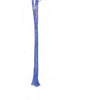
An alternative approach is to go the other
way, relating plot-scale aggregate estimates of height and vegetation density from TLS to ALS (potentially via UAV-LS). This has the advantage of not requiring co-registration at the tree scale, and so is a very attractive pragmatic approach. The drawback is the loss of the detailed tree-level information. The importance of establishing links between ground and airborne data is widely recognized. New Committee on Earth Observation Satellites (CEOS) activities make this explicit for applications relating to above-ground biomass and carbon stocks. For example, the GEO-TREES initiative seeks to establish a network of a hundred or more permanent 1 ha biomass reference sites across the globe, which are urgently needed to improve calibration and validation of satellite and airborne estimates of forest carbon.
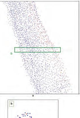
AIRBORNE AND SPACEBORNE LIDAR FUSION
Spaceborne Lidar datasets providing information on forest/canopy structure are limited to three different missions: ICESat-1 (2003-2009), ICESat-2 and Global Ecosystem Dynamics Investigation (GEDI). As the names suggest, ICESat 1 and 2 were primarily designed to measure the growing and shrinking of ice sheets and only GEDI was specifically designed to map canopy structure. GEDI was launched late 2018 and is currently orbiting the Earth from its vantage point on the International Space Station. GEDI collects full-waveform Lidar data, so instead of the detailed point clouds resulting from TLS measurements, the instrument collects a ‘waveform’ containing information on ground elevation, canopy height and vertical canopy structure at each sampling location, whereby the sampling location spans an approx. 25m-diameter circle. Given the vantage point from space, the sampling pattern is much less dense than from airborne Lidar data, but the advantage of GEDI is that it collects consistent Lidar measurements across nearly all temperate and tropical forests (between roughly 51.6 degrees North and South latitude).
Figure 4: Illustration of different Lidar datasets at the tropical savanna Litchfield TERN supersite in Australia. All point clouds are down-sampled to 0.02m voxels (from Calders et al. 2020).
Data fusion involving spaceborne Lidar data is exclusively of the second type mentioned above; two datasets are spatially aligned (co-registered) but not converted into a single unique dataset. High-resolution airborne Lidar datasets, spatially aligned with spaceborne data, can be used to validate the spaceborne measurements of canopy height and the vertical profile (Figure 5). Spaceborne and
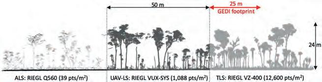
| INTERNATIONAL | ISSUE 7 2022 24
Figure 5: The left-hand image shows an illustrative scanning pattern of an airborne full-waveform Lidar system (LVIS) and GEDI in Gabon. The right-hand image shows a comparison between a Lidar waveform collected by LVIS (red) vs GEDI (black); the retrieved ground elevation and canopy height are indicated with dotted lines for both instruments. Note that these datasets were collected roughly three years apart, which may add to the observed differences in canopy structure.
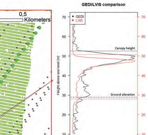
airborne fusion can also be used to assess changes in canopy structure over time, for example, using the time lag between data collection. Differences in canopy structure as measured by the two instruments can potentially be attributed to natural and human-induced processes. Additionally, airborne reference datasets can be used to train models to extract more information from the spaceborne Lidar datasets than is currently possible. Going even further, spaceborne and airborne Lidar datasets could even be fused with other spaceborne remote sensing data products at high resolution to train advanced machine learning models to estimate canopy structure over vast areas at higher resolution than is possible with spaceborne Lidar data alone.
CONCLUSION
3D information on the Earth’s forest ecosystems is essential to support long-term carbon monitoring, especially now that the world’s climate is under increased pressure. TLS data can already provide accurate estimations of tree volume and biomass, but in practice the spatial coverage is limited to just a few hectares. Larger areas can be mapped with UAV, airborne and spaceborne Lidar and this article has described how such data can be fused with TLS in two different ways to support upscaling.
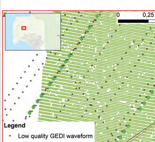
FURTHER READING
Calders, Kim, et al. Terrestrial laser scanning in forest ecology: Expanding the horizon. Remote Sensing of Environment 251 (2020): 112102.
ABOUT THE AUTHORS
Louise Terryn is a PhD student at the Computational & Applied Vegetation Ecology lab (CAVElab) at Ghent University in Belgium. Her PhD project is about multi-sensor data fusion to gain insight into the spectrum of tree structures of tropical forests.

Kim Calders is a professor of Earth Observation & Terrestrial Ecology at Ghent University in Belgium. His current research interests are related to measurements of full-3D vegetation structure and how this is related to airborne or spaceborne remote sensing signals.

Suzanne Marselis is a postdoctoral scientist at the Institute of Environmental Sciences at Leiden University in the Netherlands. Her research interests lie in the mapping of biodiversity using remote sensing data. Before joining Leiden University, she worked on the GEDI Lidar mission.
Mathias Disney is a professor in the Department of Geography at University College London in the UK and is also a member of the UK’s National Centre for Earth Observation (NCEO). His research interests include 3D measurements of forests and trees in tropical and temperate forests as well as urban ecosystems.

FEATURE 25 ISSUE 7 2022 | INTERNATIONAL |
RIEGL VZ-600 i
RIEGL’S NEW ERA OF TERRESTRIAL LASER


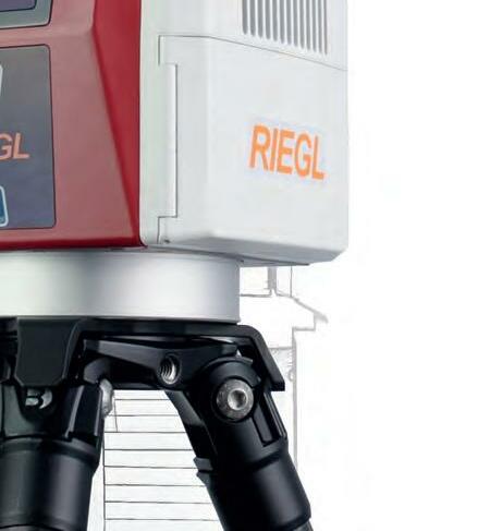


» broad range capability (0.5 m up to 1000 m)


» 5 sec scan time for low resolution overview scans

» 30 sec scan time for 6 mm resolution @ 10 m distance
» 60 scan positions per hour (with image acquisition)
» 3D position accuracy up to 3 mm @ 50 m


» precise real-time onboard registration


» internal cameras & GNSS receiver
» weight 6 kg / 13 lbs
» prepared for mobile use

Watch the video! www.riegl.com
SCANNERS

NEW World Premiere INTERGEO 2022
extreme versatility | high productivity | ultimate performance | prepared for mobility Austria | USA | Japan | China | RIEGLWORLDWIDE | Australia|Canada | United Kingdom
BACK IN BUSINESS AT INTERGEO
Reuniting the Geospatial Industry
The vibe at Intergeo 2022 felt almost just the same as pre-pandemic times, and a wide range of innovative hardware and software solutions were on display. The geospatial industry is clearly back in business! Moreover, with a strikingly high number of companies already signed up to exhibit next year, it seems to be all systems go for an even bigger and better Intergeo 2023 in Berlin.
Intergeo 2022 was the first in-person edition since COVID-19 brought the world to a standstill, so many geospatial enthusiasts had been looking forward to it for a long time. And based on the vibe at the exhibition centre in Essen during the three days of the event, they were clearly not disappointed, since the atmosphere at the world’s leading trade show and conference for the mapping and
surveying profession felt almost just the same as pre-pandemic times.
While this year’s edition of the event was officially described as a ‘hybrid’ version, it can actually be seen as a major step towards things going back to normal. Having said that, COVID-19 had clearly left some traces, since a number of exhibitors were present with
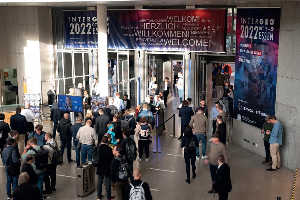
smaller booths than in previous years. Their restraint is understandable, as the ongoing uncertainty in the world has made many businesses think twice about budgets and investment decisions.
EXCITED TO SEE HARDWARE, SOFTWARE AND PEERS
However, any hesitation rapidly made way for
REPORT 27 ISSUE 7 2022 | INTERNATIONAL |
GIM INTERNATIONAL
BY WIM VAN WEGEN, HEAD OF CONTENT,
Any hesitation rapidly made way for excitement as soon as Intergeo 2022 opened its doors in Essen. (Courtesy: Fokuspokus Media)
excitement as soon as Intergeo 2022 opened its doors in Essen, the second-largest city in the Ruhr region, which is Germany’s largest urban area and was the beating heart of the German Wirtschaftswunder (economic miracle) in the 1950s and 1960s. For many of the roughly 14,000 visitors, one of the key reasons to attend had clearly been to meet up with old (and new) friends and finally see their peers in the geomatics community again in real life, which is of course so much more enjoyable than trying to interact on a screen. This definitely added to the lively atmosphere that filled the air in the exhibition halls.
Needless to say, Intergeo 2022 was much more than an occasion to meet people in person. It was also the perfect place to get a major update on the latest hardware and software solutions that are driving the geospatial industry’s growth, ranging from terrestrial surveying solutions to unmanned aerial vehicles (UAVs or drones) and other automated solutions for capturing the world’s reality. Visitors could also see numerous examples of how today’s advanced geoinformation systems and building information modelling (BIM) solutions are unleashing their potential in data analysis, monitoring and decision-making support. This year, there was a special focus on digital twins, which are increasingly being used to bring static models to life with dynamic, realtime information and to simulate wide-ranging scenarios in their reflected reality. On the topic of digital twins, next year’s host city of

Intergeo is currently working on an interesting real-life use case. In a regeneration project that is set to transform a 73-hectare site into a modern urban district called Siemensstadt Square, Berlin’s newest neighbourhood will be ‘built’ twice: first in the digital world and then in the real one. A holistic digital twin will serve as the foundation for both the construction and the subsequent operation of the whole district.
DIGITAL TWINS AND THE METAVERSE
Digital twins were also in the spotlight during the traditional press conference on the second day of Intergeo. One of the speakers was Hansjörg Kutterer, who will be succeeded as president of the German Society of Geodesy, Geoinformation and Land Management (DVW) by Rudolf Staiger from January 2023 onwards. Kutterer stated that the Earth is changing rapidly and that we need to map, model and run simulations as the basis for discussions and scenario analysis to support informed decisions at the level needed. The geomatics profession is a main player in this, he explained, which also requires us to think big and merge our different views and competencies into something bigger.
By ‘something bigger’, Kutterer was referring to the metaverse, which was a buzzword at this year’s event. Although the metaverse may still be a somewhat abstract term for many people, it can be seen as the evolution of ‘Industry 4.0’ and the Internet of Things.
In the metaverse, the use of AR and VR will bring physical things into the parallel digital
world. Geospatial data will be essential to create dynamic digital twins that will form important building blocks of the metaverse and add value.
Barbara Ryan, executive director at the World Geospatial Industry Council (WGIC), described the metaverse as the ‘forcing function’ for people. The term ‘metaverse’ was first coined around 20 years ago in the science-fiction novel Snow Crash, written by Neal Stephenson, she explained. “That shows how fast things move, and there is no doubt that one day we will all be ‘living’ in two worlds: the virtual and the physical.”
Thomas Harring, president geosystems at Hexagon, stated that digital twins are already a kind of metaverse, but the metaverse will be even more complex and in real time. “This will drive awareness among consumers and the broader community of the technology and what geospatial data can do. Hopefully it will also help to attract young people or new talent to our industry.”
GEOSPATIAL DATA TO COMBAT CLIMATE CHANGE
Climate change is undoubtedly high up on the list of priorities for the global community to solve. Therefore, it was fitting that the press conference addressed how geospatial solutions could help the world to combat this societal challenge or adapt to its effects. Kutterer commented that he regards a digital representation of the environment, including
| INTERNATIONAL | ISSUE 7 2022 28
The traditional press conference on the second day of Intergeo was focused towards climate change. (Courtesy: Fokuspokus Media)
the landscape, coverage, buildings and physical processes, as the basis for enabling decision-makers in many disciplines –ranging from architects and biologists to civil engineers and mayors – to mitigate the impact of climate change.
Martina Klärle, a climate expert at the Frankfurt University of Applied Sciences and project leader at caREL (a research platform using geospatial data to support climate goals, including Europe’s ambitions to become the world’s first climate-neutral continent), urged the geospatial industry to fight climate change with all the available tools. She described it as our duty to share all the data with the world for free in order to empower our united attempt to meet the targets of the Paris Agreement.
Scott Crozier, vice president, survey and mapping at Trimble, agreed that sharing information is indeed absolutely critical, and said that the industry can help by sharing the abundance of relevant geodata collected with today’s advanced mapping and surveying solutions. Thomas Harring concurred that it is important for decision-makers to access to all the information they need, adding that all the data can be used to make a giant impact.
THE ROLE OF INTERGEO IN PUSHING THE GEOSPATIAL INDUSTRY

On the third and final day of Intergeo, I caught up with DVW’s Kaja Hoppe (head of business development) and Christiane Salbach (director), together with Hinte (the
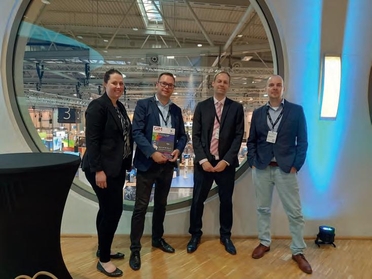
for a cup of coffee. With the number of visitors in Essen exceeding expectations and lots of visible signs of engagement, they were clearly pleased with the success of the event. Besides having a strong sense of the industry reuniting, they were also aware of many new contacts being made – often by chance – which illustrated the open nature of the geospatial community. Notably, the percentage of female visitors had increased, and so too had the number of students. In the context of the talent shortage and the
geospatial labour market, the presence of so many youngsters is encouraging.
In summary, it is fair to conclude that Intergeo 2022 in Essen marked a strong return of the annual event which turns a German city into the global capital of the mapping and surveying sector for a few days each autumn. As a result, things now look very promising for next year’s Intergeo, which will be held in Berlin. A notably high number of companies have already signed up to exhibit next year, and the ‘Secure your booth’ corner in one of the halls was constantly busy. “Rebookings are going through the roof,” confirmed Salbach, who praised the unique appeal of Berlin as an extra factor boosting the potential of Intergeo 2023 to be an even bigger success. Additionally, the organizing committee intends to further broaden the role of content in order to spread the word about the interdisciplinary potential of geospatial, for example regarding energy, infrastructure, urban planning and rural development. Hoppe: “We aim to create better awareness of what our industry can do, both for politicians and the public.” Moreover, networking will be given an even bigger role in Berlin, and there will be a greater focus on the next-generation surveyor. As Martina Klärle said during the press conference: “If you want to be a hero, become an engineer.” There are plenty of role models in the geospatial industry and, at GIM International, we are delighted to support Intergeo’s efforts to give them an international voice.
REPORT 29 ISSUE 7 2022 | INTERNATIONAL |
The percentage of female visitors had increased, and so too had the number of students. (Courtesy: Fokuspokus Media)
The Geomares team, representing GIM International, Geo-matching and Hydro International.


www.gim-international.com
ESSENTIAL TOOLS FOR DEFORMATION AND ENVIRONMENTAL MONITORING
Geodetic Control Networks: Challenges and Solutions
What are the key challenges in establishing precise geodetic control networks? This is one of the most important tasks of geodesists and land surveyors, since geodetic control networks are essential for the deformation and environmental monitoring of dams, tunnels, high towers, landslides and bridges, among others. This article discusses the main challenges relating to vertical angles and provides some recommendations for how they can be overcome.
The key challenges when establishing precise geodetic control networks relate to the vertical angles that are employed to reduce the collected slope distances to horizontal distances. This approach, called ‘trigonometric slope distance reduction’, is well known and commonly practised in geodesy. However, reducing slope distances to horizontal distances should be done without existing systematic errors.
Collecting vertical angles (or zenith angles) using a total station creates various issues. Refraction error, geometric effect (due to curvature-skewness of Earth’s reference model) and physical effects (due to the deflection of verticals) are the main challenges that affect the collected vertical angles (Figure 1). These effects show that the vertical angle is a sensitive observation.
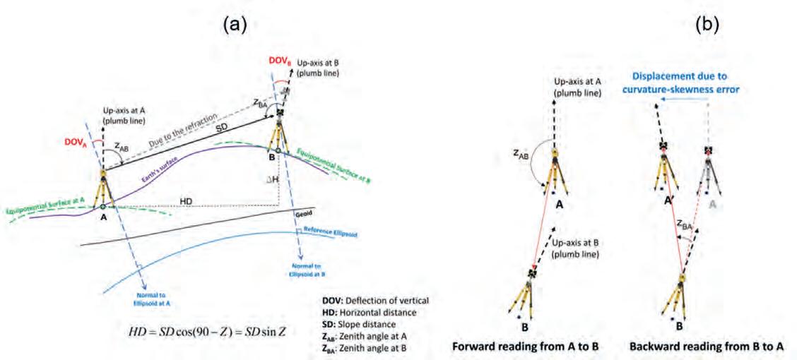
EFFECTS ON THE VERTICAL ANGLE
Refraction error occurs because of atmospheric density variation along the baseline. The air temperature gradient in the direction perpendicular to the line of sight is the main factor in modeling the refraction effect. As shown in Figure 1, geometric and physical problems occur because of the non-parallelism of the up-axes at the start
FEATURE 31 ISSUE 7 2022 | INTERNATIONAL |
Figure 1: a) Refraction and physical effects and b) geometric effect on the vertical angle and slope distance reduction.
BY MOHAMMAD BAGHERBANDI, SWEDEN, AND MASOUD SHIRAZIAN, IRAN
and endpoint of the baselines in the geodetic control networks. The geometric problem is related to the Earth’s reference shape (spherical or ellipsoidal model). Due to the curvature problem, the up-axes will not be parallel. However, by selecting an ellipsoidal model for the Earth, an additional problem will appear that is called the skewness problem (i.e. the up-axes at points A and B will not be in the same normal sections/mathematical sight of view). The results show that the geometric error (the non-parallelism of the up-axes) can reach to 32 arc-seconds for 1km baseline length with 100m height difference, where the corresponding slope distance reduction is 8mm. The physical problem (or the deflection of verticals problem) is due to the separation of the normal line to the Earth’s reference ellipsoid and plumb line. The problem is that the observations are collected on the Earth’s surface (physical shape of the Earth), but the Earth’s mathematical shape (e.g. reference ellipsoid) is used for calculations. Therefore, observations should be corrected to the normal to the ellipsoid as a reference.
It is important to mention that it does not matter which type of coordinate system is defined in establishing a classical geodetic network (local geodetic or local astronomic coordinate system). The deflection of vertical problem can reach to 16.5mm (for 70° zenith angle) and 4.2mm (for 85° zenith angle), assuming 1km baseline length. Geometric and physical effects will directly influence the zenith angles and, consequently, the reduction of the slope distances will be affected. Since these problems have not been clearly mentioned in the guidelines,
the quantification of these problems in Bagherbandi et al. (2022) can be useful for future guideline compilation.
SOLUTIONS TO THE CHALLENGES
In the existing guidelines, the recommended solution to the above-mentioned problems is the reciprocal reading of vertical angles. However, to remove the refraction error, the vertical angle should be collected simultaneously from both ends of a distance (see e.g. Engineer Manual 2018, Section 3-4).
The reciprocal reading can be a solution for geometric and physical effects if the points are at the same elevation. Otherwise, both geometric and physical errors should be considered for correcting vertical angles.
Cost and time are both important factors in establishing optimum and precise geodetic networks and should always be considered. Collecting reciprocal observations is timeconsuming, especially in areas of rough topography (e.g. dam sites), and increases the fieldwork and project costs. In addition, it is not always possible to follow the guidelines and design the geodetic control network with the points at the same elevation because of the project circumstances (e.g. existing rough topography and monitoring high towers). The authors’ results show that disregarding geometric and physical effects can lead to signifcant errors, especially if there are large height differences between the points (even if the vertical angles are collected reciprocally).
Up until now, textbooks and geodetic lecture notes have only presented the geometric effect on the horizontal angles. But how can
this error be formulated and quantified for the vertical angle? The physical problem can be corrected using a regional gravity database and calculating the precise deflection of vertical components. Detailed information about this problem and its solution can be found in Bagherbandi et al. (2022) and Heiskanen and Moritz (1967, p. 312).
HOW TO AVOID READING VERTICAL ANGLES
Two methods can help land surveyors to eliminate collection of the vertical angle using only the unidirectional slope distances and horizontal angles: 3D network adjustment (cf. Ghilani 2017, Chapter 23), and a recently proposed method by Shirazian et al. (2021) called the network-aided method. In the network-aided method, one can use only unidirectional slope distances in the form of a 3D free network adjustment in the first step. The horizontal distances are calculated in the next step using adjusted coordinates (Easting and Northing components). Lastly, the calculated horizontal distances, along with the horizontal angles or direction observations, are used in the final network adjustment to calculate the 2D geodetic network.
The authors evaluated the network-aided method using two geodetic networks in Iran (Mojen Dam and Damghan Dam). Figure 2 shows the coordinate differences obtained by using reciprocal and unidirectional observations (i.e. network-aided method and using only slope distances and horizontal angles). The results illustrate that the discrepancies between the results of the two methods are less than 1mm and are therefore
| INTERNATIONAL | ISSUE 7 2022 32
Figure 2: Coordinate differences using reciprocal slope distances and unidirectional slope distances (network-aided method) in a) Mojen Dam and b) Damghan Dam 2D geodetic networks.
neglible. In addition, the network-aided method results in similar error ellipses (or, in some points, smaller semi-major and semiminor axes) and better redundancy numbers.
ADVANTAGES OF NETWORK-AIDED METHOD

The network-aided method has some advantages compared to 3D network adjustment. Comparing the two methods
FURTHER READING
shows that the number of degrees of freedom in the network-aided method will be larger than in 3D network adjustment. This means that the average redundancy (or relative redundancy), which is an important network quality factor (especially when designing networks), is higher in the proposed method by the authors, as validated by testing in two dam deformation monitoring networks.
Bagherbandi, M., Shirazian, M., Ågren, J., & Horemuz, M. 2022. Physical and geometric effects on the classical geodetic observations in small-scale control networks. Journal of Surveying Engineering. https://doi.org/10.1061/(ASCE)SU.1943-5428.0000407.
Engineer Manual. 2018. Structural deformation surveying. EM1110-2-1009. Washington, DC: USACE.


Ghilani, C. D. 2017. Adjustment computations: spatial data analysis. John Wiley & Sons. Heiskanen, W. A., & Moritz, H. 1967. Physical Geodesy. WH Freeman and Company. San Francisco, CA.
Shirazian, M., Bagherbandi, M., & Karimi, H. 2021. Network-Aided Reduction of Slope Distances in Small-Scale Geodetic Control Networks, Journal of Surveying Engineering 147(1983), 1-10. https://doi.org/10.1061/(ASCE)SU.1943-5428.0000375.
ABOUT THE AUTHORS
Mohammad Bagherbandi is a professor in the Faculty of Engineering and Sustainable Development at the University of Gävle and a senior researcher in the Division of Geodesy and Satellite Positioning at the Royal Institute of Technology (KTH) in Stockholm, both in Sweden. His professional interests include geodetic surveying, Earth observation using satellite sensors, physical geodesy and geodynamics. He is currently pursuing multidisciplinary research combining directions such as geophysics, applied geodesy and land surveying.
mohammad.bagherbandi@hig.se

Masoud Shirazian is an assistant professor in the department of geomatics engineering (Civil Engineering Faculty) at the Shahid Rajaee Teacher Training University in Tehran, Iran. His professional interests include geodetic surveying, GNSS, geometric geodesy and geodynamics. His background is in surveying engineering. He is currently pursuing multidisciplinary research combining directions such as GNSS, geodesy and land surveying.
m.shirazian@sru.ac.ir

FEATURE 33 ISSUE 7 2022 | INTERNATIONAL |
HYPACK® Surveying and processing software for Single Beam, Side Scan, ADCP, Sub-bottom, and Magnetometer systems. Your Sensors. Our Software. Survey The World. HYSWEEP® Surveying and processing software for Multibeam, Backscatter, and LiDAR systems. sales@hypack.com • www.h ypack2023.com DREDGEPACK® Dredging control software on Cutter Suction, Hopper, Excavator, Bucket Dredges, and more. NEW SOFTWARE · WATER QUALITY · GEOPHYSICS · ECHO HYPACK 2023 Training Event Panama City Beach, Florida January 9-12, 2023
Shining a Light on the Surveying Profession
The 27th edition of the FIG Congress took place in the Polish capital of Warsaw from 11-15 September 2022. As always, this gathering of the land surveying community featured a large number of highly relevant keynotes, seminars and sessions. But after more than two years of COVID-19 restrictions, it also turned out to be an event full of enthusiastic reunions between acquaintances as well as a place for forming new friendships. This article starts by giving an impression of the congress in a nutshell, followed by contributions from two young participants. Between them, they paint a picture of the event from the refreshing perspective of the new generation of surveyors.
The focus of the 27th edition of the FIG Congress was on the changing face of the surveying profession. The job of a land surveyor has changed radically over the years. Nowadays, geospatial data is applied across a wide range of disciplines in a much broader context. It is being recognized as a

vital part of the solution for the well-being and betterment of society as a whole. This is being further accelerated by the rapidly advancing technological developments of the past decade, such as increased computational power and the miniaturization of sensors. The geospatial experts of today are continuously
exploring new ways of tapping into the potential of these and other technological advancements.
GETTING TOGETHER TO SHARE EXPERTISE
The backbone of the FIG Congress was formed by the keynote sessions and a broad
| INTERNATIONAL | ISSUE 7 2022 34
LOOKING
BACK ON THE FIG CONGRESS 2022
range of technical sessions. The abundance of presentations covered almost every conceivable topic under the ‘geospatial data umbrella’. The content of the keynotes varied from land governance in support of the 2030 Global Agenda – zooming in on the concept of responsible land governance and the importance of including all land, people and land rights at a countrywide scale – to mapping plastic pollution in the Earth’s oceans by employing multispectral imagery in conjunction with artificial intelligence and deep learning algorithms. With support from the local organizers from the Association of Polish Surveyors (SGP), this year’s FIG Congress was an important hub for intensive learning and a valuable platform for the FIG community to exchange knowledge and experiences during the workshops, seminars and sessions. One of the keynotes, given by outgoing FIG president (and incoming DVW president) Rudolf Staiger, took the audience on a journey through the history of surveying. Staiger visibly entertained the audience with his dynamic insights into
how the 3rd and 4th industrial revolutions have had huge impact on the surveying profession. He explained that the profession is now based on connectivity and computing power, and the ‘Surveyor 4.0’ is “using his or her equipment like a big office software package – just push the button.” Staiger ended his keynote by emphasizing the need for events such as the FIG Congress and other gatherings where the geospatial community can get together to exchange knowledge. And after the inspiring days in Warsaw, most participants will probably agree that meeting up in person is indeed a very enjoyable and effective way of keeping pace with the changing face of the surveying profession!
The upcoming issues of GIM International will feature various articles written by land surveying professionals and geospatial experts who spoke during the FIG Congress in Warsaw. In the meantime, for an overview of all the keynote sessions, see the FIG website: https://www.fig.net/news/news_2022/10_ congress_report.asp.
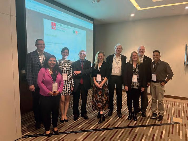
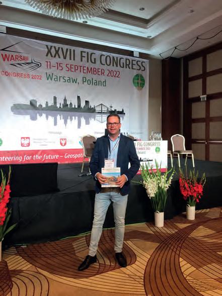
A Sense of Community
BY ANGELINA AGEENKO
After a COVID-19 break, the FIG Congress finally opened its doors again to participants in 2022. It was attended by professionals from all over the world across numerous surveying disciplines including geoinformatics, geodesy and land management, to name but a few. Warsaw, the beautiful and charming capital of Poland, with its castles, palaces, universities and parks, served as the backdrop to this year’s congress. As a first-timer at a FIG conference, I had a perfect and long-awaited opportunity to attend the event in person, get exposed to new ideas, build professional relationships and become a part of the international surveying community.
The congress was preceded by a number of events, of which I attended the FIG Young Surveyors Network. The programme, tightly packed with activities, was not only dedicated to the professional development of young surveyors through technical lectures. A special place in the Young Surveyors Network was given to building a strong sense of the international surveying community though social activities such as field games,
geo-puzzles, competitions related to the use of the newest surveying equipment and a museum visit that introduced us to the hospitable Polish culture.
This sense of community is indispensable and precious in the world, where cooperation and volunteering for a professional organization such as FIG are an urgent need. This was so precisely captured and reflected by the overall theme of the congress: ‘Volunteering for the Future – Geospatial excellence for better living’. It was a great inspiration to listen to peers from North America and Africa who
REPORT 35 ISSUE 7 2022 | INTERNATIONAL |
the FIG Congress 2022. Pictured here: Head of Content Wim van Wegen.
keep networks active in their countries, or who find ways of contributing to their society by leveraging the power of geospatial information to combat COVID-19.
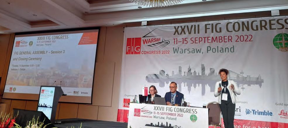
After two days in the company of fellow young surveyors, I was overwhelmed by the main part of the congress and the abundance of the technical sessions, workshops and events it offered. Even though the scale and the size of the congress was quite different from what we are used to at home in Denmark, I always
felt welcomed and guided by both the FIG team and the local organizing team during my stay in Warsaw.
The sessions brought into sharp focus the solutions and the challenges that our multifaceted profession currently experiences and will face in the future. They might vary in different countries, but one thing seemed certain – surveyors will remain the link between the technological advancements and the Sustainable Development Goals. I was
lucky enough to get the chance to present my work on landslide susceptibility mapping using artificial intelligence at the congress and feel happy that I could make a small contribution to this wonderful event.
Angelina Ageenko presented her paper on ‘Landslide Susceptibility Mapping in Denmark – a Machine Learning Approach’ on Wednesday 14 September 2022 in the session TS07C: Geospatial Analytics Use Cases.
The FIG Congress Seen from a Young Surveyor’s Perspective
BY CLAIRE BUXTON
It is difficult to tell if it was a lack of in-person connection over the previous years or a true feeling of progress, but the buzz at this year’s FIG Congress and Young Surveyors Conference was palpable. It was the best one I’ve been to so far (best out of three). Obviously, it is hard to compare with the first one I attended because that is where I got a taste for the nerdy joy that comes from FIG Working Weeks. But this one in Warsaw, Poland, brought out all FIG’s best for us young surveyors who were lucky enough to be there. Meeting representatives of the ‘big players’ (such as World Bank, Esri, Trimble and United Nations organizations) not only adds context and a friendly face to the projects, models
it also provides exposure to role models for a young surveyor to see what opportunities can exist for them beyond their day-to-day work. They can visualize a future in our industry beyond that millimetre, bolt, boundary or calculation. It allows a young surveyor to picture themselves in our industry and see how they can carve out their place within a bigger picture.
Inspiration for a young surveyor to continue furthering their knowledge stems from the technical sessions. It is always tricky to choose which sessions to attend, with simultaneous sessions being a necessity for the programme organizers to fit it all into one week. I was
around land administration using fit-forpurpose techniques, clever tools designed to empower young surveyors while mapping deforestation trends, and participate in meetings and workshops to discuss the future direction of FIG. It is humbling as a person who has gained privilege from living within countries with strong land tenure systems and stable governments to be invigorated by other young surveyors and experts who dedicate their lives to the improvement of land systems in their own contexts and communities. Attending an international conference can be daunting, especially if you haven’t been to one before. A young surveyor learns quickly that FIG is as supportive as a well-braced control
| INTERNATIONAL | ISSUE 7 2022 36
Closing ceremony featuring Louise Friis-Hansen, Rudolf Staiger and Diane Dumashie.
the way you dress does not define you, for example. In fact, if your luggage is held up at customs, you can likely find a friendly person to lend you an outfit while you’re waiting for it to arrive. I loved seeing people wearing their favourites, from customary clothing through to a Wonder Woman t-shirt. When presenting, the speaker receives questions that will challenge them but will not accuse. There is a genuine interest from attendees to learn from the perspective of a young surveyor. Finally, meeting other young surveyors and seasoned surveyors with a similar energy for their careers is a huge bonus. Connections like these are worth continuing to build on and lean on for support. Your network grows fast within FIG. Young surveyors can see first-hand which geospatial tools are out there. Robotics, automation and other front-end technology that some parts of the industry are perhaps not even ready for in their own country were displayed at the FIG congress. This can give young surveyors an understanding of what exists before it may even reach their context. Better yet, they could bring it to their own country and offer a new service to generate income for their organizations and improve delivery for their clients.
52 DEGREES NORTH
Of course, we didn’t just get spoiled with technical content and demonstrations of the latest technologies; we also got to experience the local flavours and customs of Warsaw. With the charity dance (which is always well attended and supported), pure Polish vodka tastings and traditional dancing and food on offer during the week, we were treated to a teaser of Polish culture to cherish.
Despite all of this, I recognize we have still got improvements to make. I say ‘we’ because, as a volunteer-run organization, FIG rests on the shoulders of all its volunteers. It is up to us as members of both FIG and the wider surveying industry to continue striving for improvement. Whether by supporting the Stand for her Land campaign and the Volunteer Community Surveyor Program, creating a place for diverse people to come together and feel at home as themselves, being an ally to promote diversity, equity and inclusion, or bringing together the academic/private practice gap, we each have a role to play.
A big word of thanks to the organizers for bringing this event together. From where I am sitting, the stress and hectic hours were all worth it. Knowing that our industry is broad
and connected provides motivation for young surveyors to stay on this career path, but also to seek out collaboration and growth opportunities for their individual selves and for the industry. It is easy to gain inspiration from meeting with an international community of surveyors. The trick is now for the commission chairs and FIG leadership to convert that inspiration into sustained energy for next year and the years to come. As the incoming FIG president, Dr Diane Dumashie, said to me during the welcoming ceremony, “many hands make light work”. Let us roll up our sleeves, support each other, learn from each other and keep shining a light on our wonderful profession.
Claire Buxton is working as a consultant at Underhill Geomatics, Canada, and is an active member of the FIG Young Surveyors Network, most recently as the leader of the Volunteer Community Surveyor Program (VCSP). Before moving to Canada, she volunteered for the Survey and Spatial New Zealand Young Professionals and Pacific Advisory Group from 2015 onwards. She spends much of her spare time as a volunteer supporting young surveyors internationally in growing the VCSP.
As the symbolic finale of the FIG Congress in Poland and a material memento of this ‘festival of world geodesy’ in the heart of Europe, an unusual geodesic monument was unveiled on Theatre Square in the centre of Warsaw: a survey pillar dating from 1872. The pillar was originally erected as a geodetic and magnetic surveying station for the 52nd parallel north geodetic arc survey project in the second half of the 19th century. It formed part of a triangulation chain spanning the whole of Europe, from Ireland to the Ural Mountains. Created with the cooperation of Struve, Baeyer and many other famous surveyors and astronomers such as Airy, Helmert and Žylinski, the chain lasted for 40 years. The pillar survived the destruction of Warsaw during the Second World War and, on 14 September 2022 – exactly 150 years after it was erected – this unusual relic from the history of geodesy was unveiled in memory of the FIG Congress in Warsaw as the European Geodesy Monument. This is an important step towards the 52nd parallel north geodetic arc being added to the UNESCO World Heritage List as the first truly international Earth surveying project on a continental scale. The coordinates of this monument to the scientific collaboration of European surveyors are (BLH, GRS80-ETRF89): 52°14’38.30338” N, 21°00’33.03398” E.
Glory to the science of surveying: geodesy!
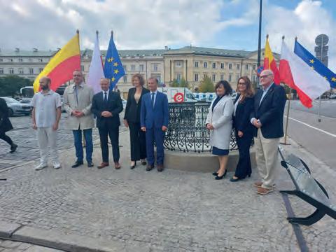
REPORT 37 ISSUE 7 2022 | INTERNATIONAL |
The unveiling of the geodesic monument on Theatre Square in the centre of Warsaw: a survey pillar dating from 1872.
Mariusz Meus (also known as ‘Mr Meridian’), head of the ‘Honorary Krakow Meridian’ geodesic educational initiative.
IBKS pushes the boundaries of scan-to-BIM with NavVis and PointFuse in a towering project
IBKS is a digital solutions and management consulting firm offering built-environment services in the healthcare space. The firm recently tested its innovative NavVis and PointFuse workflow in a huge, complex healthcare facility – and succeeded beyond all expectations.
KEY TAKEAWAYS
I BKS built a fast and accurate scan-to-BIM workflow around two powerful tools with low barriers to entry, NavVis VLX and PointFuse Pro
T he team started delivering complex scan-to-BIM projects in the medical space almost immediately
Recently, IBKS took on a two-tower, 450,000-square-foot healthcare project in Los Angeles
W ith NavVis VLX, each 11-storey tower took only 10 days to scan
W ith PointFuse Pro, each floor was prepared for Autodesk Revit in only 12 hours
TALL ORDER
In 2022, IBKS landed a big scan-to-BIM project for a large medical complex on the border of Beverly Hills and West Hollywood in Los Angeles. This site sprawls over 375,000 square feet — covering multiple medical suites and two 11-storey towers. Including exterior elements, the sum balloons to over 450,000 square feet.
It was the biggest scan-to-BIM project undertaken by IBKS to date. It was also a huge test for the firm’s innovative scanto-BIM workflow, which they had recently built around the NavVis VLX mobile scanner and PointFuse Pro software.
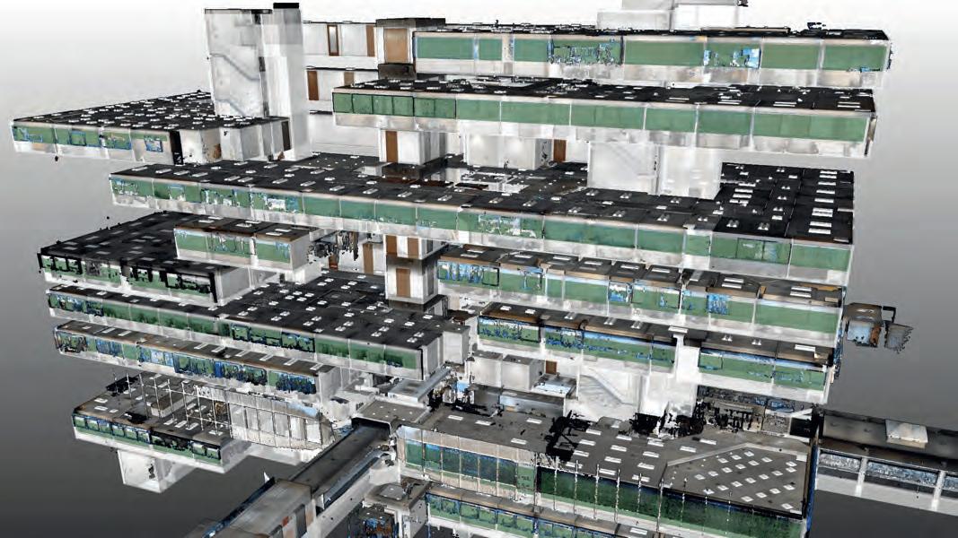
INNOVATE OUT OF THE GATE
According to Mo Haidar, founder of IBKS, the firm had only recently added reality capture to its services portfolio. IBKS had some in-house scan-to-BIM experience, but much of it was five years old — or even older — so the main players were essentially starting afresh.
This proved to be a strength rather than a weakness. IBKS was able to build an innovative workflow with no preconceptions about the “best” tools to use. As Haidar explains, IBKS “did research for every device that’s out there, and quickly realized that our use case would require a mobile mapping
SPONSORED ARTICLE | INTERNATIONAL | ISSUE 7 2022 38
Point cloud imagery of the two-tower complex in Los Angeles.
approach. And we pretty much knew that it was going to be the NavVis Reality Capture Solution: NavVis VLX and NavVis IVION. It was obvious because they offered no barrier to entry and no intimidation whatsoever.”
Spivey Lipsey, digital twin solutions lead with IBKS, adds that the mobile-mapping solution wasn’t just beginner friendly, it also met the firm’s stringent technical requirements for work in healthcare, “We were looking for a fair amount of accuracy, but we also have a lot of square footage to cover. The scanner hit that sweet spot of accuracy and speed.”
To complement their NavVis solution, IBKS looked for a downstream scan-to-BIM tool that offered a similar combination of a low barrier to entry, speed, and data quality. They found it in PointFuse Pro. This software would automatically classify surfaces, generate meshes of their point clouds to reduce file size, and produce LOD 200 models rapidly. And it would be very easy to use.
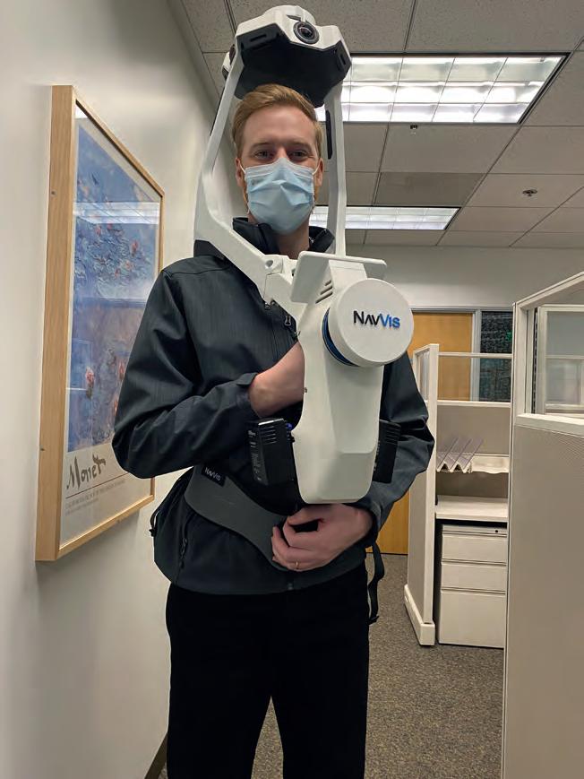
Lipsey says the most important factor, however, was that IBKS could be sure the tools would hang together as a complete workflow. “Someone that begins their adventure into this space — as they’re trying to procure software and hardware for their solution — they quickly understand that there is a very convoluted world of software versions and compatibility issues. And many of the software solutions are counterintuitive.”
“A big selling point for me,” he adds, “is that NavVis and PointFuse already had a collaboration. That lent a degree of confidence that these tools would work together.” With the right tools in place, IBKS then worked with the technical teams at NavVis and PointFuse to hone the workflow over a handful of large scan-to-BIM projects. The firm used these jobs to develop best practices for maintaining consistency, capturing corridors without drift, organizing data, auto-recognizing elements, and more.
THE BIG TEST
IBKS then landed the scan-to-BIM project for the two-tower complex in Los Angeles and put their workflow to its biggest test yet. This 450,000-square-foot project presented a number of challenges. IBKS would need to capture data that was accurate enough for a BIM model that met customer specs. And,
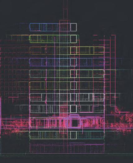
since the site was an active medical facility, they would need to work quickly after hours to reduce disruption to the staff.
As mentioned earlier, the project’s scan area sprawled across multiple levels of medical suites and 22 floors in total. But there was still one more level of complexity; the end client didn’t own the buildings being scanned, so IBKS could only capture the areas their client had leased. This meant the scans would be scattered — Haidar called the arrangement “Swiss cheese.” The team was uncertain if their software could maintain proper alignment through the processing chain. “We were worried that we might need to do the alignment of the multiple levels in two places, NavVis IVION, and PointFuse Pro,” says Haidar. “And the last thing you want to do is the same task twice.”
NAVVIS VLX AND NAVVIS IVION
Lipsey says that the team accelerated the mobile-mapping workflow by capturing numerous smaller scans without the use of control points. This enabled them to get in and out of each space very quickly while reducing drift to maintain a high level of accuracy.
To combat any possible alignment problems that might arise due to the scattered layout, IBKS arranged the scans in a “tree” configuration. “There were two stairwells in each tower that were the full height of the building,” Lipsey says. “So, we scanned those individually. We also scanned each corridor for each floor, as well as the restrooms, and a portion of the stairwell. Then we scanned the suites individually.”
When it came time to process, the team performed initial alignment work in NavVis IVION. “We were able to connect the corridor to the stairwell and align the levels like a tree trunk with branches,” Lipsey says. “Then, we aligned the suites to the corridor.” The team subsequently used the crop and download tool to export each level individually.
PROCESSING: POINTFUSE PRO AND AUTODESK REVIT
They then passed the data along to PointFuse Pro. The transition was seamless. “We brought each level, each combined data set into PointFuse Pro. They stacked up exactly as we had aligned them in NavVis IVION with no need for further alignment.”
When it came time to process, the team performed initial alignment work in NavVis IVION.
Eliane Bouery, BIM Consultant with IBKS, says the next step was to begin processing. She used PointFuse Pro to automatically generate a mesh and classify large planar surfaces like walls and floors. “Next, floor by floor, we did the classification of elements,”
SPONSORED ARTICLE 39 ISSUE 7 2022 | INTERNATIONAL |
she says. She navigated inside each individual room and verified or identified doors, walls, furniture, windows, and other important elements. Meanwhile, she kept the original point cloud open in NavVis IVION as a visual reference.

“After that, we went to the BIM Space Management module and produced a 3D model automatically. Then I just adjusted and positioned each window and door. I worked in parallel in NavVis IVION, navigating to each room and streaming the measurements to verify positioning.”
After she completed the alignment of each floor, she exported an IFC file from PointFuse Pro to easily upload into Revit for the final clean-up and modelling, again with no need for further alignment. From there, the BIM model was quickly completed to the client’s specs.
BIG SUCCESS AND A FUTURE OUTLOOK
IBKS says the NavVis and PointFuse workflow exceeded expectations and made what was initially a daunting task, very easy and smooth. For one, the mobile scanning was fast. The team was in and out of each
tower in only 10 days and were happy that they didn’t need to return after the initial capture. The speed of the mobile mapping workflow also helped reduce disruption to the medical personnel on-site. “Even though we scanned after hours, there were doctors and nurses in some of the offices,” notes Haidar. “And they had to step out for only three minutes for us to complete the scan and get back. To them, it was like a welcome coffee break. Almost everybody was surprised by how quickly we got out of their space.”
And that speed didn’t mean a drop in accuracy or data quality. “We’re actually seeing some really high precision using mobile mapping in spaces like long corridors,” says Lipsey. “And apart from just a few very minor artifacts, everything came out really clean. I think we’ll be able to use NavVis VLX on a much larger scale than we anticipated.”
As for the software workflow, Lipsey says it was definitely up to the challenges posed by scan-to-BIM work for large medical facilities. NavVis IVION reduced the initial processing time to 4 hours per floor (roughly 16,000 sq
feet). PointFuse Pro reduced the “scan-toRevit-model” time to only 12 hours per floor. It also reduced the size of the point cloud files by over 66%, saving a lot of storage space and speeding up transfers significantly.
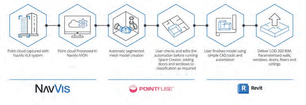
IBKS’ innovative workflow also managed the complex alignment with no problem. “In fact, I think it enables us to do as many storeys as we need,” says Lipsey. “We could start with alignment in NavVis IVION, bring the data accurately into PointFuse Pro, and then Revit, without having to do any further translation.”
“This is a great testament to how both of the products work together,” concludes Haidar. “We’ve seen some tremendous success here.”
ABOUT THE AUTHOR
Sean Higgins is an independent technology writer, former trade publication editor, and outdoors enthusiast. He believes that clear, buzzword-free writing about 3D technologies is a public service.


SPONSORED ARTICLE | INTERNATIONAL | ISSUE 7 2022 40
Eliane Bouery.
Mo Haidar.
Spivey Lipsey.
FIG Hand-over Event
Diane Dumashie Takes over FIG Presidency from Rudolf Staiger
The transition of the FIG presidency from the current president, Rudolf Staiger, to the incoming president, Diane Dumashie, was marked at a special hand-over event which took place on 20 October 2022 in connection with Intergeo 2022 in Essen, Germany. Host of the event was the German Association for Geodesy, Geoinformation and Land Management (DVW).
At the FIG Congress in Warsaw in September 2022, the FIG General Assembly elected Diane Dumashie, United Kingdom, as president for the term 2023-2026 as well as the two new vice chairs: Daniel Steudler and Winnie Shiu.

Stig Enemark, honorary president of FIG, was the first speaker at the ceremony. Among other things he talked about the development of FIG from a bureau-driven system to the current system with an elected council. Stig was the first elected president of FIG (20072010) when this new governance structure was introduced 20 years ago. The fourth term is now coming to an end and the system has proven to work the way it was intended, “making FIG a truly global organization, also in terms of the governance structure by the opportunity of having a variety of countries represented in the council,” he stated.
Diane Dumashie was the second speaker at the event. She talked about the coming challenges and opportunities for FIG. It is now time for the new council to elaborate on its work plan for the next four years. The term will start officially at the beginning of 2023.
The final speaker was Rudolf Staiger, whose presentation had a cryptic title: ‘Having Ice in the Stomach’. He talked about the importance of volunteering – a term which he has also used in his overall motto for these past four years: “Volunteering for the Future”. Without volunteers, FIG would not be able to exist and a large number of volunteers and dedicated officials put in many hours of work for FIG. Rudolf has served FIG in various positions and roles over the past 22 years, and has attended six congresses, 14 working weeks and five regional conferences… together with numerous other meetings and other happenings, and has worked on many tasks for FIG such as the design of the current Peer Review system. Referring to the cryptic title of his address, Rudolf explained that especially these past three years have been a different kind of challenge, which also changed the focus of his term of presidency. The extra layer of uncertainty due to COVID-19 and its impact on meetings and conferences took up much of the time. This was followed
earlier this year by the Russian invasion of Ukraine, which had a direct impact on the congress destination of Poland, making it a quite different term of office. He said it had been important to stay calm and deal with these challenges – in other words, to use a Scandinavian proverb, “To keep ice in the stomach”. Another consequence of the challenges over the past three years is that Rudolf will most likely be the FIG president leaving the smallest carbon footprint ever.
Prior to the hand-over ceremony, DVW invited all international participants on a highly interesting trip to the Zollverein Coal Mine Industrial Complex in Essen, including a guided tour in the coal mine complex, and then hosted a dinner in the evening. A very big thanks to DVW and its representatives for organizing this event.
By Louise Friis-Hansen, FIG director
More information www.fig.net
ORGANIZATIONS 41 ISSUE 7 2022 | INTERNATIONAL |
The current and incoming council at the hand-over ceremony –from left Kwame Tenadu, Daniel Steudler, Rudolf Staiger, Diane Dumashie and Mikael Lilje. Unfortunately, outgoing Vice President Jixian Zhang and incoming Vice President Winnie Shiu were not able to attend in Germany.
The FIG Chain was transferred from Rudolf Staiger and to Diane Dumasie with the help of FIG Director Louise Friis-Hansen.
ISRSE-39 – Turkey (24-28 April 2023)
‘From Human Needs to SDGs’
In this inspiring time for the space sector and its essential contribution towards helping to realize the timely delivery of the Sustainable Development Goals (SDGs), the 39 th International Symposium on Remote Sensing of Environment (ISRSE-39) offers a unique opportunity for in-depth, cross-disciplinary exchanges between key public and private-sector organizations and leading actors in the fields of satellite observing systems, remote sensing applications and information services. Although a global event, the symposium will place a strong emphasis on practical applications and societal outcomes at local, national and regional levels. ISRSE is widely acknowledged to be one of the most significant gatherings of the international remote sensing community. It attracts senior staff from space agencies and international Earth observation programmes, and provides a global overview of advances in Earth observation and the substantial societal benefits.
ISRSE-39 will take place from 24-28 April 2023 in Antalya, Turkey – a location at the crossroads of ancient and modern civilizations, and an ideal setting for a timely international exchange on the contribution of remote sensing to societal resilience during the 21st century.

We look forward to meeting you and discussing recent developments and contributions to save our planet.
ISPRS GSW 2023 – Egypt (2-7 September 2023)
‘Remote Sensing for Better Future’
The Arab Academy for Science, Technology, and Maritime Transport (AASTMT) is honoured to host the first ISPRS Geospatial Week in Africa and the Middle East in 2023 (GSW-2023) held under the auspices of H.E Secretary-General of the League of Arab States. The conference will take place in September 2023 at the InterContinental Cairo Semiramis, Egypt.
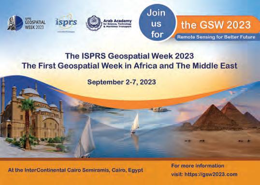
The GSW2023 will host 22 workshops representing the state of the art and future trends in geospatial technologies, such as:
• 3D sensing for smart cities
• Mobile mapping technologies and HD maps
• Emerging navigation and mapping technologies for autonomous systems
More information https://www.isrse39.com/
• Intelligent and autonomous mapping systems
• SAR constellations and applications
• Robotics for mapping
• Semantic scene analysis and 3D reconstruction from images and image sequences
• AI-based point cloud and image understanding
• Indoor 3D navigation and mapping
• Mapping from UAVs
• GI4SDGS – the geospatial information and SDG nexus
• Sensor orientation and calibration for mapping and navigation purposes
• SDI “Toward a SDSS”
• Crowdsourcing for global mapping
• International Symposium on Spatial Data Quality (ISSDQ)

• Geospatial computing for understanding human behaviours
• L aser scanning
• Advanced data preparation and data management for geospatial and remote sensing scenarios
• Smart forests – multi-scale forest assessment and monitoring using AI and robotic-aided remote sensing
• S atellite remote sensing and its applications
We look forward to seeing you in Cairo in September 2023.
More information www.gsw2023.com
ORGANIZATIONS | INTERNATIONAL | ISSUE 7 2022 42
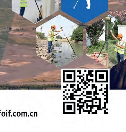
THE VIEW OF NEW DIMENSION


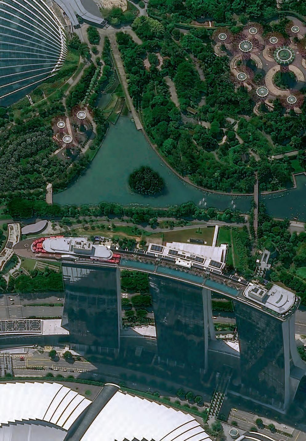
Get a new dimension of insight with Pléiades Neo, a cutting-edge constellation of four Earth observation satellites. Pléiades Neo combines 30cm very high resolution that enables a clear view of objects as small as streetlights, and the ability to perform intraday revisits – giving you operational advantage and unparalleled access to information. With Pléiades Neo, governments, militaries, institutions, and businesses can make the right decisions at the right time – keeping our world safe and beautiful.
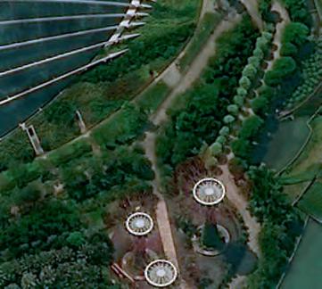

airbus.com


