20 minute read
Editorial
from AS WE REOPEN...
Navigating the Unknown
COVID-19 has impressed upon us the fear of the unknown. Airlines are collapsing as international travel has reduced drastically; and tourism is dying a slow death. Our healthcare systems are at breaking point. Livelihoods are affected and joblessness is growing. Yet we have begun to adjust to this through the “known”. Meetings are now online, as are seminars. Students learn online in spite of the woeful state of the availability of the Internet in rural areas. What stands out in this bleak scenario is the importance of location. Never before has it become so essential to know “where”. Where are the containProf. Arup Dasgupta ment zones, where are the hospitals, where is the doctor, the ambulance, the address of the patient… the list goes on. This is the time for geospatial to show its utility. arup@geospatialmedia.net Perhaps the earliest use of geospatial in India for COVID-19 control has been in the state of Kerala. Here, COVID-19 cases were plotted on a map and “heat maps” were created to indicate possible clusters and help delineate containment zones. There have been cases where the travel of COVID-19 affected individuals have been plotted and publicized and a post facto checkout of individuals who might have picked up the infection from these individuals was conducted. While geospatial systems have helped in mapping, the real control has been effected by feet on the ground. Health workers have used the system to keep track of the patients and their movement and contacts.
In sharp contrast are the contact tracing apps which have proliferated worldwide. Originally started by China and then picked up by South Korea, Singapore and India. MIT Technology Review has listed 30 such apps being used all over the world. Apple and Google have worked together to develop an API which has been picked up by 23 countries to create their own contact tracing apps. Most of these apps except the Apple-Google API do invade the privacy of the individual to a lesser or greater degree. Such apps are not a replacement of feet on the ground but only assists such workers. Much is made of individual safety. Consider the much-touted Singapore app. As only one-fifth of the population is using this app, the chances of any two persons in close proximity having this app on their smartphones is just 4%.
The real application of geospatial is when it is combined with other tools like AI. As an article in this edition shows, using these two technologies together, appropriately termed GeoAI, it was possible to detect the unusual cases of pneumonia in Wuhan back in December, which turned out to be COVID-19. Such techniques should be used to locate clusters and potential clusters based on travel data and contact tracing. More importantly, such applications can become an important tool in the armory of the healthcare organizations to sniff out potential pandemics.
An area which geospatial systems need to address is the post pandemic scenario. For one thing, COVID-19 is here to stay. What would be the implications of this to healthcare, travel, transportation, energy sources and industry? It is increasingly clear that the world is not returning to its pre-pandemic state very soon. Lockdowns have showed that the impact of wanton development can be reversed. While we cannot stay in a condition of permanent lockdown, it is clear that controlled development is the way forward. Geospatial technologies can and should provide the necessary information for future planners to help them to find a way towards a sustainable future.
2020 & Elasticity of the World Order
On June 26, 1945, delegates from and inward looking governments sealed their 50 nations came together to sign borders and dedicated all available resources the United Nations Charter – a to protect their own people. This inward historic moment for global peace approach percolated to municipal, and even and progress which set the context for a new household levels. Soon, social distancing also world order. Five years later, the Republic of meant “emotional distancing”. India laid down the principles for the world’s largest democracy, with वसुधैव कुटुम्बकम् (The World is one Family) engraved in the entrance hall of its Parliament. Sanjay Kumar sanjay@geospatialmedia.net Since early March, international institutions, set up with the purpose of multilateralism and oneness, turned “deaf and dumb”, and left countries at their own fate, irrespective
Over the last 75 years of post-World War of their capability to deal with pitiful realities. II, humanity has thrived towards global peace, prosperity, Leave aside helping with resources, there hasn’t been even and harmony. Several alliances have been formed to build cooperation in terms of sharing quality information and cooperation in fields of security, economy, and sustainalearnings, which has resulted in chaotic decision-making ble development. Though some of the early alliances such and a billion+ job losses. as NATO and Warsaw Pact focused on military cooperation, soon, the world witnessed economically driven collaborations such as Organisation of Petroleum Exporting Countries (OPEC), Group of Seventy Seven (G-77), Organisation for Economic Cooperation and Development (OECD), and Group of Seven (G7). It is a foregone conclusion that humanity is experiencing its biggest economic depression, and it may get worse than 1930s. At a time when the world leadership should have put its act together to combat this crisis, we have been observing an unaspiring, indifferent, inward, and isolated approach, which is focused at addressing local, and at best,
The end of the Cold War around 1990 added even more national interest. Moreover, powerful economies have meaningful dimensions to the world order, driven by aspichosen to strengthen their supremacy by triggering conflict rations of free trade (World Trade Organisation), political and unrest in different parts of the world. integration (European Union) and economic cooperation (Group of Twenty) and BRICS. And finally, the last decade witnessed the noble aspiration to ‘Leave No One Behind’. The world got together to commit The 2030 Agenda for Sustainable Development – a blueprint for peace and prosperity for people and the planet. At the heart of the Agenda are 17 Sustainable Development Goals, making an urgent call for a global partnership to end poverty, improve health, and reduce inequality, while spurring economic growth The ideas that shaped the past 75 years have all but evaporated. A world order based on humanitarian approach has showed its theatrical character and fragility. The year 2020 has put elasticity of the world order to test by stretching and compressing its shape. The global response to COVID-19 has posed fundamental questions about the genuineness of a progressive world order and exposed its hypocritical intent of “oneness”. and tackling Climate Change. Hopefully, the future will witness an all-new progresWhile we prepare to celebrate the 75th anniversary of the UN, reaffirming its collective commitment to multilateralism, the year 2020 seems to be adamant on challenging the elasticity of the world order by compressing its prinsive world order that can restore trust and values of peace, inclusivity and sustainability. Maybe the crisis will give rise to charismatic leadership and statesmanship, which will help the world regain its large-hearted shape. ciples of one family. The year began with COVID-19, and within a fortnight, humanity was dismayed by the so called aspirational world order in which no one is left behind. Collaborative agreements of all kinds lost their relevance, अय निजः परो वेतिगणना लघुचेतसाम् | उदारचरितानां तु वसुधैव कुटुम्बकम् (the narrow-minded think of “this is mine” or “that is his”. For the noble minded, the whole world is a family).
Courtesy: DigitalGlobe
ADVANCING US LEADERSHIP IN COMMERCIAL SPACE INDUSTRY
US Commerce Department’s move to ease restrictions on Remote Sensing regulations will increase transparency and boost business. By Anusuya Datta
The United States Department of Commerce’s decision to ease restrictions on remote sensing regulations has received a thumbs up from commercial satellite players in the country. Released on May 19, 2020, the regulations will improve the licensing process for private satellite remote sensing operations.
The rules are aimed at increasing openness and transparency in licensing and eliminating restrictions such as limits on the resolution of imagery and additional conditions by the government after issuance of license. Interestingly, the guidelines require the government to assess the remote sensing data already planned or available in the market to determine whether any conditions should be applied to companies.
The rules eliminate the special conditions in place for systems like synthetic aperture radar (SAR), shortwave infrared or nighttime imaging. The regulations also recognize the growing role of Artificial Intelligence, Cloud Computing and other advanced technologies in extracting unique information from remote sensing, and thus apply only to the Remote Sensing instruments and components that support their operation.
The development comes nearly a year after a draft version of the rules received severe criticism from the industry. “The streamlined remote sensing rules reflect the Trump Administration’s commitment to advance American leadership throughout a diverse array of commercial space industries,” Wilbur Ross, US Secretary of Commerce, said in a statement. “We heard the message from industry loud and clear that previous regulations were too restrictive and were preventing the realization of unique economic opportunities from commercial satellite remote sensing systems. I am grateful to President Trump, Vice President Pence, the National Space Council, NOAA, and the Office of Space Commerce for their leadership in bringing these new rules to fruition,” Ross added.
THREE-TIER APPROACH The rules categorize applicants based on the degree to which the unenhanced data to be generated by their proposed system are already available
TIER 1
Faces minimum restrictions. An applicant proposes a system that is capable only of producing unenhanced data substantially the same as unenhanced data available from sources not regulated by Commerce.
TIER 2
An applicant proposes a system that is capable of producing unenhanced data that are substantially the same as unenhanced data available from US sources only. As there is no foreign competition for that unenhanced data, a US license restriction could be effective.
TIER 3
Faces most stringent controls. An applicant proposes a system that is capable of producing unenhanced data that are substantially the same as no available unenhanced data—that is, if the applicant has no competitors, foreign or domestic.
Praising the new regulations, Dr. Scott Pace, Deputy Assistant to US President and Executive Secretary of the National Space Council, said, “American industry is driving innovation in commercial remote sensing at an increasingly rapid rate. These streamlined and updated rules are critical to ensuring US regulations keep up with the speed of innovation and ensure the United States remains the flag of choice for commercial space businesses.
A welcome move “Maxar is pleased with the significant update to the Commerce Department’s remote sensing regulations, which relaxes many of the barriers that have held US companies back. We look forward to receiving updated licenses that embody the forward-leaning principles espoused in the preamble to the new rules,” said Dan Jablonsky, CEO of Maxar, which is one of the largest commercial remote sensing operators in the US
In a statement soon after the announcement, smallsat major Planet said, “These streamlined, forward-looking regulations represent a philosophical shift in striking a balance between US technological innovation, competition from foreign actors and national security.”
“In general, I view these proposed changes as quite encouraging for the space industry — primarily because I expect they will push forward new innovations and also allow US companies to be more competitive in the global market,” said Emiliano Kargieman, CEO and Founder of Satellogic.
Echoed SkyWatch CEO James Slifierz. “We believe the revamped regulations will help the industry as a whole. We really look forward to seeing what new applications will be developed with these new datasets. We can avoid situations where US lawmakers try and play catch up with the speed of innovation, adding costs and delays to new constellations going up and stifling the growth of the industry.”
Fresh categorization The new rules mean that if a satellite imagery can be bought in a foreign country, US satellite companies have the right to sell it. For instance, when data is captured by an American company and sold through a Canadian platform to a Dutch client for their South African customers, things can get really complicated, explained Slifierz. With the expected increase in the volume of satellite data to be generated daily in the future, Artificial Intelligence/Machine Learning applications will play an increasingly larger role in how data is used. The revisited regulation should help data sellers and buyers across the globe.
The new guidelines do away with the earlier draft proposal to classify applications as “low risk” or “high risk” from a national security perspective and instead uses a threetier approach.
“This (the earlier) rules worked under the assumption that Remote Sensing systems would be regulated so as to prevent them from causing harm to national security: more risk a system posed to national security, the more restrictive its license would be,” the Department of Commerce said in the rule. The industry had argued the earlier regulation would have classified almost all commercial satellite companies as “high risk”.
The new rules, however, have no bearing on US government Remote Sensing capabilities or the data policy regarding the availability of data or products therefrom, such as Landsat and NOAA’s operational satellites. Only private remote sensing space systems operated by all other entities — commercial, non-profit, academic, or otherwise — will be under the purview of this regulation.
Anusuya Datta
Editor-At-Large - Technology & Innovation anusuya@geospatialmedia.net
Enhance Image Quality with Vexcel’s UltraCam Osprey 4.1
The next generation UltraCam Osprey 4.1 is Vexcel’s highly versatile large-format aerial camera. The UltraCam Osprey simultaneously collects photogrammetry grade nadir images (PAN, RGB and NIR) and oblique images (RGB) in four directions. Enabling unprecedented flight collection efficiency at superior radiometric and geometric quality, the UltraCam Osprey 4.1 sets a new standard in urban mapping and 3D city modeling.
As a result of a combination of leading customized lens systems, next generation
Key Specifications
➝ 20,544 x 14,016 pixels PAN image size (nadir) ➝ 14,176 x 10,592 pixels color image size (oblique) ➝ CMOS imaging sensors image sensors with custom electronics, and a best-in-class image processing pipeline, the UltraCam Osprey 4.1 delivers imagery of unprecedented quality in terms of detail resolution, clarity and dynamic range. The system pushes urban flight productivity to new levels, collecting 1.1 Gigapixels every 0.7 seconds.
Its new and innovative Adaptive Motion Compensation (AMC) method compensates multi-directional motion inducted image blur and ground sampling distance variations in oblique images. Besides a new numbering format — the UltraCam Osprey 4.1 is a 4 th generation camera in its first version — this new generation also introduces several design updates to increase the overall usability and user-friendliness.

Unveiled: New iPad Pro with Breakthrough LiDAR Scanner
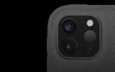
Apple has announced its most advanced iPad Pro, which will be powered by a breakthrough LiDAR Scanner that delivers cutting-edge depth-sensing capabilities. The LiDAR Scanner, along with pro cameras, motion sensors, pro performance, pro audio, powerful apps and a Liquid Retina display will help the device maintain its lead as the world’s best device for augmented reality (AR).
Apple’s latest innovation is a first in the mobile industry. The new depth frameworks in iPadOS combine depth points measured by the LiDAR Scanner, data from both cameras and motion sensors, and is enhanced by computer vision algorithms on the A12Z Bionic for a more detailed understanding of a scene. According to experts, the LiDAR Scanner and the AR experiences are suited to work best in indoor and confined environments and for short travel distances (5 meters).
Key Features
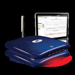
➝ Cutting-edge depthsensing capabilities ➝ Detailed understanding of a scene ➝ Stunning AR experience Boost for Monitoring Professionals: Trimble’s Settop M1 Firmware v3.0 Trimble has recently announced the release of its Settop M1 firmware v3.0, which enables monitoring professionals to experience an even more user-friendly communication device, while also benefiting from enhanced remote management of total stations in real-time.
When used with Trimble 4D Control (T4D) software, the Settop M1 enhances the operation of a Trimble total station, combining the functionality of a field computer, device server, router and remote switch — all into one device. This streamlines the number of components needed in the field for buildings, mines, dams, bridges and other structural monitoring applications.
Product Features
➝ New web user interface ➝ Trimble internal camera support ➝ Reset password feature ➝ Last known position feature
Latest Version of Trimble’s Tekla Software Solutions is Here
Trimble has recently introduced the latest versions of its Tekla software solutions for advanced Building Information Modeling (BIM), structural engineering and steel fabrication management — Tekla Structures 2020, Tekla Structural Designer 2020, Tekla Tedds 2020 and Tekla PowerFab 2020. Tekla software is at the heart of design and construction workflows building on the free flow of information, constructible models and improved collaboration. Tekla Structures supports the constructible process to transform the entire design, build and operate lifecycle.
Tekla Structures 2020 delivers enhancements, improvements and new features that enable efficient workflows for better productivity, increased mobility and collaboration across project teams.
Product Strengths
➝ Allows easier modeling of complex shapes with geometry improvements ➝ Provides better usability, control and productivity with concrete rebar detailing enhancements ➝ Enables quick and easy formworks modeling and improved hollowcore concrete detailing
Leica Geosystems’ Map360 v4.0 to Simplify Incident Reconstruction
Leica Geosystems has come out with the latest version of Leica Map360 crash and crime scene diagramming and reconstruction software, bringing three editions to meet specific customer needs based on the technology used to measure and collect any scene. With an all new user experience and interface, Map360 v4.0 simplifies incident reconstruction activities for investigators, reconstructionists and other public safety personnel.
With 2D intuitive workflows, Map360 Sketch offers a program designed to create basic diagrams, floorplans and reports from manual measurements, imported points, or UAV imagery.

Product Highlights
➝ Measure and collect a scene ➝ All new user interface ➝ 3D capabilities and tools along with animation
Supporting All Signals: CHCNAV’s AT661 GNSS Geodetic Antenna
CHC Navigation (CHCNAV) has released its new AT661 GNSS geodetic antenna, which offers a performance rivalling that of highcost and bulky conventional GNSS choke ring antennas. Its affordable price makes it the best choice for any GNSS networks or monitoring application. The AT661 supports all current and future GNSS signals, including GPS, GLONASS, BeiDou, Galileo, QZSS, IRNSS, SBAS and L-band. The antenna features both high gain LNA and wide beam width to provide excellent flexibility in applications requiring low elevation satellites reception and high availability of GNSS signals, especially in obstructed situations.
The accuracy of the antenna's phase center reaches the millimetre-level with extremely high stability and repeatability to ensure perfect processing of GNSS data regardless of the length of the baselines. Built to last, the AT661 withstands all types of weather, including high and low temperatures, and is protected by a waterproof radome.
Product Advantages
➝ Compact ➝ Affordable ➝ Provides millimetre accuracy
Here Tech’s Free Route Planning Solution for Indian SMEs
Here Technologies has recently launched its route planning solution, WeGo Deliver, in India to enable businesses optimize their delivery of goods and services. The solution will assist small enterprises in planning and dispatching deliveries without any software development or implementation cost. The company has made access to WeGo Deliver free of charge to all small or medium-sized businesses until 2021.
Users can upload their order destinations and number of drivers to the online planning dashboard and the solution will optimize each route and delivery sequence for them. Drivers can get their delivery route by email and can access the delivery route end points by using the Here WeGo mobile app.
Product Utility
➝ Users can upload order destinations and number of drivers to get optimized routes and delivery sequence ➝ Drivers can get their delivery route by email and can access the end points by using the Here WeGo mobile app
THE BIG COMMERCIAL FLIGHT
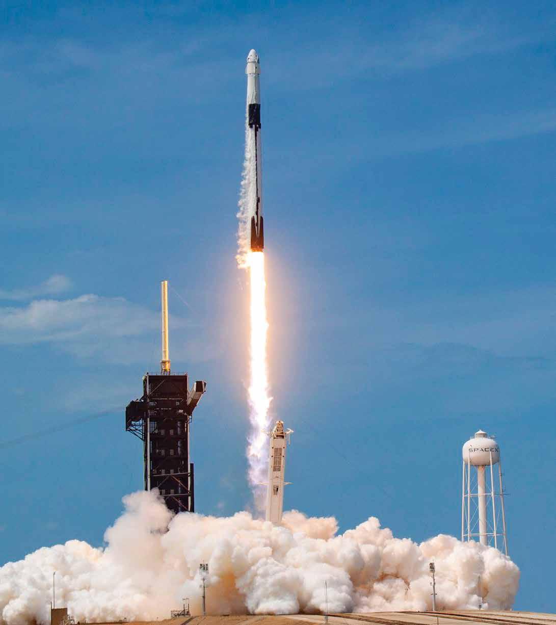
DATE: May 30, 2020 TIME: 3.22 pm ET

LOCATION
Kennedy Space Center, Florida.
LAUNCHPAD
The iconic launchpad 39A at the Kennedy Space Center was used for Apollo 11 landing on Moon. It was later used for the Space Shuttle program.
SECOND TIME LUCKY
May 30, 2020 launch was the second attempt. The launch was called off due to bad weather on May 27, 2020.
WHY IS THIS SIGNIFICANT • This is the first time in a decade that
American astronauts have been launched from American soil on an
American rocket. • SpaceX is the first private company to send humans to space. The SpaceX Demo 2 Mission, which saw a Falcon 9 carrying NASA astronauts Robert Behnken and Douglas Hurley aboard a Crew Dragon capsule fly for the International Space Station (ISS), represents the final step before NASA certifies the SpaceX capsule to fly regular, long missions to the ISS.
THE ROCKET
• Falcon 9 is SpaceX’s workhorse and is the first orbital class rocket capable of reflight. It has been launched 85 times so far, with 46 landings and 32 reflown missions. • Two-stage design allows refly of the most expensive parts of the rocket. • Stands 70 meter tall and is 3.7 meter in diameter, with a payload capacity of 22,800 kg to LEO, 8,300 kg to
GTO and 4,020 kg to Mars.
THE SPACECRAFT
• Crew Dragon is an evolved version of SpaceX’s
Dragon Cargo spacecraft that has visited the space station 22 times, with 9 reflown missions. • Sits on top of the Falcon 9 in place of the traditional nose cone • 8.1 meter tall with a trunk and 4 meter in diameter, with 37 sq meter trunk volume. • Launch payload mass of 6,000 kg and return payload mass of 3,000 kg • Capable of carrying up to 7 passengers to and from Earth’s orbit, and beyond • Trunk is the large lower half that’s covered in solar panels, which can also carry cargo • Trunk remains attached to Dragon until shortly before re-entry into Earth’s atmosphere • Allows transport of people as well as environmentally sensitive cargo
Falcon 9 lifts off from the historic Launch Complex 39A
IN THE DOCK
On May 31, 2020, 19 hours after the launch, the Crew Dragon successfully docked with the ISS.
THE ASTRONAUTS
• Bob Behnken and Doug Hurley were selected by NASA in its astronaut class of 2000. Both have been to Space twice before on Space Shuttle missions. • Air Force veteran Behnken, 49, is the joint operations commander for the mission — responsible for reaching
ISS and docking. • A Navy and Marines veteran, Hurley, 53, is the spacecraft commander and is responsible for Crew Dragon’s launch, landing and recovery.

Now is not the time: Given the coronavirus crisis, NASA made an unprecedented request — urging large crowds to not gather on the highways and beaches to watch the launch.
Extended quarantine: Astronauts Robert Behnken and Douglas Hurley officially entered a preflight quarantine on May 13, 2020, although they had been self-isolating since mid-March. While typically astronauts are quarantined before a mission, the protocol has been stricter for Demo-2 due to the pandemic. Limited Contact: Direct interaction with the crew was not permitted without appropriate protective gear, and even the interaction with VIPs a day before launch was done through a glass wall. Control room arrangements: In the Mission Control, different rooms were used to keep people safely distant from each other with plexiglass between seats and stations. Concept: Anusuya Datta | Design: Subhash Kumar
The United States has regained our place of prestige as the world leader. You can't be number one on Earth if you are number two in Space… Today’s launch makes clear the commercial Space industry is the future.
DONALD TRUMP President, United States
It’s been nine years since we’ve launched American astronauts on American rockets from American soil, and now we have done it again.
JIM BRIDENSTINE Administrator, NASA
I’d like to acknowledge the incredible work of the people at SpaceX and NASA and everyone who created this technology – what has culminated in this incredible launch today.


