4 minute read
CASE STUDY
from AS WE REOPEN...
ACCURACY MATTERS ACCURACY MATTERS
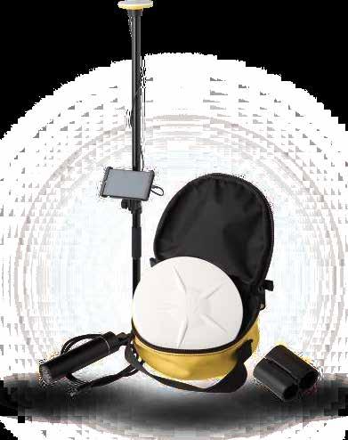
Trimble Catalyst The integration of L&T’s map-based mobile app LMNoP with Trimble Catalyst GNSS led to enhancement in positional accuracy and data quality, apart from saving data acquisition time.
With the ubiquitous use of smartphones, project sites leverage the power of mobile apps to reduce costs and improve efficiency. LMNoP, which stands for Locate, Measure and Navigate on Phone, a map-based mobile application by Larsen & Toubro, acts as a base platform upon which a series of construction solutions are built and integrated. The mobile application was developed to run on every smart gadget, both on Android and iOS platforms, and is widely used across business verticals in different use cases in correspondence with business requirement. The LMNoP solution, integrated with Trimble Catalyst, was branded as LMNoP+. Trimble Catalyst is a revolutionary GNSS concept, bringing Trimble quality and precise positioning to the location-enabled workforce. Using the service, any location-enabled Android field app can utilize the power of Trimble positioning technology and benefit from the productivity improvements that come from working with precise location.
The primary objective of the LMNoP application is to provide location information of a project site’s assets, supporting site engineers in field operations. The app also enables site engineers to view the project’s design drawings, toposheets, aerial photographs and other GIS layers superimposed on the project base map. The solution has been constantly growing with customized versions and builds generated, based on specific needs of projects.
Utility alignment tracking, material or resource planning and re-route analysis are some of the growing use cases of LMNoP solution. The data captured using the app across the project site serves as the base, which is further used as input data for engineering design, quantity estimation, progress monitoring, obstruction and hurdles management. The technical architecture of the LMNoP app includes both mobile and web application — while mobile application is used for field related activities, web application is used for monitoring and other decision-making process. Seamless connection between the web and mobile application ensures integration of both office and site activities.
The big challenge Since mobile GPS receivers catch radio waves from connected satellites and use triangulation methods to derive where a person/object is, these receivers are not premium builds like dedicated GNSS receivers and sometimes do not provide accurate data. The initial version of LMNoP used relatively less accurate inbuilt mobile device GPS to derive location information, which had a deviation in positional accuracy of up to 30 metres. To enhance positional accuracy, data quality and save data acquisition time, LMNoP was integrated with Trimble Catalyst.
The objective behind the integration was clear: delivering professional grade positioning. Trimble Catalyst allows GNSS signals and satellite corrections
to be passed into android smartphones and tablets. The light weight, plug-and-play antenna simply connects with mobile using USB connection. Additionally, the easy push fit mount enables the users to capture data in corner and challenging points in an accurate manner. With the availability of open SDK, LMNoP application was integrated with Trimble involving several customizations.
On ground experience Under the Deendayal Upadhyaya Gram Jyoti Yojana (DDUGJY) scheme in the Indian state of West Bengal, asset information was captured using LMNoP+ for project sites. The objective of the scheme was to supply electricity to the rural households which would cover works relating to feeder separation, strengthening of sub-transmission and distribution systems, including metering of distribution transformers/feeders/consumers by addressing the areas of critical gap. The scope included engineering design and construction of new poles and replace the outdated poles with new ones, thereby electrifying the rural areas.
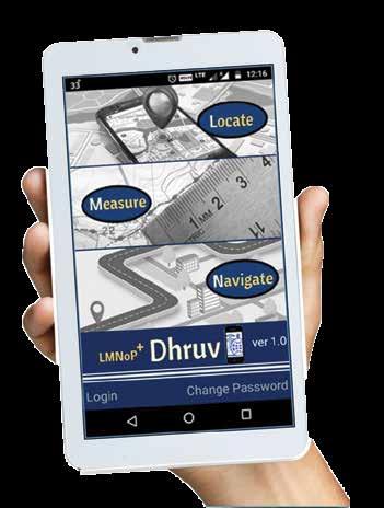
LMNoP+ Contours on aerial image
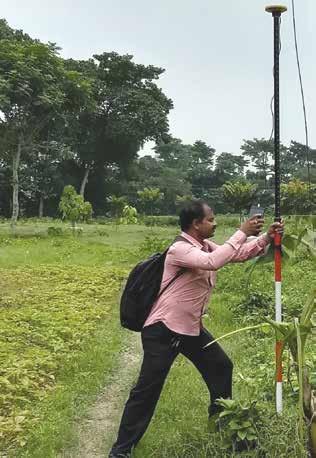
Trimble Catalyst helps in capturing the utility asset’s exact locations, and the GIS capability creates points and feature attributes in the geodatabase in real time
Surface elevation in offline mode
The critical part in rural electrification was to assess the existing conditions of assets and to determine the requirement of new assets. Unlike in other construction, where engineering design usually happens at office location and construction/erection happens at site location, this utility power project demanded engineering design of the poles at the site locations. By examining the condition of the geography, material used to erect the poles were designed both qualitatively and quantitatively at site location itself. LMNoP+ digitalized the entire field operations with higher accuracy, leading to more than 70% time saving.
Performance enhancer The overall performance of LMNoP+ is enhanced by the integration with Trimble Catalyst, which gives centimetre level positional accuracy. This enables to precisely locate and map engineering information of the utility assets that has to be installed in the field. The distance between each collected point is automatically measured and updated in the web portal accurately.
Trimble Catalyst helps in capturing the utility asset’s exact locations, the GIS capability creates points and feature attributes in the geodatabase in real time. Surveyors on site are guided by step-wise procedure with the help of predefined forms in the mobile app. The details entered in the mobile app are submitted and synchronized to the web portal seamlessly. For better visualization, the captured data is overlaid on a base map with all GIS mapping functionalities. This enables the generation of Bill of Quantities (BoQ) accurately for the quantity of materials irrespective of any existing/proposed asset. Precise BoQ helps in the reduction of material wastage and saves cost.
Courtesy: Trimble


