

“The creation of a landscape is a harmonious collaboration between nature and design, where every space tells a unique story.”- Frederick Law Olmsted
IISER-Landscape development for campus... Bhauri,Bhopal.
Experience........
Incuratingmyportfolio,Ihavechosentoshowcaseaselectionofmymostsignificantandimpactfulprojectsfrommyacademic studiesandinternshipexperience.Eachprojectrepresentsaculminationofmyskills,creativity,anddedicationtodeliveringhighquality design solutions. By carefully curating and including only the most relevant and compelling projects, I aim to present a focusedandconciserepresentationofmycapabilitiesasalandscapedesigner.Theseselectedprojectsexemplifymyabilitytotackle diversedesignchallenges,demonstratemyproficiencyinvarioussoftwareandtechnologies,andhighlightmycontributionsto thesuccessfulcompletionofeachendeavor.
C
. . . . 01 Adaptive
Abandoned
Padi,chennai. 04 Working
02
05 Rendering..... 03
O N T E N T S
Re-use of
Railway line.
Drawing....
Industrial Landscape-Textile Mile.. Indore.
Professional
Adaptive Reuse of abandoned railway line padi,chennai

REUSE
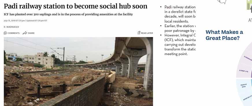
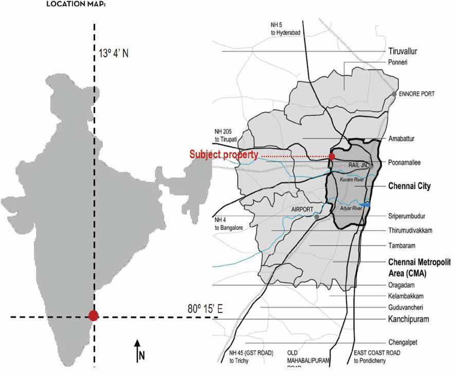
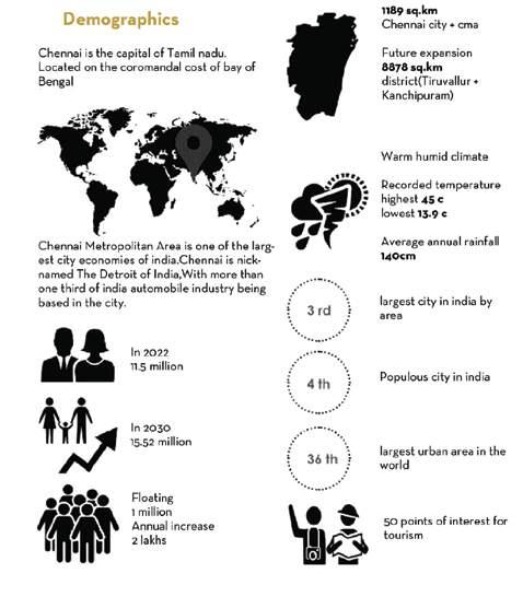
To address this issue, there is a growing need to prioritize the development and preservation of open spaces in Chennai. These initiatives aim to provide opportunities for recreational activities, promote physical and mental health, foster community engagement, and contribute to the overall sustainable development of the city. Recognizing the critical significance of open spaces in enhancing the well-being and quality of life for Chennai’s residents, efforts are underway to explore innovative approaches, such as adaptive reuse and revitalization of underutilized spaces, to create more accessible and inclusive open spaces. By focusing on the improvement and expansion of open spaces, Chennai can strive towards becoming a more livable and resilient city, where residents can enjoy a better quality of life, reconnect with nature, and foster a strong sense of community. The need for study is to address the lack of open spaces in Chennai and explore the potential of utilizing leftover spaces in the city. The study aims to understand the different types of leftover spaces, the challenges associated with working with them, and identify ways to repurpose these spaces effectively. By examining the concept of adaptive reuse instead of open space, the study seeks to provide innovative solutions to enhance the quality of life in Chenna How can the abandoned railway line in Chennai be adaptively reused to create functional and vibrant spaces that cater to the needs of the community and contribute to the city’s sustainable development? Negative or leftover spaces are thus part of the urban fabric of cities across the world. Chennai is the fourth largest metropolitan area in India, with a population of 7 million in 2001. Located in State of Tamil Nadu, Chennai is the major city of southern India. Chennai is the fourth largest metropolitan area in India, with a population of 7 million in 2001. Located in State of Tamil Nadu, Chennai is the major city of southern India Between 2015 and 2018, the Chennai Metropolitan Development Authority (CMDA) swallowed up as many as 11 open spaces in Chennai for converting into residential and commercial projects. The United Nations Human Settlements Programme dictates that for every
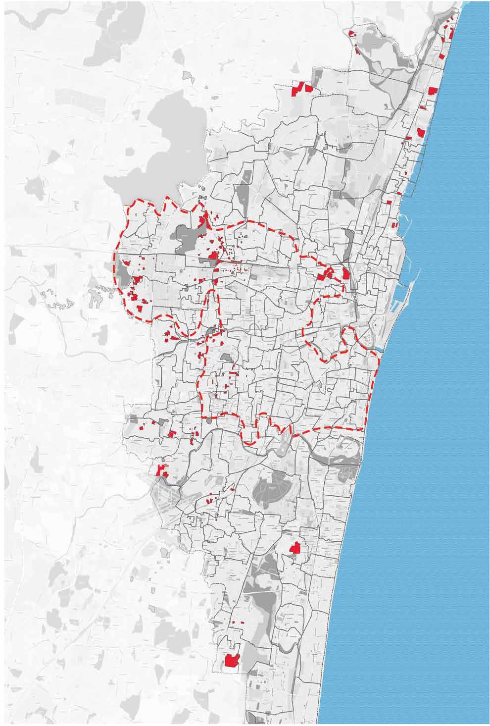
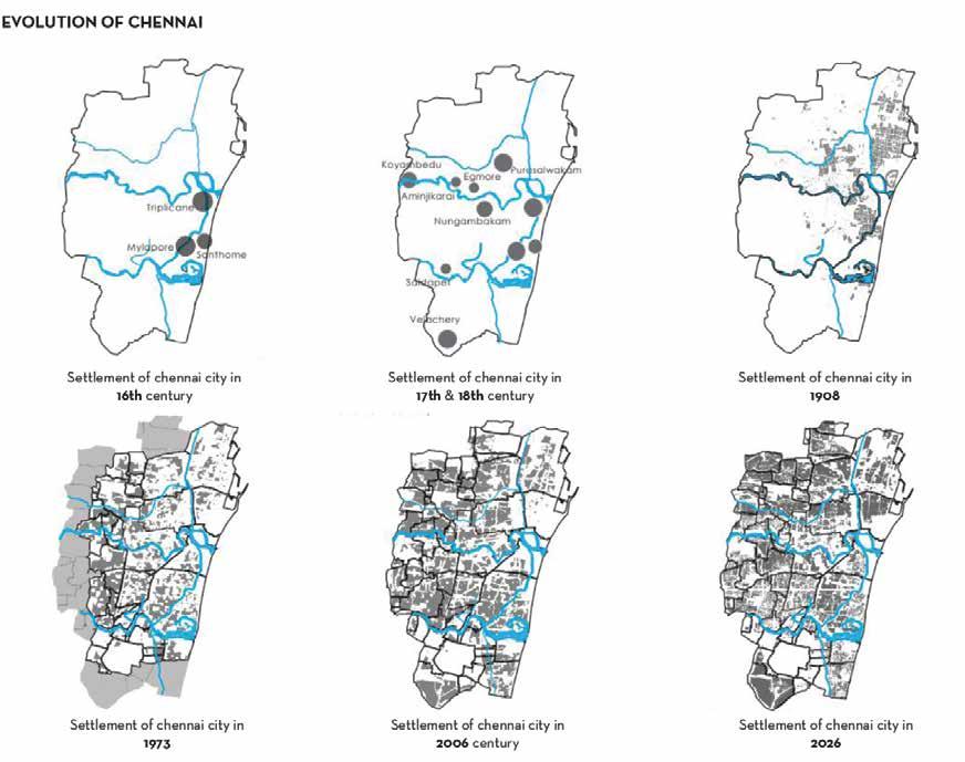
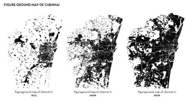
UNDER UTILIZED OPEN SPACE OF CHENNAI Chennai is a 100% urbanised district.This has naturally led to an increase in congestion, overcrowding, steady growth of slums and squatter settlements and heavystrain on the infrastructure and services. Moreover, there is the migration from neighbouring and other districts in Tamil Nadu for employment opportunities.Increase in population put pressure on available land. Most of the slums in the city Two dimensional map of Chennai shows the relationship between built and unbuilt space. The city growth was based on the location of water ie. sea and river ),It spreads radially towards North,South and West. In 2026,CMDA proposal shows more builtup area than before. The selected study area is located in Padi,Railway station. Chennai is the fourth largest metropolitan area in India, with a population of 7 million in 2001.Located in State of Tamil Nadu, Chennai is the major city of southern India. Metropolitan Development Authority (CMDA) swallowed up as many as 11 open spaces in Chennai for converting into residential and commercial projects.The United Nations Human Settlements Programme dictates that for every individual in a city,at least 20 sq m of open space or green space must be set aside to ensure an adequate.
UNDER UTILIZED SPACE OF CHENNAI SCALE:1:45000
STRATIGIE:ADAPTIVE
Chennai
Its thesis focuses on negative spaces These spaces are empty, but accessible to the public. This includes informal green spaces, open spaces, playgrounds, free parking spaces, spaces behind or between or on top of buildings. Negative spaces are often known in the academic world as “lost spaces”, “remaining spaces” or “urban voids” and many others. The nature of negative spaces varies from city to city, depending on the degree of urbanization. If their presence is not recognized and carelessness continues in the city, it can lead to social, economic and even environmental problems in the city (Omar and Saeed, 2019).
Being an area without a clear purpose, it is open and can therefore accommodate opportunities. It could be redesigned and redefined by users as they see fit (Hudson & Shaw, 2011).
Although there is discussion about these kinds of places all over the world, this thesis will concentrate on Chennai, a city in the Tamil Nadu state.
Being a space with no defined function, it is free and hence holds room for opportunities. It holds the potential to be reshaped and redefined as users feel fit (Hudson & Shaw, 2011).While there is a discussion of these kinds of spaces worldwide, this thesis will focus on the city of Central Chennai
EXISTING SITE:
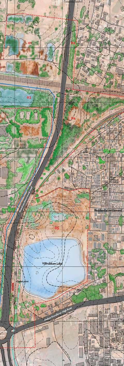
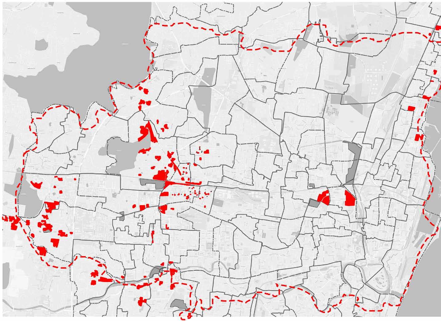
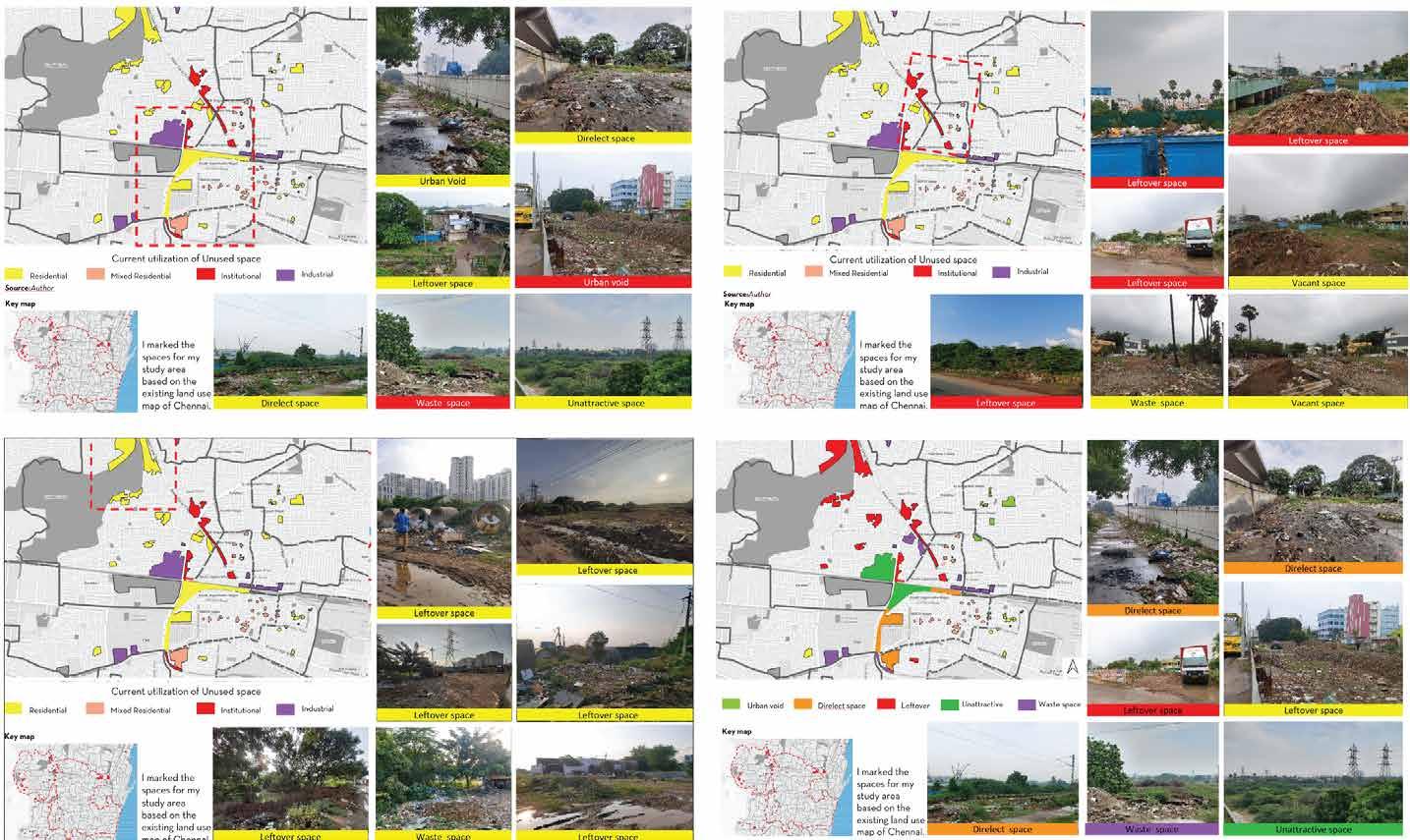

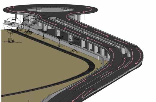

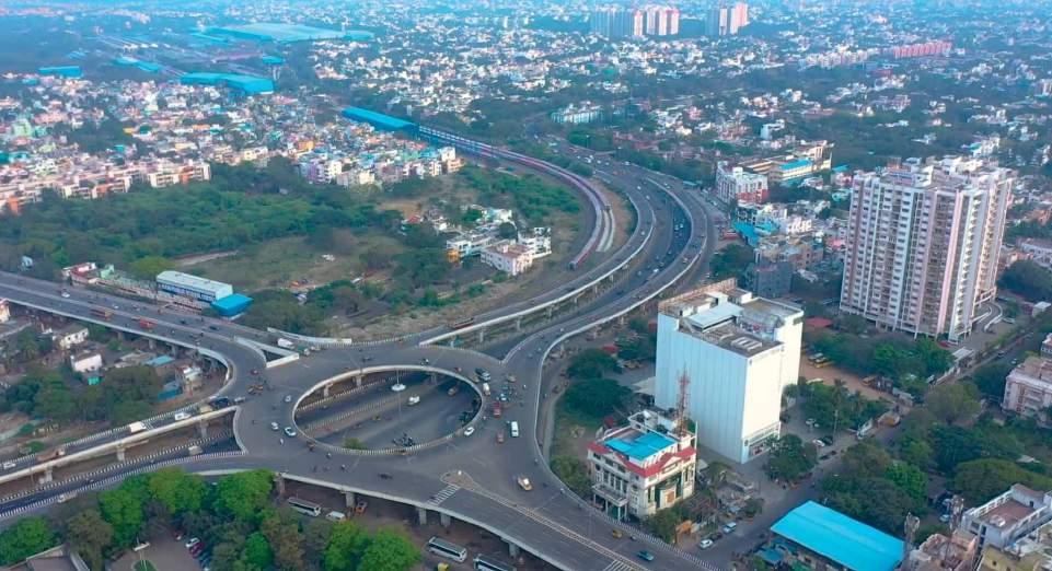
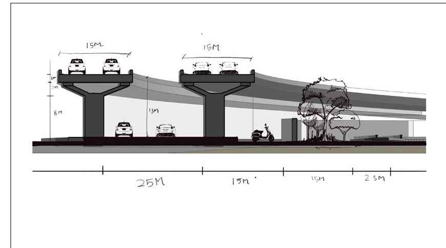
Existing flyover: In my research, I chose an abandoned railway station as the focus of my research. The once busy station is now neglected and unused. The site has enormous potential for change and revitalization. There is a fragmentary ceiling next to the station, further increasing the underuse and isolation of the area. The focused study area for this research is central Chennai, which has been identified to have a significant amount of leftover space compared to the north and south regions of the city. The aim of this study is to investigate and analyze the abandoned areas within central Chennai, utilizing Geographic Information System (GIS) technology. Field visits spanning one week were conducted to identify these abandoned areas, providing valuable insights into the potential for their adaptive reuse and transformation. By focusing on central Chennai, this research aims to shed light on the untapped potential of these leftover spaces and explore innovative design solutions that can contribute to the city’s sustainable development and revitalization.
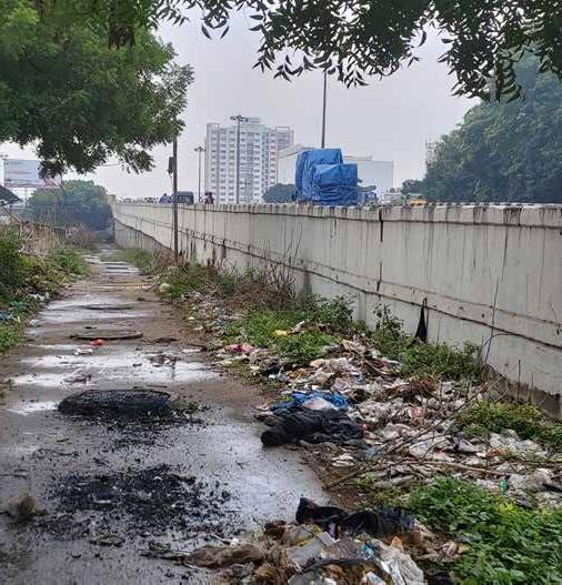
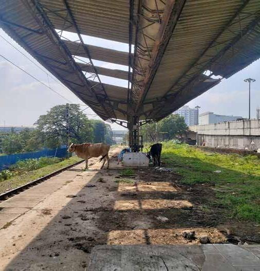
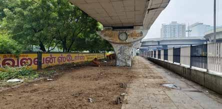
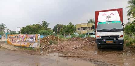
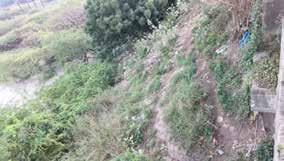
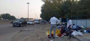
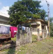
The images presented above offer a comprehensive visual representation of the current state of the abandoned railway line that serves as the focus of this thesis on adaptive reuse. These photographs capture the essence of the site, revealing its neglected infrastructure, overgrown vegetation, and untapped potential.
The railway line, once a bustling transportation artery, now stands as a testament to the passage of time and the challenges faced by aging infrastructure. Weathered tracks, rusted railway cars, and crumbling platforms bear witness to years of disuse, echoing the forgotten stories of locomotives and passengers that once animated these tracks.
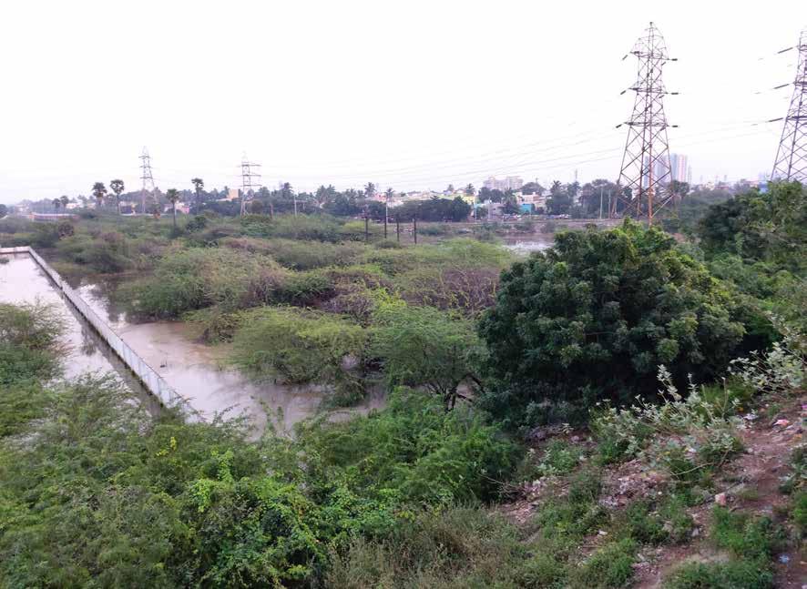
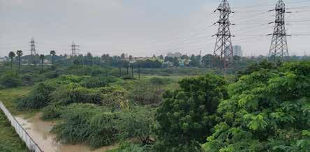
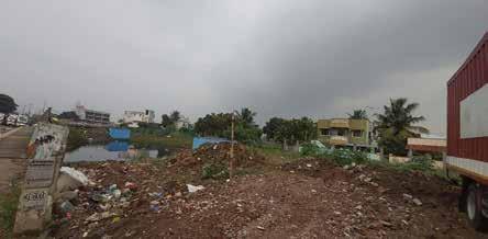
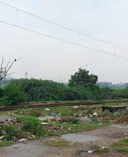
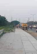
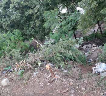
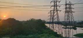
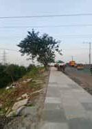
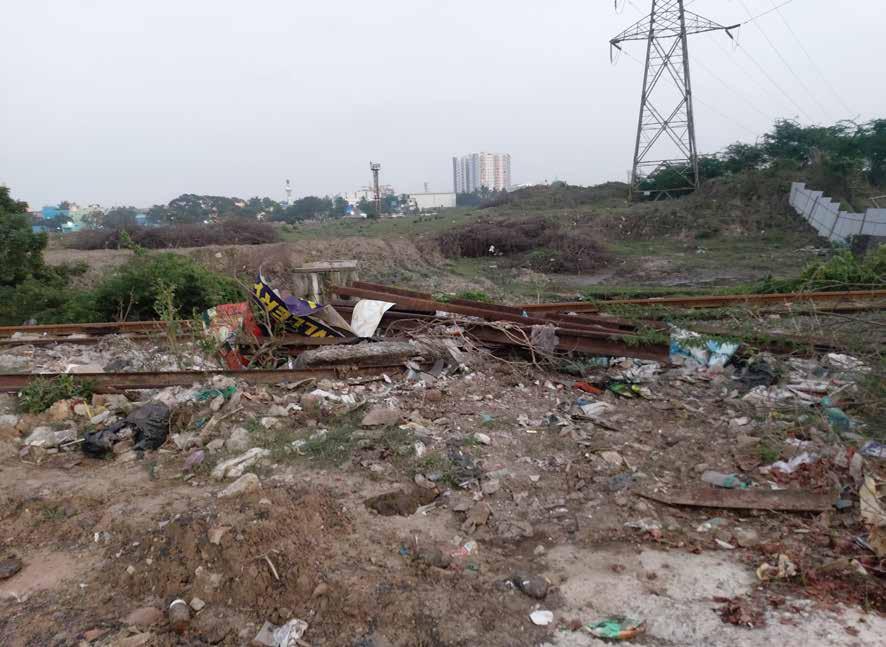
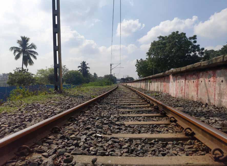
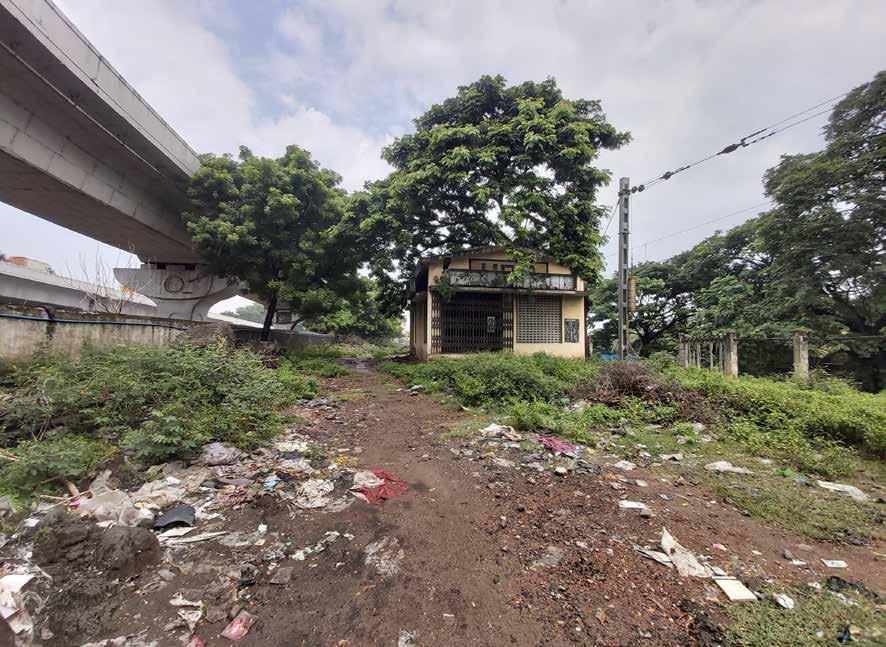
The existing site images it clearly shows the condition of site and context Uncleared waste in railway station
SITE PHOTOS
No proper space for seller Beautiful evening view Pathway construction Flower sellers occupying road corner By embracing the principles of adaptive reuse, we aim to breathe new life into this dormant corridor, creating an innovative and functional space that honors its heritage while meeting the evolving needs of the present. The dumping of waste in the leftover space. The vacant space under the flyover However, amidst this apparent deterioration lies an opportunity for revitalization. The rich history embedded in the railway line’s past offers a compelling foundation for transforming this neglected space into a vibrant and sustainable asset for the surrounding community. It clearly shows the water logging issues of the site Lorem Ipsum is simply dummy text of the printing and typesetting industry. The uncontrolled vegetation dominating the exiting site. The remain track Uncleared waste
SITE ANALYSIS
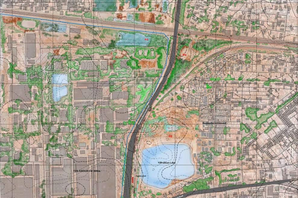
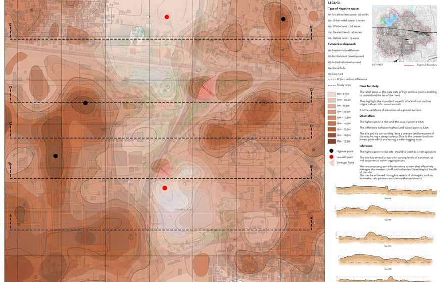
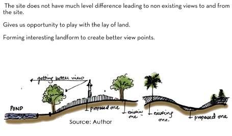
The existing landform of the site presents a captivating blend of undulating hills, gentle slopes, and sprawling plains. The undulations create a dynamic topography that adds visual interest and character to the landscape. The hills, with their varying heights and slopes, provide natural vantage points that offer panoramic views of the surrounding areas. These elevated areas could be utilized as observation decks or lookout points in the adaptive reuse design, allowing visitors to appreciate the site’s natural beauty while connecting with the history of the railway line.
The landscape character map reveals a fascinating array of features along the abandoned railway line. Overgrown vegetation, including tall grasses, shrubs, and scattered trees, suggests a site that has been reclaimed by nature over an extended period of abandonment. This natural character can be leveraged for adaptive reuse by integrating green infrastructure and ecological corridors into the design. The deteriorated infrastructure, with rusted tracks, crumbling platforms, and decaying structures, presents an opportunity to restore and repurpose these elements while preserving their historical significance. Additionally, the railway line’s passage through diverse landscapes, encompassing urban areas, industrial zones, and natural environments, offers an exciting prospect for adaptive reuse strategies that integrate surrounding land uses, fostering mixed-use developments and cultural corridors. The intersections with roadways, pedestrian paths, and water bodies provide avenues for connectivity and the creation of engaging public spaces, enhancing accessibility and promoting multimodal transportation. With a comprehensive understanding of these landscape characteristics, the adaptive reuse of the abandoned railway line can be thoughtfully designed to respect its heritage, embrace nature, and seamlessly integrate with the surrounding community.
In summary, the landscape character map showcases a multifaceted site, where overgrown vegetation, decaying infrastructure, diverse landscapes, and intersection points converge. By understanding and leveraging these characteristics, the adaptive reuse of the abandoned railway line can unlock its full potential as a thriving and sustainable asset, honoring its heritage, embracing nature, and enriching the fabric of the community.
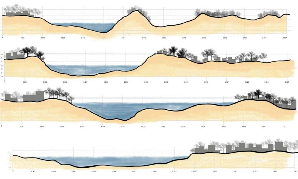
A notable feature of the existing landform is the presence of a meandering river that winds its way through the site. The river not only adds a scenic element to the landscape but also offers opportunities for water-based activities and recreational amenities. Its tranquil flow and the surrounding riparian vegetation create a serene and inviting ambiance, providing an ideal setting for leisurely walks, picnic areas, or even small-scale boating facilities. Integrating the river into the adaptive reuse plan can enhance the overall experience, creating a harmonious blend of nature and human interaction.
LANDSCAPE CHARACTER MAP Existing landform section

SITE ANALYSIS
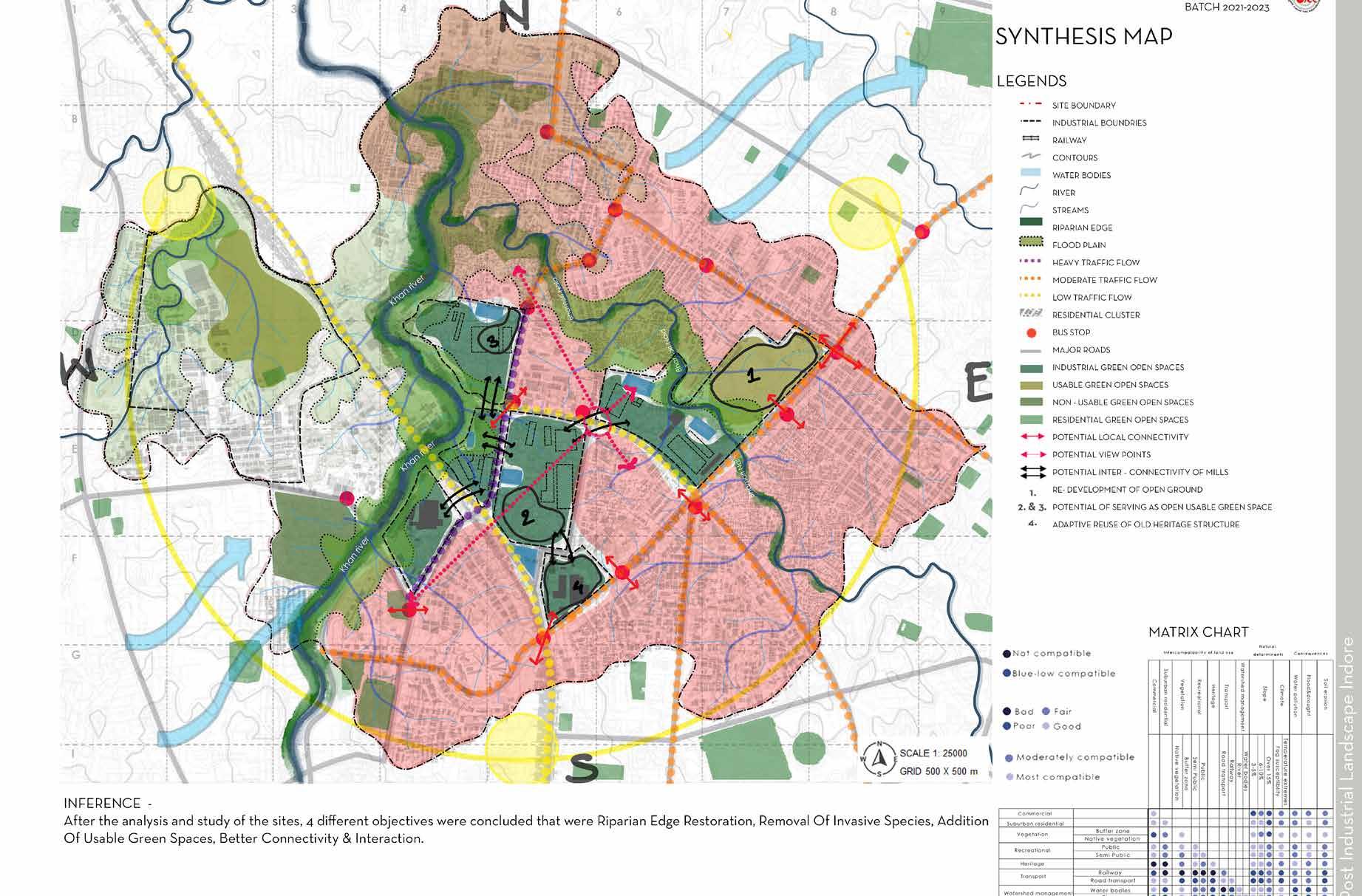
The overall site analysis of the abandoned railway line reveals a rich tapestry of characteristics and opportunities that lay the foundation for its adaptive reuse. The analysis encompasses various aspects, including the existing landform, landscape character, visual qualities, activities, traffic flow, and user preferences. The existing landform showcases undulating hills, a meandering river, rock formations, and open plains, offering diverse topography and scenic beauty. The landscape character highlights the presence of overgrown vegetation, decaying infrastructure, and diverse land uses along the railway line. Visual analysis unveils captivating visual elements, including light and shadow dynamics, urban-natural juxtapositions, and panoramic views. The existing activities study uncovers a range of human interactions, from urban exploration to artistic expressions, indicating the site’s cultural potential. The traffic flow map provides insights into transportation connectivity and opportunities for integration with the surrounding network. Lastly, the user analysis delves into user preferences, desires, and activities, shaping the design approach. The comprehensive site analysis serves as a critical framework, guiding the adaptive reuse project to harness the site’s unique attributes, address challenges, and capitalize on opportunities. By integrating these findings into the design process, the adaptive reuse of the abandoned railway line can be realized as a vibrant, sustainable, and communitycentric space that celebrates heritage, fosters connectivity, and enriches the lives of its users. The overall site analysis of the abandoned railway line presents a holistic understanding of its potential for adaptive reuse. Through a comprehensive assessment of various aspects, including the existing landform, landscape character, visual qualities, activities, traffic flow, and user preferences, a nuanced portrait of the site emerges. The examination of the landform reveals a captivating mix of undulating hills, meandering water bodies, rock outcrops, and vast open plains. These natural features offer not only visual interest but also opportunities for diverse programming, such as elevated viewpoints, waterfront activities, and recreational spaces.

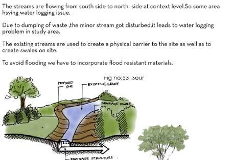

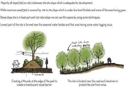

Existing Activities & Visual Analysis Map
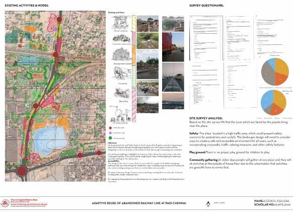
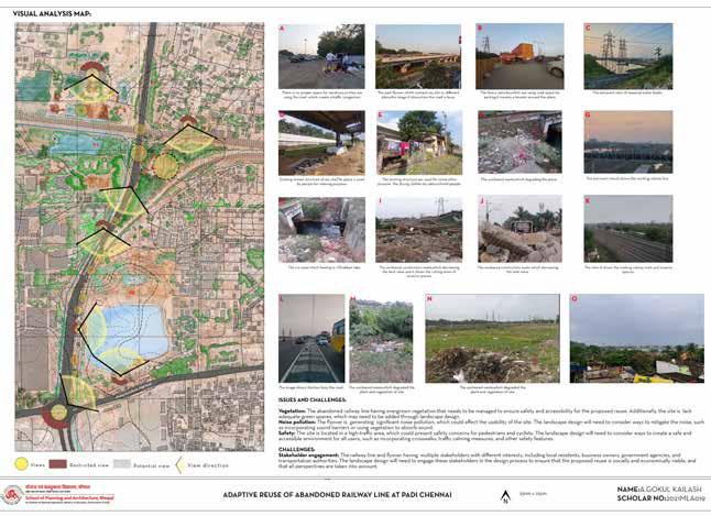
Traffic Flow & User Analysis Map
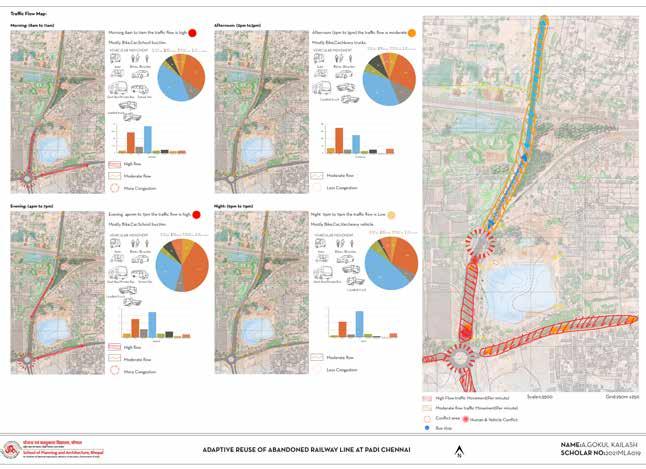
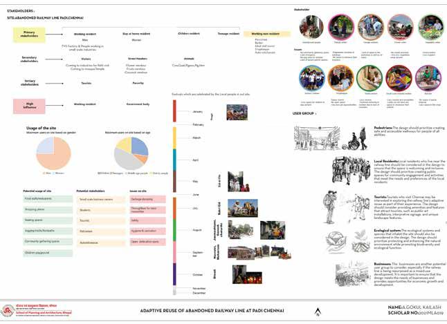

Relief Map Hydrology Slope The traffic flow map of the area surrounding the abandoned railway line provides valuable insights into the movement patterns and transportation dynamics within the vicinity. By analyzing the map, it becomes evident that the railway line intersects with major roadways and thoroughfares, indicating its historical significance as a transportation corridor. The study of existing activities on the abandoned railway line has revealed a dynamic and multifaceted landscape of human interaction. Through extensive observation and analysis, it becomes evident that the site continues to serve as a magnet for various activities and engagements. Lorem Ipsum is simply dummy text of the printing and typesetting industry. Lorem Ipsum has been the industry’s standard dummy text ever since the 1500s, when an unknown printer took a galley of type and scrambled it to make a type specimen book. It has survived not only five centuries, but also the leap into electronic typesetting, remaining Lorem Ipsum is simply dummy text of the printing and typesetting industry. Lorem Ipsum has been the industry’s standard dummy text ever since the 1500s, when an unknown printer took a galley of type and scrambled it to make a type specimen book. It has survived not only five centuries, but also the leap into electronic typesetting, remaining The user analysis conducted for the adaptive reuse project of the abandoned railway line offers crucial insights into the needs, preferences, and behaviors of the potential users. By gathering data through surveys, interviews, and observations, a comprehensive understanding of the target user groups has been obtained. The study of existing activities on the abandoned railway line has revealed a dynamic and multifaceted landscape of human interaction. Through extensive observation and analysis, it becomes evident that the site continues to serve as a magnet for various activities and engagements.
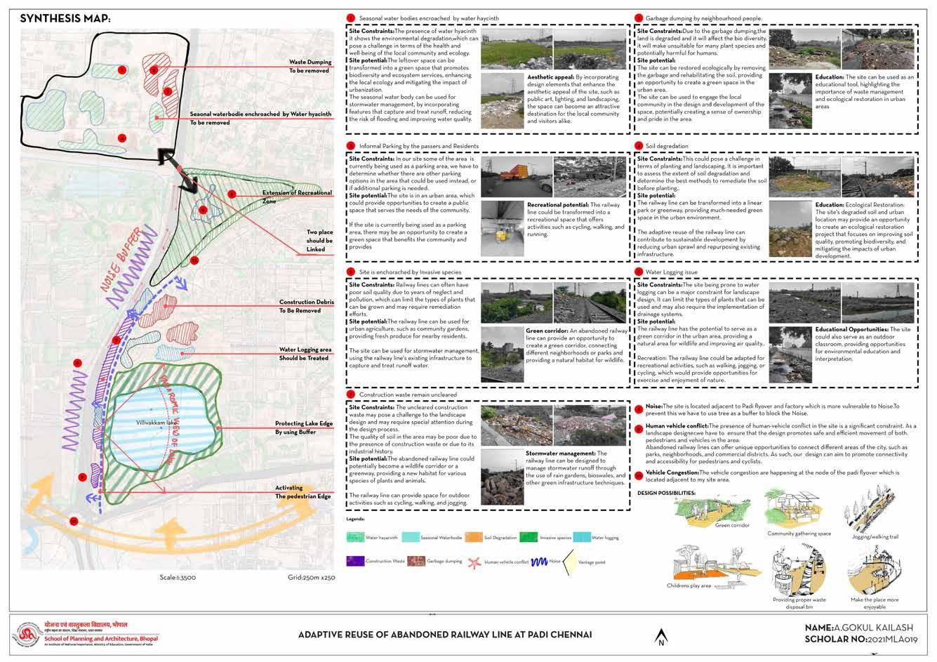
Synthesis Map
Proposals
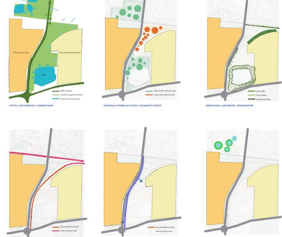
COMPREHENSIVE LANDSCAPE DEVELOPMENT PLAN
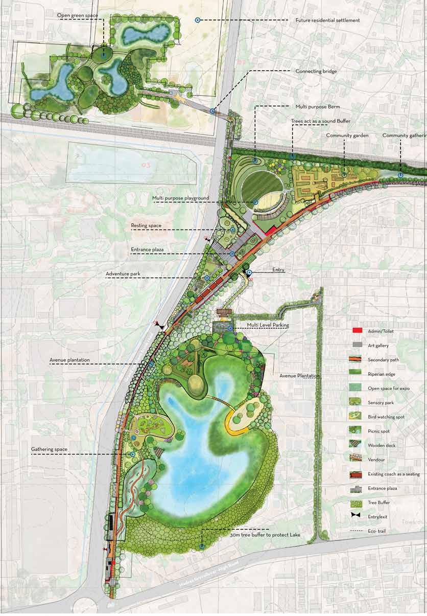

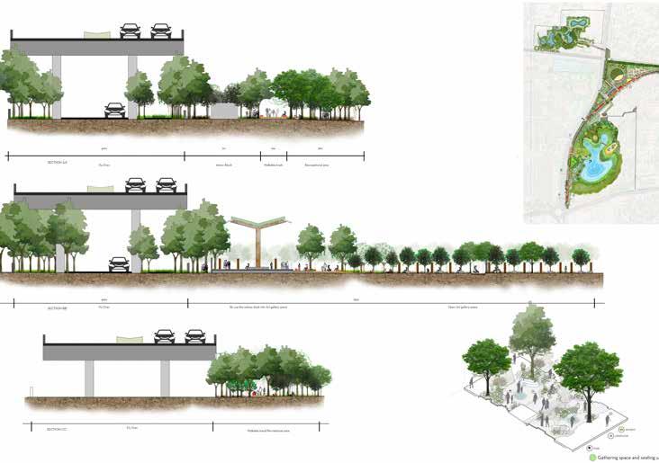
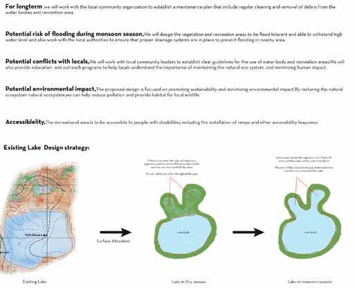
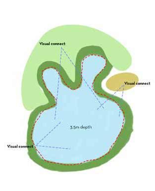
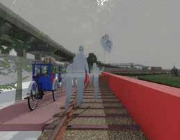
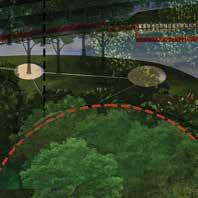
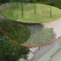
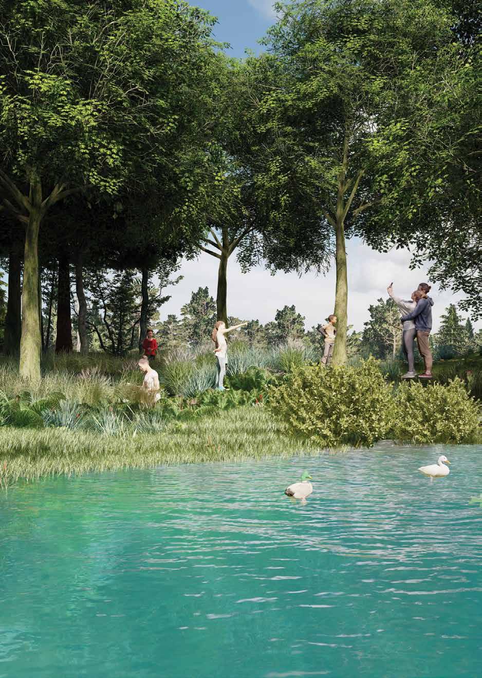
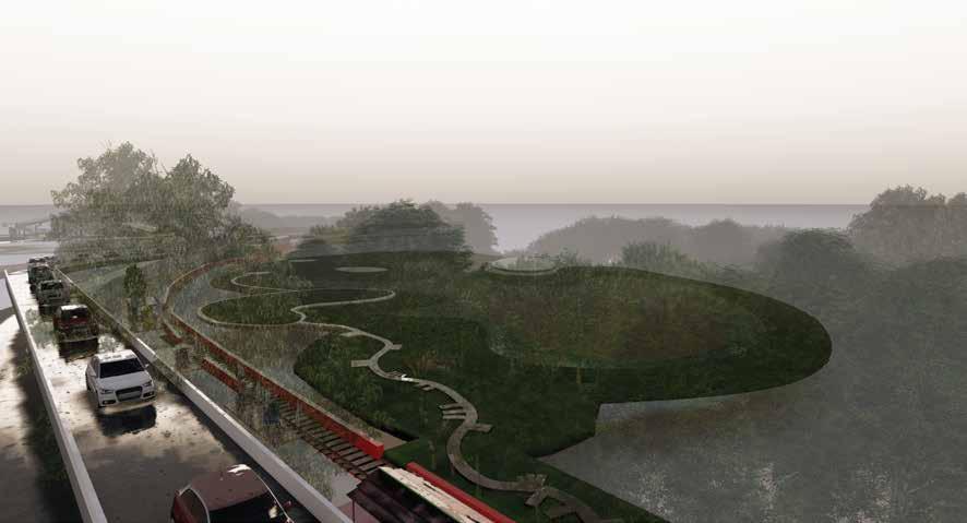
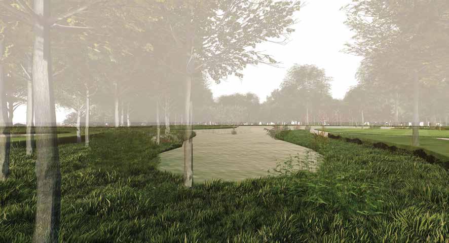
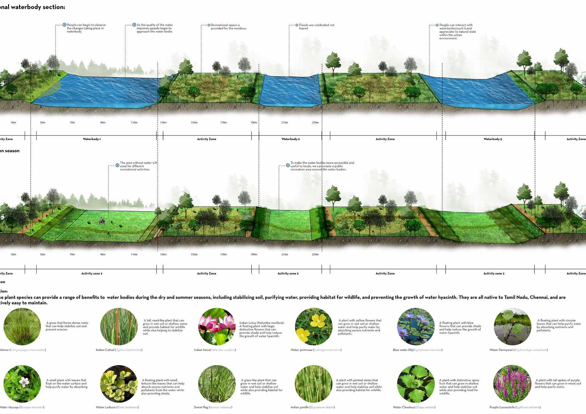
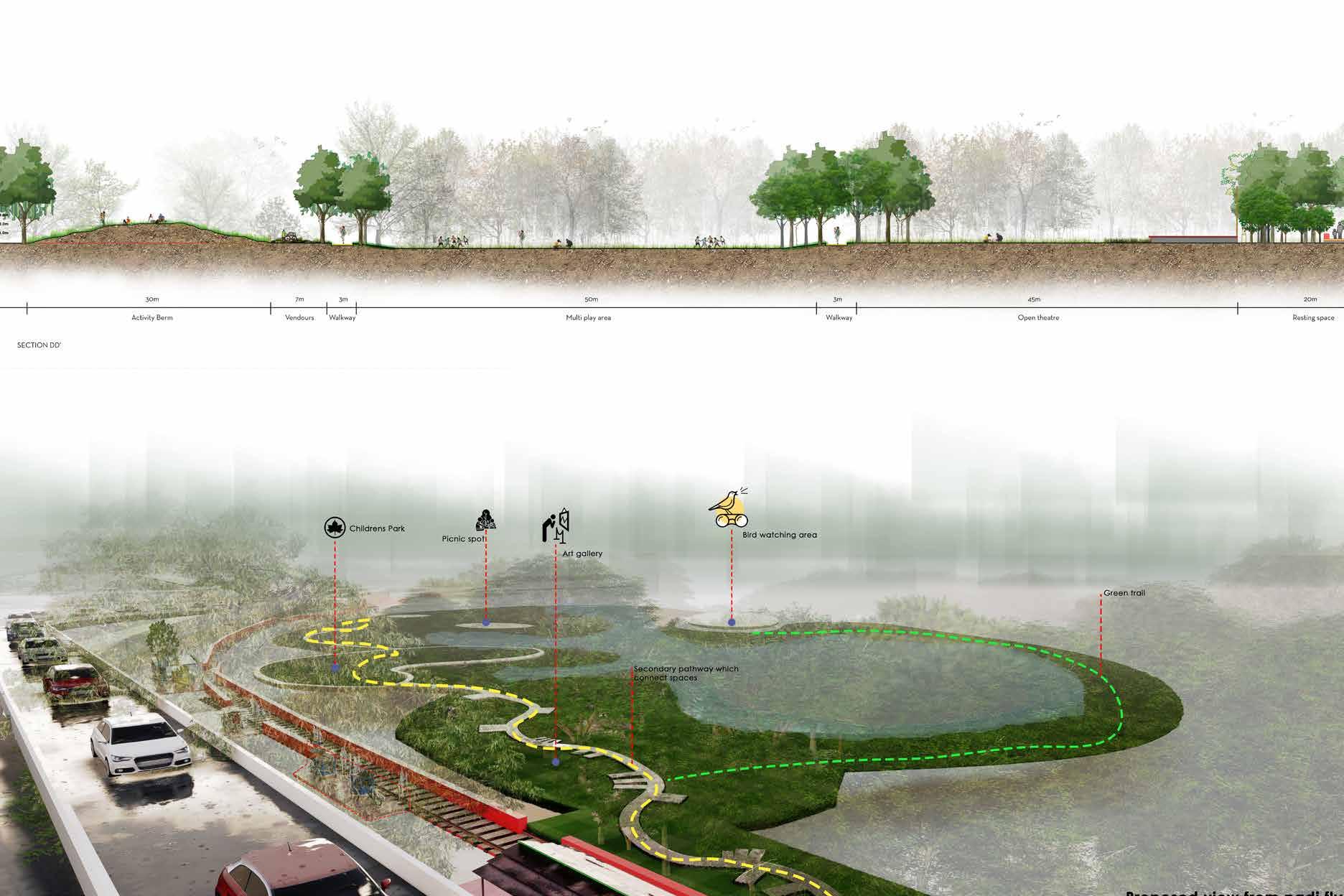
Altered Surface Design: Describe the alteration of the lake’s surface, as previously mentioned, to enhance its functionality and aesthetic appeal. Ensure that the altered surface design takes into consideration the integration of the picnic spot, creating suitable areas for seating, activities, and interactions with the lake. Soft Edge Design, Bird Watching Spot, and Picnic Spot: Implement a soft edge design approach along the lake’s perimeter, integrating the bird watching spot and the designated picnic area. Use naturalistic and gentle slopes to seamlessly blend the lake with the surrounding landscape. Provide suitable seating, tables, and facilities in the picnic spot to accommodate visitors and enhance their enjoyment of the area. Non-Mechanical Boating and Rowing Boat Rentals: Continue to emphasize non-mechanical boating activities, specifically the use of old rowing boats, to offer visitors a peaceful and environmentally friendly way to explore the lake. Ensure that the boating activities do not interfere with the picnic spot, providing appropriate pathways or separations between these areas. Plant Buffer Zone and Native Vegetation: Maintain the 30-meter plant buffer zone around the lake, incorporating native plant species to stabilize the shoreline and create a natural transition. Consider the use of trees, shrubs, and grasses that can provide shade and enhance the picnic spot’s ambiance, while promoting biodiversity and environmental sustainability. In conclusion, the adaptive reuse of the abandoned railway line holds immense potential for transforming a neglected and forgotten space into a vibrant, culturally rich, and socially engaging asset within the community. The thorough site analysis, encompassing the existing landform, landscape character, visual qualities, activities, traffic flow, and user preferences, has provided valuable insights that inform the adaptive reuse design. The existing landform offers a diverse topography, presenting opportunities for varied programming and recreational activities. The landscape character highlights the site’s unique blend of natural elements and decaying infrastructure, setting the stage for repurposing and revitalization. The visual analysis has uncovered captivating visual elements, offering inspiration for design interventions that celebrate the site’s inherent beauty and historical significance. Furthermore, the analysis of existing activities and user preferences underscores the importance of community engagement and inclusivity in the adaptive reuse project. By incorporating and enhancing these activities, the project can foster a sense of place and ownership among the community, ensuring its long-term sustainability. Considering the traffic flow and transportation connectivity, the project can optimize accessibility and promote sustainable modes of transportation. In light of these findings, it is recommended that the adaptive reuse design integrates cultural and artistic spaces, recreational amenities, and multimodal transportation infrastructure, all while preserving the site’s unique heritage. Mechanical removal of water hyacinth: Schedule regular mechanical removal of water hyacinth from the water bodies using boats or other equipment. Shoreline restoration: Restore the natural vegetation along the shoreline of the water bodies by planting native species of trees, shrubs, and grasses. Use species that are well adapted to the local climatic conditions, such as Palmyra palm (Borassus flabellifer), Neem (Azadirachta indica), Indian gooseberry (Emblica officinalis), and Indian almond (Terminalia catappa). These plants will not only help stabilize the soil and prevent erosion but will also attract local wildlife to the area. By embracing the site’s existing qualities and engaging with the community, the adaptive reuse project can serve as a catalyst for social interaction, cultural enrichment, and sustainable development. The site’s unique characteristics, including the diverse landform, captivating landscape character, intriguing visual qualities, and existing activities, present a wealth of opportunities for repurposing and revitalization. The integration of the existing landform, such as the undulating hills, riverine features, and open plains, can inform the design of diverse recreational and leisure spaces that harmoniously blend with the natural surroundings. The preservation and thoughtful incorporation of the landscape character, including the overgrown vegetation and decaying infrastructure, can not only honor the site’s historical significance but also serve as artistic and cultural elements that celebrate its past while embracing the present.





By integrating these activities into the adaptive reuse plan, the project can become a vibrant hub of creativity, culture, and social interaction, providing opportunities for diverse user groups to connect and share experiences. Moreover, considering the traffic flow and transportation connectivity, the project should prioritize the development of multimodal transportation options, pedestrian-friendly pathways, and accessible entry points to ensure seamless integration with the surrounding transportation network and enhance overall accessibility.
In light of these conclusions, it is recommended that the adaptive reuse project embraces a sustainable and inclusive approach, incorporating green design principles, community involvement, and a long-term management strategy to ensure the project’s longevity and positive impact on the surrounding community. Through the adaptive reuse of the abandoned railway line, a once-forgotten space can be transformed into a dynamic, culturally significant, and environmentally conscious destination that enriches the lives of residents, visitors, and future generations.
Furthermore, optimizing traffic flow and integrating sustainable transportation options will enhance accessibility and reduce the project’s environmental impact. In light of these findings, it is recommended that the adaptive reuse project be driven by a strong vision and guided by principles of sustainability, community engagement, and cultural preservation. This can be achieved through collaboration with stakeholders, ongoing public participation, and the establishment of long-term management strategies that ensure the site’s continued vibrancy and relevance. The adaptive reuse of the abandoned railway line has the potential to transform the area into a vibrant, resilient, and socially cohesive space that celebrates the site’s history, fosters community connections, and contributes to the well-being of both residents and visitors alike.



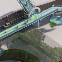
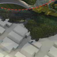





Seasonal waterbodies sections:
Lorem Ipsum is simply dummy text of the printing and typesetting industry. Lorem Ipsum has been the industry’s standard dummy text ever since the 1500s, when an unknown printer took a galley of type and scrambled it to make a type specimen book. It has survived not only five centuries, but also the leap into electronic typesetting, remaining essentially unchanged. It was popularised in the 1960s with the release of Letraset sheets containing Lorem Ipsum passages, and more recently with desktop publishing software like Aldus PageMaker including versions of Lorem Ipsum. It is a long established fact that a reader will be distracted by the readable content of a page when looking at its layout. The point of using Lorem Ipsum is that it has a more-or-less normal distribution of letters, as opposed to using ‘Content here, content
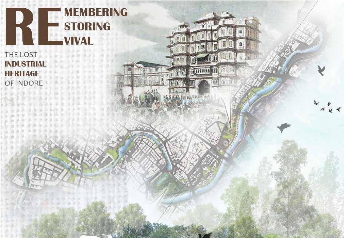
Industrial landscape design:
SITE ANALYSIS
The landscape character map provides a valuable perspective on the industrial landscape of the project site, unveiling its unique features and qualities. Through meticulous studies and analysis, the map highlights the distinctive elements that shape the character of the industrial landscape. It identifies the dominant industrial structures, such as factories, warehouses, and manufacturing units, which define the visual identity of the site. Additionally, the map illustrates the interplay of built forms, open spaces, and natural elements within the industrial context, showcasing the intricate relationship between human intervention and the surrounding environment.
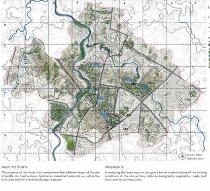
By understanding and mapping the landscape character, the design process can leverage the unique qualities of the site, ensuring the industrial landscape is not only functional but also aesthetically pleasing, environmentally sustainable, and socially beneficial.
The relief map serves as a crucial tool in understanding the topography and terrain of the project site. It provides a threedimensional representation of the landforms, including hills, valleys, slopes, and other natural features. The relief map enables a visual comprehension of the site’s elevation changes and helps identify areas of high and low relief. This information is invaluable in the landscape development plan, as it guides the design and placement of various elements within the site. By analyzing the relief map, designers can determine the most appropriate locations for infrastructure, pathways, and open spaces, ensuring a harmonious integration with the existing topography.
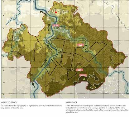
The relief map also assists in identifying potential challenges and opportunities presented by the site’s relief, such as drainage patterns, erosion-prone areas, and areas suitable for retaining walls or terracing.
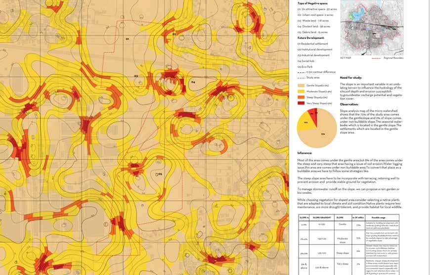
The slope map provides a valuable representation of the varying degrees of inclination across the project site. By visually depicting the steepness or gentleness of slopes, the slope map offers essential insights for the landscape development plan. It helps identify areas prone to erosion, soil instability, or water runoff, allowing designers to implement appropriate measures for slope stabilization and erosion control. The slope map also informs the placement of different elements within the site, such as buildings, pathways, and vegetation, ensuring they are appropriately situated to accommodate the slope conditions and minimize any potential negative impacts.

the hydrology map plays a crucial role in understanding the movement and management of water within the project site. It illustrates the natural drainage patterns, including streams, rivers, ponds, and other water bodies, as well as the location of artificial drainage systems, such as culverts or stormwater channels. The hydrology map helps identify areas prone to waterlogging, flooding, or erosion, enabling designers to implement effective strategies for stormwater management and flood control. It also assists in determining the best locations for water features, such as ponds or rain gardens, which can contribute to the ecological balance and aesthetics of the landscape.
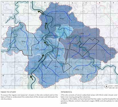
Moreover, the slope map contributes to the aesthetics of the landscape by showcasing the undulating contours and creating opportunities for the integration of terraced gardens, retaining walls, or other landscape features that can enhance the visual appeal and functionality of the site. Additionally, the hydrology map helps identify potential water sources for irrigation or other landscape uses, promoting sustainable water management practices.

Landscape character Map Relief Map Slope Map Hydrology Map
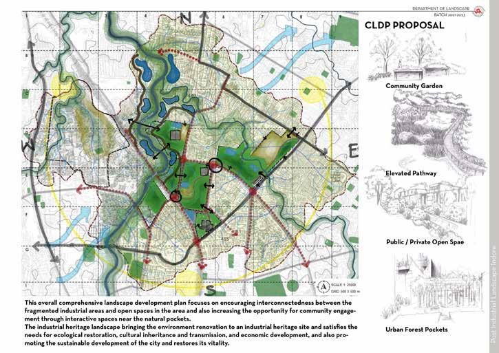

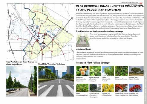
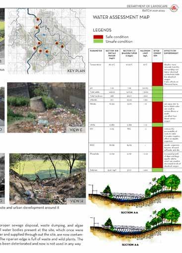
The landscape perspective of the CLDP for the industrial landscape encompasses two key phases, each emphasizing distinct aspects of the site’s natural elements. The first phase concentrates on the river, recognizing its significance as a vital ecological feature and a potential catalyst for landscape enhancement. By adopting a river-centric approach, the CLDP aims to restore and preserve the river’s ecological integrity while integrating it harmoniously within the industrial context. This involves measures such as riverbank stabilization, creation of riparian buffers, and implementation of sustainable stormwater management practices to mitigate the impact of industrial activities on the river ecosystem. Furthermore, the CLDP envisions the creation of riverfront green spaces, promenades, and recreational amenities that not only provide a visual delight but also encourage a stronger connection between the industrial landscape and the natural surroundings.
The second phase of the CLDP focuses on vegetation, recognizing the crucial role that green infrastructure plays in enhancing the environmental quality, aesthetic appeal, and
overall well-being within an industrial setting. The plan emphasizes the strategic integration of vegetation throughout the site, including the use of native and adaptive plant species that are resilient to industrial conditions. The vegetation plan envisions a diverse range of green spaces, such as parks, gardens, and green corridors, which not only beautify the industrial landscape but also provide multiple benefits, such as air purification, noise reduction, and temperature moderation. Additionally, the CLDP promotes the inclusion of urban agriculture initiatives, such as rooftop gardens or vertical farming, which not only contribute to local food production but also enhance the ecological balance and social cohesion within the industrial environment.
Through the implementation of these landscapefocused phases within the CLDP, the industrial landscape can undergo a transformative journey that integrates the natural elements, enhances the environmental sustainability, and creates an appealing and healthy environment for workers, visitors, and the surrounding community.
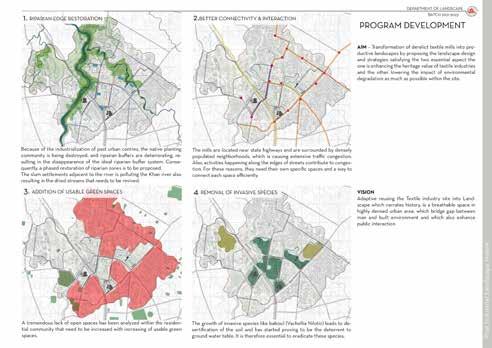
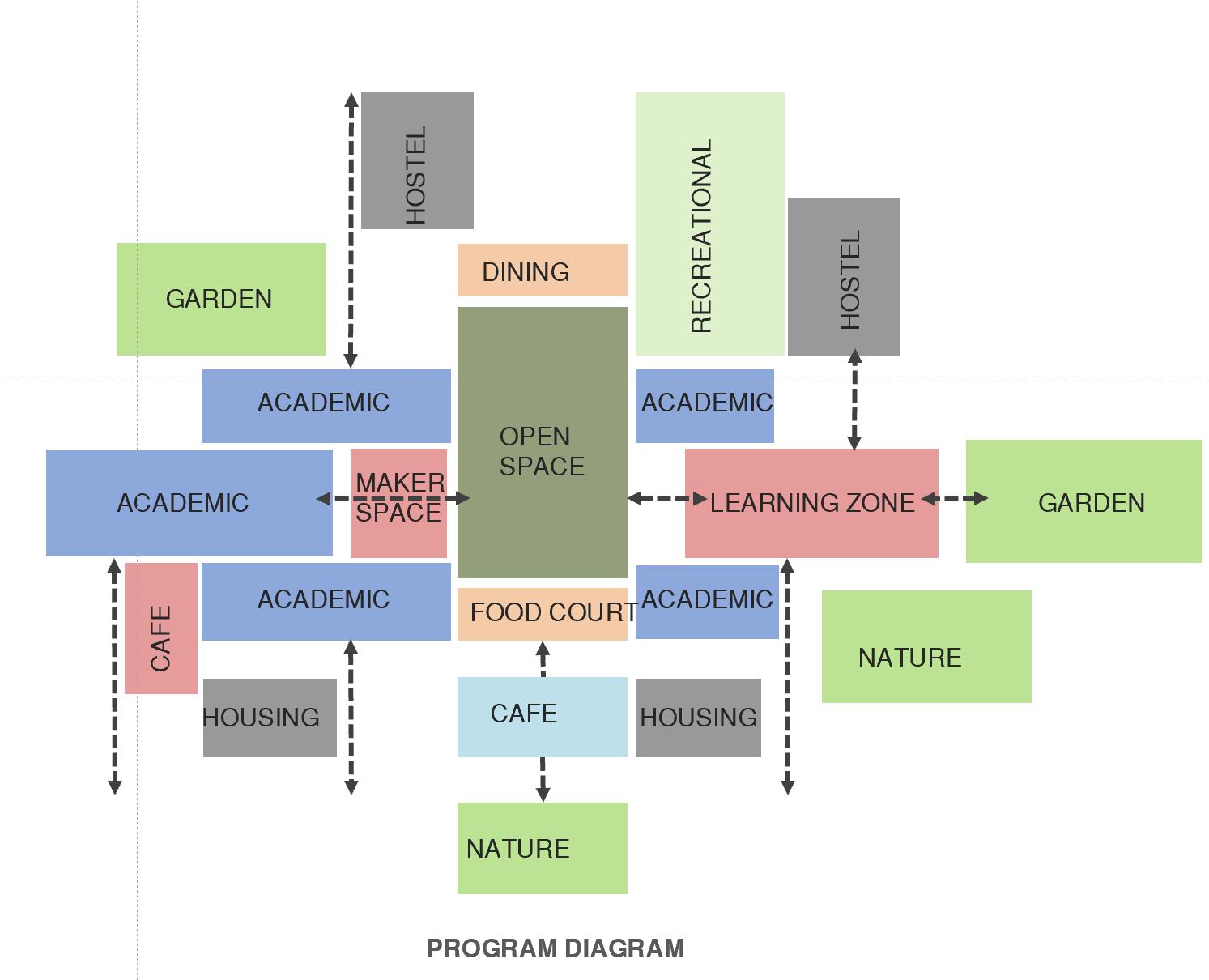
 Program development
HABITAT SECTION:
Lorem Ipsum
Lorem Ipsum
CLDP-PHASE1
PROPOSALS INDUSTRIAL LANDSCAPE
CLDP-PHASE2
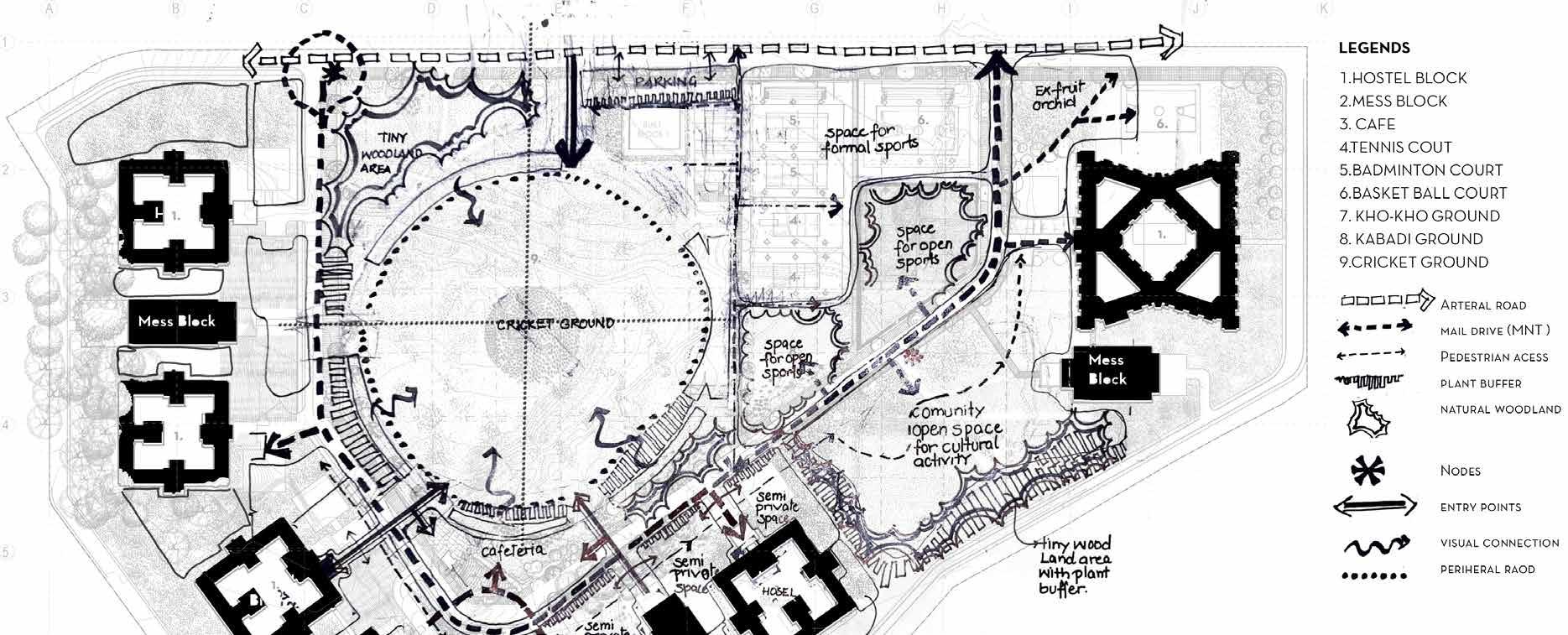
IISER-LANDSCAPE DEVELOPMENT PLAN
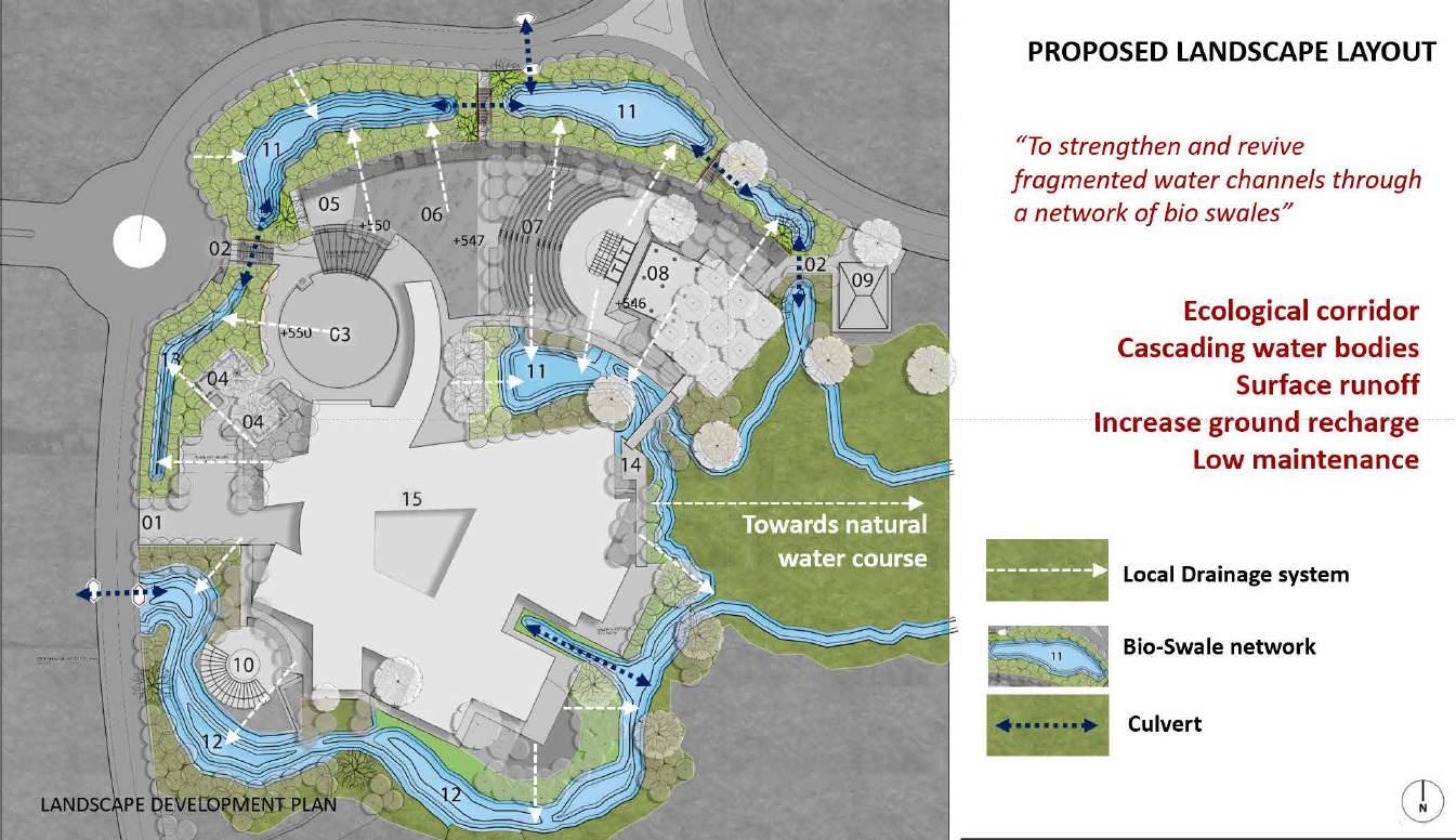
The landscape development plan for IISER Bhopal presents a comprehensive vision for the transformation of the campus into a harmonious and sustainable living and learning environment. Recognizing the vital role of landscape in enhancing the quality of life, fostering a sense of place, and promoting ecological balance, this plan aims to create a campus that not only inspires academic pursuits but also nurtures the well-being of students, faculty, and staff. Through meticulous analysis and thoughtful design, this plan seeks to integrate natural and built elements, establish strong connections with the surrounding context, and celebrate the unique identity and cultural heritage of the region. By prioritizing sustainability, functionality, and aesthetics, the landscape development plan for IISER Bhopal aspires to create an inviting and vibrant campus that reflects the institution’s commitment to academic excellence, environmental stewardship, and community engagement.
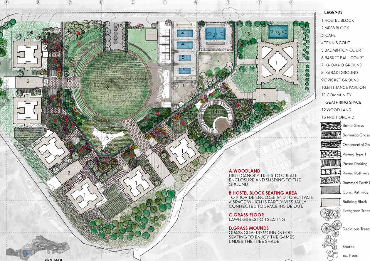
Sports ground:
A key component of the landscape development plan for IISER Bhopal is the establishment of a state-of-the-art sports playfield that encourages physical activity, promotes wellness, and fosters a sense of community among students, faculty, and staff. The sports playfield will be designed to accommodate a range of sporting activities, including football, cricket, basketball, tennis, and athletics. It will feature well-maintained turf, modern sports infrastructure, and spectator seating to create an engaging and enjoyable experience for participants and spectators alike. The playfield will be strategically located within the campus, easily accessible from academic buildings and residential areas, to encourage regular physical exercise and a healthy lifestyle. Additionally, the design will incorporate sustainable features, such as rainwater harvesting systems and energy-efficient lighting, to minimize the environmental impact. The sports playfield will serve as a focal point for recreational and competitive sports, promoting team spirit, friendly competition, and a sense of camaraderie among the campus community. By providing a dedicated space for sports and physical activities, the landscape development plan aims to enhance the overall well-being of individuals and contribute to a vibrant campus environment.
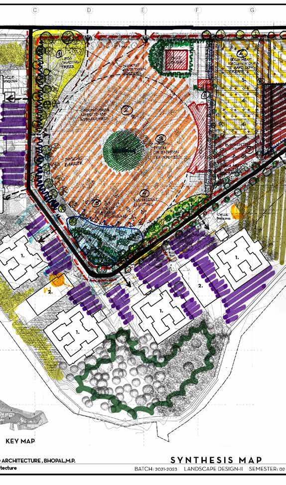
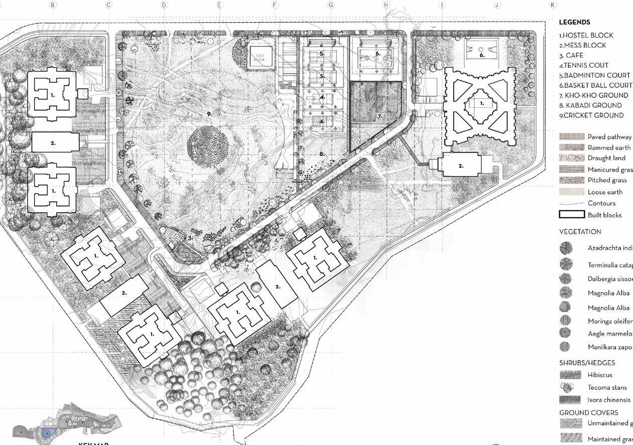
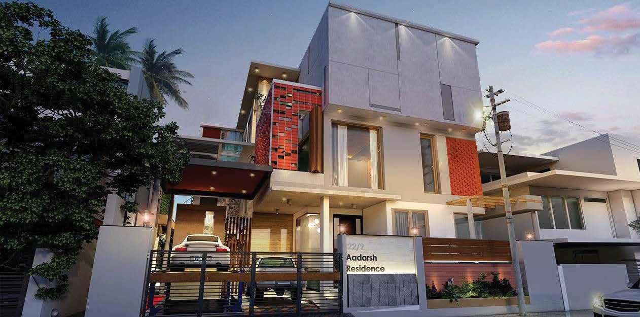
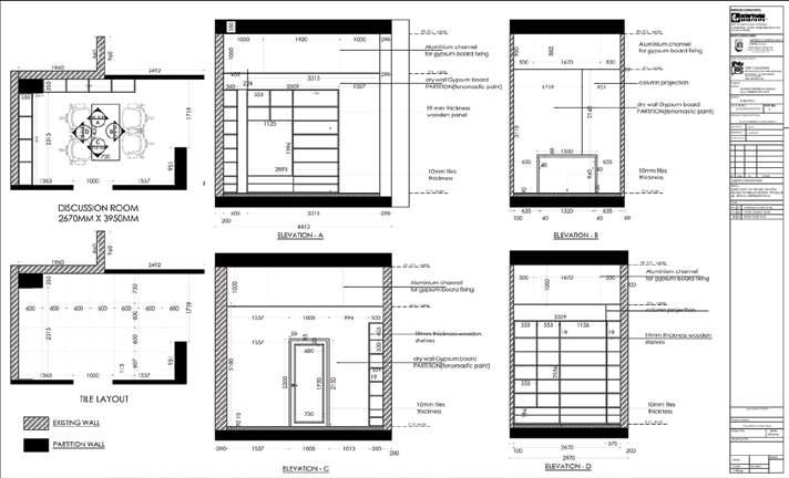
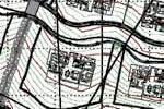
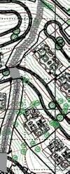
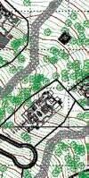
The landscape and architectural working drawings, which I have completed, represent a significant milestone in the design process and showcase my skills and expertise in the field. These drawings demonstrate my ability to translate design concepts into detailed and precise documentation, highlighting the thoughtful integration of landscape and architectural elements. As I apply for job opportunities, these working drawings serve as tangible evidence of my proficiency in creating comprehensive and visually appealing design solutions. The attention to detail and accuracy showcased in these drawings reflect my commitment to delivering high-quality work. Furthermore, these drawings demonstrate my ability to effectively communicate design intent and collaborate with interdisciplinary teams. With my strong foundation in landscape and architectural design, supported by these working drawings, I am confident in my ability to contribute to innovative and sustainable design projects.




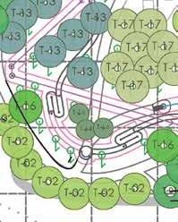


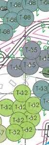


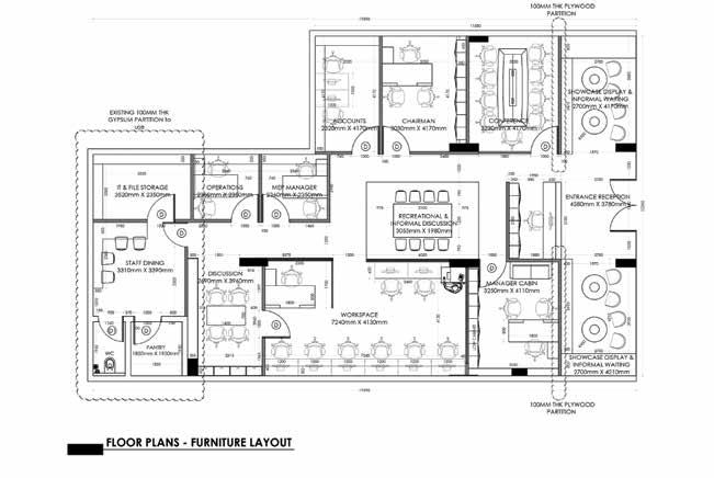


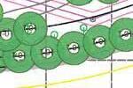
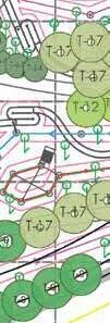


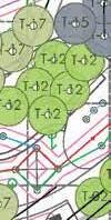


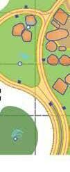


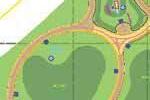
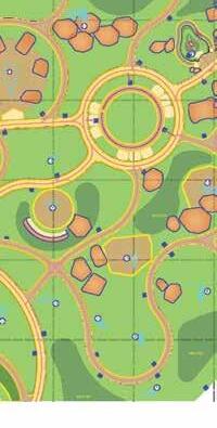


ARCHITECTURAL AND LANDSCAPE WORKING DRAWING
TS-10 TS-09 F G C1-02 SR-11 LOCATION OF P.S.S. 4 FRL 212.20 FRL 211.90 FGL 211.80 FGL 211.90 FGL 211.80 PLANTER ELEC. NICHE ELEC. NICHE 16 T-01 T-01 T-17 T-13 T-15 T-14 T-02 T-02 T-14 T-14 T-08 T-08 T-08 T-08 T-01 T-17 T-08 T-13 T-02 A. PERIPHERAL TREES Chukrassia tabularis Millingtonia hortensis Pterospermum acerifolium Tectona grandis B EVERGREEN AND SHADE GIVING TREES Albizzia lebbek Ficus bengalensis krishna Ficus infectoria Kigelia pinnata Schleichera trijuga C. PEDESTRIAN PATH SIDE SMALL FLOWERING TREES Cassia fistula Lagerstroemia flosreginae Milletia ovalifolia Terminalia mantaly Cassia renigera D. Cassia siamea Erythrina indica Spathodea campanulata E. Bauhinia purpurea Ficus Iyrata Plumeria rubra Michelia champa Nyctanthes arbor-tristis F. FOREST AND GREEN BUFFER AREA Dalbergia sissoo Eugenia jambolana Heterophragma adenophyllum Melia azedarach Phyllanthus emblica Pongamia Glabra Plumeria acutifolia Prunus persica Tabebuia argentea G. Ficus benjamina Ficus reginald Aegle marmelos Terminalia bellerica Terminalia arjuna Nerium oleander(yellow) Cinnamomun camphora Cinnamomun verum Myristica fragrans Syzgium myrtifolium Schleichera trijuga Mimusops elengi Santalum album Albizia procera Phyllanthus emblica Madhuca longifolia Ziziphus budhensis Putranjiva roxburghii Heterophragma adenophylla Pongomia pinnata Bauhinia purpurea A. AVENUES AND ENTRANCE ZONES Dypsis decaryi Phoenix sylvestris Roxb Washingtonia filifea Foxtai B. ALONG BUILDING AND ACTIVITY AREAS Areca Palm C. THEME PARKS Cycus cirsnallis madagascariensis TRANSPLANTED TALL TREES Ficus benghalensis Ficus religiosa Ficus infectoria Ficus lyrata Ficus macrocarpa Ficus bengalensis krishna Ficus glomerata Ficus benghalensis(variegated) Ficus elastica(black prince) T-05 DRAWING DISCIPLINE KEY PLAN GFC Approval Concept Preliminary BUILDING: DRAWING TITLE REVISION DRAWING NO SCALE: DRAWN BY CHECKED BY DATE STAGE/ISSUED FOR Tender Signature of authorised signatory: 3. FOR STAIRCASE TOILET RAMP DETAIL, REFER DETAIL DRAWINGS. 4. ANY DISCREPANCY FOUND IN THE DRAWING SHOULD BE BROUGHT TO THE NOTICE OF ARCHITECT STRUCTURAL 5. CONSULTANT BEFORE TAKING ANY DECISION. 6. THIS DRAWING IS TO BE READ IN CONJUNCTION WITH STRUCTURAL AND OTHER RELEVANT SERVICES DRAWINGS. CHARGE/ ARCHITECT BEFORE PROCUREMENT. 9. ALL DOORS WHICH ARE EXPOSED TO OUTSIDE SHOULD HAVE LEVEL 10. DIFFERENCE IN FLOOR SO THAT WATER SHALL NOT COME INSIDE, SAME FOR ALL WET AREAS. 11. DOOR AND WINDOWS SIZE AND MATERIAL SHALL BE COORDINATED WITH DETAILED DRAWINGS.ANY AMBIGUITY SHALL BE BROUGHT TO THE NOTICE OF ARCHITECT BEFORE TAKING FINAL DECISION, Number The drawing is the property of NBCC and may not be copied, duplicated or reproduced in any form whatsoever without prior written permission of NBCC. Revision Description GENERAL NOTES: PROJECT TITLE : Date 2 GFC Drawing Approved for release of GFC by ARCOP ASSOCIATES PVT LTD. DELHI DEVELOPMENT AUTHORITY NBCC (INDIA) LIMITED (Government of India Enterprises) PMC AGENCY: ARCHITECTURAL AND ENGINEERING CONSULTANTS EPC AGENCY: As-built BHARAT VANDANA PARK, DWARKA SECTOR-20, NEW DELHI CLIENT: CONSULTANT OF EPC AGENCY ARCOP ASSOCIATES PVT LTD. NEW DELHI A-15 Pamposh Enclave, Greater Kailash-I New Delhi-110048 1) GFC Drawing Submitted by NKG INFRASTRUCTURE LTD. 3) IIT/ NIT Vetting and Approval For Structural Drawings only. NKG INFRASTRUCTURE LTD. REGISTERED OFFICE204, Kailash Building, 26 K.G. Marg,New Delhi - 110001 SURESH GOEL AND ASSOCIATES C- 85 Shivalik,near malviya nagar Delhi, 110017 FUN PARK PLANTING PLAN - TREES MASTER PLAN 30-06-2022 BVP-LA-ADVP-100 R PRA ADI FOR APPROVAL 16 15 14 13 12 11 10 09 08 07 17


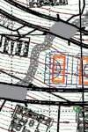











E 00 E 100 E 200 E 300 E 400 E 500 E 600 E 700 E 00 E 100 E 200 E 300 E 400 E 500 E 600 E 700 N 500 N 450 N 400 N 350 N 300 N 500 N 450 N 400 N 350 N 300 PINE TREE BENCH MARK BORING BR 40 0 20 10 20 S UNIQUE SURVEYORS PH: 011 25289573 Cell 9810524943 SURVD.BY PROJECT TOPOGRAPHICAL SURVEY OF LAND AT DATE SEPT. 07, 2021 MOHANA SHACHALI, DISTT. SIRMAUR, H.P. DRAFTING SCALE 1:1000 S.ROHILLA RAMANAND 1. ALL DIMENSIONS ARE IN METER. NOTES LEGENDS KEY PLAN AREA STATEMENT PLOT BOUNDARY WATER BODY Mr. DEEPENDRA SINGH RATHORE 2. AMSL 1652.0 MT./ 5420 FEET (ROUNDED OFF) FIX ON THE EDGE OF VILLAGE ROAD AT MAIN ENTRY OF SITE. F O R E S T L A N D F O R E S T L A N D F O R E S T L A N D OTHER'S LAND OTHER'S LAND OTHER'S LAND OTHER'S LAND OTHER'S LAND OTHER'S LAND OTHER'S LAND OTHER'S LAND << NH-907A LT LT LINE IN USE) 4. CONTOUR INTERVAL 1.0 M. 5. PLOT BOUNDARY SHOWN BY Mr. MADAN JI. SHACHALI>> 0.025M.)0.15M.) 0.025M.) 1652.0 M. 1798 1795 1795 1794 1794 1793 1793 1792 1789179017911792 1787 1786 17851786 1782 1782 1781 1781 17781779 1777 1777 1776 1776 1775 1775 1774 17711772 1771 1770 1769 1769 17661767 1764 1763 1761 1759 1757 1752 1735173717381740174117421743174417451746 17251726 1676 1660 165516561657 164516461647164816491650165116521653 96 1799 1799 1802180318041805 1800 1799 1801 1800 17991798 18131815 18051806180718081810 1811 183518361837183818391840 182018218231824182518261827182818291830183118321833 1723 17281729730737321733 1694 1796 1780 1745 1742 81518161818 18141809181118121813 17971800180218031804 1788 178 1780 1747 BAAN TREE GENERAL TREE A B A = 133158.96 SQ.M. OR 32.904 ACRES B = 1729.74 SQ.M. OR 0.427 ACRE C = 3429.63 SQ.M. OR 0.848 ACRE TOTAL = 138318.33 SQ.M. OR 34.179 ACRES KUMARHETTI>> 22KM <<NAHANKM <<NH-907A>> << MOHANA SHACHALI>> LOCATION PLAN NTS 50.65 58.08 13.47 7.36 10.89 44.52 52.48 16.92 7.29 25.60 22.65 99.47 56.44 25.74 27.98 62.17 22.85 22.48 99.47 27.15 73.23 66.48 35.62 185.05 23.39 67.80 25.05 28.54 15.12 74.42 27.49 71.54 54.51 29.24 15.62 33.86 4.69 18.24 LAT: 30 47'03.510" LONG: 77 08'00.950" LAT: 30 46'53.246" LONG: 77 08'19.516" N: 3407200.088 E: 704532.651 N: 3407457.696 E: 703983.041 6. MEASURED THE GIRTH OF TREE AT 1 M. ABOVE FROM GROUND. 1.8 KM N: 3407644.447 E: 704165.791 LAT: 30 46'57.561" LONG: 77 07'53.945" LAT: 30 46'48.858" LONG: 77 08'14.425" N: 3407337.792 E: 704665.431 1 800 1 900 000 1656 VILLAGE ROAD (KATCHA) LINK ROAD (PROPOSE) FENCING PLOT BOUNDARY CONTOUR 17851784 VILLAGE ROAD (MATTEL) 1745 1735 1705 1705 1700 1700 Job No Drawn By Checked By Revision Title Project Drawing No: Scale PRINCIPAL DESIGN CONSULTANT LANDSCAPE CONSULTANT C 536 Defence Colony, GF, New Delhi 110024 Office:011 4165 0777 Moble: 91-9971632047 STUDIO LOTUS LUXURY HOUSING_ELDECO, SIRMAUR, HIMACHAL PRADESH AA S N PLUMBING AND FIRE SUPPRESSION SUB-CONSULTANT ELECTRICAL CONSULTANT CONCEPT MASTERPLAN ROHA 14.07.22 R0 L 0.0 Sr. SYMBOL NOTE: MATERIAL PALLET LEGEND ENTRY LVL ±00 LVL ±00 F.F.L+250 EXIT EXIT F.F.L +250 M5 M4 M4 M4 M4 M4 M5 M1 M3 M1 M1 M3 M3 M2 M3 M3 M6 M6 M2 M3 M3 M3 M6 M1 M1 M3 M1 M4 M4 M4 CODE Sr. SYMBOL MATERIAL LOCATION SIZE (in mm) L X B X H FINISH COLOUR Concrete Paver Dream Grey Nasoli Gold Steel Grey Black Kares Thermopine M4 M5 Ramp Paving Flooring Flooring Planter walls and coping Natural Leather Polished Grey Light Grey Yellow Dark Grey Black (treated with pine oil) 3 4 5 NOTE: Flooring Horizontal Finishes Cladding Vertical Finishes MATERIAL PALLET LEGEND Pre-cast Kerb stone Kerb along Pathway Smooth Grey 6 60mm Thk 300 x 150 x 300 20mm Thk 20mm Thk 30mm Thk (Coping) M2 M1 M3 M6 Layout Plan 20.04.2022 1:150 Drawn By Title Project PRINCIPAL DESIGN CONSULTANT C 536 Defence Colony, GF, New Delhi 110024 Moble: 91-9971632047 ACPL Design Ltd Tel 011-48234444, Paras Commercial SECTOR-129, NOIDA, U.P. SUB-CONSULTANT ELECTRICAL CONSULTANT All the services are to be covered after services provisions. 9. Drawing approval is for the conformity with outline design intent and does relieve the contractor/ subcontractor from full responsibility for the integration and fitness for purpose of design. 10. Construction Manager/Project Manager to revert back within working days of receiving the drawings coordination and buildability issues. otherwise would be deemed that they have understood and accepted the drawing/ design and full responsibility for the works carried out accordingly. E STRUCTURAL CONSULTANT) LAWN AREA VILLA BOUNDARY WALL GRAVEL PLINTH 4L-02 7.36 1790 1795 7500 1000 1000 C/L RETAINING WALL (AS PER SPECS BY STRUCTURAL CONSULTANT) PARAPET WALL 600MM HIGH 50MM THICK PREMIX DRAIN EARTHEN SHOULDER 1M WIDE DRAIN WEEP HOLES (AS PER SPECS BY STRUCTURAL CONSULTANT) GSB 100MM WBM2 COMPACTED EARTH OF MINIMUM PROCTOR DENSITY OF 95% STUDIO LOTUS LUXURY HOUSING_ELDECO, ROHA SECTION AA- TYPICAL ROAD SECTION-4BHK-LARGE 7500 GRAVEL (AS PER SPECS BY PARAPET WALL EARTHEN SHOULDER SLOPE RETAINING WALL (AS PER SPECS BY STRUCTURAL CONSULTANT) (AS PER SPECS BY A 50.65 27.49 1800 1795 7500 1000 1000 RETAINING WALL (AS PER SPECS BY STRUCTURAL CONSULTANT) PARAPET WALL 600MM HIGH SEAL COAT 50MM THICK PREMIX EARTHEN SHOULDER 1M WIDE DRAIN WEEP HOLES (AS PER SPECS BY STRUCTURAL CONSULTANT) 250MM THICK GSB 100MM WBM1 100MM WBM2 COMPACTED EARTH OF MINIMUM STUDIO LOTUS LUXURY HOUSING_ELDECO, TYPICAL ROAD SECTIONSECTION AA- TYPICAL ROAD SECTION-4BHK-LARGE KEY PLAN 3 ROAD SECTION DETAIL
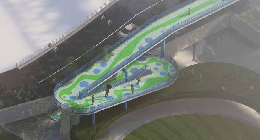
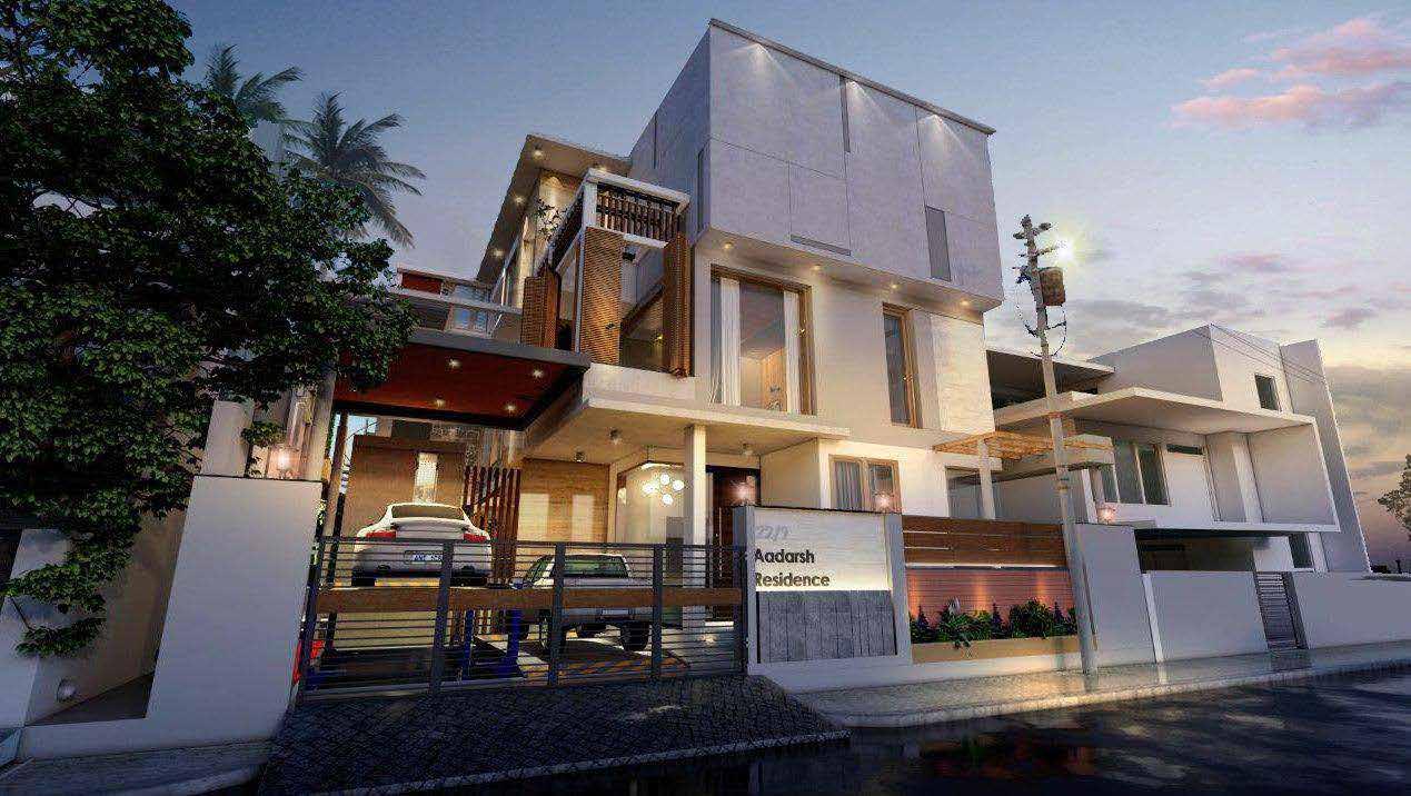
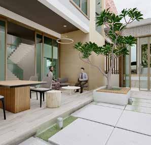
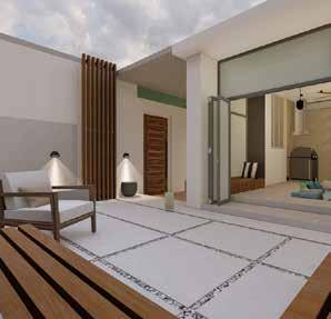
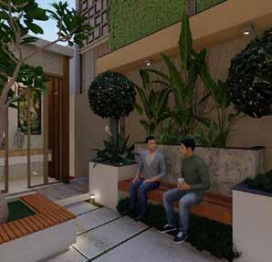
In addition to my expertise in landscape and architectural design, I have a strong proficiency in utilizing rendering software such as Lumion, Twinmotion, and Enscape. These powerful tools enable me to bring design concepts to life and create realistic visualizations that accurately portray the intended atmosphere and aesthetics of the project. Through the use of Lumion, Twinmotion, and Enscape, I am able to showcase the project in immersive virtual environments, providing clients and stakeholders with a clear and captivating understanding of the design intent. These rendering software allow for real-time adjustments, seamless material and lighting simulations, and the incorporation of landscaping elements, ensuring a high level of accuracy and realism in the final visualizations. By harnessing the capabilities of these software, I am able to present compelling and visually stunning renderings that effectively communicate design concepts, enhance client engagement, and facilitate informed decision-making throughout the design process.

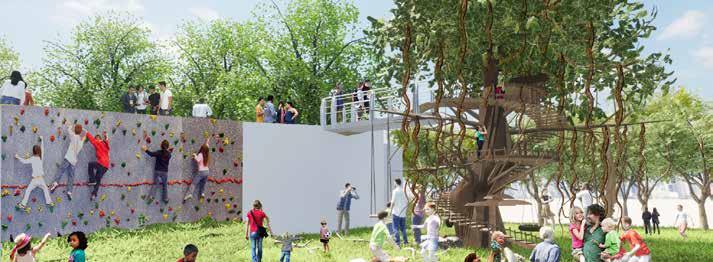
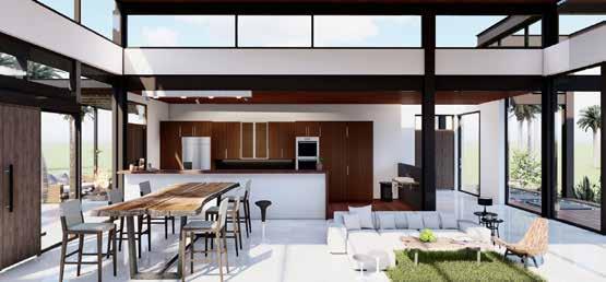
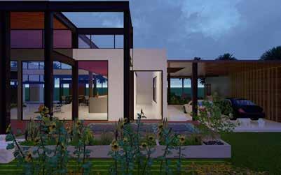
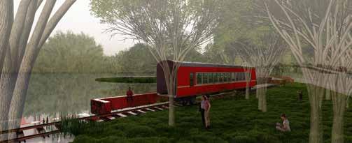
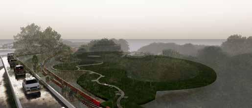
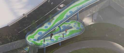

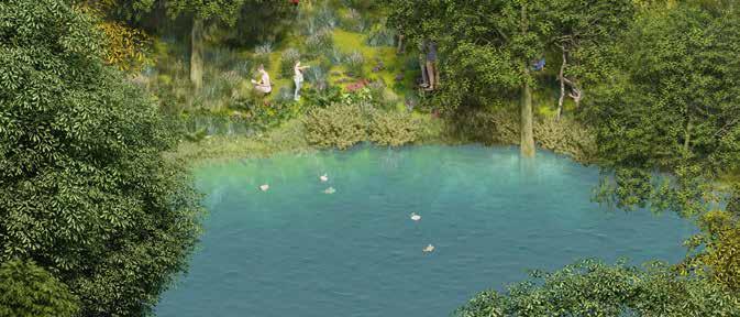
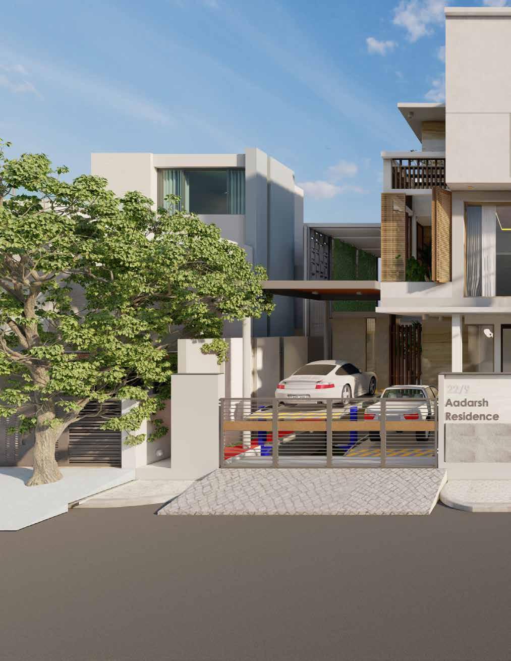
Ipsum is simply dummy text of the printing and typesetting industry. Lorem Ipsum has been the industry’s standard dummy text ever since the 1500s. Lorem Ipsum is simply dummy text of. Lorem Ipsum is simply dummy text of the printing and typesetting industry. Lorem Ipsum has been the industry’s standard dummy text ever since.
RENDERS Lorem
Lorem Ipsum is simply dummy text of the printing and typesetting industry. Lorem Ipsum has been the industry’s standard dummy text ever since.
PROFESSIONAL EXPERIENCE
Key Achievements and Responsibilities:
Project Inception: I played a pivotal role in the conceptualization and design phase, working closely with stakeholders to understand their needs and goals. This involved site analysis, master planning, and the creation of a comprehensive landscape strategy to enhance the campus’s aesthetics and functionality.
Sustainable Design: Sustainability is at the core of my work. I integrated eco-friendly elements such as rainwater harvesting, native plant species, and efficient irrigation systems to reduce the project’s environmental footprint. This project demonstrates my commitment to creating environmentally responsible landscapes.
Construction Oversight: I was actively involved in the construction phase, collaborating with contractors and teams to ensure that the landscape elements were executed according to the design specifications. My role included monitoring progress, quality control, and adherence to the project timeline.
Site Management: I continue to oversee the ongoing execution of the project, ensuring that the landscape evolves as intended. This includes maintenance planning, addressing any challenges, and making necessary adjustments to enhance the final outcome.
Stakeholder Engagement: Effective communication and collaboration have been key to the project’s success. I have been responsible for engaging with various stakeholders, including university administrators, faculty, students, and local communities, to gather input and feedback, fostering a sense of ownership and pride in the landscape.
Budget Management: I managed project budgets efficiently, ensuring that the landscape development remained cost-effective without compromising quality.
Future Plans:
As the Landscape architect, I am committed to completing the project successfully and seeing it through to its full potential. Additionally, I look forward to taking on new challenges in the field of landscape architecture, where I can apply my skills and expertise to create sustainable, functional, and beautiful landscapes for future projects.
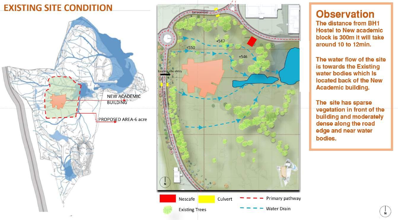
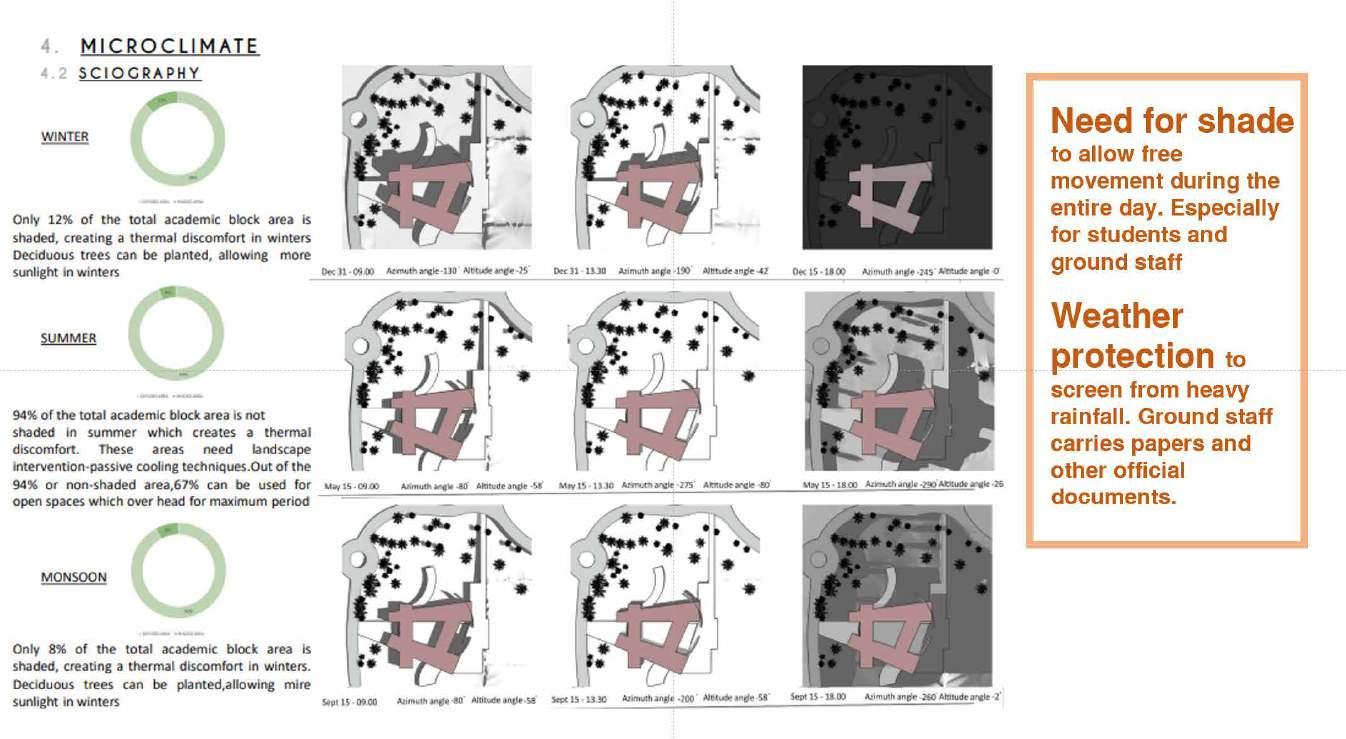
P R O P O S E D L A N D S C A P E D E S I G N F O R A C A D E M I C B L O C K S C H O O L O F P L A N N I N G A N D A R C H I T E C T U R E - B H O P A L
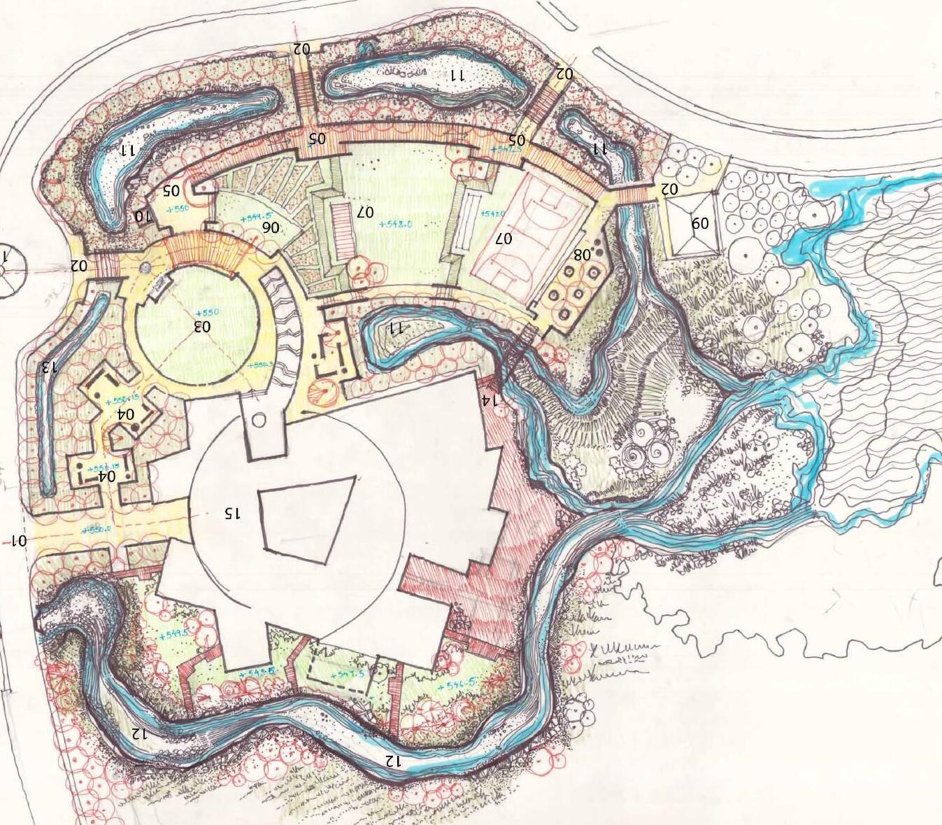
P R O P O S E D
L A N D S C A P E
D E S I G N
F O R A C A D E M I C B L O C K
S C H O O L O F P L
A N N I N G A N D A R C H I T E C T U R E - B H O P A L
CONCEPT

I would like to express my sincere gratitude to the recruiters for taking the time to review my portfolio. I am truly thankful for the opportunity to present my work and showcase my skills and passion for landscape design. It is my utmost desire to contribute my expertise, creativity, and dedication to meaningful projects and make a positive impact in the field. I am excited about the prospect of joining a dynamic team and bringing my unique perspective and abilities to the table. Thank you once again for considering my portfolio, and I look forward to the possibility of collaborating on future endeavors.
Thankyou


 Program development
HABITAT SECTION:
Lorem Ipsum
Lorem Ipsum
CLDP-PHASE1


