


Gear, Gadgets, and Biking Communities


Gear, Gadgets, and Biking Communities
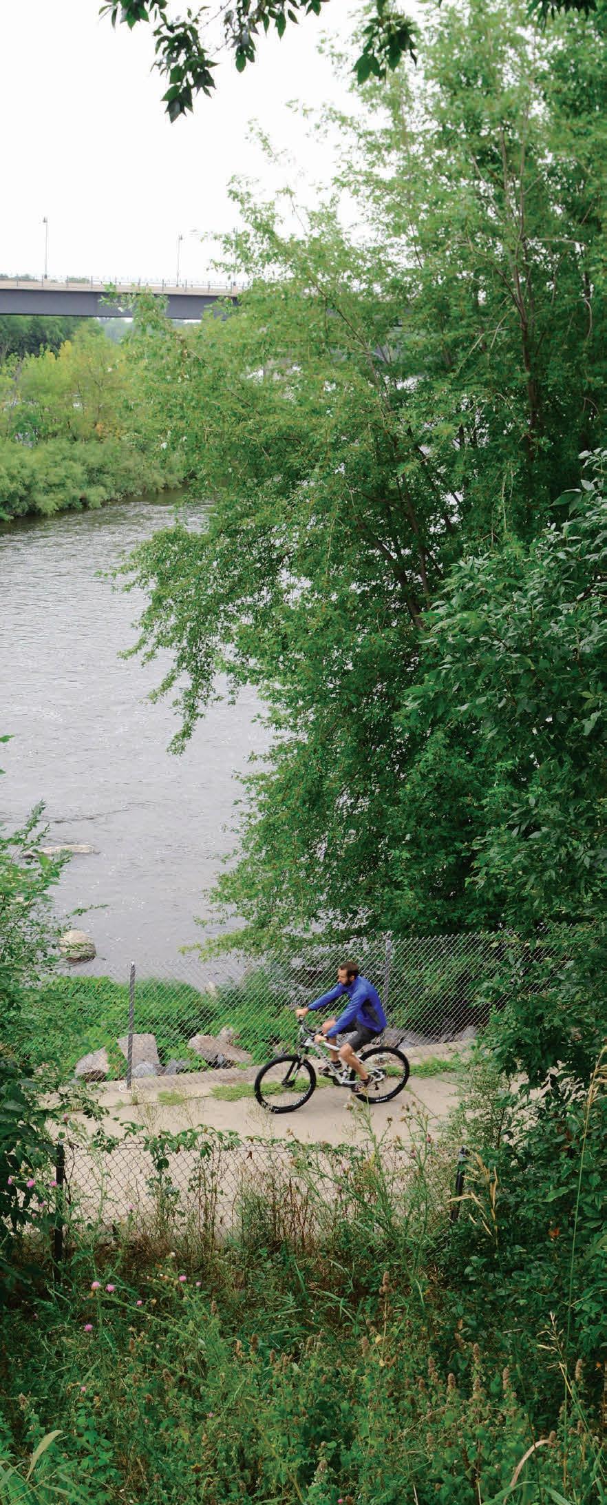
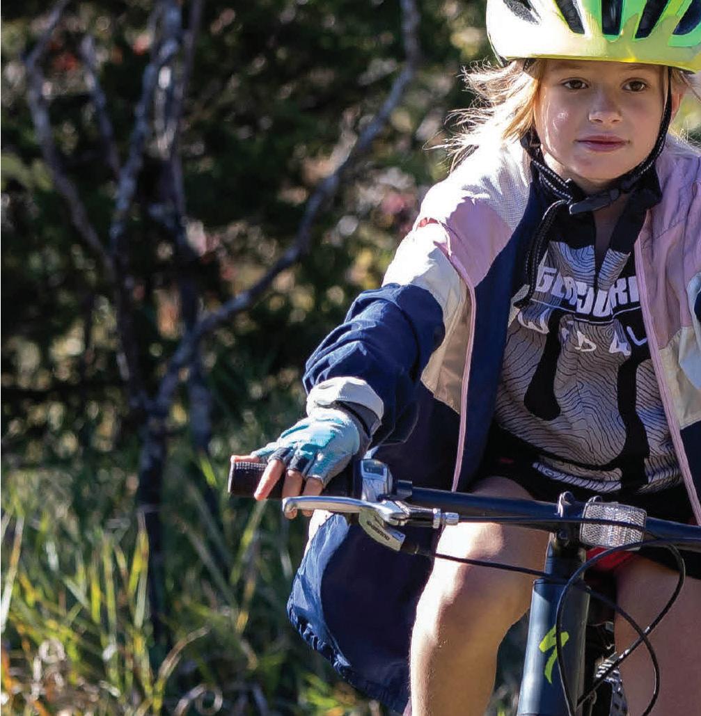
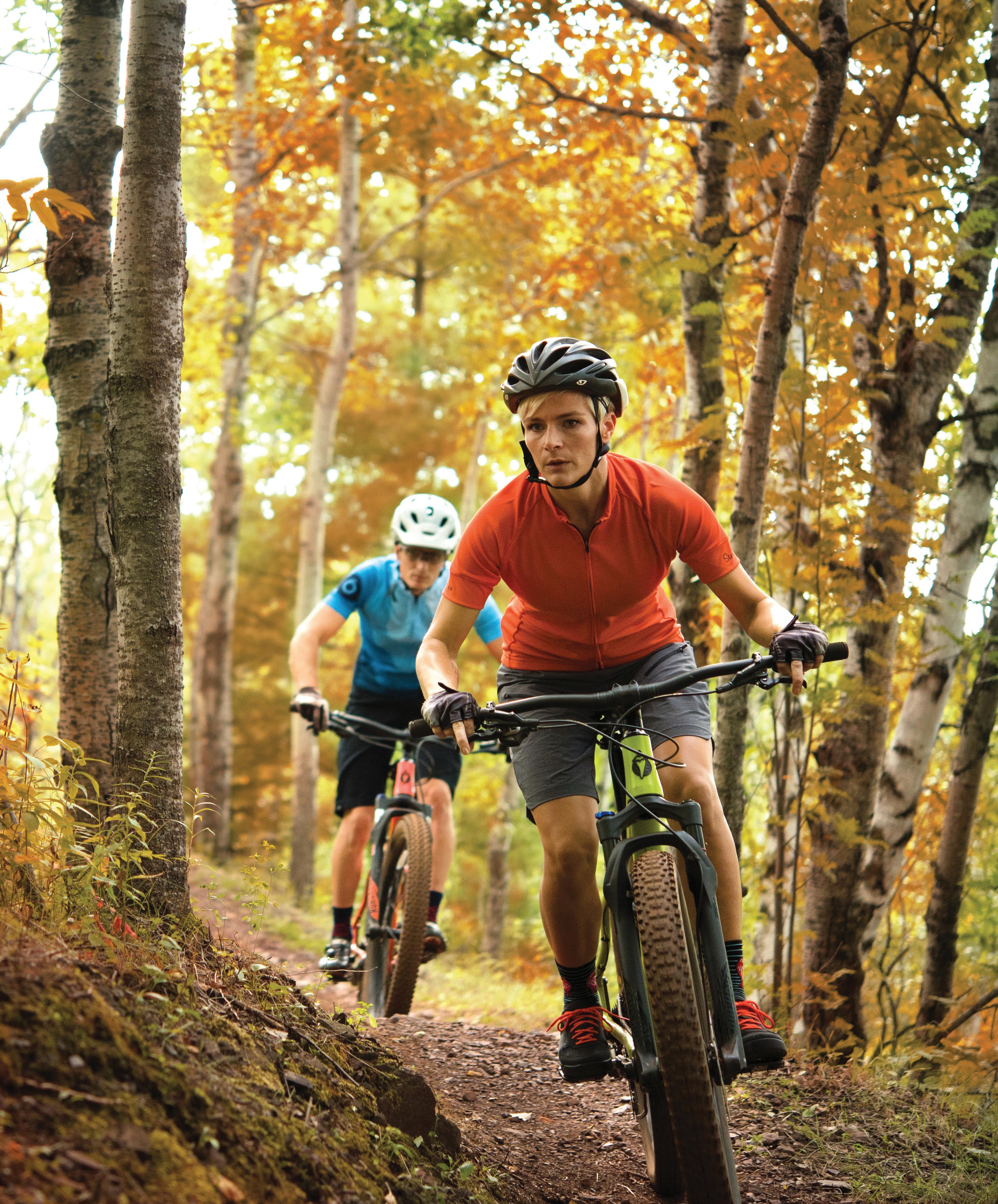
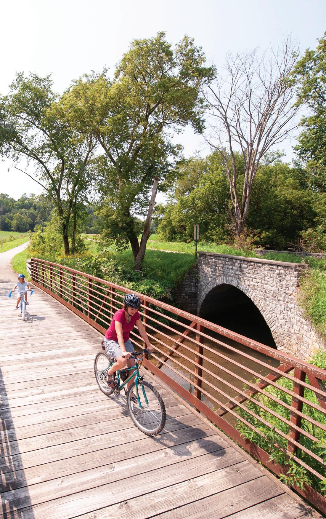
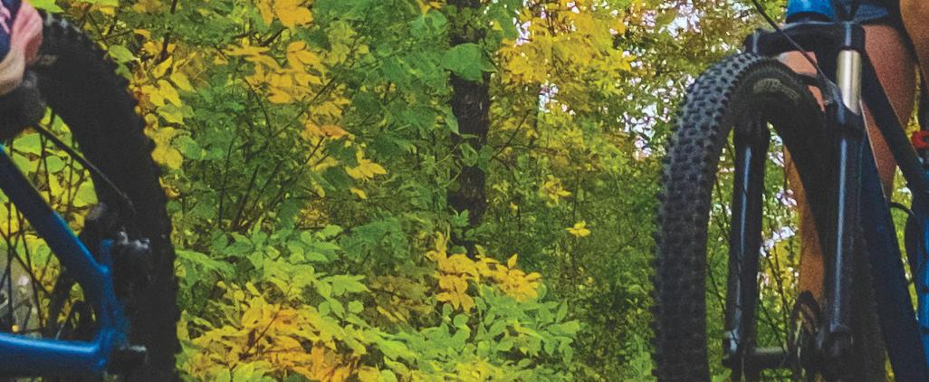
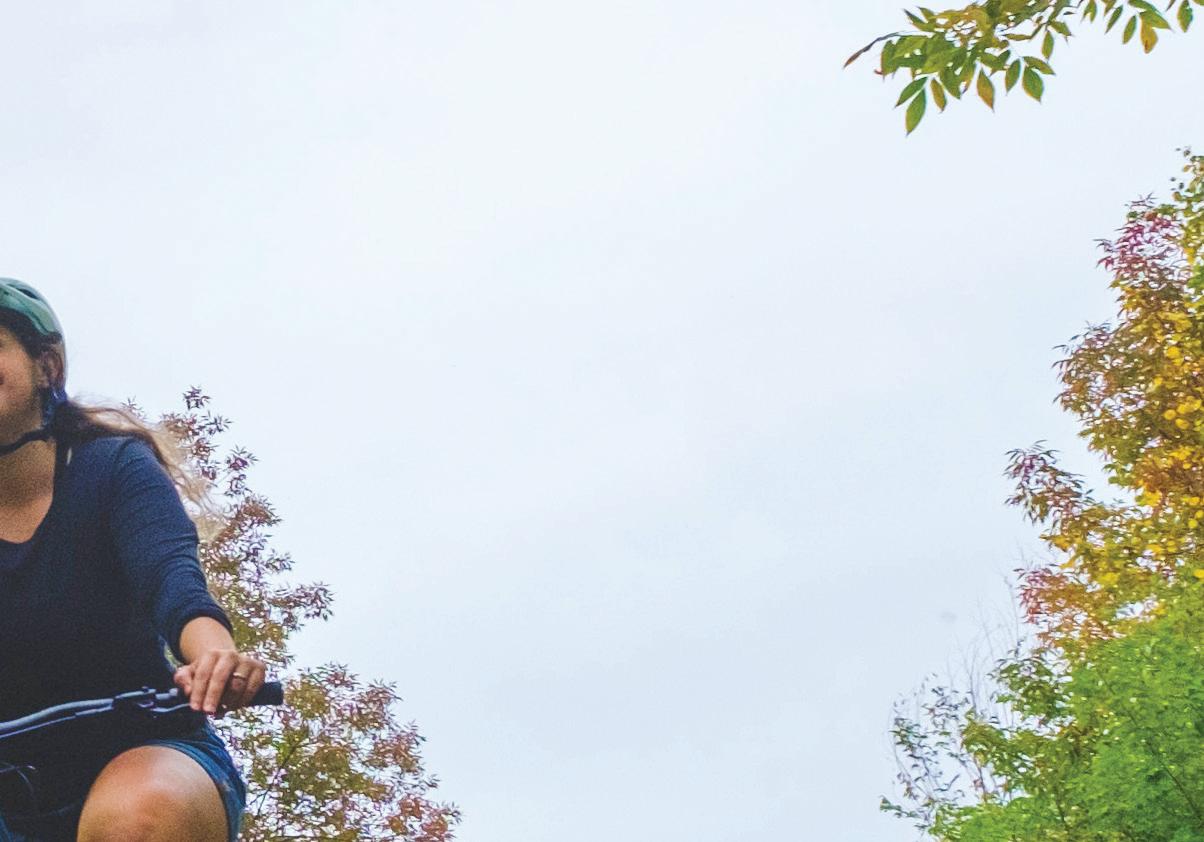
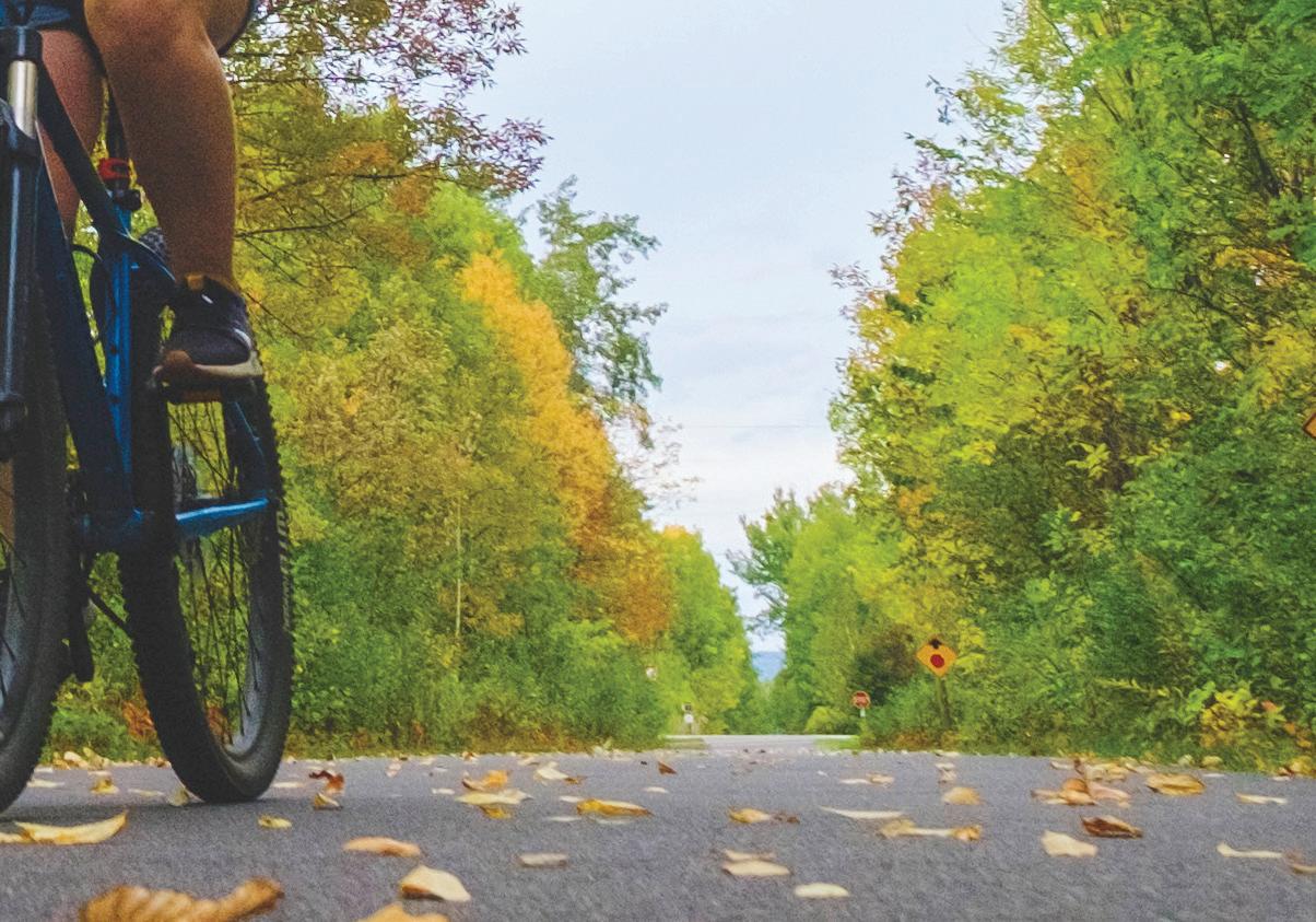
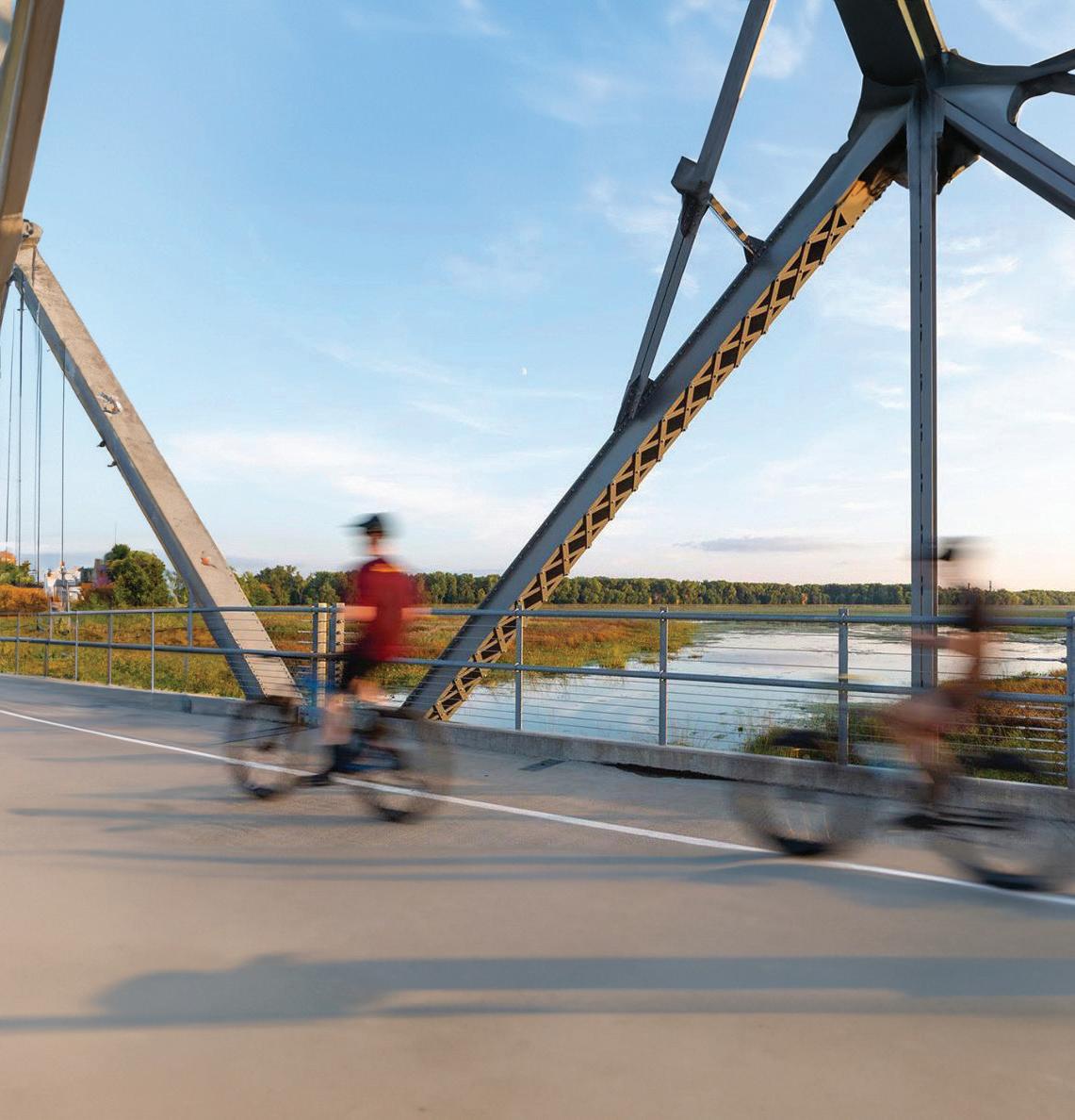
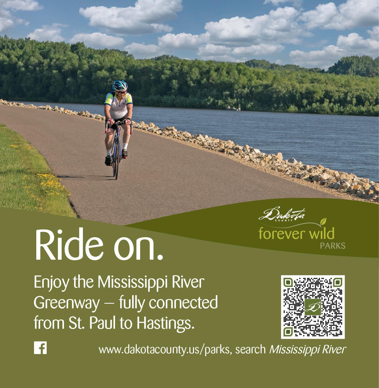
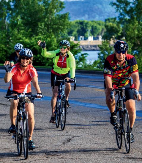
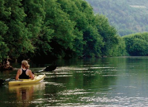
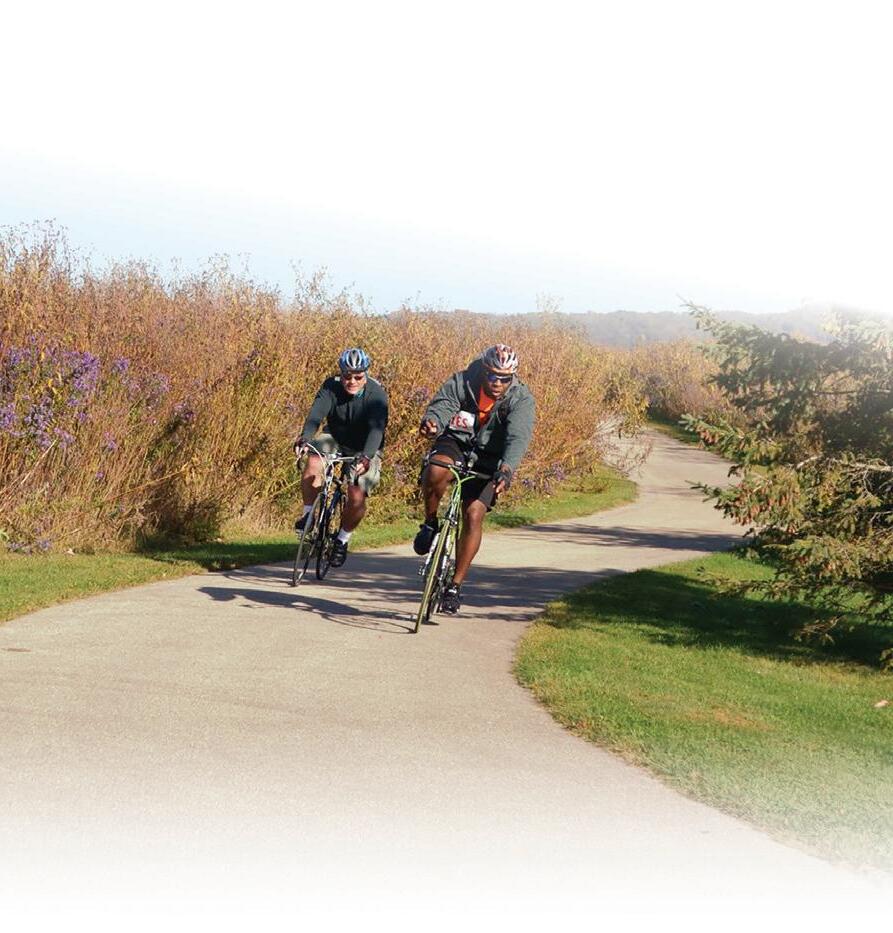
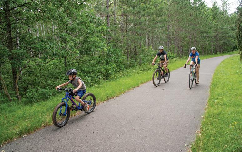
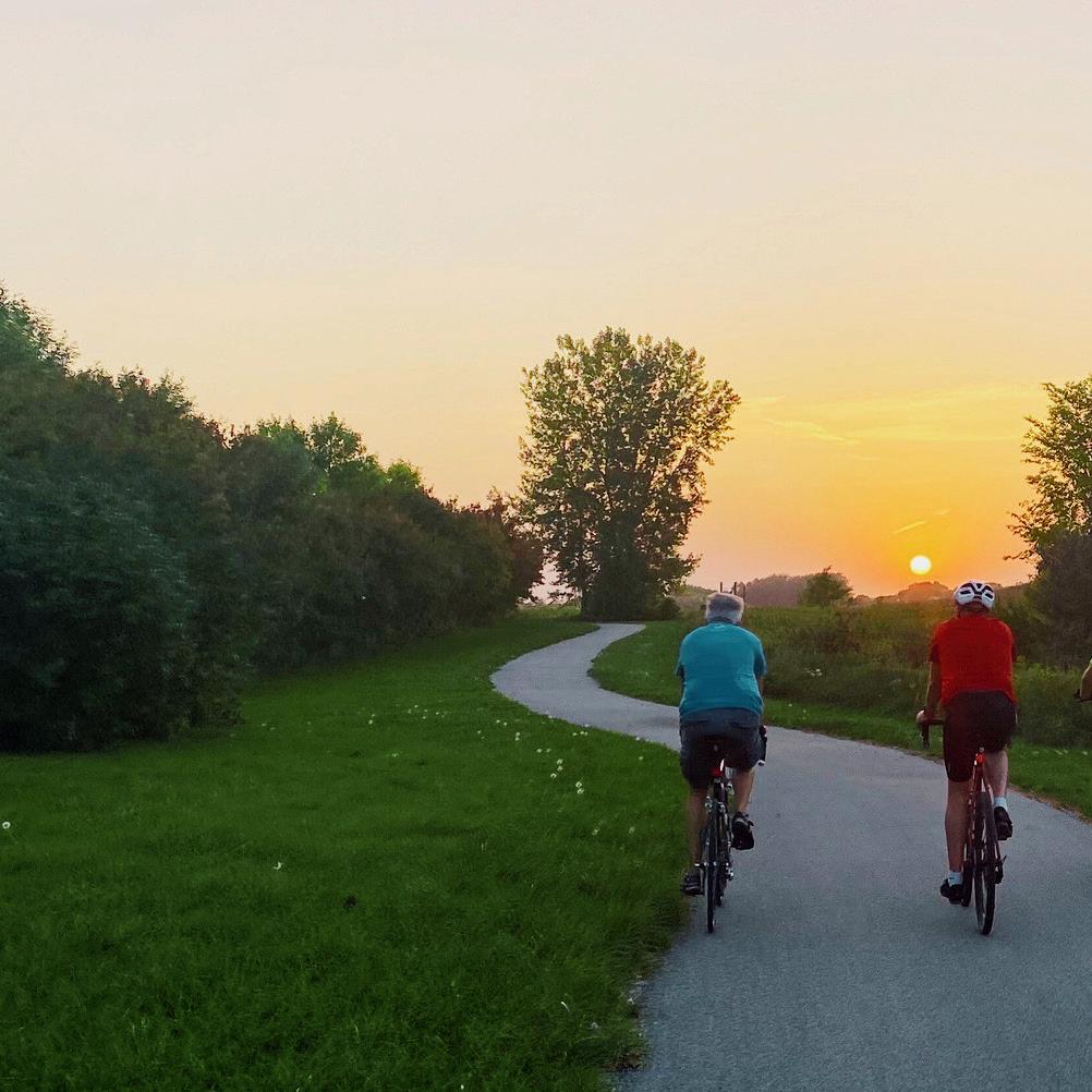
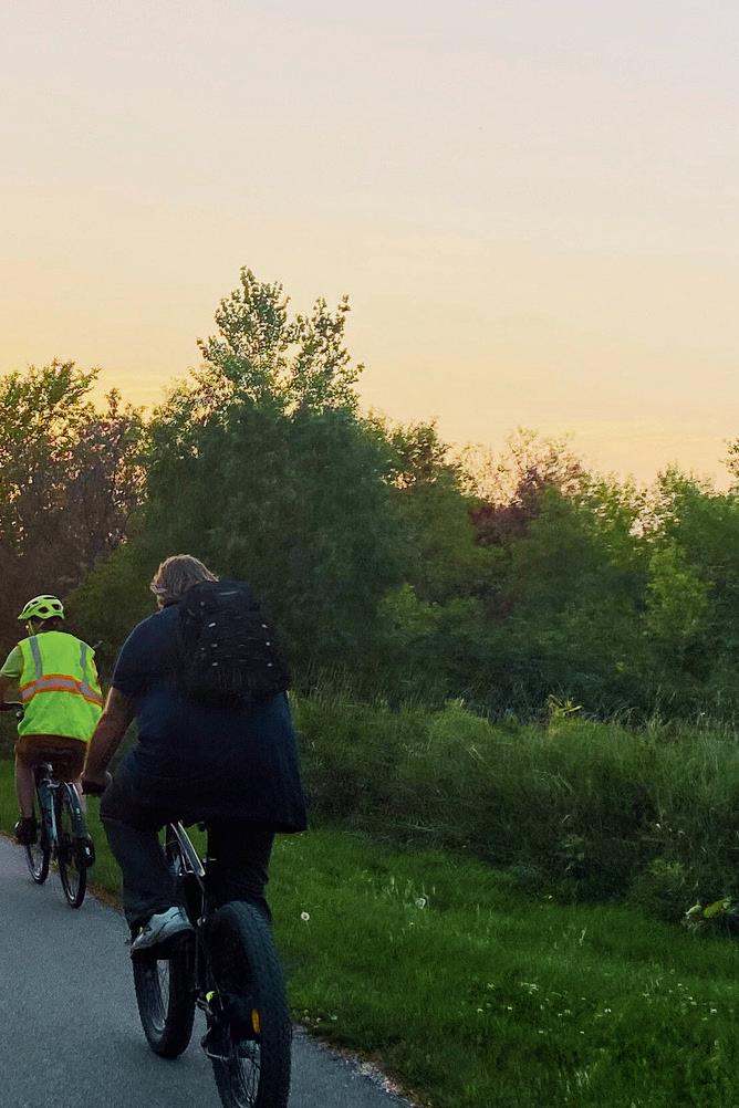
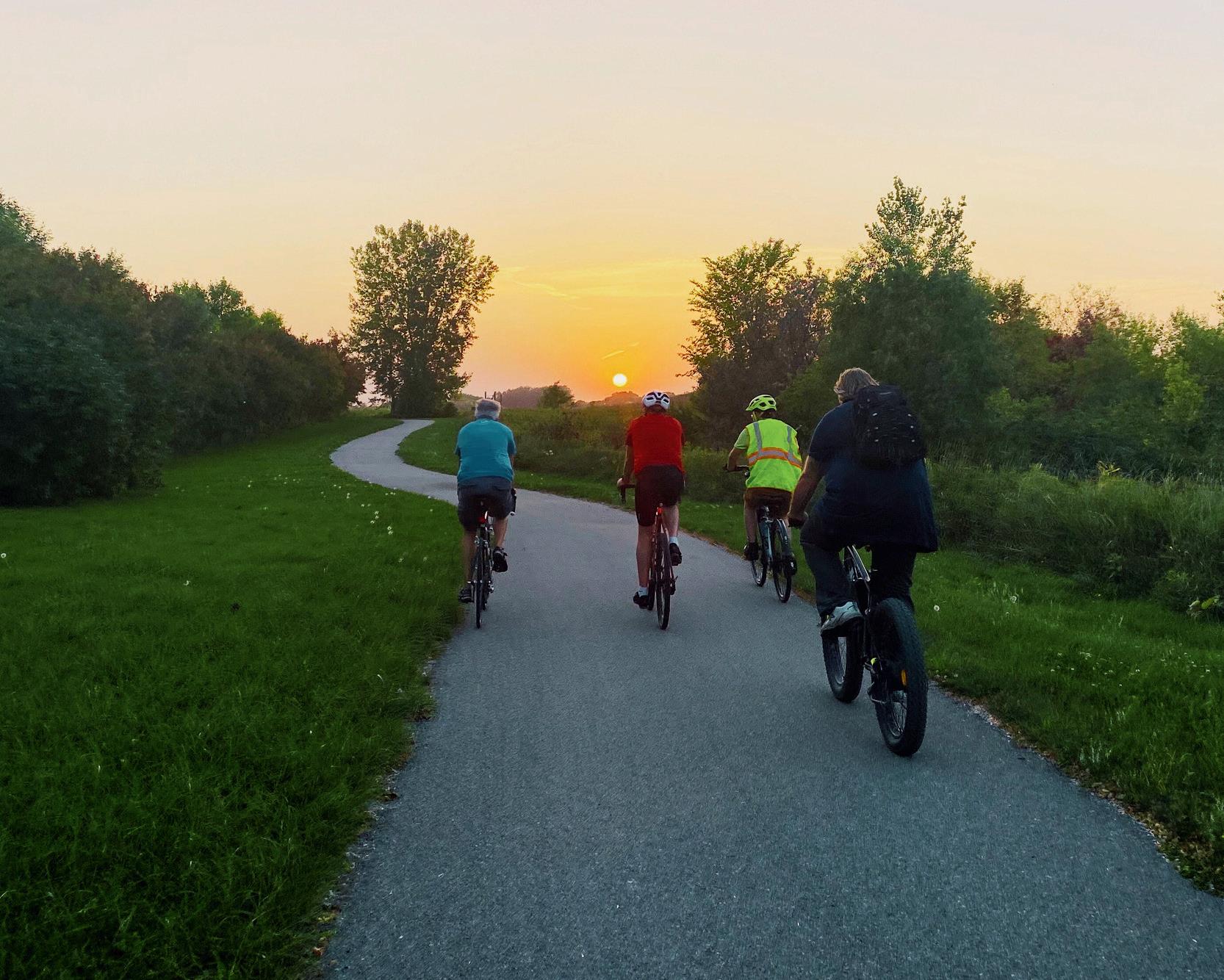
Embrace the outdoors and enjoy the beauty of Greater St. Cloud on your bicycle. Paved trails, mountain biking, E-bike rentals, and scenic cruises await!
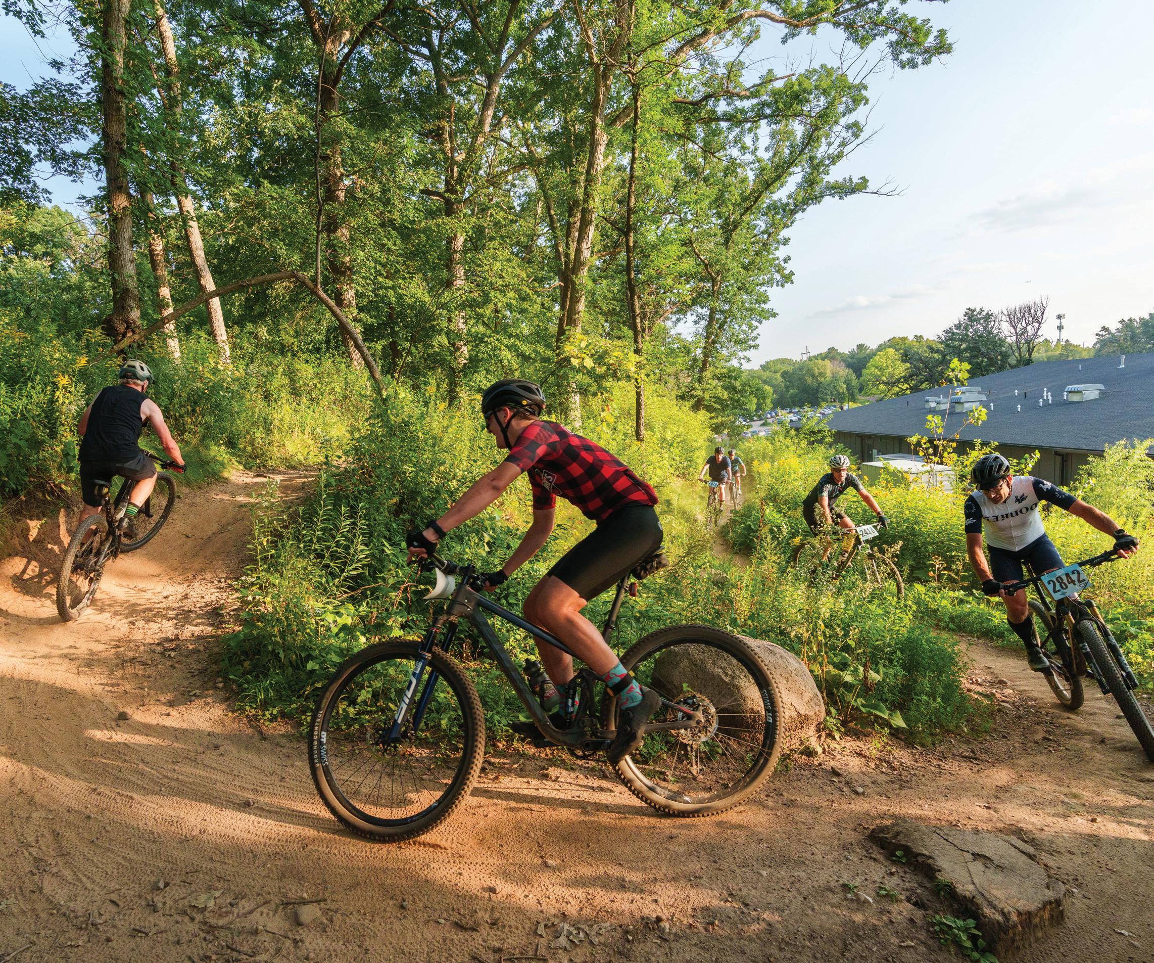
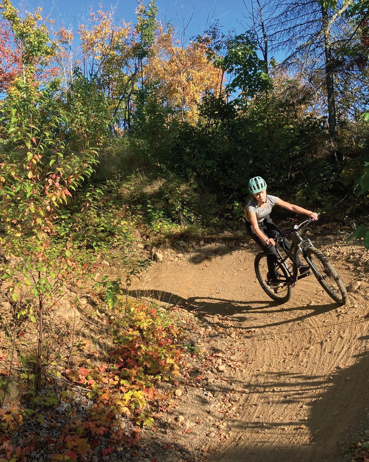
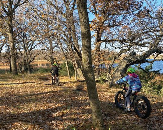
Gear up for a bumpy ride on the North Loop Jail Trail. With multiple paths to choose from for every experience level, the Jail Trail is an adventurous ride through the woods with small hills, tight corners, and lots of fun! Practice your riding skills on the small terrain park just outside the trail head!
Need some new terrain to ride? Head over to Quarry Park and Nature Preserve for a truly spectacular cruise past historic granite quarries, all while enjoying the quiet and striking natural beauty of the preserve.
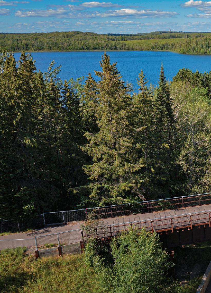
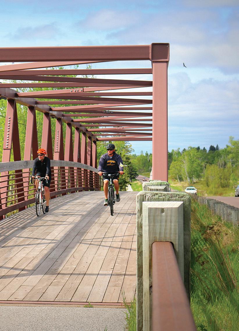
The Lake Wobegon Trail is the perfect path for a long, meandering ride through the countryside of Greater St. Cloud. Start at the trailhead at Riverside Park (where you can rent a bike if you need one!) and enjoy the paved path that cruises for over 60 miles with beautiful scenery at every turn! Looking to speed up your ride without breaking a sweat? Bring your ebike, or check out Lake Wobegon Outftters to rent an ebike for the day!
Keep it short and sweet and take in views of the mighty Mississippi River on a ride down the Beaver Island Trail! The Beaver Island Trail starts behind the River’s Edge Convention Center, cruises down past St. Cloud State University and goes for just about 5 miles.
See you out there!


24 8 12 14 18 outdoor adventure.
GEAR UP
Discover the latest in biking technology with cutting-edge gear and gadgets.
TECH MEETS TRAIL
These are the best biking apps and online communities for cyclists.
THE STATE OF CYCLING
Minnesota’s unique geography and growing biking culture are turning it into a top destination for cyclists.
THEMED RIDES
Explore unique themed bike trails, from historical routes to backwoods adventures.
With thousands of miles of paved and unpaved paths, discover detailed listings with GPS coordinates, parking info, fees, and more to plan your next


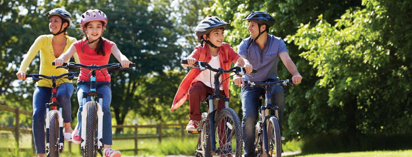
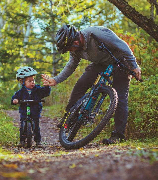
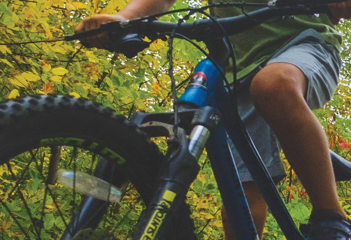
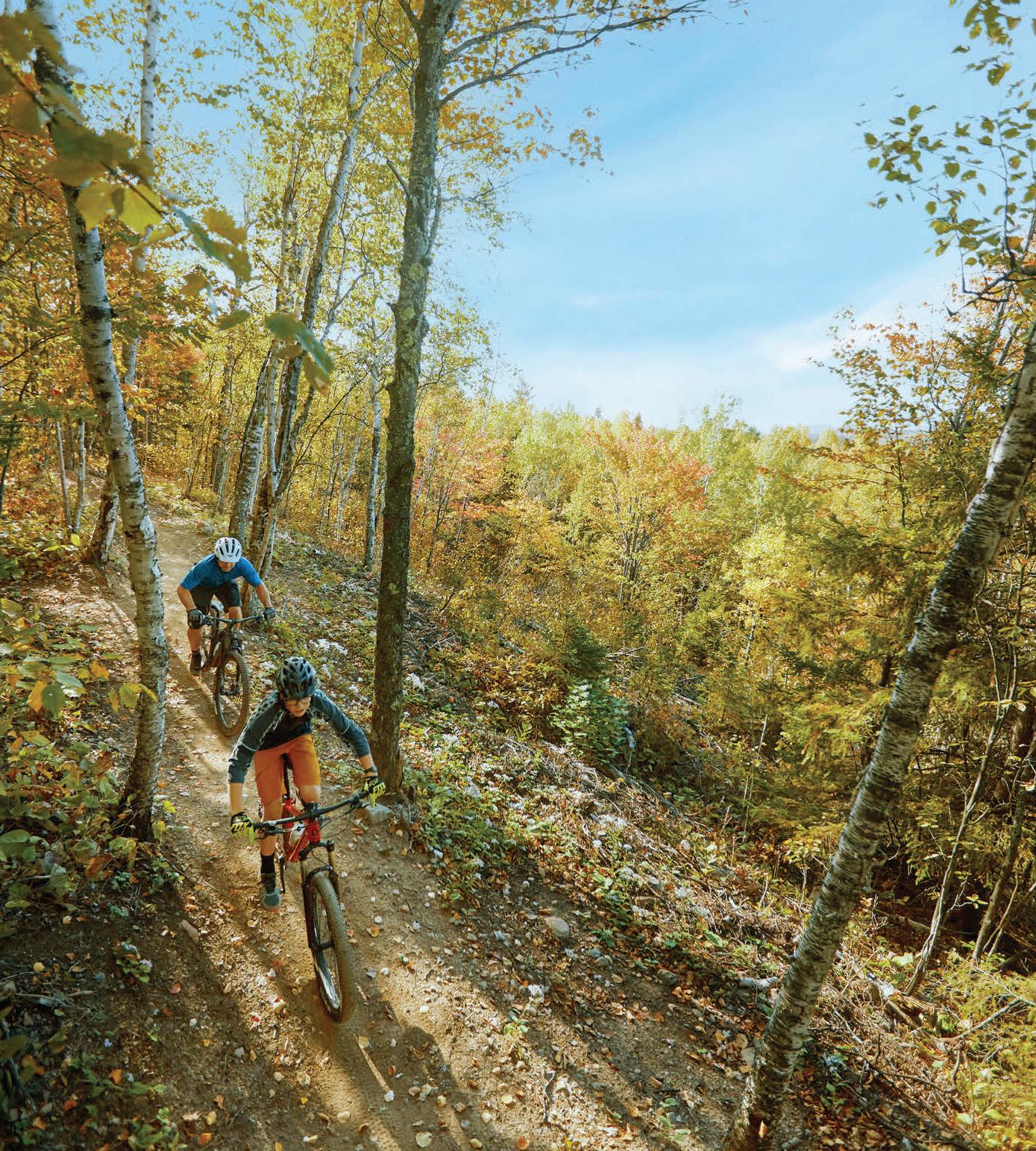
minnesota has a wealth of biking options across the state, from picturesque, paved trails to singletrack with jump lines. In fact, our trail surfaces are as diverse as our riders. Although there is always a place for the hardcore enthusiast, cycling has become, in my opinion, one of the most inclusive and accessible sports around—accommodating, well... everyone. Minnesota trail expansion has included purpose-built adaptive trails that can be found in several locations in our great state, such as Cuyuna’s Sagamore Unit and Elm Creek Park Reserve to name a few. Incredibly, these trails accommodate hand-pedaled adaptive bikes.


Cycling Without Age, a pilot
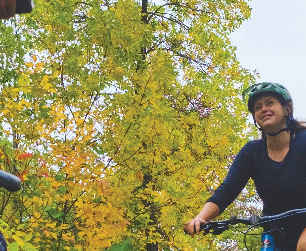
Last year, the Minneapolis Park & Recreation Board launched Cycling Without Age, a pilot program aimed at older adults with mobility issues to help them enjoy riding and “feeling the wind in their hair.” Many Minnesota trails are e-bike friendly, and the growth of e-bikes has unleashed a new wave of riders of all ages and abilities. Looking for instruction to sharpen your skills and gain confidence on your bike? Skillbuilding classes, workshops, and clinics abound for all experience levels. There are women’sspecific options, such as SheRides founded by the Superior Cycling Association, which o ers a weekend clinic in Lutsen. Stöke MTB teaches
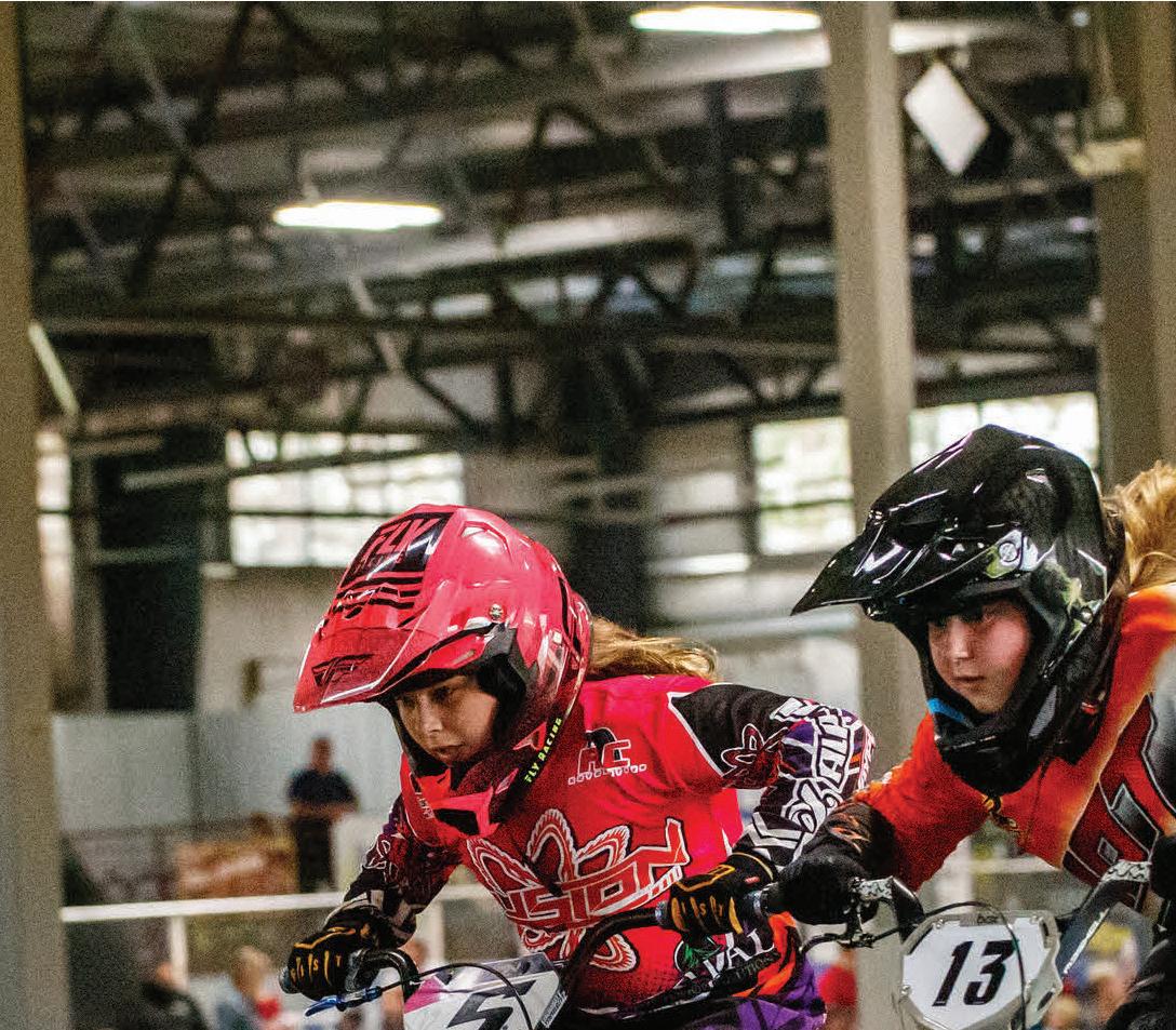
private lessons and skills clinics, including a series offered at a brewery (yes please), and Unruly Women is an organization aimed at inclusivity and accessibility. There are plenty of other options as well. Check out The Loppet Foundation for a ton of o erings, and DrtPdlrs if you want to learn how to catch some big air. Minnesota is also at the forefront of growing future riders through youth cycling opportunities. For younger riders, check out programs by Little Bellas and Loppet Trail Kids. For grades 6-12, the Minnesota Cycling Association (MCA) o ers a race series for student-athletes. Teams are co-ed with no tryouts or cuts. MCA has over 2,600 students participating, and it continues to grow every year.
If you have ever thought that cycling is not for you, I encourage you to think again. I didn’t become a serious cyclist until about 10 years ago, but through a career path that led me into the bike industry, I was fortunate to gain exposure and ultimately fall in love with bikes. My personal favorite is riding singletrack, and my Salsa Spearfish has no shortage of miles on it, in Minnesota and beyond. Even my wedding this year will be bike-centric, taking place in downtown Crosby, with plenty of riding to be had. Whether you like riding mountain, gravel, road, or bike path, I hope this guide o ers you access and information that shows biking in Minnesota is for everyone, and you definitely belong here. Keep the rubber side down!


Meghan Gess director of events + marketing
PUBLISHER Tammy Galvin
EDITORIAL
EDITOR - IN - CHIEF Alesha Taylor
MANAGING EDITOR Macy Harder
ASSOCIATE EDITOR Emma Enebak
ART
CREATIVE DIRECTOR Ted Rossiter
JUNIOR GRAPHIC DESIGNER Bryce Eckman
PRODUCTION
PRODUCTION DIRECTOR Deidra Anderson
ADVERTISING COORDINATORS Sydney Kell, Ellianna Radovich
JUINIOR ADVERTISING COORDINATOR Grace Carlson
INTEGRATED MARKETING
DIRECTOR OF EVENTS + MARKETING Meghan Gess
EVENT OPERATIONS MANAGER Rick Krueger
SPONSORSHIP, PARTNERSHIPS + EVENTS SPECIALIST Elisabeth Wulf
MARKETING + COMMUNICATIONS SPECIALIST Josh Bremseth
SALES
SALES DIRECTOR Kristin Gantman
ACCOUNT EXECUTIVE Sue Fuller
EVENT ACCOUNT EXECUTIVE Scott Rorvig
SALES + MARKETING SPECIALISTS
Madeline Braverman, Tausha Martinson
BUSINESS
DIRECTOR OF BUSINESS OPERATIONS Kathie Gorecki
ACCOUNTING ASSOCIATE Austin Schmelzle
CIRCULATION
AUDIENCE DEVELOPMENT DIRECTOR Geri Wilson
CIRCULATION MANAGER Riley Meyers
SENIOR CIRCULATION MARKETING COORDINATOR David Benvenuto
EDITORIAL & BUSINESS OFFICE
GREENSPRING MEDIA 9401 James Ave. S., Suite 152 Bloomington, MN 55431 612-371-5800 FAX 612-371-5801
HOUR MEDIA
CEO Stefan Wanczyk
PRESIDENT John Balardo
SUBSCRIPTIONS & BACK ISSUES
A subscription to Minnesota Monthly is $14.95 per year (U.S. only).
For subscriptions, call 866-660-6247. Back issues are $5.95 + shipping, prepaid. Change of address: Enclose address label, send to Hour Media LLC, 5750 New King Drive, Suite 100, Troy, MI 48098, and allow 30 days.
EDITORIAL To contact the editorial department with feedback, freelance submissions, or story suggestions, go to minnesotamonthly.com/contact.
ADVERTISING Information about advertising is available at minnesotamonthly.com/advertise or by calling 612-371-5800.

The pages between the covers of this magazine (except for any inserted material) are made from wood fiber that was procured from forests that are sustainably managed to remain healthy, productive, and biologically diverse.


BIKE BELLS, THESE MUST-

HAVE CYCLING ACCESSORIES WILL ENHANCE YOUR RIDING EXPERIENCE, ENSURING YOU’RE PREPARED FOR ALL TWOWHEEL ADVENTURES
by ALESHA TAYLOR


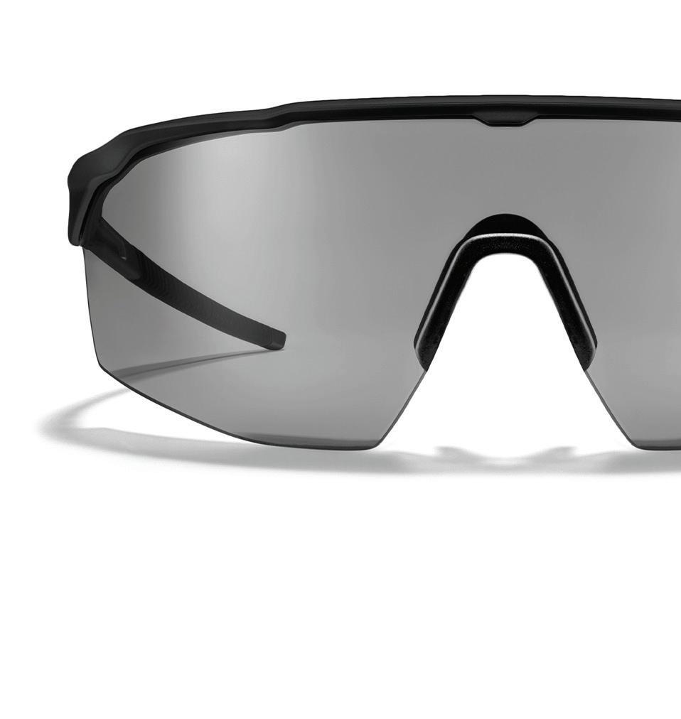
The SR-1x features a neutral clear-to-grey lens that adapts to changing light conditions, ensuring comfort for road cyclists and athletes. With adjustable titanium core wires and Patented GEKO technology, it o ers a secure fit and enhanced optics for racing and training. $230, roka.com

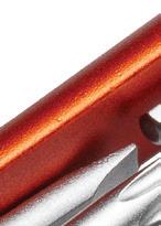
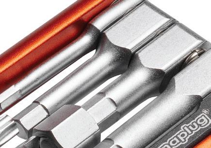
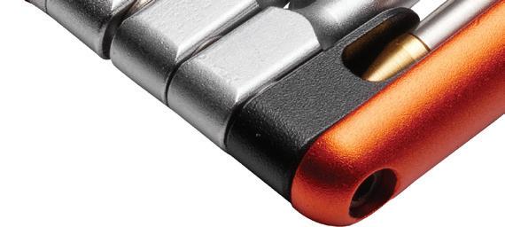
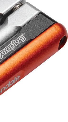
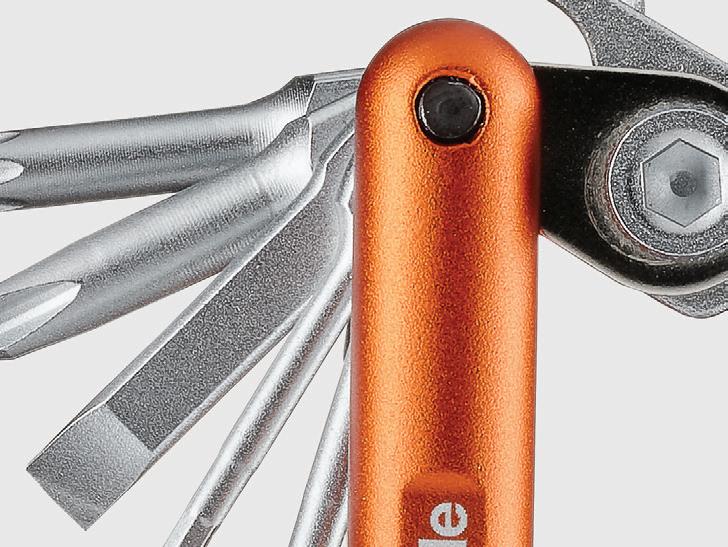
18-IN-1 WITH DYNAPLUG MULTI-TOOL
The 18-in-1 Dynaplug Multi-tool is your essential cycling companion, featuring a double-ended Dynaplug for quick flat repairs, a chain-breaker that also serves as a brake pad spreader and bottle opener, and three spoke wrenches. It includes hex keys (2-8mm), Torx T25, Phillips #2 and flat #5 screwdrivers, a valve core tool, and chain master link storage for on-the-go repairs. $80, cannondale.com


The Fix Manufacturing Eflator Digital Tire Pump replaces your floor pump, inflating up to nine MTB tires or eight road tires per charge. It features automatic shuto , universal valve compatibility, preset targets, and a built-in flashlight—perfect for e ortless inflation anytime, anywhere. $99.99, rei.com


Chamois Butt’r Original is a nongreasy skin lubricant crafted by cyclists for ultimate comfort. It soothes and softens skin, e ectively preventing chafing during long rides. Easy to apply directly to skin or your chamois pad, it rinses out easily and won’t damage technical clothing, ensuring a worry-free experience. $19.99 (8-ounce tube), chamoisbuttr.com


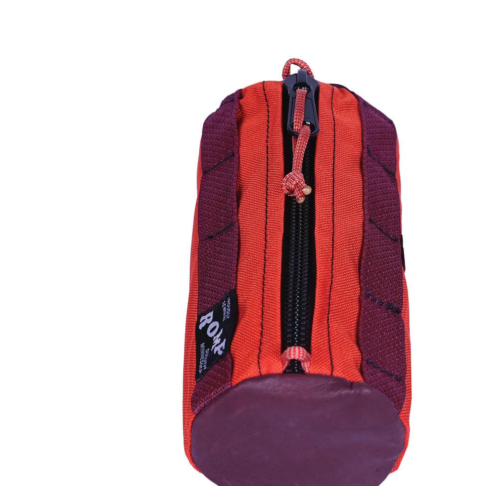


The Burrito Bag is perfect for your adventures, securely attaching to your handlebar and stem with included bungee straps. Its dual daisy chains o er stylish attachment points. Proudly sewn in Duluth, Minnesota, and made from durable nylon and upcycled upholstery leather. $45, rompbags.com
Enhance your ride with BellBeats, a handlebar-mounted bike bell and Bluetooth speaker. Stream music, podcasts, or navigation with clear sound from its Harman speaker, and choose from eight bell tones for e ective communication. Enjoy six hours of playtime, ergonomic controls, and a digital battery gauge. With IP67 water resistance and easy installation, it’s perfect for cycling. $99.99, trekbikes.com


Along the banks of the wild and scenic St. Croix River, sits a historic town waiting to deliver your next Wisconsin weekend. Looking for your next bike adventure? Discover it in Hudson. Scan the QR code for bike trail options in the local area.


Ride With GPS
Offers route planning and exploration worldwide. Create, share, and navigate custom routes on iPhone or Android. Monthly fees may apply.

Strava
Tracks rides, sets goals, and keeps you motivated. Record activities, join challenges, and access safety features for free. Upgrade for custom goals, nearby routes, and leaderboards.

Trailbot
Provides real-time trail conditions for mountain bikers, tracking 236-plus MTB systems in the U.S. and Canada. Free on iPhone and Android.
Trailforks
Provides interactive maps for biking, hiking, and more, with trail conditions, GPS tracking, and route planning. Access basic features for free or upgrade to Pro for full access.

Gives access to 40,000-plus miles of trails, offline maps, and a community of outdoor enthusiasts. Save and track your favorite trails, with the first map free.
by ALESHA TAYLOR
technology has made it easier than ever for cyclists to track rides, discover new trails, and connect with other enthusiasts. Whether you’re an avid mountain biker, road cyclist, or simply looking to explore new routes, there are a variety of apps and online communities designed to enhance your biking experience. Here are some of the top biking apps and online communities to check out.
Biking Minnesota is an engaging Facebook group with 23,000-plus members, where cyclists share routes, advice, events, and stay connected on biking news in the state. facebook.com/groups/906660477785179
BORCA is a volunteer-led nonprofit that advocates for and maintains sustainable, nonmotorized trails and bike parks, promoting inclusivity and environmental responsibility. New members and ideas are always welcome. borca.org
The Twin Cities Bicycle Trading Post and Twin Cities Bicycle WTFNB (women/ trans/femme/nonbinary) Trading Post are popular Facebook groups for buying and selling bikes, parts, and accessories, helping cyclists upgrade or sell gear.
This Facebook group shares real-time updates, tips, and photos about the Minnesota River Bo oms trail network, covering the Minnesota Valley National Wildlife Refuge, Fort Snelling State Park, and nearby areas. facebook.com/groups/ MNRiverBo omsRideReport
MCA is a youth development organization that uses cycling to build strong minds, bodies, and character. Open to students in grades 6-12, MCA offers programs like advocacy, a er-school activities, and a racing series, promoting inclusivity and equality for over 2,600 student-athletes. minnesotacycling.org
MORC is a nonprofit group enhancing mountain biking in the Twin Cities area. With over 100 volunteers, they maintain 17 trails across seven counties, focusing on trail building, maintenance, advocacy, and education to promote responsible riding year-round. morcmtb.org
PeopleForBikes is a national community working to make the U.S. the best place to ride. With 325-plus supplier members and 1.4 million supporters, they focus on making biking safer, more accessible, and enjoyable for all. peopleforbikes.org
As of January 2025, The League of American Bicyclists ranked Minnesota the No. 2 state with the most bicycle-friendly communities!


by KATHERINE LAWLESS
Minnesota is quickly pedaling its way onto the national and international radar as a top biking destination, thanks to its unique geography, innovation in education and infrastructure, and a growing cycling culture.
Minneapolis has long been known for its excellent public parks and bike trails, and last year, the city earned a spot on PeopleForBikes’ list of “Best Large U.S. Cities for Biking,” alongside Portland, Oregon, and San Francisco, California. At the heart of the city’s bike-friendly reputation is the Grand Rounds Scenic Byway, a 51-mile loop of off-street trails that has connected neighborhoods and parks for over a century. This historic route now links seamlessly with other trails like the Midtown Greenway, Cedar Lake Trail, and Theodore Wirth Regional Park, creating a recreational cyclist’s dream network.
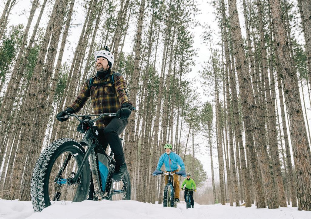
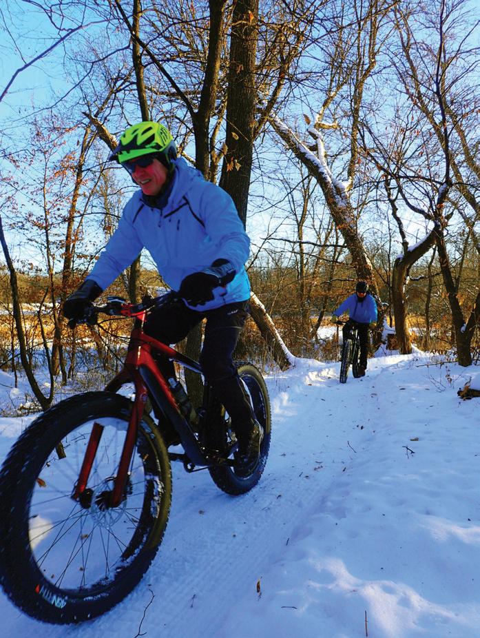
“There’s diversity of biking opportunities in both the metro and rural areas. When it comes to what and how you can ride, I think we’re seeing a bit of a renaissance in the cycling sector,” says Randolph Briley, executive director of outdoor recreation for Explore Minnesota. “Some of the biggest areas of growth in cycling these days are fat bikes, gravel cycling, and e-bikes… and Minnesota is uniquely able to support those types of riding.”


Minnesota’s bike retailers have seen a significant increase in e-bike sales over the last year, thanks in part to the accessibility of the bikes, their year-round usability, and a new statewide rebate program. Last year and this year, state lawmakers set aside millions of dollars to offset up to 75% of the costs of e-bike purchases, aiming to make the purchase of sustainable transportation easier for the average Minnesotan. The 2024 program successfully generated significant interest in e-bikes, as evidenced by the initial application website crashing in June due to high demand. Since then, almost 72% of rebates have been redeemed and Minnesotans are ready to cruise on their new e-bikes.


■ As You Go MPLS


“In the past, many biking events were organized around competition, which narrows the scope of participants. And while competition is great, now we’re also seeing a lot more biking events organized around community,” says Briley. Here are a few Twin Cities community ride groups that welcome bikers of a range of ages and skill levels:
Organized by Minneapolis Public Works, this group encourages Twin Citians to bike or walk newly opened bike lanes and trails with regular community rides. It’s a great way to explore your home, meet neighbors, and get active. Visit minneapolismn.gov for more details.
■ Joyful Riders Club
This monthly ride club is known for its laidback approach to biking, seasonal celebrations, and DJ rides. Come ride, dance, and sing along. Follow the group on Facebook for up-to-date information and schedules.
■ The Loppet Ride Club
This year-round riding club is for mountain bikers of all skill levels. Each Saturday morning, the group takes off from Theodore Wirth Regional Park to bike around the city’s public trails. Register and download the Team App for more details.
With over 4,000 miles of paved biking trails and countless more miles of rugged paths, Minnesotans have plenty of space to get out and ride, no matter their bike of choice. Now, as new forms of biking grow in popularity, the state is committing to making sure the next generation of Minnesota bikers are ready to safely enjoy their state’s outdoor recreation opportunities. A law passed in 2023 requires Minnesota schools to teach bike and pedestrian safety to students from kindergarten through eighth grade, with lessons and videos provided by BikeMN already rolling out. And as the state cultivates an interest in biking among its youth, Minnesota’s biking community is garnering attention on a national and international scale.
Gravel cycling is booming, and Minnesota is quickly becoming a hot spot for this growing sport. At the end of 2023, exercise app Strava reported a 55% annual increase in the number of users who recorded a gravel bike ride. Uniquely positioned to attract cycling enthusiasts to small towns, gravel cycling has the potential for a huge economic impact on communities with undeveloped, unpaved roads—and it seems that the momentum is carrying into this year.
“Gravel cycling is growing really fast, probably the fastest as far as the competition space,” says Briley. “It’s kind of a hybrid between mountain biking and road biking. The tires are a little


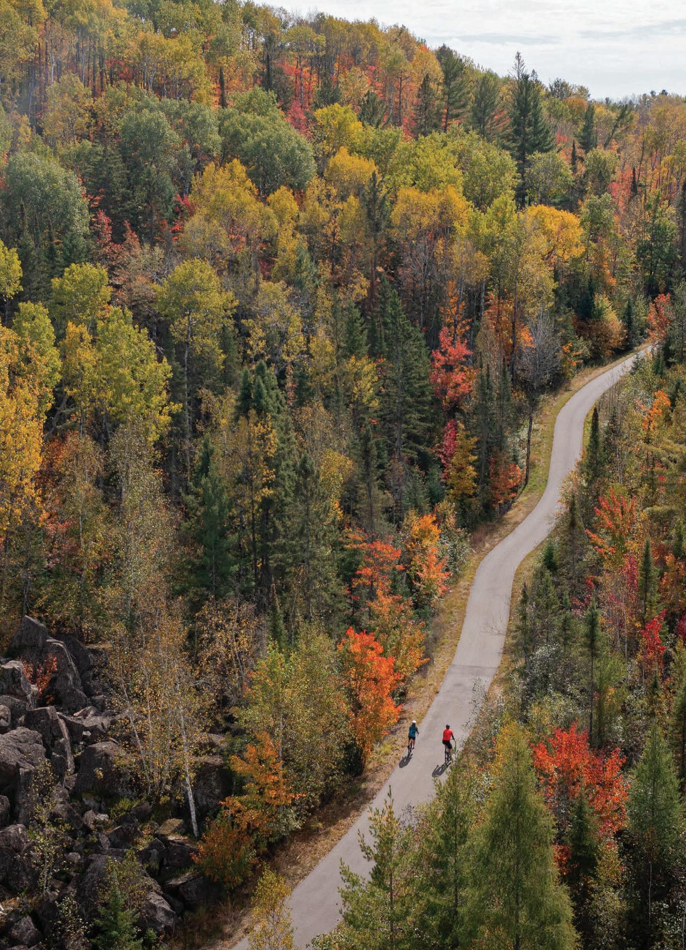
trails that wind up the North Shore along Lake Superior.


bit fatter, but you do it on dirt roads or gravel roads, and Minnesota has plenty of those.” In fact, southeastern Minnesota’s extensive network of gravel roads has drawn national attention, with La Crescent set to host USA Cycling’s Gravel National Championships in September. This prestigious event will welcome the country’s top gravel cyclists to the Driftless Region, a rolling, scenic area in southeastern Minnesota known for its challenging and picturesque routes. “If you’re a gravel cyclist in the Upper Midwest or anywhere else and you want to ride some really good gravel, you come to Minnesota, particularly the southeast and the Driftless Region,” Briley adds.
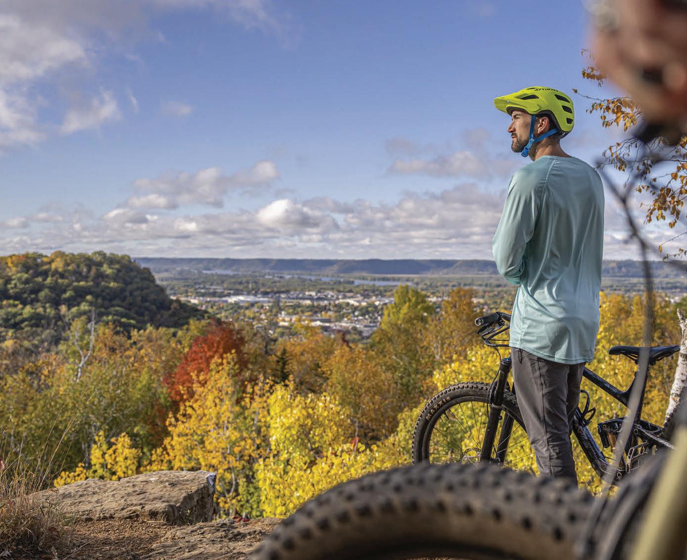
Nearby, Winona is also known for its biking recreation opportunities. Cyclists come from across the state and the Midwest to bike along the 5-mile Lake Park Trail, which winds around Lake Winona and up to the area’s famous Sugar Loaf Blu . In the fall, Winona’s popular Ride the Ridges event guides riders across a selection of scenic routes, ranging from a leisurely 23-mile cruise to a challenging 104-mile trek, making it perfect for riders of all levels. The route, organized by the Winona Rotary Club, winds through the rolling hills and quiet backroads of the Mississippi River Valley, and is an excellent option for leisure bikers who want to enjoy the Driftless Region’s scenery.
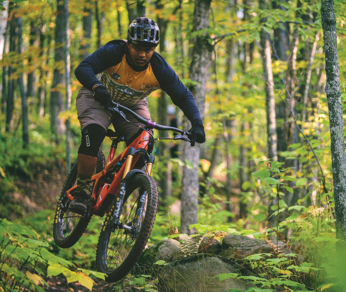
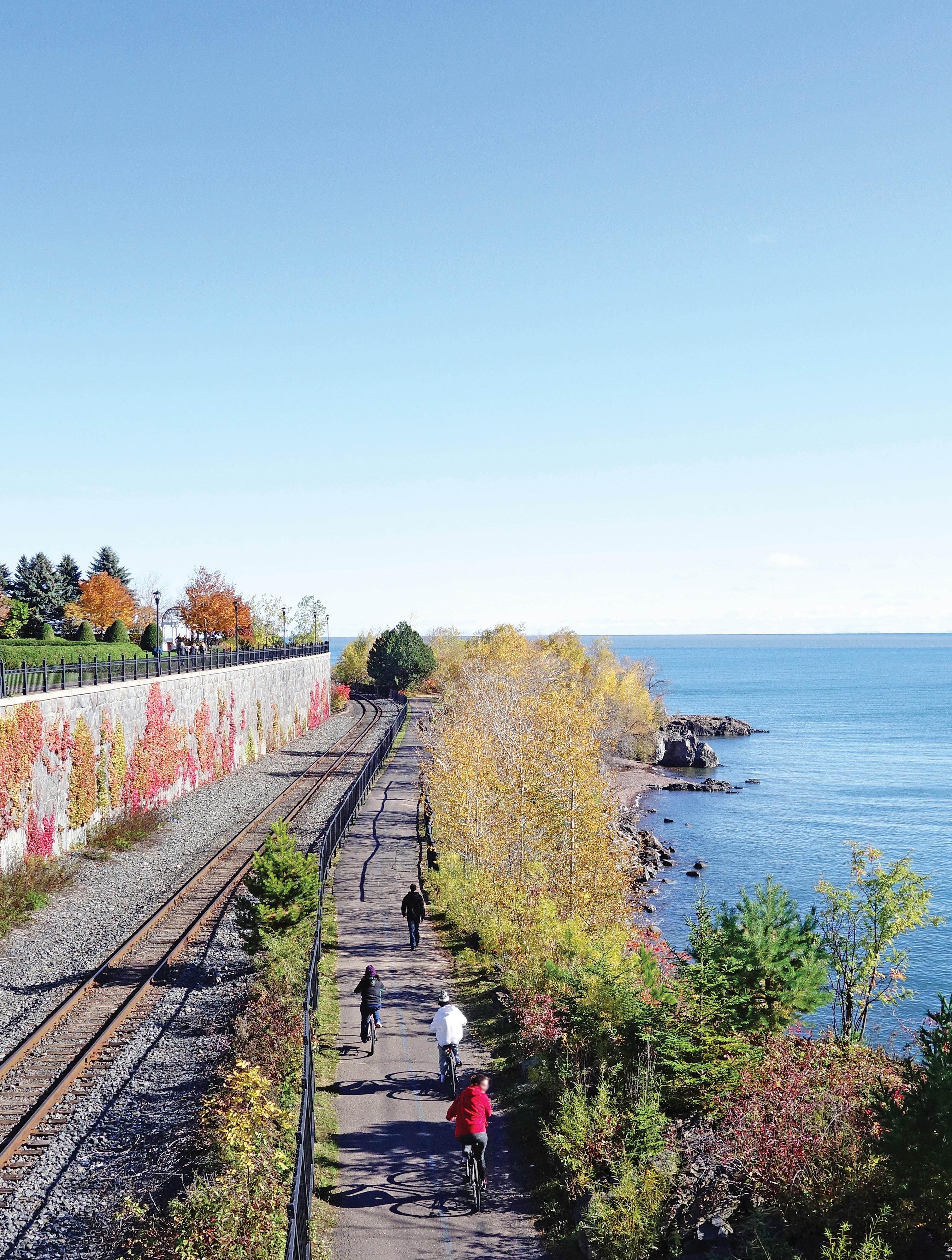
Duluth has firmly established itself as one of the nation’s (and the world’s!) top mountain biking destinations, earning a GoldLevel Ride Center designation from the International Mountain Bicycling Association (IMBA). This prestigious status, shared with only a handful of destinations worldwide—including cities in Utah, New Zealand, and Oregon—solidifies Duluth as a must-visit for bikers seeking top-tier trails. Some of this is owed to Spirit Mountain’s lift-access downhill trails, which o er everything from beginner-friendly flow to rugged expert runs, but Duluth is also an excellent access point for the many bike
Additionally, Duluth is playing a key role in shaping the future of mountain biking. This fall, the city will host IMBA’s Foundations trail workshop, designed to equip attendees with the skills to create model trail communities. Participants will learn from IMBA staff, industry experts, and local stakeholders about planning, design, and promotion while touring Duluth’s intentional and diverse trail systems. The North Shore’s harsh winters, ample rivers and waterfalls, and lake-battered shores require trails and bridges to be constantly maintained against the elements. As Duluth locals prepare to usher in a new era of trail- and community-building, their commitment to existing trail sustainability is exemplified by projects like the Pincushion Trails rehabilitation, which reduces erosion and bolsters infrastructure atop a ridge overlooking Lake Superior near Grand Marais.
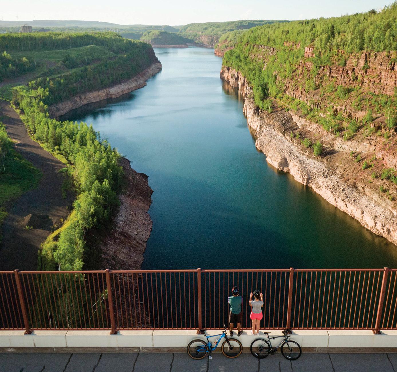
Up on Minnesota’s Iron Range, Cuyuna is a top destination for serious mountain bikers and recreational riders alike, o ering incredible trails and scenery around the abandoned mine pits that made this region famous. Spanning nearly 800 acres across the Cuyuna Country State Recreation Area, the 50-mile trail system has earned a Silver-Level Ride Center ranking from the IMBA. Bikers can enjoy rides past the clear waters of Yawkey Mine Lake or the sweeping views from Miner’s Mountain Overlook, accessible from the Miner’s Mountain Rally Center.
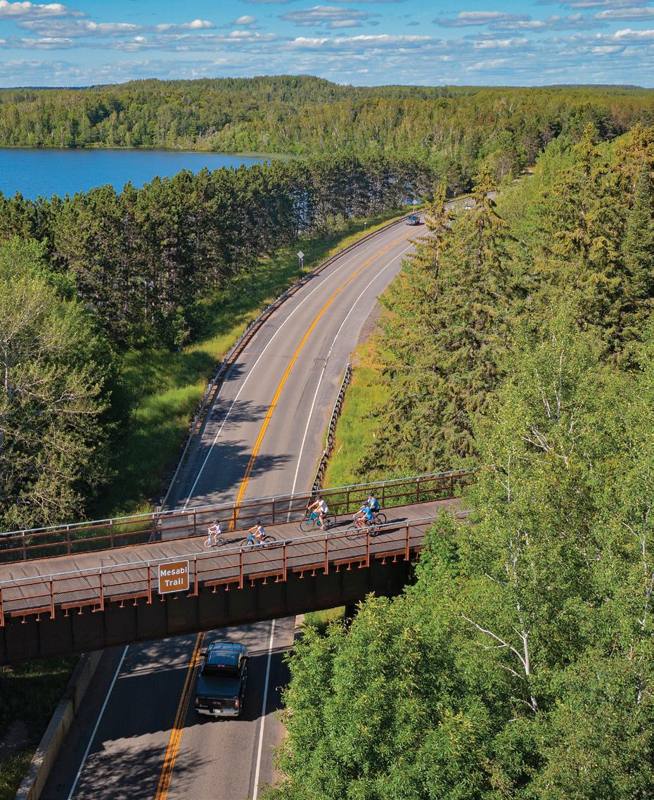
North of Cuyuna, the famed Mesabi Trail stretches through the Chippewa National Forest from Grand Rapids to Ely and recently added nearly 10 more miles of trail on the north end of the route. But this is only the beginning of the trail addition, as Ely’s mountain biking community plans to eventually connect to the Mesabi, Prospector, and Trezona trails. Many now regard Ely as the gateway to the Boundary Waters Canoe Area Wilderness, but there are plans to attract the attention of the IMBA, which has already recognized the Twin Cities, Duluth, and Cuyuna as globally significant bike destinations.


ENHANCE YOUR NEXT RIDE BY EXPLORING ONE OF MINNESOTA’S MANY THEMED TRAILS, WHICH WILL IMMERSE YOU IN WONDERS OF HISTORY, SCENERY, AND OUTDOOR RECREATION
by CHRIS PASCONE

Modern society loves creating alternative realities around shared themes. Take ugly sweater contests, “The Great Gatsby” parties, or masquerades for example—concepts that center around fun and fantasy. Biking has these features, too—allowing riders to escape mundane reality by embracing
two-wheeled freedom and imagination. Minnesota’s 4,000-plus miles of paved bike trails are great places to get yourself far from the ordinary. Mix in some singletrack mountain biking trails and gravel paths for good measure. Whichever you prefer, use our curated guide to explore themed rides across the state that fit your lifestyle and interests.
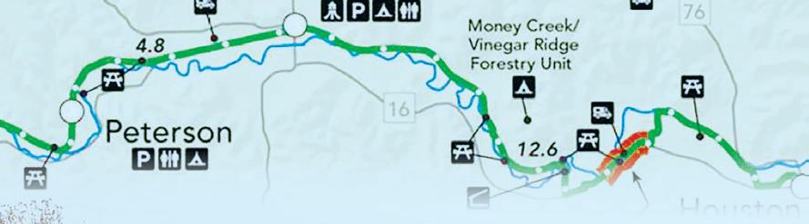
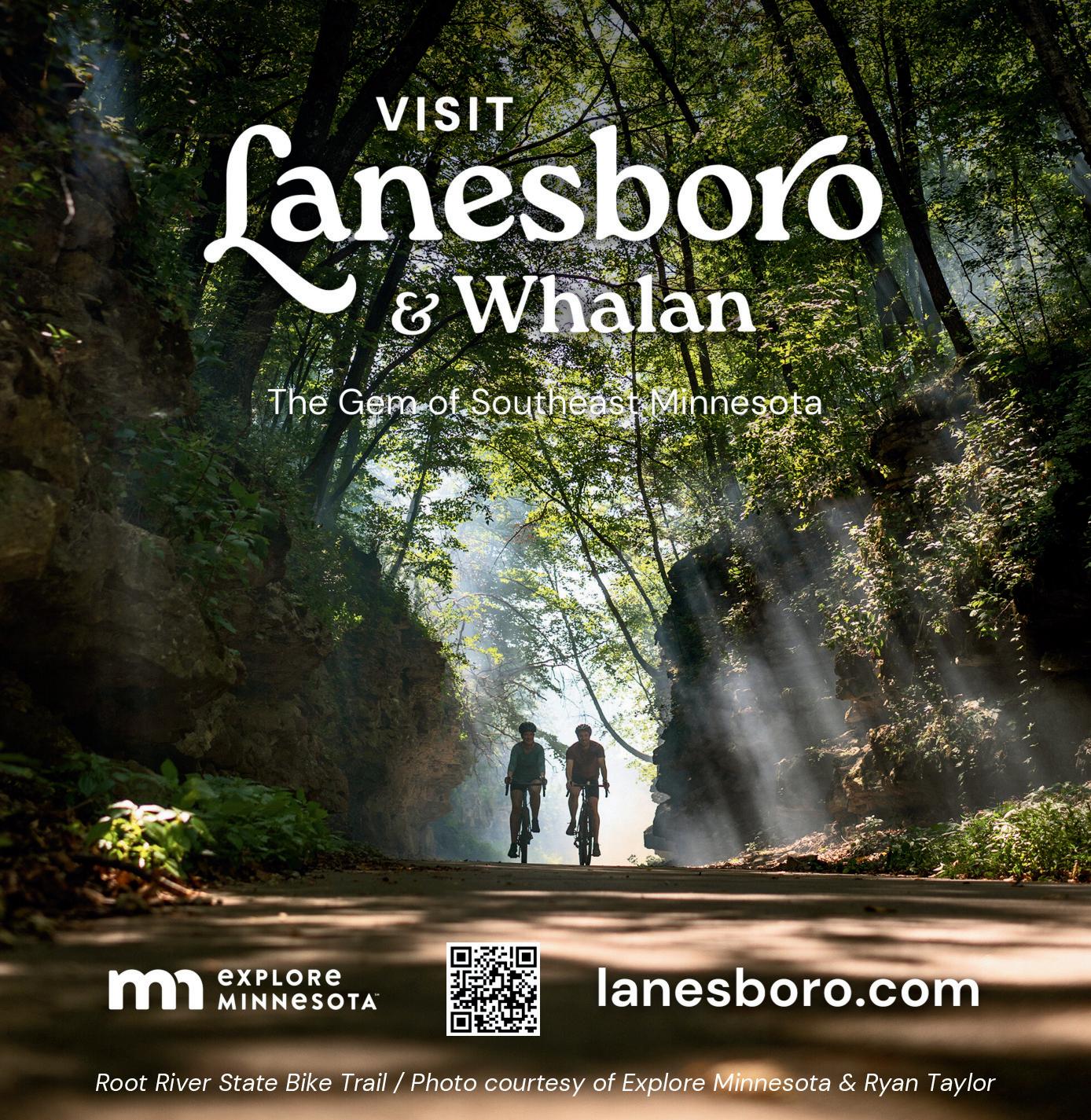
The paved Root River State Trail in southeastern Minnesota’s Bluff Country runs 42 miles from the town of Fountain east to the quaint hamlet of Houston (once a steamboat port and railroad hub). The Root River Valley & Southern Minnesota Railroad (RRV&SM) was chartered on March 2, 1855, and the towns that popped up along the railway are full of historical landmarks and buildings that transport you back in time on today’s bike trail.
To park in Fountain, turn from Highway 52 onto County Road 8, and proceed 1 mile to the parking lot near the city park. To park in Houston, turn west on Plum Street off Highway 76 and go one block to the Nature Center.
The trail follows the Root River, which unites four other rural communities on its way—Lanesboro, Whalan, Peterson, and Rushford. These towns offer welcoming amenities, including bed-and-breakfasts, campgrounds, restaurants, and shops. Just beware of abundant ice cream stops: Some also call this route the “ice cream to ice cream” trail.
Lanesboro is full of historic buildings like Old Village Hall and Hotel Lanesboro. Browse through the History Museum, and if you’re riding through town in the fall, view the History Alive! Lanesboro theatrical performances. Take a break at Pedal Pushers Cafe on Parkway Avenue for bicyclist-friendly dining and spirits.

Further down the trail, stop in Peterson to check out the 1877 Peterson Station Museum, with historical memorabilia, photographs, and artifacts of a different age.


How many cities have a mountain bike trail crossing them from one end to the other? Duluth does. The sprawling “Zenith City” has its own 41-mile mountain bike traverse trail, generally considered to be a moderately challenging ride. If you start at 6 a.m. on a summer morning, you can finish riding the entire Duluth Traverse (DT) by sunset. There’s even a Race Across Duluth, or RAD, held in September each year.
Duluth is rugged, and its Traverse is, too. The Cyclists of Gitchee Gumee Shores (or COGGS—Duluth’s bike advocacy group) call the DT a “mostly flow trail with a few unavoidable rocky sections.”
You’re never more than half a mile from any neighborhood on this ride, with cafes, bars, and other goods readily accessible. Enjoy exploring Duluth’s micro-neighborhoods one a er another. You can park and start at Chambers Grove Park—ride north on the St. Louis River Trail and watch for official DT trail markers. Heading west, the Traverse takes you through Spirit Mountain Recreation Area (campground available) and Brewer Park, then skirts the Lincoln Park Cra District, which is a prime example of Duluth’s urban renewal with a lively bar scene. You’ll see mountain bikes parked all summer long at Superior Street’s breweries, cideries, and distilleries, like Wild State Cider, Ursa Minor Brewing, Duluth Cider, and the brand-new Duluth Whiskey Project. Ride down paved Lincoln Park Drive from the DT to get fast access to restaurants and bars, or take the demanding Lincoln Park Cra Connector Trail if you want to jump gaps and hit drops on your way down. Just be prepared for a wicked climb back up to the DT.
A er riding east across Observation Hill, with stunning views of Lake Superior, you’ll come through some beautiful urban woods into the Chester Park/Central Hillside neighborhood. Here, you have two colleges—The College of St. Scholastica and the University of Minnesota Duluth—and more camping available at UMD’s Bagley Nature Area. When the DT crosses West College Street, take a detour down to Woodland Avenue to find all kinds of college-centered cuisine. Tavern on the Hill has an extensive outdoor patio right across the street from a free bike repair station.
Finish up the Traverse riding through Hartley Park over to Hawk Ridge, and then it’s downhill all the way to the trail’s end in Lester Park, where Lake Superior is just steps away. Congrats—you’ve just put a new spin on urban sprawl.


Are you a fan of sustainability, efficiency, and quality of life? Do you like ge ing the blood flowing to start your day, while enjoying the sunrise scenery? If you said yes, Midtown Greenway is your bike-commuting dream come true. This active transportation corridor in the heart of Minneapolis can be even faster than crossing the city by car at certain times of the day.
Nestled 20 feet below street level in an early20th-century railroad cut, the Greenway provides barrier-free travel. In some sections, you’re pedaling under bridges carrying city traffic overhead. In others, you’re on a levy, with car traffic passing underneath you. It’s like biking on cruise control.
“I get on the Greenway at 6:30 in the morning, and I see the same people every morning going to work,” says Andrew Anderson of South Minneapolis. Anderson’s favorite part about the trail? The public murals that line the Greenway. “There are murals under every bridge, and you don’t get distracted by traffic, so you can enjoy them,” explains Anderson.
The Greenway has westbound and eastbound biking lanes, as well as a separate walking path. This well-developed infrastructure, combined with the surrounding tranquil gardens, make this rail trail a commuter’s paradise. You can use it to get to work by bike 365 days a year—the Greenway is plowed in winter and lit at night.
Minnesota is full of railroad lines turned into bike paths, but perhaps none is more dramatic in scope than the Mesabi Trail. On the Iron Range, you can cycle through 28 different towns and travel 162 miles by bike. Start from the east end of the trail in Ely, parking in the lot off Miners Drive and riding to the Mesabi Trail entry point kiosk. Or start from the west in Grand Rapids, parking at the north end of the Itasca County Fairgrounds lot. You can also find parking and trail access in any of the other 26 communities in between. Throughout the trail’s path, you’ll see evidence of the mining and forestry industries that spawned the railway connections. Various sections of the trail use former stretches of railbed once operated by the Duluth, Missabe & Iron Range Railway (DM&IR). This system was once the largest transporter of ore and taconite in the United States. The trail isn’t all old railbed, though—expect plenty of hills with both challenging climbs and luxurious descents. Paved trail predominates, with some gravel sections in spots. Get a stunning view of the Rochleau open pit mine from the dedicated Mesabi Trail bike lane on the state’s tallest bridge in Virginia. Visit Locomotive Park in Mountain Iron—the self-proclaimed Taconite Capital of the World—and see the Minnesota Discovery Center in Chisolm. Enjoy the contrast between the region’s historical heavy machinery and your featherlight bike.
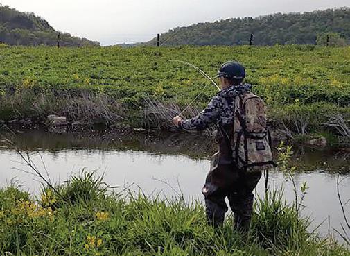
Fishing and biking seem to go hand in hand: Both are quiet, peaceful pursuits that can promote introspection. To make fishing a part of the ride, you’ll need a compact, packable rod. A Tenkara fly rod is a long telescoping rod with no reel, just a short line tied to the rod tip. It’s fishing in its simplest form, and perfect for when your ride crosses a stream with a nice trout pool below. Flip some flies into the creek for brookies or browns.
If Tenkara fishing sounds too simple, bring a collapsible multipiece rod and spinning reel in your pannier bag, and cast further out from shore on lakes and rivers. One trail with a plethora of piscatorial opportunities is the Paul Bunyan Trail, starting from the scenic Brainerd Lakes Area.
Named a er the legendary lumberjack, this trail carries rich folklore, while also leading through rich fish habitat. There are 115 miles of trail all the way north to Bemidji, crossing spots like the Turtle River, Mississippi River, and seven other rivers and streams perfect for shore casting. To enhance the fishing theme, stop in at legendary local fishing store Reeds Family Outdoor Outfi ers in Walker. Or take a short detour on the Heartland State Trail to see the Nevis Tiger Muskie Sculpture.
The Gitchi-Gami State Trail is a paved bicycle trail that parallels the dramatic Lake Superior shoreline in bits and pieces between Two Harbors and Grand Marais. Why only pieces? Currently, 36 out of an eventual 89 miles are complete. Not coincidentally, the finished segments generally run on state land (think state parks) that dot Superior’s shores. Gooseberry Falls State Park, Iona’s Beach Scientific and Recreation Area, Split Rock Lighthouse State Park, Temperance River State Park, and Cascade River State Park all play host to the Gitchi-Gami State Trail.
Sure, you won’t be able to bike between them all on a trail, and taking narrow, twisty Highway 61 can be a harrowing experience. But if you’ve got a car to fill in the gaps, you can ride trail sections leading to whispering waterfalls, Lake Superior overlooks, and sunny shorelines in some of the best state parks in the Midwest.

This year, the Gitchi-Gami Trail Association is celebrating a quarter century of supported bike rides. Their 25th Annual North Shore Bike Ride will be held on Aug. 16, 2025.


Biking is synonymous with exploration. Many of us choose to explore hard-to-reach areas by bike. If exploring the backwoods on two wheels is your kind of adventure, Minnesota’s Arrowhead is your playground. Backwoods biking is everywhere here, whether you take gravel National Forest Service roads or singletrack mountain bike trails. Why not combine them both? To make it more of an adventure, trick your bike out for bikepacking, carrying your own sleeping system, tent, and food for an overnight excursion.


Start your backwoods trip at Bri on Peak Trailhead in To e. Ride the spectacular Jackpot and High Climber singletrack mountain bike trails for 16 miles through the deep woods to Lutsen. You’ll cross only one road (Onion River Road) the whole way. The maple ridges here are particularly stunning in fall.
High Climber will bring you to Ski Hill Road in Lutsen, where there are multiple lunch options at Lutsen Mountains resort. Then it’s time to live dangerously. Head north from Ski Hill Road on the logging road that parallels the Poplar River. This remote two-track eventually crosses the Poplar (the bridge is not maintained). Then head due north to Barker Lake Road, from which you can connect with Honeymoon Road and then the Caribou Trail.
From Caribou, ride the beautiful gravel roads of Cook County toward Grand Marais. Your woods ride will bring you east on Murmur Creek Road, Pike Lake Road, Cascade River Road, and Bally Creek Road—all home ground to the Le Grand du Nord cycling race held each May. Camp overnight at Cascade River Rustic Campground or Devil Track Lake Campground to round out a glorious day.
Make your pick on day two: Roll into Grand Marais on more gravel and celebrate your ruggedness with a beer in town (you can overnight again at the Grand Marais Recreation Area, with 296 campsites), or go straight to more singletrack glory at Pincushion Mountain Trails on the Gunflint Trail.


MINNESOTA BOASTS THOUSANDS OF MILES OF BOTH PAVED AND MOUNTAIN BIKE TRAILS WAITING TO BE EXPLORED by
KATHERINE O'NEIL


BELMONT PARK
LOCATION: Jackson, 43.81993963095932, -95.02855401338513
TYPE: Unpaved
DISTANCE: 5.3 miles
DESCRIPTION: This 80-acre park is rich with history and natural beauty. Located on the east bank of the Des Moines River, this trail has switchbacks, berms, and jumps that drop 120 feet into the river valley.
PARKING: Available on-site.
LEVEL: Easy to difficult
COST: Free
INFO: 507-847-2525; co.jackson.mn.us
BLAZING STAR STATE TRAIL
LOCATION: Albert Lea, 43.642570657540055, -93.32250720864288
TYPE: Paved DISTANCE: 6 miles
DESCRIPTION: A paved stretch that connects Albert Lea Lake and Myre-Big Island State Park, this trail features a diverse landscape of wetlands, prairie, and oak savanna, as well as great birding spots in the spring and fall.
PARKING: One lot available next to Frank Hall Park at the intersection of Frank and James avenues; parking also available in Myre-Big Island State Park.
LEVEL Moderate
COST: Free INFO: 507-414-6193; dnr.state.mn.us
CAMDEN STATE PARK
LOCATION: Lynd, 44.35619487326335, -95.9198552675769
TYPE: Paved and unpaved
DISTANCE: 5.25 miles
DESCRIPTION: Ride through hardwood forests and prairie with trails that are suitable for beginners and experienced riders. There’s also an abundance of wildflowers when in season.
PARKING: Available on-site.
LEVEL: Easy to difficult
COST: $7 daily; $35 year-round
INFO: 507-872-7031; dnr.state.mn.us
LOCATION: Cannon Falls, 44.5582494768784, -92.7215914
TYPE: Paved
DISTANCE: 19.7 miles
DESCRIPTION: This paved trail traces the Cannon River and features many miles of sightseeing, from the Cannon River Turtle Preserve to an abandoned river channel.
PARKING: Available on North Service Drive.
LEVEL: Easy
COST: $7 daily wheel pass for 18 and older; $30 per season INFO: 507-263-0508; cannonvalleytrail.com
LOCATION: Faribault, 44.34538565034988, -93.1650082298346
TYPE: Dirt
DISTANCE: 2 miles
DESCRIPTION: Caron Park is a remnant of the Big Woods Forest Community, meaning it has rich environmental features and history. Trails are bidirectional and pass by Prairie Creek. Keep an eye out for the natural waterfall as well.
PARKING: Street parking available.
LEVEL: Easy to moderate
COST: Free INFO: 507-332-6112; ricecountymn.gov
LOCATION: Currie and Pipestone, 44.07673831807797, -95.67169985998149
TYPE: Both paved and unpaved
DISTANCE: 19.5 miles
DESCRIPTION: Connecting Pipestone, Woodstock, Lake Wilson, and Currie, this trail boasts Lake Shetek and rolling prairie. Named a er railroad engineer Casey Jones, it was one of the first trails to be authorized by Minnesota.
PARKING: Pipestone: available off Highway 23; Woodstock and Lake Wilson: available at the community park; Currie: available at the End-OLine Railroad Park and Museum; Lake Shetek State Park: available in several areas of the park with vehicle permit.
LEVEL: Moderate to challenging COST: Free INFO: 507-283-6053; dnr.state.mn.us
LOCATION: Fairmont, 43.6049339, -94.4793534
DISTANCE: 1.8 miles
TYPE: Paved
DESCRIPTION: This compact-yetscenic trail is lush with trees. The park also features an additional 3 miles of mowed nature trails and three 18-hole disc golf courses.
PARKING: From Interstate 90: Exit on Highway 39 and drive south for 5.5 miles, take a le on 80th Street (Lake Aires Road), and take the next le on Cedar Creek Road. Lot available at end of the road. From Highway 15: Go west on 80th Street and take a right on Cedar Creek Road. Lot available at the end of the road.
LEVEL: Easy
COST: Free INFO: 507-235-9330; fairmont.org
LOCATION: Between Rochester and Pine Island, 44.0837317762188, -92.54636590230987
TYPE: Paved
DISTANCE: 12.5 miles
DESCRIPTION: Pass through some rich agricultural land and see geese and pheasants on this bike trail built off an abandoned railroad grade.
PARKING: Rochester: available south on CSAH 22, 2 miles to Olmstead County Road, then 0.3 miles east to Rochester trailhead; Douglas: west on Olmstead County Road 14, then 3 miles to the Douglas trailhead; Pine Island: Goodhue County Road 11 for 0.5 miles to Pine Island City Park trailhead.
LEVEL: Easy
COST: Free INFO: 507-206-2847; dnr.state.mn.us
LOCATION: Rochester, 44.01177469693327, -92.41331272458181
TYPE: Unpaved
DISTANCE: 7 miles
DESCRIPTION: This mostly wooded trail has twists and turns along the Zumbro River. There are three sections that weave throughout the park.
PARKING: Available on-site.
LEVEL: Easy to moderate COST: Free INFO: rochestermn.gov
LOCATION: Mankato, 44.12826787417346, -94.04394776443304
TYPE: Unpaved
DISTANCE: 2.2 miles
DESCRIPTION: Rollers and berms wind on the Blue Earth River on bidirectional trails. Perfect for those looking to pick up more riding skills.
PARKING: Head to canoe river access area by the South 90 bridge.
LEVEL: Easy to moderate
COST: Free INFO: havefunbiking.com/southernminnesotas-fun-mountain-bike-trails
LOCATION: Rochester, 43.95267968721105, -92.44284959172427
TYPE: Paved
DISTANCE: 13 miles
DESCRIPTION: With scenic views of Gamehaven Lake, the Gamehaven Trail System contains a rolling singletrack trail with a handful of short climbs. Be careful to not trespass on the nearby marked Boy Scout camp property. Fat biking is available in the winter.
PARKING: Lot available near the Reservoir Parking Connector.
LEVEL: Easy
COST: Free
INFO: minnesotacycling.org/ gamehaven-rochester-mn
LOCATION: Red Wing, 44.54331291260561, -92.56974800229244
TYPE: Paved
DISTANCE: 47 miles when complete (currently in progress)
DESCRIPTION: This trail allows one to pass through grass prairies, oak savanna, and maple forests while keeping an eye out for creatures like deer, wild turkeys, and bald eagles.
PARKING: Available in the city of Red Wing, the Hay Creek unit of the Richard J. Dorer State Forest, and the southern portion of the Covered Bridge Park in Zumbrota.
LEVEL: Easy
COST: Free INFO: 507-206-2847; dnr.state.mn.us
In Bloomington, fun on two wheels is in high supply: Spot wildlife on nature trails in the Minnesota River Bo oms or enjoy 8-plus miles of paved paths lining tranquil lakes and ponds in the Three Rivers Park District. Plus, on-street bike lanes make reaching Mall of America® and other a ractions a breeze.
Find itineraries, maps and more at BloomingtonMN.org/Biking


LOCATION: Between Plainview and near Eyota, northeast of Rochester, 44.02113956303226, -92.25532408696955
TYPE: Paved
DISTANCE: 15 miles when complete (currently in progress)
DESCRIPTION: Made up of a largely agricultural landscape, this trail features miles of quiet farmland and a few creek crossings.
PARKING: Plainview: at trailhead on Third Street Southwest; Elgin: in town; Eyota: on County Road 9.
LEVEL: Easy
COST: Free INFO: 507-206-2847; dnr.state.mn.us
LOCATION: Between Harmony and Preston, southeast of Rochester, 43.67297840203906, -92.07252436184632
TYPE: Paved
DISTANCE: 18 miles
DESCRIPTION: The northern twothirds of the trail are constructed from a former railroad and continue to pass through farmland as well as wooded areas. There is much wildlife to see, too, such as deer, hawks, and wild turkey.
PARKING: Harmony: Take Fourth Street Northwest 0.5 miles to parking lot; Preston: Take Fillmore Street (County Road 12) 0.5 miles to parking lot.
LEVEL: Easy
COST: Free INFO: 507-206-2847; dnr.state.mn.us
LOCATION: Northfield, 44.472204514927675, -93.18205480193842
TYPE: Unpaved
DISTANCE: 1 mile
DESCRIPTION: This short two-way trail near St. Olaf College can be accessed by crossing Highway 19 or from Sechler Park. As the name suggests, it parallels Heath Creek and winds through a quaint, pleasant wooded area.
PARKING: Street parking only.
LEVEL: Intermediate
COST: Free INFO: croct.org/heath-creek-st-olafmtb-trail
LOCATION: Winona, 44.04105152363901, -91.66254543901714
TYPE: Rocky clay
DISTANCE: 9 miles
DESCRIPTION: This 9-mile loop has steep climbs and winding curves, and it passes through a mature hardwood forest and blu ops.
PARKING: Heading toward the bluff, follow the Huff Street crossing of Highway 61 and then turn right onto Lake Boulevard. Go about three-quarters of a mile to reach the Holzinger Lodge parking lot on the le
LEVEL: Difficult
COST: Free
INFO: 507-452-0735; visitwinona.com
LOCATION: Owatonna, 44.0625908859776, -93.23566493556054
TYPE: Unpaved
DISTANCE: 6 miles
DESCRIPTION: This singletrack trail is easy to moderately difficult, with log jumps and hills amid a wooded landscape. Located next to Lake Kholmire, the trail is also scenically appealing.
PARKING: Available on-site.
LEVEL: Easy to intermediate COST: Free INFO: 507-444-4321; exploreminnesota.com
LOCATION: Mankato, 44.198154543772695, -94.01861110927062
TYPE: Unpaved
DISTANCE: 6 miles
DESCRIPTION: Due to Kiwanis’ river valley and floodplain terrain, this double-loop trail has many exciting features: boardwalks, rocks, and jumps. Fat biking is available in winter, too.
PARKING: Head into the Kiwanis Recreation Area and onto the short gravel road. Lot available on right side.
LEVEL: Easy to advanced COST: Free INFO: joinmamb.com
LOCATION: Luverne, 43.6662019035895, -96.20307627305257
DISTANCE: About 15 miles total


TYPE: Paved
DESCRIPTION: Including the Luverne Loop, Ashby Trail, and Blue Mounds Trail, the trails of Luverne take bicyclists through city sights, lakes, agricultural fields, and views of the Blue Mound cliffline.
PARKING: Luverne Loop: Public parking available along the route; Blue Mounds: available at intersection of Main Street and Mound Avenue, at Blue Mounds State Park, and at Cliffline Area along County Highway 8 (parking pass needed).
LEVEL: Easy
COST: Free
INFO: cityofluverne.org/community/ parks___trails/trails
LOCATION: Red Wing, 44.5620233061009, -92.52115171068394
DISTANCE: 12 miles
TYPE: Unpaved
DESCRIPTION: Trails range from easy to difficult and are shared with hikers and cross-country skiers.
PARKING: Located in Red Wing, from Main Street Southeast on Highway 58, continue on Bush Street to Mississippi National Golf Links for paved surface.
LEVEL: Moderate to difficult COST: Free INFO: redwing.org
STATE
LOCATION: Albert Lea, 43.63735457116805, -93.30890121680532
DISTANCE: 7 miles
TYPE: Grass
DESCRIPTION: Trails are shared with hikers and wind through forested hills and pass by Albert Lea Lake. Note that trails have limited accessibility when wet.
PARKING: Available on-site.
LEVEL: Moderate
COST: $7 daily; $35 year-round INFO: 507-668-7060; dnr.mn.state.us


LOCATION: Henderson, 44.535620281701924, -93.88704145700214
TYPE: Unpaved
DISTANCE: 1.5 miles
DESCRIPTION: This singletrack trail has berms, a rock garden, and drops—an easy to intermediate-level ride suitable for all cyclists.
PARKING: Trails are not located on the Nature Center property but north of the intersection of Highway 19 and Henderson Station Road. Parking available in this area.
LEVEL: Easy to moderate
COST: Free
INFO: neycenter.org/visit-us/mountainbiking
LOCATION: Between Mankato and Rapidan, 44.11812558615121, -94.04924536948536
TYPE: Paved
DISTANCE: 6 miles
DESCRIPTION: Named a er a Seneca Indian chief, the Red Jacket Trail employs three railroad trestles. The impressive Red Jacket Trestle spans the length of the Le Sueur River and Highway 66. This trail also includes Red Jacket Trail Park, which has stunning views of the trestle.
PARKING: Mankato: Take Riverfront Drive exit off U.S. 14, turn le onto Riverfront Drive, then turn right on Stoltzman Road for parking; Weagel Park: From Sibley Street, turn right onto West Seventh Street, turn le onto Highway 66, then turn le onto Indian Lake Road for parking; Red Jacket Trail Park: From Highway 22, turn right onto County Road 90, turn le onto Highway 66, then turn le for parking available on the right.
LEVEL: Easy
COST: Free INFO: 507-304-4025; blueearthcountymn.gov
NATURE CENTER
LOCATION: Faribault, 44.278073237440076, -93.24132807487763
TYPE: Grass and dirt
DISTANCE: 10 miles
DESCRIPTION: These easy, multiuse trails pass by the Straight River and provide scenic views of the bluffs. Fat biking is available in the winter.
PARKING: Available on-site.
LEVEL: Easy
COST: Free
INFO: rbnc.org/seasonal-recreation
LOCATION: Between Fountain and Houston, 43.767994056762554, -91.8739631309798
TYPE: Paved
DISTANCE: 42 miles
DESCRIPTION: Root River State Trail presents splendid views of the limestone bluffs of the Root River Valley, as well as historical buildings and rural communities in passing trail towns. There is plenty of wildlife to see, such as wild turkey, deer, and even ra lesnakes, which are a state protected species.
PARKING: Fountain: From Highway 52, take County Road 8 a mile to available parking; Lanesboro: From County Road 8, turn right onto Parkway Avenue South. Parking available on the street and next to Sylvan Park on the le ; Peterson: From County Road 25, continue straight before turning right onto Park Street, and turn right again on Fillmore Street for parking; Rushford: From Highway 16, turn north on Elm Street and find parking at the restored railroad depot; Houston: Turn west on Plum street off of Highway 76 and go one block to the Nature Center.
LEVEL: Moderately challenging COST: Free INFO: 507-206-2847; dnr.state.mn.us
LOCATION: Between Faribault and Mankato, 44.20289183408095, -93.62574380027883
TYPE: Paved
DISTANCE: 39 miles
DESCRIPTION: Developed on an abandoned railroad grade, Sakatah Singing Hills State Trail passes through Sakatah Lake State Park and provides access to a few other lakes and parks within the route. Sakatah is the Dakota word for “singing hills.”
PARKING: Mankato: On U.S. 14, go 8 miles to Riverfront Drive exit, then turn
RIVER TRAIL


right onto North Riverfront Drive. In 0.6 miles, turn le onto Lime Valley Road, where parking will be available; Faribault: Take Exit 59 on I-35 and turn right onto Highway 21 to White Sands Park.
LEVEL: Easy
COST: Free INFO: 507-698-7852; dnr.state.mn.us
LOCATION: Austin, 43.69217510227654, -92.96157396097978
TYPE: Unpaved
DISTANCE: About 4 miles
DESCRIPTION: This is a fast, flat ride through woods and prairie land. Fat biking is available in winter, too.
PARKING: Available in marked lots at Todd Park and on both sides of 11th Street NE except where indicated.
LEVEL: Easy
COST: Free INFO: minnesotacycling.org/ schindlers-way-austin-mn
SECHLER PARK
LOCATION: Northfield, 44.4484438217028, -93.18125350510793
TYPE: Unpaved
DISTANCE: 1.75 miles
DESCRIPTION: Running along the shore of the Cannon River, this trail is ideal for beginners dipping their toes into mountain biking. There’s even a skills area with berms, jumps, and beams.
PARKING: Available on-site.
LEVEL: Easy
COST: Free INFO: 507-645-3045; northfieldmn.gov
MILE CREEK COUNTY PARK
LOCATION: St. Peter, 44.26607627636511, -94.03297212790913
TYPE: Unpaved
DISTANCE: 8 miles
DESCRIPTION: This 628-acre park switches from the Minnesota River to valley grasslands, to deciduous forests, to bluffs. Riders can see white-tailed deer and wild turkeys.
PARKING: Available on-site.
LEVEL: Easy to intermediate
COST: Free INFO: 507-934-7723; co.nicollet.mn.us
LOCATION: Faribault, 44.31228125709834, -93.26046948778148
TYPE: Unpaved
DISTANCE: 3-6 miles
DESCRIPTION: Built into the side of the riverbank above the Straight River, this handbuilt singletrack goes up and down the various ravines. The switchbacks on these trails require more expert skills.
PARKING: Available on 14th Street.
LEVEL: Easy to moderate
COST: Free
INFO: croct.org/sha uck-st-marys-mtb-trail
LOCATION: Between LeRoy and Austin, 43.58312814261466, -92.78426342228396
TYPE: Paved
DISTANCE: 29 miles
DESCRIPTION: Built off an unused railroad bed, this trail follows meadows and hardwood groves to agricultural fields. There is a Norwegian church that serves as a rest stop as well as a memorial for Margie Meier, a supporter of the trail.
PARKING: LeRoy: on Lowell Street, east of County Road 14; Rowe Pit: off County Road 14, north of LeRoy; Lake Louise State Park: Parking available with vehicle permit; Taopi: between Maple and Main streets on the south side of Highway 56; Adams: Parking available on the south side of West Main Street (Highway 56); Rose Creek: Parking available off Highway 56 or Fourth Street; J.C. Hormel Nature Center: off 21st Street.
LEVEL: Easy
COST: $7 daily vehicle pass; $35 year-round INFO: 507-414-6193; dnr.state.mn.us
LOCATION: St. Peter, 44.349280221505246, -93.94325355434016
TYPE: Unpaved
DISTANCE: 11 miles
DESCRIPTION: With some of the best views of the Minnesota River in the area, Traverse des Sioux Park is one of Minnesota’s historic sites. It has easy bidirectional trails that weave through the trees.
PARKING: Available on-site.
LEVEL: Easy
COST: Free
INFO: 507-934-4840; saintpetermn.gov


BARSNESS PARK
LOCATION: Glenwood, 45.64107815103215, -95.38282444057917
TYPE: Unpaved
DISTANCE: 7 miles
DESCRIPTION: This beginner to intermediate-level singletrack system has views of Lake Minnewaska, berms, rollers, and rock obstacles.
PARKING: Available on-site.
LEVEL: Easy to moderate COST: Free INFO: ci.glenwood.mn.us/parks
LOCATION: Wadena, 46.453518564489805, -95.19931293190686
TYPE: Unpaved
DISTANCE: 5.5 miles
DESCRIPTION: This singletrack trail passes through the woods and alongside Oak Creek with challenging sharp turns, steep drops, and roots and logs to hop. Fat biking is available in winter, too.
PARKING: Available at the Big Spruce loop.
LEVEL: Moderate to difficult
COST: Free INFO: mtbproject.com
CENTRAL LAKES STATE TRAIL
LOCATION: Between Fergus Falls and Osakis, 46.019977109347366, -95.69989050871006
TYPE: Paved
DISTANCE: 55 miles
DESCRIPTION: This region notably features the Kensington Runestone, an artifact allegedly found near a small town southwest of Alexandria that supposedly dates to 1362. The trail’s Seven Sister Prairie on the north side of Lake Christina is an impressive group of seven glacially-produced knolls. The landscaping on this trail is varied, including dense forest as well as farmland and rolling hills.
PARKING: Fergus Falls: Parking is available at Central Lakes State Trail Trailhead off Highway 210 and in DeLagoon City Park; Alexandria: in Big Ole Park; Osakis: by Osakis Information Center; Dalton, Ashby, Evansville, Brandon, and Garfield: in dedicated lots
or city streets.
LEVEL: Easy
COST: Free
INFO: 218-671-7930; dnr.state.mn.us
LOCATION: Pine River, 46.740247956407195, -94.64083628102338
TYPE: Unpaved
DISTANCE: 10 miles
DESCRIPTION: This trail winds around Cut and Deer lakes and provides a nice, quiet ride through the forest.
LEVEL: Moderate
COST: Free
INFO: exploreminnesota.com/profile/ cut-lake-trail
STATE TRAIL
LOCATION: Deerwood, 46.476303, -93.8978952
TYPE: Paved
DISTANCE: 8 miles
DESCRIPTION: Inside the Cuyuna Country State Recreation Area, this trail features six natural lakes and 25 miles of undeveloped shoreline with a variety of fish species, including trout, bass, sunfish, and walleye.
PARKING: Crosby: Take Highway 210/6 and follow the signs to the Cro Mine Historical Park. Parking is also available on the west side of Highway 6; Riverton trail head: From Highway 210, go north to County Road 128. Take a right to the intersection of Rowe Road. Parking is available on the right of Rowe Road.
LEVEL: Easy
COST: $7 daily vehicle pass; $35 year-round INFO: dnr.state.mn.us
FERBER PARK
LOCATION: Fergus Falls, 46.30874481742957, -96.04813564612337
TYPE: Unpaved
DISTANCE: 2.2 miles
DESCRIPTION: Developed by volunteers assisted by the city of Fergus Falls, Ferber Park’s biking trails are a mix of flat terrain and rolling hills and still in the process of being improved and implemented.
PARKING: Available on-site.
LEVEL: Easy to moderate COST: Free
INFO: fergusfallsmn.gov/explore
LOCATION: Between Willmar and Paynesville, and Roscoe and Cold Spring, 45.258949875652604, -94.94604522871388
TYPE: Paved
DISTANCE: 29 miles
DESCRIPTION: This trail bisects western tallgrass prairie and deciduous forest terrain, where one can view reptiles, small mammals, and bu erflies. As the name implies, the lakes surrounding the area make this trail scenic.
PARKING: Willmar: On Highway 12 east to County Road 89, turn le for parking available at the Civic Center; Spicer: Go west at the junction of Highway 23 and County Road 10; New London: Go 1 mile northeast of Main Street on County Road 31. Parking is available at the intersection of River View Lane; Hawick: Parking is available at the intersection of Highway 23 and County Road 2; Richmond: On Highway 23, go north one block on Central Avenue South.
LEVEL: Easy
COST: Free
INFO: 320-409-2051; dnr.state.mn.us
HILLSIDE PARK
LOCATION: Elk River, 45.305232931902374, -93.5397575181757
TYPE: Unpaved
DISTANCE: 6.6 miles
DESCRIPTION: These wooded mountain biking trails are perfect for both beginner and expert riders looking to work on their skills. Fat biking is available in the winter.
PARKING: Available on-site.
LEVEL: Easy to difficult COST: Free
INFO: 763-635-1150; elkrivermn.gov
LOCATION: St. Cloud, 45.54284775542044, -94.12989383864738
TYPE: Unpaved
DISTANCE: 7.5 miles
DESCRIPTION: Despite being named for the trail’s proximity to one of Minnesota’s correctional facilities, there’s nothing criminal about this trail. It is a singletrack ideal for all skill levels with great wildlife viewing, short climbs, and fun, quick turns.
PARKING: Available on-site.
LEVEL: Easy to moderate
COST: Free
INFO: 320-257-5959; visitstcloud.com
LOCATION: Kensington, 45.8144267897302, -95.66701927614709
DISTANCE: 7.5 miles
DESCRIPTION: These trails weave through scenic maple, aspen, and oak forests alongside some lakes and meadows. Fat biking is available in winter, too.
PARKING: Available on-site.
LEVEL: Easy to moderate
COST: Free
INFO: 320-762-2999; douglascountymn.gov
LAKE BROPHY COUNTY PARK
LOCATION: Alexandria, 45.91289708332872, -95.44802416755003
TYPE: Paved
DISTANCE: 6.5 miles
DESCRIPTION: These trails, ideal for both beginner and expert riders, wind through the uphill prairie and have jumps, drops, and sweeping turns. For unbeatable views of Alexandria, make sure to bike to the top of the park. To access the park by bike, take the paved Central Lakes Trail, which skirts this trail system.
PARKING: Available on-site.
LEVEL: Easy to difficult COST: Free
INFO: 320-762-2999; douglascountymn.gov

SATURDAY JUNE 7, 2025 SATURDAY JUNE 7, 2025


LOCATION: Between St. Joseph and Osakis, with a spur north from Albany to Holdingford, 45.66974843864027, -94.73500939739333
TYPE: Paved
DISTANCE: 65.5 miles
DESCRIPTION: This trail is named a er the fictional town of Lake Wobegon, coined by Minnesota radio personality Garrison Keillor. The small towns along the trail, such as Holdingford, gave Keillor inspiration for this fantastical place. The lengthy trail features lakes, woodland, and open farmland.
PARKING Available at the following trailheads: Waite Park, St. Joseph, Avon, Albany, Freeport, Melrose, Sauk Centre, West Union, Holdingford, and Bowlus.
LEVEL: Easy
COST: Free
INFO: 800-264-2940; lakewobegontrail.com
LOCATION: Between Onamia and Isle, south of Mille Lacs Lake, 46.073303151105655, -93.66768878255682
DISTANCE: 11 miles
TYPE: Paved and gravel (multiuse trails)
DESCRIPTION: This trail features scenic forest and countryside, plus a beach and swimming area in Father Hennepin State Park. Keep an eye out for the rare albino deer dwelling in the area nearby.
PARKING: Onamia: available at the Library/Depot on Roosevelt Road; Isle: on Fi h Avenue, one block south of Main Street.
LEVEL: Easy
COST: Free INFO: 888-350-2692; millelacs.com
QUARRY PARK
LOCATION: Waite Park, 45.537378770689166, -94.2417132542613
DISTANCE: 2.2 miles
TYPE: Dirt, gravel, grass
DESCRIPTION: The largest park in the Stearns County Parks system, Quarry Park has a wide variety of doubletrack multiuse trails as well as hard-packed aggregate and natural-surface trails for both walking and biking. Fat biking is available in winter, too.
PARKING: Available on-site.
LEVEL: Moderate
COST: $5 daily Labor Day through Memorial Day; $10 daily Memorial Day through Labor Day; $25 annual INFO: 320-255-6172; stearnscountymn.gov
LOCATION: Spicer, 45.244677901565865, -95.0400351226836
TYPE: Unpaved
DISTANCE: 4.5 miles
DESCRIPTION: This beginner-friendly ride begins at the Environmental Learning Center and winds through deciduous and prairie woods, with some boardwalk and bridges along the way.
PARKING: Gravel lot available below main education building.
LEVEL: Easy
COST: Free INFO: 320-354-5894; willmarlakesarea.com
LOCATION: St. Cloud, 45.588523387509625, -94.19102858097271
TYPE: Unpaved
DISTANCE: 2 miles
DESCRIPTION: This is a short, easy ride ideal for beginners, although a technical line is available along a berm. A skills course and two skills-building trails were also built in 2023.
TYPE: Grass and dirt
DESCRIPTION: With varied topography and an expert-level climb up the Continental Divide, this trail system is challenging, but the views are worthwhile.
PARKING: Available on-site.
LEVEL: Moderate to difficult
COST: $7 daily; $35 year-round INFO: 218-419-1500; dnr.state.mn.us
LOCATION: Hutchinson, 44.9484394658623, -94.42725887434418
DISTANCE: 3 miles
TYPE: Unpaved
DESCRIPTION: This trail system is a short and sweet ride with moderate terrain, a seesaw, and a balance beam.
PARKING: Available on-site.
LEVEL: Moderate
COST: Free INFO: 320-484-4334; mcleodcountymn.gov
LOCATION: Between Ulen and Crookston, 47.3917113309243, -96.2708251183878
DISTANCE: 53 miles
TYPE: Unpaved
DESCRIPTION: This abandoned railroad grade rides through Minnesota farmland and provides views of Sand Hill and Wild Rice rivers. There are also opportunities to see squirrels, coyotes, and deer.
PARKING: Crookston: Go 1.5 miles southeast to where Highway 9 and Highway 102 meet; Fertile: available on city streets; Ulen: available off Highway 32, north of County Road 34 and County Road 16.
LEVEL: Easy to moderate
COST: Free
PARKING: Available at Friends of Whitney Dog Park.
LEVEL: Easy to moderate COST: Free INFO: 320-253-2171; sartellmn.com
INFO: dnr.state.mn.us
LOCATION: Detroit Lakes, 46.78277831342375, -95.8826124318148
DISTANCE: 3.8 miles

STATE PARK
LOCATION: McGregor, 46.81945747221645, -93.17606071096087
DISTANCE: 10 miles
TYPE: Paved
DESCRIPTION: Located on the shores of Muskrat Lake and Lake Sallie, this
53-acre park offers miles of mountain biking trails that pass through hardwood forested hills in the northern end and wooded terrain in the southern end. Northern trails pass through what was once a gathering spot for Sioux people, so there are remnants of burial mounds throughout the trail. Please be considerate.
PARKING: Available on-site.
LEVEL: Easy
COST: Free INFO: 218-847-0099; co.becker.mn.us
LOCATION: Moorhead, 46.853498881637805, -96.78228525393844
DISTANCE: 3.6 miles
TYPE: Unpaved
DESCRIPTION: These easy, wide singletrack trails wind around the perimeter of the Red River. Since the trail is short, take multiple laps around for a more high-energy and intensive workout.
PARKING: Available on-site.
LEVEL: Easy
COST: Free
INFO: mtbproject.com
LOCATION: East Grand Forks and Polk, 47.9223034634545, -97.016854137529
DISTANCE: 10 miles (in Minnesota)
TYPE: Paved
DESCRIPTION: This trail connects the border of Grand Forks, North Dakota, and East Grand Forks, Minnesota, along the Red River and Red Lake River. There are a multitude of campgrounds, fishing sites, and playgrounds to enjoy, as well as golf courses and ice skating and hockey rinks.
PARKING: River Heights Park: Go east 2.7 miles on Gateway Drive from North Dakota to enter Minnesota. Take the East Grand Forks exit and turn le onto Fourth Street. Parking will be available on the right; Confluence of Red River and Red Lake River: Go east on Demers Avenue. Take the Fourth Avenue South exit, then turn le onto Minnesota Avenue. Turn le , and parking is available before the Third Avenue Bridge.
LEVEL: Easy
COST: Free
INFO: 701-746-2750; greenwayggf.com


PLACES TO STAY
Inns, campgrounds and vacation rentals
PLACES TO EAT
Many local favorites


PLACES TO SHOP
From basic necessities to products unique to the valley


LOCATION: Roseau, 48.63766485173657, -95.54523345199323
DISTANCE: 5 miles
TYPE: Unpaved
DESCRIPTION: Start the ride at Hayes dam and traverse through an easy, level, grassy terrain amid a wooded area.
PARKING: Available on-site.
LEVEL: Easy
COST: $7 daily; $35 year-round INFO: 218-425-7504; dnr.state.mn.us
LOCATION: Between Park Rapids and Cass Lake, 47.15239558501804, -94.6402347711641
DISTANCE: 49 miles
TYPE: Paved
DESCRIPTION: One of the first railroads that was converted to a bike trail, Heartland State Trail features views of lakes, rivers, streams, and wildlife such as bald eagles, bobcats, and coyotes. This trail also connects to the Paul Bunyan State Trail.
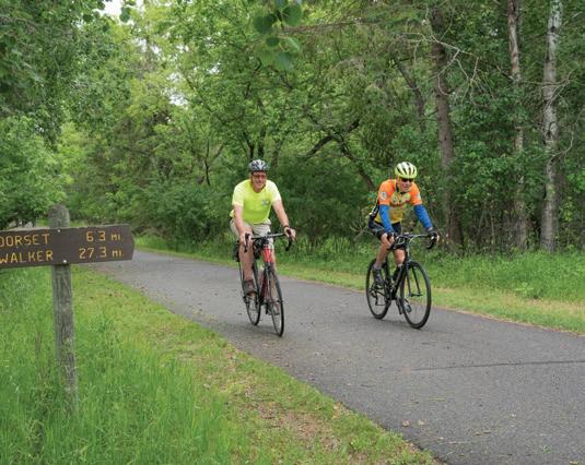
PARKING: Park Rapids: From Highway 34, go north 0.25 miles on Mill Street for parking in Heartland County Park; Dorset: Go north 1.4 miles on Highway 225 from Highway 34 for parking; Nevis: Parking available off Highway 34 at the intersection of County Road 18 and Village Road; Akeley: North from Highway 34, go 0.1 miles on Hillside Avenue for parking; Walker: Go south on County Road 12, proceed 0.25 miles from Highway 371 to Lake May Drive and Heartland Place; Erickson’s Landing: Parking available 2 miles north of Walker on Highway 371; Steamboat Landing: Go west off Highway 371. A er 0.3 miles, parking is available on 130th Street Northwest; Cass Lake: Parking available on the north side of Highway 2.
LEVEL: Easy to moderate
COST: Free INFO: 218-308-2372; dnr.state.mn.us
LOCATION: Lake Bronson, 48.72464568280081, -96.62574936732443
DISTANCE: 14 miles
TYPE: Grass, packed dirt, and gravel
DESCRIPTION: This trail system is a non-challenging way to enjoy all the natural beauty Lake Bronson has to offer, from mink and o ers to scenic lake views. Trails are mostly flat with some small hills here and there.
PARKING: Available on-site.
LEVEL: Easy
COST: $7 daily; $35 year-round INFO: 218-754-2200; dnr.state.mn.us
LOCATION: Callaway, 47.00930691863373, -95.77676938357011
DISTANCE: 25 miles
TYPE: Unpaved
DESCRIPTION: Maplelag Resort maintains well-groomed trails throughout the summer and fall seasons, as well as some fat-biking segments for the winter. On over 19 trails, a $15 pass will let bikers experience all sorts of difficulty levels and terrains.
PARKING: Park in the first lot upon entering the premises.
LEVEL: Easy to difficult
COST: $15 for daily pass INFO: maplelag.com
LOCATION: Moorhead, 46.91067403861451, -96.75526580975531
DISTANCE: 4 miles
TYPE: Unpaved
DESCRIPTION: This trail flows along a steep, large embankment and has some manageable obstacles. Fat biking is available in winter, too.
PARKING: Available on-site.
LEVEL: Easy
features deciduous forest and red and white pines, as a large part of it traverses through the Chippewa National Forest. Migizi, the Ojibwe word for “bald eagle,” is the namesake of this trail. The eastern 2.8 miles of this trail connect with the Heartland State Trail.
PARKING: Available at the Cass Lake Wayside Rest on Highway 2 and the South Pike Bay Picnic Area.
LEVEL: Easy
COST: Free
INFO: 218-335-8600; fs.usda.gov/chippewa
LOCATION: Roseau, 48.83535226633101, -95.74594021645548
DISTANCE: 6 miles
TYPE: Unpaved
DESCRIPTION: This singletrack trail rides through rolling hills, flowing turns, and even has a 60-foot man-made mountain for more experienced bikers. It is a wide open, grassy terrain that is well maintained and groomed.
PARKING: Street parking only.
LEVEL: Easy to moderate
COST: Free INFO: mtbproject.com
RECREATION AREA
LOCATION: Detroit Lakes, 46.803811296323396, -95.77470215879677
DISTANCE: 6 miles
TYPE: Unpaved
DESCRIPTION: These singletrack trails are moderately challenging, with several different loop options. Riders enjoy a ride through a hardwood forest and can take a connecting trail to Detroit Mountain.
PARKING: Available on-site.
LEVEL: Moderate
COST: Free
INFO: 218-847-0099; co.becker.mn.us
COST: Free INFO: 218-299-5340; cityofmoorhead.com
LOCATION: Cass Lake, 47.33475588209354, -94.56299046803375
RECREATION AREA
LOCATION: Bemidji, 47.57774062921777, -94.83208130300814
DISTANCE: 8 miles
TYPE: Dirt, grass

DISTANCE: 19 miles
TYPE: Paved
DESCRIPTION: This scenic trail
DESCRIPTION: This trail system features twisty and challenging trails that make use of the land’s natural topography, perfect for bikers of all levels looking to improve their skills.
PARKING: Available on-site.
LEVEL: Easy to difficult
COST: Free


INFO: 218-333-4210; co.beltrami.mn.us
LOCATION: From Crow Wing State Park (Brainerd Lakes Area) to Lake Bemidji State Park, 47.58041820986701, -94.82077033900367
DISTANCE: 115 miles (not including short on-road connections through Baxter and Bemidji)
TYPE: Paved
DESCRIPTION: Boasting the title of Minnesota’s longest state trail and the longest continuously paved rail trail in the United States, the Paul Bunyan State Trail also hosts oak savannas and prairies with bountiful wildlife.
PARKING: Available in the following locations: Akeley, Backus, Baxter, Bemidji, Brainerd, Chippewa National Forest, Crow Wing State Park, Guthrie, Hackensack, Jenkins, La Porte, Lake Bemidji State Park, Lavinia, Merrifield, Nary, Nisswa, North County Trail, Pequot Lakes, and Walker.
LEVEL: Easy to moderate
COST: $7 daily vehicle pass; $35 year-round INFO: 218-308-2372; dnr.state.mn.us
LOCATION: Two Harbors, 47.10797577653353, -91.74888998090665
DISTANCE: 10 miles
TYPE: Unpaved
DESCRIPTION: Ride through the boreal woods of the Superior National Forest. Groomed for fat biking in the winter. This trail is also being planned to expand up to 15-20 miles.
PARKING: Available on-site.
LEVEL: Easy
COST: Free INFO: 218-834-8340; co.lake.mn.us


LOCATION: Grand Rapids, 47.23006146579099, -93.5653451963995
DISTANCE: 5 miles
TYPE: Unpaved
DESCRIPTION: This short, beginnerfriendly ride takes bikers through Minnesota’s picturesque North Woods, with three combined trails: the Forest of Today Trail (3 miles), the River Trail (1 mile), and the Swamp Trail (1 mile).
PARKING: Available on-site.
LEVEL: Easy
COST: Free INFO: 218-327-4482; mnhs.org
LOCATION: Along the North Shore of Lake Superior, 47.197014020035446, -91.38489784445896
DISTANCE: Over 33 miles (will be 86 miles when complete, currently in progress)
TYPE: Paved
DESCRIPTION: This trail has been slowly under construction for two decades but allows bicyclists to ride along the North Shore of Lake Superior while enjoying birch and aspen forests, lakeside beaches, and waterfalls. This trail, when completed, will connect five state parks.
PARKING: Silver Creek Cliff: Go to the east side of the Silver Creek Cliff tunnel. Parking is available at the Silver Creek Cliff wayside; Grand Marais: available at the Grand Marais public water access; Schroeder to To e: available at the MNDOT wayside, Temperance River State Park, and To e Town Park off Sawbill Trail; Gooseberry Falls State Park to Silver Bay: available at Twin Points public water access, Iona’s Beach Scientific and Natural Area, Split Rock Lighthouse State Park trail center, Silver Bay hockey arena, rest area near the Beaver River, and Gooseberry Falls State Park.
LEVEL: Easy
COST: $7 daily vehicle pass; $35 year-round
INFO: 218-834-1430; dnr.state.mn.us
HIDDEN VALLEY
RECREATION AREA
LOCATION: Ely, 47.90393030241871, -91.8158246280663
DISTANCE: 24 miles
TYPE: Unpaved
DESCRIPTION: In the warmer months, the Hidden Valley Ski Trails are transformed into professionally developed singletrack mountain biking trails that take riders through the scenic white pine forest. There are even technical and skills tracks with jumps for more advanced riders.
PARKING: Go half a mile from the junction between Highway 1 and 169 to Hidden Valley Road. Take a right and go half a mile, where there will be parking at the Hidden Valley chalet.
LEVEL: Easy to advanced
COST: $5/day donation from nonmembers INFO: 218-365-7600; fs.usda.gov
LOCATION: To e/Lutsen, 47.60160674488014, -90.86121630251144
DISTANCE: 16 miles
TYPE: Unpaved
DESCRIPTION: These twin trails are praised for their jumps, rollers, berms, and fast and loopy descents, all with the backdrop of the scenic wilderness. This ride has beginner portions but is most suited for experienced riders who can handle switchbacks and jumps.
PARKING: Available at Bri on Peak Trailhead in To e, Ski Hill Road Trailhead in Lutsen Mountains, and on Onion River Road.
LEVEL: Easy to moderate COST: Free INFO: northshorevisitor.com
LOCATION: Grand Rapids, 47.24930472184074, -93.5370897796433
DISTANCE: 7 miles
TYPE: Unpaved
DESCRIPTION: Located in American Legion Memorial Park, this singletrack trail was handbuilt and features technical twists, turns, and curves.
PARKING: Available on-site.
LEVEL: Moderate
COST: Free INFO: northernlightsnordic.org
LOCATION: Hibbing, 47.60168434527672, -93.0255457325218
DISTANCE: 4 miles
TYPE: Unpaved
DESCRIPTION: This 160-acre park is


a pleasant ride through the natural undeveloped environment of Hibbing.
PARKING: Available on-site.
LEVEL: Moderate
COST: Free
INFO: 218-362-5951; hibbingmn.gov
MESABI
LOCATION: Between Grand Rapids and Ely, 47.46367808831124, -92.52076305809695
DISTANCE: Over 150 miles (over 165 miles when completed, currently in progress)
TYPE: Paved
DESCRIPTION: Pass through 28 communities and by lakes, creeks, and ponds on this premier biking trail that spans from the Mississippi River to Minnesota’s Boundary Waters.
PARKING: Available at the following access points: Kinney, Tower, Calumet, Giants Ridge, Aurora, Embarrass, McKinley, Gilbert, Bovey, Virginia, Taconite, Chisholm, Buhl, Biwabik, Grand Rapids, Fayal Township, Mountain Iron, Coleraine, Eagles Nest, Eveleth (Fayal Pond), Pengilly, Hibbing, Keewatin, Marble, Eveleth (Mesabi Station), Ely, Biwabik (Embarrass Lake), and Nashwauk.
LEVEL: Moderate
COST: Wheel pass is required for riders 18 and up; $10 for a three-day pass; $20 for an annual pass INFO: 877-637-2241; mesabitrail.com
LOCATION: Itasca, 47.60646416351756, -93.46097978305562
DISTANCE: 12 miles
TYPE: Unpaved
DESCRIPTION: Ride around the scenic lake area with the beautiful company of rolling wooded hills and grassy bogs.
PARKING: Off County Road 45, go 1.25 miles west of Scenic No. 7.
LEVEL: Easy to moderate
COST: Free
INFO: 218-365-6123; ely.org
LOCATION: Hinckley, 45.95376835585972, -92.61313698282272
DISTANCE: 21 miles
TYPE: Unpaved
DESCRIPTION: Minnesota’s largest state park features an elaborate trail system rich with history and wildlife. The St. Croix River was an important trade route for centuries and home to many logging camps in the mid-1800s. Today, the park is habitat to beaver, raccoons, foxes, deer, eagles, and more.
PARKING: Available on-site.
LEVEL: Easy to moderate COST: Free
INFO: 320-280-7880; dnr.state.mn.us
LOCATION: Two Harbors, 47.193355232697975, -91.39424941842277
DISTANCE: 3 miles
TYPE: Unpaved
DESCRIPTION: This is an easy, beginnerfriendly ride along Lake Superior. For a longer ride, take the paved Gitchi-Gami State Trail on the return for a 6-mile total loop.
PARKING: Available at the Trail Center or in Gooseberry Falls State Park in the lower picnic area.
LEVEL: Easy
COST: $7 daily vehicle pass; $35 year-round
INFO: 218-595-7625; dnr.state.mn.us
LOCATION: Grand Rapids to Ely, 47.753649836777285, -92.49971458091905
DISTANCE: 165 miles
TYPE: Paved and unpaved
DESCRIPTION: Taconite State Trail intersects with the David Dill/Arrowhead State Trail west of Lake Vermilion. The first 6 miles are paved, while the rest is unpaved and suitable for mountain biking through forests of birch, aspen, and isolated lakes and streams. Heading north, one can see the remains of the taconite and mining industry.
PARKING: Available at the following trailheads: McCarthy Beach State Park, Minnesota Highway 73, U.S. Highway 53, Minnesota Highway 1, Minnesota Highway 169 (Peyla), Minnesota Highway 135 (Tower).
LEVEL: Moderate to challenging COST: Free
INFO: 218-328-8980; dnr.state.mn.us
LOCATION: Between Hinckley and Duluth, 46.45338162213786, -92.76890421120025
DISTANCE: 70 miles
TYPE: Paved
DESCRIPTION: The Duluth segment of this trail takes bikers through the stunning scenery of Jay Cooke State Park, while the northeast part features views of the St. Louis River and the twin ports of Superior and Duluth. Watch for wolves, coyotes, and even black bears along the way.
PARKING: Carlton: Go one block south of Highway 210 on County Road 1; Duluth: Parking available at the northern trailhead on Grand Avenue (Highway 23) and 75th Avenue; West Hinckley: Go one block north of the Hinckley Fire Museum (the intersection of Highway 61 and County Road 18); Jay Cooke State Park and Moose Lake State Park: Parking available with vehicle permit; General C.C. Andrews State Forest: Parking available at Dago Lake Day Use Area, McCormick Lake Day Use Area, and Willow River Campground.
LEVEL: Easy
COST: $7 daily vehicle pass; $35 year-round
INFO: 218-460-7021; dnr.state.mn.us
BERTRAM CHAIN OF LAKES REGIONAL PARK
LOCATION: Monticello, 45.29504812201111, -93.85674931670624
DISTANCE: 14.25 miles
TYPE: Unpaved
DESCRIPTION: A fast singletrack, switchbacks, as well as doubletracks are all features that are available in this park’s trail system. There are also plenty of logs and wooden bridges to explore. Fat biking is available in the winter.
PARKING: Available at the south entrance to the park off 90th Street.
LEVEL: Moderate
COST: Free
INFO: 763-682-7693; co.wright.mn.us
BETHEL HAUNTED FOREST TRAILS
LOCATION: Bethel, 45.39089496659288, -93.26437103201557
DISTANCE: 6 miles
TYPE: Unpaved
DESCRIPTION: The Bethel Fire Department used to put on a haunted a raction in this area, giving it its spooky title. But this 80-acre wooded area is now more known for its interconnected bike trails that feature loops, log jumps, and some le over man-made obstacles from the haunted a raction days.
PARKING: Available on-site.
LEVEL: Easy to moderate COST: Free INFO: mtbproject.com
LOCATION: Grant to Stillwater, 45.07114359636236, -92.83703667336673
DISTANCE: 5.9 miles
TYPE: Paved
DESCRIPTION: This trail follows Brown’s Creek, a trout stream with a dense canopy that provides ample shade for trail users. One may also see views of the St. Croix River and the National Scenic Riverway, Minnesota’s only river in the National Wild and Scenic Rivers System.
PARKING: Downtown Stillwater: available at the eastern end of the trail on Laurel Street; East Brown’s Creek Nature Preserve: Go south of the intersection of McKusick Road and Neal Avenue; Grant: available under the Gateway State Trail bridge.
LEVEL: Easy
COST: Free INFO: 651-259-5841; dnr.state.mn.us
LOCATION: Burnsville, 44.7246540795558, -93.28716640987477
DISTANCE: 6 miles
TYPE: Unpaved
DESCRIPTION: Singletrack mountain biking trails take riders through drops, downhill flow trails, and breathtaking views of Crystal Lake and the surrounding forest.
PARKING: Available on-site.
LEVEL: Easy to moderate COST: Season or day pass required. INFO: 952-435-7174; buckhill.com
LOCATION: Woodbury, 44.9039554511142, -92.97905079644073


DISTANCE: 5.5 miles


TYPE: Paved and unpaved
DESCRIPTION: Cruise the south side of Carver Lake with loops, switchbacks, and gorgeous lake views. Fat biking is available in the winter.
PARKING: Available at lower parking lot on 3175 Century Ave. S.
LEVEL: Easy to moderate
COST: Free
INFO: 651-714-3583; woodburymn.gov
CEDAR LAKE LRT REGIONAL TRAIL/ MINNESOTA RIVER BLUFFS LRT REGIONAL TRAIL
LOCATION: Between Hopkins and Minneapolis, 44.9448662350375, -93.3360918310428
DISTANCE: 19.9 miles
TYPE: Paved and crushed stone
DESCRIPTION: This is an aggregate trail and former railroad that goes from Hopkins to Chaska. Bicyclists can view Shady Oak Lake, Riley Lake Park, and the Minnesota River Valley.
PARKING: Hopkins: available at Depot Coffee House between Excelsior Boulevard and Milwaukee Road; Eden Prairie: Go west of Eden Prairie Road to Miller Park on Highway 212; Chaska: Parking available where the trail meets Bluff Creek Drive.
LEVEL: Easy
COST: Free INFO: threeriversparks.org
BIKE PARK
LOCATION: Co age Grove, 44.84565684928497, -92.9693756897273
DISTANCE: 2.4 acres
TYPE: Dirt
DESCRIPTION: This small but mighty work-in-progress bike park features jumps, ramps, pump tracks, and fun for the whole family. They regularly add new obstacles, so keep an eye out!
PARKING: Available on-site.
LEVEL: Easy to moderate
COST: Free INFO: 651-458-3400; co agegrovemn.gov
LOCATION: Between Wayzata and New Germany, 44.90557485411182, -93.73812083751056
DISTANCE: 26 miles
TYPE: Paved
DESCRIPTION: Passing through Lake Minnetonka and Waconia, this trail follows the former Dakota Rail Corridor that ended in 2001.
PARKING: Wayzata: available at Shaver Park and the municipal parking lot on Lyric Avenue; Mound: available at the downtown transit center at the intersection of Lynwood and Commerce boulevards; St. Bonifacius: available at Don Logelin Memorial Lions Park; New Germany: available on Broadway Street.
LEVEL: Easy
COST: Free
INFO: carvercountymn.gov/parks (western portion); threeriversparks.org (eastern)
LOCATION: Champlin, Dayton, and Maple Grove, 45.13848231014937, -93.43794067983092
DISTANCE: 30 miles
TYPE: Paved
DESCRIPTION: Throughout Elm Creek Park Reserve, there are 20 miles of paved trails that eventually connect to the Rush Creek Regional Trail.
PARKING: Available at Coon Rapids Dam Park and Elm Creek Park Reserve.
LEVEL: Easy
COST: Free
INFO: 763-694-7894; threeriversparks.org
LOCATION: St. Paul, 44.86622487242993, -93.19118793210258
DISTANCE: 10 miles
TYPE: Unpaved
DESCRIPTION: This is a pleasant, relatively flat, and beginner-friendly ride that takes riders along the Dakota County side of the river. Fat biking is available in the winter.
PARKING: Available by Gun Club Lake and at Picnic Island.
LEVEL: Easy
COST: $7 daily vehicle pass; $35 year-round
INFO: 612-279-3550; dnr.state.mn.us
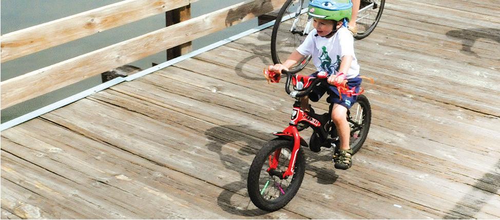


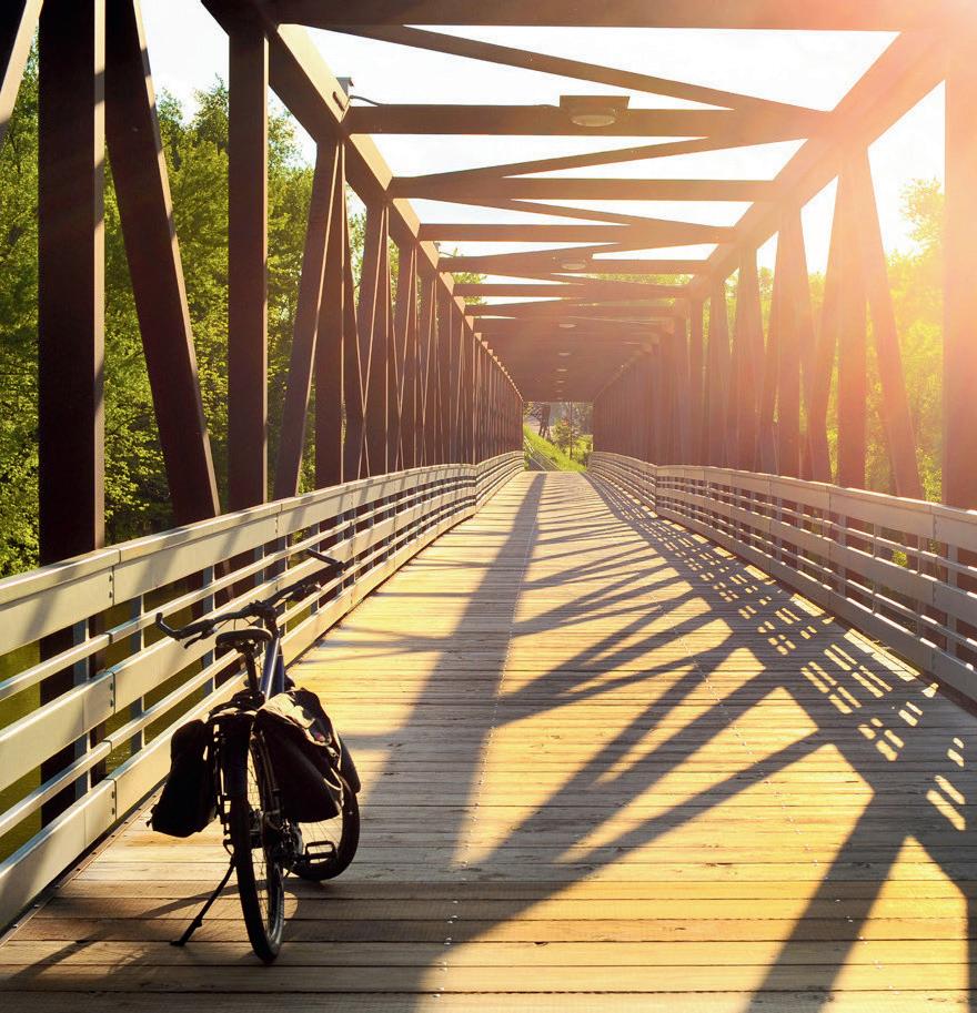
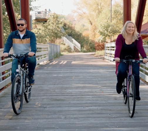
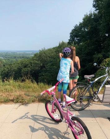

LOCATION: Between St. Paul and Pine Point Park, west of Stillwater, 45.03434111747131, -92.94844903074005
DISTANCE: 18 miles
TYPE: Paved
DESCRIPTION: Built off the former Soo Line Railroad grade, this trail has a surprising number of rural areas, considering its proximity to the city. This trail features wetlands, parks, and lakes to view along the way.
PARKING: Available at the following trail accesses: North Saint Paul Trailhead, Flicek Park, Maplewood Community Center, Highway 36, and Second Street (North St. Paul), Arlington Avenue, 55th Street (southwest of Highway 36 and I-694), Mahtomedi Athletic Fields-Green Lot, Jamaica Avenue, under Gateway State Trail Bridge near Lake Masterman, Pine Point Regional Park (fee required), and along city streets.
LEVEL: Easy to moderate
COST: Free INFO: 651-259-5841; dnr.state.mn.us
ROUNDS BIKE TRAILS
LOCATION: Minneapolis, 45.027781031026116, -93.26011313104526
DISTANCE: 51 miles
TYPE: Paved
DESCRIPTION: The Grand Rounds Scenic Byway System is one of the U.S.’ longest continuous systems of urban parkways. This system weaves through lakes, wetlands, lagoons, and
woodlands and runs along parkways such as St. Anthony Parkway, Victory Memorial Drive, and Theodore Wirth Parkway.
PARKING: North: Take I-35W south into Minneapolis and exit on Stinson Boulevard. Take a right on Stinson Boulevard heading north, then turn le onto St. Anthony Parkway; South: Take I-35W north into Minneapolis and exit at 46th Street. Take a le on 46th Street to East Lake Harriet Parkway; West: Take I-394 east into Minneapolis and exit at Penn Avenue. Take a le on Penn to Glenwood avenues to Theodore Wirth Parkway; Downtown Minneapolis: Take East Hennepin Avenue to West River Parkway.
LEVEL: Moderate
COST: Free INFO: 612-230-6400; minneapolisparks.org
LOCATION: Chaska, 44.82283001776057, -93.57265040322183
DISTANCE: 4 miles
TYPE: Unpaved
DESCRIPTION: This trail was handbuilt by volunteers from the Carver Trails group and features hills, sharp corners, and verticals. A green trail is available for beginners, as well as a short black trail for advanced riders.
PARKING: Available across the street at Pioneer Ridge Middle School during off-school hours only. During school hours, park at nearby city parks and
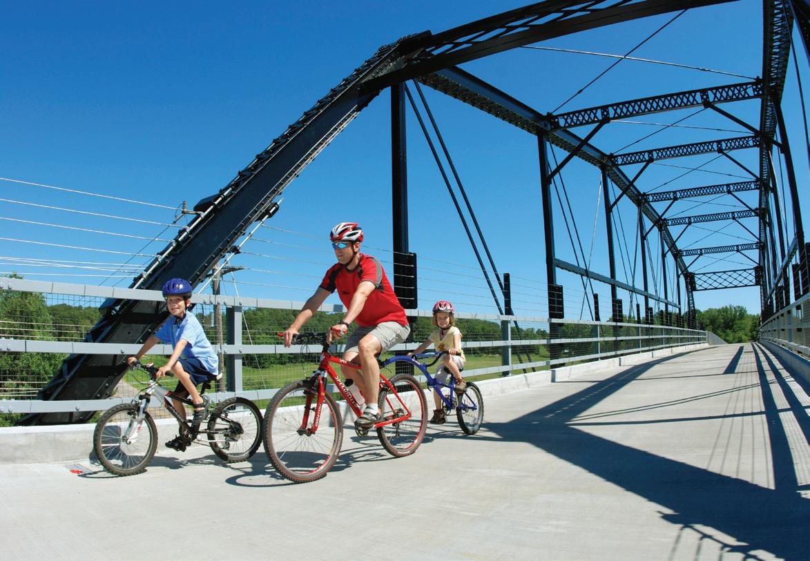
ride in from there.
LEVEL: Easy to moderate
COST: Free INFO: 952-448-5633; chaskamn.gov
LAKE ELMO PARK RESERVE
LOCATION: Lake Elmo, 44.9709084381651, -92.90314923887563
DISTANCE: 19.4 miles
TYPE: Mixed
DESCRIPTION: This multiuse trail is a pleasant ride that offers a view of Eagle Point Lake. Fat biking is available on the Big Bluestem Trail in the winter.
PARKING: Available on-site.
LEVEL: Easy to moderate
COST: Vehicle permit required, $7 daily; $30 year-round INFO: washingtoncountymn.gov
LAKE REBECCA PARK RESERVE
LOCATION: Rockford, 45.07281808665736, -93.74935266759068
DISTANCE: 21.35 miles
TYPE: Paved and unpaved
DESCRIPTION: Take an easy, beginnerfriendly ride through the big woods and wetland areas. The mountain bike trailhead begins at Hilltop Picnic Area, while an 8-mile paved path loops around the park reserve.
PARKING: Available on-site.
LEVEL: Easy
COST: Free INFO: 763-694-7860; threeriversparks.org
LONE LAKE PARK
LOCATION: Minnetonka, 44.901533958377776, -93.42754463206963
DISTANCE: 5 miles
TYPE: Unpaved
DESCRIPTION: Made to accommodate varying levels of biking skill levels, this trail system takes riders through Minnetonka’s Big Woods remnant forest and has steep topography and a fast and flowy singletrack. Bikers can ride all the way through by entering through the Minnesota River Bluffs Regional Trail and can leave their cars at home.
PARKING: From Shady Oak Road, park in the lower lot by the lake.
LEVEL: Easy to challenging COST: Free INFO: minnetonkamn.gov


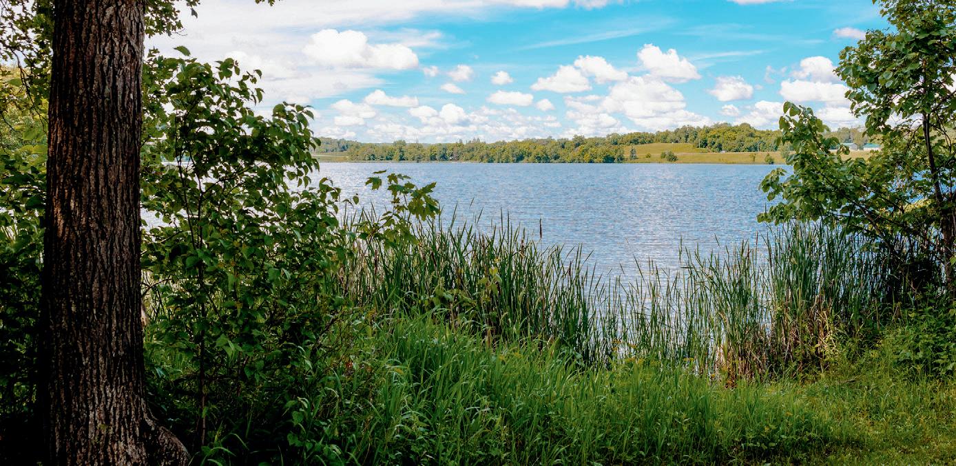


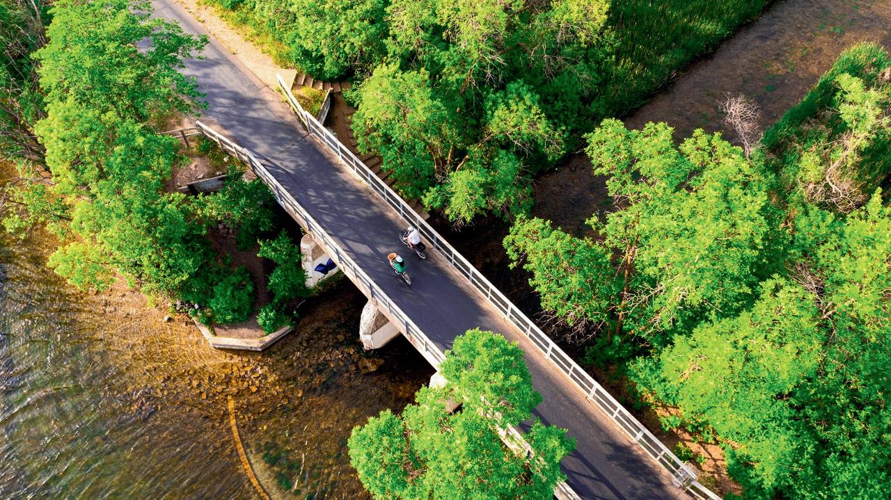

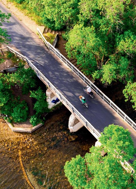


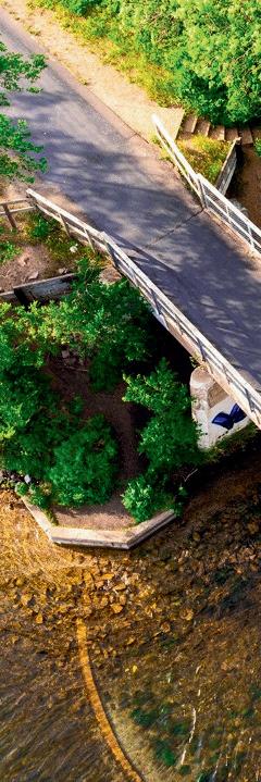
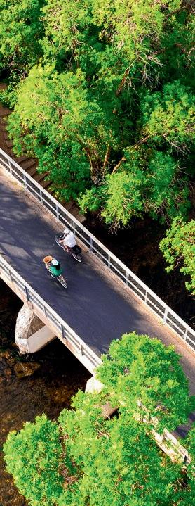
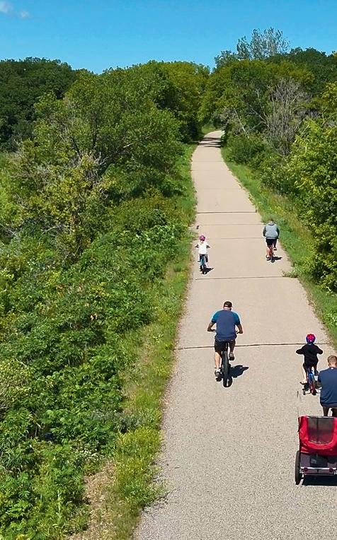


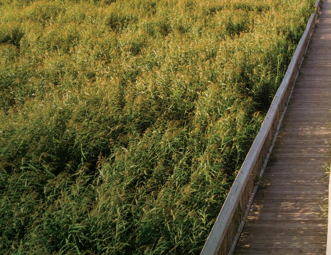
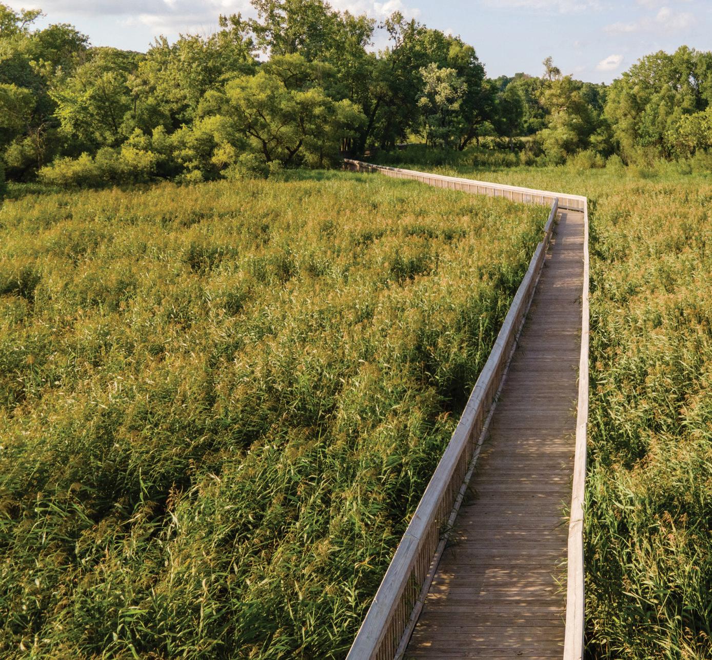
LOCATION: Plymouth through Watertown, Winsted, and Silver Lake to Hutchinson, 44.955466487588176, -94.0351518733759
DISTANCE: 63 miles
TYPE: Limestone from Plymouth to Winsted, paved from the McLeod and Carver County line to Hutchinson, crushed rock from Hutchinson to Cedar Mills, and natural (mowed grass) from Cedar Mills to Cosmos, and crush rock from Cosmos to Thompson Lake.
DESCRIPTION: The Luce Line is a preserved countryside, featuring woodlands, prairie, and nearby lakes with ducks and geese. Bicyclists can enjoy the differing landscapes of both metropolitan and rural Minnesota.
PARKING: Carver County Road 127: available south of County Road 20; Cedar Mills: available on the south side of Highway 7; Cosmos: available at Thompson Park and 252nd Avenue; Hutchinson: off Highway 7 on each end of town; Independence: east side of County Road 110 and south of County Road 6; Lyndale: off County Road 92; Long Lake: Head south on Old Crystal Bay Road to Watertown Road. Go west to Stubbs Bay Road. Then, go south 0.25 miles for parking; Plymouth: off 10th Avenue North and Vicksburg Lane; Silver Lake: north side of Highway 7 at Park Avenue; Watertown: off Vega Avenue; Winsted: available at Babcock Avenue/County Road 1 and Kingsley Street/County Road 9.
LEVEL: Easy
COST: Free INFO: 651-259-5841; dnr.state.mn.us; threeriversparks.org
LOCATION: Minneapolis, 44.95055188634809, -93.2689895020445
DISTANCE: 5.5 miles
TYPE: Paved
DESCRIPTION: The Midtown Greenway, following the path of an abandoned railroad, makes commuting through the city efficient. Since the path is separated from the street grid, the Greenway makes for quick and seamless traveling, also connecting to the Minneapolis Chain of Lakes and paths along the Mississippi River.
PARKING: Bracke Field Park: Take I-94 to Exit 235A toward Riverside Avenue.
Merge onto Ninth Street, then turn right onto 26th Avenue. Turn le onto East 25th Street, then turn right onto 36th Avenue South. Go 0.4 miles to East 28th Street, then turn le onto South 39th Avenue for available parking.
LEVEL: Easy
COST: Free INFO: 612-879-0105; midtowngreenway.org
LOCATION: South St. Paul, 44.91102183347783, -93.04896400310146
DISTANCE: 28 miles
TYPE: Paved
DESCRIPTION: The Mississippi River Greenway stretches 28 miles from St. Paul to Hastings, offering scenic river views and connections to parks, trails, and local destinations. It's open for walking, biking, and in-line skating. Trailheads are located at Kaposia Landing Park and Simon’s Ravine Trailhead, South St. Paul; Swing Bridge Trailhead and Pine Bend Bluffs Trailhead, Inver Grove Heights; Fahey Trailhead, Rosemount; and Lock and Dam No. 2 Trailhead and Schaar’s Bluff Trailhead, Hastings (Spring Lake Park Reserve).
PARKING: Off-street parking available at most trailheads.
LEVEL: Easy to moderate COST: Free INFO: 952-891-7000; co.dakota.mn.us
LOCATION: Waconia, 44.878552568847454, -93.71947480758786
DISTANCE: 14 miles
TYPE: Unpaved
DESCRIPTION: With over 14 miles of trails ranging from easy to advanced, riders will experience wetlands, grasslands, and woodlands. The beginner trails feature a wider tread, while the more advanced loops, like the Raptor Ridge loop, have flowy trails and berms.
PARKING: Available on-site.
LEVEL: Easy to difficult COST: Free INFO: 763-694-7650; threeriversparks.org
LOCATION: Monticello, 45.28245822456811, -93.76578626756981
DISTANCE: 2.75 miles
TYPE: Paved
DESCRIPTION: First opened in 2020, this course is for experienced riders who can handle steep hills, jumps, and teeters. Fat biking is popular here in the winter, with the annual FatBikeFest in February. As it is a newer course, more trails are planned to be added in the future.
PARKING: Available at the top of Holy Spirit Trail.
LEVEL: Challenging
COST: Free INFO: ci.monticello.mn.us
LOCATION: Minnetonka, 44.904353893892626, -93.40298226923774
TYPE: Paved
DISTANCE: 15.3 miles
DESCRIPTION: Connecting to the trail systems of the Minnesota River Bluffs Regional Trail, Cedar Lake Regional Trail, and Nokomis-Minnesota River Regional Trail, Nine Mile Creek provides bikers with scenic views of Hennepin County, including the wetlands and woodlands of the Edina area and Lake Nokomis.
PARKING: Available at Hopkins Depot, Hopkins Valley Park, Walnut Ridge Park, Bredesen Park, Fred Richards Park, Adams Hills Park, and Roosevelt Park.
LEVEL: Easy to moderate
COST: Free
INFO: threeriversparks.org
LOCATION: Lake Elmo, 44.99304046785611, -92.87468758854796
TYPE: Unpaved
DISTANCE: 1 mile
DESCRIPTION: This is a rather easy, accessible ride for beginners or those ge ing back into biking. It is still a work in progress, with help from community volunteers.
PARKING: Available on-site.
LEVEL: Easy
COST: Free INFO: lakeelmo.org
LOCATION: Lino Lakes, 45.17184847148936, -93.06959493205498
TYPE: Paved
DISTANCE: 3.5 miles
DESCRIPTION: Two singletrack trail loops make up this trail system within one of the largest parks in the metro area. There are also a lot of natural resources and wildlife to spot—check out pelicans, sugar maples, and wildflowers in the springtime.
PARKING: Available on-site.
LEVEL: Easy to moderate
COST: To park inside the park, a $7 daily vehicle pass or $30 annual pass is required
INFO: 763-324-3300; anokacountyparks.com
LOCATION: St. Paul, 44.92741997048706, -93.11997721551134
DISTANCE: 9 miles
TYPE: Paved
DESCRIPTION: Take in the cityscape of St. Paul and views of the Mississippi River on this 9-mile ride that leads bicyclists through Shepard Road, Upper Landing Park, and Indian Mounds Park.
PARKING: Available at Ba le Creek Regional Park, Lower Landing Park, Upper Landing Park, the end of Randolph Avenue, and Crosby Farm Regional Park.
LEVEL: Easy
COST: Free INFO: stpaul.gov/parks
COUNTY PARK
LOCATION: Cambridge, 45.58840480885687, -93.35253300731276
DISTANCE: 3 miles
TYPE: Paved
DESCRIPTION: Perfect for bikers looking for a pleasant, easygoing ride, this trail passes through rolling hills, hardwood forests, and wetlands. It is also groomed for fat biking in the winter.
PARKING: Available at north and south parking lots.
LEVEL: Easy
COST: Free INFO: co.isanti.mn.us
LOCATION: Lake Elmo, 44.9991546, -92.8984612
DISTANCE: 9 miles
TYPE: Unpaved
DESCRIPTION: Considered to be the “crown jewel” of the Lake Elmo park system, this 284-acre natural area is filled with woodland, wetland, and prairie plant communities. The singletrack mountain biking trails have berms, elevated lines, and rollers, perfect for bikers looking to develop their skills.
PARKING: Available on-site.
LEVEL: Moderate to challenging COST: Free INFO: lakeelmo.org
LOCATION: Between North Branch and Hugo, 45.16187311112033, -92.99321080201005
DISTANCE: 26 miles
TYPE: Paved
DESCRIPTION: As their names imply, these connecting trails pass through both farmland and hardwood forests, plus a number of wetland areas. A er traversing both the west and south branches of the Sunrise River, Sunrise Prairie Regional Trail changes into the Hardwood Creek Regional Trail in Forest Lake.
PARKING: North Branch: Take I-35 to Exit 147, then go 0.6 miles east on Highway 95 to Forest Boulevard. Turn right to go south, then turn right again onto Maple Street for available parking; Stacy: Take I-35 to Exit 139, then go 0.3 miles east on Stacy Trail for available parking; Wyoming: Take I-35 to Exit 135 for Chisago County Road 22. Go east for 0.2 miles on East Viking Boulevard. Turn le onto Forest Boulevard; Forest Lake: Take I-35 to Exit 131, then go east for 0.8 miles on West Broadway Avenue.
LEVEL: Easy
COST: Free INFO: 651-257-1300; chisagocountymn.gov or 651-430-8370; washingtoncountymn.gov

JUNE 6-8, 2025
MT. TELEMARK VILLAGE, CABLE, WI
birkie.com/bike/events/epic-bike-fest
Challenging and fun for the entire family. Food trucks, expo/festival, and beer tent on-site!
Epic Singletrack
FULL: 37 Miles | HALF: 18 Miles
Epic Gravel
FULL: 50 Miles | HALF: 27 Mile
Mini Epic Kids Race
AUG. 9, 2025
MT. TELEMARK VILLAGE, CABLE, WI birkie.com/bike/events/telemarkgravity-games
The amazing Trek Trails Powered by OTM provide the perfect setting for this first-time summer Enduro. A fun party with some of your closest friends who are looking for a fast, technical downhill challenge.
OCT. 11, 2025
MT. TELEMARK VILLAGE, CABLE, WI birkie.com/bike/events/enduro
Limited to 50 riders, this event is for riders who need a fast, technical downhill challenge. Racing is the focus for this event, but we’ll be sure to have fun at the after party with Earth Rider beer!

101 ISANTI PKWY. NW, ISANTI, MN INFO@RUMRIVERBMX.COM rumriverbmx.com
Rum River BMX in Isanti, Minnesota, offers a passionate, volunteerdriven environment where riders of all ages and skill levels can thrive. Focused on safety, accessibility, and education, the track fosters a strong sense of community and supports athletes in achieving their goals.
OAKS WEST PARK
LOCATION: Burnsville, 44.77194244104249, -93.24631456134331
DISTANCE: 2.3 miles
TYPE: Unpaved
DESCRIPTION: Although a fairly short ride, this is a technical trail with climbs, descents, and plenty of hills, ideal for those training for endurance.
PARKING: Available on-site.
LEVEL: Moderate
COST: Free INFO: burnsvillemn.gov
WEST LAKE MARION
MOUNTAIN BIKE TRAIL
LOCATION: Lakeville, 44.66582787461908, -93.28823511234198
DISTANCE: 5 miles
TYPE: Unpaved
DESCRIPTION: This trail has segments for beginners, intermediate, and advanced bikers, and passes through the fields and woods on the west side of Lake Marion.
PARKING: Available at gravel lot near the soccer fields and Casperson Park.
LEVEL: Easy to challenging COST: Free INFO: lakevillemn.gov
XCEL ENERGY
MOUNTAIN BIKE PARK
LOCATION: Shakopee, 44.7951554, -93.4493332
DISTANCE: 4 miles
TYPE: Unpaved
DESCRIPTION: This park has a handful of beginner-to-intermediate trails that loop around Quarry Lake, and the singletrack course follows a prairie area. There’s also a pump track, as well as the “chicken foot”—a fallen oak tree cut for riders to traverse.
PARKING: Available on-site.
LEVEL: Easy to difficult COST: Free INFO: 952-233-9300; shakopeemn.gov
VALLEY VIEW TRAILS
LOCATION: Oak Park Heights, 45.029216029832185, -92.80128832941563
DISTANCE: 3.2 miles
TYPE: Unpaved
DESCRIPTION: This singletrack mountain biking trail has steep but brief hills and technical drops and curves, ideal for the intermediate rider.
Riders will pass through prairie grasses and even a small creek.
PARKING: Available at main Valley View parking lot near trailhead.
LEVEL: Moderate
COST: Free INFO: cityofoakparkheights.com
LOCATION: Around Deer River, Grand Rapids, Walker, and Cass Lake, 47.48629075889229, -94.03690983076658
DISTANCE: Varies
TYPE: Paved and unpaved
DESCRIPTION: Within this 1.6-millionacre national forest, there are mountain and non-mountain biking trails to explore, including the scenic 630-mile Mississippi River Trail. There are also the Cass Lake, Deer River, and Marcell areas. Encounter abundant plants and wildlife, as the Chippewa National Forest is home to more than 250 wildlife species.
PARKING: Available on the north and south ends of the forest.
LEVEL: Moderate to challenging COST: Free INFO: 218-335-8600; fs.usda.gov/chippewa
LOCATION: Crosby-Ironton area, 46.49038744987329, -94.00048692411492
DISTANCE: Over 50 miles
TYPE: Unpaved
DESCRIPTION: Experience worldclass mountain biking with Cuyuna’s singletrack trails, spread out over 800 acres of vegetation and lakes. The trail difficulty is denoted by color, as Cuyuna is accessible to the most novice and the most seasoned of mountain bicyclists.
PARKING: Ironton: available at Third Street between Irene and Winona avenues, or Curtis Avenue between Highway 210 and Second Street.
LEVEL: Easy to extremely challenging COST: $7 daily vehicle pass; $35 year-round INFO: 218-454-3222; cuyuna.com
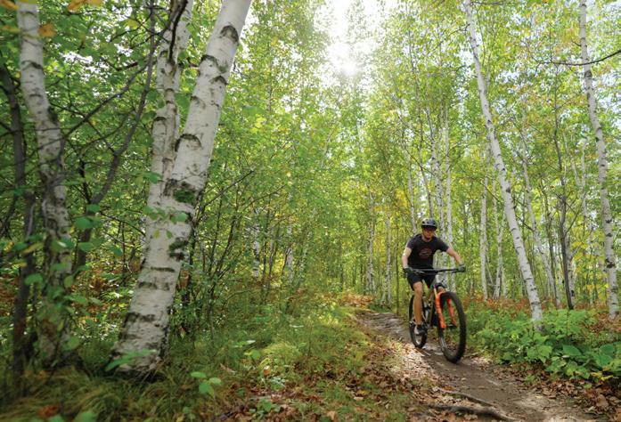

LOCATION: Detroit Lakes, 46.813250587547365, -95.78332125293907
DISTANCE: Varies
TYPE: Unpaved (dirt)
DESCRIPTION: In the summer months, Detroit Mountain provides premier mountain biking for all levels and ages, including cross-country contour flow trails, a skills park, and downhill gravity trails.
PARKING: Available on-site.
LEVEL: Easy to extremely challenging COST: Pricing varies by season, see online (season passes available).
INFO: 218-844-7669; detroitmountain.com
LOCATION: Around Duluth, 46.718500078229624, -92.21673113760153
DISTANCE: Varies
TYPE: Unpaved
DESCRIPTION: From Mission Creek to Spirit Mountain, the scenic backdrop of Lake Superior makes for exceptional mountain biking. Hilly terrain and wooded hillsides weave through the city’s rocky terrain, totaling over 90 miles.
PARKING: Lots and street parking available.
LEVEL: Easy to extremely challenging COST: Spirit Mountain summer adult all-day pass, $35; winter fat biking allday li pass, $65. Prices subject to change.
INFO: coggs.com
LOCATION: Biwabik, east of Virginia, 47.578831869614845, -92.3031907961994
DISTANCE: 37 miles of road and mountain biking trails; connects to the paved Mesabi Trail
TYPE: Paved and unpaved
DESCRIPTION: Giants Ridge is a favorite getaway for skiing and golfing, and also the largest li -served mountain bike park in the Midwest. It offers 10 gravity trails that cover a variety of terrains suitable for beginner to expert riders. There are also 9 miles of cross-country trails within the Superior National Forest.
PARKING: Lot available.
LEVEL: Easy to extremely challenging
COST: Adult all-day pass, $30; youth allday pass, $25. Prices subject to change. INFO: 800-688-7669; giantsridge.com
LOCATION: Demonstration Forest, Two Harbors, 47.10857093529782, -91.74904554603354; and Split Rock Wilds, Beaver Bay, 47.252825013355746, -91.32108177301674
DISTANCE: 10 miles; 22 miles
TYPE: Unpaved
DESCRIPTION: Demonstration Forest: four singletrack trails with scenic views great for beginners; Split Rock: new trail system for advanced riders with technical terrains.
PARKING: Demonstration Forest: From Two Harbors, go about 8 miles northwest to Drummond Grade, parking at the forest entrance; Split Rock: Take Highway 61 to Superior Hiking Trail.
LEVEL: Easy to challenging COST: Free INFO: lovinlakecounty.com
LOCATION: Milaca, 45.754258655260315, -93.66216658686747
TYPE: Unpaved
DISTANCE: 12 miles
DESCRIPTION: The Milaca Trails have less strenuous, relaxing rides on trails such as the Meadow and River Run, or more high-intensity rides on the Sky Hill Trails. This single and doubletrack trail system is also decorated with scenic views of the Rum River.
PARKING: Available in Recreation Park, near the entrance to Forest Hill Cemetery, and west off County Road 112.
LEVEL: Easy to challenging COST: Free
INFO: 320-983-3141; cityofmilaca.org
LOCATION: Nisswa, 46.430528204196406, -94.43583746547684
DISTANCE: Over 30 miles
TYPE: Unpaved
DESCRIPTION: Venture through deciduous and coniferous trees as well as small lakes and ponds in Minnesota’s first state forest. Hilly topography (due to glacial activity) makes for thrilling mountain biking.
PARKING: Available off Beauty Lake Forest Road and Pillsbury Forest Road.
LEVEL: Moderate
COST: Free
INFO: dnr.state.mn.us/state_forests
LOCATION: Grand Marais, 47.77119387341624, -90.31674203238342
DISTANCE: 6 miles
TYPE: Unpaved
DESCRIPTION: Seven hard-pack trails intersect in this trail system, giving riders a stunning view down the mountain, plus an overhead look at Grand Marias.
PARKING: Turn west onto Gunflint Trail for 3 miles and watch for signs pointing to Pincushion Mountain on the right, which will lead to a parking lot.
LEVEL: Moderate
COST: Free INFO: fs.usda.gov
LOCATION: Chisholm, 47.47739423343047, -92.89380284421588
DISTANCE: 27 miles (in progress)
TYPE: Paved and unpaved
DESCRIPTION: Established in 2020 from an abandoned iron mine, with miles of towering cliff faces, lakes, and overlooks, this park is set to add 14 miles of trails and backcountry.
PARKING: At the Minnesota Discovery Center.
LEVEL: Easy to challenging COST: Free INFO: redheadmtbpark.com
MEMORIAL PARK
LOCATION: Red Wing, 44.56151190773725, -92.52103110226072
DISTANCE: Varies
TYPE: Unpaved
DESCRIPTION: With 31 available mountain biking trails that wind through scenic, elevated terrain, there is something for all skill levels.
PARKING: Take Highway 61 to Plum Street to East Seventh Street to Skyline Drive.
LEVEL: Easy to challenging COST: Free INFO: red-wing.org/407/trails
SUPERIOR
FOREST
LOCATION: Around Ely, To e, and Grand Marais, 47.866510712173636, -91.48020017303766
DISTANCE: Varies
TYPE: Unpaved (gravel and dirt)
DESCRIPTION: Explore the spectacular boreal forest along the numerous single-lane gravel roads. Pincushion, Big Aspen Trail, and Peak Trailhead are just some of the mountain biking trails available.
PARKING: Lots and street parking available.
LEVEL: Easy to extremely challenging COST: Free to bike INFO: 218-626-4300; fs.usda.gov/superior
TIOGA RECREATION AREA
LOCATION: Cohasset, 47.22319574272827, -93.61224457306038
DISTANCE: 25 miles
TYPE: Unpaved
DESCRIPTION: Located on 500 wooded acres, the area has turned former mining ores into twisty, sloping, thrilling mountain biking trails.
PARKING: Available at Tioga Beach and trailhead parking lot off Tioga Beach Road.
LEVEL: Easy to extremely challenging COST: Free INFO: tiogarecreation.com
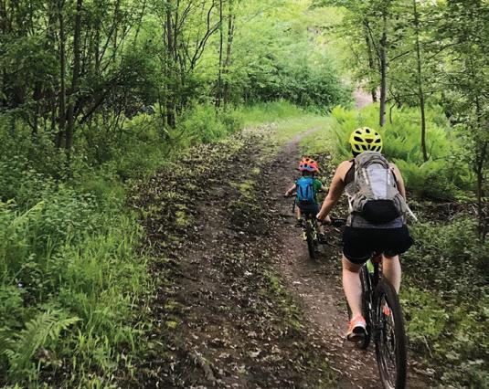


LOCATION: Eastern part of St. Paul, 44.93859455583189, -93.01400074827198
DISTANCE: 9.5 miles of trails
TYPE: Paved and unpaved
DESCRIPTION: With trails varying in difficulty, plus views of the Mississippi River, Ba le Creek Regional Park provides accessible mountain and road cycling for nature enthusiasts and steadfast bicyclists alike.
PARKING: Available at Ba le Creek Recreation Center and on Upper A on Road.
LEVEL: Easy
COST: Free
INFO: 651-748-2500; ramseycounty.us
LOCATION: Eagan, 44.79311481376406, -93.12845731748752
DISTANCE: 12 miles
TYPE: Unpaved
DESCRIPTION: Containing almost 2,000 acres, Lebanon Hills Regional Park is the largest park in the Dakota County Park System. The trail system provides picturesque views of lakes and wooded areas, and the West Trailhead is suitable for mountain biking.
PARKING: Available on Johnny Cake Ridge Road or on Galaxie Avenue on the west side of the park.
LEVEL: Moderate to challenging COST: Free INFO: 651-554-6530; co.dakota.mn.us/parks
LOCATION: Bloomington, 44.804987161925716, -93.28838054814916
DISTANCE: 11 miles
TYPE: Unpaved
DESCRIPTION: Located within the flood plain of the Minnesota River, this trail is colloquially referred to as the “River Bo oms.” In the winter, fat biking is quite popular, with weekly “Faturday” rides.
PARKING: Available at Sibley Park and Waterfront Park access points.
LEVEL: Moderate
COST: Free INFO: morcmtb.org
LOCATION: Between Shakopee and Belle Plaine, 44.65130663231192, -93.71618683506946
DISTANCE: 35 miles
TYPE: Unpaved and paved
DESCRIPTION: This state recreation area preserves part of the Minnesota River Valley, which contains wetlands, oak savanna, and floodplain forest. Enjoy a ride with a view of the Minnesota River or Horseshoe Lake. The trail is natural-surface from Belle Plaine to Chaska, then paved from Chaska to Shakopee.
PARKING: Available on-site.
LEVEL: Easy
COST: $7 daily; $35 year-round INFO: 651-259-5774; dnr.state.mn.us
LOCATION: Mankato, 44.13335298833132, -94.03330907158977
DISTANCE: Over 7 miles
TYPE: Unpaved
DESCRIPTION: Open from early May through October, Mount Kato’s mountain biking trails are 80% wooded singletrack and take bicyclists around ponds and ski trails. They even offer a view of the Minnesota River from the top of the hill.
PARKING: Available on-site.
LEVEL: Moderate to challenging COST: $5 daily; $130 seasonal. Prices subject to change.
INFO: 507-625-3363; mountkato.com
LOCATION: Near Savage, 44.724149839699734, -93.34821522409575
DISTANCE: Over 10 miles
TYPE: Unpaved
DESCRIPTION: This singletrack mountain bike course consists of three oneway loops of varying difficulty. The easy loop traverses an open, rolling prairie. The intermediate loop is more than 2 miles long, weaving through the woods and

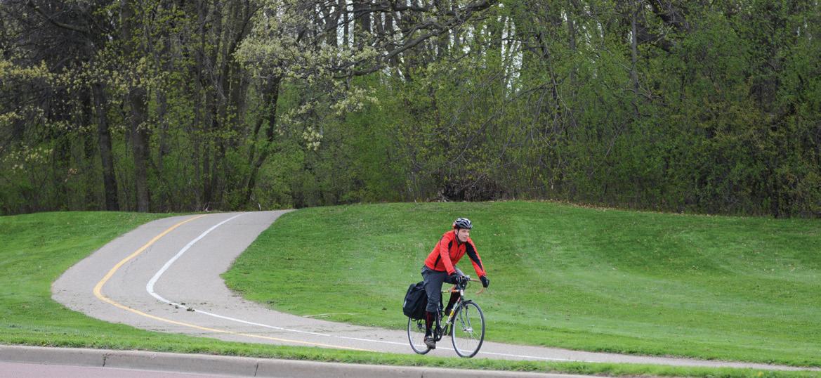

over a wetland boardwalk. The advanced is more than 5 miles long and goes over high and narrow ladder bridges.
PARKING: From I-35W, take County Road 42 west to County Road 27. Turn south then east on 154th Street. Go south on County Road 75 to the park entrance.
LEVEL: Easy to challenging
COST: Free
INFO: 763-694-7777; threeriversparks.org
LOCATION: Minneapolis, 44.99248144706423, -93.32649070985082
DISTANCE: Over 12 miles
TYPE: Paved and unpaved
DESCRIPTION: Theodore Wirth Regional Park is the largest park in the Minneapolis park system. The trails are a mix of easy, moderate, and challenging and take bicyclists through open parkland and woods.
PARKING: Available in trailhead lots and in nearby neighborhoods.
LEVEL: Easy to challenging COST: Free INFO: 612-230-6400; minneapolisparks.org
LOCATION: Holzinger Trail System, 44.0410900933339, -91.66255080212011; and Cherry Hill, 44.059776620726886, -91.73056506656435
DISTANCE: 9 miles; 6 miles
TYPE: Unpaved
DESCRIPTION: The Holzinger Trail and Cherry Hill Trail systems offer some of the Midwest’s most challenging mountain biking. The Holzinger Trail System in Bluffside Park combines doubletrack rollers and technical singletrack. Cherry Hill offers one doubletrack and two singletrack sections.
PARKING: Holzinger: available in Holzinger Lodge parking lot; Cherry Hill: available in lot at the end of Brook Drive off County Road 23.
LEVEL: Moderate to challenging
COST: Free INFO: visitwinona.com
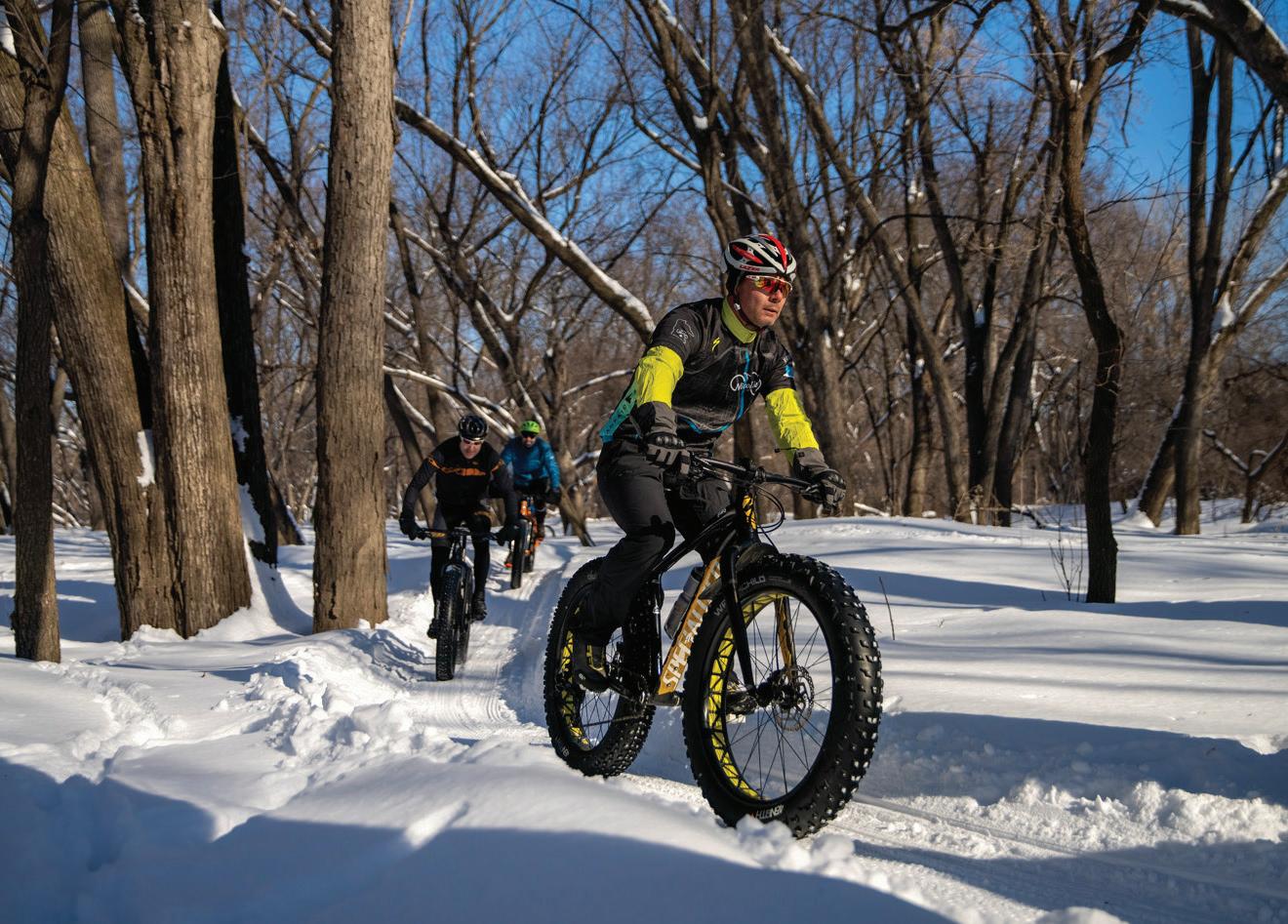
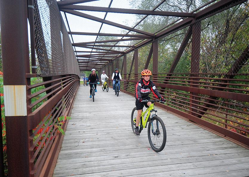
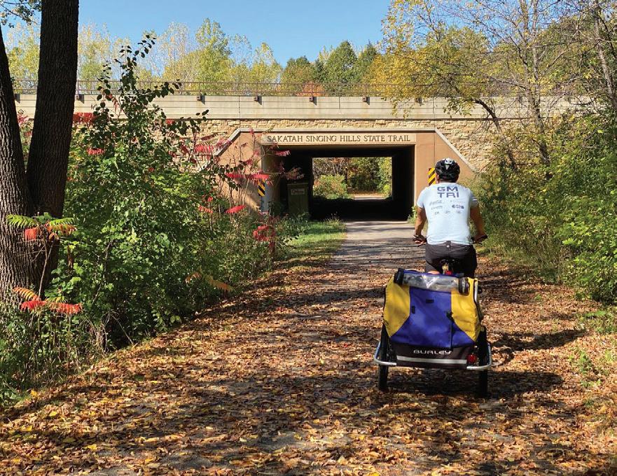
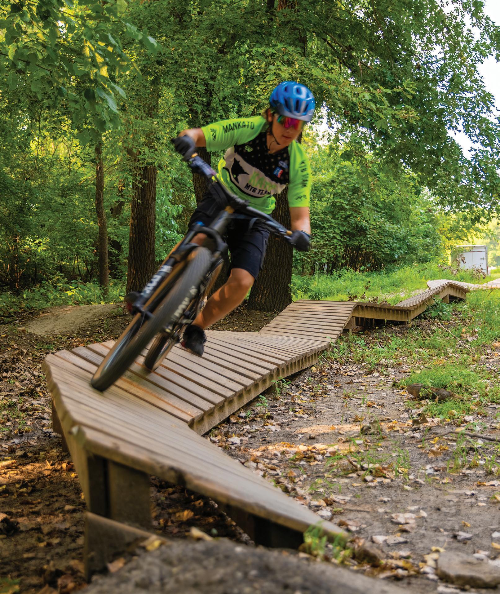
Did you know? Greater Mankato features some of the best biking opportunities in the state and boasts over 50 miles of cycle-friendly trails and loops. Gear up for biking adventures throughout all four seasons while soaking up the breathtaking scenery of blu s, rivers, lakes, and wildlife. The community of Mankato and North Mankato have been designated a Bronze Bicycle Friendly Community by the League of American Bicyclists, Washington D.C. boasts scenery of designated a League of know? Greater Mankato features some of biking opportunities in the state and boasts miles of cycle-friendly trails and loops. biking adventures throughout all four while soaking up the breathtaking scenery rivers, lakes, and wildlife. The community of and North Mankato have been designated a Bicycle Friendly Community by the League of Bicyclists, Washington D.C.
GIANTS RIDGE
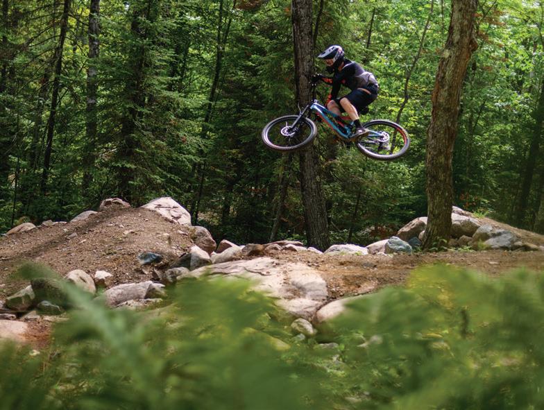
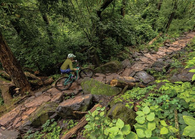
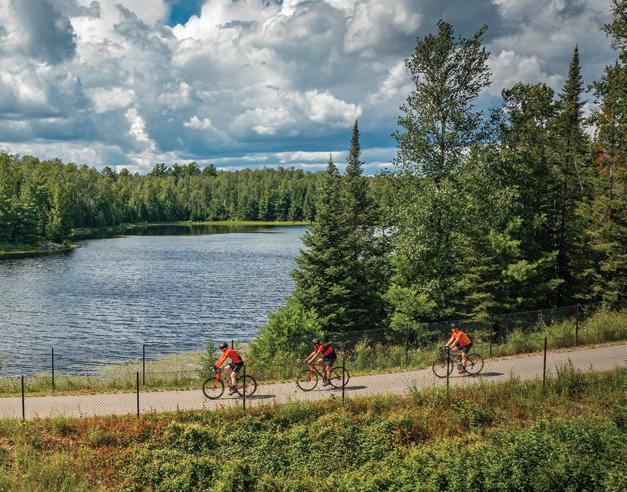
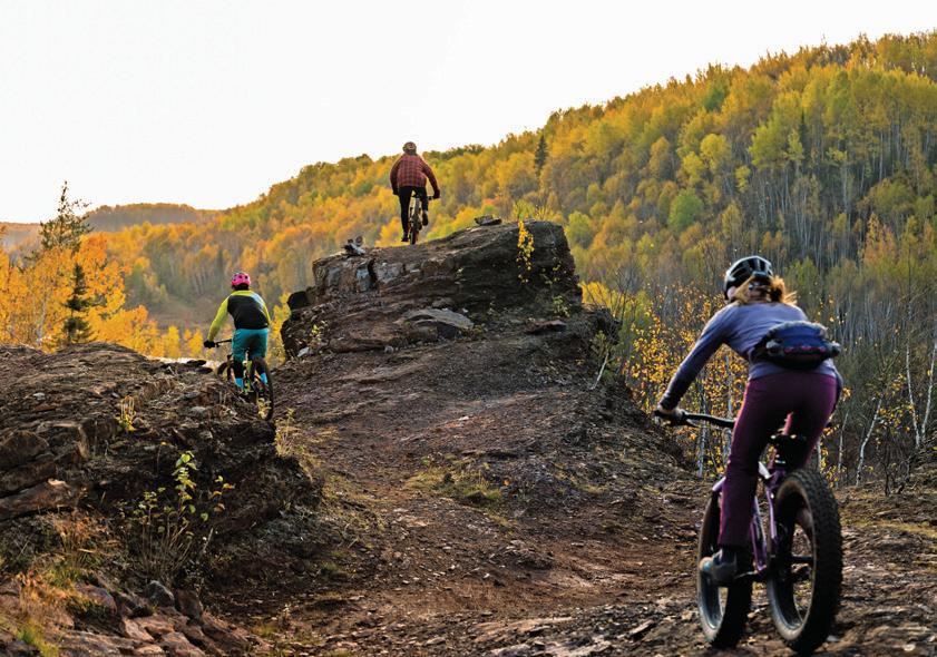
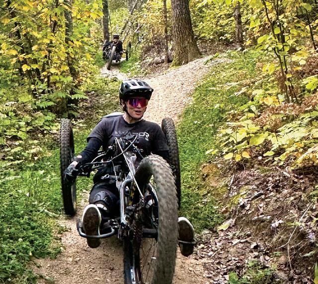
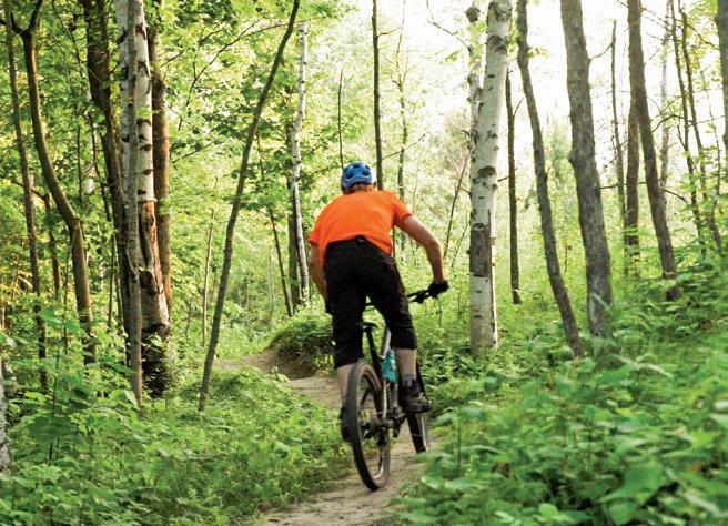
315 MILES OF TRAILS - 6 TRAIL LOCATIONS - 1 GOOD TIME WELCOME TO MINNESOTA’S IRON RANGE