

The original edition of this publication was made possible by the support of the Graduate School of Architecture, Planning and Preservation at Columbia University New York, New York.
Copyright © 2024 by the Trustees of Columbia University in the City of New York
All illstrations, layouts, photographs © 2024 URBAN Magazine
All rights reserved


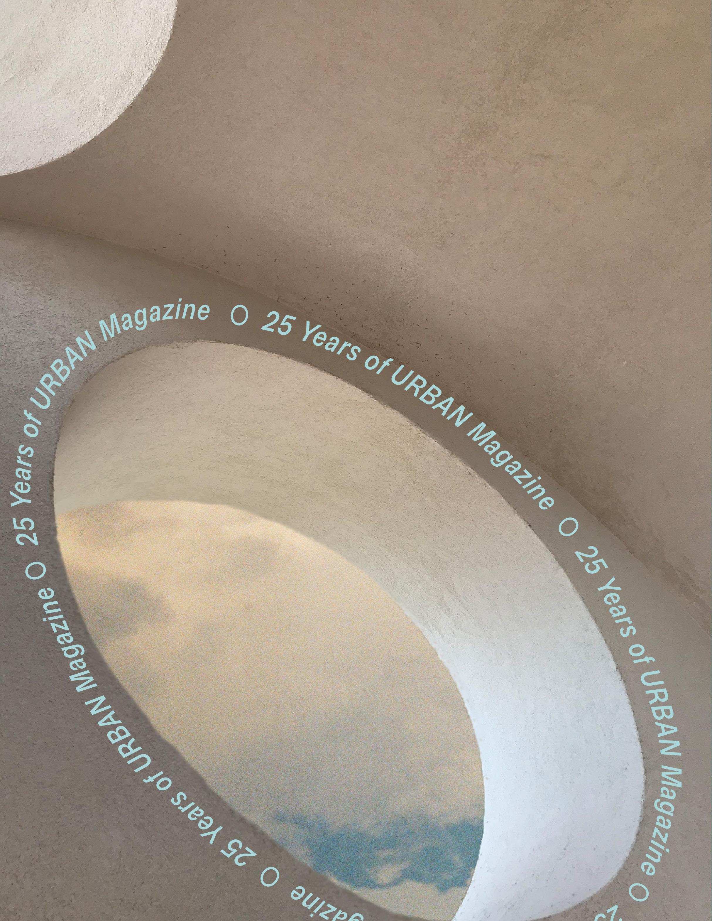
URBAN Magazine
Celebrating 25 Years
Volume 34, Spring 2024


Letter from the Editors
Some moments demand a pause for reflection. While URBAN Magazine began publishing written and visual work in 1999, the magazine has never been just a platform for thinking about cities. For a quarter-of-a-century, URBAN has provoked and inspired readers with questions that challenge our foundational assumptions about the built environment.
The complexity of urban life has remained a central concern since the magazine’s inception. Every year we see new formulations of the same questions — about the changing character of cities against flows of capital, people, and time. One (perhaps obvious) lesson from the hundreds of entries in URBAN over the years is that cities, in their richness and diversity, evade characterization. To claim to understand a city is to see only one facet of its reality.
Breaking with tradition, Volume 34 of URBAN does not have a theme. This decision was motivated in part to avoid unnecessary guardrails for our submissions. We encouraged our contributors to play a more collaborative and active role in shaping the issue through their own paths and perspectives.
We present Volume 34 as an exercise in both reflection and speculation. We looked to the past to create this issue, reviewing those that came before to revive lost practices and improve upon them. We have also greatly expanded the voices included in our magazine, and are excited to pair excellent student and peer contributions alongside reflections from theorists and expert practitioners, including Carlos Moreno, Steven Holl, and Emily Talen, among many others. We’re proud to feature editors from URBAN’s past issues, including Leah Meisterlin (2005), Ebru Gencer (1999), and Fernando DeGuia (1999). Looking toward the future, in this issue, we highlight new media in the form of podcasts and videos. Over the next 25 years, we hope future editors and contributors continue to embrace alternative media formats, creating a forum for perspectives and ideas that have been traditionally excluded from print publication.
We have large shoes to fill on URBAN’s 25th anniversary; the magazine that has made strides to publish daring ideas about cities and our lives within them. It has been a labor of love to collectively assemble this issue of URBAN from deep within Fayerweather Hall — not to mention an honor to build upon the magazine’s legacy on this important milestone.
Volume 34
5
Ethan Floyd, Olivia Jia, and Felipe Urrutia

 Salonee Ghosh
Soichiro Harada
Otis Emslie
Deqah Hussein-Wetzel
Florentina Anastasia
Ishaan Barrett
Fernando DeGuia
Salonee Ghosh
Soichiro Harada
Otis Emslie
Deqah Hussein-Wetzel
Florentina Anastasia
Ishaan Barrett
Fernando DeGuia
10-13 28-31 14-17 32-35 18-19 36-39 20-23 40-45 24-25 26-27 Choreographies in Chaos Fluid Urbanism at Mumbai's Edge Self-Similarity Across Cities, Architecture, and Nature Retail Redundancies and the Landscape for Small Business in Big Cities Preserving Place Through Story So Close Yet So Far Hyderabad and Hitech-City An Interview with Our Inaugural Editor Quito Recuerdos y Colores Inside Volume 34
Stories of Decay, Insalubrity, and Resistance in Lima, Peru
Claudia Kohn Avila
Daniela Perleche Ugas
6
Mumtaz Hammad


 Teonna Cooksey
Alexandria Bernabe
Jaron Kaplan
Sueng Hyo Chang
Johann Xavier Marcotullio
Ruju Joshi
Teonna Cooksey
Alexandria Bernabe
Jaron Kaplan
Sueng Hyo Chang
Johann Xavier Marcotullio
Ruju Joshi
54-57 82-85 58-65 66-67 68-71 72-77 78-80 46-49 50-52 How Participatory Budget has Impacted Citizens’ Lives in the Metropolitan Area of Guadalajara, Mexico Eviction, then Redemption The Land and Water Talks Our Innate Obsession With the Waterfront and How to Keep It Alive Occupiable Thresholds Intra-City Transit in a Late Medieval and Early Modern City Not-for-Profit or Landgrab Richies of New York City Unraveling Ejidos, Land Rights, and Urban Form in Baja California Inside Volume 34
William Fainaru Callahan
Pan When a House is not a Home
Shuyue
88-97 25 Years of URBAN Magazine 7
Raquel Padilla
100-101
Saturday II
102-111
Riding LA

112-115
Illuminating Chinatown’s Future
116-120
The Symbolism of Destruction
 Tiara Hughes
Oscar M. Caballero
Tiara Hughes
Oscar M. Caballero
122-127
128-131 132-139
Saadiyat: Architecture and the Ideology of
in Abu Dhabi
the Fog of Artificial Impact
on the
Appendix Inside Volume 34
140-149 Hotel
Tolerance
Unveiling
Dragons
Landscape
Izzy Kornblatt
Kurt Steinhouse
John Friedman
Lauren Kirk and SOM
Sofia Ohmer
8
9
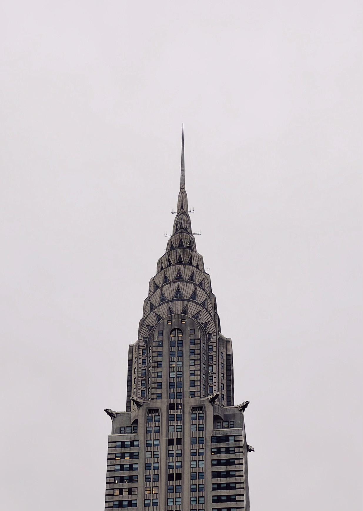
Chrysler (2023). Photo by: Ethan Floyd
CC C hh h hi i aa a p oo o o g r r e e ss s
 Words by: Mumtaz Hammad
Mumtaz Hammad is an urbanist, trans-disciplinary artist, and graduate student at Columbia University pursuing an MSUP at Columbia GSAPP.
n
10
Deconstructed vibrations of a glass shattering reach over the speakers and crawl inside my stomach. In Mojave epistemology, the stomach is also referred to as the core or compass. The corpus of my gut navigates me in my lurching movements in rhythm to the club music that is not really club music, but not really subterranean music either. One may ask, what is tunnel music? Are we creating it right now? Is the crescendo of corridos, jersey club, and noise reflexive of the waves of sewage that lurched here before? Tunnel music makes use of all these genres in its griminess and defiance of conventional electronic dance music. It leads me and leaves me.
But now I am enveloped by the tough love of New York. I’m also enveloped in the depths of its sound. They drown me inside them in a fullness of open fury. The warehouse is sublime and sublimated, eating itself alive in a chiasmatic venture. The venture of performance. And then I remember what it felt like to be crushed by the sonic concaving of an abandoned tunnel in the heart of Texas. I remember my friends and I embracing a dirtiness unable to be translated into the city around us, in a flux of inventing and reinventing impurity. Perhaps this is what makes us pure. To love something lined with grime into sparkling in a new way is miraculous.
Meditation opens up more space in chaos. Chaos is the space that allows for devotion. Without chaos, there would be no harmony. Chaos is vital for the liquid architecture of the tunnels, fixed into place by sweat, saliva, sound. Chaos is a cool spring heat.
Can tunnel meditation translate as warehouse meditation? There are parties thrown in abandoned warehouses scattered around the industrial organs of the city. They too are lined in dilapidation and a glimmer. But it is a glimmer still hidden from me, separate from what I know as an epistemology of unknowing. It leaves an ache in me. The sheen beyond the edge of its structure. At the end of a warehouse party, I am left aching for more. To know the spatial secrets of its meditation.
I trace myself back to the tunnels.
A cavernous chaos threatens to eat me alive. I am listening. For an instant, all silence is drowned out in a decomposing clash of harmonies. A style that is completely subterranean on its own. This structure is unfamiliar, petrifying even. But it is erotic in its eeriness.
Mumtaz Hammad
11
I am interested in the structure that is created through sonic elements in entanglement. Harmonious or not. A structure held together in sweeping exhales of strangeness. This is how I render liquid architecture. At the pit of this pulpit of liquidity, there is an everlasting vibration that is meditation. When movement blurs, it is meditating. A blurring is self reflexive, pausing at the instant that is. That is, a is-ness that is always-already a quandary.
Meditation keeps transmuting itself into different forms for me. Sometimes I breathe deeply. Sometimes I match the corporeal rhythm of a dancing partner. Sometimes it is an offering of fragrance I make at my altar at home. Yet, in all its forms, meditation is a rejoinder of my attention that is fragmented within an ever present un-reality that is constructed by borders. Meditation makes itself synonymous with prayer. It is only through meditation that I begin to not just be the “I” but also the “We” that obscures the transparent violence of a pornographic worship of marginality. Meaning, the affect of blurring comes onto itself in that pause of quandary. Blurring is eternally self-curatory in ways that representation is simply not. And so, the rave becomes a neverplaceable moment of self-curation. Knowing itself as temporary, the rave is a continuous moment of blurring. The rave perpetually dies and is thus perpetually birthed in a space of opacity, or a moment of blurring. Which is why I am so inextricably intermeshed with it.
My senses come into being. I am both in the warehouse and the tunnel. There is a space in between where I occupy, settle, stake. I unmoor myself from it. In this action, I find a space for meditation. Moving across both worlds of warehouse and tunnel, in a tempest of sonics, the meaning of a rave makes itself unknown to me. It is both part of and extracted from spatial strategy. Meditation lies beyond the rave’s claims of subversion and sublimation.
I am surrounded by the glorious torrent of sound. And I don’t question my body that responds.
Choreographies in Chaos 12
13
Beacon (2021). Photo by: Olivia Jia
Self-Similarity Across Cities, Architecture, and Nature
How fractals of the concrete jungle can inspire design that embraces the beauty of nature, without overgrowing its boundaries
Words and models by: Soichiro Harada
Soichiro is a candidate in the MSUP program at Columbia GSAPP.
Before GSAPP, he worked as an architectural designer and project manager at Kengo Kuma and Associates in Tokyo.
14
Walking through Times Square, one might spot a bike tour zooming by, set to the backdrop of “Empire State of Mind.” We’re all familiar with the famous lyric, “Concrete jungle where dreams are made of.” However, what interests me more than the song is the question: Why do we refer to New York as a “jungle”? Why would we describe this artificial city of concrete and glass with the same word reserved for a primeval natural environment?
Perhaps the city’s “jungle-esque” quality is not so much due to the materials of its buildings but the self-similarity of repeating square windows and building forms, and the continuity of its skyscrapers. This selfsimilarity isn’t just found in cities but also in everyday objects like the Romanesco broccoli on supermarket shelves and in the branches of street trees. This repetitive structure is known as a “fractal,” characterized by a structure that looks the same regardless of scale.


The advantage of fractals is their ability to efficiently (via repeated patterns) cover a limited amount of surface area while maintaining resilience. If one part is damaged, the overall functionality remains intact.
This logic is particularly useful in maximizing office space and natural light, especially within the constrained land area of Manhattan’s grid. Perhaps it is that repetitive square pattern of the Manhattan grid that contributes to New York’s fractallike feel. But, other grid cities like Kyoto or Washington D.C., or cities with similar towering skyscrapers like Tokyo and Hong Kong, are not referred to as “concrete jungles.” So then, maybe it’s New York’s unique combination of both homogenous street grids and the endless repetition of square skyscrapers that earns it this
15
Soichiro Harada
moniker. Nicknames aside, my hypothesis is that this repetition of self-similar curtain walls and grids instills in our minds a sense of comfort similar to that feeling of walking through the trees in a jungle. I wondered, could I use this principle to evoke the same feeling in my architectural designs?
Beyond cities, the world of architectural design is influenced by mathematical principles like fractals. Historically, many renowned architects pursued beauty by adhering to the “golden ratio” of specific proportions. The Italian architect, Carlo Scarpa, was renowned for his exceptional proportional sensibility. What surprised me most about his designs was the repeated fractal-like patterns.
He frequently used an offset pattern based on a 5.5cm grid throughout his spaces. This pattern of offsetting appears scaleless throughout his architecture, from tiny door hinge engravings to facades, skylights, and landscapes. His design choice is believed to be inspired by the tidal steps in Venice, where he grew up. These steps adjust to the tides, allowing access to water and serving as a daily tide gauge. Such repetitive designs proved over time to be an excellent way for humans to engage with nature. Although I haven’t found any direct mention of fractals by Scarpa, I imagine that an inherent selfsimilarity permeates his spaces. Inspired by his vocabulary of “repetition and steps,” I designed a residence and confirmed his work’s fractal nature. I first created a plan pattern using the 5.5cm grid he employed, then expanded it three-dimensionally using
his architectural language of concave and convex openings. This unit, when repeated, manifested a fractal living space.
Repetitive design is not always advantageous, however. Consider Romanesco broccoli; although it is structured fractally, not everyone appreciates its appearance. This aversion, termed “trypophobia,” may be rooted in an evolutionary instinct to avoid potentially harmful patterns. For instance, when humanoid robots look too human-like, they become unsettling.
So then, as designers, we must be wary of this gray area when a repetitive design enters the so-called “uncanny valley” and has the opposite effect. Perhaps the unsettling nature of Paul Rudolph’s Lower Manhattan Expressway Project, and the adjacent brutalist buildings of those who were once futurist architects stems from their excessive repetition and resemblance to natural forms. Even for welltrained architects, it is challenging to pinpoint the fine line between aesthetically pleasing and displeasing designs. To maintain the beauty of our “concrete jungles,” perhaps we need perspectives that learn from real jungles. In essence, those who are most adept at interpreting the intricacies of nature could very well be the finest architects, urban designers, and planners, guiding us toward creating spaces that harmonize with the organic patterns and wisdom of our planet’s ecosystems.
Self-Similarity Across Cities, Architecture, and Nature 16
“
The advantage of fractals is their ability to efficiently (via repeated patterns) cover a limited amount of surface area while maintaining resilience.
If one part is damaged, the overall functionality remains intact.
”
17
Soichiro Harada
Preserving Place Through Story
How the Urban Roots Podcast has Created New Pathways for Equitable PreservationBased Development in Black Neighborhoods
 Words by: Deqah Hussein-Wetzel
Deqah Hussein-Wetzel is an HP Doctoral Student at Columbia GSAPP whose work centers around the use of digital media and its role in the preservation of cultural memory in urban environments.
18
Not Just Any Interview
When I first spoke to A’Lelia Bundles, the great-great-granddaughter and biographer of Madam C.J. Walker, with my Urban Roots podcast co-host/producer, Vanessa Quirk, we had no idea our interview about the life of Madam Walker would turn into an in-depth conversation about Black wealth in Indianapolis, Indiana. This interview, conducted in 2020, was the first we had ever done for the Urban Roots podcast, and it would take a few years for the narrative documentary-style podcast series we envisioned on Madam Walker to come to fruition. After our conversation with A’Lelia, we realized this story was more nuanced than we thought and that it required more time to build.
Many people are familiar with Madam C.J. Walker, the brilliant entrepreneur who built a haircare empire and became the first African American woman millionaire. But most don’t know that she lived in Indianapolis and that her company’s headquarters were located along a oncevibrant Black corridor called Indiana Avenue. Today, Indiana Avenue is known for parking lots, high-speed traffic, and uninspiring university buildings. But, why do so few people know the rich Black history of this community? Because over decades, government planners and private developers slowly and systematically erased Indiana Avenue’s history. Fortunately, there are some Black Hoosiers who are working to uncover—and reclaim— what almost disappeared without a trace. In the two episodes dedicated to Black Indianapolis, Urban Roots tells their — and the Avenue’s — story.
Need for Local Support
In 2021, our nonprofit Urbanist Media received a grant from Indiana Humanities to develop a two-part Urban Roots podcast series on Black Indianapolis. To execute this, we partnered with historians like A’Lelia Bundles and Susan Hall Dotson of the Indiana Historical Society, community members like Claudia Polley of the Urban Legacy Lands Initiative (ULLI), and Paula Brooks, the Environmental Justice Program
Manager at the Hoosier Environment Council. These folks not only spoke about the past and present of Indiana Avenue, but they also connected us to other residents whose voices were included in the series. Our first episode on Black Indianapolis focused on Indiana Avenue’s past (including the history of Madam Walker), while the second episode sought to understand how the preservation of Black legacy lands like Indiana Avenue and the neighborhood of Norwood are helping to reshape Indianapolis’ future.
About the Episodes
In our first Black Indianapolis episode, we drew from our interview with Ms. Bundles, who told us that Madam Walker was actually born by the name Sarah Breedlove in 1867. She eventually developed a hair care product that restored hair from scalp disease and began to sell it in St. Louis, Missouri, during the late 1880s, before moving her company to Denver, Pittsburgh, and then Indianapolis in 1910. Madam Walker set up her factory along Indiana Avenue and bought a home about a block away. From her headquarters, Madam Walker presided over a veritable haircare empire—the Madam Walker Manufacturing Company—employing thousands and making millions.
By the time she died in 1919, she’d become America’s first self-made female millionaire. With the help of Susan Hall Dotson of the Indiana Historical Society, we were able to get an in-depth look into their archives and see their extensive Madam C.J. Walker collections. We were even lucky enough to be recording the podcast at the same time the museum was hosting an exhibit about her remarkable life. Once there, we saw maps, descriptive texts, and a recreation of her office. We even ran into an actor portraying a Walker Company sales agent from back in the day. Today the historical society has over 40,000 documents, business records, personal letters, photographs, and advertisements that tell us the history of the company.
Because so much of Indiana Avenue has been erased through urban renewal during
the mid-20th century, very few physical remnants remain. This once thriving Black community was systematically demolished between the 1950s and 2000s when approximately 5,000 buildings, mostly homes and businesses owned by African Americans, were destroyed. A’Lelia Bundles explained that today both Madam Walker’s home and the Walker Manufacturing Company’s buildings are gone. Fortunately, there are community members like Claudia Polley who actively work to prevent further erasure of Black legacy lands threatened by new development. In our interview with Claudia, we learned that she takes after her mother, Jean Spears, who had helped establish the Ransom Place Historic District in 1991 (named in honor of Freeman Ransom, Madam Walker’s prodigious lawyer). In 2021, Claudia founded ULLI as a Cultural Heritage Development Corporation that uses equitable and inclusive neighborhood growth and development to establish new models for the targeted preservation and stewardship of Black heritage communities. We dive into these present-day topics, and much more, with Claudia and other community members in episode two of the series.
Scan the podcast QR code to hear the full story.

Deqah Hussein-Wetzel
19
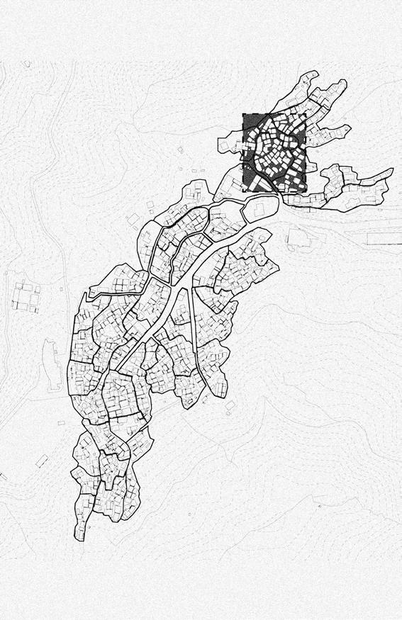
Stories of Decay, Insalubrity, and Resistance in Lima, Peru
Words and map by: Daniela Perleche Ugas
20
Daniela is an MSUP student at Columbia GSAPP and Researcher at Urbes-Lab.
Growing up in Lima’s Historical Center was a unique experience. Although there was more than one neighborhood in the Historical Center, many people considered it a dangerous place to live or, as I often heard during school, a place where ‘you might get killed.’ My dad always told my sister and me that we were privileged to live in the “Center” of it all, saying that in other countries, people would dream of living in the downtown area. Throughout my 20 years of living there, I have heard and read many different, albeit contradictory, narratives surrounding this part of the city, most of which focused on the problematic and physical impairments of the area. From headlines in newspapers and statements by officers of the Government, the decay of this neighborhood often seemed unavoidable. On the other hand, some counternarratives, usually heard by people on the streets or walks with friends over Jiron Quilca, highlighted the resistance spirit of the people still living there.
This concept of territorial stigmatization refers to how an area, neighborhood, or place can be considered problematic or dangerous, and this perception can significantly impact the people who live there. This type of stigma places particular emphasis on the “where” of a place. How we talk about and construct our imagination of the Historical Center has shaped the lives of the people there. From the beginning of the Republic, narratives have been important, serving as the strength or weakness of a city’s journey. Both in and out of policy, word-of-mouth descriptions service connotations for placemaking in urban planning. In this essay, we will delve into various narratives that shed light on the current state of the Historic Center of Lima. These narratives include those centered around hygiene and salubrity, historical preservation, and stories of resistance. By examining these narratives, we hope to gain a deeper understanding of the complex issues facing the Center and the various perspectives that shape its current state.
Republican Lima. Narratives of the Historic Center around hygiene and insalubrity
In all this shapeless set of rooms live individuals of the Indian race preferably, subjects of a lymphatic temperament, pusillanimous, illiterate, and without a hint of cuteness, and as such without any aptitude or will comply with the most rudimentary precepts of hygiene. This explains the exaggerated insalubrity of the neighborhood described, which in the state it is in, constitutes a real threat to the population. Santiago Basurco. Retrieved from Joffré (1999, p.182)1
With its foundation as a colonial city in 1535, Lima was meant to represent the power of the Spanish crown in the region. The morphology of the streets was based on a rectangular grid that gave centrality to the central plaza and buildings, keeping Indigenous and Black communities away from the centers of power. Since then, the narratives surrounding the Historic Center of Lima have consistently been tainted by classist, racist, and colonizing undertones.
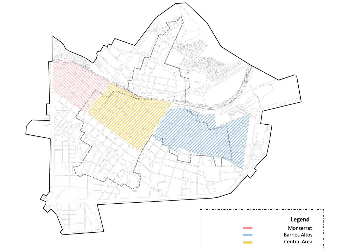
Daniela Perleche Ugas
Monserrat Barrios Altos Central Area
21
Parts of the city were considered areas for racialized and Indigenous communities, such as Barrios Altos or areas in “El Rimac” (Ludeña, 2018). However, after the walls that protected the Historic Center were destroyed in 1872, the abandonment of the oligarchic classes from the Center to the suburbs began. With that, a new dynamic shaped the Center. These areas were continually portrayed based on their social and material conditions. As Ludeña (2002) points out, when the walls were demolished, and the city expanded, the notion of a center in Lima became a common perception of Limeans.
After Peru gained independence in 1821, the narratives surrounding the Historic Center began to change. In the early 20th century, the hygienist discourse was the main narrative, especially after yellow fever (1896) and the bubonic outbreaks (1903) in Lima. According to Cueto (1991), overcrowding in the city began with the subdivision of the old, large houses that once belonged to Lima’s aristocracy, which were inhabited mainly by vulnerable populations who could only afford to live in an alley.
Scholars and intellectuals at that time also held similar narratives, often maintaining racist paternalism and blaming the working class for their living conditions and spending their money on alcohol. As Huaytalla (2017) points out, part of the discourse on security in Peru was deeply impacted by its colonized history, and Indigenous people were often associated with transgression. This was especially true at the beginning of the century, as the Penal Code of the country considered Indigenous people “savage,” “uncivilized,” and “degraded by easement and alcoholism” (Penal Code, 1924)2. According to Ludeña (2014), almost 60% of the buildings were alleys and ‘quintas’(1). The proliferation of these types of dwellings was seen as a threat caused by the “barbarians” being characterized by their “ignorance, bad habits, customs, and bad [diet]” (Joffré, 1999).
Thus, housing conditions were used to justify different urban projects and spatial strategies. One of the first areas to undergo
this renewal process was Callejon Otaiza, which was full of xenophobia and discourse against the “unhygienic, overcrowded, and disease-ridden neighborhoods”. This narrative was fueled by xenophobia since that area was known for its Chinese population. The written media portrayed an image of the “displaced,” a stereotypical version of the Chinese people, along with rats (Palma and Ragas, 2018), and in popular perception, they were often linked with opium, diseases, and prostitution (Joffré, 1999). Another example was El Callejón de Petateros (the Petatero’s Alley), which was planned to be part of a more significant project of the street that connected two main Plazas in Lima (The Main Plaza and San Martin Plaza). Part of the narrative was also based on salubrity. As stated by Joffré (1999), the race component was crucial to this kind of action in both cases.
“Recuperemos el Centro Histórico,” new narratives around recovering the Historical Center
In the decades following the mid-20th century, there were significant changes in urban policies concerning the historical Center of Lima. However, the 80s and 90s were marked by a turbulent political climate, with the onset of armed conflict and terrorism. According to Joseph, Castellanos, Pereyra, and Aliaga (2005), terrorist attacks began to affect districts such as Miraflores, San Isidro, and Jesús María, and terrorist influence was concentrated in some unions and leaders of the city Center, including the Historic Center of Lima. The Barrios Altos massacre (2) impacted the neighborhood. As stated by a report by LaMula.pe (2016), a group of old colleagues of the victims promoted a campaign to remind them that the victims in the massacre were just like them: “ice cream sellers murdered one night when a paramilitary group considered them terrorists and killed them.”
In 1990, during the administration of Ricardo Belmont Casinelli, the Historic Center of Lima was declared a World Cultural Heritage Site by UNESCO. Projects were then developed to recover the main public spaces of the Historical Center, and
PROLIMA (Program for the Recovery of the Historic Center of Lima) was created in 1994 (Rodríguez, 2012). According to Ludeña (2002), the historical Center underwent a recovery process during this period, driven by the interests of the neooligarchy and its need to forge an identity aligned with its requirement for spatial ubiquity. Andrade was one of the key figures who represented this neo-oligarchy, and his administration was marked by various urban projects aimed at restoring the historical Center of Lima. This included remodeling several public spaces, such as Plaza San Martin, Plaza de Armas, Plaza Italia, Chabuca Granda, and the Parque Universitario, among others. One notable project was the pedestrian walkway on Capon Jr. Ucayali Street, carried out at the mayor’s initiative.3
One of the primary concerns for Andrade was security, and he enlisted William Joseph Bratton to create an Action Plan for Lima based on the broken windows theory that establishes a relationship between disorder within the urban environment and criminal activity acts (Costa, 2007). During this time, the first urban renewal project approved by the Central Government allowed for the direct purchase or expropriation of alleys for their subsequent demolition or recovery (Lopez and Paraizo, 2022). In the following municipal terms (3), the second and third stages of the urban renewal process in the Historic Center of Lima began. This program included the construction of social housing for families evicted by the previous project but had yet to be relocated (Lopez and Paraizo, 2022).
Following that period, Castañeda was re-elected, and his plans included the continuation of the project to eliminate slums in Lima’s Historic Center. As a result, the Urban Development Manager of that time informed the press about a plan to demolish over 40% of the houses deemed uninhabitable (La Mula, 2015). Thus, during all these years, forced evictions were carried out under the guise of safety concerns for the housing infrastructure. Authorities claimed that it was unsafe to let people live in buildings that were at risk of collapsing. However, these displacements
Stories of Decay, Insalubrity, and Resistance in Lima, Peru 22
resulted in the destruction of social networks associated with the area, and many affected residents were promised a return to the Center, only to end up resettled in distant districts. In reality, these evictions were a means of indirectly pushing marginalized communities (4) out of the Historic Center, further perpetuating the exclusionary dynamics of the city. Although the narrative of security and risk management was not the only factor contributing to the community’s expulsion, it was the central narrative behind this.
The Historic Center today. Stories of resistance.
I always had the feeling that what is happening with Barrios Altos is that there is a great appreciation of its architectural heritage, that it has great tourism potential, but that it cannot be developed at the expense of those who are stigmatized, right? It is the neighbors to whom we always attribute the blame for the deterioration of the heritage or those we associate with crime. Who does not think from the bottom of their hearts that this neighborhood is dangerous or that it is better not to go there? And we see these kinds of narratives in the media, we see them in social networks, we see them in different communication platforms, and I had the feeling that something is happening with these people. We are not interested in them as a social group; instead, we only see them as interrupting the sector’s development projects in the area Jimmy Valdivieso- Director of the documentary “Esa Gente Existe”.
Contrary to popular belief, the Historic Center of Lima is not uninhabited. In fact, various narratives and resistances prove otherwise. As showcased in Jimmy Valdivieso’s documentary and other works like “My Beloved Barrios Altos,” there are stories of residents who cherish their neighborhood despite its challenges.
However, the housing problem in the Historic Center persists, and there is a lack of political will to address it. To fight against evictions and reclaim public spaces, activists have turned to social media campaigns and civic space reclamation. When Castañeda proposed demolishing 40% of the neighborhood, residents of the Monserrate, central zone, and Barrios Altos areas came together to oppose it.
According to Lopez (2020), the issue of precarious housing in Peru’s historical
centers is a complex problem caused by factors such as neoliberal urban policies and the perception of housing as a real estate commodity. In 2020, Ordinance 2267 was enacted by the Municipality of Lima and since then it has allowed the municipality to evict buildings deemed uninhabitable, further complicating the issue. This also led the community to organize and seek alliances with academic institutions for joint pronouncements against these actions.
Reflections
Recognizing that the Historical Center is not a homogeneous area with many stories behind it is essential. With its foundations rooted in resistance and resilience, the Historic Center of Lima continues to face challenges related to housing, urban policies, and public space. Words matter, and despite the diverse pejorative narratives, residents continue to live in the area with passion and dignity, cherishing their neighborhoods and fighting against evictions and demolitions. The community’s efforts have been met with varying degrees of success, but the complex nature of the issue persists. The stories of those who continue to call the area home, despite its challenges, serve as a reminder of the importance of preserving history, culture, and community in the face of so-called urban development.
(1) In Perú Quintas refers to a group of single-family dwellings built on a plot of land with common access from the public road.
(2) The Barrios Altos Massacre was a Human rights violation during Fujimori’s dictatorship and was executed by the Colina Group, a paramilitary group established at the beginning of the dictatorship.
(3) Luis Castañeda was elected during 2004-2011, and Susana Villaran during 2011-2016.
(4) Another type of forced eviction was caused by the construction of warehouses in the Barrios Altos area. For further reading on the subject, see Dammert (2018), and Lopez, et al. (2023).
Daniela Perleche Ugas
23
An Interview with our Inaugural Editor
24
Fernando DeGuia founded URBAN Magazine in 1999 as an MSUP at Columbia GSAPP with the hope of fostering connections between students, alumni, faculty, and planning professionals.
URBAN Magazine: What was your original vision when you founded URBAN Magazine? Could you tell us the short story of its creation?
Fernando DeGuia: The vision was to foster connections between the GSAPP planning students, alumni, faculty, and planning professionals through a student run monthly newsletter/magazine. I approached fellow students, the student board, and Urban Planning administration (primarily Elliot Sclar and Lionel McIntyre) with the idea in the fall of 1998. The first edition came out March 1999 with contributions from first and second year planners. This inaugural edition was seven pages and had a section on the current planning field, planning issues, Kinne projects, jobs, student activities, and March program calendar, interspersed with trivia questions about the Urban Planning program and quotes. It was an instant hit with both students and alumni.
UM: What obstacles did you have to overcome to publish the first issue?
FDG: None of it would ever have happened without that inaugural editorial staff-me, Sze Lei Leong, Riem El-Zoghbi, Ryan Gorney, Anne-Marie Turner., — and additional contributors Joe Bialowitz, Susan Jainchill, Nicole Ogg, and Sarah Bowen. Elliot Sclar and the administration were very supportive, providing funds for printing and mailing, and alumni emails. It was definitely a team effort and the editorial staff and writers changed as schedules permitted. After the 2nd edition in April 1999 as the magazine got longer, and we had more ideas for articles, we realized we just didn't have the time to consistently produce a quality monthly newsletter and printings became less frequent.
UM: Looking back, did you ever imagine it to celebrate its 25th anniversary (and release its 34th Volume)?
Fernando DeGuia


FDG: The hope was always for URBAN to be sustainable and have some longevity at GSAPP. The editorial team created a transition plan for how and when to transfer editorial control from 2nd to 1st year students annually, with some long term stability via PhD students. Thank you Ebru Gencer! It's been so interesting to see the evolution of the magazine over the years, and I'm so happy and proud to see it celebrate 25 years this spring. Every group of writers and editors, advisors, and supporters who have fostered its growth the past 25 years should be proud of the contribution to keep it going as part of the UP program.
UM: Which books, magazines, and publications inspire you today?
FDG: Bloomberg CityLab and the Center for an Urban Future are currently my favorite reads on urban and planning issues.
UM: What advice would you give to urban planners who are interested in writing, editing, and publishing throughout their design careers?
FDG: I think that planners are naturally inclined to put ideas to paper or other media. It's the inspiration on what to write about that may be harder to find. To help with that problem, I encourage planners to travel. Travel exposes you to different ideas, cultures, and living conditions, and challenges what you may think is the "norm". I encourage planners to get involved in issues they care about. That can take the form of volunteering, writing a council member, being on a panel, writing articles for the local paper on the issues that are important to you. Third, I encourage planners to read publications and articles on planning issues, or watch planning related documentaries. I think the writing will naturally flow from there. Who knows, you may even be inspired to start your own planning -related magazine.
25
Q
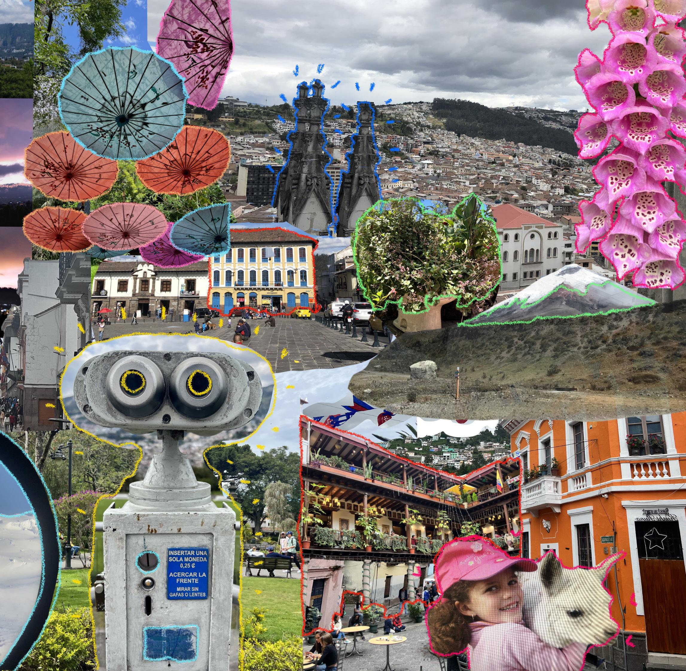
t u C y
Collage by: Claudia Kohn Avila
Claudia was born and raised in Quito, Ecuador. Her work and studies have focused on community and sustainable planning.
R u e o o o l o s s e e r r d i c

26
27

Words and images by: Salonee Ghosh
Salonee is an architect and urban designer. Originally from Mumbai, India, her interest in exploring dynamic urban centers has led her to NYC.
28
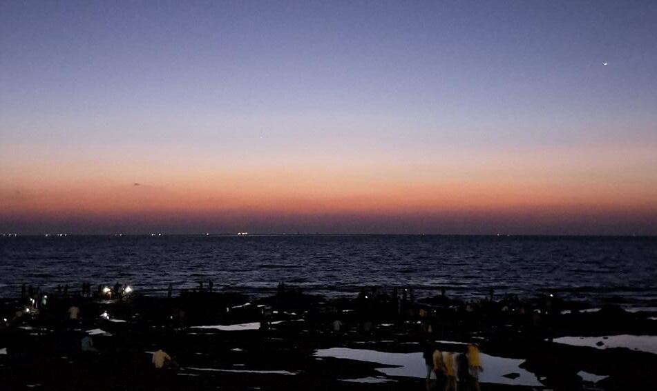
Mumbai. One may think, instantly, of high rises. Someone familiar with the city may think of Marine Drive and its glittering arc of lights that illuminate the city’s most famous promenade along the Arabian Sea, or of Mumbai’s numerous beaches romanticized in movies. Those of us who have lived there, however, reminisce about the ubiquitous crowds that are paradoxically indicative of both chaos and inexplicably, of peace.
Mumbai’s identity lies in its constant sense of enterprise, formed by people from across the country and abroad who flood the city with a sense of purpose. It almost seems to be a city in a perpetual state of motion with children, the youth and the middle-aged alike running to board buses and trains that are forever on the verge of departing. Embedded in this constant chaos that Mumbaikars embrace is the human desire to pause and take it all in. As if by unspoken consent, the area that people flock to for leisure is the waterfront. A city that first gained prominence as a port, Mumbai has a long history with water that flows in and out of sync.
Mumbai has over 100 kilometers of coastlines, of which 33 kilometers is accessible to the public, offering multiple options for waterfront access with varying degrees of crowds. Marine Drive remains the most famous, simultaneously centering a Mumbaikar and impressing a tourist. On weekdays, it is seemingly impossible to get a seat along the 3 kilometer stretch of stone benches. College students end their nights at the promenade at 2 AM to catch a breath of fresh air only to realize that overly enthusiastic joggers, nearby residents with pets, and parents with sleeping infants had the same idea.
A local’s choice for appreciating the sea and the colonial architecture of downtown is near the historic Gateway of India monument, where passing vendors visually gauge the age of people lounging on the benches and then, depending
Salonee Ghosh
on their assessment, offer them either tea or cigarettes. Further north is a range of beaches, each named after the posh residential suburb adjacent to it. Juhu beach is the go to choice for a chance glimpse of a movie star jogging at the crack of dawn. Young boys practice cricket within striking distance of families and lovers having picnics on the sand. During the festival of Ganpati, massive crowds flock to the beaches for immersions, occupying every square inch of available space in an orderly manner that must be witnessed to be believed. Yet, even in the dearth of space, Mumbaikars find opportunities for business.

Stalls with bottled water are strategically positioned next to spicy bhutta (roasted corn), where extra spice will be added, regardless of personal preferences. Elderly men give haircuts and hair oil massages to clients seated on the sand – an openair parlor with a spectacular view across the horizon. The vendors cater to clientele of all ages, selling balloons for children, bouquets of roses, and local delicacies as snacks. The reliance of this multi-layered ecosystem of activities on the water can be both helpful and detrimental.
Every year, the city receives four months of torrential rainfall. Rain attacks pedestrians from all directions beyond the scope of protection of an umbrella. Auto rickshaw drivers refuse to take on passengers the second they mention a low-lying area susceptible to flooding, and the local train regularly gives up when the tracks get
29
waterlogged. For a city of people constantly in a rush, the patience developed during these four months is incredible. The office-bound 30-something will produce a newspaper wrapped in plastic from his bag, preemptively packed to kill time when the scheduled bus is delayed due to the rains. Each year has seen a 48-hour period when a particularly blinding spell of rain coincides with the high tide and the city sighs to take a break from stepping outdoors. Those in informal settlements shift their valuables to the tops of cupboards. Hindu mandirs and Jain derasars near educational institutions prepare extra food during flood warnings when schools are still active in case the water levels rise too high for students to leave. Massive waves splash onto the promenades along the waterfronts and the beaches are barricaded. Two days of continuous rainfall later, the waters recede and people return to work with a nonchalance that comes from experience.
Water is an integral component of life in Mumbai in ways that transcend its aesthetic appeal. It is a spiritual exercise to seek the quiet of the waterfront where the noise of traffic is muted. The crowds never abate and yet, when facing the vast expanse of the Arabian Sea alongside hundreds of strangers, each person somehow manages to find solitude in the throng. At its most aggressive, the water approaches Mumbaikars and forces the city that never sleeps to pause. The waterfronts create spaces of quiet in the city, occasionally enabling, and sometimes invading one’s sense of peace.


Fluid Urbanism at Mumbai's Edge 30

“
Two days of continuous rainfall later, the waters recede and people return to work with a nonchalance that comes from experience.
”
Salonee Ghosh
31
Retail Redundancies and the Landscape for Small Business in Big Cities
maps by:
32
Words and
Otis Emslie Otis Emslie is a 2025 MSUP candidate at Columbia GSAPP.
If you look closely, you may have noticed some shops closed in your collection of cities over the past several years. Maybe you were home for the holidays and found out one of your favorite stores shuttered. That great stationary store is gone. So is the pet store. You could have been somewhere more familiar to you than New York, a smaller metro bereft of the expansive commercial landscape that gives this city its cultural pungence. We return to our hometowns with an enduring familiarity, acutely surveying which stores have stayed and which have gone. Here retail death is more palpable.
You can walk by vacant storefronts and not bat an eye, understood as a give and take in an unforgiving system of urban commerce. But ultimately you can’t ignore a graveyard: vacancy transmits between businesses and becomes noticeable along corridors. So what is changing in our commercial spaces and why?
It is difficult to watch: the American storefront was ravaged by the pandemic as retail vacancy rates increased percentage points in all cities between 2019-2022. In light of the fallout of changing e-commerce consumer preferences, demand for retail space is projected to be 9% lower in 2030 than it was in 2019. But this long-term outlook hasn’t stopped post-pandemic shopping habits, squeezing revenues for businesses in urban commercial spaces where the operations are costly.
In the central business districts of cities where retail rent on a per square foot basis is high, many small businesses can no longer afford a large ground-floor space, resulting in increased vacancy rates and the repopulation of empty storefronts with established chain brands.
In other parts of the city, construction of new mixed-use developments produces “20-minute neighborhoods”: areas offering amenities and services near or within residential buildings. Cities value the profit potential for mixed-use buildings, particularly the diverse revenue streams and taxes generated through a mix of property types, but the opportunity for
local businesses to populate ground floors is meager.
Maybe here you’ve seen cities rezone and add entirely new swanky mixeduse neighborhoods in areas that were previously industrial. Construction costs are expensive, and developers can manage to pay back lenders if they rely on brand tenants with good credit and assumable revenue streams who can afford large retail space. These tenant criteria can oversaturate a market with particular business types, resulting in duplicated chain stores that have already dropped pins in other parts of the city or country. This means more bank branches, more fast-casual chains, more of that brand you saw online with so many storefronts that won’t leave you alone.
But perhaps new retail tenants should be expected when consumer demands shifted after a pandemic forces us to confront our habits and interests. Is the excessive duplication of chain stores in city centers a new step in a commercial evolution? Should we shake off the naive hope that the most popular e-commerce brands will stop fixating on our most beloved retail corridors? Fewer are shopping for formal wear in the work-from-home era, no one rents DVDs anymore, and long are the days since smoking inside was permitted.
It’s difficult to quantify, but commercial spaces lose local resonance when overrun by franchise brands, and urbanism becomes an increasingly homogenous experience when brands repeat across neighborhoods and cities. This threatens the novelty fundamental to neighborhoods of local commerce. If retail neighborhoods add the same chain store concepts recycled from other cities, then the urban experience, albeit incrementally, blends together.
Ironically, many added mixed-use neighborhoods billboard a progressive era of new urbanism incorporating aspects respectful to principles of innovative urban design, some of a few being walkability, retaining soft edges, and providing open space. Yet these same neighborhoods are puzzled by the challenge of finding
commercial tenants that can meet the rent qualifications for pricey retail footprints. Jeffrey Shumaker, an associate professor of planning and urban design at Columbia familiar with how ground-floor retail opportunities in center city neighborhoods favor corporate bidders, believes retaining mom-and-pops hinges on the willingness of investors to trust local businesses in mixed-use developments.
“A big question to ask is: is the developer seeking to hold the property or are they just looking to flip? Unfortunately, most of these sorts of large-scale developments have a developer looking to cash out and sell it.” Shumaker says. “They want to get the big tenants in there to increase the value immediately rather than think about how a more interesting local-based retail mix could create value over time.”
I asked Shumaker how city governments and contracted designers can prioritize forecasting the originality of businesses when developing streetscapes and he offered several alternatives to confront the gold rush refilling empty retail corridors, at odds with preserving neighborhood identity. “Retail real estate in center cities isn’t always about bringing people in. Sometimes it’s more about the advertising gain from being in a prominent location that a chain can afford. They’re not really dependent on a lot of people using that particular branch. But through urban design and zoning controls, you can limit how many banks, for example, are on a particular block or the frontage of the street. It forces developers to put the bulk of their square footage either below grade or above grade so that the ground floor has room for other retailers to potentially move in. You can also limit the total square footage per business to even less than 1000ft², which these smaller retailers can get down to.”
More creative sectioning of space playing towards density has helped small retailers stay afloat in centralized retail destinations, often subdividing ground floors in open market concepts. Such is the case at many modern food halls or indoor flea markets, like SoHo’s Canal Street Market, allowing
Emslie 33
Otis
entrepreneurs and food vendors small spaces to showcase trunk shows and offer light fare eats to shoppers.
Some cities have balanced the protection of local businesses in thriving historical corridors while promoting entrepreneurship in added mixed-use neighborhoods where the opportunity for mom-and-pop retail is conventionally unrealistic. In the design of the new Seaport District in Boston, Massachusetts, the city pushed for the inclusion of “micro pods”, where local entrepreneurs can set up temporary operations and scale up if products take off. Boston has also protected existing boutique shops through zoning controls. The Beacon Hill Civic Association overseeing the historical Charles Street retail corridor utilizes a specific zoning type that “discourages expansion or continuance of non-conforming commercial uses”. These measures have helped Beacon Hill retain local businesses such as the salons, clothing, or arts and craft stores while excluding the corporate chains eager to penetrate one of Boston’s oldest neighborhoods.
But protective zoning aiming to prevent chains from encroaching on local retail corridors can sometimes produce counterintuitive results, and shoulder out the addition of new small businesses that don’t perfectly blend into a neighborhood’s existing fabric. New York’s, “City of Yes”, Economic Opportunity proposes simplifying and modernizing the rules on which types of businesses are allowed in commercial areas, a persistent problem magnified during the pandemic, when businesses shuttered and storefronts could not find replacement tenants compatible with the city’s archaic “usegroup” regulations.
Calvin Brown is the Assistant Commissioner for Neighborhood Development at the NYC Department of Small Business Services and previously worked at the Department of City Planning. In Brown’s tenure at DCP, he says protective zoning measures in certain areas of New York over the 2010s aimed to prevent a takeover by big box stores but actually increased demand for
limited real estate and allowed landlords to hike up prices: a cautionary example that planning shouldn’t be overly prescriptive to local retail markets.
At SBS he now leads initiatives to frontend engagement with local entrepreneurs and advises them on the operational preparation necessary to enter an increasingly competitive retail market bullied by chain stores hungry for the front-and-center advertising prominence rewarded by urban locations.
“We’re figuring out how to engage the market because we can tell them there are vacancies in this neighborhood, but it’s really up to the landlord to then be willing to rent or lease to the local entrepreneurs,” says Brown. “We tried a pilot group that acted as a negotiator with the landlord to say ‘Hey, if you give us this vacant space that you haven’t been able to lease out, we will put an entrepreneur in here, as part of a pop-up”.
In New York, other SBS strategies look to enrich existing small-scale retail corridors with local businesses, leaving the brands to the center city commercial areas such as Midtown. SBS conducts “Commercial District Needs Assessments”, evaluating the retail mix of neighborhoods and determining which business types a community wants, and initiated “BE NYC” and “WE NYC”, programs for Black and woman-owned businesses respectively to grow operations and fill-in the city’s existing brick-and-mortar. In other cities, small businesses can benefit from antidisplacement policies, rent caps, rent subsidies, or even construction financing. The city of Pittsburgh awards such financial support at 1% interest to its local and minority-owned businesses, The Avenues of Hope Commercial Real Estate Program (ACRE), capital that can be used for business site acquisition or construction.
These programs are especially necessary for smaller markets, maybe even your home city, where limited retail corridors are more penetrable by chain stores, and redundancy effects could be more pronounced. In some way or another, most
of us have emanated outwards from our familiar centers- not just from our homes and residential neighborhoods, but also traded in modest downtowns and main streets and arrived at the footsteps of the largest city in the country characterized by an ego of commercial ecstasy. Here in New York (and cities beyond), there’s a delicate balance at play: protective zoning usage restricts certain business types (including chain brands) from encroachment maintained by rents that local entrepreneurs can afford. As more brands scale down footprints and blend into low-density walkable retail districts or think big and continue dominating central business district retail space, the window of opportunity for these entrepreneurs in cities narrows. Deploying creative applications of zoning and urban design may be our chance to promote local entrepreneurship and retain original urban spaces in cities where the landscape for small businesses has shifted.
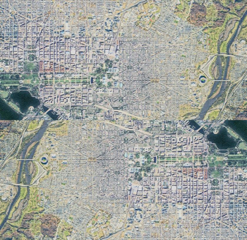
Repeating Chain Brands Between the 14th / U Street and Navy Yard Mixed-Use Neighborhoods in Washington, DC
Retail Redundancies and the Landscape for Small Business in Big Cities
34
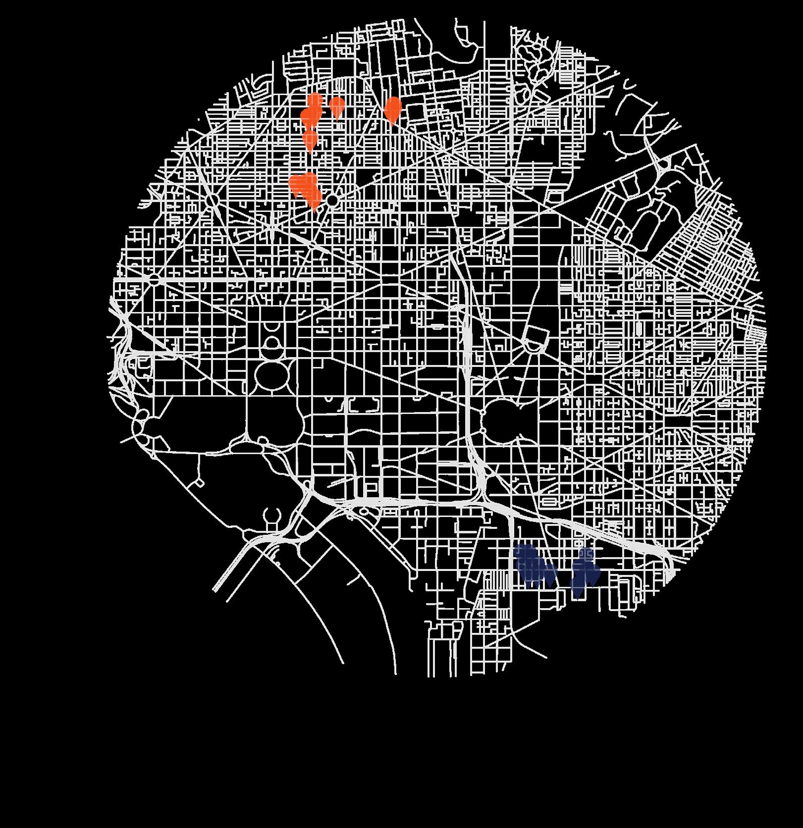 Navy Yard, SE Retailers
35
14th / U Street, NW Retailers
So Close Yet So Far
Words and images by:
Florentina Anastasia

36
Florentina is an MSAUD 2024 graduate student at Columbia GSAPP.
Multi-Faceted Challenges
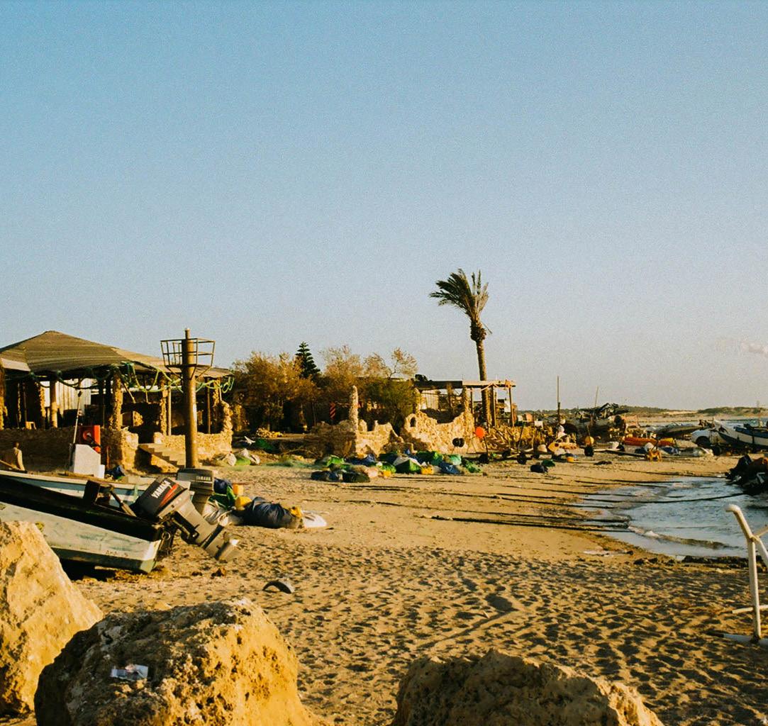
Imagine living close to the sea and looking at seamless blue from the coast. This is supposed to be a profitable property. However, walking through an alleyway, the smell of clams permeates. This is home to the fishing community of Kamal Muara, North Jakarta, that withstands pressure from developers to build lavish properties. Under this persistent pressure, the fear of displacement emerges. Despite being near a wealthy golf course, gated community, and commercial area, Kamal Muara continues to endure in its confined and informal buildings.
Apart from the physical discrepancy, there is a huge gap in the economy of the communities along the coastline. In contrast to the daily lives of the mid to high-income residents in the gated community, economic activities in Kamal Muara remain deeply connected to sea resources. Women in Kamal Muara often come together to clean and peel clams, subsequently selling the processed ones at a nearby fish market. Along the coastline, boats are moored, strategically waiting for opportune moments for fishing activities or to facilitate the transportation of tourists exploring Kepulauan, Seribu, a popular island-hopping destination in Jakarta. Engaging in informal economic activities collectively helps them endure the high financial pressure of living in Jakarta.
Despite the direct connectivity to the sea, the community is far from water services. Kamal Muara has limited access to clean water and residents are often forced to purchase costly buckets of water. Even though the groundwater has been extracted, still, brackish water is unsafe for consumption. Water is a crucial issue in this neighborhood, both as an environmental disaster and as a public service.
“During the rainy season, spending on clean water is no more than 100,000 IDR (6.4 USD) per month, this last month we were able to spend 500,000 IDR (32 USD) per month to buy clean water” says Rahmi,
one of the Kamal Muara residents. During the rainy season, said Rahmi, residents use the rainwater they collect for bathing and washing clothes and dishes. Meanwhile, clean water purchased from the clean water supply and service operator in Jakarta, PT PAM Lyonnaise Jaya (Palyja), is used for drinking and cooking purposes. In this dry season, continued Rahmi, residents are forced to meet their washing and bathing needs by buying water sold by individual water traders. “The price is IDR 7,000 (50 cents USD) per 4 buckets,” (Antara, 2019).
Furthermore, alongside water scarcity, Kamal Muara faces a myriad of environmental challenges. Rising sea levels, attributed to climate change, coupled with land subsidence resulting from extensive groundwater extraction across Jakarta, intensify the vulnerability of this coastal community and burden the entire coastline of Jakarta. Consequently, Kamal Muara has become an increasingly vulnerable place to reside.
Kamal Muara, positioned near the sea with the expectation of abundant resources,
is currently grappling with the threat of multi-directional concerns. The community is working hard to survive economic pressures and adapt to environmental risks. Reflecting on the challenges faced by Kamal Muara, there is an urgent need for significant improvements.
Siloed Government Action
Nevertheless, instead of holistically building resilience, the government is constructing dehumanized sea walls to protect the land from sea level rise. One such sea wall is on a short span of the community’s houses. Constructing giant sea walls is a more siloed-technical solution that can only address sea-level rise. The construction of massive sea walls not only disrupts the local ecosystem but also poses a significant threat to the traditional livelihoods of fishermen, forcing the community to face the prospect of eviction. This approach not only fails to address these nuanced environmental challenges but exacerbates the hardships faced by the residents of Kamal Muara.
37
Disregarding the inequity faced by vulnerable communities in the pursuit of environmental improvement is counterintuitive. The significance of both environmental and equitable concerns cannot be understated.
An Ideation Competition for Kamal Muara
In May 2023, Trisakti University in Indonesia organized the “Reimagining Kamal Muara” design competition, offering students a platform to conceptualize improvements for the community. This competition aimed to envision solutions that enhance the built environment and support vulnerable livelihoods in Kamal Muara. The judging
panel comprised representatives from the Indonesian Institute of Urban Designers, the Indonesian Institute of Architects, academic professionals, and the Head of Jakarta Spatial Planning and Land Agency. The competition’s objective was to generate design ideas that could serve as a proposed plan for future government initiatives.
This competition encouraged participants to fully leverage the potential of Kamal Muara, encompassing the entire area. Regrettably, the design brief instructed participants to speculate about redesigning the neighborhood from scratch, assuming that existing buildings would be removed. Viewing this competition as a chance to contribute to the improvement of environmental quality and vulnerable livelihoods, I decided to take part and challenge the design brief. Rather than following the prompt of transforming Kamal Muara into a greenfield development, I
advocated for the enhancement of the existing informal settlement.
Wetland Kampung Kamal Muara
The concept of the “Wetland Kampung Kamal Muara” was proposed with the aim of integrating human activity and ecology within the existing built environment. Central to this concept were the development of multipurpose, naturebased infrastructure and the improvement of existing buildings instead of demolishing and reconstructing them.
Due to land subsidence and the impending threat of sea-level rise, the community resides in a low-lying area. To address this environmental challenge, the proposed landscape envisions a wetland ecosystem, establishing a seamless transition between the sea and land ecosystems. Hence, the wetland serves as the primary foundation for the built environment in this neighborhood realm.
The design masterplan prioritizes the preservation of the existing condition and embraces natural systems. While retaining the road structure and neighborhood grid, the plan introduces a transformation by replacing roads with boardwalks to align with the wetland-based landscape of the neighborhood. The primary boardwalk connects the main gate of the wetland village to the newly integrated pier at the
So Close Yet So Far
38
neighborhood’s tip, catering to tourists interested in island-hopping adventures. Lining the boardwalk, homestay house typologies are stretched to contribute to a vibrant atmosphere. Additionally, public and social facilities are strategically positioned within a 200-meter walkable distance, creating multiple gathering spots for residents and enhancing both social and economic values. Innovative installations for water desalination utilize natural resources such as sunlight and seawater, collectively serving every 5 to 10 houses as an alternative water source.
Addressing the water scarcity concern, a proposed solution involves the implementation of a desalination system as a nature-based alternative water resource. Seawater, filtered through a wetland ecosystem, is pumped to the distillation facility. Utilizing solar energy, the seawater is heated, forming steam, which subsequently condenses into clean water. This purified water is then directed to residents’ houses, with the sediment requiring regular disposal. Its objective is to collectively cater to every 5 to 10 households as an alternative water supply.
The improvement also encompasses existing residential buildings rather than demolishing them. New programs are incorporated into this improvement initiative, considering the economic potential of activities in Kamal Muara. Houses can serve not only as residential spaces but also be integrated with local economic endeavors, such as hosting
a clam cleaning and peeling workshop, operating souvenir shops, food stalls, rental units, or homestays. In the case of houses integrated with commercial facilities, a distinct division is established, with the first floor dedicated to economic activities and the second floor reserved for residents.
Towards Equitable Development
Kamal Muara faces the complex interplay between environmental challenges, socioeconomic disparities, and governmental approaches to urban development. Despite its proximity to affluent areas, Kamal Muara struggles with fundamental issues such as water scarcity and the looming threat of sea-level rise, exacerbated by siloed government actions like the construction of massive sea walls. However, amidst these challenges lies potential for transformation, as the Reimagining Kamal Muara design competition aimed for. The proposal's strategies, covering master plan considerations, landscape, infrastructure, and housing improvements, aim to empower the vulnerable community and foster a more inclusive and equitable development approach. The focus on nature-based solutions and improving existing structures is geared towards addressing immediate needs and building a sustainable community. Kamal Muara’s situation highlights the importance of holistic development in communities facing adversity, emphasizing the aspiration to turn challenges into opportunities for equitable development.
Florentina Anastasia
39
Hyderabad and Hitech-City
Reflections on a Changing Urban Culture
Words and images by: Ishaan
Barrett
Ishaan Barrett is a current sophomore at Columbia College studying Urban Studies and Architecture; his previous work has been published at the Columbia Daily Spectator, the Harvard Urban Review, and in the BarnardColumbia Urban Review
40
Carefully lacing up my new HOKAs, I stare intently at the street just past my shade-covered perch on the second story balcony of my family’s Hyderabad home, ignoring the distant call of my mother’s voice who reminds me to take my phone, wear sunscreen, and try to not get lost. Streetcars hurdle along the ramshackle roads nearby, blaring their horns against the shouting and hustle of the food stalls on the curb. The air is heavy with dust and the brown plumes of exhaust from the motorists commuting to school and work. Perhaps against my better judgment, I have decided that these are the streets I will run on for the next ten days.
Earlier last December, my family decided to take a trip to visit my mom’s childhood house in Hyderabad over our summer break. My mom originally planned the trip to help her parents move out before the house was officially sold. But the trip eventually became more than just a family trip. We explored the old colonial palaces in the outskirts of the city, went shopping in the new commercial centers, and saw some cousins living in the newer developments of Hyderabad. In each corner of the city that we explored, a different facet of the urban experience came to life in front of us. Rich historical culture, modern innovation, new public infrastructure, and neglected spaces collide in a singular urban biosphere. What follows are a few parts of its story.
The Urban Ethos: Chowmahalla Palace
Chowmahalla Palace is an oddity of the Hyderabad urban environment, juxtaposing a regal atmosphere of preserved quietude against the kinetic energy of city life. It retains a deep history connected to India’s colonial past that the city has decided to preserve, building around rather than over the antiquated— now popular tourist—attraction. The hidden relic remains secluded within the multiplicity of Hyderabad’s urban skyline, containing sprawling open spaces and splendid architecture to discover. Packed full of my family, our car rolls into the small palace courtyard, instantly surrounded by near silence. Stepping through the main gates, the vast inner courtyard meets two
Ishaan Barrett
enclosed parallel walkways with ornate towers studding each entryway (Figure 1). Looking closer, the peeling paint and cracks in the foundation of the palace come into full focus, reminders of the palace’s longevity.
From the enclosed courtyard, we walk into the main throne room. Ornate enamel fixtures glinting along the ceiling and glossy marble floors surround us. We walk up carpeted stairs to the upper balconies and the chandeliers light up with afternoon sunlight (Figure 2). The space defies the historic, bygone atmosphere of the palace. Just outside, the dirt and concrete are worn and weathered by the centuries it has withstood. Above, a pristine white clocktower glows in the daylight, bright against the brown-tinted steeples beneath (Figure 3). Chowmahalla collides against the vibrant city, enclosing different temporal spheres within a single place by displaying opposing visual motifs. The palace is a bridge between the past and present, history and modernity, preservation and rebuilding. It is this dynamic that more broadly defines Hyderabad as more than just a city, but as a mosaic of destinies.
Hyderabad’s Ground Zero: Contrast and the City
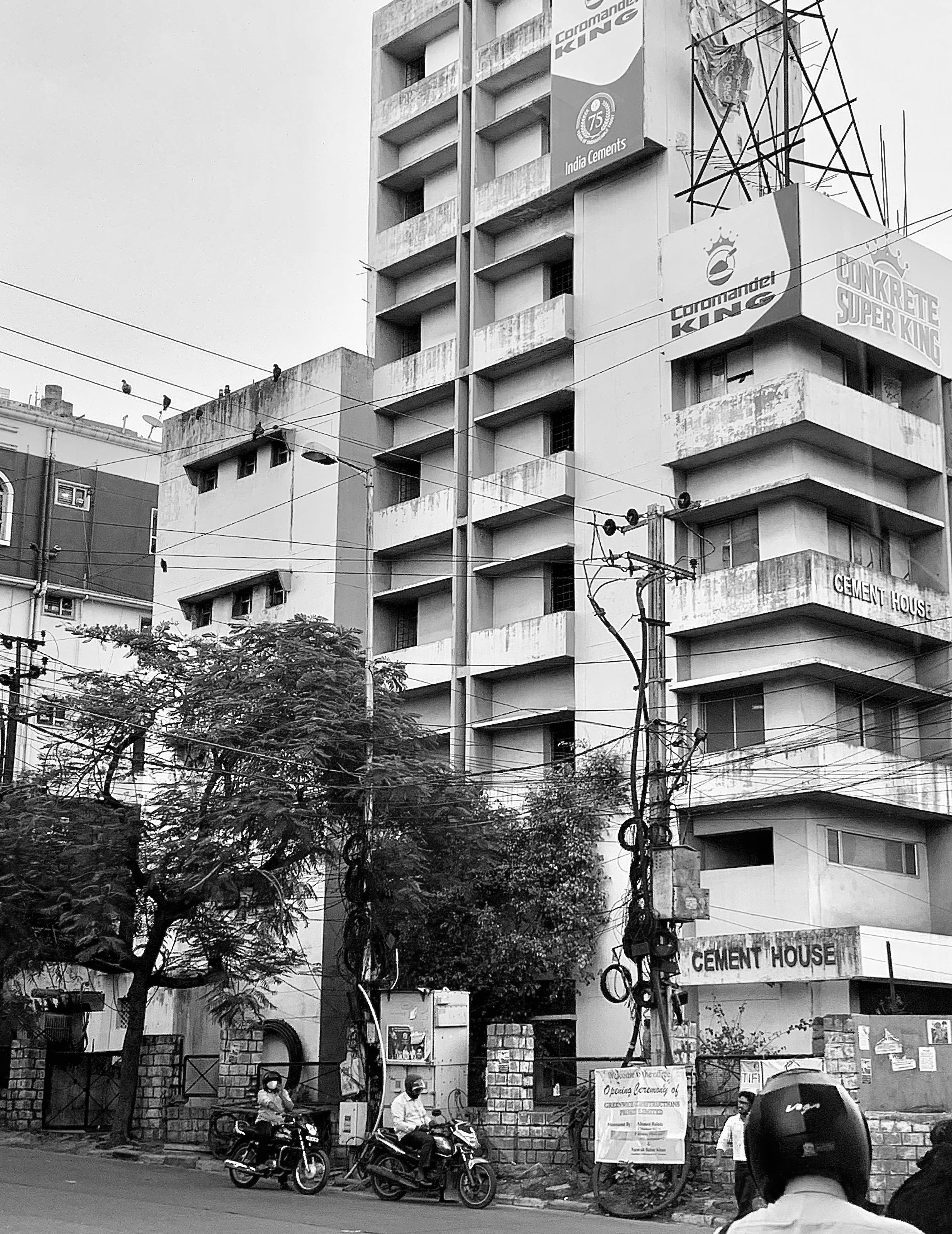
Charminar is perched high above the city and looks over mostly residential areas of Hyderabad’s urban sprawl. From this new vantage point, the vibrant colors and diversity of the city come into full view; a patchwork of different tones interspersed with prominent sections of green where the city embraces its environment (Figure 3). In the opposite direction, the commercial centers of the city attract tourists and wealthy business owners. Near-pristine apartment complexes adjacent to shopping centers include green roofs and foliage extending above the street level. In comparison to the ramshackle “cement houses” further away, these areas represent a contrast within Hyderabad’s urban atmosphere (Figure 4). These “cement houses” boast incomplete scaffolding and public advertisements that seem contradictory to the residential purpose of these edifices. Buildings in the
commercial sector are dense with foliage, well-kept brick exteriors, and green space that extends to the stoop of stores nearby (Figure 5).
Such differences—from the types of buildings to the presence of shopping centers—highlight a larger shift in the labor sphere of Hyderabad society. New outcroppings of the city host pristine offices for foreign tech companies and brand-new apartments for its workers. The modern commercial center of the city now caters to those who can spend and earn more. But is the separation between these spaces—the residential and business centers— purposeful? The falling electrical wires near the “cement house” signify an overall attitude of neglect; has the government decided to ignore the older spaces of the city in favor of the new? When situated hundreds of feet above street level, it is simply impossible to tell.
My family and I drive about an hour away from our home into the proper commercial center of the city, where hotels and malls are merely a few blocks away from each other. The commercial section of Hyderabad is relatively close in proximity to our home, but the city traffic makes the commute almost twice as long as it should be. With more cars on the road—and even more motorbikes—the city street is transformed into a cluster of slow-moving vehicles that seem to have abandoned all rules of driving. But there is an order to the chaos.
Stuck in traffic, my attention turns to the surrounding buildings and roads in Hyderabad’s commercial center. The dirt roads near our home are left behind for crisp, sheer asphalt; nearby, English advertisements rise adjacent to a roaring overpass (Figure 7). We pass by the new Hilton Hotel, touting chic new balconies and a roof garden with trees pouring over the top and sides (Figure 8). This space of the city is energetic, but almost sterile in comparison to the vibrant colors and smells of our neighborhood we left behind. This newer section of the city confronts us with the reality of Hyderabad, a place that remains very much an urban project.
41
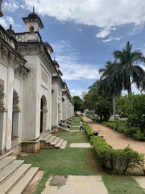

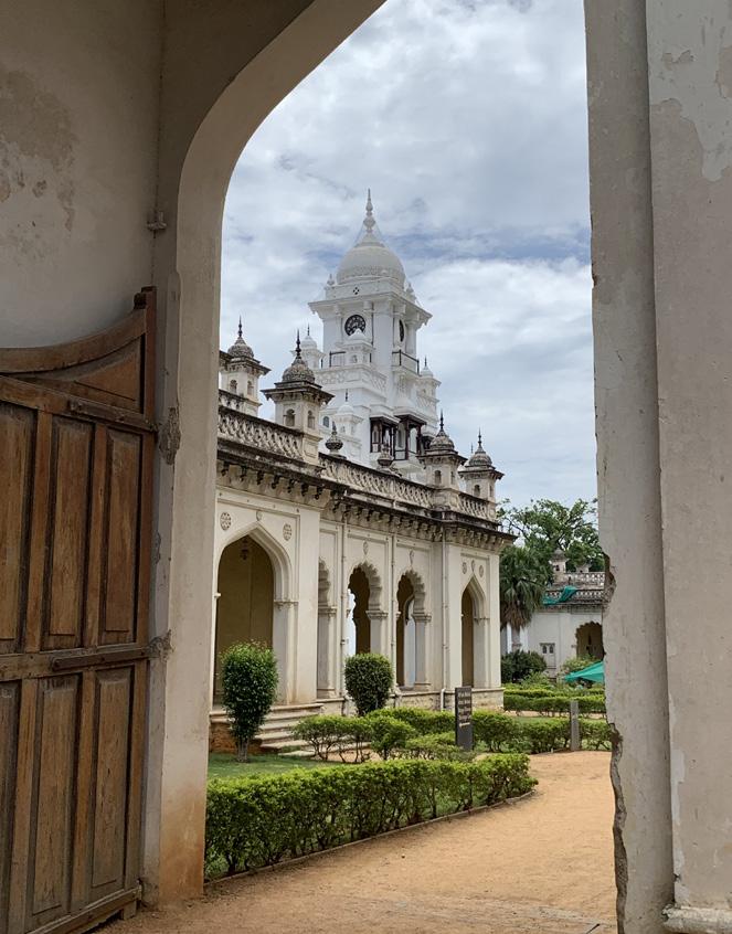
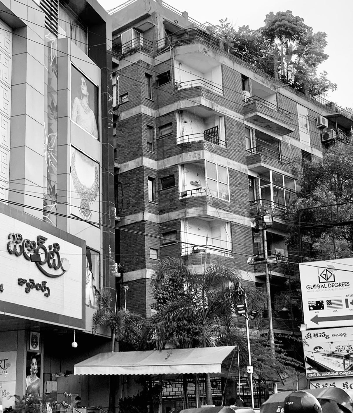
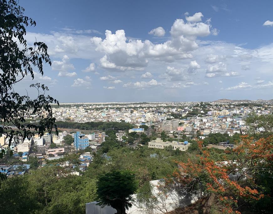
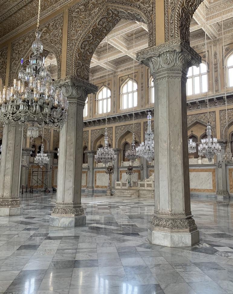 Fig. 1.1
Fig. 2
Fig. 3
Fig. 4
Fig. 6
Fig. 1.1
Fig. 2
Fig. 3
Fig. 4
Fig. 6
and Hitech-city 42
Fig. 1.2
Hyderabad
Commerce, capitalism, and industry have transformed portions of the city drastically and Hyderabad has left behind the ad-hoc, individualistic businesses that percolate the older areas, like our home in Vanasthalipuram. In place of street vendors and markets, the city now prefers the shopping mall and international hotel. Since my first visit to India when I was eleven months old, this has been the reality of the city my mom and her family have called home for decades.
In the evening, we take a trip outside the city to see a movie. Along our way, the positioning of rundown apartments with steel rebar protruding outwards and discolored facade seem almost antithetical to the sheer, glass-balconied complex just nearby (Figure 9). Two different flavors of the city collide: the old and renewed meet along new thresholds. As our movie concludes, we walk out into the vacant lot behind the cinema and look out on a vast green enclosure. In the distance, seemingly empty apartments stand unused (Figure 10). In a place where vegetation thrives, the anthropogenic flavor of the city is absent. The empty lot, green expanse, and concrete skeleton of future apartments is a liminal space of the city, waiting for development to push it into utility. In Hyderabad’s new technological hub, the pace of urban construction is unprecedented and expeditious. Never before have apartments, glass offices, and connected highways been constructed so quickly within this new technological Eden.
Looking Back: Reflecting on a Changed City
Several months after my visit to India, I sat down with Vinod Sudhakar, a long-time high school friend of my mom and my family. Both he and my mother attended the same school for a time, sharing the strangeness and wonders of Hyderabad’s urban atmosphere in the 80’s. However, looking back at the way the city has changed, Vinod highlighted the nuances and subtle changes that only a seasoned local could pinpoint with exactitude.
“Growing up, [Hyderabad] was home to
Ishaan Barrett
one of the wealthiest people in the world and there was a lot of royalty and opulence because of that. Even though it was a lazy city—where people were very into their food and culture—there was an air [of] ‘we were special.’ We had access to all the markets in the world, so people were very lazy but quite proud. Whoever comes to Hyderabad, even if you weren’t born there, could eventually [call it] home. There was a great sense of belonging that [the city] evoked in all people.”
Together, we discussed the development of the city since his time growing up there. Everywhere we went during my trip, it felt as though the new parts of Hyderabad protruded right up out of the ground. For Vinod, the same thing was true:
“The city rose up by five floors. Everywhere you go, it has risen up out of the ground. What used to be wide spacious roads, [the government] expanded at the expense of several business and storefronts. They are still not sufficient because of the heavy traffic. Public transportation has improved, but even with the connectivity [of the city] it is still congested. The city has spread in all directions at least two-fold. The people are still foodies; you can still find some of the best restaurants and diverse cuisine there.”
When talking with Vinod, the most striking part of the city that I came to understand was the dynamics of education. Historically, Hyderabad was unable—in many ways— to fill the needs of its growing population using the labor of its citizens. For a single job in the government, there would be thousands of applicants vying for the position, all well-qualified and highly educated by the universities in the city. Hyderabad is still running into challenges when trying to satisfy city needs with the talent that it has; that’s why so many foreign companies are coming to the region in search of this talent:
“Hyderabad had one of the largest universities in the county. There people there had a big focus on education; if you look at the Indian diaspora within the US or UK, you will find that at least a third of Indians in the US are from Hyderabad and
its vicinities. [This is] because they were highly educated: their families focused quite a bit on education. So, they earned [their] degrees but couldn’t find jobs. That same reason caused big companies— Microsoft, Google—to outsource work to Hyderabad.
Just as [your mom and I] came out of India, the education system recognized that it didn’t have the cap to provide the tech talent. It added a seven-fold number of engineering and business schools in Hyderabad and its vicinity (within about 20 kilometers). Now, there’s a talent pool and businesses that want to capture that talent; the education system is expanding to meet it.”
Soon our focus shifted from the educational dynamics of Hyderabad to the social sphere, covering the complex systems of inequality within the city space:
“What you’re seeing today is inequality; when you look at poverty in the US, you still see that food, shelter, clothing, and transportation are not taken care of. [In Hyderabad], the contrast [between the poor and upper classes] is not very stark nowadays. However, when we were growing up, there were shanty towns; there were four poles, a corrugated metal roof, and plastic wrapped around the poles to make a house. People would live inside four-by-four feet enclosures like pawn shops. I don’t see that right now because of social programs.
The government has given [people] food at such a discounted price that is not affordable for even the lower middle class. People living above the poverty line [are being] taken care of by the government. If you’re looking at [the lower-middle classes] and their homes, they wouldn’t be shanties, but would be solid structures; still a departure in terms of what you saw.”
Beyond the social sense of divide in the urban space of Hyderabad, the physical aspects of the city have been changed dramatically by the upper-class and business oriented members of the public. The large divide between developed and
43
developing areas of the city has always existed, and is likely to endure as a feature of the urban environment.
Land prices went up when development happened. The [residents] formed unions in these shanties. When people said they had to move, they were able to negotiate housing for themselves. As the land value went up, the builders said ‘we don’t want to fight’ so they paid [dwellers] off and they were able to get better housing. That housing is still a huge departure from what you see now. Tech jobs are now paying three times what a normal job would be. [Development] has taken a pattern similar to the US; the wealthy residents in the center of the city moved to the outside. The new planned city offered a better setting; traffic was much better managed, water was better, access to gardens, all of it was much better. The inner city has formed with the poorer people staying there; the business men don’t like to stay too far away from their shops though. They are the ones gentrifying the inner city. What used to be slums got built up. They were still torn down again and then built with brand new construction to feed gentrification. You see two cycles: growth happens up and outwards; then you come inwards and rebuild.
The push and pull within and outside of Hyderabad’s urban center defines the city experience. Places within the city that have remained are emblematic of a shifting focus to the better-developed outer sections of the city. While Hyderabad continues this development and the import of new jobs into the region, patterns of urban charge are likely to persist. For returning residents like my mom and Vinod, these modifications to urban life are tangible, sensory, and persistent. At the same time they are a reminder of a forgotten image of the city from their youth and early adulthood. Charminar, Chowmahalla, and the city outskirts generate a sense of nostalgia both for what remains unchanged and what has been forgotten in the past. Their memory is perhaps the only record that a different, pre-hyper industrial Hyderabad ever existed.
Hyderabad and Hitech-city
Conclusion
After a long day out, we finally make our way back home and pass the towering apartments being constructed in the new “technology city” of Hyderabad. Speeding by, I photograph the cranes, steel scaffolding, and work lights that signal the ongoing construction of these buildings in preparation for the flood of new business (Figure 11). In this almost artificial segment of Hyderabad’s urban landscape, a new element of the city emerges. The city itself might be evolving, but its changes are driven by forces beyond the scope of “modernity,” an agent of transformation driven principally by time. Instead, the encroachment of foreign companies is forever altering the way Hyderabad will function as a city. As the government mobilizes to meet the new labor demands of these companies and the economic opportunities they promise, other spaces of the city are shifting out of public interest. The city has now oriented itself towards new prospects; it no longer seeks to reshape or redevelop the older, less-maintained segments of its built environment.
It’s easy to be critical of the city for ignoring such spaces; but its cultural identity is still very much alive. My family’s home in Vanasthalipuram is rich with the colors and smells of daily life. On my runs, open air markets, food stalls, shops on wheeled carts, and retail stores that spill onto the sidewalk capture the enduring spirit of the city. While other parts of Hyderabad remain under construction, my mom’s neighborhood maintains its deep roots within the people-driven practices of urban construction, deconstruction, and renewal. Ultimately, it is this sense of community that separates my family’s home from the rest of the city. In spaces where restaurant chains and department stores accommodate bureaucracy, the family-owned shops and stands of our neighborhood remain delightfully local.
Hyderabad is a city ripe with contradictions and complexity. It grapples with contemporaneity and the age-long questions that come to define what a
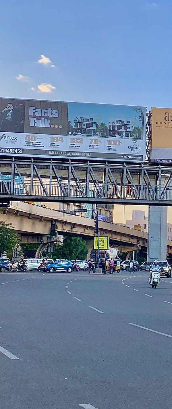
global city looks like in the 21st century. At the same time, Hyderabad maintains a deep respect and reverence for the practices that have distinguished it—for me at least—from Washington, DC and New York City. It is the clash of cultures, the convergence of built environments, and juxtaposing, chaotic constructions in a single urban space that defines Hyderabad and the beauty and vibrance therein.
This article would not have been possible without the perspective of Vinod Sudhakar; Vinod’s insights have been invaluable. Thank you to my mom for helping to bring all of this together, from start to finish. I am forever grateful.
44
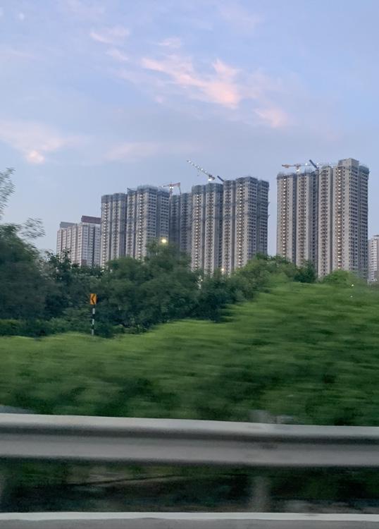
 Ishaan Barrett
Fig. 7
Fig. 10
Fig. 8
Fig. 9
Ishaan Barrett
Fig. 7
Fig. 10
Fig. 8
Fig. 9
45
Fig. 11
Not-for-Profit or Landgrab
Richies of New York City
Words and maps by: Ruju Joshi Ruju is an Urban Designer-Planner from India, currently based in New York City.
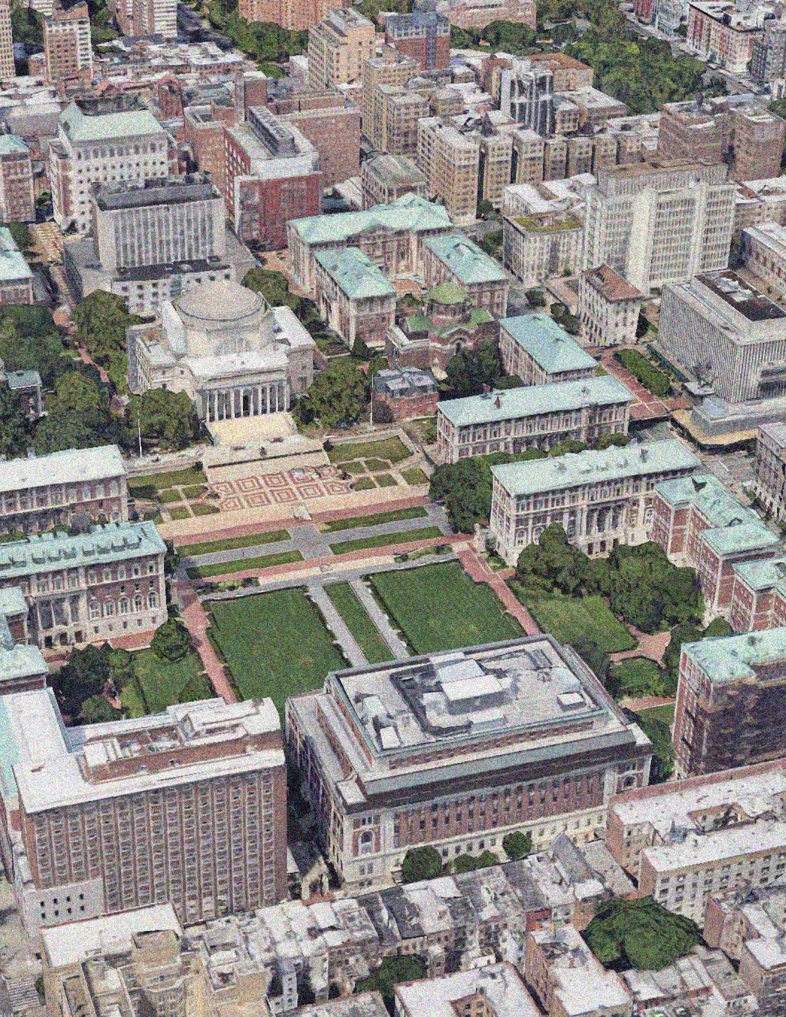
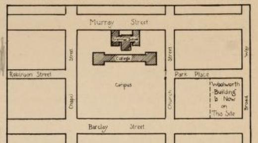
46
Columbia University makes a substantial contribution to the intellectual and cultural fabric of New York City, representing academic brilliance since it was established as King’s College in 1754. Despite being known around the world for its research, Columbia’s latest accolade may come as a surprise to visitors and locals alike: the institution has become the largest private landowner in New York City with more than 320 property holdings (Haag et al., 2023). The New York Times reported that Columbia has a combined valuation of nearly $4 Billion in property holdings throughout New York City.
Columbia University’s campus has moved all around the city, from lower to midtown to upper Manhattan over the course of 269+ years. These moves were seemingly random at first, however, there were greater governmental and political pushes supporting and encouraging them.
The historical foundation of Columbia University in NYC dates back to 1702 when Trinity Church was granted a parcel of land known as the King’s Farm. After many repeated conversations, the General Assembly granted permission to build a college for 15 “academic men”. The money used to pay for the construction was raised by public lotteries, after receiving the generous donation of the farmlands from the church. The capital for lottery money increased to £3443 18 shilling. and that is how Columbia’s land portfolio was conceived (Arrowsmith, 1982). It was a historical circumstance: the University received the land through a donation and did not pay for it.
The land for King’s College stretched from Broadway to the North River which was eventually expanded in 1772 with additional land received as part of a city donation program. The college was housed in this location for about 40 years. Soon after in 1776, the symbolic crown of the building was taken off, and King’s College became Columbia University.
There were several presidents including William Samuel Johnson, Rev. Charles H. Wharton, Harris, Duer, and Moore
who played pivotal roles in building the downtown campus, and in “moving the campus” plans to midtown Manhattan (Arrowsmith, 1982).
After several plans called for the expansion and relocation of the University during the early 19th century, the trustee committee purchased a part of the block between 49th and 50th Streets, and Madison and Fourth Avenue from the Deaf and Dumb Asylum. The campus moved to midtown Manhattan and stayed there for the next 50 years (Arrowsmith, 1982). Under the tenure of president Charles King, it marked the beginning of modern development for the university in 1857, and a significant addition to its real-estate portfolio.
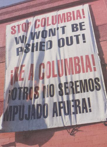
An option emerged in 1891 for Columbia to continue its journey uptown to the Bloomingdale Asylum site between 116th and 120th Streets. December 1895 saw the laying of the cornerstone for the Library building, and in May 1896, President Low oversaw the official dedication of the new location (Columbia University). In 1897, Columbia University made the official transition to what is now its permanent home in Morningside Heights, ending one chapter in its history and beginning a new one that is still being shaped by administrators who have come after, especially presidents Butler (who served for almost 40 years) and Lee C. Bollinger (20 years).
During the tenure of President Bollinger, the campus faced its most dramatic expansion of all: into West Harlem for the expansion of the Columbia Business School. The campus is a $6 Billion investment, spanning from 125th Street to 134th Street. It is one of Columbia’s largest campus development projects, initiated in 2008, and speculated to be completed by 2034 (Banerjee et al., 2023). It was also one of the most contested and controversial expansions in the University’s history, as it used eminent domain for its land acquisition unlike previous city donation programs. The city declared the area “blighted” and took over the land to eventually pass it down to Columbia. The University created a Community Benefits Agreement (CBA) for its 31-year timeline for the affected neighborhood. The agreement committed Columbia to deliver up to $4 Million in legal assistance, $20 Million in affordable housing, and $76 Million in other resources and services for West Harlem, distributed through the West Harlem Local Development Corporation.
This amount is less than Columbia’s annual savings from its property tax benefits.
A more than 200-year-old state law that exempts universities, museums, and other non-profits from paying negligent to almost no property taxes (Haag et al., 2023) has saved Columbia tons of dollars, putting a growing strain on city revenue as the university increases its property footprint. The 1969 Tax Reform Act, which introduced Section 501(c)3 in the Internal Revenue Service (IRS) Code, established universities’ tax-exempt status. The underlying principle behind granting tax-exempt status to 501(c)3 organizations is clear: instead of paying taxes to the government, these entities can allocate their funds to further invest in the public goods they provide, potentially making a more significant impact than government spending.
Based on an analysis of the New York City Department of City Planning’s MapPLUTO dataset, the Department of Finance’s Digital Tax Map, and Tax Exemption Detail datasets, Columbia University holds 265
Joshi
Ruju
47
land parcels under more than 36 variations of “THE TRUSTEES OF COLUMBIA UNIVERSITY IN THE CITY OF NEW YORK'', “BARNARD COLLEGE COLUMBIA UNIVERSITY'', and “TEACHERS COLLEGE COLUMBIA UNIVERSITY'' (NYCDCP, 2023).
The variations make it extremely difficult to filter the dataset and find the exact property ownership for the university in NYC. It also does not account for the subsidiary companies or organizations that have the landholding under a different name for Columbia. The university is partially or fully exempted from paying property taxes on 222 of those 265 properties (NYCDOF, 2023). Most of these lots are located in the Morningside, Manhattanville, and Inwood Park neighborhoods. The remaining 42 land parcels on which the institute does pay taxes are extremely small in size compared to the overall 13.4 Million square feet of landholdings.
So, how does Columbia invest these savings? According to a recent study conducted by Columbia Spectator, Columbia saves nearly $170 Million through property tax exemptions annually, out of which 53% is retained as savings, approximately 40% is spent on the local infrastructure upgrades and Manhattanville Workforce firms, and only 7% is contributed to the Community Benefits Agreement payments to the West Harlem Local Development Corporation (Spectator, 2023).
A direct implication of Columbia’s presence in Uptown Manhattan is clearly visible in its surrounding areas as well. Many local and small businesses were taken over or replaced by large-scale food and market chains like Shake Shack, Blue Bottle, and Westside Market, affecting the microeconomics of Morningside Heights. Further north, around the Manhattanville campus, many restaurants and residents were displaced due to changes in demographics. The NYCHA residents living across from the Manhattanville campus are constantly paranoid over displacement today. There have been first hand experiences of fear during community engagement events
for NYCHA Manhattanville Campus under the PACT program. The residents refuse to participate in the engagement as they dread the threat of being kicked out of their homes where they have been living for more than 40-50 years. That is also because the government supported Columbia over the local community under eminent domain for Manhattanville campus’ land acquisition. They ruled in the institution’s favor, leaving the residents with nothing but a compromise in the name of a CBA. The presence of Columbia in the neighborhood
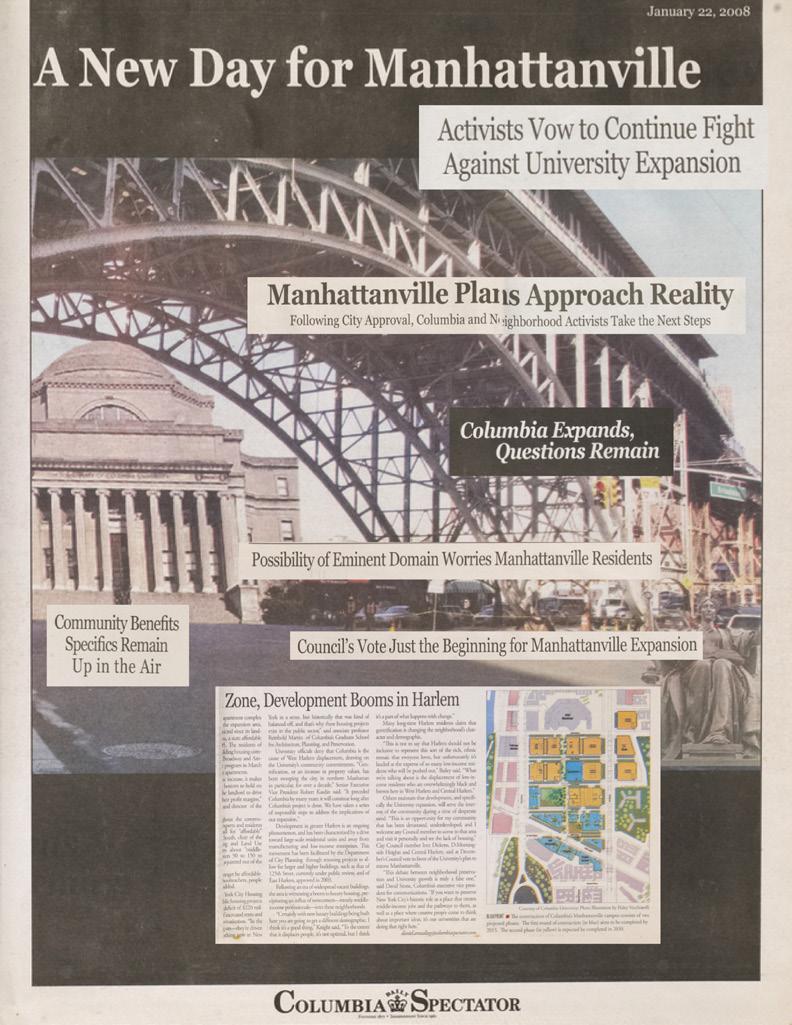
has certainly and significantly imposed its “power”. It is startling to observe various political, economic, and social aspects of these decisions unfold.
On a positive note, the development draws the interest of numerous national and international students to the region, who serve as secondary contributors to municipal taxes and bolster local economic activities. Moreover, the contemporary yet historic campus serves as a forum for civic engagement and public demonstrations, affording city residents the opportunity to voice their concerns.
By this point we have seen the complex connection between Columbia’s prominence in real estate and its
designation as a “not-for-profit” organization under Section 501(c)3 of the 1969 Tax Reform Act. The university’s historical expansions and strategic land acquisitions from downtown to uptown Manhattan are intricately linked to each other. Columbia’s ability to amass substantial real-estate holdings and achieve its current status as the largest private landowner in New York City has been attributed in large part to its “not-for-profit” status.
The financial benefits from the property tax exemptions draw attention to the nuanced effects of this dominance, which range from changes in local business economics to alterations in the demographics of the neighborhoods around it. A problem emerges regarding how to strike a balance between Columbia’s growth and its effects on the surrounding communities as it continues to expand, especially with the Manhattanville campus project.
or Land-Grab Rich-ies of New York City
Not-for-Profit
This piece was originally written by Ruju Joshi as a paper to analyze 'How RealEstate Shapes a City' for her New York Rising class at Columbia GSAPP.
48
Inwood Sports Center

222 of Columbia University's properties in Manhattan are Property Tax Exempted -- this accounts for 80% of the University's Manhattan portfolio.
Only 42 properties are nonProperty Tax Exempted
Ruju Joshi
Manhattanville Campus Morningside Campus 1,000 m N 49
Unraveling: Ejidos, Land Rights, and Urban Form in Baja California
 Words by: William Fainaru Callahan
Will is an MSUP student at Columbia GSAPP from Berkeley, CA. He is interested in affordable housing, community development, and the use of creative writing to address urban challenges.
50
On the surface, Todos Santos has all the trappings of a town experiencing firstwave gentrification—an exploding real estate market led by “pioneers” like AirBnB mindfulness guru Chip Conley, art galleries, yoga studios, farmers markets, overpriced souvenirs, and most importantly, increases in the cost of living. But the foundation of this change is a system of land ownership as old as the Mexican revolution: the ejido
Intended as a form of subsistence farming, the ejido (pronounced eh-hee-doh) was created after the 1910 revolution as a vehicle for redistributing land to Indigenous communities (Teresa 2004). There are still some 30,000 ejidos in Mexico, though their total footprint has been shrinking since 1992, when the government passed Article 27, legalizing the privatization of the ejidos through sale, transfer, or use as collateral. While that policy change was promoted as a way to integrate the ejidos into Mexico’s global economy, it also freed up previously restricted land to foreign investment. It was no coincidence that the North American Free Trade Agreement (NAFTA) preceded the new law. The treaty promoted the free flow of capital – including real estate investment – across the U.S-Mexico border.
To anthropologists, the ejido is a vestige of Mesoamerica and Mexico’s Indigenous civilizations. To local business owners, the ejido is a quasi-government entity that controls the region’s water supply and other services. To real estate developers, the ejido — is a source of cheap land. Even government planners might overlook the ejido’s authority (the ejidos were omitted from the city of La Paz’s Planeado
William Fainaru Callahan
Desarrollo Urbano, the blueprint for development in the region).
In 2018, my parents purchased a halfacre of land in Pescadero, a former fishing village on the Baja Peninsula. Baja’s real estate market was exploding, largely because of foreigners lured by the region’s breathtaking beauty and relatively cheap land.
Despite the town’s tranquilo (chill) lifestyle, my position as an outsider was still solidified. It was more than just a cultural or language barrier that kept me looking through a glass. The town’s contradictions – its lack of paved roads and multi-million dollar homes – seemed to betray an ideological struggle. While I was familiar with limited equity housing like community land trusts, there was no American equivalent to the ejido. I wondered how an Indigenous communal land system could become a power broker in global real estate transactions. Was buying ejido land helping or hurting their cause?
foreign investors because these coastal restrictions give the ejido more leverage in negotiations.
The Mexican Revolution was fought in part to redistribute property from wealthy and powerful landowners, including foreigners, to disenfranchised Indigenous farmers. What Hugo describes is essentially a reversal of this process, one that he fully supports because of the resources he believes it will bring to the Pescadero community.
Octavio Paz anticipated this conflict in The Labyrinth of Solitude, his classic booklength essay on Mexican identity and the nation’s “dialectic of solitude.” Paz argued
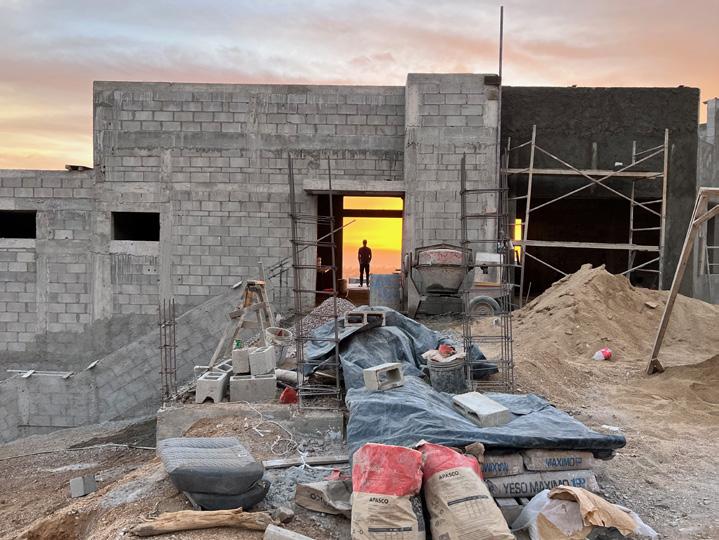
“ ”
The town’s contradictions – its lack of paved roads and multi-million dollar homes – seemed to betray an ideological struggle.
To understand the ejido’s evolution, I went directly to the source, speaking with Hugo Fernando Leon Espinoza, who inherited his share of land from his grandfather, one of the founding members of the Pescadero ejido. In the 1930s, the administration of President Lazaro Cardenas granted Pescadero fourteen hundred hectares of arable land stretching from the Pacific Ocean to the mountains. In addition to owning his family share of fifteen plots, Hugo presides over a commission that administers the ejido’s properties along the shoreline, las tierras de uso común, the ejido’s remaining communal land. Hugo sees the potential for growth in the area, hinting at a partnership with an Australiabased hotel conglomerate, though he declined to disclose the ejido’s parcel data to protect the privacy of prospective buyers. Hugo’s position requires an understanding of “fideicomisos,” real estate investment trusts that allow foreigners to circumvent regulations on coastal lands. The ejido especially covets
that Mexican culture perpetually oscillates between preserving its indigenous roots and adapting to globalization imposed by the United States (Paz 1985). The privatization of ejido land is the embodiment of the conflict. As the line between social land and private property becomes blurred, so does the ejido’s role. The ejido has assumed the role of a planning organization, carving up parcels on mountains overlooking the Pacific, and hiring consultants and attorneys to mediate disputes with local municipal governments.
While Paz intended the labyrinth as a symbol of Mexican identity, urban planners have adapted this metaphor to represent isolation in Mexico’s built environment, particularly with Indigenous communities. In Laberinto – an architectural art installation in Mexico City’s Gustavo A. Madero neighborhood – Rozana Montiel
51
imposed a literal labyrinth in the middle of a downtown square. The piece was intended to explore how imposing arbitrary demarcations can disrupt the social cohesion of a neighborhood.
In Aztec to High Tech, Lawrence Herzog explores the inverse: what are the consequences of removing spatial demarcations? He argues that trade agreements like NAFTA not only demand uniformity across labor markets, they require uniformity in the built environment: in their property rights, infrastructure, and even architectural design. In Herzog’s view, Baja’s Indigenous heritage has not dispelled the inundation of real estate investment; in a twist of fate, the region’s Aztec-inspired architecture is becoming an asset, the backdrop for this cultural assimilation to take place (Herzog 2001).
But shouldn’t the ejido be a buffer to this homogenization? In its insularity, the ejido was designed to withstand the whims of the global real estate market. Claudio Lomnitz – the chair of the anthropology department at Columbia – argues the ejido’s self-sufficiency was more than just a business model, it became the blueprint for surrounding rural economies to build upon.
Marcos Ramirez was a beneficiary of this blueprint, incorporating the ejido’s subsistence farming model into his restaurant, Hierbabuena, a locally sourced, healthy eating establishment in Pescadero.
Marcos used to work at a world-class restaurant in Napa Valley but was drawn to Baja’s burgeoning food scene. He purchased land from an ejidatario roughly twenty years ago; in the man’s old age, Marcos helped with maintenance and paperwork, eventually taking over the property when the man passed away. In spite of the rising costs in maintaining Hierbabuena – rising property, labor, and food expenses, as well as water purchased from the ejido – Marcos has remained loyal to his grassroots business model. He contends that the ejido’s influence on the region is indelible and lives on through his restaurant.
But as Todos Santos, the better-known tourist town north of Pescadero, becomes one of the most expensive cities in Mexico, the link between labor and land – the underlying principle on which the ejido was founded – is eroding by the day. Much of the local farmland is being bought up by developers, and some residents wonder whether all of it will be gone within the next two decades.
The town’s revolutionary origins can be seen everywhere. Murals in Todos Santos depict revolutionary heroes like Emiliano Zapata and his famous quote: “La tierra es de quien la trabaja” (the land belongs to those who work it).
But increasingly, the land belongs to those who buy it.
For centuries, Indigenous civilizations subscribed to the concept of “sacred time and space,” believing the land’s economic value was ancillary to its spiritual value (Herzog 2001). The built environment was erected to contain this spiritual value, safeguarding it from being exploited by foreign intruders.
But as ejidos actively pursue foreign investment, does this portend the ejido’s demise? Or does that narrative miss the point? The ejido is the culmination of centuries of Mexico’s Indigenous heritage. Does that legacy end with the sale of the land, or is it ingrained in the soil?
Ejidos, Land Rights, and Urban Form in Baja, California
Unraveling:
52

53
Forest Cover (2023). Photo by: Olivia Jia
How Participatory Budgeting has Impacted Citizens’ Lives in Metropolitan Guadalajara, Mexico
 Words by: Raquel Padilla
Raquel Padilla is an urban planner who works at the intersection of modeling design, spatial analysis, and policy making.
54
As the concentration of urbanites shifts from the Global North to the Global South, governments and planners have started to look at these geographies as sources of inspiration for policy-making and innovative ways to cope with the challenges that affect cities today. The Participatory Budget (PB) is one of these innovations. It is a mechanism that emerged in Porto Alegre, Brazil in 1989. Participatory Budgets are an excellent tool to promote citizen participation in government affairs. They are one of the greatest innovations from the Global South.
This instrument originates as an effort from local governments to rebuild relations between legislative and executive powers, and as a way to rethink democracy (Cabannes, 2004). Since it emerges in the context of directly elected governments, the stakes of constructing or strengthening dialog between government and citizens are very high. The idea behind this initiative is to allow citizens to participate in the decision-making process by giving them the power to vote and decide on the government budget allocation.
Among the cities that have adopted this mechanism is the Metropolitan Area of Guadalajara (MAG), the second largest metropolis in Mexico. The MAG has ten municipalities, four of which (Guadalajara, Tlajomulco, Tlaquepaque, and Zapopan) have implemented this mechanism.
A Worldwide Phenomenon
After its first implementation in Porto Alegre, this mechanism encountered enormous success nationwide and began to emerge in Latin American countries, leading to its global recognition. This initiative coincides with a shift in the way democratic institutions approach their interaction with citizens to recognize different voices and increase participation (Watson, 2009).
To understand how PBs “conquered” the world, Cabannes identified three
main stages of global spread: 1) First experiences: Porto Alegre, Montevideo, and Santo André (1989 to 1997); 2) Brazilian spread: adoption of the tool by 130 Brazilian municipalities (1997 to 2000); and 3) Expansion: adoption by various Latin American and European cities (2000s onwards) (Cabannes, 2004).
Beuermann & Amelina (2014) identified four main impacts of PB implementation: 1) Impact on the decision-making processes, 2) Impact on the enhanced willingness to pay taxes, 3) Impact on local budget allocation, and 4) Impact on the quality of public services. This categorization confirms that PBs are not only a tool to promote citizen participation and the pursuit of common well-being; they are also an instrument for political propaganda and a tax-collecting mechanism. This last component comes from the need to finance the projects to be executed through this planning instrument; however, one question that arises is whether this monetary purpose should determine who has the right to participate and who does not.
The large number of cities that have adopted this planning tool demonstrates its success as it brings an opportunity to promote participation and transparency, all while constructing stronger bonds with the community. Furthermore, the ballots reflect the success of this exercise, increasing its attractiveness. However, despite the benefits that PBs bring to the local governments, the advantages for citizens are more difficult to unpack. It is even harder to measure how citizens perceive this tool, and if they identify it as beneficial for them and their community.
Participatory Budgets and the MAG1
In 2010, the municipality of Tlajomulco started to experiment with this initiative. It was the first municipality in Mexico to implement this tool, setting an example for its neighbors. The government initially presented ten proposed projects for
the citizens to vote on. In the years that followed, the administration started to work with the citizens so they could suggest projects that would be beneficial for them. It motivated the neighboring municipalities of Guadalajara, Zapopan, and Tlaquepaque to adopt it.
Nowadays, the tool has evolved in similar ways in the three municipalities. Some of the milestones mentioned during interviews were that each municipality has its own legal framework to regulate this mechanism (and other participatory initiatives). Furthermore, the three governments have implemented this mechanism within a participation-devoted agency. Hence, it is evident that there is some commitment to foster participation beyond this particular tool.
As mentioned above, the projects that are voted on are the result of a dialogue between citizens and government. Overall, the process followed by the three municipalities consists of four phases: proposing, filtering, technical evaluation, and general voting.. However, there are a few municipality-specific ways to participate in the proposing phase. Guadalajara for example started to ask for proposals when citizens issue their votes, and they will present them in the following year’s exercise of the PB. Guadalajara and Zapopan also hold working sessions with the citizens to gather project ideas; for the 2022 exercise, for example, Zapopan declared to have held 111 of these events.
Tlajomulco leverages the voting round to ask its citizens about the topics the municipality should prioritize. Hence, when voting, a person can suggest the development of a particular project and select the areas they consider more important to address. The ballots include categories such as natural environment, education, public health, children and elderly, security, culture, sports, and recreation. In the reports consulted for this work, security came in first place with roughly 30% of the votes. It was followed
Raquel Padilla
55
How Participatory Budgeting has Impacted Citizens’ Lives in Metropolitan Guadalajara, Mexico
by education and public health with about 20% each. It is a way for citizens to express their priorities.
As mentioned before, the implementation of this initiative in the MAG has become very popular among local governments. Table 2 showcases the increase in the number of participants over the years except for the years during the COVID-19 pandemic. The number of proposed projects demonstrates differences amongst municipalities. Guadalajara has adopted a more focalized approach proposing specific projects per zone (there are seven zones in total) and some general projects for the whole municipality, explaining the larger number of projects proposed.
Once the voting period has ended, the municipalities proceed to select the projects to execute. They rank all the projects according to the votes they received; and turn this list to the executing dependency which will be in charge of implementing them. The number of projects executed will vary depending on the project cost and the total available budget. There are, however, some general guidelines that the municipalities consider; the officials from Guadalajara and Zapopan mentioned the intention to generate equity when distributing the projects. Tlajomulco prioritizes efficiency by making the most of the available budget.
Finally, the three functionaries I interviewed mentioned that initially this tool was opened exclusively to taxpayers. It targeted property owners who would be able to submit their votes when paying their property taxes. However, the three municipalities are currently working to expand the scope of this initiative, making it available to other populations. Zapopan and Guadalajara for example have installed more voting centers in different municipal agencies as well as an ambulatory unit that collects taxes and allows people to vote regardless of their tax-paying status. Guadalajara also decreased the
minimum age required to vote to fifteen years old, and Zapopan expressed their intention to expand the initiative to informal communities as well. With this, we see a possibility for local governments to act as inclusionary gates for certain groups by ensuring participation in city matters as suggested by Miraftab (2009). Though there is a will to make this initiative available to a larger sector of the population, we should also reflect on how this inclusion could be implemented throughout multiple phases of the process, such as the proposition and design of projects without limiting it to the voting process.
Assessing the Participatory Budget in the MAG
In this section, I present some of the outputs from an online survey I carried out in November 2022 among the population of the MAG. I received seventy-three responses from the inhabitants of the four municipalities (thirty-seven from Zapopan, twenty-seven from Guadalajara, six from Tlaquepaque, and three from Tlajomulco)2 in total. Thirty-seven respondents of these seventy-three were women, and thirty-six were men of ages ranging from twenty-five to fifty-seven years old.
Graphs 1 and 2, show that the PB is not well known by the population. It ranges from 30% to 40% in the four municipalities, and similar percentages result when we separate respondents by age group. The only exception is the group of fifty-one to fifty-five years old which seems to be more familiar with the initiative.
After assessing their familiarity with the initiative, I asked about their participation in this exercise. Here I found that of the people who knew about the initiative, 69% had voted in previous years (Table 3). This percentage of participation seems high considering the eligibility matter mentioned before. Nevertheless, we can see that eligibility is not entirely clear for everyone. After defining the PB in the survey, it was mentioned that this mechanism
is open to all inhabitants of the four municipalities. After this, the participants were asked if they were eligible; to which 57% responded Yes; however, only 28% of them had previously voted (Table 4) which suggests that they were unaware of their participation eligibility in the initiative.
When asking about the reasons for not voting before evidently the most common answer is the lack of awareness of the initiative with phrases such as “I didn’t know” (no sabía), “I was not aware” (no estaba enterado), “lack of information” (Falta de información) or yet “I don’t know if I am eligible” (no sé si soy eligible).
Similar ideas come out when asking about the barriers they consider existing to participate in this process. We can see the lack of information and lack of diffusion being the two main barriers identified (falta de información and falta de diffusion respectively). But we can also see some other answers that evoke mistrust in the government and the transparency of the mechanism: “I don’t think it is transparent” (no lo considero transparente), “mistrust” (desconfianza), “potential conflict of interests” (possible conflicto de intereses).
As for the means of participation, Zapopan is the municipality that seems to have a better adoption of online voting3 with over 90% of respondents declaring using this means to participate in the process. A report from the 2021 exercise from Guadalajara confirms this information where they present a ratio of 5.09% online voters against 94.91% in person (Guadalajara, 2022).
Online voting is important since it provides a practical and easy way to participate for those who do not have the time or means to attend a physical voting center. In this case, we could include this implementation as an effort of the process to be more inclusive. However, online participation is only available during the voting period. There is no implementation yet of online participation during the other stages of the
56
mechanism (monitoring and proposing) as conceptualized by Matheus et al. (2010).
Finally, I asked the respondents to evaluate the initiative on a scale from one to five, five being good and one being bad, and we can see that most of the people who were already familiar with the initiative had an ambiguous opinion about the tool, most of them giving it a three.
Among the reasons given for this note, we can read again the lack of awareness (no la conozco), but also some critiques regarding the very little information provided about the projects presented as well as the absence of reporting on the projects executed as pointed out by this respondent:
"You can vote for the projects in the list but there is only the name of the project (e.g. resurfacing of the street X in the neighborhood Y) but it is not specified more for example the number of people who will benefit from it, the socio-economic level of the neighborhood, or the number of votes that each project has accumulated. This would help to support the projects that would have the biggest impact and that could benefit the neighborhoods in more need."
Another respondent also mentioned the lack of information about the execution of the projects: “When they ask for our vote, they could show the list of projects that were executed in the previous year”.
As for the people who evaluated the initiative from four to five, the reasons seem to come mainly from their assumptions and expectations with phrases such as “good initiative” (buena iniciativa) or “I think is interesting” (me parece interesante). We can read responses that applaud the initiative for its inclusion component with phrases like “opportunity to give your opinion” (oportunidad de opinar) or “I decide the priorities for my municipality” (decido prioridades para mi municipio). However, there are again critiques of the lack of diffusion, the lack of clarity in the execution process, and some skepticism for this tool with phrases such as: “lack of information of results” (desconocimiento de los resultados), “unfortunate the
Raquel Padilla
lack of awareness” (lamentable el desconocimiento) or “I would like for this to work” (me gustaría que funcionara).
Finally, although not very present in these responses, one of the critiques that PBs have received in their Latin American application is the lack of relevance of the small budget allocation to this initiative (Sintomer et al., 2012). One of the answers to this last question echoes this criticism where some of the respondents critiqued the small scale of the projects (obras muy básicas) or their quality (obra de mala calidad).
Final Reflections
The previous section discusses the biggest critique of the PB in the Metropolitan Area of Guadalajara, which is the lack of information and promotion. As we saw in Table 2, the number of voters has increased over the years since its first exercise. However, these numbers remain small when we compare them to the total population of these municipalities (Zapopan, 1,476,491 inhabitants, Guadalajara, 1,385,629 and Tlajomulco, 727,750). This same lack of information is perceived as a barrier to its wider adoption.
Nevertheless, we see that the initiative is appealing to people who just discovered it, and it draws attention and willingness to participate. Therefore, we could predict that a larger communication campaign would result in a significant increase in the participation rate which will eventually bring more tax collection and prospective projects.
Finally, there is a lack of information regarding the execution of the projects, and perhaps this is what generates mistrust and skepticism among the community. As we saw in some of the answers, people would like more details about the projects to make an informed decision. They would also like to have more information about the execution of the projects -- we can see in Table 3 that 83% of the people
who knew about the initiative don’t feel directly benefited by it. This last fact might be related to the fact that most people cannot identify any project that has been executed under this mechanism (out of the 73 people surveyed, only 4 people could mention a project constructed with the PB). So, we can see another area of opportunity for the municipalities.
Overall, we can conclude that this initiative has been successful in its theoretical components and at a smaller scale in practice. Secondly, there is openness from the municipalities to expand the initiative and make it more accessible to a wider range of groups. Finally, more efforts need to be made regarding the communication of the initiative during the voting period as well as throughout the process, from the project proposals phase to the execution and dissemination of results. Doing so could increase participation, bring more income to the municipalities to develop more projects, and reinforce trust and confidence in the tool and the government.
1 The information presented in this section is the result of data collected from the official websites of the municipalities, official reports obtained through the federal transparency platform, and conversations held with three public officials from the transparency directions of three of the municipalities: Tlajomulco, Guadalajara, and Zapopan. Though the municipality of Tlaquepaque was contacted for this study, I did not receive any response, nor I found relevant information in the official website.
2 Unfortunately, I couldn’t gather more answers from Tlajomulco and Tlaquepaque Which forces me to be cautious with the interpretation of the results for those two municipalities.
3 Since there were only three responses for Tlajomulco, there is uncertainty about the representativeness of this parameter.
57

The Land and Water Talks

Words and images by: Alexandria Bernabe
Alexandria is an architecture student in the New York / Paris: Shape of Two Cities program at Columbia GSAPP. With a passion for photography and storytelling, she hopes her work can be used to amplify voices of unheard communities across the world.
58
Alexandria Bernabe
When driving through the streets of Jerusalem to get to the old village of Lifta, the tour guide told us to look out the windows to see cranes flying overhead. In the sky were not birds migrating to their next destination, but large mechanical machines signifying the migration of new neighbors to newly constructed communities on the land. The mechanical cranes shined against the old remains of Lifta’s greenery and were seen from the farthest of distances. In every neighborhood, village, and town, the silhouette of the new emerges from the lasting remnants of the land’s previous life. These images attempt to differentiate the new and the old, extract their stories, and give light to a re-imagined, hopefully near, future.
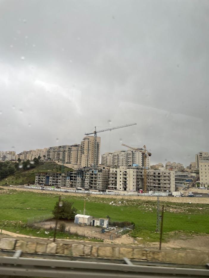
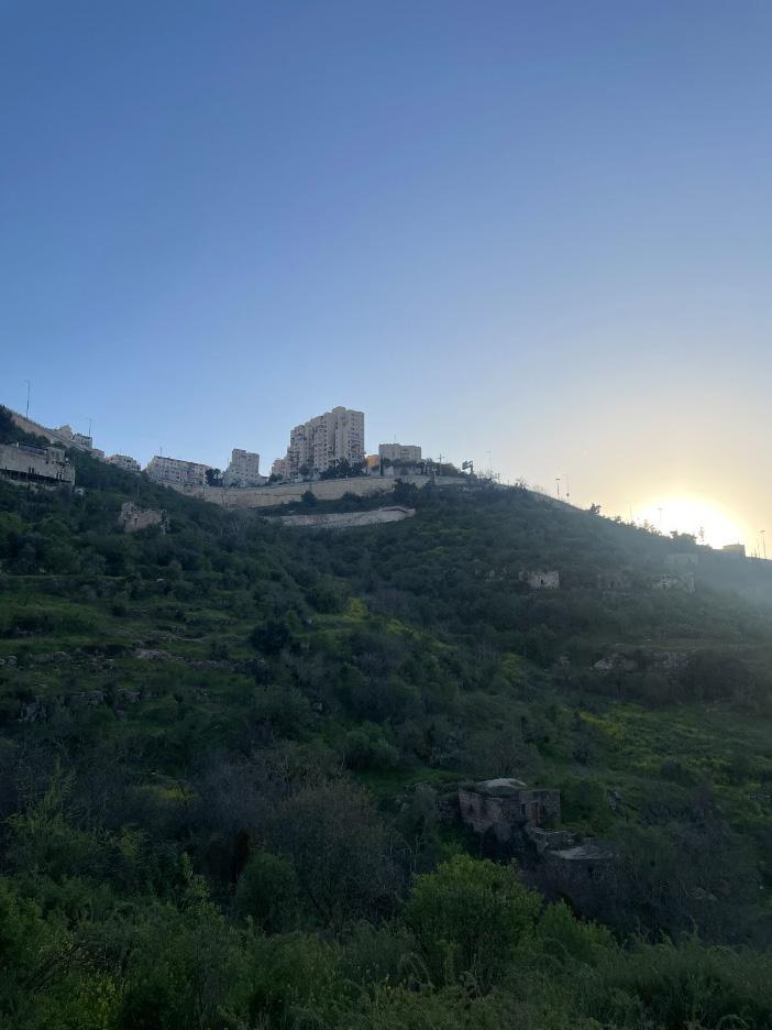
Bedouin
59
Neighbor in Al-Naqab Town of Rahat, Negev Desert

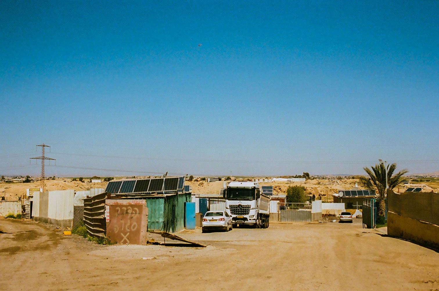
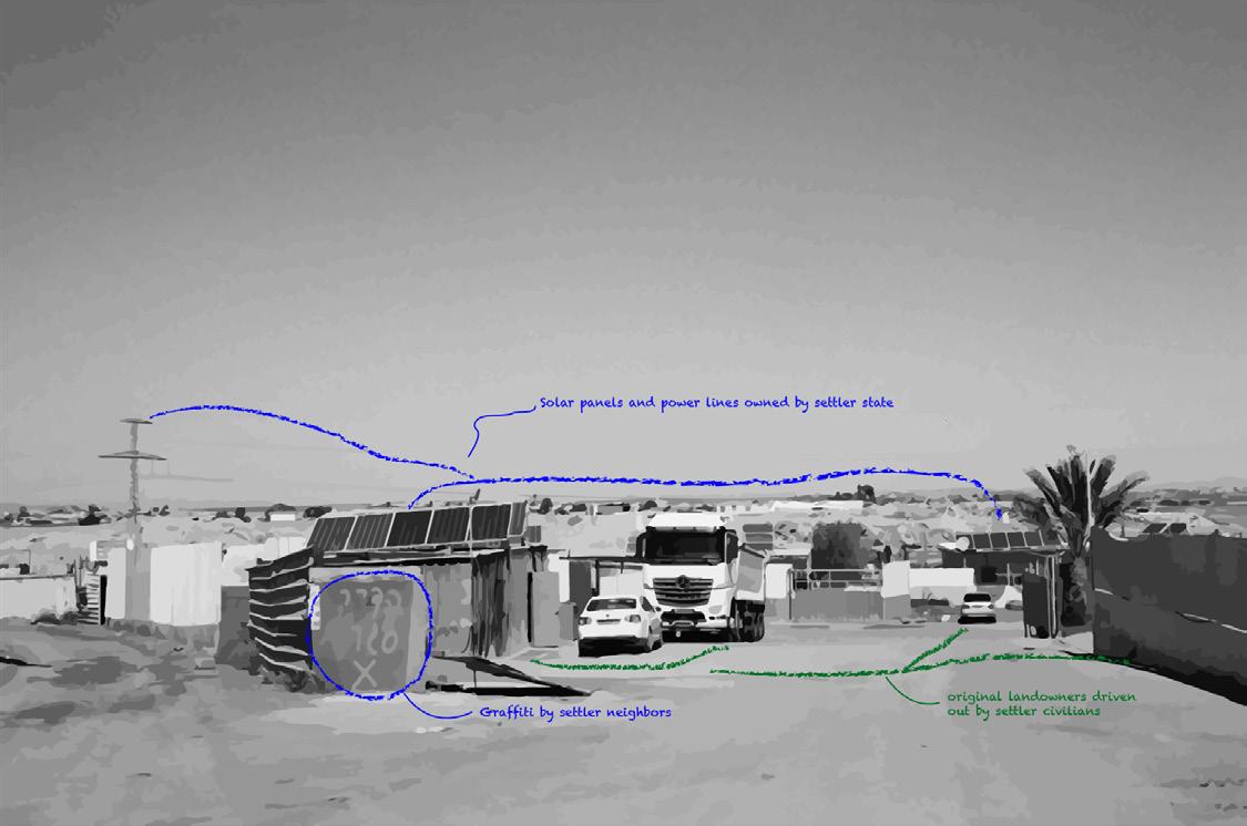
Al-Naqab, or the Negev Desert, is home to the Palestinian Bedouin community. Consisting of both unrecognized and recognized villages, the Bedouin people have been struggling to have their land ownership and villages officially recognized and respected since the 1948 establishment of the settler state. The town of Rahat is the largest Arab Bedouin city in the world, and one of the seven townships in the settler-state that is fully recognized as a city. There are a total of 35 unrecognized villages and townships in the Negev Desert and 100,000 people living in the unrecognized villages.
Demolished Bedouin home in Rahat Town of Rahat, Negev Desert
The settler-state court law declares unrecognized villages illegal, a tool that encourages the demolition of Bedouin homes and pressures the community to relocate. The unrecognized villages receive no state funding for basic city services, like street safety, transit, and education. 2500 homes in Al-Naqab are demolished annually due to lack of recognized documentation of their land claims. The Bedouin population are forced to demolish and rebuild their homes on their own coin.
Bedouin neighborhood in transition Town of Rahat, Negev Desert

The Land and Water Talks
60
Alexandria Bernabe
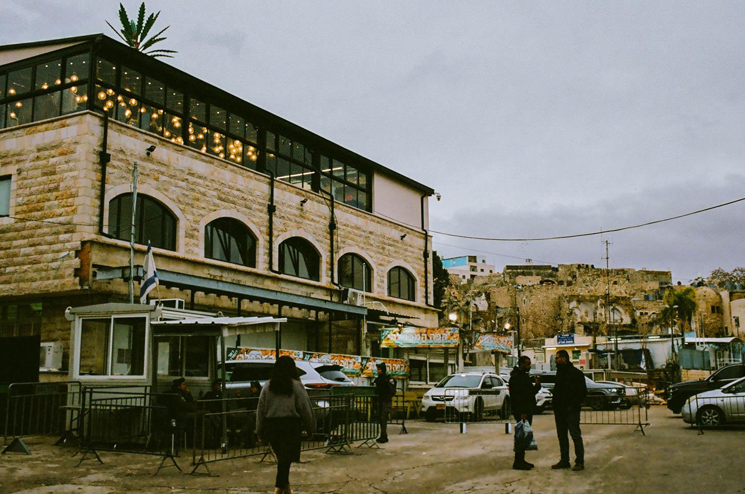
The city of Hebron physically encapsulates the divide between Palestinians and the settler state. In 1997, the city was divided into two sections: H1 controlled by the Palestinian National Authority, and H2 under the settlerstate military control. Check points throughout the city organizes the section borders and mitigates movement of people. Although H2 has both Palestinian and settler civilians, the Palestinian people are regulated by specific rules in place by the military administration, while settlers have their own governing body.
Children in Al-Naqab Town of Rahat, Negev Desert

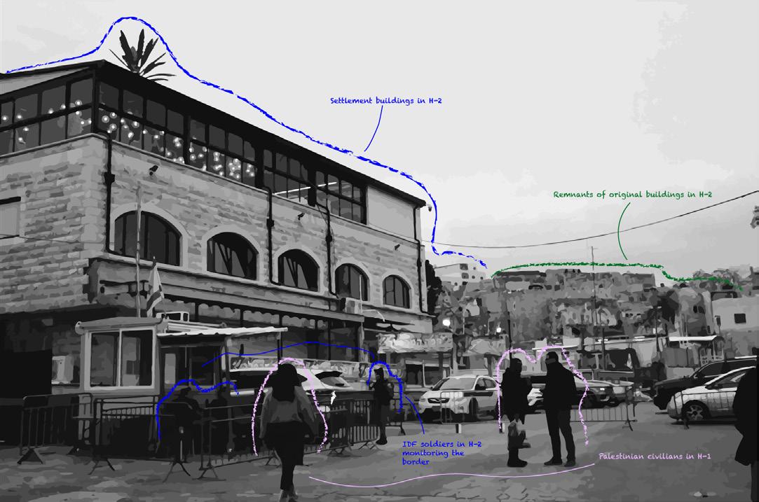
Borders and Checkpoints
Hebron H1/H2
Borders and Checkpoints
Hebron H1/H2
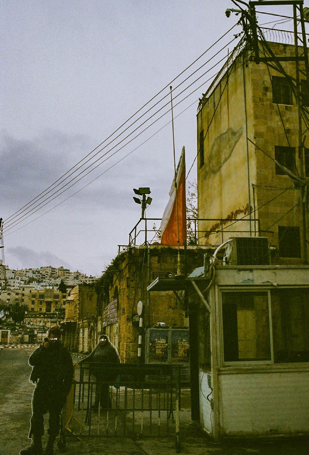
61
The Land and Water Talks
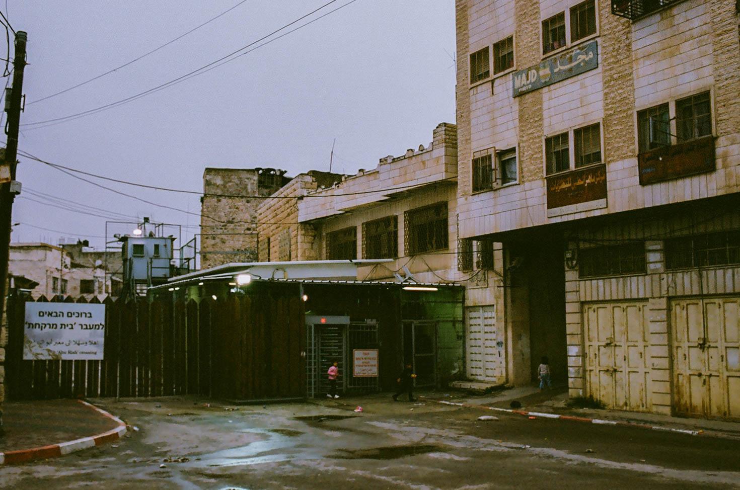
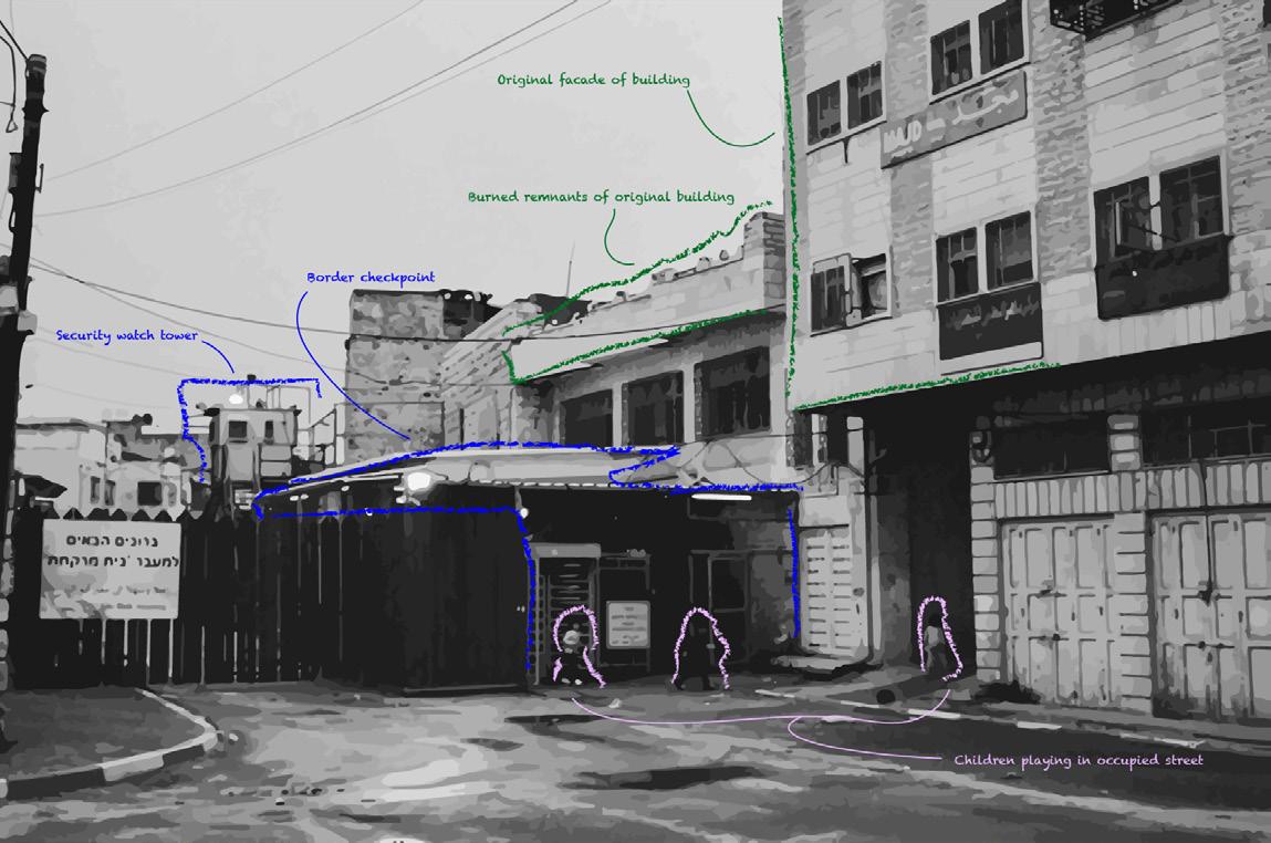
Checkpoints and military law restrict human movement within the Palestinian community.
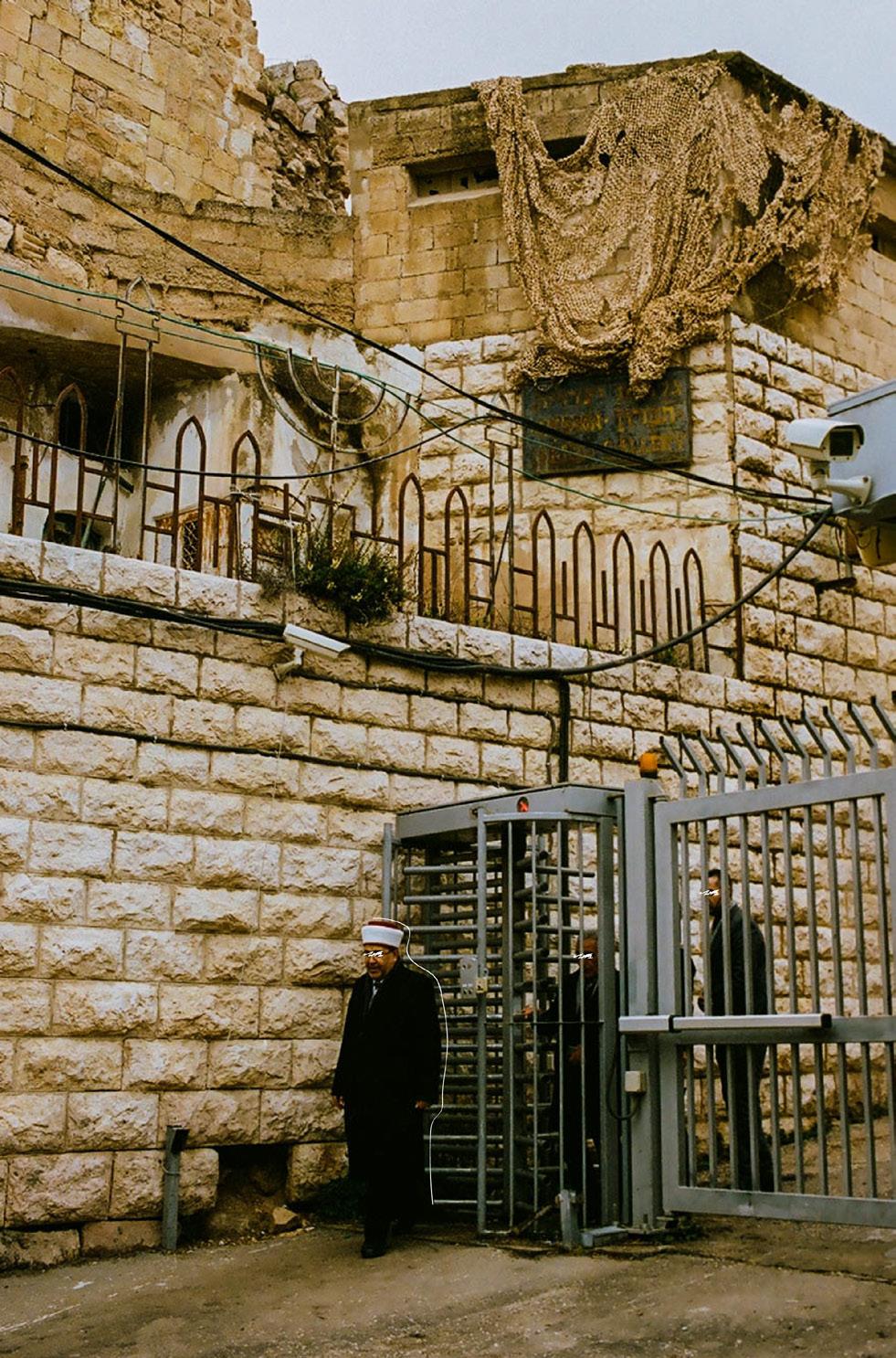 Checkpoint outside of the Sanctuary of Abraham Hebron H1/H2
62
Children in the Old City of Hebron Hebron H1/H2
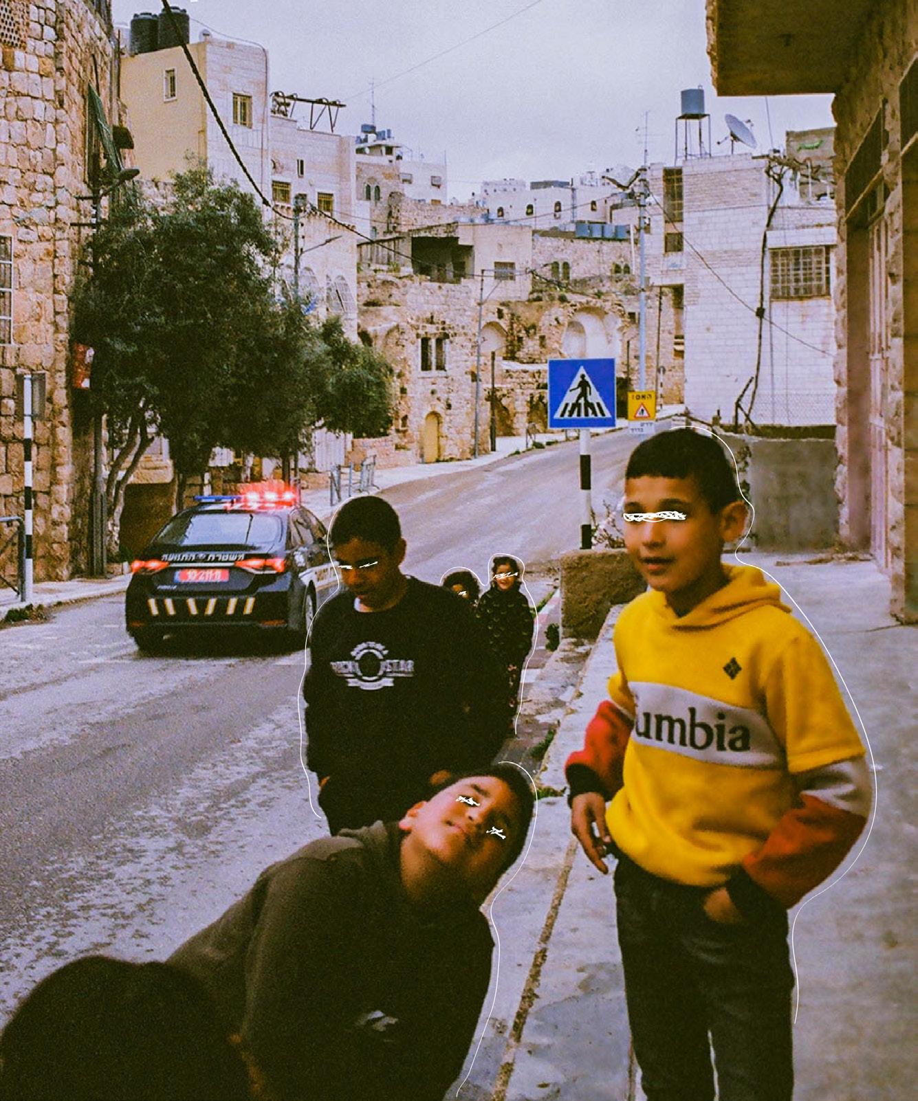
Aida is a Palestinian refugee camp located in the West Bank in Bethlehem and houses thousands of child refugees every year. Refugee camps like aida border IDF security check points where soldiers and children clash daily. Tear gas is a prominent tool that the settler states have used on refugees without repercussions and has been a cause of the many fatalities and deaths of Palestinian refugee youth.
Children in the Old City of Hebron
Hebron H1/H2
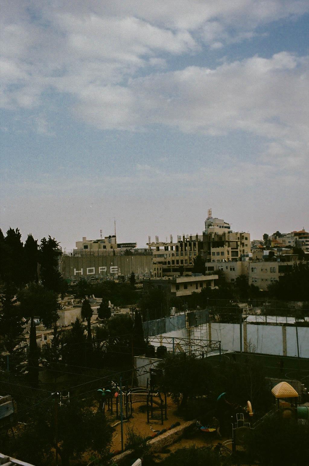
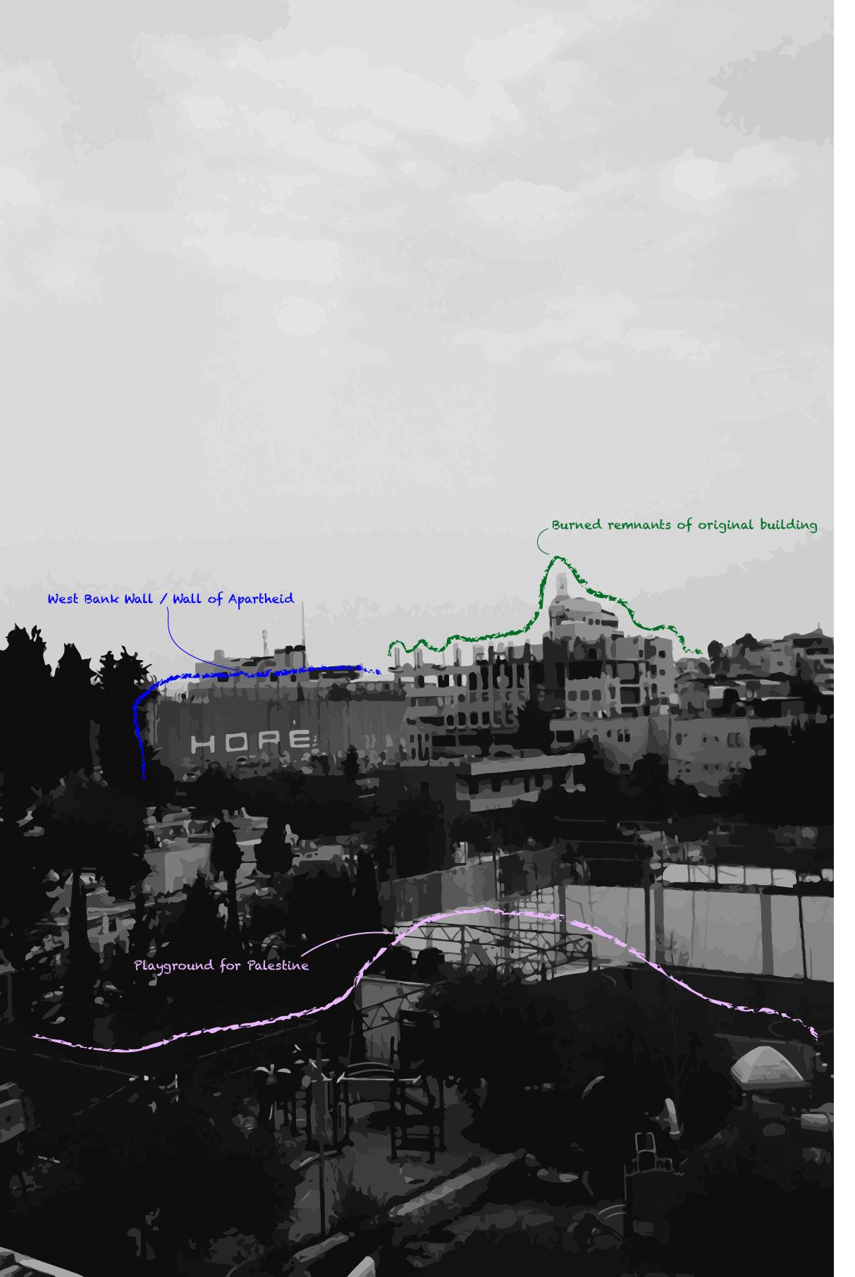 View of the West Bank Wall
63
Aida Refugee Camp, Bethlehem
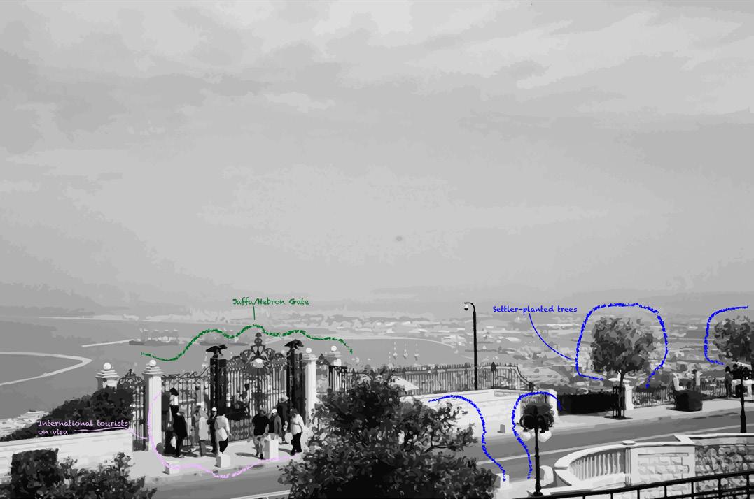
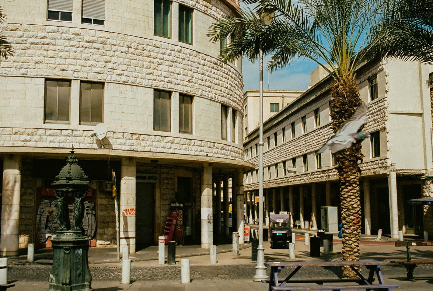
The settler state government uses three different types of erasure to transform the historical context and current day landscape of Haifa. By renaming streets, limiting and changing knowledge and information in classrooms, and changing the geography and the features of the city, the settler state strategically balances coexistence and segregation. Greenwashing techniques are used to turn demolished Palestinian houses into gardens and terraces. Day-to-day life visibly looks mixed but segregation is camoflauged.
3 Types of Erasure Haifa
Tourists at Gate of the Friend Haifa
Haifa is an occupied Palestinian city that became a gateway for settler immigration during the 1948 Nakba. Since the city is technically recognized within the settler state, Palestinians cannot live in or visit the city without proper documentation. Palestinians who do live in Haifa are segregated into certain neighbors under settler-state law.
The Land and Water Talks
64

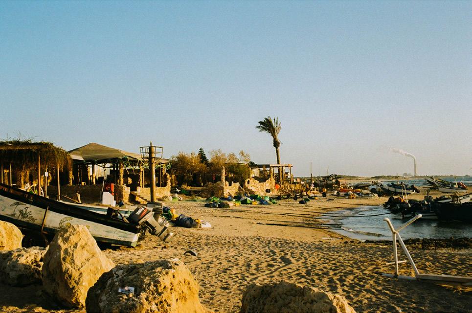
Jisr Al Zarqa is the only settler-state recognized town on the Mediterranean Coast with a Palestinian and Bedouin majority population. Although it is recognized within the settler state, it does not receive similar government aid and benefits. The town is surrounded by wealth settlements and the settler state has been trying for years to transform the area into a national park. With direct access to the Mediterranean Sea, the land has become desirable for settlers and tourists. Despite advances from the settler government, the Palestinian community refuses to move their homes.
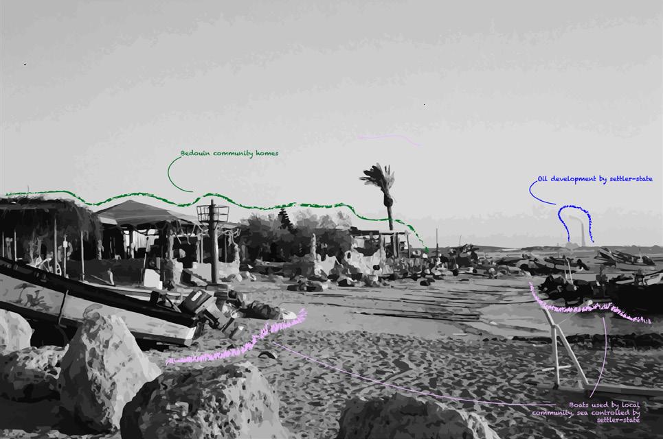
The Settler state encloses the Palestinian community into borders by having complete control of not just the land, but also the sea.
One of the last Bedouin communities on the Mediterranean coast Jisr Al Zarqa
65
One of the last Bedouin communities on the Mediterranean coast Jisr Al Zarqa
Our Innate Obsession with the Waterfront,

and How to Keep it
Words by: Jaron Kaplan
Jaron
Alive 66
is an MSUP at Columbia GSAPP who is passionate about fostering joy and resilience along our coastlines.
Our waterfronts have the right to be much more than a monetized playground. For thousands of years, waterfronts have reflected human spirituality. They represent the transition from the physical to the spiritual, marking the threshold between the human realm of land, and the spirit realm of the water.
Cultures around the globe have revered the waterfront for centuries, millennia even, immortalizing water – and our relationship with it – through folklore. The Ohlone, an Indigenous group who have inhabited the San Francisco Bay Area for over 5,000 years, center their creation story on the idea that the world was once entirely covered in water except for two islands, and then as humans began to inhabit the region, the water receded more and more, creating the land they then inhabited. The Jewish creation story similarly tells of the manipulation of preexisting water to make space for land, and then people. In ancient Mesopotamia, folklore tells the tale of Ninurta, a warrior god, who was responsible for both creating the Tigris and Euphrates rivers and destroying cities, giving life and death. In Ancient Egypt, the annual flooding of the Nile was said to be the result of the god Isis crying tears over the death of Osiris. In Greek mythology too, there are numerous stories of Poseidon sending tsunamis as punishment. These stories serve as lessons on how to live with water and in spite of it.
Over time, these spiritual connections with water eroded to make space for more functional alternatives. Modern patterns of development along the water are typically quite obvious. On a material level, water access is critical for drinking water, sanitation, economic activity, transportation, recreation, and food. However, at the metaphysical level, water access is also a key contributor to positive mental health and a critical part of human identity. In Blue Mind, Nichols studies and quantifies the meditative sense of awe, nostalgia, comfort, and emotional regulation that being in or around water can have on the human body. Naturally, most of the 3 billion people who live within 100 kilometers of the coast already know this.
Jaron Kaplan
The power of this connection is too often at odds with privatization, industrialization, and commercialization along waterfronts. Looking towards the future of waterfront planning and design, especially in the face of climate change, the critical question then becomes: how can we design resilient waterfronts to preserve and promote culture and human spirituality? By piecing together the core components of these folklore stories, we can begin to construct an image.
These stories serve as lessons on how to live with water and in spite of it. “
”
Ensure free public access.
Access to the waterfront has been a right for most of human history. The privatization, development, and commercialization of our waterfronts challenges that right, severing people from the water and its benefits. Recent tensions in Puerto Rico demonstrate this conflict, as all beaches require public access, but wealthy homeowners have attempted to restrict access through the privatization of the surrounding land. California provides an example of progressive policy to resolve this tension; The Coastal Act in California guarantees the right of public access to coastlines and beaches, and the Coastal Conservancy which enforces this act has far-reaching authority to ensure public access and safety.
Urban planners and designers working on coastal resilience projects can ensure free public access by incorporating trails, parking, beach paths, and boat launches. Taken a step further, transportation planners should also prioritize multi-modal infrastructure to connect waterfronts and city centers to allow for equitable access, regardless of where people live in the city, or their income. On a policy level, jurisdictions should adopt proper policy frameworks to provide and enforce
access via easements. By guaranteeing people’s right to the waterfront, the public can establish a trusting and enduring relationship with the water.
Enable a dynamic relationship between infrastructure and water.
By “locking in” our shorelines with concrete floodwalls and levees, we commit to the inevitable failure of our infrastructure as, eventually, the capacity threshold will be surpassed. Creating dynamic or floodable landscapes using nature-based solutions that can adapt to flooding over time is crucial to the long-term resilience of our waterfronts. They also make sense from a human-psychological perspective. Our sense of natural wonder stems from experiencing natural systems – blue water, the crashing of waves, or the infinity of the horizon. Over-engineering the waterfront deprives people of the biophilic psychological and physiological benefits of these spaces.
Build a culture around the waterfront.
In today’s urban society, people establish a sense of locality through intersections, businesses, and institutions, not through the natural landscape of rivers, hills, or coasts. This disconnect from the natural world, one that still plays a critical role in defining our everyday lives — and increasingly so due to climate change – leaves people more vulnerable to disaster as they fail to understand the interactions between urban and natural systems. Indigenous communities and past civilizations built these relationships into their storytelling and culture, ensuring their resilience through the acknowledgment of ephemerality. Rebuilding a culture around the waterfront through education and engagement increases community resilience, reconnecting people with their natural landscape and the risks it may pose.
By getting more people to the coast to immerse themselves in the landscape, they gain a better understanding of their positionality within these systems as participants, beneficiaries, and targets.
67
Whena House

Wordsby:ShuyuePanatShuyuePanisanMSCCCP ColumbiaGSAPP.
68
isnota Home
In her article ‘Philosophical Plumbing’, Mary Midgley compares the commonalities between philosophy and plumbing; they have both arisen from our elaborate cultures but have a fairly complex system that is usually unnoticed and sometimes goes wrong.1 Architecture, as an essential part of our lives, shares similarities with plumbing as the crisis of affordable housing has gone unnoticed by the architectural industry. In recent years, the urbanization and economic growth of cities in the United Kingdom have contributed to an increase in demand for affordable housing. The supply of affordable housing, however, does not meet the current demand, leading to a crisis of shortage. This has been attributed to the local estate market paying more attention to building new commercial developments than providing homes for those in need. Additionally, those affordable units that were already built or newly constructed may have underlying structural problems. Apart from proliferating demand, housing quality is another concern that tends to be hidden but aggravates this crisis.
According to the 2017 Housing White Paper from the UK government, “the housing market in this country is broken, and the cause is very simple: for too long, we haven’t built enough homes.”2 The housing economy views housing as a good, while the architecture industry tends to pay more attention to the design of goods, and the design of a building rather than the benefits it can produce. This can be linked with the concept of “social contract,” as Midgley stated, it is the tacit agreement between citizens deciding their moral or political obligations to serve the common good of society.3 When it is universally adopted and there are no explicit grievances, we assume that these contracts are reflective of our societal mores. As it stands, our social contract funnels our attention to increasing demand being the root cause of our housing affordability crisis. However, little attention is paid to the condition of our existing housing supply and its durability. To address this issue, architects and governments must engage with a new social contract.
As the architecture industry requires high specialization, social contracts permeate and impact people through regulations of governments and expectations of clients, leading to architects’ tendency to design buildings that can maximize their profits and serve their own interests. As a result, architects are not fully participating in serving the public to justify their exclusive rights to knowledge. They seem to be mired in an obsession with form and appearance rather than how their design can help to reduce social problems and benefit the public.4 Architecture today is indeed likely to focus on the bespoke rather than reproducible and the reconstruction of pre-existing buildings that have the potential to meet needs.5 Consequently, the social contract between architects and the public needs to change. The problem, however, is that people seem to be used to this mode of thinking, as Mary Midgley states: “we assume that the ideas we are using are the only ideas that are possible.”6 This kind of rigid thinking contributes to the lack of affordable housing.
It is indubitable that architecture needs a new social contract in today’s society that enables architects to provide solutions for public service rather than commercial missions of private practice. Many obey the current practice models while these models give no answer to how architecture can address dire living conditions and inadequate shelters. 7 As a result, some non-profit firms and for-profit firms create mass-customizable designs for people in diverse locations, tackling the essential needs of people through local materials and unskilled labor. The Public Practice in London, for instance, is a not-for-profit organization that helps build the public sector’s capacity to improve both equality and quality of the living environment. The redevelopment of Joyce Avenue and Snell’s Park (Fig.1) by The Public Practice not only helps to double the number of homes that are available to rent with long-term tenancies but also improves the quality of living.8 They aim to make a change by working within the system and understanding the complexity of systems that have caused structural deficiencies
like the lack of parking areas (Fig.2) and access stairwells (Fig.3).8
According to research from Public Practice London, they not only need to solve the shortage in affordable housing but also underlying economic and social issues: high crime rate, low employment, and income deprivation.10 Therefore, architects need to pay attention to those aspects that are less visible in social life such as creating and building local networks. To address this issue they transformed the library into an urban room (Fig.4) to facilitate community engagement and replaced the garage site with working and studio spaces to offer job opportunities for residents.11 The problem of lack of affordable and adequate housing is closely linked with social issues, so it requires a reconstruction of the relationship between architecture and the public. Just as in Public Practice London’s renovation, architects need to use architecture to solve the problem from the root. For example, architects should pursue more cohesive solutions through mixeduse development that creates employment opportunities, rather than just building new housing units. It is true that to solve this crisis, there is much work that needs to be done to further legitimize these forms of practice and create a new form of social contract in the field of architecture.
In addition to the problem of the social contract of architecture, the shortage of affordable housing can not be met with housing that is inadequate in its function and structure. People’s cognition of things and objects always focuses on appearance. Thus although some affordable housing appears as such, it does not function as affordable housing because it does not meet the needs of those who are unable to afford secure and decent housing on the market. According to Tess Lea, a professor of anthropology at the University of Sydney: “the sign of the material house is an illusion when no system of institutionalized expectation is in place to connect the physical structure (house) and the range of functions it is assumed to be able to provide to the resident.”12 To address a housing shortage, governments
Shuyue Pan 69
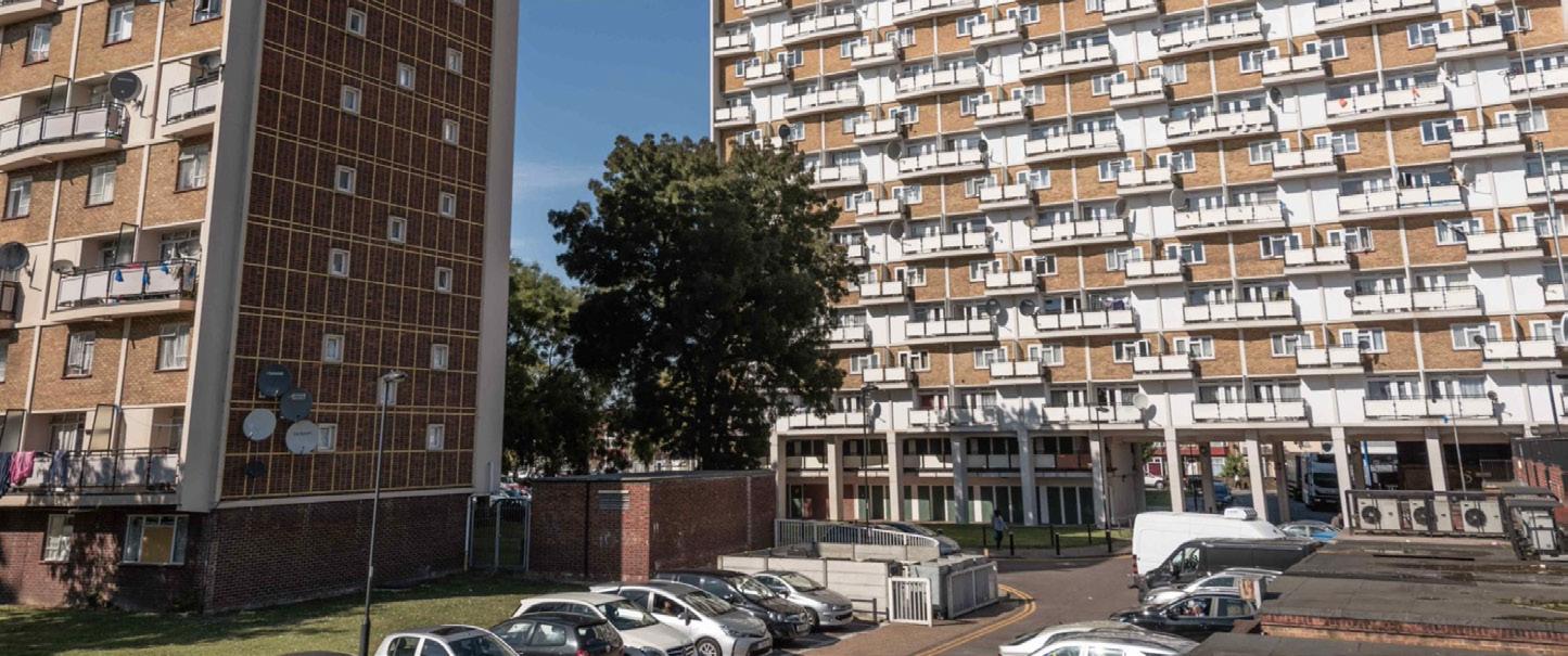
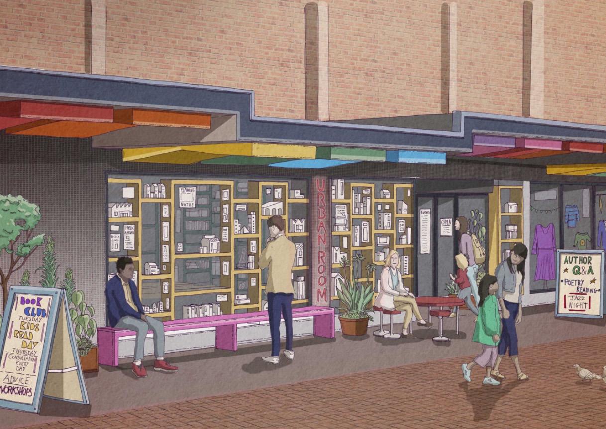

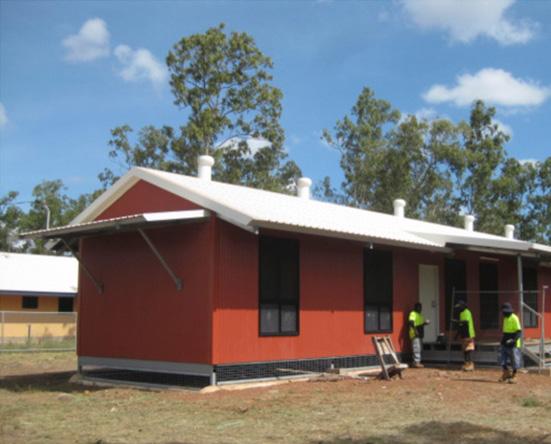
When a House is not a Home
Fig. 1 - The Joyce Avenue and Snell’s Park in London before the regeneration
Fig. 4 - The New Urban Room’s Visualization
70
Fig. 5 - Indigenous houses in Australia

will pursue cheaper building options to maximize the amount of units that can be built. However, cheaper design can lead to structural failures, further contributing to the shortage of affordable and adequate housing. For example, some indigenous homes in Australia have the appearance of “affordable” houses, with scripted policy announcements about money spent and program achievements, but have low infrastructure conditions and quality (Fig.5).14 These homes lack electrical wiring boxes or shower systems and are continually damaged even as newly built.15
It is clear that living standards and design quality are considered barriers to increasing the supply of affordable and adequate homes. To tackle these problems, the regeneration of housing is needed. A better quality of housing can not only improve the well-being of those who live in it but also help governments save on repair costs. For example, Health Habitat, a non-profit organization, aims to tackle basic problems and improve the living quality of homes for Indigenous Australians, providing a new solution to the problem of shortage in affordable housing. In his research, the most dire problem of Indigenous homes is poor housing hardware such as showers, and inadequacies which often lead to the spread of infectious diseases.16 Housing for Health developed a model (Fig.6), which used a standard budget of $7,500 for each home to make repairs and upgrades.17 This model used a repeatable measurement of housing performance through safety and essential infrastructure such as a safe electrical system and a working shower.18 This project is noteworthy as it links design and well-being rather than building more homes to solve the shortage.
A similar regulation called the ‘nationallydescribed space standard’ introduced by the UK government failed to unify the standard of housing.19 Differing from Australia, this approach depends entirely on the adoption of local authorities during their local plan process and involves regulatory barriers.20 The quality of housing and living standards may indeed contribute to the lack of affordable homes. Thus,
further policies need to be set to implement this approach in the UK such as a long-term approach, which can both help to boost innovation and lower costs among sectors and local authorities to fix the housing crisis. Also, except for the encouragement and policies that governments offer, more precise investments and subsidies are needed to promote innovation.
To conclude, the crisis of shortage in adequate and affordable housing is rooted in several issues. The real estate market in the UK has increasingly become a domestic and international speculative asset rather than a foundation of health, safety, and well-being. The infrastructure and living standard problems faced by much of the existing stock have also contributed to this crisis. To solve this crisis, both architects and governments need to readjust their thinking. This includes developing new social contracts that lead to better engagement of architects in social practices, and new policies by governments to improve living quality.
Shuyue Pan
Fig. 6 -The Demonstration House of Housing for Health project in Australia
71
Fig. 2 (left) and 3 (bottom) - The heavily Parked Estate of the Joyce Avenue The Open Access Stairwells of the Joyce Avenue and Snell’s Park Before the Regeneration and Snell’s Park Before the Regeneration
Occupiable Thresholds
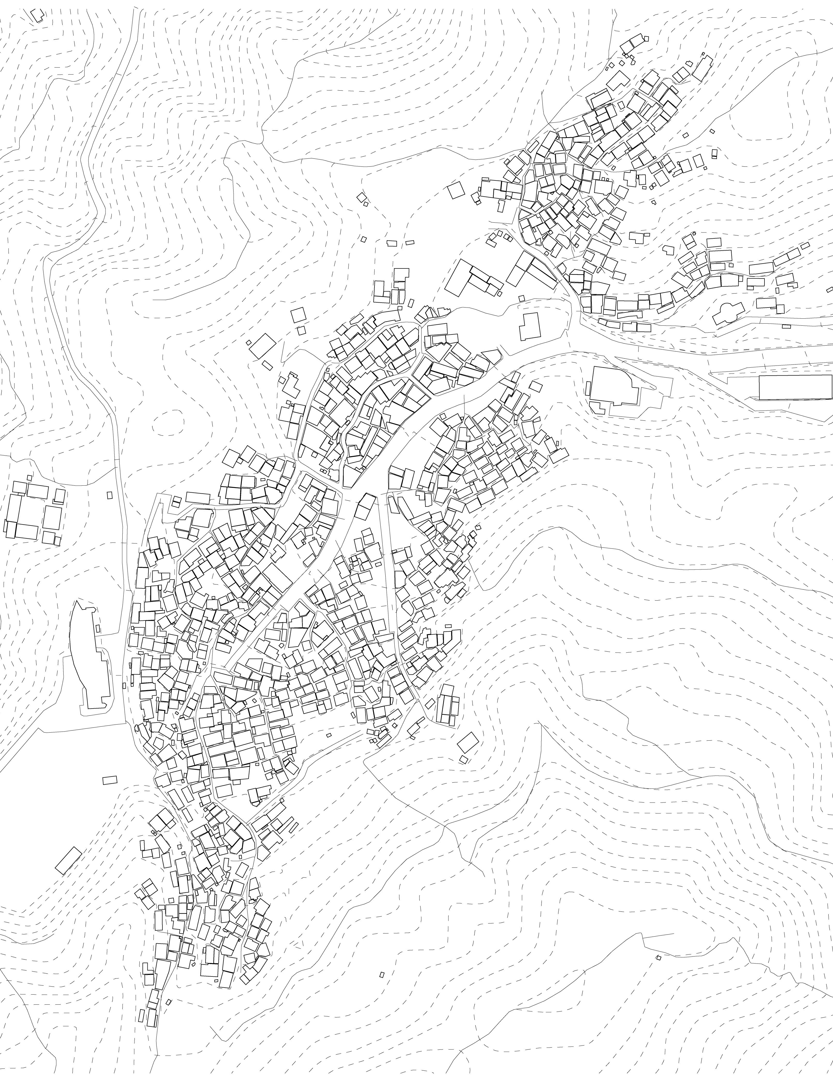
Words and visuals by: Seung Hyo Chang
Seung Hyo Chang is an aspiring architect and urban designer, holding a Bachelor of Architecture from Syracuse University and an MSAUD from Columbia GSAPP.
72
Informal settlements are often engraved in our brains as something bad with socially constructed negative connotations. The concept of “Occupiable Thresholds,” which refers to spaces that are neither solely personal nor entirely communal, reveals a different interpretation. This speculation unfolds an urban fabric rich in socio-spatial dynamics and communal complexities, challenging the conventional view of these communities as mere underserved areas. At the heart of the narrative lies Anchang Village in Busan, Korea, which serves as a prime example showcasing the unrecognized potential of such neighborhoods. Here, the seemingly haphazard arrangement of homes in multi-directional configurations unveils a complex web of human interaction and shared living, elements often overlooked in mainstream urban discourse. Anchang Village and its unique thresholds stand as an example of these dynamics. It is a beacon, illuminating the depth and richness of communal life that flourishes beyond conventional urban landscapes.
The intricate fabric of life in Anchang Village, characterized by its spontaneous growth and communal harmony, finds a parallel in the urban theories of Edmund N. Bacon, as expressed in his book “Design of Cities”. Bacon characterizes such free-form fabric as a distinct design typology, fostering dynamic interactions among various units, each manifesting its own spatial expression. His description of the ancient city of Camiros exemplifies this idea. He notes, “The pure rectangular and lucid geometrical order are replaced by a complex interaction of rectangular forms in angular relation to one another. Here the development of a single concept is replaced by a gradual accumulation of buildings over many years.” (pg. 63) This portrayal of Camiros, where the urban form evolves through the incremental integration of distinct structures over time, mirrors the essence of informal settlements. Anchang Village, in particular, stands as an embodiment of Bacon’s concept of “form being determined by the cumulative work of individual(s),” capturing the layered and interconnected spaces of such communities.
The organic evolution of the village, established in the 1950s by Korean War refugees, is clearly reflected in these insights. Its distinctive architectural fabric, branching out like tree limbs from the central road, clearly contrasts with Busan’s more structured and planned urban areas. The generatively accumulated houses lay out the village, segmenting it into an array of areas reminiscent of cellular activity. This development, driven by the collective efforts of the inhabitants, forms a living mosaic, continually adapting and evolving in response to communal needs. Within this vibrant tapestry, the villager’s decision to blend private and public spaces exemplifies the concept of “Occupiable Thresholds,” where personal privacy and shared communal life coexist in harmonious balance. The manifestation of these thresholds is particularly evident in the seemingly mundane daily life of the villagers, where the distinction between public and private spaces becomes fluid.
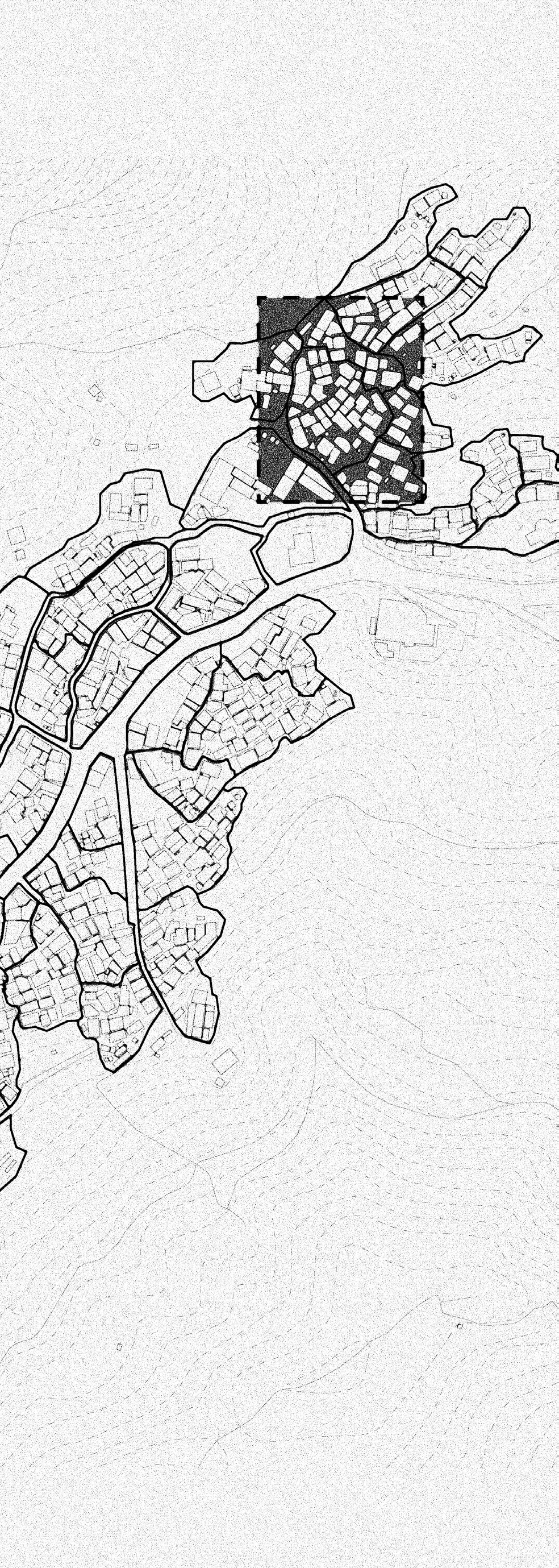
73
Seung Hyo Chang
Inhabitants in Anchang Village seamlessly integrate public areas such as bus stops and truck marketplaces into their daily lives, treating these spaces as extensions of their own living rooms. This expansion of a sense of domesticity, blurring the lines between public and private zones, reflects the community’s preference for open, shared spaces over strictly delineated private areas. Furthermore, the front doorsteps of homes, traditionally private realms, are transformed into vibrant hubs for socializing, symbolically dissolving the traditional boundaries of personal property.
This shared space culturally extends to even more intimate aspects of daily life. Neighbors in the village look after each other’s packages, take care of each other’s laundry during rains, and even regularly enter each other’s homes to help with various tasks. These acts of mutual assistance and care highlight the communal bonds within the village. The individual rooms appear to be the only private spaces within each house, with all other areas contributing to a collective, community living experience.
What might be perceived as impolite and intrusive elsewhere is deeply embedded in the village’s way of life. The way residents allow the overlap of public and private spaces is not just a spatial arrangement; it is symbolic of their deep trust and reliance on each other. This willingness to share space, transcending the norms set by conventional urban boundaries, serves as a compelling example of an alternative community model. It showcases how reimagining the use of space and fostering deep-rooted trust can lead to a form of communal living that is both profoundly human-centric and socially cohesive, offering valuable insights for innovative approaches in urban planning and community design.
The exploration of Anchang Village and its “Occupiable Thresholds” significantly transcends the traditional narrative surrounding informal settlements. By delving into the rich tapestry of communal life within the village, this narrative not only challenges but fundamentally reconstructs our understanding of what constitutes “public” space. The village embodies a vibrant manifestation of culture, kinship, and a deeply ingrained sense of community, effectively dissolving
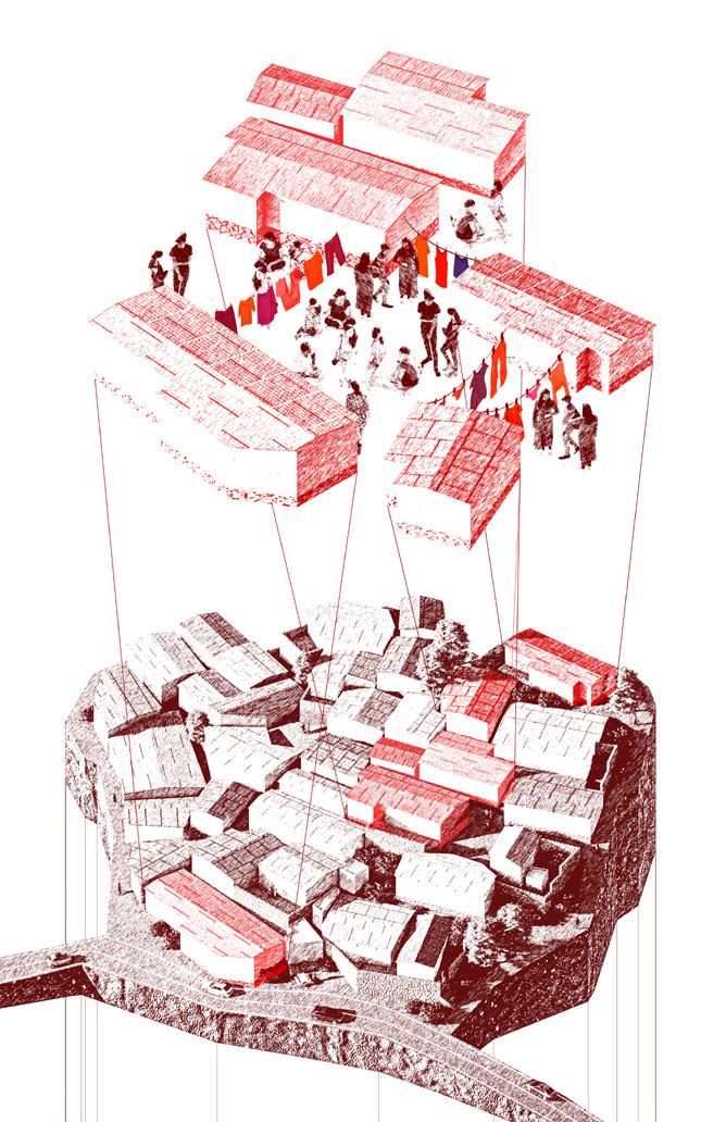
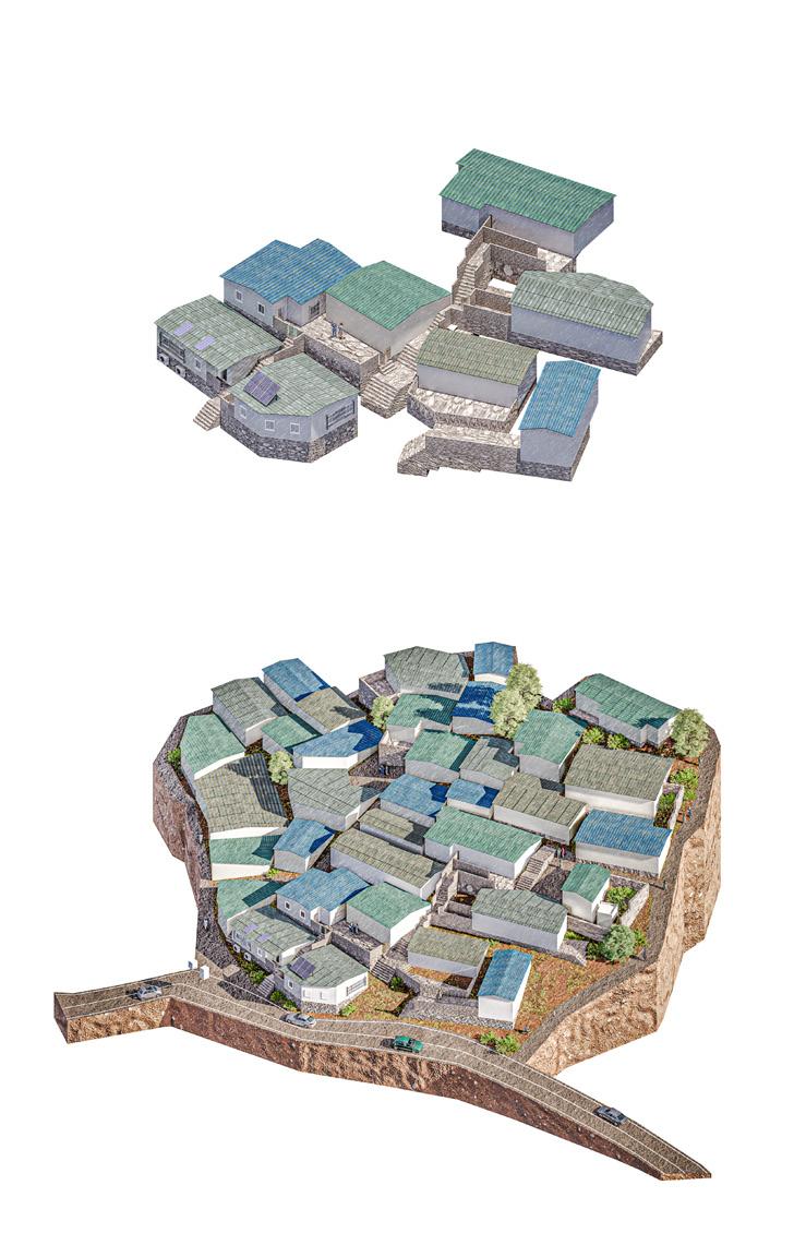
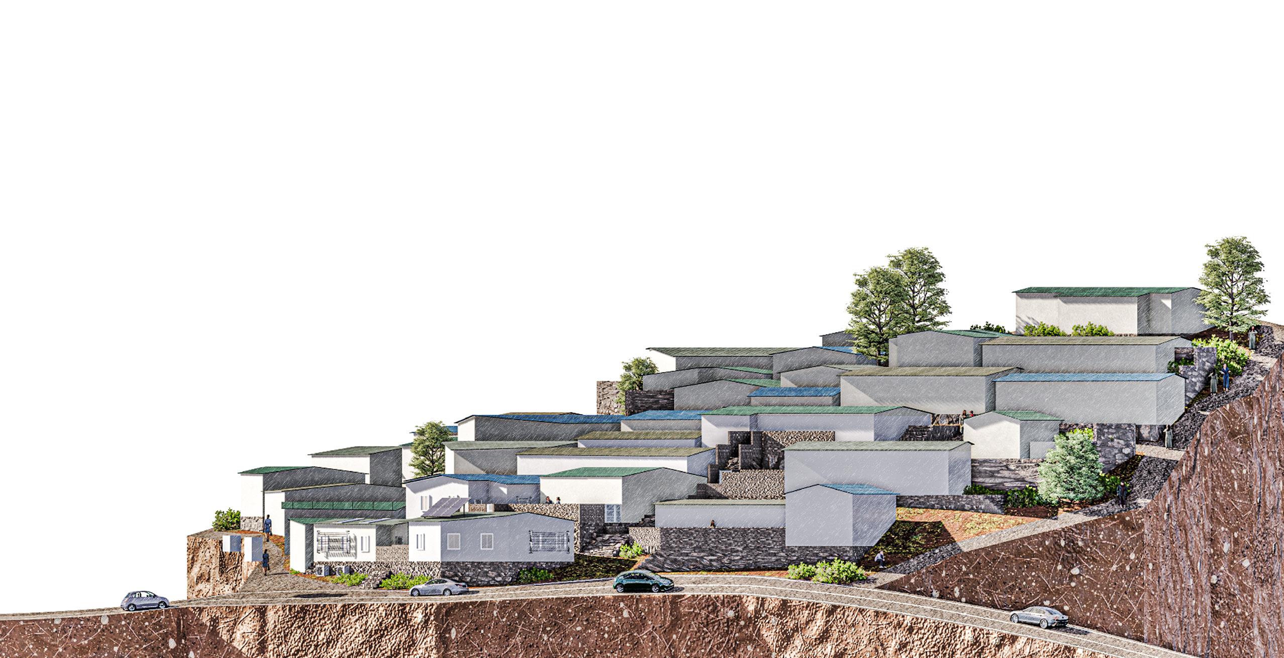
Occupiable Thresholds 74
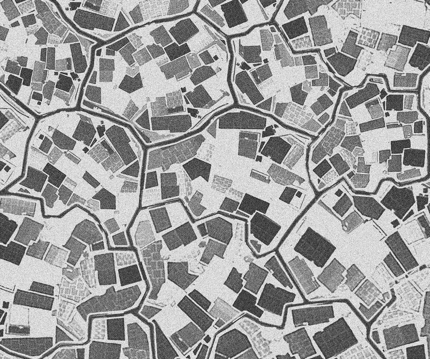
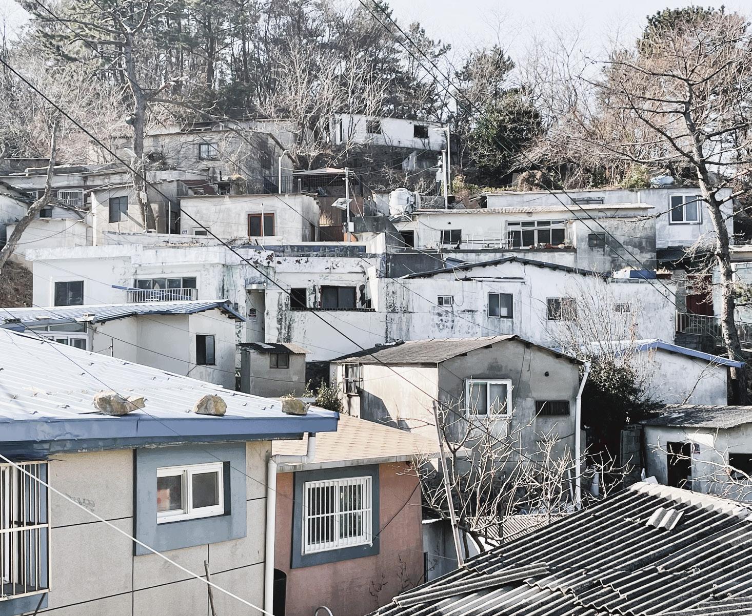
Seung Hyo Chang 75
the conventional dichotomy between private and public spheres. This transformation illustrates that the essence of truly successful urban spaces lies not merely in their architectural layout but more importantly in the robustness of community ties and the depth of shared experiences.
The story of Anchang Village serves as a compelling case study for urban design and community planning, illustrating the immense potential of informal settlements as sources of inspiration for innovative urban solutions. It underscores the importance of designing cities with a focus on human-centric needs and communal relationships, advocating for a shift towards environments that prioritize connectedness, empathy, and a collective sense of belonging. By embracing the concept of “Occupiable Thresholds,” Anchang Village provides valuable insights into how urban spaces can be reimagined as inclusive, resilient, and socially cohesive communities. This narrative not only celebrates the unique socio-spatial dynamics of the village but also acts as a powerful appeal for urban planners and designers to reconceptualize the essence of public spaces in fostering vibrant, empathetic, and connected urban landscapes.
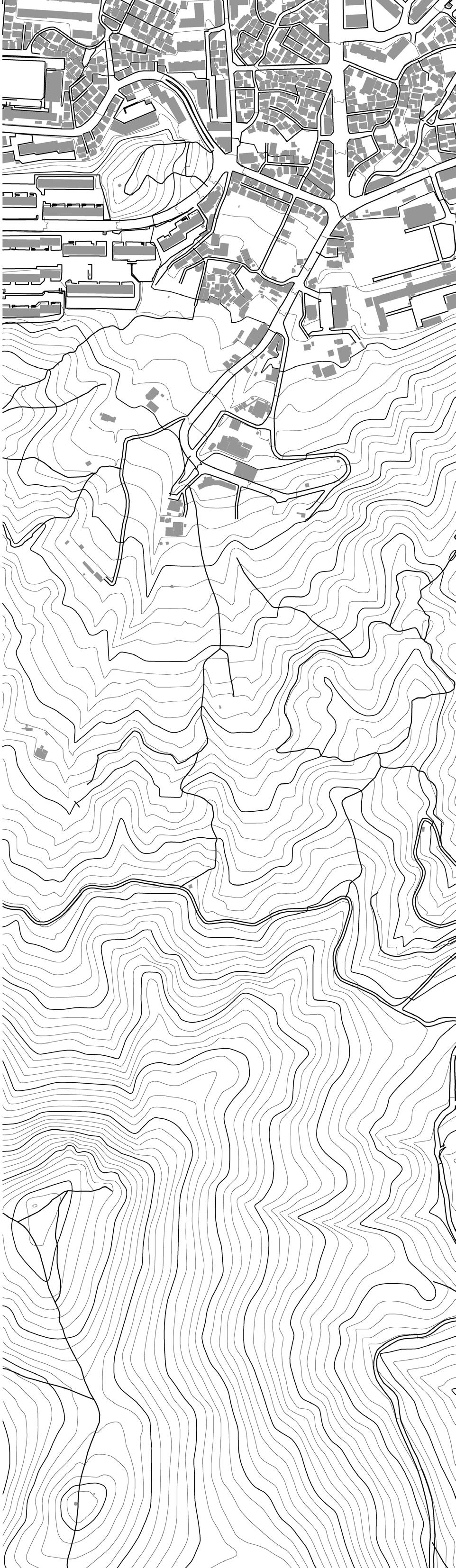
Occupiable Thresholds 76
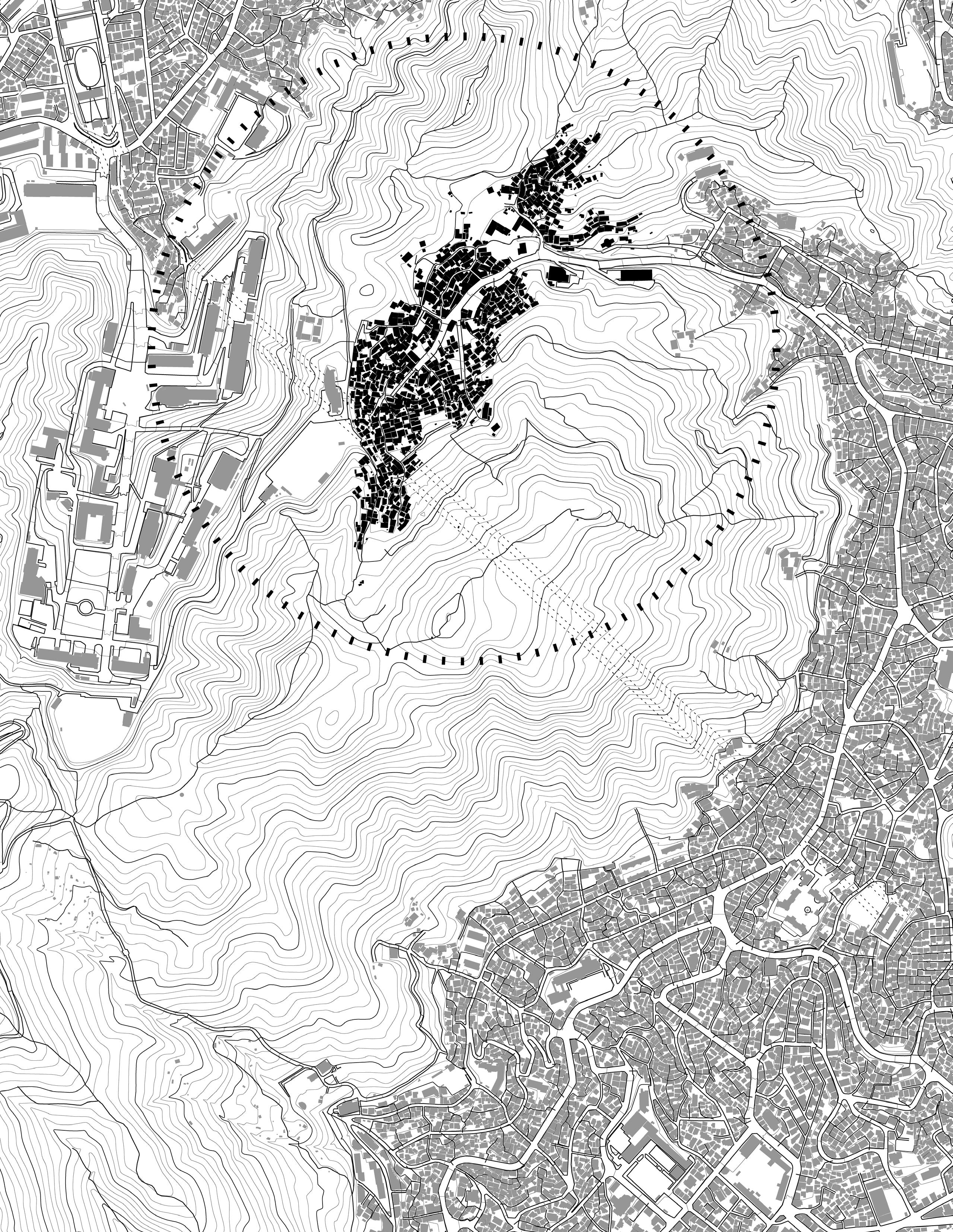
77

Intra-City Transit in a Late Medieval and Early Modern City
Words by: Johann Marcotullio
Johann graduated from the University of London with a degree in History and is now studying Urban Studies at Columbia University.
78
During the late medieval and early modern eras, travel by water was the primary mode of long-distance movement within the Mediterranean world. Transfer of goods and people from city to city was primarily undertaken by boat as water-related travel was faster and more cost-efficient than journeying overland on roads. Cities, at the time, were built close to water sources, mainly due to trade and commercial needs. Ironically, goods and services were transported within cities by carts, animals, or human labor. One city, however, used water passage as the principal impetus for developing an internal transport system. Venice, to this day, is known as the “City of Water” or the “City of Canals.” While the canals are currently tourist attractions, during the late medieval and early modern periods, the urban canal system was a unique and major thoroughfare for urban movement.
It is not surprising that Venice developed an internal water transport system. The city was created from water, as it grew out of a swampy lagoon beginning at around c 420. By 1600, it was one of the largest cities in the Mediterranean, with over 200,000 inhabitants. At that time, in the port of Venice, residents had been using waterways as the major transport routes within the city for centuries. The boats of Venice, or more specifically, the gondola, became a mainstay image of the city. One pilgrim, Arnold Von Harff, claimed that there were 50,000 small boats when he visited the city in the late 15th century. This impression provides an idea of Venice as a city where the primary mode of transportation by the local population and those visiting was the gondola.
Indeed, gondolas functioned as the lifelines of Venice. The port of Venice during the early modern period was busy, driven by the arrival and departure of a wide variety of boats and ships, some being gondolas and other larger vessels like galleys, which are the two large ships with many oars. In the
forefront, gondolas are being used to move goods to merchants, and in the background, these water taxis enter and exit canals carrying merchandise and people. Venice was a thriving city with constant intra-city transport by boat. Exploring the gondola system of early transit demonstrates some universal characteristics of urban mobility, still in use today.
The Venetian gondola transit system included several distinct institutions defined by “brotherhoods” (scuola) that offered different transport services. These services included privately owned gondolas, which would have permanent gondoliers that the owner would personally utilize. Ferry gondolas (in Italian, known as traghetti di dentro) ran on authorized routes within the city and hired gondoliers (traghettatori) by the hour or day. Within Venice, during the early modern period, approximately 5% of the entire population (about 10,000 people) was engaged in some form of gondola transit system. Members of the ferry gondola system (traghetti di dentro) had to join one of approximately fifteen different gondolas "brotherhoods" (scuola). There was a limited number of spots in each scuola, and to join, one would have to pay an entry fee. This historical system compares to today's process of acquiring a taxi medallion. The brothers or members of the scuola would have to follow a list of rules set out by the government of Venice called the Marigold, which included a series of regulations associated with being a member of a scuola. These protocols included swearing an oath of allegiance to their brotherhood, paying for meals, paying for brothers' needs when they were sick, and supporting children and windows of fellow brothers. The head of each brotherhood was called a gastaldo who dealt with the economic and legal side of running the association; they would petition the government whenever there was a legal dispute between different scuola, settle internal disputes between members, and deal with any rule-breaking inside their
group. The scuola acted, in many ways, like the strong labor unions of today.
In terms of transportation in Venice, the traghetti di dentro ferried citizens and travelers between Venice and mainland Italy. Along with this, many traghetti di dentro would also transport people from the smaller islands around Venice into the central part of the city, including the main thoroughfare, the Grand Canal. Interestingly, the traghetti di dentro also had public health responsibilities as they were required to ferry plague victims and quarantined sailors to and from hospitals or quarantining facilities and Venice.
On the other hand, the traghettatori were gondoliers hired for a specific period or trip. The traghettatori was mainly used by those who did not live in Venice, as those who did would own a gondola or have a private gondolier. The traghettatori would most often be hired by pilgrims in Venice so they could travel the city faster and not have to walk. Using the traghettatori was economically efficient as the cost was significantly less than hiring a horse. Many travelers into the city from Germany or the Middle East used animal-based transport,
“
” The gondola system was central to life in the late medieval and early modern periods. While centuries old, the system demonstrates universal characteristics of urban mobility.
Marcotullio
Johann
79
but this was impossible in Venice. The use of gondolas and other small boats usurped the role of animals due to the street design of Venice, and the gondola became essential to own or to hire a traghettatori when needed. If a local merchant did not have space or enough gondolas, they would be required to hire a traghettatori to complete the task.
While both the traghettatori and the traghetti di dentro had regulations and rules that they followed, external disputes often arose. These tensions were typically but not always resolved by the government and court in Venice. However, some gondoliers operated as a for-hire service and worked independently from the scuola, which might be considered a black market in today’s economy.
Another reason to hire a traghettatori would be for leisure. Some people would hire a traghettatori for a night out on the water. In “Der Venediger Lust Bracht und Herligkeit’’, three couples have engaged a traghettatori to have a meal out. A German artist created this painting on his visit to the city and captured one important activity of the traghettatori. The work entitled in English, “The Venetian's Pleasure and Lust,” shows how Venetians enjoyed the gondola system.
The last component of the gondola system was operated outside of the scuola. While not every citizen of Venice owned a gondola or had a private gondolier, it is clear that many local merchants did. Merchants used these boats to transport goods from their warehouses, typically on the outskirts of the city, so larger ships could access their ports directly. They also moved their goods via smaller boats from their warehouse to the central market of Venice or other buyers’ warehouses using their private gondoliers and gondolas. Canon Pietro, another pilgrim, stated that Venice’s wealth at the time was evident in the number of privately owned gondolas. There is limited evidence that the Venice government attempted
to restrict or regulate owning gondolas. In “Habiti d’huomeni et donne venetiane”, we find visual evidence of the everyday use of private gondolas. Here, Franco creates an image of Novices traveling by gondola to visit their relatives. Inhabitants would use gondolas for routine activities such as going to the market, church, visiting family, and more.
The gondola was a focal point of Venice, essential for native-born Venetians, and remains a symbol of the city today. The gondola system was central to life in the late medieval and early modern periods. While centuries old, the system demonstrates universal characteristics of urban mobility. The traghetti di dentro system draws similarities to today’s public transport network, where the government regulates private companies’ operation of its routes. The traghettatori compares explicitly to today’s taxis and for-hire services, with the licensed and unlicensed taxi rivalry in the early modern period. Interestingly, the traghettatori provided a social safety net for its brotherhood similar to our transportation unions today. On the other hand, privately owned gondolas characteristics relate to any privately owned transport today. Instead of using your car to get around, you would get around using your gondola. It is clear that the gondola system of early modern Venice and our systems of intra-city transport today, while separated by centuries, have far more in common than one might see at first glance.
Intra-city Transit in a Late Medieval and Early Modern City 80
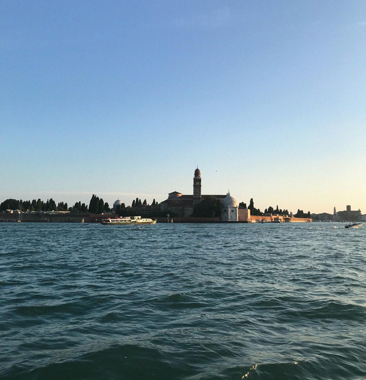
81
Venice, Dusk (2018). Photo by: Olivia Jia
Eviction, then Redemption

Words and images by: Teonna N. Cooksey
Teonna is an MSUP and MSArch at Columbia GSAPP whose work explores the intersection of housing, resiliency, community organizing, and health equity and is synonymous with healing and empowerment.
82
What if we rethink the way we live together in a duplex apartment? What would happen if your neighbor was also your babysitter on the weekend, and you were their cook during the mid-week? What if the rooms in a duplex were organized in a way that allowed your neighbor access to parts of your home? The seeds of this idea are rooted in knowledge gained in Milwaukee, Wisconsin, watered by a series of conversations concerning the human impact of foreclosure and eviction. Stories of the difficulties single mothers endured while trying to access quality housing stock and sustain their livelihoods grew this idea--using design to mitigate housing challenges single mothers face. Together, we as designers, including you reading this, can help.
Contextualizing the Research
My research provides a historical perspective of the neighborhoods and examines why once-active households turned into vacant and derelict buildings between 2016 and 2017. The homes shared one thing in common: the residents were evicted by the city because the homeowners failed to pay property taxes or keep up with home maintenance. It is important to note these are not bank foreclosures. Instead, they are called city-tax-foreclosures, and since 2011, the number of city-tax-foreclosures has increased exponentially. This research shows that homes have deteriorated over time because many are hardly inhabited or repaired. In Milwaukee County, one in five black female renters report experiencing eviction in their adult lives. This is compared to one in twelve Hispanic women and one in fifteen white women, according to a Milwaukee renters study conducted in 2018.
Through the exploration of measured drawings, housing permits, legal documents, manuscript census data, and oral history interviews, a story reveals the human impact of foreclosure and eviction. The first notable change in both neighborhoods was the transition from
single-family to multi-family homes through structural conversions. The second notable change regards race occupancy, home ownership, and class status—all of which relate to one another. The neighborhoods were initially occupied by German Americans and transitioned to African Americans and, more recently, Asian Americans. The great migration, redlining policies, changing infrastructure, white flight, and national economic decline were integral to these demographic changes. The third notable change regards the types of permits for each home. The transition of permits has gone from beautification efforts to maintenance repairs to enforcement permits to code violation permits. All of these transitions represent residents' challenges while maintaining their properties and livelihoods.
Industrial District to Planned Ghetto, a Story about Washington Park
The distinctiveness of the Washington Park neighborhood comes from a dramatic change in its typology. The neighborhood was initially centered around a growing industrial district, The homes being analyzed here were originally white male gendered—meaning only the males of the household worked. Between 1890 and 1910, the railroad corridor that curved through Miller Brewing became the first central industrial district for the Washington Park neighborhood. Following the brewing company, industries such as Harley-Davidson, the Electric Railway & Light Company (We Energies), and other smaller-scale companies provided jobs for thousands of people. Homes were rapidly being built to accommodate people who moved into the Washington Park neighborhood by settling on the land surrounding the park. As time progressed, the homes transitioned from homeowners who lived in their homes to homeowners who lived elsewhere. Eventually, homes were converted to incorporate multiple families who rented what was once a single-family home. Many of the mansions once inhabited by early farmers were replaced by newer, smaller homes to accommodate the lifestyles of the new demographic. Although incomes varied, the community did not lack investors, resources, or employment opportunities. German culture highly influenced the neighborhood, as seen through house typologies and businesses. It comprised many German immigrants and some Irish and Jewish residents. It was economically stable until 1962 when Highway 41 cut off a large portion of the park, causing many traditional residents to leave the neighborhood, and beginning a significant demographic shift as the once-industrial district experienced continued decline in the 1970s and 80s. This was the end of the Great Migration—and many African American, Latino, Native American, and Asian residents— particularly Hmong refugees, resettled the land that was left behind. This new demographic change in Washington Park did not produce as much economic success.
The population of African American residents increased from two percent in 1970 to sixty-eight percent by 1990. When this population shifted to majority African American residents, the practice of redlining contributed heavily to more economic barriers. Redlining limited the financial services to inner-city neighborhoods like Washington Park without acknowledging the residents’ qualifications or creditworthiness. This policy essentially created a ghetto out of the Washington Park neighborhood after it became occupied by majority African American residents by legalizing and institutionalizing racism and segregation within the housing industry. This caused the property value of those white neighbors who chose to stay in the area to decrease, which resulted in an even greater separation of minority neighborhoods and white neighborhoods. It influenced white flight, which refers to the process of white residents moving to the suburbs to escape the influx of minorities. When the white residents moved away, the resources and money they had access to also moved away. The Washington Park community was left economically in flux.
Teonna N. Cooksey
83
Examples of Community Efficacy in the Sherman Park Neighborhood
Sherman Park is a family-oriented neighborhood located on the city's northwest side, approximately four miles from downtown and less than one mile from Washington Park. The neighborhood was settled in the 1890s by German-Americans who continued to move from and through the Washington Park neighborhood. The early settlers were entrepreneurs, doctors, and lawyers of the middle-class economic rank. They inhabited sturdy bungalows of period revival style and emphasized ornamentation and high craftsmanship. In 1971, the Sherman Park Community Association was founded to advocate for the neighborhood. The neighborhood was facing racially discriminatory real estate practices, landlord neglect, and crime, and the association fought to combat these burdens to the community. With white flight, changing infrastructure, and the migration of African Americans, the association's focus was ensuring a smooth transition of racial integration with the current German-American residents who lived there and the incoming African-American residents who began to settle. The association fought to prevent the I-43 freeway from being linked to I-44 at the expense of the neighborhood. Seven different neighborhoods came together and protested the demolition of homes, but ten blocks were eventually bulldozed.
flight. The neighborhood is still filled with primarily bungalow-style homes built before the 1900s, but it also has many Cape-Cod-style homes constructed during the 1940s.
Sherman Park was already engulfed with many vacant homes when the foreclosure crisis rampaged through America. In fact, within a two-block radius amid Wright and Clark on 38th Street, there are eighteen vacancies—three of which have been foreclosed. A total of fifty-six homes are located within those two blocks, meaning over thirty percent of the housing stock is not utilized. While these vacancies continued to contribute to the declining property value of the entire community,
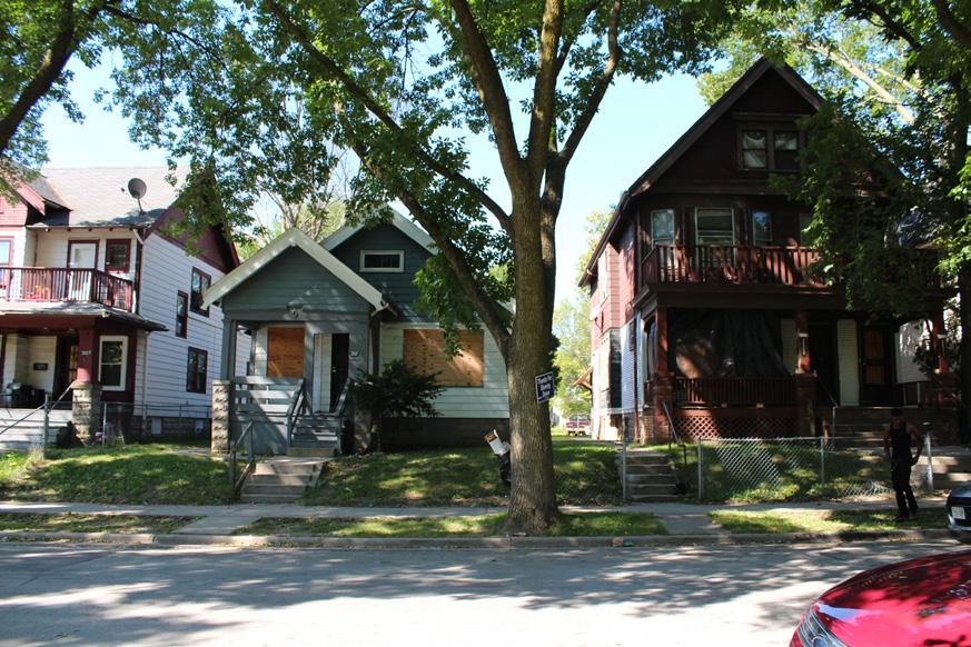
women whose storyline shined a light on eviction in Matthew Desmond’s Evicted (2016). Ms. Kearny was raised by strict parents who valued education. Like many residents in the neighborhoods analyzed, she witnessed her neighborhood change in the 80s. Maintaining consistent work was challenging as an adult, so she found employment at any restaurant that would hire her. Ms. Kearny’s main goal at the time was to feed her children. Edna first experienced eviction in 1993 after losing her job at a temp company and missing one rent payment. She had been renting that apartment for the past five years and described how the landlord told her to get a voucher before putting her out without fixing anything. Her initial reaction was to be hurt and worried about where her kids would go. Edna described how she “got depressed and didn’t want the eviction on my record. (She) sat at the park for two days before reaching out for help because she didn’t want to tell anyone.” Finally, she went to a shelter, Joy House, and they helped her find additional housing. Throughout her lifetime, she has experienced eviction a total of three times—most of the feelings she described as depression, shame, and fear.
After the 1970s, home vacancies became more evident along Burleigh Street and Center Street, leading to issues bringing in investors. The Sherman Park Area Congregation saw these challenges as opportunities to intervene. The Protestant, Catholic, and Jewish churchgoers met to discuss neighborhood issues and create viable solutions. Since Sherman Park encompasses three of the city’s thirty-eight designated historic districts— Grant Boulevard, 47th Street Bungalow Historic District, and Sherman Boulevard, the neighborhood is affiliated with many partners and resources—even after white
there was a lack of access to housing stock that accommodated the needs of single mothers, specifically.
According to Camille Mays, a single mother living in the neighborhood:
“I was a working mother—working full time, overtime, and doing what I was supposed to do. By the time I was done paying everything, it was like I was working below poverty. That’s a lot of single moms. It’s hard, and you don’t get a lot of help…single mothers are often the victims of slum lords, evictions, and things happening— because they are often forced to live in whatever kind of condition."
Eviction, then Redemption: the Story of Edna Kearny
Approximately one year after interviewing Camille Mays, I had the privilege of interviewing Edna Kearny - one of the
I asked her to describe an average night, and she spoke about pride and shame. She explained, “Sitting up all night, pushed back into the bushes.” She was scared but knew they would be alright. She mentioned being a protector. She prayed, but her pride kept getting in the way of asking for help. One thing about eviction is that once it is on your record, it stays there for years, and affects your ability to be accepted as a tenant. In Edna’s case, eviction pushed her into neighborhoods like Washington and Sherman Park with poor-quality housing and absentee landlords. The second time she was evicted, it was caused by her involvement in an abusive relationship. Edna says that her boyfriend would “tear up the property.” The landlords, which she called “slumlords,” would come to collect the rent, but would not fix the issues with the apartment. Despite her despair, she
Eviction, then Redemption 84
used to make excuses back then that kept her in the abusive relationship. Once she decided to get help, she found the Sojourner Truth House, which provided her with the resources and encouragement to get out of her abusive relationship and fight back against the predatory landlords. It was there, in a community of other women, that she realized that her circumstances were not unusual, noting “it was so many women getting beat by their partners.”
Yet, later on, her lack of knowledge of her rights as a tenant contributed to her third eviction; this time from an apartment where her children got lead poisoning. After calling the city about it, she received a two-day eviction notice. Kearny made the mistake of withholding rent without going through the proper legal channels. She recalled “not knowing the process of withholding rent, and not knowing who to talk to or what to do” as the landlord carried out the two-day eviction, and kept her security deposit. Eviction ruined her credit, rendering her unable to purchase a car or qualify for a credit card or personal loans. She needed two or three co-signers while trying to buy a house or access other apartments. Edna stated “It’s a paper that defines your whole life and makes processes a lot longer. I wish that instead of evicting people, you could give me a chance. I didn’t know that this was going to ruin my life. It’s hard to come back from eviction.”
Throughout all of these circumstances, Ms. Kearny was dealing with a myriad of health issues - depression exacerbated, and she endured bipolar disorder, schizophrenia, and gulf foot. Instead of adequately dealing with her health issues, she described how she “still had to work--either hold this pain or not be able to thrive for my kids.” She proclaimed that there was a day when she decided she was never going to get evicted again. She would do whatever she needed to. Although we talked about her questioning why she kept going through this, she mentioned that she kept working at temp jobs getting paid $7 per hour and
working twelve-hour shifts. The toll that took on her personal life and schedule was tremendous. The lack of ability to save, invest, or allocate funds to health, personal development, or other necessary qualities that would have contributed to a wellbalanced lifestyle, instead perpetuated the cycle of eviction.
Instead of considering her story as part of a larger narrative, Edna internalized much of her circumstances and ended up feeling like she was cursed. It was only after receiving much-needed assistance as the years went on, that she began to feel like the eviction crisis had gotten better.

A Collaborative Process Inspired the Idea for The Women’s Empowerment Network
Taking into account the knowledge gained from Edna Kearny, and merging that with the process of research and neighborhood engagement within the Sherman and Washington Park neighborhoods, my work has attempted to uncover ways to mitigate some of the negative variables that contribute to foreclosure, eviction, and housing vacancy. Edna mentioned an array of resources that helped her, noting places like Bradley Crossing, Joy House, and Sojourner Truth. All of these organizations help women and children access health care, counseling, financial literacy, and maybe most importantly, quality housing. When asked what the most valuable resources were for Edna, she mentioned “psychiatrists, outreach, vouchers for rent assistance, and section 8”. Helping to build
a small network where resources can be shared to help people get back on their feet was important to her. Edna ended our conversation by saying “Help me and I’ll help myself.”
Taking those insights into the field, I worked alongside residents and community organizers for three months through a series of community design charrettes, Jane's Walks, and installations in the Washington Park neighborhoods. This process enabled the ability to explore the neighborhood from the residents’ point of view. During the Jane's Walk, neighbors pointed out essential anchors in the community, as well as hotspots they deemed to be problematic. ZIP Milwaukee was there, along with community organizers, residents, architecture students from UW-Milwaukee, and people interested in learning about Sherman Park and the Center Peace Community. The conversations ensued regarding various aspects of business development, parks and recreation, community gardens, foreclosed properties, and art. Many of the interventions prompted critical dialogues between us as architecture students seeking design input and residents of the neighborhood seeking involvement with incoming projects. The Women’s Empowerment Network was one of the projects from this research.
It is a housing model that I propose to focus on establishing therapeutic support and generating wealth by occupying housing stock. Based on a thorough examination of the needs and wants of single mothers and children continuously displaced from housing due to eviction, this concept pulls from an understanding of Washington and Sherman Park. Its purpose is to reimagine housing typologies by leveraging city-owned foreclosures to meet single mothers' needs.
It is something that is in continuous development and that will soon be realized. Through my studies, I continue to listen to the stories of women and hone design skills that can be strategically implemented. If you want to share insights or discuss this work further, please reach out.
Teonna N. Cooksey
85


86
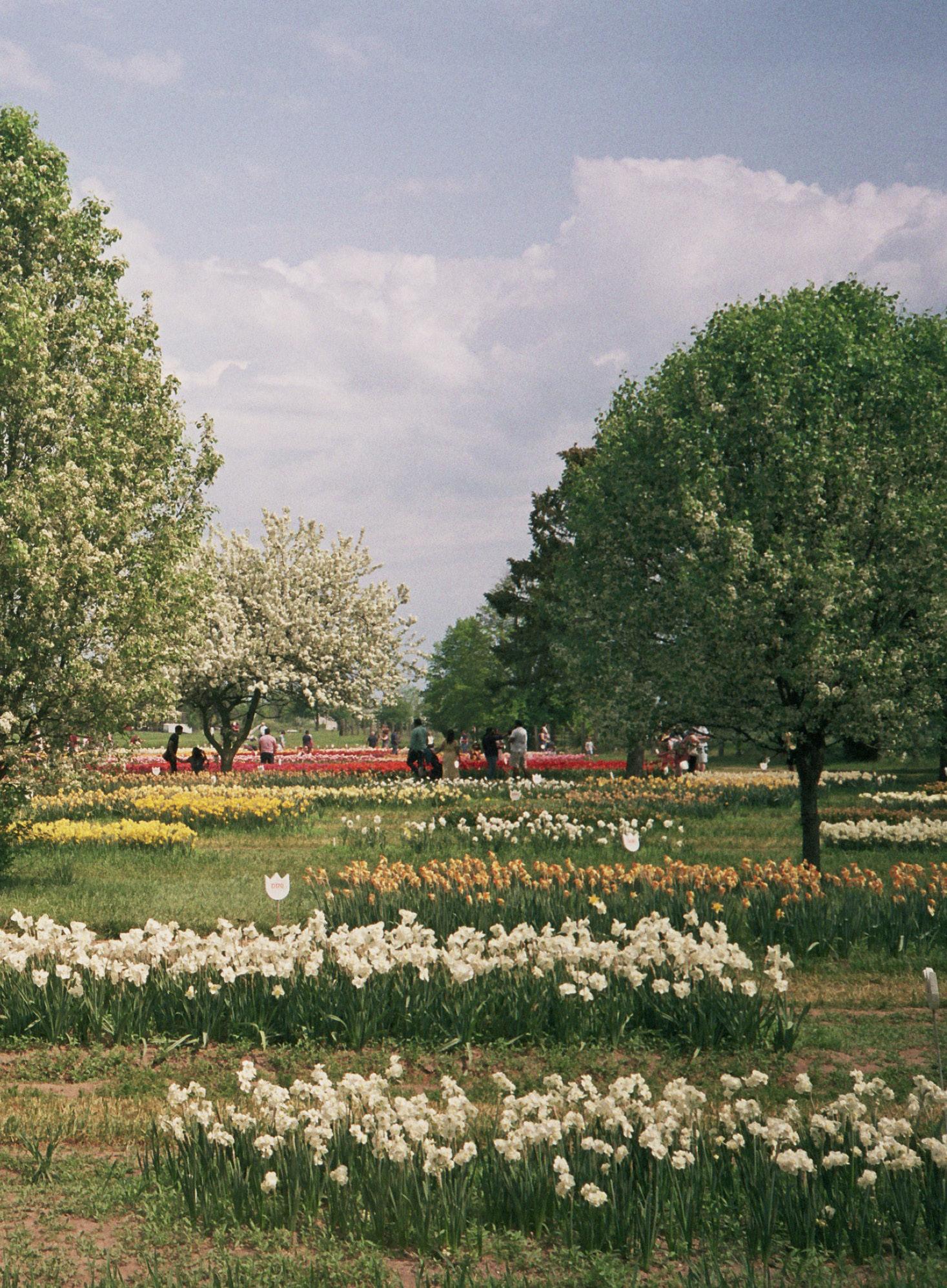

87
Centerfold (2022). Photo by: Olivia Jia
25 Years of

For our 25th anniversary issue, we reached out to designers, planners, practitioners, researchers, artists, teachers, and thinkers around the globe who we admire to ask questions about the past, the future, their hometowns, their thinking around cities and nature, and much more. We hope you enjoy the conversation.
88
Contributors: Lola Ben-Alon, Rosa Chang, Ifeoma Ebo, Rosetta S. Elkin, Ebru Gencer, Steven Holl, Andrés Jaque, Michael Kimmelman, Charles Marohn, Leah Meisterlin, Carlos Moreno, Mary
Pattillo, Emily Talen, Tom Slater, Jeff Speck, Galia Solomonoff, Anthony Vanky, and Doug Voigt, Weiping Wu.

URBAN
Magazine
89
Do you think more often about the past or the future, and why?
We operate in the present. But the present happens in connection with histories that are shaping what is more likely and what is less likely now, and is affected by the sociopolitical, cultural, and ecological settings that we inherit from the past. The same can be said about the future; whatever we do in the present is always affected by how it changes the conditions that will influence the yet-to-come. This is a very relevant question because by operating in the present, we rearticulate both—the past and the future. This is very much what architects and planners do, and I think that’s why our work is so relevant.
- Andrés Jaque is Dean and Professor at the Columbia University’s Graduate School of Architecture, Planning & Preservation (GSAPP), and the Founder and Principal of the New York- and Madrid-based architecture practice Office for Political Innovation (OFFPOLINN), established in 2003.
Both – at 16 I went on a student exchange trip to Paris, France. From an entire life in the suburbs, to living in Paris – WOW. I hadn’t realized until then that cities, buildings, environments could inspire, challenge and resonate so deeply. I was blown away. And bitten by a travel bug that inspired me to live in different cities around the world and soak up as much as I could. Our cities, our created environments, are the hopes, dreams and poetry of the people who came before us, and they are whispered along to anyone willing to take a moment to listen. For example the Brooklyn Bridge is a poem of yearning, dreaming, loss, daring and triumph. With Gotham Park, we are building upon that love letter from the past, to create something new, that celebrates us today, but with a firm eye on the future, with our own hopes, dreams
and challenges written in space for a new generation to discover.
- Rosa Chang is the Co-Founder and President of Gotham Park, a nonprofit imagining and building New York City’s next legacy public realm project underneath the Manhattan Anchorage of the landmark Brooklyn Bridge.
“Time present and time past Are both perhaps present in time future, And time future contained in time past...” Excerpted from T.S. Elliot’s Four Quartets There’s an inherent bias towards the future ingrained in our work. Planning, at its core, seeks to solve today’s problems in order to create a better tomorrow. We operate on the premise that the future holds positive change.
I increasingly find today’s core conversations mirrored in past anecdotes. For instance, fears and conflicts surrounding data-driven cities resonate with anxieties about electrification in 19th-century America. Likewise, concerns about privacy under surveillance echo anxieties surrounding the widespread use of pay phones. Similarly, the optimism surrounding parametric urbanism today draws parallels to Cerdà’s algorithm for designing Barcelona’s ideal block size, or debates around artificial intelligence’s augmentations to cities see similarity to Mumford’ descriptions of industrializing cities.
While T.S. Eliot’s reflections on time were pertinent to the post-war era, they might also shed light on today’s urban conflicts. By recognizing historical echoes in present issues, we can gain valuable insights for shaping a more informed and balanced future.
- Anthony Vanky is an assistant professor at Columbia GSAPP and often counts how many people walk through campus with their eyes glued to their mobile devices
It’s the wrong question. I know you’re asking about whether I’m nostalgic or an optimist. I’m both. I am concerned with the world we are building. But we can’t imagine a future without understanding the past... The past is not an escape. It’s not a rebuke of change. It is a remedy to our ignorance and guide to the future.
Michael Kimmelman
It’s the wrong question. I know you’re asking about whether I’m nostalgic or an optimist. I’m both. I am concerned with the world we are building. But we can’t imagine a future without understanding the past. Progress is longitudinal. It is not an end point but a process. Social media and the 24/7 news cycle conspire to lock our focus on the present -- or at least lock in those of us who live in certain bubbles. We tell ourselves this is a remarkable moment, a turning point. In our myopia and self-centeredness, we have become an amnesiac society. The past is not an escape. It’s not a rebuke of change. It is a remedy to our ignorance and guide to the future.
-
Michael Kimmelman is the architecture critic of The New York Times.
Definitely the past. I think a lot about how the meanings of buildings and spaces has changed. A castle that once kept the population subservient might now simply be a public space. That’s a
“ ”
25 Years of URBAN Magazine
90
positive change. More often the change is negative, especially in terms of scale. Remnants of the past—pieces of old urbanism—are everywhere visible and what I mostly think about what the profound change from small scale to large scale urbanism has meant. Am I romanticizing the past? Probably. But small scale was the urbanism of localized social connection. In the city of mega-structures, is it any surprise that we struggle to connect?
- Emily Talen is Professor of Urbanism at the University of Chicago and director of the Urbanism Lab.
Recently, I watched a documentary on the Webb Space Telescopes. The success of its launch December 25, 2021, is astonishing. New information it continues to send merges the future with the deep past. First images show galaxy clusters as they appeared 4.6 billion years ago… structures that have never been seen before. I believe architects should find optimistic paths for future generations. I feel we currently spend too much time thinking about the past. In my first editorial for Domus January 2023, I argued that the aim to articulate theories addressing our modern condition via a “theory of action” embodies ideas in new creations, a challenge to all architects, artists, and designers.
- Steven Holl is an architect based in New York and founded Steven Holl Architects in 1977.
The past, for several cliche-but-true reasons. (1) I think about the past in order to think about the present. (2) Lest we repeat it. (3) I’m not convinced one can actually think about the future. (4) Most new ideas are only accelerated iterations of previous ideas. (5) There is no tabula rasa. We occupy a space of inherited legacies and the accumulation of others’ decisions.
- Leah Meisterlin is an assistant professor at Columbia GSAPP.
Where in the world do you experience a sense of belonging and why?
Humans are animal creatures—we all have ranges. So another way to reframe belonging, is to ask in what range do you feel most at home? This takes us away from single geographies and features that tend to invite a sense of possession that forces humans to ask “does this belong to me?”. Imagine instead asking, “Do I belong here?” It has taken me most of my adult life to appreciate that I belong to a part of the world that I identify through the range of the southern Boreal or snow forest; where spruce, pine and birch meet the eastern broadleaves of the temperate world; the oaks, maples and hemlocks of the north Atlantic plains. Home, afterall, is where you know the plants that support you.
- Rosetta S. Elkin is an author and designer drawn to learning from the land, and hoping others will do the same with us in the new Landscape Architecture program at Pratt Institute.
Definitely here in my hometown [Minnesota]. I grew up on a farm outside of Brainerd, Minnesota that was homesteaded by my grandparents and I live in town now. People often ask me why I live here. I work from home –I could live anywhere, but I live here because this is where I’m most deeply rooted. This is the Councillor’s office in the converted junior high. This is where I went to high school, I met my wife down the hall, I can see the church I go to and used to go to with my family. My house is five blocks that way… I feel comfortable here.
- Charles Marohn is the founder and president of Strong Towns, a land use planner, and civil engineer based in Minnesota with decades of experience and three books on how to build strong, financially resilient cities.
Over time, I’ve come to realize that my sense of belonging is shaped by a combination of external and internal factors. An external factor that significantly influences me is the weather, climate, specifically the humidity, and surrounding vegetation. I’m drawn to and feel a strong sense of belonging in Mediterranean climates with semi-arid summers and mild rainy winters, influenced by the sea’s humidity. This preference aligns with my upbringing in Israel and the historical residence of my ancestors in Morocco and North Africa over approximately ten generations. Another crucial external factor is community. As a young mother, being surrounded by families and other mothers increasingly influences my sense of belonging. Internally, my mental state plays a pivotal role. I believe a true sense of belonging stems from feeling at home within oneself. This is fostered by my embodied experience, a collective absorption of everything I do to return to my center, including self-care rituals like yoga, meditation, rest, and proper nutrition.
- Lola Ben-Alon is an Assistant Professor at Columbia GSAPP, where she directs the Natural Materials Lab and the Building Science and Technology curriculum. She specializes in earth- and bio-based building materials, their life cycle, supply chains, fabrication techniques, and policy.
“
Fifty windows, fifty stories, fifty households. In this tapestry, I witness, albeit discreetly, the symphony of life playing out behind illuminated panes.
” Anthony Vanky
25 Years of URBAN Magazine
91
Definitely New York City – it is the home
I have chosen. Part of the allure is that it encompasses so much diversity and possibility within it. You can travel the world in this city, experiencing so many different cultures, food, art, religions, perspectives, etc... Every encounter is a new world of potential. Here, we can celebrate our commonalities and expand from our differences. For people who embrace multiple identities, histories, cultures, and perspectives, NYC is home – we are not one thing, we are so many things all at once.
- Rosa Chang
The spaces and places where I have experienced the greatest sense of belonging have been in public space. I think about the festivals and ceremonies and celebrations in Brooklyn that have most made me feel a sense of connection to the various communities that intersect with my identity and ways of being. As a Nigerian American I feel belonging in different ways in Nigerian or American cities. There is a part of me that has been socialized in either place and so public space is a location where cultural norms are on display and I am able to connect and identify in both countries.
- Ifeoma Ebo is the Principal of Creative Urban Alchemy and Assistant Professor for Design and Sustainability at the Spitzer School of Architecture at the City College of New York.
What is the view outside your window right now?
I have a big picture window in my condo on the third floor of what we in Chicago call a “six-flat building.” There is a mixture of snow and sleet falling diagonally from the east, and sticking to the bare tree branches that nearly touch my window.
This is the first time there is a forecast of significant snow this winter. The media has been in a frenzy about this potential snow storm, but it is turning out to be pretty minor so far. It is January 9th in Chicago, so to have gone this far into winter without snow has to make you think of global warming. While global warming creates many risks for cities across the world, I did think this morning of one benefit. There are fewer times that the city puts salt on the roads. Road salt has been linked to various environmental and health problems. So, less road salt is good. Back to my window, the snow/rain sparkles in the street lights. But I know it’s going to be an ugly commute to work.
- Mary Pattillo is a professor of sociology and Black Studies at Northwestern University and the author of several books and articles about Black Chicago
From my office I can see into the center of Columbia’s Morningside campus. As has intermittently been the case for the last few months, the campus is not fully open. Crowd-control fencing and barricades determine the flow of people at the gates, surround Alma Mater, and prohibit access to the steps of Low Library.
- Leah Meisterlin
Our Chicago office is in the Railway Exchange Building, on Michigan Avenue. The building was designed by Daniel Burnham and was once home to his offices. It has amazing views of Grant Park and Lake Michigan. When I look outside my window, I am reminded of the civic leadership we have as designers - and the planning and vision that has been realized here to shape and develop this great city, but also to preserve and restore its natural beauty. I’m inspired by the designers I get to work with every day and I’m proud to be one of those fortunate to have had an impact here and involved in shaping its future.
- Doug Voigt is an urban design and
planning partner at SOM in Chicago.
This very perspective, a voyeur’s delight, birthed the suspenseful cinematic masterpiece, Hitchcock’s Rear Window. It is from this vantage point that the collage of daily life unfolds, a silent play performed in the various windows, punctuated by a fire stair or two.
In one window, a student sits bathed in the cool glow of a computer screen, fingers dancing across the keyboard. Meanwhile, in the window two over from the student, two silhouettes dance over a kitchen stove as they craft their dinner. Above them, a worried soul attempts to rescue a cat sitting precariously close to the window ledge.
A flicker of vibrant hues bleeds from another window, the rapid-fire light shows betraying the rush of a cinematic chase or the spectacle of a sporting event. Closer to the ground, a window pulses with the mesmerizing hypnotism of an RGB lightbulb but conceals what that unit’s occupants are doing.
Fifty windows, fifty stories, fifty households. In this tapestry, I witness, albeit discreetly, the symphony of life playing out behind illuminated panes. This voyeuristic glimpse into the human experience is a privilege unique to this magnificent city, where the rhythm of life unfolds in a breathtaking two-dimensional display
- Anthony Vanky
What unexpected places do you turn to for inspiration?
Public housing projects all over the world. They are usually stigmatized and then demolished due to real estate interests, but they tend to nurture incredibly strong communities and systems of mutual
25 Years of URBAN Magazine 92
support and solidarity from which we all need to learn a great deal.
- Tom Slater is Professor of Urban Planning at GSAPP and the author of Shaking up the City: Ignorance, Inequality and the Urban Question (University of California Press).
Rome, for now. I was taken by surprise when first visiting Rome in the spring of 2018. A city where the past and present co-exist so beautifully, though not without contradiction. The Pantheon right in the middle of bustling downtown, and the Colosseum with the amazing ancient concrete technology eclipsing modern methods. A true palimpsest, the way all cities are.
- Weiping Wu is an urban and China specialist, a GSAPP professor and Columbia’s Vice Provost for Academic Programs.
I often turn to cultural artifacts reflecting color, texture, pattern and symbology for inspiration. There is so much that one can learn about a people or a community from the art that they individually or collectively produce. I recently traveled to Nigeria and really enjoyed going to junk yard museums in Lagos and historic shrines in Anambra. Both places gave me access to seeing how cultural art has morphed overtime from the practical to the aesthetic. There’s so much inspiration embedded in this that can inform massing studies to material palettes to shape and form of design.
- Ifeoma Ebo
At the Natural Materials Lab, [...] I discover numerous surprising sources of inspiration. I draw parallels to other disciplines of art and making, ranging from sculpture to kitchen science processes. Interestingly, our lab’s accessories and equipment are often sourced from industrial kitchen websites, utilizing tools like a legume shredding machine (for
chopping vegetable fibers), an industrial dough mixer (to create mud mixtures), silicon cookie forms (for testing minibricks), spatulas, food-grade additives, baking mats, and more.
My inspiration from the kitchen extends into kitchen chemistry, where I analyze the role of each ingredient in a recipe and its impact on the final building product. This scrutiny influences my approach to mix-design, contemplating its implications for the chemistry and particle interaction of construction elements, such as bricks, slabs, fabrics, and textiles.
- Lola Ben-Alon
What [idea, trend, development, or force] do you think has most influenced the way we’ve lived in the past decade?
In the past decade, the overarching force shaping every facet of our lives has been the quest for immediacy or instantaneity. This pursuit of speed stands out as the defining trend, fundamentally altering how we interact with the world. Information is not only instantly accessible but also instantaneously produced. The convenience of delivering food within moments, the ability to communicate across the globe without delay, and the feasibility of traveling vast distances in mere hours exemplify this trend. Thanks to digital applications, even navigating an unfamiliar city has become a
matter
of minutes.
However, this relentless pursuit of speed and efficiency has significantly cost human interaction and socialization. Our lives, constantly pressed for time, have become a race against the clock, often sidelining the deeper, more
meaningful connections from face-to- face interactions and community engagement. The tools connecting us across vast distances can also create a paradoxical sense of isolation and disconnection in our immediate surroundings. As we rush through our fast-paced lives, the opportunities for spontaneous, organic social interactions diminish, impacting our sense of community and belonging.
This revolution in speed and immediacy has transformed our communication, travel, and personal relationships. Technological advancements, mainly through our smartphones, have reshaped our life’s rhythm. While I appreciate the benefits and conveniences of these technological strides, I am increasingly concerned about the implications of this relentless pace on human well-being and health and the erosion of social bonds. To counteract this trend, I propose the concept of the ‘15-Minute City.’ This urban design vision focuses on creating cities where all essential needs — such as shopping, healthcare, sports, and education — are accessible within a 15-minute walk or bike ride from one’s home. The 15-Minute City is not
“
I imagine that we can overcome the binaries of nature and culture, city and country, past and future. These are the very tools of pacification that are blanketing life, confusing our instincts, and convincing people that measure matters.
”
Rosetta Elkin
25 Years of URBAN Magazine
93
merely about physical proximity; it is a transformative idea to foster sustainable living, improve health, and strengthen community ties.
In a 15-Minute City, the reliance on cars is drastically reduced, decreasing pollution and traffic, contributing to a cleaner, healthier environment. This approach also encourages physical activity through walking and cycling, which are integral for physical and mental health. The reduced need for lengthy commutes alleviates stress and enhances the quality of life. Moreover, this concept supports local economies and promotes an equitable distribution of resources and services, ensuring that all neighborhoods have access to essential amenities.
- Carlos Moreno is a University Professor and researcher, and has earned international recognition for bringing an innovative perspective on urban issues through the Human Smart City, 15-Minute City and 30-Minute Territory concepts.
Without question it’s the smart phone and all the accompanying apps and social media options. From transportation (Uber, Lyft, etc) to housing (Airbnb) to food and restaurants (GrubHub, DoorDash, Instacart, etc) to communication (X, Instagram etc) to how we neighbor (Nextdoor etc), this tiny little device has changed every corner of the world, urban and rural, big city or small.
- Mary Pattillo
I think there is no doubt that the number one trend that has influenced the way we live is financialization. It has affected not only how we build, but how we buy our homes, how we live, how we get around and what we invest in, how we deliver the government. It has allowed us to remove and supersede all of the constraints that have bound previous generations of Americans, previous societies.
Financialization is like a magic elixir that provides this magical illusion of prosperity. Over the last decade in particular, it has allowed us to do things that even two decades ago people would have said were impossible… We’ve been living in a fiscal dreamstate.
- Charles Marohn
What is the role of nature in your vision for the city of the future?
From a cosmopolitical perspective, there is no divide between the urban and nature. Human and more-than-human life is shaped in the ways many different entities infiltrate each other and negotiate their coexistence. The way the Hudson Yard’s buildings shine is the result of the titanium oxide coatings on their facades. This titanium is extracted in the little town of Xholobeni on the east coast of South Africa; by removing the titanium particles from its sand, the town is progressively becoming more and more dusty. Hudson Yards extends onto Xholobeni, and it is also part of the lungs of those breathing the dust there. This continuity and entanglement between bodies, territories, buildings, and materials is where politics are installed, now. The urban is not confined to fixed patches in the land, but rather distributed. This transscalar notion of the urban is important in my work and one that I believe can allow us to work in some of the complexities that, as societies, we care about.
- Andrés Jaque
I struggle with this question. Of course we want green in the city – it’s good for us on so many levels. But why is the quest for “nature” in the city so often taken
to extremes? The images of futuristic cities covered in green are Kafkaesque to me – dystopian, nightmarish. Cities are about connection and exchange and in the merger of modernist skyscrapers and hanging gardens I see isolation and sheltered worlds. I’m perplexed that the argument still needs to be made that lushness does not equate with sustainability. Can we just focus on making sure every part of the city has street trees, please?
- Emily Talen
Nature is very central to my vision for the city of the future. Urbanization has led to the disconnect between human beings and the natural world. We therefore have lost a piece of our own identities in that disconnect. This is why I strive to learn more about indigenous culture wherever I work. It allows me to understand ways that people have coexisted with nature. My vision for the city of the future that our built environments are regenerative. They facilitate our cohabitation with nature in supportive rather than extractive ways. They support nature to reach its fullest potential and foster an improved symbiotic relationship between humans and nature.
- Ifeoma Ebo
I believe preserving the natural landscape is an urgent cause in balance with building cities of the future. In Half-Earth: Our Planet’s Fight for Life, E.O. Wilson proposed that “only by committing half of the planet’s surface to nature can we hope to save the immensity of life forms that compose it.” Wilson’s half-earth concept puts biodiversity in the primary driving position of any future urban theory of developing in the landscape. A humancentric theory is reversed in the half-earth proposal as migratory routes of biodiverse species are taken to be more important than horizontally expanded city patterns. The idea of “dense-pack” settlements
25 Years of URBAN Magazine 94
The smell of wet earth always reminds me of Rosario and waiting for the rain to slow down.
Galia Solomonoff
and metropolitan density allows more preservation of the natural landscape and the ecosystems so important for biodiversity to be a core issue. The entire planet Earth’s landscapes are the focus, not the horizontal sprawl of the cities. How can urbanists and architects embrace this “project for life”? Perhaps by creating “mini-utopias” that restore or preserve large sections of natural landscape with ecological architecture and are free of fossil fuels via geothermal heating and cooling and solar power.
- Steven Holl
Nature has always provided the inspiration and resources for designers to explore integrated frameworks through systems thinking and circular economies. Today, as we work towards a carbon-free future, the integrity of natural systems plays a crucial role in sustaining our cities and regional ecosystems. SOM is using research and computation to design regenerative infrastructure and new forms of public space to restore the balance that is urgently needed in our cities. We believe that by prioritizing nature where it can thrive, we can improve the health and wellbeing of ourselves - and our planet.
- Doug Voigt
For too long, nature has been a cosmetic or ornamental design feature in artificial,
totally sterile cities. But if we want cities to remain liveable in the years to come, [...] we need to take a long, hard look at the place of nature in the city.
We need to consider cities as ecological systems that are part of a larger natural ecosystem. Cities need to be transformed and built around natural elements rather than the other way around so that we can recreate genuine green and ecological infrastructures.
Simply put, in my vision of the city of the future, there is no distinction between concrete and nature. Nature is everywhere and is useful to both the planet and its inhabitants.
- Carlos Moreno
I imagine that we can overcome the binaries of nature and culture, city and country, past and future. These are the very tools of pacification that are blanketing life, confusing our instincts, and convincing people that measure matters. I am interested in other ways of finding our way in the world, without labels or singular visions. I believe our culture knows how, we just have to be reminded, and start trying with more care.
- Rosetta Elkin
What is a discipline, field, or way of knowing that planners should seek to better understand?
- Galia Solomonoff is an architect who teaches at GSAPP, lives with her family in Chelsea, and is the founder of Solomonoff Architecture Studio/SAS in New York
As we confront formidable challenges like global warming, environmental disasters, economic and social crises, and global diseases, the transformation of our cities plays a crucial role in addressing these issues and averting catastrophic outcomes. The shift towards sustainability and moderation is not just necessary but imperative. Urban planners and architects are at the forefront of this change, engaging in extensive research and implementing best practices such as lowcarbon construction, material reuse, and comprehensive rainwater infiltration.
However, to accelerate and enhance this transition, urban planners should deepen their understanding in three key areas: Ecosystemic Understanding of Urban Environments: Urban planners must develop a more nuanced understanding of cities as ecosystems. This involves recognizing the intricate interplay between urban areas and their natural surroundings. An ecosystemic approach would encompass the study of biodiversity, natural resource management, and the integration of green spaces into urban planning. This perspective can help in creating cities that not only coexist harmoniously with their natural environments but also enhance them.
Biomimicry. I think planners will gain from looking more closely at the production of materials, processes, structures, and systems embedded in biological entities.
Impact of Artificial Intelligence on Urban Development: Artificial intelligence (AI) ‘s burgeoning field holds tremendous urban planning potential. Planners should explore how AI can be utilized for more efficient city management, from traffic control and waste management to energy use and public safety. Understanding AI’s capabilities, ethical considerations, and potential pitfalls is essential for planners to leverage this technology to create more innovative, responsive urban spaces.
25 Years of URBAN Magazine
“ ”
95
Inclusion and Accessibility in Urban Design: Inclusion should be a cornerstone of urban planning, especially considering the world’s aging demographics. Planners must pay special attention to making cities accessible and friendly for the elderly. This includes designing walkable neighborhoods, ensuring easy access to essential services, and creating community spaces encouraging social interaction. Inclusion also extends to other demographics, providing that cities are welcoming and accessible to all, regardless of age, ability, or socioeconomic status.
- Carlos Moreno
I’m a geographer, so I will always say geography. It is a very misunderstood and trivialized way of knowing and thinking about the world. But what could be more important for urban planning than the intense analysis of spaces and places?
- Tom Slater
Human psychology and evolutionary biology… for planners, the fascinating work is understanding why humans do what they do. Where we came from, and how that influences our history and future. If we don’t center on human behavior, perception and reaction when we design our cities, who are we building for?
- Charles Marohn
Cathedral thinking.
- Michael Kimmelman
Planners in the US need to learn traffic engineering (regarding both traffic and safety) or, more to the point, how the current “science” behind the provision and design of streets in our communities is based on a series of complete fallacies that need to be thrown away.
- Jeff Speck is a partner in the city planning firm of Speck Dempsey, based in Boston, and the author of many books including Walkable City, How Downtown Can Save America, One Step at a Time.
Can you describe a sound or smell that reminds you of where you grew up?
The smell of jasmine. Once in a while, I would visit a new place, and when that smell hits, immediately I would be transported back to childhood growing up in a small Chinese city at the foot of Mountain Taishan. Simple days during the Cultural Revolution when kids’ daily routines were a few hours of schooling and lots of playing in the open.
- Weiping Wu
The smell of the sea and the sound of seagulls remind me of where I grew up (a coastal neighborhood in Istanbul). My high school’s mascot was a seagull, and during my college years, I took the ferry between the Asian and the European sides of the city every day.
- Ebru Gencer is an Adjunct Associate Professor of Architecture, Planning, and Preservation at Columbia University. She was a contributing editor to URBAN during its inaugural year.
Crickets at night, leaves in the late fall. I grew up in the suburbs, but the right kind of suburb. . . prewar, walkable, transit served, and mixed-use. My father walked to work every day.
- Jeff Speck
Jazz. I come from a very musical family and jazz has always been a big part of my life. New York is in so many ways the spiritual and soulful home of jazz, which has helped me adjust to life here.
- Tom Slater
I grew up in Rosario, a 1 million inhabitants city in the Argentine, Pampas. At the beginning of the fall there, in March, it rains a lot, and rain there is more aggressive, more voluminous than here. The smell of wet earth always reminds me of Rosario and waiting for the rain to slow down.
- Galia Solomonoff
When you visit a new place, what is the first thing you search for?
It’s not what I search for, but walkability is the most important criterion for me to get adjusted to a new place. I am always out looking for bookstores and neighborhood coffee shops, as well as finding access to the coast (if there’s any) when I visit a new place.
- Ebru Gencer
It starts when I book my hotel. . . where is the part of the community where narrow streets are lined by buildings of adequate height to give them shape? In Europe, I always end up in the pre-enlightenment part of town. Medieval street networks are my favorite—a place to get lost.
- Jeff Speck
I like to go running in every city we are working in. I have a philosophy on the value of getting ‘lost’ – it’s a way to remain curious and have a more intimate
25 Years of URBAN Magazine 96
understanding of a city. In five minutes you can be immersed in nature, or in a completely different environment. It’s been valuable to absorb where I am and to be present.
I always try to find new places, to see the city in new ways. How are these parts of the city linked? How do the streets and paths contribute to the identity of the place?
- Doug Voigt
The nearest public square or neighborhood park. To watch kids kick soccer balls against the back wall of a church and old men play petanque.
- Michael Kimmelman
A map, and by that I mean Google Maps. I must situate myself in the city. I must know what the major arteries are, where is downtown, how big the city is in the land area and what is its shape, which way is North/South/East/West, and if the city is on a grid or laid out in some other way. I look for major natural landmarks to orient myself. This comes from growing up and living in Illinois and Wisconsin. Lake Michigan is always to the East. When I go to California where the water is to the West I am totally disoriented. A map is the foundation for exploring the next things I search for – vegetarian restaurants, city history museums, and outdoor festivals.
- Mary Pattillo
Easy, I look for the closest train station.
- Galia Solomonoff
25 Years of URBAN Magazine 97

98
Westbound (2023). Photo by: Olivia Jia

99
Columbus (2021). Photo by: Olivia Jia

Saturday II
Film by: Kurt Steinhouse
100
Kurt teaches planning law at Columbia University GSAPP, works as a land use lawyer at the international law firm BCLP, and chairs the New York City Bar Association’s land use committee.
 Footage captured during February’s first snowfall.
101
Scan the video QR code to watch Saturday II.
Words by: John Friedman
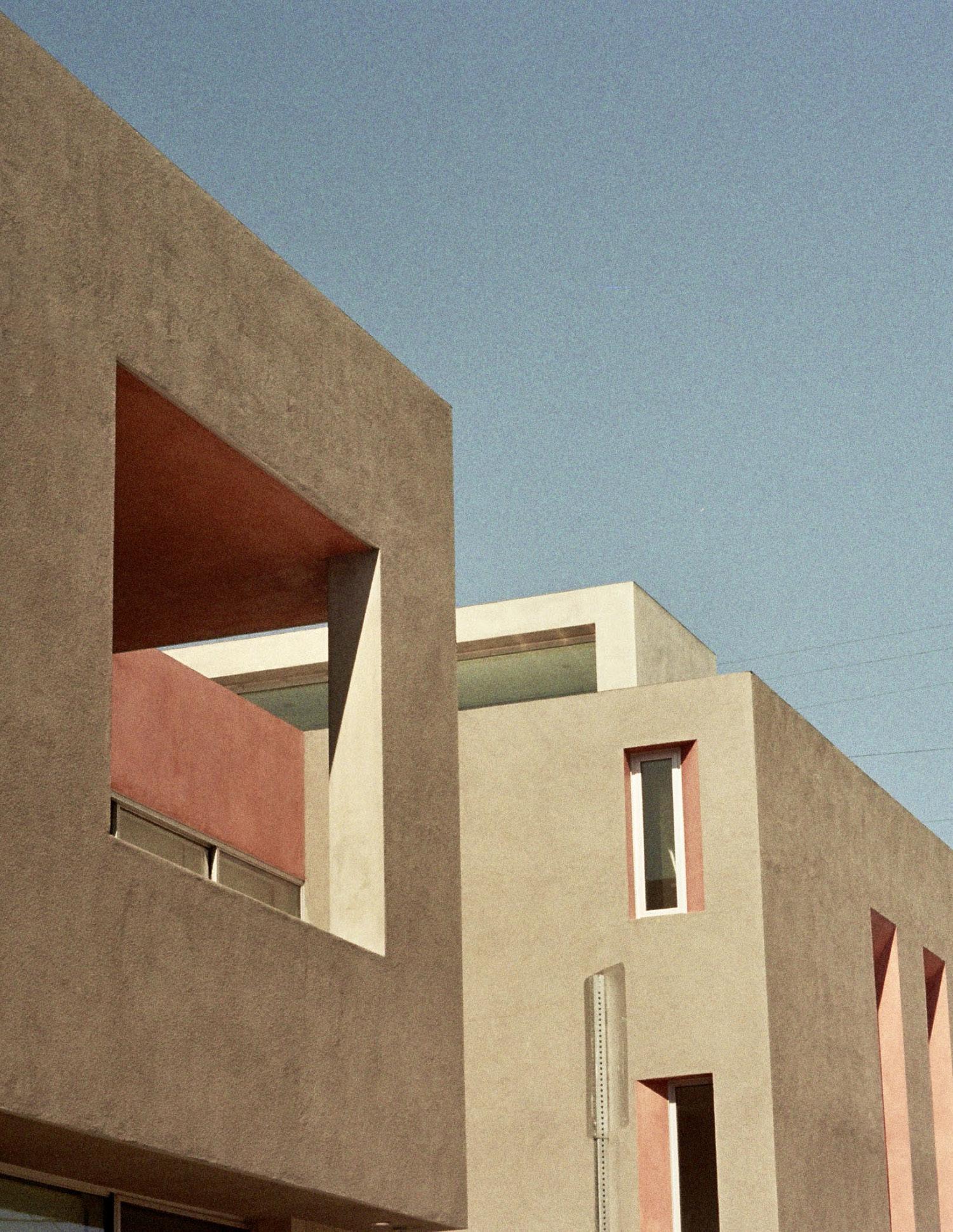
Riding LA
102
John Friedman is a principal of John Friedman Alice Kimm (JFAK) Architects based in Los Angeles.
He wasn’t really up for spending his Sunday with them, but he could tell that’s what they were aiming at when Robert casually asked: Is there a good way to see Mulholland Drive? If he didn’t like them so much, he would’ve just fended them off, but that was the problem, he did: You guys want me to take you on a tour of LA?
Oh, that would be so nice.
It was just like everything else. Aaron thought he should go into medicine, so he became an architect. He wanted to live in New York after grad school, so he moved to LA. He wanted to date the blonde, so he asked out the brunette. At one point he tried tricking himself into wanting the thing he didn’t, so he would get the thing he really did, but that didn’t work either. Unless… No telling the machinations the brain could make – his brain – wired as it was to reward regret and disappointment, though how that made any logical sense, he couldn’t say. The point was that even though he hadn’t much enjoyed his two years at Oxford – when it came right down to it, hadn’t made but one good English friend (the Scottish and Irish were a different story, and the Welsh, well, he’d never met anyone from Wales as far as he knew) – it made total Aaron-sense that as soon as he was in LA with a place of his own, he volunteered to host recent New College graduates traveling through the US on their NewQuest fellowships. Maybe he thought he’d have the kind of fun he’d missed when he was there. Maybe he thought it was his own fault he hadn’t made many English friends. Maybe it just felt like the right thing to do.
He was a lazy tour guide at first. After loading them into the van and getting on the 101 North, Aaron pointed out Griffith Observatory and the Hollywood Sign, the latter practically on axis with Beachwood Drive, at the bottom of which Scientology’s “Celebrity Center” loomed over the freeway in the type of Golden Age residential edifice you could still see in Hollywood, all chandeliers and turrets – less condo,
In Europe, we put the cathedral by the river. In LA, we will put it next to the freeway.
”
more castle. It was just a matter of time before the ‘Church’ bought out the more famous “Hollywood Tower” up the street, so iconic it had inspired its own simulacrum at Disneyland, though minus the original Tower’s adjacent freeway. Which begged the question: Who was the better urbanist – Disney? The first Tower’s Designer? Or Rafael Moneo, the architect of Downtown LA’s new Cathedral? Because anytime he passed the original Tower or the finished Cathedral, Aaron would smile at the memory of Moneo’s final presentation to Cardinal Mahoney: In Europe, we put the cathedral by the river. In LA, we will put it next to the freeway.
Aaron was still smiling when he turned and pointed out the cylindrical stack of LPs and rooftop needle known as the Capitol Records Building, and then after passing through Whitley Heights (rudely bisected during the freeway’s construction in the ‘50s), little parts of the Hollywood Bowl that poked through the foliage. Once over the rise, the hill-devouring compound known as Universal Studios came into view. Which was only a prelude to further autopilot descriptions as they wound up Mulholland: Here’s the LA Basin – see how big it is, see Downtown, see the ocean? There’s the Chemosphere, a little masterpiece by an architect who died bitter because he never got a chance at the big cultural projects. Here’s the Valley, see how big it is, see the mountains? Did you know that one-third of LA’s residents are immigrants? Guess how many languages are spoken in the Los Angeles Unified School District. Ninetyseven.
Is it true, Robert asked, that the Valley is the capital of the porn industry?
As far as I know, Aaron said. All this space, all these little houses – anything is possible. You must have seen Boogie Nights.
Yes! Amma smiled. At the beginning of the lockdown, my friend and I started a film club. That was the first one we watched.
Good choice, Aaron said. And then after they’d crossed Laurel Canyon Blvd: Not quite Sepulveda Pass – which you’ll see when we reach the freeway – but one of the major commuter conduits between the Valley and the Basin – windy, as in curvaceous windy, knuckle-whitening day or night, zip code of choice for ‘70s rock stars. Crosby, Nash, Stills, and even Young, Joni Mitchell of course, Jim Morrison, Jackson Browne. And can’t forget John Lennon, during his “Lost Year,” only Dylan and the Band missing, ensconced in their New York analog, maybe the Grateful Dead too, up north in theirs.
They’d already driven the most iconic sections of Mulholland (which went on, in one form or another, for at least another twenty miles), so as they snaked down to the 405, Aaron made the executive decision to abandon it for a more direct, more ‘instructive’ route to the beach, distracting his Questers with chatter before he could merge onto the freeway. Near the bottom of the Pass, he gestured up at The Getty Museum, the sight of which always started him on a lecture his kids called:
“All The Ways LA Has Changed Since Dad Got Here.” What could he say? When he’d arrived in 1990, LA had the finest – the largest – collection of single family houses in the world. (Aaron’s opinion, but having spent nearly six months searching them out, first in Europe, then in LA, an informed one.) But when it came to great, even just good, public modern architecture, there was almost nothing. AC Martin’s Department of Water and Power Building was perhaps the best. Eisenshtat’s overlooked Sinai Temple and Gehry’s Loyola Law School
Friedman
John
103
“
probably qualified, possibly Ellwood’s Art Center as well, though critics who didn’t appreciate the Fallingwater joke or thought it too derivative – “MiesXL” – had a point. Beyond those, Aaron was hard-pressed to come up with anything else. Which struck him as bizarre – that in a city where talent overflowed and cultural production was almost its raison d’etre, the arts had so little public expression – as if it had all been made just to export, uncelebrated, impotent as a force for community togetherness. And while that might have made sense for filmmaking, it didn’t for architecture – and not just because it kept LA from being considered a world-class city, a destination for things other than celebrity sitings (sic) and Mickey Mouse, plentiful beaches and temperate weather, USC and UCLA, the Lakers and Dodgers. The bigger issue was how few architectural landmarks or places there were for people to meaningfully engage with each other –places that, the longer Aaron lived there, seemed absolutely necessary for LA’s longterm viability.
Yet: In a town whose major product is an art form largely experienced in a dark theater, where people are more likely to talk to the screen than the person sitting next to them… In a city where people flock to escape or forget or remake history, their own histories… In a metropolis where the primary view from an airplane is row after row of single family houses… should it be any surprise that its first and still primary, maybe forever, form of architecture is for (and mostly by) the individual?
And yet again, consider Disney Hall, the Broad Museum, and Moneo’s Cathedral – all in Downtown; OMA’s Synagogue and the expanded, now contracting, LACMA (which should have been given to Gehry, but that’s another story) – both in the Miracle Mile; Tongva Park, the Getty Center, and the Getty Villa on the West Side and Malibu. Plus: Inglewood’s SoFi Stadium, the expansion of LA Metro (finally digging through Beverly Hills), and just around the corner, the LA28 Olympics: Does the fact
that, in the last thirty years, Los Angeles has added or enlarged an envious number of world-class institutions and architectural gems prove that the City has matured? Does it mean that Los Angeles has become more than the sum of its parts?
As they arced west off the 405 at Sunset, Aaron recommended the Questers check out the old round Holiday Inn, then look up at the Getty.
How funny, Diana said. They do have some similarities. Are they by the same architect?
Not quite, Aaron chuckled, imagining what Annie would think about his comment: “You may think your joke is funny, Aaron, but no one else does. It just makes you look jealous.”
Sorry, Aaron said to the Questers. That was a bad inside joke.
What’s in the Getty? Amma asked.
Basically the collection of J Paul Getty. He made a fortune in oil after World War II. No modern art, though – it’s typically neoclassical or the real Greek and Roman stuff. Probably the closest thing we have to the British Museum.
So it’s full of pilfered antiquities, Diana said. I’m pretty sure they had to give some of them back, yeah, the ones they got caught buying on the black market not too long ago. If I remember correctly, Italy threatened to arrest one of their curators if they caught them in the country again.
Does it mean that Los Angeles has become more than the sum of its parts? “
I’m so sick of hearing this kind of stuff, Robert said.
Here we go, Diana said.
That’s right, Robert said. My family moved to the UK for the opportunity. I just don’t get bashing your own country.
Well, I think calling out your country when it’s wrong is just another form of patriotism. You can have opportunity and still not steal. You mean when you think it’s wrong. Everyone knows the things you’d have the UK give back would have been destroyed, lost, broken up and sold – whatever – if we hadn’t taken them. That’s certainly true of the Elgin Marbles. At the very least, they’d have disintegrated in Athens’ pollution. So, Diana said – supposing Portugal had plundered the best of Brazil’s art when they ruled the country. How would you feel about that?
Well, since they brought European knowhow and science and –
Disease, Diana cut in –
…and Enlightenment values, such as, ahem, respect for human rights –
And war –
…which we already had plenty of, by the way, then maybe it was a fair trade –
All of the country’s – what’s that vile word – patrimony? So let me get this straight –it would have been just fine with you if the Portuguese had packed up Brazil’s most valuable art and shipped it back to Lisbon? With all the gold they also pilfered – dug up by slaves if I recall correctly. Maybe by your great grandfather? But no, he would’ve died before he’d had any children and you never would’ve been born… All fine with you?
Well, Robert said, except for the slave part, yes. ”
Riding LA
104
Except… for… the… slave… part…. Diana drew out the sentence like she was Severus Snape. Brilliant, she said. But I highly doubt the Brazilians who stayed in their country would feel that way. Although – what kind of important art did Brazil produce anyway? Nice, Diana. Nice.
Have you seen the museum the Greeks built for when the Marbles are returned? –it’s just a matter of time. It’s as sophisticated as anything in our crumbling country.
I doubt that, but yeah, crumbling because of people like you.
Or maybe people like you.
What does that mean?
I’m just saying… you’re only glad we took it all, so you could follow…
Now that’s vile –
Oxford rhetoric at its best! Aaron laughed. The debates at the Union were too polite. You’re taking me back to the College JCR.
Followed by Amma: Yeah, that’s enough, you two lovebirds!... I’m here to learn about Los Angeles. Aaron, do you know where OJ’s house is?
OJ? Aaron couldn’t believe his ears: OJ’s house? That’s what you want to see?
Yes!!! They all wanted to see it.
Okay then, he chuckled. It’s not too far, but I insist on showing you a few other places along the way.
Aaron took a right and headed up Kenter, then veered onto Skyewiay and stopped halfway up the hill. Check it out, Aaron said, pointing at a wood structure cantilevering over a steep ivy-covered hill, a massive brick volume anchoring it to the earth, more balcony than house, no hedge, no gate, the property completely unsecured.
Frank Lloyd Wright’s Sturges house, 1939, Aaron announced. One of my favorites.
Ooh, that’s so cool, Robert cooed.
Interesting, Amma said, but who’s Frank Lloyd Wright?
Funny, Aaron said. OJ, yes, Wright, no… Well, I’d put him – Wright, that is – in my top four twentieth century architects – along with Le Corbusier, Mies van der Rohe, and Alvar Aalto. The first great innovators. To one degree or another, the rest of us just work in their shadows. Maybe you went to the Guggenheim Museum when you were in New York? Wright designed that too.
The one like a shell? With the spiral inside?
That’s the one – my favorite public interior space in the country. When people think about what makes great architecture, they mostly think about the outside, since that’s what photography and books tend to emphasize, but in my mind, a building doesn’t rank unless the interior experience is at least equal to the exterior. At least, I repeat. The inside should actually be better.
Like people, Amma said.
Yes, Aaron agreed. I like that.
They got back in the van and started up the hill, hairpinned left, and coasted back down Kenter, the way they’d come.
I wouldn’t have guessed that the same architect had designed those two buildings, Amma said.
True, Aaron replied. And there are a lot of interesting issues swirling around your observation. About style and architectural language and the way some architects brand themselves to get the attention of the ‘cultural elite’ – a loaded term for sure, but I mean the people who influence – some would say determine – which architects get the best projects. And on the specific issue of style, or language, or whatever you want
to call it, I’m curious what you think – should the design of a building develop organically from things like what kind, or type it is –church or museum or house, say? Or what its program is, a list of all the different kinds of spaces it needs? Or from its context –forest or city, Beijing or Chicago, historical or tabula rasa? All of the above? Or is it fine to just use an established, one-size-fits-all style for any building, no matter what it is, where it is, how big it is? Should it respond to its surroundings or could architecture be autonomous, related only to its inherent media – material, form, space, structure if we’re being reductive? Frank Lloyd Wright probably developed three or four distinct architectural languages in his career, with the house you just saw and the Guggenheim being two primary examples, though now that I think of it, many think his later work – he died before the Museum was finished – was heavily influenced by the German architect, Erich Mendelsohn, probably the first great expressionist. On the other hand, Richard Meier, the architect for the Getty, developed just one recognizable style, though it was unapologetically derivative of Le Corbusier’s early work and “five points” manifesto, not to mention Giuseppe Terragni’s pre-war take on Corb in Como, where I would say he did Corb even better than Corb. Meier sometimes equaled, but never surpassed either Corb or Terragni – a crime for which he was eventually cancelled… Just kidding, it was for the usual bad stuff. But for decades, Meier was widely copied, until – even before being shown the door – until he wasn’t. And was it just because people needed to find the next big thing? Maybe, but I think it had more to do with the thoughtless repetition. Too much Rolling Stones, not enough Beatles.
Oh, taking sides are we? Diana said. You sound like my parents.
Ouch, Aaron winced. But that wasn’t so much against the Stones as pro-Beatles –their restless experimentation, their never being content to just repeat themselves. How could you not be inspired?
John Friedman
105
They rolled through Sunset, which somewhere along the line transformed from Kenter into Bundy, and then stopped for the light at San Vicente.
What’s that? Amma said, pointing to the right. Down there – a golf course? In the middle of the City?
Yeah, there are quite a few, Aaron said, and usually better camouflaged. It’s not until you get on Google that you see just how much they impact certain parts of the City, though they’ve been baked in for so long, you don’t really think about the damage they do. When I’m Mayor, I’m going to make them all public parks.
Ahh, political aspirations? Diana said.
No, no, Aaron said: It’s just one of my gripes about LA – how few parks and public amenities we have. LA has the least amount of public open space per person of any major city in the US.
But Griffith Park, close to your house, is so big.
Sure, and Angelenos love to brag that it’s larger than Central Park. But most of it is hilly and covered with scrub, unusable. And nowhere near the neighborhoods that need it most, South LA in particular, which was totally cheated. It wasn’t just Rodney King that the City erupted over in 1992. Demographic changes have also caused major tensions. When I got here, South LA was probably 90% Black. I’m no expert, but I think it was set up that way – it can’t be a coincidence that most of the factories and warehouses and railroads are located there – the vast majority of back-breaking, lowwage jobs, in other words. Should anyone be surprised that Blacks are upset about being priced out of the only neighborhood they were allowed to live in for most of the last century? It’s 50-50 Black-Latino now. Even young whites are moving into Leimert Park and Baldwin Hills. But I wouldn’t blame the carpetbaggers. The City simply blew it – there should be enough affordable
housing for everyone. LA’s previous Mayor, an American Oxford Grad, did his best to encourage development, but he didn’t have much success. Maybe we should get Boris over. I’ll never forget meeting him at the Union, so proud of the fact that he’d been born in New York and therefore had dual citizenship: After I’m Prime Minister, he said, I’ll move to the US and be President. Good luck with that.
I recommend keeping him out of the country, Diana said. BJ fucked us changing sides on Brexit, just so he could get elected. And now we’re getting crushed.
Aaron started right, then jerked back left: Let’s make a little detour – context for the OJ saga. About a half-mile up, he gestured to a building that came to a sharp point where San Vicente intersected Gorham: Mezzaluna, one of OJ and Nicole’s regular dinner spots. That’s not the name now.
Well, not surprising since the guy that was killed with Nicole, supposedly her
boyfriend, was a waiter there. Ron… Goldman, I think. Aspiring actor.
Ooh, Diana squirmed. He chose the wrong restaurant.
The wrong something, Robert said.
A triangular Starbucks pointed back to Mezzaluna from its own island across the intersection. Aaron traced the sad little shard: Apparently, OJ used to heckle Nicole and Ron from his Bentley when he found them here, probably from the path we’re on now.
Diana was visibly agitated: Can we please leave this place?
Seems pretty nice overall, Robert said. I’d live here.
How about here? Aaron asked. He’d driven back west on San Vicente and turned left on Bundy: See these beige buildings on the right? One of them, I’m not sure which, is the condo where Nicole and Ron were stabbed to death.
They all cringed. Diana’s head bowed. Amma asked: Do you think OJ did it?
Aaron realized they hadn’t even been born in 1994 – not even close: Well… yeah. I mean, there wasn’t anyone else with even the remotest of motives. And there was a ton of evidence. But what a disaster. All the way around. At least you never hear about their two kids anymore.
They turned right on Wilshire: Perhaps LA’s most famous street, Aaron said – after Sunset or Rodeo Drive. But what sets Wilshire apart, he added, is that it runs right through the heart of the City, from the ocean to the center of downtown, practically an x-ray of LA’s ethnic and economic categories, to borrow from Doug Suisman.
Who’s Doug Suisman?
An urban designer who wrote a little book
Riding LA
106
showing how the borders of LA’s original ranchos – when it was still part of Mexico – became the main boulevards of presentday Los Angeles.
Was that so surprising? Amma asked.
Well, no, not when you think about it. He didn’t think so, either, but it was a revelation at the time.
There are roads that wind all through London, Diana said.
Oh, don’t I remember! Oxford’s water polo team sometimes had to drive clear across London to get to a match. What a nightmare, the same quote-unquote road curving and shifting this way and that. It took forever –though I suppose it was better than what we did here, bulldozing freeways through every part of the city – right over the old Red Car lines. Bet you didn’t know that until the end of World War II, we had the largest above-ground metro system in the world.
Hmm, Robert said. Maybe we should bulldoze some freeways through London. The Tube is a disaster and the streets are completely clogged.
Oh, and just when I thought you were a traditionalist.
Aaron went right at 20th Street, then after several blocks, right again onto Washington.
Wow, speaking of winding around, Amma said. And it’s like every house has a different style. I don’t know their names very well, but I know I’ve seen Tudor and Georgian.
It’s one of the advantages of being a young city in a young country, Aaron said. Your property, your style. Speaking of which…
The van stopped in front of a house with an oversized, twisted glass box jutting out between walls of corrugated metal: This is Frank Gehry’s seminal house, 1978.
You’re kidding. Seminal for what? Robert
Northerners flocking south for that noble savage hue – courting the exotic, the criminal...
”
asked. Making houses look cheap? Building with junk? This is what my family left Brazil to get away from.
Me, too. Amma said. I’ve seen enough shacks in Accra to last a lifetime.
Well, this was his own house, so he could experiment – another reason architects still flock to LA. You’d think major tech hubs like Seattle and Silicon Valley would be open to that, but no-can-do, it’s mostly fisherman’s net sweaters and wood shingles up there.
I like it, Diana said. He’s clearly playing a game – borrowing from cubism and Duchamp and Rauschenberg – but with architecture. Low materials, high concept.
Game for you, Robert said. Northerners flocking south for that noble savage hue – courting the exotic, the criminal – while everyone around the equator is just trying to escape the slums, the crime, get out of the sun, away from the heat, the paler the better. They’d trade places with you in a heartbeat.
You’re criticizing people for liking the sun? So sorry we live in the cold and aspire to a warm beach once in a while.
Better to be warm, than to look warm.
And you? You call yourself warm?
Amma covered her ears.
Aaron kept getting lost as he searched for OJ’s house – he’d been there once before, but hadn’t been driving. Meanwhile, bits and pieces of forgotten OJ news were bubbling back into his consciousness: OJ losing almost everything in the second, civil case to the Brown and Goldman families; OJ and the Brown family fighting over custody of the kids; OJ moving to Florida where bankruptcy laws don’t allow the confiscation of personal houses; the Brentwood property taking several years to sell; the house eventually being demolished. Then Amma pulled up the address on her phone and they realized they’d been circling it for the last fifteen minutes. It was completely surrounded by tall hedges, only one gate, no number, no name, invisible. Erased? Well, sorry, Aaron said. It’s a bit anti-climactic, I’m afraid. But I have an idea for lunch I think you’ll like.
They rolled back down to Sunset and slipped into the stream hurtling west, only slowing to the speed limit when they rose up the bluff and into Palisades Village. This is where I really wanted to live, Aaron said – close to the beach, good public schools, an amazing park – but Annie put the kibosh on that: “Too white,” she said. She can be pretty funny sometimes. “Hello… Have you looked at your husband lately?”
Silence.
Which reminds me, Aaron laughed, a couple times at Oxford I was pulled aside and told, “Hey, maybe it would be better if you didn’t share so much.” Of course, no one used that term then, but you get the idea. Which of course explains why we expats tended to stick together.
They looped around the Self Realization Center – I have no idea who they are, Aaron admitted – then down the last grade, where they caught the light at the PCH and coasted into the parking lot at Gladstones. The beach at last.
So, Diana asked through her fish and chips,
John Friedman
“ 107
what kind of projects do you like to do most?
Well, on one hand, we’ve always been committed to the social realm, so schools, community centers, housing – things like that – have always been at the top of our list. But we’re also attracted to projects that allow us to innovate with more purely aesthetic ‘architectural’ goals in mind. The best is when we can marry the two – when it results in a structure that communicates its identity in a compelling way, and also contributes to the beauty and health of the city overall. If we’re known for anything, he laughed, it’s probably that.
Well, I definitely think you should do more housing. When I was taking an Uber from West Hollywood back to your house, I saw a lot of new apartment buildings that looked very similar – too similar.
What, are you some kind of journalist now? Robert asked.
Well, as you know, I am.
Writing for whom?
Oh, I see what’s happening. Robert wants you to know that I’m writing for The Sun – editing mostly. It wasn’t my first choice, but I was just happy to get a job during the pandemic. And it is a good job, even if I don’t agree with the politics.
I’m fine with it, Aaron smiled. I still remember the trauma of finishing college and getting my first real job, being the youngest, having no idea what was going on – all those things. It’s probably why I stayed in school so long. But yes, as far as the city goes, the new apartment buildings do tend to look the same – one big box articulated with a lot of little ones… Does that sound right? Which there are two reasons for: first, zoning and building codes; and second, developers insisting on maxing out the allowable square footage, height, etcetera – maximizing their profits, that is. It will be interesting to see if having a
higher percentage of the population living in apartment buildings – as opposed to houses with yards – will require more parks. Personally, I don’t see how it can be avoided. People need open space. But I’m guessing you were on Santa Monica Blvd, where you can really see LA coagulating, especially along our newly designated “transit corridors.” The line about LA being a city of neighborhoods – it’s still true – and last time I checked the internet, we have anywhere between eighty-seven and five hundred seventy-two separate neighborhoods, but however you count them, they’re growing towards each other, congealing, physically and culturally, on one hand, becoming more homogeneous – Starbucks, CVS,
and all that – while on the other, less so, as ethnic enclaves diversify and their borders break down. But the result – the tendency towards sameness, even in diversity – is well, the same. Globalism at the level of the city – just another thing setting off the sleeping Archie Bunkers.
Bravo! But who’s Archie Bunker? When it comes to the US, Homer Simpson’s our goto.
Funny, but if you want to go further back, if you really want to understand recent US history – Trump et al – then watch All in
the Family from the ‘70s, which I recently learned is based on a British sitcom – so it always starts with “youse guys,” as Archie would say. You just need to watch a few episodes to get the overall idea – the left-right political-cultural struggles that stretch back to the ‘50s, their full-throat emergence in the ‘60s – Vietnam, abortion, the feminist movement, the Black Power movement, civil rights... It’s all there, one trigger after another, no warnings, no one’s feelings spared, but at least part of a national conversation that doesn’t really exist anymore, thank you social media and cable TV. Anyway… Robert, what’s your take?
On LA? I like it, but I’m a little worried about your homeless problem, which I would have thought you’d be able to control. Seventy thousand just in LA? London’s Wembley Stadium seats more than that – why not put them in one of your big football arenas? Or in some campout in the desert?
Kind of harsh, don’t you think? Diana said. After World War I, the UK developed a massive amount of social housing and managed to get a roof over almost every head – it was practically considered a right. At one point, one in ten lived in council flats. If my family hadn’t had one, I never would have gotten to college, much less Oxford.
Aaron had been staring at the ocean, remembering the last time he was at Gladstones – maybe with some Questers before the pandemic. Just by chance they’d witnessed something so strange, it didn’t even register at first. One of NASA’s old space shuttles was piggybacked on top of a 747, like a squirrel trying to hump an alligator, flying a route he’d never seen a plane on before, north to south, so low it looked like it might just land on the horizon, which on that overcast day was as solid and dark as rain-soaked asphalt. Reason eventually told them it was descending to LAX or some other landing strip big enough to take an extra-heavy airship, but it was a sight Aaron knew he would never forget, awesome in the true sense of the word, but
Riding LA 108
also deeply troubling: How could the US be so rich, so technologically advanced, yet leave so many of its citizens on the streets?
Hungry, jobless, ignored, demonized. The great American conundrum.
The far right likes to pin the problem on drugs, Aaron finally said. They’ll admit some of it comes from mental illness, but only a slice, since it was Reagan who slashed funding to the mental institutions in the ‘80s, and these days, the man is a god. The facts are pretty clear, though: the main culprit is the lack of affordable housing, which is something both the left and right have on their hands. And not just the politicians – anyone and everyone who’s ever argued against having a ‘project’ in their neighborhoods, NIMBYs coming in all shapes, sizes, and colors. Which of course has a lot to do with racism, but just try to get people to admit that. And finally, there’s something that doesn’t get discussed very much – likely because it involves what I think are two conflicting ideas at the heart of America’s values – and here I’m drawing on some of what I studied at Oxford. That is, on one hand, we’re founded on individualism and mobility, but on the other, we’re also about family, and the former is not so good for the latter – for the most part, they’re at cross purposes. The dissolution of the family has been a disaster.
I’m not quite sure what you’re saying, Amma laughed. I was a Chemistry major!
Well, my examiners at Oxford didn’t either. So… let me try again: Over time, the US’ overarching commitment to both the individual and capitalism has resulted in the breakdown of the family unit. Add to that the decline in religion and little in the way of social safety nets, and the result is that when the economy weakens or other bad things happen – job lay-offs, inflation, drug addiction, mental illness, health problems, you name it – mostly things nobody can predict – then a lot of people aren’t able to pay their rent anymore, and the next thing they know, they’re out on the street. There’s simply no one left to help them – no
John Friedman
family unit, no church, no government. But it doesn’t have to be that way. One of my best friends is from Mexico, from the mountains outside of Guadalajara – he didn’t even see a car until he was twelve. But he started making furniture in his garage when he was still in high school, and that turned into a huge company, and now he’s a poster boy for the American Dream: “Every Mexican family has at least one drunk,” he told me the other night. “Remember, our families are big,” he laughed, “so there’s always some uncle or brother who pretty much just lives for the bottle. But at the end of the day, or week, or however long he’s been gone, he knows he still has a home, a place where he’ll always get fed, he’ll always have a bed.”
I’ll take Staples Center over St. Paul’s Cathedral any day; that guy Shaq over Napolean; the grid over the roundabout. “
”
So you’re saying that everyone in the US should convert to Catholicism, Diana smiled.
Yes, I guess so, Aaron laughed. Or that we should be more like Mexicans. But in Brazil, whole families are like that, without jobs, without much of anything, Robert said.
What? Diana cut in. Roberto showing a little compassion?
Piss off, Robert replied.
Guys! Amma said. Aaron, let’s drop these two off at the airport.
But why? Aaron laughed. They fit in so perfectly here.
Well, Diana said, what I really like about the western part of the US is that it doesn’t follow the European model – it doesn’t insist on replicating the beautiful squares and fancy buildings that Europe and the UK have in droves – and everyone loves – but that we conveniently forget were built on the blood of Empire. Nothing – not religion, not any appeal to superior values – can justify the outright theft; the despair, fear, and cruelty we inflicted in our colonies. Though it’s not like the US was innocent. You had so much land and so many slaves, you didn’t need to go abroad – you created all the conditions of empire right here in the south. I’m not saying I think LA is some sort of paradise, but it certainly feels less tainted by history and more welcoming to change – a place where the little guy, like your friend, has a real chance. And I know I’m skipping over huge injustices perpetrated on Indigenous Peoples and Mexicans, but I’ll take Staples Center over St. Paul’s Cathedral any day; that guy Shaq over Napolean; the grid over the roundabout. I was about to say Venice Beach over Regent’s Park, but Aaron’s convinced me that LA needs more parks.
Are you sure you’re not reading more into those places than really exists, Aaron asked – that maybe they’re not embedded with as much history as you suggest? I know you’re right when you say that most of Europe’s iconic buildings and squares were funded by their colonies, but you have to admit that over time, they’ve been transformed into places for more, let’s say, democratic purposes. The impressive plazas that front your cathedrals and city halls may have originally been built to intimidate and rule, but in the last century, they’ve certainly been used for the opposite purposes –for protests, democracy rallies, demands for justice – not to mention communal celebrations of all sorts. That’s why they’re still inspiring, they’re still copied. The point is that the form is there, regardless of use.
Okay, Diana said, I’ll give you that – the
109
exterior spaces. But not the buildings –the palaces and court buildings, which at best are transformed into expensive hotels and restaurants, Prada and Apple. Or the railroad stations. Or the monuments, whose MO is to take something horrible and make it into something beautiful. Myths!
Those can be taken down… We’re doing that in the south.
Are you saying you don’t like the fact that your museums and sports arenas – and even your silly malls – have replaced the cathedral?
No, no, I get it. I get the whole empireexploitation-architecture connection. What we have now is an improvement, definitely, but erasing history is a complicated enterprise.
Not erasing – just not celebrating. Putting things in their correct place.
As the van bumpered down the Pacific Coast Highway, Aaron pointed out Santa Monica’s eponymous pier: Depending on how you look at it, he said, the tunnel coming up – there, at the end of the bluff – marks either the end or the beginning of the Continent, and if we stayed on the 10 Freeway for the next four or five days, we’d end up about twenty-five hundred miles away – in Jacksonville, Florida, I think.
Brilliant, Robert said. This country is so big – I had no idea.
The UK’s about the size of California, Aaron said, steering the van up the ramp onto Ocean Boulevard. Korea too, he added, speeding south through blocks of dumpy two-story apartment buildings, until they got stuck behind an old VW at Windward. Finding the parking lot by the beach full, Aaron maneuvered east around the Circle and up Grand, explaining it was all part of the drill, that any authentic beach experience included at least a few blocks in flip flops from car to beach and back again, a bag overflowing with towels, a boogie board or two, realistically an umbrella.
The ocean pulled at the sun. The end of a perfect day?
”
Typical of late afternoon, there wasn’t much grunting or clinking at Muscle Beach, but they quickly got the gist of the place from the throngs on the Boardwalk, which Diana christened LA’s “Soho” – London’s, not New York’s. Then they gave in to the water’s pull, initially pausing where the handball courts met the bike path, but eventually penetrating the rainbow of towels, umbrellas, and bodies to find themselves face to face with the great Pacific.
Reminds me of Sao Paulo, Robert said. Definitely a Latin vibe with African and Asian accents.
It’s not food, Diana said.
Oh, well there you’re wrong, Diana. In Sao Paulo, it is.
Disgusting.
Pants rolled, shoes in hands, they settled into the tidal mantra, luxuriating in the thick white foam massaging their ankles, the silky sand soothing their feet, the cool water investigating their toes, count them: five. Then meditating on the water’s dark lonely retreat, miscellaneous black holes housing hiding sand crabs, random assortments of slippery bubbles, thin overlapping arcs of shiny shattered shells. Three hypnotized Oxford grads staring at the horizon.
The UK could definitely use something like this, Robert said.
Then Diana: It’s so peaceful. I could stand here forever.
Finally, Amma: Amma was transfixed, quiet. The ocean pulled at the sun. The end of a perfect day?
One more stop, Aaron said. He wanted to get there before dark.
Lincoln was on Aaron’s list of supremely ugly boulevards in LA – which then stood at three (La Cienega and Santa Monica were the other two) – but this day was special, the neighborhood dissolving into a tropical aviary, the cars as soft and innocent as butterflies, as free as magic carpets, their windshields glinting the last rays of sweet evening sun; colorful signs everywhere hawking the best food in the world –hamburgers, sushi, tacos – anything you could possibly want to eat – laundromats glowing and whirring, the strip mall your best friend, everything warm, everything good in the world.
They got on the 90 heading east: Anyone heard of Simon Rodia? The dazed, postbeach sleepy silence wasn’t surprising. Then Amma spoke: Are we going to Disneyland? No, I guess not, she answered once they’d curved onto the 105 East. What’s in Norwalk?
Don’t worry, Aaron said. It’s just a couple more exits.
We’re going into Watts? Amma asked. The van had just exited at Wilmington, then turned left at the bottom of the ramp. Dusk was turning to night, but Amma’s face glowed from the light of her screen: Isn’t that a bit sketchy? – Watts? All I can find is stuff about riots and some towers. And I don’t see any towers.
Well, the riots were in 1965, and the towers… you’ll see. I think we’ll be fine, Aaron said. Then he chuckled: Believe it or not, the only place I’ve ever been attacked, physically, was in Oxford –right outside University College, after the water polo team’s end-of-season dinner… But he trailed off – each new street was getting progressively darker, and the one they were on – abandoned train tracks on one side, small unlit houses on the other – had only an early moon and a few stars to keep Aaron’s mounting gloom at bay. Please be open, he whispered.
Riding LA 110
“
And then, just like magic, just like it’s supposed to happen when you’re showing guests around a city you claim as your own, Aaron saw people on the sidewalk and a glow coming from what he knew must be the street where the towers were located. He could hear music. Was there some kind of fair? A guy in a reflective vest waved the van into the parking lot.
This is it, Aaron said, poking buttons to open the rear doors. Last stop.
They dribbled out and Aaron could see their eyes go wide at the sight of the illuminated towers, catching his own surprise as well –but of course there would be events here. They worked their way through the crowds and stalls to the entry: Name? a big black guy asked. He was wearing a black suit, black shirt, and silver tie.
If he’d been there with his kids, Aaron would have told them, Okay, forget it, we’ll come back another time, but he’d always gone the extra mile with the Questers, which not only confused his wife and kids – they’d all noticed his attentiveness – it confused him as well. But there it was.
Blum, Aaron told the big guy. I’m here with three friends.
The big guy looked at the “friends,” looked at Aaron, rolled his eyes, and looked down at his clipboard.
You won’t find us there, Aaron said. I mean, I had no idea there was something special going on here tonight.
I’m sorry, this is a private party, he said. Everyone inside was dressed to the nines, sparkling like the towers. Was that Serena?
Ummm. These three, they’re from England, just graduated from Oxford. They’re leaving tomorrow – and… I just thought their visit wouldn’t be complete without coming here.
He gave them a skeptical once-over. Oxford, huh? You, too? he asked, gesturing
John Friedman
to Robert and Amma. They both nodded. Say something, he said.
What?
Say something.
Okay, Robert started. I just finished studying at Oxford and now I’m here on holiday.
Holiday?
Vacation, Amma jumped in. I grew up in London, after my parents immigrated from Ghana. I love Los Angeles.
All right, all right. Listen, he said, lowering his voice. I’ll let you in if – if you, he pointed at Aaron – if you donate one hundred dollars right now, to the Watts Towers Arts Center.
Aaron knew that the Arts Center and adjacent park had been added sometime in the ‘90s, long after the towers were finished. Deal, Aaron said. He slid his phone from his pocket, pulled up the website, added the $100 and credit card number, then held up the screen for everyone to see him tap the pay icon.
Great, he said, looking around. And if anyone asks, I didn’t let you in. Tell ‘em you climbed the fence or something.
Got it. Thanks.
Amma, Diana, and Robert took off towards the left, where Serena had last been seen, while Aaron stepped to the small exhibit on the right. There wasn’t much, but he always enjoyed reading about Rodia: Immigrant from Italy, religious, day job as a tile mason who kept broken and unused tiles to decorate the towers, worked on them for three-plus decades, so strong that when the City tried to tear them down (he’d built them without any known structural engineering), they wouldn’t budge – the only reason they’d survived. And then one day in 1954, he just got up and left, supposedly moved up north to live with a sister no one knew he had, and died ten years later. Aaron’s hero.
The genius, or more specifically, the works of individual genius that sprouted through this mess of a city – that was what Aaron loved about Los Angeles, why he stayed. Beauty against all odds, or maybe because of them. Architecture – not paintings or other objects that could be made in a studio, shown in a museum. Architecture that was vital, intimate – not corporate. And when Aaron thought about the social realm, the numbers and names were just a convenience. What Aaron always imagined was a single child, alone, pure. Pure potential. Which would always survive, whatever else LA became.
Back in the van, it was quiet, but around the time they curved north onto the 110 Amma caught Aaron’s attention with a nod to the back. There in the rear view mirror, he saw Diana’s head on Robert’s shoulder.
What the – ? He wasn’t sure until he glanced back low and saw their fingers interlaced.
He looked at Amma with raised eyebrows, who smiled and whispered back: They were an item in College for a good two years. Then Diana graduated and got a job in London, and, well, you know how those things go.
Aaron nodded and then whispered back: Yeah, makes total sense now.
LA’s Downtown Corridor, a vehicular chasm more Asia than America, inched along as always, but once they’d merged onto the 101 North and exited at Silver Lake, the circle was complete. Then they swished under Sunset and swooshed up Berkeley –which Aaron pronounced “Bark-Lee,” like a good Oxonian – and soon arrived at Aaron and Annie’s house just below Lautner’s iconic Silvertop. The houses across the reservoir were lit up, and from over the hill, Aaron could see the glow from Dodger Stadium.
111
Illuminating Chinatown’s Future
How a community initiative to brighten the streets sparked a bigger opportunity for the Manhattan neighborhood’s renewal
Words by: Lauren Kirk and SOM
Design by: Amanda Darmosaputro, Andrew Leung, Andy Rah, McCloy Leonard, Morgan Frederick, Shivani Agarwal, Kristen Garibaldi
112
Amid the shadows cast by the pandemic, a light out of darkness emerged in the heart of Manhattan’s Chinatown. Light Up Chinatown, a grassroots initiative that brought 250 lanterns to illuminate the streets, became a symbol of the neighborhood’s resilience and recovery as the city emerged from lockdown. Since its debut in 2021, the project has evolved into a more ambitious project that is now underway: a communitydriven investment in permanent lighting and streetscape improvements, one of several key projects in Chinatown funded by a $20 million grant from New York Governor Kathy Hochul’s Downtown Revitalization Initiative.
At the onset of the pandemic, a combination of COVID-19 pandemic restrictions and a wave of anti-Asian xenophobia brought unprecedented challenges to Chinatown: a staggering 57% decline in food service jobs (compared to 45% citywide), coupled with a 26% loss in retail jobs (compared to the citywide average of 18%), from 2019 to 20215. Storefronts were closed and the streets were empty and dark. In an effort to infuse vibrancy back into the streets of Chinatown, draw back customers, and ensure safe passage for residents during challenging times, Light Up Chinatown, a communityled organization, installed 250 permanent light fixtures and traditional lanterns across Chinatown’s narrow streets and pedestrian thoroughfares. The brainchild of Patrick Mock, a Chinatown native and manager of 46 Mott St. Bakery, the project was led by a coalition of community leaders: New York City Council District 1 official Jenny Lam Low; Joanne Kwong, president of Pearl River Mart; chef and entrepreneur Winston Chiu; and political organization consultant Chung Seto. Now in its fifth year, Light Up Chinatown stands as an inspiring testament to Chinatown’s resilience and unity and has sparked a broader dialogue on preserving and elevating the unique essence of this historic neighborhood.
This grassroots success not only revitalized physical spaces but also sparked renewed interest, particularly among a forwardlooking new generation of Chinatown residents. These young Chinese Americans, deeply committed to their community, demonstrate their dedication through organizations like Send Chinatown Love, Welcome to Chinatown, and Think! Chinatown. These groups work tirelessly to empower working-class Asian immigrants and tenants, safeguarding them from the adverse impacts of gentrification, commodification, and tourism.
In 2021, Manhattan’s Chinatown was selected as one of 19 communities to benefit from New York State’s Downtown Revitalization Initiative (DRI). The New York City Regional Economic Development Council acknowledged the unique impact of the pandemic on Chinatown’s businesses and the broader Asian community, awarding a $20 million grant. A coalition of community leaders and business owners called Chinatown Partnership developed a Strategic Investment Plan that outlines key goals for DRI funds: improving the streetscape through connectivity and visibility, enhancing quality of life, stimulating the local economy, and celebrating the neighborhood as a cultural destination.
This funding opportunity presents a remarkable opportunity for Light Up Chinatown and the community’s future. Approved DRI projects include reenvisioning Gotham Park, renovating Kimlau Square, beautifying the Park Row Connection to Chinatown, improving Forsyth Plaza, and expanding Light Up Chinatown street lanterns amongst other projects of impact.
Recognizing the transformative potential of DRI funds, Chinatown Partnership sought out collaborators who could bring design and planning expertise to help achieve
the community’s goals. SOM and the engineering firm Arup joined the effort. For the SOM Asian Alliance—a group within the firm that advocates for community, leadership, and empowerment for Asians in the design industry—this initiative was perfectly aligned with its mission. An interdisciplinary team of architects, urban planners, and lighting designers took shape, working pro bono to devise design interventions that best utilize the funds and redefine Chinatown’s future. The design team pinpointed East Broadway as the crucial link between existing approved DRI sites, offering an exceptional opportunity to create greater connection, safety, and an authentic sense of place.
Despite being a major commercial corridor, East Broadway can feel dark and unsafe at night for pedestrians. The lighting on East Broadway, which traverses Chinatown diagonally from Kimlau Square to Grand Street and passes beneath the Manhattan Bridge, prioritizes vehicular traffic, resulting in areas of sidewalk that are dark in contrast. Light generated from the street’s retail storefronts fails to establish a welcoming ambiance after sundown. In interviews our team conducted with local residents, people who were born and raised in this neighborhood remarked feeling uneasy on East Broadway at night.
Arup’s Lighting Design Practice conducted a site survey to measure and document existing lighting conditions across the project area. Illuminance measurements at various points were taken to understand the quantity of light falling onto sidewalk surfaces. Luminance maps, using High Dynamic Range (HDR) photography, were generated to characterize the distribution of light in the surrounding environment and evaluate the perceived brightness and degree of contrast within a visual field. The team’s measurements reinforced the perceptions expressed by the community, documenting areas with both light levels
Kirk, SOM
Lauren
113

and uniformity ratios below established design targets. Our design team recognized that adding lighting enhancements on East Broadway is an amazing opportunity— beyond improving the pedestrian experience, it is a chance to reinforce the identity of the neighborhood. “This is essentially a placemaking project masquerading as a lighting project,” says SOM architect Andy Rah. More than designing a lighting fixture, the team sought to make a transformational impact at an urban scale. We began by assessing the existing conditions of East Broadway as a starting point for how a large-scale lighting intervention could enhance the character of this unique corridor.
All along East Broadway, storefronts, canopies, and signage abound, contributing to the distinctive vernacular and charm of Chinatown—a character that we wanted to preserve. Steering clear of this street-level signage, our team identified a zone above it, between 20 and 30 feet along the building facades, as the site of our lighting intervention.
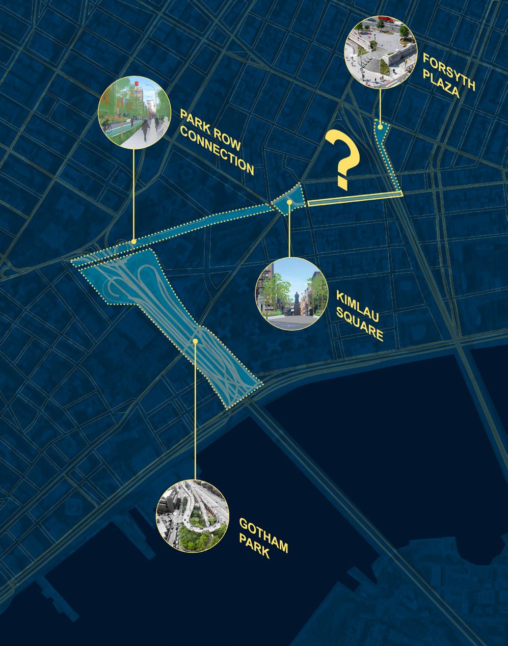
Here we envisioned a “kit of parts” to be deployed, including additional pedestrian lighting and directional lighting to illuminate sidewalks. Our working height for the facademounted fixtures also aligns with an opportunity to light up the underside of Manhattan Bridge on the east end of the block, creating a welcoming threshold, an “urban room” of light.
Manhattan’s Chinatown community has demonstrated remarkable resilience, from its emergence in the 1870s to the recent challenges posed by the COVID-19 pandemic. The intersection of grassroots initiatives like Light Up Chinatown, strategic investments through the DRI, and communitydriven design interventions exemplify the community’s commitment to preserving its heritage while embracing a vision for the future. As Chinatown navigates the path ahead, it stands poised to emerge stronger, more vibrant and interconnected than ever before.
Illuminating Chinatown’s Future
114
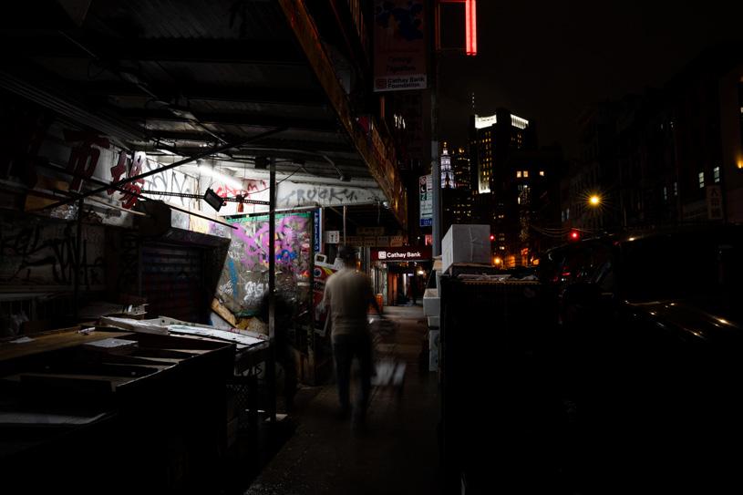
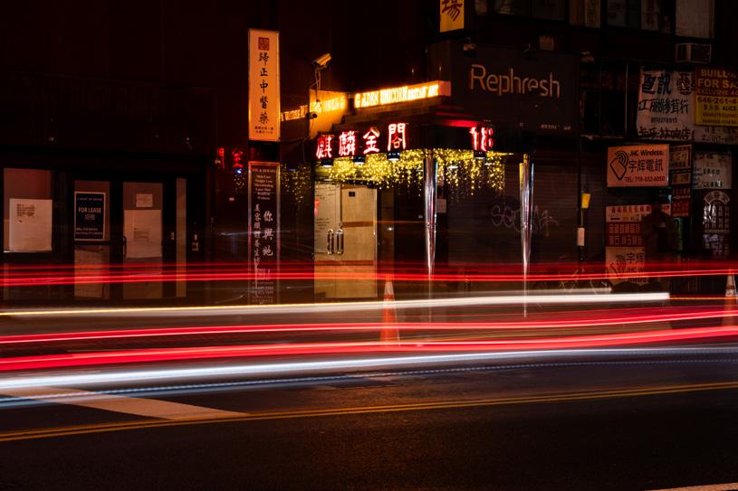
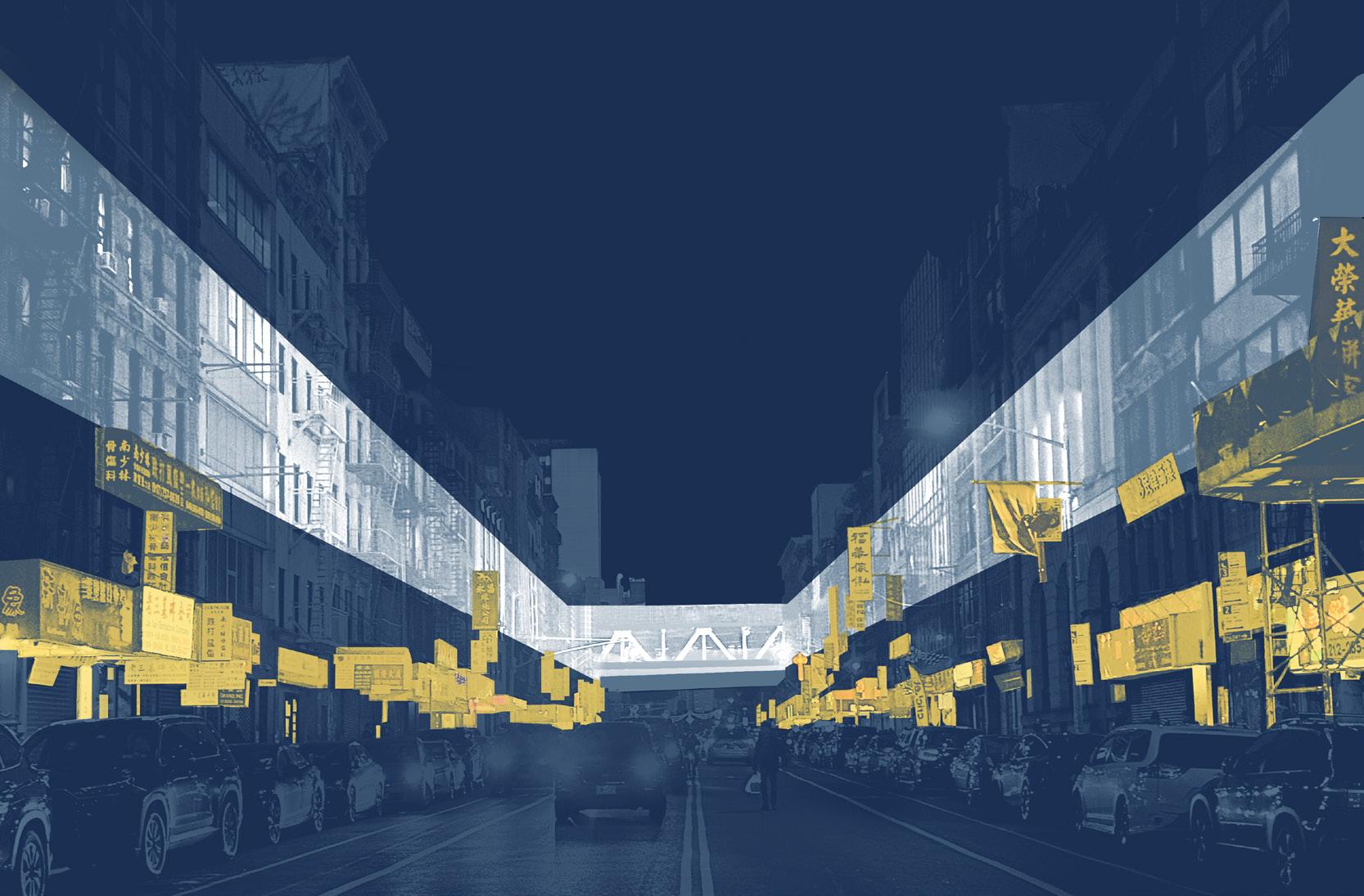
115
Lauren Kirk, SOM
The Symbolism of Destruction
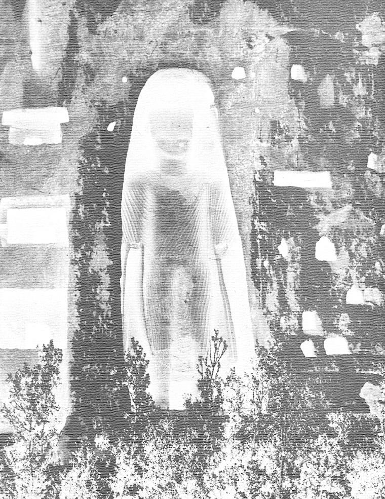 Words by: Sofia Ohmer
Sofia Ohmer is a graduate of the Institute of Fine Arts at New York University and currently works as a curatorial assistant in New York City.
116
Monuments commemorate various events, ideas, people, and values. “They recall good things and bad, achievements and catastrophes, victories and failures, noble persons and evil ones, benefactors and persecutors.”1 Evoking memories and communicating these “various figures and events in history that bind or divide,” monuments have a symbolic role in society.2 Not only depicting the good, one aspect of their presence is to remember the horrible moments of history. With this physical and visual way of remembering, the question of who and what should be valorized arises. Moreover, with the changing interpretations of past events and the reputation of people, due to the acknowledgment of social injustice, the meaning of monuments can shift. Thus, no monument will ever have a fixed interpretation, and the memorialization of the past can cause strong disagreement within communities. In recent times, the debate about the destruction of monuments, like the removal of Confederate monuments and memorials in the United States, has received much attention. However, the reasons for destruction vary, and they are always deeply interwoven in a larger societal context.
For religious, economic, or political reasons, destruction happens to “annihilate, challenge, eradicate and suppress the ideological and emotional attachments that are often connected to these historical monuments.”3 Political scientist John Sodiq Sanni sees the destruction of the past as critical and active forgetting.4 Whether historical monuments have a negative or positive impact on society, “they represent narratives that must be engaged rather than erased.”5 Instead of “freeing oneself from the past,” there should be an awareness and an authentic engagement with history.6 For him, only with “accurate knowledge of the past, present and future […] this awareness potentially opens.”7 Consequently, “the destruction of a historical monument is the destruction of human beings’ attempt to better understand their history.”8
For the independent researcher Janette Bicknell, however, the commemoration
Sofia Ohmer
of persons and events with monuments “seems to go hand in hand with the impulse of later generations to alter or destroy those commemorations.”9 Conveying a message to their viewers, all memorials can reinforce a certain sense of identity or set of values and increase or decrease public or individual respect for authority.”10 For this reason, the moral philosopher Geoffrey Scarre sees the act of memorialization in a world of opposing and plural values as a cause for controversial debates and arguments.11 Moreover, “the values they express or seek to inculcate are typically those of the “establishment” rather than of dissident or minority groups.”12 Not always guaranteeing a sympathetic reception, monuments can be harmful, even though they cause no physical harm. In times of war between two political opponents, the winning group will destroy the public monuments of the losing group, taking away a symbol of their cultural heritage. Over the last twenty years, increases in political instability have caused a rise in religious intolerance and nationalism. Resulting conflicts lead to the destruction of mosques, monastics, churches, and other religious institutions.13
Nevertheless, some destruction of monuments can lead to “a constructive dialogue about social values and ideals.”14 The physical presence of a monument, and in some cases, the celebration of past injustices, oppression, and intolerance that is depicted “challenge[s] the status quo” and gives attention to minority views that “perform a valuable social function.”15 Although “there is always a justification for the destruction of any monument” it is crucial to examine the reason behind the act.16
This essay will draw together the multiple reasons for destroying a monument and the symbolism of this demolition. By examining three monuments, the Berlin Wall in Germany, the Robert E. Lee Monument in the United States, and the Buddhas of Bamiyan in Afghanistan, the essay will give an overview of the destruction of famous yet otherwise strongly constating monuments and their story. Distinguishing between
the motives of their destruction, finally, in comparison, each case assists in identifying the different reasons behind the effort of destructing a monument and the various symbolisms surrounded by the act of tearing down these public structures, statues, and landmarks.
The Berlin Wall – Destruction Creating a Monument
For decades before the fall of the Berlin Wall in 1989, Germany was divided into the German Democratic Republic in East Germany (GDR) and the German Federal Republic in West Germany (FRG) by an almost insurmountable border. Today, the fragments of this monument symbolize the Cold War, and its “destruction [is] a symbol of its end.”17 After World War II, the four victorious powers France, Great Britain, the USA, and the Soviet Union, occupied Germany and agreed upon “four-power supervision of Berlin on 1 July 1945.”18 At that time, the Western victorious powers, France, the USA, and Great Britain joined forces and later formed the FRG on their territory. Under the communist Soviet occupation, the GDR was founded in the East.19 In the GDR, the Socialist Unity Party of Germany (SED) claimed all the power, imposed strict rules, and monitored people. Citizens were not allowed to oppose the SED government or leave the country. This hardline phase of party policy, accompanied by economic difficulties and the collectivization of agriculture, “led to a dramatic increase in the number of emigrants from East Germany.”20 At the climax of this crisis of “a development that had been going on for years” and to put an end to the escaping of its people from socialism, the GDR erected a “system of barricades” along the 1,400 km demarcation line “separating it from the Federal Republic.”21 From the whole span of the barrier, 40 km were inside the city. Structured to surround the total of West Berlin, the border “was not just a wall, but a whole military system.”22 It had watchtowers, water patrols, minefields, and so-called Todesstreifen, to make the crossing to the West even more deadly.23 In addition to
117
these visual deterrence techniques, the SED party claimed the wall was an ‘anti-fascist protection wall’ not to keep Easterners in but to keep Western influence out.24 Eventually, the German-German border ended through increasing pressure and the Peaceful Revolution of 1989. GDR citizens protested on the streets and demanded freedom of speech and free elections. Ultimately, the Peaceful revolution was successful and led to the fall of the Berlin Wall on the 9th of November 1989.25
Given its history, the Berlin Wall is an interesting case of the symbolism behind the destruction of a monument. Starting as a physical wall that was built to show “each side who they were, by creating a clear enemy, a clear image of what they were not,” its destruction made it a monument.26 The act of collaboration, tearing down the physical structure, changes the meaning of the wall from a tool of separation to a monument of unity. Together, people from East and West Germany, climbed the wall with pickaxes or crowbars, creating a collective memory through the joy of destruction. It was a moment “which allowed everyone access to fragments of a historical object imbued with historical significance.”27 Now, the remaining fragments of the wall are a significant monument in Berlin’s cityscape that commemorates this time of separation. Sections of it, like the Eastern Wall near the Oberbaumbrücke, were given to different artists and were overpainted, now known as The East Side Gallery. Others were sold to major Museums like the MoMA in New York and are spread out in more than 18 countries, making this history of Germany palpable around the world.28 However, some of the fragments stay untouched, like at the Berlin Wall Memorial site, to remember those, who lost their lives by trying to escape the GDR.29 Thus, the Berlin Wall and its still visible moment of destruction are a crucial element in understanding the city’s past and present. Starting as a wall to separate, its meaning changed into a historical monument, art canvas, and sculpture, full of symbolic meaning and collective memory that needs to be preserved.
The Symbolism of Destruction
The Robert E. Lee Monument –Liberation Through Destruction?
The Berlin Wall was a structure of oppression and became a monument of liberation through destruction. However, what if a monument glorifies a time of oppression? How does the symbolism of destroying these structures change? Moreover, what are the challenges and problems that come with handling these monuments? The active challenging of structures of oppression in the United States, especially with symbols of the Confederacy, increased after a white supremacist murdered nine people in a South Carolina church.30
Followed by the Police killing of George Floyd on May 25th, 2020, which reignited the struggle, massive Black Lives Matter protests erupted around the globe.31 In this fight for racial justice, many statues and monuments depicting persons who supported slavery and oppression were destroyed, removed, or vandalized, causing heated debates about how to treat these monuments. One of the first monuments that was a prominent part of this debate was the Robert E. Lee Monument in Richmond, Virginia. Its case shows the multiple aspects, problems, and questions that arise in handling Confederate status. Located in Richmond, the capital of the Confederacy from 1861 to 1865, the statue is placed in the state that contains most Confederate monuments.32 Moreover, the monument was erected in 1890, “a time when Confederate symbols provided a rallying point for advocates of racial segregation and oppressive Jim Crow laws.”33 It represents a time were white supremacist terrorism was at its height “with more than 1,000 Black Americans lynched during that decade […].”34 Thus, the monuments weren’t erected during the time of the Confederacy in 1861-1865, but around 35 years later to “preserve and perpetuate a narrow set of memories about the Confederacy.”35 Karen L. Cox, a historian specializing in Southern history, sees these monuments as symbols of white supremacy, and “to understand their history is to understand how white southerners memorialized men who fought
in a war to preserve slavery and created a “new” South that sought to limit the freedom of black southerners whose ancestors were enslaved.”36 For her, these monuments do not remember real history but reinforce a collective memory and values that maintain the Confederate culture.37 However, fighting these Confederate values is not easy as several southern states made laws to protect their ‘cultural heritage.’ Because some of these laws have proven to be insufficient, Donald Trump issued an executive order to criminalize vandalism against monuments in the United States in 2020, leaving local communities with no legal rights to make decisions about their monuments.38 Therefore, “monuments have been vandalized and toppled as never before in American history” simply because people have no legal way to do so.39
In relation to these events, widespread protest against racial injustice occurred in Richmond in 2020, and four Confederate statues, one of them the Robert E. Lee monument, were removed. Nonetheless, due to a lawsuit filed by a group of Richmond citizens, the Lee statue kept standing till it was finally taken down in September 2021, when Virginia’s Supreme Court dismissed the case and supported the removal.40 In December 2021, state officials and the city agreed to transfer the Lee statue and pedestal ownership to the Black History Museum and Cultural Center of Virginia, which also agreed to take possession of the other three Confederate monuments.41 The Black History Museum will work in partnership with the Valentine Museum and local community members to decide the future of these Confederate symbols.42 The pedestal of the Lee statue will be an “interesting challenge for the museums” since protestors used graffiti and transformed the granite plinth into “an internationally recognized symbol of the fight for racial justice.”43 In addition to this preservation challenge, some residents of the community had hoped the pedestal would “remain [in its original place] as a new kind of monument.”44 Even though it is not decided what happens to the Lee monument yet, Richmond’s deal with the
118
museums does not limit what they can do with the statues. Marland Buckner, the interim executive director, claims that the museum takes the responsibility to manage these objects very seriously and that they will “ensure their origins and purpose are never forgotten: that is the glorification of those who led the fight to enslave African Americans and destroy the Union.”45 Like proposed in Charlottesville with another Lee statue, one possibility would be to melt down the monument and create a new work of art. For Andrea Douglas, the executive director of the African American Heritage Center in Charlottesville, it “really is about taking something that had been harmful and transforming it into something that is representative of the city’s values today.”46 The museum will cooperate with Charlottesville residents to determine the art piece’s guidelines and the result will be gifted back to the city to be displayed in public in 2024.47 However, this idea also caused an uproar, and opponents filed a lawsuit against the city.48 This disapproval shows how complicated the handling of the statue is and how sensitive decisions must be made. How do we deal with monuments, which are sources of people’s pain, anger, and anxiety? Should vandalism and destruction be prevented? Do they need to be physically removed? How do we display them in museums or state institutions without further glorifying the histories they represent?
Art historian Erin L. Thomson doesn’t think it is surprising that “people are rebelling against the ideas that are represented by these statues today.”49 Throughout history, humans made monuments “and since we started making art, and since we started making statues, other people have started tearing them down.” 50 There is a symbolism behind taking down these monuments; by destroying or vandalizing them, people are attacking the person that is represented in the image. When statues get damaged, the people attacking them usually demolish them at the parts that would also be the most vulnerable parts of a real human being. Looking back at iconoclasm, many Roman statues have eyes gouged out, or the ears
Sofia Ohmer
cut off.51 The same symbolism of “attacking an idea” is happening with the destruction of Confederate monuments, people don’t just reject the monument and its values, they are “humiliating it.”52 For Thomson this may feel “very good in a way” but can be “potentially problematic.”53 Is there no liberation without active destruction? Still, the cases of destruction must be seen in proportion, and the destruction of these monuments is an exception rather than a norm. The number of erased Confederate monuments is small; only a few were removed from the nearly 800 Confederate monuments.54 In addition, preservation is expensive, and people pay to maintain these monuments. In 2018 the Smithsonian magazine published an article about the cost of Confederate monuments and found out that in just ten years, more than 40 million dollars were spent on their maintenance.55 Additionally, statues are all in public spaces “claiming that this version of history is the public version of history,” subsequently the public should decide what to do with them.56 Apart from that, destroying a monument does not mean erasing its history; the monuments and their story can be told in books, pictures, and movies and will continue to exist. The removal of these monuments does “not remove the systematic racism with which [they have] long been associated. It is a symbolic act only, although it may also serve as an important first step.”57 The more challenging work is dismantling racism and confronting racial inequality in the community. Nevertheless, these “current attacks on statues are a sign that what’s in question is not just our future but our past, […] as a nation, as a society, as a world.”58
Buddhas of Bamiyan – Destruction as a Form of Oppression
Destructing the Lee monument is an attempt to eliminate the glorification and memorialization of an oppressor. However, what if the oppressor is the operator of the destruction? Looking at the case of the Buddhas of Bamiyan in Afghanistan, the destruction of cultural heritage becomes a weapon of terrorism and therefore is loaded with a different symbolism. The Buddhas
are known as “Salsal, the Western Buddha, and Shahmama, the Eastern Buddha.”59 Untilill 2001, the two statues, carved into the cliff, looked over the Bamiyan valley, one 55 meters tall and the other 38 meters tall.60 Erected around the 6th- 7th centuries, the colossal monuments were the largest Buddha statues on earth till their destruction.61 Their importance goes beyond Afghanistan as they marked the farthest point where Buddhism reached the West. As a holy site for Buddhists, the area and surrounding caves on the cliff “were once home to Buddhist monasteries and sanctuaries”.62 Moreover the Bamiyan valley was a significant site located between the commercial trading route from India to China.63 Now, where these majestic figures once stood, is nothing but an empty cliffside.
On February 26, 2001, the leader of the Taliban Mullah Muhammad Omar ordered “the elimination of all non-Islamic statues and sanctuaries in Afghanistan”, committing a “spectacular attack against their historical and cultural heritage.”64 Many Western countries, moderate Muslim clerics, and heads of neighboring states tried to convince the Taliban not to execute their plans of destruction. Trying to preserve cultural heritage and religious tolerance, UNESCO pleaded that the Taliban should distinguish between “idolatry and exemplarity — between a secular admiration and an idolatrous veneration”.65 Other arguments were that these statues could benefit all religions and “insisted on the exemplarity of piety.”66 Additionally, some museums like the Metropolitan Museum of Art in New York and Buddhist states like Iran, Thailand, and Sri Lanka offered to buy the statues in the hope of saving them from their elimination.67
All of these attempts failed, and even though the Taliban were under international pressure, they labeled them un-Islamic and took them apart with heavy explosives.68 With Rockets and tank shells, the destruction of the Buddhas was then issued in a public announcement on March 14th, 2001.69 The argumentation of the reasons behind the destruction was ideological and
119
political. According to the Mullah, there was no need to preserve false idols if they “don’t have a single Buddhist in Afghanistan.” Moreover, the Taliban regime was upset by the Western effort to save statues when the country needed money to feed its people. An adviser to the Taliban leader, Mullah Muhammad Omar, Mr. Rahmatullah said to the New York Times with no regret of the destruction: “What do you expect from a country when you just ostracize them and isolate them and send in cruise missiles and their children are dying?”70
Since the Taliban took over Afghanistan again in August 2021, they have tried to present a softer image regarding the treatment of cultural heritage. Nowadays, they are running the site as a tourist attraction, and for around 5 Dollars, people can wander around the empty caves. They are faced with “economic and security challenges of governing the country after years of insurgency and are also under pressure from international organizations to protect Afghanistan’s cultural heritage.”71 Furthermore, UNESCO declared the Bamiyan Valley a World Heritage in Danger in 2003. Right now, they are trying to preserve the area and what is left of the Buddhas for future generations.72 This is crucial since the areas around the Buddha niches are victim to illegal construction, excavations, and looting, threatening a complete decay of the site.73 Laeiq Ahmadi, a former head of the archaeology department at Bamiyan University, thinks that the Taliban’s actions now are a “silent explosion.”74 History is not thought objectively and “arts that are against their beliefs are being stored in museums’ basements and erased from memories.”75
The destruction of the Buddhas of Bamiyan was an act against human history. Now, the empty niches function as a memorial in the present, communicating the absence. On a political front, their destruction, and the destruction of some other historical monuments, has been used as “propaganda intended to eradicate the history of a past regime and the cultural memories associated with these monuments.”76 The destruction of these monuments takes
The Symbolism of Destruction
away important cultural heritage. It can “destabilize the psyche of the ‘opponents’ and make them think that there is nothing left of their idolized past.”77 Another reason is the sole motive of hegemony; the destruction helps to establish a new ideology and is a means to gain control over some regions of the country. However, there is also light in the recent history of the Bamiyan Valley, and two documentarians brought the statues back to life in 2016, creating a 3D light installation showing them in their true size and glory.78 In the same year, Zahra Hussaini, an archaeologist and artist, organized “A Night with Buddha.” Every year, on the anniversary of the Buddhas’ explosions, she raises awareness of the importance of protecting cultural heritage sites.79 It shows that even in the darkest moments of destruction, the emptiness can be filled – although it will never be the same.
Comparison & Conclusion
“We cannot talk about monuments without talking about human history.”80
Sculptures, landmarks, and monuments tell our human history. They illuminate all sorts of human encounters, the good ones, and the bad ones, and when they get destroyed, a part of history gets erased. Because of this, it is essential to understand the different reasons for monument destruction and the symbolism that these acts hold. The Berlin Wall, the Robert E. Lee monument, and the Buddhas of Bamiyan showed some of the different reasons behind the destruction of a monument and the symbolism behind this destruction. The Berlin Wall was created as a physical structure to separate the East from the West, its destruction transformed it into a monument. The memory of tearing down the wall marked a day of collective history and memory. Nevertheless, the leftover structures in Berlin remember a time of separation.
A case where destruction is not always warranted or never warranted is the Robert E. Lee monument in Richmond, standing for a complex debate about the handling of Confederate monuments in the United
States. Confederate structures were vandalized or destroyed in recent years to overcome these figures of oppression and to point out a history that is still deeply rooted in the South. The intense reactions and legal cases show that the handling of these monuments raises complicated issues. In the end, it is hard to tell if destruction is the solution but it can be seen as a symbolic act of liberation, which raises awareness of the ongoing racial injustice in the United States and around the world.
On the contrary, the attack of the Buddhas of Bamiyan is not used as a form of liberation but a means of oppression. Destroying the symbols of other religions to create a hegemony is a terroristic act and can be seen as a form of contemporary iconoclasm. What is left is an empty niche and damage that can never be restored. Nevertheless, the 3D projections and the annual remembrance show a creative way of trying to keep a seemingly lost history alive. Moreover, the emptiness left behind in the stone niches is a new monument and history in itself. Since our history is a history of humans, all these monuments show that their meaning is not a static one but changes over time. They remember and depict the past, and therefore are crucial in understanding our present and future.
120
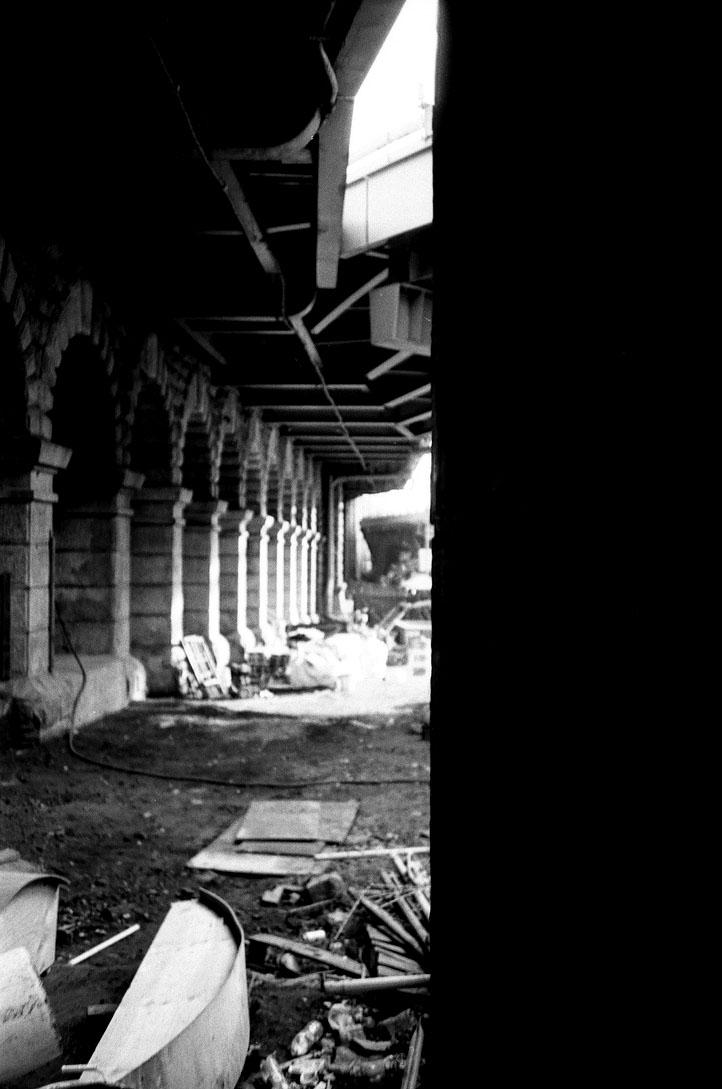
121
Under the Arches I and II (2023). Photos by: Olivia Jia
Hotel Saadiyat: Architecture and the Ideology of
Tolerance in Abu Dhabi
Words and images by: Izzy Kornblatt
Izzy is a critic and historian. He is a contributing editor at Architectural Record and is pursuing a Ph.D. in the history and theory of architecture at Yale.
122
In November 2008, a group of government officials, journalists, guests, and schoolchildren gathered in a landscaped median in front of a row of stately government buildings on the edge of Abu Dhabi Island.1 Immediately behind them stood the diwan of Sheikh Mohamed bin Zayed Al Nahyan, then the crown prince of Abu Dhabi; Mohamed was not himself in attendance, but there on his behalf were two of his children, seven-year-old Sheikha Hassa and her younger brother Sheikh Zayed. The group had gathered for the dedication of a nine-piece sculpture by the French artist Guy Ferrer: a set of eight-foottall bronze letters set atop five-foot podiums spelling out “T-O-L-E-R-A-N-C-E.” Each letter takes the form of a person or people in a different pose, and each, according to Ferrer, represents a different global faith. In Ferrer’s description, “Mysterious and grave, nine emissaries invite you to meet them, to respect their differences and the beliefs they suggest. Joined together on the same site, they speak to us of encounter and harmony, of peaceful completeness.”2
After a performance by Bedouin folk dancers, Hassa helped unveil the first letter, a rather imposing “T.” Children from around the world waved a variety of national flags. Emirati poet Karim bin Matouk read a poem he had been commissioned to compose for the occasion. In a speech, Sheikh Sultan bin Tahnoon Al Nahyan, a relative of Mohamed and the then-chairman of the Abu Dhabi Authority for Culture and Heritage, described the sculpture as emblematic of how Abu Dhabi’s leaders “put the people at the center of what we do.”
Some fifteen years later, the rhetoric of tolerance has only escalated in frequency and prominence in the United Arab Emirates. In 2016, the country established a federal Ministry of Tolerance, which has since been renamed the Ministry of Tolerance and Coexistence and is now led by another relative of Mohamed, Nahyan bin Mubarak Al Nahyan.3 In 2017, after ten years of planning, the Jean Nouvel-designed Louvre Abu Dhabi opened its doors, inaugurating a vast set of galleries that tell a sunny tale of universal human history and preach the necessity of coming together around shared values.4 Two years later, the UAE declared 2019 the “Year of Tolerance” in part to honor Pope Francis’s landmark visit to the country,5 and the following year, the UAE agreed for the first time to establish diplomatic relations with Israel.6 In 2022, following the death of his long-ailing half-brother Sheikh Khalifa bin Zayed Al Nahyan, Mohamed—long associated with the tolerance ideal—ascended to the UAE presidency. Less than a year afterward, in early 2023, the Abrahamic Family House, a religious complex designed by David Adjaye that includes a mosque, a church, and a synagogue arranged together on a plaza in an explicit symbol of religious harmony, opened near the Louvre.7
Indeed, nowhere is the ideology of tolerance more evident than on the twenty-sevensquare-kilometer Saadiyat Island (“island of happiness” in Arabic), the site of one of the largest developments of arts and culture facilities in the world that includes both the Louvre and the Abrahamic Family House. Located to the north of Abu Dhabi
Island, to which it is linked by a single, tenlane highway bridge completed in 2010,8 Saadiyat has been selected to play the role of a literal sandbox for the UAE’s leadership— an unbuilt space in which to experiment with the import of both institutions and architecture from the rest of the world in the name of Emirati hospitality and tolerance of cultural differences. In addition to the Louvre and Abrahamic House, Saadiyat plays host to the Abu Dhabi campus of New York University, designed by Rafael Viñoly, which was completed in 2014,9 a music center affiliated with Boston’s Berklee School of Music, the Manaret Al Saadiyat arts center, and several luxurious mixeduse developments. Still under construction are a Frank Gehry-designed branch of the Guggenheim Museum; the Norman Fosterdesigned Sheikh Zayed National Museum, which, thanks to a long-term agreement renewed in 2018,10 will exhibit several objects from the collections of the British Museum; a museum of natural history designed by the Dutch firm Mecanoo;11 and a large, futuristic building that will house an interactive digital exhibition by the Japanese studio TeamLab.12 Together, these projects promise to turn a substantial chunk of the island into a glittering collection of symbols of elite global culture: museums from America, Britain, and France, a digital experience from Japan, religious buildings understood to represent Israel, and the Vatican, an American university. The Sheikh Zayed Museum’s location at the physical and symbolic center of the Island’s cultural district makes the intended hierarchy clear. The Emirati leadership, Saadiyat wants to say, has enabled the coming together of the
... If the act of giving ideology spectacular built form is on one level effective at distracting from the state violence that underlies Abu Dhabi’s political and economic system, on another it reveals a broader conception of how cultural difference can be defined as subject to strict state control.
Kornblatt
Izzy
“ ”
123
“finest elements of global culture” under the watchful eye of the sheikhs.
The significance of the ever-growing emphasis on “tolerance” on display at Saadiyat is multifold. First, against the backdrop of the precipitous rise of Islamophobia in Europe and the United States that followed the September 11 attacks, Emiratis have felt pressed to rehearse a constant disavowal of religious extremism. The Orientalist discourse that creates the opposing categories of the “good Muslim” and the “bad Muslim”—and forgets the United States’ role in backing fundamentalist groups during the Cold War—has forced the UAE to proclaim its membership in the former group.13 Casting itself against Orientalist projections of the Arab world in this way has been an important strategy for the UAE in positioning itself as a destination for business and tourism (particularly in contrast to neighboring Saudi Arabia), and has also helped ensure ongoing American and European military assistance. It has also served to deflect criticism of the UAE’s autocratic and often repressive government: it marshals the promise of peaceful multiculturalism to justify the continuance of monarchic rule. (The ruling sheikh of Abu Dhabi serves as the country’s president, and the ruling sheikh of Dubai serves as its vice president.)
But the tolerance ideal is more than a signal to the external world; it is more than statecraft and more than propaganda. It is rather one element of a broader understanding of culture that emerged in the Emirates in tandem with the influx of a population of non-citizens, most of whom are laborers at different social and economic strata, that now outnumbers citizens nine to one. The roots of this demographic situation lie before the UAE’s independence from British rule and formation as a federation of emirates in 1971: the discovery of oil and pressure to extract it exerted by the British in the late 1950s and early 1960s imposed the will of a vast apparatus of corporate interests on an Abu Dhabi that at time counted just 20,000 inhabitants, leading to the formation of an economic system in which workers drawn from abroad—today primarily from South Asia—fill virtually all
private-sector jobs.14 The entrenchment and expansion of this system of governance and labor organization have accompanied the development of social, political, and economic structures that address themselves to regulating and perpetuating the fundamental division between citizens and the multiple classes of non-citizens upon which the entire system relies—and “tolerance” lies not far from the ideological center of the project.
It is tolerance as ideological justification that has been and continues to be dramatized, spatially and architecturally, on Saadiyat Island. Through architecture, Saadiyat renders this ideology transparent and open to spatial analysis: if the act of giving ideology spectacular built form is on one level effective at distracting from the state violence that underlies Abu Dhabi’s political and economic system, on another it reveals a broader conception of how cultural difference can be defined as subject to strict state control. The relationship between the foreign institutions of Saadiyat Island and the Sheikh Zayed Museum around which they are arrayed becomes a synecdoche for the larger spatial relationships between the various existing areas of Abu Dhabi and the new Capital District proposed in the Plan Abu Dhabi 2030 city plan.
Though the notion of developing the island dates at least as far back as 1988, as recorded in a city plan prepared by UNDP and Atkins, formal arrangements did not get underway until the 1990s, when Abu Dhabi leaders decided to pursue turning the sandcovered island into a new financial center for the country.15 But before development could begin in earnest, Dubai eclipsed Abu Dhabi as a financial center and Saadiyat remained undeveloped; it was not until 2004 that the Abu Dhabi Tourism Authority announced the first iteration of the project now still underway—the transformation of Saadiyat centered around a new cultural district consisting of institutions operated in partnership with famed museums and performing arts centers elsewhere in the world.16
The initial master plan for the island was the work of Gensler, and in addition to the
cultural district, which would occupy the island’s western third, it also proposed large mixed-use developments projected to house 150,000 people and various green spaces.17 To make the island accessible, Abu Dhabi’s planning authorities proposed running an east-west highway across it, linking Saadiyat with both Abu Dhabi Island and Jubail Island; another highway was to branch off to the south near the center of Saadiyat, linking back to Al Reem Island.18 Apart from these large-scale moves, the details of Gensler’s plan remain murky; the specifics of what was proposed outside the cultural district, if they were ever enumerated, are not readily available. But beyond establishing a general pattern of land use, the plan is perhaps most notable for proposing the placement of each cultural institution on its own man-made peninsulalike landform, surrounded on three sides by water—a motif that has continued in subsequent Saadiyat developments. (The most proximate source for this motif could be I.M. Pei’s Museum of Islamic Art in Doha, Qatar, which stands above the harbor on an artificial island connected to the city by a set of bridges, and which began construction around 2003.19) In a memorable Gensler rendering, the institutions appear like a string of shiny pearls along the shore, designed above all to be visible from across the water.20
By early 2007, when plans for the cultural district were unveiled to much fanfare, Gensler’s plan had been updated by Skidmore, Owings & Merrill with the addition of a winding canal lined with smaller cultural pavilions.21 At the unveiling, architectural designs were also revealed for most of the major cultural institutions, each of which, as Gensler had proposed, would jut out over the water: Gehry’s Guggenheim at the easternmost tip, Nouvel’s “classical museum” not far south, then Hadid’s performing arts center, then Ando’s maritime museum. Apart from Hadid’s abstract, geometric proposal, reminiscent of her Guangzhou Opera House, each of the other three projects was marketed as combining regional motifs with contemporary ideas. Gehry claimed his proposal, with its irregular conical forms, referenced traditional wind towers; Nouvel
Saadiyat: Architecture and the Ideology of Tolerance in Abu Dhabi 124
Hotel
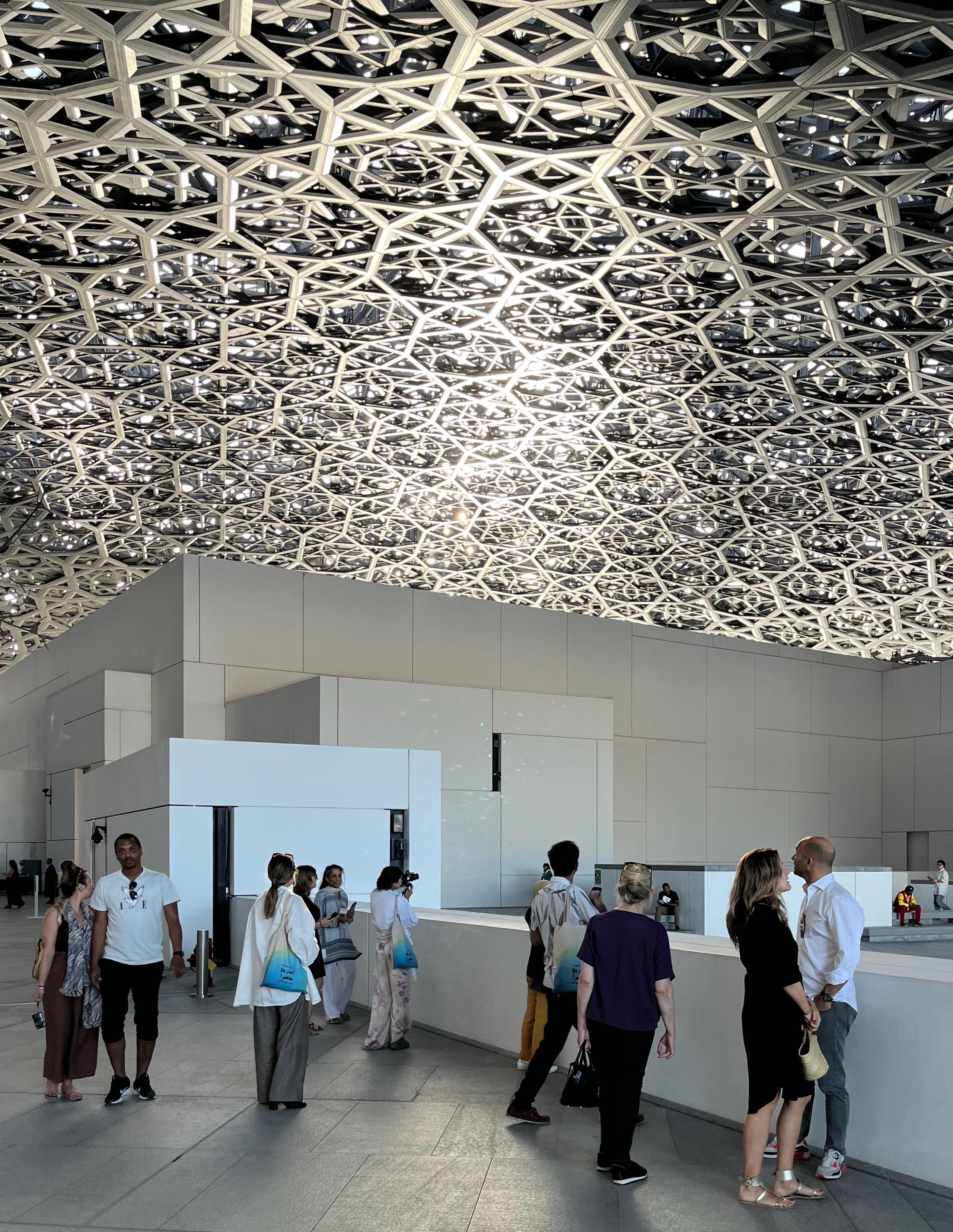
“
Whereas Koolhaas and Zenghelis sought to subvert the values dominating both architecture and city politics in 1970s New York, and partially as a result never came close to realizing any part of their proposal, the architects of the Saadiyat cultural institutions have been able to realize their architectural fantasies on a vast scale precisely because they are anything but subversive.
”
Izzy Kornblatt
125
likened his complex of small buildings under a vast dome to a desert oasis; Ando argued that the enormous block with a large cut-out that he proposed placing over a reflecting pool suggested the form of a dhow.22 New York Times architecture critic Nicolai Ouroussoff cheered the development, arguing that thanks in large part to these designs’ rootedness in their regional context, “the buildings promise to be more than aesthetic experiments, outlining a vision of cross-cultural pollination.”23
But, with each institution representing its own imported vision of culture on its metaphorical island, and with all the institutions clustered together on a literal island, away from the rest of the city, where exactly was cross-pollination to be found? The sunny narratives promulgated by the architects (and, in this case, the supporting critic) praise the ideology of tolerance while accidentally or deliberately ignoring how the projects perpetuate an unequal status quo. Ahmed Kanna, writing on Dubai, describes the relationship of foreign architects to the Emirati context in apt terms:
Contrary to the myth of the autonomous architect, starchitects seemed to be greatly and unwittingly influenced by local political and symbolic structures that had evolved to justify family-state political domination…. [S]tarchitects and various other kinds of urban experts in effect practiced a representational politics that articulated all too well with the local politics of antireformism, authoritarianism, and ethnocracy. Architectural and spatial forms came to echo the contours of local familystate hegemony and the ruling bargain ideology.24
On Saadiyat, the grand institutions, each with its distinctive form, valorize the notion of tolerance as the controlled display of cultural difference. In the celebratory architectural spectacle, it seems all too easy to overlook the fact that only select elements of select cultures are placed on display, having been carefully sanitized, stripped of any subversive content, and cleared for consumption by the authorities. It is no accident that Saadiyat’s institutions proclaim their connections to Europe, North America, and Japan; and that the rest of
the world is left out of the display. At the metaphorical Hotel Saadiyat, the Emirati authorities roll out the red carpet for the elite cultures of the Global North, while the cultures of the Global South—the cultures of those who build, operate, and maintain the edifice—are kept out of sight.
Subsequent shifts in plans for Saadiyat offer further fuel for this reading. Just a few weeks after the initial plans were unveiled, Abu Dhabi leaders signed an agreement with France enabling the Nouvel-designed museum to take on the Louvre Abu Dhabi brand25—an imprimatur of elite status if ever there was one. Today, the Louvre is open, as are several subsequent additions to the island; the Natural History Museum and TeamLab digital exhibition center have taken the place of Hadid’s and Ando’s proposals, and are now taking shape by the waterfront southeast of the Louvre. Though plans have changed repeatedly—SOM’s canal appears to have been eliminated, for example—the spatial logic of the cultural district that is now taking shape is obvious: each foreign-affiliated museum remains isolated along the shore, but now all revolve around the Zayed Museum at the center.
Seen in the context of the Abu Dhabi 2030 city plan, which was also revealed in 2007, Saadiyat takes on an additional layer of significance. Plan Abu Dhabi 2030 proposed the creation of two urban centers—the existing downtown near Saadiyat, occupying the coastal portion of Abu Dhabi Island, which was to become an expanded commercial center, and a new “Capital District” replete with Beaux Arts-style radial boulevards to house governmental institutions, which would be located several miles southeast on the mainland. The division is anything but subtle. As a former employee of the city’s planning department told Alamira Reem Bani Hashim in an interview,
The double-centered dumbbell of Plan 2030 was one of the things that made it different than the other plans I looked at… [I]t’s a two-centered city, that is connected efficiently by multiple transit connections, and those centers serve two different functions. One is government, healthcare,
and education; one is business and financial. And another way to look at that is, Emirati-Expat.27
In this scheme, the separation between foreign-affiliated museums along the shore and the Sheikh Zayed Museum inland which is visible on Saadiyat becomes the spatial logic of the entire city. The western, coastal zone of Abu Dhabi Island, along with Saadiyat Island and Al Reem Island, are seen as foreign-dominated areas, while the eastern zone of Abu Dhabi Island the various inland districts are seen as Emiratidominated areas. This proposed bifurcation reifies the existing tendency toward segregation of housing, which has seen the vast majority of Emirati nationals move to private villas on government-granted inland land while expatriates have tended to remain in apartments on the western end of Abu Dhabi Island. It makes clear that while Saadiyat itself remains in the “expat” zone, the ideological proposal it presents extends far beyond its shores to encompass the entire city.
The Capital District proposed in the 2030 plan is now under construction, though it has been renamed Zayed City and it remains unclear which government agencies will ultimately move to it.28 Abu Dhabi leaders may not want to abandon the historic western zone of Abu Dhabi Island entirely— especially given that it is the site of most of the city’s history and that it houses some of the largest of the Al Nahyan family palaces. Even so, the translation of “tolerance” into the segregation of urban space shows no signs of abating: the logic of Saadiyat is the logic of Abu Dhabi’s development in the 21st century. Under most likely development scenarios, constructed ideas of the “local” and the “foreign” will continue to be placed in deliberate contrast, a picture of spatial harmony under autocratic control, and all the rest—from the labor camps that are essential to the emirate’s functioning but are effaced in official representations of the city like the 2030 plan, to the various forms of local and foreign culture that are identified as threatening to the state—will be swept out of sight.
126
Hotel Saadiyat: Architecture and the Ideology of Tolerance in Abu Dhabi
In an unsettling twist of fate, the architects and planners at work on Saadiyat have realized the ambitions laid out in Rem Koolhaas and Zoe Zenghelis’s 1972 speculative proposal for the development of Roosevelt Island in New York: they have filled an island with the structures and institutions that could not or would not have been built on the mainland. But there is a Faustian bargain at work on Saadiyat. Whereas Koolhaas and Zenghelis sought to subvert the values dominating both architecture and city politics in 1970s New York, and partially as a result never came close to realizing any part of their proposal, the architects of the Saadiyat cultural institutions have been able to realize their architectural fantasies on a vast scale precisely because they are anything but subversive. They are, in the end, little more than the letters of Guy Ferrer’s “tolerance” sculpture blown up in scale and installed along the shoreline. Behind them, in place of Sheikh Mohamed’s diwan, will stand the even grander Zayed Museum: ideology hides in plain sight.
I am grateful to Kishwar Rizvi for her guidance throughout this project and for her incisive comments on this paper.
Izzy Kornblatt
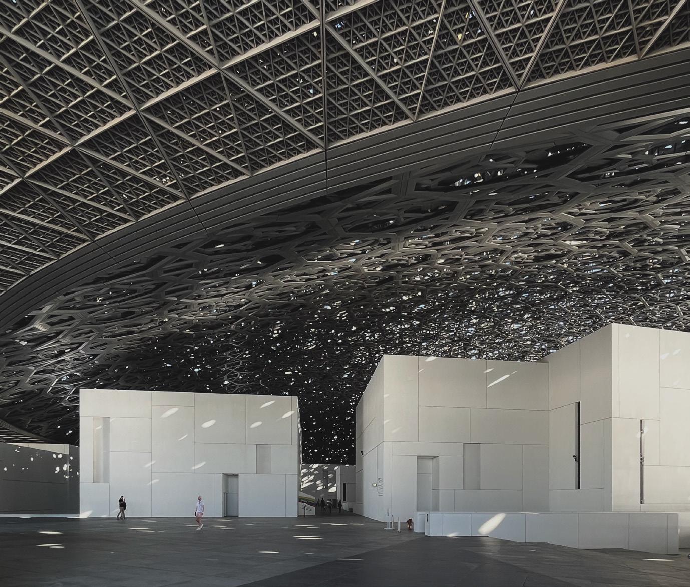
127
Unveiling the Fog of Artificial Impact
 Words by: Tiara Hughes
Tiara Hughes, Commissioner at the City of Chicago Landmarks Commission, is a seasoned urban designer and founder of FIRST 500, dedicated to shaping the built environment for positive social change.
128
Diversity and inclusion have become buzzwords across industries and communities, and rightly so. The call for greater representation, equity, and genuine inclusion has never been more pronounced. Yet, beneath the glossy surface of many organizations, from university campuses to corporate boardrooms, a phenomenon prevails that can best be described as the “Fog of Artificial Impact.”
To understand the “Fog of Artificial Impact,” we must first define it. This fog is characterized by a series of superficial actions that feign dedication to change while perpetuating the illusion of progress. Universities, as influential institutions, often contribute to this phenomenon through a series of performative actions employed by organizations, motivated by a desire to appear committed to diversity, equity, and inclusion. Yet, beneath these actions lies a lack of substance—efforts that create the appearance of change without truly challenging the status quo. The fog’s presence is most evident within university campuses and continues to permeate the professional world, creating a discord between rhetoric and reality. It is not enough for organizations to speak of diversity and inclusion; they must act on these principles in ways that make a tangible difference.
University campuses, regarded as beacons of progress and enlightenment, are not immune to the fog. While universities make commitments to diversify their faculty, staff, and student populations, the actual achievement of these goals is often superficial. The aftermath of George Floyd’s murder posed a critical juncture for universities; some responded by appointing diverse leaders and engaging in symbolic demonstrations of solidarity. However, the fog persisted as some of these leaders found themselves in precarious positions serving as symbolic markers of inclusivity,
Tiara Hughes
rather than as valued contributors to the institution. The fog thickens when these individuals face a lack of genuine support and mentorship, which can ultimately lead to their premature departure, reinforcing the status quo.
Adjunct faculty members, often the largest segment of the faculty body, are frequently the primary source of faculty diversity within educational institutions. Unfortunately, they typically lack the job security of tenure and have limited opportunities for advancement within their respective organizations. Essentially, they are contingent workers in the higher education landscape, similar to how Uber drivers are within the gig economy. Meanwhile, full-time, tenured faculty, who are predominantly white, enjoy the protections of tenure including job security, higher incomes, and access to comprehensive benefits.
This performative nature extends to student demographics, where universities emphasize diversity in promotional materials while failing to mirror these ideals in the classroom. This discrepancy can leave students of color feeling isolated and unsupported, contributing to higher dropout rates among minorities.
The fog doesn’t dissipate as students transition from campus to career. In fact, it often
follows them, shaping their expectations and experiences in the professional world. Students who have been exposed to performative diversity and inclusion during their academic years may carry inflated expectations into their careers. They may anticipate workplaces that are more inclusive and equitable than they actually are, setting the stage for disillusionment. The performative actions students encounter in university settings can perpetuate systemic disparities. When they enter the workforce and find that the same performative attitudes persist, they may be less inclined to challenge these inequities, having been conditioned to accept the illusion as reality.
The fog also radiates outward, from within the campus community to the larger geographies housing these universities. Universities often engage in performative community outreach and engagement, conducting initiatives for the sake of appearances. Instead of addressing the unique needs and aspirations of local communities, especially those of diverse and underressourced backgrounds,
129
these efforts can be superficial, leaving community members feeling unheard and unserved.
Nevertheless, there are also those who, having developed a real commitment to diversity and inclusion during their academic years, become agents of change in their professional lives. These individuals can be catalysts for change, pushing for authentic equity in their workplaces and challenging the fog wherever it lurks. Even with the spark for change, the battle is strenuous and burdensome for those individuals.
It’s clear that the “Fog of Artificial Impact” requires universities to undergo a transformation that attacks the phenomenon from all angles. This journey begins with universities taking ownership of their role in perpetuating the performative narrative. It involves a holistic approach to inclusion that extends from faculty recruitment to student support, fostering environments where diversity is more than a façade. A multidimensional approach is needed and the following steps can be taken moving forward:
Unveiling the Fog of Artificial Impact
Genuine Mentorship:
Academic institutions should invest in structured mentorship programs that honestly support diverse students, faculty, and staff. Mentorship in the form of structured programming and more importantly an open door policy to first hear them out and provide what they need. This support should not be performative but instead provide guidance, opportunities, and empowerment to thrive.
Transparent Accountability:
Universities and organizations alike must establish clear diversity objectives for both their faculty and student populus, track progress diligently, and communicate transparently about their actions. Only through true accountability can the fog be dispelled.
Curricular Reformation:
Overhaul course materials and promote a diverse curriculum that reflects the multifaceted perspectives of our society. Materials should include diverse perspectives, histories, and voices in all forms of media (books, articles, videos, lectures, etc.). The representation of marginalized communities should not be a mere token, but an integral part of the learning experience.
Community-Centered Engagement:
Considering the proximity of most universities to communities, engagement and interactions with communities should be driven by the actual needs and aspirations of the communities involved. Institutions should foster sincere collaboration with the locals to address their unique needs and co-create solutions.
Long-Term Dedication:
A commitment to diversity and inclusion must extend beyond the superficial short term wins. Even though these outcomes contribute to progress, significant change takes time and dedication. Universities and organizations should be prepared for the long haul, eschewing performative gestures for lasting transformation.
The “Fog of Artificial Impact” is a powerful and persistent phenomenon that casts a shadow over our educational institutions and professional spaces. The route to an equitable, fog-free future is undeniably complex, but it is surmountable. This challenge requires a nuanced and multifaceted response. Through a longterm, steadfast commitment to genuine, measurable diversity, equity, and inclusion, universities can rise as bastions of authentic transformation. The academic arena, instead of serving as a breeding ground for the fog, can become a beacon of progress and inclusion. Furthermore, introducing students that will lead the way into a world characterized by an equitable metamorphosis within both academia and the broader professional realm.
130
“
The “Fog of Artificial Impact” is a powerful and persistent phenomenon that casts a shadow over our educational institutions and professional spaces.
The route to an equitable, fog-free future is undeniably complex, but it is surmountable.
”
Tiara Hughes
131
Dragons on the Landscape
Endemic Fauna & Forms of Volcanic Governance
Words and visuals by: Oscar M. Caballero Oscar is a New York based Nicaraguan architect, researcher, artist and assistant professor at GSAPP, Columbia University.

132
Seen from above the volcanic range—19 volcanos strung across the Pacific coast of Nicaragua—, it feels as if one is looking at fire-breathing beasts in a precarious sleep, awaking every so often with a tectonic symphony waving the land as in liquid matter. The Mesoamerican landscape fluctuates somewhere between myth and reality. Indigenous legends are of paramount importance to understanding the human connection to nature, fauna, climate, and other earthly forces such as volcanoes. Its territory has cohabited with volcanic lands by its ability to adapt. In this land of volcanoes, animals play an outsized role, whether in traditional dances, nature reserves, or the Masaya Volcano.
In the pre-Columbian Mesoamerican territory, animals had a cultural role beyond agriculture and farming. Indigenous people would express their appreciation of animals with powerful and divine qualities such as jaguars, panthers, snakes, and mesmerizing birds through pictorial elements, paraphernalia, and the crafting
of mythological literature. Native fauna was often painted, carved and even sculpted on mediums of architectural character such as stone trails, cave walls, and, later, buildings. These practices developed a profound connection between memory and architecture that has prevailed until the present day. The landscape animal presence would trigger legends about lagoons and volcanic mythology, the naming of regions, and religious beliefs. Nevertheless, during the colonization period, the European cosmovision regarded the native culture as pagan mythical folklore.
The colonial mestizaje blended the new Catholic rituals with indigenous practices in a slow amalgamation of customs, often featuring animals in a new way. For example, the satirical drama “El Güegüense o Macho Ratón,” proclaimed by UNESCO as a masterpiece of the Oral and Intangible Heritage of Humanity, revolves around encounters between Spanish authorities who wear masks with Caucasian features and Native people who wear horse masks.
The Indigenous dancers maneuver clever ways to challenge the colonial authority. The use of a horse mask represents a metaphorical abstraction of wild horses that resist captivity.
A Liquid Country
Countries with high volcanic activity such as Nicaragua are constantly in flux. The geological movement triggers motions of geographic, political, urban, and architectural collapse. This cycle of territorial renewal maintains an intriguing ephemeral state on the landscape. In his foreword to Sabrina Duque’s VolcáNica: Crónicas de un país en erupción, Nicaraguan writer Sergio Ramírez describes the nation as a territory that is yet to be geologically transformed. He establishes a parallelism between geography and history, by the seismic affairs that shake the underground realm and the political revolutions on the surface that have caused a different type of turmoil, both with dreadful consequences. One could perceive Nicaraguan geography as a liquid
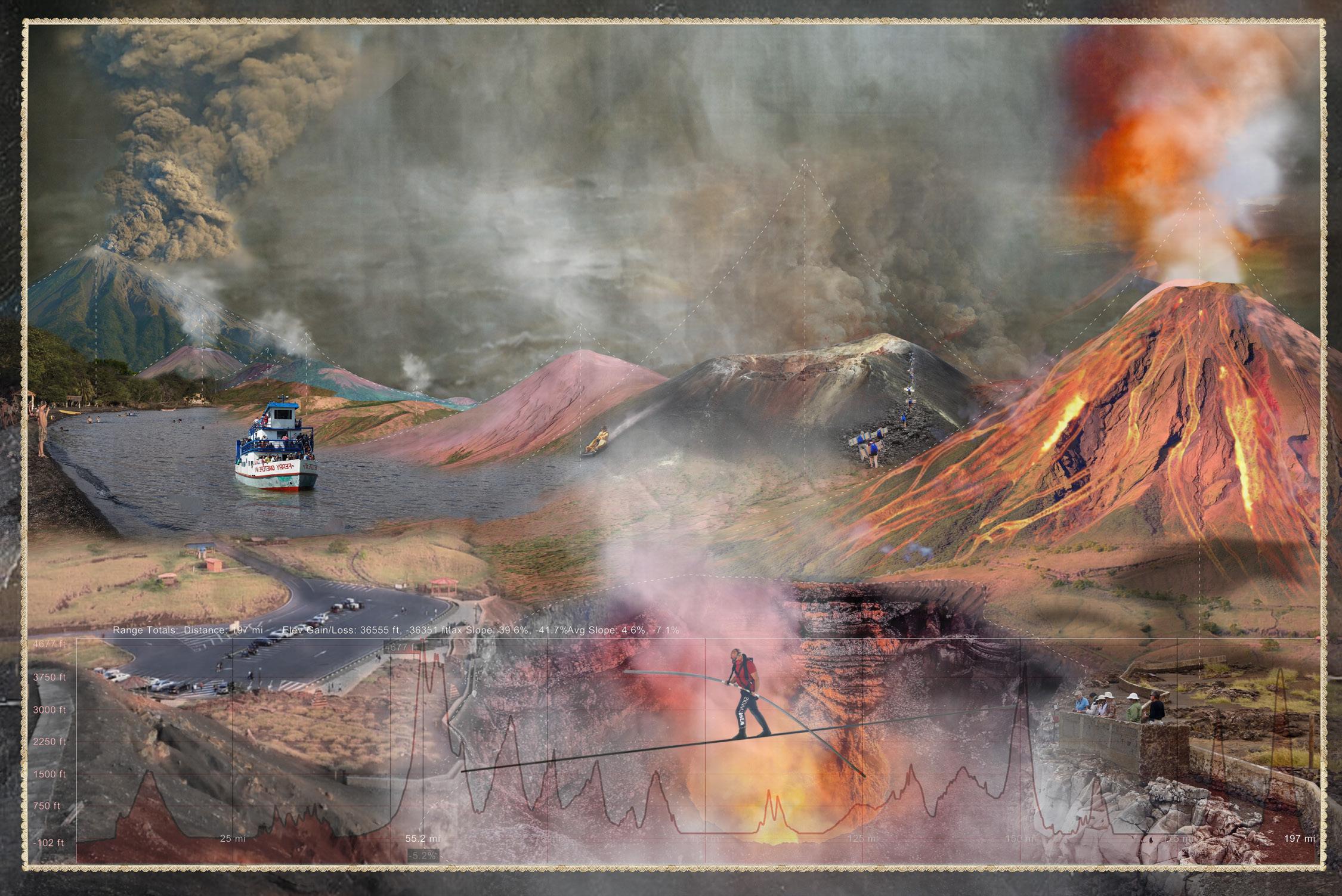
133
Oscar M. Caballero
state of temporary permanence driven by its volcanology to influence politics, urban planning, and nature’s evolutions. This territorial liquidity also carries along traces of memory, storytelling, and forms of enduring.
The post-volcanic landscape has proven to be an incubator for fascinating natural transformations that redefine human and non-human boundaries. From the emergence of new ojos de agua out of emptied volcanic craters, the birth of islands on water bodies that were originally part of volcanic erupted material, unexpected forests from fertile post-volcanic soil, topographic transformation at a city scale, urban settlements and nationwide displacements and mutation of animal and plant species.
of urban mismanagement. Environmental experts think that the mercury ingested in fish such as guapote, mojarras, and guabinas would have a negative long-term effect on consumers.
The contamination of Lake Xolotlán is not an isolated case. Multiple water bodies in Nicaragua with rare natural characteristics have been jeopardized through waste modes ranging from an institutional to a local level. Animal and plant species have been the first to perish or emigrate to safe locations. Protecting certain regions as natural sanctuaries has allowed for the preservation of fauna in the wilderness and zoological settings. On this matter, the politics of non-human architecture should focus on designing systems and spatial regulations that contribute to the lasting proliferation of nature. Due to the latent
lush treetops and wetlands. It’s a region struck mostly by hurricanes, but in April 2018 it erupted with the force of a volcano when more than 12,000 acres burned, transforming its vivid greenery with a crimson gleam that unveiled a new dark monochrome landscape and greatly affected its wildlife.
The UNESCO-certified biosphere reserve, one of the most important humid tropical forests in the Central American region, hosts a variety of threatened or endangered species such as tapirs, jaguars, mountain pigs, manatees, and a great variety of birds, such as limpets, toucans, quetzals, and tiger herons. It’s also a sanctuary for neotropical migratory birds and bird species that have already disappeared from other regions of the country, such as peacock bass, limpets, and the harpy eagle. These species have

The oldest traces of the presence of animals living among the Nicaraguan people were imprinted about 6,000 years ago by an opossum, a bird, and a deer on volcanic mud. The Acahualinca footprints were discovered by accident in 1874 in the capital Managua near Lake Xolotlán. During decades of archaeological studies, it has been determined that 18 people divided into two groups of men, women, and children were walking away from a volcanic eruption. In between the two days’ journey, the group of animals passed through the night following the same instinct on a trajectory towards the lake. The fluid lava would solidify these ancient tracks and influence the beginning of a new human settlement that would focus on fishing and agriculture. In modern times, the lake was contaminated by decades
danger, volcanic lands have often become a vessel for secluded nature, thriving in fantastical ways that only match the descriptions of indigenous mythology.
Crimson Hues on the Warpath
The natural balance of paradisiac reservoirs in Nicaragua has been often maintained due to the volatility of the territory. Environments inhospitable to humans have flourished with endemic species of animals and plants along with uncontrolled governance of geographical formations.
In the southeast Caribbean of Nicaragua— relatively far from the volcanoes on the Pacific coast—the Indio Maíz Biological Reserve rests under the camouflage of
confronted the advance of agricultural gentrification, deforestation, the invasion of settlers from the interior of the country, and the construction of religious temples and fires.
It is popularly known that the activity of a volcano could awaken another one and produce a chain reaction across the Pacific range. Similarly, the volcanic fury at Indio Maíz lit a second political volcano after forty years of perennial numbness and exploded with a third reaction, a city that resisted like a volcanic bastion. By the time the media transmitted the news on Indio Maíz, protests spread like wildfire, especially in the capital. The consequences of this forest fire reached the volatile Pacific coast to awaken a disobedient spark and propel
on the Landscape 134
Dragons

135
Oscar M. Caballero

the beginning of an insurgency against the unfair politics and mismanagement of the Ortega-Murillo government, including protests against pension reform.
Throughout the protests, one bird, in particular, became a symbol of rebellion because of its untamable nature: “El Guardabarranco” (Eumomota Superciliosa), the Nicaraguan national bird since 1971. The colorful bird is usually found near cliffs in forest regions and its singing serves as an advisory signal for unexpected topography. Even though this species of bird does not nest on tree branches and prefers to nest in secluded holes dug in the walls of cliffs or caves, it cannot live in captivity. It is popularly known that the bird will charge against the cage incessantly seeking freedom until it meets its final rest. Vicariously, Nicaraguans opposing the dictatorship projected the fervor for freedom through the symbolism of the bird. “El Guardabarranco,” in addition to being a national symbol, became an ideal of civic protest, an anthem for freedom, and an inspiration for endurance.

Mountain of Fire, Valley of Water
Upon the gravitational pull of two concave lagoons carved from past volcanic activity, there is a city made from movement traces. Its intricate streets reveal a pattern of constant displacement between geographical nodes, and the ruins of its
colonial architecture are a monument to seismic endurance. Masaya, according to the late folklorist Eliseo Ramirez in his book Masaya indígena y mestiza, means “Land of Deers” or “Burning Mountain” in the náhuatl language. Today, deer can only be seen in protected environments to prevent extinction, but the burning mountain is more prominent than ever.
The Masaya Volcano—composed of Masaya, Nindirí, San Pedro, San Fernando, Comalito, Santiago, and other parasitic cones—is one of the highest producers of lava in the Central American region since pre-Columbian times. The National Park Volcán Masaya, owned by the Central Bank of Nicaragua, is intertwined with an architectural program that extends to the zoo, museum, magma port, trails, and caves where multiple species of bats rest. The cauldrons are inhospitable due to the sulfur dioxide they emit constantly, but unusually, flocks of parakeets can be seen at sunset gliding through the volcanic gasses into the crater.
136
Dragons on the Landscape
In 2012, National Geographic released a documentary, “Untamed Americas.’’ A short segment in the first episode shows the unprecedented habitat of parakeets in the lands of the Masaya Volcano in Nicaragua. This species of bird has managed to live among toxic gasses emanating from the crater, where they have created a new ecosystem by nesting on holes they dug out of the soft soil. The reason why and how these parakeets can live among the toxic gasses remains unknown. Although, one could reason that their reclusive humaninhospitable shed might be a survival mechanism. The illegal trade of several species of parakeets and parrots is a deeprooted practice in several parts of the country where cages full of these birds can be seen for sale along the roadside.
human harm. A cautionary tale of a beautiful ojo de agua with an underwater guardian. This legend has been passed down for generations. Even though the valley and the snake are both a metaphor, they represent a sentiment. Allegorically, the narrative explores the volatility of the landscape and the connection between animals and human settlement. Not as opposing forces, but as elements of the same earthly cycle.
Let There Be Lava
Nicaraguan volcanoes will continue to influence territoriality across human and non-human forms of habitability. They represent the governance of nature upon other living affairs and it questions the human response towards climate manifestations. However, the Nicaraguan

Parakeets are not the only species that have fled from human contact in the Masaya Volcano area. The seclusion of exotic fauna can also be found in indigenous tales. There are several variations of the origin legend of the Masaya lagoon, but the main storyline remains consistent: There was a valley surrounded by a lush forest and it was home to a fantastical beast, a horned snake as long as the contouring of the valley itself. Any attempt to kill the powerful animal guarding the valley would prove unsuccessful. Different tribes gathered and figured out a way to contain the snake. By losing its freedom, the snake deepened in sorrow and cried until its tears puddled on the ground. Eventually, tribes fled and the valley flooded. The horned snake lies at the bottom of the lagoon within the liquid realm to shelter from
fauna has created an intrinsic connection with volcanoes, enduring the volatility of their eruptive nature by developing an endemic cohabitation. Joaquin Zavala Urtecho’s essay, “Los volcanes han sido para Nicaragua bendición y flagelo a la vez,” describes the volcanic range as a nervous system that binds the human psyche and geography with deep roots connected to the underground Pacific ring of fire wrapping across the world. In the words of Sabrina Duque, the volcano is a metaphor. It’s both animal and nature, geology and politics, home and foe.
A version of this article was originally published on February 27th of 2023 in Revista
137
Oscar M. Caballero

138

139
Citations

Citations

Choreographies in Chaos
Words by Mumtaz Hammad
Edited by Olivia McCloy
Images by Olivia Jia

Self-similarity Across Cities, Architecture, and Nature: How Fractals of the Concrete Jungle Can Inspire Design That Embraces the Beauty of Nature, Without Overgrowing its Boundaries
Words and Images by Soichiro Harada
Edited by Ethan Floyd
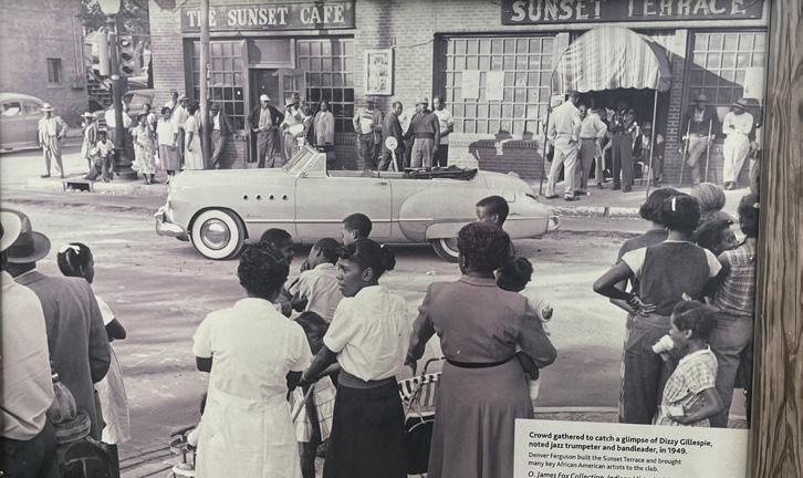
Preserving Place Through Story: How the Urban Roots Podcast has Created New Pathways for Equitable Preservation-based Development in Black neighborhoods
Words by Deqah Hussein-Wetzel
Edited by Ethan Floyd
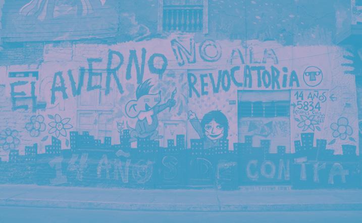
Stories of Decay, Insalubrity, and Resistance in Lima, Peru
Words and map by Daniela Perleche Ugas
Edited by Olivia McCloy
Cover Image: El Averno in Jiron Quilca, Anna Maria (2013) https://www.flickr.com/photos/ annamariademarzo/8574095741
References
Costa, G. (2007). La ventana rota y otras formas de luchar contra el crimen.
Cueto, M. (1991). La ciudad y las ratas: La peste bubónica en Lima y en la costa peruana a comienzos del siglo veinte. Histórica, 15(1), 1–26.
Dammert Guardia, M. (2018). Precariedad urbana, desalojos y vivienda en el centro histórico de Lima. Revista Invi, 33(94), 51–76.
GrupoRPP. (2012, October 24). El Averno cierra sus puertas mañana luego de 14 años. RPP. https://rpp.pe/cultura/ literatura/el-averno-cierra-sus-puertas-manana-luego-de-14anos-noticia-533794
Huaytalla, A. (2017). Cuando los cerros bajan: Estudio de la violencia delictual de dos barrios limeños: los cerros San Cosme y El Pino. Instituto de Defensa Legal.
Joffré, G. R. (1999). La muralla y los callejones: Intervención urbana y proyecto político en Lima durante la segunda mitad del siglo XIX. Sidea.
Joseph, J., Castellanos, T., Pereyra, O., & Aliaga, L. (2005). Lima,“Jardín de los senderos que se bifurcan”: Segregación e integración. Ciudades Latinoamericanas: Un Análisis Comparativo En El Umbral Del Nuevo Siglo, 363–440.
LaMula (2015). Gestión Castañeda prepara la demolición de cerca del 40% del Centro Histórico de Lima. https:// lamula.pe/2015/04/02/gestion-castaneda-prepara-lademolicion-de-cerca-del-40-del-centro-historico-de-lima/ enriquejesusfloresvelasquez/
LaMula (2016). Memorex y aclaraciones sobre la matanza de Barrios Altos. La Mula. https://redaccion.lamula. pe/2016/11/03/matanza-barrios-altos-grupo-colina-albertofujimori-sendero-luminoso-memoria/jorgepaucar/
Lopez, S., & Paraizo, R. (2022). Los desplazamientos sociales en los programas de renovación urbana del Centro Histórico de Lima (1996-2016). Revista EURE-Revista de Estudios Urbano Regionales, 48(145).
Lopez, S., Jaime, K., Perleche, D. (2023). Desplazamientos sociales en el Centro Histórico de Lima durante la pandemia. Caso de estudio: Barrios Altos y Monserrate. In Centros Históricos y Desplazamiento Social.
Ludeña, W. (2002). Lima: Poder, centro y centralidad: Del centro nativo al centro neoliberal. EURE (Santiago), 28(83), 45–65.
Ludeña, W. (2014). Crisis urbana, el discurso higienista y el problema de la vivienda en Lima de 1900.
Palma, P., & Ragas, J. (2018). Enclaves sanitarios: Higiene, epidemias y salud en el Barrio chino de Lima, 1880-1910. Anuario Colombiano de Historia Social y de La Cultura, 45(1), 159–190.
Rodríguez Larraín Echecopar, M. R. (2012). Estudio del impacto de las intervenciones en el núcleo del Centro
Histórico de Lima, a partir de la declaración de Patrimonio Cultural de la Humanidad.
Zapata, A., & Rojas, R. (2013). ¿Desiguales desde siempre?
Miradas históricas sobre la desigualdad. Instituto de Estudios Peruanos.
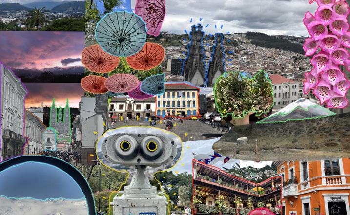
Quito Recuerdos y Colores
Collage by Claudia Kohn Avila
Edited by Ethan Floyd
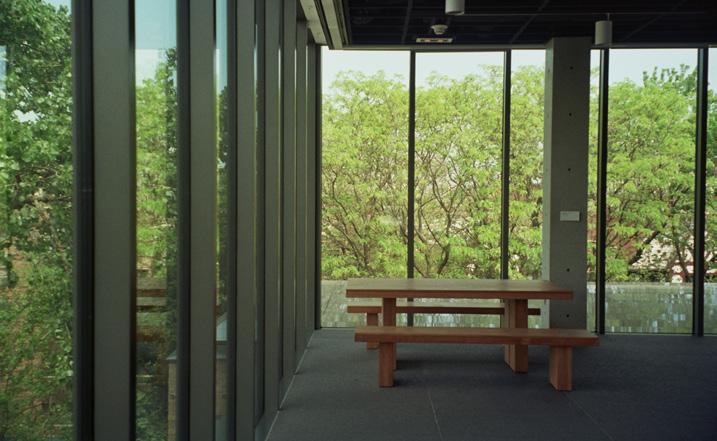
An Interview with Our Inaugural Editor
Responses by Fernando DeGuia
Edited by Ethan Floyd
Cover Image by Olivia Jia
140


Fluid Urbanism at Mumbai's Edge
Words and images by Salonee Ghosh
Edited by Jaron Kaplan
Retail Redundancies and the Landscape for Small Business in Big Cities
Words and mapping by Otis Emslie
Edited by Olivia McCloy
Cover Graphic by Olivia Jia
References
“City of Yes Economic Opportunity.” NYC Dept. of Planning.
Eckholm, Cara. “When Did New York’s Streets Get So Hollow?” The New York Times, February 7, 2024.
Metzinger, Jamie. “Differences in Experiences With the Development of Mixed-Use Projects From 2004 and 2017.” Frontiers in Built Environment 7 (September 23, 2021): 734149.
https://doi.org/10.3389/fbuil.2021.734149.
Osemwengie, Prince. “Combating the Displacement of Small Businesses.” Inclusive Action for the City (blog), January 20, 2022.
Preuss, Ilana. “As We Move Through the Pandemic, Here’s How to Fill Vacant Storefronts.” Next City (blog), May 18, 2022.
“The Pademic’s Impact on Real Estate.” McKinsey Global Institute, July 13, 2023.
“Zoning and Licensing Policies.” Beacon Hill Civic Association. DC Open Street Maps.

Words and images by Florentina Anastasia
Edited by Ruju Joshi
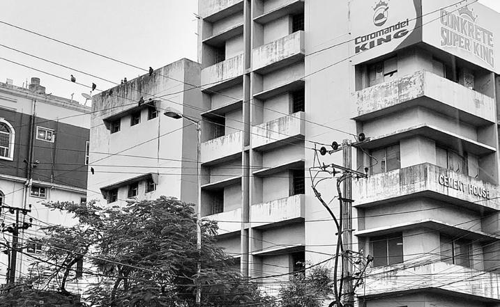
Hyderabad and Hitech-city
Reflections on a Changing Urban Culture
Words and images by Ishaan Barrett
Edited by Olivia Jia
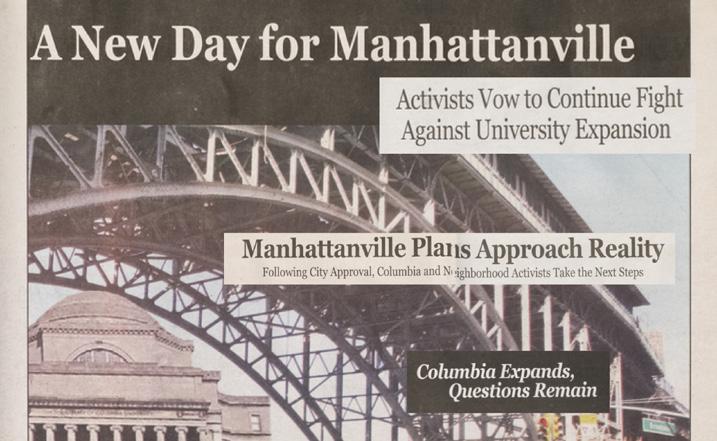
Not-for-Profit or Land-Grab Rich-ies of New York City
Words and mapping by Ruju
Joshi
Edited by Ethan Floyd
Images via Columbia Spectator and New York Public Library
References
Banerjee, I. (2023, January 19). Bollinger’s tenure accentuated a contentious, decadeslong history between Columbia and West Harlem, some residents say. Columbia Daily Spectator. https://www.columbiaspectator.com/city-news/2023/01/19/ bollingers tenure-accentuated-a-contentious-decades-longhistory-between-columbia-and-west harlem-some-residentssay/
Columbia Daily Spectator 22 January 2008 — Columbia Spectator. (n.d.). https:// spectatorarchive.library.columbia. edu/?a=d&d=cs20080122-03.1.1&e=-------en-20-- 1--txt-txINEminent+Domain------
Columbia of yesterday, 1754-1897 / : Arrowsmith, R. (Robert), 1860-1928. : Free Download, Borrow, and Streaming : Internet Archive. (1926). Internet Archive. https://archive. org/details/ columbiaofyester00arro/page/n1/mode/2up Columbia University Authentication. (n.d.). https://www. finance.columbia.edu/content/ access-columbias-tax-exemptcertificates
Government and Community Affairs | Office of Public Affairs. (n.d.). https:/communications. news.columbia.edu/content/ government-and-community-affairs
History. (n.d.). Columbia University Neighbors. https:// neighbors.columbia.edu/content/ history
Lewis, E. (2022, May 22). The College Tax Scam: Addressing University Exploitation of The501(c)3 Tax Status — Columbia Undergraduate Law Review. Columbia Undergraduate Law Review. https://www.culawreview.org/journal/the-college-tax scam-addressing-university-exploitation-of-the-501c3-taxstatus
Looking out on a city and a world | Columbia University in the city of New York. (n.d.). https://www.columbia.edu/content/ university-history McKee, A. (2023a, April 20).
Exceeding previous estimates, Columbia is the largest private landowner in New York City, city data reveals. Columbia Daily Spectator. https://www.columbiaspectator. com/citynews/2023/04/20/exceeding-previous-estimates-columbiais-the-largest private-landowner-in-new-york-city-city-datareveals/
McKee, A. (2023b, October 27). Columbia’s tax exemptions exceed its annual community investment by millions. West Harlem residents want more. Columbia Daily Spectator. https://www.columbiaspectator.com/city-news/2023/10/27/ columbias-tax exemptions-exceed-its-annual-communityinvestment-by-millions-west-harlem residents-want-more/
NYC Finance. (n.d.). Tyler Technologies Inc, Akanda Solutions, LLC. https://a836- pts-access.nyc.gov/care/search/ CommonSearch.aspx?mode=ADDRESS PLUTO and MapPLUTO. (n.d.). https://www.nyc.gov/site/ planning/data-maps/open-data/ dwn-pluto-mappluto.page Property exemption detail | NYC Open Data. (2023, October 25). https://data.cityofnewyork. us/City-Government/ Property-Exemption-Detail/muvi-b6kx
Schneider, M., & De Alva, J. K. (2021, October 27). Why should rich universities get huge property tax exemptions? Washington Post. https://www.washingtonpost.com/news/ grade-point/wp/2016/07/08/why-should-rich-universitiesget-huge-property tax-exemptions/ The New York Times. (2023, September 6).
‘The Untouchables’: How Columbia and N.Y.U. Benefit From Huge Tax Breaks. The New York Times. https://www.nytimes. com/2023/09/26/nyregion/columbia-university propertytax-nyc.html
Citations
So Close Yet So Far
141


Unraveling Ejidos, Land Rights, and Urban Form in Baja California
Words by William Fainaru Callahan
Edited
by Donatella Donato
Cover Image by Olivia Jia
Images by Maureen Fan

How Participatory Budget has Impacted Citizens’ Lives in the Metropolitan Area of Guadalajara, Mexico
Words by Raquel Padilla
Edited by Ruju Joshi
References
Beuermann, D. W., & Amelina, M. (2014). Does Participatory Budgeting Improve Decentralized Public Service Delivery? (Working Paper IDB-WP-547). IDB Working Paper Series. https://www.econstor.eu/handle/10419/115501
Cabannes, Y. (2004). Participatory budgeting: A significant contribution to participatory democracy. Environment and Urbanization, 16(1), 27–46. https://doi. org/10.1177/095624780401600104
Davidoff, P. (1965). Advocacy and Pluralism in Planning. Journal of the American Institute of Planners, 31(4), 331–338. https://doi.org/10.1080/01944366508978187
Healey, P. (1992). Planning through Debate: The Communicative Turn in Planning Theory. Town Planning Review, 62, 143–162. https://doi.org/10.3828/ tpr.63.2.422x602303814821
Matheus, R., Ribeiro, M. M., Vaz, J. C., & de Souza, C. A. (2010). Case studies of digital participatory budgeting in Latin America: Models for citizen engagement. Proceedings of the 4th International Conference on Theory and Practice of Electronic Governance, 31–36. https://doi. org/10.1145/1930321.1930328
Miraftab, F. (2009). Insurgent Planning: Situating Radical Planning in the Global South. Planning Theory, 8(1), 32–50. https://doi.org/10.1177/1473095208099297
Roy, A. (2005). Urban Informality: Toward an Epistemology of Planning. Journal of the American Planning Association, 71(2), 147–158. https://doi. org/10.1080/01944360508976689
Sintomer, Y., Herzberg, C., Röcke, A., & Allegretti, G. (2012). Transnational Models of Citizen
Participation: The Case of Participatory Budgeting. Journal of Deliberative Democracy, 8(2), Article 2. https://doi. org/10.16997/jdd.141
Watson, V. (2009). Seeing from the South: Refocusing Urban Planning on the Globe’s Central Urban Issues. Urban Studies, 46(11), 2259–2275.
Websites consulted:
Municipio de Guadalajara. Official website for the participatory budget. Consulted on November 4th 2022. https:// transparencia.guadalajara.gob.mx/presupuesto-participativo
Municipio de Tlajomulco de Zúñiga. Repository of past exercises of the participatory budget. Consulted on November 4th 2022. https://www.tlajomulco.gob.mx/presupuestoparticipativo ciudadano
Municipio de Zapopan. Official website for the participatory budget. Consulted on November 4th 2022. https:// presupuestoparticipativo.zapopan.gob.mx/

The Land and Water Talks
Words and images by Alexandria Bernabe
Edited by Donatella Donato

Our Innate Obsession With the Waterfront and How to Keep It Alive
Words by Jaron Kaplan
Edited by Ethan Floyd

When a House is not a Home
Words by Shuyue Pan
Edited by Donatella Donato
Cover Graphic by Olivia Jia
References:
Bailey, James. “What Are Local Authorities Doing and What More Could They Do to Address the Housing Challenge,” in What More Can Be Done To Build The Homes We Need, edited by Sir Michael Lyons, Luke Murphy, Charlotte Snelling and Caroline Green, 55-60. London, Institute for Public Policy Research, 2017.
Fisher, Thomas. “, “Architects as Public-health Professionals,” in Defining Contemporary Professionalism, edited by Alan Jones and Rob Hyde, 97-99. London: RIBA Publishing, 2019.
Hyde, Rory. “Architecture Is in Breach of The Social Contract.” in Defining Contemporary Professionalism, edited by Alan Jones and Rob Hyde, 147-149. London: RIBA Publishing, 2019.
Internet Encyclopedia of Philosophy. “Social Contract Theory.” Accessed December 3, 2021. https://iep.utm.edu/soccont/#SSH4a.iii.
Lea, Tess, and Paul Pholeros. “This Is Not a Pipe: The Treacheries of Indigenous Housing.” Public Culture 22, no.1 (2010):187-207.
Midgley, Mary. “Philosophical Plumbing.” in The Impulse to Philosophies: Royal Institute of Philosophy Supplement, edited by A.Phillips Griffiths, 139-145. Cambridge: Cambridge University Press, 1992.
Citations
142

Nouri, Arman and Jorge Roman. “Social Regeneration: Embedding Estate Regeneration into Broader Strategies for Improving Social Infrastructure.” The Public Practice, April 10, 2021.
https://www.publicpractice.org.uk/resources/embeddingestate-regeneration-into-broader-strategies-for-improvingsocial-infrastructure.
The UK Government. “Housing White Paper.” Accessed December 13, 2021.
https://www.gov.uk/government/collections/housing-whitepaper.
Wahlquist, Calla. “Paul Pholeros, Architect Who Helped Reduce Indigenous Poverty, Dies at 62.” The Guardian, February 2, 2016.
https://www.theguardian.com/australia-news/2016/feb/02/ paul-pholeros-architect-who-helped-reduce-indigenouspoverty-dies-at-63.
Figure Citations
Figure 1: Joyce and Snells. “Needs for Regeneration.” Accessed December 12, 2021.
https://joyceandsnells.co.uk/need-for-regeneration/.
Figure 2 and 3: Nouri, Arman and Jorge Roman. “Social Regeneration: Embedding Estate Regeneration into Broader Strategies for Improving Social Infrastructure.” The Public Practice, April 10, 2021.
https://www.publicpractice.org.uk/resources/embeddingestate-regeneration-into-broader-strategies-for-improvingsocial-infrastructure.
Figure 4: Drew, Joanne. “Joyce Avenue and Snells Park Estate Redevelopment.” Governance Enfield, November 6, 2019. https://governance.enfield.gov.uk/documents/s78411/ Joyce%20and%20Snells%20-%20Cabinet%206%20 November%202019.pdf.
Figure 5: Pholeros, Paul. “This Is Not a Pipe: The Treacheries of Indigenous Housing.” Public Culture 22, no.1 (2010):187-189.
Figure 6: Health Habitat. “Demonstration House.” Accessed December 12, 2021. https://www.healthabitat.com/research-development/ demonstration-house/.
Occupiable Thresholds
Words and visuals by Sueng Hyo Chang
Edited by Ruju Joshi
References
Alexander, Christopher. The Nature of Order. Center for Environmental Structure; 1st edition; 2002.
Bacon, Edmund. Design of Cities. Penguin Books; Revised ed. edition; 1976.
Billig, Noah. ISTANGUL_Informal Settlements and Generative Urbanism. Routledge; 2019.
Carracedo, Oscar. Resilient Urban Regeneration in Informal Settlements in the Tropics_Upgrading Strategies in Asia and Latin America. Springer; 2021.
Hyeon-Min Park, Jae-Hong Park, Jun Kim, Jae-Woo Yoo. Development Process and Characteristics of Modification of the Cow-shed Village in the Busan Refuge Shelter. Busan National University.
Jae-Woo Yoo. Jun Kim. Hye-Young Song, Ji-Wan Hong. A Study on the Characteristics of Refuge Dwelling Area and Housing of Busan since Korean War. Journal of the Architectural Institute of Korea Planning and Design; Vol. 36, No. 3 (Serial No. 377) 2020.
Kyung-Yi Jang, Jae-Woo Yoo. The Characteristics of Houses Plan Type and House Conditions of the Aged Residential Ahn-Chang Village in Busan. Department of Housing Busan National University, 2020.
Sung-Yup Kim, Ju-Eun Jang, Dong-Jin Kang. Analysis of Patterns for Community Synergism in Blighted Detached Dwelling Areas - With focus on Anchang Village in Busan. Architecture & Urban Research Information Center, 2008.
Intra-city Transit in a Late Medieval and Early Modern City
Words by Johann Xavier Marcotullio
Edited by Ruju Joshi Image by Olivia Jia
References
Brennan, M.G. (Ed.). English Travellers to Venice 1450 –1600 (1st ed.). Routledge. (2022): https://doi. org/10.4324/9781003251576
Bulliet, Richard W. The Camel and the Wheel. New York: ACLS History E-Book Project, 2005.
Harff, Von Arnold, and Malcolm Letts. The Pilgrimage of Arnold Von Harff, Knight: From Cologne, through Italy, Syria, Egypt, Arabia, Ethiopia, Nubia, Palestine, Turkey, France and Spain, Which He Accomplished in the Years 1496-1499. Printed for the Hakluyt Society, 1946.
Lowe, Kate. “Visible Lives: Black Gondoliers and Other Black Africans in Renaissance Venice.” Renaissance Quarterly66, no. 2 (2013): 412–52. https://doi.org/10.1086/671583.
Mackenney, Richard. “Public and Private in Renaissance Venice.” Renaissance Studies 12, no. 1 (1998): 109–30. http:// www.jstor.org/stable/24412632.
Newett, M. Margaret (Mary Margaret), and Pietro Casola. Canon Pietro Casola's Pilgrimage to Jerusalem in the Year 1494. Manchester: University Press, 1907.
R. Colas, Bibliographie Générale du Costume (1933), no. 1108, col. 384-5; Katalog Der Freiherrlich Von Lipperheide'schen Kostümbibliothek (repr. 1963), no. 1324, p.527.
R. S. Lopez, THE EVOLUTION OF LAND TRANSPORT IN THE MIDDLE AGES, Past & Present, Volume 9, Issue 1, April 1956, Pages 17–29, https://doi.org/10.1093/past/9.1.17.

Eviction, then Redemption
Words and Images by Teonna Cooksey
Edited by Olivia McCloy
Cover Image by Olivia Jia
References
“MARS,” Matthew Desmond, n.d., https://scholar.harvard.edu/ mdesmond/mars-data.
“The Human Impact of Foreclosure and Eviction,” Teonna Cooksey, National Council on Undergraduate Research (NCUR) chrome-extension:// efaidnbmnnnibpcajpcglclefindmkaj/https://libjournals.unca. edu/ncur/wp-content/uploads/2021/03/2678-CookseyTeonna-FINAL2.pdf\ 2018.
“An Introduction - The Women’s Empowerment Network. Teonna Cooksey, Environmental Justice Research Studio, 2018. https://citizenarchitects2018.weebly.com/teonnacooksey-wen.html
Citations
143

25 Years of URBAN Magazine
Edited by Olivia Jia
Contributors: Lola Ben-Alon, Rosa Chang, Ifeoma Ebo, Rosetta S. Elkin, Ebru Gencer, Steven Holl, Andrés Jaque, Michael Kimmelman, Charles Marohn, Leah Meisterlin, Carlos Moreno, Mary Pattillo, Emily Talen, Tom Slater, Jeff Speck, Galia Solomonoff, Anthony Vanky, and Doug Voigt, Weiping Wu

Saturday II
Video by Kurt Steinhouse
Edited by Olivia Jia
Cover Graphic by Olivia Jia
Riding LA
Words by John Friedman
Edited by Felipe Urrutia
Images by Olivia Jia
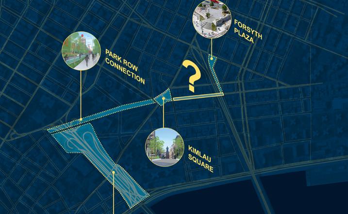
Illuminating Chinatown’s Future: How a community initiative to brighten the streets sparked a bigger opportunity for the Manhattan neighborhood’s renewal
Words by Lauren Kirk and SOM
Design team: Amanda Darmosaputro, Andrew Leung, Andy Rah, McCloy Leonard, Morgan Frederick, Shivani Agarwal, Kristen Garibaldi
Edited by Olivia Jia
Images courtesy of Lauren Kirk, Trey Thomas, McCloy Leonard, SOM, Office of Governor Kathy Hochul
References
Gotham to Go (2022, December 25). Chinatown Recipient of 11 Transformational Projects as Part of Downtown Revitalization Initiative. Gotham to Go. https://gothamtogo. com/chinatown-recipient-of-11-transformational-projects-as-part-of-downtown-revitalization-initiative/
Krueger, A. (2021, January 1). Will 250 lanterns be enough to save Chinatown?. The New York Times. https://www.nytimes. com/2021/01/01/nyregion/nyc-chinatown-lanterns.html
Leaden, C. (2021, January 5). There’s a gorgeous new lantern display lighting up Chinatown’s Streets. https://secretnyc.co/ light-up-chinatown-lantern-display/
Ligaya, M. (2023, September 19). Saving Chinatown, while also making it their own. The New York Times. https://www. nytimes.com/2023/09/19/t-magazine/manhattan-chinatown-neighborhood.html
Light up Chinatown. Let’s Light Up Chinatown, one lantern at a time. https://merchant.sendchinatownlove.com/light-up-chinatown
Liu, Jenniger. (2021, May 28). Giving away 70,000 free meals in NYC’s Chinatown changed this bakery manager’s perspective on leadership. https://www.cnbc.com/2021/05/28/46motts-patrick-mock-helps-feed-chinatown-residents-duringcovid.html
Pearl River Mart. (2021, January 14). Light Up Chinatown: How This Festive Lantern Installation Came to Life. https://pearlriver.com/blogs/blog/light-up-chinatown-how-this-festive-lantern-installation-came-to-life
Welcome to Chinatown. (2022, July). Chinatown’s small businesses: Impacts of COVID-19 and actions for Recovery. https://welcometochinatown.com/impact-study
Yee, Karen. (2022) Preserving Chinatowns in the United States. National Trust for HIstoric Preservation. https:// storymaps.arcgis.com/stories/3fa093b1c6194409ac979b03a4e77ed6
Yu, Eda. (2022, January 28). Gentrification in Chinatown is the focus of these young activists. https://www.teenvogue.com/ story/chinatown-gentrification-los-angeles-new-york
The Symbolism of Destruction
Words by Sofia Ohmer
Edited
by Donatella Donato
Cover Graphic by Olivia Jia
Works Cited
1 Geoffrey Scarre. “How Memorials Speak to Us,” in Philosophical Perspectives on Ruins, Monuments, and Memorials, ed. Bicknell, Jeanette, Jennifer Judkins, and Carolyn Korsmeyer (New York: Routledge, 2020), 32.
2 John Sanni Sodiq. “The Destruction of Historical Monuments and the Danger of Sanitising History,” Philiosophia, 49, (2021): 1183-1188.
3 Basic Rozmeri. “Destruction of Monuments in Europe: Reasons and Consequences.” The International Journal of the Arts in Society, Volume 6, Issue 4, 2011: 283.
4-8 Sanni Sodiq. “The Destruction of Historical Monuments and the Danger of Sanitising History,” 1187-1188.
9 Janette Bicknell. “The Physical Legacy of a Troubled Past,” in Philosophical Perspectives on Ruins, Monuments, and Memorials, ed. by Bicknell, Jeanette, Jennifer Judkins, and Carolyn Korsmeyer (New York, Routledge, 2020), 253.
10 -12 Scarre, “How Memorials Speak to Us,” 21.
13 Rozmeri. “Destruction of Monuments in Europe: Reasons and Consequences,” 283.
14-15 Scarre, “How Memorials Speak to Us,” 26.
16 Sanni Sodiq. “The Destruction of Historical Monuments and the Danger of Sanitising History,” 1188.
17 Frederick Baker, “The Berlin Wall: Production, Preservation and Consumption of a 20th-Century Monument.” Antiquity 67 (257), (1993), 709.
18-20 Baker, “The Berlin Wall”, 711.
21 Benjamin Drechsel, “The Berlin Wall from a Visual Perspective: Comments on the Construction of a Political Media Icon.” Visual Communication 9 (1), (2010), 9.
Citations
144
22 Baker, “The Berlin Wall," 728.
23 Drechsel, “The Berlin Wall from a Visual Perspective," 10.
24 Baker, “The Berlin Wall," 713.
25 “Öffnung Und Fall Der Mauer.” 2021. www.berlin.de. July 16, 2021. https://www.berlin.de/mauer/geschichte/oeffnung-der-mauer/.
26-28 Baker, “The Berlin Wall," 720.
29 “The Berlin Wall Memorial | Berlin Wall Foundation.” n.d. Www.stiftung-Berliner-Mauer.de. https://www.stiftungberliner-mauer.de/en/berlin-wall-memorial/historical-site/ memorial.
30 Melanie L. Buffington, “Confronting Hate: Ideas for Art Educators to Address Confederate Monuments.” Art Education 72 (1), (2018), 14.
31 Karen L. Cox, No common ground: Confederate monuments and the ongoing fight for racial justice. (North Carolina: The University of North Carolina Press, 2021), 6.
32-34 Livia Gershon. “Richmond’s Robert E. Lee Statue Is Headed to a Black History Museum,” Smithsonian Magazine, January 5, 2022. https://www.smithsonianmag.com/smartnews/richmond-confederate-monuments headed-to-blackhistory-museum-180979319/.
35 Buffington. “Confronting Hate: Ideas for Art Educators to Address Confederate Monuments.”, 15.
36-39 Cox, No common ground, 8.
40-41 Gershon, “Richmond’s Robert E. Lee Statue Is Headed to a Black History Museum.”
42-44 Gregory S. Schneider. “Robert E. Lee Monument, Other Confederate Statues Could Go to Richmond’s Black History Museum under Deal,” Washington Post, December 30, 2021. https://www.washingtonpost.com/dc-md va/2021/12/30/ richmond-confederate-statues-black-history-museum/.
45-47 Gershon, “Richmond’s Robert E. Lee Statue Is Headed to a Black History Museum.” 46 Teo Armus. “Charlottesville’s Robert E. Lee Statue Will Be Melted down by City’s African American History Museum.” Washington Post, Dezember 7, 2021. https://www.washingtonpost.com/dc-md va/2021/12/07/charlottesville-melt-robert-lee-statue/.
48 Gershon, “Richmond’s Robert E. Lee Statue Is Headed to a Black History Museum.”
49-53 Jonah Engel Bromwich. “What Does It Mean to Tear down a Statue?” The New York Times, June 11, 2020. https:// www.nytimes.com/2020/06/11/style/confederate-statuecolumbus-analysis.html.
54 Cox, No common ground, 7.
55 Brian Palmer. “The Costs of the Confederacy.” Smithsonian. Smithsonian.com. November 28, 2018. https://www. smithsonianmag.com/history/costs-confederacy-specialreport-180970731/. 56 Bromwich, “What Does It Mean to Tear down a Statue?”
57 Cox, No common ground, 4.
58 Bromwich, “What Does It Mean to Tear down a Statue?”
59 Sarvy Geranpayeh, “New Concerns for the Bamiyan Valley’s Future in Taliban Hands Surface on Anniversary of Monumental Buddhas’ Destruction.” The Art NewspaperInternational Art News and Events. March 11, 2022. https:// www.theartnewspaper.com/2022/03/11/bamiyan-buddhastaliban-preservation-looting development.
60 Llewelyn Morgan, The Buddhas of Bamiyan. (Cambridge, Massachusetts Harvard University Press, 2012),4. 61 Rachel Elbaum & Gabe Joselow. “Taliban Make Ancient Buddhas They Destroyed into a Tourist Attraction.” November 24, 2021, NBC News, https://www.nbcnews.com/news/world/talibandestroyed-afghanistans-ancient buddhas-now-welcomingtourists-rcna6307.
62 Rachel Elbaum & Gabe Joselow. “Taliban Make Ancient Buddhas They Destroyed into a Tourist Attraction.” November 24, 2021, NBC News, https://www.nbcnews.com/news/ world/taliban-destroyed-afghanistans-ancient buddhas-nowwelcoming-tourists-rcna6307.
63 Geranpayeh, “New Concerns for the Bamiyan Valley’s Future in Taliban Hands Surface on Anniversary of Monumental Buddhas’ Destruction.”
64 Centlivres, Pierre. “The Death of the Buddhas of Bamiyan.” April 18, 2012, Middle East Institute. https://www.mei.edu/ publications/death-buddhas-bamiyan.
65-66 Centlivres, “The Death of the Buddhas of Bamiyan.”
67 Centlivres, “The Death of the Buddhas of Bamiyan.”
68 Elbaum & Joselow. “Taliban Make Ancient Buddhas They Destroyed into a Tourist Attraction.” 69 Centlivres, “The Death of the Buddhas of Bamiyan.”
70 Barbara Crossette, “Taliban Explains Buddha Demolition,” The New York Times, March 19, 2001, https://www.nytimes. com/2001/03/19/world/taliban-explains-buddha-demolition. html.
71-72 Elbaum & Joselow. “Taliban Make Ancient Buddhas They Destroyed into a Tourist Attraction.”
73 Geranpayeh, “New Concerns for the Bamiyan Valley’s Future in Taliban Hands Surface on Anniversary of Monumental Buddhas’ Destruction.”
74-76 Geranpayeh, “New Concerns for the Bamiyan Valley’s Future in Taliban Hands Surface on Anniversary of Monumental Buddhas’ Destruction.”
77-78 Sanni Sodiq, “The Destruction of Historical Monuments and the Danger of Sanitising History.”, 1190.
79 Erin Blakemore.“ Destroyed Buddha Statues Are Coming back to Life in Afghanistan as Beautiful 3D Projections.” Smithsonian Magazine, June 16, 2015, https://www. smithsonianmag.com/smart-news/destroyed statues-arecoming-back-life-afghanistan-180955601/.
80 SGeranpayeh, “New Concerns for the Bamiyan Valley’s Future in Taliban Hands Surface on Anniversary of Monumental Buddhas’ Destruction.”.
81 Sanni Sodiq, “The Destruction of Historical Monuments and the Danger of Sanitising History.”, 1193.
Image Credit
East Buddha, c. 6th–7th century C.E. (Bamiyan, Afghanistan), stone, stucco, painted, 120 feet high, destroyed 2001 (photo: © Dr. H. Crane)
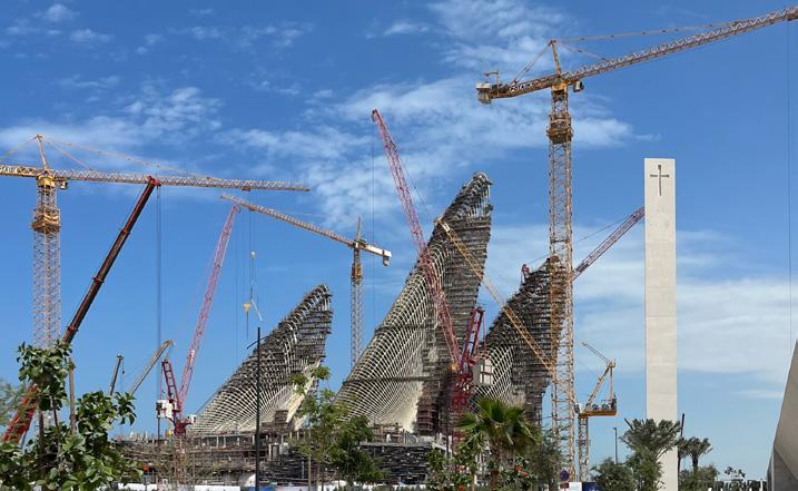
Hotel Saadiyat: Architecture and the Ideology of Tolerance in Abu Dhabi
Words and images by Izzy Kornblatt
Edited by Felipe Urrutia
References
1 This account is drawn from Anna Seaman, “Inspired by 9/11, artist uses sculpture to promote peace and forgiveness,” The National, November 18, 2008 (online); and Silvia Radan, “Art Sculpture ‘Tolerance’ Unveiled in Abu Dhabi,” Khaleej Times, December 8, 2008 (online).
2 “T.O.L.E.R.A.N.C.E.,” Guy Ferrer (artist website), accessed May 8, 2023. https://www.guyferrer.com/t-o-l-e-r-a-n-c-e
3 “About,” United Arab Emirates Ministry of Tolerance and Coexistence, accessed May 8, 2023. https://www.tolerance. gov.ae/ministry
4 Holland Cotter, “Arabic-Galactic Wonder,” The New York Times, November 29, 2017: C1.
5 “Year of Tolerance,” United Arab Emirates Ministry of Economy, accessed May 8, 2023. https://www.moec.gov.ae/ en/-/en/year-of-tolerance-1
6 Peter Baker, Isabel Kershner, David D. Kirkpatrick, and Ronen Bergman, “Israelis and U.A.E. Agree to Full Ties in Landmark Deal,” The New York Times, August 14, 2020: A1.
7 See Izzy Kornblatt, “Like a Prayer.” Architectural Record, June 2023: 115-121.
8 Alamira Reem Bani Hashim, “Planning Abu Dhabi: From Arish Village to a Global, Sustainable, Arab Capital City,” University of California, Berkeley, 2015: 291.
9 Heather Jimaa, “$1 Billion NYU Abu Dhabi Construction Completed,” Gulf Business, April 29, 2014 (online).
10 Katrina Kufer, “Zayed National Museum And British Museum Renew Agreement,” Harper’s Bazaar Arabia, June 24, 2018 (online).
11 Matt Hickman, “Mecanoo’s geology-inspired Natural History Museum Abu Dhabi takes shape on Saadiyat Island,” The Architect’s Newspaper, April 5, 2022 (online).
12 Tom Ravenscroft, “TeamLab reveals ‘home for infinite curiosity’ on Abu Dhabi's Saadiyat Island,” Dezeen, June 24, 2022 (online).
13 See Mahmood Mamdani, “Good Muslim, Bad Muslim: A Political Perspective on Culture and Terrorism,” American Anthropologist 104, no. 3, 2002: 766-775.
14 According to Calvert Jones, as of 2010, Emirati nationals
Citations
145
made up less than .05 percent of the country’s private sector labor force. Calvert W. Jones, Bedouins into Bourgeois: Remaking Citizens for Globalization, Cambridge, United Kingdom: Cambridge University Press, 2017: 55.
15-16 Hashim, Planning Abu Dhabi: 270, 288.
17 “Saadiyat Island,” Gensler, accessed May 9, 2023: https:// www.gensler.com/projects/saadiyat-island
18 The configuration of highways is shown in Hashim, Planning Abu Dhabi: 205.
19 Paula Deitz, “Museum of Islamic Art, Doha,” Architectural Record, August 2009: 65.
20 See “Saadiyat Island,” Gensler.
21-22 Yasser Elsheshtawy, “Cities of Sand and Fog: Abu Dhabi’s Global Ambitions,” in The Evolving Arab City: Tradition, Modernity and Urban Development, ed by Yasser Elsheshtawy. Planning, History and Environment Series, 258-304. London: Routledge, 2008: 291-2.
23 Nicolai Ouroussoff, “A Vision in the Desert,” The New York Times, February 1, 2007 (online).
24 Ahmed Kanna, “Introduction,” in Dubai, the City as Corporation, Minneapolis: University of Minnesota Press, 2011: 29.
25 Lin Noueihed, “France signs deal to open Louvre in Abu Dhabi,” Reuters, March 6, 2007 (online).
26 I have not been able to access a current master plan for Saadiyat, if one exists. But materials produced by developers and institutions working on individual projects, and the current physical state of the island, strongly suggest that the canal has been eliminated.
27 Quoted in Hashim, Planning Abu Dhabi: 206.
28 “Zayed City,” Keller Group, accessed May 8, 2023: https:// www.keller.com/projects/zayed-city
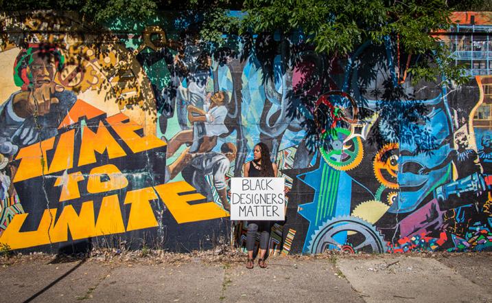
Unveiling the Fog of Artificial Impact
By Tiara Hughes
Edited by Olivia Jia
Images by Dawveed Scully


Dragons on the Landscape
Endemic Fauna & Forms of Volcanic Governance
Words and Visuals by Oscar M. Caballero
Edited by Jaron Kaplan
Image Credits
Image 01: “Tierra de fuego”. Catalog of Nicaraguan volcanos. Colored photomontage by Oscar M Caballero.
Image 02: “Dragons on the landscape”. Maribios Volcanic Range from the Pacific coast of Nicaragua. Colored photomontage by Oscar M Caballero.
Image 03: “Huellas de Acahualinca Maquette”. Photo from the Acahualinca museum in Managua, Nicaragua.
Image 04: “Transvulcania”. Planetary ring of fire. Diagram by Oscar M Caballero.
Image 05: “Volcanic Fury”. Satellite diagram connecting Indio Maiz Biological Reserve burning with protests in Managua against the fire control mismanagement from the Nicaraguan government. Diagram by Oscar M Caballero.
Image 06: “Volcanic entanglements”. Mapping of Masaya Volcano. Scanned charcoal/marker drawing with photomontage by Oscar M Caballero.
Image 07: “Parakeets of Masaya Volcano”. Screenshots from NatGeo's “Untamed Americas” documentary on Twitter.
Image 08: “Ciudad, Volcán”. Mapping of volcanic colonial city architype. Photomontage by Oscar M Caballero.
Citations
146
Credits

Design Appendix
Typeface
Article headings are set in Teimer Light 66 font. Subheadings, author credits and biographies are set in the Parabolica font family. All other body copy uses the Halyard Display body copy.
Publishing
URBAN Magazine Volume 34 was edited and designed by the 2023-2024 editorial staff and printed by Columbia University. Approximately 200 copies were printed.
Photography
Unless otherwise noted, all photography included in this issue is taken by Olivia Jia on 35mm film with an Asahi Pentax or an Olympus Infinity Stylus camera.
Editorial Team
Senior Editors
Ethan Floyd, Outreach Editor
Olivia Jia, Design Editor
Felipe Urrutia, Content Editor
Junior Editors
Jane Cole
Steven Dela Cruz Duncan
Donatella Donato
Ruju Joshi
Jaron Kaplan
Olivia McCloy
Tharika Raman
Saumil Sanghavi
Yuting Sun
147