CITIES ALIVE
Green Infrastructure Appication
Esholt Bradford
THI HUONG TRANG VU MA LANDSCAPE ARCHITECTURE LA 703 REPORT 1
TURNING A PLACE WITH INDUSTRIAL VISUALIZATION INTO A LIVELY SPACE FOR HUMAN
2
OVERVIEW
• URBAN CHALLENGES p1
• CITIES ALIVE: RETHINKING INFRASTRUCTURE
• GREEN AND BLUE INFRASTRUCTURE
• CITIES ALIVE: WATER FOR PEOPLE
SURVEY AND ANALYSIS
• SITE LOCATION
• WIDE CONTEXT
• SITE CHARACTERS AREA
• SITE PHOTOS
• SITE PROPOSAL AND CURRENT SITUATION
• HISTORY
• TOPOGRAPHY
• HYDROLOGY
• HABITAT SURVEY
• ACCESS AND CIRCULAR
• SWOC ANALYSIS
• OPPORTUNITIES AND CONSTRAINTS MAP
• ESHOLT ESTATE’S CURRENT PROPOSAL
RESEARCH &CASE STUDY
• APPLICATION OF EARTH SHELTERED CONSTRUCTION
• HOCKERTON HOUSING PROJECT
• WASTEWATER TREATMENT WETLAND
• FREE-WATER WETLAND
• CROOKED RIVER WETLAND COMPLEX NATURAL WASTEWATER TREATMENT
• PHYTOTECHNOLOGY IN LANDSCAPE DESIGN
• DE CEUVEL PARK IN THE NORTH OF AMSTERDAM
• SHENZHEN LOTUS WATER CULTURE BASE AND GROUND LEVEL OF HONGHU PARK WATER PURIFICATION PLANT
• GREENVILLE’S REWA INNOVATION CAMPUS
• BONNET SPRINGS PARK
VISION AND CONCEPT
• AIMS AND OBJECTIVES
• DESIGN CONCEPT
• ZONING PLAN
• MASTERPLAN
• VISUALISATION
• CONNECTION
• PURIFYING PROCESS
• PLANTING
REFERENCE LISTS
CONTENTS
3
THE PURPOSE
This project documents a brief exploration of the importance of green and blue infrastructure in relation to landscape design approaches. With a particular focus on the watercourse within an urban and peri-urban context, this report tracks an overview of the significance of application in green and blue infrastructure within the development of a historical area.
Inspired by Arup’s ‘Cities Alive: Rethinking Green Infrastructure and ‘Cities Alive: Water for People publications, This report presents the progress and final design of
4
SURVEY AND ANALYSIS
URBAN CHALLENGES
URBAN CHALLENGES
5
OVERVIEW
URBAN CHALLENGES
SIGNIFICANT CHANGES ARE FACED BY CITIES GLOBALLY, THESE INCLUDES:




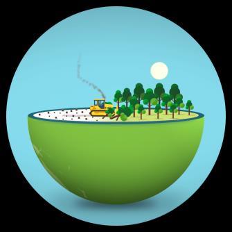

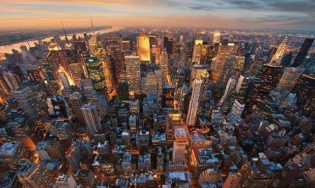


‘... most cities woefully fail to achieve any sort of balance between people and nature. As pressure has grown on expanding urban areas, urban green space has had to compete against high land prices and increasing densities of development and urban infrastructure, thus squeezing nature out of our cities. This has had a detrimental effect on urban environments with resulting social and health impacts.’
RAPID URBANIZATION
WELL-BEING
6
POPULATION GROWTH
CLIMATE CHANGE HEALTH AND
RESOURCE DEPLETION
Arup, ‘Cities Alive: Rethinking Green Infrastructure’
figure 1 population growth
figure 3 climate change
figure 5 resources depletion
figure 4 health and well-being figure 2 rapid urbanization
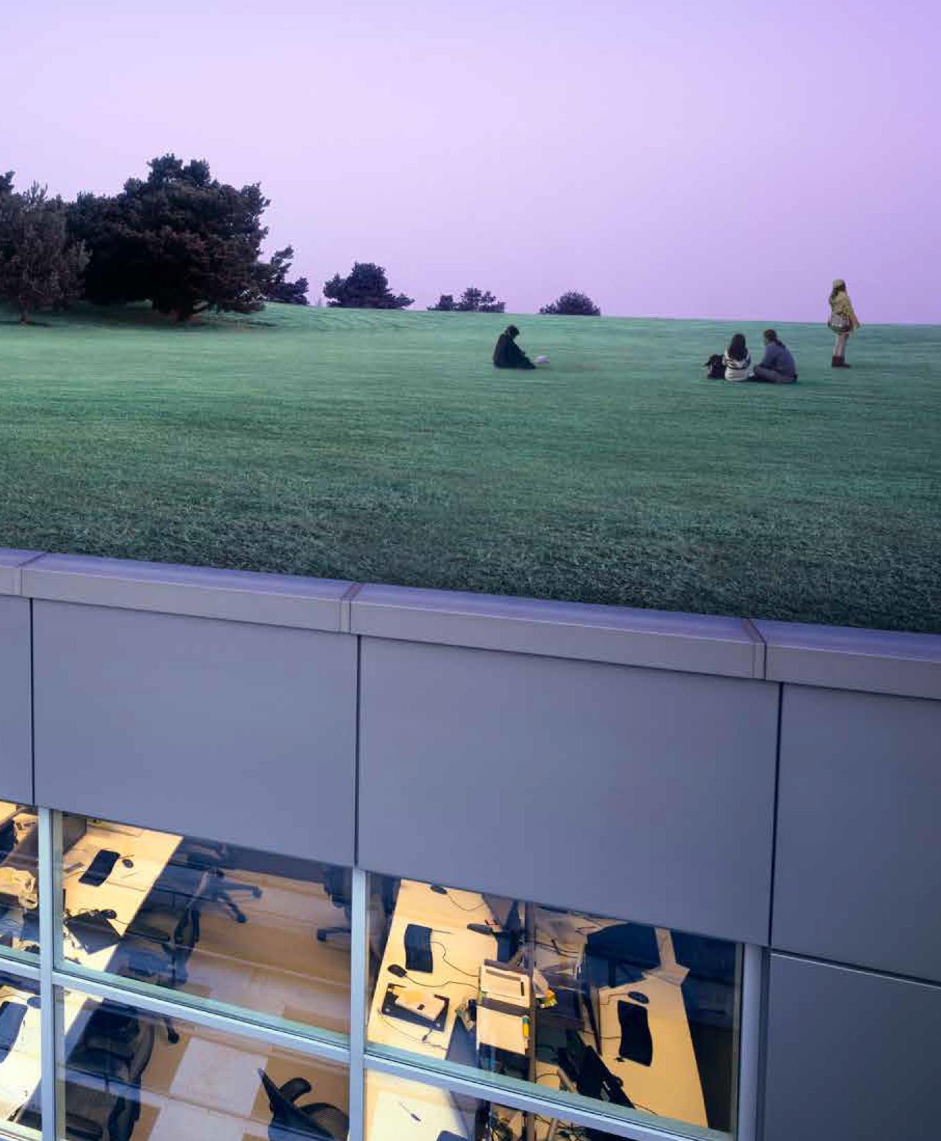
The pandemic has changed how we think about space
An increase in the proportion of city dwellers
looking to move out of cities from 40% to 50%
OVERVIEW
URBAN CHALLENGES
“The pandemic has had an enduring impact on our urban environment and changed the way we live, work and play”
“Debate is raging on the future path that cities will take, with the pandemic serving to hasten many of the trends that were already reshaping our urban landscape and real estate markets.”
Over the coming years, our cities and built environment will continue to face significant disruption due to:
Changes to work and workplaces and changes to lifestyle preferences, combined with technological advancement, have the potential to radically alter how our cities and buildings are used. It will shift patterns of real estate demand between and within our cities. Pressures to move to a low-carbon, climateresilient economy and to build a more equitable society, requiring fast-track routes to producing sustainable, inclusive, and resilient buildings.
The mass adoption of technology and increase in hybrid working has opened up opportunities for better ‘distributed urbanisation’ – the dispersal o people and activities over a wider geographical area, typically within the hinterland of a major city –creating digitally connected networks of suburbs and second and thirdtier cities and tons.

7
7 hybrid working
Figure 6 urban environment Figure
SURVEY AND ANALYSIS
CITIES ALIVE PUBLICATION
CITIES ALIVE PUBLICATION
8
CITIES ALIVE RETHINKING GREEN INFRASTRUCTURE
Cities Alive: Rethinking Green
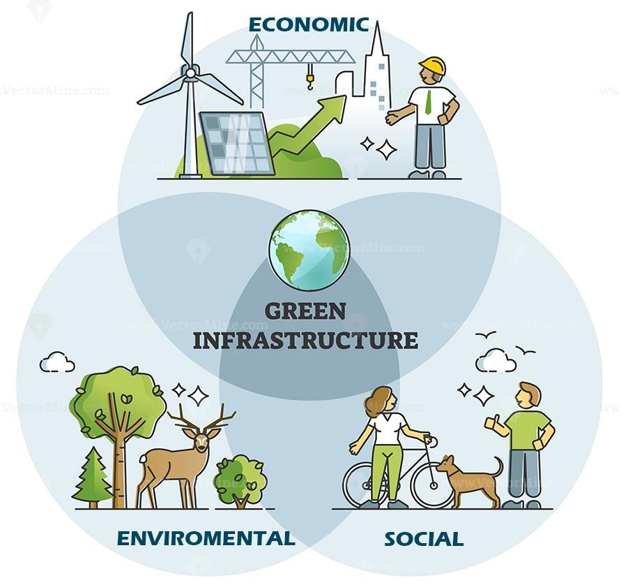
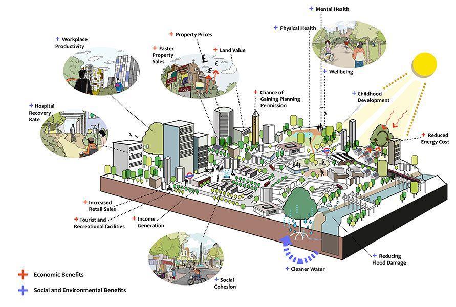
Infrastructure focuses on the benefits of green infrastructure in general. And then within the context of the environmental, social, and economic sectors individually. The text focuses primarily how to integrate green infrastructure into development with an overall nature led design approach being implemented in future developments. The aim of this design approach is to create a healthier environment for people and to create more resilient cities against increased disaster events caused by climate change.
BENEFITS OF GREEN INFRASTRUCTURE
ECONOMIC BENEFITS
Increased Property Prices
Increased Land Values
Faster Property Sales
Encouraging Inward Investment
Reduced Energy Costs via Microclimate Regulation
Improved Chances of
Gaining Planning Permission
Improved Tourist and Recreation Facilities
Lower Healthcare Costs
ENVIRONMENTAL BENEFITS
Improved Visual Amenity
Enhanced Urban Microclimate
Improved Air Quality
Reduced Flood Risk
Better Water Quality
Improved Biodiversity
Reduced Ambient Noise
Reducing Atmospheric CO2
SOCIAL BENEFITS
Encouraging Physical Activity
Improving Childhood Development
Improved Mental Health
Faster Hospital Recovery Rates
Improved Mental Health
Improved Workplace Productivity
Increasing Social Cohesion Reduction in Crime
9
Figure 8 benefits of green infrastructure
CITIES ALIVE RETHINKING GREEN INFRASTRUCTURE
The case for GI
Provide shade and reduce temperature: Our urban forest in the form of large species trees, street trees, parkland and open space of our urban forest are hugely important as they provide shade and protection from UV radiation and localised cooling and shading in towns, cities, and especially streets.
Wind speed reduction: Trees can help to reduce local wind speeds and provide shelter for buildings, thereby reducing fuel bills for heating.
Water attenuation: Urban trees and forests are now being regarded as important and cost-effective way of reducing flood risks and reducing the impact of rainstorms. One study has estimated that for every 5% increase in tree cover area, run-off is reduced by 2%.
Reducing atmospheric pollutants: Research on the health and economic benefits of air cleansing urban forests in 10 U.S. cities have shown that trees save lives, reduce hospital visits and reduce the a number of days taken off work. They do this mainly by reducing pollutants from the air.
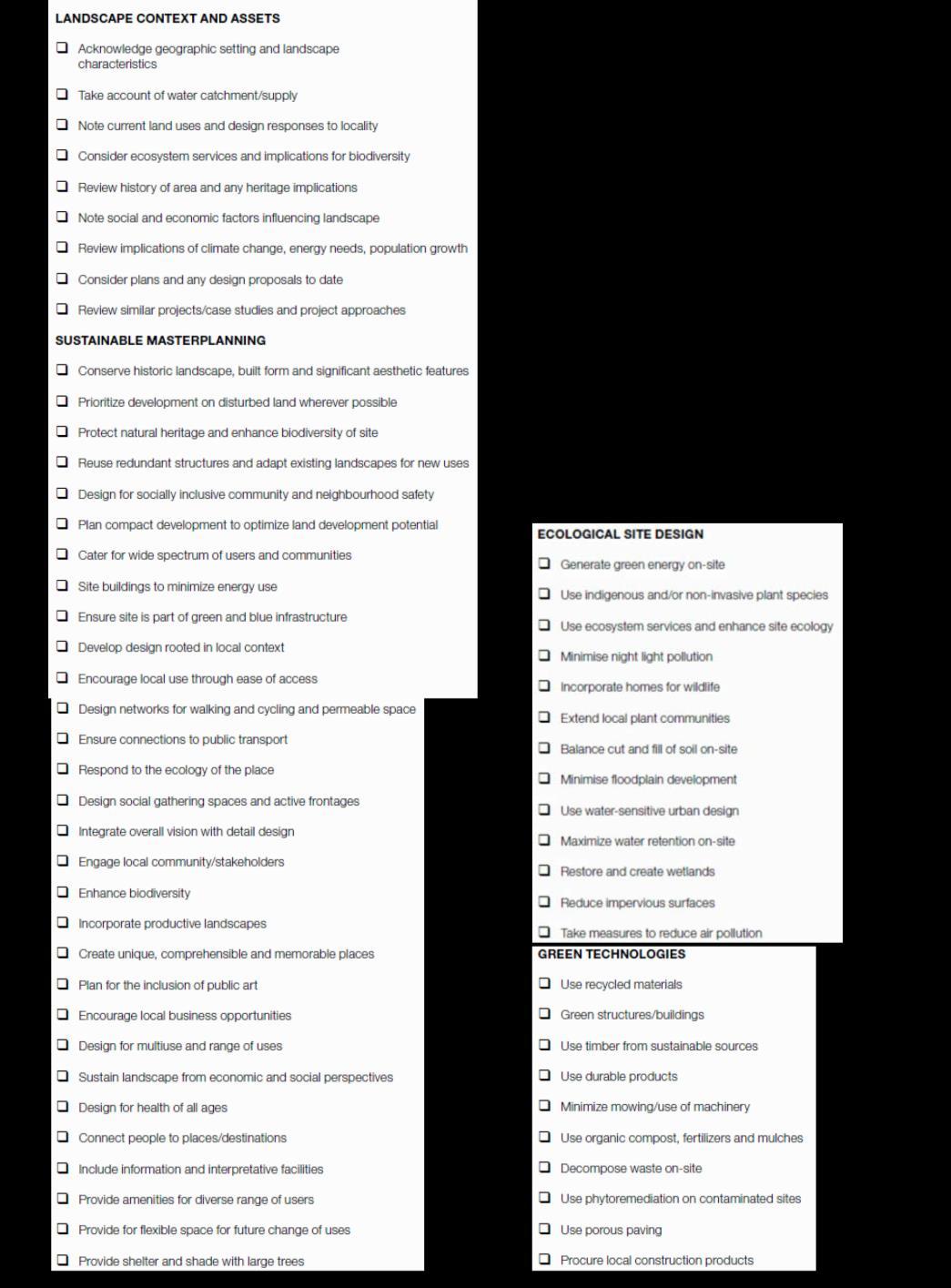
checklist that is focused on sustainable design and created with reference to Initiative in 2007. This will
10
9 green infrastructure in cities
Figure
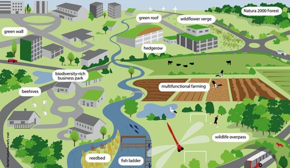
GREEN AND BLUE INFRASTRUCTURE
‘Green infrastructure is a strategically plan high-qualityered network of high quality green spaces and other environmental features.
It should be designed and managed as a multifunctional resource capable of delivering those ecological services and quality of life benefits required by the communities it serves ... [it] should thread through and surround the built environment and connect the urban area to its wider rural hinterland ... it needs to be delivered at all spatial scales’ Natural England,
‘Natural England’s Green Infrastructure Guidance'
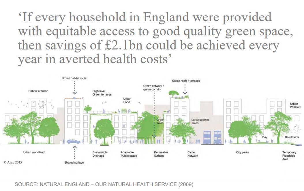
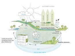
A multilayered and integrated approach to green infrastructure makes the best use of limited space in urban environments
Arup, ‘Cities Alive: Rethinking Green Infrastructure’ Arup, ‘Cities Alive: Rethinking Green Infrastructure’ p.98
11
Figure 10 green infrastructure in cities
CITIES ALIVE WATER FOR PEOPLE
The report explores pioneering water approaches in cities around the world. It promotes five key principles that look to reconnect people with the water cycle, and reconnect cities with their basins to deliver resilience and create healthier city environments that will help drive social and economic success.
Populations in Cities will increase to 66% of the global population by 2050

1 in 4 large are already facing water stress and an estimated 1.6 to 2.4bn people live in river basins that experience water scarcity. Water demand will increase by 55% by 2050.



Cities Alive Water for people explores how to make cities more people-centric

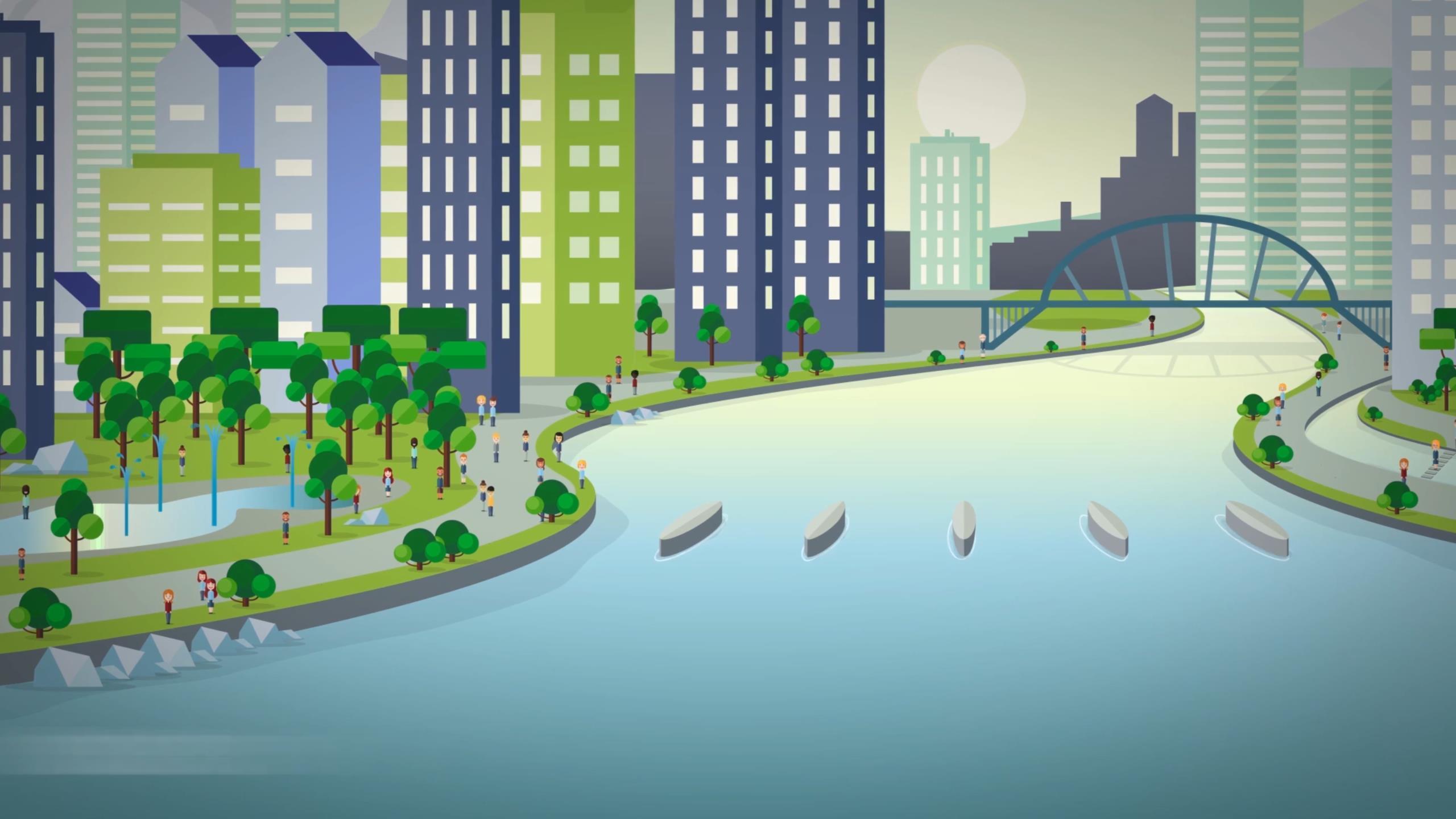
Cities Alive: Water for people's vision is to reconnect people with cities and water cycle, ...
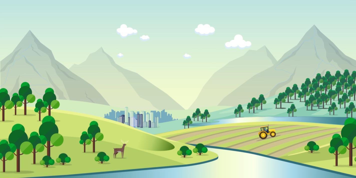 ...And reconnect cities with their river catchments
12
Figure 11 Reconnect people with cities and water cycle
Figure 12 reconnect cities with their river catchments
CITIES ALIVE WATER FOR PEOPLE
THE 5 KEY THEMES IDENTIFIED IN WATER FOR PEOPLE TO CONNECT PEOPLE WITH THE WATER.

‘... in growing cities, water can become either a community enhancer or a reason for unrest’ Arup, ‘Cities Alive: Water for People’
13
SURVEY AND ANALYSIS
SURVEY AND ANALYSIS
SURVEY AND ANALYSIS
THE SITE Esholt
14
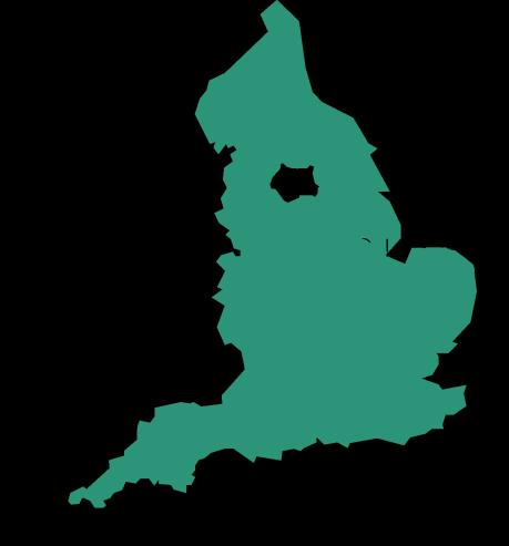
ENGLAND
LEEDS BRADFORD Esholt
WEST YORKSHIRE
SITE LOCATION
SURVEY AND ANALYSIS
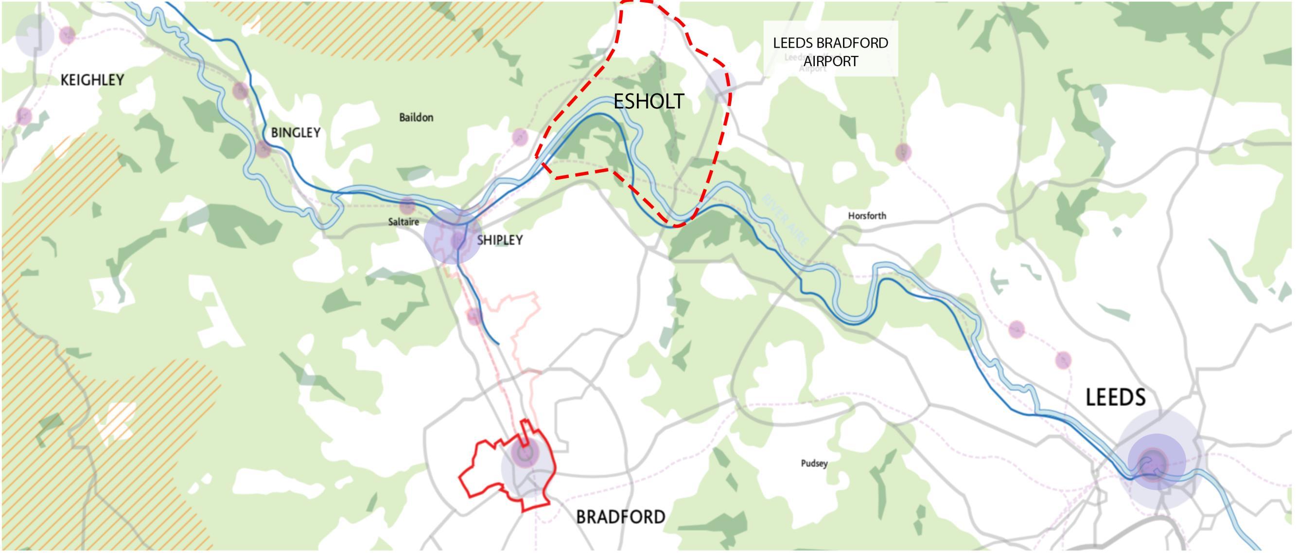
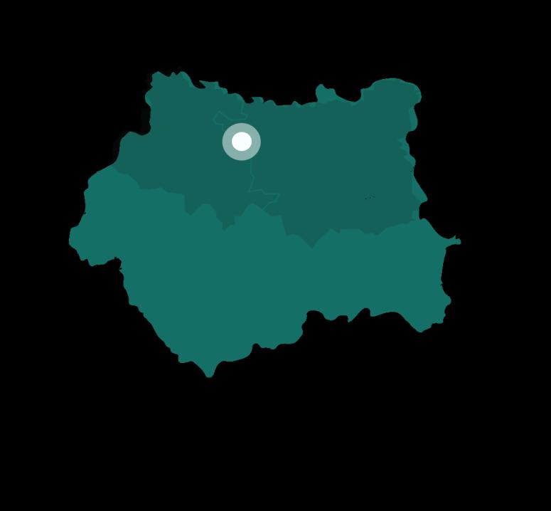
Esholt is a village between Shipley and Guiseley, in the metropolitan district of the City of Bradford, West Yorkshire, England.
It is situated 3 miles east of Shipley town centre, 1.5 miles south-west of Guiseley Main Street, 7 miles north of Bradford City Centre, and 10 miles north-west of Millennium Square, Leeds.
15
Figure 12 the site Esholt location
SURVEY AND ANALYSIS
SITE LOCATION
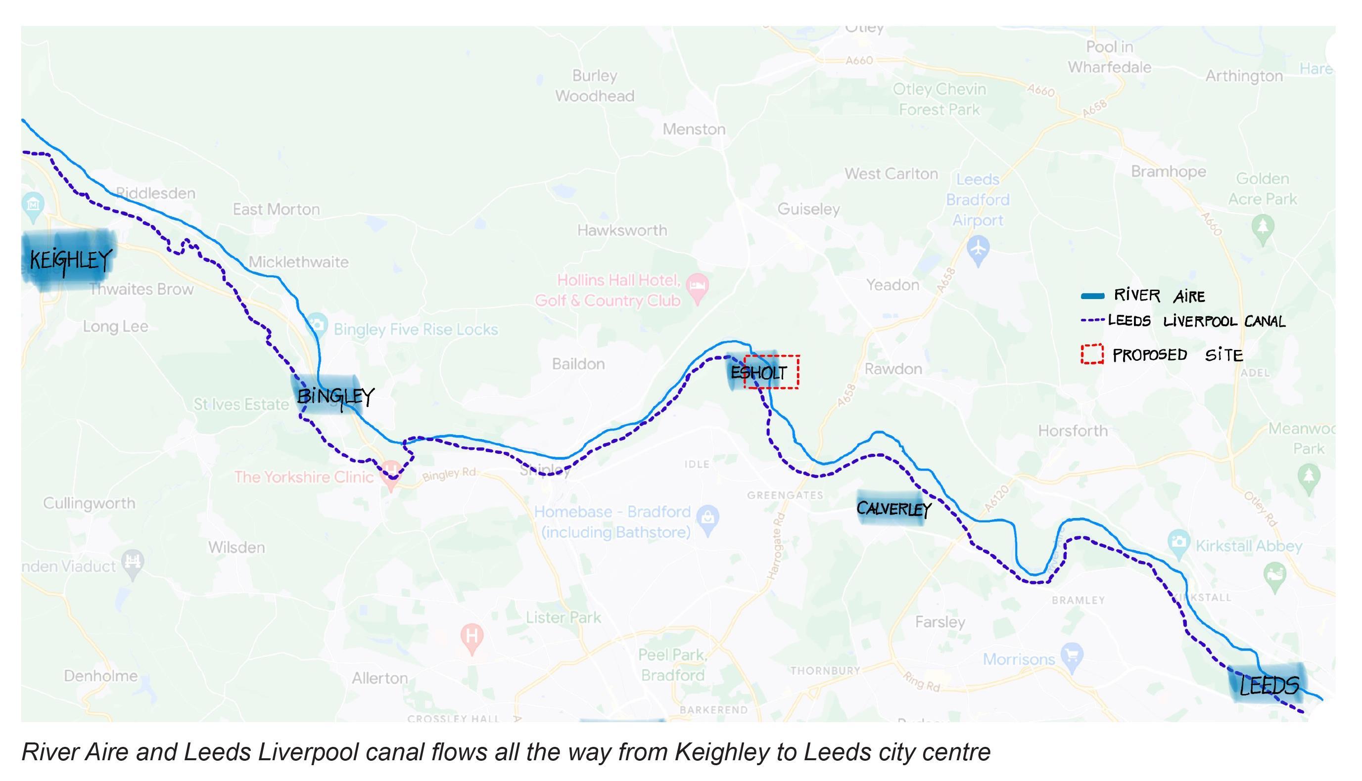
River Aire is the major river which flows 148 kilometeres long in Yorkshire, England. The Aire and Leeds Liverpool canal acts as prominent character in the development of Esholt village. The Leeds Liverpool canal was constructed in 1816 and flows 150 kilometres (approx.) long. The information regarding Aire potrays that the distance from Malham to Howden is 90 kilometres direct, from Malham Tarn and Airmyn, the river drops 400 metres. River Aire is partly canalised in Leeds and the water flowing from Esholt is quite canalised.
River Aire flows from west to east, but the becks and streams joining from Bradford and Leeds(South) connects to Eshlot (North)
16
Figure 13 the site Esholt location in the R.Aire ans LL canal flows
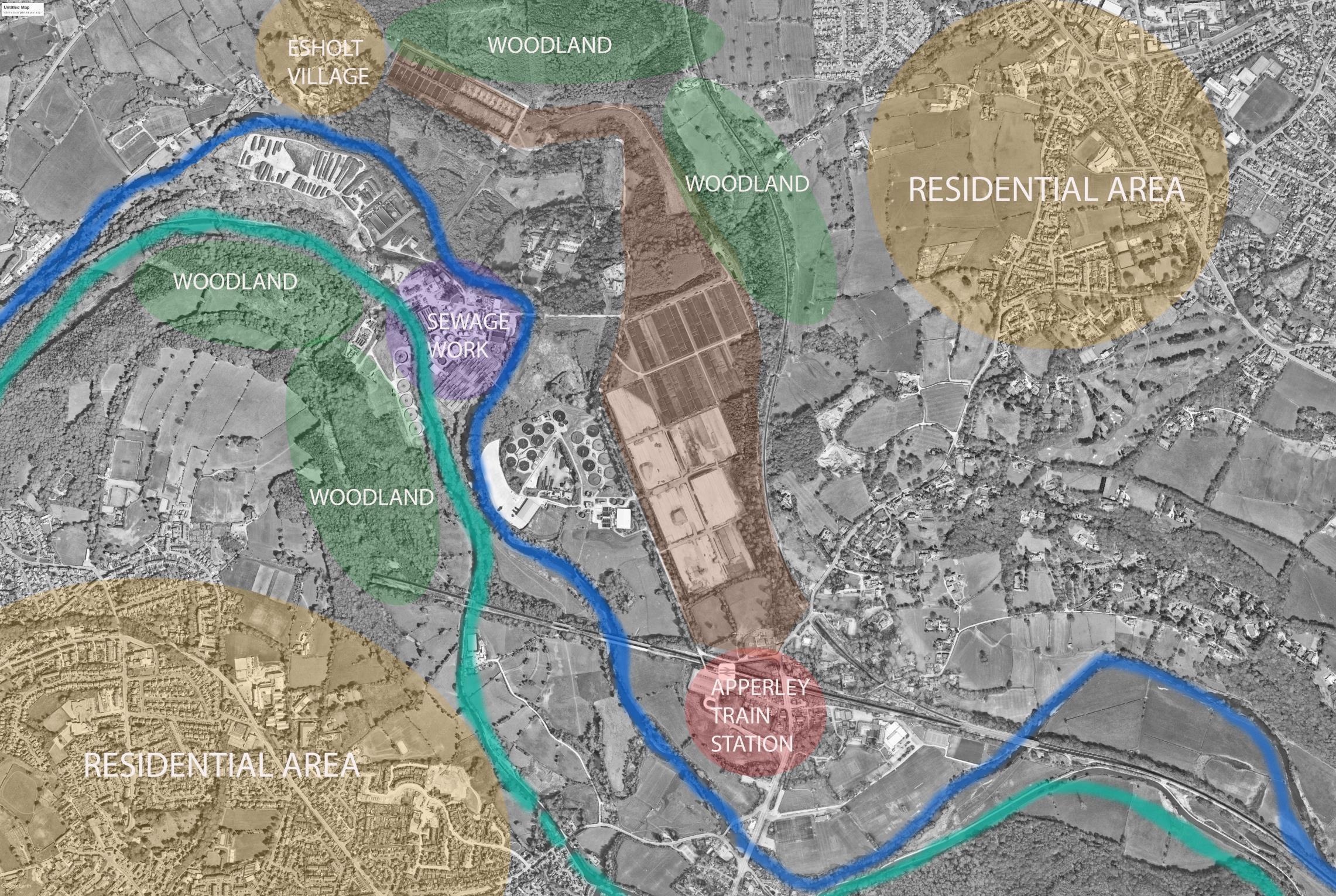
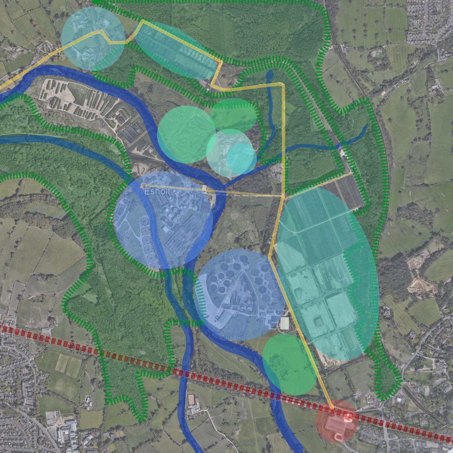
The site is surrounded by:
• Apperley train station to the south
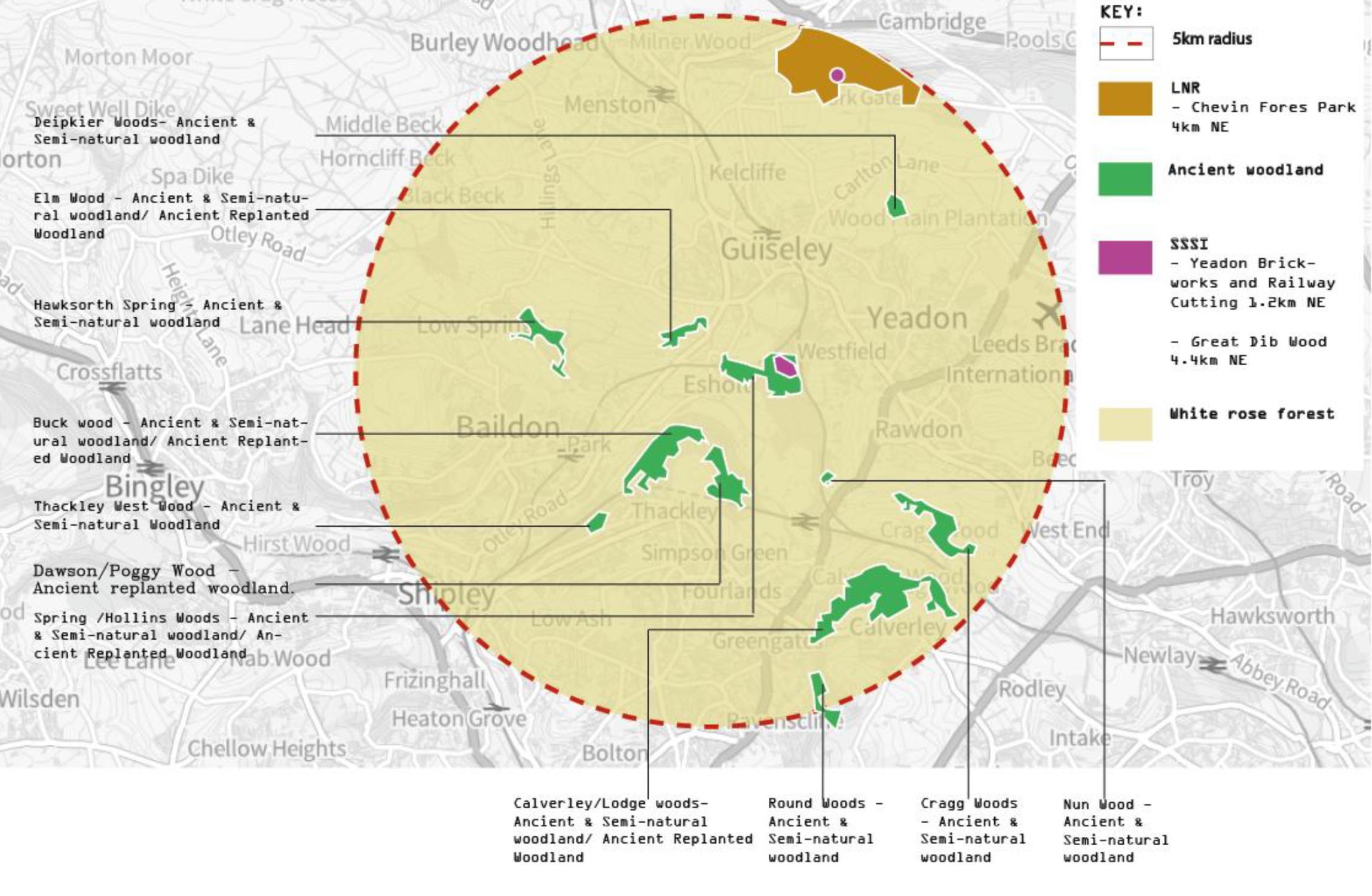
• Esholt village and ancient woodland to the North
• To the West are R.Aire, LL canal, and woodland
• In a wider context are suburban residential Areas
WIDER CONTEXT
SURVEY AND ANALYSIS 17
Figure 14 Map of wide context surrounding the site Illustration based on map of Google Earth


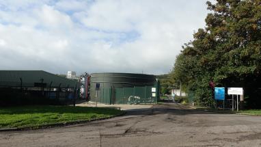
SETTLEMENT
TREATMENT
KITCHEN GARDEN
ENCLOSED BY HEDGES
ENCLOSED BY HEDGES
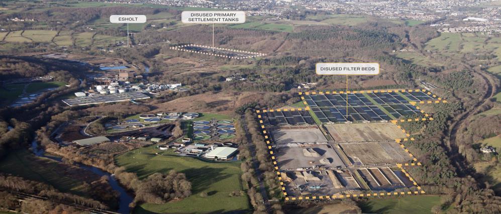
filter bed Esholt Hall Heritage The Avenue Woodland Sewage treatment plants Beck APPERLEY TRAIN STATION 1. Water corridors: river, canal, Becks 2. Sewage treatment plants 3. Disused filter bed 4. Disused primary settlement tank 5. Village of Esholt 6. Esholt Hall Heritage 7. Kitchen Garden 8. The Avenue 9. Woodland 10. Field enclosed by hedges 11. Apperley train station 18
15
the site’s characters
CHARACTERS AREA SURVEY AND ANALYSIS WOODLAND WOODLAND WOODLAND WOODLAND DISUSED PRIMARY
TANK DISUSED FILTER BED SEWAGE
PLANT SEWAGE TREATMENT PLANT VILLAGE OF ESHOLT ESHOLT HALL HERITAGE
FIELD
FIELD
FLOODPLAIN Disused
Figure
Map of
Illustration based on the map of Google Earth
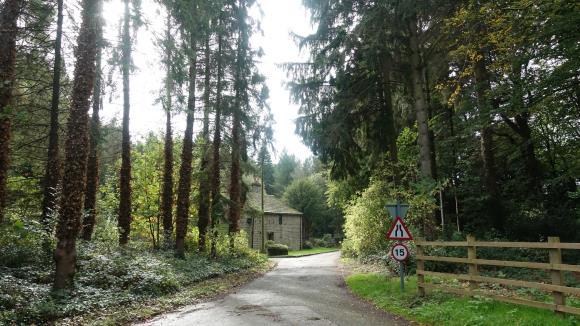
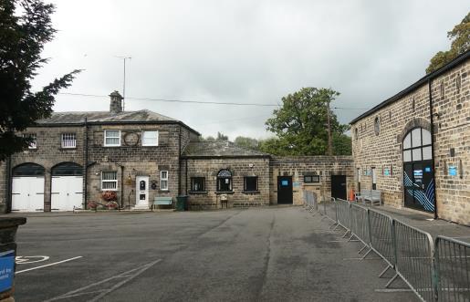
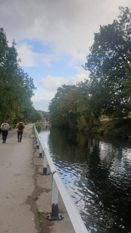
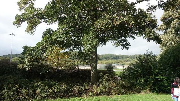
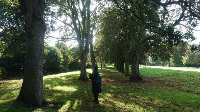
1 3 5 7 4 6 2 8 2 9 1 5 9 4 10 SURVEY AND ANALYSIS 11 12 SITE PHOTOS SURVEY AND ANALYSIS 19
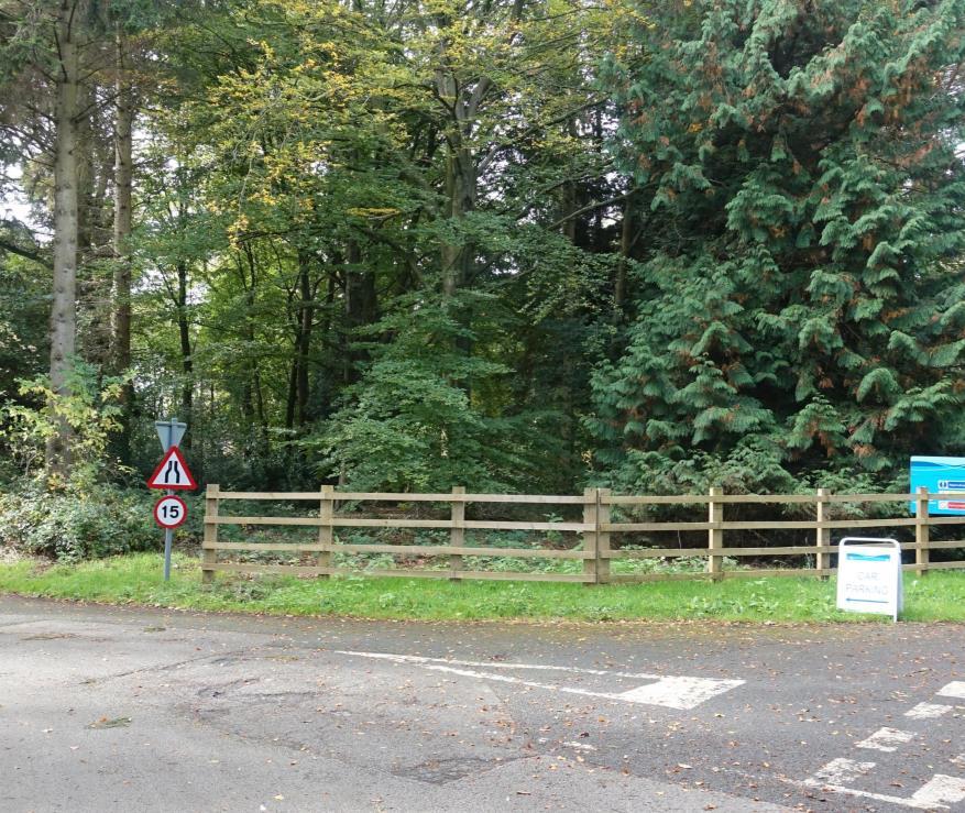
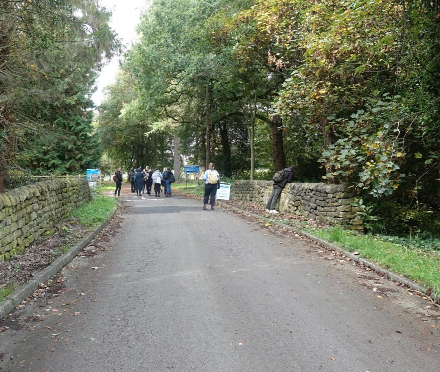
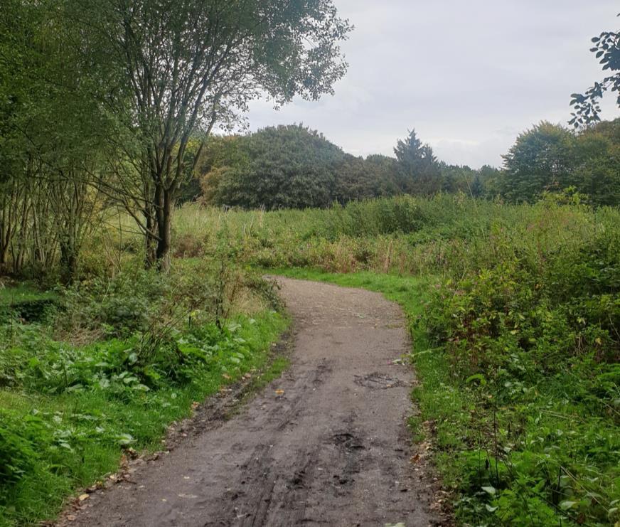
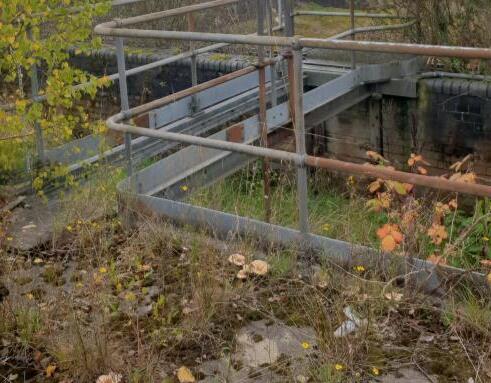
SITE PHOTOS
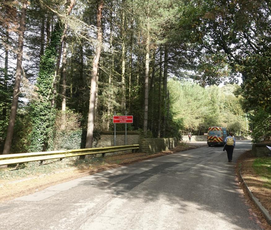
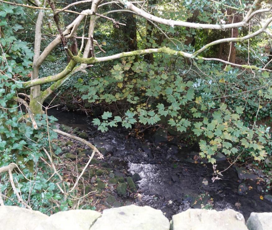
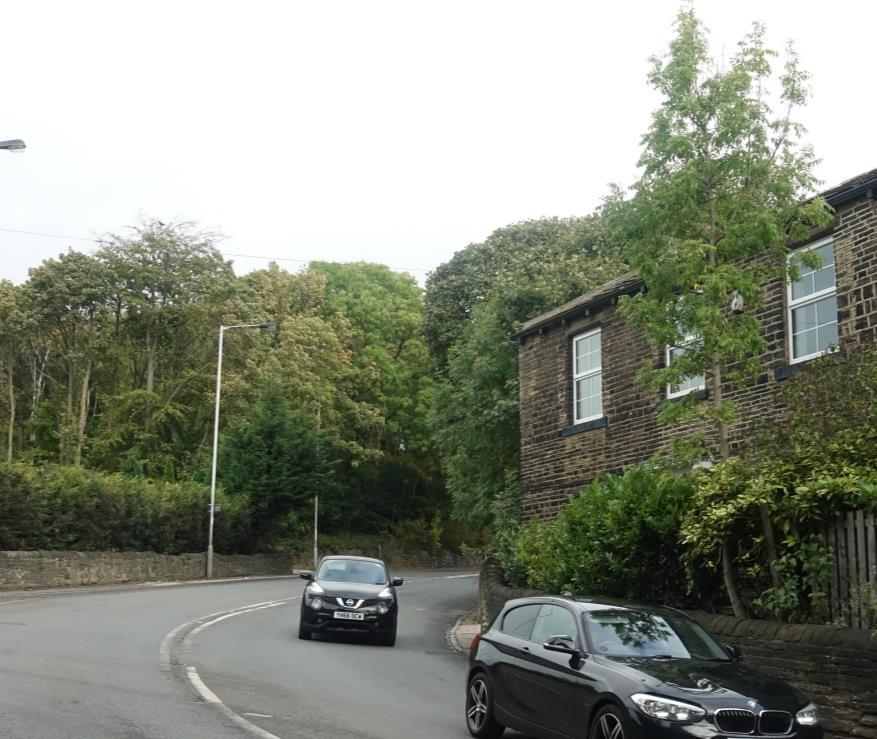
5 3 8 10 4 5 20

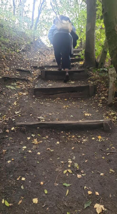

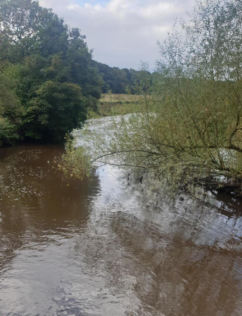
2 11 5 6 12 21
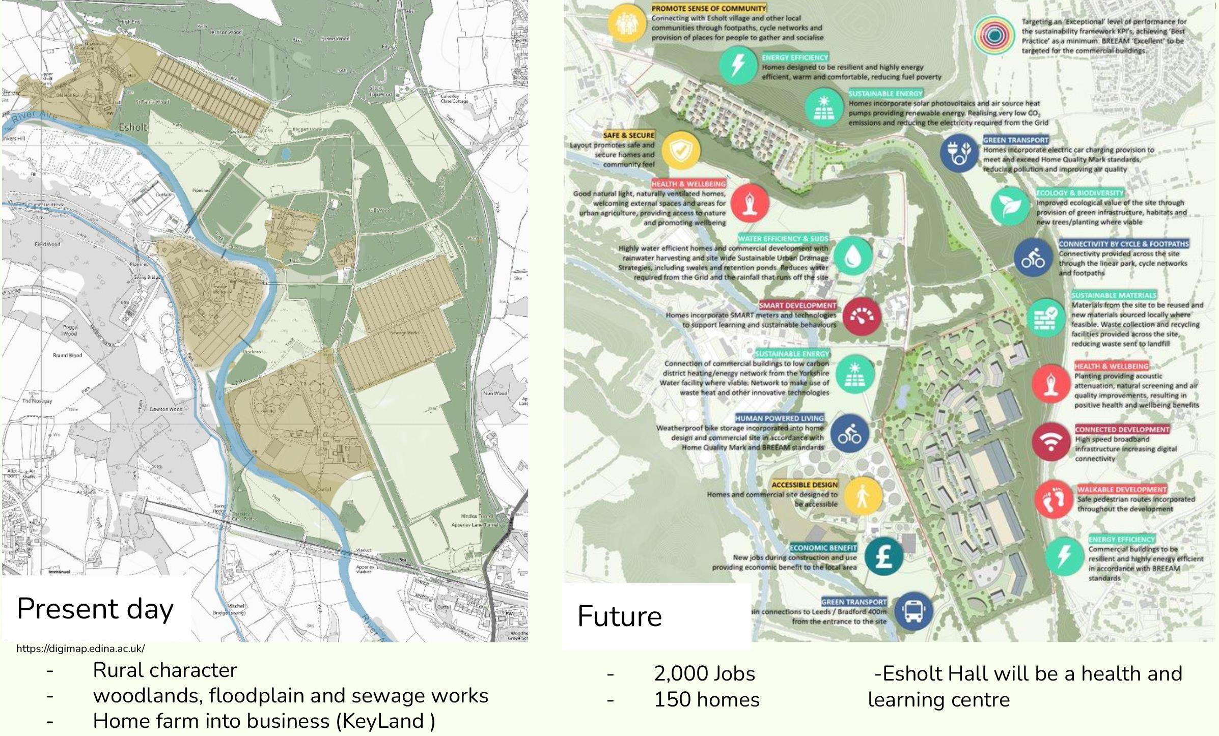
SITE PROPOSALS SURVEY AND ANALYSIS
22
figure 16 the site in present day and site proposal
PROPOSALS AND CURRENT SITUATION SURVEY AND ANALYSIS
1.
Current: Disused water tanks
Key

Industrial proposals
Residential proposals
Existing water tanks to be retained
Esholt Hall to be repurposed
2.5km radius
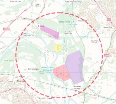
Proposed: Residential development consisting of 150 homes
3.
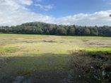
Current: Water filtration beds
Proposed: Industrial/business development area
2.
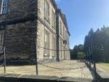
Current: Esholt Hall
Proposed: Academy for Yorkshire water & centre for health and well-being
4.
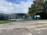
Current: Sewage and water treatment tanks
Proposed: To be retained and remain in use
WIDER CONTEXT
1 2 3 4
23 figure 17 site proposal figure 18 site proposal
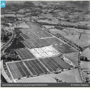
Bacterial Filters (1947)
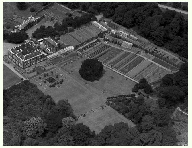
An engraving of Esholt Hall, before 1832 ilkleygazette.co.uk
In the 16th century Esholt began an agricultural community and a medieval nunnery
● Leeds Liverpool Canal was constructed in the 1770s, for carrying products e.g coal, and wool .Also it was connected to Bradford Canal.
● In the 1830s cloth trade began and the workers lived in cottages in Esholt
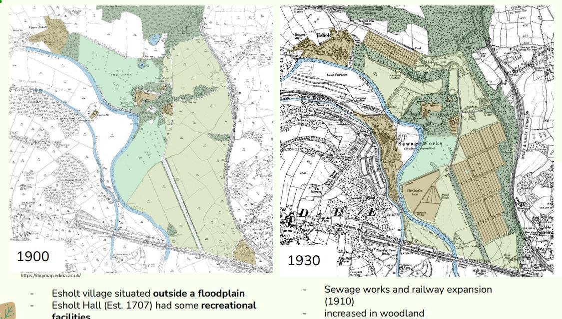
● Esholt sewage works railway was constructed in 1910. It was the main sewage works in Bradford region. soap, bleaches and dyes from the textile industry were released into the water sewage system for treatment at the site
SURVEY AND ANALYSIS
HISTORY
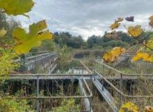
Esholt sewage works railway was constructed in 1910 to serve sewage works in Esholt.
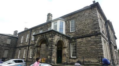
 Image showing old railway bridge Stanford, M. (2020)
thetelegraphandargus.co.uk britainfromabove.org.uk britainfromabove.org.uk 24 figure 18 site history
Esholt Hall
figure 19 historic Esholt Hall figure 20 historic bacterial Filters figure 21 Esholt sewage works railway
SURVEY AND ANALYSIS
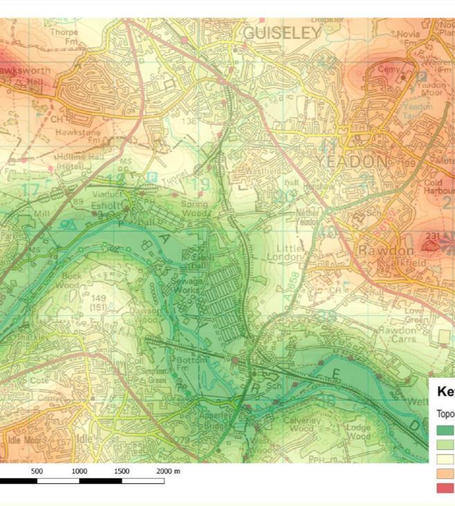
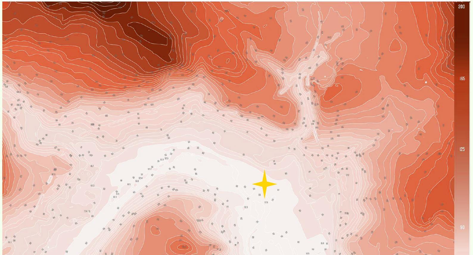
TOPOGRAPHY
• River Aire was eroded along the line of a major geological fault
• Valley developed at the beginning of the last glacial period and is wide and gently rounded in cross section. Dominated by the wide valley of the River Aire.
• Steeply inclined valley to the south.
• Gently sloping north of the river.
• The narrow wooded valley of Gill Beck feeds into the Aire valley from the west.
• Guiseley beck running in from the north-east via Esholt Hall.
• Large, flat floodplain is dominant within the character area.
STRENGTHS
✓ Esholt’s character is defined through the surrounding bold pattern of heavily wooded slopes; and flat, more open floodplain which gives it a definitive character.
✓ The natural & historic wooded ridges surrounding Esholt provides an important skyline features in views from within the Esholt valley
✓ Some Managed woodland slopes have continuous links with surrounding ancient woodlands
WEAKNESS
✓ Esholts location makes it more prone to flooding due to it being situated Close to River Aire and based at the bottom of the valley
✓ Could suffer from excessive water run off over a period of time and bare land soil erosion
25 Figure 21 tophography of the site
SURVEY AND ANALYSIS
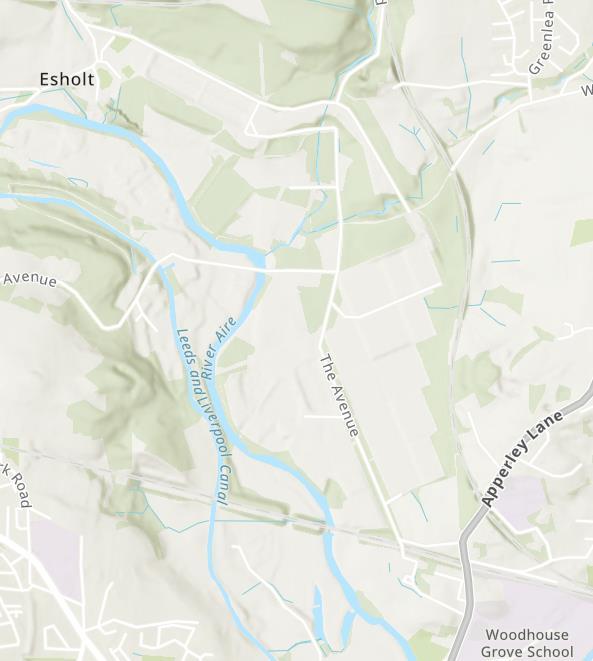
HYDROLOGY
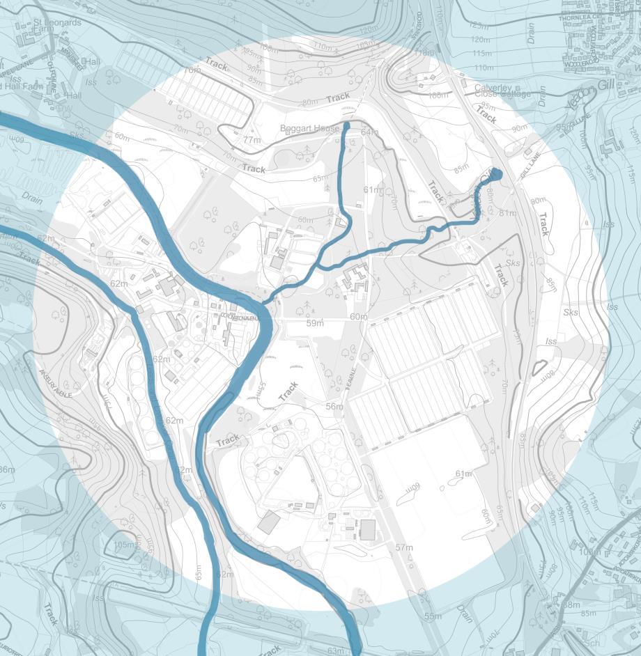
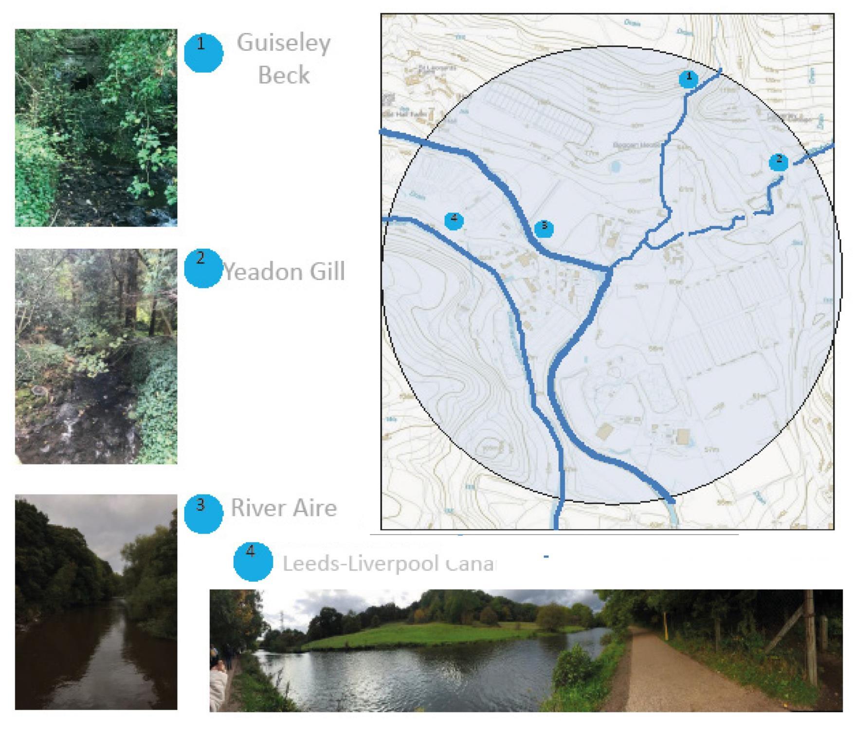
Guiseley Beck enters the Site from the south east via River Aire. The stream runs through the Esholt Property. From the river it follows a common path and later diverges towards the north.
Yeadon Gill enters the Site from the south east via River Aire. From the river it follows a common path and later diverges towards the north-east. The stream runs through the Esholt Property and The Avenue.
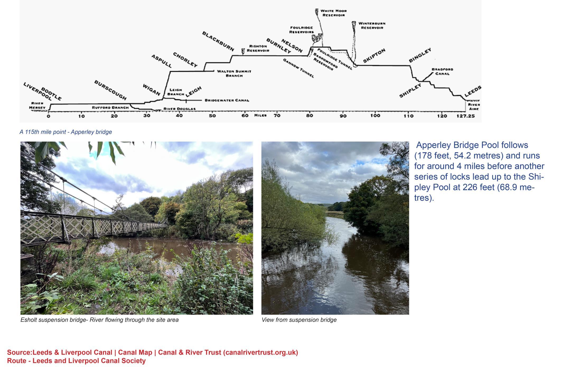
River Aire Runs through Keighly, Bingley, Salaire and Shipley, the centre of Leeds and out to Woodlesford and Castleford ending in the River Ouse at Airmyn. Key strategic transport corridor during industrial revolution. Today the river is cleaner than ever due to pollution prevention, although the river still suffers from pollution and one major source is the large sewage treatment works taking domestic and industrial wastes from Keighley, Bradford, and Leeds
Leeds liverpool canal Dobson Locks:One of the locks being present at Esholt. Was used for carrying stone, coal and many other goods. Today the canal offers walking, boating, wildlife-watching and allround relax
26
Figure 21 Hydrology of the site
SURVEY AND ANALYSIS
HYDROLOGY
27
SURVEY AND ANALYSIS
HYDROLOGY
FLOODING AREA
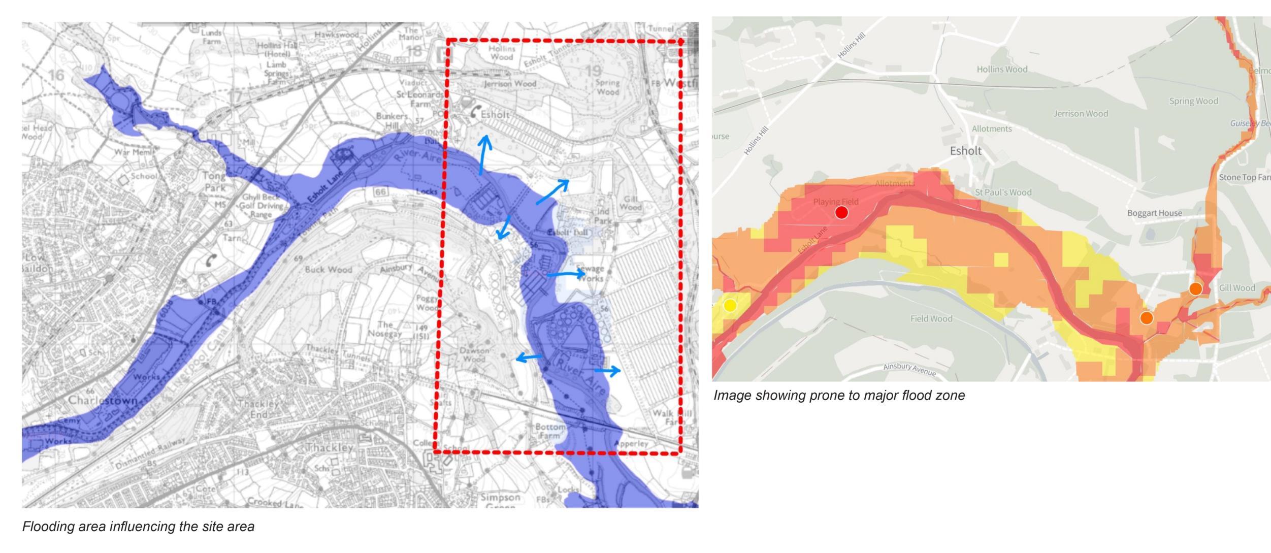
the detailed analyses of the flooding area. Its demonstarted and seen due to relief of the existing village patch, water streams in and around the site and canal which is located adjacent to the river.
28
22
Figure
HYDROLOGY SURVEY AND ANALYSIS
29
SURVEY AND ANALYSIS 30
HABITAT SURVEY
Figure 23 habitat designations map
LANDSCAPE CHARACTER MAP
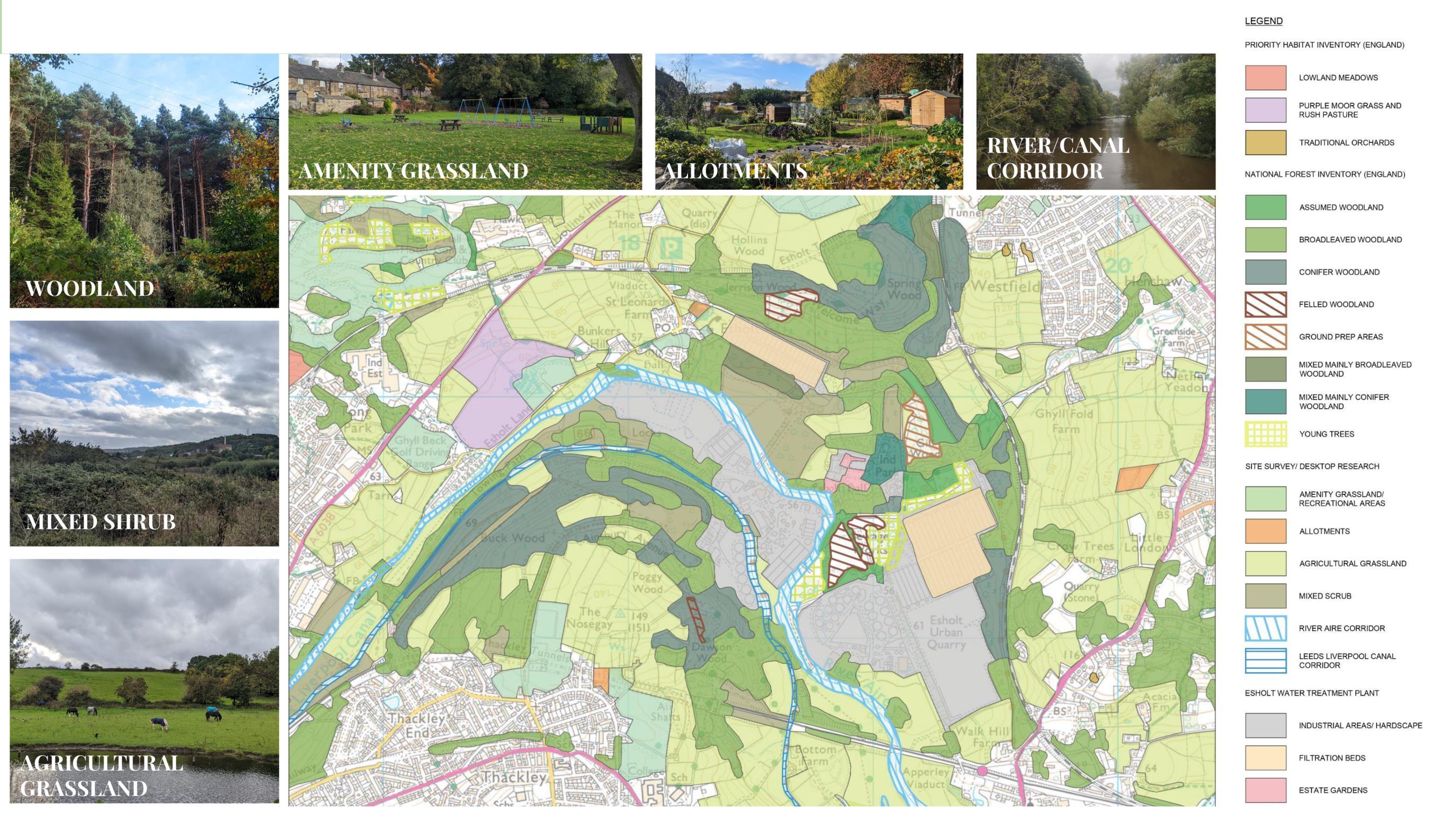
SURVEY AND ANALYSIS
HABITAT SURVEY
31
SURVEY AND ANALYSIS
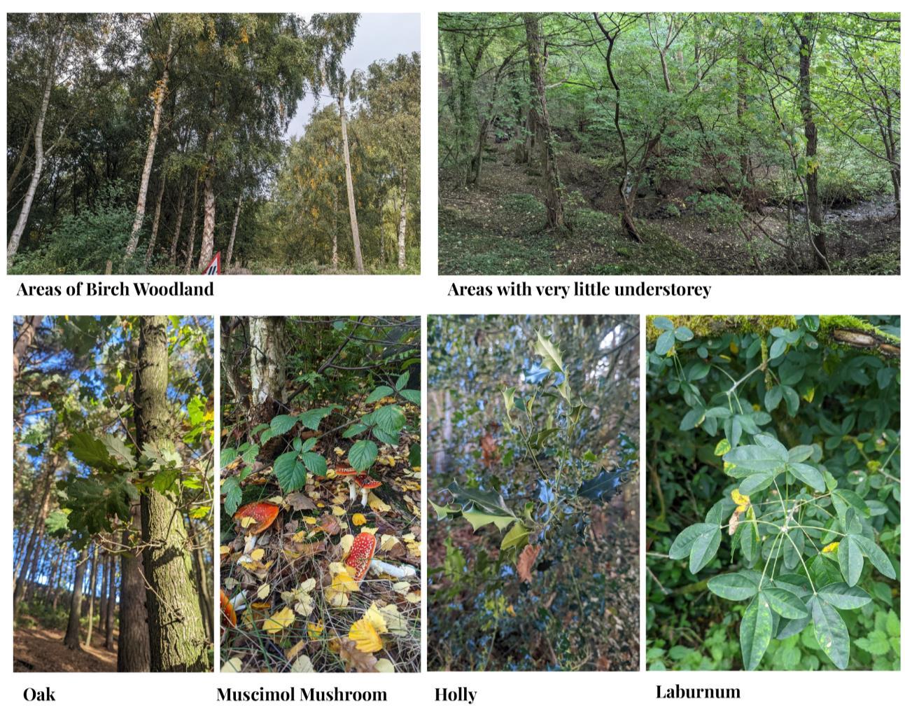
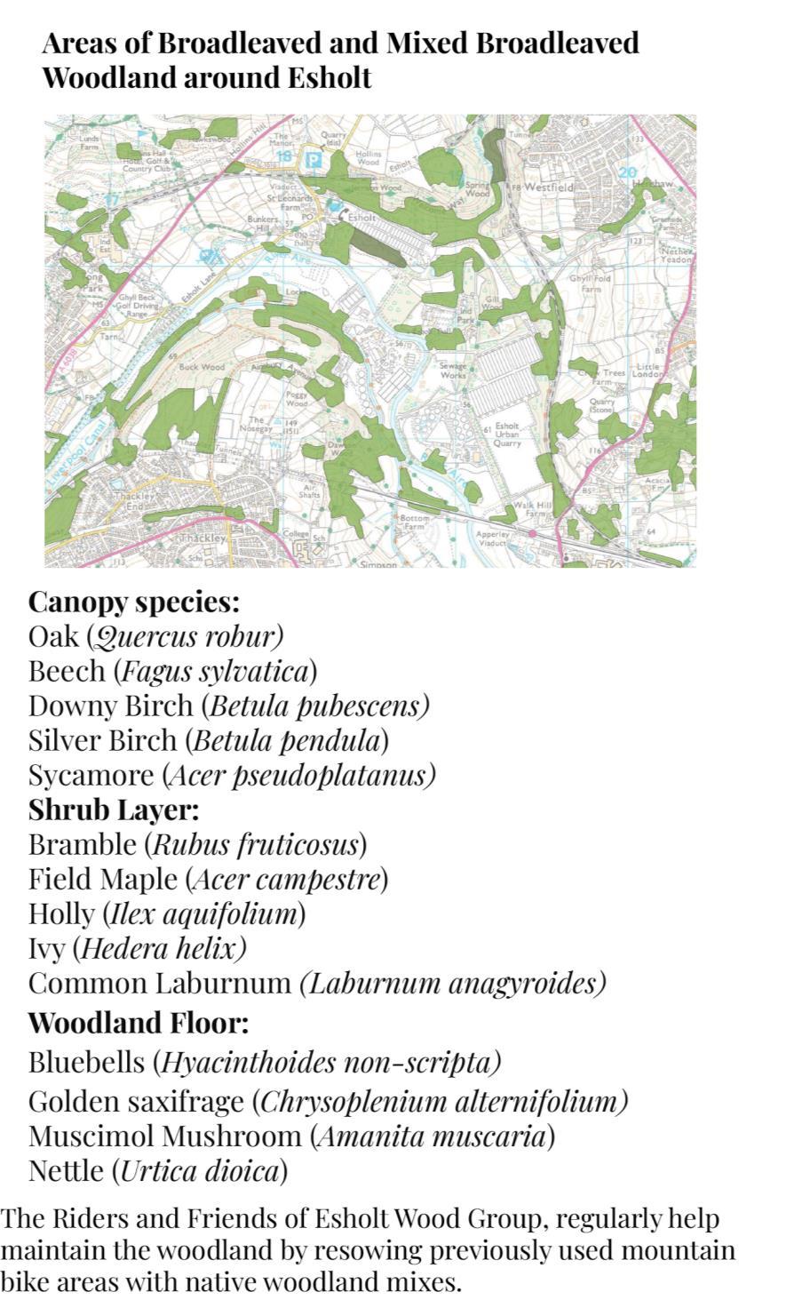
HABITAT SURVEY
WOODLANDS HABITAT
32
SURVEY AND ANALYSIS
HABITAT SURVEY

WETLAND
33
SURVEY AND ANALYSIS
HABITAT SURVEY
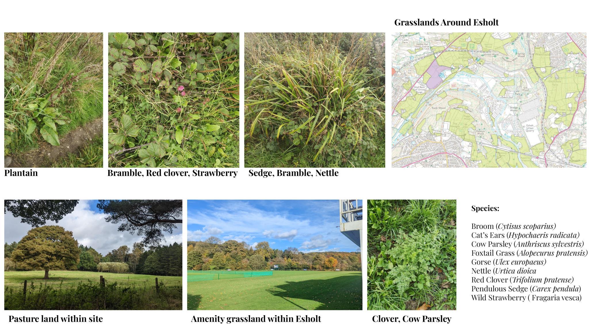
GRASSLAND
34
SURVEY AND ANALYSIS
ACCESS AND CIRCULAR
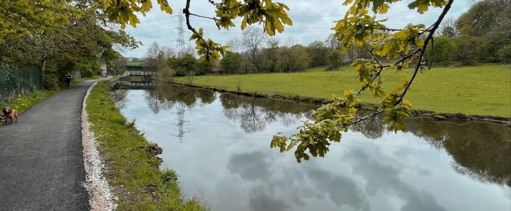
Esholt have popular public paths for walk, cycle and bridleway circles the sewage works at Esholt, using footpaths across farmland and through woodland, suitable for visiting walkers. This walk is not ideal for pushchairs, wheelchairs.
Opportunities:
Create accessible infrastructure for walkability, cycle
Create recreation and leisure destinations attracting visitors and residents
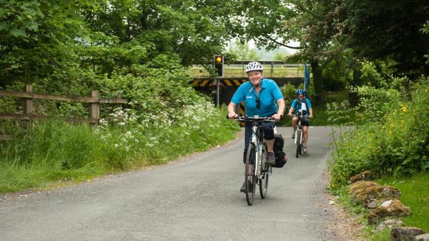
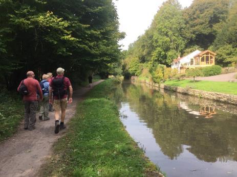


Base map: City of Bradford Metropolitan District Council
Countryside & Rights of Way
Bradford.gov.uk

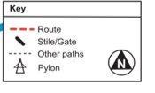
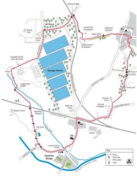
--
35
Figure 24 Rights of Way Map Bridleway and Footpath
STRENGHTS
Good public transport linkages with Bradford and Leeds
Diverse landscape characters and surrounded by large woodland areas
Existing water bodies and vegetation
Large mature trees throughout the site. Pastureland throughout the site and surrounding area are in good condition.
A large number of open spaces
Retained historic landscape features
Strong sense of community in Esholt village, and well-preserved Esholt
Hall Grounds
WEAKNESSES
Smell pollution from the sewage treatment plant and Soil contamination
Not many activities for the younger generation
Have not exploited the value of ecological landscape and water course value, lack of connectivity to waterbodies the site disconnected from the rest of Bradford as access is restricted
Post-industrial areas need management to achieve biodiversity
OPPORTUNITIES
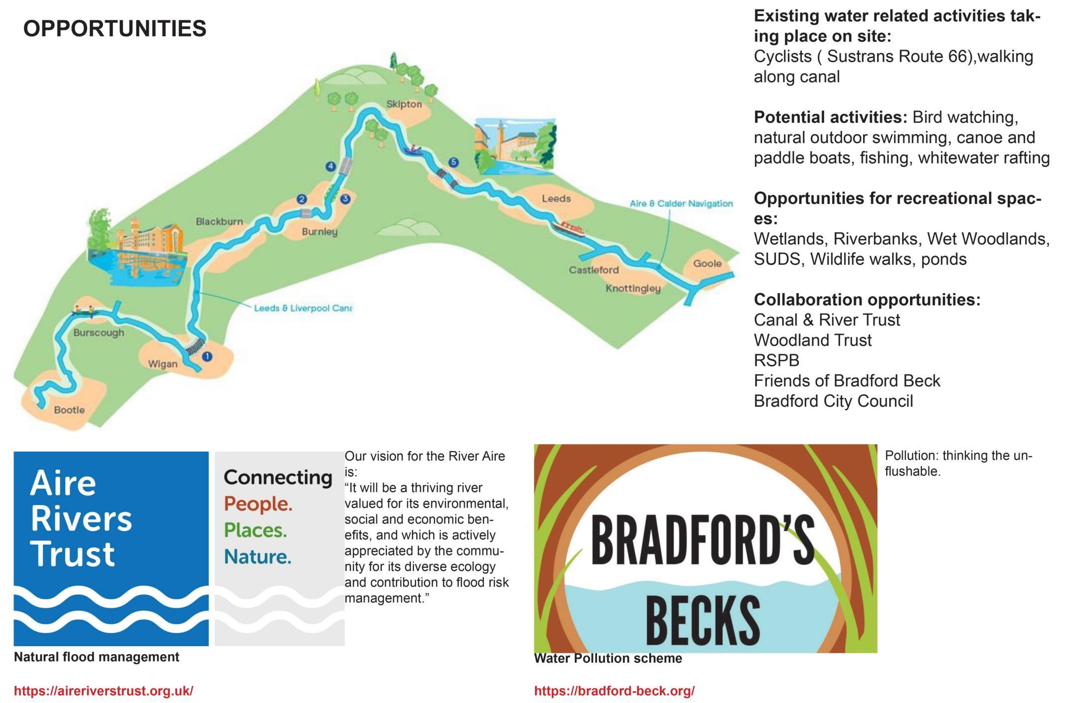
Involving the community with different projects around the Esholt Hall grounds
Large areas of neglected pasture that could be used for development or to create more biodiverse habitats.
Managing and maintaining other woodlands surrounding the site to create more biodiversity, Opportunity to create sustainable housing
make River Aire/ Leeds-Liverpool Canal corridor more biodiverse.
CHALLENGES
Linking new and existing communities, developing the new development in a way that won’t disturb the existing community
Mitigate smell pollution from wastewater treatment facilities and mitigate soil contamination
Deal with flood zones and water-sensitive areas
SWOC
36
Figure 25 opportunities and constraints map

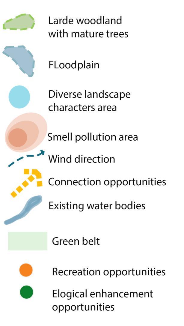
SURVEY AND ANALYSIS
OPPORTUNITIES AND CONSTRAINTS MAP
37
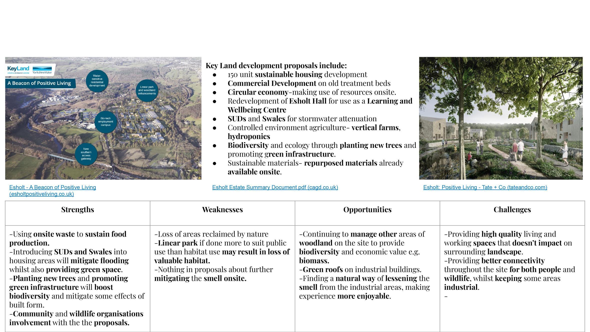
ESHOLT ESTATE’S CURRENT PROPOSAL SURVEY AND ANALYSIS
38
ESHOLT ESTATE’S CURRENT PROPOSAL SURVEY AND ANALYSIS
No connection for people with nature and creation
Small community spaces
The housing and business park section seems separated and disconnected from the rest of the development
Weaknesses Opportunities
Better connections to nature and wildlife for the residents and visitors.
Increase biodiversity
Bring more visitor
Create green connection for recreation purpose
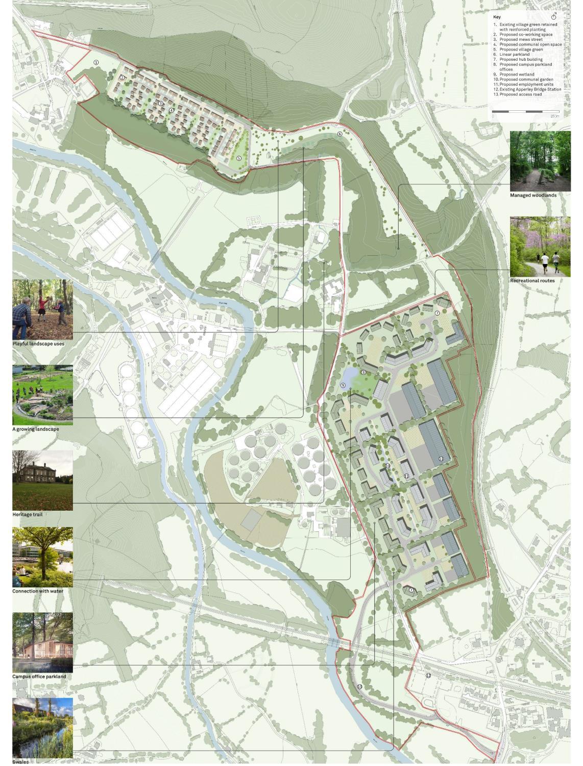
39 Figure 26 Esholt estate’s current proposal
RESEARCHES AND CASE STUDIES
RESEARCHES AND CASE STUDIES
40
APPLICATION OF EARTH SHELTERED CONSTRUCTION RESEARCHES
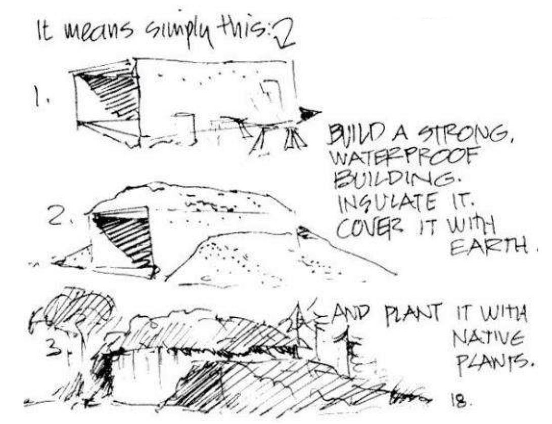
Architects such as Malcolm Wells is pioneer in earth sheltered design and have put on the map many such buildings. He had beliefs that the roofs of all buildings should be made habitable for both animals and plants with a strong philosophy that architecture should be something, that is environmentally efficient and self-sustainable.
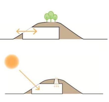
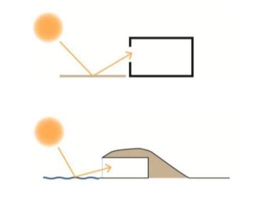
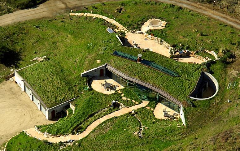
There are three types of earth sheltered housing construction methods:
Earth bermed - soil is packed against the building and over the rood to create a sloping hill structure.
In hill construction - this is where you have a preexisting hill and set the house into it.
Fully recessed construction - the whole house is below ground level and revolves around a central open courtyard space
Of the three methods earth berming is the more common.
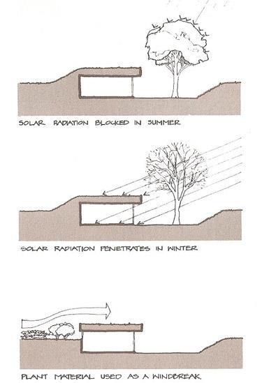
He effectiveness of trees and shrubs in reducing energy costs but it also indicates the potential savings that could be projected for a house that was earth-sheltered on three sides providing a far more complete windbreak.
https://www.bigrentz.com/blog/earth
41
Multilayers using Light souces Use water for light reflection Light reflection
Figure 27 earth sheltered construction principals
Figure 30 effects of vegetation on earth-sheltered homes.
Figure 28 earth sheltered construction principals
Figure 29 earth sheltered contruction
APPLICATION OF EARTH SHELTERED CONSTRUCTION RESEARCHES
EARTH BERM AND PLANTS ACT AS A WIND BARRIER TO MITIGATE SMELL
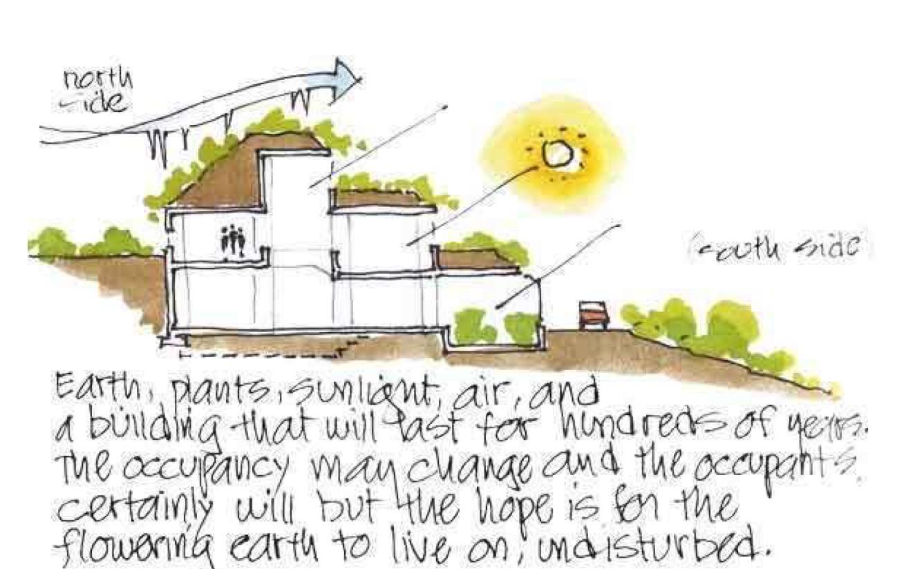
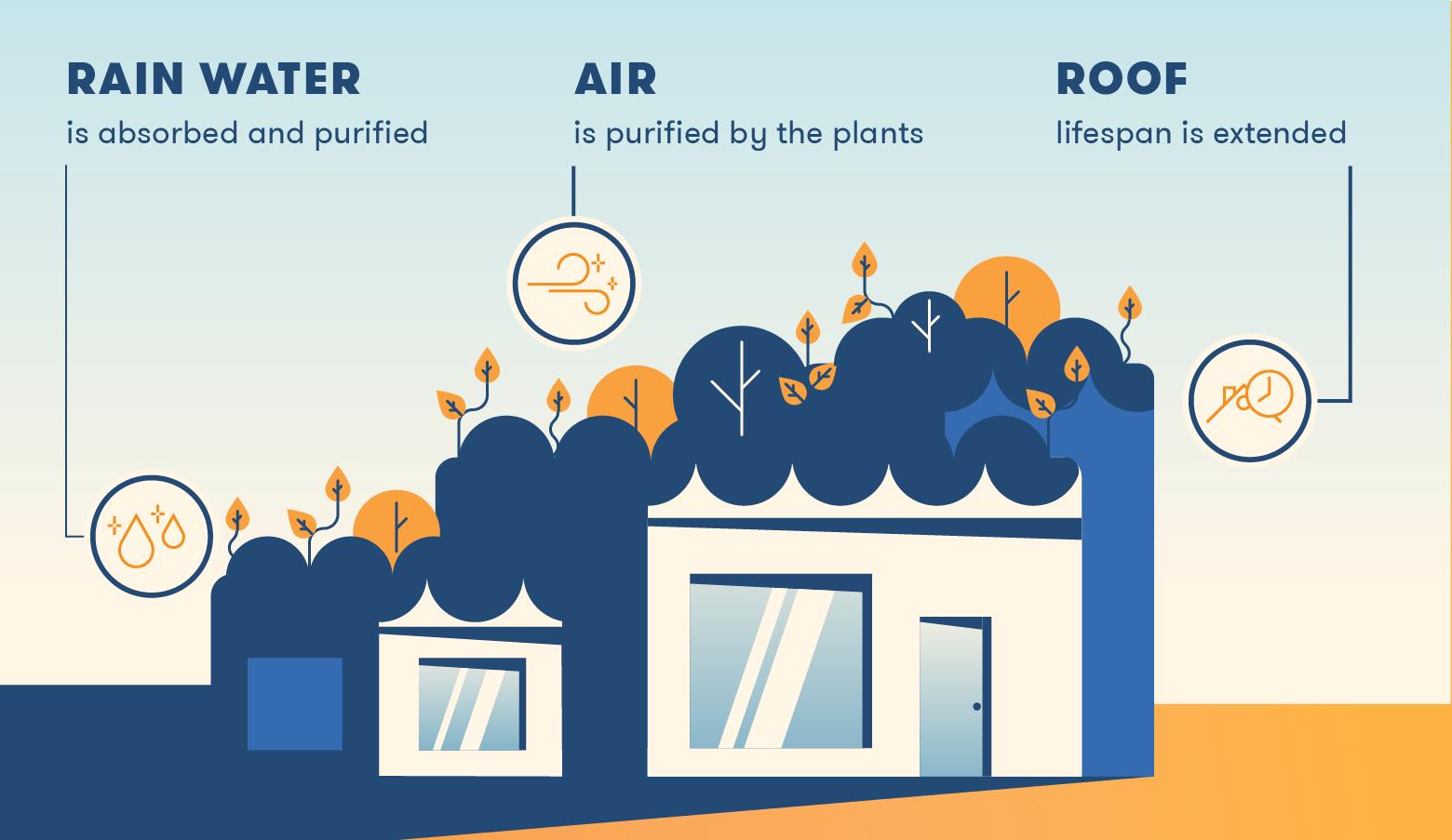
Benefits of earth-sheltered house?
• Efficient use of land - the landscape layer on the roof has functional uses e.g, food production, Car parks
• Less variation in temperature due to the soil not heating up as much as air temperatures.
• More resistant against strong winds
• Soundproofing
• Insulated - requires less man-made insulation
• Energy efficient Earth Sheltered Structures
42
Figure 31 earth sheltered construction principals
Figure 32 earth sheltered construction principals
CASE STUDIES
HOCKERTON HOUSING PROJECT
The village of Hockerton in Nottinghamshire this development was first proposed back in 1993 - well ahead of its time. The draft proposal was for 5 earth sheltered homes on a 25 acre site.
Water
The project is self-sufficient in terms of water, and has separate systems for filtering to produce different use water; drinking water, household water and water for food growing.
Energy Reduction
“The houses use about one tenth of the energy of a comparable conventional house i.e. approx.810kWh/day.”
Achieved by reducing the need for heating and cooling, using heat pumps and thermal stores forhot water and using low energy appliances


Benefits of using earth sheltered homes in the project:
Houses blend into the landscape and they become invisible to roads and access points. Insulates the homes and acts as a buffer from the outside temperature as soil temperature doesn’t change as quickly. The footprint area can be restored on the roof and there is little loss of area of natural environment.
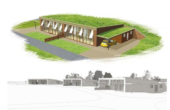
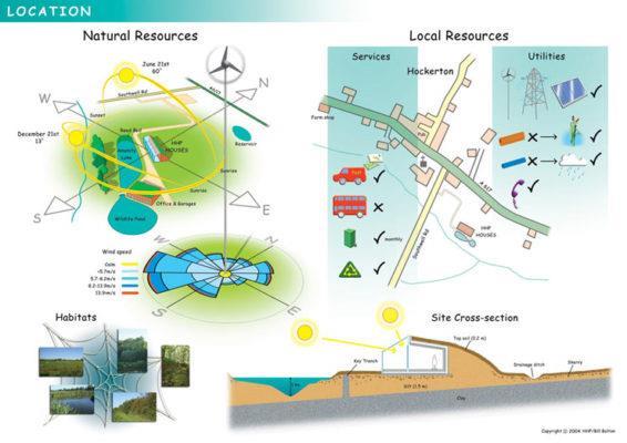
In the context of the Esholt Site:
Using earth sheltered homes will reduce loss of landscape and can limit the visual impact of the site. Development can be fully self sufficient if you manage rainwater harvesting in the right way -plenty of water bodies on site.
43
Figure 33 hockerton housing
Figure 34 hockerton housing
Figure 36 hockerton project
Figure 35 Hockerton visualisation for earth sheltered home
WASTEWATER TREATMENT WETLAND RESEARCHES
Constructed wetlands are secondary treatment facilities for household (blackwater or greywater, and/or biodegradable municipal or industrial wastewater.
The plants grown in the wetland may be used for composting or biogas production (see also composting small scale, composting large scale or anaerobic digestion).
Raw blackwater should be pretreated to prevent the excess accumulation of solids and garbage. Once in the pond, the heavier sediment particles settle out, and this also removes the nutrients attached to them. Plants and the communities of microorganisms that they support (on the stems and roots), take up nutrients like nitrogen and phosphorus. Chemical reactions may cause other elements to precipitate out of the wastewater. Pathogens are removed from the water by natural decay, predation from higher organisms, sedimentation and UV irradiation.
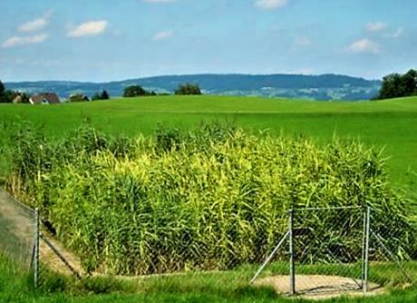
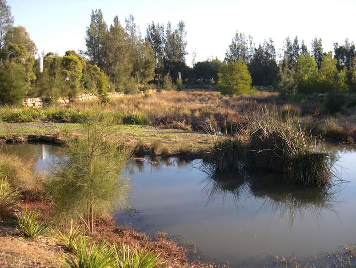
Basically, there are three different types of constructed wetlands (CWs). They are classified according to the water flow regime as:
• Free-water surface constructed wetlands (FWS)
• Horizontal flow constructed wetlands (HF)
• Vertical flow constructed wetlands (VF)
These three types of CWs may be combined with each other in hybrid constructed wetlands in order to exploit the specific advantages of the different systems.
One of the main advantages of CWs is, that they are natural systems and thus not require chemicals, energy or high-tech infrastructure. Moreover, they are suited to be combined with aquaculture or sustainable agriculture
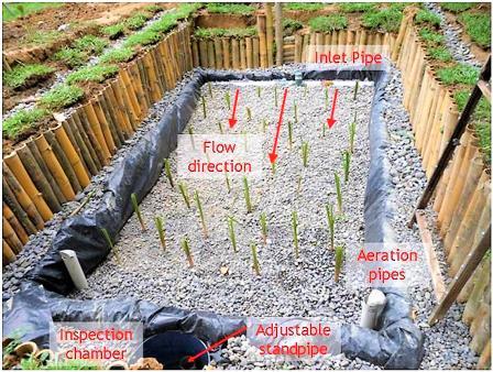
https://sswm.info/sswm-university-course/module-6-disaster-situationsplanning-and-preparedness/further-resources/free-water-surfaceconstructed-wetland
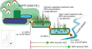
an independently operating full scale free water surface CW incorporated into a municipal wastewater treatment scheme
A free water surface constructed wetland (FWS CW) for stormwater runoff in Woodcroft Estate near Sydney, NWS, Australia
A vertical constructed wetland in Switzerland Horizontal flow CW in the EcoLodge Hotel in Bukit Lawang (Iandonesia) with local aquatic plants
https://ars.els-cdn.com/content
44
FREE-WATER WETLAND RESEARCHES
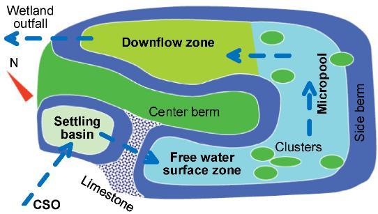
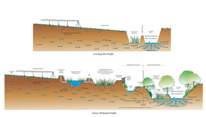
A free-water surface constructed wetland (also called free water surface, FWS) is a series of flooded planted channels or basins. It aims to replicate the naturally occurring processes of a natural wetland, marsh or swamp. As water slowly flows through the wetland, particles settle, pathogens are destroyed, and organisms and plants utilize the nutrients. This type of constructed wetland is commonly used as an advanced treatment after secondary or tertiary treatment processes.
As well as improving water quality, constructed wetlands can provide additional benefits:
Wildlife. Wetlands provide habitat for a wide range of wildlife including birds, insects and amphibians, their importance is magnified by the relative absence of these types of features in urban areas.
Amenity. Well-designed wetlands can also create interesting, diverse landscapes for people. There are many examples of wetlands that have been used to enhance parks and open spaces, making them more desirable places to visit and spend time, delivering wider benefits to the local community and improving public health and wellbeing

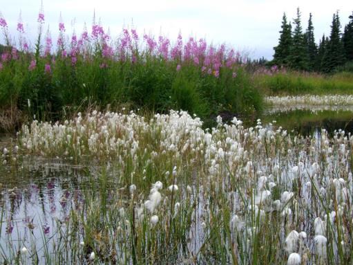
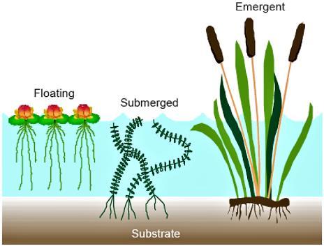 Plants for free-water surface flow constructed wetlands. Source SA’AT (2006)
Layout of free water constructed wetland
45
CROOKED RIVER WETLAND COMPLEX NATURAL WASTEWATER TREATMENT CASE STUDIES
https://www.cityofprineville.com/wetlands
The City of Prineville’s successful Crooked River Wetland Complex is now complete and providing remarkable social, economic and environmental benefits to the community. Through this 120-acre, multipurpose project, the City is responsibly expanding its wastewater capacity, lowering residential and business System Development Charges, stabilizing monthly wastewater rates, created a new public hiking trail system with numerous educational opportunities and improving riparian and instream conditions in the Crooked River.
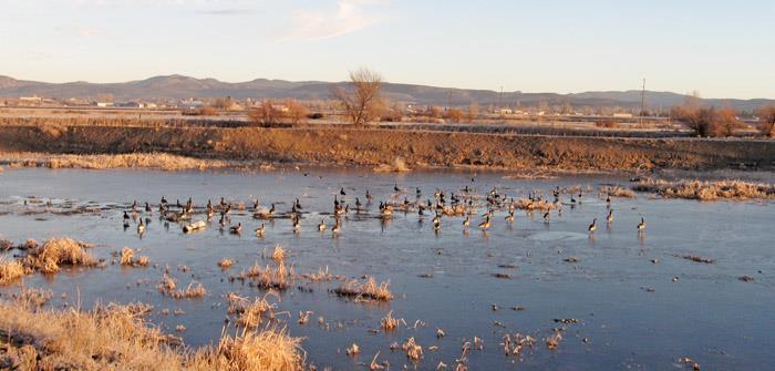
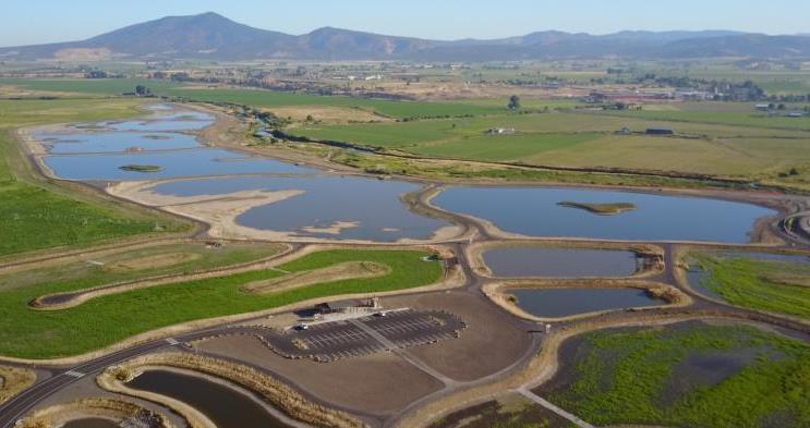
https://www.nacwa.org/news-publications/newsdetail/2019/12/04/the-city-of-prineville-s-innovativenatural-wastewater-treatment-system
Crooked River Wetlands Complex Natural Resources
A natural alternative to a new mechanical treatment works
Sustainable Benefits
Civic Improvements - Future treatment costs were reduced from $62 million to $7.77 million.
Recreational Opportunities - Amenities abound with over 5.4 miles of new walking, running and hiking trails, 3.25 miles of which are paved for use year-round. A covered pavilion and restrooms make for a wonderful gathering place prior to a birdwatching or recreational hiking tour.
Educational Values - Thirteen separate colorful kiosks present topics ranging from the Crooked River Watershed to macroinvertebrates. The facility is expected to serve many generations of schoolchildren to come.
Environmental Benefits- many species of fish and wildlife, including lower river temperatures.
Crooked River Wetlands
46
Crooked River Wetlands Habitats
PHYTOTECHNOLOGY IN LANDSCAPE DESIGN RESEARCHES
Plants can and do in such a powerful way that these plants are being used to remediate toxic wastelands, restoring them to pictures of health.
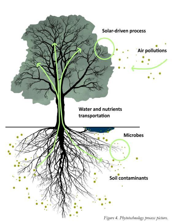
PHYTOTECHNOLOGY: living plants are employed to clean up soil, air, and water contaminated with hazardous chemicals.
A number of species of plants are especially adept at concentrating elements from the environment, degrading toxins in soils water and air into harmless compounds and elements.
Phytotechnology is extremely environmentally friendly and it’s far less expensive than other pollution remediations. However, take more time, as the plants work more slowly than chemical or mechanical methods.
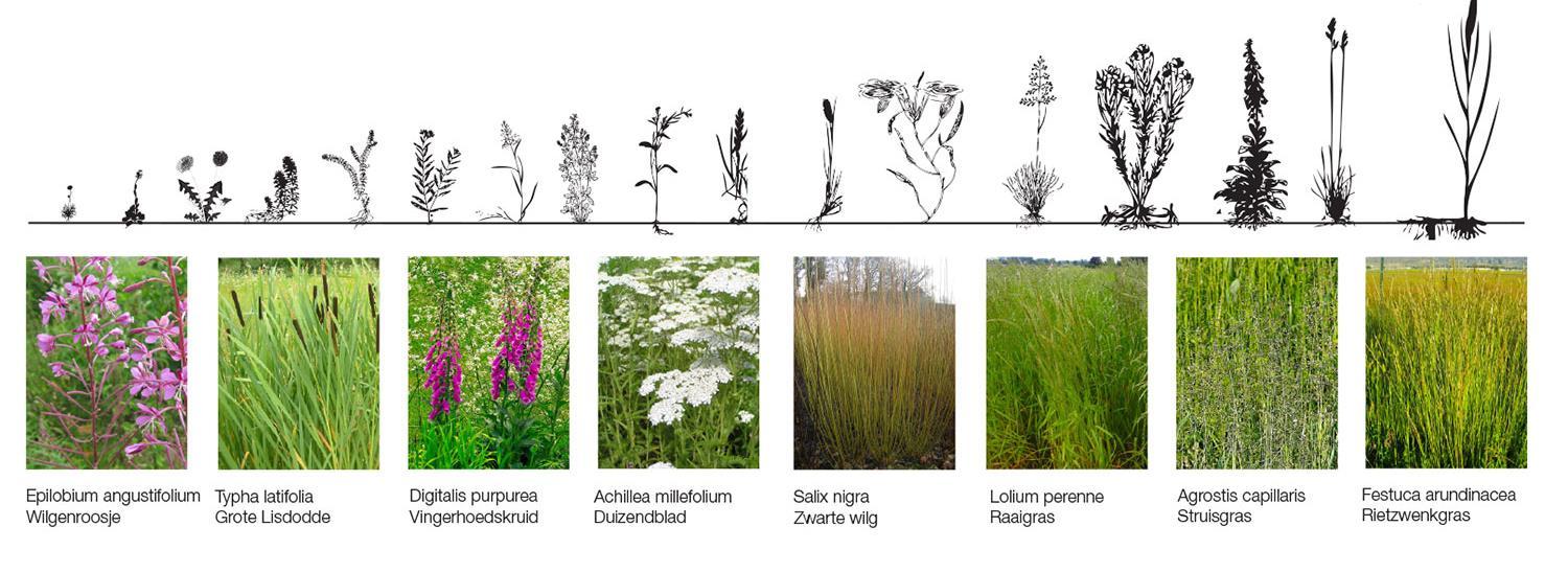
Examples of phytoextractive and hyperaccumulator plants and their target contaminants include:
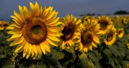
•Sunflowers (Helianthus annuus)
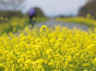
•Indian mustard (Brassica juncea)
•Ragweed (Ambrosia artemisiifolia)
•Hemp dogbane (Apocynum cannabinum)
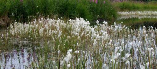
TURNING POISON INTO PARADISE
Purifying Park De Ceuvel
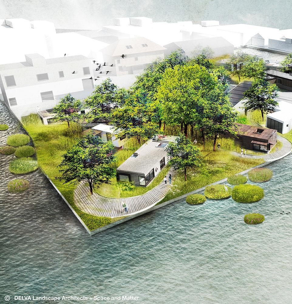
De Ceuvel, in Amsterdam, which has been sustainably developing a piece of industrial wasteland. It features a Purifying Park filled with indigenous plants that are pulling the toxins out of the soil and water and turning the land into place where children can safely play and people can safely live.
•Poplar trees (Populus)
•Fireweed (Achillea millefolium)
•Chinese Brake Fern (Pteris vittata)
•Alpine pennycress (Thlaspi caerulescens)

•Willow (Salix viminalis)
•Water hyacinth
•Halophytic barley (Hordeum vulgare)
•Sugar beet (Beta vulgaris)
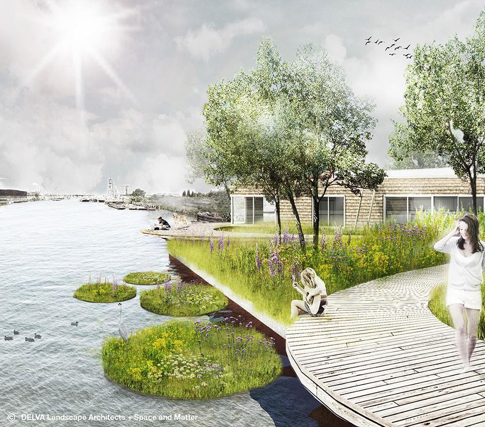
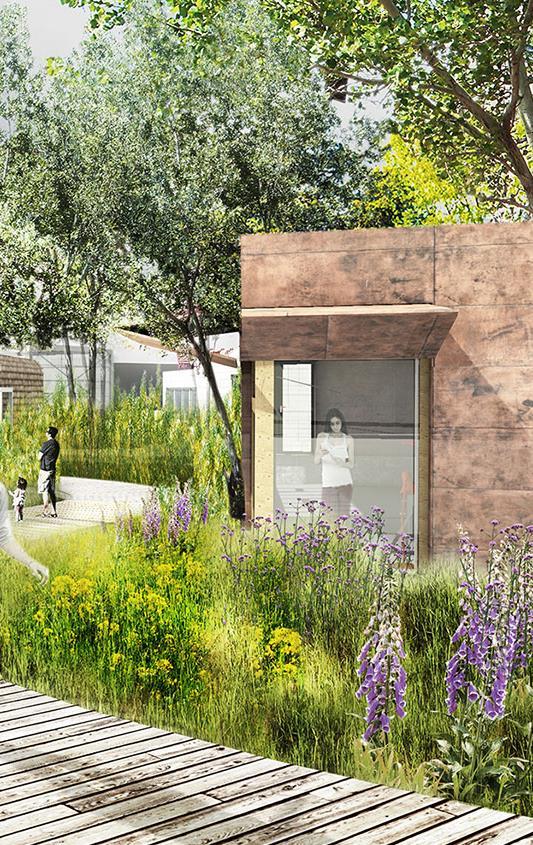
The Purifying Park is growing willows, foxgloves, and other purifying workhorses. The difference they are making is astounding. De Ceuvel attracts all sorts of people, but mostly people with creative professions that are interested in sustainable development and alternative ways of living.
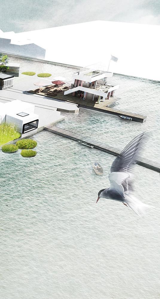
Pioneering technologies and use cases that include a biogas boat, a floating garden, a urine recycling system, a DIY aquaponics system, and an advanced phytotechnology based public park
47
DE CEUVEL PARK IN THE NORTH OF AMSTERDAM CASE STUDIES
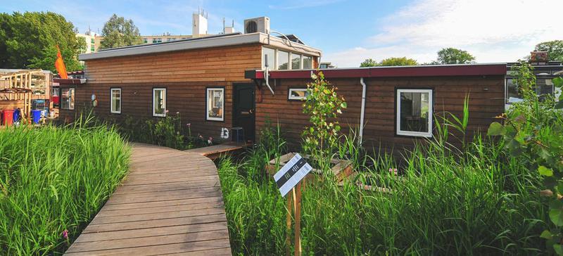
The Purifying the Ceuvel Park- a new creative hotspot in Amsterdam Noord. The last few months, tenants, volunteers and students, worked hard on the boats, the jetty, the Ceuvel Café and the park.
The purifying park consists of an undulating green plain of grasses, perennials, short rotation coppice and mature trees for the uptake and degradation of pollution. The plant species are specifically selected for this area; plants that suit the rugged nature of the industrial terrain
The starting point for the realization of the new creative hub ‘De Ceuvel’ is the pollution of soil and water. By filling the area with polluted dredge and the polluting activities of the ship wharf the site is heavily polluted with organic as well as inorganic pollutants. Current techniques that are used for purification of soil and water are costly, unsustainable and are often limited to hiding or moving the pollution to another site.
The technique of phytoremediation, in which plants are used to stabilize, take-up or extract contamination from the soil, offers an alternative.
On the site of ‘De Ceuvel’ this organic way of cleaning the soil results in a working landscape cleaning the soil and producing low-impact biomass. After ten years, the entire site is returned to the municipality of Amsterdam cleaner
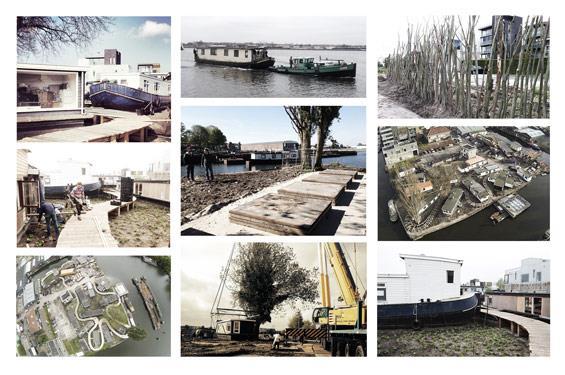 The floating garden at De Ceuvel.
House boats
48
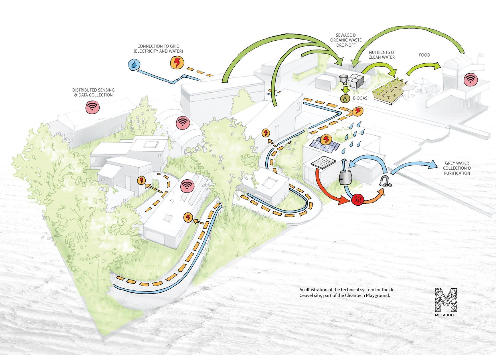
The site is conceptualised as a circular, metabolic framework in order to reuse waste materials and improve resource efficiency and productivity.
Self-sustainable DE CEUVEL PARK IN THE NORTH OF AMSTERDAM CASE STUDIES
De Ceuvel in the North of Amsterdam. The project contains land-based offices and a commercial park, Café De Ceuvel, and a water-based residential community.
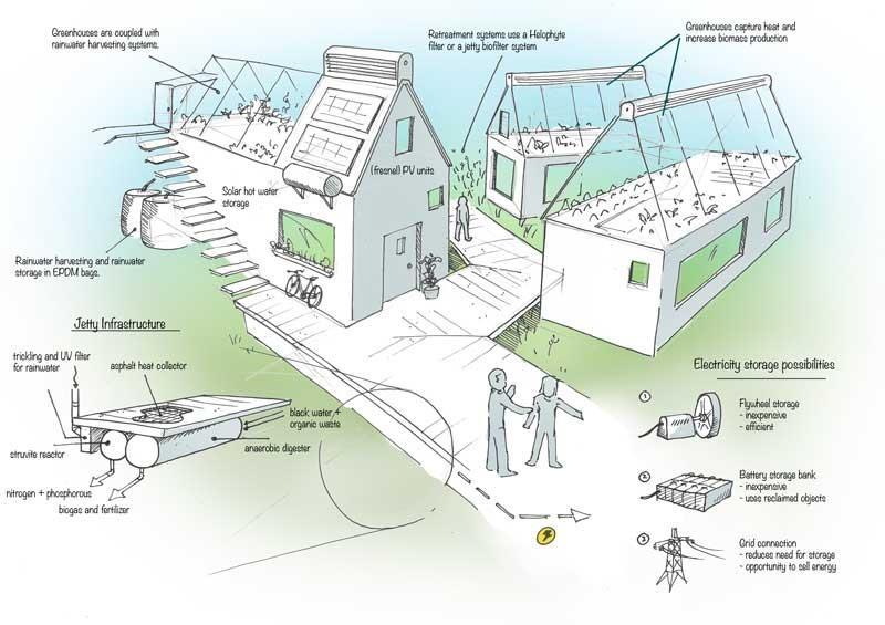
Building a digester to digest the kitchen waste into biogas for the kitchen and extract the nutrients and nitrates to be used as fertilizer for the fruit trees and a greenhouse on the roof
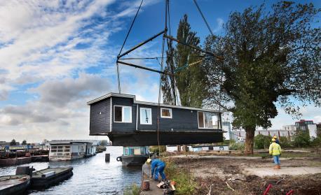
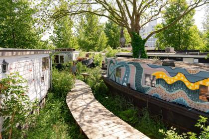
The houseboats have been taken from the water to be repaired, placed on land and remade into workspaces and offices.
The boats are not connected to a central sewage system, so instead they all have dry composting toilets and an individual greywater recycling system. a very popular café, Café De Ceuvel is connected to the sewage system, have waterless toilets installed to collect pure urine. The urine will be then converted into fertilizer for the plants in the soon-to-come greenhouse.
49
Self-sustainable approach in De Ceuvel
CASE STUDIES
SHENZHEN LOTUS WATER CULTURE BASE AND GROUND LEVEL OF HONGHU PARK WATER PURIFICATION PLANT
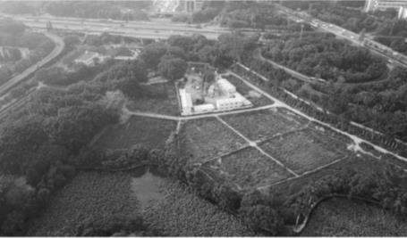
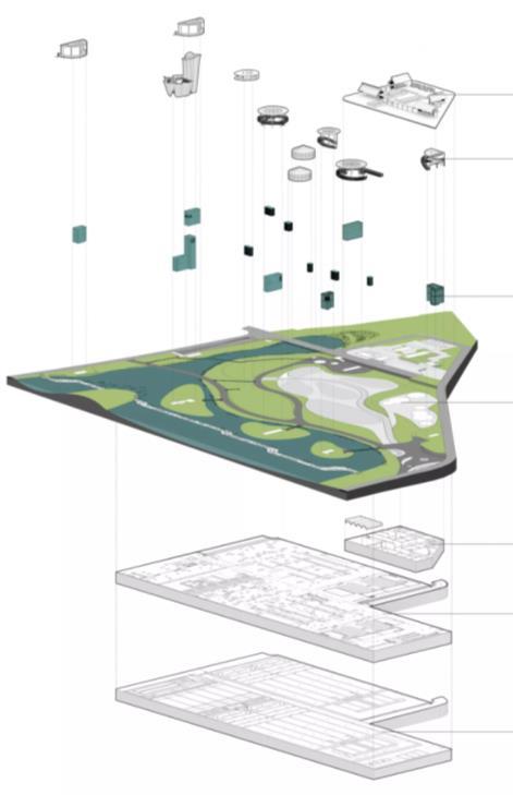
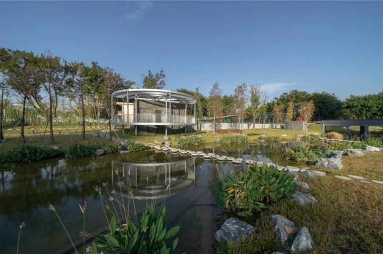
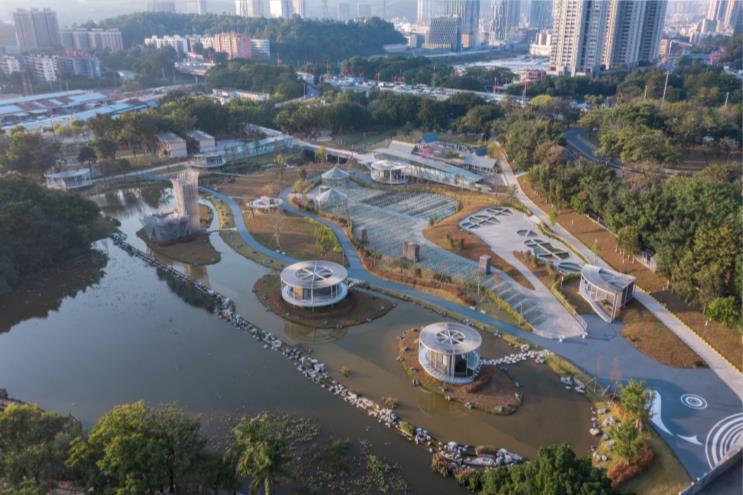
• The Honghu Park Water Purification Plant, one of the key projects for water pollution control, employs a leading fully-buried water purification technology and involves the restoration of the surface landscape of about 3.24 ha. It aims to effectively alleviate the sewage increase problems resulting from the urban renewal and development in this city
• Design the restored surface landscape on top of the water purification facility, and the underground offices at the northern end.
• Create an aesthetic and community-friendly public space. Application to Esholt:
✓ The surface landscape is closely related to both flood control requirements and the underground water purification facility, the project simultaneously encompasses knowledge of technical logic and landscape production process.
✓ Beyond the engineering logic, and tried to create an aesthetic and community-friendly public space.
50
GREENVILLE’S REWA INNOVATION CAMPUS CASE STUDIES
Area: 168 acres
Year: 2022
Architects: SASAKI
Restoring wastewater into a clean, renewable resource while creating an ecologically responsive campus and a destination for wellness and learning.
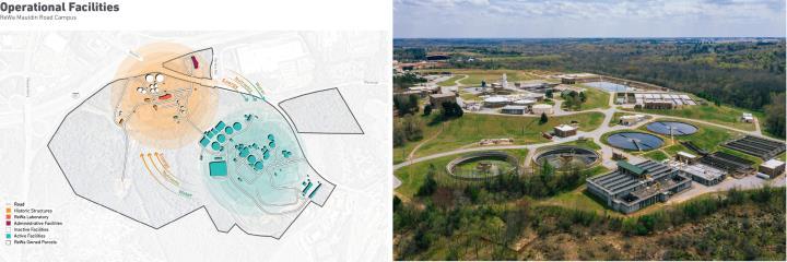
Renewable Water Resources (ReWa):
A wastewater treatment plant located in Greenville, South Carolina, has been serving Greenville County since 1925. Mission statement “Enhancing our community’s quality of life by transforming wastewater into renewable resources through responsible and innovative solutions”, The Mauldin Road Campus was modernized as a destination for wellness and learning, serving both the ReWa and greater Greenville communities.
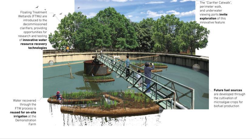
The Decommissioned Clarifier acts as an innovative and interactive research lab.
Aims:
• Contributes to community vibrancy
• Builds ecological value
• Provides education opportunity.
Action:
• Network of multi-use paths will link the site’s historic treatment buildings with its contemporary facilities. New spaces will knit into the fabric of the campus, providing venues for education and celebration.
• Native plant communities will be reintroduced within this active industrial site and reference the regional watershed’s diversity, rom its upland forests to its floodplains.
• The introduction of “floating treatment wetlands” (FTWs), underwater viewing ports, and a catwalk overlooking the treatment process will provide unique opportunities for the public to learn more about where their clean water comes from, as the water recovered and treated from the FTWs will flow through an irrigation system into the Demonstration Farm.
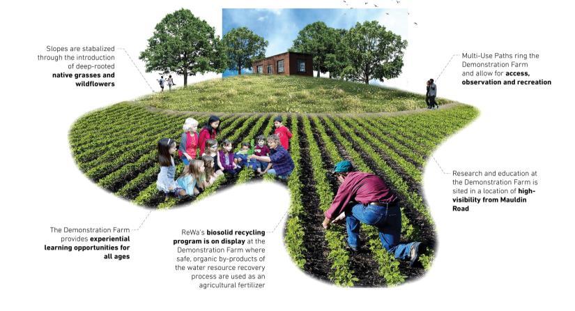
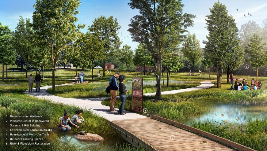
ReWa’s restored wetlands promote recreational use and encourage ecological restoration and biodiversity.
Application to Esholt:
✓ Offers multi-layered learning opportunities, educating visitors through interpretive signage along the paths about the demonstration wetlands, restored ecology, purification process, and the unique bio-solid recycling program.
✓ Creates a balance between industry, community, and nature. Treatment facilities becoming centers of health and wellness.
✓ Wetlands will collect runoff while also offering recreational use.
✓ The current features can be reserved for events, utilized for shared outdoor activities, or simply act as a place for people to celebrate nature.
51
BONNET SPRINGS PARK CASE STUDIES

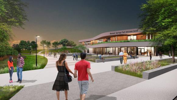
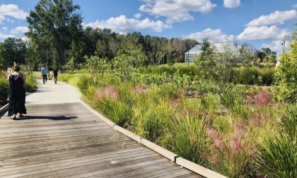
Revitalizes Vacant Rail Yard to Create Florida's New Central Park
Area: 168 acres
Year: 2022
Architects: SASAKI
Aims:
• Revitalizing designs will improve the site’s ecological health, foster unique harmonious architectural design, and set the park up for self-sustaining, economic success.
• Using creative, complex remediation strategies and design tactics to convert this damaged land into the “Central Park of Lakeland"
Action
• Stockpiling the most contaminated material into large hills
• The removal of 37 tons of accumulated trash to ready the site for transformation.
• A degraded stream corridor carrying comingled storm water runoff and clean water from a sand seep spring will be rehabilitated by diverting storm water into to a series of constructed wetlands to remove pollutants.
• Designing new buildings in harmony with the surrounding environment. These added buildings are all intentionally immersed into the landscape contexts—some partially buried into the landscape’s new hills.
Context:
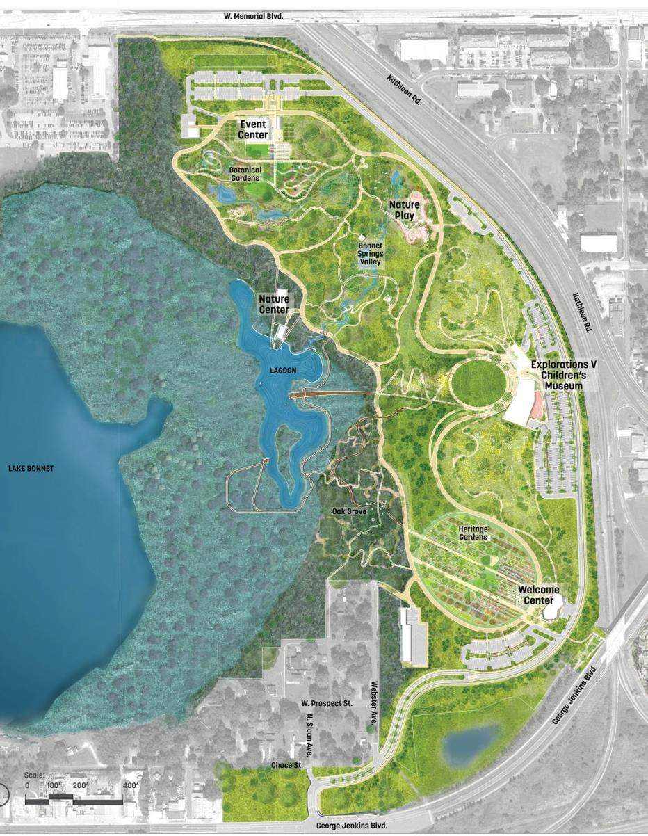
Bonnet Springs Park site was home to the Lakeland Railyard. In 1952 the railyard closed, leaving the land in an abandoned state and Lake Bonnet all but forgotten. 2015, metro Lakeland is one of the fastest growing regions in the country, and building upon the city’s natural areas, proposed the creation of Bonnet Springs Park with a mission: to become an ecological jewel, a cultural magnet, and connected community asset. Design includes heritage gardens, a canopy walk, boating activities, sculpture gardens, playgrounds, and an event lawn.
New walking and biking paths connect major park spaces with new buildings: Welcome Center, Nature Center, Event Center, and Children’s Museum and Cafe
Bonnet spring park's master plan
Bonnet spring park's Natural Center
Bonnet spring park's Welcome Center
Bonnet spring park's Wetland
52
VISION AND CONCEPT
VISION AND CONCEPT
53

Worldlandscapearchitect.com 54
Become a vitality community and a destination for wellness and learning by enhancing ecological health
AIMS
Contributes a community vibrancy
Enhancing ecological value
Provides education opportunity
Increase human interaction with nature
OBJECTIVES
• Transform industrial visualization and turn it into a lively space for human
• Create a sustainable, diverse and multifunctionality development that meets the demands of living and working
• Fill with functions (housing, business park, recreation, education, leisure, etc.) for range of people
Create a blue and green infrastructure that helps mitigate climate changes - in an open and educational way inspired by the Cities Alive approach:
• Organize new buildings in harmony with the surrounding environment, a sustainable build form. Hiding buildings, and housing under the hill.
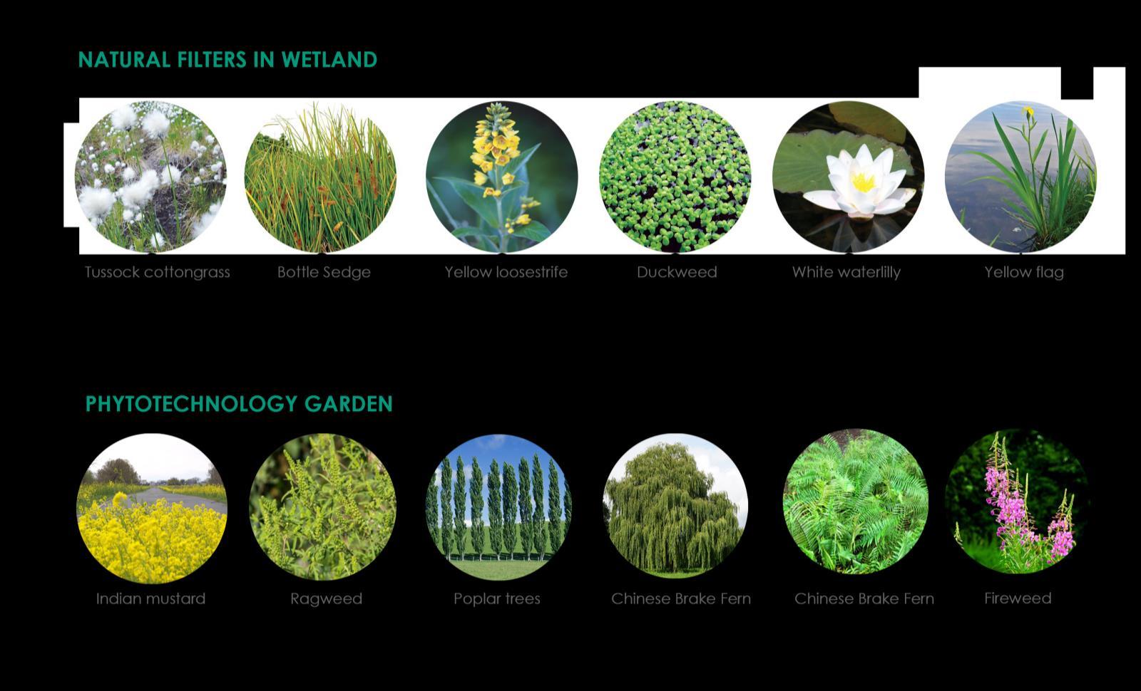
• Introduce purifying park that helps enhance soil, air and water quality . Choosing plant materials planting approach, suitable for tackling problems such as low biodiversity, water pollution, and smell.
• Implementing a system for water treatment and ,reuse, and food production
• Introduce ecological education and experience facilities
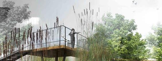
• Offers multi-layered learning opportunities, educating visitors through the demonstration wetlands, restored ecology and water purification, reconnecting the visitor to what makes the most abundant resource in the world – water – clean and safe.
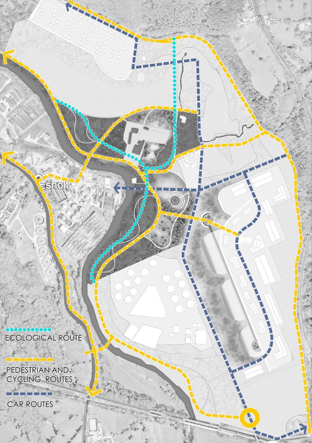
• Organize comfortable, barrier-free bicycle and pedestrian routes for recreation.
• Create green axis to connect water bodies R.Aire and LL Canal to many spaces.
• Create a green, aesthetic and community-friendly public space



55

GREEN INFRASTRUCTURE APPLICATION
56
DESIGN CONCEPT VISION AND CONCEPT
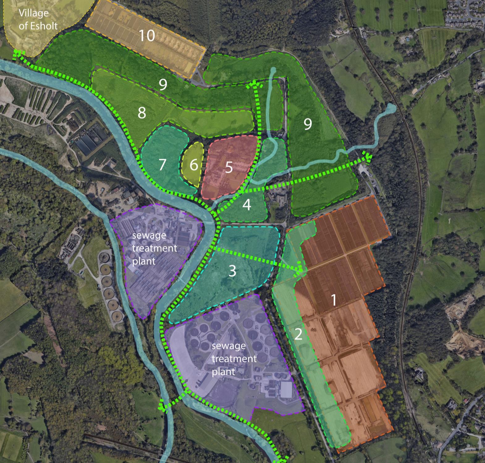
ZONING PLAN FOCUS ZONE VISION AND CONCEPT 1 SUSTAINABLE BUSINESS PARK 2 WINDPROOF HILL &EARTH SHELTER BUSINESS BUILDINGS 3 PURIFYING PARK 4 NATURAL PLAYPARK & ECOLOGICAL LAB 5 NATURE EDUCATIONAL CENTER & HEALTH AND WELLBEING CENTER 6 NUTRIENT & WATER RECOVERY FARM 7 FLOODPLAIN RESTORATION 8 WILDFLOWER MEADOW ENHANCEMENT 9 MANAGED WOODLAND 10 WATER-SENSITIVE HOUSING 57
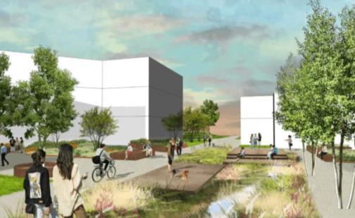
1 SUSTAINABLE BUSINESS PARK
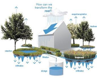
The medium-density business park will include solar panels, green roofs, water retention, and reuse systems, rain gardens, and bioswales.
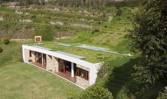
2 WINDPROOF HILL & EARTH SHELTERED BUSINESS BUILDINGS
The use of sustainable build form creates a windbreak, mitigating smell pollution from the sewage works. These added buildings are all intentionally immersed into the landscape contexts partially buried into the landscape’s new hills, providing stunning rooftop views of the park.
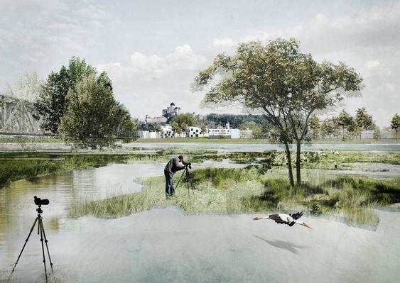
7 FLOODPLAIN RESTORATION
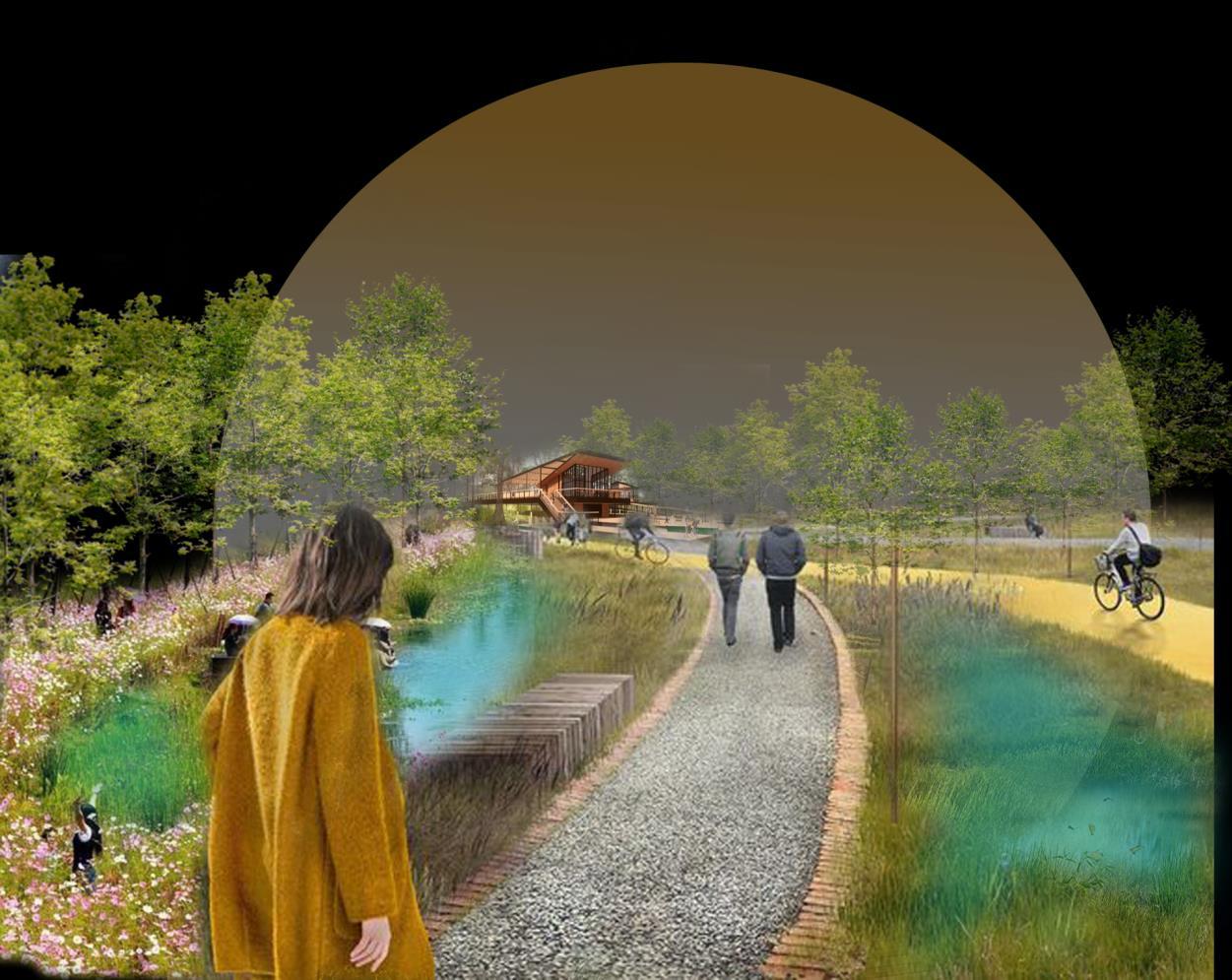
Includes wetlands that will reduce flood volume and runoff while also offering recreational use. Native grasses and flowers will populate the winding paths, and wildlife will nest and roam freely, all while our water undergoes purification.
smushcdn.com
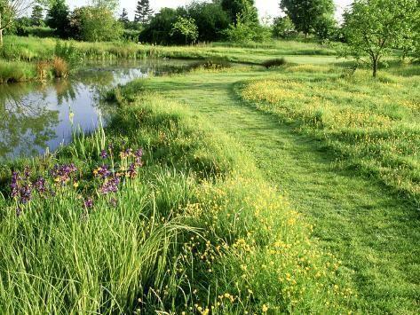
8 WILDFLOWER MEADOW ENHANCEMENT
An area of potential ecological value as a species-diverse, large wildflower meadow which could support a variety of pollinator species. A small area of this space could be used as a natural recreational area associated with the housing area. Native grasses and flowers will populate the winding paths, and wildlife will nest and roam freely
wilderutopia.com
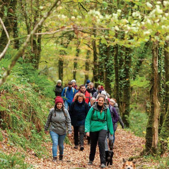
9 MANAGED WOODLAND
Continuing to develop Woodland management and ecological enhancement. It acts as a green belt for the site, helps improve landscape and water quality, sequesters carbon as well as increases enjoyment of the woodland for recreation/leisure use.
afasiaarchzine.com
10 WATER-SENSITIVE HOUSING
Medium-density, highly efficient housing placed outside of flood zone will include solar panels, green roofs, water retention and reuse systems, rain gardens and bioswales.
scskillman.com
countryfile.com
uacdc.uark.edu
58
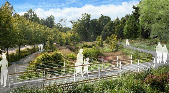
PURIFYING PARK
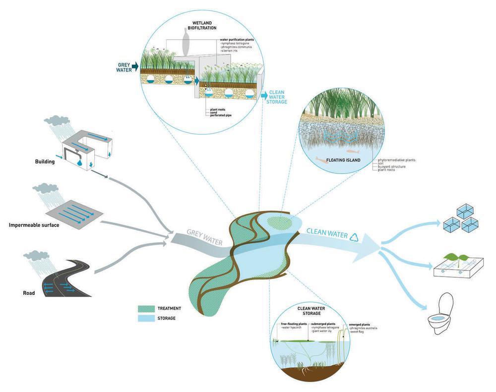
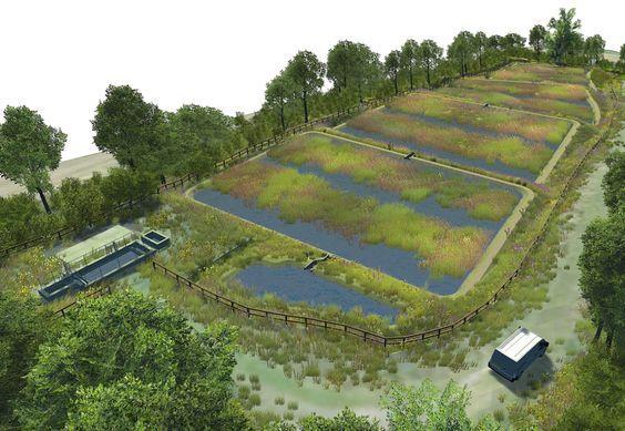
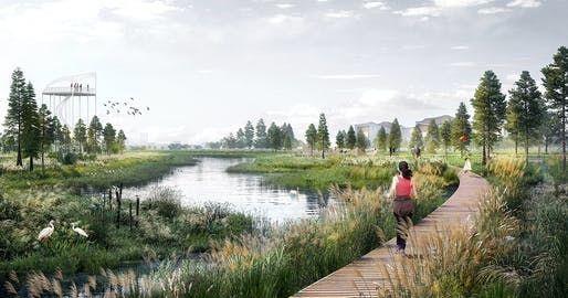
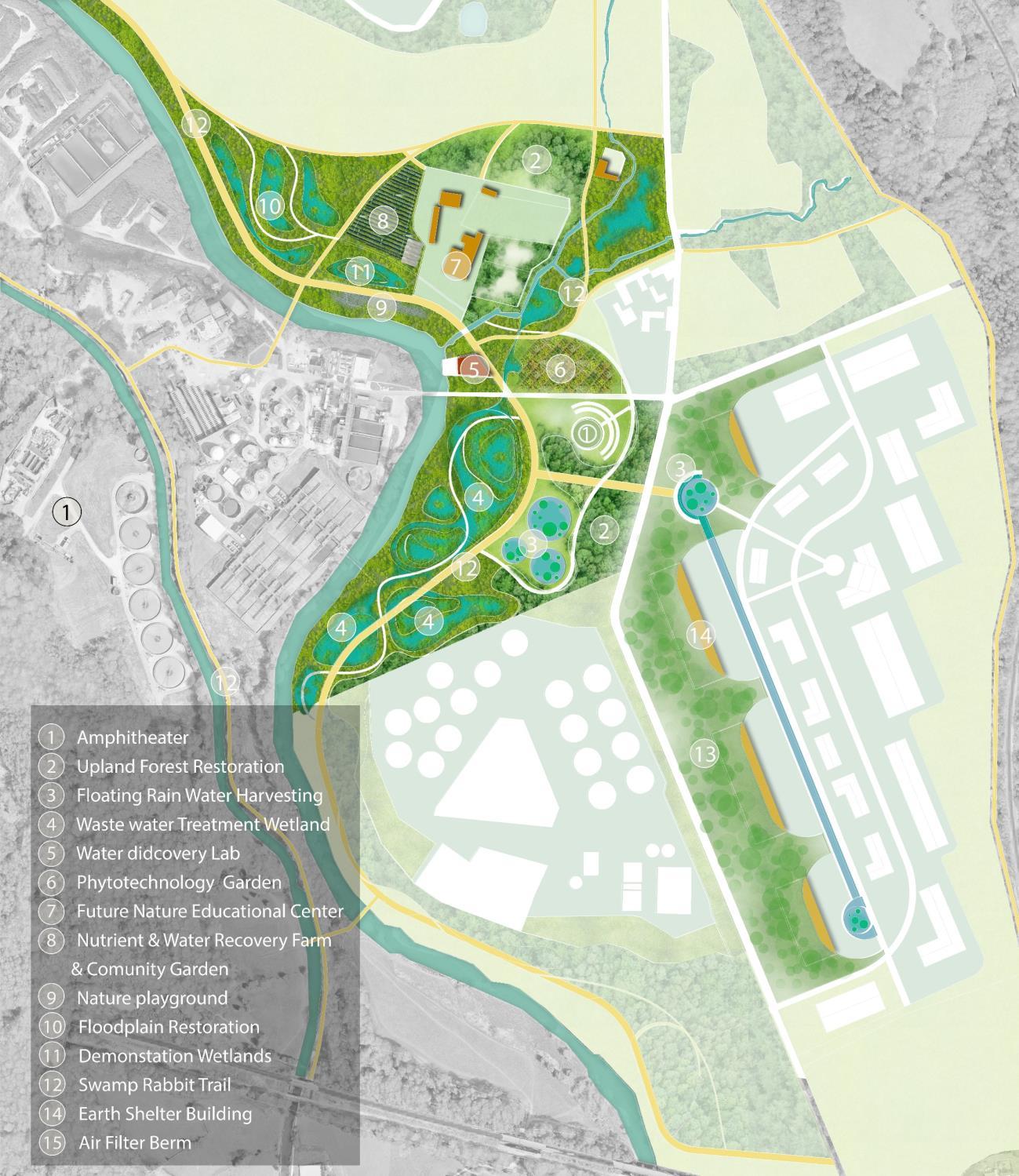
Water purification traditionally is not an activity that is open for public viewing. The introduction of a “purifying park”, includes a wastewater treatment wetland (WTW), reed bed, natural retention, underwater viewing ports, and a swamp rabbit trail overlooking the purifying process will provide unique opportunities for the public to learn more about the natural processes of water purification, reconnecting the visitor to what makes the most abundant resource in the world – water – clean and safe. The park itself is also completely interconnected, as the water recovered and treated from the WTW will flow through an irrigation system into the Demonstration Farm.
constructionenquirer.com
archinect.com
twm.la
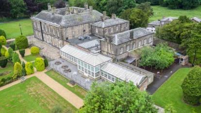
5 NATURE EDUCATIONAL CENTER & HEALTH AND WELLNESS CENTER
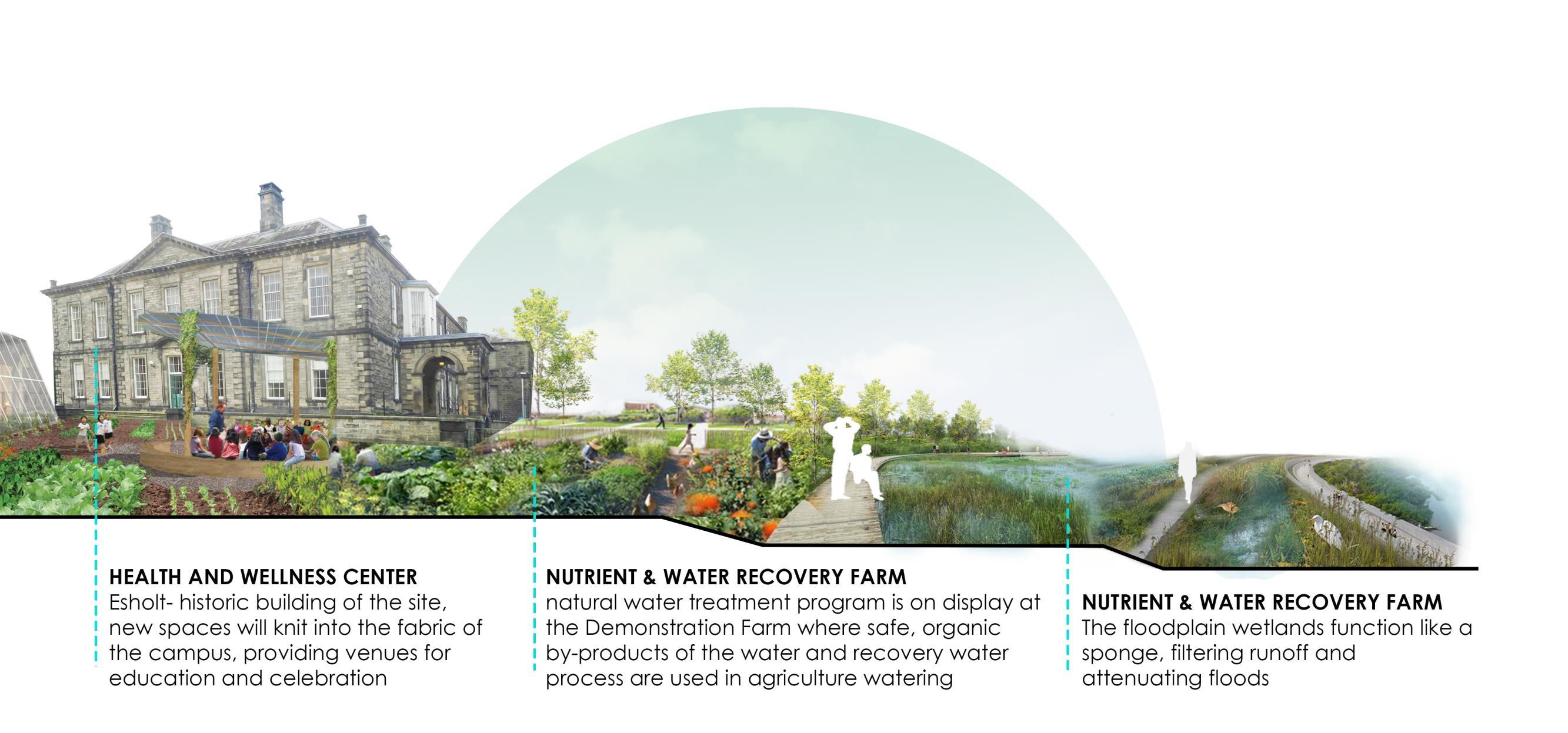
Design vision creates a balance between industry, community, and nature. The history building-Esholt Hall is becoming a center of health and wellness, The Heritage Garden will tell the history of Esholt’s site, which was once sewage works and a railway. The Future Nature Educational center-A destination of the area for a visitor can come and experience.
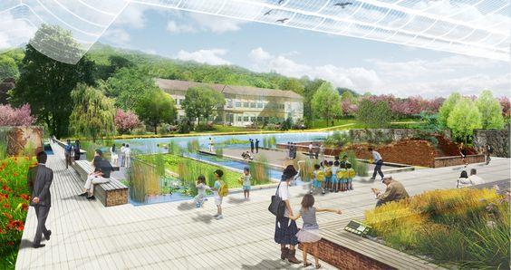
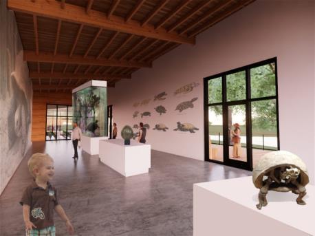
4 NATURAL PLAYPARK, NATURAL CENTER & ECOLOGICAL LAB
The Beck Valley was created by the natural eroding processes of the Guiseley beck and Yeadon Gill beck. The rare hydrological system is the result of groundwater out from a hillside. A newly restored ecosystem along the beck corridor will naturally stabilize the banks, clean the water, and provide new habitat for waterloving fauna. Offering a wild experience by the water course. The Nature Lab Center will boast a nature museum with research about phytotechnology used for purifying park
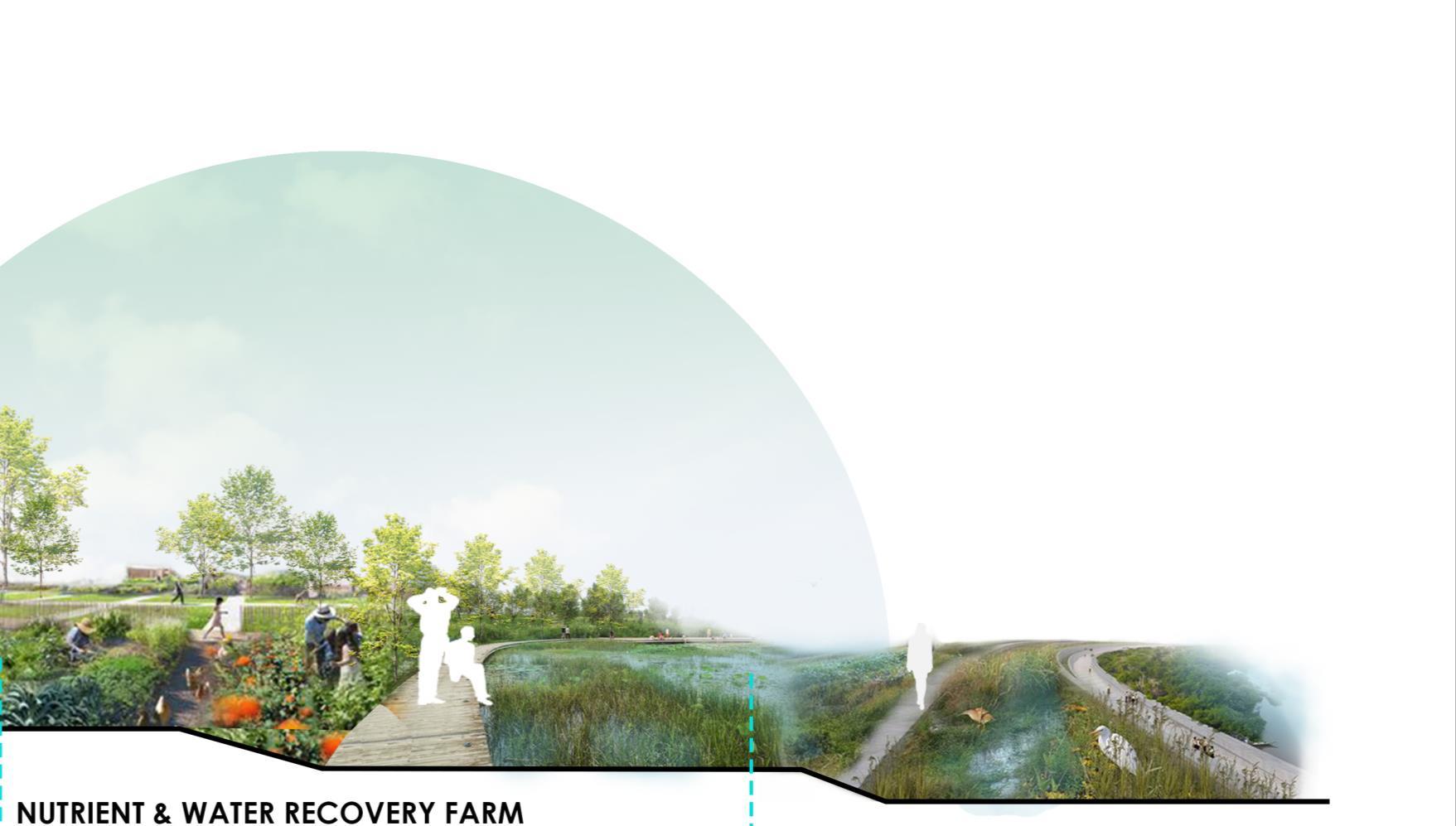
6 NUTRIENT & WATER RECOVERY FARM
.weissmanfredi.com
yorkshirewater
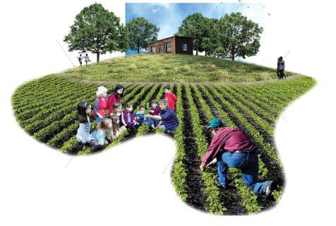
The rolling hillside garden’s Demonstration Farm will be fertilized from organic by-products following the wastewater treatment process. It offers hands-on learning and shows the connection between resources –like water, land, and soil – and how we can mutually benefit by implementing them at various stages of the purification cycle

revitalization.org
revitalization.org

landezine.com
www.mkskstudios.com
3
59
MASTERPLAN VISION AND CONCEPT
Enviromental benefits
Economic benefits
REVITALIZATION
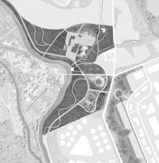
Traditionally water purification is not an activity open to the public. with a contrasting idea with the existing treatment plant, the introduction of a "purifying park", applying phytotechnology to absorb pollutants in the soil, reducing soil pollution. Applying organic wastewater treatment techniques to introduce a sustainable solution and alternative landscape space. These techniques will be a fully-integrated learning experience that includes the natural processes of water purification, reconnecting the visitor to what makes the most abundant resource in the world – water – clean and safe.
60
VISION AND CONCEPT VISUALISATION
HEALTH AND WELLNESS
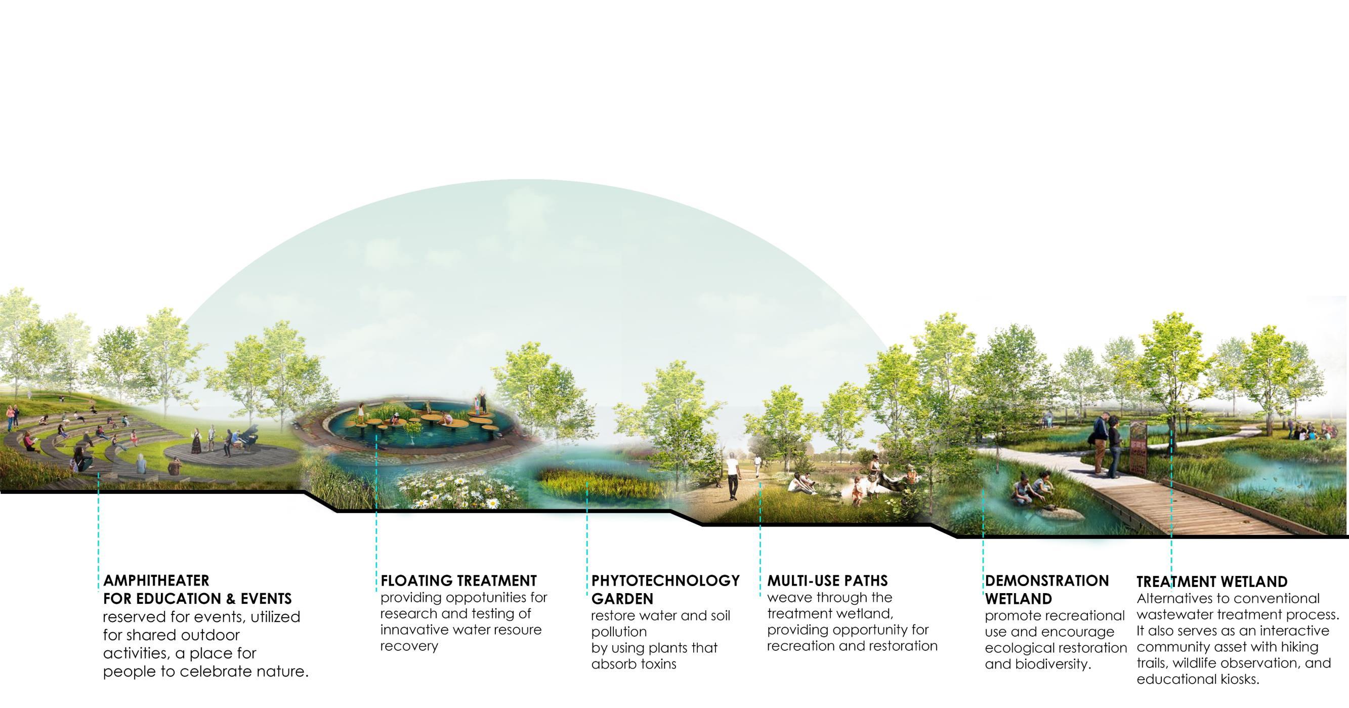
Design vision creates a balance between industry, community, and nature and is the first step toward facilities becoming centers of health and wellness. Floodplain restoration will collect runoff while also offering recreational use. Native grasses and flowers will populate the winding paths, and wildlife will nest and roam freely, all while our water undergoes purification. The Master Plan features an amphitheater that can be reserved for events, utilized for shared outdoor activities, or simply act as a place for people to celebrate nature.
61
Economic benefits Social benefits Enviromental benefits
EXPERIENTIAL LEARNING
VISION AND CONCEPT
VISUALISATION
Master Plan offers multi-layered learning opportunities, educating visitors through interpretive signage along the paths about the demonstration wetlands, restored ecology, and purification process.
Demonstration Farm will be fertilized from organic by-products following the wastewater treatment process, offers hands-on learning, and shows the connection between resources – like water, land, and soil – and how we can mutually benefit by implementing them at various stages of the purification cycle.

Social benefits
Enviromental benefits
62
CONNECTION VISION AND CONCEPT
Connections from water bodies to other green spaces. To connect to the site for recreational purposes, the design is proposed to create a green corridor along the River and the Canal for pedestrians and bicycle routes along.
Green infrastructure helps to attract tourists and improve the quality of life in the area increasing economic efficiency and real estate value
Economic benefits
Social benefits
1 1
63
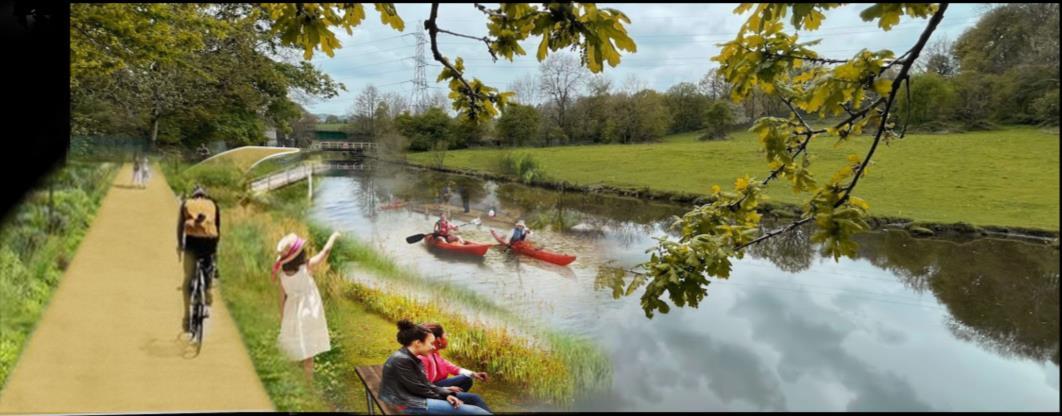

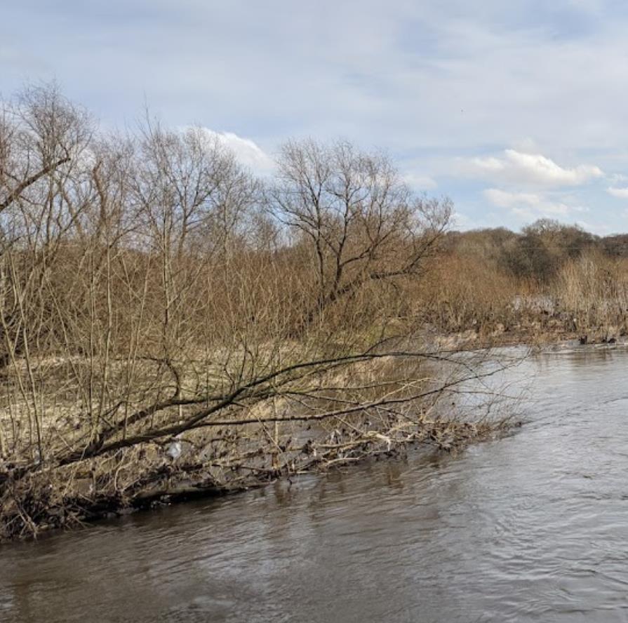
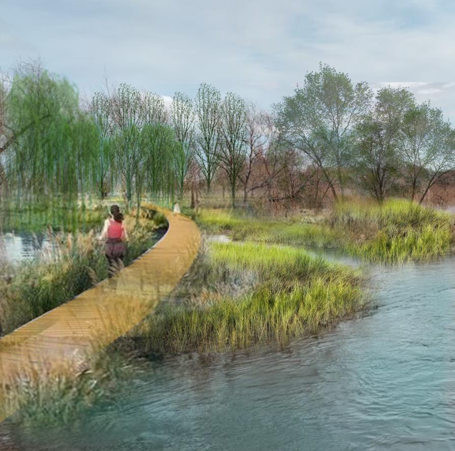
BEFORE AFTER BEFORE AFTER 2 2 3 3
64
VISION AND CONCEPT VISUALISATION
PURIFYING PROCESS

DESIGN PROPOSAL
65
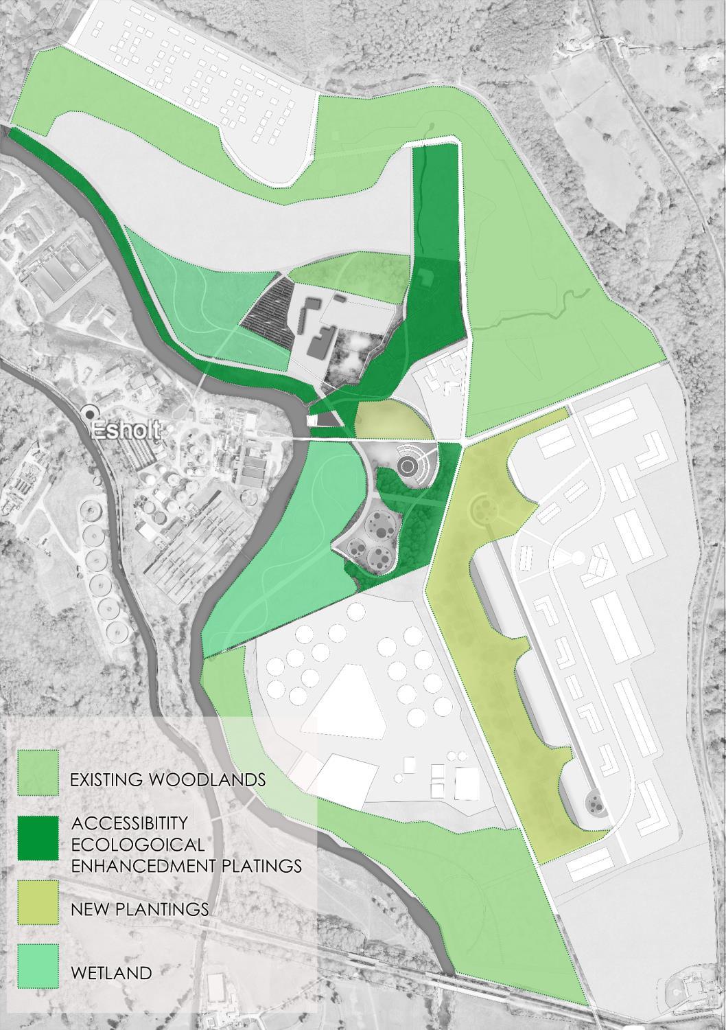
PLANTING VISION AND CONCEPT
66
REFERENCE LISTS
REFERENCE LISTS
67
OVERVIEW
URBAN CHALLENGES
https://www.theccc.org.uk/2018/01/04/uk-cities-climate-change/
https://www.jll.co.uk/en/trends-and-insights/research/the-future-of-cities
https://foreignpolicy.com/2020/05/01/future-of-cities-urban-life-after-coronavirus-pandemic
RESEARCHES CITIES ALIES
Cities Alive: Rethinking Green Infrastructure. ARUP. 2014
Cities Alive: Water for People.ARUP. 2018
Natural England’s Green Infrastructure Guidance.Natural England.2019
SURVEY AND ANALYSIS
SITE LOCATION
http://esholtpositiveliving.co.uk/wp-content/uploads/2019/03/288_1_0_190307_Public-exhibition-boards.pdf3
Group B Research
CHAREACTERS AREA
Group E Research
SITE PROPOSAL
Group C Research
PROPOSALS AND CURRENT SITUATION
Group E Research
HISTORY
Group E Research
Group C Research
HYDROLOGY
Group B Research
HABITAT SURVEY
Group C Research
ACCESS AND CIRCULAR
City of Bradford Metropolitan District Council Countryside & Rights of Way /Bradford.gov.uk
ESHOLT ESTATE’S CURRENT PROPOSAL
Group C Research
Esholt - A Beacon of Positive Living (esholtpositiveliving.co.uk)
Esholt Estate Summary Document.pdf (cagd.co.uk)
https://tateandco.com/projects/esholt-keyland-developments/
RESEARCH AND CASE STUDY
RESEARCH: APPLICATION OF EARTH SHELTERED CONSTRUCTION
https://www.daviddarling.info/encyclopedia/E/AE_earth-sheltered_home_effects_of_vegetation
https://www.bigrentz.com/blog/earth-sheltered-homes
https://www.eco-home-essentials.co.uk/earth-sheltered-home-designs
The integration of building and landscape in a highway proximal environment through the smart use of earth berm sound barriers. Maria Kaskareli. January 2014.
CASE STUDY: HOCKERTON HOUSING PROJECT
https://www.hockertonhousingproject.org.uk
https://diggersanddreamers.org.uk/community/hockerton-housing-project
RESEARCH: WASTEWATER TREATMENT WETLAND
https://ars.els-cdn.com/content
https://sswm.info/sswm-university-course/module-6-disaster-situations-planning-andpreparedness/further-resources/free-water-surface-constructed-wetland
https://www3.epa.gov/npdes/pubs/free_water_surface_wetlands.pdf
CASE STUDY: CROOKED RIVER WETLAND COMPLEX NATURAL WASTEWATER TREATMENT
https://www.nacwa.org/news-publications/news-detail/2019/12/04/the-city-ofprineville-s-innovative-natural-wastewater-treatment-system
https://www.cityofprineville.com/wetlands
https://www.cityofprineville.com/wetlands/page/about-crooked-river-wetlandscompleX
RESEARCH: PHYTOTECHNOLOGY IN LANDSCAPE DESIGN
Demonstrating a phytotechnological design-approach pdf
Exploring phytotechnology in site-specific landscape design. Laura-Kristine M. G. Bergma.pdf https://stud.epsilon.slu.se/15249/20/bergman_l_191203.pdf
CASE STUDY: DE CEUVEL PARK IN THE NORTH OF AMSTERDAM
https://worldlandscapearchitect.com/purifying-park-de-ceuvel-amsterdamnetherlands-delva-landscape-architects
https://beautifulnow.is/discover/impact/poisoned-wasteland-turned-into-healthyground-phytoremediation-plants-render-toxins-harmless-de-ceuvel
CASE STUDY: SHENZHEN LOTUS WATER CULTURE BASE AND GROUND LEVEL OF HONGHU
PARK WATER PURIFICATION PLANT
https://mooool.com/en/henzhen-lotus-water-culture-base-by-node-architectureurbanism
https://www.dezeen.com/awards/2022/longlists/shenzhen-lotus-water-culture-base
CASE STUDY: GREENVILLE’S REWA INNOVATION CAMPUS
https://www.mkskstudios.com/dialogue/a-groundbreaking-vision-bridges-waterpurification-to-community-wellness-and-nature
CASE STUDIES: BONNET SPRINGS PARK
https://revitalization.org/article/dead-for-30-years-a-toxic-rail-yard-will-be-reborn-as-adowntown-park-in-lakeland-florida
https://www.sasaki.com/projects/bonnet-springs-park/
68
AND WEB-SITES
PUBLICATIONS
69


 ...And reconnect cities with their river catchments


 Image showing old railway bridge Stanford, M. (2020)


 Plants for free-water surface flow constructed wetlands. Source SA’AT (2006)
Layout of free water constructed wetland


 The floating garden at De Ceuvel.
House boats


