
I HSIU SHEN


SELECTED WORKS
2018 ‒ 2023
DESIGN
MISTLETOE
Keelung City Lost Space Addition and Reconstruction
THE CROTON
Abstraction of plants and convert of space
BLOCK
Mixed residential and commercial building
SPACE OF DIVERSITY
The unit relationship-Institutional integration
SABOTAGE
UCL March Architectural design project- RC1
OTHERS
PHOTOGRAPHY
MODEL
DRAWING
AWARD and PRESENTATION
INTERN EXPERIENCE


I
HSIU SHEN (JENNIFER)
BIRTH: 27/09/1999
CONTACTS: +44 7884791518 Jennifer9876543210@gmail.com
Language: Mandarin/ English
SOFTWARE
AUTOCAD PHOTOSHOP
SKETCH UP ILLUSTRATOR
RHINO INDESIGN
BLENDER UNREAL ENGINE
LUMION ENSCAPE
EDUCATION
University College London 09/2023 - 09/2024
Now project/ Architectural Design research cluster 1: Monumental Wastelands Gamifying climate and crisis
Focus on climate and environment issue, and try to use video game as a media to approach complex issue.
Exchange to Tung Hai University department of architecture 02/2021 - 06/2021
National Kimen University 09/2018 - 06/2023
EXPERIENCE
Intern at Very studio | Che Wang Architects Taichung, Taiwan 02/2022- 07/2022
Intern at J.M.Lin Architecture/The Obsever Design Group Taipei Taipei, Taiwan 07/2021 – 08/2021
Xiamen construction competition and achieve the honorable mention award 05/2019
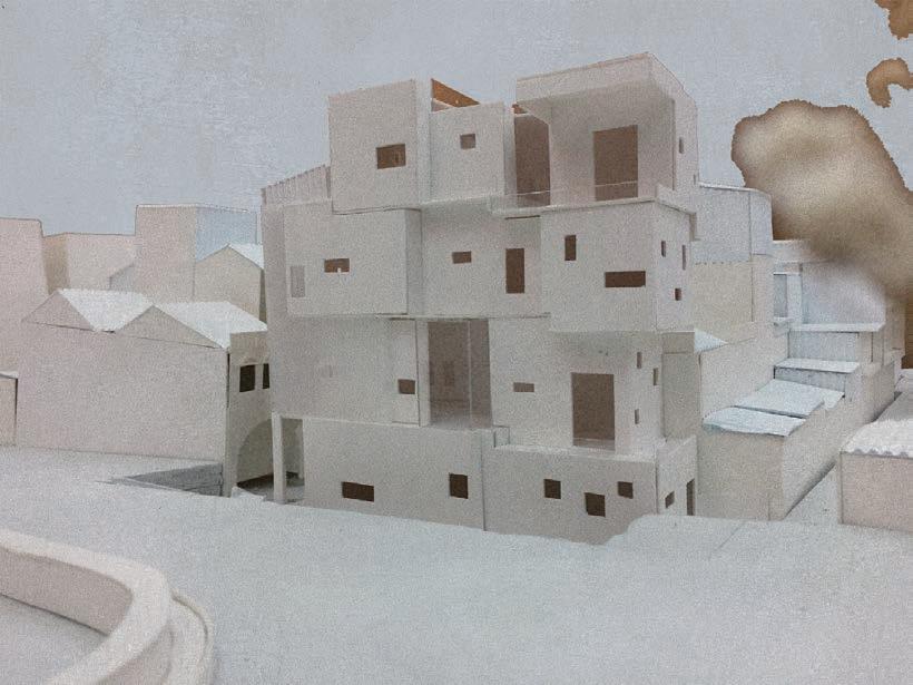
Keelung City Lost Space Addition and Reconstruction

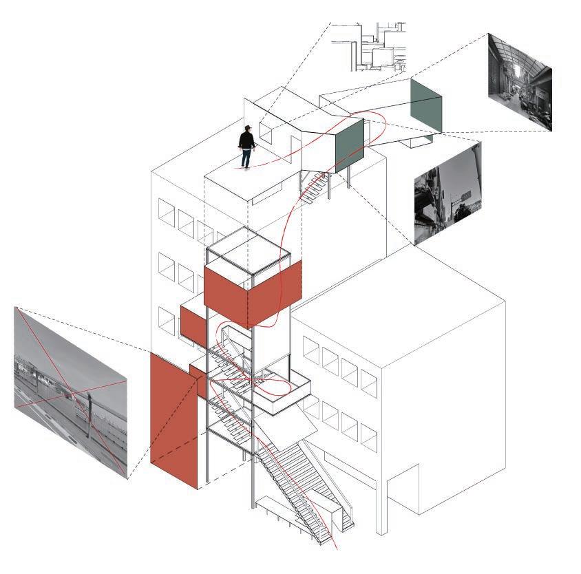
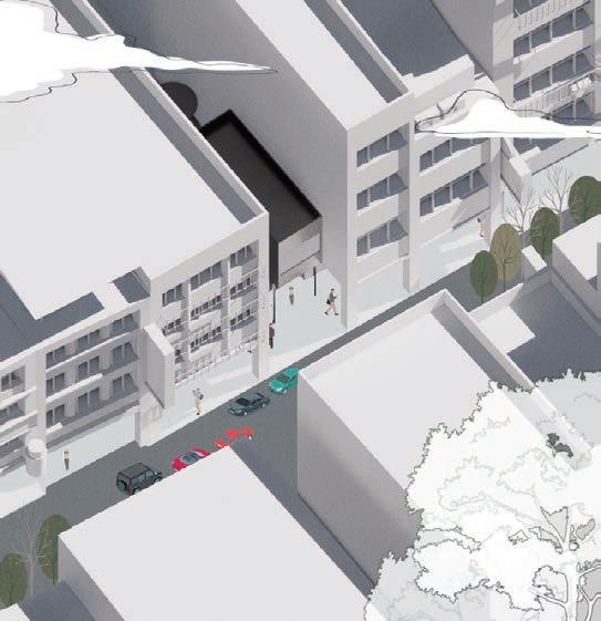
The daily routine of behaviour multiplied by tens of thousands of times constitutes the everyday. The additions in the alleyway are familiar sights that fill our daily life, hidden in our daily life, representing a trace or appearance of life that is often perceived as negative, but ignored only because of habit. For me, this state of affairs is paradoxical and interesting, and I want to manipulate and observe these elements in order to perceive the existence of paradox. I want to manipulate and observe these elements in order to perceive the paradox. To turn the everyday into the non-everyday.
To put a kind of interesting space and architectural state in the city, the design is used as a seducer to lead people to enter and discover the kinds of things in the lanes and alleys, which are also the daily life that we are familiar with. Trying to put into the city the state of some additions, turning private into public, forming a kind of paradoxical space in the city, and attempting to make it into a public interesting space.


In normal days, it may be a common addon that no one pays special attention to.
Manipulating the elements of observation to view the city from a new perspective - Paradoxes
Creating a space of paradoxical interest in the city

Contradiction:An inconsistency between two or more statements, ideas, or actions; a difference. In my design, I try to put the state of these additions into the city, transforming the private into the public, forming a kind of paradoxical space in the city.

The railway runs along the edge of the city. The neighbourhood of Keelung Station was developed earlier, but later development slowed down, causing the neighbouring streets to fall into decline, with old and dilapidated buildings and streetscapes.
In contrast to the neatly organised streets, the lanes and alleys within them appear to be very messy and irregular.
During the Republic of China period, the river was chosen to be filled in because there was no flat land left to develop in the city due to the small size of the Keelung Flat.


During the Japanese colonial period (1905), the �Urban Correction Plan� was implemented, and the original city streets were rearranged in a checkerboard layout, and several rivers running through the city centre were restored.
Surrounded by mountains and facing the harbour, Keelung is sandwiched between the mountains and the sea with the exception of the narrow plains around Keelung Harbour and on both sides of the Keelung River, the rest of the city is hilly and adjacent to the coastline, giving Keelung a crowded urban landscape with bridges and tunnels everywhere you look.



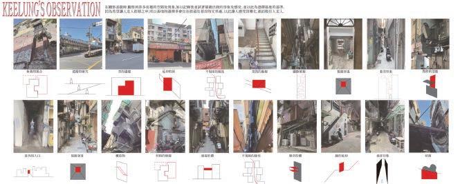




The design operator firstly collected and analysed the elements of the environment and gave me an interpretation of the base. It also became the basis for selecting the operation point.
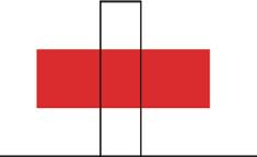
After selecting the operation point, I summarised the elements and sorted out several categories. Based on the characteristics of the site, I further analysed and created a conceptual model to explain the feeling of the site.










Contradiction
Symmetry / Asymmetry
Partial / Whole picture


Alley objects→Exhibits→Exhibition venue Contradiction


/ Whole picture
/
Abstraction of plants and convert of space


In this project need to observe the plant that you interest in and transfrom the plant into the space. It was the interesting project and I learn a lot. From explaining the feeling of plant into space, the function of transform, the imagination and creation. The plant I found is croton.I was attractedby it’s unique leaf. After deeper observation, I found there was lot of special thing on it. About leaf、vein、growth pattern and other things represents for. Tried many combinations of different materials, wanted to show the many layers of the Croton. The old leaves from outside、the young leaves in the middle and then leaf vein from the inside. From a part of perspective, details about leaf vein was also have many layers. We could see the texture in our eyes, but carefully discovered that it is not exposed, but hidden inside the leaf. All of this were the unique nature of the Croton, so in this design, I wanted to show these characteristics of the Croton.
The type of the leaf is transformed into a geometric shape, and the change of direction present the shape of a leaf spiral. The large and small represent new buds and old leaves.
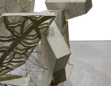
The pattern of leaf veins is directly expressed in the geometric shape of the basket, and there are changes in light and shadow.
The leaf vein is covered by the leaf and represented in a linear shape. This is the difference from other plants.
DEVELOPMENT/ MODEL

A part of perspective -The leaves vein

Overall -leaves、leaves vein、growth pattern


The geometric shape from outside represent leaves,and the leaf veins were the iron wire which covered by the leaves. The basket is used to make the whole work not too bulky, the penetration of the line of sight increases the sense of lightness, and there are also changes in light and shadow.


Upward cover represents its growth form and show its vitality. The croton is a bright and beautiful plant but it juice is poisonous. Using shadow to show it poisonous side, but hide it.
Mixed residential and commercial building

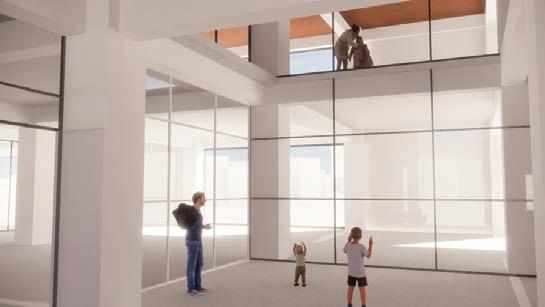
This is a residential/commercial office complex. This was the first time to work on a high-rise building, and there were a lot of things that needed to be considered, such as car parks and staircases. In terms of planning, the first to fourth floors are for shopping centres, the fifth to seventh floors are for office space, and the eighth to eighteenth floors are for residential space.
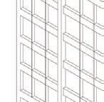
I tried to dismantle the high-rise building in the form of Lego blocks so that it would not be too big and bulky visually. The building blocks are stacked and left empty to create different spaces. The facade shows a sense of stacking and dislocation.




The unit relationship-Institutional integration

This subject was I operate when I exchanged to TUNG HAI in third grade term two. Different with the previous subject, no pre-ordered program, site and amount of space. We get start from concept,each person has four small concept, through the integration and thinking of these four concepts, extend to the general direction of operation and then into the site, finally, the function is determined according to the needs of the site. It is a fresh attempt to start from different aspects this time, and it is true that there is no fixed order for designing.
This subject was operated the whole term, seperate into two part of it. First part is the discussion, extension, development and integration of concepts. Second part begins to enter the site and insert program to operate. Our site is located in the area of Kaohsiung Cijin and Gushan which everyone is looking for a place that suits them to operate.


at different scales and combinations


Also a type of unit,different with LEGO's unit and combination.The gap between the red bricks are also interesting.


Reorganization(intact to broken), old and new relationship exists,and also loses it's original function.


The image and function of connection are also like the axis of dividing the

TYPE �-THE IMAGINATION OF TANGRAM


Each unit has direct connections,like passages and slopes.There are also implied connection relationship,and the gap between surfaces are an implied relationship. Many units of different types and properties are directly or indirectly related.


In another form, observe the relationship between units, the complementary relationship between virtual and real, as well as the integrity of objects and visual effects.


In Cijin, the road sign in units of telephone poles points to the route of walking along the poles.On the way, it was found that there are many ways to connect the poles. For example, using street lights to connect in series、connecting to buildings.
IRON WINDOW


Observe the ruins scattered in the alleys of Cijin, and try to combine them with the broken units on site. According to the characteristics of the ruins, different appearances are combined.

The facade of the building located on the street near the site. Although the form of each house is different, such as the horizontal strip, the way of opening the windows,because of the element of iron windows, each house looks coherent, and the facade of the street has a continuity and integrity.


SITE/PROGRAM DETERMINE
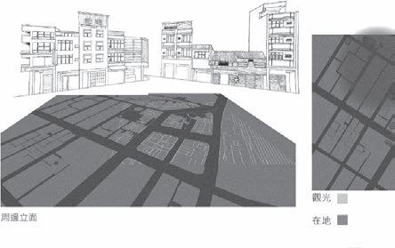


The concept model based on the development of the above concept is divided into three blocks, each block has different scale of units, and also has a hierarchical relationship from area to unit. And they are connected to each other in different ways.


Through the survey of the white elephant and the base visit, the results are summarized and sorted out. It can be found that there are many unitary objects in daily life, and these objects have different scales in daily life.
Taking the site I went to as an example, the ruins and telephone poles are the units in one area; the barbed windows are the units of the street; and then entering the building, the shape or structure is a unit, and finally the interior, the equipment can also be unitized 's object.
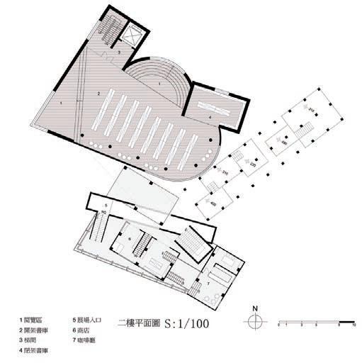
The site was finally determined at Kaohsiung Gushan. The site was chosen because of it's multi-faceted nature, one for sightseeing and the other for being local. In addition, there are many historical buildings nearby, it is also a concept of ruin be reused, so I respond to the surrounding historical buildings when operating the design. In terms of program decisions,I prefer to make decisions based on the needs of the site. The multi-faceted nature of this site and the concept of pre-operation, my program are compounded, which can be used by different people, and how the various institutions are connected in series and in dialogue with the historical building. Therefore, I chose the library, visitor center and exhibition venue to respond to the site. The exhibition space is the program that I put into the dialogue with the historical buildings. Today, those historical buildings are revived and reused, such as cafes, restaurants, cultural and creative shops. I think this is a way of experience, and the form of exhibition is another way of experience. We can learn more about historical buildings through cultural relics, books, models,and the exhibition venue is also related to the library and the visitor center.


The four directions obtained through the operation of the previous concept are showed by design techniques. The atmosphere created by each field with different programs is different. Different unit forms are used to highlight each space. Like the visitor center, I want it to be relaxed, so I use a lot of glass; the library is serious and quiet, so I use a large geometric massing. In the final exhibition, I hope that the exhibition can be concentrated, so a single element and the form of a long strip are used to express it. They are connected with each other, and I think the exhibition space is the bridge connecting the whole design, no matter in site plan or program
PLAN


The left area is the residents main activity area,the right is for tourist.Therefore, in the site plan,I let the library is placed close to the side where the residents are, and the visitor center is facing the main traffic road.And the exhibition connect this two program.The place close to the park,I freed up a little green space to allow the park to extend to my site.

The original historical buildings and two temples inside the site were chosen to be preserved. The relationship between the original building and the old building, the scale relationship of the gap, are very interesting.


BACKFILLINGISARUDE REHABILITATION
Research cluster one focus on climate issue, try using gamification to approach the problem. This year different with previous year, more focus on gamification, so we trying to develop the whole game, from stroy board to game aesthetics; game logic to mechanics. Our team focus on Australia, the mining industry and indigenous people’right, these are the most serious issue in Australia. Mining has long been an important industry in Australia, providing a significant source of income for the Australian economy, also caused significant ecological damage, such as water pollution, soil contamination and climate change caused by gas emissions. In Australia, the majority of minerals are found on Indigenous land, particularly in the Northern Territory. The economic benefits of mining are in conflict with environmental issues and the rights of the Indigenous people.
Kakadu National Park, located in northern Australia, is protected for its exceptional landscape, biodiversity and cultural heritage. Ninety percent of the park’s land belongs to Indigenous people, and indigenous ecological knowledge and modern conservation techniques make up the park’s complete ecological protection system. At the same time, one of the world’s most productive uranium mines, Ranger Uranium mine, is also located in the park, but is not part of the park therefore the area not protected by park land. Mining has been one of the most controversial issues in the park, not only in terms of ecological damage but also in terms of land ownership. Although the mining company intends to restore the landscape to its former state, it has buried it with backfill, obscuring the fact that the mine ever existed.
Sabotage proposes that the mine be assimilated and protected as part of the park by occupying the land and returning ecological stewardship to the Indigenous people through the landscape migration. Considering the reality, the industrial debris left behind by the mine and the complex ecology of the park, the project will simulate the process of destruction and reconstruction through vedio game.


STRATEGY





Sabotage is a deliberate action aimed at weakening a polity, government, effort, or organization through obstruction, destabilization, division, disruption, or destruction. One who engages in sabotage is a saboteur. Saboteurs typically try to conceal their identities because of the consequences of their actions and to avoid invoking legal and organizational requirements for addressing sabotage.We use Sabotage to slow down the operations of the current mine.


Kakadu National Park, located in northern Australia, is protected for its exceptional landscape, biodiversity and cultural heritage. Ninety percent of the park’s land belongs to Indigenous people, and indigenous ecological knowledge and modern conservation techniques make up the park’s complete ecological protection system.
Ranger Uranium Mine
At the same time, one of the world’s most productive uranium mines, Ranger Uranium mine, is also located in Kakadu National Park. It is an enclave.


Landscape Migration is typically used to describe the physical movements of organisms. Landscape migration occurs as material movements from one geographic location to another. A landscape migrates when its unique assembly of components — the materials, entities, and actors that define it — shifts such that, over time, a new assembly forms. Qualitatively different landscapes can and do manifest upon a single geographic terrain.


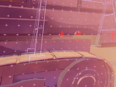
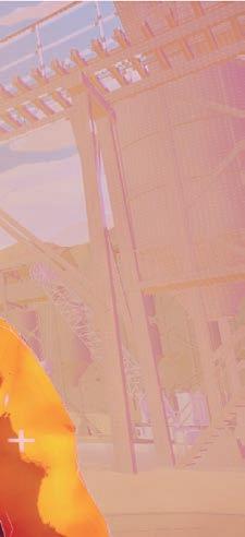
Sacred Site: The player will be born from this place, and during the process of crossing the cave, he can appreciate the rock paintings on the stone walls and obtain a climate compass in the center of the cave for real-time understanding of climate change. Stepping out of the cave, the player will enter indigenous community and mine to complete the mission: Sabotage.
Sabotage: The player will secretly destroy the machines and buildings of the mine in this level, and collect as many components as possible within a limited time to purchase machines for landscape migration level. During this period, player need to avoid being driven away by miners, otherwise his health will be reduced,resulting in the failure of this level.
Landscape Migration: The player will use the collected components to purchase machines, which can be used to migrate different landscapes. The new landscape will affect the temperature and humidity of the site, and bring different animals. The ultimate goal is to restore the climate of the mining site to be consistent with Kakadu National Park and ensure a new balance in the food chain.


LANDSCAPE MIGRATION





The blocks shown in the figures are specifically designed to simulate landscape migration, including elements such as green lands, forest lands, wetlands and stones. These blocks were used to simulate the migration effect on the“Stone Country”and“wetland”environment, while using different colors to more realistically reflect the actual scene and facilitate the differentiation of different terrain features. There are many ways to combine these blocks, and players can freely combine them according to their wishes.


The entire process of building the physical model begins with a thorough analysis of the game scene, extracting key elements from it. These scene features are abstracted into various block elements, each representing different natural landscapes such as stones, mines, rivers, etc.
By using multiple pigments to color these blocks, the distinction between each element becomes more distinct, enhancing the visual appeal of the model and accurately and beautifully reflecting the rich details and colors of the original game scene.
In order to build the area for landscape migration, a PVC board was installed above the site. Two areas are connected by plastic sticks to create a continuous operating platform. Players can place landscape blocks in the spaces divided by PVC boards to simulate the process of landscape migration.


