Jessy Rojas Güere
Architecture, Planning & Urban Design Portfolio


Jessy Rojas Güere
Architecture, Planning & Urban Design Portfolio

M.S. in Architecture & Urban Design
Licensed Architect in Peru

jessy.rojasguere@gmail.com
jlr2273@columbia.edu
US +1 (845) 694-2429
PE +51 977 158 512 LinkedIn
ArcGIS StoryMap

Urban Planning & Design
Experienced in developing strategies for regional and urban resilience, including master plans, land use guidelines, and landscape design proposals. Skilled in producing conceptual design drawings, plans, and construction documents.

Proficient in developing, analyzing, and visualizing geospatial data for implementation across multiple scales.
Visual Storytelling

Skilled in crafting compelling narratives through a combination of data, in-depth research, and a strong sense of graphic design.
Community engagement & Collaborative Work


Experienced in developing materials and methodologies for participatory design processes, leading community workshops with a focus on respect, empathy, and dialogue.
VERÓN VERDE
Stitching socio-spatial fragmentation to connect communities and ecosystems
CREATING VALUE OUT OF TRASH
A Resilient and green future industry system
SOUTH NORFOLK
A vision of resilience for South Norfolk waterfront
RETREAT OF ANDEAN GLACIERS
Mapping resilient strategies for melting territories
Territorial Development Plan of Chiclayo 2022 – 2042
PDM CALLAO 2040
Metropolitan Development Plan of Callao 2020 – 2040
VILLA PANAMERICANA
Master Plan for the Pan American Village Lima 2019
BOULEVARD UPTOWN
A New Civic Axis for the city
DIAGONAL
Lima Art Museum (MALI) Expansion Competition
LA CASA DE LOS MUÑECONES
A Cultural Center for preserving community legacy
Stitching socio-spatial fragmentation to connect communities and ecosystems
Location
Verón, Alta Gracia, Dominican Republic
GSAPP Course
Urban Design Studio III - Spring 24’
Studio Faculty
Kate Orff, Thaddeus Pawlowski, Claudia Herasme, Dilip da Cunha, Geeta Mehta, Adriana Chavez
Collaborators
F. Anastasia, C. Gassiebayle, S. Ghosh
Key contributions
• Led workshops with the local community in the Dominican Republic
• Coordinated the team, organized activities, and developed the final proposal
• Developed urban design principles, including axonometric drawings and diagrams
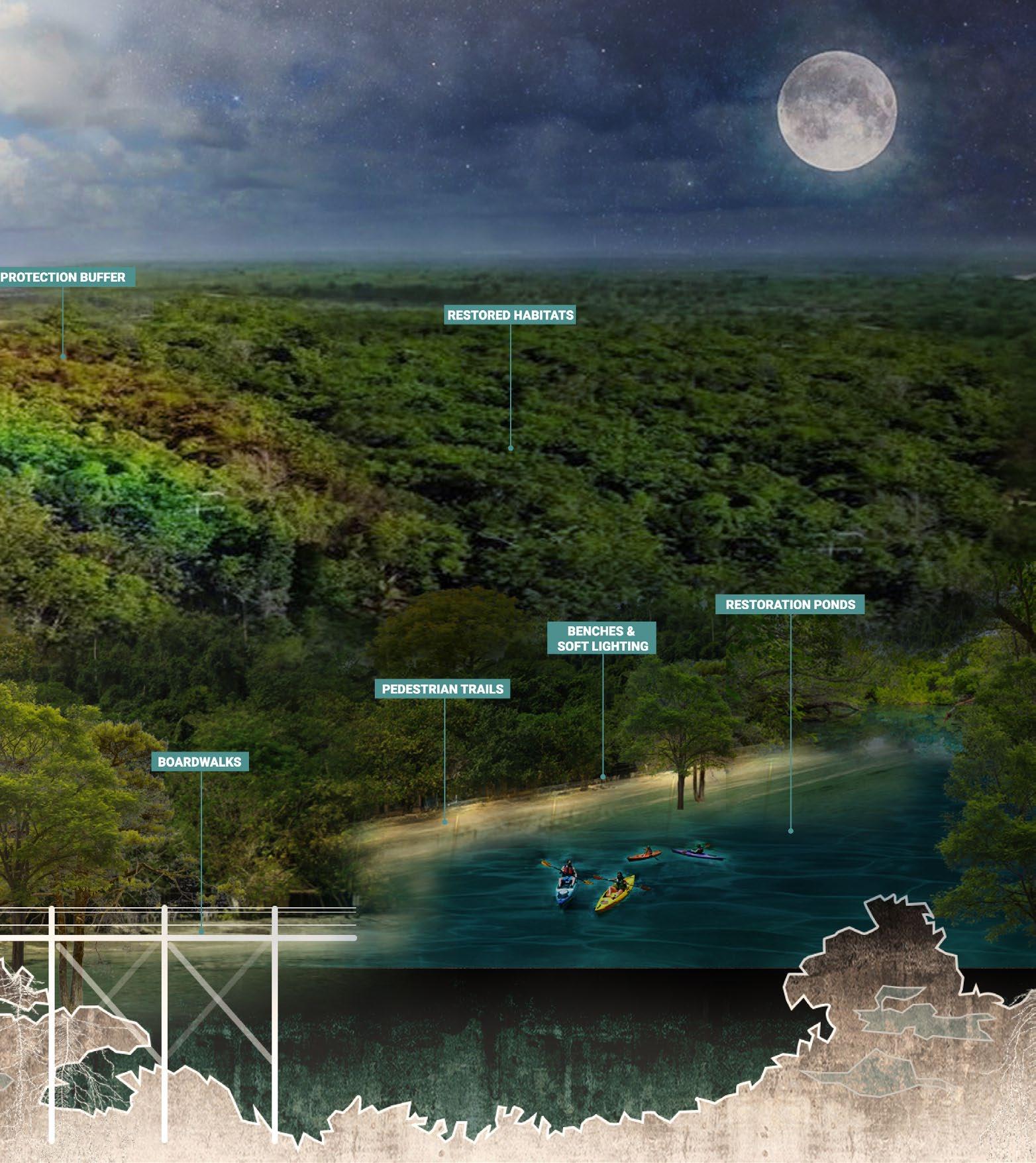
• Designed and drafted specific proposals for the “Green Corridor,” including sections, plans, and views
• Created perspectives and illustrative drawings
Key statement
Verón, a dormitory town in the East of Dominican Republic, supports Punta Cana’s tourism industry yet remains overlooked. This proposal aims to transform it into a vibrant Caribbean city through three main strategies: creating ecological corridors, consolidating an efficient pedestrian-friendly mobility network, and connecting fragmented developments with social infrastructure for sustainable growth.
This vision sees Verón as a resilient, vibrant, and connected city, an ecological asset for the region, and a living legacy for future generations.
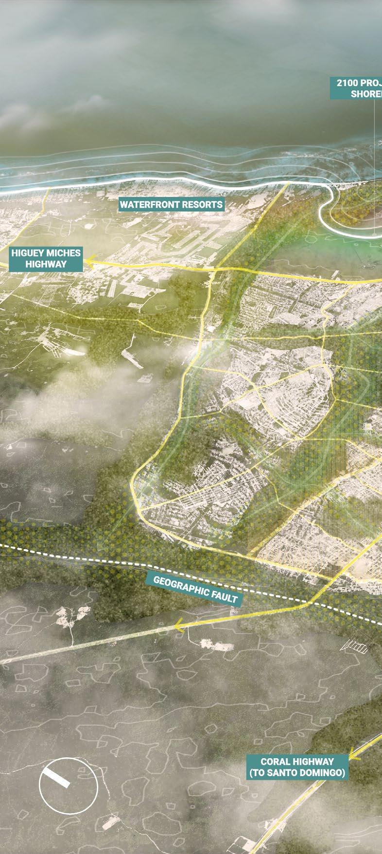

A nature-based climate resilient city model for East Dominican Republic


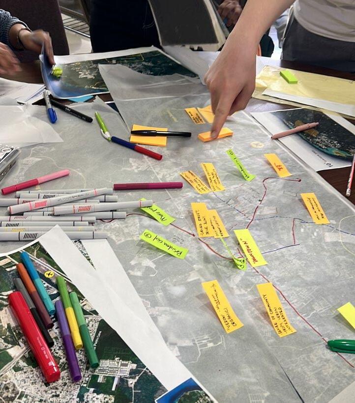
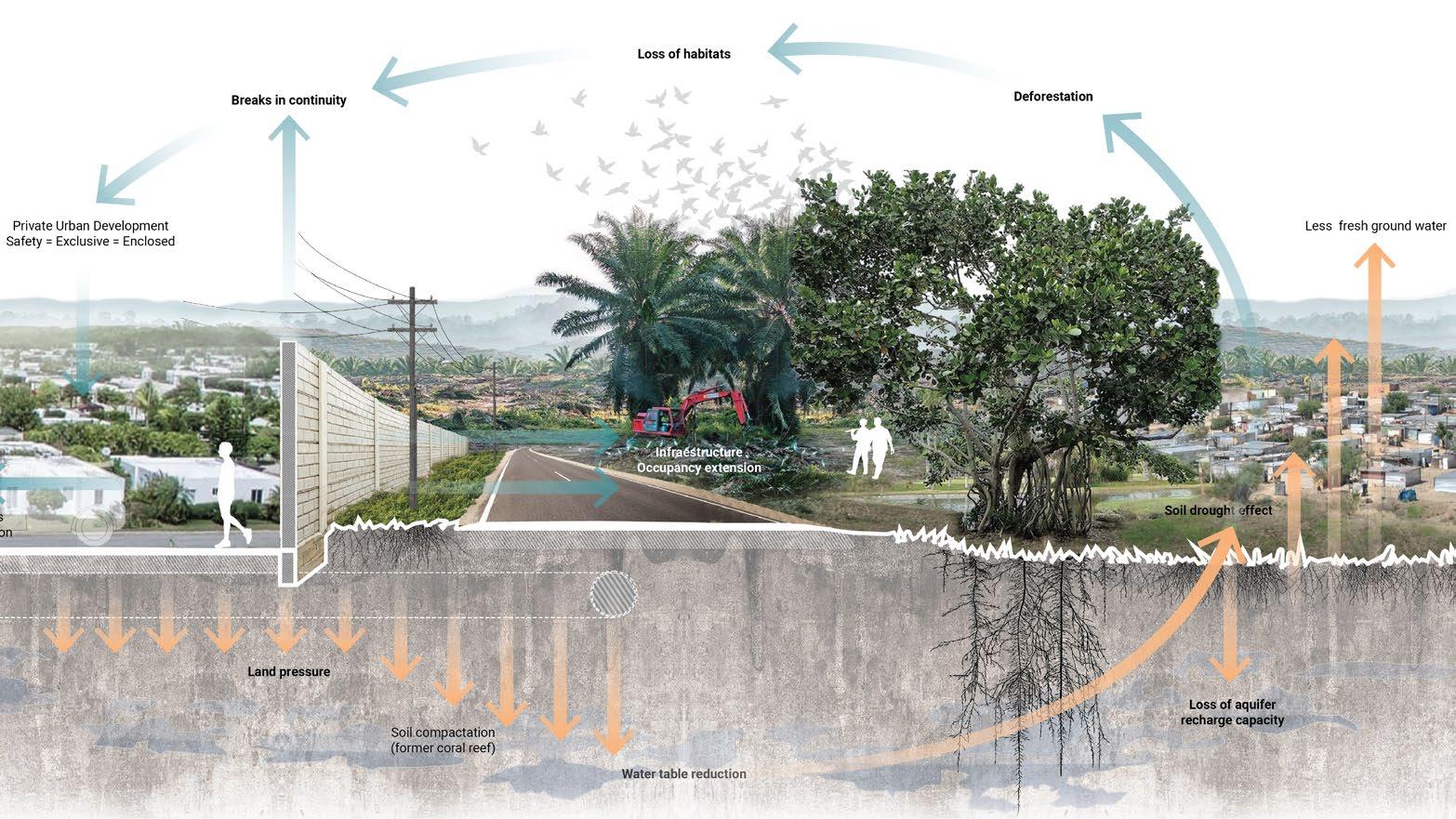

Verón, from a dormitory town into an attractive and lively Caribbean city
Location
Harlem River, New York, USA
GSAPP Courses
Urban Design Studio I - Summer 23’
DTEQ / Digital Techniques - Summer 23’
Studio Faculty
Nans Voron, Sagi Golan, Austin Sakong, Elizabeth Camuti, Daphne Lundi, Grant McCracken, Sean Gallagher
DTEQ Instructors
Adriana Chavez, Christopher Landau, Claudia Tomateo
Collaborators
J. Li, S. Kumar, Y. Wang
Key contributions
• Conducted research, analysis and data collection
• Created and developed maps
• Performed image post-production
• Organized narratives and presentations
Key statement
The project introduces a new industrial infrastructure focused on recycling and upcycling to address high waste production in the Bronx by including training and education facilities to involve locals, creating job opportunities. Additionally, the proposal aims to revive water transportation on the historically industrial Harlem River, enhancing connectivity between Harlem and other NYC neighborhoods and boroughs.
Furthermore, the project will activate and restore a linear park along the Harlem River, revitalizing the area and providing green space for the community.

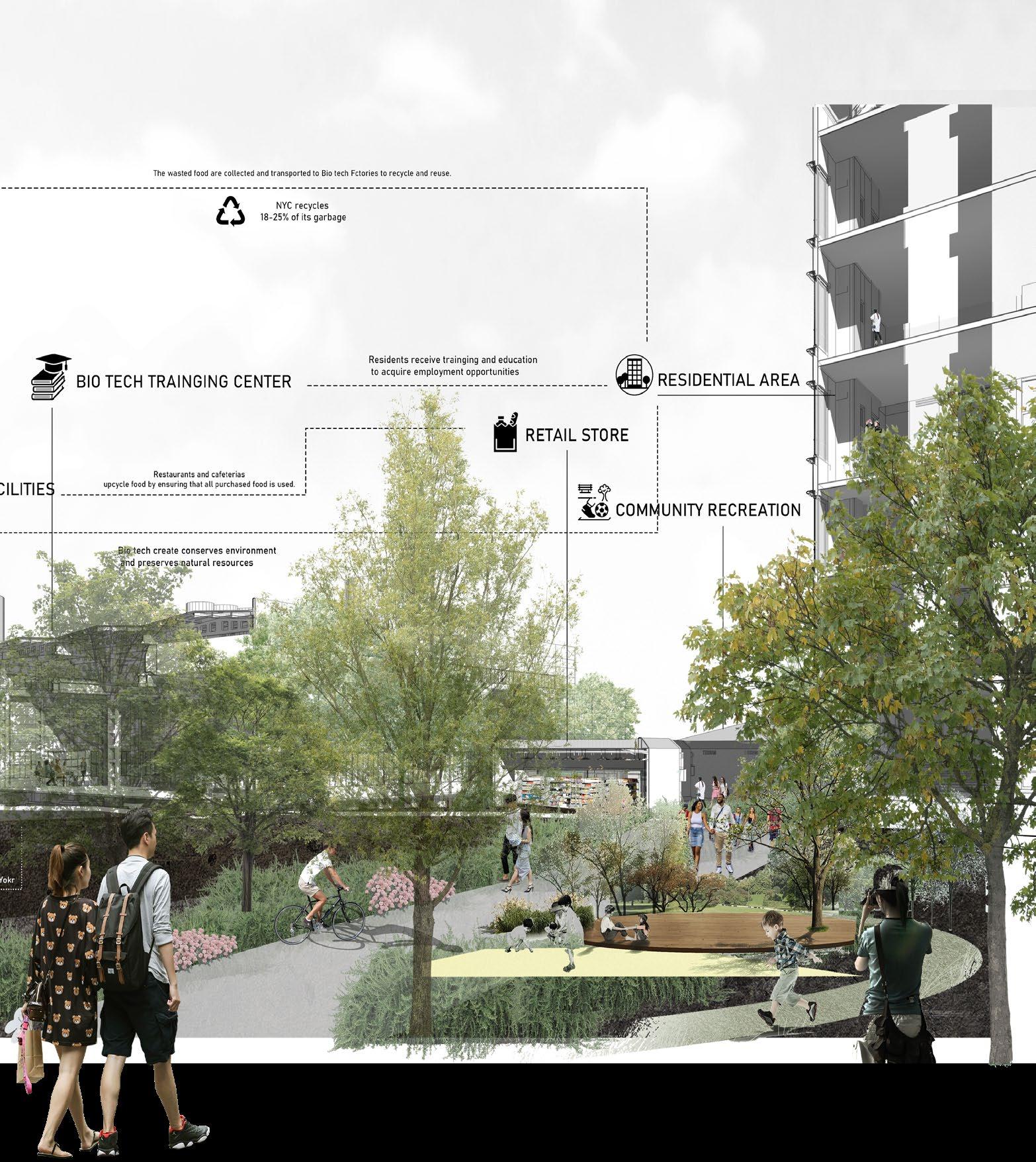


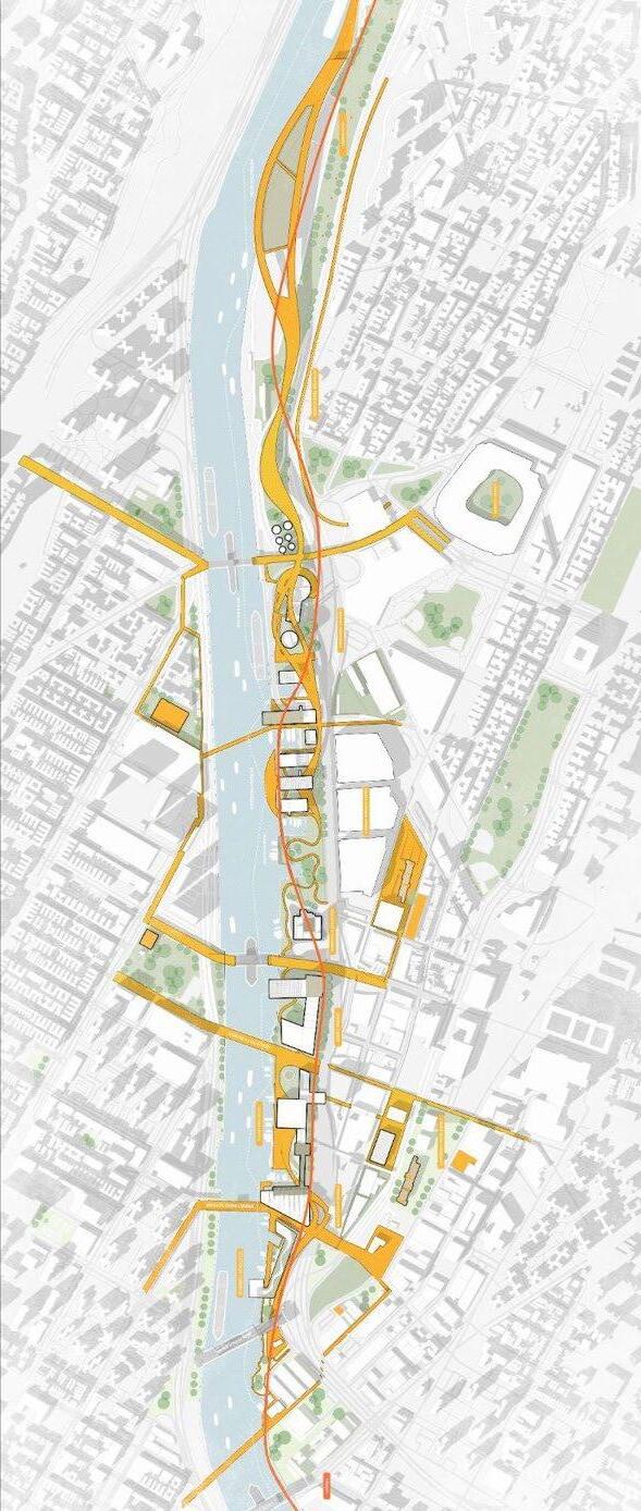
Connectivity Strategies and Upcycling Facilities


Location
South Norfolk, Virginia, USA
GSAPP Course
Toward Resilient Cities & Landscapes - Fall 23’
Instructor
Kate Orff
Collaborator
C. Gassiebayle
Participation in
• Developed maps and conducted urban analysis
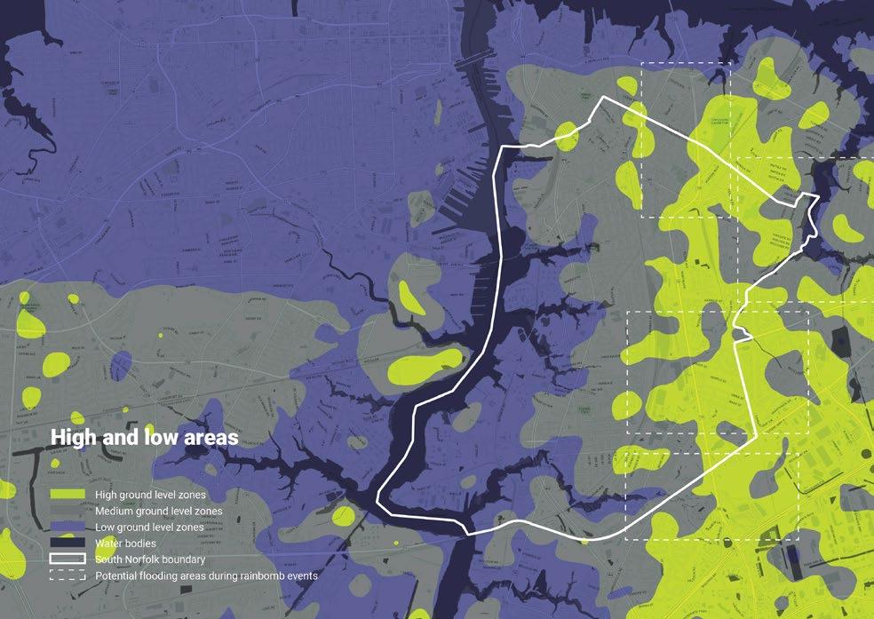
• Analyzed issues and opportunities, particularly related to future scenarios of rising water levels
• Designed development principles
• Created diagrams and drawings of urban resilience strategies
• Co-developed the story map, including materials and narrative
Key statement
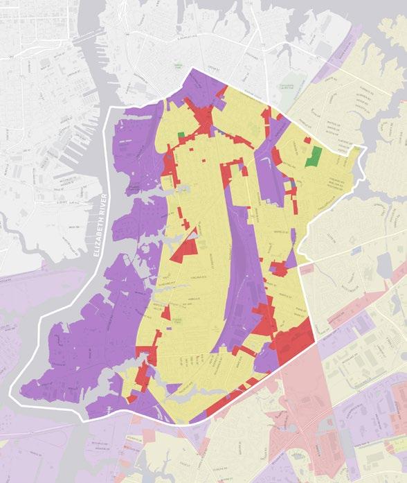
The project aims to assess the current conditions of South Norfolk (SoNo), Virginia’s industrial waterfront and community priorities to develop a resilience plan addressing local strengths and threats.
Proposed urban strategies focus on the most vulnerable and high-potential areas: enhancing city-water connectivity along the waterfront and creeks, implementing flood protection with defense lines parallel to the coast (including roads, flood areas, and facilities like schools), promoting mixed-use zones in highly trafficked, interconnected areas, and transitioning waterfront industries to cleaner energy and alternative uses.
These measures aim to bolster SoNo’s resilience and sustainability.
Learn more
South Norfolk Storymap

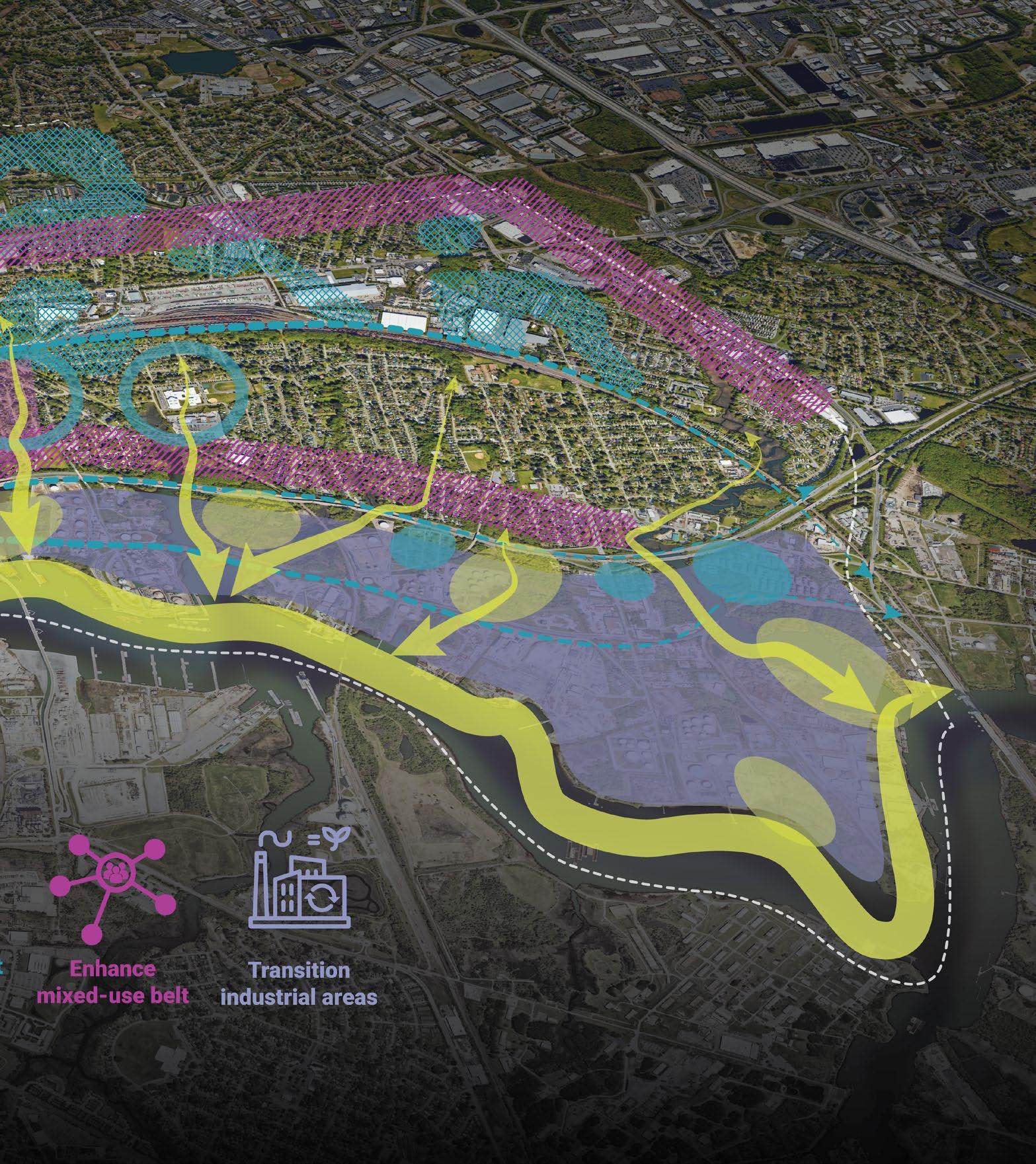
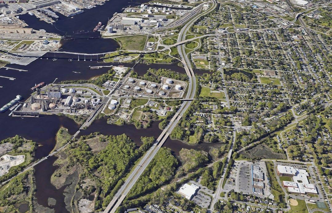

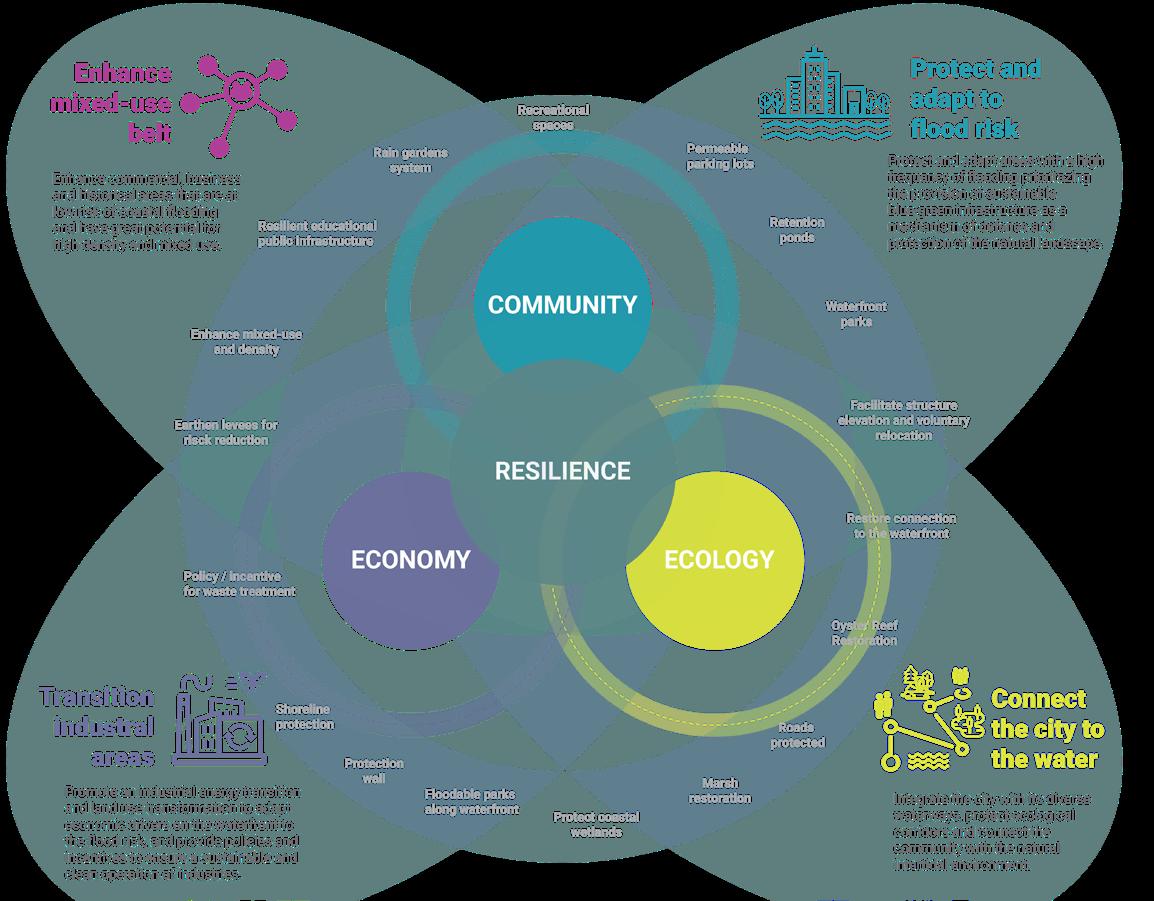
Development Principles for a Resilient Future


Adapting to a New Landscape: Sections of the


Mapping resilient strategies for melting territories
Location
Yungay Town, Province of Ancash, Perú
Courses
GIS for Practices - Fall 23’
Spatial Data Narratives - Spring 24’
Instructors
Manon Vergerio, Eric Brelsford Joshua Begley
Awards
William Kinne Fellows Traveling Prize 2023-2024. GSAPP, Columbia University.
Key statement
This project is part of that process, the beginning of a journey that seeks its future continuity in defense of the glacier territories. My goal is to take action in the protection of mountain ecosystems and strengthen the resilience of high Andean communities.
This research seeks to identify, characterize and geolocate community experiences and wisdom for adaptation to the rapid melting of glaciers in the tropical Andes. Specifically, the study of the communities of Yungay Town, the scene of the most catastrophic natural disasters recorded in Peru related to climate change.
The objective of this research is to define resilience strategies for the implementation of public policies and rural landscape design, in order to allow its replicability in other contexts of vulnerability and territorial injustice.
Learn more
Retreat of the Andean Glaciers Storymap
Retreat of the Andean Glaciers Research Statement


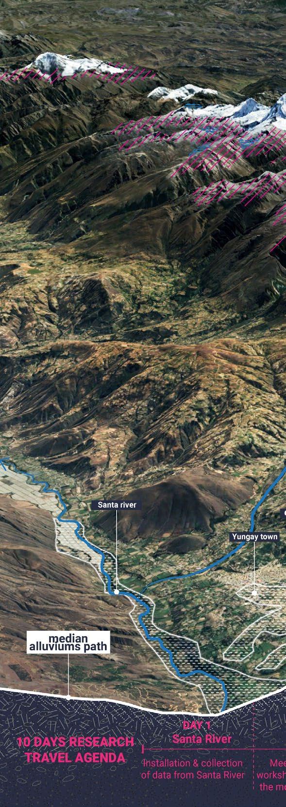
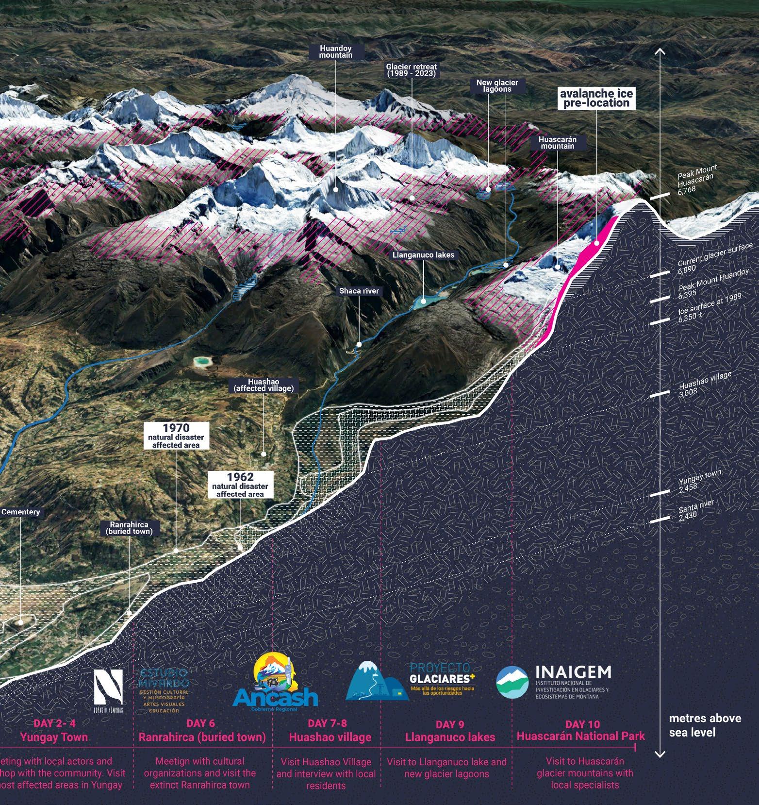
of places to visit and itinerary along previous avalanches path
Territorial Development Plan of Chiclayo 2022 – 2042
Location
Province of Lambayeque, Perú
Position/Year
Territorial-regional planner / 2022
Firm / Organization
Ministry of Housing of Perú
Key contributions
• Developed technical diagnoses and proposals, and coordinated technical and graphic content.
• Designed graphic identity for project submissions, and crafted the Executive Summary.
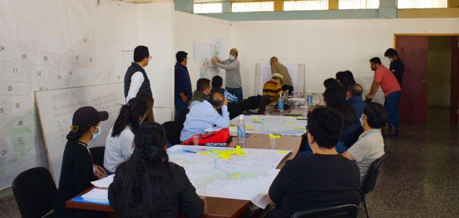
• Supported participatory process coordination, methodologies and materials.
• Co-developed the proposals for “Future Urban Vision” and the “Ecological Infrastructure system”.
• Created diagrams, collages, maps and drawings of urban resilience strategies
Key statement
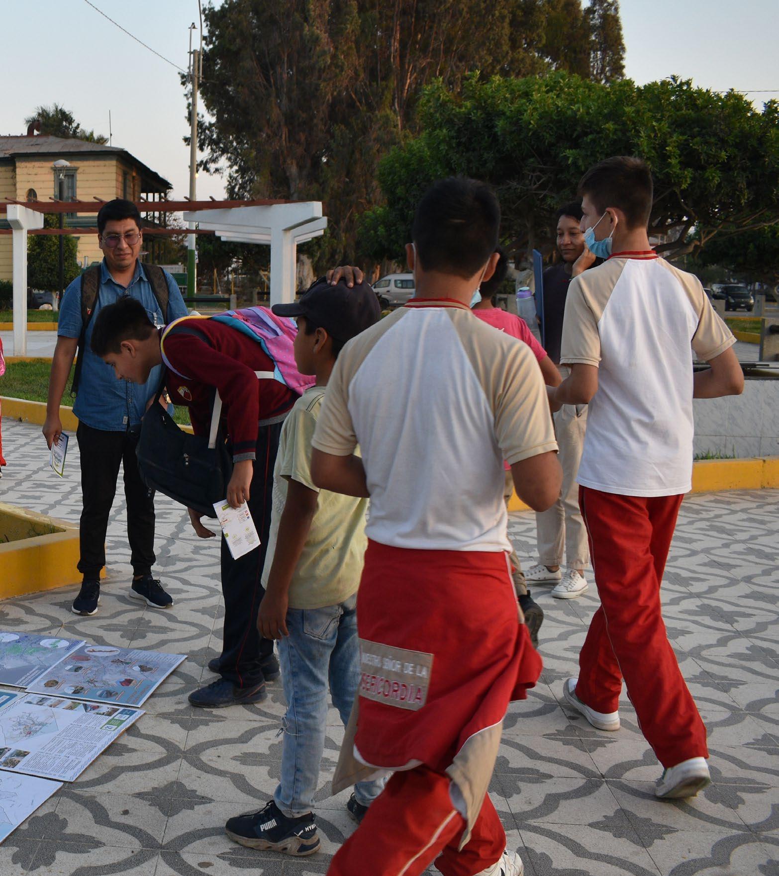
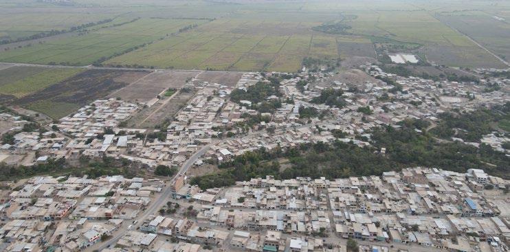
The Territorial Development Plan of Chiclayo 2022-2042 (PAT 2042) is a strategic tool guiding economic, urban, and environmental activities for sustainable development across Chiclayo’s districts over 20 years. Emphasizing equity and justice, it targets the neediest areas, providing a concrete roadmap for public investment by all government levels.
Approved in April 2024, the plan addresses significant inequalities between rural districts and the metropolitan area. It leverages Chiclayo’s economic, cultural, and ecological strengths, ensuring comprehensive development by utilizing previously untapped or underutilized territorial potentials.
Learn more
Peruvian government official announcement
Municipal Ordinance Approval
PAT Chiclayo 2042: Executive Summary



Territorial Conditioning Units
Provincial Population Centers
Urban-Rural Mobility
Productive Economic Infrastructure
Basic Facilities and Services
Heritage and Tourism Infrastructure
Ecological and Recreational Infrastructure
Rural Infrastructure
Environmental and Risk Infrastructure

Urban vision process: Urban Systems, Objectives, and Policy Guidelines
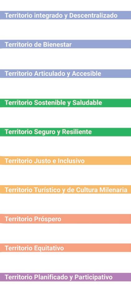
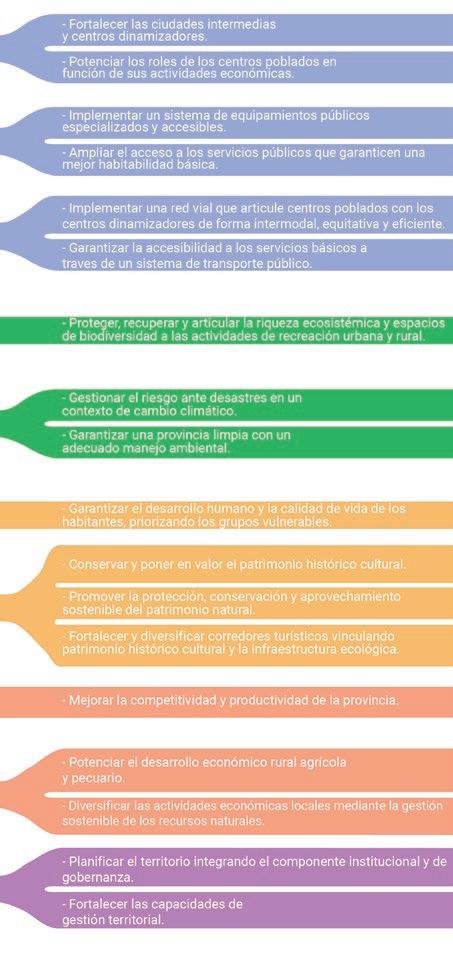


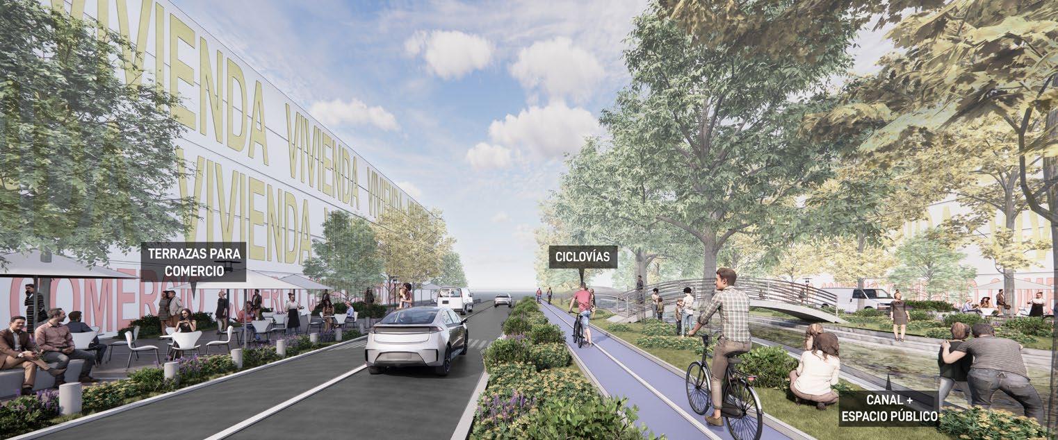
Ecological Infrastructure System Proposal


Metropolitan Development Plan of Callao 2020-2040
Location
Province of Callao, Perú
Position / Year
Urban Planning Assistant / 2020
Firm / Organization
Ministry of Housing of Perú
Key contributions
• Support technical diagnoses and proposals, and coordinated technical and graphic content.
• Led the diagnosis and proposals for the “Public Spaces and Ecological Infrastructure System”.
• Designed graphic identity for project submissions
• Created diagrams, collages, maps and drawings of urban resilience strategies
Key statement
The Metropolitan Development Plan for Callao 20202040 (PDM CALLAO 2040) is a technical, regulatory, and management instrument that ensures comprehensive urban planning for sustainable development in the Province of Callao. It aims to optimize public and private investment through a coordinated project portfolio and social validation.
The PDM CALLAO 2040 envisions a cohesive, revitalized, and integrated Callao, reconnecting it with the sea and natural ecosystems, invigorating its urban core, promoting adequate housing, protecting ecological areas and cultural heritage, and incorporating the airport and port as positive development hubs. The plan ensures a high quality of life, safety, and connectivity, positioning Callao as a strategic national gateway.
Lear more
PDM CALLAO 2040: Executive Summary


Immovable and Archaeological Cultural Heritage

Ecological Infrastructure and Open Spaces
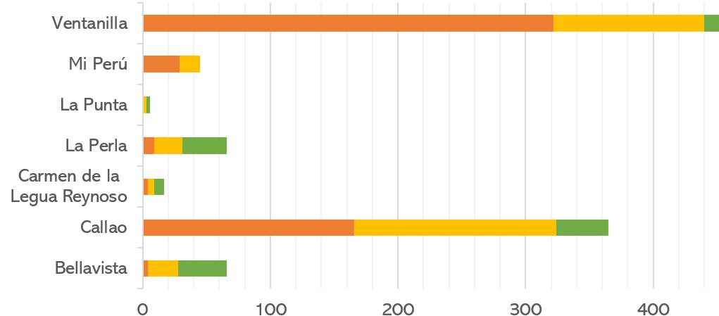
Quantitative Data and Analysis by District Units
Urban Infrastructure and Services
Urban Facilities
Urban Mobility and Centralities


Proposal for


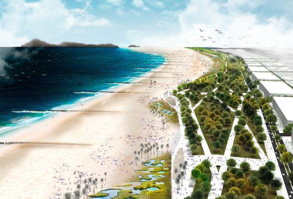
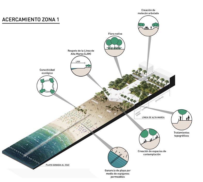

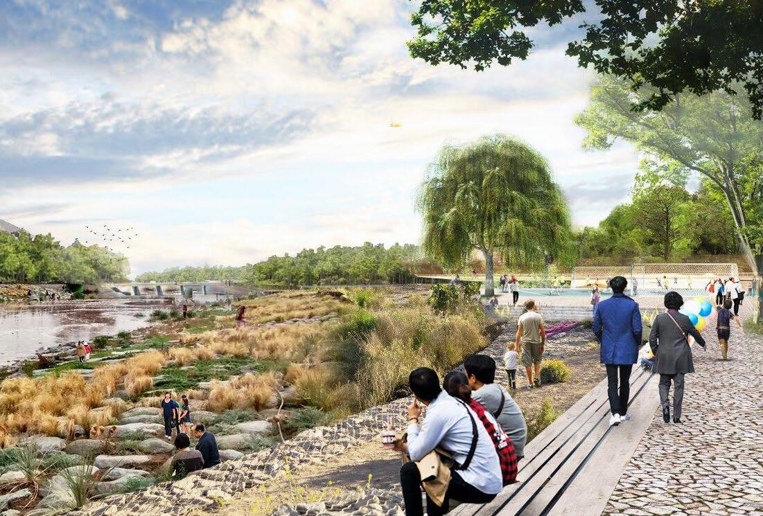


Strategies for the renaturalization of river edges
Master Plan for the Pan American Village Lima 2019 - XVIII Pan American Games
Location
Villa El Salvador district, Lima, Perú
Position / Year
Urban Planner / 2019
Firm / Organization
Planning & Urban Design Team, F-D Architects
Key contributions
• Co-development of urban policies, zoning regulations, and building parameters.
• Analyzed land use scenarios and occupancy calculations.
• Produced detailed 3D drawings and plans.
Key statement
The proposal aims to develop a Strategic Urban Vision and Master Plan for the Pan American Village, extending the legacy of the XVIII Pan American and VI Parapan American Games Lima 2019.
It defines the Village’s post-Games role in Villa el Salvador and Metropolitan Lima, focusing on future uses for “Biotechnological Park 26” to enhance its legacy.
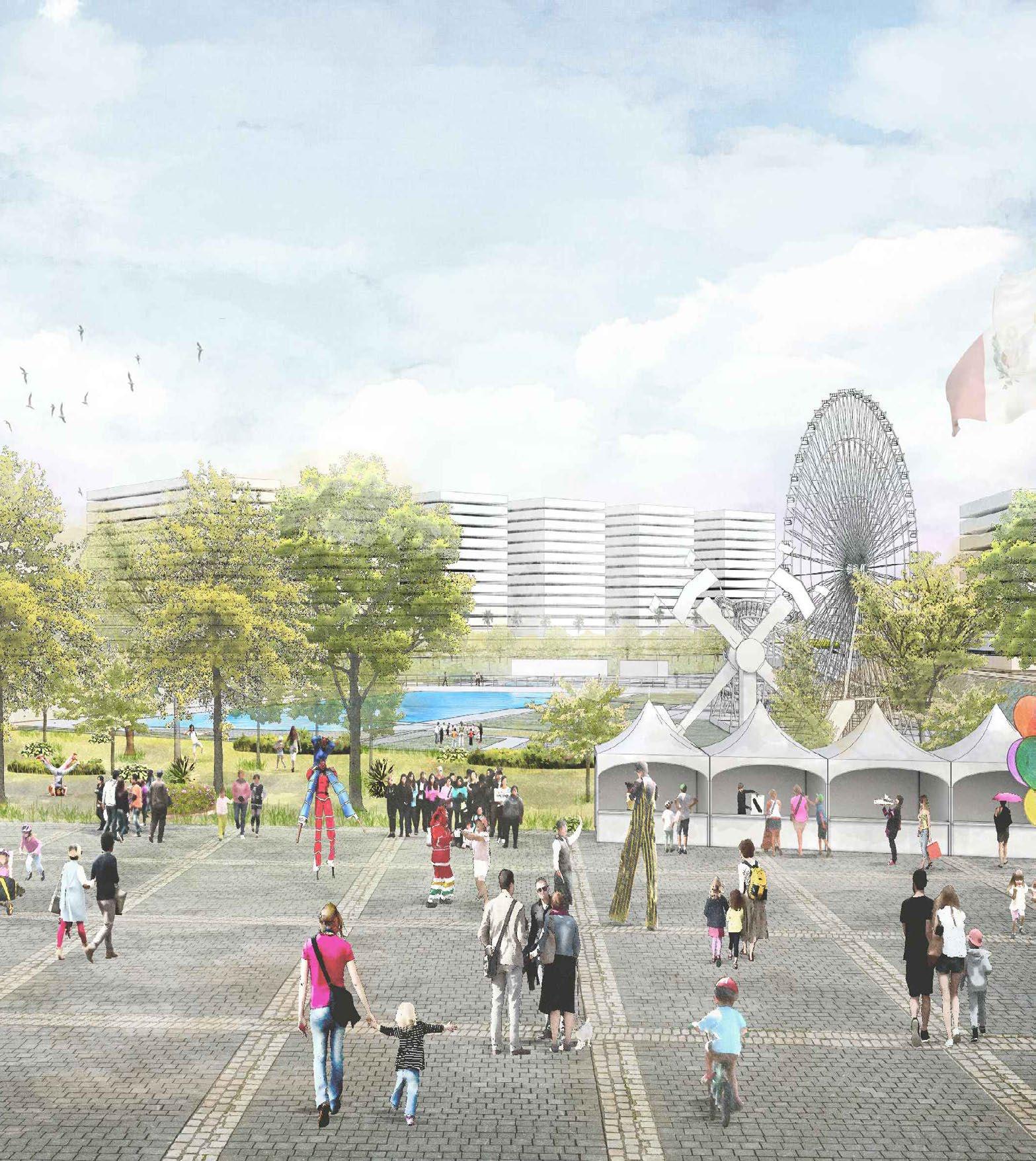
The Master Plan envisions transforming the site into a major urban center for services and public spaces, promoting inclusivity and social integration. It includes a technological innovation center, high-performance school, university and institute space, Metropolitan Park, Civic Plaza with a cultural center, strip mall, commercial areas, and a new hospital, minimizing residential use.


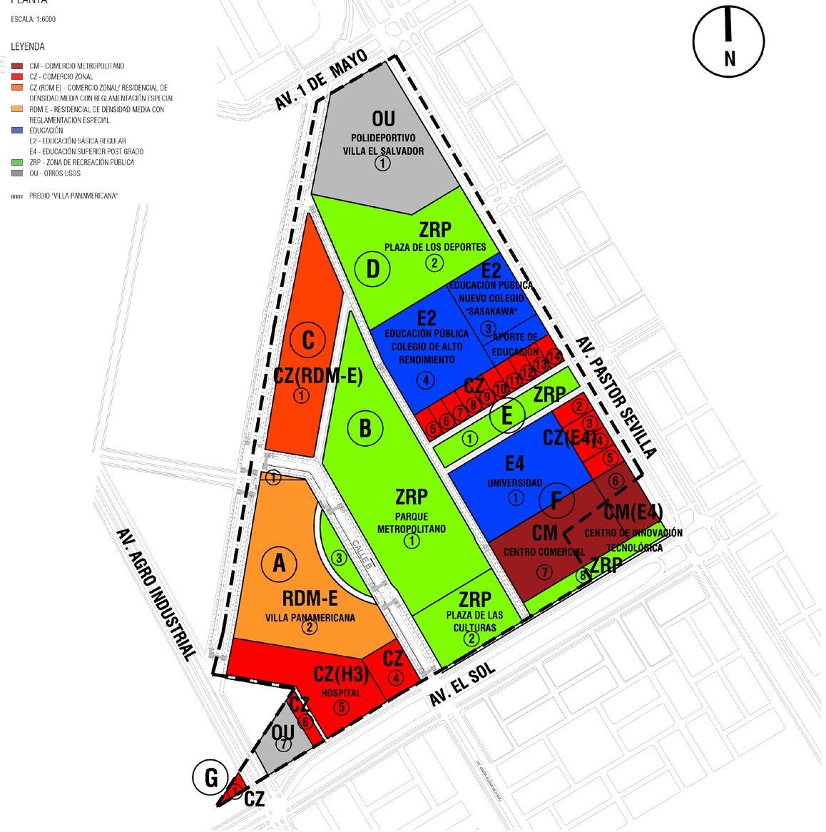


Block Special Regulations proposed:
BLOCK “A” PROPOSED USE PARCEL AREA (m2)
BLOCK “B” PROPOSED USE PARCEL AREA (m2)
BLOCK “C” PROPOSED USE PARCEL AREA (m2)
BLOCK “D” PROPOSED USE PARCEL AREA (m2)
Setbacks Heights
BLOCK “E” PROPOSED USE PARCEL AREA (m2)
BLOCK “F” PROPOSED USE PARCEL AREA (m2)
BLOCK “G” PROPOSED USE PARCEL AREA (m2)


Other considerations

Regulatory heights isometry
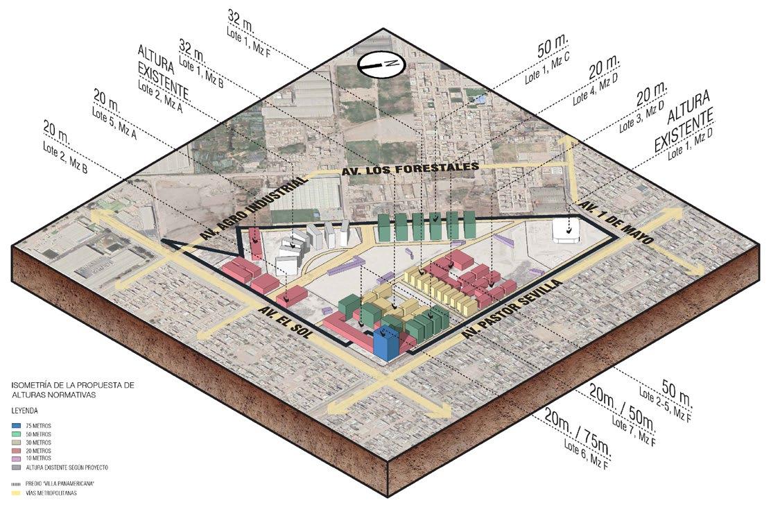

A New Civic Axis for the city
Location
San Miguel District, Lima, Perú
Position / Year
Architect Urban Designer / 2019
Firm / Organization
Calvet Architects
Awards
1st Place “Social Housing in Lima” & 1st Place “Work of the Year”. Architecture and City Award, (CAPECO, 2020).
Key contributions
• Developed conceptual design drawings, project plans, sections, and details for construction phase project.
• Coordinated with specialists, engineering teams, and real estate partners for technical integration.
• Prepared graphic proposals for competitions.
• Produced comprehensive plan sets for subdivision approval.
Key statement
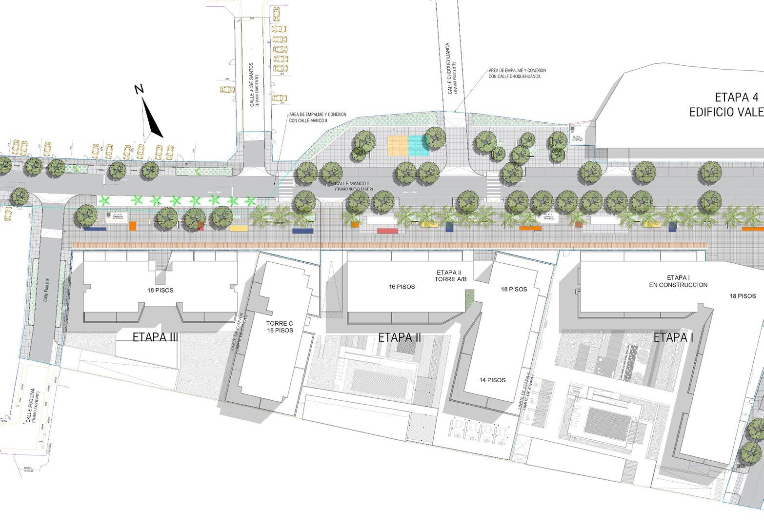
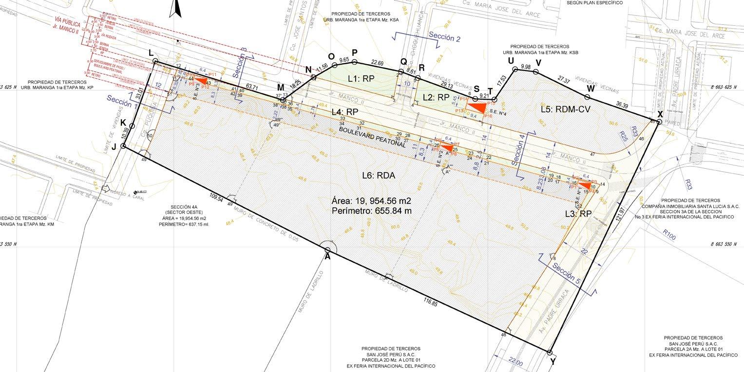
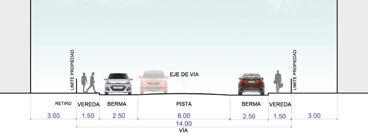
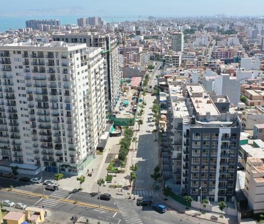
The project aims to create a pedestrian boulevard in San Miguel’s high-density district through a private sector initiative. The “Civic Axis” will link parks and public facilities with wide, landscaped sidewalks and reduced vehicular traffic (two lanes). Mixed commercial uses on the ground floors of high-density residential buildings will enhance city life and promote social control of public spaces.
A private land grant for public use, nearly doubling the boulevard’s width, ensures the project’s feasibility. This grant applies only to the surface level, preserving underground areas for private parking and maintaining the property’s buildable area and investment potential.








Lima Art Museum (MALI)
Expansion Competition
Location
Historical Center of Lima, Perú
Position / Year
Architect & Urban Designer / 2016
Firm / Organization
Calvet Architects
Award
HONORABLE MENTION in The International Competition NUEVA ALA DEL MALI, 2016.
Key contributions
• Coordinated the development team for proposal creation.
• Developed conceptual design drawings, plans, and sections.
• Created graphic style, improved views, and collages.
• Developed competition panels and submitted proposals.
Key statement
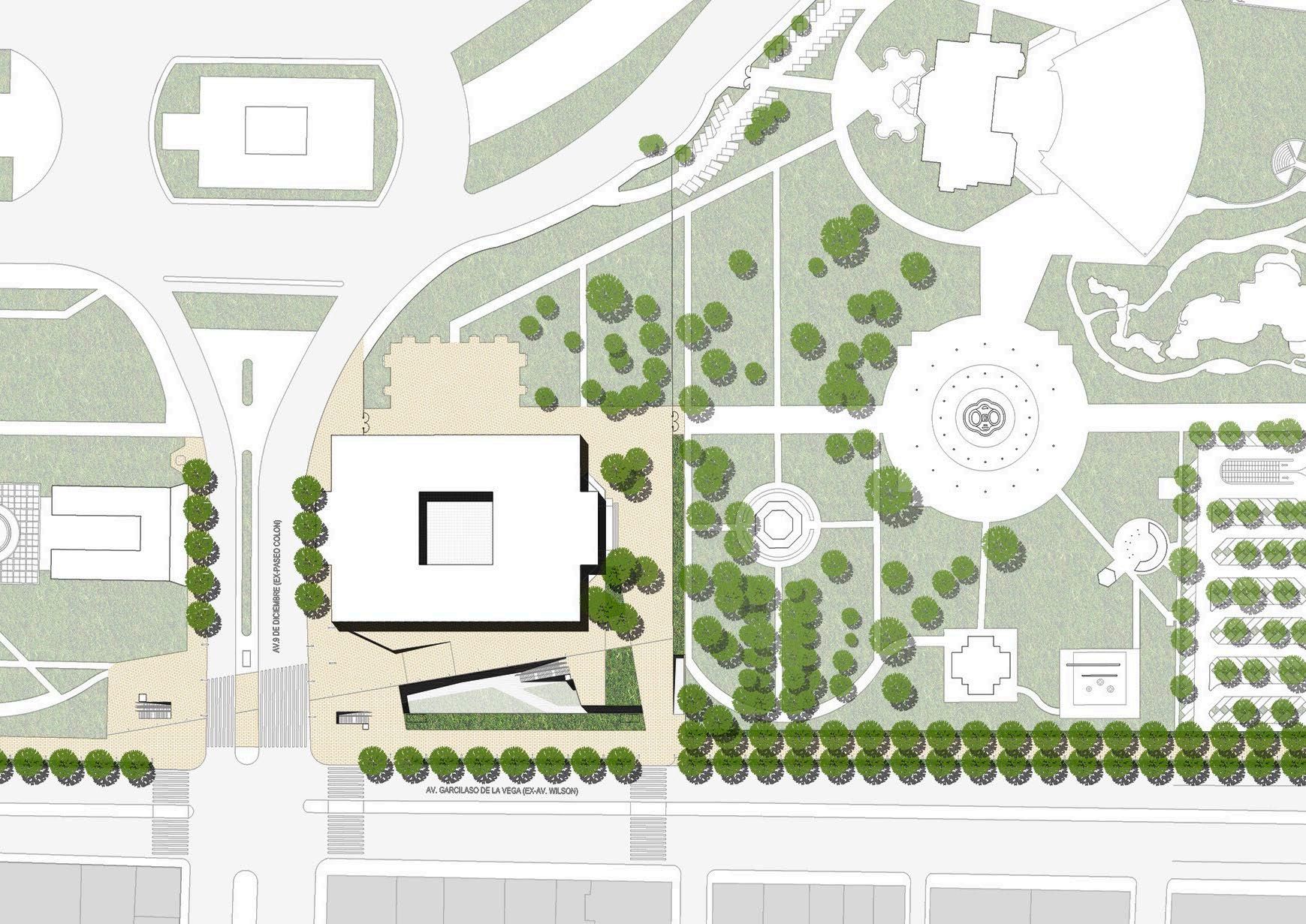
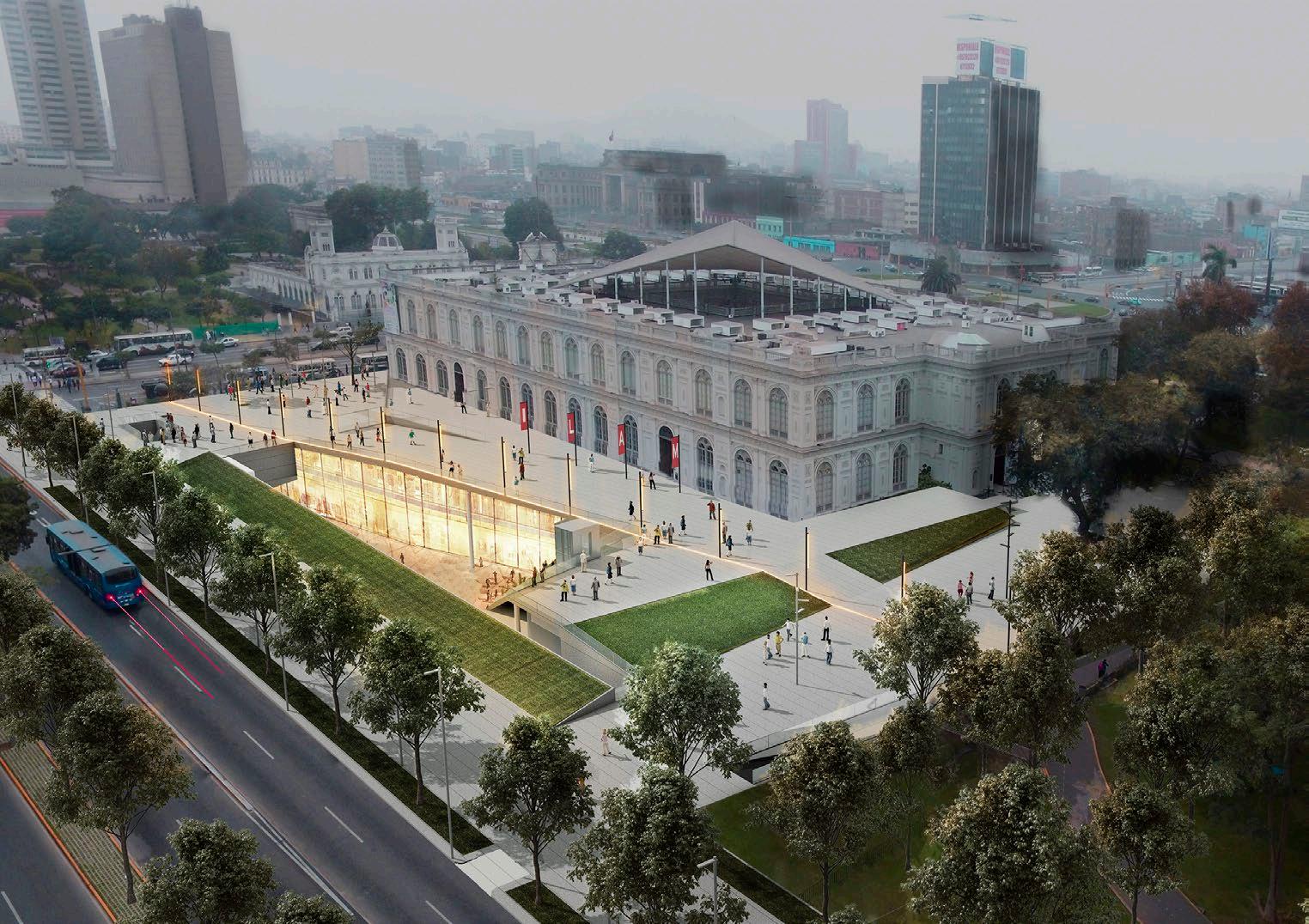
The MALI expansion redefines its relationship with the city, enhancing its role in the pedestrian “Corridor” linking major parks, squares, and boulevards in the Historic Center. Key interventions include remodeling the museum surroundings, creating a boulevard to 28 de Julio Avenue, facilitating metro lobby access, and redefining Exposition Park’s boundaries with a new Plaza entrance.
The “ New Plaza” of the museum revitalizes the neoclassical facade, encouraging interaction with outdoor exhibitions and cultural activities. It organizes public spaces around the museum, directing pedestrian flows to museum and park entrances.
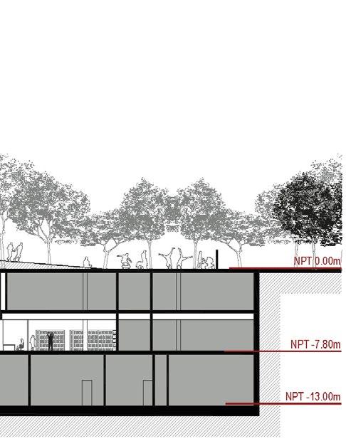
A diagonal layout elevates the plaza, creating a central “Patio” that links visually and physically to the underground expansion housing galleries, a library, and classrooms.
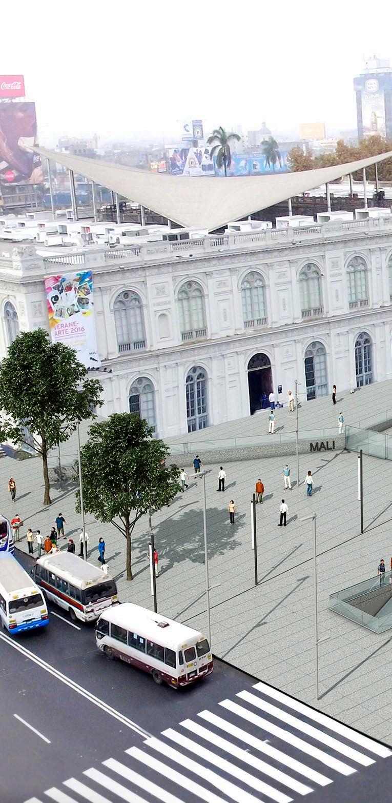
Daytime view of the proposal integrated into the urban context of Lima



A Cultural Center for preserving community legacy
Location
Comas distric, Lima, Perú
Position / Year
Co-founder & Urban Designer / 2014 - 2017
Organization
“Colectivo IN>formal”: V.r Barraza, D. Canchán, M. Cisneros, A. Garcia, W. García, G. Miglierina, D. Monzón, C. Morales, J. Rojas, L. Sanchez.
Award
2nd Place in CAF International Competition for Urban Development and Social Inclusion Projects. IDB 2015.
Key contributions
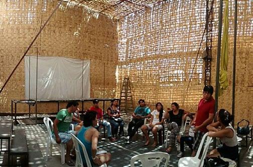
• Created participatory design methodologies and led workshops for adults and children.
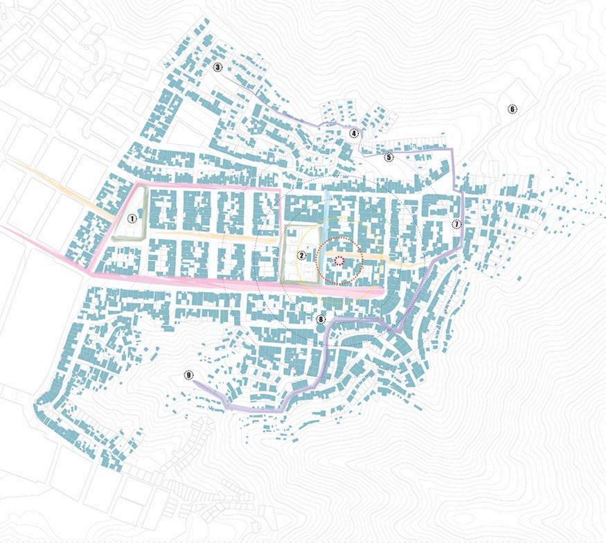
• Conducted urban analysis and diagnosis, and developed participative proposals (views, plans, sections, and diagrams)
Key statement
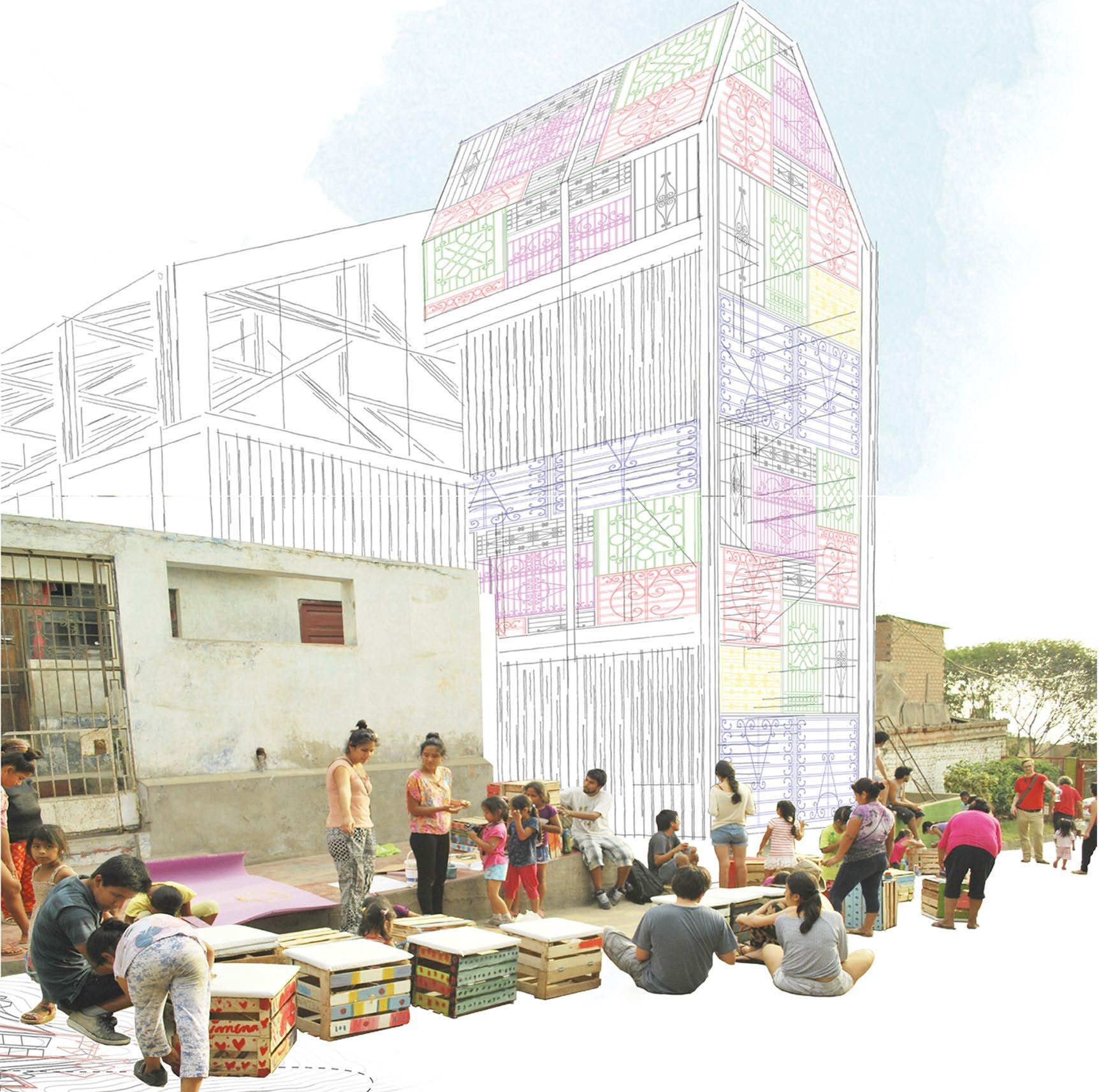
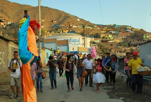
The project aims to restore and preserve the memory of the teaching and training space of the Cultural Association “La Gran Marcha de Los Muñecones,” which has been central to the neighborhood.
Using a participatory design methodology, it integrates local materials while preserving the neighborhood’s aesthetic and identity. The proposal creates a flexible space, both internally and externally, accommodating horizontal and vertical uses.
This approach aligns with IN>formal’s principles, combining sociology, architecture, and art to engage with informal urban settings, promote dialogue, and offer comprehensive solutions tailored to community needs.
Learn more
La Casa de los Muñecones Portfolio


External view of the proposal: Preservation of the street as a public space for creation
