Jessy Rojas Güere
Architecture, Planning & Urban design
M.S. Architecture & Urban Design
Columbia University GSAPP
Graduate Portfolio 2023-2024
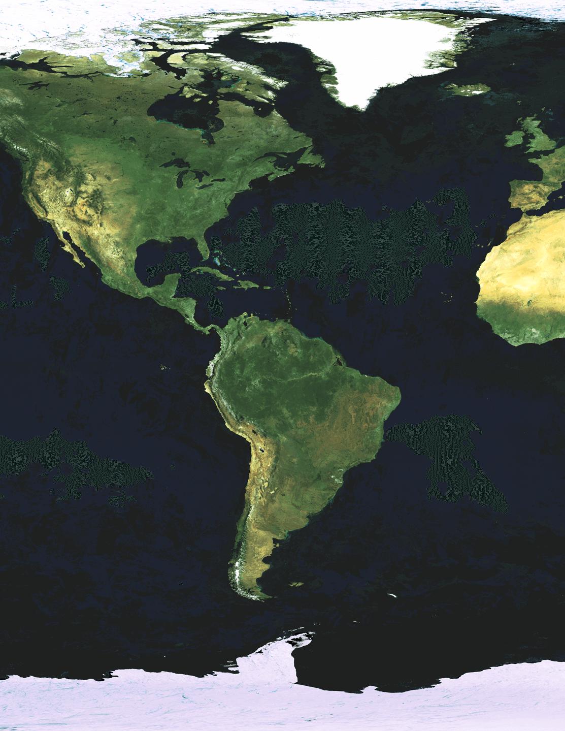

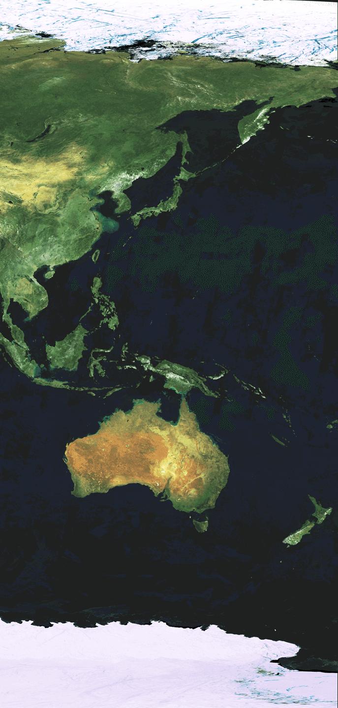
A selection of learnings, data and design experiences from the communities, territories, species and oceans of the Atlantic, the Caribbean and the Pacific, for a more resilient and equitable landscape to cohabit.
VERÓN
Stitching a new fabric
PEEL-LINK
Rethinking the property regime by peeling back the layers of “development”
CREATING VALUE OUT OF TRASH
A Resilient and green future industry system
SOUTH NORFOLK
A vision of resilience for South Norfolk waterfront
EDGE OF HOPE
Brownsville’s Migration Crossroads
BEYOND HARLEM’S RECYCLING SYSTEM
A Story of Resilience and Renewal
URBAN RECONVERSION IN NORTH LIMA
When inequality dresses up as a shopping mall

VERDE
RETREAT OF ANDEAN GLACIERS Mapping resilient strategies for melting territories 04 10 16 20 24 26 28 32 CONTENT
PAGE 2

3
VERÓN VERDE
Stitching a new fabric
Location
Verón, Alta Gracia, Dominican Republic
Key statement
At present, Verón, a city of the Dominican Republic, is a dormitory town, the overlooked backbone of the tourism industry in Punta Cana.
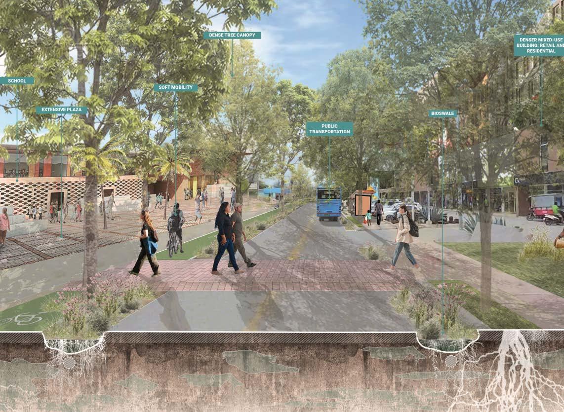
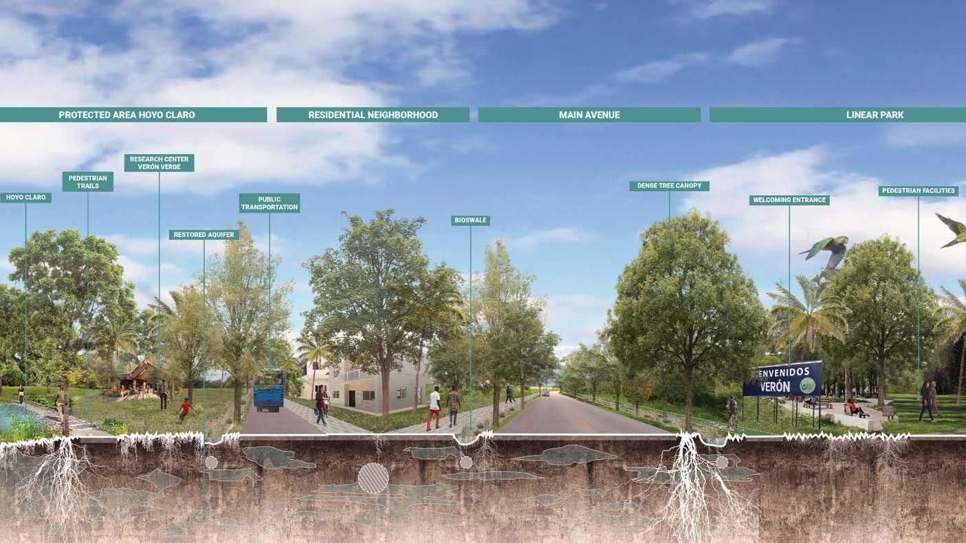
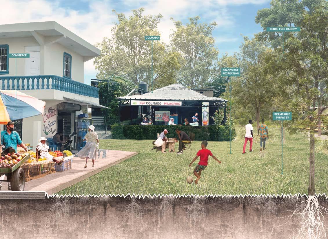
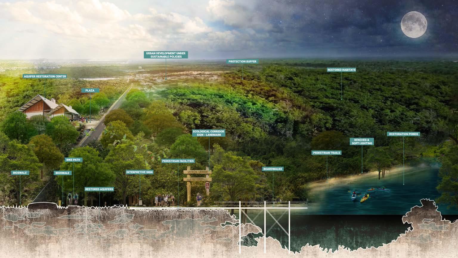
This proposal aims to transform it into an attractive and lively Caribbean city, full of energy, activity and life. The change is driven by three main urban strategies: the creation of ecological corridors that preserve habitats, the consolidation of an effecient mobility network that prioritizes pedestrians, and the stitching of disconnected development fragments via social infrastructure to eventually create a framework for sustainable urban expansion.
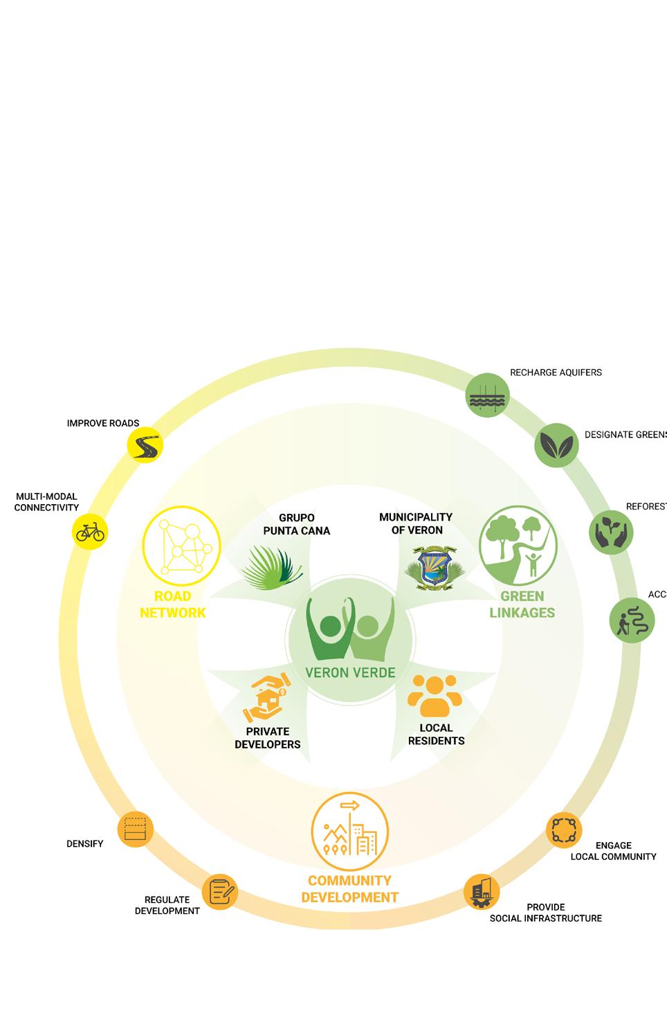
Leading the transformation is “Verón Verde”, an alliance proposed to protect and promote green and social infrastructure; uniting public and private actors to serve their shared interest of enhancing conditions in Verón.
This proposal envisions the future of Verón as a resilient, vibrant and connected city, an ecological asset for the region and a living legacy for future generations.
VERÓN VERDE: STITCHING A NEW FABRIC - STORYMAP

Course
Urban Design Studio III - Spring 24’
Studio crits
Kate Orff, Thaddeus Pawlowski, Claudia Herasme, Dilip da Cunha, Geeta Mehta, Adriana Chavez
Collaborators
Florentina Anastasia
Candelaria Gassiebayle
Salonee Ghosh
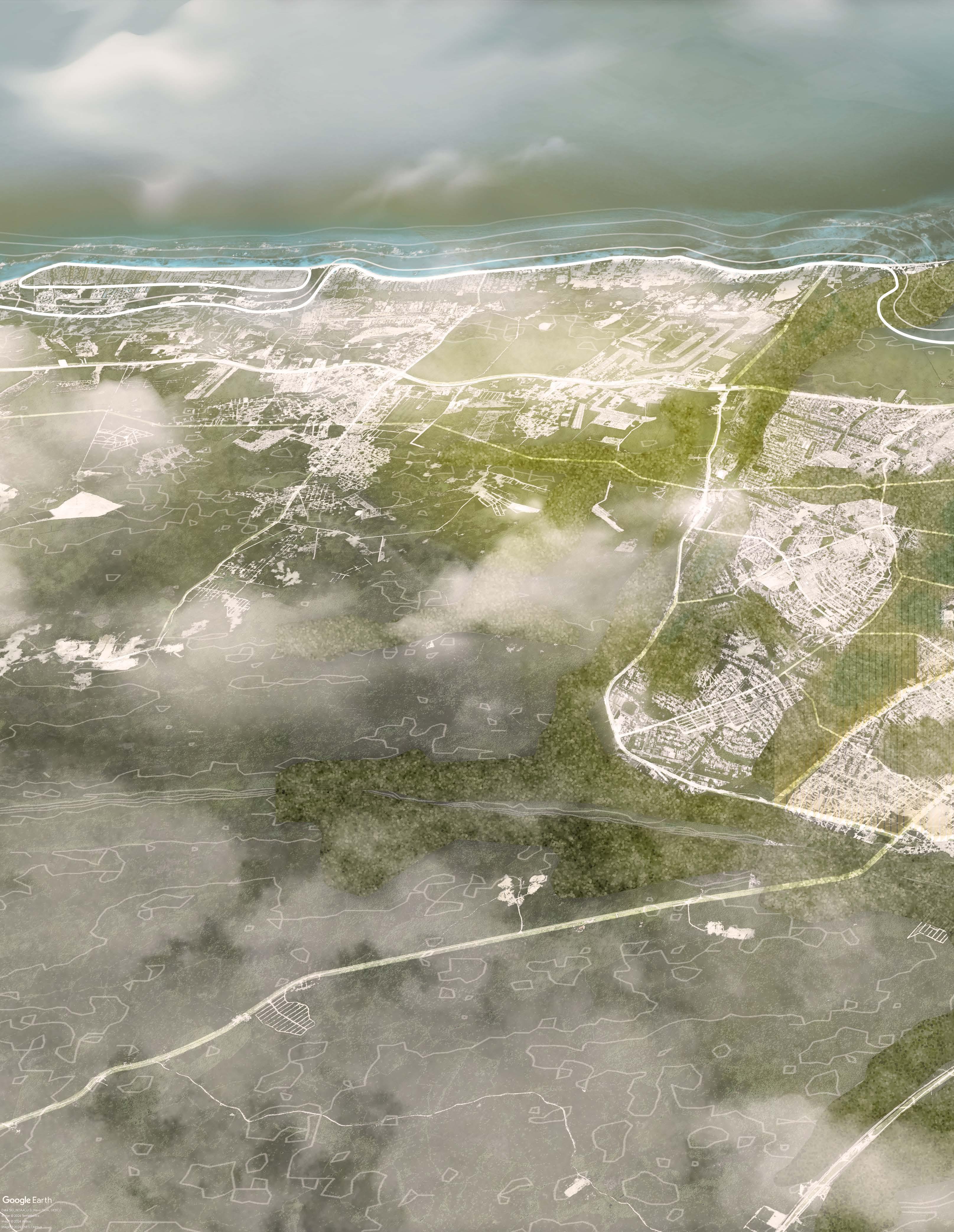
VERÓN - PUNTA CANA 2100
A resilient, vibrant and connected city
An ecological asset for the region
A living legacy for future generations
4
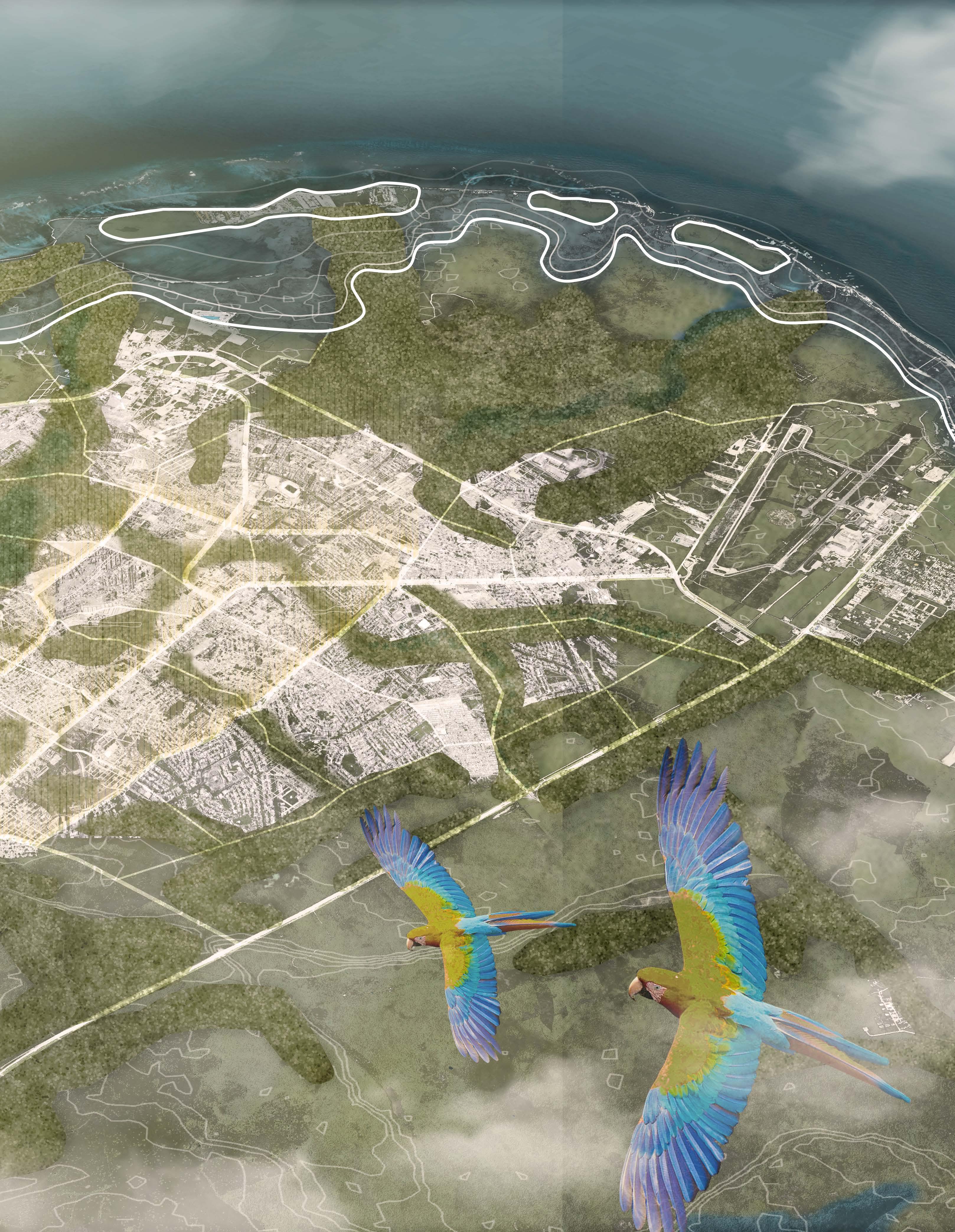
Stitched Neighborhoods
Ecological Access to the City
Centro Verón
Green Corridor
5
“There is no water provision or sewage system”
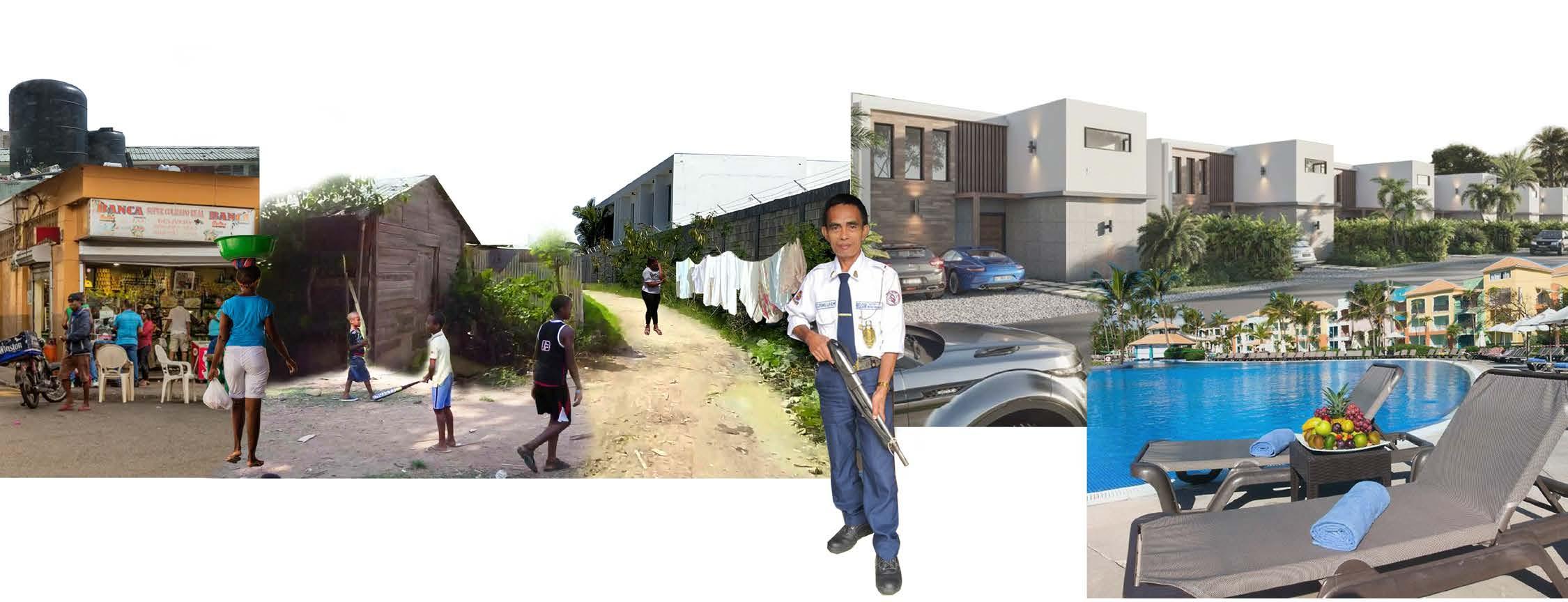
“After covering kilometers of dirt and puddles... many had told me that the access to Hoyo Claro was super difficult”
“There are not enough schools for my kids”
“We have everything inside the resort, there is no need to leave”
“Development is good (…) but you also have to think that if you are removing a tree, you have to plant at least 10 more somewhere”
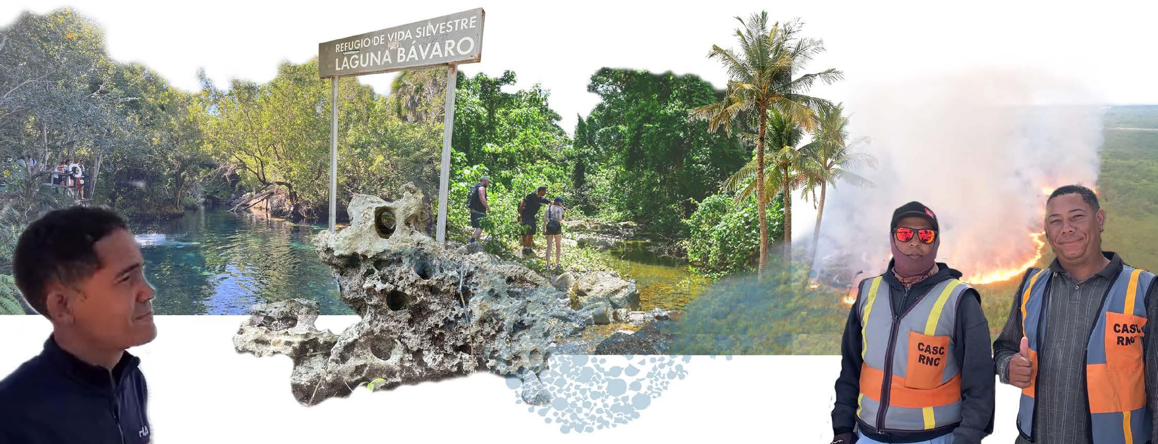
1 of the 36 Hostspots of Biodiversity in the World Contains over 1,500 endemic plant species Lost more than 70% of its primary native vegetation.
Areas of Opportunities
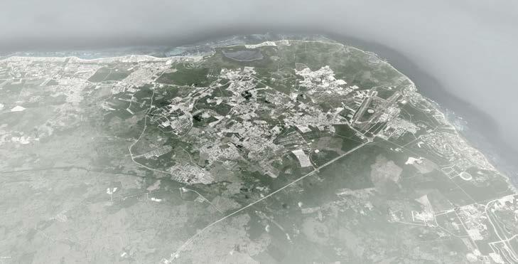
Despite the apparent chaos of the sprawl, there are areas of untapped potential. The undeveloped spaces between parcels, often overlooked as mere ‘leftovers,’ are opportunities to bridge ecological and social division, both above and below ground, in Verón and beyond.
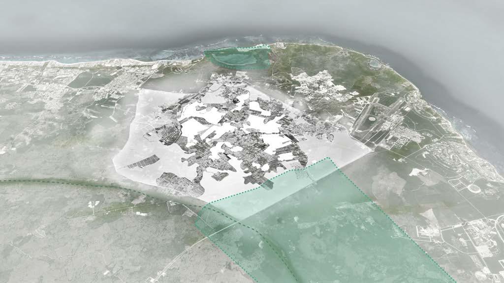
To unite fragmented groups under a singular banner, Verón Verde is proposed. Verón Verde is a partnership between public and private actors, including the Municipality of Veron, private developers, and residents. It is envisioned as an alliance dedicated to protect, enhance, and promote green and social infrastructure aimed to improve the quality of life for the people of Verón.

Taxi diver from Verón
-
Fruit seller in Verón
- Guest at all inclusive resort
- Claudio en Moto, adventure enthusiast
- Jose & Sergio, delivery workers and Verón residents
Protected
Few Paved Street
Designated
Areas
Aquifer - Fresh Water Reserve Fire to Clear The Land
Limestone Ground from Former Reef
Luxury Residence Pool for recreation
Wall that Divides
Geographic
01.
03.
02.
Verón Verde Alliance
Fault 04. Green Corridor
Stitching Neighborhoods
Centro Verón
Ecological Access to The City
6
Verón
98% of Veron’s Population is Born in Other Cities of DR and Haiti
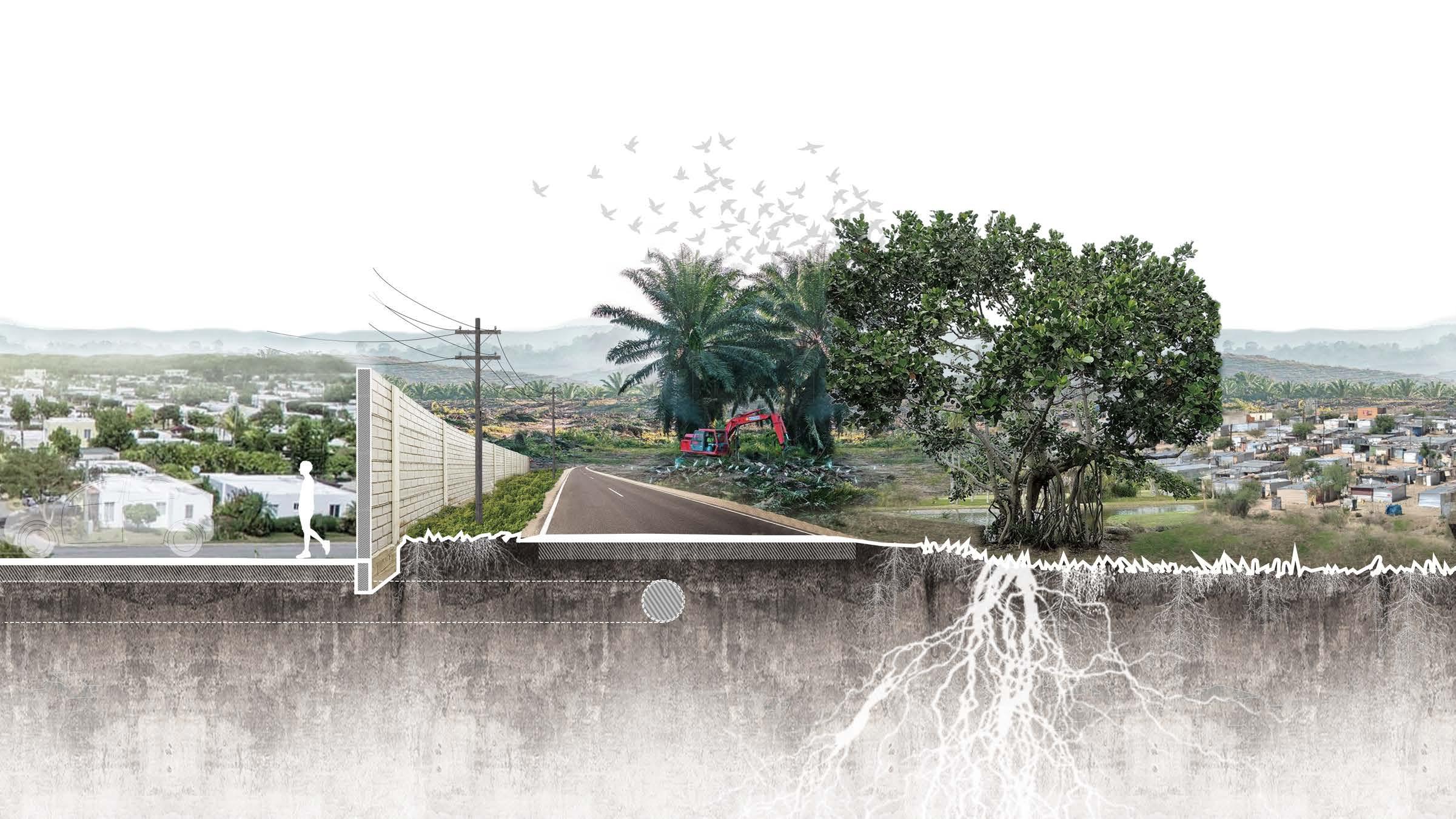
From fragmentation to connected communities and ecosystems
By 2050, the proposal develops social and ecological capital for Verón - a shift from a dormitory town to a lively Caribbean city with a rich identity of its own.
By 2100, the project aims to extend the resilient city boundaries to include Punta Cana. Verón will represent a green-blue future for the eastern region of the Dominican Republic, where the challenges presented by climate change are tackled through nature-based solutions, prioritizing the quality of life for Veron’s residents.
1. Enhancing landscape infrastructure that integrates habitat protection and social facilities.
“Veron is a city for workers. We work for 12 days and take 3 days off” - Fruit seller in Verón
2. Creating an accessible and efficient mobility infrastructure to integrate the city.

3. Organizing the city and its uses to create vibrant and diverse neighborhoods.

Deforestation
Loss of Habitat
Private Urban Developments Improvised City Threatened Natural Resources
Land Pressure Breaks in Continuity
Underserved Neighborhoods
Loss of Aquifer Recharge Capacity
Corridor 2025 2075 2050 2100 7
Laguna Bávaro
 Ecological Access to the City
8
Centro Verón
Stitched Neighborhoods 9
Green Corridor
PEEL-LINK
Rethinking the property regime by peeling back the layers of “development”
Location
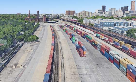
Hulsey Yard, Atlanta, USA

Key statement
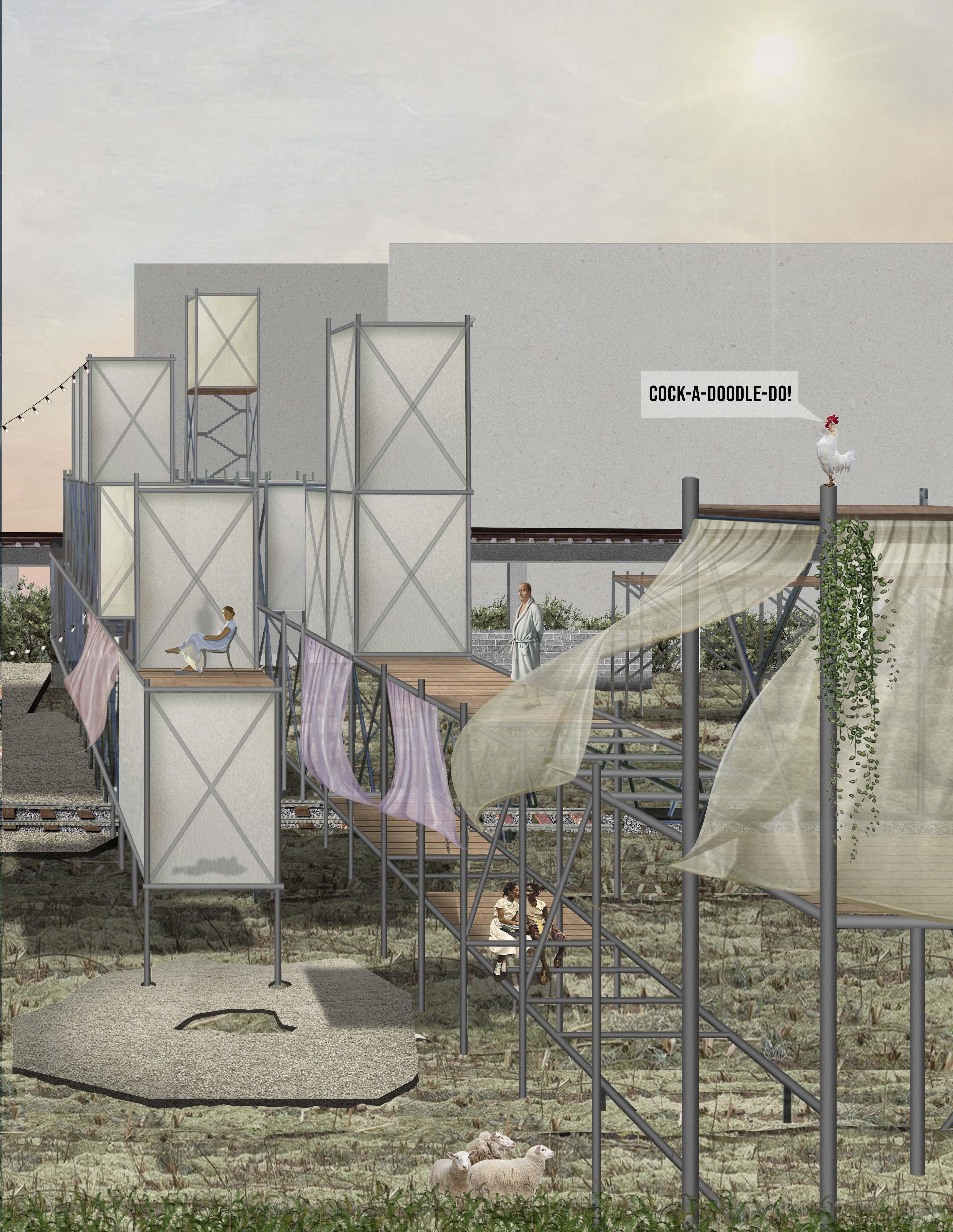
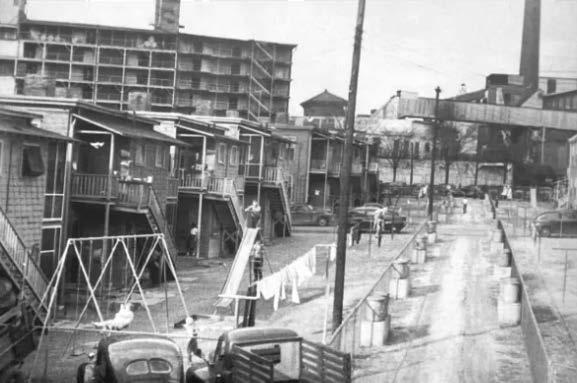
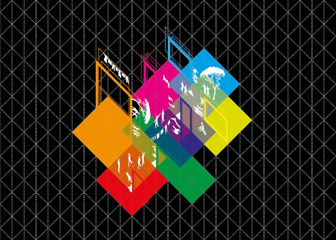
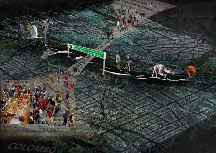
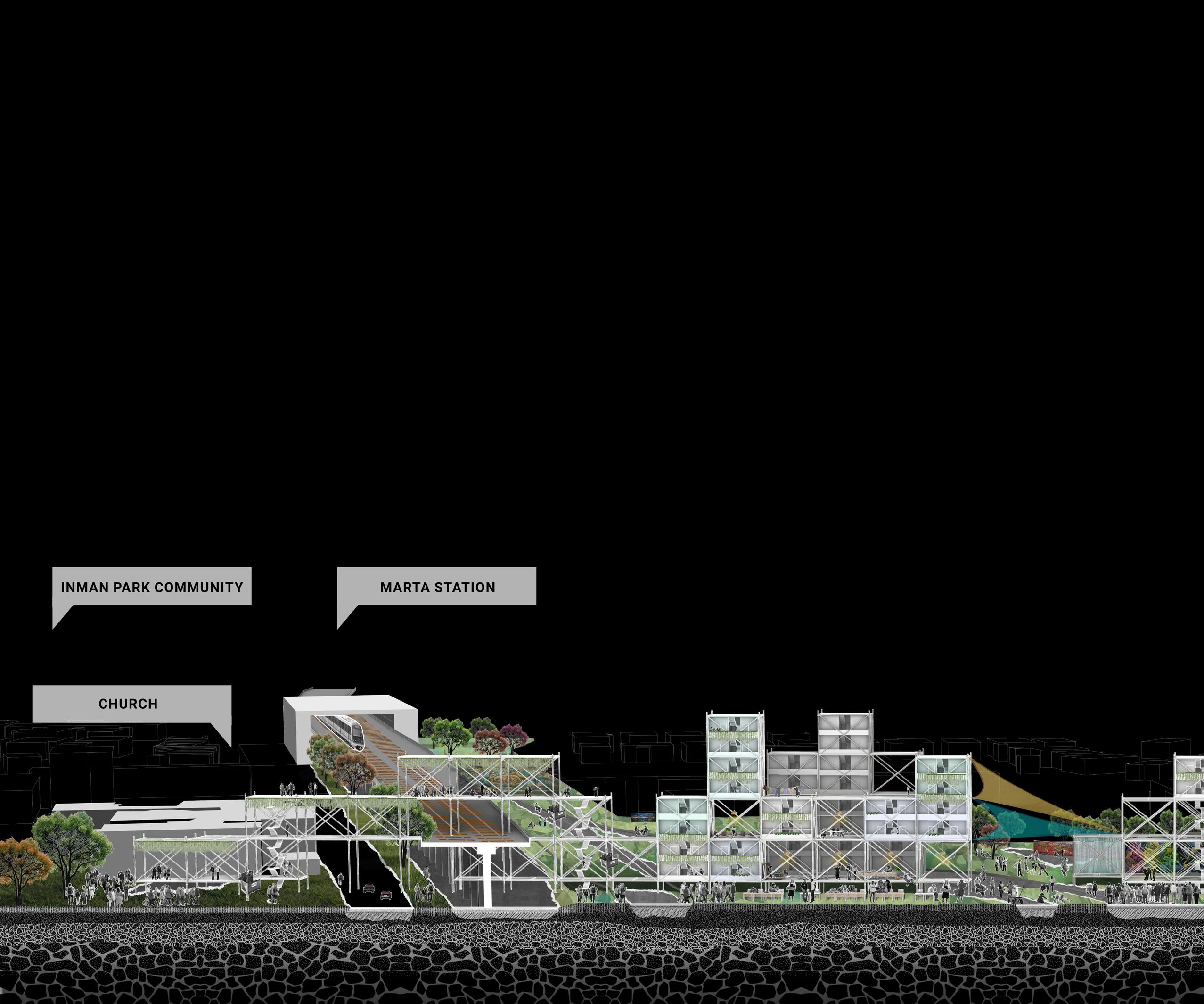
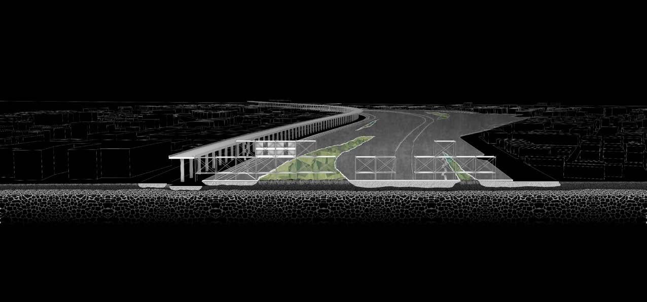
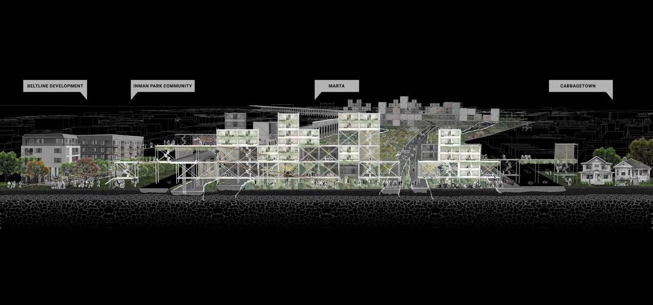
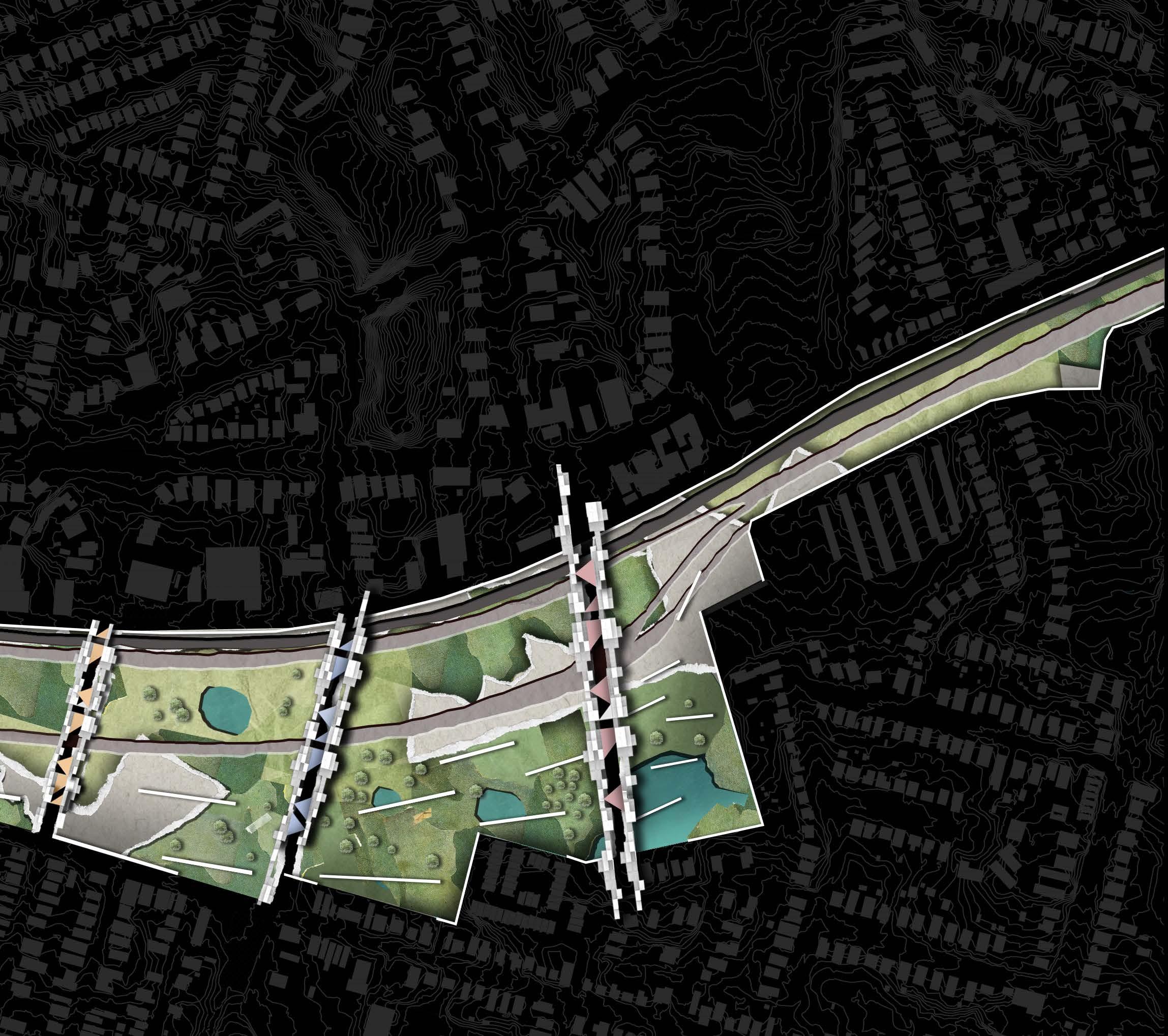
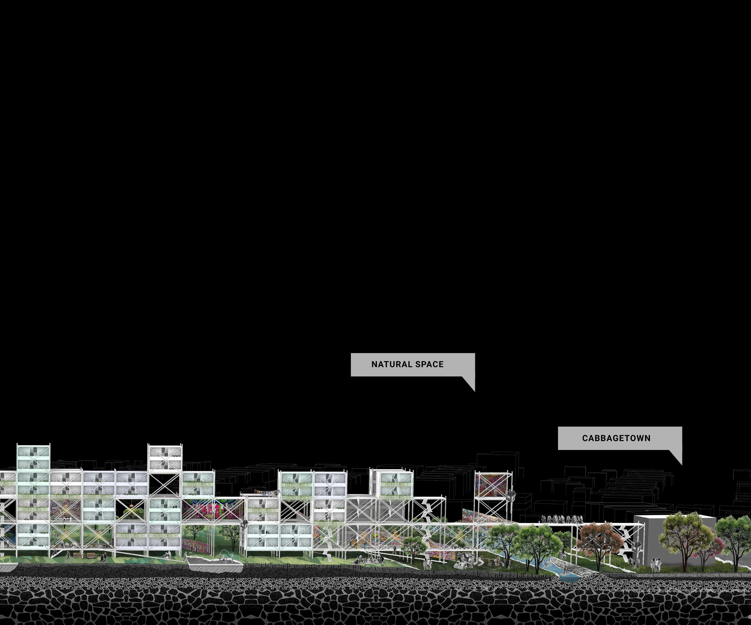
Inspired by the complex history of the site, particularly the walls of the Krog Street Tunnel, this project rethinks the property regime by peeling back the various layers that development has oppressed over the community and the territory.
The project envisions that property can be a fair system that hosts spaces of protection, integration, and justice, where community-based historical knowledge and cultural expressions are revived, and natural resources are preserved within the urban landscape to face the challenges of the future.
Course
Urban Design Studio II - Fall 23’
Studio crits
Emanuel Admassu, Nina John, Jelisa Blumberg, Oscar Oliver, A.L. Hu, Christin Hu
Collaborators
Manar Alrougi Yi Chi Wang
10
11



12
PEEL-LINK MANIFESTO
1. Reclaiming abandoned spaces for people, not for goods and commodities.Therefore, the first decision is to push back the walls in the southern part of the yard.
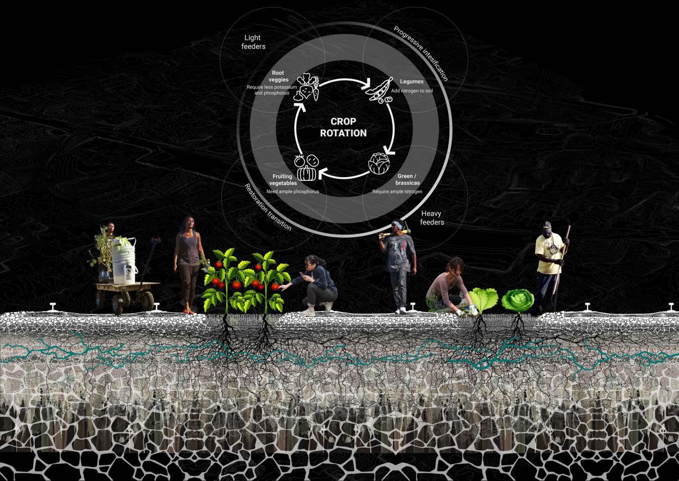
2. The soil has to be for the community, not for companies. By depaving and restoring the soil for fresh food growing.
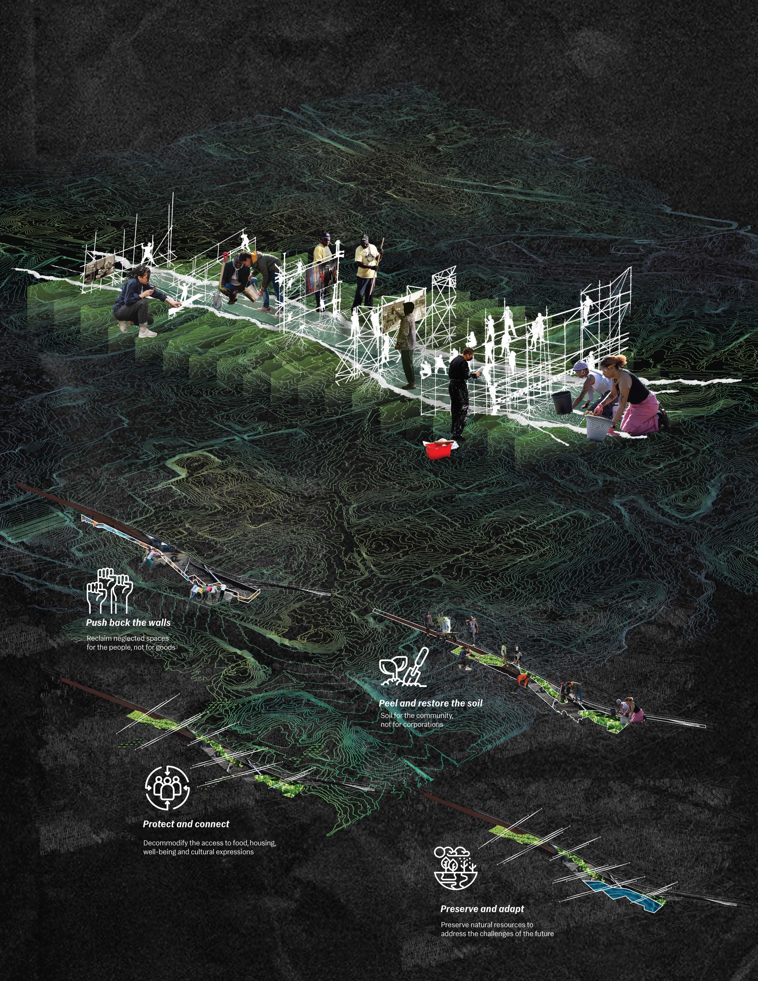
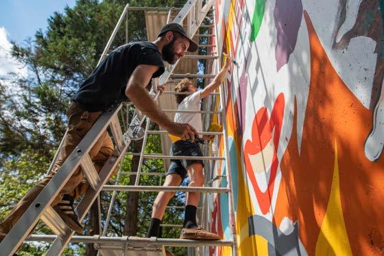
3. Decommodify access to food, housing, and cultural expressions. Inspired by the scaffolding used by street artists, its porposed to open corridors and connect the neighborhoods using light structures to host the various facilities needed to support the community.
4. Preserve natural resources to face the challenges of the future. Therefore, the idea of greening this area for crops is combined with locating flood zones in the lower areas of the land as part of the landscape and as a water reserve for crop irrigation.
13
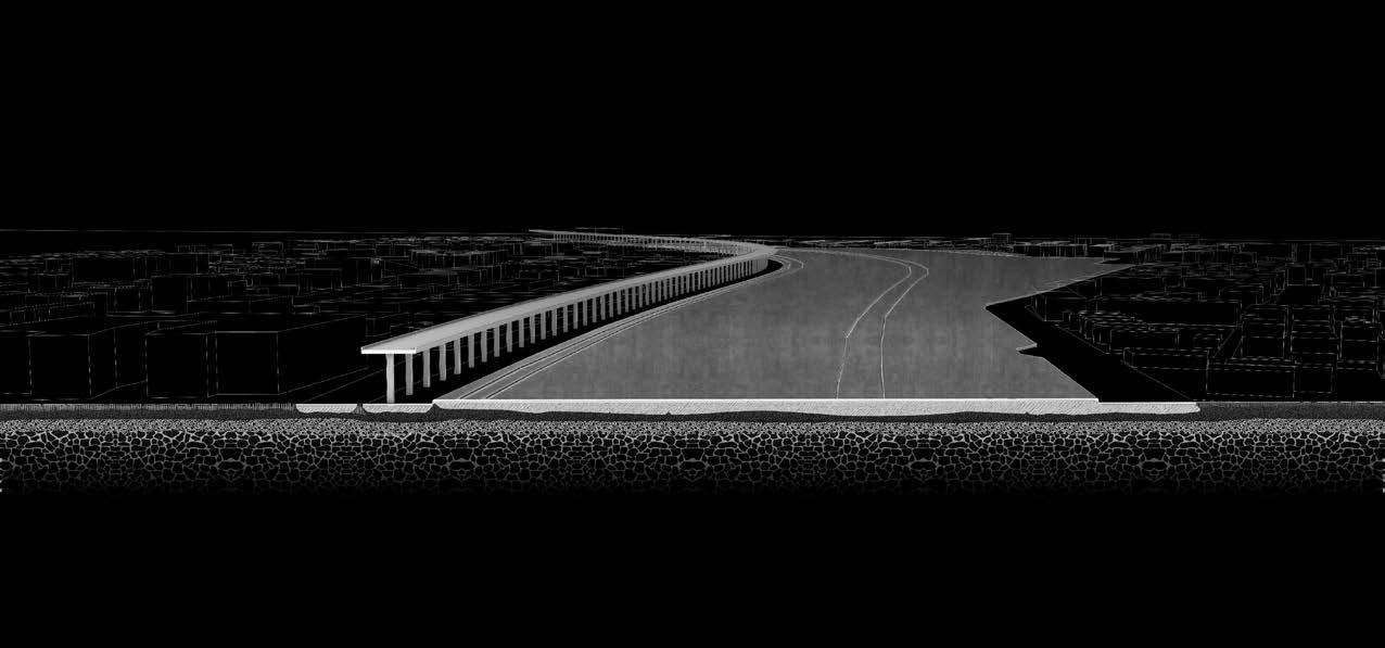
PEEL-LINK PLAN

PEEL-LINK SECTION
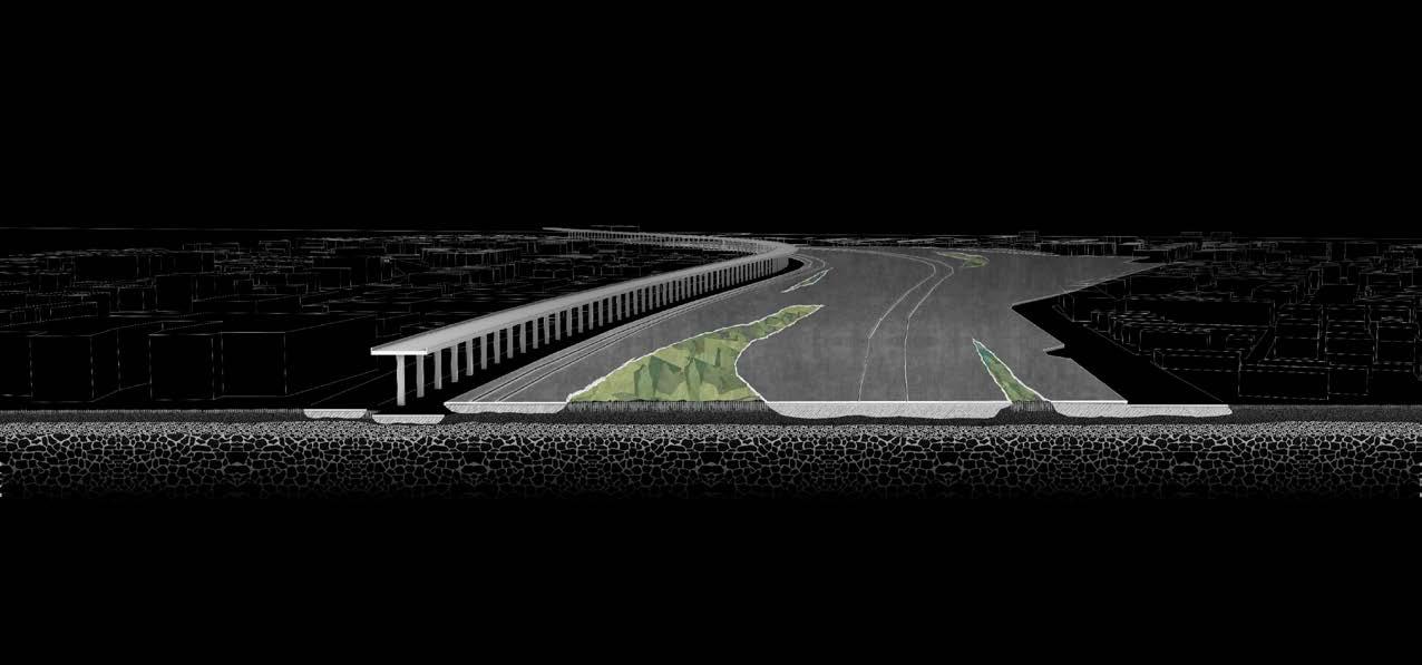
PEEL-LINK PROCESS
14
15
CREATING VALUE OUT OF TRASH:
A Resilient and green future industry system
Location
Harlem River, New York, USA
Key statement
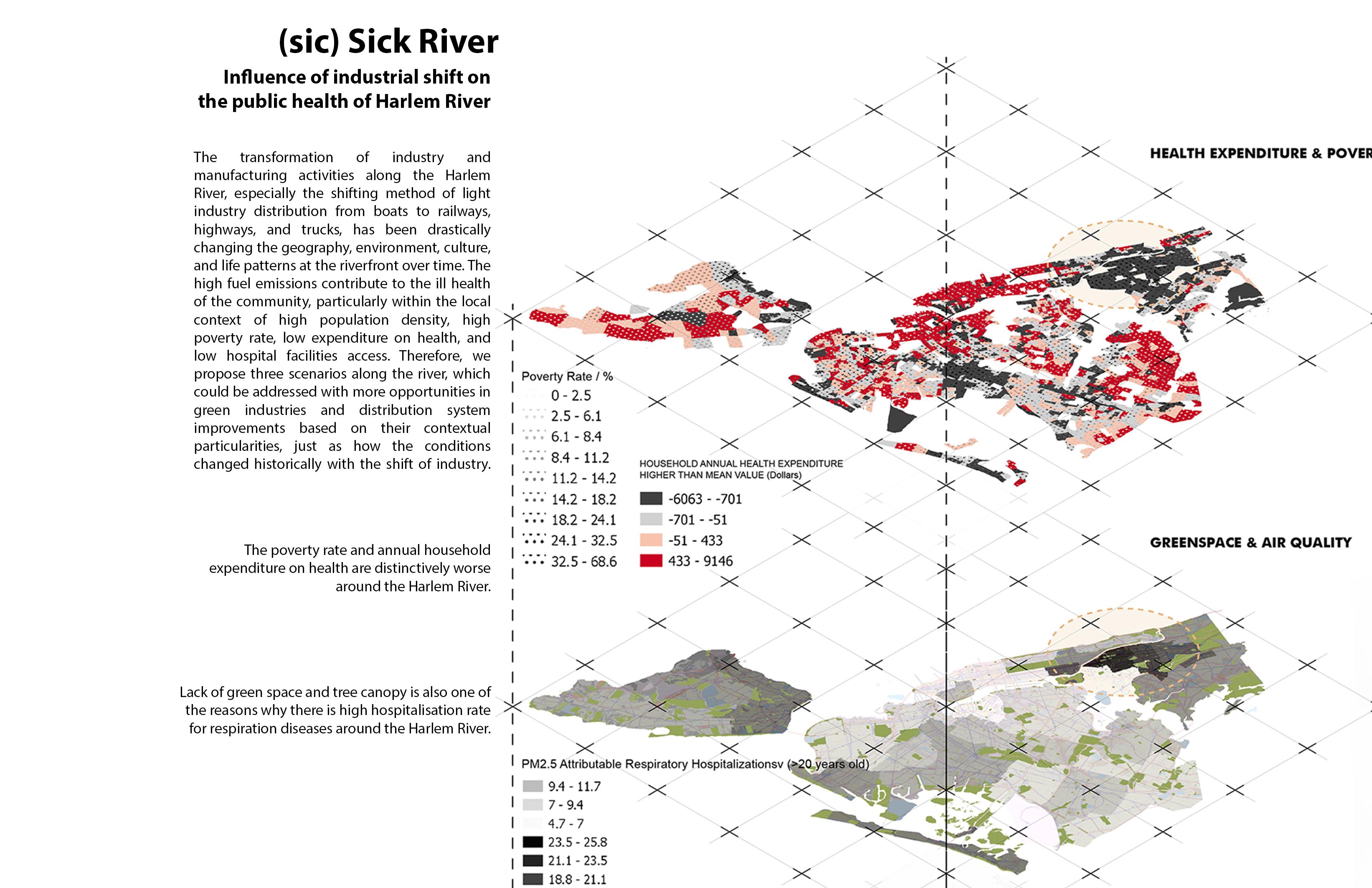
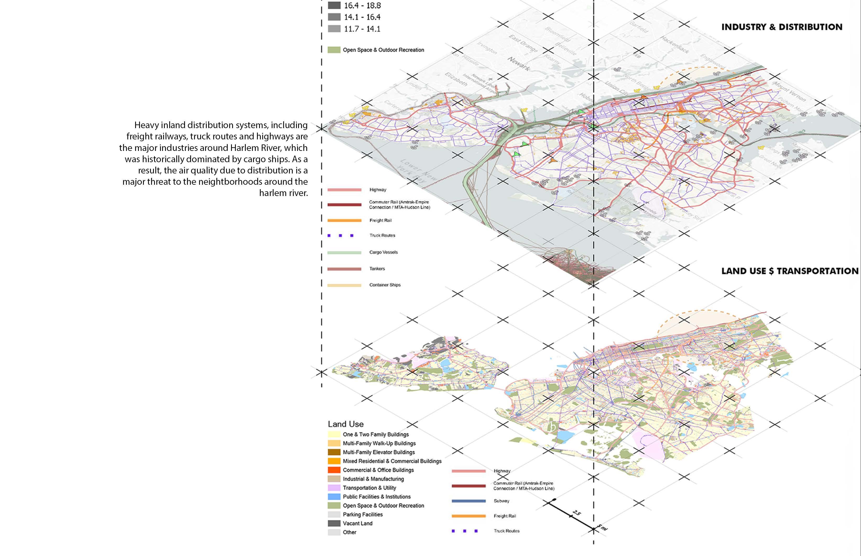
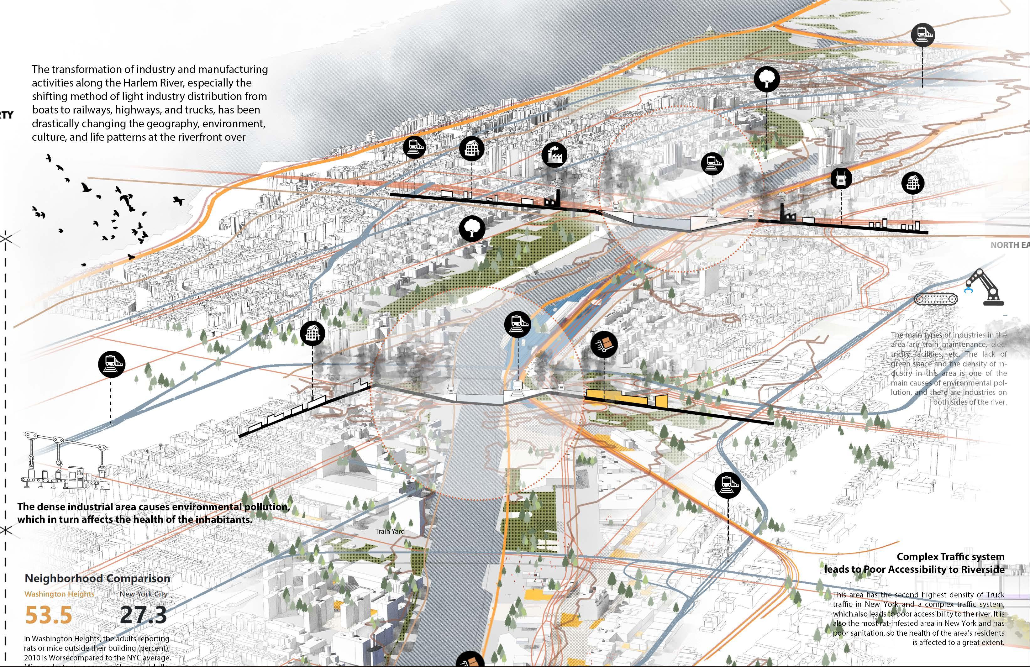
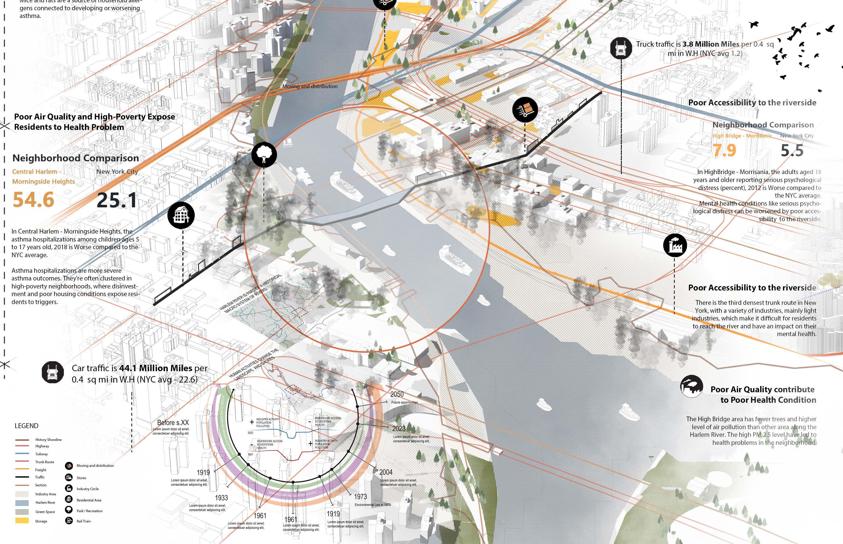
The project involves the creation of a new industrial structure that departs from the way most people currently perceive industries. Since the area currently produces high amounts of biodegradable, organic and inorganic waste, studying the community and the context in detail led us to understand the importance of a recycling and upcycling industry in the Bronx.
The proposal aims to establish a circular economy and system where waste produced locally is recycled, upcycled and returned to the neighborhood.
This is further supported by training and education facilities so locals can assist and participate in these sectors, creating employment opportunities. Additionally, the Harlem River has historically been an industrial area, and water transportation was the main mode of transit. We want to resurrect this movement system that not only links Harlem to other neighborhoods and boroughs of New York City.
Courses
Urban Design Studio I - Summer 23’ DTEQ / Digital Techniques - Summer 23’
Studio crits
Nans Voron, Sagi Golan, Austin Sakong, Elizabeth Camuti, Daphne Lundi, Grant McCracken, Sean Gallagher
DTEQ Instructors
Adriana Chavez, Christopher Landau, Claudia Tomateo
Collaborators
Jiaye Li
Sahana Kumar
Yuxuan Wang
16
by 2100 17
Verón Town vision
MANIFESTO:
Activate the Harlem riverfront as a citywide circular economy
Reactivate a historical industrial zone along the Harlem River for the benefit of the community and the environment.
Create a revolutionary industry through the upcycling of waste and promotion of responsible consumption and circular economy.
Generate opportunities of employment, education and environmental awareness
Return access to the riverfront by opening spaces for public use, restoring damaged ecosystems and activating fluvial transportation.
Consolidate a climate, economic and social resilience based on the generation of a sustainable urban industrial space with regional impact.
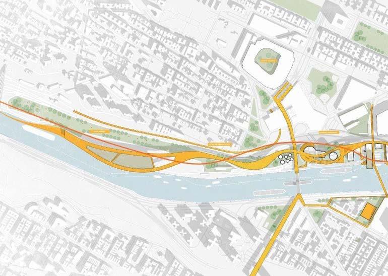
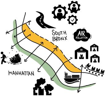
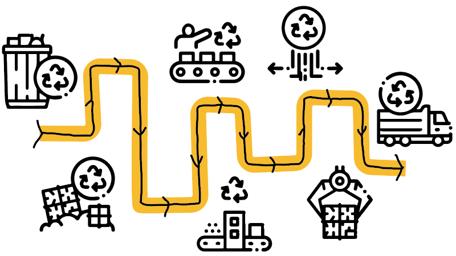
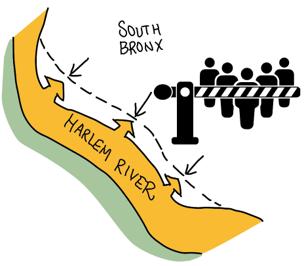

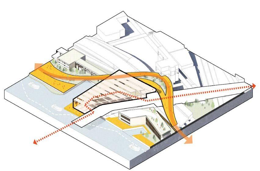
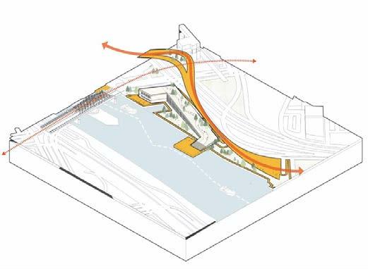
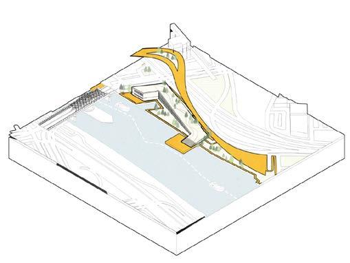 Ideation
Adaptation to the context Upcycling functional sequence Bring access to the riverfront 18
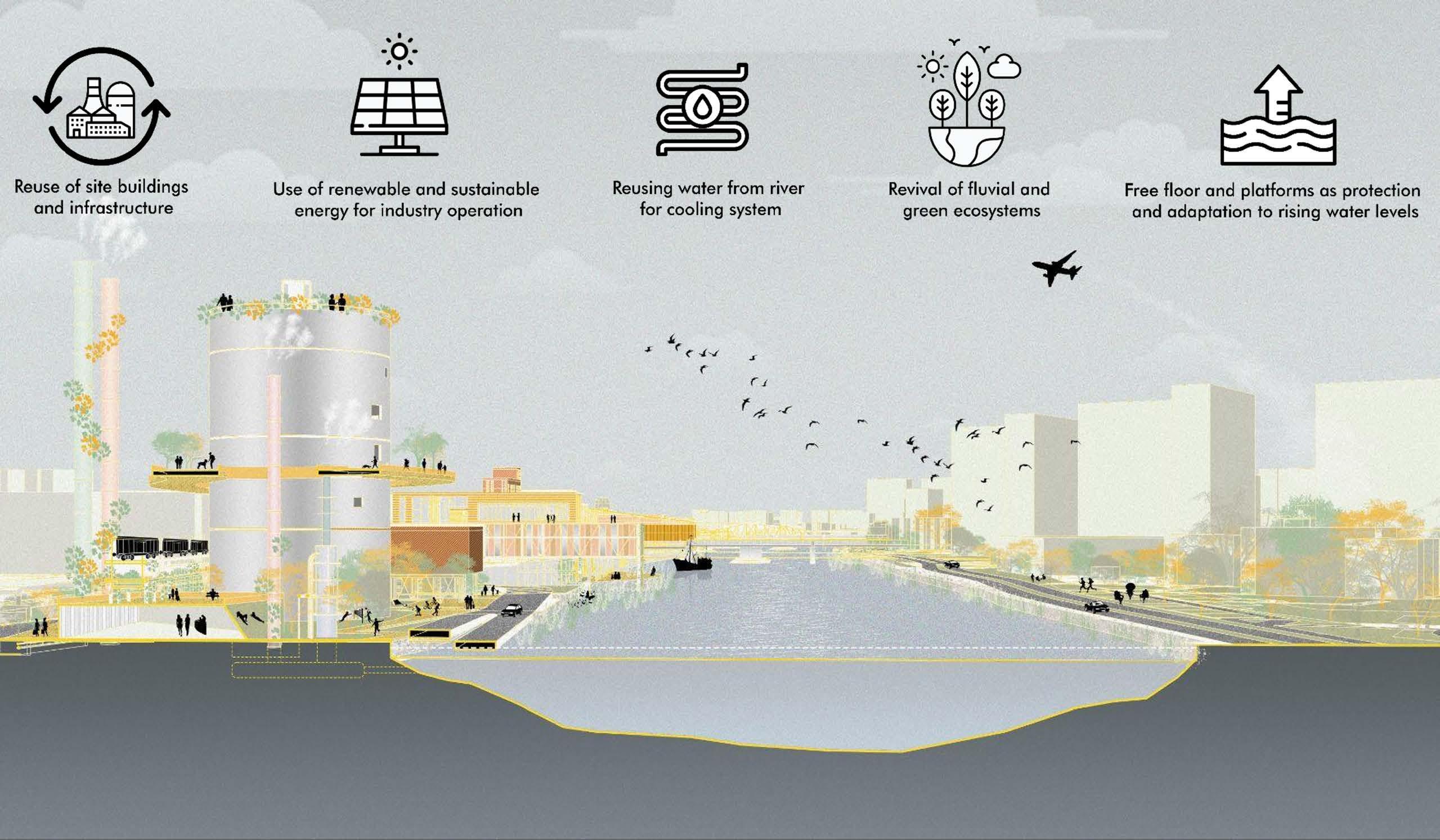
Circular Economy Proposal
Axonometries
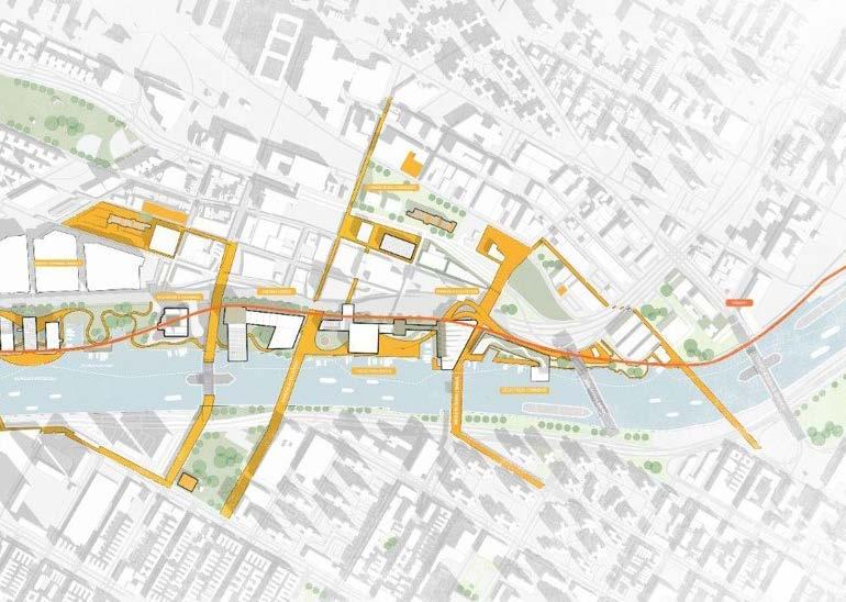
19 Proposal Plan
Typical section
SOUTH NORFOLK:
A vision of resilience for South Norfolk waterfront
Location
South Norfolk, Virginia, USA
Key statement
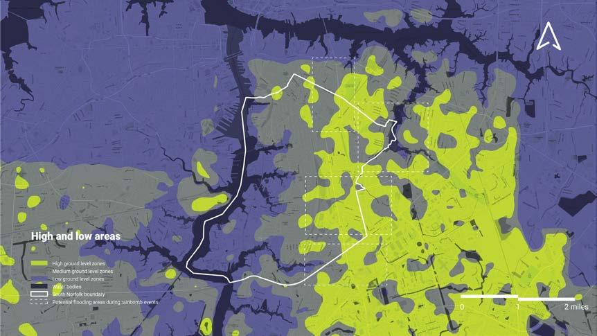
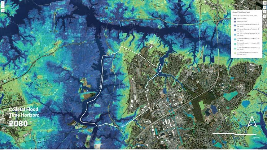
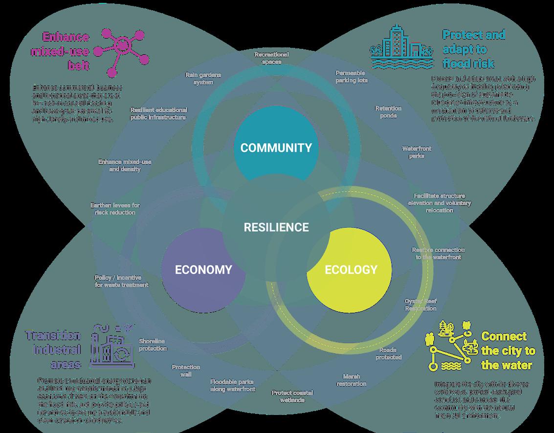
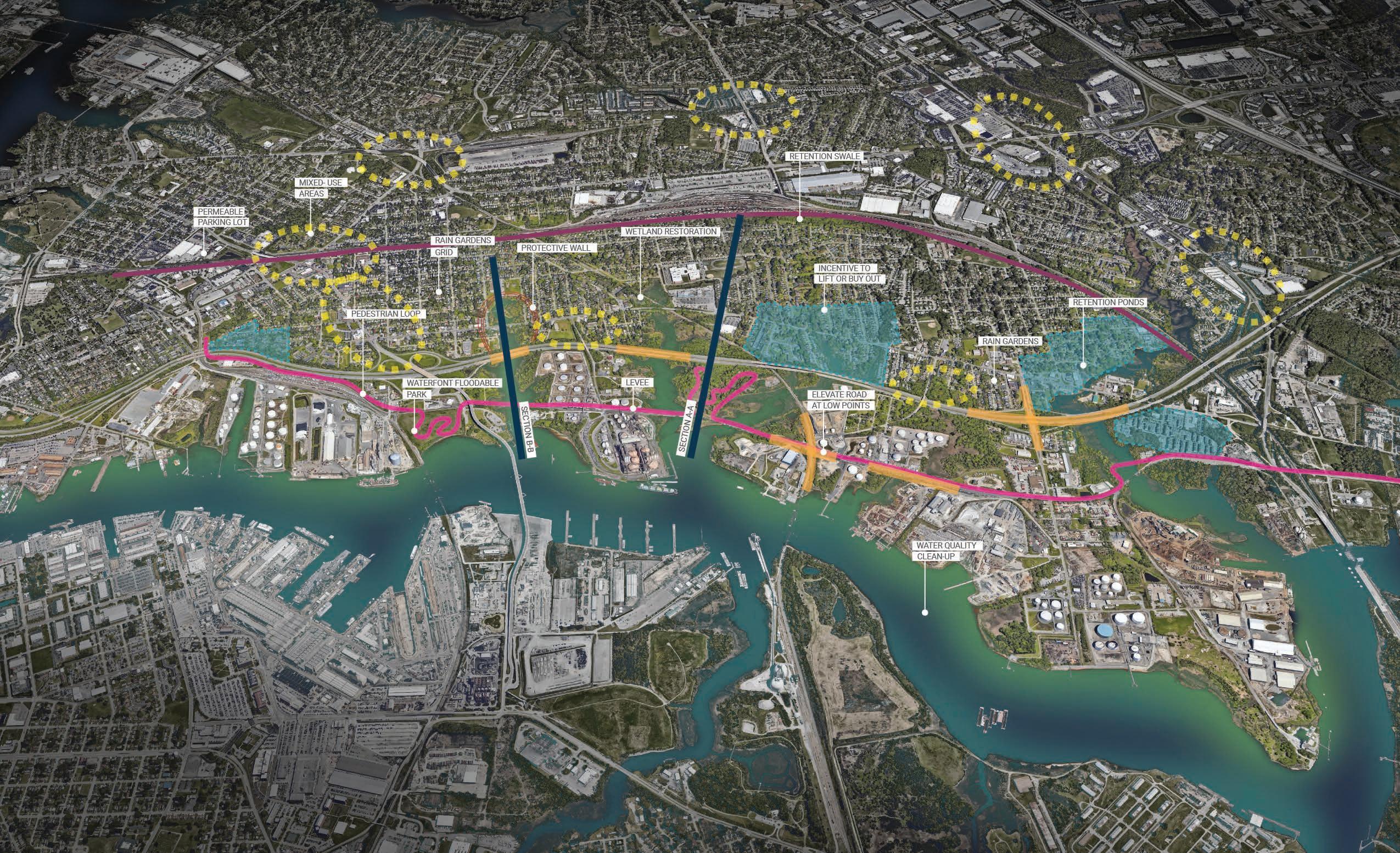
The project aims to understand the current conditions of South Norfolk (SoNo), Virginia, its industrial waterfront and the community’s priorities to produce a resilience plan along the shoreline that takes into consideration the strengths and threats specific to this community.
The urban strategies proposed are located in the most vulnerable areas and/or the ones with the greatest potential:
- The city’s connectivity with water, located on the waterfront and along the creeks that puncture into the city.
- The protection and adaptation to flood risks, through lines of defense parallel to the coastal edge associated with roads, inland flood areas and facilities such as schools.
- The enhancement of mixed-use zones, on highly transited and interconnected areas.
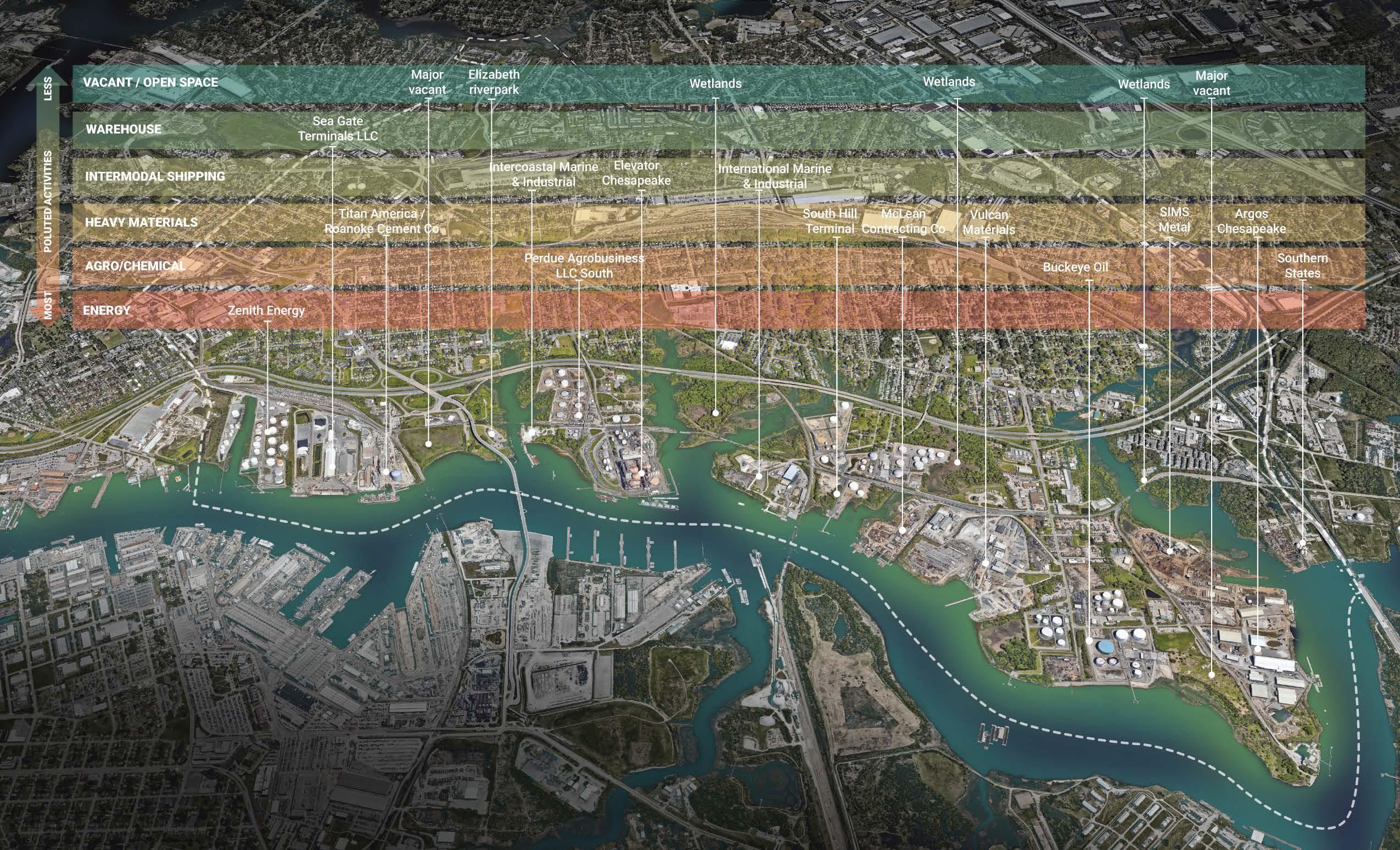
- The transition into cleaner industrial energy and transformation into other uses of industries along the waterfront.
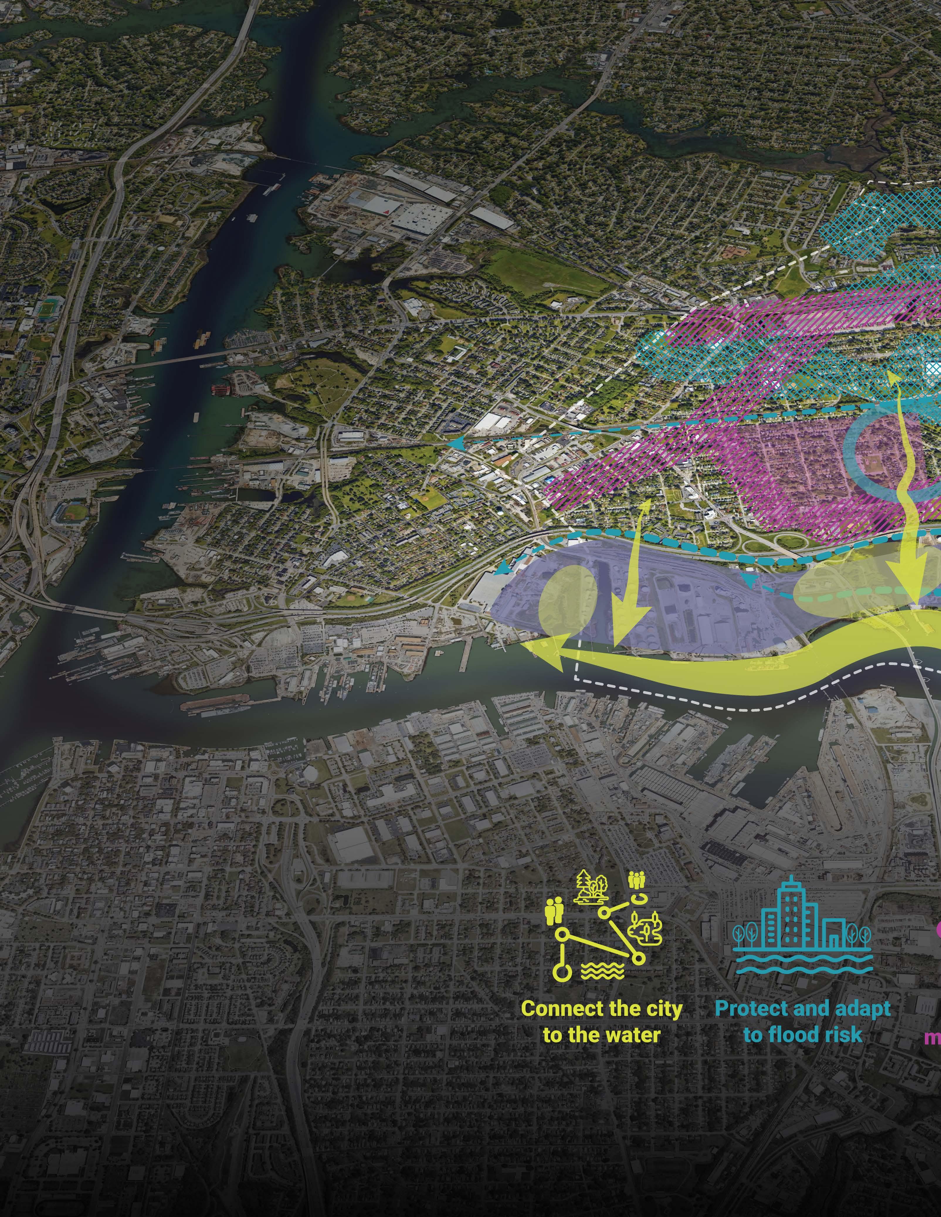
A VISION OF RESILENCE FOR SOUTH NORFOLK STORYMAP

Course
Toward Resilient Cities & Landscapes - Fall 23’
Instructor Kate Orff
Collaborator Candelaria Gassiebayle
20
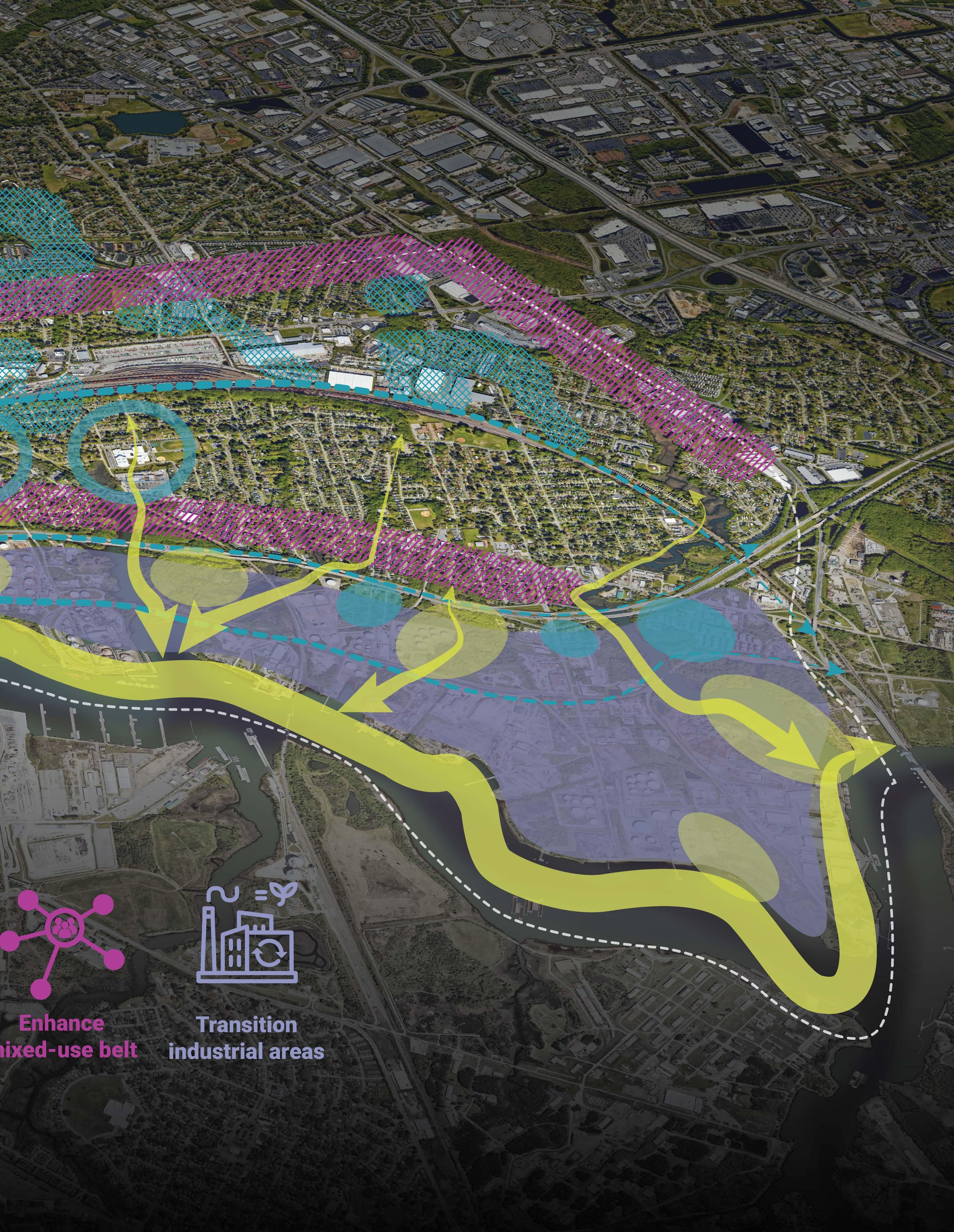
21
Resilient strategies for South Norfolk
Chesapeake Bay Context

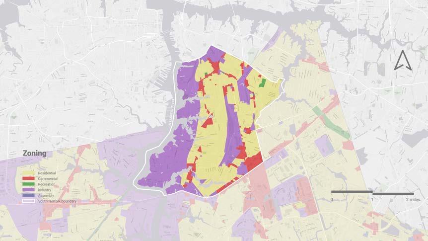

Types of industries on the waterfront

Urban
22
Section A-A
Analysis

Design Proposals: A new connection front

Principles for a resilient South Norfolk Main
Takeaways
23
Section B-B
EDGE OF HOPE
Brownsville’s Migration Crossroads
Location Brownsville, Texas, USA
Key statement
The escalating impacts of climate change are driving increased migration to Brownsville, Texas, presenting complex global challenges to this diverse community as it navigates the influx and its associated demands.
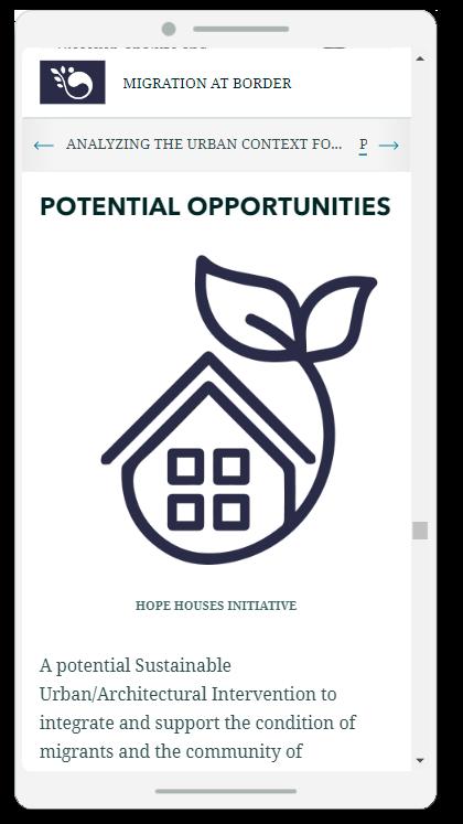
A potential Sustainable Urban/Architectural Intervention to integrate and support the condition of migrants and the community of Brownsville, is to implement a mixed-use development model, “Houses of Hope”, integrating affordable housing, community spaces, and green infrastructure to support the needs of migrants while promoting environmental sustainability and integration with the current community.
This intervention could involve designing ecofriendly buildings with energy-efficient features, incorporating renewable energy sources, and utilizing sustainable materials. The development would prioritize walkability, access to public transportation, and the creation of green spaces to enhance the quality of life for migrants. Additionally, the inclusion of community gardens, urban farms, and recycling facilities can foster community engagement and self-sufficiency while reducing environmental impact.
Course
Cartography and property - Spring 24’
Instructor Molly Burhans
Collaborators
Saakshi Sawant
Tai Ning
Nuances of “property”: Mapping sensory perceptions
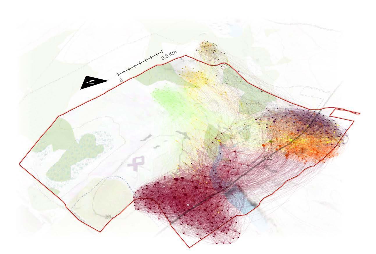
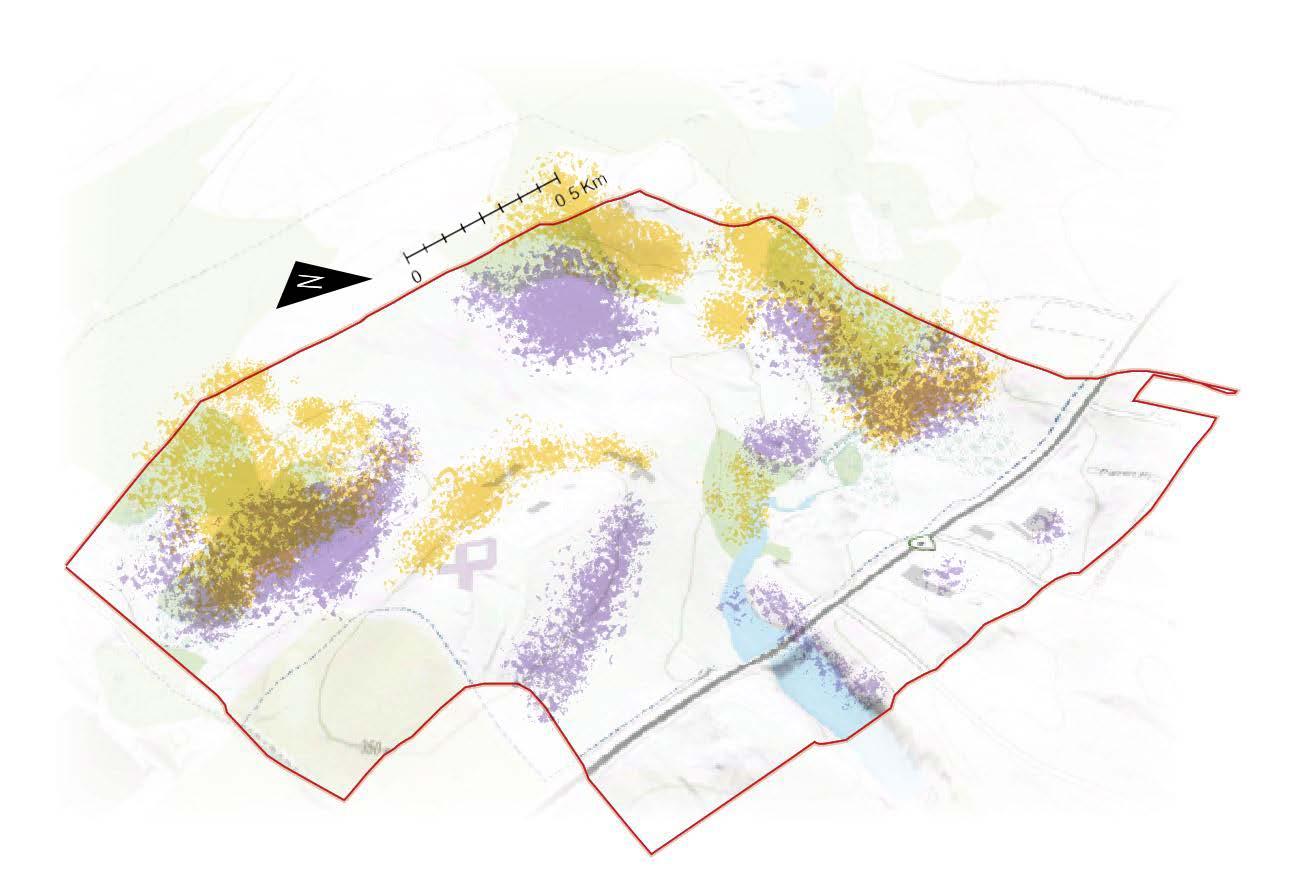

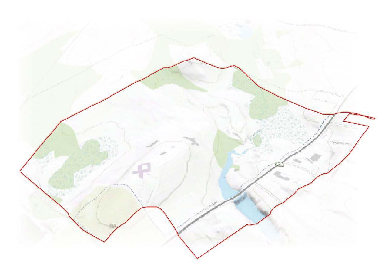 “Property” basemap
Smellmap
Natural shadows
24
Noisemap

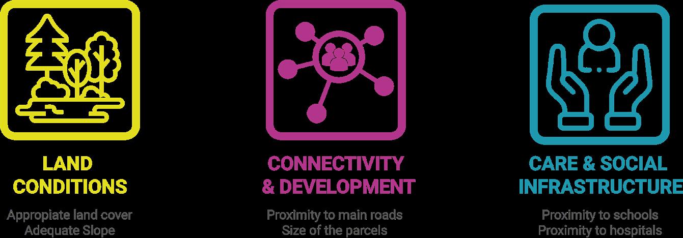
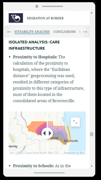
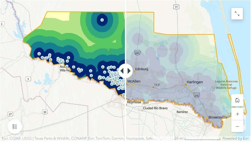
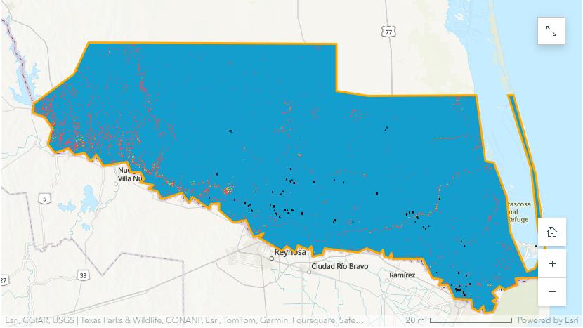
Workflow for Suitability Analysis: locating the “Houses of Hope”

More than 20 Data Analysis
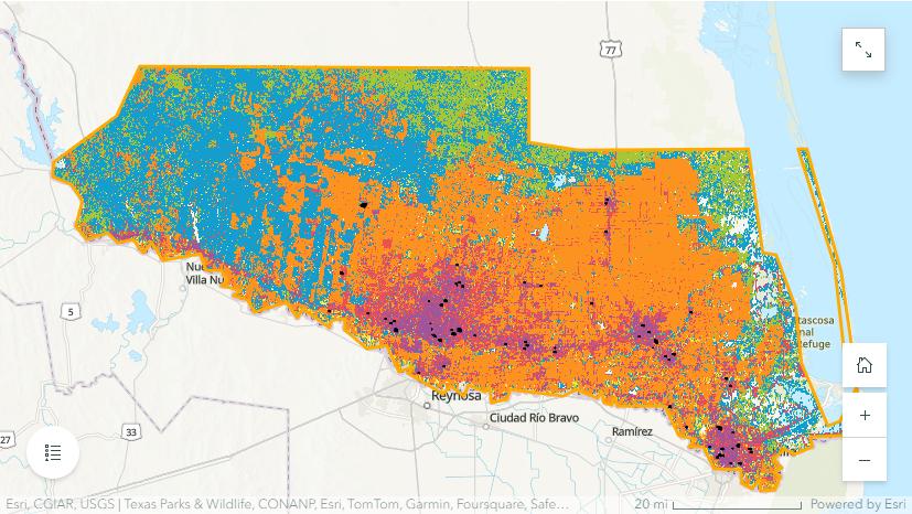

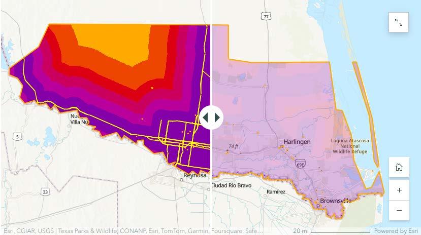
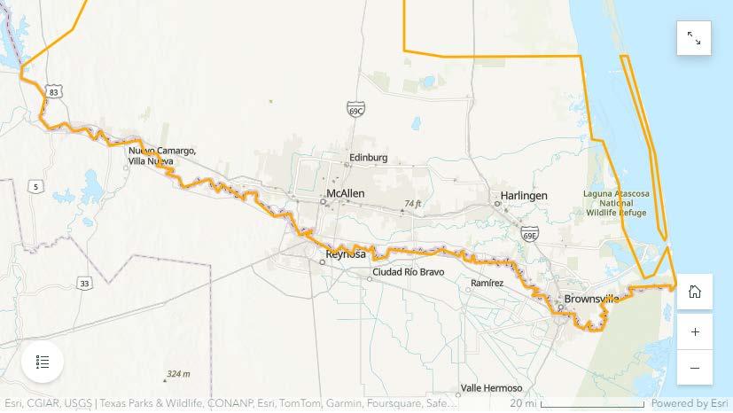
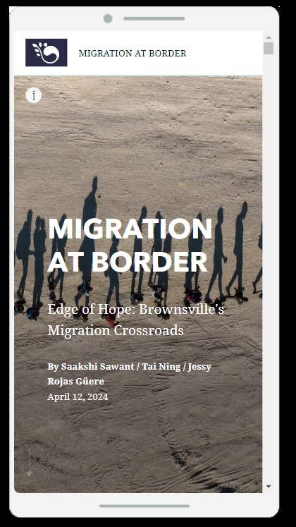
Sharing knowledge: StoryMap and GeoHub of the project

MIGRATION AT BORDER: EDGE OF HOPE STORYMAP


MIGRATION AT BORDER: EDGE OF HOPE GEOHUB

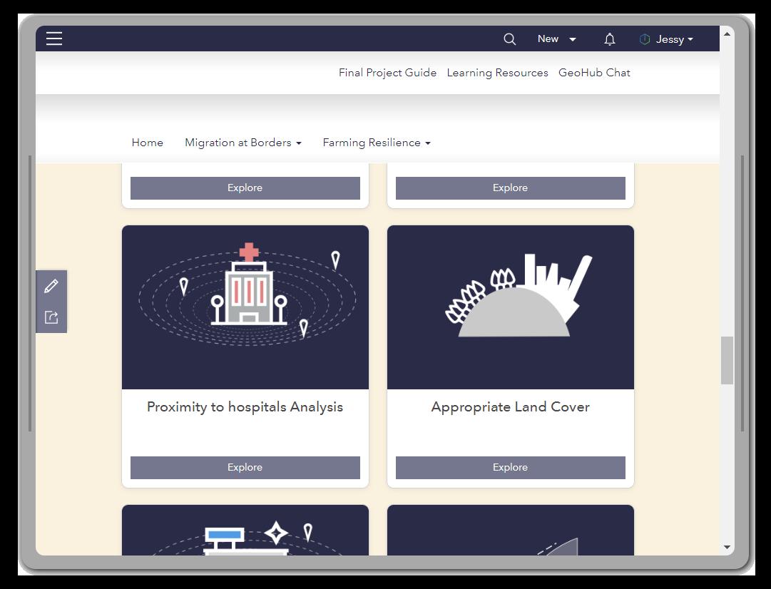
Houses of Hope Initiavive Houses of Hope Principles
25
BEYOND HARLEM’S RECYCLING SYSTEM:
A Story of Resilience and Renewal
Location
Harlem, New York, USA
Key statement
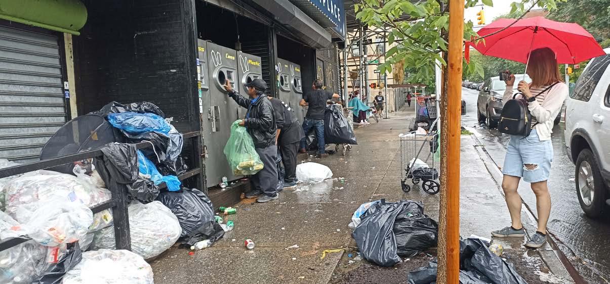
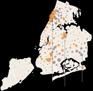
This project research focuses on the daily lives and work experiences of Harlem’s garbage collectors, with the goal of exploring their resilience and renewal in the face of the challenges they encounter.
The goal is to shed light on the interconnected lives of garbage collectors, supermarkets embloyees and recycling companies and the vital roles they play in creating a better future.
By showcasing the resilience and dedication of garbage collectors, the proactive efforts of supermarkets, and the intricate processes of recycling companies, the objective is to inspire people to think about their own consumption and waste to consider participating in recycling initiatives.
This research has consolidated the entire collection of data, interviews, and maps into a Storymap format, which can be accessed through an ArcGISStorymap account at the following link:
BEYOND HARLEM’S RECYCLING SYSTEM STORYMAP

Course
Reading New York Urbanism - Summer 23’
Instructor Justin Davidson, Jesse Hirakawa
Collaborators
Manar Alrougi Yi Chi Wang

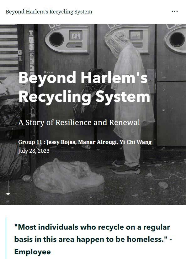
Key findings
In the study, we collected three perspectives from different characters to see the operations of the recycling machines in Harlem, the most populated and consuming area of New York. Some people depend on the recycling machines for living but are these also producing problems for the environment now.
26
Current situation
How can this system improve?
For Blanca and her family, By enhancing job prospects and increasing accessibility for job seekers through improving opportunities.
For Alberto, By enhancing organization and a more efficient system to streamline processes and operations.
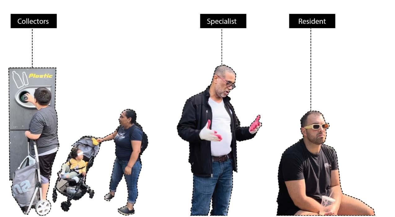
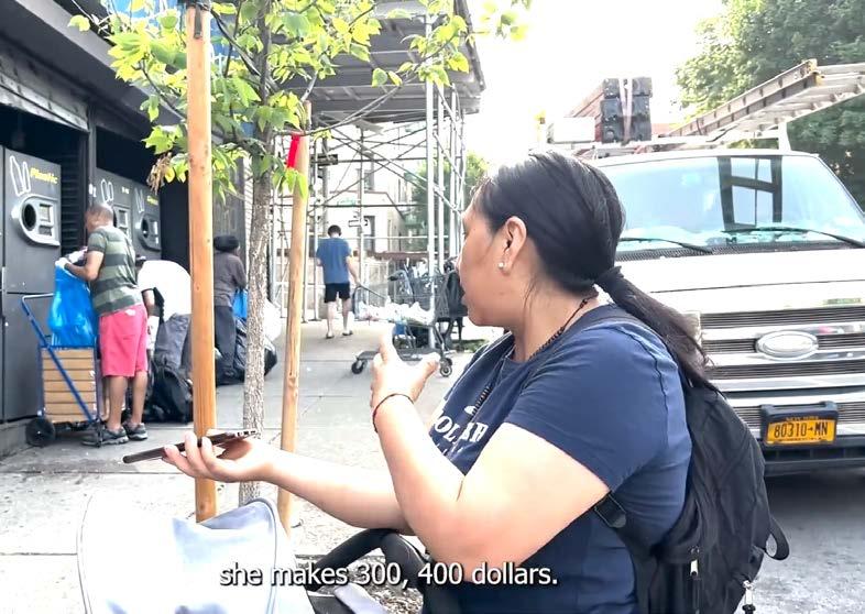
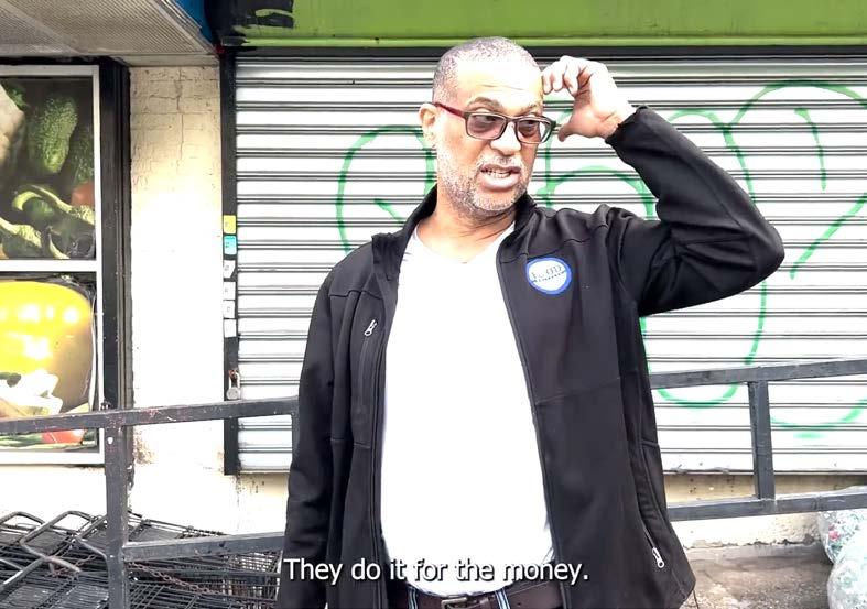


For Alex, By enhancing recycling system to cater to the needs and interests of individuals passionate about recycling.

27
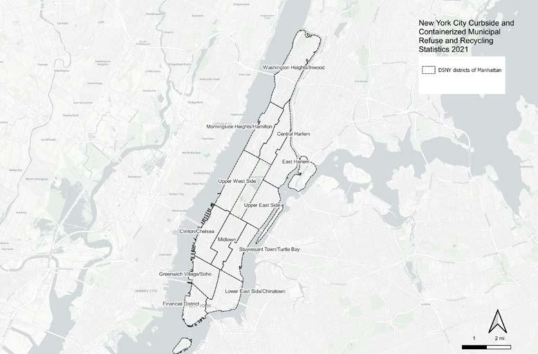
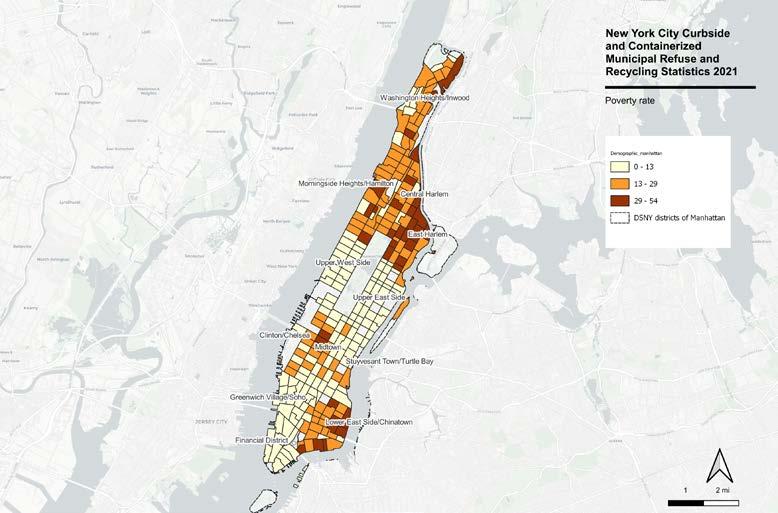
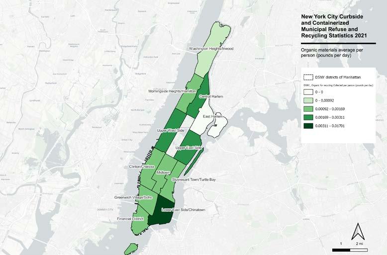
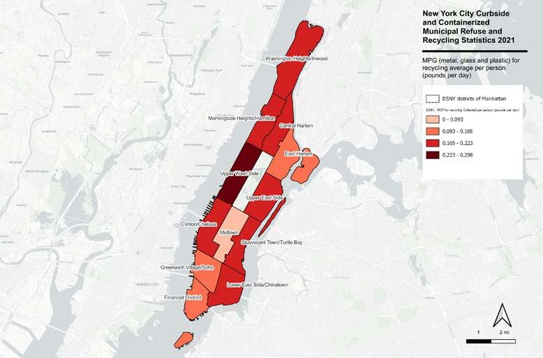
Mapping Manhattan recycling system
URBAN RECONVERSION IN NORTH LIMA:
When inequality dresses up as a shopping mall
Location
North Lima, Lima, Perú
Key statement
In the last 30 years Lima, the capital of Peru, has suffered several urban changes in response to population growth, decentralization of services, lack of territorial planning, among others.
Thus, in particular, North Lima, has seen how its former industrial areas (located on the periphery of the downtown) are now hosting several shopping centers, or malls, which have a great influence on a metropolitan scale.
It is the biggest urban “change” that has been developed as a symbol of “improvement or upgrading” in an area with alarming rates of poverty, informal settlements at risk and human development, in the largest inter-district area of the Peruvian capital.
It is, therefore, necessary to question the notion of “development” when it does not benefit the majority, especially those in vulnerable contexts.
Course
Urban Design History & Theory - Summer 23’
Instructors
Noah Chasin
Work Cited
- Calderón, J. “La ciudad ilegal”. Lima, Perú: Punto Cardinal, 2016.
- Espinoza, A. & R. Fort. “Mapeo y tipología de la expansión urbana en el Perú. Lima: GRADE”; 2020.
- Harvey, David. “Rebel cities: from the right to the city to the urban revolution”, 2013.
- Lefebvre, Henri. “The Production of Space”. Blackwell, 1991.
- Instituto Metropolitano de Lima (IMP). “Plan De Desarrollo Urbano De Lima Norte al 2035”, 2022.
- Vega-Centeno, Pablo. “La dimensión urbana de las centralidades de Lima Norte: cambios y permanencias en la estructura metropolitana”. EURE (Santiago), 43(129), 5-25, 2017.
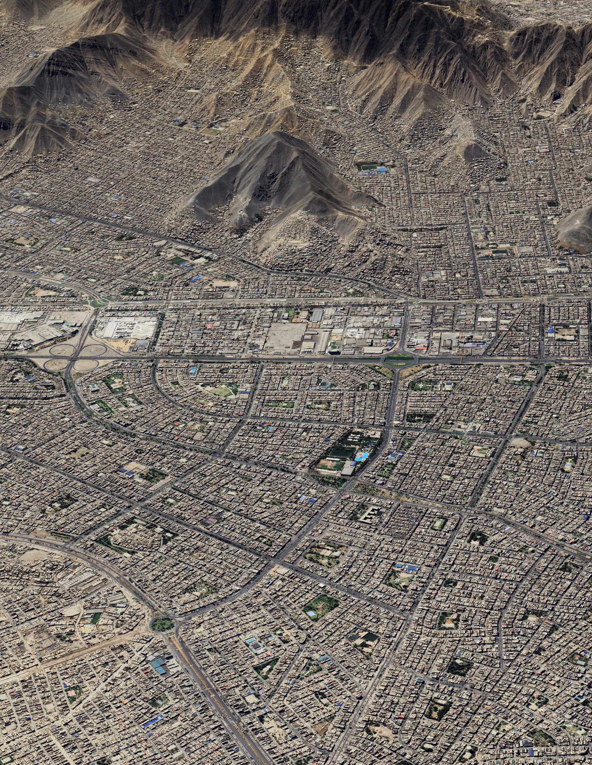
 AREA OF STUDY: INDLUSTRIAL AREA OF NORTH LIMA
METRO SUPERMARKET
MAESTRO SHOPPING CENTER
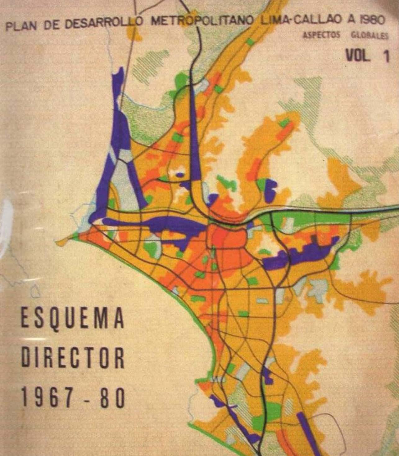
Urban Plan Lima 1967-1980 Source: http://urbvial.blogspot.com/2011/04/plandemet-plan-de-desarrollo.html 28
Experimental Housing Project - PREVI
INFORMAL HILLSIDE SETTLEMENTS

Historically, North Lima has been one of the urban laboratories of political and academic debates to propose new urban planning measures in Latin America in order to improve the conditions of the informal settlement in the popular city.
Such is the case of the Experimental Housing Project - PREVI in the district of Los Olivos, which in the years 1965-1976 brought together the best specialists worldwide, an initiative of the Peruvian State and the United Nations Development Program - UNDP.
Likewise in the 1960s, the studies and proposals of John F.C Turner in the autoconstructed settlement of Pampa de Cueva in the district of Independencia, where he rescues local factors such as self-construction and the progressive production of social space, as values of the informal city.
Certainly, until before 1990, North Lima seemed to be that hope for improvement in quality of life and built environment, not only due to the social demand for the
“Right to the city” (Lefevre 68-82) (Harvey 3-116), but also to the concern and action of the political class, producing a holistic understanding of “development”, in social as well as economic and urban terms.
Unfortunately, in 1991, the Peruvian government dismantled all policies on urban planning and housing (Calderón 52) to give way to the populist creation of the massive titling policy that, under neoliberal guidelines, that definitely, does not solve the structural problems that the country needs in urban matters.
Today, almost 30 years later, the country has experienced economic growth (due to an emerging middle class), but this is not reflected in the production of built space. As a result, in 2019 it was estimated that, in the last 20 years, Peru’s cities have expanded by about 50% and that more than 90% of this urban expansion is of an informal nature (Espinoza & Fort 5), a reality that is not much talked about in the public sphere, due to the mirage of the Peruvian economic miracle.
MEGA PLAZA MALL
PLAZA NORTE MALL
SUPERMARKET
PLAZA VEA SUPERMARKET
ROYAL PLAZA
29
view from Earth
PLAZA CENTER MALL
Aereal
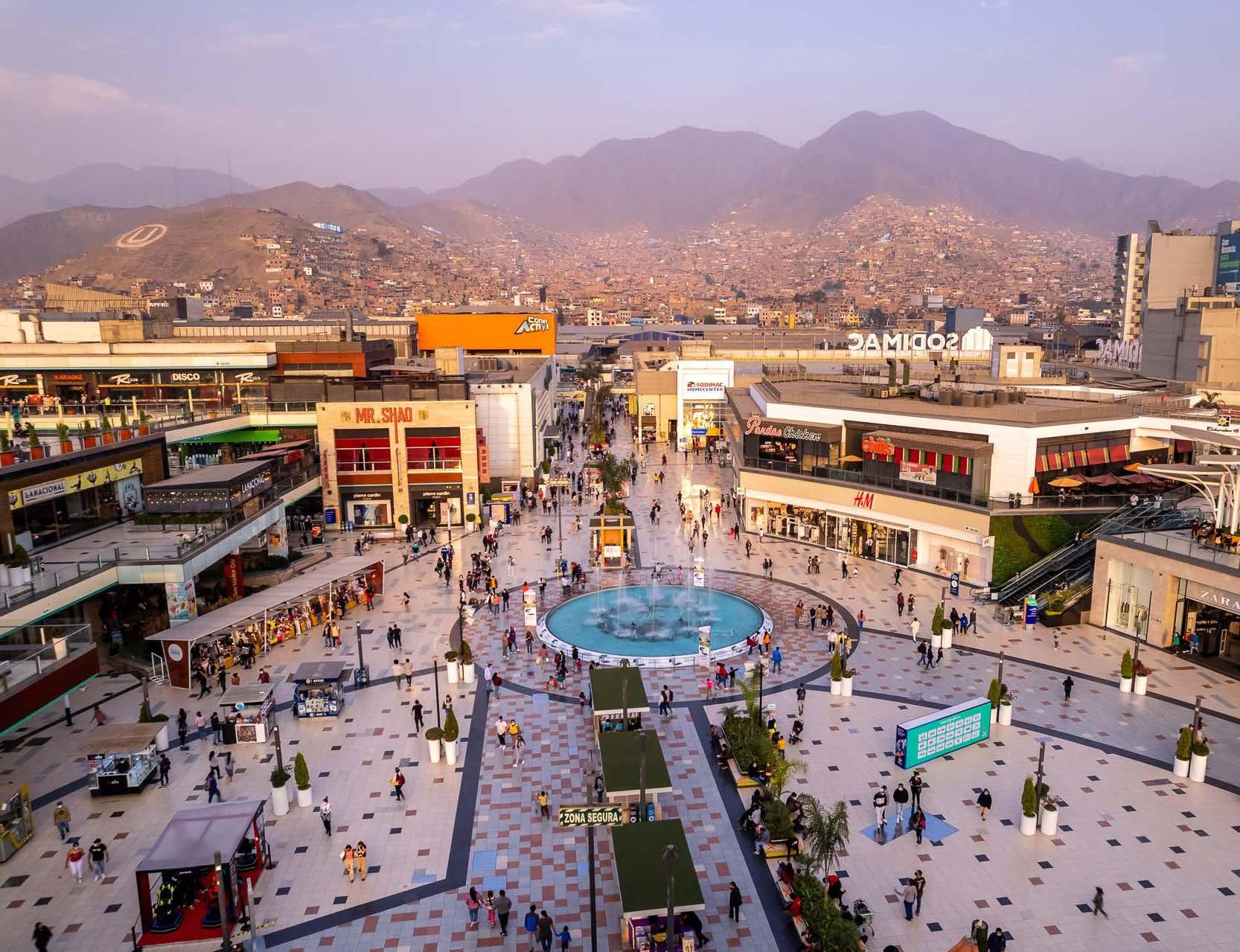
It is, in this historical and political context that, at the beginning of the year 2000, a formation phase of a commercial hub began at the metropolitan level in North Lima (Vega Centeno 5-25), based on the reconversion of large former industrial parcels of land into closed, and unarticulated private shopping centers, in urban areas with a deficit of quality housing and services as a result of the mentioned policies.
This “commercial and consumer” phenomenon, probably influenced by that urban typology representative of American “social climbing” during the post-war period, the “malls”, ended up being for North Lima, the symbol of “development and improvement”. A private solution to the need for public, cultural and recreational spaces that citizens demanded from the city.
Today, North Lima has 14 shopping centers in its territory, which play the role of “new centralities” (IMP 10). Such is the case of Megaplaza and Plaza Norte, the two largest shopping centers in the area, which are less than a kilometer away from each other and represent the formal style, in different aspects and scales, of shopping center production.
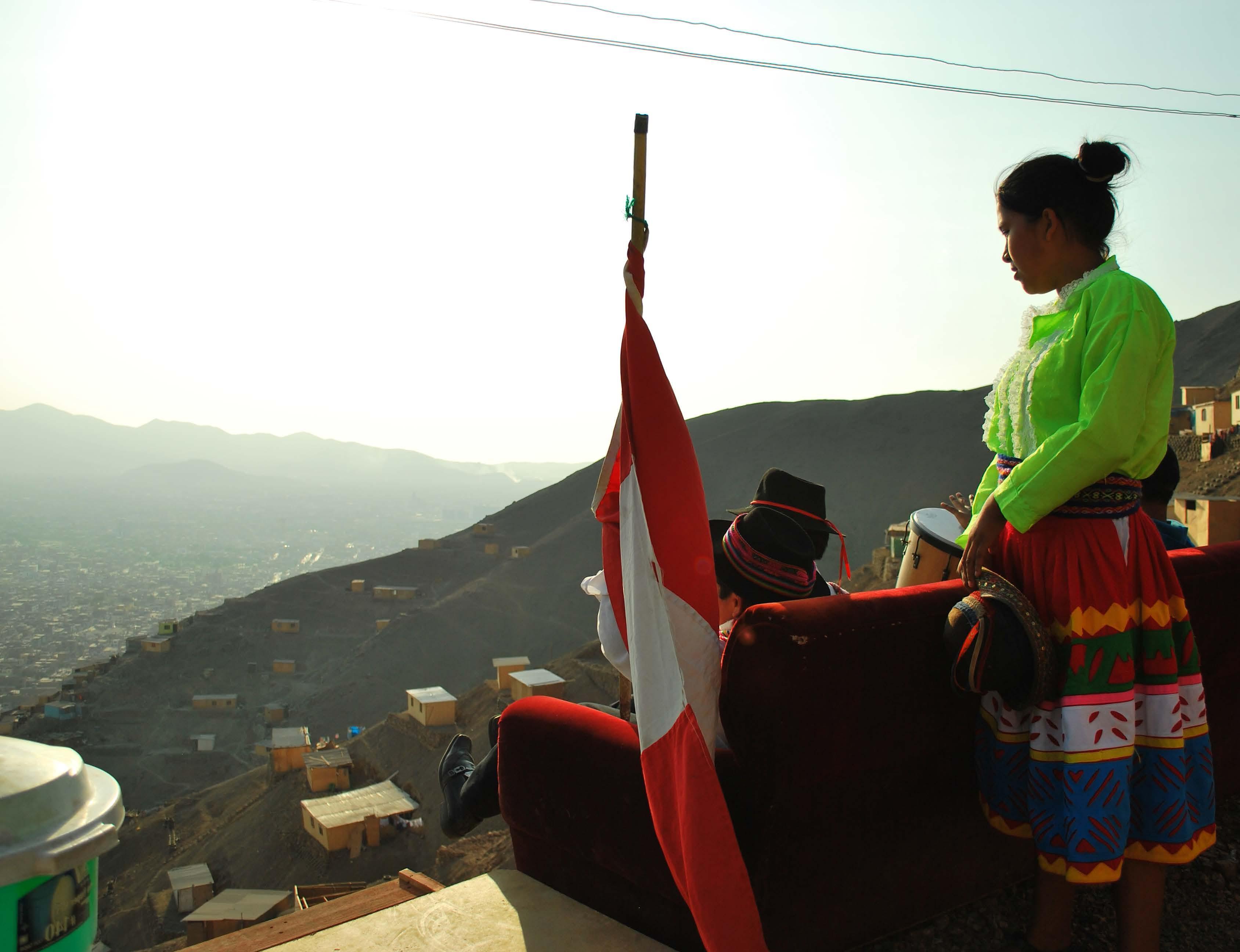
On a urban scale, the appearance of these shopping centers continues “respecting” the original perimeters of the factories that used to exist on their site. In an urban context of medium density with small and atomized lots, these large polygons stand out for interrupting, or in any case, not being part of the city grid, imposing their privilege of location in a flat area with diverse accessibility, in front of high-risk hillside housing located just behind them.
Megaplaza Shopping Center
30
Picture by ©Pablo Blanco Barros
This starring role is intensified by the color and materiality those use, since, in a deserted urban landscape surrounded by half-built houses, these shopping centers are dressed in bright colors and materials that are totally contrasting with their context. Definitely recognizable from a distance, reaching the point of questioning if it is a masterpiece of voluntary postmodern art or simply a sort of bad taste of color harmony.
On the micro scale, the situation is much the same. Long and high perimeter walls welcome what could be translated as a money-spending factory. Parking lot esplanades are the vestibule for the entrance to the strikingly colorful volumes, which inside recreate refined common spaces of eclectic taste, and where users find stores of exclusive international brands. A totally contrasting experience to the reality of the exterior.
It is a challenge to determine the aesthetic and urban improvement contribution in terms of integration with the context of these shopping centers. In contrast, it is evident that, although these projects have been of great importance to stimulate the city’s economy, this has been a wasted opportunity, since these private investment contributions are potential agencies of change in cities where there is no public funding to make the improvements that North Lima has historically demanded and needs very much.
Finally, in response to the questioning of the notion of “development” set out in the first paragraph, it now seems to be measured through the privileges that citizens can access, where they are reduced to the status of a client, very different from the historical memory of efforts for the improvement of the habitat. Therefore, today more than ever it is imperative to transform and recover the city as a common good, instead of a product and individual consumption.
31
Informal Hillside Settlement in North Lima Picture by the author
RETREAT OF ANDEAN GLACIERS:
Mapping resilient strategies for melting territories
Location
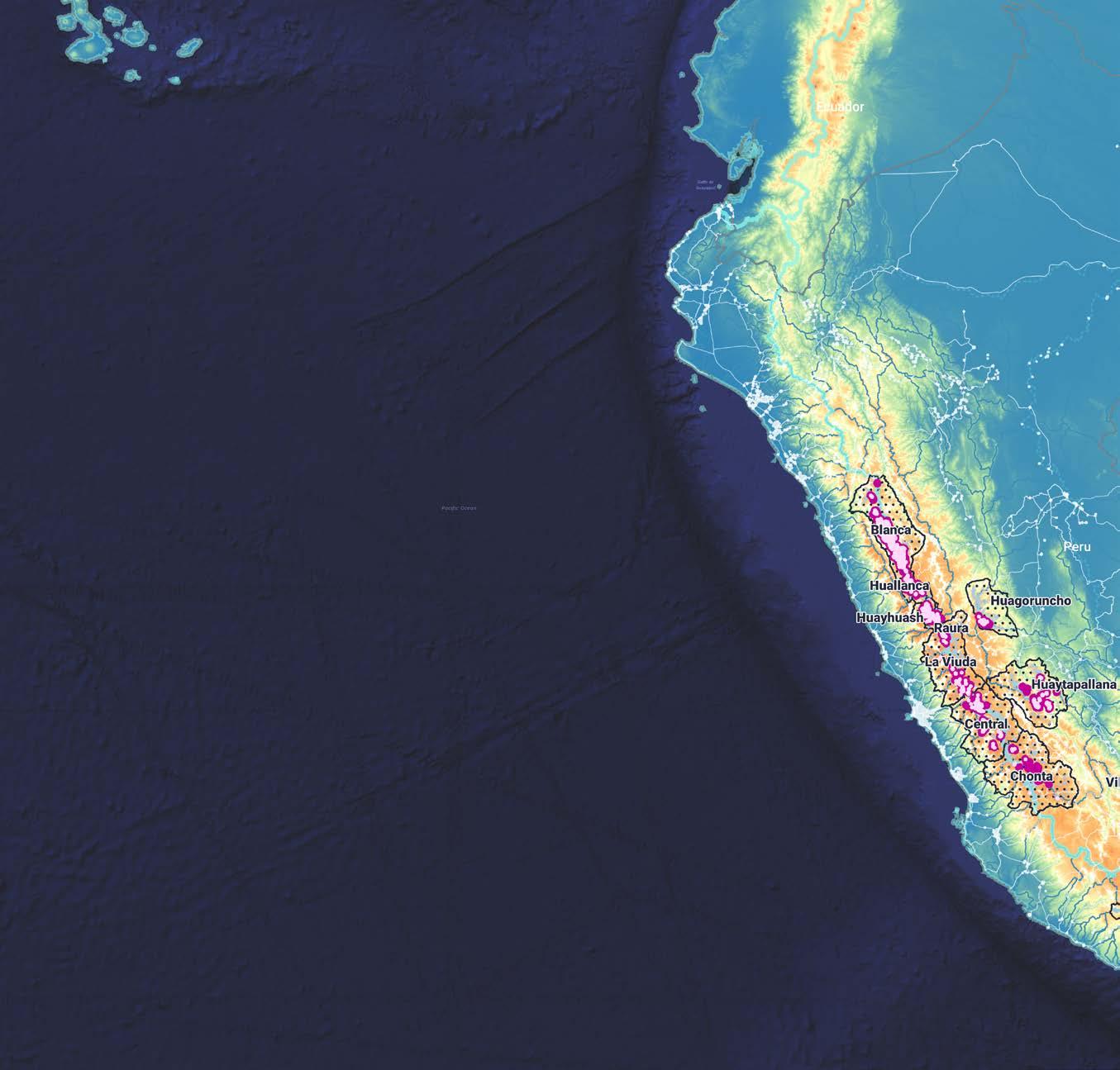
Yungay, Ancash, Perú
Key statement
My passion for the astrophotography has allowed me to understand different territories and vulnerable Andean communities that are experiencing the extinction of their glaciers due to climate change. This has led me to start in 2023, a research to study the phenomenon of the retreat of Andean glaciers of Peru, my homeland.
This project is part of that process, the beginning of a journey that seeks its future continuity in defense of the glacier territories. My goal is to take action in the protection of mountain ecosystems and strengthen the resilience of high Andean communities.
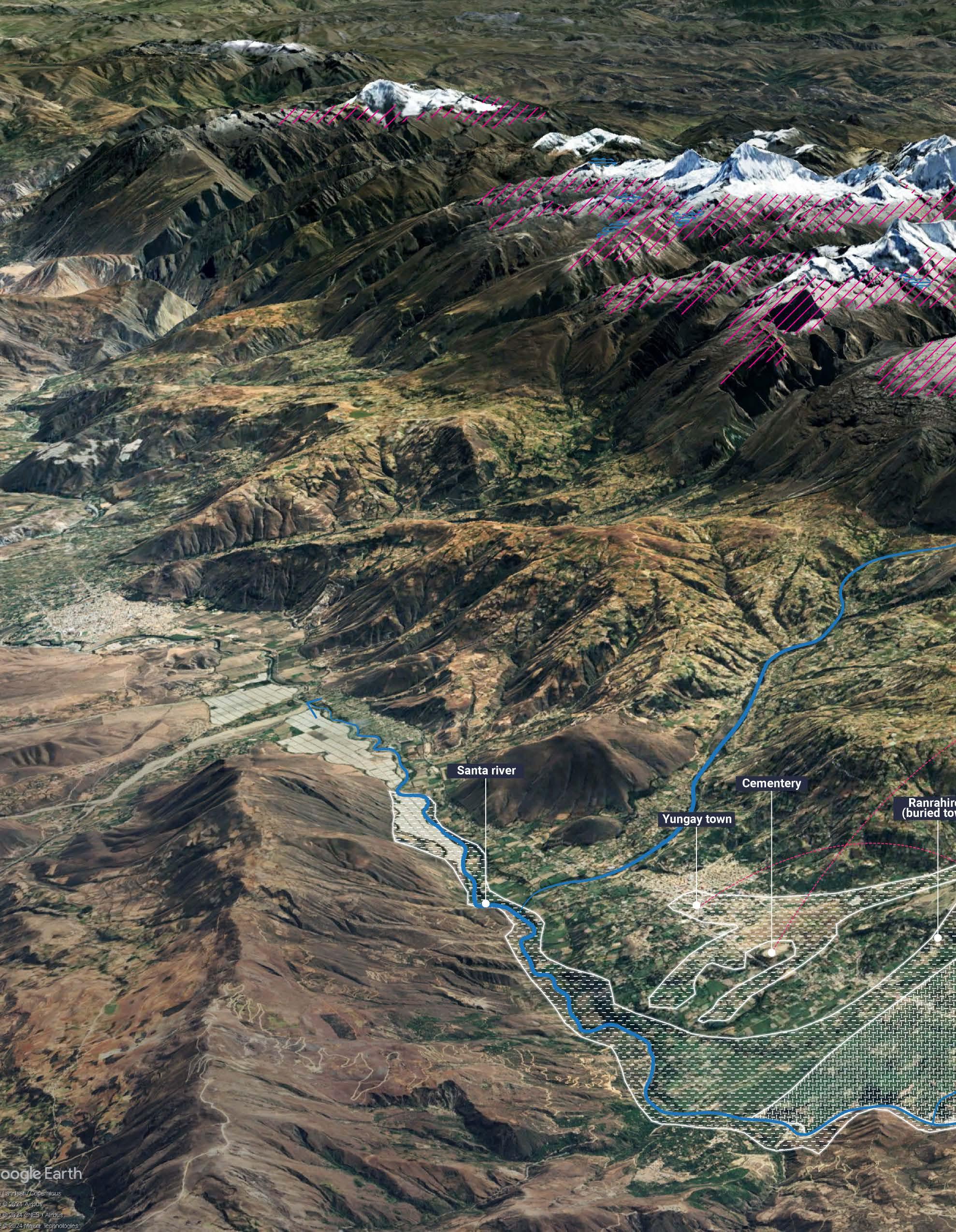
This research seeks to identify, characterize and geolocate community experiences and wisdom for adaptation to the rapid melting of glaciers in the tropical Andes. Specifically, the study of the communities of Yungay Town, the scene of the most catastrophic natural disasters recorded in Peru related to climate change.
The objective of this research is to define resilience strategies for the implementation of public policies and rural landscape design, in order to allow its replicability in other contexts of vulnerability and territorial injustice.
Note: This research project was developed throughout different courses at GSAPP during the fall 23’ and spring 24’ semesters. It is currently applying for the William Kinne Fellows Traveling Prize 2023-2024.
RETREAT OF ANDEAN GLACIERS STORYMAP

Courses
GIS for Practices - Fall 23’ Spatial Data Narratives - Spring 24’
Instructors
Manon Vergerio, Eric Brelsford
Joshua Begley
32
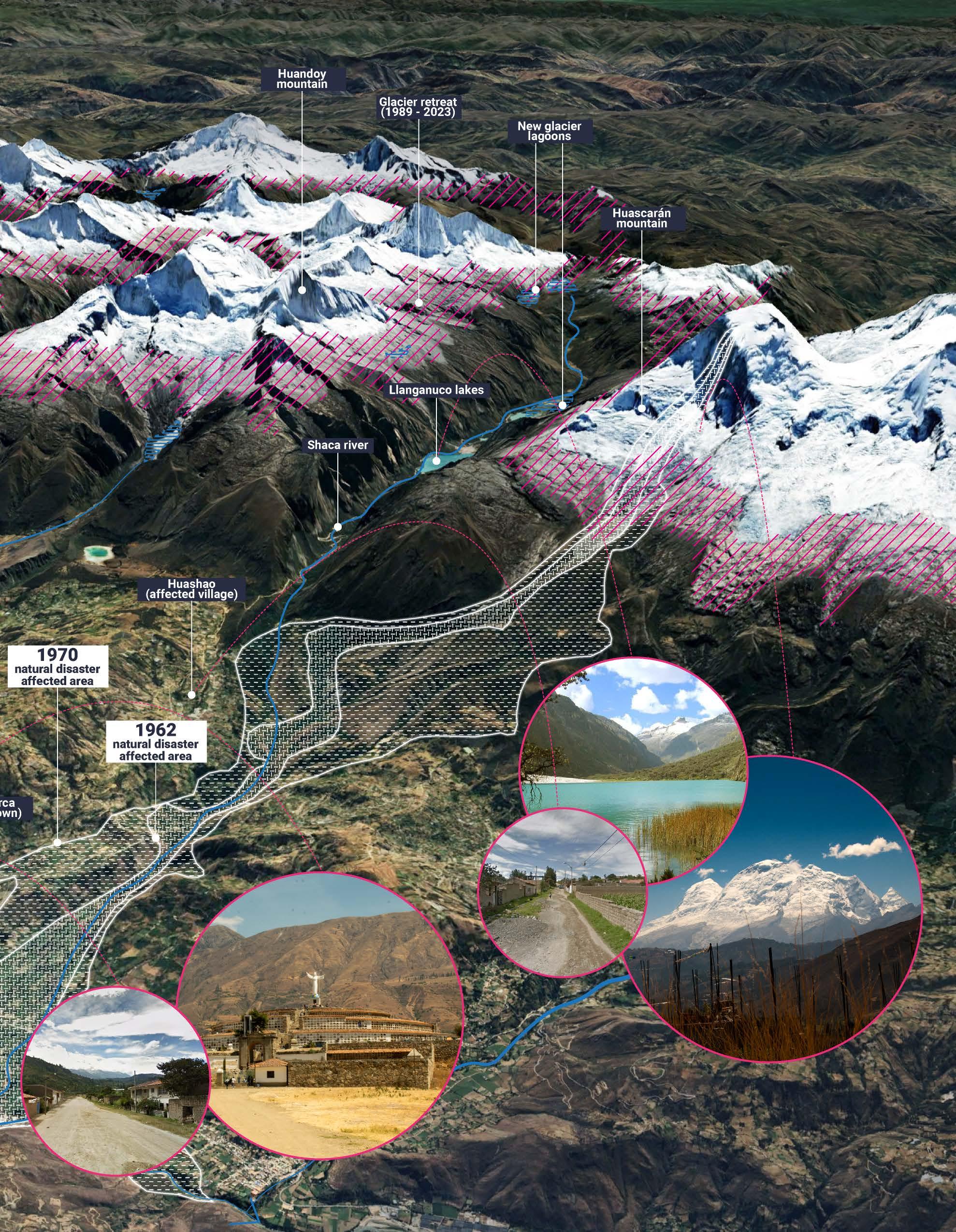
Geo-spatial context
33
of Yungay Town and the natural disasters of 1962 & 1970
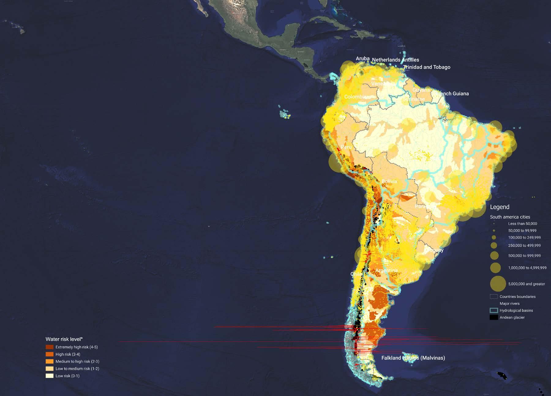
The glacier retreat is aggravated in the tropical zone of the Andes, where 68% is in Peru and which in the last 60 years has lost more than 56% of its extension. According to the National Inventory of Glaciers and Glacial Lagoons 2023 (Ministry of the Environment of Peru - MINAM), there are 20 glacier ranges within this territory.
As a result of a preliminary diagnosis, the areas with the greatest water risk associated with glacier melting were identified. The most affected region is the White range or Cordillera Blanca in Spanish, Peru’s most extensive mountain range located in the Ancash region.
This mountain system is also the one that has lost the most glacier surface between 1948-2019 (249.46 km2 - 39% of its total area), with an average annual glacier retreat of 19 meters. It is one of the places where more “glacier lagoons” have originated as a result of glacier melting. Large natural water bodies that expand and increase rapidly on the slopes of the mountains. A latent and imminent threat that has historically intensified the impact of natural disasters in the area.
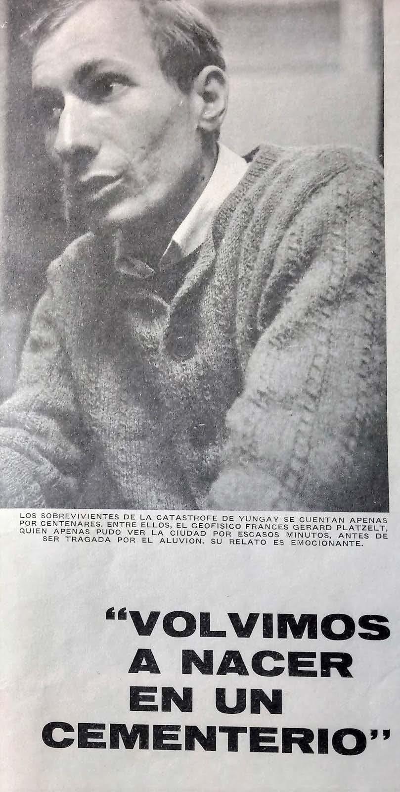
“WE REBORN IN A CEMETERY”
Testimony of Eng. GERARD PLATZELT Informe Ilustrado Magazine No 33 Lima, 30-June-1970
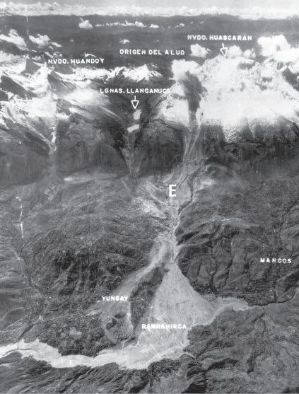 Yungay-Ranrahirca 1970
By the U.S. Geological SurveyLibrary
Water
Map 34
White Range
Risk

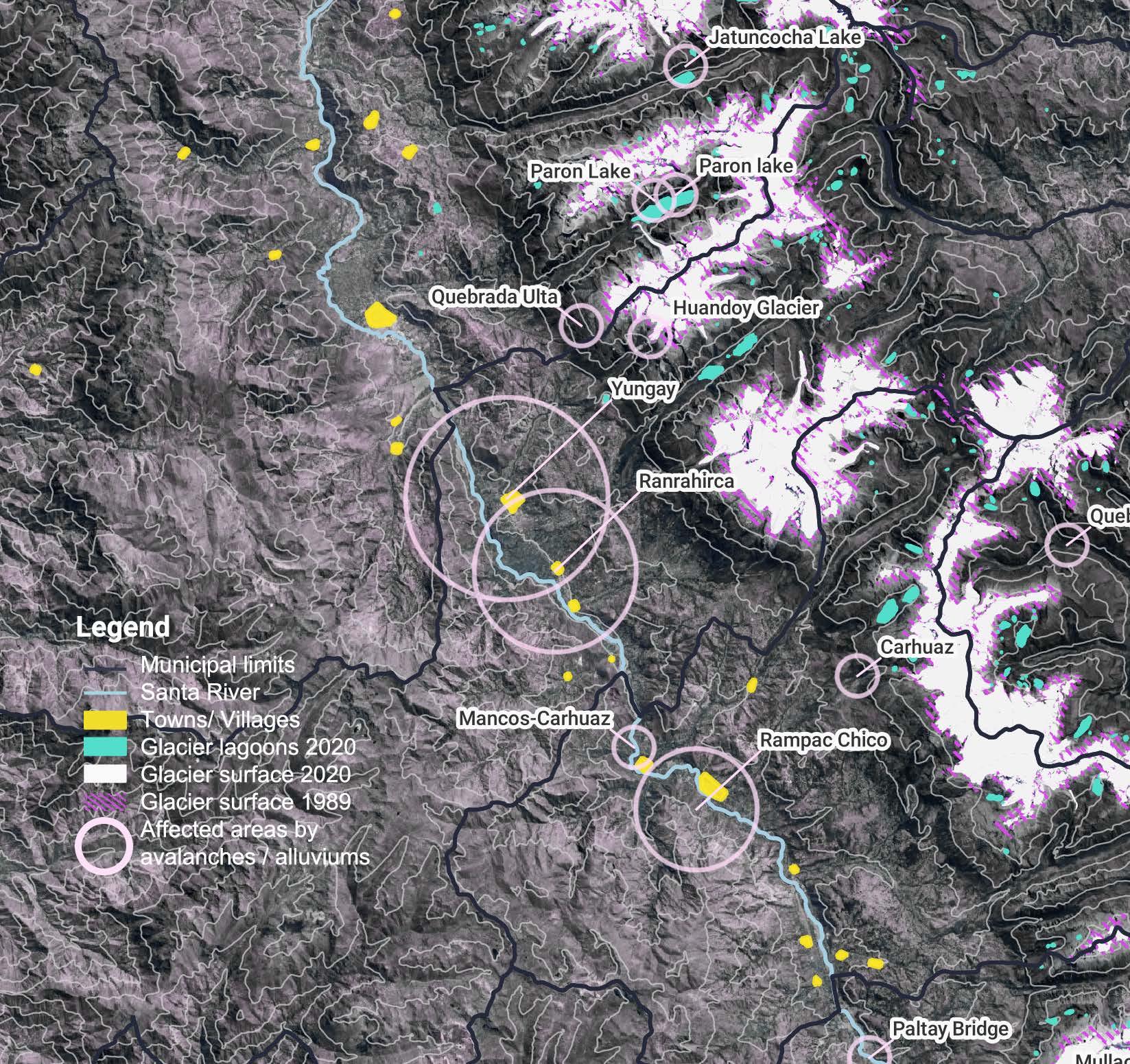
Geo-spatial context of Yungay Town and the natural disasters of 1962 & 1970
Process of "frozen lagoons" 2023

Process of "frozen lagoons" 2023
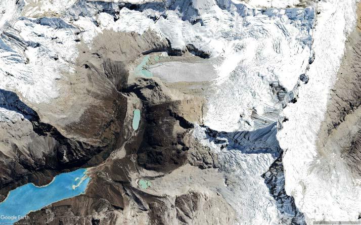

 New "frozen lagoons" 2023
Yungay Town
35


Architecture, Planning & Urban design jlr2273@columbia.edu 2024 Jessy Rojas Güere


 Ecological Access to the City


 Ideation


 “Property” basemap
Smellmap
Natural shadows


 AREA OF STUDY: INDLUSTRIAL AREA OF NORTH LIMA
METRO SUPERMARKET
MAESTRO SHOPPING CENTER


 Yungay-Ranrahirca 1970
By the U.S. Geological SurveyLibrary


 New "frozen lagoons" 2023
Yungay Town