
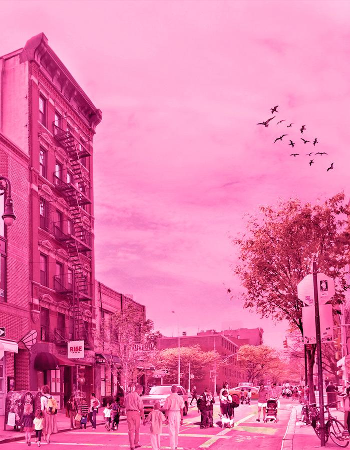
CLOSE THE STREETS
What streets can be pedestrianized to ensure the safety of children?
New York City was set to introduce congestion pricing, a fare that would charge all vehicles entering Manhattan $15 or more. This was aimed to reduce car traffic, encourage the usage of public transit, and create vibrant pedestrian streets amongst many other goals.
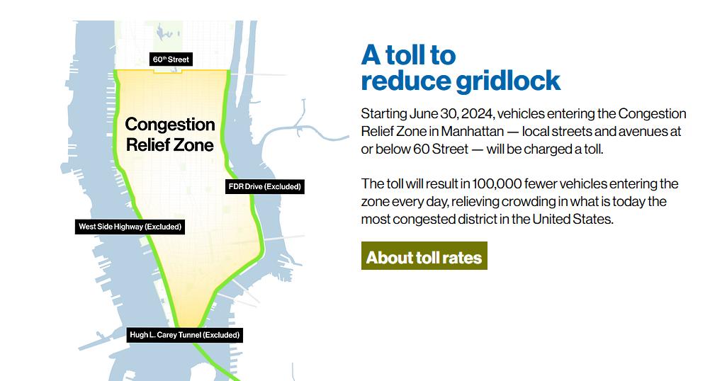
MTA. “Congestion Pricing” https://congestionreliefzone.mta.info/
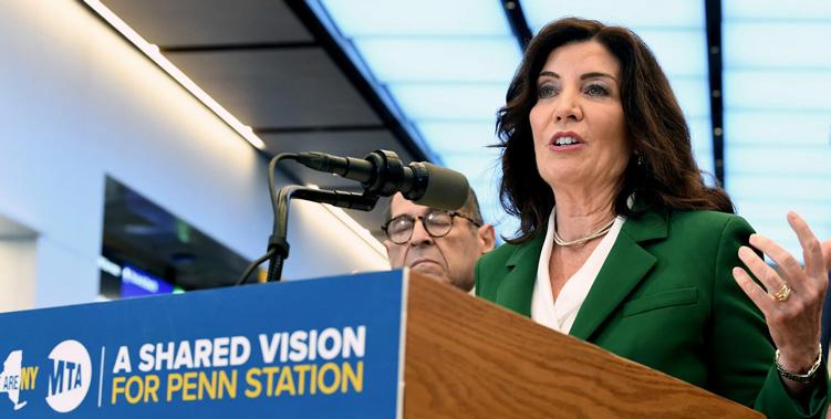
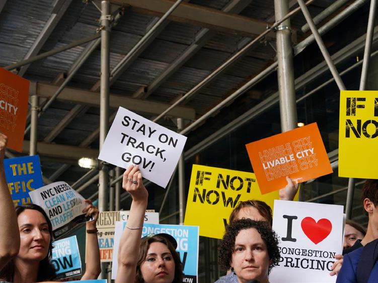
On June 5th, 25 days before the introduction of congestion pricing, New York Governor Kathy Hochul decided to cancel congestion pricing, sparking protests.
“What streets can be feasibly pedestrianized to ensure the safety of children?”
Keeping Track of New York City’s Children: 2024

Designing Streets for Kids
This project looks to perform analysis at the metropolitan level to underdtand the necessities for pedestrian infrastructure
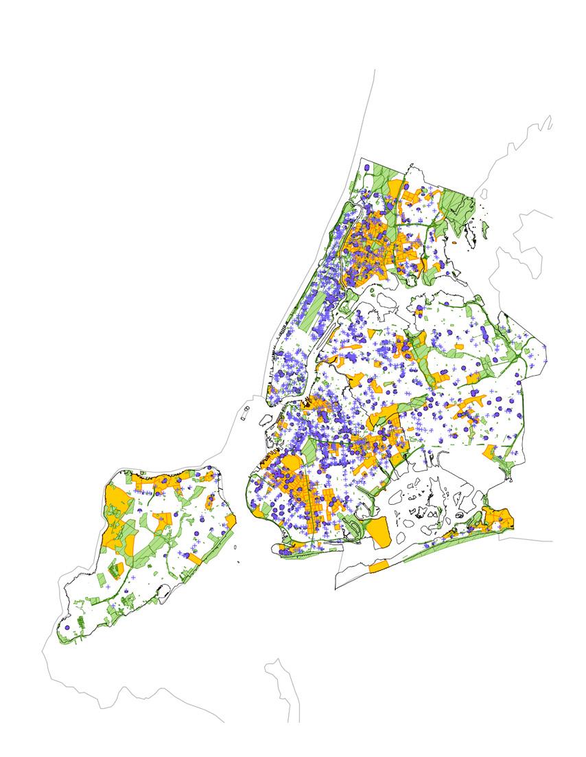
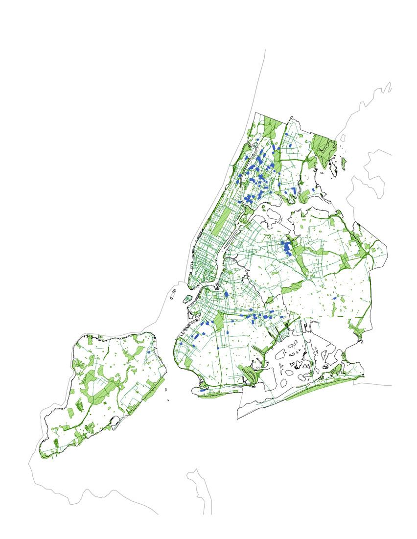
By mapping two factors that influence the movement of people, the project looks at Spatial and physical feature, as well as time as a way to inform design decisions. Below are the factors that were studied
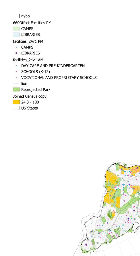
• Proximity to facilities (Spatial/Physical)
• Libraries
• Camps
• Schools
• Child care
• Time of usage (Time)
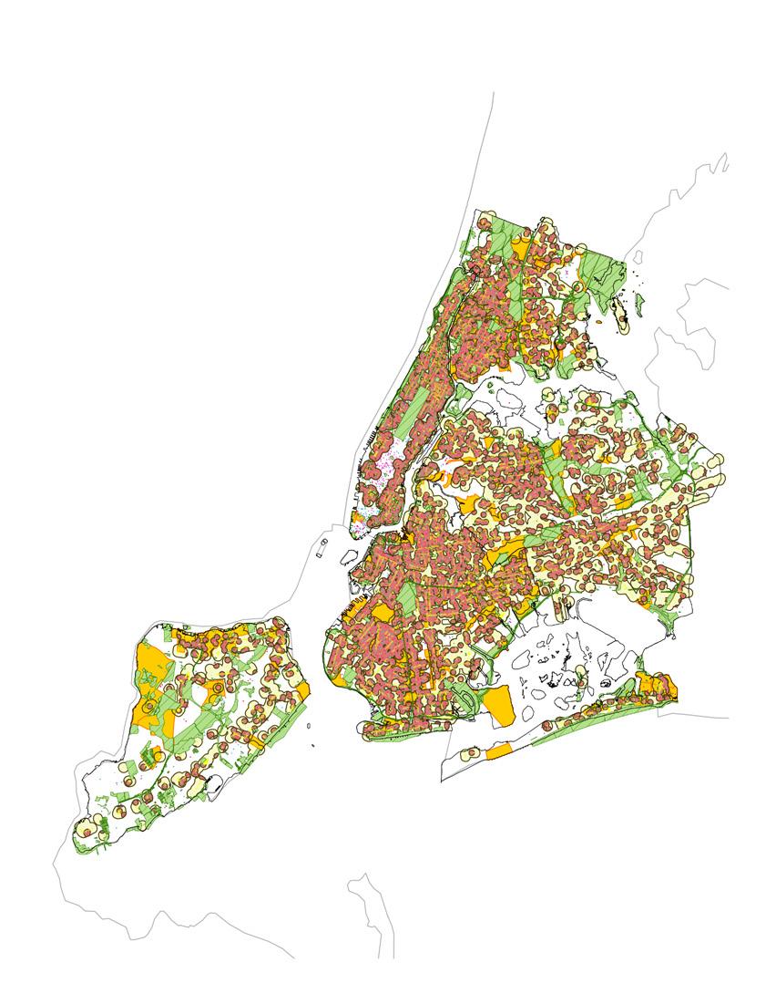
• Mix-use commercial districts (Spatial)
• Vehicular Traffic (Spatial and Time)
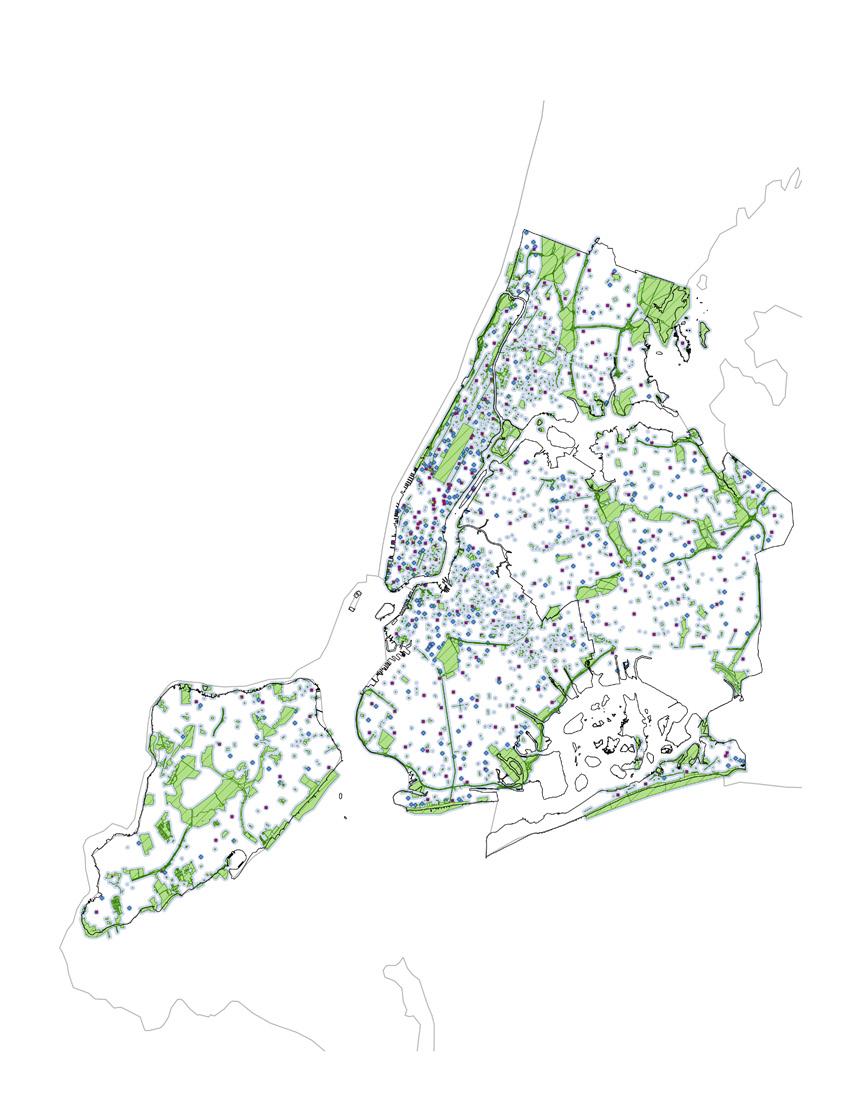
• Public Benches (Spatial)
• Percentage of children (Spatial)
• Bike Infrastructure (Spatial)
Research Methodology
General Data
The overall analysis begins with finding the opportunity areas by:
1. Mapping census data of percentage of children per neighbourhood
2. Looking at the area of highest concentration of children. This is the opportunity area to better improve their walkability
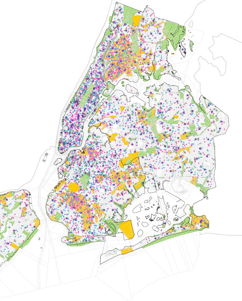
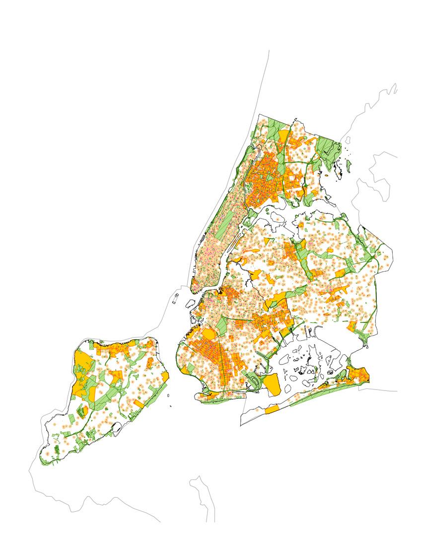
3. Context analysis, mapping schools, daycares, kindergartens, camps and libraries. These are the main location that will dictate what streets can be adjacent.
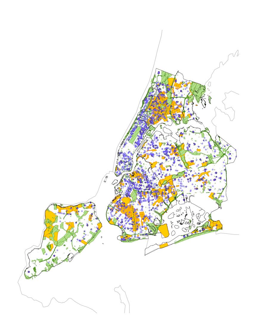
Time-specific data
The overall analysis begin with a layered process of expansion and subtraction by expanding each layer of information by a certain distance, either 660ft or 1032 ft.
1. Facilities (Expanded)
Subtraction
2. Commercial Districts (Expanded)
Subtraction
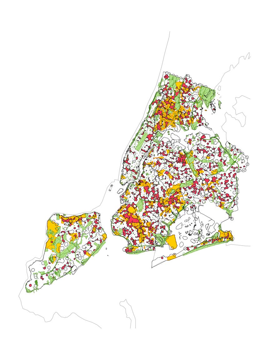
3. High traffic counts (Expanded)
Subtraction
4. Public bench locations (Expanded)
Subtraction
5. Opportunity area (Subtracted)
6. Bike Lanes (Subtracted)
Understanding Context
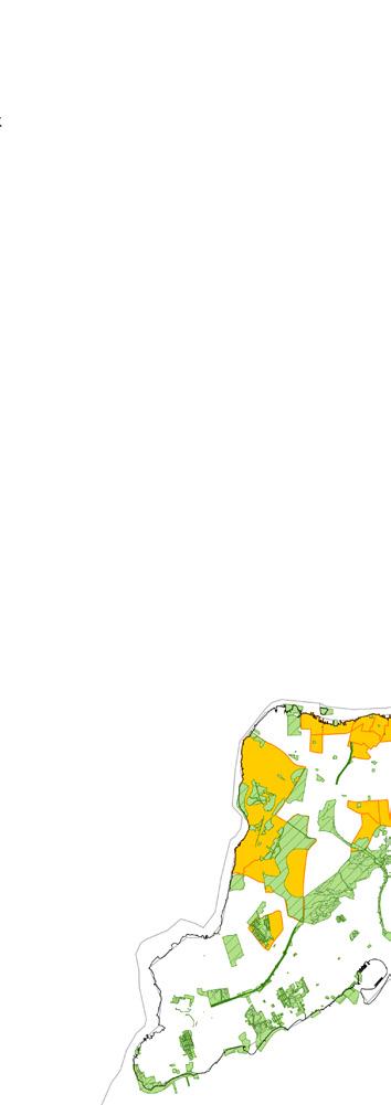
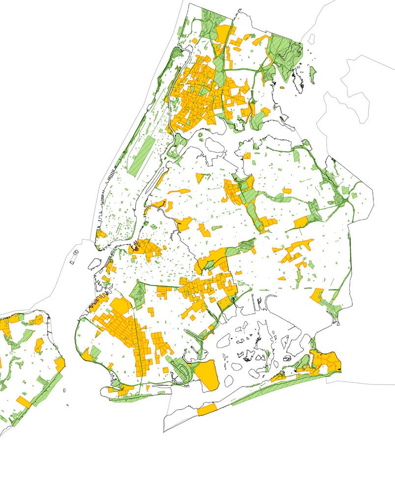
Percentage of Children
0%-15%
15%-18.5%
18.5%-20.9%
20.9%-24.3%
24.3%-100%
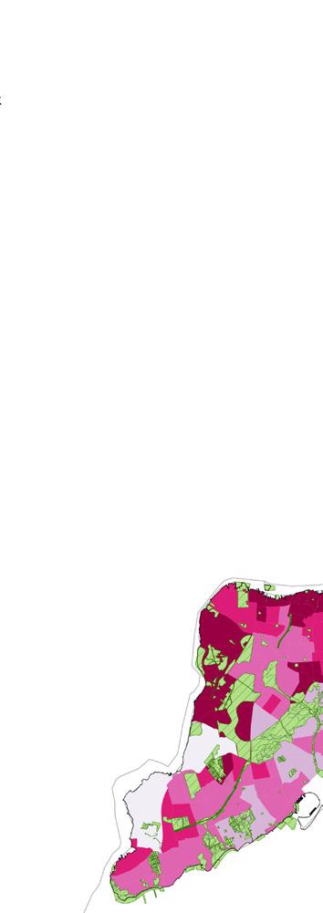
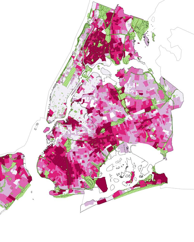
Opportunity Areas
Finding the opportunity area, highest percentage of Children
24.3%-100%
Knowing the surroundings
Percentage
of Children
24.3%-100%
Facilities
Schools (K-12) and vocational and proprietary Schools
Day care and pre-kindergarten
Camps
Libraries
Not all streets can be pedestrianzied at all times,
Commute daytime 7:00am-10:00am 4:00pm-8:00pm
Commute to School
Daycare/Pre-kindergarten K-12 Schools
After-school activities
Camps Libraries Parks
3:00pm-4:00pm
Commute Home (or other)
Walkabiltiy to facilities
Understanding where a child is going during times of day informs the approach to what streets should be strategically closed and pedestrianized
660 ft/201m
5 minute walk
Area of interest (highest concentration of children)
Schools (K-12) and vocational and proprietary Schools
Day care and pre-kindergarten
660ft buffer
Daytime
Camps
Libraries
Area of interest (highest concentration of children) 660 ft buffer

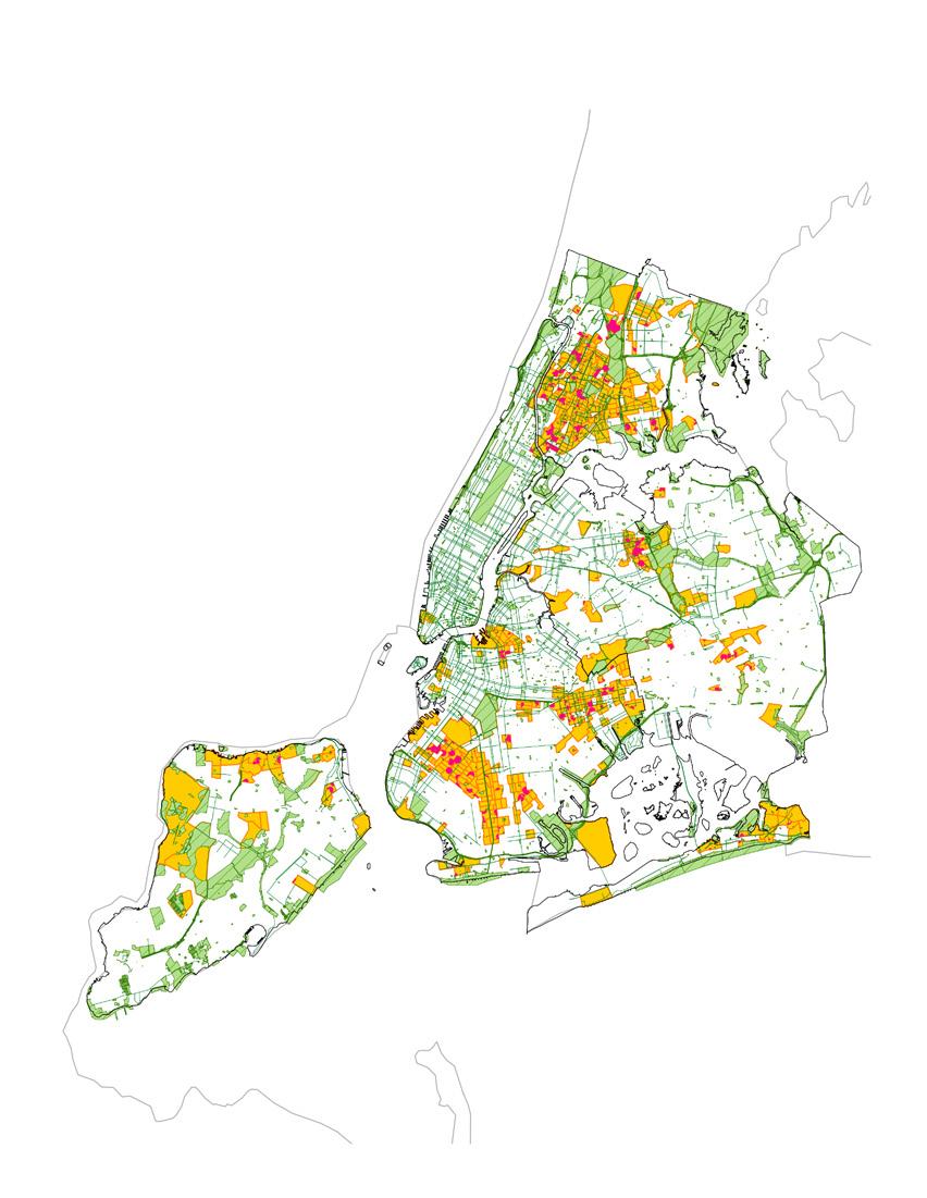
Subtracting Walkability with Commercial Districts
Toronto’s “Planning for Children in Vertical Communities” encourages commercial mix-use districts as spaces for children move through to encourage vibrant communities and safe streets
1032 ft/315m 7 minute walk
Daytime
Area of interest (highest concentration of children)
Mix-use commercial districts (C1/C2 zoning)
Commercial Distric Zone 1032ft buffer
Found opportunity area


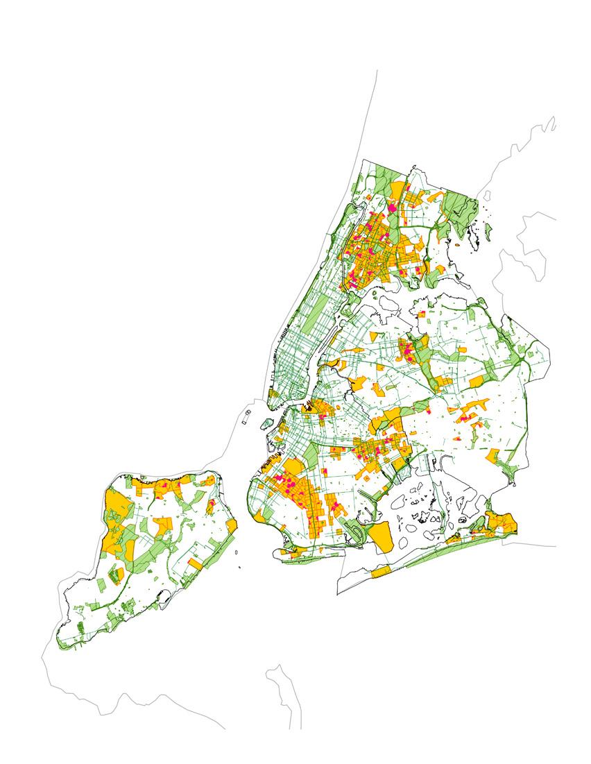
Walkability, and subtracting traffic counts over 100 cars per hour
High car traffic poses a safety concern for children and pedestrian. Avoiding these pinch points reduces the risks associated with Car accidents 1032 ft/315m 7 minute walk

Daytime
Area of interest (highest concentration of children)
Car volume count, over 100 cars per hour
Car volume count 1032ft buffer
Found opportunity area

Walbility, subtracting public bench locations
The Designing Streets for Kids guideline speaks to the need of resting/sititting areas for caregivers of children

660 ft/201m 5 minute walk
Daytime
Area of interest (highest concentration of children)
Public bench
Public bench 660 ft buffer
Found opportunity area
Walbility within opportunity areas
Returning to the areas in need
Daytime
Area of interest (highest concentration of children)
Found opportunity area

Walkability and bike infrastructure
Applying the found data to bike networks to encourage multi-modal mobility
Daytime
To be pedestrianized streets
Bike path

A
closer look
Daytime
