KESSLER PARK WATER
KANSAS CITY DESIGN CENTER
STUDY 2021-2022
RE-IMAGINING
RESERVOIR
VISION


MP 84 MASTERPLAN Masterplan 85 Transformative Schemes 93

KANSAS CITY DESIGN CENTER
STUDY 2021-2022
Before proposing final designs to the circulation and activities within the park, conceptual designs were created based on a series of studies on entry, circulation, and activity within the park. The first exposes the entries into the park with the left hand entrance being Wabash, and the Right hand arrow being Lexington. It is found that once traffic is cut off to East Reservoir Drive, Lexington becomes the primary entrance.
Next is the study of the existing intersections where these streets face traffic and slowdowns for cars and people trying to enter the park. The primary East-West street that intersects these entry streets is Independence Avenue. These intersections between Independence and the entry streets are an area of concern that will best be remedied by a 4-way stop, light, or roundabout system.
As Wabash is to become a pedestrian focused street, special attention is paid to how park trails and paths can be connected to Wabash Avenue and Lexington Avenue parking area for out-of-neighborhood visitors. It is found that almost all trails connect back near East Reservoir Drive or along Cliff Drive making pedestrian connection from Wabash easy. It is also noted that East Reservoir Drive becomes a paved part of the trail system and therefore needs to be connected back to the parking area via a paved pedestrian access-way.
Conceptual Park Organization
Overlook Disc Golf Rain Garden
Pond Parking
Using all of the previous information, it is concluded that the conceptual design for the circulation surrounding the park should name Lexington Avenue as the primary vehicular entrance, Wabash Avenue as the primary pedestrian entrance, and should provide parking that is easily accessible off of the Lexington/Independence intersection.
As for designing the spaces within the park itself, studies of the activities in the park found that all existing activities such as the overlook, disc golf, and nearby North Terrace Pond should remain untouched. Instead of interrupting any existing activity space it is concluded that the park can add parking in the empty field directly off of Lexington Avenue and include a watershed solution that addresses runoff water that is collecting in a low point along St. John Avenue.
The final conceptual design within the park includes the activities seen here. The existing activities such as the pond, disc golf, and overlook remain untouched as they stand. However, two new activities-- the rain garden and parking lot-- are to be added to address unresolved issues on the site. These new areas will connect to the rest of the park through the existing trails system, East Reservoir Drive, and two newly added paths that connect East reservoir drive to the parking lot and to the North Terrace Pond (shown in bold blue dashed line).
The studies of the immediate site highlight circulation and drainage issues that can be redeveloped to create a safer and cleaner park. The first change is to vehicular access and circulation. The East Reservoir Drive loop which skirts around the reservoir is a haven for parked cars, both empty and occupied. This is due to both a lack of security and a lack of adequate parking elsewhere. Therefore the master plan proposes to cut off vehicular access to East Reservoir Drive and instead make the park pedestrian focused and incorporate a large, new parking lot to the east of the reservoir.
The master plan proposes to revise the street design along Wabash and Lexington to address this change in access. This is done by making Wabash Avenue, which connects to East Reservoir Drive, a one-way, primarily pedestrian street, and Lexington Avenue, which connects to the parking lot, a boulevard street with divided two-way traffic. Once the traffic is addressed, the last move of the masterplan is to implement a large rain garden in an area to the west of the reservoir which houses a low-point that collects water and runoff with little drainage.


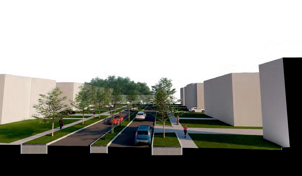
As previously mentioned, the largest changes proposed to the immediate site are to the vehicular and pedestrian circulation routes into the park. To the left are the sections of Wabash Avenue and Lexington Avenue.
As Wabash is the primary pedestrian route of access, it is proposed that the street be converted into a oneway that carries traffic north toward the park. In place of a second traffic lane, a pedestrian parkway will take shape. The space left behind by the second traffic lane will make room for a larger sidewalk, bike lane, and planter boulevard. The planter will provide safety for pedestrians by dividing the vehicular traffic from bikers and walkers, safety in the form of more street lighting for the pedestrians, and create a boulevard experience into the park that gives it more definition when compared to the nearby neighborhood streets. The second street, Lexington avenue is proposed to be maintained as a two-way street, but divide the traffic with an additional planter boulevard. This would help to further identify the park and tie it to the vernacular of the parks and boulevard system through the use of a boulevard-like design strategy.

Once the streets are designed, parking is proposed as an extension of Lexington avenue. The proposed parking lot takes the place of a small gravel drive and empty field that sits northeast of the Lexington/Independence intersection. This will allow for 143 new parking spots while introducing the use of bio-swales that will help filter runoff before it percolates into North Terrace Lake, which sits directly to the east.
By directing traffic from independence within the parking lot, traffic buildup can be avoided along independence
and vehicular traffic flowing from Lexington Avenue can have a direct entrance.
To supplement the large parking lot, diagonal parking is proposed along Independence for daily users. All of these parking stalls, as well as those within the larger lot, connect back to Wabash Avenue and East Reservoir Drive via a sidewalk system that runs parallel to Independence Avenue to facilitate safe pedestrian movement.
LEXINGTON AVE.The final issue the masterplan addresses within the park is that of water management. Due to the steep topography of the property surrounding the reservoir, there is a significant amount of runoff generated by annual rainfall. Not only does this move pollutants down the Missouri River, but it also causes deterioration to areas like Cliff Drive which sits on the steep slope of the park along the Northern edge of Kessler Park. While this issue is beyond the scope of the studio’s project, the small issue of ponding runoff in the park can be
resolved. In this case, an area to the east of the reservoir is currently an unresolved low spot that accumulates runoff. It currently houses a small, underutilized basketball pad, but the masterplan proposes the area instead be changed into a large terraced rain garden for neighborhood residents to enjoy and to help filter pollutants that run through the park.
The design studio has taken three different approaches to redesign Kessler Park’s reservoir during the 2021-2022 academic year. Each of these schemes has a primary concern of reintegrating this reservoir into the fabric of Kessler Park, to make it and its surrounding land safer and more accessible to the nearby neighborhoods. Additionally, each of these schemes works to establish the Kessler Park reservoir as public domain that should be known beyond the context of the Northeast Neighborhoods.


 Preservation Concept Intersection Concept
Integration Concept
Preservation Concept Intersection Concept
Integration Concept
The scheme that proposes the least amount of alteration to the reservoir’s original structure, the aptly named Preservation Scheme analyzes the reservoir’s asymmetrical decay since its construction. This decay has been what informed the scheme’s direction; the north half of the reservoir honored this existing condition of decay while standing juxtaposed from its southern half. As a whole, the preservation of this reservoir will work as one collective and processional experience which follows a path to culminate in a final public gathering space. This public gathering space serves as an informational and educational examination of the reservoir’s shifted use through time.
This scheme’s re-orientation of the park vis-à-vis the reservoir’s geometry works to establish its shell as an extension of Kessler Park. To create these extensions into the park, a series of cuts were introduced to the reservoir’s structure. In addition to providing new paths throughout Kessler Park, these cuts also break down the reservoir’s immense scale into ‘rooms’ which activate Kessler Park’s different activity zones for different uses and programmatic needs by inviting these needs into the reservoir shell.
As perhaps the most reservoir-altering scheme, the Integration Scheme has several goals for the reservoir in Kessler Park. The concept’s overall goals are to provide visibility into the reservoir in the interest of public safety, establish Kessler Park as a regional destination as well as a neighborhood park, and better utilize underused space. This integration has been achieved by removing the southern portion of the reservoir to allow for better flow to and from its newly created spaces.


The Preservation Scheme seeks to make the most of the existing reservoir infrastructure and form, while still allowing for architectural innovation through additive elements. Because Preservation is a scheme focused on the least amount of physical intervention possible, we have discovered that this ideology celebrates the current existing environment within the reservoir and redevelops this basin as a place of discovery and exploration.
The history of the reservoir has relevance to the rest of Kessler Park, the surrounding neighborhood, and even its connection to the rest of the city through the extensive parks and boulevards system. Historic preservation, in this case, is done by protecting a place with the goal of telling the story of its history. We are preserving the conditions of the reservoir to tell its story through a design that opens it up to the community and draws in new visitors.
To better solidify and compliment our commitment to the preservation of the Kessler Park Reservoir, we have taken upon ourselves a scheme that primarily uses additive methods of construction, rather than subtractive. In this design there is only one instance of ‘cutting’ into the basin infrastructure to create
a connection between the north and south basins. All other elements are added to the existing form in order to maintain it’s historic importance and educate visitors of it’s purpose, decay, and identity within the community. Overall, this is accomplished through various additive parts within the reservoir. These elements were designed to celebrate areas of importance found within the existing condition. It seeks to celebrate the existing foliage that has overtaken the reservoir, traverse through the decaying landscape of cracked concrete and colorful graffiti, and teach visitors of the power of water collection and green infrastructure in an urban setting. Significant parts within the design include an urban hike ramp that visitors can circulate on as they explore the found condition of the basin, an overlook tower that can be seen from outside the reservoir and draws in community activities, and a water management system that relates back to the original use of the reservoir and serve to educate users of green practices through this implementation.
“Anytime you can take a look at the existing infrastructure and repurpose the history and imprint, you get the best designs ”Anna Marie, Advisory Meeting 09/10/21
To organize our studio design process based on these planning reports, we created a list of objectives to better structure our schemes. The mission of this scheme is to preserve the historical essence of the reservoir while generating involvement and support for the surrounding communities.
Some of the goals include preserving the existing conditions of the reservoir, emphasizing the reservoir as an opportunity for community engagement and ensuring that the reservoir provides for both the present and future needs of the community. These goals were determined and met through multiple meetings with
community members and neighborhood residents that provided feedback on what the community needs, wants, and already has. This was combined with the analytical research determined previously on the state of the reservoir and it’s historical importance to create the final design.

Utilize the entry sequence as a connecting element between the master plan and the reservoir
Reconnect the reservoir to important points of the city
Create overlooks and pauses through a pedestrian walkway that allows visitors to experience the decay inside the reservoir while also being able to see viewsheds to the area and the city.
Highlight visual scenes within the reservoir that celebrate the existing foliage and material conditions within the reservoir.
Provide spaces for community engagement within the reservoir.
Preserve the decay of the reservoir while celebrating the foliage through controlled growth and organization
Create program within the reservoir that reignites the basins and provides for the community’s current needs.
Create open spaces that have connect to each other through flexible programming.
“Tore-purposetheKesslerParkReservoiranduseasacatalystfortheimprovement oftheareawhileenhancingtherelevanceofKesslerParktothecommunity”
In meeting with community members, neighborhood residents, and professionals with an understanding of the reservoir and its possibilities, needs and desires were determined that later influenced the design and function of the Preservation Scheme.
In polling community members within the three neighborhoods surrounding the park -- Pendleton Heights, Scarrittt Renaissance, and Indian Mound
-- residents’ desires were compared to find that the common wants between all three neighborhoods included better connection to the neighborhoods, more economic pull and revenue, providing amenities that are lacking such as bathrooms and water, and providing a flexible event space that can be used at a small scale by the neighborhood, and at a large scale for city events.
• Park Amenities For Adults Without Children
• Support Local Black Community
• Clear Vehicular Connection To Park
• Connection To Neighborhoods
• Economic Pull
• Bridge Gap Of Lacking Amenities
• Flexible Event Space
• Support Diverse Communities
• Support Local Asian Community
• Provide Opportunities
For Diverse Interaction
• Restore And Preserve Vitality Of Reservoir
• Support Local Hispanic Community
• Create Spaces For Youth And Families
Scarritt Renaissance Indian MoundThe adjacent neighborhoods include: Pendleton Heights, Scarritt Renaissance and Indian Mound
1. To broaden and deepen the understanding of the past by celebrating the existing conditions and historical trajectory.
2. To create a space that accommodates its future use while prioritizing past and present communities.
Since the reservoir has been overcome by volunteer plants and its infrastructure has decayed over the years, it has acquired a new spatial condition. Its location has also allowed for local artists and community to reclaim it and transform it into an expressive canvas through the use of graffiti. Keeping certain preservation principles in mind, the scheme aims to address the dilemma of how to embrace these found qualities and transform them into a more accessible public realm for the community.
WATER AND ENERGY COLLECTION: Preserves the original ideology for the reservoir while introducing a new resource to collect and distribute to the adjacent communities
WATER AND ENERGY USE: Amenities and activities needing to use resources such as electricity or water are able to take from the reservoir’s stored capacity
COMMUNITY INVESTMENT: Portray the Reservoir as an investment for community interaction, economic growth and use by the neighborhood association
IMPROVEMENT & SOLUTIONS: Proper site development will allow for solutions to current undesirable activities within Kessler park, thus allowing for more frequent visitors
CENTERPIECE ELEMENT: allows the Reservoir to remain as a unique element at a high elevation point that draws in users from the park and adjacent neighborhoods
WATER COLLECTION: Celebrates the original intention of the reservoir and allows the community to be a part of the experience
RESERVOIR

EXISTING
SITE


on the
a
the

When working within the outline of the project master plan, developed to be followed by each design scheme, Preservation again took a minimally invasive approach. While the goal was to provide paved paths that drew visitors into the reservoir and added to the experience of the circulation, little was proposed to the park surrounding the reservoir. This leaves the green space still open to disc golfers and neighborhood residents who have come to love the large open yard surrounding the reservoir.
The entry and exit sequences proposed by the Preservation design create the possibility of engaging with the interior of the reservoir while also connecting to the larger order of Kessler Park. The east and west entries into the basin connect to the interior pathway which serves as the formal passage through the reservoir. This completes and extends the reservoir ramp experience as you move out of the basin and into the park.
While this notion of passage is the primary focus of this scheme, focus areas within the master plan create specific programmatic points for users to rest and view the relationship between Kessler Park and the reservoir. These programmatic points also allow for collection of users from Kessler Park, adjacent neighborhoods and regional locations into the reservoir. These points of interest were developed as small community plazas in this design scheme that could serve as a gathering spot, resting spot, or way finding landmark that marks the entrance into Kessler Park.

In the Preservation design, there are two programmatic functions within the reservoir -- the “urban hike” experience of a suspended ramp that winds through the north basin points of interest, and the green infrastructure that is made up by the tower.
The north basin, the focus of this chapter, was designed around a series of experiential and historical points of interest that were chosen based on a number of analytical studies of the basin. The basin was then transformed into a ramp system that could carry the user through these points and provide ADA access to the ground below. It seeks to provide educational and enjoyable experiences through the use of different public spaces and designs along the ramp system.


This scheme developed an experiential strategy by overlaying existing conditions and identifying experiential points that could then be developed into a circulation route. Conditions that had historical or experiential significance such as foliage, graffiti, and sound were analyzed and overlaid to find where in the reservoir there were areas of importance that users would want to traverse. Inside the reservoir,this design looks to preserve two main elements: the foliage and the graffiti. In doing so it was decided that the graffiti itself is to be left intact, while the foliage is to be controlled and maintained. By removing all invasive species within the reservoir (over half the existing foliage) we are left with large holes throughout the outer rim of protective vegetation. To reclaim some of this foliage real estate, new plantings will be implemented that match the local species within Kessler Park to create a more cohesive user experience when moving into the reservoir from the park. These design decisions were taken into account in the final ‘Experiential points’ study where all studies were overlaid. The points of interest included not only the analytical areas of interest that had been studied, but also the existing towers and jetty that were part of the infrastructure. These areas (the largest and third largest circle in the diagram) then became not only areas to be explored by the circulation path, but obstacles that should help determine where the north basin ramp could and couldn’t go. With the jetty being the natural starting point for the path and the tower creating an obvious obstacle in the center of the basin that needed to be avoided, but accessible to view.


The spatial strategy of the reservoir is based on the organization of the primary space, which allows people into the ground level of the basin, and the location of the green infrastructure that focuses on water collection. By dividing the reservoir floor into primary and secondary areas, it became clear what areas would be best left with a flexible purpose and what areas could be ‘programmed’ for a specific purpose.
All these spaces are programmed to house activities that encourage community interaction while also
preserving the quality of the reservoir.
The floor of the reservoir, which is defined by primary and secondary spaces as well as access and no access spaces, becomes largely public flex space.
While the ‘secondary’ portion of the floor becomes devoted to rain gardens, the primary space is left more open to interpretation. An abundance of public gathering and learning spaces allow visitors to use the reservoir for public meetings, events, concerts, outdoor classrooms, and any other needs that they find fit the space.
PUBLIC SPACE
PUBLIC SPACE
PUBLIC SPACE
PUBLIC SPACE
PUBLIC SPACE
COMMUNITY
Community meetings RAINGARDENS Rest/Reflection Water & Plant Education
RAINGARDENS
REST/REFLECTION WATER & PLANT EDUCATION ART GARDEN KC
WATER STORAGE OVERLOOK AMENITIES
TOWER ART SPACE
TEMPORARY SCULPTURE EXHIBIT
TOWER Water Storage Overlook Amenities ART SPACE Art Garden KC Temporary Sculpture Exhibit
AMPITHEATRE
MOVIE NIGHTS CONCERTS COMMUNITY BLOCK PARTIES
AMPHITHEATER Movie Nights Concerts Community Block Parties


 PublicSpaceOne PublicSpaceTwo
PublicSpaceThree GraffitiWall
PublicSpaceOne PublicSpaceTwo
PublicSpaceThree GraffitiWall
The first public space is an intimate seating moment where lectures, outdoor classes, speeches, performances, and other smaller events can happen. This space is referred to as the storytelling space.
The second public space is more flexible, user-friendly, and extroverted. This allows for exploration and for larger activities to happen. This space is referred to as a public expression space.
The final public space along the ramp takes users closer to our rain gardens and provides them with 3 opportunities to stop and learn about how the rain gardens work. This space is referred to as a learning opportunity space.
The one and only cut in the reservoir’s existing structure is the trapezoidal tunnel that connects the north and south basins and better facilitates pedestrian and resource movement.
The south basin exists as a living water system. In addition to the rain garden that extends the north basin rain gardens, a living wall that purifies the water encapsulates an ADA circulation ramp that takes you up to the overlook tower.


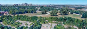
The final additive element on the path is the tower. This serves the purpose of housing a large water tank that supplies the basin and helps store collected rainwater as well as creating an overlook area that looks to downtown Kansas City and the KC Museum.

In the Preservation design, there are two programmatic functions within the reservoir -- the “urban hike” experience of a suspended ramp that winds through the north basin points of interest, and the green infrastructure that is made up by the tower.
The north basin, the focus of this chapter, was designed around a series of experiential and historical points of interest that were chosen based on a number of analytical studies of the basin. The basin was then transformed into a ramp system that could carry the user through these points and provide ADA access to the ground below. It seeks to provide educational and enjoyable experiences through the use of different public spaces and designs along the ramp system.

The north basin ramp can be divided into a series of segments divided based on the experiential points they relate to. The first segment is the overlook. This first portion if the ramp is where you get your first view of and begin to enter the north basin. From this stretch, you can see all of the north basin ramp as well as the activity on the ground plane.
The second portion of the ramp is where the user is brought into the reservoir and carried over a path of existing foliage that helps the user to interact with and experience the existing foliage of the reservoir in its preserved state.
The next portion of the ramp experience is focused on the existing tower that it encircles. This segment also introduces the first of public spaces which allow the user to exit the ramp and touch the ground plane as well as creating gathering spaces for spontaneous activity along the ramp.
The fourth segment of the ramp is all about the rain gardens that are below it. This straight stretch of the ramp houses ‘learning pods’ that look out over the rain gardens below and allow users to learn about the foliage and water cycle that is going on underneath them.
The last portion of the elevated ramp is the graffiti wall experience. This portion of the ramp runs parallel to the all-important slanted graffiti wall that divides the two basins. This was an area that is intentionally preserved not only because of the community’s love for it now, but also as an open canvas for future artists to continue its legacy.
The final experience of the north basin is the transition between the north and south basin. This final stretch is a tunnel-like experience made by the one cut that preservation allowed into the form of the existing basin.

After determining the route of the ramp, the next decision was the form of the ramp. A number of determining factors were compared to decide on how the ramp would be structured in order to best facilitate and respond to the conditions it would experience the most. The first condition that was pertinent to the form of the ramp was the sun exposure. Areas that were shaded were best used as areas of movement and could be more open than areas of full fun. Full sun areas, however were most successful with either an overhead plane to provide shading or tall vertical structures to block direct sun as much as possible.
The study of sun bled into the study of movement vs. rest. Here the form of the ramp was analyzed to note which areas would best facilitate movement and which areas were better structured as areas of rest. It was determined that areas where the ramp extended out to meet the basin of the ground and the ramp segments were shorter were most successful as areas of rest, while longer stretches of uninterrupted ramp that had less abrupt turns and more shade were best served as areas of movement.

Comparing sun and movement allowed the ramp to take form. portions of the ramp meant for movement could have solid, short guardrails that allowed users to move quickly along the path and not get distracted by any specific views. Areas that were meant for rest, however called for a transparent guardrail that allowed users to stop and view a specific key area. The height of the solid guardrail was then manipulated to guide user views along areas of movement. Taller guardrails could be implemented along the path to block a view to a hidden area or to help users focus in on a specific view through a transparent guardrail
The final study and additive element of the ramp was areas of play. Along the ramp, in areas of rest, stairs were added to give users the opportunity to touch the ground. In these areas, playful elements were added to keep the engagement of kids and provide areas of interaction along the ramp. Two slides were also added along the ramp to give younger users a break from the seemingly long path by breaking up longer-spanning sections of the
Grille Sheet Metal
Metal Structural Fin
Western Cedar Cladding
Structural Deck For Cladding
6”X8” I Beam
3”X2” Steel Bracing
8”X8” I Column
10”X33” I Beam
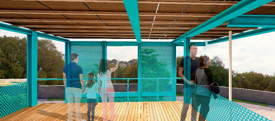
To create a ramp that becomes an experience for visitors traversing its length, we began to address how this ramp would be supported, articulated, and illuminated. The perforated metal sheets that fold and undulate to create the ramp’s guardrails provide safety, but also orient views and control pedestrian intake. While walking the ramp, users will experience a feeling of safety that is a direct result from how the guardrail changes height and transparency while maintaining a uni-body form. To better address the connection between this unibody system and the structure that holds it together
from below, we drew from the existing structure within the reservoir; namely the standpipe tower’s wroughtiron frame. Using columns with cross-bracing at a 12’ interval, a series of snaking structural bays are created that slowly unite the ramp and the bottom of the reservoir. The uni-body guardrail and support structure are two halves of a whole that work together to provide direction for visitors, as well as provide programming in the reservoir. Our goal with structure is to create something that will last, but a construction that is also as easily removable as it was implemented.


 RamptoRoomExtension
NorthBasinFloorPlan
RoomsWithFoliage
ViewFromPlatform
RamptoRoomExtension
NorthBasinFloorPlan
RoomsWithFoliage
ViewFromPlatform


This establishing strip in the north basin serves as a basis for the development of the rest of the elevated pathway. It focuses on the modulation of experiences within the found condition to create an experiential sequence within the reservoir.


The first strip of the reservoir as you approach the first public space integrates all of the guardrail forms and allows users a view of the rest of the ramp they will be traversing. This establishes the path and gives an overall understanding of the north basin of the reservoir at the very start of the experience.

Along the ramp sequence are 3 public spaces that offer users unique stopping points which allow for interactions with the reservoir in special ways. The first public space is an intimate seating moment where lectures, outdoor classes, speeches, performances, and other smaller events can happen. This space is referred to as the storytelling space.
This moment offers a unique connection to nature and due to its narrow form is ideal for activities that require a more quiet, personal experience. Seated individuals face north, and are easily shaded by the sun while performers, orators, or musicians will receive natural lighting and a green wall backdrop of preserved foliage on the basin floor below.
This space takes the form of a reflected amphitheater which allows the space to be used in one or two directions, but can, in certain situations, be used in all directions. Luckily, the mirroring form of the reservoir’s sloped wall that sits directly across from the space helps carry sound back to the seating space and also provides an open space for further seating should larger events take place.

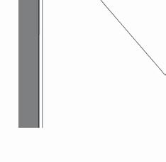
The firm, materials, and structure of the public space is constructed as an extension of the ramp. The columns and beams that hold the metal panels mimic that of the ramp and the lightweight cross brace added to the structure of the steps is meant to play off of the floating experience of the ramp beyond. The continued use of the blue metal mesh also allows users to be enclosed in the space and provided with shade, without blocking all views to the natural landscape beyond the walls.


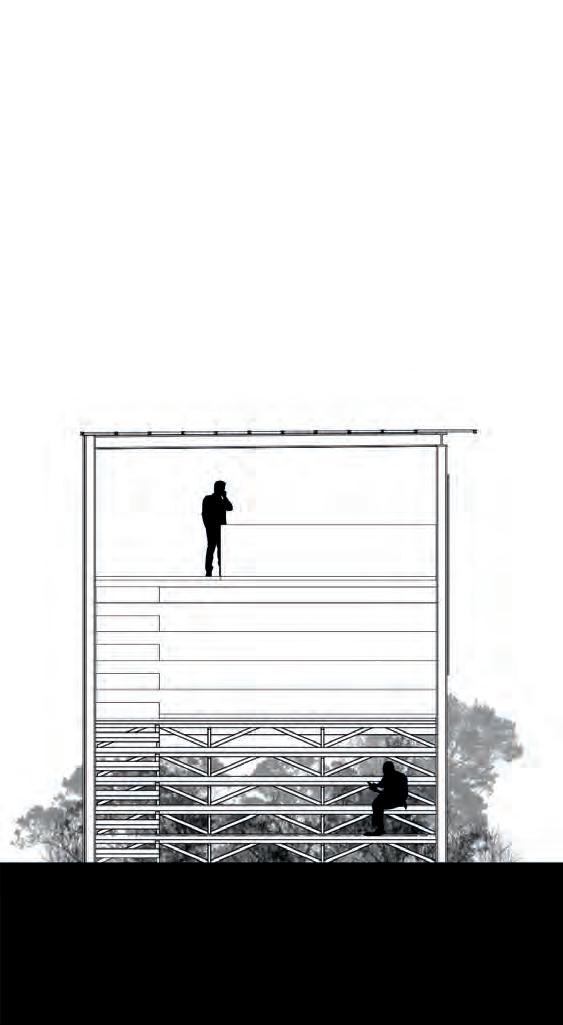
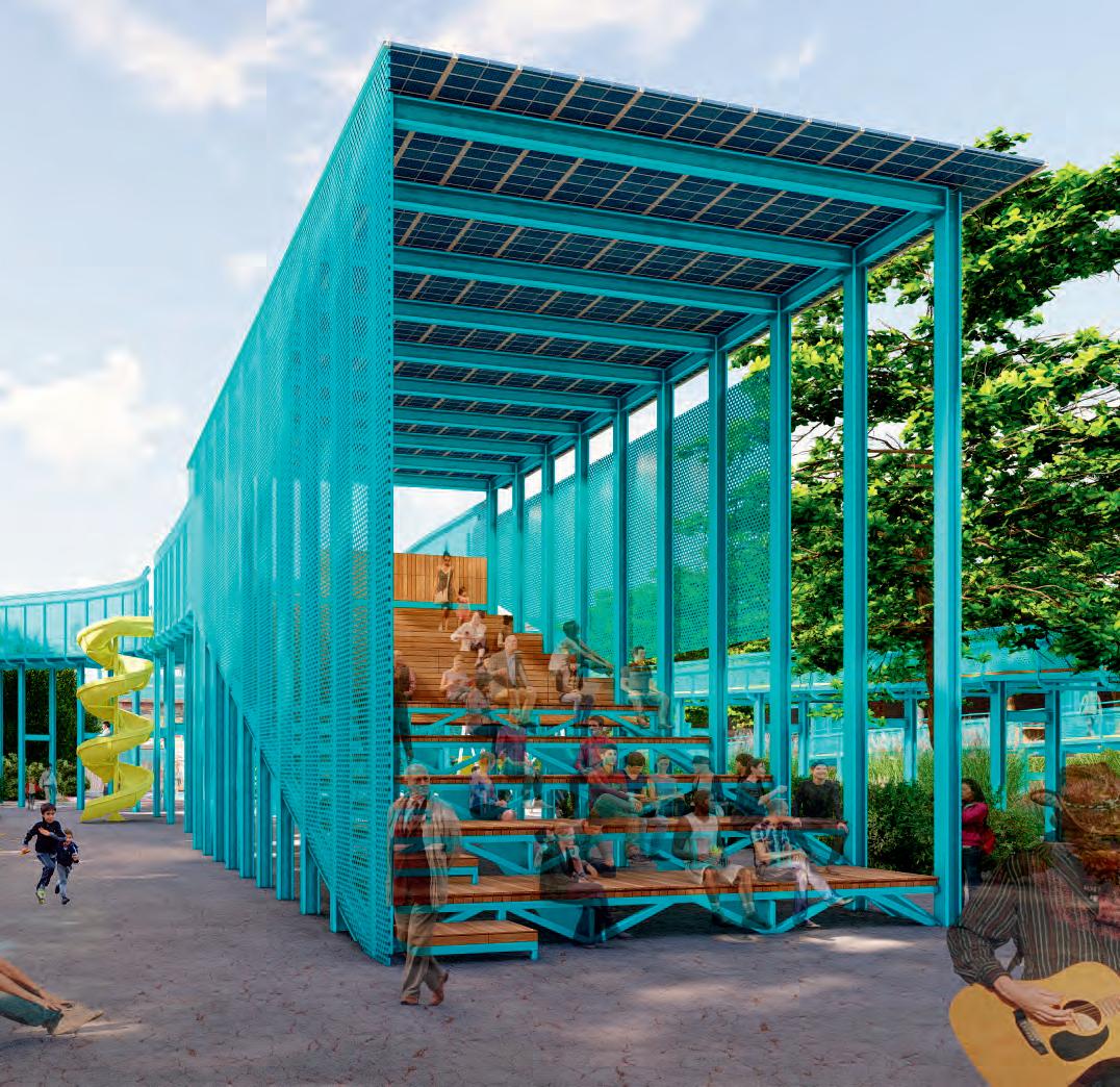
The second public space is more flexible, user-friendly, and extroverted. These attributes allow for exploration and for larger activities to happen. The space accommodates visitors through multi-leveled seating with different materials, which allow for views to performances situated on a stage that sits directly adjacent to the space.
Overall, Public Space Two stands as a larger more outwardly-drawn connection between ramp and reservoir. This space is referred to as a public expression space. Centralized in the north basin and acting as a focal point within the urban hike experience, this public space is meant to also hit on some of the reservoir’s historic use. Its location lends credence to the now removed standpipe tower that once stood in the center of the North Basin.
Being the largest of the public spaces, this space seeks to respond to and interact with the user the most of the 3 spaces. It integrates into its form multiple playful elements such as a hanging woven seating area, climbing wall, and slides that make this space useful as a playground as well as a seating area for performances. It sits in the center of the north basin and acts as a focal point to all of the ramp surrounding it.
Similar to public space one, Public Space Two uses an open structural form and materials that mimic that of the ramp. This Space however, integrates new playful elements throughout that are added in a bright yellow to draw users’ attention and bring brightness to the space. This space also differs from public space one in its overhead plane as it leaves some areas open to the sunlight above. In this space the sunlight is welcomed to brighten the playful elements and keep that space feeling less enclosed.


The final public space along the ramp takes users closer to our rain gardens and provides them with three opportunities to stop and learn about how the rain gardens work. The rain garden is broken up into three sections, each with a different purpose to support Kansas City’s current initiative to introduce the city into the monarch butterfly corridor, each of the three pods supports a different wildlife habitat -- hummingbirds, monarch butterflies, and native grasses. This area of the reservoir is primarily reserved for educational experiences and a chance to safely
interact with wildlife during their annual migration, as well as local flora and fauna that help filter rainwater. This space is referred to as a learning opportunity space.
Working in tandem with each of the rain garden spaces above are intimate learning pods that provide the user with seating and an info graphic on the use of the space, the way it functions, and its benefits to the community.

This transitional opening is the only subtractive alteration to the reservoir edge and allows for a physical connection between the two basins, which is framed by the graffiti wall above. Because we first and foremost are setting out to preserve as much of the original reservoir’s form and structure as possible, we only allowed ourselves one design move that alters the original form. A trapezoidal tunnel now connects both the north and south basin and better facilitates pedestrian and resource movement throughout the entire reservoir.
Immediately following the north basin, the south basin represents a more open flexible space that directly serves the larger scale programmed spaces for largescale community events. The south basin elements also all work together cohesively to create a water collection, storage, and use system that feeds the programmatic purposes and provides further learning opportunities for visitors.

Ponding
Rain Gardens were implemented to function as a space for reflection, learning, and water collection within the reservoir. With access to water in the ponding area, community initiatives such as the KC water educational programs can take place here. As seen in the rain garden concept plan, the rain garden extends from the north basin to the south basin, but is used and organized differently in each basin.
The rain garden in the north basin is organized in a linear manner, to support the three sections and purposes mentioned within the explanation of Public Space
Three. The rain garden in the south basin, however, is organized in an organic manner, to allow handson learning and experiences within the rain garden. This space would support the community water education programs, as well as a regional draw for educational purposes.

In the rain garden, intentional ponding is created and then surrounded by flowers and plants that were hand selected with the need for low or partial shade, providing a unique learning experience within the basin. While the north basin rain garden has specific sections of plants for their topic of education, the south basin is vegetated with a blend of native species. Water collected here is filtered through the ground and collected by a large perforated pipe that sits in the soil below, this then runs to the living wall to run through another system of filtration and feed the living wall vegetation with water. After this cycle, water is then stored in the tower beyond, where it can be used to support the amenities and upkeep of the other foliage.


The collection of water within the south basin heavily relates back to the original intentions of the reservoir by integrating water back into the purpose of the basin. Not only does it serve a historic purpose, but also helps to maintain and create some of the programmatic uses within the south basin.
Through a series of pipes, water is collected from the rain gardens, pumped up to the top of the living wall that covers the ADA ramp up the tower, filtered in the living wall vegetation, and then stored in the
water tank that sits inside the centrally located tower. If needed, the water tank is then also able to pump water for irrigation purposes back to the rain gardens and regularly pumps water into the restrooms and the back of the basin for use as both a splash park (in the summer) and ice skating rink (in the winter).
As the north basin ramp continues into the south basin, it picks up again within the living wall. After water flows through the rain gardens, it is pumped up to the top of the living wall. From there, water is dispersed throughout the vegetation. A collection of stacked planters run from top to bottom of the wall. Each planter is filled with different layers of substrate that act as a filter for the water. Water falls from one planter down to the next before a collection pipe pumps the water to its final destination, the water tank
Within the tower, there are restrooms and a large water tank that supports the water management system. Inside the tower is a 44,000 gallon water tank that collects water from the rain gardens/bio-filter wall and uses it. Water coming from the reservoir is pumped up again to the top of the tower and poured into the tank for storage and use. The funnel-like shape of the tank then uses gravity to give water to the basin below.
DRY SEASON (30mm weekly average)
30mm = 1
average
1 gallon/7 days = 0.14 gallons (0.14gallons)(30days) = 4.2 gallons
WATER
TOILET (1.6 gallon EnergyStar) (1.6gallons)(30 daily uses) = 48 daily gallons (48gallons)(30days) = 1,440monthly gallons
FAUCET (2gallons/mnts) (2gallons/mnt)(30daily uses) =160 daily gallons
AVERAGE KITCHEN WATER CONSUMPTION:
FAUCET
a living machine, the south basin is meant to collect and circulate all of the water and energy it needs on its own. In doing so, events can be held and spaces can be used without too much added cost to the city and its residents.
order to ensure the reservoir can collect and store enough water to maintain itself, calculations were done on the collection potential of the basin and compared to average uses.

was concluded that the south basin can collect
water yearly to sustain itself and still have
of water stored in the tank for
This store can then be carried over to drier
and used when rainfall isn’t as consistent.
Experiential Points
Primary Axis

Experiential Points
Center of Space
Primary Axis
Backdrop Weather Protection Water Use/Collection


Flexible Traffic Flow Privacy


FT.
16,723 SQ.FT

FT.
9,027 SQ.FT
SpatialOrganization


1,913 SQ.FT
The south basin, much like the north, was based on a series of experiential points. These points were centered on the foliage, the existing tower, and the cracked form of the southern half of the basin. These points then divided the space up geometrically into four primary volumes that would become the rain gardens, tower and ramp, amphitheater space, and flex space.
1,913.22 SQ. FT.


The organization and geometry of the basin allowed for the spaces to be physically divided from one another, but also always visible to at least two other spaces. The visual connection between spaces was designed to ensure an open environment that could cater to a variety of events as well as create free security by ensuring no one place was too secluded from all others.


PV Panels
Translucent
Vegetation/Water Filtration


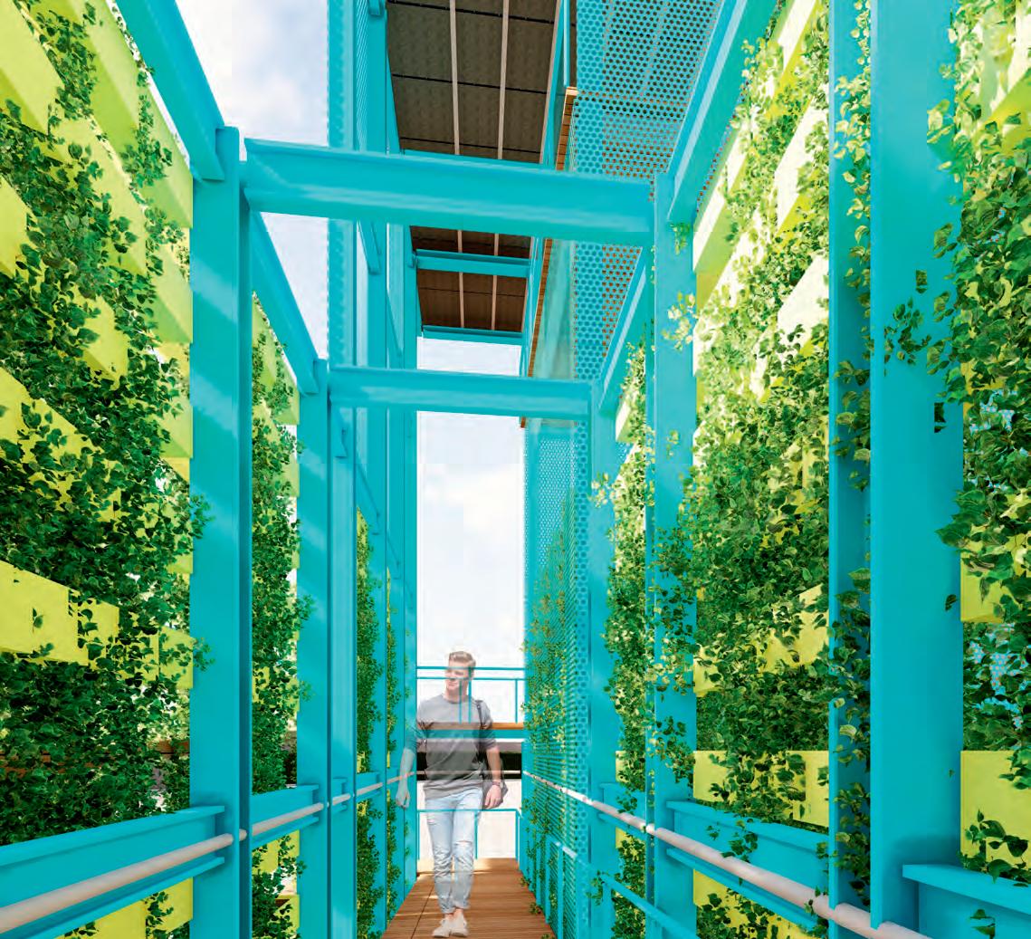


As the north basin ramp continues into the south basin, it picks up again within the living wall. This wall functions as a spiraling ramp to bring park visitors up to the same level as the top of the reservoir’s wall. Not only is it functional in the form of water filtration, it also serves as a clear datum line to the reservoir. The vegetation the fills in the steel form gives users a break from the harsh steel form of the north basin ramp while again continuing the same structural language giving the basin it’s own identity while still connecting it to the north basin experience.


For those who wish to take a more direct route than the ramp, there are also stairs within the tower that spiral around the water tank. Either path, the stairs or ramp allows visitors an up close and personal experience with the water system within the south basin. Both also bring visitors to the level of an exit path that extends to the edge of the basin.
The experience as you move through the tower is very intimate. The staircase is narrow, bringing the user close to the water tank and using reflective materials to play off of the shadows and light of the metal sheets that make up the tower cladding. This gives the tower a semi-transparent form that invites users, but leaves a bit of mystery to the tower’s form and use.
 WaterTowerInterior


 ViewstoKCMuseum
TowerViews
ViewstoKCMuseum
TowerViews
Not only does the tower serve as storage and a learning opportunity as you travel up the stairs, but the rooftop also serves a purpose. At the top of the tower is an overlook point where 360 degree views of the city are created. Here, there are two main views that are framed by the form of the roof and datum wall beside the tower.
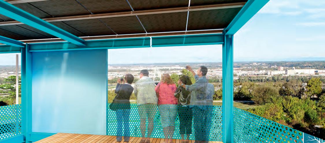
The primary views that are framed by the tower are the views to downtown Kansas City and a direct view of the Kansas City Museum. The 360 degree visual access to the park and city beyond help to celebrate the historic location of the park and orient users in the city.


The height of the tower also acts as a beacon from outside the reservoir as it extends above the reservoir walls and sits as the only element from inside the reservoir that can be seen by park users from outside of the basin.


For night and daytime events, the south basin of the reservoir allows for multiple community events. The amphitheater space that sits behind the tower activates the basin at all times of day. With an LCD screen, stage, and ample sitting and standing room, the amphitheater opens itself up to large-scale events that could bring economic value to the reservoir.
When not in use as a concert space, in the daytime the amphitheater space can then be filled with a few inches of water from the storage tank and used as a splash park through the use of small hidden jets embedded in the concrete or as an ice skating rink in the winter when the water freezes over.

On the back facade of the tower, connected to the exit walkway, there is a sliding LCD screen that can be used as a backdrop for community events, plays, or concerts. It can also function as a screen for movies or videos as neighborhood events of community events to bring in revenue for residents.
In front of the screen, sits a stage that can be used for flexible community events while allowing for ample open space for picnics, roaming, or conversation on the basin floor beyond.
The sliding function of the screen further ensures that the space can be flexibly used for multiple events. If the screen is not needed, but the space needs to be more enclosed, it can slide to cover the rain gardens and further enclose the amphitheater space. It can also be used to obscure the view of a large lift system that is connected to the exit walkway to allow for the raising and lowering of large equipment onto the stage or into the amphitheater space.


When the amphitheater space is in use as a performance space, the slanted basin wall can be transformed to house custom seating that sits into the grooves of the brick pavement. The seats are lightweight and portable and can be placed by visitors anywhere along the slanted wall to view the performance.

DN
50% of Slope (Obscure View of Screen)
50% of Slope (Screen Viewable) 27% of Slope (300 People)

The splash park element of the open amphitheater space allows some respite from the heat and sun in the south basin. Since the south basin is less filled with existing foliage and the slanted walls along the southern edge of the basin are bare to make room for event seating, the summer sun can raise the temperature of the concrete and the surrounding program to unpleasant levels.
To fight this, and as an extension of the water
management system, the splash park was added for daytime use. This, combined with the soft-scape of the rain gardens helps to reduce the heat island effect within the south basin and cool off visitors.


does this design scheme allow the


be
but it is also designed to be
With the integration of photo-voltaic panels, the equipment and amenities within the reservoir are able to be self-powered. These include a water pump in the south basin tower, equipment lift tubular motors, lights, and the LED screen. By using Building Integrated PV panels, we are able to utilize the PV’s


way that acts and supports the enclosure of spaces. The backsheet of the modules are solid to also act


where needed. These PV panels are integrated on most horizontal shading planes on the public spaces in the north basin and roof of the overlook in the south basin. The quantity of electricity collected by these panels actually exceeds the amount the reservoir should use. As such the reservoir can then give back to the grid to help bring income and to serve the nearby residences that may need help.

Since this project serves as a framework for the possibility of redevelopment of the reservoir, we’ve organized the elements and their construction into four phases. The first phase is to begin implementing the changes to the park around the reservoir that are proposed by the masterplan.
The second phase of the project would by to prepare the reservoir structure for new elements and begin work on the base ramp. The ramp can be used as a park in the space independent of other elements and sustain the reservoir until funds are available to continue work on further developments.
The third phase develops the other programmatic elements in the reservoir. This includes the public spaces, tower, living wall, and beginning work on the rain gardens. This is also the phase where the water system piping would be laid and the reservoir would begin collecting water. Once this phase is complete, the reservoir can function as both a neighborhood park and a space for education.
The fourth and final phase would propose finalizing the amphitheater space and installing the PV panels to all overhead planes. Once this phase is complete, the reservoir can begin being used as a city event destination as well as a neighborhood park space.
