F127452 2022-2023 22CVB075
PORTFOLIO ONE
Klaudija Lukosiunaite
DEVELOPMENT
Introduction
The Kinder Scout Mass Trespass
Quarrying in Derbyshire
Legislation & Long-term Planning
Stakeholder analysis
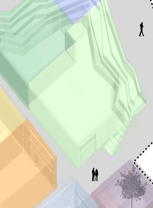
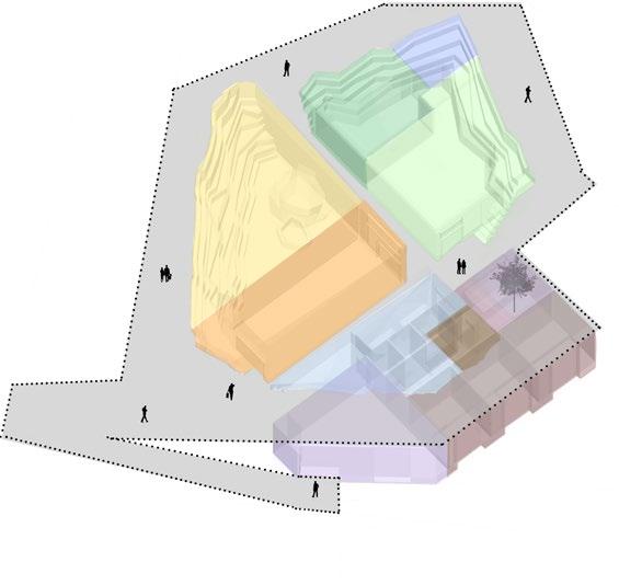
Site Analysis
4 Potential Site Locations Analysis of Sites Potentials
Site Strategy
Typology Study
Precedent Studies
5 Big Ideas Site Concept
Building Form & Concept
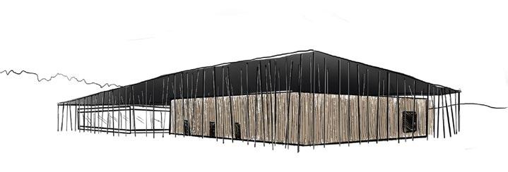
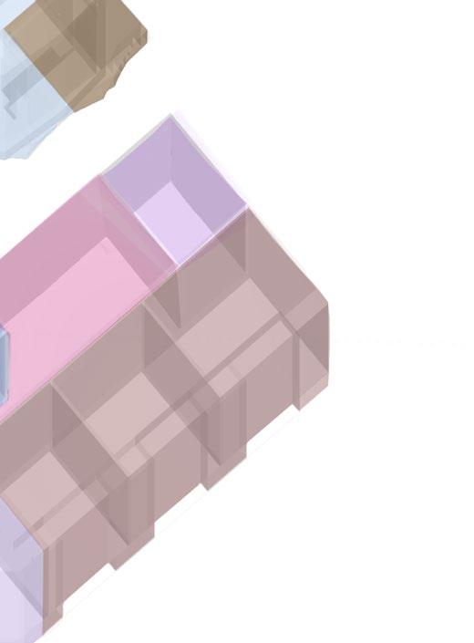
Massing Model Spatial
FINAL DESIGN
EXPLORATION
DEVELOPMENT
FINAL DESIGN
CONTENT 01 RE-QUARRY 02 DREAM LAB. 01 RE-QUARRY 02 DREAM LAB
EXPLORATION
Programme Review Site Plan Site Elevation Building Floor Plans Steps & Viewpoint Plan Building Elevations Building Sections Building Isonometric & Interiors Viewpoint Perspectives Site Model & Building Model Introduction Brainstorm Contextual Analysis Study on Sleep (Dreams) Precedent Studies
Site Strategy & Form Programme Site Plan Birds-eye View & Narrative Eye-level Views Roof Intervension: Control Room Sleep Pods A1 Poster References 03-04 05-06 07-08 09-10 11-12 13-14 15-18 19-20 21-22 23-26 27-28 29-30 31-32 33-34 35-36 37-38 39-40 41-42 43-44 45-46 47-48 49-50 51-52 53-54 55-56 57 58 59-60 61-62 63-66 67-68 69-70 71-72 73-74 75-76 77-78 79-80 81-82 84 01-02 83
Concept Deep-map
Introduction:
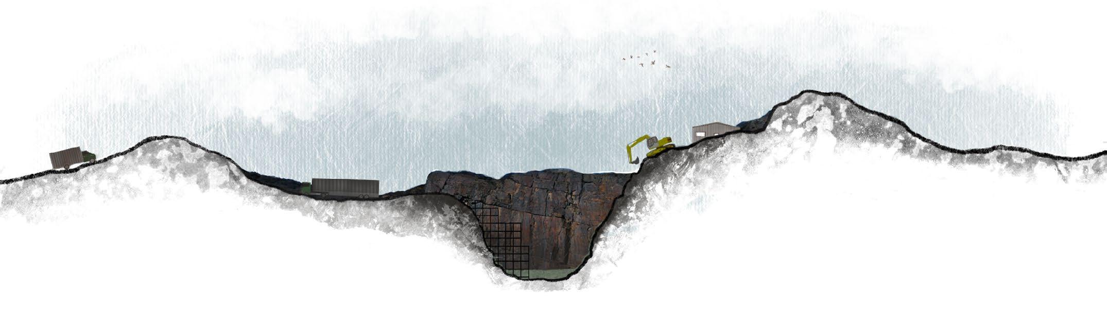
Since the dawn of civilisation, minerals have shaped cultures, communities and economies. Across the globe, mining has witnessed unprecedented growth as an industry, generating wealth, employment and opportunities - which we do not see declining any time soon.
What remains a concern however, is how the many landscapes used for mining remain abandoned and left to degrade after mineral extraction is terminated, becoming dangerous sites with restricted public access - almost as a way to masque the damaged caused.
We use our materials not thinking where they come from, expecting our buildings to be constructed on scenic undisturbed landscapes, ignoring the issues that consequently lie beyond the site boundaries - in a quarry.
Desire for Nature Vs Demand for Steel
The dirty secret: Architects contribute to the creation of quarries to source their materials, to which the consequences of are often overlooked. Architects must admit to their raping of the land.
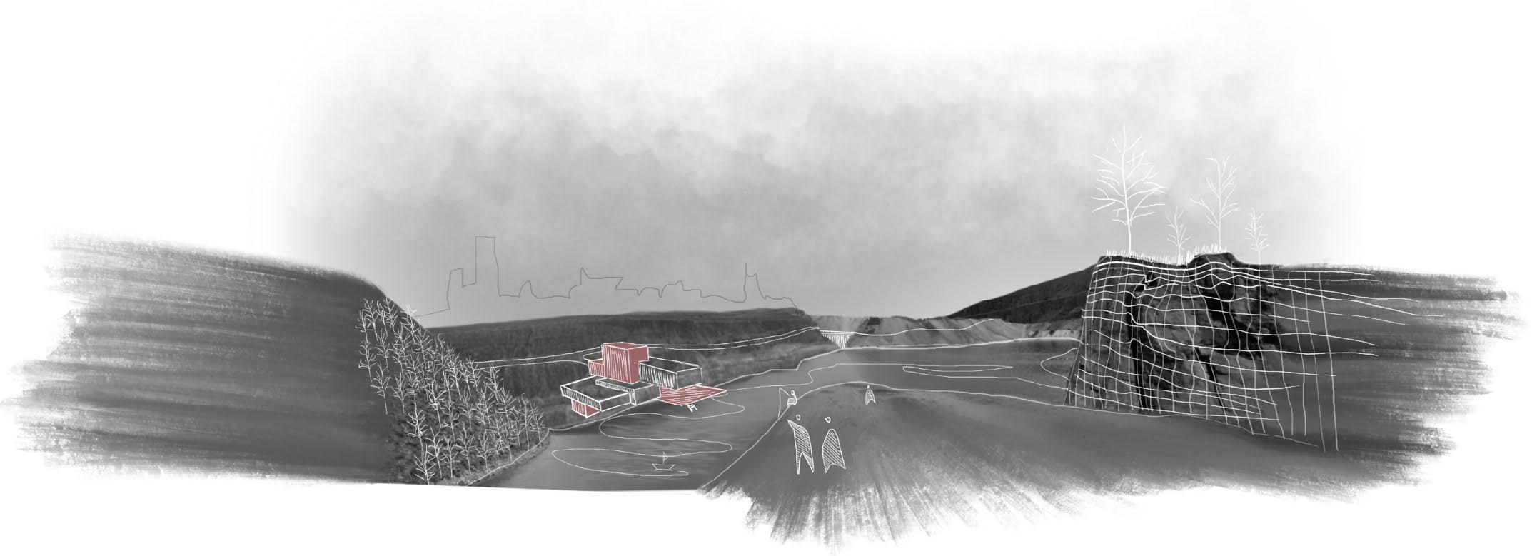
This project is a catalyst to Re-think, Re-imagine and Re-design condemned quarries before they are in the making - by creating them within controlled environments, then using them as spatial resources for education, development and recovery.
01 RE-QUARRY
[01] [02]
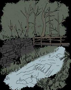
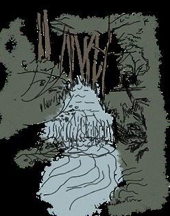
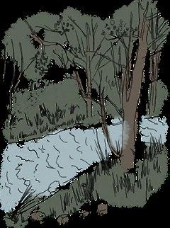
History of the Trespass:
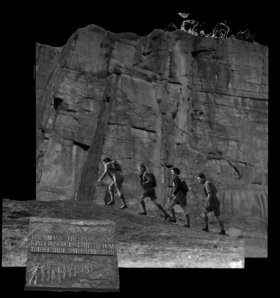
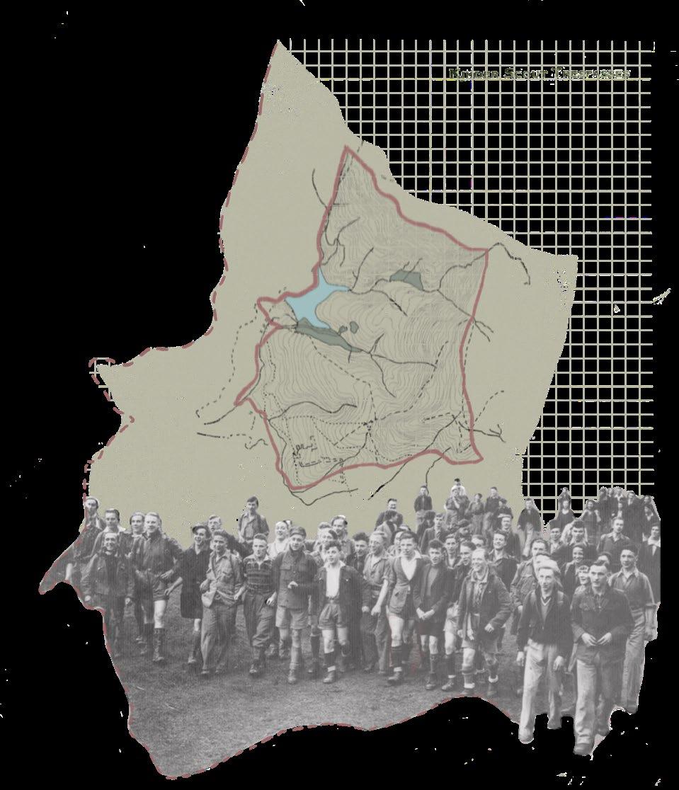
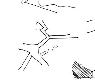
In April of 1932, members of the Young Communist League of Great Britain took moral action against the public denial of access to areas of open countryside in the UK.
The Plan of the mass trespass was for ranblers from Manchester and other places in the UK to meet at the Kinder Plateau. They illegally ventured over moorland, hills and valleys, which have now become known to be known as the Peak District National Park.
This event also brought about the Right to Roam legislation, which allows anyone to walk the open countryside - which has only more recently come into effect across the whole of England and Wales on the 31st of October, 2005.
Project Reflection on the Mass Trespass:
The area of Hayfield has reputation for tough moral questions. in the 1930’s there were questions on the ownership and access to the land, which now perhaps is shifting towards the stewardship of the land - how we are excavating for building materials though not having an audit of those materials, their carbon footprint and the moral labour.
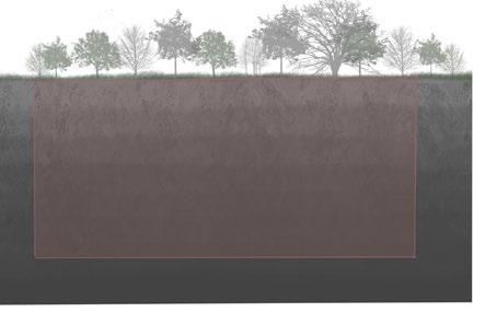
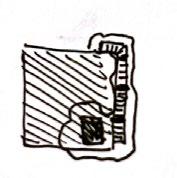
The valleys of Hayfield host former quarries (the car park and campsite for working stone). The Peak District, known for it’s remarkable natural landscapes has multiple existing quarries, providing a strong example of how scenic landscapes have been damaged for their minerals, causing habitat and vegetation loss.
The response this project takes to the mass trespass is that they acted morally to public access of the land, so we must also act morally towards the stewardship of the land (by pre-planning the restoration of quarry’s before extracton).
4
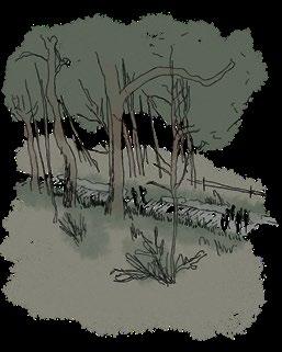
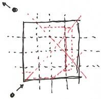
[EXPLORATION] THE KINDER SCOUT MASS TRESPASS
[03] [04]
(Figure 1)
(Figure 2)
[EXPLORATION] QUARRYING IN DERBYSHIRE
5 Proposed Quarry’s in Derbyshire:
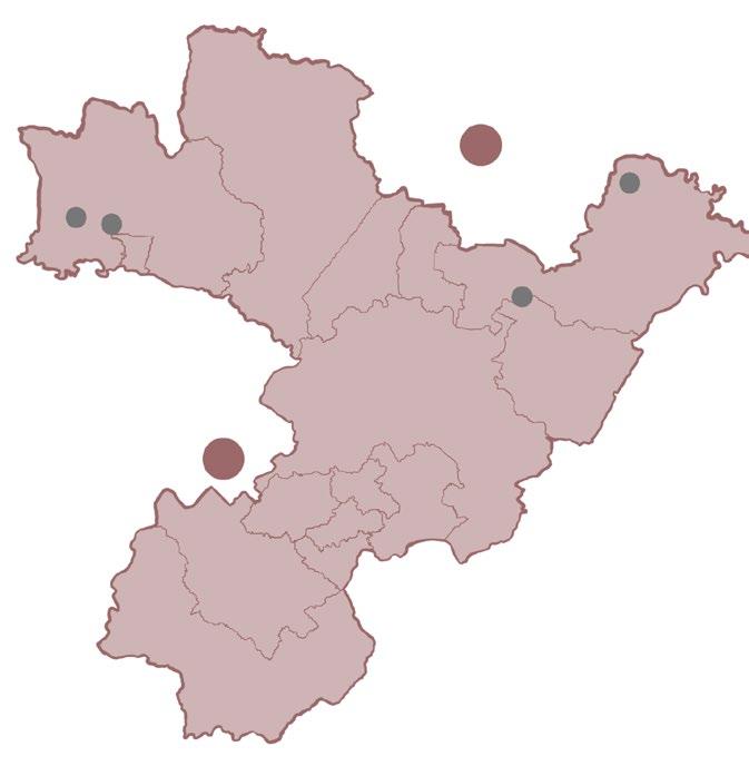
South Derbyshire is planned to have 5 large new quarry’s in the towns of Elvaston, Swarkestone North, Swarkestone South and Foston as part of a plan to mine for about 13 million tonnes of sand and gravel.
If the proposal is approved, these quarrys will operate up till 2038.
With no mention of post-quarry planning or re-purposing, these sites will likley become dangerous, inaccessible landscapes that have experienced habitat and vegetation loss.
Existing Quarry Repurposing:
Building Proposal
Water Feature
Re-Planting
Viewpoints
Derby
Foston
Sudbury
Burton on Trent
Swarkestone South
Swarkestone North
Elvaston
[05] [06]
[EXPLORATION]
LEGISLATION & LONG-TERM PLANNING


‘Agent of Nature’ Proposed Legislation: Long-Term Planning of Quarry:
‘Right to Roam’ Legislation (2005) -> ‘Agent of Nature’ Legislation


The architect contests the law over the use of the land by being a mediator between those requiring the minerals (such as construction and/or fuel companies) and the local council.
1. Local council & quarrier’s present their list of needs/ requirments
2. Architect spends time with the locals to understand their needs
3. Architect works with quarriers, engineers and geologists to preplan site landscape and building proposal
4. Architect lays out quarry site dimensions
5. Quarrying commences with resposible exctraction
Planning Requirements:

Local needs must be addressed in the design proposal
Water run-off checked to be of acceptable quality
6. Some material is stored for construction (such as rock for building cladding)
7. As material leaves, food waste compost from landfill returns with material for soil replenishment
8. Water run off is checked and ensured not to be toxic
9. Once quarrying is completed in section, excavated walls are reinforced (geotechnical reinforcement)
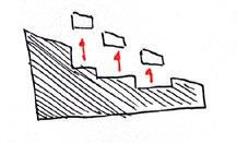
10. Sites where soil replenishment has taken place are sectioned off for planting and species repopulation
Step-by step designated spaces for planting and species re-population
Necessary materials to be stored for re-use in proposed construction
Aesthetic Consideration of quarry and proposed building
Construction/ Fuel company
[07] [08]
Local Council Architect
[EXPLORATION] STAKEHOLDER ANALYSIS
Identifying Stakeholders: Prioritising Stakeholders:
Public and Private:
Quarry Operatives Hayfield Parish Council Architect(s)/ Engineer(s) Long-Term Planning 3 4 5 1 2 6 8 7 9 Local Stakeholders: 1- Students 2- Hayfield Parish Council 3- Local Businesses 4- Local Residents 5- Quarry Operatives 6- Architects/ Engineers 7- Hikers/ Ramblers 8- Farmers 9- Campers Visitor Center Visitor center Funders Construction Employees Hayfield Parish Council Historic England (GIA) - Landowner Students Visitors Historians Tourists Local Population Scout Groups Hikers Ramblers Contractors Engineers Quarry Operatives Geologists Architects Darbyshire Wildlife Tour Guides Restaurant staff Management Cleaners Receptionist Security Landfill & Waste
Public Private Hikers Scout Groups Local Population Tourists Historians Students Ramblers Hayfield Parish Council Historic England (GIA) - Landowner Security Receptionist Cleaners Management Restaurant staff Tour Guides Architects Darbyshire Wildlife Landfill & Waste Geologists Quarry Operatives Engineers Campers Campers Farmers Other Farmers Local Businesses Local Businesses Hayfield Sites Location Direct Indirect Hayfield Parish Council Historic England (GIA) - Landowner Architects Darbyshire Wildlife Quarry Operatives Hikers Scout Groups Local Population Tourists Historians Students Ramblers Campers Farmers Local Businesses Security Receptionist Cleaners Management Restaurant staff Tour Guides Architects Landfill & Waste Geologists Engineers [09] [10]
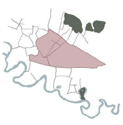
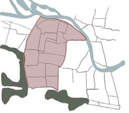
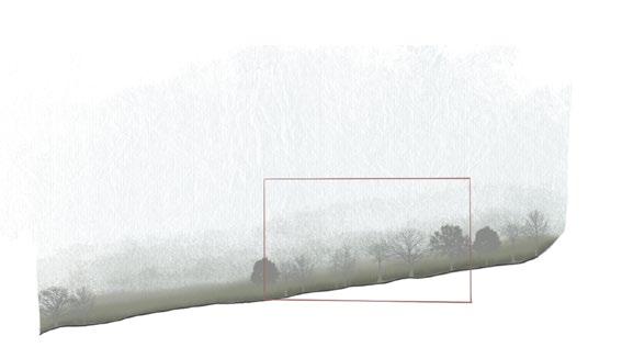
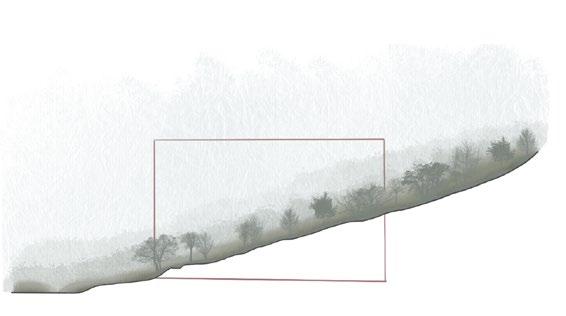
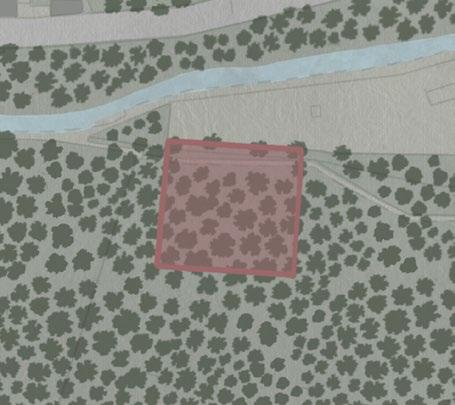
[EXPLORATION] SITE ANALYSIS
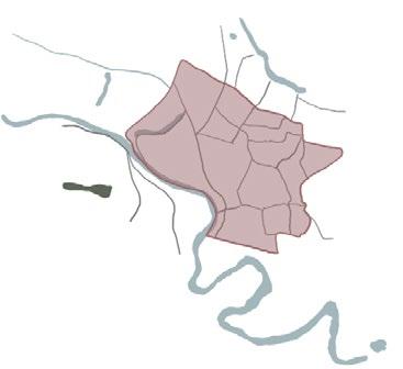
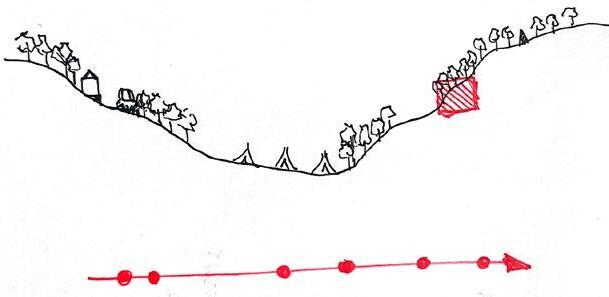
Hayfield Campsite - Breakdown: Hayfield, Derbyshire:
The 4 Sites
Structures
Roads & Paths
Vegetation & Trees
Water Systems
Topography
Sun Path
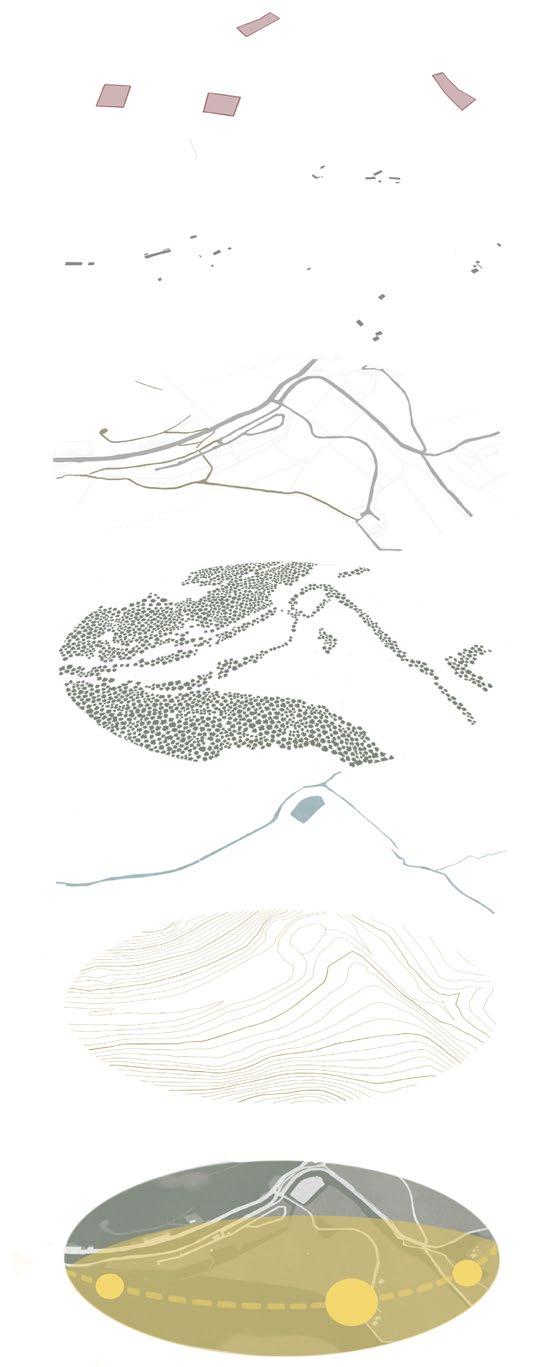 Hayfield Town Hayfield Quarry Site
Campsite Former Quarry [11] [12]
Carpark Former Quarry
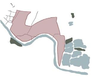
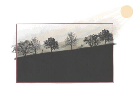
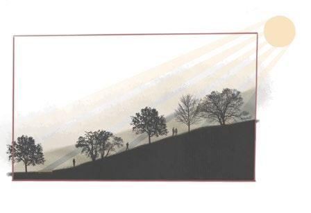
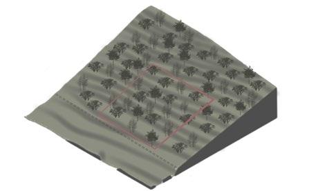
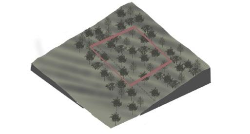
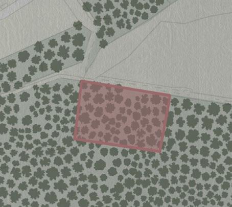
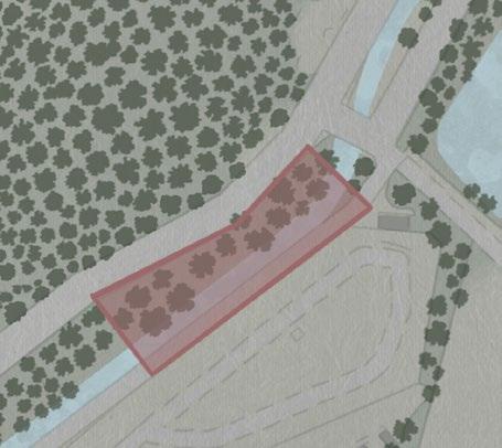
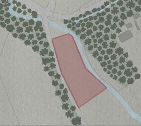
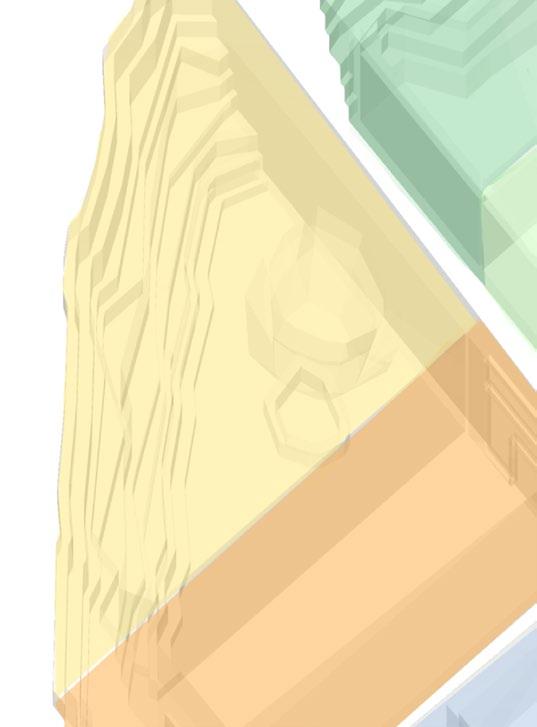
[EXPLORATION] 4 POTENTIAL SITE LOCATIONS
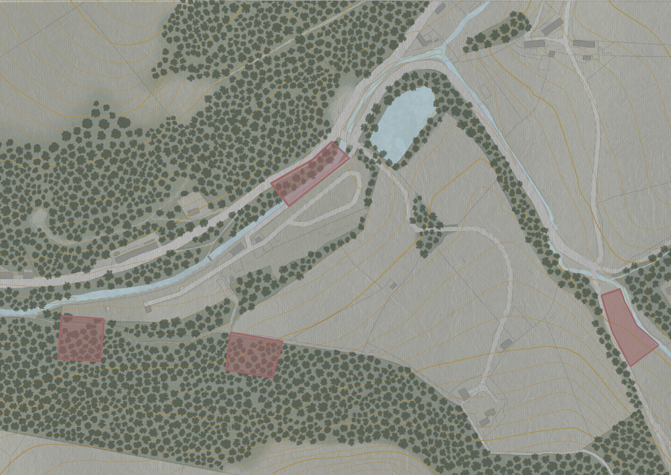 Site 1
[Chosen Site] Site 2
Site 4
Site 1
[Chosen Site] Site 2
Site 4
[13] [14]
Site 3
[EXPLORATION] ANALYSIS OF SITES POTENTIALS
Site 1: Sett Bank View
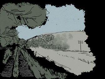
Site visit sketches:
S W O T
- Peaceful and private (away from civilization)
- Abundant in vegetation (biodiverse)
- Hiker-friendly due to adjacent path
- Forest views
- Access to natural light from fields in north
- Challenging topography as well as obstructive trees
- Steep incline creating difficulty to climb to top for non-hikers
- Proximity to camp site makes it prone to noise and constructions/ a new building on this site could cause disruption
[Chosen] Site 2: Elle Bank
- Most immersed in nature, makes site appealing and invites people away from civilization
- Appeals to hikers as main stakeholder
- Can be used as a center for hikers to address their needs
- Can implement accessibility options through design proposal

- Surrounding trees may need to be removed (can disrupt ecosystem)
- Loose soil can be slippery and pose as a hazard
_ Steep topology may mean excavations could be neccesary

Site visit sketches:
S W O T


- Open area and lots of natural light
- Open field to north provides views of countryside; site is higher up providing multiple views
- Hiker-friendly path adjacent to site
- Long journey from car park and main road makes site less accessible
- Lacks some natural elements; far from lake
- Not the most biodiverse site, in terms of its vegetation variety
- Challenging topography (steep)

- Appealing to hikers as main stakeholder
- Comparatively, the land & soil is the easiest to build upon and hike
- Requirement to form new connections of access to site could influence design proposal
- Building into the challenging topography could ruin soil; lead to soil erosion
- Excavation may be necessary to even out site for construction (can harm biodiversity and vegetation)
Prevailing Winds Sun Direction Prevailing Winds Sun Direction Site Boundaries Site Boundaries [3000.00 sqm] 120 m 120 m
[3000.00
sqm]
[15] [16]
[EXPLORATION]
Site 3: Kinder Stones
ANALYSIS OF SITES POTENTIALS
Site 4: Kinder Road
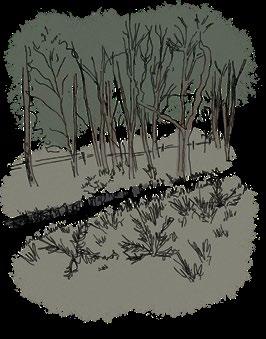
Site visit sketches:
- Most accessible site (nearest to car-park, main road, hiking path)
- Natural elements such as waterfall and adjacent lake makes it appealing
- Nearest to Kinder Stones (historical element)
- Mix of open and tree-dense spaces (sunlight & shade)
- Public space; more noise from roads and civilization
- South sunlight blocked by trees
- Has a random telephone pole which forms a hinderance to views of countryside
- Can address a variety of stakeholders, due to its accessibility
- Its historic value is there due to proximity to Kinder Stones
- Conceptual design could be inspired by the natural elements of the site
- To provide some extra space for construction, some trees may need to be uprooted which could disrupt the natural environment
Site visit sketches:
- Dense tree coverage at north of site provides natural shade and still recieves lots of daylight from south sun
- Site overlaps waterbody (sounds from river and nearby lake form additional natural element)
- Easy access for campers due to proximity to campsite
- Closest site to car park
- Lacks sunlight (open area is north facing, trees block sunlight at south)


- Lakcs views of countryside
- Vehicle noise from surroundign civilisation
- Loose, wet soil can be a hazard
- Lake and river could be directly implemented to design concept (forming interactions with the natural elements)
- Surrounding trees may need to be removed, disrupting ecosystem
- Loose soil is slippery (posing as a hazard)
Prevailing Winds Sun Direction 80 Prevailing Winds Sun Direction Site Boundaries Site Boundaries 120 m 120 m
S W O T
S W O T
[3000.00 sqm] [3000.00
sqm]
[17] [18]
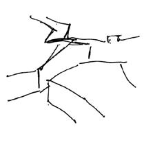
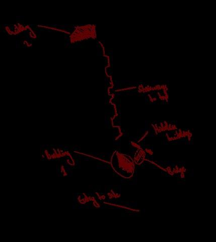
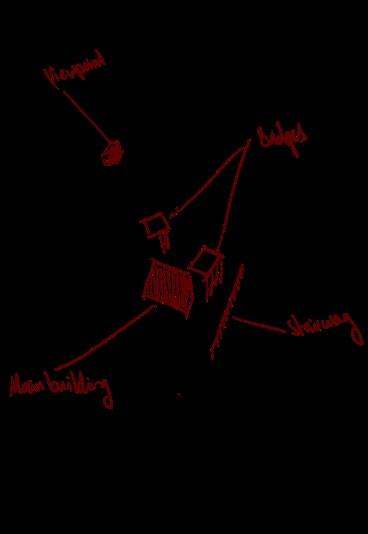
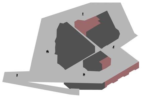
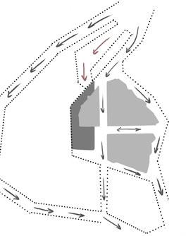
Site Strategy Mapping:
Site Strategy Evolution:
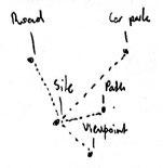
Defining and Connecting Points of Interest:

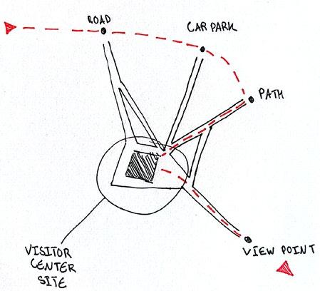
Defining Access Route to Site:

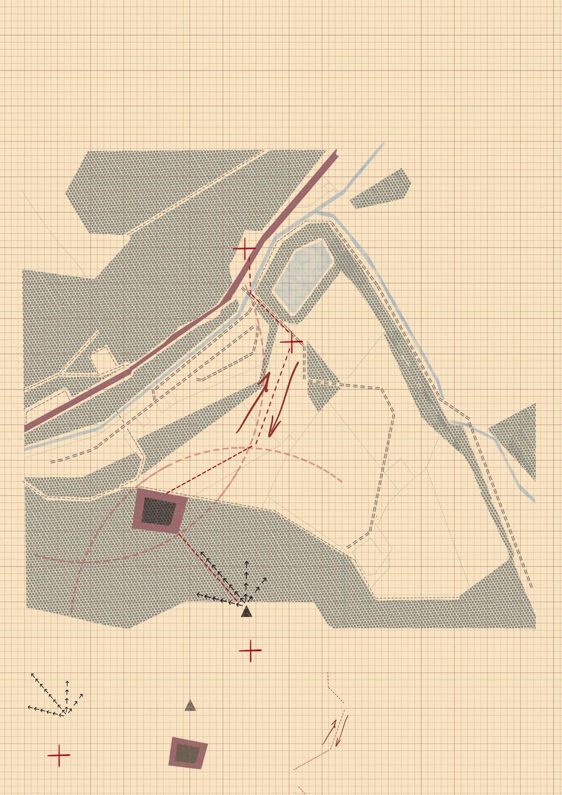
Site Access in Elevation:
Main Road Camp Site Site Viewpoint
Site Strategy Summary:
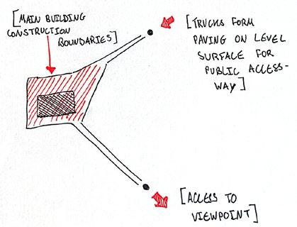
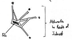
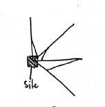
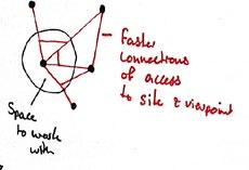
My site stragy begins by hilighting what locations form ways of access that could direct users of the visitor center towards the site, which became by points of interest.
Key: Initial Truck, to Then Pedestrian Access
Views Building Site
of Interest
Viewpoint
Following from this, I was able to identify the best access route from the main road, carpark, through to the site and then eventually up to the sites viewpoint.
This access route will first be layed out during quarry development (as trucks enter and exit the site). Which will the, be evened out and paved once quarrying is complete, forming a level path of access to the visitor center.
[EXPLORATION] SITE STRATEGY Points
Road Camp Site Site Viewpoint Car Park Pathway
Buildings
Main
[19] [20]
[EXPLORATION] TYPOLOGY STUDY
Typology: Existing Visitor Center Examples:
Wenchuan Earthquake Memorial Museum:
Basic Form: Developed Form: Final Sketch:
Colours & Materials:
Slate Corten steel Surface material and planting
Stonehenge Visitor Centre:
Programme:
- Green spaces
- Museum
- Service spaces
- Open-air facilities
Basic Form: Developed Form: Final Sketch:
Colours & Materials:
Timber Glass Steel
Programme:
- Multi-media displays
- Exhibition space
- Shop
- Cafe
De Oostvaarders Nature Education Centre:
- Changing rooms
- Car-park
- Green areas
Basic Form: Developed Form: Final Sketch:
Colours & Materials:
Glass Prefab
Timbered pinewood
Programme:
- Small exhibition space
- Restaurant
- Panorama
[21] [22]
(Figure 3)
(Figure 4)
(Figure 5)
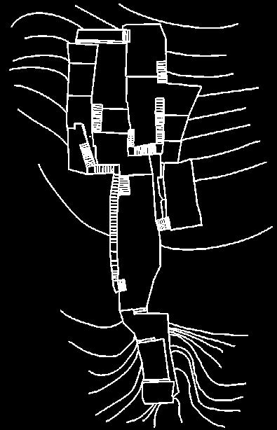
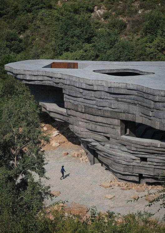
Quarry Development: Zhejiang Abandoned Quarries
Architects: DnA_Design and Architecture
Year: 2022
Area: N/A
DnA Design and Architecture studio explores the reuse of a series of abandoned stone quarries in the Chinese Province of Zhejiang as new public cultural spaces. The project demonstrates how “interrrupted” natural environments (such as quarries) can be made functional - by providing access for people to roam the carved landscape as opposed to constructing new public spaces on scenic, un-interrupted landscapes.
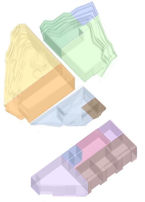
Models From Precendent Study:
Concept for Abandoned Quarries:
Plan of Quarry No.8:
Perspective from Ground:
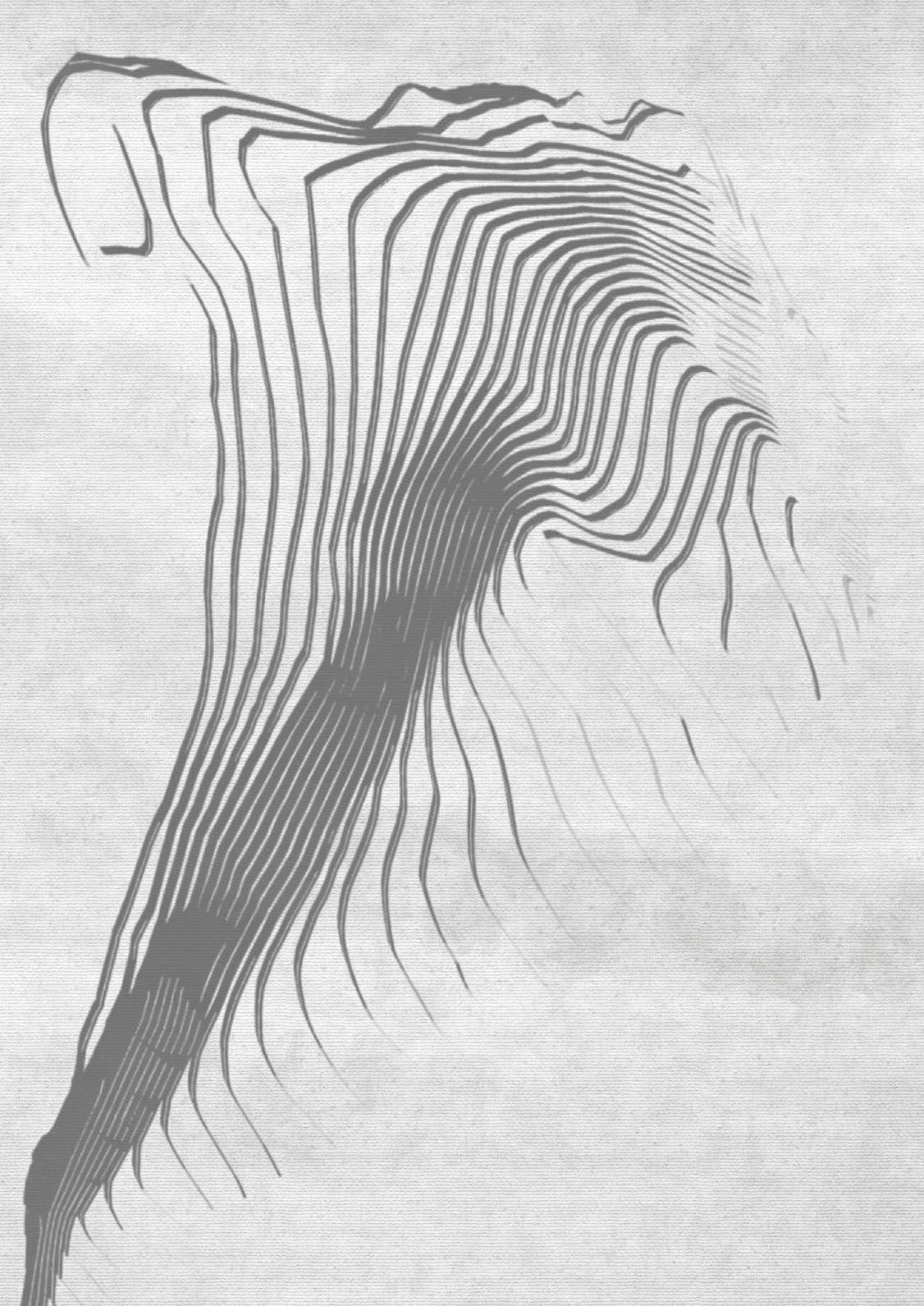
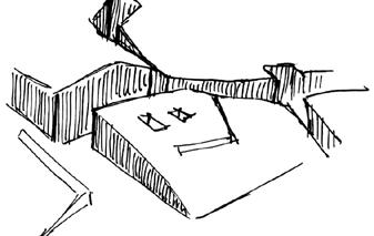
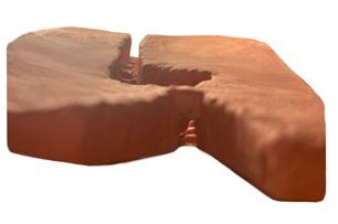
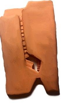
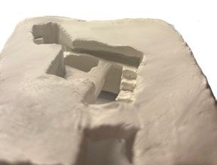
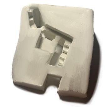
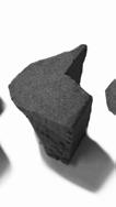
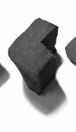
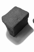
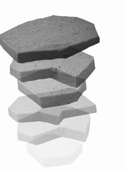
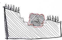
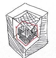
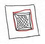
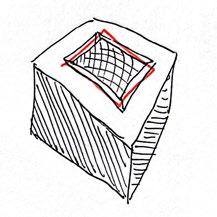
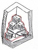
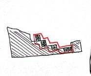
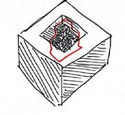
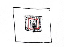
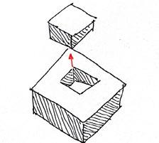
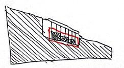
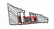
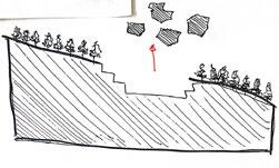
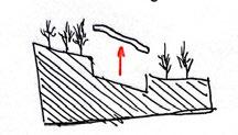
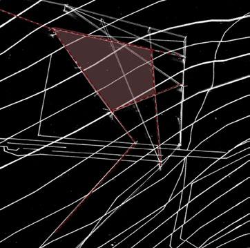
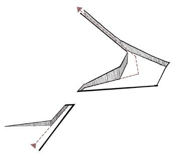
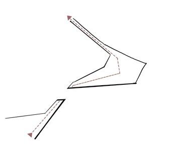
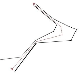
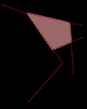
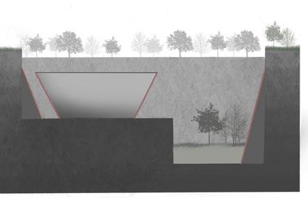
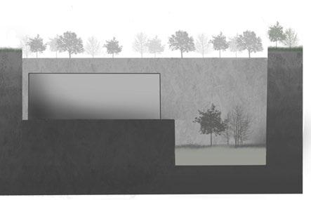
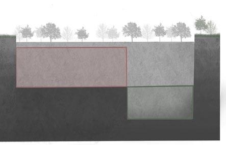
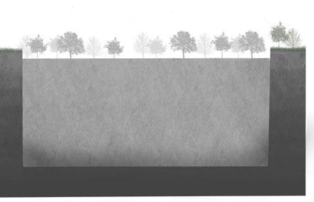
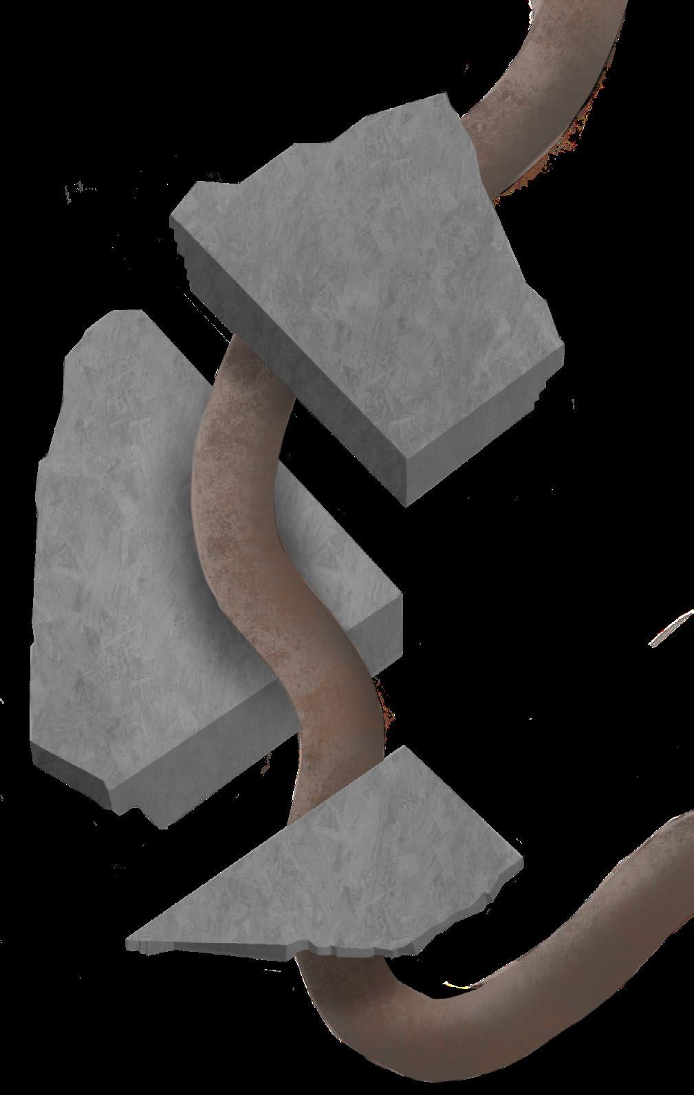
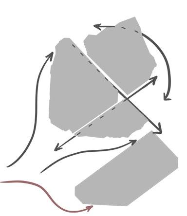
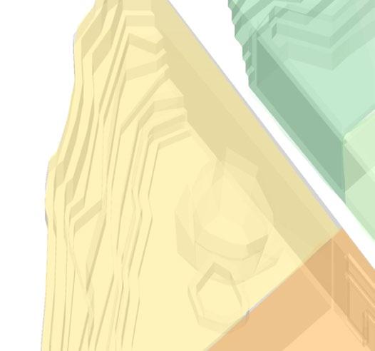
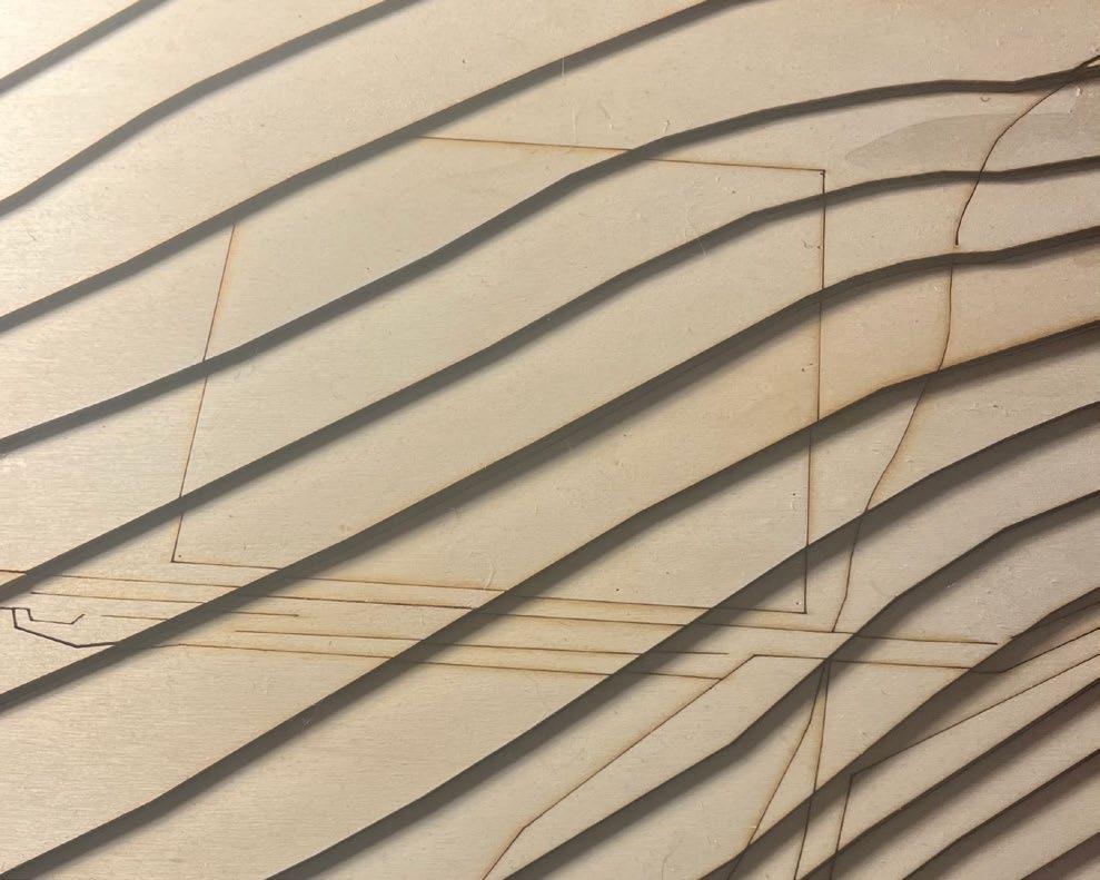
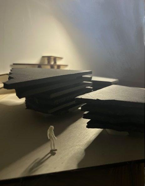
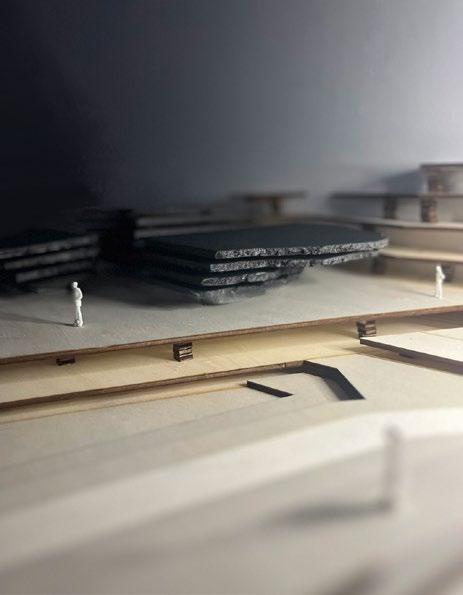
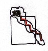
To start-off the development of my quarry landscape formation, I wanted to explore how the excavated walls of a landscape could be manipulated/developed to become a spatial resource which is open for public accessibility.
This would involve exploring the creations of ‘crevasses’ through models, which could later be developed with reinforcements, paths/stairways and a building proposal.
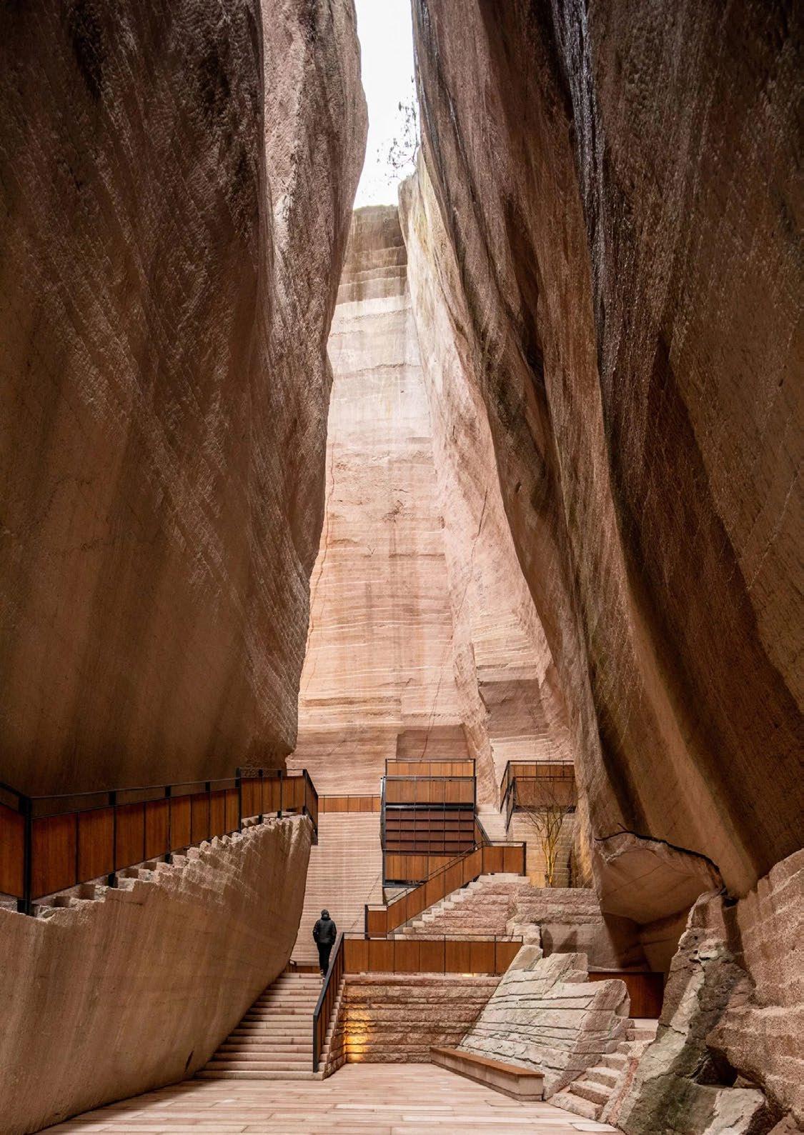
“The project is an ecological improvement to mend the interrupted nature” & raises “attention and discussion on the reuse of abandoned mines and quarries.” - DnA Design and Architecture studio
(Figure 6)
This ‘carving into the land’ and creating a crevasse is explored further later in my project following my site concept, conducted with paper modelling.
[EXPLORATION] PRECEDENT
1
STUDY
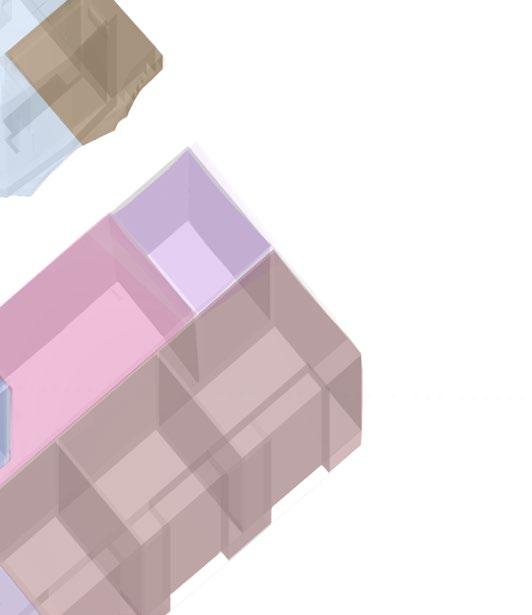
Model 1:
Model 2:
[23] [24]
Form Exploration: Chapel of Sound
Architects: OPEN Architecture
Year: 2021
Area: 790 sqm
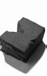
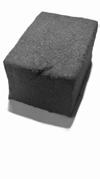
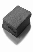
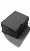
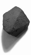
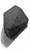
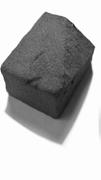
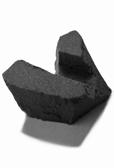
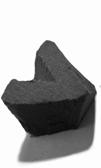
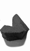
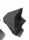
The Chapel of Sound is an open-air concert hall imitating the shape of sound. The chapel is located in a mountainous landscape by Beijing, providing views to the historical Great Wall of China. Its faceted skin resembles a rock formation such as charcoal which makes the building seem as though it were a “natural being of the landscape”. The architects of this project wanted to capture the feeling of being fully immersed into nature by imitating its form and sound.
Models From Precendent Study:
Concept for Chapel of Sound:
Sections:


Floor Plans (Ground -> Top):
Carving Blocks:
1)
2)
3)
Perspective from Ground:
Stacking Layers:
1) Aligning Layers
2) Carving Layers
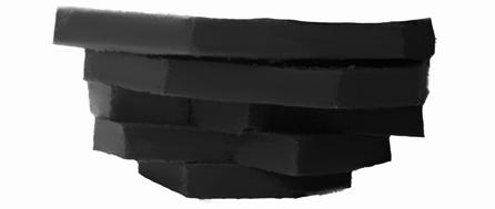
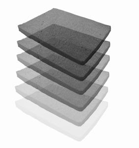
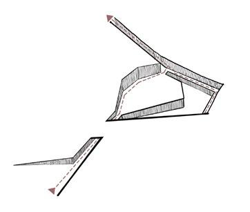
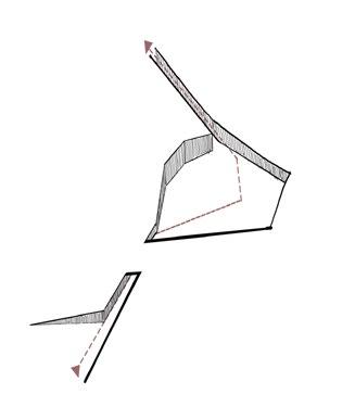
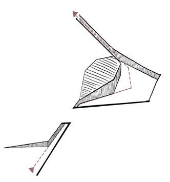
Exploring the form-work of the Chapel of Sound, I found myself wanting to develop a form that is similarly representative of a rock which appears to consist of multiple layers and or/ carvings.
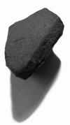
In the same way this precedent mimics the ‘shape of sound’, tough represents a bouler/rock-like structure - I wanted to develop models from three-dimensional quadrilaterals by carving them and stacking them, to mimic the proposed excavated walls of a quarry.
“We are now at a time when the question of our relationship with nature as human beings is more acute than ever. Can we be humble enough to hear what nature is murmuring to us? The symphony of nature is what we really wanted people to experience here.”
3) Revealing Form
Inspiring the final geometric form of the main building proposal (layers of rock)
PRECEDENT STUDY 2
[EXPLORATION]
[25] [26]
(Figure 7)
1) Exposing
Section: Section with Form: Form Perspective:
3) Mimicking
Section: Section with Form: Form Perspective:
5) Carve & Extrapulate
Section: Section with Form:
Perspective: Plan:
Perspective: Plan:
2) Greater Space Illusion
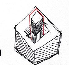
Lifting a piece of land to reveal what liest beyond the surface. This piece of land can be raised and present itself as a structure.
Section: Section with Form: Form Perspective:
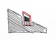
4) Sectioning
Sectioning land at different levels/platforms. Allows for programme dedicated spaces at different levels of height, with different views.
Section: Section with Form: Form Perspective:
Plan:
Carving into the land to reveal its minerals (rock) which can then form an abstract lanscape surface and inform the building form based on the mineral (rock) formations.
Perspective: Plan:
Perspective: Plan:
Defining User Needs:
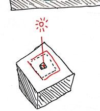
An excavation below the surface. From above the size of excavation and building cannot be seen (only a small opening for light).
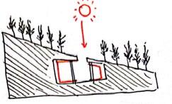
Here I am lifting a piece of land to reveal what liest beyond the surface. This piece of land can be raised and present itself as a structure.
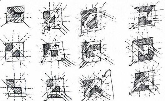
In this stage of my project I explored 5 creative variations of my design proposal which would be designed to take the defined ‘user needs’ into account. Each variation explores the manipulation of a landscape and possible building formations within the land.
[DEVELOPMENT] 5 BIG IDEAS FOR LANDSCAPE & BUILDING
Natural Light Intimacy Indoor/Outdoor Environment Access
[27] [28]
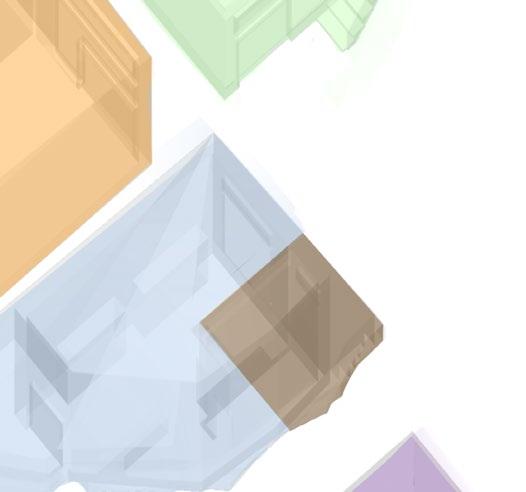
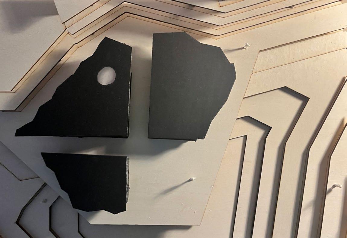
[DEVELOPMENT] SITE CONCEPT MODELS
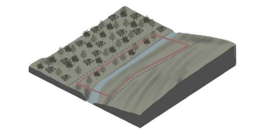
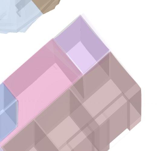
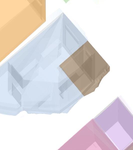
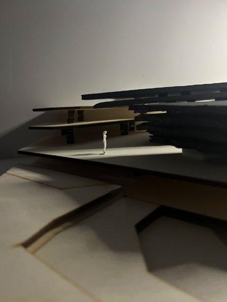
Site/Landscape Concept - Carve & Reveal the Land:
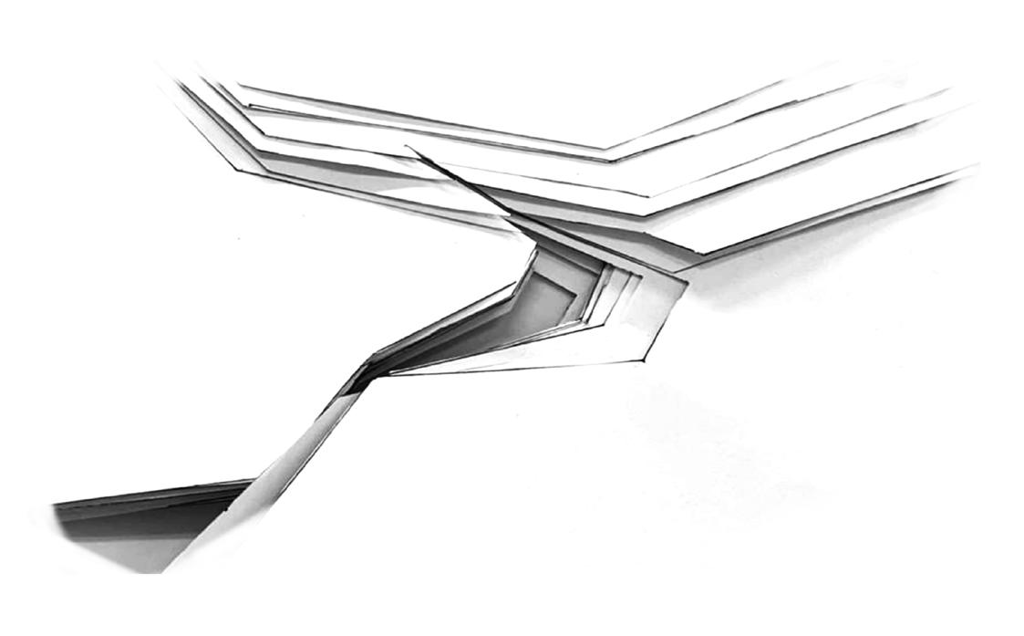
Forming Building Boundaries:
By forming lines through connections between my points of interest (as previously explored in my site strategy) - this helped inform the general shape of how I would carve/ manipulate the landscape.
The final general shape and direction of this carving would influence the chosen general dimensions and shape of the proposed land which would be permitted for quarrying.
The shaded area will influence the boundaries of the building
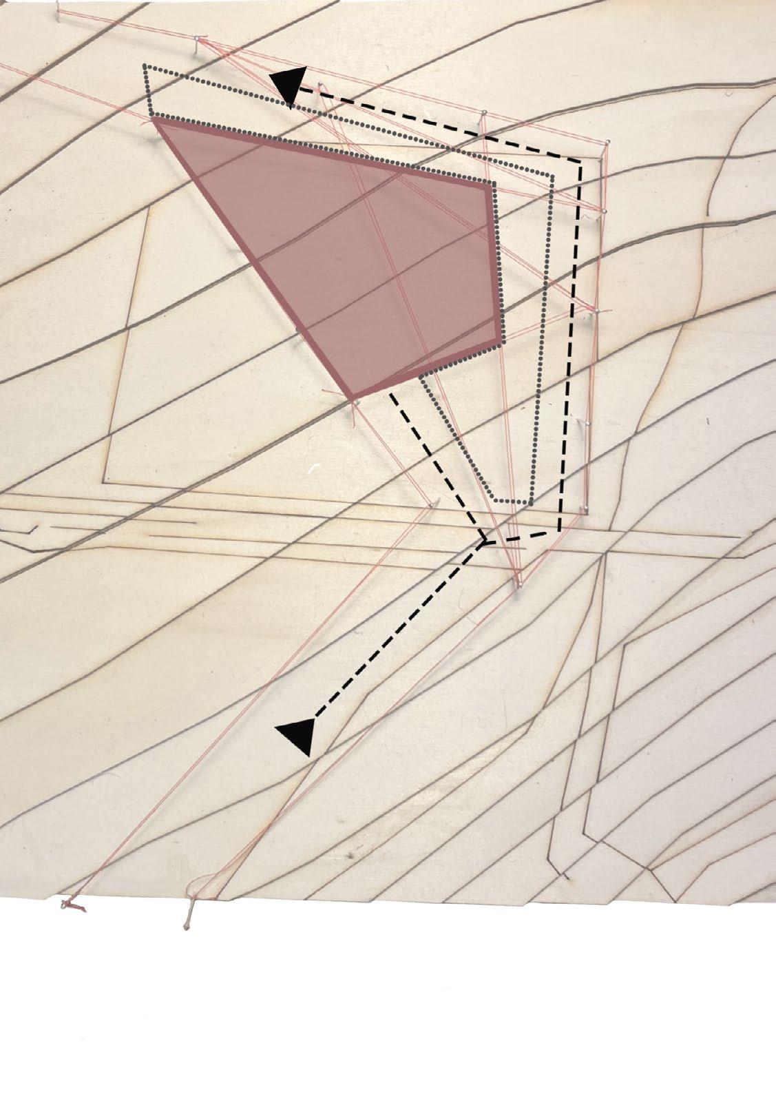 1) Define Access Route 2) Overlap Existing Path Landscape 3) Excavate
[29] [30]
4) Building site 5) Excavate for building Site 6) Raised Platform for Building Site
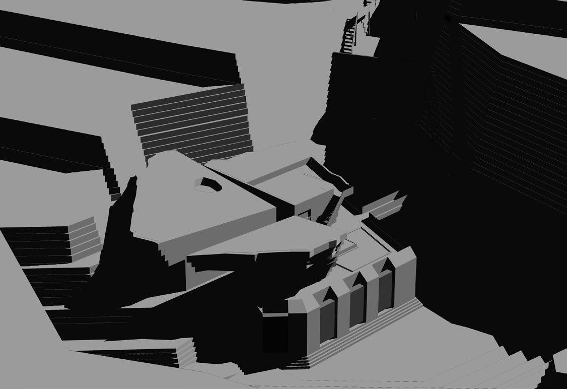
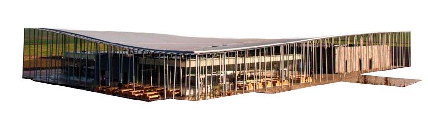
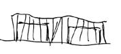
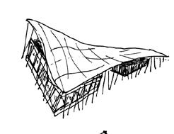
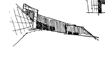
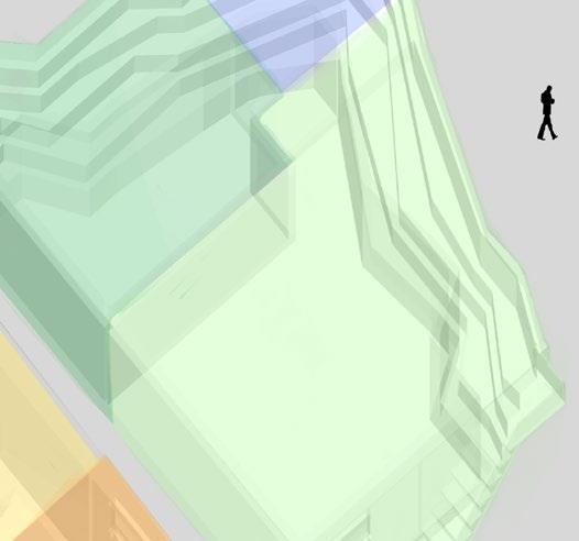
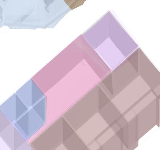
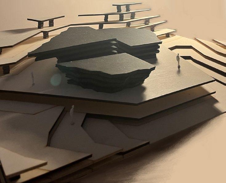
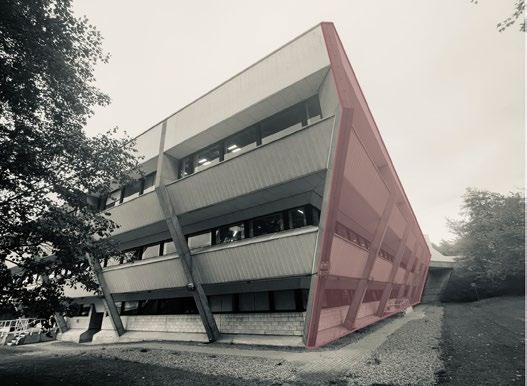
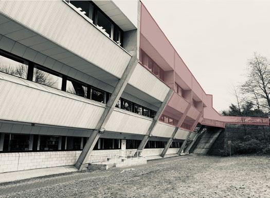
[DEVELOPMENT] BUILDING FORM & CONCEPT
Parti-Diagram (Evolution): Building Concept - Extraction:
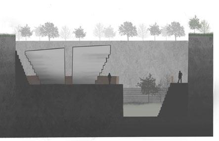
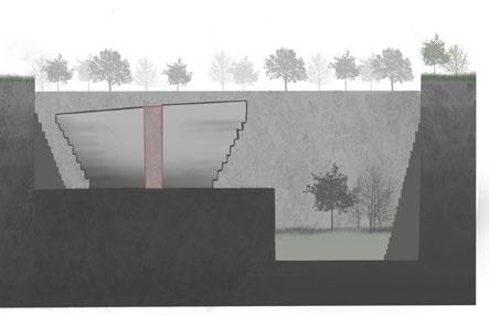
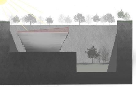
PROSPECT FROM THE MASS.
 1) Excavation Site Boundaries
2) Excavated land
3) Raised Platform for Building & Soil Replenishment zone
4) Building Mass
5) Excavation walls renforced and slanted, building mimics slanting
6) Added dimensions to building facade and tilted roof towards sunlight in south
7) Separation for better accessibility and separated programmes
1) Excavation Site Boundaries
2) Excavated land
3) Raised Platform for Building & Soil Replenishment zone
4) Building Mass
5) Excavation walls renforced and slanted, building mimics slanting
6) Added dimensions to building facade and tilted roof towards sunlight in south
7) Separation for better accessibility and separated programmes
[31] [32]
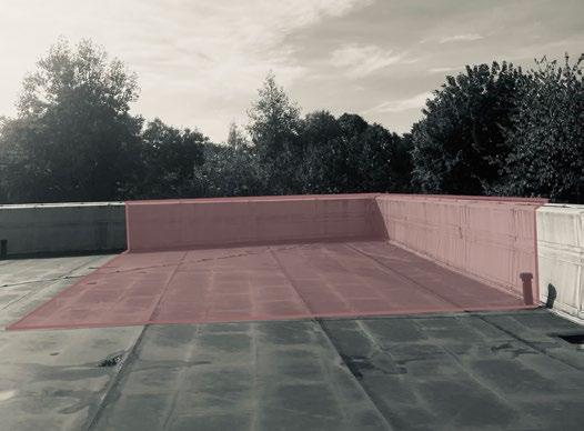
8) Pedestrian walkway platforms and conrten steel fencing
[DEVELOPMENT]
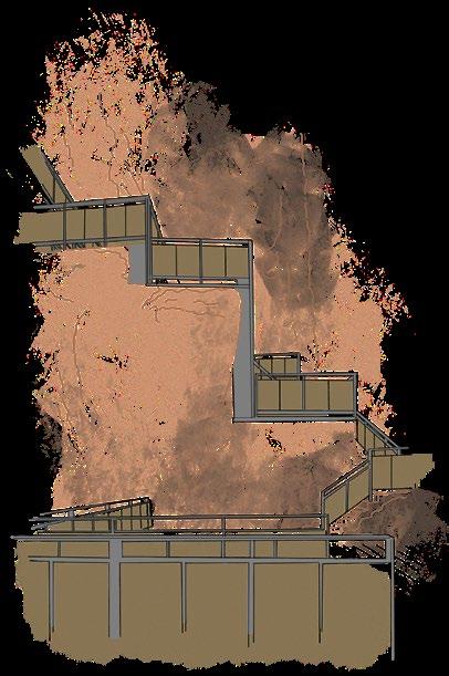
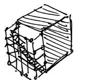
MASSING MODEL

 Storage
[33] [34]
Viewpoint
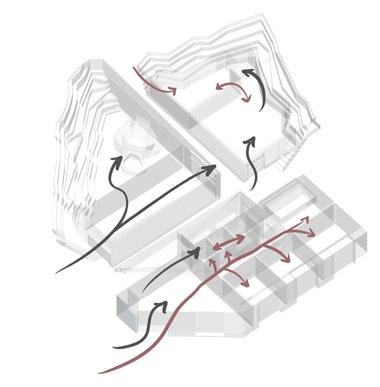
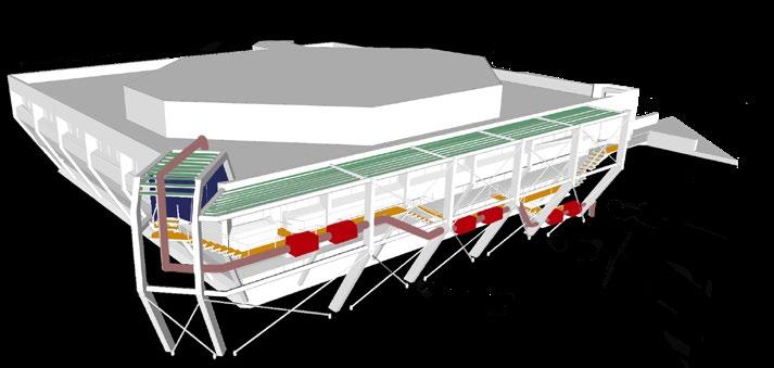
[DEVELOPMENT] SPATIAL PROGRAMME
Parti Diagrams: Bubble Diagrams:
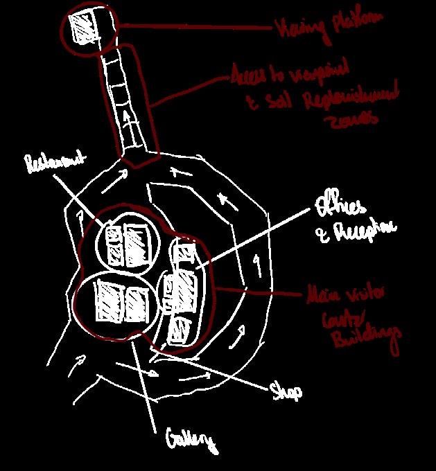
To start with the development of my core design, I began to outline the separations of spaces within a site boudary to improve circulation from an imagined entry to desired viewpoint direction.
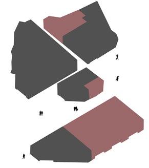
Public vs Private:
There is little separation between the public and private access spaces to ensure interactions between all people involved at the visitor center take place.
Furthermore, this allows more authoritative figures of this space to acknowledge and learn from the developments and public interactions of the site.
Desired Outlines:

Circulation:
The circulation around the visitor center is almost directly influenced by the buildings orientation and its relation to the viewpoint, south-east of the site.
The pulic circulation at the first floor is free-flowing with with public accessways around each of structure dimensions. The added perpendicular separations that split the structure into 4 provide more freedom of movement and quicker access directed towards public toilets and towards the viewpoint at the end of the site.
On the other-hand, the private access at the ground floor is very direct.
Architectural Programme:
Key:
Gallery/ Exhibition Shop Storage Reception Toilets Gallery Entry Ground access Below Ground access Private Public
Kitchen Offices Toilets Restaurant Archive Toilet Private Public Level Separation Storage Key: Private Public Key:
[35] [36]
[FINAL DESIGN] REVIEW
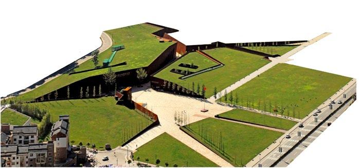
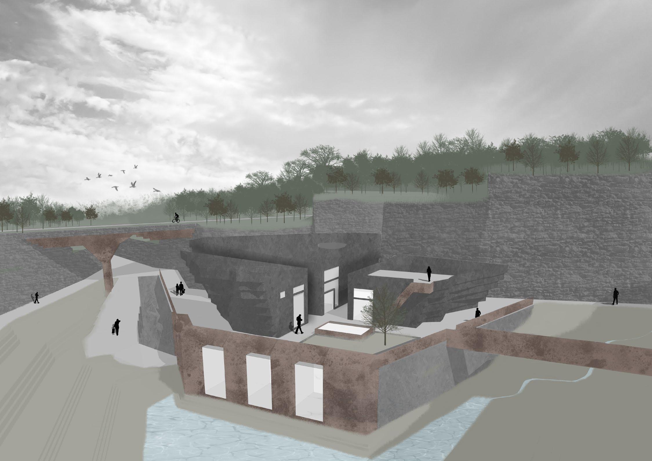
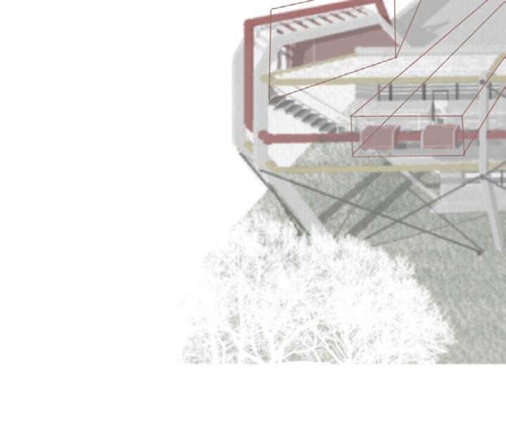
Society is oblivious to the great potentials quarry sites have to offer in terms of boosting tourism, recreation and hospitality. The visitor center provides the frameworks to a much larger quarry redevelopment scheme, which educates the public about the possiblilites of such sites and the positive influence of having the ‘Agent of Nature’ legislation (whnere the architect sets out goudelines and a plan for quarry repurposing before it has commenced). Furthermore, in the same shared space, private quarry workers, various architects and the members of the wildlife trust work on-site to further plan for future development of the site and other proposed quarrys.
The quarry is filled with a pristine blue water, lending an intrinsic natural charm and dynamism to the otherwise rigid terrain. The uneven site contours create a visual interest and curiosity, beckoning explorers and hikers to delve further into the site. The site thus has the potential to generate unique experiences for visitors. The recreation and hospitality segment of the local area will spur the prospects of Hayfield, hence, a resort emanating from the mass of the excavated land is proposed. The visitor centers zoning is the translation of its physical opportunities and experiences. Water harvesting, reviving native ecology and using available rocks from the quarry site are some of the salient features of the design.
Overall, this proposal is a catalyst for re-thinking how we approach planning and construction, also how we can re-design our quarrys to bring about esuch xemplary transformations for the future of quarrying.
[37] [38]
[FINAL
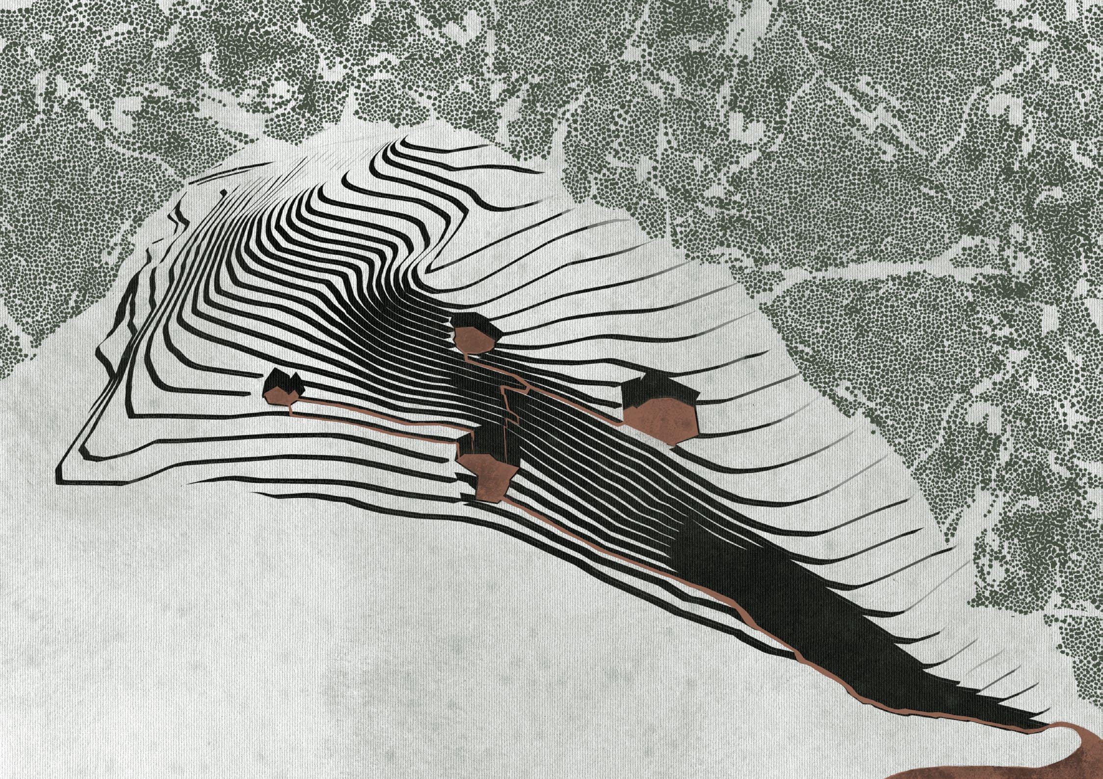
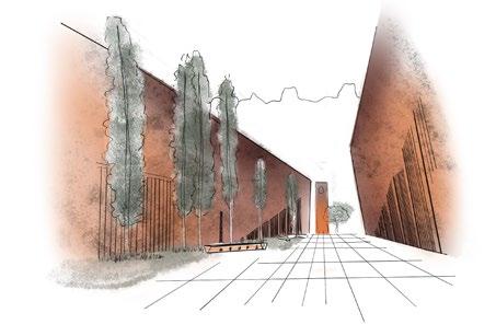
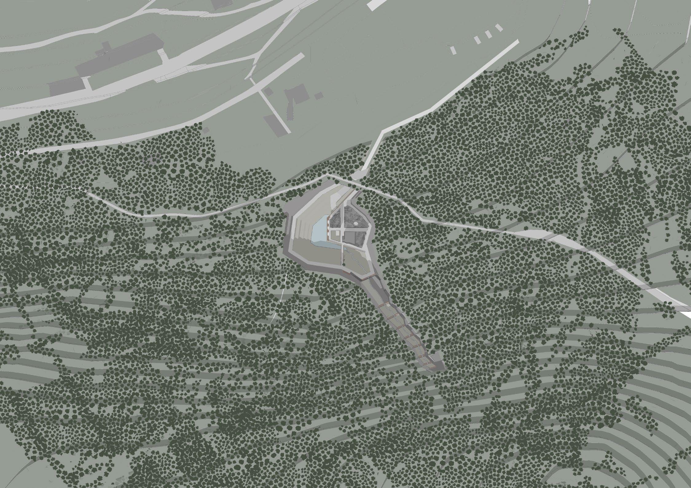
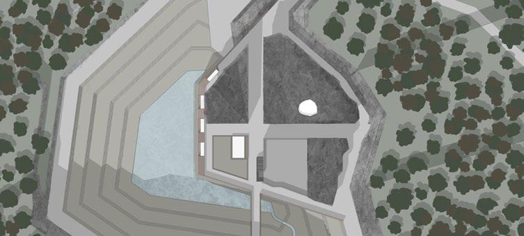
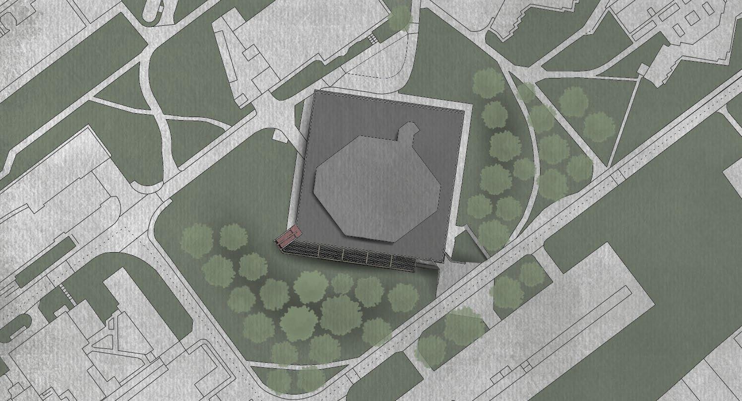
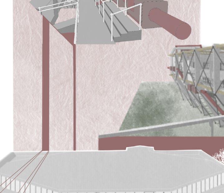
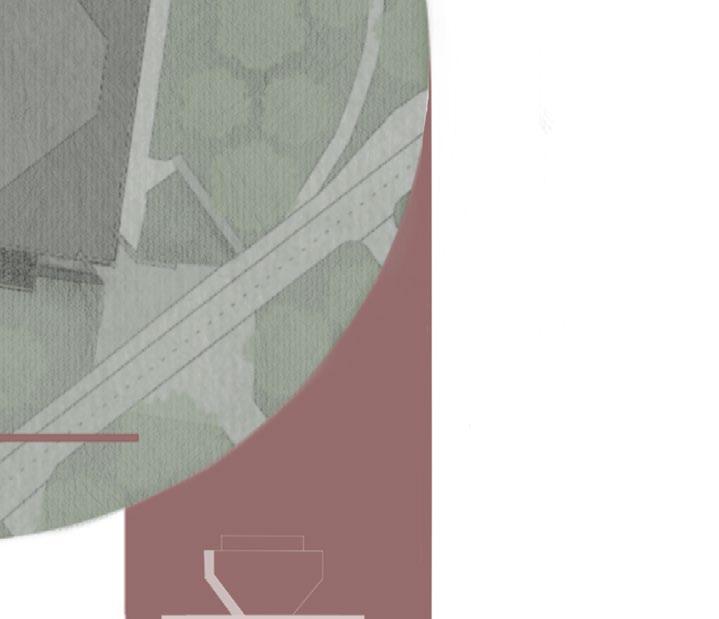
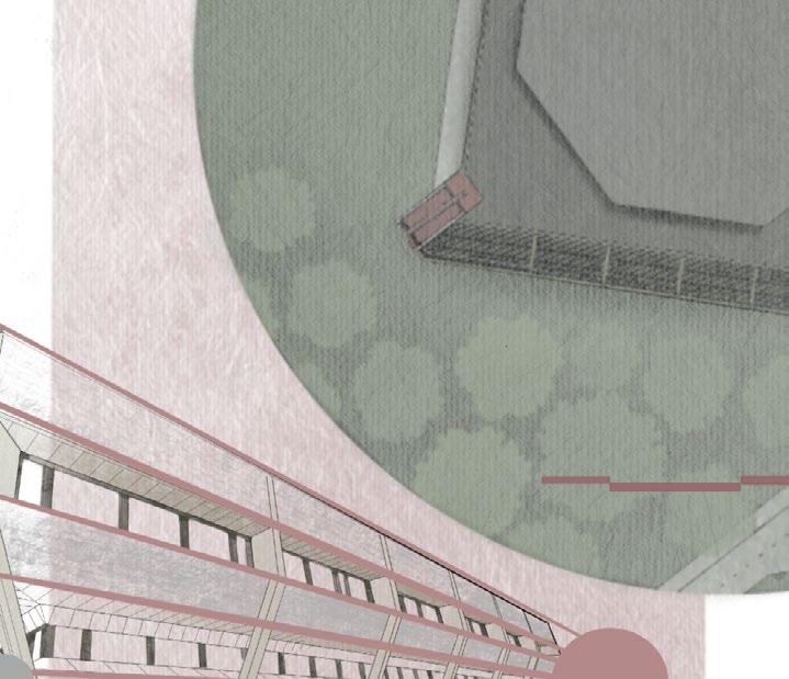
SITE PLAN 0 10 50 100m 1:1000 Level Access Path Existing Pedestrian Path Visitor Center Building Soil Replenishment and Re-planting Zones and Stairway “View-point’ Viewing Platform [39] [40]
DESIGN]
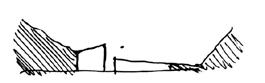
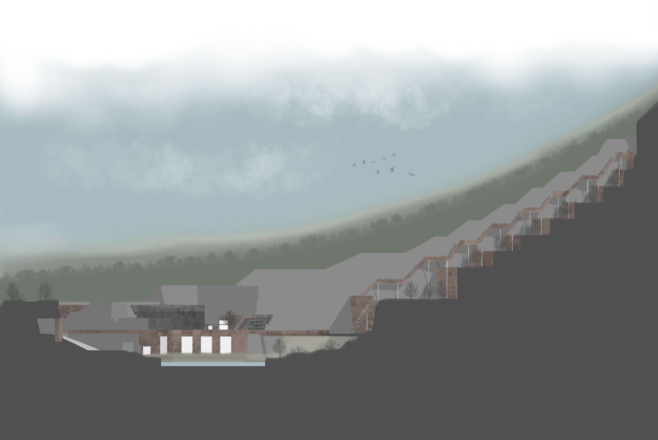
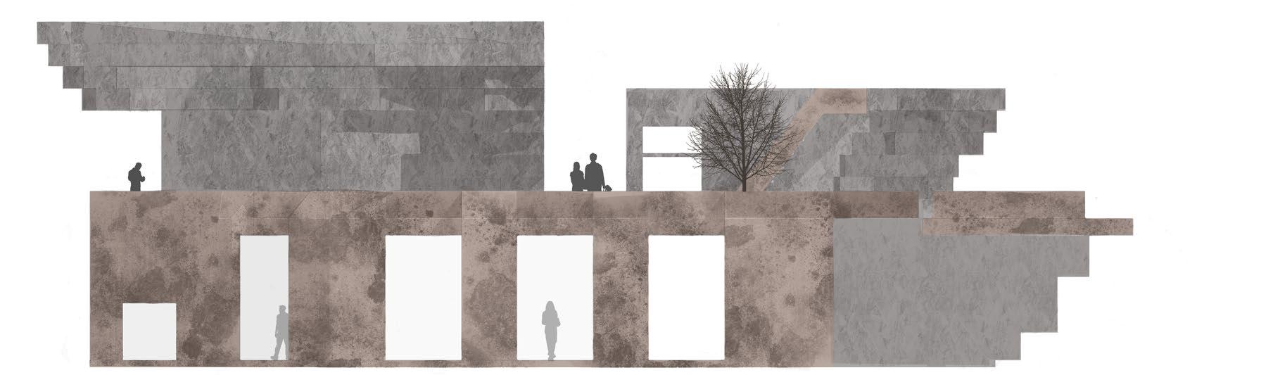
[FINAL DESIGN] SITE ELEVATION
Visitor Center Building ‘View-point’ Viewing Platform Steps to Viewpoint Soil Replenishment & Replanting Zones [41] [42]
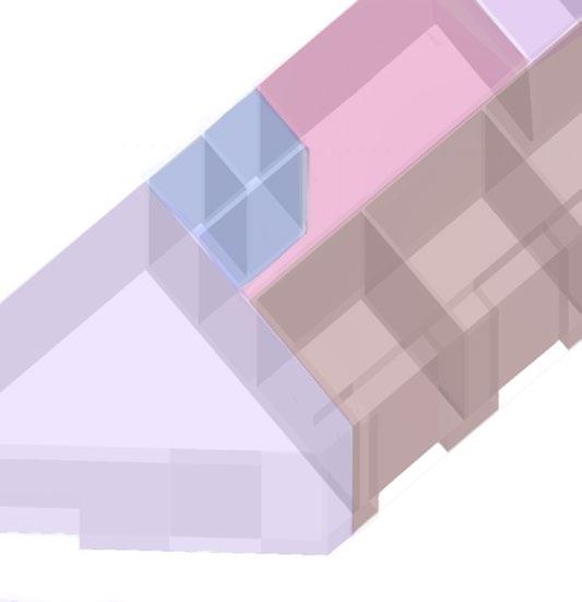
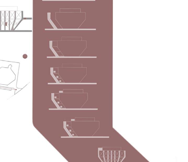
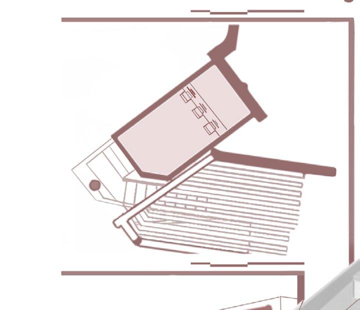
[FINAL DESIGN] BUILDING FLOOR PLANS
0 2 10 20m 1:200 Ground Floor A 0 1:200 First Floor C C D E B B B G F H A - Reception B - Office/ Meeting Room C - Toilet 2 10 20m 0 2 10 20m 1:200 Second Floor Key: I J C K C C C D D - Office Passageway E - Archive F - Shop G - Storage H - Gallery Entry I - Gallery/ Exhibition J - Restaurant Seating K - Kitchen [43] [44]
[FINAL
STEPS & VIEWPOINT PLAN 0 2 10 20m 1:200 Viewpoint & Access to Viewpoint [45] [46]
DESIGN]
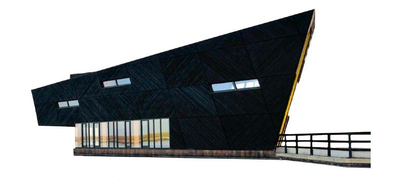
[FINAL DESIGN] BUILDING ELEVATIONS
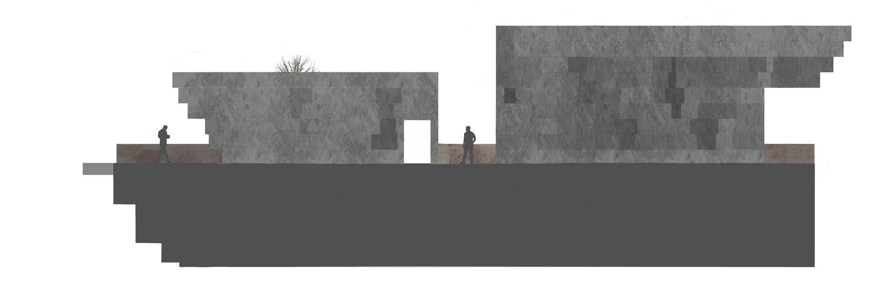
0 1 5 10m 1:100 North-east 0 1 5 10m 1:100 South-West [47] [48]
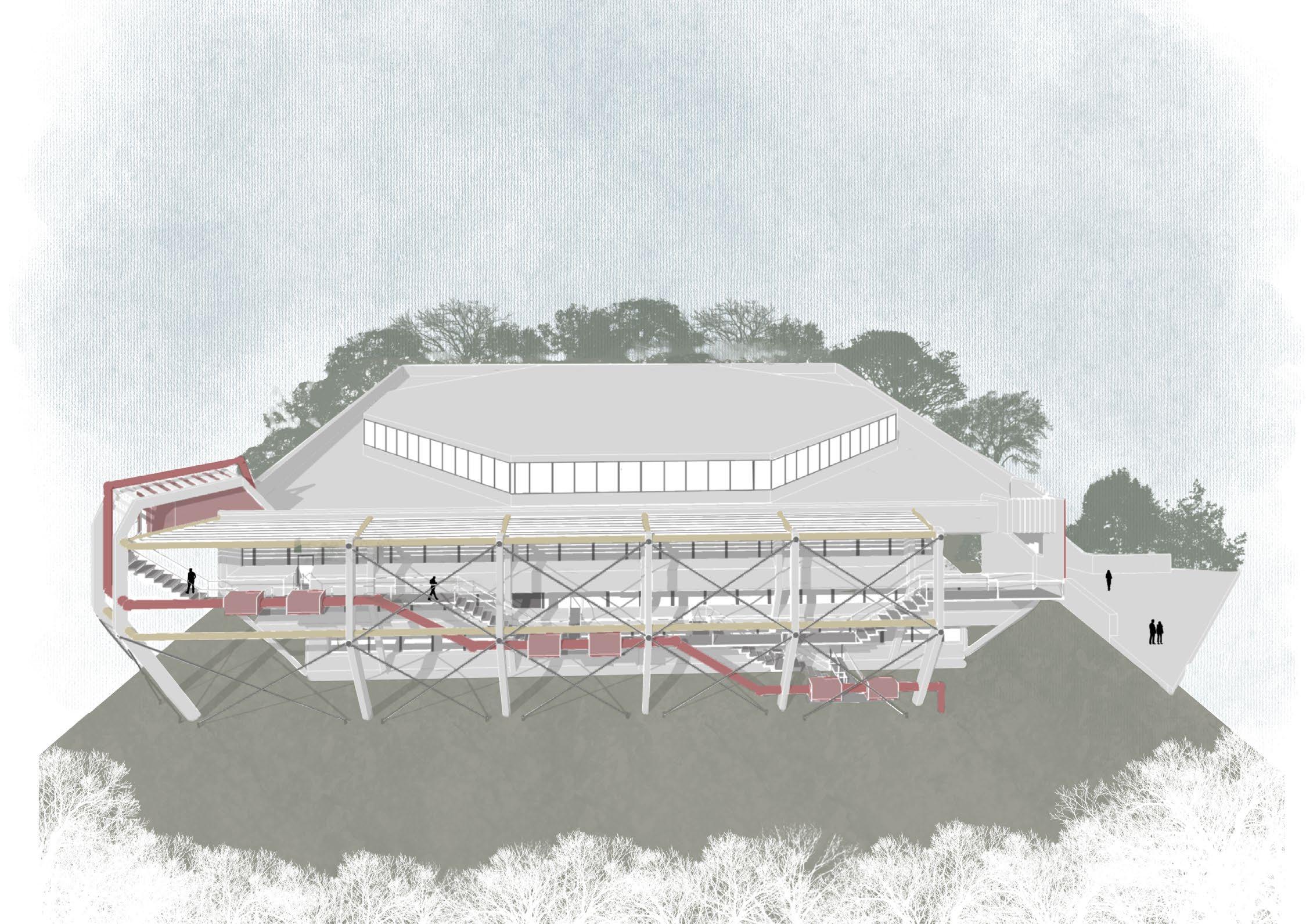
[FINAL DESIGN] BUILDING SECTIONS
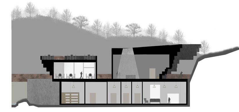
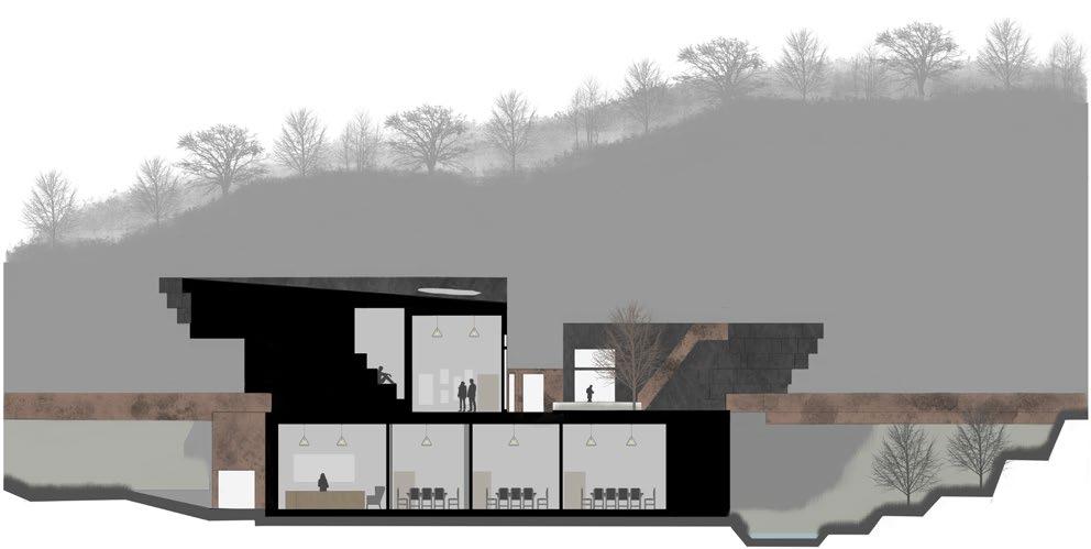
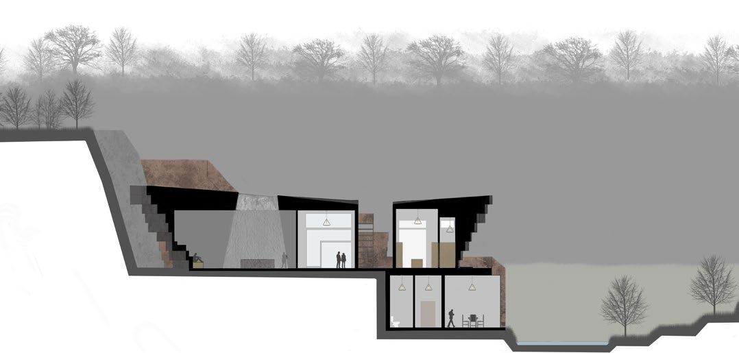
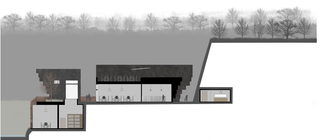
0 2 10 20m 1:200 A: North 0 2 10 20m 1:200 C: South 0 2 10 20m 1:200 B: East 0 2 10 20m 1:200 D: West A A B B C C D D [49] [50]
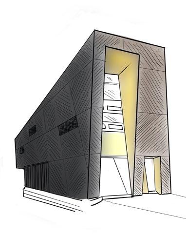
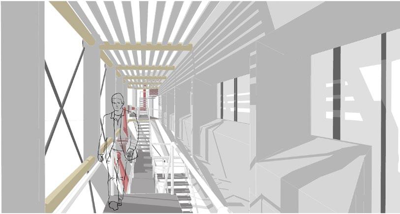
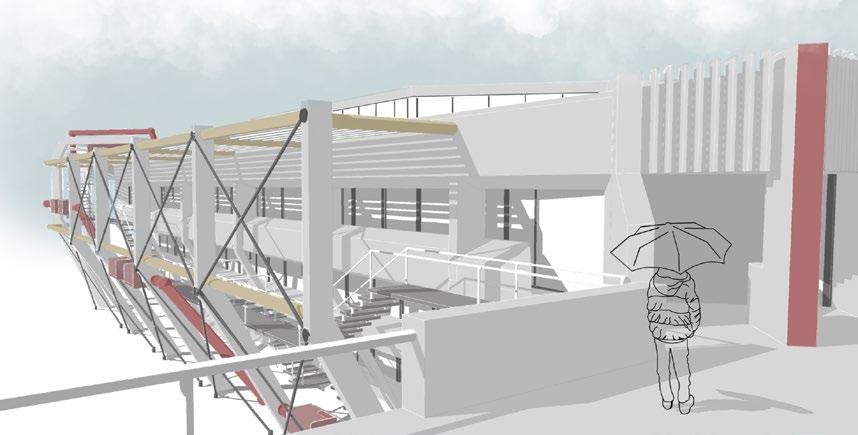
[FINAL DESIGN] BUILDING ISONOMETRIC & INTERIORS
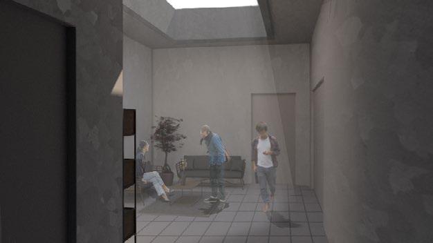
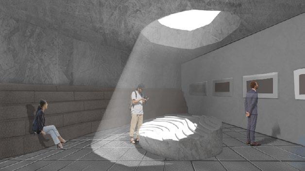
Public Space: Gallery/ Exhibition
Area: 66.99 sqm
This public exhibition space is a dim, intimate space which hosts a variety of ‘repurposing quarry’ proposals to showcase the success the new legislation of the ‘Agent of Nature’.
The interior structural walls mimic the edges of the external facade, creating seating along the long wall. The only source of light is a skylight - situated directly above an installation model of a successful quarry projec - providing a visual focal-point for visitors.
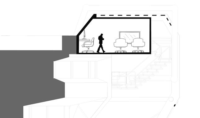
Private Space: Office Passageway
Area: 34 sqm
This private office passageway will experience the greatest private users footfall, as interactions and conversations are made as people enter/exit offices and during meeting intervalls - hilighting the importance of user interactions with each other.
The inerior walls stick to a similar tone to the quarry excavation space (grey & brown) with a large skylight that projects daylight into the deepplan of the groun-floor.
[51] [52]
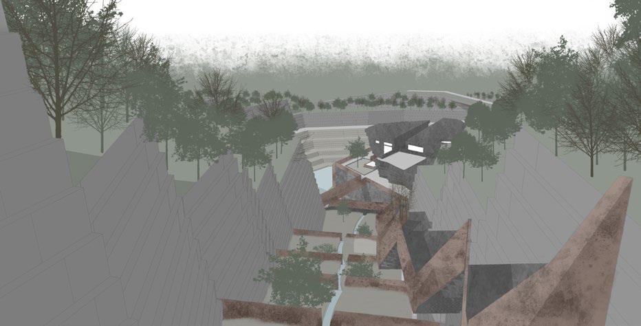
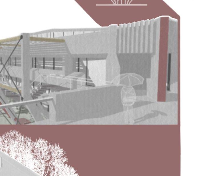
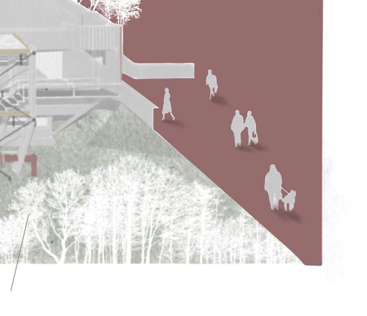
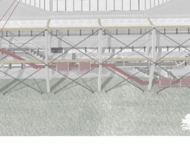
View Out to the Visitor Center:
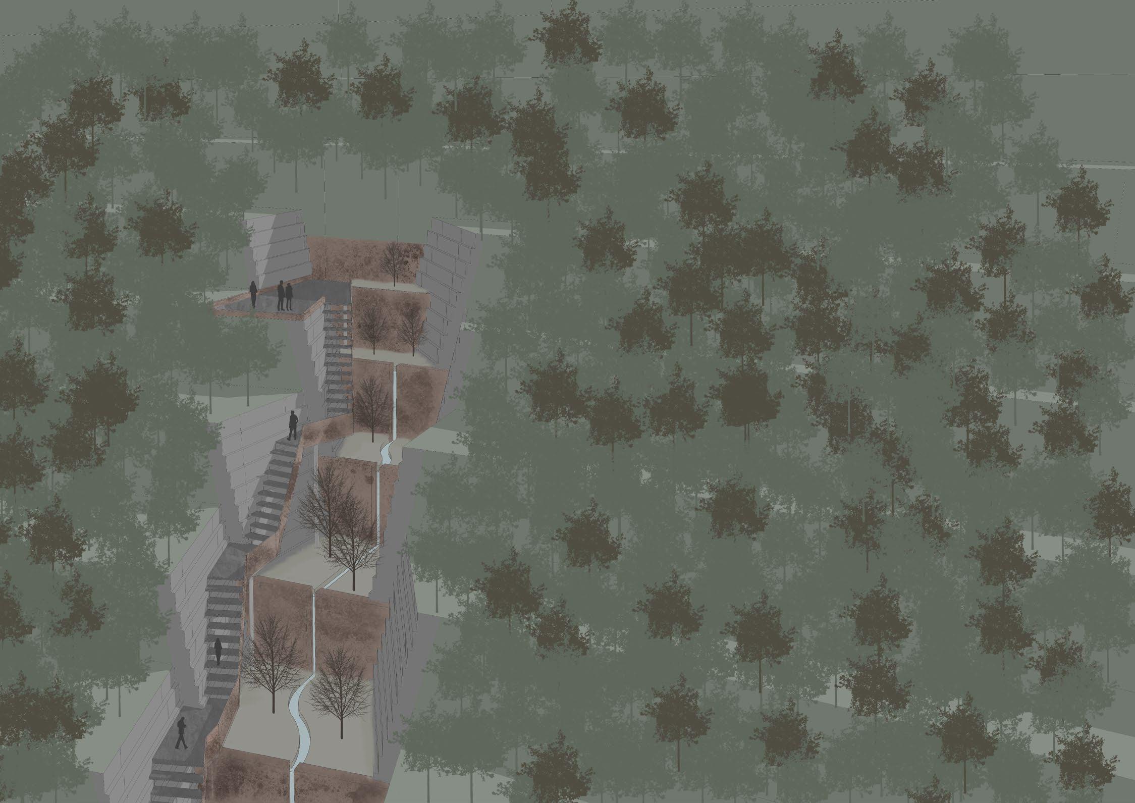
The ‘Viewpoint’ viewing platform is an ideal location for hikers, students and vtourists of the visitor center.
The 5 minute climb up the stairway provides views at different heights out over the crevasse of the landscape and of the forests surrrounding the site.
Below the stairway, at each level, there are designated soil replenishmwnt and replanting zones. These zones also feature a natural rainwater harvesting system meandering and making it way down to the quarry lake by the visitor center building.
With this viewing platform raised and firther beyond the entry to the visitor center, visitors are encouraged to go to the exhibition to learn about the ‘quarry repurposing’ process and the new legislation in place.
After this experience, visitors can either shop, eat at the centers restaurant or directly head up to the viewpoint, from which they get an almost birds-eye view of the repurposed quarry and are able to imaginehow far it has come, as well as its future potentials.
As visitors are able to venture through the carved crevasse of this landscape, as once was not permitted - a new knowledge and history of the space is coming to light - as people are able to view over the entire development - how there once was questions to the access of land, which now has come to the stewardhsip.
[FINAL DESIGN] VIEWPOINT PERSPECTIVES
Soil Replenishment Zone
Viewing Platform
[53] [54]
Rainwater Harvesting
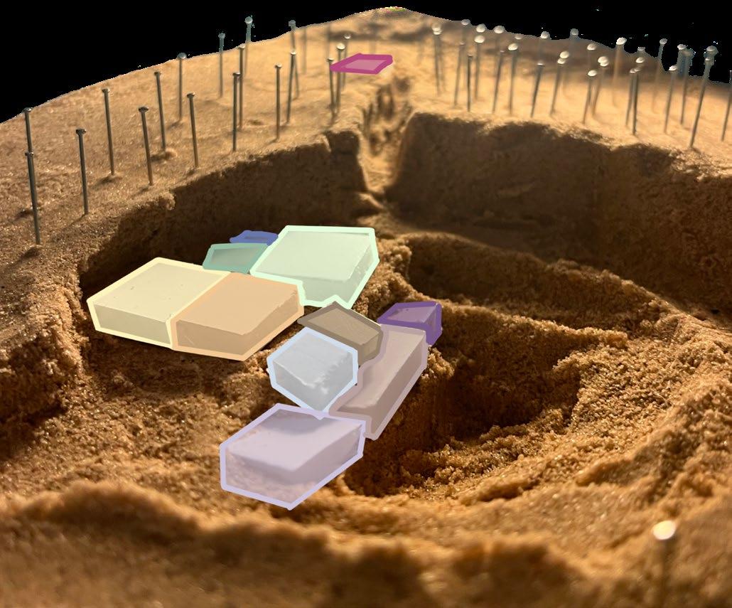
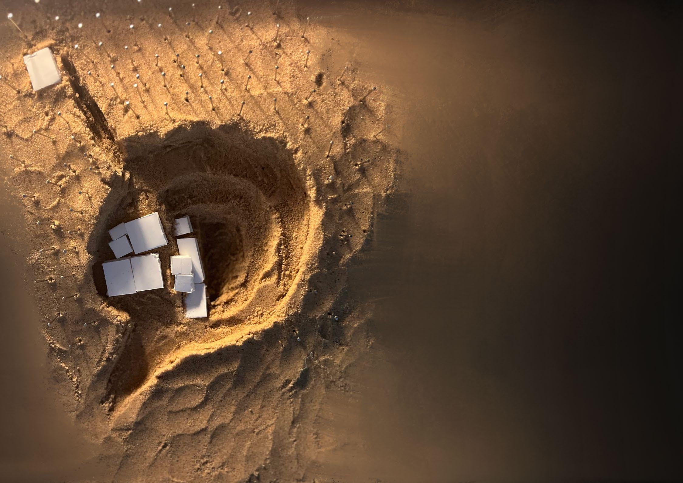
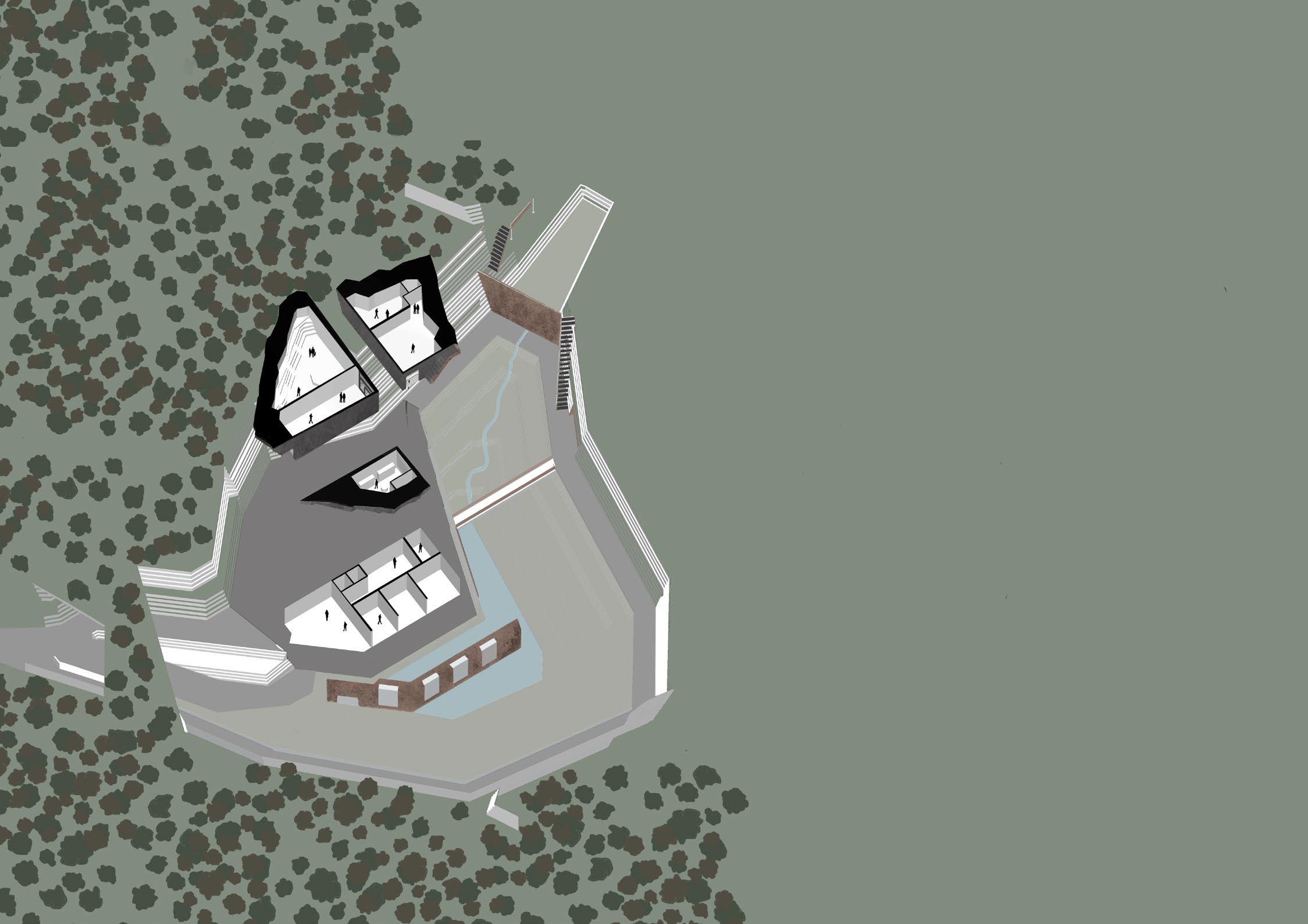
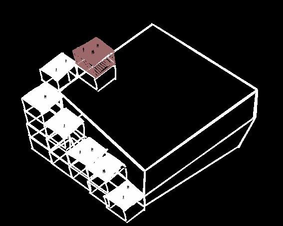
[FINAL DESIGN] SITE MODEL & BUILDING MODEL
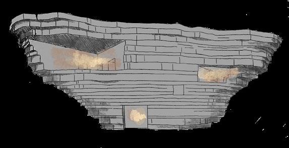
Site Model - Before Construction:
Plan:
 Perspective:
1: Viewpoint 2: Viewpoint 3: N
Viewpoint
[55] [56]
(Construction Boundaries)
Introduction:
Brainstorm:
Potential Theme 1: Habit
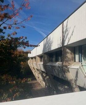
Pilkington Library:
The Pilkington Library, opened in 1980, is located on University Road on Loughboruough University Campus.
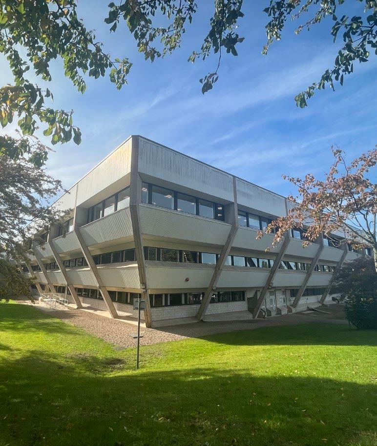
The 4-story building sees countless students daily, providing them with the necessary information and the spatial resources to study.
It can be said that the library hosts as a breeding ground for knowledge and is a place which forces ideas to be cultivated.
In this project, I will be exploring how more creative ideas can be cultivated for a student in the context of a library.
Potential Theme 3: Dreams
Chosen theme - Dreams:
I began my project by exploring the words and ideas we associate with libraries - the first coming to mind being resources and information.
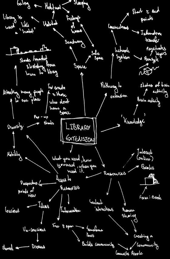
Resources and information are those which are provided to us. However, in this project I was more interested in delving into what is less known to us. Where do new ideas come from? How can we encapsulate these ideas? How can these be shared?
Through this project I also wanted to directly relate my theme to something that is habitual and a part of everyones, everyday lives, though little known about or understood - Dreams.
Potential Theme 2: Brain Activity
02 DREAM
LAB
Initial Brainstorm
[57] [58]
[EXPLORATION]

Colours and Materials:
CONTEXTUAL ANALYSIS

Current Activities:

Emotions Provoked Through a Poor Library Environment:


What The Library is Lacking:
Spaces to be Imaginative
Library Intervension Potentials:


The idea here stems from the notion of the extensive amount of brain activity which accumulates in library settings.
This intervension would present itself as a space for library users to relax and ‘winddown’ their brain activity in order to recharge.
This intervension proposal presents itself as the ‘building blocks for student success’ where the news of student successes at the university is broadcasted and exhibited oalong the library facade.
Spaces to Recharge

Spaces to Inspire
Given much of my interest centers around the ‘unknowns’ of our brain activity, this intervension would provide a space where students can power-nap and recharge but also have their dreams assessed, recorded and shared.


Concrete Glass & Steel Frame Decorative Colours
& Fatigue Overwhelmed Stress & Panic From my analysis I was able to form 3 initial ideas for the Library Intervension propsal.
Boredom
1) Brain Activity (waves) Leisure Space:
Eating Group Study Reading Studying/ writing
2) Student Success News Platform:
3) Sleep Analyst (Parasite):
[59] [60]
[EXPLORATION] STUDY ON SLEEP (DREAMS)


‘Dreaming’ - A Scientific Speculation

Important for learning, memory and creativity.
Occurs usually in optimum sleeping conditions and can take up to an hour at times to reach.

If awoken at this stage of sleep, a person can record their dreams most vividly.
[REM Rapid-eye Movement Sleep]

A good sleep environment relies on low temperature, dark, quiet and comfortable conditions.
This is important especially for a person to reach REM-phase sleep (optimal form of sleep).
[Good Sleep Environment]
There are several existing examples where sleeping pods have been intorduced in public work-spaces.
Research on the use of daytime sleep pods hilights the importance of napping and allowing the brain to re-set.
[Sleep Pods]
[Dream Report]
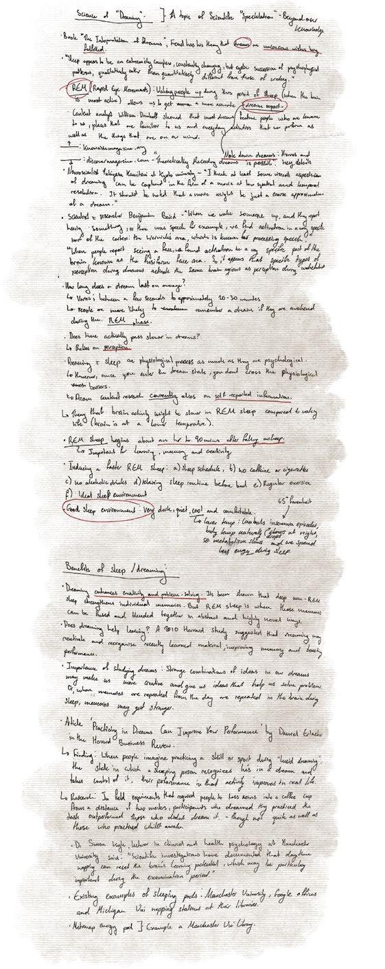
To capture an accurate dream report a person must be awoken during the REM phase of their sleep and take note of their dream.
Though there are also speculations over wether dreams could actually be recorded and visual aspects captured.
[Enhancing Creativity & Problem Solving]
Whilst non-REm sleep is great for memory recollection - REM sleep only firther enhances these memories by fusing them in abstract ways, boosting creativity through imagina-

EEG Stage 1 2 3 4 5 6 7 8 1 2 3 4 W REM Sleep Awake [61] [62]
[EXPLORATION] PRECEDENT STUDY
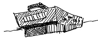
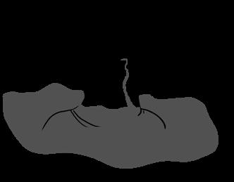
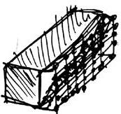
Form Exploration: Spider, 1997
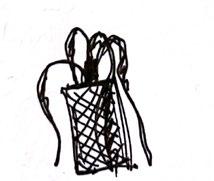
Artist: Louise Bourgeois
Year: 1997
This installation piece represents the artists mother and her most notable traits: protectiveness and persistance.
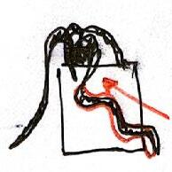
I took particular interest in this piece due to the sort of ‘power dynamic’ the spider has over its cage, as though it were ontrolling it not just protecting it. The piece also appears to me as a parasytic creature, that looks as though it will either consume or penetrate the cage.
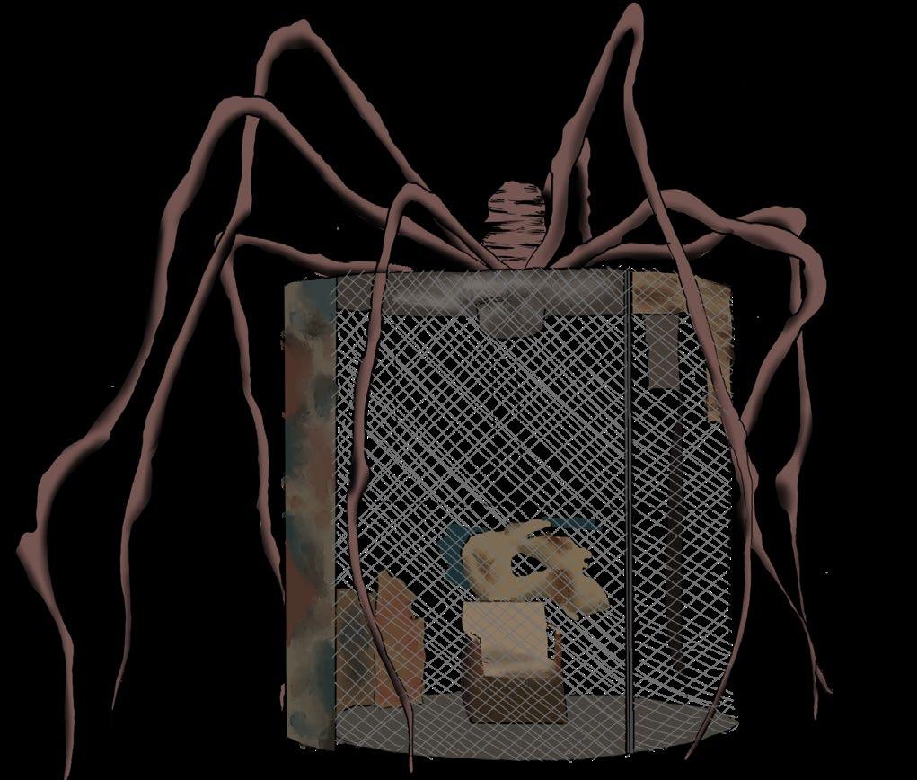
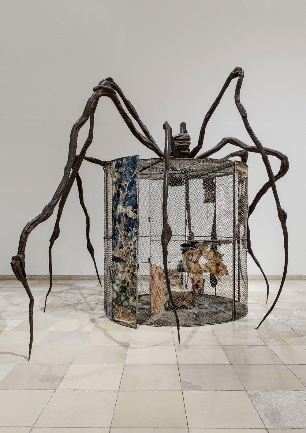
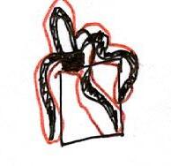
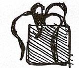
This inspired me to explore this idea of control - In my case, the control over the Pilkington Library building.
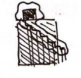
Developmental Sketches from Precedent:
Inspiration to Form:
4) Access path forms stairway
Thickness added to structure (like skin of parasite)
Narrative: [Spider protecting cage]
Narrative: [Parasite invading/climbing building]
Elevation
Plan Perspective
1) Position of Roof extension 2) Integrating parasite to extension
3) Access from marasite leg
5)
[63] [64]
(Figure 8)
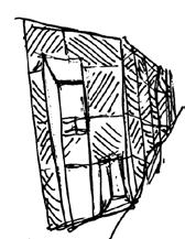
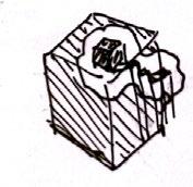
[EXPLORATION] PRECEDENT STUDY
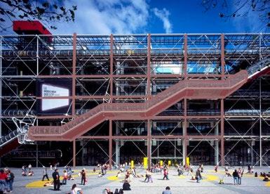
Form Exploration: The Center of Pompidou
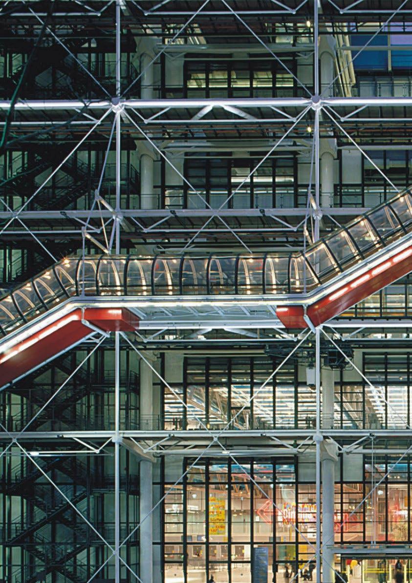
Architects: Renzo Piano, Richard Rogers, Peter Rice, Mike Davies, Su Rogers, Gianfranco Franchini
Year: 1977
Area: 2 ha
In a similar manner to Louis Bourgeois’ ‘Spider’, this building also expresses to me an element of control through its various channels, upheld by a framework.
These various tubes and channels form various connections which helped inform the accessway of my design from the entry, up to the roof intervension.
(Figure 9)

Developmental Sketches from Precedent:

1) Position of Roof extension 2) Extrapulate wall (duplicate)
Inspiration to Form:
3) Fill void with stairway
4) Add thickness to stairway
5) Connect Stairway to roof structure
Narrative: [Inside-out Structural System]
Narrative: [Staurway Framework]
Plan
Elevation
Perspective
[65] [66]
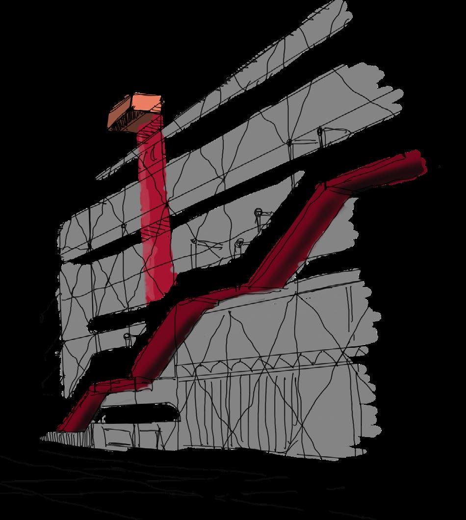
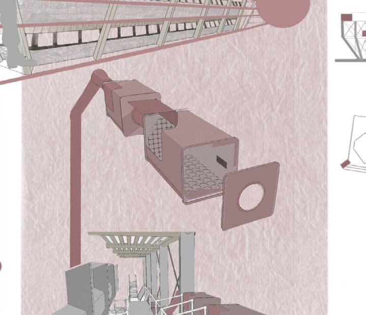
[DEVELOPMENT] CONCEPT DEEP MAP
Combining Precedent Studies:
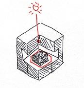
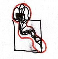
The parasytic, controlling and protective nature of the Spider, 1997 inspires the connections the control room at the proposed library roof connects itself to and controls each sleeping-pod that is attached to the framework of the building facade.
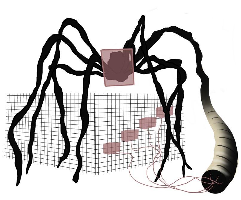
Conceptual Outcome:


Framwork and channel systems as seen in the Center of Pompidou imspires a second facade for the proposed library intervension. This would be used to support the sleeping pods at each level, as a channel system connects each pod to the control room where ‘sleep data’ is collected and assesed.
Sleep Pods
Control Channel
Control Room
FALL
[67] [68]
Building Frame
INTO SLEEP.
(Figure 10)
(Figure 11)
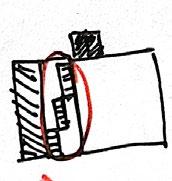
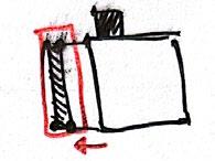
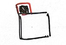
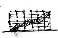
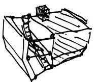
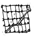
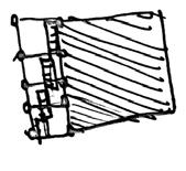
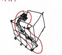
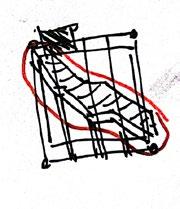
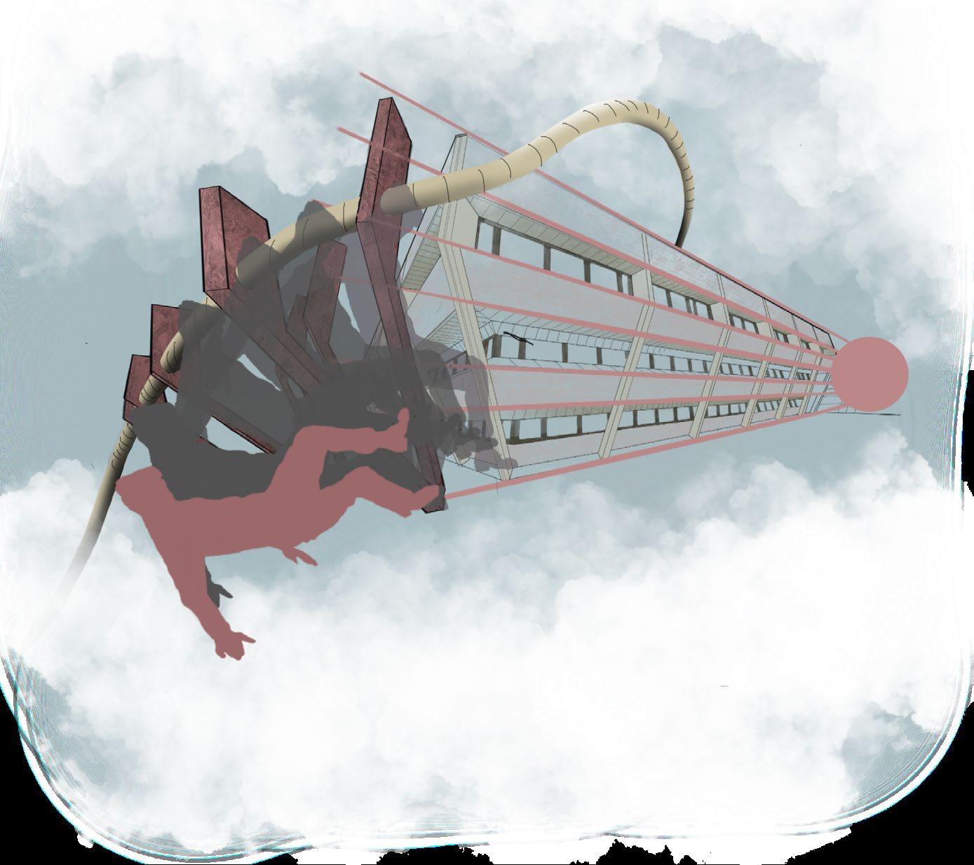
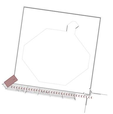
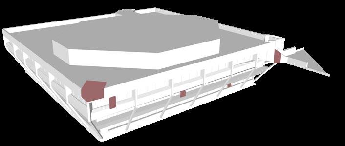
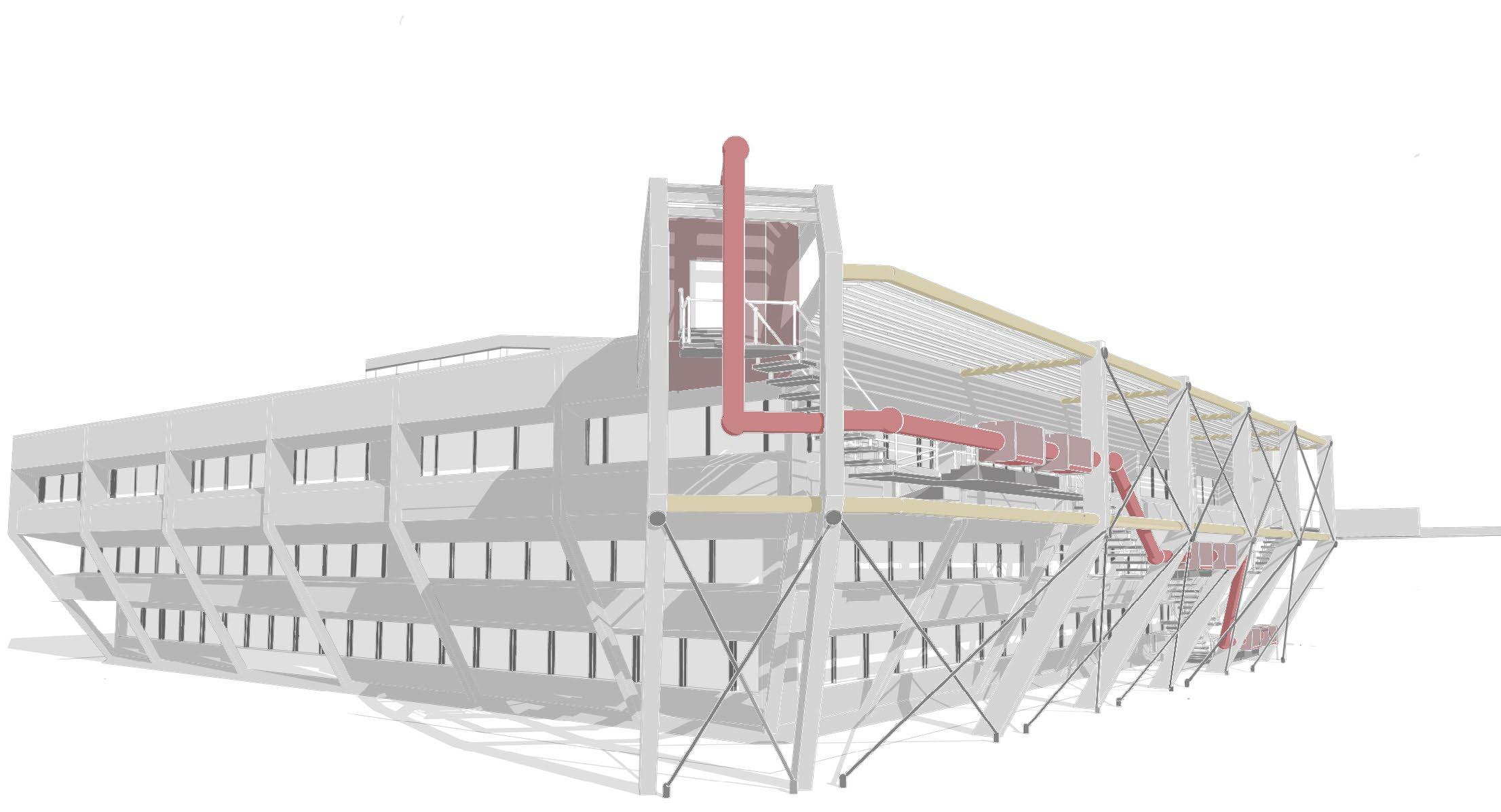
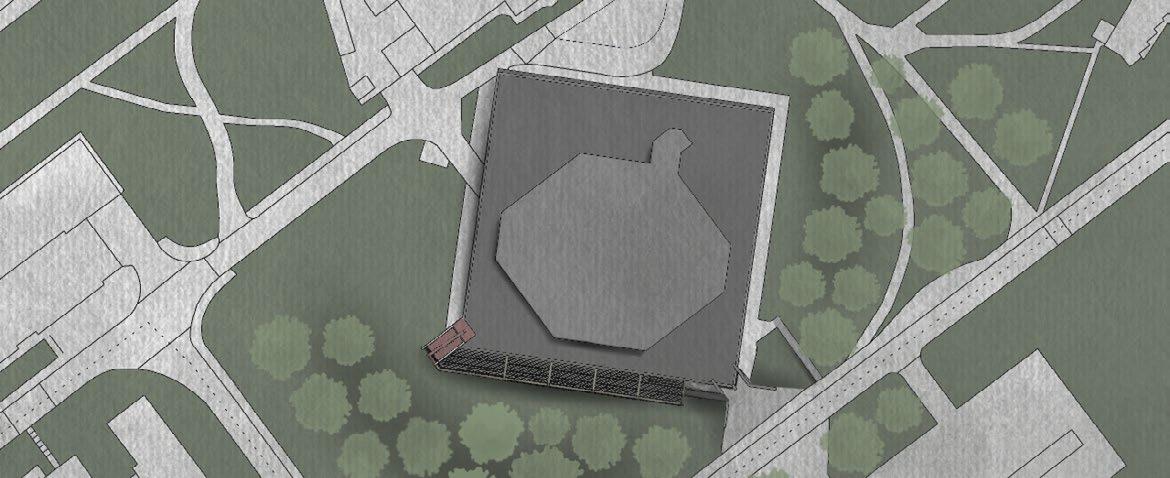
[DEVELOPMENT] SITE STRATEGY & FORM
Site strategy:
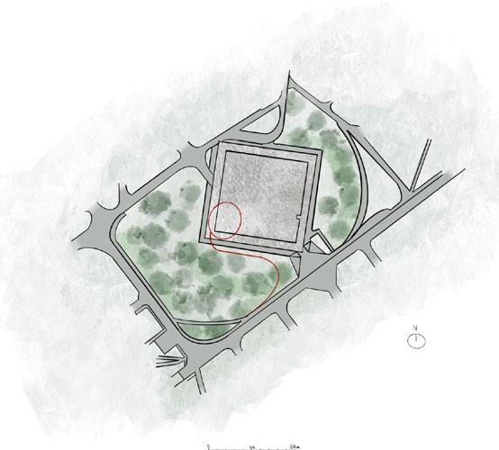
Form Development:
In the first stage of my form development I identified the places on the library building where the intervension would intersect (roof location for intervension, walls at 3 floors between ground floor and road-level floor for accessibility, main access from library entrance).
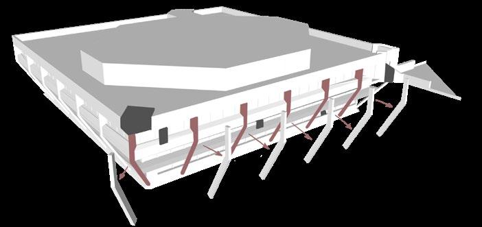

The second stage of my form development involves extrapulating the buildings structural pillars (duplicating them to create secondary facade frame).
- These pillars will act as the main additional strctural feature that will help support the rest of the structure within its void between the pillars and the bulding.
The third stage involves adding structural stability to the building and providing a more developed framework by creating connections through steel channels and wires.
The final stage concludes the form by addiing height to the roof intervension (control room), a stairway, steel channels supporting 6 sleepimg pods and solar shading.
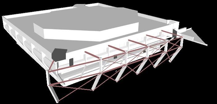
 Access to intervension and rest of the structure will be situated on the south facade.
Roof intervension will be situated on the southwest roof corner of the library.
Access will be mainly directed from the main entry/access to the library at the main road.
Building Plan of Proposed Intervension:
Building Plan of Intervension:
Access to intervension and rest of the structure will be situated on the south facade.
Roof intervension will be situated on the southwest roof corner of the library.
Access will be mainly directed from the main entry/access to the library at the main road.
Building Plan of Proposed Intervension:
Building Plan of Intervension:
Desired route of access to Intervension:
1) Places of Intersection
2) Extrapulation
3) Structural Connections
4) Final Features
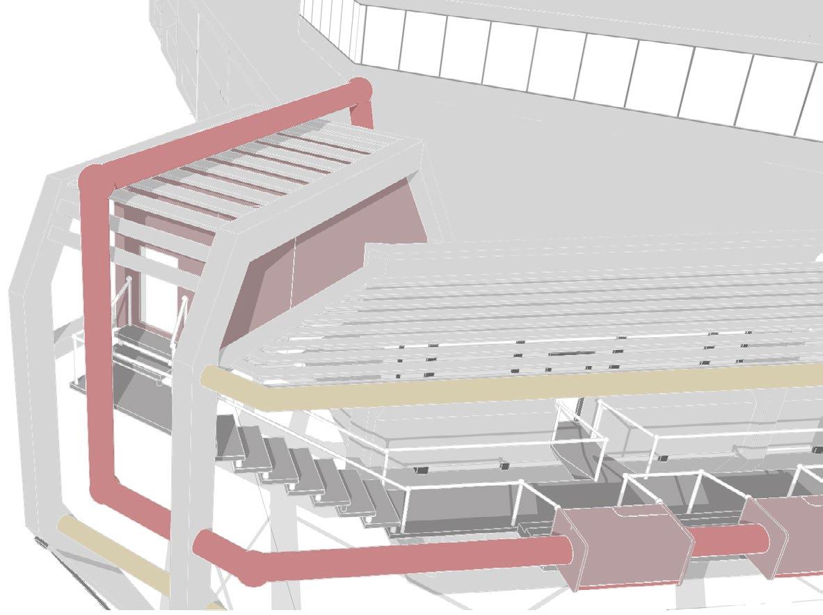
Control Room Key: Stairway Steel Channels Sleeping Pods Solar Shading [69] [70]
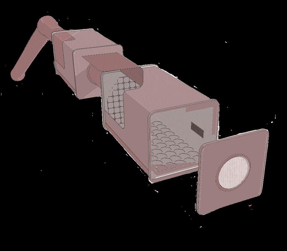
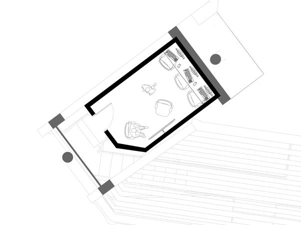
Control Room: Sleep Pods:
The control room located at the roof of the Pilkingtom lbrary is an accessible space for library users to study their own dreams, share their dreams or study others dreams.
Whist ‘sleep scientists’ may use this space for firther study into the prospects of recording/capturing dreams, the averae library user is likley to use it to be inspired by these recorded dreams, helping them in aspect such as recent tasks they struggled to come with ideas for.
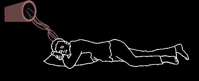
The sleeping pods are designed with optimum sleep conditions to improve the chances of the user reaching their REM-Sleep (a phase where dreams are most vivid).
Recording cameras and devises (such as an electroencephalogram) are used to capture REM (rapid-eye movements) during the users sleep. Once this state of sleep is reached, the user is awakened.
The user is encouraged to note-down their dreams most vividly which is then uploaded to the control room for further study.

Key: Stairway Sleep Pods
Control Room
Information Channel
[DEVELOPMENT] PROGRAMME
[71] [72]
0 5 25 50m 1:500 Plan
[FINAL DESIGN]SITE PLAN
Roof Intervension: Control Room
[73] [74]
Access-way ansd Sleep Pods
DREAM LAB.
PILKINGTON LIBRARY
Escape the pressures of the Library and fall deep into your subconcious. To recall our dreams allows us to define our thoughts, worries and issues whith the hope we can work to overcome them.
Though when we awaken, we are unknowing of the details of our past dream. What if we could accurately recounter our dreams and perhaps the dreams of others..? Tanke your rest at a the dream lab, which will awaken you at your most vivid stage of dreaming (REM) and take note of what you had encountered.
Allow others to be inspired by your dreams, and you of others.
[FINAL DESIGN]BIRD’S-EYE VIEW & NARRATIVE
[75] [76]
[FINAL DESIGN]EYE-LEVEL VIEWS
 View From Library Entry: View of Entry onto Access Stairwell:
[77] [78]
Perspective of north-West side:
[FINAL DESIGN]
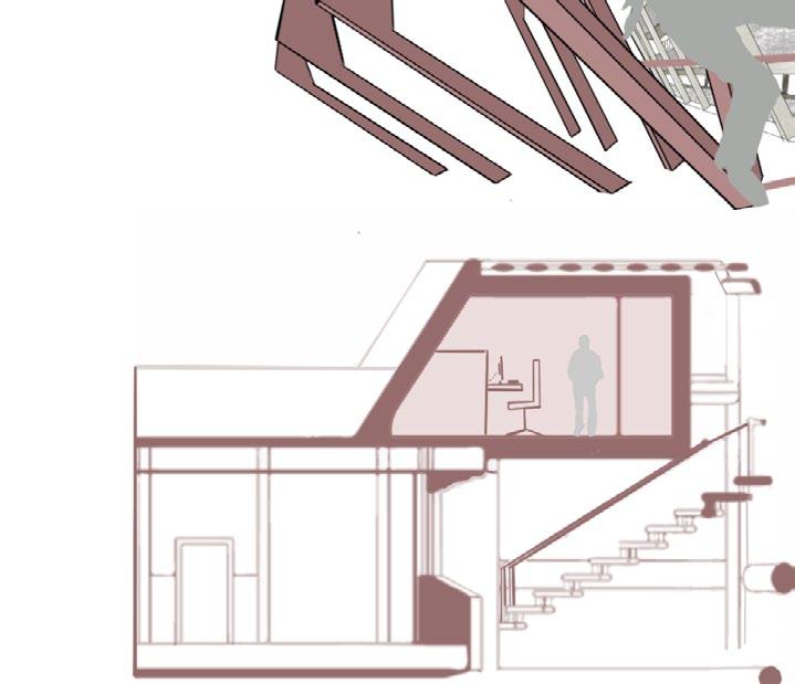
ROOF INTERVENSION: CONTROL ROOM
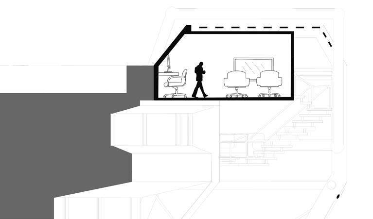
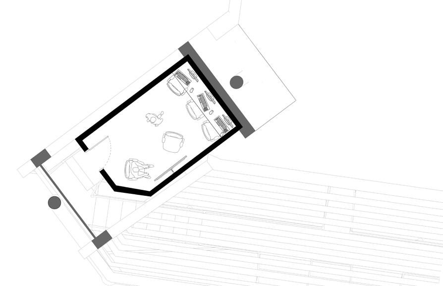
0 2 5 10m 1:50 Control Room Section 0 2 5 10m 1:50 Control Room Plan Control Room Location [79] [80]
Inspiration:
Dark and private spaces with no windows for daylighting
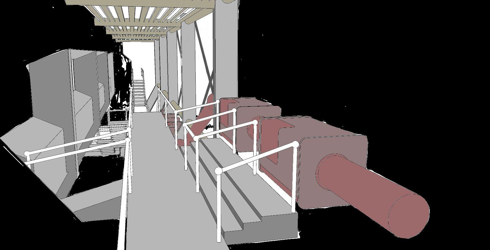
Sleeping pod in Manchester university library.
Designed for librarr users to take a 20 minute power-nap in order to “optimise the brain’s ability to learn and retain information” (Dobson, 2015).
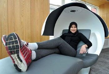
Cushioned Interior for Optimal Comfort
Control System for internal temperatures, alarm and touchscreen for note-taking
[FINAL
‘Dream Information’ Channel Access Path
DESIGN]SLEEP PODS
[81] [82]
(Figure 12)
DREAM LAB.
PILKINGTON LIBRARY
Escape the pressures of the library and fall deep into your subconscious. To recall our dreams allows us to define our thoughts, worries and issues with the hope we can work to overcome them. Though when we awaken, we are unknowing of the details of our past dream. What if we could accurately recounter our dreams and perhaps the dreams of others… Take your rest at a sleeping pod, which will waken you at your most vivid stage of dreaming (REM) and take note of what you had encountered. Allow others to be inspired by your dreams and you of others.
REFERENCES

(Figure 1) Kinder Scout trespass: How mass action 90 years ago won ramblers roaming rights. (2022). BBC News. [online] 23 Apr. Available at: https://www.bbc.co.uk/news/uk-england-derbyshire-61008955.
(figure 2) Freshwalks. (n.d.). Reviving the Spirit of Kinder 1932. [online] Available at: https:// www.freshwalks.co.uk/blog/520/ [Accessed 9 Jan. 2023].
YCL. (n.d.). Mass trespass of Kinder Scout turns 90. [online] Available at: https://challenge-magazine.org/2022/04/24/mass-trespass-of-kinder-scout-turns-90/ [Accessed 9 Jan. 2023].
Bidman (n.d.). Contributions by Bidman. [online] Contributions by Bidman. Available at: https://www. google.com/maps/contrib/114081244319356398307/photos/@53.46695 [Accessed 9 Jan. 2023].
(Figure 3) Viva, A. (n.d.). Museum of the Wenchuan Earthquake - Cai Yongjie Cao Ye. [online] Arquitectura Viva. Available at: https://arquitecturaviva.com/works/museum-of-the-wenchuan-earthquake.

(Figure 4) ArchDaily. (2013). Stonehenge Visitor Centre / Denton Corker Marshall. [online] Available at: https://www.archdaily.com/461242/stonehenge-visitor-centre-denton-corker-marshall.
(Figure 5) Journal. (2016). Framing the Environment: 8 Visitor Centers That Dramatically Connect With Nature - Architizer Journal. [online] Available at: https://architizer.com/blog/inspiration/ collections/visitor-centers/ [Accessed 9 Jan. 2023].
(Figure 6) Dezeen. (2022b). DnA_Design and Architecture transforms Chinese quarries into cultural spaces. [online] Available at: https://www.dezeen.com/2022/04/24/dna-design-and-architecture-jinyun-quarries/.
(Figure 7) world, S. (n.d.). What is the shape of sound? OPEN Architecture probes with a monolith chapel. [online] www.stirworld.com. Available at: https://www.stirworld.com/see-features-what-isthe-shape-of-sound-open-architecture-probes-with-a-monolith-chapel [Accessed 9 Jan. 2023].
(Figure 7) designboom, kat barandy I. (2021). OPEN architecture reveals an unseen look at its newly completed ‘chapel of sound’. [online] designboom | architecture & design magazine. Available at: https://www.designboom.com/architecture/open-architecture-chapel-sound-jinshanling-china-completion-11-01-2021/ [Accessed 9 Jan. 2023].
(Figures 8 & 10) The Museum of Modern Art. (n.d.). Louise Bourgeois: An Unfolding Portrait | MoMA. [online] Available at: https://www.moma.org/audio/playlist/42#tour-stop-684 [Accessed 9 Jan. 2023].
(Figures 9 & 11) Crook, L. (2019). Centre Pompidou is high-tech architecture’s inside-out landmark. [online] Dezeen. Available at: https://www.dezeen.com/2019/11/05/centre-pompidou-piano-rogers-high-tech-architecture/.
(Figure 12) Dobson, C. (2015). Manchester University installs futuristic sleeping pods at library so students can catch up on sleep. [online] Manchester Evening News. Available at: https://www.manchestereveningnews.co.uk/news/greater-manchester-news/manchester-university-installs-futuristic-sleeping-9197533.
[83] [84]
INTERVENTION SECTION INTERVENTION PLAN 1:100 1:100 1:500 0 0 0 50 10 10 SLEEP CAPSULE DESIGN ACCESS FORMN DEVELOPMENT Step 1: Selecting facade section for extrapulation. Step 2: Extrapolating facades vertical pillars parallel to facade wall. Step 3: Create attached walkways between pillars and facade for stability and access. Step 4: Add sleep capsules to pillars and walkways at building floor levels. Step 5. Place control center on edge of library roof. Step 6. Add pipe connections between pods and control center. Step 7: (Rotated) Add corossing steel rods along pillars for added stability. SITE PLAN
