Urbanism & Landscape Studio
 Hanna Erixon Aalto & Francesca Savio KTH Arkitekturskolan, Stockholm 2022

 Hanna Erixon Aalto & Francesca Savio KTH Arkitekturskolan, Stockholm 2022
RESEARCH (P1)
MEET THE STUDIO
INVITED PARTICIPANTS INTRODUCTION FOUR PRINCIPLES GENERAL STRATEGY P1: RESEARCH AND NARRATIVES
LEGAL INFRASTRUCTURE BLUE INFRASTRUCTURE GREEN INFRASTRUCTUREEARTH, SOIL, FOOD GREEN INFRASTRUCTUREVEGETATION, FOREST
PUBLIC INFRASTRUCTURE
LIVING CONDITIONS + LIFESTYLE
URBAN ECONOMY
4 6 8 20 24 26 28 36 44 52 60 68 76
P2: A COLLECTIVE STRATEGY
KYMLINGEPARKEN - SOONER AND LATER WEAVING WATERWAYS RETHINKING THE RESERVE LIVING WITH WATER BRIDGING THE BOUNDARIES INTERWEAVING WITH GREEN WORTHMORE
Madeleine Atterhem
Hadi Botoros
Jingkai Chen
Eugénie Deruaz
Agnes Ekbom Aldrin
Lycke Förell
Bingcen Guo
Marcus Johansson
Elizaveta Khamitova
Helena Lecocq
Elina Lejerbäck
Ylva Nissen
Nicole Oliveira
Alhawraa Salman
Beatrice Selander
Wiktoriina Alexandra Setälä
Yifan Su
Çlirimtare Syla
Yves Albert Rico Turmel
Adam Varga
Chiara Vicuna Narvaez
Sébastien Wegmüller
Mandong Zhu
Hanna Erixon Aalto
Francesca Savio









Tor Lindstrand, Architect at Larsson Lindstrand Palme Arkitektkontor and Associate Professor at Konstfack
Andrew Merrie, Research Liaison Officer at Stockholm Resilience Centre and Head of Futures at Planethon
Sherif Zakhour, PhD and Sustainability Specialist at White Arkitekter
Sara Borgström, Associate Professor at KTH
Daniel Koch, Researcher and Docent at KTH
Jonas Torsvall, architect and partner at 2BK Architecture
Francesca Savio, architect and lecturer at KTH
Hanna Erixon Aalto, PhD researcher and lecturer at KTH
Jaime Montes, architect and lecturer at KTH
Nina-Marie Lister, Professor at the School of Urban and Regional Planning, Toronto Metropolitan University
Maria Gregorio, studio lead and urban designer at Warm in the Winter
Anna Sundman, architect and founder at Theory Into Practice
Suzete Tumba Pihl, architect and urban designer at Archus
Jaime Montes, architect and lecturer at KTH
Anders Mårsen, professor at SLU and landscape architect at Landskapslaget
Sara Brolund Fernandes De Carvalho , architect and lecturer at KTH
Alejandra Navarrete Llopis, architect and PhD at KTH
Nina-Marie Lister, Professor at the School of Urban and Regional Planning, Toronto Metropolitan University
Eveliina Hafvenstein Säteri, architect and planning strategist at Stockholms city
Ania Öst, architect and lecturer at KTH
Anders Tranberg, Naturskyddsföreningen
Petter Kvarnbäck, Marketing and Communications manager from Vasakronan
Anna-Maria Larsson, Expert in Green Wedges, Ekologigruppen
Anna Barr, Stockholm University Department of Ecology
Jonas Jernberg, architect/planner expert on urban farming Urbanworks
Ulrika Egerö, ecologist and planning strategist at Stockholm City
Elisabeth Mårell, Regional planner fokus Green Wedges, Länsstyrelsen
Eveliina Hafvenstein Säteri, architect and planning strategist at Stockholms city
Örjan Hultén, Järva Folkets Park
Erik Stenberg, architect and Associate Professor KTH
Anton Botoros, Akalla Native
Amir Sebdani, project manager at BLING
Erik Andersson, Professor and ecologist at the Stockholm Resilience Center and Helsinfors University
Rebecka Milestad, agronomist, doctor in rural development and docent in environmental strategies research at KTH
Kerstin “Piglet” Wikström, Husby konsthall
Anders Berg, city architect Järfalla kommun
Örjan Hultén, Järva Folkets Park
Venue: KTH Library
Address: Osquars backe 31
Date: 16/12/22 - 17/01/23
The Urbanism and Landscape Studio focuses on cities, landscapes and territories in the broader context of the environmental crisis. How can we imagine a sustainable and resilient twenty-first century city? What can designers’ role be in addressing urgent and interconnected problems such as rapid urbanization, biodiversity loss, social inequity and severe global climate changes affecting our cities? This book presents analytical studies and projections made by 23 students from the Urbanism and Landscape Studio at KTH School of Architecture.
In the fall of 2022, the studio has investigated how the Green Wedges of Stockholm can be a catalyst for new resilient urban environments. We have zoomed in on the Järva area, a site that exemplifies a contested planning situation in which the seemingly incompatible endeavors of protecting and maintaining green and open spaces are set against the will of creating a polycentric, dense and more connected urban fabric. The studio aims at challenging this polemic praxis through the exploration of alternative city/nature relationships.
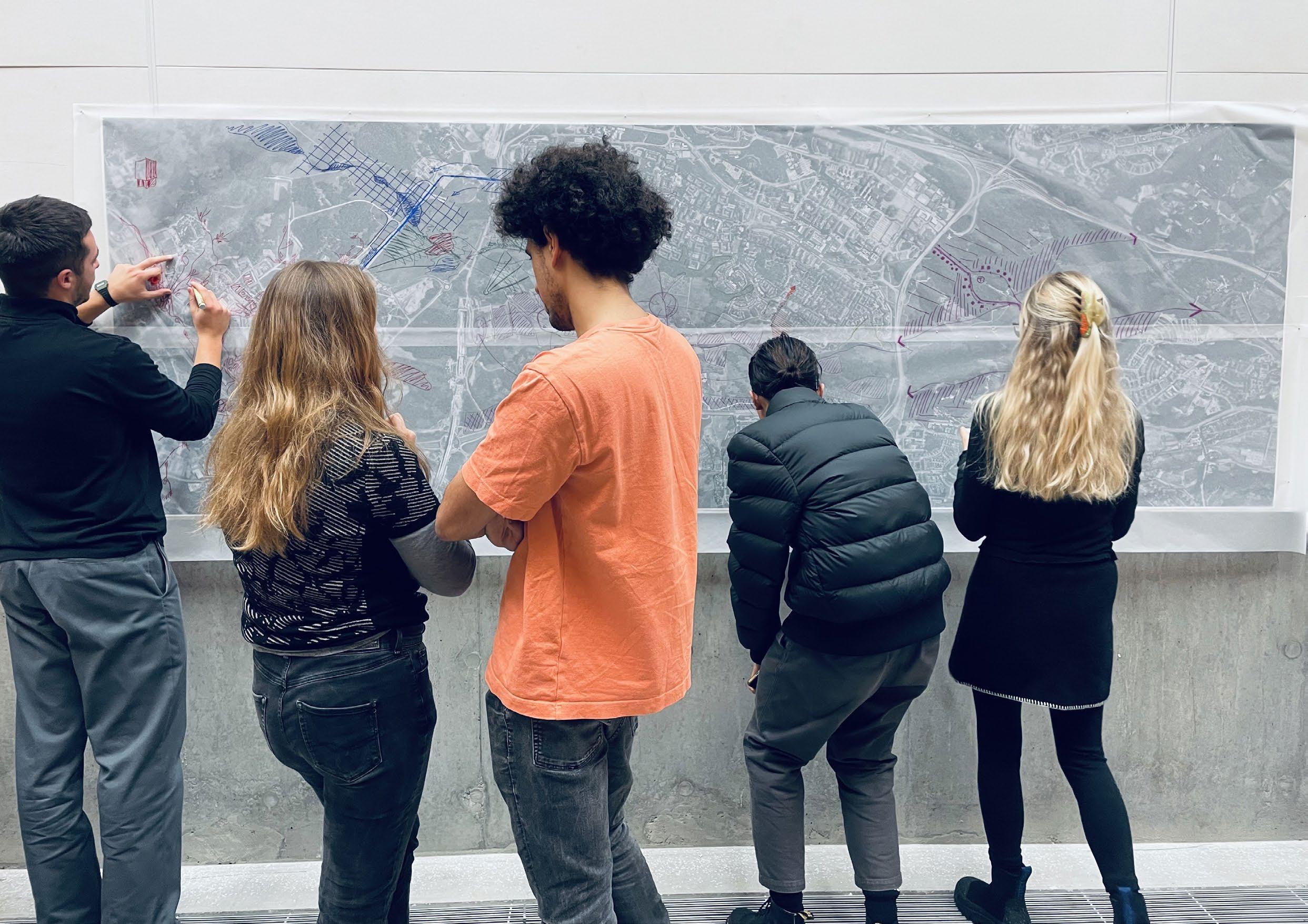
The Urbanism and Landscape Studio focuses on cities, landscapes and territories in the broader context of the environmental crisis. How can we imagine a sustainable and resilient twenty-first century city? What can designers’ role be in addressing urgent and interconnected problems such as rapid urbanization, biodiversity loss, social inequity and severe global climate changes affecting our cities?
Drawing on the nexus of ideas within landscape/ecological urbanism, resilience theory, and the environmental humanities, the studio challenges the modernist idea of the city as a fixed, delimited territory contrasting the ‘natural’ world around us. Instead, we explore landscape and ecology as organizers of urban space; as providers of catalytic urban strategies that can embrace complexity and multi-functionality and change over time.
Stockholm is growing rapidly. This brings with it a number of important challenges, e.g. in building new housing and public infrastructures, as well as strengthening resilience toward climate change and biodiversity loss. In this context, balancing urban growth and development interests against the need to safeguard large-scale urban green structures – the Ten Green Wedges of
Stockholm – has become a key issue. Previous urban development strategies expressed aims to keep the green structure as continuous as possible, by “building the city inwards” and creating a more dense urban core. This has, however, recently shifted towards a desire to expand the city outwards, towards the suburbs, creating a denser, polycentric, locally connected urban fabric across the green wedges that may counter social segregation. At present, the will of achieving a contiguous urban fabric is set against the goal of safeguarding vital ecological services and resilience of the large-scale green structure.
The studio has aimed at challenging this polemic praxis through the exploration of alternative city/nature relationships. How can the Green Wedges of Stockholm be operationalized as a productive, generative landscape that can be a basis for new urban living environments? Must natural values always be sacrificed when the city grows, and, concurrently, must “nature” always be seen as an obstacle to urbanization? We have focused on a suburban section of Järvakilen that includes the municipalities of Järfälla, Stockholm and Sundbyberg. The aim of this studio has been to explore the transformation of existing antagonistic relationships into synergistic ones; they become part of the solution instead of the problem.
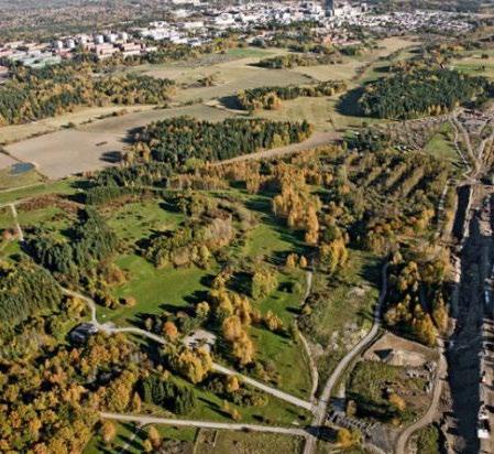
The selected case, the Järva area, is located in the north-western part of Stockholm. The site centers on the Igelbäcken stream and includes a section of the Jäva green wedge and parts of surrounding housing areas that are located to the north and south. These neighborhoods accommodate approximately 60,000 inhabitants (8% of the population of the municipality of Stockholm) and the majority of the land is owned by the municipality and the state. Similar to what is typically found in Swedish cities, the landscape can be characterized as primarily consisting of extensive, cultivated, open areas. About half of the green wedge consists of fields and grazed meadows, which are partly dedicated to active, small-scale agricultural land uses, and partly constitute abandoned and overgrown former agricultural areas. The elevated parts of the landscape support groves of deciduous forests and patches of coniferous forests, and in some lower parts, wetlands have been restored.
Middle-class residential areas characterized predominantly by single-family houses are located at the edge of the study area.
Given these conditions, the study area at large can be said to exhibit socioeconomic and ethnic diversity, but the individual neighborhoods are rather homogenous enclaves, separated by roads and green space – a typical pattern in the suburbs of Stockholm.
The main housing areas surrounding the wedge were planned and built in the 1960s, 1970s, and 1980s, in the spirit of modernist “neighborhood units” and in response to the ideals of traffic and functional separation. These areas are today characterized by a very high proportion of population with foreign background and considered among the most socially segregated suburbs of Stockholm.


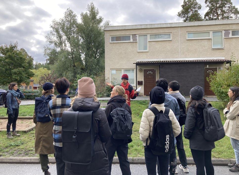

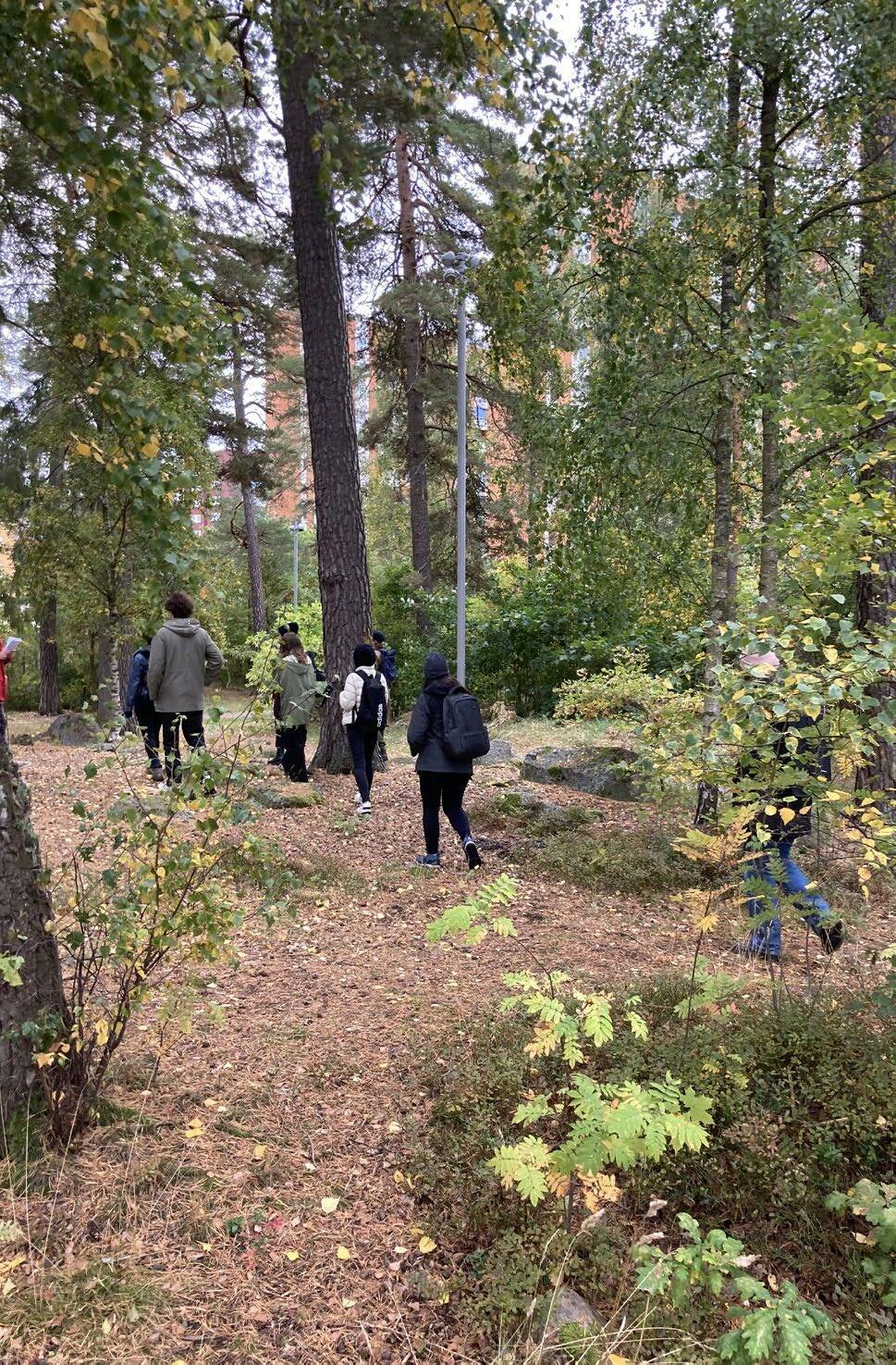
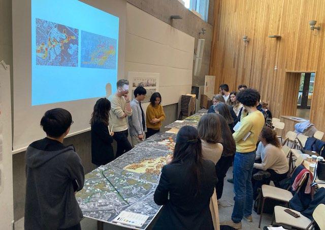
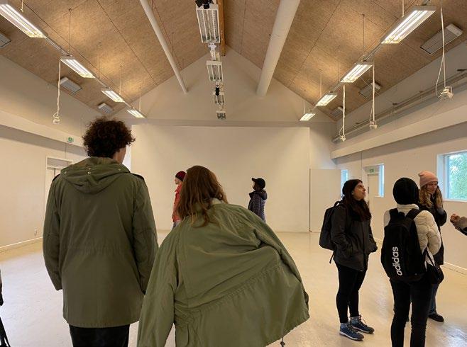
We aim to empower students to develop a critical and systematic outlook to the urban and global problems we face though the study of hands-on, ‘live’ problems grounded in real-world challenges. Urban design is an inclusive, reflective and, by necessity, transdisciplinary practice. The studio supports this by working closely with decision makers, activists, local organizations, and experts. We study international references, learn from invited lecturers, hold literature seminars, perform writing exercises, conduct interviews with relevant actors and arrange expert tutorials and interdisciplinary workshops. Learning from history, we study how the forces of nature, culture and infrastructure have shaped urban life. By combining the critical and the suggestive, analysis and innovation, we develop bold scenarios that reframe the relationship between humans and nature. We see outcomes that reveal unexpected potential ranging in scale from the territorial and the neighbourhood, down to the detail of a living environment.
A strategic general plan is developed to establish a holistic view on how the green wedges of Stockholm could be transformed. The map also outlines a set of overarching strategies as well as pointing out the selected sites where the students have developed site specific projections.
A set of maps codifies and illustrates The Jarva Wedge and bring forward various types of boundaries, e.g., political, economic, or physical. The maps also show spatial and statistical relationships that may reflect ecological, physical, social, and economic aspects. We see the maps as subjective abstractions. They can be powerful tools to influence human behavior and decision making. The maps are produced to generate new views on the territory and to bring forward unexpected solutions and effects.
Timeline-collages and interviews present how different relationships between the environment, actors and structures can take on different forms and constitute different living environments. For instance, a farmer can only practice a farmer’s life if he has tools, plants, spaces for storage, structures for selling the crops, and so on. Looking back in history, this practice was associated with one type of living environment; today the practice might look completely different. This leads us to imagine and formulate more resilient future environments and relationships.
A series of alternative strategies is created with a landscape-first approach by investigating the site in relation to ecosystem services and working with system thinking. In nature, systems think
ing examples include ecosystems in which various elements such as plants, animals, air, water and movement work together to survive or perish. In social and economic systems elements consist of people, structures, and processes that interact and make the system healthy or unhealthy.
Challenging the idea of the unfeasability of developing in and around the wedge we design different strategies for building and densifying the site. With different density goals we can compare scenarios of development that span from the rural to the ultra urban and exemplifies various approaches to creating density on the sites, by working on the edges, or creating new structures in the core of the park.
The projections explore the potential of the chosen sites. Projections are estimations or forecasts of future situations based on studies of present trends. The projections are developed as sketches, axonometric drawings, views, and system sections. These projections are tentative, rapid prototypes, through which we explored key aspects and potentials that evoke ideas and reactions for further development. The projections also aim to rouse public opinion about alternative future scenarios.




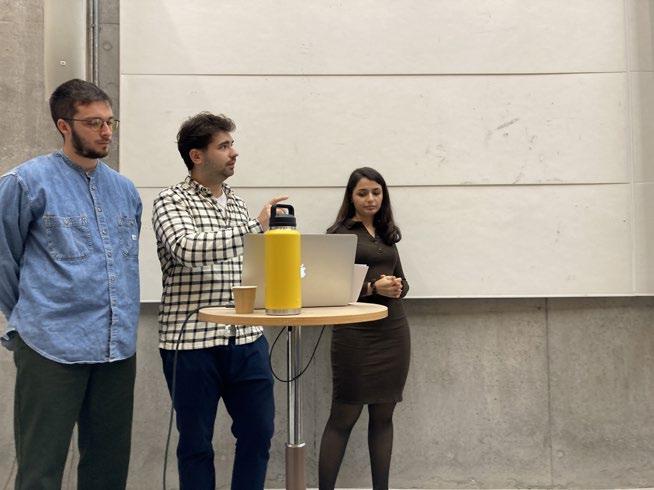


Four key principles that guide planning and design are developed in the studio. These principles aim to strengthen and support a sustainable and resilient development of Stockholm as well as the city’s relationship to its Green Wedges.
Stockholm is growing rapidly: the city is expected to have a population of 1.3 million by 2040. This entails a number of important challenges, for example, the construction of new buildings, adaptation of transportation- and public infrastructures and strengthening resilience related to climate change and environmental degradation. At present, and in mainstream urban planning strategies, the need to meet the demands of the growing city is often contrasted with the need to safeguard green infrastructures in a dichotomist fashion: landscapes are either ‘spared’ (through reserves) or ‘sacrificed’ (to development) rather than integrated, conceptually, physically, economically and ecologically into the urban structure. Projects within the studio have set out to explore the transformation of these existing antagonistic relationships into synergistic ones, asking – can we preserve, or even strengthen and create, locally generated ecosystem services whilst at the same time developing a more connective urban fabric including modern urban neighborhoods for human and non-human actors alike? Can a more built-in protection of these areas be created through tying people more closely to the green wedge, thus complementing more formal conservation
strategies for safeguarding large urban green structure values? The projects within the studio explore a wide range of strategies including: ● The introduction of a new public connective tissue in the wedge, that activates the landscape and is built on principles of caring and sharing combining urban farming, food production, markets, community buildings whilst supporting ecological connectivity and biodiversity in the landscape ● Creating a framework for experimentation and innovation – a new “Stockholmsutställningen” – that extends the knowledge cluster of Kista out in the wedge towards Barkarby, creating a highly performative and connective landscape where flows of flora and fauna coexists with education, research, commercial and recreational functions.
In recent years, the City of Stockholm has expressed a strong ambition to promote social and physical integration by improving and establishing connections between the neighborhoods in a north–south direction. In the on-going policy discourse, these ambitions are held to conflict with the objective of protecting ecological and recreational values, a task which is tied to the unbroken continuation of the green wedge in an east–west direction. The dualism presented in relation to Järva – which juxtaposes connected, large-scale green structures against a connected
urban fabric – is typical of the Stockholm context and is reflected in both the general planning discourse and in planning practice. In the Urbanism & Landscape Studio we question this polemic thinking and explore the diversity of what it means to “connect”. Strategies proposed within the studio include: ● The introduction of robust public strands that run cross the wedge in strategic locations and weave together people, plants and animals through new symbiotic typologies ● New entrances to the wedge that counter barriers in the landscape and create opportunities for people to live more close to and be a part of Järvafältet ● Enhancing a system of “mini wedges” that connects in to the core of the surrounding neighborhoods through a system of green landscape paths where people, bikers, dog walker, joggers, public transportation etc. can travel around in an uninterrupted flow ● Enabled new connections between the districts and the green with the implementation of a new tram that runs as a ring line between Akalla, Barkarby, Hjulsta, Rinkeby, Ursvik, Kista and Husby.● Staging innovative and playful water spaces and wetland parks that become a public connective tissue for urban development.
and Sweden. Being our societies and economies dependent on the quality of our ecosystems, we need to start working on enhancing ecological structures and build resilience to safeguard our cities. Climate change is appearing in Sweden in the form of extreme drought and warm weather that have disrupted both agriculture and forestry with, among other climate issues, the lack of water, uncontrollable fires, the strengthening of harmful pests, and unpredictable seasons. In the Järva area, questions of climate change and biodiversity loss are deeply connected to water and blue infrastructures. The Igelbäcken stream that runs from the lake Säbysjön in the North-West to the Edsviken in the East has been suffering from water shortage, lack of connectivity, as well as high amounts of PFOS in water and sediment. The previous vital stream and its surrounding wetlands have been straightened out, buried in artificial tunnels, drained and degraded, just like many other similar areas historically. In Barkarby, issues of water and flooding have even put future development plans on hold, due to projected risks of flooding. In light of this, the studio has set out to take a more holistic approach and explore potential
Extreme weather conditions as a result of climate change have had a global impact that does not spare the Nordic countries
synergies between ecology and its residents. How can we rethink our idea of what is “urban” and “stadsmässigt”, and curate new urbanism cultures that stitch together humans and their green and blue environments? How can we weave together societies with their local resources, and how can we re-imagine new modes of management structures for public green and blue resources? How can we raise human awareness about what is vital for our long-term survival, although it is often invisible? Diverse strategies are proposed within the studio including: ● Robust public spaces that delay storm water through wetlands and softer edges. ● New performative neighborhoods that can simultaneously constitute habitats for humans and non-humans whilst improving biodiversity in the wedge and water quality and flow in Igelbäcken ● The creation of green corridors and connections for flora and fauna to flow through the landscape ● New passages under and over existing barriers in the landscape for both humans and non-humans.
Our site, Järvafältet, is part of the regional green structure and the Järva Green Wedge, which extends from southern Djurgården in the southeast, via Järvafältet, to Sigtuna in the northwest. The wedge structure, compared to for instance a Green Heart or a Green Belt, is beneficial since it allows many people to have
contact with nature close to where they live. As one of the city’s areas of development and expansion, the peri-urban Järva area experiences strong development pressures, with a range of different interests and actors connected to the site and involved in its development. Today, around 50% of new construction in Stockholm takes place on natural land, and piece by piece of the Green Wedge is being chewed away without a clear comprehensive strategy and vision to provide direction. This can be traced back to the market-led “Stockholm model” that today guides urban development, in which long-term planning strategies are replaced by short-term priorities. Furthermore, the very largeness of the green wedge can be identified both as one of the main challenges and main potentials. On the one hand the large scale of the wedge creates conditions for high biodiversity since it allows a dispersal of various species, plants, animals and genes to spread throughout the landscape. On the other hand, the large size, and the fact that the wedge spans over multiple jurisdictional and administrative borders, makes out a challenge to maintain a consistent interpretation of the green structure amongst stakeholders. How can the Järva Green Wedge at large, and the Järva green area in particular, become more legible, as an organizer of space and provider of identity and a sense of belonging? Instead of isolating surrounding neighborhoods, can the green wedge function, as framed by urban theorist Julia Czerniak as a: “social catalysts by providing contact and exchange for people in otherwise disjointed urban environments”? Projects within the studio include proposals for: ● A series of connected identities that tie together as a sequence of parks connected by
a public passage along the stretch of the Igelbäcken stream. ● Amplifying existing social and cultural nodes in the landscape (such as Eggeby gård, Husby gård, Hästa gård), and strategically adding new ones where they seem to be missing. ● Staging innovative and playful water spaces and wetlands parks that become a public connective tissue for urban development. ● A new tram line that strengthens the public transport infrastructure connecting neighborhoods surrounding the wedge in a loop and enhancing local exchanges and accessibility.


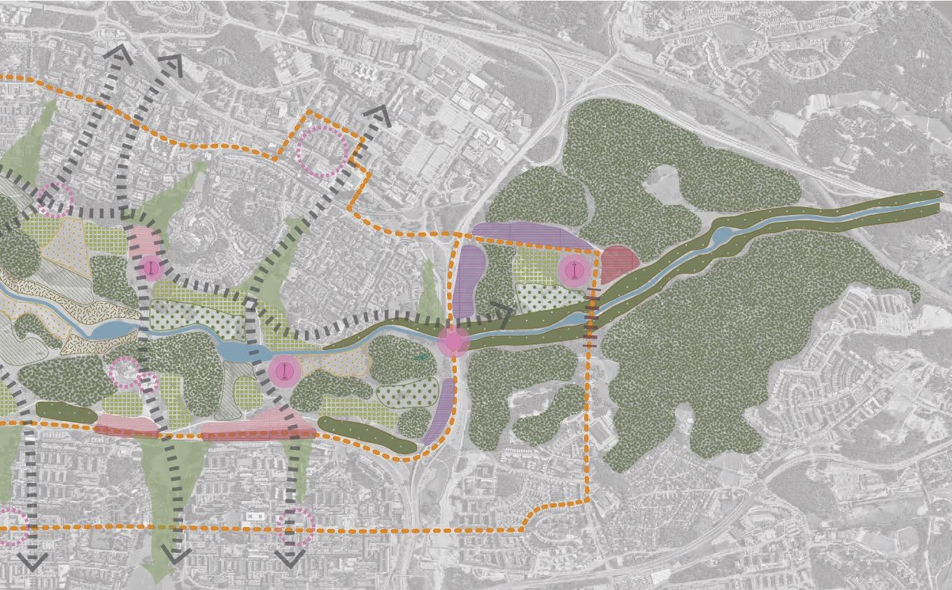
While dealing with the Järva area, it is important to realise its great natural and social potentials, which can be segregating barriers, both physical or perceived, but also drivers for future developments. The area suffers from insufficient connectivity between the neighbourhoods, a fragmented relationship with nature and misses common language conveying its qualities into unborn scenarios. Our strategy makes use of the resources and landscapes while maintaining respect and consciousness of the existing conditions and ecosystems. By interpreting our five layers of thinking, we try to imagine Järva as a sustainable and resilient urban area, where large natural green bodies serve as catalysts for creating co-living and co-interacting spaces for future societies and non-human actors.


An essential part of creating a ‘Järva Identity’ is to promote existing landmarks and also create new ones. The celebration of runestones and urban farms cements a pre-existing connection with the area. Bird towers offer vantage points to help locate oneself within the wedge itself while also offering vistas across North East Stockholm.
New infrastructure is to be proposed in the form of a tram operating on two circular lines - connecting neighbouring residential areas. In addition, new roads winding across the green wedge make pedestrian travel safe and public transport on buses easy.

For people to develop closer connections with nature it is important shared spaces such as allotments, farmland and flower gardens thing tangible in return. A range of new public spaces such as markets knowledge to be shared.
important to offer functions that help engagement with it. New gardens offer the chance to work with nature while receiving somemarkets and education centres allow for both produce and
Exsiting public facility Allotment Meadow
New public / meeting space
New public / meeting space / Landmark
Tram
The connection of landscapes can be broadly separated into both green and blue. The Igelbäcken will be used as a carrier for emerging communities, while new wetlands will offer new public space in addition to their ecological benefits. Urban planning and architectural language will be informed by the landscape to create a closer relationship with nature and its human inhabitants.



Main
Bridge
In areas such as Tensta and Rinkeby, the connection to Järvafeltet is inhibited by the highway that acts as a barrier. This edge would be blurred by creating new residential areas that transition from high to low buildings. Furthermore, this will help reduce issues of noise pollution caused by the highway. Areas of new development will have a less explicit distinction between the built and ‘nature’ by introducing mini-wedges that again help blur the line.

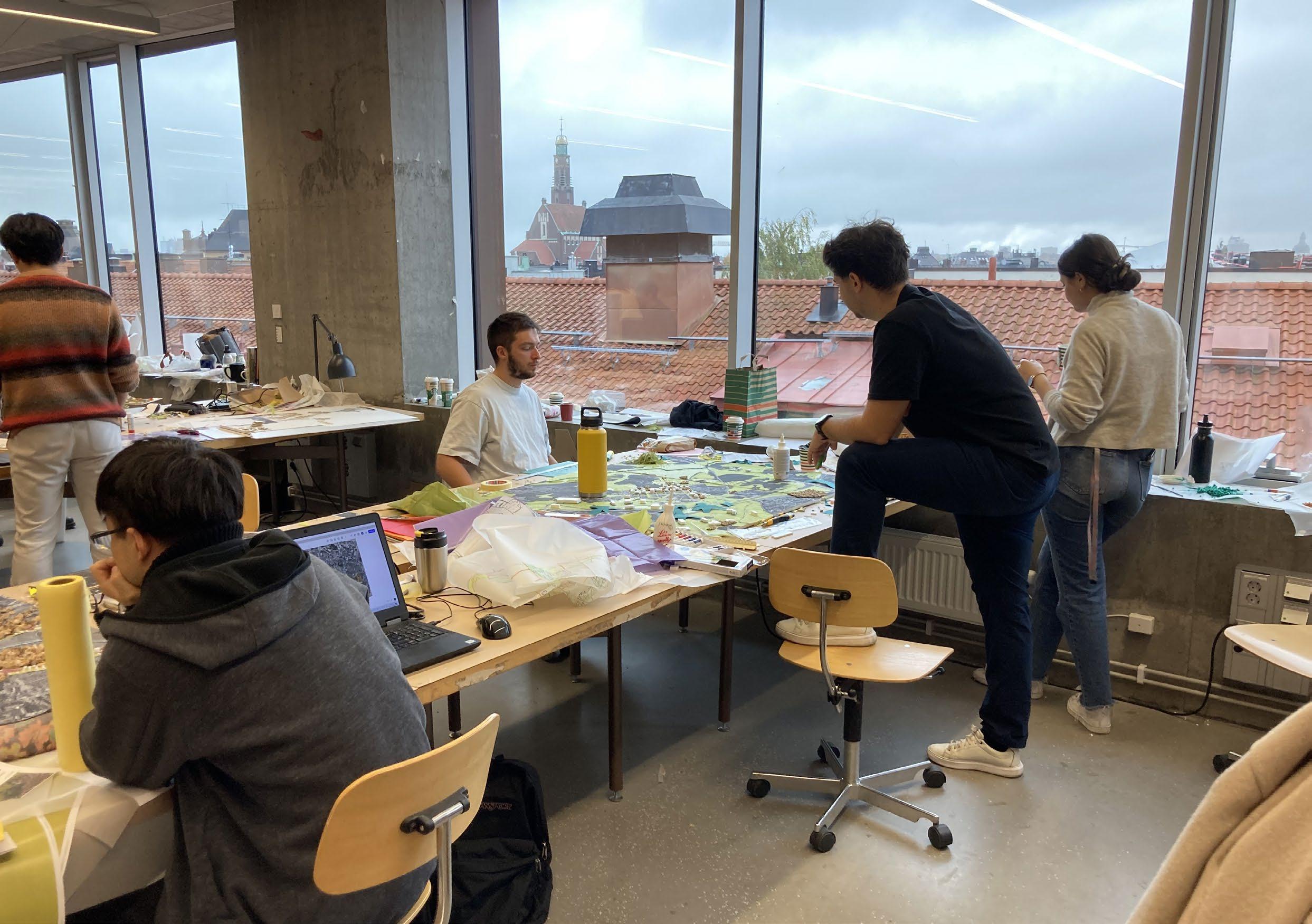
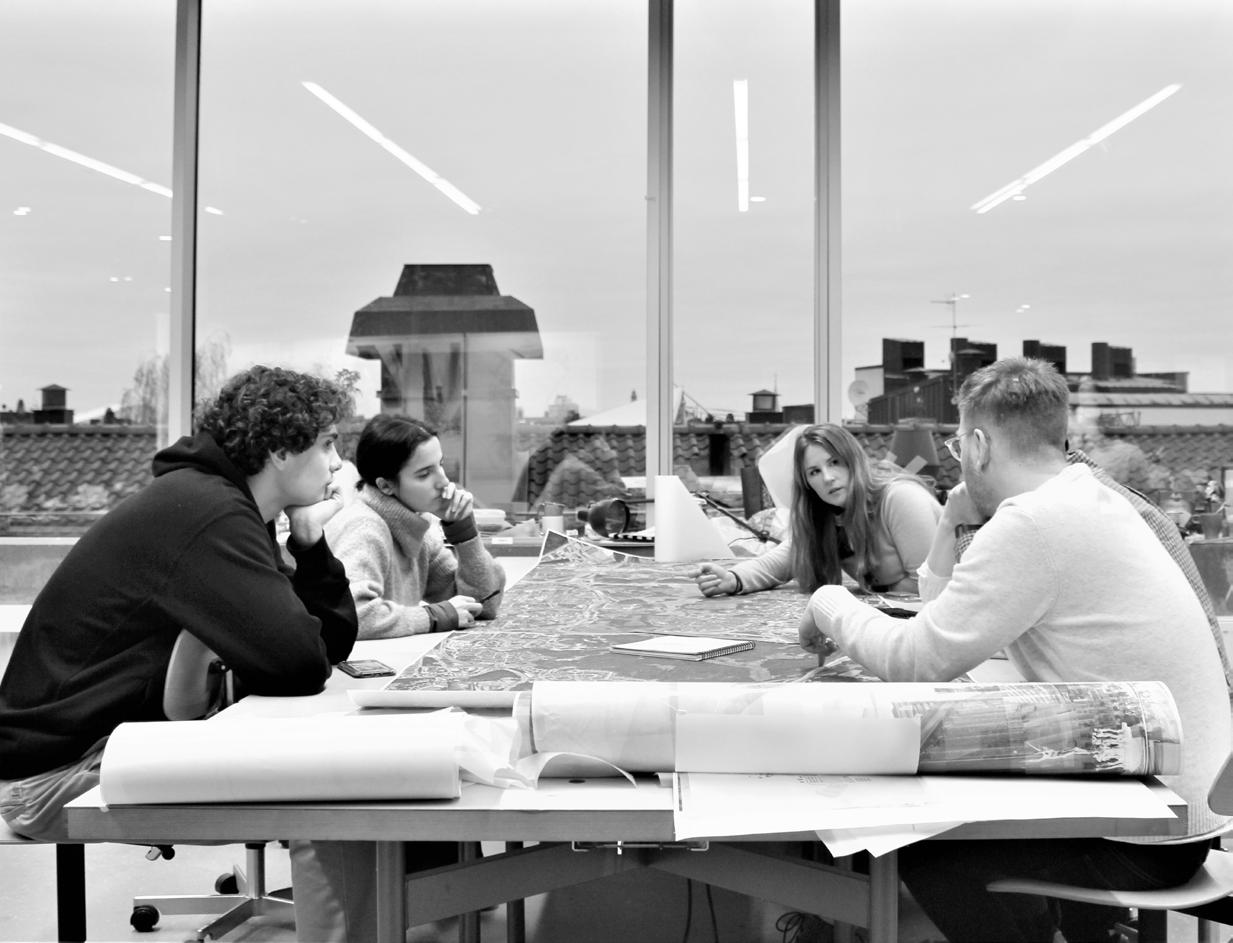
In the first part of this studio we study the complexity of the site through combining theory and analysis with artistic and bold explorations. Working closely with actors and experts on the site, we investigated and conceptualized existing and new interfaces for human/nature relations. We divided in groups and specialized in different aspects of landscape and urbanism. The work of each group might overlap but is unique and contributes to an open source knowledge sharing that will
be used by everybody later in the course.
Through the lens of art and architecture we will test and project scenarios for where and how new relations with nature could develop. Our investigation: how can the Green Wedges be operationalized as a productive, generative landscape that can be a basis for new urban living environments?

Grup member, group member, group member
Järvafältet is located northwest of Stockholm and is part of Stockholm’s green wedge, which extends from the inner parts of Stockholm to the more rural parts of the county. The site has great ecological and urban potential but also acts as a barrier for the neighboring areas, which makes the site exciting from several perspectives. We started exploring the site from a legal infrastructure perspective and discovered that the legal conditions dominate the framework for the existence of the site. The legal infrastructure includes physical and administrative borders, but also political visions on both a municipality level and for the country at large. So how could we find a green strategy for this? By expanding the allotment as a principle, we wanted to create collective clusters for food production around the existing arable land. These clusters would stretch the length of Igelböcken and create a legible center that would be beneficial for the entire area.
This is a diagram of how the non-human and human actors would cooperate.With this strategy, we wanted to challenge the view of nature as something separate from us. Could we find a common green infrastructure for both humans and the qualities of the reserve? By bringing different ingredients to the site we could help the ecological actors. The collective clusters would be a new way to organize such a proposal.


Strategic plan for Stockholm - Legal infrastructure
4.
5.
Diagram 1. Urban infrastructure causing fragmentation of the green wedges.


Diagram 2. District segregation due to long distance because of a big conservation.
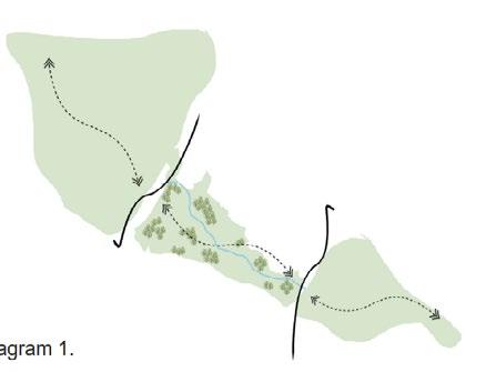
Graph 1. Number of national parks, nature reserves and nature protected areas divided into total area of sites.6


Graph 2. Protected area of national parks, nature reserves, nature conservation sites and Natura 2000 (habitat directive)
Accumulated area (millions of hectares) per year.7
CATEGORY 1 - LANDMAP
Allotment gardens Culture reserve Nature reserve Borders of municipalities Private owners right to use land
CATEGORY 2 - SYMBOLS
Relation to legal regulation Nature reserve Property owner Municipality Culture reserve Profit interest Associations
1.Nature area and burial ground at Järva
2.Outdoor swimming pool (Järvabadet)
3.Rinkebyterrasen
4.E4 Stockholm Bypass (Förbifart Stockholm)4
5.Possible built area and Kymlinge station
4.
EXPLINATIONS 1. 3.
(1) https://vaxer.stockholm/projekt/jarva-begravningsplats/ (2) https://vaxer.stockholm/projekt/nytt-utomhusbad-pa-jarvafaltet/ (3)https://vaxer.stockholm/projekt/bostadsomradet-rinkebyterrassen/ (4)Trafikverket. E4 The Stockholm bypass. Stockholm, Sweden. (5)https://vaxer.stockholm/projekt/husby-kulturstrak/
(6)Naturvårdsverket. Swedish Nature Conservation 100 years. Stockholm, Sweden
Diagram 2. Graph 2. Diagram 1. Graph 1.
Urbanism & Landscape Studio 2022/2023


Teachers: Hanna Erixon Aalto & Francesca Savio
Students: Lycke Förell
Çlirimtare Syla
Sébastien Wegmüller
1971
The first protected area is created in Järvafältet by the National Board of Agriculture
1905-1968
The whole field is left by the military, who are using the place as a training area. This particular usage made the place practically untouched.
“Nature has an ecosystem that helps to preserve itself, but we can also as humans take advantage of it.”
“Green infrastructure is very important, both for humans to have green space to walk in, but also for species to be connected between different areas.”


The housing shortage in Sweden and especially in Stockholm has political consequences. The Social Democratic government therefore promises that one million homes will be built between 1965 and 1975.
1999
The cultural reserve protection instrument was introduced by the Environmental Code in 1999. The intention is to enable the care and conservation of valuable cultural landscapes.
The growing population and housing shortage are prompting the city to build more and more homes. The new challenges are defined in the 1999 Stockholm City Plan.
People can have a allotment where can grow food and flowers. No buildings are allowed and the use is restricted.
Few projects are taking agriculture, small communities, sites are the most common The main use is walking,
“Järvafältet is one of these places where there are a lot of people that lose out on the current way of developing it.”
they buildings restricted.
taking place in the protected areas: communities, gardens and rental common activities in these areas. walking, running or cycling.
The boundary between protected areas and built-up areas is very strong. Either the area is protected or you can build whatever you want.
“I think we do need to have sort of boundaries regarding nature, at least perceive certain boundaries as important, especially when we live in this capitalistic society.”
Allotments could be on a much larger scale, with people respecting nature and having a fair division of land.
No more boundaries: nature cohabits with the different buildings, creating a more organic space.


All protected areas are linked, which allows species to move freely, as the buildings are not connected but surrounded by nature.


Activities could be organised to make discover the nature and new dynamic places. The quality of the ecosystem is guaranteed by the people who become part of it.
“I think the clear separation between built-up and protected areas is bad for nature and for the way people look at nature and use it, I don’t think the boundaries need to be so sharp, they can be much more fluid and we need to preserve the best parts of the green spaces.”
One of the interviews that we had was with Petter Kvarnbäck, a Marketing and Communications manager from Vasakronan, which is a commercial real estate company owned in equal shares by the First, Second, Third and Fourth Swedish national pension funds. As answered in the interview the goal of this company is to provide money to pension funds, to allocate some of their means to the company. While asked if it the process is different as a real estate development so close to the nature reserve from other regular real estate developments/city planning, the interviewee said that it is different. He explained that the company develop their property in existing green fields and existing building. And he explained that if they want to build something close to a nature reserve they have to be extra careful on what the border could look like.
He, then told us about the aim of company, that being to be climate neutral as a company. So to be able to do that, they have to work on decreasing the energy consumption, the use of materials and other factors. They have to compensate for the built area otherwise it would be impossible for them to become climate neutral.
He talked about the Kymlinge area where it shows the conflict between Vasakronan and the Sundbyberg municipality since the last mentioned has no interest in the development of this area. This area is part of this municipality so without them settling nothing can start happening in that area. To sum up, it seems that it is not convenient for Sundbyberg to invest something there because it is on the wrong side of the nature reserve which comes to becoming an issue the “strange location” of different services provided by the municipalities while comparing with the other parts of Sundbyberg. But also there would be no business plan for Sundbyberg since Vasakronan owns the land and the when the municipalities develop they sell land and get some money so at this area this wouldn’t be possible for them.
Asked if it is a good or a bad thing this so called separation of nature and the built area of the current organization of nature in the city he depicted that it is bad for the nature and also for the people on how they look at nature or use the nature. His opinion is that the lines don’t have to be so sharp, they could be more fluent while preserving the best parts of the nature and using the not so highly valuable parts for building apartments because of the high demand.
The second person we interviewed was Anders Tranberg from the Stockholm branch of the Swedish Nature Conservation Society. He works to create links between green spaces and protected areas in the city.

Areas are protected, but individual objects can also be protected. The qualities of a nature reserve are protected species, a sensitive environment like wetlands or old forests, and also social values. He thinks that we do not protect nature enough in Sweden, as only 6% of the forests are protected. Industry is the first problem when talking about forests, because the demand for wood is high. For him, it is better to leave the protected areas totally free. If we could build there, it would be difficult to know what to accept or not. Nature needs large spaces, and the soil must also remain intact, which is not compatible with housing foundations for example. Only small constructions could be allowed, and eco-villages could be a possible option.
In the Järvafältet area, the construction of the highway is a big problem for him. The city didn’t want to build a tunnel because it was expensive, even though it was better for the peace and nature. The other problem in Järvafältet is that the area is not welcoming enough for visitors. There are many possibilities to do much more to attract people to the protected area.
He thinks that the way the zones are drawn today is a bit tricky, because often some of the nature has to be preserved for the development of the city. There has to be some balance for the city so that the interests of both parties are respected. He imagines that having a strict limit and a tolerant limit could be interesting. To conclude, he thinks that Stockholm should use the land in an efficient way, for example by having underground infrastructures to let nature develop, and by connecting the different areas by green corridors.
“Green infrastructure is very important, both for humans to have green space to walk in, but also for species to be connected between different areas.”
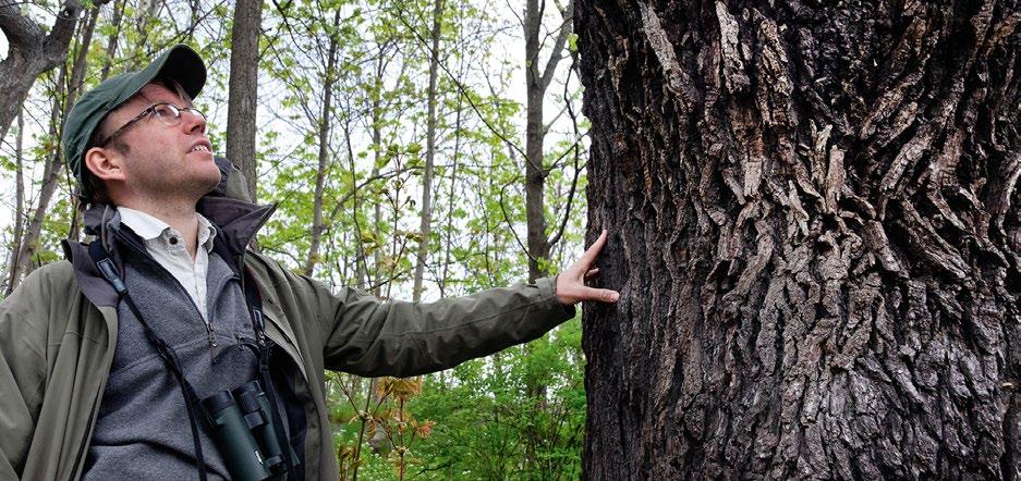
“When we develop our property we do it in existing green fields or existing buildings. It’s quite rare that we do it in green areas.”Photo: The Stockholm Circle with chairman Anders Tranberg managed to save the endangered old oaks on Kungsholmen
How the “Miljonprogrammet” shaped the landscape of the Stockholm suburbs ?
After World War II, Sweden was characterized by a very strong growth until the 1960s. People left the countryside to find new jobs in the cities. Unfortunately, there was not enough housing for this growing population. The crowding and lack of standards in the inner city neighbourhoods became a symbol of social misery. It was felt that people should instead move to the outskirts of the city to more spacious apartments.
In 1964, the Parliament launched the “Miljonprogrammet” and decided that one million new housing units would be built between 1965 and 1974 to solve the housing shortage for good. The aim was to raise the standard of housing, both in terms of size and equipment. The lack of labor made it difficult to keep up with the high production, so it was necessary to rationalize, standardize, mass produce and use large-scale methods. The confidence in modern methods to solve the housing problem is very high.
During the 1970s, Sweden entered a recession and newly built apartments became empty due to a decline in demand for housing, but many of the original objectives were achieved and the housing shortage was resolved. However, new problems soon emerged and the critical debate began early on.
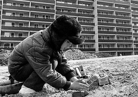
For many critics, the “Miljonprogrammet” symbolizes the inability of planners and politicians to build the “good society.” The monotony, dullness and large scale of the buildings were often criticized as an attempt to make the largest possible houses in the shortest time and at the lowest cost, with the possibilities offered by technology being poorly exploited. Houses were often depicted as large concrete blocks in contrast to the small human being, and this large scale led to dissatisfaction and lack of social control.
Outdoor environments were often characterized by the same scale and uniformity as the buildings, and quality requirements were often few and imprecise.
This criticism also resulted in problems with empty apartments and relocation. The remaining households had fewer financial resources, and it was easy for social services to place households with social problems in these areas. New immigrants were also often placed in these neighbourhoods, and all of this caused the Miljonprogrammet to develop into underclass communities, which created more and more segregation.
How the Stockholm 1999 General Plan took lessons from the past to set new goals for the future city ?
The plan was created in response to the various problems facing the city, given the population growth that began to increase again in the 1990s. The objective is to achieve the four main goals into which the project is divided by 2040.
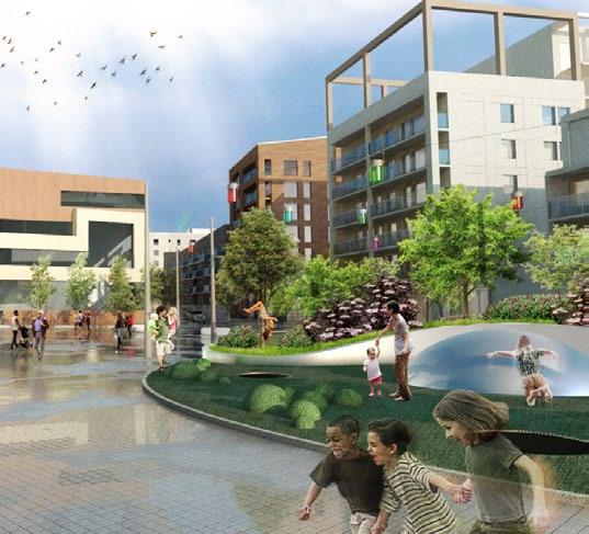
A growing city: The first objective is to be an open, tolerant and welcoming city. It should offer housing for all price categories, create an attractive urban environment close to green spaces and bring new concepts that can make the city more dynamic. It should attract businesses with good market conditions and a mixed-use urban environment to accommodate them. Necessary public functions and services should be developed, with an emphasis on building schools.
Good public spaces: The objective is to bring diverse communities together by improving the public space. Each neighborhood should have a dynamic center with access to fundamental urban features in all parts of the city, and housing areas should be transformed into mixed-use urban environments where people live close to their daily activities. New housing should be diversified in size and form, and public spaces should be developed, especially green spaces.
A cohesive city: The goal is for people from different local areas to move through the same public space and see each other throughout their day. The street network must be improved and the street must be used more efficiently. Public transportation needs to be developed to avoid the isolation of areas. Green spaces and parks should be improved to create connections between different neighborhoods, and major attractions should be evenly distributed to encourage people to seek out new destinations.
A climate-smart and resilient city: Urban structure needs to be developed in a way that encourages sustainable travel and lower consumption of resources. Land has to be used effectively and major urban developments should be done in existing poorly developed areas. New buildings must be built with sustainable materials, energy solutions, technology and design to suit future climate change. The infrastructure should be robust enough to cope with new challenges such as heavy rainfall, rising sea levels or heat waves. A network of green spaces must be developed and the green infrastructure should be improved.
“Because of the large scale and uniform design, it could be difficult for many people, especially children, to distinguish their own homes from the ground”
“Approximately 1,600 homes are planned here, with preschools and a school. The area will also be developed to include business premises, parks and a new square.”Photo: Erich Stering, 1972, Kid playing in front of a “Miljonprogrammet” building Photo: Landskapslaget, Kista Äng
Today, the program is seen as a part of the representative history of the housing policy goals of the 1960s and 1970s, and for many people it represents a part of their roots and identity.
Food production, climate regulation and social ecosystem service.
- Utilization of the allotments and farmlands as a strategy for food production, but also for connecting people and creating different activities (social aspect: physical and mental health, social interaction, knowledge and inspiration).

- Allotments will be the size of 10x10m, which can provide enough product for a person or a small family. They will create the paths around the area and will also be shaping the farmlands which will be positioned inside these allotments.

- The management will be from the municipalities, as they will put a person in charge to manage the area and provide the necessary tools for people to work in the fields.
- As an exchange, the allotments will be given to people who spend their time and bring knowledge, creativity and innovation to the community. This fixes the issue of the long queues to get an allotment. With this idea employment will increase for this area by working at the market place or working in the fields.
- Low-tech green houses will be built, so they can be used during winter time.
- Utilization of the two existing facilities Husby Gård and Eggeby Gård as meeting points, market places and also as cultural, educational and recreational spaces for the residents.
- Along Igelbäcken a path will be created which will be the main connecting path which lies across the field.
Parts of the land will be used as experimenting areas, test gardens or “labs” for institutions related to agriculture.
As a contribution to climate regulation, green roofs can be implemented on the buildings around the area. Revitalized access points or green corridors from each of the districts, as a way to bring nature to the city while at the same time bringing people in to the nature.
Density goal: 200,000-700,000m2
- The area contains: allotment gardens (seasonal gardens and greenhouse allotments), farmlands (food farmlands and livestock), public and institutional spaces.

- Seasonal gardens will be the size of 10x10m, while greenhouse gardens will be the size of 15x15m in which people could also live.
- Public spaces will be used for sports, cultural, recreational, community and academic activities aside from the allotment gardens.
- There can be a possibility of building facilities which can be used for these activities. But always with a focus on sustainability and preserving the nature.

- One way to provide these activities without the need of large buildings could be by building installations or pavilions for different festivals, events, exhibitions, workshop spaces or yoga practice, market places; outdoor cinemas; outdoor sports fields; outdoor fitness equipment.
- Another way of using parts of these lands is for different institutions which can be used as “lab” lands where they can manage and take care of those parts.
- The other built area, which will reach the density goal to around 300,000m2 consists of 3-5 storey apartment buildings and terraced buildings which will have green roofs and green terraces. The higher buildings will be located across the edge which will help reduce noise pollution from the highway. They will be distributed along with the relief by creating a smooth transition from high density to medium density and all the way to the fields and gardens with greenhouses. ( approximately 250 apartment buildings will be built.
- Paths are enriched due to different actions happening all around the field. They welcome the citizens to use the area and contribute positively to the different ecosystems.
- The ideal management of these lands would be a decentralized one, by involving local actors, associations and residents in the decision making and managing of the land use.

During the bronze age the sea level was still high over the Järva field. The area had become a part of the inner archipelago with many islands, one of which was Akalla. During the viking age (around 1000 bc) the bay area had withdrawn so that former sea bottom was now pasture and Igelbäcken a large water source serving as a connection and used to boat transporting.
The part of the blue infrastructure in Järva that has our most attention is Igelbäcken; a rather small creek that is running from the lake Säbysjön north-west of Akalla and stretching 10 km east to run into lake Edsviken. On its way through Järva, Igelbäcken is part of several nature reserves divided by the municipalities of Järfälla, Sollentuna, Solna, Stockholm and Sundbyberg.
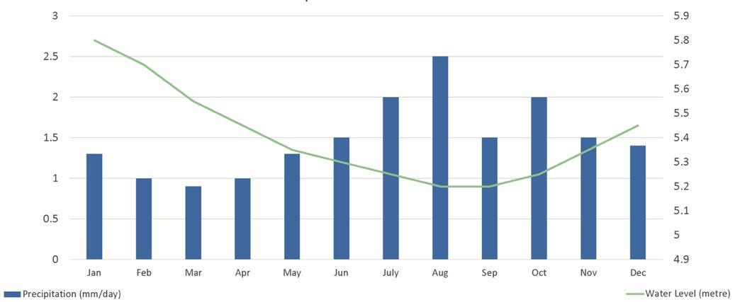
The creek has a modest ecological status - it is over-nutritioned, but mostly it suffers from water shortage, lack of connectivity and morphology as well as high amounts of PFOS in water and sediment. Stormwater is now run directly to Edsviken, which also contributes to water lack. Climate changes - higher temperature and increased precipitations - impacts the creek area with seasonal flooding but also draught. The hydrological issues effect the connectivity, which we conclude is due to among other reasons the morphological status of the creek. The straightened out parts of the creek, the parts that are led through artificial tunnels and over bridgening by roads.
The Stockholm city ecologist Ulrika Egerö suggested for prior and planned future projects of creating wetlands in the area, as both a way to prevent flooding and draught, while also contributing to biodiversity. Another prominent local actor of Järvafältet is the director of Eggeby gård that is engaged in the local area and is concerned with the lack of connectivity for people in the area, as well as access to the green. The future of Järvafältet has many interests; the different municipalities, the exploitation office, the housing issue if Stockholm, the recreational needs, the residents, the different local organisations.
Our conclusion is that the blue infrastructure has been weakened many times in modern day. There are measurements to be taken. We wonder, how can we strengthen the connection between human and water, how to enhance the recreational aspects for the creek to tie up the communities and attract more people come to the place? And what does the creek want ? If we would give it a voice, a personhood with legal power - would it want us to create more room for the river ?
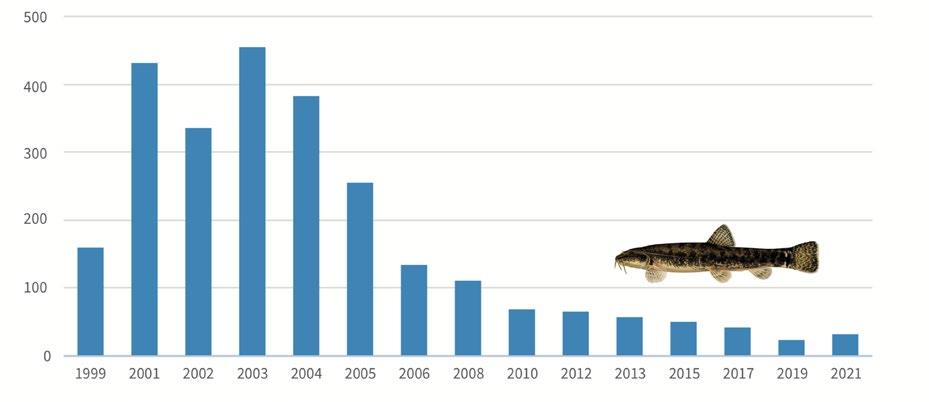
Amount of the fish Grönlingen (Barbatula Barbatula) / 100m2
Precipitation and water level


“In the Middle Neolithic, most of the Järva field was still under water and only a few small islands emerged, including Hjulsta, Rinkeby, Tensta and Husby.”
“Then, in the Bronze Age, the area around the Järva field became an inland archipelago landscape.”
“Little by little, more and more land became available for people to live on.”
“Currently, as a problem, Igelbäcken has too little water, and the stormwater from the highway is bad for the environment. Anders thinks that the PFOs (toxic chemicals) from Barkarby district are a threat to Igelbacken.”
“The has restoring
 Urbanism & Landscape Studio 2022/2023
Teachers: Hanna Erixon Aalto & Francesca Savio Students: Yifan Su Ylva Nissen Eugénie Deruaz
activist group “Återställ Våtmarker” existed for many years, they call for restoring wetlands and an immediate stop to using peat in Sweden.”

“A direct consequence of extensive drainage is a dry landscape that has lost its water management and flow equalization function, while the need for water is high.”
“We should make more meeting places in Järvafältet to avoid possible issues of racial disparity and segmentation of different groups of people.”
“Creating more wetlands can help prevent the exposure of old peats that leak out tons of carbon monoxide”
“We should have more open spaces for water in the future, and perhaps adding more ‘Regndiken’ (rain ditches that act as a buffer zone for rainwater to delay the flow) to the site..”
Anders studied at Stockholm University for his Bachelor’s Degree in Human Geography, he focused on understanding the environment and urban development. Now he is the president of Naturskyddsföreningen (Swedish Society for Nature Conservation) since 2005. The company is founded in 1905 since the forest was clear-cut, and the aim for preserving the high natural value of Stockholm.
Anders believes that nowadays many countries are better at protecting than Sweden like Latvia, South America, etc. There is only 5-6% of the forest is being protected because of the industrial background of Sweden, which is not enough. “I could do more in my organization to push Stockholm Stad in preserving natural reserve”, he said, “It has lots of potential and rich resources to be developed”.
Currently, as a problem, Igelbäcken has too little water, and the stormwater from the highway is bad for the environment. Anders thinks that the PFOs (toxic chemicals) from Barkarby district are a threat to Igelbacken. “When you handle the water from Järvafältet, you should have wetlands before the water comes to Igelbäcken. If there are more plants in the area, they can take up and filter the pollution”.
The activist group “Återställ Våtmarker” has existed for many years, they call for restoring wetlands and an immediate stop to using peat in Sweden. “It is very good to restore the old wetland, so the peat will not come to the surface, and the air will not touch the peat. Making more wetlands can help protect the peat”, Ander said. As the president of a legal group, he prefers a more formal way of making action rather than a way of protest, however, he also agrees with the problem of the slow working process for legal groups. “Also there is a lot of money that goes in the wrong direction, we need to tell them to spend money on the wetland instead of the wrong direction”, Anders said.
Anders encourages making more meeting places in Järvafältet to avoid possible issues of racial disparity and segmentation of different groups of people. He believes if we make the green area more interesting, it can change people from different areas. “I do not agree that the green spaces divide people”, he said.

Anna joined Ekologigruppen as a Landscape Architect, who specialized in the research of green wedges. Her research of Järvafältet started in 2006, throughout the time she did interviews with people from different ethnic backgrounds about the use of green wedges. Anna also participated in projects around Järvafältet, like putting up signs for the natural reserves and for Igelbäcken river. She believes that using signs as an information board and directions to guide is really helpful. “People might criticize the use of signs as too traditional, but I am trying to create it as a menu to present information about nature. It can also help people find their way out in nature.” Anna said. Putting signs can help introduce more of the area and educate people about its history.
For the issues of the stormwater and water run-off in Järvafältet, Anna thinks although it is hard to solve the issues, it will be amazing to do more open stormwater solutions which lead the water to Igelbäcken. “It seems everything is working against the Igelbäcken, because throughout history, the water level is decreasing, while the ground level is rising.” We discussed our proposal of expanding the water network by creating more wetlands, which Anna thinks is a good idea. “Creating more wetlands can help prevent the exposure of old peats that leak out tons of carbon monoxide”, Anna said, “We have to accept more chaotic expressions in nature to deal with all the challenges we are meeting in the future and for now”.
As a green wedge expert in Ekologigruppen where they work with restoring wetlands since the early 1980s. Anna has colleagues who struggled with the issues of wetland restoration for many years. “I can see a few of them are really annoyed at the activists when they are using really harsh sentences...It is kind of ironic. We were doing the actual action for restoring the wetland, and we got stuck by a traffic jam that the activist causes”. She believes that the Igelbäcken is needed to be funded by a private landowner for processing the restoration, which should be requested formally through the government.
At last, Anna suggests it is nice to use the grass from the wetland for the growing vegetable since it has many nutrients. “We have to find a circular way of working with the wetland.” It is important to reuse the resources for saving energy consumption and to save the climate.
“We have to find a circular way of working with the wetland. If you want to cut the peat industry, you need to find alternative material as well”
“We could do more in my organization to push Stockholm Stad in preserving natural reserve, where there are lots of pootential and rich resources to be developed”Photo: Online Zoom Interview Process Photos: Anders Tranberg and Anna-Maria Larsson
Igelbäcken and the land uplift in the Järva field
The last ice age ended about 10,000 years ago. The ice cap was so heavy that it pushed the land mass underneath into the sea. Then, as the ice melted, the land began to rise again.
So, little by little, more and more land became available for people to live on.
The first small islands emerged from the sea around 42003300 BC. The sea in which Akalla was located was called the Litorina Sea, which consisted of meltwater from the ice cap.
In the Middle Neolithic, most of the Järva field was still under water and only a few small islands emerged, including Hjulsta, Rinkeby, Tensta and Husby.
Then, in the Bronze Age, the area around the Järva field became an inland archipelago landscape. What had once been sea and open water was transformed into bays. Almost the whole of Akalla emerged from the water and the inhabitants lived from agriculture, livestock, as well as from hunting and fishing.
By the time we reach the Viking Age, the bay has completely disappeared from Akalla. The new land that was previously sunken was used as pasture.
Thereafter, Igelbäcken was a more important watercourse than today, around which farms and villages developed over time. Access to fresh water was a prerequisite for settlement. The inhabitants of Akalla needed drinking water and water for cooking. They could also wash their clothes and bathe.
And later, the remains of a mill and a water saw were found.
Today, Igelbäcken is a small stream in northern Stockholm. Its drainage area is shar ed by the municipalities of Järfälla, Sollentuna, Solna, Stockholm and Sundbyberg. Stretching more than 10 kilometers from west to east, from Säbysjön to Edsviken near Ulriksdal Palace, Igelbäcken is fed mainly by the Djupanbäcken stream, which carries water from the small lake Djupan. Because of its location in the national park and its untouched character, Igelbäcken is considered one of the most valuable bodies of water in Stockholm.
The wetlands: carbon binding and water filtratingand left to dry out
Until the mid-1800s, much of the region was completely, or periodically, a wetland. Industrialization changed the needs of the land - from pasture to agriculture. This led to extensive water drainage in the region in an effort to gain arable land but with the loss of large wetlands.
Water that existed naturally in the landscape was systematically drained, and water sources were maintained, flushed, straightened, deepened and channeled, resulting in lower lake levels and soil drainage. New cropland was then quickly obtained and the effective drainage prevented cropland from being flooded.

Trenching in the forest has a similar history, and has always been used to lower surface groundwater levels to reduce the risk of frost, increase soil oxygenation, and create favorable conditions for forest production. Until the 1920s, there was a widespread belief that virtually all land could become forested if dug to a sufficient depth. In Sweden, the proportion of forest land excavated on peat is about 2.5-5%.
A direct consequence of extensive drainage is a dry landscape that has lost its water management and flow equalization function, while the need for water is high. Another environmental effect is an increased leakage of nutrients that negatively affects lakes, rivers and the Baltic Sea due to the loss of natural filtration in the water landscape. These major changes have also had negative effects on plants and animals, as their living conditions and connectivity have deteriorated. Recently, attention has also been drawn to the fact that large amounts of greenhouse gases are being released from peatland excavation.
During the last two years, more than 22 km² of wetlands in nature reserves throughout Sweden have been restored, measures that have led to a rise in the water table of 7.2 km² of peatlands, with many positive effects on the climate. The County Administrative Board has received from Naturvårdsverket the means to take action in more than 300 wetlands in protected areas across the country. 32 surveys for future actions have also been made, for the coming years.
“Then, as the ice melted, the land began to rise again.
So, little by little, more and more land became available for people to live on.”
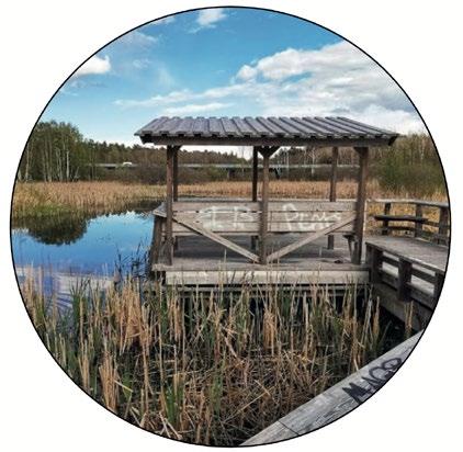
“During the last two years, more than 22 km² of wetlands in nature reserves throughout Sweden have been restored, measures that have led to a rise in the water table of 7.2 km² of peatlands, with many positive effects on the climate.”Photos : satellite images showing the water level over time Photo: peat harvesting 4200-3300 BC The Middle Neolithic The Bronze Age Today Year 0 Photo: Hästa pond, a wetland along Igelbacken with rich bird life, 2022
“In Sweden, the proportion of forest land excavated on peat is about 2.5-5%”
Our vision for the project is to bring the water back to Järvafältet, use water as a medium to enhance community engagement, and environmental protection (like lower air pollution), and as a carrier for the experiment of emerging communities on water.

Our strategy will be divided into 3 phases according to importance. The first phase is the ‘purification’ of the beginning part of the river near Säbysjön Lake, and the linkage to the hard surface like the highway, roads, and urban areas. Hence, they are purified before entering Igelbäcken. The second phase is the ‘connection’, where we extend the blue to the metropolitan area through ditches and small ponds. At the same time, activate the waterfront area by creating recreational nodes (the pearl on the necklace) to turn it into a spotlight of the green wedge. The third phase is to ‘develop the beaver area’. The beaver habitation wetlands can increase biodiversity, improve water quality, store water during drought, and minimise flood risk.
Sketch of the blue strategy in relation to the biodivervsity and the purification of water and air
purification Beaver habitation Recreation Culture Living Education
Igelbäcken and its extension
Pedestrian and cycling path Roads
2-step ditch (constructed purificatiob)
Our vision for the project is bringing the water back to Järvafältet, use water as a medium to enhance community engagement, environmental protection, and as a carrier for emerging communities.
In our development strategy, we propose to connect the Igelbacken river with the technological catchment area through a central blue axis, where a new train station Barkarbystaden will be built in the future. It then grows in the form of rib/tree branches, for conveying the water to each neighborhood, and for activating and enlivening each community.

We classified the river into primary, secondary, and tertiary blue spines, where the added river follows the topography and the roads. The primary spine is along the central axis, connecting 3 train stations. It is planned to be a ‘vivid corridor’ with a variety of public buildings and platforms. The secondary spines are carrying the river to the forest and communities, where the tertiary spines are used to further extend it to the residential area. Purifying wetlands in each crossover area on the central corridor are our important nodes, to ensure the water is purified before it enters the community.

Our research into the Järvafältet in North-western Stockholm has centred around the composition of the soil and resultingly in food production too. The green wedge, cutting through two dense residential areas boasts high ecological value.
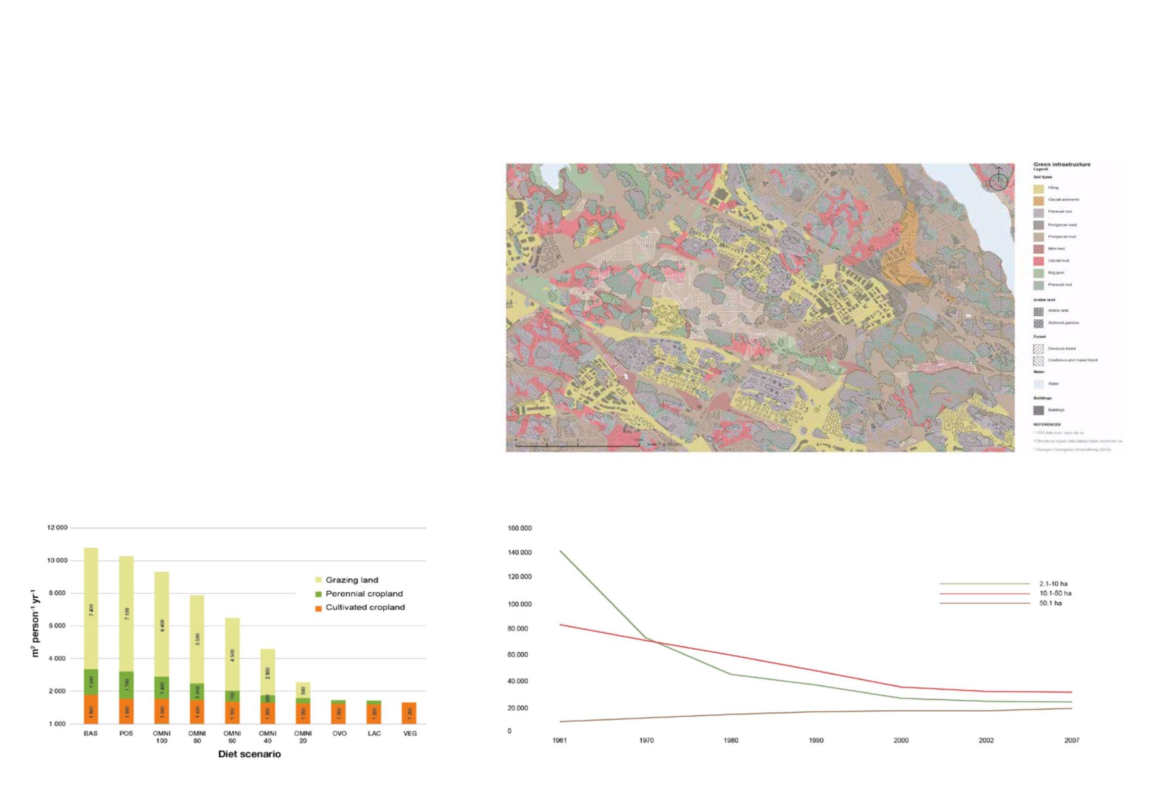
Reading into the history of the site has shown a decline in the use of the arable land as farmland. This echo’s the national trend in the decline of small to mid-scale farms as highlighted in the graph. On a global scale, we are becoming more reliant on large-scale farming to provide us with our daily food. This causes friction with our increased need to reduce our carbon footprint – with the average vegetable travelling 2,400km before being consumed. Today most of the old farmland is used for leisure purposes to serve the very few. A prime example of this is the conversion of working farms into stables for horse riding. By visiting the site, we were able to see that the use of allotments was a popular pastime. Not only does this have a great environmental impact by reducing the carbon footprint of the food consumed – but it is also positive in a social sense – encouraging time spent outside with the community. While still wanting to keep this idea of community in our research, we wanted to delve deeper into what possibilities there were to strengthen the site in an ecological sense as simply reducing food miles was not enough. We then investigated the soil’s ability to absorb carbon in different areas in the site in conjunction with possibilities for rewilding.
Inspired by Effekt’s concept of the ReGen Village, we started to consider the possibility to utilise non-arable land for aquaponic farming. By doing this it could help feed the ever-growing community in Järva while freeing up to 98% more space than traditional farming methods. This saves space and frees up more space for rewilding, encouraging more biodiversity and absorbing more carbon.
Soil types plan
Amount of land to feed a person with different diets
Chart numbers of farms with at least 2 hectares of arable land in Sweden, by arable land.


Jonas Jerberg is an architect and a planner. He’s also an expert on urban farming. Today Jonas has his own practice called Urban Works focusing on urban planning and urban farming.

In his practice Jonas is working with, along other things, urban farming in Enköping and writing a debate article about urban agriculture in Sweden. His knowledge about Järvafältet is quite broad. One of his last projects as an architectural student was in Järvafältet.

During the interview Jonas was talking about how it is important to connect the areas around Järvafältet. Currently the bourders of the area are being even more built but Jonas thinks that Järvafältet also has potentiol. He says that the area should be a green area but built elements could be added, such as housing. A more clear border should also be defined between the built and the non-built areas.
To strengthen the connection between these areas is something that Jonas talks a lot about. Strengthening the physical connections could be a way to work against the ongoing segregation in the area. He also mentions that more public functions should be added in the area and highlights the outdoor swimming pool in the area as a good example.
Regarding urban farming Jonas talks about one of the main challenges being the cost of the electricity needed but also the cost of the maintenance needed for urban farming to work. He continues to explain that a business model and commercial viability are necessary. In the area people are selling vegetables but much of it is not coming from Järvafältet, it would be intresting to connect these aspects Jonas explains. He reminds us that not everyone is good at farming or wants to farm, therefor urban farming should be organized and profferinazied.
Ulrika Egerö is a urban planning strategist (stadsbyggnadsstrateg) and works for the municipality of Stockholm in the planning deparment. She is also a ecologist and has worked with Järvafältet for a long time.

Järvafältet and the housing districts in the area lack a lake nearby. A questionnarie was made for the residents of these areas regarding what activities the residents lacked in the area. Most of the answers conserned a swimming pool. This was the case both in the 1970s and 1990s until an outdoor pool was built in the area. The pool was funded with tax-money because it was considered to be an activitty for the health. A lot of other activities in the area aren’t funded by tax-money beacuse the municipality dosen’t think that those activities will improve the health of the inhabitants. Ulrika disagrees with that and mentions that a lot of other activities could improve the health in the area in different ways. She also mentions that people in these areas usually can’t afford a car which makes it harder for them to travel to different parts of the city and be active.
Regarding the closed farms in the area and how to use the remianing buildings and areas Ulrika talks about the importance of having more activities and places to visit. These closed farms could potentionally be places to visit with different activities, she explains. She also mentions how people’s health could improve if there were more activities in the area. Having cafés or other activities would make people walk more and it would imporve the “social health” Ulrika explains.
Another intresting topic that was brought up in the interview is carbon sinks and sources. Ulrika explains that young forests work better as carbon sinks than old forests and says that the former wetlands act as carbon sources today.
“The former wetlands act as carbon sources.”Photo: Jonas Jerberg, an architect, planner and expert on urban farming.
“The value (of developing Järvafältet) is to dicrease the transport, (strengthen) the social aspect and biodiversity.”Photo: Enköping Stadsjordbruk & Foodtech is a report about Urban Farming and Foodtech as a tool in planning and urbanisation made by Urban Works.
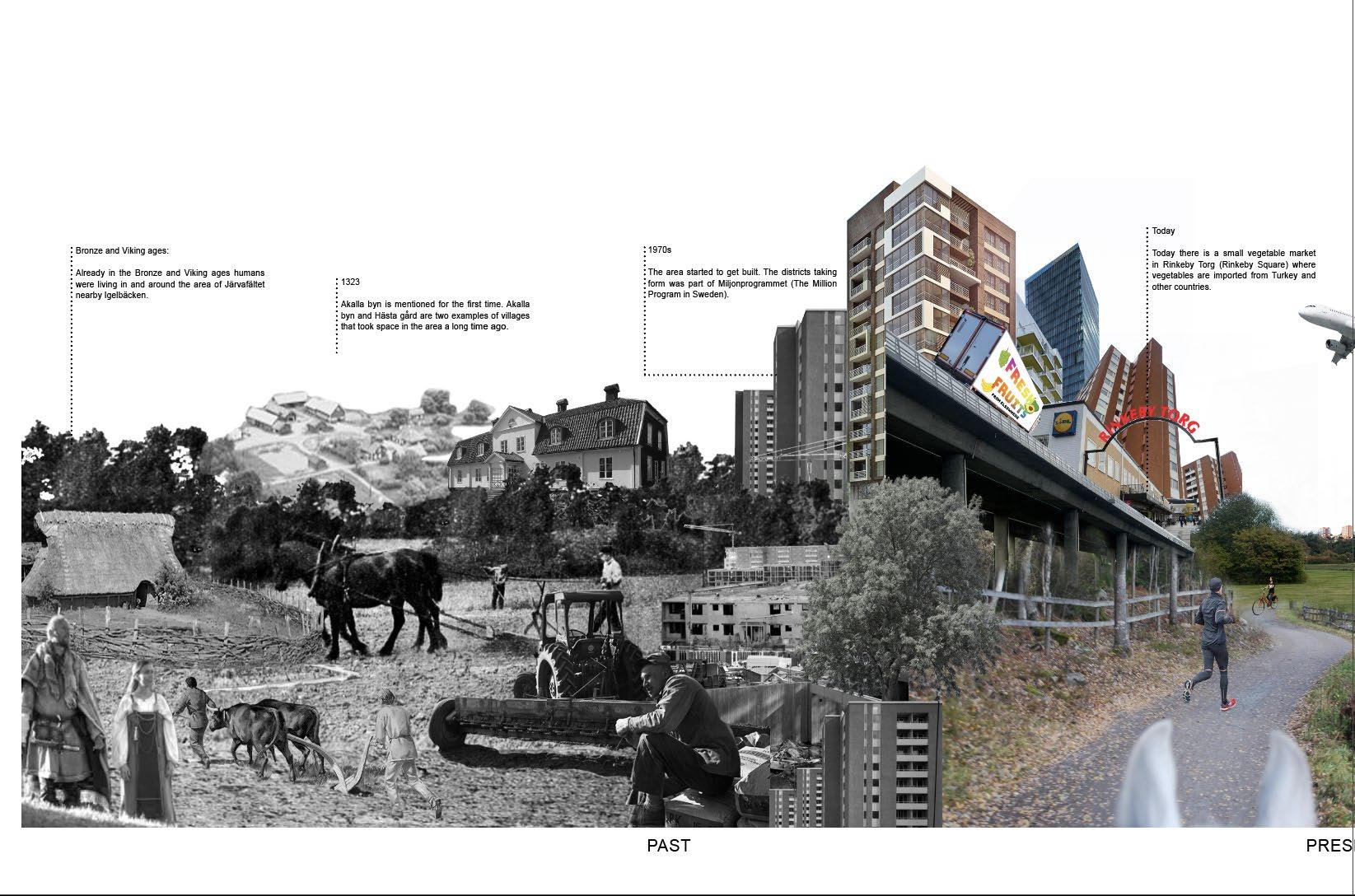
Already in the Bronze and Viking ages humans were living in and around the area of Järvafältet. They were livestock keepers and lived in the area with animals. Today we can see rune stones and grave remains of these times.
A long time ago Igelbäcken was a miles long waterway. Around it yards and villages sprouted. The water of Igelbäcken worked as a way to connect people. The access to drinking water was a big part of why people were living in this area.
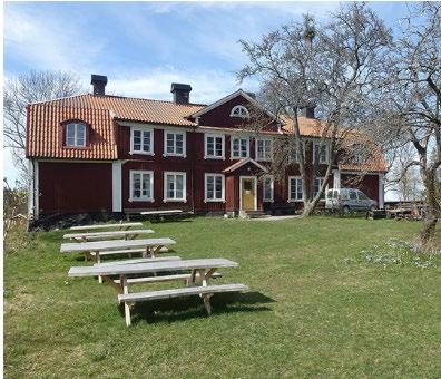
Hästa gård was one of the yards that took form in the area a long time ago, already in the viking age people were living and farming there. Up until recently the farm was Stockholm’s only living agriculture and one of the world’s biggest urban agricultures.
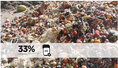
In the 1970s the areas nearby Järvafältet started to be built. The self-sufficiency trend was transformed to a trend of buying your food in a local market. The local market itself could get the food from anywhere in the world. This trend is not specific for Järvafältet or even Sweden, it is an ongoing global trend that is transforming into an issue. Vegetables travel on average 2 400 km from farm to consumer today. This causes a 12% extra emission before consumption.
“Every time you make a decision about food, you are farming by proxy.” is a quote by the American writer Jonathan Saffran Foer. Dijstelbloem (2012) explains that to Foer awareness of what we choose to eat is a moral duty. Even though Dijstelbloem is critical to that statement the quote is really interesting in the context of our group’s narrative. We as planners and architects could also make an effect in how things are produced and what is available for a community. Is it locally produced food or is it transported thousands of kilometers?
Today there is a small vegetable market in Rinkeby Torg (Rinkeby Square) where vegetables are imported from Turkey and other countries. The market is quite popular in the neighborhood. The market seems to be a good thing for the community but as it is today it also awakens a moral question about how far the vegetables are being transported. The vegetables from different parts of the world could be replaced with locally produced vegetables. Dijstebloem (2012) explains that the micro and macro levels in the case of food are linked together. A vegetable-market in Rinkeby is a local actor but it has a global effect too.

(1) Stockholmskällan, Järvafältet (https://stockholmskallan.stockholm.se/teman/Stockholmsplatser/jarvafaltet/)
(2) Stockholmskällan, Tidens väg, en vandring i historien (https://stockholmskallan.stockholm.se/ ContentFiles/SSM/Texter/Text_0001/Skyltar_tidens_vag.pdf)
(3) “Food, A Compromised Issue.” In Food for the city, A Future for The Metropolis, edited by Stroom Den Haag (p.58-64). NAI Publishers, 2012.
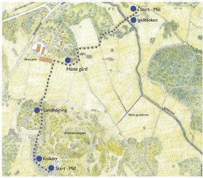
Map of a route in Tidens väg (The way of time). Showing among other things Igelbäcken and Hästa gård.

Our development strategy for the Järva area is to explore how current mass and void can be used in the future.

The functions of buildings will change to suit modern, eco-conscious lifestyles; the voids between them will follow suit. Vertical farms will be in current residential areas with markets arising to distribute crops to the dwellers. The land will soften the edges and boost biodiversity between built and wild, through allotments, orchards, new forests, and grazing land.
Approximately 190,000m2 density of new builds will be proposed in hard surfaced areas that already have plans to be built upon, approximately 90,000m2 density will be altered, removing industries that have grown obsolete.
We aim for the mass to become more productive and the void to be less of a chasm between communities and more of a space for joining neighbours and neighbourhoods together.
Sketch of the strategy - Multiple neighbourhoods mixing through multifuction spaces in Järvafältet.


Our research initially focused on the Järva wedges habitats, biotopes and ecological infrastructures. The nature in the Järva wedge is varied and contains everything from deep conifer forests to flowerrich pastures, leaf groves, forest marshes and wetlands. After receiving knowledge about the oak’s importance in ecological infrastructure, we decided to map out oaks in the area. The oak is a vector for biodiversity, a key biotope, home to a large number of species. They function as stepping stones for animals to travel. We have noticed that there is a big gap of oaks in the Järva area. Why can this be?
Oaks can get very old. An oak’s conservation value often comes into play when the tree is about 150 years old. The oak is the tree with the largest number of species associated with it, upwards of 1,500 species, of which approx. 800-900 insects and 400-500 mosses, lichens and mushrooms. The acorns are sought after by many wild animals, such as squirrels, deer and jays (bird). Jays have an important relationship with the oak, through its winter storage of acorns under the grass cover, the acorns spread to new places where they can germinate. Therefore, a good way to spread oaks is to make sure there are optimal living conditions for this bird, and then it’s important to know that these birds nest in coniferous forests, so therefore to get more oaks, we need to make sure there are also other trees like pines.
For a long time the oak was a “royal” tree. The wood was used mainly for boats and larger buildings and was brought to the royals as gifts. When society and agriculture changed, the farmers during the 19th century got the right to rule over the oaks on their lands. It led to large amounts of oaks being cut down.
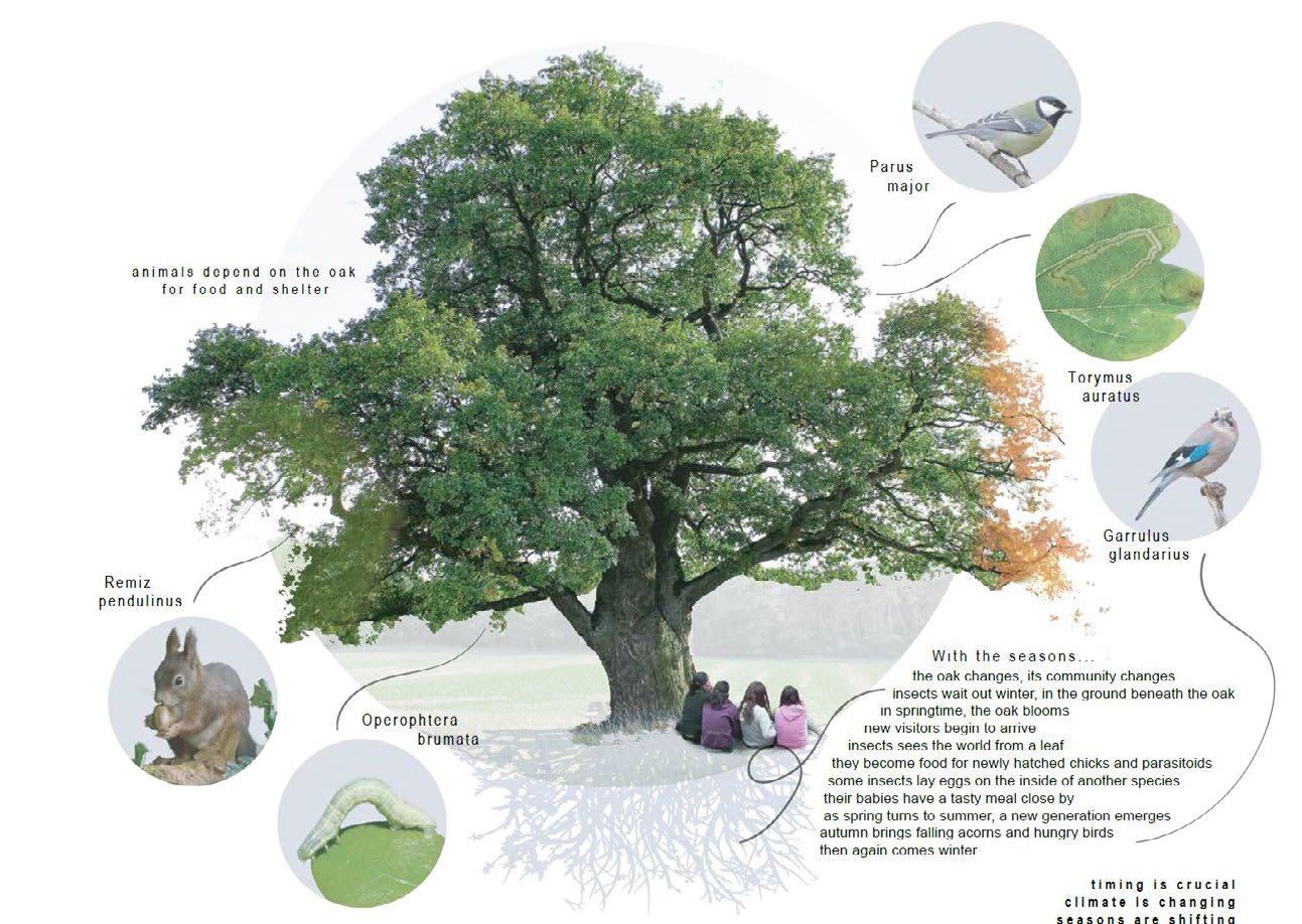
The greatest threat to oaks is a lack of care so that they are shaded by other trees or buildings. A building with a height of 15 meters must stand more than 32 meters from an oak environment if they are to get sun from morning to afternoon. Other major threats are felling, exploitation, continuity time gaps, isolation of populations and dispersal barriers.
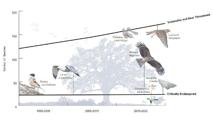
In the graph we have shown the red-listed species that exist and have existed in the area. We wanted to make this graph to show some effects of the changing landscape and furthermore on the biological diversity connected to Järva’s biotopes. What vegetation has disappeared and what ecological values?
(1) City of Stockholm, Vision Jarva 2030. https://international.stockholm.se/ globalassets/rapporter/jarvalyftet_broschyr_en1.pdfv









(2) Lennarth Jonsson, 1966. Oaks in Sweden. Journal of International Oak Society, (7), pp.32 39


Elisabeth Mårell is working as a regional planner in Stockholm. In her role it’s important to have a focus on topics and questions regarding larger areas. Municipalities are responsible for their local contexts, but planning on a regional level deals with the needs that connect over municipalities borders. She says that as a municipality, you can’t only think about the local effects. Changes can create effects in places far away from you, not only in the bordering municipalities but sometimes ever further.

Right now they’re working with the green wedges of Stockholm. The wedges stretch from the inner parts of Stockholm city center, to the more rural areas of Stockholm. Mårell emphasizes awareness when working with these green wedges. When changes are made in these areas, we are potentially risking great functions, both recreational and biological.
In the process of regional planning, the focus is set on the future. In Mårells office, they’re mainly looking towards 2030 but also 2050.
Mårell describes the Järva wedge as a man-made landscape and refers to cultural history. Not only are there nature reserves but also culture reserves. She says it’s important to plan for the maintenance and how to take care of the different parts of the landscape. The wedge is situated between residential areas, with a lot of people living alongside the wedge, which makes it important for different kinds of recreation.
On the regional scale, the effects of climate change are clearly noticeable on the green wedges, which can help mitigate the effects of climate change. Green wedges help with many ecosystem services such as temperature, humidity and flood control.
The Jarva wedge is vital for ecology of the site and Mårell hopes it will stay in tact. However there have already been talks about developing the area for safety and integration reasons by connecting Sollentuna and Rinkeby. If developments as such occur, ecological functions can be put at risk. It’s vital to know the consequences and effects development can cause, on recreational aspects too. Currently a cemetery is being planned, but other recreational functions must move in order for the project to develop.
There is a conflict between cultural and nature based solutions, as they’re incompatible with one another.
Some areas need to be disturbed by humans for values of nature to be kept. Maintenance programs must exist, as there is almost no nature without human interference.
The maintenance is connected to the mankind having used the landscape for a long time. The landscape is affected by for example animal grazing. If the goal is to keep the area the way it is now, the agricultural and forestry maintenance must continue. Otherwise the landscape will change.

“If you want to keep it that way, you need to keep maintaining it and if you stop, the landscape will change. It will not be the same landscape anymore. You may have different values then, but they are not the same values you are trying to protect now.”
“The maintenance is connected to the mankind having used the landscape for a long time. The landscape is affected, for example, by animal grazing.”Photo: Highland cattle (naturskyddsforeningen.se) Photo: Elisabeth Mårell (regionstockholm.se)
For our third interview we interviewed Anna Barr, an oak expert. Anna describes oaks as little islands with animals living on them. They are small worlds in themselves. The oak is providing homes in every part of the tree for different organisms, and it changes during its lifetime. As it gets older, more cracks and cavities arise where species can live.
Anna was interested in the matter of connectivity. She started biking around Stockholm for her master thesis, stopping and looking at a couple hundred old oaks. To be able to measure the connectivity, she created a connectivity
index. She was studying the trees, studying what species were on the oaks, and how many there were. Connectivity was an important factor in how many insects she saw on the trees. She also looked at leaf litter, how much was allowed to stay around the tree. It is very important for small insects and other animals to be able to overwinter and climb up on the trunk.
She doesn’t think that the global condition of the oaks is great today, due to urbanization. She says they might be declining due to habitat loss. In Sweden there is a large timber industry. Since oaks often live in mixed forests in Sweden, they are affected by felling. It’s a prevailing question in the forest industry: how to sustain the oaks while felling the other trees that are needed for the timber industry.
In Sweden it seems to Anna like many people appreciate the oaks and value their historical worth. But maybe they are not as aware of the habitats connected to the oaks. Climate change has had a major impact on species. Anna says that spring is happening a couple weeks earlier than before, and birds and caterpillars have adapted to that by laying their eggs earlier. Studies also reveal that birds have had to change their time of migration to adapt to climate change.
Anna describes Climate change as one of the greatest threats to oaks. The climate is getting warmer and the decrease in rainfall is causing droughts. Some oaks have been able to adapt to the changes, but not all and habitat loss is occuring. Other threats are invasive species such as different foreign beetles and pathogens. Some oak trees are more adapted to shadier conditions, but they usually do need the full sunlight. Some trees can handle more acidic soil and some more basic soil. Also English oaks prefer more humid conditions. Growing in different conditions can affect how they can handle the changes.
Anna
Anna discusses other key biotopes in environments. Sea otters keep other species under control, and without them, the sea urchins will take control, leading to loss of biodiversity in those areas. That can be the case with some other species as well. Mangrove trees are another key biotope by offering many holes and spaces for different fish and organisms even after they die, similar to coral reefs and oak trees.
Oak trees are spread through their acorn dispersal. Jays are the major spreaders of oaks, they spread acorns by burying the seeds a couple centimeters down in different places. Jays are great for spreading isolated oaks, and wood mice are good for spreading them in woodlands as secondary spreaders. The reason for plants having such tempting fruits is for other animals to take, eat and spread them. Acorns are also spread by falling into streams and getting washed up.
Lot of species rely on acorns as food, such as squirrels who hide them in tree trunks, which isn’t good for the oak. Oaks can also be destroyed by wild pigs.

If an oak is surrounded by buildings, it might not get to be healthy and species might not find other oaks. Insects can’t find the second tree because they can’t see that far, they need some sort of connection between oaks. Some insects may only travel 15m in the course of their life. Oaks located near buildings also can affect birds. There have been many cases of birds striking into windows, especially on sunny days. It is a tricky balance between creating welcoming environments for species but not too welcoming, comfortable or confusing where they can result in hurting themselves. Our intentions as architects may be good, but harmful for other species. We need to study all species and see how they are all affected.
When asked about Anna’s idea of utopia, she spoke about the importance of planting native plants to improve resilience, provide homes for native wildlife and reduce climate change impacts, like droughts and floods. She also mentions increasing green spaces, as even small parks make a difference.
describes Climate change as one of the greatest threats to oaks. The climate is getting warmer and the decrease in rainfall is causing droughts.
Lot of species rely on acorns as food, such as squirrels who hide them in tree trunks, which isn’t good for the oak.Photo: Oak (giftinformation.se) Photo: Squirrel (yle.fi) Photo: Anna Barr
Our overarching purpose is to maximize biodiversity, and create resilience and connectivity between all species, human and non-human. We’re thinking to focus on meadows and cultivated land which hold potential for pollinators, coniferous and deciduous trees, and wetlands with open and vegetated water. A key principle in our strategy is planting oaks on edges to create oak corridors and ensure oak trees receive sufficient sunlight without competing with conifers. Additionally, we will create complexity and layers in vegetation to attract more biodiverse species. We also want to connect people and neighborhoods by designing pathways and parks of various sizes to promote diverse activities across the Järvafältet. How can we create an overall strategy that perhaps can be used in similar areas?
Our method began with overlaying diagrams and a grid system. The grid helped us enforce biodiversity by pointing out gaps in the landscape and created legibility in the map. What new understandings of the place might we get when applying this rigid tool?
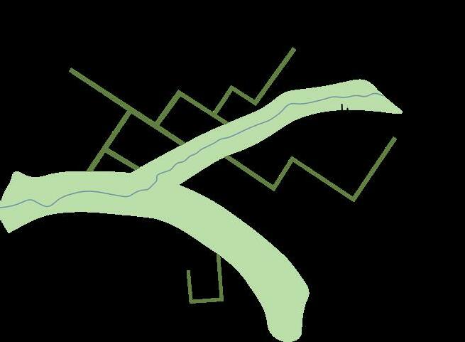


Our strategy emerged from the intention to strengthen biodiversity. We pixelated the site in order to break it up into smaller parts, give them pronounced identities, to enrich the diversity.
The site is given two main parks, one that runs along Igelbäcken. This park will maintain open view lines that bees need to travel. The other park stretches from Ursvik to Kista, linking two neighborhoods, strengthening their connection to each other and Järva wedge. From the main parks, smaller parks will connect to create paths that runs across the wedge, connecting eg. Kista with Kymlinge station.

The pixels contain the elements: coniferous/mixed forest, deciduous forest, meadows, wetlands, parks and different types of building. In the same manner as we want to enrich the biodiversity, we will also aim for diversity in the types of housing. Instead of creating zones with one building type, we will mix them up. We want to preserve and respect the existing landscape but also not be limited by it. We want to be free to change boundaries and lines for the sake of creating better connections.
We created a model that would function as a playful, learning tool for us, that would let us explore multiple variations. Therefore the pixels are not set, they can be moved and rotated. The model is a highly abstract projection of a strategy that is based on an experimental way of thinking. Topography eg. is not included.


 Beatrice Selander,Mandong Zhu,Nicole Oliveira
MAPPING + ANALYSIS


The analysis of the public infrastructure group for the Jarva region sought to understand the region by mapping public transport, buildings with important programs, such as schools, spaces to practice sports and understand the places where people are meeting. In the region, we can observe a structuring of public facilities around public transport, especially in subway stations, such as schools and spaces to practice sports, in this way, commerce (stores, supermarkets, pharmacies and malls...) are also structured around public transport.


Jarva is marked by different areas, where the areas near the subway concentrate more residential buildings and the commercial area, another part is formed by houses and small businesses. We observed that even if the areas are close, there is a difference between them, for example, in the typology of buildings, public squares and commerce. This phenomenon can happen because the regions of Jarva have limited connection, many of them only communicate with one access, favoring access with vehicles. For pedestrians, the connection between the region is precarious.
There are infrastructures in the study perimeter that are characteristic of regions further away from the city center, such as 4H-farms, allotments, golf club and motocross. Allotments are areas where residents of the region rent space to grow a vegetable garden, plants and flowers, in our field visit, we realized how interesting the creation of these spaces is, as it is a manifestation of the population to use an idle part of the region for the local community.
We tried to map people’s meeting places in the region, and we realized that there are a good number of associations, but most of them carry out their activities in buildings. In this way, we realize that there are not many squares in this region, there are neighborhoods in this place that only have one square. However, there is a green area that would be a good place for residents of the region to gather, but it is not easily accessible for everyone, pedestrians need to pass under bridges to connect with other areas.

CATEGORY 1 - Transport metro and railway line metro station railway station
CATEGORY 2 - Buildings Education Sports Others
CATEGORY 3 - Public space Squares Water Green area Allotment Golf club Motocross 4H-Farm

CATEGORY 4 - Associations Education Social Sport Culture Others
CATEGORY
https://edokmeetings.stockholm.se/welcome-sv/namnder-styrelser/ spanga-tensta-stadsdelsnamnd/mote-2021-12-16/agenda/godkand-r-1-foreningsbidrag-2022-pdf?downloadMode=open - Acess 20/09/22
https://www.lokalabeslut.se/protocol_case_item/fordelning-av-foreningsbidrag-for-verksamhetsaret-2022-ca-1-msek/ - Acess 20/09/22
https://www.nyhetsbyranjarva.se/forskolan-som-sapo-vill-stanga/ - Acess 20/09/22
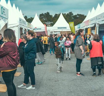
https://www.aftonbladet.se/nyheter/a/pWJ5qW/sverigedemokrater-vill-riva-bro-till-rinkeby - Acess 20/09/22


https://www.mitti.se/nyheter/centrumen-ar-mannens-varld/lmqbo!1257631/Acess 20/09/22

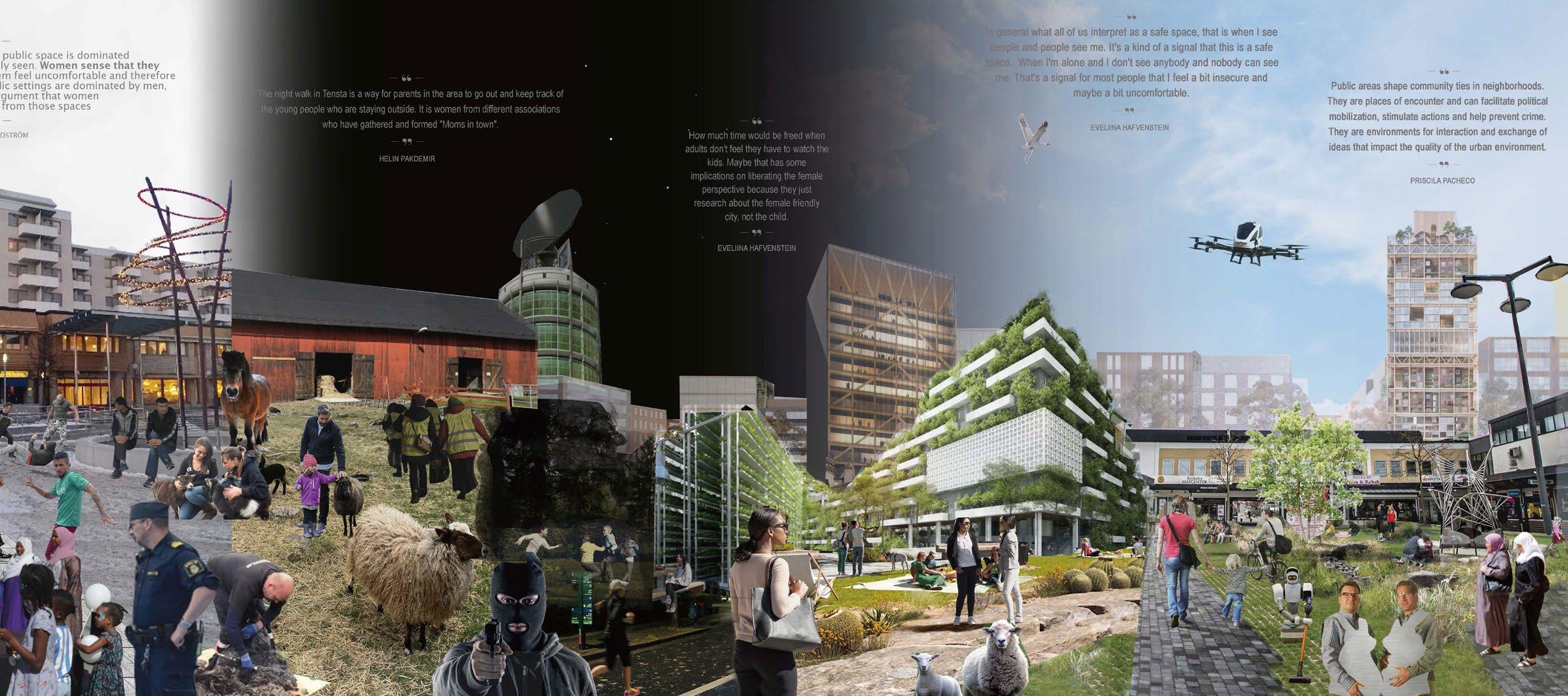

What is your relationship with Järva ?
I didn’t grow up here, but I have quite a long history in Järva because when I was newly married, we settled down in Rinkeby. So when we had our first kid in 94, we took walks here and we thought this place was very nice. And also they had a café. It was a perfect walk with a baby so we often ended up here drinking coffee and talking to the old couple who lived here. And then we got to know them. I was looking for a place to rehearse, so she gave me an opportunity to rehearse in that small building on the yard here. So actually I could come here and just the contract was that I can practice as much as I want and just clean the place after me.
How do you experience, the public space in the area?
How has it changed ?
A lot of people who are new in Sweden, they end up in Tensta or Rinkeby. If we’re talking about late 60s, there were Swedes and Finnish people living here. And then in the 70s there were a lot of South Americans from Chile. And then we have alot of a Greek population and a Turkish population, and now it’s a lot of people from Somalia and from Syria. So it’s constantly changing, and that’s very interesting. But it’s also kind of a problem. That it is like a place where you don’t stay. if the media wants to show a problem area, they show pictures from Tensta. They’re a little bit lazy, so they just: “Oh, let’s put some pictures on television from a problematic area”. They take Tensta even though nothing has happened in Tensta for weeks. So it’s a symbol for shootings and for violence. We often have to carry the responsibility for the violence in this area. But we are not always guilty. Okay, maybe you can feel unsafe in Tensta. But there’s a lot of unsafe areas in Sweden. If you just compare it to Tensta, it’s not particularly unsafe in Tensta. Maybe you would feel unsafe if you were taking a walk from Tensta to Akalla in the middle of the night. I have always followed my daughters when they come home from the metro. I met them there and walked through the field.
Have you noticed some activities that attract more women ?
Yes, Marie who works here, she works with some handcraft and also she works with helping women from Somalia filling in legal documents. Also, a woman from Iraq that we are hoping to hire, wants to have handicraft evenings or themes for women where they can just come here and drink coffee and tea and just sit and talk about knitting and stuff like that.
What are your thoughts regarding the master plan of the million housing program and the master plan of today? How are city planners planning diffently ?
They were very focused on building this functional communities,with the subway station and the center located around the subway station, the schools and maybe some workplaces,thereweremainlyhousings.There’snatureandthere’sdistance to the next local community. That’s a strategy that is not how we think about city and urban development today.The existing master plan that we focus on is to connect the city and building the city closer within the city. So in that sense, the nature structures that are surrounding these local communities may be considered a barrier in some sense that we have to find ways to overcome, maybe by programming the nature more intensely, creating more destinations that you visit.
What type of urban design do you believe would make women feel more safe in the public space ?
In general what all of us interpret as a safe space, that is when I see people and people see me. It’s a kind of a signal that this is a safe space. When I’m alone and I don’t see anybody and nobody can see me. That’s a signal for most people that I feel a bit insecure and maybe a bit uncomfortable. The main pathway, is also the path that has the most options to go. If I know the area better than I would know how to move through the structure to take right or left when I pass a housing unit that looks quite the same from other housing units. So if I have few options and most of my options, when I move in, the city is in spaces where I’m not seeing and nobody can see me. Maybe that’s a problem or a challenge for that environment as a whole.
How would you envision the utopian female urban setting where men weren’t threatful? What would we do and how would the architecture be like ?
How much is the car a symbol of a male society ? The car hinders us from building a city of closeness because moving by foot and by bike is in conflict with car movements, but also through history, when we built Rome or when we built the old town or the inner city. It was also a predomination of male views. Also, I don’t know how much time parents spend watching over their kids. They do it a lot more now than they did in the 60s, and they’re not allowed to go anywhere. So how much time would be freed when adults don’t feel they have to watch the kids. Maybe that has some implication sonliberating the female perspective because they just research about the female friendly city, not the child. In this future, it might mean that the kids are much more of an integrated part of the urban conditions and the society.
“It’s not particularly unsafe in Tensta. Maybe you would feel unsafe if you were taking a walk from Tensta to Akalla in the middle of the night. I have always followed my daughters when they come home from the metro. I met them there and we walked through the field.“
“How much time would be freed when adults don’t feel they have to watch the kids. Maybe that has some implications on liberating the female perspective because they just research about the female friendly city, not the child.“
During the Viking era, women were considerably free. Viking women fought among men and took part in other activities together with men. Moreover, they could easily leave their spouse without social reprimands. Furthermore, the status of free viking women becomes evident through the punishment a man would face when harming a free viking woman; he would be punished by death.
When Catholicism entered Sweden, women became more controlled by men. In contrast to viking women, a catholic woman had to obey her father or husband and was not allowed to leave her marriage. If a catholic woman behaved outside of the patriarchal norm, she was treated like a social pariah.
During the peasant age, women were seen as male property. The church, together with the newly formed state, established laws to ensure no children were born outside of the marriage. Since women are the ones who carry the children, they were at a higher risk of taking the blame in case of an unwanted pregnancy.
Social status showcases how free each individual feels in public. It is likely to assume that women that are under more social control will perceive the public sphere as a more threatful space since they will have to be more cautious not to perform inappropriately or be wary of unwanted attention.

This type of mentality is still present today. Following is a quote from journalist Jae L:
“The culture of victim blaming is deeply entrenched. Women are told to avoid attracting attention to themselves as if the answer to being safe in a public space is to retreat into yourself and cede more control to the men who are controlling those spaces”.
When the Järva area was planned, the team consisted mostly of men. The intention was to plan new city parts that would fit the needs of the nuclear family.
Leslie Kern, a feminist urban planner explains: “At the most obvious level, cities have been planned primarily by men. So, there is a predominantly male perspective on how the city works or should work”.

“Fundamentalists have started to harass women for their choice of clothing, which have made it impossible for women to visit cafés in the Tensta city center. Women have to meet up at home instead, away from the sight of men“.
The labor movement, together with the feminist movement, believed that the only way to liberate women was to make women enter the job market. If women had their own income, they would no longer depend on men. Childcare became a tool to enable this shift. However, women still tended to care for children to a larger extent and earned less than men. Emine Onatli, local journalist, describes the transition of the public sphere from the 80s until today:
“When my family moved to Tensta in 1987, it was natural for men and women to visit cafés together. But Tensta has become more segregated and muslim fundamentalism has become more influential//…// Fundamentalists have started to harass women for their choice of clothing, which have made it impossible for women to visit cafés in the Tensta city center. Women have to meet up at home instead, away from the sight of men//…// When public settings are dominated by men, it strengthens the argument that women must be protected from those spaces”.
Geography professor, Gill Valentine, explains:
“The common link in these expressions of male dominance is the way that men subtly insinuate, or directly use the threat of male sexual violence consciously or subconsciously to exert power and hence control over women’s use of space”.
American journalist, Jae L writes:
“The way in which a person’s body takes up space is directly connected to the sense of entitlement they have to be in it//…// Public spaces are a site on which imbalances in social power play out more generally”.
An ongoing historical theme is how the control over reproduction has shaped the status of women through history, where institutions, that traditionally have been run by men, have indirectly limited women’s access to the public space.
“Fundamentalists have started to harass women for their choice of clothing, which have made it impossible for women to visit cafés in the Tensta city center. Women have to meet up at home instead, away from the sight of men“.
“Women are told to avoid attracting attention to themselves as if the answer to being safe in a public space is to retreat into yourself and cede more control to he men who are controlling those spaces”.Photo: Jae L, feminist journalist. Photo: Emine Onatli, local journalist
Extending existing wetlands and creating new wetlands along the both sides of the highways to protect the water and pollinators from pollutions Avoid using pesticides. To prefer native plants.
The intersections of the circles create social nodes, where humans and pollinators meet. The area above Ursvik is less in need of connecting with other city parts and more in need of nature preservation. These social nodes therefore deal with slow paced recreation. The social nodes between Kista and Rinkeby serve as links between the two areas. The strategy for this area is to activate the social nodes with new functions such as: low rise residents, meeting rooms for associations, farmland, cafés, school facilities, market places and allotment gardens. The human zones around the circles create paths of functions that are less dependent on large physical structures such as: outdoor gyms, allotment gardens and sport fields.


Walking distances have been considered (max 1 km between functions) Main paths over the field with activities and functions all day making it possible to pass the field when it is dark Spaces for association that support activities for women, disabled and elderly. Legend
Following are the three main categories of species among the pollinators in the Järva area: Bees Butterflies Flower flies Each category has their own unique need of species to feed on, nesting place and migration pattern. The strategy consists of protecting the nesting place and creating human activities around the locations of the nests. The nesting places are where the pollinators uphold when they are the most fragile (early stages of the life cycle, hibernation, and resting spot). Bees prefer open flower fields, sandy places and dead wood. The butterflies prefer flower fields. The flower flies prefer moist areas. Therefore these places should be protected from human interaction as much as possible. Furthermore, pollinator habitats need to be within easy range of clean shallow water, open flower fields consisting of varied blooming seasons and some woodland. Additionally, sunny and wind protected areas are the most optimal place for nesting for most pollinators. The master plan consists of circles with a diameter of 1 km. The center of the circle is placed in close proximity to the stream Igelbäcken, open fields and woods, so that the general needs for most species are met. The size of the circle is determined by the average distance pollinators can move during one day. Within the circles, specific spots that have the potential to inhabit the nest of the different main categories have been identified. Some circles are placed in an urban environment. The strategy for these areas is to connect the villa areas with the wedge through implementing street trees, adding vegetation along the streets and on top of the buildings.


Nests: sand, gravel, dead wood,reeds (little vegetation), under edges of objects (to hide) Moves in open filelds with flowers Specific trees
Hibernate: under vegetation + in dead wood get water from nectar Specific flowers.
BUTTERFLY

Rutten fruit Moves linearly Mobile nests Open flower fields Open environments + glades Colorful flowers
FLOWER FLY
Wet + moist areas (close to flower fields) (the lava easily dries out) Rutten flowers Open fields with flowers Grounded-elder + keck

The strategy consists of :
Creating three multifunctional ribbons over the field to activate the area all day
Placing public buildings along the ribbons with low rise housings, that emphasize on gardening, in between

Creating areas along the ribbons where pollinators and other species easily can move through

The main actors considered when designing this area are:
(Women Disabled Elderly Children )
These target groups are the least represented groups to take part in activities in the Järva area, which highlight the lack of public space directly connected to these actors. The project aims at creating safe and specific spaces for the main actors. Additionally, the housings are suggested to be for these groups only. This is a way to reclaim a space that has caused feelings of unsafety among the population, and in particular among vulnerable groups.
Low rise housings with gardens are great places for pollinators to feed in. The villa areas serve as corridors for pollinators to move through, while the larger public buildings work as barriers that steer the movement of the pollinators.
When analyzing the living conditions and lifestyles of the suburbs around Järvafältet, it became evident that the northern and the southern suburbs are severely impacted by the boundaries created by several factors including, but not limited to: building height, accessibility to green spaces, roads, and sound pollution—comparing the districts of Akalla, Husby. Kista, Rinkeby, and Hjulsta-Tensta, serious segregation, and division, within but also between these communities, became evident because of these boundaries.
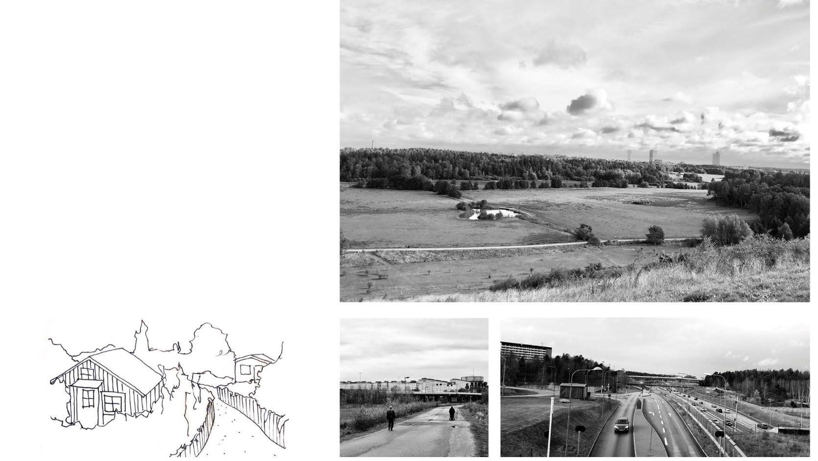
The map visualizes the boundaries, and in some cases the layers of boundaries, created by the categories analyzed, showing that Rinkeby and Hjulsta-Tensta are far more restricted by boundaries, essentially being enclosed into their districts. Access to nature is possible but in very unenjoyable circumstances that require the individual to cross below a highway- once in the green space, the sound pollution is so tangible that the experience is gravely hindered. The north edge of the two districts is bordered by huge highways that wrap around them, in addition to smaller city roads that encircle the entirety of the districts. Lastly, building heights for the buildings bordering the green wedge play a huge part in the district’s connection to nature, in Hjulsta-Tensta, Rinkeby, and Husby, 5-8 story buildings line the districts, creating a sound barrier but also an architectural wall between the community and nature. Akalla and Kista have been planned so that the border condition between the district and the green wedge is met with low-rise single-family row houses (seen in the section through the area in focus).
In addition to the analysis of boundaries through mapping, analysis of the accessibility to public, private and green space has been graphed and diagrammed by the district. Living conditions are affected by the community’s access to public and green spaces and the lack of them in HjulstaTensta and Rinkeby act as yet another boundary for these communities, reinforcing the obvious segregation experienced in these districts.
SOUND BOUNDARY 65-70 dBa 60-65 dBa 55-60 dBa

STREET BOUNDARY Highway City street Main street
SLU, 2022. Geodata Extraction Tool [online]
Segregationsbarometern, 2020. Stockholm kommun [online] Stockholm Stad skapad av Tyréns AB, 2022. Stockholm stads bullerkarta 2D [online]

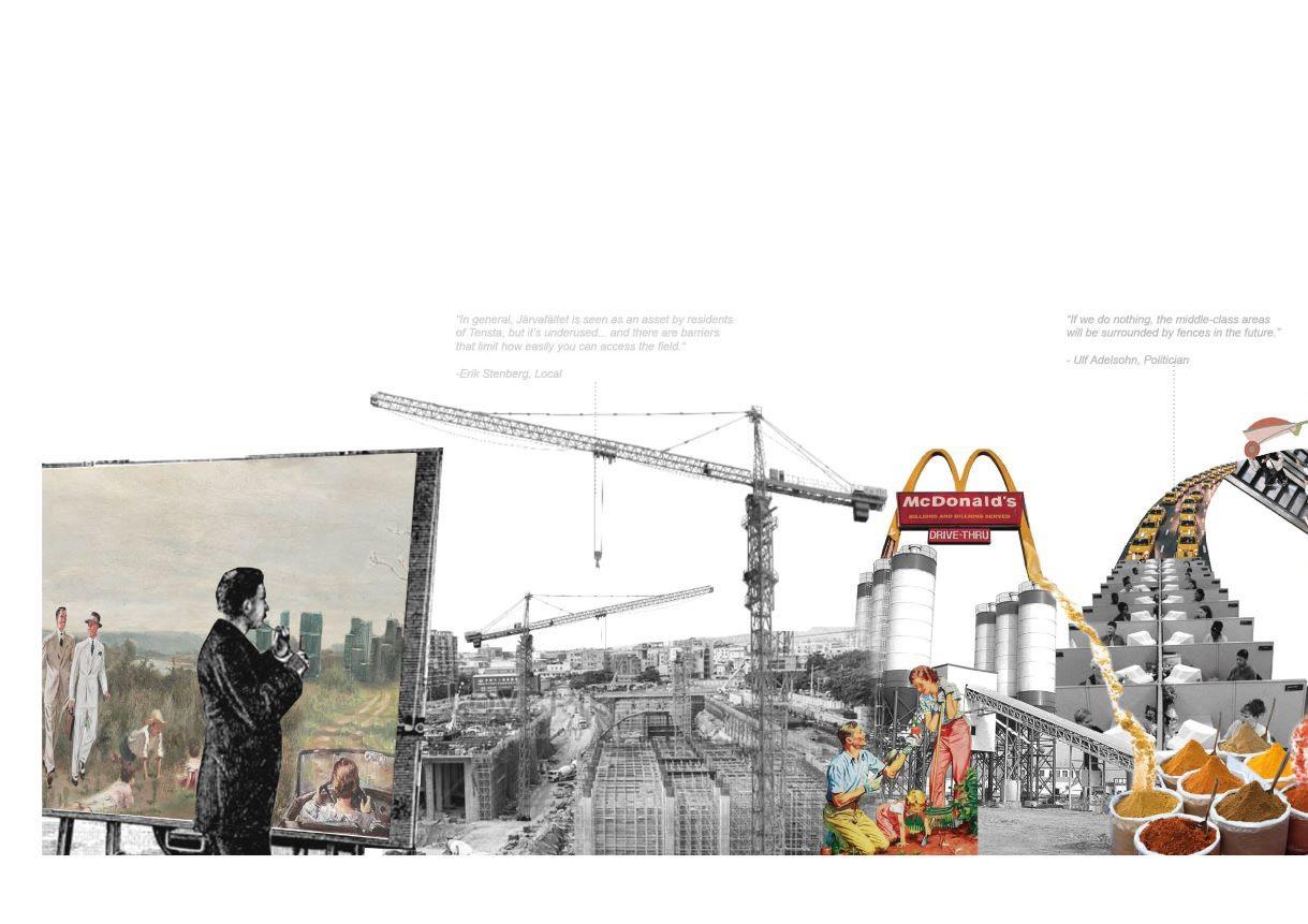


1. Why did you move to Tensta?
I worked on a project in Tensta and got to experience it first hand. It was so much different than the bad reputation it had so when I got an offer to move there I took it.
2. How did you and others relate to Järvafältet?
Järvafältet and the green spaces surrounding Tensta were one of the biggest assets living there. I used the green spaces when walking around, biking, skiing, jogging, fishing, swimming ect. The green space closest to Tensta lacks good water/wetlands which I feel is a negative. But generally I would say that it was underused by people. But how much you used it stood in direct relation to where in Tensta you lived. There are also barriers that limit how easily you can access the field. Most people have to go under the highway to get access to it and there are limited access points.
3. Did you feel like the closest suburbs (Rinkeby & Solhem/ Bromsten) were related to Tensta?
I felt more closely related to Solhem/Bromsten than Rinkeby living In Tensta. I only went to Rinkeby to meet friends or during certain events but I never felt there was anything better in Rinkeby that you couldn’t get in Tensta. The suburbs were built to be Isolated and you really feel the separation when you try to drive between the suburbs. You have to use E18 to travel between. When it comes to Solhem I had many friends there which I also met when I went to Spånga IP.
4. Did you feel like the suburbs on the other side of Järvafältet (Akalla, Husby, Kista) were connected to Tensta? What did you do there?
It felt like they were really separated. It was hopeless to travel between them, either you had to take a slow bus or go back and forth with the metro. But I seldom needed to be there because I worked in the city and moved from home to work that way so I got what I needed on the way or in Tensta.
1.
I came to Sweden in 1976 for a better life. When I arrived I got an apartment in Hallonbergen. After my family expanded we needed a bigger apartment so we put out an ad in the local newspaper and exchanged rentals with a family in Akalla. In the late 70’s-early 80’s people usually lived in the suburbs and worked in the city. For instance, I worked in a hot dog factory on Odenplan. But later I got a job at Eriksson in Kista in the 80’s as a microchip assembler and worked there for many years. But the factory moved outside of Sweden so I lost my job. I tried to start a small shop In Akalla 1991 but it was bad economic times and I also got out-competed by the big box stores in Barkarby. But I liked living in Akalla. I think it has improved a lot since I arrived, but sometimes I feel like it’s missing more grocery stores and restaurants. It’s the same thing in Husby where I live now.
2. How did you and others relate to Järvafältet?
We used it a lot. There are so many things to do there. You can take long walks, sit and watch the animals, go to the forest to pick mushrooms and blueberries. There were also allotment gardens, we rented one and grew vegetables.
3. Did you feel like the closest suburbs (Husby & Kista) were related to Akalla?
Yes they felt really connected and we usually walked between Akalla and Kista through Husby. Kista had a lot to offer, shopping, entertainment, and restaurants, that I felt Akalla and Husby were missing. We frequented Husby less, we only went if our dentist in Akalla was fully booked.
4. Did you feel like the suburbs on the other side of Järvafältet (Tensta, Rinkeby, Hjulsta) were connected to Akalla? What did you do there?
No I never felt they were connected but I sometimes went there by bus to buy cheap vegetables from the square vendors or visit family/friends.
“In general, Järvafältet is seen as an asset by residents of Tensta, but it’s underused... and there are barriers that limit how easily you can access the field.“
“We used Järvafältet a lot, there are many things to do there... long walks, mushroom picking, and there are also allotment gardens, where we grew vegetables.“Photo: Erik Stenberg, Tensta Native
“The bottom line is that we have too little contact. My vision is that in every school, every single school, there should be contact groups. The police should be out in the schools. Social services should be involved. The recreation department should be involved. Immigrant associations should be involved. The church should be involved. We don’t need rallies against racism. Instead, people should come out here, sit and talk, and make contact with immigrants. Then you do something about racism. You don’t do that by wallowing in complacency.”
- Ulf Adelsohn, Politician”Unlike countries with colonial heritage, Sweden has a historical opportunity to tackle the threat of segregation. Integration into Swedish society means in practice allowing immigrants to take part in what is happening in the local community, to become involved. They are capable of taking responsibility, of taking on tasks.”
- Project Manager Social Administration“I think the redevelopment of Rinkeby gives a good picture of what can be done with an area that was so poorly built from the start,” says work manager Gerry Åkerström ... “There are many areas in our country that could do with a similar makeover.”
-Lennart Ericsson, CEO“It is, among other things, streets that divide the area in an unfortunate way, something that complicates the feeling of home and taste. Each block is an enclave. In some places, there are no natural crossing points. And there are still major deficiencies in the maintenance of houses and yards in some areas, particularly the high loft buildings. What is needed most is to bring in larger and smaller apartments, so that large and small households can stay and the area becomes more stable.”
- Eva Björklund, Architect“The problem is that the stable families are moving from immigrant areas, not only the Swedish families but also the stable immigrant families. People are afraid of the environment in which their children will grow up. -Immigrants for 30 years.”
-Local
“The social authorities have been working on their own without cooperating with immigrant groups or immigrant associations. We know how to deal with our children, how to get close to them, how to inform them without making them afraid.”
-Local
“Imagine an adult man who comes from Somalia. He is well-educated, has worked for a long time, has supported his family. But in Sweden, he can’t get a job. What does he tell his children? In their eyes, he is just at home. He knows nothing. What does this mean for them, where do they end up?”
-Local
“By socializing, prejudices are broken. And how does one achieve this socializing? Well, by giving tasks and letting immigrant groups take responsibility. Then there is no longer any reason for fear. In Husby, we have succeeded.”

-Local
“There is no one with capital in these immigrant areas. No one owns their home. They don’t have the money to build their own homes. There is no money to start businesses. And the connections are missing. Who has seen a black banker in Sweden? I have never done it.”
-Local
“Graffiti does not exist in Eritrea. Here in Sweden, society takes the parents responsibility. We are surprised by the way our children behave. I want my children to grow up as Swedes. My new homeland is their homeland.”
-Local
“If we do nothing, the middle-class areas will be surrounded by fences in the future.”
- Ulf Adelsohn, Politician
“For me, the most important thing is a sense of belonging and safety. That is why I value the sense of neighborhood.”Photo: Aerial image of Rinkeby AN UNCHANGED
Our strategy for Järvafältet focused on two points, maximum densification and pollination to make Järva attractive for pollinators and humans alike. This creates a space where pollinators are naturally attracted by the added landscape features and where humans from different suburbs come together to meet, socialize and learn about pollination, gardening, food production and how it’s all linked. The pollinators in questions are domestic bees, wild or solitary bees (bumblebees included) and butterflies. The old patchwork of agricultural fields is remade into wild growing meadows with a mixture of natural varieties that produce nectar and pollen at different times of the year. The natural paths in between the patchwork of fields will be expanded and in the center of each patch. Butterflies will also find this landscape habitable with the sight lines created from the paths allowing for easier travel and newly planted orchards. The domestic bees will live within the three “Allotment bridges” which will connect Rinkeby with Kista, Tensta with Husby and Akalla with Hjulsta, while paths in the field and the river connect all of these bridges together. The nesting grounds can also be used as beekeeping sights for honeybees.
Our maximum densification strategy was to over-deck the E-18 highway and build “tetris” like buildings found in Ärvinge, Kista. This typology works very well to solve the issue we found with the sectional flow of the Southern suburbs by slowly lowering the hight of the building to make the edge of the built meet the green with low buildings. This would erase the hard barrier between the southern suburbs and the field, similar to Akalla and Kista.
Axonometric diagrams of thresholds

Current section throught Tensta
Proposed section throught Tensta
Sketch of the strategy - Urban bridge connectors
Schematic section throught Tetris typology showing step down into nature
With our model we explored how the landscape would change with over-decking, how a maximum densification strategy would land on ground and how the “Allotment bridges” could be shaped and designed to incorporate all the different aspects of our social and pollination strategies.
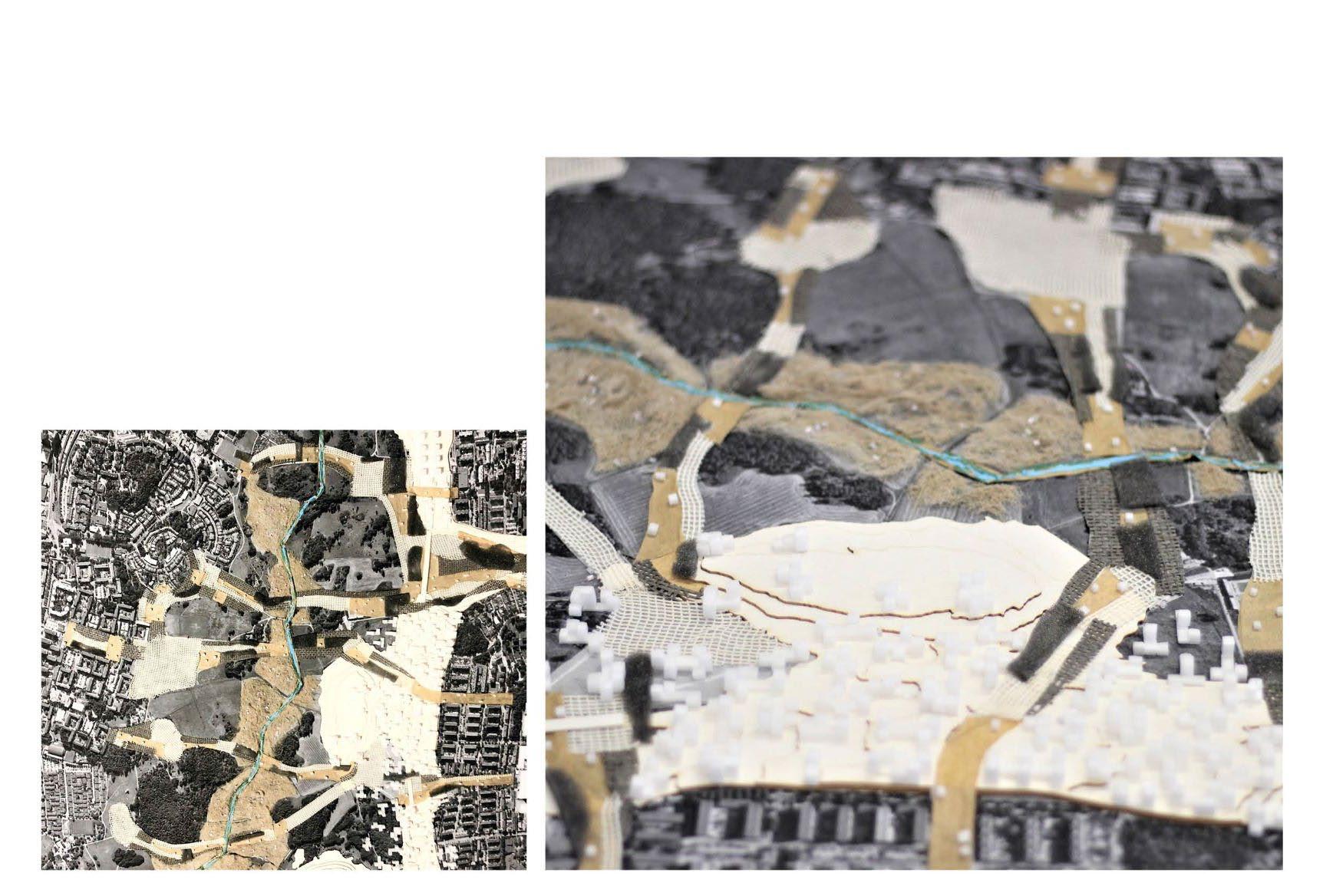
The shape of the bridge is determined by the natural landscape features which the bridge organically sneaks around, while the direction of the bridge is shaped by the morphology of the suburbs. Within each bridge, a grid system is made to organize different services and activities. Some of these include, outdoor farming, indoor farming, indoor and outdoor social places, markets, orchards and nesting grounds for pollinators.
After doing the model we found that it is possible to build high density along the E18 but that it would need to be further developed with roads, social spaces, positioning ect, to keep the logic of the existing infrastructure. We understood that the bridges would need to have a more diverse social program to be more activated during all months of the year. We also found that a convincing landscape model could be created using simple materials like sponges, fabrics, foam, baking paper and table covers which all represent different programs.
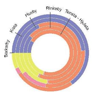
Economically Jarva is a diverse and heterogeneous area. Studying statistics regarding employment and income it is clear that parts of the area is suffering of a lower socioeconomic status than the Stockholm average. Interestingly this is not just true for districts such as Rinkeby and Tensta, which are generally known to be suffering the negative effects of segregation, but also the districts Barkarby and Kista which in contrast are known as economical clusters for commerce and the tech-industry. This is in stark contrast to the remarkably high revenues made by companies seated in the two districts. A clarifying insight is gained by reviewing the night and day population of the area which is clearly painting the picture of economical clusters to which people commute to work rather than living nearby. Economic spillovers from the profitable companies are therefore not overly apparent in the income statistics.

Further inspection of the available data continues to give insights into the character of this place. While the data regarding building function cements the picture of Barkarby and Kista as single functional, economical clusters like those created through euclidean zoning, the data on housing typologies paints a more complex picture of the districts. While the housing typologies in the bigger Jarva area is quite diverse, you can see an abundance of multifamily residentials in Rinkeby, Tensta, Hjulsta, Husby and Akalla. Reasons behind the selling of homes rather than having rentals can be many but it can be speculated that the attractive proximity to the nearby nature of Jarvafaltet is contributory. While areas the districts Tensta, Hjulsta and Rinkeby also have a close physical proximity to the verdant green wedge, these are separated from the nature by highway E18. Either if this is the case or not a conclusion can quite confidently be drawn that the highway affects these districts negatively. For example, we can see that initiatives that strive to contribute to increase connectivities in the area and engage the local populations in the green wedge in between the districts experience that they more easily can reach people living on the Kista side of the wedge. This could once again be speculated to be because of the more blurred limits between these districts and the wedge. These types of engagements in increasing connectivities are something quite apparent when studying the economic processes in the area. Alongside non-profit initiatives such as Jarva i Samverkan, Husby gard and Eggeby gard aiming to get people to meet each other in the shared green spaces we can also find organizations such as Bling and Shift that by helping local entrepreneurs build their networks strive to increase connections to the clusters.

> 350 000
300 000 - 350 000 250 000 - 300 000 200 000 - 250 000 < 200 000

Description: Interconnectwities created by BLING
Description: Highway E18 works as a barrier, separating districts from each other and hindring peo-ples movement
Description: The green wedge works as a green corridor for flora and fauna to travel between different areas but also as a barrier hindring people from moving and connecting with other districts
Calculated with an FAR of 2.5 and an estimated price of 5000 SEK/sqm light BTA the highlighted area is worth roughly 125 billion SEK.
Calculated with the average yearly revenue per hectar for industrialized agriculture in Sweden, the highlighted area would create yearly revenues of roughly 8.5 million SEK.
(1) BLING. 2022. https://www.blingstartup.se/. (Accessed 2022-12-08)
(2) SHIFT. 2022. https://www.shiftcapital.se/. (Accessed 2022-12-08)
(3) Geodata Extraction Tool. Sveriges lantbruksuniversitet. 2022. https://maps. slu.se/get/. (Accessed 2022-12-08)

(4) Järva samvebkan. 2022. Om JIS. https://jis.nu/om-jis/. (Accessed 202212-08)
(5) Husby konst & hantverksförening. 2022. https://www.husbygard.nu/. (Accessed 2022-12-08)
(6) Järva folkets park. 2022. http://www.eggeby.se/WP/. (Accessed 2022-12-08)
(7) Statistiska centralbyrån. Statistics Sweden. 2022. https://www.foretagsregis tret.scb.se/. (Accessed 2022-12-08)


(8) Akalla 4H-gård. 2022. https://www.4h.se/akalla/. (Accessed 2022-12-08)
(9) Sweco Society. 2018. Nulägesanalys av Stockholms arbetsmarknad. Stockholm: Sweco. https://insynsverige.se/documentHandler.ashx?did=1951714&rt=0&t=


US: We know that BLING is trying to overarch social, economic, geographical limits in Järvafältet and we are really interested in your work. We would like to know more about your story and your philosophy as an association? Can you also talk more about your different businesses?

AMIR: We started in 2014 as a non-profit organization who aim to build bridges between different parts of the society and to help entrepreneurs in segregated areas, giving access to people living in the Järva area to the inner city and vice versa. The aim of this initiative is to encourage people to give start businesses based on their hobbies and interests. As ways of working we like to help our clients in every stage, from concept to realization of the project, being a both organizational and economic support. In the case of the Bridge initiative, the entrepreneurs don’t pay rent because they’re new in the sector and they still need to grow and, in a way, we help them to sponsor and show themselves. Regarding our business we have connections in all of Sweden and even if we’re trying to focus on Järva most of the clients still come from outside of the area. We’ve identified that most of our members are over 25 years old. We are therefore right now focusing on helping younger entrepreneurs to try to create more visionary social interactions. We are also discussing collaborations with different organizations like, for example Fryshuset to reach young people to teach them about entrepreneurialship.
US: It seems to exist somewhat of a Järva-identity that is shared between people from the different districts, even thought these are physically, economically, and socially quite separated from each other. Do you agree with this?
AMIR: I think you are right. It is something related to a real community feeling. I come from Tensta and I love to live there. The neighbourhoods are quiet, families are always walking together, markets and commercials are always full of life, and I can feel safe, because I know the city, the area and the people that live there. Even if there are problems with criminality I still believe it is a living place for me, it is my home. Also the green area could be considered as a great public space that creates connection between people.
US: You are talking about community building, stimulating synergies in the local economy, mixing housing and business and we could talk a lot about good will, but what are the economic incentives to invest in Kista and Kymlinge to make it a more vivid place to live?
PETTER: So, and we have a number of properties, big buildings, and I would say that you come to a point where you either have to realize we won’t get a good return on investment anymore, or we have to invest to to make this a great place again, a place where people want to live and where the rents can go up again.
US: Why do you think people don’t want to live in huge technologic economic cluster as Kista?
PETTER: In Kista there is an evident lack of services’ variety. The blocks are too big and too closed, too few people live in the area where the offices are, the streets are almost empty during the night. In general, there is too little interaction between the residential and the commercial neighbourhood and it is not that easy to go to a place to another because of a lack of urban usability. Also, the car is still the most used way of transport in Kista, but people clearly prefer something cheaper, more ecological, and flexible as a bicycle. We want to have the qualities that people need in a liveable city.
US: Regarding this “trend” of people wanting to work more from home and other places than the office, we know about your new offices at Sergels torg it and about your co-working initiatives such as Arena. Do you see the same trend in Kista? Do you think it could be possible to develop similar spaces in Kista?
PETTER: I think we must look at all these perspectives. The more flexible we are the better. Maybe we should have a Sergels torg office in Kista, to divide all the big blocks that we have and create more open spaces. Even though we are not actually looking at Kista context so far, it could be a great proposal to work on for the future.
“What BLING does is to try to give access to people living in these areas in the suburbs [...] give access to investers and entrepreneurs from the inner city“
“The rent level for offices has been a flat liner, more or less, for a number of years”Interview with Amir Sebdani,
project managerat BLING start-ups association Interview with Peter Kvarnbäck, market analyst at Vasakronan

During the first half of the 20th century the urban city was generally zoned in a somewhat concentric way with manufacturing industries and low income neighbourhoods being centrally located and higher status city districts being located further out in suburbs(1)
This was also true for Stockholm and back then the central parts of the city was in a state of dissarray, struggling with overpopulation and unsanitary living conditions. Because of this it plenty of measures were taken to improve the living conditions for Stockholms working class by establish new housing areas in the shape of garden citys and ABC citys. In the 1940’s it was decided that the central parts of Stockholm were to be regulated and sanitized. This meant tearing down the old Klara quarters and build a new, modern sanitary city center(2). Supplentary to these measures was the milion program in which new suburbs, such as Rinkeby and Tensta, was built and where the working population were to move and enjoy better living conditions(3)
Parallel with the ongoing milion program Stockholm and Sweden underwent a an economic structural change and went from predominantly being a manufacturing economy Sweden into being an economy were the service sector plays a bigger part of the economy(4)
In line with the transition, Stockholm city was in the process of establishing the new areas of northern Järva. Together with Ericsson and ABB decided that the new Kista district would be a technology business cluster(5). The primary housing districts in northern Järva, Husby and Akalla, would here have a mix of small and large scale residentials, learning from the critisism against the million program(3). Kista itself became the before mentioned technogy cluster it was meant to and has long been known as the Silicon Valley of Stockholm.
(1) Burgess.E, 1925. CCD model [available online]
(2) Markelius, S. (red.) (1945). Det framtida Stockholm: riktlinjer för Stockholms generalplan. Stockholm:
(3) Stockholmshem, 1998. Rinkeby [available online]
(4) Ahlberger. C, 2001. Den svenska staden: vinnare & förlorare. (1. uppl.)
Stockholm: Riksantikvarieämbetets förl..
(5) Anttiroiko, A-V., 2014. The Saga of Kista Science City: The Development of the Leading Swedish IT Hub from a High-Tech Industrial Park to a Science City [available online]
(6) Svenska Bostäder, 2022. Tensta [online]
(7) Stockholm stad, 2020. Trygghetsstrategi Järva [available online]
(8) Fastighetsnytt, 2022. Rykten för miljarder Kista – så vill Citycon jobba med den upplevda otryggheten [published 2022-06-04]
(9) Petter Kvarnbäck, 2022. Interview med Petter Kvarnbäck at Vasakronan
A lot of criticism was oriented towards the planning of these areas for example in regards to housing typology and the execution of the project in regards to letting people move in before it was finished. People living in Tensta during the time of construction describes life there as living in a muddy construction site and that there was only a baracks functioning as food store for the whole district(3)
The before mentioned, generally gradual, structural change soon had an effect on Stockholms workforce and the manufacturing industries and appurtenant work opportunities diminished quite early on to give way for the newly dominating service sector. This in turn resulted in that the influx of workers from the rest of Sweden decreased and a lot of the residentials built, for example in Tensta, remained empty. This excess of apartments together with the increasing influx of immigrants settling in the cheap available apartment in later decades and a portrayal of milionprogram areas as troubled suburbs led to a stigmatization and segregation of these areas still prevalent today(3) (7)
Interest from companies to have their offices in decentralised, single functional office districts has decreased through the years and the benefits of working in tech and telecom clusters does no longer outweigh the benefits of working in the more vivid and mixed use neighbourhoods in central Stockholm. The reputation of Kista has also taken a toll these last years due to people no longer feeling safe walking the streets after office hours, a problem long known in these sort of districts(8). The days of Kista as a single functional tech and telecom cluster seems to be counted and, as shown in the transcript from our interviews, it is generally agreed that the district needs to undergo some sort of change to remain an economic, comercial and industrial center (9)
The strategy proposes a new type of productive landscape, where food production on different scales and with different functions (recreation, research, education, profit) share the landscape with large and small scale food processing. Through this we set in motion a needed change in the tech and telecom cluster today located at Kista to become more of a technology - climate/food production that will include all of the Järva wedge, connecting the different districts.
The wedge will be transformed into a productive, patchwork landscape where food productive enterprises of different scales and in all stages of processing, will be huddled up close together. We also believe that further research is an important step to deal with the ongoing climate crisis and that by closing the gap between science and commercial enterprises, new mutually beneficial synergies might evolve. In line with these beliefs, this new patchwork landscape will constitute an enormous, experimental showroom showcasing the future of a more climate sensitive rural and urban farming - displaying the latest technology and being a cluster for agricultural research and education. In regards to aspects of the natural environment, such as soil, water and weather conditions, will therefore be made to divide the land into a grid of zones with different functions. For this reason zoning will also take into account the built environment and the existing infrastructure wconsisting of highways and streets as well as natural and man made walking pathways.

With our proposal Growing Knowledge we redesign the Järva wedge into an extensive experimental showroom to create a new technology - agricultural cluster that spans through all of the Järva area. More specifically we set our strategy in the eastern part of Järvafältet through which we propose a development in three different areas, extending out from Kista, Järva and Ursvik. By extending these areas and by creating both suburban and more urbanized areas, we are increasing the perceived proximity to the new connecting productive landscape. To connect these new developmental areas, a series of existing pathways and axises have been identified for the establishment of a network of bike lanes, allowing easy access to different parts of the new areas. In our goal to increase the connectivity in the Järva area, we are also proposing a small number of tram lines connecting different districts and bridging the divide currently caused by the green wedge.
The interrelationships in the new cluster between different actors and functions are central to our green strategy and that’s why we conceive the green edge as a patchwork landscape organized in a grid of different functions, subdividing the urban fabric. This subdivision unshrouds the morphological relationships that make up the urban landscape. Through such an exposing of otherwise complex structures the built environment and the processes therein becomes more easily read. These new grid neighborhoods will therefore be zoned in a non euclidean way, consisting of clearly defined functional and typological zones.

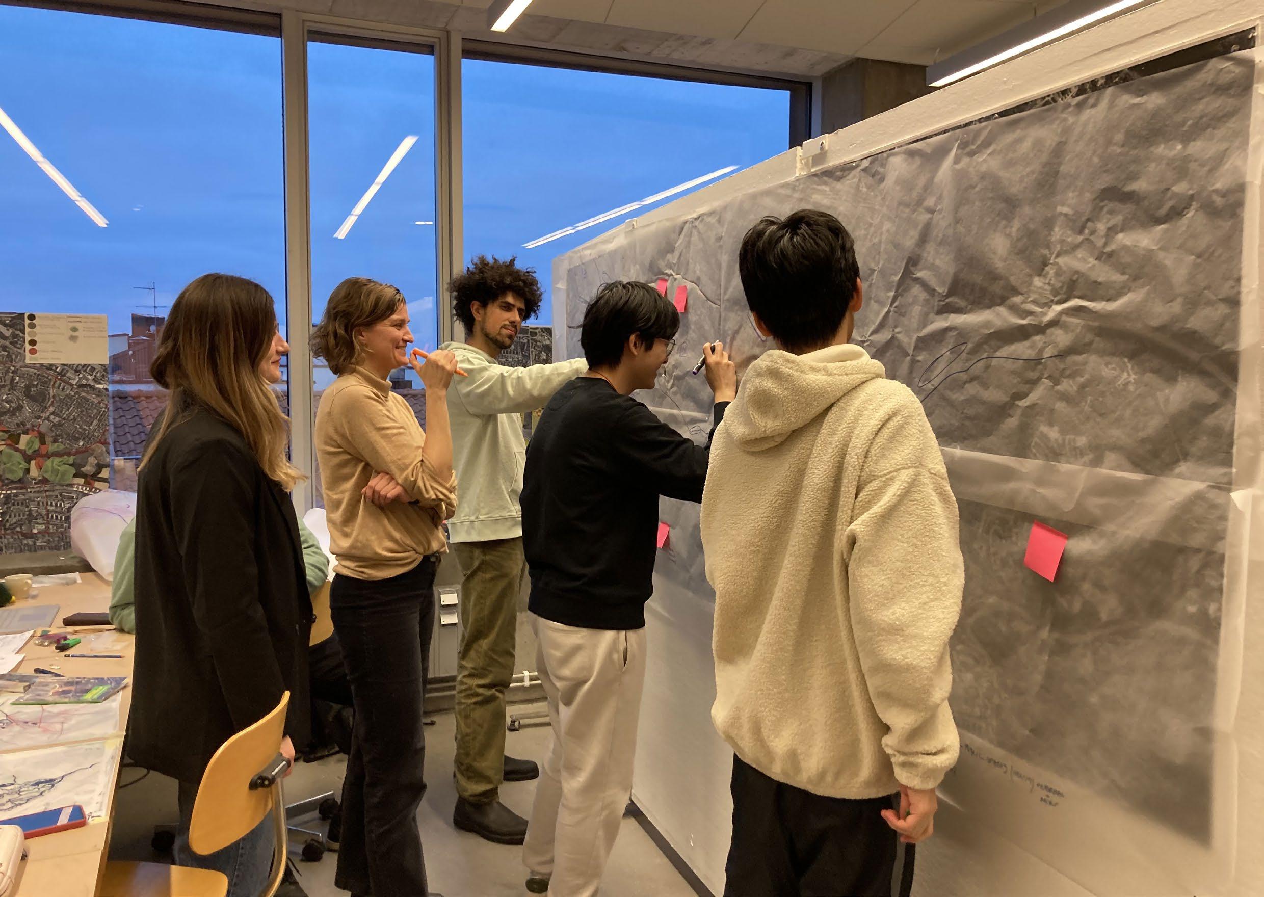
Building on knowledge from P1, we expanded on dimensions of systems thinking. We explored different concepts of caring and how to design resilient neighborhoods for the future. Going back to the site we zoomed in and created a series of projections. Projections are not finished projects, but rather a representation of “what if” scenarios that tell alternative narratives for the development of the wedge and explore new relationships between humans and nature.
Drawing from our multiple projections we collectively developed a communicative vision and strategic plan for the development of new relationships between Stockholm and its green wedges.
We have explored how Kymlinge could change over time. Our projections represent scenarios for 2030, 2050 and 2100. Our main proposal is a park that will be outlined with built areas, a “central park”.


Along the roads contouring the park there will be meadows, making the park more approachable and providing open view lines for pollinators. The wetlands will also expand, raising their potential to handle stormwater and supporting biodiversity.
To enhance the connection between Kista and Lilla Ursvik, we also propose an alley that will hold a smaller road for vehicles, walking- and biking, and a metro station. Kista science city will stretch out into the green wedge, creating Kymlinge Science City. Commercial buildings will surround the metro station. Terrace houses will be placed near the park to make a gradient connection between built and unbuilt. Row houses will take place in the areas connecting to the terrace houses, and point houses and taller buildings will be placed closest to the highways to act as noise cancelers.
Our site - Kymlinge, between Kista and Ursvik
(1)Naturvårdsverketshemsida naturvrdverket.se

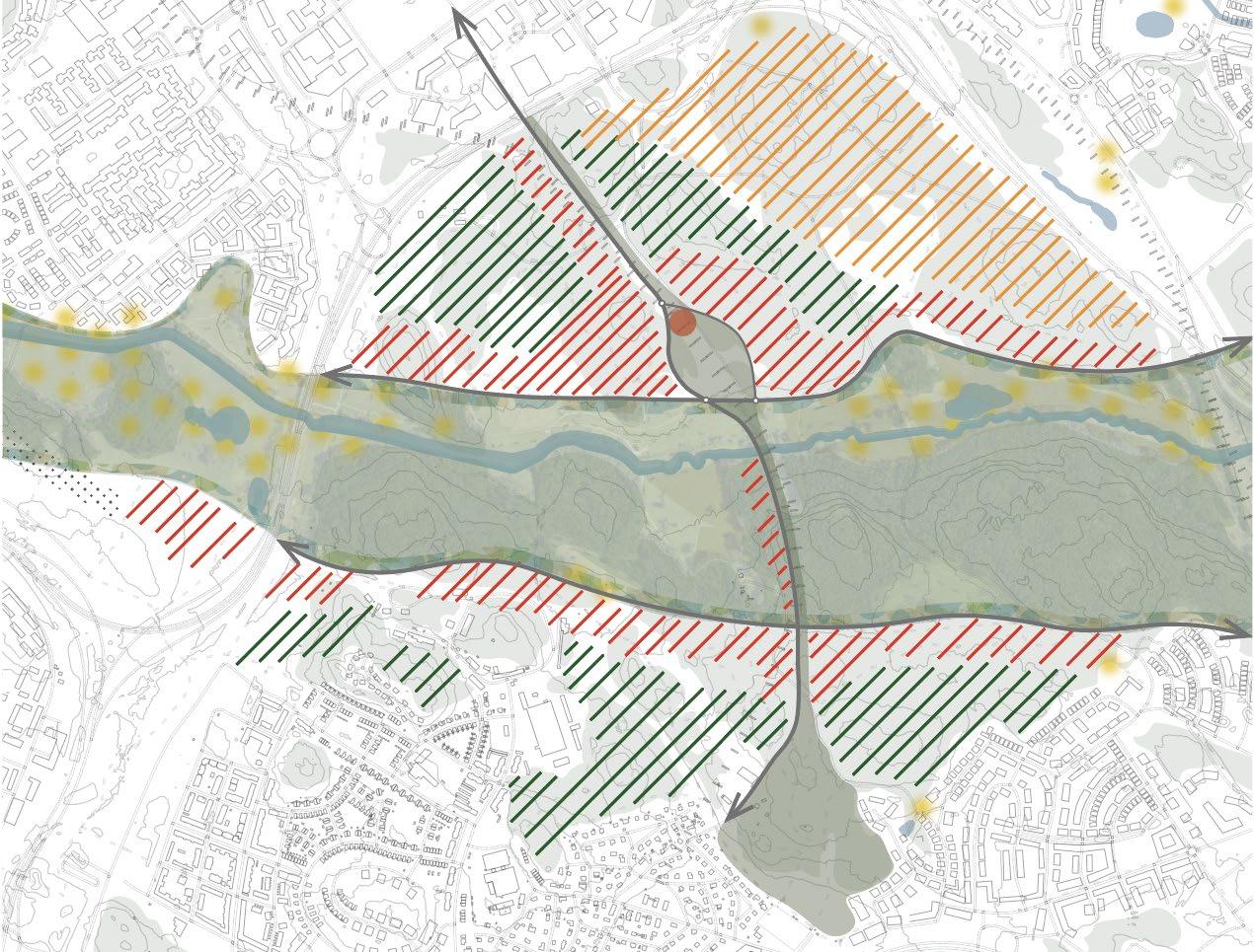



(2) Stockholms stads hemsida Miljöbarometern - Återgärder Igelbäcken


The first projection is showing the connective core, it is close to the metro station and we see the intersection between the railway and the park. The railway is raised above ground. Underneath there is a space that holds possibilities for public functions and people meeting each other, with playgrounds, allotment gardens and room for a cafe or a market. Commercial towers and terrace houses are surrounding the space. In the projection for 2030 we see plant protections for the oaks with small trees growing inside them along the alley. 2050 we imagine the site has become even more densified and the planted trees have grown bigger. 2100 we believe there will be new smarter ways of traveling and that the architecture might look and act a bit different. We predict that there will be easier ways to grow food locally. The oaks are now quite big and their plant protections can have their new function and become sculptures.

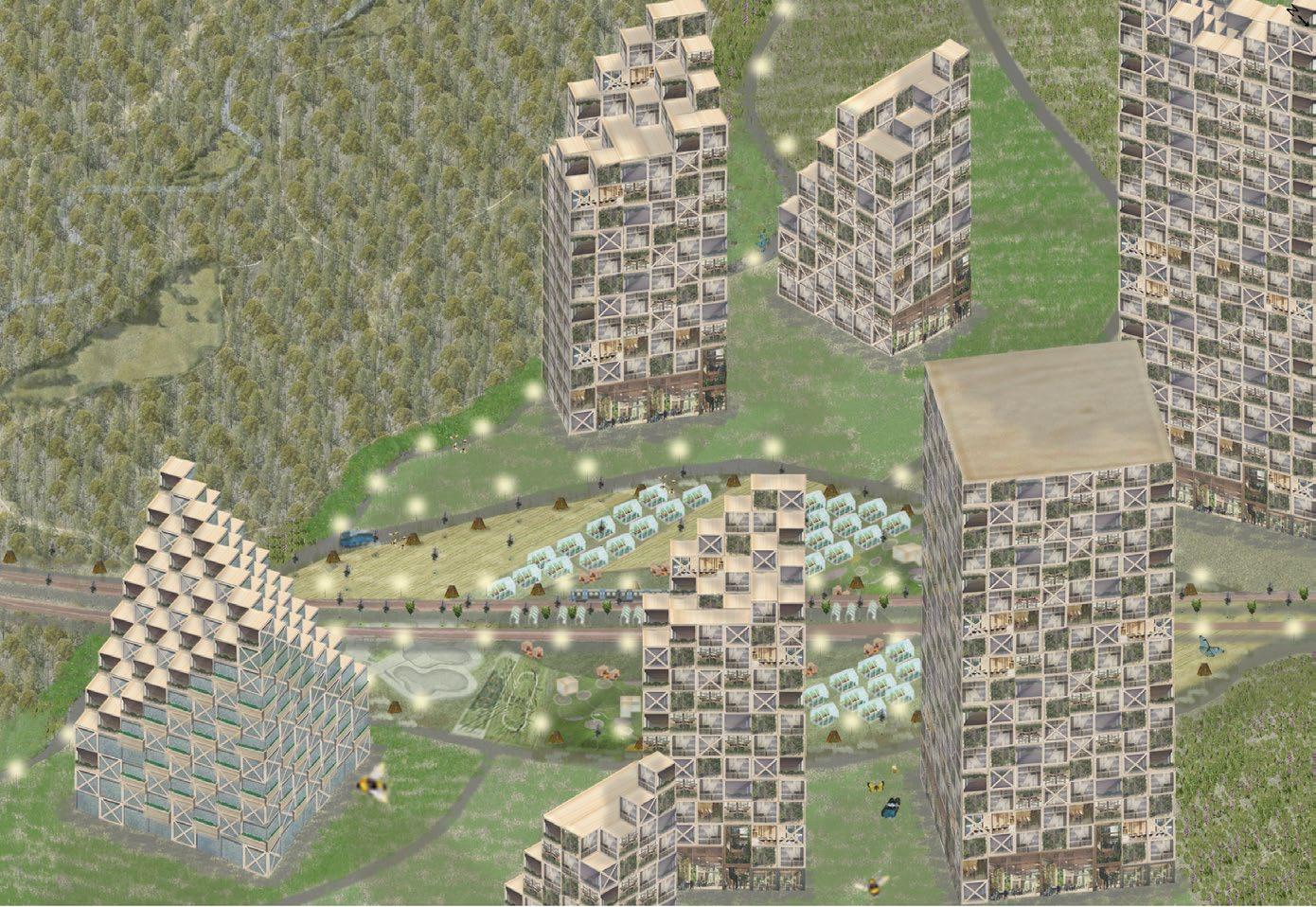

This projection is showing the dialogue between the park and the residential housing. This is an area of lower density with terrace houses and row houses. Our intention with the building typologies is that they integrate the green and erase the heavy contrast between the built and non-built.The rows are placed in a non-rigid structure, creating spaces between that function as green corridors. Between the rows there are fast growing meadows and red trees (blodlärk) that are faster growing than oaks. 2050 we see an increase in the variations of vegetation. 2100 there is a more productive use of the terraces, for example growing your own food. The oaks have now grown big and are starting to blur the contrast between the built and the park. The community have now got the ability to welcome even more species.
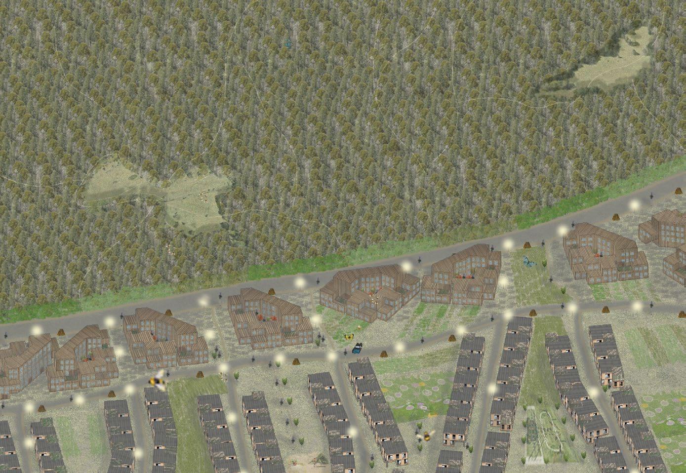

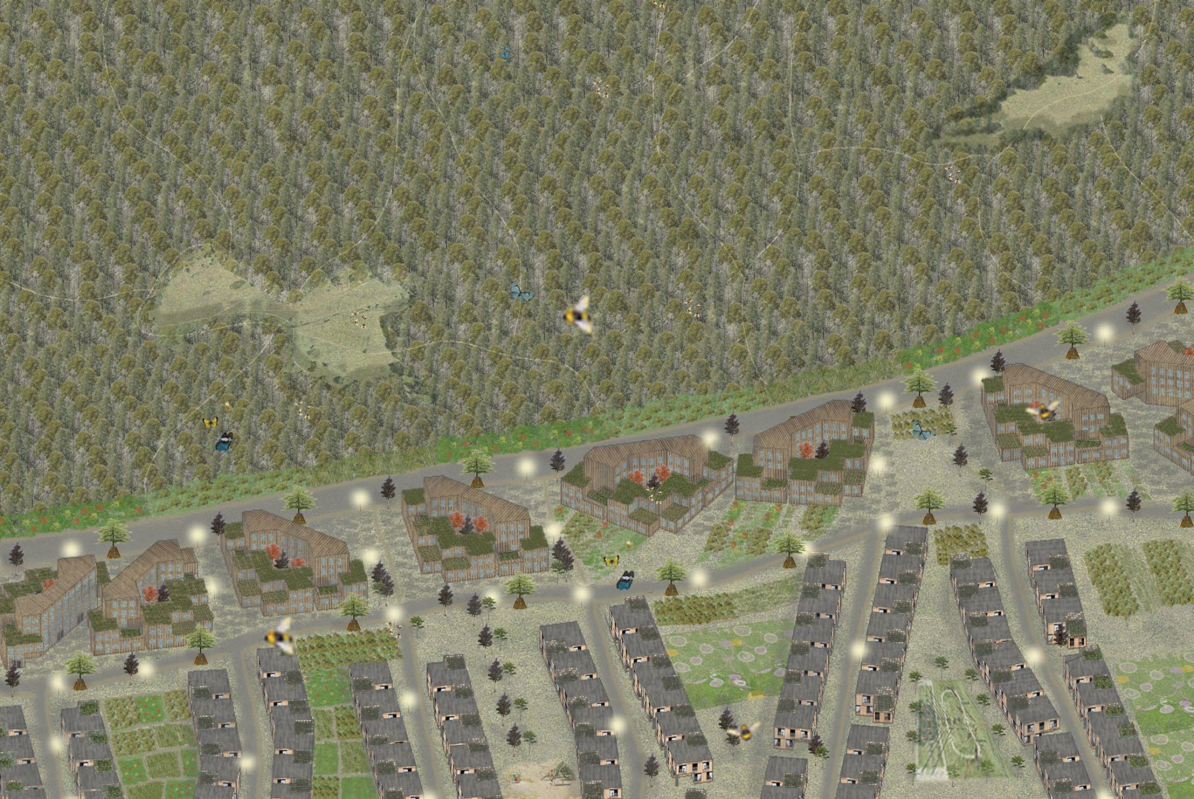

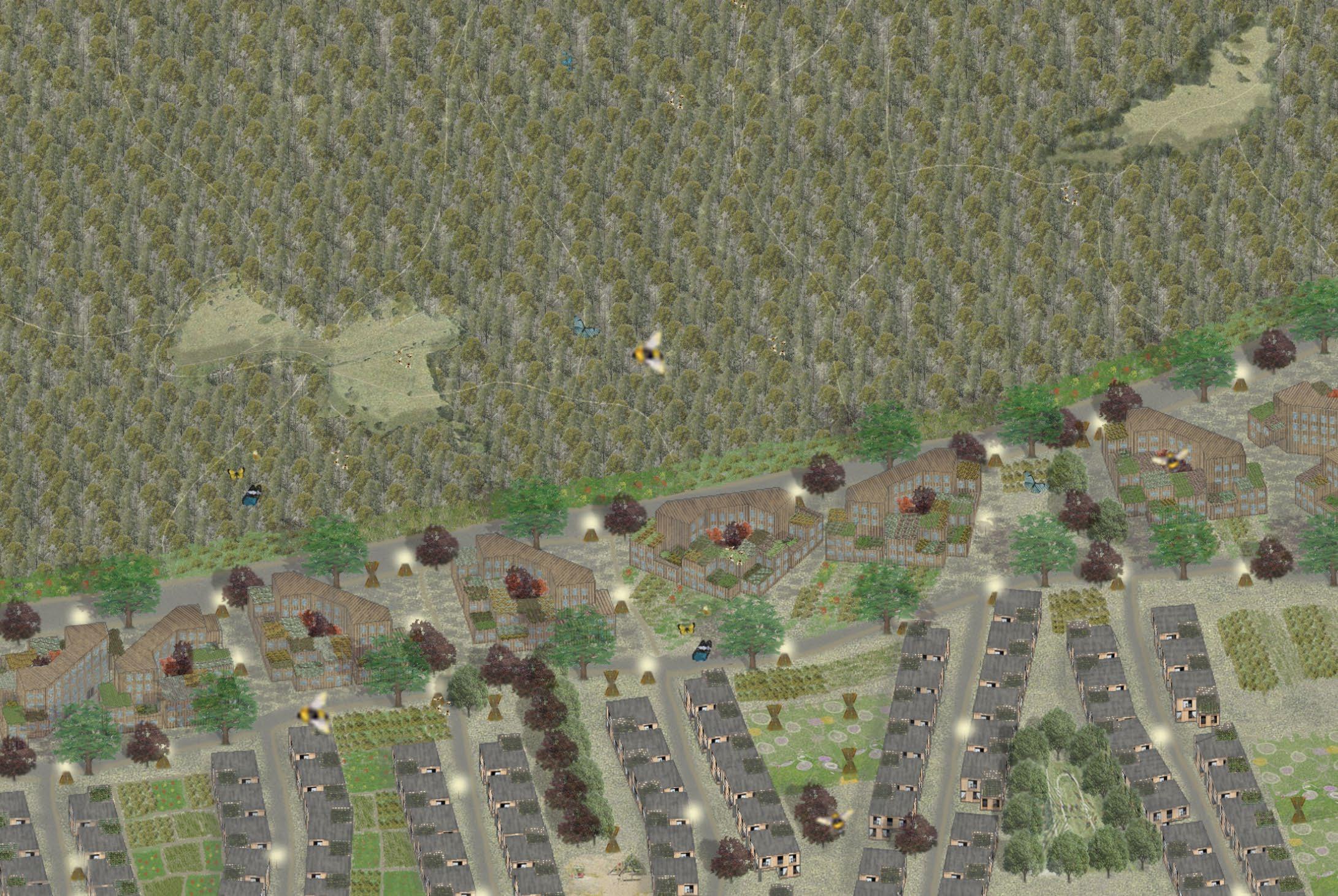
The Weaving Waterways project aims to improve the spatial vitality and connectivity between people, water and nature in the Järva wedge through the weaving of the land and water, extending from the Igelbäcken river. The Igelbäcken river runs along the entire Järva wedge, beginning from lake Säbysjön near Akalla, and running into lake Edsviken. The river is currently facing issues of water shortage, water contamination (eutrophication), habitat loss, and lack of biodiversity and insufficient connectivity to the nearby neighborhoods. Our project aims to mitigate these hydrological, social and environmental issues and add richness to the water and built environment.
The overall vision of the strategy is to direct water back to Järvafältet to use it as a medium for the enhancement of recreational aspects of the creek. We also envision it to improve community engagement and environmental protection, and act as a carrier for emerging communities.
The three focus site areas are located near Barkarby and Akalla. The location of the sites was determined by examining flood maps and site topography to find the weakest points within the Järvafältet. This then defined the locations of river extensions and the widening of the Igelbäcken to enhance its water capacity. The locations are also disjointed in ecological connectivity but have high potential for improvement and growth.
Each site has different functions and characters, and responds to different issues. The Barkarby projection focuses on increasing housing density in response to Stockholm’s housing crisis, and contains meandering rivers crossing between soft and hard surfaces. It will also connect people by opening a station entrance right next to the site. Akalla focuses on enhancing water catchment areas through green and “blue veins” which result in a gradual replenishment of groundwater, that also serve as vivid community corridors. The Hästa Gård projection concentrates on increased resilience in supporting food production through stepping stone wetlands, also benefiting biodiversity habitats. All three sites and projections contain water extensions which tie the projections to the Igelbäcken and to one another, forming the Igelbäcken as the “core spine” that connects people and nature.


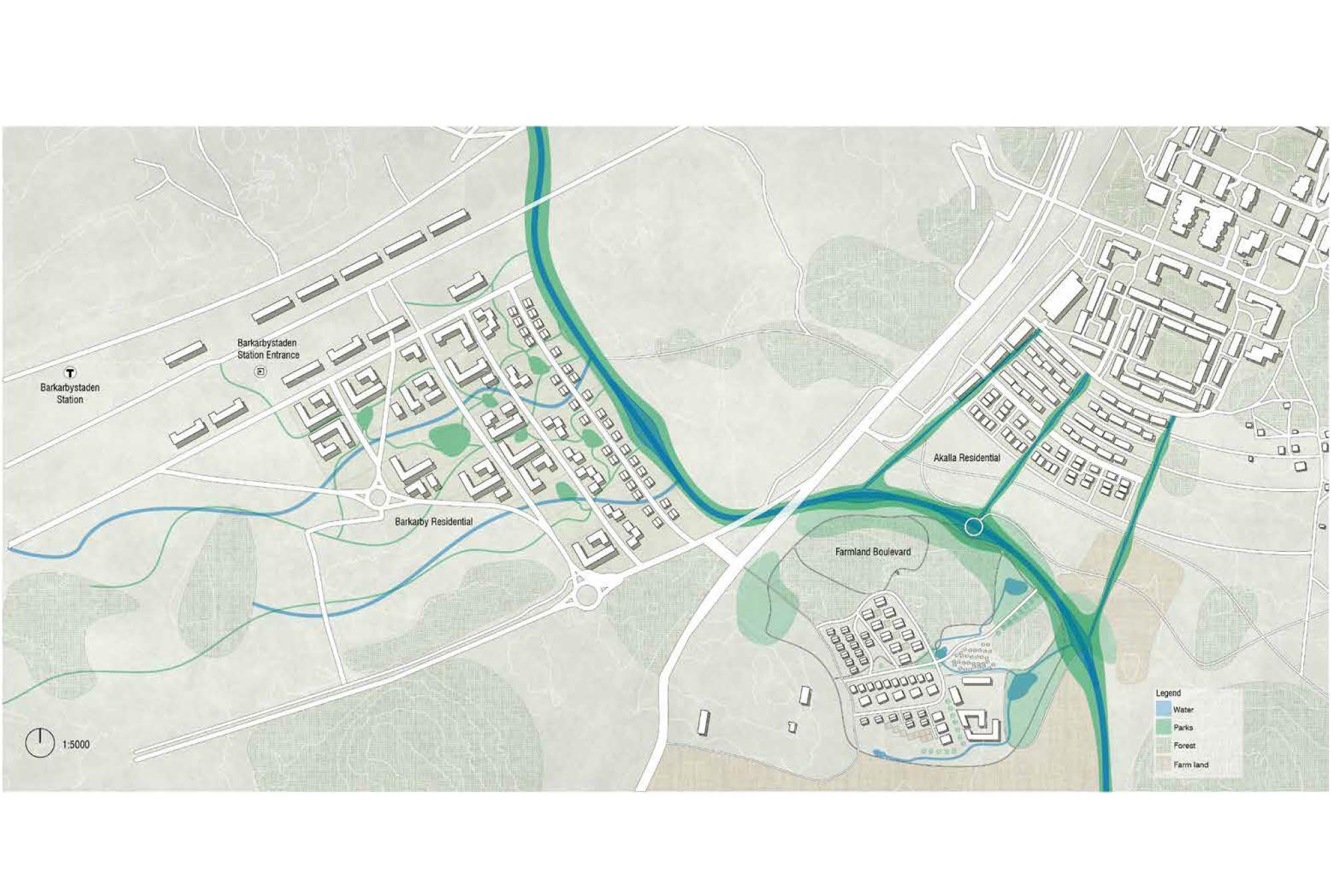
The grid systems are delineated by the existing logic and landscape of the site, particularly the building texture, and current road outlines.
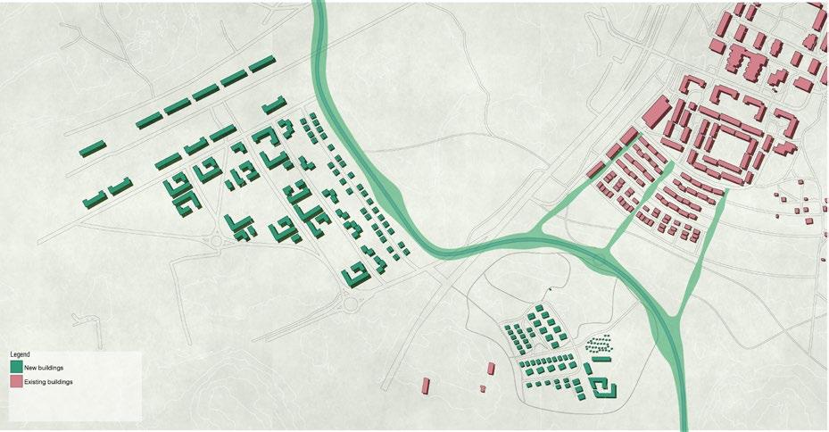

The roads are divided into 2 typologies for sectioning the circulation for humans (slow track) and vehicles (fast track), while creating rain water gardens on two sides as a buffer to the residential areas.

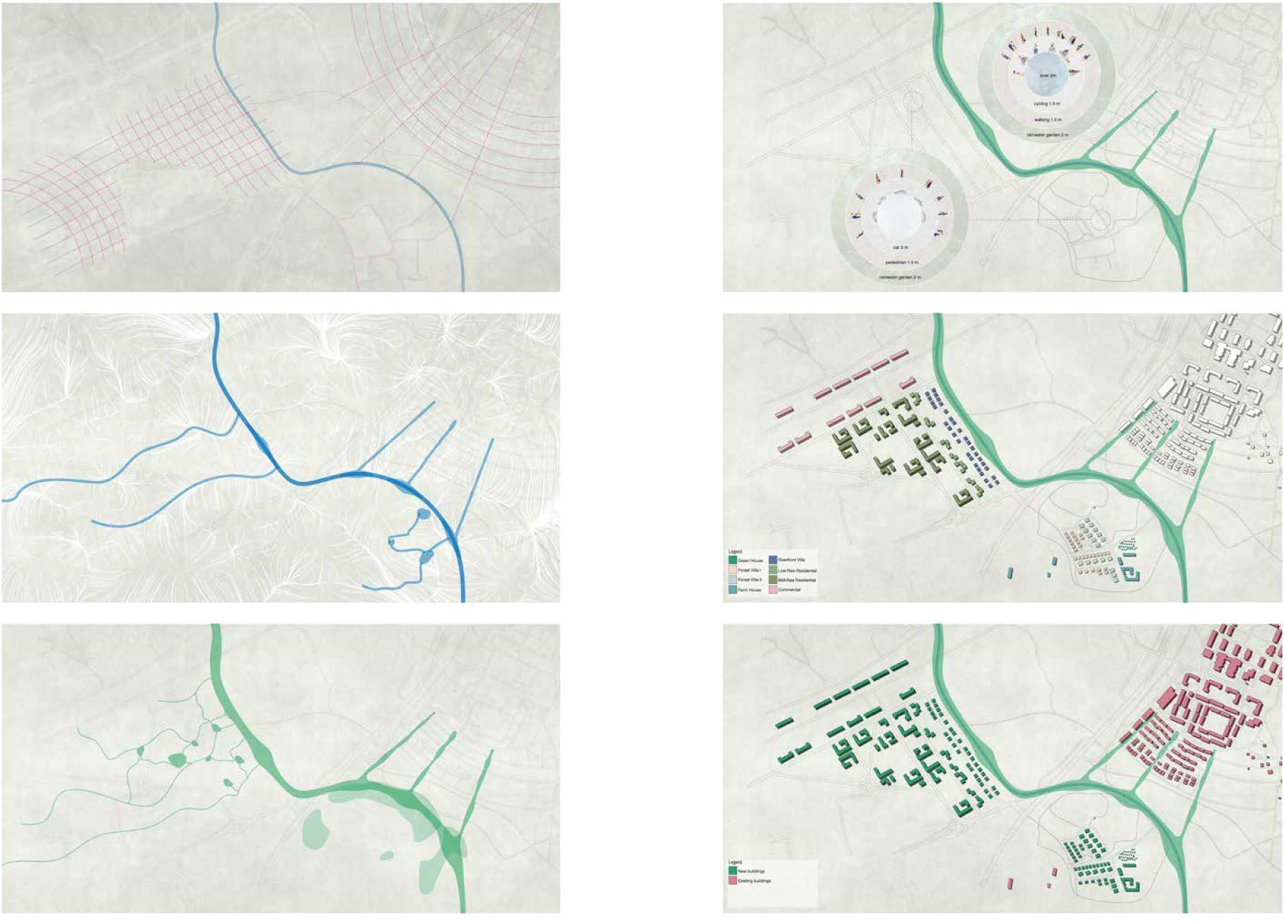
Water extensions are formed following the contour of the site and rainwater drainage data. The extensions gather water, mitigating the drought issue in the Igelbäcken and reducing the risk of flooding.
Parks weave from the Igelbäcken and intertwine within the built environment, blur the boundaries between public and private spaces, and break down the formality and exclusivity of waterfront residences.
Different building typologies are set according to the specific conditions of each site.
THE EXISTING AND THE NEW BUILT
The Igelbäcken functions as a spine, bridging the existing and proposed built environments
In addition to the common theme, each area has its own identity and focus.
In Barkarby, water streams and park paths weave and intertwine, bringing the water and built environment together. Micro nature hubs, which contain native plants, trees, seating areas, and playgrounds, are scattered throughout the site, creating green corridors and connections for pollinators and other species, and an enjoyable and organic walking experience for people. They also create comfortable spaces for the local community to gather and enjoy recreational time. The organization of the infrastructure and housing is formed along a grid that is delineated from the existing logic of the Barkarby roads and curves of the Igelbäcken. The typology of the buildings form a gradual increase of density from the Igelbäcken to the Barkarbystaden Station, beginning with freestanding villas, to mid-rise housing, and high-rise apartments. Green roofs are added to the apartments to mitigate climate change effects.

Hästa Gård keeps its identity as farmland. Around the site are community urban farms, and greenhouses for local residents, which utilize the water from the Igelbäcken extensions and ponds for irrigation. There is also an area with allotments and smaller greenhouses for community use. A new bigger farmhouse located in the bottom left of the diagram concentrates on local food production, and the old farmhouse on the top of the hill is transformed into a cafe-museum with an observation tower next to it. The houses in the area are townhouses and are mainly aimed for families with kids. The buildings are situated along the existing landforms. The Akalla projection contains blue veins extending from the Igelbäcken that function as stormwater collectors, and create a ‘vivid community corridor’ to develop the Akalla community and embrace the relationship between nature and humans. The veins follow the slope of the topography from the Akalla residential area to the Igelbäcken river, along with local plants and small recreational resting platforms. The river intersection between the Igelbäcken river and the endpoints of the blue veins are enlarged and form nodes with different types such as purification and buffering zone, recreational zone, and animal habitation area. The ‘connecting ring’ (on the node of the wetland) and the stepping stones (between the narrow parts of the river) are constructed as both a landscape bridge and for enhancing area connection.

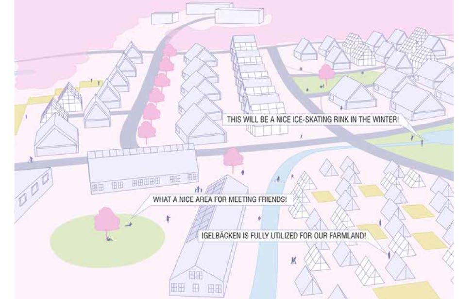

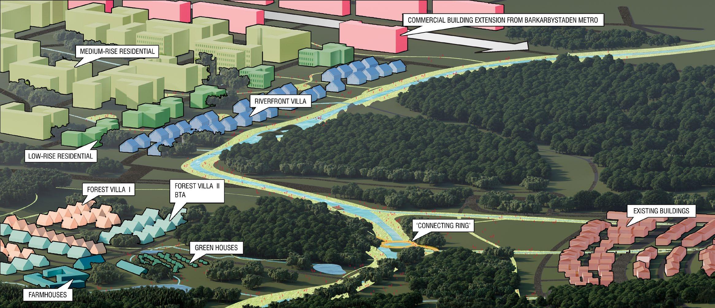
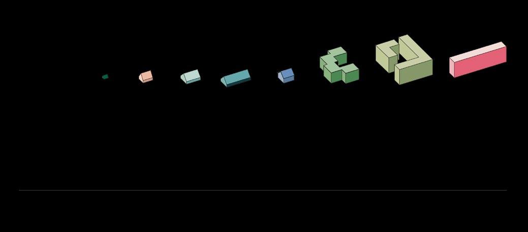


The first step in the strategy is to give the reserve another function that will allow it to retain its natural qualities. The idea is to add community spaces composed of farmland, seasonal gardens and infrastructure.
These spaces are arranged around public spaces, which serve as places for exchange, meeting, and cultivation, and allow for the direct use of crops and animal products on site. The plan is an example of one of these public spaces, which consists of a market, a community building, an amphitheater for art events, and a bird tower that can be used to observe the surroundings and find one’s way around, and can be seen all around the reserve and the city. The public space also invites the city’s residents to visit and use the reserve.
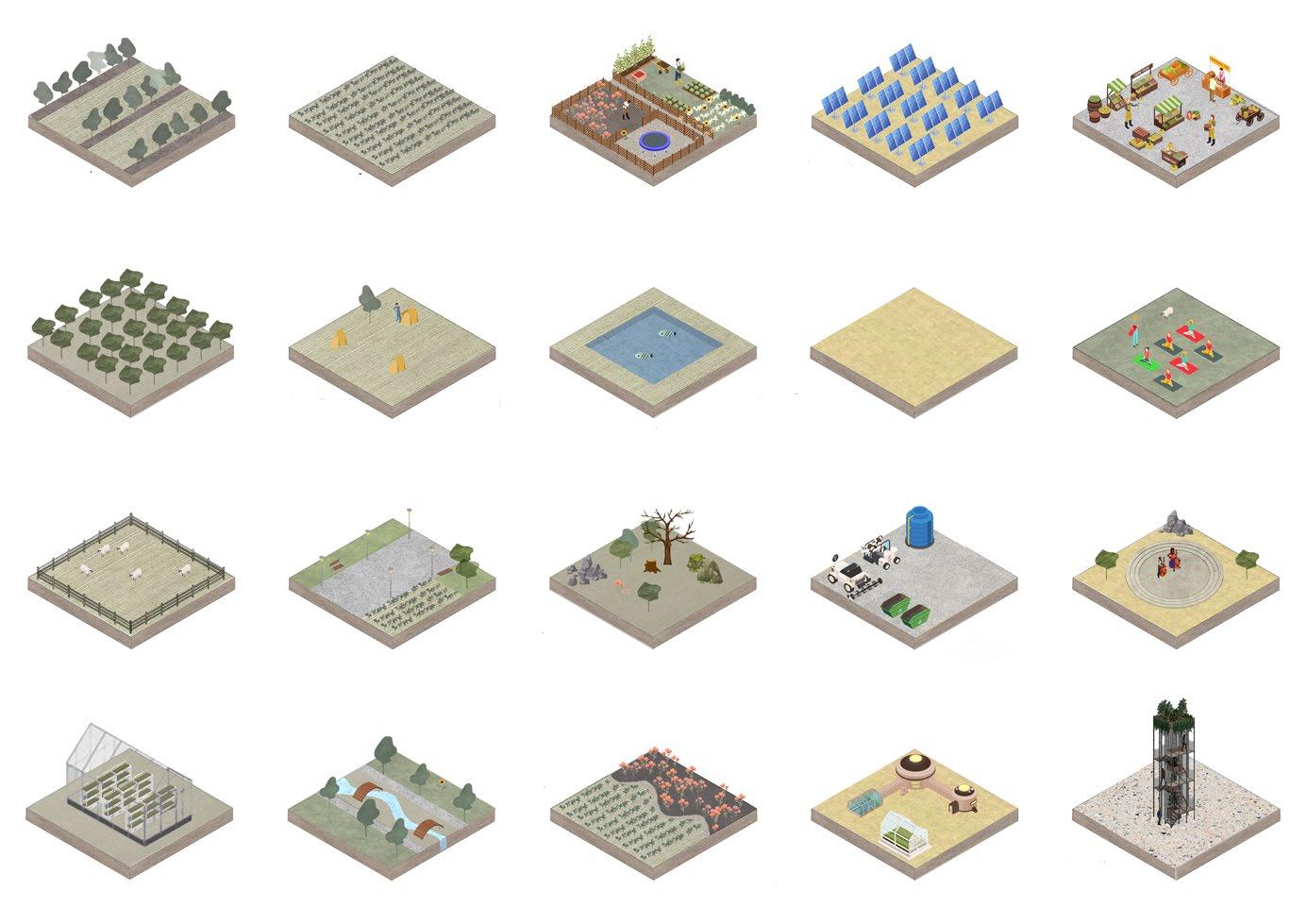
The second step in the strategy is the connection between the city and these elements. By creating main cross-connections through the reserve and a longitudinal connection along igelbäcken, this allows better orientation in the site, connects the two parts of the city and links the main public spaces together.
The final step in the strategy is to create better access from the city and bring the reserve into the city. By using a system of terraces as in Rinkeby, and adding a second system with smaller buildings, the transition is smoother which brings part of the reserve into the city.
To the right, you can see a non-exhaustive list of the ingredients that compose the land, which when put together create these community spaces.
Below is a section of the reserve, with the modified Rinkeby Terrace and the bird tower that can be seen from a distance.
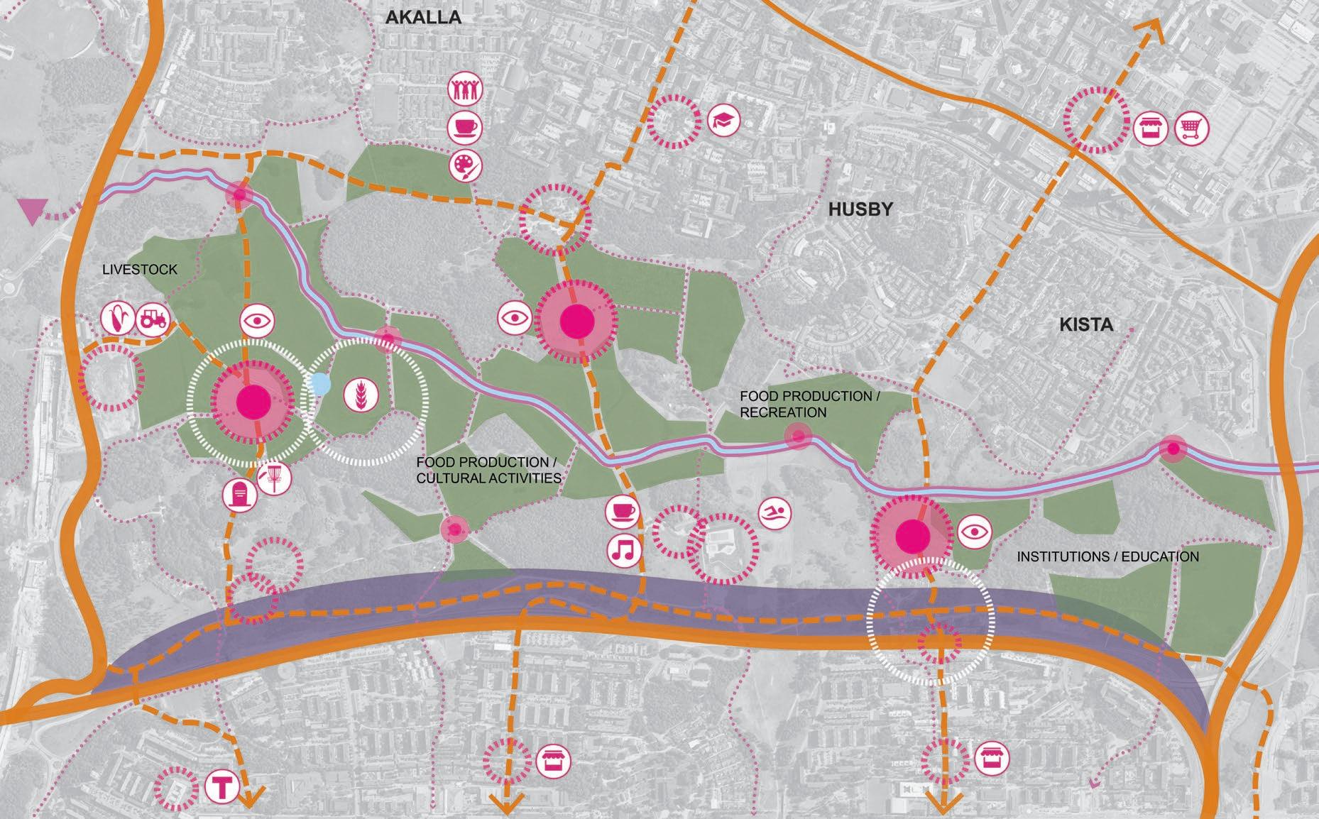
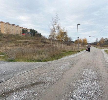

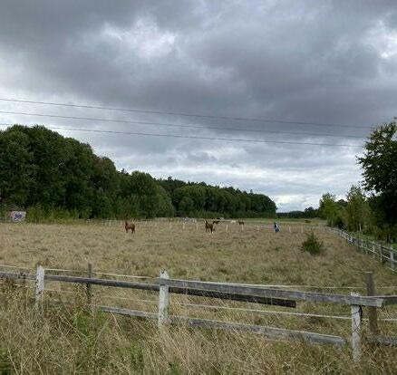
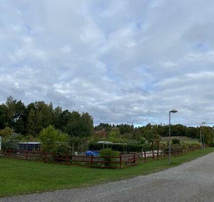
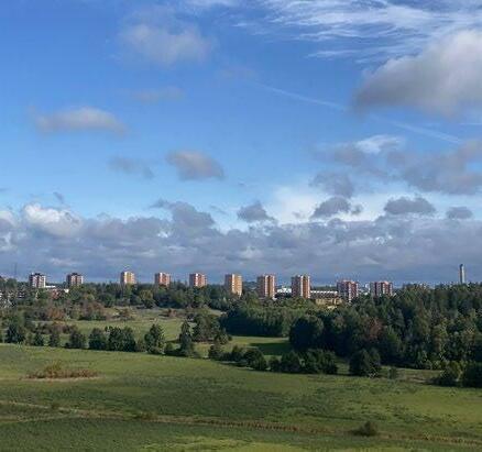

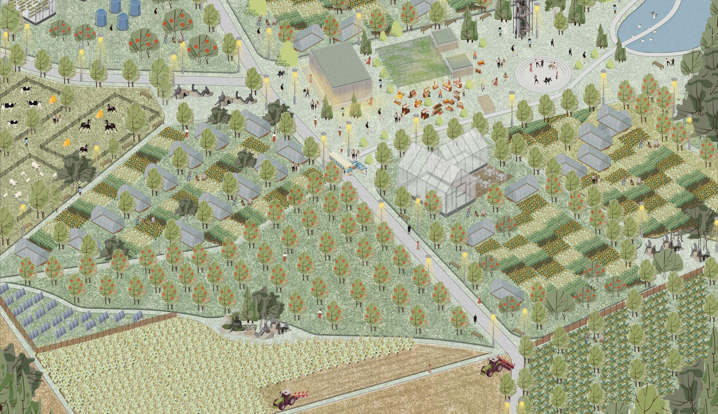
Plan of the farmlands, scale 1:500
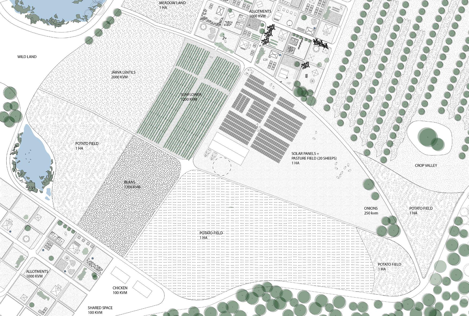
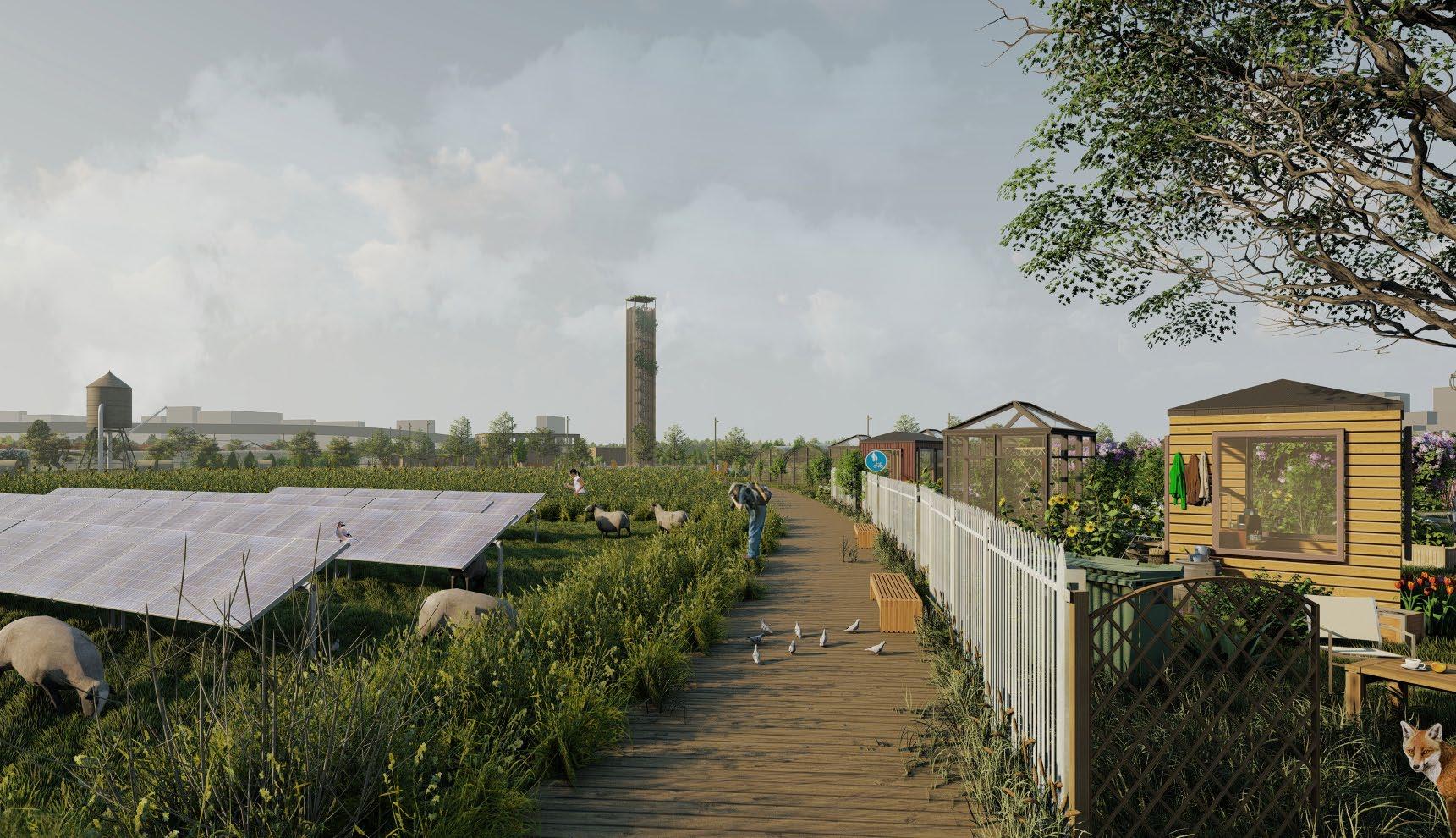
Plan of the Rinkeby terrasse, scale 1:500


For all three projections, we anticipate the same future scenario. Environmentally, we believe that residents of Barkarby will encounter more extreme weather and seasons. Heavier rain and longer droughts. Socially, we think there will be changes in consumerism, with fewer large-scale retail outlets being needed but as the city plan shows, a great need for more residential space.
Barkarby currently poses vast expanses of hard-surfaced areas that work against rainfall. Examples of this include car parks and huge retail outlets. All three projections work with different approaches, dependent on their context, but with the same goal; to work with water.

To work with water means to allow it to soak into the landscape, providing needed water for forests, meadows, and wetlands in the cases of excess water. These all have significant ecological benefits to both human and non-human actors. Carbon sequestration, habitat creation, and reduced flooding are just some of these merits.
By proposing approaches that blur the currently harsh line between human and non-human space we hope to create a greater bond with the landscape in which the people of Barkarby reside. This is to be done by proposing green public space that physically puts people within nature. Another example would be the proposal of allotment gardens that give individuals a tangible reward for the time spent outside.
Barkarby - Contour Lines
Barkarby - Contour Lines


Topography and rain lines on the site
Barkarby - Assemblage un
Barkarby - Assemblage un
Barkarby - Topography
Barkarby - Topography
Barkarby - Assemblage deux
Barkarby - Assemblage deux
Barkarby - Rain Flow
Barkarby - Rain Flow
This projection focuses on the need for additional development in the Barkarby area – with an awareness of the increase in extreme weather patterns in the future. The aim is to create microcommunities that can live with every rainfall with minimal risk of flooding. By including as few hard run-off surfaces as possible and offering a network of soft ground gullies – water can be absorbed and not fought against.

Building forms of these new developments will be informed by the movement of water through the landscape. Through both design form and practical function, the proposed developments aim to create a closer relationship between human actors and their non-human counterparts. This concept has the potential to be reused in different contexts and scales throughout the Järva region and beyond. With larger masses being proposed nearby areas that are heavily built up; fading into smaller scale proposals on the edges.
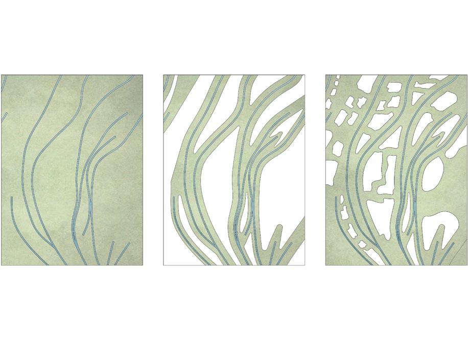


The area of Barkarby contains a large industrial/retail ‘belt’, running roughly from North to South. In the future, we anticipate that many of these will grow surplus to the requirements of future societies. More specifically, large expanses of hard-surfaced areas like those seen in the IKEA car park cause a high risk of flooding by channelling large volumes of water into smaller spaces. We intend to break these hard surfaces to make way for green space and wetlands. Not only does this help reduce flood risk in an area that is currently quite high – but it also has great benefits in carbon sequestration. In addition, these spaces will often have the potential to be used for the public to meet, helping create a sense of community. The buildings themselves often pose very deep plans – specifically designed for functions that require minimal natural light such as shopping centres. In this instance, we aim to reuse the buildings but breakout areas and courtyards to create increased light and also a greater ability to absorb rainwater.

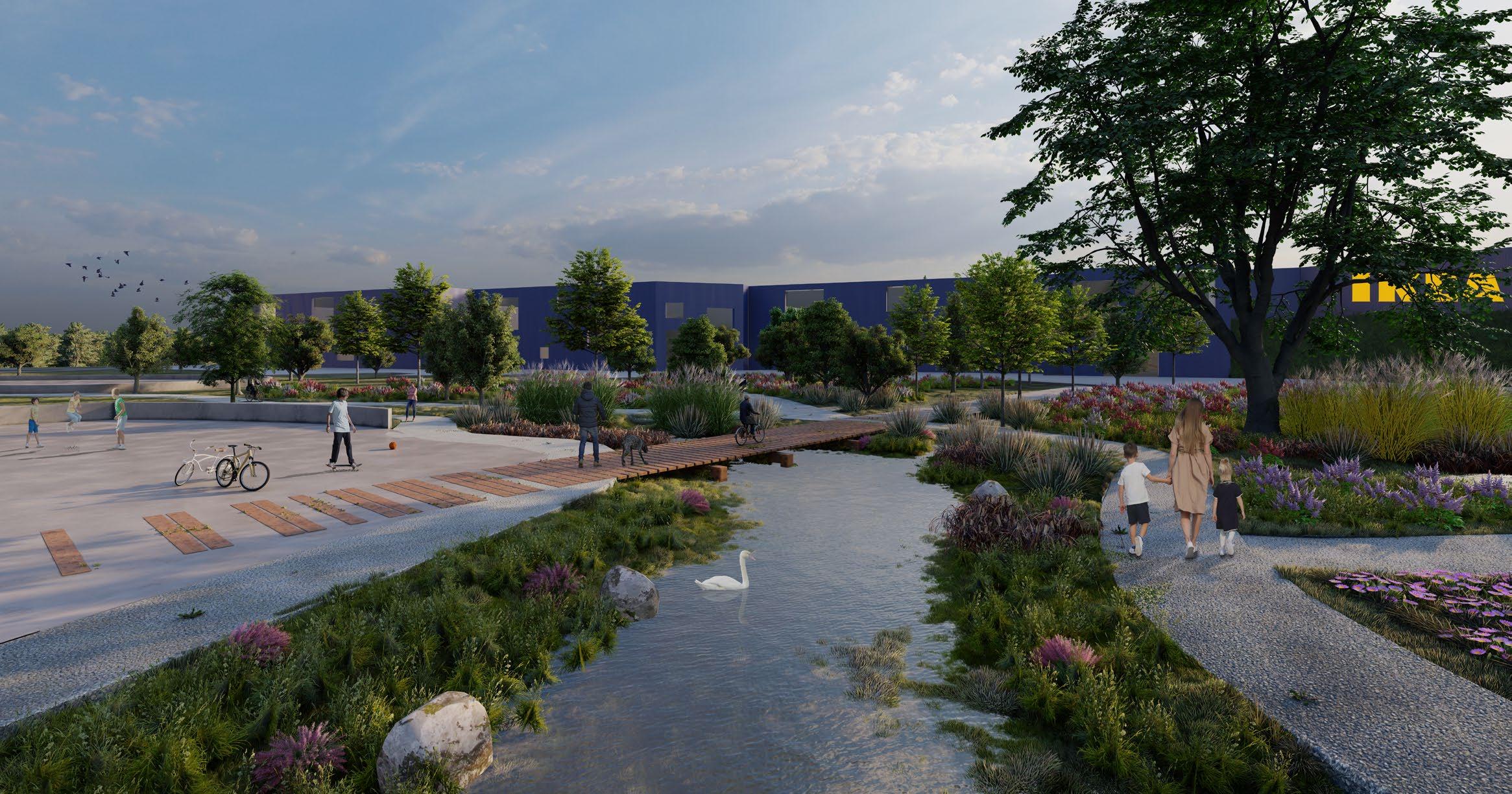
This projection in the lowest part of Barkarby concentrates on the idea of water becoming a community centre as well as a centre of particular ecological interest. Rainwater from large portions of Barkarby eventually falls to this area.
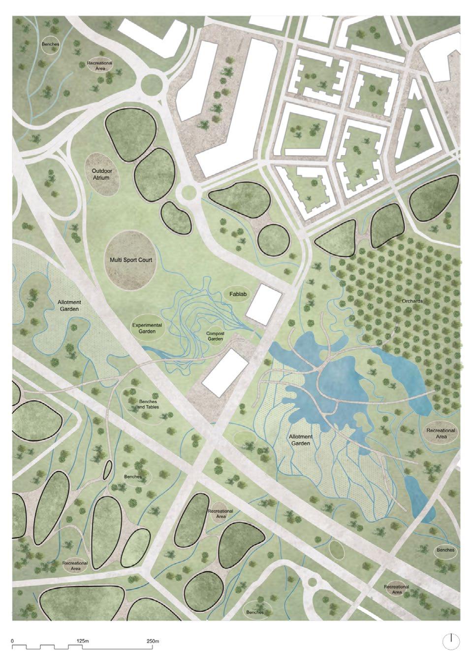
The benefits of having this wetland as opposed to hard-surfaced areas include strength in carbon sequestration as well as creating habitats for an ecosystem with increased variety and resilience. The presence of the wetland here will also have benefits for human actors. The ability to provide water for allotment gardens gives a community-based project a tool needed for it to flourish – intertwining both eco and community centres.
We intend for this area to be enjoyed by its human actors and not ‘used by – this means we will propose very few new structures, just two bridges that help connect people to the area over the highway and then another lightweight structure that strides over the largest wetland to further increase connectivity.


The boundary created by the E-18 highway between Tensta and the landscapes found in Järva is one that is uncomfortable and needs to be addressed. A question asked when investigating the threshold between the two was: how can we bridge this gap and make the Järva wedge accessible to everyone? Currently, to access the wedge, one must walk under loud, industrial, dark, or potentially unsafe areas, usually underpasses. With this reality, it is crucial to ensure a safe and enjoyable transition to the green space, one that you don’t even realize is happening until you’ve found yourself in a forest among the tall coniferous trees and mossy rocks. But how?
As the first step in our strategy, we identified different thresholds, or access points, typologies throughout the whole region of study. Three were identified: overpass, underpass and a mix of the two. Next, we traced animal sightings in the area to understand which zones are frequented by non-human contributors to decipher which zones we wanted to leave untouched so that the biodiversity can be maintained and thrive. Next, we identified all the unused parking lots in the Järvafältet region and noticed that the parking lots are frequently underused and waste valuable real estate for the public, green, and housing infrastructure for these districts.
After these analyses, it became clear that there is a lot of untapped potential in these car-prioritized spaces like the highway passes and parking lots. They have the ability to be reused, revitalized, and redefined to create enjoyable public spaces that bring the landscapes into Tensta and bring the community out to Järva. Whether users of these spaces are passing over, under or coexisting with the highway that once was a boundary, they are the ones prioritized now.

In addition to the highway interventions, a new tram line has been implemented to replace one lane of car traffic so that people from outside of or from the center of Tensta will be better connected to the green wedge. The E18 has been reduced to slow speed in this zone, and expelled one double lane of car traffic and replaced it with biking and walking lanes along the landscape, reducing actual car flow to two lanes, one in either direction.
What once was a boundary, preventing coexistence between nature and urban, can be reused to bridge the disconnect and allow communities, human and non human, to thrive in the Tensta region of Järvafältet.
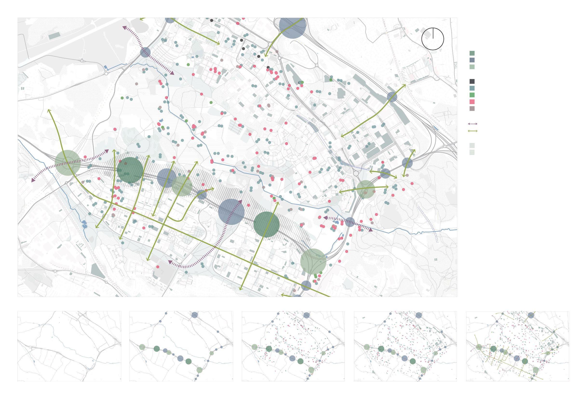
Overpass
Underpass
Mixed (over/under)
ANIMAL SIGHTINGS
Bat Bird Amphibians and reptiles Invertebrates Other vertebrates FLOWS
Animal Human GREEN SPACES Tree Meadow
As we strolled through the district and prepared to step onto one of the roads, a passing lorry stopped us and kindly reminded us that this is a car-only road and that pedestrians are not allowed to enter. This also made us realize that this is a neighborhood where cars are the main character. But why should a community that is clearly for humans give way to cars? We are not comfortable with this and want to propose changes. That’s why we change the highways and make bridges across them into the green wedge.
So, what happens after that? While society is pursuing equity and affirmative action, our design should not establish one single character, so biodiversity comes into play. In our investigation, we found that a large number of creatures are observed throughout the Järva wedge. But most of them are far from the city, and the small number of species that live in the neighborhood cannot travel freely into the green wedge because of the highway. So, all the species on the site need to break this barrier. In our design, we study the distribution of species in the site about the Järva as a whole, establish their potential tribal relationships, and try to re-establish such connections. At the same time, the plant ratios in the site are adjusted so that they can form a good ecological relationship with the creatures and humans, thus building a good ecological community.

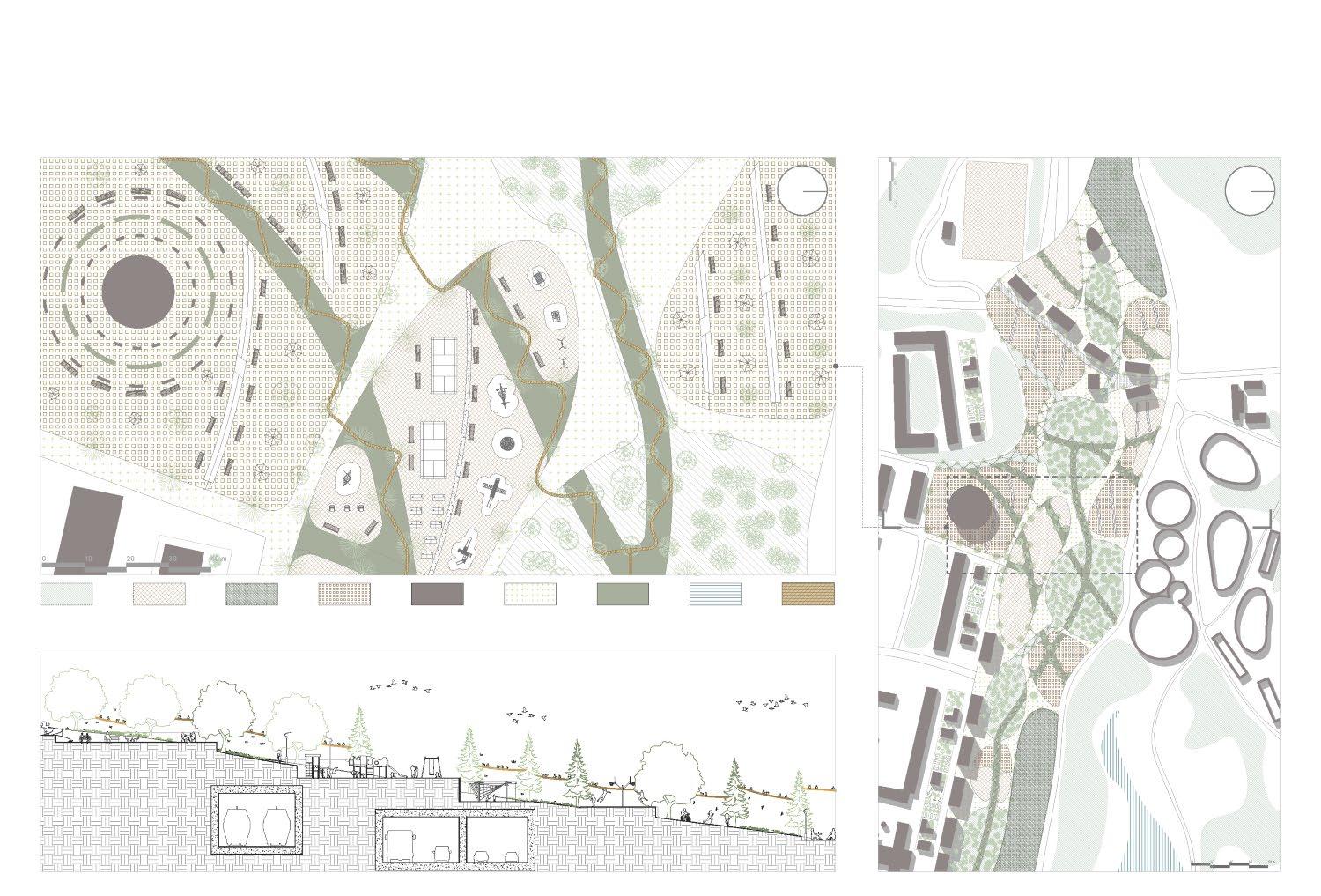
Lack of public spaces, low accessibility to the Järva wedge and poor interaction between nature and the city are some of the main urban questions affecting Tensta. In the actual scenario, the car is the main actor and the traffic system is not designed to involve all the different flows of the context.

Who are the “real” habitants of the area? How do they interact with the space? How do they move?
By observing the existing situation we can notice how the highway is separating the urban center from the “green surrounding” and It is not only about grass fields: natural reserves and forests are situated very close to the urban neighborhood. But this boundary is not legible from inside Tensta.
So how a collective consciousness of the territory can be built? People need more public spaces to interact with the environment and between them and at the same time public spaces have to be related to the natural landscape with all its complex biodiversity.
Focusing on the highway’s underpass, It is rethought to become an access point and crossing space of distinct flows of humans and non-humans across the whole urban tissue. Also, the existing forest of the new graveyard area is gradually extended to the “in-between fields”, so that a smooth transition between forest and grass is defined. Regarding blue infrastructure, the small lakes of the new cemetery are connected to the city with canals. In that way, public spaces are empowered with wetlands while the “grass space”, inside and outside the city, develops into a multi-functional space, where productive, commercial, cultural, and recreational activities can be played.
nature (high density forest)
nature (slow density forest)
nature (botanic park)
nature (grass)
production (agriculture+market)
recreation (allotments+gård) recreation (sport pitches) education (school+cultural center)
new pedestrian paths existing pedestrian paths blue system (lake+creek+canal)
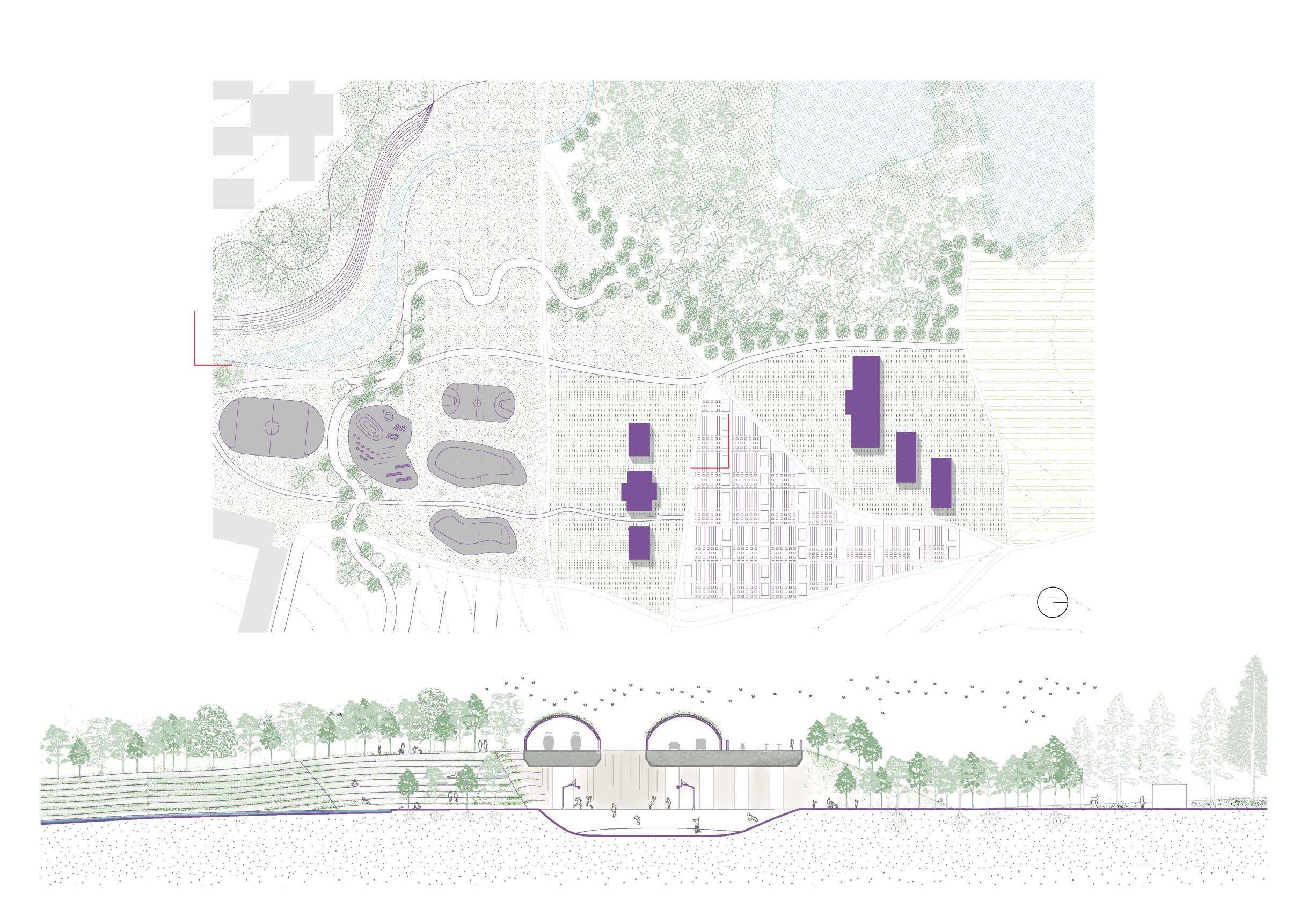
A space that once may have felt dead, unsafe, and uncomfortable will now create an inviting atmosphere, making the access point an entrance to Järva. Activating the threshold that has been unused by humans since the construction of the highway and creating a space that makes access to nature effortless through the reuse of spaces and structures that prioritized vehicles and transforming them into spaces that prioritize humans was the motivation for this projection.
The projection includes several interventions. First, a main vehicular road that didn’t consider the human at all is converted into an urban park that expels the cars and prioritizes the human and non-human experience. The park runs across Tensta, connecting the green zone below the district to Järva. Not only does this intervention bring green into the urban tissue, but it incorporates various “hotpots” for non-human actors, such as pollinators, to have areas to land as they traverse the city which was once sparse for green areas, reducing the number of pollinators.
Next, the parking lots are reused with the purpose of reactivating these large and numerous spaces throughout the whole Järva area that are largely unused. The prototype for the concept proposes breaking up the parking lot into 17.0x17.5m zones which have the opportunity to house community gardens, playgrounds, forested/green areas, housing of various scales, and public/workspace infrastructures. The idea is to keep the area activated at all times of the day, which is currently not the case for Tensta, and most of the Järva area, while having community spaces and places, making everything one may need for daily life accessible.
Small scale housing Medium scale housing Office building / Public Isometrics displaying parking lot revitalization typology menu
Section through urban park
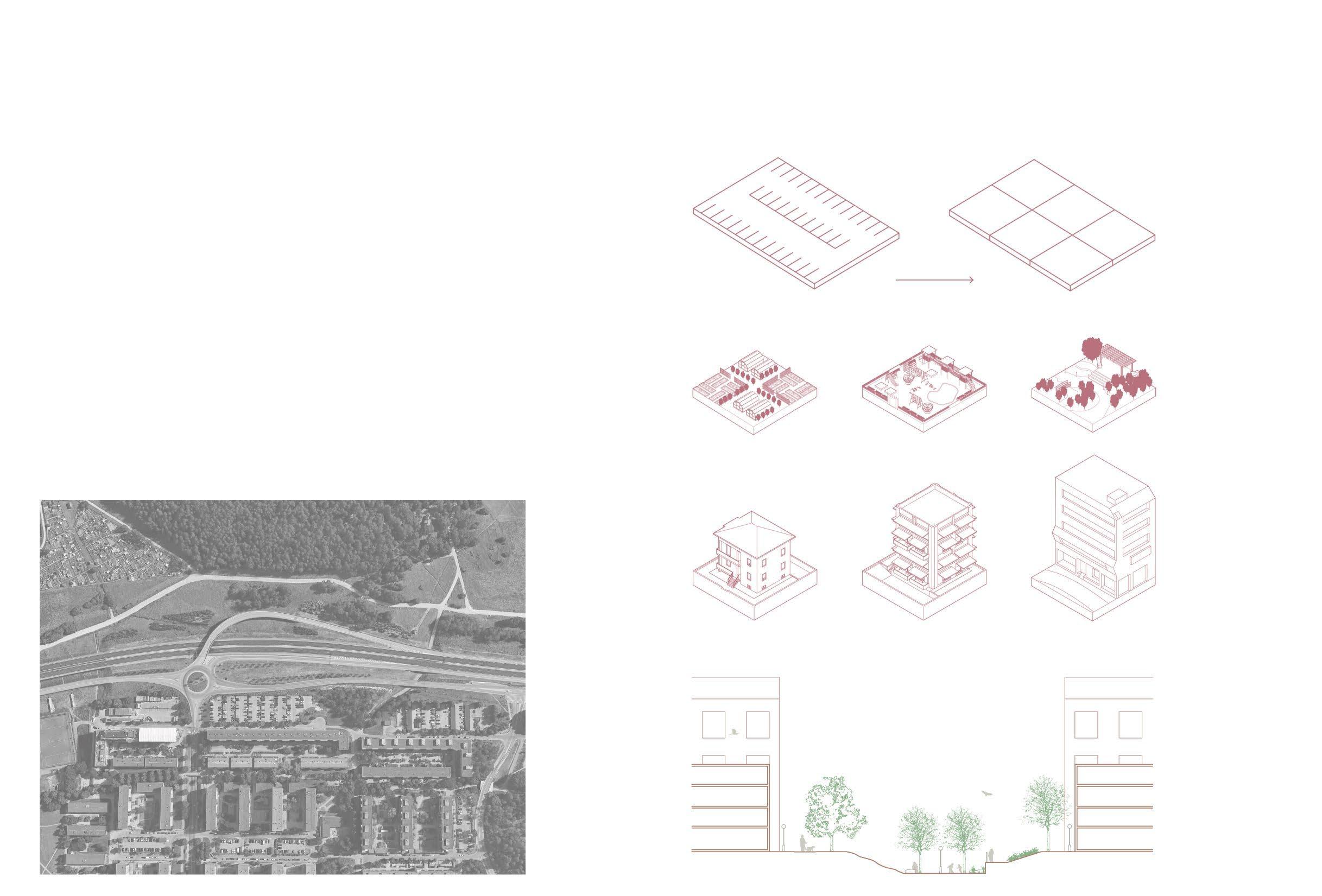
What once was a “mixed overpass” with a four-lane highway flowing underneath and a highway ramp flowing above has now been converted into a passage into Järva which is essentially an extension of the urban green spaces.
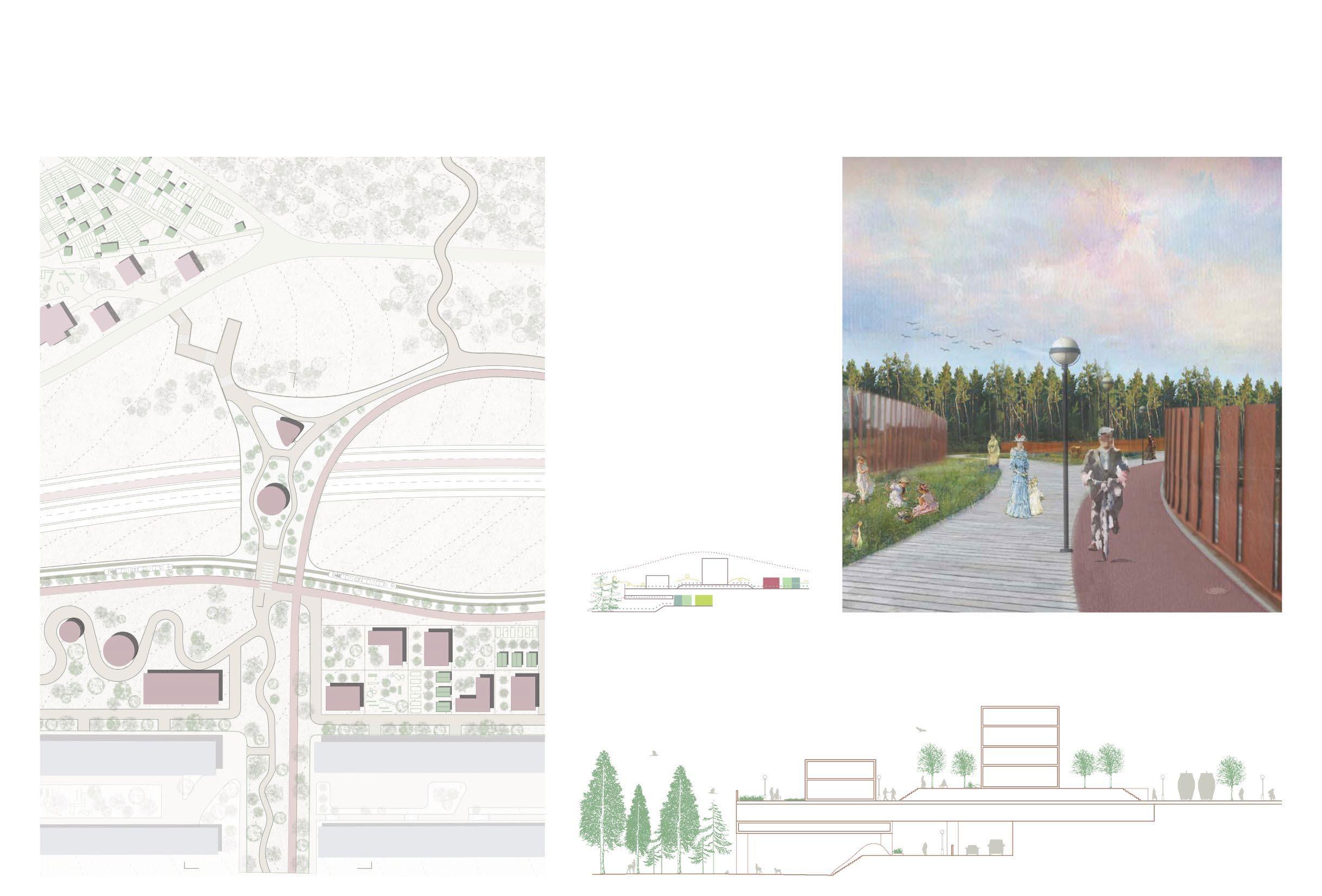
Keeping part of the existing form of the ramp, the overpass gives the users several options for how they can access the green area depending on the experience they seek. There is a raised forest pathway, allowing the users to see the forest from a different perspective, a meandering stairway with a viewpoint over Järva ending at a new 4H gård, and a long ramp that leads the user towards Eggeby Gård. Additionally integrated onto the overpass are public cultural infrastructures that draw users to the intersection.
For maintaining the rich biodiversity in Järva, plants that pollinators thrive off of are integrated into the green zones on the path. There is also a nesting infrastructure for bats and birds integrated under the new bridge structure.
of flows: human and non human
From existing sports center in Kista to new residential area in Rinkeby, there is the shortest gap between city areas separated by the green wedge, including allotments and sport fields. It shows a great potential to develop a new urban area. We propose a development mode in four phases to connect the two urban areas, from metro station Kista to metro station Rinkeby, create a new urban area in the green wedge to activate the green wedge with limited destruction of nature.
There would be connections in two directions, green corriors along the green wedge Järva for animals and insects, and urban connections between the city areas sperated by the green wedge. As a result, the urban areas and the green wedge get developed and interweaved together.
We propose two strategies to develop our proposal, to insert activation landscapes to attract people from the city and keep the natural feature of the site, and to develop a greenhouse system to expand the urban area and interweave with the green wedge.
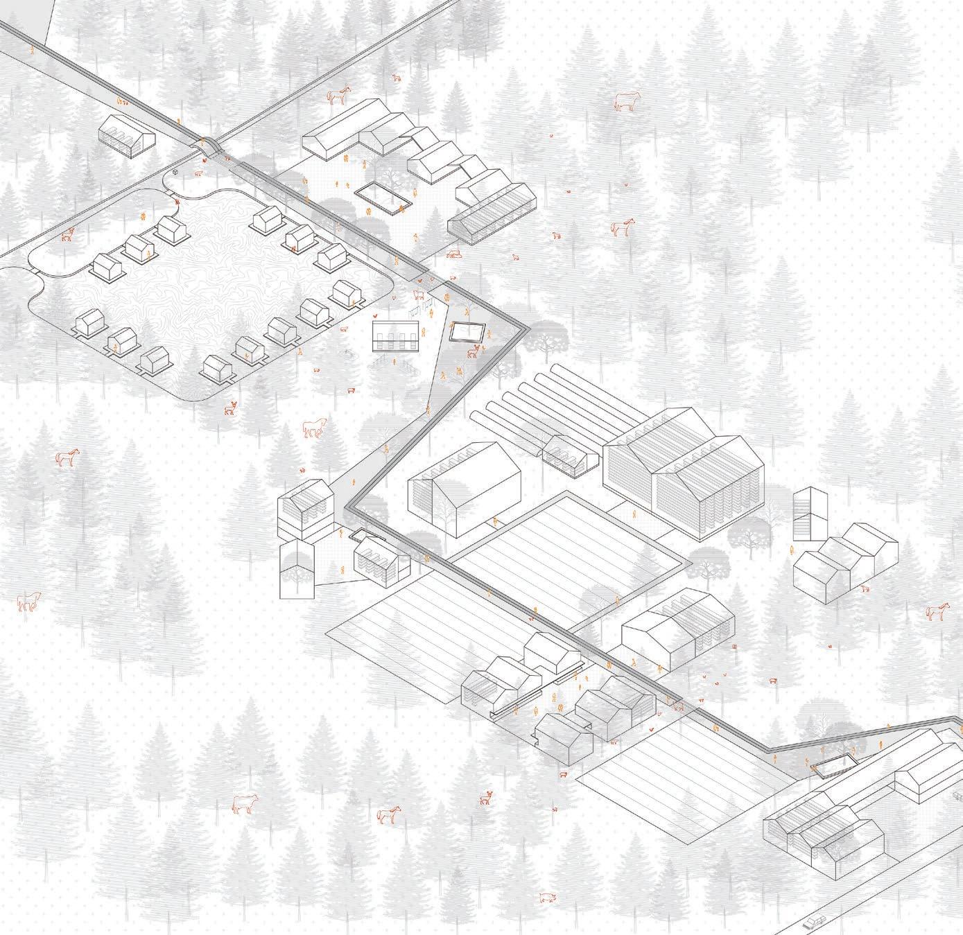
The greenhouse system could be a universal method to develop green spaces, and it’s the main solution of our site. There would build single greenhouse to contain the existing community gardens or farms, in order to develop vertical agriculture and release the occupied green spaces. Based on these greenhouses, there could generate a greenhouse complex system within diverse public functions like cultural, commercial, co-residential and sports facilities. It could develop a new urban system by combining landscapes and existing public buildings, in the green wedge and the existing city.
(1)Aldo Cibic, 2010. RETHINKING HAPPINESS.
(2)Space10 + Effekt, 2019. Urban villages.
(3)Kim Trogal, 2003. CARING: MAKING COMMONS, MAKING CONNECTIONS.
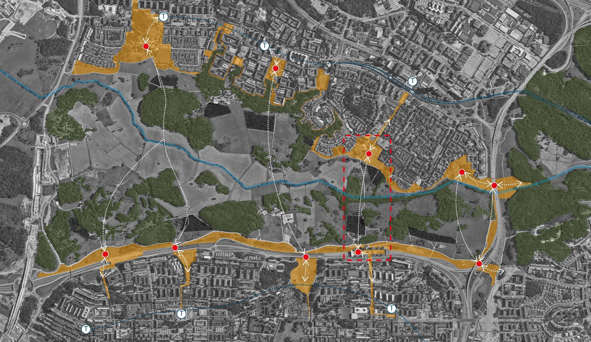

There are four phases of the whole proposal to activate the green wedge, gradually expanding the urban areas under the interaction with the green wedge.
For the site we focus on, we protect the forest firstly. Then we determine a potential urban area outside the forest. Significantly, As we proposed to be more eco-friendly, there would keep green corridors though the new urban area to get interweaved with the green wedge Järva, in order to keep the access for animals and build the basis of interweaving with green. Along the green corridors and the boundaries of green wedge, there would be two systems of urban planning grid on our site.

For the possibility of the new urban area, our landscape prototype toolbox could help. It shows the possible landscapes and urban spaces based on our planning expectation interweaving. Then there shows specific landscape prototypes picked from our toolbox in the grid systems. These ordered grids are not limitations of nature and our landscape prototypes, but rather give starting points for the interweaving form, which will become more natural and curved over time.
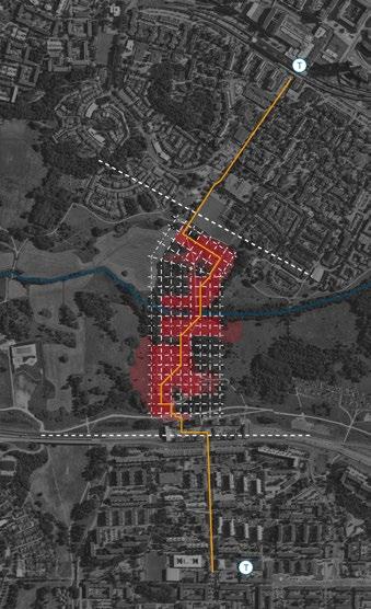


As a result, the diversification of nature and urban area would increase gradually in four phases.
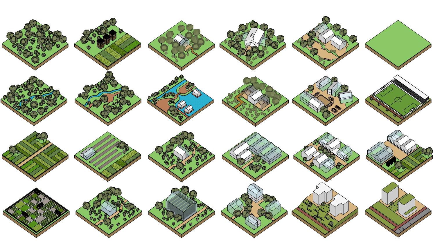
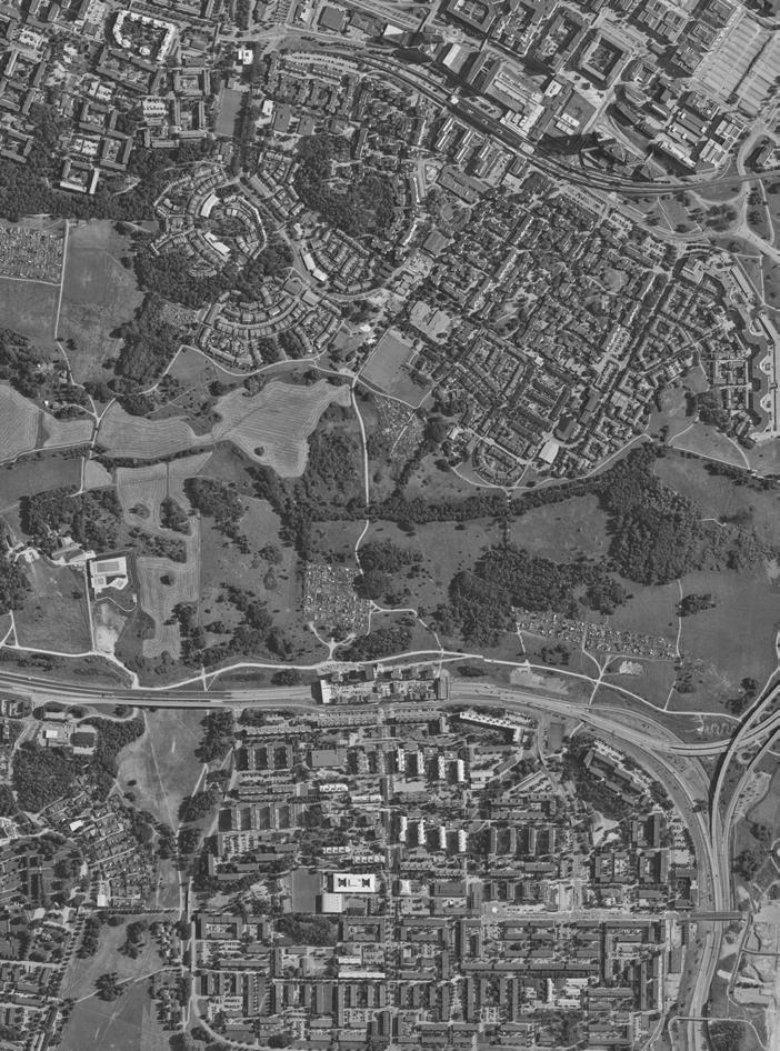


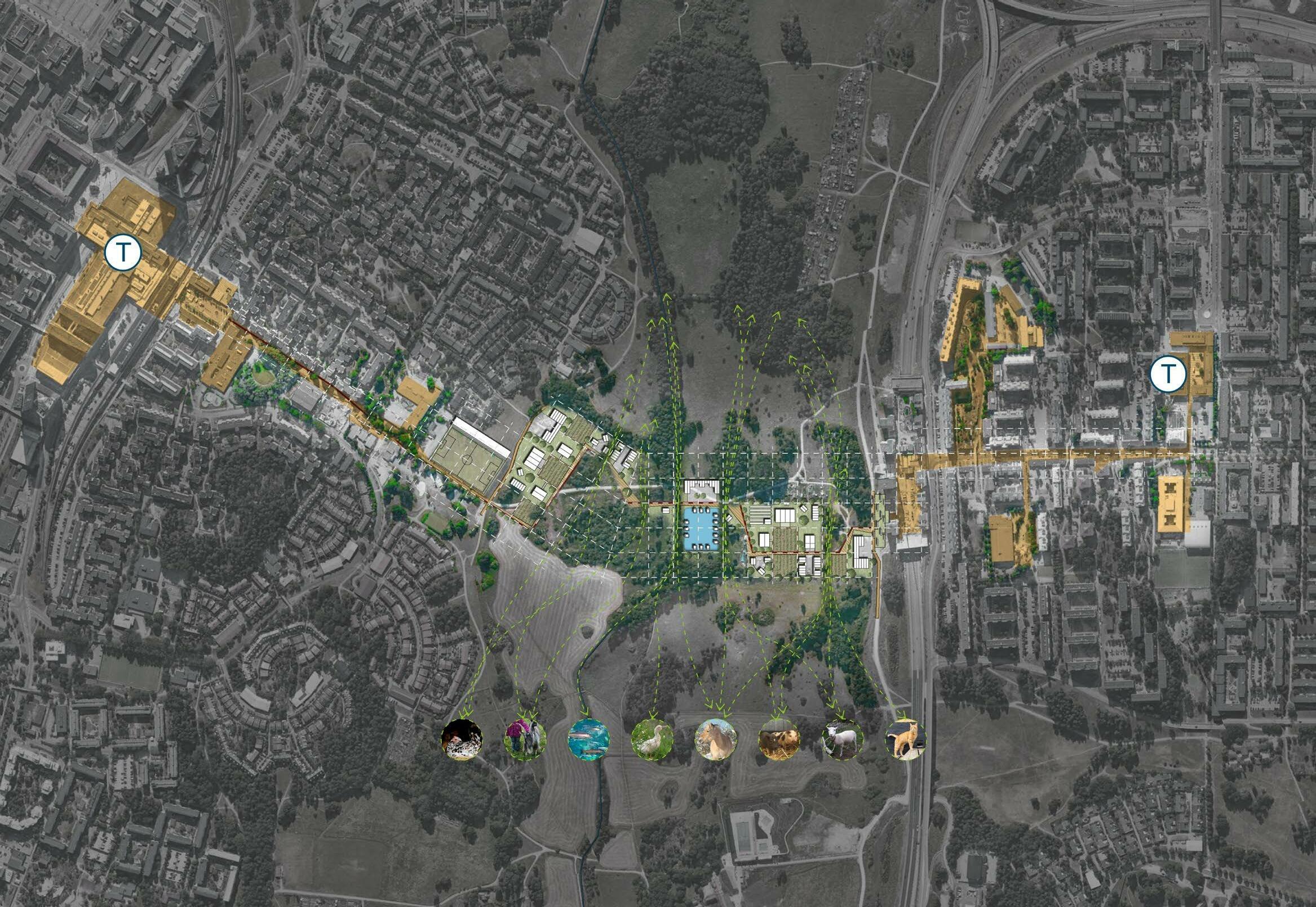

1.organic fertilizer from urban 2.organic fertilizer from nature and feed back to nature
1.water storage for nature 2.water for farm
FOOD
1.food for sell 2.food for experiment 3.food for storage
HUMAN
1.recreation 2.shopping 3.work


Our strategy, Worthmore revolves around locating weakened areas, finding potential in these and revitalizing them so they can generate new values, be them economic, natural, social or in the form of knowledge production.
As a first step in formulating this strategy, we have so far focused our gaze at the area stretching from the Kista linear city to Barkarby. At this site we are seeing the failing Kista cluster, in need of some sort of urban revitalization as well as weak social and economic connectivity between different districts. We’re also seeing an air field that has lost its earlier function, now just an artifact in the landscape as well as the problems caused by a failing blue infrastructure, hindering further development of Barkarby. At the same time we’re seeing the potential to increase the value of and strengthen the green corridor and its capacity to manage floodings, increase connectivity between districts as well as laying the foundations needed to revitalize the technology cluster.
We propose that we reevaluate Järvafältet and the protected green corridor. Instead of keeping it in a static, virtually non changing and non performative state we propose that the land be subdivided into separate and different functions, all generating value in different ways. Just as in the P1 project Growing Knowledge, this new performative landscape will in Worthmore be an extension of the technology cluster to include all of Järva in a knowledge cluster focused on technology, research and sustainable land use. While in large being a successor to Growing Knowledge, Worthmore is drawing on the insights gained through Blue Lung from P1 about the sensitive nature of the Igelbäcken ecosystem, the great import of proper water management in Barkarby and how the different waterways Igelbäcken, Bälstaån and Djupanån can be used.
In addition to creating a new experimental subdivision of Järvafältet that connects people from different districts, another element that we bring back from Growing Knowledge is that of a tram line connecting the different districts. The verticality of the air field is used to create both an infrastructure for a new tram line connecting Akalla and Barkarby as well as constituting a central axis in the new performative landscape. This new air field will be a place for people to go to enjoy recreation, small scale markets and indulging in the pleasures of learning.
Our strategy for the area transforms the green corridor through subdividing it into different plots and functions, that can change over time. As such it means that major development in the green corridor. This development will however be of less dense morphology with plenty of room for nature to flow through the built up areas. This annexation of the landscape will be done in the name of knowledge production in the fields of ecosystems and sustainable land use. As such the new development will follow a principle widely used in sustainable farming, that the ecosystem will be strengthened by our actions. As such new some new development is made to function as skipping stones for pollinating species, while other actions, such as the reestablishment of wetlands in the area, strengthens the local blue infrastructure. These different actions also benefit us in the way that proper water management will allow further development of the
Diagramatic plan showing the general strategy of the area
Morphology density


Redirected water run off
Expansion of urban axis Flow of flora and fauna
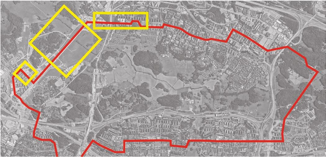
Tram line Restored wetlands

Bridging the creek and utilizing raised fields allows continuous food production while the water is allowed to run freely through the landscape.
The airfield is utilized as a new central node in the knowledge productive cluster and experimental showroom. An observation tower is built that establishes the cluster as a spiritual successor to the Stockholm exhibition of 1930.

Water run off hard surfaces too fast - flushes urban surfaces accumulating lots of pollutants when run-off - does not get absorbed in urban hardscape

- polluted run-off reaches watercourses - one of the biggest threats of our lake and streams - leads to flooding of urban areas regularly
There is space for water - to be held and let out a little at a time - to trickle down from less hard-made surfaces - to become a resource for urban vegetation and biodiversity - to be purified before it reaches recipient - to become an integrated part of urban life - to add recreational values to cities


We are designing our expansion of Barkarby as a sponge city to more properly manage water run off and because of the recreational values


In the first projection, we have chosen to zoom in on the northwestern part of Akalla. This part partly consists of housing, preschools, and a small citycenter where the subway station is located. The res idential buildings in the district are elevated in relation to the roads and the center. The height differ ences generate a clear traffic separation. Furthermore, the highway in the northwest (Akallalänken) constitutes an obstacle to further expansion and connection to the green area in the norh. We propose to create an extended main axis starting at Akalla center. The new route is meant to both help increase connectivity to the green space and generate new buildable land that can extend the city’s axis. The new elevation will consist of soil masses and excavation from construction sites and will extend over the Akalla link and further out towards Barkaby airfield. The new route is intended to reinforce the main axis and the connection between cityscape and the green wedge. On this part will be a new road with space for cars, the new tramline, pedestrian- and bicycle path as well as the imple mentation of green paths and stormwater beds and vegetation. We believe our proposal could help contribute to smoother transition to the northwest where the highway no longer constitutes an obstacle.









As part of the establishment, we propose some reorganization of the urban morphology extending from Kista to Akalla, creating an extended axis with several urban functions. We propose that the new buildings consist of a mix of different functions. Where buildings with center character are placed closest to the metrostation and the new tram stop while residential buildings and educational are placed nearer the green open spaces.
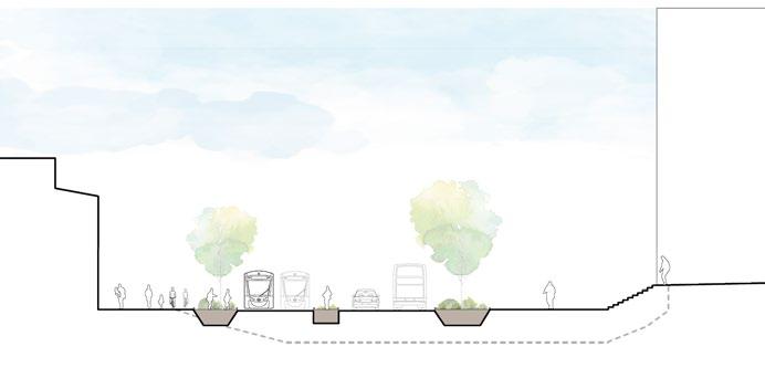


Central in the area is the Järva wedge. Long ago the field was under water, being the bottom of a river which constituted an important passageway for trade ships. Later it has been used both for agriculture and as military proving grounds. Today, the earlier activated landscape of the Järva wedge is now largely a nature reserve, which basically exclusively work as a green corridor for flora and fauna. While allowing nature to travel freely, the wedge is splitting the area into different parts, functioning as a barrier hindring connectivity between districts.
At the same time we are seeing that the Kista cluster is in dire need of change. To revitalize the clus ter, we are proposing a new type of productive landscape where the land is to be subdivided into dif ferent functions such as food production, commercial showrooms for the clusters different corpora tions, research, education and recreation to create a new performative green corridor. Through this we set in motion a needed change in the tech and telecom cluster, today located at Kista to become more of a knowledge cluster that will include all of the Järva wedge, connecting the different districts.
Our belief is that an increase in local food production is necessary for decreasing agri culture’s impact on our climate. With it’s already varying water levels, the area between around Barkarby flygfält constitutes good proving grounds for research in how food pro duction could adapt to the more extreme weather to come. For example could a combina tion of the traditional agricultural techniques of raised fields be combined with new technol ogy such as drones to allow continued usage of agricultural fields through seasons of flooding.
We believe that by closing the gap between science and commercial enterprises, new mutually ben eficial synergies might evolve. In line with these beliefs, this new patchwork landscape will constitute an enormous, experimental showroom showcasing the future of a more climate sensitive rural and urban farming - displaying the latest technology and being a cluster for agricultural research and education. This landscape will, in stark contrast to the green corridor we’ve gotten used to, be vari able both in it’s natural flows and through it’s man made functionality. More permanent buildings with a more flexible usage will share space with mobile structures, easy to change location when need be; function specific research constructs on strange and foreign forms; and buildings more similar to the ultra modernistic shed-like structures of car dealerships and pavilions, easy to assemble and dissasemble.


Street section through the new infrastructural axis of Barkarby flygfält. A majority of the strip functions as public space for communal gardening, markets and other recreational and commercial uses.
Plan - Original scale 1 : 1500 (A3)






Decades of urban expansion and densification have given us an urban environment dominated by impermeable surfaces, creating greater flows and volumes of stormwater while the need to replace existing pipes increase. We have come further away from a natural water cycle and ecosystem. Barkarbystaden is affected by water to the extent that it is interrupting further development. Water could become a resource in urban areas, rather than an obstacle, if we’re able to tackle it right.
Barkarbystaden is built on organic soil on clay, the soil consists of peat, sludge and mud, all very loose with high water content, and foundation conditions at the site are generally unfavorable. The groundwater level is shallow and flooding occurs after heavy rainfall, since the area’s natural infiltration is so poor, all according to the municipality of Järfälla. If we can formulate principles for a new relationship between urban and green, and apply nature based solutions to these urban problems we might gain a more diversified and less vulnerable city. Can we not make up an ’urban nature’?
Urban spaces need to be multi-functioning to be sufficient, handle several functions on the same surface and volume. Blue-green-gray systems are different smart infrastructural constructions that benefit plants (the green) and stormwater management (the blue) without taking up too much ground surface (the gray). The aim is a more integrated ‘urban nature’ as well as creating a new entrance to the denser green area. The green corridor needs to be led into the urban blocks, and water and snow runoff needs to be managed; to be absorbed, filtered and delayed before it reaches the water courses. We’re proposing the ‘Sponge City’ is a city that absorbs and swells instead of letting water run off its hard surfaces like an umbrella. To accomplish this we are implementing green roofs, förgårdsmarker (green strips of semi-public edging buildings) and rain beds throughout the urban landscape. We’re also proposing a Water square where a wetland is constructed at the local square, making local water managing visible to community. We will also implement swales in lower parts to prevent polluting, as well as an urban nature park which will negotiate the border to the green corridor


Besides the necessity of proper water management, benefits of access to ‘green spaces’ has been well documented, and increasingly now also of ‘blue spaces’ of all sorts, coasts and lakes of course, but also wetlands, rivers and even smaller constructed water features as fountains and splash pads in urban areas are recognized as beneficial to public wellness.









Street section through one of the streets next to the new wetland square in Barkarby
Plan is coming - Original scale 1 : 400 (A3)





Blue-green-grey streetscape as buffer zone and increased biodiversity

New tramway connecting Barkarbystaden with Akalla, Husby, Kista and the urban areas around Järvafältet to eachother and to the field
Public Water Square for rain buffer + recreation & play
Wetland Park a constructed wetland deals with runoff water while providing access to “blue space” for recreation and wellness
Studio Urbanism & Landscape KTH Arkitekturskolan, Stockholm 2022