WALKING,CYCLING AND BETTER STREETS STRATEGY 2031
FROM THE MAYOR Walking and cycling around our city is incredibly popular, but most of us do it for recreation and exercise. But, what if we had even more, safer and easier options to commute, so that instead of jumping in the car to go to work or to do the shopping, we could walk or cycle to where we need to go? This is the vision of Council’s Walking, Cycling and Better Streets Strategy. Its challenge is to address the need for better, safer infrastructure for walking, cycling and links to public transport across Lake Macquarie. Our city continues to grow and we expect at least 30,000 new residents to call Lake Macquarie home in the next 15 years. Our nine economic centres located around the lake will be the focus of our growth in the coming years, placing more need for walking,
cycling and public transport infrastructure to help manage transport congestion. Through this strategy we see our city as a place where walking and cycling is easy, safe and appealing for everyone. A city home to inviting urban spaces that are conveniently connected by roads and paths that accommodate multi modes of transport, not just vehicles. And a place where walking and cycling becomes a part of our life, which makes us feel better and gets us to where we are going. We are incredibly lucky to live in a city unlike any other with our natural landscape and active community at the heart of what makes our lifestyle so fantastic. Let’s continue to work together as a community as we adapt to change and help make Lake Macquarie an even better place to live, work, play and commute. Lake Macquarie Mayor Cr Kay Fraser
2
LAKE MACQUARIE CITY COUNCIL
CONTENTS OUR VISION
PLANNING FOR PEOPLE, MOVEMENT AND PLACES
WHAT OUR COMMUNITY WANTS TO SEE
Movement and Place and the Safe System..... 33
TOWARDS MORE WALKING, CYCLING AND BETTER STREETS FOR ALL
Planning and design principles...........................40
OUR FOCUS AREAS Principal Pedestrian Networks for our centres...... 16 The Principal Bicycle Network and iconic links...... 22 Neighbourhood shared paths and streets............... 25 Active travel to schools and road safety.................. 26 Bus stops and multi-modal travel............................... 28 Other City-wide improvements and support........... 30
Types of pedestrians and cyclists.......................37 Local design preferences ..................................... 42 Trials and temporary interventions................... 50 Listening to our community..................................51 Measuring progress................................................. 52
APPENDIX 1: PRINCIPAL BICYCLE NETWORK ROUTES SUPPORTING DIGITAL RESOURCES Cycling routes planning map Principal Pedestrian Network maps
WALKING, CYCLING AND BETTER STREETS STRATEGY
3
Cycling
Walking and assisted mobility
OUR VISION
Cycling is low-stress with family-safe and commuter routes linking shops, services, schools, parks and public transport and our region is known for key unique, iconic routes for recreation and transport
It’s safe, easy and appealing to walk to local shops, services, schools, parks and connect to public transport
Walking, assisted mobility, cycling and other We enjoy walking connections that are forms of active transport are easy and appealing easy, leafy and appealing, and that safely for everyone. Streets enhance our walking and take us to local shops, schools, workplaces, STREETS cycling experiences, and foster connections parks, playgroundsMAIN and public transport. LOCAL STREETS Our main streets in EVERYWHERE, with each other and places. Improvements town centres and Cycling is low-stress, with family-safe streets Our local streets ALL THE TIME for pedestrians and cyclists also benefitprovide the access to our neighbourhood shops and provisions for faster, more confident We care and look out are inviting, thriving homes, encourage safety and well-being of those in vehicles. for each other cyclists, and our places City isthat known for iconic links prioritise active living and on the roads people all ages make us feel good that connect us with our of unique landscapes. and abilities
B
More places for face-to-face meeting
4
More local green streets for quiet walking, cycling, jogging, greeting the neighbours, taking the bus
LAKE MACQUARIE CITY COUNCIL
More walking and cycling connections to community gathering places, schools, parks, clubs, playgrounds, sports places
More walking and cycling into vibrant main streets that are bustling, social, inclusive places - street life connected to life inside buildings
More iconic and scenic routes between centres for enjoying bushland, lake front and beaches
WALKING, CYCLING AND ACCESSIBILITY ARE CORE TO OUR COMMUNITY VALUES This strategy reflects the community’s values developed through comprehensive community engagement for the City’s Community Strategic Plan. With community representatives from Council’s Active Transport Advisory Group, we looked at how walking, cycling and accessibility relate to the community’s values, what they can tell us about how we can improve, and the outcomes we want to see for our City.
What is at the heart of improving walking and cycling?
Well-being and the right to get home safely Connections with each other and shared experiences of places Creating choices for people of all ages and abilities
How can we do it?
Creative processes, new technologies and ways of thinking Shared decision-making
What do we want to see for our city?
Effective transport systems that provide choice to conveniently move people, goods and services A diverse economy which is resilient and adaptable to change, making the best use of the unique advantages of our location and lifestyle A great lifestyle through safe, active social opportunities The natural environment is protected and enhanced; our existing urban centres are the focus of our growth, maintaining their unique characteristics
WALKING, CYCLING AND BETTER STREETS STRATEGY
5
WHAT OUR COMMUNITY WANTS TO SEE In preparing this strategy, we have drawn on community feedback provided through a wide range of projects, surveys and other channels. We also heard from important stakeholder groups including Council’s Active Transport Advisory Group, Ageing and Disability Panel and Youth Advisory Council.
WALKING AND ASSISTED MOBILITY
More footpaths and crossing facilities, especially on busier roads and near shops, services and schools
Wider footpaths in places with more people, and more paths to schools and parks
6
Accessible parking
Street trees to keep cool in Summer
Improvements to the look, feel and safety of main streets
Improved street and path lighting in some locations
WALKING AND CYCLING
More accessible bus stops and connecting paths
Better traffic management around schools
LAKE MACQUARIE CITY COUNCIL
Try alternative designs, materials and processes, to roll out more facilities sooner
Wider paths or separation between cyclists and pedestrians in areas of high activity
Use recycled content in construction
Slower, safer local streets
Better maintained path surfaces
CYCLING
Family-safe cycling infrastructure separated from traffic such as shared paths and protected cycleways, to shops, schools, places of work and parks
Better end-of-trip facilities such as parking and showers
On-road bicycle lanes away from the ‘car dooring zone’ and wider road shoulders
More facilities like the Fernleigh Track
Way-finding signage, hardcopy and digital maps, and promoting the opening of new facilities to raise awareness
LAKE MAC WALKS
CYCLING PARTICIPATION SURVEY
In 2016 and 2017, we spent a lot of time talking with the community about walking and how to make accessible, appealing streets. The aim of our Lake Mac Walks project was to hear from you about where people walk and what barriers prevent them from walking.
In 2018 and 2019, Lake Macquarie participated in the annual National Cycling Participation Survey, a standardised survey undertaken throughout Australia to measure participation and attitudes towards cycling.
Most people identified the need for more footpaths and for improved traffic management for safety.
The survey sample consisted of 530 households in Lake Macquarie containing 1114 individuals in 2018 and 475 households containing 995 individuals in 2019.
We asked the community to identify important linkages for future walking opportunities. We received over 550 submissions, spoke to schools and students, and many people attended free ‘walkshops’ with transport and walking experts. As a result, Council adopted the Walk21 charter (walk21.com) to create healthy and sustainable communities where people choose to walk. We have drawn upon this feedback to inform the development of this strategy, including which destinations are more important for walking.
Those who had ridden in Lake Macquarie at least once in the past 12 months were asked questions about how cycling could be improved. The most supported actions were:
check-circle more off-road paths and cycleways check-circle better connections between bike paths
and schools, parks/swimming pools and shops
More bike paths and footpaths, separate bike paths, mow the lawns and put a separate path for pedestrians and bikes like other councils do…
Conditions have gotten worse because of traffic…
Need more cycleways off the main roads, this would be better for riders and drivers…
check-circle more on-road bicycle lanes.
ACTIVE TRANSPORT ADVISORY GROUP Since 2017, a group of dedicated volunteer community members, Councillors, representatives from the Heart Foundation and Newcastle Cycleways Movement and Council staff have met around once a month to guide the development of this strategy and provide user experience into pedestrian and cycling improvement projects. The group established a clear charter, recognising the need to take a strategic ‘whole of city’ approach for the greatest benefit.
The shared path around the Lake is wonderful. Every addition is cherished and used. We just need to keep it going!
WALKING, CYCLING AND BETTER STREETS STRATEGY
7
HOW ELSE WE HAVE HEARD FROM YOU CITY VISION AND VALUES ENGAGEMENT
STREETS AS SHARED SPACES
AGEING POPULATION PLAN
The need to improve road infrastructure, public transport, walking and cycling was the most common issue raised across 1800 submissions and comments, and a phone survey of a further 1003 people, in developing the City’s vision statement and values for the Community Strategic Plan 2017-2027.
In 2020, the NSW Government sought public feedback on how streets might be adjusted to better accommodate walking and cycling, in response to COVID-19 and in the longer term. Lake Macquarie residents pointed to the need for more walking and cycling infrastructure.
Feedback collected from over 380 visits to Council’s website, 2648 people on social media and 77 submissions on the Ageing Population Plan found 48 per cent of people would like more or improved footpaths, shared pathways and walking tracks.
COMMUNITY SATISFACTION SURVEY
CHILDREN AND FAMILIES STRATEGY In 2020, we asked what the community wanted to see to make the city more family friendly. Around one in four people asked for better walking and cycling infrastructure, including separated facilities from cars, wider footpaths for prams and families, paths connecting to parks and playgrounds and better path maintenance.
YOUTH ADVISORY COMMITTEE AND THE YOUTH STRATEGY
This survey is conducted every two years and provides us with a picture of which Council services are most important to the community and how well we are delivering these services. The community consistently rates satisfaction with footpaths, public transport, road and traffic safety and cycleways as low or requiring improvement.
PARKING STRATEGY The location and availability of parking has a significant impact on walking and cycling. In preparing the City’s Parking Strategy, we received over 600 survey responses and 800 comments and submissions identifying parking issues and suggestions. Over 70 per cent of responses raised issues relating to walking and cycling.
8
LAKE MACQUARIE CITY COUNCIL
AGEING AND DISABILITY PANEL AND THE DISABILITY INCLUSION ACTION PLAN In 2016, around 300 people participated in an engagement program to identify ways to make the City more inclusive and accessible. Indirect and inaccessible public transport services emerged as a key theme. A workshop with Council’s Ageing and Disability Panel to inform this strategy and available feedback from the 2020 update of the Disability Inclusion Action Plan reinforce this theme.
In preparing the City’s Youth Strategy, we had over 1000 engagements on social media. Access to frequent, convenient, low-cost and safe transport options emerged as a key theme for the City’s youth. In 2020, we held two workshops with the Lake Macquarie Youth Advisory Council on walking, cycling and public transport, which reinforced this theme.
SUSTAINABLE NEIGHBOURHOOD GROUPS Sustainable Neighbourhood Groups engage residents to deliver community projects and provide input to a diverse range of local plans and policies. Each group establishes its own challenges and priorities for their location. Walking and cycling is a consistent, clear priority.
SCHOOLS ENGAGEMENT We survey schools on sustainability matters, including walking and cycling, and engage schools regularly through our traffic management and road safety investigations. Parking, traffic management, safe crossing points and access to footpaths are recurring themes.
CUSTOMER SERVICE REQUESTS Council processes over 100 service requests a month related to traffic and transport matters, including requests for pedestrian and cycling improvements. This does not include requests for maintenance.
PLANNING FOR PLACES – CENTRES, PARKS, COMMUNITY FACILITIES AND TRANSPORT ACCESS Council has many planning projects and capital works on the go at any time for specific locations. When we ask for feedback, this information is recorded and distributed to relevant departments. Walking, cycling and bus stop access are recurring themes.
WALKING, CYCLING AND BETTER STREETS STRATEGY
9
TOWARDS MORE WALKING, CYCLING AND BETTER STREETS FOR ALL Our overarching goals and principles will guide how we will plan and deliver better experiences.
They reflect community aspirations, and a host of local, regional, state and national policies, plus new guidance on road safety and planning for streets, walking and cycling. These policies in turn reflect the many benefits of improved pedestrian and cycling infrastructure for everyone, including: •
allowing people to move around the city safely and improving independence of children, seniors and people with disability
•
helping address physical inactivity and associated health problems
•
reducing car trips, resulting in less cars on the road, improved travel times for those who must drive, improved air quality and less greenhouse gas emissions
•
•
10
reducing urban heat, helping manage stormwater and enhancing biodiversity with street trees and vegetation encouraging people to dwell and spend at local businesses through more accessible and appealing streets.
LAKE MACQUARIE CITY COUNCIL
GOALS
MORE PEOPLE WALK AND CYCLE More residents and workers actively choose to walk and cycle for transport, convenience and health, and easily and comfortably connect to public transport. Work toward exceeding the NSW Government’s target for 17 per cent of all trips in the Greater Newcastle metropolitan area to be made by walking or cycling and 7.5 per cent by public transport, by the year 2056.
SAFER STREETS Work towards zero deaths and injuries on our roads, in line with State and National goals.
SUCCESSFUL PLACES Pedestrian and cycling infrastructure links our economic and local centres, supporting local business and economic growth.
STREETS FOR ALL Urban streets are designed to be accessible for the elderly, children, and people with disability, and are equitable and appealing to all.
GUIDING PRINCIPLES
IMPROVE WALKING AND CYCLING APPEAL
Improve the appeal of walking and cycling by addressing desired user experiences and designing facilities people love.
SHARE DECISION-MAKING Involve people, harness local knowledge, learn from one another, share and co-define challenges and solutions.
BE INNOVATIVE Embrace new ways of delivering better walking and cycling experiences, sooner, guided by this strategy and the latest available guidance.
BE RESPONSIVE Our City is constantly changing. How we plan and deliver better walking and cycling will be targeted yet agile, enabling us to respond to new funding, partnership opportunities and other events.
United Nations Sustainable Development Goals NSW Better Placed and Greener Places Policies NSW Road Safety Plan and 2056 target
Community Strategic Plan Local Strategic Planning Statement
Cities Power Partnership pledge Walk 21 Charter
Sustainability Policy and Environmental Sustainability Strategy
Walking, Cycling and Better Streets Strategy 2031
Related: Disability Inclusion Action Plan Children and Families Strategy
Greater Newcastle Metropolitan Plan 2036 Greater Newcastle Future Transport Plan and 2056 target
Legislation and guidance For example, Roads Act 1993, Disability Standards for Accessible Public Transport 2002, Australia’s Physical Activity and Sedentary Behaviour Guidelines, NSW Movement and Place Framework
Housing Strategy
Area planning Road safety technical investigations Development Contribution Plans Infrastructure delivered by private development Development Control Plan
Capital works program
Ageing Population Plan Parking Strategy Destination Management Plan Parks and Play Strategy Tracks and Trails Strategy Energy Resilience Plan Asset Management Strategy
Four year Delivery Program
Community Land Plan of Management
Annual Operational Plan
WALKING, CYCLING AND BETTER STREETS STRATEGY
11
THE CHALLENGE AND OPPORTUNITY Many of our streets were constructed at a time when footpaths and cycleways were not required. Over time, expectations have changed and national standards updated to improve the safety and comfort for all road users. The City’s footpath, shared path and street network continues to expand as more people call Lake Macquarie home. In recent years, around 3.5km of new footpath and 1.6km of shared path has been constructed each year in established areas. A further 7.5km of footpath and 1.5km of shared path has been constructed as part of new neighbourhood developments on average each year. At the same time, the City’s road network also continues to grow. With clever planning, new development brings opportunities to help fund more infrastructure for both the incoming and existing population. The average walking trip in Lake Macquarie is 12.7 minutes (NSW Household Travel Survey). With good infrastructure, short trips taken by residents to the shops, cafes, and places of education and work can be easily made by walking, cycling, assisted mobility and public transport. With pleasant, leafy and safe streets, walking and cycling can become people’s preferred choice.
CITY INFRASTRUCTURE SNAPSHOT 2020
1450km
1250km urban roads 200km rural roads
Almost all trips start and end with walking. Everyone is a pedestrian at some point.
470km
Footpath (street network)
Almost 1 in 4 residents live within a 10-minute walk of an economic or local centre.
105km
Traffic separated cycling facilities
People tell us they will ride more if we build familysafe, separated cycling infrastructure.
(Local Cycling Participation Survey)
City population 17 pedestrians were killed and 177 pedestrians and cyclists suffered serious, moderate or minor injuries in Lake Macquarie between 2014-19. (NSW Centre for Road Safety 2014-19)
204,914 2020
245,000 - 335,000 2050
12
LAKE MACQUARIE CITY COUNCIL
1 in 4 residents over 15 years of age say they may consider cycling for transport on occasion if there were better infrastructure - currently 2 per cent do.
Every day, Lake Macquarie residents collectively make over 700,000 trips. Around 11 per cent of all trips are by walking and cycling. Almost one in four trips to economic centres and schools are by walking, cycling or assisted mobility. WHY DO WE TRAVEL?
26.5%
18.7%
9.8%
16%
13.9%
7.3%
6.9%
1.5%
social/recreation
shopping
commuter
work related
personal business
drop off or pick up a passenger
education/childcare
other
HOW FAR DO WE TRAVEL? Over half of the trips made by Greater Newcastle’s residents are short journeys under 5km.
Trips by distance on an average day
54%
5km or less
5%
35km+
21%
10-35km
20%
5-10km Source: Greater Newcastle Future Transport Plan
Current walking and cycling to Lake Macquarie’s major urban centres percentage of trips reported Source: Parking Strategy 2018, Lake Macquarie Transport Study 2018
Citywide travel (9% walking, 2% cycling, 3% bus/train, 86% car)
To/from economic centres (16% walking, 8% cycling, 6% bus/train, 70% car)
To/from education (19% walking, 2% cycling, 32% bus/train, 47% car)
cycling
walking
bus/train
car
21%
WALKING, CYCLING AND BETTER STREETS STRATEGY
13
10-35km
20%
OUR FOCUS AREAS 10 YEAR STRATEGIC OUTLOOK
SUPPORTING ACTIONS
This strategy helps us plan, prioritise and deliver better pedestrian and cycling experiences. It does not list specific projects, but sets out what we hope to deliver over time.
For each focus area we have identified supporting actions that speak to multiple themes:
Six focus areas will help us target high-benefit projects around the City, which we will work towards delivering over the next 10 years and beyond. Each focus area guides us in identifying priority projects. We will also apply general program adjustment principles.
FOUR-YEAR PROJECTS OUTLOOK We will identify infrastructure priorities in our four year Delivery Program and annual Operational Plans. These are publicly exhibited for comment before being adopted by Council. When adopted, resources are committed and the community knows what Council is investigating, designing or building each year. In each Delivery Program, we will distribute funds across our focus areas. This process will be guided by this strategy, community preferences, available funding (including grants and development contributions) and private development activity.
This Strategy
14
Planning for places
LAKE MACQUARIE CITY COUNCIL
check-circle deliver new infrastructure and enhance accessibility, safety and appeal
check-circle help people find their way (way-finding and online information)
check-circle monitor and communicate progress check-circle encourage walking, cycling and public transport, and share decision-making
check-circle align local planning policy and development controls
check-circle innovate and accelerate delivery. Supporting actions will guide the delivery of new infrastructure and help address community desires for more and better infrastructure, sooner. Some actions will be dependent on available funding.
GENERAL PROGRAM ADJUSTMENT PRINCIPLES check-circle Fast-track investigation and design of projects with available development contributions
check-circle Fast-track projects that better align with grant funding programs
check-circle Fast-track or hold projects to achieve
economies of scale where projects align within five years (over five years we may proceed with projects that do not impact future projects)
check-circle Fast-track or hold projects that align with
NSW Government projects and likely private development within 5-10 years based on available data
check-circle Aim for a mix of projects in terms of
scale and stage (investigation, design, construction) – to help avoid workflow peaks and troughs across the organisation
Public infrastructure delivered as part of private development and by NSW Government projects will complement Council’s capital works program, across all focus areas.
Infrastructure pre-planning
Priorities
4 year Delivery Program
1 year Operational Plan
Possible projects
Focus Areas
Principal Pedestrian Networks
Principal Bicycle Network and iconic links
Neighbourhood shared paths and streets
Active travel to schools and and road safety
Bus stops and multi-modal travel
Other citywide improvements
Apply prioritisation guidance to identify four year priorities Priority projects
Projects will typically benefit multiple focus areas in different ways
Council-wide prioritisation of public works and services
Four-year Delivery Program
WALKING, CYCLING AND BETTER STREETS STRATEGY
15
#1: PRINCIPAL PEDESTRIAN NETWORKS Principal Pedestrian Networks have been defined for the City’s nine larger economic centres and many smaller local centres, where most people live, visit, work and play.
check-circle Highly legible, easy to follow
People will generally walk or use assisted mobility for 10-15 minutes to access local shops and services, depending on their age, health, the walking environment and the weather. Principal Pedestrian Networks are based on walking distances of 10 minutes to the edges of local centres and 15 minutes to economic centres.
check-circle Leafy and shaded
Principal Pedestrian Networks generally do not include no-through streets, as pedestrian and traffic volumes are much lower. The exception is where a no-through street connects to a trip generating destination such as a school, club, train station, etc., or the land is zoned for medium density housing.
LAKE MACQUARIE CITY COUNCIL
check-circle Direct and convenient
These areas typically include older neighbourhoods, many built at a time when streets did not require footpaths. Being closer to shops, services, schools, workplaces, community facilities and train stations, these areas include streets and routes frequently used by pedestrians.
In some cases, Principal Pedestrian Networks may extend to include routes to important destinations slightly beyond 10-15 minute walking distances.
16
KEY DESIGN PREFERENCES
check-circle Pedestrians have right of way priority
where safe and possible
check-circle Feels safe, benefits from passive surveillance
check-circle Meets disability accessibility standards
MAP 1: PRINCIPAL PEDESTRIAN NETWORKS
CARDIFF GLENDALE CHARLESTOWN WARNERS BAY
MOUNT HUTTON TORONTO
BELMONT
Schools Train Stations SWANSEA
MORISSET
Principal Pedestrian Network Built footpaths North West Catalyst Area
For the latest status of the network (constructed / not constructed) refer to our digital maps at lakemac.com.au
WALKING, CYCLING AND BETTER STREETS STRATEGY
17
IDENTIFYING PRIORITIES We will target missing link footpaths and priority crossing facilities based on:
check-circle centres that have less complete footpath
networks but more people living within the 10 or 15 minute Principal Pedestrian Network
check-circle more popular walking routes (see over page) check-circle streets with higher traffic speeds and volumes check-circle extent of existing paths check-circle crossing facilities without connecting paths check-circle NSW crash history data and information on verge safety
check-circle alignment with other larger capital works
For local centres, we will target centres with diverse services more likely to attract walking activity. Important services include supermarkets/ grocers, medical centres/pharmacies, cafés/takeaways, clubs/pubs, post-offices, libraries and community centres. We will fast-track 40kmh or less high pedestrian activity areas where extensive traffic management infrastructure is not required, in line with NSW Government directions. We will also build footpaths outside of Principal Pedestrian Networks—see Other City-wide improvements and support.
ACTIONS Ongoing check-circle
Develop and refine a digital mapping tool to assist with identifying popular routes and priority footpath and crossing facilities, based on our prioritisation criteria identified with Council’s Active Transport Advisory Group
check-circle
Review and seek community feedback on popular routes when preparing/revising area specific plans
check-circle
Investigate/review 40kmh or less ‘high pedestrian activity areas’ for streets servicing commercial areas
1-5 years check-circle
Review and align local development controls and guidelines with updated local planning guidance for streets and footpaths*
check-circle
Embed Safe System road safety assessments in road-related infrastructure projects and provide staff training in the Safe System approach*
check-circle
Provide up to date online information about current capital works projects and publish fact sheets on how Council prioritises pedestrian improvements
check-circle distance to secondary destinations outside of a centre’s core.
Secondary destinations include housing or premises for seniors or people with disability, schools, clubs, community facilities and holiday parks, parks and playgrounds, bus stops, train stations, beaches, scenic shared pathways and commercial and employment areas other than urban centres. We will target projects in both economic centres and local centres. Comparing larger economic and smaller local centres is difficult due to their difference in size. Council has adopted the strategy of growing and activating our local centres to provide jobs and services closer to where people live.
18
LAKE MACQUARIE CITY COUNCIL
5-10 years check-circle
Implement pedestrian way-finding signage in economic centres
*See Planning for People, Movement and Places
POPULAR WALKING ROUTES TO ECONOMIC AND LOCAL CENTRES Popular walking routes are direct routes used more often (or used more often if made more appealing) to get to a centre and other nearby destinations. If a street or thoroughfare is identified to be more popular than surrounding links, this will elevate the street as a priority for pedestrian improvements. Popular routes may change over time with urban development, the opening and closing of commercial premises, new community facilities or changes to road conditions.
URBAN CENTRE CORES Council has adopted Streetscape Master Plans and Technical Guidelines to provide more detailed guidance on public domain and safety improvements on main streets and certain adjoining streets within the inner cores of economic and local centres.
PRINCIPAL PEDESTRIAN NETWORK (PPN)
POPULAR WALKING ROUTES
15 min walk based on street network and other links
Urban centre core
S econdary destinations (schools, community facilities, clubs, parks and playgrounds, beaches and foreshore areas)
FOUR-YEAR DELIVERY PROGRAM PRIORITIES
INFRASTRUCTURE GAPS
These guide the capital works program and the delivery of public infrastructure by private developers.
WALKING, CYCLING AND BETTER STREETS STRATEGY
19
#2: THE PRINCIPAL BICYCLE NETWORK AND ICONIC LINKS The Greater Newcastle Future Transport Plan 2056 proposes regional cycling routes for the metropolitan area, based on past collaboration between Lower Hunter councils and the community-led CycleSafe Network proposal for Newcastle and northern Lake Macquarie. Based on community feedback and planning for future growth, our strategy expands on these to propose a 254km Principal Bicycle Network (PBN) for Lake Macquarie. This will connect key destinations including shopping and employment areas, schools and other places of education, and major parks and scenic attractions. In 2021, 85km of the network has been established. A further 9km is under investigation and 2km under construction. An additional 33km is expected to be delivered through private development and NSW Government State Road upgrades. Our strategy proposes regional routes (such as the Coastline Cycleway from Swansea to Newcastle, including the Fernleigh Track) and sub-regional routes (such as Swansea to Caves Beach). Sub-regional routes service large, sometimes isolated residential areas or key regional destinations, such as major beaches or the Lake Macquarie Museum of Art and Culture.
ICONIC LINKS Iconic links are unique sections of shared paths and cycling routes that have outstanding scenic and cultural qualities that are difficult to replicate. They encourage locals and visitors to cycle (and walk) by virtue of these characteristics. Examples include:
check-circle the Fernleigh Track, Fernleigh Awabakal
Shared Track and Blacksmiths to Coon Island, Swansea
check-circle Eleebana Lions Park to the Museum of Art and Culture, via Red Bluff, Eleebana to Booragul
check-circle Fassifern to Toronto Greenway (rail trail) check-circle Wallsend to Speers Point, via Cockle Creek and the Tramway Track.
Other possible links, subject to further investigation and costing, include:
check-circle Bareki Road, linking Thomas H. Halton Park to Eleebana Lions Park
check-circle Green Point, Valentine check-circle Richmond Vale Rail Trail check-circle Fernleigh Track to Dudley Rail Trail check-circle Kilaben Bay to Rathmines Park check-circle Catherine Hill Bay Heritage Trail check-circle Cockle Creek to West Wallsend Rail Trail check-circle Awaba Station-Wangi Wangi Rail Trail
20
LAKE MACQUARIE CITY COUNCIL
KEY DESIGN PREFERENCES check-circle Low-stress, family-safe (infrastructure that separates people from traffic, or shared streets with low traffic speeds and volumes)
check-circle On-road provisions for faster more confident cyclists
check-circle Direct and convenient check-circle Highly legible, easy to follow check-circle Continuous treatments and smooth surfaces
check-circle Right of way priority where safe and possible
check-circle Feels safe, benefits from passive surveillance
check-circle Leafy and shaded check-circle Design respects location, environment and heritage
check-circle Meets accessibility standards where
paths are also catering to non-bicycle users
To Richmond Vale
MAP 2: PRINCIPAL BICYCLE NETWORK
To University of Newcastle
CARDIFF
To Newcastle
GLENDALE CHARLESTOWN
Regional routes
WARNERS BAY
C oastline Cycleway: Swansea to Newcastle (via Fernleigh Track); Swansea to Central Coast
Glenrock State Recreation Mountain Bike Area
R ichmond Vale to Fernleigh Track (via Charlestown)
MOUNT HUTTON TORONTO
Belmont to Toronto (Northern Bays Way), Wangi Wangi, Morisset W arners Bay to Broadmeadow, Mayfield S peers Point to University, Newcastle*
Possible future link to Awaba Mountain Bike Park
BELMONT
Morisset Peninsula to Cooranbong N orthlakes Way (Glendale, Edgeworth, West Wallsend, Cameron Park)
Local and economic centres
W arners Bay to Redhead Beach
Schools
R ichmond Vale to University, Newcastle*
SWANSEA
Train Stations Principal Bicycle Network
M aitland to University* MORISSET
North West Catalyst Area
*Refer to City of Newcastle’s Cycling Strategy
Existing and potential iconic links subject to further investigation
Appendix 1 provides more detail on Principal Bicycle Network routes.
For the latest status of the network (constructed / not constructed) refer to our digital maps at lakemac.com.au To Central Coast
WALKING, CYCLING AND BETTER STREETS STRATEGY
21
IDENTIFYING PRIORITIES We will prioritise projects that: •
have clear missing links on more established routes to create a more connected network, sooner
•
include iconic links that inspire greater uptake of cycling
•
better cater for shorter trips to economic centres and local centres
•
service more schools and convenient travel to/ from a school
•
connect to more playgrounds, parks and community facilities such as libraries, sports fields and swimming pools
•
address areas with limited or no available family-safe and convenient alternatives, and roads with higher traffic speeds and volumes
•
offer benefits to multiple user groups, such as alignment with Principal Pedestrian Networks, where higher pedestrian demand is expected
•
align with larger capital works, such as road reconstruction, park upgrades and public domain works
•
align with objectives of grant programs
•
have available development contributions funding support.
We have undertaken a high-level analysis including:
check-circle engineering challenges and site constraints check-circle land ownership check-circle environmental, cultural and heritage matters check-circle multiple possible route options that require lengthier investigation time
Applying our prioritisation criteria and complexity analysis together helps us identify high priorities that are readily implemented, as illustrated by Map 3. Route segments that are of high priority but also highly complex are more expensive. Projects will be subject to further investigation before we commit resources to detailed design and construction. Route alignment, design options and detailed costs will be considered during investigation and design stages. For more complex projects, this requires one to two years. We will prioritise construction based on aligned funding opportunities such as available development contributions and grants.
Benefit
Higher benefit Lower complexity
Higher benefit Higher complexity
Lower benefit Lower complexity
Lower benefit Higher complexity
Complexity
22
LAKE MACQUARIE CITY COUNCIL
To Richmond Vale
MAP 3: PRINCIPAL BICYCLE NETWORK – BENEFIT AND COMPLEXITY ANALYSIS
To University of Newcastle
CARDIFF
To Newcastle
GLENDALE WARNERS BAY
CHARLESTOWN
E xisting cycle route section or nearing completion
Glenrock State Recreation Mountain Bike Area
H igher benefit, lower complexity H igher benefit, higher complexity
MOUNT HUTTON
L ower benefit, lower complexity
TORONTO
L ower benefit, higher complexity D elivery associated with land development
Possible future link to Awaba Mountain Bike Park
D evelopment contributions funding
BELMONT
SWANSEA
Local and economic centres MORISSET
Schools Train Stations North West Catalyst Area
To Central Coast
WALKING, CYCLING AND BETTER STREETS STRATEGY
23
ACTIONS Ongoing check-circle
Design, implement and enhance cycle routes of the Principal Bicycle Network
check-circle
Investigate use of alternative and recycled materials that ensure a safe, comfortable and accessible experience for intended users without introducing unreasonable asset lifecycle costs
1-5 years check-circle
Review and align local development controls and guidelines with updated local planning guidance for streets and cycling provisions*
check-circle
Embed Safe System road safety assessments in road-related infrastructure projects and provide staff training in the Safe System approach*
check-circle
Collaborate with the NSW Government and Lower Hunter councils to develop a strategic investment business case for the Principal Bicycle Network
check-circle
Monitor network use and install automated pedestrian and cyclist counters for improved network planning, asset management, construction detours, event planning and emergency response
check-circle
Prepare and implement a way-finding plan for the cycling network, including access to mountain biking trails, in accordance with Australian standards for cycle route wayfinding and Council’s signage guidelines
24
LAKE MACQUARIE CITY COUNCIL
check-circle
Integrate/adapt the NSW cycling design toolkit and suite of standard drawings for various treatments (e.g. continuous path treatments, driveways) in conjunction with Transport for NSW and the City of Newcastle
check-circle
Provide up to date online information about current capital works projects and the status of route segments (investigation/design/construction/ complete)
*See Planning for People, Movement and Places
#3: NEIGHBOURHOOD SHARED PATHS AND STREETS Neighbourhood shared paths and shared streets form the local access bicycle network, connecting people to the Principal Bicycle Network, local neighbourhood shops, schools, parks and playgrounds. Shared paths are wider paths for both pedestrians and people on bicycles. Shared local streets are safer streets with ‘design speeds’ of no more than 30kmh that enable more people of all ages and abilities to cycle. Shared streets are an important part of the cycling network as it is not feasible or desirable to provide separated cycling infrastructure on every street. They also improve the safety of pedestrians until footpaths are provided. Our online cycle routes planning map identifies neighbourhood shared paths and potential shared street environments that form part of the local access bicycle network. In addition, we will implement shared streets around our commercial centres and review development controls to provide shared streets for new residential neighbourhood developments.
IDENTIFYING PRIORITIES As new neighbourhoods are planned and built, shared streets and neighbourhood paths will be added to the cycling network, guided by Council’s Development Control Plan. In existing areas, we will target missing links on more established routes closer to commercial centres, schools, parks and recreational areas. We will also prioritise projects where no family-safe alternatives are available. We will align projects with larger capital works, such as the upgrade of parks, foreshore areas and roads. For shared streets, NSW councils do not have authority to change speed limits, however, we can:
check-circle apply for special reduced speed areas on
local streets surrounding main streets and commercial areas
check-circle ensure streets in new neighbourhoods are
designed to manage traffic speeds and improve cyclist visibility, guided by Council’s Development Control Plan
check-circle modify the design of streets to manage traffic
OTHER RECREATION FOCUSED TRAILS AND FACILITIES Many cycling routes cater to both active travel and recreation. Cycling trails and other facilities not considered to cater for active travel, such as mountain bike trails, parks and pump tracks, will be investigated as part of future open space and recreational planning.
ACTIONS Ongoing check-circle
Design, implement and enhance neighbourhood shared paths and shared streets
check-circle
Investigate/review 30-40kmh or less shared streets around commercial areas
1-5 years Same actions as for the Principal Bicycle Network
when undertaking road reconstruction works.
In each four year Delivery Program we will aim to include sections of the Principal Bicycle Network and neighbourhood paths/shared streets.
WALKING, CYCLING AND BETTER STREETS STRATEGY
25
#4: ACTIVE TRAVEL TO SCHOOLS AND ROAD SAFETY Our City has 90 education institutions. In 2020, the City had approximately 40,000 school age children. This is expected to grow as Lake Macquarie continues to entice young families. Most primary schools have student intake catchments of around 2km—a 15-20 minute walk or shorter bicycle trip. High schools draw on larger areas, requiring a combination of walking, buses and cycling. Around 1 in 5 students walk to school/education, 1 in 3 catch the bus and 2 per cent ride their bike. Almost half of students arrive by car. Safe crossing facilities provide the greatest benefit in helping young people get to school. Footpaths are also important as in NSW children under 16 years of age can legally ride on footpaths. Many schools in older neighbourhoods lack footpaths and crossing facilities. Increased traffic around schools has also prompted more families to drive children to school.
IDENTIFYING PRIORITIES We will collaborate with schools, the NSW Department of Education, School Infrastructure NSW and private schools to develop school entry and exit plans to help identify and align pedestrian, cycling and traffic improvements on priority streets. Entry and exit plans identify preferred entrances and exits for parents and students. This assists with pedestrian safety and traffic management in the surrounding street network. We will:
check-circle target schools with agreed student entry and exit plans
check-circle target streets with higher traffic volumes and speeds
check-circle target schools with a greater proportion of students residing within a 2km area
check-circle fast-track low-cost traffic, parking and bus
stop adjustments, guided by officer technical investigations and stakeholder engagement
check-circle review and identify key school active travel
routes when preparing place-specific locality plans
check-circle encourage communities to organise school
‘walking buses’ and promote walk and ride to school day.
26
LAKE MACQUARIE CITY COUNCIL
Investigations and stakeholder engagement will be combined with Council’s traffic management investigations and school sustainability engagement activities. Each year we will attempt to target both high school and primary school improvements as part of our overall pedestrian improvements program. Schools will also benefit from investment in the Principal Bicycle Network and local access bicycle routes.
ACTIONS Ongoing check-circle
Collaborate with education stakeholders to identify pedestrian, cycling and traffic improvements
check-circle
Promote walk and ride to school day
check-circle
Partner with schools/communities to facilitate the delivery of bicycle skills and maintenance training
WALKING, CYCLING AND BETTER STREETS STRATEGY
27
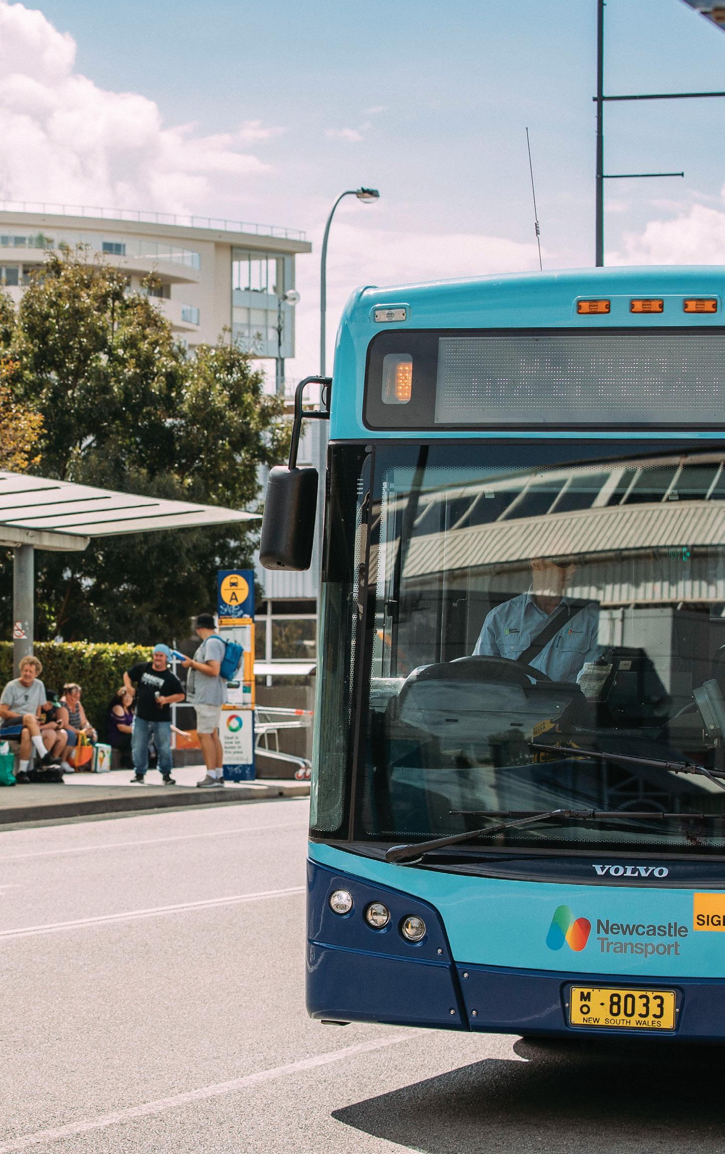
#5: BUS STOPS AND MULTI-MODAL TRAVEL BUS STOP UPGRADES
BIKES, TRAINS AND BUSES
Our City has 2000 bus stops and a growing ondemand bus service. Council funds bus stop infrastructure including concrete slab boarding points, seats and shelters. Transport for NSW and bus service providers are responsible for the location of bus stops.
Public bus services can facilitate travel by bike and bus by allowing customers to bring their bicycle on the bus, on a rack. While Council does not run bus services, we can advocate for improved services on behalf of our community.
IDENTIFYING PRIORITIES We will preference upgrading bus stops to meet national disability standards. This includes clear signage, tactile ground surface indicators for the vision impaired and a firm, evenly graded boarding point. We will provide seats and shelters for stops adjacent to major trip generating land uses including shopping and commercial areas, train stations, community facilities and houses or premises for seniors and people with disability. We will look to include bus stop upgrades in larger capital works projects. For discrete bus stop upgrades not part of larger works, in each fouryear Delivery Program we will consider stops:
check-circle with the most tap-ons check-circle on more direct, high-frequency routes check-circle on main roads check-circle servicing housing or premises for seniors or people with disability.
28
LAKE MACQUARIE CITY COUNCIL
From 2021, the NSW Government is expected to introduce a new intercity train fleet for services between Newcastle and Sydney. These new carriages include dedicated bicycle parking. We will advocate for improved bicycle storage at train stations, including lockers and secure cages.
STATION ACCESS PROGRAM The NSW Government is responsible for upgrading train stations to improve accessibility. We will provide priority connections as part of our footpath and cycling programs.
BIKE SHARE AND OTHER ASSISTED MOBILITY SCHEMES Bike share schemes allow locals and visitors to access a bicycle ‘on-demand’ when desired. Bike share schemes generally come in two forms: docking stations or dockless. Lake Macquarie already hosts several tourist-based docking stations. We will continue to facilitate the market in providing future share schemes.
ACTIONS Ongoing check-circle
Upgrade bus stops as part of larger capital works projects and undertake discrete priority upgrades as part of a specific program
check-circle
Improve and maintain an up-to-date database of existing and proposed bus stop upgrades
check-circle
Monitor the effect of on-demand bus services on our bus stop upgrades program
check-circle
Review advertising arrangements on shelters and seats and replace seats to better meet community needs
check-circle
Advocate for the NSW Government to investigate improved bicycle storage for major transport interchanges and on bus services
check-circle
Assist the NSW Government and bus service providers with the roll out of digital timetable displays at priority bus stops
check-circle
Provide online program updates
1-5 years check-circle
Review and align local development controls and guidelines with updated local planning guidance for bus stop provisions*; and review processes to ensure construction complies with standards
check-circle
Review local policy and plans to facilitate the safe uptake of bike share and other possible assisted mobility schemes, ensuring appropriate and fair use of available public space for parking bicycles and devices
*See Planning for People, Movement and Places
WALKING, CYCLING AND BETTER STREETS STRATEGY
29
#6: OTHER CITY-WIDE IMPROVEMENTS AND SUPPORT OUTLIER FOOTPATHS AND CROSSING FACILITIES Beyond Principal Pedestrian Networks and key active travel routes to schools, there are many important destinations that require safe pedestrian access and improved accessibility. We will:
check-circle focus on projects that address demonstrable hardship, an urgent safety need such as crossing a main road or introducing traffic management measures
UPGRADING EXISTING FACILITIES We will assess the need to widen or redesign paths with high pedestrian and cyclist volumes when they near the end of their useful life or when other events such as storms, private development or road reconstruction projects trigger the need to reconstruct sections. In some circumstances, available space and environmental and heritage matters may restrict what is possible, such as in the case of parts of the Fernleigh Track.
check-circle primarily deliver projects as part of larger
ON-ROAD CYCLING PROVISIONS FOR MORE CONFIDENT CYCLISTS
check-circle prioritise projects closer to housing or
Council is guided by the notion that every street is a cycling street. In other words, apart from some roads nominated by the NSW Government excluding cyclists, people can legally ride on any road.
capital works, such as road reconstruction and community facility projects premises for seniors or people with disability, schools, clubs, community facilities, parks and beaches, bus stops, train stations, scenic shared pathways and commercial and employment areas other than urban centres
check-circle prioritise projects on streets with higher traffic speeds and volumes and where verges result in more pedestrians walking on the road
check-circle target short missing links that do not require design, following private development path construction.
In accordance with Australian standards and NSW guidance, we will:
check-circle provide wider shoulders when reconstructing roads where space permits and mark new cycle lanes as part of our line-marking program
check-circle target ‘high-difficulty’ routes identified in our digital cycle route planning maps available online
check-circle consider opportunities for every road project during planning.
30
LAKE MACQUARIE CITY COUNCIL
Wider shoulders and on-road bicycle lanes
END-OF-TRIP FACILITIES Local planning controls and more detailed place plans guide the planning and delivery of endof-trip facilities such as bicycle parking, on-site bicycle storage, change rooms and showers. We will:
check-circle target bicycle parking in convenient and
secure locations on main streets, libraries, community facilities, parks, playgrounds and sports grounds
check-circle be open to community suggestions check-circle ensure planning controls for new
developments meet current best practice.
ENCOURAGING WALKING AND CYCLING
1-5 years
Council can play a role in encouraging the uptake of more walking and cycling and safe driving behaviours. Subject to the availability of delivery partners and funding, we will seek to support initiatives such as:
check-circle
Publish a cycling routes way-finding map, aligning with neighbouring local councils, and share data on recommended routes to help the NSW Government and thirdparty service providers improve digital trip planning services for walking and cycling
check-circle
Undertake a citywide audit of bicycle parking
check-circle
Review shared path signage and investigate opportunities for improvements to encourage shared path etiquette, including use of social media
check-circle
Review Council’s public lighting policy based on the latest research
check-circle
Identify ways to help customers report unsafe and illegal motorbike use of shared paths to the NSW Police
check-circle National Road Safety Weeks, National Heart Week, NSW Bike Week, Walk and Ride to School Day
check-circle bicycle skills and maintenance training,
promotion of walking, cycling and public transport to Council run events
check-circle promotion of road safety campaigns check-circle publishing information on established cycling routes.
ACTIONS Ongoing check-circle
Install bicycle parking
check-circle
Investigate/implement street tree plantings with reference to Council’s Environmental Sustainability Strategy
check-circle
Partner with the NSW Government and community organisations to promote and deliver skills development and road safety awareness initiatives
check-circle
Advocate for the NSW Government to investigate improved bicycle storage for major transport interchanges and on bus services
Minimum passing distance. It’s the law.
60
& under
1m
5-10 years check-circle
check-circle
Investigate an integrated approach to planning and prioritising local area traffic management interventions as part of area planning activities and road safety technical investigations, to better align with pedestrian and cyclist safety issues and priorities Following community requests, investigate community crowdfunding funding models that ensure delivery of priority projects for the City
OVER
60
1.5m
WALKING, CYCLING AND BETTER STREETS STRATEGY
31
PLANNING FOR PEOPLE, MOVEMENT AND PLACES Two best practice frameworks help us improve the safety and comfort of pedestrians and cyclists, and balance the needs of everyone who uses our streets: the Movement and Place framework and the Safe System. Together with supporting guidance, such as the NSW Walking Space Guide, we have developed updated local planning guidance including:
check-circle different types of pedestrians and cyclists and their needs
check-circle core planning and design principles for walking, cycling and streets
check-circle local design preferences check-circle how to approach trials and temporary interventions
check-circle how we’ll incorporate community feedback and measure progress.
LOCAL DESIGN PREFERENCES Local design preferences are an important part of local planning guidance. We have identified key preferences for different street types under the Movement and Place framework, plus green network links beyond the street network, such as the Fernleigh Track. Local design preferences help us determine what is best suited to where, given our City’s geography
and local characteristics and lower population density in places. These aspects influence Council’s ability to fund the maintenance of infrastructure into the future. We will review and update local preferences with best practice guidance, as the City and expectations change and as Council revises its asset management strategy (the extent of roads and paths we can afford to maintain and replace into the future).
VISION AND GOALS FOR WALKING, CYCLING AND STREETS check-circle Safe System Guidance
check-circle Trials check-circle New technologies check-circle New infrastructure, developments and experiences
Changing expectations, behaviours and policy
check-circle Movement & Place Framework check-circle Supporting guidance check-circle Core design principles for walking and cycling
LOCAL DESIGN PREFERENCES FOR STREETS AND LINKS
Local Streets
32
LAKE MACQUARIE CITY COUNCIL
Main Streets & Civic Spaces
Main Roads
Green network travel links
MOVEMENT AND PLACE AND THE SAFE SYSTEM In NSW, the Movement and Place Framework has been developed and adopted as a collaborative ‘place-based’ approach to the planning, design and delivery of transport networks and places.
The Safe System recognises people will inevitably make mistakes and may have road crashes, but the road system should be forgiving and crashes should not result in death or serious injury.
Movement is how people get about to access their jobs, education and services, as well as the movement of goods required for our cities and towns to function.
There are four pillars to the Safe System. Each must be working together to minimise the likelihood and severity of crashes:
Places are the spaces where we get together, relax, celebrate, work and participate in civic life.
M ovement
The framework recognises that roads are important for the movement of people and goods, but can also act as important places. It identifies four street types based on movement and place objectives: main roads, main streets, local streets and civic spaces.
MAIN ROADS
MAIN STREETS
LOCAL STREETS
CIVIC SPACES
check-circle Safe roads check-circle Safe speeds check-circle Safe vehicles (technology and design)
Safe System Assessment We will assess pedestrian, cycling and road projects against the Safe System to inform design outcomes. Where additional infrastructure needs cannot be funded, we will list for future investigation.
check-circle Safe people (behaviour of all road users) Council’s primary role is ensuring roads are designed to meet Safe System standards for all road users. We will implement what can be funded and ensure designs can be adopted to integrate longer-term solutions. Movement and Place and the Safe System approach are embedded in key NSW Government transport and urban planning documents, including the Greater Newcastle Metropolitan and Future Transport Plans. Together, these frameworks help us clarify the objectives for a street and the infrastructure and design outcomes required.
Place
WALKING, CYCLING AND BETTER STREETS STRATEGY
33
SAFE SYSTEM SPEEDS Safe System guidance provides clear direction that pedestrians and cyclists should be separated from motorised traffic or speeds reduced to 30kmh or less. Lower speeds results in fewer crashes, as road users have more time for reacting and decisionmaking and can stop within a shorter distance. Consequently, impacts on people and vehicles are less severe and the likelihood of serious injury or death is reduced. Vehicle speeds of 30kmh or less Pedestrians and cyclists can mix with low traffic volumes. More than 30kmh Above 30kmh the chances of survival decrease rapidly. Traffic separated infrastructure is recommended or, if this is not possible, streets should be designed to reduce the likelihood and severity of impact. Under the Movement and Place framework, lower speeds are important for local streets, main streets and civic spaces. Importantly, reducing speeds on local streets has little impact on overall travel time as these streets quickly connect to main roads.
Travelling speed and pedestrian survival
30 Hit at 30km per hour Less than 10% of pedestrians will die
40 Hit at 40km per hour
25% of pedestrians will die
50 Hit at 50km per hour
55% of pedestrians will die
60 Hit at 60km per hour
85% of pedestrians will die
34
LAKE MACQUARIE CITY COUNCIL
SAFE SYSTEM INFRASTRUCTURE Council and the NSW Government have historically provided 1.2m wide footpaths, shared paths and on-road bicycle lanes and markings.
paths (also known as protected cycleways), such as King Street, Warners Bay and Station Street, Morisset.
construction costs with costs associated with maintenance over the expected life of an asset. The provision of wider shoulders and on-road cycle lanes on busier roads for more confident cyclists will continue.
Council has adopted several detailed area plans that already include traffic separated bicycle-only
Our community has suggested exploring alternative materials for cycling routes to deliver more infrastructure, sooner, such as spray sealed gravel paths. We will continue to take a life-cycle approach to planning and designing new infrastructure. This means we will balance
Wider footpaths in areas with more pedestrians and children under 16 years on bicycles
Kerb ramps are essential for people in wheelchairs, on mobility scooters, with prams or luggage
Kerb extensions and refuges to improve safety, especially for children, the elderly and people with disability
Continuous path treatment across local streets, to give pedestrians and cyclists right of way and to help reduce traffic speeds
Raised pedestrian crossings to give pedestrians right of way and help manage traffic speeds
Kerb extensions and narrow intersections reduce pedestrian time spent in the roadway area
Population growth and new road safety guidance require a variety of facilities and interventions.
WALKING, CYCLING AND BETTER STREETS STRATEGY
35
SHARING THE PATH Shared paths are used for different purposes and will remain important links in the cycling network. We will ensure they operate as shared, welcoming and safe places for all to enjoy, by continuing to promote shared path etiquette through our online engagement activities.
Wider shared paths in areas of high pedestrian activity
Bicycle boulevards – special shared traffic streets with modifications to reduce vehicle speeds and increase the visibility of adults and children on bicycles
Traffic separated bicycle-only paths
Off-road spray sealed gravel trails
36
LAKE MACQUARIE CITY COUNCIL
We will also investigate opportunities to improve path signage. When it is time to upgrade or build new paths upgrade paths, we will investigate opportunities for widening in areas of high pedestrian activity and where space and funding is available.
TYPES OF PEDESTRIANS AND CYCLISTS We will cater to all, but to achieve our goals we need to pay special attention to more vulnerable groups – children, the elderly and people with disability. All pedestrians benefit from shorter crossing distances, refuge areas, ample room to wait at intersections, intersection control that prioritises their movement and separation from all but the lowest-speed and lowest volume traffic.
0 kmh 0 m/s
Parked bicycles
0 kmh 0 m/s
5 kmh 1.4 m/s
6-7 kmh
1.6-1.9 m/s
Kerb ramps are crucial for wheelchair users and people are walking with extra items, such as prams, trolleys and luggage. People cycle for many different reasons. We need to cater for different travel needs as well as different skill levels. Replacing car trips with cycling trips will largely rely on building more infrastructure separated from traffic and creating reduced vehicle speed shared streets.
10 kmh 2.7 m/s
Cyclist transporting goods
Children and families
10 kmh
Commuter
20 kmh
15+ kmh 4+ m/s
Recreational Cyclist
> 30kmh
WALKING, CYCLING AND BETTER STREETS STRATEGY
37
Cyclists may fall into multiple categories:
Traffic separated infrastructure and low-stress suited to all ages and abilities
Potential or novice cyclists. Basic skills. Very low tolerance for mixing with traffic. Rely on way-finding. Ride shorter distances, typically between 1-5km. Prefer flat routes with less than 5% gradient. May not have ever ridden a bicycle.
School age Cognitive skills and situational awareness in development. Require separated infrastructure. Under 16 years of age can legally ride on footpaths in NSW.
Families with young children Prefer separation from traffic. Ride shorter distances. Prefer flat routes with less than 5% gradient. Adults / guardians may be walking alongside young children on bicycles.
Casual adult riders People who ride irregularly in the City, typically for leisure or social trips. Prefer separation from traffic. Rely on way-finding. Prefer flat routes with less than 5% gradient.
Regular adult riders (including commuters) and touring cyclists
On-road facilities suited to more confident cyclists
More confident mixing with traffic, though still prefer separation. Commuters ride longer distances, typically less than 20km, and touring cyclists rider much longer distances. More likely to commute and combine with public transport. Prefer flat, direct routes, but may tolerate 10% gradients, or 15% with e-bikes. Require all day secure parking, showers and change facilities.
Swift and savvy Adult riders more confident mixing with traffic. If riding for training purposes, may ride very long distances, sometimes more than 100km.
Mountain biking / bike packing Mountain biking, trail riding and bike packing cyclists purposefully seek out off-road adventures. When travelling on the street network or green network active travel links, these cyclists may fall into any of the above categories. Note: Off-road cycling of this type is the subject of complementary open space and recreation planning.
38
LAKE MACQUARIE CITY COUNCIL
Increasing: Confidence • Situational awareness • Distance • Speed
Curious but concerned
Mobility scooters Mobility scooters are familiar-looking motorised wheelchairs with a top speed of 10km/hr. They are used by people of all ages, providing an affordable substitute for cars, and can be combined with other forms of public transport. If Lake Macquarie’s ageing population trend continues, use of mobility scooters will likely become more common. In NSW, a motorised wheelchair user is considered to be a pedestrian and must comply with NSW Road Rules that apply to pedestrians. Generally, these devices are not to be driven on the road if there is a footpath available.
Assisted mobility and micromobility Assisted mobility technology is constantly evolving and improving. The terms ‘assisted mobility’ and ‘micromobility’ are generally used in reference to motorised and nonmotorised devices that help pedestrians move in ways other than walking. Micromobility often specifically refers to the use of electric scooters by able-bodied persons. In some places, micromobility also includes use of bicycles.
Electric scooters, skateboards and bicycles Demand for battery powered scooters, skateboards and bicycles has surged in recent years in cities around the world. These devices are increasingly a common sight in Lake Macquarie, creating demand for more infrastructure, wider paths and safer streets. The NSW Government is investigating updating regulations to better accommodate these devices.
WALKING, CYCLING AND BETTER STREETS STRATEGY
39
PLANNING AND DESIGN PRINCIPLES Our planning and design principles guide the delivery of pedestrian, cycling and road infrastructure. Our principles also speak to how we plan our city more broadly, and we’ll apply them when planning for streets and places. People will walk and cycle when it is appealing and when they have the confidence to do so. This means walking and cycling is convenient, direct and preferable to other ways of getting around. It means having the right infrastructure and reducing perceptions of risk and actual danger. Improving appeal is also about enabling people to live close to where they work, shop and access services. Managing car parking is also important. To implement these principles, Council has adopted other plans including the Local Strategic Planning Statement, Housing Strategy and Parking Strategy.
What is within Council’s control? check-circle I dentifying land suitable for housing, employment, recreation
check-circle M anaging population density In line with NSW Government directions
check-circle F ootpaths, street trees and cycling facilities on
local streets and behind the kerb on State roads
check-circle P edestrian refuges and crossing facilities where NSW requirements can be met
check-circle O ff-street ‘green network’ links such as the
Fernleigh Track (subject to land ownership)
check-circle T raffic calming check-circle M anaging public parking check-circle S etting requirements for road design, pedestrian and cycling facilities and car parking in new subdivisions and building developments
check-circle B us stop infrastructure What is not within Council’s control? times S peed limits (Council can apply to NSW
Government for lower speeds in certain areas)
times Speeding vehicles (NSW Police) times Location of bus stops times Bus routes
40
LAKE MACQUARIE CITY COUNCIL
PLANNING AND DESIGN PRINCIPLES Low-stress and vehicle safe speeds People have different perceptions of what feels safe or stressful for them. Pedestrian and cycling infrastructure that minimises interaction with vehicles and risk of traffic-related injury gives people of all ages and abilities more transport choices.
Intuitive, visible, logical and direct Streets and paths should be easily navigable, forming a convenient and coherent route and linking people directly to where they want to go.
Accessible and comfortable Streets and paths meet accessibility standards where pedestrian access is required. Surfaces and transitions are smooth and provide ample width and turning space for intended users. Separate or give more room to pedestrians and cyclists in areas of higher pedestrian activity.
Connected, with many choices Multiple routes should be available for people to move between key destinations. This is especially important for pedestrians, where travel time is impacted by limited choices.
Sheltered, cool and leafy Street trees and building awnings provide protection from the sun and inclement weather.
Well-loved and intriguing People are attracted to beautiful and interesting streets and places and are more likely to walk and cycle and feel safe where other people are also present. Encourage active building frontages and spaces for play and rest, and provide greenery and public art.
Safe and inviting Design for more ‘eyes on the street’, careful placement of public lighting and many entry and exit points to offstreet paths, to reduce the likelihood of crime and help people feel safe.
More shops and services closer to home People are more likely to walk and cycle when there are lots of places to visit and things to do nearby that many people can reach within an easy distance (generally 10-20 minutes). Plan existing and new neighbourhoods to provide local facilities within walking and cycling distance.
Inviting and convenient public transport Every trip on a bus or train involves walking or use of assisted mobility and in some cases cycling. People are more likely to walk and cycle when public transport is frequent, reliable and comfortable.
Balance parking with other needs Manage the supply and demand of car parking in such a way that ensures local places continue to thrive and the safety and accessibility needs of pedestrians, cyclists and people with disability are met.
WALKING, CYCLING AND BETTER STREETS STRATEGY
41
LOCAL DESIGN PREFERENCES: LOCAL STREETS Local streets make up the majority of streets within our City’s transport network and are important places for local residents. Local streets include primary and secondary streets and access streets such as laneways and no-through cul-de-sacs. Primary streets have more through traffic. Local streets provide a means for people to get to and from home and to other places. They provide a space for walking, cycling, jogging, learning to ride and playing. They are more than just pavement—they are important for managing stormwater flows, providing trees and greenery for our well-being and wildlife, and enabling power, water, sewer and telecommunications to service our homes. Road widths, footpaths and trees must be carefully planned to allow for future maintenance.
check-circle Priority paths on at least one side of primary and secondary local streets, and both sides of primary streets within 400m of the Principal Pedestrian Network area and schools
check-circle Priority paths on at least one side of access streets within Principal Pedestrian Network medium density zoned areas
check-circle New footpaths 1.5m wide in Principal Pedestrian Networks, 1.2m-1.5m elsewhere depending on local constraints
check-circle Use raised crossings and continuous pedestrian paths across intersections where
requirements can be met to help manage traffic speeds and improve visibility of pedestrians
check-circle Traffic separated cycling provisions or low-speed shared streets where a cycling route is identified
check-circle New streets designed for 30kmh check-circle Street trees PRIMARY/SECONDARY LOCAL STREET WITHIN 5 MINUTE AREA OF PRINCIPAL PEDESTRIAN NETWORK
DESIRED OUTCOMES Local streets encourage active living and make us feel good. Street design, traffic management and pedestrian and cycling infrastructure reduces the likelihood and severity of crashes. Where footpaths are recommended for both sides of a street, the delivery of paths on at least one side of streets will generally be prioritised. Key exceptions include when connecting to a crossing facility or roads where crossing would not be considered safe, due to traffic volumes and speeds.
Utilities 1.5m footpath
Parking and travel lanes
Utilities
Example local street configuration in a Principal Pedestrian Network
42
LAKE MACQUARIE CITY COUNCIL EXAMPLE PRIMARY/SECONDARY LOCAL STREET OUTSIDE OF
Priority for safety and vulnerability Highest
Pedestrian
Cyclist Vehicles Lowest
WALKING, CYCLING AND BETTER STREETS STRATEGY
43
LOCAL DESIGN PREFERENCES: MAIN STREETS AND CIVIC SPACES Main streets and civic spaces are places that experience a lot of through traffic but are also places where we work, go for fun or to access shops, cafes, restaurants and services. Balancing the movement of people and vehicles with pleasant pedestrian, cycling and eating experiences is a common challenge. Examples include The Boulevarde, Toronto, Brooks Parade, Belmont and Pearson Street Mall, Charlestown.
DESIRED OUTCOMES Main streets and civic spaces are inviting, thriving places that prioritise people of all ages and abilities and put vulnerable road users, amenity and local business first.
check-circle Wider paths on both sides of the street in accordance with Council’s adopted Streetscape Master Plans
check-circle Raised crossings, continuous pedestrian paths across connecting local streets and signalised crossings
check-circle Main streets and connected to the cycling network and where
a cycling route is identified along the main street, people on bicycles are separated from traffic and car parking movements
check-circle 30-40kmh speeds check-circle Street trees and vegetation check-circle Bus stop shelters and seats
As sites of high pedestrian activity and cyclist and traffic movement, the safety and comfort of vulnerable road users is the priority.
Footpath
bicycle lane
travel lanes
travel lanes
Example main street configuration
44
LAKE MACQUARIE CITY COUNCIL
Parking
Footpath
Priority
Highest
Pedestrian
Cyclist
Transit
Service
Single occupant car Lowest
WALKING, CYCLING AND BETTER STREETS STRATEGY
45
LOCAL DESIGN PREFERENCES: MAIN ROADS Main roads are important thoroughfares for moving people and goods. They include motorways, freight corridors and major public transport, pedestrian and cycling routes. Main roads are also known as distributor and collector roads, with more than 3000 vehicles per day and design speeds of 50km/h or more. Where main roads pass through urban centres, the road may instead be classified as a main street. Being busy, main roads often act as barriers to people walking and cycling. Safe crossing facilities are critical. Most main roads are classified as ‘State’ or ‘Regional’ roads under the Roads Act 1993. On State roads, Council is responsible for managing the kerb to property boundaries and the NSW Government is responsible for the roadway area. This means Council is responsible for providing paths and the NSW Government for providing crossing facilities, which may be done in partnership with Council.
DESIRED OUTCOMES Main roads cater to all transport modes, safely and conveniently connecting people to places, allowing for the efficient movement of goods and providing access to local residences and industrial areas.
46
LAKE MACQUARIE CITY COUNCIL
check-circle Priority paths on both sides of main
roads in areas where adjacent land use generates pedestrian activity, including industrial areas
check-circle New footpaths 1.5m wide in Principal Pedestrian Networks, 1.2m-1.5m elsewhere depending on local constraints
check-circle Less confident people on bicycles are
separated from traffic where a cycling route is identified
check-circle On-road cycling provisions for more confident cyclists
check-circle Street trees
LOCAL DESIGN PREFERENCES: ALL STREET TYPES check-circle Driveway crossing concrete joints show legal right of way to pedestrians and have a maximum crossfall of 2.5 per cent
check-circle Kerb ramps at intersections, mid-block crossings and to facilitate bus stop access
check-circle Bus stops meet disability accessibility standards, and have seats and shelters for stops adjacent to shopping and commercial areas, train stations, community facilities and houses or premises for seniors and people with disability
check-circle Street trees in accordance with Council policy
WALKING, CYCLING AND BETTER STREETS STRATEGY
47
LOCAL DESIGN PREFERENCES: GREEN NETWORK LINKS Green network links are dedicated pedestrian, cycling and assisted mobility thoroughfares beyond the street network that provide critical transport links between places and public transport. They also fulfil recreation needs. In Lake Macquarie, green network links are typically shared paths and structures such as the Fernleigh Track, Booragul to Eleebana shared path including the Red Bluff Boardwalk, Cardiff Winding Creek shared path, Raspberry Gully, and Thomas H. Halton Park.
DESIRED OUTCOMES Green network links are family-safe, comfortable and appealing, conveniently connecting people to places, public transport and Lake Macquarie’s unique landscapes. They are environmentally and culturally sensitive, cater to diverse user groups and seamlessly integrate with street network infrastructure.
check-circle Pedestrians and cyclists are given
priority at intersections where safe and possible, to reduce number of stops and trip time
check-circle Path surfaces are constructed to be
smooth with no bumps, enhancing user experience while reducing asset maintenance costs
check-circle Compacted, spray-sealed gravel or
equivalent may be investigated as an intermediate or site sensitive measure
check-circle Transitioning between the street
network and the green network is safe, smooth and clearly defined
check-circle Good passive surveillance and many accessible entry and exit points
check-circle Links that form part of the Principal Bicycle Network are 3m wide
check-circle Provide wider paths or separate
pedestrian and cycling facilities in areas of higher pedestrian activity, where feasible
Path design preferences also apply to shared paths built within street corridors
48
LAKE MACQUARIE CITY COUNCIL
WALKING, CYCLING AND BETTER STREETS STRATEGY
49
TRIALS AND TEMPORARY INTERVENTIONS Lower-cost trials and place-making ‘pop-ups’ are a great way for the community to see and experience possible changes, provide feedback and build trust.
check-circle Document and measure – collect before
Trials also help reduce risk associated with big investments. A design can be improved upon before a more permanent solution is implemented. Lake Macquarie has a history of conducting trials, particularly with the use of materials in pathways.
check-circle Attract attention – use colourful materials, art
and after photos and metrics to support permanent solutions and creative promotional materials to draw attention to the transformation
check-circle Scale up – pilot new approaches to transform policy and inspire new programs.
The Global Designing Cities Initiative identifies five key lessons to ensure success:
check-circle
Exploring temporary, quicker and cheaper solutions is an evolving space in NSW. As both local and State governments are responsible Uncover value – identify under-utilised space for streets in different typically Uncover Engage Document Attractways, trials are Scale and transform it to contribute to safety, delivered in partnership. value stakeholders & measure attention up community building or economic goals
1
2
3
check-circle Engage stakeholders – public outreach can
generate new ideas, build community support and improve local understanding of issues
1 50
LAKE MACQUARIE CITY COUNCIL
Uncover value
2
Engage stakeholders
3
4
5
We will refer to NSW guidance on temporary trials and work with the NSW Government to identify solutions that align with long-term plans.
Document & measure
4
Attract attention
5
Scale up
LISTENING TO OUR COMMUNITY Customer requests for new footpaths, crossing facilities and cycling facilities will be noted in our infrastructure planning database. We will analyse this information when assembling our four-year Delivery Program. Requests for new infrastructure provide staff with local knowledge that informs our planning. However, projects will not be prioritised based on the number of requests, nor will individual requests influence our prioritisation methodology. Customer requests for traffic and road safety investigations will be considered against our transport operations procedures. Where requests have merit, we will investigate. We may then recommend a new project for our capital works program.
Our Strategy is our filter
Other ways to have your say Each year we undertake a range of activities to better understand the community’s needs. These provide another way for you to help shape the capital works program and local planning controls that influence development outcomes.
It helps determine priority footpaths, crossing and cycling infrastructure projects. We will check in with the community every four-years to see if we are getting it right.
Planning for places -planning for your main street, local shops, neighbourhood parks and playgrounds. Community surveys - we ask about your preferences and how satisfied you are with services.
Customer feedback helps inform four-year planning cycle (Delivery Program)
WALKING, CYCLING AND BETTER STREETS STRATEGY
51
MEASURING PROGRESS We will report on our progress indicators every four-years in our State of the Environment Report.
PARTICIPATION INDICATORS
DATA SOURCE
FREQUENCY
Proportion of journeys to work by bicycle/walking
Australian Bureau of Statistics Census
Every 5 years
Proportion of residents who walked/cycled for transport (all trip purposes)
Transport for NSW Household Travel Survey
Annual
Proportion of residents who walk/cycle to major urban centres
Lake Macquarie Environmental Attitudes Survey
Every 4 years
Proportion of residents who cycle for transport
Cycling Participation Survey (local edition)
Every 2 years
Proportion of walking trips less than 2km and cycling trips less than 5km
Transport for NSW Household Travel Survey (data request)
Annual
Proportion of residents who rode in the ‘last seven days’ (at time of survey)
Cycling Participation Survey (local edition)
Every 2 years
Network counts
Automated pedestrian and cyclist counters
Real-time
Proportion of residents with a disability
Australian Bureau of Statistics
Every 5 years
Proportion of women who ride to work
Australian Bureau of Statistics Census
Every 5 years
Proportion of women who cycled in the ‘last seven days’ (at time of survey) / or gender split ratio
Cycling Participation Survey (local edition)
Every 2 years
Proportion of young adults aged 18-19 who rode in the ‘last seven days’ (at time of survey)
Cycling Participation Survey (local edition)
Every 2 years
Proportion of cycling trips made for education
Cycling Participation Survey (local edition)
Every 2 years
Reported pedestrian and cyclist casualty crashes over a five year period
Transport for NSW – Centre for Road Safety
Annual
Greater Newcastle Metropolitan Area hospital admissions related to cycling incidents (pilot)
Local methodology to be developed with City of Newcastle
TBC
General
Diversity
Road trauma
52
LAKE MACQUARIE CITY COUNCIL
ATTITUDE INDICATORS
DATA SOURCE
FREQUENCY
Reported satisfaction with footpaths, shared paths and cycleways, road surfaces, road safety and traffic management
Community Satisfaction Survey
Every 2 years
Reported importance of footpaths, shared paths and cycleways, road surfaces, road safety and traffic management
Community Satisfaction Survey
Every 2 years
Performance gap – satisfaction compared to importance – footpaths, shared paths and cycleways, road surfaces, road safety and traffic management
Community Satisfaction Survey
Every 2 years
Proportion of cyclists who feel comfortable or very comfortable cycling in Lake Macquarie
Cycling Participation Survey (local edition)
Every 2 years
Proportion of cyclists in agreement that cycling conditions have improved in the last two years
Cycling Participation Survey (local edition)
Every 2 years
Proportion of responses in agreement with the statement ‘drivers are courteous towards cyclists’
Lake Macquarie Environmental Attitudes Survey
Every 4 years
Proportion of responses in agreement with the statement ‘pedestrians and cyclists are courteous to one another on shared paths’
Lake Macquarie Environmental Attitudes Survey
Every 4 years
INFRASTRUCTURE INDICATORS
DATA SOURCE
FREQUENCY
Length of footpath (street network)
Geographical Information System
Every 5 years
Length of shared paths, bicycle paths and lowdifficulty on-road cycling routes
Geographical Information System
Every 5 years
Length of on-road facilities for more confident cyclists
Geographical Information System
Every 5 years
Length of road network
Geographical Information System
Every 5 years
Length of road network covered by 40kmh or less high pedestrian activity or local traffic areas
Geographical Information System
Every 5 years
Sentiment
WALKING, CYCLING AND BETTER STREETS STRATEGY
53
APPENDIX 1: PRINCIPAL BICYCLE NETWORK ROUTES
54
LAKE MACQUARIE CITY COUNCIL
WALKING, CYCLING AND BETTER STREETS STRATEGY
55
Appendix 1: Principal Bicycle Network Routes
COASTLINE CYCLEWAY: SWANSEA TO NEWCASTLE/CENTRAL COAST
INCLUDING THE FERNLEIGH TRACK
MAIN ROUTE SEGMENTS
ABOUT THIS ROUTE
KEY ATTRACTORS
This route forms part of a long-held aspiration for a continuous NSW coastline cycling route. It includes the iconic Fernleigh Track rail trail and the Fernleigh Awabakal Shared Track from Belmont to Blacksmiths.
• E conomic centres: Swansea, Belmont, Charlestown, Newcastle
The Fernleigh Track and Fernleigh Awabakal Shared Track will provide a continuous cycling experience from Swansea to Adamstown. The southern leg, Swansea to Central Coast, is complete to the Pacific Highway underpass at Murrays Beach.Beyond this, completion of the route will rely on future land development and engagement with NSW National Parks and Wildlife Service and Central Coast Council.
• S econdary/tertiary education: Belmont TAFE, Belmont Christian College, Whitebridge HS, St Pius HS (Swansea HS, Belmont HS via sub-regional route)
Swansea to Belmont • Swansea to Blacksmiths • B lacksmiths to Belmont (Fernleigh Awabakal Shared Track) Belmont to Adamstown (Fernleigh Track) • Belmont to Redhead
• Train stations: Adamstown
• Redhead to Whitebridge
• O ther: Fernleigh Track, Glenrock State Conservation Area, Blacksmiths Beach, Pelican Foreshore, Caves Beach, Redhead Beach, Dudley Beach
• Whitebridge to Adamstown Adamstown to Newcastle (refer to City of Newcastle Cycling Strategy) Swansea to Catherine Hill Bay • Swansea to Murrays Beach
LOCALITY PLANS check-circle S wansea Area Plan, Streetscape check-circle check-circle check-circle
56
Masterplan and Local Adaptation Plan B elmont Area Plan and Streetscape Masterplan N orth Wallarah Peninsula Area Plan C atherine Hill Bay Heritage Precinct Area Plan
LAKE MACQUARIE CITY COUNCIL
check-circle L ake Macquarie Coastline Area Plan check-circle M arks Point Belmont South Area check-circle check-circle
Plan and Local Adaptation Plan P elican and Blacksmiths Local Adaptation Plan Dudley Heritage Precinct Area Plan
• Murrays Beach to Catherine Hill Bay (including Catherine Hill Bay Heritage Trail) Catherine HIll Bay to Central Coast • C atherine Hill Bay to Lake Munmorah (refer to Central Coast Cycling Strategy)
CARDIFF
GLENDALE
To Newcastle
SUB-REGIONAL ROUTES
WARNERS BAY CHARLESTOWN
Swansea to Adamstown 01a Swansea to Caves Beach Local Centre 02 To Swansea 03 Swansea to Coon Island 04 To Blacksmiths Beach (Ungala Road) 05 To Pelican Foreshore (Soldiers Road) 06 F ernleigh Awabakal Track to Marks Point Local Centre 07 F ernleigh Awabakal Track to Belmont South Foreshore (Beach St) 08 F ernleigh Track to Belmont North (via John Darling Colliery rail trail) 09 Fernleigh Track to Jewells Local Centre 10 D udley to Fernleigh Track Fernleigh Track to Richmond Vale, together these form the “Charlestown to Coast” route) 11 Fernleigh Track to Kahibah Local Centre Swansea to Central Coast 01b To Murrays Beach, Nords Wharf
MOUNT HUTTON
11
10
09
TORONTO
08
07
To Redhead Beach, see Warners Bay to Redhead regional route BELMONT
06 05 03 02
04 SWANSEA
01a MORISSET
01b
Local and economic centres Schools Train stations Principal Bicycle Network North West Catalyst Area
CATHERINE HILL BAY
For the latest status of the network (constructed/not constructed) refer to our digital maps at lakemac.com.au
To Central Coast
WALKING, CYCLING AND BETTER STREETS STRATEGY
57
Appendix 1: Principal Bicycle Network Routes
FERNLEIGH TRACK TO RICHMOND VALE RAIL TRAIL VIA CHARLESTOWN
MAIN ROUTE SEGMENTS Whitebridge to Charlestown
ABOUT THIS ROUTE This route will connect the north-western part of the Greater Newcastle Metropolitan Area (Minmi and the Richmond Vale rail trail) with the strategic centre of Charlestown and ultimately the Fernleigh Track. The route passes through future land development sites at Minmi, Cameron Park and Edgeworth, then aligns with the Speers Point to Newcastle route briefly on Frederick Street, before continuing through Glendale to Cardiff via Stockland Drive or Winding Creek. The route continues on Winding Creek through to Hillsborough and is then proposed to run parallel to the Inner City Bypass to Warners Bay Road (service road) to provide a gentler and safer climb to Charlestown relative to alternatives (E K Avenue or Charlestown Road). The route passes through Charlestown to connect to Whitebridge and the Fernleigh Track via Kaleen Street.
KEY ATTRACTORS • E conomic centres: Charlestown, Cardiff, Glendale • S econdary/tertiary education: Whitebridge HS, Cardiff HS, Glendale TAFE (Macquarie College via sub-regional route) • Train stations: Cardiff • O ther: Fernleigh Track, Richmond Vale rail trail, Tramway Track
LOCALITY PLANS check-circle C harlestown Area Plan and Streetscape Masterplan
check-circle C harlestown Transport check-circle check-circle check-circle check-circle
58
LAKE MACQUARIE CITY COUNCIL
Management Plan C ardiff Streetscape Master Plan C ardiff Transport Management Plan G lendale Area Plan and Streetscape Master Plan E dgeworth Area Plans (multiple)
Charlestown to Cardiff • Charlestown to Hillsborough • Hillsborough to Cardiff Cardiff to Glendale Glendale to Richmond Vale • Glendale to Edgeworth • Edgeworth to Minmi (Richmond Vale)
To Richmond Vale Rail Trail
03 GLENDALE
SUB-REGIONAL ROUTES
CARDIFF
02
01 W inding Creek to Cardiff South via Waterview Road
01
02 Winding Creek to Cardiff Station 03
Multiple route alignment options to be investigated
WARNERS BAY
To Macquarie College (via Lake Road)
CHARLESTOWN
FERNLEIGH TRACK
See also Coastline Cycleway: Dudley to Fernleigh Track
MOUNT HUTTON TORONTO
BELMONT
Local and economic centres SWANSEA
Schools Train stations
MORISSET
Principal Bicycle Network North West Catalyst Area
For the latest status of the network (constructed/not constructed) refer to our digital maps at lakemac.com.au
WALKING, CYCLING AND BETTER STREETS STRATEGY
59
Appendix 1: Principal Bicycle Network Routes
BELMONT TO TORONTO, WANGI WANGI, MORISSET INCLUDING NORTHERN BAYS WAY (BELMONT TO TORONTO)
ABOUT THIS ROUTE This route traverses much of the eastern, northern and western perimeter of Lake Macquarie, offering unparalleled views and linking to major attractors such as Speers Point Park, the Museum of Art and Culture, the Fernleigh Track, and the main streets and lake foreshore areas of Belmont, Warners Bay and Toronto. Priority missing links include Belmont to Valentine, Bareki Road at Eleebana and Booragul to Toronto.
KEY ATTRACTORS • E conomic centres/foreshores: Belmont, Warners Bay, Toronto, Morisset • S econdary/tertiary education: Belmont HS, Belmont TAFE, Warners Bay HS, Lake Macquarie HS, St Paul’s College, Morisset HS • T rain stations: Booragul, Morisset (Teralba, Fassifern, via sub-regional routes) • O ther: Speers Point Park, Museum of Art & Culture, Red Bluff Boardwalk, Green Point Reserve
LOCALITY PLANS check-circle B elmont Area Plan and
Streetscape Masterplan
check-circle W arners Bay Area Plan and Streetscape Masterplan
check-circle check-circle check-circle check-circle
W arners Bay Foreshore Masterplan S peers Point Park Masterplan W oodrising West Area Plan B lackalls Park / Fennell Bay Local Adaptation Plan
check-circle T eralba Heritage Precinct Area Plan check-circle T oronto Area Plan and Streetscape Masterplan
check-circle T oronto Foreshore Masterplan check-circle T oronto Heritage Precinct Area Plan check-circle R athmines Park Masterplan and Heritage Precinct RAAF Base Area Plan
check-circle W angi Power Station Precinct Area Plan
check-circle M orisset Area Plan and
Streetscape Masterplan
check-circle N orth Morisset Area Plan check-circle D ora Creek Township Flood Prone Land Area Plan
60
LAKE MACQUARIE CITY COUNCIL
MAIN ROUTE SEGMENTS Belmont to Warners Bay (Northern Bays Way) • Belmont to Valentine • Valentine to Warners Bay Warners Bay to Toronto (Northern Bays Way) • W arners Bay to Speers Point (Watagan Track) • Speers Point to Woodrising/Fennell Bay • Woodrising/Fennell Bay to Toronto Toronto to Wangi Wangi • Toronto to Rathmines • Rathmines to Wangi Wangi Wangi Wangi to Morisset • Wangi Wangi to Dora Creek • Dora Creek to Morisset
CARDIFF
GLENDALE
06
WARNERS BAY
SUB-REGIONAL ROUTES Belmont to Belmont High School To Croudace Bay To Eleebana T he Esplanade to Speers Point & Boolaroo Local Centres 05 To Museum of Art and Culture, Marmong Point Marina 06 To Teralba Local Centre 07 Billy’s Lookout to Booragul Station via Toronto Road 08 Woodrising Local Centre 09 To Fassifern Station 10 Fennell Bay to Bolton Point 11 Fassifern to Toronto (Greenway) 12 To Toronto West 13 To Wangi Wangi Local Centre 14 Dora Creek Local Centre to Bonnells Bay Local Centre
04
07
01 02 03 04
09
CHARLESTOWN
05 08
11 10
12 TORONTO
03 02
MOUNT HUTTON
01
RATHMINES
BELMONT
13 WANGI WANGI
14
Mix of traffic-separated infrastructure and shared local streets
Local and economic centres SWANSEA
Schools Train stations
MORISSET
Principal Bicycle Network North West Catalyst Area
For the latest status of the network (constructed/not constructed) refer to our digital maps at lakemac.com.au
WALKING, CYCLING AND BETTER STREETS STRATEGY
61
Appendix 1: Principal Bicycle Network Routes
WARNERS BAY TO KOTARA, MAYFIELD ABOUT THIS ROUTE This route provides a direct and convenient link between Lake Macquarie and Newcastle. It traverses two hills suited to more confident cyclists and users of electric bicycles (once complete).
KEY ATTRACTORS
From Warners Bay, the route uses Queen Street (parallel to King Street) to Hillsborough Road. An alternative route is via Lake Street, crossing King Street at Margaret Street. Through the Warners Bay commercial and employment area, two service roads are available until such time off-road facilities are investigated.
• Train stations: Adamstown
The route runs parallel to Hillsborough Road to reach Charlestown Road. Crossing Charlestown Road, an existing path connects to Kaleen Street, in turn connecting to the Raspberry Gully shared path (former colliery railway adjacent to Styx Creek) that links directly to the Kotara shared path network.
62
LAKE MACQUARIE CITY COUNCIL
• E conomic centres/foreshores: Warners Bay, Kotara, Broadmeadow, Mayfield • S econdary/tertiary education: Warners Bay HS • Other: Raspberry Gully rail trail
LOCALITY PLANS check-circle W arners Bay Area Plan and Streetscape Masterplan
check-circle W arners Bay Foreshore Masterplan
MAIN ROUTE SEGMENTS Warners Bay to Kotara • Warners Bay to Hillsborough • Hillsborough to Kotara Kotara to Mayfield • ( Refer to City of Newcastle’s Cycling Strategy)
GLENDALE
CARDIFF
To Newcastle (Kotara, Broadmeadow, Mayfield)
SUB-REGIONAL ROUTES
WARNERS BAY
01 To Cardiff via Cardiff South 02 To Charlestown
01
02 CHARLESTOWN
MOUNT HUTTON TORONTO
BELMONT
Local and economic centres SWANSEA
Schools Train stations
MORISSET
Principal Bicycle Network North West Catalyst Area
For the latest status of the network (constructed/not constructed) refer to our digital maps at lakemac.com.au
WALKING, CYCLING AND BETTER STREETS STRATEGY
63
Appendix 1: Principal Bicycle Network Routes
SPEERS POINT TO UNIVERSITY, NEWCASTLE
INCLUDING THE TRAMWAY TRACK ABOUT THIS ROUTE
From Speers Point Park, this route follows Cockle Creek to Argenton before reaching the former Speers Point to Wallsend tram line.
• Argenton to Glendale
• E conomic centres/foreshores: Glendale, Wallsend, Jesmond, Lambton, Hamilton, Newcastle
Glendale to Wallsend
From Wallsend the route follows part of the historic Wallsend to Newcastle tram line via Jesmond (continue east for University) and onward to Newcastle West via Lambton, Broadmeadow, Hamilton.
• Other: Speers Point Park
LAKE MACQUARIE CITY COUNCIL
• Speers Point to Cockle Creek Station
KEY ATTRACTORS
• S econdary/tertiary education: Glendale TAFE, Macquarie College, University of Newcastle
64
Speers Point to Glendale • Cockle Creek Station to Argenton
At Glendale TAFE the route intersects with the Northlakes Way route to Cameron Park and West Wallsend, as well as the Richmond Vale Rail Trail to Fernleigh Track route.
This route includes important connections to the Cardiff industrial employment area and the North West Catalyst Area identified in the Greater Newcastle Metropolitan Plan for future population and jobs growth.
MAIN ROUTE SEGMENTS
• Train stations: Cockle Creek
LOCALITY PLANS check-circle S peers Point Park Masterplan check-circle G lendale Area Plan and check-circle check-circle
Streetscape Masterplan P asminco Area Plan W est Wallsend Heritage Masterplan and Streetscape Masterplan
• G lendale TAFE to Wallsend (Tramway Track) Wallsend to Newcastle • (Refer to City of Newcastle’s Cycling Strategy)
GLENDALE WEST WALLSEND TO COCKLE CREEK STATION
CARDIFF
03
TO CARDIFF VIA MACQUARIE HILLS
02 01
SUB-REGIONAL ROUTES
WARNERS BAY
01 Cockle Creek Station to Boolaroo 02 Cockle Creek Station to Cardiff Industrial Employment Area 03 Argenton to Stockland Glendale Link West Wallsend to Cockle Creek Station (West Wallsend Rail Trail) Link Pasminco urban renewal area to Cardiff via Macquarie Hills
CHARLESTOWN
MOUNT HUTTON TORONTO
BELMONT
Local and economic centres SWANSEA
Schools Train stations
MORISSET
Principal Bicycle Network North West Catalyst Area
For the latest status of the network (constructed/not constructed) refer to our digital maps at lakemac.com.au
WALKING, CYCLING AND BETTER STREETS STRATEGY
65
Appendix 1: Principal Bicycle Network Routes
MORISSET TO BONNELLS BAY, COORANBONG
INCLUDING TRINITY POINT ABOUT THIS ROUTE
Morisset is identified as a strategic economic centre in the Greater Newcastle Metropolitan Plan. The Morisset peninsula to the east and Cooranbong surrounds to the west are key residential growth areas. This route connects peninsula suburbs to Morisset and Morisset to Cooranbong and the Watagan Park estate. From Cooranbong, a potential route has been identified to the Awaba Mountain Bike Park (refer to digital planning map).
KEY ATTRACTORS • Economic centres/foreshores: Morisset • S econdary/tertiary education: Morisset HS, Avondale University College • Train stations: Morisset • Other: Trinity Point, Awaba Mountain Bike Park
LOCALITY PLANS check-circle M orisset Area Plan and
Streetscape Masterplan
check-circle N orth Morisset Area Plan check-circle C ooranbong Seventh Day Adventist Heritage Precinct Area Plan
check-circle N orth Cooranbong Area Plan
66
LAKE MACQUARIE CITY COUNCIL
MAIN ROUTE SEGMENTS Morisset Peninsula to Morisset Morisset to Cooranbong / Watagan Park
GLENDALE CARDIFF
SUB-REGIONAL ROUTES
WARNERS BAY
01 Brightwaters to Bonnells Bay (via Bay Vista Road) 02 Silverwater to Bonnells Bay 03 Trinity Point to Bonnells Bay 04 Morisset to Wyee
CHARLESTOWN
MOUNT HUTTON TORONTO
Possible future link to Awaba Mountain Bike Park
BELMONT
Local and economic centres 02
SWANSEA
Schools Train stations
01
MORISSET
04
03
Principal Bicycle Network North West Catalyst Area
For the latest status of the network (constructed/not constructed) refer to our digital maps at lakemac.com.au
WALKING, CYCLING AND BETTER STREETS STRATEGY
67
Appendix 1: Principal Bicycle Network Routes
GLENDALE TO CAMERON PARK AND WEST WALLSEND VIA EDGEWORTH (NORTHLAKES WAY) ABOUT THIS ROUTE The City’s north west is identified as a major growth area. This route connects emerging neighbourhoods with the Fernleigh Track to Richmond Vale route and Speers Point to University, Newcastle route via Glendale. Parts of the route reflect the historic tram line to West Wallsend.
KEY ATTRACTORS • E conomic centres: Glendale • L ocal centres: West Wallsend, Cameron Park, Edgeworth • S econdary/tertiary education: West Wallsend HS, Glendale TAFE, Macquarie College • Train stations: Cockle Creek Station (via sub-regional connector) • Other: Pasterfield Sport Complex
LOCALITY PLANS check-circle G lendale Area Plan and
Streetscape Masterplan
check-circle E dgeworth Area 3 Area Plan check-circle West Wallsend/Holmesville Heritage Precinct Area Plan
68
LAKE MACQUARIE CITY COUNCIL
MAIN ROUTE SEGMENTS West Wallsend to Cameron Park Cameron Park to Edgeworth Edgeworth to Glendale (Glendale TAFE)
01
02
03
CARDIFF GLENDALE
SUB-REGIONAL ROUTES 01 02 03 5-9
CHARLESTOWN
WARNERS BAY
est Wallsend to Cameron W Park via Sugar Valley Cameron Park north to Edgeworth Barnsley to Edgeworth West Wallsend to Cockle Creek Station
MOUNT HUTTON TORONTO
BELMONT
Local and economic centres Schools SWANSEA
MORISSET
Train Stations Principal Bicycle Network North West Catalyst Area
For the latest status of the network (constructed/not constructed) refer to our digital maps at lakemac.com.au
WALKING, CYCLING AND BETTER STREETS STRATEGY
69
Appendix 1: Principal Bicycle Network Routes
WARNERS BAY TO FERNLEIGH TRACK, REDHEAD BEACH ABOUT THIS ROUTE This route connects the economic and local centres of Mount Hutton and Gateshead with the Belmont to Warners Bay route and the Fernleigh Track. While the route includes some hills, it also follows Scrubby Creek past Mount Hutton to the Pacific Highway, connecting Mount Hutton and Gateshead. The route follows the Fernleigh Track from Oakdale Road to Redhead before using various local streets in Redhead to reach Redhead Beach. Important sub-connectors include links to Windale Local Centre, Hunter Sports High School, St Mary’s Catholic College, Lake Macquarie Private Hospital and to Charlestown to Hillsborough.
KEY ATTRACTORS
MAIN ROUTE SEGMENTS
• E conomic centres/foreshores: Warners Bay, Mount Hutton
Warners Bay to Mount Hutton Mount Hutton to Redhead
• S econdary/tertiary education: Warners Bay HS, Hunter Sports HS, St Mary’s Catholic College
• Mount Hutton to Gateshead
• O ther: Lake Macquarie Private Hospital
LOCALITY PLANS check-circle W arners Bay Area Plan and Streetscape Masterplan
check-circle W arners Bay Foreshore Masterplan check-circle M ount Hutton Area Plan and Streetscape Masterplan
check-circle W indale Area Plan
70
LAKE MACQUARIE CITY COUNCIL
• Gateshead to Redhead
GLENDALE CARDIFF
CHARLESTOWN WARNERS BAY
SUB-REGIONAL ROUTES
02
01 E leebana to Warners Bay and Mount Hutton (via Burton Road) 02 To Dunkley Parade shops (Mount Hutton Local Centre) 03 To Windale Local Centre/Bennetts Green 04 To Gateshead Local Centre
04 01
03 MOUNT HUTTON
FERNLEIGH TRACK
TORONTO REDHEAD BEACH
BELMONT
Local and economic centres SWANSEA
Schools Train stations
MORISSET
Principal Bicycle Network North West Catalyst Area
For the latest status of the network (constructed/not constructed) refer to our digital maps at lakemac.com.au
WALKING, CYCLING AND BETTER STREETS STRATEGY
71
For more information lakemac.com.au
lakemaccity
ourlakemac
lakemac
02 4921 0333
26065