
Village of Buffalo Grove, IL Comprehensive Plan


September, 2021
DRAFT For Review
Table of Contents
INTRODUCTION 5
Acknowledgments 6
Mayor’s Message 7
Buffalo Grove Community Profile 8 Plan Definition 12 Project Schedule 13
STRUCTURE OF PLAN 14
How to Use the Plan 15
COMMUNITY PRIORITIES
17
Community Vision 18 Public Engagement Summary 22 Key Themes Introduction 26
LAND USE, ECONOMIC DEVELOPMENT, AND PLACEMAKING
31
Future Land Use 32 Zoning Recommendations 36
Economic Development Summary 40 Nodes Description 44 Placemaking 52 Land Use, Economic Development, and Placemaking Goals and Strategies 54
HOUSING & NEIGHBORHOODS
59
Housing 60 Community Facilities 64 Housing and Neighborhoods Goals and Strategies 68
TRANSPORTATION 73
Roadway Network 75 Public Transit 84 Bicycle and Pedestrian System 90
Transportation 96 Goals and Strategies 96
DRAFT For Review
NATURAL RESOURCES, OPEN SPACE AND PARKS 105
Community Sustainability Strategies 106
Floodplains and Stormwater 110
Parks and Open Space Recommendations 118
Natural Resources, Open Space and Parks 122
Goals and Strategies 122
CORRIDOR PLANS 127
DUNDEE ROAD CORRIDOR 128
Overview 130 Goals and Opportunities 133 Transportation 144 Open Spaces 148
MILWAUKEE AVENUE CORRIDOR 150
Corridor Overview 152 Goals and Opportunities 156 Transportation 166 Trails & Pedestrian Connections 168
IMPLEMENTATION 171 APPENDICES 175 DRAFT For Review
DRAFT For Review
Chapter1
Introduction

DRAFT For Review
Acknowledgments
STEERING COMMITTEE
Trustee Andrew Stein Trustee Les Ottenheimer Trustee Gregory S Pike
Planning & Zoning Commission Chair
Frank Cesario
Florin Coles
Kyle Olson
Aaron B. Zarkowsky
Mark Podeschi
VILLAGE BOARD
President Beverly Sussman
Clerk Janet Sirabian Trustee Eric Smith
Sangeetha Subramanian
Nicholas D. Panarese
James J Sayegh Stacey Bachar
Tim Beechick
Pete Panayiotou Ryan Risinger Mike Szos Mike Baker
Tyler Grace Kevin Carrier Chris Stilling Dane Bragg
Jenny Maltas Nicole Woods Rati Akash Evan Michel
Trustee Andrew Stein Trustee Lester A Ottenheimer Trustee David Weidenfeld
PLANNING & ZONING COMMISSION


Frank Cesario (Chair)
Adam Moodhe
Amy Au
CONSULTANT TEAM
Kevin Richards Matthew Cohn Mitchell Weinstein
Trustee Joanne Johnson Trustee Gregory S Pike
Neil Worlikar Stephen Goldspiel Zill Khan
DRAFT For Review
Mayor’s Message
DRAFT For Review
Buffalo Grove Community Profile
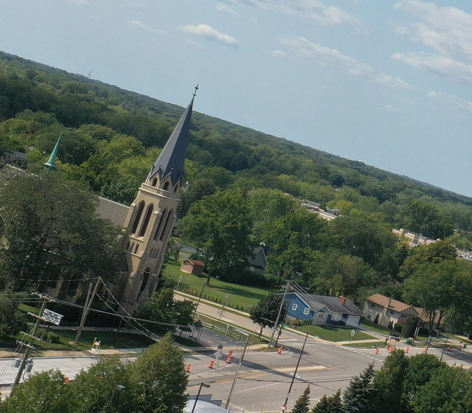
Buffalo Grove is recognized as one of the most attractive suburbs in the greater Chicago region. In 2013, Money Magazine featured Buffalo Grove as one of the top fifty places to live in the country. With its highly educated citizens and diverse tax base, it is one of the economically strong suburbs of Chicago.
In the early 1900s, Buffalo Grove was a dairy farming community, supplying fresh dairy products to the Chicago area via rail. The Villages’ train stations connected by Metra’s North Central Service (NCS) line continue to be the lifeblood of the community and therefore, frequent and reliable service will be imperative to the community’s continued success.
Significant growth in the village occurred in the early 1950’s when much of the farmland was converted into residential subdivisions, many of which still exist today. This rapid growth and need for governance led to Buffalo Grove’s incorporation in 1960. Buffalo Grove continued to experience significant growth through the second half of the 20th Century. Buffalo Grove’s demographics and market landscape have changed dramatically over the last 10 years. Looking forward, it will be important to respond to resident needs for community amenities and housing to enable aging-in-place and to accommodate diverse individuals and families.
In addition to residential growth, Buffalo Growth also experienced strong growth in its business community and industrial areas. The Buffalo Grove Commerce Center was developed in 1981 with approximately 50 acres of land at Lake-Cook Road and the Soo Line (a subsidiary of Canadian Pacific Rail) railroad tracks. This area continued to expand east, west, and north throughout the mid1980s and 1990s. Buffalo Grove currently has a strong concentration of research/light industrial establishments. These buildings are now beginning to show sings of aging. It will be critical to ensure older building stock can adapt to the changing markets and business needs.
As Buffalo Grove continues to grow, it expanded its business environment to accommodate research and light industrial uses. The Village now has a substantial research and innovation hub with major enterprises present, including Siemens. The Village also has been proactive in streamlining its application processes to become a more business-friendly community. Over the past ten years, the Village has seen a substantial increase in the Asian population, making the Village a more diverse community. The strong diversity and talents present in Buffalo Grove also contribute to the Village‘s well-regarded parks and school system, resulting in the Village being a safe place to live, great place to own a business and raise a family.

DRAFT For Review
Area Context
The Village of Buffalo Grove is an established community in the Chicagoland region with a land area of approximately 9.5 square miles. It lies about 30 miles northwest of the Chicago’s downtown. The Village is adjacent to the Lake County Forest Preserve and has access to the regional highway network including I-94, Lake-Cook Road, Dundee Road, Half Day Road, and McHenry Road. Metra’s North Central Service train serves Buffalo Grove with two Metra Stations - Buffalo Grove and Prairie View. With a wellregarded school system and an abundance of parks, the Village is an attractive place to raise a family. The Village also has important commercial corridors and nodes to provide important day-to-day services for its residents. Its industrial hubs are crucial in bringing employment into the Village and positively contributing to the Village’s economic stability.

COOK WILL LAKE MCHENRY KANE DUPAGE GRUNDY L A KE MICHIGANCHICAGO EVANSTON GLENCOE HIGHLAND PARK WAUKEGAN NORTH CHICAGO ZION LAKE FOREST GURNEE BUFFALO GROVE MUNDELEIN VERNON HILLS VOLO MCHENRY ALGONQUIN LAKE ZURICH SCHAUMBURG ARLINGTON HEIGHTS ELGIN AURORA ST. CHARLES GENEVA WHEATON BOLINGBROOK OAK LAWN SOUTH HOLLANDORLAND PARK LA GRANGE GARY OAK PARK O’HARE DES PLAINES MIDWAY 94 90 90 90 355 294 294 355 290 55 55 88 57 94 94
DRAFT For Review
Buffalo Grove Today
The character and identity of Buffalo Grove is grounded in its people, history, and culture. For the Village to fulfill its potential, establishing programs and activities that advance the spirit of unity, support, and cooperation within the community are important. Having an understanding of what makes Buffalo Grove unique and differentiates it from its peers builds momentum towards implementation.

Character and Identity
Central to the character and identity of the Village is the investment and commitment residents of the past and future make to the community. From the Raupp brothers, with their namesake street, to the more recent Pride Parade, organized by the Pinta Family, Buffalo Grove continues to grow and thrive. This strong sense of community represents both cultural and economic aspects of Buffalo Grove’s identity. The questions now are how will Buffalo Grove’s local economy continue to evolve? And, what actions are needed to promote its successful evolution and continuance of its positive trajectory? The Village has also experienced significant demographic change—population increases, significant real estate investment, capital improvements, growth of local employment centers, and with the COVID-19 pandemic, resilience to new uncertainties resulting from the pandemic related to its economic base. These factors also affect the local economy and addressing these changes directly will require two things—new approaches to growing Buffalo Grove’s economy and collaborations between local governments, the private sector, and the Village’s institutions--to achieve this Plan’s goals.
The Plan vision encompasses growth, prosperity and inclusion for the entire Buffalo Grove community. Based on the recently published Census 2020, suburban growth in the Chicago region surpassed increases to population in the urban core. This accelerating trend, primarily due to the COVID-19 pandemic, appears to disproportionately impact working-age and older adults (pewresearch.org).
Similarly, the Brookings Institute found America’s largest cities saw the sharpest population losses during the pandemic, according to recent census data (brookings. edu). In fact, this national trend has seen 60% of all metro areas in the U.S. experience more suburban than urban growth (myhome.freddiemac.com). Residents – young and old – are seeking the shared qualities of distinct local economies and high quality of life. These qualities in turn, foster business attraction and investment, and collaborative problem solving. Successful suburban communities also recognize the importance of all of their residents, inclusive of all measures of diversity, and actively work to engage and include all residents in their increasingly prosperous local economy. Consequently, these communities, of which Buffalo Grove is one, with its rich history, is able to cultivate a unique ‘quality of place.’
Buffalo Grove’s many assets and its multiple, significant resident stories, define and shape the community. These stories represent tangible opportunities from both the economic and market positioning perspective. Buffalo Grove’s stories are national, regional and local. Facing unprecedented, 80% population growth in the 1970’s, Buffalo Grove annexed adjacent land and became a Home Rule community, allowing it to develop significant educational, civic and economic facilities throughout
DRAFT For Review
the Village. The Village’s economic story derives from entrepreneurial success, including the founder of the Village’s original subdivision, Al Frank. Early residents were dairy farmers, making a name for the community as a distribution center. These same entrepreneurs built the Village’s historic buildings, residences, and institutions.
Buffalo Grove also has other assets that can and will contribute to future local economic success. The Village’s major employment centers on the east side of the Village have added workers over the last decade. Bufflalo Grove has well-established connection to natural resources, forest preserves and the DesPlaines River corridor.


Village resident’s access to the DesPlaines River, parks, and nearby trails are also important contributions to the Village’s sense of place. Sustaining and maintaining all of these assets will be important to enhancing the Village’s overall quality of life throughout Plan implementation.
Buffalo Grove will need to build on these many assets to establish the foundation for future growth. Like many suburban communities, existing local challenges can complicate managing change within the community. The Village, given current local real estate economics, will need to create value locally (or re-evaluate its residential property taxes) before additional housing and commercial development occurs. Fundamentally, this means that
the Village, potential private sector interests, and area institutions will need to capitalize on what already exists. The Village’s current built environment, residential and commercial, can continue to be evaluated for additional development that respond to changing resident needs, and can attract investors and to develop a more resilient local economy.
DRAFT For Review
Plan Definition
In July 2019, the Village of Buffalo Grove kicked-off a planning process to update its 2009 Comprehensive Plan. The Comprehensive Plan Update includes significant community outreach, including the involvement of a steering committee as part of a multi-phase planning process. The Plan serves as the Village’s official policy guide, and assists the Village in making informed decisions that best serve the needs of the community for the next 10 to 15 years.
Building on Past Planning
The consultant team conducted a series of outreach events, data collection, analysis of physical conditions, and reviewed existing plans to understand the issues and opportunities of the Village. These findings are summarized and integrated into the Existing Conditions Report.
This report fostered a shared understanding among Village of Buffalo’s residents and stakeholders on the issues and opportunities the Village faces. The Comprehensive Plan builds on this foundation to create a planning framework that will inform future policy, land use, housing, transportation, open space, economic, and subarea recommendations.
WHAT IS A COMPREHENSIVE PLAN?
The Comprehensive Plan for the Village of Buffalo Grove serves as the community’s official land use and development guide. The Comprehensive Plan is a roadmap, which details a long-term vision and a policy agenda for critical issues including land use, redevelopment, housing, economic development, infrastructure, transportation, parks and recreation, natural resources, and more. The Plan also represents a unified vision developed through the input of residents, businesses, staff, officials, and the consultant team. Ultimately, the Plan answers the question, “What should the Village of Buffalo Grove look like in 10-15 years and how do we get there?”
DRAFT For Review
Project Schedule
The planning process for the Buffalo Grove Comprehensive Plan consists of five phases. The existing conditions report documents tasks one and two.
Task
Task 1 – Project Award and Kick-Off
The “kick-off” for the project involved a coordination meeting with the Steering Committee and Village Staff to frame the direction and logistics of the Comprehensive Plan.
Task 2 – Existing Conditions
The consultant team began collecting data from a variety of data sources to study the Village’s characteristics. A series of outreach events, including the first public workshop, was hosted to solicit input from Village residents, business owners, stakeholders, organizations, elected and appointed officials, and Village Staff about their perceptions of Buffalo Grove. These findings and analysis were summarized and incorporated in to the Existing Conditions Report.
Project on Hold
Task 3 – Visioning & Preliminary Recommendations
In this phase, the consultant team will draft a vision statement for the community, key goals, and recommendations that will be included in the Draft Comprehensive Plan.
Task 4 – Draft Plan
In this phase, the consultant team will incorporate feedback from the Village and its stakeholders to revise the vision statement, key goals, and recommendations. The consultant team will also begin developing implementation strategies to establish a policy roadmap.
Task 5 – Final Plan
This task will include refinement of the Draft Comprehensive Plan to create the Final Comprehensive Plan. The Final Draft Plan will be presented to the Village Board for formal approval and adoption.
JUL 2019 2021 2020 2020 2021 2022 OCT AUG MAY NOV APR
1 Task 2 Task 3 Task 4 Task 5
DRAFT For Review
Structure of Plan
Chapter 1: Introduction
The first chapter provides an overview of the Village of Buffalo. It describes the community’s history, character and identity and the key findings of the demographics and socio-economic analysis from the Existing Conditions Report. This chapter also discusses the Buffalo Grove Comprehensive Plan and how it will be used.
Chapter 2: Community Priorities
The second chapter provides an overview of the community’s vision. It explains the public engagement process and summarizes the key takeaways. The Plan is a foundation for decision-making to address opportunities and challenges in the Village and those that may be faced in the future. This chapter will also present recurring themes that emerged over the Comprehensive Plan’s outreach process. These key themes will guide the goals and implementation recommendations of subsequent chapters.
Chapter 3: Land Use, Economic Development, and Placemaking
This chapter contextualizes land use and its intersection with economic development and placemaking. Land use patterns play a significant role in shaping the physical character of any community. This chapter will introduce a future land use map that is based on community feedback, development trends and best planning practices. The chapter will also provide an economic development summary and identify development opportunities for the Village of Buffalo Grove. Lastly, it will look at placemaking opportunities and identify the community and neighborhood nodes as well as propose recommendations for future zoning to be consistent with future land uses.
Chapter 4: Housing and Neighborhoods
Creating supportive services and responsive housing for Buffalo Grove’s residents will maintain stability in the community and attract new residents seeking high quality, affordable amenities. The Village is rich in social capital and prioritizes residents’ access to services and programs that will provide longevity and a high quality of life.
Chapter 5: Transportation
The transportation system is integral to the success of the Village of Buffalo Grove. Recommendations are coordinated with infrastructure to enhance mobility options and safety for pedestrians, bikes, and automobiles. In addition to the transit network, street network, community facilities, pedestrian infrastructure, and trails recommendations, infrastructure and utility improvements and recommendations are included.
Chapter 6: Natural Resources, Open Space, and Parks
Parks and open space are critical to the recreation, health, and wellness of the village’s residents. This chapter provides recommendations to increase opportunities for partnerships, increased connection of facilities, and creation of new facilities to serve the residents. Conservation and maintenance of the parks are important for budgeting and level of service to be provided. Preparing for future opportunities and programming will contribute to the Park District’s on-going success. As the recreational, athletic and leisure needs of residents change, the open space systems and park resources in the Village of Buffalo Grove will need to adapt.
This chapter also discusses the opportunities to assist the Village in preparing for resiliency. Utilities and infrastructure improvements are identified that create high functioning systems that are able to accommodate growth as well as changes in the intensity and frequency of storm events.
Chapter 7: Corridor Plans
This chapter examines two different corridors: Dundee Rd and Milwaukee Ave. It presents goals and opportunities for both and provides recommendations for future development focusing on green infrastructure improvements, a connected transportation network and easily accesible open space.
Chapter 8: Implementation
The Implementation chapter provides direction and guidance on actions that the Village and its stakeholders can take to ensure the goals of each chapter are realized. Project partners and timeframes are also identified for each goal.
DRAFT For Review
How to Use the Plan
The Comprehensive Plan establishes policies that will guide physical development in the Village. These policies are vital in supporting the Village’s staff, officials, and the Planning and Zoning Commission in their ability to review and evaluate future projects and developments. The Comprehensive Plan can serve as a marketing tool to highlight Village of Buffalo Grove’s unique assets and economic advantages within the Chicagoland region. It can also be used to support applications for grants and to demonstrate that future projects are within the Village’s larger, holistic strategy rather than stand-alone efforts.
Interpreting the Plan
Comprehensive plans are, by nature, primarily concerned with a community’s physical development and the day-to-day decisions that influence future growth and development. Though it is important for the community to identify and assess current issues, the community must also consider the Comprehensive Plan’s intent and goals in an effort to create desirable outcomes for the community.
The policies in the Comprehensive Plan are intended to provide a framework for implementation of the community’s collective vision for the future. The goals, objectives, and strategies are deliberately meant to be future-focused. The action steps are intended to be incrementally implemented and guide the decisions concerning specific and task-oriented activities. Interpreting the Comprehensive Plan in this way will enable the members of the Planning Commission to justify their approval, or denial, of any proposed development or redevelopment in or immediately surrounding the Village of Buffalo Grove. It will also empower the residents of the Village of Buffalo Grove to shape the future of their community and contribute to its continued growth and prosperity.
Use the Plan Daily
Once adopted, the Comprehensive Plan serves as the Village’s official guide to land use and development. It should be used on a daily-basis to inform everyday decision-making. The Village’s Department of Community and Economic Development could meet and brief all of the Village’s staff, officials, and the Planning and Zoning
Commission on their ability to review and evaluate future projects and developments. The Comprehensive Plan should be made available and easily accessible to all Village staff, elected officials, boards, commissions, and members of the Buffalo Grove community.
Update the Plan Regularly
It is essential for the Comprehensive Plan to serve as a living document and be regularly updated to reflect the community’s changing needs. The Village should undertake an annual review to update the Plan, in addition to performing more comprehensive reviews and updates to the Plan every three to five years. This would require coordination between Village departments and stakeholders. If changes or revisions are necessary during the review, the Village can adopt them as amendments to the Comprehensive Plan. If the Village does not have the capacity to update the Plan, then the Village may consider releasing a Request for Proposal to solicit services from planning consultants.
Goals & Strategies
The Comprehensive Plan’s policy recommendations are in the form of goals, objectives, and strategies. These goals are introduced at the end of Chapters 3-7, and are organized based on key themes identified in Chapter 2.
They are later summarized in Chapter 8; timelines and supporting partners are listed to guide implementation of the policy recommendations. Below are the definitions of each of these components:
Goal: A goal directly supports the collective efforts and ideals of the community.
Strategy: Tangible action steps the Village can undertake to implement the objectives.
Supporting Partners: Agencies, organizations and stakeholders that can assist with implementing the policy recommendations.
DRAFT For Review

DRAFT For Review
Chapter2
Community Priorities

DRAFT For Review
Community Vision
Characteristics of the community have been defined that have shaped the vision statement. The Existing Conditions Report and workshop input were critical to defining the underlying elements that characterize the Village. To create an effective Vision Statement, these elements should be considered aspirational and inspiring. The Vision Statement captures not only the spirit of the Village but embodies a shared view of how Buffalo Grove should grow, the priorities for decision making, and external perception of the community. The Comprehensive Plan can reinforce the identity of the community by emphasizing specific qualities and attributes that make it special. Identifying and emphasizing these unique qualities can create greater value in the city and communicate its legacy and identity. These characteristics are:

Safe Place to Live
Many Buffalo Grove residents expressed the importance of maintaining safety in the Village. Residents express that it is a safe place to live and a great community for their children to grow up. NeighborhoodScout.com ranked Buffalo Grove as the 10th safest community to live in the nation. This gives Buffalo Grove a competitive advantage - safety is one of the top three factors a prospective homeowner considers when moving into a community. The other two are schools and amenities, which residents validate are present and functioning in Buffalo Grove.
Park and School System
Buffalo Grove has a highly-ranked park and school systems. The Illinois Association of Park Districts (IAPD) and the Illinois Park and Recreation Association (IPRA) recognized the Buffalo Grove Parks District as an Illinois Distinguished Accredited Agency in 2013. This distinction is awarded to Park Districts that have met state guidelines to provide excellent park and recreation services. Parks and open space remain one of Buffalo Grove’s most cherished community amenities. The Village has a robust system of trails that link many of these spaces together. In addition to parks, many families move to Buffalo Grove for the schools. US News includes Buffalo Grove High School in its list of Best High Schools in the nation. The school is ranked 20th in Illinois and has a participation rate of 75% in Advanced Placement courses. Adlai E. Stevenson High School, which is ranked 6th in Illinois and has a participation rate of 79% in Advanced Placement courses, is also available for Buffalo Grove residents.
A Family- and Business-Friendly Community
In addition to being known as be a family-friendly community with a high quality of life, Buffalo Grove also has robust commercial and recreational facilities. Commercial nodes throughout the Village are neighborhood-serving and offer a variety of services at each location. Research, light industrial, and advanced manufacturing businesses are concentrated on the east side of the Village, close to expressway and train service. The Village has been proactive in attracting a variety of
DRAFT For Review
NICOLE TO ADD VISION STATEMENT:
businesses. For example, the Village has streamlined its development-review application process and combined its Planning and Zoning Commission. Such actions make the development, approvals, and permitting process more appealing for potential developers. The Village also periodically updates its strategic plans, which examine the Village’s market position in the region. These processes enable the Village to demonstrate to current and potential businesses that the Village is a good partner in their success.
Diversification of Population
The Buffalo Grove community is an ethnically diverse community. The first residents of Buffalo Grove were German settlers. In the 1970s, there was a large influx of Jewish families that moved into the Village. The Jewish community helped construct six synagogues in the Village by the early 1990s and is comprised 30% of the Village’s population by 2000. Asians and Asian-Americans began moving into Buffalo Grove after the 2000s. The Asian population currently makes up approximately 20% of the
DRAFT For Review
Village’s population. This is significantly higher than that in other suburban communities in the Chicagoland region. Currently, the Village is also experiencing an increase in the Hispanic/Latino population. These trends are projected to continue.
Amenities and Resources
The Village has a spatial framework that is centered on commercial centers that service adjacent residential neighborhoods. The Village’s park system is distributed throughout the Village and has connectivity to regional river and trail systems. Local, national and regional retail and commercial chains are located in the Village in addition to other major employers in the manufacturing and industrial sectors. These amenities and resources create value for Village residents and enhance their quality of life. During the COVID-19 pandemic, regional mobility increased to suburbs like Buffalo Grove. This indicates that environments similar to those provided in the Village are highly desired for convenience, safety, health and wellness. Buffalo Grove has been the beneficiary of several new development inquiries throughout the last 18 months and continues to thrive from a business perspective. This momentum continues to increase the opportunities for additional amenities and has resulted in new convenience retail in existing commercial nodes and increased development activity along Lake Cook Road.
Community Evolution and Progression
The impact of demographic changes in this mature, built out community is becoming more significant. Outreach conducted as a part of this planning process, revealed that many seniors in the Village desired to age in place. Providing housing and amenities to accommodate the changing needs of residents would allow seniors to stay in the Village as well as attract new residents. The Village has succeeded in creating processes to attract and retain businesses through a flexible development framework with the goal of ultimately, achieving neighborhood need. By prioritizing future-focused development, the Village is able to be responsive to new opportunities as well as recover effectively from new challenges, such as the COVID-19 pandemic. By integrating responsiveness to resident need and being attentive to new development opportunities, the Village can establish community resiliency.
Advanced Manufacturing Center
Buffalo Grove has a robust industrial and manufacturing sector with buildings located primarily in the eastern portion of the Village near Deerfield Parkway. The Village has been successful in attracting these employment centers because of the Village’s strong schools and other outdoor amenity areas. Transportation assets, including access to Metra, and additional quality of life and recreational amenities position the Village for future success. With changes in the industrial sector, and trends accelerated by the COVID-19 pandemic, the Village is considering modification of zoning and land use to accommodate a more diverse range of businesses in this areas. There is a desire to create new innovation and technical buildings not currently available in the Village. Older industrial buildings are difficult to retrofit for new and emerging uses. Preservation of existing industrial areas is prioritized by the Village, however, a strategy to evaluate alternative uses that don’t create conflicts with existing industrial uses should be considered for the future.
Diversified Local Economy
The Village of Buffalo Grove has been successful in attracting a diverse workforce and employers to locate throughout the community. Provision for growing market sectors such as high-tech or emerging technologies in manufacturing, in-fill convenience retail, and diversity of housing typologies will continue to position the Village to respond quickly to changes in the regional economy. Targeted investments in the Village’s major arterials and corridors contributes to effective movement of goods and services throughout the Village. The Village would benefit from opportunities to transition underutilized land uses to those that are more easily marketable to attract additional businesses. Flexibility in the zoning ordinance to accommodate these new uses could contribute to an effective business attraction strategy as well. In coordination with Metra, the Village benefits from regular train service for its residents and worker population, connecting the Village to other municipalities for work and leisure.
DRAFT For Review
Connection and Accessibility
Prioritization of connection internal to the Village, to adjacent communities, and within the region is critical to providing residents mobility options. A continuous sidewalk network, bike lanes, regional trail systems, regional train service, and roadways have been identified by residents as core systems to improve to achieve Village-wide connectivity. The Village’s physical framework of neighborhood, civic and regional nodes creates an opportunity to define their specific character and offerings. Connectivity of these nodes creates a sense of discovery and differentiated destinations in the Village. Accessibility to a multi-modal transportation network also includes consideration for all ages and ability levels.
Proximity to Transit

The Buffalo Grove and Prairie View Metra stations serve the Village of Buffalo Grove and provide community residents alternative means to travel to the City of Chicago and other parts of the Chicagoland region via Metra’s North Central Service (NCS) line. Buffalo Grove is the busiest station and Prairie View is the second busiest station, in terms of boarding, of all stations on the NCS line. Although a considerable amount of land surrounding the Prairie View Metra Station is currently unincorporated, the Village has proactively planned a longterm development vision for transit-oriented development
in this area. Multi-story, mixed-use development is planned within proximity to the Prairie View Metra Station and is complemented by townhomes and closely spaced single-family detached homes. The vision also includes residential development on the Stancliff Property including empty lots southwest of Half Day Rd and Prairie Rd. Both feature generous green space for stormwater mitigation and provide space for recreation.
The Buffalo Grove Metra Station is conveniently located between residential neighborhoods and the Village’s research/light industrial hub. It has ample capacity for park-and-ride facilities for commuters and the adjacent employment base.
DRAFT For Review
Public Engagement Summary
The Comprehensive Plan resulted from an outreach process that actively sought input from a variety of stakeholders including: residents, business owners, brokers/developers, social service providers, elected and appointed officials, and Village staff. A variety of outreach methods, both in-person and online, were utilized to gather the concerns, ideas, and aspirations of the stakeholders. The feedback and input provided a foundation for the Comprehensive Plan, guiding the recommendations and strategies to address the Village’s key issues and opportunities. The following summarizes the community outreach efforts that took place during the planning process.
Outreach Events
This section describes the outreach events the consultant team has facilitated throughout the comprehensive planning process.
Staff Kick-Off Meeting
A project kick-off meeting was coordinated with Village Staff on August 23, 2019 to discuss the project logistics and schedule. An overview and discussion of the online engagement portal and how it would complement the comprehensive planning project was also discussed.
Steering Committee 1 Meeting
The first Steering Committee meeting was held in the Village Hall on September 12, 2019. The consultant team introduced the Steering Committee to the planning process and the project’s schedule, logistics, and oriented the group to the online engagement portal.
During the meeting, Steering Committee members participated in a Strengths, Weaknesses, Opportunities, and Threats (SWOT) exercise to identify the issues and opportunities facing the Village. The exercise also included a facilitated discussion with the meeting participants.

22 DRAFT For Review
PLANNING PROCESS
The Comprehensive Plan Update was a five-phase planning process. Each phase was designed to build on the previous phase in an iterative process to create the Comprehensive Plan.

Task 1 – Project Award and Kick-Off:
The first phase of the planning process included a kickoff meeting with City leadership, staff and Steering Committee to discuss and review the Comprehensive Plan workplan, schedule, and opportunities for public engagement.
Task 2 – Existing Conditions:
In this phase, the consultant team began collecting data from a variety of sources to study the Village’s characteristics. A series of outreach events and community workshops were hosted to gain input from Village residents, business owners, stakeholders, organizations, elected and appointed officials, and Village Staff about their perceptions of Buffalo Grove. These findings were summarized and incorporated into the Existing Conditions Report.
Task 3 – Visioning & PreliminaryRecommendations:
The consultant team drafted a Vision Statement for the community and identified Key Goals and Recommendations which were then presented to and reviewed by the Steering Committee.
Task 4 – Draft Plan:
Incorporating the feedback from the Village and its stakeholders, the consultant team revised the Vision Statement, expanded on the Goals and Strategies and refined its recommendations to the Village. The input gathered in previous tasks created the basis for the preparation of plans, recommendations, and policies that address the future land use, economic development, placemaking, housing and neighborhoods, transportation and natural resources of the Village. At the end of this phase the consultant team submitted a Draft Comprehensive Plan to the Village for review.
Task 5 – Final Plan
During this final phase of the project the consultant team revised the Draft Comprehensive Plan based on feedback from the Village and stakeholders . The Plan was finalized and presented to the City Council for adoption on April ? 2022.
23 DRAFT For Review
Part of these discussions focused on Dundee Road and Milwaukee Avenue Corridors, which are subareas of the Comprehensive Plan. Many of the responses centered on the following themes:
• The Village has robust parks and school system and is an attractive place to raise a family.
• The community is generally safe and has diverse demographics.
• The Village is conveniently located with access to nearby forest preserves and the regional highway system.
• There are many opportunities to diversify the Village’s housing stock to enable seniors to age-in-place.
• It is important for the Village to establish priority areas to focus public infrastructure resources and provide a greater variety of dining and shopping options.
• Utilizing the Village’s economic tools is important to ensure Buffalo Grove remains competitive in the region.
Listening Sessions/ Focus Group Interviews
On October 24, 2019, the consultant team has facilitated a series of listening sessions/focus group interviews with various groups of stakeholders to better understand the specific issues and opportunities in the Village. The groups included:
• Research, innovation, and advanced manufacturing business owners
• Business owners and residents along Dundee Road and Milwaukee Avenue Corridors
• Civic groups and organizations
• Local developers and realtors
• Buffalo Grove High School’s administration, students, and parents
Public Workshop 1
On November 13, 2019, the consultant team with the Village of Buffalo Grove hosted the first public workshop to solicit public input on the comprehensive planning process. The workshop was held at the Aptakisic Junior High School. Approximately 46 participants, consisting of residents, stakeholders, business leaders, steering committee members, Village staff, and elected and appointed Village officials, attending the workshop. The workshop consisted of four stations that residents cycled through during the scheduled 2-hour workshop. Many participants shared similar points of view and prioritized similar elements or concepts including:
• Addition of dining and shopping options.
• Improved trail connections throughout the Village and to the surrounding Forest Preserves.
• Community amenities that can accommodate all age groups.
• Promotion of diversified housing stock (development types, densities, and price points) to attract young professionals, empty-nesters, and enable seniors to age-in-place.
• Development and strengthening of the Village’s clusters of activities to brand the Village as a familyfriendly destination.
• Improvement of the main transportation corridors’ visual appearance and experience.
• Attraction of new businesses and strengthening of existing of the Village’s industrial park.
• Increased frequency of service for Metra, especially during the weekends.
• Exploration of partnership opportunities with adjacent communities to better use underutilized lands and sites.
24 DRAFT For Review
Social Media Interface
The Village of Buffalo Grove has created a Facebook page dedicated to sharing information about the Comprehensive Plan. The interface is intended to facilitate two way communication with Village stakeholders as well as understand their priorities and preferences. The website is managed by Village staff who also participate in responding to dialogue presented on the webpage. The Facebook page also includes links to the monthly Resident Academy’s that feature content about the Comprehensive Plan.


Resident Academy
Resident Academy is a monthly live webcast that appears on the Village’s Facebook page. Each month, a topic is chosen and facilitated by Department of Community
Development Staff. For the Comprehensive Plan, the consultant team and staff participated in a Resident Academy on August 4, 2021 to share the project’s process, inform residents about the plan, and share next steps in the process. The Resident Academy serves to engage Buffalo Grove residents in conversations around current topics of interest in the Village.
Steering Committee Meeting 2
The second Steering Committee Meeting was held via Zoom on June 29, 2021. The consultant team presented the draft Vision, Goals and Objectives Memo for discussion. The Steering Committee provided comment and input on the vision and goals that will serve as the framework for the Comprehensive Plan.
25 DRAFT For Review
Key Themes Introduction
Based on the findings during the analysis phase of the project and documented in the Existing Conditions Report, key themes were identified. These themes played an important role in guiding the development of the Vision and Goals for the Village of Buffalo Grove.
The key themes are:
Theme 1: Commercial/Civic Nodes Framework
Understanding the specific land uses and physical framework of the Village supports its unique position in the region and offerings for residents. Buffalo Grove’s history has influenced the location and development of its land uses. The Village has a variety of distinct nodes that anchor adjacent residential development. The characteristics of these nodes are generally commercial or civic. This framework contributes to a variety of destinations in the Village and is an alternative to one central gathering space or downtown. The Village has an opportunity to leverage this unique spatial framework and develop multiple destinations or offerings consistent with the character of the existing nodes. The development and prioritization of a nodal framework supports the development of centers in the Village by each node serving a particular purpose and enhances the adjacent residential neighborhoods.
Theme 2: Aging in Place
The Village of Buffalo Grove has a vibrant population of active seniors that have demonstrated commitment to living in the Village. The ability of this population to maintain their quality of life as well as have opportunities to transition into housing that fits their changing needs will ensure the Village maintains stability and accommodates the diversity of its population. There are currently few areas in the Village and few types of housing that can accommodate those with limited mobility or those in need of additional assistance. Further, few of these housing types provide connections to convenience retail or are close to a variety of transportation options. Village stakeholders have expressed a desire for housing and amenities to consider the changing needs of all residents through all phases of life.
26 DRAFT For Review
Theme 3: Increasing Housing Diversity and Affordability
The cost of housing in Buffalo Grove is higher than surrounding communities and presents challenges for some demographic sectors in the community, including seniors, young families, and young adults. There are viable areas in the Village where additional housing units and density could be increased. Priority for residential units should be given in commercial activity or civic nodes, to ensure that these areas in the Village remain hubs that are able to attract additional retail or complementary services. As young adults enter the workforce, preferences for housing near their places of employment is a priority. Buffalo Grove offers a highquality lifestyle and many of the amenities desired by these cohorts including access to bike trails and nature areas, walkability, convenience, and commuter transportation. However, housing has become unattainable for young adults interested in Buffalo Grove and they are choosing to live in adjacent communities that have greater housing choice as well as additional amenities. Buffalo Grove has an opportunity to create housing types and neighborhoods that reflect the values of young adults to attract a skilled workforce to the community.
Theme 4: Industrial Corridor Dynamic
The industrial corridors in the Village are essential for employment, the Village’s tax base, and provision of a variety of goods and services for distribution throughout the region. The existing buildings in these areas are of differing qualities, ages, and uses. This mix is both a benefit for the types of business able to locate in these flexible areas, and a challenge for the Village’s existing regulatory framework to remain flexible as needs in these areas change. Of central importance to these areas is maintenance of public safety, utilization of the district’s buildings, and adaptability of its uses to accommodate the changing needs of Buffalo Grove’s business community. New business opportunities have been presented that would introduce new uses to the industrial areas. These uses vary in their space needs, hours of operation, service population and target markets, and services offered. They are generally nontraditional businesses for industrial districts and include uses such as: schools and education centers, fitness uses, and pet and animal uses.
27 DRAFT For Review
Theme 5: Sustainable Strategies
To ensure the longevity, health and wellness of Buffalo Grove and its residents, sustainable strategies will be incorporated into the Comprehensive Pan. Strategies will include social, economic and physical opportunities to lower costs and create value in construction and the natural environment. Efficient utilization of the area’s resources contributes to the character and identity of the Village and preserves its natural elements. These sustainable strategies will also be coordinated with the Village’s new Sustainability Plan.
Theme 6: Prioritize Walkability and Connectivity
The Village of Buffalo Grove is organized into neighborhoods centered on commercial and/or civic nodes. Access to the nearby freeway system, major corridors, trails and bike paths, and a variety of transit resources are assets of the community. One of the two Metra stations is located in a commercial area with connectivity to the Village’s industrial district. The second is located in an unincorporated residential area. Walkability and connectivity of these stations is important to both linking residential and employmentoriented areas. The roadway network is well distributed, however the right-of-way varies significantly and there are opportunities to incorporate modern best practices that fosters multi-modal options. The goals for the transportation network prioritize the design of roadways that are multi-modal and accessible to the population of Buffalo Grove as well as being intuitive for visitors. The goals illustrate opportunities for more efficient circulation systems that move traffic and people to the destinations of choice. Differentiation of modes is also considered with regard to the walkability of the district and high number of Metra commuters and employees.
28 DRAFT For Review

29 DRAFT For Review


DRAFT For Review
Source: Prairie View Metra Station Area Plan, RATIO
Chapter3
Land Use, Economic Development, and Placemaking
DRAFT For Review
Future Land Use
Land use patterns play a significant role in shaping the physical character of Buffalo Grove. The Village is guided by its policy documents, such as the 2009 Comprehensive Plan and the Zoning Ordinance. The Planning and Zoning Commission and the Village Board enforce and interpret these policies. This chapter will examine the existing land use patterns, how the current Zoning Ordinance impacts land use, and the issues and opportunities they present. They will form the basis of the Comprehensive Plan’s recommendations.
Existing land uses in Buffalo Grove were documented using the Chicago Metropolitan Agency for Planning’s (CMAP) 2013 Land Use Inventory data. Spot-checks, involving comparing the data and Google Earth imagery, were conducted to update the data where needed. The accompanying map identifies existing land use for every parcel within the Village. Every parcel has been categorized into one of the 13 land use designations that follow.
Agricultural
The agricultural land use categorization refers to land modified or created by man specifically to grow or raise biological products for human consumption or use. This includes cropland, pasture, orchards, groves, vineyards, nurseries, ornamental horticultural areas, and confined feeding areas. There is not much agricultural land left in Buffalo Grove. Most of it is concentrated around Aptakisic Rd, east of Buffalo Grove Rd.
Single-Family Detached
This consists of single-family detached homes. This is currently the predominant land use within the Village of Buffalo Grove. Lot sizes and housing characteristics/ typologies vary across different neighborhoods and subdivisions.
Single-Family Attached
This land use consists of townhomes and duplexes. The units are horizontally connected but have separate entrances from the public right-of-way and sidewalks. This land use is mostly concentrated in subdivisions throughout the Village.
Multi-Family
Multi-family residential areas include apartment buildings where units share a common entrance or hallway. Similar to single-family attached uses, multi-family uses in Buffalo Grove are typically concentrated in subdivisions, and are generally located along Dundee Road, near the Town Center development, and north of Chevy Chase Country Club.
Commercial
General commercial uses include general retail, dining, and services that can be tailored to either the local or regional customer base. These uses can be situated within smaller and individual buildings, shopping malls, strip malls, and big-box retail developments.
Office
Office uses typically include professional services, employment, offices, and medical offices. They can accommodate accessory commercial uses, such as restaurant, service, or other convenience services that are geared toward serving the office tenants. In Buffalo Grove, they mostly consist of standalone office and medical office buildings.
Research/Light Industrial
Research/light industrial land uses cover a wide range of functions. They include storage, warehouse, research, light processing or assembly, and manufacturing. These land uses are typically located in the industrial-like building that is characterized by one.
DRAFT For Review
Civic Institutions
This land use includes a broad range of public and semi-private facilities. These facilities are considered community amenities that define and contribute to Buffalo Grove’s quality of life and shared service delivery. These amenities can include government buildings/facilities, religious institutions, and museums. These facilities can be integrated into other land use categories as they are generally small in scale and both serve their surrounding neighborhoods and Village as a whole.
Schools
This land use consists of public and private educational institutions in Buffalo Grove. Buffalo Grove’s school system is nationally recognized and attracts many families moving into the Village.
Parks/Open Space
This land use category consists of public parks and open space. They accommodate both active and passive recreation and, like civic institutions, contribute to Buffalo Grove’s quality of life and serve the Village as a whole. Similar to schools, Buffalo Grove’s park system is wellrecognized and is one of the favorite amenities among Buffalo Grove’s residents. These spaces also include multi-use trails, athletic fields, golf courses, playgrounds, neighborhood parks, as well as the Cook and Lake County Forest Preserves.
Utilities/Transportation
This land use designation includes public transportation and utility facilities. They vary in physical scale and scale of operations. Utilities and transportation are necessary public infrastructure in the Village and are critical to its function. Examples of utilities/transportation uses include overhead utility lines, railroad rights-of-way, Buffalo Grove and Prairie View Metra Stations, and the Lake County Water Treatment Plant. These uses serve the Village as a whole.
Vacant
This land use designation includes currently vacant buildings and/or lots within Buffalo Grove. They present opportunities for infill development. The Land and Lakes Wheeling landfill has recently been annexed into the Village of Buffalo Grove. According to the Illinois Environmental Protection Agency (ILEPA), this landfill has been filled to capacity, closed and covered, and is being stabilized under a post-closure care plan.
Potential Areas for Annexation
The Village’s 2016 Annexation Strategy and Plan identified a number of area that can be potentially annexed into Buffalo Grove. The existing land use map in the following page show existing land use patterns in these areas. Future annexation and redevelopment occuring in these areas should be sensitive to these areas’ current character.
DRAFT For Review

Indian Creek BuffaloCreek Vernon Hills Long Grove Arlington Heights Buffalo Creek Forest Preserve Buffalo Grove Golf Club Willow Stream Park Sullivan Woods TheArboretum Club HAWTHORNE DR MILLCREE K D R ROSE BLVD OLDCHECKERRD FARRINGTONDR PAULINE AVE H I G HLANDGROVEDR W FABISH DR MARSEILLES CIR THOMPSONBLVD RB A N DYWY N LNTHOMPSON BLVD SHERIDANRD B I R C H W OODLN C SEH TNUT TERRACE WHISPERING OAK RDS N TR OLIA A K SDR PORT CLINTON RD FREMONT WA Y ALDENLN SPRINGSIDELN VINTAGE LN PLUM GROVERD W HITE P I N E R D BEECHWOOD RD WILLOWPWKY RAUPP BLVD W HALF DAY RD APTAKISIC RD N BUFFALO GROVE RD N BUFFALO GROVE RD N BUFFALO GROVE RD ARLINGTON HEIGHTS RD MCHENRY RD PRAIRIE RD DEERFIELD PKWY CHECKER RD W DUNDEE RD E DUNDEE RD NRANDRD OLD HICKS RD N HICKS RD LAKE COOK RD LAKE COOK RD 22 53 53 6453 83 53 12 Agricultural Single-Family Detached Single-Family Attached Multi-Family Commercial Office Research/Light Industrial Civic Institution School Parks/Open Space Utilities/Transportation Vacant FUTURE LAND USE Legend Buffalo Grove Municipal Boundary Lake-Cook County Boundary Railroad Metra Station Potential Area for Annexation 0 0.5 10.25 MileNorth Village of Buffalo Grove, IL Existing Land Use Designation DRAFT For Review
Des PlainesRiver D e s PlainesRiver Buffalo Creek LAKE COUNTY COOK COUNTY Lincolnshire Wheeling Prospect Heights Riverwoods Ryerson Conservation Area Potawatomi Woods Chevy Chase Country Club CAMBRDIGE DR AVE NEWTOWN DR VD M DA I S O N D R AVA L NO DR M ADIERA LN ARMSTRONG DR LEXINGTON DR HAST I SGN D R BUSCH PKWY ASBURY DR N APPLE HILL LN W DUNDEE RD NMILWAUKEE AVE LAKE COOK RD DEERFIELD RD HALF DAY RD N MILWAUKEE AVE PORT CLINTON RD MCHENRYRD WEILAND RD APTAKISIC RD BARCLAY BLVD BARCLAY BLVD LAKE COOK RD 94 294 64 45 45 45 22 83 METRA NCS LINE PRAIRIE VIEW BUFFALO GROVE WHEELING DRAFT For Review
Zoning Recommendations
Current Zoning Considerations
Regulatory controls are municipal ordinances that dictate the use and appearance of properties within the municipal limits. The Village’s Zoning Ordinance codifies these controls. It is intended to ensure the safety, health, and welfare of the public by reducing land use incompatibilities, reducing hazards, mitigating nuisances, protecting natural resources and features, and promoting a visually attractive environment and positive experience within the Village. When used effectively, it can be an instrument to attract new investment and growth. The following sections describe the issues and opportunities regarding the Village’s regulatory framework.
I
– Industrial Zoning District
Create an Identity for Buffalo Grove’s Research/ Light Industrial Park
Buffalo Grove’s research/light industrial park is one of the Village’s most important assets. It is home to research/ light industrial establishments at varying scales, including Siemens and Flex LTD. It is critical for this area to have an identity so it can continue to attract businesses and the best talent in the region. Current trends in the research/ light industrial sector is showing greater demand for larger-scale buildings that can accommodate multiple tenants. This presents opportunities for the Village to revisit its I-Industrial Zoning District and ensure it promotes research/light industrial buildings that better meet industry demands.
Non-Traditional Uses Require Special Use Permits
The Village’s research/light industrial park is currently zoned as I-Industrial District. Non-traditional uses, such as daycare, tutoring space, and indoor sports complexes in research/light buildings would require a special use permit under the Village’s current zoning code. This creates additional permitting processing and time and deters these uses to locate in this land use. Some aging and smaller research/light industrial buildings have difficulty attracting and retaining typical industrial uses and tenants, however, there are opportunities for the Village to revisit the Industrial Zoning District’s uses to increase the type of tenant uses that are permitted by-right and do not need special use permits. This should be carefully balanced with the ability of the Village to attract largescale tenants, should demand continue. Alternatively, non-traditional uses may be considered on a case by case basis to ensure the safety and business mix in the industrial areas is maintained.
Zoning at Landfills
The Land & Lakes Landfill is currently zoned as B3 Planned Business Center District. There is a strong demand for research/light industrial use in the Village and an opportunity for Land & Lakes Landfill to accommodate both commercial and research/light industrial uses. Commercial uses can front Milwaukee Ave while the industrial uses can be located at the rear. Fulfilling this vision may require subdividing this lot to accommodate B3 and I zoning districts.
The Flanagan Parcel is another opportunity site for both commercial and research/light industrial uses. It is currently unincorporated. Should this parcel is annexed into Buffalo Grove, the Village should consider rezoning this parcel to either B3 or I zoning districts.
DRAFT For Review
Commercial Uses Site Design
The majority of commercial developments in Buffalo Grove are auto-oriented. This is characterized by building setbacks that accommodate large parking lots, which front the main roadway. As the Village explores way to improve the experience of its commercial nodes, there are opportunities to ensure commercial zoning districts’ bulk, yard, site design standards promote a more urban and pedestrian oriented character.
Design Standards
A significant number of buildings in the Village were built in the 1970s and 1980s. The design and character of these buildings no longer conforms to the Village’s vision for its neighborhoods and household size of residents. This presents opportunities for the Village to create design standards to clearly communicate the Village’s expectations for building character and design to developers and property owners. The design standards may apply to the entire Village or to specific areas or corridors.
Potential Zoning Overlay District
There are opportunities to implement a zoning overlay district on the Dundee Road Corridor. This Corridor is home to two important neighborhood nodes (Dundee Rd and Arlington Heights Rd and Dundee Rd and Buffalo Grove Rd). The issue is the Village’s existing zoning districts, including the versatile B3 – Planned Business Center District, for non-residential properties on Dundee Rd has resulted in a number of variances. This is because B3 and other commercial zoning districts have front yard buffer requirements that make it economically unfeasible for a development and property owner to fully conform to the zoning districts’ regulation when developing along Dundee Rd. Having a zoning overlay district creates an opportunity for the Village to adjust or revise its front yard buffer requirements and create a uniform set of standards and requirements for future developments on the Dundee Road Corridor. This, in turn, provides a clear set of expectations for developers and property owners.
DRAFT For Review
Village of Buffalo Grove, IL
CURRENT ZONING
Legend
Buffalo Grove Municipal Boundary Lake-Cook County Boundary
Current Zoning Districts
B1 Business District, Limited Retail
B2 Business District, General Retail
B3 Planned Business Center District
B4 Business Services and Wholesale District
B5 Town Center
Planned District
I Industrial
O&R Office & Research District
RE One-Family Dwelling District
R1 One-Family Dwelling District
R2 One-Family Dwelling District
R3 One-Family Dwelling District
R3A One-Family Dwelling District
Railroad Metra Station Parks/Open Space
R4 One-Family Dwelling District

R4A One-Family Dwelling District
R5 One-Family Dwelling District
R5A One-Family Dwelling District
R6 One-Family Dwelling District
R6A One-Family Dwelling District
R7 Dwelling District
R8 Multiple-Family Dwelling District
R9 Multiple-Dwelling District
R9A Multiple-Dwelling District
Indian Creek BuffaloCreek Vernon Hills Long Grove Arlington Heights Buffalo Creek Forest Preserve Buffalo Grove Golf Club Willow Stream Park Sullivan Woods TheArboretum Club HAWTHORNE DR MILLCREE K D R ROSE BLVD OLDCHECKERRD FARRINGTONDR PAULINE H I G HLANDGROVE W FABISH MARSEILLES CIR THOMPSO RB A N DYWY N LNTHOMPSON BLVD SHERIDANRD B I R C H W OODLN C SEH TNUT TERRAC WHISPERING OAK RDS N TR OLIA A K SDR PORT CLINTON RD FREMONT WA Y ALDENLN SPRINGSIDELN VINTAGE LN PLUM GROVERD W HITE P I N E R D BEECHWOOD RD WILLOWPWKY RAUPP BLVD W HALF DAY RD APTAKISIC RD N BUFFALO GROVE RD N BUFFALO GROVE RD N BUFFALO GROVE RD ARLINGTON HEIGHTS RD MCHENRY RD DEERFIELD PKWY CHECKER RD W DUNDEE RD E DUNDEE RD NRANDRD OLD HICKS RD N HICKS RD LAKE COOK RD LAKE COOK RD 22 53 53 6453 83 53 12
0 0.5 10.25 MileNorth DRAFT For Review
Des PlainesRiver D e s PlainesRiver Buffalo Creek LAKE COUNTY COOK COUNTY Lincolnshire Wheeling Prospect Heights Riverwoods Ryerson Conservation Area Potawatomi Woods Chevy Chase Country Club CAMBRDIGE DR PAULINE AVE DR H DR NEWTOWN DR ONBLVD M DA I S O N D R E AVA L NO DR M ADIERA LN ARMSTRONG DR LEXINGTON DR HAST I SGN D R BUSCH PKWY ASBURY DR N APPLE HILL LN W DUNDEE RD NMILWAUKEE AVE LAKE COOK RD DEERFIELD RD HALF DAY RD RD N MILWAUKEE AVE PORT CLINTON RD MCHENRYRD WEILAND RD PRAIRIE RD APTAKISIC RD BARCLAY BLVD BARCLAY BLVDPKWY LAKE COOK RD 94 294 64 45 45 45 22 83 PRAIRIE VIEW BUFFALO GROVE WHEELING METRA NCS LINE DRAFT For Review
Economic Development Summary
In 2016, the Village completed its Economic Development Strategic Plan. This plan supported a framework of development and other economic tools that focused development efforts in the Village. Since that time, a variety of opportunities and externalities have allowed the Village to respond to a changing economic climate. Buffalo Grove’s future economy can be both resilient and prosperous for the entire community. Achieving resiliency and prosperity will initially require the Village to use its existing assets—buildings, businesses, and people—and evaluate its regulatory environment including zoning, to grow the Village’s economy. People, employers, and investors are attracted to places that are unique, well maintained, and most importantly, visibly convey a local commitment to quality of life.
Buffalo Grove’s present challenges include: accommodation of changing population demographics, maintenance of high quality amenities, lack of housing diversity, and the impact of technology and market shifts in all business sectors. New approaches to local economic issues will be required to succeed throughout Plan implementation. An example is the changing manufacturing and industrial environment in the region. Similar challenges are occurring in many communities of all sizes throughout the nation’s Midwest and West. The communities in these regions with aging or no longer relevant facilities share similar characteristics to success - they created an effective development framework, supported by regulatory enforcement and design guidelines, and they recognize the ongoing need to improve the local quality of life and of place for their entire community including improvement of transportation and infrastructure systems. This emphasis on strengthening the local economy is apolitical. The focus is making the community or place better economically, socially, and physically.
By capitalizing on its existing economic assets, Buffalo Grove can strengthen its tax base and property values and continue to diversify the local employment base. Identifying opportunities for new and different housing types, reuse of underutilized properties, and improvement of connections throughout the Village will incrementally support real estate appreciation. Working with local employers to identify their emerging market opportunities
for business expansion is another aspect of strengthening the local economy. These integrated efforts to support local business growth will increase the Village’s tax base and expand Buffalo Grove’s economy.
Some of this work has begun, and local partnerships, whether ad hoc or ongoing, will remain critical to the Village’s economic growth. Rebuilding the local economy in new ways, given Buffalo Grove’s economic strengths, will establish the necessary foundation for future growth and attraction efforts. Local partnerships can ensure this fundamental work happens. Demonstrated implementation and redevelopment success can then create momentum, attracting increased investment throughout the Village.
Buffalo Grove’s node framework provides opportunity to leverage a diverse tax base related to the tenant mix in each node type. The variation in node character include both civic and commercial/retail. Nodes have geographic diversity in the area served including both local and regional. Continued evaluation of the economic impact of these nodes as they develop can support Village-wide strategies for continued success. Continued diversification can also create a higher level of stability in uncertain economic times or where specific market sectors are underperforming.
Public Private Partnerships
The term “public-private partnership” (PPP) traditionally refers to projects that involve the use of public resources or financing capabilities to promote local private economic development. In those arrangements, the public entity typically provides some combination of tax incentives, public land or other assets, infrastructure investments or financing methods. The private entity makes capital investments, commits to providing jobs, contributes development expertise and assumes financial risk.
An example of smaller project types that are ripe for public-private partnerships include unlocking the value of land: Local and state governments have significant real estate holdings that are often underutilized. Particularly in areas with increasing density, these real estate holdings can be leveraged to replace aging public facilities and provide parking while at the same time generating
DRAFT For Review
increased tax revenues from multi-use projects.
Developers are also often willing to donate private land if it speeds up the delivery of needed infrastructure.
There are several local, state and federal financial tools that property and business owners can investigate for their applicability to their projects including grants, loans, and innovative products that benefit both the village and the specific project. These opportunities should be investigated for any redevelopment proposal in the Village of Buffalo Grove.
Local Investment Strategies
Small Business
Buffalo Gove’s growth will derive from a strategic approach to creating local systems that support long-term growth. Most important, this approach assumes that the Village will continue to improve, with specific focus on technology infrastructure. The importance of tech access has become critical for business survival, particularly for small businesses, during the COVID-19 outbreak. Reliable access is no longer a competitive option; it is a baseline requirement for future business success.
The Village and its economic partners can formulate a flexible business start-up culture that responds for rapid market change. All uses, including residential, are undergoing seismic market shifts. The repercussions from the current global pandemic will exacerbate these ongoing shifts. With improved technology, Buffalo Grove can integrate start-ups, larger businesses that utilize more bandwidth for their operations, and work from home, including self-employed contractors and home-based businesses.
Buffalo Grove businesses already vested in the community must also be part of a system to facilitate new start-ups entering the market to positively impact sales growth and physical expansion. In creating a supportive small business eco-system, new business owners will require access to business expertise and resources and access to capital, beginning with business planning, entrepreneurship, and finally, funding.
Access to capital remains the primary issue for entrepreneurs nationally, regardless of business type. Financing options, such as crowd funding or local angel funding, enable business development for expanding
businesses and entrepreneurs and small- scale local real estate development. Another aspect key to funding access is inclusion. A report by the Kauffman Foundation provides data indicating even greater funding challenges for businesses owned by women, immigrants, and people of color.
Placemaking
Buffalo Grove is known for its park system, schools, and choice neighborhoods. Currently manifesting in the growing entrepreneurship and arts sector, the Village is presented with an opportunity to celebrate emerging industries. Currently, the Village promotes business through a variety of programs and events such as BG Days. Opportunities for residents to engage with the Village are also promoted on social media. Ongoing public art planning and implementation of initiatives illustrate the Village’s commitment to supporting the public arts sector and responsiveness to culturally relevant improvements in the Village that reflect its current demographics. Subarea planning including the Milwaukee Avenue Corridor and Dundee Road Corridor are prioritized for future redevelopment and can be examples of placemaking and celebration of Buffalo Grove’s ability to attract and retain development. The neighborhood nodes can also be spaces to express neighborhood pride and reflect their unique locations and adjacent neighborhoods in the Village. The ability for neighborhoods to share their unique offerings and characters can foster a greater sense of community and opportunity for residents to participate in Buffalo Grove’s cultural heritage Preserving the Village’s built environment , maintaining neighborhood’s unique character and quality, and ensuring viable uses in existing buildings is an economic fundamental of this Plan’s recommendations.
Arts and culture play a large role in the culture of the Village. Several festivals and events are programmed throughout the year and celebrate the identity, performing arts groups, and small business culture of the community. In addition to BG Days, a multi-day festival, the community also hosts 4th July fireworks, a Farmer’s Market, pride parade, Village Green concerts, Lawn Chair Lyrics, Movies Under the Starts, Green Fair, Buffalo Grove Symphonic band, Buffalo Grove Singers, National Night Out and golf events.
DRAFT For Review
Indian Creek BuffaloCreek Vernon Hills Long Grove Arlington Heights Buffalo Creek Forest Preserve Buffalo Grove Golf Club Willow Stream Park Sullivan Woods TheArboretum Club HAWTHORNE DR MILLCREE K D R ROSE BLVD OLDCHECKERRD FARRINGTONDR PAULINE H I G HLANDGROVE W FABISH MARSEILLES CIR THOMPSO RB A N DYWY N LNTHOMPSON BLVD SHERIDANRD B I R C H W OODLN C SEH TNUT TERRAC WHISPERING OAK RDS N TR OLIA A K SDR PORT CLINTON RD FREMONT WA Y ALDENLN SPRINGSIDELN VINTAGE LN PLUM GROVERD W HITE P I N E R D BEECHWOOD RD WILLOWPWKY RAUPP BLVD W HALF DAY RD APTAKISIC RD N BUFFALO GROVE RD N BUFFALO GROVE RD N BUFFALO GROVE RD ARLINGTON HEIGHTS RD MCHENRY RD PRAIRIE RD DEERFIELD PKWY CHECKER RD W DUNDEE RD E DUNDEE RD NRANDRD OLD HICKS RD N HICKS RD LAKE COOK RD LAKE COOK RD 22 53 53 6453 83 53 12 0.5 Mile Dundee Rd & Arlington Heights Rd Chase Plaza Shopping &Office Area McHenry Rd &Arlington Heights Rd Buffalo Grove Rd & Aptakisic Rd Woodland Commons Mike RylkoParkCommunity Campus COMMERCIAL/CIVIC NODES Legend Buffalo Grove Municipal Boundary Lake-Cook County Boundary Railroad Metra Station Existing Parks/Open Space Existing Trail Prairie View Metra Station Area Existing Commercial Uses Community Nodes Neighborhood Nodes Regional Commercial Nodes 0 0.5 10.25 MileNorth Village of Buffalo Grove, IL DRAFT For Review
Des PlainesRiver D e s PlainesRiver Buffalo Creek LAKE COUNTY COOK COUNTY Lincolnshire Wheeling Prospect Heights Riverwoods Ryerson Conservation Area Potawatomi Woods Chevy Chase Country Club CAMBRDIGE DR PAULINE AVE DR H DR NEWTOWN DR ONBLVD M DA I S O N D R E AVA L NO DR M ADIERA LN ARMSTRONG DR LEXINGTON DR HAST I SGN D R BUSCH PKWY ASBURY DR N APPLE HILL LN W DUNDEE RD NMILWAUKEE AVE LAKE COOK RD DEERFIELD RD HALF DAY RD RD N MILWAUKEE AVE PORT CLINTON RD MCHENRYRD WEILAND RD PRAIRIE RD APTAKISIC RD BARCLAY BLVD BARCLAY BLVDPKWY 94 294 64 45 45 45 22 83 METRA NCS LINE PRAIRIE VIEW BUFFALO GROVE WHEELING Dundee Rd & Buffalo Grove Rd Town Center Development Prairie View Metra Station Area Deerfield Pkwy &Milwaukee Rd Deerfield Pkwy &Weiland Rd DRAFT For Review
Primary/ Community Nodes
Indian Creek BuffaloCreek Buffalo Creek Lincolnshire Vernon Hills Long Grove Arlington Heights Wheeling Prospect Heights Chevy CountryBuffalo Creek Forest Preserve Buffalo Grove Golf Club Willow Stream Park Sullivan Woods TheArboretum Club HAWTHORNE DR MILLCREE K D R CAMBRDIGE DR ROSE BLVD OLDCHECKERRD FARRINGTONDR PAULINE AVE H I G HLANDGROVEDR W FABISH DR NEWTOWN DRMARSEILLES CIR THOMPSONBLVD M DA I S O N D R RB A N DYWY N LNTHOMPSON BLVD SHERIDANRD B I R C H W OODLN C SEH TNUT TERRACE AVA L NO DR M ADIERA LN WHISPERING OAK RDS N TR OLIA A K SDR PORT CLINTON RD FREMONT WA Y ALDENLN SPRINGSIDELN VINTAGE LN PLUM GROVERD W HITE P N E R D BEECHWOOD RD ARMSTRONG DR LEXINGTON DR HAST I SGN D R BUSCH PKWY ASBURY DR WILLOWPWKY RAUPP BLVD N APPLE HILL LN LAKE COOK RD W HALF DAY RD N MILWAUKEE AVE PORT CLINTON RD APTAKISIC RD N BUFFALO GROVE RD N BUFFALO GROVE RD N BUFFALO GROVE RD MCHENRYRD WEILAND RD ARLINGTON HEIGHTS RD MCHENRY RD PRAIRIE RD APTAKISIC RD BARCLAY BLVD BARCLAY BLVDDEERFIELD PKWY CHECKER RD W DUNDEE RD E DUNDEE RD NRANDRD OLD HICKS RD N HICKS RD LAKE COOK RD LAKE COOK RD 45 45 22 53 6453 83 83 53 METRA NCS LINE PRAIRIE VIEW BUFFALO GROVE 0.5 Mile Dundee Rd & Arlington Heights Rd Mike RylkoParkCommunity Campus Dundee Rd & Buffalo Grove Rd Town Center Development Prairie View Metra Station Area
The Village of Buffalo Grove’s physical characteristics can be organized into a series of community or primary nodes. These nodes are centered on the Village’s
clusters of commercial activity. These clusters include: • Town Center Development • Dundee Rd & Buffalo Grove Rd • Dundee Rd & Arlington Heights Rd • Prairie View Metra Station Area • Mike Rylko Community Park Campus Nodes Description 1 1 2 3 4 5 23 5 4 DRAFT For Review
existing
Town Center Development
The Town Center development is one of Buffalo Grove’s primary commercial nodes. It is within proximity to many residential neighborhoods, that include multifamily apartments, townhomes and single-family homes. The Village’s 2018 Lake-Cook Corridor Plan envisions strengthening the commercial/ retail core of this node and creating a walkable and active mixed-use Village Center for the community. The plan proposes infilling oversized parking lots with retail and entertainment uses and creating a stronger presence at the McHenry Rd intersection with a continuous commercial facade. The plan also proposes the additional multi-family and singlefamily attached developments within and around the Town Center Development, potentially increasing the residential customer base near the Town Center’s businesses.


1 BUFFALOGROVERD
McHENRYRD
WEILAND RD LAKECOOKRD
OLD CHECKER RD
DRAFT For Review N
Source: Google Earth Pro
Dundee Rd & Buffalo Grove Rd
This is an important commercial node along Dundee Rd that has opportunities for infill residential development on the underutilized parking lots and other vacant outlot sites. The infill development could front the roadways to provide a stronger and more defined identity and streetwall at this node. The existing uses at this node include successful regional commercial and retail development. Leveraging these developments could enhance adjacent neighborhoods and increase the desirability of the area. The Corridor Plan for Dundee Road in Chapter 7 includes more detailed recommendations.

 BUFFALO GROVE
RD
E DUNDEE RD
Source: Google Earth Pro
BUFFALO GROVE
RD
E DUNDEE RD
Source: Google Earth Pro
DRAFT For Review N 2
Source: Google Earth Pro
Dundee Rd & Arlington Heights Rd

This node is home to several important anchors including Aldi and the Buffalo Grove High School. The underutilized parking lots at the existing shopping center present opportunities for infill development, which can accommodate a mix of residential, office, and commercial uses. Underutilized properties along Dundee Road and near Bison Park present partnership opportunities between the Village, Buffalo Grove Park District, and the School District 214 to reconfigure the area to accommodate new uses such as non-teaching spaces for Buffalo Grove High School students. This node has the potential to become a mixed-use, vibrant, and walkable HUB where the community connects. The Corridor Plan for Dundee Road in Chapter 7 includes more detailed recommendations.

ARLINGTON HEIGHTS RD DUNDEE RD
Source: Google Earth Pro
ROSE BLVD
DRAFT For Review N 3
Source: Google Earth Pro
Prairie View Metra Station Area
As one of the busiest Metra Station on the NCS line, there is significant potential for continued transit-oriented development around the Prairie View Metra Station. The Village adopted the Prairie View Metra Station Area Plan in 2019, which provides long-term vision and development guidance for this area. The Plan divides the area into three subareas, each with a unique identity, and reinforces the intersection of Main St and Half Day Rd as a gateway. The proposed plan recommends highly visible areas near major arterials include retail development and proposes a smooth transition from higher to low density residential use. Open and green space is also heavily incorporated throughout the land use plan. The unincorporated area around the Metra station is controlled by a Boundary Agreement with the Village of Lincolnshire. Annexation of designated properties to Buffalo Grove is a part of the overall development of the Station Area.

 PRAIRIE RD
HALF DAY RD
Source: Google Earth Pro
Source: Google Earth Pro
PRAIRIE RD
HALF DAY RD
Source: Google Earth Pro
Source: Google Earth Pro
N MAINST DRAFT For Review 4
PORT CLINTON RD
Mike Rylko Community Park Campus

This campus is a civic and recreational node that consists of multiple important recreational facilities. These facilities include the Village’s Fitness Center, Buffalo Skate Park, and the golf dome. Most of the Village’s trail converge in this area, providing residents easy access between this campus and nearby park space, including Willow Stream Park, Green Lake Park, and Cherbourg Park, and other parts of the Village. It is recommended that this area be preserved for similar uses that increase the Village’s recreational and natural assets. Maintenance of this node as a connection hub to the region’s trail system can be promoted as a community differentiator.
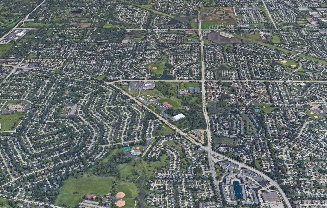 N BUFFALO GROVE RD
DEERFIELD PKWY
Source: Google Earth Pro
Source: Google Earth Pro
N BUFFALO GROVE RD
DEERFIELD PKWY
Source: Google Earth Pro
Source: Google Earth Pro
N DRAFT For Review 5
McHENRYRD
Neighborhood Nodes
Secondary or neighborhood functions consist of commercial nodes in the Village that provide convenient access to dining and services to Village residents from adjacent neighborhoods. Although the Village should prioritize its investment and improvements to the primary nodes, opportunities exist for future improvements and development to improve pedestrian access between the secondary nodes and surrounding neighborhoods. Non-traditional uses cal also infill vacant tenant spaces and contribute the secondary nodes’ role of being convenientneighborhood-oriented service hubs. The secondary nodes
include: • Woodland Commons • Chase Plaza Shopping and Office Area • McHenry Rd & Arlington Heights Rd • Deerfield Pkwy & Weiland Rd • Buffalo Grove Rd and Aptakisic Rd Indian Creek BuffaloCreek Buffalo Creek Lincolnshire Vernon Hills Long Grove Arlington Heights Buffalo Creek Forest Preserve Buffalo Grove Golf Club Willow Stream Park Sullivan Woods TheArboretum Club HAWTHORNE DR M CAMBRDIGE DR ROSE BLVD OLDCHECKERRD FARRINGTONDR PAULINE AVE H I G HLANDGROVEDR W FABISH DR NEWTOWN DRMARSEILLES CIR THOMPSONBLVD M DA I S O N D R RB A N DYWY N LNTHOMPSON BLVD SHERIDANRD B R C H W OODLN C SEH TNUT TERRACE AVA L NO DR M ADIERA LN WHISPERING OAK RDS N TR OLIA A K SDR PORT CLINTON RD FREMONT WA Y ALDENLN SPRINGSIDELN VINTAGE LN PLUM GROVERD W HITE P I N E R D BEECHWOOD RD ARMSTRONG DR LEXINGTON DR HAST I SGN D R BUSCH PKWY ASBURY DR WILLOWPWKY RAUPP BLVD N APPLE HILL LN LAKE COOK RD W HALF DAY RD N MILWAUKEE PORT CLINTON RD APTAKISIC RD N BUFFALO GROVE RD N BUFFALO GROVE RD N BUFFALO GROVE RD MCHENRYRD WEILAND RD ARLINGTON HEIGHTS RD MCHENRY RD PRAIRIE RD APTAKISIC BARCLAY BLVD BARCLAY BLVDDEERFIELD PKWY CHECKER RD W DUNDEE RD E DUNDEE RD NRANDRD OLD HICKS RD N HICKS RD LAKE COOK RD LAKE COOK RD 45 22 53 53 6453 83 83 53 12 METRA NCS LINE PRAIRIE VIEW BUFFALO GROVE 0.5 Mile Chase Plaza Shopping &Office Area McHenry Rd &Arlington Heights Rd Buffalo Grove Rd & Aptakisic Rd Woodland Commons Deerfield Pkwy &Weiland Rd DRAFT For Review 6 6 7 7 8 8 9 9 10 10
Regional Commercial Node
Located at the Deerfield Pkwy and Milwaukee Rd intersection is an important regional commercial node for the Village. It has a concentration of retail, dining, shopping, and service options and is within proximity to the Village’s innovation, research, and advanced manufacturing hub.
Indian Creek
Des PlainesRiver D e s PlainesRiver
BuffaloCreek Buffalo Creek Lincolnshire
Long Grove Wheeling Prospect Heights Riverwoods Ryerson Conservation Area Potawatomi Woods Chevy Chase Country ClubBuffalo Grove Golf Club Willow Stream Park Sullivan Woods TheArboretum Club HAWTHORNE DR MILLCREE K D R CAMBRDIGE DR ROSE BLVD OLDCHECKERRD FARRINGTONDR PAULINE AVE H I G HLANDGROVEDR W FABISH DR NEWTOWN DRMARSEILLES CIR THOMPSONBLVD M DA I S O N D R RB A N DYWY N LNTHOMPSON BLVD SHERIDANRD B I R C H W OODLN C SEH TNUT TERRACE AVA L NO DR M ADIERA LN WHISPERING OAK RDS N TR OLIA A K SDR PORT CLINTON RD FREMONT WA Y ALDENLN SPRINGSIDELN VINTAGE LN PLUM GROVERD W HITE P N E R D BEECHWOOD RD ARMSTRONG DR LEXINGTON DR HAST I SGN D R BUSCH PKWY ASBURY DR WILLOWPWKY RAUPP BLVD N APPLE HILL LN W DUNDEE RD NMILWAUKEE AVE LAKE COOK RD DEERFIELD RD HALF DAY RD W HALF DAY RD N MILWAUKEE AVE PORT CLINTON RD APTAKISIC RD N BUFFALO GROVE RD N BUFFALO GROVE RD N BUFFALO GROVE RD MCHENRYRD WEILAND RD ARLINGTON HEIGHTS RD MCHENRY RD PRAIRIE RD APTAKISIC RD BARCLAY BLVD BARCLAY BLVDDEERFIELD PKWY E DUNDEE RD LAKE COOK RD 64 45 45 45 22 22 83 83 METRA NCS LINE PRAIRIE VIEW BUFFALO GROVE WHEELING 0.5 Mile Deerfield Pkwy &Milwaukee Rd DRAFT For Review 11 11
Vernon Hills
Placemaking
The points where residents and visitors enter the Village are considered gateway areas. The appearance and character of these areas are important in shaping the overall perception of the Village as they are the first impression given to visitors and residents. Gateways can be placed near specific destinations, such as Prairie View Station Area, Deerfield Parkway and Milwaukee Rd or Town Center to identify entrance into the Village and arrival at the major hubs in the Village. They can also be placed along corridors such as Dundee Road or Milwaukee Ave.


The Village’s current gateway signage can be improved to reflect its unique identity and brand within the region. The design of gateway elements varies with consideration for mode choice, available space and vehicular speed, with the goal of enhancing community identity. Gateways should be pedestrian scaled, but auto-oriented. Gateway signage at the borders of the Village’s municipal boundaries and along major roadways should be prioritized for implementation. Construction of secondary gateways around important destinations to further distinguish these areas from others in the Village should also be prioritized. Gateways should have a consistent design that communicates a positive experience in the Village.

A coordinated palate of wayfinding and interpretive signage should also be created. The goals of the signage and wayfinding strategy communicate pertinent information on parking locations, local institutions, and the Metra stations to pedestrians, bicyclist and autos. For example, the signage can help visitors and residents navigate to the Mike Rylko Community Park Campus, Prairie View and Buffalo Grove Metra stations, the golf courses and other attractions in the Village. Additionally, connectivity to regional trail systems, the Buffalo Creek Forest Preserve, Ryerson Conservation Area, Potawatomi Woods, Des Plaines River, Buffalo Creek, and Village parks would be included on directional signs. For cyclists, signage directing them to trail heads and bike routes throughout the Village would increase
bicycle safety and reduce the amount of bike traffic in areas where traffic conflicts are possible. Parking signage directing residents and visitors to available lots would help alleviate congestion on streets and would enhance the shopper experience by moving people more quickly from their cars to their destinations. Wayfinding signage would communicate parking entry locations to reduce driver confusion with moving from the street into a lot. Locations of signage should be spaced appropriately along major arterials and secondary streets to ensure travelers are able pinpoint their location and destinations.
DRAFT For Review
Existing Signage in the Village; Source: Google Earth Pro
Gateway & Wayfinding

A gateway and wayfinding system takes into account pedestrian, bicycle, and vehicular traffic from the perspective of both visitors and residents. The scale of these elements should relate to the scale and speed of traffic and to the character of the surrounding area or community. The design and location of gateway and wayfinding elements should reflect the unique aspects of Buffalo Grove and concisely inform and guide motorists and pedestrians to attractions within the Village.
Gateways
Gateway features can delineate and announce one’s arrival into a region, town, neighborhood, or unique public place. They are the first impression of a community’s image. Gateway features may vary in scale or function, and can take the form of signage, public art, a signature building, or decorative streetscape enhancements such as lighting and landscaping along the roadside, at intersections, in medians, or in roundabouts. Gateway features may be a singular element, an element repeated at every gateway, or elements that reflect the character of each individual gateway. Recommended locations for gateways are: the southern Village limits limits along Dundee Rd and the western limits at Deerfield Rd and Milwaukee Ave.
Wayfinding & Signage


Many communities recognize the importance of creating a “user-friendly” environment that directs both residents and visitors to prominent destiniations once they are within the community. A well designed wayfinding system has the potential for economic benefit by providing directional assistance to commercial shopping areas, historic areas of interest, or major employment destinations. A comprehensive wayfinding system should:
• Increase the Village’s sense of place by expanding the community’s brand and expressing the local character.

• Increase awareness of goods and services in the Village by providing opportunities to represent each significant node.
• Encourage exploration of the Village by including special destinations of interest that may encourage visitors or residents to explore the Village’s offerings.
El Cajon Blvd. San Diego, CA; Source: Google Earth Pro Community Garden, San Francisco Trail head, Victoria Island Fulton Market District, Chicago Pilsen, ChicagoDRAFT For Review
Learning Garden, San Franciso
Land Use, Economic Development, and Placemaking Goals and Strategies
Theme 1: Commercial/Civic Nodes Framework
Goal 1: Create strong, distinct and economically successful nodes.
Strategy 1: Establish an identity for each node based on its primary function.
Strategy 2: Strengthen the identity of each node type by creating a branding and signage strategy that communicates each area’s offerings.
Strategy 3: Develop brand standards for each node type
Strategy 4: Market development opportunities that are responsive to resident’s needs adjacent to specific nodes.
Goal
2: Coordinate and direct development in nodes to support their unique identities.
Strategy 1: Ensure that new infill development contributes positively to the quality of the surrounding corridor or neighborhood, including the potential to provide additional park space, and minimize the visibility of on-site parking.
Strategy 2: Encourage development of public spaces and plazas within commercial, mixed-use, and residential projects that can accommodate civic events and function as community gathering areas.
Strategy 3: Create a mix of uses in commercial nodes that include variety of services to support resident health and wellness.
Goal 3: Focus on creating a complimentary mix of uses in the Village’s nodes that have a uniform architectural and design vocabulary.
Strategy 1: Encourage high-quality site development and amenities in commercial nodes by enforcing zoning recommendations and developing form-based code for the commercial areas in the Village to support the desired character.
Strategy 2: Enhance nodes by introducing diverse housing types where there is available property to ensure existing and new residents have housing choice and ease of access to goods and services.
Strategy 3: Co-locate health services and convenience retail in nodes to ensure necessary services are accessible and available.
DRAFT For Review
Theme 2: Aging in Place
Goal 1: Support a variety of housing types that respond to the changing needs of single adults, families and seniors.
Strategy 1: Make developing creative and alternative housing easier for developers and residents interested in new options.
Strategy 2: Support housing that incorporates best practices for accessibility and use including Universal Design strategies.
Strategy 3: Encourage preservation of existing housing stock through rehabilitation incentivized and supported by the Village through grants and subsidies.
Goal 2: Continue to enhance community engagement outreach to foster a welcoming and inclusive environment for all residents.
Strategy 1: Include age-friendly principles in Village policies.
Strategy 2: Create multiple ways to engage by developing inclusive policies for public engagement that consider accessibility to the internet and other communications methods.
Goal 3: Work with senior-focused partners to promote intergenerational exchange, continuing educational opportunities, and social connection.
Strategy 1: Encourage shared gathering spaces within residential areas and neighborhood nodes that foster social exchange.
Strategy 2: Promote diverse businesses in neighborhood nodes that offer seniorfocused services
Strategy 3: Help business owners improve their properties to facilitate ease of accessibility and comfort to all user groups.
Strategy 4: Create public outdoor areas with diverse experience and facilities such as seating and public art.
DRAFT For Review
Theme 3: Increasing Housing Diversity and Affordability
Goal 1: Introduce high-quality attainable housing to the community.
Strategy 1: Connect housing to other Village amenities by prioritizing walkability and bikeability.
Strategy 2: Identify areas of the Village with aging housing stock to focus rehabilitation and renovation efforts.
Strategy 3: Create programs that incentivize preservation of affordable housing and introduce additional housing units to attract and retain a diverse population to the Village.
Goal 2: Leverage opportunities for increased density along corridors in Buffalo Grove and in and around the two Metra train stations.
Strategy 1: Focus new residential and mixed-use development opportunities around Metra station areas and neighborhood commercial nodes.
Strategy 2: Coordinate zoning and land use to accommodate opportunities for increased density and mixed-use development.
Strategy 3: Consider form-based code for commercial areas to ensure uniformity of design quality, look, and character.
Goal 3: Attract young professionals to the Village.
Strategy 1: Identify underserved areas of the Village for high quality internet service and explore solutions to implement fiber optic infrastructure.
Strategy 2: Increase programming in outdoor space, connectivity with trail systems, and investments to cultural activity programming in the Village.
Strategy 3: Incentivize and support the creation of small local businesses.
Strategy 4: Promote the creation of school programs that compliment the high quality of education in the Village and supplement afterschool activities to attract young families.
DRAFT For Review
Theme 4: Industrial Corridor Dynamic
Goal 1: Preserve specific areas of industrial corridors for high tech and innovation businesses.
Strategy 1: Maintain industrial corridors as economic engines and vital job centers in the Village.
Strategy 2: Provide access for all transportation modes and prioritize connectivity to Metra stations to ensure employees have multi-modal options to reach the industrial employment centers.
Strategy 3: Re-zone identified areas of the industrial corridors to facilitate complimentary and lower impact uses.
Goal 2: Coordinate alternative uses and identify specific areas for non-industrial tenants to benefit from the existing context or prepare for future opportunities.
Strategy 1: Identify specific areas of existing industrial land uses to accommodate non-industrial tenants.
Strategy 2: Determine allowable uses for non-industrial tenants that are complimentary and can leverage existing industrial infrastructure while buffering residential uses.
Strategy 3: Improve the roadway system to ensure multi-modal connectivity from neighborhoods.
DRAFT For Review
Chapter4
 Source: Prairie View Metra Station Area Plan, RATIO
DRAFT For Review
Housing & Neighborhoods
DRAFT For Review
Housing
Residential land uses occupy the majority of the land within the Village of Buffalo Grove. The Village’s housing stock is primarily comprised of single-family detached homes (~53%), apartments with two or more units (~30.7%) and single-family attached (16.4%). This chapter will examine Buffalo Grove’s residential developments and explore issues and opportunities related to the Village’s housing stock.
Aging-In-Place Empty-Nesters
Most of the Village’s housing units were built in the 1970s and 1980s. Although they were considered modern at the time, issues with effectively meeting the needs of current and future residents are present. Based on the Village’s demographic analysis, it is projected that the population of aging adults will grow in the coming years. This group of people are considered ‘empty-nesters’. During focus groups, participants expressed that some would prefer to down-size and move to smaller homes with lower price points within the Village. A considerable share of Buffalo Grove’s homes are priced between $200,000 and $500,000 (Source: American Community Survey 20132017 5-Year Estimates & ESRI Business Analyst 2019 Estimates). This presents opportunities for the Village to explore ways to diversify its housing stock, in terms of building style, density, and price points. Promoting infill development for residential uses, in the form of townhomes and multi-family apartments, is a potential strategy the Village can use to retain empty-nesters.
Senior Housing Facilities
Based on current and projected trends, there is demand for more senior housing facilities in the Village of Buffalo Grove. There are various types of senior housing, and opportunities for the Village to promote additional senior living facilities that cater to the active senior demographic. The Dundee Rd and Lake-Cook Rd Corridors have potential to accommodate this type of development. They can also be located near the established neighborhood and commercial nodes to produce synergies between residential and commercial uses. Stakeholders have noted that new senior housing facilities have been constructed in adjacent communities, and it is critical that the Village should engage with senior housing providers to better understand what factors impact their decisions to locate their facilities.
DRAFT For Review
Multi-Generational Living
The US Census showed that 18.1% of the U.S. population (57 million Americans) lived in multi-generational households in 2012. This is double the number of such households in 1980. This growth spiked during the Great Recession of 2007-2009 and continued to grow, albeit at a slower pace, during the post-recession period. Racial and ethnic minorities are more likely to live in a multigenerational family, which have been increasing since the 1970s. The Pew Research Center founded that Asians are most likely of all minority groups to live in multigenerational arrangements. In 2016, the Asian population made up 21%of the total population in the Village of Buffalo Grove.
There are various reasons for this phenomenon. Young adults are marrying later in life and staying in school longer. This contributes to an increasing share of young adults living with their parents. Declining employment and wages may also undermine adults’ ability to live independently. Many existing residential units in the Village of Buffalo Grove are designed for single-generation living. There are opportunities to promote new housing types that are conducive to multi-generational living. The following are design and housing examples that promote this concept.
Design Features of Multi-Generational Housing
• Multiple Masters: Multi-generational homes may require a second master bedroom, preferably on the first floor, to provide better access and privacy for older parents. This also gives them a sense of privacy in a shared home.
• Suite Addition: One of the best ways to make multigenerational housing work is to construct an in-law suite/apartment with a separate kitchenette and entrance. The feasibility of this feature will depend on zoning restrictions.

• Versatile Living Room: Multi-generational housing can either feature a separated living room or a large space with appropriate amenities to enable different generations to coexist. An example is to install shelving/storage units in the living room to help keep the space free from toys and clutter, which can pose a safety issue to seniors.
• Flex Space: Rooms should be designed to be adaptable for various uses. For example, an underutilized living room can be repurposed into a home office, then an in-law suite, then a space for a young adult who decided to move home, and then an entertainment space.
• Universal Design / Open Access: This works in tandem with flexible spaces to create an environment that all persons can use. Examples of universal design include wide-enough hallways to accommodate a wheelchair and zero-entry threshold to accommodate people with physical disabilities.
DRAFT For Review
In-law Units (Granny Flats)
In-law units are apartments that are an accessory to a primary residence. They have their own entrance, kitchen, bedroom, and living area. In-law units are typically located above the garage of the primary residence or as a separate structure in the primary residence’s rear lawn. The unit is generally occupied by the primary residence’s guest or relative.
In-law units could provide benefits to the community, homeowners, families, and the elderly alike. Having in-law units increases the number of persons per household in existing residential neighborhoods. This reduces the need for municipalities to extend utilities and services. This option helps municipalities increase their diversity of housing options at moderate pricing points without requiring subsidies. In-law units enable the elderly population to maintain their independence in the community and to have continued to access to nearby community amenities.
Currently, municipalities may have regulations pertaining to tenancy and whether rents may be charged. The Village of Buffalo Grove’s Zoning Ordinance currently does not permit residential uses on accessory dwelling units (see 17.12.005 - Accessory building or structure in the Village’s Municipal Code). This presents an opportunity for the Village to evaluate its permitting and regulatory process to understand how the Village can accommodate in-law units in a way that would contribute to a neighborhood’s sense of place and provide flexibility for the growing needs of shifting family structures.
Attracting Young Professionals and Teachers
Diversifying Buffalo Grove’s housing stock includes promoting housing typologies that attract young professionals. Based on current trends, multi-family apartments with amenities are attractive to young professionals. Buffalo Grove faces the challenge of providing housing for those that work in the Village but who cannot afford housing there. Teachers are one affected group. In focus groups, this group shared that many commute to the Village for work and were unable to participate in the schools’ after-school programs because of long commute times from their existing place of residence outside of the Village. Creating this housing type and ensuring rental units are available near schools and Metra stations are opportunities for the Village to better attract and retain teachers, among other young professionals.
Rehabilitation and Teardown of Older Housing Stock
A significant portion of the Village’s older housing stock, which was built between the 1960s and 1970s, are concentrated in the southern portion of the Village. As time progresses, these homes will be in need of rehabilitation to adapt to modern standards and changing needs. Alternatively, these homes may be torn down and redeveloped into a more dense housing type or converted to other land use, depending on the site’s location and coordination with the future land use map. This presents opportunities for the Village to work with property owners and developers to promote best practices in housing rehabilitation and responsive housing options to the Village’s changing demographics and resident needs. The Village should examine the number of units and location where teardowns are occurring to understand which neighborhoods are experiencing changes.
DRAFT For Review
Increasing Housing Diversity and Affordability
The Village faces challenges in diversifying its housing stock and maintains relatively high price points to enter the market. A significant portion of housing units are larger single-family detached homes with prices starting at $200,000. Through infill development and rehabilitation of existing homes, there are opportunities for the Village to work with developers and property owners and utilize its economic development tools to promote housing typologies that vary in terms of size, density, location, and price points.

DRAFT For Review
Community Facilities
The Village of Buffalo Grove is served by community facilities that provide efficient delivery of public services and enhance the community as a desirable place to live and do business. The Village currently has high quality schools, parks, recreation, open space, and municipal services. In addition, charities and civic-minded businesses contribute to the quality of life and “social capital” of the Village.
The Village can improve its working relationships with service providers by identifying and understanding the needs of each community facility. These partnerships will improve the overall level of service provided to Buffalo Grove residents.
Schools and Educational Facilities
Education in Buffalo Grove is provided by both public and private educational institutions. The school districts serving Buffalo Grove add to the overall quality of life in the Village and are major contributors to the Village’s desirability as a place to live and raise a family. The Village includes three school districts in both the Lake County and Cook County sides of the Village. These school districts are Aptakisic-Tripp Community Consolidated School District 102, Kildeer Countryside Community Consolidated School District 96, and Wheeling Community Consolidated School District 21. The evolution of these school districts came as a response to population growth.

The Village should support the continued operation and improvement of these facilities, balancing their impact on adjacent residential neighborhoods, and fostering cooperation with the multiple school districts to maintain high-quality school sites and facilities.
The Village is served by 16 educational facilities, including nationally recognized Stevenson High School. There is one private school – St. Mary’s School. Nine primary education facilities and six middle and high schools are located in the Village.
Civic Facilities
Civic facilities provide important services to the residents of Buffalo Grove. These facilities include: Village Hall, Buffalo Grove Police Department, the Buffalo Grove Fire Department, Buffalo Grove Park District, Raupp Memorial Museum and various religious institutions. The Village should maintain and improve their municipal facilities, balanced with their impact on residential neighborhoods, and encourage the same for the religious institutions and service organization facilities.
 Buffalo Grove High School, Source: Google Earth Pro
DRAFT For Review
Buffalo Grove Village Hall, Source: Google Earth Pro
Faith-based Institutions
There are nine religious facilities located in the Village that serve both Buffalo Grove and surrounding communities. These facilities are distributed throughout the Village and represent a variety of faith communities. According to bestplaces.net, over 59% of Buffalo Grove residents identify as religious, with a majority that identify as Catholic. The changing demographics of the community are also represented in its major religious institutions and include other western religions such as Islam and Judiasm as well as a variety of Christian denominations.

Health and Wellness

Three public health facilities are located in Buffalo Grove including Northwest Community Healthcare Immediate Hospital, Northwest Community Healthcare Center, and BG Medical Center. A number of specialty facilities and private professional medical offices also serve Buffalo Grove residents. With the Village’s aging population, encouraging additional healthcare facilities to locate in the Village can enhance the overall wellbeing of residents and provide amenity in the community.
 St. Mary’s Catholic Church
JCYS Northwest Family Center, Source: Google Earth Pro
St. Mary’s Catholic Church
JCYS Northwest Family Center, Source: Google Earth Pro
DRAFT For Review
Northwest Community Healthcare Immediate Hospital, Source: Google Earth Pro
Legend
Buffalo Grove Municipal Boundary
Lake-Cook County Boundary Railroad Metra Station
Government
Village Hall
Public Service Centre
Interstate, Highways & Major Roadways Trails Forest Preserve Local Parks/Open Space
Buffalo Grove Park District Raupp Memorial Museum
Public Safety
Fire Station 27
Fire Station 26
Fire Station 25
Fire Training Facility
Buffalo Grove Police Department Education
Postal Office Religious
Buffalo Grove High School
Stevenson High School
Cooper Middle School
Longfellow Elementary School
Kilmer Elementary School
Ivy Hall Elementary School
Willow Grove Kindergarten Center
Prairie Elementary Schol
Latter Day Saints
Jewish Council for Youth Services

Congregation Bnai Shalom
Congregation Beth Am St. Mary's Church
Knopf Cemetery
Lord's Love Community Church
Kingswood Methodist Church 40 Exodus Community Church
Public Health
Northwest Community Healthcare Immediate Hospital
CH - Northwest Community Healthcare BG Medical Center
Montessori World of Discovery
Twin Groves Middle School
Meridian Middle School
Aptakisic Jr High
Tripp Elementary School Pritchett Elementary School St Mary’s School
Buffalo Grove KinderCare
BuffaloCreek
Arlington Heights
Indian Creek
Vernon
Long Grove
Hills
Buffalo Creek Forest Preserve Buffalo Grove Golf Club Willow Stream Park Mike Rylko Community Park Sullivan Woods TheArboretum Club HAWTHORNE DR MILLCREE K D R ROSE BLVD OLDCHECKERRD FARRINGTONDR PAULINE H I G HLANDGROVE W FABIS MARSEILLES CIR THOMPS RB A N DYWY N LNTHOMPSON BLVD SHERIDANRD B I R C H W OODLN C SEH TNUT TERRAC WHISPERING OAK RDS N TR OLIA A K SDR PORT CLINTON RD FREMONT WA Y ALDENLN SPRINGSIDELN VINTAGE LN PLUM GROVERD W HITE P I N E R D BEECHWOOD RD WILLOWPWKY RAUPP BLVD APTAKISIC RD N BUFFALO GROVE RD N BUFFALO GROVE RD N BUFFALO GROVE RD ARLINGTON HEIGHTS RD MCHENRY RD DEERFIELD PKWY CHECKER RD W
RD E DUNDEE RD
LAKE COOK RD LAKE
22 53 53 6453 83 53 12
DUNDEE
NRANDRD
COOK RD
COMMUNITY FACILITIES
0 0.5 10.25 MileNorth
Village of Buffalo Grove, IL
1 1 2 1 1 2 2 3 4 5
3 4 5 5 4 3 3 5 1 2 1 1 2 4 4 5 5 3 7 7 8 8 6 9 9 10 10 12 13 11 11 15 16 16 14 15 6 3 1 1 2 3 3 4 5 5 6 6 7 8 8 9 9 7 4 DRAFT For Review
1 2 3
Des PlainesRiver D e s PlainesRiver Buffalo Creek LAKE COUNTY COOK COUNTY Lincolnshire Wheeling Prospect Heights Riverwoods Ryerson Conservation Area Potawatomi Woods Chevy Chase Country Club CAMBRDIGE DR PAULINE AVE EDR H DR NEWTOWN DR ONBLVD M DA I S O N D R CE AVA L NO DR M ADIERA LN ARMSTRONG DR LEXINGTON DR HAST I SGN D R BUSCH PKWY ASBURY DR N APPLE HILL LN W DUNDEE RD NMILWAUKEE AVE LAKE COOK RD DEERFIELD RD HALF DAY RD W HALF DAY RD N MILWAUKEE AVE PORT CLINTON RD MCHENRYRD WEILAND RD PRAIRIE RD APTAKISIC RD BARCLAY BLVD BARCLAY BLVDPKWY LAKE COOK RD 94 294 64 45 45 45 22 83 METRA NCS LINE PRAIRIE VIEW BUFFALO GROVE WHEELING 2 4 1 3 2 12 13 14 2 9 DRAFT For Review
Housing and Neighborhoods Goals and Strategies
Theme 1: Commercial/Civic Nodes Framework
Goal 1: Create community nodes that are attractive and accommodating to a diverse group of residents.
Strategy 1: Prioritize housing typologies that are complimentary to adjacent uses and attract a captive population to commercial nodes.
Strategy 2: Create unique identities for commercial nodes to instill community pride and connect to the character of the adjacent neighborhoods.
Strategy 3: Focus on retention of existing commercial and civic uses within commercial and civic nodes by promoting nearby residential development.
Goal 2: Focus higher density housing around existing commercial nodes.
Strategy 1: Consider changing demographics to determine right size housing for future residents and provide housing that is flexible and adaptable.
Strategy 2: Attract development to commercial nodes that includes mixed-use or higher density housing.
DRAFT For Review
Theme 2: Aging in Place
Goal 1: Provide residents housing choice opportunities.
Strategy 1: Promote the growth of residential development maintaining the existing character of the Village.
Strategy 2: Support aging-in-place by allowing accessory dwellings, such as granny flats, on existing properties.
Strategy 3: Promote new townhome and condominium development in select locations within the Village’s commercial/mixed-use land uses.
Strategy 4: Revise the Village’s regulatory framework to allow responsive and potentially more dense housing typologies.
Strategy 5: Ensure senior residents are able to stay in their homes by partnering with financial institutions, volunteers and senior focused care centers in the community.
Goal 2: Create opportunities for social programming to increase the connectivity and resources in the senior community.
Strategy 1: Ensure the network of community, educational, faith-based organizations that focus on seniors are connected to Village resources.
Strategy 2: Ensure that residents have access to the community calendar of festivals and events.
Strategy 3: Increase options for event programming in neighborhoods by supporting self-sufficiency and creativity within neighborhood and faith-based organizations.
Goal 3: Foster multi-generational communication between Village residents and leadership.
Strategy 1: Partner with schools and senior housing facilities to build a shared community garden where both students and residents can interact.
Strategy 2: Establish a special community fund for inter-generational art projects that beautify the Village.
DRAFT For Review
Theme 3: Increasing Housing Diversity and Affordability
Goal 1: Introduce programs in the Village to expedite approvals of desirable development and resolve regulatory barriers to its development.
Strategy 1: Establish design, density, and open space criteria for all future development areas.
Strategy 2: Work with developers to offer cost and time savings such as reducing permit and petition fees, expediting development review and subsidizing utility hook ups in exchange for desired development commitments.
Strategy 3: Amend the Village’s development code to permit single-family detached housing to have in-law units and home office uses in accessory structures.
Goal 2: Prioritize development of walkable, highly amenitized neighborhoods
Strategy 1: Invest in the Village’s natural resources and playgrounds to ensure they continue to be valuable.
Strategy 2: Enhance residents’ sense of safety by facilitating the formation of neighborhood watch groups, block clubs, and resident interest groups.
DRAFT For Review
Theme 4: Industrial Corridor Dynamic
Goal 1: Buffer residential neighborhoods from industrial uses.
Strategy 1: Coordinate transitional land uses to buffer residential from industrial uses.
Strategy 2: Mitigate potential negative impact from industrial areas by communicating with residential neighbors to understand how to improve policies that facilitate desired development.
Strategy 3: Create industrial design guidelines to create a uniform look and feel to industrial corridors.
Additional Goals Forthcoming
Theme 5: Sustainable Strategies
Goal 1: Incentivize public awareness around the benefits of alternative energy and preservation of natural resources.
Strategy 1: Create a public awareness campaign regarding the benefits of alternative energy
Strategy 2: Investigate potential funding sources for the project (public and private).
Strategy 3: Install solar-powered traffic control signals.
Additional Goals Forthcoming
DRAFT For Review
Chapter5
Source: Google Earth Pro
DRAFT For Review
Transportation

DRAFT For Review
Source: Google Earth Pro
The Village of Buffalo Grove is located at the convergence of five State routes and six County highways, which provides for excellent access to the regional roadway system but leads to high volumes of through traffic, auto-centric commuting patterns, and significant barriers to pedestrian and bicycle travel. Over the years, the Village has worked towards broadening its transportation infrastructure into a more multimodal system by establishing public transit service on the Metra North Central Service Line, supporting Pace feeder bus service to Metra and Chicago Transit Authority (CTA) terminals, and building a bicycle trail and pedestrian system that extends to all corners of the Village. These investments have brought economic development to the Village and have enhanced the quality of life for its residents by improving mobility throughout the Village and connections to the larger region.

In planning for the Village’s next 20 years, the Village shall endeavor to capitalize on opportunities to address remaining deficiencies in the transportation system, and better integrate the various modal components of the system, in an effort to support its commercial and residential base and achieve its environmental goals for sustainability.
This chapter describes strategic improvements to the transportation system to reduce congestion in the Village’s commercial corridors, enhance its public transit assets to increase ridership and expand services, incorporate sustainable options and new technologies, close remaining gaps in the bicycle and pedestrian network, and improve pedestrian safety at the major roadway crossings. Additional transportation recommendations are detailed in the chapter on the corridor plans.
74 DRAFT For Review
Roadway Network
Buffalo Grove is traversed by a network of roadways that accommodates traffic circulation throughout the Village, seamless connections with the adjoining communities, efficient linkages between local neighborhoods and commercial corridors, and direct access to the regional freeway system to the east and west.

Functional Classification
Roadways are classified in a hierarchical structure based on the function that they serve and the traffic-carrying capacity that they provide. Four functional classifications are used, including freeways, arterials, collectors, and local roads. Arterials and sometimes collectors are commonly subdivided into major and minor designations based on location, service function and design features. Each roadway classification serves as a collecting/ distributing facility for the next higher classification.
Roadways are classified in a hierarchical structure based on the function that they serve and the traffic-carrying capacity that they provide. Four functional classifications are used, including freeways, arterials, collectors, and local roads. Arterials and collectors are commonly subdivided into major and minor designations based on location, service function and design features. Each
roadway classification serves as a collecting/distributing facility for the next higher classification.
Freeways
Freeways provide the highest degree of mobility, with access limited to grade-separated interchanges to preserve capacity for high volumes of traffic and high travel speeds. The Village benefits from proximate access to Interstate 94/294 (Tri-State Tollway) and Illinois Route 53. Interstate 94 is accessed from Half Day Road (IL 22), Deerfield Parkway, and Lake Cook Road approximately two to three miles east of the Village. IL 53 is accessed from Lake Cook Road and Dundee Road approximately one to 1½-miles west of the Village.
Major Arterials
Major arterials provide a high degree of mobility and function as the primary travel routes through urban areas connecting the freeway system with the local network of arterials, collectors and local roads. These higher capacity roadways are four- to six-lanes wide, carry high volumes of traffic, and require more stringent access controls and traffic signal spacing.
75 DRAFT For Review
In Buffalo Grove there are five major arterials, including Dundee Road (IL 68), Half Day Road (IL 22), Lake Cook Road, McHenry Road (IL 83), and Milwaukee Avenue (US 45/IL 21). Half Day Road, Lake Cook Road, and Milwaukee Avenue, and McHenry Road (south of Lake Cook Road) are also part of IDOT’s Strategic Regional Arterial (SRA) system, which is a 1,500-mile network of the most important major arterials in the Chicagoland region.
Minor Arterials
Minor arterials also provide a high degree of mobility but with lower operating speeds and less stringent access controls than major arterials. Minor arterials in Buffalo Grove are two- to four-lanes wide and include Aptakisic Road, Arlington Heights Road (south of IL 83), Buffalo Grove Road, Deerfield Parkway, Hicks Road (IL 53), Prairie Road, and Weiland Road.
Collectors
The collectors in the Village are two-lane roadways built within an 80-foot right-of-way. The collectors distribute traffic between the arterials and local roads, have limited continuity and lower operating speeds, and may allow parking in the curb lanes
Major collectors include Arlington Heights Road (north of IL 83), Barclay Boulevard, Checker Road, Old Checker Road, and Thompson Boulevard (west of Buffalo Grove Road). Minor collectors include Bernard Drive, Brandywyn Lane, Busch Parkway, Golfview Terrace (south of Raupp Boulevard), Highland Grove Drive, Main Street, Pauline Avenue, Raupp Boulevard, Thompson Boulevard (east of Buffalo Grove Road), and Weidner Road.
Local Roads
All other roadways in the Village are classified as local roads and are generally two-lanes wide, built within 60foot (residential roads) to 80-foot (industrial/ business park road) rights-of-way, with parking. These roadways connect with the arterials and collectors, provide direct access to private property, and carry low volumes of traffic at low speeds.
Jurisdiction
Most of the arterial roadways in the Village are under County or State jurisdiction. The Cook County Department of Transportation and Highways (CCDTH) controls and maintains Lake Cook Road, as well as Arlington Heights Road, Buffalo Grove Road, and Weiland Road to the south of Lake Cook Road. The Lake County Division of Transportation controls and maintains Deerfield Parkway, Aptakisic Road, and Prairie Road, as well as Arlington Heights Road, Buffalo Grove Road and Weiland Road to the north of Lake Cook Road. McHenry Road (IL 83), Dundee Road (IL 68), Half Day Road (IL 22), Hicks Road (IL 53), and Milwaukee Avenue (US 45, IL 21) are controlled and maintained by the Illinois Department of Transportation. The collector roads and local roads are all under Village control. It is important that the Village maintain close coordination with these agencies to support future development, enhance multimodal connectivity, control access, and unify roadway character.
Truck Routes
IL 53, Dundee Road (IL 68), McHenry Road (IL 83), and Milwaukee Avenue (US 45/IL 21) are IDOT-designated truck routes designed to support heavy commercial traffic while avoiding residential areas. The Village also maintains has a local truck route system that is concentrated in the innovation, research, and advanced manufacturing hub along Busch Parkway and Barclay Boulevard and connects private industry with the State truck route system.
76 DRAFT For Review
1
Table 1: Major Roadways in Buffalo Grove
Functional Classification Roadway
Tri-State Tollway (I-94, I-294) IL 53
Jurisdiction
Annual Average Daily Traffic1 Freeways
ISTHA IDOT 130,300-185,200 78,700-99,000
Major Arterials
Dundee Road (IL 68) Half Day Road (IL 22) Lake Cook Road McHenry Road (IL 83) Milwaukee Avenue (US 45/IL21)
Aptakisic Road
Minor Arterials
Arlington Heights Road (S of IL 83) Buffalo Grove Road Deerfield Parkway Hicks Road (IL 53) Prairie Road Weiland Road
Major Collectors
Arlington Heights Road (N of IL 83) Barclay Boulevard Checker Road
Old Checker Road Thompson Boulevard (W of BG Rd)
Bernard Drive
Minor Collectors
Brandywyn Lane Busch Parkway Golfview Terrace (S of Raupp Blvd) Highland Grove Drive Main Street Pauline Avenue Raupp Boulevard Thompson Boulevard (E of BG Rd) Weidner Road
IDOT IDOT Cook County IDOT IDOT
Lake County Cook County/Lake County Cook County/Lake County Lake County IDOT Lake County/Village Cook County/Lake County
Village Village Village Village Village
Village Village Village Village Village Village Village Village Village Village
22,700-26,400 22,000-25,000 36,000-45,800 15,200-45,300 32,700-33,900
6,400-18,400 17,000-23,100 10,600-19,600 11,900-16,600 23,700 6,450-11,800 10,400-13,700
3,050 3,550 4,9002 4,2002 3,9002
4,0002 1,3752 3,100 2,3502 n/a n/a 1,9002 2,100 n/a 2,1502
Local Roads All other roadways Village n/a
Source: Illinois Department of Transportation 2 Source: Village of Buffalo Grove n/a – not available
77 DRAFT For Review


ROADWAY SYSTEM 78 DRAFT For Review
Roadway Improvement Opportunities
Complete Streets
A “Complete Street” is a roadway that is designed to be safe for all users of the transportation network, including motorists, transit riders, bicyclists and pedestrians. IDOT has adopted design policy changes in response to the 2007 Complete Streets state law, which requires the agency to construct bicycle and pedestrian ways when an urban roadway is constructed, reconstructed, or widened. Cook County and Lake County adopted complete streets policies in 2011 for application on the County highway system.
The Village of Buffalo Grove has followed suit through the adoption of its own Complete Streets policy in October 2019, which will be used as a guide for application on the Village-controlled roadways in the future. as they are resurfaced and reconstructed.
Roadway Modifications
In general, the roadway system within the Village adequately manages traffic flow, and with some specific improvements, the system can perform better in the future while also accommodating the needs of pedestrians and bicyclists.
The Canadian National Railway does create a barrier to east-west travel on the east side of the Village, which channels traffic onto Buffalo Grove Road, IL 22, Aptakisic Road, Deerfield Parkway, and Lake Cook Road. The Buffalo Grove Golf Course also constrains local travel through the center of the community.
Roadway capacity improvements are currently programmed or planned by IDOT and Lake and Cook counties for many of the Village’s arterial roadways that experience congestion as discussed below. The Village should regularly coordinate with these agencies on these projects and to monitor traffic flow along the other arterials. The Village should also endeavor to maintain its own collector and local roads to the highest standard to support its residents and business community and to enhance the viability of commercial redevelopment opportunities.
Lake Cook Road
Cook County’s Lake Cook Road improvement, which will conclude in 2022, will address the long-standing traffic congestion that has occurred in the corridor by widening the roadway to six lanes between Raupp Boulevard and Hastings Lane, installing additional turn lanes at Buffalo Grove Road, McHenry Road and Weiland Road, improving the traffic signals and street lighting, installing a bicycle path, and incorporating an attractive landscaped median. IDOT’s SRA plan for Lake Cook Road includes the continuation of the six-lane cross-section west to IL 53. In the interim, Cook County has programmed the resurfacing of the roadway and ADA improvements between Arlington Heights Road and Raupp Boulevard in its 5-Year Highway Improvement Program.
McHenry Road (IL 83)
Cook County’s Lake Cook Road improvement also reconstructed McHenry Road between the Buffalo Grove Town Center and Weiland Road and improved intersection capacity at Weiland Road. IDOT’s SRA plan includes additional intersection capacity improvements on McHenry Road including dual left-turn lanes and rightturn lanes at Lake Cook Road and a southbound right-turn lane at Weiland Road. The medians along many segments of McHenry Road and beautifully landscaped with trees and plantings. The Village should collaborate with IDOT to replace many of the remaining concrete medians in the corridor with similar planted materials for a consistent boulevard appeal, including median segments east of Arlington Heights Road, west of Buffalo Grove Road, between Buffalo Grove Road and Lake Cook Road, and between Lake Cook Road and Weiland Road.
79 DRAFT For Review
Dundee Road
The excess number of curb cuts along the south side of Dundee Road between Arlington Heights Road and Old Arlington Heights Road and between Buffalo Grove Road and Old Buffalo Grove Road should be consolidated as the adjoining properties are redeveloped. Further, as the properties at the northwest and southeast corners of the Dundee Road/Arlington Heights Road intersection are redeveloped, the access drives should be shifted further from the intersection to reduce conflict potential. Several of the medians in the Dundee Road corridor are landscaped with trees and plantings. The Village should work with IDOT and the adjoining property owners on the installation of additional landscaped medians in the corridor, including the roadway segments between Arlington Heights Road and the Buffalo Grove High School driveway, Vernon Lane and Buffalo Grove Road, Buffalo Grove Road and Huntington Lane, and Cambridge Drive and Schoenbeck Road.
Half Day Road (IL 22)
The current five-lane cross section adequately accommodates the volume of traffic using the roadway each day although some congestion occurs during the peak commuting hours. While IDOT’s ultimate configuration for the roadway has largely been accomplished, some intersection capacity improvements remain to be completed at the Main Street and Buffalo Grove Road intersections, including additional turn lanes on Half Day Road. Further, as the properties at the northwest and southeast corners of the Half Day Road/ Prairie Road/Main Street intersection are redeveloped, the access drives should be shifted further from the intersection to reduce conflict potential.
Milwaukee Avenue (IL 21)
The high volume of traffic carried by Milwaukee Avenue is adequately accommodated by the six-lane cross section between Lake Cook Road and Prague Avenue. However, the transition to a five-lane cross-section north of Prague Avenue results in traffic delays and congestion during the peak periods. IDOT’s ultimate plan for Milwaukee Avenue would continue the six-lane cross section north
to the Village of Lincolnshire, which would reduce the congestion along the roadway. The ultimate plan also includes a raised median which could be landscaped and sidewalk along both sides of the roadway.
In addition, the excess number of curb cuts along the east side of Milwaukee Avenue between Riverwalk Drive and Johnson Drive should be consolidated as the adjoining properties are redeveloped. Further, as the properties at the northwest and southwest corners of the Milwaukee Avenue/Riverwalk Drive/Columbus Parkway intersection are redeveloped, the access drives should be shifted further from the intersection to reduce conflict potential.
The medians on Milwaukee Avenue to the north and south of the Lake Cook Road interchange are nicely landscaped with trees and plantings. The Village should collaborate with IDOT to replace many of the remaining painted and concrete medians in the corridor with similar planted materials for a consistent boulevard appeal, including median segments between Prague Avenue and Mettawa Lane W.
Buffalo Grove Road
Cook County’s Lake Cook Road improvement added turn lanes to the Lake Cook Road and Weiland Road intersections and improved street lighting. Lake County’s recent reconstruction project extended the four-lane cross-section of Buffalo Grove Road from Deerfield Parkway north to IL 22. The County’s long-range plans include widening of the roadway between IL 22 and US 45 to continue the four-lane cross-section and upgrade the bicycle paths and sidewalks. The medians along many segments of Buffalo Grove Road and beautifully landscaped with trees and plantings. The Village should collaborate with Cook and Lake counties to replace many of the remaining concrete medians in the corridor with similar planted materials for a consistent boulevard appeal from the north end of the Village to the south end.
80 DRAFT For Review
LAKE-COOKRD
WEILAND RD BUFFALO GROVERD
MCHENRYRD
Source: https://lakecookweiland.com/project-overview/project-overview-lake-cook-road/
Weiland Road
Cook County’s Lake Cook Road improvement project included the widening of Weiland Road south of Lake Cook Road and realignment of the roadway with Aptakisic Road to provide a continuous roadway between Lake Cook Road and Buffalo Grove Road thereby eliminating one of the two major road misalignments in the Village. Lake County’s recent roadway widening project extended the five-lane cross-section of Weiland Road from Armstrong Drive north to Aptakisic Road. Lake County has long-range plans to address the other major road misalignment in the Village by extending Weiland Road north to align with Prairie Road and incorporating bicycle paths and sidewalks into the new roadway segment.
Arlington Heights Road
Lake County has plans to reconstruct Arlington Heights Road between IL 83 and Lake Cook Road and add new bicycle/pedestrian facilities.
Aptakisic Road
The current five-lane cross section to the east of Buffalo Grove Road provides sufficient capacity to accommodate the volume of traffic carried each day but the transition to a three-lane cross section to the west of Buffalo Grove Road results in congested traffic conditions. Lake County has plans to extend the five-lane cross-section of Aptakisic Road west to IL 83 and add a bike path on the north side of the road and a sidewalk on the south side. The Village should also collaborate with Lake County to replace the painted and concrete medians in the corridor with raised planted medians for a boulevard aesthetic consistent with other landscaped corridors in the Village.
Old Arlington Heights Road
IDOT has plans to resurface Old Arlington Heights Road and install ADA improvements between Dundee Road to Arlington Heights Road.
 Lake-Cook Rd Project Area
Weiland Rd Extension
Lake-Cook Rd Project Area
Weiland Rd Extension
81 DRAFT For Review
Prairie Road
Lake County has plans to reconstruct Prairie Road between Aptakisic Road and IL 22 and install new bike path and sidewalk segments. The Village should use this opportunity to work with Lake County on incorporating raised planted medians into the reconstruction plans for a boulevard aesthetic consistent with other landscaped corridors in the Village.
Old Checker Road
The Village has developed Phase 1 engineering plans to reconstruct the roadway between Checker Drive and Buffalo Grove Road. East of Buffalo Grove Road, the continuity of Old Checker Road between Buffalo Grove Road and McHenry Road is constrained by the private street that extends through the Buffalo Grove Town Center. The potential redevelopment of the Town Center area could address this issue by providing a better local connection between the two arterial roadways, as noted in the Lake Cook Corridor Plan.
Brandywyn Lane
The Village has plans to reconstruct the segment between Thompson Boulevard and Deerfield Parkway.
Thompson Boulevard
The Village has plans to reconstruct the segment between Arlington Heights Road and Brandywyn Lane.
Bernard Drive
The Village has developed Phase I engineering plans to reconstruct the roadway between Arlington Heights Road and Buffalo Grove Road.
Checker Drive
The Village has developed Phase I engineering plans to reconstruct the roadway between Arlington Heights Road and McHenry Road.
Jordan Terrace
This stubbed street within the Eastgate subdivision has the potential to be extended west if the Didier farm were to be redeveloped in the future.
N. Riverwalk Drive
The north end of this street is currently stubbed at the entrance drive to 301 Riverwalk Place. Redevelopment of the vacant uses between the 251 N. Milwaukee office building and Gerber Collision & Glass would provide the opportunity to extend N. Riverwalk Drive north to Milwaukee Avenue opposite Johnson Drive.
82 DRAFT For Review
Traffic Controls
There are 52 traffic signal-controlled intersections in the Village, all located along arterial or major collector roadways under IDOT, Cook County or Lake County control. The remaining intersections in the Village are generally under stop or yield control. Many of the traffic signals along the arterial corridors in Buffalo Grove are interconnected into a signal system maintained by IDOT, Cook County or Lake County to provide traffic progression and traffic flow efficiency. Further, all of the traffic signals in Lake County, and some along Lake Cook Road, are tied into LCDOT’s Passage system (Program for Arterial Signal Synchronization and Travel Guidance) through a fiber optic network. PASSAGE is an Intelligent Transportation System designed to make real-time signal timing adjustments and provide immediate motorist information due to crashes and construction events.
The following intersections may warrant traffic signal control in the future with traffic volume growth from planned or potential development/redevelopment projects.
• Deerfield Parkway/Barclay Boulevard
• Buffalo Grove Road/Brandywyn Lane
• Prairie Road/Brandywyn Lane
• Milwaukee Avenue/Johnson Drive/N. Riverwalk Drive extension
• McHenry Road/Bank Drive/Old Checker Road extension
• Arlington Heights Road/Buffalo Grove High School north driveway
83 DRAFT For Review
Public Transit
Public transportation service in the Village of Buffalo Grove is provided by Metra commuter rail, Pace suburban bus, Vernon Township, and Wheeling Township. These services provide convenient transportation alternatives for Village residents, employees and visitors that travel between the Village, the City of Chicago, and the greater Chicago region.
Metra Commuter Rail
There are two Metra commuter rail stations in the Village of Buffalo Grove, both served by Metra’s North Central Service (NCS) Line which operates along the Canadian National Railway and provides weekday service between the Village of Antioch and Union Station in downtown Chicago. The Buffalo Grove station, located at 825 Commerce Court, is owned and maintained by the Village of Buffalo Grove. The Prairie View station, located at 2701 Main Street, is owned and maintained by Vernon Township.
Each weekday the NCS Line makes 9 inbound (towards Chicago) stops at the two stations and 10 outbound (towards Antioch) stops. The Buffalo Grove and Prairie View Metra stations are the busiest two stations along the NCS Line and ridership levels at both stations are at all-time highs.
The majority of riders (75%-85%) arrive to the stations by car either by driving alone, carpooling or being dropped-off and picked-up. Approximately 10-20% of riders walk to the stations, making the stations amongst the most walkable of the 17 stations along the NCS line.
The Village provides 1,045 parking spaces for Metra commuters at the Buffalo Grove station (daily fee, and bi-monthly or annual permit and parking utilization over the past 10 years have has ranged from 35% to 40% of capacity.
Vernon Township provides 418 parking spaces for Metra commuters at the Prairie View station (daily fee and quarterly, semi-annual and annual permits) and parking utilization is high (83%), as the Township also sells parking permits to Adlai Stevenson High School students by month, semester or for the full school year.
Bicycle racks are also provided at both Metra stations and are utilized to approximately 40% of capacity. Approximately 25% of the jobs within the Village are within ½-mile of the two Metra stations. However, the minimal Metra weekday service in the reverse-peak direction, and the absence of weekend service, makes it challenging for Village businesses to attract employees and customers residing in the City of Chicago. The Lake County Transportation Alliance has formed a North Central Service Working Group to further explore three service improvement scenarios identified through a recent RTA study. As a member of the Alliance, the Village should participate in the working group and collaborate with the other member communities to enhance Metra service to the Village.
Pace Suburban Bus
Pace suburban bus operates a Park-n-Ride facility at the Buffalo Grove Metra Station and five fixed-bus routes through the Village. Four of the routes provide feeder service to the Metra system (North Central Service Line, Milwaukee District North Line, or Union Pacific Northwest Line), one of the routes feeds into the CTA rapid transit system (Dempster-Skokie Yellow Line), and one of the routes connects to the Pace Northwest Transportation Center in Schaumburg.
• Route 234 Wheeling - Des Plaines: Operates between the Buffalo Grove Metra Station and Des Plaines Metra Station (UP Northwest Line) via Deerfield Parkway, Busch Parkway and Milwaukee Avenue with stops at the Wheeling Metra Station/ Town Center, Randhurst Village, the Mount Prospect Metra Station, and Amita Health Holy Family Medical Center in Des Plaines.
• Route 272 Milwaukee Avenue North: Operates between the Hawthorn Mall in Vernon Hills and Golf Mill Shopping Center in Niles via Milwaukee Avenue, Deerfield Parkway, Busch Parkway, and Barclay Boulevard with stops at the Buffalo Grove Metra Station, Arbor Creek Business Centre, Corporate Grove, and Marriott Lincolnshire Resort.
84 DRAFT For Review
PUBLIC TRANSIT SYSTEM 85 DRAFT For Review
• Route 604 Wheeling - Schaumburg: Operates between the Pace Northwest Transportation Center in Schaumburg and the intersection of Buffalo Grove Road/Hintz Road via Dundee Road and IL 53 with stops at Woodfield Mall, Buffalo Grove High School, Dundee Point Shopping Center, Ridge Plaza in Arlington Heights, and Deer Grove Crossing in Palatine.
• Route 626 Skokie - Buffalo Grove Limited: Operates between the Lincolnshire Corporate Center and the Dempster-Skokie CTA (Yellow Line) Station in Skokie via Aptakisic Road, Barclay Boulevard, Busch Parkway, Deerfield Parkway, Milwaukee Avenue, and Lake Cook Road with stops at the Buffalo Grove Metra Station, Arbor Creek Business Centre, Corporate Grove, Wheatland Apartments, Riverwalk development, Walgreens corporate campus, Lake Cook Road Metra Station, Deerbrook Shopping Center, and Northbrook Court.
• Route 634 Shuttle Bug 4: Operates between the Lake Cook Road Metra Station in Deerfield and the BMO-Harris Bank offices at Lake Cook Road/ Lexington Drive via Lake Cook Road with stops at the Riverwalk development and the Walgreens corporate campus in Deerfield. The Shuttle Bug program is a public-private partnership between the TMA of Lake Cook, Pace, Metra, and area businesses to provide shuttle service connections between participating businesses and Metra stations.
Many of the Village’s residential neighborhoods and some of its apartment complexes (e.g., Town Center area) and employment areas (e.g., Buffalo Grove Business Park) are not within a convenient walking distance of the Pace bus routes and thus residents and employees have few alternatives but to drive to shop, work or take Metra. The Village should collaborate with Pace, Metra and the TMA of Lake Cook to explore options for reaching areas of the Village that could potentially yield ridership levels that would support a new or modified bus route. Options could include the westerly extension of Route 634 to the Buffalo Grove Business Park/Town Center area and/or the establishment of a new shuttle route between the Buffalo Grove Metra Station and the business park/Town Center area.
Several of the bus stops within the Village offer modern, weather-protected passenger shelter that provide ADAcompliant connections with the pedestrian system including on Dundee Road, Deerfield Parkway, Buffalo Grove Road, Busch Parkway, Barclay Boulevard, and at the Buffalo Grove Metra Station. Several other bus stops in the Village that are utilized on a daily basis are in need of these amenities.
The Village should coordinate with Pace to install shelters where none exist as well as upgrade the existing shelters with real-time bus tracker information, improved lighting, and/or bus route maps/schedules to improve the rider experience, encourage greater ridership, and preserve existing service frequency. The Village should also endeavor to extend the pedestrian system to all bus stops in the Village. Priority locations to be considered for new shelters include:
• Southbound Milwaukee Avenue at Columbus Parkway/Riverwalk Drive
• Westbound Dundee Road between Grove Drive/ Fireside Terrace Apartments and Strathmore Square Shopping Center
Pace is also the designated public rideshare administrator for Northeastern Illinois and the agency facilitates a free carpool and vanpool matching service through their website.
The vanpool programs include its traditional vanpool program, Metra Feeder Program, and Employer (Corporate) Shuttle Program.
Vernon Township
Vernon Township, in conjunction with Pace, offers a DialA-Ride bus service to Township residents on weekdays for trips that begin and end within the Township. This doorto-door service utilizes a 10-passenger, wheelchair liftequipped bus and requires advanced reservations.
Wheeling Township
Wheeling Township provides a Dial-A-Ride bus service and a Medical bus service for the Township’s seniors and/ or permanently disabled residents. Both buses provide
86 DRAFT For Review
Table 2: Pace Routes, Frequency and Hours of Operation
Bus Route Weekdays Saturdays Sundays
Route 234
Route 272
Route 604
Route 626
Route 634
5:20 AM – 7:35 PM 18 NB1 trips, 18 SB2 trips
5:29 AM – 10:52 PM 25 NB trip, 23 SB trip
4:57 AM – 9:55 PM 34 NB trips, 34 SB trips
5:43 AM – 10:37 AM 2:45 PM – 7:22 PM 14 NB trips, 12 SB trips
7:22 AM - 9:00 AM 3:48 PM – 6:23 PM 2 WB-AM trips, 3 EB-PM trips
1 NB = Northbound; 2 SB = Southbound; Source: Pace
No Service No Service
7:58 AM – 7:36 PM 12 NB trip, 12 SB trip No Service
7:57 AM – 9:52 PM 20 NB trips, 20 SB trips No Service
No Service No Service
No Service No Service
Bus Route
Table 3: Annual Average Daily Bus Ridership
Average Weekday Ridership
Average Saturday Ridership
Average Sunday Ridership
Route 234 226 n/a n/a
Route 272 559 260 n/a
Route 604 160 81 n/a
Route 626 345 n/a n/a
Route 634 43 n/a n/a
Source: Regional Transportation Asset Management System (RTAMS). Represents average of monthly ridership averages from January 2018-December 2018.
door-to-door service with advance reservations. The Dial-A-Ride bus service operates within the Township on weekdays. The Medical bus service operates on weekdays and Saturdays for medical appointments only and is part of the Township Riders Initiative Program (TRIP), which makes prearranged trips to medical facilities in Wheeling Township and surrounding townships, regional medical facilities and VA hospitals.
Air Transportation
Chicago’s O’Hare International Airport provides scheduled airline passenger services and is conveniently located 10 miles south of the Village. The Chicago Executive Airport provides general aviation services three miles southeast of the Village in Wheeling/Prospect Heights.
87 DRAFT For Review
Intercity Passenger Train Service
Amtrak provides intercity passenger train service from in downtown Glenview (9 miles southeast of the Village) for routes to Milwaukee and destinations to the Northeast and downtown from Chicago’s (Union Station) (25 miles southeast of the Village) for destinations to other parts of the United States.
Intercity Passenger Train Service
Greyhound Lines and Burlington Trailways offer intercity bus service in downtown Chicago approximately 25 miles southeast of the Village.
Freight Rail
The Canadian National (CN) Railway is the only freightmoving railroad in the Village carrying approximately 14 to 22 freight trains per day on the same tracks used by Metra’s North Central Service Line. The railway passes beneath Lake Cook Road and crosses Deerfield Parkway, Aptakisic Road, Half Day Road, and Buffalo Grove Road at-grade. The grade crossings are enhanced with vehicular safety features (automatic flashing light signals and gates, warning signs and pavement markings). Pedestrian gates are only located at the Deerfield Parkway crossing. The Village should work with the Illinois Commerce Commission (ICC), the CN Railway and Metra to install pedestrian gates at the Aptakisic Road, Half Day Road and Buffalo Grove Road crossing as well.
All of the grade crossings are part of a Federal Railroad Administration-approved Quiet Zone which minimizes train horn noise through the Village. There are currently two rail spurs off of the railway which provide freight service to Nemera Corporation at 600 Deerfield Parkway and Flextronics International, Ltd. (Flex, Ltd.) at 700 Corporate Grove Drive. The Village should explore the feasibility of spur track connections to the CN Railway that could support potential redevelopment of the industrial sites off of Aptakisic Road.
Sustainable Vehicles & First Mile/Last Mile Travel Options
While the Village benefits from several public transportation options, some of these services are beyond a comfortable walking distance to homes and workplaces or do not connect with desired destinations. As a result, Buffalo Grove is an auto-dominant community where 80 percent of residents drive alone to work daily and over 83 percent of households have two or more cars. There are alternatives that the Village can pursue to achieve environmental benefits for the community, decrease greenhouse gas emissions and dependence on fossil fuels, reduce parking demand, lower household automobile ownership rates and income devoted to transportation costs, and provide travel options to fill the “first-mile/last-mile” gap between public transit services and a traveler’s initial or final destination.
Carsharing
Households with access to carsharing services such as ZipCar are likely to have lower automobile ownership rates and spend less of their disposable income on associated costs of ownership (i.e., insurance, fuel, maintenance, registration fees, etc.). Currently there are no carsharing services operating in the Village. The Village should work with carsharing companies to establish business within the community and identify carshare vehicle storage locations. Potential locations include the Buffalo Grove and Prairie View Metra stations, Buffalo Grove Business Park, Riverwalk, research/light-industrial park off Barclay Boulevard, and multifamily residential complexes.
No-Emission Vehicles
lectric vehicle charging stations are currently located at Woodman’s Market, Buffalo Grove High School, The Arbors of Buffalo Grove, Arboretum Club, and Walgreens (15 N Buffalo Grove Rd). To incentivize the use of these types of vehicles, the Village should endeavor to expand the charging station inventory by soliciting vendors to charging stations at public facilities and working with the businesses community to dedicate parking spaces and new charging stations at private locations.
88 DRAFT For Review
Ridesharing Partnerships
Ridesharing services such as Uber and Lyft can supplement the public transit system by providing an alternative to using a personal vehicle for short trips to local destinations, such as the Metra stations or business parks/employment centers. Some communities in the United States have partnered with a rideshare company to subsidize a portion of the cost for rides that begin and end within the community, which can reduce the need to construct additional public and/or commuter parking. The Village should consider ridesharing partnerships to provide affordable alternatives to owning and operating a personal vehicle and closing gaps in the public transit system.
Bikesharing
Bikesharing is a micro-mobility option that can fill the first-mile/last-mile gap. It also offers riders that do not own a bicycle an opportunity to explore the Village, utilize the nearby regional trails, or run a quick errand. The City of Chicago’s bikeshare program (Divvy), which includes both pedal bikes and electric-assist bikes, currently has docking stations throughout Chicago and in the adjoining suburbs of Oak Park and Evanston. Together We #RideGrayslake is the first community Bike Share program in Lake County, which is a collaboration between the Village, public library district, park district, and College of Lake County. Bicycles can be rented from these stations for a short period of time at an hourly rate and returned back to any station.
The Village could explore collaborative efforts at bringing bikesharing into the community as a convenience for residents, commuters and visitors. Partners could include the Buffalo Grove Park District, Indian Trails and Vernon Area library districts, College of Lake County (Southlake Campus), and business park and shopping center owners. Docking station locations could include the Buffalo Grove and Prairie View Metra stations, Buffalo Grove Business Park and Barclay Boulevard research/light-industrial park, Riverwalk, Buffalo Grove Town Center, libraries, parks, and larger multifamily residential complexes, among other locations.
Electric Shared Scooters
Electric shared scooters (e-scooters) are another micromobility option and first- and last-mile solution that supports public transit. Users access or return the dockless scooters wherever it is legal to lock a bike in the public way and use a smartphone or other cash-based option to unlock and ride the devices for short periods of time at an hourly rate. E-scooter programs have been initiated in cities throughout the country, including the City of Chicago which conducted e-scooter pilot programs in 2019 and 2020 and is considering establishment of a permanent program. The Village could explore partnering with a micro-mobility company to initiate an electric scooter sharing service in the community.
89 DRAFT For Review
Bicycle and Pedestrian System
The bicycle and pedestrian systems in the Village are extensive and extend to all corners of the Village. The system consists of a network of trails, side paths, and sidewalks along one or both sides of most roadways. Efforts to infill bicycle and pedestrian infrastructure where gaps exist will contribute to the continuity of the system, connections to the regional trails and local destinations, interface with the networks in the adjoining communities, and quality of life in the Village.
Regional Trails
There are two regional bicycle trails near Buffalo Grove that provide long-distance recreation and off-street bicycle connections to nearby communities, forest preserves, and other regional trails.

The Des Plaines River Trail is a 31.4-mile gravel trail that follows the river’s edge and extends nearly the entire length of Lake County from Russell Road in Wadsworth south to Lake Cook Road in Wheeling where it continues south another 22.1 miles through Cook County to River Grove. The trail winds through 12 Lake County forest preserves and can be accessed from Half Day Road, Marriott Drive, Riverside Road and Aptakisic Road in Lincolnshire, Deerfield Road in Riverwoods, and Riverwalk Drive in Buffalo Grove.
The Buffalo Creek Forest Preserve Trail is a 4.8-mile gravel trail that extends through the Buffalo Creek Forest Preserve. The trail can be accessed from Arlington Heights Road, Lake Cook Road, Schaeffer Road, Checker Road, and the Buffalo Creek Nature Preserve.
Local Trails and Side Paths
The Village has a network of trails that extend through the public parks, ComEd utility corridor, and many of the residential neighborhoods. A few of these trails extend through lowlands or wetland areas and tend to flood or ice over after rain/snow events, such as the segment between Prairie Elementary School and Aptakisic Road. The segments of these trails made impassable by these events should be elevated to keep the trails open for public use. In addition to the trails, all of the arterial roadways and major collector roadways in the Village have side paths along various segments of the roadways. The Lake Cook Road, Weiland Road and Buffalo Grove Road
Source: http://4.bp.blogspot.com/-8vpbbcwjDB4/ VYTEqD9b8DI/AAAAAAAAMho/q9zM5MHg1wM/s1600/ IMG_7693.jpg
Source: KLOA
improvement projects closed many of the gaps in the bicycle network but several gaps remain to be filled.
The Village’s 2014 Bicycle Plan includes a series of project types intended to close the gaps in the bicycle network, including side paths, shared lanes, bike lanes, bike routes, combined bike/parking lanes, and widened sidewalks. The projects have been categorized in three levels of priority (high, medium, low). Most and many have yet to be implemented. The lead agencies for the projects include the Village of Buffalo Grove, IDOT, Lake County Division of Transportation, and the Cook County Department of Transportation and Highways.
90 DRAFT For Review
The width of Lake Cook Road is creates a perceived barrier to bicycle travel between the Lake County and Cook County sides of the Village due to the discomfortlevel in crossing the roadway at-grade. Grade-separated crossings currently exist on Lake Cook Road east of Milwaukee Avenue, on McHenry Road west of Buffalo Grove Road, and on Arlington Heights Road south of Checker Road. The Lake Cook Corridor Plan recommends a bicycle bridge over Lake Cook Road in the vicinity of the Buffalo Creek crossing, which would alleviate the safety concerns in crossing the road and better connect the two sides of the Village.
The forest preserves and most of the Village’s schools and public parks have bicycle paths but a few do not have paths or have paths that do not connect with the Village’s bicycle network. Notable facilities include:
• Emmerich Park
• Emmerich East Park
• Bison Park
• Raupp Memorial Museum & Park
• Community Arts Center
• Ivy Hall Elementary School
• Willow Grove Early Learning Center
• Earl Pritchett Elementary School
• Kilmer Elementary School
• Cooper Middle School
Bison Park may be underutilized but has the potential to supplement the athletic/recreational fields at Buffalo Grove High School. The bicycle and pedestrian connection between the high school and park can be enhanced by either widening the sidewalk on the south side of Dundee Road between the signalized crossings at the high school access drive and Weidner Road or by widening the sidewalk on the south side between Weidner Road and the park entrance. A second connection to the park can also be created from the south by continuing the bike path on the east side of Old Arlington Heights Road from Miller Road north to Dundee Road and by extending a new easterly path within a private easement near the south property line of the former automobile dealership sites.
Wayfinding
Residents have a perception of a lack of trails in the Village and a lack of connections to the Des Plaines River Trail and other major destinations in the Village. The Village should implement a wayfinding sign package to increase public awareness of the trail system and provide guidance to the regional trails and local destinations.
Bicycle Parking
Bicycle parking is an essential component of the bicycle system. Providing a safe location for users to lock their bikes will encourage bicycle travel for short-distance trips and boost local commerce. Bicycle racks are currently provided at most of the municipal facilities, including Village Hall, Public Service Center, Police headquarters, and Post Office. Racks are also located at all of the public and private schools and in several of the larger commercial centers (Buffalo Grove Town Center, The Grove) and business parks (Buffalo Grove Business Park). The Village should continue to add bicycle parking infrastructure at other key destinations in the community, including the public parks, Community Arts Center, the Buffalo Creek Forest Preserve, and many of the religious institutions and employment centers.
Recommended bicycle rack styles include the “inverted-U” and the “post and ring” which should both be anchored to the ground. The racks should be located in well-lit and visible locations within 50 feet of building entrances. Covered bicycle shelters at the two Metra stations should also be pursued for weather-protection over the existing bicycle racks. Bike lockers can also be installed at the Metra stations for added security.
91 DRAFT For Review
BICYCLE NETWORK 92 DRAFT For Review
Table 4: Bicycle System Gaps
Roadway Gap Location
Lake Cook Road 1. Milwaukee Ave to Angus Chemicals drive
McHenry Road (IL 83) 1. IL 53 to Bristol Ln
Milwaukee Ave (IL 21)
1. Johnson Dr to The Shop of Buffalo Grove (Deerfield Pkwy) 2. Busch Pkwy to Aptakisic Rd 3. Linden Ave to eastbound Lake Cook Rd exit ramp
Hicks Road (IL 53) 1. Old McHenry Rd/Fremont Way to IL 83
Aptakisic Road 1. ComEd corridor to Prairie Rd
Arlington Heights Road 1. Dundee Rd to Village limits (Mill Creek Dr)
Buffalo Grove Road 2. Dundee Rd to Village limits (Ashford Cl) 3. Buffalo Skate Park to north of McHenry Rd 4. Weiland Rd to Grove Court shopping center
Prairie Road 1. Aptakisic Rd to north of Arlyd Rd
Barclay Boulevard 1. Aptakisic Rd to Deerfield Pkwy
Checker Road 1. McHenry Rd to Old Checker Rd 2. Arlington Heights Rd to Knight Hill Ct
Thompson Boulevard 1. Weiland Rd to ComEd ROW 2. Copperwood Dr to Arlington Hts Rd
Bernard Drive 1. Arlington Heights Rd to Buffalo Grove Rd
Brandywyn Lane 1. Deerfield Pkwy to Beverly Ln 2. Buffalo Grove Rd to west of Cedar Court South Busch Parkway 1. Deerfield Pkwy to Milwaukee Ave
Golfview Terrace 1. Raupp Blvd to Dun Lo Dr
Highland Grove Drive 1. Pauline Ave to Thompson Blvd
Main Street 1. Park Ave to Half Day Rd
Pauline Avenue 1. Townplace Pkwy to Carman Ave
Raupp Boulevard 1. Church Rd to Golfview Terrace
Weidner Road 1. Hapsfield Ln to Arlington Hts Rd
93 DRAFT For Review
Sidewalks
Buffalo Grove benefits from an extensive pedestrian system with sidewalks or bike paths provided on one or both sides of all arterial and collector roadways in the Village and most of the local roads. This infrastructure ensures a high level of walkability and provides all residents with easy options to get around. Deteriorated sidewalks and gaps in the network limit accessibility and create safety issues. The Village should continue to maintain and repair the pedestrian infrastructure as part of its annual Capital Improvement Program and pursue opportunities to close the gaps in the system, which may require collaboration with IDOT, Cook County, Lake County, and private landowners.

Table
Roadway Gap Location
5: Pedestrian System Gaps
Half Day Road (IL 22) 1. Easton Ave to Main St
Hicks Road (IL 53) 1. IL 83 to Fremont Way
Aptakisic Road 1. Bond St to Buffalo Grove Rd
Old Checker Road 1. Manchester Dr to Willow Stream Park drive
Weidner Road 1. Arlington Heights Rd to Lake Cook Rd
Prairie Road 1. IL 22 to Daybreak Terrace 2. Arlyd Rd to Aptakisic Rd
3. Noah’s Landing to Port Clinton Rd
Barclay Boulevard 1. Aptakisic Rd to south of Busch Pkwy
Fremont Way 1. IL 53 to Fremont Way Cl
Busch Parkway 1. Deerfield Pkwy to Milwaukee Ave
Main Street 1. Park Ave to Half Day Rd
Pauline Avenue 1. Weiland Rd to Rafael Ave
Asbury Drive 1. Busch Pkwy to Chicago Show, Inc.
Corporate Grove Drive 1. Barclay Blvd to Asbury Dr
94 DRAFT For Review
Source: KLOA
Intersection Safety
The Village’s arterial and collector roadways can be barriers to pedestrian travel due to the width of the roadways, high volumes of traffic, and traffic speeds. Other than the grade-separated crossings noted above, the signalized intersections along these roadways are the safest locations for pedestrians and bicyclists to cross, and many have been upgraded with high-visibility crosswalks, ADA-compliant curb ramps, and pedestrian signals with countdown timers. Several signalized intersections in the Village, however, are still in need of some of these enhancements on one or more of the intersection approaches, most notably along Lake Cook Road (east and west of the recent road improvement project), McHenry Road, Half Day Road, Milwaukee Avenue, and Buffalo Grove Road. The Village should address these needs through coordination with IDOT, Cook County and Lake County to ensure that all pedestrian crossings at these intersections have these safety features.
Despite these safety features, the physical width of some of the major crossings causes discomfort for many residents, such as at the intersections of Dundee Road/ Arlington Heights Road or Dundee Road/Buffalo Grove Road. Additional intersection improvements that prioritize pedestrian safety could be pursued with IDOT and the County DOT’s including:
• Reconstructing medians as refuge islands with decorative pavers or landscaping
• Extending medians through the crosswalk
• Reducing corner radii to slow turning maneuvers
• Installing raised or decorative corner islands to reduce crossing distances
• Installing curb extensions at the end of parking lanes where on-street parking exists


• Utilizing crosswalks as wide as 10 feet made of highvisibility markings or decorative paving
• Modifying the signal phasing to utilize lead pedestrian intervals
• Installing “No Right on Red when Pedestrians are Present” signs or “Turning Vehicles Yield to Pedestrian” signs
The existing unprotected crosswalk on Arlington Heights Road next to Buffalo Grove High School is also a significant safety concern. A relocation of the crossing to the high school’s north driveway, combined with enhancements to the roadway median, would partially allay the concern. The possibility of signalizing the Arlington Heights Road intersection with the north driveway would further enhance pedestrian crossing safety. Alternatively, the existing crossing could be made safe by utilizing installing active pedestrian warning signs with flashing beacons and installing a pedestrian refuge island in the median of the roadway.
95 DRAFT For Review
Source: Google Earth Pro
Transportation Goals and Strategies
Theme 1: Commercial/Civic Nodes Framework
Goal 1: Connect commercial and civic nodes in an attractive comprehensive multimodal framework.
Objective 1: Emphasize multimodal connections between commercial/civic nodes areas and Metra train stations, community facilities, schools, parks, and adjacent neighborhoods.
Action Items:
1.1a: Partner with Pace and Metra to support existing transit service and prioritize future transit investments on the basis of ridership demand and partnership opportunities.
1.1b: Maintain close coordination with IDOT, Cook County and Lake County to support future development, enhance multimodal connectivity, control access, and unify roadway character on roadways not controlled by the Village.
Objective 2: Enhance the streetscape along the Village’s major commercial corridors and other major streets through coordinated public and private improvements to convey a positive image of the Village, contribute to its economic vitality and perception, and improve visual and physical transitions into adjacent neighborhoods.
Action Items:
1.2a: Create Design Guidelines which mandate that all streetscape designs should include wide sidewalks to accommodate unified landscaping, trees, lighting, paving, street furniture, and other public improvements appropriate to the scale of the streets. (Refer to ADA requirements and Universal Design Principles).
1.2b: Require universal design and accessibility as part of the design review and maintenance of public and private transportation infrastructure.
1.2c: Require (re)development to integrate sidewalk and pedestrian scale design features with connections to existing and future adjacent destinations.
1.2d: Collaborate with IDOT and Lake and Cook counties to replace remaining concrete medians with landscaped medians for a consistent boulevard appeal throughout the Village, including median segments along McHenry Road, Dundee Road, Milwaukee Avenue, Buffalo Grove Road, and Aptakisic Road.
1.2e: Prioritize pedestrian/ bike network in commercial zones by raising crosswalks to be flush with the curb where appropriate.
96 DRAFT For Review
Theme 2: Aging in Place
Goal 1: Facilitate safe and attractive sidewalk between residential areas and convenience commercial, public facilities and parks.
Objective 1: Ensure sidewalk connections are safe, continuous and wellmaintained.
Action Items:
2.1a: Maintain sidewalk quality to the highest standard and perform timely repairs of deteriorated sections.
2.1b: Install pedestrian scale lighting, benches and landscaping on major walking routes to commercial nodes.
2.1c: Infill gaps in the sidewalk network.
Objective 2: Support attractive pedestrian corridors adjoining vibrant and safe commercial nodes.
Action Items:
2.2a: Emphasize street-oriented development, with parking located behind or next to buildings rather than in front, to minimize pedestrian conflicts.
2.2b: Encourage commercial activities such as sidewalk sales and outdoor dining.
2.2c: Coordinate with local utility providers to identify priority areas for undergrounding or relocation of overhead electrical and telephone/cable wires to remove visual clutter of existing infrastructure.
97 DRAFT For Review
Theme 4: Industrial Corridor Dynamic
Goal 1: Capitalize on the Village’s proximity to freight rail services.
Objective 1: Study feasibility of spur track connections to the CN Railway that could support potential redevelopment of industrial sites off of Aptakisic Road.
Action Items:
4.1a: Work with the Village’s engineer and CN Railway to determine feasibility, property requirements, and order-of-magnitude costs.
Goal 2: Ensure safe, functional and attractive transportation access to the Barclay Boulevard industrial park
Objective 1: Supplement the pedestrian and bicycle system within the corridor to enhance continuity, safety, and support for the system’s users.
Action Items:
2.1a: Infill gaps in the sidewalk and bicycle network, including along Barclay Boulevard, Busch Parkway, Asbury Drive, and Corporate Grove Drive.
2.1b: Install bicycle racks at private businesses within the park.
2.1c: Implement intersection safety measures along pathways to residential neighborhoods and public transit routes.
Objective 2: Support public transit access to the corridor.
Action Items:
2.2a: Install additional bus shelters along Deerfield Parkway, Barclay Boulevard, and Busch Parkway.
2.2b: Ensure all bus stops are ADA accessible with paved connections to the sidewalk system and curb.
Objective 3: Maintain an environment that offers a pleasant experience for motorists, pedestrians, bicyclists, and transit riders.
Action Items:
2.3a: Enhance the public right-of-way with additional trees and plantings.
2.3b: Emphasize high-amenity streetscapes in review of new development projects.
98 DRAFT For Review
Theme 5: Sustainable Strategies
Goal 1: Promote sustainable transportation alternatives that reduce vehicle emissions, reliance on fossil fuels, auto ownership, income devoted to transportation costs, and parking demand.
Objective 1: Fill the “first-mile/last-mile” gap between public transit services and traveler’s initial or final destinations.
Action Items:
1.1a: Establish a partnership with a ridesharing company(s) to subsidize a portion of the cost of rides that begin and end within the Village.
1.1b: Partner with a micro-mobility company to initiate an electric scooter sharing service.
1.1c: Coordinate with the Park District, library districts, College of Lake County, and business park and shopping center owners to establish a bikesharing program in the Village and identify bicycle docking locations such as the Metra stations, business/industrial parks, public facilities, and larger multifamily residential complexes.
Objective 2: Expand the electric vehicle charging station inventory in the Village.
Action Items:
1.2a: Solicit vendors to install electric vehicle charging stations at public facilities in the Village.
1.2b: Partner with local businesses and commercial property owners to install on-site electric vehicle charging stations.
Objective 3: Establish carsharing in the Village.
Action Items:
1.3a: Solicit carshare vendors and dedicate parking stalls at public and private locations such as the Buffalo Grove and Prairie View Metra stations, Buffalo Grove Business Park, Riverwalk, Barclay Boulevard industrial park, and larger multifamily residential complexes.
99 DRAFT For Review
Theme 6: Walkability and Connectivity
Goal 1: Create opportunities to travel by active transportation for daily commuting, errands and recreation.
Objective 1: Maintain the quality and continuity of the pedestrian infrastructure.
Action Items:
1.1a: Promptly replace deteriorated sidewalks as part of the annual Capital Improvement Program.
1.1b: Conduct a sidewalk gap study to identify missing linkages.
1.1c: For Village-controlled roadways, infill gaps in the sidewalk network through the Village’s Capital Improvement Program.
1.1d: For IDOT or County-controlled roadways, collaborate with the appropriate agency to infill gaps in the sidewalk network.
Objective 2: Support a Village-wide network of bikeways that is continuous, connects with local destinations, and provides directional guidance.
Action Items:
1.2a: Promptly replace deteriorated sidewalks as part of the annual Capital Improvement Program.
1.2b: Elevate trail segments susceptible to flooding.
1.2c: Implement the recommended bicycle facilities from the Village’s 2014 Bicycle Plan, including side paths, shared lanes, bike lanes, bike routes, combined bike/parking lanes, and widened sidewalks
1.2.d: Infill gaps in the bicycle trail system through the Village’s Capital Improvement Program and collaboration with IDOT or the two counties.
1.2e: Install trails or bicycle paths at schools and parks missing such facilities.
1.2f: Ensure all school and park trails/paths are connected to the Village’s bicycle network.
1.2g: Pursue a grade-separate bicycle facility spanning Lake Cook Road in the vicinity of Buffalo Creek.
1.2h: Collaborate with the Village of Riverwoods to improve trail connections to the Des Plaines River Trail via Busch Parkway, Milwaukee Avenue, Estonian Lane, and Deerfield Road.
1.2i: Develop and install a wayfinding signage system for guidance to the regional trails and local destinations.
100 DRAFT For Review
1.2j: Continue adding bicycle racks at major bicycling destinations including public parks, Community Arts Center, Buffalo Creek Forest Preserve, and religious institutions and employment centers.
1.2k: Install covered bicycle shelters and bike lockers at the Buffalo Grove and Prairie View Metra stations.
1.2l Develop educational programs for schools and community groups to increase awareness of health and wellness and the benefits of active transportation.
Objective 3: Prioritize Safety at the Major Intersections and Rail Crossings.
Action Items:
1.3a: Inventory the Village’s intersections to identify locations in need of safety upgrades.
1.3b: Upgrade all curb ramps in the Village compliant with American with Disabilities Act’s (ADA) standards.
1.3c: Install high-visibility crosswalk markings and pedestrian signals with countdown timers on all signalized intersection approaches connected to the pedestrian and bicycle system.
1.3d: Pursue a safer pedestrian crossing on Arlington Heights Rd adjacent to Buffalo Grove High School by either relocating the crosswalk to the BGHS north driveway and signalizing the intersection or installing active pedestrian warning signs with flashing beacons and a pedestrian refuge island.
1.3e: Monitor traffic conditions to determine if warrants are met for traffic signal control at the intersections of Deerfield Parkway/Barclay Boulevard, Buffalo Grove Road/Brandywyn Lane, Prairie Road/Brandywyn Lane, Milwaukee Avenue/ Johnson Drive, N. Riverwalk Drive extension, McHenry Road/Bank Drive/Old Checker Road extension, Arlington Heights Road/BGHS north drive.
1.3f: Work with the Illinois Commerce Commission (ICC), CN Railway and Metra to install pedestrian gates at the Aptakisic Road, Half Day Road and Buffalo Grove Road rail crossings.
Goal 2: Pursue a calmer traffic environment through the Village
Objective 1: Implement Complete Streets policies to reprioritize excess road capacity .
Action Items:
2.1a: Apply the Village’s Complete Streets policy when Village-controlled streets are resurfaced and reconstructed.
2.1b: Incorporate landscaping enhancements as a component of the Complete Streets applications to add visual appeal to the safety enhancements.
101 DRAFT For Review
Objective 2: Reduce congestion, crash potential and vehicular-pedestrian conflicts on arterial and collector roadways.
Action Items:
2.2a: Utilize curb extensions, corner radius reductions, and refuge islands, where possible, to reduce pedestrian crossing distances and vehicle turning speeds at intersections.
2.2b: Consolidate curb cuts along arterial roadways as properties redevelop, particularly at the intersections of Dundee Road/Arlington Heights Road, Milwaukee Avenue/Riverwalk Drive/Columbus Parkway, Half Day Road/Prairie Road/Main Street, and along Milwaukee Avenue (Riverwalk Drive to Johnson Drive).
2.2c: Maintain regular coordination with IDOT and Lake and Cook counties on programmed and planned roadway improvements in the Village, including projects on Milwaukee Avenue, Lake Cook Road, McHenry Road, Half Day Road, Buffalo Grove Road, Weiland Road, Arlington Heights Road, Aptakisic Road, and Prairie Road.
2.2d: Pursue funding grants from IDOT and the federal government to facilitate implementation of roadway improvements that reduce congestion and improve safety.
2.2e: Work with Lake County on its plans to align Weiland Road with Prairie Road to eliminate the only major road misalignment in the Village.
Goal 3: Fortify and expand public transit service in the Village.
Objective 1: Increase ridership at the Buffalo Grove and Prairie View Metra stations and along the Pace bus routes to preserve existing service frequency.
Action Items:
3.1a: Pursue transit-oriented development opportunities in proximity to the Metra stations.
3.1b: Ensure all bus stops are ADA-accessible and connected to the pedestrian system.
3.1c: Coordinate with Pace to upgrade existing shelters with real-time bus tracker information, improved lighting, and/or bus route maps/schedules.
3.1d: Coordinate with Pace to install new bus shelters. Priority locations for new shelters include southbound Milwaukee Avenue at Columbus Parkway/Riverwalk Drive and westbound Dundee Road between Grove Drive/Fireside Terrace Apartments and Strathmore Square Shopping Center.
102 DRAFT For Review
Objective 2: Pursue more frequent service on the Metra North Central Service Line.
Action Items:
3.2a: Participate in the Lake County Transportation Alliance’s North Central Service Working Group to explore the service improvement scenarios identified through the recent RTA study including increased service in the reverse-peak direction and the initiation of weekend service.
Objective 3: Pursue Pace route extensions for Metra feeder service to assist businesses in attracting employees and customers residing in the City of Chicago.
Action Items:
3.3a: Collaborate with Pace, Metra and the TMA of Lake Cook to explore options for reaching areas of the Village that could potentially yield ridership levels that would support a new or modified bus route, potentially including a westerly extension of Route 634 to the Buffalo Grove Business Park/Town Center area and/or the establishment of a new shuttle route between the Buffalo Grove Metra Station and the business park/Town Center area.
Objective 4: Work with area employers to encourage use of public transit
Action Items:
3.4a: Encourage employers to provide incentives to employees who utilize alternate modes of transportation when commuting.
3.4b: Educate employees on available transportation connections from the Metra stations to places of employment, including Pace bus, vanpool and carpool options.
Objective 5: Utilize commuter parking assets for Village events and to support area businesses.
3.5a: Identify opportunities for complementary or alternate uses of the Metra commuter parking lots during non-peak commuter periods (e.g., farmer’s market, neighborhood festival, shared parking for nearby restaurants and businesses).
Goal 4: Position the Village to utilize emerging transportation technologies to enhance connectivity.
Action Items:
4.1a: Monitor changes in emerging technology, policy, and requirements related to autonomous vehicles and use of shared mobility options to inform design of (re)development and public and private infrastructure investment.
103 DRAFT For Review
Chapter6

104 DRAFT For Review
Source: Google Earth Pro
Natural Resources, Open Space and Parks

105 DRAFT For Review
Community Sustainability Strategies
Many natural resources and open spaces exist within the Village that provide opportunities for both passive and active recreation which define a community. The proximity of the Village to adjacent Forest Preserves, which includes amenities such as trails, ponds, etc. make the Village a desirable place to live. Historically, the Village has successfully managed development within and adjacent to floodplain, wetlands and open spaces to preserve these features. Implementation of best management practices both protect the general welfare of the Village in addition to its valuable natural resources, while promoting both the public health and economic development. Future focus should be towards maintaining existing features and levels of service of existing stormwater management facilities and infrastructure in addition to preparing for future development within the Village.
Community Solar
With ever changing ways to create sustainable forms of energy, solar communities have been on the rise. Becoming part of a solar community does not require residents or businesses to install solar panels on their
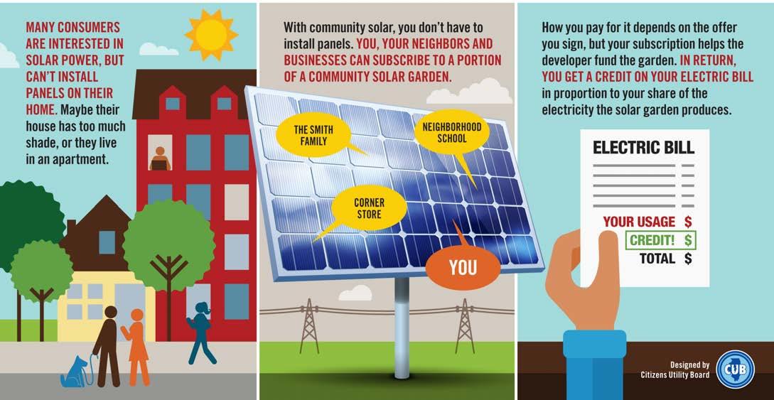
property, but they become part of a larger solar farm. Not only does this provide a sustainable source of energy, but it also creates an opportunity for residents and business owners who may endure challenges such as not having enough sunlight, living in an apartment or other multi-family home, limited space, or financial means. It does not require additional effort on behalf of the resident/business owner since the solar energy is simply supplied to the power company. The owner of the community solar garden pays the upfront costs to build, maintain and connect the garden to the utility’s power grid. Subscribers pay the owner for their portion of the electricity produced. The owner then reports the output of each solar subscription to the utility, and the utility company adds credits to the subscriber’s electric bill equal to that output.
Solar farms should ideally have 10-14 acres of clear, unobstructed land and should be within two miles of a utility substation. Land should also be relatively flat, clear of any open water features, such as ponds, lakes, streams, etc., and have no environmental zoning restrictions. There is an electrical substation located southwest of Aptakisic Road and North Buffalo Grove Road.
106 DRAFT For Review
How Community Solar Works, Source: Citizens Utility Board
Natural Resources & Green Infrastructure
The Village benefits from a wide range of environmental resources including rivers, lakes, wetlands and ponds within the Village limits, many of which are protected by local, county, state and federal regulations. Approximately 14% of the Village of Buffalo Grove is parks and open space. The largest open parcel is home to the Buffalo Grove Golf Club, which is located in the regulatory FEMA floodplain and floodway of Buffalo Creek and Farrington Ditch.
Future development and expansion will need to consider not only smart and innovative infrastructure, but the conservation of wetlands and preservation of the natural characteristics and functions of the watercourses and floodplains, while creating riparian buffers along stream corridors. These combined efforts not only reduce flood damages but prevent erosion. Green infrastructure should be an integral part of stormwater management strategies given the cost-effectiveness of green approaches across a variety of categories. Policies that favor or stimulate the wider adoption of green infrastructure strategies have been gaining notoriety while providing opportunity and available financial resources.
Green infrastructure techniques include using vegetation to control stormwater, restoring wetlands to retain floodwater, installing permeable pavement to mimic natural hydrology, and using or capturing and re-using stormwater more efficiently on-site. By attempting to mimic natural hydrologic functions, such as infiltration and evaporation, these approaches prevent stormwater from flowing into surface waters or storm sewers that may already be under great stress. Green infrastructure is typically used to compliment or assist traditional stormwater management practices and is not meant to replace traditional stormwater management practices. While it is used to compliment a stormwater management system for frequent storm events, they do not target lowfrequency, high volume rainfall events.
Green infrastructure techniques that could be implemented throughout the Village include:
• Green Roads
• Rain gardens throughout the Village and in open spaces

• Rain barrels and downspout disconnection

• Permeable pavement
 Source: CBBEL
Source: MWRDGC
Source: CBBEL
Source: MWRDGC
107 DRAFT For Review
Source: CBBEL
Implementation of smart stormwater management techniques, which should be designed to protect critical habitat and maintain healthy stream corridors, promote and protect the public health, safety, and general welfare of the Village residents and property owners in addition to protecting the Village’s valuable water resources and natural resources, preserving the ecological health. These efforts provide recreational opportunities, provide aesthetic benefits, enhance the community, and promote economic development.

Aging Infrastructure
With numerous opportunities to accommodate significant development and redevelopment within the Village, it is important that future demands on infrastructure are carefully evaluated. Coordination with the Village’s engineering, public works, and water services teams is integral in maintaining aging infrastructure and is critical to ensure that land use and development recommendations can be supported by existing facilities and planned expansions. The infrastructure surrounding any new development and located within the limits of any street maintenance project, including collector roads, should be evaluated to determine the age and condition of the underlying infrastructure. Replacements and/or repairs should be made at this time. All infrastructure improvements should be evaluated during the Phase 2 design and work in conjunction with the Village’s Capital Improvement Plan and Stormwater System’s Study.
For unincorporated areas and for privately owned utilities, development would be required to extend water and sanitary mains for service connection.
108 DRAFT For Review
Source: CBBEL
Stormwater Detention
For those development areas that do not have stormwater detention already constructed, detention will be required in accordance with the requirements set forth in the applicable stormwater ordinance. The Metropolitan Water Reclamation District of Greater Chicago (MWRDGC) Watershed Management Ordinance (WMO) should be used for properties located in Cook County and the Lake County Stormwater Management Commission (LCSMC) Watershed Development Ordinance (WMO) should be used for properties located in Lake County. Detention storage is commonly provided in above-ground stormwater basins/detention ponds. Use of naturalized detention basins is encouraged to enhance the natural landscape of the Village, promote infiltration, and reduce sediment transport to the surface waters.
Roadway Infrastructure Development
The Village has a fully developed street grid with standard curb and gutter cross-sections. Development activities that take place within a public right-of-way or are administered and funded (whole or partially) by a public agency under its respective jurisdiction is considered public road development (Illinois Department of Transportation, Cook County Department of Transportation and Highways and the Lake County Division of Transportation). For roadways in Lake County, if the public roadway development causes an increase of 1.5 acres or more of new impervious surface, it will require both detention storage requirements and runoff volume reduction standards based on the WDO. For roadway projects in Cook County, an increase of impervious area greater than or equal to 1 acre will require both detention storage requirements and volume control based on the WMO.
While traditional stormwater management typically relies on gray infrastructure, in high-density areas incorporating street trees to interact with the hydrologic cycle can improve its ability to manage stormwater runoff. Street
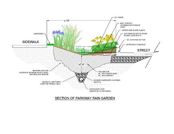
 CBBEL
Source: CBBEL
CBBEL
Source: CBBEL
existing storm sewer system while improving the water quality entering into bodies of surface waters. Systems similar to the Silva Cell (seen in the Silva Cell figure), allows trees to be planted within the impervious surfaces, encouraging infiltration and reducing runoff. Additionally, encourage the existing stormwater system to better drain stormwater runoff by installing curb cuts to create inlets into the parkway to create rain gardens. This would allow runoff to access roadside ditches and promote infiltration prior to discharging into surface waters.
109 DRAFT For Review
Source:
Private Development
This area within this node is primarily commercial with residential located west of Buffalo Grove Bike Path and east of Town Center. Development areas not considered public roadway development that do not have stormwater detention already constructed, because this area is located in Lake County, will be require stormwater detention in accordance with the requirements set forth in the LCSMC WDO because this area is located in Lake County. Detention storage is commonly provided in above-ground stormwater basins/detention ponds. All near-term and future design need to consider increased regional rainfall depths.
Floodplain/Floodway Considerations
Farrington Ditch traverses through the node from north to south, through the Buffalo Grove Golf Course, west of the Buffalo Grove Police Department. There is Zone AE regulatory floodplain and floodway associated with the watercourse prior to its confluence with Buffalo Creek, just north of Lake-Cook Road. Development within these designated areas will require additional permitting
through IDNR-OWR and is considered an area of concern due to the limitations of development. All work within the regulatory floodway of Farrington Ditch and Buffalo Creek must be an appropriate use set forth by the IDNROWR Part 3708 Rules. All work within the regulatory floodplain must meet the requirements of the LCSMC WDO, including compensatory storage at a ratio of 1.2:1 for all volume of floodplain that is filled, thus limiting the development area adjacent to the watercourse.
Wetland Considerations
According to the Lake County Wetland Inventory, there are three wetland areas within the node, one at the south end of the Buffalo Grove Town Center. All three wetlands are located within stormwater management facilities. Efforts should be made to encourage enhancement of these areas while maintaining the natural features. A wetland assessment will need to be completed by a Certified Wetland Specialist and confirmed by the U.S. Army Corps of Engineers prior to development in these areas. Depending on the outcome of the assessment, wetland mitigation and/or buffers may need to be provided for any identified wetland areas.

De PlainesRi e D s P ainesRiver I d Creek BuffaloCreek Buffalo Creek LAKE COUNTY COOK COUNTY Lincolnshire Vernon Hills Long Grove Arlington Heights Wheeling Prospect Heights Riverwoods Ryerson Conservation Area Potawatomi Woods Chevy Chase Country ClubBuffalo Creek Forest Preserve Buffalo Grove Golf Club Willow Stream Park Sullivan Woods TheArbo et m Club HAWTHORNE DR MILLCREE D R CAMBRDIGE DR ROSE BLVD OLDCHECKERRD FARRINGTONDR PAULINE AVE G HLANDGROVEDR W FAB SHDR NEWTOWN DRMARSEILLES CIR THOMPSONBLVD M DA S O N R RB N DYWY N LNTHOMPSON BLVD SHERIDANRD B C W OODLN C SEH TNUT TERRACE AVA NO DR M ADIERA LN WHSPERING OAK RDS N TR A OL A SDR PORT CLINTON RD FREMONT WA ALDENLN SPRINGSIDELN VINTAGE LN PLUM GROVERD W HITE N D BEECHWOOD RD ARMSTRONG DR LEXINGTON DR HAST SGN R BUSCH PKWY ASBURY DR WIL OWPWKY RAUPP BLVD N APPLE HILL LN W DUNDEE RD NMILWAUKEE AVE LAKE COOK RD DEERFIELD RD HALF DAY RD W HALF DAY RD N MILWAUKEE AVE PORT CLINTON RD APTAKISIC RD N BUFFALO GROVE RD N BUFFALO GROVE RD N BUFFALO GROVE RD MCHENRYRD WEILAND RD ARLINGTON HEIGHTS RD MCHENRY RD PRAIRIE RD APTAKISIC RD BARCLAY BLVD BARCLAY BLVDDEERFIELD PKWY CHECKER RD W DUNDEE RD E DUNDEE RD NRANDRD OLD HICKS RD N HICKS RD LAKE COOK RD LAKE COOK RD 94 294 64 45 45 45 22 22 53 53 6453 83 83 53 12 METRA NCS LINE PRAIRIE VIEW BUFFALO GROVE WHEELING 0.5 Mile Dundee Rd & Arlington Heights Rd Mike RylkoParkCommunity Campus Dundee Rd & Buffalo Grove Rd Town Center Development Prairie View Metra Station Area Community Nodes Town Center Development 1 23 5 4 1 Floodplains and Stormwater 110 DRAFT For Review
Dundee Road & Buffalo Grove Road
Private Development
This area within this node is primarily commercial. There is one development proposed within this corridor located at the southeast corner of Dundee Road and Buffalo Grove Road. Development areas not considered public roadway development that do not have stormwater detention already constructed, because this area is located in Cook County, will be require stormwater detention in accordance with the requirements set forth in the MWRDGC WMO. There is one Detention storage is commonly provided in above-ground stormwater basins/ detention ponds. All near-term and future design need to consider increased regional rainfall depths.
Floodplain/Floodway Considerations
There is no regulatory floodplain or floodway within the Dundee Road and Buffalo Grove Road corridor.
Wetland Considerations
According to the National Wetland Inventory, there are three wetland areas within the node, all of which are associated with existing stormwater facilities. Efforts should be made to encourage enhancement of these areas while maintaining the natural features. A wetland assessment will need to be completed by a Certified Wetland Specialist and confirmed by the U.S. Army Corps of Engineers prior to development in these areas. Depending on the outcome of the assessment, wetland mitigation and/or buffers may need to be provided for any identified wetland areas.
Dundee Road & Arlington Heights Road
Private Development
This area within this node is primarily commercial. Development areas not considered public roadway development that do not have stormwater detention already constructed, because this area is located in Cook County, will be require stormwater detention in accordance with the requirements set forth in the MWRDGC WMO. Detention storage is commonly provided in above-ground stormwater basins/detention ponds. All near-term and future design need to consider increased regional rainfall depths.
Floodplain/Floodway Considerations
There is no regulatory floodplain or floodway within the Prairie View Metra Station Area.
Wetland Considerations
According to the National Wetland Inventory, there are our wetland areas within the node: two associated with stormwater management facilities within the Villa Verde Condominium Development; one associated with the stormwater facility west of Trace Drive; and one along South Arlington Heights Road, on both the north and south sides of Happfield Drive. All four wetlands are associated with stormwater management facilities. Efforts should be made to encourage enhancement of these areas while maintaining the natural features. A wetland assessment will need to be completed by a Certified Wetland Specialist and confirmed by the U.S. Army Corps of Engineers prior to development in these areas. Depending on the outcome of the assessment, wetland mitigation and/or buffers may need to be provided for any identified wetland areas.
2 3 111 DRAFT For Review
Prairie View Metra Station
Private Development
A development plan was prepared by Ratio in 2019 for the overall 128-acre Prairie View Metra Station Area. Development areas not considered public roadway development that do not have stormwater detention already constructed, because the shopping center area is located north of Lake-Cook Road and is located in Lake County, will be require stormwater detention in accordance with the requirements set forth in the LCSMC WDO because this area is located in Lake County.
Floodplain/Floodway Considerations
There is no regulatory floodplain or floodway within the Prairie View Metra Station Area.
Wetland Considerations
According to the Lake County Wetland Inventory, there are several wetland areas within the node. The wetland areas are generally associated with open space areas of Vernon Township, the Buffalo Grove Fire Department Station 27, and undeveloped property partially within the Village and partially unincorporated. Efforts should be made to encourage enhancement of these areas while maintaining the natural features. A wetland assessment will need to be completed by a Certified Wetland Specialist and confirmed by the U.S. Army Corps of Engineers prior to development in these areas. Depending on the outcome of the assessment, wetland mitigation and/or buffers may need to be provided for any identified wetland areas.
Mike Rylko Community Park Campus
Private Development
This area within this node is primarily open space and residential. The Mike Rylko Community Park serves as the focal point for this node. Development areas not considered public roadway development that do not have stormwater detention already constructed, because this area is located in Lake County, will be require stormwater detention in accordance with the requirements set forth in the LCSMC WDO because this area is located in Lake County. Detention storage is commonly provided in above-ground stormwater basins/detention ponds. All near-term and future design need to consider increased regional rainfall depths.
Floodplain/Floodway Considerations
Farrington Ditch traverses through the node from north to south. There is no regulatory floodplain associated with the watercourse until south of Old Checker Road, therefore it does not fall under the regulation of IDNR-OWR requirements. However, it does have greater than 100 acres of tributary area and therefore is considered a riverine flood-prone area according to the LCSMC WDO. A base flood elevation (BFE) determination would be required for this area to determine the 100-year floodplain elevations and corresponding limits. All work within the regulatory floodplain must meet the requirements of the LCSMC WDO, including compensatory storage at a ratio of 1.2:1 for all volume of floodplain that is filled, thus limiting the development area adjacent to the watercourse.
Wetland Considerations
According to the Lake County Wetland Inventory, there are several wetland areas within the node, including within the park and in the adjacent subdivision to the east. The wetlands within the park are adjacent to Farrington Ditch. North of Deerfield Parkway, within Greek Lake Park, there is wetland area associated with the Greek Lake Park Pond and further north in the open space area. Efforts should be made to encourage enhancement of these areas while maintaining the natural features. A wetland assessment will need to be completed by a Certified Wetland Specialist and confirmed by the U.S. Army Corps of Engineers prior to development in these areas. Depending on the outcome of the assessment, wetland mitigation and/or buffers may need to be provided for any identified wetland areas.
54 112 DRAFT For Review
Private Development
Because this area is located in Lake County, development areas not considered public roadway development that do not have stormwater detention already constructed will be require stormwater detention in accordance with the requirements set forth in the LCSMC. Additionally, there is Zone AE regulatory floodplain associated with the South Branch Indian Creek within the regional node. All near-term and future design need to consider increased regional rainfall depths.
Floodplain/Floodway Considerations
The South Branch Indian Creek is located along the western edge of the neighborhood node. There is regulatory floodplain and floodway associated with the creek. The Tributary to Aptakisic Creek is also located along the southern portion of the node, south of Half Day Road. Both creeks traverse through the Arboretum Club. Development within these designated areas will require additional permitting through the Illinois Department of Natural Resources - Office of Water Resources (IDNROWR) and is considered an area of concern due to the limitations of development. All work within the
regulatory floodway of Aptakisic Creek must be an appropriate use set forth by the IDNR-OWR Part 3708 Rules. All work within the regulatory floodplain must meet the requirements of the LCSMC WDO, including compensatory storage at a ratio of 1.2:1 for all volume of floodplain that is filled, thus limiting the development area adjacent to the watercourse. It is recommended that this open space area remain a natural feature of the Village.
Wetland Considerations
According to the Lake County Wetland Inventory, there are wetland areas adjacent to the Tributary to Aptakisic Creek, within the Arboretum Club. These areas are currently open space/floodplain/floodway. There are also wetland areas north of Half Day Road within the Vernon Township open space areas. Efforts should be made to encourage enhancement of the Village-owned and Vernon Township open space areas while maintaining the natural features. A wetland assessment will need to be completed by a Certified Wetland Specialist and confirmed by the U.S. Army Corps of Engineers prior to development in these areas. Depending on the outcome of the assessment, wetland mitigation and/or buffers may need to be provided for any identified wetland areas.
Neighborhood Nodes Des P ainesRiver D PlainesRive nd an Creek BuffaloCreek Buffalo Creek LAKE COUNTY COOK COUNTY Lincolnshire Vernon Hills Long Grove Arlington Heights Wheeling Prospect Heights Riverwoods Ryerson Conservation Area Potawatomi Woods Chevy Chase Country ClubBuffalo Creek Forest Preserve Buffalo Grove Golf Club Willow Stream Park Sullivan Woods TheAbore m Club HAWTHORNE DR MILLCREE K D R CAMBRDIGE DR ROSE BLVD OLDCHECKERRD FARRINGTONDR PAULINE AVE H G HLANDGROVEDR W AB SHDR NEWTOWN DRMARSEILLES CIR THOMPSONBLVD M DA O N D R RB A N DYWY N LNTHOMPSON BLVD SHERIDANRD B R H W OODLN C EH TNUT TERRAC AVA L NO R M ADIERA LN WHISPERING OA RDS N TR OLIA A K SDR PORT CLINTON RD FREMONT WA Y ALDENLN SPRINGSIDELN VINTAGE LN PLUM GROVERD W HITE N E R BEECHWOOD RD ARMSTRONG DR LEXINGTON DR HAST SGN D BUSCH PKWY ASBURY DR W LOWPWKY RAUPP BLVD N APPLE HILL LN W DUNDEE RD NMILWAUKEE AVE LAKE COOK RD DEERFIELD RD HALF DAY RD W HALF DAY RD N MILWAUKEE AVE PORT CLINTON RD APTAKISIC RD N BUFFALO GROVE RD N BUFFALO GROVE RD N BUFFALO GROVE RD MCHENRYRD WEILAND RD ARLINGTON HEIGHTS RD MCHENRY RD PRAIRIE RD APTAKISIC RD BARCLAY BLVD BARCLAY BLVDDEERFIELD PKWY CHECKER RD W DUNDEE RD E DUNDEE RD NRANDRD OLD HICKS RD N HICKS RD LAKE COOK RD LAKE COOK RD 94 294 64 45 45 45 22 22 53 53 6453 83 83 53 12 METRA NCS LINE PRAIRIE VIEW BUFFALO GROVE WHEELING 0.5 Mile Chase Plaza Shopping &Office Area McHenry Rd &Arlington Heights Rd Buffalo Grove Rd & Aptakisic Rd Woodland Commons Deerfield Pkwy &Weiland Rd
6 6 7 8 9 10 113 DRAFT For Review
Woodland Commons
Chase Plaza Shopping & Office Area
Private Development
Development areas not considered public roadway development that do not have stormwater detention already constructed, because the shopping center area is located north of Lake-Cook Road and is located in Lake County, will be require stormwater detention in accordance with the requirements set forth in the LCSMC WDO because this area is located in Lake County. Detention storage is commonly provided in above-ground stormwater basins/detention ponds. Additionally, there is Zone AE regulatory floodplain associated with Buffalo Creek within the regional node. All near-term and future design need to consider increased regional rainfall depths.
Floodplain/Floodway Considerations
Buffalo Creek flows from northwest to southeast, through the Village of Buffalo Grove Open Space area and the Buffalo Grove Golf Course, immediately downstream of the Buffalo Creek Flood Control Reservoir. Aspen Ditch flows into Buffalo Creek approximately 900’ east of Arlington Heights Road. Development within these designated areas will require additional permitting through the Illinois Department of Natural Resources - Office of Water Resources (IDNR-OWR) and is considered an area of concern due to the limitations of development. All work within the regulatory floodway of Aptakisic Creek must be an appropriate use set forth by the IDNROWR Part 3708 Rules. All work within the regulatory floodplain must meet the requirements of the LCSMC WDO, including compensatory storage at a ratio of 1.2:1 for all volume of floodplain that is filled, thus limiting the development area adjacent to the watercourse.
Wetland Considerations
According to the Lake County Wetland Inventory, there are wetland areas adjacent to Buffalo Creek and associated with the ponds located with the developed areas and the golf course. These areas are currently open space/open water/stormwater facilities and efforts should be made to encourage enhancement of these areas while maintaining the natural features. A wetland assessment will need to be completed by a Certified Wetland Specialist and confirmed by the U.S. Army Corps of Engineers prior to development in these areas. Depending on the outcome of the assessment, wetland mitigation and/or buffers may need to be provided for any identified wetland areas.
McHenry Rd & Arlington Heights Rd
Private Development
There is limited open space within this node. It is primarily residential with the open space areas being parks. Development areas not considered public roadway development that do not have stormwater detention already constructed, because this area is located in Lake County, will be require stormwater detention in accordance with the requirements set forth in the LCSMC WDO because this area is located in Lake County. Detention storage is commonly provided in above-ground stormwater basins/detention ponds. Additionally, there is Zone AE regulatory floodplain associated with Buffalo Creek within the regional node. All near-term and future design need to consider increased regional rainfall depths.
Floodplain/Floodway Considerations
Buffalo Creek flows from north to south through Bridgewater Farm on the western edge of the node, with only a small portion of the creek located within the Village in this node. There is Zone AE regulatory floodplain and floodway associated with the creek at this location. The remaining open space areas within the node do not have floodplain or floodway associated with them. Development that impacts the Buffalo Creek floodplain/floodway will require additional permitting through the Illinois Department of Natural Resources - Office of Water Resources (IDNROWR) and is considered an area of concern due to the limitations of development. All work within the regulatory floodway of Aptakisic Creek must be an appropriate use set forth by the IDNR-OWR Part 3708 Rules. All work within the regulatory floodplain must meet the requirements of the LCSMC WDO, including compensatory storage at a ratio of 1.2:1 for all volume of floodplain that is filled, thus limiting the development area adjacent to the watercourse.
Wetland Considerations
According to the Lake County Wetland Inventory, there are two wetland areas within the limits of the node associated with open space and existing stormwater storage facilities. Efforts should be made to encourage enhancement of these areas while maintaining the stormwater features. A wetland assessment will need to be completed by a Certified Wetland Specialist and confirmed by the U.S. Army Corps of Engineers prior to development in these areas. Depending on the outcome of the assessment, wetland mitigation and/or buffers may need to be provided for any identified wetland areas.
7 8 114 DRAFT For Review
Deerfield Parkway & Weiland Rd
Private Development
Because this area is located in Lake County, development areas not considered public roadway development that do not have stormwater detention already constructed will be require stormwater detention in accordance with the requirements set forth in the LCSMC. There is one proposed development currently proposed located at 106051 Deerfield Parkway. It will consist of a new multi-family development with associated open space and a stormwater management facility. There is Zone AE regulatory floodplain associated with Aptakisic Creek within the regional node. All near-term and future design need to consider increased regional rainfall depths.
Floodplain/Floodway Considerations
Aptakisic Creek flows from northwest to southeast, crossing Deerfield Parkway just west of Weiland Road, and then continues to flow northeast. There is regulatory floodplain and floodway associated with the creek through the node. 1,600 feet west of the intersection of Deerfield Parkway and Milwaukee Road and it contains both regulatory floodplain and floodway, as shown on the Deerfield Parkway/Milwaukee Road Figure. Development within these designated areas will require additional permitting through the Illinois Department of Natural Resources - Office of Water Resources (IDNR-OWR) and is considered an area of concern due to the limitations

of development. All work within the regulatory floodway of Aptakisic Creek must be an appropriate use set forth by the IDNR-OWR Part 3708 Rules. All work within the regulatory floodplain must meet the requirements of the LCSMC WDO, including compensatory storage at a ratio of 1.2:1 for all volume of floodplain that is filled, thus limiting the development area adjacent to the watercourse.
Wetland Considerations
According to the National Wetland Inventory, there are wetland areas adjacent to Aptakisic Creek and along south of Deerfield Parkway and west of Weiland Road on areas located within Park District property. There are also wetland areas located within the open space and floodplain areas. Efforts should be made to encourage enhancement of these areas while maintaining the natural features. A wetland assessment will need to be completed by a Certified Wetland Specialist and confirmed by the U.S. Army Corps of Engineers prior to development in these areas. Depending on the outcome of the assessment, wetland mitigation and/or buffers may need to be provided for any identified wetland areas.
9 115 DRAFT For Review
Buffalo Grove Road & Aptakisic Rd
Private Development
Development areas not considered public roadway development that do not have stormwater detention already constructed, because this area is located in Lake County, will be require stormwater detention in accordance with the requirements set forth in the LCSMC WDO because this area is located in Lake County. Detention storage is commonly provided in aboveground stormwater basins/detention ponds. Additionally, there is Zone A and AE regulatory floodplain associated with Aptakisic Creek and Zone AE regulatory floodplain associated with the Tributary to Aptakisic Creek within the regional node. All near-term and future design need to consider increased regional rainfall depths.
Floodplain/Floodway Considerations

Aptakisic Creek flows from west to southeast, crossing Buffalo Grove Road, south of Aptakisic Road. There is Zone A regulatory floodplain that changes to Zone AE regulatory floodplain and floodway through the node as it traverses Twin Peaks Park. This open space/ floodplain area west of Buffalo Grove Road is owned by the Village. On the east side of Buffalo Grove Road, the open space on the south side of the creek is owned by the Village and the north side of the creek is owned by Commonwealth Edison. North of Aptakisic Road, there is Zone AE regulatory floodplain and floodway associated with the Tributary to Aptakisic Creek. This floodplain area
is primarily located on property owned by the Village and the Park District.
Development within these designated areas will require additional permitting through the Illinois Department of Natural Resources - Office of Water Resources (IDNROWR) and is considered an area of concern due to the limitations of development. All work within the Zone A floodplain of Aptakisic Creek must comply with IDNR-OWR Part 3700 Rules. All work within the regulatory floodway of Aptakisic Creek must be an appropriate use set forth by the IDNR-OWR Part 3708 Rules. All work within the regulatory floodplain must meet the requirements of the LCSMC WDO, including compensatory storage at a ratio of 1.2:1 for all volume of floodplain that is filled, thus limiting the development area adjacent to the watercourse.
Wetland Considerations
According to the Lake County Wetland Inventory, there are wetland areas adjacent to both Aptakisic Creek and the Tributary to Aptakisic Creek. These areas are currently open space/floodplain/floodway and efforts should be made to encourage enhancement of these areas while maintaining the natural features. A wetland assessment will need to be completed by a Certified Wetland Specialist and confirmed by the U.S. Army Corps of Engineers prior to development in these areas. Depending on the outcome of the assessment, wetland mitigation and/or buffers may need to be provided for any identified wetland areas.
10 116 DRAFT For Review
Regional Community Nodes
Private Development
Because this area is located in Lake County, development areas not considered public roadway development that do not have stormwater detention already constructed will be require stormwater detention in accordance with the requirements set forth in the LCSMC. Additionally, there is Zone AE regulatory floodplain associated with Aptakisic Creek within the regional node. All near-term and future design need to consider increased regional rainfall depths.
Floodplain/Floodway Considerations
Aptakisic Creek is located approximately 1,600 feet west of the intersection of Deerfield Parkway and Milwaukee Road and it contains both regulatory floodplain and floodway, as shown on the Deerfield Parkway/Milwaukee Road Figure. Development within these designated areas will require additional permitting through the Illinois Department of Natural Resources - Office of Water Resources (IDNR-OWR) and is considered an area of concern due to the limitations of development. All work within the regulatory floodway of Aptakisic Creek must bean appropriate use set forth by the IDNR-OWR Part 3708 Rules. All work within the regulatory floodplain must
meet the requirements of the LCSMC WDO, including compensatory storage at a ratio of 1.2:1 for all volume of floodplain that is filled, thus limiting the development area adjacent to the watercourse.
Wetland Considerations
According to the Lake County Wetland Inventory, there are wetland areas adjacent to Aptakisic Creek and along Milwaukee Avenue, north of Deerfield Parkway and in the southwest corner of Deerfield Parkway and Milwaukee Avenue. A wetland assessment will need to be completed by a Certified Wetland Specialist and confirmed by the U.S. Army Corps of Engineers prior to development in these areas. Depending on the outcome of the assessment, wetland mitigation and/or buffers may need to be provided for any identified wetland areas. Therefore, development in these areas may have limitations of development.
Deerfield Parkway/Milwaukee Road Des PlainesRiver D PlainesRive Indian Creek BuffaloCreek Buffalo Creek LAKE COUNTY COOK COUNTY Lincolnshire Vernon Hills Long Grove Arlington Heights Wheeling Prospect Heights Riverwoods Ryerson Conservation Area Potawatomi Woods Chevy Chase Country ClubBuffalo Creek Forest Preserve Buffalo Grove Golf Club Willow Stream Park Sullivan Woods TheAbore m Club HAWTHORNE DR MILLCREE K D R CAMBRDIGE DR ROSE BLVD OLDCHECKERRD FARRINGTONDR PAULINE AVE H G HLANDGROVEDR W FAB SHDR NEWTOWN DRMARSEILLES CIR THOMPSONBLVD M DA O N D R RB A N DYWY N LNHOMPSON BLVD SHERIDANRD B R H W OODLN C EH TNUT TERRACE AVA L NO R M ADIERA LN WHISPERING OA RDS N TR OLIA A K SDR PORT CLINTON RD FREMONT WA Y ALDENLN SPRINGSIDELN VINTAGE LN PLUM GROVERD W HITE N E R BEECHWOOD RD ARMSTRONG DR LEXINGTON DR HAST SGN D BUSCH PKWY ASBURY DR W LOWPWKY RAUPP BLVD N APPLE HILL LN W DUNDEE RD NMILWAUKEE AVE LAKE COOK RD DEERFIELD RD HALF DAY RD W HALF DAY RD N MILWAUKEE AVE PORT CLINTON RD APTAKISIC RD N BUFFALO GROVE RD N BUFFALO GROVE RD N BUFFALO GROVE RD MCHENRYRD WEILAND RD ARLINGTON HEIGHTS RD MCHENRY RD PRAIRIE RD APTAKISIC RD BARCLAY BLVD BARCLAY BLVDDEERFIELD PKWY CHECKER RD W DUNDEE RD E DUNDEE RD NRANDRD OLD HICKS RD N HICKS RD LAKE COOK RD LAKE COOK RD 94 294 64 45 45 45 22 22 53 53 6453 83 83 53 12 METRA NCS LINE PRAIRIE VIEW BUFFALO GROVE WHEELING 0.5 Mile Deerfield Pkwy &Milwaukee Rd
117 DRAFT For Review 11 11
Parks and Open Space Recommendations

As discussed in the 2017 Park District Master Plan (Plan) there are 51 park sites in the Village, which are comprised of mini parks, community parks, neighborhood parks, facilities, special use parks and detention/open spaces totaling over 417 acres. The overall distribution of parks and facilities is generally well covered in the Village, except for a small portion east of Weiland Road and north of Lake Cook Road, which is not covered by neighborhood or mini parks. The Park District provides 9.07 acres of developed land per 1.000 people, which exceeds the National Recreation and Park Association (NRPA) recommendation. The Plan indicates that the Park District is deficient in the acreage per population for Mini Parks, but exceeds the acreage for Community Parks and Neighborhood Parks. Based on the results of the Plan, while the density of parks per population exceeds the national recommendation of 6.25 acres per 1,000 people, there are improvements that will need to be made to the existing facilities to maintain their usership in addition to extending their life span. The Master Plan provided recommendations to the existing parks within the Village that include a range or improvements from vegetation management, to increasing accessibility for citizens of all ages to establishing a standard marquee sign for all parks. As park updates are made and new open spaces are created, it is recommended that reference be made to the Village’s 2020 Sustainability Plan to meet or exceed the outlined goals.
Community parks range in size from 15 to 50 acres and typically have a 1 to 3 mile radius of service, while neighborhood parks generally range in size from 5 to 10 acres. Sites as small as 2 acres can be appropriate for neighborhood parks as well. Neighborhood parks are designated for a ¼ to ½ mile radius of service. Mini parks are designated for a ¼ mile radius of service and are 1.5 acres or less in size. Detention and open spaces are primarily designed and used to mitigate stormwater runoff, but can serve as informal playing fields. Listed below is a summary of locations where parks/open space areas can be created as development occurs within the Village.

 Emmerich Park, Source: Google Earth Pro
Woodland Park, Source: Google Earth Pro
Emmerich Park, Source: Google Earth Pro
Woodland Park, Source: Google Earth Pro
118 DRAFT For Review
Twin Creeks Park, Source: Google Earth Pro
Location of new parks
Land and Lakes Site
This site is almost entirely floodplain area which provides opportunity for incorporating outdoor recreational and open space areas during development, while enhancing the floodplain. If high-end/luxury residential is proposed in this area, creating of a park adjacent to the floodplain will provide both an opportunity to connect to the Village’s trail system on the west side of Aptakisic Creek in addition to providing open space in an area that is outside of the community park service area. The site’s proximity to the adjacent Forest Preserve on the east side of Milwaukee Avenue will tie new development into the existing landscape.
Vacant Lot (Area B) in Unincorporated Lake County
This area is adjacent to both the Aptakisic and Des Plaines River floodplains. Because this area presents a major opportunity for high-quality multifamily, luxury apartments, or senior housing, development of floodplain areas will provide connectivity to the Des Plaines River trial system, while enhancing the natural features of the watercourses.
Northwood Park/Detention Basin
This site serves as a stormwater basin for the adjacent neighborhood. Enhancements to this area, including amenities found in Mini Parks, will provide the distribution needed to incorporate a public space in the area north of Lake Cook Road and east of Weiland Road.
East Side of Milwaukee Avenue and North of Lake Cook Road (Area C) in Unincorporated Lake County
Similar to Area B, this area is adjacent to the Des Plaines River and there is significant floodplain and floodway. Because the area is an opportunity for multifamily development along the rear, adjacent to the river, creation of open space/parks in this area can provide a dual benefit of stormwater/floodplain management and connectivity to the Des Plaines River trial system.
Vernon Township Open Space, Northeast of Indian Creek Drive
Located just outside of the Community Parks Service Area, the open space adjacent to the Indian Creek floodplain can be utilized for a park within the residential neighborhood. Creation of a park in this location can also provide an opportunity for enhancements to the adjacent floodplain. A connection to the Village’s trail system can also be made at this location.
The Park District has created an Environmental Action Team (Team) to raise awareness and improve the Village’s natural environment while encouraging sustainable practices. In addition to the Team, the Illinois Park and Recreation Association (IPRA) prepared an Environmental Report Card outlining environmental initiatives and green practices as well as reference should be made to the Sustainable Sites Initiative (SITES) program for sustainable practices when creating new or improving existing park areas.
2 1 3 4 5
119 DRAFT For Review
Buffalo Grove Municipal Boundary
Lake-Cook County Boundary Railroad Metra Station
Interstate, Highways & Major Roadways Trails Forest Preserve Local Parks/Open Space Parks
Canterbury Park
Woodland Park
Apple Hill Park
Prarie Grove Park Churchill Park Twin Creeks Park Prairie Park Oxford Park Children’s Park
Raupp Memorial Park Green Lake Park Westchester Park
Old Farm Park
Veteran’s Park Fitness Center Spray ‘N Play
Golf & Sports Center
Land and Lakes Site Vacant Lot (Area B) in Unincorporated Lake County Northwood Park/Detention Basin
East Side of Milwaukee Avenue and North of Lake Cook Road (Area C) in Unincorporated Lake County
Vernon Township Open Space, Northeast of Indian Creek Drive
Cherbourg Park Highland Point Park Parkchester Park
Northwood Park Tartan Park Commons Park Nicole Park Emmerich East Park Emmerich Park Weidner Park Winfield Park Lions Park Windsor Ridge Park Bison Park Cambridge Park Mill Creek Park
Creek BuffaloCreek Vernon
Long Grove
Buffalo Creek Forest Preserve Buffalo Grove Golf Club Willow Stream Park Mike Rylko Community Park Sullivan Woods TheArboretum Club HAWTHORNE DR MILLCREE K D R ROSE BLVD OLDCHECKERRD FARRINGTONDR PAULINE H I G HLANDGROVE W FABISH MARSEILLES CIR THOMPSO RB A N DYWY N LNTHOMPSON BLVD SHERIDANRD B I R C H W OODLN C SEH TNUT TERRAC WHISPERING OAK RDS N TR OLIA A K SDR PORT CLINTON RD FREMONT WA Y ALDENLN SPRINGSIDELN VINTAGE LN PLUM GROVERD W HITE P I N E R D BEECHWOOD RD WILLOWPWKY RAUPP BLVD W HALF DAY RD APTAKISIC RD N BUFFALO GROVE RD N BUFFALO GROVE RD N BUFFALO GROVE RD ARLINGTON HEIGHTS RD MCHENRY RD DEERFIELD PKWY CHECKER RD W DUNDEE RD E DUNDEE RD NRANDRD LAKE COOK RD LAKE COOK RD 22 53 53 6453 83 53 12 PARKS &
Legend
Indian
Hills
Arlington Heights
NATURAL RESOURCES
Village of
0 0.5 10.25 MileNorth 5 Proposed
23 24 109 181 192 203 214 225 236 247 258 269 2710 2811 2912 3013 31 32 33 14 15 17 16 11 7 6 5 2 1 4 12 13 18 16 15 17 8 25 29 30 31 33 26 27 28
Buffalo Grove, IL
New Parks
1 2 3 4 5 120 DRAFT For Review
Des PlainesRiver D e s PlainesRiver Buffalo Creek LAKE COUNTY COOK COUNTY Lincolnshire Wheeling Prospect Heights Riverwoods Ryerson Conservation Area Potawatomi Woods Chevy Chase Country Club CAMBRDIGE DR PAULINE AVE DR H DR NEWTOWN DR ONBLVD M DA I S O N D R E AVA L NO DR M ADIERA LN ARMSTRONG DR LEXINGTON DR HAST I SGN D R BUSCH PKWY ASBURY DR N APPLE HILL LN W DUNDEE RD NMILWAUKEE AVE LAKE COOK RD DEERFIELD RD HALF DAY RD RD N MILWAUKEE AVE PORT CLINTON RD MCHENRYRD WEILAND RD PRAIRIE RD APTAKISIC RD BARCLAY BLVD BARCLAY BLVDPKWY LAKE COOK RD 94 294 64 45 45 45 22 83 PRAIRIE VIEW BUFFALO GROVE WHEELING METRA NCS LINE 1 2 3 4 3 13 22 19 20 21 14 32 121 DRAFT For Review
Natural Resources, Open Space and Parks Goals and Strategies
Theme 1: Commercial/Civic Nodes Framework
Goal 1: Integrate and enhance landscaping and other natural spaces as appropriate.
Objective 1: Create an attractive, walkable pedestrian environment within and between commercial districts and neighborhoods through careful site planning, architectural design, and provision of pedestrian amenities such as sidewalks, benches, plaza areas, information kiosks, and other street furniture.
Objective 2: Encourage the use of creative landscape designs to visually define districts and reduce conflicts between residential and commercial land uses.
Objective 3: Explore opportunities to display public art to help activate public spaces through collaboration with local partners.
Objective 3: Provide natural landscape berms to separate roadways from development.
Goal 2: Protect and enhance natural and open spaces by regulating development in floodplain and wetlands.
Objective 1: Regulate development in open/vacant lots to preserve existing green spaces and create new green spaces to reduce risk of flood hazards.
Objective 2: Maintaining existing features and levels of service in addition to preparing for future development within the Village.
122 DRAFT For Review
Theme 2: Aging in Place
Goal 1: Enhance accessibility and functionality of open spaces, parks, and natural resources
Objective 1: Create design standards for public open space that incorporate ADA requirements and Universal Design principals to provide equitable access and accommodate residents of all age and ability.
Objective 2: Enhance existing open and public spaces with seating, lighting, wayfinding.. etc.
Objective 3: Incorporate upgrades to accommodate ADA accessibility during streetscape projects and roadway improvements that correspond to the CIP and Stormwater System’s Study.
Theme 3: Increasing Housing Diversity and Affordability
Goal 1: Provide adequate community outdoor space in each neighborhood
Objective 1: As redevelopment and development occurs, look for development plans to provide open space, in large open parks, tot lots, small plazas, and/or other types of open space.
Objective 2: Initiate community needs assessments to determine how and where parks and green spaces can be most impactful for communities to yield outsized benefits.
123 DRAFT For Review
Theme 5: Sustainable Strategies
Objective 1: Provide incentives to create neighborhood parks, green spaces, or other public open spaces throughout the Village, particularly within commercial and mixed-use corridors.
Objective 2: Explore transitional uses for vacant lots which would provide recreational amenities or ecosystem services.
Objective 3: Provide educational workshops to residents about how they can do their part in creating a sustainable community
Objective 1: Protect landscape zones from future development.
Objective 2: Promote the use of native plants and landscaping Village-wide to mimic natural communities and systems, to protect critical habitat and maintain healthy streams.
Objective 3: Foster stewardship and a sense of pride in the green spaces in the community by incorporating BMP’s in public spaces and maintaining a high standard of design. Offer educational workshops that encourage residents to apply lessons from those public spaces in their own back yards.
Objective 1: Assess existing parks and stormwater management facilities for implementation of stormwater BMPs and green infrastructure retrofits
Objective 2: Consult SITES checklist for open space BMPs at www.usgbc.org/ resources/sites-rating-systemand-scorecard. Certification should be considered for any new parks and open space acquisitions.
Objective 3: Incorporate stormwater management techniques to promote infiltration, including permeable pavement, parkway trees, and bioswales thus reducing pollutant discharge to surface waters through conventional infrastructure.
Objective 4: Promote the use of rain gardens by building a community Rain Garden and providing signage and educational programming.
Objective 5: Educate and support individual homeowners in their efforts to integrate BMP’s on their properties, including rain barrels and rain gardens.
Goal 1: Prioritize environmental policies that create value and balance quality of life, economic development and access to recreational amenities.
Goal 2: Preserve the Village’s natural resources and unique landscapes, such as the adjacent Forest Preserves, Des Plaines River, and creeks by creating landscape zones within the Village that are both functional and beautiful.
Goal 3: Define community infrastructure improvements that alleviate stormwater and flood impacts through sustainable detention strategies.
124 DRAFT For Review
Goal 4: Examine the possibility of a Community Solar Project.
Objective 1: Survey the residents and business owners to determine the interest in a community solar project.
Objective 2: Promote value of solar energy by hosting an informational meeting for residents and business owners describing the cost, benefits, and how it is funded and credited on electric bills.
Objective 2: Explore viable sites within the Village that meet the minimum criteria of a community solar farm installation.
125 DRAFT For Review
Dundee Road Corridor

Chapter7
DRAFT For Review
Dundee Road Corridor looking southeast, Source: Google Earth Pro
Corridor Plans

Milwaukee Avenue Corridor
DRAFT For Review
Source: Google Earth Pro
Dundee Road Corridor

BUFFALOGROVEROAD
Dundee Road Corridor is Buffalo Grove’s original commercial street, and a major east-west arterial in the northern part of Cook County today. The corridor offers great potential to be transformed to a multi-modal street that can attract new walkable developments to the Village. Dundee Road Corridor looking southeast, Source: Google Earth Pro DUNDEE ROAD DUNDEE ROAD128
DRAFT For Review
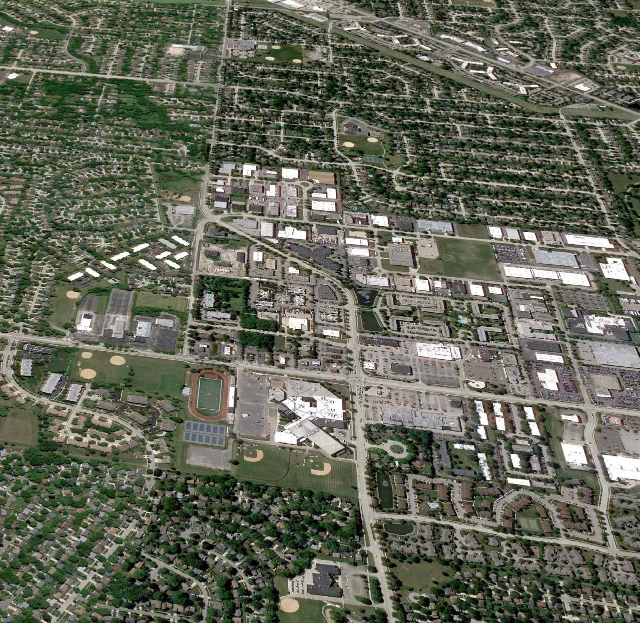 ARLINGTON HEIGHTS ROAD
129 DRAFT For Review
DUNDEE ROAD
Overview


Dundee Road Corridor was at one time Buffalo Grove’s original commercial street, serving as a major retail center for the Village. According to the Encyclopedia of Chicago, “In the 1930s Dundee Road became the first state concrete road in northern Illinois”. Ranch Mart Shopping Center, currently The Plaza at the Buffalo Grove intersection, opened in 1964. The corridor has been significantly built up for decades, with minimal vacant land for new development. Aerial views from 1994 (below) show that very little has changed in this corridor in the last few decades.
Today, Dundee Road (IL 68) is a major east-west corridor in northern Cook County and serves Buffalo Grove and the neighboring communities of Arlington Heights and Wheeling. Designated as a Major Arterial by IDOT, the road carries an average traffic of 22,700-26,400 daily. The two major commercial nodes are at the Arlington Heights Road and Buffalo Grove Road intersections.
 Dundee Road Corridor in 1994, Source:
Arlington Heights Road Intersection
Buffalo Grove Road Intersection
Dundee Road Corridor in 1994, Source:
Arlington Heights Road Intersection
Buffalo Grove Road Intersection
ARLINGTON HEIGHTS ROAD BUFFALO GROVE ROAD 130 DRAFT For Review
DUNDEE ROAD
The Corridor Today
This two mile corridor is a typical suburban car-oriented commercial arterial with residential uses interspersed between major intersections. The western part of the road, towards IL 53 falls in the Village of Arlington Heights. This approx. 0.64 mile stretch of Dundee Road has only commercial and industrial uses, with car dealerships as the single largest use. Rising vacancies in big box buildings, large surface parking lots and dated commercial buildings create a challenging entryway to Buffalo Grove from the west.
Commercial
• Major commercial nodes are at the Arlington Heights Road and Buffalo Grove Road intersections. Aldi, Starbucks, Walgreens, Noodles & Company, Seoul Supermarket and Dollar Tree are major retail uses at the Arlington Heights Road intersection. Garden Fresh Market is the major anchor at the Buffalo Grove Road intersection with a variety of other outlots and commercial uses on all four corners. Restaurants are primarily fast food chains.
• There are over six banks on this two mile corridor and small local office uses in strip retail centers. There are no major medical and health related facilities.
• Mid-block retail centers between Vernon Lane and Golfview Terrace are dated and at risk of long-term survival.
Residential
• The corridor offers significant multifamily housing including condominiums, apartments, duplexes and townhomes. Most complexes are generally at least over a decade old. Park Wellington, one of the newer condominium complexes on Dundee Road near the High School is located within the Arlington Heights Village boundary. There are no new senior housing or higher end apartment complexes in the corridor today.
• The corridor also has a significant amount of detached single family homes and some of the older housing areas near Buffalo Grove Road. There are few isolated homes near Golfview Terrace a frontage road.
Institutional
• Buffalo Grove High School anchors the west end of the corridor. The Betty Haag Academy of Music, Joyce Kilmer Elementary School and local churches are other institutional anchors. There are no Village facilities or civic recreational venues in the corridor.

Buffalo Grove High School
Municipal Boundary Single Family Residential Multifamily Residential Commercial Industrial Civic and Institutional Open Space
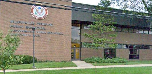
131 DRAFT For Review
Existing Land Uses, Dundee Road
Summary of Corridor Strengths and Challenges
Community feedback and analysis of existing conditions identified the following major strengths and challenges for the Dundee Corridor:
Strengths
• Buffalo Grove High School is a major anchor and a strong asset for the corridor as well as the Village.
• The corridor already has a mix of uses, with significant multifamily housing interspersed with commercial uses. A variety of affordable multifamily housing choices are also available.
• Residents feel safe and crime is not a major concern.
• There are ample public parks within walking distance from most homes.
• Pace bus service is also available within walking distance from most homes.
Challenges
• Dundee road is a car-oriented arterial with minimal pedestrian appeal and is in need of streetscaping and more greenery. There is no cohesive identity for the overall corridor.
• Aging buildings, outdated retail centers, empty commercial properties, and lack of new developments create an overall dated look for the corridor.
• The corridor lacks a sense of “place” and a major activity hub. There is no outdoor place or plaza for gathering, outdoor seating, or community events.
• Unattractive car-oriented intersections are not safe for pedestrians and bicyclists. There is a lack of bus shelters and amenities for Pace riders.
• Dated retail centers have many curbcuts and surface parking lots along the street, creating an unattractive environment for pedestrians.
• Trails lack signage for trails and have missing connections to the Village-wide network. Parks do not cater well to the needs of seniors and young adults.
Dundee Corridor offers the opportunity to implement many of the overall Themes and Strategies for Buffalo Grove, as outlined in Chapter 2 of the Comprehensive Plan, including the following:
Commercial/Civic Nodes Framework
• Create strong, distinct, and economically successful nodes.
• Coordinate and direct development in nodes to support their unique identities.
• Focus on harmonizing the mix of uses in the Village’s nodes through high-quality design.
Aging in Place
• Support a variety of market rate housing types that respond to the changing needs of single adults, families, and seniors.
Increasing Housing Diversity and Affordability
• Introduce high-quality attainable housing to the community.
• Leverage opportunities for increased density along corridors in Buffalo Grove.
• Attract young professionals to the Village.
Sustainable Strategies
• Incentivize public awareness around the benefits of alternative energy and preservation of natural resources
• Pursue sustainable transportation alternatives that reduce vehicle emissions, auto ownership and parking demand.
Prioritize Walkability and Connectivity
• Create trail connectivity and wayfinding guidance.
• Ensure sidewalks are continuous and are wide enough to accommodate a variety of transportation modes.
• Incorporate safety features at locations where the pedestrian/bicycle systems converge with the roadway network.
132 DRAFT For Review
Goals and Opportunities
Goals
Building on the overall Themes and Strategies of the Comprehensive Plan, the following goals were identified for the Dundee Corridor:
Goal 1: Create a mixed-use, vibrant, and walkable development at the Arlington Heights intersection, a new “HUB”where the community connects.
Goal 2: Transform the Dundee Road right-of-way into an attractive and multi-modal street with new streetscaping, trails, and green infrastructure.
Goal 3: Enhance the intersections at the two major nodes at Arlington Heights and Buffalo Grove Road to be more attractive and safer for pedestrians and bicyclists.
Goal 3: For larger lots, encourage commercial uses and restaurants in the front and multi-family uses in the back.
Goal 4: Develop underutilized parking areas with new restaurants or commercial uses along the street with rear shared parking.
Goal 5: Enhance Bison Park, natural areas, landscaping, and other natural resources along the corridor.
Key near-term opportunity: Redevelopment of the north-west corner of the Arlington Heights intersection.
Opportunities
Many long-term redevelopment sites were identified during the Existing Conditions analysis phase of the Comprehensive Plan, as shown on the map below. These included vacant and underutilized sites, and areas with strong redevelopment and infill potential.
Village feedback has suggested that there are potential commercial developments underway or proposed for several of these sites, and that the primary opportunity for near-term redevelopment is at the Arlington Heights intersection, as identified in Goal 1.
Following pages showcase concepts for creating a new mixed-use HUB at the northwest corner of this intersection. This redevelopment effort can create an attractive gateway to the Village from the west and be a catalytic project for the long-term transformation of the overall Dundee Corridor.
 Long-term Redevelopment Opportunity Areas identified in the Existing Conditions Analysis
DUNDEE ROAD
ARLINGTON HEIGHTS ROAD
BUFFALO GROVE ROAD
Long-term Redevelopment Opportunity Areas identified in the Existing Conditions Analysis
DUNDEE ROAD
ARLINGTON HEIGHTS ROAD
BUFFALO GROVE ROAD
133 DRAFT For Review
•
•
•
•
•
•
•
Existing Strathmore Square


A new “HUB” for Dundee
The 7.67 acre privately owned site has dated commercial uses with a large surface parking
ARLINGTONHEIGHTSROAD
commercial uses in Strathmore Square Community Feedback Highlights on Ideas for the HUB:
DUNDEEROAD
Existing
A place with a“Downtown or Urban Vibe”
A Plaza or Gathering Place for all age groups
A safe and more attractive intersection
Pedestrian friendly streetscape
More nature and greenery
Photo Op for School Events
More Restaurants and things to do 134 DRAFT For Review

of new
the
An opportunity to transform Strathmore Square into a mixed-use, vibrant, and walkable HUB where the community connects. 1 2 2 3 3 3 3 7 5 5 5 6 8 4 9 DUNDEEROAD ARLINGTONHEIGHTSROAD Potential Key Elements 1. Gateway Plaza at corner with outdoor seating, landscaping, and public art 2. New Restaurants with outdoor seating, green roofs and rooftop terraces framing the plaza. 3. New Commercial uses along Dundee Road. 4. Redesigned Intersection with pedestrian and bike friendly enhancements, decorative paving, wider crosswalks, refuge islands etc. 5. New Multifamily/Senior housing to bring more residents to live in the HUB 6. Open Space/ Stromwater Area as an amenity for residents 7. Shared Parking to the rear 8. Enhanced Natural Landscape Garden in front of Buffalo High School 9. New Landscaped Medians on streets Key elements are described in detail on followings pages. 135 DRAFT For Review
Conceptual Rendering
HUB at
northwest corner of Dundee and Arlington Heights Road
A Mixed-Use “HUB”
Restaurants / Commercial Area

Illustrative plan shows approx. 32,000 sf of new commercial uses on 3.0 acres with shared parking to the rear.


Multifamily / Senior Housing Area
Illustrative plan shows approx. 36 rear loaded Rowhouse units on 3.6 acres.
A Transformed Intersection
See following page for design possibilities.
NEW STREET DUNDEE ROAD136
Restaurants with outdoor seating and rear-loaded rowhouses would bring residents
DRAFT For Review
TheIllustrative
Plan shows a clear approach to redeveloping this deep commercial site with new commercial uses along the street and multifamily/senior housing in the back.
A Transformed Intersection
The existing Dundee and Arlington Heights intersection is unattractive, car-oriented, and does not prioritize the safety of pedestrians, bicyclists, or students of the High School. The intersection needs to be redesigned for this area to emerge as a strong and vibrant node in the Dundee Corridor.
A new pedestrian and bike friendly intersection design should include the following elements:
• Provide wider refuge islands with landscaping. The travel lanes along Dundee & Arlington Hts Rd can be narrowed from 12’ to 11’, which would allow the existing small refuge islands to be widened to 10’ to 11’. The refuge islands can be longer and aligned opposite the opposing left-turn lane without cutting into the travel lanes.
• Install highly visible crosswalks in front of the stop lines on all approaches. Crosswalks can be as wide as 10’ and textured, made of colored-paving, or striped with wide vertical lines (zebra striping). Unique paved or painted patterns can also be used to create a bold brand and identity for the area.


• Install pedestrian signals with countdown timers at all crosswalks
• Where possible, modify the signal phasing plan to utilize lead pedestrian intervals to give pedestrians a head start when entering an intersection


• Provide sidewalks and ADA-compliant curb ramps that are aligned with the crosswalks
• Utilize signage such as “No Right on Red when Pedestrians are Present” or “Turning Vehicles Yield to Pedestrians”
• Utilize curb extensions at the end of parking lanes where on-street parking exists
• Reduce corner radii where possible to slow turning maneuvers
These same design elements can also be used to improve the Buffalo Grove and Dundee Road intersection, and intersections in other major nodes identified in this plan.
Decorative crosswalks and unique paving patterns can create an137 DRAFT For Review
Crosswalks can be a canvas for unique artwork
A vibrant corner plaza can be a community gathering place for all - residents, students and staff from High School, seniors, and visitors. The plaza can create a unique gateway into the Village with a distinct identity, branding, and signage. Following design elements are recommended for the corner plaza:

Landscaping
• Landscaped and planted areas in the plaza can provide color and texture that softens and complements the hardscape. Low-maintenance, climate appropriate, and drought-resistant landscape materials that need minimal irrigation should be used.
• Trees are essential components of successful and enjoyable plazas by providing shade and comfort, adding greenery and visual interest, and reducing urban heat island impacts. Plaza trees must be at least four caliper inches in diameter.

• Trees can be located in planter beds or in tree grates that allow porous surfaces around the tree for water
Gateway Plaza at the corner
filtration and provide ample room for growth and longterm health of the trees.
• Irrigation systems should be provided for all trees and plant areas. Solar-powered features (lighting, trash compactors, etc.), recycling and composting compartments with trash receptacles are strongly encouraged.
Outdoor Seating


Abundant, well-designed, and comfortable seating is one of the most critical elements of public plaza design. Seating for outdoor dining areas are strongly encouraged. Seating areas can be shaded with landscaping, umbrellas, pergolas, and trellises. Heating lamps are encouraged for winter weather.
Types of seating can include:
• Fixed benches and individual seats.
• Low ledges around planter beds and water features. Ledges generally should be maximum 30 inches in height and at least 22 inches in depth.
• Movable chairs and unique art forms for seating.
• A substantial proportion of seats in the plaza should have backs to facilitate comfort and usability by people of all ages and abilities.
138 DRAFT For Review
Provide many seating choices for outdoor dining and
Lighting
Abundant and well-designed lighting can transform a plaza from a dim, foreboding space into a desirable, 24-hour amenity. Too often, however, light levels are excessively uneven or are dimmed. The minimum hours of illumination should be from at least one hour before sunset to one hour after sunrise.

• All lighting within the public plaza must be shielded to avoid impacts on nearby residential units.

• Visual interest can be added by varying the type, color and location of illumination and highlighting focal features. Uplighting can be added for trees, public art, and water features, and under-lighting provided for benches, walls, bollards, and steps.
Paving


• The use of distinctive, high quality paving materials can convey the importance of public gathering places. Durable and easy to maintain materials like stone, brick and concrete are encouraged. Concrete unit pavers tend to lose color with time and should be used only as accents.
• Unique and interesting paving patterns, medallions in the paving, and other creative paving designs are strongly encouraged.
Public Art
The long term value of great Public Art is priceless. Public Art can challenge, delight, educate, and illuminate, and create a sense of civic vitality to the area. Permanent and temporary installations of Public Art can help to create a distinctive identity for the Village and the Dundee Corridor and is encouraged to be incorporated as a key element of the plaza.
Provide interesting lighting for Create a unique identity with fun139 DRAFT For Review
Incorporate local public sculpture to reflect the Buffalo
High-Quality Building Design
The “HUB” can showcase best practices in site planning and building design that reinforce the pedestrian scale, help build an attractive street wall, and minimize the visual impacts of parking. Following design elements are recommended for new buildings:
Building Placement
• New buildings should be placed along the streets to create attractive pedestrian oriented street walls.
• Parking areas should not be located between the street and the building facade in the front setback area. Parking should be provided to the rear or side of buildings.
• All rowhouse and multifamily units must be rear loaded with garages and driveways accessed from a rear drive. Front loaded units with garages and driveways facing the streets should not be allowed.
• Zoning codes for front setbacks can be amended to allow Zero Lot line to 10’ max. for non-residential and mixed-use buildings. Front setback should be allowed to be increased to accommodate pedestrian oriented amenities, including: outdoor eating for restaurants, landscaped plazas, wider sidewalks, outdoor art or special streetscape features, and porches /stoops for rowhouses.
Entrance and Corner Articulation
Buildings are strongly encouraged to provide creative corner designs that make the architecture distinctive and strengthen the pedestrian scale of the street. Buildings around the corner plaza, in particular, are great design opportunities to create an attractive and inviting HUB.
• Entrances and corners can be articulated with changes in height, massing, or materials, including distinctive corner towers, roof features, windows, awnings and canopies, balconies or other unique architectural features.
• Architectural style and design of entrances and corners must be consistent with overall style used in the building. Fake architectural elements, including fake windows, cornices, and fake upper stories should not be allowed.
Awning and Canopies
Awnings and canopies are strongly encouraged to create shade for pedestrians and make street facades more colorful and attractive.
• Awnings may project up to 5’ into the public right of way over the sidewalk.


• Awnings must be located over a window or door and cannot be located over fake windows or fake doors or along a blank wall.
• Canopies for entrances may project up to 8’ max. into the public right of way over the sidewalk.
140
DRAFT For Review
Buildings placed along the street with articulated entrances
Canopies cannot have support columns or poles on the sidewalk. An 8-foot minimum clearance above the finished sidewalk must be provided. Design should be in scale with the overall building and complement the overall architectural vocabulary.
• Transom windows and other architectural elements should not be covered.
• Materials must be high quality and durable. Backlit and vinyl awnings are not allowed. Retractable canvas awnings are strongly encouraged. Placement should not conflict with streetscape elements, tree canopies or signage.


Green Roofs and Rooftop Seating
Green roofs provide layers of living vegetation installed on top of buildings to offer the following benefits:
• Manage stormwater and improve water quality by retaining and filtering rainwater.
• Provide more building insulation, reducing cooling and heating costs.
• Reduce cadmium, copper and lead in runoff.
• Extend the life of roofs.
• Preserve habitat and biodiversity.
• Improve air quality and reduce the “urban heat island” effect.
Partial green roofs can be combined with rooftop seating for restaurants. Greenhouses and rooftop gardens can provide local sources of fresh produce.


141
Rooftop garden at local Chicago
Green roofs on national chains
DRAFT For Review
Awnings, articulated corners and entrances, and outdoor seating can create an
Green Infrastructure

Bioswales
Bioswales are linear, vegetated ditches which allow for the collection, conveyance, filtration and infiltration of stormwater. Benefits of bioswales include: Treats stormwater and improves water quality. Adds visual appeal, especially near paved areas. Can provide habitat for wildlife species.

1. Enhance existing natural area in front of Buffalo Grove High School as a showcase of Green Infrastructure tools. Add rain gardens, natural landscaping, educational signage, seating, birdwatching stations etc. to create a memorable place for students, residents, and visitors.
2. Use permeable paving and bioswales in parking lots and other and paved areas.

Rain Gardens
A rain garden is a garden of native shrubs, perennials, and flowers planted in a small depression, which is generally formed on a natural slope. A rain garden is not a water garden, a pond or a wetland. It is dry most of the time and typically holds water only during and following a rainfall event. Benefits of Rain Gardens include:
• Temporarily holds and soaks in rain water runoff that flows from roofs, driveways, patios or lawns.
Green Infrastructure elements are cost-effective and resilient approaches to managing wet weather impacts and can provide many community benefits. While singlepurpose gray stormwater infrastructure - conventional piped drainage and water treatment systems - is designed to move stormwater away from the built environment, Green Infrastructure reduces and treats stormwater at its source while delivering environmental, social, and economic benefits. Following green design elements are recommended for new developments:
• Can remove up to 90% of nutrients and chemicals and up to 80% of sediments from the rainwater runoff.
• Compared to a conventional lawn, rain gardens allow for 30% more water to soak into the ground.
• Because rain gardens drain within 12-48 hours, they prevent the breeding of mosquitoes.
2
1
142
DRAFT For Review
Bioswales, rain gardens, and native landscaping provide site-level
Natural Landscaping
Natural landscaping refers to the use of native vegetation including prairie, wetland and woodland species, and is strongly encouraged as an alternative to conventional landscaping. On some sites natural landscaping can be installed or preserved in an informal setting; on others, native plants can be used in more formal settings in place of imported species. Benefits of Natural Landscaping include:
• Native vegetation is a low-cost alternative to traditional landscaping that utilizes turf grass and ornamental plantings.
• A naturally landscaped site will produce substantially less stormwater runoff than a conventional landscape. Native vegetation enhances both absorption of rainfall and evaporation of soil moisture due to extensive root systems that extend down 3 to 10 feet or more. In contrast, the root zone of turf grass typically extends only about 3 to 4 inches.
• Natural landscaping reduces pollutants associated with urban runoff.
• Deep-rooted native plants effectively stabilize soils and prevent erosion along stream banks and detention basin edges.
• The reduced maintenance needs of natural landscaping not only save money, but also reduce air, water and noise pollution.
• Natural landscaping provides habitat for native and migrating birds, butterflies, and insects.
• Natural landscapes, especially trees, moderate temperature extremes (such as the “urban heat island” effect), resulting in reduced heating and air conditioning costs.
• Provides four seasons of color and textures not commonly found in conventional landscapes and requires less maintenance over time.
Permeable Paving

• Permeable paving promotes absorption of rain and melted snow and is strongly encouraged for all off-street paved surfaces including surface parking areas, private drives and alleys. Benefits of Permeable Paving include:

• Substantially reduces runoff quantities, which can lead to significant cost savings in stormwater engineering and infrastructure, including curbs, gutters and storm sewer costs. These savings can partially offset the higher installation costs.

• Reduces the runoff pollutants associated with these events.
• Requires less frequent replacement than typical asphalt and concrete paving.
• Permeable paving has aesthetic and marketing advantages over conventional paving. Vegetated pavers, in particular, can substantially improve the aesthetic appeal of paved areas and significantly reduce the urban heat island effect.
143
DRAFT For Review
Negative impacts of parking lots and paved areas can be reduced with permeable
Pedestrian and Bicycle Mobility
• Existing intersections are designed for auto-traffic and need to be upgraded to be safe and attractive for pedestrians and bicyclists. Wider intersections require further improvements to increase pedestrian comfort levels. The reconstruction of the medians with decorative pavers or landscaping, extensions of the medians through the crosswalks to create a refuge island, expansion and upgrades of the corner islands, and wider and decorative crosswalk patterns are options to consider. Pedestrian safety upgrades (pedestrian signals, countdown timers, high-visibility crosswalks, ADA-compliant curb ramps, etc.) are also needed at signalized intersections.
• There is already a multi-use path along the north side of Dundee Road. Many residents seem to think this is just a wider sidewalk and are unaware that this is also a trail. Signage and pavement markings are needed to make the role of the multi-use path clear to all users.
• There is a lack of trail connections to destinations in and other public opens paces in other parts of the Village.
• The existing unprotected crosswalk on Arlington Heights Road next to Buffalo Grove High School is a significant safety concern. A relocation of the crossing to the high school’s north driveway, combined with enhancements to the roadway median and potential signalization of the intersection would partially allay


Transportation Roadway Bicycle System Gap Location Arlington Heights Road Dundee Rd to Village limits (Mill Creek Dr) Buffalo Grove Road Dundee Rd to Village limits (Ashford Cl) Weidner Road Dundee Rd to Arlington Heights Rd Intersection Crosswalk Type Intersection Approach Pedestrian Signals Countdown Timers ADA Compliancy Dundee Rd/Arlington Hts Rd HV All √ √ Dundee Rd/BGHS Dr HV N, W √ √ √ Dundee Rd/Weidner Rd P All √ √ Dundee Rd/Golfview Terrace P W, S √ √ √ Dundee Rd/Buffalo Grove Rd HV All √ √ √ Dundee Rd/Huntington Ln P E √ √
144 DRAFT For Review
Existing Street conditions at the Arlington Heights
the concern. The possibility of signalizing the Arlington Heights Road intersection with the north driveway would further enhance pedestrian crossing safety.
• Relocating the existing mid-block signalized entry to the High School to align with Old Arlington Heights Road would create a clean intersection and provide safer crossings for pedestrians and bicyclists.

• Existing gaps in the multi-use path (trail) and sidewalks need to be filled in to create a connected system.
Street R.O.W.
• This is a 5 lane IDOT R.O.W. with a curbed center median. The median is landscaped on a few blocks. Overall appearance is unattractive with no cohesive streetscaping style.
• There are an excessive number of curb cuts and vehicular conflict points along Dundee Road, especially near the Old Arlington Heights Road and Buffalo Grove Road intersections. Consolidation of curbcuts throughout the corridor would create more continuous sidewalks and trails and reduce traffic issues related to frequent turn movements.
DOT FY 2020-2025 Proposed Highway Improvement Program includes the following:
• Dundee Road (IL 68) – Resurfacing and ADA improvements; 4.26 miles from east of Kennicott Avenue in Arlington Heights through Buffalo Grove to First Street in Wheeling.
• Old Arlington Heights Road – Resurfacing and ADA improvements; 0.45 miles from Dundee Road to Arlington Heights Road.
Pace
• Most of the multifamily and apartment complexes in the corridor are within a ¼-mile walking distance of a Pace bus route.
• Bus stops do not offer passenger waiting amenities (i.e., weather-protected shelters, benches, lighting, real-time bus tracker information, bus route maps/ schedules, concrete waiting pads).
• The bus stop on westbound Dundee Road between Grove Drive/Fireside Terrace Apartments and Strathmore Square Shopping Center receives significant ridership but lacks a bus shelter.
Trucks
• Dundee Road (IL68) is designated as an IDOT Class II Truck Route carrying an Annual Average Truck Traffic of 630-1,725 trucks.
Existing Trail or Multi-use Path
Existing Pace Stop
Existing Transportation System, Dundee Road
145 DRAFT For Review
Transforming the Dundee Road Right-of-way
Following improvements are recommended to transform Dundee Road into a green and multi-modal street
1. Add Landscaped Medians along the full length of the corridor to add greenery and shade to the street.
2. Completely upgrade car-oriented intersections to be more attractive and safe for pedestrians, bicyclists and other modes of travel. Consider adding decorative paving or landscaping, extensions of the medians through the crosswalks, and expansion and upgrades of the corner and refuge islands.

3. Consolidate existing curb-cuts and minimize new ones for better traffic flow and to reduce mid-block
turn movements. Fewer curbcuts also allows for more continuous lengths of sidewalks.

4. Fill in the missing gaps in the bicycle and sidewalk system and connect to the overall Village network of trails, open spaces and destinations.
5. Install user friendly maps, signage and trail heads for easy and clear access to the bike network.
6. Consider bold pavement signage and color to make it clear that the multi-use path along the north side of Dundee Road is for bikes and pedestrians.
7. Add bus shelters for all stops along the corridor.
DUNDEE ROAD TODAY POSSIBILITIES
146 DRAFT For Review
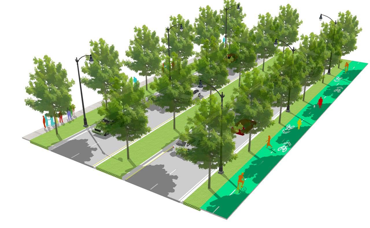

Potential Key Elements 1. New Landscaped Median along the entire Dundee Corridor 2. Landscaped Parkway with Street Trees to add shade for pedestrians and greenery 3. Dedicated Bike Trail on the north side of the street that also connects to the Village-wide trail framework 4. Continuous Sidewalks with pedestrian and bike friendly enhancements, decorative paving, wider crosswalks, refuge islands etc. 5. New Decorative Street Lights that can reinforce a unique brand and identity for the Village Proposed Dundee Road cross section 1 2 5 3 12 2 34 4 2 147 DRAFT For Review
Open Spaces
Existing Public Parks
Following public open spaces are right on the corridor today or are within walking distance of Dundee Road: 1. Bison Park 2. Buffalo Grove High School Fields
Windsor Ridge Park
Cambridge Park
Mill Creek Park
Chatham Lions Park
White Pine Strip
Longfellow School Park


Joyce Kilmer Elem. School Fields

Winfield Park
Most of the corridor has a public park within a 5 minute walking distance. However, existing parks seem generally geared towards athletic uses and need better trail connections, programming and new amenities to serve seniors and young adults.


7.
3.
4.
5.
6.
8.
9.
10.
1 3 4 2 5 6 7 8 10 9 1 1 4 3
148 DRAFT For Review
Existing Parks and 5 minute walk 5 minutewalk
Bison Park: A Key Opportunity
Bison Park is an underutilized public open space with an irregular shape and limited visibility from Dundee Road. Pedestrian and Bike connections to the park are not safe or convenient today. The Old Arlington Heights Road intersection west of the park is not signalized. The existing signal to the High School creates a mid-block connection further west.
Following are key opportunities to transform Bison Park into a catalytic public open space that can help attract new development as desired by the community:
Reshaping the park. A more visible and regular shaped park can be created as part of the redevelopment of the Rohrman’s site. Existing detention can be incorporated into the park design.
Safer connections across Dundee Road. Relocating the signalized entrance to the High school to align with Old Arlington Heights Road would create a clean signalized intersection that can offer safe pedestrian and bike crossing across Dundee Road. Other options to consider include:

• The sidewalk on the south side of Dundee Road between the signalized crossings at the high school access drive and Weidner Road can be widened.
• A second connection to the park can be created from the south by continuing the bike path on the east side of Old Arlington Heights Road from Miller Road north to Dundee Road and by extending a new easterly path within a private easement near the south property line of the former automobile dealership sites.
More amenities and programming. Students and staff from the high school strongly support the idea of improving the park significantly into a “place” they can use all year. Ideas from students and other stakeholders for park programming include:
• Nature Garden
• Community Garden
• Music /Small Performance Space
• Skating Park
• Lacrosse Field
• More Trails
• Safe connections to school
• Sensory Park
• Outdoor Pubic Art
• Soccer/Football, tennis, baseball
• Photo Op for School Events
• Plaza for outdoor seating
10
DUNDEE ROAD
Bison Park
OLD ARLINGTON HEIGHTS ROAD Detention Area
High School Fields
149 DRAFT For Review
Existing Bison Park and High
Milwaukee Avenue Corridor
 Milwaukee Avenue Corridor defines Buffalo Grove’s eastern edge and falls entirely in Lake County. The corridor offers a few large development parcels that could define a stronger eastern gateway to Buffalo Grove.
150 DRAFT For Review
Source: Google Earth Pro

151 DRAFT For Review
Corridor Overview
Milwaukee Avenue defines the eastern edge of Buffalo Grove, with majority of the street frontage shared with neighboring communities of Riverwoods, Wheeling and Lincolnshire. The Avenue was historically one of the Chicago region’s iconic scenic streets that extended significant growth from the City borders to northern Lake County. Downtowns and Main Streets grew around the Avenue in communities like Glenview, Northbrook, Libertyville and Vernon Hills. This part of the Avenue, from Lake Cook Road to Aptakisic Road, is an edge and not a “center” for the communities along the road. Designated as a Major Arterial by IDOT, the six-lane road carries 32,700 to 33,900 vehicles daily, and is perceived as primarily a car-oriented corridor.
Single Family Residential Multifamily Residential Commercial Industrial Civic and Institutional Open Space
Existing Land Uses
• The south end of the corridor is anchored by a major office complex with two 20-story towers and two parking structures. The complex overlooks the Des Plaines River and creates a strong focal point at the Lake Cook ramp. The other major new anchor is Woodman’s Food Market retail center that has added a 240,000sf grocery and other outlots at the Deerfield Road intersection. Remaining uses generally include dated strip retail centers and other smaller commercial and office uses.
• Industrial uses occupy most of the parcels to the west all the way to the train tracks. Industrial parcels are significantly built up today.
• Immediately to the north is “City Park”, a large mixed-use development in Lincolnshire, with a movie theater, high quality restaurants, hotel, office and high end residential.
• Majority of parcels fronting the road are zoned B3 or I. Other designations along the corridor include B1, B4, RE, R5, R9, and O&R Zoning.

152 DRAFT For Review
Existing Land Uses in the Milwaukee Corridor

INCORPORATED AREAS BUFFALO GROVE LINCOLNSHIRE RIVERWOODS WHEELING Existing Municipal Boundaries along 153 DRAFT For Review
Corridor Strengths and Challenges
Community feedback and analysis of existing conditions identified the following major strengths and challenges for the Milwaukee Corridor:
Strengths
• Strong address as a commercial corridor. High traffic volumes support new commercial development.

• The new Woodman’s Grocery is a strong economic anchor serving residents from Buffalo Grove and the neighboring communities.


• Exiting large office complex at the Lake Cook interchange is a strong anchor and a gateway to the corridor.
• There are a few large vacant sites that offer opportunities for attracting more job producing and revenue generating uses.
• Existing industrial uses have created a strong industrial base in the Village.
Challenges
• Multiple municipal jurisdictions create lack of a cohesive identity.
• The road is a car-oriented street with minimal multimodal appeal.
• There is a lack of clear connections to the Des Plaines River Trail.
• There are too many zoning designations and a lack of clear direction on future land uses.
Existing car-oriented cross section of154 DRAFT For Review
From top: Woodman’s Grocery, Office Complex at Lake Cook Road and
Milwaukee Corridor offers the opportunity to implement many of the overall Themes and Strategies for Buffalo Grove, as outlined in Chapter 2 of the Comprehensive Plan, including the following:
Commercial/Civic Nodes Framework
• Create strong, distinct and economically successful nodes.
• Establish a clear identity and brand for each node.
• Connect nodes to a comprehensive transportation framework.
• Partner with regional organizations, such as Pace Suburban Bus and Metra, to support existing transit service and prioritize future transit investments on the basis of ridership demand and partnership opportunities
Industrial Corridor Dynamic
• Preserve specific areas of industrial corridors for high tech and innovation businesses.
• Maintain industrial corridors as economic engines and vital job centers in the Village.
• Provide access for all transportation modes and prioritize connectivity to Metra stations to ensure employees have multi-modal options to reach the industrial employment centers.
• Re-zone identified areas of the industrial corridors to facilitate complimentary and lower impact uses.
• Coordinate alternative uses and identify specific areas for non-industrial tenants to benefit from the existing context or prepare for future opportunities.
Sustainable Strategies
• Pursue sustainable transportation alternatives that reduce vehicle emissions, auto ownership and parking demand.
• Develop programs and facilities, such as increased convenient bike parking, linking sidewalk/trail gaps, bike share, and bike parking audits, that support non-auto mobility options and encourage short trips to be made by walking or biking at all Metra stations. (Consider bike share stations at all Metra Stations).
• Incentivize public awareness around the benefits of alternative energy and preservation of natural resources.
• Install solar-powered traffic control signals.
• Include rainwater management on site to handle as much runoff as possible before piping off-site by using bioswales at all parking lots and along streetscapes. Include detention basins to allow rainwater to infiltrate onsite, reducing the need for storm infrastructure.
Prioritize Walkability and Connectivity
• Work with area employers to increase accessibility via public and private modes.
• Encourage employers to provide incentives to employees who utilize alternate modes of transportation when commuting.
• Educate businesses and residents about transportation connections from the Prairie View Metra Train to places of residence or employment, which include shuttle services such as Transportation Management Association of Lake-Cook Shuttle Bug, Chariot Shuttle as well as carpooling options such as SPLT and Pace Vanpool.
155 DRAFT For Review
Goals and Opportunities
Goals
Building on the overall Themes and Strategies of the Comprehensive Plan, the following goals were identified for the Milwaukee Corridor:
• Goal 1: Create a gateway for Buffalo Grove from the east

• Goal 2: Create better connections and access points for Buffalo Grove residents to the Des Plaines River Trail.
• Goal 3: Create flexible zoning regulations that can support a variety of job producing and revenue generating uses and can better respond to changing market trends.
• Goal 4: Encourage major recreational uses that can create a regional destination for the area.
• Goal 5: Protect floodplain and storm water management areas and design these as major open space amenities.
Opportunities
Two major opportunity areas were identified in the Milwaukee Corridor: Area A at the north end of the and Area B to the south of Deerfield Road. Existing conditions and recommended framework plans for these areas are described in detail in the following pages.
Top left: Top Golf, Schaumburg on an 18 acre parcel, is an example of a major recreational destination that could be attracted to the area.


Above: Restaurants with outdoor seating along the street can create an attractive gateway for the Village
Left: Old Plank Trail gateway in Frankfort is an example of how a signature trailhead to the Des Plaines River can be an anchor for the area
156 DRAFT For Review

157 DRAFT For Review
B A Major Opportunity Areas A and B in the Milwaukee BUFFALO GROVE CORPORATE BOUNDARY FEMA FLOODZONES FLOODWAY 100 YEAR FLOODPLAIN 500 YEAR FLOODPLAIN
Area A
Area A is the largest remaining vacant site in the corridor today, offering close to 60 acres of development potential. Major opportunities include:

• Attract a major job producing and revenue generating anchor, including retail, recreational, medical, office and industrial uses. While the site is large enough for a major retail anchor, the market trends do not appear to support a big-box type development in the near-term.
• Build on the momentum of the “City Park” Lincolnshire’s mixed-use development to the north, that has created a place for dining, shopping, entertainment and work.
• Attract higher quality revenue generating uses along the Milwaukee frontage including good restaurants. Consider luxury multifamily residential as a support use.
• The only access is at Meitawa Lane that dead-ends into the site. Investigate alternative locations that are better aligned to curbcuts to the east, as well as connections to Parkway Drive to the north and Busch Parkway to the south.
• Aptakisic Creek and trails runs along the western rear edge of the site. This is a great opportunity to expand and improve the Creek and trails as a major public amenity on the corridor.

• Use best practice solutions to address the 100-500 year floodplain on the site.
Area A
• SIZE: 58.6 Acres
• OWNERSHIP: Private
• EXISTING USE: Vacant
• CURRENT ZONING: B3
• 2009 COMPREHENSIVE PLAN DESIGNATION: Commercial
A A DES PLAINES RIVER AND TRAIL MILWAUKEEAVENUE APTAKISICCREEK CITY PARK, LINCOLNSHIRE EXISTING INDUSTRIAL AREA FOREST PRESERVES MILWAUKEE
158 DRAFT For Review
AVENUE
An opportunity to attract highquality revenue generating uses at the northeast gateway to Buffalo Grove
WATERWAYS FLOODWAY 100 YR FLOODPLAIN
EXISTING ROADS EXISTING TRAILS EXISTING TRAFFIC SIGNALS MILWAUKEE AVENUE ROADWAY FRAMEWORK
DEVELOPMENT PARCELS
OPEN SPACE POSSIBLE DETENTION POTENTIAL TRAILS POTENTIAL TRAIL HEADS POTENTIAL TRAFFIC SIGNAL GATEWAY FEATURE & KEY PEDESTRIAN INTERSECTION

Flexible Framework Plan that can respond to changing market trends
A
Framework Plan Concept for 1 2 3 3 3 6 4 3 DUNDEEROAD Key Framework Elements 1. New Road that connects Busch Parkway to the south
the
to the north. 2. Potential Future Signalized Intersection with pedestrian and bicyclist amenities 3. Potential Stormwater Management Area that incorporates best management practices and creates a continuous open space amenity with the
to the
and existing ponds to the
and south. 4. New Trail Connection to Des Plaines River Trail that can be provided on a required easement on private parcels to the east of Milwaukee Avenue. 5. New Trail along the west side of Milwaukee Avenue that provides the missing link between existing trails on the road. 6. Other Internal Trails that can create a connected system through the area to serve employees and visitors. Village of Lincolnshire Corporate Center 1 5 6 6 6 159 DRAFT For Review
to Parkway Drive in
Lincolnshire Corporate Center
creek
west
north
Area B
This is the largest unincorporated vacant site in the corridor today, offering 30 acres of development potential. The site is uniquely located along the Des Plaines River, offering over 1,200 feet of river frontage. The southern edge is also defined by Aptakisic Creek, a major waterway in this part of Lake County.


This former landfill site has challenging remediation and topography/grade issues towards the river and the creek.
Major opportunities include:
• High quality multifamily, luxury apartments or senior housing along the rear to maximize access and views to the river and trails.
• Higher quality commercial uses along Milwaukee Avenue.
• New high quality restaurants that can have outdoor seating with views to the river or creek.
• A public open space and trail connection that creates a highly visible gateway to the river and trails.
• Stormwater areas that are designed as major open space amenities that enhance the creek and riverfront.
Area B
• SIZE: 30 Acres
• OWNERSHIP: Private
• EXISTING USE: Vacant, formerly a landfill site
• CURRENT ZONING: UNINCORPORATED
•
B BMILWAUKEE AVENUE DEERFIELD ROAD DESPLAINESRIVERANDTRAIL APTAKISICCREEK
2009 COMPREHENSIVE PLAN DESIGNATION: Commercial
FOREST PRESERVES MILWAUKEEAVENUE DEERFIELDROAD An opportunity to attract a highquality mixed-use development at the Milwaukee Avenue and Deerfield Road node 160 DRAFT For Review
RIVERWOODS
WATERWAYS FLOODWAY 100 YR FLOODPLAIN
EXISTING
EXISTING TRAFFIC SIGNALS MILWAUKEE AVENUE ROADWAY FRAMEWORK
DEVELOPMENT PARCELS

POSSIBLE DETENTION
POTENTIAL TRAILS
POTENTIAL TRAIL HEADS
POTENTIAL TRAFFIC SIGNAL GATEWAY FEATURE & KEY PEDESTRIAN INTERSECTION
A Flexible Framework Plan that can capitalize on the unique natural assets of the area
EXISTING ROADS
TRAILS
OPEN SPACE
Framework Plan Concept for 1 2 3 4 Key Framework Elements 1. New Commercial uses that can attract restaurants and neighborhood oriented retail 2. Potential Future Signalized Intersection with pedestrian and bicyclist amenities 3. Potential Stormwater Management Area that incorporates best management practices and creates a continuous open space amenity with the creek to the south. 4. New Trail Connections to Des Plaines River Trail that can be provided on a required easement on private parcels to the east of Milwaukee Avenue. 5. New Trail along the west side of Milwaukee Avenue that provides the missing link between existing trails on the road. 6. New multifamily or other uses that can capitalize on the unique riverfront location. 6 1 4 4 161 DRAFT For Review
Promote Best Practices and Green design in Areas A & B
Best practice strategies are strongly encouraged to be incorporated in the design of new industrial and commercial developments to capture the following benefits:
• Reduce the environmental impact of the development.
• Positively impact the health, safety, well-being and experience of employees, visitors, and occupants.
• Respond to the potential growth in green jobs in manufacturing.
• Encourage new anchors to be good stewards for the Buffalo Grove community.
LEED (Leadership in Energy and Environmental Design) is a major resource for Green Building design strategies that can be incorporated into all new developments.
Developments are also encouraged to incorporate Green Infrastructure elements. These cost-effective, resilient approaches to managing wet weather impacts can provide many community benefits. While single-purpose
gray stormwater infrastructure - conventional piped drainage and water treatment systems - is designed to move stormwater away from the built environment, Green Infrastructure reduces and treats stormwater at its source while delivering environmental, social, and economic benefits.
Reduction of heat islands is also a major benefit of best practice design. Heat islands are described by the EPA as “urbanized areas that experience higher temperatures than outlying areas.” Structures such as buildings, roads, and other infrastructure absorb and re-emit the sun’s heat more than natural landscapes, creating heat islands where daytime temperatures can be 1–7°F higher than temperatures in outlying areas. New paved areas and rooftops can contribute significantly to the heat island effect.
The following Best Practice Strategies are recommended for all new developments in the corridor.
The Testa Produce facility in Chicago is a LEED Platinum certified development that showcases the following best practices:


• Renewable Energy from a wind turbine and solar panels
• A Green Roof and Rain Water Harvesting from the roof
• Permeable Paving that drains water runoff into a
bioswale system. There is no blacktop asphalt on the entire site
• Natural Landscaping and Bioswales for rainwater infiltration into existing soils and to filter water into the retention pond
• Sustainable and Recycled Materials for construction and maintenance
Tesla Produce Facility,
162 DRAFT For Review
Renewable Energy
According to the EPA, sources of renewable energy include Wind Power, Solar Power, Geothermal Technologies, Landfill Gas, Biomass Power, and Lowimpact Small Hydropower. All new developments are encouraged to incorporate these renewable energy sources in their facilities. A variety of on-site tools can be installed to harness renewable energy, including:
• Rooftop solar arrays
• Ground source heat pumps to eliminate or reduce the need for natural gas
• Small-scale Photo Voltaic installations, including solar awnings, parking lot lights, passive solar walls etc.
• Solar hot water heating systems
• Wind Turbines
Green Roofs and Cool Roofs

A Green Roof provides layers of living vegetation installed on top of buildings. Green Roofs on large roof surfaces can provide significant benefits, including the following:
• Manage stormwater and improve water quality by retaining and filtering rainwater.
• Provide more building insulation and reduce cooling and heating costs.
• Reduce cadmium, copper, lead, zinc, and nitrogen levels in stormwater runoff.
• Extend the life of roofs two to three times. A vegetated roof, on average, can be expected to prolong the life of a conventional roof by at least 20 years because the vegetation prevents the roof from being exposed to ultraviolet radiation and cold winds.
• Preserve habitat and biodiversity.
• Improve air quality and reduce the heat island effect.
A Cool Roof is one that has been designed to reflect more sunlight and absorb less heat than a standard dark roof. Dark roofs can reach temperatures of 150°F or more in the summer sun. A cool roof under the same conditions could stay more than 50°F cooler and save energy and money by using less air conditioning. Cool

The Method Southside Soapbox in Chicago, Illinois is a LEED Platinum manufacturing facility located on 22 acres in the heart of the Pullman neighborhood. The facility showcases the following best practices:

• Renewable energy from a wind turbine that helps to generate half of the building’s annual electrical consumption.
• Solar tracking trees in the parking lot follow the sun
from sunrise to sunset in order to maximize energy generation.
• The roof has a commercial-scale greenhouse that produces fresh, premium quality, pesticide-free produce for the local community and restaurant market. A rooftop landscaped canopy helps decrease energy use, improve urban air quality and reduce stormwater runoff.
163 DRAFT For Review
Method Southside Soap Facility,
roof coatings are typically made of white or special reflective pigments that reflect sunlight. Coatings are like thick paints that can protect the roof surface from ultra-violet (UV) light and chemical damage, and some offer water protection and restorative features. Light colored metal roof systems and polyurethane foam spray systems can also be used to create cool roofs.
Multiple Stories to Reduce Building Footprint
Multistory facilities can accommodate significantly more building area on a smaller building footprint. A smaller footprint leads to less impervious coverage and reduces adverse impacts on natural resources, especially the floodplain in the area. Multiple tenants can be also be stacked vertically within a smaller footprint.
Permeable Paving to reduce Impervious Coverage
Permeable paving typically consists of a porous surface composed of open pore pavers, concrete, or asphalt with an underlying stone reservoir. The permeable pavement catches precipitation and surface runoff, storing it in the reservoir while slowly allowing it to infiltrate into the soil below or discharge via a drain tile. Benefits of permeable paving include:
• Reestablish a more natural hydrological balance and reduce runoff volume by trapping and slowly releasing precipitation into the ground instead of allowing it to flow into storm drains and out to receiving waters as effluent. This same process also reduces the peak rates of discharge by preventing large, fast pulses of precipitation through the stormwater system.
• Reduce the concentration of pollutants
• Cool down the temperature of urban runoff
• Reduce the need for or the required size of a regional BMP, such as a wet detention pond
• Reduced need to apply road salt for deicing in the winter time. Air trapped in the pavement can store heat and release it to the surface, promoting the melting and thawing of snow and ice.
Natural landscaping, Natural landscaping refers to the use of native vegetation including prairie, wetland, and woodland species, and is strongly encouraged as an alternative to conventional landscaping for new developments. Natural Landscaping benefits include:
• Reduced maintenance needs saves money, but also reduced air, water, and noise pollution from lawn mowers.
• Produce substantially less stormwater runoff than a conventional landscape. Native vegetation enhances both absorption of rainfall and evaporation of soil moisture due to extensive root systems that extend down 3 to 10 feet or more. In contrast, the root zone of turf grass typically extends only about 3 to 4 inches. Natural landscaping also reduces pollutants associated with site runoff, stabilizes soils, and prevent erosion along stream banks and detention basin edges.
• Provide habitat for native and migrating birds, butterflies, and insects.
• Moderate temperature extremes (such as the “urban heat island” effect), resulting in reduced heating and air conditioning costs.
The Village can amend local codes to require a minimum percentage of natural landscaping for all new developments with an approved list of native plant species, and a maintenance criteria.
• Design should be tailored to individual site characteristics, factoring in topography, soils, drainage patterns and sun exposure.
• On some sites natural landscaping can be installed or preserved in an informal setting; on others, native plants can be used in more formal settings in place of imported species.
• Plant slopes with a terraced system of native plants and ground covers can be used to break up the slope and slow down water and soil.
• A rain garden of deep-rooted native plants and grasses can be considered for low areas to encourage storm water to soak slowly into the ground.
164 DRAFT For Review
Bioswales, Rain Gardens, and Rainwater Harvesting
A Bioswale is a vegetated open trench designed specifically to temporarily store and infiltrate stormwater. Bioswales are planted with deep-rooted native grasses and forbs, and are often used as an alternative or supplement to standard below ground stormwater sewers. They can be found on the edges of parking lots or around developments and vary widely in size. Benefits of Bioswales include:
• Reduce runoff volumes and rates by slowing water down through the vegetation allowing groundwater to recharge and sustaining stream base flows.
• Deep-rooted native grasses and forbs can enhance the infiltration, cooling, and cleansing of water in order to improve water quality. This may reduce detention needs for the area.


Bio infiltration systems should be located at least 10 feet away from buildings to ensure water does not drain into the foundations. Ideally, pretreatment should be provided to remove suspended solids from the runoff before it enters the system.
A Rain Garden is a simple form of bio infiltration that typically relies on the underlying soils for drainage.
Therefore it may not function properly if underlying soil is compacted by heavy equipment and/or its absorption rate is slow. Where appropriate, however, rain gardens can be fitted with french drains, or other types of underdrains, to move more water through the soil.
• Full sun is best, but shade may be created by the presence of trees or surrounding buildings.
• No additional watering should be necessary, once plants are established.
• A gradual slope is generally better in order to prevent a minimum of erosion during heavier rain storms. Erosion mats can be used to help hold the soil, if the slope is steep.
• A full list of hardy native plants recommended by IDNR is available at https://www2.illinois.gov/dnr/ education/Pages/PlantListBioswale.aspx.
Rainwater Harvesting can provide a source of alternative water for non-potable uses. Alternative waters are sustainable sources of water, not supplied from fresh surface water or groundwater, that offset the demand for freshwater. Rainwater harvesting captures, diverts, and stores rainwater from rooftops for later use. Typical uses of rainwater include landscape irrigation, wash applications, cooling tower make-up water, and toilet and urinal flushing.
165
Stormwater and detention areas can be major open space amenities with seating, educational signage,
DRAFT For Review
Transportation
Roadways
Designated as a Major Arterial by IDOT, Milwaukee Avenue carries 32,700 to 33,900 vehicles daily, and is perceived as primarily a car-oriented corridor. This volume of traffic is adequately accommodated by the six-lane cross section between Lake Cook Road and Prague Avenue.
• The transition to a five-lane cross-section north of Prague Avenue results in traffic delays and congestion during the peak periods. IDOT’s ultimate plan for Milwaukee Avenue would continue the six-lane cross section through the Village, which would reduce the congestion along the roadway.
• Traffic signal control may be warranted in the future at Milwaukee Avenue/Johnson Drive/N. Riverwalk Drive extension.
• There are excessive number of curb cuts and vehicular conflict points at Milwaukee Avenue (Riverwalk Drive-Johnson Drive). Curb cuts could be consolidated and moved further from the intersection at Milwaukee Avenue/Riverwalk Drive/Columbus Parkway.
• There are opportunities for better median and street landscaping to add more greenery to the street.
Pace
• The corridor is well served by Pace service, with connections to the Transportation Center and mall in Schaumburg and other local and regional destinations.
• The southbound service at Columbus Parkway/ Riverwalk Drive receives significant ridership but lacks bus shelter and passenger amenities.
Trucks
• Milwaukee Avenue (US 45/IL21) is designated as an IDOT Class II Truck Route carrying an Annual Average Truck Traffic of 1,975-2,300 trucks.
Future Plans
IDOT Strategic Regional Arterial Studies
• Proposed configuration has yet to be built and consists of the widening of the roadway through Buffalo Grove to three through lanes in each direction with a 30-foot wide raised median and sidewalk along both sides of the road built within a 150-foot right-ofway. The only segment currently with three lanes in each direction is between Lake Cook Road and Prague Avenue. The improvements would also require the reconstruction of the bridge over Aptakisic Creek.
Lake
County Division of Transportation FY 2019-2024
Proposed Highway Improvement Program
• Roadway reconstruction and widening of Deerfield Road: new non-motorized accommodations through Riverwoods from Milwaukee Avenue to Saunders Road. Programmed for 2022 through 2023.
Lake County’s 2040 Transportation Plan
• Roadway widening of Milwaukee Avenue: 7.25 miles from Lake Cook Road to IL 60.
• Lake Cook Road Deviating Bus Service: Northgate Parkway to Sheridan Road in Highland Park via Lake Cook Road.
• Lake Cook Road Bikeway: Northgate Parkway to Sheridan Road in Highland Park via Lake Cook Road.
• Deerfield Road Bikeway: Milwaukee Avenue to Portwine Road in Riverwoods.
IDOT FY 2020-2025 Proposed Highway Improvement Program
• Deerfield Road widening: 2.0 miles through Riverwoods from Milwaukee Avenue to Saunders Road.
166 DRAFT For Review
M
Buffalo Grove Corporate Boundary

Existing Roadways
Existing Trail or Multi-use Path
Existing Pace Stop
Existing Metra Station
Existing Access Points to Des Plaines River Trails
Existing Transportation System, Dundee Road167 DRAFT For Review
Trails & Pedestrian Connections
Des Plaines River Trail connections
Milwaukee Avenue runs parallel to the Des Plaines River Trail system that offers 56 miles of regional trails through Lake and Cook County. This is an incredible asset for Buffalo Grove that needs to be celebrated and utilized more strongly.
Residents have a perception of a lack of trails in the Village and a lack of connections to the Des Plaines River Trail and other major destinations in the Village, which may be a result of a lack of bicycle wayfinding signage.

The Des Plaines River Trail today has only one access point in Buffalo Grove at Riverwalk Drive and is not the most visible entry point to this great regional asset. Community feedback indicates residents tend to use access points on Aptakisic Road in Lincolnshire and Deerfield Road in Riverwoods. This is a great opportunity to create more bold trailhead entranceways at the heart of Milwaukee Avenue and firmly establish Buffalo Grove as a Des Plaines River community.
Roadway Bicycle System Gap Location
Lake Cook Road Milwaukee Ave to Angus Chemicals drive
Milwaukee Ave (IL 21) Johnson Dr to The Shop of Buffalo Grove (Deerfield Pkwy)
Busch Pkwy to Aptakisic Rd Linden Ave to eastbound Lake Cook Rd exit ramp
Busch Parkway Deerfield Pkwy to Milwaukee Ave
Intersections
• Signalized intersections at Deerfield Road and Busch Parkway can be significantly improved for pedestrian and bike safety including pedestrian signals, countdown timers, high-visibility crosswalks, ADAcompliant curb ramps, etc.
• Wider intersections require further improvements to increase pedestrian comfort levels, potentially including the reconstruction of the medians with decorative pavers or landscaping, extensions of the medians through the crosswalks to create a refuge island, and expansion and upgrades of the corner islands.
• Grade-separated crossings currently exist on Lake Cook Road east of Milwaukee Avenue.Roadway Bicycle System Gap Location Lake Cook Road Milwaukee Ave to Angus Chemicals drive Milwaukee Ave (IL 21) Johnson Dr to The Shop of Buffalo Grove (Deerfield Pkwy) Busch Pkwy to Aptakisic Rd Linden Ave to eastbound Lake Cook Rd exit ramp Busch Parkway Deerfield Pkwy to Milwaukee Ave
Crosswalk Intersection Pedestrian Count ADA CompliancyIntersection Crosswalk Type Intersection Approach Pedestrian Signals Count down Timers ADA Compliancy Milwaukee
Dr P All √ √ √
HV W √ √ √
P S √ √ √
Ave/Riverwalk
Milwaukee Ave/Inverrary Ln Milwaukee Ave/Deerfield Pkwy
Milwaukee Ave/Busch Pkwy Milwaukee Ave/Aptakisic Rd
168 DRAFT For Review
Existing Access to Des Plaines River Trail at Riverwalk Drive


! " ! ! " " " 1 ! ! ! ! ! ! ! ! ! ! ! ! ! ! ! ! !! ! ! ! ! ! ! ! ! ! CTABlue Chicago Glenview Niles Park Ridge Norridge River Grove Rosemont Morton Grove 90 80 68 90N 64 81W 78 56A 72 Ridge Edison Park Belmont AveMetraMilwaukeeDistrictWestLine 58 14 90 Cherry St Elm St St Elm St Jennings D P n R e Woods East %%%Nature Center oT m Oo TB Oo BT Dam No. 4 Woods East Oo B P Tu Robinson Woods South Oo B P Tu Evans Field OBo Tu Fullerton Woods Oo P TB Schiller Woods West x Schiller Woods East OU x Jerome Huppert Woods %% %%% Schiller Model Airplane Flying Field Catherine Chevalier Woods O Po T Indian Boundary Golf Course Beck Lake xo nrTs Big Bend Lake Oxo B PnTC Sunset Bridge Meadow %% %%% Schiller Woods Family Picnic Area John. E Traeger Picnic Area Schiller Playfield Family Picnic Area Family Picnic Area Fullerton Woods Family Picnic Area Indian Boundary Family Picnic Area Robinson Homestead Family Picnic Area Che Che Pin Qua Woods O Irving Park Road Canoe Landing Belleau Lake x Camp Dan Beard Connection to North Branch Trail Connection to No thBranch Tra 272 226 331 241 209 305 413 412 225 Forest View Dr Harlem Ave Harlem Ave Milwaukee Ave Touhy Ave Central Rd Grand Ave 25th Ave Shermer Rd BusseHwy Dempster St WaukeganRd Lawrence Cumberland Ave Belmont Ave Ballard Talco Rd Lehigh Ave Ave Can eld Rd 5th Ave River Rd Foster Ave Greenwood Ave Greenwood Rd er Rd TalcottAve Voltz Rd Ave Lake AvondaleAve G Golf W R Higgins Rd Lake Ave Fullerton Ave NorthwestHwy W s k Av ach Ave Oakton St East River DeeRd Dee Rd Central Zone North Zone Trail Map LAKE COUNTY COOK COUNTY The Des Plaines River Trail runs alongside the Des Plaines River for over 56 miles, protecting watershed habitat and forestland through much of Lake and Cook Counties. The trail is a natural oasis within a short drive of Chicago and its northern suburbs. ! ( ! ! ! " " " " " " " " " " " " " " " ! " " " " " 0 1 2 3 4 17 16 15 14 13 12 11 10 9 8 7 6 5 4 17.2 ! ! ! ! ! ! ! ! ! ! ! ! !! ! ! ! ! ! ! ! ! ! ! !! ! ! ! ! ! ! ! ! ! ! 1 1 1 1 2 2 1 1 9 4 2 1 1 2 3 1 1 1 1 1 2 2 1 6 3 75 1 1 1 1 15 10 13 12 11 Chicago Executive Airport O’Hare International Airport Rosemont Cumberland Harlem-O'Hare O'Hare Airport LineCTA Blue Elmhurst Chicago Des Plaines Glenview Northbrook Niles Wheeling Park Ridge Mount Prospect Prospect Heights Norridge Schiller Park Rosemont Morton Grove 80 68 90N 88 64 81W 69 78 56A O'Hare Rosemont Schiller Park Wheeling Glenview Dee Road Park Ridge Edison Park Lake Cook Des Plaines Cumberland Mount Prospect North Glenview Northbrook Metra North Central Service Line MetraUnionPaci c-NorthwestLine Metra Milwaukee North Line 68 21 43 58 58 62 72 72 43 171 19 19 45 45 12 14 14 294 294 190 90 90 94 41 94 Church St Winkleman Rd Fargo AveCherry St Elm St Birchwood St Sibley St Redfield Ct Elm St Portwine Rd Morgan Park The Grove Heritage Park Wood Oaks Green Park Chahokia Flats (LCFP) Northbrook Sports Center Village Green Techny Prairie Park & Fields Meadowhill Park Patriot Park Isaak Walton Park Jennings Park Flick Park Willow Park Majewski Metro Park Kopp Park Friendship Park High Ridge Knolls Park Prairie Lakes Park D e s P a n e s R i v e r D e s Plaines Ri v e r Potawatomi Lake Beck Lake Big Bend Lake Axehead Lake Schiller Pond Belleau Lake Opeka Lake Dam No. 1 Woods - East %% %%% River Trail Nature Center oT %m N Lake Avenue Woods - East Oo P TB Camp Pine Woods Oo BT Dam No. 4 Woods - East Oo B P Tu Robinson Woods South Oo B P Tu Schiller Woods West x Schiller Woods East OU x Schiller Model Airplane Flying Field Catherine Chevalier Woods O Po T Beck Lake xo nrTs Big Bend Lake Oxo B PnTC Potawatomi Woods %%%% %%%%% TxO uJGP Allison Woods T r Lake Avenue Woods - West T Dam No. 2 WoodsrP Kloempken Prairie u M Lions Woods O P Northwestern Woods %% %%% oO Chippewa Woods O JP Schiller Woods South O u Blandings Grove Family Picnic Area John. E Traeger Picnic Area Schiller Playfield Blue Beech Family Picnic Area River Bend Family Picnic Area Robinson Homestead Family Picnic Area Irving Park Road Canoe Landingr Camp Ground Road Woods oO BTP Harry H. Semrow Driving RangeA Dam No. 1 Woods - West Camp Baden Powell Isaak Walton League Algonquin WoodsM Iroquois WoodsO Axehead Lakex/ Belleau Lake x Camp Dan Beard% q Massasauga Family Picnic Area Connection to North Branch Trail Connection to NorthBranch Trail 4.9 284 272 423 282237 208 226 234 230 240 250 221 223 610 616 270 606 241 600 626 422 619 326 623 210 411 290 209 635 413 629 412 696 694 225 634 632 627 213 Forest View Dr Wolf Rd RandRd Harlem Ave Oakton St Milwaukee Ave Dundee Rd Touhy Ave Touhy Ave Central Rd Central Rd Lee St Willow Rd Sanders Rd P fi ngsten Rd Higgins Rd Techny Rd Euclid Ave Algonquin Rd Hintz Rd Shermer Rd BusseHwy Dempster St Palati ne Rd WaukeganRd Landwehr Rd Golf Rd Lawrence Ave Cumberland Ave Ballard Rd Glenview Rd Schoenbeck Rd TalcottRd Walters Ave Lehigh Ave Can fi eld Rd Des Plaines River Rd Camp Mcdonald Rd River Rd Foster Ave Greenwood Ave Foundry Rd Greenwood Rd Lee Rd Po tt er Rd Kensington Rd Miner St TalcottAve Voltz Rd Wheeling Rd East River Rd Grant Rd Devon Ave Lake Ave AvondaleAve Gu nn ison S t Shermer Rd HigginsRd Willow Rd Golf Rd W a u k e g a n R d Lake Ave Mount Prospect Rd Higgins Rd Lake Ave Dempster St Des Pl ai n e s Ri ver Rd NorthwestHwy Walters Ave WestLake Ave Lee St Lake Cook Rd Main St Elmhurst Rd Elmhurst Rd Elmhurst Rd Devon Oakton St rvingParkRd MIlwaukee Ave East River Rd DeeRd Dee Rd Yellow Off FPCC Yellow Orange......................... 4.9 Miles Des Plaines Trails *Trails over 1 mile Unpaved Regional & Local Non-FPCC Chicago Bike Route } 17.2 Miles Other Equestrian Trailer Parking C Ecological Management Area u Cycling o Fishing Lake x Birding m R CrossCountry Skiing T F J Hiking B Activities ExpertAdvancedIntermediateEasy Boat Launch n Golf A N Ice Fishing / G Cook County Lake County North ZoneNorthwest Zone North ZoneNorthwest Zone Des Plaines Trail Map 169 DRAFT For Review
Chapter8

DRAFT For Review
Source: Google Earth Pro
Implementation

DRAFT For Review
Chapter strategies
Timeline
DRAFT For Review
DRAFT For Review
ChapterA
Source: Google Earth ProDRAFT For Review
Appendices
DRAFT For Review