CITY OF
WAUKEGAN, ILLINOIS


WAUKEGAN, ILLINOIS
Sam Cunningham, Mayor
Janet Kilkelly, City Clerk
Dr. John Schwab, Treasurer
Dr. Sylvia Sims Bolton, 1st Ward Alderman
Patrick Seger, 2nd Ward Alderman
Greg Moisio, 3rd Ward Alderman
Dr. Roudell Kirkwood, 4th Ward Alderman
Edith Newsome, 5th Ward Alderman
Keith Turner, 6th Ward Alderman
Felix Rivera, 7th Ward Alderman
Dr. Lynn Florian, 8th Ward Alderman
Ann Taylor, 9th Ward Alderman
Robert Long, Corporation Counsel
Douglas Dorando, Deputy Corporation Counsel
Noelle Kischer-Lepper, Director of Planning & Zoning
Russ Tomlin, Principal Planner

Steve Sabourin, Senior Planner
Kathy Reinhardt, Assistant
Jane Ferry, Public Relations Specialist
Markus Pitchford, Special Projects Analyst for the Mayor
Michael Rodriguez, Chairman
Theodora Anderson
Michael Bill
Sara Griffin
Benjamin Grimes
Ted Haug
Nathan Hintz
Rafael Rivera
Nancy Bjerstedt
Esther Herran
Anne Linn
Lisa May
Jamie O’Meara (in memoriam)
Greg Petry
Chuck Rukstales
Diane Tecic
Greg Thompson
Diane Verratti
Tom Vick
 Source: City of Waukegan
Page intentionally left blank
To the residents of Waukegan:
The creation of a modern comprehensive land use plan to replace Waukegan’s 1987 Plan has been one of my top priorities since being elected Mayor. The City of Waukegan has always been a diverse and pioneering community, focused on improving our economic, social, cultural, and physical environments. To achieve these quality of life goals pursued by our families, and to strengthen our economic vitality, this comprehensive plan presents forward-thinking and attainable strategies that should be considered.
This plan is a roadmap of the shared community vision for what the City of Waukegan is and strives to be. This plan is aspirational, but will be our City’s long-term guide. It is designed to help shape our future: It will inform our City’s zoning maps and ordinance, direct our capital improvement plans, and will shepherd sustainable future development. This plan will never be completely finished, as it is a living document, one that we will regularly review and reinforce with implementation strategies and plans for parts of our community. We know major changes are already afoot with the ongoing environmental cleanups of our prime lakefront property, and with the State’s approval of a casino in Waukegan. We are becoming a major tourist destination with our beaches, our harbor, and our multimodal transportation, and our future is bright.
The success of this Comprehensive Plan will depend on your continued participation, your insight, and your determination. This plan places priority on actions and initiatives that can only be achieved if we work together. If we work together, using this plan as our guide, we will strengthen our neighborhoods and business districts, we will increase tourism and become Lake County’s ”northern Navy Pier,” and we will also tackle many smaller projects that, when combined, will forever improve our City’s quality of life and economy, for us and for our future generations to come. We all must work together to realize the future that we have envisioned together.
This comprehensive plan is the result of over two years of meetings, feedback, and public workshops. While it has been overseen by RATIO and a Steering Committee, it is due to the diligent work and guidance of the Planning and Zoning Commission, City staff, our partners in non-profits and businesses, and the general public that this plan exists.
The people of Waukegan are the City’s greatest assets. Your participation in this plan is proof of your dedication to the City and to a better future for us all. From the bottom of my heart, I thank you for all of your hard work, and we look forward to working with you as we implement this comprehensive plan. We will succeed. Together, we are Waukegan strong, and Waukegan’s future has never been brighter.
Sincerely,
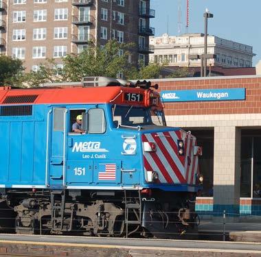
The City of Waukegan is leading the transformation of the North Shore region of Illinois. It is the county seat of Lake County and is located midway between Chicago and Milwaukee. Its proximity to regional transportation systems, including: Metra Union Pacific North service, Interstate 94, Skokie Highway (U.S. Highway 41), Green Bay Road (State Route 131), Sheridan Road (State Route 137), and the Waukegan National Airport, enables residents to travel north to Wisconsin and south to Chicago, Indiana, Michigan, and beyond.

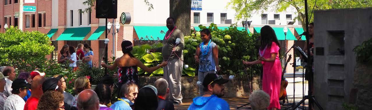
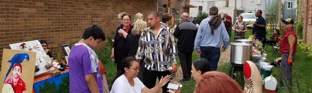
Welcome to Waukegan! Our community’s diversity has been attractive to a variety of people throughout its history. Current trends reveal growth in populations of Latino/Hispanic origins, contributing to the community’s historic legacy of diversity in the neighborhoods. Our civic spirit is alive. For example, the Waukegan Public Library is not just a library, it is a community resource center and a destination. Our City’s residents value providing critical services to vulnerable populations in Waukegan balanced with economic growth and fiscal responsibility.
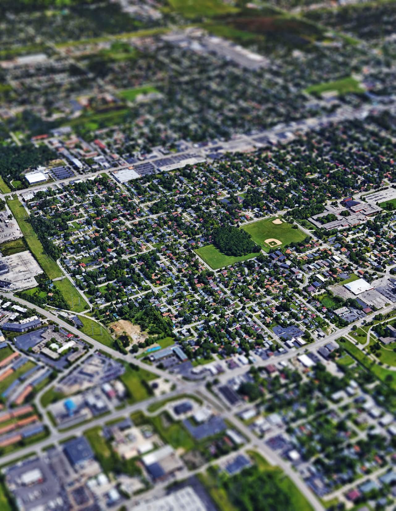
We are proud of our neighborhoods and the community they represent. Residential neighborhoods make up a significant part of Waukegan. Homes within the urban core are typically smaller and are more dense than homes in Waukegan’s edge neighborhoods, generally located on the far west side of the City. Resident identity is defined by relationships and connection to the neighborhoods.
We have thriving commercial corridors. Belvidere Road, Washington Street, and Grand Avenue are three primary commercial east-west corridors that are important to enabling residents and visitors access to the City. Beautification of these corridors is important to building a positive impression of our community for residents and
visitors as they enter Waukegan from the regional highway system. These gateway corridors connect Downtown Waukegan and the lakefront. Lewis Avenue and Green Bay Road are important north-south corridors.
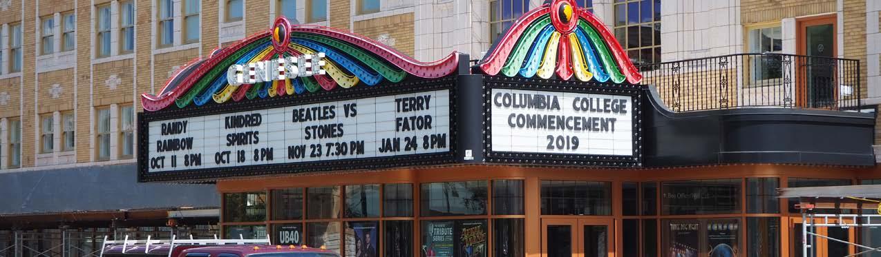
Downtown Waukegan has a variety of arts, culture, civic, and institutional businesses. It is a destination for local residents and tourists to enjoy its entertainment and arts programming. Events, such as ArtWauk, attract residents and visitors to visit downtown. The Genesee Theatre, a local landmark, presents high quality performances and draws from throughout the region. The concentration of government institutions also establishes an employment base working in downtown. With the expansion of the College of Lake County’s Lakeshore Campus, there are opportunities to increase amenities and respond to the growing popularity of this area of the City and adapt to the changing workforce through higher education offerings. Safe and convenient connections between downtown Waukegan and the lakefront will help downtown thrive.
Our small business community continues to grow, adding new experiences and opportunities for shopping, dining, and leisure. Their contributions and engagement with the community illustrate resident commitment to improving our City. They also provide richness and texture in the business environment and celebrate the entrepreneurial spirit of our community.
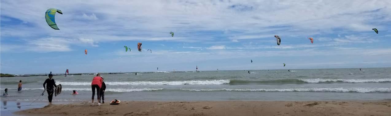
The City’s east-west thoroughfares include Grand Avenue, Washington Street, and Belvidere Road. They enable residents to access different parts of the City and the regional transportation network. The City of Waukegan is bordered by Lake Michigan on the east, Village of Beach Park and Wadsworth to the north, Gurnee the west, and North Chicago, Green Oaks, and Libertyville to the south. Natural and recreational spaces are spread throughout the City for residents’ use, and the lakefront remains a regional destination and significant redevelopment opportunity.

Waukegan, first visited by Pere Marquette in 1673, is one of the oldest communities in Illinois. The city started as a French trading post and as the Potawatomi Indian settlement known as “Little Fort”. Records dating back to 1829 tell of a treaty signed by the Potawatomi Indians in which they ceded all of their land in this area to the federal government. Little Fort became the county seat of government in 1841 by virtue of its population. Between 1844 and 1846, the town’s population grew from 150 to 750 people. In 1859 when the town was incorporated, the population had risen to 2,500. During the 20th and 21st centuries, Waukegan became an industrial powerhouse along the north shore of Lake Michigan, leading its competitors in economic success and attracting people in search of career opportunities. A diverse population grew out of this prosperity and continued to create a community rich in culture.
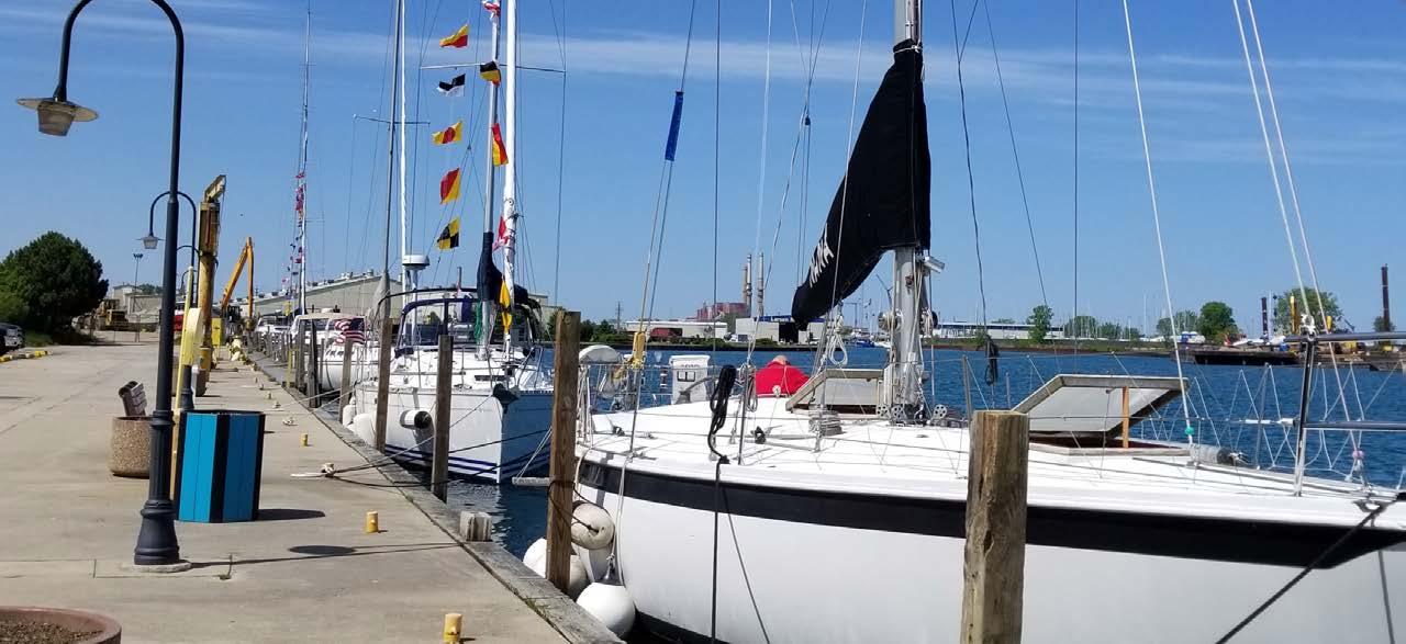
The lakefront is one of our City’s greatest assets and has the ability to accommodate future uses to become an even more vibrant destination. Redevelopment opportunities have been created by industry changes in the manufacturing sector. A reduction in the land needs and a preference for proximity to the interstate highway system for this sector in Waukegan has resulted in a surplus of properties and brownfields with reuse potential. These changes have allowed the City to work collaboratively towards a cohesive vision for the future. The City has been working with federal and state agencies to remediate and monitor these sites, focusing on preparation for future redevelopment. The Waukegan Metra Station is located between the lakefront and downtown Waukegan, and it serves as an important transit connection between Waukegan and the Chicago region. Many local Pace bus routes converge at the Metra Station and facilitate transit transfers. The beach, parks, harbor, and marina differentiate the Waukegan lakefront. As the lakefront transitions from its industrial past to an attractive mixed-use environment, this Comprehensive Plan will examine strategies to further facilitate this transition and position our City for success.
The south lakefront area, which used to house industrial businesses, is becoming a mixed-use environment. The City has undertaken some rezoning along South Genesee Street as part of the implementation of the South Sheridan Revitalization Plan.
Waukegan has a substantial and successful innovation hub on the southwest side of the City and a robust local small business community in its core. Corporate establishments, including Amazon and VisualPak, have a presence in Waukegan. A food business corridor is also present on Sunset Avenue. This hub is attractive because of its convenient access to the regional highway system, including Interstate 94, U.S. Highway 41, and State Routes 131, 137, and 43. The Waukegan National Airport, which functions as a reliever airport for O’Hare International Airport, services corporate traffic flying into the North Shore region.
Waukegan will soon be home to a new casino located at Fountain Square. This development affords the City an opportunity to consider economic development activity including supportive industries, revenue generation, and local employment. The Comprehensive Plan contemplates a variety of projects and programs that the casino can support to accomplish community-wide goals.
Unincoporated parcels on Waukegan’s perimeter present opportunities for growth. Annexation of these parcels near existing industrial parks would allow the City to accommodate more research/light research uses and expand its ability to respond to growing industrial sector needs. Responding to the growing demand for industrial and research space contributes to Waukegan’s identity as a desirable location for innovation and emerging industrial development. Emerging industries may include technology, sustainable and green industries, makers spaces, and light industrial industries. Recreational uses such as family oriented facilities may also be included to diversify activities in these zones and create more variety in spaces that can accommodate larger uses. Other areas with annexation potential could support commercial or residential development proposals.
Today, Waukegan is the 10th largest city in Illinois with a population of almost 100,000. While our City has historically been known for its industry, tomorrow’s Waukegan is focused on innovation and cultivation of a culture that utilizes its position in the region to curate a high-quality of life, expression of creativity and arts, and fulfillment of its legacy of success. The Comprehensive Plan represents our desire and commitment to continue to be a leader in the region.
The City of Waukegan is growing and developing in a sustainable way that is responsive to future conditions in the City. The City’s ambition to identify opportunities and prepare itself for revitalization has led to the creation of the new Comprehensive Plan. This document represents a roadmap to ensure Waukegan’s success and ability to adapt to a changing socio-economic and physical landscape.
The process to create a new Plan included significant community outreach as part of a multi-phase planning process. The Plan will serve as the City’s official policy guide and will assist the City in making informed decisions that best serve resident needs in the community for the next 20 years.
 Source: City of Waukegan

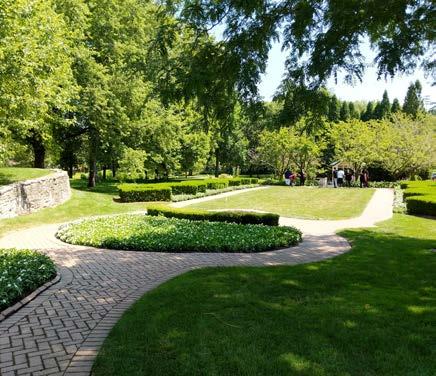
Waukegan is a diverse and vibrant community. The City’s core assets including the lakefront, natural resources, affordability, location, and competitive position in the region, have created opportunities for growth and economic vitality. Progress to remediate and reposition some of the former industrial sites along Waukegan’s lakefront are near completion, a testament to the joint efforts between City, state and federal agencies to create vibrant, high-quality public spaces that contribute positively to the identity and character of Waukegan. These improvements pave the way for new development opportunities on the lakefront and create momentum for supporting a variety of uses throughout the City. The popularity of Waukegan Municipal Beach and Stiner Pavilion illustrates the City’s commitment to create destinations for festivals, events, and recreational opportunities that draw from outside of the community as well as enhance residents’ quality of life. The College of Lake County’s Lakeshore Campus, a prominent educational institution in the community, is planning to expand and renovate its campus to improve its ability to serve students in the community and region. Waukegan is at the precipice of leading the region with its visionary approach to increasing accessibility for its younger residents to participate in innovation industries through integration of STEAM (science, math, engineering, arts, and math) in the educational curriculum and workforce partnerships. Waukegan’s neighborhoods are also complemented by an award-winning network of parks and open space. The Waukegan Park District has received recognition for its stewardship of its parks and continues to work with the City and other stakeholders to improve Waukegan residents’ quality of life. The City is working with the award-winning Waukegan Park District to preserve and enhance the City’s natural resources.
These assets present opportunities for Waukegan to fulfill its potential as a regional anchor. The Waukegan Comprehensive Plan creates a long-term vision and framework to enable the City, its partner agencies, and residents to respond to trends, needs, and opportunities with a future-focus and specific actions to ensure implementation.
This Comprehensive Plan is different from the City’s other recent planning efforts, which have been focused on specific parts of the City. The Comprehensive Plan looks at the City as a whole, and creates a unified vision on how to move forward. As a result, the Comprehensive Plan will coordinate relevant portions and strategies in the City’s previous plans.
The Comprehensive Plan is intended to guide long-range planning efforts. It is the City’s official guide to land use and development. It is a roadmap, which details the vision and policy agenda for critical issues, including: land use, redevelopment, housing, economic development, transportation, infrastructure, parks and recreation, natural resources, and more. The Plan is a culmination of a unified vision developed through the input of City residents, businesses, staff, elected and appointed officials, and the consultant team. In the end, the City of Waukegan Comprehensive Plan answers the question, “What should Waukegan look like in the next 10-20 years, and how do we get there?”
Source: City of Waukegan
The Waukegan Comprehensive Plan
not only guides the City’s policy direction but inspires residents, stakeholders, and developers to consider the latent potential of the City and take action. The goals in each chapter serve to move the City towards its bright future as a leader of innovation and economic development in the region. The key goals, strategies, and input received from community members can be utilized to implement development plans, spur interest in specific areas of the City, and support best practices. The Comprehensive Plan is organized into five key themes, presented in the document as unique chapters. An introduction is also included. These themes and principles coordinate with the Chicago Metropolitan Agency for Planning’s ON TO 2050 Regional Plan.
The introductory chapter describes the purpose of the Comprehensive Plan and how it can be used by stakeholders to guide creative
solutions and generate new ideas. This chapter also presents an enhanced image and identity for the community to be incorporated into each chapter.
The prosperity chapter highlights economic development trends in the City of Waukegan and their impact on its future. Economic development strategies are explored on a city-wide basis and for selected subareas, including the City’s commercial corridors, casino, downtown, and lakefront.
The land use framework impacts the development and quality of life in the City. The community chapter describes the types of places present in the City, and provides guidance on their planning, development, and potential improvement. This chapter also incorporates goals for health and wellness, diversity and inclusion, and youth and education.

Access and mobility enable people and goods to travel effectively in and around Waukegan. This chapter explores recommendations to foster better connections and greater mobility choices in the community.
The environment plays a key role in Waukegan and impacts the social, economic, and physical resilience of the community. This chapter explores opportunities to improve the quality of the City’s recreational and natural resources.
Organizational capacity is a key factor in the implementation of the Comprehensive Plan’s strategies. This chapter provides guidance on the process to increase organizational capacity in Waukegan to effectively implement the Plan.
Many of the key goals and strategies in the Comprehensive Plan are informed by the input received from community residents, business leaders, agencies and organizations, and other stakeholders throughout the planning process. The input received has been instrumental in forming a community vision that relates to the Plan’s core principles. The Plan’s recommendations will align with one or more of these principles. Corresponding principles are reflected in CMAP’s ON TO 2050 Regional Plan. These principles are:
• Resilience
• Inclusive Growth
• Prioritized Development
The City’s natural resource systems and infrastructure are adaptable and able to function during times of critical need. Social systems, natural resources, and infrastructure are improved to become more durable, making them recover quickly from short-term distress and long-term stress.
Waukegan offers economic opportunities for all of its residents regardless of their background, age, or income. Doing so enables them to experience prolonged periods of prosperity and stability, with fewer and shorter periods of economic stagnation or decline.
It is critical to prioritize investments and management of public revenues to maximize benefits to the community. Waukegan’s ability to access mixed funding streams, including limited government resources, demonstrates the City’s ability to seize opportunities where available.
Community members, consisting of residents, business leaders, organizations and agencies, school representatives, and faith-based organizations, identified issues and challenges that the City faces, and key actions to address them. They described what they believed to be Waukegan’s strongest assets and most difficult challenges that needed to be addressed to improve Waukegan’s quality of life. This input is organized into the following five characteristics that include each topic area’s strategies and provides a foundation for the development of the Comprehensive Plan. These characteristics answer the question, “What should Waukegan look like in the future?”
Throughout the outreach process, community members stressed the importance of a healthy economy in Waukegan. The City has many assets that contribute to its strengths, including the City’s innovation hubs. Job creation through expansion and growth of existing workforce development ecosystems and partnerships improves results in positioning residents for jobs of the future. Access to valuable workforce training opportunities allows residents to gain necessary skills for tomorrow’s economy. Improving Waukegan residents’ sense of community is also critical in attracting them to work and invest in the City. Support for and fostering of small and local businesses, especially in downtown Waukegan, is a priority. Redevelopment of underutilized sites is a catalyst for additional economic growth in Waukegan.
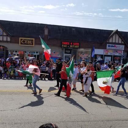
Waukegan has a diverse population of both legacy residents as well as those new to the community. Multi-ethnic neighborhoods that celebrate resident’s heritage are an asset and unique characteristic of the City. Embracing diversity includes equitable distribution of services to the residents of Waukegan, regardless of their age, language, background, income, or ability. The richly diverse population is able to enjoy the various opportunities and amenities the City has to offer as well as celebrate their own cultural traditions. Strong inter-cultural communication supports community engagement and a robust social service network supports the City’s most vulnerable residents including people with disabilities, elderly, and low-income households. Additional housing options, especially in downtown Waukegan, will give residents greater choice and give the City ability to continue to attract new residents.
 Source: City of Waukegan
Waukegan prioritizes the protection, conservation, and improvement of its natural environment to improve the quality of life in the City. Community members are proud of Waukegan’s award-winning Park District. Emphasis on connectivity between parks as well as multimodal access to parks via trails and different transportation modes benefits all residents of Waukegan. The Waukegan ravines and the lakefront are uniquely beautiful natural resources in the community.
Community residents recognize that beautification contributes to a more resilient natural environment in Waukegan and the community, as well as improves the perception and identity of the City.
The City of Waukegan works diligently with its transportation partners: Metra, Pace, and the Lake County and Illinois Department of Transportation to improve mobility options for Waukegan’s residents. Community members benefit from longer service hours for Pace buses and more frequent weekend service for Metra trains to transport them in and around the region. A continuous sidewalk network improves pedestrian mobility and accessibility and allows residents to experience the City safely. Beautifying Waukegan’s major corridors promotes safer neighborhoods and encourages interaction and economic development activity. Improving connections between the lakefront and Waukegan’s neighborhoods is a priority. Equitable and diverse transportation is a goal to connect these destinations in Waukegan. (Refer to Northern Lakeshore Connectivity Plan.)
Having the ability to implement key goals and strategies is of paramount importance for the Comprehensive Plan. This will require renewed collaboration and focused investment in addressing both today’s challenges, as well as future challenges, in Waukegan. Increasing the City’s organizational capacity by partnering with community agencies and organizations is critical to improving residents’ quality of life. Identifying and pursuing funding opportunities is also an important method to bring the Plan’s recommendations to fruition.
Source: City of WaukeganThe Waukegan Comprehensive Plan focuses on the City of Waukegan as a whole. It is general in nature and addresses themes and concepts that can then be applied to individual projects or conditions. The intent is to aid the City in creating a vision for future growth and development, key areas to focus, and guidance for City’s actions and investments in a long-term timeframe. The Plan identifies agencies and organizations to coordinate with to improve organizational capacity and reduce redundancy. The Comprehensive Plan includes subarea plans that include specific information, planning, and design recommendations on a more detailed level. The Plan serves the following key functions:
The Comprehensive Plan is aspirational, a vision of how the City wants to move forward to the future. The vision is a culmination of input received from the City, staff residents, business leaders, external organizations and agencies, and other stakeholders. From this vision, the Plan identifies priorities, and charts a path for how the City should grow and develop in the future.
The City should utilize the Comprehensive Plan to guide and assess the evaluation of public or private development proposals, and ensure future developments align with the community’s long-term objectives. This document can be shared with developers and others involved with land economics.
The Plan serves as a foundation for the City’s regulatory framework, which includes zoning regulations, subdivision ordinances, brownfield remediation, flood hazard regulations, annexation strategies, and other key decisions as necessary. Amendments to these regulations should be made to ensure they support the Plan’s long-term objectives.
The Comprehensive Plan serves as a guide to foster collaboration between the City and agencies and organizations at the local, county, state, and federal levels. This document may assist and inform efforts related to housing, transportation, parks, natural resources, land use, infrastructure, development, economic development, conservation, and annexation.
The Plan is intended to inform the City in developing its Capital Improvement Program (CIP) and budget, and assist in the prioritization of investments and sequence of capital improvements. The plan should be reviewed annually for consistency with CIP and budget to maintain momentum and allocation of funds for implementation.
The Plan can be used to support applications for grants and to demonstrate that future projects are within the City’s larger, holistic strategy rather than stand-alone efforts.
This document is a valuable source of information for policymakers, local boards and commissions, organizations and agencies, businesses, and residents. The information provided in this Plan can also help establish the foundation for future initiatives.
The City should review the Comprehensive Plan at least on an annual basis to evaluate its progress in implementing the Plan’s goals and strategies. It is important for the City to be proactive in amending the Comprehensive Plan to reflect changing trends if necessary.
In-depth conversations with Waukegan stakeholders to create a plan that addresses the challenges and opportunities in Waukegan informed the Plan. The diverse group of stakeholders represented a broad range of perspectives including:
• Residents and neighborhood organizations
• Faith-based organizations
• Business owners and major employers
• School districts, private schools, and higher education institutions
• Local economic development organizations
• Workforce development agencies
• Social service and housing agencies
• County and state level transportation agencies
• City boards and commissions
• City administration and staff
Waukegan is a diverse and equitable community with opportunity for all and an unwavering pride of place represented in multi-generational legacy investments made by the City’s residents. We value strong partnerships between the City and other organizations to improve Waukegan residents’ quality of life by the effective provision of high-quality services. The City’s unique and accessible location, arts and culture, variety of attainable housing, vibrant business environment, healthy neighborhoods, convenient transit access, and a beautiful and activated lakefront define the City’s authentic identity and future success.
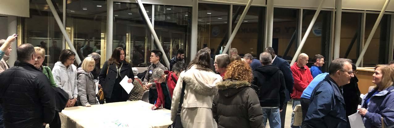
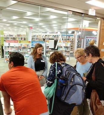
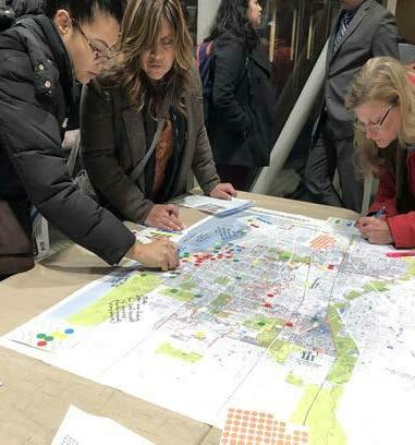
To create the City of Waukegan Comprehensive Plan, the voices of the community added valuable insights and personal experience to the Plan. The public engagement process provided a variety of opportunities to participate in the creation of the planning process and succeeded in understanding the public’s needs, preferences, priorities, and vision for the City. The COVID-19 global pandemic required that the final meetings in this schedule be conducted in a virtual format, rather than in-person.

2019
Ongoing Project Website
August
March
With an eye to the future, Waukegan’s economy has diversified and become less manufacturing-based and more focused on innovation. Waukegan is positioned to continue to be flexible to change and leverage a global economy to move forward and better adapt to the changing dynamics in the 21st century. This chapter examines these key opportunities, anchors and assets, as well as economic development strategies for the City of Waukegan.
Bold goals to support prosperity in Waukegan include:
1. Enhance the downtown as a vibrant mixed-use district by attracting residential development and complementary commercial uses.
2. Reinvest in the Waukegan lakefront & Harbor with a goal of creating a lakefront residential community and tourism destination.
3. Sustain gateway corridors as unique neighborhood-serving retail districts.
4. Strengthen the City’s economic base and expand opportunities for economic growth.
Central to the economic vibrancy of the City is the downtown. This district will be recognized in the Chicago region as a vibrant mixed-use community that brings together the best of the old and the new to draw visitors from throughout the City and beyond. The historic Genesee Street will be strengthened with new development that brings more shops and residents to the heart of downtown while reinforcing the walkable scale of smaller blocks and pedestrian friendly streets. New multifamily development will enhance vibrancy in the area and provide a built-in consumer base to support local businesses.
As the jewel of the North Shore, the Waukegan lakefront will be established as one of the premier Lake Michigan recreational and tourism destinations north of Chicago. New residential and entertainment development along the waterfront will transform the area from a postindustrial manufacturing district into a lively go-to mixeduse destination in the region. Strong connections to downtown will ensure both areas gain from synergistic benefits.
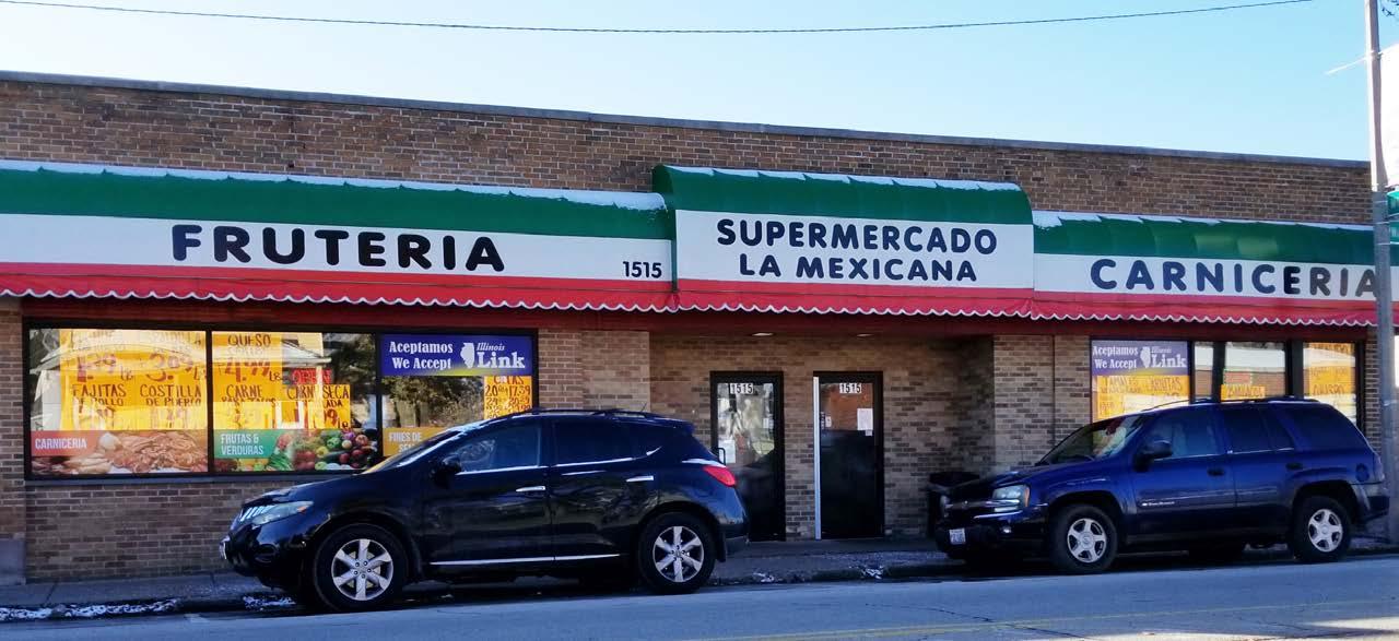
Graceful entry to the City and introduction to its character along its gateway corridors will continue to welcome people to Waukegan and provide shops, restaurants, and services for their convenience and enjoyment. These corridors will continue to adapt to changing retail trends and redevelopment in accordance with changing market conditions. The existing Latinx-owned business clusters, such as Washington Street and the Belvidere Mall, are well-established and celebrated as the Latinx cultural hub in Lake County. Business organization, façade and public improvements, and distinct branding opportunities will allow these corridors to remain attractive commercial environments and support the local business ecosystem.
New growth and development within southwest Waukegan will continue to strengthen the City’s economic base. As the strongest industrial and commercial area of the City, there is an opportunity to build on the success and expand economic activity in this area. The new planned casino is positioned to further enhance the City’s economic base – providing a new attraction to draw people from around the region while also enhancing the City’s revenue stream. Other employment hubs within the City, such as northwest Waukegan, will also provide opportunities for continued growth and expansion of the City’s economic base.
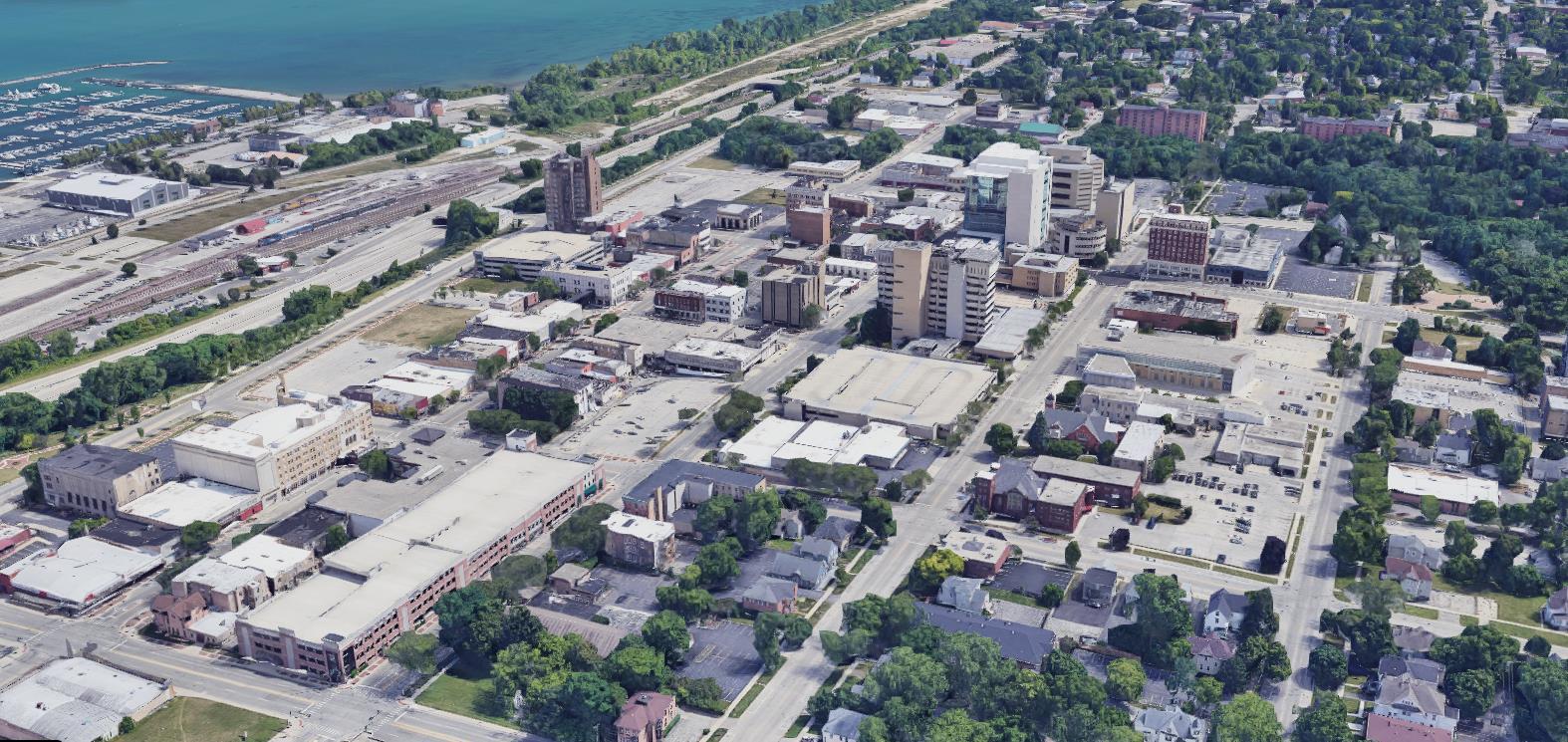
Downtown Waukegan is viewed by residents, business owners, patrons, and other community members as the commercial and entertainment hub of the City. Genesee Street between Grand Avenue to the north and Belvidere Road to the south is the focal point of downtown Waukegan. Downtown is located near two of the City’s most significant assets: the Waukegan Metra station and the lakefront. The Metra station is located at the intersection of Sheridan Road and Washington Street and serves the UP-N line that operates from Kenosha, Wisconsin to downtown Chicago. A highway separates the downtown from the Waukegan Metra station and Lake Michigan. There is limited visibility from the Metra station to downtown due to the grade change near the station area and the core downtown area.
Downtown Waukegan is home to approximately 4,100 residents. The downtown area has a healthy stock of historic buildings that could be suitable for rehabilitation and reuse for residential purposes. For example, the 2012 Karcher ArtSpace development is an example of a rehabilitation of the historic Karcher Hotel into a mixeduse live/work arts building. This development utilized both Low Income Housing Tax Credits (LIHTC) and Historic Tax Credits, as well as tax increment financing (TIF) funds. The downtown rental housing market remains untested for new market-rate multifamily rental apartments. However, a 2019 study conducted by Valerie S. Kretchmer Associates, Inc. indicated that new market-rate multifamily apartment price points ranging from $1.70 to $1.80 PSF could be achieved in downtown Waukegan in the future.
Genesee Street is the commercial heart of downtown with cultural, educational and institutional centers anchoring the downtown. Waukegan has a thriving arts and entertainment scene, building on the historic Genesee Theatre and the Three Brothers Theater. These spaces host a variety of comedic, dramatic, and musical performances throughout the year and have become fixtures within the local Waukegan arts community. The downtown core is adjacent to the College of Lake County, the Daniel T. Drew Municipal Complex, and the Lake County Complex, among other institutional and community anchors. Stakeholder interviews indicated that students and employees from
the City’s institutional anchors typically utilize cafeterias and other convenience-based retail offerings located within their respective buildings rather than patronizing downtown shops and restaurants. This impact, coupled with the downtown area’s limited retail inventory, has resulted in high downtown area vacancy rates over the past 10 years. Office and retail vacancies in the downtown area are at approximately 38% and 16%, respectively.
To increase foot traffic and business patronage in the downtown area, the Waukegan City Council approved a proposal to establish a downtown entertainment district, lifting regulations on liquor licensing and video gambling in the downtown core. City officials anticipate that the downtown entertainment district designation will promote business retention and decrease vacancy. As Waukegan continues to grow, stakeholder interviews also noted that there could be opportunities for local-serving retail opportunities, such as drug stores and full-service grocery stores, which are currenty underrepresented in the market. Additional downtown residential growth is also critical to help garner market support for such uses. Additionally, various organizations are making strides to support small business development and promote business start-up and retention within the downtown area. These efforts range from business incubation and acceleration to tenant solicitation.
The City’s downtown area is a hub of entertainment, institutional, and commercial assets, which could be utilized to establish downtown Waukegan as a prominent, mixed-use community. In order to achieve this vision for downtown Waukegan, the City should aim to capitalize on the following opportunities:
Creating a critical mass of people living in the downtown area is vital for the revitalization of downtown Waukegan. The City is aiming to promote residential development in downtown Waukegan and the surrounding areas, especially market-rate multifamily housing products. While current price
points may not be able to support near-term construction of market-rate multifamily, the City is considering utilizing public-private partnerships and creative parking strategies with first movers willing to develop in a relatively untested multifamily market. Building on existing assets, such as the historic building stock and proximity to the Metra station, the downtown area is primed for new multifamily development. Prioritizing resources to support transit-oriented development will support greater return on transportation improvements and encourage additional business and residents to locate in the area. Existing underutilized and vacant buildings, as well as City-owned properties, have the potential to be redeveloped to provide for additional market-rate multifamily housing within the downtown area.


The City and its downtown partners have already engaged in efforts to revitalize downtown Waukegan’s commercial activity through the establishment of a downtown entertainment district and increasing family-friendly programming and events in the downtown area in order to attract patrons and visitors. The next steps involve decreasing the commercial vacancies in the downtown area. The City is taking a proactive approach to fostering a vibrant commercial environment by promoting business development and retention, activating vacant and underutilized properties, and strategically investing in public space.
The City has long sought to improve the connectivity between downtown Waukegan and its other nearby assets such as the Waukegan Metra Station and Waukegan Harbor. Over the past 20 years, there have been several large-scale proposals to connect downtown to the lakefront and the Waukegan Metra station. The 2003 Lakefront-Downtown Masterplan called for a block-wide extended street north of Washington Street and above Metra line and freight railroad line that would extend to the lakefront. The LakefrontDowntown Master Plan also calls for a town center, park, and international transportation center.
By improving connectivity between downtown Waukegan and other nearby assets, namely the lakefront, the City can create a synergistic vibrancy between the downtown area, the lakefront, and other assets.
 METRA STATI GENESEE THEATRE
COLLEGE OF LAKE COUNTY
JOB CENTER OF LAKE COUNTY
WAUKEGAN MARINA
THREE BROTHERS THEATER
WAUKEGAN PUBLIC LIBRARY
LAKE COUNTY COMPLEX
METRA STATI GENESEE THEATRE
COLLEGE OF LAKE COUNTY
JOB CENTER OF LAKE COUNTY
WAUKEGAN MARINA
THREE BROTHERS THEATER
WAUKEGAN PUBLIC LIBRARY
LAKE COUNTY COMPLEX
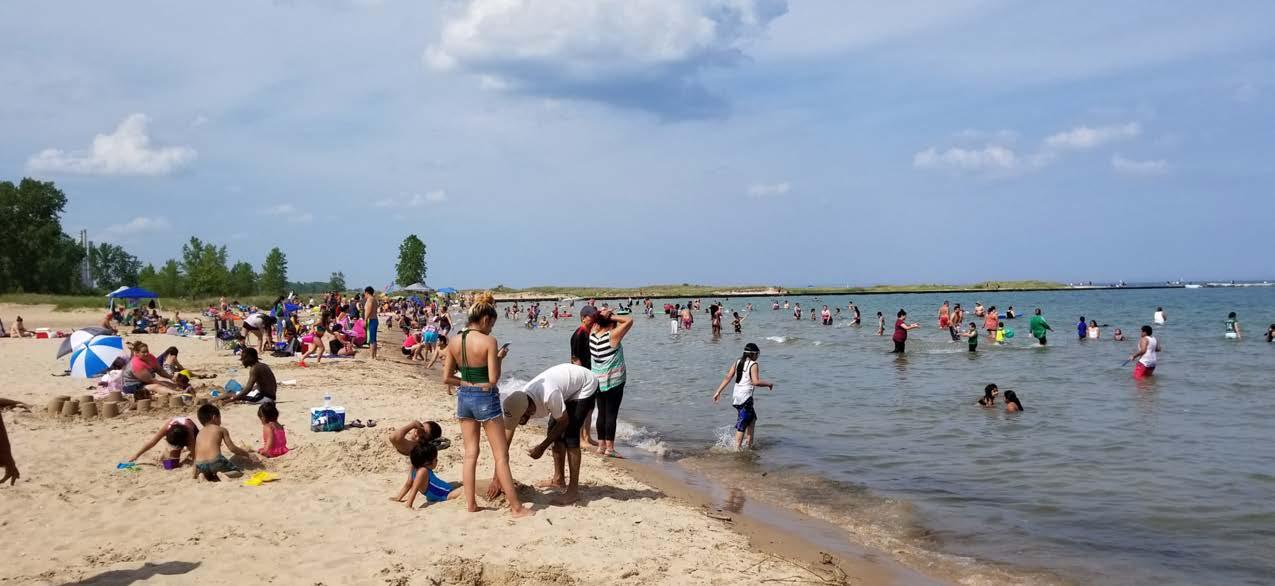
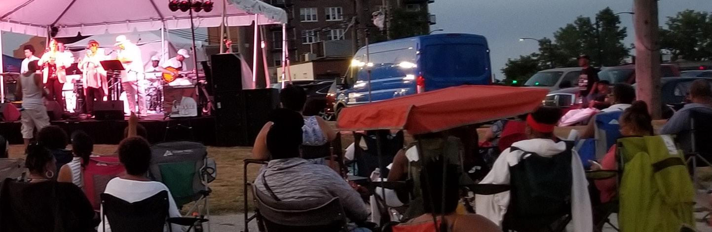
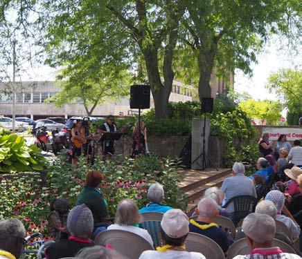
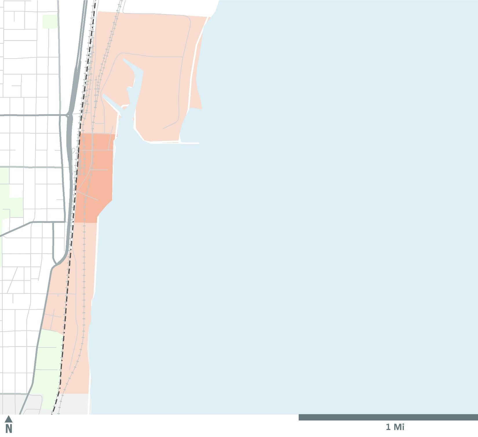
The Waukegan lakefront and Harbor are some of the City’s most unique assets. This key focus area comprises three subareas; the north harbor subarea, the Waukegan Harbor and Marina subarea, and the south lakefront subarea. As the City’s industrial market shifts westward towards the interstate highway system, there is an opportunity to transform the lakefront area into a new lakefront community and regional tourist destination. The City has envisioned the lakefront as a vibrant entertainment and recreation destination with supporting residential and commercial development. The Waukegan Harbor and Municipal Beach currently serve as anchors for attracting visitors year-round, especially during the spring and summer months. The Waukegan Marina provides services and facilities for recreational boaters and an industrial port. Summer event programming and events at the Waukegan Municipal Beach, such as the Waukegan Band Summer Concert Series and free lakeside yoga at the Stiner Pavilion, also attract guests to the lakefront area.
There are a number of vacant and underutilized parcels with redevelopment potential located along the north harbor and south lakefront subareas. Over the past 20 years, the City has worked with federal and state agencies to remediate land within these subareas, expecting to attract private developer interest for redevelopment. In 2001, the City acquired approximately 130 acres of land within the north harbor subarea and is currently remediating the area to
prepare for redevelopment.
The 2003 Lakefront-Downtown Master Plan dictates future development patterns to include mixed-use transitoriented development surrounding the Waukegan Harbor with complementary residential and commercial offerings along the north harbor and south lakefront subareas. The north lakefront subarea, located due north of the north harbor subarea, currently houses two utility operators. While these users are unlikely to relocate, the 2003 Lakefront-Downtown Master Plan calls for the vacant land surrounding these sites to be allocated for open space and natural areas.
The Waukegan Harbor Master Plan was approved in 2017 by the Waukegan Port District. This plan also calls for the clean-up of the harbor and increasing accessibility to downtown Waukegan. Other goals of the plan include proposing strategic partnerships to relocate existing industrial users to more favorable locations, and creating the opportunity for early stage public-private investments near the marina and lakefront.


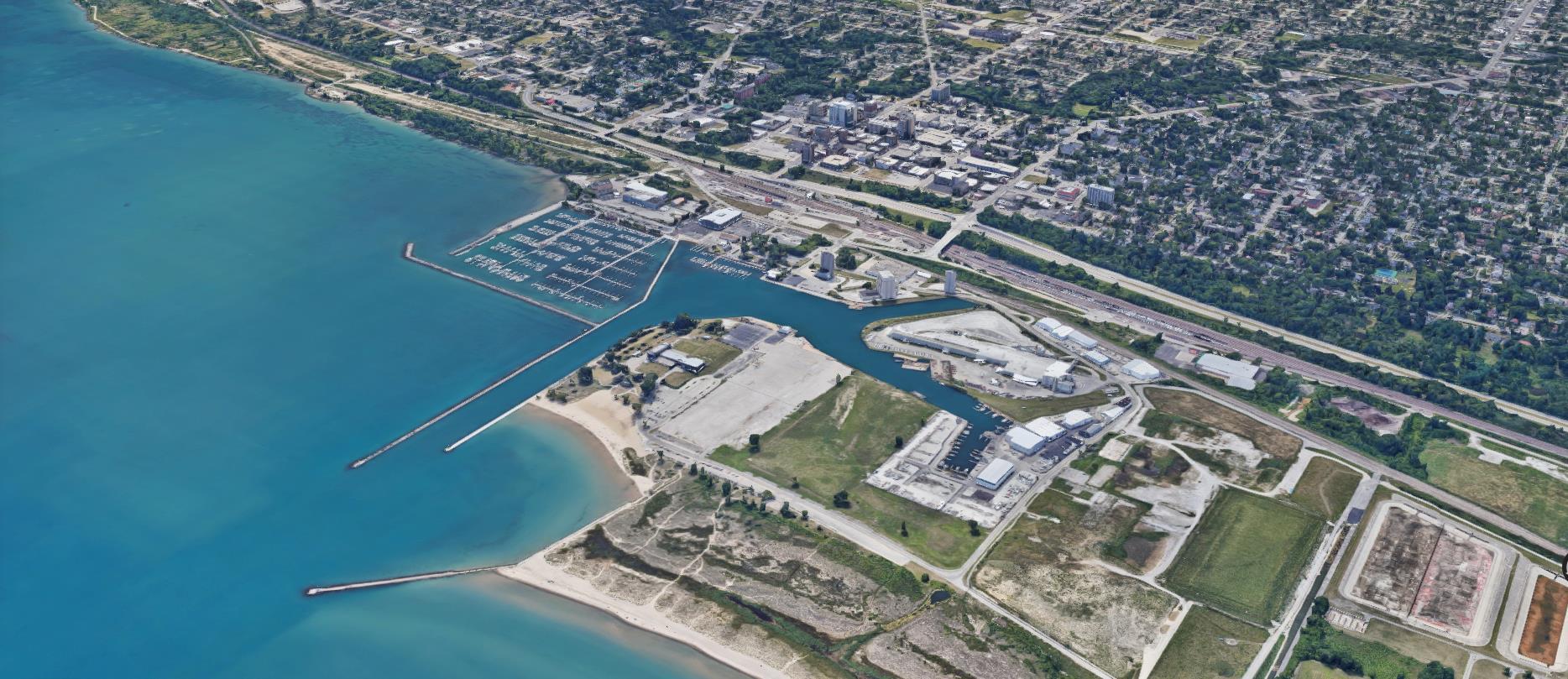
As industrial users have relocated from the lakefront, the City has worked to remediate key properties in order to prime the lakefront for future (re)development as a mixed-use residential and tourism destination. Now that remediation efforts of City-owned properties in the north harbor and south lakefront subareas has neared completion, the City is working to position these key (re) development areas for residential and commercial uses, as highlighted in the 2003 Lakefront-Downtown Master Plan.
The City has the opportunity to solicit developers for residential and commercial development on City-owned parcels. Given adequate environmental remediation for residential (re)development within City-owned properties in the north harbor subarea, the sites could support an aggregate total of approximately 800 residential units, assuming an average residential density of 10 dwelling units per acre. This residential density would allow for diversity of residential typologies such as duplexes, townhomes and apartments. However, given the generally untested market, supporting a first mover residential development, or the first residential development in the north harbor subarea, is a key step toward establishing a new lakefront residential market in the City.
There is active interest in residential development on underutilized properties along Market Street and the south lakefront, namely a 660-unit residential development of market rate housing within 12 parcels south of the Waukegan Harbor. The City owns a key site near the south lakefront subarea, located on the southeast corner of South Genesee Street and South Avenue that has previously been identified as a catalytic redevelopment site and could spur additional redevelopment along the south lakefront subarea. While the first market rate project may require public financial assistance, such an investment has the potential to be catalytic and unlock additional lakefront and downtown development. Stakeholder interviews cited environmental contamination concerns along the lakefront on legacy industrial properties. The extraordinary costs of environmental remediation challenge redevelopment opportunities in the area. All Superfund sites are in or nearing completion of cleanup. While several City-owned sites have been remediated, remaining remediation efforts and costs still challenge various privately-owned sites within the area. Additionally, industrial users continue to operate in areas of the Waukegan Harbor that may hinder the viability of future residential and retail developments. Typically, successful waterfronts incorporate a mix of residential and commercial uses, including industrial uses. Adequately buffering these privately-owned industrial properties from the publicly owned, development ready sites would enable future mixed-use development to occur with
METRA STATION WAUKEGAN MARINA MUNICIPAL BEACH STINER PAVILION DOWNTOWN PWAUKEGAN OTENTIAL RESIDENTIAL DEVELOPMENT SITE CITY OWNED PROPERTY WAUKEGAN HARBORminimal land use conflict.
The City is committed to establishing the Waukegan lakefront and Harbor as the premier waterfront tourism destination in Lake County. The Waukegan Harbor and the Waukegan Municipal Beach provide recreational offerings and attractions to the area, along with seasonal retail activity from the spring to the fall. In order to attract a critical mass of recreational and commercial patrons year-round, the City could partner with existing lakefront businesses and users to create a year-round retail and entertainment destination. In the long-term, this could lead to the propagation of other retailers and businesses along the lakefront and surrounding the Waukegan Harbor.
The City has desired to improve connectivity and enhance synergy between downtown Waukegan and the lakefront. Previous planning efforts, such as the 2003 LakefrontDowntown Master Plan, have called for large-scale projects and improvements to increase connectivity between these assets.
To build on the vision of the 2003 Master Plan, the component pieces of the project could be separated into smaller, more manageable projects. Also, this bridge should likely be moved one block north of the anticipated location, due to development that has taken place since the 2003 Plan, as well as to create a view corridor from downtown looking out the harbor channel.
Belvidere Road, Grand Avenue, Sheridan Road, and Washington Street serve as gateway retail corridors connecting the greater Lake County region to downtown Waukegan and Lewis Avenue. These gateway corridors provide visitors to the City a first impression of what Waukegan has to offer. In addition to providing unique retail offerings for regional visitors, the gateway corridors serve as commercial complements to the downtown area and provide City residents with much needed neighborhoodserving, convenience-oriented retail.
The five gateway corridors represent key retail corridors within the City:
The Belvidere Road retail corridor is the largest retail cluster within the City, comprised of approximately 900,000 square feet of retail space. This corridor consists of big-box retail stores including Home Depot and the Belvidere Discount Mall, a collection of local Latinx-oriented businesses. Average retail rents for this corridor are approximately $9 per square foot (PSF) and retail vacancies are estimated to be 16%.
Grand Avenue contains approximately 500,000 square feet of retail space. Retailers in this corridor are predominately local businesses and local restaurants, spanning a variety of cuisines. The average retail rents for this corridor are approximately $17 PSF while vacancies are at 2%, indicating a healthy corridor. Lewis Fresh Market is the main anchor in this corridor.
The Green Bay Road retail node, anchored by JewelOsco, CVS, and Walgreens, contains nearly 800,000 square feet of retail space. The average retail rent in the node is approximately $15 PSF, while vacancies in the area are about 4%. The southeast corner of the Green Bay Road and Grand Avenue intersection is an auto-related retail cluster, consisting of car dealerships such as Toyota and Kia, and other auto-related retail uses such as car washes and auto repair facilities.
The Lewis Avenue retail corridor, which extends from York House Road to Glen Flora Avenue, contains approximately 800,000 square feet of retail space. Anchor tenants within this corridor include Target, Ross, and Jewel-Osco, along with other neighborhood-serving retailers, restaurants, and grocers. Retail rents in this corridor are approximately $9 PSF, with vacancies of approximately 6%.
Washington Street is an active retail corridor with approximately 200,000 square feet of retail space, including many small businesses. There is a high concentration of local Latinx-oriented businesses, which are patronized by the local community. Washington Street was cited as the “Main Street” for the Latinx community in the region by the Chicago Metropolitan Agency for Planning’s (CMAP) 2014 Washington Street Corridor Plan. This community-oriented retail market has resisted the impacts of e-commerce retail that plague many big box retailers. The 2014 Washington Street Corridor Plan recommended increasing signage and providing for
wayfinding along Washington Street in order to promote patronage of local businesses along Washington Street by all members of the greater Waukegan area.
The gateway corridors have begun to establish individual, localized identities within the City. One example includes the Washington Street corridor and its abundance of Latinx-oriented retail offerings. In order to capitalize on the corridor’s popularity, the City has already worked to improve patronage in the area through increased signage and wayfinding efforts. Based on feedback from the 2014 Washington Street Corridor Plan, the City initiated a pilot program for the Washington Street corridor to improve façades, streetscaping, and wayfinding supported by $50,000 in Community Development Block Grant (CDBG) funding for façade projects for businesses. This initiative was enhanced by adding banners funded by the City to establish a Washington Street brand identity through a 5-block stretch along the corridor.
Building on the success of this program, other corridors could benefit from an established brand identity and increases in marketing efforts for businesses, as seen in the Washington Street corridor. The City is working with businesses and outside organizations to provide assistance in highlighting and promoting local businesses. The City also provides assistance to improve public infrastructure, branding and streetscaping to increase the attractiveness and aesthetic quality of the gateway corridors. Such placemaking initiatives that are designed to help revitalize the gateway corridors can also turn into a powerful marketing vehicle for the city and help establish unique brand identities for each corridor.
Strategically respond to changing retail trends through adaptive re-use and consolidation Nationwide, store closures are at record levels as big box stores reposition brick and mortar footprints This trend is driven by numerous factors including the rise of e-commerce, or the transaction of buying or selling online, omni-channel retailing and private equity restructuring. The gateway corridors have already experienced these national trends at a local level as traditional big box “brick and mortar” retail stores have restructured their physical presence to adapt to changing trends. The unfortunate outcome from this shift away from big-box retail development is an increase in vacancies of big-box retail buildings. However, this presents an opportunity to strategically respond to changing retail trends through creative adaptive re-use and consolidation strategies. One example is the conversion of the former Kmart located in the Belvidere Road corridor into the Cristo Rey St. Martin College Prep school in 2018.
The City seeks to support reinvestment within the gateway corridors by encouraging infill/redevelopment for convenience and neighborhood-serving retail while facilitating large-scale redevelopment where appropriate. Opportunities exist within the gateway corridors to target future reinvestment efforts in promising retail corridors while allowing for struggling retail locations to adapt to market changes and transition to other compatible land uses.
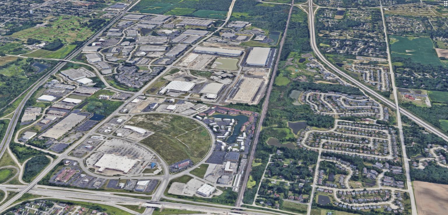
Southwest Waukegan is one of the City’s prime economic engines. This focus area comprises a broad mix of uses that all contribute significantly to the City’s economic base. While other areas of the City also have opportunities for continued growth and expansion of the City’s economic base, southwest Waukegan has the highest near-term development potential which could further catalyze economic activity within the City.
Fountain Square, located southwest of Belvidere and Waukegan Road, is one of the City’s prominent retail and lifestyle clusters with retail, hotel, and multifamily residential. Fountain Square is one of the largest regionalserving retail clusters within the City, with over 600,000 square feet of retail space, anchored by Walmart with supporting hotel and multifamily apartment development. Fountain Square today represents the successful bold redevelopment of the former Lakehurst Mall. While Fountain Square has not been as competitive as other nearby regional retail clusters such as Gurnee Mills, the retail cluster’s proximity to both Belvidere Road and US-41 allows it to command retail rents of $16 PSF triple-net with a vacancy rate of 6%.
This area of the City is also one of the primary locations of Waukegan’s industrial base. Bridge Point North is an office and light industrial park located to the south of


Fountain Square. The 225-acre business park currently contains nearly 2 million square feet of industrial space and has emerged as the City’s premier industrial park, with national tenants such as Amazon, MedLine, Visual Pak, and the Bolke-Miller Company. The Amhurst Lake Business Park located due east of Bridge Point North, contains approximately 1.1 million square feet of industrial and office space. Two other business parks, Northpoint Business Park and Norman Woods Business Park, collectively serve as the City’s highest performing industrial cluster with an average rent of about $6.50 PSF and vacancy rates of approximately 6.5%.
Southwest Waukegan’s strategic location near Interstate-94, US-41, and IL-120 have fostered its position as a prime commercial location in the City. This area has experienced significant development activity over the past 15 years, including retail and industrial, and is strategically positioned for a casino development.
Additionally, there is a concentration of higher value residential uses to the west of Fountain Square. The River Road neighborhoods contain a cluster of estatestyle housing which are among the highest priced homes in Waukegan. In 2017, the City adopted the River Road Corridor Plan, which aims to preserve the existing character of natural spaces and estate-style residential uses.
 AMHURST LAKE
FOUNTAIN SQUARE
PROPOSED CASINO SITE
BRIDGE POINT NORTH
NORMAN WOODS
NORTHPOINT
AMHURST LAKE
FOUNTAIN SQUARE
PROPOSED CASINO SITE
BRIDGE POINT NORTH
NORMAN WOODS
NORTHPOINT
The City seeks to create a signature urban casino and entertainment complex that acts as a new regional tourist destination. The casino complex should co-locate a diverse mix of hospitality, restaurant, and entertainment uses that provide synergistic growth with the existing Fountain Square development. Entertainment uses at the casino complex should not compete with existing Waukegan anchors such as Genesee Theatre, but be a net new draw for patrons and tourists from the larger Chicagoland and southeast Wisconsin regions. The City also seeks to improve connections between the casino and other entertainment and recreational assets in the downtown area and along the lakefront. Future revenues generated from the casino development could also be used as a source to finance the City’s economic development goals in the future.
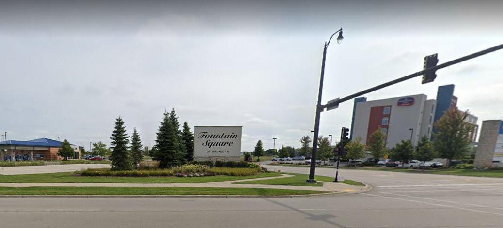
National trends in retail are adapting to embrace e-commerce and multi-channel retailing, as well as more experiential retail offerings. As one of the City’s highest performing retail clusters, the City seeks to enhance Fountain Square as a prominent experience-oriented retail and entertainment destination by integrating with the experiential commercial environment provided by the casino.
While southwest Waukegan contains some of the City’s highest performing industrial parks, stakeholder interviews indicated that there is limited land availability in southwest Waukegan for future commercial development. Stakeholder interviews identified a strategic site located at southeast corner of the Interstate-94 and IL-120 as having retail and/or research and light industrial (R/LI) redevelopment potential.
In addition, the City should consider the annexation potential of land located south of the Bridge Point North development and in proximity to the City’s northern industrial cluster. The Green Bay Road corridor, from York House Road to Crescent Avenue, should also be considered an opportunity for annexation and commercial development.
The Prosperity Chapter identifies key redevelopment areas within the City and provides economic development strategies for revitalizing each identified area. Key (re) development areas and strategies were informed by market research, development trends, and stakeholder interviews conducted between May and June 2019. The goal of this chapter is to provide place-based strategy direction and potential next steps for the City to facilitate future development.
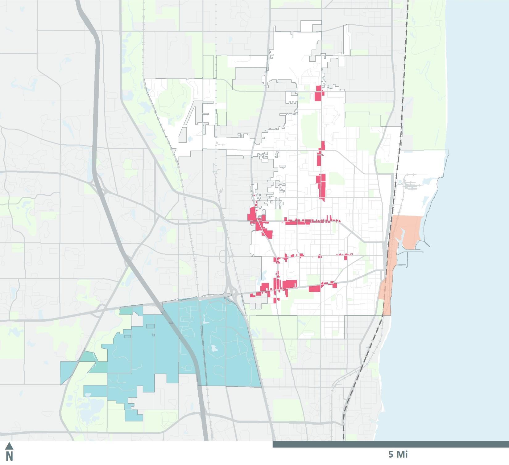
Our findings identified four focus areas within the City with (re)development potential, as highlighted in Table 1. These focus areas include:
• Downtown Waukegan
• Waukegan lakefront & Harbor
• Belvidere Road, Grand Avenue, Green Bay Road, Lewis Avenue, and Washington Street, (the “Gateway Corridors”)
• Southwest Waukegan
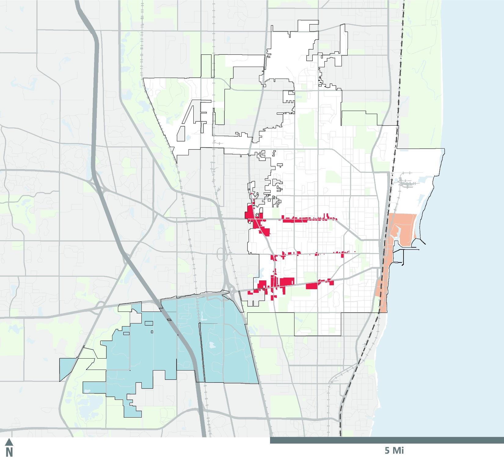
Figure 1 (on the next page) highlights the focus areas within the City of Waukegan. Table 1 summarizes the development strategies identified for each focus area.
To facilitate redevelopment efforts, various economic development tools have been highlighted which could be used by the City to facilitate future development. Local economic development districts such as TIF districts, Enterprise Zones, and Opportunity Zone are existing tools to support development efforts. Additionally, future revenues generated from the casino development could also be chosen as a source to finance the City’s economic development goals.
• Support residential development targeting 1,000+ additional units in downtown and surrounding areas
• Improve connectivity to the Waukegan Metra station, the Waukegan Harbor, and other nearby assets
Downtown Waukegan
• Promote business development and retention
• Activate vacant and underutilized properties
• Strategically invest in public space
Waukegan lakefront & Harbor
• Position the Waukegan Harbor and lakefront for public recreational uses and waterfront mixeduse development, including residential uses
• Improve connectivity to downtown Waukegan
• Activate destination sites
• Expand marketing and branding efforts
• Concentrate retail to key nodes and adaptively reuse or redevelop vacant and underutilized retail
• Encourage development on remaining available land
Southwest Waukegan
• Proactively monitor retail performance of Fountain Square and casino development
• Expand available developable land for industrial development
Fig. 1:

YORK HOUSE RD

120 94 41 94 43
N MCAREE RD 32 Waukegan Comprehensive Plan Prosperity
WASHINGTON ST
GRAND AVE 10TH ST MARTIN LUTHER KING, JR. DR
Fig. 2:
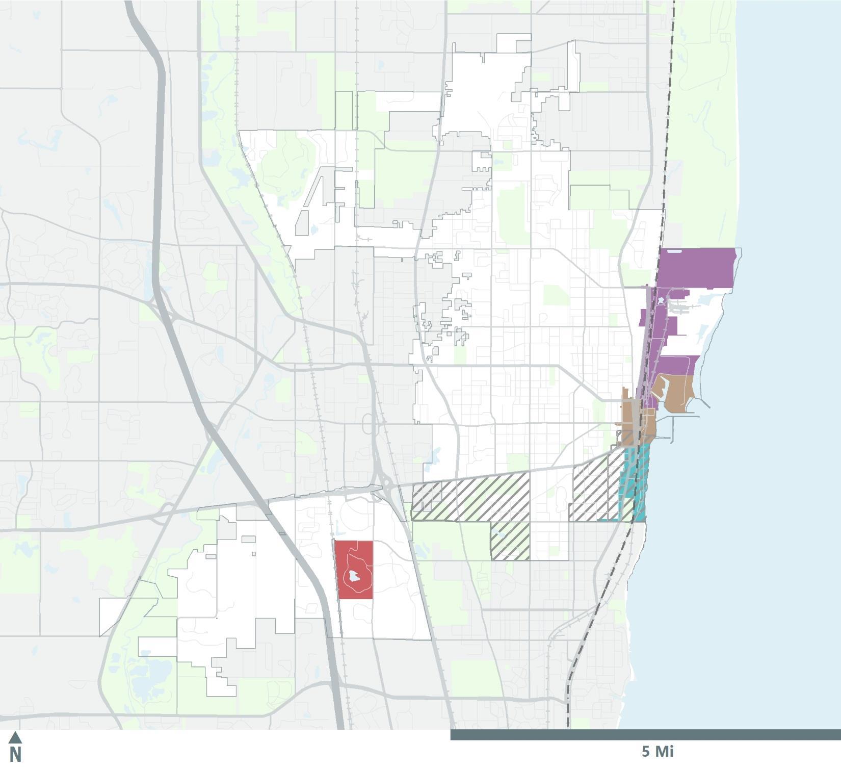
Map of Economic Development Districts within the City of Waukegan
YORK HOUSE RD
N MCAREE RD
GLEN FLORA AVE
LEWIS AVE GRAND AVE 10TH ST
WASHINGTON ST

Establish downtown as a vibrant mixed-use district by attracting residents and visitors to the downtown area, improving connectivity to nearby assets, and fostering a healthy commercial environment.
The diagram below identifies some of the key redevelopment and strategic sites for implementing the following (re) development strategies.
Strategies:
1. Support residential development targeting 1,000+ additional units in downtown and surrounding areas.
◦ Develop new market-rate housing units in downtown Waukegan. Higher household incomes within the downtown area could provide a “builtin” consumer base to support retail, restaurant and service uses.
2. Support new market rate residential units through new construction and rehabilitation of downtown buildings.
◦ Focus new development on vacant and underutilized lots near the Genesee Street commercial cluster and Metra station.
◦
Rehabilitate and adapt downtown’s healthy stock of historic buildings for residential purposes. One example includes the historic Waukegan Building, located at 4 South Genesee Street.
3. Leverage economic development tools to incentivize first-mover housing construction and introduce new market-rate multifamily products into the downtown area.
◦
Utilize TIF funding and other local incentives to support first-mover market rate multifamily development, which are the earliest projects delivered in an unproven market. Once the market has been proven, subsequent projects are unlikely to need financial support.
market-rate housing developments will need to provide parking to accomodate the new uses.
5. Facilitate transit-oriented development (TOD) in the downtown area.
◦
Prioritize TOD opportunities on vacant and underutilized properties near the Washington Street and Sherdan Road intersection, within proximity to the Metra station.
◦
Ensure future TOD construction in the downtown area is easily accessible to both the downtown businesses on Genesee Street and the Waukegan Metra station. One potential TOD site is the City-owned property at the corner of Washington Street and Sheridan Road.
◦
Develop policies and a procedure manual for multimodal transportation infrastructure to facilitate consistent application throughout the City.
◦
Utilize best practices and implement design guidelines to address site access, parking, and circulation for properties that present unique redevelopment opportunities. Lakefront and downtown design guidelines have already been created.
6. Continue to promote market rate residential development in areas surrounding downtown Waukegan.
◦
Access state and federal incentives, including various tax credit programs such as Historic Tax Credits and New Market Tax Credits, with a qualifying mixed-use project.
4. Explore creative downtown parking solutions to reduce surface parking and alleviate the financial burden of parking structure development costs.
◦
Encourage shared parking between uses. An example includes using office parking spaces for overnight residential purposes.
◦ Support efforts to increase residential development in these areas in order to complement development activity in the downtown area.
◦
Reduce or eliminate parking minimums.
◦ Maintain a district level public parking plan. New,
Promote business development and retention, and support existing business development efforts being undertaken by a variety of organizations to attract and retain long term commercial tenants within the downtown area.
1. Continue to support collaboration between existing business development entities in the downtown area.
◦ Continue to build upon its existing partnerships with national and local organizations who specialize in historic preservation, business development, tenant solicitation and placemaking in downtowns across the United States.
◦ Work with various downtown and arts-based organizations to identify and apply for various state, national, and privately funded grants aimed at supporting local artists and start-up businesses.
2. Implement a façade and tenant improvement program to support new and existing businesses.
◦
Provide matching grants or loans (possibly from CDBG or TIF) to property owners and/or small businesses willing to renovate the street-front exteriors of their structures, and provide funds for needed tenant improvements that would otherwise prevent businesses from opening or expanding downtown. Local banks could serve as partners to provide additional funding opportunities.
3. Monitor vacant properties in the downtown area.
◦
Actively monitor vacancies in the downtown area in order to proactively market and activate vacant commercial properties.
a walkable district.
◦
Facilitate the concentration of retail shops within a walkable district in order to generate the adequate foot traffic required to sustain small and local businesses located in the downtown area.
◦
Conduct pedestrian traffic counts at key intersections in the downtown area to include data in marketing tools.
◦ Collaborate with downtown organizations and property owners to identify priority downtown properties to concentrate activation strategies. ◦ Diversify retail offerings within this walkable district to support foot traffic throughout the day. ◦
Develop relationships with commercial retail brokers that have contacts with local, regional, and national retailers and can help recruit businesses to the downtown area.
5. Create cross-marketing and promotion strategies.
◦ Market available spaces through organizations such as the International Council of Shopping Centers (ICSC).
◦
Partner with downtown businesses and organizations to facilitate a creative marketing and promotion program to encourage people to stay downtown.
◦
◦
Create an inventory of all commercial properties, property owners, and building occupancy statuses.
4. Reduce retail vacancies and concentrate retail in
Utilize marketing strategies designed to increase visit frequency across the various business sectors and improve awareness for the full range of products and services available. Examples include a ‘dinner & a show’ promotion with local restaurants and performance arts venues, or a local employee and/or student coupon book to encourage patronage of local downtown business.
Activate vacant and underutilized properties in the downtown area to create a dynamic environment for residents and visitors. Provide unique experiences to attract a new consumer base to shop at local retailers and help improve negative perceptions.
1. Activate vacant and underutilized properties by establishing “pop-up” and temporary stores in vacant storefronts to support local businesses.
◦ Work with business development organizations and local businesses to temporarily activate vacant spaces in the downtown area through “pop-up” stores.
◦
Encourage pop-up stores as a tool to promote local businesses and startups that would benefit from a decrease in rent burden and exposure. These flexible spaces allow business owners to experiment in a new location without the high upfront costs of building out a new retail space.
promote the City’s art scene and attract tenants to underutilized and vacant properties.
4. Strategically invest in public space.
◦ Invest in public spaces to encourage people to spend more time downtown. Public spaces should be well maintained and attractive, as well as provide a central focus for gatherings. Key locations for improvements include Washington Street and Genesee Street.
5. Invest in streetscape beautification to create an aesthetically pleasing environment to attract visitors, and businesses into the downtown area.
◦
◦
Utilize pop-up stores to decrease vacancies within the downtown area and help prove that downtown is a viable location for businesses.
◦
Create and maintain attractive public spaces by repairing deteriorated sidewalks and adding placemaking features such as benches, planters, bike racks, and greenery.
◦
Property owners have a key role in making spaces viable and affordable.
2. Promote public events in underutilized spaces.
◦
Host a series of public events in underutilized properties to activate space and attract visitors to the downtown area. Weekly events give people a reason to visit downtown more frequently and support small, independent businesses.
Install public art to add interest, create a focal area, and give people a reason to visit a district. The City could capitalize on its thriving arts scene and partner with a local arts organization or hold a competition to solicit installation of art pieces to catalyze this interest in the downtown area.
◦ Strategically use CDBG and TIF funding to finance streetscape improvements and public art installation.
◦
Utilize events to promote local businesses and startups. Such events could also be held in proximity to downtown on the lakefront.
3. Support local artists.
◦
Partner with local artists and property owners to facilitate temporary art installations or displays in vacant storefronts through partnerships with property owners.
◦
Coordinate with various downtown and arts-based organizations to identify and apply for various state, national, and private grants aimed at promoting public art installations and streetscape improvements.
◦
Utilize rotating art installations and displays to
◦
Continue to use the courtyard at the intersection of Genesee and Madison Streets as a public gathering space.
Improve connectivity to the Waukegan Metra station, the Waukegan Harbor, the lakefront and other nearby assets between downtown Waukegan to increase the synergy among commercial, residential, and entertainment uses within each key redevelopment area.
Strategies:
1. Improve connectivity by investing in smallerscale public improvements while disbursing the capital costs over a longer time frame.
◦ Consider interim, smaller-scale alternatives to better connect the lakefront to downtown Waukegan, such as public improvements to existing connectors along Grand Avenue, Washington Street, and Belvidere Road to make each throughway more accessible for pedestrians and cyclists.
◦
Assess and prioritize sidewalks for repair and replacement based on usage level and proximity to City and community assets.
scale capital improvements by including priority corridors for improvement within the CIP to demonstrate the City’s local commitment for addressing smaller-scale capital improvements.
3. Enhance synergy between lakefront and downtown Waukegan through increased connectivity.
◦
Expand and improve connectivity to downtown Waukegan to create synergy between the downtown area and the lakefront.
4. Invest in public improvements to improve connectivity to downtown.
◦
◦
Ensure the City’s current Capital Improvement Plan (CIP) includes critical connectivity improvements between downtown Waukegan and the lakefront via Grand Avenue, Washington Street, and Belvidere Road.
◦
Implement more affordable, piecemeal alternatives to better integrating the Waukegan Harbor and lakefront to downtown Waukegan.
Utilize TIF revenues from the DowntownLakefront, North Lakefront and/or South Lakefront TIF districts to fund public improvements.
◦
Use local financing tools such as TIF funding from the Downtown-Lakefront and North Lakefront TIF districts and CDBG funding to support ongoing small-scale capital improvements.
2. Strategically compete for federal grants for more expensive, larger scale capital improvement projects.
◦ Implement a two-pronged approach for addressing both smaller-scale and larger-scale capital improvements in order to be more competitive for federal and state funding while tackling immediate public improvement needs.
◦ Position the City to become more competitive for securing federal and state funding for larger-
◦
Apply for state and federal funding sources, such as BUILD Grants, to assist in funding larger-scale capital improvement costs. ◦
Demonstrate a local commitment to smallerscale capital improvements, as well as a priority list of key transit corridors subject for capital improvements.
1. Position the Waukegan lakefront and Harbor for catalytic waterfront development.
◦
Attract new residential and retail development on City-owned property in the north harbor and south lakefront areas with the goal of establishing the Waukegan Harbor and lakefront as a mixed-use destination.
2. Continue environmental remediation efforts for City-owned property.
◦ Continue to spearhead environmental clean-up efforts.
◦
Seek federal and state funds such as the Illinois EPA’s Brownfields Cleanup Revolving Loan Fund, the US EPA’s Brownfield Cleanup Grant Program, and the INDR Coastal Management Program grant program, to finance the remediation to create additional development-ready sites. Cityowned sites are nearly complete.
sources of funds such as Opportunity Zone and New Market Tax Credits to finance redevelopment activity in the Waukegan lakefront & Harbor area.
5. Establish the Waukegan lakefront & Harbor as a year-round retail and entertainment destination.
◦ Expand the Waukegan lakefront & Harbor public recreational offerings and complementary uses
◦ Continue to expand event programming in the north harbor and Waukegan Harbor & Marina areas.
◦
Increase and target events to be held year-round, such as ice-skating in the public parks, holiday related events, or farmers’ markets to sustain a critical mass of visitors to the area.
◦ Activate underutilized City-owned properties such as vacant lots and parking spaces along the lakefront to host these additional events.
6. Enhance the management and preservation of Waukegan’s beach and dunes.
◦
Utilize TIF revenues from the DowntownLakefront, North Lakefront and/or South Lakefront TIF districts to fund site remediation for firstmover projects.
3. Solicit qualified developers for residential development on City-owned property.
◦
◦
◦
Pre-market the sites to qualified developers.
Prepare and issue Request for Qualifications (RFQ).
Shortlist developer based on demonstrated experience with complex projects and capacity.
◦
Waukegan Dunes: No sand grooming recommended in this zone, with the exception of hand grooming marked trails as needed to keep markers visible. Work with natural grading when engineering pathways, zigzag paths to extent possible to limit sand erosion and to make sand less attractive to gulls.
◦
◦
Prepare and issue Request for Proposals (RFP).
◦ Select developers based on their submitted development plan, economic proposal and strategy and commitment to the project.
4. Promote “first mover” residential units within the north harbor and south lakefront subareas.
◦ Conduct a two-step developer solicitation process (RFQ/P) to market housing development on Cityowned properties.
◦
Utilize TIF revenues from the DowntownLakefront, North Lakefront and/or South Lakefront TIF districts to incentivize first mover (re) development. Because a substantial amount of public assistance would likely be required for a ‘first mover’ project, City could also consider implementing provisions such as upside sharing costs, in the case that a development project exceeds projected returns. Utilize other federal
◦
North Beach: Habitat Management Plan: There is always the risk a nesting pair of endangered/ threatened bird species will select a site within the swimming beach groomed sand area. It is for this reason that an Incidental Take Authorization (ITA) should be sought which addresses the potential for taking listed birds. Due to the rarity of nesting attempts, the State may not be able to issue an ITA for the Common Tern or the piping plover; it must be able to find that the proposed taking will not jeopardize the continued existence or the recovery of the listed species in Illinois.
South Beach: Utilize design strategies that minimize management needs.
◦
Temporary snow fencing along southern portion of beach to capture aeolian sand that blows into the federal channel. Once sand covers fence, dunegrass should be planted to stablize and maintain this new dune, which will keep sand on South Beach and out of the channel.
◦
Extend temporary snow fencing across entire beach, west to east at approximate 100’ spacing, in winter months to keep sand in place.
Attract and grow local businesses within the corridors through strategic marketing and branding, rezoning as appropriate, promoting business development and retention, and promoting retail concentration and adaptive reuse in transitioning areas, and support technology enhancements in a forward-thinking manner.
1. Create distinct brand identities for the gateway corridors.
◦
Facilitate partnerships between local businesses and organizations specialized in business development to establish brand identities.
◦ Provide additional marketing assistance to highlight local businesses.
◦ Review and rezone areas along corridors, as needed, to align with the corridor identities.
2. Continue façade improvement and signage/ wayfinding installation programs.
◦ Support façade improvements and signage/ wayfinding installations along eligible gateway corridors to improve façades and streetscapes.
◦
Support grassroots efforts aimed to improve façades and streetscapes for local businesses.
3. Strategically respond to changing retail trends through adaptive re-use and consolidation.
◦
Concentrate retail to key nodes and adaptively reuse or redevelop vacant and underutilized retail. Encourage transition of obsolete retail uses in Gateway Corridors to adapt to market changes through consolidation and adaptive reuse and redevelopment.
◦
Encourage participation in enterprise zone incentive programs for property owners and prospective businesses looking to locate and/or expand in the eligible gateway corridor.
4. Support and promote adaptive reuse or redevelopment of vacant buildings. ◦ Promote creative redevelopment of vacant and underutilized sites.
◦
Encourage participation in incentive programs for property owners and prospective businesses looking to locate and/or expand.
◦
Promote Opportunity Zone participation for developers in vacant and underutilized properties along Belvidere Road.
◦
Investigate project-based TIF district designations along struggling corridors to provide funding for (re)development efforts.
5. Support technology enhancements throughout the community.
◦
Triage struggling retail nodes to target reinvestment and consolidate retail activity in strategic locations.
◦
Consolidate efforts to help key shopping centers fill vacancies while allowing less-viable retail locations to transition to other land uses.
◦
Stay aware of technological advances that are attractive to businesses and/or property owners. ◦ Install conduit for fiber optics every time the ground is opened for infrastructure work. ◦
Make fiber optic connections as pieces fit together.
Image
Image Source: Dimit
The redevelopment of the Cleveland Lakefront served as an effort to revitalize a key commercial area within the City of Cleveland. The Lakefront houses various institutional anchors such as the Rock and Roll Hall of Fame and the Great Lakes Science Center and is bordered by other anchors such as FirstEnergy Stadium and the Burke Lakefront Airport. However, there was little private investment within the Lakefront, which was further challenged by the Cleveland Memorial Shoreway, which separates the Lakefront from Downtown Cleveland.
Image Source:
In 2012, the City of Cleveland adopted a revision to the Cleveland Downtown Lakefront Plan focusing on the redevelopment of three key areas of the Cleveland Lakefront; Harbor West, North Coast Harbor, and Burke Development District. The City engaged in various public-private partnerships to sell City-owned lots in the Lakefront for redevelopment purposes.
commercial area within the City of Cleveland. The Lakefront institutional anchors such as the Rock and Roll Hall of Fame Science Center and is bordered by other anchors such as FirstEnergy the Burke Lakefront Airport. However, there was little private Lakefront, which was further challenged by the Cleveland Memorial which separates the Lakefront from Downtown Cleveland.
Lakefront Plan focusing Lakefront; Harbor West, City engaged in various Lakefront for redevelopment
The most notable redevelopment district. In 2014, a development Development and the redevelop 28 acres Phase I of the development development featuring space, which were
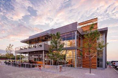
In 2012, the City of Cleveland adopted a revision to the Cleveland Lakefront Plan focusing on the redevelopment of three key areas Lakefront; Harbor West, North Coast Harbor, and Burke Development City engaged in various public private partnerships to sell City Lakefront for redevelopment purposes.
The most notable redevelopment efforts have occurred in the district. In 2014, a development team consisting of local developer based Trammell Crow Company redevelop 28 acres of vacant lots and surface parking in the Phase I of the development plan consisted of a lakefront restaurant unit luxury apartments with ground
The next phase of the additional 1,000 apartment square feet of retail, This proposal is currently
The next phase of the North Coast Harbor redevelopment project additional 1,000 apartment units, 80,000 square feet of office square feet of retail, in addition to green space and a possible This proposal is currently undergoing the entitlements process
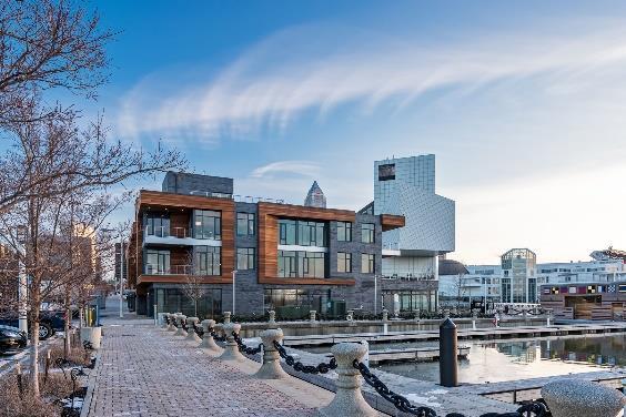
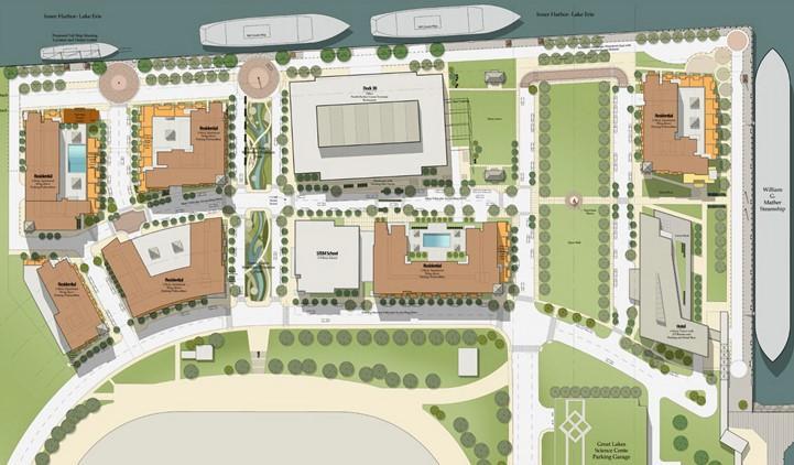
Source: City of Cleveland; Cumberland Development; Downtown Cleveland Alliance; SB
The most notable redevelopment efforts have occurred in the North Coast Harbor district. In 2014, a development team consisting of local developer Cumberland Development and the Dallas-based Trammell Crow Company won a bid to redevelop 28 acres of vacant lots and surface parking in the North Coast Harbor. Phase I of the development plan consisted of a lakefront restaurant and a mixed-use development featuring 16-unit luxury apartments with ground floor office and retail space, which were completed in 2016.
The commercial institutional Science the Lakefront, which In 2012, Lakefront Lakefront; City Lakefront The district. Development redevelop Phase development space, The additional square This
Image
The next phase of the North Coast Harbor redevelopment project proposes an additional 1,000 apartment units, 80,000 square feet of office space, and 50,000 square feet of retail, in addition to green space and a possible school development. This proposal continues through the entitlements process with the City.
Image Source: Downtown Cleveland Alliance NUEVO MODERN MEXICAN & TEQUILLA BAR HARBOR VERANDAS Image Source: Cumberland Development Source: City of Cleveland; Cumberland Alliance HARBOR VERANDAS Architects Downtown Cleveland Alliance NORTH COAST HARBOR PHASE II CONCEPT PLAN NUEVO MODERN MEXICAN & TEQUILLA BAR HARBOR VERANDAS Source: Dimit Architects Source: Cumberland Development Source: Source: Cumberland Development Source: Dimit Architects
Integrate the future casino development into the existing Fountain Square fabric while maintaining and expanding the retail and research/light industrial offerings of southwest Waukegan, and create new regional tourist destinations. The diagram below illustrates key redevelopment and strategic sites for implementing the following redevelopment strategy within Fountain Square and southwest Waukegan.
ENCOURAGE DEVELOPMENT ON REMAINING AVAILABLE SITES
PROACTIVELY MONITOR RETAIL PERFORMANCE PRESERVE ESTATE RESIDENTIAL CHARACTER
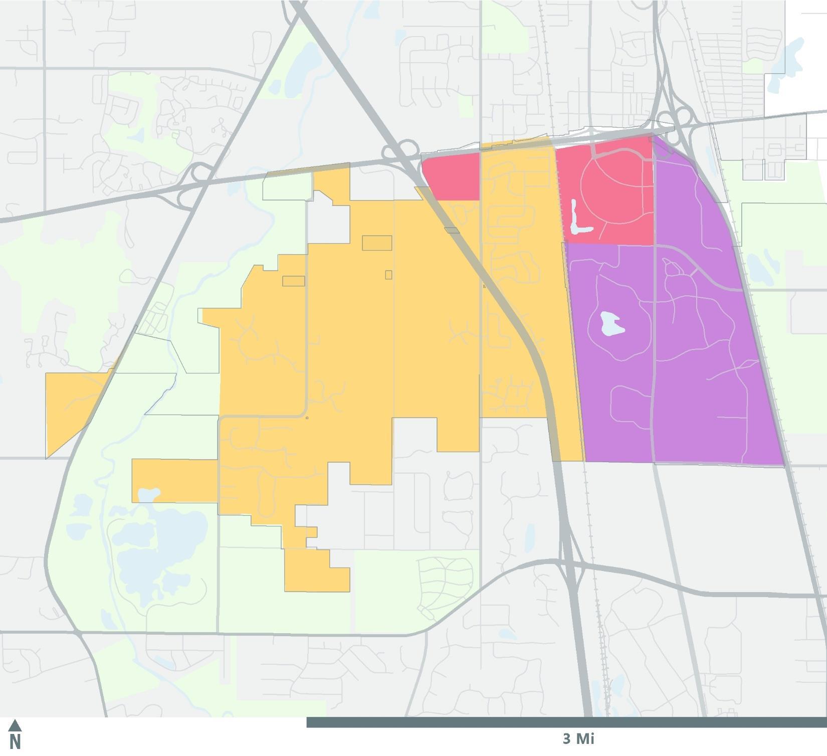
1. Integrate future casino development into existing commercial landscape.
◦
◦
Co-locate a diverse mix of hospitality, retail and entertainment uses.
Collaborate with selected casino licensee to ensure that the final development vision includes outwardly facing integrated restaurant, retail, and entertainment options.
4. Develop relationships with commercial retail brokers. ◦
Develop relationships with commercial retail brokers and utilize their contacts with local, regional, and national retailers.
◦
Compile the list of vacant commercial properties as they become available to market spaces through organizations such as ICSC.
◦
Ensure future hotels complement existing hospitality options within Fountain Square.
◦ Explore potential for a conference center component in the future.
2. Solidify Fountain Square as a regional retail cluster.
◦ Maintain high performing retail in Fountain Square while guiding future commercial development.
◦
◦
Encourage development on remaining available land within Fountain Square.
Coordinate with property owners to support development and help facilitate needed public infrastructure improvements.
3. Proactively monitor retail performance.
◦ Work with brokers and property owners to monitor key performance indicators for retail at Fountain Square, such as vacancy.
◦
Proactively gauge the health of the retail cluster to watch for signs of decline and intervene to adapt to changing retail trends, if necessary.
5. Maximize use of available developable land for new commercial development.
◦
Expand Waukegan’s commercial and industrial presence in this area.
Consider annexation of adjacent unincorporated land, and work with property owners. ◦
◦
Sites with similar development potential located outside of the Waukegan city limits could also be annexed and designated for compatible uses. Possible sites include underutilized properties located to the south of the existing industrial parks.
◦
Continue to investigate annexation potential of unincorporated land adjacent to the City’s northern industrial cluster to alleviate future pressures of highly concentrated industrial users.
6. Encourage development on remaining available land at southeast corner of the Interstate-94 and IL-120.
◦
Collaborate with the property owner to support development and help facilitate needed public infrastructure improvements.
The Waukegan Comprehensive Plan provides a blueprint for the City to make its community stronger and more resilient through prioritized planning, investment, and enhanced collaboration between organizations and bodies of government. The City desires to preserve its high-quality open space, and revitalize the lakefront, downtown, commercial corridors, and promote housing choice throughout the City. The Community chapter illustrates how land-use patterns play a significant role in shaping the physical character of Waukegan. Diversity, equity, arts, and culture are also important to the maintenance of Waukegan’s quality of life. Waukegan has a robust network of civic and community facilities and social organizations that are active in their support of the community’s positive identity. This chapter provides recommendations to organize future land uses in Waukegan through the “placetype” approach and provides goals and recommendations to enhance the physical landscape of Waukegan.
The City’s natural resource systems and infrastructure are adaptable and able to function during times of critical need. Social systems, natural resources, and infrastructure are improved to become more durable, making them recover quickly from short-term distress and long-term stress.
The Waukegan Comprehensive Plan organizes future land use and development in terms of “placetypes.” Placetypes characterize an area based on its defining character, scale, form, and function. They are also an umbrella for multiple land uses. This approach provides the City flexibility when planning in the future. This flexibility can be responsive to where the community’s needs and conditions may change. Waukegan’s eight placetypes establish well-defined, unique geographies in the City. The placetypes are created and enhanced through the involvement of the Waukegan community, neighborhood planning and collaboration, land-use regulations, partnerships between the City and local organizations, and public-private partnerships.
The placetypes also provide the potential for creativity. This approach fosters utilization of vacant and undeveloped properties by enabling the City to assign the most appropriate land uses. It recognizes that being flexible and creating areas with a mix of compatible land uses can foster a greater level of activity and convenience for residents. In addition to land use, placetypes also depend on the specific location’s design, functionality, and access to infrastructure.
The use of this approach provides more inclusive, accessible, and economically vibrant neighborhoods, and reflects the three community principles of resilience, inclusive growth, and prioritized investment.
Waukegan offers economic opportunities for all of its residents regardless of their background, age, or income. Doing so enables them to experience prolonged periods of prosperity and stability, with fewer and shorter periods of economic stagnation or decline.
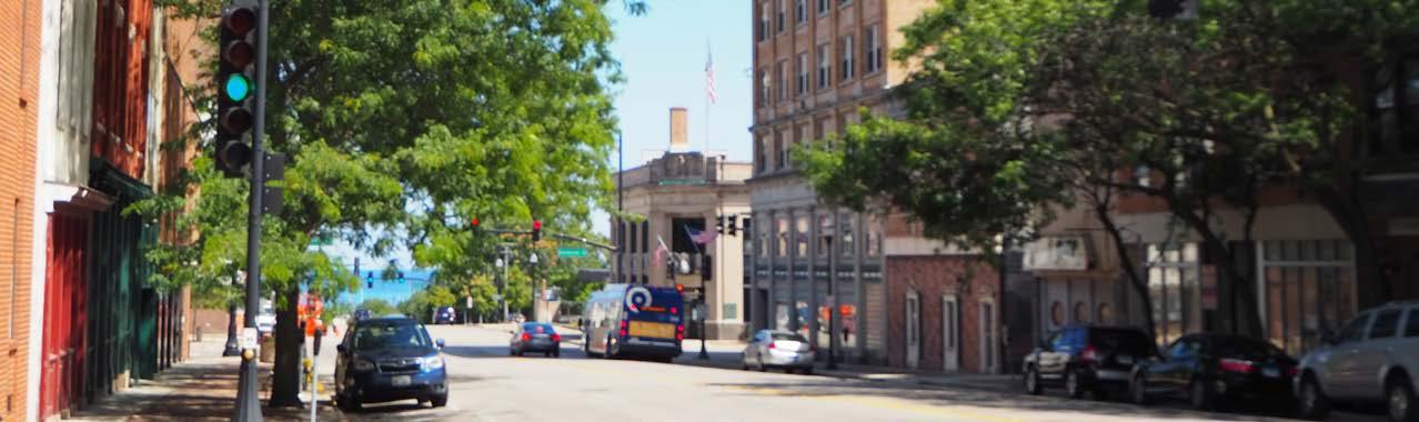
It is critical to prioritize investments and management of public revenues to maximize benefits to the community. Waukegan’s ability to leverage mixed funding streams, including limited government resources, demonstrates the City’s ability to seize opportunities where available.
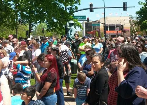
Although placetypes generally share defining features, each individual placetype is encouraged to define its own unique character and a specific mixture of land uses to meet local needs and aspirations. For example, Belvidere Road, Grand Avenue, and Sunset Avenue are designated as Commercial Areas. However, each corridor has its own character and delivers a unique experience for visitors and residents entering Waukegan.
The following section outlines Waukegan’s eight placetypes, including a description of their character, the compatible land uses within each placetype, and best practices relevant to the City. These placetypes define Waukegan by creating environments with their own sense of identity. It should be noted that in areas where different placetypes are adjacent to each other, a transition zone that integrates each placetypes’ character should be created. Adjacent land uses should be compatible and appropriately scaled and buffered.
To fulfill the embodied character of each placetype, elements for prioritization of improvements are discussed. The character is aspirational and illustrates the future vision of each placetype. The recommended characteristics will bring to life the types of spaces and thriving environment that the City desires to achieve. The eight placetypes are:
• Core Neighborhoods
• Edge Neighborhoods
• Commercial Area
• Downtown Waukegan
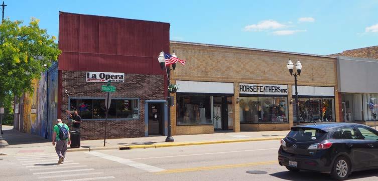
• Lakefront
• Innovation Hub
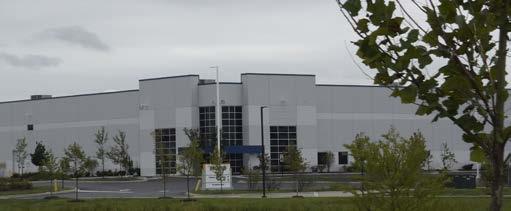
• Parks/Green Space
• Waukegan National Airport
Source: City of Waukegan Source: City of Waukegan Source: City of Waukegan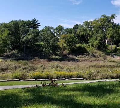
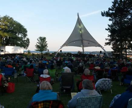
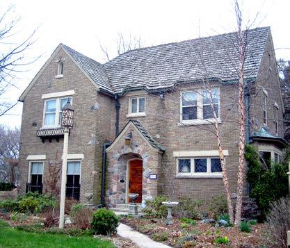
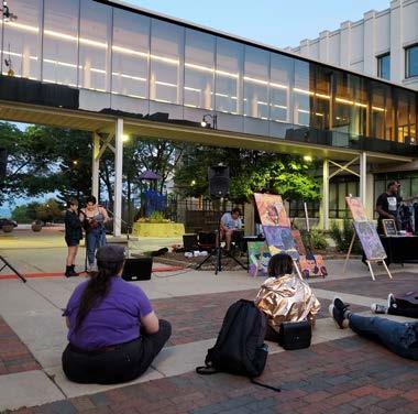
Waukegan is a complex city made up of a variety of distinct zones and districts. Placetypes incorporate the anticipated use, spirit, character, and vision for the specific area. They are flexible in their use and interact with adjacent land uses to create complete neighborhoods. Land use designations are still used, however, they are coordinated with placetypes to ensure regulatory and experiential needs are met. The placetype approach recognizes how land uses are related to each other rather than traditional land use plans that utilize a parcel-byparcel approach. The placetype approach assigns a specific future land use category to larger geographies with similar characteristics.
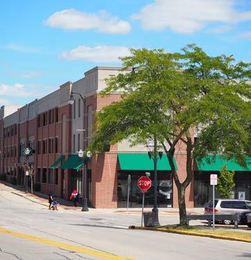
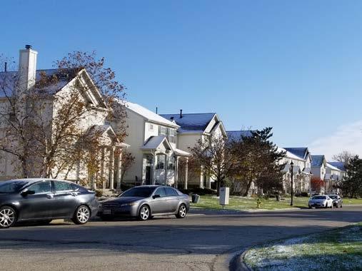
The characteristics of the placetypes are aspirational and envision the future of Waukegan. Each placetype recognizes complementary land uses that may be co-located. This coordination demonstrates a thorough understanding of the City and its complex and integrated systems. Waukegan’s urban fabric and relative location of placetypes, has been contemplated as a complete community.
In the future, as development occurs, the City will continue to be able to adapt to these conditions using the placetype framework.
The eight placetypes consist of several typical land uses, which are categorized as either a primary or secondary land use for each placetype. Most of the typical land uses are derived from the existing land use categories listed in the Existing Conditions Report. Primary land uses play an important role in the overall characterization of the placetype. Secondary land uses complement primary land uses. The table below illustrates the relationship between primary and secondary land uses for each placetype. The following sections will describe the characteristics of each typical land use.
Primary Land Uses are prioritized and characterize the placetype. Secondary Land Uses are supportive and complement the Primary Land Uses.
This land use consists of singlefamily detached homes on subdivided lots. This is currently the predominant land use and building type within the City of Waukegan. Lot sizes and housing characteristics vary across different neighborhoods.
This land use consists of townhomes and duplexes. The units are horizontally connected but have separate entrances from the public street and sidewalks.
Multifamily residential structures contain multiple housing units and are usually stacked vertically and attached horizontally. Each unit has its own entrance on a common hallway. Multifamily residential buildings include apartments, condominiums, and senior housing buildings.
These areas permit commercial land uses and include places where people can shop, dine, and work. These activities may be located within either commercial or office buildings. The scale of these land uses can vary in size. They can be low-intensity and be found within neighborhoods, or they can be largescale and more intense, such as those found in shopping centers or in mixed-use environments.
Source: Google Earth Pro Source: City of Waukegan Source: City of WaukeganEntertainment and arts typically include venues that accommodate arts, performance, and festivals. These are generally located in downtown Waukegan and at the lakefront where community festivals and events regularly bring people together. Some notable events include ArtWauk, Scoop, and Waukegan Band Concerts. Genesee Theatre and Three Brothers Theater are notable destinations that host popular productions. Both are also located in downtown Waukegan.
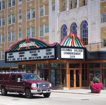
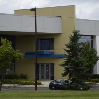
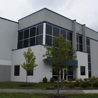
Office uses typically include professional services, corporate, offices, and medical offices. They can accommodate accessory commercial uses, such as restaurant, service, or other convenience amenities that are geared toward serving the office tenants. They mostly consist of stand alone office and medical office buildings. It should be noted that office uses can also be incorporated within research/light industrial uses.
Research/light industrial land uses cover a wide range of functions. They include storage, warehouse, research, light processing or assembly, and light manufacturing. Research/light industrial uses also range in scale and intensity, from individually-owned establishments to larger corporate establishments including Amazon, VisualPak, Medline, and Astronics. These spaces tend to have a mix of office space and industrial operations that focus on innovation and sustainability.
Civic/Educational uses include a broad range of public and semiprivate community facilities. They help define and contribute to Waukegan’s quality of life. These institutions can include schools, government buildings/facilities, and medical facilities. Civic facilities that serve specific populations include non-profits and social service agencies. These facilities may be integrated into other placetypes as they are generally small in scale and serve their surrounding neighborhoods.
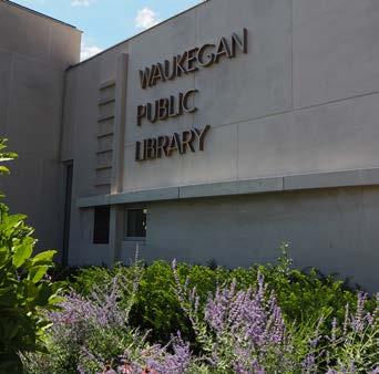
This land use category consists of public parks and open space. They include those owned and maintained by the City, Park District, and the Lake County Forest Preserve District. They accommodate both active and passive recreation and, like civic/ educational uses, contribute to Waukegan’s quality of life. These spaces also include pedestrian trails, athletic fields, golf courses, playgrounds, neighborhood parks, beach, as well as natural areas and features, such as the Waukegan ravines, woodlands, prairies, and the Waukegan Dunes.
This land use designation includes public transportation and utility facilities. They vary in physical and operational scale, and are necessary infrastructure components of the City of Waukegan. Examples of transportation/utility uses include the Waukegan NRG Generating Plant, Waukegan Water Plant, Waukegan Metra Station, Waukegan National Airport, North Shore Water Reclamation District, and power substations and lines. These uses are most likely to remain and continue to serve Waukegan’s residents longterm.
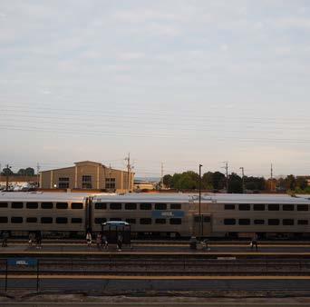
Page intentionally left blank
The Core Neighborhood placetype is predominately residential with a variety of residential building types, including single-family detached, single-family attached, and multi-family buildings. The residential typologies vary by density and coexist with schools, parks, and religious institutions. This placetype typically has a traditional neighborhood grid-like street pattern. It supports convenience retail, restaurants, and office uses that can be located at intersections or along major roadways. It should be noted that some current land uses within Core Neighborhoods do not conform to the recommended primary and secondary land uses. The current and non-conforming land uses can remain; however, should an opportunity for redevelopment/reuse arise, the City should work with stakeholders to implement the placetype’s recommendations.
• Single-Family Detached Residential
• Single-Family Attached Residential
• Multi-family Residential
• Restaurant
• Retail
• Commercial Service
• Parks/Open Space
• A network of safe, protected, and attractive pedestrian and bicycle routes to connect Core Neighborhoods with their surrounding neighborhoods, commercial, and mixed-use placetypes.
• Single-family detached and attached housing to establish the Core Neighborhood’s primary character. Multi-family housing is also acceptable and should be located along main streets, at the edges of neighborhoods, or in transition zones. It should also be screened or buffered against single-family detached and attached housing units to create smooth physical transitions across different densities.
• Pedestrian, bicycle, and transit connections between existing and future retail/commercial nodes in Core Neighborhoods. This provides residents convenient access to daily services and groceries.
• Neighborhood gathering spaces, such as parks, schools, and religious institutions, as many community events are centered around these venues.
• ADA-compliant sidewalks with continuous access throughout the residential placetype.
• Street lighting conforms to the Illuminating Engineering Society (IES) and International Dark Sky Association’s (IDA) Backlight, Uplight, and Glare (BUG) rating system. This type of street lighting minimizes light pollution, glare to pedestrians, and light reflection into adjacent buildings.
Source: City of WaukeganThe Edge Neighborhood placetype typically consists of newer residential subdivisions located outside of Waukegan’s urban core. These neighborhoods are built on previously undeveloped lands or greenfields. A key element that differentiates Edge Neighborhoods from Core Neighborhoods is the intensity and scale of development. Edge Neighborhoods typically feature larger homes that are spaced further apart than Core Neighborhood houses. Additionally, Edge Neighborhoods tend to have curvilinear street patterns while Core Neighborhoods typically follow a traditional grid pattern. It is anticipated that future expansion of residential areas will be developed at the edge of the community. Edge Neighborhoods should possess a mix of housing types with access to pedestrian and bicycle infrastructure. This makes the neighborhood more walkable and connected to adjacent placetypes, forest preserves, parks, and open space.
• Single-Family Detached Residential
• Single-Family Attached Residential
• Multifamily Residential
• Restaurant
• Retail
• Commercial Service
• Parks/Open Space
• Retail, services, restaurants, and commercial services along main streets and at the edge of the neighborhoods. They should be directly accessible from Edge Neighborhoods by drivers, bicyclists, and pedestrians.
• A variety of housing types, prices, and sizes should be incorporated into Edge Neighborhoods. Higher-density multifamily housing should be located along main streets or at the neighborhood perimeter.
• Contains a central feature, such as a park, natural feature, school, and other neighborhood gathering space.
• ADA-compliant sidewalks with continuous access throughout the placetype.
• Street lighting conforms to the Illuminating Engineering Society (IES) and International Dark Sky Association’s (IDA) Backlight, Uplight, and Glare (BUG) rating system. This type of street lighting minimizes light pollution, glare to pedestrians, and light reflection into adjacent buildings.
• Infill housing and mid-density development is distributed throughout the placetype.
Source: City of Waukegan Source: City of Waukeganannexation opportunities for commercial growth
Commercial Areas are important components of Waukegan’s economy. This placetype primarily contains uses that provide goods and services to nearby Core and Edge Neighborhoods but can also service other placetypes within the vicinity. This placetype is characterized by shopping centers and clusters of developments that are often located along corridors and at the intersections of the City’s major roadways. Gateway corridors that include Commercial Areas can also provide a positive impression to people entering Waukegan from the regional highway system. Integration of streetscaping and landscaping can brand each Commercial Area as a unique place.
It should be noted that this placetype is more than just a neighborhood-scaled commercial node. Commercial Areas can vary in intensity and can function as a major destination with a regional base of customers. Smaller community plazas and green space can be strategically located within Commercial Areas to act as social gathering places. Given that Commercial Areas are intended to serve the needs of multiple neighborhoods, it is critical that they are linked by pedestrian, bicycle, and transit connections.
• Restaurant
• Retail
• Commercial Service
• Entertainment & Arts
• Single-family Attached Residential
• Multifamily Residential
• Office
• Civic/Educational
• Commercial buildings front the primary streets to ensure visibility and accessibility. Placement of parking lots at the rear of the buildings and storefront transparency maintains interest at the street frontage.
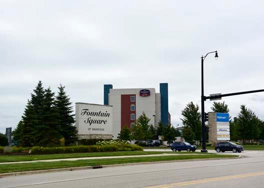
• Multifamily and single-family attached residential in Commercial Areas to expand the local customer base.
• Single-family attached units where Commercial Areas are adjacent to residential neighborhoods to create a smooth transition between these placetypes.
• The road network along Commercial Areas should provide safe and convenient access for cars, buses, bicycles, and pedestrians to nearby commercial activities from residential areas. Sidewalk continuity should be prioritized.
• Streetscaping on the City’s major east-west commercial corridors, including Sunset Avenue, Grand Avenue, Washington Street, and Belvidere Road, is critical to the branding of each corridor as a unique place.
• Parking requirements for future commercial developments accommodate weekday customer volume rather than the ‘annual peak volume’.
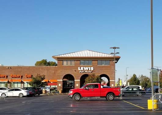
• Shared parking among adjacent businesses that have different time periods of parking utilization, such as an office and a retail store.
• ADA-compliant sidewalks with continuous access throughout the placetype.
Source: City of WaukeganDowntown Waukegan is the City’s core and is the center of arts, culture, and commerce. This placetype is the City’s most intensely developed area with mixed-use, entertainment, civic/educational, retail, restaurant, and multifamily residential as the defining uses. The intensity of development and prioritization of multi-modal transportation makes downtown Waukegan a walkable environment and an attractive place to live, work, shop, dine, and play.
The performing arts venues, in addition to seasonal festivals, make downtown Waukegan a popular destination among residents and visitors. Downtown Waukegan is also home to the City’s Public Library, which functions as a versatile community resource center. The College of Lake County’s Lakeshore Campus is an important educational institution in downtown Waukegan. Its presence creates opportunities for increased activity. These events, facilities, and organizations create a framework to build on in the future, and enhance the quality of life of Waukegan residents.
• Multifamily Residential
• Restaurant
• Retail
• Commercial Service
• Entertainment & Arts
• Single-family Attached Residential
• Office
• Civic/Educational
• Parks/Open Space
• Downtown Waukegan defines the City’s image through high-quality architecture and site design to activate space.
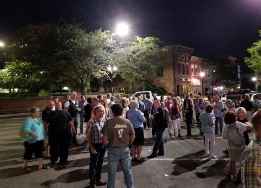
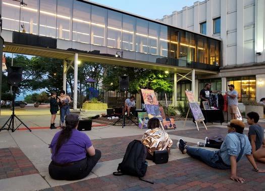
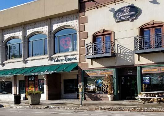
• Streetscaping improvements and gateways define the unique character for the district.
• Civic plazas, parks, and open spaces are gathering places for residents, employees, and visitors.
• Easy and safe multi-modal connections between downtown Waukegan, adjacent neighborhoods the Waukegan Metra intermodal station.
• Wayfinding signage along sidewalks directs people between the lakefront, neighborhoods, and downtown.
• Buildings front the street to ensure visibility and accessibility.
• Single-family attached units where Commercial Areas are adjacent to residential neighborhoods create a smooth transition between different placetypes.
• Multifamily and single-family attached residential expand the local residential base. They should have safe and direct connections to nearby commercial activities. Mixed-use buildings are another option to promote diversity of activities and experience.
• Parking lots provide capacity for weekday averages and lots are located at the rear of the commercial buildings with buffering. Shared parking opportunities are promoted.
Source: City of WaukeganThe lakefront placetype includes areas within the Waukegan Harborfront, the Marina, and the North Harbor. The lakefront is a well-known recreational destination for its marina and seaside activities. This placetype affirms the recommendations established by three City-adopted plans. They are the 2003 Lakefront - Downtown Master Plan, the 2015 Lakefront Active Implementation Plan, and the 2016 Beach Management Plan. The Lakefront Active Implementation Plan provides an updated and economically feasible implementation framework to realize the 2003 Master Plan’s vision of the lakefront, including an eco-park along East Sea Horse Drive. The City’s 2016 Beach Management Plan proposed a series of action items that preserve these natural resources.
Guidelines for development densities for downtown, the South Lakefront, the Harborfront and North Harbor have been established in the 2005 Waukegan Lakefront downtown Master Plan Design Guidelines document. These guidelines should be adhered to with consideration for new development along the lakefront as an entertainment and recreation destination. To realize the lakefront’s full potential, residential, commercial, and mixed-use development are encouraged. Focusing on creating a highly amenitized, complete neighborhoods are priorities of this placetype.
• Multi-family Attached
• Restaurant
• Retail
• Commercial services
• Parks/Open Space
• Transportation/Utilities
• Single-family Detached
• Single-family Attached Residential
• Multifamily Residential
• Visitors and residents are able to access the lakefront through an enhanced path network, complementary signage program, and streetscape design.
• The lakefront is connected to downtown Waukegan, beaches, and harbor area.
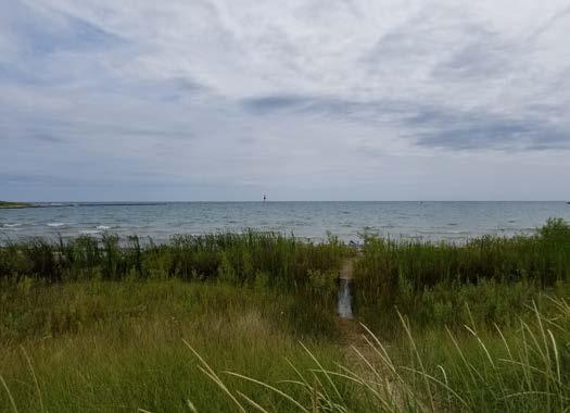
• Opportunities for additional development along the lakefront utilizing established design standards to regulate a comprehensive identity for the area.
• New uses for the lakefront that forward its identity including an eco-park, educational programming and volunteer opportunities to connect residents with this amenity.
• Partnerships with state and federal agencies can help fund successful initiatives in the future.
• New mixed-use, waterfront neighborhoods along the south lakefront, harborfront and north harbor increase day and night vibrancy in the district.
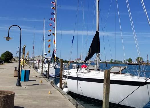
• Connection and accessibility to the harbor.
• Rail yards are relocated from the harborfront to provide additional development opportunities.
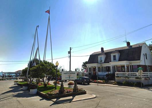
• Conservation of Waukegan’s public beaches and dunes located north of the Waukegan Harbor channel in the Dead River Watershed.
• A mix of uses along the waterfront that combines recreational, industrial, commercial, and residential.
• Ecological diversity, recreational opportunities and prioritization of education of beach visitors about the global significance of the sites as habitat for plants and wildlife.
Source: Google Earth Pro Source: City of Waukegan• Office
• Research/Light Industrial
• Restaurant
• Retail
• Commercial Services
• Transportation/Utilities
The Innovation Hub placetype includes areas dedicated to industrial uses, including manufacturing, research, warehousing, distribution, and fulfillment centers. This placetype plays an important role in Waukegan’s economy but should be appropriately buffered from residential and commercial areas. Multifamily residential and hotels can be located within this placetype to provide convenient housing and accommodation options for workers and visiting executives/employees. This placetype generates significant traffic from both its employees and associated truck traffic. Roadways within this placetype should accommodate traffic without adversely impacting quieter residential areas.
One of Waukegan’s utility hubs is located at the northern part of the lakefront area, bordered by the Illinois Beach Nature Preserve to the north and the City’s redevelopment area to the south. Three brownfields (Johns-Manville Corporation Site, North Shore Gas North Plant, and Outboard Marine Corp) under the EPA’s Superfund Site program are located within this area, and the City has been working with state and federal agencies to monitor and remediate
the brownfields. It is anticipated that existing industrial businesses and associated utilities will remain for the time being. As time progresses and conditions change, the City and relevant stakeholders should consider decommissioning the industrial (utility) land uses and reusing the land for appropriate development.
Annexation of unincorporated parcels south of the City’s existing industrial parks in Southwest Waukegan can accommodate additional research/innovation uses and to expand Waukegan’s ability to respond to growing industrial sector needs. Responding to this growing demand contributes to Waukegan’s identity as a desirable location for this kind of development. Attraction strategies should focus on sustainable and innovation oriented industries. Future opportunities in the Innovation Hub placetype may include technology, sustainable and green industries, makers spaces, and light industrial industries. Recreational uses such as family oriented facilities (eg: trampoline park) may also be included to diversify activities in these zones and create more variety in spaces that can accommodate larger spaces.
• Street pattern and roadway configuration accommodates the safe and efficient circulation and access of high-volume traffic of freight and trucks.
• Sites accommodate large warehouse buildings and paved areas required for safe turning movements for cars and freight trucks.
• Waukegan’s regional highway system and/or airport facilitates the efficient movement of goods and services and minimize impacts to residential neighborhoods.
• Industrial developments incorporate attractive architectural and landscaping design to preserve their value long-term. Screen or buffer Innovation hubs that are adjacent to quieter residential neighborhoods.
• The City’s Solsmart Gold status can attract sustainable/green industries into Waukegan.
• Remediated brownfields, which the City has made significant progress and their preparation for future redevelopments.
• Emerging industries such as cannabis and complementary uses to the new casino may be located in this placetype.
• Existing utility properties, if eventually phased-out, should be adaptively re-used.
Source: Google Earth ProThe intent of the Parks/Green Space placetype is to preserve existing parks, natural resources, and Waukegan Ravines. These amenities are critical to enhancing Waukegan residents’ quality of life. Development should not be permitted within this placetype, except for additional park and recreational facilities. These facilities should be accessible by cars, buses, bicycles, and pedestrians. Parking lots should be located where they minimize disturbance of the existing natural resources. This placetype also includes greenways and easements that are currently occupied by overhead utility lines.
The Waukegan Park District currently has about 707 acres of park space (excluding Bonnie Brook Golf Course and the Waukegan Sports Complex). The Park District is nationally-recognized for its stewardship and leadership including recreational park projects, restoration, and native landscaping.
•
•
• Access to playgrounds, sports fields, and large open space managed by the Waukegan Park District.
• Wooded areas, grasslands, ravines, beaches, and lakefront to help mitigate negative environmental impacts and enhance Waukegan’s natural appeal.
• Non-local traffic in neighborhoods adjacent to park space can be directed to appropriate thoroughfares for public access.
• Waukegan’s residents are connected to parks/green space through a comprehensive network of linear parks, trails, bicycle routes, and sidewalks.
• The Waukegan ravines and drainage corridors are buffered to protect private property from flood or erosion hazards, as well as to preserve opportunities for trail and recreation.
• High-quality facilities and engaging programs activate parks/green space as community gathering places.
• Property owners install their own flood protection on sensitive lands and prioritize water conservation and community resiliency.
• Transportation/Utilities
• Hospitality, Restaurants
The Waukegan National Airport accommodates general and corporate aviation and also has a substantial number of international arrivals. It is an important reliever airport for O’Hare International Airport. The airport has completed a master planning process which analyzed the airport’s capacity and needs, and created recommendations for the airport’s growth in the future. The process has resulted in a preferred expansion alternative, selected from the original ten runway design alternatives. This concept plan converts and extends the existing Runway 5-23 into a parallel taxiway segment and includes a new primary runway (7,000 feet long). The extended runway will cross Green Bay Road, and the road will go underneath it in a tunnel. This design will necessitate purchasing adjacent properties to accommodate the runway expansion and reconfiguration of Green Bay Road. The City has been working with the Waukegan National Airport and other stakeholders to implement this vision. Land use impacts are anticipated to be minimal and future developments around the Waukegan National Airport will consider airport noise levels.
In the future, the Waukegan National Airport is well positioned to accommodate additional hospitality and restaurant amenities. With consideration for increased traffic through the airport, additional facilities, services, or land should be included in future airport master plans and coordinated with the City.
• The preferred concept for the Waukegan National Airport Master Plan is implemented with stakeholders.
• The Waukegan National Airport is buffered from urban encroachment.
• The Waukegan National Airport works with area stakeholders to mitigate the impact of the airport expansion on surrounding neighborhoods, including noise pollution, air quality, and visual appearance is mitigated.
• The Waukegan National Airport Master Plan prepares the community for future aviation-related opportunities and provides opportunities for future development including hospitality and associated industries.
An effective gateway and wayfinding system takes into account pedestrian, bicycle, and vehicular traffic from the perspective of both visitors and residents. The design of these elements relates to the scale and speed of traffic and the character of the surrounding area. The gateway and wayfinding elements communicate unique aspects of Waukegan and inform and guide motorists and pedestrians to attractions and destinations within the City. The commercial corridors in Waukegan are priority locations for gateway signage. The four gateway corridors include:
• Belvidere Road
• Grand Avenue
• Green Bay Road
• Washington Street
• Sheridan Road
• Lewis Avenue
Gateways can also be located at proposed roundabouts’ central green spaces. Wayfinding signage should be located in downtown Waukegan, the lakefront, and the new casino located in Fountain Square. Unified wayfinding signage from nearby roadways should be designed and implemented.
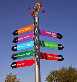

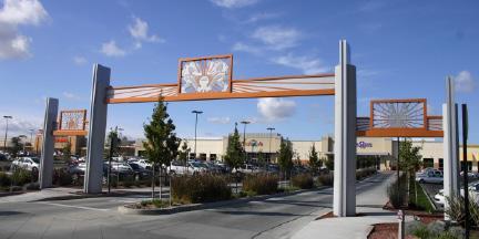
A branding strategy for the corridors should be developed and coordinated with the City’s existing brand standards. Gateway signage for each corridor should announce arrival into the City. Located at major intersections, gateway signage is the first impression of the City for visitors. Its design and location identifies Waukegan as a distinct City and communicates its boundaries to visitors and residents. As Waukegan defines its identity in the region, gateway signs help reinforce its importance and position as a regional leader.
Gateway features may vary in scale or function, and can take the form of signage, public art, a signature building, or decorative streetscape enhancements such as lighting and landscaping along the roadside, at intersections, in medians, or in roundabouts. Gateway features may be a singular element, repeated at every gateway, or elements that reflect the character of each individual gateway. Fountain Square’s main entrances are an example.
Good branding will make Waukegan stand out from its peers. Clearly communicating the City’s distinctive qualities is a goal of the branding exercise. Communication about the City’s vision and unique character are important to share. This definition builds a powerful brand and establishes a long-term strategy that outlines the tools and methods to promote and define the City. Creating strategies that have substantial impact on awareness can be leveraged by forging partnerships with the many entities and individuals that have a stake in Waukegan’s success. Steps to achieve an effective branding strategy include:
• Identify elements that can reinforce the City’s brand.
• Create a communications strategy that residents can engage with. Embrace those that already love your area and recruit them to help spread the word.
• Create collateral materials that illustrate the brand. Some of these branding tools include a message map and style guide.
• Partnerships and organizations that can support the City’s brand are also critical to its success.
• A style guide will protect the uniformity of the brand by providing specific guidelines regarding its usage.
Community facilities in the City of Waukegan provide efficient delivery of public services and enhance the community as a desirable place to live and do business. These facilities include: public and private schools, municipal services, civic institutions, and religious facilities. In addition, charities and civic-minded businesses contribute to the quality of life and “social capital” of the City. The City’s working relationships with service providers improves the overall level of service provided to Waukegan residents and ensures their needs are addressed.
Education in Waukegan is provided by both public and private educational institutions. The public school district that serves Waukegan’s almost 17,000 students is CUSD #60. The College of Lake County Lakeshore Campus provides higher education opportunities to residents and commuters. A variety of private schools add diversity of educational choice to the City. The school system is a major contributor to the City’s desirability as a place to live and raise a family. The operation and improvement of these facilities, balanced with their impact on adjacent residential neighborhoods, and fostering of cooperation with the schools to maintain high-quality opportunities for Waukegan youth, is a priority for the City’s continued success. Improving the quality of education in Waukegan will allow public school students to be competitive in higher education and employment opportunities.
Civic facilities provide important services to the residents of Waukegan and include: the Waukegan Public Library, City Hall, Waukegan Police and Fire Departments, various religious institutions, among others. The City’s commitment to its residents and delivery of municipal services continues to be a priority. Collaboration between religious institutions and service organizations strengthens the City as a whole. Youth sports leagues are an important means of bringing together children from all parts of Waukegan and different socio-economic groups. The youth soccer and baseball programs are especially wellorganized, well-funded, and well-attended at all age levels, thereby promoting “connectedness” among Waukegan parents and their children.
The Waukegan Public Library is an important asset to the Waukegan community. As a public library, it offers a wide range of services to the community and regularly hosts community events and concerts to bring people together. The library’s versatile operating hours enable many children to remain in the library during after-school and summer hours for studies and recreation.
To further enhance its services and value to the community, the library created and adopted the Literacy 2020 Strategic Plan. This plan established four key areas of impact where the library would focus its efforts. They are Kindergarten Readiness, Grade-Level Reading, Career and College Readiness, and Adult Learning. To complement these measures of success, the Library Staff identified five objectives that will guide the Library’s efforts over the lifespan of the Strategic Plan. The objectives are intended to address the Library’s most pressing areas of focus, they are:
1. Offering outcome-aligned achievement for WPL learners
2. Developing Library services to meet the changing needs of our community
3. Engaging our community in robust and meaningful ways; managing the Library’s internal framework in a responsible, sustainable way
4. Creating a collaborative culture among staff
5. Developing a dynamic Library environment to foster learning and discovery
For further reading, please refer to https://www.waukeganpl. org/about/strategic-direction/
Religious
McCall Elementary School
Lake County Baptist School
Clark Elementary School
Jack Benny Middle School
Little Fort Elementary School
Oakdale Elementary School
Immanuel Evangelical Lutheran School
City Yards / Public Works
Clearview Elementary School
Greenwood Elementary School
Lilac Cottage & Waukegan History Museum
North Shore Water Reclamation District
St. Anastasia School
Glen Flora Elementary School
Waukegan Armory (School Dist.)
Glenwood Elementary School
Whittier Preschool
Daniel Webster Middle School
Lions Math & Science Junior Academy
North Elementary School
Waukegan Water Plant
Waukegan Harbor
Miguel Juarez Middle School
Hyde Park Elementary School
Weiss Field
Waukegan High School
Brookside Campus
Washington Elementary School
Robert Abbott Middle School
Waukegan High School
Washington Campus
Alternative/Optional Education Center
Lake Shore Academy
Cristo Rey High School
Carman-Buckner Elementary School
Lyon Magnet School
Thomas Jefferson Middle School
Cooke Magnet School
Lake County Courthouse & Adult Corrections Facility
Job Center of Lake County Waukegan City Hall
College of Lake County
Three Brothers Theatre
Waukegan Public Library
Genesee Theatre MBT Academy
The City of Chicago’s Department of Cultural Affairs and Special Events (DCASE) is dedicated to enriching the City’s artistic vitality and cultural vibrancy. It is also involved in the local art scene where it promotes independent working artists and for-profit arts businesses. DCASE is also responsible for providing a framework to guide the community’s cultural and economic growth through the City’s 2012 Cultural Plan. Finally, it works to market the City’s cultural assets and present high-quality, free, and affordable cultural programs for Chicago residents and visitors.
The 2012 Cultural Plan recognized how the City’s cultural life, including arts enterprises and nonprofit arts organizations, significantly contribute to the City’s economy and position as the third-largest creative economy in the U.S. To further strengthen the City’s cultural vitality, the Plan focuses actions on three topic areas, which are: people, policies, and planning culturally. The Plan also discussed enhancing cooperation between various City departments to better implement the Plan’s recommendations and making regulations and applications for cultural events easier to navigate.
Stakeholders during Waukegan’s Comprehensive Planning process voiced interest in Waukegan investigating the value of creating a Department of Cultural Affairs to support and celebrate the City’s diversity. This department can support existing programs and facilitate higher levels of multicultural dialogue and understanding.
For further reading, please refer to https://www.chicago.gov/ city/en/depts/dca/supp_info/cultural_plan4.html.
Source: https://www.chicago.gov/city/en/depts/dca.html
There are numerous religious institutions within the City of Waukegan that play an important role in the daily lives of residents, as well as act as social service providers. These institutions add to the overall sense of community and are considered an important component of the community in their ability to unify residents and communicate news, initiatives, events, and programs offered by the City. The City can support the improvement or expansion of these facilities from a land use perspective. During stakeholder engagement, residents expressed pride in the culture of faith-based service and contributions of this community to the City. Placetypes that support religious institutions, such as the residential placetype, can consider the specific land use needs of these facilities.
Waukegan’s most vulnerable populations including the homeless, veterans, and seniors benefit the most from a robust and integrated healthcare system. Waukegan currently has several health centers, clinics and hospitals. Major health delivery institutions include:
• Vista Health System
• Erie Family Health Center
• Lake County Health Department and Community Health Center
• Lake Behavioral Hospital
Maintenance of these options is important to preventative care of Waukegan residents. While all of the facilities listed are on major bus routes, access to other healthcare facilities or clinics by public transportation will allow a greater proportion of residents to actively participate in their healthcare. Ensuring routes and facilities are accessible and available to vulnerable populations will contribute to Waukegan’s overall health and will mitigate challenges identified in the City’s Health Assessment conducted by Lake County Health Department.
Maintain affordability in the community by expanding home rehabilitation programs and upgrading existing housing.
1. Assist income-burdened households.
◦ Utilize existing affordable housing maintenance programs.
2. Continue to enforce property maintenance standards and support rehabilitation of the City’s existing housing stock.
◦ Identify delinquent landlords and remove inadequate or unsafe housing.
◦ Encourage improvement of aging housing structures through the establishment of residential rehabilitation service providers through the CDBG program.
◦ Educate and support property owners about the City’s existing programs to support housing rehabilitation.
◦ Promote upper-story residential units in downtown Waukegan to increase residential density and extend the number of hours of activity in coordination with building rehabilitation.
• Core Neighborhoods
• Edge Neighborhoods
• Commercial Areas
• Downtown Waukegan
Develop new and responsive types of housing that allow residents to remain in the City through all phases of life.
1. Leverage economic development tools to incentivize construction of desired housing types.
◦
Utilize the Downtown-Lakefront TIF district and various federal and state tax credit programs. New housing developments should focus on promoting multi-family and amenity-rich units.
2. Incorporate the City’s housing options into the City’s marketing campaign.
◦ Emphasize that the City’s housing options are attractive and can retain families and professionals in the City long-term.
◦ Attract developers with experience and desire to produce a variety of market-rate housing types that respond to the changing needs of singles, families, and seniors, and to accommodate Waukegan’s growing population.
3. Review and adjust the City’s regulatory framework to allow responsive housing.
◦ Support aging-in-place by allowing accessory dwellings, such as granny flats, in existing homes.
◦ Support and allow upper-story residential uses in downtown Waukegan, the lakefront, and major commercial areas.
• Core Neighborhoods
• Edge Neighborhoods
• Commercial Areas
• Downtown Waukegan
• Lakefront
Facilitate exploratory conversations about the development of housing options for regional employees in coordination with Lake County Workforce Development, housing advocacy groups, and the development community.
1. Engage with area employers, housing advocacy groups, workforce agencies, and the development community about employees’ behaviors and housing needs.
◦ Identify regional agencies and organizations that specialize in collaborative relationships to build new housing units to satisfy a growing employee population.
◦ Conduct interviews with large employers in the area to determine their appetite and needs around workforce housing as it relates to new and emerging industries, the new casino, and innovation technologies.
• Core Neighborhoods
• Edge Neighborhoods
• Commercial Areas
• Downtown Waukegan
• Lakefront
• Innovation Hub
Prioritize future career preparedness through youth education by investing in STEAM (Science, Technology, Engineering, Arts, and Math) programs.
1. Support the Waukegan School District to achieve its strategic planning goals.
◦ Support the Waukegan School District by identifying facilities that help meet its space needs.
◦ Coordinate with the Waukegan School District and the Waukegan Public Library to enhance and incorporate STEAM into existing educational enrichment programs.
2. Support the creation of knowledge and career opportunities for Waukegan students.
◦
Partner with existing agencies and workforce training organizations to provide high-school students internship/career opportunities.
◦
Communicate to employers that local employment is a priority, and encourage them to expose youth to career path opportunities in Waukegan through internships.
◦
Encourage entrepreneurship opportunities and businesses that support career paths in STEAM by hosting conversations with business leaders.
• Core Neighborhoods
• Edge Neighborhoods
• Commercial Area
• Downtown Waukegan
• Parks/Green Space
Celebrate Waukegan’s civic institutions and community pride by building organizational capacity and social capital.
Improve resident services and celebrate a sense of pride in neighborhoods.
1. Connect various local community organizations to better understand needs and available resources.
◦ Host community-wide conversations and conduct a needs assessment to define shared goals, resources, and assign accountability measures to accomplish mutually agreed upon outcomes.
2. Encourage youth to develop strong roots with the Waukegan community.
◦ Create community service opportunities for youth to better understand their impact on Waukegan and foster empowerment and ownership.
◦ Engage youth to participate with community service organizations to implement neighborhoodbased projects and initiatives consistent with the goals in the Comprehensive Plan.
◦ Foster youth participation in the City’s planning and legislative processes to ensure youth are represented in decision-making that impacts their future.
3. Foster dialogue between generations of Waukegan residents.
◦ Engage senior-focused social service agencies to promote inter-generational exchange, continuing educational opportunities, and social connection through City communication channels.
• Core Neighborhoods
• Edge Neighborhoods
• Commercial Area
• Downtown Waukegan
• Parks/Green Space
1. Enhance residents’ awareness of the City’s available services.
◦ Define communication and distribution strategies with existing civic and community organizations that focus on multi-lingual materials that are easily accessible and are targeted towards families.
2. Improve residents’ sense of pride in their neighborhoods.
◦
Enhance residents’ sense of safety including facilitating the formation of neighborhood watch groups, block clubs, and resident interest groups.
◦
Work with youth to create a campaign to improve the perception of schools and support the school district’s plan to deliver high-quality education.
3. Foster options for event and creative programming in neighborhoods.
◦ Increase options for event programming in neighborhoods by supporting self-sufficiency and creativity within neighborhood and faith-based organizations.
◦
Coordinate neighborhood groups and local artists to implement pilot projects, to pave way for future infrastructure improvements. These pilot projects can demonstrate creative alternatives to formal programs.
• Core Neighborhoods
• Edge Neighborhoods
• Downtown Waukegan
Leverage the resources and networks that the Waukegan Public Library and other community/faithbased organizations maintain to extend outreach and add value throughout the community.
1. Foster a network of partnerships and better understand the Waukegan Public Library’s needs, capacity, and impact to the community.
◦ Continue to build cooperative partnerships that impact the City’s residents in a positive way.
◦ Conduct a study to measure the social, economic and physical impact of the library’s outreach and partnerships.
◦ Build city-wide organizational capacity through continued and sustained outreach to ensure services are distributed equitably.
• Core Neighborhoods
• Edge Neighborhoods
• Downtown Waukegan
Recognize arts organizations that create ambassadors representative of the diversity of the City and make them visible in the neighborhoods.
1. Enhance messaging and communications through arts.
◦ Develop messaging and a culture around accessibility and participation in the arts.
◦ Communicate arts programs to engage the broader community through new channels such as faith based organizations and non-native English speaking communities.
2. Strengthen public art’s presence in the community.
◦
Share the efforts of existing arts organizations, such as the Waukegan Arts Council, as best practice examples for other organizations.
◦
Expand opportunities for family-friendly attractions, programming, and events and create additional opportunities to celebrate the community by engaging with existing arts organizations and prioritizing resident expression and intra-neighborhood arts projects.
◦
◦
Integrate culturally relevant programming into existing events.
Emphasize the community’s vision that encourages more public art with additional installations and commissions by local artists throughout the community.
• Core Neighborhoods
• Edge Neighborhoods
• Commercial Area
• Downtown Waukegan
• Lakefront
• Parks/Green Space
Prioritize environmental policies that create value and balance quality of life, economic development, and access to recreational amenities.
Prioritize environmental and social justice solutions that are consistent with regional and County-wide strategies.
1. Promote high-performance infrastructure in underutilized and/or environmentally sensitive sites.
◦ Incorporate opportunities for high-performance, energy-efficient buildings and infrastructure, and transition to renewable energy sources.
◦ Conduct strategic future scenario planning for existing brownfield and industrial sites consistent with recommendations in the 2003 DowntownLakefront Master Plan.
◦ Leverage Solsmart Gold status to attract sustainable development and be a leader in solar energy.
• Core Neighborhoods
• Edge Neighborhoods
• Commercial Area
• Downtown Waukegan
• Lakefront
• Parks/Green Space
1. Identify and mitigate impacts from sources of industrial pollution.
◦ Assess potential deterrents to health resulting from industrial pollution and consider options for reducing the negative impact.
◦ Share educational information with health care service providers to ensure their Waukegan residents understand health and wellness options available in the community.
◦
Encourage health and wellness through marketing of Waukegan Park District programs, trails and open space, and attraction of additional fitness facilities.
2. Ensure all Waukegan neighborhoods have equitable access to transportation options.
◦
Work with ride-sharing services, Pace, Metra, Lake County Department of Transportation, and Illinois Department of Transportation to identify and address service gaps in Waukegan.
• Core Neighborhoods
• Edge Neighborhoods
• Commercial Area
• Downtown Waukegan
• Lakefront
• Parks/Green Space
Create an authentic identity and character for Waukegan.
Welcome diversity by intentional and inclusive policy creation, representation, and communication. Ensure equal access to residential, educational, institutional, and commercial opportunities.
1. Develop a community branding system that can be applied to signage and banners to unify the City’s image.
◦ Focus on unique branding opportunities for corridors and downtown that feature businesses and celebrate each district’s offerings.
◦ Utilize the Plan Vision to define design elements that can be used by other organizations to promote Waukegan.
• Core Neighborhoods
• Edge Neighborhoods
• Commercial Area
• Downtown Waukegan
• Lakefront
• Parks/Green Space
1. Create a formal department, in coordination with the Mayor’s Office, that focuses on cultural affairs within the City that includes highcapacity organizations that provide guidance and vision for scalable projects throughout the City.
◦ Conduct a Community Transformation Workshop to better understand effective outreach and communications methods and to identify leaders and champions representative of Waukegan’s diverse population.
◦ Work with agencies like CMAP to increase outreach efforts and maintain momentum and involvement with the Comprehensive Plan implementation.
◦ Recruit representatives from the City’s existing organizations and agencies to act as ambassadors for strategies in the Comprehensive Plan.
• Core Neighborhoods
• Edge Neighborhoods
• Commercial Area
• Downtown Waukegan
Develop a wayfinding and signage program to support multi-modal navigation and place-based understanding of the City.
1. Identify critical locations in the City where gateway signage should be added to identify entry points.
◦ Develop a system of gateway signage that represents the identity of Waukegan. A variety of scales, materials and locations can differentiate the gateways depending on the route traveled and location within the City.
◦ Create gateways into unique areas of the city to differentiate them and elevate their special character.
2. Use municipal branding strategies to locate gateways and involve community members in their design.
◦
Utilize gateways as a focus of community pride by involving stakeholders in their design. Engage community members in helping staff identify the best and most visible locations for signage.
3. Utilize wayfinding as a tool to showcase special locations, destinations, landmarks and institutions in the City.
◦
Develop wayfinding signage in conjunction with gateway signage to create a comprehensive signage program.
• Core Neighborhoods
• Edge Neighborhoods
• Commercial Area
• Downtown Waukegan
• Lakefront
• Parks/Green Space
◦
Use educational and directional signage to orient travelers on distinct areas of the City.
Transportation preferences and the way we think about planning for the future of transportation have begun to shift in recent years. The rapid pace at which technology is advancing may change the transportation landscape and more broadly, how we view mobility as it relates to land use and the environment. This chapter provides the policy framework that the City of Waukegan may utilize to continue to create a forward-looking community.
Evaluating the adequacy of Waukegan’s transportation network relies on understanding overall mobility. This chapter discusses key components and analyzes the current conditions throughout the community regarding ease of travel, barriers, safety, gaps, linkage to other modes of travel, and connections to land uses. The categories of mobility, which are transit, street, and bicycle and pedestrian, are intended to give an overall picture of the issues and opportunities facing the City of Waukegan. This chapter recommends a policy framework to create a transportation network that safely and efficiently accommodates all modes of travel.
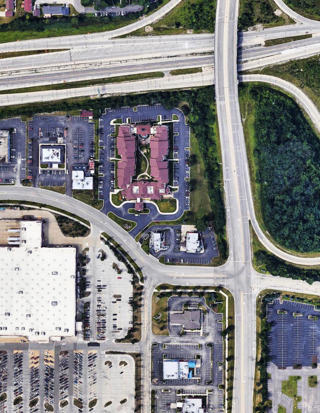
Throughout its history, the City of Waukegan has supported comprehensive transportation systems that connect its residents and visitors to social and economic opportunities. During the mid 1800’s, settlers were attracted to Waukegan’s location as a port city to ship goods and produce south to Chicago. As the City continued to grow, a new railroad was built which bolstered Waukegan as a manufacturing center during America’s second industrial revolution. Rail established Waukegan as a dominant north American trading hub, and the Federal Highway Act of 1956 aided in the construction of the Tri-State Tollway (I-94) along the western edge of the City.
Mobility and the way we think about transporting people and goods has shifted over the past few decades. Transportation is on the verge of transformative change. These changes are being led by technological advances in both communication and automation. Business models are establishing themselves around these technologies, and providing more options than ever before to passenger and freight travel. Some of the most notable being Uber and Lyft ridesharing services, and the use of drones for package deliveries. Additionally, more people are conscious of how they affect the environment and are choosing alternative forms of transportation, such as walking or biking. The choices of both individuals and organizations are evolving to adapt to the new mobility options1
Since its inception, the City of Waukegan has worked to provide efficient services that have increased the economic opportunity and quality of life for its residents. With the new casino being constructed in Fountain Square and the transformation of the lakefront and downtown area, the transportation network within Waukegan must support the City in taking advantage of these opportunities.
This summary presents key goals and policies the City of Waukegan will implement to adapt and prosper from not only the future of mobility, but also the unique opportunities in the City.
Technology offers the chance to fundamentally redesign the street system with more safe and narrow streets that get people where they are trying to go2
• Manage parking requirements
• Re-thinking the right-of-way (ROW)
• Shared mobility
As an established urban area, the majority of Waukegan’s arterial and collector streets have sidewalks, which allows for pedestrian mobility throughout most parts of the City.
• Increase pedestrian and bicycle network connectivity
• Increase awareness about the benefits of nonmotorized transportation
A combination of Pace bus routes and a Metra commuter rail line provides the backbone of transit services for the City of Waukegan. Waukegan supports a myriad of transit options.
• Enhance access to transit
• Improve transit efficiency
• Increase awareness and ridership for paratransit and on-demand transit, such as Dial-A-Ride (DAR) services
Waukegan’s connected roadway system is an opportunity for growth. Key recommendations to accommodate current and projected traffic volume numbers have been created to maintain an efficient street network.
• Increase mobility and accessibility into and out of downtown Waukegan
• Coordinate roadway upgrades with infrastructure improvements to promote city-wide resilience.
1 Leven, Dalia. Planning for an Uncertain Future. American Planning Association, 2018, pp. 19–31
2 https://sidewalklabs.com/streetdesign/index.html
Technology is advancing at an increasingly rapid pace. In the future, mobility – the way we get around – and the transportation systems that support our methods of travel will be affected by emerging technologies. Connected and Autonomous Vehicles (CAV’s) are an example of this type of emerging technology.
CAV’s embody a wide range of mobility types and technologies. In recent years, advanced driver assistance systems are improving safety by controlling certain driving functions. Fully autonomous vehicles will eventually have the capacity to operate without human input.
Research conducted by Walker Parking Consultants estimates that AV’s have the potential to reduce parking demand by 40 percent by the year 2050. This shift could open a significant portion of land area, currently dedicated to parking, to more intense development. The American Planning Association’s (APA) Planning Advisory Service (PAS) recently released Planning for Autonomous Mobility1, which is a report that explores the affect CAV’s may have on our built environment and how municipalities and agencies can effectively prepare for their arrival. Additionally, the report estimates that by the year 2040, 50% of cars will be AV’s and that one shared AV could replace between nine and eleven privately-owned vehicles.
Due to most of the major arterial and collector roadways in the City being outside of its jurisdiction, it is likely that policies and plans pertaining to CAV’s will largely be carried out by agencies such as the Illinois Department of Transportation (IDOT), the Lake County Department of Transportation (LCDOT) and the Chicago Metropolitan Agency for Planning (CMAP).
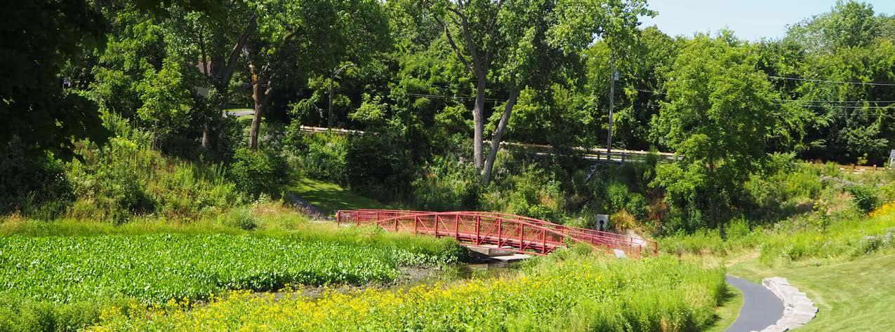
City staff should regularly review and stay up-to-date on these agencies’ policies and plans for implementation. Educating and informing the residents of Waukegan on these plans and the issues and opportunities associated with emerging transportation technologies will be vital to ensuring a safe and efficient transition into the future. The following areas, which are explored in more detail in the goals and strategies section of this chapter, are most important for the City of Waukegan when planning for CAV’s:
• Managing parking requirements
• Rethink the right-of-way (ROW)
Additionally, shared mobility services such as car sharing (Zipcar), ride-sharing (Uber & Lyft), bike-sharing (Divvy), and scooter sharing have recently grown in popularity. These services undoubtedly have begun to impact the way we think about travel. The most pertinent shared mobility service that impacts the City of Waukegan is ridesharing. Uber and Lyft allow anyone with a smartphone the ability to “hail” a ride from virtually any location.
As Waukegan develops its lakefront area, revitalizes its downtown, and constructs a casino, managing these ride-sharing services will help to reduce congestion and improve safety.
1 https://www.planning.org/publications/report/9157605/
As an established urban area, the majority of Waukegan’s arterial and collector streets have sidewalks, which allows for pedestrian mobility throughout most parts of the City. Few residential streets do not provide sidewalks on either side of the street. However, despite most streets providing sidewalk on at least one side of the roadway, access between Waukegan’s parks and recreational areas is considered difficult due to the City’s expansive roadway network.
The City has an average walkability score, which is a metric determined by walkscore.com. This metric measures pedestrian-friendliness by analyzing population density and road metrics, such as block length and intersection density. A higher walkability score generally means increased access to social and economic opportunities within a community. An average score means that the perception of the City is car-dependent. However, it is of note that most suburban communities in Chicagoland have average walkability scores due to the history and nature of suburban urban design frameworks.
Despite these challenges, the City of Waukegan is actively taking steps to provide is residents and visitors with a connected bicycle and pedestrian network. The City of Waukegan created a complete streets policy. Complete streets require that roadways be designed for all travel users – pedestrians, bicyclists, and vehicles. The Northern Lakeshore Trail Connectivity Plan outlines proposed and future off-street and on-street bicycle accommodations throughout the five communities of Waukegan, Beach Park, Winthrop Harbor, Zion, and North Chicago. The recommendations contained in that plan have been incorporated into the Trails Network Map provided on the following page. Over time, the implementation of the complete streets policy and Northern Lakeshore Trail Connectively Plan will help to greatly improve pedestrian and bicycle mobility throughout the City of Waukegan.
The goals and strategies section explores how the City of Waukegan can increase the accessibility and connectivity of its bicycle and pedestrian network in the future.


The Pace suburban bus system provides connections throughout Waukegan and to other suburbs throughout Lake County. The City currently has 12 Pace bus routes operating within City limits, which provide excellent mobility to many residents.
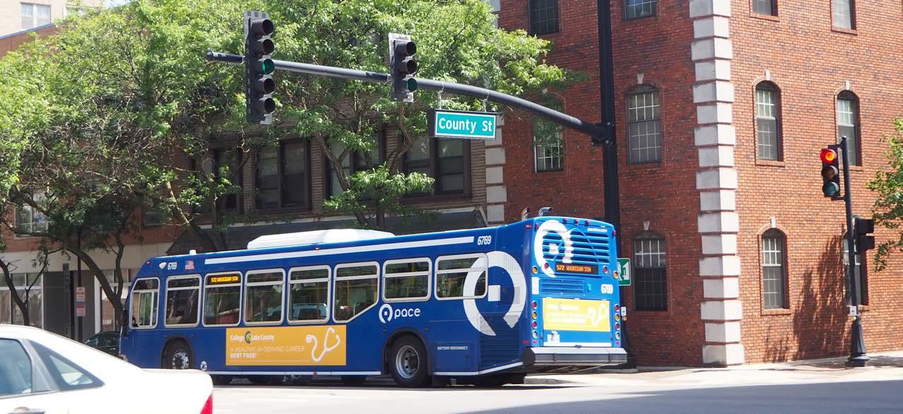
While multiple routes provide key north-south and eastwest transit service to the City of Waukegan, the highest average boardings are on major corridors and connections to downtown.
Lake County Division of Transportation (LCDOT) completed the Lake County Transportation Market Analysis in 2012.1 The study administered a rider survey that reached a total 1,209 riders. Key recommendations in the Comprehensive Plan are based, in part, on the findings in this report.
The recommendations address a higher than average transit need than comparable communities of similar size, primary access to transit from neighborhoods to commercial corridors or major arterials, and the need for a variety of connections to transit including ease of transfer.
Metra provides commuter rail access along the Union Pacific North (UP-N) line that runs parallel to Lake Michigan on the east side of the City, with the station located just east of downtown. Waukegan is the fourth most-northern station with the end of the line in Kenosha, Wisconsin.
A combination of Pace bus routes and a Metra commuter rail line provides the backbone of transit services through and to the City of Waukegan.
Waukegan’s connected roadway system presents opportunities for growth. Key recommendations to accommodate current and projected traffic volume numbers, which are provided in Appendices, have been created to maintain an efficient street network. These recommendations also emphasize the importance of providing alternative modes of travel, such as transit, bicycles, and walking, to Waukegan’s residents.
The City of Waukegan has many arterial roadways, such as: Skokie Highway (US 41), Green Bay Road (IL 131), Belvidere Road (IL 120), Grand Avenue (IL 132), Sheridan Road (IL 137), Waukegan Road (IL 43), Washington Street, Lewis Avenue, and the Amstutz Expressway. They provide a foundation for connecting people to both social and economic opportunities. Generally, these roadways have posted speed limits at least 30 miles per hour and are designed to efficiently move the greatest number of vehicles possible.
Most arterial roadways connect to Skokie Highway (US 41), which provides excellent regional access. However, the high number of arterial roadways may limit pedestrian and bicycle access among residential, recreational, and commercial areas.
In order to assist in examining the future traffic impacts on Waukegan’s roadway network, the Chicago Metropolitan Agency for Planning (CMAP) provided 2050 traffic projections for roadways throughout the community. These projections can be found in the Appendices (page 211). The projections predict that most roadways will have an average traffic volume increased by approximately 30 percent. The exhibit depicted on the following page outlines future improvements to Waukegan’s street network
According to the Federal Highway Administration, “A typical road diet consists of converting a four-lane roadway (two in each direction) to a three-lane (one in each direction plus a center turn lane) and adding sidewalks and/or bicycle lanes. At times, this reconfiguration can be accomplished by simply re-striping the lanes in conjunction with a resurfacing project.”1. Road diets are generally used as traffic calming measures that improve pedestrian and bicycle mobility, while maintaining traffic operations when are applied in the appropriate situations. When examining if roadways are suitable for a road diet, the following are some criteria to follow2:
• Moderate volumes (8,000 – 15,000 Average Annual Daily Traffic, or AADT)
• Transit corridors
• Popular bicycle routes and links
The intersecting streets with the roadway that may be put on a road diet also must be considered. If the intersecting street has excessive traffic volumes, such as over 20,000 AADT, then operations may be impacted, and traffic congestion could increase. Following the abovementioned criteria, the following pages list recommended roadways within the City of Waukegan that qualify to be put on a road diet. It should be noted, however, that traffic projections can change over time and that more detailed traffic impact analysis should conducted before implementing these recommendations.”
If the road diets were to be implemented along Grand Avenue, Washington Street, or Belvidere Road (IL 120), new and future streetscaping elements should conform to the recommendations of the 2003 Lakefront – Downtown Master Plan. The vision of that plan was to create boulevard-like roadways that foster a sense of place and should signal to residents and visitors that they are entering a more pedestrian-friendly area of the City. It should be noted that there have been best practices examples where municipalities have worked with IDOT to implement road diets. Some examples are as follows:
• IL-31 traverses north-south along the Fox River in this subject scenario. The important roadway connects Downtown Batavia with Downtown Geneva and has multiple connectors that provides access to residential neighborhoods. IDOT and the City of Geneva completed the road diet in 2015. AADT’s on the roadway have remained steady around 10,000 since the implementation.
• S. Chicago Ave runs parallel to the Chicago Skyway near the Illinois/Indiana border. This stretch of roadway is near the end of the Metra Electric Line at the South Chicago (93rd) station and supports many businesses, as well as being flanked by neighborhoods on both sides. The road diet was implemented in 2013/2014.
Lewis Avenue between Belvidere Road and Grand Avenue is a local example of a roadway that transition from a four-lane section to a three-lane section. Connectivity to the Northern Lakeshore Trails Connectivity Plan should be considered in coordination with roadway improvement to ensure multi-modal accessibility.
1 https://www.fhwa.dot.gov/publications/publicroads/11septoct/05.cfm
2 http://www.cityofandersonsc.com/wp-content/uploads/transportation/road-diets-fixing-the-big-roads.pdf
Road Diet along Sunset Avenue/Golf Road from Greenwood Avenue to just west of New York Street.
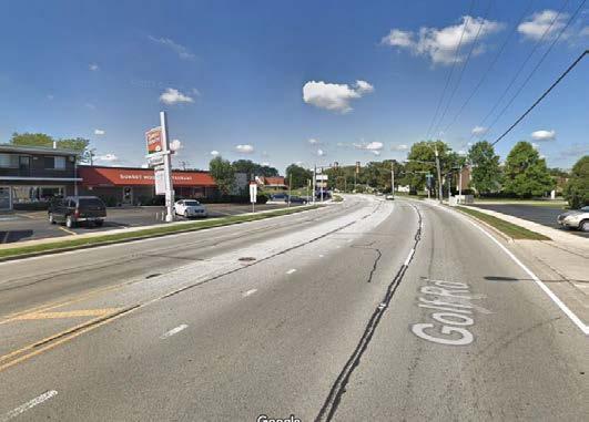
2050 Projected ADT: 15,000 vehicles per day (vpd)
Road Jurisdiction: Lake County, maintained by City
• Reduce the travel lanes from four to three
• Install a shared-use path on one or both sides of the roadway
Advantage:
• Reduce crossing distance for pedestrians and cyclists.
• Shared-use paths would provide access to the Robert McClory Trail, which acts as the City’s main north/ south bicycle path
• Provide access to a multitude of schools and destinations
Option B (Future Alt):
• Introduce on-street bike lanes.
• Reduce number of travel lanes
• Introduce bike lanes within the existing curb dimensions.
Advantage:
• Less cost overall
• No alteration to the roadway dimensions
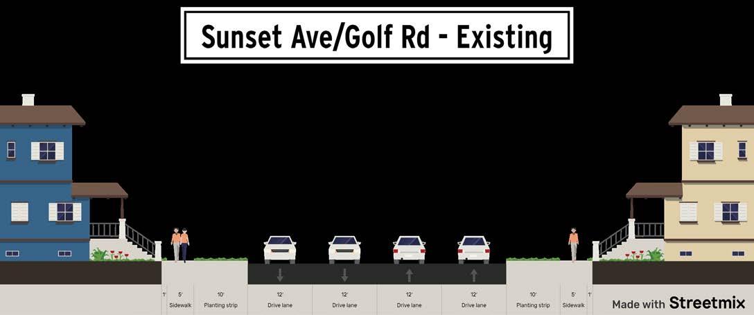
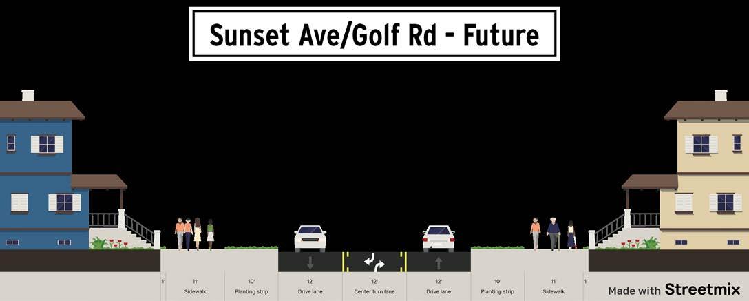

2050 Projected AADT: 13,000 AAD, 16,800 AADT by 2050
Road Jurisdiction: IDOT, PACE Route 565
Recommendation:
• Install a shared-use path on one or both sides of the roadway
• City will need to coordinate with IDOT to advocate for a road diet
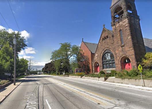
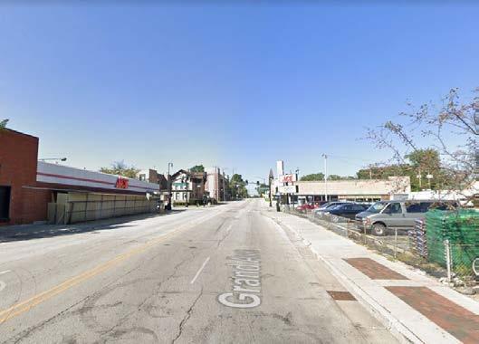
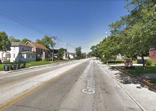
Advantage:
• High transit ridership
• Can provide safe paths for all modes of travel
• Increases the multi-modal mobility of the current
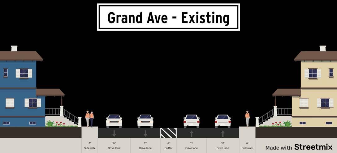
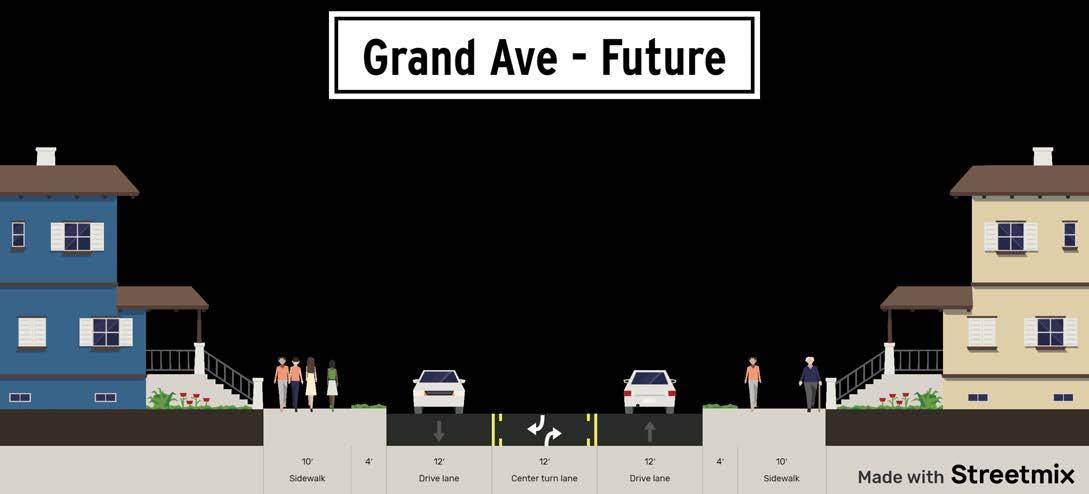
2050 Projected ADT: 5,000 AADT, projected to decrease
Road Jurisdiction: City of Waukegan, Pace Route 572
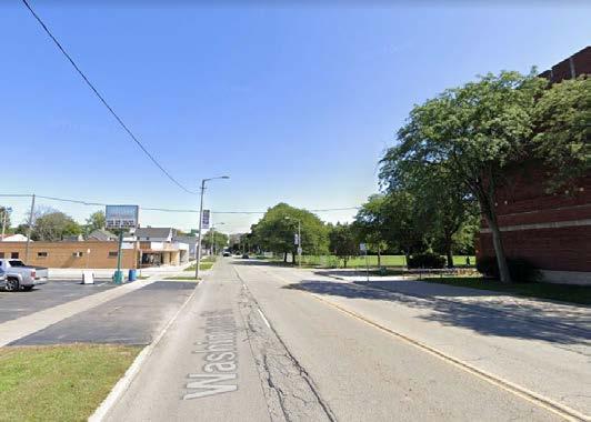
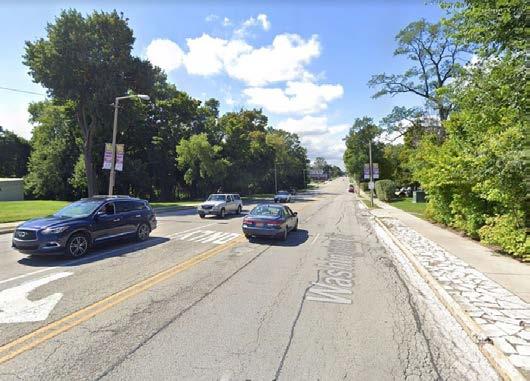
Recommendation:
• The road diet will include the reduction in travel lanes
• Installation of on-street bikes lanes per Washington Street Corridor Plan from the Robert McClory Bike Path east to the study area boundary, which is just west of West Street.
• Reduction in travel lanes would provide sufficient room for on-street parking along the north side of Washington Street between Jackson Street and Park Avenue.
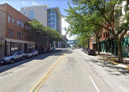
Advantage:
• Gateway into downtown Waukegan
• High average ridership
• Provides room to install Pace bus accommodations, such as bus shelters with benches, and bus bulbs, that would improve the experience of riding transit. Pace’s Transit Supportive Guidelines for the Chicagoland Region should be referenced for design guidelines.

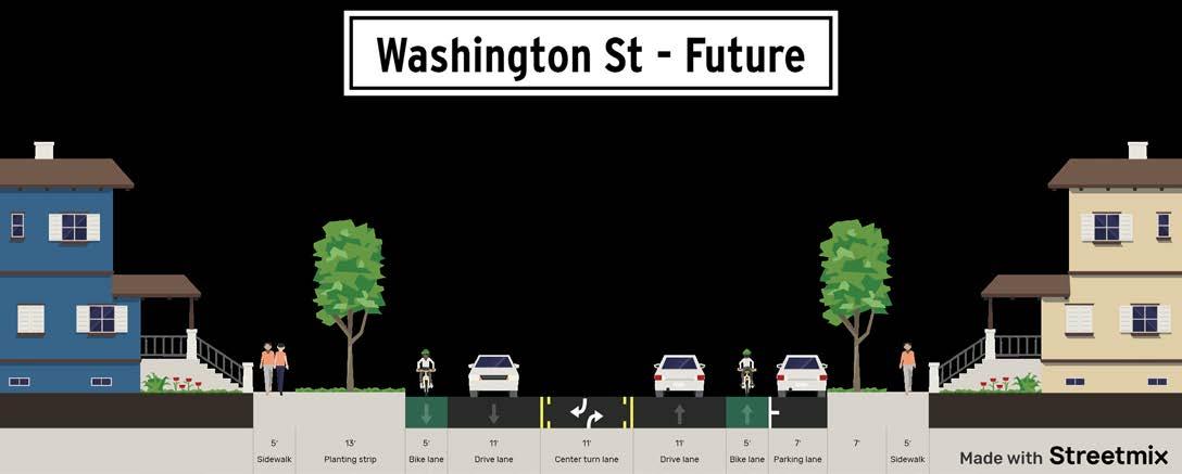
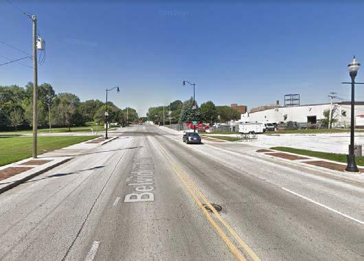
Road Diet along Belvidere Road (IL 120) west of Sheridan Road to the Robert McClory Bicycle Path.
2050 Projected ADT: PACE Routes 564 and 568, 8,000 AADT, 11,400 AADT by 2050.
Road Jurisdiction: IDOT, City of Waukegan
Recommendation:
• Reduce number of travel lanes
• Install bus facilities
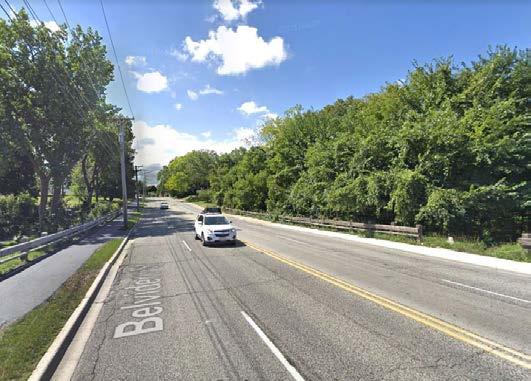
• City will need to coordinate with IDOT to advocate for a road diet
Advantage:
• Improves pedestrian and bicycle mobility
• Currently low AADT
• Can provide safe paths for all modes of travel
• Increases the multi-modal mobility of the current
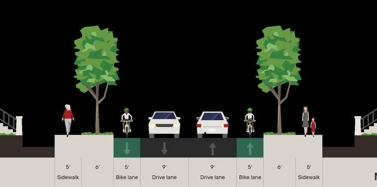
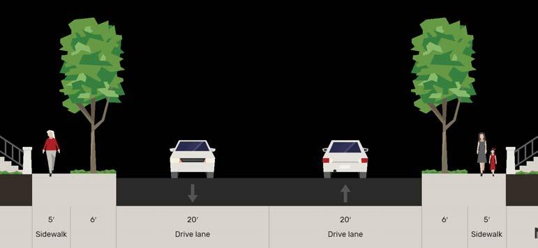
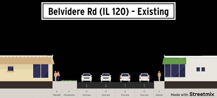
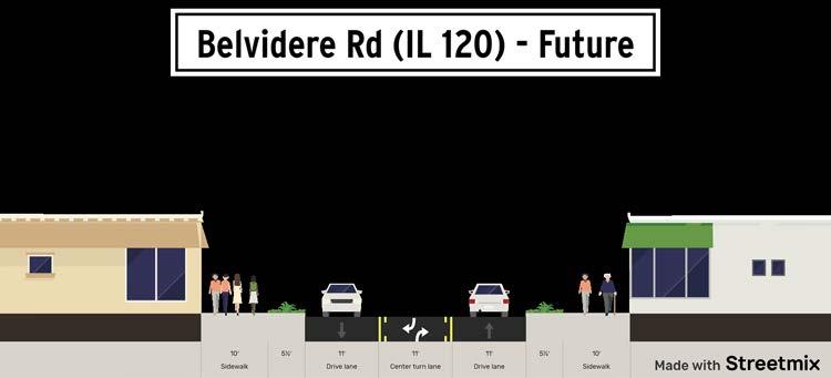
The following goals and strategies include a comprehensive approach to Waukegan’s transportation network. They provide goals and strategies related to future technology, bicycle/pedestrian network, transit, and roadways. They ultimately strengthen multi-modal mobility and accessibility for all Waukegan residents, improving their quality of life.
Manage parking requirements for all land uses throughout the City.
1. Establish a parking task force by the year 2030.
◦ Establish a task force by the year 2030 that has the goal of outlining the desired use for reclaimed parking spaces and managing the decline in parking demand.
◦
The task force should consist of individuals from the Departments of Engineering, Community Development, Economic Development, Public Works, and qualified members of pertinent organizations and the public.
2. Educate private property owners on new parking regulations.
◦
Empower the task force with educating private property owners, as well as the general public, as to the effects that emerging mobility technologies may have on parking demand.
Prioritize future transportation technologies in the design of the right-of-way (ROW).
1. Establish what the community prioritizes for reclaimed ROW.
◦
Shift design guidelines to include autonomous mobility to open up more space for bicycle and pedestrian facilities, active streetscapes, and green spaces.
◦
Establish what the community prioritizes for reclaimed ROW. On the facing page, is an example of what a cross section along Sheridan Road north of downtown might look like in the future when AV’s and CV’s are more prominent. The future scenario has an additional twelve feet of reclaimed ROW, while also providing bike lanes.
◦
Inform property owners that more space for pick-up and drop-off areas within parking lots will be necessary once connected vehicles (CV’s) and autonomous vehicles (AV’s) become commonplace.
Manage ridesharing services (Uber & Lyft) at the revitalized lakefront/downtown and around the casino at Fountain Square.
1. Establish drop-off and pick-up zones at the revitalized lakefront, downtown and at the casino.
◦ Geo-locate drop-off and pick-up zones and require that passengers be dropped off or picked up within certain areas.
◦ Mark the zones with signage to help distinguish them.
◦ Review the plans of each major development within the lakefront/downtown area and the casino to verify that a drop-off and pick-up zones are provided.
2. Balance parking requirements with the need for additional loading/drop off areas for rideshare vehicles.
◦ Consider rideshare services as a part of the parking and loading ordinance requirements.
◦ Site plan review should evaluate appropriate drop off/pick up locations based on estimated occupancy and consumer base to ensure transient traffic can be accommodated without encumbering other types of traffic flow or modes.
Increase shared mobility options including scooters and bicycles.
1. Pilot a bikesharing program within downtown Waukegan and the surrounding neighborhoods.
◦ Contract with a bike-share program to test the viability of bikesharing in Waukegan.
◦ Start the program within downtown and its surrounding neighborhoods to increase access to downtown and the lakefront.
◦
Utilize the Lake Michigan Water Trail Plan to aid in the implementation and connection of bicycle networks to the Lake Michigan Water Trail.
Implement new on-street bike routes and more offstreet bike routes throughout the City of Waukegan.
Increase pedestrian and bicycle network connectivity.
1. Pursue funding sources to increase the number of on-street and off-street bike routes.
◦
Cultivate relationships with potential funding sources including: the Lake County Division of Transportation (LCDOT), Illinois Trails Grant Program, Illinois Transportation Enhancement Program (ITEP), Transportation Alternatives Program (TAP), Surface Transportation Block Grant Program (STBG), Safe Routes to Schools Program (SRTS), and Congestion Mitigation and Air Quality Program (CMAQ).
2. Engage businesses and build partnerships.
◦
Communicate with existing business owners and the development community to help provide valuable insight into the benefits that on-street and off-street bicycle accommodations provide to the local economy.
3. Coordinate the construction of bike lanes with implementation of road diets.
◦
Implement road diet recommendations for Belvidere Road, Golf Road/Sunset Avenue, Washington Street, and Grand Avenue.
◦ Integrate bike facilities into the design and engineering for each commercial corridor during the implementation of its road diet.
1. Create a connected system of bike lanes and bicycle/pedestrian trails throughout the City by connecting intra and inter-city bike trails and paths.
◦
Connect beyond the City and increase walkability and bikeability to key locations and destinations.
◦ Implement the Northern Lakeshore Trail Connectivity Plan, which identifies trails and paths that link the five North Shore communities of Waukegan, Winthrop Harbor, Zion, Beach Park, and North Chicago. ◦
Expand the City’s network of pedestrian and bicycle routes to encourage healthy lifestyle choices and help to alleviate traffic congestion and demands on parking facilities.
2. Prioritize connections that link the many parks and recreation areas the City has to offer. ◦ Link recreational areas throughout Waukegan ◦ Utilize the Lake Michigan Water Trail Plan to aid in the implementation and connection of pedestrian/ bicycle networks to the Lake Michigan Water Trail.
3. Draft a Bicycle Parking Ordinance. ◦
Convenient and safe bicycle parking can be a deciding factor in an individual’s choice to utilize their bike for transportation. ◦
Review other municipalities’ ordinances, such as the City of Evanston and the City of Elmhurst, prior to drafting a new ordinance.
Increase awareness about the benefits of non-motorized transportation.
1. Work with nonprofit organizations or local bicycle groups, such as Ride Illinois and Bicycle Club of Lake County, to spread awareness of the benefits of non-motorized transportation.
◦
Increase non-motorized travel to receive the following benefits: congestion reduction, healthier lifestyle, and increased access to opportunity for vulnerable populations.
◦ Increase awareness of non-motorized benefits by working to establish a bicycle education program with nonprofit organizations or local bicycle groups.
◦
Establish a “Bike to Work” day similar to “Bike the Amstutz”, that will encourage residents to ride their bicycle to work.
2. Coordinate with the nonprofit organizations and local bicycle groups mentioned in Strategy 1 to include a non-motorized transportation map on the City’s website.
◦
Create a non-motorized transportation map for the City’s website to provide residents and visitors with an official map that documents all the bicycle accommodations the City has to offer.
◦
Update the map as new accommodations are constructed.
Increase awareness and ridership for paratransit and on-demand transit, such as Dial-A-Ride (DAR) services.
Strategies:
1. Work with the Lake County Coordinated Transportation Services Committee (LCCTSC) to develop policies that prioritize improvement of active mobility options for vulnerable populations, such as senior, youth, and the unemployed or underemployed.
◦ Support resident mobility by prioritizing those with fewer options.
◦ Increase marketing for Dial-A-Ride (DAR) services throughout the community, especially in areas where the target demographic have insufficient access to public transit.
2. Work with PACE to place their paratransit service guide in public facilities, such as City Hall, the Waukegan Public Library, and senior housing facilities.
◦ Include a link on the City’s website that displays information about DAR services and locations that are regularly visited.
3. Partner with area social service organizations and senior advocates to enhance mobility options.
◦
Create a partnership with the Lake County Committee of Coordinated Transportation to support a sustainable framework for engagement with existing social service organizations.
◦
Leverage existing senior advocate and social service organizations in Waukegan that provide private transportation options for their service populations.
◦
Support identifying additional volunteers and subsidies to maintain consistency with program delivery.
◦
◦
Mobility options should be explored that reduce barriers to employment and healthcare.
Build capacity and create opportunities for collaboration that increase mobility options.
4. Engage area employers in creating localized and/or additional focused mobility options for this specific population.
◦
Create employer partnerships with PACE and Metra to facilitate a healthy regional transportation eco-system.
◦
◦
Support increased multi-modal transportation options that include bike, trail, and transit.
Encourage area employers to access a large talent pool by contributing to the creation of a transportation framework that supports their growth.
◦
Work with transportation authorities and sharedride providers to extend their capacity.
Improve transit efficiency.
1. Work with IDOT and LCDOT to implement more Signal Coordination and Timing Studies (SCAT)
◦ Optimize the signal phasing, or timing, in order to decrease congestion along the corridors and reduce vehicle/bus emissions and delays.
2. Work with IDOT, LCDOT, and RTA to implement more Transit Signal Priority (TSP) corridors in Waukegan.
◦
Prioritize Lewis Avenue and Belvidere Road.
◦ Participate in the Regional Transportation Authority’s (RTA) Regional TSP Implementation Program. This program utilizes existing vehicle location and wireless communication technologies to advance or extend green times at signalized intersection.
◦ Reduce bus travel times, improve schedule adherence, and reduce operating costs.
◦ Increase the number of TSP corridors in the City from two existing (Grand Avenue throughout Waukegan and Washington Street from Teske Boulevard to Sheridan Road).
3. Coordinate with PACE on bus service to the new casino planned within the Fountain Square area.
◦ City staff and the developer should coordinate with PACE to ensure that convenient bus services are provided.
◦
Reduce parking demand and free up valuable square footage that a developer may utilize to increase the building or open space footprint.
4. Work with Metra and Amtrak to provide train service to Fountain Square.
◦
Assist in implementing LCDOT’s 2040 Transportation Plan.
1. Educate residents when two new PACE fixed routes that enter Waukegan’s boundaries are commissioned.
◦
Coordinate with PACE to place notification flyers throughout the City and create a link on the City website to help market the new routes. (The first route is the Green Bay Road Deviating Bus, which will run along Green Bay Road from Lake Bluff in the south to Grand Avenue in Waukegan. Additionally, PACE plans to implement a Waukegan Lake-Cook Corridor route that will run from Lake Cook Road in Northbrook along Waukegan Road north into Waukegan before switching to the Skokie Highway (US 41) and ending at Grand Avenue.)
2. Be an advocate for the extension of existing PACE Bus Rapid Transit (BRT) along Milwaukee Avenue to Belvidere Road (IL 120).
◦ Support extension of PULSE routes along Milwaukee Ave to Belvidere Road and into Fountain Square.
◦
Coordinate with PACE to explore the feasibility of extending the proposed PULSE route along Belvidere Road into Downtown Waukegan.
◦
The City should advocate to PACE to implement both of these PULSE routes, especially with the casino being located in Fountain Square.
Enhance access to transit throughout the City.
Strategies:
1. Prioritize transportation projects that support both pedestrians and bicyclists.
◦ Improve connectivity of bike and pedestrian elements with transit services and the varying land uses is critical to improving overall mobility and ease of travel, while decreasing auto dependency, as depicted in the Northern Lakeshore Trails Connectivity Plan.
◦ Implement a pedestrian system that includes sidewalks, street crossings, pedestrian signals, and multi-use trails.
◦ Provide on-street bike lanes or off-street bike paths to provide bicyclists safer access to transit stops.
2. Utilize PACE’s transit-supportive guidelines to foster reliable, efficient, convenient, and accessible transit.
◦
Waukegan, designers, engineers and others responsible for public rights-of-way and developments served by these rights-of-way should implement the guidelines, planning principles, and design standards presented in this document.
◦ Through implementation of the guidelines, promote a built environment that supports all modes of movement related to transit to create a more effective regional transit service.
3. Identify projects for funding using RTA’s Access to Transit Program tool.
◦ Provide funding for small-scale capital projects to improve access to the regional transit system for pedestrians and bicyclists.
4. Establish Transit Oriented Development (TOD) zones and incentivize development near transit hubs. Develop a vision and strategies to facilitate TOD and multi-modal connections and mobility near transit hubs, such as the Waukegan Metra Station in downtown.
◦
Prioritize resources to support transit-oriented development and support greater return on transportation improvements. ◦ Incentivize TOD development within an expanded radius from transit stations/hubs (usually 1/2 mile). Incentives include, but are not limited to: parking requirement reductions, streamlined development processes, and increased floor area ratio (FAR) guidance.
5. Develop policies and a procedure manual for multimodal transportation infrastructure to facilitate consistent application throughout the City.
◦
Utilize best practices and consider alternate site design guidelines to address site access, parking, and circulation for properties that present unique (re)development opportunities. ◦
Prioritize resources and identify alternate and strategically combined funding sources/ opportunities to support the improvement of existing streets and repair other multimodal transportation facilities before replacement is necessary.
◦
Create a platform for public input on the development of Capital Improvement Plan (CIP) priorities.
6. Consider development of a train station at Fountain Square
◦
Work with Metra and Amtrak to provide service at this key location ◦
Service would support commuters, retailers, casino, and Great Lakes Naval Training Station.
Increase mobility and accessibility into and out of downtown Waukegan.
Strategies:
1. Re-design the corridors that lead into downtown Waukegan as boulevard style roadways that accommodate all travel modes.
◦
Implement the road diet recommendations contained in the “Street Network” section. Road diets were recommended in the following locations:
▪
Sunset Avenue/Golf Road from Greenwood Avenue to just west of New York Street
▪ Washington Street east of Jackson Street to Genesee Street
▪
▪
Grand Avenue from Sheridan Road to New York Street
Belvidere Road (IL 120) west of Sheridan Road to the Robert McClory Bicycle Path
2. Commission travel demand studies for both Sunset Avenue/Golf Road and Washington Street to examine the feasibility of road diets.
◦ Conduct demand studies that include opportunities for increased pedestrian and bike mobility along road diet corridors.
3. Contact IDOT to begin discussions regarding road diets along Grand Avenue and Belvidere Road (IL 120) which are under the jurisdiction of the Illinois Department of Transportation (IDOT).
◦
The City will contact IDOT to start communication about the process of implementing the recommendations.
Create a roundabout at Washington Street, Park Avenue, and Glen Rock Avenue.
Strategies:
1. Commission a study to examine the feasibility of installing a roundabout at the intersection of Washington Street, Park Avenue, and Glen Rock Avenue with a gateway feature in the central green space.
◦
Create a new roundabout to be a gateway that welcomes residents and visitors into downtown Waukegan.
◦
Increase safety with the installation of a roundabout intersection. The current operational geometrics of the intersection are not ideal for motorists, pedestrians, or bicyclists.
2. Create a gateway committee to evaluate the design of gateway options to accompany the roundabout.
◦
Include City staff, people from the Waukegan Arts Council, Waukegan Chamber of Commerce, local businesses and members of the public who have skills in public engagement, marketing or branding.
◦ Establish the scope and overall objective of the project at the roundabout, as well as provide guidance for the design standards for other gateways in the City.
◦
Ask the right questions including, “What type of message are we trying to convey as residents/ visitors enter downtown Waukegan?” and “Should this gateway have public art commissioned?”
◦
Document processes as scope and objectives are completed, maintain a list of project partners, and examine the lessons learned throughout the course of the project
◦
Consider the other gateway opportunities throughout the City and proposed in the Comprehensive Plan after implementation of the initial roundabout.
Coordinate roadway upgrades with infrastructure improvements to promote city-wide resilience.
Strategies:
1. Focus efforts on the western edge of the community within the Des Plaines Watershed.
◦ Begin to integrate new regulations updating watershed specific release rates, rainfall data, and redevelopment provisions relating to detention.
◦ Update the following regulations that impact two different things:
▪ Stormwater ordinance used for development
▪ FEMA-mapped floodplain elevation along the Des Plaines River.
◦ Update Waukegan’s stormwater ordinance to incorporate new regulations related to watershed and floodplain data.
◦
Coordinate all new development with updating/ replacement of infrastructure. All development (storm sewer, basins, etc.) will be required to follow the new regulations and it will potentially require larger pipes and bigger ponds. The more long-term impact will be the floodplain.
◦
Increase awareness of the new regulations and focus efforts on making sure that they are being met on the western edge of the community within the Des Plaines Watershed.
The City of Waukegan prides itself on being the home to many significant natural resources. The Comprehensive Plan addresses Waukegan’s environment and natural resources in three key areas:

• Parks & Open Space: Management of green spaces for active and passive recreation.
• Lakefront: Preservation, management, and development of Waukegan’s beaches and harbor.
• Infrastructure: Integration of stormwater and resilient design Best Management Practices Citywide.
Although some of the challenges and opportunities facing the City seem to oppose each other when looked at alone, they can be leveraged for successful outcomes when they are working in tandem. Over 20% of Lake County is water, floodplain, wetlands or hydric soils (previously wetlands). Every development action that results in increased impervious cover increases risks of flooding and degradation of water quality. Thus, it is important to view every land-use activity as either contributing to or mitigating these risks. Assessing activities in this way results in mindful land-use and development that enhances stormwater management, community resiliency, aesthetic features, and economic prosperity.

Communities rely on infrastructure for the activities of everyday life. However, much like the mobile phone of decades ago would be unable to keep up with the needs of the modern user, this infrastructure ages and demands revision in order to maintain its functionality. All communities are susceptible to hazardous events, whether excessive temperatures, severe storms and heavy rains, or floods and drought. These hazardous events are increasing in frequency and duration, and the standards by which infrastructure was designed are becoming outdated or fail to account for the needs of the modern community. Though communities cannot stop these hazards, they can better withstand hazard events, minimize disastrous consequences, and recover more quickly through community resilience planning.
Resilience planning is preventative and restorative care for infrastructure and the disaster risks it faces. By planning, prioritizing, and acting, communities can take cost-effective approaches towards resilience that are consistent with long-term development goals. When disruptive events strike, these communities will be able to better withstand their effects and respond to their aftermath.
The process of resilience planning is a collaborative effort that involves goal-setting and development of objectives, identifying the gaps between current and desired performance, development and implementation of solutions that bridge this gap, and then regularly revisiting this process to assess effectiveness and update as necessary. This process can be applied to all infrastructure and services of a municipality. It is recommended that resilience planning occurs outside of the context of this plan in such a way that implements stakeholder input and goal-setting beyond the scope of this section.
In the context of this plan, general recommendations can be made to improve the resilience of the stormwater management systems of Waukegan including: revisions to municipal and stormwater management ordinances, management of open and vacant spaces, alternative stormwater infrastructure and best management practices (BMPs), and the attenuation of extreme rain events and flooding.
A useful tool for the assessment of ordinances is the Center for Watershed Protection’s Code and Ordinance Worksheet. Though its primary function is the revision of local development regulations to encourage low impact development, its recommendations can be applied to existing infrastructure to minimize impervious cover, conserve natural areas, and reduce runoff. These are tools which increase a community’s resilience to storm events.
Some of the recommended ordinance improvements are captured in the most recent (2015) Watershed Development Ordinance issued by the Lake County Stormwater Management Commission, in which Waukegan is a Certified Community. The purpose of the ordinance is to prevent the economic, governmental, and safety risks due to flood events, as well as prevent decreases in water quality. Ordinances within this framework regulate development within floodplains and wetlands, regulate the development of stormwater conveyance and storage systems, set standards for erosion and sediment control, and define standards

based on the conservation of natural hydrologic and hydraulic functions of floodplains and wetlands.
Increased impervious surfaces associated with development are a major detractor from community stormwater resilience and threaten the natural ravine systems, such as those found in Waukegan. As water is unable to infiltrate into these surfaces, it flows directly into drainage networks, thus increasing the flood risk for the surrounding community. An effective method of addressing this threat is to capture and treat precipitation where it falls, rather than immediately conveying it through drainage networks. However, the BMPs associated with this approach are not always allowed or encouraged by local ordinances (examples include: rain gardens, disconnected downspouts, cisterns, curb cuts and bioswales).
Waukegan can further improve its resilience by implementing changes in its zoning and subdivision codes. One impactful area of focus for ordinance modification is the encouragement and allowance of permeable paving surfaces in low-use streets, driveways, and parking lanes and lots. Off-street parking ordinances can be reviewed to assess the standards on number of spaces required and whether they reflect demand, the ability for business to share lots, size of parking spots, the number of small car parking spaces, and to better implement lot grading and landscaping that allows for green infrastructure
installation. Additionally, modifying subdivision ordinances to allow and encourage open space subdivision not only provides valuable public spaces, but provides space for stormwater BMP implementation.
Where practices are not explicitly regulated one way or the other, ordinances can be modified to propose incentives for reducing runoff into storm drains and fees to encourage new options for increasing pervious surfaces. For example, many downspouts in Lake County drain directly into stormwater systems. Proper disconnection of these downspouts would reduce peak loading into storm drains and water could be re-used for practices like irrigation. Another example is the design of curbs; by allowing for cuts and flush curbs, stormwater can be directed into stormwater green infrastructure rather than directly into storm drains. For instance, allowing cul-de-sac designs where runoff is directed to a landscaped center island reduces the amount of impervious surface and allows for on-site stormwater management.
The Lake County Stormwater Management Commission lists extensive stormwater BMPs that can be implemented on properties to increase their ability to infiltrate stormwater on-site and reduce runoff and associated pollutants. These include structural components like permeable pavement, rain gardens, bioswales, rainwater harvesting, green roofs, naturalized detention basins, urban trees, downspout disconnection,
and establishment of native plant buffers around water bodies. They also recommend programmatic components like dog waste management, household chemical waste disposal, phosphorus-free fertilizers, and reduced pesticide use.
Best management practices vary greatly in ease of implementation, cost, and effectiveness. BMPs and green infrastructure are site specific and require a feasibility analysis before implementation. Relatively large, open sites such as vacant lots, can implement high-impact infrastructure like rain-water storage cisterns to capture massive amounts of stormwater runoff. Smaller BMPs like rain gardens, street trees, and bioswales can be retrofitted into existing infrastructure, and though their size is small, their ease of installation and relatively low cost allow them to be installed in greater numbers. The bioswale at Waukegan Beach is an example of a best management practice and solution in action.
A collaborative effort is necessary to create a resilient city whose infrastructure will stand the test of time. Residents of Waukegan and communities across the globe are vulnerable to the impacts of a changing climate and increasingly frequent hazard events such as heatwaves and flooding. Resilience planning should be implemented into future planning efforts whether comprehensive plans, watershed plans, or regulatory updates.

Lake County Stormwater Management Commission (LCSMC) is also working to protect the resiliency of communities within Lake County, such as Waukegan, by updating the Watershed Development Ordinance (WDO). The updated WDO will set forth minimum requirements for the management of stormwater for development within Waukegan and surrounding Lake County.
Concurrently, LCSMC held educational meetings in 2019 informing the public about the WDO, about increased rainfall totals in the County, introduced additional tools for tracking and understanding local weather, provided resources and tools to help manage stormwater and flooding issues for homeowners, and information about mosquitoes and what is and can be done to control them. Waukegan can improve its resiliency by following the guidance of LCSMC and the leveraging the specialized programs and recommendations they have developed for the County.


The process of planning for community resilience is dependent on the analysis of the resources available to the community through parks and open space. The maps on the following pages identify locations that can serve as invaluable, community assets that can beautify neighborhoods, provide recreational green space, and house BMPs that boost community resilience. GIS data layers from the Chicago Metropolitan Agency for Planning (CMAP) are implemented in a refined mapping approach to better understand specific opportunities for parks and open space improvements in the City of Waukegan.
Key recommendations for the comprehensive plan are based on an analysis of the park system’s challenges and opportunities related to stormwater, recreational facilities, and athletic improvements. In addition, all vacant, brownfield and open space land was reviewed for ability to be a part of a network of focused Green Infrastructure. Green Infrastructure can be prioritized but redevelopment should be preferred where it makes the most sense.
The Waukegan Park District currently has 44 parks totaling 707 acres. Bonnie Brook (160 acres) and the Waukegan Sports Complex (135 acres) are not wholly within the City. While the former is very large and can be considered a separate enhancement project, the latter is functioning well and incorporates many progressive BMPs which could be emulated in identified parcels. After removing these two parks from the analysis, there are 42 parks totaling 415 acres for an average of 9.9 acres; this gives us a basis to consider park enhancements. It is worth noting that the median park size of 5.0 acres indicates that most parks are smaller in size according to NRPA guidelines, with few raising that average.
GIS and Field Verification was used to create Key Recommendations at the parcel scale. Source: AES


Per National Recreation and Park Association (NRPA) standards, park service areas and their associated size classifications are defined as the area within a 0.25 mile radius around mini parks (<5 acres) and neighborhood parks (5-10 acres), and 3 miles around community parks (> 10 acres) (NRPA, 1995). The service area for community parks within the Waukegan city limits encompassed the entire city area. Therefore, community park service areas were reduced to a 0.25-mile radius for analysis to account for pedestrian usage.
Lands categorized as vacant by CMAP represent 616 properties totaling just over 1500 acres. Only those parcels greater than 0.25 acres are considered in this analysis.
This results in 356 properties totaling just over 1200 acres with an average of 3.5 acres and a median of 0.4 acres. This is our basis for considering vacant land options.
The Parks and Vacant Lands Opportunity Maps illustrate Waukegan’s existing parks and their service areas, existing trails, existing recreation and conservation open space, and existing vacant land.

Population data was utilized to determine areas within Waukegan that may be under-served in terms of mini and neighborhood parks. Overall, the ratio of mini park service area to residents (0.49 acres/1000 residents) is above the recommendation of 0.2 acres/1000 residents when examining at a city-wide scale. However, there are approximately 63,000 residents that do not have direct access (within 0.25 mile) to a mini park; the majority occurring in the west central portion of the city (see West Central Sector Map). Our methodology entailed exploring these gaps for the entire City of Waukegan via a combination of GIS analytics, selected field data points and site photos, and AES internal staff conversations about what made sense from a practical standpoint. The results are a winnowed-down list with specific recommendations on
Park Type Mini Park
Size
Neighborhood Park Community Park*
< 5 acres 5-10 acres > 10 acres
Quantity 21 7 13
Total Area (acres) 44.07 50.76 305.02
Total Service Area (acres) 2,891 1,488 City-wide
# Residents within service area 25,807 13,210 89,235
Area: population ratio (ac/1000 residents) .49 acres/ 1000 residents .56 acres / 1000 residents 3.4 acres / 1000 residents
* Excludes Bonnie Brook Golf Course, Greenshire Golf Course, and Waukegan Sports Complex because parts of the facilities are not wholly within the City of Waukegan.
each of the eight Opportunity Sectors (refer to Parks and Vacant Lands Opportunity Companion Table and associated Sector Maps).
Additionally, we considered where strategically placed mini parks would provide additional recreational area for residents in neighborhoods underserved by parks and open space. In addition to local park service areas, trail service areas were analyzed spatially for connections to current parks. By applying a 0.5-mile service area for bikeable trails, 13 mini-parks, three neighborhood parks, and seven
community parks could be accessed via bike trails.
This exercise is mapped in Sector Maps that break the Waukegan area into eight Sectors for a fineresolution view of the data. These maps detail the existing parks and their service areas, population within areas, existing trails, and, through the previously described process, locations of potential mini and neighborhood parks that could be converted from vacant land.
Key recommendations for potential new parks and open space were performed by reviewing the existing data, field visits, and consultant discussions about aesthetics, stormwater and trail connections. The Recommended Opportunity is the primary function for the parcel. Each parcel is anticipated as a future potential project. “Bundling” the three primary opportunities (Recreational Park, Stormwater and Trails) to conceptualize projects and uses is encouraged. Additional field data points with percent impervious, vegetation, aesthetics and other insights, specifics with photographs that can be provided via Arc-GIS are available for a more focused approach to parcel-level projects.


This Sector is well-served for open space, parks, and access to recreational areas. The area has substantial industrial warehouse land uses but also includes the Waukegan Sports Complex and Midlane Country Club in the western portion. Our analysis reveals opportunities for park conversion of vacant lands, particularly in an underutilized degraded oak grove with key trail connections.


The North Sector is well-served for parks and open space and has synergies with the Waukegan Sports Complex. Greenshire Golf Course, Bonnie Brook Golf Course. Henry Pfau Callahan and Bevier Parks further complement this area.


Access to Lyons Woods, Illinois Beach State Park and Lake Michigan, and coupled with existing parks just south of Blanchard make this area well-served for parks. East-west trail connections are limited in this area and a tremendous opportunity exists via invasive species removal and trail creation and enhancement of the ravine just north of the Pineview Cemetery. While not in Waukegan, it is a part of the regional ecology. Graham Park may offer a location for a trailhead, stormwater and recreational enhancement.

Source: Waukegan Park District, Oct 2009


The West Central Sector is highly urbanized yet has reasonable access to parks such as Adelphi, Clearview, Hinkston Parks, and Larsen Nature Preserve. There are gaps in the 0.25 mi Park Service Areas (yellow hashed on the Sector Map), and our key recommendations include stormwater and recreational enhancements to bridge these gaps. Yeoman Park is of special note as it has mature oak trees and great potential for enhanced aesthetics via invasive species management and stormwater features (curb cuts, native landscaping, bioswales) tied into the ravine to the east where it could serve as a key trailhead feature.


Challenging accessibility of the waterfront via eastwest pedestrian routes across the highway and busy north-south roads underscores the importance of any open space parcels for trail connections and stormwater. Because of the current proximity to the highway and the narrow shape of the 3 parcels highlighted in the East Central Sector, the parcels would be best served for alternative uses.

This area is highly urbanized and relatively underserved by parks (note gaps in the yellow hashed Park Service Area). Two vacant parcels are identified for consideration for new mini-parks. The strip of open space east of Willow and between 7th and 8th streets could also feature stormwater best management practices (BMPs).


Although the population of this highly urban area is very dense, it is well served by the parks network. The opportunities here lie in existing parks (such as Roosevelt Park) having connections to pedestrian and bicycle trails of the ravines. These ravine trails could be the key to creating vital east west corridors to connect neighborhoods with waterfront and the harbor.

This Sector has limited potential for urban park retrofits for recreation and stormwater. There is a substantial section of the eastern portion of this Sector in impervious cover in the form of asphalt and concrete parking lots, coupled with traditional stormwater practices and turf grass. Most of this area is privately owned, and general improvements in stormwater infiltration could attenuate flooding while fostering new innovative approaches to industrial stormwater projects. A larger additional opportunity lies in future stormwater, park, and open space protection in the agricultural lands located just west of I-94.


The Waukegan Park District has made significant achievements to improve the state of their award winning park system. When considering stormwater function, aesthetics and habitat, two examples stand out: the Waukegan Sports Park and Roosevelt Park. Through implementation of green infrastructure and habitat restoration, these parks not only provide a recreation space for residents, but increase community resilience by mitigating the impacts of surrounding land use on stormwater runoff and habitat loss.
The Waukegan Sports Park exemplifies a facility designed with the implementation of green infrastructure and the improvement of the natural environment at the forefront. The park features a 16-acre prairie, interconnected bioswales, rain gardens, and stormwater ponds that collect and recirculate runoff for landscaping needs. While the Waukegan Sports Park has a large footprint and is a newer design, its principles of design can nonetheless be applied elsewhere.


Roosevelt Park is an outstanding example of a park that is well-connected to local trail systems and serves as an asset to adjacent schools. Among its features are trails, a creek restoration that improves flood attenuation and habitat, and interpretive signage that can serve as an outdoor classroom for learners. Through improving existing open spaces by increasing functionality and benefits to the community, Roosevelt Park is a testament to open space retrofits that can be applied to other parks.
However, there are opportunities to improve on previous successes. Per the Spatial Analysis of Parks and Vacant Land, many neighborhoods in the interior of Waukegan are under-served by parks, and open space (of vacant lands or otherwise) is limited. Thus, in order to improve community resilience to flooding and other issues, the opportunities lie in enhancement of existing parks (retrofits) and potential conversion of vacant lands for new parks.
The Waukegan Sports Park is an excellent example of Waukegan Park District’s environmentally friendly parks that showcases aesthetics with stormwater. Source: AES Native vegetation integrated with bioswales and ponds at the Waukegan Sports Park. Source: AESThe National Parks and Recreation Association (NRPA) Resource Guide for Planning, Designing and Implementing Green Infrastructure in Parks is an excellent reference for communities to plan for and implement BMPs within existing parks. As stated in Chapter 5.1- Community Resilience Planning, each site has its own constraints and appropriate BMPs that address those constraints. In low traffic and parking areas, permeable pavement can be explored. For stormwater treatment, existing parks could be retrofitted to incorporate curb cuts accompanying bioswales, bioretention, and perennial beds of native landscaping. Land adjacent to natural areas, such as rivers and ravines, can implement vegetated buffers or restore stream ecosystems, providing the benefits of habitat improvement and flood attenuation. As in the Waukegan Sports Park, rainwater can be harvested and re-used for the purposes of irrigation. Even the simplest retrofits like the planting of trees can have an effect on stormwater runoff, temperature reduction, and carbon sequestration. In a developed environment, the implementation of these BMPs is necessary to ensure future community resilience.
Natural area restoration and native landscaping are essentially one in the same, but at different scales. Natural area restoration involves transforming a degraded natural area into one that exhibits better ecological health, and is typically done on larger sites such as publicly owned open space. Native landscaping is done at smaller scales around homes or businesses and is often formal in appearance. Both require the use of native plants to create environments that mimic historic landscapes of the Midwest, such as prairie, woodland, and wetland. Native plants are defined as indigenous, terrestrial or aquatic plant species that evolved naturally in an ecosystem. The use of native plants in natural areas or native landscaping is well documented. These plants adapt well to environmental conditions, reduce erosion, improve water quality, promote water infiltration, do not require fertilizer, provide wildlife food and habitat, and have minimal maintenance costs.
Trees provide extensive evapotranspiration and cooling benefits, improve air quality, provide habitat, increase property values, and improve aesthetics in urban landscapes. Trees play a valuable role in trapping and absorbing stormwater, reducing pollutants, and holding soils in place during rain events, and they help to recharge groundwater supplies. A tree with a 25-foot diameter canopy can process the runoff of a 2,400 square foot adjacent impervious surface (EPA, 2016). Depending on the size and species, one tree can store 100 gallons or more of stormwater (Fazio, 2010).
Implementing a successful stormwater tree program can be complicated. Space and soil quality constraints can often be the limiting factors on whether a site is appropriate for installing stormwater trees. Other constraints include finding an appropriate species of tree, steep slopes, utility lines, impervious surfaces and preexisting structures. With a little planning and engineering, many of these constraints can be overcome. In 2016, the USEPA produced a Technical Memorandum on Stormwater Trees that provides detailed information on the benefits and challenges to implementing an effective Stormwater Tree program and maintaining the trees over time. This report is available on the EPA’s website at https://www. epa.gov/green-infrastructure/stormwater-trees.
Examples of open and vacant land conversion to parks, based on Summer 2019 field verification, can be seen on the Parks and Vacant Lands Opportunity Maps. Prior to implementation of BMPs, however, it is recommended that Waukegan Park District engages in a community planning process addressing community needs, equity, and feasibility; as well as studies that assess the impacts of these management practices on stormwater runoff within their drainage area. This iterative and facilitated process is to be approached with the intent of developing a plan that incorporates suggestions that Park District leadership and community members would like to see with those in the Parks and Vacant Land Opportunities maps.

The ravines of the City are an important natural resource, providing unique habitat for flora and fauna and harboring a variety of threatened or endangered (T&E) species. Ironically, these natural features have been left unprotected, unmaintained, and often damaged due to development and growth surrounding them. Many ravines in Waukegan currently have hard armoring, retaining walls, and stormwater outflows that reflect a heavy reliance on gray infrastructure. By implementing green infrastructure approaches to restoration of these ravine systems, the community can slow the erosive forces degrading them, protect a rare habitat, and create aesthetically pleasing open space systems that can serve as a unique community amenity, all while improving their stormwater network and resiliency.
Because Waukegan Harbor is listed as an Area of Concern (AOC), by USEPA, it is prioritized for some funding for restoration and enhancement including Great Lakes Restoration Initiative (GLRI), Sustain Our Great Lakes (SOGL) and the Great Lakes Protection Fund (GLPF), amongst other sources. These match-based grants can be used creatively to address key needs, such as restoration of the ravines. Regarding erosion and stormwater issues on adjacent private parcels that are tributary to the ravines, the Park District can consider educational programs on the importance of Green Infrastructure and stormwater BMPs (campaign to tie-in disconnected downspouts, rain barrels, rain gardens, etc.).
Waukegan’s lakefront is one of the City’s most important assets, both as a regional destination and as an ecological corridor. Forming a link between a mix of industrial and undeveloped Lake Michigan shoreline to the south and Illinois Beach State Park and Nature Preserve to the north, Waukegan’s lakefront is a truly unique resource with a complex history.
The City has initiated and led many planning, operational, and infrastructure efforts to restore and enhance lakefront parks and beaches. The Beach Management Plan of 2016 provides guidelines to protect and maintain Waukegan’s natural shoreline areas. This Plan provides guidance for protecting the City of Waukegan’s public beach and dune natural resources, while preserving flexibility for continued recreational use. The Waukegan Harbor Area of Concern Sustainable Shoreline Plan of 2015 addresses non-point source pollution and the necessity for infrastructure to increase and encourage public access and economic development at Waukegan’s lakefront.
The Lakefront Active Implementation Plan of 2015 and the Port District Master Plan of 2017 both included Waukegan’s Lakefront as the primary study area, but focused primarily on providing recommendations for sustainable mixed-use development on the lakefront to enhance its economic vitality.
Key recommendations for the comprehensive plan are based on previous planning efforts and an analysis of industrial and development patterns and opportunities along Waukegan’s Lake Michigan shoreline.
The City has undergone decades of environmental remediation, removal of abandoned structures, and ecological restoration of the lakefront. The comprehensive plan looks to the future with a mindset of building on environmental clean-up efforts already completed and continued protection and enhancement of natural spaces as segments of the shoreline undergo revitalization and development.

The comprehensive plan offers planning strategies that maintain a balance of natural resource protection and management.
Waukegan boasts approximately 4 miles of Lake Michigan waterfront, of which over a mile consists of public beach and undeveloped dunes including South Beach and North Beach, and the adjacent Waukegan Dunes.
These undeveloped beaches, dunes, and wetland areas have the potential to buffer and reduce impacts of fluctuating lake levels and potential flooding.
Popular North and South Beach can see thousands of visitors on peak summer weekends. The popularity of these spaces necessitates careful planning and management to preserve the very resources that visitors come to enjoy. By providing easily accessible and wellmaintained beaches and waterfront space for active and passive recreation, unprogrammed “wild” dune and beach areas are less likely to be used improperly and wildlife habitat can be protected.
Management recommendations for the entire study area include continued monitoring of water quality, sand movement, T&E species, gull and goose management, and invasive species management.
Physical improvements are recommended such as clear marking of trails through dune areas with easy access to parking to help to limit foot traffic on sensitive dunes, and the use of snow fence to capture windblown sand and create new dunes, holding the beach in place to the extent possible.
Stormwater management recommendations include construction of bioswales at all parking lots to filter stormwater from paved areas.
Public education is a critical ingredient to continued health of Waukegan’s beaches and dunes, including signage on how to recognize and protect native species and to notify beach users where certain activities are appropriate and which areas to avoid for preservation of dune habitat.

 Source: Edgewater Resources
Various resources already exist that the City of Waukegan should use to initiate BMPs and measure their performance. The resource that would best fit the character and needs of Waukegan’s beaches and dunes would be the Sustainable Sites Initiative™ (SITES™). What the LEED rating system is to buildings, the SITES program is to landsacpes. Much like LEED, SITES includes a certification checklist and design prerequisites, and is considered a valuable planning tool by design professionals, engineers, developers, and property owners.
The SITES program includes rigorous, field-tested standards, and the certification process does include associated fees. The City can use a SITES certification as a marketing tool to attract project partners and future developers, as it conveys a high level of environmental quality and ethical responsibility, but all park and openspace projects can follow the principles of sustainable design required or encouraged by SITES, even without a formal certification. The design prerequisites should be considered especially important elements of site design and management.
Just a few of the SITES prerequisites that would directly apply to the beach and dune area include:
• Protect floodplain functions. Limit construction within the 100 year floodplain to critical site access
elements such as boardwalks and viewing platforms, designed to withstand damage by flooding and not cause soil erosion.
• Conserve aquatic ecosystems. Wetlands within park boundaries have already been delineated per U.S. Army Corps of Engineers standards, continue to monitor the aquatic flora and fauna within these wetland zones.
• Conserve habitats for Threatened and Endangered (T&E) Species. Limit beach nourishment and any sand dredging activities to seasons when Piping Plovers are not nesting. Continue to require all beach grooming staff to complete training on how to recognize Plover nests. Post signs to educate public on how to do the same.
• Manage precipitation on site. Any new development within a 1/2 mile of South Beach or Waukegan Dunes should be designed to retain the precipitation from the 60th percentile precipitation event as defined by the U.S. EPA with biofiltration or cisterns.
• Control and manage invasive plants. Include a plan for invasive species identification and removal with a training manual for all beach management staff.
• Use appropriate native plants. New dunes formed by wind accretion on snow fence should be planted with appropriate native dune grass species to protect and maintain new dunes.

The developed property along Waukegan’s lakefront includes many industrial land uses including sites owned by National Gypsum, St Marys Cement, Lafarge, and Akzo Nobel. The Marina, US Coast Guard station, kayak launch, and Yacht Club are all central to Waukegan’s lakefront and are managed by the Waukegan Port District. Other uses directly adjacent to the port include boat maintenance and storage, parking, and rail-related uses, both passenger and freight. Currently there is minimal open space or green park space within this harbor area, other than Siver Park.


Like Waukegan’s beaches, the developed waterfront has undergone environmental clean-up efforts in recent years. Groundwater contamination has been consistently monitored and mapped. Brownfields have been identified and targeted for future improvements.
Due to the industrial and commercial/marine land use in this area, preservation and habitat management are not the primary goals nor recommendations. Rather, the focus of the comprehensive plan is the revitalization of this area to attract a diverse mix of compatible uses on the lakefront that follow principles of sustainable design.
Development related recommendations include implementation of Form-Based Code that outlines desired development outcomes while remaining flexible to attract a wide range of developers. Implementation of a green infrastructure ordinance for future development will be key
to build upon clean-up efforts already completed and to help foster resilience of the lakefront to storm events and fluctuating Great Lakes water levels.
More detail on development recommendations for Port District property and funding opportunities are included in the Port District Master Plan of 2017, which proposes an active and vibrant waterfront with greatly expanded public access. The plan includes a wide range of development types including hotel, conference, restaurant, commercial, and mixed-use residential. The development of this district can provide a long term funding source to implement and maintain green infrastructure strategies.
Two resources for implementation of BMPs at the Port and Marina are LEED v4 for Neighborhood Development and the Clean Marina Initiative.
LEED v4 ND is a rating system that integrates the principles of green building to build better-connected and resilient communities. Like other evaluation programs with rigorous standards and associated fees, a LEED rating can be used as a marketing tool but can also be used as a guideline for planning without official certification.
LEED v4 ND also includes prerequisites that are considered critical design elements, some of which could apply directly to new development, including:
• Reduced parking footprint. Use no more than 20% of the total new development footprint area for all new off-street surface parking, and locate lots to the side or rear of buildings.
• Tree-lined and shaded streetscapes. Provide street trees at intervals of no more than 50 feet spacing along at least 60% of existing and planned blocks.
• Rainwater management. Manage runoff onsite (bioswales, detention basins, etc.) from new development to the 80th percentile rainfall event based on EPA Standards.
• Light pollution reduction. New and existing site lighting must not emit any light above 90 degrees horizontally.
The Waukegan Marina is certified in the Clean Marina Initiative, a voluntary compliance program that encourages environmentally sound operating and maintenance procedures. The Illinois Clean Marina Program offers many benefits, with the ultimate goal of improving water quality for boating enjoyment.

The Marina already follows Clean Marina guidelines, and as of July 2019 meets an impressive 90% of recommended BMPs (50% compliance is required). The key to maintaining this high level of performance will be to apply Clean Marina guidelines in coordination with any new harbor development.
Additional BMPs to consider now:
• Label storm drains. Stencil storm drains with the words “Don’t Dump—Drains to Lake (River)” and “No Fish Waste” where appropriate.
• Educate boaters. Provide signage describing BMPs that boat owners and contractors must follow.
BMPs to coordinate with future development:
• Minimize impacts of dredging. When required, schedule dredge activities to avoid critical migration and spawning periods of important fish species.
• Storage of boats in upland dry-stack facilities. Protect shoreline, allow space for public waterfront access, and reduce maintenance needs on the water.
• Consider LEED. Design new facilities to meet applicable certification requirements.
Waukegan is a fully developed and built-out community. The City will need to leverage and reinvest in existing infrastructure and already-built areas to protect and improve the natural resources and community resiliency.
Infrastructure recommendations for the comprehensive plan are based on principles of low impact development and sustainable conservation design.
Incorporating green infrastructure into new or existing infrastructure can improve stormwater management, reduce flooding, improve water quality, reduce maintenance costs, create additional habitat for wildlife, and improve and increase available open space for residents. Retrofitting existing gray infrastructure to be more inclusive of green infrastructure alternatives will be a valuable investment in Waukegan’s community resilience and environmental outcomes. Likewise, redevelopment of brownfield parcels with green infrastructure in mind could improve returns on investment across multiple outcomes, and leverage additional aspects of revitalization for those projects.
Following principles of conservation design or low impact development can also improve resilience and environmental outcomes in Waukegan. Conservation design facilitates development density needs while

preserving the most valuable natural features and ecological functions of a site. It does this by reducing lot size, thereby reducing the extent of roads and infrastructure. The open space is typically preserved or restored as natural areas that are integrated with newer natural Stormwater Treatment Train features and recreational trails.
The concept of the Stormwater Treatment Train begins with the premise that water is an asset and something to be used, not just piped away. Beginning with rainfall, BMPs can be linked together (like a train) from rooftop to downspout to swale, and so on, to a river or lake. The emphasis can prove impactful when it is placed before concrete and pipes, which are already strained to take on more quantities and frequencies of stormwater events. The open space becomes a vital amenity for neighboring residents. Low impact development (LID) focuses on the hydrologic impact of development and tries to maintain pre-development hydrologic systems, treating water as close to the source as possible. LID principles, such as those being developed within Lake County’s Watershed Development Ordinance, can be incorporated into new or redevelopment. Green infrastructure systems are created to mimic natural processes that promote water infiltration, native plant evapotranspiration, and stormwater reuse.
The City of Waukegan has a variety of partners and tools to continue to remediate its brownfields including the USEPA’s Office of Brownfields Assistance and IDNR’s “Mud to Parks Program.” IEPA provides workshops, low interest loans, and guidance on cleanup options, regulatory liability, and private funding assistance for detection and cleanup of brownfields. There are many tangential benefits including a return on investment from jobs related to cleanup, development, and real estate value increases. IDNR’s $10M fund is an effort to provide win-win outcomes for government assistance by removing sedimentation from the Illinois River and applying this clean fill to cap identified brownfields so contaminants are not mobilized where they can pose a risk to humans or wildlife.
According to the USEPA for the fiscal year 2018, an average of $16.86 was leveraged for each brownfield dollar and 8.6 jobs leveraged for every $100,000 of USEPA brownfield funds expended on assessment, cleanup, and revolving loan fund cooperative agreements. A 2017 study concluded that cleaning up brownfield properties led to residential property value increases of 5-15.2% within 1.29 miles of the sites. Analyzing dat a near 48 of those brownfields, another study found an estimated $29 to $97 million in additional tax revenue for local governments in a single year after cleanup—2 to 7 times more than the $12.4 million USEPA contributed to the cleanup of those brownfields. Initial anecdotal surveys indicate a reduction in crime in recently revitalized brownfields areas.
Waukegan currently has several Superfund sites: JohnsManville Corp, North Shore Gas North Plant MGP, North Shore Gas South Plant, OMC – Outboard Marine Corporation, and Yeoman Creek Landfill. The brownfield cleanup process and options can be optimized as a concurrent, rather than linear process with multiple stakeholders. The process identifies the feasibility of cleanup and often starts with a Phase I Environmental Site Assessment (or ASTM) analyzing the background and historical use data, accompanied with a site inspection. This can often lead to a full site assessment, an assessment of costs, and funding mechanisms for cleanup.

In this chapter, the goals and strategies are organized under themes including: Regulatory, Community Outreach, Conservation, Management, and Development.
Require all future development to follow resilient design practices.
1. Review of City of Waukegan zoning and development ordinances to allow and encourage the implementation of stormwater BMPs. Use the Center for Watershed Protection’s Code and Ordinance Worksheet to evaluate regulatory documents.
2. Ensure local “weed control” ordinances do not discourage or prohibit native landscaping.
◦ Ensure weed control ordinances do not conflict with using native plants.
3. Include requirements for short- and long-term management with performance standards for restored natural areas and stormwater features within new and redeveloped areas.
◦
Utilize tools such as protective overlays, setbacks, open space zoning, conservation easements, conservation and/or low impact development, etc. in municipal comprehensive plans and zoning ordinances to protect environmentally sensitive areas on identified Green Infrastructure Network parcels.
4. Utilize tools such as Development Impact Fees, Stormwater Utility Taxes, Special Service Area (SSA) Taxes, etc. to help fund future management of
green infrastructure components where new and redevelopment occurs.
5. Encourage developers to protect sensitive natural areas, restore degraded natural areas and streams, then donate natural areas and naturalized stormwater management systems to a public agency or conservation organization for longterm management with dedicated funding such as Development Impact Fees, Stormwater Utility Taxes, Special Service Area (SSA) Taxes, etc. In general, it is not recommended that these features be turned over to HOA’s to manage.
◦
Establish incentives for developers who propose sustainable or innovative approaches to preserving green infrastructure and using naturalized Stormwater Treatment Trains.
◦
Encourage stormwater management practices that infiltrate water in any development or redevelopment.
◦
Promote conservation design and low impact development in new and redevelopment particularly in the Southwest Sector where remaining agricultural land can be used for progressive stormwater BMPs as development occurs.
Increase stakeholder support and land stewardship through educational programs and outreach.
Explore potential partnerships for successful implementation of resilient design strategies.
1. Organize an event focusing on stormwater and parks that celebrates water as an asset and focuses on opportunities to catalyze partnerships, this can start with painting and installing rain barrels, native plant sale, and partnership connections with schools for education.
2. Improve community understanding of stormwater and flooding issues and provide resources for BMPs by creating public education documents that communicate action steps for residents.
3. Establish a long-term stormwater campaign to engage citizens. This can include downspout disconnections, education and awareness to empower homeowners to take ownership within the community.
1. Waukegan DPW – Department of Public Works partner with Waukegan Park District by inviting other stakeholders and the public to focus on education and the message. What is Green Infrastructure? How should rate payers look at their water bill? How might open space and park investments that benefit stormwater, also benefit rate payers by keeping these bills relatively affordable?
◦ Establish formal partnerships with key stakeholders around stormwater and open space including City of Waukegan, SMC and other agencies.
◦ Coordinate with LCSMC and CMAP green infrastructure and BMPs for sustainable stormwater strategies.
Enhance the preservation of Waukegan’s beaches and dunes.
The following strategies are from the Beach Management Plan (2016):
1. Waukegan Dunes:
◦ No sand grooming recommended in this zone, with the exception of hand grooming marked trails.
◦ Work with natural grading when engineering pathways, zigzag paths to extent possible to limit sand erosion and to make sand less attractive to gulls.
2. South Beach:
◦ Groom and nourish beach per recommendations of Beach Management Plan to keep recreation areas above 100’ floodplain.
3. Waukegan Dunes and South Beach:
◦ Use bioswales between parking lots and dunes to keep contaminants from draining directly to beach.
◦ Install curb and gutter to drain to bioswales where appropriate.
4. North Beach:
◦ Groom beach per recommendations of Beach Management Plan to remove exceed sand accumulation, to be used for beach nourishment elsewhere.
◦ There is always the risk a nesting pair of T&E bird species will select a site within the swimming beach groomed sand area. If this occurs, an Incidental Take Authorization (ITA) should be sought to address the potential for taking listed
◦
◦
◦
birds.
Due to the rarity of nesting attempts, the State may not be able to issue an ITA for the common tern or the piping plover; it must be able to find that the proposed taking will not jeopardize the continued existence or the recovery of the listed species in Illinois.
It is important to note that the physical characteristics of this beach change with flow of stormwater from the two wetland channels. For this reason, the recommended northern limit of the swimming beach coincides with the point where stormwater periodically overtops the foredunes and empties into Lake Michigan.
The area where the wetland breaks through can be marshy and is not ideal for a beach groomer to drive through. Water quality tends to be lower in this area due to this stormwater overflow, according to the LCHD.
5. North Beach and South Beach:
◦
Install temporary snow fencing along southern edge of North Beach and southern end of South Beach to capture aeolian sand. Once sand covers fence, dunegrass should be planted to stabilize and maintain these new dunes.
◦
Extend temporary snow fencing across beaches, west to east at approximate 100’ spacing, in winter months to keep sand in place.
Prioritize conservation of Waukegan’s natural areas and ravines as important and unique features by coordinating with LCSMC and CMAP green infrastructure and best management practices (BMPs) for sustainable stormwater strategies.
1. Begin with a mapping exercise by reviewing shapefiles of Outfalls, Ravines and Watershed Flow Lines (via City of Waukegan – Engineering Department).
◦ Identify all sub-management units (SMUs) and sub-watersheds inside and tributary to City of Waukegan, point discharge locations, and associate with drainage lines to ravines. Crosscheck throughout this process with the USACE stormwater modeling report that focused on limiting soil erosion, sedimentation and pollutant loading (USACE Chicago District 2011). Also, refer to the Existing Conditions Report (ECR) previous phase of this plan.
2. Conduct a thorough inventory of Waukegan’s Ravines. Measure physical features and focus on erosion, head cutting, and problematic infrastructure nearby that is at risk. Also note vegetation along ravines and specific management plans that focus on buckthorn and honeysuckle and promote native herbaceous understory.
◦
Associate strategy 2 with 3, via engineering modeling based on flow and associated erosion and rates of degradation with the ravines. ◦
Prioritize ravine and sub management units based on rate of degradation, best potential for flood abatement and funding to leverage dollars. Marry needs for infiltration within these prioritized and specific sub management units with BMP recommendations for parks and vacant lands to “put these parcels to work” via curb cuts, infiltration bioswales, etc.
◦
Restore and maintain prioritized degraded ravine systems for green infrastructure benefits using naturalized approaches where possible.
Enhance parks, open space, and trail connections.
Implement Best Management Practices (BMPs) from existing Plans that fit Waukegan’s vision.
1. Assess vacant lands for potential acquisition for several purposes. 1) feasibility in implementation of stormwater management practices and 2) development of parks and green spaces that address areas that could use additional green space.
◦ Engage with Lake County Stormwater Management Commission (LCSMC) to conduct an analysis of stormwater drainage and storage to see where and what BMPs might look like (see also Goal 3 regarding gray to green retrofits).
2. Improve connectivity between trail system and existing and proposed park system, spotlight these areas as the critical connections to area neighborhoods to vital east-west travel corridors to the waterfront revitalization that is on so many people’s minds.
◦ Initiate community needs assessments to determine how and where parks and green spaces can be most impactful for communities to yield outsized benefits.
◦ Promote the use of native plants and landscaping City-wide to mimic natural communities and systems.
1. Retrofit existing gray infrastructure for green infrastructure and use naturalized BMPs where possible. A strategic approach of gray to green infrastructure can often reduce project costs.
◦ Waukegan’s Sustainable Shoreline Plan includes recommendations to support cohesive stormwater infiltration projects (such as recent Great Lakes Restoration Initiative Fund bioswale project.
2. Assess existing parks for implementation of stormwater BMPs and green infrastructure retrofits, leveraging funding and programs of Lake County Stormwater Management Commission.
◦
Review existing stormwater infrastructure, including conducting a feasibility study of implementation of green infrastructure and BMPs that incorporate recommendations from Lake County Stormwater Management Commission.
◦
Consult SITES checklist for open space BMPs at www.usgbc.org/resources/sites-rating-systemand-scorecard. Certification should be considered for any new parks and open space acquisitions.
◦
Consult LEED v4 ND checklist for port and harbor new development BMPs at www.usgbc.org/ resources/leed-v4-neighborhood-developmentcurrent-version. Consider certification for Harbor Master Plan, as this site already meets many of the prerequisites of the program and certificaton could be used as a marketing tool.
◦
Consult Illinois Clean Marina Guidebook and checklist for marina BMPs at www.dnr.illinois.gov/ cmp/Documents/Guidebook.pdf. The Waukegan Marina is certified (date of assessment 7/1/2019), these BMPs should be coordinated with any new waterfront development.
Increase visioning, revitalization, and stakeholder outcomes when redeveloping brownfields.
1. Leverage existing programs such as IEPA’s Office of Brownfields Assistance and IDNR’s “Mud to Parks Program” when redeveloping brownfield sites.
2. Develop Visioning exercises designed to bring stakeholders together and think big for “what is possible” for the community as it relates to parks and open space.
◦ Concept plans to retrofit and redevelop these sites for the expansion of open space and future parks should be explored as the City revitalizes these idle parcels as future assets.
◦ Develop a brownfield parcel prioritization matrix –prior to the Brownfield Cleanup Process via EPA (and other stakeholders), the City should consider an objective matrix that incorporates the following parameters: position on landscape, development potential (geotechnical considerations, use of Conservation Development Practices), public access.
3. Utilize green infrastructure practices on all brownfield redevelopment.
Implement sustainable design strategies at Waukegan’s harbor and marina.
1. Reduce heat island effects and improve streetscape character by allotting no more than 20% of total new development footprint area for all new offstreet surface parking, and locate lots to the side or rear of buildings.
◦
To further reduce heat island effects and provide walkable streets, provide street trees at intervals of no more than 50 feet spacing along at least 60% of existing and planned blocks.
2. Include rainwater management on site to handle as much runoff as possible before piping off-site, by using bioswales at all parking lots and along streetscapes. Include detention basins to allow rainwater to infiltrate onsite, reducing the need for storm infrastructure.
◦
Stencil stormwater drains with the label:“Don’t Dump—Drains to Lake (River)” and “No Fish Waste” where appropriate.
◦
Provide signage describing BMPs that boat owners and contractors must follow.
3. Reduce Light Pollution.
◦
Only install dark-sky compliant light fixtures.
Revitalize Waukegan’s Lakefront area north of the federal channel.
The following strategies are from the Lakefront Active Implementation Plan (2015):
1. Improve wayfinding from downtown to lakefront, consider pavement markings as “yellow-brick road” markers, make it a fun adventure to follow the path.
2. Provide lakefront markers and maps, and identify lakefront districts with distinct branding. For example, the public beach is one district, active recreation and programmed play areas are another. Future commercial/entertainment nodes would be a third distinct district. This helps to orient visitors and create a sense of place.
3. Improve bike and pedestrian trail connections, including a connection to rails-to-trails.
4. Complete proposed Sea Horse Drive improvements, including ADA trail connections.
5. Work with the Department of Public Works to regularly evaluate and reassess the Beach Maintenance Plan, to ensure beach is consistently clean and welcoming.
6. Actively program the lakefront to attract new visitors. ◦
“Discover Your Beach” days ◦ Discover boating program ◦ “Ship Watch” events when large ships arrive
7. Install beach area enhancements such as: ◦ Site furnishings – benches, litter receptacles, lighting
Splash pad play fountain
Restrooms ◦
Teen activities – skate park
Large picnic shelters for rental ◦ Multi-purpose playfields
8. Provide kayak parking as part of a blueway trail system.
9. Install observation areas for birders to encourage wildlife stewardship.
10. Expand winter programming with events such as: ◦ Ice festivals ◦ Ice carving competitions
Outdoor holiday markets
Portable/temporary ice skating rinks
Redevelop the Waukegan Harbor as an attractive mixed-use destination.
The following strategies are from the Port District Master Plan (2017):
1. Maintain a mixed-use lakefront with elements of residential, restaurant/retail, recreational and working waterfront (commercial shipping) activities.
2. Consider development of a Form-Based Code that grants zoning approval so long as the project complies with the Code.
3. Recognize broader potential development types with greater job creation potential such as assisted living and memory care.
4. Remain open to working waterfront opportunities with a need to be on the lakefront that are clean and compatible with surrounding land uses.
5. Actively seek out development partnerships.
6. Engage City development and economic development staff, consider addition of Economic Development Coordinator.
7. Identify available incentives such as: ◦ TIF / infrastructure investment ◦ Tax incentives ◦ Land partnership ◦
State/federal economic development grants ◦ Brownfield incentives
8. Consider a one time “catalyst project incentive” of special benefits to the first developer of a key project to get the ball rolling on the waterfront.
9. Reward developers for additional investment in the creation of adjacent public amenities and/or additional sustainable design initiatives.
10. Increase public access to marina promenade by locating non-essential parking and storage upland.
11. Operate small open-air boat taxi (or tender) to move people between piers.
12. Increase and promote boating activities such as: ◦ Sailboat and powerboat rentals, kayak, and paddleboard rentals ◦ Water taxi ◦ Dinner cruise opportunities
13. Operate regular shuttles from beach to downtown and back.
14. Reorganize transportation infrastructure ◦ Work with Illinois Department of Transportation to remove Amstutz Expressway south of Grand Avenue ◦
Shift Amstutz traffic to Sheridan to re-energize downtown Waukegan ◦ Work with Union Pacific and Metra to relocate commuter coach yard ◦ Expand facilities related to Metra
15. Consider lakefront as a location for regional attraction such as: aquarium, ecological museum, bird observation, and nature center.
Page intentionally left blank
The City of Waukegan has many important institutions, organizations, and agencies that support the creation of a successful future. The strengths of these organizations are social capital and resources that, over time, can build upon the City’s existing social infrastructure to create a sustainable framework. For the City to address its future, understanding the capacity and resources of these important stakeholder groups is critical to longevity. Having a basis for the enhancement of the City’s social infrastructure can contribute to its economy over time. The following framework emphasizes these strengths and how to build upon them to enable the City of Waukegan’s future success.

Preparatory steps can help the City and its partners to organize for implementation by building capacity. Having a clear understanding of the Comprehensive Plan goals is critical to this process and to ensure positive plan results. The Governance chapter has been created to support organizational leadership, leaders and champions for the Comprehensive Plan, elected and appointed officials, and the City of Waukegan in organizing for implementation of the plan strategies. These steps are designed to assist City officials in initiating the process, but more importantly, to gain support for implementation from community stakeholders and residents to build social capacity for future initiatives. Understanding and managing change in the City will be necessary for successful implementation efforts.
Preparatory steps for the City to effectively implement the Comprehensive Plan include:
1. Create a database of partner organizations and agencies that have common goals and relationships to the Comprehensive Plan. This list may include those organizations that can be resources for each other as well as leadership in the City of Waukegan. These groups can also be identified in the Plan as those primarily accountable for the particular goal.
2. Schedule meetings with those identified to better understand the Plan strategies and create an action plan with associated resources. These project stakeholder meetings can be coordinated with existing groups as well as those interested in participating or organizing around implementation. For subarea planning areas, including businesses and business organizations can support additional capacity building in commercial corridors.

3. Review partner organizations’ existing strategic plans for familiarity and consistency with the Comprehensive Plan goals. Those identified as primarily accountable for each Plan goal or strategy should become familiar with existing plans and reports related to the goal. The ability to find synergies and collaborative action items strengthens each group’s ability to secure funding or other resources to bring their initiatives to fruition. In addition, partner organizations and agencies should utilize the Comprehensive Plan to support their independent goals.
4. In addition to reviewing past plans and reports, partner organizations should perform their own internal needs assessment to ensure internal sustainability through implementation. This process is recommended to be a part of the organizations’ existing framework with a focus on Comprehensive Plan implementation. Existing annual plan review or budget creation can be the best time to integrate Comprehensive Plan reviews.
The structure of Waukegan’s Comprehensive Plan is consistent with CMAP’s ON TO 2050 framework. This framework provides consistency with regional goals and creates a shared language with regional governments. In addition, the 2050 framework identified future-focused goals that are attainable at a city-scale. Waukegan’s specific goals apply the principles of the 2050 Plan and inform its future. Waukegan is specifically referenced in CMAP’s plan as a subregional job center with ample natural resource and transportation assets. Regionally significant projects for Waukegan identified in the 2050 document include transportation connectivity improvements. The need for broader investment and capacity by all entities and groups located in the City is important to the Comprehensive Plan’s implementation. The City’s future is reliant on the region’s success, and improving its physical attributes—land uses, transportation, and appearance—will provide important visible evidence of positive change. Economic and environmental determinants will also reflect the community’s values and ability to continue to be flexible and adapt to a changing environment. But to succeed, implementation also needs organizational structures and leadership.

Project partners, leaders, and champions, with a sense of ownership for Waukegan’s future, are needed to guide this Plan’s implementation process. The City alone, given limited staff and fiscal challenges, cannot implement the recommended changes identified in the Comprehensive Plan. The ability for the City to harness and activate its residents and stakeholders includes continuing the momentum started during the planning process and engagement with private sectors’ interests and the City’s institutions. Only commitment, consistent participation, and hard work by all of these project partners with the City will incrementally improve it over time.

Organizational capacity for the City of Waukegan is the local ability to coordinate and collaborate around shared interests. In most municipalities, these shared interests are either directly or indirectly social, economic, or physical interests. For all City constituencies, sustaining and enhancing these interests will create consistency and continuity, recognizing that each placetype is unique. It also means that a strong City jointly benefits neighborhoods and commercial interests. Reaping these joint benefits will require focused actions and partnerships by a lead organization, or champion, serving as a Comprehensive Plan advocate.
Organizational capacity also means flexibility. Local responses to broader issues and challenges impact the City as a whole. For the City to be successful building organizational capacity, it must be grown locally. The capacity building strategies in this section are flexible, not necessarily sequential. The City and its stakeholders should formulate new solutions that benefit the City. By building capacity, Waukegan’s stakeholders and the City will recognize that this early (and very hard) work will yield successful, long-term results.
The following strategies describe the comprehensive actions needed to organize the City’s stakeholders for successful implementation of the Plan’s strategies. These strategies will communicate stakeholder and plan champion roles and responsibilities to capitalize on the City’s existing strengths. When combined with the Plan’s land use, transportation, infrastructure, and economic development improvements, the vision for Waukegan’s future will become reality.
Prepare for implementation by building social capacity.
1. Identify and share contact information of project partners.
◦ Develop a list of project partners and their social capital resources in alignment with the Comprehensive Plan chapters.
◦ Share organizational contact information with others in the chapter group.
◦ Ensure that contact information is kept up to date and that City staff can be a liaison for the collection and dissemination of this information.
2. Review and prioritize the Comprehensive Plan’s contents and recommendations.
◦ Review the Comprehensive Plan with stakeholders to ensure they are familiar with its contents.
◦
Prioritize action items that are low-hanging fruit and strategies that are short-term in nature. Support stakeholder and organizational location of resources and incentives to implement the identified actions.
Convene Staff and communicate the process and expectations for implementation.
1. Communicate the implementation process.
◦ Coordinate conversations with City staff and Comprehensive Plan partners to understand challenges and barriers to implementation.
◦ Meet with resident groups and local stakeholders impacted, identify projects and initiatives, and encourage empowerment in helping to shape the City’s policy direction.
◦
Based on feedback during the planning process, continue to meet with Waukegan’s institutions and agencies to engage broadly, identify additional partners, and identify specific funding sources.
Test local capacity for sustained implementation including quick-wins as well as longer term efforts.
1. Identify and implement ‘quick-wins.’
◦
Implement short-term and catalyst projects. These projects should generate excitement for Waukegan’s residents
◦ Identify the best partners, as appropriate, for these projects.
◦ Celebrate the City’s success with implementation of these projects to maintain momentum for longer-term projects or initiatives.
2. Utilize lessons learned from implementing the quick-wins for implementing larger-scale recommendations.
◦ Provide assistance to the merchant group in completing their 1-2 priority programs, if requested.
◦ Assess any lessons learned from the process and opportunities for growth as implementation scales.
The implementation matrix organizes the goals and strategies of the Waukegan Comprehensive Plan into an easily referenced table. The matrix identifies the estimated timeline for completion and potential partners for the implementation of each key action item. The estimated timelines are identified as follows:
• Ongoing = The City should continue to do this

• Short-term = 0-3 years
• Medium-term = 4-8 years
• Long-term = 9+ years
The content of the goals may have applicability to more than one chapter and should be viewed as a feedback loop in which the chapter topics are integrated to comprehensively understand the implications of implementation.
1
Timeline Potential Partners
• Develop new market-rate housing units in downtown Waukegan. Higher household incomes within the downtown area could provide a “built-in” consumer base to support retail, restaurant and service uses. Short-term City of Waukegan, Developers, Realtors
2
• Focus new development on vacant and underutilized lots near the Genesee Street commercial cluster and Metra station.
Timeline Potential Partners
Short-term City of Waukegan, Developers, Realtors
• Rehabilitate and adapt downtown’s healthy stock of historic buildings for residential purposes. One example includes the historic Waukegan Building, located at 4 South Genesee Street. Mid-term City of Waukegan, Developers, Realtors
3
Timeline Potential Partners
• Utilize TIF funding and other local incentives to support first-mover market rate multifamily development, which are the earliest projects delivered in an unproven market. Once the market has been proven, subsequent projects are unlikely to need financial support. Short-term City of Waukegan, Developers, Realtors
• Access state and federal incentives, including various tax credit programs such as Historic Tax Credits and New Market Tax Credits, with a qualifying mixed-use project. Mid-term City of Waukegan, Developers, Realtors
4
Timeline Potential Partners
• Encourage shared parking between uses. An example includes using office parking spaces for overnight residential purposes. Short-term City of Waukegan, Developers, Realtors
• Reduce or eliminate parking minimums. Mid-term City of Waukegan, Developers, Realtors
• Maintain a district level public
Timeline Potential Partners
• Prioritize TOD opportunities on vacant and underutilized properties near the Washington Street and Sheridan Road intersection, within proximity to the Metra station. Short-term
• Ensure future TOD construction in the downtown area is easily accessible to both the downtown businesses on Genesee Street and the Waukegan Metra station. One potential TOD site is the City-owned property at the corner of Washington Street and Sheridan Road.
City of Waukegan, Developers, Realtors
Mid-term
• Develop policies and a procedure manual for multimodal transportation infrastructure to facilitate consistent application throughout the City. Short-term
• Utilize best practices and implement design guidelines to address site access, parking, and circulation for properties that present unique redevelopment opportunities. Lakefront and downtown design guidelines have already been created.
City of Waukegan, Developers, Realtors
City of Waukegan, LCDOT, IDOT, Pace, Metra
Ongoing City of Waukegan 6
Timeline Potential Partners
• Support efforts to increase residential development in these areas in order to complement development activity in the downtown area. Short-term City of Waukegan, Developers, Realtors
City of Waukegan, Developers, Realtors, Waukegan Main Street, Historic Preservation Commission
•
Implement
a façade
• Provide matching grants or loans (possibly from CDBG or TIF) to property owners and/or small businesses willing to renovate the street-front exteriors of their structures, and provide funds for needed tenant improvements that would otherwise prevent businesses from opening or expanding downtown. Local banks could partner in this effort.
• Actively monitor vacancies in the downtown area in order to proactively market and activate vacant commercial properties.
Timeline Potential Partners
Short-term
City of Waukegan, Developers, Realtors, Waukegan Main Street, local banks
Short-term
• Create an inventory of all commercial properties, property owners, and building occupancy statuses. Ongoing
City of Waukegan, Developers, Realtors, Waukegan Main Street
City of Waukegan, Waukegan Chamber of Commerce, Greater Waukegan Development Coalition, Waukegan Main Street, Local Businesses
4 Timeline Potential Partners
• Facilitate the concentration of retail shops within a walkable district in order to generate the adequate foot traffic required to sustain small and local businesses located in the downtown area. Short-term
• Conduct pedestrian traffic counts at key intersections in the downtown area to include data in marketing tools. Short-term
• Collaborate with downtown organizations and property owners to identify priority downtown properties to concentrate activation strategies. Short-term
• Diversify retail offerings within this walkable district in order to support foot traffic throughout the day. Ongoing
• Develop relationships with commercial retail brokers that have contacts with local, regional, and national retailers and can help recruit businesses to the downtown area. Ongoing
City of Waukegan, Developers, Realtors, Waukegan Main Street
City of Waukegan, Waukegan Main Street
City of Waukegan, Local Property Owners, Local Businesses, Waukegan Main Street
City of Waukegan, Waukegan Chamber of Commerce, Waukegan Main Street
City of Waukegan, Waukegan Chamber of Commerce, Waukegan Main Street
5
Timeline Potential Partners
• Partner with downtown businesses and organizations to facilitate a creative marketing and promotion program to encourage people to stay downtown.
Short-term
• Utilize marketing strategies designed to increase visit frequency across the various business sectors and improve awareness for the full range of products and services available. Short-term
City of Waukegan, Waukegan Chamber of Commerce, Waukegan Main Street, Local Property Owners, Local Businesses
City of Waukegan, Local Property Owners, Local Businesses, Waukegan Main Street
Activate vacant and underutilized properties in the downtown area to create a dynamic environment for residents and visitors. Provide unique experiences to attract a new consumer base to shop at local retailers and help improve negative perceptions.
1
Activate vacant and underutilized properties and establish “pop-up” and temporary stores in vacant storefronts to support local businesses.
• Work with business development organizations and local businesses to temporarily activate vacant spaces in the downtown area through “pop-up” stores.
• Encourage pop-up stores as a tool to promote local businesses and startups that would benefit from a decrease in rent burden and exposure. These flexible spaces allow business owners to experiment in a new location without the high up-front costs of building out a new retail space.
• Utilize pop-up stores to decrease vacancies within the downtown area and help prove that downtown is a viable location for businesses.
• Property owners have a key role in making spaces available and affordable.
Promote public events in underutilized spaces.
City of Waukegan, Waukegan Chamber of Commerce, Waukegan Main Street, Waukegan Arts Council, Local Businesses and Property Owners
• Host a series of public events, such as farmers’ markets, in underutilized properties to activate space and attract visitors to the downtown area. Weekly markets give people a reason to visit downtown more frequently and support small, independent businesses. Ongoing
• Utilize events to promote local businesses and startups. Such events could also be held in proximity to downtown on the lakefront. Short-term
City of Waukegan, Waukegan Chamber of Commerce, Waukegan Main Street, Waukegan Arts Council, Local Businesses and Property Owners
Support local artists.
Action Items
• Partner with local artists and property owners to facilitate temporary art installations or displays in vacant storefronts through partnerships with property owners. Ongoing
• Utilize rotating art installations and displays to promote the City’s art scene and attract tenants to underutilized and vacant properties. Ongoing
City of Waukegan, Waukegan Chamber of Commerce, Waukegan Main Street, Waukegan Arts Council, Local Property Owners
Strategically invest in public space.
• Invest in public spaces to encourage people to spend more time downtown. Public spaces should be well maintained and attractive, as well as provide a central focus for gatherings. Key locations for improvements include Washington Street and Genesee Street.
Ongoing
City of Waukegan, LCDOT, IDOT, Waukegan Arts Council, College of Lake County, Local Artists
Invest in streetscape beautification to create an aesthetically pleasing environment to attract visitors, and businesses into the downtown area.
• Create and maintain attractive public spaces by repairing deteriorated sidewalks and adding placemaking features such as benches, planters, bike racks, and greenery.
• Install public art to add interest, create a focal area, and give people a reason to visit a district. The City could capitalize on its thriving arts scene and partner with a local arts organization or hold a competition to solicit installation, of art pieces to catalyze this interest in the downtown area.
• Strategically leverage CDBG and TIF funding to finance streetscape improvements and public art installation.
Medium-term
City of Waukegan, LCDOT, IDOT
Short-term
City of Waukegan, Waukegan Arts Council, College of Lake County, Local Artists
Long-term
• Coordinate with various downtown and arts-based organizations to identify and apply for various state, national, and privately funded grants aimed at promoting public art installations and streetscape improvements.
• Continue to use the courtyard at the intersection of Genesee and Madison Streets as a public gathering space.
City of Waukegan, Waukegan Housing Authority, Department of Housing and Urban Development (HUD), Neighborhood Stakeholders, Developers, Realtors
Short-term
Short-term
City of Waukegan, Waukegan Port District, Waukegan Chamber of Commerce, Waukegan Arts Council, Local Businesses
City of Waukegan, Waukegan Park District, College of Lake County, and Main Streets
The City could implement loan and/or grant programs to assist property and business owners in the downtown area. These programs could provide aid in temporary business start-ups, as well as façade improvements and renovations for property owners. Funding sources such as CDBG and TIF could be used by the City to establish these programs. In addition, the City could work with various downtown and arts-based organizations to identify and apply for various state, national, and private grants aimed at supporting local artists and start-up businesses.
Goal 4
Improve connectivity to the Waukegan Metra station, the Waukegan Harbor, the lakefront and other nearby assets between downtown Waukegan to increase the synergy among commercial, residential, and entertainment uses within each key redevelopment area.
Improve connectivity by investing in smaller-scale public improvement while disbursing the capital costs over a longer time frame.
Action Items
• Consider interim, smaller-scale alternatives to better connect the lakefront to downtown Waukegan, such as public improvements to existing connectors along Grand Avenue, Washington Street, and Belvidere Road to make each throughway more accessible for pedestrians and cyclists.
Timeline Potential Partners
Short-term City of Waukegan, Developers, Realtors
• Assess and prioritize sidewalks for repair and replacement based on usage level and proximity to City and community assets. City of Waukegan
• Ensure the City’s current Capital Improvement Plan (CIP) includes critical connectivity improvements between downtown Waukegan and the lakefront via Grand Avenue, Washington Street, and Belvidere Road.
• Use local financing tools such as TIF from the Downtown-Lakefront and North Lakefront TIF districts, and Community Development Block Grants (CDBG) to support ongoing small-scale capital improvements.
2
Short-term City of Waukegan, Developers, Realtors
City of Waukegan
Strategically compete federal grants for more expensive, larger scale capital improvement projects
Action Items
Timeline Potential Partners
• Implement a two-pronged approach for addressing both smaller-scale and larger-scale capital improvements in order to be more competitive for federal and state funding while tackling immediate public improvement needs. Short/Longterm
• Position the City to become more competitive for securing federal and state funding for larger-scale capital improvements by including priority corridors for improvement within the CIP to demonstrate the City’s local commitment for addressing smaller-scale capital improvements.
City of Waukegan, LCDOT, IDOT, Pace, Metra, Waukegan Port District
Medium-term City of Waukegan 3
Timeline Potential Partners
• Expand and improve connectivity to downtown Waukegan to create synergy between the downtown area and the lakefront. Long-term City of Waukegan, LCDOT, IDOT, Pace, Metra, Waukegan Port District, 4
Action Items
Timeline Potential Partners
• Implement more affordable, piecemeal alternatives to better integrating the Waukegan Harbor and lakefront to downtown Waukegan. Long-term
City of Waukegan, LCDOT, IDOT, Pace, Metra, Waukegan Port District
• Utilize TIF revenues from the Downtown-Lakefront, North Lakefront and/or South Lakefront TIF districts to fund public improvements. Medium-term City of Waukegan
• Apply for state and federal funding sources, such as BUILD Grants, to assist in funding larger-scale capital improvement costs.
• Demonstrate a local commitment to smaller-scale capital improvements, as well as a priority list of key transit corridors subject for capital improvements. Short-term City of Waukegan, LCDOT, IDOT, Metra, Pace
As discussed previously, the City could consider a piecemeal improvement approach to tackle small-scale infrastructure improvements using existing funding designated in the City’s current Capital Improvement Plan, as well as TIF funding. Other state and federal funding sources, such as BUILD Grants, could also be used to assist in funding larger-scale capital improvement costs. The City could position itself to be more competitive for these state and federal funding sources upon demonstrating a local commitment to smaller-scale capital improvements, as well as a priority list of key transit corridors subject for capital improvements.
Establish the Waukegan Harbor and lakefront as a destination for public recreational use and waterfront entertainment with supporting residential and commercial offerings. The map below identifies some of the key redevelopment and strategic sites for implementing the following development strategy within the Waukegan Harbor and lakefront.
1
Position the Waukegan Harbor and lakefront for catalytic waterfront development.
• Attract new residential and retail development on City-owned property in the North Harbor and South Lakefront areas with the goal of establishing the Waukegan Harbor and lakefront as a mixed-use destination.
Continue environmental remediation efforts for City-owned property.
• Continue to spearhead environmental clean-up efforts.
• Seek federal and state funds such as the Illinois EPA’s Brownfields Cleanup Revolving Loan Fund, the US EPA’s Brownfield Cleanup Grant Program, and the IDNR Coastal Management Program grant program, to finance the remediation of City-owned properties to create additional development-ready sites.
• Utilize TIF revenues from the Downtown-Lakefront, North Lakefront and/or South Lakefront TIF districts to fund site remediation for first-mover projects.
Long-term City of Waukegan, USEPA, IEPA, IDNR, Individual Property Owners
Timeline Potential Partners
Ongoing
City of Waukegan, U.S. Environmental Protection Agency (USEPA), Illinois EPA, Illinois Department of Natural Resources (IDNR)
3
Solicit qualified developers for residential development on City-owned property.
Action Items
• Pre-market the sites to qualified developers.
• Prepare and issue Request for Qualifications (RFQ).
• Shortlist developers based on demonstrated experience with complex projects and capacity.
• Prepare and issue Request for Proposals (RFP).
• Select developer based on their submitted development plan, economic proposal and strategy, and commitment to the project.
Timeline Potential Partners
Short-term City of Waukegan
• Conduct a two-step developer solicitation process (RFQ/P) to market housing development on City-owned properties.
• Utilize TIF revenues from the Downtown-Lakefront, North Lakefront and/or South Lakefront TIF districts to incentivize first mover (re)development. Because a substantial amount of public assistance would likely be required for a ‘first mover’ project, City could also consider implementing provisions such as upside sharing costs, in the case that a development project exceeds projected returns. Utilize other federal sources of funds such as Opportunity Zone and New Market Tax Credits to finance redevelopment activity in the Waukegan lakefront & Harbor area.
5
Long-term City of Waukegan, Realtors, Developers
• Expand the Waukegan Harbor and lakefront public recreational offerings and complementary uses. Medium-term
• Continue to expand event programming in the North Harbor and Waukegan Harbor & Marina areas. Medium-term
• Increase and target events to be held year-round, such as ice-skating in the public parks, holiday related events, or farmers’ markets to sustain a critical mass of visitors to the area.
• Activate underutilized City-owned properties such as vacant lots and parking spaces along the lakefront to host these additional events.
Short-term
City of Waukegan, Waukegan Port District, Waukegan
Chamber of Commerce, Waukegan Arts Council, Local Businesses, Waukegan Park District, Waukegan Main Street
Short-term
Enhance the management and preservation of Waukegan’s beach and dunes.
6 Timeline Potential Partners
The following strategies are from the Beach Management Plan (2016):
• Waukegan Dunes: No sand grooming recommended in this zone, with the exception of hand grooming marked trails as needed to keep markers visible. Work with natural grading when engineering pathways, zigzag paths to extent possible to limit sand erosion and to make sand less attractive to gulls.
• North Beach: Habitat Management Plan: There is always the risk a nesting pair of T&E bird species will select a site within the swimming beach groomed sand area. It is for this reason that an Incidental Take Authorization (ITA) should be sought which addresses the potential for taking listed birds. Due to the rarity of nesting attempts, the State may not be able to issue an ITA for the Common Tern or the piping plover; it must be able to find that the proposed taking will not jeopardize the continued existence or the recovery of the listed species in Illinois.
• South Beach: utilize design strategies that minimize management needs.
• Temporary snow fencing along southern portion of beach to capture aeolian sand that blows into the federal channel. Once sand covers fence, dunegrass should be planted to stablize and maintain this new dune, which will keep sand on South Beach and out of the channel.
City of Waukegan, USACE, Waukegan Port District, Friends of Waukegan Beach Group
Long-term
City of Waukegan, USACE, USFWS, Waukegan Port District, Friends of Waukegan Beach Group
Long-term City of Waukegan, USACE
Ongoing City of Waukegan, USACE
• Extend temporary snow fencing across entire beach, west to east at approximate 100’ spacing, in winter months to keep sand in place.
The City could continue to access federal and state funding sources for environmental remediation, such as the Illinois EPA’s Brownfields Cleanup Revolving Loan Fund, the US EPA’s Brownfield Cleanup Grant Program, and the INDR Coastal Management Program grant program. The City has also established three TIF districts encompassing the Waukegan Harbor and lakefront, each of which could be utilized for remediation and redevelopment efforts along the lakefront. Other federal sources of funds such as Opportunity Zone and New Market Tax Credits could be utilized to finance redevelopment activity in the Waukegan Harbor and lakefront area. In addition, the City has an opportunity to conduct a developer solicitation process to attract housing development on City-owned properties.The City has previously leveraged federal funding sources, such as CDBG, to fund streetscape improvements, signage, and façade improvements along Washington Street. Continual efforts to fund these improvements within Washington Street, as well as other eligible corridors, could expand the brand identity of the gateway corridors. The City could also fund these improvements with TIF revenue, general fund, or bonds.
1
• Facilitate partnerships between local businesses and organizations specialized in business development to establish brand identities.
• Provide additional marketing assistance to highlight local businesses.
• Review and rezone areas along corridors, as needed, to align with the corridor identities.
2
• Support façade improvements and signage/wayfinding installations along eligible gateway corridors to improve facades and streetscapes.
• Support grassroots efforts aimed to improve facades and streetscapes for local businesses.
• Concentrate retail to key nodes and adaptively reuse or redevelop vacant and underutilized retail. Encourage transition of obsolete retail uses in Gateway Corridors to adapt to market changes through consolidation and adaptive reuse and redevelopment.
Timeline Potential Partners
Short-term
City of Waukegan, Waukegan Chamber of Commerce, Waukegan Arts Council, Waukegan Main Street, Local Businesses
Timeline Ongoing
City of Waukegan, Local Property Owners, Local Businesses
Timeline Potential Partners
Medium-term City of Waukegan, Developers, Realtors
• Triage struggling retail nodes to target reinvestment and consolidate retail activity in strategic locations. Medium-term City of Waukegan, Developers, Realtors
• Consolidate efforts to help key shopping centers fill vacancies while allowing less-viable retail locations to transition to other land uses. Medium-term City of Waukegan, Developers, Realtors
• Encourage participation in enterprise zone incentive programs for property owners and prospective businesses looking to locate and/or expand in the eligible gateway corridor. Medium-term City of Waukegan, Developers, Realtors 4
Timeline Potential Partners
• Promote creative redevelopment of vacant and underutilized sites. Medium-term
• Encourage participation in incentive programs for property owners and prospective businesses looking to locate and/or expand. Medium-term •
City of Waukegan, Developers, Realtors
• Investigate project-based TIF district designations along struggling corridors to provide funding for (re)development efforts.
Medium-term
• Stay aware of technological advances that are attractive to businesses and/or property owners. Short-term
• Install conduit for fiber optics every time the ground is opened for infrastructure work. Medium-term
• Make fiber optic connections as pieces fit together. Medium-term
The City could investigate amending the zoning allowance to allow for adaptive reuse including higher-density residential and mixed-use projects along these corridors. This would promote creative redevelopment of vacant and underutilized sites in these key corridors. Other incentives to promote adaptive reuse of vacant buildings include TIF revenue.
Integrate the future casino development into the existing Fountain Square fabric while maintaining and expanding the retail and research/light industrial offerings of southwest Waukegan, and create new regional tourist destinations. The diagram below illustrates key redevelopment and strategic sites for implementing the following redevelopment strategy within Fountain Square and southwest Waukegan.
1
7 Strategies Integrate future casino development into existing commercial landscape. Solidify Fountain Square as a regional retail cluster. Action Items
Action Items Proactively monitor retail performance. Action Items Develop relationships with commercial retail brokers. Action Items
Timeline Potential Partners
• Co-locate a diverse mix of hospitality, retail and entertainment uses. Medium-term
• Collaborate with selected casino licensee to ensure that the final development vision includes outwardly facing integrated restaurant, retail, and entertainment options. Short-term
• Ensure future hotels complement existing hospitality options within Fountain Square. Long-term
• Explore potential for a conference center component in the future. Long-term
2
• Maintain high performing retail in Fountain Square while guiding future commercial development.
• Encourage development on remaining available land within Fountain Square.
• Coordinate with property owners to support development and help facilitate needed public infrastructure improvements. 3
• Work with brokers and property owners to monitor key performance indicators for retail at Fountain Square, such as vacancy.
• Proactively gauge the health of the retail cluster to watch for signs of decline and intervene to adapt to changing retail trends, if necessary. 4
• Develop relationships with commercial retail brokers and utilize their contacts with local, regional, and national retailers.
• Compile the list of vacant commercial properties as they become available to market spaces through organizations such as ICSC.
City of Waukegan, Developers, Realtors, Local Businesses and Property Owners
Timeline Potential Partners
Ongoing
City of Waukegan, Developers, Realtors, Local Businesses and Property Owners
Timeline Potential Partners
City of Waukegan, Developers, Realtors, Local Businesses and Property Owners Medium-term
Timeline Potential Partners
City of Waukegan, Developers, Realtors, Local Businesses and Property Owners Medium-term
Maximize use of available developable land for new commercial development.
• Expand Waukegan’s commercial and industrial presence in this area. Long-term
• Consider annexation of adjacent unincorporated land, and work with property owners Medium-term
• Sites with similar development potential located outside of the Waukegan city limits could also be annexed and designated for industrial uses. Possible sites include underutilized properties located to the south of the existing industrial parks. Medium-term
• Continue to investigate annexation potential of unincorporated land adjacent to the City’s northern industrial cluster to alleviate future pressures of highly concentrated industrial users. Medium-term 6
City of Waukegan
Encourage development on remaining available land at southeast corner of the Interstate-94 and IL-120.
• Collaborate with the property owner to support development and help facilitate needed public infrastructure improvements.
Medium-term City of Waukegan, Developers, Realtors, Local Businesses and Property Owners
The City could work with existing property owners to discuss annexation and acquisition of properties outside of Waukegan city limits. The McGaw Business Center TIF District, designated in 2015, is located in Southwest Waukegan and was leveraged to fund the Bridgepoint North industrial development. While all existing funds are committed to the Bridgepoint North development, the City could consider amending the TIF to extend the boundary and duration of the TIF’s life to support redevelopment efforts.
•
Short-term City of Waukegan, Waukegan Housing Authority, Department of Housing and Urban Development (HUD)
• Identify delinquent landlords and remove inadequate or unsafe housing. Short-term City of Waukegan, Waukegan Housing Authority
• Encourage improvement of aging housing structures through the establishment of residential rehabilitation service providers through the CDBG program. Short-term City of Waukegan
• Educate and support property owners about the City’s existing programs to support housing rehabilitation. Short-term City of Waukegan
• Promote upper-story residential units in downtown Waukegan to increase residential density and extend the number of hours of activity in coordination with building rehabilitation. Short-term City of Waukegan
City of Waukegan, Waukegan Chamber of Commerce, Developers, Realtors
Review and adjust the City’s regulatory framework to allow responsive housing.
Timeline Potential Partners
• Support aging-in-place by allowing accessory dwellings, such as granny flats, in existing homes. Short-term
• Support and allow upper-story residential uses in downtown Waukegan, the lakefront, and major commercial areas. Medium-term
Goal 3
Facilitate exploratory conversations about the development of housing options for regional employees in coordination with Lake County Workforce Development, housing advocacy groups, and the development community. Strategies
1
City of Waukegan Engage with area employers, housing advocacy groups, workforce agencies, and the development community about employees' behaviors and housing needs. Action Items
Timeline Potential Partners
• Identify regional agencies and organizations that specialize in collaborative relationships to build new housing units to satisfy a growing employee population. Short-term
• Conduct interviews with large employers in the area to determine their appetite and needs around workforce housing as it relates to new and emerging industries, the new casino, and innovation technologies.
Goal 4
City of Waukegan, Habitat for Humanity Lake County, Social Service Organizations
Short-term City of Waukegan, Local Employers
Prioritize future career preparedness through youth education by investing in STEAM (Science, Technology, Engineering, Arts, and Math) programs. Strategies
1
Support the Waukegan School District to achieve its strategic planning goals.
• Support the Waukegan School District by identifying facilities that help meet the its space needs. Short-term
• Coordinate with the Waukegan School District and the Waukegan Public Library to enhance and incorporate STEAM into existing educational enrichment programs. Medium-term
City of Waukegan, Waukegan Community Unit School District (CUSD) 60, Waukegan Public Library, Lake County Workforce Development, Local Employers
2
Support the creation of knowledge and career opportunities for Waukegan students. Action Items
Timeline Potential Partners
• Partner with existing agencies and workforce training organizations to provide high-school students internship/career opportunities. Medium-term
• Communicate to employers that local employment is a priority, and encourage them to expose youth to career path opportunities in Waukegan. Short-term
• Encourage entrepreneurship opportunities and businesses that support career paths in STEAM by hosting conversations with business leaders. Medium-term
City of Waukegan, Waukegan CUSD 60, Waukegan Public Library, Lake County Workforce Development, Local Employers and Businesses, College of Lake County
Timeline Potential Partners
• Host community-wide conversations and conduct a needs assessment to define shared goals, resources, and assign accountability measures to accomplish mutually agreed upon outcomes.
City of Waukegan, Lake County Workforce Development, Waukegan CUSD 60, Waukegan Public Library, Local Social Service Organizations, Local Faith-Based Community Members, Local Employers, College of Lake County 2
• Create community service opportunities for youth to better understand their impact on Waukegan and foster empowerment and ownership.
Short-term
Short-term
• Engage youth to participate with community service organizations to implement neighborhood-based projects and initiatives consistent with the goals in the Comprehensive Plan. Medium-term
• Foster youth participation in the City’s planning and legislative processes to ensure youth are represented in decision-making that impacts their future. Medium-term 3
• Engage senior-focused social service agencies to promote inter-generational exchange, continuing educational opportunities, and social connection through City communication channels.
City of Waukegan, Waukegan Public Library, Waukegan CUSD 60, Waukegan Park District, Local Social Service Organization
Short-term
City of Waukegan, Waukegan Public Library, Waukegan CUSD 60, Waukegan Park District, Local Social Service Organization, Waukegan Township
Short-term
City of Waukegan, Waukegan Public Library, Waukegan Arts Council, Waukegan Chamber of Commerce, Waukegan Main Street
• Enhance residents’ sense of safety including facilitating the formation of neighborhood watch groups, block clubs, and resident interest groups.
• Work with youth to create a campaign to improve the perception of schools and support the school district’s plan to deliver high-quality education.
Medium-term
City of Waukegan, Local Faithbased Community Members, Waukegan Main Street
Medium-term City of Waukegan, Waukegan CUSD 60, Waukegan Public Library, College of Lake County
• Increase options for event programming in neighborhoods by supporting selfsufficiency and creativity within neighborhood and faith-based organizations.
• Coordinate neighborhood groups and local artists to implement pilot projects, to pave way for future infrastructure improvements. These pilot projects can demonstrate creative alternatives to formal programs.
Medium-term
City of Waukegan, Waukegan Park District, Waukegan Arts Council, Local Youth and Adult Sport Leagues
1
• Continue to build cooperative partnerships that impact the City’s residents in a positive way.
Medium-term
City of Waukegan, Lake County Workforce Development, Waukegan CUSD 60, Waukegan Public Library, Waukegan Arts Council, Local Social Service Organizations, Local Faith-Based Community Members, Local Employers, College of Lake County, local artists
Medium-term
• Conduct a study to measure the social, economic and physical impact of the library’s outreach and partnerships. Short-term
• Build city-wide
City of Waukegan, Waukegan Public Library, Local Faithbased Community Members, Local Social
City of Waukegan, Waukegan Park District, Waukegan Arts Council, Waukegan Main Street, Waukegan Chamber of Commerce, College of Lake County
2
Timeline Potential Partners
• Share the efforts of existing arts organizations, such as the Waukegan Arts Council, as best practice examples for other organizations. Short-term
• Expand opportunities for family-friendly attractions, programming, and events and create additional opportunities to celebrate the community by engaging with existing arts organizations and prioritizing resident expression and intraneighborhood arts projects. Medium-term
• Integrate culturally relevant programming into existing events. Medium-term
• Emphasize the community’s vision that encourages more public art with additional installations and commissions by local artists throughout the community. Medium-term
development, and access
1
Promote high-performance infrastructure in underutilized and/or environmentally sensitive
• Incorporate opportunities for high-performance, energy-efficient buildings and infrastructure, and transition to renewable energy sources.
Timeline Potential Partners
Short-term City of Waukegan
• Conduct strategic future scenario planning for existing brownfield and industrial sites consistent with recommendations in the 2003 DowntownLakefront Master Plan. Long-term City of Waukegan
• Leverage Solsmart Gold status to attract sustainable development and be a leader in solar energy. Medium-term City of Waukegan
9 Goal 10
Prioritize environmental and social justice solutions
1
that are consistent with regional and County-wide strategies.
Timeline Potential Partners
• Assess potential deterrents to health resulting from industrial pollution and consider options for reducing the negative impact. Long-term
• Share educational information with health care service providers to ensure their Waukegan residents understand health and wellness options available in the community. Short-term
• Encourage health and wellness through marketing of Waukegan Park District programs, trails and open space, and attraction of additional fitness facilities. Short-term
2
Timeline Potential Partners
• Work with ride-sharing services, Pace, Metra, Lake County Department of Transportation, and Illinois Department of Transportation to identify and address service gaps in Waukegan. Long-term
1
Develop a community branding system that can be applied to signage and banners to unify
Timeline Potential Partners
• Focus on unique branding opportunities for corridors and downtown that feature businesses and celebrate each district’s offerings. Ongoing
• Utilize the Plan Vision to define design elements that can be used by other organizations to promote Waukegan. Short-term 1
Ensure
Action Items Create a formal department that focuses on cultural affairs within the City that includes high-capacity organizations that provide guidance and vision for scalable projects throughout the City. Welcome diversity by intentional and inclusive policy creation, representation, and communication.
Timeline Potential Partners
• Conduct a Community Transformation Workshop to better understand effective outreach and communications methods and to identify leaders and champions representative of Waukegan’s diverse population. Short-term City of Waukegan
• Work with agencies like CMAP to increase outreach efforts and maintain momentum and involvement with the Comprehensive Plan implementation. Short-term City of Waukegan
Goal 13
Strategies
• Recruit representatives from the City’s existing organizations and agencies to act as ambassadors for strategies in the Comprehensive Plan. Short-term City of Waukegan 1
Timeline Potential Partners
• Develop a system of gateway signage that represents the identity of Waukegan. A variety of scales, materials and locations can differentiate the gateways depending on the route traveled and location within the City. Medium-term
Create an authentic identity and character for Waukegan. Character and Identity Goal 11 Goal 12 Action Items Identify critical locations in the City where gateway signage should be added to identify entry points. Action Items Use municipal branding strategies to locate gateways and involve community members in their design. Action Items
• Create gateways into unique areas of the city to differentiate them and elevate their special character. Medium-term 2 Timeline Potential Partners
• Utilize gateways as a focus of community pride by involving stakeholders in their design. Engage community members in helping staff identify the best and most visible locations for signage. Medium-term City of Waukegan
Utilize wayfinding as a tool to showcase special locations, destination, landmarks and institutions in the City.
Action Items
• Develop wayfinding signage in conjunction with gateway signage to create a comprehensive signage program.
• Use educational and directional signage to orient travelers on distinct areas of the City.
Medium-term City of Waukegan
Medium-term City of Waukegan
Manage parking requirements for all land uses throughout the City. Strategies
Establish a parking task force by the year 2030. Action Items
• Establish a task force by the year 2030 that has the goal of outlining the desired use for reclaimed parking spaces and managing the decline in parking demand. Long-term City of Waukegan
• The task force should consist of individuals from the Departments of Engineering, Community Development, Economic Development, Public Works, and qualified members of pertinent organizations and the public. Long-term
City of Waukegan, Waukegan Chamber of Commerce, Waukegan Main Street, Waukegan Arts District, Local Businesses
2
Educate private property owners on new parking regulations. Action Items
• Empower the task force with educating private property owners, as well as the general public, as to the effects that emerging mobility technologies may have on parking demand. Long-term
• Inform property owners that more space for pick-up and drop-off areas within parking lots will be necessary once connected vehicles (CV’s) and autonomous vehicles (AV’s) become commonplace. Long-term
Prioritize future transportation technologies in the design of the right-of-way (ROW). Strategies
City of Waukegan, Waukegan Chamber of Commerce, Waukegan Main Street, Waukegan Arts District, Local Businesses
1
Establish what the community prioritizes for reclaimed ROW. Action Items
• Shift design guidelines to include autonomous mobility to open up more space for bicycle and pedestrian facilities, active streetscapes, and green spaces.
Goal 3
Medium-term
City of Waukegan, LCDOT, IDOT, Metra, Pace, Ridesharing Services
• Establish what the community prioritizes for reclaimed ROW. 1
Manage ridesharing services (Uber & Lyft) at the revitalized lakefront/downtown and around the casino at Fountain Square. Strategies
Establish drop-off and pick-up zones at the revitalized lakefront, downtown and at the casino. Action Items
• Geo-locate drop-off and pick-up zones and require that passengers be dropped off or picked up within certain areas.
• Marked the zones with signage to help distinguish them.
• Review the plans of each major development within the lakefront/downtown area and the casino to verify that a drop-off and pick-up zones are provided.
Timeline Potential Partners
Medium-term
City of Waukegan, LCDOT, IDOT, Metra, Pace, Ridesharing Services
2
• Consider rideshare services as a part of the parking and loading ordinance requirements.
• Site plan review should evaluate appropriate drop off/pick up locations based on estimated occupancy and consumer base to ensure transient traffic can be accommodated without encumbering other types of traffic flow or modes.
Timeline Potential Partners
City of Waukegan, Ridesharing
1
• Contract with a bike share program to test the viability of bikesharing in Waukegan.
• Start the program within downtown and its surrounding neighborhoods to increase access to downtown and the lakefront.
• Utilize the Lake Michigan Water Trail Plan to aid in the implementation and connection of bicycle networks to the Lake Michigan Water Trail.
Timeline Potential Partners
1
• Cultivate relationships with potential funding sources including: the Lake County Division of Transportation (LCDOT), Illinois Trails Grant Program, Illinois Transportation Enhancement Program (ITEP), Transportation Alternatives Program (TAP), Surface Transportation Block Grant Program (STBG), Safe Routes to Schools Program (SRTS), and Congestion Mitigation and Air Quality Program (CMAQ).
Timeline Potential Partners
City of Waukegan, LCDOT, IDOT, Illinois Department of Natural Resources (IDNR), Federal Highway Administration (FHWA), 2
Ongoing
Timeline Potential Partners
City of Waukegan, Waukegan Chamber of Commerce, Waukegan Main Street, Waukegan Arts District, Local Businesses 3
• Communicate with existing business owners and the development community to help provide valuable insight into the benefits that on-street and off-street bicycle accommodations provide to the local economy. Ongoing
Increase pedestrian and bicycle network connectivity Strategies
Create a connected system of bike lanes and bicycle/pedestrian trails throughout the City by connecting intra and inter-city bike trails and paths.
Action Items
• Connect beyond the City and increase walkability and bikeability to key locations and destinations.
• Implement the Northern Lakeshore Trail Connectivity Plan, which identifies trails and paths that link the five North Shore communities of Waukegan, Winthrop Harbor, Zion, Beach Park, and North Chicago.
• Expand the City’s network of pedestrian and bicycle routes to encourage healthy lifestyle choices and help to alleviate traffic congestion and demands on parking facilities.
2
Timeline Potential Partners
Long-term
City of Waukegan, LCDOT, IDOT, Waukegan Park District, Adjacent Municipalities, Pace
Prioritize connections that link the many parks and recreation areas the City has to offer.
Action Items
• Link recreational areas throughout Waukegan.
Timeline Potential Partners
Ongoing City of Waukegan, Waukegan Park District
• Utilize the Lake Michigan Water Trail Plan to aid in the implementation and connection of pedestrian/bicycle networks to the Lake Michigan Water Trail. Ongoing
3
Draft a Bicycle Parking Ordinance.
Action Items
• Convenient and safe bicycle parking can be a deciding factor in an individual's choice to utilize their bike for transportation.
• Review other municipalities ordinances, such as the City of Evanston and the City of Elmhurst, prior to drafting a new ordinance.
Goal 7
Increase awareness about the benefits of non-motorized transportation. Strategies
1
City of Waukegan, Waukegan Park District
Timeline Potential Partners
City of Waukegan, Bicycle Advocacy GroupsMedium-term
Work with nonprofit organizations or local bicycle groups, such as Ride Illinois and Bicycle Club of Lake County, to spread awareness of the benefits of non-motorized transportation.
Action Items
Timeline Potential Partners
• Increase non-motorized travel to receive the following benefits: congestion reduction, healthier lifestyle, and increased access to opportunity for vulnerable populations. Medium-term
• Increase awareness of non-motorized benefits by working to establish a bicycle education program with nonprofit organizations or local bicycle groups. Short-term
• Establish a “Bike to Work” day similar to “Bike the Amstutz”, that will encourage residents to ride their bicycle to work.
2
City of Waukegan, Local Social Service Organizations, Local Faith-based Community Members, Local Bicycle Groups (Ride Illinois and Bicycle Club of Lake County)
Short-term
Coordinate with the nonprofit organizations and local bicycle groups mentioned in Strategy 1 to include a nonmotorized transportation map on the City’s website.
Action Items
• Create a non-motorized transportation map for the City’s website to provide residents and visitors with an official map that documents all the bicycle accommodations the City has to offer.
Timeline Potential Partners
Short-term
• Update the map as new accommodations are constructed. Ongoing
City of Waukegan
Increase awareness and ridership for paratransit and on-demand transit, such as Dial-A-Ride (DAR) services.
Work
youth, and the unemployed or underemployed.
• Support resident mobility by prioritizing those with fewer options.
• Increase marketing for Dial-A-Ride (DAR) services throughout the community, especially in areas where the target demographic have insufficient access to public transit.
Short-term
City of Waukegan, Pace, RideShare Providers, Local Social Service Organization, Local Senior Living Facilities
Work with PACE to place their paratransit service guide in public facilities, such as City Hall, the Waukegan Public Library, and senior housing facilities.
• Include a link on the City’s website that displays information about DAR services and locations that are regularly visited.
• Create a partnership with the Lake County Committee of Coordinated Transportation to support a sustainable framework for engagement with existing social service organizations.
• Leverage existing senior advocate and social service organizations in Waukegan that provide private transportation options for their service populations.
• Support identifying additional volunteers and subsidies to maintain consistency with program delivery.
• Mobility options should be explored that reduce barriers to employment and healthcare.
• Build capacity and create opportunities for collaboration that increase mobility options.
Ongoing
City of Waukegan, Pace, RideShare Providers, Local Social Service Organization, Local Senior Living Facilities
Medium-term
City of Waukegan, LCDOT, IDOT, Pace, Metra, Local Social Service Organizations, Lake County Committee of Coordinated Transportation, Ride-Share Providers, Local Employers
• Create employer partnerships with PACE and Metra to facilitate a healthy regional transportation eco-system.
• Support increased multi-modal transportation options that include bike, trail, and transit.
• Encourage area employers to access a large talent pool by contributing to the creation of a transportation framework that supports their growth.
• Work with transportation authorities and shared-ride providers to extend their capacity.
Medium-term
City of Waukegan, LCDOT, IDOT, Pace, Metra, Local Social Service Organizations, Lake County Committee of Coordinated Transportation, Ride-Share Providers, Local Employers
Engage area employers in creating localized and/or additional focused mobility options for this specific population. Action Items with the Lake County Coordinated Transportation Services Committee (LCCTSC) to develop policies that prioritize improvement of active mobility options for vulnerable populations, such as senior, Partner with area social service organizations and senior advocates to enhance mobility options. Action ItemsShort-term City of Waukegan, LCDOT, IDOT, Pace 2
• Optimize the signal phasing, or timing, in order to decrease congestion along the corridors and reduce vehicle/bus emissions and delays.
• Prioritize Lewis Avenue and Belvidere Road.
Short-term
• Participate in the Regional Transportation Authority’s (RTA) Regional TSP Implementation Program. This program utilizes existing vehicle location and wireless communication technologies to advance or extend green times at signalized intersection. Short-term
• Reduce bus travel times, improve schedule adherence, and reduce operating costs.
Medium-term
• Increase the number of TSP corridors in the City from two existing (Grand Avenue throughout Waukegan and Washington Street from Teske Boulevard to Sheridan Road). Long-term 3
• City staff and the developer should coordinate with PACE to ensure that convenient bus services are provided.
City of Waukegan, LCDOT, IDOT, Pace
Ongoing City of Waukegan, Pace
• Reduce parking demand and free up valuable square footage that a developer may utilize to increase the building or open space footprint. Short-term City of Waukegan, Developers, Realtors, Property Owners 4 1
• Coordinate with PACE to place notification flyers throughout the City and create a link on the City website to help market the new routes. (The first route is the Green Bay Road Deviating Bus, which will run along Green Bay Road from Lake Bluff in the south to Grand Avenue in Waukegan. Additionally, PACE plans to implement a Waukegan Lake-Cook Corridor route that will run from Lake Cook Road in Northbrook along Waukegan Road north into Waukegan before switching to the Skokie Highway (US 41) and ending at Grand Avenue.)
Medium-term City of Waukegan, Pace 2
• Suuport extension of PULSE routes along Milwaukee Ave to Belvidere Road and into Fountain Square.
• Coordinate with PACE to explore the feasibility of extending the proposed PULSE route along Belvidere Road into Downtown Waukegan.
• The City should advocate to PACE to implement both of these PULSE routes, especially with the casino being located in Fountain Square.
City of Waukegan, IDOT, LCDOT, PaceMedium-term
Enhance access to transit throughout the City Strategies
Prioritize transportation projects that support both pedestrians and bicyclists.
Action Items
• Improve connectivity of bike and pedestrian elements with transit services and the varying land uses is critical to improving overall mobility and ease of travel, while decreasing auto dependency, as depicted in the Northern Lakeshore Trail Connectivity Plan
Timeline Potential Partners
Short-term
• Implement a pedestrian system that includes sidewalks, street crossings, pedestrian signals, and multi-use trails. Medium-term
• Provide on-street bike lanes or off-street bike paths to provide bicyclists safer access to transit stops. Medium-term
2
City of Waukegan, IDOT, LCDOT, Pace, Metra
Utilize PACE’s transit-supportive guidelines to foster reliable, efficient, convenient, and accessible transit.
Action Items
Timeline Potential Partners
• Waukegan, designers, engineers and others responsible for public rights-ofway and developments served by these rights-of-way should implement the guidelines, planning principles, and design standards presented in this document. Ongoing
• Through implementation of the guidelines, promote a built environment that supports all modes of movement related to transit to create a more effective regional transit service. Long-term
3
Identify projects for funding using RTA’s Access to Transit Program tool.
Action Items
City of Waukegan, IDOT, LCDOT, Pace, Metra
Timeline Potential Partners
• Provide funding for small-scale capital projects to improve access to the regional transit system for pedestrians and bicyclists. Short-term City of Waukegan, RTA
4
Establish Transit Oriented Development (TOD) zones and incentivize development near transit hubs. Develop a vision and strategies to facilitate TOD and multi-modal connections and mobility near transit hubs, such as the Waukegan Metra Station in downtown.
Action Items
• Prioritize resources to support transit-oriented development and support greater return on transportation improvements.
• Incentivize TOD development within an expanded radius from transit stations/hubs (usually 1/2 mile). Incentives include, but are not limited to: parking requirement reductions, streamlined development processes, and increased floor area ratio (FAR) guidance.
5
Timeline Potential Partners
Ongoing City of Waukegan
Medium-term City of Waukegan
Develop policies and a procedure manual for multimodal transportation infrastructure to facilitate consistent application throughout the City.
Timeline Potential Partners
• Utilize best practices and consider alternate site design guidelines to address site access, parking, and circulation for properties that present unique (re)development opportunities. Ongoing City of Waukegan
• Prioritize resources and identify alternate and strategically combined funding sources/opportunities to support the improvement of existing streets and repair other multimodal transportation facilities before replacement is necessary.
Short-term City of Waukegan
• Create a platform for public input on the development of Capital Improvement Plan (CIP) priorities. Short-term City of Waukegan
Consider development of a train station at Fountain Square
• Work with Metra and Amtrak to provide service to this key location.
• Service would support commuters, retailers, casino, and Great Lakes Naval Training Station
Action Items
1 Timeline Potential Partners
• Implement the road diet recommendations contained in the “Street Network” section. Road diets were recommended in the following locations: Medium-term
Sunset Avenue/Golf Road from Greenwood Avenue to just west of New York Street Medium-term Washington Street east of Jackson Street to Genesee Street Medium-term Grand Avenue from Sheridan Road to New York Street Medium-term Belvidere Road (IL 120) west of Sheridan Road to the Robert McClory Bicycle Path Medium-term 2
City of Waukegan, LCDOT, IDOT, Pace
Commission travel demand studies for both Sunset Avenue/Golf Road and Washington Street to examine the feasibility of road diets. Action Items
Timeline Potential Partners
Short-term City of Waukegan, LCDOT, IDOT, Pace 3 Timeline Potential Partners
• Conduct demand studies that include opportunities for increased pedestrian and bike mobility along road diet corridors.
Contact IDOT to begin discussions regarding road diets along Grand Avenue and Belvidere Road (IL 120) which are under the jurisdiction of the Illinois Department of Transportation (IDOT). Action Items Goal 13
Create a roundabout at Washington Street, Park Avenue, and Glen Rock Avenue. Strategies
• The City will contact IDOT to start communication about the process of implementing the recommendations. Medium-term City of Waukegan, LCDOT, IDOT 1
Commission a study to examine the feasibility of installing a roundabout at the intersection of Washington Street, Park Avenue, and Glen Rock Avenue with a gateway feature in the central green space. Action Items Timeline
• Create a new roundabout to be a gateway that welcomes residents and visitors into downtown Waukegan.
• Increase safety with the installation of a roundabout intersection. The current operational geometrics of the intersection are not ideal for motorists, pedestrians, or bicyclists.
Medium-term City of Waukegan, LCDOT, IDOT
Create a gateway committee to evaluate the design of gateway options to accompany the roundabout. Action Items
• Include City staff, people from the Waukegan Arts Council, Waukegan Chamber of Commerce, local businesses and members of the public and have skills in public engagement, marketing or branding. Short-term
• Establish the scope and overall objective of the project at the roundabout, as well provide guidance for the design standards for other gateways in the City. Short-term
• Ask the right questions including, “What type of message are we trying to convey as residents/visitors enter downtown Waukegan?” and “Should this gateway have public art commissioned?”
Short-term
• Document processes as scope and objectives are completed, maintain a list of project partners, and examine the lessons learned throughout the course of the project Short-term
• Consider the other gateway opportunities throughout the City and proposed in the Comprehensive Plan after implementation of the initial roundabout. Medium-term
City of Waukegan, Waukegan Arts Council, Chamber of Commerce, Local Businesses
Coordinate roadway upgrades with infrastructure improvements to promote city-wide resilience. Strategies
1
Focus efforts on the western edge of the community within the Des Plaines Watershed. Action Items
• Begin to integrate new regulations updating watershed specific release rates, rainfall data, and redevelopment provisions relating to detention.
• Update the following regulations that impact two different things:
Timeline
Short-term City of Waukegan
Stormwater ordinance used for development. Short-term City of Waukegan
FEMA-mapped floodplain elevation along the Des Plaines River. Short-term City of Waukegan
• Update Waukegan’s stormwater ordinance to incorporate new regulations related to watershed and floodplain data. Short-term City of Waukegan
• Coordinate all new development with updating/replacement of infrastructure. All development (storm sewer, basins, etc.) will be required to follow the new regulations and it will potentially require larger pipes and bigger ponds. The more long-term impact will be the floodplain.
• Increase awareness of the new regulations and focus efforts on making sure that they are being met on the western edge of the community within the Des Plaines Watershed.
Medium-term City of Waukegan
Medium-term City of Waukegan
Goal 1
Require all future development to follow resilient design practices. Strategies
Review and adjust the City’s regulatory framework to promote resilient design practices.
Ensure local “weed control” ordinances do not discourage or prohibit native landscaping.
• Ensure weed control ordinances do not conflict with using native plants.
Short-term
City of Waukegan, Lake County Storm Water Management Commission (SMC)
Include requirements for short- and long-term management with performance standards for restored natural areas and stormwater features within new and redeveloped areas.
• Utilize tools such as protective overlays, setbacks, open space zoning, conservation easements, conservation and/or low impact development, etc. in municipal comprehensive plans and zoning ordinances to protect environmentally sensitive areas on identified Green Infrastructure Network parcels.
Short-term
Utilize tools such as Development Impact Fees, Stormwater Utility Taxes, Special Service Area (SSA) Taxes, etc. to help fund future management of green infrastructure components where new and redevelopment occurs.
City of Waukegan, Lake County Storm Water Management Commission (SMC) 4 5
Encourage developers to protect sensitive natural areas, restore degraded natural areas and streams, then donate natural areas and naturalized stormwater management systems to a public agency or conservation organization for long-term management with dedicated funding such as Development Impact Fees, Stormwater Utility Taxes, Special Service Area (SSA) Taxes, etc. In general, it is not recommended that these features be turned over to HOA’s to manage.
• Establish incentives for developers who propose sustainable or innovative approaches to preserving green infrastructure and using naturalized Stormwater Treatment Trains.
Short-term City of Waukegan
• Encourage stormwater management practices that infiltrate water in any development or redevelopment. Short-term City of Waukegan
• Promote conservation design and low impact development in new and redevelopment particularly in the Southwest Sector where remaining agricultural land can be used for progressive stormwater BMPs as development occurs.
• Encourage stormwater management practices that infiltrate water in any development or redevelopment.
Medium-term City of Waukegan, Chicago Metropolitan Agency for Planning (CMAP)
Medium-term City of Waukegan, Chicago Metropolitan Agency for Planning (CMAP)
1
Organize an event focusing on stormwater and parks that celebrates water as an asset and focuses on opportunities to catalyze partnerships, this can start with painting and installing rain barrels, native plant sale, and partnership connections with schools for education.
Short-term
City of Waukegan, Waukegan Park District, SMC, Faithbased Community Members, Waukegan Port District, Waukegan Public Library, Waukegan CUSD 60
2 Improve community understanding of stormwater and flooding issues and provide resources for BMPs by creating public education documents that communicate action steps for residents.
Short-term
City of Waukegan, Waukegan Park District, SMC, Faithbased Community Members, Waukegan Port District, Waukegan Public Library, Waukegan CUSD 60 3 Establish a long-term stormwater campaign to engage citizens. This can include downspout disconnections, education and awareness to empower homeowners to take ownership within the community.
Mid-Term City of Waukegan 1
Timeline Potential Partners
• Establish formal partnerships with key stakeholders around stormwater and open space including City of Waukegan, SMC and other agencies. Short-term
City of Waukegan, Waukegan Park District, Neighborhood Groups, SMC, CMAP
• Coordinate with LCSMC and CMAP green infrastructure and BMPs for sustainable stormwater strategies. Long-term City of Waukegan, SMC, Waukegan Park District
• No
City of Waukegan, USACE, Waukegan Port District,
City of Waukegan, USACE, Waukegan Port District, Friends of Waukegan Beach Group
extent possible to limit sand erosion and to make sand less attractive to gulls. Short-term Waukegan Port District, Friends of Waukegan Beach Group
The following strategies are from the Beach Management Plan (2016):
•
Groom and nourish beach per recommendations of Beach Management Plan to keep recreation areas above 100’ floodplain.
Short-term
The following strategies are from the Beach Management Plan (2016):
• Use bioswales between parking lots and dunes to keep contaminants from draining directly to beach.
• Install curb and gutter to drain to bioswales where appropriate.
Action Items
The following strategies are from the Beach Management Plan (2016):
• Groom beach per recommendations of Beach Management Plan to remove exceed sand accumulation, to be used for beach nourishment elsewhere.
• There is always the risk a nesting pair of T&E bird species will select a site within the swimming beach groomed sand area. If this occurs, an Incidental Take Authorization (ITA) should be sought to address the potential for taking listed birds.
• Due to the rarity of nesting attempts, the State may not be able to issue an ITA for the common tern or the piping plover; it must be able to find that the proposed taking will not jeopardize the continued existence or the recovery of the listed species in Illinois.
• It is important to note that the physical characteristics of this beach change with flow of stormwater from the two wetland channels. For this reason, the recommended northern limit of the swimming beach coincides with the point where stormwater periodically overtops the foredunes and empties into Lake Michigan.
• The area where the wetland breaks through can be marshy and is not ideal for a beach groomer to drive through. Water quality tends to be lower in this area due to this stormwater overflow, according to the LCHD.
North Beach and South Beach
Action Items
The following strategies are from the Beach Management Plan (2016):
• Install temporary snow fencing along southern edge of North Beach and southern end of South Beach to capture aeolian sand. Once sand covers fence, dunegrass should be planted to stabilize and maintain these new dunes.
City of Waukegan, USACE, Waukegan Port District, Friends of Waukegan Beach Group
Long-term City of Waukegan, USACE
City of Waukegan, IDNR, U.S. Fish and Wildlife Services (USFWS), Waukegan Port District
Ongoing City of Waukegan, USACE
Ongoing City of Waukegan
City of Waukegan, IDNR, U.S. Fish and Wildlife Services (USFWS), Waukegan Port District
City of Waukegan, IDNR, U.S. Fish and Wildlife Services (USFWS), Waukegan Port District
Long-term
City of Waukegan, IDNR, U.S. Fish and Wildlife Services (USFWS), Waukegan Port District
Long-term
• Extend temporary snow fencing across beaches, west to east at approximate 100’ spacing, in winter months to keep sand in place. Long-term
City of Waukegan, IDNR, U.S. Fish and Wildlife Services (USFWS), Waukegan Port District
City of Waukegan, IDNR, U.S. Fish and Wildlife Services (USFWS) Waukegan Port
Prioritize conservation of Waukegan’s natural areas and ravines as important and unique features by coordinating with LCSMC and CMAP green infrastructure and best management practices (BMPs) for sustainable stormwater strategies. Strategies
Begin with a mapping exercise by reviewing shapefiles of Outfalls, Ravines and Watershed Flow Lines (via City of Action Items
• Identify all sub-management units (SMUs) and sub-watersheds inside and tributary to City of Waukegan, point discharge locations, and associate with drainage lines to ravines. Cross-check throughout this process with the USACE stormwater modeling report that focused on limiting soil erosion, sedimentation and pollutant loading (USACE Chicago District 2011). Also, refer to the Existing Conditions Report (ECR) previous phase of this plan.
2
Timeline Potential Partners
Short-term City of Waukegan
Conduct a thorough inventory of Waukegan’s Ravines. Measure physical features and focus on erosion, head cutting, and problematic infrastructure nearby that is at risk. Also note vegetation along ravines and specific management plans that focus on buckthorn and honeysuckle and promote native herbaceous understory.
Action Items
• Associate strategy 2 with 3, via engineering modeling based on flow and associated erosion and rates of degradation with the ravines.
• Prioritize ravine and sub management units based on rate of degradation, best potential for flood abatement and funding to leverage dollars. Marry needs for infiltration within these prioritized and specific sub management units with BMP recommendations for parks and vacant lands to “put these parcels to work” via curb cuts, infiltration bioswales, etc.
Timeline Potential Partners
Medium-term City of Waukegan, USACE, Waukegan Park District
Medium-term City of Waukegan, Waukegan Park District, SMC
• Restore and maintain prioritized degraded ravine systems for green infrastructure benefits using naturalized approaches where possible. Ongoing
Management
Goal 6
Enhance the parks, open space, and trail connections. Strategies
City of Waukegan, Waukegan Park District 1
Assess vacant lands for potential acquisition for several purposes. 1) feasibility in implementation of stormwater management practices and 2) development of parks and green spaces that address areas that could use additional green space.
Action Items
• Engage with Lake County Stormwater Management Commission (LCSMC) to conduct an analysis of stormwater drainage and storage to see where and what BMPs might look like (see also Goal 7 regarding gray to green retrofits).
Timeline Potential Partners
Medium-term City of Waukegan, SMC
Improve connectivity between trail system and existing and proposed park system.
Action Items
• Spotlight these areas as the critical connections between area neighborhoods, vital east-west travel corridors, and the lakefront.
• Initiate community needs assessments to determine how and where parks and green spaces can be most impactful for communities to yield outsized benefits.
Medium-term City of Waukegan, Waukegan Park District
Short-term City of Waukegan, Waukegan Park District
• Promote the use of native plants and landscaping City-wide to mimic natural communities and systems. Ongoing City of Waukegan, Waukegan Park District
Implement Best Management Practices (BMPs) from existing Plans that fit Waukegan’s vision. Strategies
Retrofit existing gray infrastructure for green infrastructure and use naturalized BMPs where possible. Action Items
• Waukegan’s Sustainable Shoreline Plan includes recommendations to support cohesive stormwater infiltration projects, such as the Great Lakes Restoration Initiative Fund bioswale project.
Long-term City of Waukegan, Waukegan Park District, IEPA, USEPA,
Action Items
• Review existing stormwater infrastructure, including conducting a feasibility study of implementation of green infrastructure and BMPs that incorporate recommendations from Lake County Stormwater Management Commission.
• Consult SITES checklist for open space BMPs at www.usgbc.org/resources/sites-rating-system-and-scorecard. Certification should be considered for any new parks and open space acquisitions
• Consult LEED v4 ND checklist for port and harbor new development BMPs at www.usgbc.org/resources/leed-v4-neighborhood-development-currentversion. Consider certification for Harbor Master Plan, as this site already meets many of the prerequisites of the program and certificaton could be used as a marketing tool.
• Consult Illinois Clean Marina Guidebook and checklist for marina BMPs at www.dnr.illinois.gov/cmp/Documents/Guidebook.pdf. The Waukegan Marina is certified (date of assessment 7/1/2019), these BMPs should be coordinated with any new waterfront development.
Goal 8
1
Assess existing parks for implementation of stormwater BMPs and green infrastructure retrofits. Leverage state and federal assistances to facilitate and prioritize brownfield redevelopment. Action Items
Medium-term City of Waukegan, Waukegan Park District, LCSMC
Medium-term City of Waukegan, Waukegan Park District, LCSMC
Short-term City of Waukegan
Short-term City of Waukegan
• Leverage existing programs such as IEPA’s Office of Brownfields Assistance and IDNR’s “Mud to Parks Program” when redeveloping brownfield sites. Ongoing
City of Waukegan, IEPA, USEPA
Develop Visioning exercises designed to bring stakeholders together and think big for “what is possible” for the community as it relates to parks and open space. Action Items
2 Timeline Potential Partners
• Concept plans to retrofit and redevelop these sites for the expansion of open space and future parks should be explored as the City revitalizes these idle parcels as future assets.
• Develop a brownfield parcel prioritization matrix – prior to the Brownfield Cleanup Process via EPA (and other stakeholders), the City should consider an objective matrix that incorporates the following parameters: position on landscape, development potential (geotechnical considerations, use of Conservation Development Practices), public access.
Short-term City of Waukegan, Waukegan Park District
Long-term City of Waukegan
3
Utilize green infrastructure practices on all brownfield redevelopment.
Strategies
Reduce heat island effects and improve streetscape character by allotting no more than 20% of total new Action Items
Implement sustainable design strategies at Waukegan’s harbor and marina. Action Items
1 Timeline Potential Partners
• To further reduce heat island effects and provide walkable streets, provide street trees at intervals of no more than 50 feet spacing along at least 60% of existing and planned blocks.
Long-term City of Waukegan, LCDOT, IDOT 2 Timeline Potential Partners
Include rainwater management on site to handle as much runoff as possible before piping off-site, by using
• Stencil stormwater drains with the label:“Don’t Dump—Drains to Lake (River)” and “No Fish Waste” where appropriate.
Medium-term City of Waukegan, Developers, Property Owners
• Provide signage describing BMPs that boat owners and contractors must follow. Medium-term City of Waukegan, Developers, Property Owners 3
Timeline Potential Partners
Goal 10 Revitalize Waukegan’s Lakefront area north of the federal channel.
• Only install dark-sky compliant light fixtures. Medium-term City of Waukegan, LCDOT, IDOT 1 Improve wayfinding from downtown to lakefront, consider pavement markings as “yellow-brick road” markers, make it a fun adventure to follow the path. Short-term Department of Economic Development 2 Provide lakefront markers and maps, and identify lakefront districts with distinct branding. For example, the public beach is one district, active recreation and programmed play areas are another. Future commercial/entertainment nodes would be a third distinct district. This helps to orient visitors and create a sense of place. 3 Improve bike and pedestrian trail connections, including a connection to WCL EJE rails-to-trails.
Work with the Department of Public Works to regularly evaluate and reassess the Beach Maintenance Plan, to ensure beach is consistently clean and welcoming. Ongoing City of Waukegan
Actively program the lakefront to attract new visitors. Short-term Chamber of Commerce
Install beach area enhancements.
Kayaking
Install observation areas for birders to encourage wildlife stewardship. Long-termIDOT/Engineering/Rail
Expand winter programming with events. Medium-term Department of Natural Resources
Redevelop the Waukegan Harbor as an attractive mixed-use destination.
Strategies
The following strategies are from the Port District Master Plan (2017):
1 Maintain a mixed-use lakefront with elements of residential, restaurant/retail, recreational and working waterfront (commercial shipping) activities.
2 Consider development of a Form-Based Code that grants zoning approval so long as the project complies with the Code.
Long-term
City of Waukegan, Waukegan Port District, IEPA, IDNR, USEPA, Developers
Long-term City of Waukegan 3 Recognize broader potential development types with greater job creation potential such as assisted living and memory care.
Long-term City of Waukegan 4 Remain open to working waterfront opportunities with a need to be on the lakefront that are clean and compatible with surrounding land uses.
Long-term 5 Actively seek out development partnerships.
Ongoing 6 Engage Director of Development, consider addition of Economic Development Coordinator.
City of Waukegan, Waukegan Port District, IEPA, IDNR, USEPA, Developers
Medium-term City of Waukegan 7 Identify available incentives such as: TIF / infrastructure investment, tax incentives, land partnerships, state/federal economic development grants, and brownfield incentives.
Medium-term City of Waukegan 8 Consider a one time “catalyst project incentive” of special benefits to the first developer of a key project to get the ball rolling on the waterfront.
Medium-term 9 Reward developers for additional investment in the creation of adjacent public amenities and/or additional sustainable design initiatives. Medium-term 10 Increase public access to marina promenade by locating non-essential parking and storage upland.
City of Waukegan, Waukegan Port District, IEPA, IDNR, USEPA Developers
Long-term City of Waukegan, Waukegan Port District
11 Operate small open-air boat taxi (or tender) to move people between piers. Long-term Waukegan Port District
12 Increase and promote boating activities such as: sailboat and powerboat (rentals, kayak, and paddleboard rentals), water taxi, dinner cruise opportunities.
13 Operate regular shuttles from beach to downtown and back.
14 Reorganize transportation infrastructure.
Medium-term Waukegan Port District
Medium-term City of Waukegan, Waukegan Port District
Work with Illinois Department of Transportation to remove Amstutz Expressway south of Grand Avenue Shift Amstutz traffic to Sheridan to re-energize downtown Waukegan
Work with Union Pacific and Metra to relocate commuter coach yard Expand facilities related to Metra
15 Consider lakefront as a location for regional attraction such as: aquarium, ecological museum, bird observation, and nature center.
Long-term
City of Waukegan, Waukegan Port District, Union Pacific, Metra, LCDOT, IDOT
Medium-term
City of Waukegan, Waukegan Port District, Waukegan Park District
1 Identify and share contact information of project partners.
Timeline Potential Partners
• Develop a list of project partners and their social capital resources in alignment with the Comprehensive Plan chapters. Short-term City of Waukegan
• Share organizational contact information with others in the chapter group. Short-term City of Waukegan
• Ensure that contact information is kept up to date and that City staff can be a liaison for the collection and dissemination of this information. Ongoing City of Waukegan
2 Review and prioritize the Comprehensive Plan’s contents and recommendations.
Ongoing City of Waukegan
Timeline Potential Partners
• Review the Comprehensive Plan with stakeholders to ensure they are familiar with its contents. Short-term City of Waukegan
• Prioritize action items that are low-hanging fruit and strategies that are shortterm in nature. Support stakeholder and organizational location of resources and incentives to implement the identified actions. Short-term City of Waukegan
Timeline Potential Partners
• Coordinate conversations with City staff and Comprehensive Plan partners to understand challenges and barriers to implementation. Short-term City of Waukegan
• Meet with resident groups and local stakeholders impacted, identify projects and initiatives, and encourage empowerment in helping to shape the City’s policy direction. Short-term City of Waukegan
• Based on feedback during the planning process, continue to meet with Waukegan’s institutions and agencies to engage broadly, identify additional partners, and identify specific funding sources. Short-term City of Waukegan
Timeline Potential Partners
Short-term City of Waukegan •
Short-term City of Waukegan • Celebrate the City’s success with implementation of these projects to
City of Waukegan
2 Utilize lessons learned from implementing the quick-wins for implementing larger-scale recommendations.
Action Items
• Provide assistance to the merchant group in completing their 1-2 priority programs, if requested.
Short-term City of Waukegan
• Assess any lessons learned from the process and opportunities for growth as implementation scales. Short-term City of Waukegan
This page intentionally left blank
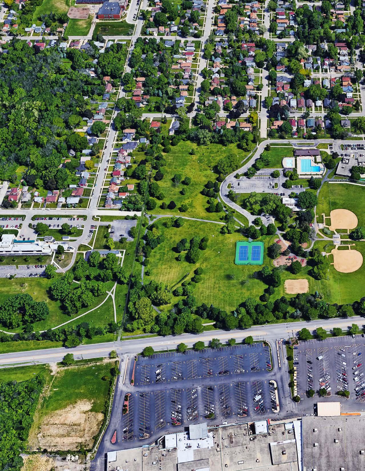
The following graphics represent the breadth of participation received during the Comprehensive Planning process. Over 10% of the City’s population was represented in responses to the community survey which ran from March-July 2019. The 14 question survey was available at the formal pubic workshops, pop-up events, project website, as well as publicized through the City’s social media. A summary is provided below:
Lakefront, harbor Culture, entertainment People Parks
Lakefront, harbor Culture, entertainment People Parks
Diverse population Library (meets the needs of the residents of all cultures)
Love the history (Homes, parks, trees, lakes)
Diverse population Library (meets the needs of the residents of all cultures)
Love the history (Homes, parks, trees, lakes)
Q2. What do you love about the City of
Q1. What word would you use to describe the City of Waukegan?
Q3. What do you dislike about the City of Waukegan?
Q4. Which of the following topics is most interesting to you?
Q5. Would you like to see more programming in Downtown Waukegan?
Q5a. What kinds of programming would you participate in?
Q6. How could Waukegan’s commercial districts and corridors be improved?
Q7. Where do you usually go to meet your family and friends?
Additional Businesses New Uses for Vacant Lots
Additional Businesses New Uses for Vacant Lots
Streetscape Design Gateway/Wayfinding Signage
Streetscape Design Gateway/Wayfinding Signage
Church Restaurants Parks, fieldhouse Beach/Lakefront/Harbor Other Cities Culture/Entertainment
Church Restaurants Parks, fieldhouse Beach/Lakefront/Harbor Other Cities Culture/Entertainment
Art Installations Additional Public Transit Service
Other
Art Installations Additional Public Transit Service Other
Church Restaurants Parks, fieldhouse Beach/Lakefront/Harbor Other Cities Culture/Entertainment
Q8. Are you a resident of Waukegan?
Q8a. If so, how long have you lived in Waukegan?
Q9.
Are you a former resident of Waukegan?
Yes 20%
Q9a.
• Less than 1 year = 0
• 1-5 Years = 5
• 6-10 Years = 2
• 11-15 Years = 0
• Longer than 15 years = 7
No 80%
Yes No
Q9b. Why did you move?
• Navy brat. Went to college and then moved back to Waukegan as soon as we could
• Gurnee schools
• School system, closer to elderly family
• Better housing - larger lot
• Ability to purchase a home in Beach Park from a friend, less property taxes, better school district, close to work
• Schools/retail
• Work in Waukegan as an educator
• College and then returned 6 years ago
• Affordable, close to work, on the lake, lovely neighborhood
• Many cities, longest time in St. Louis.
• Moved to a condo as we aged
• Property taxes
• Met my husband, got married. I’m from Wisconsin.
• Family
Q9c. What community did you move to?
• Gurnee = 3
• Zion = 3
• Beach Park = 4
If so, how long have you lived in a different community?
Are you a former resident of Waukegan?
Q11. Do you own a business in Waukegan?Q10. What is your age? Q11a. If so, how long have you owned your business?
Faith Based Organizations Culture/Arts Education
Faith Based Organizations Culture/Arts Education
Economic Development Natural Resources Social Service
Economic Development Natural Resources Social Service
Education Resources Social Service
Survey
Workshops
Online/Social media, email, Public access TV, radio, podcast
Keep people talking, new people, go to people
Ward meetings
Keep doing what youre doing Newsletter, newspaper Seek input from younger residents (16-24)
Outreach to Latino, African American community Food
Small Community Events
Q13. How can we do a better job of collecting input from Waukegan residents?
Q12. What groups/organizations should we contact to gather input?
1. Green Bay Road (IL 131)
a) North of Belvidere Road 23,800 1,625 30,100 1,975 26% b) North of Grand Avenue 27,400 1,700 33,000 2,465 20% c) North of Sunset Avenue 20,800 2,125 37,000 3,500 78% d) North of York House Road 16,300 1,750 27,500 3,080 69%
2. Lewis Avenue
a) North of Belvidere Road 10,500 13,200 26% b) North of Grand Avenue 15,000 19,000 27% c) North of Sunset Avenue/Golf Road 18,300 24,000 31% d) North of York House Road 17,000 23,500 38%
3. Sheridan Road (IL 137)
a) South of Belvidere Road 15,800 650 21,900 850 39% b) North of Belvidere Road 12,000 13,800 15% c) Amstutz Expressway 11,800 520 15,100 690 28% d) North of Golf Road 18,500 1,000 23,300 1,240 26%
4. York House Road
a) West of Green Bay Road 3,650 5,300 45% b) West of Lewis Avenue 12,200 15,300 25% c) West of Sheridan Road 7,550 10,800 43%
5. Sunset Avenue / Golf Road
a) West of Green Bay Road 14,800 22,800 54% b) West of Lewis Avenue 14,000 16,100 15% c) West of Sheridan Road 12,000 15,100 26%
6. Grand Avenue
a) West of Green Bay Road 28,500 695 31,400 700 10% b) West of Lewis Avenue 20,400 25,500 25% c) West of Sheridan Road 12,700 16,800 32%
7. Washington Street
a) West of Green Bay Road 27,900 36,500 31% b) Near Lewis Avenue 21,400 23,600 10% c) Near Downtown 5,150 4,400 ‐15%
8. Belvidere Road
a) West of Skokie Highway (US 41) 38,800 3,800 47,600 5,135 23% b) West of Green Bay Road 27,900 2,200 33,000 2,710 18% c) West of Lewis Avenue 22,600 31,800 41% d) West of Sheridan Road 7,950 11,400 43%
9. I‐94
a) South of Belvidere Road 121,400 22,950 148,000 37,930 22%
Sources: 1. IDOT ADT 2. CMAP 2050 Projections
To: Project Team, City of Waukegan
RATIO Project No.: 18069

Date: July 1, 2019
Subject: City of Waukegan - Public Workshop 2
On June 25, 2019 the RATIO team with the City of Waukegan, hosted a public workshop to solicit public input on the comprehensive planning process. The workshop was held at the Waukegan Public Library (Main Branch)
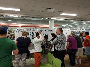
Approximately 51 participants, consisting of residents, stakeholders, business leaders, steering committee members, City staff, and elected and appointed City officials, signed in for the workshop. The workshop consisted of five stations that residents cycle d through during the scheduled 2-hour workshop. These stations were designed to optimize input from the public in an informal fashion, and participants were welcomed to join at any time. The five stations included:
• Station 1 – Welcome
• Station 2 – Work Summary
• Station 3 – Keep, Toss, Create
• Station 4 – Ask An Expert
• Station 5 – Survey
The results and input gathered from the public pertaining to each station are summarized below.
The first station included a staffed sign in and welcome table. A brief presentation was given that explained the planning process and purpose of the Comprehensive Plan. The presentation also oriented participants to each station.
The second station consisted of a series of boards showing the key topic issues that have emerged based on the input received over the course of the planning process. These topic areas were organized into key themes, and participants commented on their priorities. Additionally, the results from the Community Planning Toolkit, which the consultant team distributed to the Steering Committee members, were summarized in a series of boards. Workshop participants commented the results. This station also featured print copies of the Existing Conditions Report as reference for the participants. Comments for this station’s boards are shown in images on the facing pages.
30 West Monroe Street, Suite 500 Chicago, Illinois 60603 312.465.2359 Chicago, IL Indianapolis, IN Champaign, IL Raleigh, NC
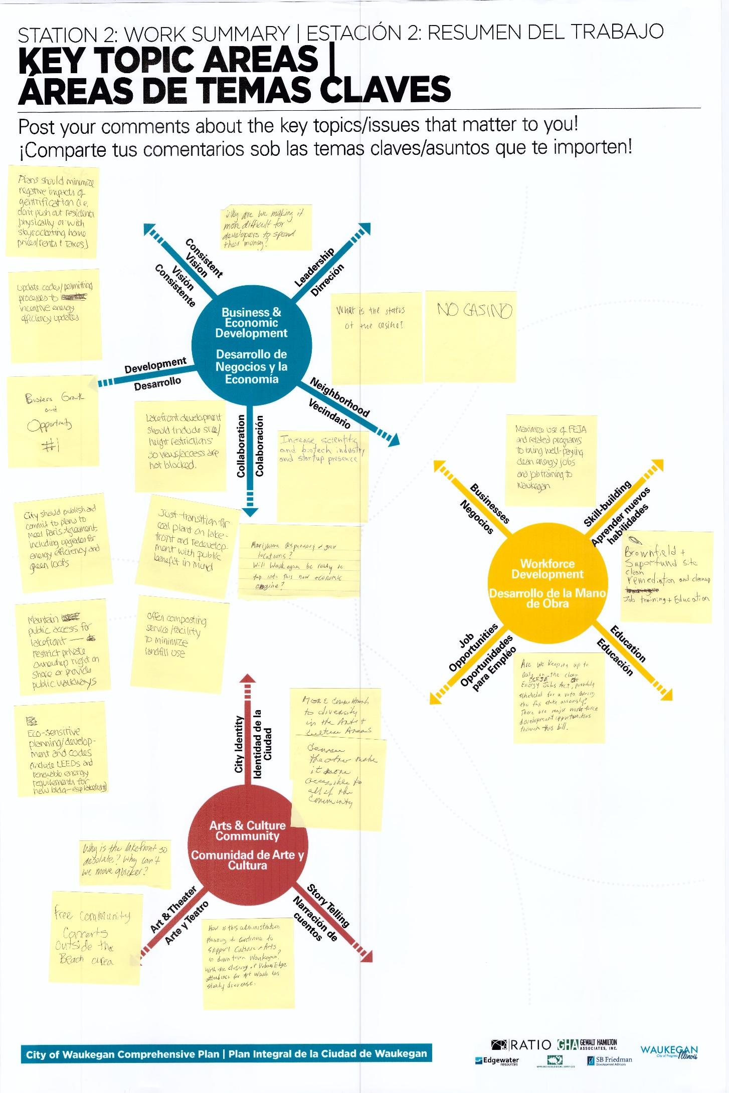
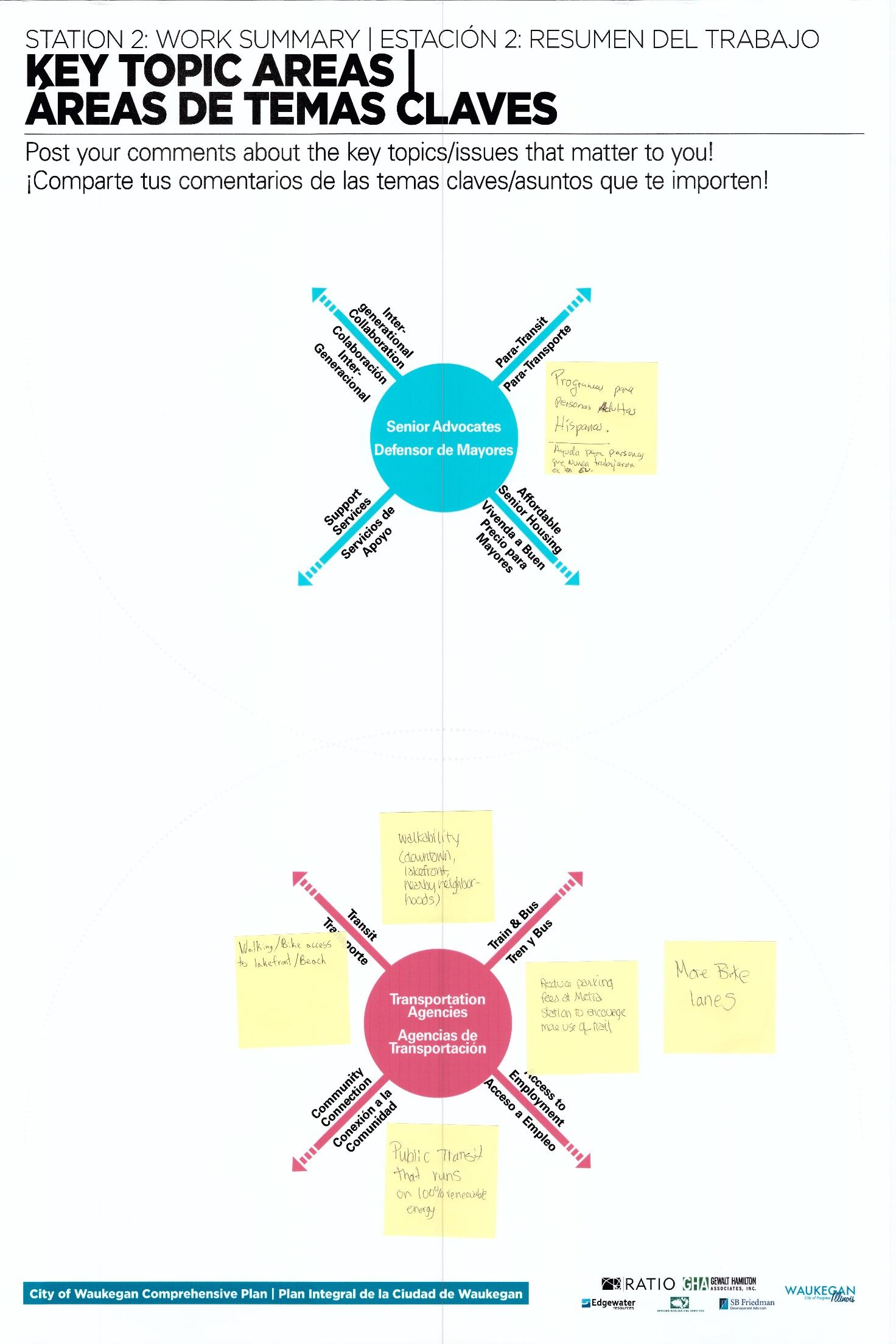
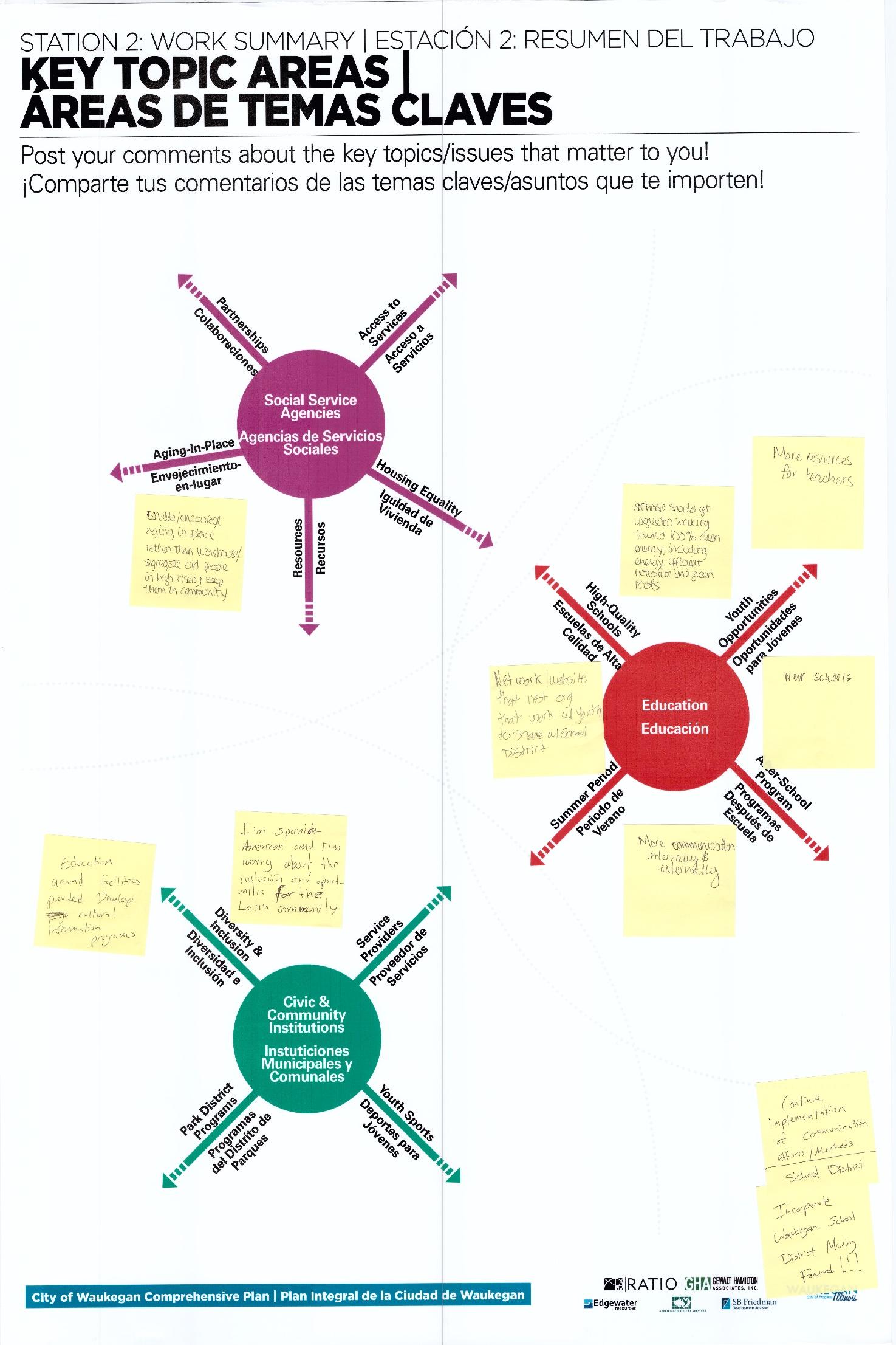
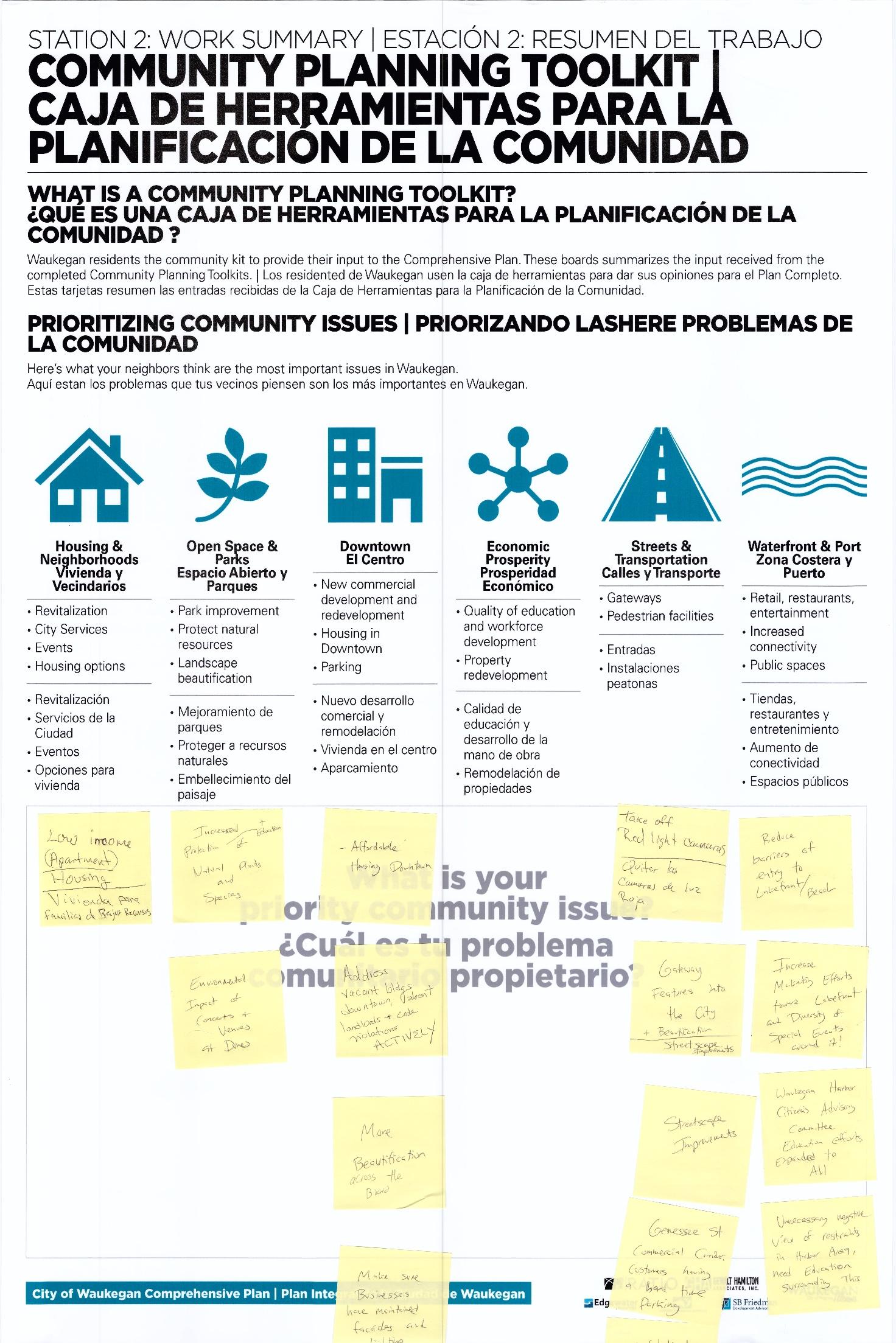
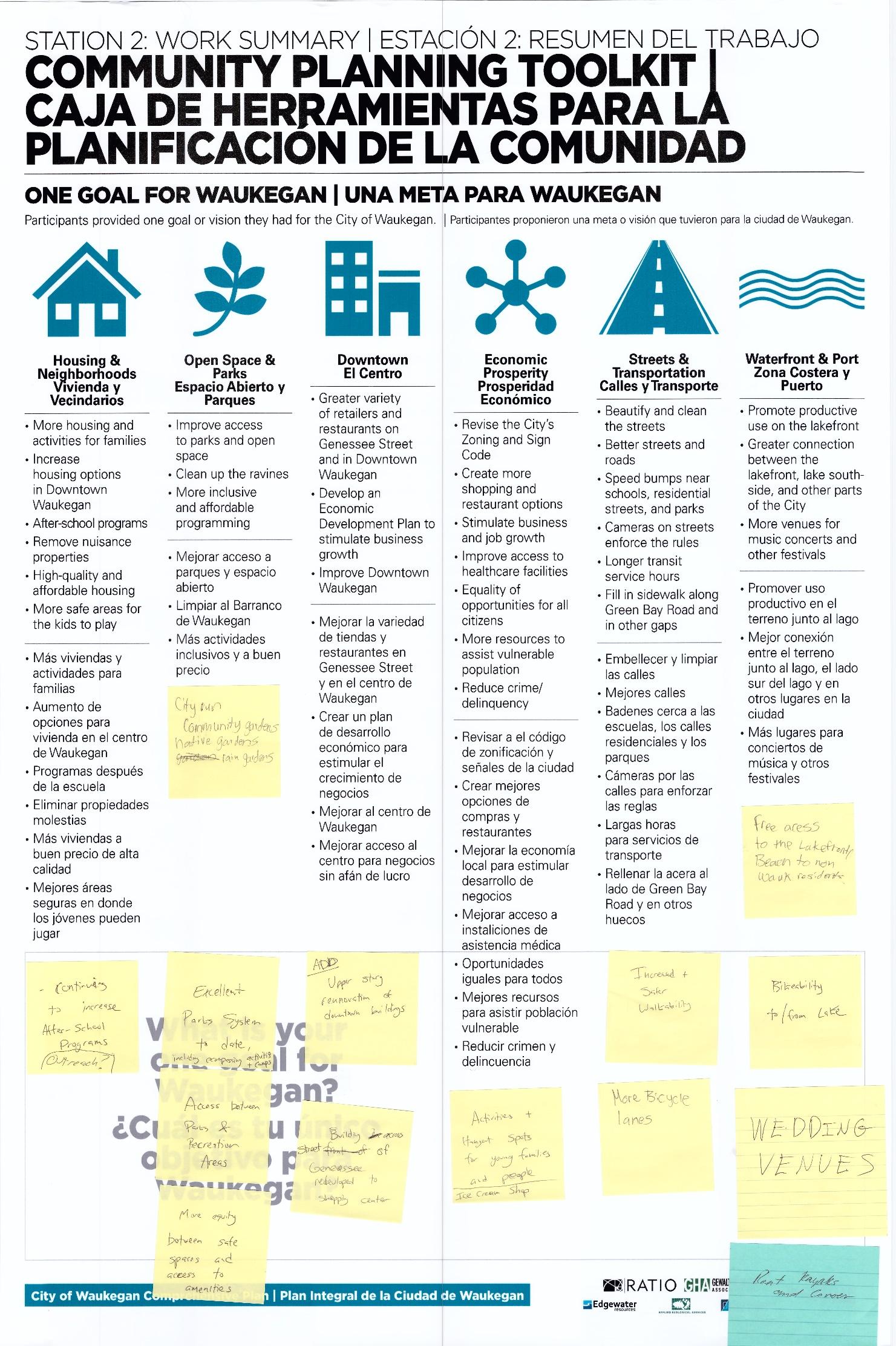

In the third station, participants evaluated the proposed goals for the Comprehensive Plan. Each proposed goal was organized under a key theme, which would be used to organize the goals, objectives, and recommendations of the Comprehensive Plan. Participants voted to “keep” the goal if they like d it, vote to “toss” the goal if they thought the goal was not good or irrelevant, or “create” a new goal to replace or add contents to the proposed goal The following images below show the results of each goals.
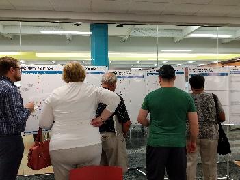
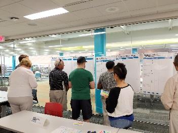
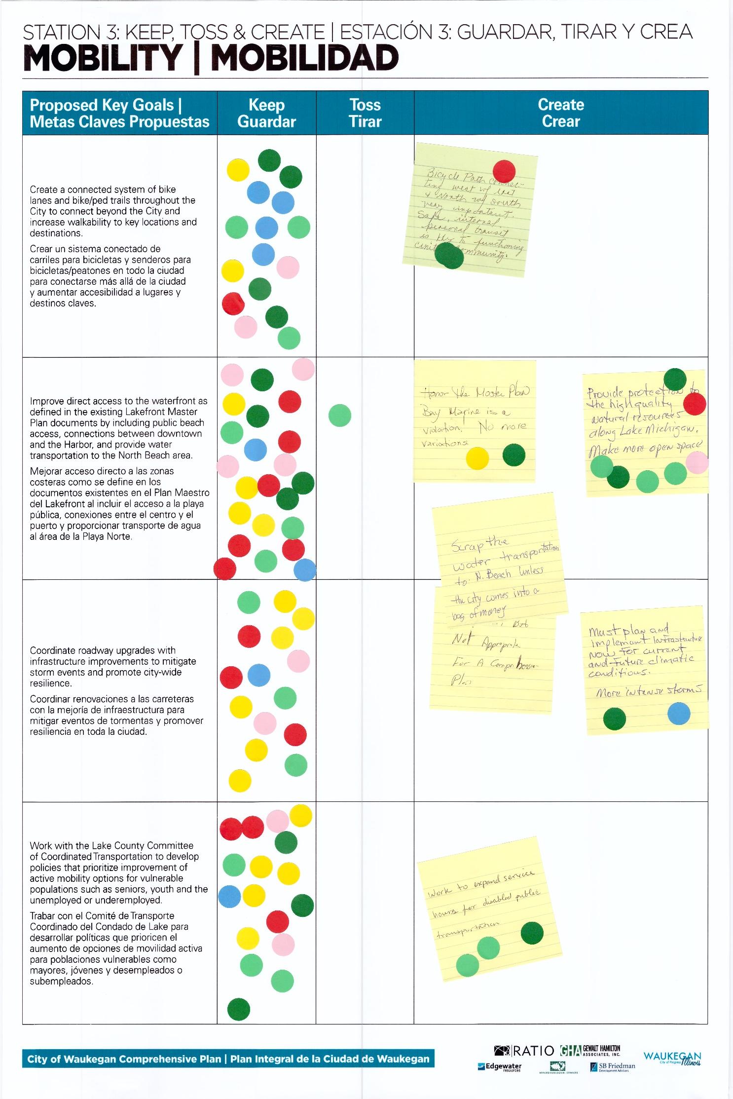
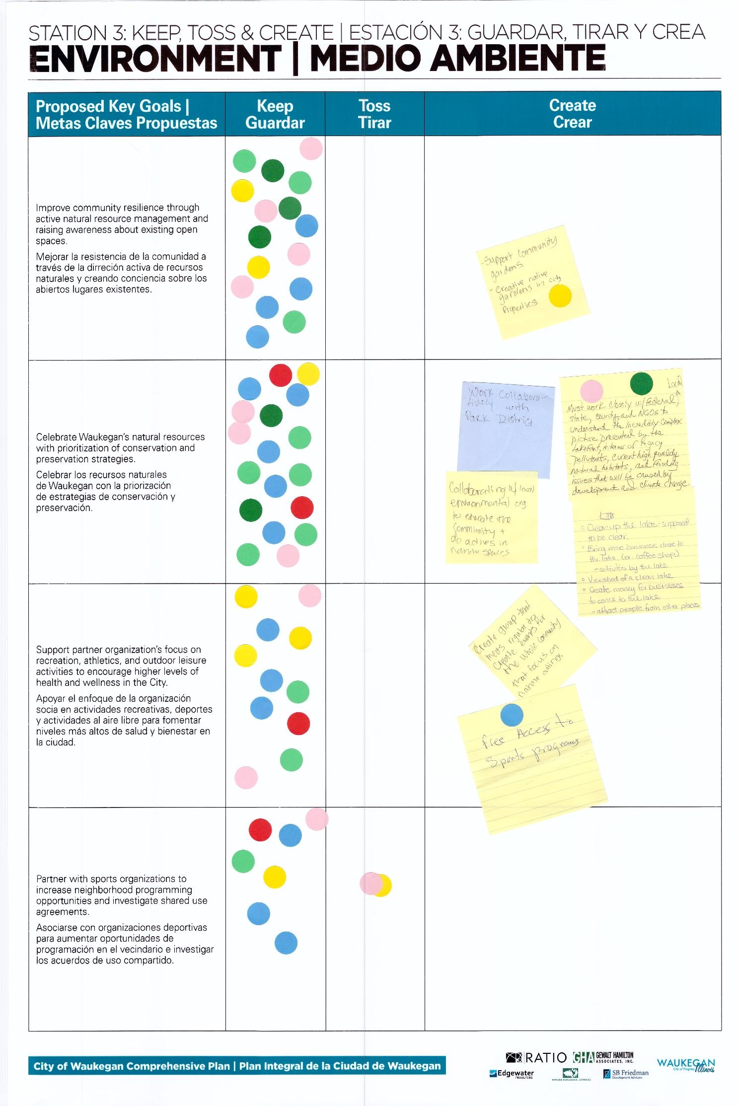
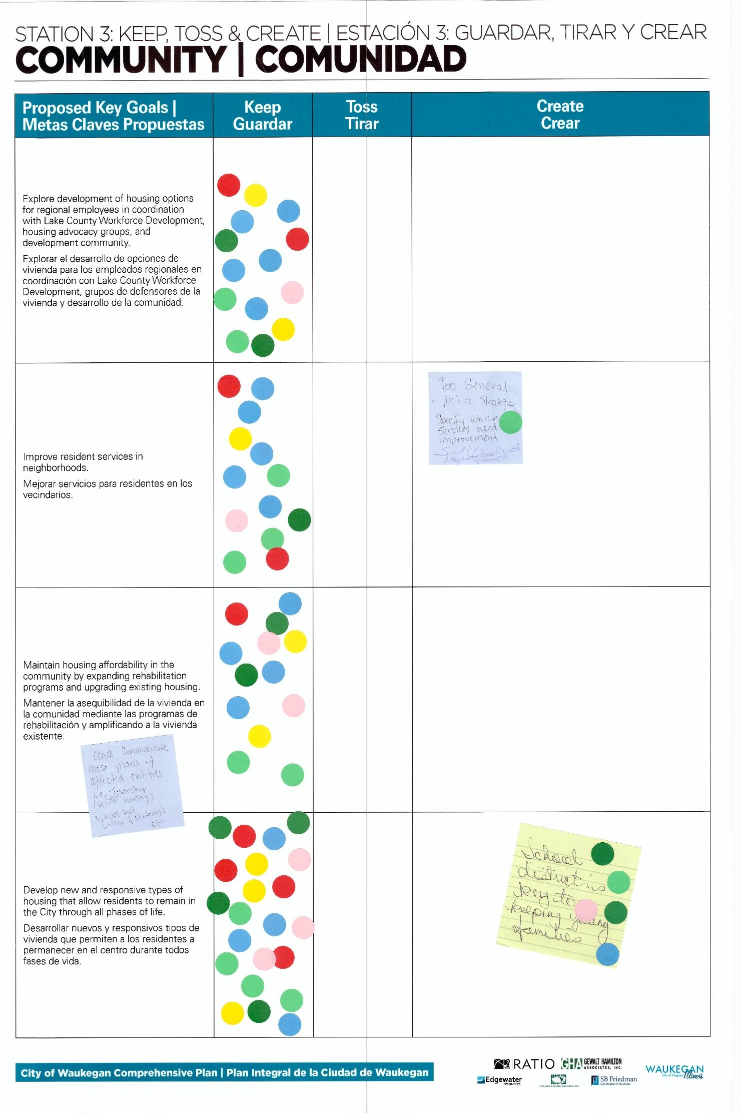
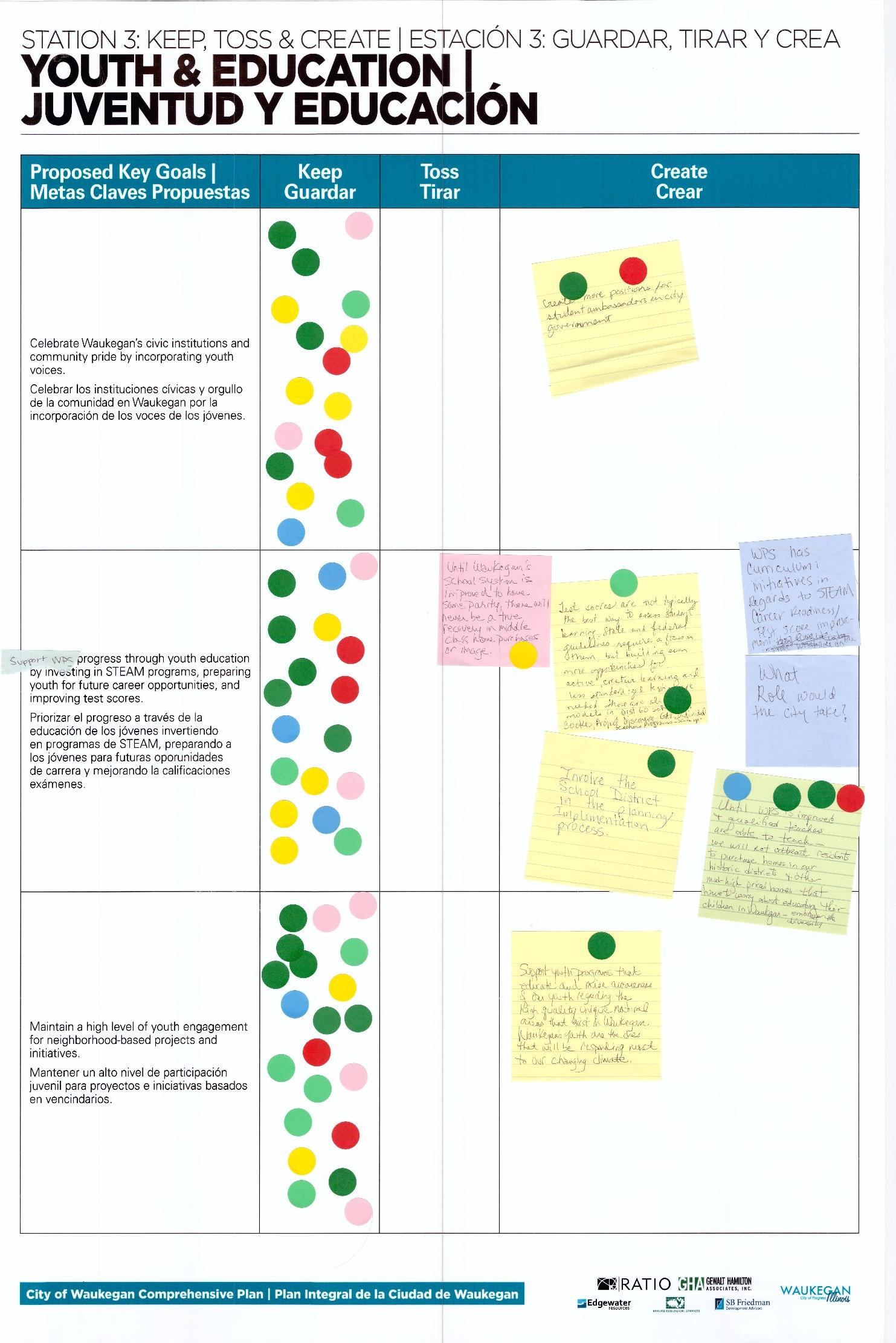
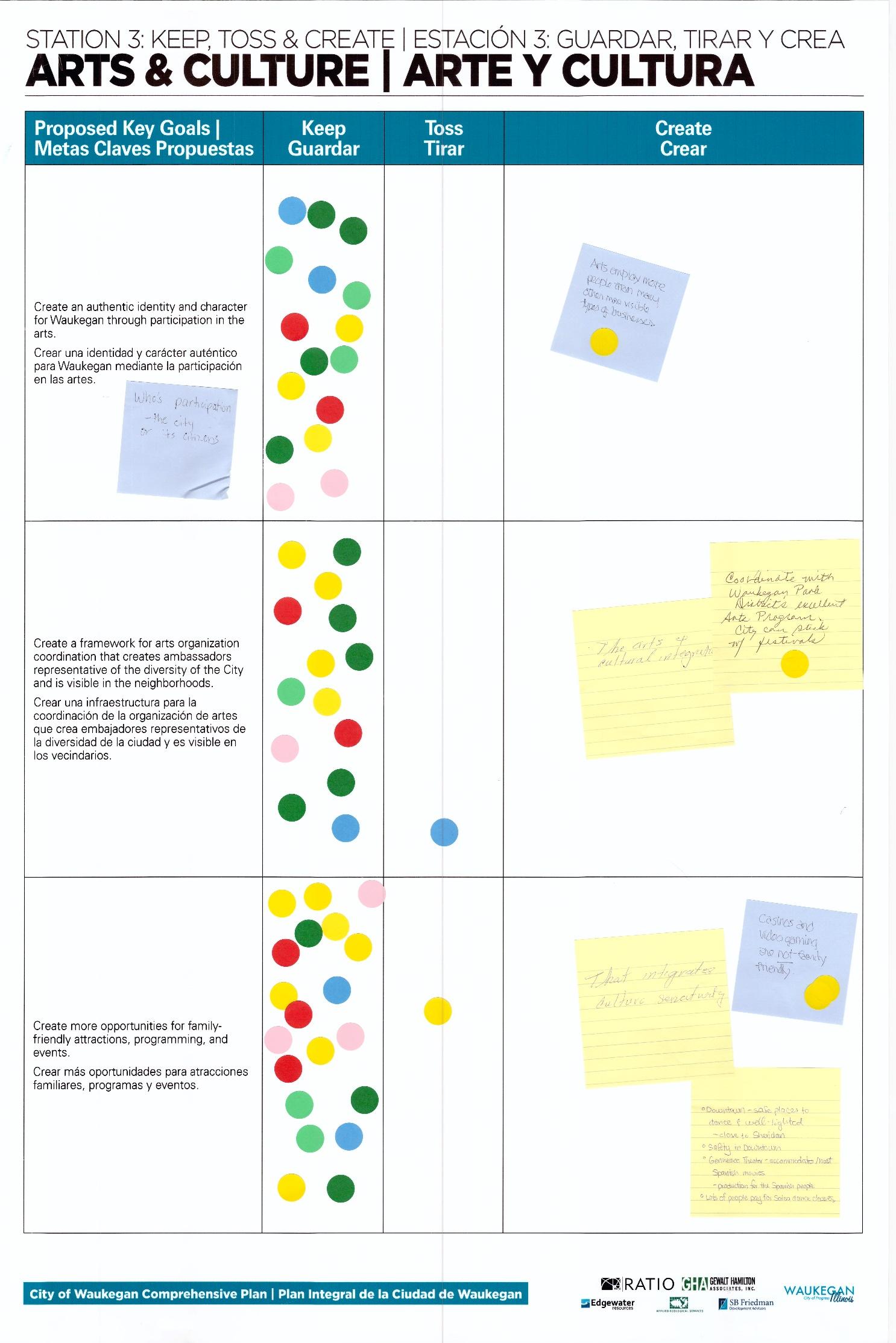
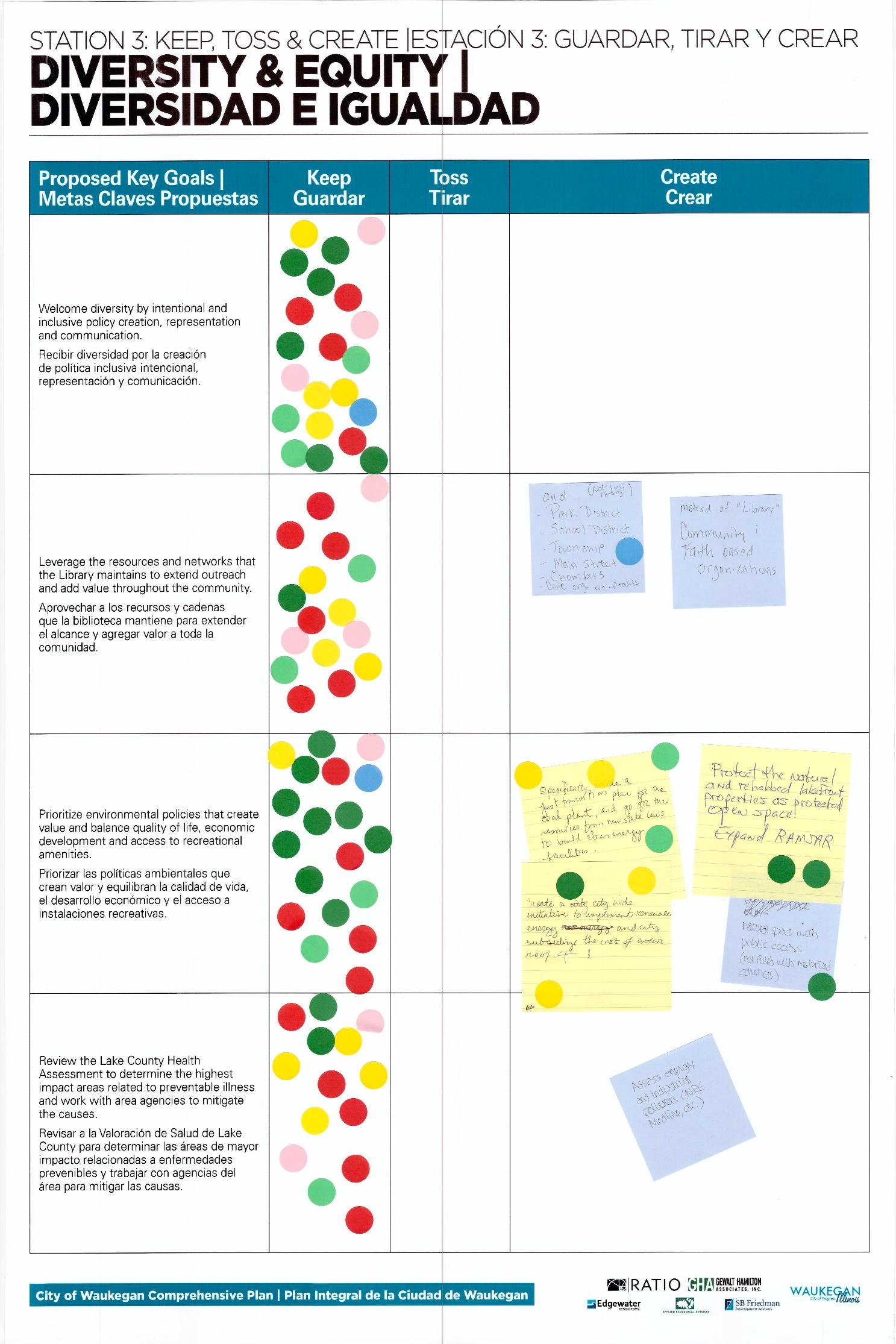
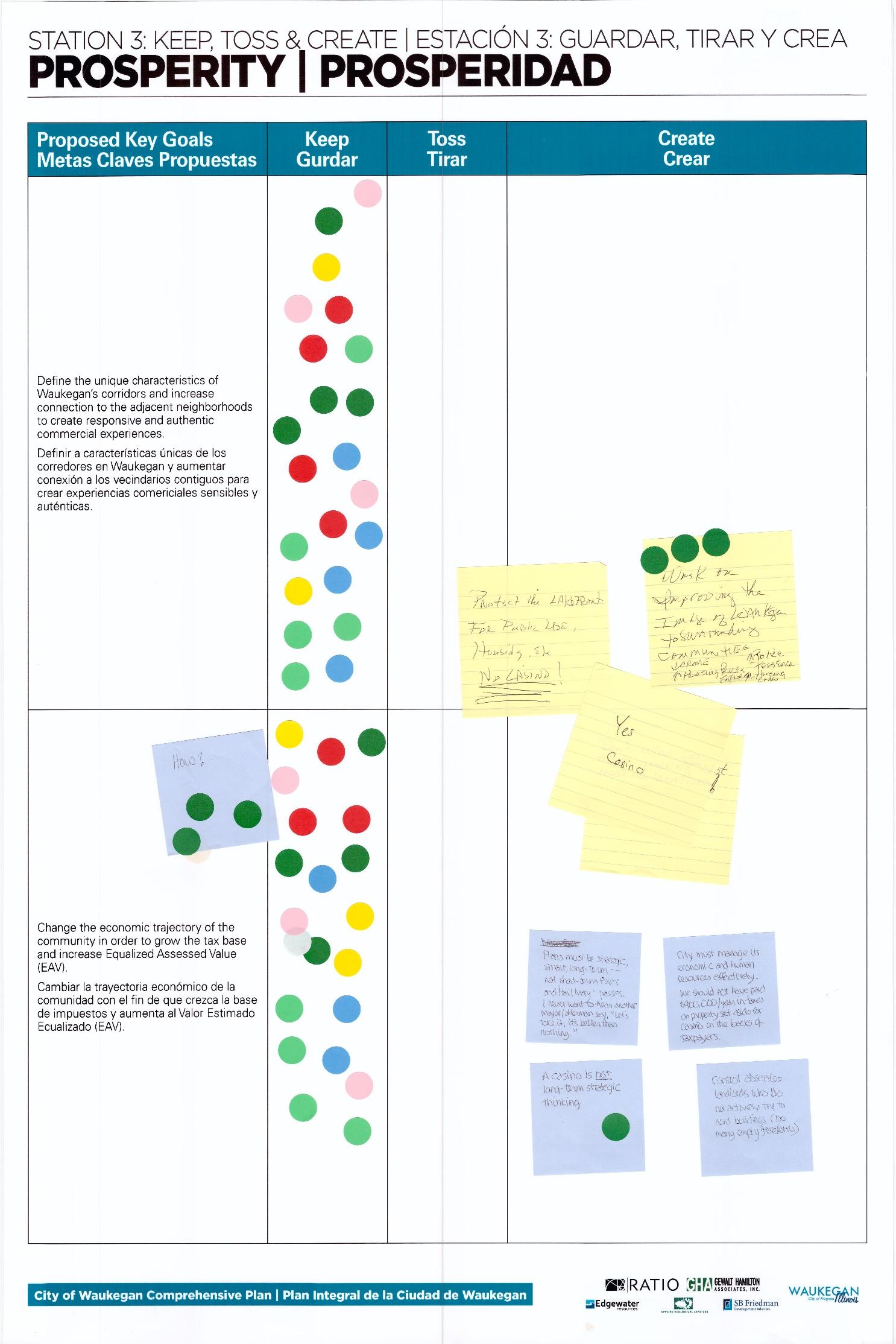
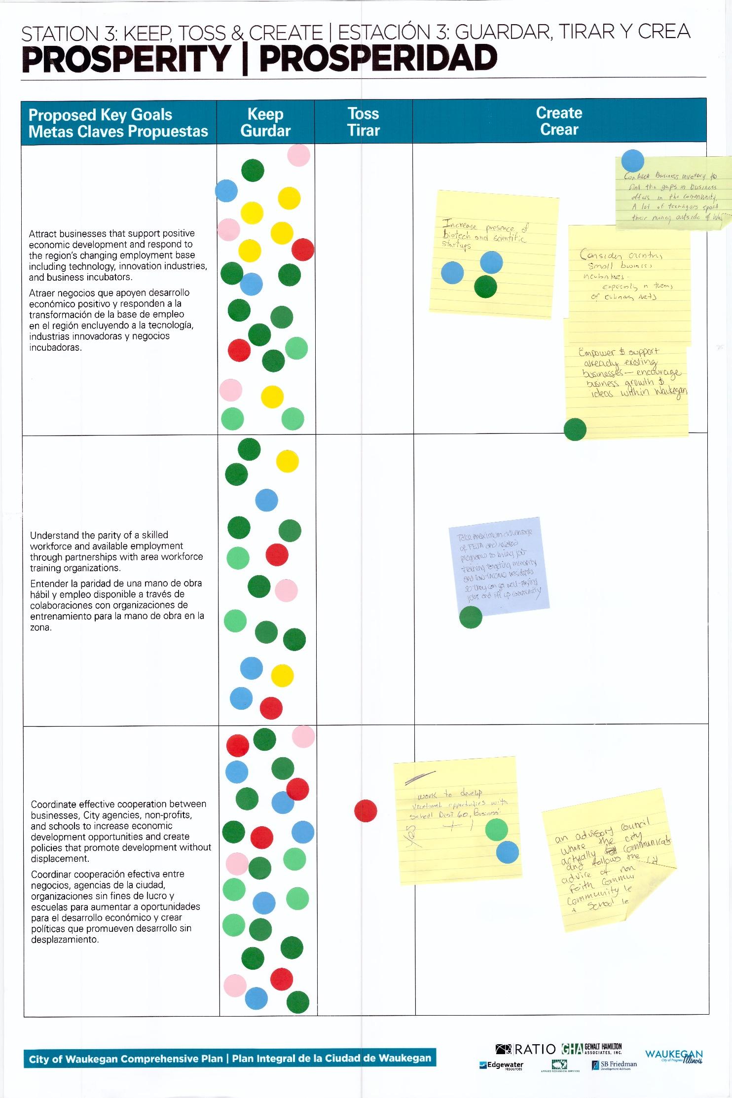
The fourth station involved consultants from Edgewater Resources and Applied Ecological Services - experts in environmental and natural resource subject areas - answering workshop participants’ questions related to Waukegan’s lakefront or other areas of importance. Participants were free to approach the consultants and ask them questions they had regarding Waukegan’s natural resources. Comments heard by participants or discussed at this station were:
• Why so many vacant buildings downtown, what are the barriers to commercial development? This was a conversation with Noelle’s son, his name escapes me. We talked about previous plans and efforts to revitalize downtown, the lack of a implementation strategies in the original SOM master plan, the need for ‘baby steps’ to spur growth and attract othe r businesses. Used the food truck down on the beach as an example, sometimes inexpensive, non permanent businesses like that can help gauge community interest. Also discussed change in city leadership, potential need for incentives for new business.
• Discussed schools as a critical piece of the puzzle to attract people to live in Waukegan. There is a false assumption that the schools are not high quality, need to attract families through a strong school district.
• Belvedere should be the gateway to downtown and the waterfront but it is highly ignored in terms of streetscape improvements and signage.
• Heard praise for reduction of beach parking fee (from $20 to $10). Also same guy (named Hilario, he works for the city and the botanic garden I think) said that the garden has a successful outdoor music in the park program because it’s consistent. It got started slowly, but when people learned the schedule and knew there will be music on certain days all summer, they love it and keep coming. Events at the beach are inconsistent so people often don’t show up because there is no guarantee anything will be going on down there. He had great energy and ideas and I’d encourage you to keep him involved if you can! Sorry I don’t have his contact info but he’s probably on the sign in sheet.
• Education on endangered species (plovers) and invasives (garlic mustard) is working, keep up efforts to teach kids about these topics and they will be the stewards of the waterfront. People really do care about these things but often they just don’t know. Signs on beach with photos are a good start. Outdoor classrooms to show kids while teaching is a great way to get them involved.
• I heard one comment that the boards at the first station had ‘big idea’ topics, and one of them should have been environment/ecology based. I told them that in these types of projects we often apply these strategies to ALL aspects of a project, we don’t think of the ecological impacts as a separate piece, but I told her I’d pass along the comment as it was important to let the community know that the beach and the natural resources are a critical piece.
• Waukegan AOC - there were several comments from two separate folks on neighborhood connections to the harbor and how its not as much of an environmental corridor/concern and more of a transportation and public safety concern.
• Interest in highlighting/featuring and “cleaning up” the ravines. A participant mentioned invasive species but her comments may have not been limited to that as she on to talk about illegal dumping, trash, shopping carts, etc. She shared that she felt the AOC was underrepresented and voiced concerns that Susie Schreiber (running the CAG – Citizen Action Group) was doing most of the communication with few others considered to bolster the CAGs efforts (meaning agency, City of Waukegan, etc.).
• Some comments were more of “how to bridge the gap” in communication of the AOC goings on and elsewhere .
• There were quite a few positive comments on the function overall and they would like to see more from City leadership
City
In the final station, participants were asked to complete a survey regarding their perception about the public workshop
I would recommend the event 16
I would not recommend the event 1
This was more useful than the first to me.
Someone should be orienting people at the beginning.
Too noisy, lack of flow
Maybe have a workshop for gov. agencies
I believe it's confusing for the people who are here for the first time
June 2019
In addition, participants were asked to share information on those who should be involved with the process, challenges and opportunities in the City.
The diversity of opinions
It was very interactive
The free form setting
Goal boards w/voting dots and post it sheets
The visuals represents the work so far.
Plenty of information
Nice method of collecting input
People to talk to & chance to give feedback
Access to people w/answers & knowledge
The stations and breaking up the event to make it interactive
Open house aspect
Very comprehensive
It gave an overview of what ir sees the needs to be
To compare and contrast priority areas of concern
The information that was provided
Q1: How likely is it that you would recommend attending the next workshop to a friend or colleague?
Info sheets, instructions on how stations work or on the corresponding info
Better signage at library entrance
More listeners at stations
A clearer overview of the whole process, stations etc Someone putting the information into context
Place a notice at front of library to tell people of room change - I walked up & down the hall in the base Thought there would be more focused concept ideas
More facilitators
I know you went with feedback you got previously, but some ideas were too broad. They were a bit har Resources too lengthy, things that only take a couple minutes to review Make this more accessible to the traditional Waukegan resident. Reduce jargon & buzzwords. An orientation session before participants walk through the displays Add some targeted/timed events
Bigger room
When I went, no black residents. Could ministers of black churches be invited with members of their co I am excited about all the loans & priority (can't read this response)
At the present time, there does not seeme to be a strategic VISION for Waukegan Room too small, kept searching for station. I had no idea that sign in table was a station. Information appears to be very general - goals not specific - too broad Too much information to take in quickly Be more specific about addressing the needs of, for example, the 1st Ward. Fresh food, economic oppo There must be action, goals and timetables
Q8: Are you a resident of Waukegan?
Yes 14 NO 4
How many years have you lived in Waukegan?
Less than a year 1 1-5 years 1 6-10 years 1 11-15 years
Longer than 15 years 11
What is your ZIP code? 60085 7
Q9: Are you a former resident of Waukegan?
Yes 3 No 7
How many years did you live in Waukegan before moving out of the City?
Less than a year 1-5 years 1 6-10 years 11-15 years Longer than 15 years 2
Found a house in Zion relatively cheaper housing in lower tax but better school district Streets are bad, businesses left, gang problems, crime, terrible neighbors
Zion Lindenhurst Wadsworth
Q10:
17 & Under 18-24 25-34 4 35-44 1 45-54 2 55-64 4 65 & Older 7
Architecture Preservation Interior Design Landscape Architecture Urban Planning & Design Graphic Design
To: Project Team, City of Waukegan
RATIO Project No.: 18069
Date: November 15, 2018
Subject: City of Waukegan - Public Workshop
On November 15, 2018, the RATIO team with the City of Waukegan, hosted a public workshop to solicit public input on the comprehensive planning process. The workshop was held at the Waukegan City Hall in the Council Chambers Approximately 110 participants, consisting of residents, stakeholders, business leaders, steering committee members, City staff, and elected and appointed City officials, signed in for the workshop. However, over 40 additional people participated in the workshop but did not sign in The workshop consisted of five stations that residents would cycle through during the scheduled 1.5-hour workshop. Many participants chose to stay beyond the allotted timeframe. These stations were designed to optimize input from the public in an informal fashion, and participants were welcomed to join at any time. The five stations included:
• Station 1 – Welcome
• Station 2 – Mapping Assets
• Station 3 – Visioning
• Station 4 – Past Plans and Reports
• Station 5 – Survey
The results and input gathered from the public pertaining to each station are summarized in the following sections.
The first station included a staffed sign in and welcome table. A brief presentation was given that explained the planning process and purpose of the Comprehensive Plan, including how the plan should be used. The presentation also oriented participants to each station.
A large map of the city was placed on a table for participants to share input related to their perceptions, strengths, opportunities, and weaknesses of the community. Participants were asked to map specific topics on the map including:
• Redevelopment/vacant land
• Public realm improvement
• Park, trail and open space
• Needs new investment
• Transportation/access issues
Most of the input received on the maps was focused in the downtown and lakefront.
RATIO Architects, Inc. RATIOdesign.com
30 West Monroe Street, Suite 500 Chicago, Illinois 60603 312.465.2359 Chicago, IL Indianapolis, IN Champaign, IL Raleigh, NC
City of Waukegan Workshop Summary Page 2
November 15, 2018
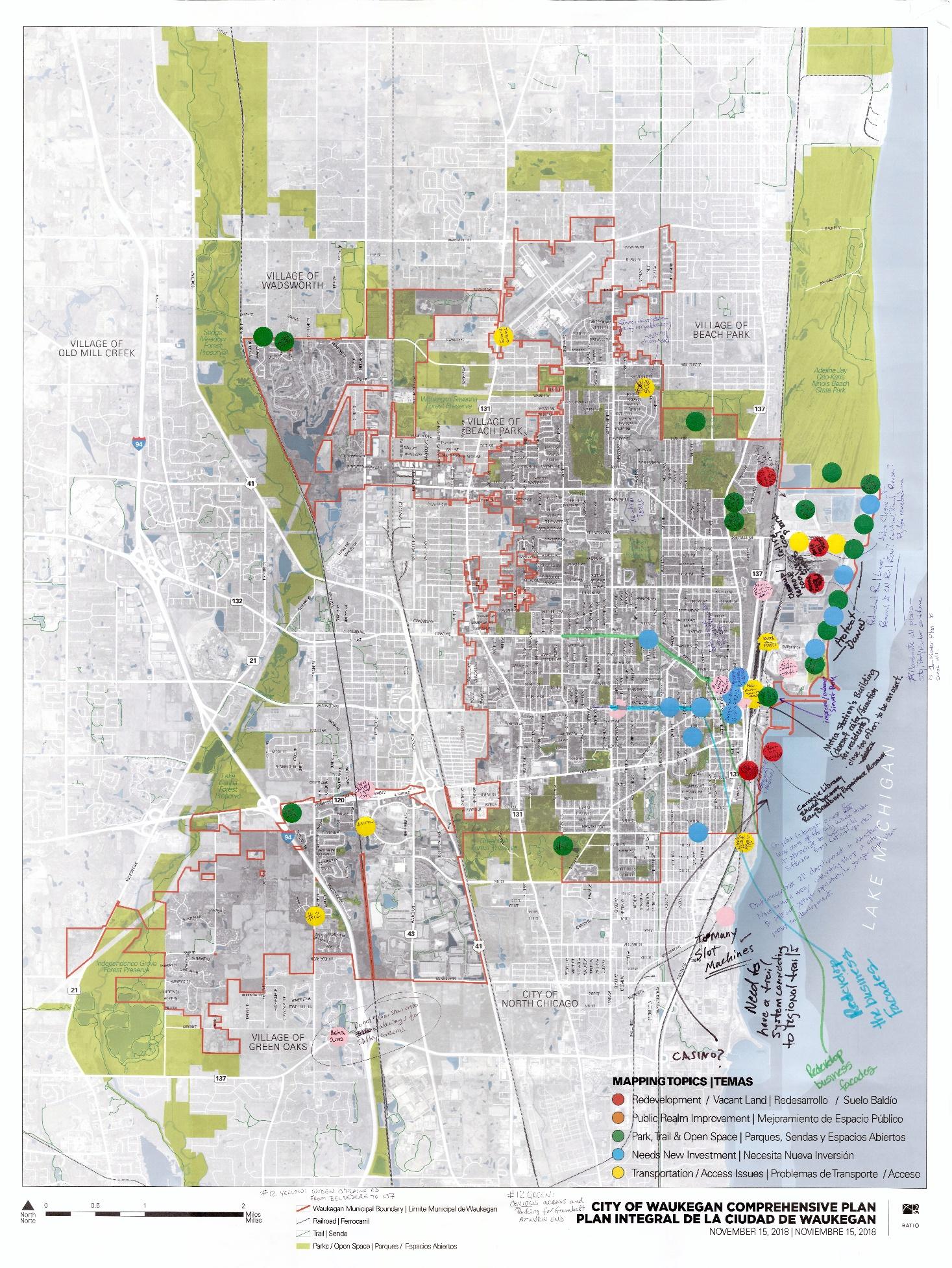
City of Waukegan Workshop Summary Page 3
November 15, 2018
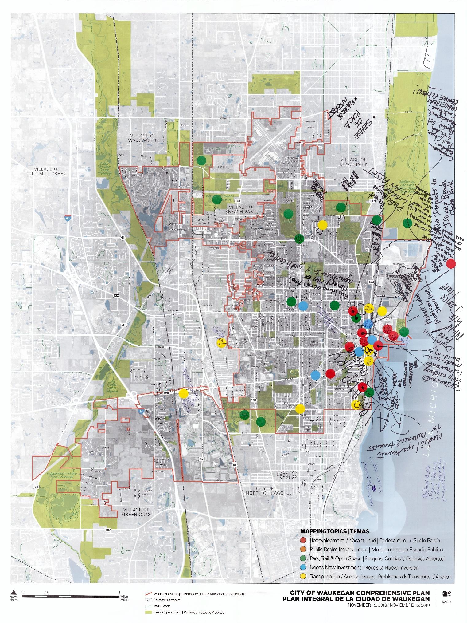
City of Waukegan
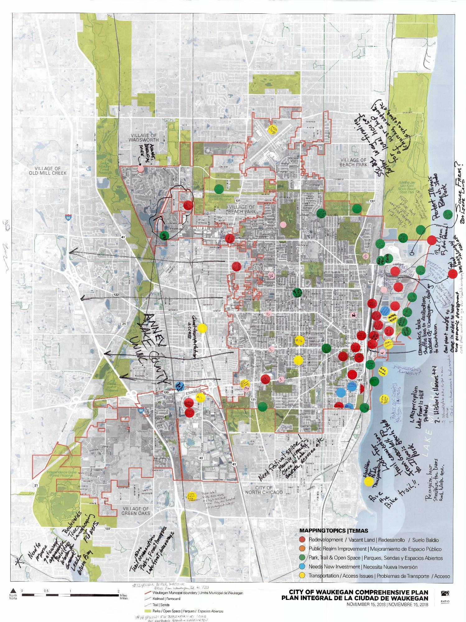
Page 4
November 15, 2018
City of Waukegan Workshop Summary
The third station was a topical visioning exercise that was designed to create a vision statement for the Comprehensive Plan. Participants were engaged in an activity where a series of cards with various images were available at the station for review. Participants picked a card that symbolizes their vision for the City. After selecting the card, each participant spoke with the facilitator and other participants about their vision for the City. The consultant staff facilitated this exercise and recorded the results on a flipchart The bullet points below are the participant’s vision for Waukegan that were recorded on the flipchart:
• Progress through education
• High performance buildings and infrastructure
• More entertainment uses (restaurant/amenities)
• Welcome diversity
• An attraction/events
• Public access to the beach
• Achievements in one year
• Community service opportunities for youth
• Create community pride and civic mindedness
• Make Waukegan the cleanest city in Illinois and the world
• Sense of pride
• Less liquor stores
• More productive businesses
• Environmentally responsible
• Variety of restaurants/coffee shop/bistro
• Walkability with places/destinations to walk
• Broad base community coming together to make a beautiful piece of art
• Connecting local community organizations to the larger Waukegan community
• Change public perception of downtown
• Model town for renewable energy
• Transform/reinvest in brownfields
• Bike lanes throughout the city
• Strong vision instead of one focus on access point
• Comprehensive efforts to leverage/investing access corridors
• Affordability
• Model of clean energy
• Potential for transformation
• Services in neighborhoods
• More things to do for families
• Community centers
• Better cooperation between businesses, city agencies, non profits, schools
• Incorporate STEAM into school programs
• Attract more talent
• Improve perception of Waukegan
• Remove the coal plant
• Remediate the lakefront
• Avoid gentrification
• Strong public input for development
• Create identity for neighborhoods
• Attract technology based companies
• Open train station (extend hours)
• Being the ‘big’ middle point between Chicago and Milwaukee
• Water transportation (ferry) to the north beach
• Direct access to waterfront
• Connect downtown to harbor
• Clean the lakefront
• Demolish cement silos
• Smart/shared parking assets
• More public amenities (pools, parks with water features)
• Beach revitalization
• Family friendly
• Better roads/navigation
• Business development in downtown
• Attract more businesses
• Incubation center (Hub non profit)
• Direct assistance to small businesses
• Support paring for businesses
• Attract major anchor company
The City of Waukegan has completed several plans in the last 10 years. This station included boards with each plan’s key recommendations and objectives for participants to understand the City’s past decisions. A timeline with Waukegan’s history was also present at the station. Participants were able to read through the major milestones in the City’s history and answer the questions:

• What does the future of Waukegan look like?
• What is your personal history with Waukegan?
Participants commented on the previous plans and added their own commentary to the plans and timeline.
In the final station, participants were asked to complete a survey about their vision for Waukegan. In addition, participants were asked to share information on those who should be involved with the process, challenges and opportunities in the City. The results follow:
RATIO Architects, Inc. RATIOdesign.com

To: Project Team, City of Waukegan
RATIO Project No.: 18069
Date: September 4, 2018
Subject: Waukegan Comprehensive Plan
On August 29, 2018, the RATIO team, including Borderless Studio, Gewalt-Hamilton Associates, SB Friedman, Applied Ecological Serices, and Edgewater Resources consultant staff, engaged in meetings with City staff and the project’s Steering Committee to kick off the Waukegan Comprehensive Plan Update planning process.
RATIO facilitated a meeting with the City’s Public Relations (PR) Team. Participants in this meeting were:
• Noelle Kischer-Lepper, Director of Planning and Development, City of Waukegan
• Steve Sabourin, Senior Planner, City of Waukegan
• Russ Tomlin, Senior Planner, City of Waukegan
• David Motley, Director of Marketing & Public Relations, City of Waukegan
• Jane Ferry, Public Relations Specialist, City of Waukegan
In this meeting, RATIO and the City staff discussed challenges and lessons learned from previous planning processes. The City staff also shared strategies to have people become more engaged with the process.
The meeting began with a discussion about challenges to the planning process. One of them is to address skepticisms from City residents, as they would question the necessity and financial implications of the City conducting another “Plan.” Also, the PR team recognized that there would always be a group of people who will not engage in the process, because they cannot dedicate their time and talents into the process. The discussion then focused on strategies to address these challeng es.
It is important to emphasize to the public that the Comprehensive Plan Update is unique from other City plans, in which the former focuses on the City rather than a district. The RATIO team and the City staff should focus on branding the planning process to keep City residents excited and engaged. This means avoiding labelling the deliverable as a “plan,” selling more of the experience and motivation of the community, and creating more organic deliverables, rather than only composing a booklet.
The outreach plan needs to focus on “going to where people are,” rather only hosting than traditional workshops. This means hosting pop-up stations at City’s popular events, such as ZombieWalk in October, punk rock concerts at the Burgundy Room, and festivals at Downtown Waukegan. Also, survey works better when done face-to-face rather online. The best way to engage with business owners is to go door-to-door and hand them a survey to complete.
Hosting workshops will be necessary, and Wednesdays, Thursdays, and Saturdays are the better days in the week to do so. Social media, mostly Facebook, will be the most effective and genuine method of gathering data and intelligence. Traditional media outlets, such as local newspaper, tend to be reactionary and acquire many stories and leads from Facebook.
The RATIO team and City staff agreed that hosting a project website will be beneficial to the planning process. The RATIO team will review with the City’s PR team on the website’s structure before launch. The website should exist outside of the City’s Facebook page, but it can link with the City’s resources, including the City’s calendar of events. The website could also host a parallel social media platform and rely on the City to disseminate the information. Regarding media inquiries, the RATIO team can directly answer them to avoid the City’s “imprint” on these responses and can directly reach out to local media outlets when needed. The RATIO team will use Eventbrite and other social media platforms to send invites for upcoming outreach events and to gauge the level of public interest. Contact information for these events will be RATIO.
30 West Monroe Street, Suite 500 Chicago, Illinois 60603 312.465.2359 Chicago, IL Indianapolis, IN Champaign, IL Raleigh, NC
The RATIO team and the City staff discussed which groups and organizations to engage. Below is a list of these potential organizations:
• Waukegan Historical Society
• Waukegan Main Street
• Waukegan Chamber of Commerce
• Lake County Chamber of Commerce
• Waukegan Township
• Waukegan Port District
• Soccer clubs
• Faith-based groups
• Business owners
• Waukegan Community Unit School District 60
• Park Place
• Lake County Forest Preserve
• Lake County Partners – public-private partnership on economic development
• College of Lake County
• Greater Waukegan Development Coalition
• Local homeowners’ associations, including those along River Road.
• Neighborhood watch groups
• Waukegan Park District
• Groups of sports coaches (professional and recreational)
The City staff stated that there are secondary groups in the City that can provide valuable input into the planning process. They include commuters to Chicago and boaters by the harbor. The best way to engage them is to meet with them in their respective locations, such as the Waukegan Metra Station and the City’s marina.
The meeting between RATIO team and the City’s planning staff, included Russ Tomlin, Senior Planner, and Steve Sabourin, Senior Planner. This discussion centered on planning issues within and around the City of Waukegan.
Although this area, with few developable parcels, is within the Waukegan’s municipal limits, residents in this area tend to perceive that they are part of the Village of Wadsworth or Gurnee. This perception is reinforced by homes with Wadsworth and Gurnee addresses and school district assignments. Residents from these areas rarely access the lakefront. The City’s planning staff would like to see residents in this area associate themselves more with Waukegan than with the communities to the west. Improving the area’s access to the lakefront will be an important issue to address in the planning process.
Southwest Waukegan includes neighborhoods west of U.S. Highway 41 and south of Route 120. This area is home to Fountain Square, which was developed by Shaw Developers, and is home to a 31-acre site. Notable development and destinations include: Marriott hotel and Big Ed’s Barbeque. A Walmart is located in this area as well. There is a perceived assumption that the City has a restrictive covenant that other big-box retailers cannot be located in Fountain Square. There is no evidence of such agreement in the City’s legal documents. There is a 10-acre site adjacent to Fountain Square that may be home to a new Marshall’s.
The main commercial corridors of the City are Washington St., Belvidere Rd., and Grand Ave. Dan Persky has worked with the City of Waukegan to implement the recommendations from the Washington Street Corridor Plan, but the momentum has waned. What largely remains in these corridors are pockets of small parcels that are unattractive to potential businesses. The parcels along the corridors are privately-owned and partially consist of non-conforming residential properties that need façade improvements. The
City desires to see a greater number of mid-rise buildings (three or more stories high) or mixed use development concentrated at specific nodes along the corridors. It is also critical to decide and establish an identity for each of the commercial corridors.
There are neighborhood-serving commercial development nodes within the City, such as the intersection of North Ave. and Ridgeland Ave. and North Ave. and Franklin St. The City recognized these developments provide residents convenient access to services, but these developments tend to serve a regional market rather than the neighborhood. This highlights an issue regarding permitted land uses in the City’s commercial zoning districts.
The City’s Planning Staff stated that more businesses are coming into Downtown Waukegan. They include: art galleries, Three Brothers Theater, cigar lounge, and Horse Feathers. The Downtown hosts an ArtWalk every month, attracting art and restaurants to the downtown. Accessibility to downtown has been a challenge in the past as some private events in Downtown Waukegan have restricted access to the area without prior communication with Downtown property owners. Downtown Waukegan business owners would like to capture more visitors in the greater Waukegan region. Many people come to Downtown Waukegan only to attend the festivals. Resolving transportation access issues in Downtown and connectivity to the City would alleviate some of the attendance challenges.
Below is a list of other issues and opportunities the RATIO team and the City’s Planning Staff have discussed:
• The 100-acre Outboard Marine Corporation site, which is an EPA Superfund site, is located at the northern section of the Waukegan Harbor. This presents a long-term development opportunity for the City.
• The Greater Waukegan Development Corporation hosts events at Harbor’s Edge during the summer. This includes weekend music festivals.
• The City is running out of office and light-industrial space and job growth is stagnant.
• The 10-acre site at the mouth of the Waukegan River is an opportunity for development and requires further study.
• The City is home to one of two Boeing manufacturing training facilities.
• Strategies to encourage companies to remain in Waukegan include: providing easy access to executive housing, located throughout the northern suburbs, leveraging staff and executives’ loyalty to Waukegan given that they grew up in this community, and maintaining a solid school district.
• The Waukegan Community Unit School District 60 is perceived as average locally but well-regarded regionally. The Cristo Rey St. Martin College Prep is relatively a new private Catholic school within a former Kmart building.
• Households who live by River Road (southwest part of the City) tend to send their children to school districts in Libertyville.
The meeting began with general introduction of RATIO team to the City’s Department Heads and the Mayor. This group included:
• Tina Smigielski, Finance Director, City of Waukegan
• Janet Kilkelly, City Clerk, City of Waukegan
• Sam Cunningham, Mayor, City of Waukegan
• Levy Cordero, IT/GIS, City of Waukegan
• Thomas Maillard, Mayor’s Office, City of Waukegan
• Mike Purtell, Building Commissioner, City of Waukegan
• George Bridges Jr., Fire Chief, City of Waukegan
• William Valko, 8 th Ward Alderman, City of Waukegan
• Pamela Jeffries, Compliance Coordinator, City of Waukegan
• Laraesa Garland, CDBG Director, City of Waukegan
• Tameika Jones, Director of Human Resources, City of Waukegan
• Susana Tigueroa, Special Projects Analyst to the Mayor’s Office, City of Waukegan
• Bob Long, Corporation Counsel, City of Waukegan
• Mike Hewitt, Director of Public Works, City of Waukegan
• Noelle Kischer-Lepper, Director of Planning & Development, City of Waukegan
• John Schwab, Treasurer, City of Waukegan
Lesley Roth, RATIO Project Director, facilitated this portion of the meeting. A five-phase planning process was explained that will take thirteen (13) months to complete with an expected adoption date at the end of September 2019. Phase 1 of the planning process includes the kick-off meeting, data collection, detailing the public process and create a deliverable (Existing Conditions Report) that will synthesize the input and data gathered so far. The consultant team with work with the City staff and the Steering Committee members to gather all necessary data during this phase.
Part of the meeting involved a discussion about previous planning efforts of the City and how they are relevant to Waukegan Comprehensive Plan Update. The consultant team will review past plans for reference and incorporate relevant pieces into the Comprehensive Plan Update. Below are some points from the discussion:
• The City has grown significantly in the 1980s/90s, through annexation of the southwest area to obtain higher EAV for the City. This area, however, has poor transportation access and the City’s public services are stressed.
• The City is long overdue for an update to its Comprehensive Plan.
• The City between I-94 and the lakefront need better planning and have multiple major corridors without a cohesive identity.
• It is critical for the Plan to assist the City in searching for a unifying identity and vision.
The RATIO team facilitated a mapping exercise with the participants to spatially identify issues and opportunities in the City of Waukegan. Participants can place stickers and write comments on the map. The results are shown at the end of this memo.
After the meeting with the City’s Mayor and Department Heads, the RATIO team and City’s Planning staff toured the City of Waukegan. They began from Downtown Waukegan and drove mostly throughout the south and southwestern parts of the City. In the tour, the RATIO team documented existing conditions, assets, constraints, and opportunities. The RATIO team plans to tour other parts of the City during the next visit.
After the tour, the RATIO team met with Tom Vick, a Steering Committee member, to discuss about his perceptions of issues and opportunities in the City of Waukegan. See the following scanned document for a summary of his six-point discussion:


The RATIO team facilitated a meeting with the City’s Planning staff and the Steering Committee members. The format of this meeting was similar to that of the meeting with the Mayor and Department Head meetings. The meeting participants were:
• Marcus Pitchford, Special Projects Analyst, City of Waukegan Mayor’s Office
• Diane Tecic, Coastal Program Director, Illinois Department of Natural Resources
• Chuck Rukstales, Resident, C3iTSM LLC
• Greg Petry
• Diane Verratti
• David McDowell, Resident
• Steve Sabourin, Senior Planner, City of Waukegan
• Russ Tomlin, Senior Planner, City of Waukegan

• Mike Purtell, Building Commissioner, City of Waukegan
• Marilyn Sommer
• Annie Lynn
• Tom Vick
• Lisa May, Alderman, City of Waukegan
• Greg Thempson
• Daney Bjerstedt
The meeting began with a general introduction of the RATIO team, City’s Planning Staff, consisting of Noelle Kischer-Lepper, Russ Tomlin, Steve Sabourin, and the Steering Committee members. Similar to the meeting with the Mayor and City’s Department Heads, the RATIO team provided an overview of the project’s schedule and planning process. There was a discussion of lessons learned from the City’s past plans and processes. Below are the key points from the discussion:
• The comprehensive plan is unique because previous plans were district-focused.
• The Steering Committee members recognized that implementation would be difficult. Some past plans had thoughtful recommendations but were hard for the City to implement. Residents may be frustrated at the City’s lack of action, despite many results not being as tangible as residents would want to see.
• Limited capital resources are an impediment to successful implementation of a plan.
• Even when there are resources, the City staff seems to be stretched too thin. A strategic staffing strategy may be needed to ensure resources are administered appropriately.
• Some attendees pointed out that there are a lack of leaders/champions and organizational capacity within the City government. The City does not need to do everything; organizations with appropriate expertise can help implement the Plan’s recommendations.
After the discussion, a mapping exercise was facilitated with the Steering Committee members. Results from the exercise are show at the end of the memo. Afterwards, the RATIO team and the meeting participants discussed roles and expectations of the Steering Committee in the planning process.


