7 minute read
Lava tunnels of the Galápagos Islands

Tommaso Santagata, Livia Savioli
Advertisement
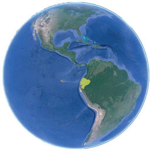
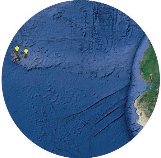
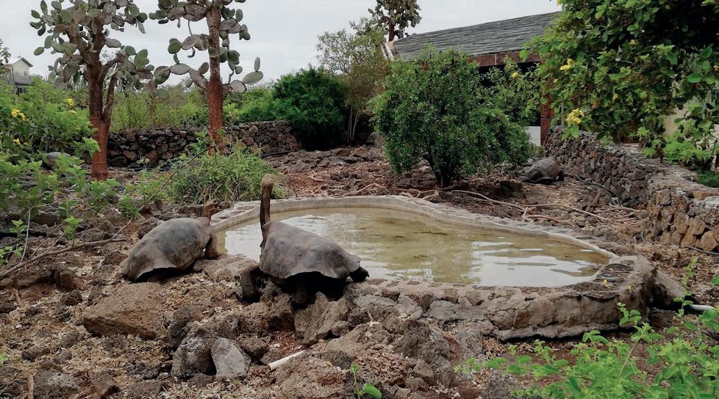
We take a map of the world and try to put our finger along the equator, off the coast of Ecuador, in line with those green splodges scattered in the middle of the Pacific Ocean. It seems almost impossible to even think about trying to reach somewhere so remote. And yet, after a twenty-hour journey involving two stopovers, we land in one of the few places in the world where nature can be still said to be truly untainted: the archipelago of the Galapagos. Our first stop is the island of San Cristobal, dedicated to Saint Christopher, the patron saint of sailors. The authenticity that characterises these islands emerges the moment you leave the airport: we understand immediately that we have reached a corner of the world far removed from our idea of space and time, a place where it is nature that beats out the rhythm of everyday life. Tranquillity envelopes us and creates a delightful, relaxing atmosphere. Straight away, we come across some of the animals that will accompany us for the rest of the journey and which represent an unusual feature of these islands: sea lions, swallow-tailed gulls, tropical birds and sea iguanas. We will have to wait a few days yet, though, before we can get up close and personal with the giant tortoises. Charles Darwin: we all know him for his masterpiece, On the Origin of Species, one of the cornerstones of the history of biology and science in general. It was specifically his observations of the fauna of the Galapagos, and in


The morphological characteristics of the volcanic galleries explored on the island of Santa Cruz
particular of their tortoises, that provided the basic inspiration for Darwin’s theory of natural selection. Speaking of evolution, we cannot fail to take into account the fact that the Galapagos are relatively young islands in geological terms; the oldest of them dates back just four million years – a very short time frame compared to the average age of the continents, which is around 65 million years. The archipelago encompasses thirteen islands, seven larger and seven smaller, scattered north and south of the equator, which passes through the northern part of the largest island, Isabela. The most fascinating aspect of these islands is their volcanic origin. The archipelago is located on the Nazca plate, one of the various plates that form the earth’s crust. The element that made the formation of these islands possible was the presence of a hotspot, a portion of the terrestrial crust in which volcanic activity is generated due to the rising currents of hot material that make their way up from the upper layer of the mantle. At this point, the heat melted part of the crust, giving rise to eruptions that led to the formation of the islands. Driven by the tectonic thrusts, the plate moved slowly east, whereas the hotspot remained where it was. Looking at the development over time, it is clear, then, that the islands to the east are the oldest, whereas those to the west, such as Isabela and Fernandina, are the youngest. It is those islands that correspond to this day to the hotspot and are still subject to frequent volcanic activity. Volcanic eruptions are often impressive, and they can be observed on the surface, but associated with them is a subterranean world that is equally fascinating – the world of lava tunnels. These are long underground ducts created by the lava flowing down the sides of volcanos; protected by a crust of surface solidification, the lava can flow along these conduits, hollowing them out, leaving in its wake underground cavities that are sometimes very large indeed. This is the raison d’être for our journey into the heart of these islands. Three years on from the first survey, in the summer of 2019 we participated in an expedition orchestrated by the American speleologists of the Cave Research Foundation, which for several years has been exploring the forests of the archipelago in search of these caves. The main objective of the expedition is to push ahead with the research on the island of Santa Cruz, the second largest in the archipelago after Isabela. From San Cristobal, we move on to hook up with the group of Americans. Despite the small number of days available, we explore

and survey almost three kilometres of new galleries. The caves are located just a few metres below the external surface; in certain cases, they are easily accessible through surface collapses that are located right in the middle of the forest. The search for these collapses, though, ends up being one of the most adventurous experiences: their location is not known, and for this reason we have recourse to GPS devices, not just to find them first time around but also to find them again on the way back. The unstable soil and the thick vegetation demand that we use all of our expertise when moving around. Our guides, local farmers who know the area inside out, accompany us, clearing the way ahead with their machetes; in the meantime, we take a break every now and then to record the co-ordinates on the external accesses and to evaluate their exploratory potential. Often, the collapses have caused the galleries below to cave in, completely blocking the way and making access to the subterranean system difficult, if not impossible. Equipped with a laser scanner, we conduct the 3D survey of the most interesting tracts of the caves we are investigating. During the operations, we do not have time to stop and observe the development of the ducts and the marks left by the flow and then by the solidification of the lava. The sinuous curves and the secondary cave sections trigger daydreams, and we are soon imagining fluid, boiling lava flows in those ducts. At the end of the explorations, we make the most of the opportunity to visit the Charles Darwin Research Centre in Santa Cruz. Here at last we can marvel first-hand at the giant tortoises, which are true titans, aged over one hundred. We then move on to Isabela, the wildest of all the islands. We instantly get the impression that we have been thrown into another dimension – here, nature really does take centre-stage. The island is the result of the fusion of six volcanos, aligned in a north-westerly/ south-easterly direction, and the resultant shape is reminiscent of a seahorse. We cannot resist the temptation to see with our own eyes at least one of these volcanos, and we make it to the Sierra Negra, which is amongst the most active of the entire archipelago. The last eruption occurred as recently as June 2018 and continued throughout that summer. On reaching the summit, we stop to look to the north, towards the volcano that rises up majestically, immersed in the morning mist, and we let ourselves be carried away by daydreams of future explorations: this is the Wolf Volcano (aka Mount Whiton), at 1707 metres the tallest in the Galapagos. This is a demanding place, where nature is uncontaminated, and is home to unique species not found even on the rest of the island; there is a volcano and, in all likelihood, a multitude of unexplored caves – quite enough to whet our appetite. Isabela island also plays host to the headquarters of the Parque Nacional Galápagos, and here we meet with one of the managers to plan out our future operations and agree on low-impact methods of exploration. Our journey into the heart of the Galapagos reaches its conclusion. We head back home with the usual feeling – that we have seen far too little. We are more determined than ever that we will have to come back again soon.
This expedition was carried out in partnership with the Cave Research Foundation and the Parque Nacional Galápagos, with the support of the Vigea company for the 3D laser scanner surveys, and the Gaibana company for the provision of footwear tested by the astronauts of the European Space Agency.


