2 minute read
PHYSICAL ASSESSMENT | URBAN DESIGN


Urban Design Assessment
At the time Oxford Circle was constructed there was a movement to build shopping centers around the car. Trends have changed over the decades and consumers are looking for a lively, pedestrian-friendly, community-oriented space that engages the surrounding neighborhood.
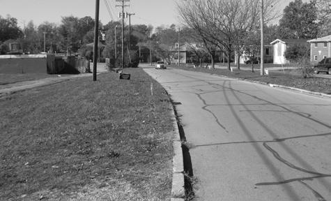
Although Oxford Circle links to a number of residential streets it lacks a clear pedestrian zone and is missing sidewalks around the perimeter of the site. This lack of sidewalks also means that the public cannot access the two halves of the site except along the narrow sidewalks on Versailles Road. The right-of-way is generous around Oxford Circle, even containing a vegetated median for a portion of its length. However, there are no clear markings to indicate whether the roadway is one or two lanes in some areas, which causes confusion to motorists and poses a safety issue for pedestrians forced to walk in the street. There is also no delineation given for bicycle lanes.
There is no clear main entrance to the Oxford Circle commercial center, and instead cars enter from a number of worn driveways, cutting across poorly marked parking lots to their destination. These oversized surface parking lots are the first hindrance to any clear pedestrian or vehicular circulation pattern, which often leads to conflicts of who has the right-of-way. Internal sidewalks exist only within the first few feet of the façade of the buildings, with no true connections between groupings of structures. The amount of impervious surface is a hindrance for circulatory, ecological, and aesthetic reasons. Parking is unfocused and not effectively tied to the commercial businesses or shared in a manner that could consolidate the amount of asphalt. Great efforts have also been made to clean up Vaughn’s Branch and the adjacent parking area.

The businesses along Versailles Road turn their backs on the businesses in the Circle, and pedestrian and vehicular movement across the various properties is challenged. The large number of property owners makes it difficult to accomplish large-scale improvements. The buildings within the area fail to address Oxford Circle or the surrounding neighborhood. Complimentary uses are spread across the site and either force a customer to park multiple times, traverse a sea of parking or walk in the street to reach additional businesses.

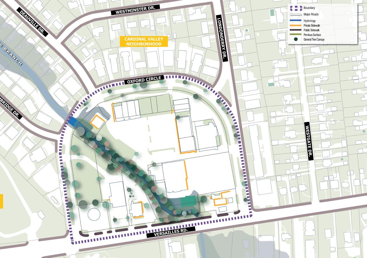
Public Space Assessment
Oxford Circle has the advantage of having a natural amenity and a large amount of undeveloped / underutilized space in an attractive location which has the opportunity to become a successful gathering site for the community. The natural amenity in this case being Vaughn’s Branch, a tributary of Wolf Run, which runs northwest to southeast bisecting the site with areas on either side filled with vegetation and green open space, (see adjacent photo). Making use of the greenspace along Vaughn’s Branch as a recreational space will help to enhance the area’s appearance.
The Existing Public Space Assessments map provides information on existing sidewalks, major roads, hydrology and pervious surfaces. These elements will be useful in determining the best areas for public gatherings/use. One of the most notable missing amenities are sidewalks along Oxford Circle to form a continuous path around and throughout the commercial core that would encourage the public to explore and circulate. Lastly, Oxford Circle currently has a large portion of its site as impervious surface. Breaking down the scale will be critical in creating public nodes and pedestrian paths throughout the site.