Address: No. 50, Chengdong Road, Taihang East Street, Changzhi City, Shanxi Province, China 046000 Phone: +(65) 93598647
E-mail: e1168897@u.nus.edu
Education: Southeast University, Nanjing, China 2018.09 - 2023.07
Bachelor of Engineering in Landscape Architecture
National University of Singapore, Singapore 2023.08 - now Master of Landscape Atchitecture
[ CONTENTS ]
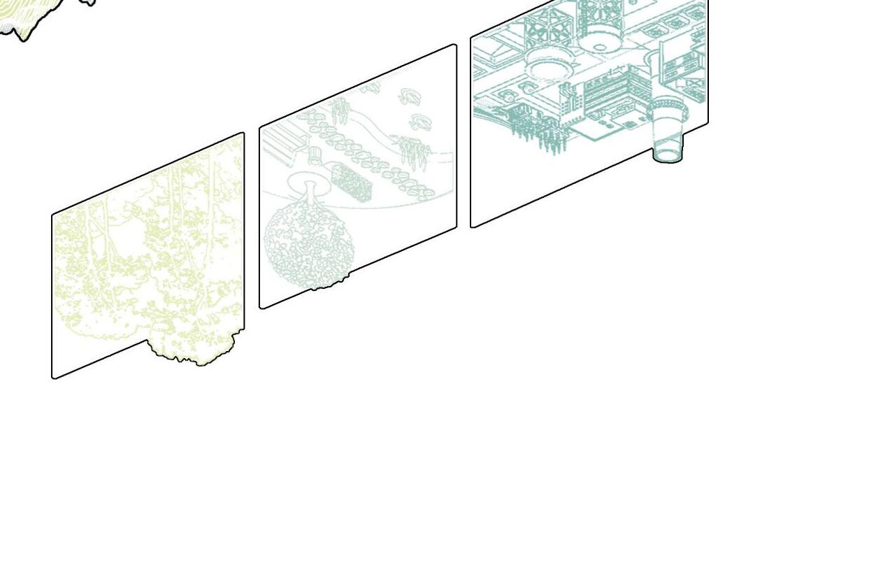
01 / HEALING EARTH SCARS
A mine park design based on GIS analysis 02 - 13
02 / INVERTED PYRAMIDS
A digital deisgn for a community that makes a living from e-waste 14 - 27
03 / WEAVING RIVERS
A resilient landscape design oriented by flood adaptability 28 - 39
[ Chenxi Wang ]
Healing Earth Scars
Mine park design based on GIS analysis
Acadamic Work
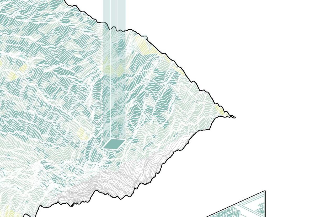
Jijiagou Village, Taiyuan, Shanxi, China
Individual Work
Tutor: Pang Li
ConstructionElevenAssessment OriginalTopography
April 2020
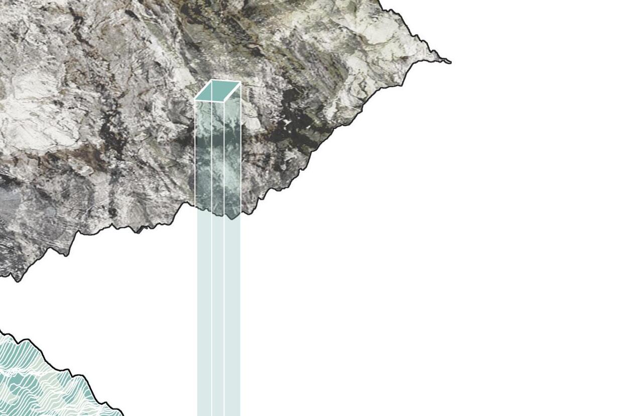
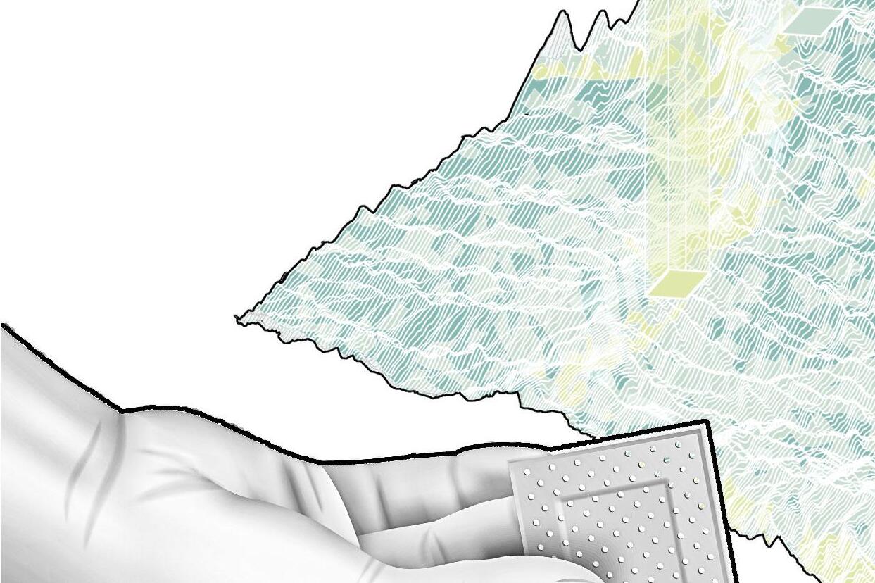
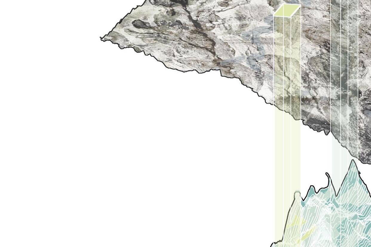
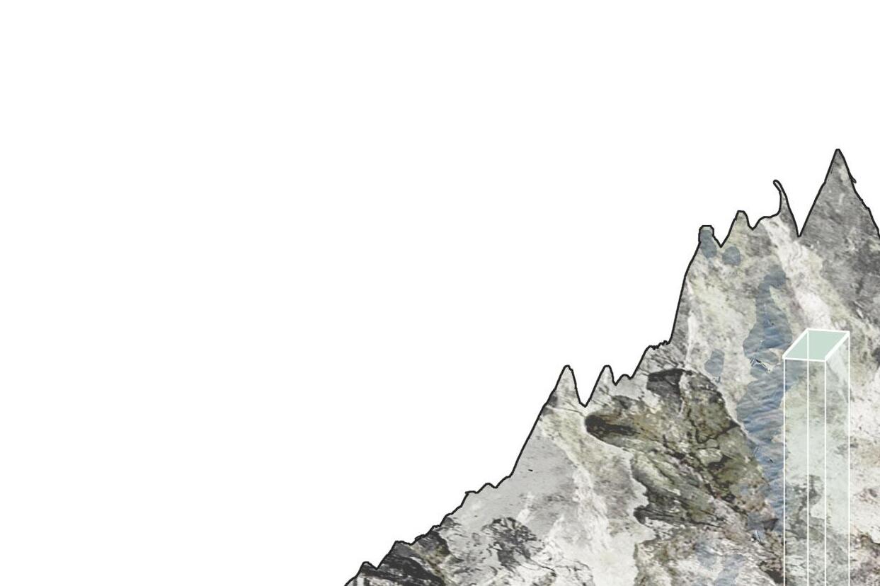
The site locates near Jijiagou Village in Xishan District, Wanbailin District, Taiyuan City, Shanxi Province, covering an area of 396hm2. The ecological problems caused by coal mine goaf in this area are the most prominent. In the regional context of the resource-based regions in Shanxi Province, affected by China's policy of vigorously developing ecological civilization, the Xishan area is facing the need for environmental restoration and scenic spot construction. With people's pursuit of quality of life, suburban parks with a good environment have gradually become the places of leisure and entertainment that people yearn for.
Due to the site's large-scale geographical scope and complex mountainous terrain, to achieve ecological restoration, activation of regional tourism resources, and objective and reasonable regional landscape transformation, this project adopts the GIS to analyze this site. After analyzing the slope, elevation, aspect, and land use of the restricted terrain, it is more reasonable to decide on the landscape reconstruction process of the abandoned coal mine land.
Coal production
Coal import
Coal reserves Coal Emport Proportion of coal exports to China in 2020
Coal exports to China showed an increasing trend from 2019 to 2020
Coal exports to China showed an decreasing trend from 2019 to 2020
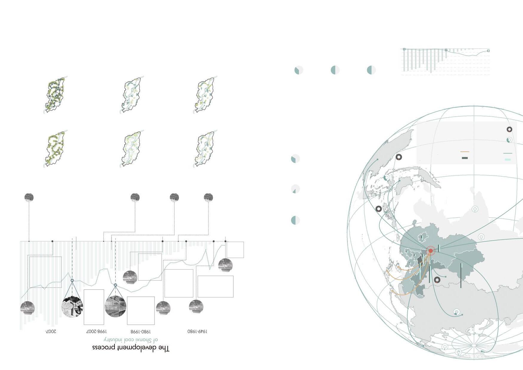
China's coal industry
Coal export /Coal import proportion /Coal production and reserves in China
Chinese coal mainly exports to Asian countries such as Japan and Korea.
The source countries of China's coal imports mainly include Indonesia, Australia, Russia, Mongolia, etc
Regarding the distribution and reserves of coal resources, China's regional distribution is highly uneven, mainly distributed in Xinjiang, Inner Mongolia, and Shanxi.
China accounts for 50% of the world's coal consumption.
China accounts for 13.3% of the world’s coal reserves.
China accounts for 51% of the world’s coal production.
In current situation
China's oil and natural gas resources are relatively insufficient, with proven oil recoverable reserves accounting for only 2.4% of the world's total and natural gas accounting for 1.2%. In comparison, coal accounts for about 14%. Such resource conditions determine that China's energy structure dominates by coal.
The development process of Shanxi coal industry
China's coal imports and exports
Before 2007, China imported a small amount of coal and was a coal exporter. Since 2007, China's coal exports have been lower than imports, becoming a coal importer.
China’s energy structure According to the graphs above, we can see that the
energy
in China is coal.
The Asian Financial Crisis The International financial crisis
The three-year Great Leap Forward The foun -dation of New China The Cultural Revolution The reform and openingup policy The National Mine Ecological Environment Restoration and Governance Site Meeting
After 1970, the level of coal mining mechanization in Shanxi improved, and coal production increased. In 1998, Shanxi adjusted the coal production and transportation order and closed unreasonable coal mines.
Phased Governance
The restoration will carry out in stages. It expects the green space construction of mines with less ecological damage and the fundamental ecological restoration will be completed by 2040.
After 2000, Shanxi carried out the integration of coal mine resources, and coal production gradually recovered.
"Shanxi Provincial Mine Environmental Governance and Restoration Fund Management Measures" forms a solid institutional constraint on the performance of mining rights holders on the obligation of mine ecological restoration.
Landscape Planning of Shanxi abandoned
mines
Ecological Restoration
According to the destruction of abandoned mines in Shanxi, the areas that need water restoration and landform landscape reconstruction will be defined in 2040.
Green Space System &Tourism Linkage
Through the landscape construction of abandoned mines, it is expected that in 2040, the mine parks will link the ecotourism resources with the surrounding parks to form an eco-tourism network system.
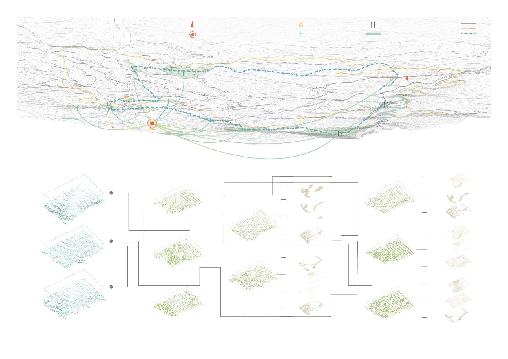
GIS analysis for the region
The evaluation level model is established by the AHRP method, and the weights of primary and secondary factors are determined by the DELPHI method. After that, GIS was used for weighted overlay analysis.
Duerping
Xishan Changfeng
Wanberlin Ecopark
Biaoqiaogou
Site analysis based on GIS
Second-order FactorsFirst-order Factors
The point in the middle of the pixel grid is selected as the sample point, and the construction suitability index at the sample point with high height and dark color is high.
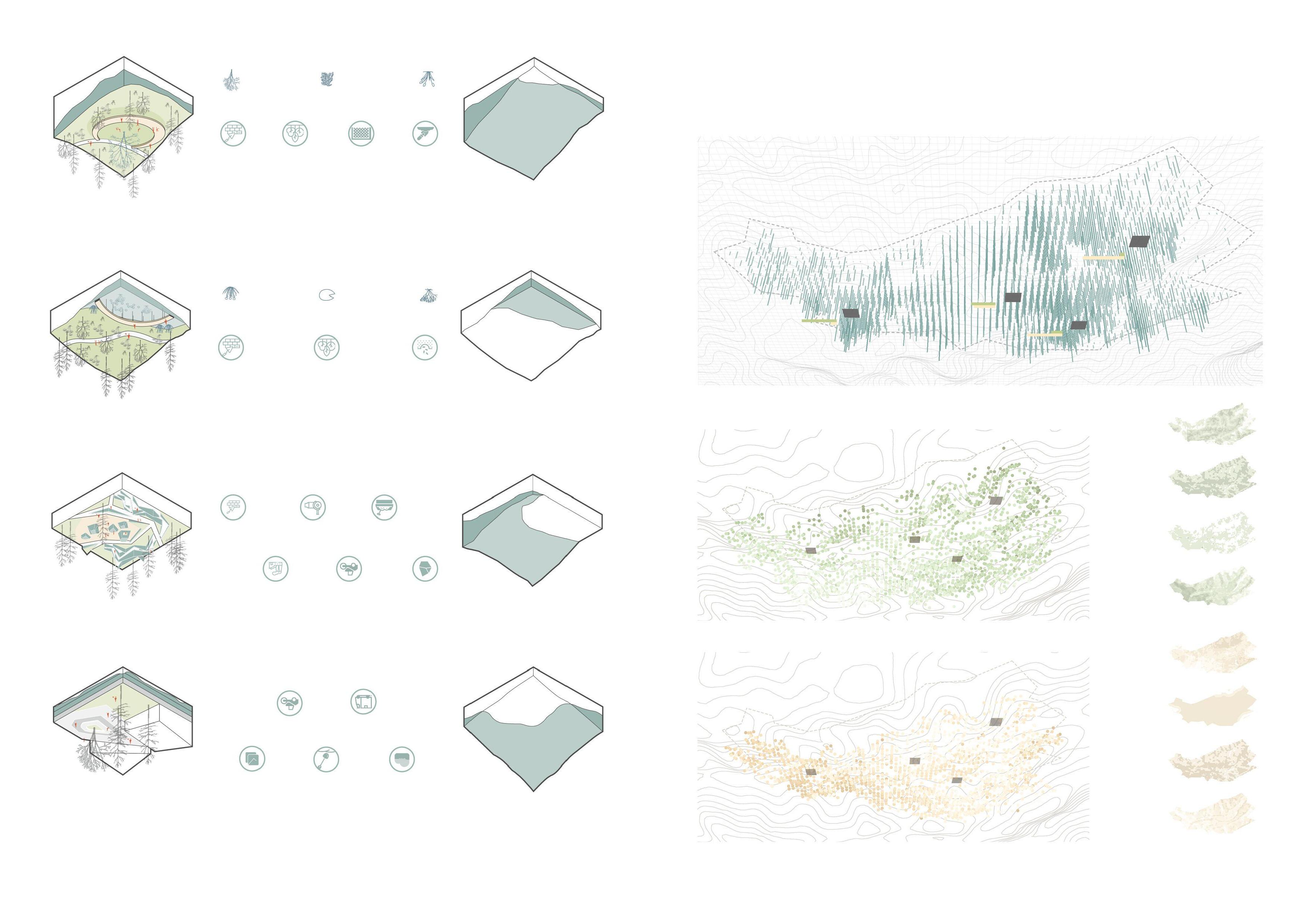
Design Strategies
Strategy1 Coal Mine Museum
Gangue Backfill
Backfilling and subgrade materials enable the bulk consumption of gangue with low pollutant content, reducing the cost of construction of roadbeds, foundations, or dam foundations and reducing the land occupied.
mountain selection
Strategy2 Mine Exploration Park
Gangue Reusage
Gangue can be used to prepare building materials to build park structures, mainly brick making, etc. When making bricks, the explosive substance of gangue can save coal, forming a virtuous circle.
×0.5
The point in the middle of the image grid is selected as the sample point, and the ecological sensitivity index of the sample point with high height and dark color is high.
Strategy3 Artificial Wetland Park
Gangue Acid Wastewater Treatment
Gangue can produce acidic wastewater, which causes soil, surface water, and groundwater pollution and seriously affects plant growth. Alkaline materials such as fly ash can be sown to neutralize with acidic substances in gangue, followed by the construction of wetlands.
Strategy4 Land Art
Ecological Restoration of Gangue Mountains
For gangue that cannot be comprehensively utilized, ecological restoration is required. Gangue mountain has a significant slope area; due to the poor engineering stability, ecological planting blanket technology can be used to enhance strength and use plant configuration to fix the soil further. Then gangue mountains can carry out a certain degree of engineering construction.
Results Analysis
According to the GIS analysis results, the four more representative sites in the site were selected as samples. These four samples adopted different design strategies.
Sample 1 has excellent construction suitability, and the ecological sensitivity is extremely low.
Sample 2 has a high overall value, high construction suitability, and low ecological sensitivity.
Sample 3 has higher construction suitability and higher ecological sensitivity.
Sample 4 has extremely low construction suitability and high ecological sensitivity.
Sample 1
Sample 2
Sample 3
Sample 4
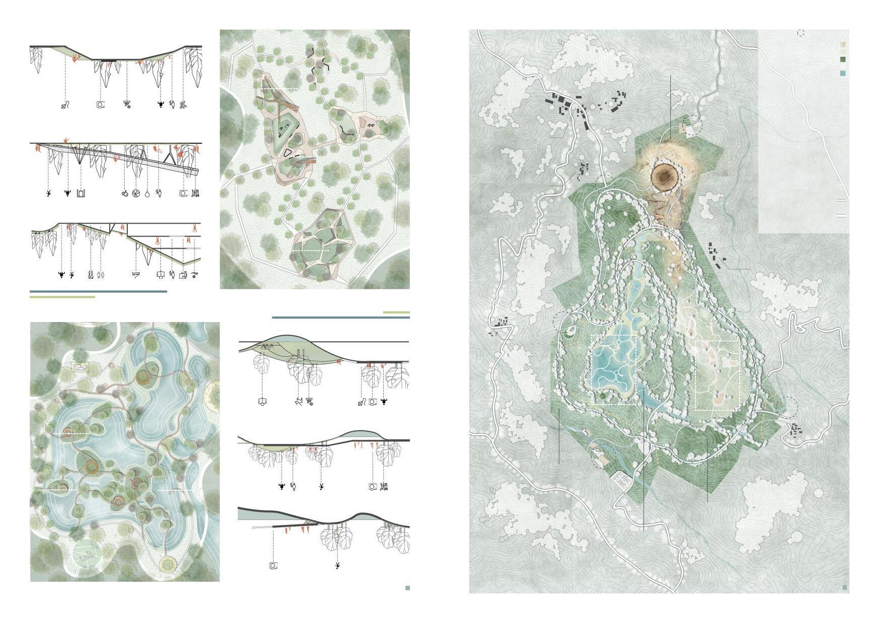
Wetland Ecological Park Area
The wetland shall be constructed using Design Strategy 3 for the subsided land resulting from coal-mine with high ecological sensitivity in the site to solve the problem of water pollution caused by coal mining. The coal gangue is backfilled as soil, nourishing the growth of plants during the long natural succession. The artificial wetland park can also bring tourists a relaxed and pleasant tour experience.
Wetland Plant Configuration
The collapse area is close to the ponding revetment, and the ability to resist waterlogging and pollution should be considered when selecting the varieties of trees. Aquatic plants with high purification capacity are planted in shallow water areas to improve the quality of water areas.
The theme park area of the mining area is built at the mine pit and coal gangue hill in the original site. The coal gangue is reused through the coal gangue utilization method proposed in Design Strategy 1 and Design Strategy 2. The mine pit style is presented to show the place's memory to visitors.
Mine Plant Configuration
Plants should choose plant varieties with tolerance to a wide range of pH values and drought and barren to improve the soil humidity and temperature conditions, establish the nutrient cycle between plants and soil, and ensure the success of the plant replantation strategy.
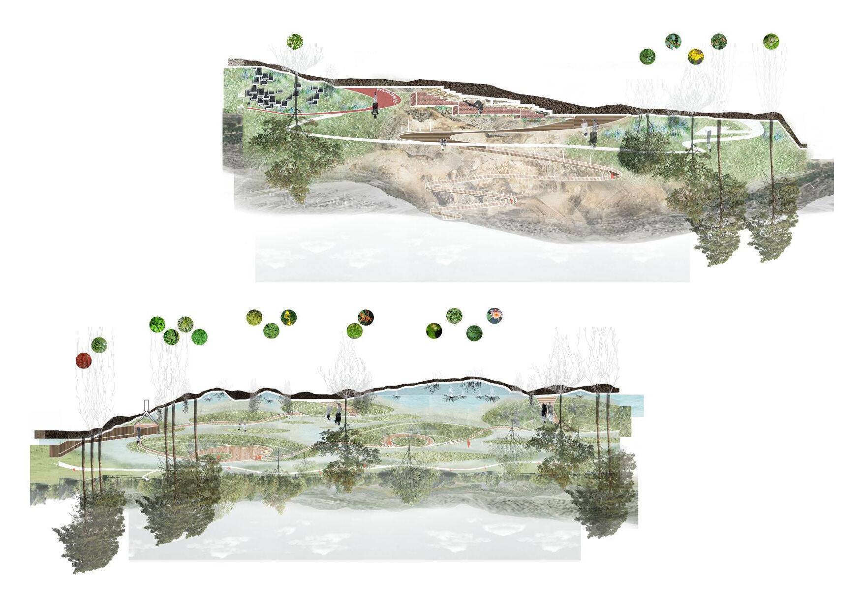
Mine Theme Park Area
Mine PitRunwayGangue reuse structure
Climbing Plank
Wetland Plants
Waterfront Rest Space Waterfront Plank
Rest Place in Forest
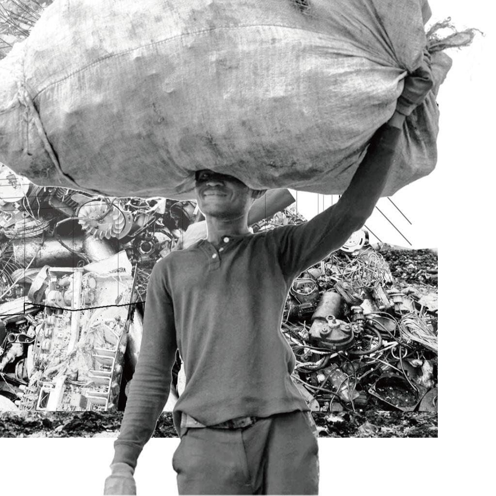
Inverted pyramids
A digital deisgn for a community that makes a living from e-waste
Acadamic Work
Agbogbloshie, Accra, Ghana
Individual Work
Tutor: Minzhi Lin; Jieping Chen October 2021
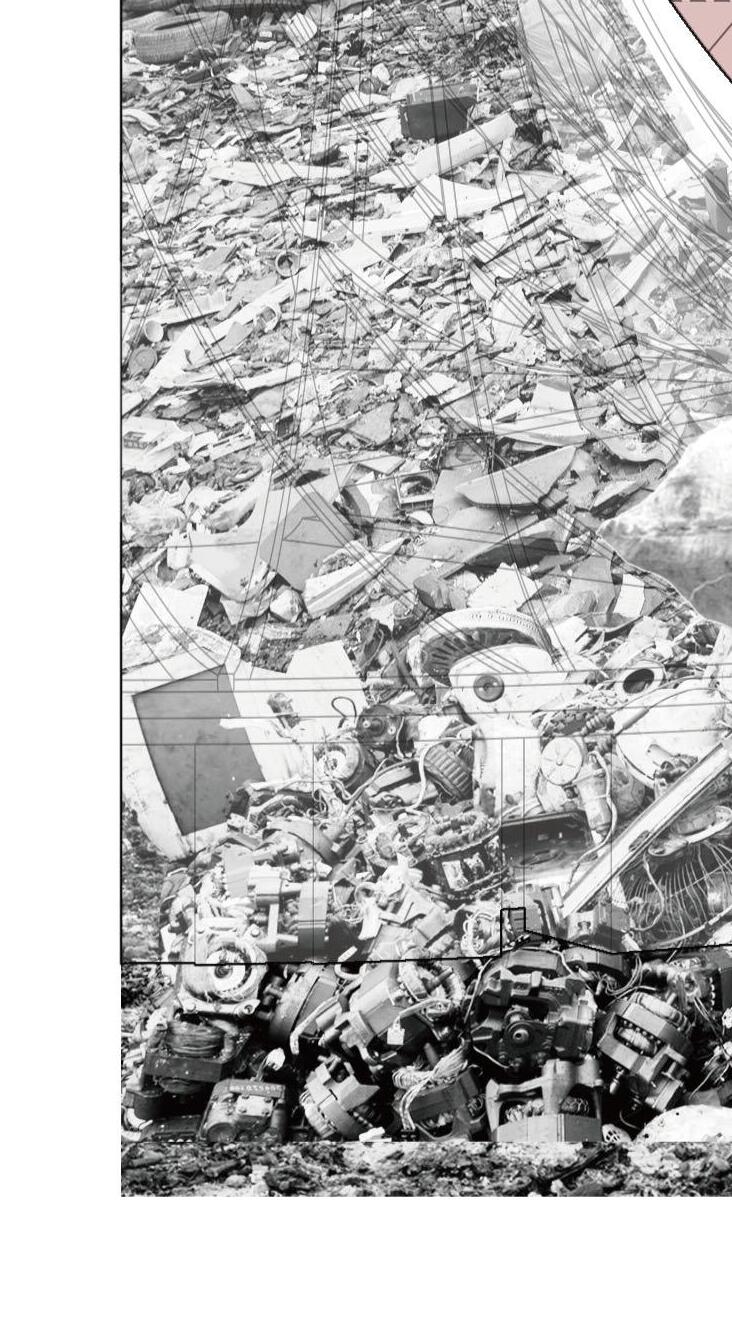
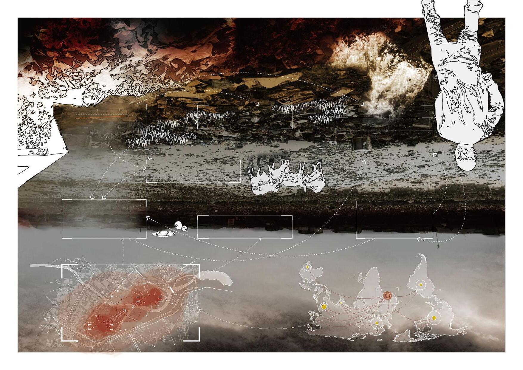
The site is controversial in the capital of Accra, Ghana; this used to be a lagoon where mangroves grew and is now a huge source of pollution. It is called "Agbogbloshie". Locals also nicknamed it "Sodom and Gomorrah," two cities condemned in the Bible. However, the poor living here believes this is a dignified land providing housing and job opportunities. Despite improper burning and dismantling, it has created devastating environmental and health problems for the entire capital. The dumping of e-waste brings them many discarded precious metals, which means a considerable income.
In 2021, the Ghanaian government incorporated it into its utopian urban planning, using it as part of the land for the construction of medical facilities, pulling out the slums on the site, and relocating the dumping site, which not only fails to fundamentally solve the pollution but completely defeat the dignity of the poor.
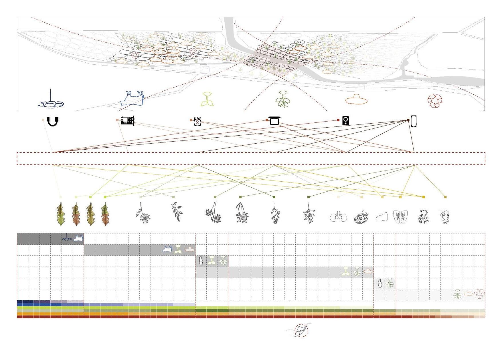
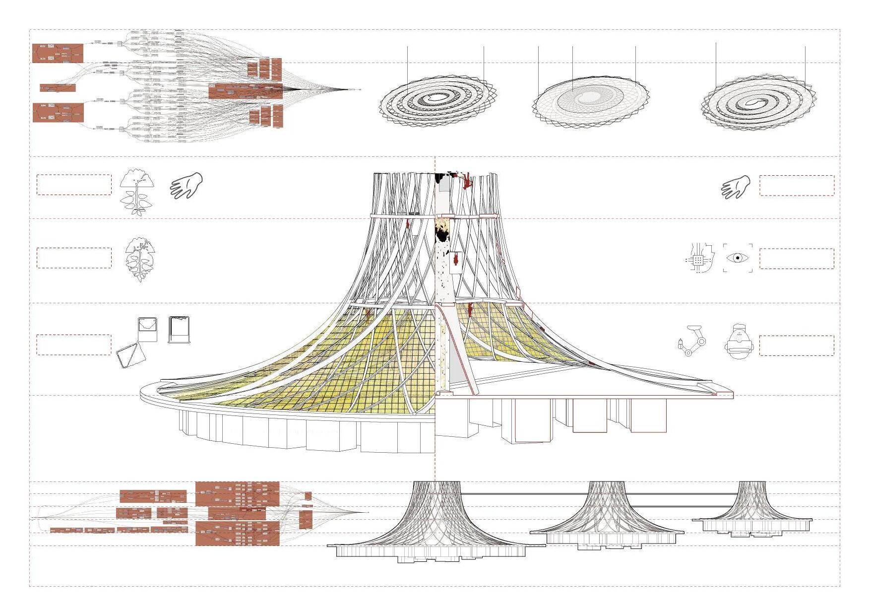
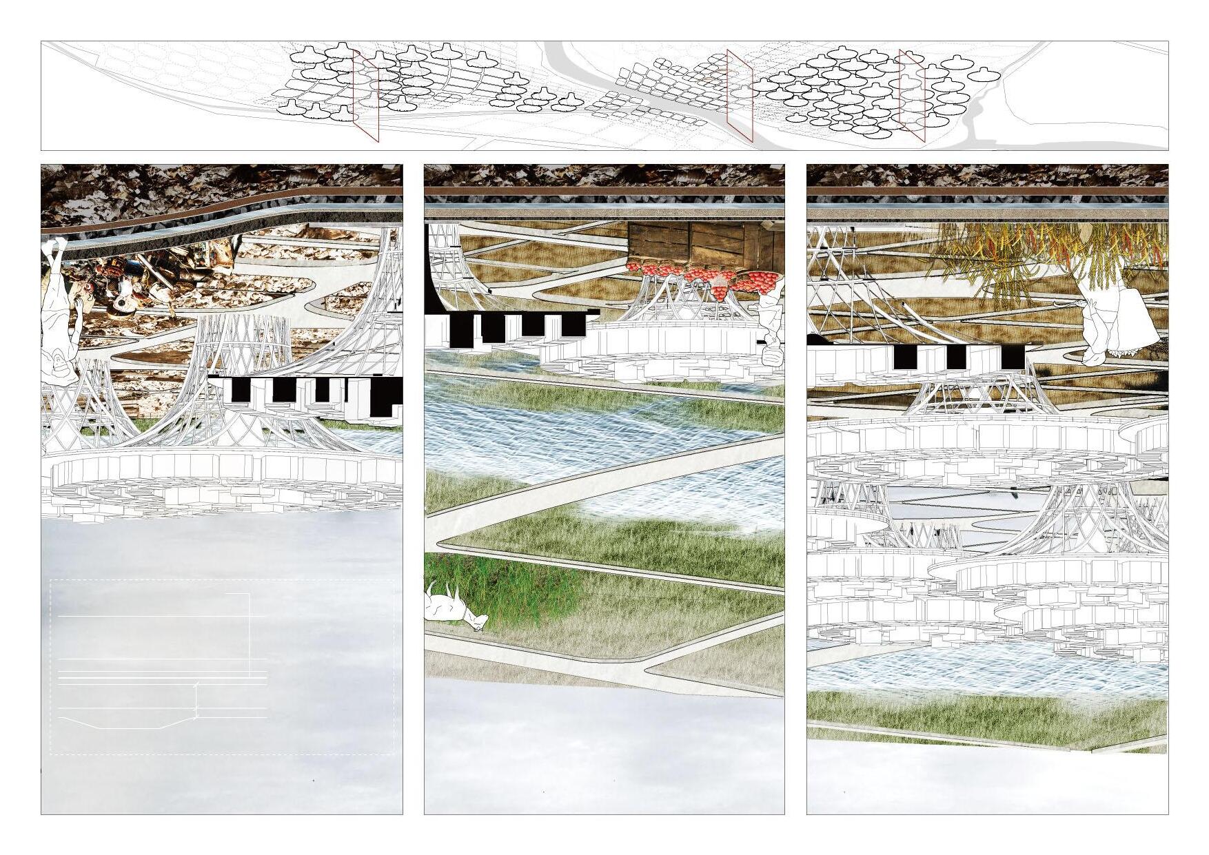
Based on site characteristics and unavoidable waste dumping, I use phytomining and automation to amplify its site characteristics as an e-waste disposal site and make the e-waste industry harmless while retaining its employment opportunities. At the same time, to ensure the living problem of the poor while using phytomining for soil remediation, the slum is lifted vertically in the form of a giant landscape structure, forming a utopian living form that places the poor on the upper layer. It is an ironic project that celebrates the impartiality of the landscape.
£7.83 / hour in the UK £1.29 / hour in Agbogbloshie
Modelling by Grasshopper Modelling by Grasshopper
The ash is mixed with water and electrolysis is then used to extract the metal from the mixture.
Hyperaccumulators are delivered into the second layer of the reaction for incineration.
The ash is then delivered to the third layer of the reaction.
Hyperaccumulators are grown in an area with high grade ores
Hyperaccumulators are harvested and transported into the bottom layer of the reaction by the poor.
Football FieldMusic Piazza
2ND CLASS ROADS
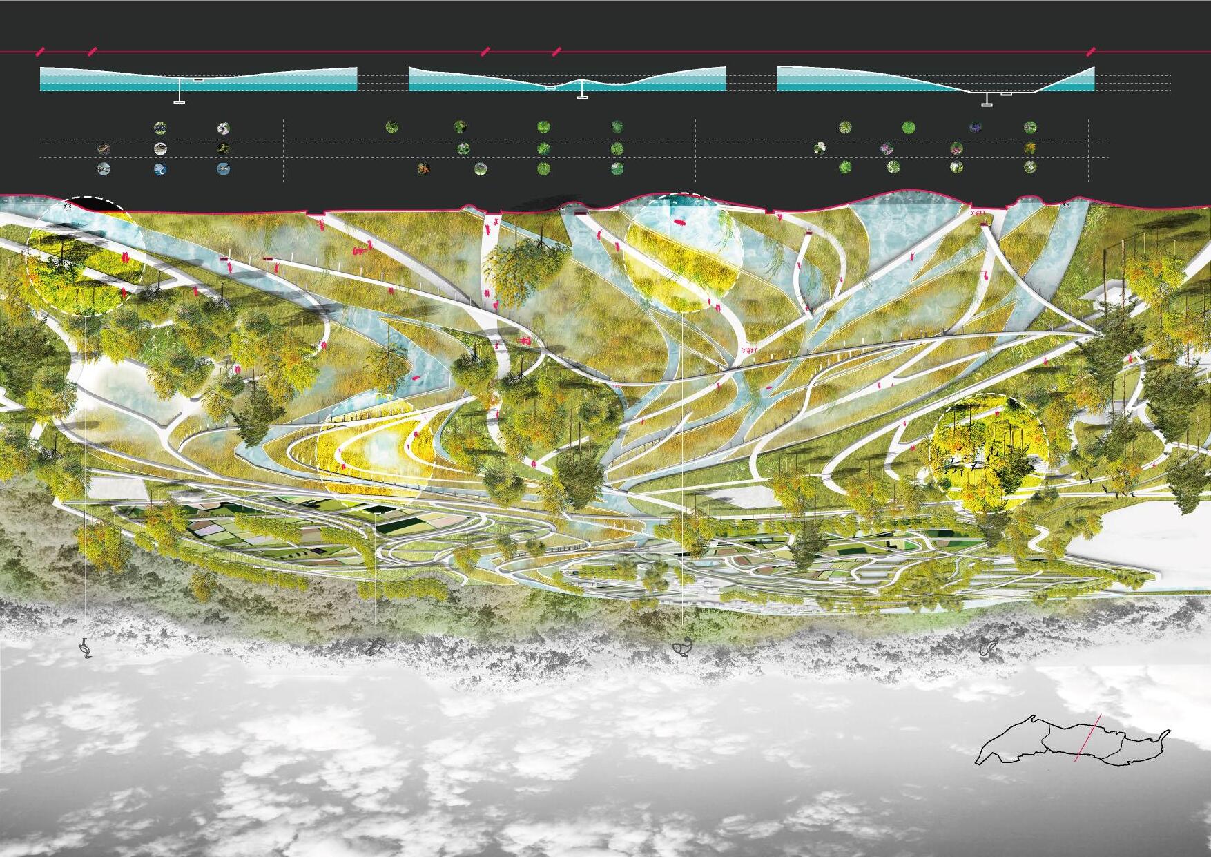
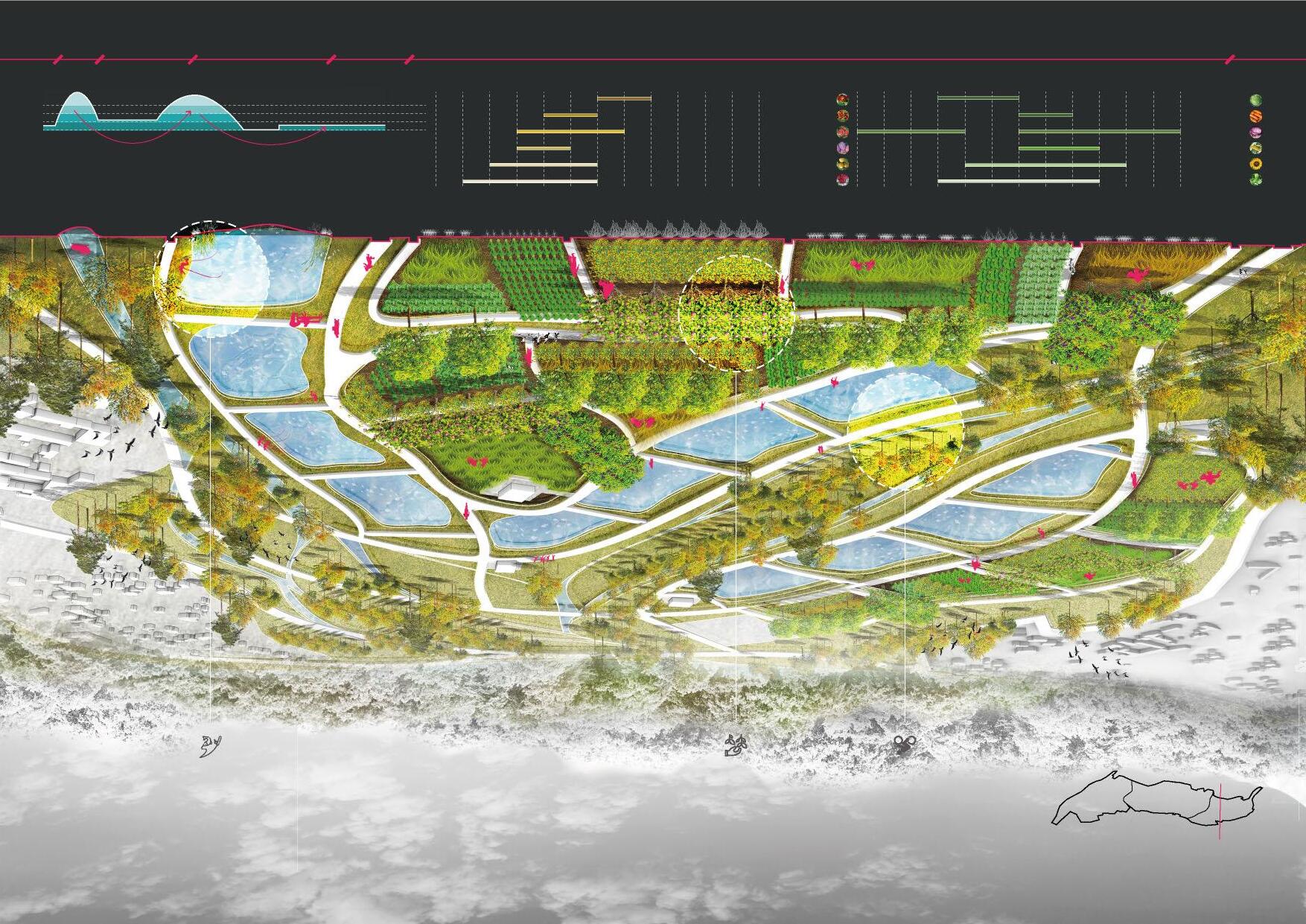
Weaving rivers
A resilient landscape design oriented by flood adaptability
Acadamic Work
Prague, The Czech Republic Individual Work
Tutor: Pang Li December 2022
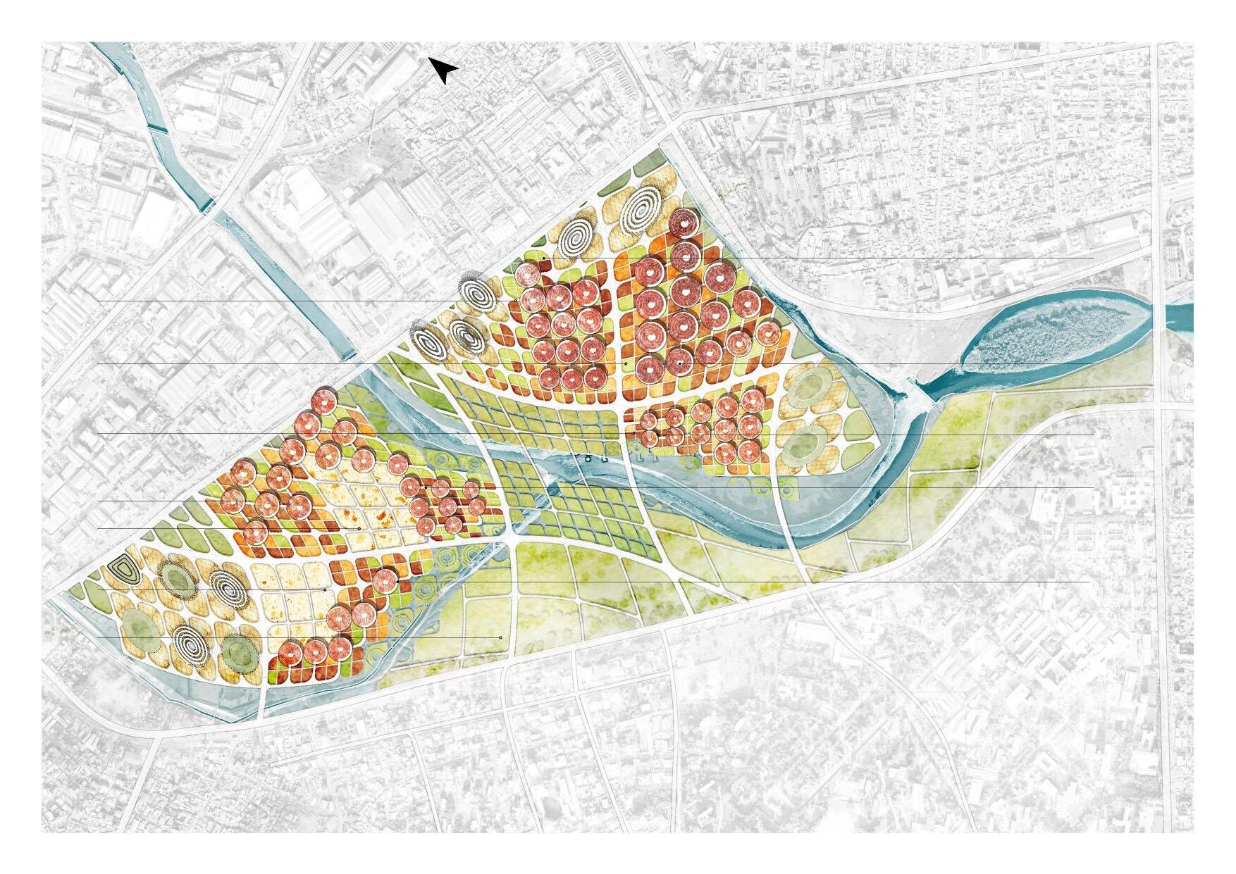
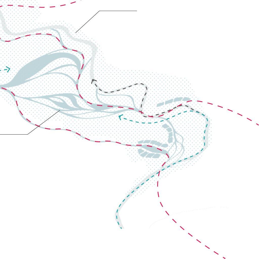
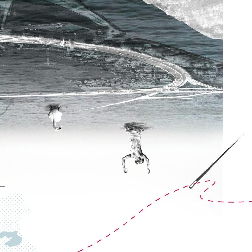
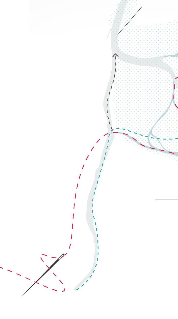
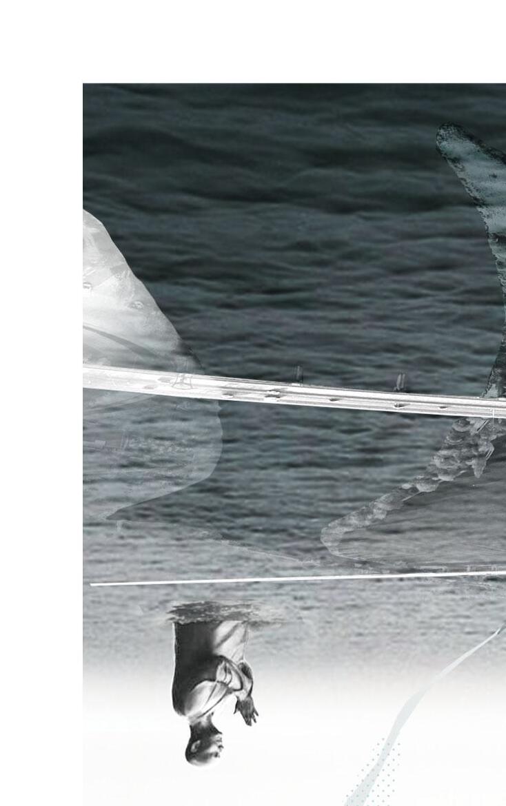
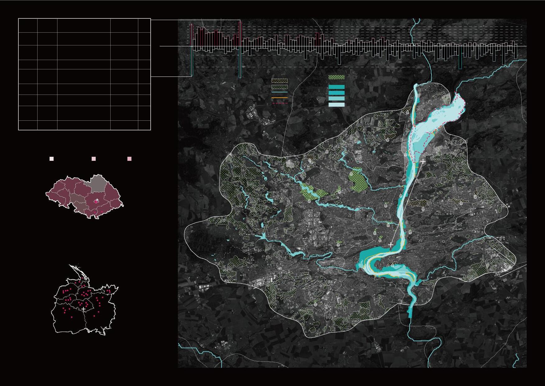
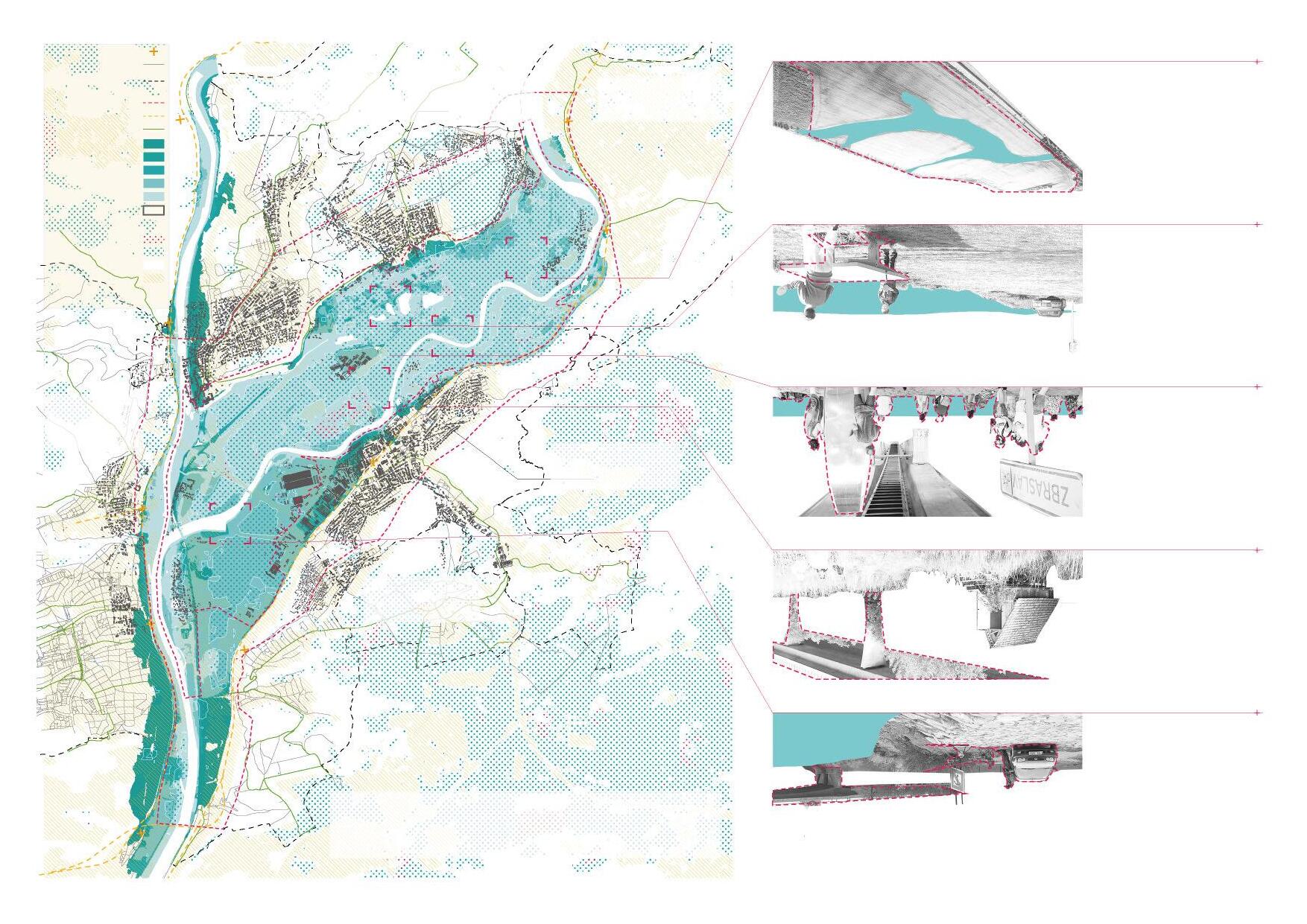
The project is located in the floodplain at the confluence of the Vltava River and Benounka River on the outskirts of Prague. Since the floodplain is located upstream of the Vltava river flowing through Prague, it is of great locational significance for preventing or delaying floodwaters from entering the center of Prague.
Due to the wrong river management in recent years, the historical river course has been artificially filled or shortened and straightened. Although the historic confluence of the Benounka river and Vltava river and other historic waterways are still visible and forced to be used during floods, they still cannot regulate or slow down the surge of river flow during heavy rains in any way.
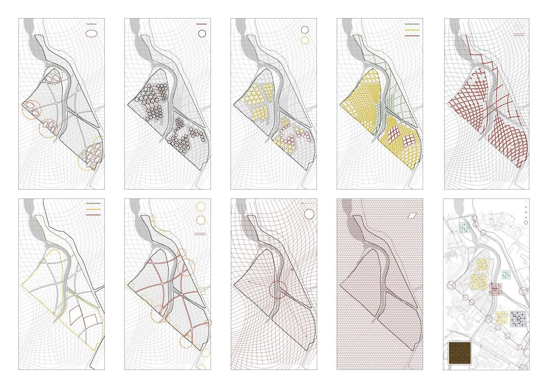
The planning goal of this project is to realize the resilience of the landscape, and the design strategies of flood resilience, economic resilience, and biodiversity resilience were put forward, and then the flood-adaptive design of suburban parks was carried out. Through diverse water landscape designs, the Vltava river and Benounka river were woven together to relieve the pressure of floods on a single waterway.
Vlta V va R vaR aR iver i iv
flood divection
Beno Ben unka River
The floodplain at the confluence of the Benounka and Vltava rivers is the most significantly affected by flooding in Prague, the capital of the Czech Republic. It is located in the upper reaches of the Vltava River that flows through Prague. The ecological regulation capacity and climate adaptability of this area are of great significance for improving urban resilience and strengthening the construction of Prague's flood control system.
Problem Analysis
The floodplain area spans five Prague city districts and a Central Bohemian town, Çernošice, and covers an area of approximately 1300 hectares. This presents an excellent opportunity for the development of recreational, sustainable farming and the development of valuable river views.
Lahovice
Radotín
Landscape Resilience
Biodiversity Arbor
Plants Populus tomentosa Carr Salix babylonica L. Ulmus pumila L. Metasequoia glyptostroboides Hu & W. C. Cheng
Forsythia viridissima Lindl. Lagerstroemia indica L. Hibiscus syriacus Linn. Gardenia jasminoides Ellis Medicago sativa L. Iris tectorum Maxim. Ophiopogon japonicus (Linn. f.) Ker-Gawl. Cyperaceae