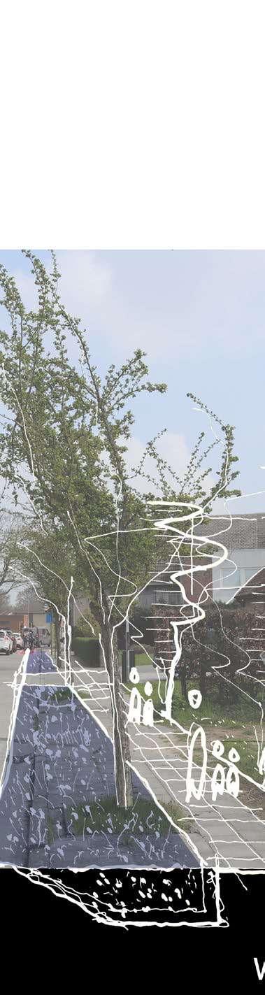
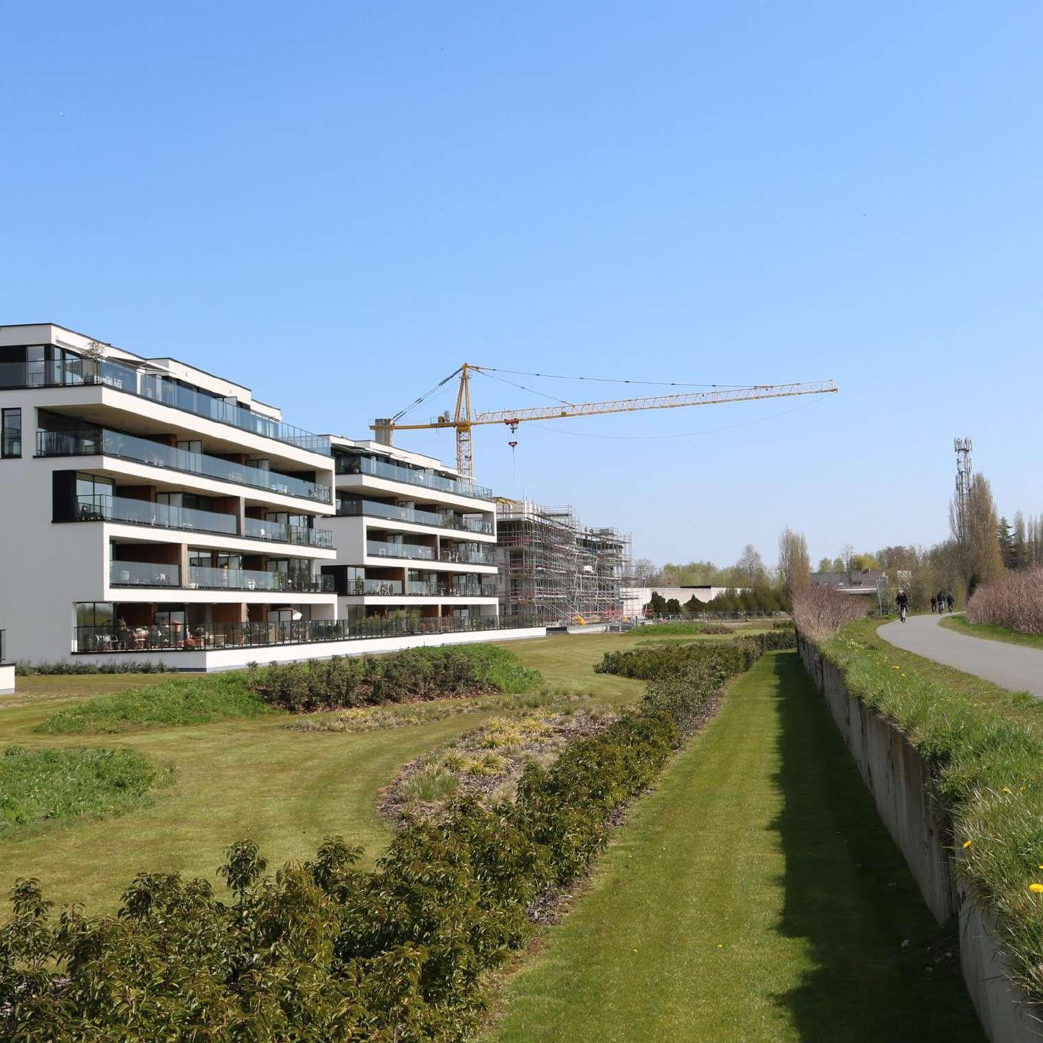
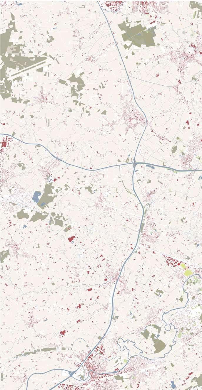
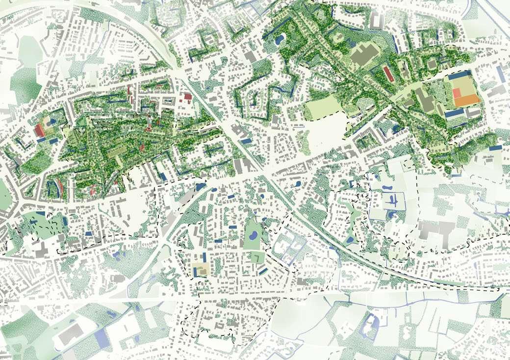
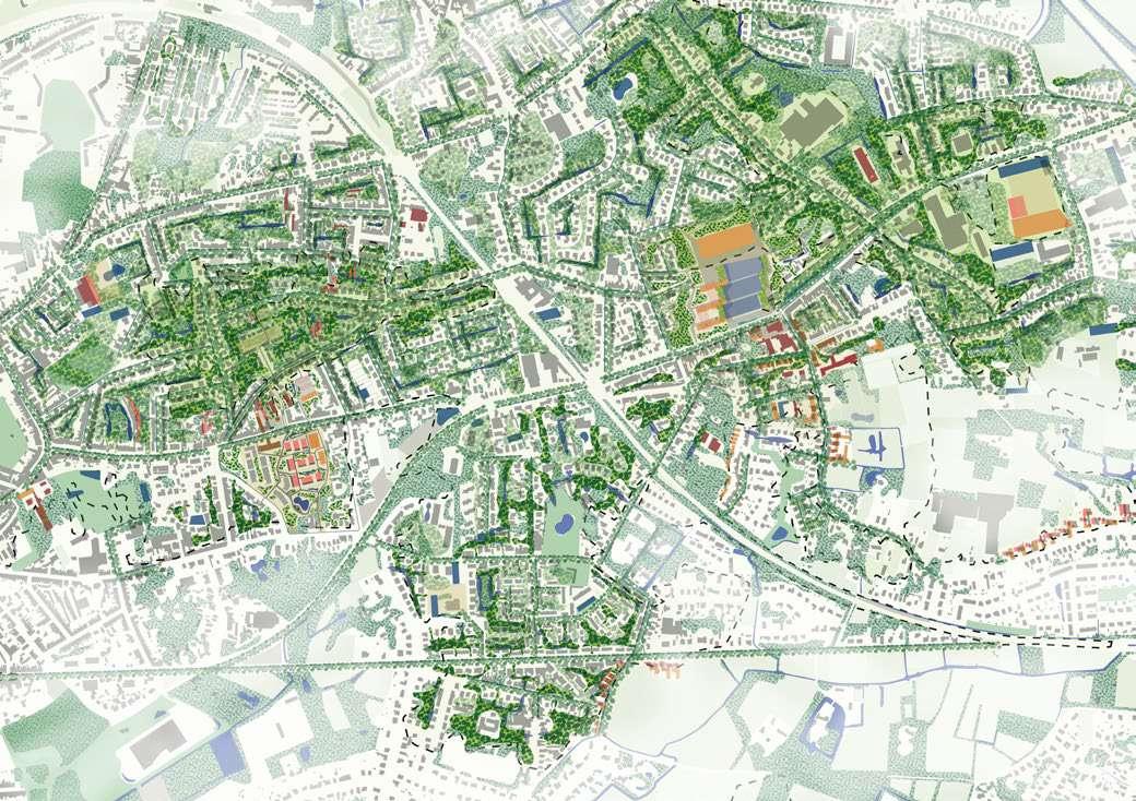
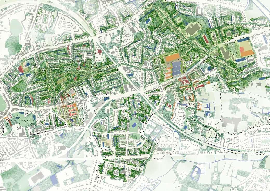
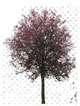
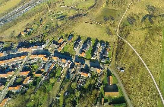
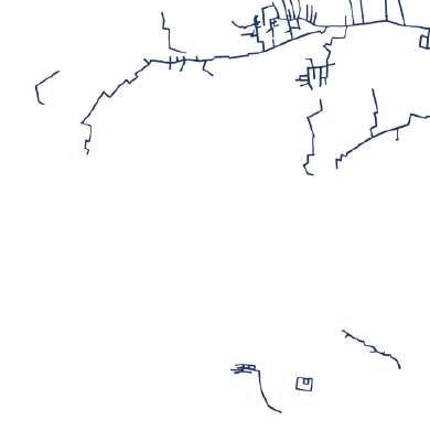
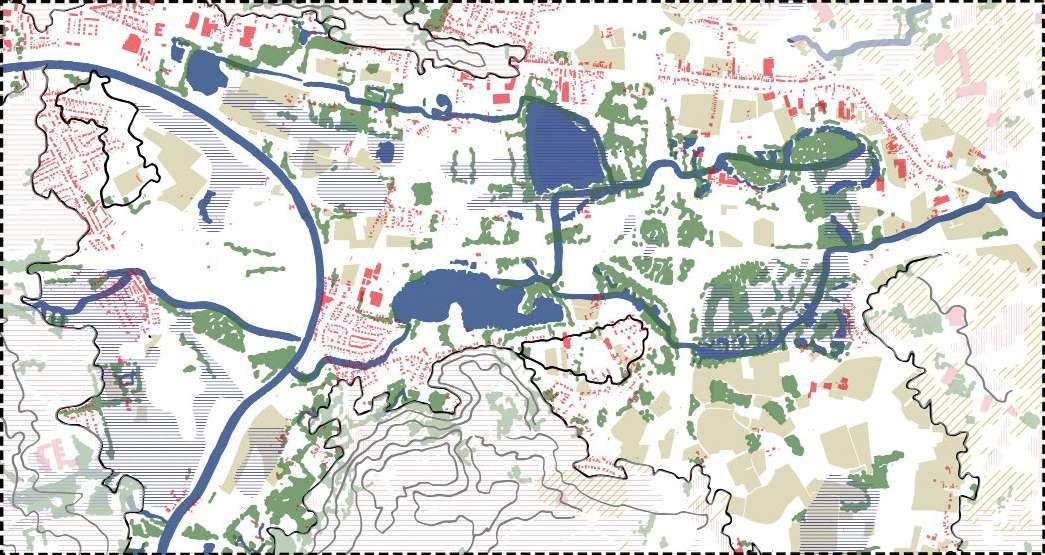
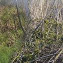
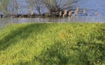
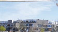
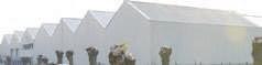
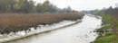
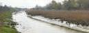
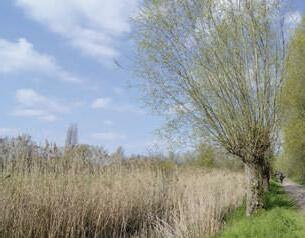
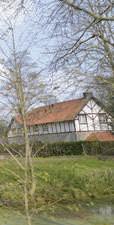
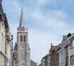
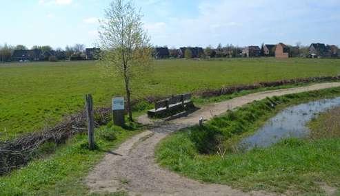
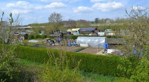
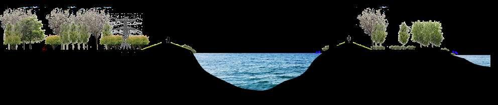
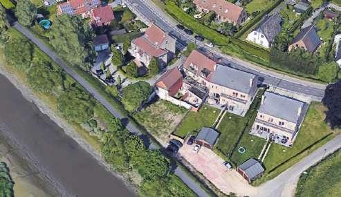
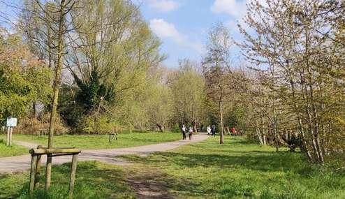
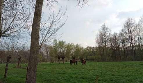
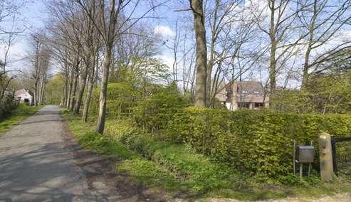
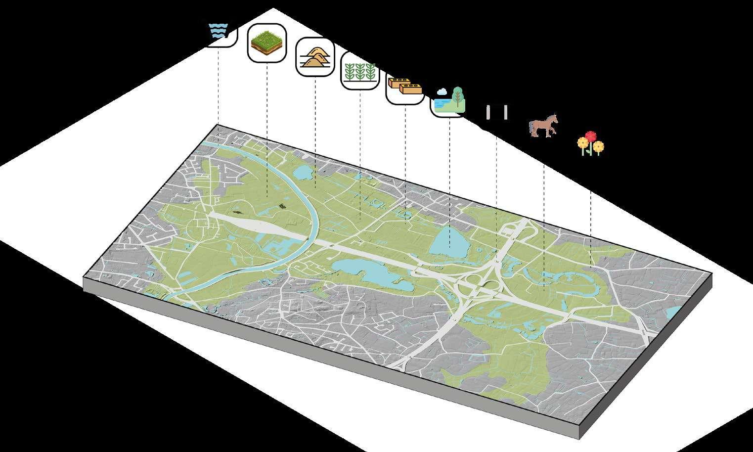
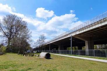
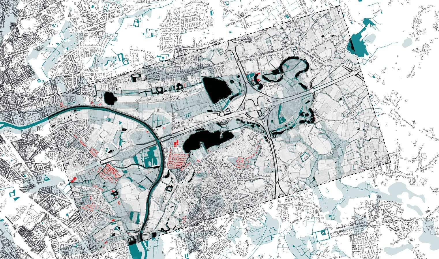
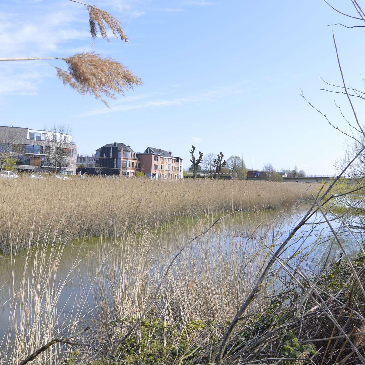
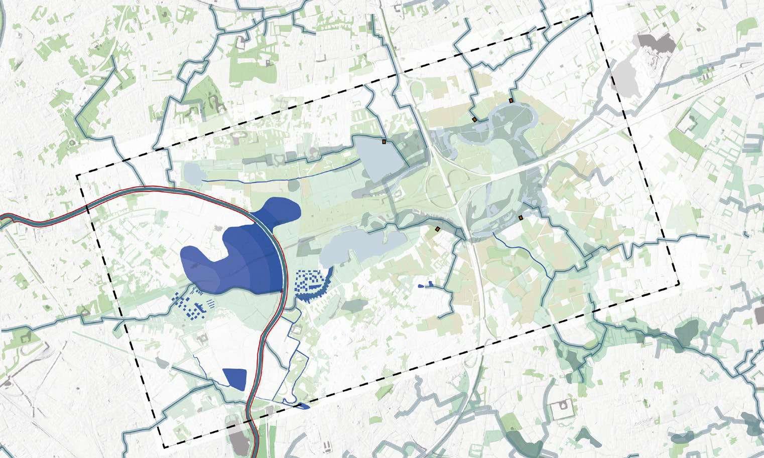
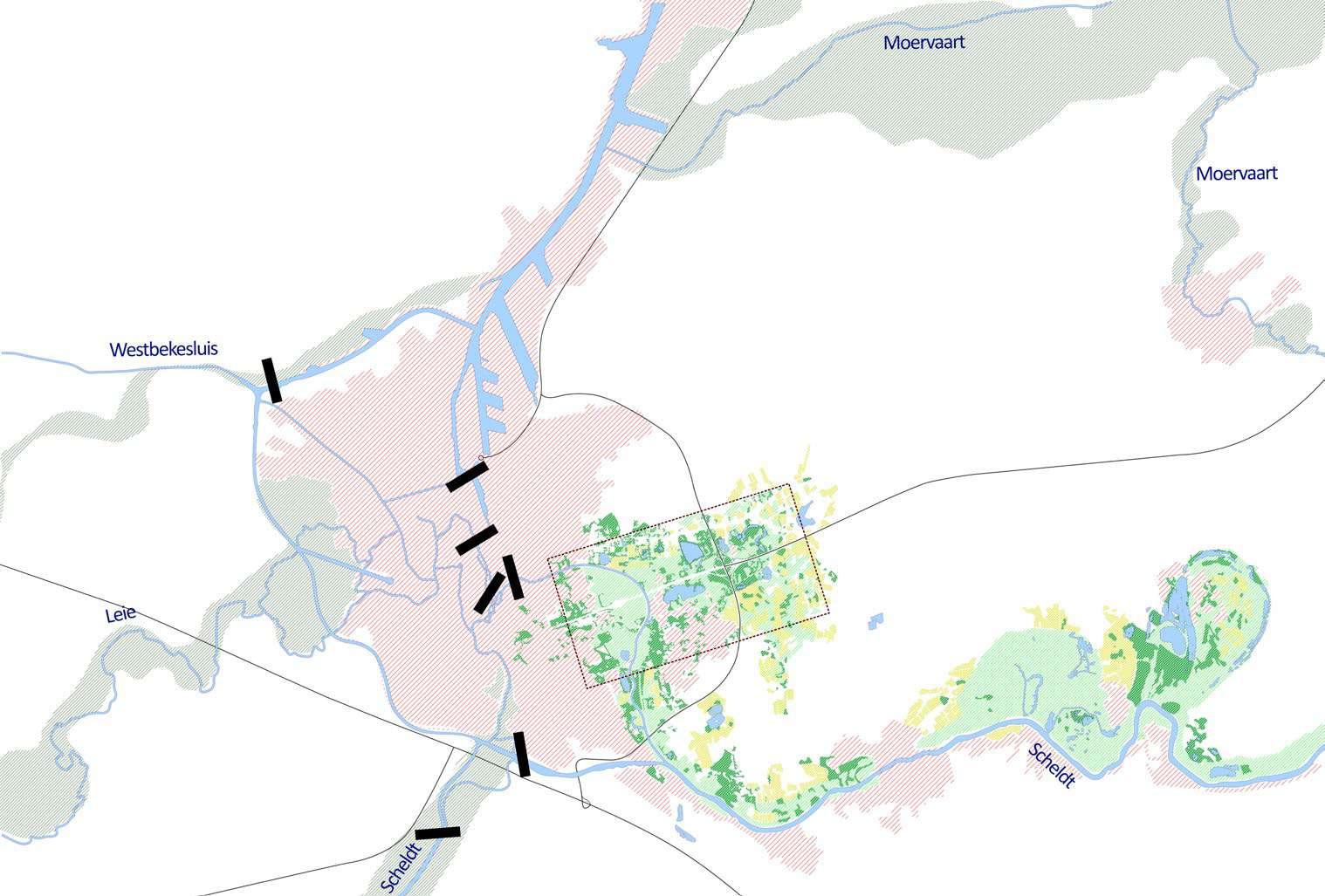
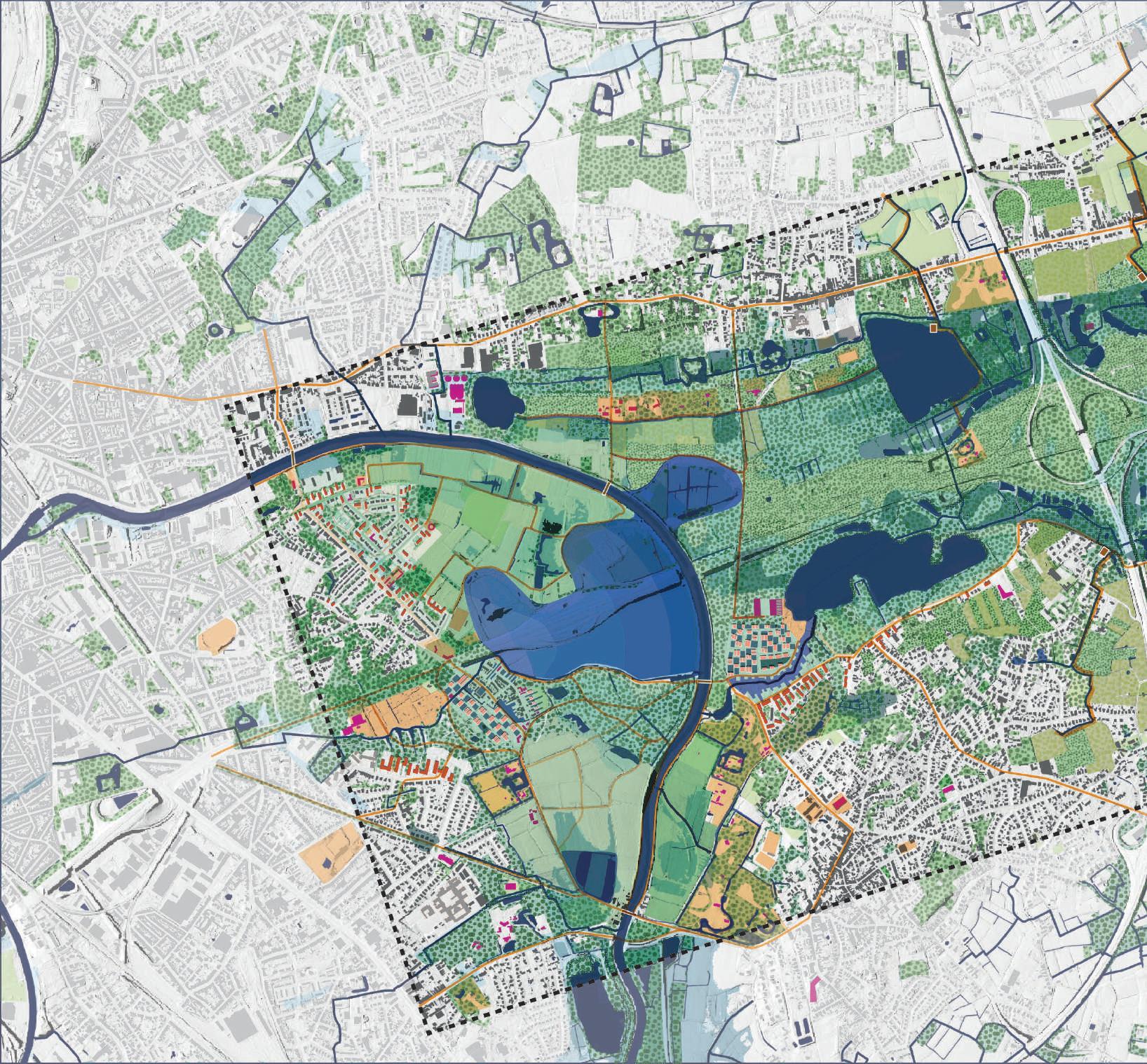
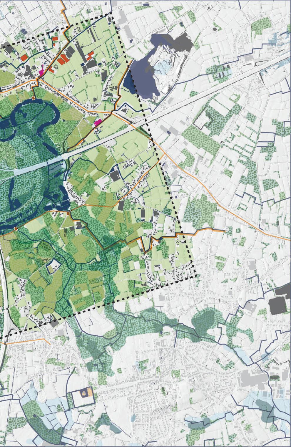
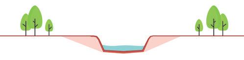
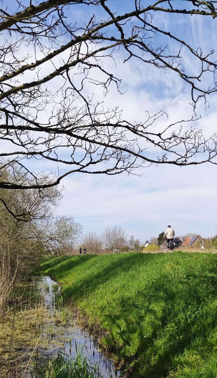
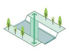
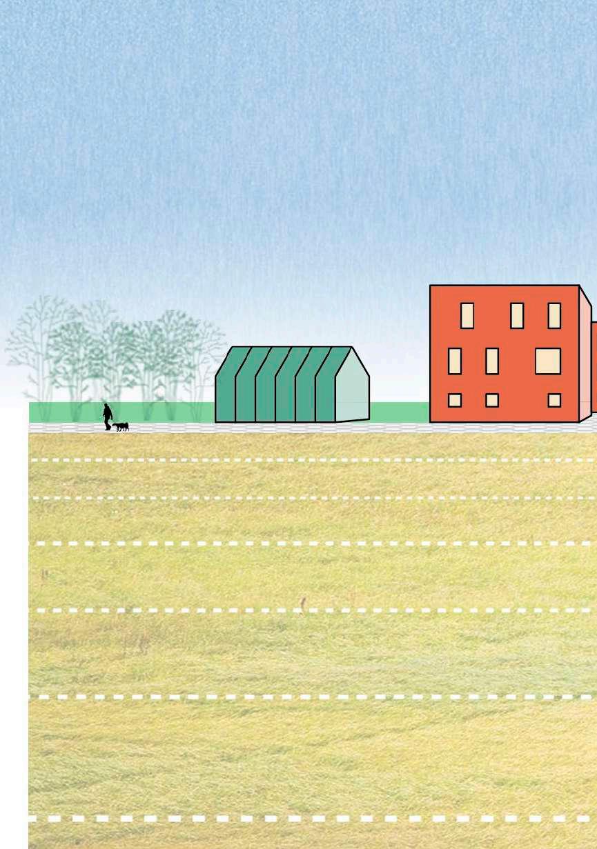
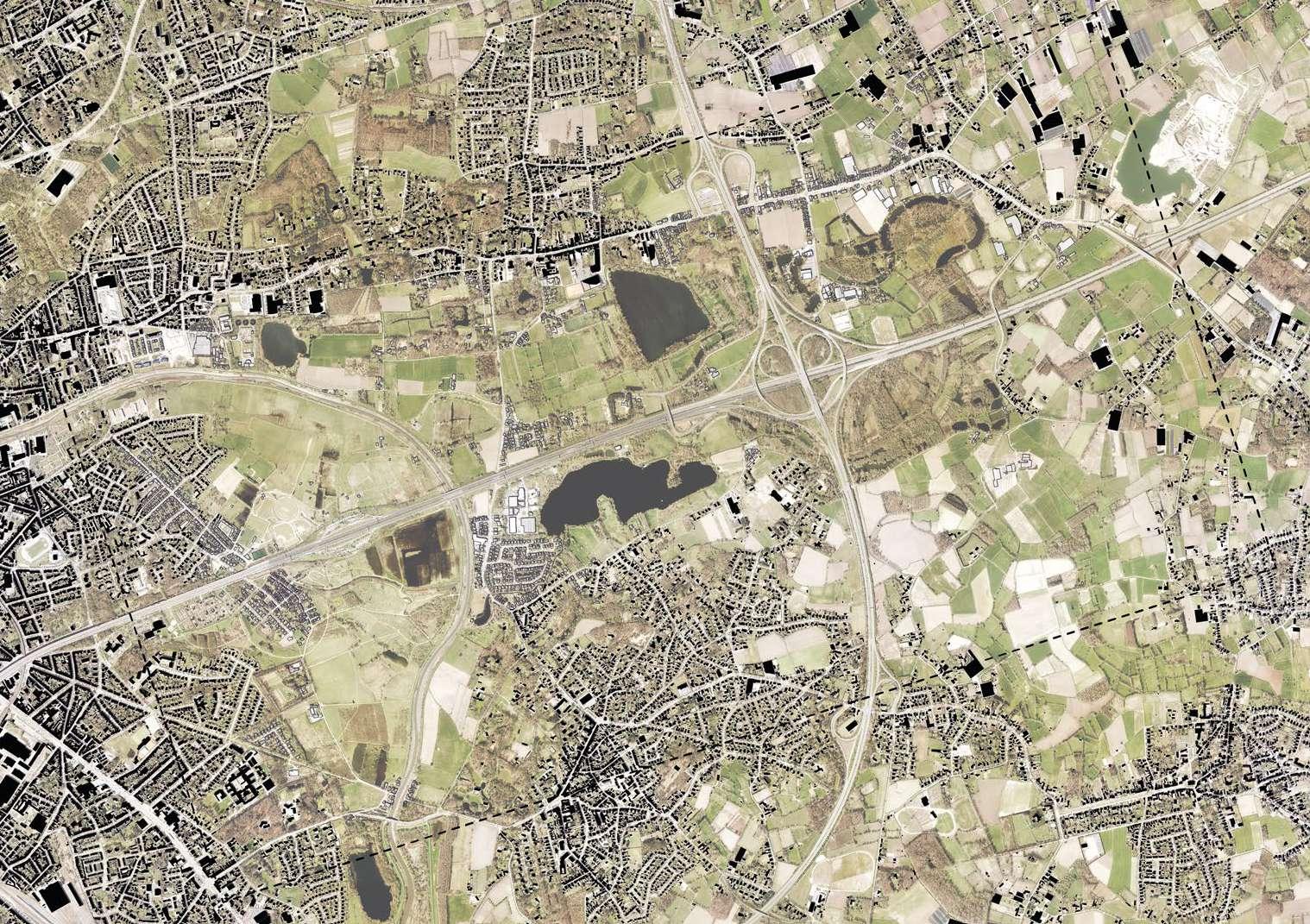
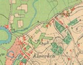
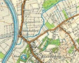
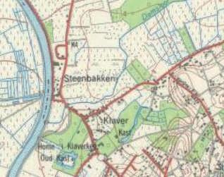
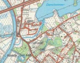
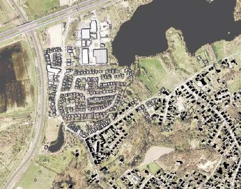
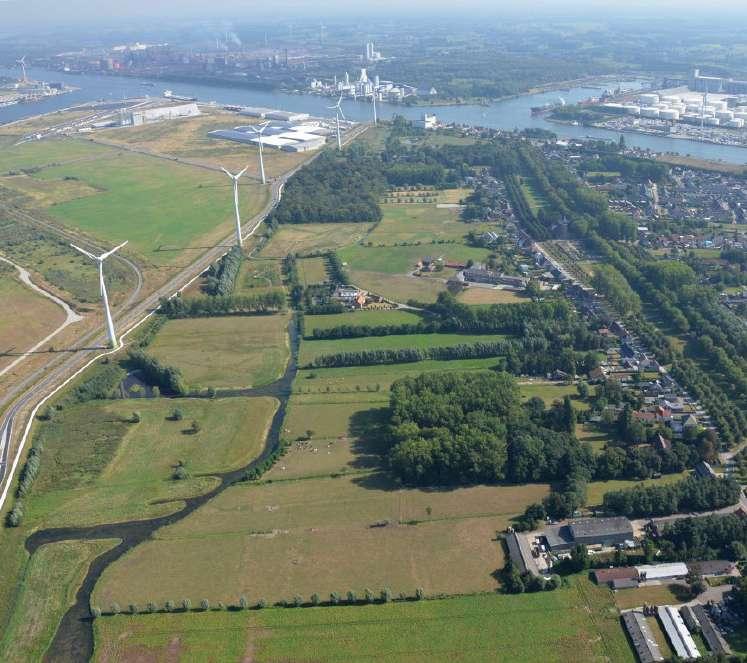
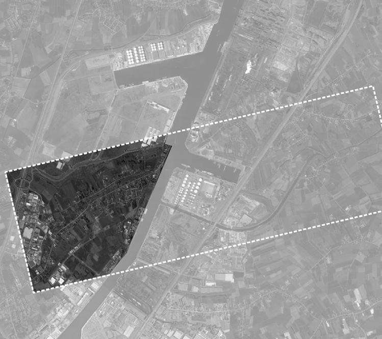
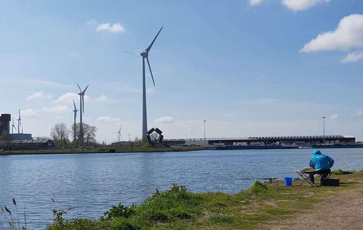
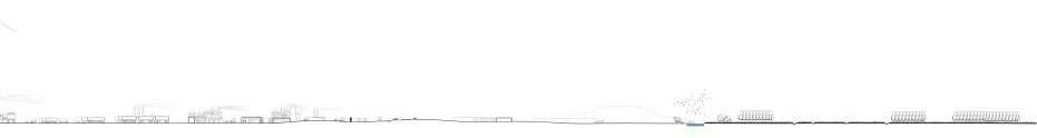
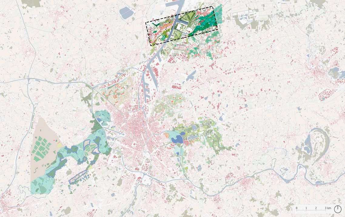
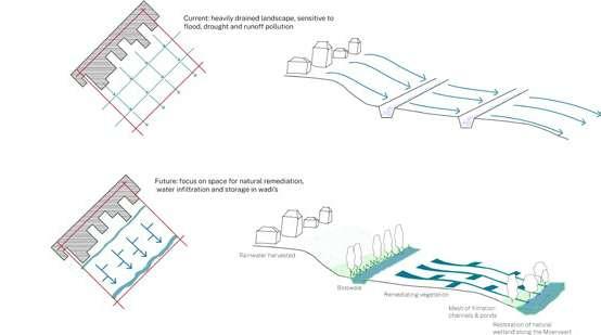
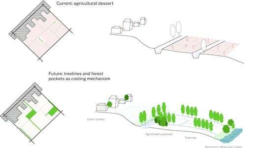
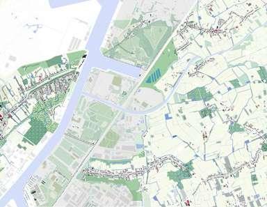
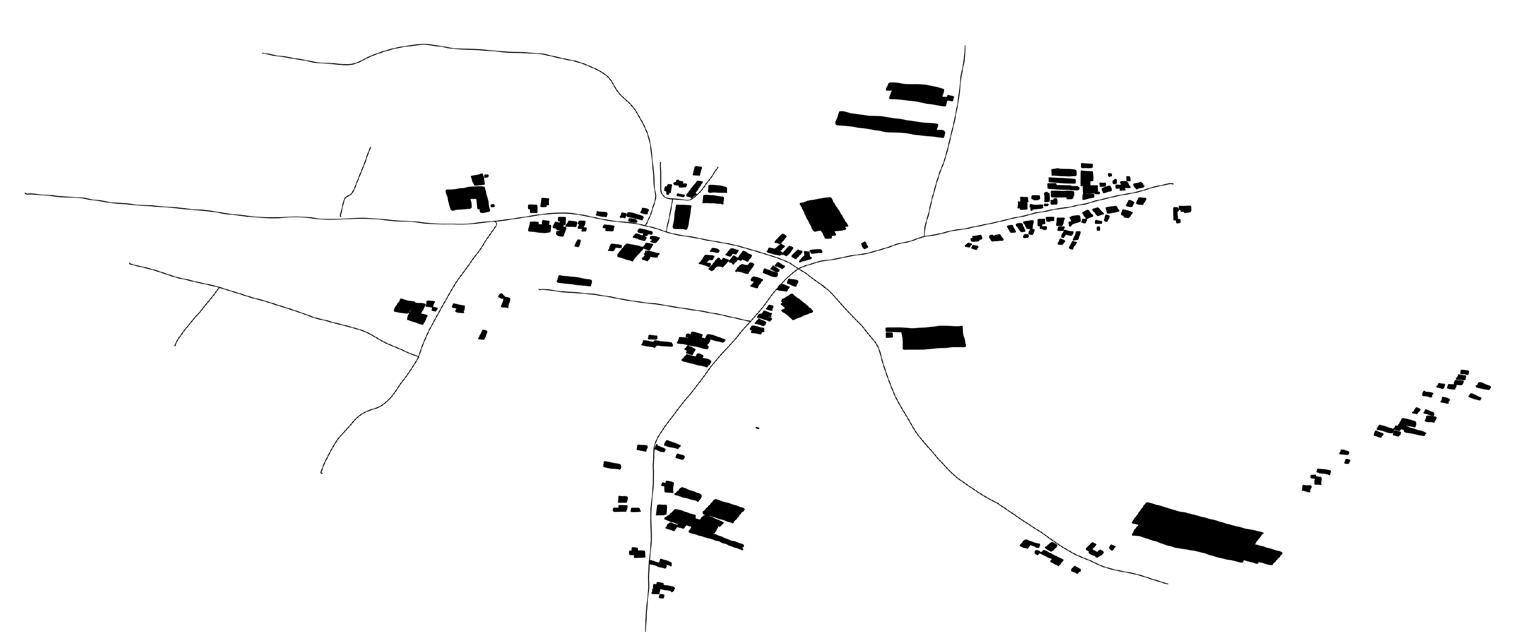
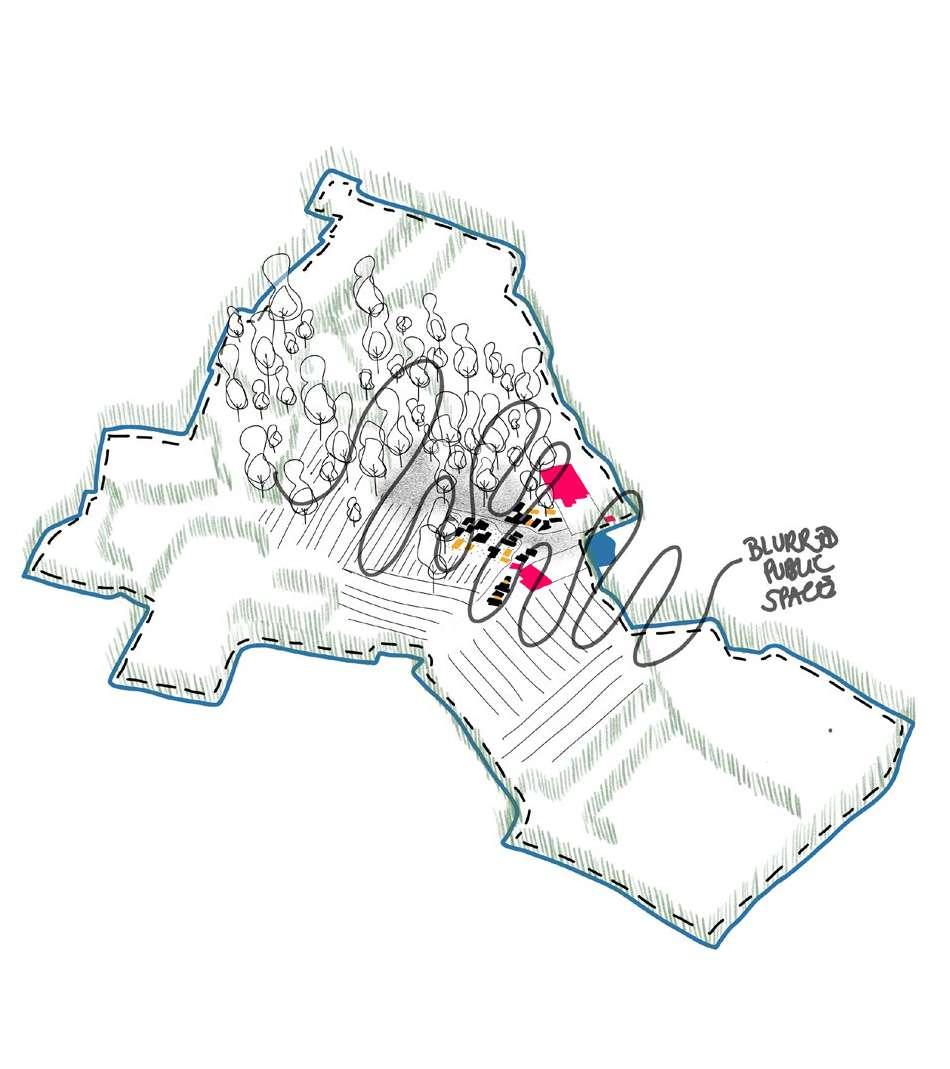
Sint Amandsberg's opportunities
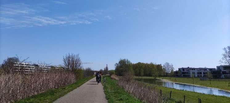
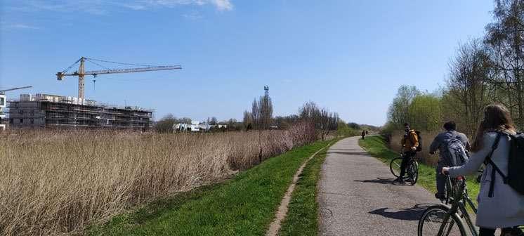
To mitigate the risks and challenges faced in Sint Amandsberg, the strategies need to be adapted to the site conditions and respecting the above mentioned diversity as a main strength. The focus is on afforestation and the introduction of new green rainwater infrastructures. The area would be activated with new typologies of housing and living. The existing green spaces in the wetter area South of the site should not be touched and will remain preserved.
200
201
202
203 2.0 DESIGN
204
Eco-Systemic Visions
2.1
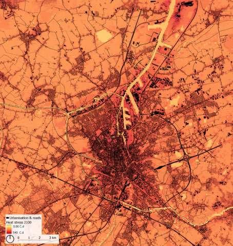
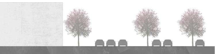
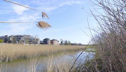
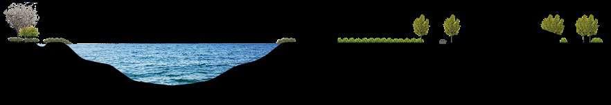
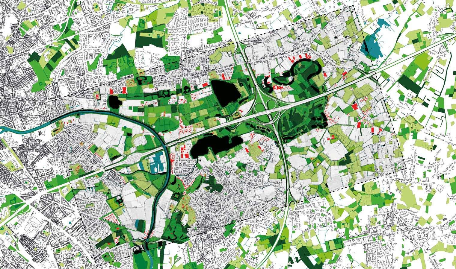
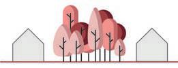
Cooling by greening
206
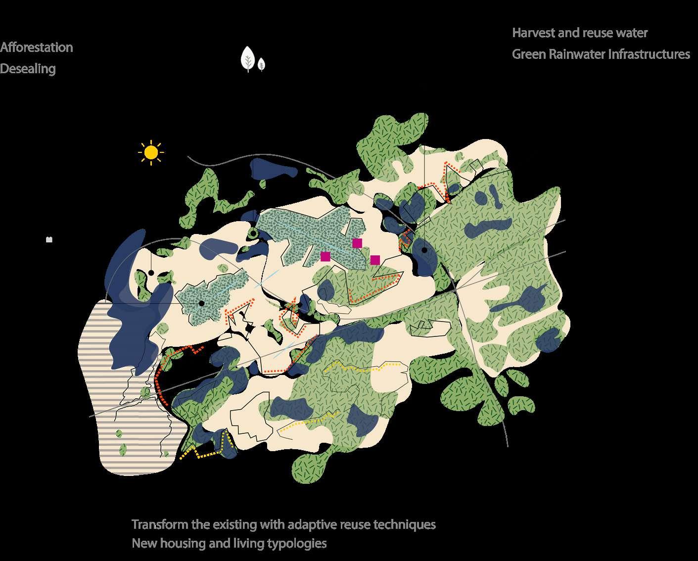
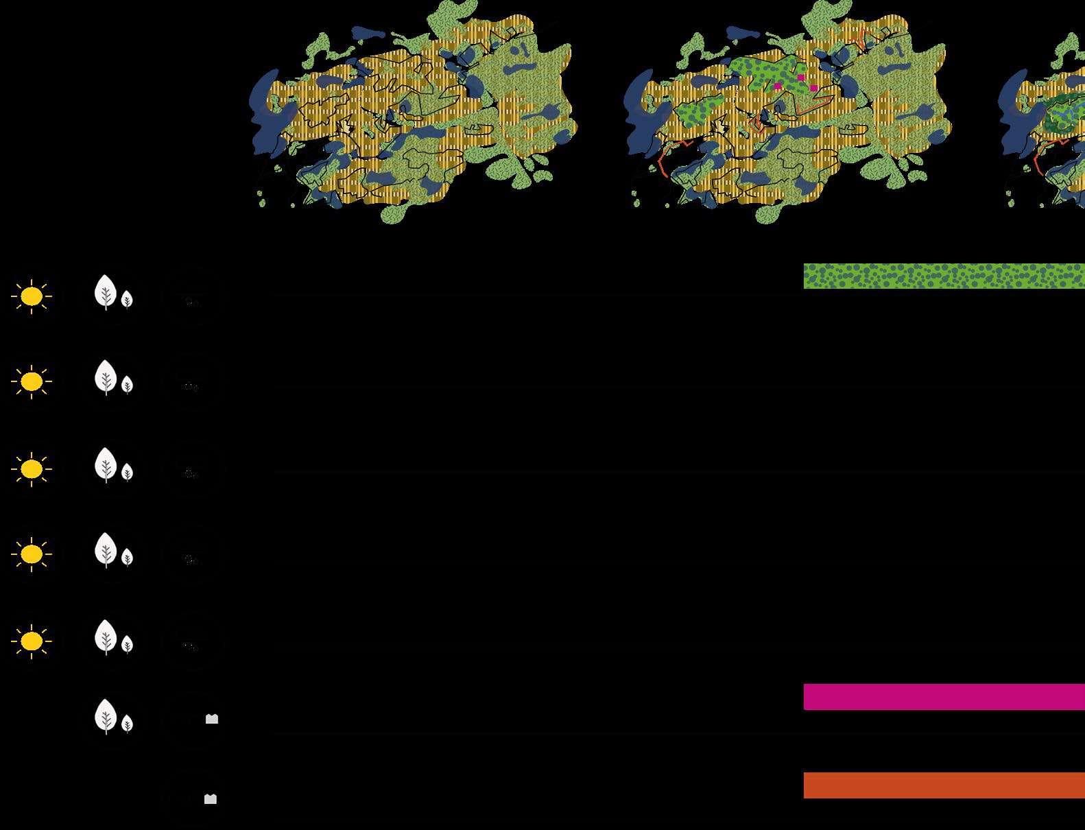
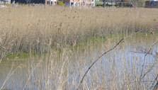
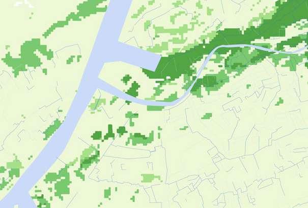
Preserve the green spaces already present on site and reinforce them to give them more strength is the strategy to counteract the ur ban heat island effect. A new green urban system of wet forests, dry forests and marshland to cool off the city and increase its canopy cover is introduced, combined with productive landscapes including communal orchards and agroforestry. This new green system will also transform how people are moving in the city. In most cases, the green and blue systems become inseparable. In Sint Amandsberg, the existing green spaces (public and private) are preserved and reinforced with afforestation to cool off the site. A green network of shared streets and roads is implemented.
207
Finding new balances between urban and nature
208
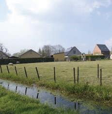
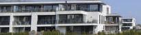
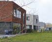
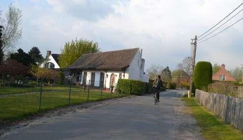
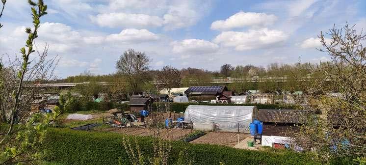
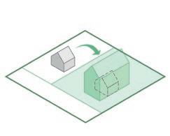
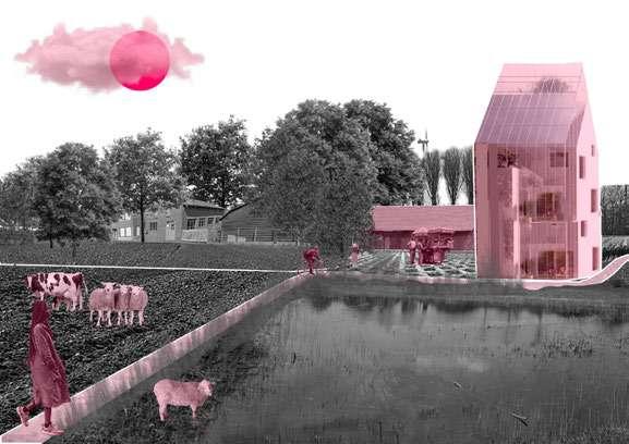
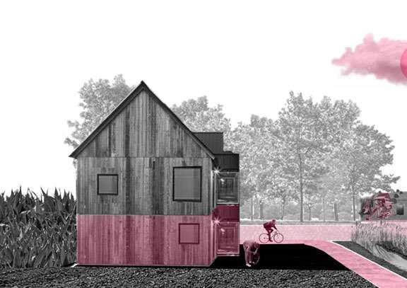
As urban population keeps growing, urban sprawl is an urgent issue. It is important to stop eating green fields and remaining open spaces while densifying by transforming what is already there to accommodate people in new housing typologies using adaptive reuse techniques. In Sint Amandsberg, the topographical edges are activated by introducing new housing and living typologies, and aging in frastructures such as big box stores are transformed and reused for new purposes more in line with 21st century needs.
209
210
The periphery as a new front
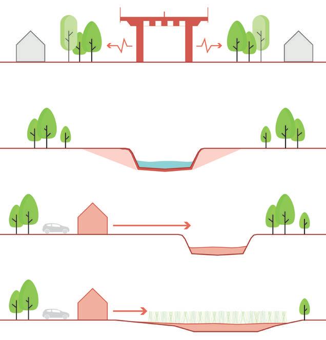
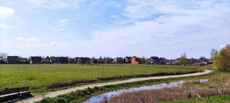
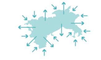
Climate change is having a considerable impact on Ghent as a metropolitan system, but considering it as an opportunity allows to rethink the relation ship between current settlement patterns and the underlying landscape. The periphery of Ghent can become the new front to address these challeng es.
211
212
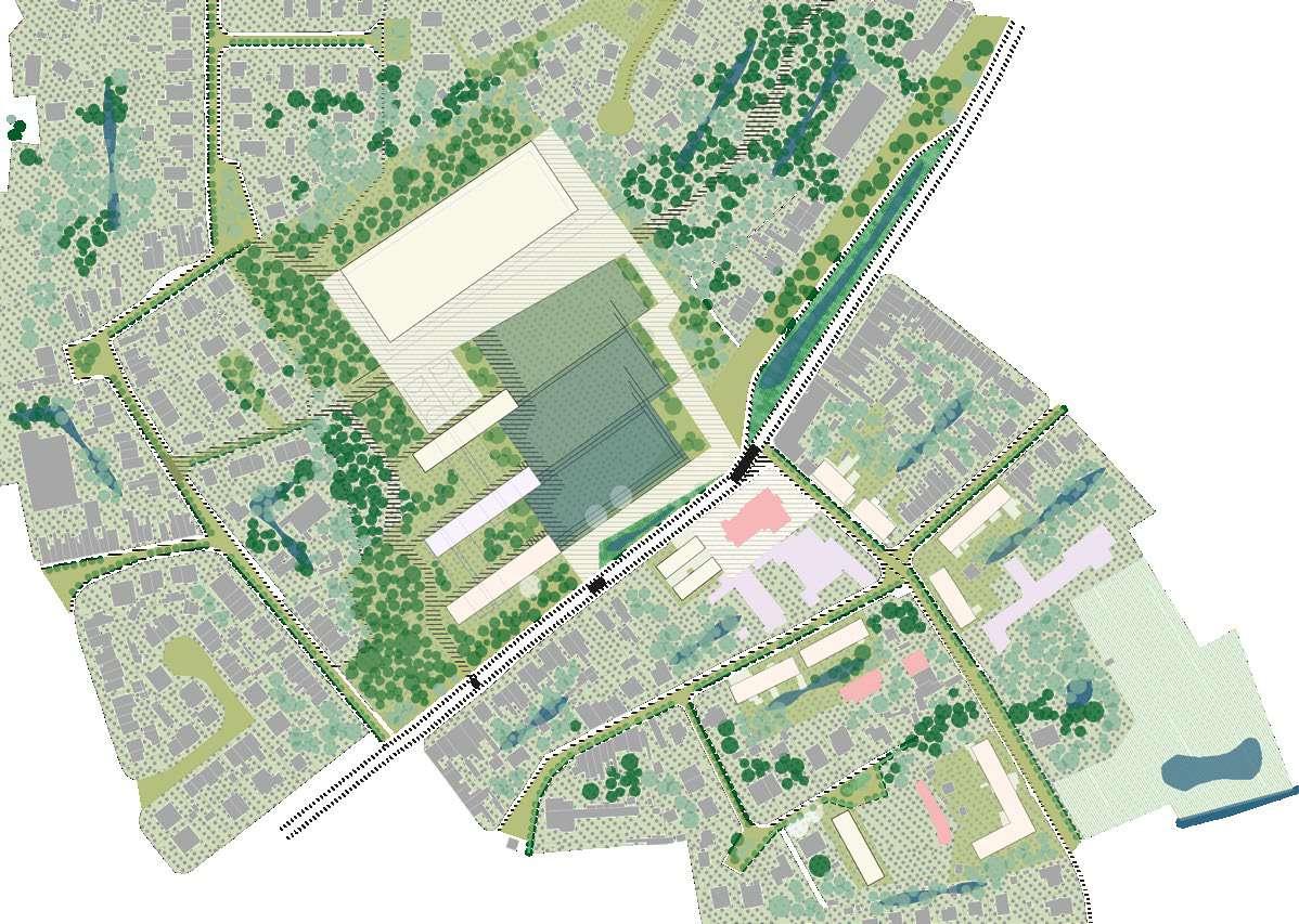
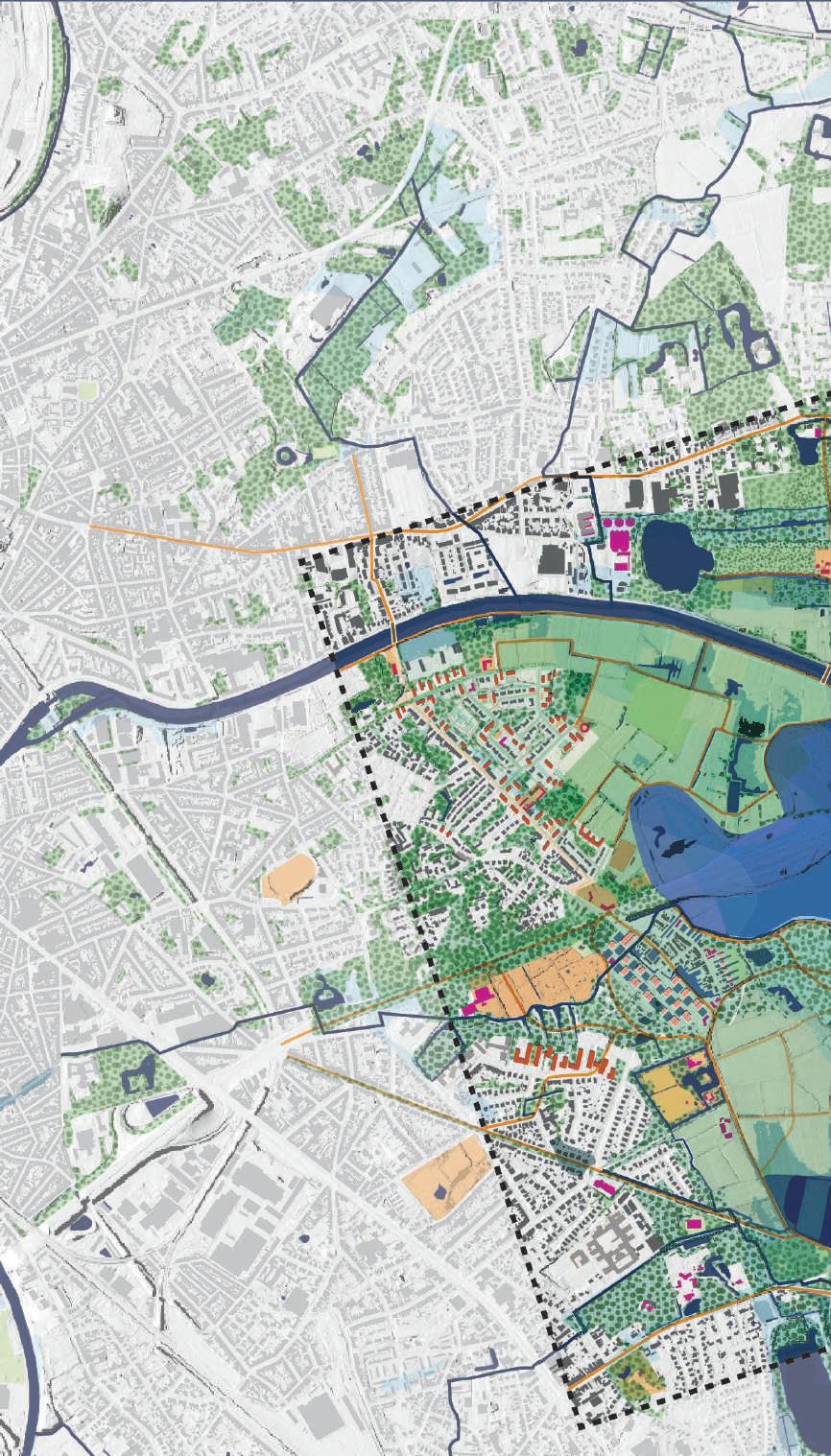
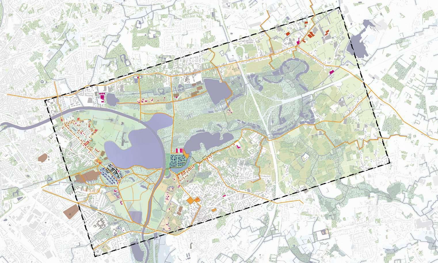
Design Proposal & Typologies
2.2
214
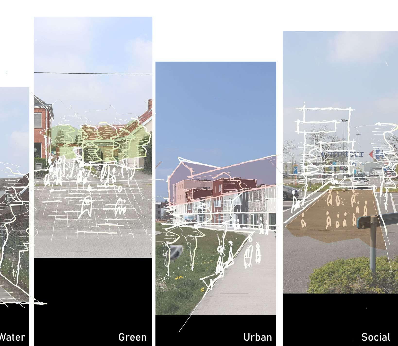
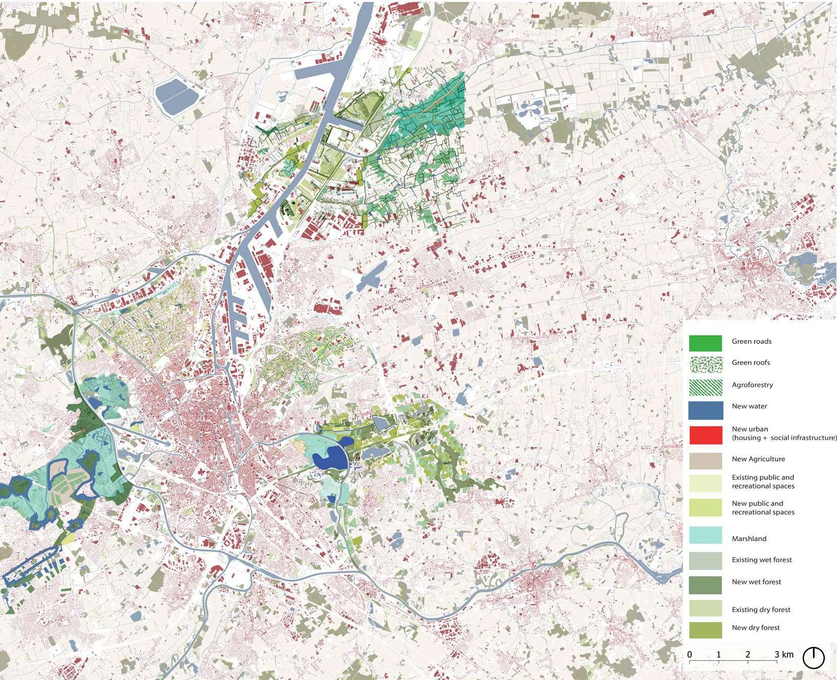
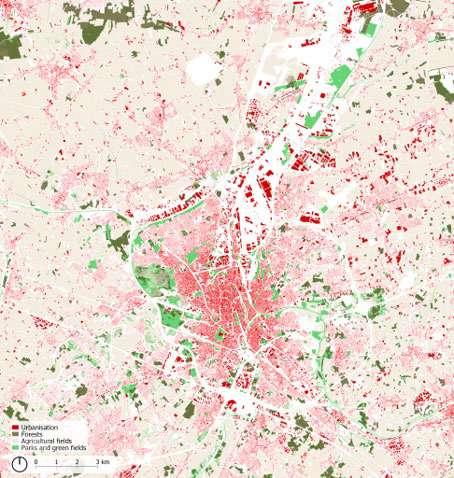
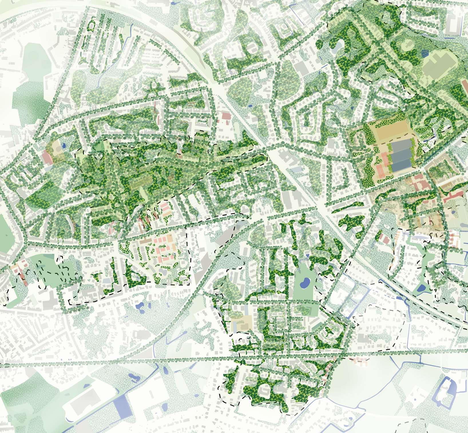
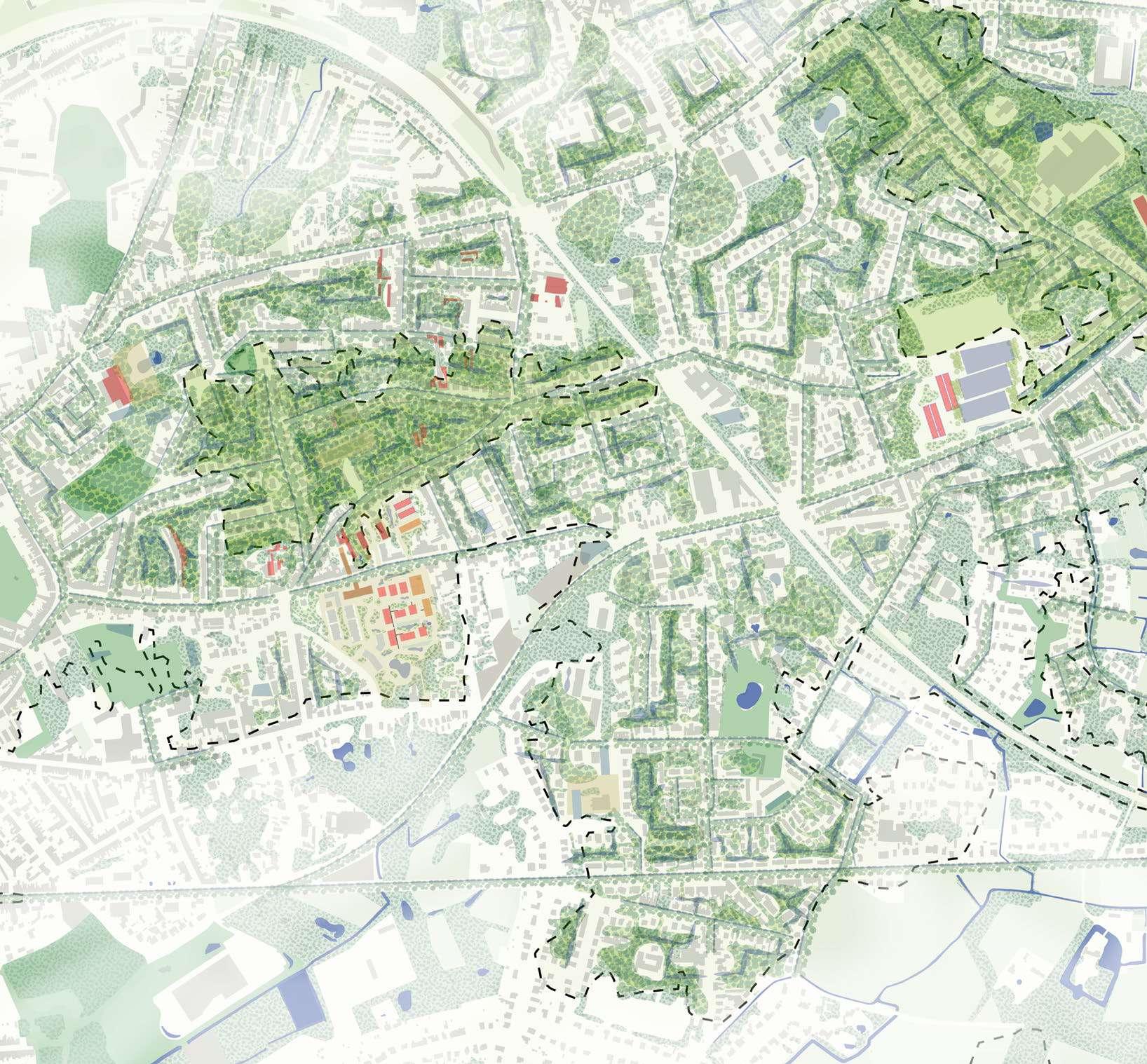
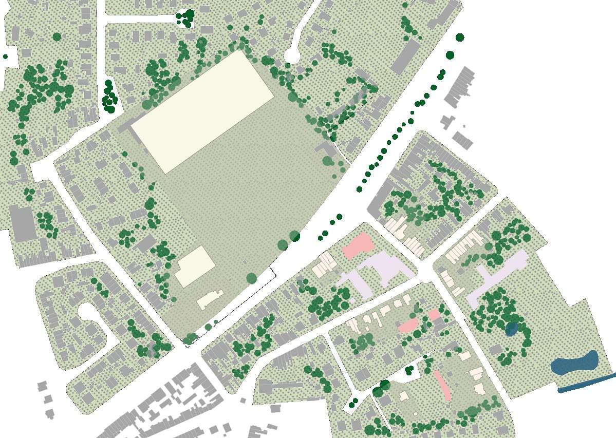
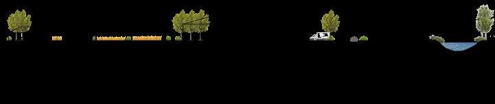
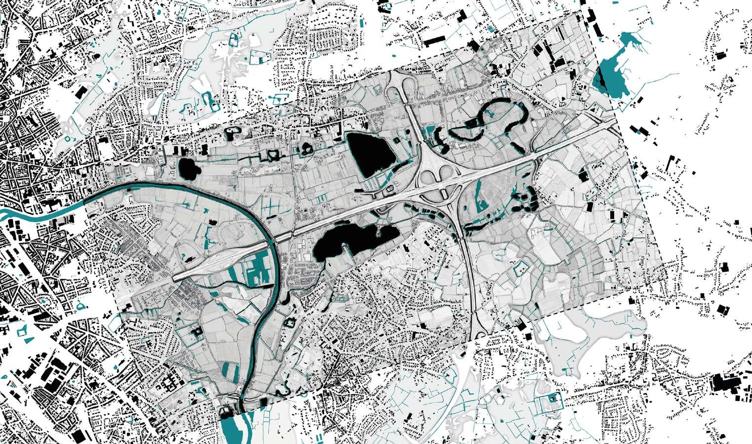
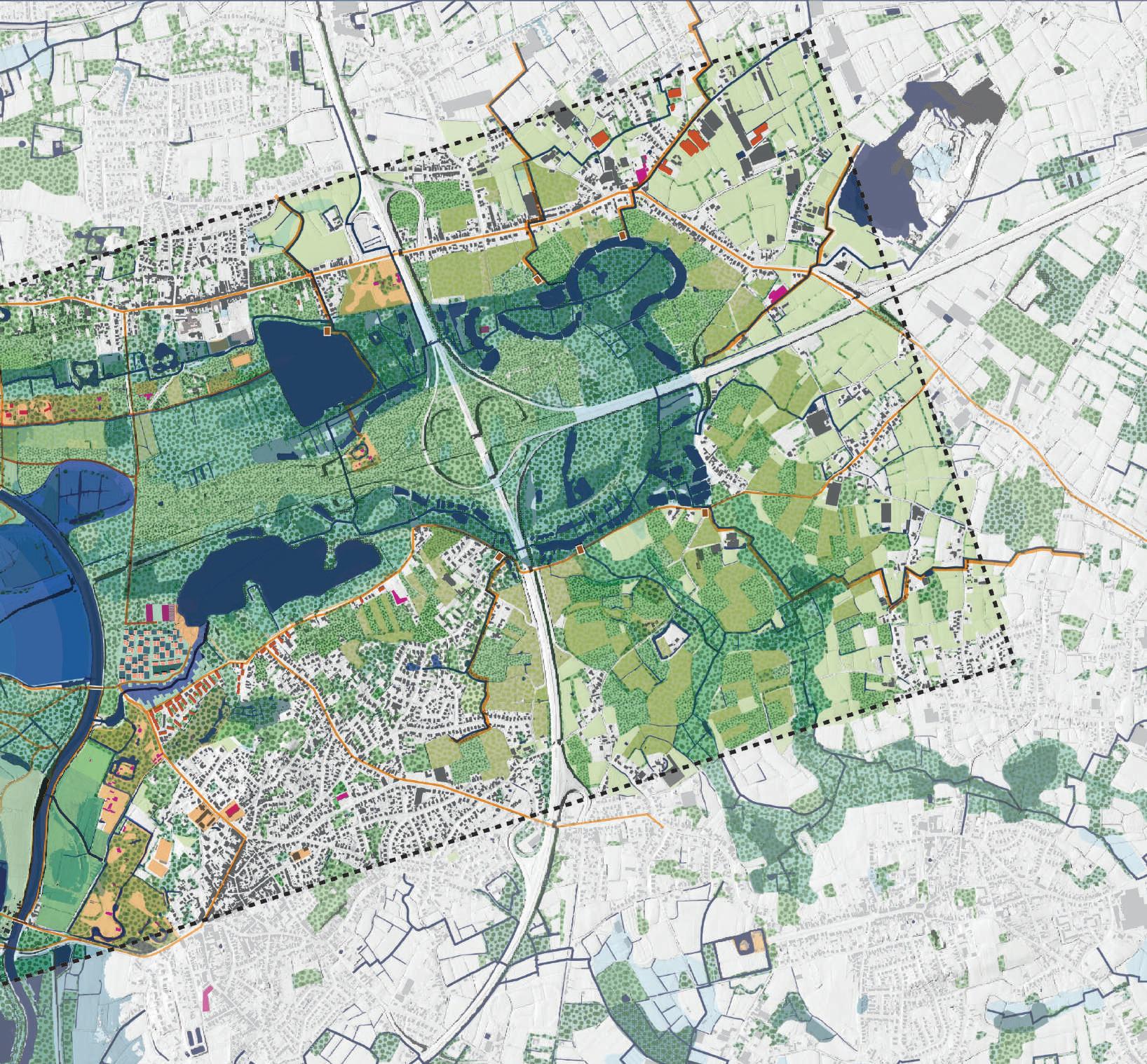
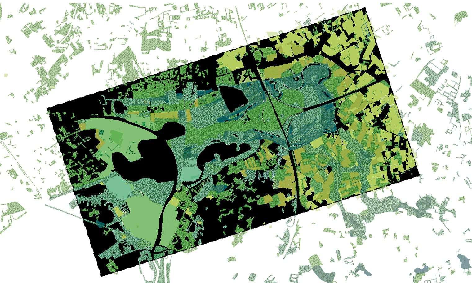
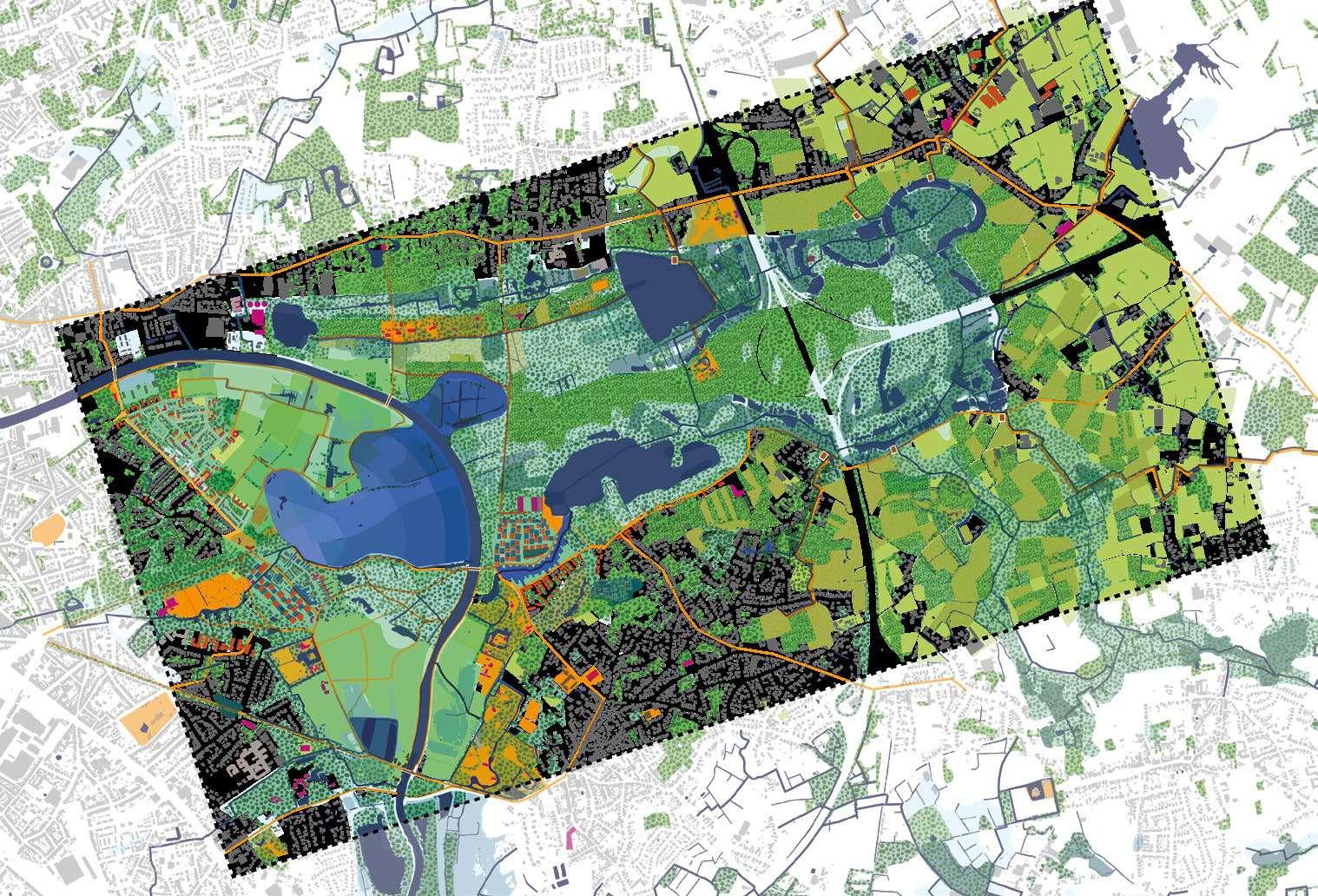
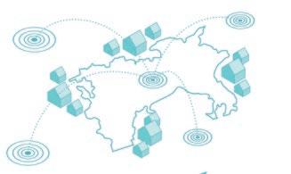
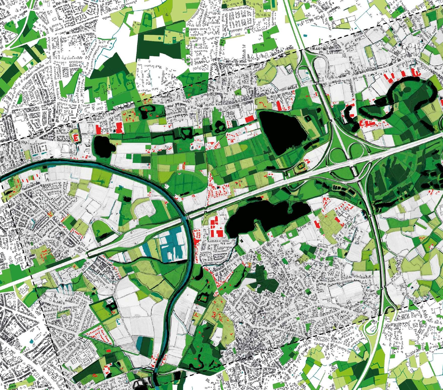
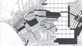
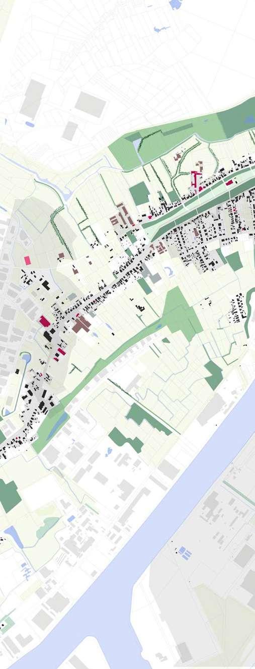
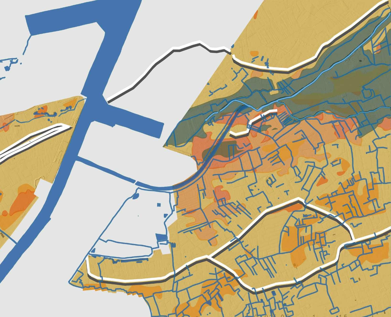
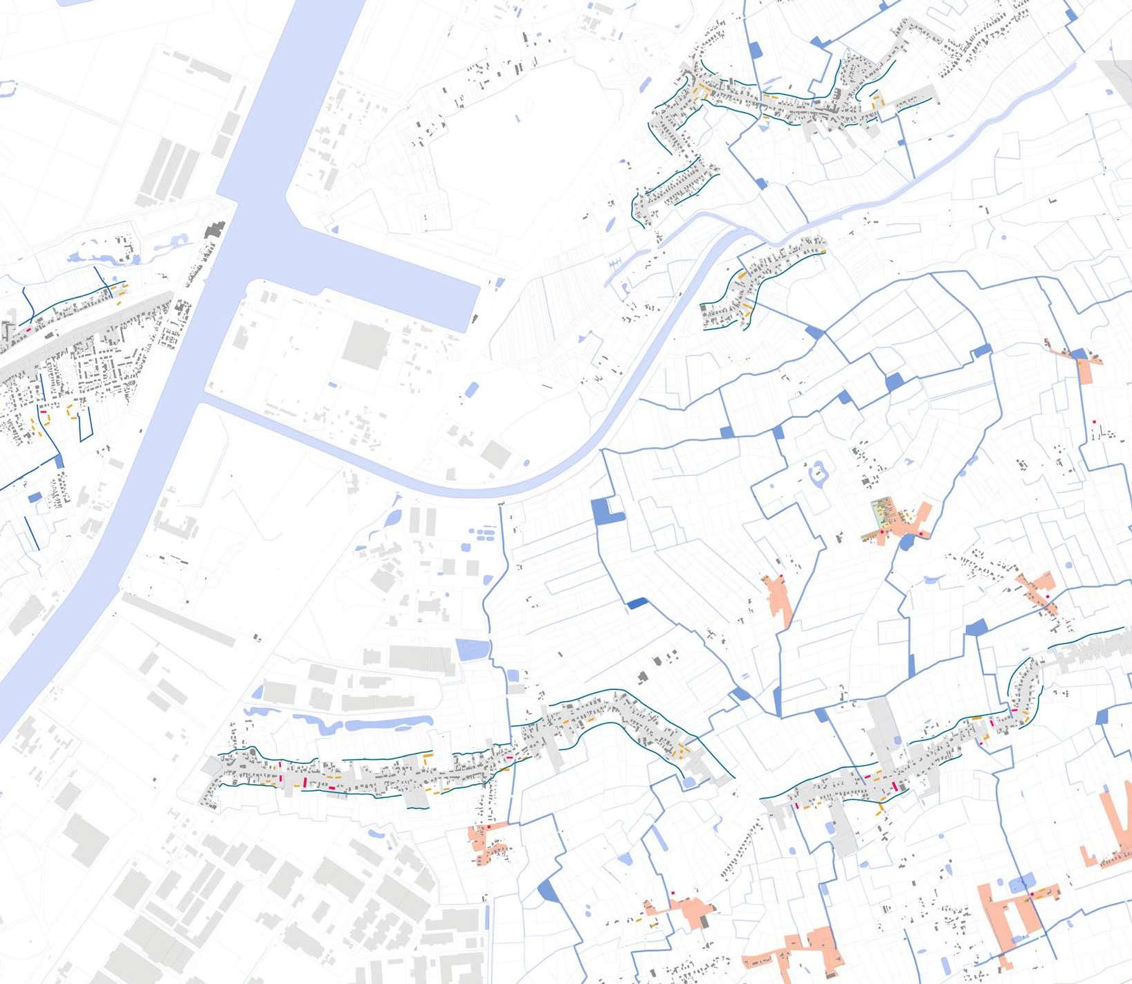
This diversity of landscape (types of green, types of blue) and social diversity (housing mix, social infrastructures) is the main quality of our site, the objective is therefore to embrace and reinforce it with strategic proposals. Green and blue structures will be increased, connected and better in tegrated to strengthen that diversity in a positive way, by looking at opportunities already present in the landscape , and multiply the opportunities to introduce green and blue in the area.
215 Vision map
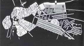
216
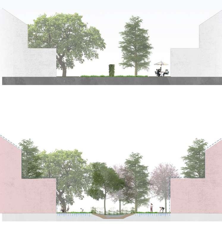
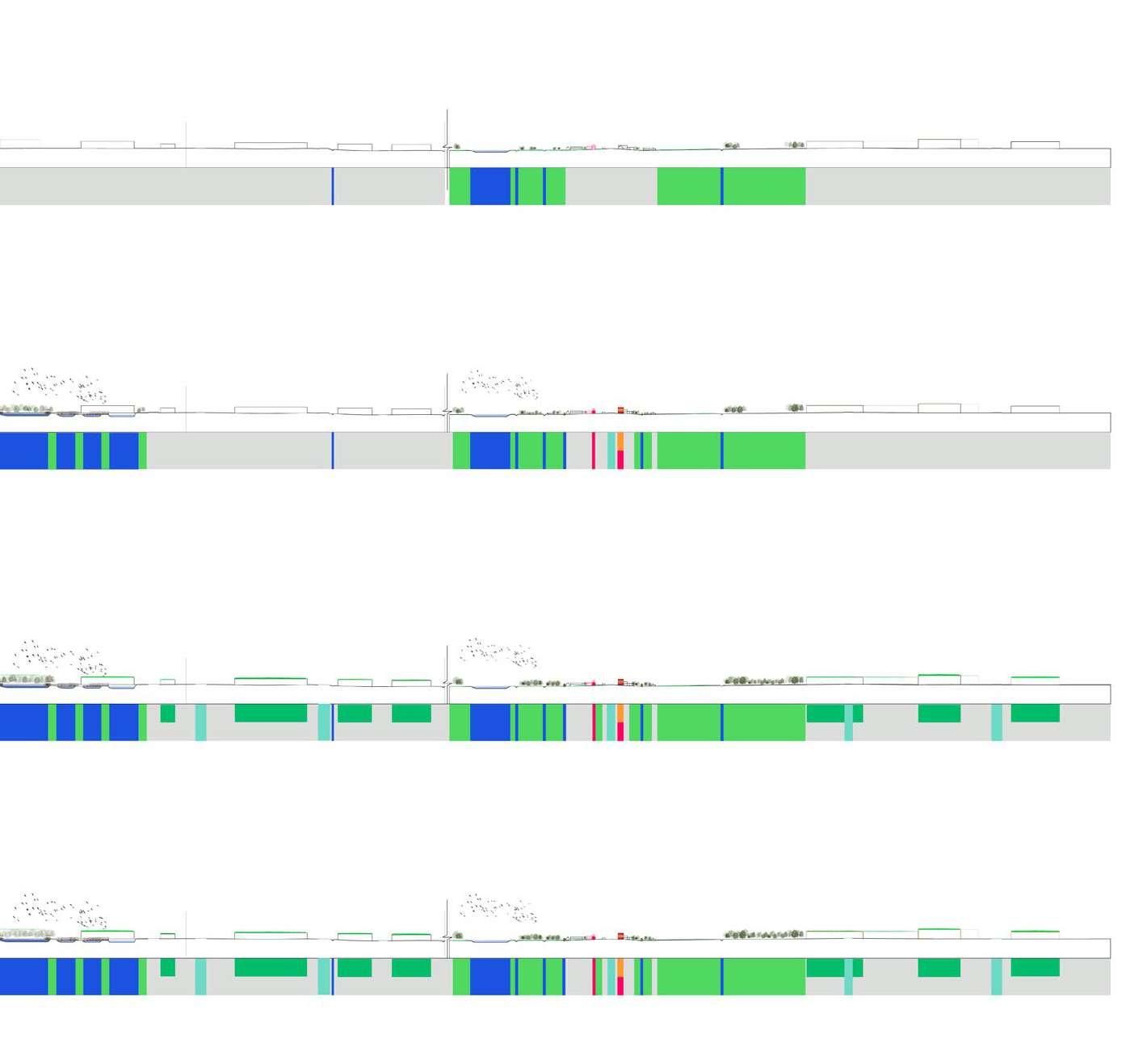
217 Sections
218
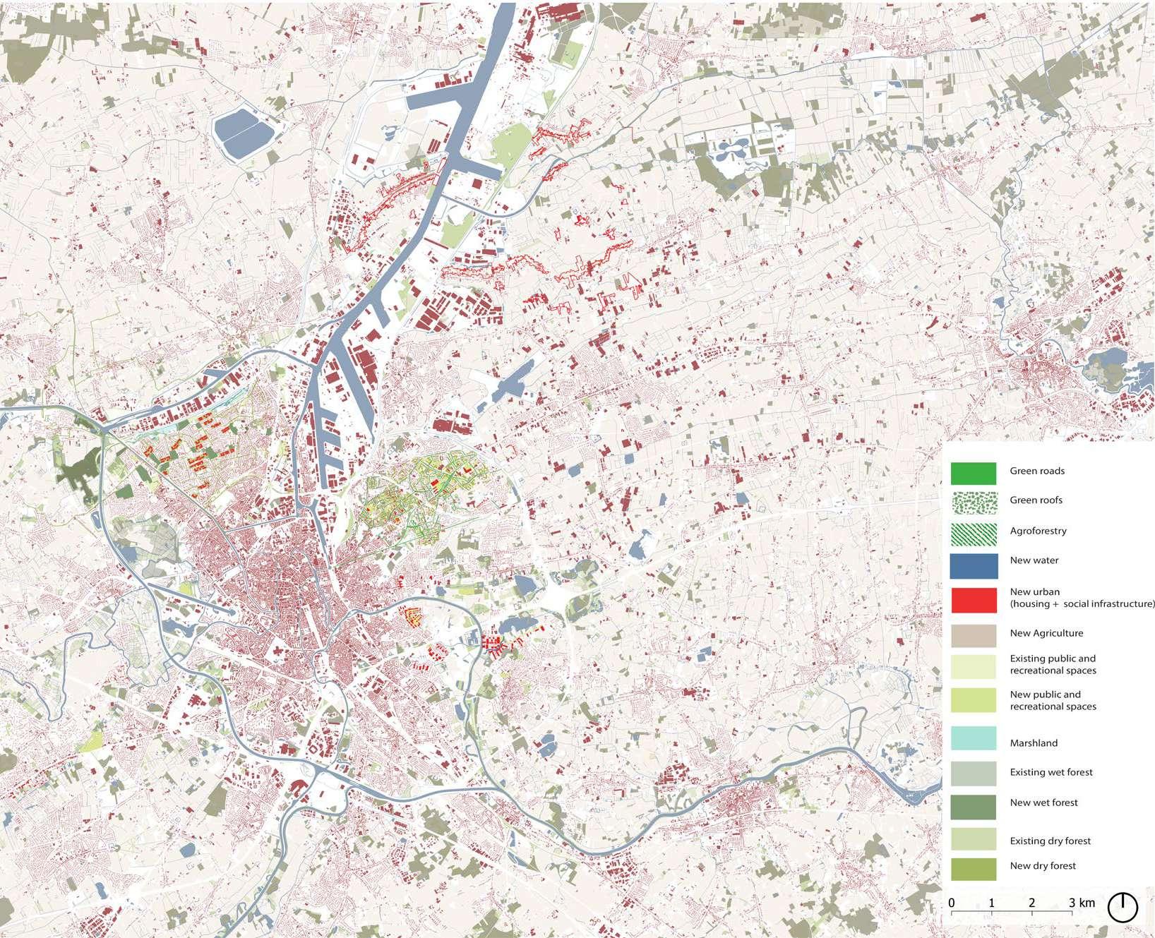
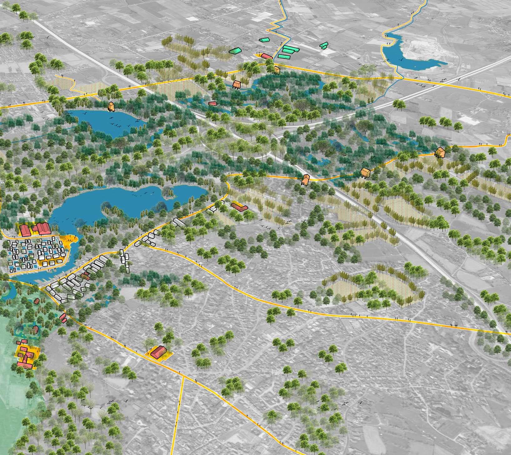
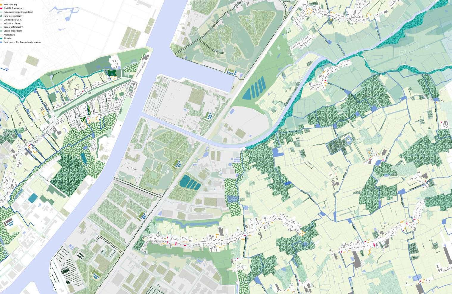
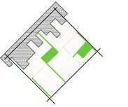
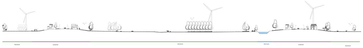
Green Strategy
It is clear that the area needs to be cooled, especially where the urban fabric is the most dense on the higher level. The strategy is to use the existing assets as our base (playgrounds, pocket gar dens, etc.) and then reimagine the inner gardens, roads and vacant lots.
By increasing the canopy cover and requalifying the existing network and sealed surfaces, which are usually vehicular dominant, they are transformed and greened. This allows to release pressure from the open spaces in the wet area and preserve them.
219
220
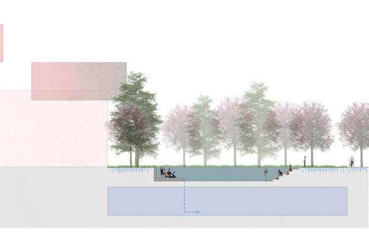
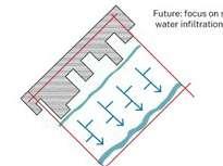
Water Strategy
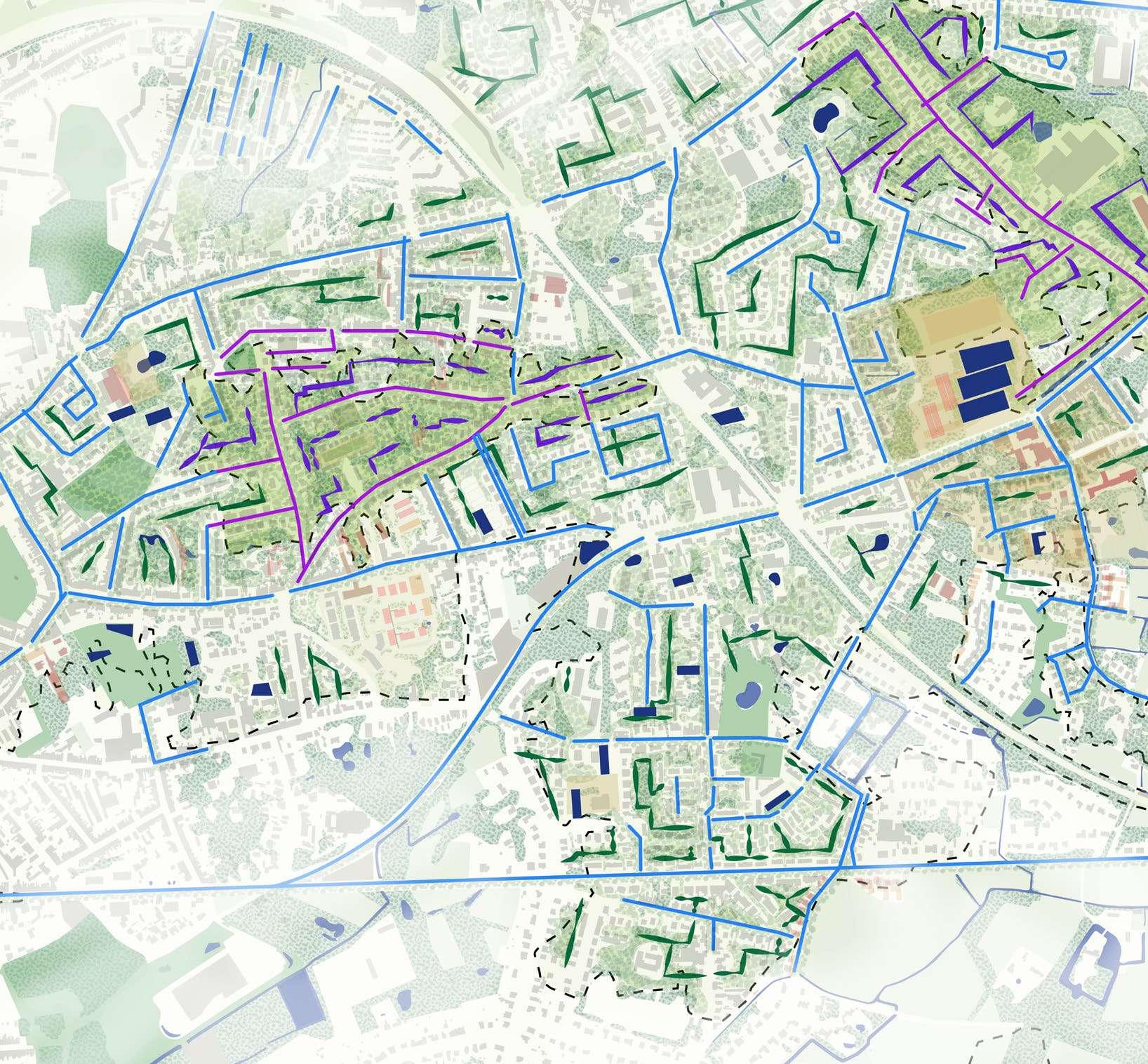
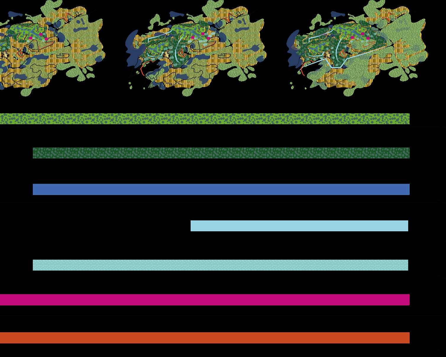
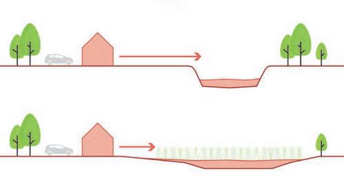
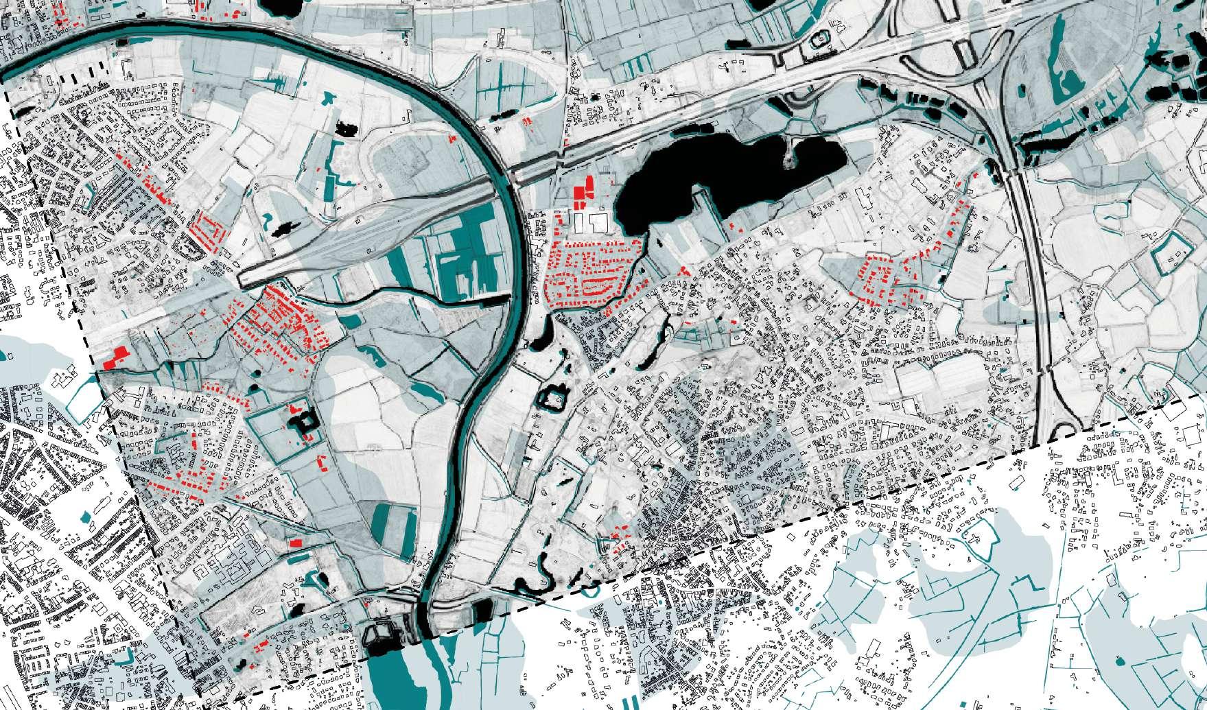
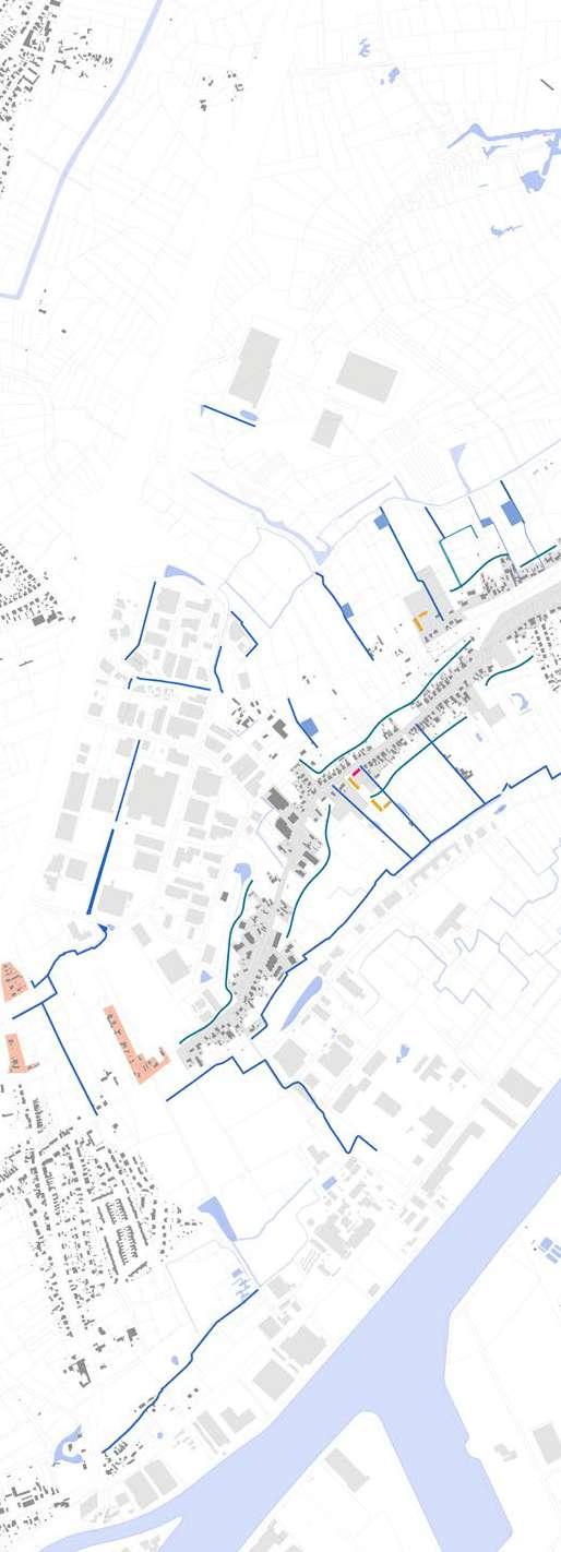
Green Rainwater Infrastructures strategies to be ap plied in Sint Amandsberg
221
Neighborhoodgreenroads
Sharedgreenroads
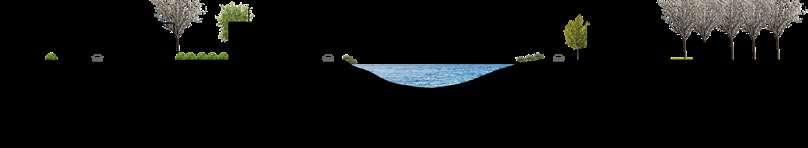
The Green-Blue strategies proposed in multiple public and private areas tackle climate change effects, but also transform it into more diverse spaces accomodating nature, water and communal activities to strenghten diversity on different levels. Main roads are recon figured reducing cars and giving more space for nature and soft mobility. At the same time, neighborhood streets are greened and transformed into shared spaces for the community. Water infiltration is enhanced also by using permeable materials for hardscapes.
222
20212021 21002100 2m 4m2m 4m 2m 4m2m 4m
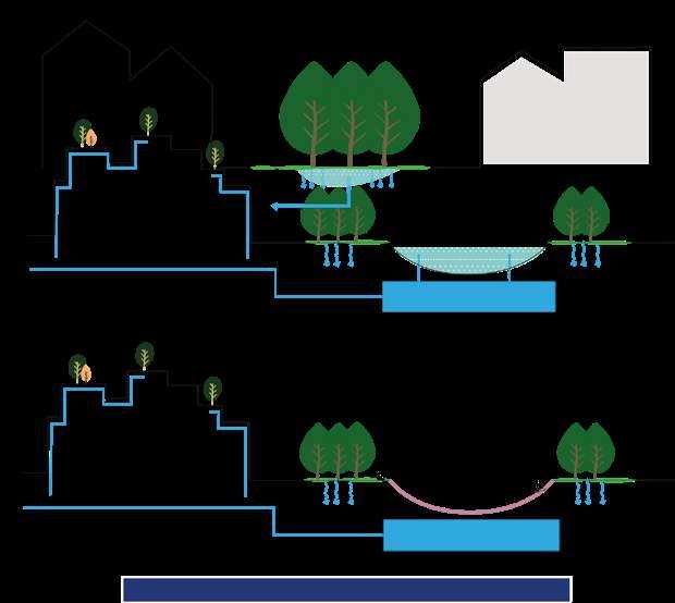
Backyardgreeningforwaterretention
Water retentioninvacantplots
Interplay between the green and blue systems
Private backyards are also forested with bioretention ponds to increase the neighbourhood canopy and the water infiltration reducing drought and flooding. Vacant plots are seen as potential spaces for water retention. They also function as clearings in the urban forest and as new diversity spaces. When dried, the ponds or mineral water collection spaces can be used as public places for people to sit, play or skate!
223
2021 2021 2100 2100 2m 4m2m 4m 2m 4m
224
Urban Transformation | Clearings
With the development and increase of the green and blue systems, urban clearings are formed, especially on the high level. Their shape and size are affected by what is existing: smaller clearings are found where the fabric is denser, larger ones are found where big boxes stores are trans formed.
225
226
Urban Transformation | Edges
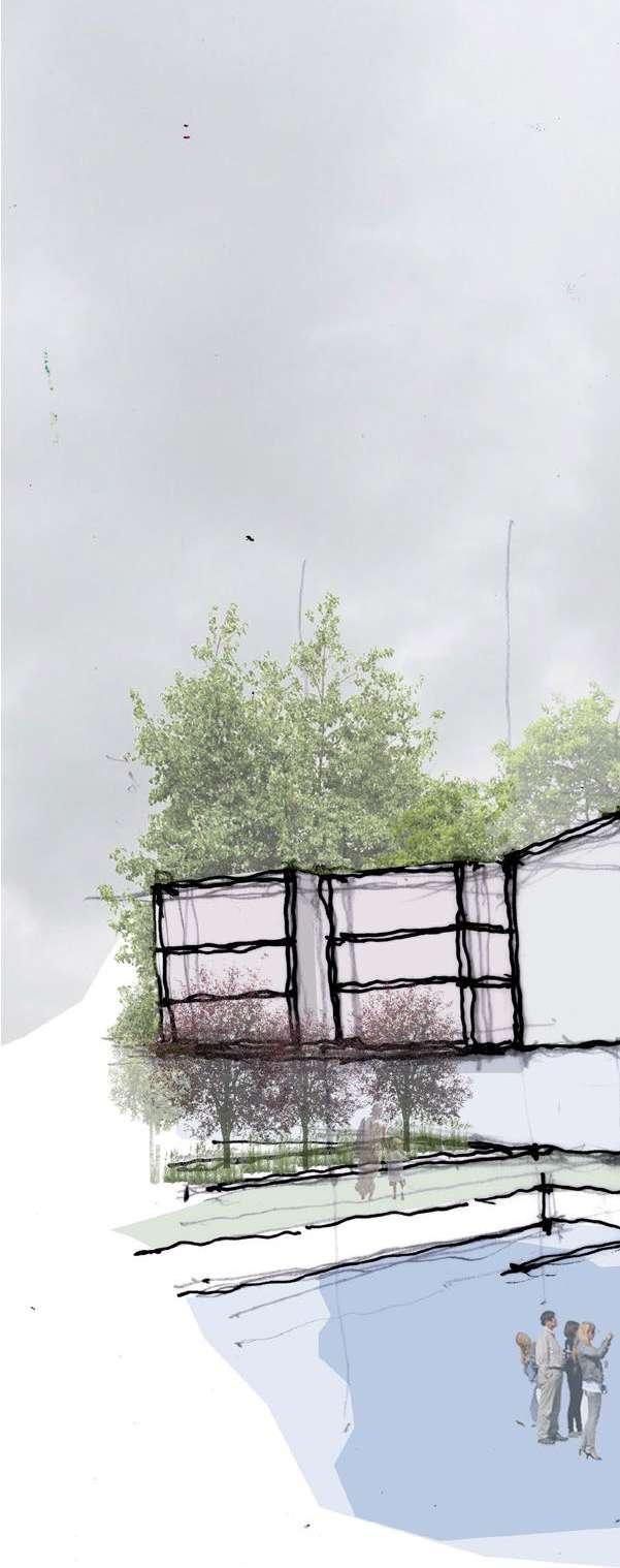
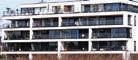
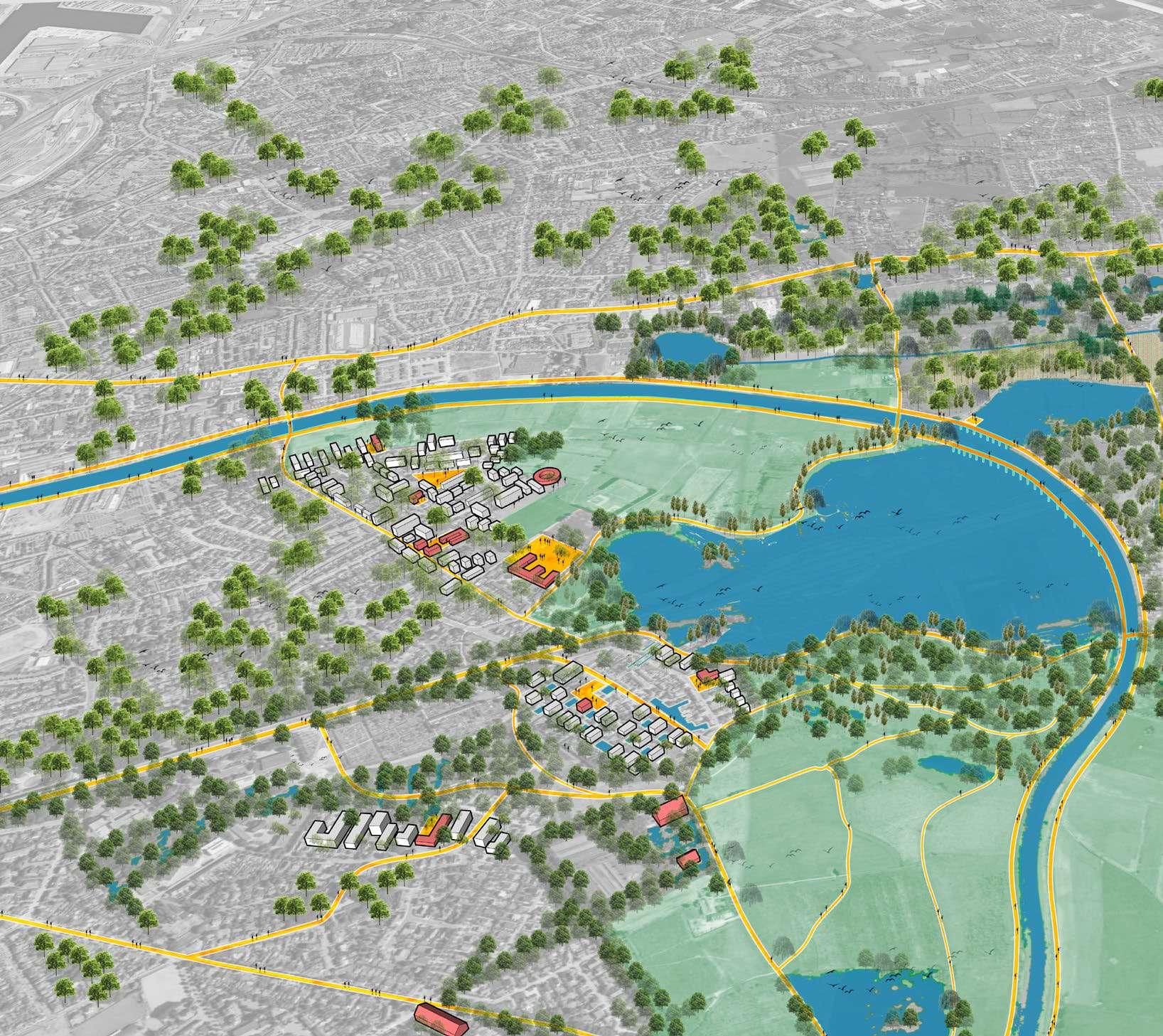
On the high level, we concentrate the infrastructure resources with workspaces, commercial units and social amenities along the housing units. On the balconies looking over the edge, we place new housing units at the interplay between the green/blue to create new relationships between the systems. Housing typologies are to be adapted for flooding risks and climate change. On the flat area in the mid level, greenification, rainwater infrastructures and densification strategies come alongside. Because of the importance of mixing demographics to reinforce the diversity of our site, these new typologies include co-living for multi-generational residents.
227
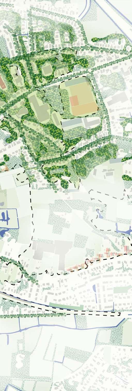
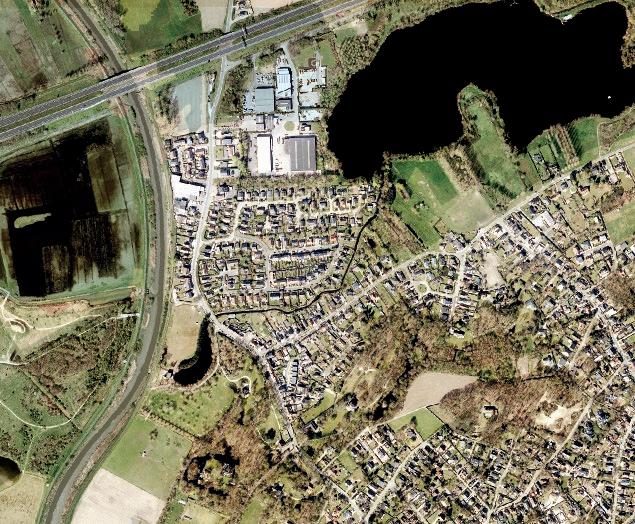
Zoom on a small clearing in the urban forest


The first zoom is in the denser area of the site that has less open spaces. The intervention is focused on taking advantage of the built spaces that sit in between the residential bubbles, creating new open urban spaces for the village, transforming buildings, introducing social infrastructure and residential areas with different housing typologies to create a self-sufficient entity, emphasizing diversity.
228
2021 2100 2100 2021 30m30m 20m 20m 60m60m 40m 40m Commercial units Residential units(medium) Residential units (small) Assisted living facility Kindergarden Social structures Circulation Education Co-working space Sports center
For the second zoom located at the large Carrefour building , our approach to the large commercial and industrial boxes located in dense urban residential fabric is about creating public squares. The square acts as an urban nucleus drawing the surrounding neigh bourhoods into the social space and integrated with the existing social infrustructure. The approach is to use the square to create clearings in the forested high point of the site. The mixed-use buildings in the square acts as a nexus for the area.


229
Zoom on a large clearing in the urban forest 2021 2021 2100 2100 30m 30m 20m 20m 60m 60m 40m 40m Commercial units Residential units(medium) Residential units(small) Assisted living facility Kindergarden Social structures Circulation Education Co-working space Sports center
230 2030 2050
231 2050 2070
232 Year 2020 2030
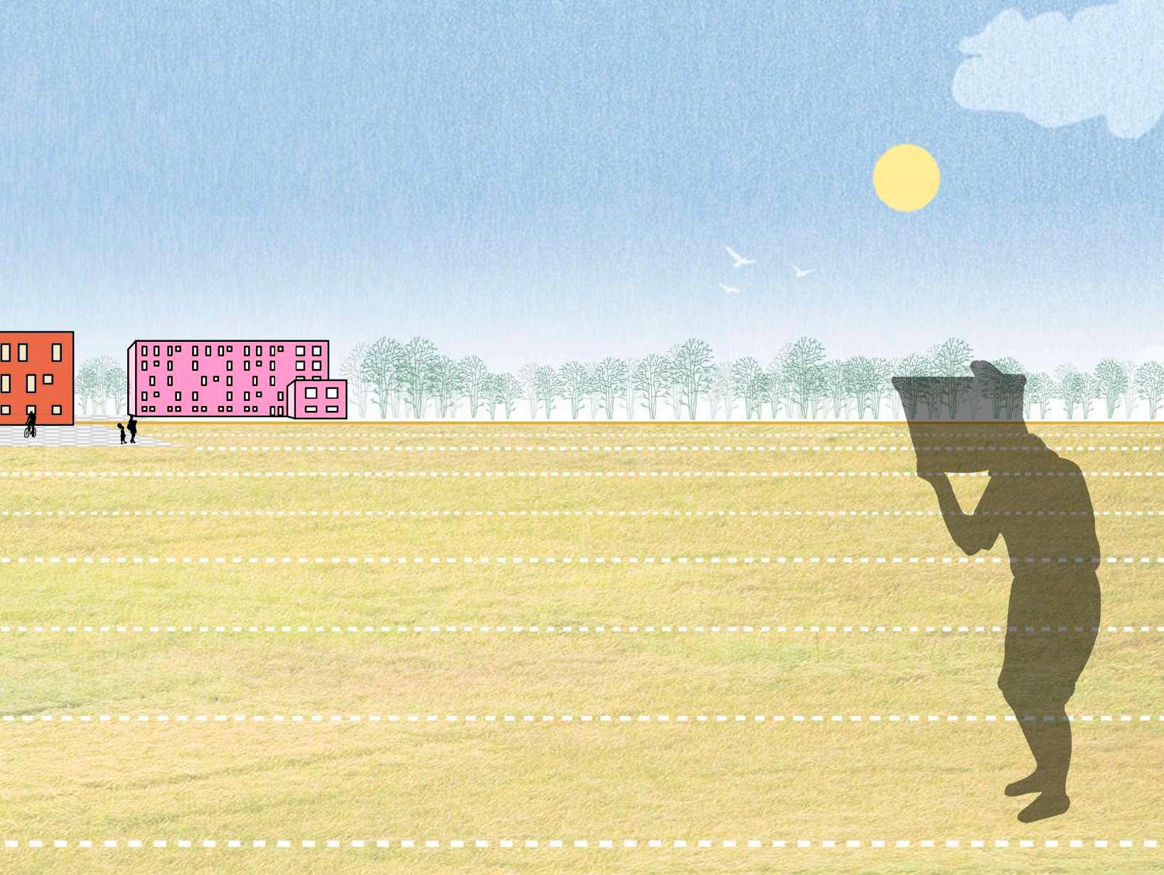
The transformation of Sint Amandsberg would start with a targeted green & blue strategy in two phases to help solve some of the issues in the area and prevent negative consequences. The strategies would then gradually and progressively extend in a second phase in the rest of the site. In all cases, the wet area South of the site and the remaining green fields are preserved and protected.
233
Timeline 2050 2070 2100
parking lot
AntwerpseSteenweg
Commercial units
Residential units (medium)
Residential units (small)
Assisted living facility
Kindergarden
Social structures
Circulation
Education
Co-working space
Sports center
Repurposing the urban relationships
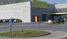
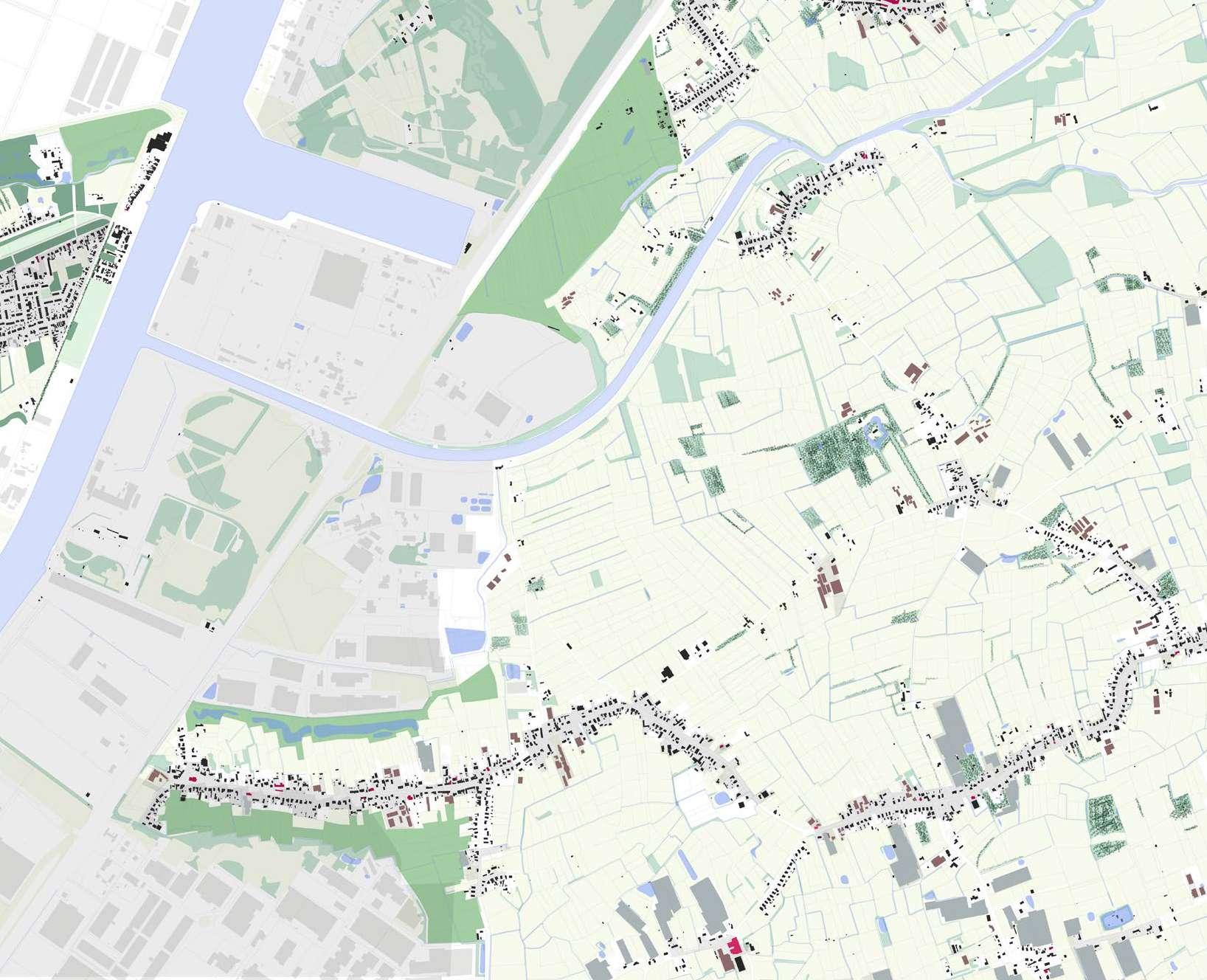
The site is characterised by large urban boxes nestled in dense suburban fabric, and located at the highest point topographically to its immediate surrounds. With the current changes of how we live, work and play, and the growing need to cope with rapid urbanisation and sprawl in Ghent, the question of how can we repurpose to adapt? arises. Carrefour is a retail chain and home to one of the largest ‘big boxes’ in the area and also maintains a large open ‘sealed’ parking lot located along the prominent Antwerpse Steenweg. In ad dition, the site is surrounded by existing social infrastructure such as churches, schools, community facilities and agricultural land all within walking distance.

234 2021
30m 60m Carrefour Carrefour
School Church School Youth centre Commercial SchoolCommercial
Forested area
Forested area
Forested area
Mixed-use building
New urban square
Commercial units
Residential units (medium)
Residential units (small)
Assisted living facility
Kindergarden
Social structures
Circulation
Education Co-working space
Sports center
Big boxes as an urban nucleus
Sports area
Floodable courtyards
Mixed-use buidngs
Mixed-use buidngs
AntwerpseSteenweg
Community park
New common
Mixed-use Community park
New common
Residential Community park
New common
The reimagining of ‘big boxes’ aims to create new urban public squares. The squares act as an urban nucleus, drawing the surrounding neighbourhoods into the social space, through the proposed new commons, and integrated with the existing social infrastructure. The square creates a clearing in the proposed forested high point of the site. The mixed-use buildings in the square becomes a nexus for the area. Urban squares work with the water management and flooding, the stepped public squares collect water and stores it over the rainy season in a mineral water retention system fed from surrounding desealed surfaces and buildings. Green and blue systems are integrated as part of the overall scheme, requalified roads, bioretention systems, new public parks and commons all work as one network.
235 2100 30m 60m
2100
Current
Community Sports + Residential
Backyard common
ResidentialSport/youth clubhouse
Residential Secondary Road
Residential community park Mixed-use community
Residential - Densified overlooking sports/clubhouse
Bioswale


Backyard common Converted social infrus. with park
236 2021 -
- Vision Commercial Residential
Panel Shop
Social Infrustructure


Residential Secondary Road
community park Mixed-use community park square
social park
Densified mixed-use
Bioswale


Desealed road and school/ community common

Church square - mixed use, live, work and play
Antwerpse Steenweg
Two-way lane
Shared Road
Housing typologies and transformations are in response to existing social infrastructures such as schools, churches and social spaces. Transformation responds to the local scale, and creates smaller squares/public spaces which are connected through green, desealed streets and new common backyard spaces forming a larger green and blue network vison for 2021.
237 +
10m 20m 10m 20m
ChurchSint-Janscolllege Oude Baree Cafe + Residential
2021 - Current
Carrefour parking lot + Commecial/Residential


Urban public square + Mixed use + water retention
Mixed-use, social, commercial and residential
Mineral water retention system
Urban square in forest clearingBioswales + biore tention ponds
2100 - Vision
238
Residential ResidentialParking lotCommercialCommercial
Carrefour retail 'big box' + Residential
Urban Nexus
Residential, co-working spac es, library and social structures
Residential forest clearing
The new urban square acts as a nexus for the surrounding community and creates a clearing in the forested slopes. Water retention systems work with surrounding floods and buildings, over the wet season, the stepped square become less accessible and more about waterfront living. The 10-story mix use building houses both public and private functions residential, co working spaces, a library and social structures. The section depicts the relationship between existing fabric and new fabrics intertwined with social infrastructures.
239 Residential 10m 20m 10m 20m
Carrefour Residential
Repurposing the urban relationships: New urban square
The floodable square acting as a new node for Sint-Amandsberg and is characterised by the surrounding neighbourhood. The dia grams show how water, nature and humans can flood the spaces, the square connects and creates a larger composition of spaces dealing with the rapid urbanisation in Ghent. The transformation of surrounding buildings, and the creation of a more dominant structure grounds the square as a node, spaces bleed out onto the square housing facilities for live, work and play intertwined with its surrounds.
240
241
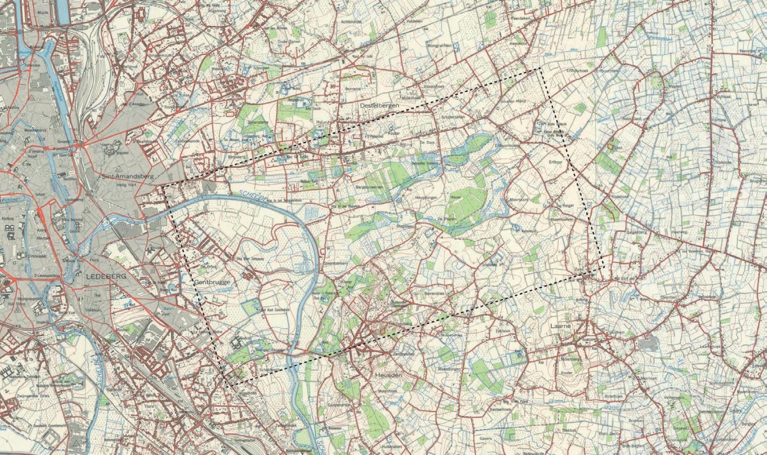
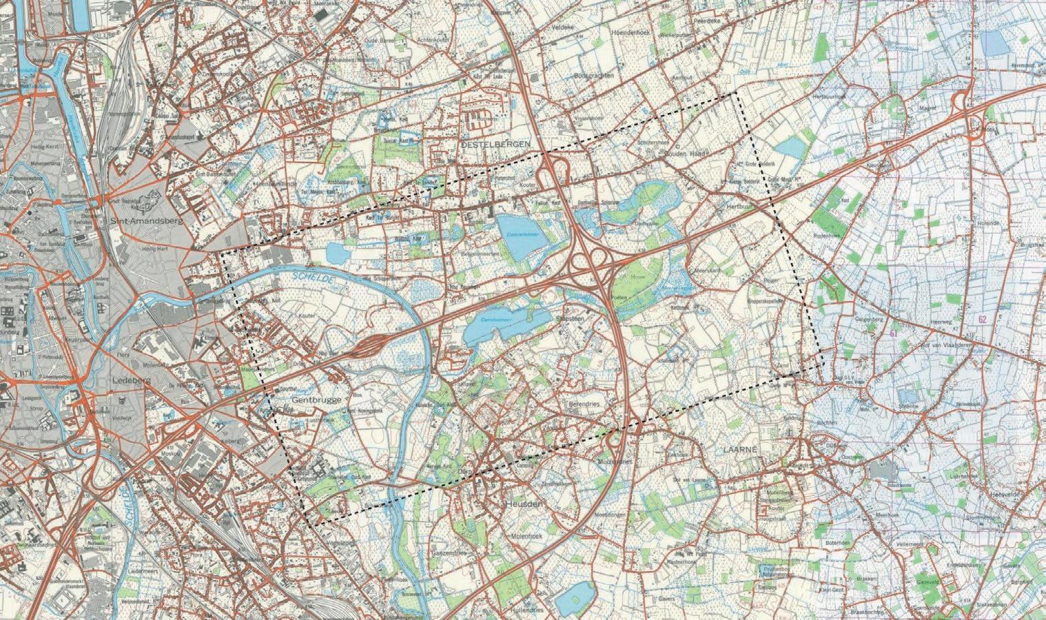
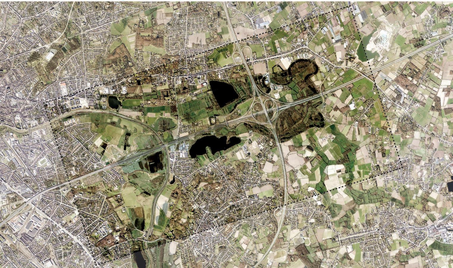
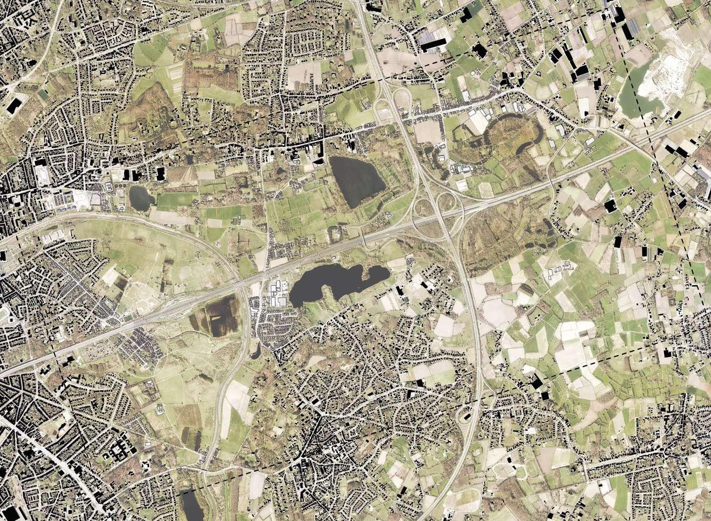
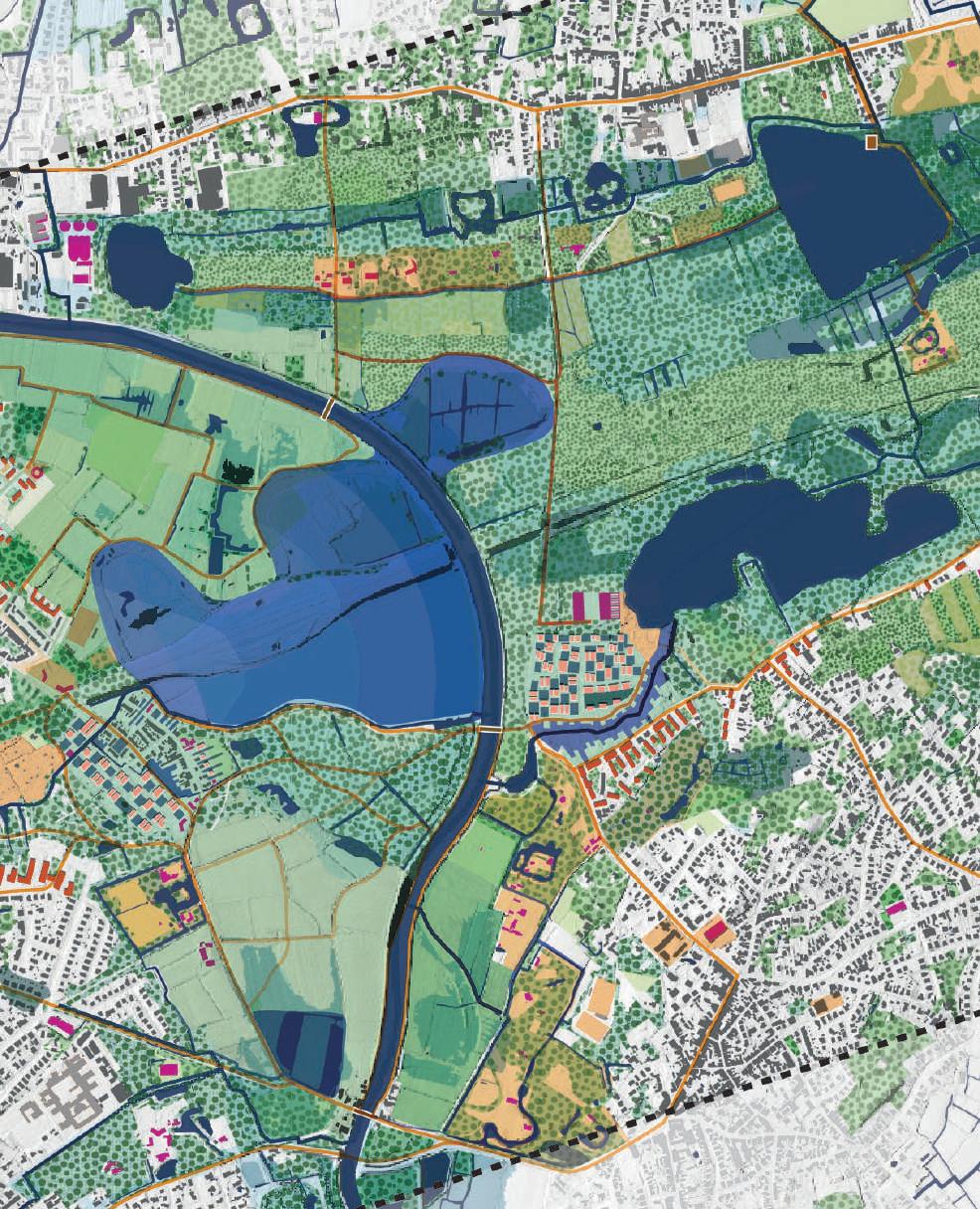
243 03.04 Revealing the Marshland: Shaping Urban-Floodplain Interfaces along the Schelde ERMIONI CHATZIMICHAIL CARLOS MORALES DÁVILA SEBASTIÁN OVIEDO CASTELNUOVO TIEN HUU TRAAN
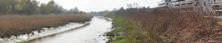
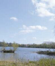
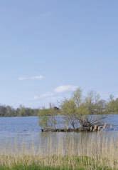
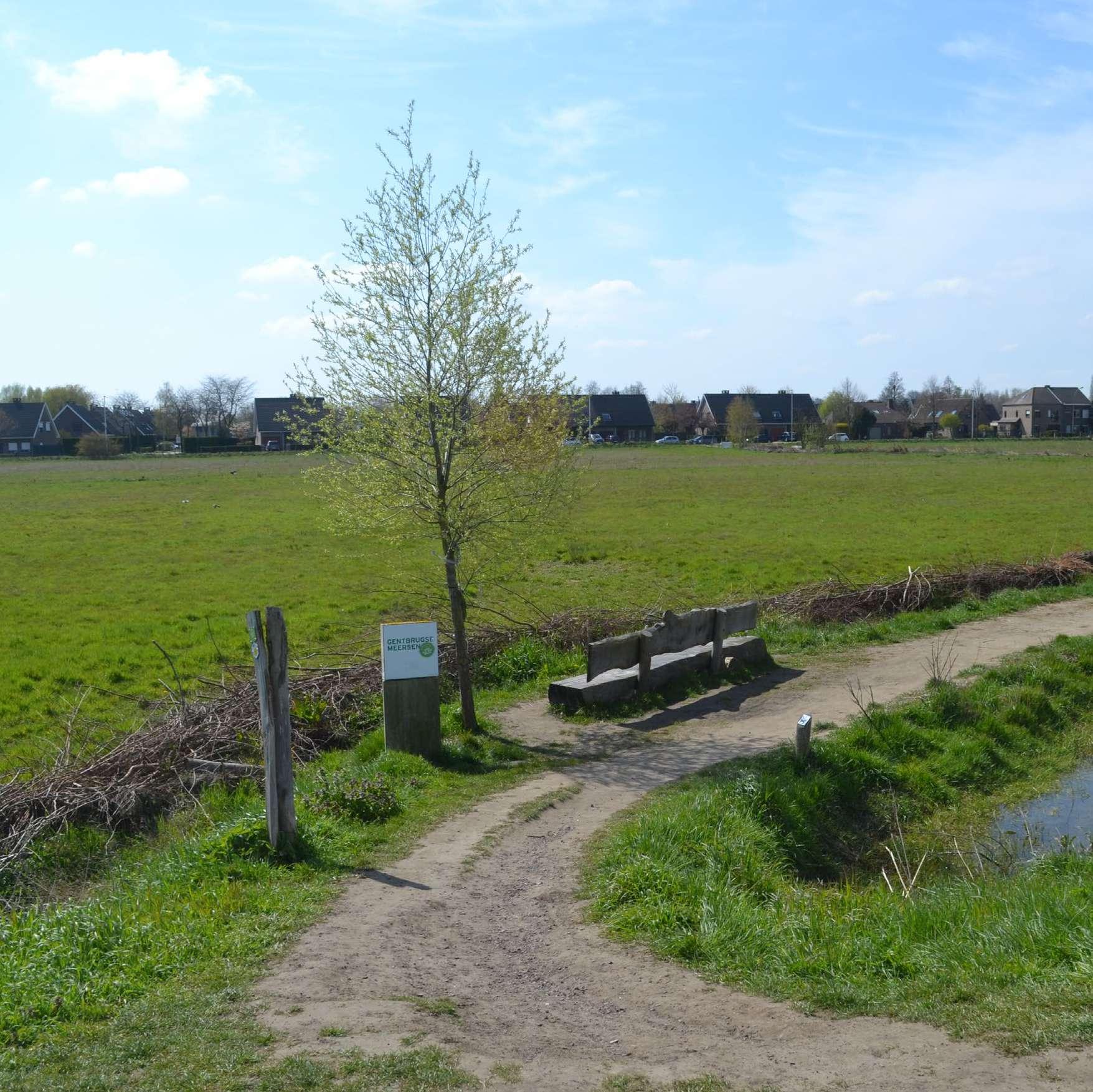
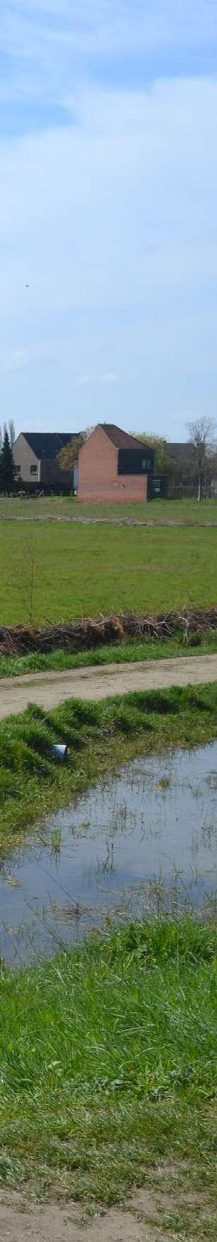
Gentbrugse Meersen
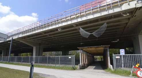
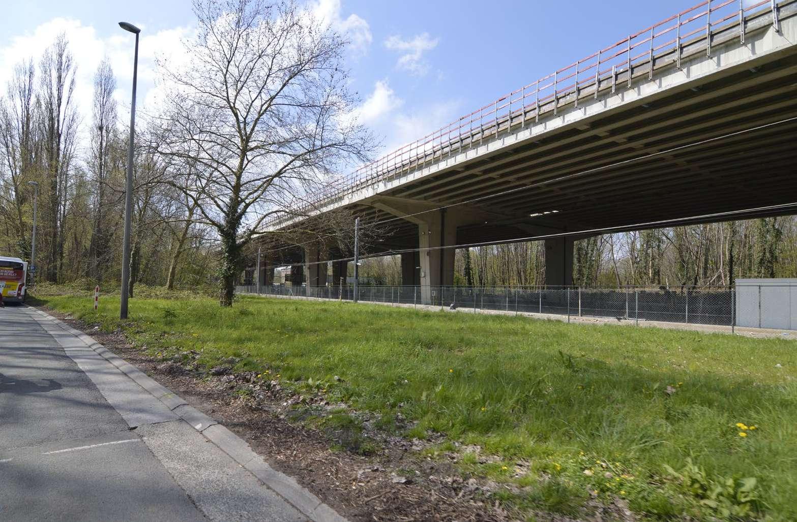
"One of the main challenges of both the Gentbrugse Meersen and the quarters of Gentbrugge & Ledeberg, is the viaduct of the E17. This transnational highway runs above the neighbour hood, creating health andsafetyhazards.Anongoingrenovation isrelievingsomeof theproblems,howeverthe Flemish govern ment is in the early stagesofastudyforthelongtermfutureof the viaduct (with a horizon of 2040,which is the ‘expiration date’ of the viaduct’s life expectancy).
IntheshadowoftheviaductliestheformertownhallofGentbrug ge (back when it was an independent community), a remarkable piece of brutalist architecture by Paul Felix.This building is be ing renovated, after which it will remain a public building, combining a number of different public functions, such as a school, a library, an arts academy, a public service counter and a cafeteria.
The Gentbrugse Meersen have been developed as a green space on the scale of the whole city. What’s less clear, however, how that differentiates from the role it plays in its direct surroundings, and whether that local importance should in crease if the surrounding urban tissue expands and/or den sifies."
(Blondia et al.2021,34)
244
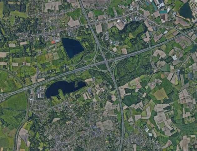
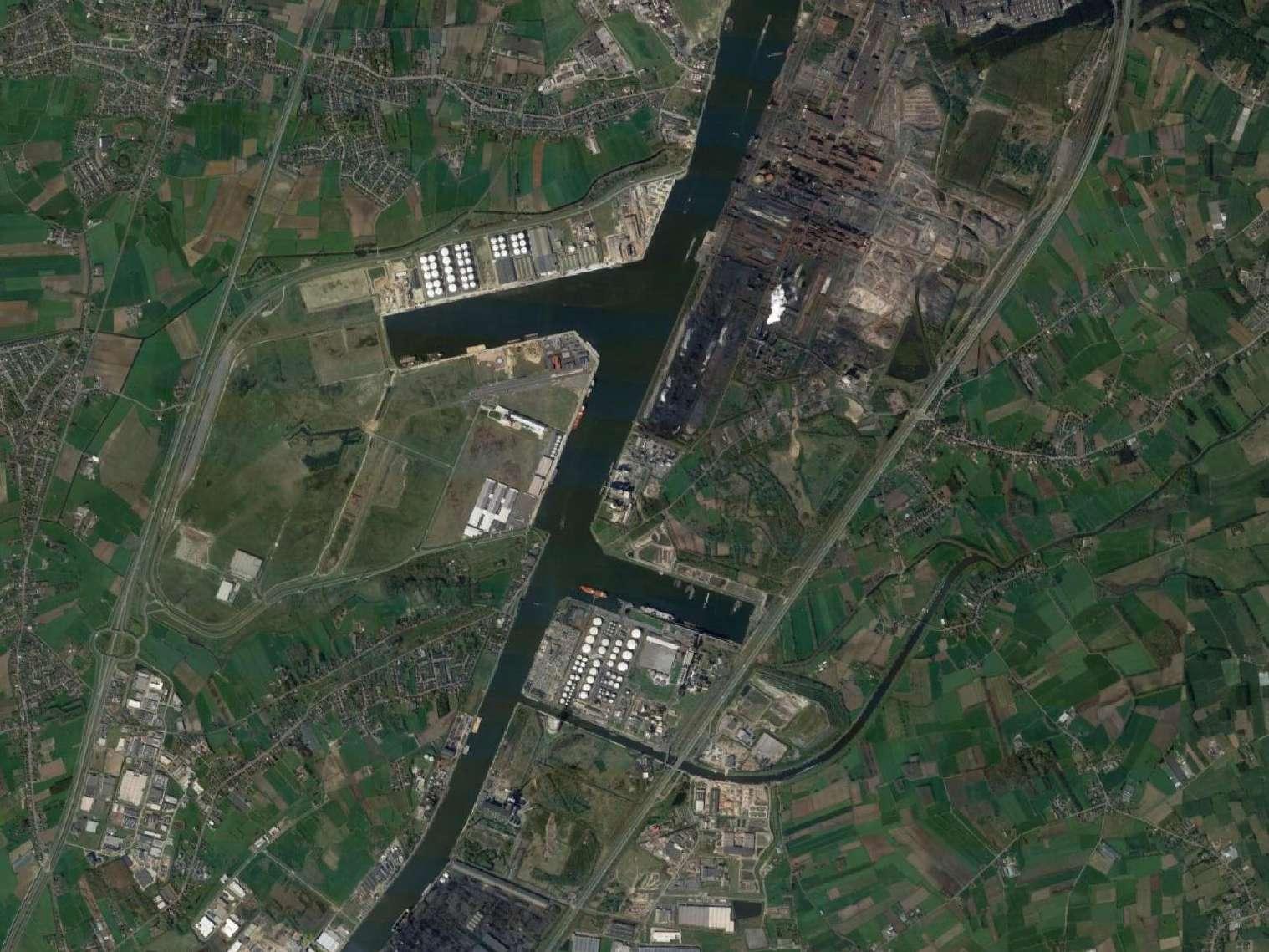
245 ©
Google Earth
246
247 1.0 ANALYSIS
248
Reading & Interpretive Analysis
1.1
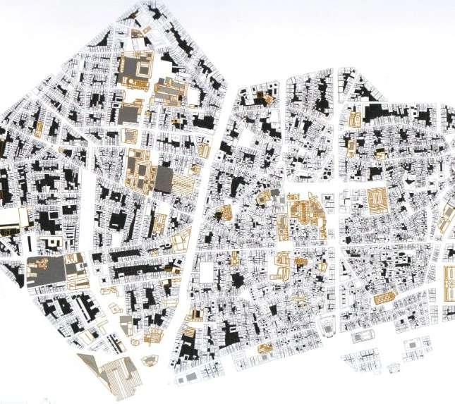
Joan Busquets and Felipe Correa
REVERBERATING MEANDERS
Busquets, Joan, and Felipe Correa. 2005. New Orleans : Strategies for a City in Soft Land. S.L.: Harvard University, Graduate School Of Design, Cop.
250
© Joan
Busquets and Felipe Correa
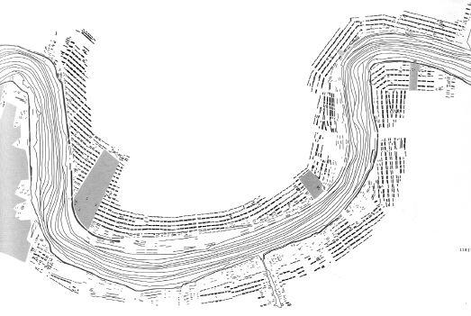
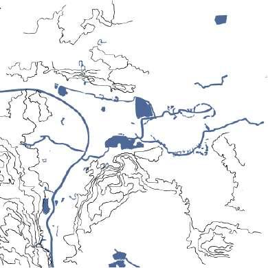
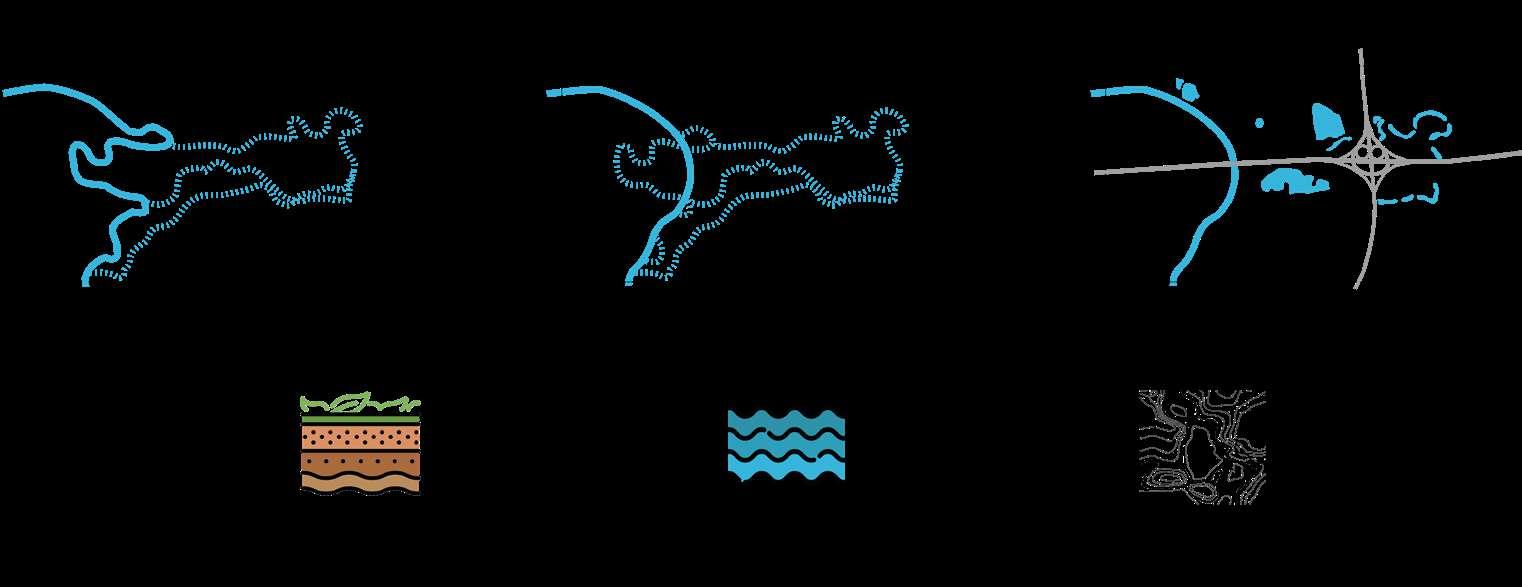
In their book New Orleans, Strategies for a City on Soft Land (2005), Joan Busquets and Felipe Correa develop drawings to schemati cally highlight and synthesize characteristics of the Gulf city’s ur ban structure relative to landscape armatures. The methodolo gy we chose highlights the directionality and density of the urban blocks as influenced by the Mississippi river. In their example, city elements are reduced to simple black lines that illustrate the linear character of landscape and urban structures.
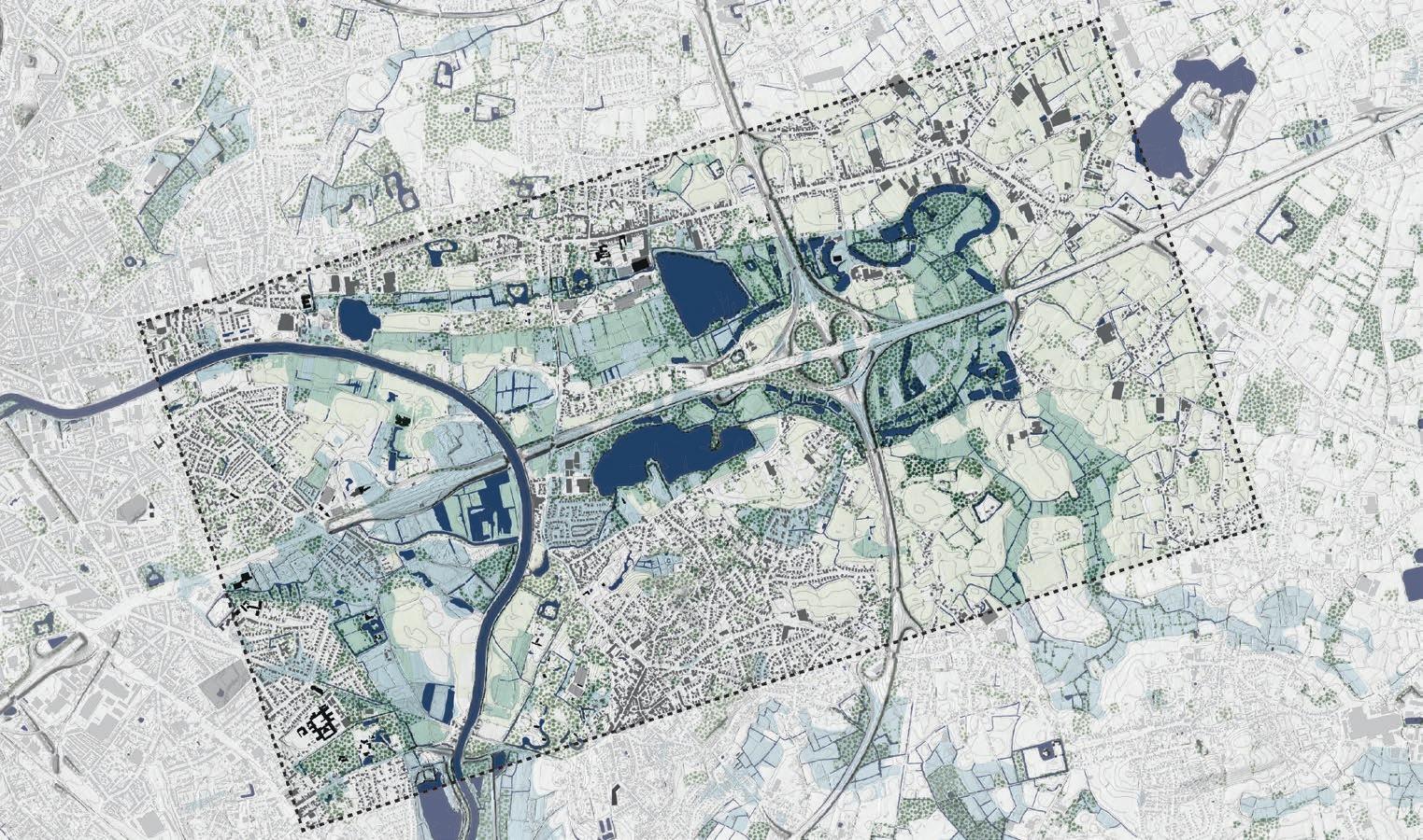
Rather than a heavily urbanized area following a hierarchical linear structure—as in the case of the Port area surrounding the Mis sissippi River—urban grain around the Gentbrugge Meerse follows different directionality patterns. Currently channelled, the Schel de historically meandered in the floodplain, surrounding a slight topographic spine in the East-West orientation, now beneath he highway (Layer 1). Despite the current concentration of water in two big lakes associated with the earthworks of the viaduct, the historic meanders and their linear configuration still determine the directionality of agricultural plots in the floodplain (Layer 2). At the same time, settlement on slight mounds follows a different logic and displays a more complex multi-directional pattern (Layer 3). To maintain clarity of these two different systems, color has been added to differentiate urban grain (in red) from plot structure in the floodplain (in black). Similarly, mounds have been added as graphic fields.
The method is helpful to uncover the underlying landscape logics and their shaping of the urban fabric over time. In this case, analys ing directionality unveils the primary topographic and hydrological conditions of the site, shifting attention away from elements that would seem to dominate this area’s morphology in the present. The method requires adaptation for systems more complex and contradictory than the example by Busquets, where the Mississippi clearly dominates grain directionality.
251
Mound-floodplain interface in Gentbrugse Meersen
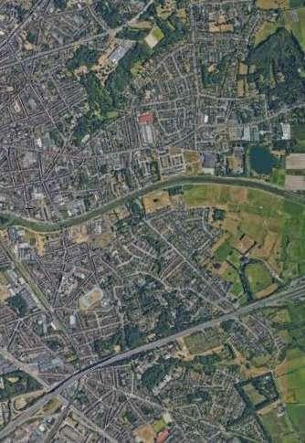
Aerial Photo of the Gentbrugse Meersen in Ghent, Belgium
2005 ©
Google Earth ©
Ciel Berings
Watermarks: historic meanders of the Schelde


252 Layer 2: Floodplain parcels directionality Layer 3: Grain directionality & topography N LAYER 1: WATERMARKS LAYER 2: GRAIN DIRECTIONALITY + TOPO Layer 1
FINAL OPTION A
OPTION A
Reverberating Meanders: two systems of directionality meet. Whereas settlement on the mounds is associated with topogra phy, plot structure in the floodplain still echoes the meandering Schelde.
253
FINAL
Bas Smets
MARSHLAND URBANISM
Mapping examples and inspiration
254
© Bas Smets
According to Cécile Houpert and Imraan Begg:
"To find the landscape behind the land, Bas Smets investigates a given territory by “delayering” its essential elements. This way, he reveals an unseen reality that can serve as a basis to transform the territory into a new reality.
In our urban analysis inspired by Bas Smets and applied to the site Gentbrugse Meersen, the drawings serve to make this new reality appear. Following his meth od, we redraw the natural and artificial elements in the landscape, the water ways, the trees and the parcels, in separate layers. We then combined them to look for a new kind of relationship between these elements that could mean something new for the landscape. This type of analysis allows to understand how the elements work together or with one another.
In the case of Gentbrugse Meersen, despite its softness, topography informs the other natural and artificial elements and shows a relative degree of openness on the site. Natural waterways and ponds are present in a quite unique way, reveal ing the path of the historical Schelde river and its meanders, while more artificial structures like denser urban tissues, agricultural patches and canals create a sort of frame on higher grounds.
Deliberately unmapped, the E17 highway still appears in the background of many of the drawings, which intersects its strong visual presence in the territory. Knowing the health and safety hazards created by this gigantic infrastructure, this element should not be ignored in the design phase. However, the delayer ing process allowed us to discover a historical marshland whose potential lies a bit untapped and which could be reinforced to show the essence of the site: its large amount of open spaces."
255
The aerial view of the site does not allow to perceive the land scape behind the different territorial elements.
2011
© Google Earth
Contours and natural rivers
Artificial waterways
Flooding areas
Forest patches Tree lines
patches
Fragmented urban tissues
urban tissues
tissues
256
Agricultural
Dense
Industrial

257
258
Fieldwork
1.2
Qualitative information maps
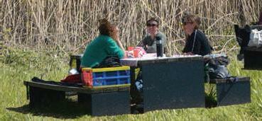


First impressions

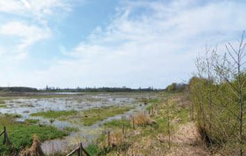
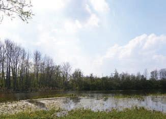
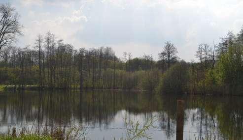
The collage represents the first impressions and unique charac teristics of the whole Gentbrugse Meersen area. It highlights the elements and aspects that stand out and make the overall site dif ferent from the rest of Ghent. As it can be seen, the main feature is the continuity of the marshlands throughout the area, despite the fact that it gets interrupted by the viaduct of the E17 road.
The marshland is interpreted as one connected space, and even though the viaduct is an obstacle, it doesn’t split the landscape. Furthermore, the collage demonstrates three distinct compo nents, the dry land, the marshland and the openness to the sky.


260
Memorable moments
261
Poster Across the Marshland: Clarifying Ghent’s Rela tionship with the Scheldt’s Floodplain


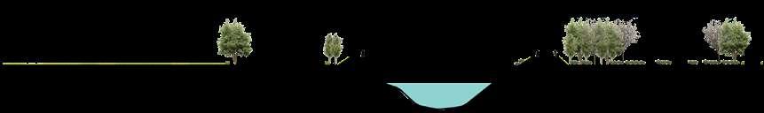
The poster represents the site as a number of sections across the marshland. The different relationships and interfaces unfold between wetland and dryland. The various scales and levels of wetness mark this space where productive land scapes coexist with recreation and highly valuable ecologies.


262
Forested wetlands encroached by urbanization
wetness concentrated in anthropogenic ponds
tidal wetlands and agriculture along the Scheldt
urbanized, narrow floodplain
263
Sections
264 © Google
Earth
1.
265 2. 3.
266 4. 5. © Google Earth © Google Earth © Google Earth
267 6. 7.
268 8. 9. © Google Earth
269
270
Argumentation & Strategy
1.3
How have the different landscape systems been a guiding element for urbanization?
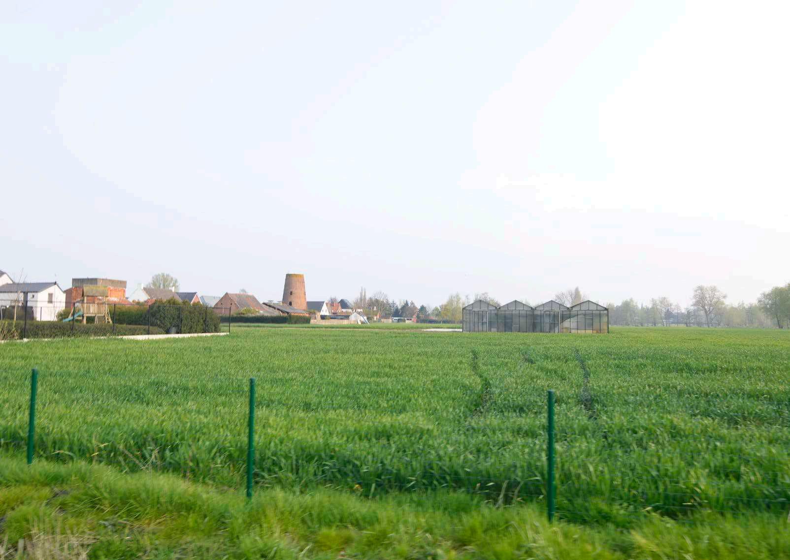
The widening valley system of the Schelde has structured the ur banization of the area throughout history. Soil, water and topog raphy have shaped the location and type of inhabitation in each area around the marshes.
Milestones/Important Components
i. Clay of the Schelde for bricks
Agriculture in fertile floodplain
Peat pits
Embankment of the Schelde
Highway construction
vi. Sand mining and creation of ponds
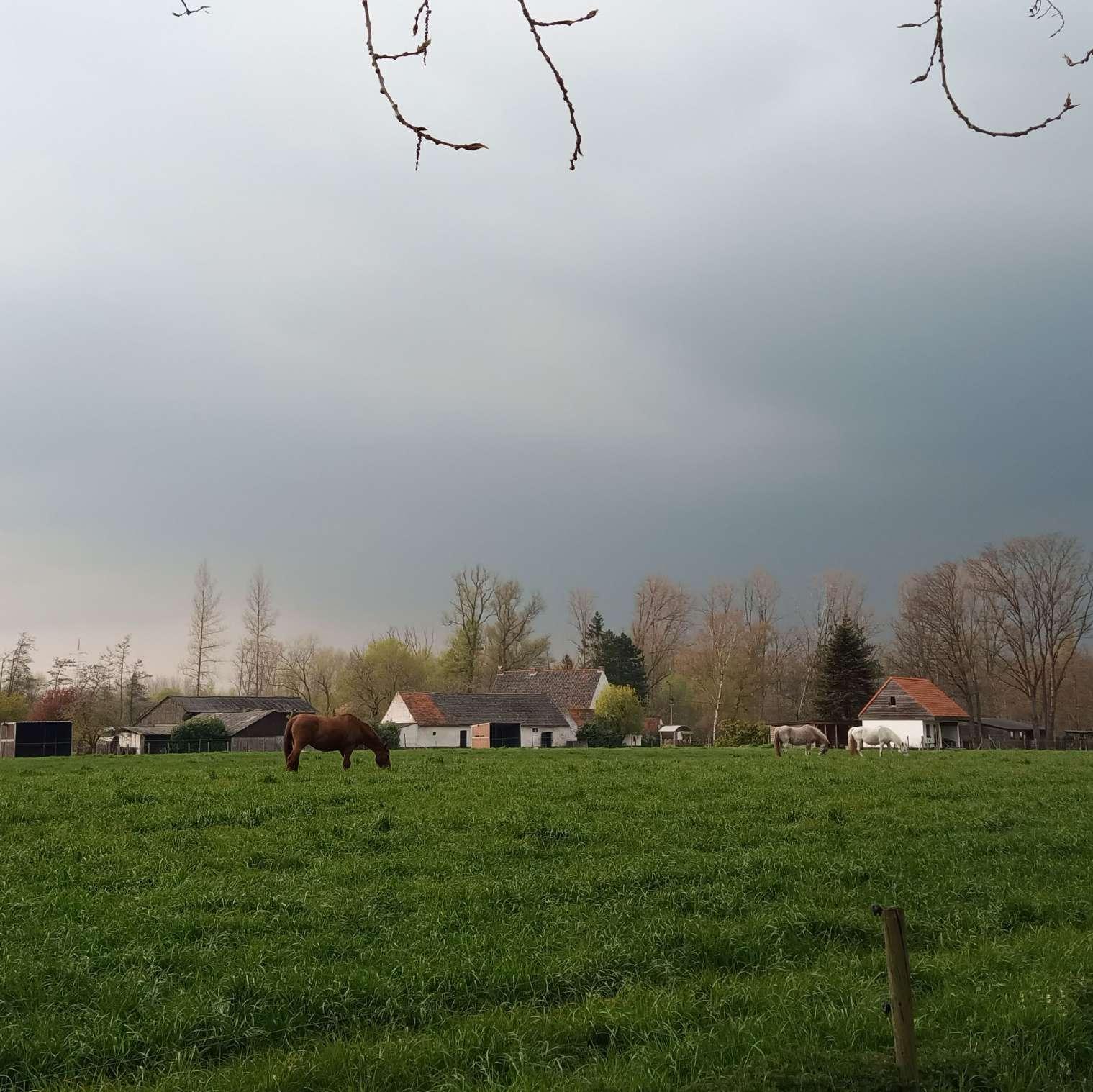
Horticulture viii. Horses
272
vii.
ii.
iii.
iv.
v.
Urban Pressure in floodable ar eas and environmental sensitive areas
Loss of biodiversity increasing ecological discontinuities
Backyard relationships neglect ing or privatizing the park / the Schedlt
Car-driven culture
273
Which conflicts and future challenges exist from the linkages among the systems?
Conflicts
Urbanization in flooding-prone areas
Urbanization and intensive land uses (horse breeding and agricul ture) in ecologically Sensitive Areas
Fertile land consumption through suburbanization and horsifica tion.
Conflicts emerging from ‘Green Lung’ as city-wide destination: In creasing pressure and conflicting interests of users (metropoli tan vs local scales, manifested in speed, cars, crowding).
Viaduct (E17) cutting through neighbourhoods and fragmenting ecologically sensitive areas, severing relationships across marsh land, adding noise and pollution to surroundings.
Embankment of River weakens its ecological functions vii.Back yard relationship between urbanization and the river + marshes as primary landscape systems.
274
275
Which conflicts and future challenges exist from the linkages among the systems?
Opportunities
Despite growing encroachment, efforts have been taken and marshland ecologies remain healthy and diverse.
Incremental decommissioning of section of Schelde as transpor tation route opens opportunities for re-naturing and connections across the stream.
Viaduct reaching the end of its life cycle opens opportunities to reintegrate the marshland area.
Designation as green lung and its ‘discovery’ during pandemic in creases awareness and sense of stewardship for marshes.
Marshland as an opportunity to reconfigure water cycles within the city in the face of worsening drought and flooding conditions.
Abundance of historic domains provides opportunities for recom moning valuable forested spaces.
An aging housing stock in the area creates opportunities for ac commodating population growth and rethinking housing schemes to accommodate more diverse populations.
276
277
Which conflicts and future challenges exist from the linkages among the systems?
Future Challenges
The area’s designation as a green lung adds pressure in terms of new urbanization around the marshes and possibly in them.
Ensuring affordability for existing and new residents will be a chal lenge as the area becomes even more attractive.
Making the area not only affordable but also suitable for diverse types of peoples will remain a challenge as the area is poorly con nected and ill-served.
Population growth in the area will have to be strategically accom modated to prevent greenfield consumption and preserve existing positive qualities.
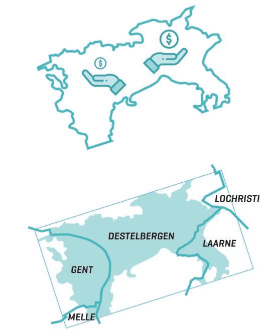
Administrative fragmentation: the Green Lung area spans across the administrative boundaries of Ghent and Destelbergen.
278
279
280
Who’s excluded from the system, who controls it, and who is benefitting from it?
281
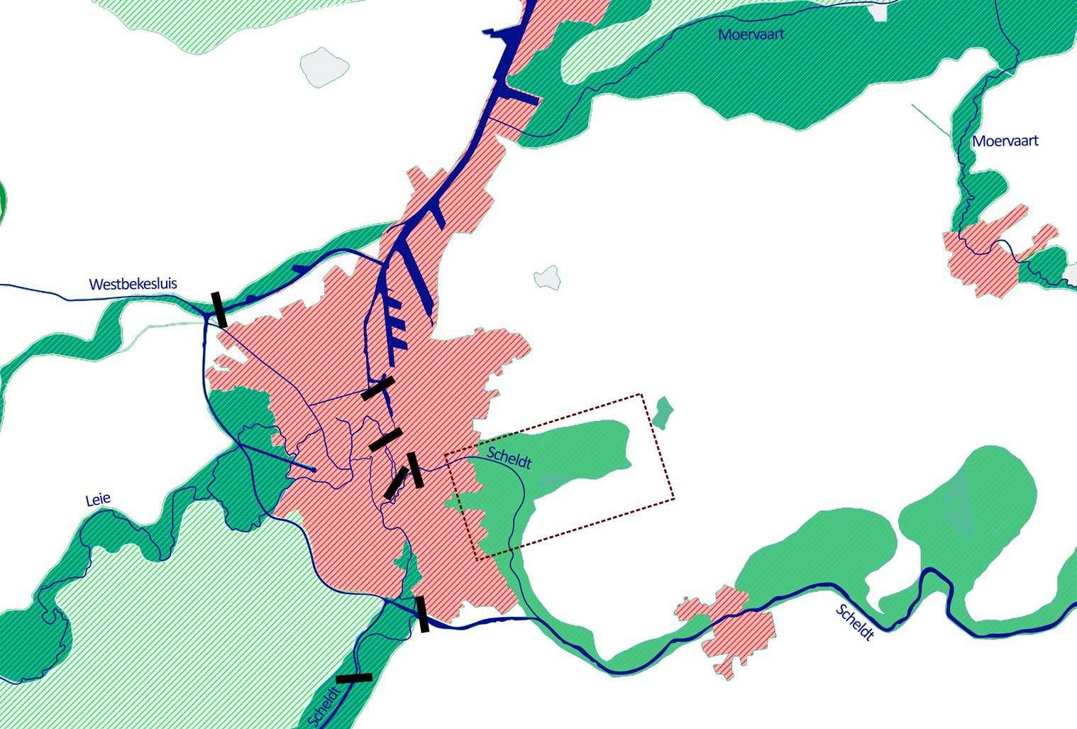
Territorial interface: gateway to the tidal system
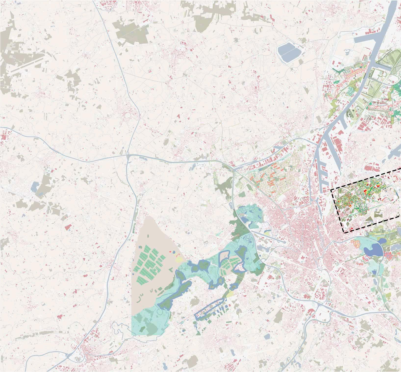
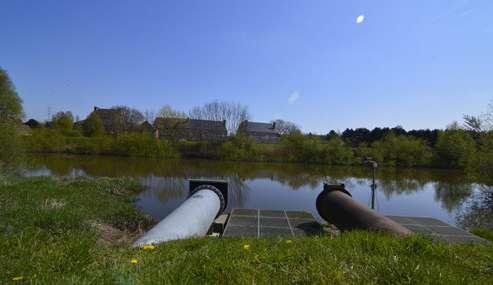
This area is particularly important due to the regional water system. After being in terruptured and channelled by a number of locks and other artificial systems in the city, the Schelde gets released at this site. As a result, the river regains its tidal con dition. However, the Schelde has been turned into a channel with dikes on both sides that separate it from its floodplain. With increasing threats of flooding, the water system of the area must be critically evaluated, with this site as a crucial component.
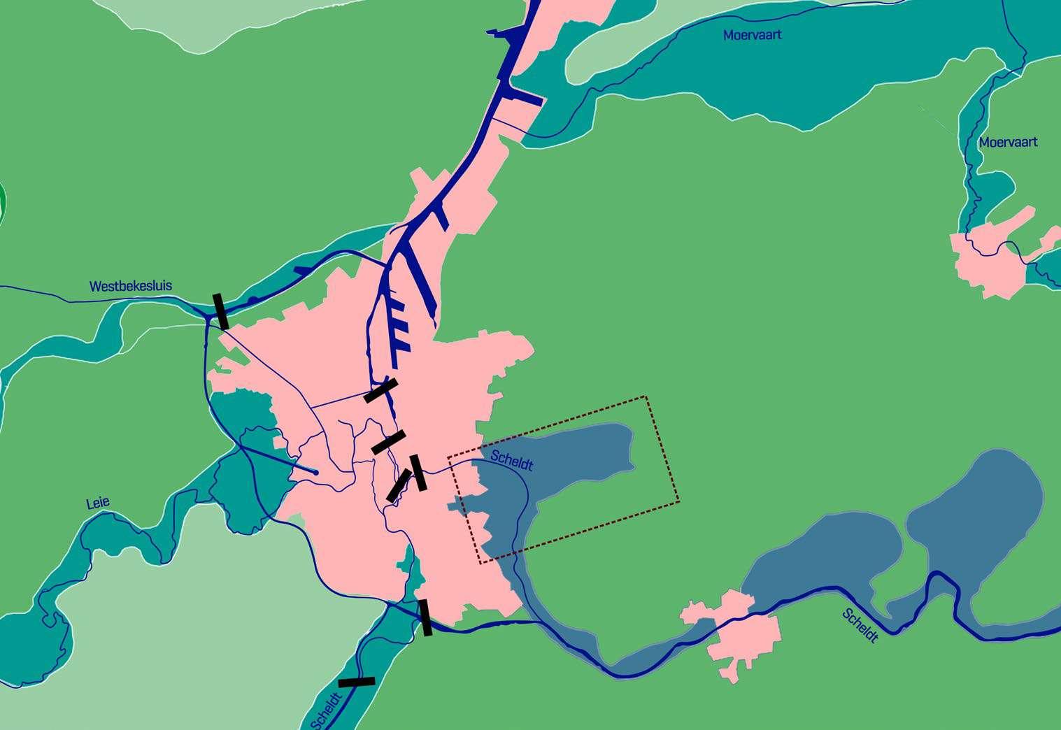
Sandy region within the Flemish Valley Scheldt basin without tides Scheldt basin with tides Urban areas and port areas
282
0 0.5 km 1 km 2 km N
Tidal system interface between two water basins
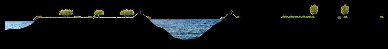
Along its course, the Schelde’s floodplain expands and contracts. The areas of ex pansion, such as Gentbrugse Meersen or the meanders in Donk, are unique land scapes that must be protected and enhanced. Their remarkable qualities make them crucial for the region’s ecology, at the same time that they provide opportunities an chor people to the landscape. Decommissioning the E17 highway that currently cuts through this site would be a first step in reclaiming this marshland and its ecologies.
areas

283
N Urban
0 0.5 km 1 km 2 km N
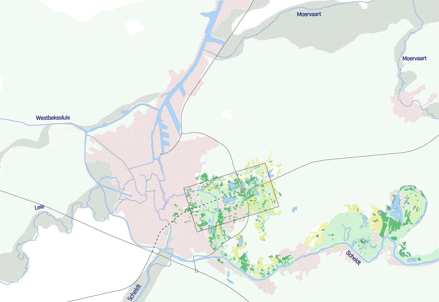
Historical Maps
284
1873 © Geopunt 0 0.5 km 1 km 2 km N

285 1939 © Geopunt 0 0.5 km 1 km 2 km N
Historical Maps
286 © Geopunt 1969
0 0.5 km 1 km 2 km N
287 © Geopunt 1989 0 0.5 km 1 km 2 km N
Existing situation
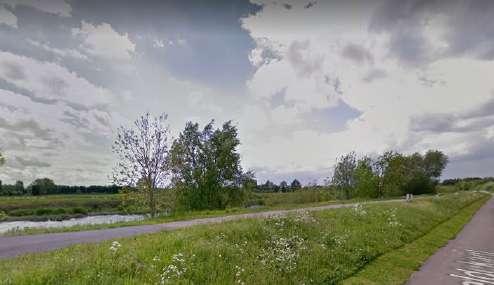
Satellite Image with flooding
The current condition of the Gentbrugse Meersen reveals growing suburbanization in flooding areas. Alongside the viaduct and other minor roads, allotments have reduced the integrity and legibility of the valley system that was evident in the past.
288
0 0.5 km 1 km 2 km N
Existing situation map
289
0 0.5 km 1 km 2 km N
Systemic conflicts
Different patches of urbanization are in high risk of flooding. Their location coincides with the historic figure of the marshland.
Flooding & Urbanization
290
0 0.5 km 1 km 2 km N
Urbanization & Topography
Though subtle, differences in slope conditions and soil type create different landscape figures. In grey, the lowlands with less than a 1% slope percentage. The figure once again coincides with historical maps.
291
0 0.5 km 1 km 2 km N
Systemic conflicts
Over time, construction has ocurred either in or in close proximity to highly valuable areas in terms of ecological diversity and relevance to broader systems
Urbanization in ecologically valuable areas
292
0 0.5 km 1 km 2 km N
293
294
295 2.0 DESIGN
296
Eco-Systemic Visions
2.1
An alternative vision
The project proposes to reclaim the landscape figure of the Marshlands ias a green lung for the city. The Schelde’s Floodplain will be protected in order to recuperate its function as a hydrological regulation system.
The Floodplan is restored as a gradient of wetness derived from its unique landscape conditions. Needed for climate change, the restoration also anchors Ghent to the broader water system it is a part of. At various scales, the vision reverses the recent suburbanization and disruption in ecological sensitive areas. The floodplain becomes the framework of urbanization, and the site is an opportunity to mitigate flooding. Here, Ghent harnesses its unique opportunity to rethink its relationship to water.
The vision is realized by a number of interventions both inside the marshland, and on the interfaces.
Current water locks situation
Proposed water managment
298
299 0 0.5 km 1 km 2 km N
Delayered Vision: Reclaiming social and ecological continuities
Starting from the bigger scale, a crucial step in this process is the gradual elimination of the E17 highway. Whereas decommissioning could start right away, we envision an incremental process of renaturalization that would span several decades. This
Reclaiming space for nature, water and people would help reestablish the ecological and social continuities that are now interrupted. Eliminating the viaduct is a crucial step to reclaim crucial land scapes in the face of climate change.
300
0 0.5 km 1 km 2 km N
301
Delayered Vision: Reclaiming social and ecological continuities
Several sectional modifications aim to preserve and re-claim spaces for human and non-human ecologies. Earthworks create more room for water to deal with growing flooding threats and advance climate change mitigation measures. Waterways are renatured to increase biodiversity and protect Ghent from drought, flooding and heat island effects.
Existing green-blue systems
Proposed green-blue systems
Existing situation
Proposed situation
Reclaiming the Space for People Reclaiming the Space for Water
Existing situation
Proposed situation
302
Reclaiming the Space for Nature
Existing situation
Proposed situation
303
Delayered Vision: Activating Waterscapes
The vision reactivates water as a guiding force in this dynamic landscape. A major component of this is to strategically break the dikes that constrict the Schelde and let the river recover its most recent historical figure, still visible in the land. At the same time, the waterways that feed the marshland are recovered as spines that connect people and other species to this landscape.
304
0 0.5 km 1 km 2 km N
Delayered Vision: Rythms of Soil Use


Similarly, the characteristics of the park are defined by its unique soil and wetness conditions. Analyzing the potential natural vegetation of the site helped to determine the ecosystems that are most suitable in each specific area based on water, soil and topography. Afforestation strategies then start with the habitats of highest ecological value, such as the alder swamp wood, represented here in the darkest shade of green and blue.
Alder Swamp Alluvial Forest Sandy Soil Forest Agroforestry Agriculture Greenfields
305
Existing Proposed
0 0.5 km 1 km 2 km N
Delayered Vision: Transforming the Urban Grain
Recovering the figure of the Marshland also de mands interventions in the existing urban fabrics. Urbanization along the edges is reconfigured to accommo date population growth and redefine the relationship with the marshland, currently somewhat of a backyard. At the same time, patches of urbanization that are within the marsh
land are adapted to simultaneously mitigate flooding and strengthen the figure of the park. Similarly, horticultural ac tivities on the eastern edge of the marshland are relocated.
306
0 0.5 km 1 km 2 km N
Delayered Vision: Gradients of Experience
The ecological gradient that structures the park then provides the basis for deter mining the level of accessibility of each area. The areas of highest value, such as the alder swamp forest towards the east are preserved for non-human species. Mean while, the west is reclaimed as a wetland park that accommodates recreation and productive landscapes in a dynamic setting.
Most protected Limited intervention Intervention Most accesible Accesible Less accesible
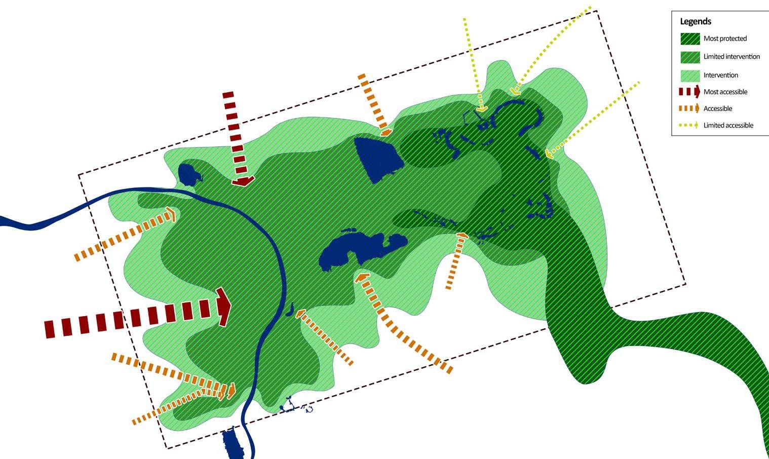
307
0 0.5 km 1 km 2 km N
308
Design Proposal & Typologies
2.2
© Huu Tien Tran
Gigantic marshlands of Ghent
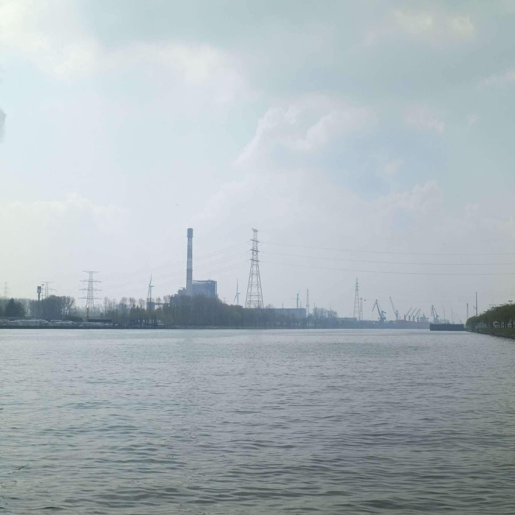
The gigantic marshlands along the Scheldt, the Leie and the Moervaart characterize the structure of the "new front" of Ghent.
The dense urban area of Ghent presents as the enormous sealed sur face that disconnects the ecological continuity of the natural marsh and water system. At the same time, this gigantic urban sprawl also have the tense impacts on the water system because of the constant con cretization of land, the canalization of natural meanders and the water managing “locks” along the rivers, which increases the hazardous ef
fects of draught and flooding. The marshland in Gentbrugse Meersen can be considered as the gateway where the water from the inner city released. Therefore, besides the high ecological values, the site also has the potentials to deal with the pressure from the dense urban core due to suitable strategies applied for the water system.
311
The ecological system along the Scheldt
Expansion of the floodplain along the Scheldt (in Gentbrugse Meersen, Wichelen & Donk).
At the territorial scale of the Scheldt, there are obviously three locations that can be considered as the widening of the Scheldt’s floodplain: 2 lo cations in Donk and Wichelen, and the last one is Gentbrugse Meersen.
These locations have their own qualities and unique values, yet, together they can formulate the wet-park system which enhances the ecologi cal continuity along the Scheldt, attracts people by the aesthetic land scape and last but not least, creates the suitable habitat for a number of non-human species.
312
Vision for Gentbrugse Meersen in 2100
The proposed development of the City park in Gentbrugse Meersen has the ability to influence the new ways of thinking about the urban park in the future due to the relevant strategies which do not only priotirize “adding more green” to the place but also take into account the current qualities and conditions of the site such as different soil types, forest and water system and the existing setttlment patterns. The Project re veals the importance of understanding about the Metropolitan area in which all the factors can be considered as different layers that overlap
and influence each other to ensure the stable development of the sys tem. Moreover, the project reflects the decommissioning of hard infra structure (E17) which change the way of thinking about the mobilty and new settlements. In particular, the new settlements will be guided by the pedestrian paths and the logic of ecological system, which prevents the new construction on greenfields and reclaims habitat for non-human factors.
313
Revealing the Marshland: Shaping Urban-Floodplain Interfaces along the Schelde. Strategies proposed in Ghent Design Studio - MaHS - KU Leuven.
314
Gentbrugse Meersen in 2100
315
Spaces of Intervention
Gentbrugse Meersen
Heusden

316
Heusden

317
0 0.5 km 1 km 2 km N
318
Location of Gentbrugse Meersen
319
0 0.5 km 1 km 2 km N
Existing Situation
Section A - Existing Situation
B - Existing Situation
320
Section
© Google Earth A A B B
The intervention area is located at the interface between the city and the peri-urban area, on the west side of the proposed metropolitan park.
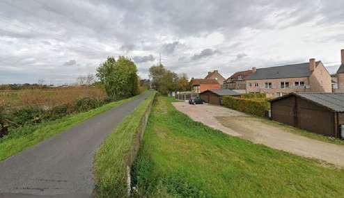
According to the field work carried out, we identified that this space is the most dynamic space in the entire park given its proximity to mobility axes and important transport infrastructures, which also gives it the status of a gateway to the site.
The main conflicts identified are given by the viaduct that cuts off ecological systems, but also spa tially segregates the city. On the other hand, various negative urban conditions are identified mainly as a consequence of the suburban development model promoted until today. Some consequences of this are the privatization and / or denial of public space, the culture of the vehicle, the sealing of the ground, among others.
321
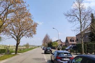
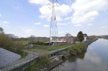
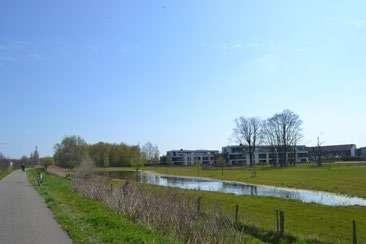
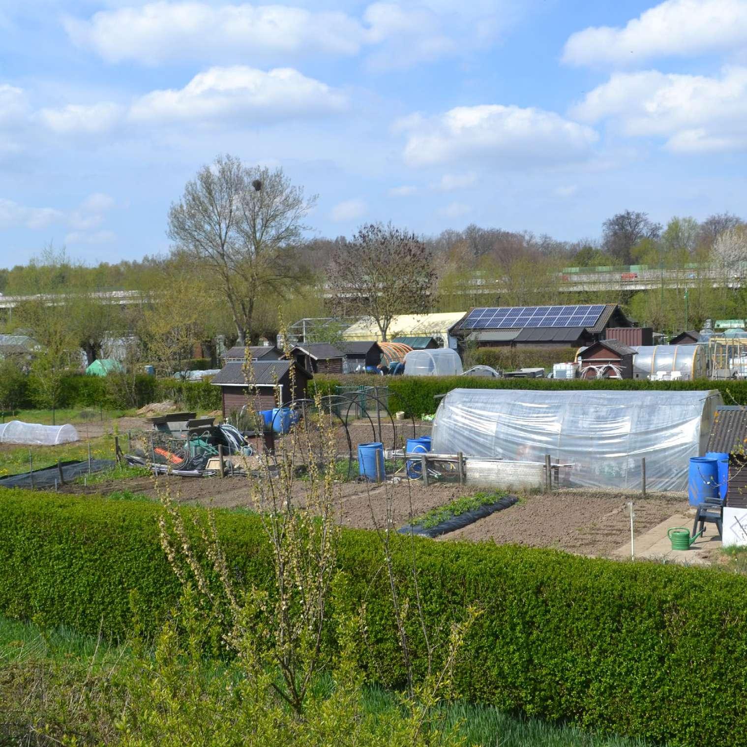
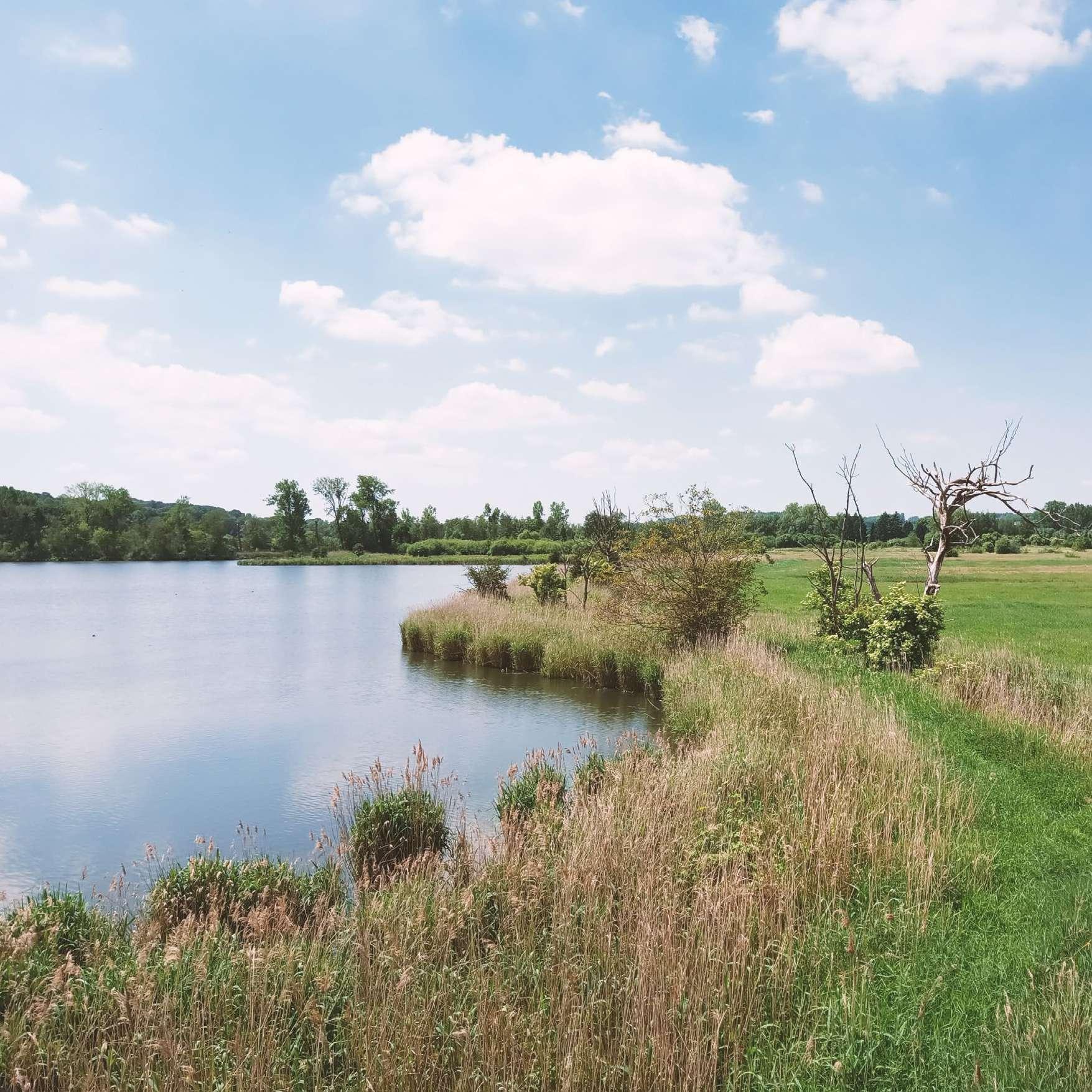
Fieldwork photos showing the existing situation
Existing soft-mobility network
New developments in marshy land
Agricultural land and forest
Housing facing pastures
Energy infrastructure and floodscapes
Grazing areas
322
Mobility infrastructure cutting ecologies
Productivescapes next to the viaduct
Waster as the structuring element
323
Housing facing marshy agricultural land and floodscapes
Proposed Vision


Section A - Proposed Situation


Section B - Proposed Situation


324
The project aims to generate ecological continuities, strengthen the smooth mobility net work, generating new connections over the Schelde River, and transform the spatial experi ence in the existing urban fabric, taking advantage of the existing backyards. Likewise, the pro ject proposes new forms of collective living promoted through landscape urbanism and re-equipping strategies to generate denser, more diverse and vibrant future neighbourhoods.
The sections show the proposals for the transformation of the urban edge fabric, turning it into a vibrant urban front in relation to the specificities provided by the agricultural and forestry mosaic. In this sense, the proposed urban development links the landscape and the productive character istics of the site, articulating the different scales of the landscape, from the park to the community garden, generating new ecologies at the interface for people and nature. Through TDR operations, it is possible to transform the urban area, providing it with a new social infrastructure, connecting the productive and ecological patches with urbanization.
325
Abstract Collage
Interface urbanisation and park Existing situation
326
327
Marshland Encroachment
The zoom-in area is at the transition between the marshland and Heusden--located on a slightly higher sandy soil. Starting in the 1970, suburban extension onto the floodable lowlands has disrupted the continuity of ecologies and rendered the landscape distinctions illegible.
328
0 0.5 km 1 km 2 km N
0 500 m N 0 500 m N
330 0 250 m N
< Several components make up the fabric to be transformed. In the soudh, a linear structure follows the transition from sandy to loamy soil in the east-west direction. A fishbone pattern along the canal that connects the human-made lake and the oxbow of the Schelde acts as a transition between the two systems. Mean while, the suburban allotment in the floodplain features three dis tinct elements: (i) a tear-drop shaped cluster of rowhouses, (ii) a coarse grain of industrial facilities, and a heterarchical structure of single-family detached homes. The project takes this structure as the basis for design intervention.
v Suburban expansion onto marshy soil has resulted in increased risks of groundwater flooding. Whereas the housing fabric has ex tended continuously across landscape distinctions, ecologies of water and forests have been interrupted. The project envisions a gradual transformation that clusters individual houses together to simultaneously improve a rather monocultural housing tissue and address flooding issues.
331
332 0 250 m N
< The project aims to reinforce the distinctions between wet and dryland urbanization by strengthening the existing canal as a structuring element. Rather than a dichotomic exclusion of two different landscape systems, the project emphasizes the canal as the site of transition between them, an 'ecotone' of mutual inter action.
Different languages of urbanization follow the preexisting condi tions and accentuate the character of each one. Wetland ur banization adapts to flooding by creating a mosaic of cut and fill operations and reducing the built footprint. Ponds and platforms alternate to protect the existing urbanization from groundwater flooding.
v Adaptation in the floodplain translates to a sculpting of the ground. Transformation is envisioned as a way to help initiate more circular systems of water that integrate the marshland into the metabolism of the urban. The more structured system on dry land corresponds with a slightly more centralized water system. On the other hand, the mosaic system of the adaptation process makes use of smaller scale clusters related to ponds. Just like at the ter ritorial scale, the pond system aims to very explicitly reveal the marshland at the micro level, giving water a very robust presence.
333
334 1873 1939 1969
335 1989
336
337
339 03.05 Kanaaldorpen: Towards a Cyclical - Ecological Mesh CAMILLE HENDLISZ HAIFA WAJEEH SALEH VÉRONIQUE DE PAUW YENTL WULTEPUTTE
Gentse Kanaaldorpen
Kanaaldorpen: towards a cyclical-ecological mesh
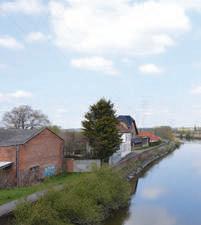
"Perhaps the most drastic transformation of the landscape surrounding Ghent, occurred north of the city, when the canal Gent- Terneuzen was excavated, connecting the harbour of Ghent with the Scheldt river (or rather: drastically augmenting the capacity of the connection). Where the landscape used to be structured by the brook/river Moere (trans formed in the early 14th century into a canal, Moervaart), suddenly the new canal cut the area in half, even quite literally cutting off the hydro logical system, as the Moere used to merge into the Kale (see: location 1). Ever since, the string of villages south of the Moervaart have been called Kanaaldorpen (Canal villages).
The Kanaaldorpen are in a peculiar situation. On the one hand, they have a very low accessibility to amenities, are mainly residential at a very low density. Most of these villages have names that end on -donk, which re fers to their location on a sandy hillock surrounded by wetlands. Indeed, surrounding these villages, is a very dense network of brooks and small waterways, delineating the individual agricultural plots; it all seems dis tinctly rural. On the other hand (and even on the other extreme), they are surrounded by infrastructure and harbour-related industries (in some cases in very close proximity), impacting their attractivity as a place to live, and grinding any potential for growth to a halt. This has also created
concerns of pollution for the inhabitants of the Kanaaldorpen.
Most of the Kanaaldorpen are on the right bank of the canal; Mendonk, Ter Donk, Desteldonk, Sint-Kruis-Winkel. Outside of the territory of Gh ent there is also Hijfte, Hoekske, etc. (territory of Lochristi) which have the same characteristic, but without the close proximity of industries. Still, all of these villages are made up of just one or two streets.
On the left bank, there is Kerkbrugge and Doornzele (and outside of the Ghent territory, further north, also Rieme and Klein-Rusland). Doorn zele is well-known for its dries, a large communal space at the center of the village, dating back to medieval agriculture (as a place to guard the sheep and collect wool); it is the only remaining dries of such a big scale.
Due to low attractivity and low accessibility, these villages escape the urbanisation pressure that is felt elsewhere in the city. There is potential for growth, but environmental issues (due to the proximity of industries) and a healthy restraint to consume the available open space will be key." (Blondia et al. 2021, 58)
340
Introduction © Text: Blondia, Mattias, Raquel Colacios, Carmen Van Maercke and Peter Vanden Abeele. "Urbanisation & Climate change adaptation: Ghent Design Studio." Studio introductory booklet. Accessed 27/04/2021 https://app.box.com/file/792684804737.
Satellite picture of the site showing the Canal Ghent-Terneuzen, surrounding industry and small villages.
341
© Google earth.
342
343 1.0 ANALYSIS
344
Reading & Interpretive Analysis
1.1
INSPIRATION
Assignment by Véronique de Pauw & Camille Hendlisz
MAPPING THE OPEN FABRIC
Joan Busquets
The old town of Barcelona
Based on Joan Busquets method of mapping the Old Town of Barcelona, we analysed Doornzele, one of the Kanal Villages north of Ghent. The presence of the canal has attracted heavy industries to the predominantly rural region. This has led to a contrasting landscape where heavy industry seems to be invading the rural land, threatening the attractivity and suitability of the area for residential purposes.
In his analysis of the Old Town of Barcelona, Busquets sheds a particular light on looking at the open space, interpreting it through a multitude of different lenses. Each of his drawings highlighting a specific aspect or characteristic of the open space making us look from a different perspective.
Parallel to Busquets analysis we approached the open space of Doornzele through different lenses. We classified the open space
346
INTERPRETATION
A MULTITUDE OF TYPOLOGICAL ANALYSIS OF THE OPEN SPACES IN DOORNZELE
in the village of Doornzele according to different categories referring to their accessibility. Whereas Busquets focusses on residential open space, we’ve approached our analysis from a broader landscape perspective, to understand how open space is organized within the area. By highlighting the industrial buildings within the built fabric, the contrasting relation between heavy industry and open and residential space is brought forward. By understanding the medieval history of the village we get a sense of
how history still defines the current landscape.
By approaching the open space through different lenses, one gets a broad perspective on Doornzeles open fabric and its position in the landscape.
347
© Saad, Rizk 2021,
1

348
ACCESSIBLE OPEN SPACES INACCESSIBLE OPEN SPACES
INDUSTRIES HOUSING UNITS
349
INSPIRATION
Assignment by Haifa Saleh, Cecilia Quiroga, Yentl Wulteputte
BREAKS & DISTORTIONS
Mario Gandelsonas, 1999
‘X-Urbanism: Architecture and the American City’ [ Los Angeles ]
Gandelsona’s stark visual language communicates the essence of urban morphologies through a distillation process that is aided by the sole use of black and white. Infrastructural elements appear as symbolic forms to show important relationships within the urban fabric. The methodology consists of overlapping different types of grids to demonstrate the organizing logics and speaks of the narrative of the historical layering. His methodology is powerful in indicating infrastructural and
human made elements on site while the natural elements seem to remain hidden to the point of absence. If applied carelessly it could lead to the oversimplification of a context.
The overarching ideas underlying the urban structure in his drawings result in a level of abstraction that may not be accessible to the layperson.
Translating his analysis of the grid systems of modern north American cities to the medieval city of Ghent could not be
350
INTERPRETATION
KANAALDORPEN RUPTURED BY INDUSTRY
done literally, as the latter’s’ distinct history does not employ a homogenous system, rather, it is a patchwork of fabrics creating a heterogenous mosaic that sedimented throughout time. Analogous to how he contrasted the historical fabric morphologies to the modernist grid development, we highlight the contrast between the historic ribbon fabric to the industrial platforms, shown as solids that encroach on the historic settlements, closing it off to other parts of the city.
The canal as water highway erased settlements in the area and subsequently continues to separate the settlements from what was once the river, interrupting the east-west movements on the site. Indicated as solid barrier on the map leaving remnants of the pastoralist culture which had an intimate relationship with the ebbs and flows of the meandering river.
351
352
353
354
Fieldwork
1.2
Fieldwork
Though seemingly scattered and hardly reveal a pattern, the tree-lines demarcating the agricultural plots serve as protective shields for the agricultural fields.
Treelines as environmental and visual screens. Desteldonk Dries.
Considered as a cultural heritage, the Dries of Desteldonk, the oldest in the region, maintains its communal essence, as a central com munity park, playground and the towns church and graveyard .
356
Despite the damaging effects of the industry on the environment, the food wastes deposited into the canal, make it a bounty for fish and fishermen.
Omnipresence of the industry.
The dominance of the industry over the landscape of the Kanaaldorpen creates a surreal scene, where one cannot surpass its omnipresence.
357
Fishermen and the industrial canal: coincidental benefits
Qualitative information maps
The transformations these villages have undergone throughout the years were correlated to water. The settlers of these lands, understood the basic language of the landscape, upon which their set tlements, and their agricultural livelihoods were based.
Strategically building on the uncultivable sandy hills, that has sufficient elevation to protect their settlements from inundations. They created the waterways and brooks as a man made water man agement system to infiltrate it in the ground. Throughout the years these water bodies became highly polluted due to the water runoff from the industrial platform and from the agricultural fields using chemical pesticides which cause damaging effects to the biodiversity in the area and pose great health issues on all human and non-human factors dependent on this landscape.
Human social and recreational activities were evi dent in certain areas, particularly surrounding the Moervaart, many old and young men go there fish ing. A culture of leisure boats and Yachts is prev alent connected by bike paths that go through the agricultural lands leading to it. The canal itself even in the industrial area attracted a certain form of social life and fishermen.
Ruptures & Disconnections
The industry and canal Ghent- Terneuzen are not only omnipresent in the background, but also disconnecting the east-west link between the settle ments and ruptured the landscape elements impacting the whole ecological system.
358
Sensitive mapping following Jan Rothuizes method, showing the existing landmarks on site.
The sensitive map depicts the nuanced feelings and perceptions on the site, depicting expected and spontaneous forms of life, the multiple effects of the industry, aiming to unravel the challenges and potenti alities on site.
359
Social encounters
The places of social encounter on the site are mostly located in outdoor areas, such as the Dries, the Moervaart and the Koppelingsgebieden. This due to the lack of public indoor spaces for recre ation, such as bars, cultural centres, community centres, ..
On the West side of the canal we can see that all the places of social encounter are well connected and building up on each other, forming a certain kind of route. The Dries in Doornzele forms the heart of social encounter on this side, facilitating a playground for children, a church, a weekly market space, yearly fair, .. Other important entities such as the elementary school, pharmacy and bakery are located at the edge of the Dries.
On the East side the places for social encounters mainly take place along the Moervaart, where ac tivities such as cycling, hiking and fishing take place on a daily basis. There are two small bays for yachts located along the Moervaart, which both give ac cess to basic need facilities and a bar.
Given the fact that the settlements on site didn’t develop any further over time, another main point of centrality would be the church, due to its im portance in the Catholic history of Flanders. Now those churches and the adjacent cemeteries lost their central function over time.
360
Fishing spots
Bar / Restaurant Cycle trail Hiking trail
Football field Sport facilities

Playground Picnic / benches
Map showing the social encounters present on site.
361
362
Argumentation & Strategy
1.3
Heat Drought
Climatic analysis maps
The challenges of the Kanaaldorpen are mainly ecological.
Flooding
364
Floodplain Sealed surface Water system
Kanaaldorpen
The presence of the industrial platform reinforce the effects of climate change. In the heavily drained landscape, both man made and natural ecosystems require more and more water, leading to increased droughts. The large sealed surface as well as the loss of the natural wetland increase the vulnerability to flooding, that threatens the agricultural lands and accordingly people's livelihoods.
365
2021
Artificial vs. Natural
Beyond the rupture, the site is articulated upon a duality of man made and natural systems which give it its form and identity. The rivers, the marshlands, the sandy hills and soil types identified the historical ways of habitation, while the canal the water brooks and the industry have brought forth other layers of challenges and opportunities.
366
Manmade versus natural systems.
367
During the analysis a mapping was done to analyse the different dynamics going on, on site.
We could conclude that the people, organisations or other instances benefiting from the system on site are mostly those functioning on a big scale, such as: the Belgian economy, the industry, the har bour of Ghent en the Project Gentse Kanaalzone
A lot of overlapping can be seen between the drivers benefiting from the system and those controlling the system. Under this category the Belgian planning policies and European policies can be added.
On the downside the ones mostly excluded from the system are the inhabitants in general, and more specific the youth on both sides of the canal. Also the nature on site suffers form the heavy impact the industry has.
Mapping the most important actors and stakeholders on site gave us a good understanding of the dynamics and relationships between the different people, organisations and instances active on site.
SeaPort Evergem
Zelzate
368
Who’s excluded from the system, who controls it, and who is benefitting from it?
INDUSTRY PROJECT GENTSE KANAALZONE NATURE HARBOUR OF GHENT Planning Policies EU POLICIES GREEN POLICIES Arcelor Mi�alOilTanking Cargill CBR Concrete Electrabel Ghent Coal Terminal Tourists Belgian Economy Biodiversity 20% sa�sfac�on Work Gewest -plan Green RUP SeaPort City of Ghent Zelzate Province of East-Flanders Flemish Region Who’s excluded from the system, who controls it and who is benefi�ng from it? Inhabitants youth 15-24y COMMUNITY Small scale farmers Mendonk Ter donk Doornzele Desteldonk SintKruisWinkel P O L L U T I O N S C A L E D I F F E R E NCE SCALE DIFFERENCEDISTANCE // LACK OF MOBILITY // ACC E S S I B I L I T Y Stakeholder and actor mapping.
Longitudenal section through the site - situation 2021.
 Koppelingsgebied
Residential ResidentialDries Canal
Koppelingsgebied
Residential ResidentialDries Canal
Koppelings -gebied
The section portrays the clear rupture the industrial platform imposes upon the landscape, creating a large sealed surface that caus es major ecological issues such as heat-island effect, flooding risks and droughts. It also shows clearly the monofunctional and seg mented nature of the site.
370
Industry Moervaart Marshland
371 Industry
R4
372
373 2.0 DESIGN
374
Eco-Systemic Visions
2.1
City scale vision
The Periphery as the New Front
Ghent is characterized with a poly-nuclear identity, with high density in its urban core, and its sur rounding municipalities. The new expansion has formed its 20th century belt, that is considered to day as the city's periphery. A perforated belt, with a interplay between built-up and open spaces is foreseen to become the new front of the city, to accommodate the future urban growth, for it has been known as a successful economic center. This puts high pressure on the housing sector and ac cordingly on the ecological structure of the city, and potentially may increase the impacts of climate change.
A group was formed to put together an overall vision for Ghent combining the landscape strategies represented in each site. All visions provided innovative ways for climate adaptation and tackled the inevitable urban growth. Risks converted into opportunities and envisioned contextually various ways that create an equilibrium between the natural landscape elements and the future of urbanization.
Three main systems were introduced; a blue system following the natural logics and integrated into the existing and proposed urban systems mitigating issues of flooding and drought. As a response to the heat-island effect a green system of new wet and dry forests to increase the canopy cover, re mediate the soil, cool off the city, and make room for natural biotas and habitats. The urbanization strategies were directed towards communal productive neighbourhoods, mixed-use densification in response to contemporary issues and to promote soft-mobility and cyclical logics.
376
The Kanaaldorpen 2100 Vision - City Scale
377
Landscape Urbanism vision
Kanaaldorpen 2100 vision
The landscape design strategies came as a response to main socio-economic and ecological challenges.
- The monofunctional, inaccessible, poorly serviced, and low dense residential zones.
- The ruptured hydrological system, endangering ecological assests such as the Moervaart valley due to pollution from heavy, and ag ricultural pesticides
- The increased climatic and environmental threats such as flooding, droughts, heat island effect due to the large sealed surface which sacrifice the canal system itself as a transport water-way
- Air, soil, and sensory pollution creating a concern for the inhabitants, the ecological system and biodiversity.
The design vision introduces a blue-green mesh interconnected with the newly proposed urban fabric, in response to these challeng es in an aim to re-envision ways of living with the industry and foreseeing radical changes in the year 2100, that bring forth notions of cyclical ways of living and producing.
378
Orchastrated by the stream
A multi-layered water system orchestrated the design in response to the challenge.
- Waste Water Treatment Plants (WWTP) introduced on several industrial zones, as to treat the industrial water runoff in addition to blackwater from the Donks, linked to a natural water treatment ponds that form green blue public spaces.
- Rainwater Harvesting System linked to bioswales that feed into a mesh of channels and ponds used for the gardens of the donks and archipelagos and provide remedi ated water for the irrigation of fields.
- Water reservoir and infiltration ponds located strategically to mitigate flooding and in relation to soil types.
Strategies | Water System
379
380
Design Proposal & Typologies
2.2
Strategies | Green System
Natural green responses
Following water, wind, sun and soil, a multifunction green system is proposed.
- Man-made green barriers: inspired by the kopplingsgebeiden, shielding urban are as and fields from the industry.
- Phytoremediation: trees and plants such as willows & poplars are used to purify the highly polluted desealed areas in the industry, the large water channels polluted by pesticides, alfalfa used for small streams, and reeds for ponds.
- Expanding river floodplains in the Moervaarvallie, and creating a riparian buffer to protect the marshland native habitats as a major ecological asset on site.
- Agroforestry: maintaining the productive character of the landscape & increasing canopy cover to cool-off the area, combat desertification, & boost biodiversity.
382
Strategies | Urban Transformation
Urban self-sufficiency
The current urban ribbon development logics were transformed into collective and productive neighbourhoods that function on two main scales:
The Donks: envisioned to host the main large-scale services for the area, the donks are reinterpreted as cyclical communal neighbourhoods reweaved into the natural system while it exchanges resources with the industry.
The Archipelagos: on a smaller scale, these islands, are to form the new self-suffi cient communities in the Kanaaldorpen, by producing their own foods, energy and use rain collected water, creating a microcosm connected to adjacent neighbour hoods through a cycling route following the water ways.
383
Restored relationship man-made and landscape Industry as resource Current: Ruptured landscape Future: Synergetic system with restored relationships Collective living in The Donks Selfsufficient living in the Archipelagos Restored relationship man-made and landscape Industry as resource Current: Ruptured landscape Future: Synergetic system with restored relationships Collective living in The Donks Selfsufficient living in the RestoredArchipelagos relationship man-made and landscape Industry as resource Current: Ruptured landscape Future: Synergetic system with restored relationships Collective living in The Donks Selfsufficient living in the Archipelagos Restored relationship man-made and landscape Industry as resource Current: Ruptured landscape Future: Synergetic system with restored relationships Collective living in The Donks Selfsufficient living in the Archipelagos Restored relationship man-made and landscape Industry as resource Current: Ruptured landscape Future: Synergetic system with restored relationships Collective living in The Donks Selfsufficient living in the ArchipelagosRestored relationship man-made and landscape Industry as resource Current: Ruptured landscape Future: Synergetic system with restored relationships Collective living in The Donks Selfsufficient living in the Archipelagos
Systemic Section


384 Sealed industrial platform Industrial platform as water tower Natural wastewater Decentralized wastewater treatment Phytoremediation Bioswales Reusable Green roofs District heating Blackwater Industrial water Rainwater Canal Gent- Terneuzen Industrial platform Constructed wetland Runoff Runoff Canal Gent-Terneuzen WWTP Treated effluent WWTP Water reuse Industrial heat island Stormwater runoff from sealed surfaces Soil pollution from industrial activities Restored man-made landscape Industry as resource Current: Ruptured landscape Future: Synergetic system with restored relationships Collective living in The Donks


385 Green area Urban ribbon Monocultural fields Scattered settlements Canalized Moervaart Collective donks development Agroforestry pockets Archipelago ecosystem Renaturalized Moervaart floodplain treatment Phyto-remediation canals Resevoir & infiltration ponds Blackwater recycling ponds Reusable water reservoir Seperate sewage system Agriculture Green area Sealed surface Water body Partially desealed Black water Black water Humanure Grey Water Grey Water Rainwater Koppelingsgebied The donks platform Agricultural lowlands Selfsufficient archipelagos Moervaart valley Runoff Desealed Street Stormwater runoff from monoculture fields Poory services ribbon developments Agricultural desert under heat and drought stress Loss of Moervaart valley ecosystem & increased flood risk
Future Transformations

Gradual and strategic transformations are envisioned to transform the industry centered Kanaaldorpen, to a climate resilient, biodiverse, and self-sufficient zone, embracing productive healing modes of living.
386
Visions for Future Transformation
387
Donks and Archipelagos
The site is characterised by following a system of donks and archipelagos, two different yet specific ways of settlements on site. The re-interpretation of the peri- urban system will start from the newly created green and blue system, creating a new way of collective living on such a donk or in an archipelago.
The elevated donks, or sandy hills, become places of collective living, connected to and ex changing resources with the industrial platform. Introducing new 'nature based moments' will reconnect the urban to the surrounding and very valuable landscape.
The scattered settlements in the lowlands are transformed into self-sufficient archipelagos, having their own water, energy and food system. More or less disconnected and only ac cessible by bike; the archipelagos and surrounding agricultural land merge and will function together as one system. Every archipelago is located within it's own cell. Those cells are big ger entities where the green, blue and urban system come together towards self-sufficient neighbourhoods.
388
Urban transformation, donks and archipelagos.
389
Urban tissue | Living on a donk
New ways of living on a donk.
Following the newly created green-blue network to generate social and natural injections in a donk. Shifting from a linear to a more fluent common inner space.
On this plan you can see the transformation and reinterpretation of what living on a donk can be. Going from a strictly linear, individual and car-driv en way of living, towards a more community and water based neighbourhood, following the overall landscape strategies, reinforcing the green and blue network.
The transformation of the donks can happen in several phases. First there needs to be looked at the existing water structure and tree lines rein forcing and bringing in the newly created greenblue figure into the centre of the donk
Secondly, the most important existing buildings will be kept or even re-purposed and opened up to the green-blue injections. Those intersections will generate new moments and reconnect the donk with the surrounding landscape. Along the existing important buildings, new social functions will arise to activate social life and new public spaces. Along those new social spaces, an extra layer of collec tive living could be added.
All these interventions will generate a transforma tion from a linear and very Belgian way of living, to a more fluent figure, creating new relations to wards the surrounding landscape and in between housing and common space.
390
Accentuating the new green-blue system
Existing importance
Nature- based moments
New ways of collective living
Section through the existing situation of Mendonk and Desteldonk, separated by a marshland.
Donks are historically higher pieces of lands in the landscape where settlements were originally found ed. The design will rethink the way of living on such a sandy hill respecting the topography, Following the new implemented green-blue system.
391
Urban tissue | Living in an archipelago
On a larger scale, the design attempts to reshape the scattered settlements in the lowlands into a biodiverse and self-sufficient archipelago. The vision for these communities is for them to be come models of small scale, short-chain living with big socio-eco nomic and ecological values, thus creating a strong sense of iden tity in the urbanised territory of the outer area of Ghent.
By introducing community gardens and a separate natural waste water pond system connected to the farms, and to green pockets and water collection ponds, a shared resource for both human and non-human inhabitants of the archipelago is formed, being the epicentre of the urban transformation.
Starting from the existing farms and water ponds, making them the centre of the archipelagos, will generate new public spaces and new relationships with the farms and accompanying agricultural fields and specificities.
The archipelagos will become small clusters merging together in the landscape, focussing on self-sufficiency and nature-related soft- mobility for access.
Existing situation of the scattered landscape.
The landscape around the Kanaaldorpen is characterised by single family houses and farms scattered all over the landscape. This results in an overload of sealed roads and car-centred connections.
392
Living in an archipelago.
The archipelago will function as a self-sufficient cell, relying on the existing farms and agricultural infrastructure in combination with the water ponds, -streams and agricultural fields surrounding the archipelago.
393
Self-sufficient cell
Schematic way to represent the phasing necessary to create the archipelago's.
The green and blue mesh have defined self-sufficient neighbourhoods including farms, stables and re-quilting a strong connection to the structuring green and blue mesh. A soft-mobility path follows this green and blue mesh, creating easy and soft access to the interi ors of the archipelagos. Along this paths and in combination with the existing important infrastructure, new public and common spaces are created, generating new ways of collective living in close relationship with the surrounding landscape.
infrastructures
394
1.
2. New
395 infrastructures 3. Blended open spaces
397 06 ACKNOWLEDGEMENTS
URBANISATION & CLIMATE CHANGE ADAPTATION Gent, Belgium
Collaborators
Peter Vanden Abeele, Stadsbouwmeester Gent
Mattias Blondia, Stadsbouwmeester Gent
Teaching Team
Raquel Colacios, UIC Carmen van Maercke, Architecture Workroom Bruno De Meulder, KU Leuven Kelly Shannon, KU Leuven
398
Student Groups
Daniela Cobo
Agnese Marcigliano Lethlabile Shubane Lucie Van Meerbeeck
Yidnekachew Yilma Seleshi Md Rafiqul Islam
Cecilia Alejandra Quiroga Zelaya
Imraan Begg
Cécile Houpert Raya Rizk Jennifer Saad
Ermioni Chatzimichail
Carlos Morales Dávila Sebastián Oviedo Castelnuovo
Tien Huu Traan Camille Hendlisz
Haifa Wajeeh Saleh
Véronique de Pauw Yentl Wulteputte
Booklet Layout & Editing
Camille Hendlisz
399

400
DEPARTMENT OF ARCHITECTURE MASTER OF HUMAN SETTLEMENTS MASTER OF URBANISM, LANDSCAPE AND PLANNING
