REPAIR


1 SPRING STUDIO 2022 METROPOLITAN
Barcelona, Spain Master (of Science) Human Settlements & Master (of Science) Urbanism, Landscape and Planning Faculty of Engineering and Department of Architecture Promoters: Raquel Colacios & Ivan llach (Taab6) Academic Year 2021 - 2022 © Peiyang Huo
© Copyright KU Leuven
Without written permission of the thesis supervisors and the authors it is forbid den to reproduce or adapt in any form or by any means any part of this publication. Requests for obtaining the right to reproduce or utilize parts of this publication should be addressed to Faculty of Engineering and Department of Architecture, Kasteelpark Arenberg 1 box 2431, B-3001 Heverlee.
A written permission of the thesis supervisors is also required to use the methods, products, schematics and programs described in this work for industrial or com mercial use, and for submitting this publication in scientific contests.
23
TABLE OF CONTENTS
01 STUDIO CHALLENGE
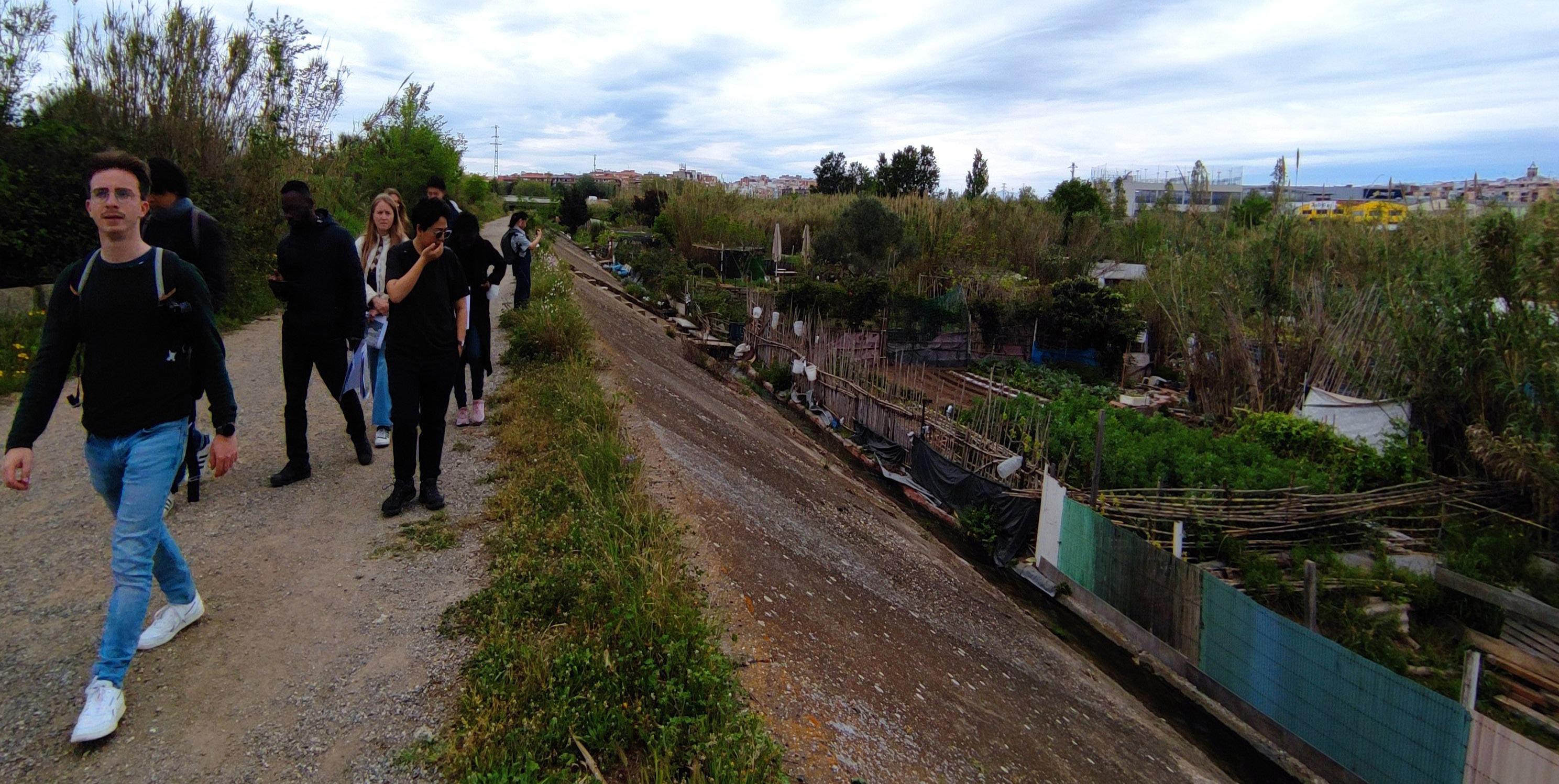
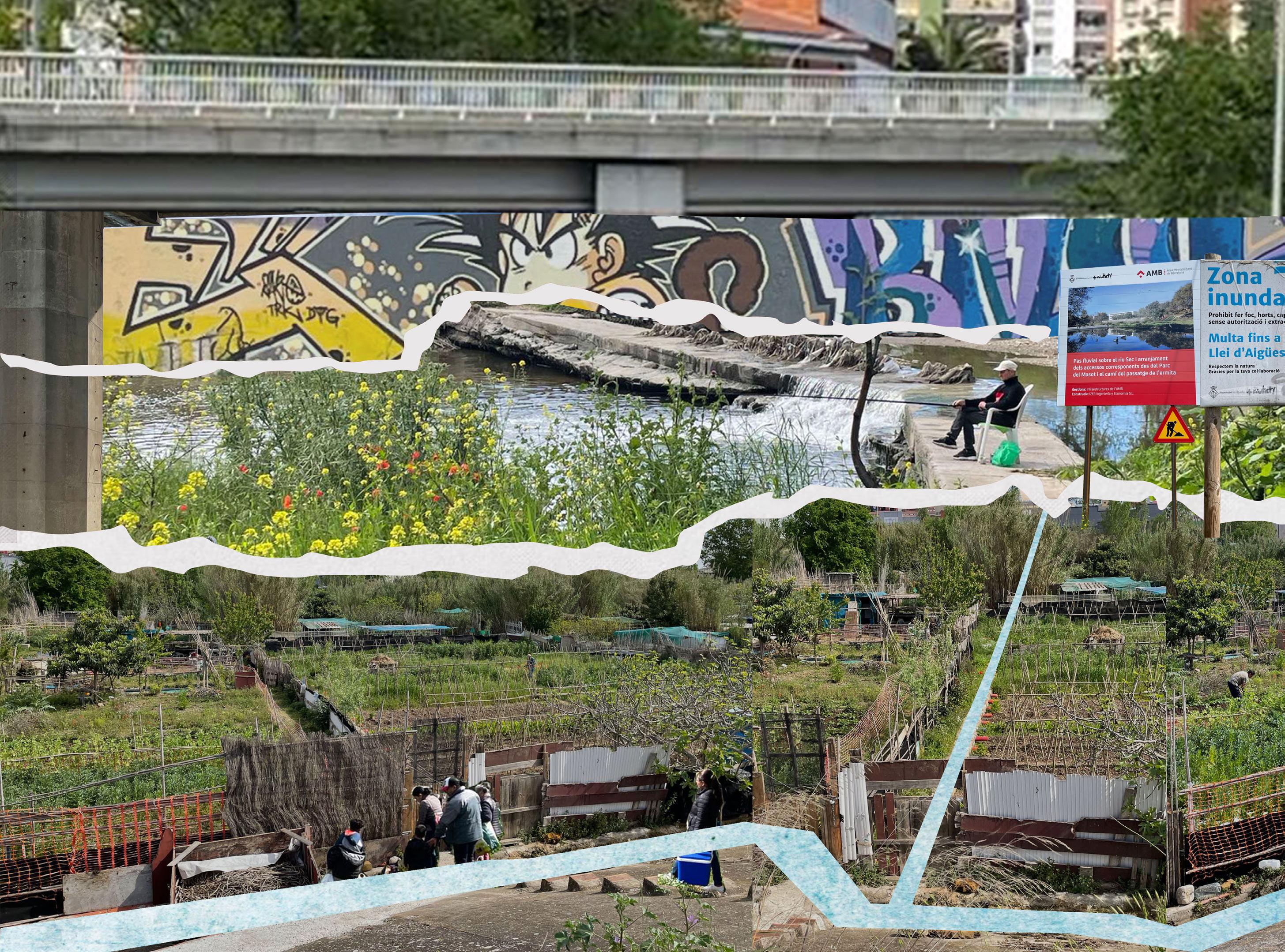
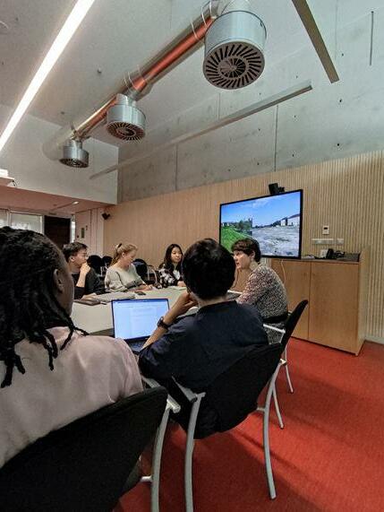
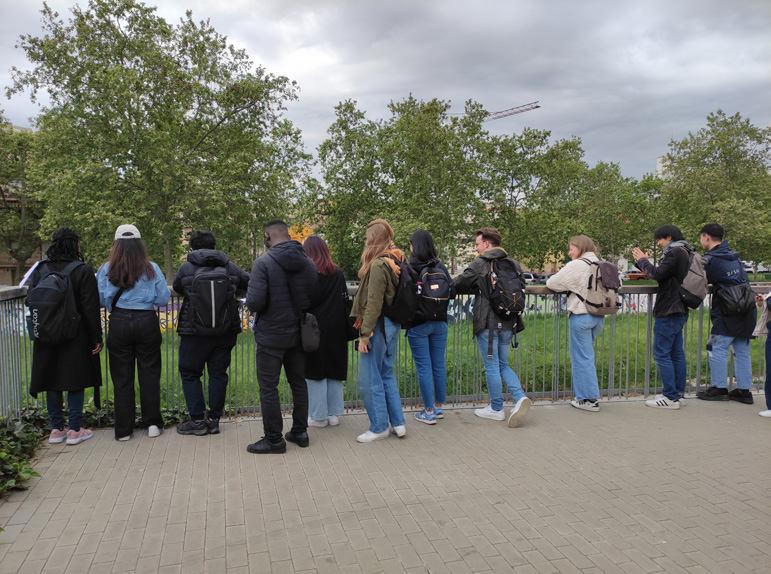
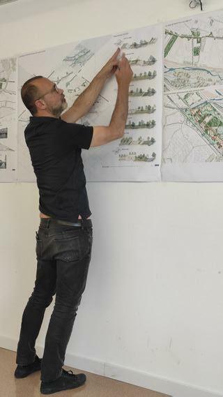
FIELDWORK
STRATEGIC PROJECTS
3403.01 (Re)Connecting Montcada to its natural Landscape
Alexander Van Gestel, Tzu Chun Lin, Hubert Asante
Enhancing biodiversity corridor: Transforming Montcada’s industry into productive landscape
Nhung Pham, Shinta Kusumawardani, Selegne Dima, Frank Bagenzi
5003.03 On the edge. Interweaving a lost landscape with a new urbanity
23
Ellen de Wolf, Axelle Haekens, Peiyang Huo, Han Qin
5803.04 Re-naturalizing Cerdanyola’s Landscape: Forestation and De-sealing surfaces
Agnes Ayesiga, Zhongyan Zhang, Yue Hu
TERRITORIAL VISION
ACKNOWLEDGEMENTS
45 03
02
04
05
07
64 66 33
4203.02
RAQUEL COLACIOS IVAN LLACH
STUDIO CHALLENGE
67 01
©Hubert
Asante
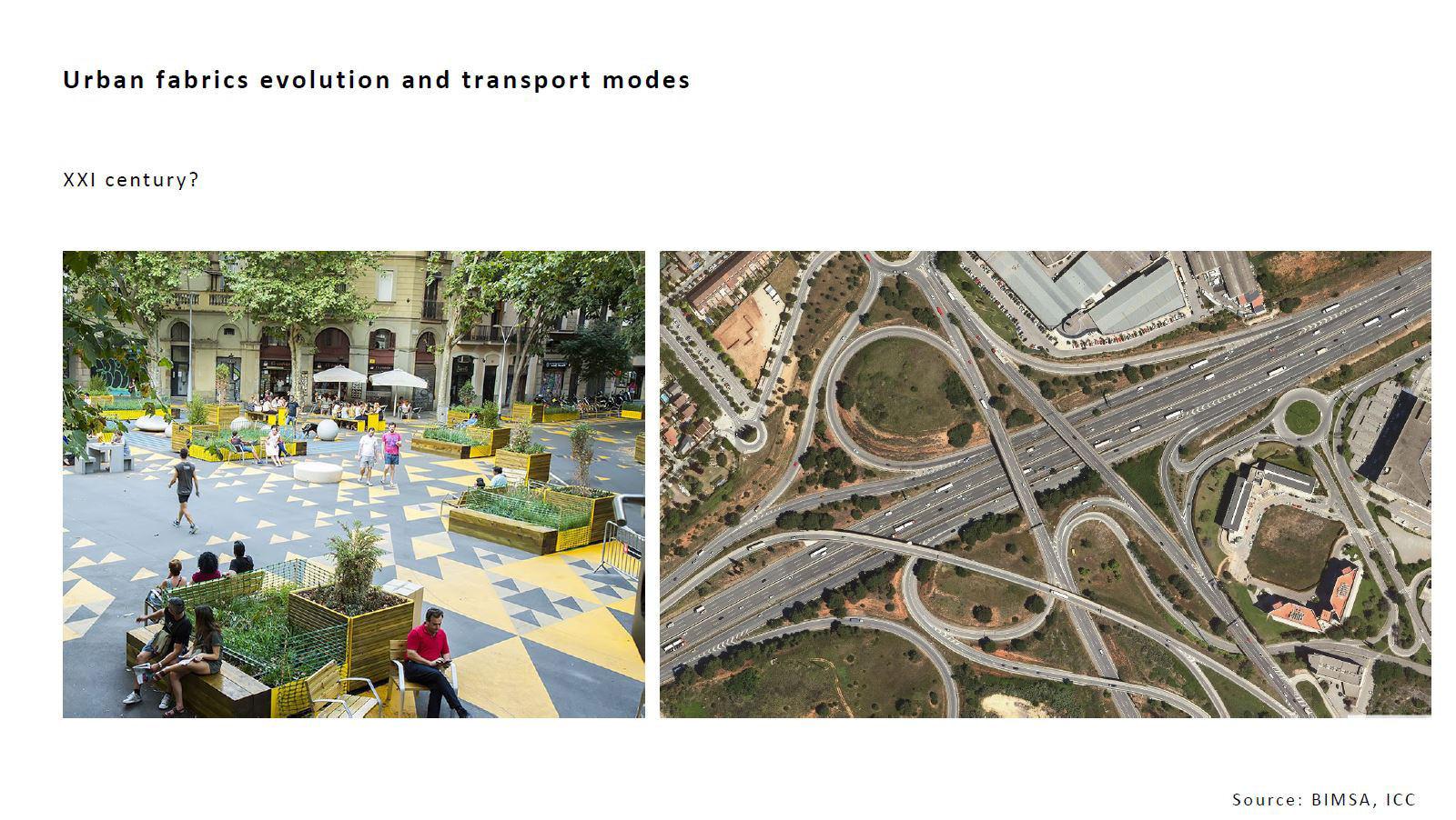
METROPOLITAN REPAIR
The Barcelona Metropolitan Area (BMA) is undergoing a process of re-conceptu alization. For years, it has been a land for heavy infrastructures, industry pockets, diffuse and fragmented urban expansion, and private mobility. All of the new de velopment has led to the loss of forest and agricultural land and the biodiversity associated with it.
tain Range has comprised a great diversity of human activities that have profound ly altered its physiognomy.
Over the last few years, the processes of transformation has accelerated and has in many cases, caused tension between the ecological footprint and spatial/ program matic demands.
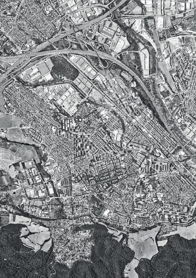
The Vallés region, located in the pre-coastal depression - in between the coastal and pre-coastal mountain ranges- is along the northers border of the Barcelona Metropolitan Region. Its strategic position and topographical location made it the ideal place to allocate industrial uses that did not fit in the city, together with sprawling urbanization infrastructure.
The BMA needs to be reconsidered in the face of the consequences of global warm ing, social and economic inequality. There is also significant territorial segregation that needs to be addressed, specifically the lack of quality and affordable housing.
Presently, this tension coincides with a wear and tear of the urban spatial figures and natural systems. On the one hand, the urban figures cannot meet the new chal lenges and needs of the current metropolis. The growing social diversity, low birth rates and aging of the population, is combined with the emergence of new technol ogies and their social and economic implications, tourism, globalization, new ways of living and working, precarious houses, mobility, competition for public space.
On the other hand, there are increasing environmental challenges posed by global warming that necessitate new ways of living, moving and working.
The studio will focus on four strategic sites inside the Vallés region, all which have been considered peripheral but have a huge potential to become new metropoli tan centres. Design research is intended to repair the area’s social and ecological dis-connection and offer new ways of sustainably inhabiting the BMA.
The metropolitan context:
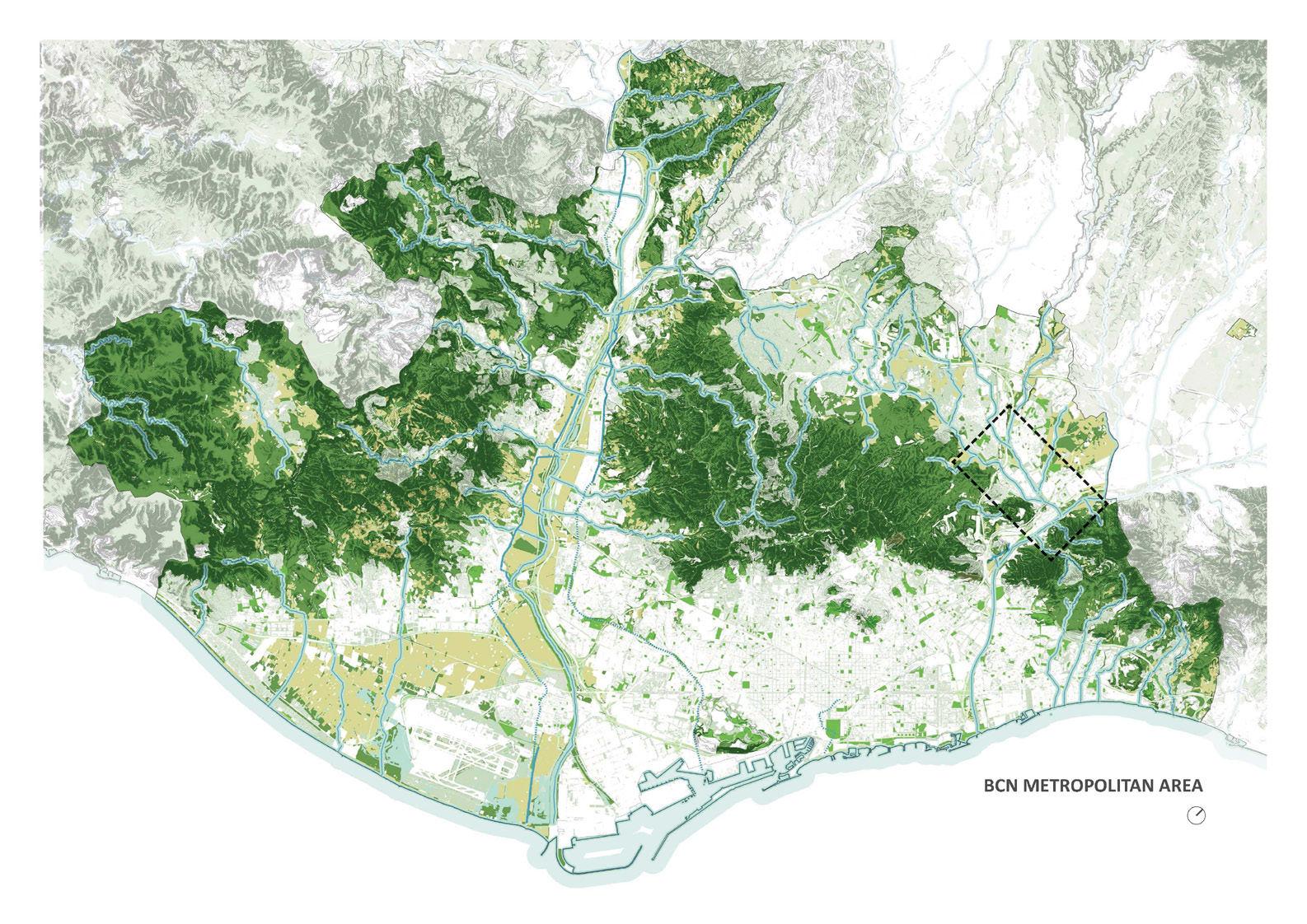
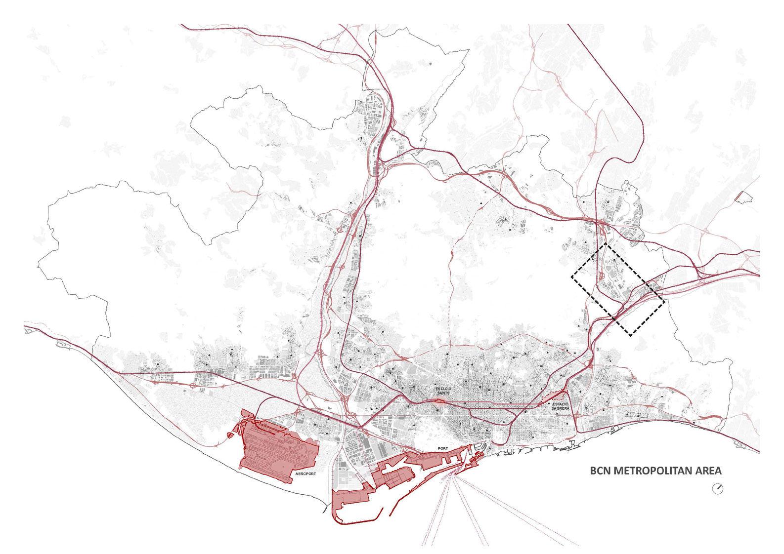
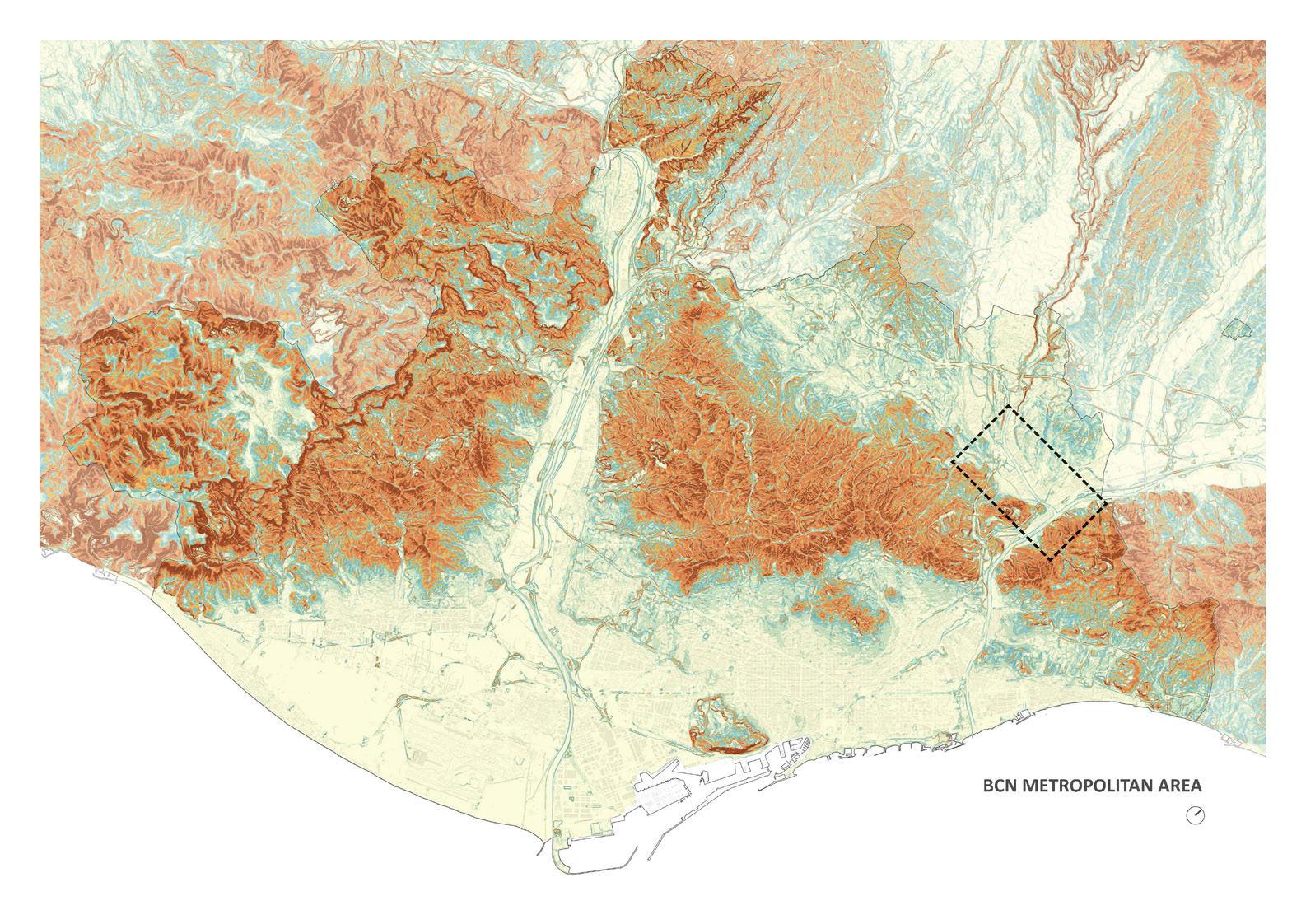
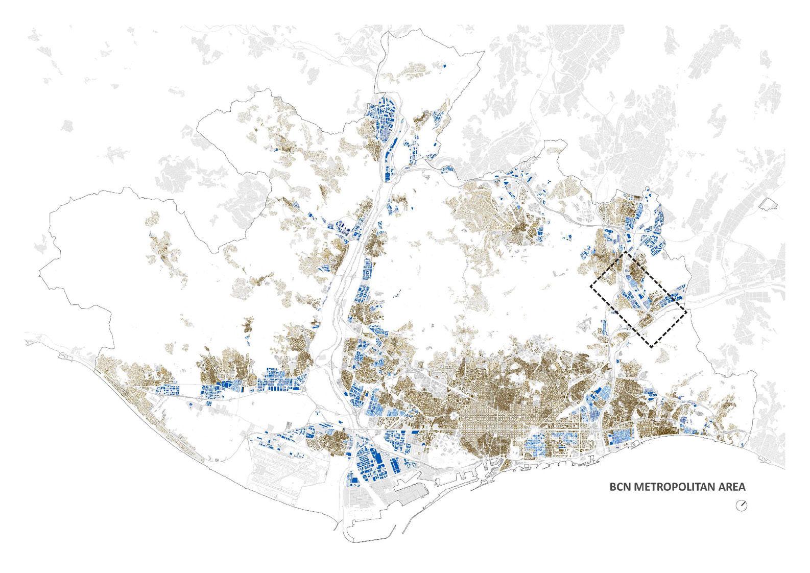
For many decades, the BMA territory has been transformed by the growth of ur ban settlements, large-scale infrastructure and various forms of exploitation of the natural environment. This space of just over 600 km2 around the Collserola Moun
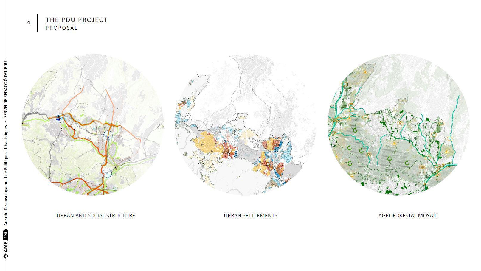
In response to these challenges, the BMA is currently developing a new strategical planning figure, the “PDU” (Urban Master Plan) that establishes a new framework for the future of the metropolitan area. The design studio will develop premises and critically evaluate the PDU through design research across scales.
89
©icc.cat© BCN Metropolitan Area green structure infraestructuresurban tissue topography ©icc.cat © icc.cat
Global warming impacts in the BMA
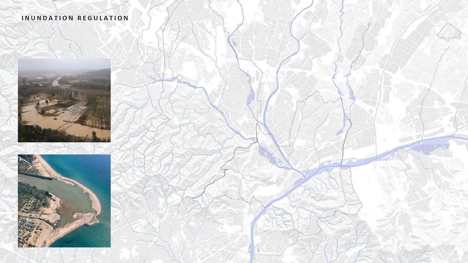
Through the knowledge of the available studies on the vulnerability of the BMA to global warming, 4 main climate risks have been determined: the increase of tem perature, drought, torrential rains and rising sea levels. These risks have resulted in impacts with a significant effect on the BMA, for which the area is not sufficiently prepared. Amongst the main impacts are the increase in floods due to torrential rainfall, the increase in energy consumption, increasing damage to infrastructure, the decrease in water resources, the adverse impact on beaches due to storms and challenging impacts on health due to heat.
The analysis of the evolution of the Catalonian climate in the future (horizon 2050) shows significant changes in the behaviour of various variables -mainly in relation to temperature and precipitation- as well as in the frequency of occurrence of cli matic phenomena extremes or rising sea levels. In relation to the evolution of the temperature, the results show significant increases in the values of average tem peratures (between +0.8º and +1.8º by 2050), as well as increases in the probability occurrence of very warm months and tropical nights, along with a reduction in the number of frost days. On the other hand, in relation to precipitation variations show a positive increase in relation to the interannual variability of precipitation (in 2050) and the average winter precipitation. In addition, there is an increase in the probability of extreme precipitation, as well as an increase in the maximum length of the dry period.
Objectives of the Studio
The BMA requires new and innovative scenarios able to cope with housing, pro duction and mobility demands while establishing new relations with restored ecol ogies that absorb the impacts of global warming and rearticulate human’s relation with nature.
The studio aims to reflect on and debate the challenges of the BMA. Specifically, the studio will explore and work on urban systems in flooding areas, the develop ment of riverine urbanism, urban rewilding, soft mobility, and the development of co-housing and other typologies, adaptive re-use of industrial areas, integration of urban tissues with restored ecologies, re-commoning and shared workspaces.
1011
© Han Qin
© Selengne Dima
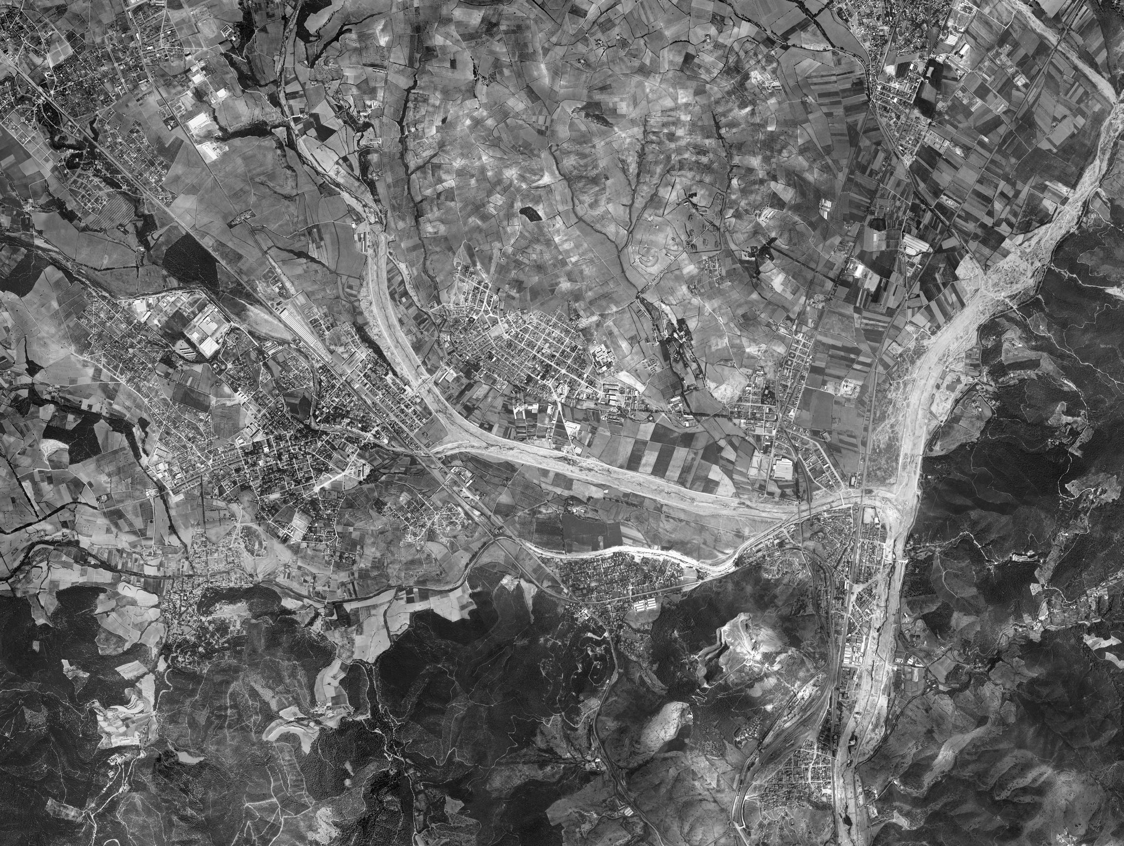
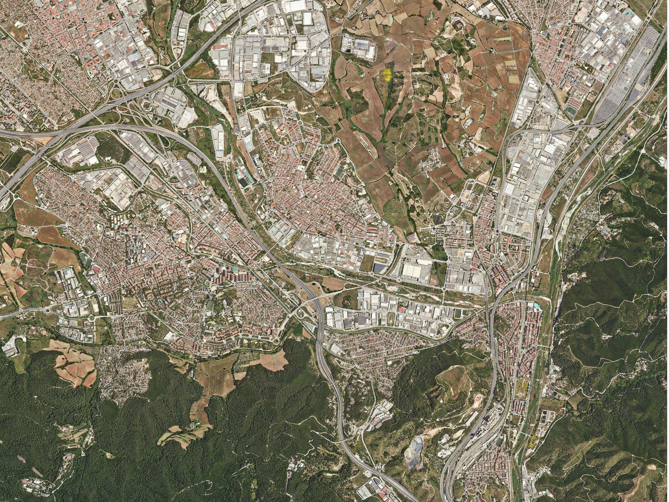
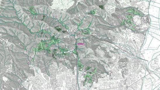
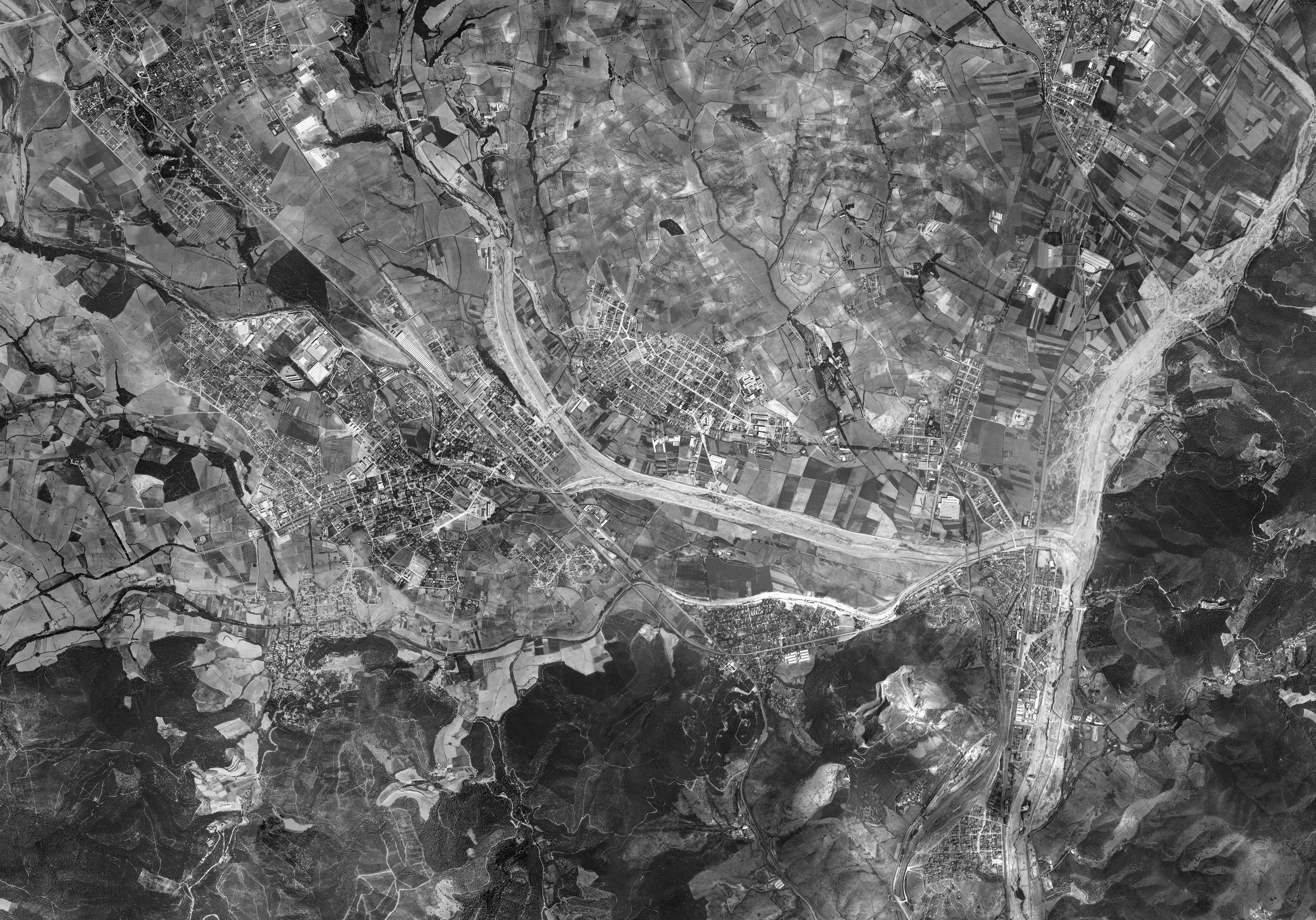
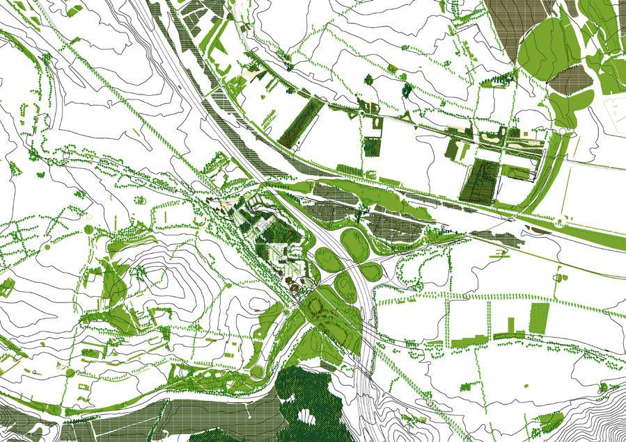
1213 © icc.cat 1956 2021 © icc.cat
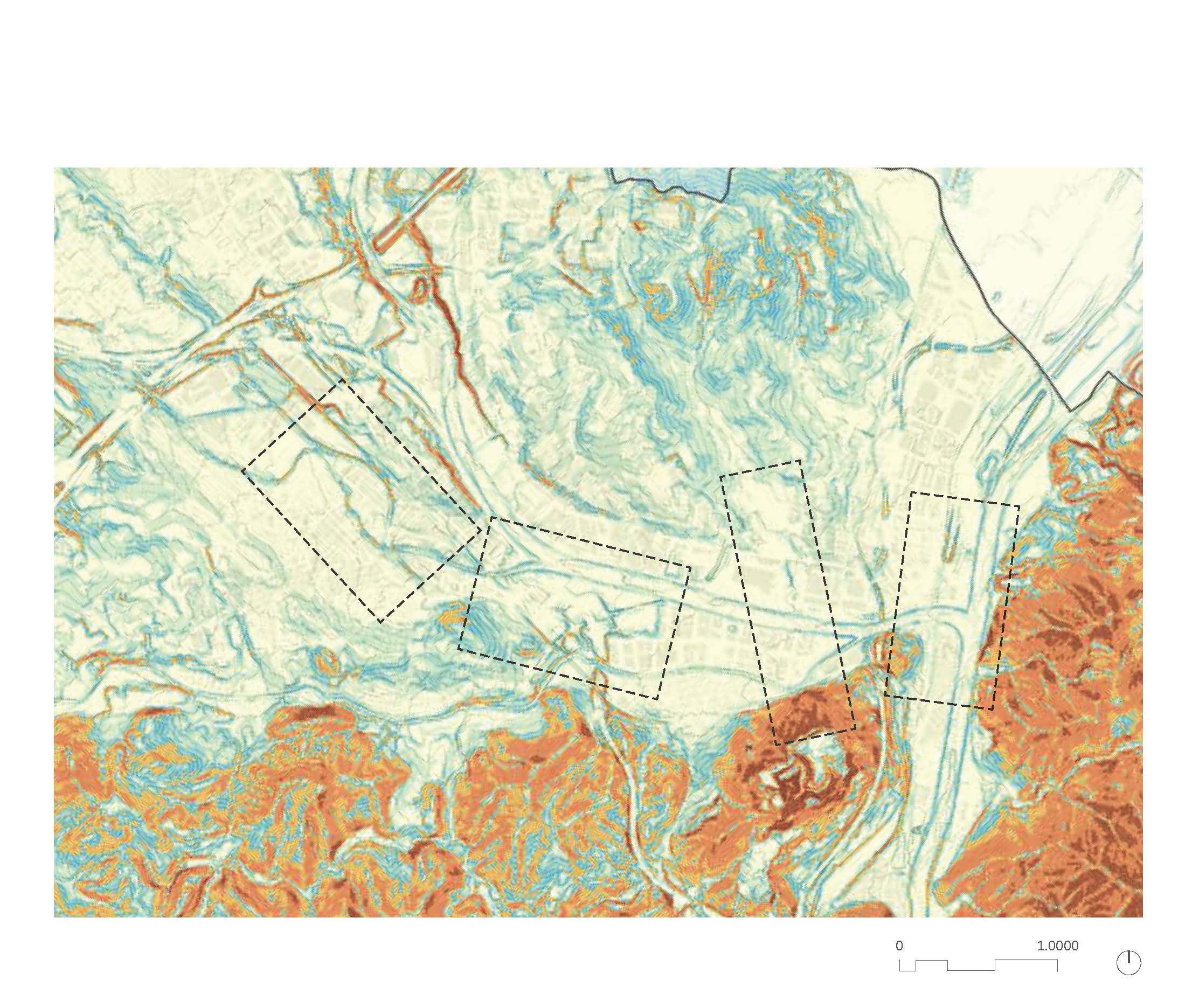
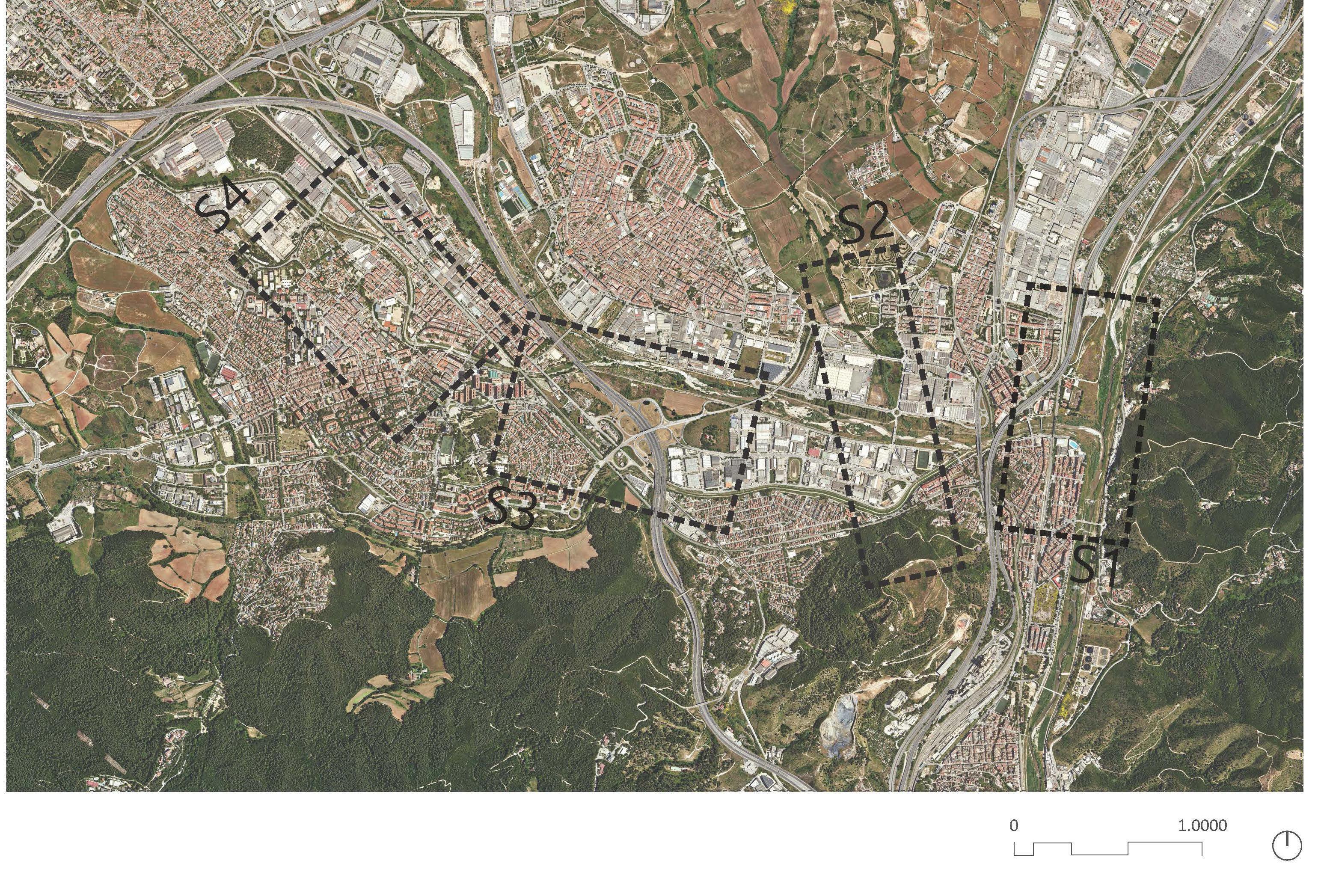
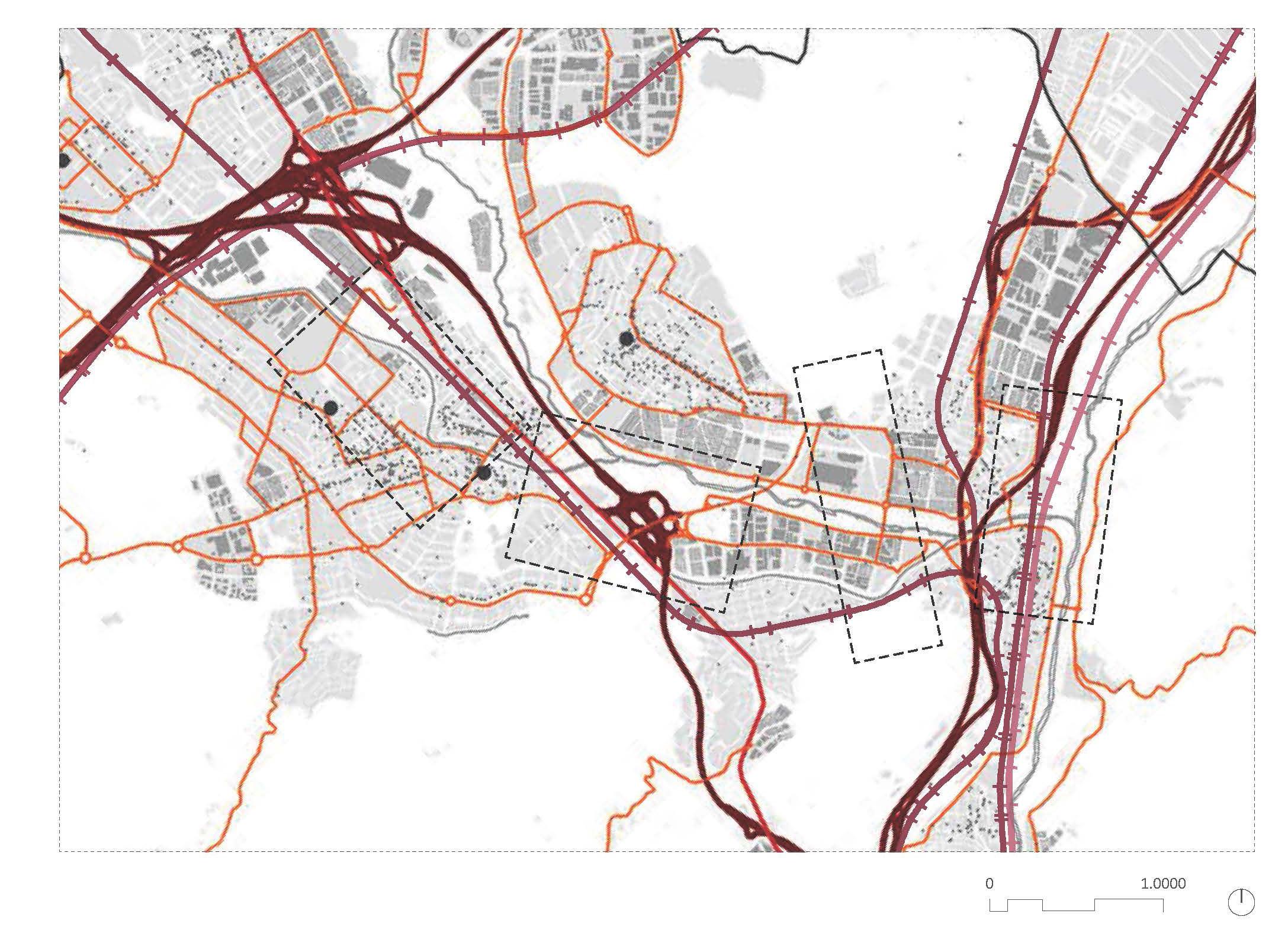
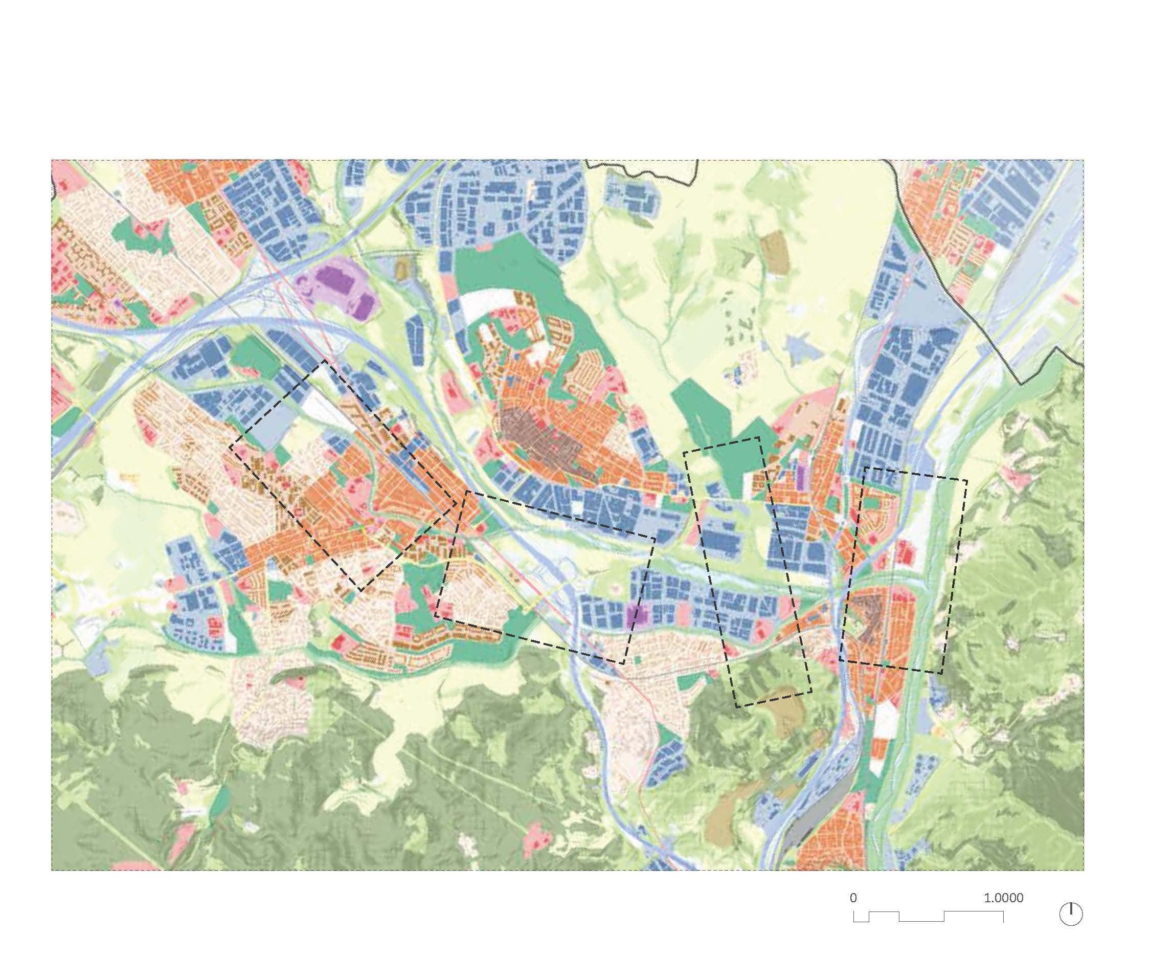
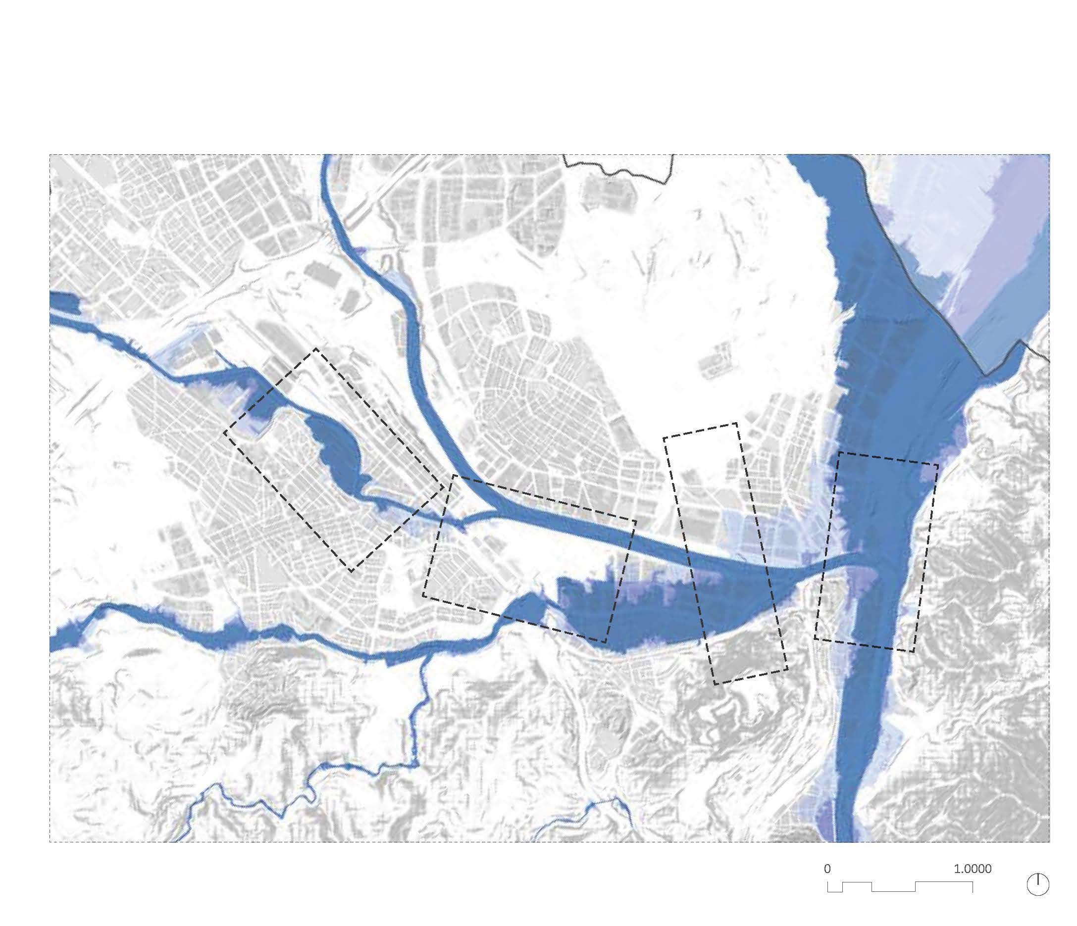
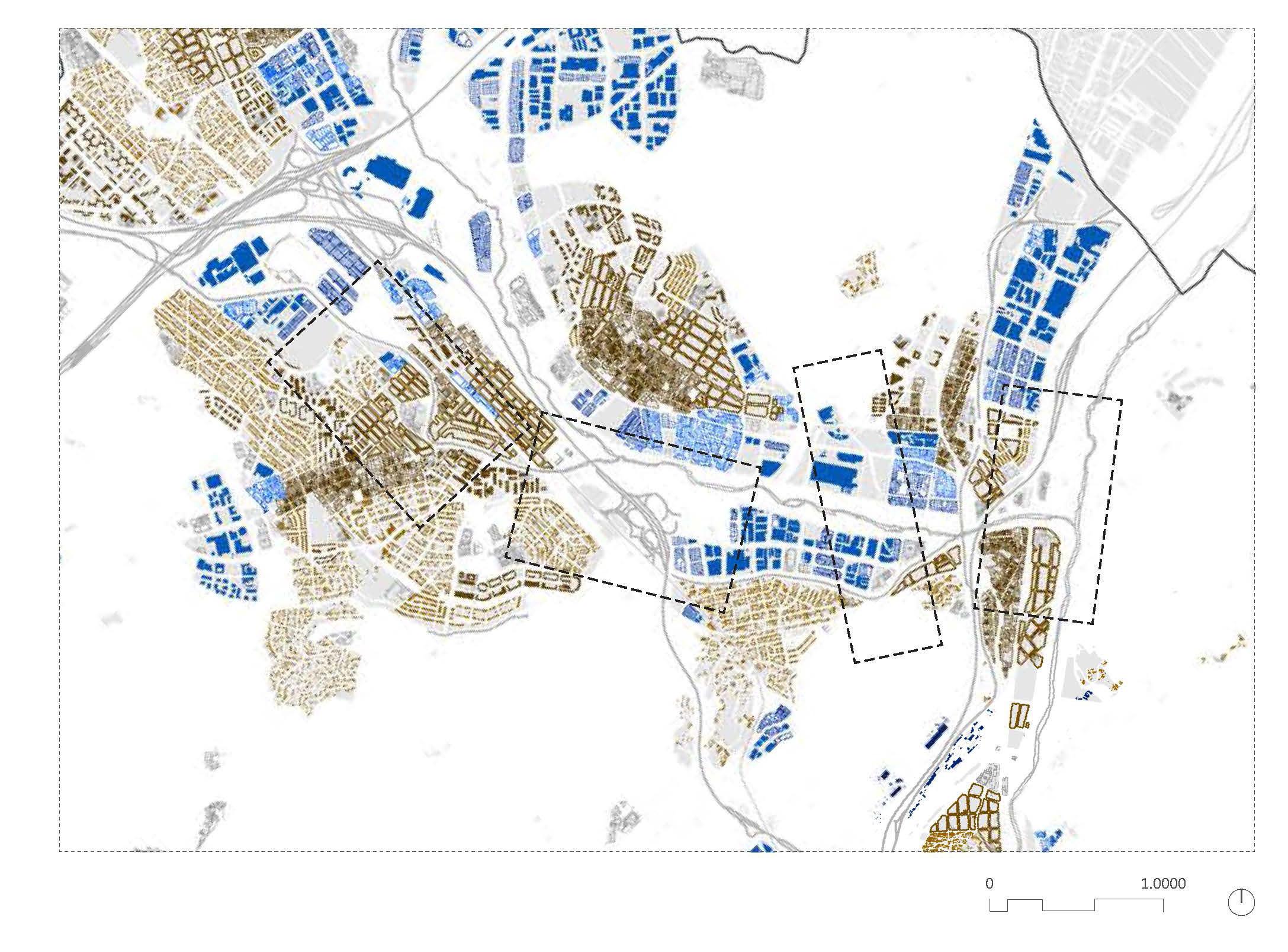
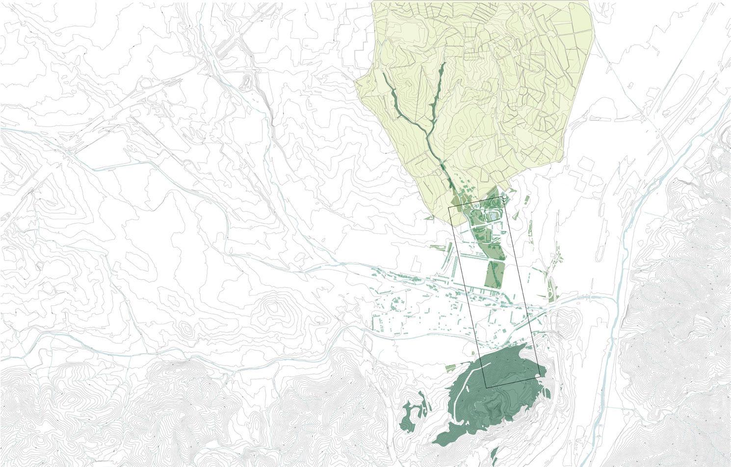
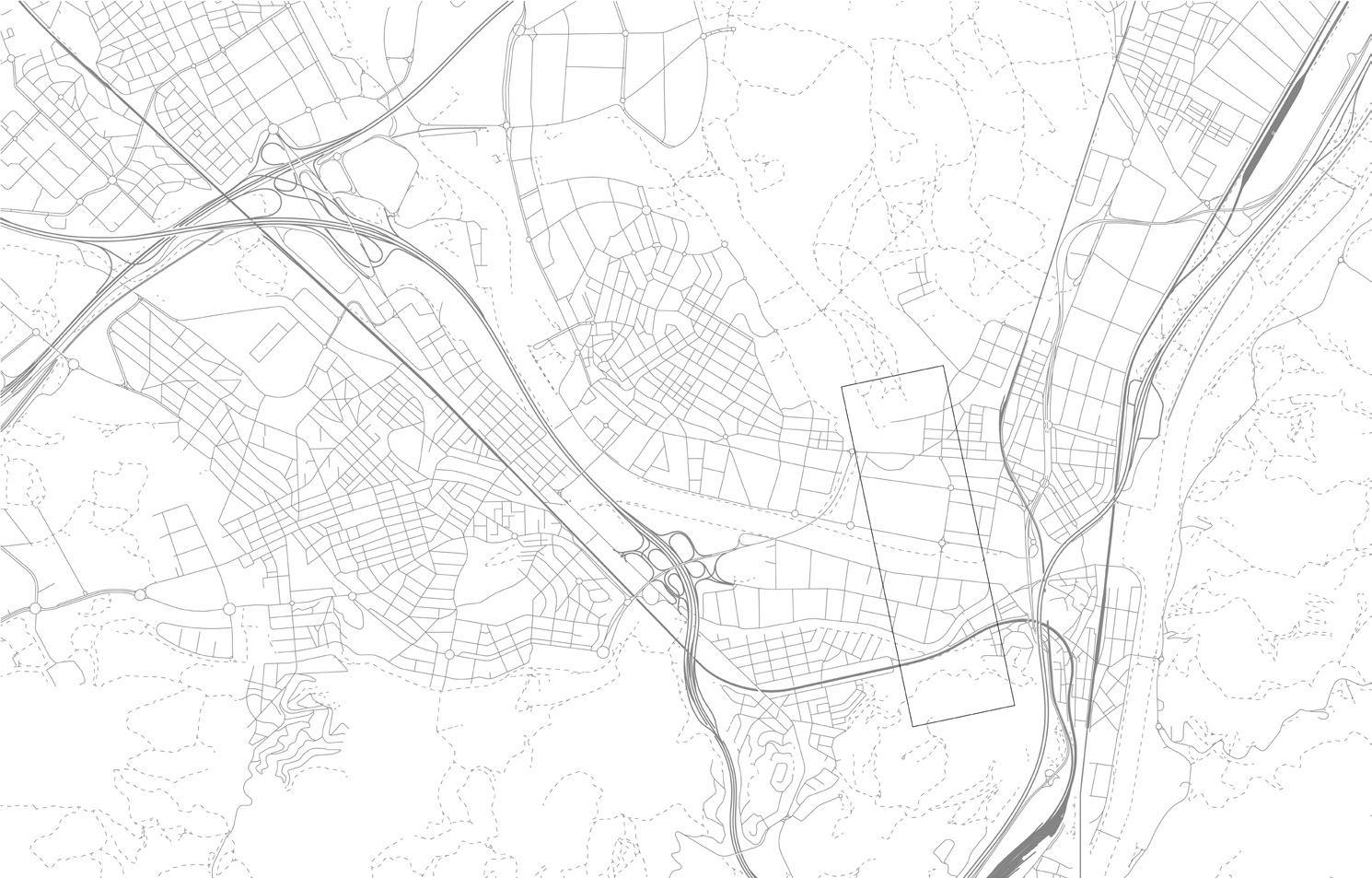
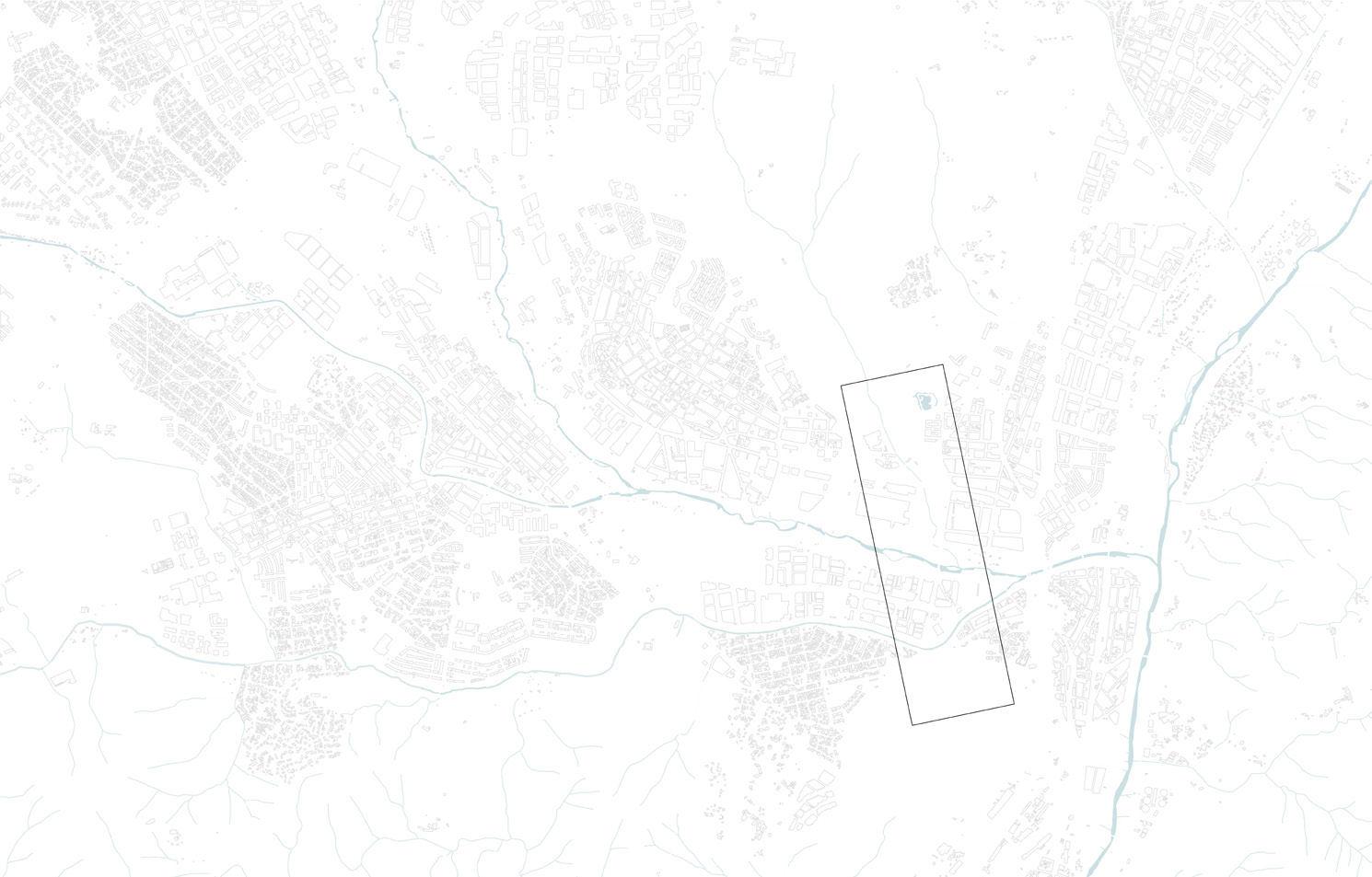
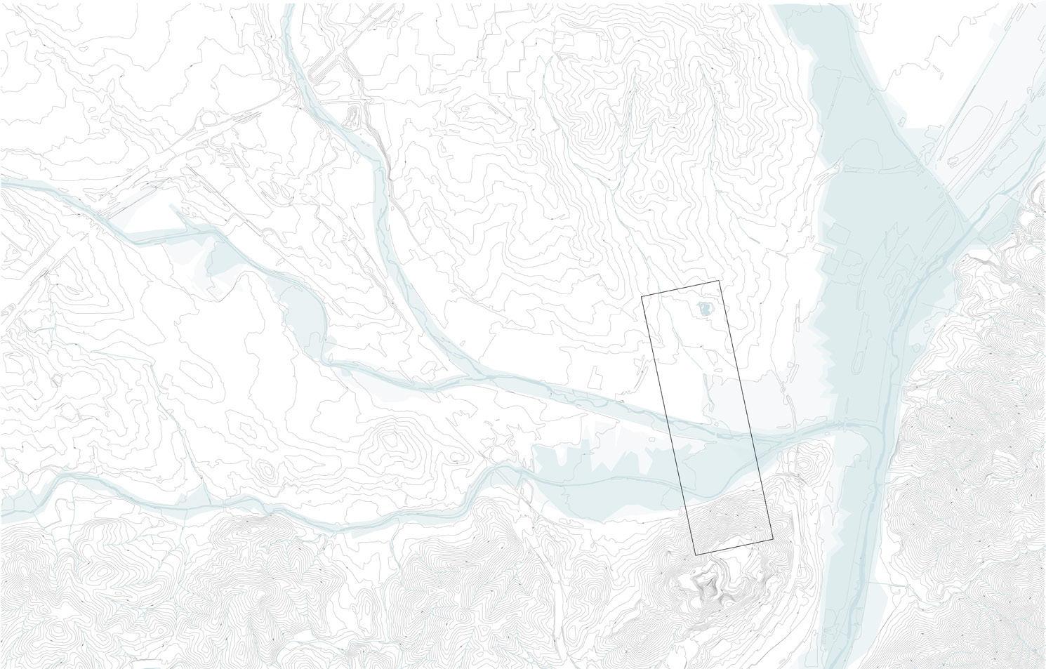
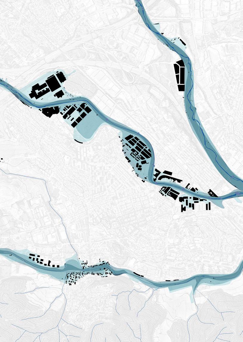
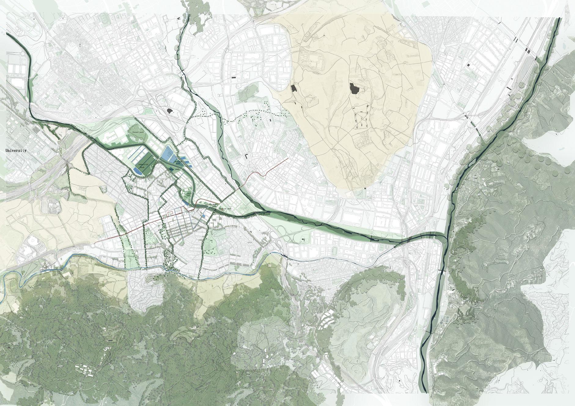
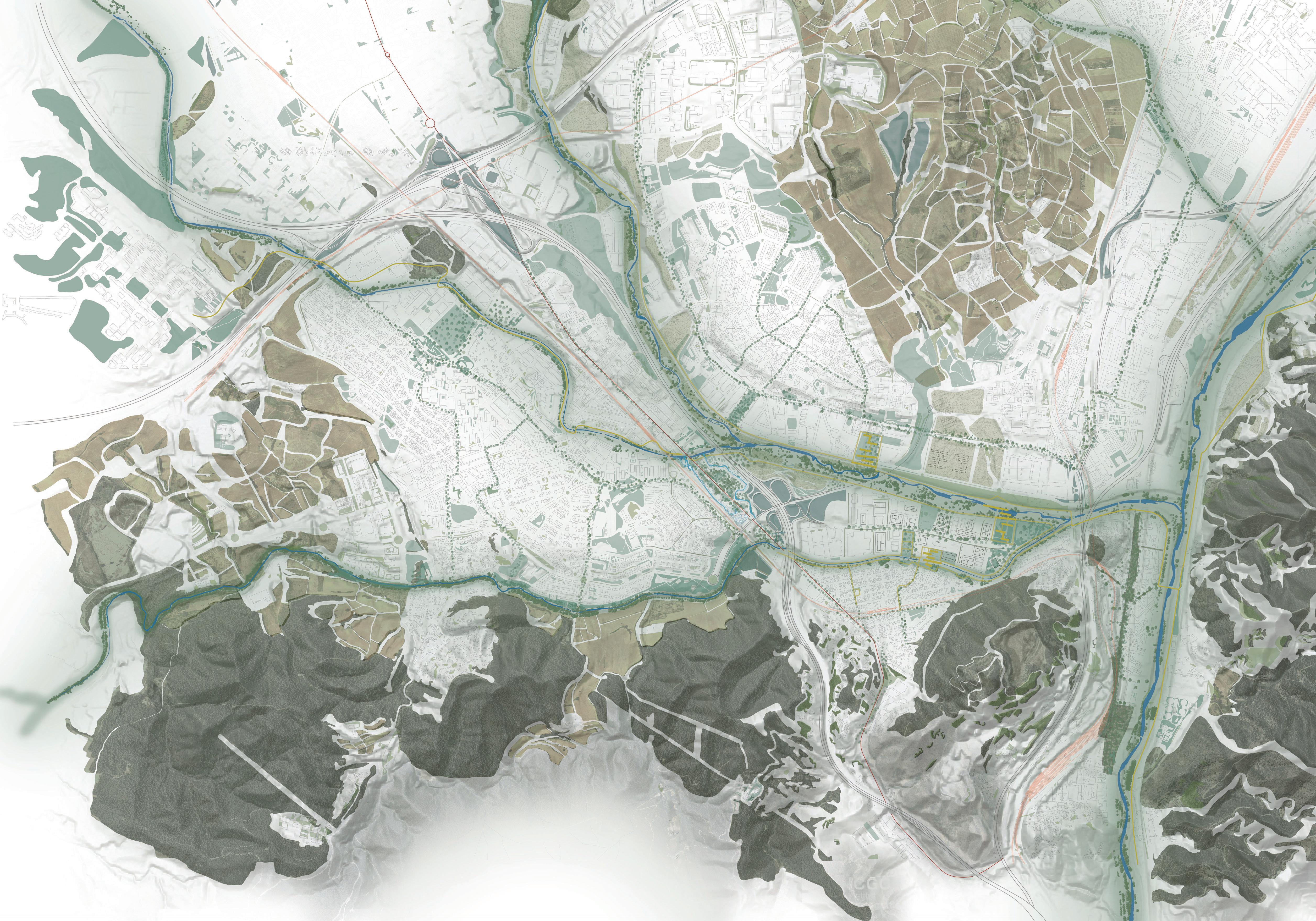
Sites
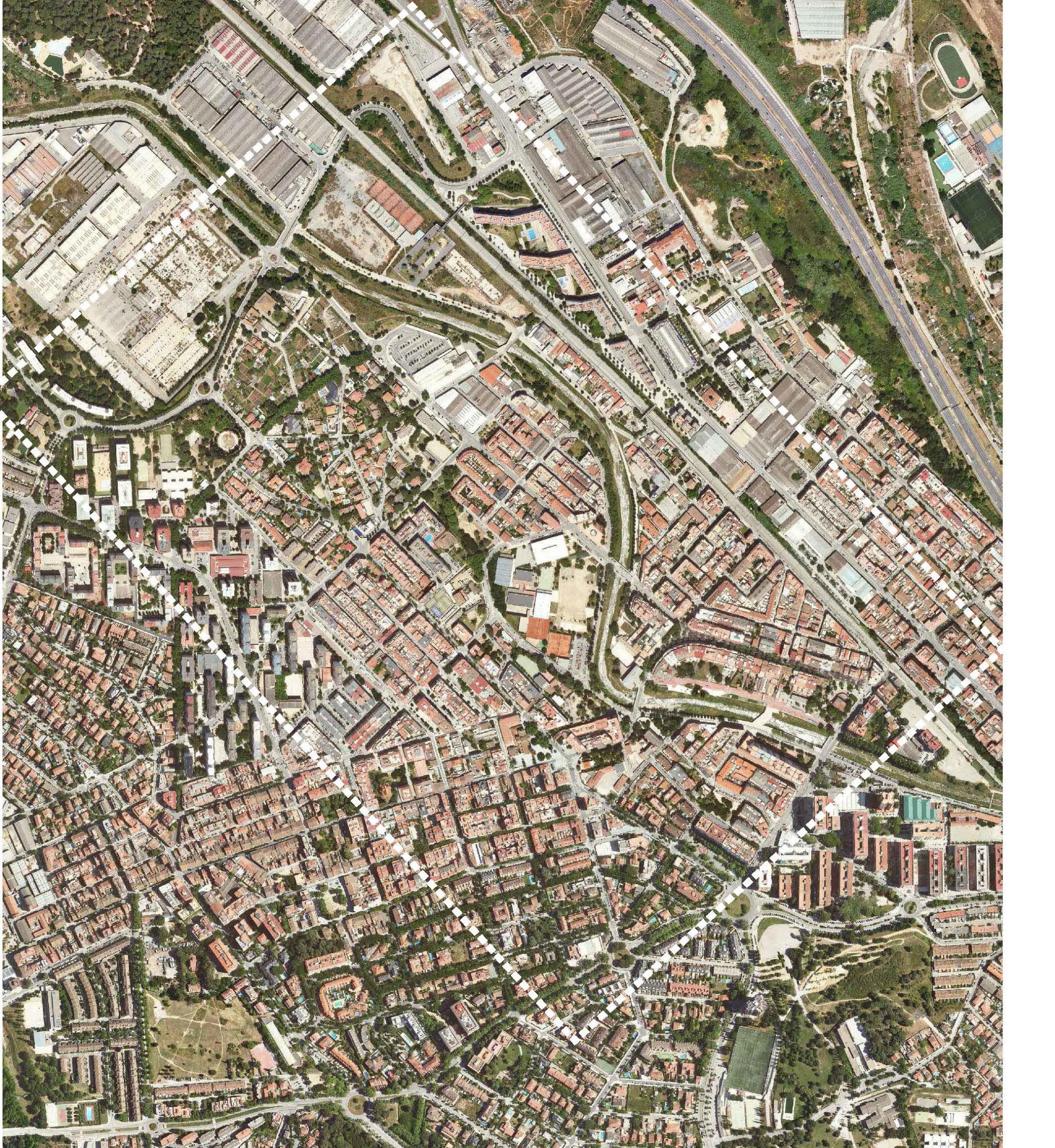
The sites are located in two strategical municipalities of the Vallés region.
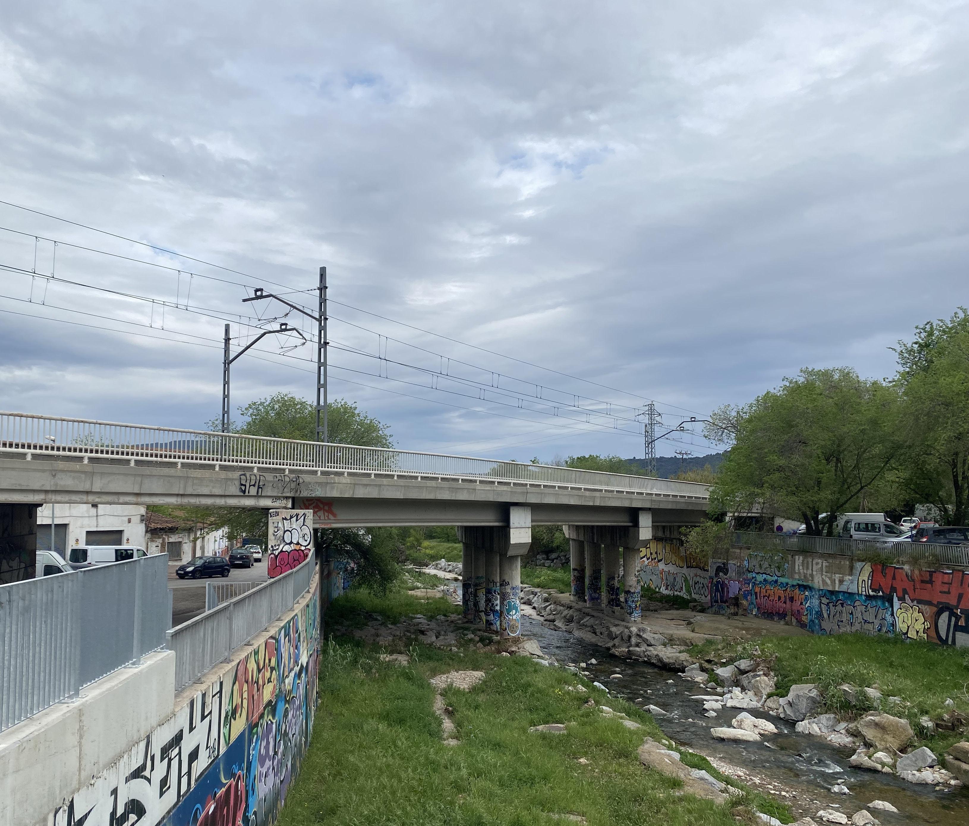
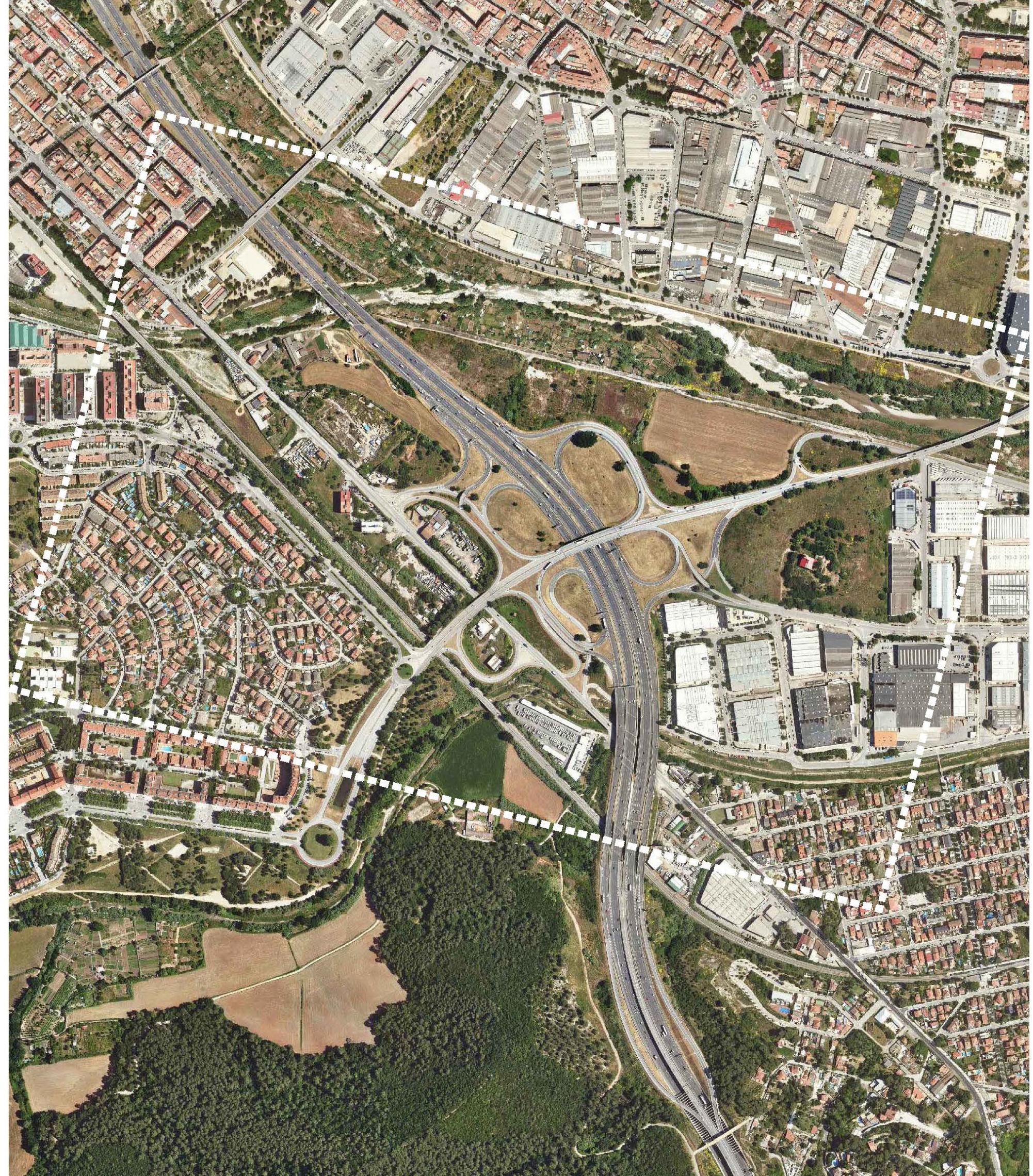
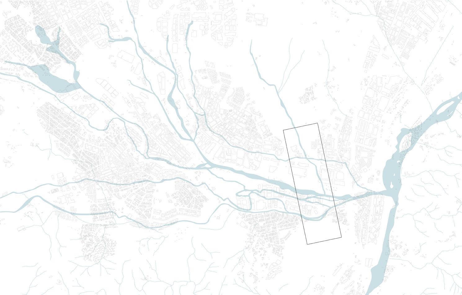
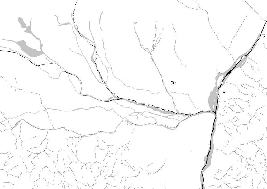
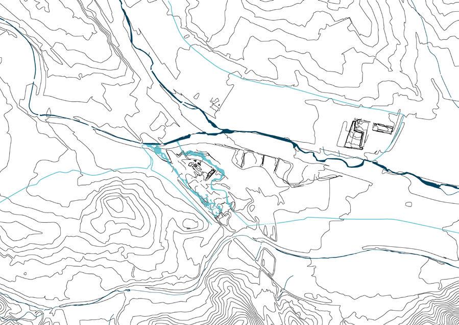
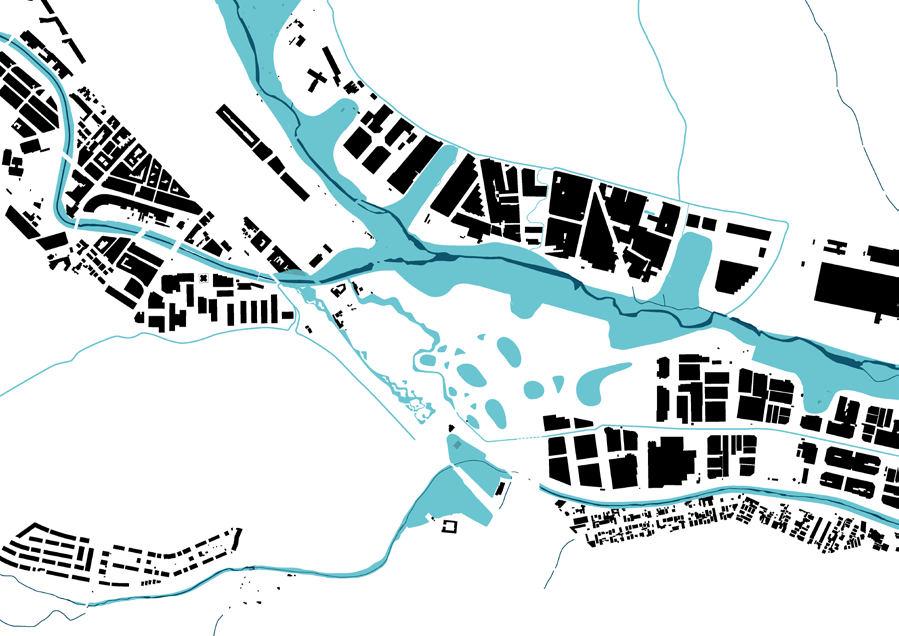
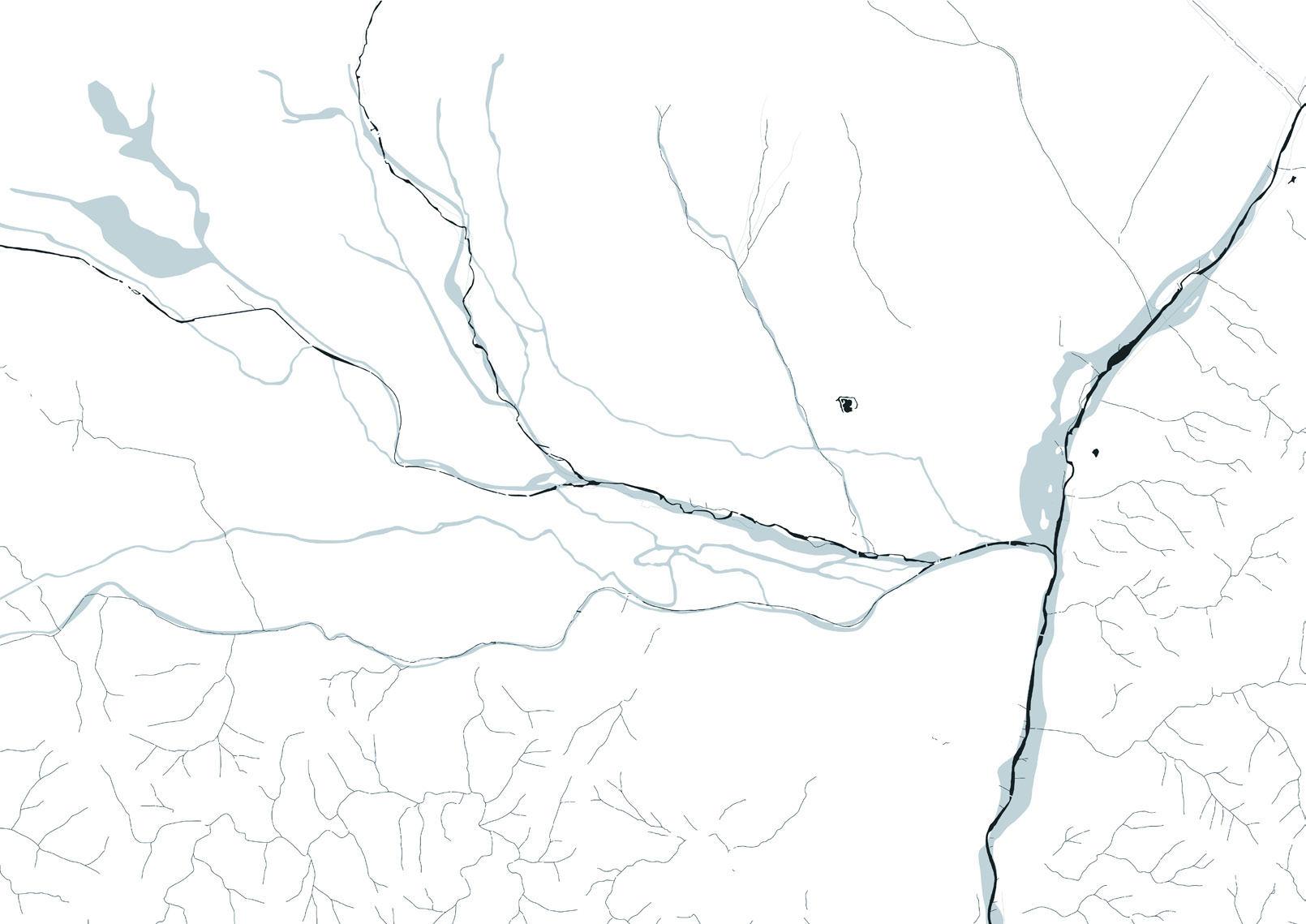
The Vallés region sits in the alluvial plain in-between the Collserola Range, the Ma rina Range and the pre-coastal mountain range. It is part of the Besós River Basin and the main receiver of water through multiple tributaries, among which are the Ripoll the Caldes streams. The region is one of the main communication hubs in Catalonia and Spain, with various axes crossings it in all directions.
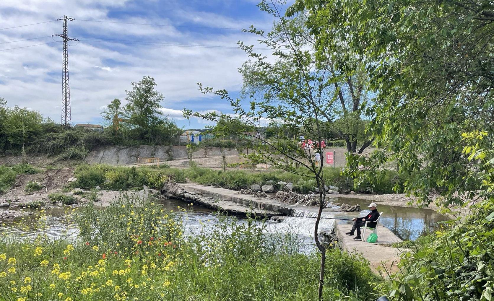
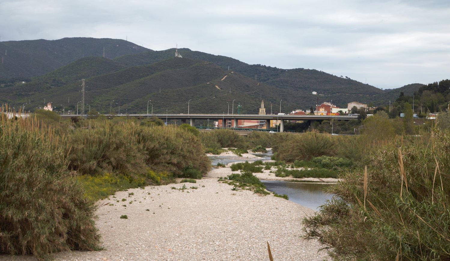
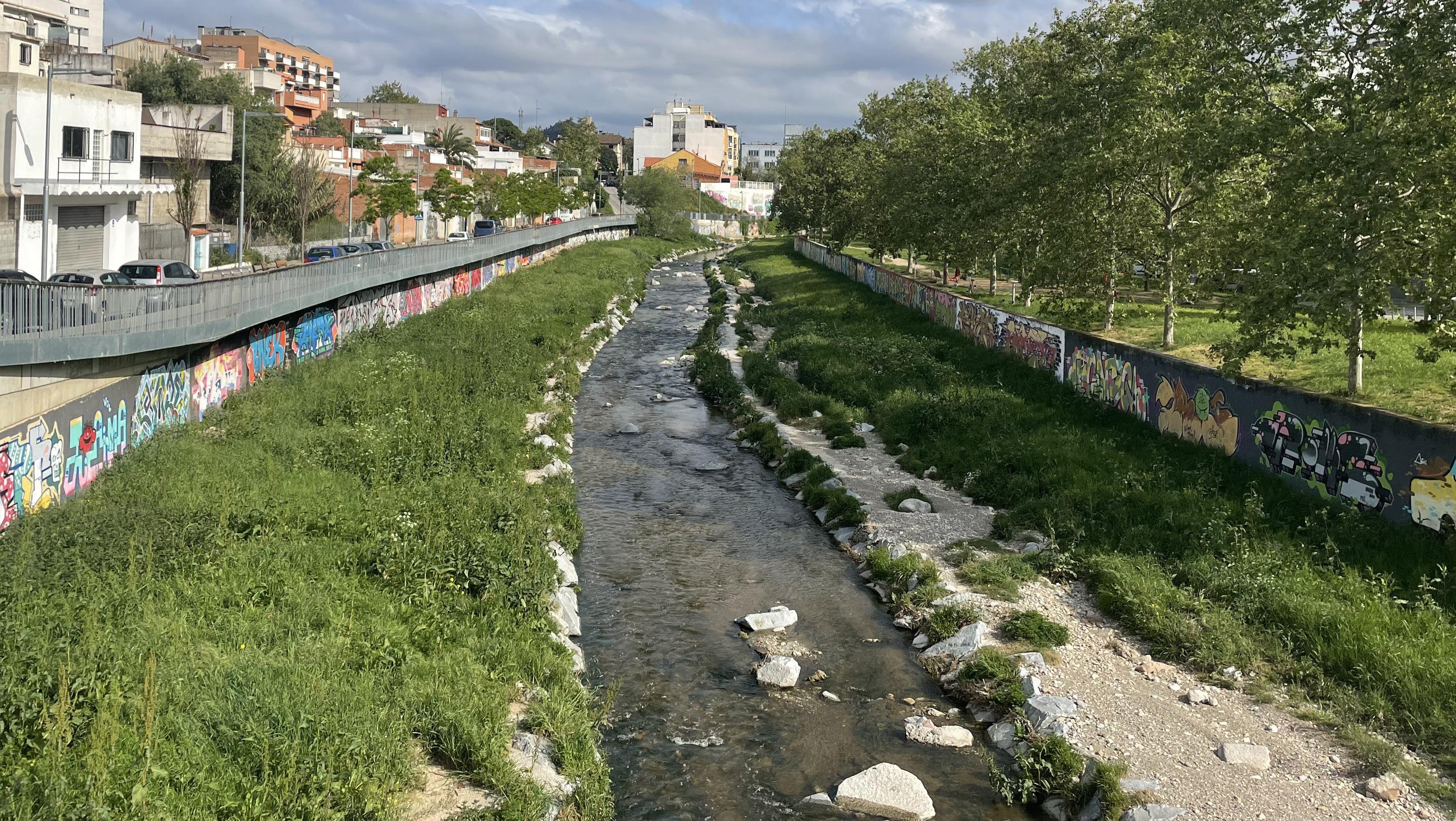
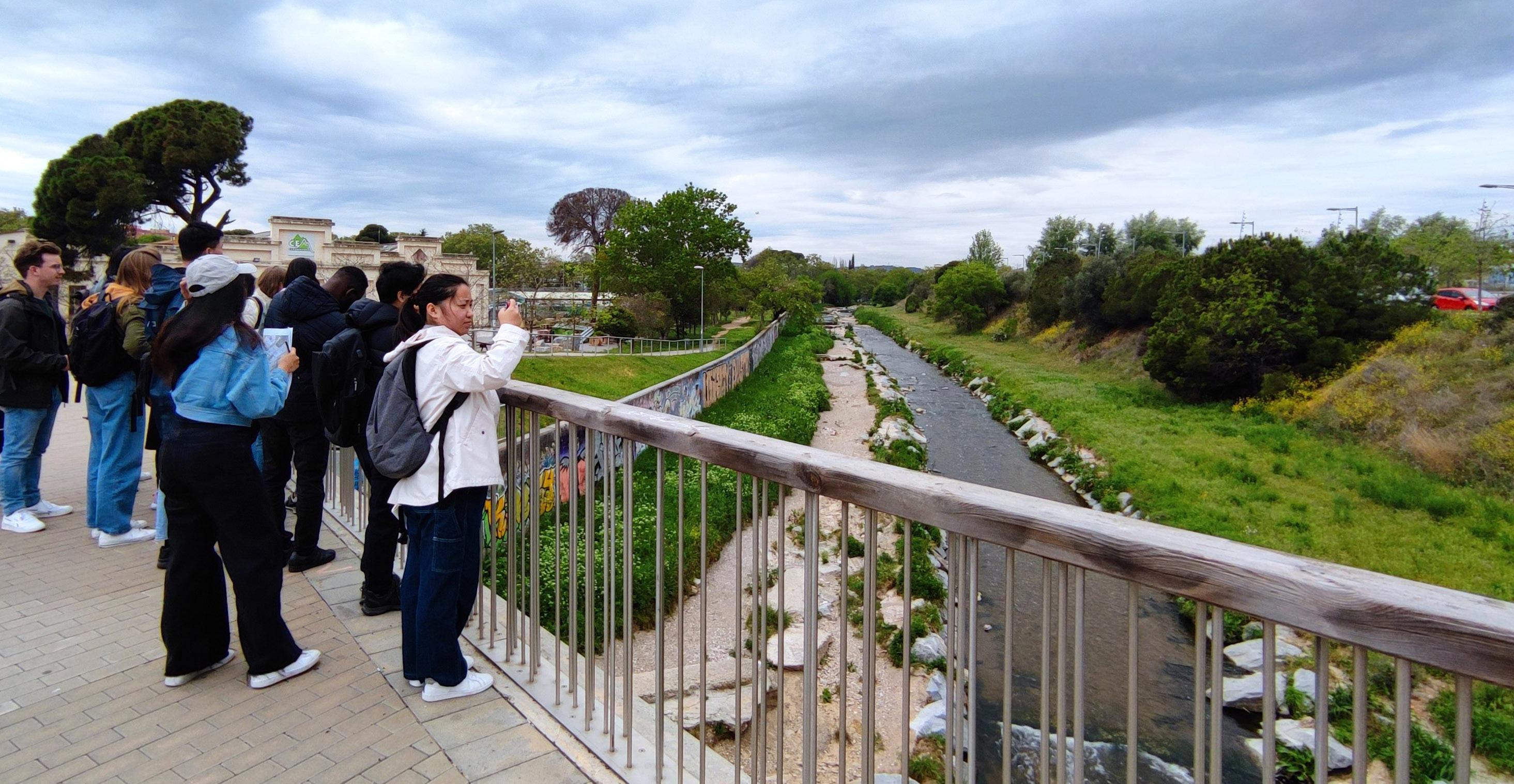
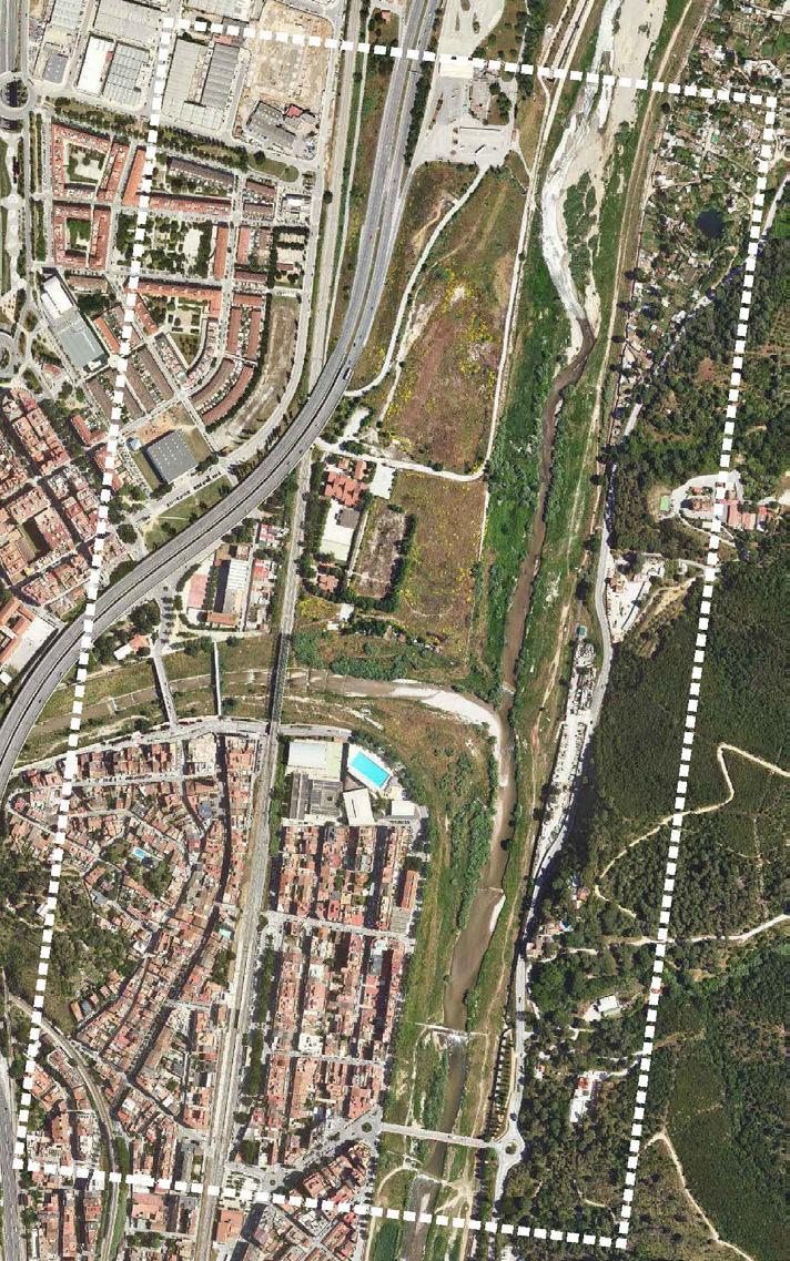
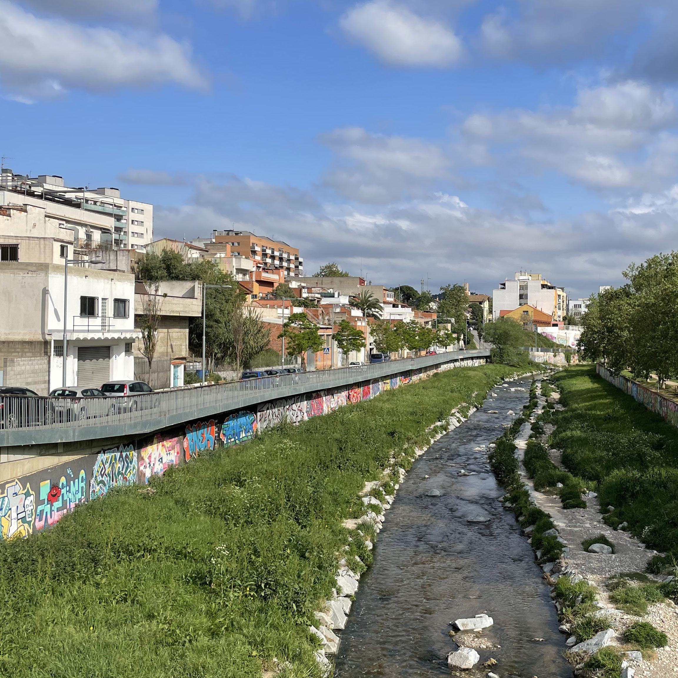
One of the main landscape figures in the region is the Ripoll River, one of the tributaries of the Besós River. The area of the Ripoll has been used for centuries by agriculture and later by the textile industry. Urban growth and industrialization led to a process of degradation in the 1950s. Later, in the mid-1990s, the process was reversed thanks to the development and application of the recovery plan for the Ripoll River, although the plan was implemented differently depending on the municipality.
The most important industries in the region are textiles, mechanics, metallurgical, machinery, electrical equipment, construction, chemicals, paper, graphic arts and food. In addition, in recent years, and because of the industrial crisis at the end of the 1970s and beginning of the 1980s, there has been an important development of the commercial and services sector.
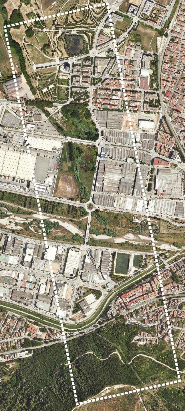
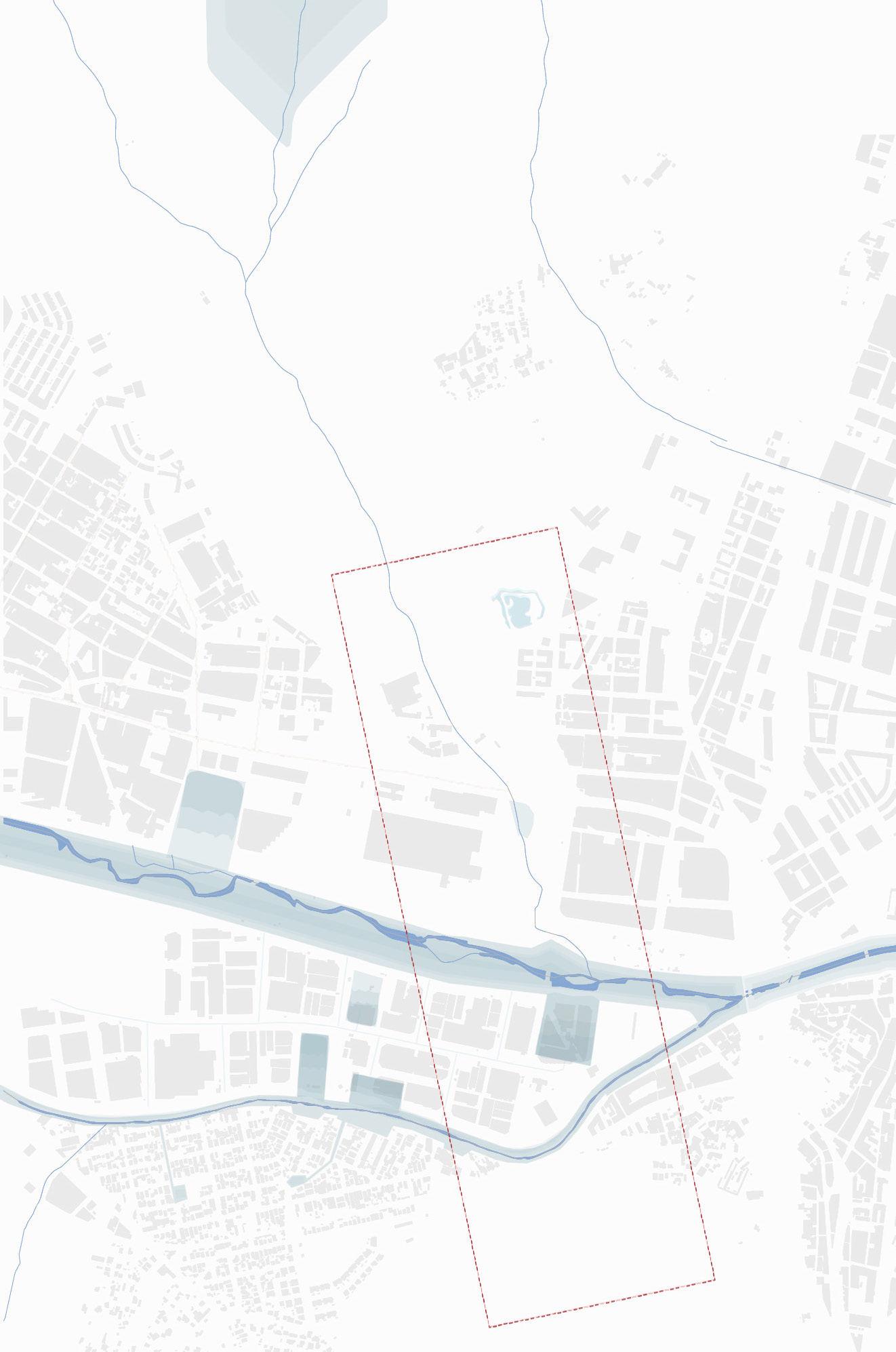
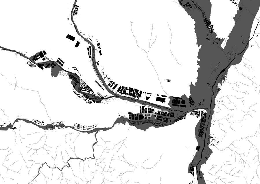
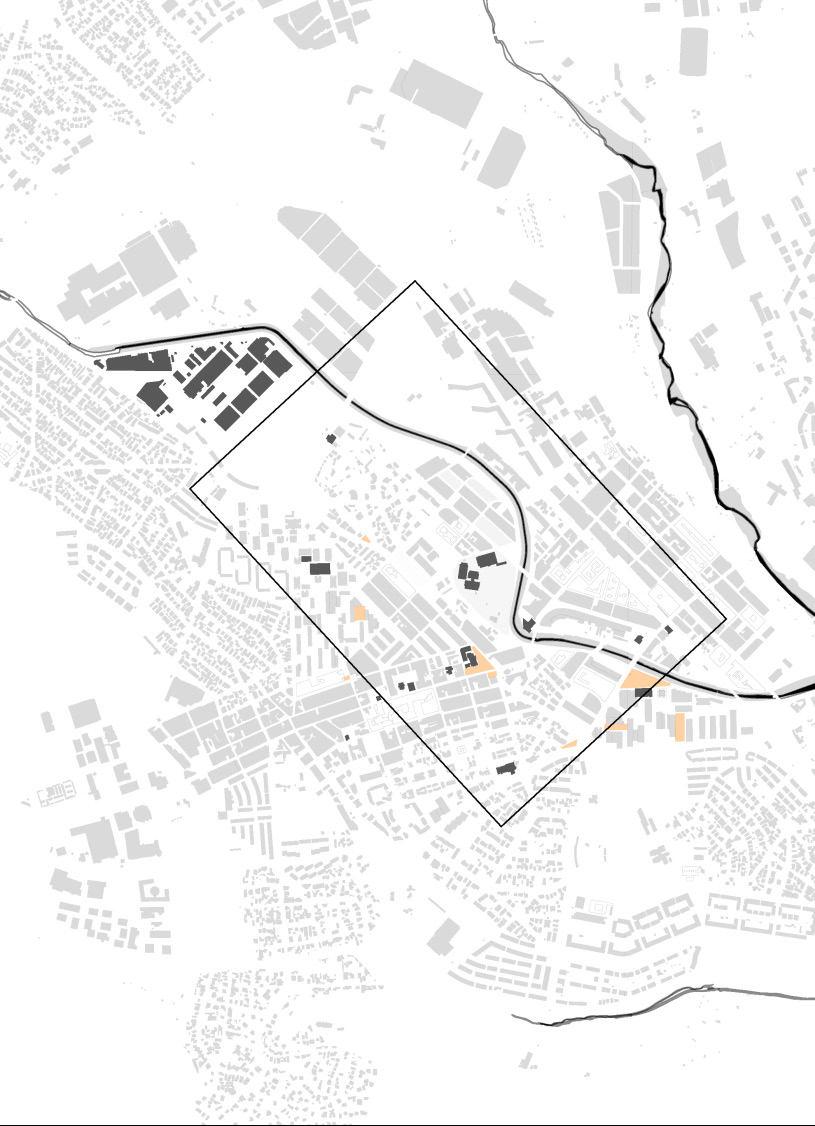
Two of the municipalities along the Ripoll River that still need to re-shape their relation with the river and its ecologies are Montcada i Reixac and Cerdanyola. These are the sites for the design research investigations.
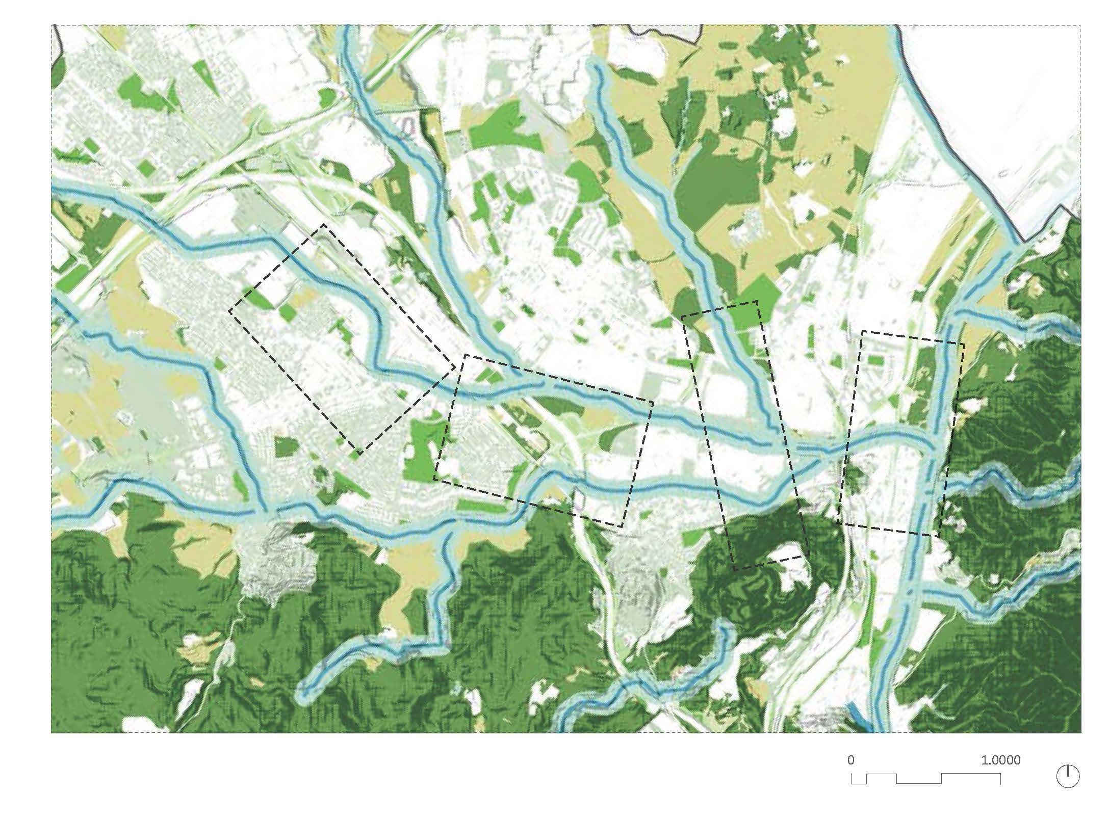
The studio will work on the premise of accommodating an additional 600 house holds per city by 2035: each site should work with adding between 200 and 300 new housing units.
1415
S1 Montcada Reixac Center
S2 Montcada Reixac Industry
S3 Cerdanyola Node
S4 Cerdanyola Center
TOPOGRAPHY
BLUE & GREEN STRUCTURES
FLOODING AREAS
URBAN TISSUE
1617
LAND USE
INFRAESTRUCTURES
Population
Surface
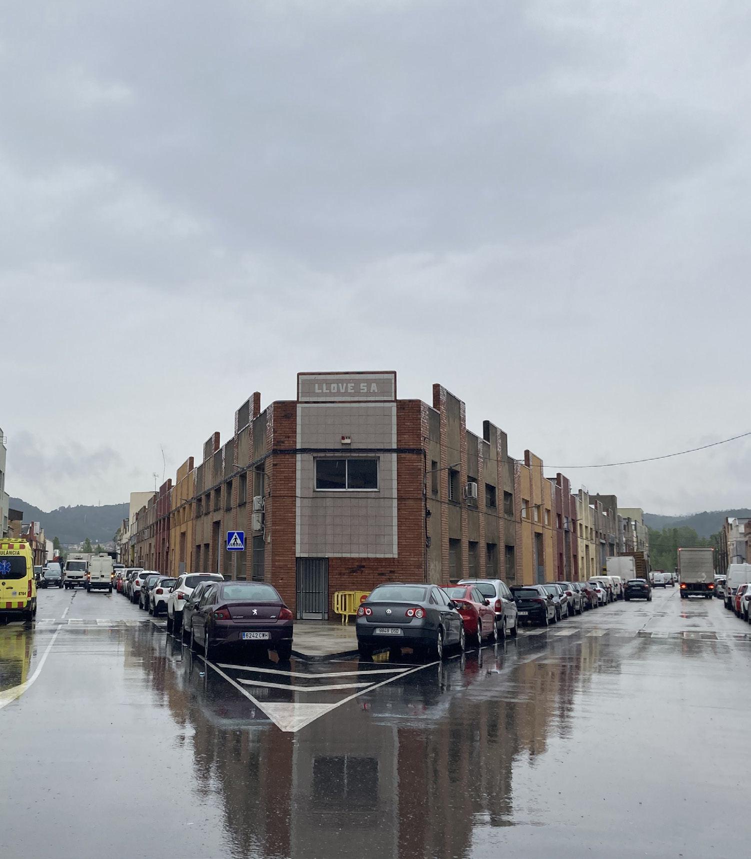
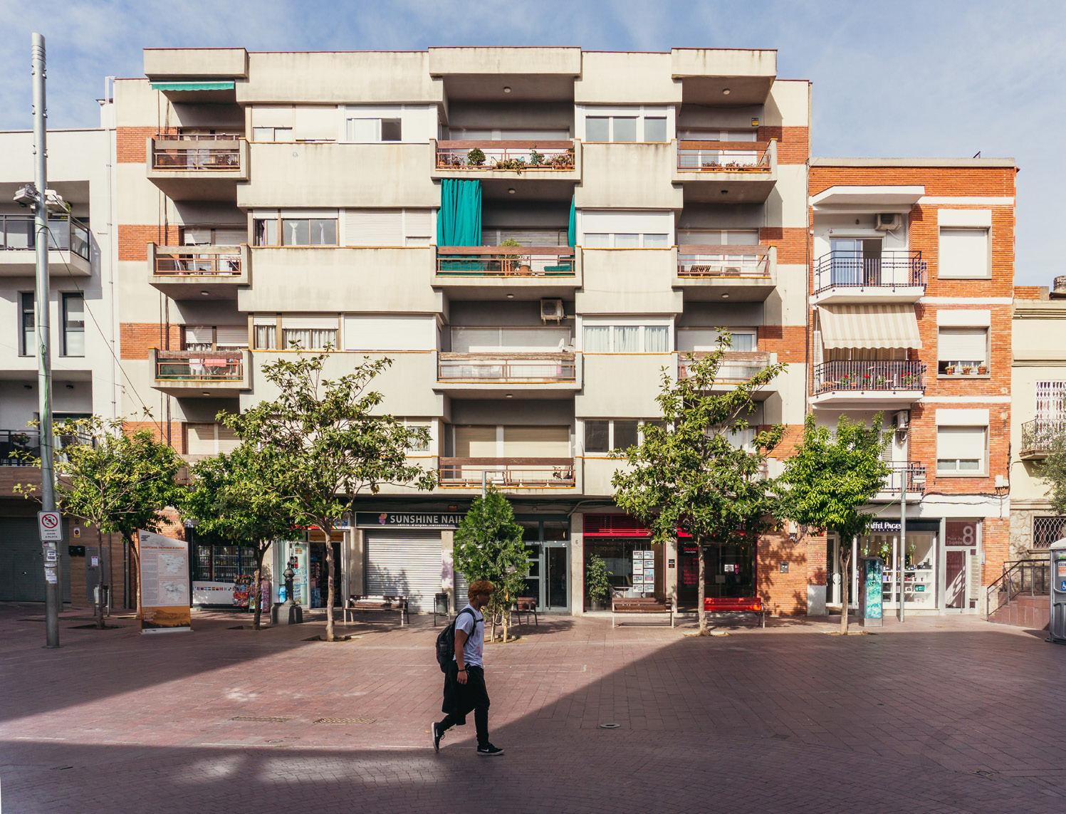
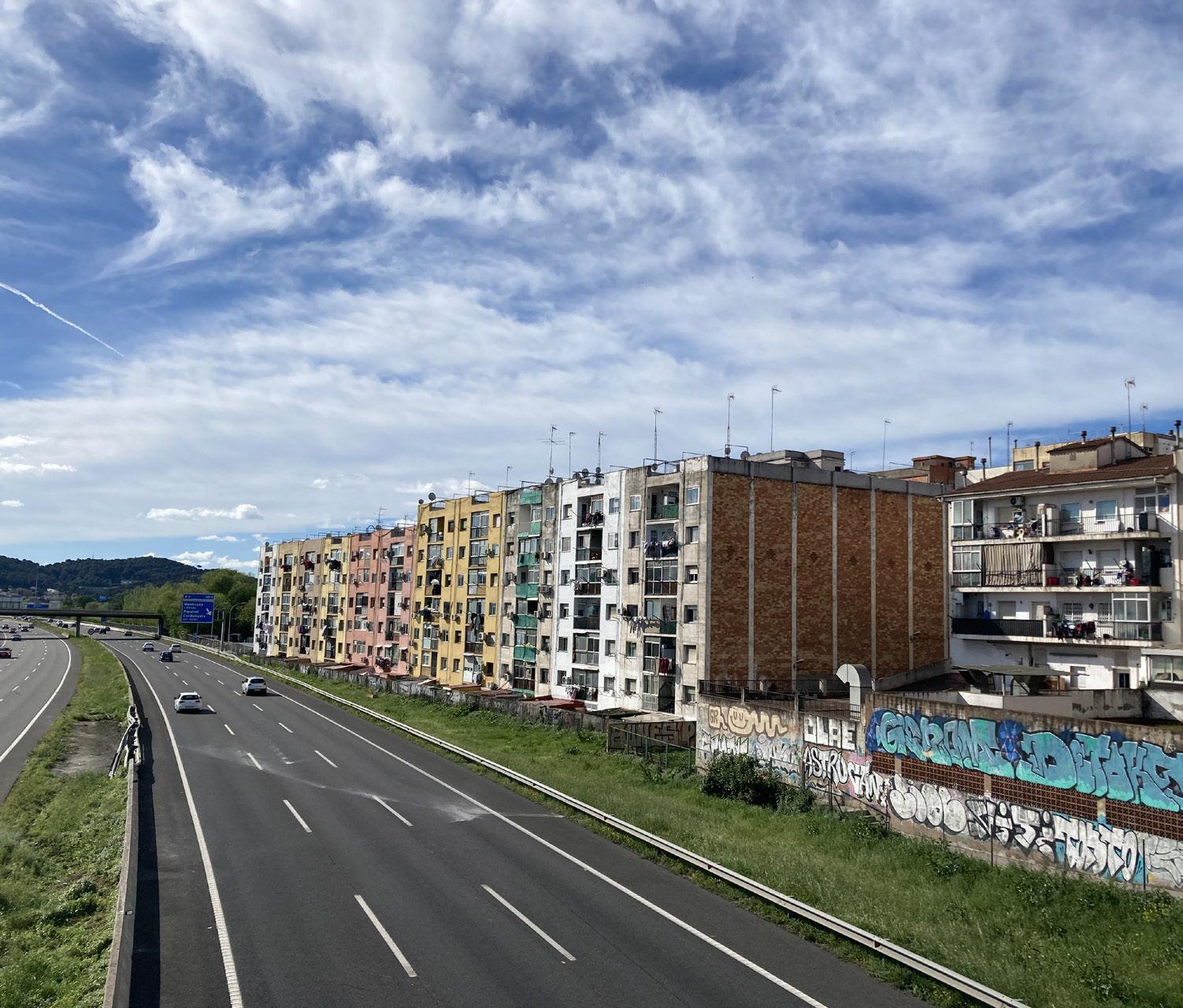
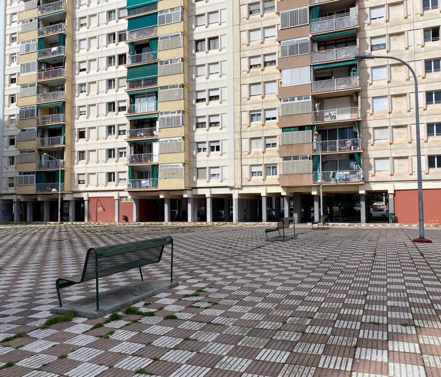
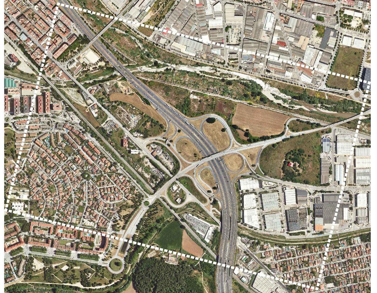
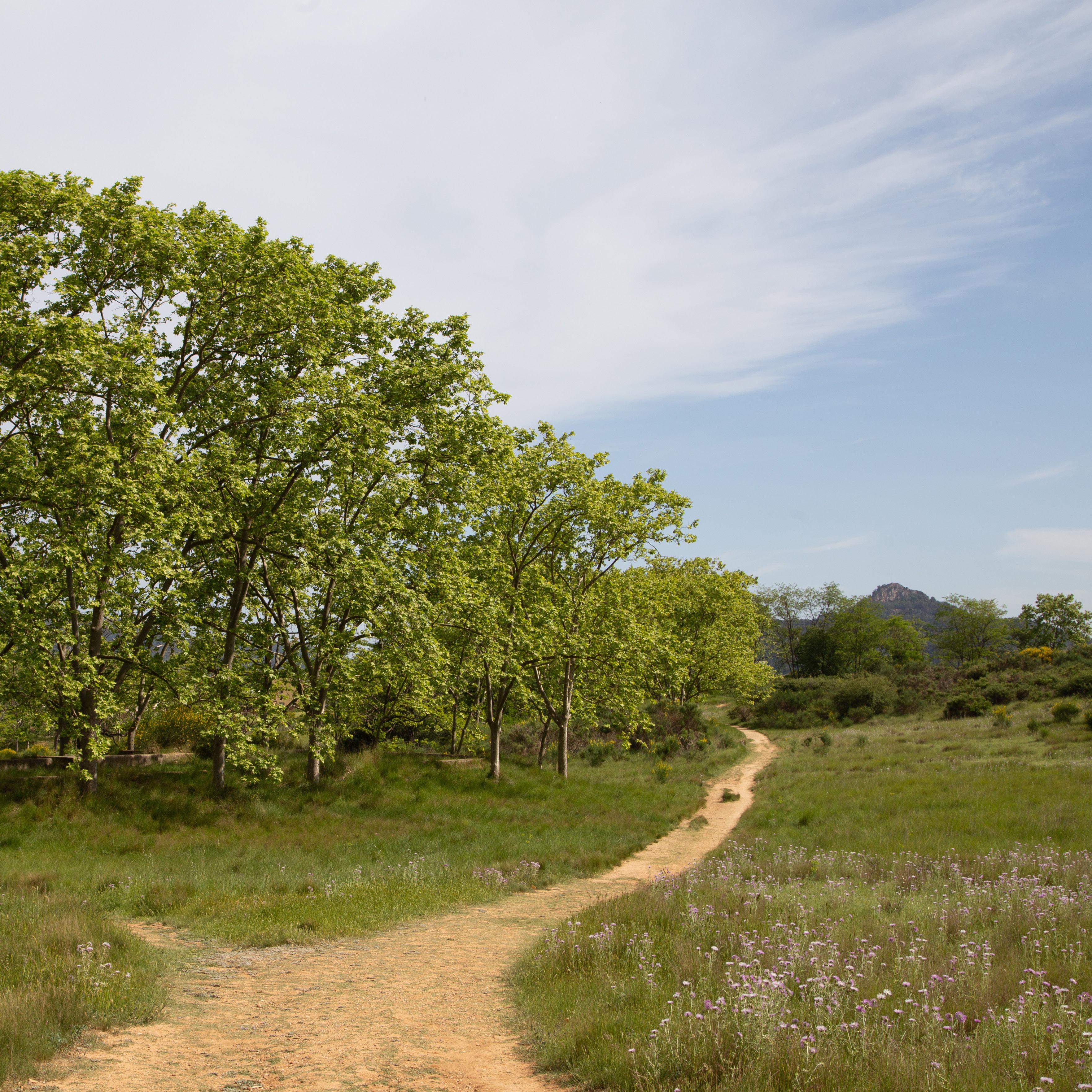
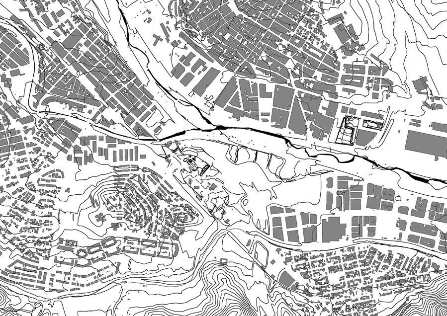
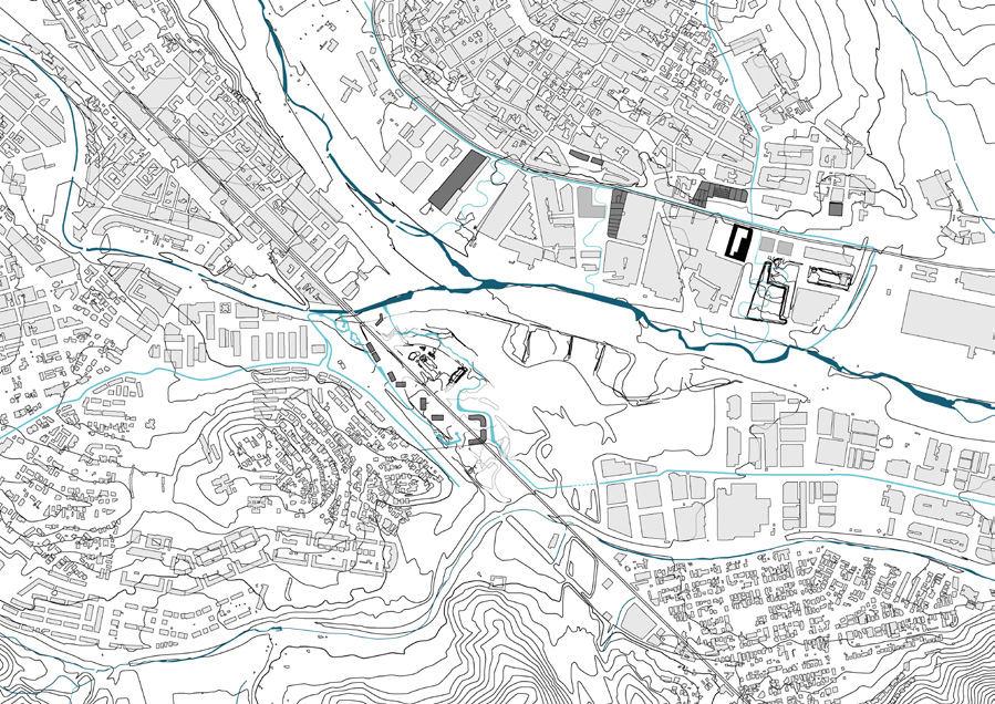
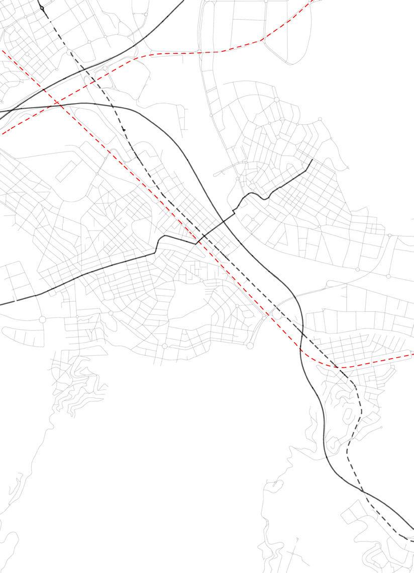
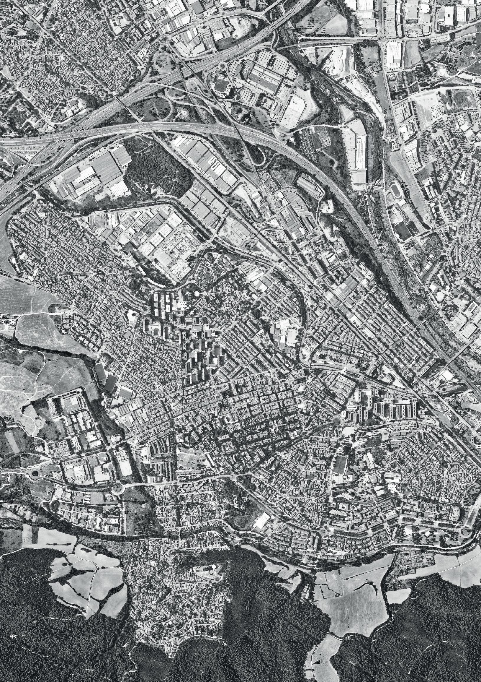
Montcada i Reixac is a town of 36,794 inhabitants where the Ripoll River meets the Besos River. It has a great complexity due to different factors, including the cross ing of heavy infrastructures like a highway, a national road and a railway that create a division in the town along with dangerous crossings, noise and biodiversity dis continuity. It results in pockets of different urban tissues hardly connected. Despite this, Montcada has a privileged location around the meeting point between two rivers, embraced by the Sierra de Marina and Collserola, and bordering the Pla de Reixac, places of great ecological value but which are threatened. Montcada has the potential to become a city that clearly establishes a new relationship with the landscape, but also, due to its intertwining situation between different ecologies, it can be the place that revalues, enhances and restores damaged and endangered natures. And becomes a benchmark for the Vallesana region, in the development of a balanced coexistence between nature and human settlements.
Density
Dwellings
Emptydwellings
PopulationAge
From0to14
From15to64
From65to84
From85andmore
Nationality
Sizeofthehouseholds
Oneperson 2220 Twopeople 4434
Threepeople 3149 Fourpeopleormore 3204
usefulsurfaceareaofdwellings
From61to90m2 7373 From91to120m2
Inyear2020
Housingstarts
State-subsidisedhousingstarts
1819 Site 1 and 2: Montcada i Reixac
36.796
23,47Km2
1.567,7inh/km2
15.910
2.537
6.038
25.097
4.769
890
Spanish 31.768 Foreign 5.026
2370
100
0 © Nhung Pham © Alexander Van Gestel © Alexander Van Gestel
3 and 4: Cerdanyola del Vallés
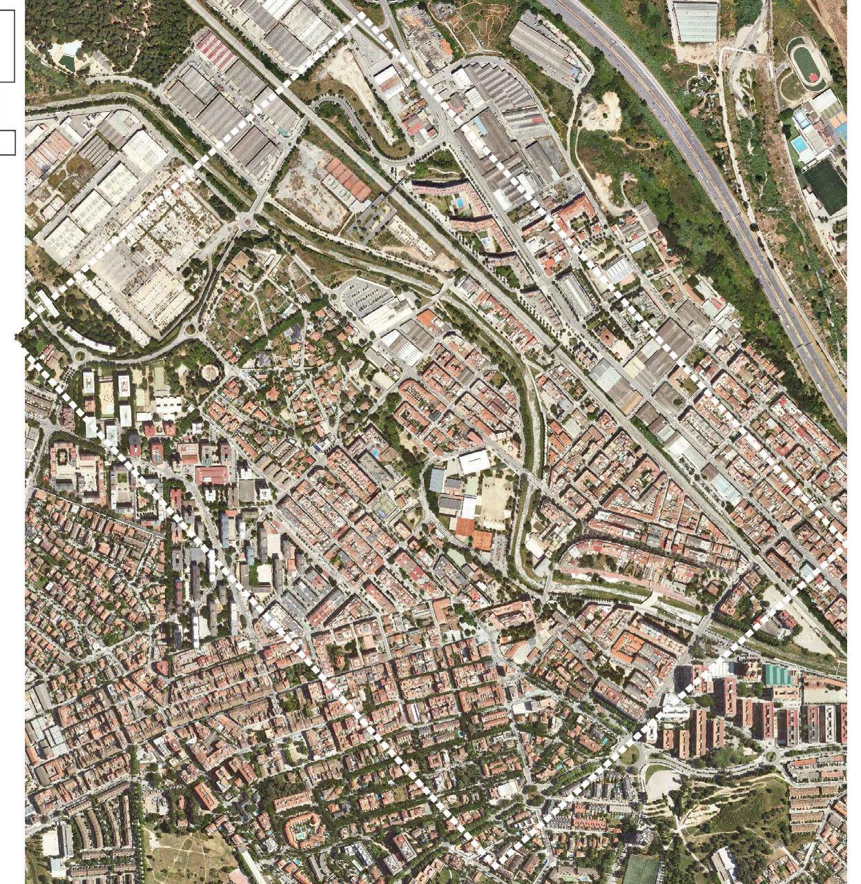
Cerdanyola del Vallès is a town of 57,217 inhabitants located in the margin of the Ripoll River, and limited by the Collserola Range. Historically, the area was a place for summer houses for the wealthy inhabitants of Barcelona. However, in the years of the industrialization, Cerdanyola became an industrial hub and rapidly devel oped without a clear planning strategy. The evolution of Cerdanyola del Vallès, is a good example of the evolution of the BMA where the different phases of its socio-economic development overlap: agricultural, industrial and knowledge ser vices. This has had important consequences on the socio-residential characteris tics of the municipality (agricultural farmhouses, workers' housing, low-density residential neighborhoods or new developments in blocks for the metropolitan population) and also, on a strong fragmentation of land uses. (industrial, universi ty, natural park ...), accentuated by the powerful metropolitan infrastructures that cross the territory (railway, AP-7, etc.).The strong fragmentation resulted in a lack of a shared identity, complex metropolitan lace and a misrelation with the land scape figures that surround
Population 57.217
Surface 30,56Km2
Density 1.872,3inh/km2
Dwellings 25.300
Emptydwellings 5.501
PopulationAge
From0to14 7.658
From15to64 38.058
From65to84 10.106
From85andmore 1.395 Nationality
Spanish 51.716 Foreign 5501
Sizeofthehouseholds
Oneperson 3996 Twopeople 6659
Threepeople 4796
Fourpeopleormore 5866
usefulsurfaceareaofdwellings
From61to90m2 12.161
From91to120m2 4.060
From121m2andover 2.357
Inyear2020 Housingstarts 85
State-subsidisedhousingstarts 0
2021 Site
© Yue Hu © Han Qin © Agnes Ayeiga
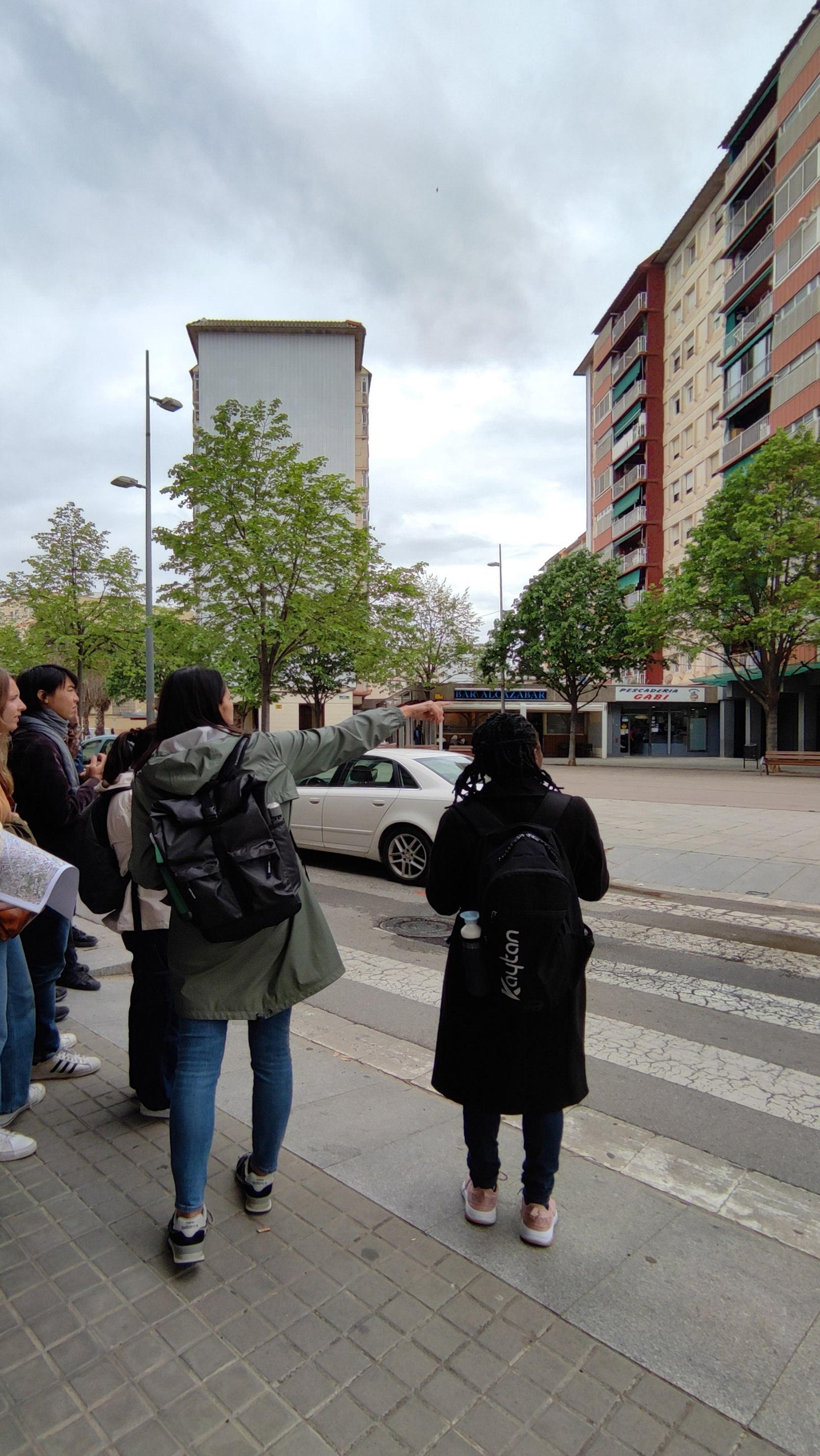
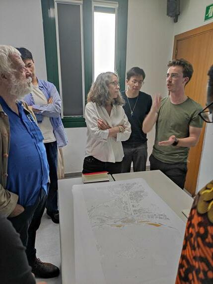
2223 02 FIELDWORK
© Peiyang Huo
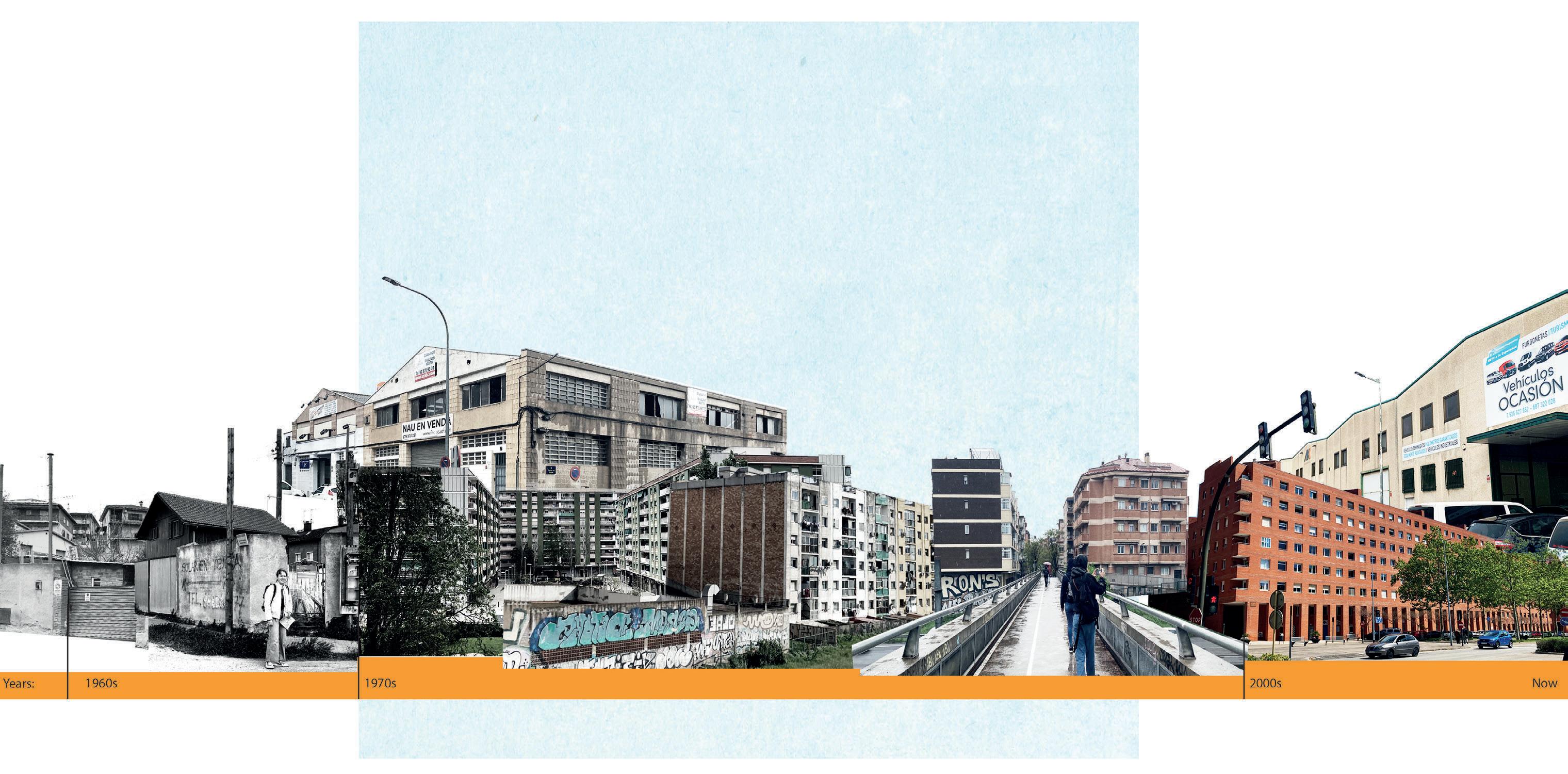
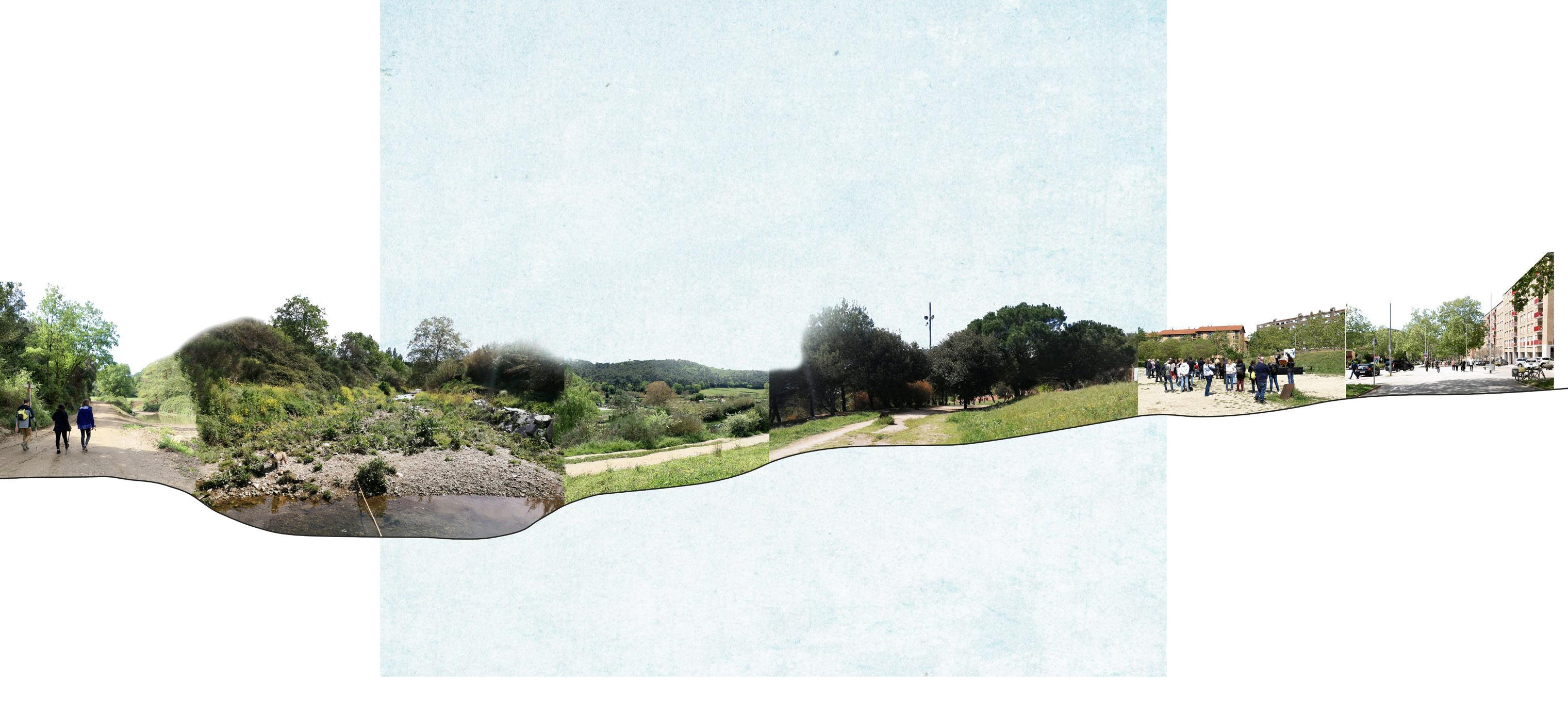
2425 © Ivan Llach TISSUE THROUGH TIME © Ivan Llach PUBLIC RIVER EDGES © Han Qin © Ellen de Wolf

2627 BOTTOM UP VS.TOP DOWN © Ivan Llach © Ivan Llach © Peiyang Huo
AMBÀ REA METROPOLITANA DE BARCELONA
AMBÀ REA METROPOLITANA DE BARCELONA
CERDANYOLA PLANNING DEPARTMENT AMBÀ REA METROPOLITANA DE BARCELONA MONTCADA PLANNING DEPARTMENT
Ramon Sisó Maria Pons Javier Ortigosa Marta Brunyesc, Josep Gomis Laia Guillem Isabelle Aguelovski
BCNUEJBCN URBAN ENVIRONMENTAL JUSTICE
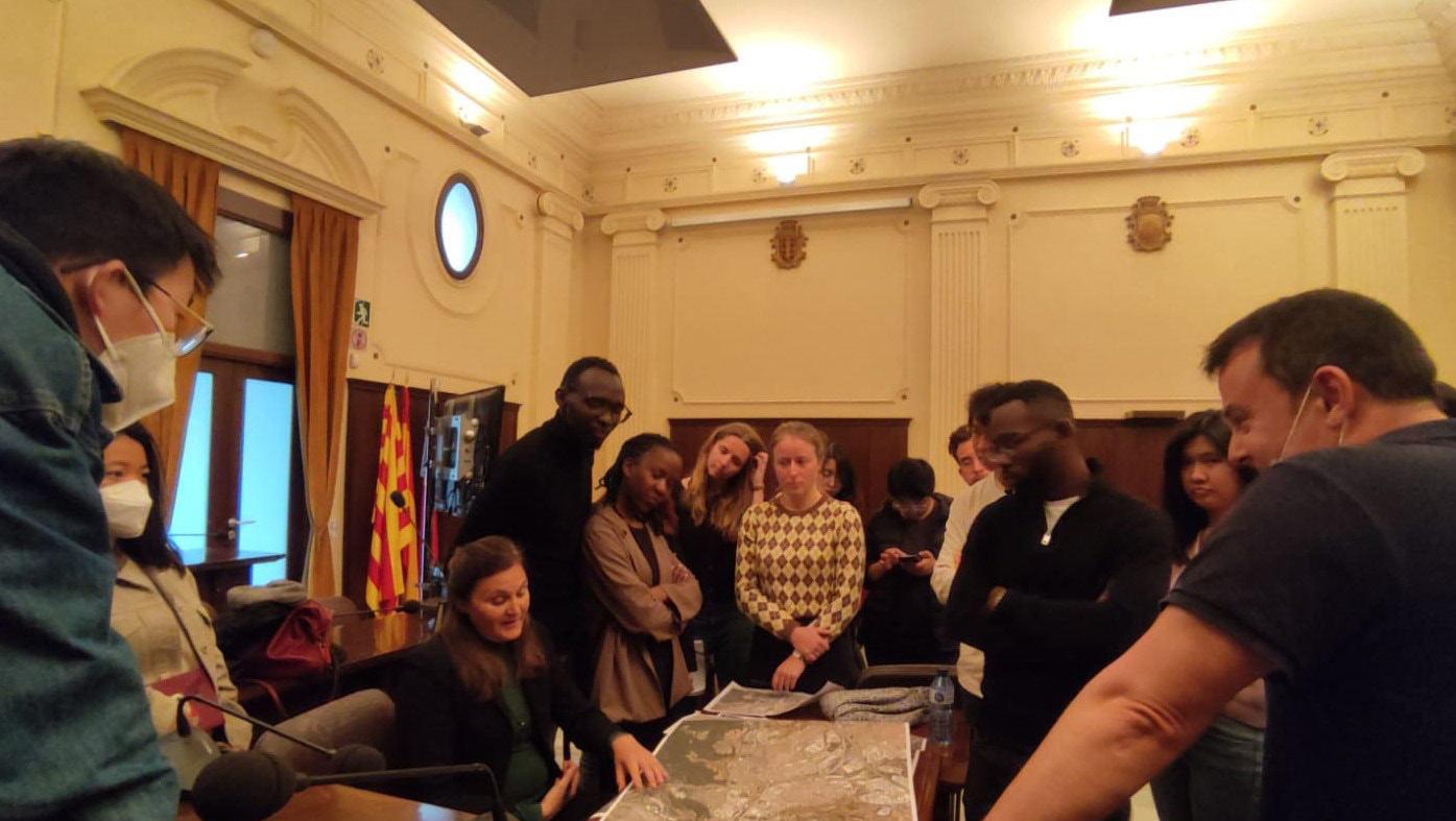
2829 Guest Lectures
3031 CONSORCI DEL BESÒSUNDER PROJECT LAB PERIS + TORAL ARQUITECTES Francesc RomeroAnna Gutierrez José Toral
(Re)Connecting Montcada to its natural Landscape
Enhancing biodiversity corridor, Transforming Montcada’s industry into productive landscape
On the edge. Interweaving a lost landscape with a
urbanity
Re-naturalizing Cerdanyola’s Landscape: Forestation
De-sealing
STRATEGIC PROJECTS
3233 03
new
and
surfaces ©icc.cat / 1956-2022 03.01 03.02 03.03 03.04
ALEXANDER VAN GESTEL TZU CHUN LIN HUBERT ASANTE
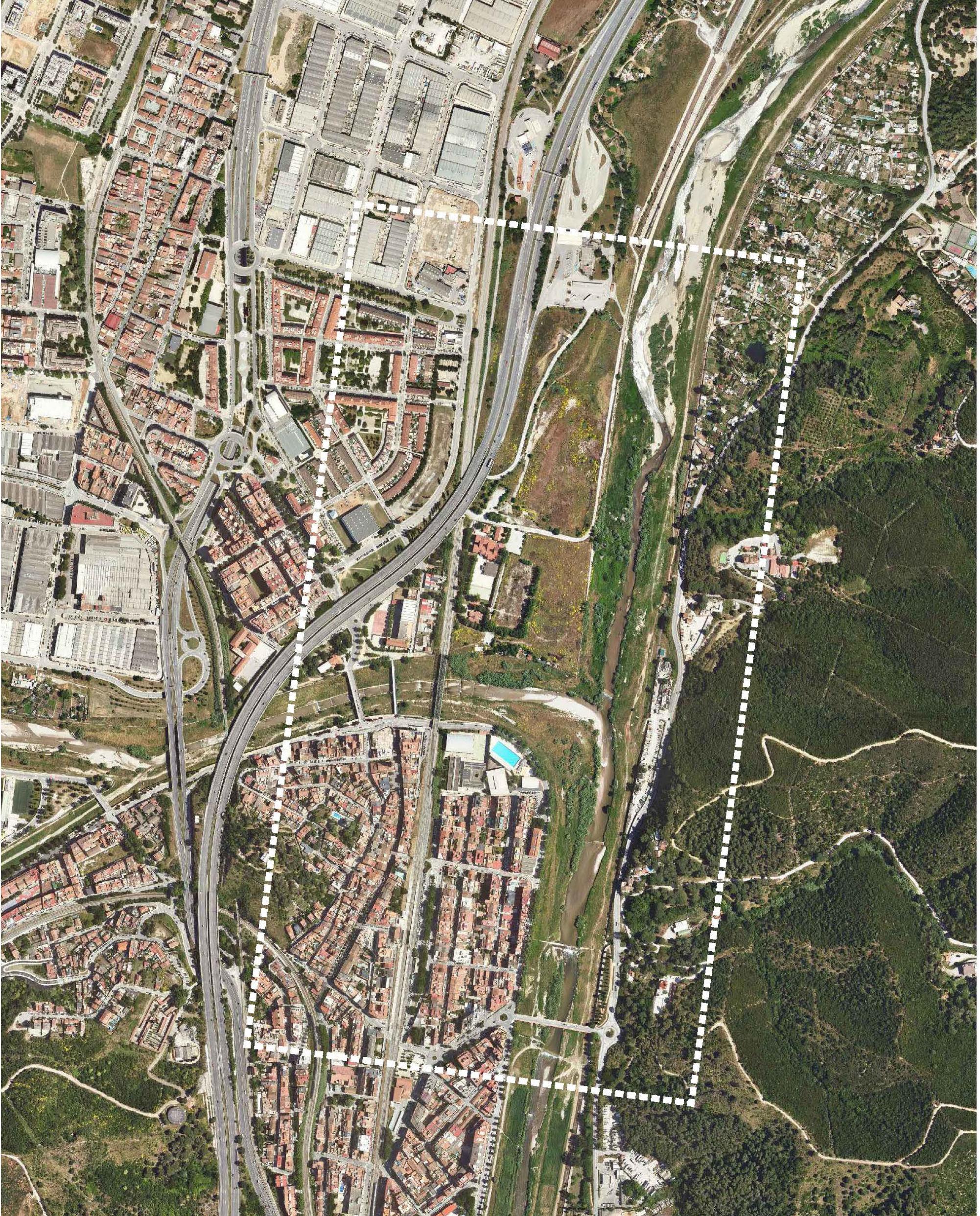
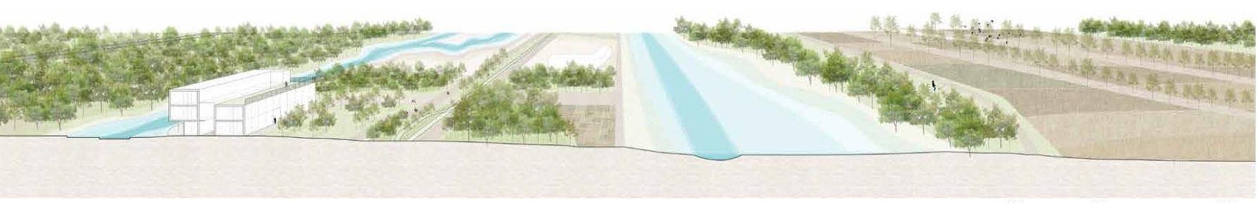
3435 03.01 (Re)Connecting Montcada to its natural Landscape
© Alexander Van Gestel
(Re)Connecting Montcada to its natural Landscape
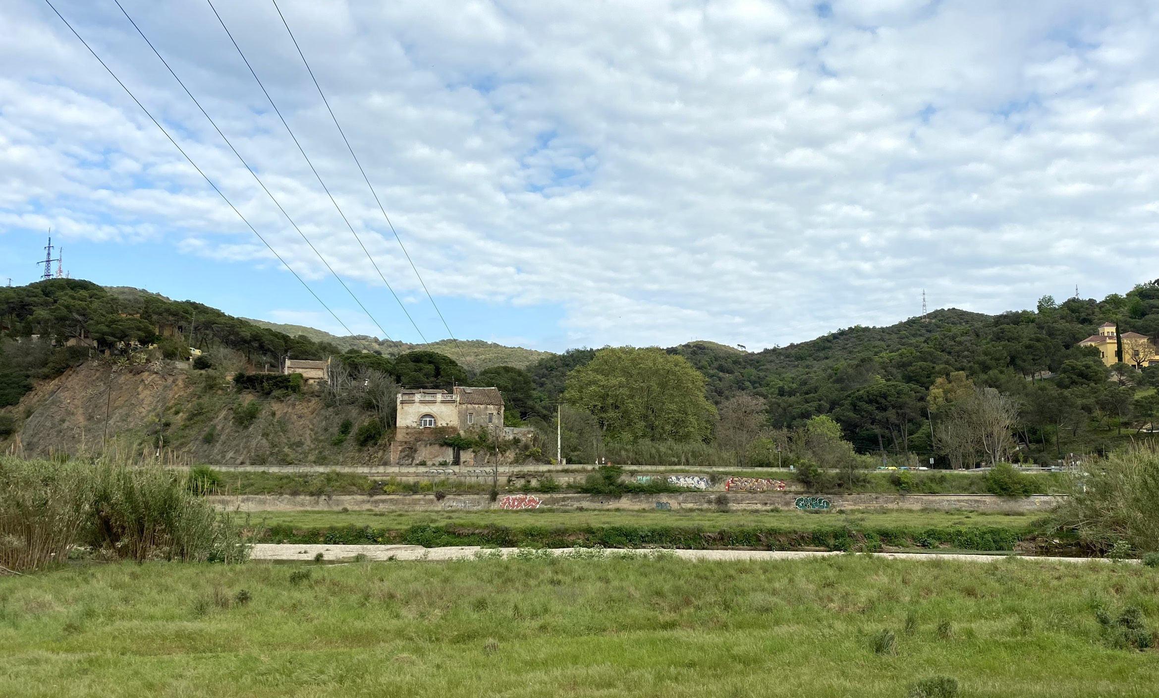
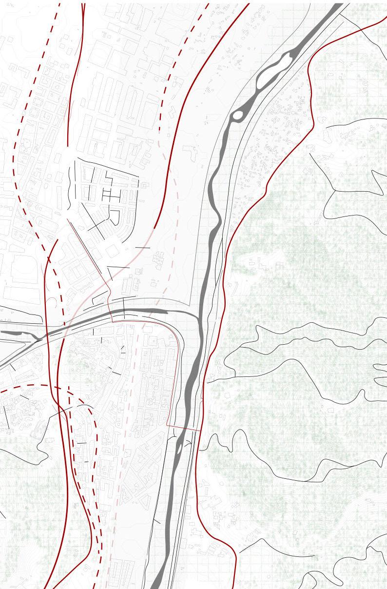
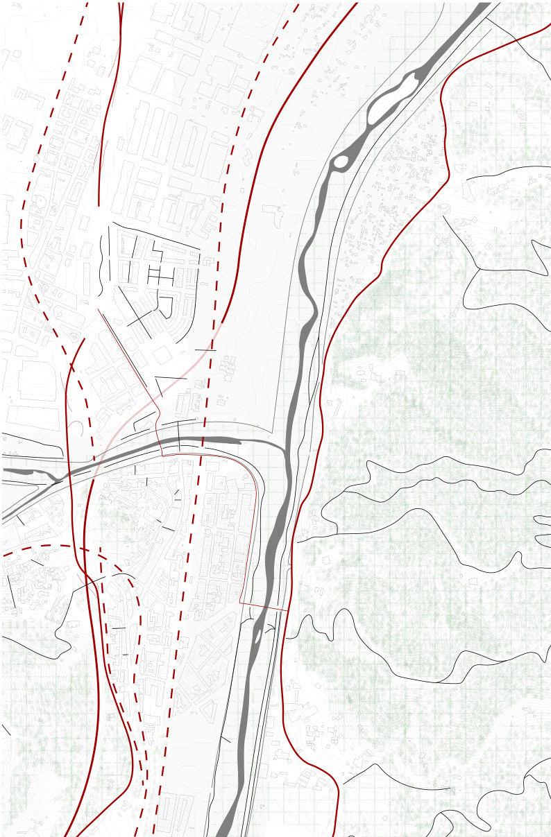
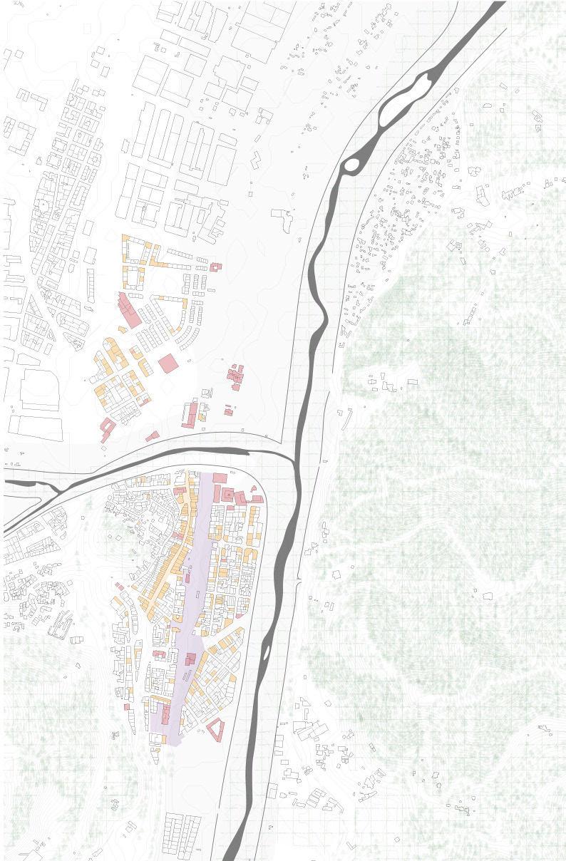
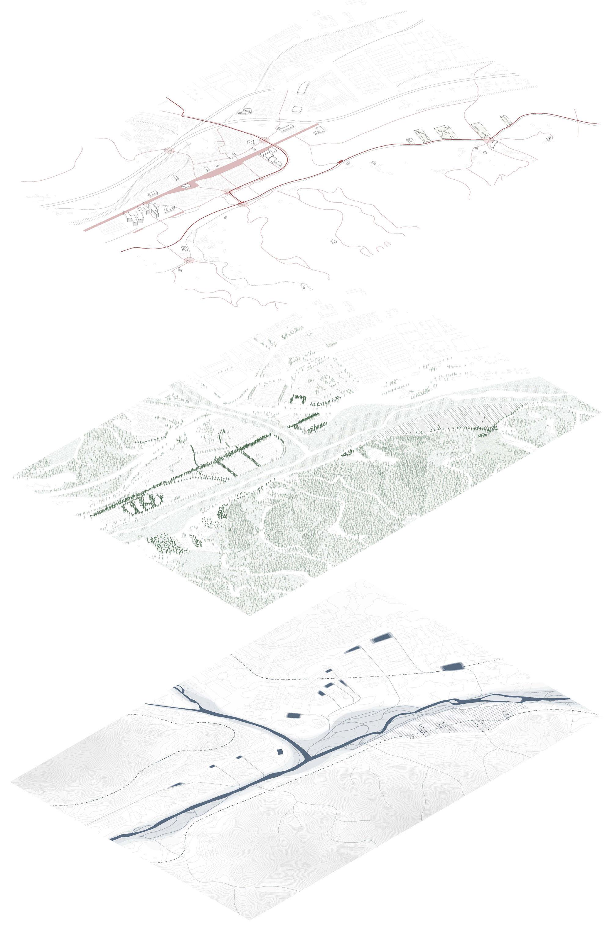
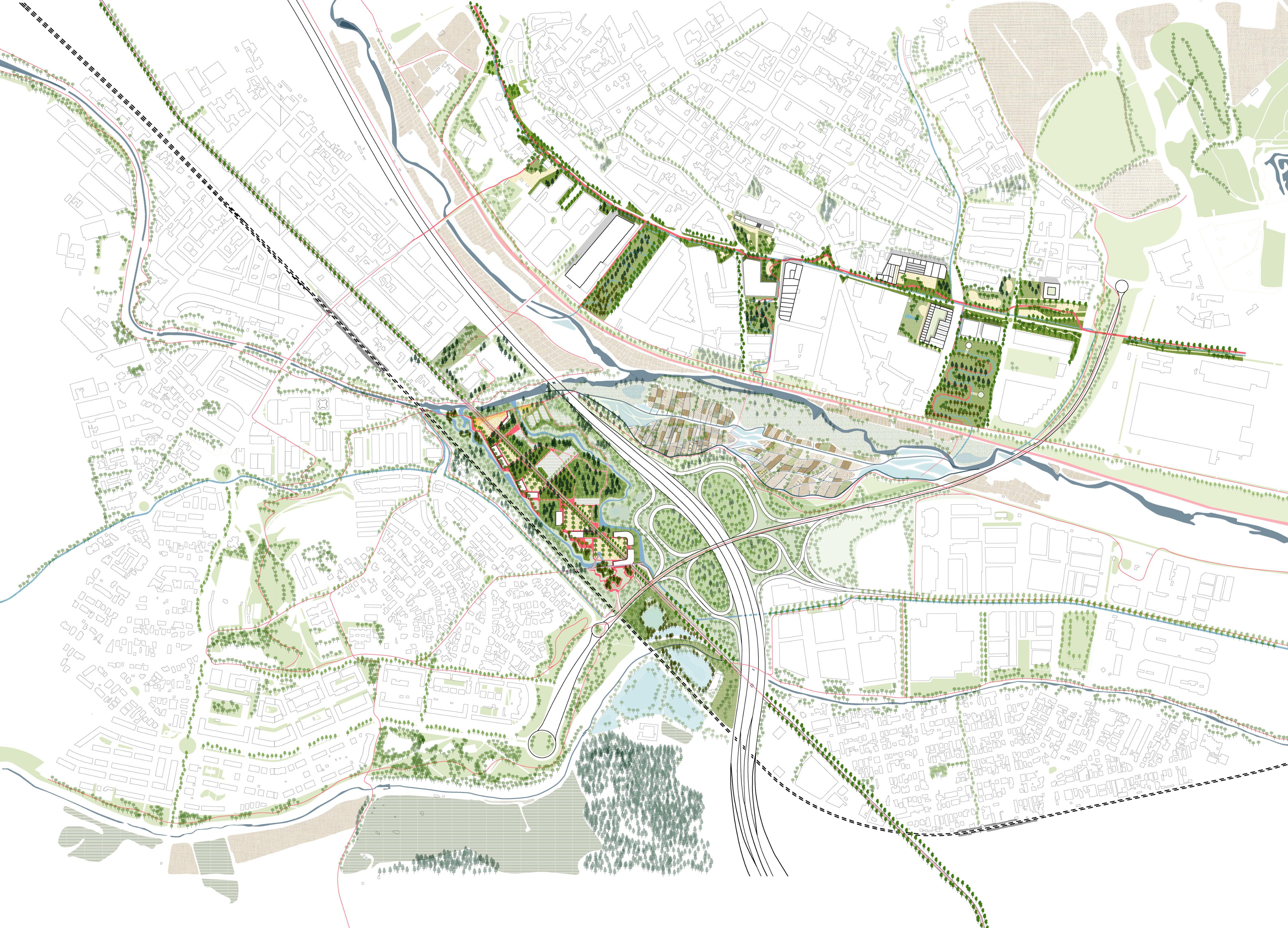
In rethinking the urban model for Montcada I Reixac, an analysis of the existing landscape in reference to the historical landscape elements in 1956 is made to trace the transformation that has occurred with urbanization. The concrete walls of the Besos and Ripoll river has greatly limited interaction of the city with its important central water bodies. The two beautiful mountains remain in the background and out of touch from the urban fabric. Furthermore, the strongly present mobility infrastructure in Montcada only emphasizes this limited interaction. A critical as sessment of the edges of the landscape elements with historical references together with a reading of the apparent mobility infrastructure is the beginning of our ur ban model story.
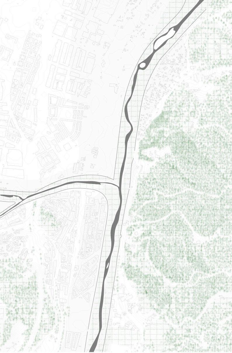
03. Flanked by green mountain structures
Montcada I Reixac is flanked by two large mountain figures, it being in close prox imity to the Serralada Marina and the Collserola. Yet the daily experience of living in Montcada is often separated from the natural landscape by the embanked river and mobility infrastructure.
04. Public functions within the city centre
An old city centre, located South of the Ripoll river, which is extended Northwards, characterize Montcada and its main avenues. Together with these avenues come public facilities and commercial activities.
05. Fragmented by infrastructure
01. Historical riverflow (1956)accompanied by agriculture
Tracing history, the Besos river had awide riverbed characterized by a braided sys tem allowing natural overflows during the rainy season. Alongside the riverbed agriculture could be found that worked in relation to the water. Making Montcada a city that worked together with its landscape figures.
02. Current enclosed riverflow
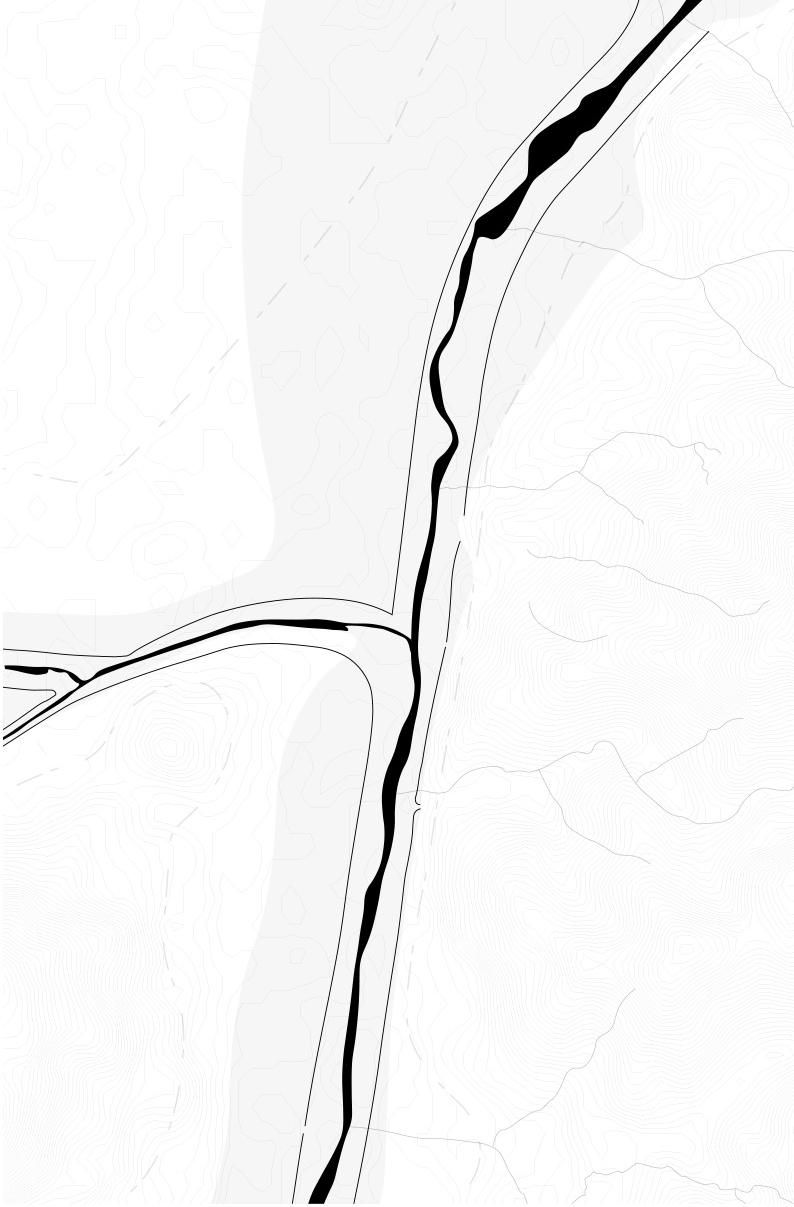
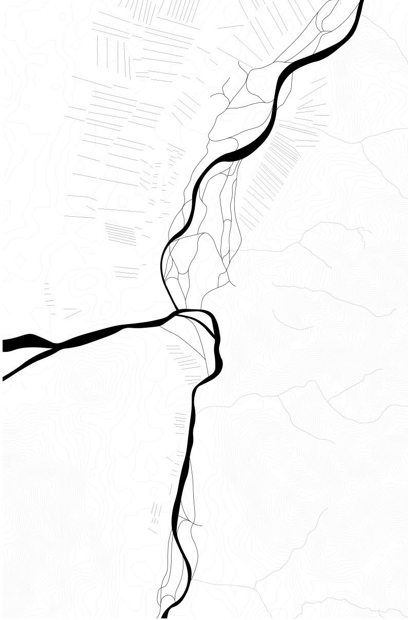
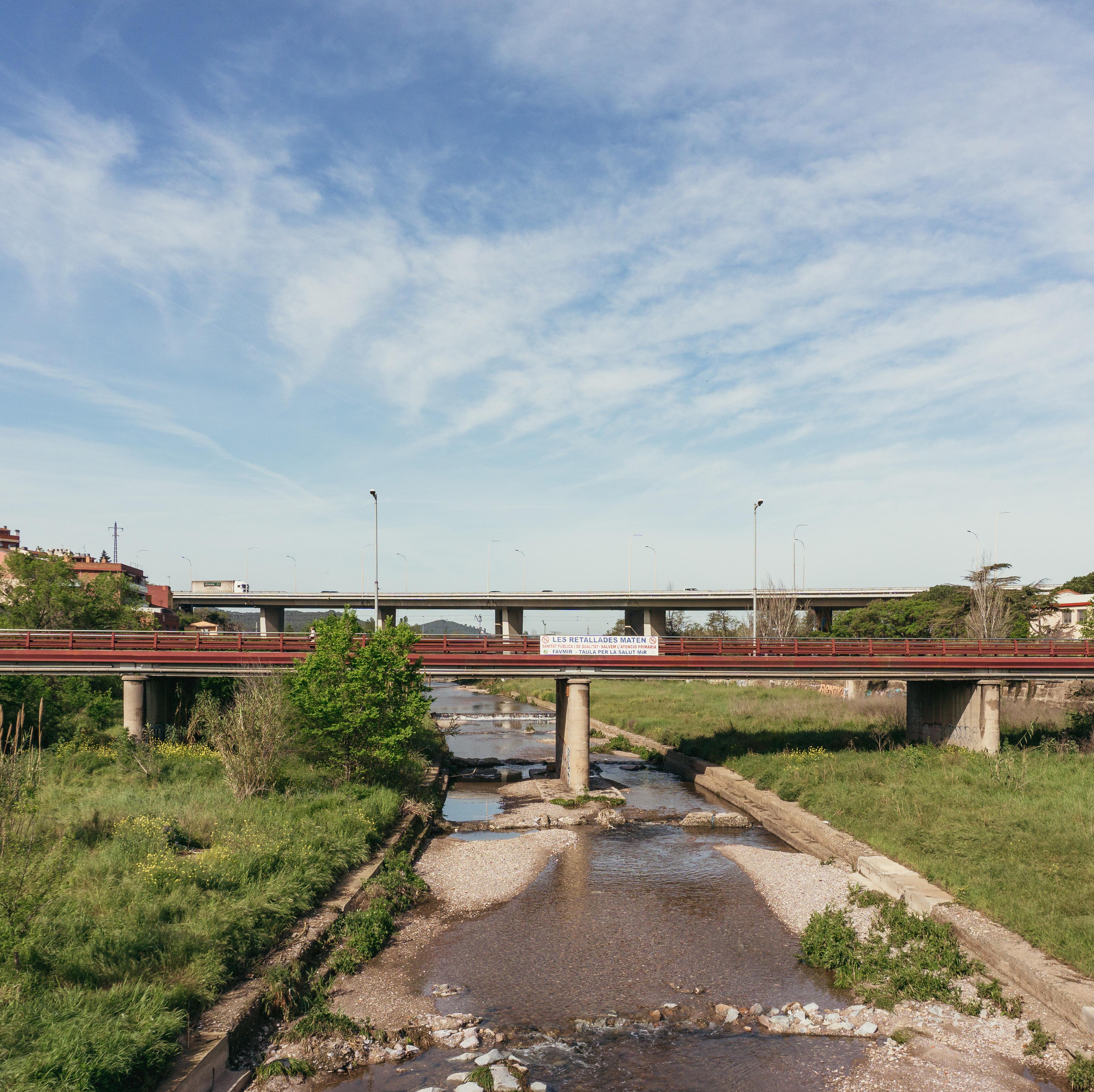
Today, the existing river area is confined by concrete, manmade embankments to which the residential communities outside of it have little to no access. These wide ly distributed artificial concrete embankments are meant to increase the speed of the river towards the sea during the rainy season, but in fact only worsens the oc currence and severity of flooding.
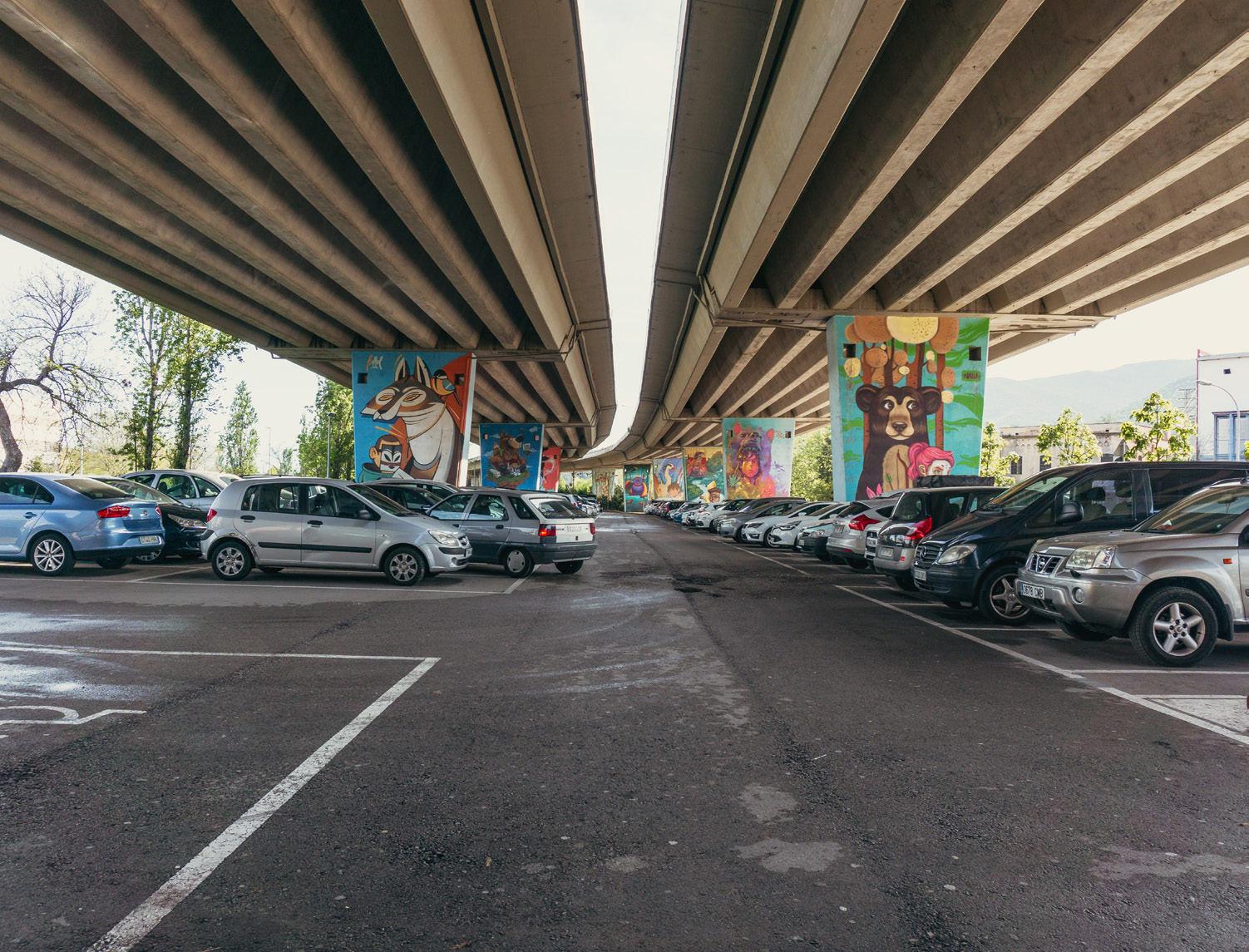
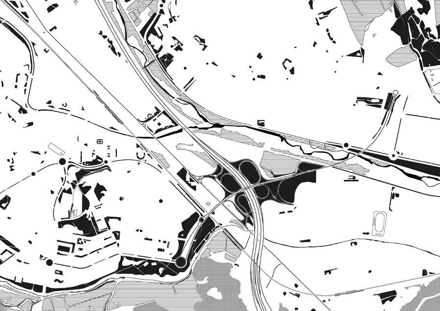
In addition, the site is located at a key location where many railroads and highways converge. These complex transportation infrastructures not only fragment the res idential community, but also block its connection to the surrounding hills and forests.
06. Burial of railway running through city centre
An approved plan proposes the burial of three railways which are located central in Montcada. It would make it possible to reorganize connections within the existing urban tissue and from this tissue towards the already apparent landscape figures.
3637
01 04 02 05 03 06
Reclaiming the riverbed and retaining water
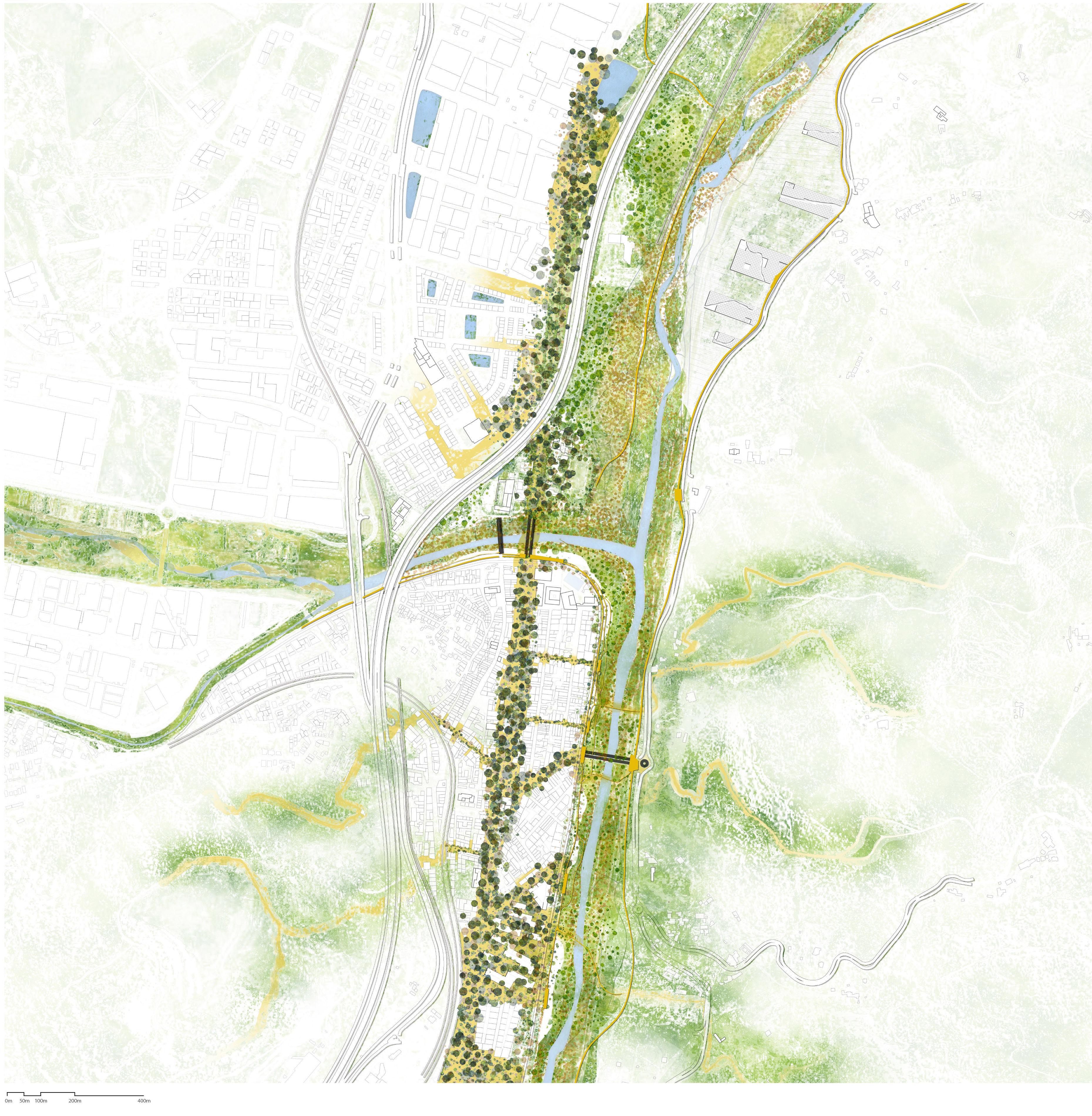
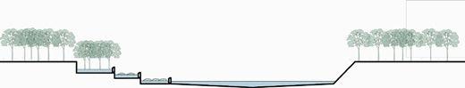
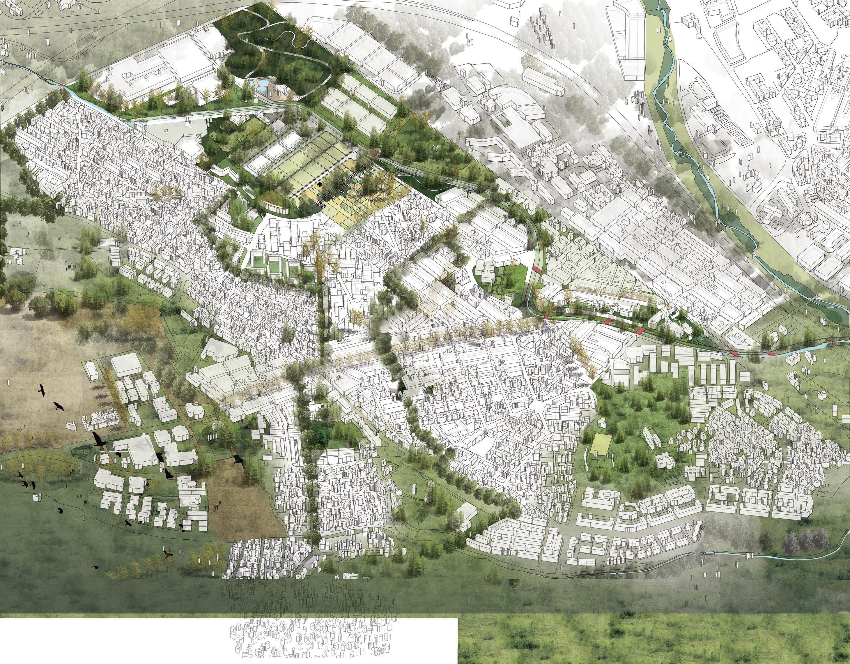
A climate where torrential rains are apparent, such as in Bar celona, has led to a dual approach for our water layer. At first, reclaiming space for and the extension of the riverbed helps mitigating floodings during the rainy season. A reïntroduced braided system, referring to the historical riverflow of 1956 goes hand in hand with this widened riverbed, ensuring more space for the water to flow. Besides ensuring the drainage of water during rainy seasons, the retention of water is just as important if not more important for the climate apparent in Montcada where they often have to deal with droughts. A se ries of retention ponds are introduced in the site.
Strengthening ecological and mobility connections
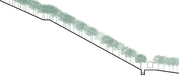
Flanked by the large mountain figures, Montcada lacks a con nection towards these due to manmade interventions. In view of the undergrounding project of the railroad that will hap pen in the upcoming future, the newly released space will be an important aspect for re-organizing the urban texture and re-connecting it to these landscape figures. We plan to shape this new north-south corridor as a linear forest in the city. Various extensions, following existing roads and pathways, are created from this linear forest. They strengthen both con nections within the city centre as well as connections towards the (forgotten) landscape from the city centre.
Weaving pathways
Montcada has various public funtions, attracting different en dusers. As stated before, the movement between these func tions is often bordered by mobility infrastructure. The reima gined railway that now acts as a linear forest will establish new connections between these public functions, focussing on soft mobility. Extensions of this linear forest will connect Montca da to its apparent landscape figures and will extend into the mountains, weaving existing pathways and landmarks togeth er. The already existing bicycle highway leading towards Bar celona city centre, which is now cutoff right before Montcada, is extended along the Besos river and gets a path that leads to Ripollet as well.
Site vision 3839
4041
Co-housing with the nature and community / © Tzu-Chun LinProductives communities / ©
Alexander Van GestelReclaiming
NHUNG PHAM SHINTA KUSUMAWARDANI SELEGNE DIMA FRANK BAGEZNI
Enhancing biodeversity corridor:
Transforming Montcada’s industry into productive landscape
4243 03.02
© Selegne Dima
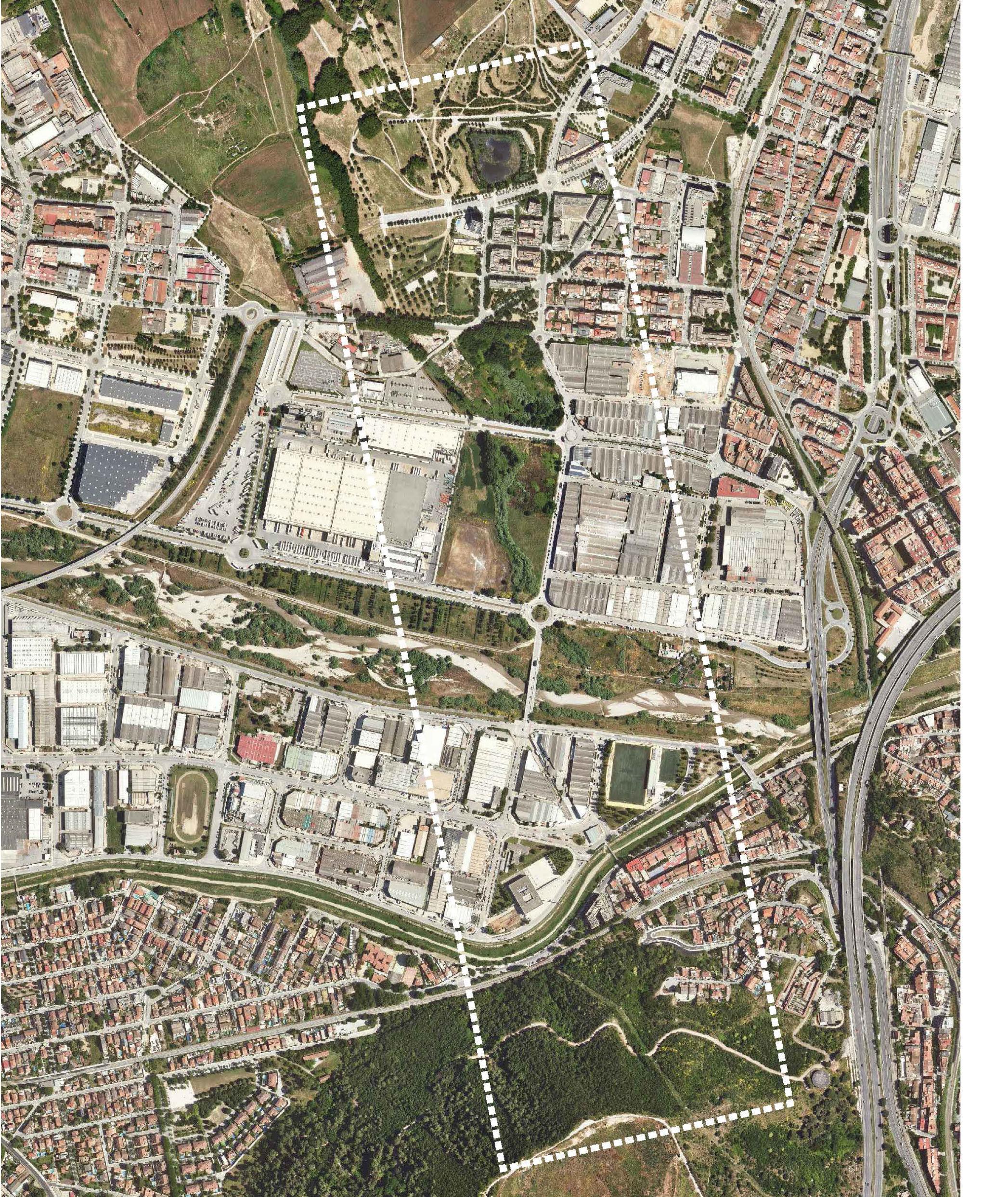
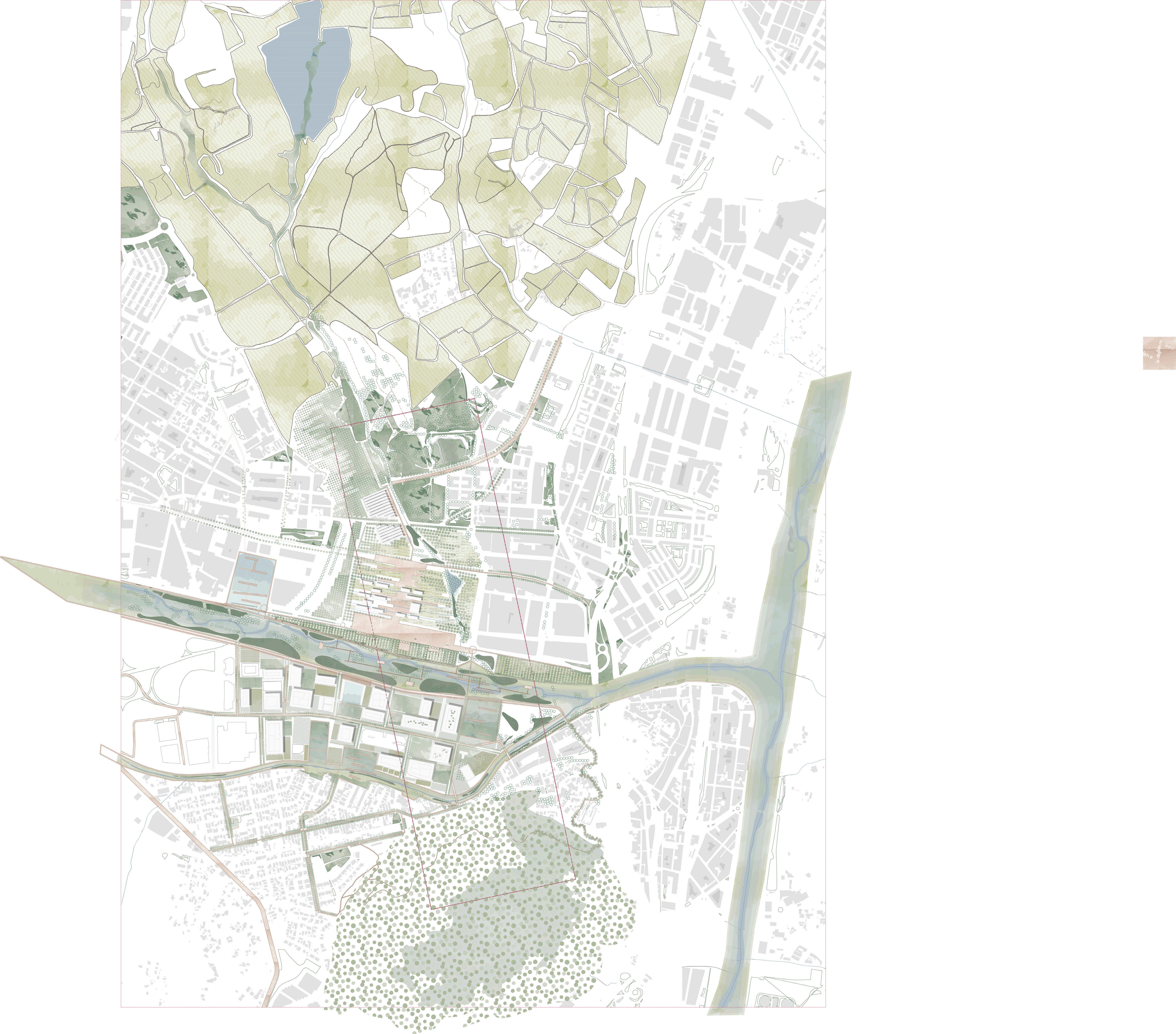
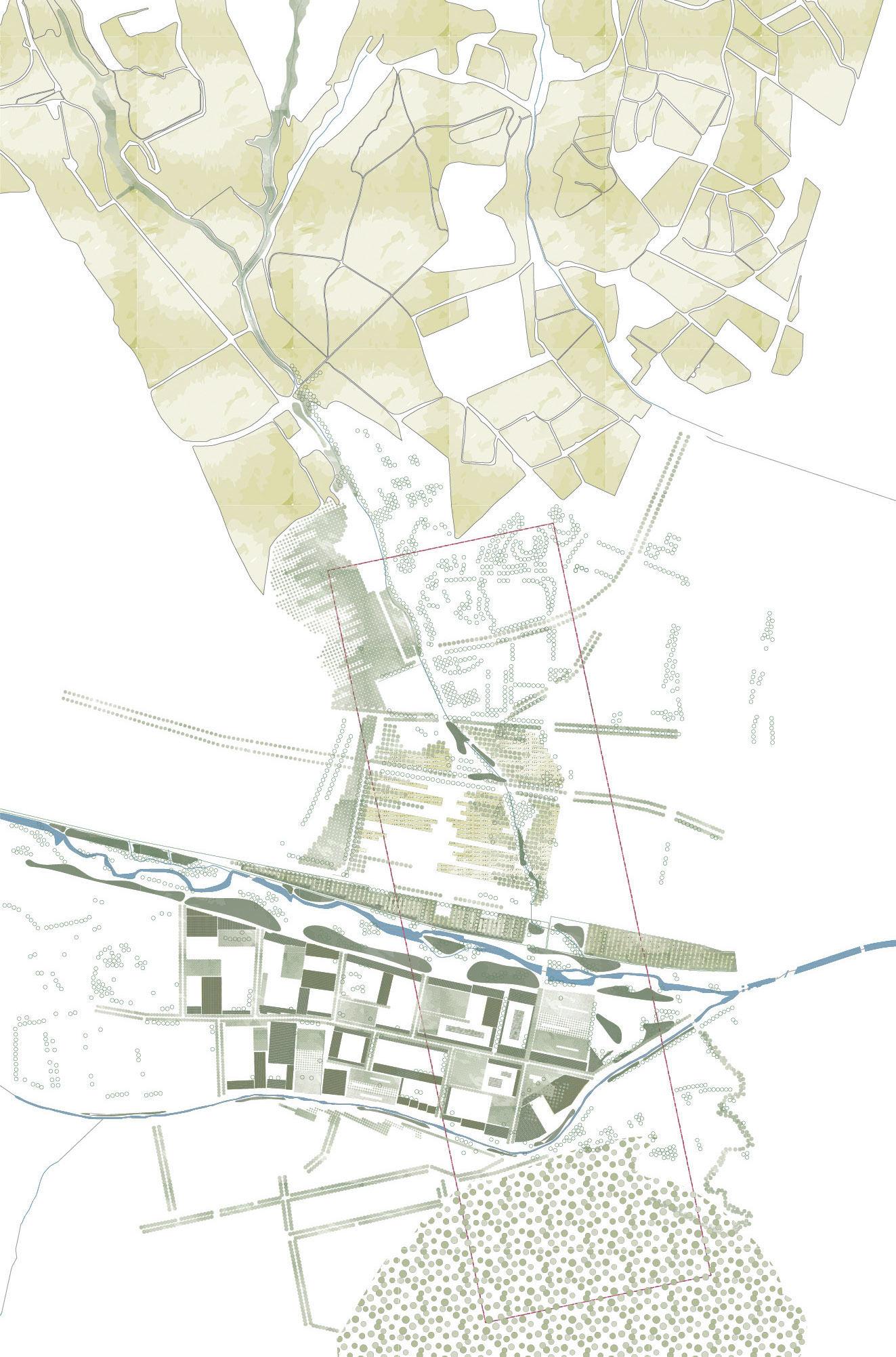
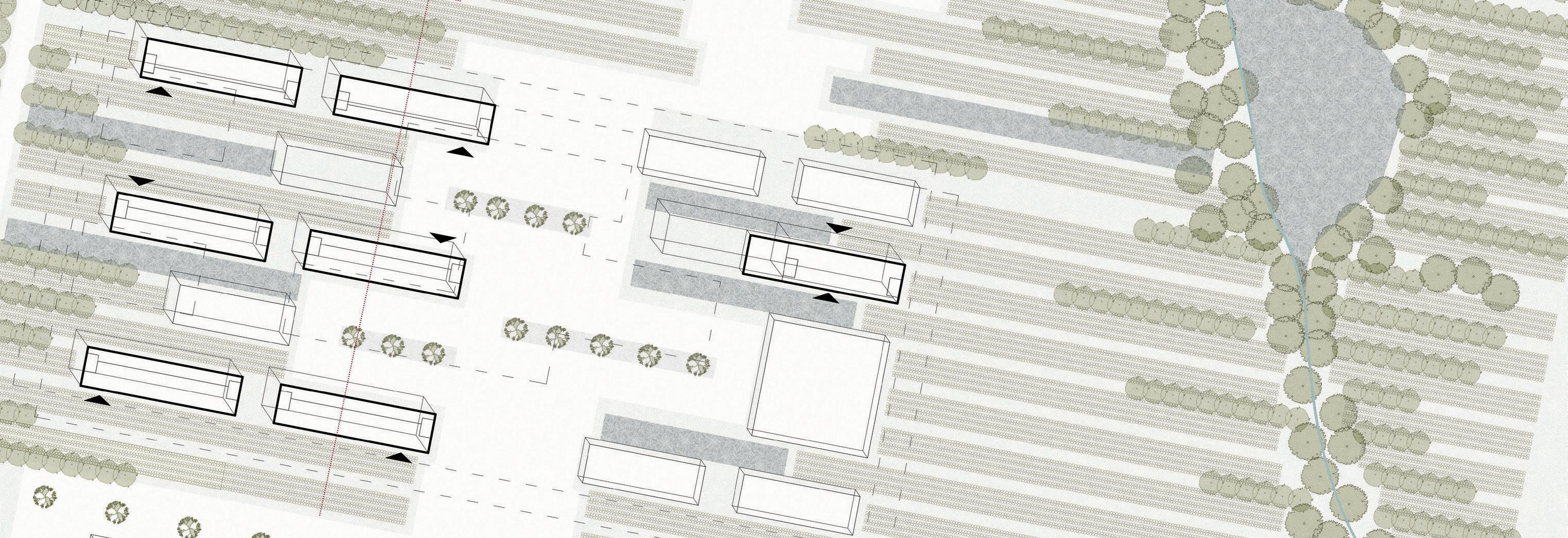
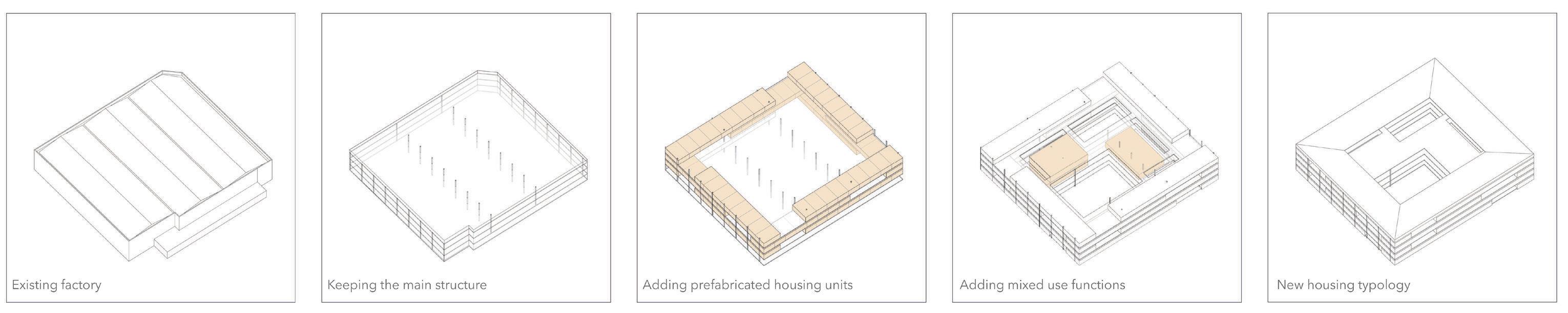
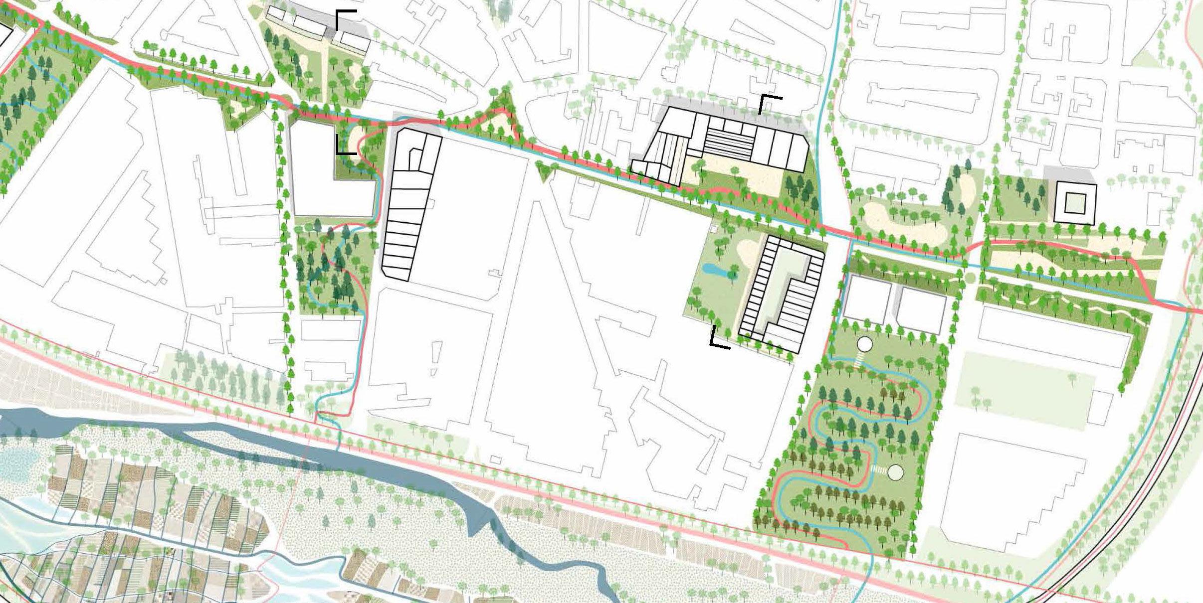
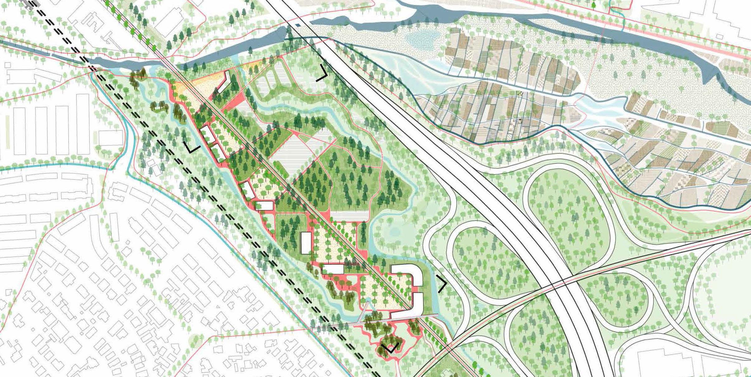
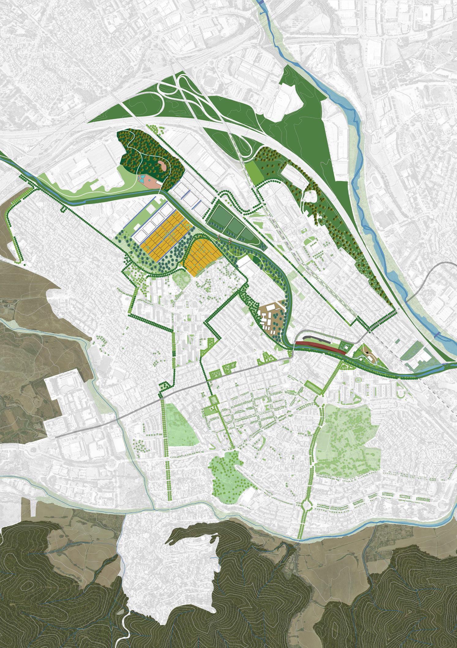
Enhancing biodiversity corridor: Transforming Montcada’s industry into productive landscape
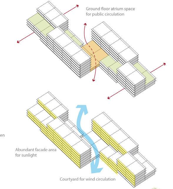
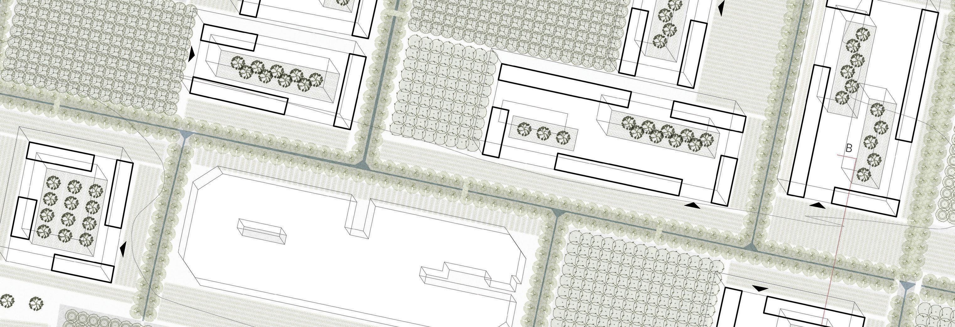
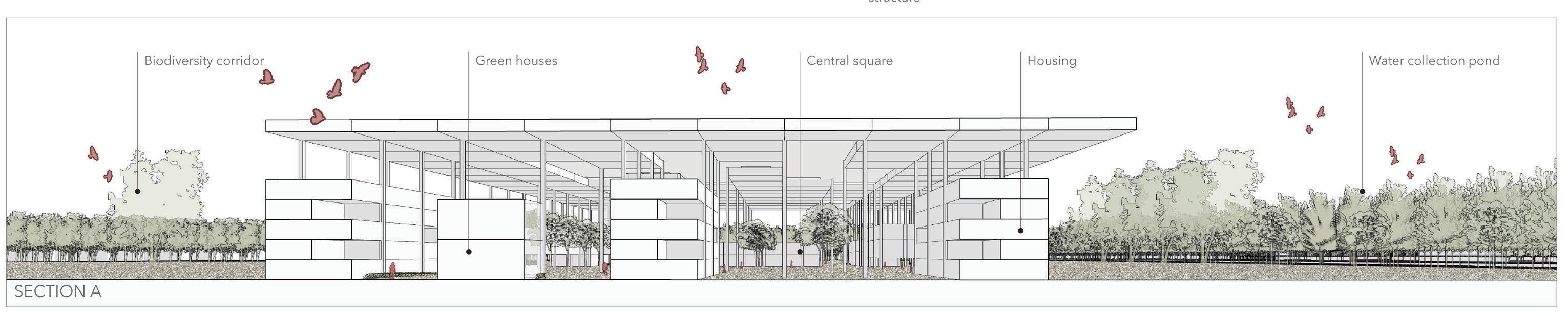
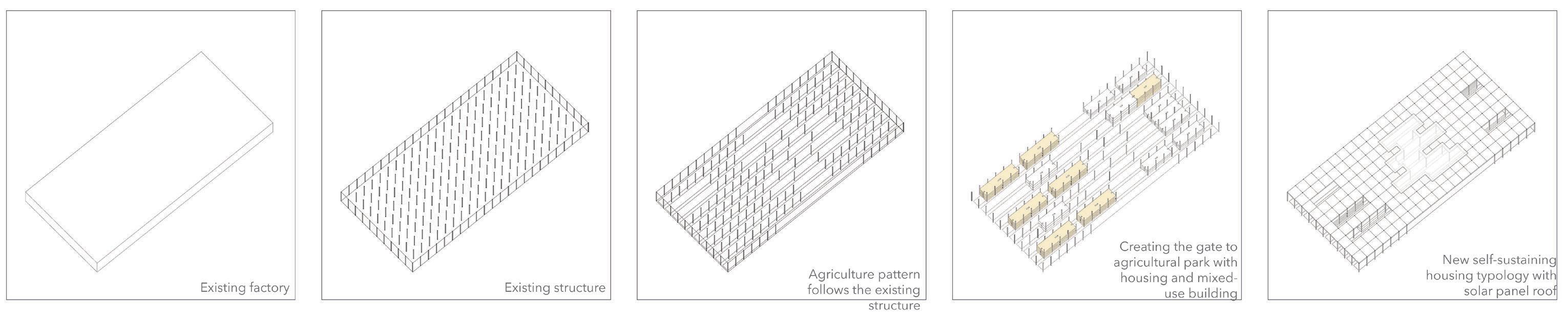
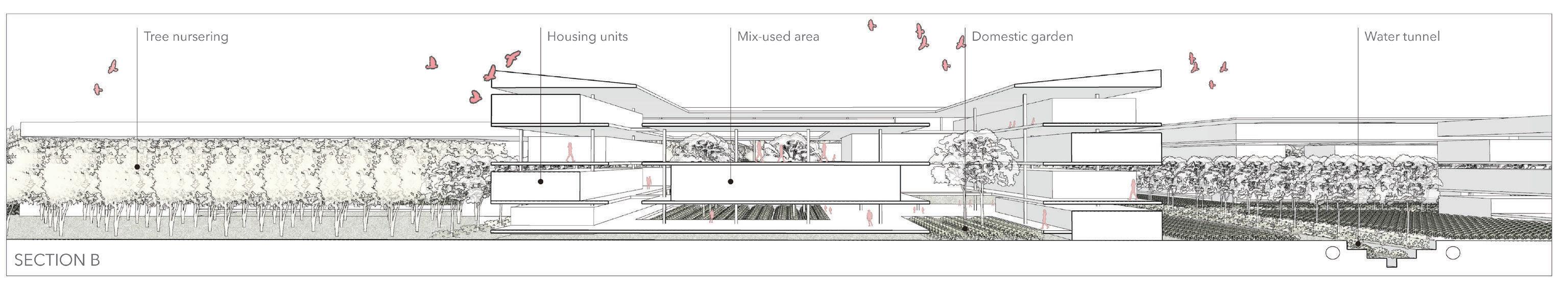
Site 2 is located in the Municipality of Montcada in between the agricultural land of Pla De Reixac and the forest of Turo de Montcada. The design project’s aim is to enhance the biodiversity corridor between these two landscapes. The Pla De Reixac is a 450-hectare of unique agroforestry area with great landscape value and rich biodiversity that has been subject to pressure from different are as. The pressure comes from the fact that it is one of the few lands of large scale that is not protected by legislation and is within the Barcelona Metropolitan Area. The Pla De Reixac has ideal characteristics to develop quality agricultural activities and has an abundant presence of plants and different kinds of animals. In the Metropolitan Urban Master Plan (PDU) they identified the emp ty plot in between the industry as a critical biodiversity point between Pla De Reixac and Turo De Montcada. The proposed design project seeks to strengthen this fragile connection in order to protect the agricultural land.
The three main aspects of the project are the introduction of productive landscape intotheindustrialareaofMontcada,thephasedconversionoftheindustrialareainto a wetland, and the creation of an entrance to the Agriculture Park of Pla De Reixac. Allelementssupporttheoverallvisionofturningthesiteintoaproductivelandscape.
The vision for the industrial area of Montcada includes a wastewater collection pond, tree nursering, wetland tree nursering landscape, reclaimed riverbank, mixed-use area, a domestic garden, a water tunnel, and a new housing typolo gy constructed using the existing main structure of the factories. One of the pro posals is to convert the supermarket storage facility into a new urban fabric that becomes a link between Pla De Reixac and Turo De Montcada. The new facil ities include self-sustaining housing typology with solar panel rooftops, social spaces, a water collection system, research and agricultural workshop facilities, greenhouses, and community gardens. The research questions are as follows: Can a productive landscape erase the barriers that divide the main landscape flow and make Montcada a healthier ecological mosaic? Can structuring the industrial pockets with water and wetland systems relieve the pressures from industrial activ ities and strengthen the productive landscape? How can the new typology of urban agro-housing be adopted to interact with the surrounding productive landscape and further strengthen the system?
4445
Existing water structure
Existing
water
Historical water structureHistorical water structure
Mobility structure
Historical
water
Two landscape structures Green space
Forest
and trees
Agriculture
Flooding map
100 year periodic flood 50 year periodic flood Existing water 500 year periodic flood
Tissue zoom 1 Tissue zoom 2 Site vision © Frank Bagenzi, Nhung Pham, Selenge Dima, Shinta Kusumawardani 0250500 1250 1 New blue systemNew green system 4647
4849
The transformation of the industry / © Nhung Pham
The Entrance Pla de Reixac Agricultural Park/ © Shinta Kusumawardani
ELLEN DE WOLF AXELLE HAEKENS PEIYANG HUO HAN QIN
On the edge:
Interweaving a lost landscape with a new urbanity
5051 03.03
© Peiyang Huo
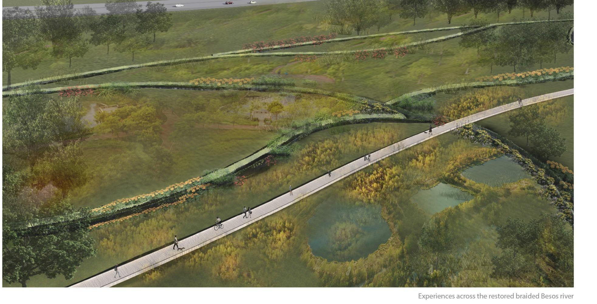
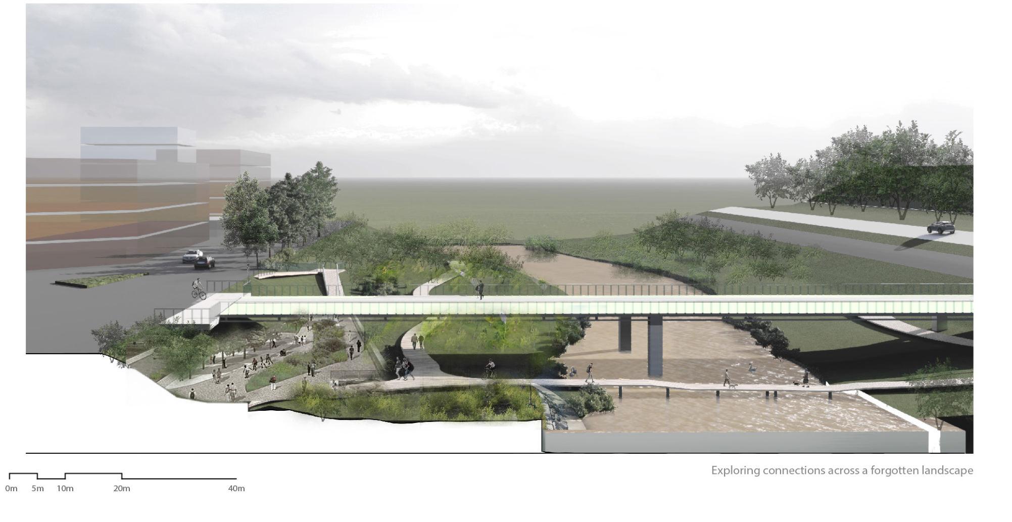
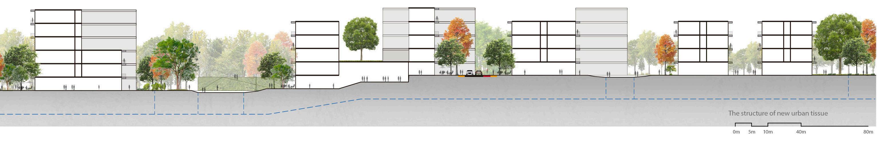
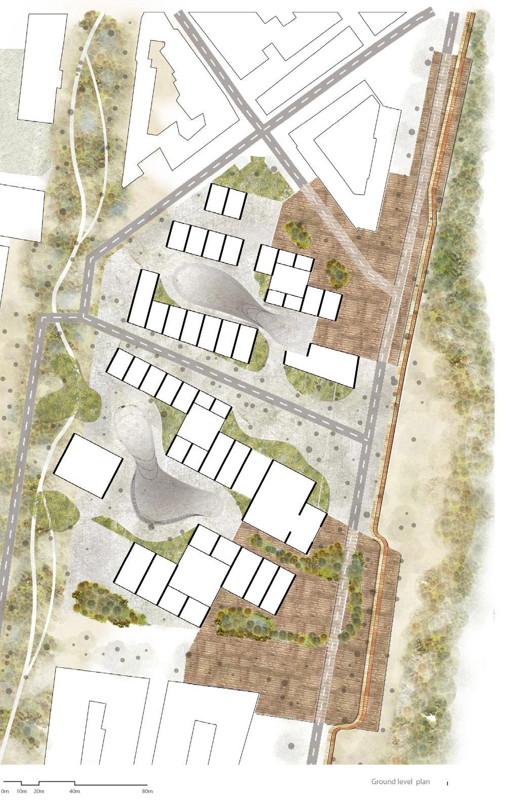
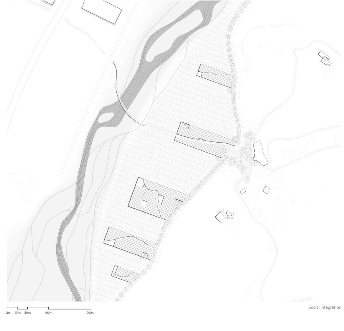
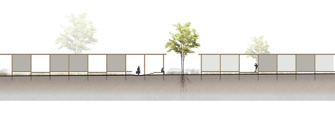
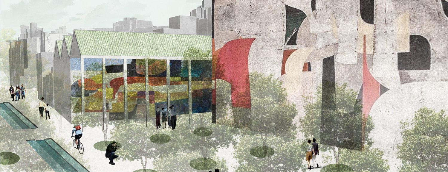
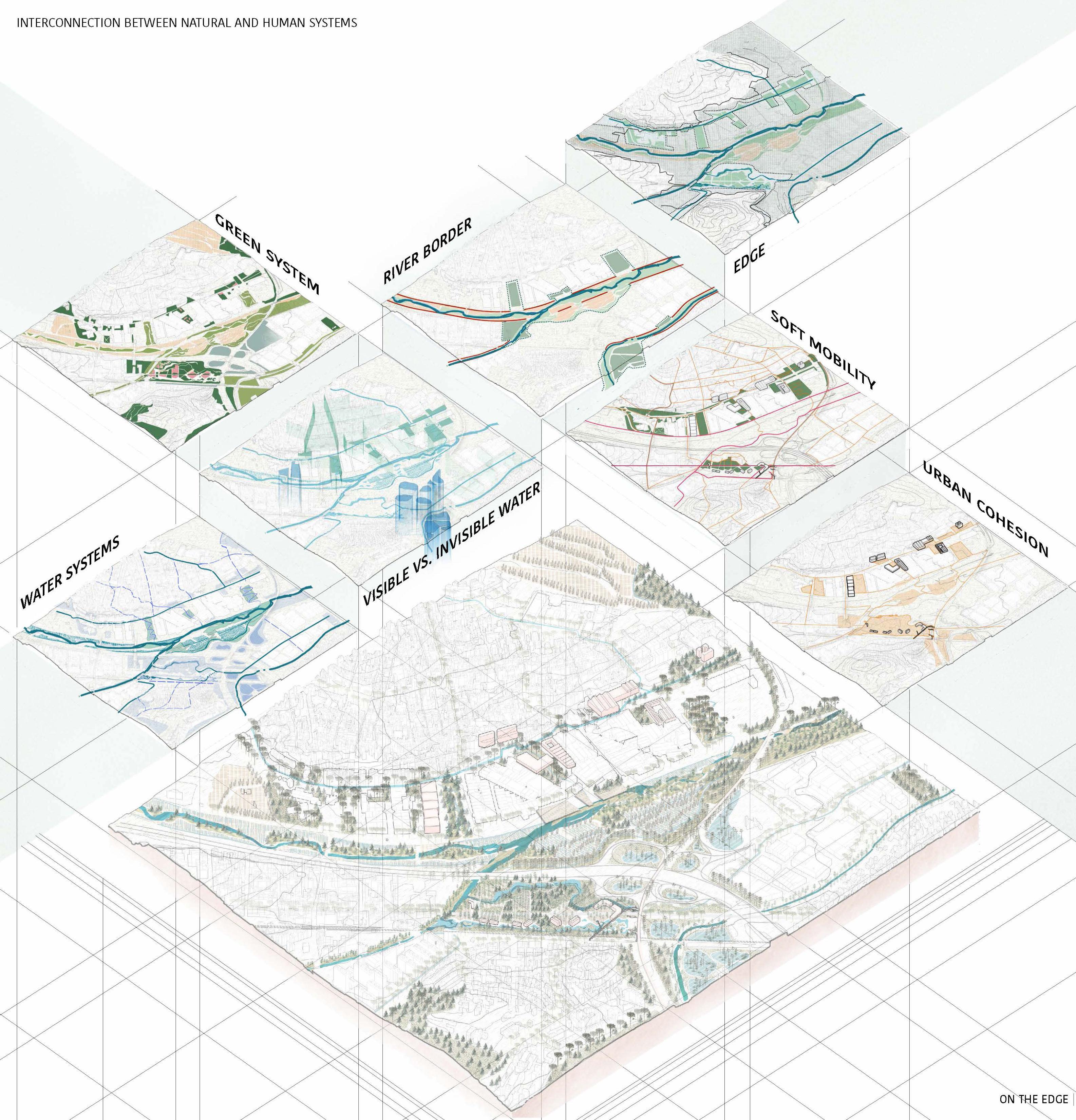
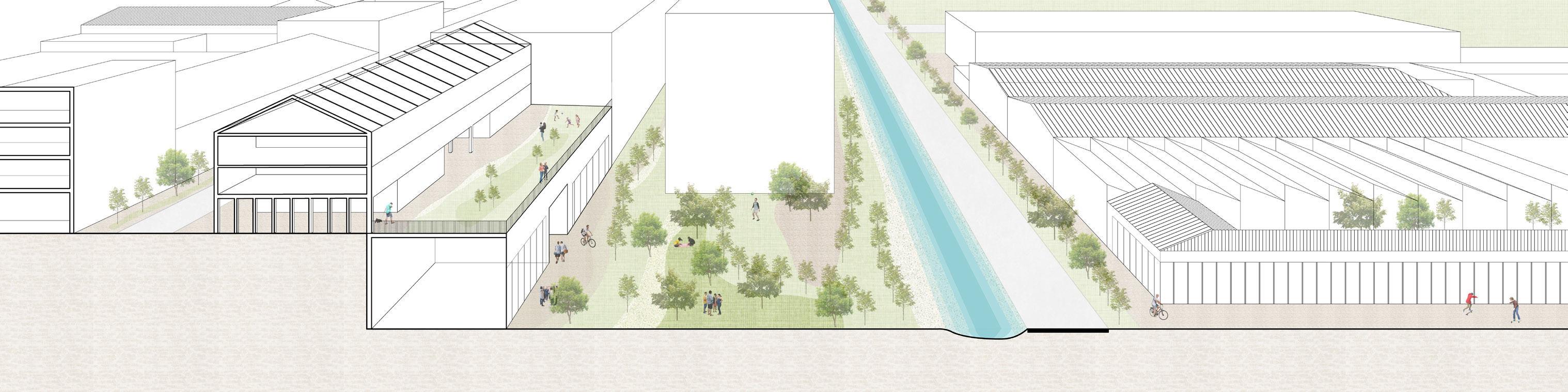
On the edge Interweaving a lost landscape with a new urbanity
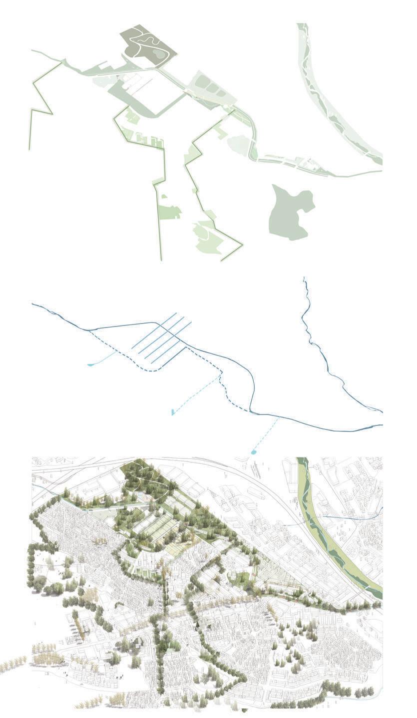
From analysis to strategy
In analysing the site, we came to some critical conclusions. These observations led to the formulation of our three research questions and the proposed strategies to answer them.
To reduce the risk of flooding, the disappeared rivers are strategically recovered. In addition, the current river boundary is being transformed in various ways to give the river more space and protect the urban tissue.
The water network brings us to the vision for the green connection. The current valuable nature areas on both sides of the valley will be connected. In this way, the left over spaces become part of a green-blue corridor.
Finally, the blue-green landscape will structure the new urban tissue, which is also directly related to the topography.
Restoring forgotten rivers
5253
Redefining the edge Continuation of the landscape Defining new urban tissues
2000m1000500 2000m1000500 1000m500250 1000m500250 2000m1000500 1000m500250 2000m1000500 1000m500250
Site vision 5455 500m250 100
5657 50m25 10
The edge between industry and city / © Ellen De Wolf
The edge between infraestructure and lesft over space / © Peiyang Huo
AGNES AYESIGA ZHONGYAN ZHANG YUE HU
5859 03.04 Re-naturalizing Cerdanyola's Landscape: Forestation and De-sealing surfaces
© Zhongyan Zhang
Re-naturalizing Cerdanyola's Landscape: Forestation and De-sealing surface
Analysis of the main figures.
In order to define our design intervention, we analysed some important figurest hat were a base in our design. These aslso helped us in formulating our research questions and strategies on how to intervene. Our main strategy was centered on renaturalising the landscape by defing the wet and dry areas. This would help guide the city in regards to areas that are safe forhousing, areas that can be used for the public and give more space for the river to flow naturally. We also used the histor ical river channel as a main water collection through the city and also identifying inbetween plazas that can be use as collection points for the water that is then used for irrigating the green spaces or channeled to the riu sec.
Urban forestry
From the large scale, we strengthen the main green agricultural figures with a bio diversity newtwork. we also used the historical street st Ramon as a main connec tion betweeb rippolet center and cerdanyola. A slow mobility path is created a long the river that strengthens the connection with barcelona and the UAB university by cycling.
Following the topography lines, green networks through the city are created that connect to near by landscape figures like moutians and hills. These networks are afforested and pacified to reduce the urban heat island effects in the city but to also provide shadows during the hot summer months.
6061
Interpreating the topographyExisting Green patchesLarge scale transport network
Historical river network Existing river and flooding areas Variety of tissue typologies
6263
Site vision
TERRITORIAL
6465 04
VISION © Peiyang Huo
ACKNOWLEDGEMENTS
6667 05
© Raquel Colacios and Ivan Llach
METROPOLITAN REPAIR
Barcelona, Spain
The Studio breif was co-developed by KU Leuven, AMB and the Planning depart ments of Montcada and Cerdanyola municipalities. We want to thank AMB, Cer danyola city council, Montcada city council and La Salle University for the support given to the studio throughout the process of its development.
Guests
Mireia Peris, AMB
Ramon Sisó, AMB
Laia Guillem, AMB
Javier Ortigosa, AMB
Annallisa Giocoli, AMB
Maria Pons, Cerdanyola Planning Department
Marta Brunyesc, Montcada Planning Department
Josep Gomis, Montcada Planning Department
Tania Magro, Consorci Besós
Francesc Romero, Consorci Besós
Joaquim Calafí, Consorci Besós
Isabelle Angueloski, BCNUEJ
Ana Coello, Ana Coello Paisaje y Arquitectura
Anna Gutierrez, UnderProjectLab
José Toral, Peris + Toral Arquitectura
Laia Mestre, Mirla Studio
Claudi Aguiló, DataAE
Josep Ferrando, La Salle University
Jordi Mansilla, La Salle University
Teaching Team
Raquel Colacios, UOC & UMEA
Ivan Llach, TAAB6
Kelly Shannon
Bruno de Meulder
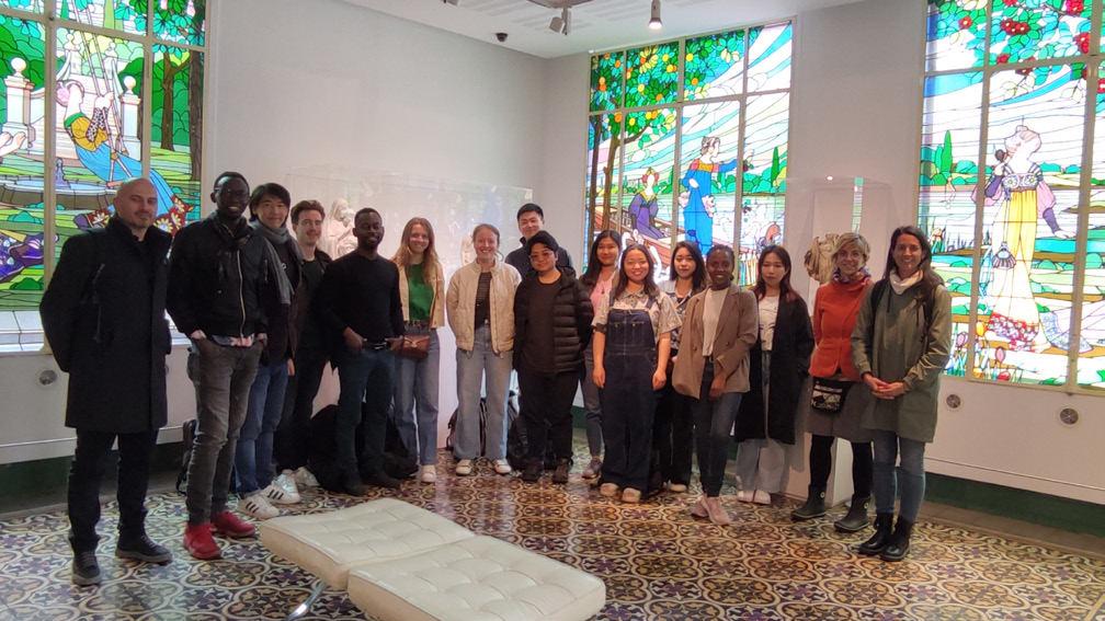
Student Groups
Booklet Layout & Editing
6869
Ivan Llach & Raquel Colacios
Alexander Van Gestel Tzu Chun Lin Hubert Asante Nhung Pham Shinta Kusumawardani Selegne Dima Frank Bagenzi Ellen de Wolf Axelle Haekens Peiyang Huo Han Qin Agnes Ayesiga Zhongyan Zhang Yue Hu
DEPARTMENT OF ARCHITECTURE

 MASTER OF HUMAN SETTLEMENTS MASTER OF URBANISM LANDSCAPE AND PLANNING
