STUDIO UNIVERCITY
SPRING STUDIO 2022 - MODULE 1
Dijle Valley, Leuven, Belgium Master (of Science) Human Settlements & Master (of Science) of Urbanism, Landscape and Planning Faculty of Engineering and Department of Architecture Teaching Team: Bruno De Meulder, Kelly Shannon, Pieter Van den Broeck Guest Teachers from Practice: Annelies De Nijs (Atelier Horizon), Mircea Munteanu
(Metapolis), Thomas Willemse (Studio Thomas Willemse)
©
Copyright KU Leuven
Without written permission of the thesis supervisors and the authors it is forbid den to reproduce or adapt in any form or by any means any part of this publication. Requests for obtaining the right to reproduce or utilize parts of this publication should be addressed to Faculty of Engineering and Department of Architecture, Kasteelpark Arenberg 1 box 2431, B-3001 Heverlee.
A written permission of the thesis supervisors is also required to use the methods, products, schematics and programs described in this work for industrial or com mercial use, and for submitting this publication in scientific contests.
2
3
4
04 URBAN
01 STUDIO
03 HOUSING
06 STAKEHOLDERS 07 STRATEGIC
08 ACKNOWLEDGEMENTS 05 MIDWAY
02 INTERPRETATIVE MAP 06 16 98 354 362 474 260 334
TABLE OF CONTENTS
ANALYSIS
CHALLENGE
ANALYSIS
PROJECTS
PROJECT VISION
5
7 01
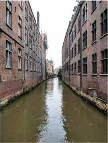
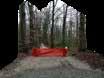
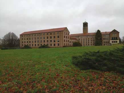
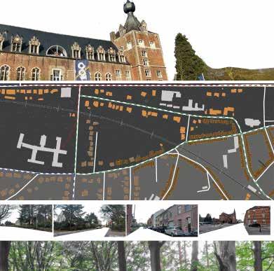
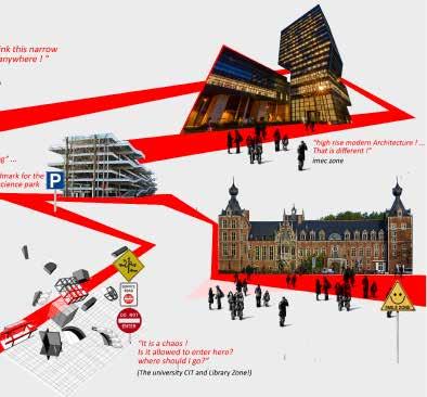
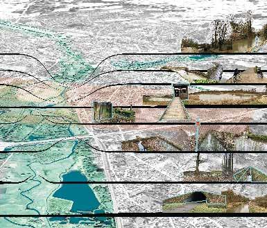
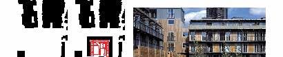
STUDIO CHALLENGE
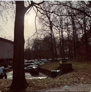
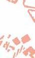
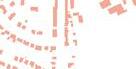
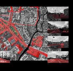
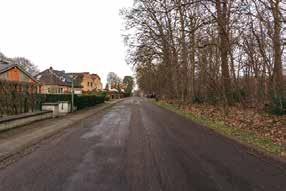
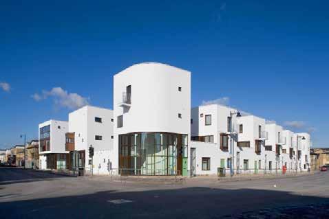
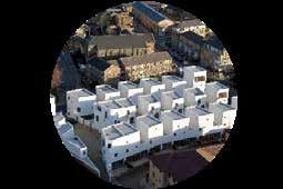
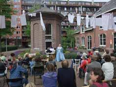
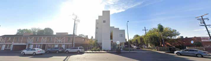
© Ellen De Wolf
STUDIO CHALLENGE
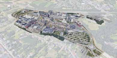
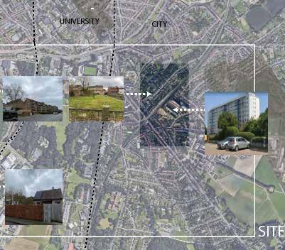
UniverCity
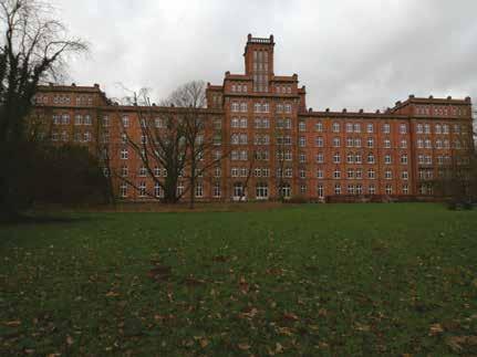
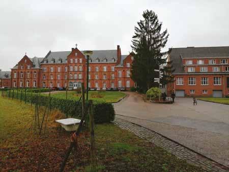
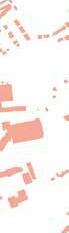
The first studio module investigates the Arenberg Park in Heverlee, home of a large university campus and links it to the inner-city university grounds. It fundamentally questions the Leuven campus model of the 1960s that created a mono-functional and exclusionary enclave and explores contemporary universitymodelsthatacknowledgetheintenseinteractionandintertwinement of universities and cities. The studio’s hypothesis is that sterile campuses can mutate into vibrant urban environments and that universities can imbue a unique form of urbanism into cities. It is understood that respecting heritage and restoring ecologies is high on the agenda, as well is the transition to carfree mobility. The Arenberg Park is seen as the first step-stone for the bikedominant transport mode in the Dijle Valley. Complex and mixed urban tissues are proposed on‘university land’(and other public land) on the slopes of the valley and the studio elaborates innovative development models that do not solely depend on the real estate market, but give way to shared economies, cooperatives, and commons. Greenfield development is banned. Land is recuperated from unnecessary parking, infrastructure, and restructured building tissue.
1. University campus and city throughout the decades
In the 1960s, when the university grew so exponentially that spatial ex pansion was required, a master plan was developed. It is basically a plan for three campuses: a campus of the human sciences within the historical inner city and two others outside the city, in Heverlee: a campus for exact sciences in the Arenberg Castle Park and a campus with academic hospital for the medical sciences on Gasthuisberg.
Surprisingly enough, until recently the 1960 masterplan remained the
self-evident reference for the university’s spatial development. Conse quently, the university developed in exclusive enclaves.
Humanities remained in the city, embedded within the urban fabric. De facto, the university retreats into evermore introvert building complexes and clusters that hardly interact with their urban environment.
Since, the congested inner city and further development of the hospital and faculty proved impossible, a new campus was developed. In the best functionalist tradition, the monumental Gasthuisberg was sacrificed to accommodate the medical campus. Without any break since the 1970s, an endless megastructure is under construction. The monstruous building complex surely no longer only provides beneficial economies of scale.
The castle domain of Arenberg has, since WWI, been completely devel oped as a university campus. A series of investment waves since the last quarter of the 20th century (including the extensions for IMEC, science park, etc.) have pushed development limits; heritage as well as ecological values of the domain severely overstressed.
There are numerous reasons to question the current spatial development model of the university, that simultaneously defines the relation between the university and the city. The university as well as city have developed dramatically during the last half of a century. The university not only grew enormously, but it also functions very differently than it did in the 1960s. Universities are more than ever research-oriented and generate numerous spin-offs. The university of Leuven has been the first in Belgium to system atically valorise research through spin-offs. At the same time, educational
8
programs evolved and doctoral studies expanded dramatically. Strange ly enough, an old, land use-based masterplan of the 1960s continued to spatially steer the fundamental development dynamics of the university. This land use planning continued a rigid functional zoning that is at odds with the interweaving of contemporary university and societal activities. This is economically surely the case with spin-offs and contract research, but as well socially and culturally. Since quite some time, universities no longer operate in isolation. On the contrary,throughout the world, plenty of university expansions are on the outlook for new creative and research laboratories.They take initiatives in situ, engage themselves where develop ment questions arise or where societal issues manifest themselves.
Prominent universities are role models in urban development and create new development models. In short, universities today are on the outlook for the city, they no longer isolate themselves. Interweaving universities in living cities enriches the universities and vice versa. For decades al ready, zoning is no longer considered a legitimate planning concept. Many university campuses belong in that sense (besides heavy industry) to the last relicts of a planning principle proven wrong. Leuven seems to be part of the club. An unease with this fact resonates in recent initiatives such as “Living Campus”, but isn’t that rather a fight against symptoms? In 2018, the KULeuven undertook the initiative to update the campus Arenberg masterplan. In parallel, a first “University City / City University” studio took place in MaHS/ MaULP. The interwoven process resulted in inter esting conclusions for the weaving of the university campus, the city and the valley landscapes. In the meantime, the university finalized their new masterplan, a roadmap for the future campus.
At the same time, the city underwent a metamorphosis over the last half a century. It has evolved away from traditional industries, redeveloped brownfields and dramatically transformed the station area. As well, the popular neighbourhoods were subject to gentrification. The university, spin-offs, and research institutes like IMEC and the university hospital are shaping the renewed economic structure of the city. Like other university cities that evolve successfully towards an ‘education/medical economy’, it evolves towards an exclusive city. Leuven has become the most expen sive city in Flanders with regards to the housing prices. By now this has become very tangible as an issue. Which percentage of the nursing and support personnel of the university hospital can afford to live in Leuven? How many of the administrators, never mind technical staff and grounds’ workers can live with their families in the city? While the population, along with the university and economy continues to grow significantly, the available space stays the same, and therefore the development offerings shrink drastically. Even though the city looks full and complete, it cannot answer to all the current (housing) needs. Many of the improvised actions today are not sufficient answers to the spatial needs—from the socio-eco nomic and ecological justice perspective.
2. Developing spatial visions for a university city and city university
There is clearly the necessity to rethink the current spatial development model. The interplay between university and city is one of the necessary starting points. In spatial terms, they are intertwined systems. After half a century of persistent direction through functional zoning policies, the spatial vision of the development of the university (and its interaction with the city) needs to be revisited. The recently developed masterplan of the
9
university will therefore be critically evaluated. Scenarios will be developed to re-balance the needs of the growing university and evolving city. Their interactions need to be strongly rechoreographed.
The main question therefore is threefold:
Which type of spatial developments will allow the flourishing of a contemporary university?
Which type of spatial developments will allow for the balanced ecological, economical, and social development of the city?
How can the spatial interaction between the contemporary city and university be orchestrated in a most interesting and interdependent way?
Answering these questions means developing a vision for university, city, and their field(s) of interaction. This unavoidably demands a research by design process: design as research and research feeding design. The pro jective process will navigate between different scales: from the building to the region and all scales in between. This design research will also involve the different stakeholders from the city and the university throughout the process. A specific stakeholder exercise will allow for a deeper dive into the understanding of the interactions, interests and involvement.
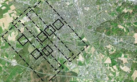
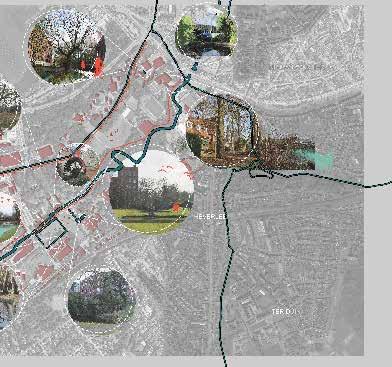
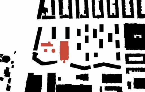
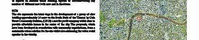
3. The site: university grounds around the valley
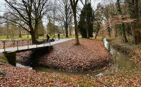
The studio will investigate the Dijle Valley as a specific spatial figure that has led to very particular forms of urbanism since the Middle Ages: valley urbanism.
bridges across rivers, on river islands and on riparian slopes. The marshy lands along rivers were usually only developed later because foundations required capital intensive interventions. Hence, the river cities were first places for resourceful institutions as convents, hospitals, schools, be guinages or for industries (starting with mills and breweries). It explains why these buildings are the most public part of the city with the highest concentration of collective services and common spaces. Before the In dustrial Revolution, the unbuilt (convent gardens and orchards, bleaching fields) dominates over the built. The valley city combined the greatest density (through large building complexes) and vast openness.
It is hence not accidental that the university expanded in the 20th century upstream in the castle domain of Arenberg that is embedded in the Dijle Valley to the south of the city. However, it cannot be said that this ex pansion led to a valuable form of valley urbanism. Elaborating a valuable valley urbanism is therefore one of the targets of the studio.
The site is situated around the Dijle Valley from Egenhoven in the south of Leuven untillthe Brusselsestraat in the historical center. The Kasteel park Arenberg with the current Arenberg campus is embedded within this segment. The site will be subdivided in three strips stretching over the valley and including both banks and the lower valley grounds. Each strip includes interesting university properties as well as large infrastructures and landscape figures. All have planned areas for densification.
4. The studio organization
Cities in the Lowlands were historically i river cities and developed as
10
The studio will function as three “offices”, which each responsible for developing a strategic vision for the entire site. Within each of the offices, three groups (of 4 students each) will work on the different strips. They are responsible as a small group to develop a vision for the strip, but at the same time formulate a design hypothesis on the scale of the full site.
Within the strips, each student will develop a particular focus (urban tis sue or landscape urbanism). Specific sites and assignments will be formu lated for each of these specific design exercises.
The goal of the studio is to be able to work across scales and within differ ent group sizes, all with the goal to reach a coherent vision for the inter twined university and city tissue within the Dijle Valley.
5. Design hypothesis & approaches
Mobility
One of the starting points is a car-free university city in the Dijle Valley, consequently the following can be considered as givens:
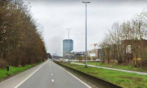
• decommissioning oversized heavy infrastructures: downsizing the Koning Boudewijnlaan (actually a highway) in the south and Kolonel Begaultaan in the north; decommissioning Celestijnenlaan that cuts the Arenbergpark, downsizing ring road, car and parking infrastruc tures in the valley section of the urban territory; .
• cars are to be stopped at the edge of the valley; they are no longer allowed to penetrate it. The Dijle Valley is to be transformed into a car-free city initiating the global mobility transition. The edge is to be
equipped (for the time being) with hubs for new mobility-systems and (in the end recuperable) parking (as part of the transition).
• transition to a car-free university city means making place for other forms of mobility: eliminating and changing (car-)lanes. The valley should become accessible and movement in the valley should become smooth and abundant. Crossing the valley, however, (with cars, etc.) is not considered beneficial and should be limited to the absolute neces sary minimal. In this way, the valley can become the spine of the new (carless) urbanity. Crossing points (ring road, Brusselsestraat, etc. can be articulated as bridges across the valley
• in the valley, place should be made for soft and public transport of the 21st century: autonomous mobility, sharing-economy in mobility (e-bike, e-cars, ...) and new e-public transport forms (from offer to demand oriented, from rigid to flexible, from 9-5 to 24/24 etc.)
Development models
The largest part of the site is university property, public property (public institutions, as schools, etc.) or can be acquired as public land/university property. This is a major asset and can be made use of to develop a comple mentary, cooperative and non-speculative model of urban development. The collective domain can be expanded with land-banking mechanisms, transfer of development rights, etc.– approaches that the private market is looked for.
University-city/city-university
From zoned and exclusive over mixed development and living campus towards inclusive and integrated university city development
• Hyper density: accommodate half of the growth of Leuven (10,000 inhabitants in a decade) within the Dijle Valley
11
• From economy of scale to scales of economy: from massive production of monofunctional programs to mixture, from office to co-work, from factories on industrial zones to productive city tissues
• Housing fabric forms the city: inclusive urban dwelling forms for the 21st century in a dynamic university context.
• Housing complexes without garages or car parking space, but with e-bike facilities embedded and shared mobility systems
• Uncertainty/unpredictability: fixed frame and flexible infill
Valley Urbanism
• Being inspired by the Middle Ages, but in a 21st century way: build ing density in an ecologically sensitive river valley and compensating dense urban development with even vaster openness (shrinking foot prints, expanding ecologies, space for water, forest, ecology).
• Building a new urban tissue and structure that intertwines with ecolo gy (instead of erasing it by occupation).
• From planning structures on a tabula rasa to a metamorphosis by restructuring: systematic reuse of buildings, limiting demolition, with exception of:
1. some oversized & decommissioned infrastructure,
2. parking space (at least 60% given back to nature),
3. supermarkets (Colruyt, Delhaize, Carrefour) and other nonvaluable, extensive space consuming structures.
• Residential densification projects (on the condition that resulting foot print decreases and natural space increases)
6. Testing sites
The territorial vision of each strip will be put to the test on two particular sites. The program definition for each testing site - finding the specific mix of functions and type of urbanity - is part of the research assignment. The minimum ambition is nevertheless to add at least 400 new housing units per site apart from the other proposed new functions. The existing build ings and programs that are taken out should also be compensated.
Specific challenges per site:
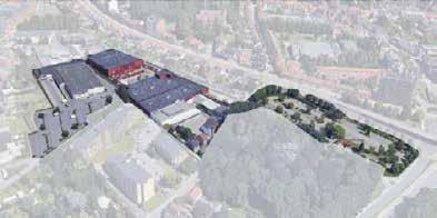
A. Valley meets City - lower valley strip Landscape urbanism challenges
• confontation of the valley and the inner-city tissue
• confluence of the Dijle and the Molenbeek
• how to make room for more nature in the city and therefore creating opportunities for ecosystem services
A.1. Redingenhof-island
1. bringing the campus into the city
2. mediating between a multiplicity of tissues, scales and pasts
3. several (overscaled) infrastructures become potential project sites, in direct interaction with the Dijle and its island in the low city tissue
4. relation has to be sought for with the heritage around the site, e.g. the Beguinage
A.2. Bodart-junction
• a gate to the city, a gate to Arenberg
• opening up the collective sports functions to the city
• turning the challenges of an infrastructural node into opportunities for
12
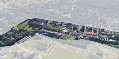
B. Valley meets Campus – middle valley strip
• Landscape urbanism challenges
• Confrontation of the valley and the campus facilities
• Parallel water streams of the Voer – Dijle – Molenbeek to choreograph through the tissue
• How can the valley landscape become even more of an asset to the tis sue? How can the campus park of Arenberg be structured by and along this water landscape?
• How to put the higher banks in relation with the lower lying valley?
B.1. Alma-edge
• creating synergies between functions
• addressing the monofunctionality of the campus
• Making use of the Koning Boudewijnlaan as a katalyst for strategic weaving between campus and residential tissue
B.2. Lerkeveld-domain
• requalifying underused but built-up backyards
• revisiting the cloister typology/ the domain in the neighbourhood. Seeking opportunities to reinterpret the urban and architectural mono lithic figure
• acting on the hinge campus-suburb
C. Valley meets Fringe – higher valley strip
Landscape urbanism challenges
• Confrontation of the valley and the open and more rural landscapes
• Upstream water management challenges for the Dijle Valley
• Embedding the campus/city in the valley system while precisely valu
ing its landscape logics and systems
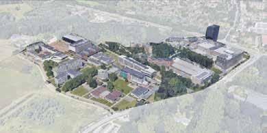
C.1. Arenberg II-patchwork
• Moving away from a car –centric, monifunctional and enclaved envi ronment
• Transforming a dead-end into a destination within the urban and cam pus tissue
C.2. Koning Boudewijnlaan-strip
• downgrading of infrastructures and stitching its sides
• moving away from a car centric environment
• designing the edge of the fringe
• searching for a link with the surrounding residential neighbourhoods and the former Jesuit domain
13
an innovative city-university development case
GUEST LECTURES
Perspective of the City of Leuven on the Campus Daan Van Tassel, Wiet Vandaele, City Planning Depart ment Leuven
History of the Domain of Arenberg Cato Leuraers, KULeuven
Water in the Southern Dijle Valley Jan Pauwels, Vlaamse Milieumaatschappij
14
INSPIRATIONAL PROJECT VISITS
Louvain-la-Neuve Cati Vilquin, KULeuven
Centrale Werkplaatsen Leuven Tom Boogaerts, Bogdan & Van Broeck
La Vignette Leuven Guido Geenen, WIT architecten
15
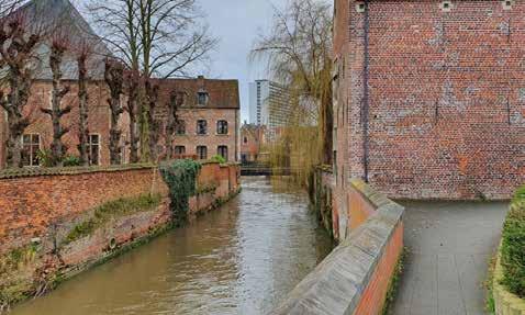
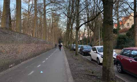
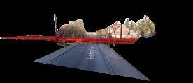
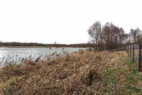
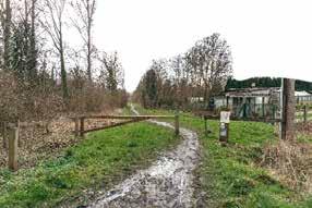
© Ermias Tessema Beyene © Arthur Van Lint © Arthur Van Lint
17 02
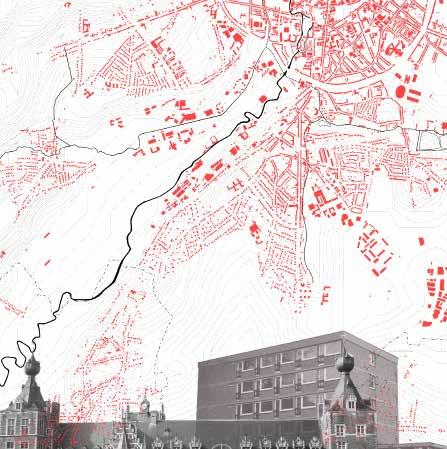
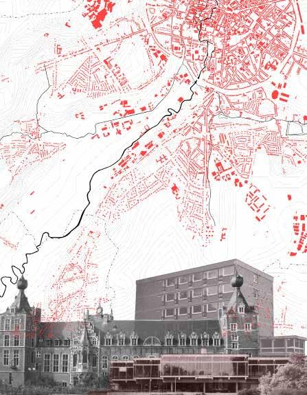
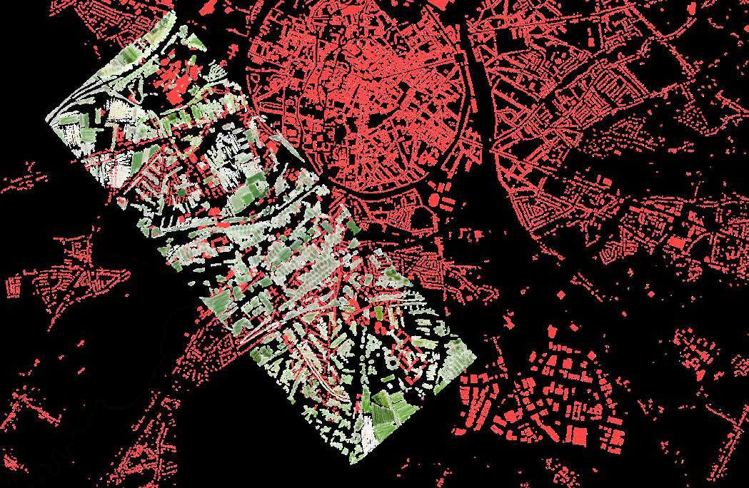
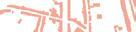
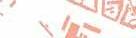
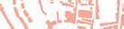
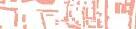
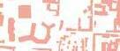
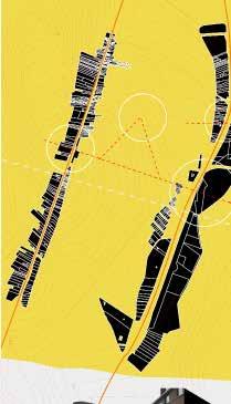
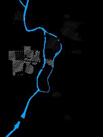
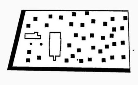
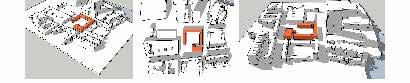
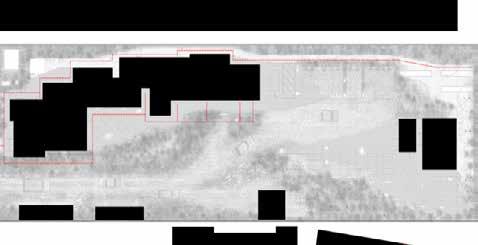
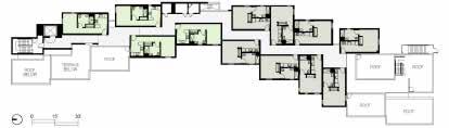
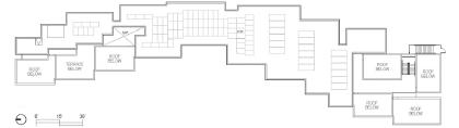
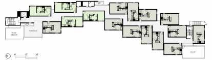
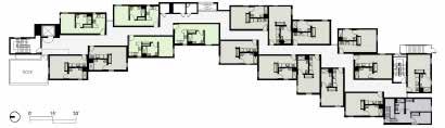
MAP © Axelle Haekens
INTERPRETATIVE
18
19
Proximity to water
Valley meets campus - Heverlee, Leuven
Yasmine Baamal
The canal and the Dijle are important elements that frame the campus land scape. Yet, there are very few spaces that take advantage of its potential and that create a proximity between humans and nature. In this map, existing and potential spaces of proximity to water are identified, in order to reveal fields of opportunities.
Ponctual users of space Linear users of space Water
20
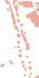
21
Parking area and urban parcels
Leuven
Tzu-Chun Lin
This analysis map marks the location of the parking spaces(ground parking, underground parking and parking tower) and reveals that all parking spaces can be divided into three types. The first serving a specific cluster of public fa cilities, the second serving a specific functional massing, and the third serving a large residential community. Through the distribution of parking spaces, it can also be found that some specific parcels of land in the site have a certain degree of independence and can be considered as specific areas in the city. In addition, with the mapping of soft mobility, it is possible to explore how different parts of the city are connected except of the vehicular movement.
22
UZ Leuven campus
Supermarkets
Science park Campus area
Industrial area
ground parking undrground parking parking building
Sports center
Abbey and park
Stadium and residential area

23
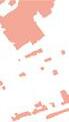
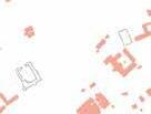
Campus in a valley
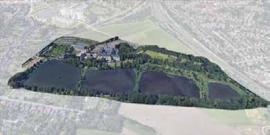
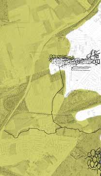
Arenberg campus Heverlee
 Axelle Haekens
The Arenberg campus in Heverlee consists of multiple ‘islands’ in the Dijle val ley. The Celestijnenlaan and the forest path are the only connections between the various campus domains that lie on either side of the floodable valley. Therefore, there is little interaction between the campus and the valley. If this is the case, how can we enhance the relation between the Arenberg campus and the Dijle valley?
24
25
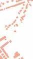
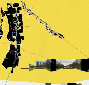
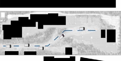
Experience of road
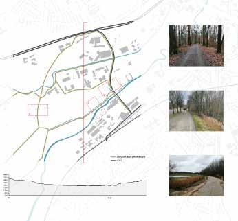
Valley meets fringe
Peiyang Huo
This map describes 5 paths that are important to students and residents, some of which have the potential to better serve users in the future. Such as the forest path connecting Egenhoven and Arenberg III, and the flooding area between the two campuses. But at present the three aspects of terrain, scenery and connec tivity make these 5 routes have different experiences, the map tries to find opportunities and challenges to improve the road experience.
26 37.1m 24.2m 36.5m 32.1m
sense of boundary
32.1m 36.5m 33.5m 24m 35.3m 48.6m 4.0km 3.6km 3.2km 2.8km

0 0.5km 1.0km 1.5km 2.4km 2.0km 1.6km 1.2km 0.8km 0.4km 51.6m 23.9m 54.4m different pavement segmentation by railway segmentation by highway
28
29
Permeability in the valley
Valley Urbanism
Shuting Li
Leuven is surrounded by so many green space (grass, agriculture,forest ect),how to build a new urban tissue and structure that interwines with ecology(instead of erasing it by occupation)?
30
31
3 Different Domains on their own Island


 Heverlee, Leuven
Evangelical
Sites currently located in urbanized areas by residences for which they do not interact with their sorroundings, they are in the middle and center of a com munity but at the same time, isolated. Due to their green area potential, they could be used to make these lots a private/semi public area for the use of community residents. At the same time, in one way or another create spaces where the different communities could interact wothou the need to sectorize public spaces, which i what is happening today. There are 3 neighborhoods with different urbn morphologies through which a connection and relationship between them could be carried throught design.
osofisch
 Zusters

32
Ana Veronica Martinez Fil
angelical Theo l ogical lt


osofisch en Theo l ogischCollege vzw(Jezuïetenhuis Heverle e)


Zusters MissionarissenJaDecht, Cult es


33
The Transitions
Noviantari
meets campus - Alma and Lerkeveld
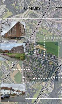
The stretch of the Arenberg campus landscape is interpreted as a transition from the city(ness) to the natural/rural landscape or vice versa. Gasthuisberg hospital bridges the transition with the city at the top north and Dijle marsh bridge the transition with the natural forest at the south. With the historical Arenberg Castle and its relation to the Dijle river at the heart of the forest campus, the Alma and Lerkeveld bridge transition to the adjacent suburb housing neighbourhoods and agricultural lands. In that transition, landscapes are in shift, necessities are in conjunction, and infrastructures are intertwined. Spaces of transition represent dialogues with the shift and criss-cross. How and what kind of dialogues mostly occur in accommodating the transition?
34
Valley
Suburb housing & agriculture
National Park Forest
agriculture lands
Tunnel
Carpark, loading dock, and elephant paths at the back of Alma
Parapet wall with steps, pathway, and bike park in between Alma and grass lawn
35
Gasthuisberg
Dijle marsh and bird watching lookout
Wide streetscape of Celestijnenlaan Lerkeveld with grass lawn and forest grove garden
of highway and grassbank leading pedestrians and cycllists from back of Alma to grocery market and adjacent suburban neighbourhood
Planting bank with elephant paths towards housing neighbourhoods
Lerkeveld
Arenberg Castle
Alma
Dijle
Elevated grass lawn with play tools in between highway, carpark, and housing neighbourhood
Stormwater infrastructure and carpark between Gasthuisberg and housing neighbourhood
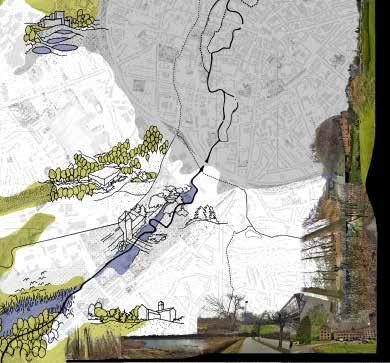
Water Nexus
The river Dijle flows into the city of Leuven from the suburbs of the city, through the campus and then to the center. In accordance with changing landscapes over this large stretch of the river there are several ways in which infrastructure such as tunnels, bridges, highways and canals plays a role in connecting the two banks of the river. How can these spaces be transformed in order to make them more interactive, taking advantage of the existing situation and transforming them into catalysts that bridge the two edges and also provide recreation and interaction for people?
36
Anagha Pandit
Dijle Valley meets Campus, South Leuven
37
38
39
Radial city
University Meets the City
Taki Tahmid Saurav
Throughout the morphological growth of Lueven city, radial expansion can be observed within the protective circle and beyond. After the circular protection wall demolision the inclusivity remained still creating a exclusive centrum for the city and the furthur expansions as puzzles plugged in to the centrum. Does rethinking the Leuven city without the strong barrier still replicate the radial expansion of the city’s tradition?
40
41
Patches and Edges
Dijle Valley meets Campus
Aliki Tzouvara
Contrasting and disconnected spaces are scattered as different urban patches in the area. Industrial, agricultural, educational, residential, forest spatialities co exist. The edges in-between vary, rarely in accordance to each function. How would the re-design of the boundaries help the connection and re-appropriation of public space and uses?
42
43
Reconnecting Landscape
University Meets the City
Zhongyan Zhang
The map demonstrates that the landscape in the urbanised areas consists of three essential elements, the city ring as the primary infrastructure, the river with its tributaries as the dominance of the valley, and the scattered green space and buffer area. However, the city ring plays as a defensive barrier, while the green space is fragmented except for the greenery buffer along the fast road. More importantly, the rivers tend to be ‘invisible’ in both the city and the campus. The accessibility is influenced due to the development occupying the surface of the city and the loss of functions for the waterfront in the university. How can the invisibility of the water landscape be addressed, and therefore facilitate the integration of the city and the university?
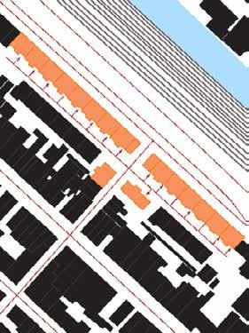
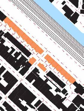
Jun(c)tion or Jun(k)tion?
Valley Meets City - Bodart
 Samantha Arbotante
After the entire bike tour, I was drawn in interest at the two separations at the Bodart area. With the daily routine of entering and exiting the campus through this junction, the blinding lack of identity and character of the area is due to the massive gray infrastructure built in the middle. At its sides, “junk” spaces or areas with flat concrete and permanent boundaries are found dominating the gateways of the sites. How can we use these existing opportunities and recreate a new landscape image to welcome the students and residents?
46
47 1 3 4 5 6 6 7 7 8 8 9 9
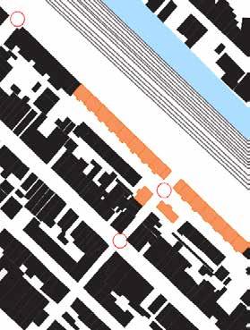
Entrance paths of the campus
The ring complex
Rafaela Maria Armoutaki
How could more conndcting poles between the campus and the ring can be integrated to enhace accessibili
48
49
Built and Open space Private and collective spaces
BODART
Frank BAGENZI
MASS AND VOID or BUILT AND OPEN SPACE Analysis is an impor tant feature of the site due to the fact that the dense residential area are created based on the topography. The built environment near the water stream are not too dense comparing to the upper slope built envornment . Not only that but also the plot patterns and porosity reduces as you go away from water stream. How can spacial qualities of the built and non built environment/open spaces help to bridge the gap or connect the city and the university ?
campus Tissue
Elastic tissue campus Tissue
campus Tissue
50

51
Static Tissue-Residentialss
Suburbia Between the Castle and the Forest
Heverlee
Fatma Ben Hfaiedh
Rich urban fabrics, Hidden mobility, Social interaction, A suburbia within a suburbia. On the sides of the railway crossing Heverlee there is a rich mixity of urban fabric (Residential, Education, Religious, parks) that could be seen as a suburbia within a suburbia?
52
53
Inherited ENCLAVES
Site A - Lower Valley Strip
Ermias Tessema Beyene
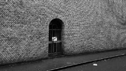
Walls have been a prominent feature of Leuven since medieval times. Maps from the 16th century show that the city had two inner and outer walls. The traces are still noticeable; particularly the outer wall which is now replaced with a wall of ringroad.
Hence, the current Leuven and the University can be read as a system of en claves, territories defined by physical means of barrier, allowing a controlled access. The walls take different forms; fence walls, buildings serving as walls, water walls, hedge walls, highway walls, etc. The controlled access takes a form gate, bridge, and underpass.
Arenberg Castle, Graf Zjef Vanuytsel, Begijnhof, UCLL Groep Lerareno pleiding are currently delineated by brick fences which are remnants of Leu ven’s past. Buildings also create an enclave when they are closely spaced next to each other, which is also a typical character observed in central Leuven. A combination of water walls, highway walls, and brick walls demarcate and partition the Heverlee Campus while bridges, gates, and underpasses link the enclave with the surroundings and within.
54
55
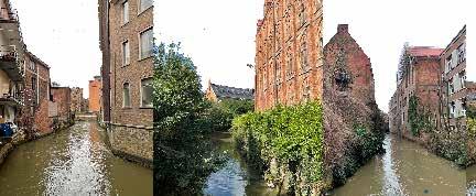
The banks of the Dyle
Leuven
Jules Descampe
Since the beginning of Leuven, the hydrographic structure of the Dyle has influenced the urban fabric. The river and its tributaries cross the city and its different typologies. The nature of the watercourse evolves according to these layers to propose a wide spectrum of spatial relations with its surroundings. These relationships are reflected in the width of the watercourse, the buildings that border it, its accessibility, and the public or private facilities. Its penetrating landscape status places the watercourse as an opportunity for the fabrication of continuities or sequences throughout the city.
Therefore, can the direct relationship of the city to the water not be a means of creating new urban logics at the scale of the city?
56
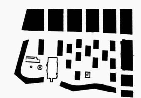
Replace this box with your collage. The interpretative map is one integrated image.
57
The Valley Unfolded
Valley meets Campus
Shannon De Wandeler
How does the valley unfold itself in relation to water, typography and the campus?
58
59
The line between landscape and urbanism
Selenge Dima
During the site visits there were times where the green fields could not eas ily be accessed and the hard lines between the landscape and the urbanism became apparent. Can blurring the line between landscape and urbanism
60
Valley meets Campus - middle valley strip
contribute to a valuable valley urbanism?
61
Layers of landscape
Heverlee
Gilles Houben
Arriving by train to Leuven alongside the Dijle valley, the topography allows us to see glimpses of landscape, framed by the tall facades of the campus Arenberg.
62
63
Zone function and landscape streamline
Yue Hu
Heverlee’s architectural and landscape functions are arranged in an orderly fashion, with roads and train tracks running through the landscape and Di jle Valley. There are scattered campuses and concentrated residential areas on the site, as well as embedded green space.
BUILDING
64
Heverlee OFFICE
BUILDING RESIDENCE ZONE CAMPUS

65
Border Conditions
 Valley Meets Campus
Mazen Jubeihi
Valley Meets Campus
Mazen Jubeihi
66
How are the disparate edge conditions reflected in typological differences along the borders?
67
Green vs Grey
Valley meets fringe
Kshitij Makhija
How can more houses be built beside the roadway or railway to make it more usable?
68
69
Green tissue edges
Valley meets fringe
Alexander Van Gestel
The Dijle valley is surrounded by large green networks consisting of forests, agriculture… where a combination of these forms of greenery is noticeable within the valley itself, accompanied by the Dijle. When approaching the university complex of Heverlee and the city centre of Leuven, a fragmentation of these tissues appears across the whole territory, forming fragments or steppingstones of the larger green networks. But how can these various fragments create a new territorial coherence of various tissues and (re)tell a story generated by geography?
TREES AGRICULTURE
RIVER STREAM AND WATER BODIES VALLEY STRUCTURE
70
71
Accessibility

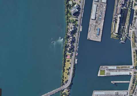
Dijle Valley, South Leuven
 Arthur Van Lint
Where the Dijle flows into the city of Leuven from the south, the river is sur rounded by a series of diverse open spaces. These potentially valuable spaces are often tucked away and exclusively accessible to specific users and/or on a part-time basis, resulting in a landscape of fences and barriers. How can these open spaces around the Dijle be connected to each other, to the river and to the rest of the city to become stimulators for interaction between different users of the city?
72
1 2 3 4 5 6
73 7 8 9 10 11 12
Defining housing qualities
Valley meets Campus- Middle valley strip
Agnes Ayesiga
The Djile valley is home to a variety of housing typologies. what are the defining qualities of the different dwellings that exit here?And what can we borrow from the different urban hosuing qualities on the site to inform the design of a new urban vibrant environment.
74
75
Leuven Hidden Terminals
Valley meets City
Beshtawi
76
Basel
77
Levels Of Seperation
Valley meets Fringe - Higher Valley Strip
Majd El Achkar
As we trailed the site the previous days, we noticed the level of separation among areas. It was noticeable that the levels of separation increased at spe cific locations. There is man-made infrastructure such as train tracks and roads throughout the site. There is a disconnect between the characters in the neighborhood due to the natural infrastructure of canals and topogra phy. What can we do to reconnect the characters as a whole, and bring back those connections?
78


“Psychogeographical” Map
Valley meets Fringe- higher valley strip
Rula Elkhalili
The “ physchogeorgraphical” map is developed based on the emotions, the feelings and the impressions of the user while walking through the city. It rep resents how the city is perceived and what is the message the city is sending to its users. In the sense, the map is highlighting parts of the city that stands out in the memory and the experience of the user, representing how the user feel and read the city.
And from here a question arises: What are the tangible urban and natural elements or configurations that formulate the intangible feeling towards the city while moving through it?
80
81
Inside vs. outside the valley
Upstream valley strip
 Ellen De Wolf
The edges of the Dijle valley are represented in the landscape in multiple ways, avoiding different parts of the area to integrate or connect. When considering mobility in the whole strip, the edges of the valley are clearly tangible. It divides the area in the inside and outside of the Dijle valley. The inner part consists mainly of a network of soft mobility, connecting important functions such as the Arenberg campus and the forest. In contrast, the outside of the valley is a car-based area of urban sprawl. How can a rethinking of mobility throughout the strip result in a shift from the car-oriented urban fabric to an integrated and accessible landscape?
82
83
Amenities Re-visited
Valley meets Campus - Middle Valley Strip
Shinta Kusumawardani
Public amenities define the quality of an area’s social infrastructure. In the middle valley strip, a variety of amenities are interwoven within its fabric, either plainly exhibiting themselves with their gigantic structures such as the case of UZ Leuven hospital and public parking lots, or easily go unnoticed due to its lack of spatial quality and camouflaged access such as the case of the designated playgrounds and sports halls. How can these existing spaces be utilized to their maximum potentialities and help contribute to fostering a rich interaction between residents? How can both those said spaces and new spaces be created to make up for a lack of high-quality public amenities in the area?
84
85
Broken nature
Valley meets campus
Nhung Pham
The landscape of the middle strip is fragmented by different reasons and factors - the roads, the buildings and human selfishness in landuse. This painted a bro ken picture of the nature in Djile Valley transition area - where there should’ve been a comprehensive biological mosaic of nature and non-nature. During the fieldtrip throughout the area, we can feel different atmospheres with sudden changes in landscape types and neighborhood areas, which demonstrated the isolation of city patches - agriculture land, the forest, the residential area, the university. The question is from this status, how to use landscape as the main element to reconnect these fragmented patches? How to reconnect city to university, local residents to students and staffs? In the broadest manner, how to reconnect nature to univercity life?
86
87
route 0 250 500
Fieldtrip biking
Urban Calendar
Valley meets city
Chloé Poisseroux
This map shows a clear difference of “calendar”, in the city centre, many facil-ities are still open after 9 pm. It creates a warm and safe atmosphere for pedes-trians to walk at night. However, once moving away from the city cen tre and entering the campus, open space after 9 pm gets really rare. This map shows also the student residences owned by KU Leuven, a majority is located on the campus resulting in major vacant housing during summertime and weekends.
Wouldn’t it be interesting to mix the functions in the campus part of Leuven with the city centre in order to keep an active environment at different moments of the day, the week and even the year?
88
89
Water Landscape and Management
Valley meets Fringe — higher valley strip
Han Qin
The morphology of the Dijle river in the upstream area is more diverse and natural, and more vital as for the flooding control of Leuven. How to adjust, enrich and strengthen the functional value of the valley as both a comprehensivly strategic water management system also ecological natural landscape?
90
91
The ring - A bridge or a barrier
Redingenhof- Bodart
Lakshiminaraayanan Sudhakar
The hard infrastructure - the ring, divides the urban fabric of the city and the university campus dramatically, creating a disconnect from the nature and ecology. The movement of people and their activities is centralised to the city centre and this gives way for the static nature of the campus through many times of the year. How can an urban intervention help in creating a framework where the city and it’s people co-exist with the blue-green networks that also activates the social fabric of the campus throughout the year?
92
93
Elusive Connection
Redingenhof- Bodart
Michelle Valladares
The fragmentation between the valley and the city is enhanced by over scaled infrastructure. The Dyle river connects these two spaces, but the connection to the river itself is also filled with barriers, abandoned or undefined spaces. These connections can also be reinterpreted to inject some life into the sites in a more permanent way. How can the relation between nature and built be approached to reestructure the urban landscape while connecting and activating spaces permanently?
94
95
Connection and Transfer
Middle Valley Strip
The Celestijnenlaan has brought structural influence to the whole Arenburg campus, and the motor traffic covered by it has brought potential instability and insecurity. At the same time, it is an obstacle to the realization of the car free mobility. Whether it will be one of the feasible strategies to transfer the original motor traffic.
96
Yongxian Zhao
97
HOUSING ANALYSIS
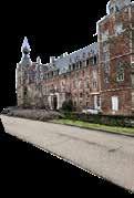
99 03
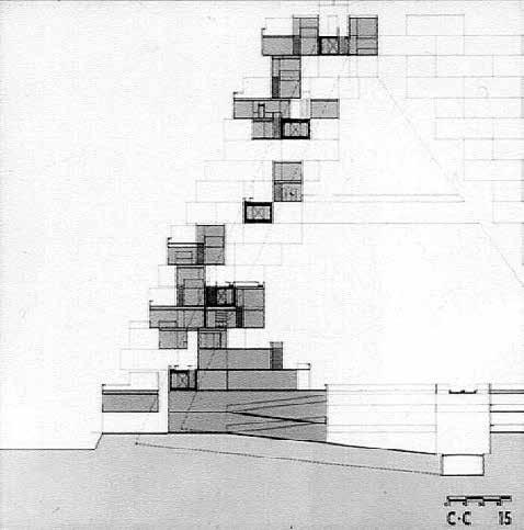
© Gilles Houben
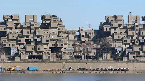
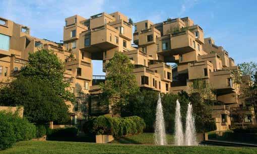
Habitat Expo ‘67
Moshe Safdie
SITE
DESCRIPTION
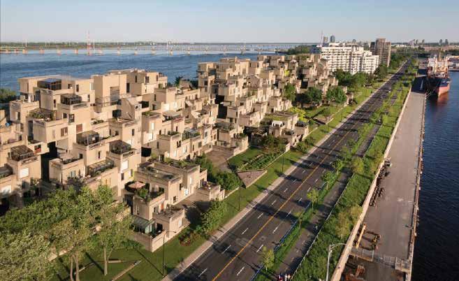
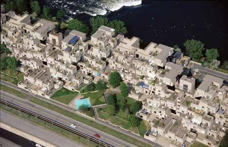
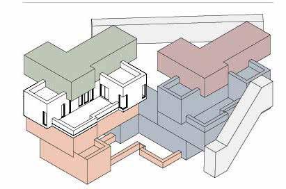
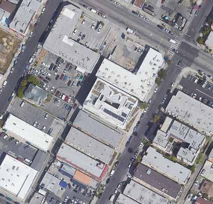
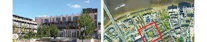
The site for this extraordinary experimental housing complex designed for the great Montreal Expo of 1967 was the Marc-Drouin Quay on the Saint Law rence River.15 in Montreal, Canada. The project is located at the end of the pier, furthest from the city by road but closest in terms of view allowing it to be a centre of display of urban density from the centre of old Montreal.
EVALUATION
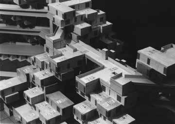
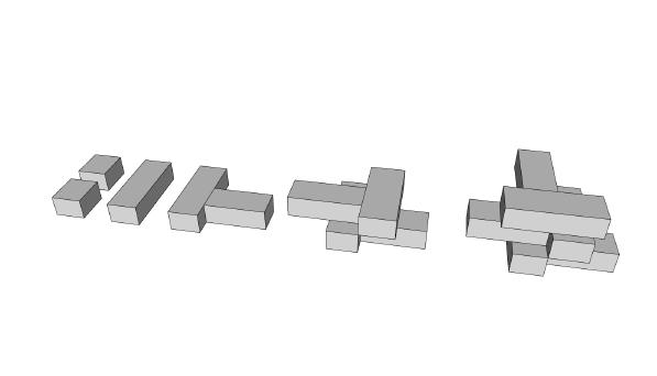
The experimental model is a radical hybrid of the suburban single-family home and the urban apartment building. 365 prefabricated concrete modules are stacked asymmetrically in dense geometric piles whose interlocking forms give rise to a wide variety of typologies. The different types and sizes of apartments range from 600 square foot one-bedroom units to 1,800 square foot four-bedroom units. The project is a demostration of how individuality can be achieved in dense developments
100
Montreal, Canada
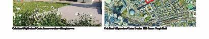
Marc-Drouin Quay, Montreal
Satelite image. Source: Google Earth 2022
Satelite image. Source: Google Earth 2022 Habitat 67, Montreal. Source: Karrie Jacobs. Architect 2015. https://www. architectmagazine.com/awards/moshe-safdie-and-the-revival-of-habitat-67_o
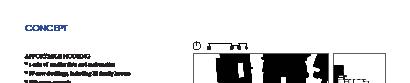
CONCEPT
• High quality housing design in dense urban environments through explor ing a combination of surburban living and apartment building.
• Densification to reduce building unit cost. Rethinking apartment design.
• Prefabrication of modules to ensure economies of scale. New housing ty pology.
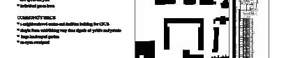
minimal building footprint on the pier due to densification
Section showing the irregular stacking of the modules. Source: Dezeen 2014. https://www.dezeen.com/2014/09/11/brutalist-buildings-habitat-67-montrealmoshe-safdie/
Facade of Projections, Habitat ‘67. Source: Archdaily 2018.
101
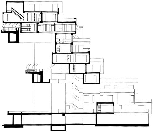
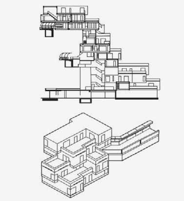
Morphology
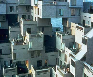
Staggered modules
SPECIFIC: DENSIFICATION AND INDIVIDUALITY
102
Interlocking forms and a variety of typologies allows for individuality in a high density development. Source: Jesse Kaplan. Architect 2015. https://www.architectmagazine.com/awards/ moshe-safdie-and-the-revival-of-habitat-67_o
The irregular stacking of the forms ensures each dwelling enjoys natural lighting and views of the St Lawrence River and the City. Source: Loveyousomat. Tumbler 2015. https://loveyousomat.tumblr.com/post/21368893808
SPECIFIC: TYPOLOGY
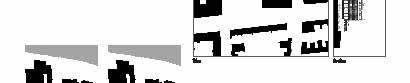
103
The basic modules are combined are rotated in order to create unique extterior conditions
Massing of various typologies
BUILDING
DESCRIPTION
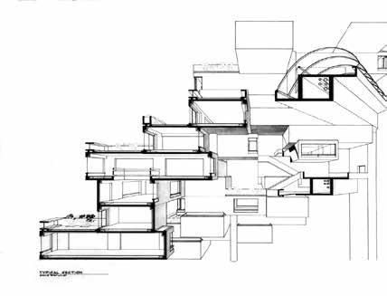
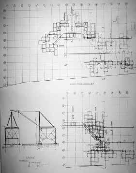
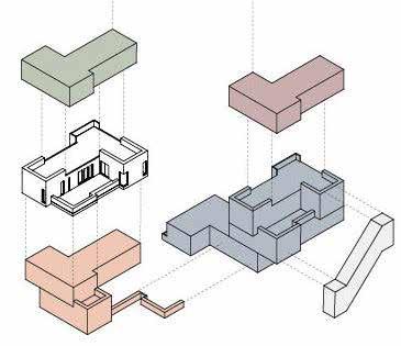
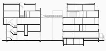
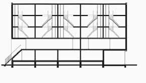
The building constructed with precast concrete boxes each measuring 11.8m long, 5.3m wide and 3m high has three central double cores and four further lift cores. The array of blocks are stacked agaisnt these cores creating a series of courtyards. The blocks themselves are also partially load bearing. This inno vation in structural system and prefabrication of the modules was in response to the focus of the 1967 Montreal Expo which was a testing grounds for new building technologies.
EVALUATION
Canada is a surburban nation with an abundance of cheap lands. Planning policies in the country are also not restrictive on urban sprawl, thus 67% of its population live in sururban areas. Moshe Safdie’s project therefore does not address suburban drift in canada. However the project explores how apart ment buildings can operate in a suburban setting whilst having high densities. The project creates a benchmark for luxury-high rises
104
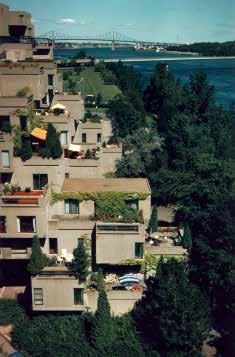
Roof garden terraces of Habitat 67. Source: Sam Tata. Dezeen 2014
Floor Plans and sections of Habitat ‘67. Source: Archdaily 2018.
SPECIFIC: TYPOLOGY
Building Typology
Section. Source: Dezeen 2014. buildings-habitat-67-montreal-moshe-safdie/https://www.dezeen.com/2014/09/11/brutalist-
Section showing various typologies. Source: Loveyousomat. Tumblr 2015. https:// loveyousomat.tumblr.com/post/21368893808
105
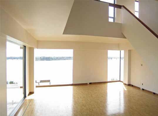
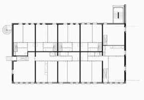
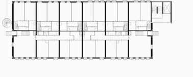
DWELLING
DESCRIPTION


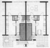
The prefabricated modules originally created 158 dwelling units with 14 different apartment configuarations. The residences range from 600 square feet(one bedroom) to 180 square feet (four bedroom). Three elevator cores, stopping at each fourth floor gives residents access to the footpath which link the dwellings.
EVALUATION


The Architects successfuly achieves individuality for each unit despite the high density of the building through a complex variation of geometry. This allows tenants benefits of suburban housing; light, privacy and views of the St Law rence River and the City.
106
Floor plans of one bedroom unit
Interior View of Habitat ‘67. Source: James Britain. The Architectural Reveiw 2018. https://www.architectural-review.com/buildings/revisit-habitat-67-montreal-canada-bymoshe-safdie
Floor plans of two bedroom unit
Floor plans of three bedroom unit
Floor plans of four bedroom unit (Drawn by Author)
Section
SPECIFIC: TYPOLOGY
Unit typologies. Source: Brianna Ssviano. Wordpress 2014. https://modulatingruin.wordpress.com/2014/06/16/593/
Habitat ‘67; A balance of cold geometry against living, breathing nature. Source: The Guardian 2015. https://www.theguardian.com/ cities/2015/may/13/habitat-67-montreal-expo-moshe-safdie-history-cities-50-buildings-day-35
107
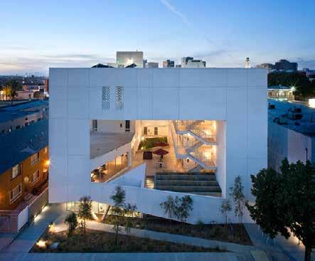
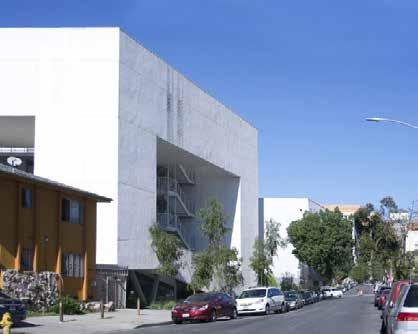
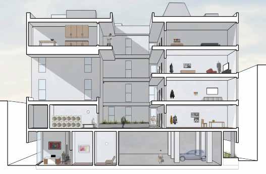
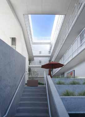
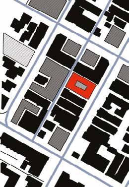
The SIX disabled veteran housing
Brooks +Scarpa
Yasmine Baamal
DESCRIPTION

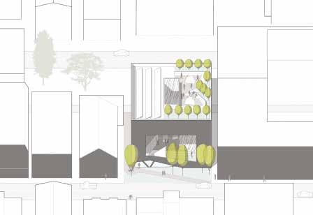
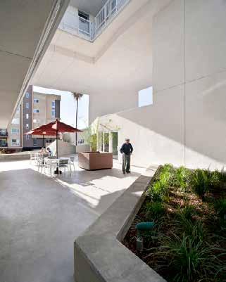
The neighborhood of MacArthur Park is one of the highest density neigh borhoods not only in Los Angeles, but also in the US. The project responds to one of the most important challenges that is facing the city : to provide a home and a shelter for homeless veterans. The project integrates 52 affordable units dedicated to homeless people, in which public and public spaces interact together to create a sense of community, bridging between the street and the housing units.
EVALUATION
The project disrupts the classic distinction between private and public spac es. Indeed, the transition from the neighborhood scale to the studios scale is progressive and blurry, with no strict separation, and a continuous visual connection.
108
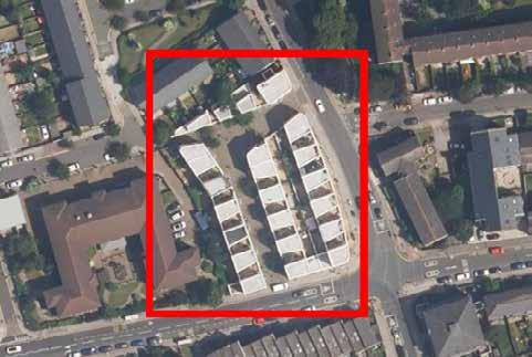
Los Angeles, California, USA
Location: Central © Wujcik, Tara. “The Six project main façade, Los Angeles”. [Digital image]. www.brooksscarpa.com. Accessed February 19, 2022. https://brooksscar pa.com/the-six
SITE ©
Google Earth Pro
7.3.4. (14/12/2015). Location
of The Six project.
© Google Earth Pro 7.3.4. (14/12/2015). Location of The Six project.
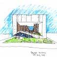
CONCEPT
• Providing shelter to homeless people within the city.
• Exploring the interrelation between public and private spaces.
• Solving a social problem through an architectural project that empowers individuals
• Promoting a community-oriented way of living
© Brooks+Scarpa. “Concept sketch”. [Digital image]. www.brooksscarpa. com. Accessed February 19, 2022. https://brooksscarpa.com/the-six
The facade becomes a space, connecting the street to the units.
© Wujcik, Tara. “Project integration”. [Digital image]. www.brookss carpa.com. Accessed February 19, 2022. https://brooksscarpa.com/ the-six
© Adapted from Brooks+Scarpa. “Project implementation”. [Digital image]. www.brooksscarpa.com. Accessed February 19, 2022. https://brooksscarpa. com/the-six
109
SPECIFIC: COURTYARD + OPENINGS
Reyes, Alejandro. Moy, Martin. “Section”. In: Arch 202 XL Sharing. “THE SIX, BROOKS + SCARPA | ALEJANDRO & MARTIN” February 8, 2021. video. https://www.youtube.com/watch?v=K9iDkrhWMJA
110
The courtyard structuring the inner circulation.
The project Built form Parking lots Vacant space
Section showing the central courtyard
New typology in the urban fabric
© Wujcik, Tara. “The courtyard”. [Digital image]. www.brooksscarpa.com. Ac cessed February 19, 2022. https://brooksscarpa.com/the-six
© Baamal, Yasmine. “”. [Map]. February 19, 2022.
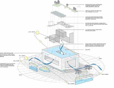
SPECIFIC: PASSIVE DESIGN STRATEGIES
Passive design strategies
© Brooks+Scarpa. “Project implementation”. [Digital image]. www.brooksscarpa.com. Accessed February 19, 2022. https://brooksscarpa.com/the-six
111
BUILDING
DESCRIPTION
The volume of the building is pierced with big openings in order to maximize natural ventilation and daylight while creating large public areas. The parking space for cars and bikes is on the ground floor, half embedded in the ground, allowing the optimization of space within a dense urban fabric. The inner cir culation is organized around the courtyard in order to serve the private units, while keeping connection with public areas.
EVALUATION
The implementation of the courtyard allows a fluid circulation while illus trating the community-driven aspect of the design. The mixity of functions within the building, including the community space and the support facilities, gives space for the inhabitants to engage with each other and create a sense of community.
Brooks+Scarpa. “Project implementation”. [Digital image]. www.brooksscarpa.com. Accessed February 19, 2022. https://brooksscarpa.com/the-six
112
©
SPECIFIC: TYPOLOGY
Reyes, Alejandro. Moy, Martin. “Analysis”. In: Arch 202 XL Sharing. “THE SIX, BROOKS + SCARPA | ALEJANDRO & MARTIN” February 8, 2021. video. https://www.youtube.com/watch?v=K9iDkrhWMJA
113
Inner circulation Private/public entanglement
DESCRIPTION
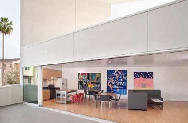
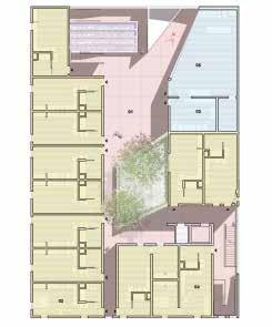
The access to the dwelling units is organized by the central courtyard, ensuring a qualitative air flow circulation, and a continuous visual connection inside the building. The Six project is composed mostly of studios, which are equipped with essential furniture and individual bathrooms, providing good housing quality for an affordable cost. Each floor has one appartement besides the studios.
EVALUATION
In addition to giving a material shelter to a vulnerable population, the project provides a symbolic shelter, a place to call home. The circulation around the semi-public areas, connected to the community space ensures a favorable en vironment for the engagement of dwellers.
DWELLING Private units
Circulation
© Wujcik, Tara. “The courtyard”. [Digital image]. www.brookss carpa.com. Accessed February 19, 2022. https://brooksscar pa.com/the-six
© Adapted from Brooks+Scarpa. “Third floor (Right) and fifth floor (left) plans”. [Digital image]. www.brookss carpa.com. Accessed February 19, 2022. https://brooksscarpa.com/the-six
114
SPECIFIC: TYPOLOGY
© Wujcik, Tara. “Private units cconnected to the courtyard”. [Digital image]. www. brooksscarpa.com. Accessed February 19, 2022. https://brooksscarpa.com/the-six
© Wujcik, Tara. “Public area inside the building”. [Digital image]. www.brooksscar pa.com. Accessed February 19, 2022. https://brooksscarpa.com/the-six
Accessed
© Wujcik, Tara. “Community space”. [Digital im age].
Febru ary 19, 2022. https://brooksscarpa.com/the-six
www.brooksscarpa.com.
© Adapted from Brooks+Scarpa. “Second floor plan”. [Digital image]. www.brooksscarpa.com. Accessed February 19, 2022. https://brooksscarpa.com/the-six
115
Private units Circulation Community space
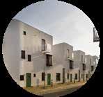
Donnybrook Quarter
 Peter Barber
Peiyang Huo
Peter Barber
Peiyang Huo
DESCRIPTION
The project is a high-density mixed housing project located on a street corner in a poor neighborhood. The designers intervened in the urban tissue by re arranging the row houses to form new streets and squares. At the heart of the project is the reactivation of street life by removing the semi-open space at the door of the house
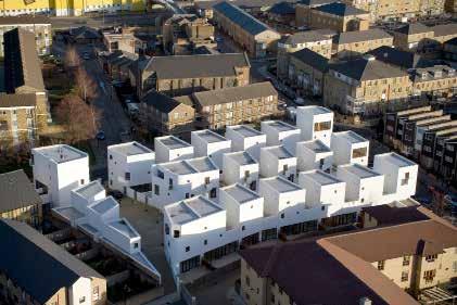
EVALUATION
The project brings new vitality to street life and rethinks the relationship be tween urban life and the building environment, revolutionizing the principle of housing design. After the project is completed, there are more people can be accommodated than the previous high-rise nursing home.
116
London, UK
Donnybrook Quarter, Bow (© Source: Google Map)
Donnybrook Quarter, Bow (© Source: architizer, accessed on Feb. 20. 2022, https://architizer-prod. imgix.net/mediadata/projects/482010/0572ad4f.jpg )
Location: close to the center
SITE
Victoria Park
Queen Elizabeth Olympic Park
CONCEPT
• Remodelling the street layout, increasing public space;
• Strong visual relationship between street and building
• back of pavement terrace (no semi-public space)
• sense of community
• Irregular white facade and simple decoration (Le Corbusier)
• Emphasize spatial perception over architectural structure (Adolf Loos)
0m
15m 0m
section
section
(© Source: architizer, section, accessed on Feb.02.2022, https://architizer.com/projects/donny brook-quarter/)
draw by author (© Source: Digimap) draw by author (© Source: Digimap) block model (© Source : architizer, accessed on Feb. 20. 2022, https://architizer-prod.imgix.net/ mediadata/projects/482010/add5abc0.jpg)
117
5m 10m
25m now
• Raumplan (Adolf Loos) figure
1990s
ground plan
SPECIFIC: REINVIGORATING STREET LIFE
terraced houses where the front door opens right onto the street (draw by author )
flow (draw by author )
Create a sense of community (© Source: Peter Barber Architects, accessed on Feb.02.2022., http://www. peterbarberarchitects.com/donnybrook-quarter)
118
25m 0m 25m
0m
commercial space private space
building semi-public space
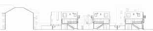
BUILDING
DESCRIPTION
The row houses are arranged to form three built-up fields framing two polygonal street zones that expand into a square. The entrance of the house is directly connected to the street, replacing the semi-public space at the entrance of the terrace house. The residents of the upper floor enter the first floor from the stairs facing the street. The facade of the building adopts a white minimalist style, which contrasts with the traditional British terrace house. Bay windows, small balconies, and oriels offer good views of the public space. The building adapts to this corner plot by changing its shape.
EVALUATION
The removal of semi-public spaces increases private space, enhances the dy namism of the street and strengthens the street as the main engine of social and economic development. The strong visual conflict makes the street more active. The T-shaped layout redesigns the urban tissue and creates more public space. Compared to high-rise apartments, complex house arrangements allow more space to be used for living.space. Compared to high-rise apartments, complex house arrangements allow more space to be used for living.
119
(white facade, © Source: Peter Barber Architects, accessed on Feb.02.2022., http:// www.peterbarberarchitects.com/donnybrook-quarter)
interaction between street and house (source: Ibid.) new community road (source: Ibid.)
THE FIVE POINTS OF ARCHITECTURE
© Source: https://www.archdaily.com/84524/ ad-classics-villa-savoye-le-corbusier
© Source: http://www.peterbarberarchitects. com/donnybrook-quarter
120
Flat roof terrace Open plan Ribbon windows Free facade
Villa Savoye by Le Corbusier Donnybrook quarter by Peter Barber
Pilotis
SPECIFIC: INFLUENCER
SPECIFIC: TYPOLOGY
121
(draw by author )
DWELLING
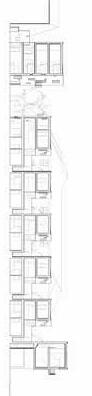
DESCRIPTION

The project emphasizes inclusivity, with 25% as social housing. The double unit in Donnybrook comprises a two-bedroomed masionette at upper ground and first floor and a two-bedroom flat at lower ground floor. The configuration as a ‘notched’ terrace maintains good levels of privacy and amenity to every dwelling
EVALUATION
Each unit has increased living space and enjoys the private space. Space is continuous and interconnected, embodying the Raumplan of Adolf Loos. Different window sizes create different atmospheres, large windows enhance daylight, other small windows ensure “eyes on street” and also make the street view more friendly.
indoor view (© Source: architizer, accessed on Feb.02.2022, https://ar chitizer.com/projects/donnybrook-quarter/)
indoor function ( © Source: architizer, accessed on Feb.02.2022, https:// architizer.com/projects/donnybrook-quarter/)
122
SPECIFIC: RAUMPLAN
“My architecture is not conceived in plans, but in spaces (cubes). I do not design floor plans, facades, sections. I design spaces. For me, there is no ground floor, first floor etc…” by Adolf Loos
123
(draw by author )
balcony bedroom bathroom View
Family space private space Living space storage Kithch living room
Haarlemmer Houttuinen
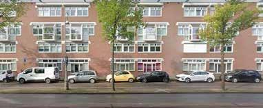
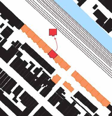
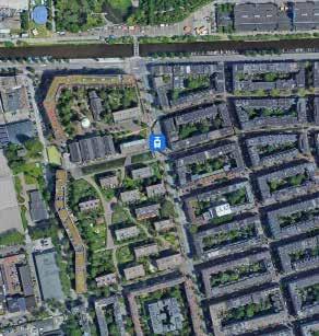
Herman Hertzberger
Edwin Kabugi Karanja
DESCRIPTION
The Haarlemmer Houttuiner Housing project, designed and implemented in 1978 - 1987, lies almost at the centre of Amsterdam city’s urban fabric in the Netherlands. It is an urban renewal project that provides housing for 75 households (homes). Owing to its location along a major transporta tion corridor with a busy road and a railway, the project is linearly designed to utilize the least space possible without encroaching the reserves of this transport corridor. The project also aimed at achieving a street with mini mum vehicular interference and maximum pedestrian freedom.
EVALUATION
Provision of housing and requalification of street use as a new form of pub lic realm was successful in turning the project site a lively community area, despite the compactness of the space within which it is located.
Removal of conflicts between vehicles and pedestrians through separation has created a new profile of public, semi public and private space in the area.
124
Amsterdam, Netherlands
Nieuwe Houttuinen, Amsterdam
Google
2022 Google Earth, 2022
Location: Central SITE Google Earth, 2022
Earth,
• Providing housing while reserving a 27m railway reserve. For this, hous es are built to provide shelter from the busy road and railway behind it. The back side of the buildings act as a rear wall. • Change of residential street use from being thoroughfares and reinstat ing them to a streets as places/spaces where local residents can meet without interferance of vehicular traffic.
125
CONCEPT
inclusive and
strengthening
Side: Acts as a rear wall of the houses. Wager, Hans. 2013. “Nieuwe Houttuinen, Amsterdam –Architekten buro Hans Wagner.” 2013. https://hanswagner.nl/prt/nieuwe-houttuin en-amsterdam/. Accessed 20th Feb 2022 Wager, Hans. 2013. “Nieuwe Houttuinen, Amsterdam –Architekten buro Hans Wagner.” 2013. https://hanswagner.nl/prt/nieuwe-houttuin en-amsterdam/. Accessed 20th Feb 2022 Van Der Vlugt, Ger. 2019. “Haarlemmer
Housing.” 2019. EUMiesAward (miesarch.com). Accessed
Feb 2022
Side: Has all the entrances and the balconies to the houses.
Southern block on the left, requalified street
the middle and Nothern block on the Right.
• The urban infill with an
accumulative
efect. Back
Houttuinen
20th
Front
Section:
in
Source: Author
SPECIFIC: OPEN SPACE STRUCTURE
126
Inversed Figure Ground
Gradient: Public (light) - Private (dark)
Porosity
Source: Author
Source: Author
Source: Author
127
SPECIFIC: CIRCULATION SCHEME
Vehicle Traffic Pedestrian Traffic Points of Superposition
The pedestrianized street only allows for delivery vehicles and car parking lots for local residents.
Source: Author
Source: Author Source: Author
BUILDING
DESCRIPTION
The housing is organized in two blocks adjacent to one another but run ning linearly along the transport corridor. Architect Herman Hertzberg er designed the northern block while Architects Van Herk & Nagelkerke designed the southern block later. They are differentiated in height by one floor. Between them is a 7m street dedicated to pedestrians. The front of the northern block (4 storeys) is characterized with big windows and pro truding piers each of which is an entrance to four maisonnetes at grade and holds the balconies of the upper units.
EVALUATION
While the protruding piers give a systemic rythm to the pedestrianized steet, the street is a lively community area as it no longer acts as a thorough fare. This separation of traffic (street is closed to general motorized traffic) has turned the street to a semi-public space only accessed by local residents of the buildings. This is evident in the way children use it to play when they are out of their houses while their parents could also sit or stand outside in the beautiful balconies to watch them or even to enjoy the space.
Adapted and modified fromVan Der Vlugt, Ger. 2019. “Haar lemmer Houttuinen Housing.” 2019. EUMiesAward (miesarch. com). Accessed 20th Feb 2022
Wager, Hans. 2013. “Nieuwe Houttuinen, Amsterdam –Architekten buro Hans Wagner.” 2013. https://hanswagner.nl/prt/nieuwe-houttuin en-amsterdam/. Accessed 20th Feb 2022
Wager, Hans. 2013. “Nieuwe Houttuinen, Amsterdam –Architekten buro Hans Wagner.” 2013. https://hanswagner.nl/prt/nieuwe-houttuin en-amsterdam/. Accessed 20th Feb 2022
128
Southern block is one storey lower to allow sushine to the street
South block
Protruding Piers
External stairs with a front garden
Entry through stairs to higher floors with shared landing areas.
North block
SPECIFIC: TYPOLOGY
129
Building Typology
Source: Author Source: Author Source: Author
DWELLING
DESCRIPTION
The dwellings accommodate 75 homes with each dwelling being a 1 or 2 bedroomed apartment with a kitchen, toilet and bathroom, sitting room nice balcony overlooking the street, providing a different layer of semi-pub lic space above grade.
EVALUATION
The project’s dwelling design offered good standards of collective housing within Amsterdam City. The buildings are well lit and aerated by natural light as all sides have pretty big windows.
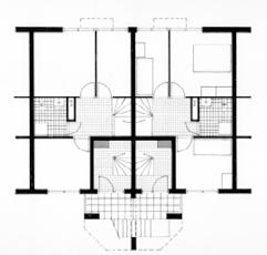
The rear side of the buildings act as the city edge/ city wall where there is no room for gardens. The wall is brought to live by differently sized bay windows (some of which protrude externally from the building), giving the residents a view of the abutting transportation corridor.
130
Protruding bay windows on the ‘city wall’. Plan: Level one Plan: Ground Floor Contextualization Flat roof apartment builing: Front, side and back wall Wager, Hans. 2013. “Nieuwe Houttuinen, Amsterdam –Architektenburo Hans Wagner.” 2013. https://hanswagner.nl/prt/nieuwe-houttuinen-amsterdam/. Accessed 20th Feb 2022 Google Earth, 2022
Accessed
Source: Author Van Der Vlugt, Ger. 2019. “Haarlemmer Houttuinen Housing.” 2019. EUMiesAward (miesarch.com).
20th Feb 2022
131
GWL Terrein
 KCAP
KCAP
DESCRIPTION
A residential area of GWL Terrein is built at the former site of the municipal drinking-water company (‘GWL’). The 6 hectares site is located in the highdensity urban centre of Amsterdam with a strong cohesion characteristic (KCAP, n.d). It is a residential block that marks the edge of the traditional housing neighbourhood of Staatslieden to its east and the business and industry to the west. The site was developed after an appeal for a car-free eco-district by the inhabitants (gwl terrein, n.d). The construction was completed in 1998 for 600 residential units of 29.000 m2
EVALUATION
The GWL Terrein residential block is well responding to the context of the site for being in between the traditional housing blocks and the busy business and industry area. The singularity of its building blocks protects the residential neighbourhood as well as provide openness to its green open spaces.
132
Noviantari
Amsterdam, Netherland
(Source: https://www.kcap.eu/projects/25/gwl-terrein)
SITE
GWL Terrein, Westerpark
(Source: Google Earth)
Location: Central
CONCEPT
• Eco-friendly (concerning four elements of water, energy, waste, and vegetation; aim to reduce water and energy consumption, separate garbage system, use environmentally-conscious building material) and car-free residential area (discourage car ownership and use by ensuring good public transport, optimal attention for cyclists, and the right selection of inhabitants)
• Preserving strong cohesion and high density character while presents as a single, large-scale urban element in its surroundings; preserving historical features of the site
• Open zone with residential blocks in the midst of greenery - an oasis of calm in the metropolitan chaos.
• Access and ownership to gardens and public spaces
Sources: https://gwl-terrein.nl/bezoekers/gwl-terrain-an-urban-eco-area/; https://www.kcap.eu/projects/25/gwl-terrein.
133
After completion of the urban plan in 1993, 10 Architects were appointed including KCAP and Adriaan Geuze from West 8 for the layout design (gwl terrein, n.d). The layout preserves a tower and a few of the historical buildings of the formerly GWL water company. Sketches of final building plans were completed in June 1994 through participatory design with the inhabitants.
The building layout to emphasize accessibility and proximity to the green open spaces.
OPEN SPACE STRUCTURE
Canal
Haarlemmerweg
Public open spaces
Staatslieden neighbourhood
The figure-ground (above left) shows the openness to the green open spaces inside the GWL Ter rein residential block. It also provides flow and direct centrality to the preserved historical buildings and GWL tower as the landmark of the site.
The open spaces correspond with adjacent neighbourhoods and functions (above right). The open spaces take form as public amenities and allotment gardens with proximities and ownership in response to the housing unit typology. The concentrated car park only at the west of the site with shared space prioritizing pedestrians and cyclists at its access is to realize the car-free urban neigh bourhood.
Private owned allotment garden
Car park Community owned allotment garden
134
Staatslieden neighbourhood
garden
space
court public open space
space
Westerpark
Businesses and industry Businesses and industry Allotment
Car park and shared
Sport
Public gathering
Sources: https://www.kcap.eu/projects/25/gwl-terrein.
BUILDING
DESCRIPTION
The GWL Terrein residential block in general consists of three building typologies with a density of 100 dwellings per hectare (KCAP, n.d). The meandering residential blocks that climb up from four storeys building at the south-west to nine storeys building at the north-east, and four to five storeys building that form a park-like setting. The meandering blocks provide nearly 57% of the dwelling and protection to the residential site from the business and industrial activities, the noise of the Haarlemmerweg road, and wind from the west. The building blocks also consist of multi-functionalities such as communal housing, live/work dwelling, community centre and public amenities.
EVALUATION
The multi-functionalities of the building blocks invite diverse communities and allow changing activities through time. It provides an opportunity to make the best use of the space and develop cohesion from the communities.
Sources: https://gwl-terrein.nl/bezoekers/gwl-terrain-an-urban-eco-area/; https://www.kcap.eu/projects/25/gwl-terrein.
135
DWELLING
DESCRIPTION
GWL residential blocks consist of various dwelling units that targeted different audiences with different prices. The range of audiences was agreed in accordance with the vision of a car-free and eco-friendly neighbourhood. The diversity of the unit is also related to the ownership of the garden. The ground floor (level 01) dwelling units mostly has direct proximity and ownership to an allotment garden. The upper floor consists of smaller dwelling units with visual proximity and communal ownership to the allotment gardens. Attention is also given to accessibility via street door as well as an upper-level corridor (KCAP, n.d).
EVALUATION
Careful and coherent attention is given to the dwelling unit design to realize the eco-friendly neighbourhood vision. The luxury of access and ownership to the garden for some units does not neglect an equal provision of public amenities and access to other units’ owners.
1st floor 2nd floor 3rd floor 4th floor 5th floor 6th floor 7th floor 8th floor 9th floor
North elevation
Level 01 plan Level 03 plan Level 07 plan
136
5th floor
4th floor
3rd floor
2nd floor
1st floor
137
Sources:
Block 11 cross section Block 11 and 13 cross section Block 11 level 01 plan Block 13 cross section Block 13 level 01 plan Block 13 level 03 plan
https://www.kcap.eu/projects/25/gwl-terrein.
SPECIFIC: NURTURING SOCIAL COHESION AND ECO-FRIENDLY NEIGHBOURHOOD
Proximity to gardens and public amenities in daily life sustains the eco-friendly neighbourhood with cohesion throughout the generation. Sources:
138
https://www.kcap.eu/projects/25/gwl-terrein.
REFERENCES
gwl terrain. n.d. “GWL terrain: an urban eco area.” Accessed February 21, 2022. https://gwl-terrein.nl/bezoekers/gwl-terrain-an-urban-eco-area/
KCAP. n.d. “GWL-Terrein, Amasterdam.” Accessed February 21, 2022. http:// www.kcap.eu/project/25/gwl-terrein.
139
140
141
142
143
144
145
146
147


156
157
158
159
160
161
162
163
Crest Apartments
Michael Maltzan
Samantha Arbotante
DESCRIPTION
Located in between busy freeways of Los Angeles Valley, the Crest Apartments was created as a new typology of housing in the sea of commercial districts. With its accessible distance to public transportation, the residents of the com plex also have easy linkages to various resources while enjoying the integrated on-site features designed to be a socially sustainable project of its own. (https:// www.swagroup.com/projects/crest-apartments/)
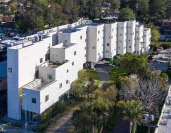
HOMELESS TO PERMANENT ADDRESS
Designed for homeless individuals and disabled veterans, the multi-layered landscape provides a stable space with flexible opportunities for its residents to gather in their own community spaces. The introduction of bioswales in the open areas such as the parking, permeable pavers, rainwater systems, and drought resistant plants and trees had promoted its features towards achieving the LEED Platinum award. (https://www.morleybuilders.com/project-experience/ crest-apartments/)
164
© Jonnu Singleton, n.d.
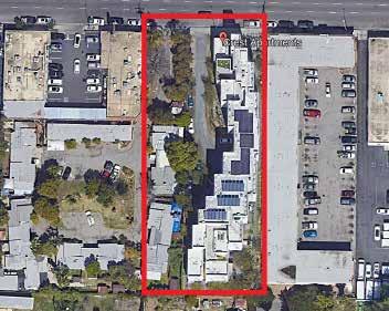
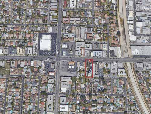
SITE
© Google Earth, 2022
© Google Earth, 2022
Los Angeles, California, United States
CONCEPT
BREAKING THE EXISTING URBAN TISSUE
Among the rows of commercial establishments with massive portions alloted for parking areas (1), the Crest Apartments provides new access for a break through to the main road for the dwellers living behind the project. The com plex provides ample green spaces for usage.
CHANGE OF VOLUMES
This project distinguishes itself from the rest with its volumetric design, a new sight against the common two to three floor heights of buildings in the area (2).
INSIDE COMMUNITY
Through the length of the project, various accessible spaces found in the ground floor were introduced to create a supportive environment for its users (3).
165
(1) Surrounded with parking areas in light gray shade
View
© Adapted from Google Earth, 2022 © Google Earth, 2022 (3)
from the side of the complex (2) View from the front of the complex © Cooper Hewitt, 2022
SITE
HOLDING DENSITY OF PEOPLE AND WATER
Porosity throughout the entire site is one of the main features of this project. Due to its location and events of frequent drought, the designers of the project had opted to enhance the entire landscape through use of permeable pavers, drought resistant trees and plants, and the introduction of two bioswales. Not only does this project contain the load of its residents but also retain and sus tain the lack of water in the site.
EVALUATION
Empowering the softscape in the site had made this project standout from the rest of housing apartments in the site. Allowing nature to be the main driver of light, ventilation, and movement had improved the quality of the environ ment.
166
© Michael Maltzan Architecture, 2016 © Michael Maltzan Architecture, 2016 Bioswales Softscape Vehicle Traffic Flow Pedestrian Traffic Flow Porosity of whole site
BUILDING
BALANCE OF PRIVATE AND PUBLIC
The long corridor of the Crest Apartments divides multiple of spaces for the residents and visitors. Public spaces such as the sheltered courtyard with tiered terraces, residents’ lounge (2), community kitchen (5), laundry room (8), con ference room (7), social service offices (12), health clinic (11), and an outdoor community garden (18) are shared to the building occupants.
EVALUATION
Comparing with the general housing projects which are either private owned buildings or by the government, the Crest Apartments had an image of sus tainable as a community of its own because of the numerous spaces alloted in the design.
167
Adapted from Maltzan Architecture, 2016
© David Lloyd, n.d.
Public Spaces Private Spaces Building Typology: Spaces Ground Floor Plan (Not to scale)
INCLUSIVITY IN UNITS
In the four levels of the apartments, a total of 64 units were allotted for the beneficiaries. Since the project is located in a postwar area and dedicated also for disabled veterans, special units were specifically designed to cater these people; among these are 6 accessible units, 4 units for people with mobility problems, and 2 units designed for people with hearing/vision problems.
EVALUATION
Providing healthy homes is one of the main goals of the designers. As most of the units are located at the southern part, this inhibits privacy to its users. It is also seen that Inclusive Design was part of the concepts of the studios as seen through the various designs and options. Along with these features, natural lighting, large windows, natural and cross ventilation, and views of the city were projected in the design to make the space more liveable.
168
Roof
All plans adapted from Maltzan
2022 © Michael Maltzan Architecture, 2016 Top: Studio 1, Bottom: Studio 2
DWELLING Second Floor Plan (Studio 1: Green shade and Studio 2: Light Green shade) Third Floor Plan Fourth Floor Plan Fifth Floor Plan
Plan
Architecture,
169
Typology: Studio 1, Studio 2, and Manager’s Studio
Studio 2 Studio 1 Manager’s Studio Studio 1 Building Typology: Volumes All plans adapted from Maltzan Architecture, 2022 Studio 2 Studio 1 Studio 1
SPECIFIC: TYPOLOGY Dwelling
Pilotis
Housing Development and Remodeling Pflegi-Areal
Gigon / Guyer Architects
Frank BAGENZI
SITE
DESCRIPTION
The project was designed from the existing building ( former hospital ‘Pflegerinnenschule Zürich’) it is a mixe use project. The existing and newly constructed buildings have different functions: offices and housing. Former hospital wards were converted into offices, and some other spaces were replaced by housing. The goal was to retain the spatial character of the large-scale facility. Simillar to the former hospital building complex and the neighboring buildings.
EVALUATION
The project show the improvement in term of new design approches that in tergarte open spaces with the built enviroment. The housing part of the project boost the neigborhood and the design charactors matches the surrounding neigborhood and context in general.
Zurich,
170
Switzerland
Pflegi Areal
Location
•
Kepping the charactor of the existing neigborhood
• Forming and defines three large exterior spaces: the garden, the samaritan court, and the carmen court.
• Form a hybrid ensemble between a closed block development and individual building volumes.
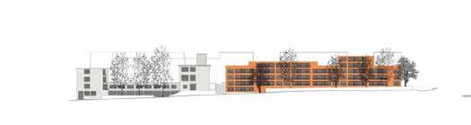
• Site adaptation considerig the existing topography
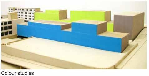
• The use of colors to bring modernist aspect of the project, Colors applied in the form of mineral based, highly matt pigments con trast without the big impression, to express the architectural lan guage.
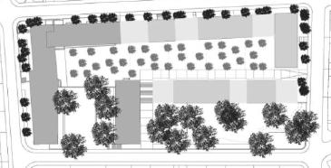
171
CONCEPT
Slope Adaptation
Arrangement based on main courtyard and open spaces
SPECIFIC: OPEN SPACE STRUCTURE
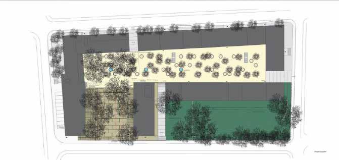
Common court yard, The carmen court.
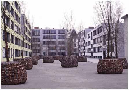
The garden, Kids playing area
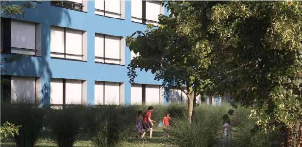
172
Samaritan court.
SPECIFIC: CIRCULATION SCHEME
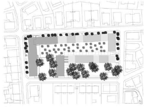
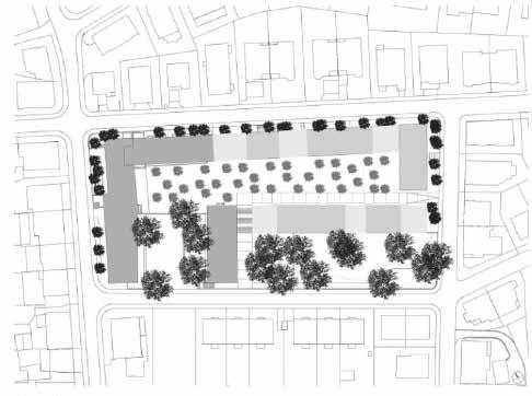
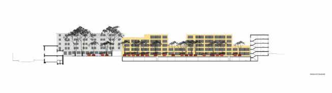
173
Vehicle Traffic
Pedestrian Traffic Excluding Cars from the Main Spaces
DESCRIPTION
Several apartments have exterior spaces in the form of terraces. They possess freshair space, also called a seasonal room. It transforms into an open loggia in good weather. An underground parking layout, accessible from the samaritan court yards, separates vehicular mobility to pedestrians within by intragated open space. Window openings provide the apartments with enough daylight and a sense of space. This gives the apartments and existing buildings a pragmatic urban air. The free circulation was achieved by placing the ancillary and service spaces at the center of the apartments.
EVALUATION
The building form is well adapted to the slope, allowing easy access for both pedestrian and vehicular circulation. The form provides spaces for different puporses as for offices and residentiaon connecting them to the central court, and providing the court that lead to the garage.
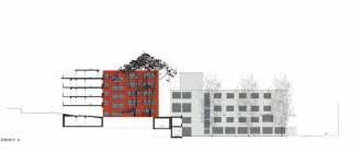
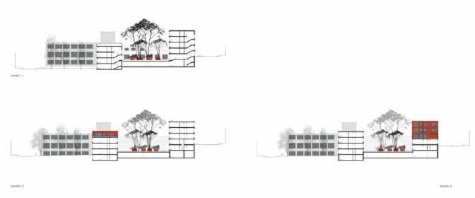
174
BUILDING
SPECIFIC: TYPOLOGY
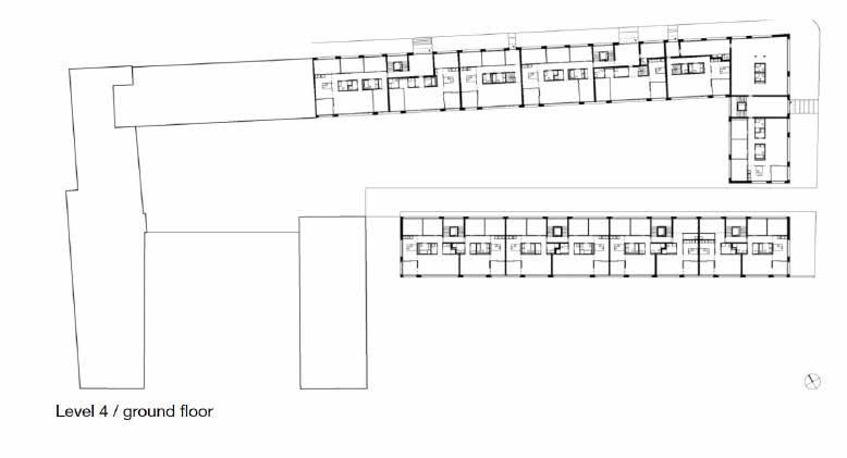
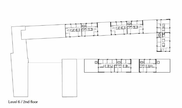
175
DWELLING
DESCRIPTION
The project housing in the newly constructed buildings has single level apart ments with open floor plans. 48 apartments with 22 different floor plan types offer 2 to 6 rooms. Ground level apartments and work studios are connected with the courtyard. Many apartments have exterior spaces in the form of ter races.
EVALUATION
The housing project gave a variety of apartments and units. It provided an clear balance to built environment and open space. and the upper units have the terraces that connect them to outside enviroment.
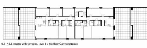
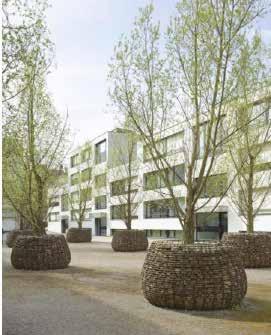
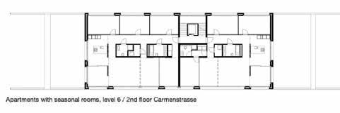
176
SPECIFIC: TYPOLOGY
Dwelling adaptation to site
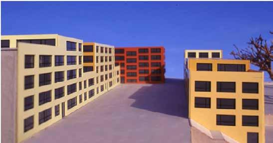
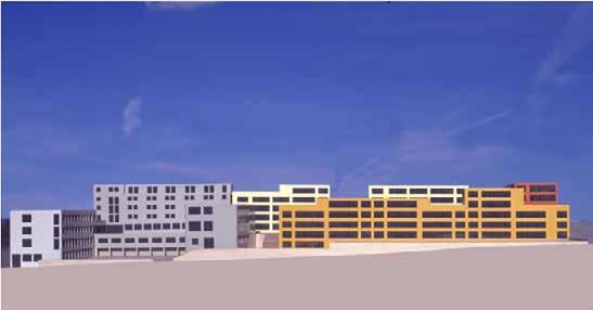
Dwelling Typology
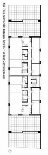
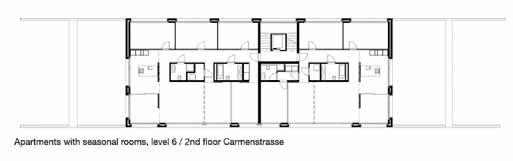
177
Quartier Massena
 Atelier Christian de Portzamparc
Fatma Ben Hfaiedh
Atelier Christian de Portzamparc
Fatma Ben Hfaiedh
178
Photos of buildings in Quatier Massena.
Source : atelierba3.files.wordpress.com
DESCRIPTION
The district is built on the edge of the Eastern part of La Seine River. The plot is flat and surrounded by a very dense urban fabric. Taking the form of open blocks, the project is fragmented rather than a unique urban volume resulting in a new fabric. Mass porosity in a dense fabric characterize the district. A separation between public street and private open spaces is implemneted through by fencing that follows the building line of the urban block.
EVALUATION
To host multiple activities, the open block concept allows variation on a district scale, by open street and detached masses. This frame allows to create porosity in the layout of the building. The installation of the building volumes can be done according to a multitude of combinations. With time resident gradually closed the crossing, delimiting each block. Creating a connection between certain functions in urban space cannot simply be an open space.
179
Paris 13eme, La Rive Gauche, France.
SITE
Location: Edge
Quartier Massena on La Seine River.
Quartier Massena Project Axonometric View
Source : www.christiandeportzamparc.com Source : Google Earth Source : Google Earth
CONCEPT

• Open Block
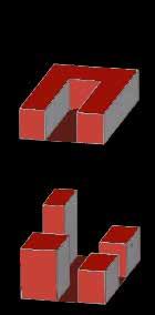
The open block concept introduced by Christian De Portzamparc in the his urban typology doctrine is the main character of the project. Fragmenting masses in each block to act independently but in the same network system. The Typology allows the street to open to the internal private open space.
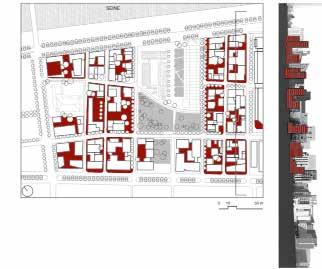

• Diversity
The Discrit open the city to host and gather multiple activities, such as housing, offices, commerce and a university within a dense city. Diversity is also translated in the urban architecture of the project by divers form of volumes and textures as the architects used the design freedom provided them to design totally different buildings.
• Green spaces
The blocks internal spaces are planed gardens that creates biodivers continuity with the public park in the project. These spaces benefit also the built volumes with sunlight exposure.
180
Source : www.christiandeportzamparc.com
Edited by author Source Author
Source Author Circulation/Porosity in open blocks
The diffrent volume heights allows Source : atelierba3.files.wordpress.com
Edited by author
The Mater plan and section of Quartier Massena
Open block concept by Christian De Portzamparc
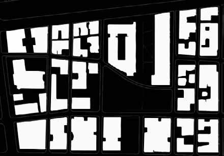
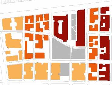
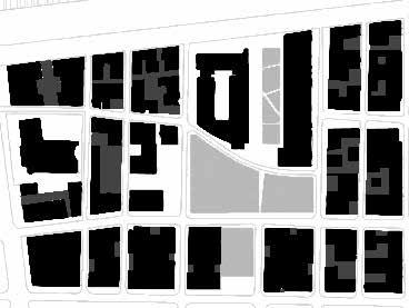

181 SPECIFIC: SPACE STRUCTURE Built / Void Diversity in functions Gradient: Public (light)Private (dark)
SPECIFIC: CIRCULATION SCHEME
Source : atelierba3.files.wordpress.com Edited by author
Hard mobility / orthogonal network
Source : atelierba3.files.wordpress.com Edited by author
Pedestrian mobility / organic network
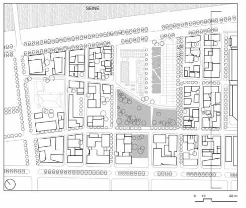
182
BUILDING
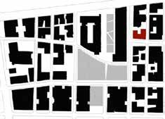
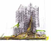
DESCRIPTION
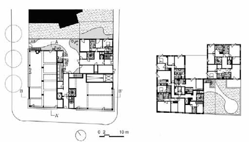
Developing its autonomy, its identity and its difference, Logement Zac Mas sena project is part of a larger whole, that of the new Masséna district, in the 13th arrondissement of Paris, and therefore participates with rigor and elegance in the urban ambitions programmed here. Each construction is an additional milestone in this piece of “Age III” city.
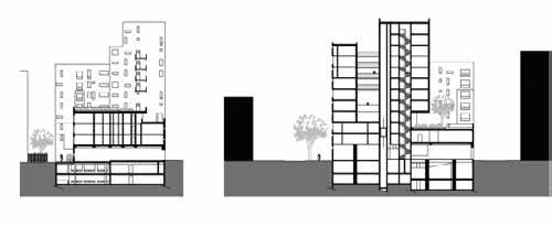
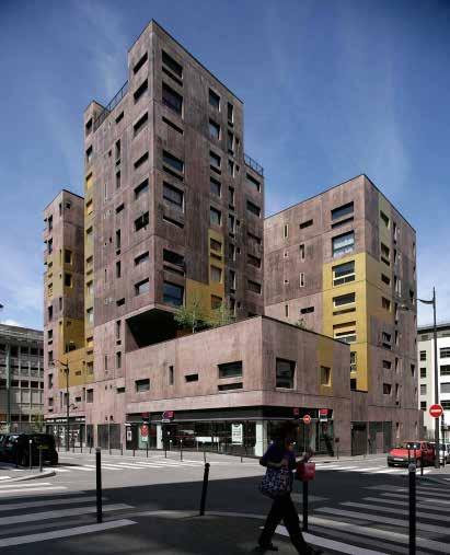
EVALUATION
At the crossroads of different axes of circulation, this sculpture imposes its density by its deep and dark mass and its mathematical play of openings. An iridescent ribbon binds all the studs that make up this plot of land. Ornamen tation is prohibited and the omnipresent nature is found in an unusual way both on the ground floor and on the roofs of the different volumes by the grace of trees of high stems.
183
B-B Section A-A Section
Zac
Source : Author project
Source : aldricbeckmann.fr/work/logements-zac-massena/ Source : atelierba3.files.wordpress.com Edited by author
Source :
aldricbeckmann.fr/work/logements-zac-massena/ Logement
Massena
DWELLING
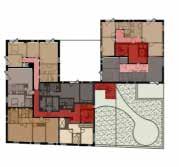
DESCRIPTION
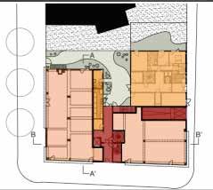
The building has 12 levels and organizes 3 different functions, social hous ing apartments, commercial spaces, and underground parking. Hosting 47 settlements, 40 apartments, 5 duplexes, and 2 studios, on a total surface of 4850 m2, the building is very dense yet every apartment is exposed to sunlight. Commercial spaces are located on the ground floor and the first level. The building has 3 main entrances and separation between public and private circulations.
EVALUATION
The architects sculpted the volumes of the building with maximum of opening and a dynamic of volumes like a lego to keep the quality of the spaces.
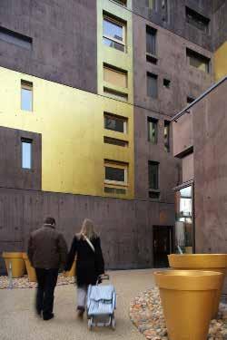
184
: aldricbeckmann.fr/work/logements-zac-massena/
: atelierba3.files.wordpress.com
author Source : atelierba3.files.wordpress.com Edited by author Building circulation Private circulation Utilities Parking Green space 3 Bedroom 2 Bedroom Duplex Studio
Source
Source
Edited by
The housing private entrence of the building
SPECIFIC: TYPOLOGY
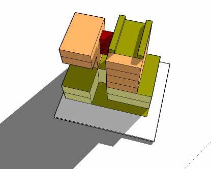
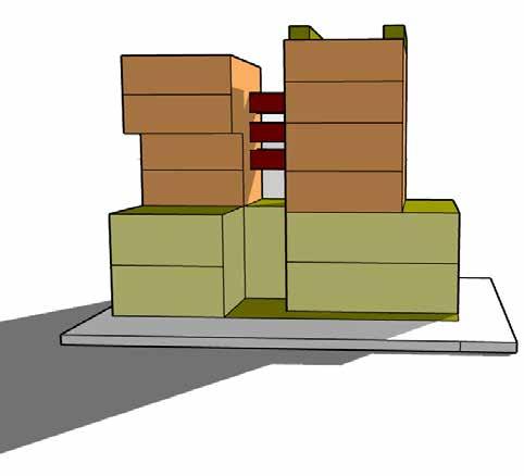
185
Author
Source :
Clock Tower
San Francisco
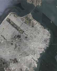 Hu
Hu
DESCRIPTION
The Clock Tower Building Lofts situated in the heart of the city’s South Beach neighbor hood. The four-story, 3,000-square-foot apartment was originally constructed in 1907. Back in its heyday, the home was part of a lithography company’s headquarters—the larg est on the West Coast at the time. The unit was built as an artist’s studio of sorts, where designers could go to complete projects in privacy, and with an abundance of natural light.
The Clocktower was a seminal project in a city that was ready for loft buildings and unit types. Its location in a walkable neighborhood a short walk from the financial district and an even shorter one to South Park-asmalland lively square surrounded by an interesting mix of building types and uses-greatly benefits the project.
186
Yue
La Sang, Al Coi
SITE
San Francisco
CONCEPT
• San Francisco’s urban development strategy -- compact development and spatial coordination
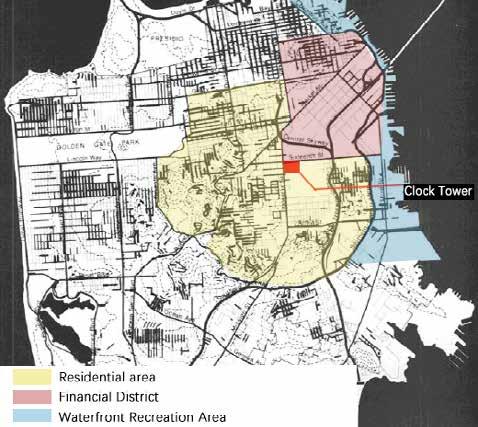
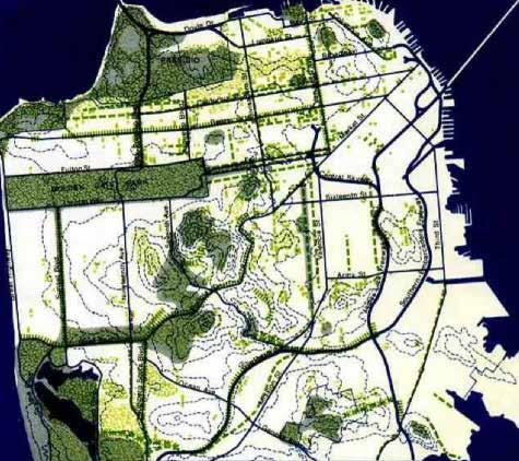
• Urban street narrows at the intersection as a landscape area
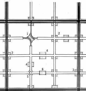
• The site is located at the junction of the financial district and the resi dential area - functions that require living/working
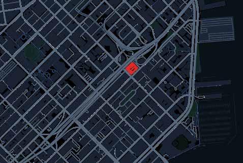
187
SPECIFIC: OPEN SPACE STRUCTURE
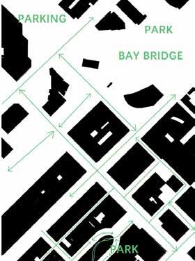
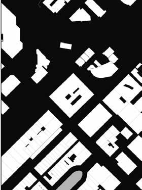
188
Inversed Figure Ground
Gradient: Public (light) - Private (dark) Porosity
SPECIFIC: CIRCULATION SCHEME
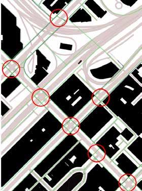
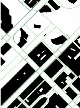
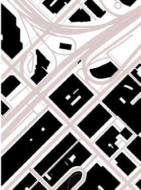
189
Vehicle Traffic
Pedestrian Traffic Points of Superposition
BUILDING
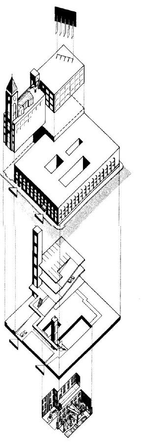
DESCRIPTION
The update of the project mainly meets the functional needs of different spaces by placing three landscape courtyards and creating unique units around them.
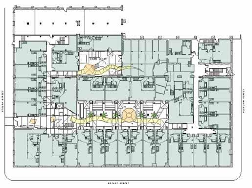
The circulation of the space is controlled by the circular corridor, and the pri vate rooms and landscape spaces are connected, so as to achieve the possibility of distinguishing between public and private spaces.
EVALUATION
The project has strong social adaptability. The spatial attributes contained in its functional logic can be summarized as “connectivity”, “mystery”, “open ness” and “separation”. The mix of public space and private space, flexible space, and flexible lifestyle give the clock tower more possibilities.
190
SPECIFIC: TYPOLOGY
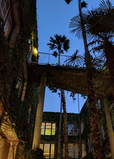
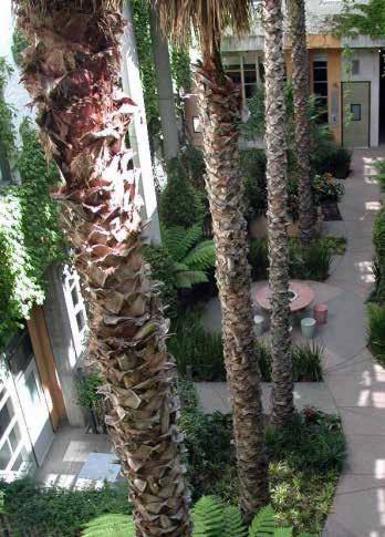
191
Courtyard view from 2nd floor
Courtyard view.
LIVE-WORK HOUSE
DESCRIPTION
The concrete, brick, and timber structure was renovated into 127 live/work lofts resulting in a rich variety of unique unit types particularly suited to the emerging lifestyle of home offices and electronic commutes.
Home sizes at the Clock Tower Building Lofts begin at about 500 square feet and range up to about 2,500 square feet. Homes are available in studio/loft, one, two and three-bedroom layouts. No two units are same, so the space is varied and interesting.
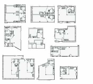
EVALUATION
Renovating the Clock Tower into a live-and-work use building with lofts that can be used for either residential or commercial purposes, this flexible renova tion model brings more vitality to the space. Withing a large scale housing sys tem each unit is unique and ‘personal’. Collective housing succeeds in meeting the need for individual differentiation and intimacy.
192
Staircase at main entry
Different working/living units 1
Featuring original brick and concrete walls and exposed structural beams, creating an industrial aesthetic that harkens back to the tower’s origins.
Different working/living units 2
A library and kitchen also occupy this floor, but the showstopper has to be the spectacular, 1,300-square-foot, wraparound deck, which serves up panoramic views of the city.
193
Malagueira Quarter Housing
Alvaro Siza Vieria
Mazen Jubeihi
EVORA, PORTUGAL
DESCRIPTION
The project proposes a different approach to mass housing in Evora, contra dicting the high-rise approach with one that favours the landscape. The project creates a new edge condition by situating housing units along the western edge of the town,it comprises of 1,200 housing units based on 10 different typol ogies. The project is inspired by different elements found in the landscape of Evora, from the Prata arches that inspired the eleveated conduits in the project to the settlement patterns that guided the orientation and placement of the project in relation to the urban fabric of the town.
EVALUATION
The project created a new urban condition on the edge of Evora, however, it did not impose a new spatial structure to the city, it rather adapted to the existing spatial structures and borrowed from the landscape and traditional built fabric to produce a project that is adaptable. It managed to create a housing project that fuses with the fabric of the city and spreads over the landscape instead of concentrating the housing in multi-story blocks.
194
Evora, Portugal
Source: www.area-arch.it/en/malagueira-district-complex/
Source: Google Earth
Location: Edge
CONCEPT
• Maintain a relationship to the encompassing landscape and existing fea tures of the site. The project is built upon regular notions of borrowing and adapting to the landscape.
• Maintaining a low-rise quality to the structure in order not to affect the city’s fabric
• Particapatory approach by working with future inhabitants of the project and altering the designs according to their needs.
Section
Source: Author based on section from https://portuguesearchitectures.word press.com/siza-vieira/1977habitacao-social-quinta-da-malagueira-evorapt/
Base map from https://www.architectural-review.com/essays/revisi ting-siza-an-archaeology-of-the-future
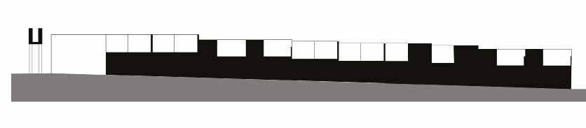
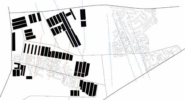
195
Project in relation to exisitng built fabric of Evora
SPECIFIC: SPACE STRUCTURE
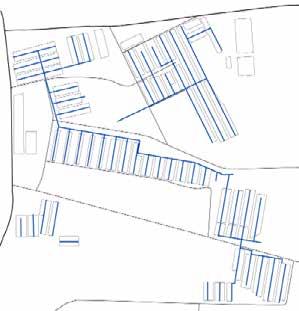
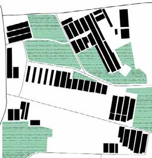
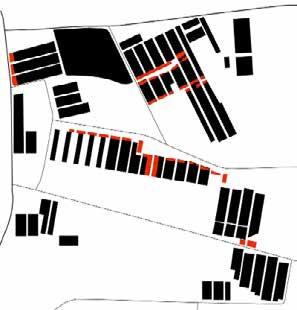
196
Commercial Spaces Open Spaces Above Ground Conduits Connections
SPECIFIC: CIRCULATION SCHEME
Porosity and Connections
Points of Super Position
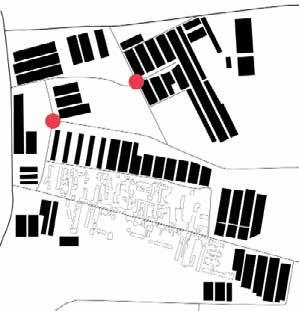
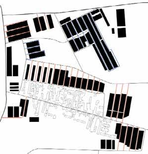
197
BUILDING
DESCRIPTION
The units are based on the 8 X 12m plots in the site, where the strips which contain two sets of houses would be 24m wide with varying lengths. Each unit maintains a separate entrance to the main street, giving the living quality there an independent feel, this is further enabled by adding a separating wall and patio in the front of each units. The blocks do not have an imposing feel on the landscape, they are not massive and are restricted to two stories high.
EVALUATION
The design maintains an equal right in accessibility to the main streets, it deals with the landscape efficiently adapting to the medium inclination of the streets of Evora. The row-housing typology cuts the cost of construction and is suitable for the elongated streets of the city, whereas a single strip containing 30 units would span over 150m as illustrated on the side. The same street would often contain houses of the same typology, while the start/end of each strip would provide a parking structure, which proved to be much needed in current times.
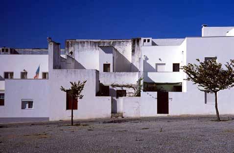
The addition of the above-ground conduits gave the project a unified sense of being as the structure stretches over the entirety of the project, it further goes along the idea that the project is a new adaptation of the city’s fabric and elements in a new light.
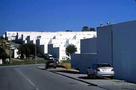
198
Block Typology Source: https://portuguesearchitectures.wordpress.com/siza-vieira/1977habitacao-social-quinta-da-malaguei ra-evorapt/
SPECIFIC: TYPOLOGY
Block Arrangement
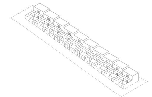
Block Arrangement in relation to Topography Source: Author
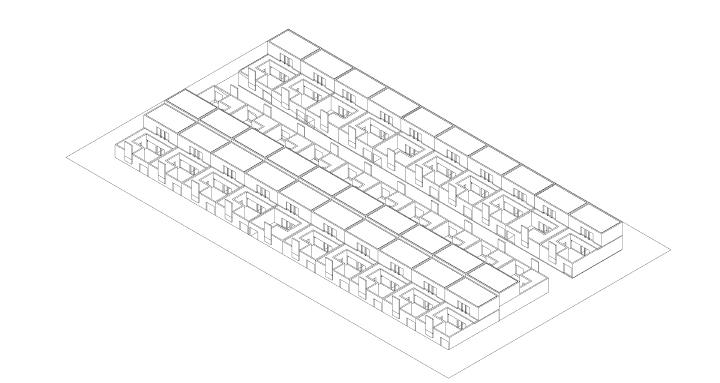
199
DWELLING
DESCRIPTION
The program of the project provides 10 different typologies for housing struc tures. The typologies range from a one bedroom, one story-high structure to a 4 bedroom, two story-high structures. They cater to small families with the types 1 and 2, and to mid size to large families with types 3 to 5. The buildings are all cladded in white stucco with minimal landscaping taking place in the front patios.
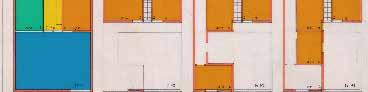
EVALUATION
The different typologies presented at the site create a wide variety of options that accommodate the different needs of the communities to be housed in this projects. The designs seem to promote privacy as they are often separated from the main street with a windowless wall and a private open space. The prgama tist spatial layout of the units’ reflects the particapatory approach undertaken, which enabled the citizens to work with the architects on the spatial configuration of the different typologies.
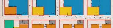
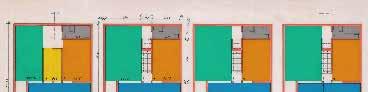
Source: https://portuguesearchitectures.wordpress.com/siza-vieira/1977habitacao-soci al-quinta-da-malagueira-evorapt/
200
Type 1 + 2 Type 3 Type 4 Type 5
Source: author based on plans from: https://www.architectural-review.com/essays/revisiting-siza-an-ar chaeology-of-the-future?tkn=1
SPECIFIC: TYPOLOGY
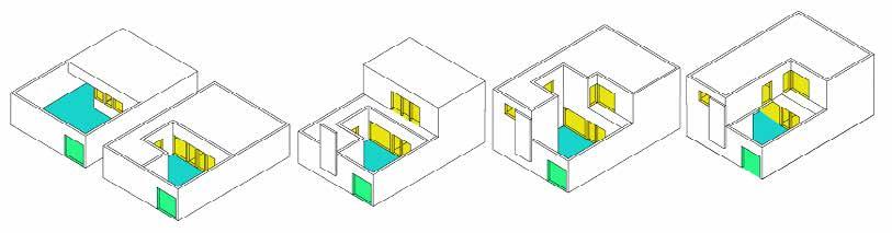
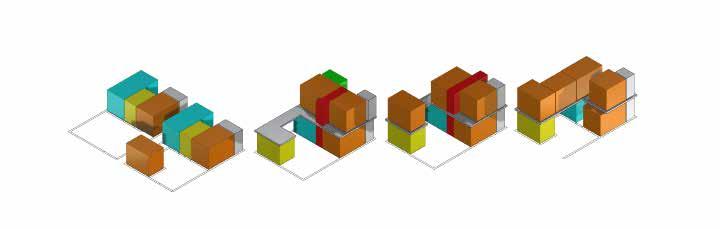
Source: Author
Source: Author
201
Opening and Patio Typology
Program Typology Bedroom Openings Patio Kitchen Storage Entrance Living Room Circulation Bathroom
‘t Pandreitje
 Haverhals - Heylen
Kshitij Makhija
Haverhals - Heylen
Kshitij Makhija
DESCRIPTION
The city of Bruges takes custody of the Pandreitje’s land in the 1980s. Since the 17th century, the Bruges jail has been located here. The site has 80 homes took up 0.75 hectares of land, is next to Astrid Park, a beautiful natural space. Haverhals - Heylen created a peaceful residential enclave right near to the bus tling historical and tourist district. They were able to create so many dwellings on the plot while keeping the plot reasonable by developing diverse typologies within a stamp of 10 out of ten.
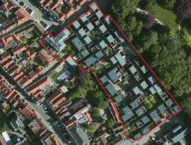
EVALUATION
This neighbourhood development project around urban living creates a con trast. City dwellers seek for single-family houses in rural locations that are both roomy and affordable. While high density, such as a hundred dwellings per hectare, necessitates compactness, especially if a stack is not an option. A ten-meter-by-ten-meter grid is the key to the complicated design which was used at the time of designing.
202
Bruges, Belgium, Source - Google Earth
‘t Pandreitje, Bruges, Source - Google Maps
SITE
‘t Pandreitje, Bruges, Source - https://architectura.be/nl/projecten/20517/pandreitje
CONCEPT
• Adding contemporary dwellings to a bustling historical tourist destination
• A sense of belonging
• Comaparable facades with a minimalist aesthetic
• The urban infill has an accelerating effect that is both universal and progressive.
• Streets and buildings have a correlation.
• The residential enclave attaches to the surrounding tissue.
• 10m x 10m grid
• Circuit housing instead of stack housing.
• Compact living on a human scale.
Pandreitje 3D Model, Retrieved from - https://in.pinterest.com/pin/449937818993249795/
Pandreitje Exterior Visual, Retrieved from - https://fr.foursquare.com/v/t-pandreitje/4e0ef63b 814d61a707003e99
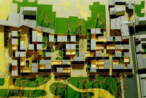
203
SPECIFIC: OPEN SPACE STRUCTURE
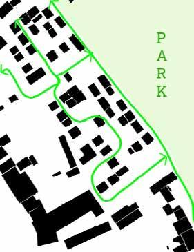
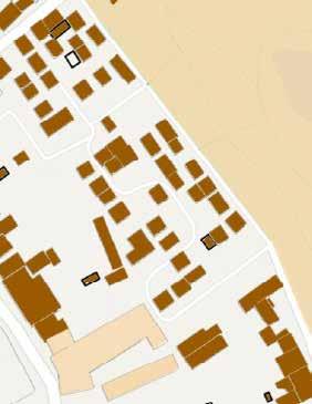
204
Figure Ground Map Gradient: Public (light) - Private (dark) Porosity
SPECIFIC: CIRCULATION SCHEME
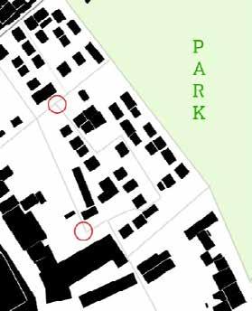
205
Vehicle Traffic
Pedestrian Traffic Points of Superposition
BUILDING
DESCRIPTION
The outdoor areas are arranged in a grid. There are nine patio homes in all, arranged in a row. The intersection of these nine clusters is the cre ation of a public outdoor place in the shape of alleys and squares abound. The concept of subterranean parking spots has come to fruition, the en clave’s whole public space allocated for the road user who is most vulnera ble, and emergency services are available. One lengthy roadway weaves its way through the neighborhood. The residences and squares that run paral lel to each of the five streets. One of the cross streets connects on an exist ing alley and the rest ends up dead garden walls of surrounding buildings
EVALUATION
The squares between several houses have a walled-off or closed-off feel about them. Despite the fact that the enclave is well-fitting, but not in terms of a smooth connection. This is understandable since a jail, by definition, isolates itself from its surroundings.
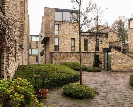
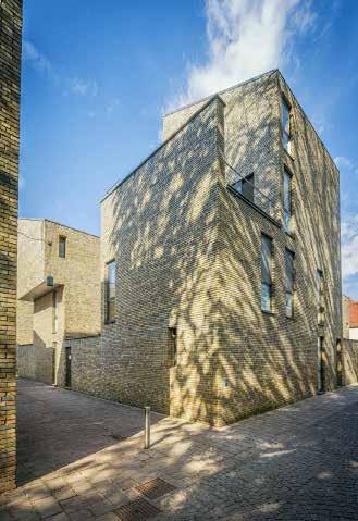
206
Exterior View of housing, Retrieved from - https://www.standaard.be/cnt/ dmf20200127_04823686
Exterior View of housing, Retrieved from - https://www.visitbruges.be/nl/woningen-pand reitje
SPECIFIC: TYPOLOGY
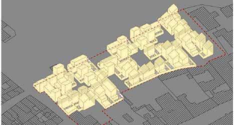
207
Building Typology
DWELLING
DESCRIPTION
So many dwellings on the plot while keeping the plot reasonable by devel oping diverse typologies within a stamp of 10 out of ten. The typologies are created in such a way that they can be put next to one other at random. The houses are built as patio houses, which is a requirement since people believe that everyone deserves at least one private outside area. On the ground level, some residences may have a garden, while others would have a terrace on the first or second story. The most logical residences feature a garden that con nects the ground-floor living area with the night zone. A portion of the living room is sometimes doubled in height, with a mezzanine serving as a second sitting area. There are also one-bedroom apartments on the same floor as the two-bedroom flats.
EVALUATION
The volume game of the typologies circuit appears to be medieval. Small cantilevers, sloping roofs (Bruges’ urban planning standards only allow flat roofs if they are utilized as a terrace), and an apparent organic layout all help to achieve this. Haverhals-Heylen had a yellowish brick created just for them, which is extremely close to the old stone used in many Bruges structures. This stone was not constructed in accordance with the rough and huge impression left by the walls.
Interior of a dwelling, Retrieved from - https://www.booking.com/hotel/be/design-apart ment-pandreitje-brugge.en-gb.html?activeTab=photosGallery
Interior of a dwelling, Retrieved from - https://www.booking.com/hotel/be/design-apart ment-pandreitje-brugge.en-gb.html?activeTab=photosGallery

208
SPECIFIC: TYPOLOGY
Type - 1 Type - 2
Type - 3 Type - 4
Dwelling Typology
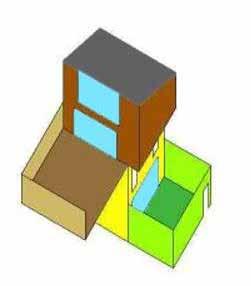
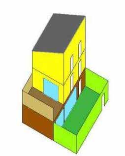
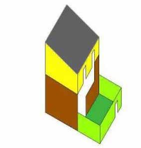
209
Formosa1140
Lorcan O’Herlihy
Architects
Arthur Van Lint
SITE
DESCRIPTION

The city of Los Angeles and its surroundings are known for its severe lack of urban public space. In the case of West Hollywood, which is saturated with multi-family housing, only one percent of the total land is allocated to pub lic parks. With their design for Formosa1140, Lorcan O’Herlihy Architects (LOHA) radically respond to this shortage by parceling out one third of the private building site as a publicly-managed pocket park.
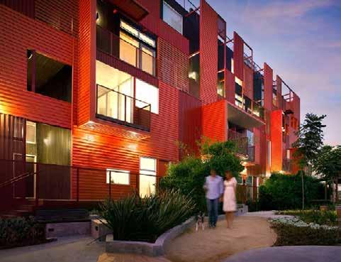
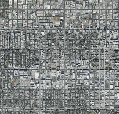
EVALUATION
Formosa1140 serves as a catalyst and replicable prototype for increasing the amount of urban public space in West Hollywood. Following the project’s suc cess, several other new public open areas have contributed to the revitalization of the city.
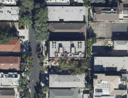
210
Hollywood, California, United States
Formosa1140, West Hollywood
Location: Central
© Lawrence Anderson, LOHA © Bing Maps
© Bing Maps

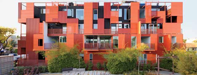
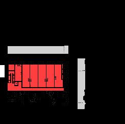
211
CONCEPT
© Lawrence Anderson, LOHA
212
PUBLIC-PRIVATE
form
map (public space)
SPECIFIC:
Built
Nolli
213
REPLICABLE
SPECIFIC:
PROTOTYPE
Nolli map (public space): replicable system
Nolli map (public space): replicable systems can work together
BUILDING
DESCRIPTION
The building consists of eleven housing units, which are all similar duplexes except for one four-story unit on the western corner of the building. In terms of circulation, the lower dwelling units have their entrance in the public pock et park, whereas the upper dwelling units have their entrance on a passerelle on the second floor - accessible by al elevator and stairs located at both ends of the building. Every unit also contains an outdoor terrace that serves as an inbetween space between the private dwelling and public park.
EVALUATION
By fitting six elongated housing units next to each other over the whole length of the building, every unit is able to have a facade in the public pocket park, with which a unique public-private interaction is established. On top of the “inbetween” terrace spaces, the careful placement of perforated metal plates in the facade orchestrates a play of light and sight between private and public.
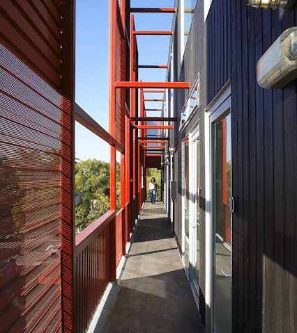
214
Ground floor
First floor Second floor Third floor
© Lawrence Anderson, LOHA
SPECIFIC: PUBLIC-PRIVATE
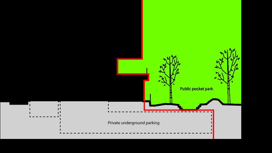
215
DWELLING
DESCRIPTION

Within the duplex units, there is a clear divison of day and night functions. Day functions take place at the level of entrance (ground floor or second floor), while night functions are located upstairs in every dwelling unit. Both levels are connected through a vide, making part of the living room double-high. This vide also helps to seperate the outdoor terrace from the private housing unit and make it feel more like a part of the public pocket park.
EVALUATION
The rectangular housing units are designed flexibly and could be converted to either one, two or three-bedroom houses. A point of critique is that - in the basic setup of two bedrooms - the outdoor terrace has to be accessed by cross ing one of the bedrooms.
216
© Lawrence Anderson, LOHA
© Lawrence Anderson, LOHA
Ground floor First floor
SPECIFIC: DUPLEX
217
Hotakubo Housing
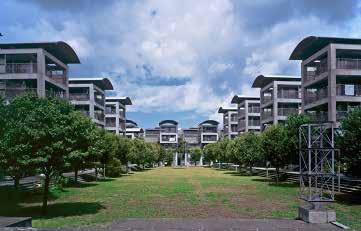
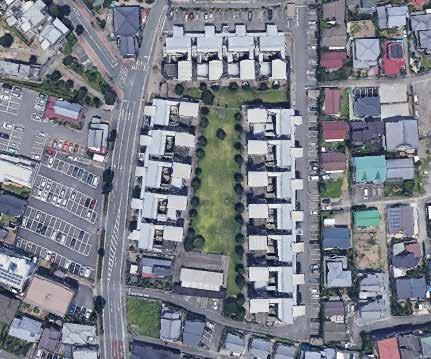
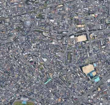 Yamamoto KUMAMOTO, JAPAN
Agnes Ayesiga
Yamamoto KUMAMOTO, JAPAN
Agnes Ayesiga
DESCRIPTION
Hotakubo Housing attempts to create a social unit larger than that of an in dividual house. 110 apartments are arranged around a central courtyard that can only be accessed by passing through one of the apartments. The 110 units are divided into three buildings – an east building, a west building, and a north building – and the buildings are in turn divided into blocks. There are 16 blocks in all, and each block contains five to eight units. Each block has two stairways, one on the front access side and the other on the central open space side. Using these two stairways, anyone living in that block is free to go through his or her unit and on down to the central open space. That is, each unit serves as a gateway to the central open space.
EVALUATION
The project demonstrates an innovative alternative to conventional social housing in Japan. A collective courtyard is introduced as the major structuring device around which 110 apartment units are organized. The way the units are arranged - so that the central open space is accessed through the units- creates this closed central open space and the units serve to cut off the central open space from the outside world or to connect it.
218
La Sang, Al Coi
The central plaza. http://www.riken-yamamoto.co.jp/index.html?page=ry_proj_detail&id=41&lng=_Eng
Location: Central
CONCEPT
- threshold ( devices that create spatial units)
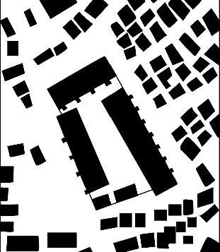
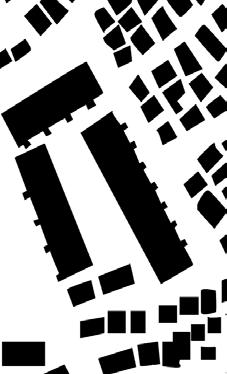
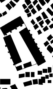
- collective space as a fundamental design theme
- nclosure from the outside world and exclusive use of the courtyard by the residents
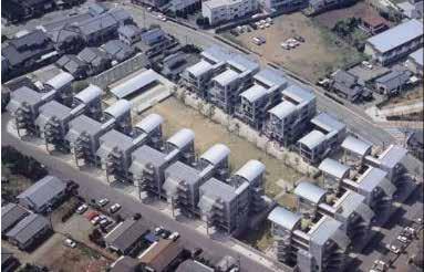
219
Aerial view of the Hotakubo housing project. Source-Google earth
SPECIFIC: OPEN SPACE STRUCTURE
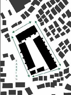
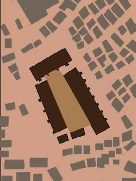
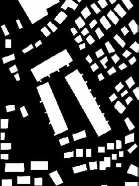
220
Inversed Figure Ground
Gradient: Public (light) - Private (dark) • Porosity
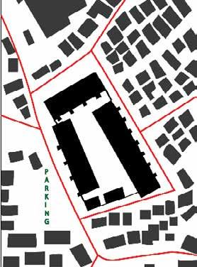
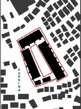
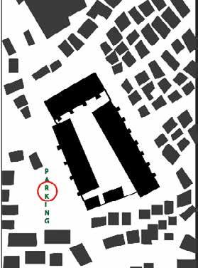
221
SPECIFIC: CIRCULATION SCHEME
Vehicle Traffic
Pedestrian Traffic Points of Superposition
BUILDING
DESCRIPTION
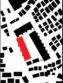
The plan for the Hotakubo Housing complex of 110 apartment units proposes a new system for assembling dwellings. The basic composition is comprised of three apartment blocks and an assembly hall sourroung the central plaza. The difference between this and ordinary garden style apartment buildings is that no access to the central plaza is provided directly from the outside. Every residential unit has two stairways. One is for access from the side of the surrounding road, the other leads to the court. The residences are the “shikii (threshold)” to the court. The courtyard staircases leading from each unit also provide access to common roof terraces. Family rooms face the central court and are made as open as possible, and the courtyard itself, rather than being merely an open space, has positive meaning as a place for living.
EVALUATION
The project is recognised as an exemplary public housing project because of the design if the units with a flexible interior, the positioning of the more pri vate functions on the street side and the more public ones having a dailogue with the central plaza, the inclusion of two staircases that provide an alterna tive entrance per unit, etc.
222 Staircase arrangement : https://misfitsarchitecture.com/2021/02/07/architecture-misfit-40-riken-yamamoto/ PLAN- TYPE D SECTION Private room/ Bedroom Bathroom Living/dinning room/ Kitchen Terrace Bridge
SPECIFIC: TYPOLOGY
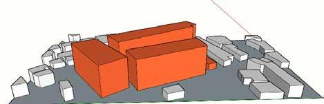
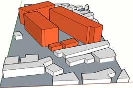
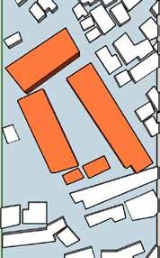
223
Building Typology
DESCRIPTION
This project has an arrangement – a central open space that is a private space closed by 110 thresholds, and units that are each directly connected to the outside world – that is the complete opposite of the conventional collective method and is intended to organise a collection of 110 units into one larger, complete unit. The building is made up of 5 floors with four(4) types of dwellings according to the floor plan arrangement. Type A( living room/dinning/ kictchen and the private room/bedroom), Type B(private room/bedroom, court, living room/dinning/kicthen,terrace), Type C( Private/bedroom, living/ dinning room/kicthen, terrace, bridge, and Type D(Private/bedroom, living/ dinning room/kicthen, terrace and the bridge.
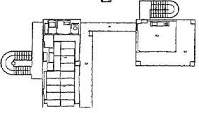
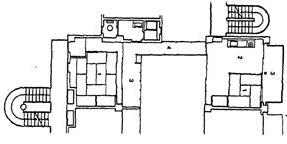
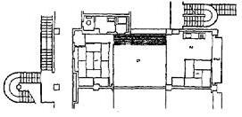
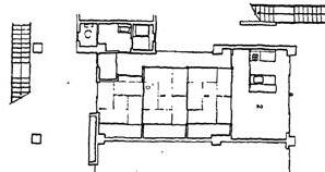
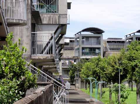
EVALUATION
The project accomodates traditional qualities of the Japanese dwelling culture like the open plan layout that allows for maximum flexiblity and the particular roof shapes which enhance natural ventillation.
224
NIGHT ZONE TYPE A TYPE B TYPE C TYPE D DAY ZONE BATHROOM The central plaza. https://upload.wikimedia.org/wikipedia/ DWELLING
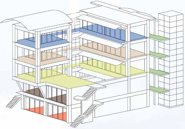
225
DWELLING
TYPE D TYPE D TYPE C TYPE B TYPE A
SPECIFIC: TYPOLOGY
TYPOLOGY
Hollainhof Social Housing
Neutelings Riedijk
Majd El Achkar
DESCRIPTION
Located in Gent city’s center, Hollainhof is a complex of social housing. To create an attractive habitat for birds, animals, and hu mans, the project aimed to combine urbanity and density with se clusion and tranquility. Located between the Visserijvaart river and a busy street that gives access to the center, the project occupies the site of a former barracks. As a result of the choice of interme diate housing at this location, a wasteland can be enhanced, while also being given breathing space.
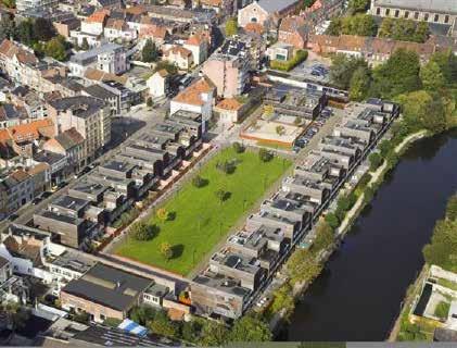
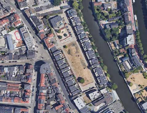
EVALUATION
The project of this nature clearly illustrates the limits of density. A density of 90 residential units per hectare is perfectly acceptable for a project of 18 houses, however, for a project of 120 houses, it becomes essential to integrate large green spaces to preserve the environment of these houses.
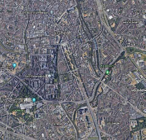
226
Ghent, Belgium
SITE
CONCEPT
• Houses set around an open field.
• Combine urbanity and density with seclusion and tranquility.
• Complex web of interdependence between public and private, open and closed, and large and small in scale.
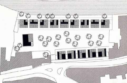
Sections
227
SPECIFIC:
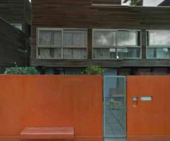
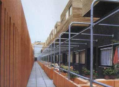
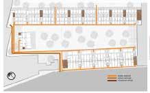
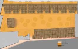
228
CIRCULATION
Public Pedestrian access Vehicular access Vertical circulation
Garden Inner Corridor Public Residential Private
SCHEME
Inner
BUILDING
DESCRIPTION
Hallainhof is surrounded to one side by a canal, and to the other side by a street. Located on flat ground, it is surrounded by dense urban development.
EVALUATION
Taking into account the building’s location within the urban fabric of Ghent, Hallainhof appears to follow the same building scale as its surroundings. As a result of the upper levels and terraces, it ap pears that the height varies.
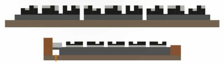
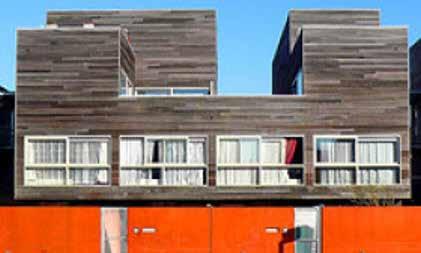
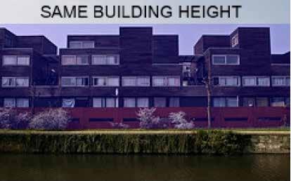
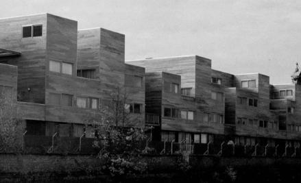
229
Building Typology
DWELLING
DESCRIPTION
The houses are arranged in two large strips, each measuring 15 blocks. Each of them has eight to ten dwellings. The combination of different types of dwellings makes each block distinctive. At the base of the housing strip overlooking the river are maisonettes.
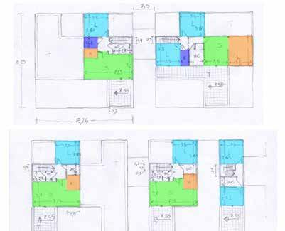
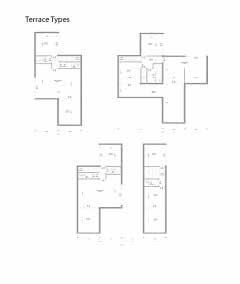
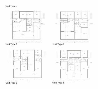
EVALUATION
There are 4 types of terraces that can be found at Hollainhof. While the layouts vary, they all have a similar focus on orientation and program space. All feature an outdoor terrace space from which one can explore the street, canal, or interior courtyard. Homeown ers can choose the space that best suits their lifestyle.
230
Bedroom Bathroom Kitchen Living room
231
TYPOLOGY MODULE GENER ATOR East strip East strip East strip West strip Plan Plan: Elevation: Elevation: 58’-6’’ 58’-6’’ Garden Garden Canal Canal Plan: Center Block Dwelling Typology
SPECIFIC:
Fleet Road Terrace Housing- London
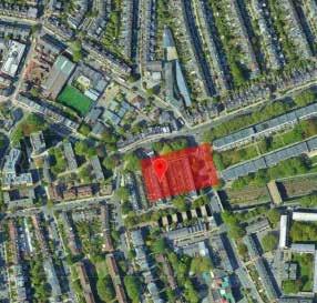 Neave Brown
 Rula ELkhalili
232
Google Maps, 2022 Location: Central Google Maps, 2022
HISTORICAL BACKGROUND
DESCRIPTION
Designed in the 1960s, Fleet Road housing project represents a housing model that challenges social models of urban housing in post-war London; which has taken a vertical approach; with mixed high rise development with high density following in the footsteps of the modern movement in architecture. (Sherwood, 1978) (Swenarton, 2012)
Through this housing model, Brown sought to promote ‘ Continutiy’ which he consider it as ‘inescapable characteristic of housing’. where modern models of housing made by modernist architects including Le Courbosier; is lacking the ‘proper recognition of the needs of continuity, cultural and physical’. (Swe narton, 2012)
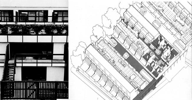
233
Fleet Road Terrace Housing axonometric
Modern Housing Prototypes, Rogertt, Harvard University Press, London, 1978.
Modern Housing Prototypes, Rogertt, Harvard University Press, London, 1978.
CIRCULATION SCHEME
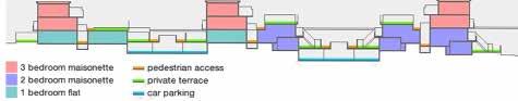
DESCRIPTION
Through the Design, Brown was seeking for achieving a ‘ spatial sequence’ where the transition from public, semi-public and private zones is crucial in housing projects, and it defines how the project sits in the urban context. (Sw enarton, 2012)
EVALUATION
Through the lens of ‘ Spatial Sequence’ that works as design driver in the proj ect, Brown’s design focused on 2 main pedestrian access, from which the user moves from the pubic street of the city to the semi-public corridor, through which the users move vertically or horizontally to their private areas.
Moreover, the concept of ‘ Spatial Sequence has social benefits, through the creation of communal and private spaces in the form of terraces and corridors, which work as a tool to re-define the social relationships between neighbors, with a focus on the split-level concept which was used as a tool to achieve the ‘ spatial sequence’ concept.
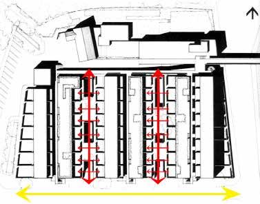
234
Modern Architecture London. Visited:
http://modernarchitecturelondon.com/buildings/fleet-road.php Fleet Road Terrace Housing Site Plan and section
Jan, 2022
Modern Housing Prototypes, Rogertt, Harvard University Press, London, 1978.
DWELLING
DESCRIPTION
The project provides different type of units, that meets different spatial needs of families:
model 1 consist of one bedroom (1-2 people)
model 2 consist of 2 bedrooms (3-4 people)
model 3 consist of 3 bedrooms (5-6 people)
EVALUATION
When studying the housing units plans , Brown is following a grid system with specific dimensions. Where the top view of each unit is the same and Brown arranged these units in a way that meets the design drives (Spatial Sequence), while considering different spatial needs. In other words, Brown considered the y- axis or the split levels while designing the interior of the units.
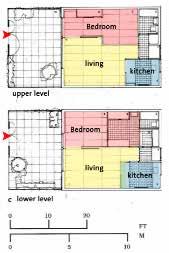
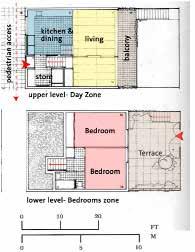
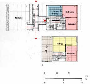
However, further analysis should be made to study the envionrmntal advan tages of this approach of split levels in terms of ventelation, sunlight.etc.
Two- person unit plan
Four- person unit plan
Six- person unit plan
235
SHERWOOD, Roger, Modern housing prototypes, 1978
SHERWOOD, Roger, Modern housing prototypes, 1978
SHERWOOD, Roger, Modern housing prototypes, 1978
Hillside Terrace
Fumihiko Maki
Lakshiminaraayanan Sudhakar
DESCRIPTION
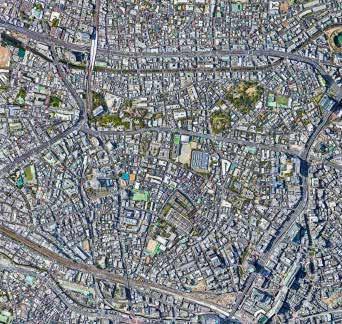
Hillside Terrace is a mix of residential, commercial, and cultural uses that have been built in 6 phases during 30 years from 1976 to 1992. The project has impacted the neighbourhood by establishing a kind of brand of the area and high quality urban spaces. The transformation brought by developments of each site using these patterns; Subdivison of the site, continuity of the site, and integration of the site and cases without redevelopment.
EVALUATION
The landscape of Hillside Terrace is centered on public spaces, including the sidewalk in front of the site. The composition of the site and its buildings is based on fragmentary urbanism, where there is a shift in the concept of a public space. It is an amalgamation of loose elements in which shifting ambiguity draws indiscriminate attention from the whole to the part and from the part to the whole.
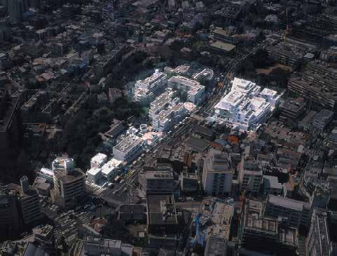
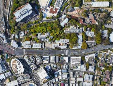
236
Tokyo, Japan
Daikanyama, Shibuya-ku
Source: ASPI and Maki and Associates
Location: Central
SITE Source: Google earth Source:
Google earth
CONCEPT
• Concept of “Group-Form” applied - based on five categories.
• MEDIATING between interior and exterior, or between public and private.
• DEFINING to mark a differentiation with the surrounding environment.
• REPEATING and underlining the group character.
• MAKING SEQUENTIAL PATHS.
• SELECTING the location.
The axonometric drawing below illustrates how the open spaces in different phases of the project connect with one another and how they as a whole, echoe the urban context in that area.
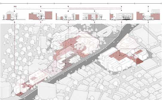
237
Source: Lyu, Zhaoyi, 2020, DanielsUniversity of Toronto 1967 Building A & B Building C Building D & E Building A & B Plaza Building F & G & H Phase 1 Phase 2 Phase 3 Phase 4 Phase 5 Phase 6 1969 1973 1977 1985 1987 1992
SPECIFIC: OPEN SPACE STRUCTURE
238
Inversed Figure Ground
Gradient: Public (light) - Private (dark)
Porosity
239
SPECIFIC: CIRCULATION SCHEME
Vehicle Traffic
Pedestrian Traffic Points of Superposition
BUILDING
DESCRIPTION
Within 6 phases, each building has its unique form though they echoe modernism. Maki explored with different materials for the construction during the progress, thus the material shifted from concrete to ceramic tile to aluminium. Meanwhile, there are also some common languagues, especially making buildings multi-functional. On lower levels, there is always commercial program which allows high transparency to the street level and social interactions. As the building goes higher, it provides residential uses and is more private.
Residential/ 6 Units Restaurant/ Shop
Residential/ 6 Units Restaurant/Shop
Residential/21 Units Restaurant/Office/ Shop
EVALUATION
The buildings are largely self-sufficient, with their own outdoor spaces that are cut off in part from the city. With the mutual exchange of views, a collective form emerges from each building’s view of others. The views are limited to eye-level and this creates a sense of scale.
Residential/18 Units
Restaurant/ Office/ Shop/ Gallery Exhibition hall/ Event Space/Library/Club Parking/ Rental Space
Building A & B Building D Building G Concrete and Glass Ceramic Tile and Glass Aluminium and Glass
Building Area: 642.8 sqm
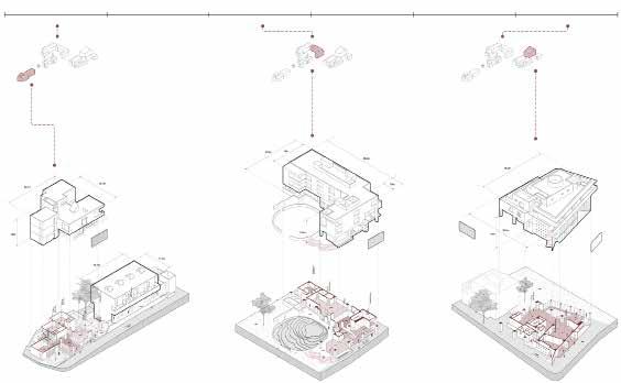
Gross Floor Area: 1849.1 sqm Height A: 10m Height B: 9.97m
Building Area: 642.8 sqm Gross Floor Area: 1849.1 sqm Height: 11.5m
Building Area: 666.3 sqm Gross Floor Area: 2726.9 sqm Height: 14m
240
Source: Zhu, Meichun, 2020, DanielsUniversity of Toronto
1967 Building A & B
Building C Building D & E Building A & B Plaza Building F & G & H
Phase 1 Phase 2 Phase 3 Phase 4 Phase 5 Phase 6 1969 1973 1977 1985 1987 1992
Source:
SPECIFIC: TYPOLOGY
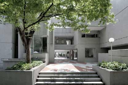
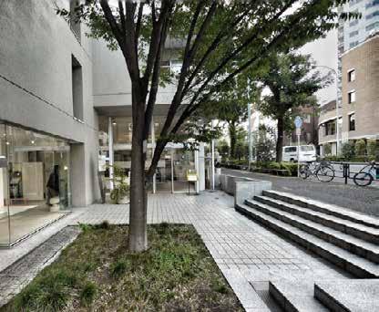
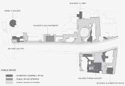

Source:
Source: Takashi, Ono ,2017
Source:
241
Building
Typology
Maki and Associates, 2015
Zhi, Xia, 2016
a+t research group, 2018
DWELLING
DESCRIPTION

There are different types of units in the project due to the change in the needs of the society through different periods of construction. For example, in Phase 1, the units were designed for a large family. from floor-through to double floor unit, the number of bedrooms starts from 3 bedrooms to 5. In the later period, the unit was designed more towards single use, from studio to single bedroom. In early 2000, only 15 units were left for residential use, others were adapted to office spaces.
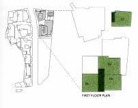
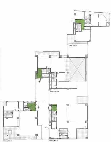
EVALUATION
The flexible nature of spaces gives the freedom to use it for different typologies based on the changing needs and it is tied together with an amalgamation of social spaces - open spaces, shops and restaurants, making it a self sustaining complex.
242
Source: S. Ollero,
2013
Alex,
SPECIFIC: TYPOLOGY
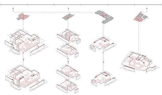
Building A/ Unit Type/ floor through Unit Area/ 305 sqm Number of Bedrooms/ 5
Building B/ Unit Type/ Double Floor Unit Area/ 108 sqm Number of Bedrooms/ 3
Building D/ Unit Type/ Studio Unit Area/ 63 sqm Number of Bedrooms/ N/A
Building G/ Unit Type/ Single Bedroom Unit Area/ 230 sqm Number of Bedrooms/ 1
243
Source: Shi, Fengyao, 2020, DanielsUniversity of Toronto
Source: Wikimedia, 2010 1967 Building A & B
Building C Building D & E Building A & B Plaza Building F & G & H
Phase 1 Phase 2 Phase 3 Phase 4 Phase 5 Phase 6 1969 1973 1977 1985 1987 1992
Seijo Town Houses
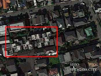 Kazuyo Sejima
Michelle Estefania Valladares Vaca
Kazuyo Sejima
Michelle Estefania Valladares Vaca
DESCRIPTION
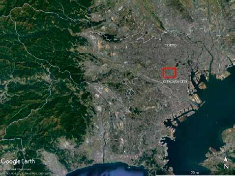
The project fills the center of a block, in a leftover, irregular-shaped lot in the city of Tokyo. Seijo Townhouses proposes a new urban fabric in the site through the assembly of volumes across open spaces and alleyways.
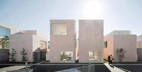
EVALUATION
The project’s distribution on site is innovative because it diffuses the boundaries between public and private within its own plot, connecting to the city by the big alleyway in the front. It creates porosity within the block, sizing down the scale of the constructed spaces and voids. In this way, it allows the site to be more permeable and enables different paths for pedestrian circulation.
244
Setagaya , Tokyo
Seijō, Setagaya
SITE
© Google
©
Location: Central
© Google Earth
Earth
Iwan Baan, 2011
CONCEPT
• Houses as an articulation of one-room modules that stretch vertically or horizontally interlocking between each other
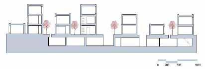
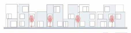
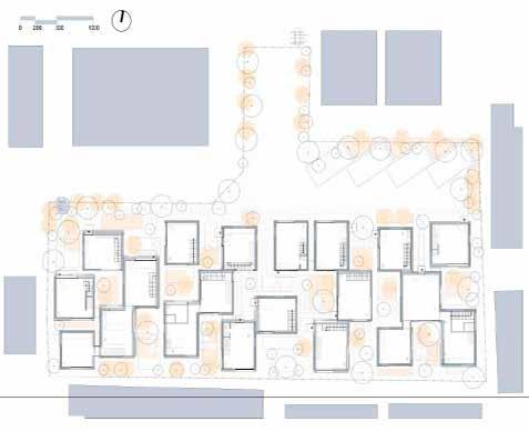
• Western concept of regulatory distances vs. strategically placed volumes that interlock through alleys and common spaces at different points, lead ing to the overlapping of the residents’ living environment and the city
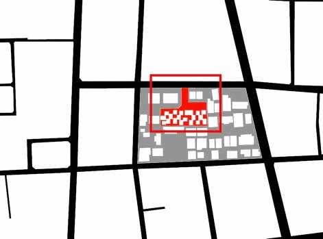
• Flexibility: free movement, no fixed beginning or end.
• Ambiguity between private and public spaces, interior and exterior spaces.
245
Section B North Facade Ground Floor
©
Scalise, Poloniato, Gadoti. 2013.
SPECIFIC: OPEN SPACE STRUCTURE
246
Inversed Figure Ground Floor
Inversed Figure Second Floor
Inversed Figure Third Floor
SPECIFIC: CIRCULATION SCHEME
BUILDING
DESCRIPTION
Seijo Townhouses is a combination of twenty small buildings, each with a different geometry. Its innovative urban setting is composed of a series of residential typologies intertwined in different levels. This project takes a new approach to collective housing: the apartments result from the articulation of small modules that can stretch horizontally and verti cally, forming a spatial continuum in the interior without its boundaries being recognizable from the outside.
EVALUATION
The porosity created by the voids between volumes creates a new spa tial experience of being part of a small town inside the project. This typology is something that works at both a small individual house scale and also larger where an entire community could live together.
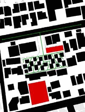
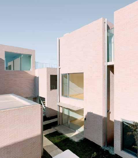
247
Circulation Ground Floor © Iwan Baan. 2011.
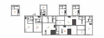
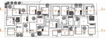
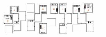
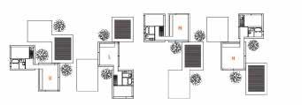
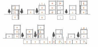
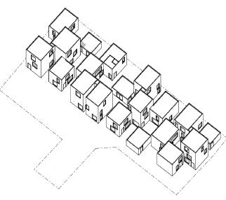
248 BUILDING Basement Plan Ground Floor Plan First Floor Plan Second Floor Plan Section A Section B ©
© Heckman, Schneider.2017
Byera Hadley Travelling Scholarships Journal Series. 2015
SPECIFIC: TYPOLOGY
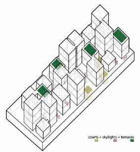
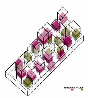
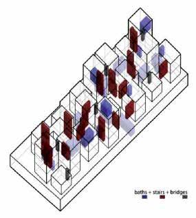
249
Building Typology © Krishnan Laimistri. 2021
DWELLING
DESCRIPTION
The dwelllings are composed of an articulation of volumes that can go up to four volumes, and can be linked horizontally or vertically through narrow passages at the interfaces without doors.
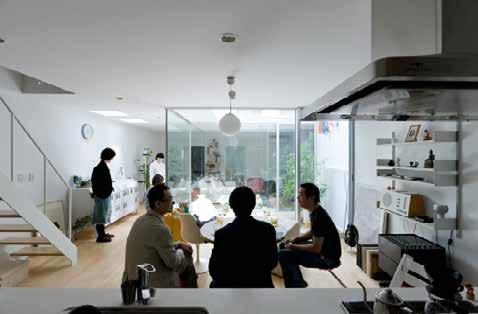
The buildings frame intimate courtyards of similar size, which are treated as part of the spatial patchwork. Stairs connect to another room in the levels above and below, either providing an entrance into the apartment or leading to a quieter space. Every apartment has its garden or a roof terrace. Although the gardens are separated, they remain readable as a continuous area.
EVALUATION
The interlocking volumes and voids create different spatial scenarios that allow the residents’ private and public life intertwine with different intensities. All this leads to a complex spatial configuration in which the living environments of the residents overlap.
Floor plan detail ground floor
Floor plan detail basement
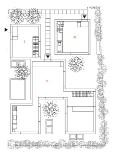
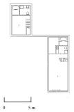
Floor plan detail 2nd floor
Floor plan detail 3rd floor
250
© Heckman, Schneider.2017 © Iwan Baan. 2011.
SPECIFIC: TYPOLOGY
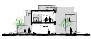
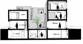
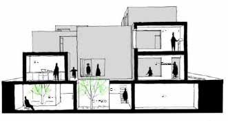
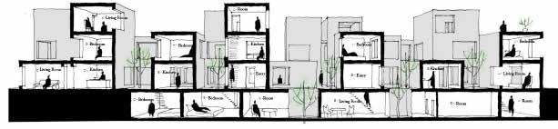
251
Perspective Section A
Dwelling Typology
Perspective Section E
Perspective Section C
© Kristen Schindler. 2007
Perspective Section D
B B
Nemausus I & II
Jean Nouvel
Yongxian Zhao
DESCRIPTION
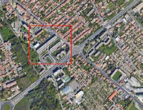
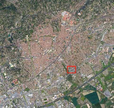
Nimes is a French city located in the south near the Mediterranean Sea. The area has a very good climate in much of the year and its people have the habit of living far away from home, making use of public space. Unemployment and housing shortage is a lesser evil, but something existing. In such countries, the most common is that the social housing sector point to a low-income popula tions or students with little budget.
EVALUATION
The concept stems from the need to define what is a good apartment. In this quest, a good apartment is defined as simply an apartment as large as possible by Nouvel . A good apartment is flexible, able to convert. A good cheap apartment in a democratic sense.
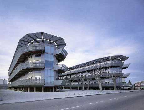
252
Nimes, France
SITE
© Google Map © atlasofplaces.com
Nemausus, Nimes
© Google
Map
CONCEPT
• Connection of transportation network
• Improvement of residential scale
• Provide comfortable living experience for users
253
Urban Fabric
© jeannouvel.com
SPECIFIC: OPEN SPACE STRUCTURE
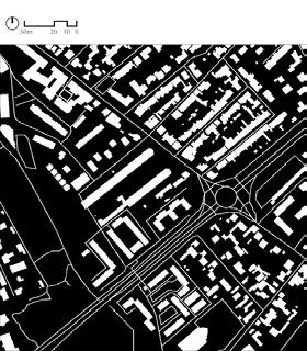
254
Inversed Figure Ground Green Spaces
Gradient: Public (light) - Private (dark)
SPECIFIC: CIRCULATION SCHEME
255
Parking Space Pedestrian Traffic Points of Superposition
DESCRIPTION
Maximum apartment size was provided for by minimizing communal spaces such as stairways and halls. Flexibility was created by dividing seventeen dif ferent modules for apartment layouts (one-room studio, split-level, tri-level, etc…) mixed into the 114 apartments contained in the two blocks. The low cost requirement was met by using prefabricated industrial elements for interi or and exterior fittings (the building shell is thin concrete cased in aluminium sheeting). The balconies provide outdoor living to the full: full-depth concer tina doors allow the balcony to be completely integrated with the main living space.
EVALUATION
The Nemausus social housing project has, since it was completed in 1987, become so well know that it is difficult to put its radical qualities into prop er perspective. The use of industrial materials (concertina garage doors for balconies, metalwork decking, aluminum open stairs) is indeed radical, but does not derive from any intention to shock or to be radical for its own sake. Among the key questions was the definition of a “good apartment”; a good apartment was, quite simply, as big an apartment as possible. A good apart ment was flexible, changeable. And a good apartment was inexpensive. That is the democratic aspect.
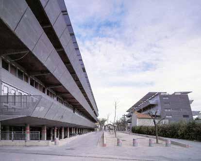
256
First Floor
BUILDING Third Floor Second Floor
SPECIFIC: TYPOLOGY
257
Building Typology
DWELLING
DESCRIPTION
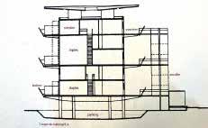
It is a social project housing that uses industrial and prefabricated materials. With the combination of seventeen different cells, the architect researches the maximum flexibility. The seventeen different modules for apartment are mixed in 114 apartments in two extended blocks. Jean Nouvel reinterprets the idea of an elongated pavilion that grows in height with common spaces.
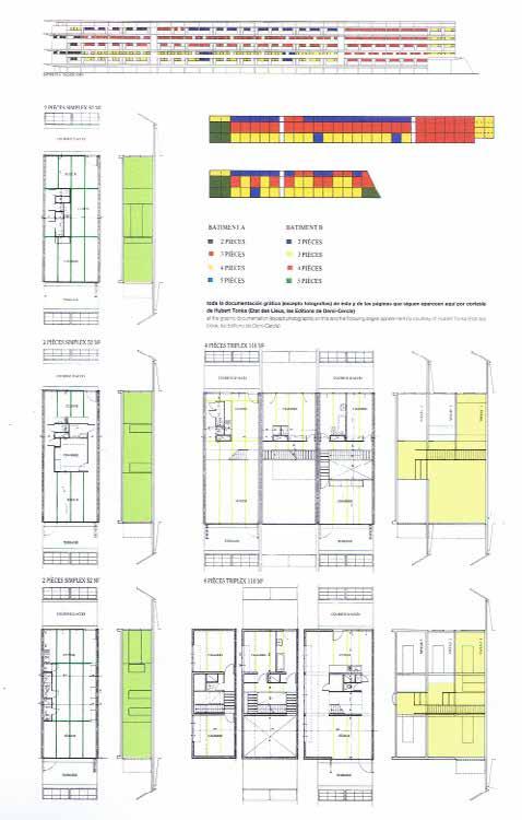
EVALUATION
Structure for working with columns and walls with crude revoke. On the rails of the stairs use of movement and micro-perforated sheet metal as well as aluminum. For the independent structure of the stairs using rectangular steel sections, painted red and white stripes, emphasizing the language industry.
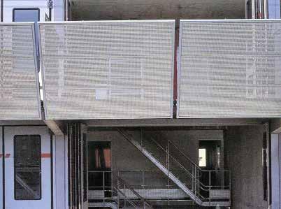
258
SPECIFIC: TYPOLOGY
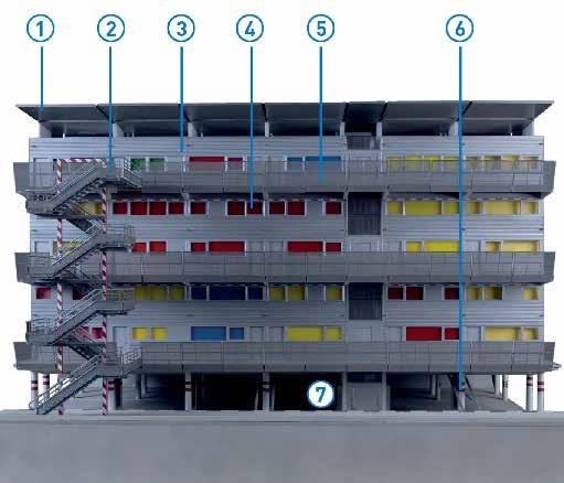
259
Dwelling Typology
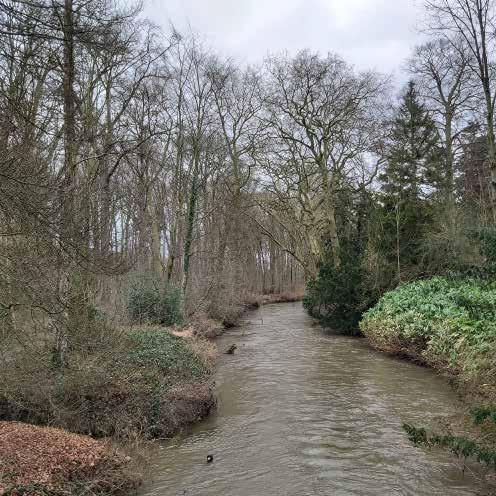
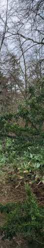
261 04
URBAN ANALYSIS
© Jules Descampe
The formation of the site
Decomposing the urban landscape, Dijle valley in Leuven
Tzu-Chun Lin
Willem Jan Neutelings, ‘Ringcultuur’. In: Vlees en Beton, 10, 1988. https://www.researchgate.net/ figure/Flowscape-Project-Neutelings-WJ-Ringcultuur-In-Vlees-en-Beton-10-1988_fig5_42318281
Willem Jan Neutelings re-presents the urban landscape by recording functions and corresponding events, and considers how the linear base can be divided into different areas within a specific infrastructure. In addition, by decomposing the original base into more fragmented blocks, it can also get rid of the constraints of the strong elements in the site (such as water network, traffic system, etc.), and then rethink the operation mechanism in the site.
Leuven takes the church as the center point, and the city develops in a radiat ing and spreading mode. The ring road in the old city is the most prominent concentric circle, and the important arterial road divides the concentric circle into several parts, becoming an umbrella-shaped urban texture. In addition, some secondary roads are parallel and concentric circles, establishing the con nection between blocks.
I decomposed the city according to the above context, which can be roughly divided into three rings, namely the inner ring of the old city, the middle ring of the residential area and the campus area, and the outer ring of the suburbs. The blocks that make up the inner ring of the old city are closely related to each other, but the blocks that make up the middle ring are not evenly related. Some blocks, such as residential land and commercial land, are closely related, but different residential areas are not close. The blocks in the outer ring are loosely related, mainly including landscape elements such as pastoral fields, woods, and wasteland.
After studying the block relationship of the base, I recorded the distribution of functions, facilities, and infrastructure in the main river valley area, and stud ied how events in the city divide the blocks of the base. From north to south, it can be divided into seven districts. The first and second districts are mainly fields and scattered residential areas; the third district is commercial space with many large stores; the fourth district is the old town of Leuven; District 5 is a large-scale public function and commercial area; District 6 is school land and industrial parks; District 7 is wilderness, wetlands and a few residential areas.
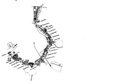
262
The image shows the structure and complexity of the city, which is formed by lots of functions and parcels.
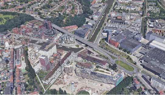
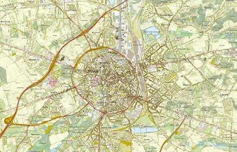
263
© Google
The main structure of this city is roads, cannal and parcels with specific functions.
Earth
© KU Leuven
These drawing shows how the urban can be split into several huge parcels and the locations of different functions and landscape.
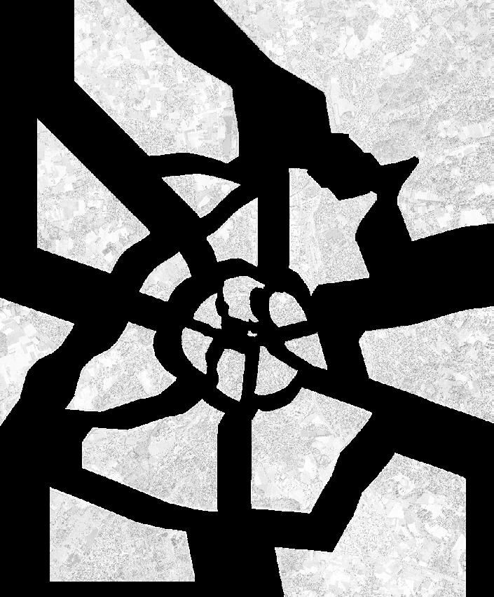
264
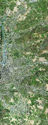
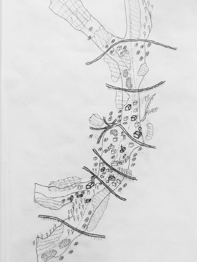
265 © Source R € ! C P Residential Commercial Educational Entertainment Religious Field Forest Industrial Cultural Administrative Sport Hospital Parking Wetland Plaza Traffic Spot
2
3
4
5
6 Area 7
Area 1 Area
Area
Area
Area
Area
A lost logic
The unreadable traces of the Dijle valley in Heverlee
Axelle Haekens
This analysis makes use of Michel Desvigne’s ‘landscapes behind the scenes’ method. In 2003, Desvigne examined the landscape of the city of Issoudun in France. Issoudun had lost much of its geographical legibility due to the urban sprawl and the lack of connection between houses and agriculture. Desvigne focuses on two aspects: how to approach and manage the limits between hab itat and agriculture, how to successfully transform the valleys crossing the city.
Desvigne’s method was applied to the valley area of the Dijle river in the south of Leuven. The analysis looks at each plot of the site and thus searches for the rhythm in the landscape. The first map shows a land survey of all plots of open green space, more specifically agriculture, grassland and forest. The second map looks for potential areas for transformation, indicated in black. Desvigne initially looked at agricultural land that the city could purchase and redevelop. These plots are the city’s backstage and can be transformed into public spaces that punctuate the housing estates, creating potential areas for promenades in the landscape. The same analysis is applied to agricultural land and grasslands in the south of Leuven. In the next phase, the presence of the valleys (and thus the risk of flooding) is emphasised. If the valley valleys are given space again to become continuous corridors, they form a strong framework to structure the landscape. Finally, the potential parcels for transformation are highlighted and expanded.
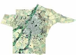
Desvigne’s method allows us to search for the lost logic in an unreadable land scape by analysing plot by plot. These plots appear in Desvigne’s analysis to be spread out and random but actually create continuous masses without forming
a route or ring. Desvigne’s results differ from this analysis because of a differ ent urban context and scale. As a result, the landscape in Leuven still seems rather unreadable at first sight. Nevertheless, especially in the northern part of the area, we see possible transformations that could enhance the landscape of Terbank and Egenhoven.
266
Corner, James, and Gilles A. Tiberghien. 2009. “Landscapes Behind The Scenes.” In Intermediate Natures: The Landscape of Michel Desvigne, edited by James Corner and Gilles A. Tiberghien, 6187. Basel: Birkhäuser.
Aerial photograph of the site, going from Ter bank to Heverlee (Leuven, Belgium).
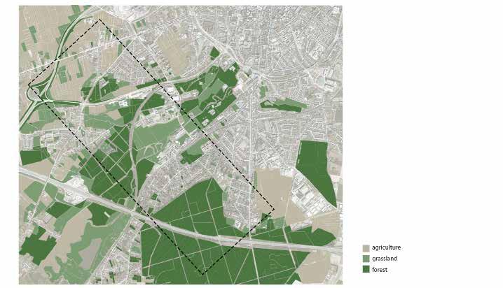
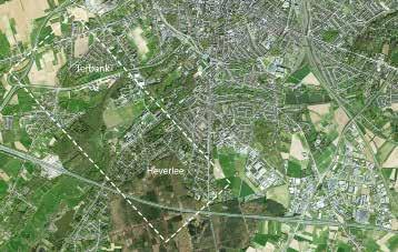
267
©
The different open green areas, divided in agricultural land, grassland and forest.
Adapted
studio material
© Adapted studio material
Within these green parcels, we can find potential plots for transformation in order to create public space whose form and power can enhance the different neighbourhoods.
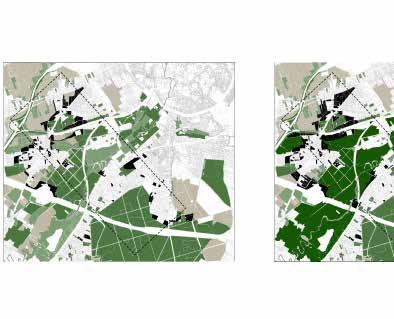
268
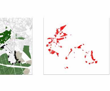
269 © Author
The land Mosaics

Mobility connect the valley, Valley Urbanism
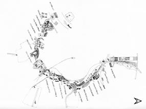
Shuting Li
Willem Jan, OMA. 2011. https://limo.libis.be/primo-explore/fulldisplay?docid=TN_cdi_csuc_ raco_oai_raco_cat_article_240491&=&=&=&=&=&=&=&=& amp=&=&context=PC&vid=KULeuven&lang=en_US&search_scope=ALL_CONTENT&adap tor=primo_central_multiple_fe&tab=all_content_tab&query=any,contains,willem%20jan%20 neutelings&offset=0
The patchwork is opposed to the idea of fragmentation which is a negative fig ure, it is composed by patches, a series of entities everyone with its own iden tity, arranged together in a superior unity.The city planning, as many hard sci ence, has always based the urban models on some metaphors. Human body, forest, hand, park, archipelago. The patchwork has so to be understood firstly as a theoretical metaphor in order to catch the characteristic that can be then applied in a real territory.
The Dyle valley connected by many different type of roads, At the first time, I have faced the issue of drawing this area as a patchwork, I have immediately realized that was not an easy matter. The problem of the scale and the bound aries of the patches appeared to me the most problematic issues. In order to produce a reproducible methodology I have followed, as much faithful as I could, the work and the defnitions that a master student stated in his paper “Land mosaics” remind me that can use the roads as boundaries as well as connections.
270
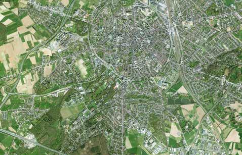
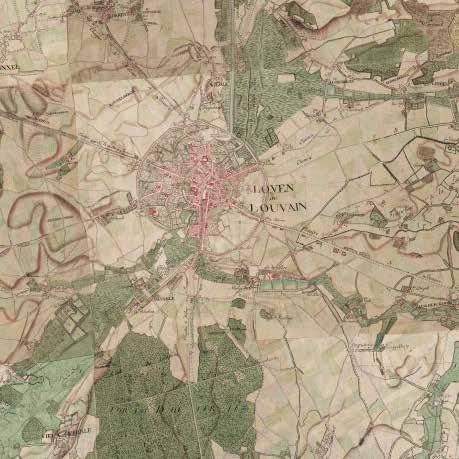
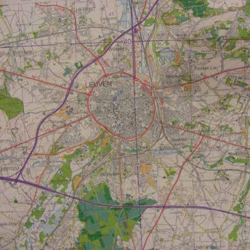
271 © Historical maps(1876,1994)
© Source: Google earth
272
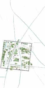
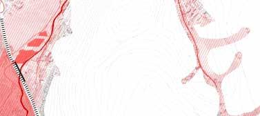
273 © Source
Urban and landscape developments around water
Contemplating historical, geographical and cultur al contexts.
Dijle Valley, Leuven
In the case of Joan Busquets and Felipe Correa with the book “New Orleans: Strategies for a City in Soft Lands”, the history of the city is analyzed in order to get the best potential out of future urban developments. In this it is explained that the climatic and geographical conditions are the most important points to consider and in the case of New Orleans, the Mississippi River. In Leuven, we are looking at the Dijle valley which is home to mostly green space, residential and educational buildings.
When investigating the history of the land, we must be clear about never forgetting its natural process, since this will help prevent cat astrophic disasters in natural accidents. In the case of New Orleans, there was a time when there was a drastic division of social classes through the lots on which they lived. These were divided into dense urban, gardens and agriculture. Today we have as an objective that in Leuven these urban morphologies so marked and sectioned do not exist, but rather that they can be interconnected and their inhab itants can relate to each other. That is why the behavior of the river is evaluated to see how these hypotheses are taken into account and to be able to create a connection between its two sides. To this end, the future flood zones of the Dijle River have been analyzed, based on information from Geopunt.com.
One of the things mentioned by Busquets regarding the readapta tion of the city of New Orleans, is that these areas at risk of flooding can be seen as public spaces such as parks and squares bringing other types of benefits to the city. “This is an area with a dual strategy: urban and economic” (Busquets, 2005).
Reference:
1. https://www.geopunt.be/
2. Busquets, Joan, The New Orleans context: consideration in the after math of Katrina, Revista Temas.
3. Joan Busquets, Felipe Correa “New Orleans: Strategies for a City in Soft Land” Harvard University, 2005.
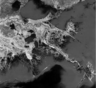
274
Aereal photo showing the breadth of the Delta and the difference form of explotation of it.
Ana Veronica Martinez
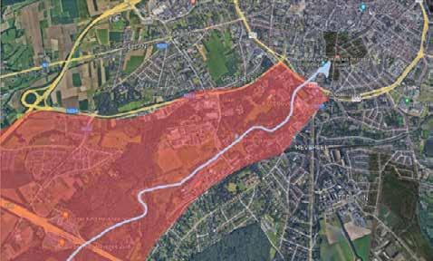
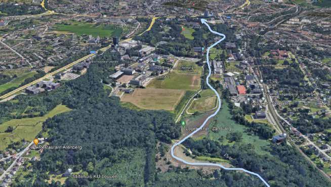
275
Dijle Valley and River zone for analysis.
Topographic lines
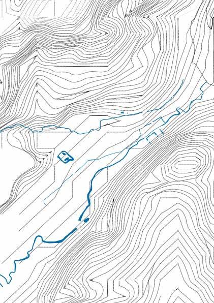
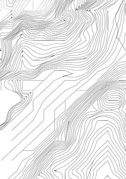
Current rivers
Actual flood zone
Future flood zone.
276
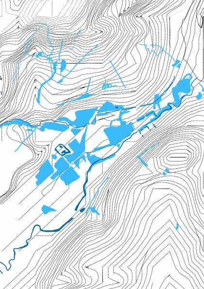
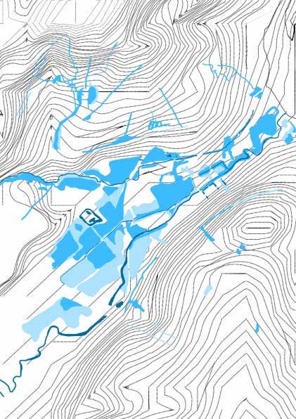
277
Transformation
Growth of
campus along
river, Valley meets Campus
Joan Busquets a professor from the Harvad University, Boston represents the evolution and transformation of Boston in relation to the University of Harvard and its expansion over the yearsl leading to the multiple changes and evolution that the city has been through.
He wrote, “These days we are seeing the emergence of an urbanistic culture that focuses on new problems in the city and the territory and no longer responds to the city model of the last century. This former model seemed to accept a biunivocal relation between urbanization and industrialization, establishing some fairly precise boundaries between the disciplines that intervene in the construction of the territory: planning, urban design, landscape architecture, etc.” (Busquets 2011)
Taking inspiration a similar principle can also be used in understanding the evolution of Leuven as a city and as a University over centuries of changes in the Dijle valley region in order to realise the campus as it is now. Mapping these changes over the years can also help identify the pattern of growth and how it could be used to the advantage or in order to create better opportunities within the city. Making it more relevant and interactive. The Dijle valley (campus) arena forms a transition between the city and the suburbs of Leuven. In order for this transition to be engaging and cater to the needs of the people in Leuven, observing and predicting their transformation can prove invaluable in the planning process.
The method thus helps understand the past and the present in relation to the evolution with time and can instigate the understanding of future opportunities and thus needs of the city as well as the campus.
278
Busquets, J. & Crawford, C. (2017) Chicago : two grids between lake and river / Joan Busquets with Christina Crawford. San Francisco: Applied Research and Design Publishing.
Anagha Pandit
the
Dijle
The city of Leuven has expanded in a radial pattern over the last centuries. The pattern also marks the growth and expansion of the university situated in Leuven.
Multiple patches of parks that were developed around the Dijle valley over the centuries that also play a major role creating the campus of the University City.
Replace the box with an image/photograph/analytic drawing that supports your analytical drawing
279
© Author
© Google Earth
Replace this box with your drawing. The analytical drawing is one
Replace this text with a 1 sentence caption that explains the image - Avenir Next, Medium, 8pt
280
one integrated image that is an application of the chosen model
281
© Source
Characteristic Landscapes
Selective mapping along the Dyle Valley, Valley Meets City
 Zhongyan Zhang
The mapping learns from Bureau Bas Smets’s approach in 55,000 Hectares for Nature in Bordeaux, France. In this project, the designer identified three types of ecology that were cut by the crucial tributary system, highlighting the existing interest points and alternative projects. It also contributes to reading the landscape and interpreting the identities of the place.
The essential landscape structure for Leuven is the Dyle valley system across the city and its outskirts. Thus, it could be regarded as the opportunity that integrates the city and the university, especially the latter primarily occupying the riverbanks. The selective mapping focus on the existing landmarks, nodes and potentials that could be transformed along the valley area with the parallel main rivers.
© Bas Smets 2012-2014
The map shows the valley system and the main rivers, including the underground river.
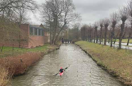
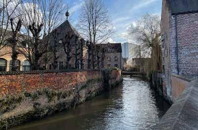
 The sketches with photos illustrate some essential open spaces that the public can access along the Dyle River, such as the park in front of the Arenberg Castle and the UNESCO heritage Groot Begijnhof.
©
Made by the author
© Metapolis Architects


 Arenberg Castle with its park II Forests, marshland and grassland I
Parks, Parking and Heritage Site IV Sport fields and Stadium III
Arenberg Castle with its park II Forests, marshland and grassland I
Parks, Parking and Heritage Site IV Sport fields and Stadium III
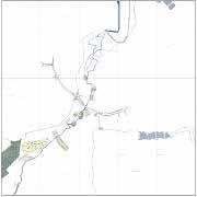 The essential elements along the Dyle Valley system.
© Drawn by the author
The essential elements along the Dyle Valley system.
© Drawn by the author
Reviving Differences
The ring complex
Armoutaki
Based on Joan Busquet’s and Felippe Correa’s book “New Orleans: Strategies for a City in Soft Land” adopted the method of underlining the importance between the urban grain and directionality that influenced by the water. This multi-completion provides information that shaped the linearity of the urban area. By analyzing the edge of borders between the Leuven and Heverlee (KU Leuven Campus area), the collecting data provides exclusive information around hydrology, topography and urban interest are identified.
The main part of the hydrographic research is the Dyle and Voer rivers, on which the flood risk is high in specific zones and the composition of the urban fabric. Special emphasis is given to the intersection point between the grain of the “ring” and the campus landscape. Also, the forms which modified changed the structure and the landscape typology over time. ing attention away from elements that would seem to dominate this area’s morphology in the present. The method requires adaptation for systems more complex and contradictory than the example by Busquets, where the Missisippi clearly dominates grain directionality.
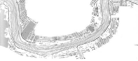
286
Busquets, Joan, and Felipe Correa. 2005. New Orleans : Strategies for a City in Soft Land. S.L.: Harvard University, Graduate School Of Design, Cop.
Rafaela Maria
287
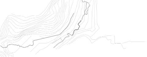
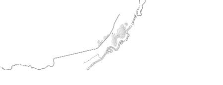
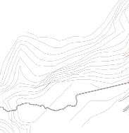
288 Layer 2: Topography and river parcels Layer 3: Floodplain Layer 1: Grain dictionarity and river
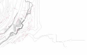


289
Adaptation of the urban tissue
Analysis of Leuven around de Dyle.
Jules Descampe.
The morphological analysis of Amsterdam by van der Hoeven and Louwe is based on the application of a reference plan to which they apply modifications due to the specificities of the city. In their case the city of Amsterdam was analyzed from the ideal plans of the fortress engineers Stevin and Speckle to which the structure of canals is applied and the variants are building blocks. In a few drawings demonstrating the impact of the programmatic or physical particularities of the site on the typologies of the city pieces they find the actual plan of Amsterdam.
The case of Leuven seems more complicated to link directly to an “ideal plan” since the city evolved according to more chaotic medieval logics. Moreover, unlike the concentric canals of Amsterdam, here the water crosses the city from one side to the other, making it a more radial structuring element.
The following analysis therefore aims to start from the classical scheme of the western medieval city. In a first step, the city installs its defenses with the first enclosure, defending a dense center, near the watercourse in order to use it partially as a moat and the second one defending the boroughs and the agricultural production grounds. The second structuring element are the gates. They are connected to the center by direct ways around which the dwellings are spread out. Finally comes the influence of the topography on the organization of the plots of the second enclosure (on the right it follows the lines of topography and on the left the flatness allows more geometric organizations).
van der Hoeven Casper, Louwe Jos. 1985, “Amsterdam als stedelijk bouwwerk : een morfologiese analyse,” http://pi.lib.uchicago.edu/1001/cat/bib/734376.
290
Add site map
Geopunt, luchtphoto and watergang.
Aerial Phto of the center of Leuven Belgium.
The evolution of the ferraris map from the middle of the XVIIIth century to the XIXth century.
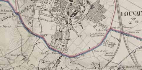
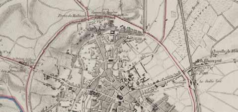
291
Geopunt, Ferarris kaarten, vandermaelen kaarten.
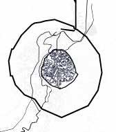
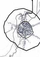
292
CONNECTIONS
WATER FIRST WALL DENSE CENTER SECOND WALL
DOORS
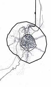
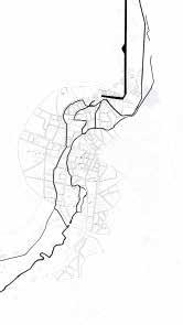


293
CONNECTIONS OVERLAPPING CURRENT URBAN ORGANISATION
The Dijle Valley
Flows and Barriers, Valley meets Campus
Shannon De Wandeler
Desvigne, M. 2011. “Processus de substitution.” http://micheldesvignepaysagiste.com/fr/proces sus-de-substitution-et-de-transformation.
The ‘Processsus the substitution’ used by Michel Desvigne for his analysis for the landscape of Issoudun, was used as a reference for this assignment.Through this, Desvigne defines a transformation process that acts upon the language of the place, rather than imagining a form He developed two axes of research; the treatment of the limits between habitat and agriculture and the transformation of the valleys.
By doing so, a substitution mechanism is created, which determines the composition of the landscape aesthetically. It forms a singular invention. [Desvigne, M. 2011. “Processus the substitution et de transformation.” http://micheldesvignepaysagiste.com/fr/processus-de-substitution-et-de-transformation.].
The specificities of the Dijle Valley can be understood through a reading of its waterways and floodings, topography and the relation to the built environment. Therefore, for this assignment, the waterways and its floodings were analyzed in relation to topography and the built environment that works as a barrier for further extension of the water. A more abstract drawing could then be made, showing the intertwining of water and topograpy versus the built.
This method is a very nice one for looking into the territory. It uncovers elements that are not visible after a first read and really asks to understand the territory very well. It forms a very intersting way of looking at landscape, not just by looking at what is visible at the surface, but really by looking more in detail and understand the flows that are present whithin a specific environment
294
This image shows the water structure, as well as the topography whithin the valley.
This drawing shows the valley with its waterways, the floodplanes and the façades of the build ings that form a barrier for further water flow.
295
©
Shannon De Wandeler © KU Leuven
This drawing shows the flows of the valley (water, topography...), and the barriers these encounter.
296
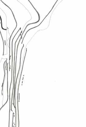
297 © Source
Nodes, Connections and Borders
Leuven and Dijle Valley
Selenge Dima
In their book Netzstadt: Designing the Urban (2003), Franz Oswald and Pe ter Baccini defined the Netzstadt Model. The Netzstadt Model describes an urban system consisting of three elements: nodes, connections and borders. Nodes are locations marked by a high density of people, goods and informa tion. Connections represent flows of people, goods and information between nodes. And borders are the spatial, temporal or organizational demarcations of the network.
An orthophoto was used for the Leuven and Dijle valley case study. The bor ders identifying urbanized areas were drawn with the help of lines between agricultural land and urban areas. Bold lines highlighting some urban areas show areas with high population densities.
The Netzstadt method requires a transdisciplinary approach between archi tectural, natural and engineering sciences and can include other disciplines. Oswald and Baccini describes the urban system as follows: “It is a comprehen sive, three-dimensional network of diverse social and physical connections. There are relatively high densities of people, goods and information in the nodes of this network. There are high rivers between these nodes of differ ent densities of people, goods and information. The colonized ecosystems of agriculture and forestry are integrated parts of this system.” (Oswald, Franz and Peter Baccini. 1998. Netzstadt. Transdisciplinary methods for converting urban systems.) The Netzstadt method alone does not provide new spatial planning drafts or set new goals. However, it is a good way to understand the urban system of a given site.
The application for the Wigger city case study suited Leuven and Dijle valley because the lines between green areas (forests, agricultural land etc.) and ur banized areas are apparent. The model should be adapted for other sites where the lines are more blurred.
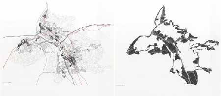
298
Oswald, Franz and Peter Baccini. 2003. Netzstadt. Springer Science & Business Media.
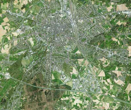
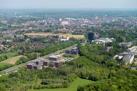
299
Orthophoto of Leuven and the Dijle valley.
KU Leuven, Arenberg Campus
© Press office of Leuven, 2018
©KU Leuven, 2022
railways main roads motor way
Leuven and Dijle Valley: node figure on the communal scale with the most important infrastructure
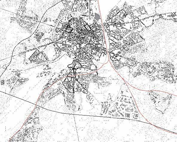

300
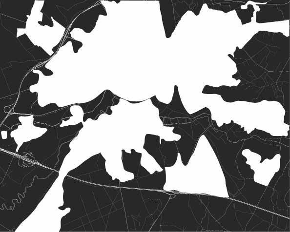
301
Leuven and Dijle Valley: node borders
The entrance of Leuven
Heverlee, between the railway and the Dijle river
Gilles Houben
As we follow the valley of the Dijle river from South, we first meet Heverlee, a peripherical settlement of Leuven. At this location, we’ll apply the precise and pragmatic methodology of the two architects Richard Plunz and John Chowder showcased in their work of the Mantua Primer District (Ney York).
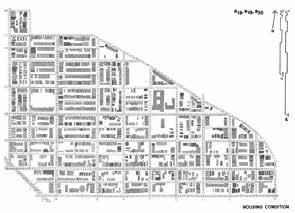
Pinched between the Dijle river and the railway, this urban area acts as the “entrance to Leuven” for all trains travellers coming from Ottignies. We find an eclectic urban tissue, composed of the Catholic University of Leuven, 4 facades houses, sport facilities, and various social and cultural structures like a church and a restaurant and schools.
We’ll use the layering method of Plunz and Chowder to highlight specific information out of the delimited urban area. Using only the grey color, the idea is to isolate different layers that contain one precise information, that can later be combined. Although, as the method of these two architect seemed too pragmatic and focused on housings, we’ll try to apply it to an urban landscape work. In this case, we’ll highlight the layers of hard and soft mobility, and the later will be combined with terraces, as an artificial topography. Also, we’ll juxtapose the built form and the mineralized surfaces of the urban area.
focus on the soft mobility here) of the studied urban area. Indeed, the density of both the university infrastructures and artificial terraces explain the pattern of mobility in the area between the railroad and the Dijle river.
The two resulting documents help understand the general circulation (with a
302
Richard Plunz and John Chowder. 1970. Mantua Primer: Toward a Program for Environmental Change, a. 20, b. 24. State College (USA): Department of Architecture, Pennsylvania State Univer sity.
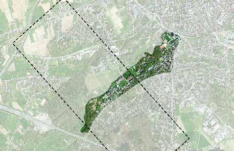
303
Heverlee, between the railway and the Dijle river
The first landscape of Heverlee
Photograph by Gilles Houben
[Edited by Gilles Houben]Areal view of Leuven, Google Maps.

304 Soft
Mobility
Hard Mobility Artificial terraces
Mineralized surfaces
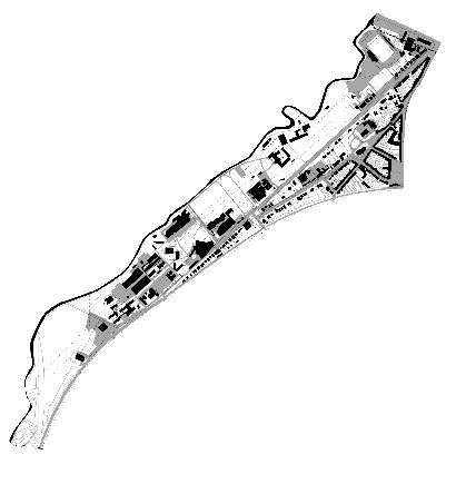
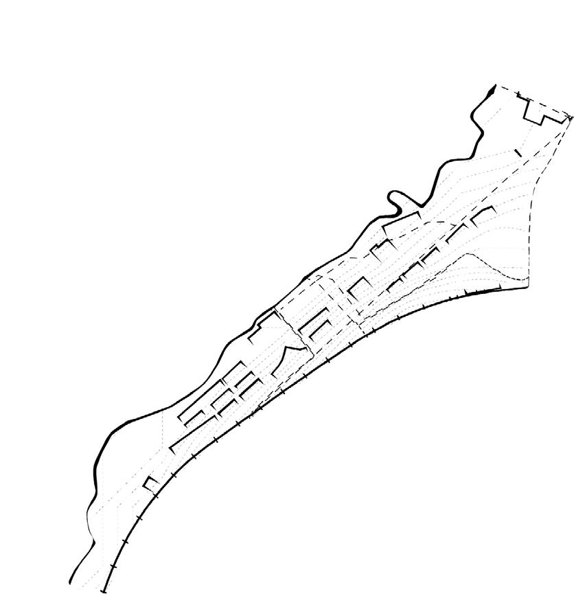
305
In- and outside the Dijle valley
Valley meets fringe
Alexander Van Gestel
As a method for the analysis, a methodology developed by Bas Smets is used to look at the valley of the Dijle. With this method he ‘delayers’ the map and leaves out certain items whilst still making interesting combinations to find valuable relations between the various layers.
For the analysis of the Dijle valley, the floodplain of the river is combined with the built form to find an interesting relation between both. Built form within the floodplain is shown with a simple line, while the built form outside of the floodplain is shown with filled black shapes to emphasize the distinction. Not only the Arenberg park is taken into account, but the whole city centre of Leuven, to understand the influence of the valley on a larger scale.
Having done the analysis, it shows the differences between the tissues apparent within the valley and the ones located on the slopes and the plateaus. The valley’s development is characterized by “domain”-like constructions, bordered by large building blocks on the eastern plateau and more open green spaces on the western plateau in the city centre of Leuven. This difference in tissue extends into Arenberg park, with clustered campus buildings as domains around the Dijle river and residential tissue on the slopes following a separate spatial system.
One could therefore question if the university complex within the floodplain of the Dijle valley is located at the right place and if this place is not better preserved for ecological systems. Furthermore, the valley structure is abruptly fragmented by man-made systems such as the ring road. These numerous
obstacles may not appeart to be very strong in Bas Smets’ method, yet they are crucial to understand today’s landscape structure.
306
Bas Smets
Difference between tissues in and at the edge of the valley.
307
City centre of Leuven and part of valley structure.
Photographs and maps by author.
Google earth.
The valley structure of the Dijle river is shown together with with its floodplain in grey, making it possible to differentiate the tissues apparent within and outside of the valley. The former consisting of a more open and dispersed structure with the latter one mainly consisting of building blocks. Where the valley meets the city centre of Leuven it is abrubtly divided by the ring road.
308
Map by author.
309
HIDDEN URBAN FORCES
VALLEY URBANISM (VS) Griding , VALLEY MEETS THE CITY
Basel Beshtawi
The X urbanism is a theoretical framework that has been developed by Mario Gandel Sonas in his book X-Urbanism: Architecture and the American City . The framework provides a new perspective of envisioning cities by examining the different hidden configurations of urban spaces . This methodology aims to reflect the hidden urban structure and its main urban forces in a visual manner . The methodology builds a puzzle of urban configurations of me dieval , industrial and post industrial and suburban territories on the city . In addition to this, it gives a visual result of the different urban forces and its influences over each other on the city .
Despite the fact that this Method is an interesting theoretical one but it still lacks the multidisciplinary perspective of urbanism . Gandel as an architect looks to the city as an architecture product without the consideration of issues like landownerships, property values and urban design .In addition to this , This methodology treats the city as a formal territory only and such a visual presentation for the hidden structures could be in some parts superficial and inaccurate because of this aspect .
This method discusses the cases of the American cities throw the industrial and postindustrial influences and its relation to the new plans including for example the plan 1811 of Newyork .This could be a challenge to be applied to the city of Leuven. So that the assignment will look into the medieval, indus trial and suburban territories of Leuven throw the Dijle valley inside the ring. Despite the fact that there were no 1811 grid plan in Leuven but many new over scaled infrastructures, throw the industrial and postindustrial eras, played a critical role in - griding -the city center . Those new infrastructures like the train station , the factories , etc , developed the turning point of the urbanism on the city of the ring.
310
Gandelsonas, Mario, 1938- X-urbanism. New York : Princeton Architectural Press, ©1999 (OCoLC)607121958 Online version: Gandelsonas, Mario, 1938- X-urbanism. New York : Princeton Architectural Press, ©1999 (OCoLC)631969407
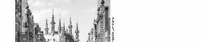
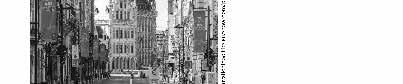
311 © Source
Replace this text with a 1 sentence caption that explains the image - Avenir Next, Medium, 8pt
312
313 © Source
The many faces of the Dijle valley
From Arenberg campus to the city centre
Ellen De Wolf
Bureau Bas Smets. “Town Centre Renewal, Ingelmunster, Belgium.” Bureau Bas Smets, 2007, https://www.bassmets.be/projects-selection.
For the design of the Town Centre Renewal in Ingelmunster, Bureau Bas Smets developed a method to analyze the relationship between the canal and river system with the surrounding urban tissue. It emphasizes the role of topography and in this way makes the distinction between the inside and outside of the floodplane. It combines the different layers of built form, landscape elements and topography, to read the existing situation and search for possible issues and opportunities (Bureau Bas Smets 2007).
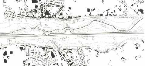
The Dijle river valley flows through the Arenberg campus and arrives at the city centre in the south, where it starts to find its way through the dense urban tissue of Leuven. Along this trajectory, the Dijle is surrounded by a large variety of natural as well as man made elements. The method of Bureau Bas Smets has been adapted and applied in order to understand the transformation from the natural valley system inside the campus towards the rigid and edged river in the city centre.
By overlapping the built tissue with the floodprone area, the map reveals the number and location of buildings inside a flood risk zone near the Dijle valley. In addition, the bordering area on both sides of the river is analyzed, indicating if eather an open grass field, forest, or urban tissue is adjacent to the Dijle. In this way, this method does not only give an idea about current flood risks in the valley, but also shows the possibilities to mitigate future flood risks in the existing buffer areas. It can be concluded that along the trajectory of the river, the number of buildings inside the floodprone area increase towards the city, while the presence of buffer areas, such as open grass fields and forests, decrease.
In this way, this method offers a critical view on the existing landscape of the Dijle valley and reveals possible issues for the future, while also showing areas with mitigation opportunities.
314
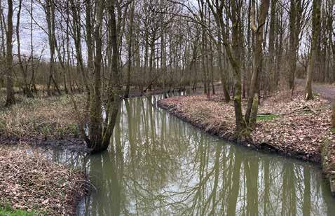
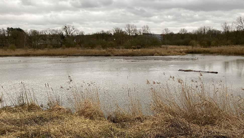
315
The Dijle meanders in its naturally emergent network of ditches and streams
The wide landscape inside the campus offers a buffer zone where the Dijle locally overflows its banks
The river edges transform along the valley. From a naturally meandering river upstream towards a fixed and manmade river edge in the city centre.
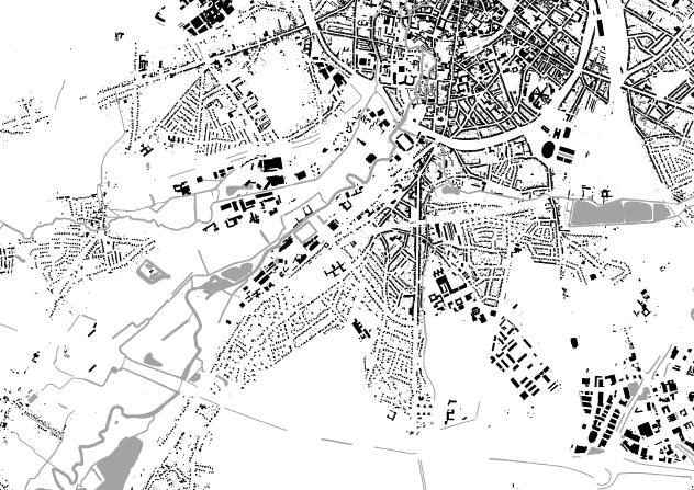
316
Buildings outside floodprone area
Buildings inside floodprone area
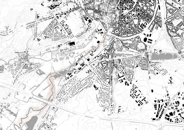
Open grass field
Forest
317
In-between
Dissecting Accessibilities of Urban Neigh borhood Spaces, Middle Valley Strip
Shinta Kusumawardani
The methodology that was first developed by Richard Plunz and John Chowder in the 1970s to analyze the urban environment of Mantua neigh borhood in Philadelphia, United States, using digitized greyscale modeling is adapted to a portion of the urban fabric in between Tervurses teenweg in the Southwest and Koning Boudewijnlaan in the Southeast. The intention of the chosen method was mainly to investigate the built envi ronment in terms of the distribution of private and public access coverage of the area.
The original method that visualized housing conditions in Mantua has been adapted to the specificities of the area that is characterized mainly by residen tial tissues, spacious agricultural land, and big retail. For this, the layering of different building typologies is also carried out in accordance with the acces sibility configurations studies, using a combination of colors and textures. Al though the method was well-suited to easily dissect urban contexts, especially in terms of the private and public accessibility of urban spaces, additional identifications have to be taken into consideration to further understand the underlying rationalities behind such information.
The building typologies are categorized into residential (private houses, apart ments, and other developments such as nursing homes and orphanage) and non-residential (schools and public retail), and the private and public urban access is examined following the same residential and non-residential logic. The residential tissue of the area is dominated by private dwelling units and is lacking in spaces that can foster public interaction and communication, while
the use and accessibilities of large but fragmented green spaces due to infra structure and property developments remain a question.
318
Richard Plunz and John Chowder. 1970. Mantua Primer: Toward a Program for Environmental Change. State College (USA): Department of Architecture, Pennsylvania State University.
Aerial view of the neighborhood in between Ter vursesteenweg and Koning Boudewijnlaan
Residential tissue in the neighborhood
319
© Author
© KU Leuven, Edited by Author
320
Analysis of building typologies and accesibility of spaces in the neighborhood, inspired by Richard Plunz and John Chowder’s work in Mantua
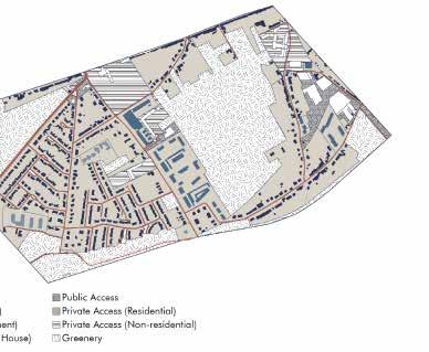
321 © Author
Agriculture potential
Valley meets campus, Djile valley
Nhung Pham
In 2003, Michel Desvigne analyzed the Issoudun city’s natural mechanism by observing the agricultural territories and retracing the agricultural land bound ary. The goal of the analysis is to find the drain main directions and agriculture pattern. From that, he developed a design strategy to strengthen this pattern and create a new coherent landscape to transform the valley crossing the city.
Inspired by this method, this analysis will use this approach in Djile valley. From the current status of fragmented landscape across the valley, I wondered whether there is any pattern behind the agricultural lands in Leuven, and from there, can the whole landscape of the valley be once again, become more com prehensive?
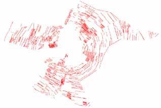
Following Michel’s methodology, I primarily analyze the agriculture direction. Firstly, it is important to figure out the main direction of agricultural land in each area by identifying the big lots then comparing them to the adjacent roads and residential lots as well as historical maps. After that, the direction of the lots was developed continuously following these main lots. Finally, all the direction lines and the shape of the river were kept to show the relationship between agriculture and water source.
The method is helpful to uncover the underlying landscape logic and their shaping of the urban landscape in Djile Valley. Although the agriculture pat tern does not show a tangible comprehensive lines system like in Michel Des vigne’s result, it points out some main features behind agricultural lands: they are following the roads with the main movement towards the river. Although
the lands seem to be fragmented and go in different directions, there are some main rhythms can be observed and nalyzing these directionality unveils the potential to explore how to recreate a more comprehensive landscape pattern for the whole alley. Many questions can be raised from this initial analysis point: Can the brownfields in the land be recovered adapting to the current ecology rhythm? What strategies should be employed to strengthen it and make it become the identity of the area? How can we connect this pattern to the river? Answering these question will open different opportunities for fur ther development of the Valley in the design stage.
322
Desvigne, Michel. 2003. Issoudun Territoire. Study project. MDP Michel Desvigne Paysagiste
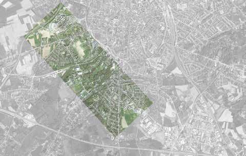
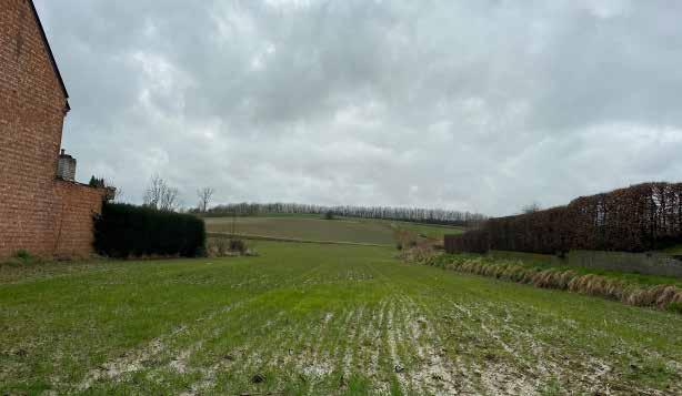 The Middle Strip site of Djile Valley, Leuven
© Source
Agriculture land hidden behind private houses in area open the potential of using these land as main landscape component for transforming the Djile Valley
© Google Maps
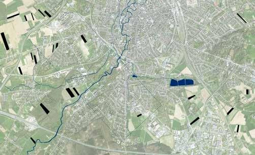
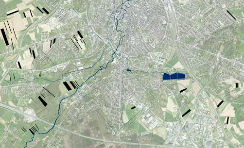
324
The potential of agriculture land in city life
Grain directionalities, topograhy and the river
325 0 250 500
Connections and duality
Leuven directionality
Chloé Poisseroux
The method used by Busquets and Correa in the book “New Orleans: Strate gies for a City in Soft Land” to analyse the city of New Orleans highlights the grain and the directionality of the city in relation to the river. It synthesizes the structure of the city through the use of lines.
For this analysis, a focus was given to the hydrography, including the rivers Dyle and the Voer, as well as considering the zones with risk of flood, it also takes into account the built structure of the city. The frame chosen focuses on the junction between the city and the university, showing the duality that exists between both. This analysis also points that through the years the water has been channelled, reducing its bed, and buildings were constructed in areas with a high risk of flood.
This analyses expresses also the clear difference of density between the inside and the outside of the ring. In the city centre, there is a multitude of buildings with a more regulated pattern. Whereas the campus hosts often larger infra structures that are displaced further away from each other.
This analysis highlights the delicate situation of the site of the campus as well. Indeed, this one is located in the valley, in between the rivers and therefore in a zone with a high risk of flooding.
326
Busquets, Joan, and Felipe Correa. 2005. New Orleans : Strategies for a City in Soft Land. S.L.: Har vard University, Graduate School Of Design, Cop.
Leuven ring. [Map]. n.d. 1:23 000. Geopunt. https://www. geopunt.be/. Accessed February 21, 2022.
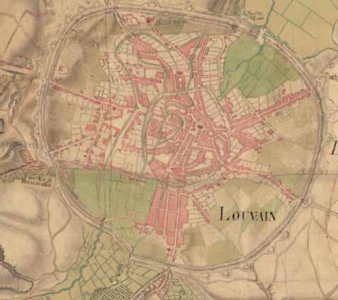
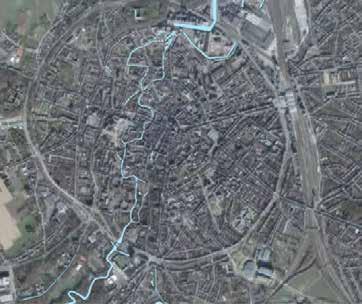
Leuven used the Dyle river to settle and develop the city through the years and centuries.
The Dyle river crosses the city from south to north it is a continuous element that can be found on both the campus and the city center.
Historic and actual map [Map]. n.d. 1:23 000. Geopunt. https://www.geopunt.be/. Accessed February 21, 2022.
327
328
Beguinage island directionality
Water evolution through time
329
Types of Territories
Morphological Territories of Ur ban System, Valley Meets Fringe
Han Qin
In the book Netzstadt: Designing the Urban(2003), Franz Oswald and Peter Baccini started to utilize a strategic method to develop urban systems, which is Netzstadt. It helped to recognize “system qualities” and identify key elements. ( Netzstadt: Designing the Urban 66). In this method, the morphologies per spective can obviously show the historical and cultural characteristics of one project or area. It is a bold way to analyze and understand evolution and re lationships in-between the elements, which would be helpful for the further projected planning and design.
Firstly, observation of specific scale is initial, and the territory of the project should be found out. The scale of the research theme is more focused on com munity size and also region size. The analysis can show the relationship in the campus and surrounding communities also urban and nature. Then we can assess the different morphological elements in the site. From the morphologi cal study of the satellite overviews, there are six perspectives sorted out: waters, forest, settlement, agriculture, infrastructure, and fallow land. Then they are separately overlayered on the satellite morphologic picture to make a clear illustration of the condition of the site.
In this project, it is clear of the territories of architectures drawn by these components. From the waters layer, the territory of the valley is defined by the Dijle river and its tributaries. It mixed with the other landscape elements like agricultural land and landscape together, consisting of the whole landscape system. The outlines of these landscape systems reversely depict the outside of the architecture territories, but the territories between them are very vogue and
opaque. The nature and construction are all sprawling and intertwining in the fringe, which became the most significant characteristics of the “campus meets fringe” site. The territories of infrastructure and fallow land in it make the segregation and negative impacts of space, but simultaneously, bring opportunity. All the layers of elements combined together shaped the rational identification of the site, which is strongly shown by this method.
In the future design, the analysis can be aligned with geographical latitude and regional contexts to seek the possibility of renovating and activating the project.
330
Franz Oswald, Peter Baccini, and Mark Michaeli. 2003. Netzstadt : Designing the Urban. Basel Boston: Birkhäuser.(92-95)

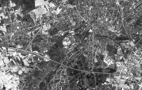
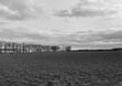
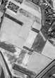
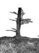
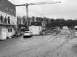

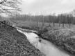
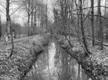
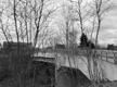
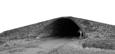
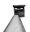
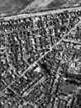
331
-waters -forest -settlement -agriculture -fallow land -infrastructure ©
photo from author
© Adapted from Google Earth
The basis of six types of territory
Heverlee, Leuven
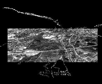
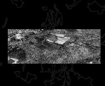
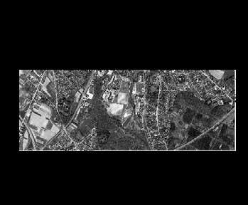
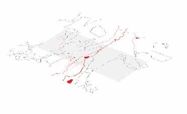
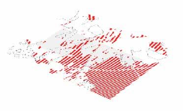
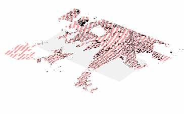
332
Type of Territory: -waters -forest -settlement -agriculture -fallow land -infrastructure
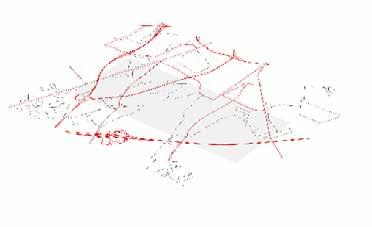
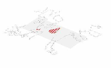
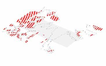
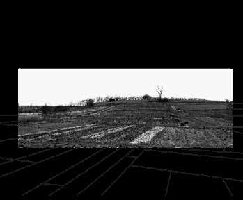
333
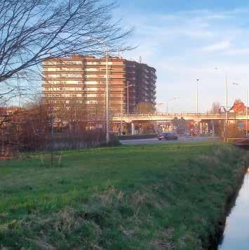
MIDWAY PROJECT VISION

335 05
©
Edwin Kabugi Karanja
336
OFFICE A
RECONNECTING THE VALLEY
337
Reconnecting the valley
Office A
Replace this box with your office vision poster. The poster is one integrated image or pdf.
The vision for the Dijle Valley is to continue and strengthen the valley landscape in the longitudinal direction in order to deal with the high risk of flooding. Allong the valley, different landscape systems will structure the new urban developments.
338
Ana Veronice Martinez, Anagha Pandit, Aliki Tzouvara, Aws Samara, Axelle Haekens, Edwin Kabugi, Hubert Asante, Noviantari, Peiyang Huo, Shuting Li, Taki Tahmid, Tzu-Chun Lin, Yasmine Baamal, Zhongyan Zhang
The Green- blue Spine
Valley meets City
It aims to reintroduce the valley system by removing the city ring radically and bringing the green blue landscapes.
339
Aws Samara, Edwin Kabugi, Taki Tahmid, Tzu-Chun Lin, Zhongyan Zhang
Connecting Landscapes - Tracing History
Valley meets Campus
The vision for the strip is to reconnect the campus valley by reinstating the historical axis of Arenberg Castle and creating the new urbanism throughout the Celestijnenlaan.
340
Anagha Pandit, Aliki Tzouvara, Noviantari, Shuting Li, Yasmine Baamal
Continue the Valley - Strengthen the Edges
Valley meets Fringe
The existing homogenuous campuses on both sides of the valley will be reinforced in order to supply the residential neighbourhoods. The landscape will structure both sides of the valley while the floodplane remains an open natural area.
341
Ana Veronice Martinez, Axelle Haekens, Hubert Asante, Peiyang Huo
342
OFFICE B DIJLE PARK
343
The Dyle Park as a Landscape Figure Structuring the Leuven Valley
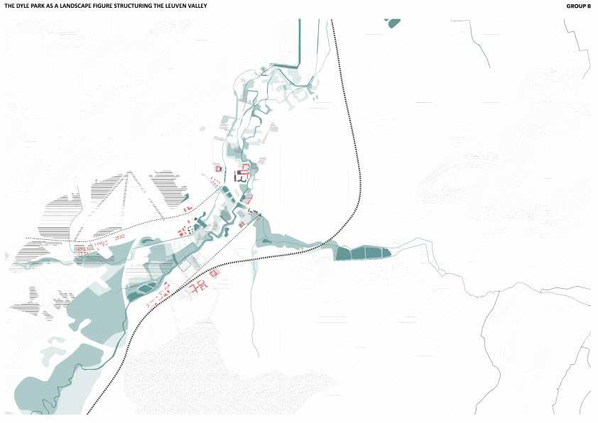
Dyle Park Office
The different clearings that were discovered within and along the valley, but also in the city center of Leuven, form the basis for creating new destinations for the Leuven Valley. In this regard, the Dyle park is formed, as a structural landscape figure for the valley that weaves the plateaus, the slopes and the floodplains altogether.
344
Samantha Arbotante, Rafaela Maria Armoutaki, Frank Bagenzi, Fatma Ben Hfaiedh, Ermias Beyene, Jules Descampe, Shannon De Wandeler, Selenge Dima, Gilles Houben, Yue Hu, Mazen Jubeihi, Kshitij Makhija, Alexander Van Gestel, Arthur Van Lint
THE DYLE PARK AS A LANDSCAPE FIGURE STRUCTURING THE LEUVEN VALLEY
From Dyle Park to Urban Maze
Valley meets City
How to preserve the concistency of the Dyle park from the open to open field campus landscape to the dense city landscape? A network of destinations linked through close relationships along the waternetwork from wetland forest to an urban maze.
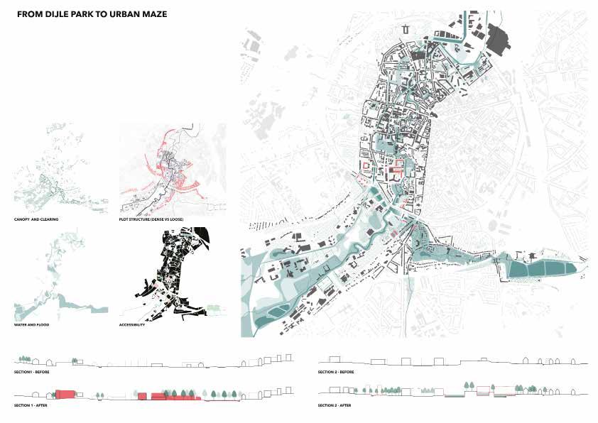
345
Samantha Arbotante, Frank Bagenzi, Ermias Beyene, Jules Descampe, Arthur Van Lint
The Dyle Valley - An Interlace of Seasonal Parks and Landscape Corridors
Valley meets Campus
The valley system, on one hand, is rethought as an interlace of a city park and landscape corridors. The surrounding suburbs, on the other hand, are reshaped by valorizing neighborhood parks.
346
Rafaela Maria Armoutaki, Fatma Ben Hfaiedh, Shannon De Wandeler, Mazen Jubeihi, Selenge Dima
Twofold of the Valley
Valley meets Fringe
Gilles Houben, Yue Hu, Kshitij Makhija, Alexander Van Gestel
Two distinctive landscape arrangements define the valley structure : the dense Heverlee forest on the plateau, and an organized “rabatten” forest within the floodplain. By strengthening and extending both identities throughout the valley, it creates one coherent story that weaves the plateaus, the slopes, and the floodplains.
347
348
OFFICE C THE DIJLE VALLEY PARK
349
The Dyle Valley Park as UniverCity Backbone
The Dyle Valley Park Office
...
Using the Dyle valley as a backbone to enhance the relationship between the city centre and the campus and the nature, creating hybridization across scales. The Dyle Valley Park becomes one continuous figure that goes from the South West to the North East and is made of both green and blue structures. Nuances can be found within the park with different types of vegetation in regards to the topography and different levels of “blue” with temporary and permanent water.
350
Agnes Ayesiga, Basel Beshtawi , Ellen De Wolf, Majd El Achkar, Rula Elkhalili, Shinta Kusumawardani, Nhung Pham, Chloé Poisseroux, Han Qin, Lakshiminaraayanan Sudhakar, Michelle Valladares, Yongxian Zhao
Landscape Patchwork Urbanism
Valley meets City
The first strip, which embeds the junction between the city centre and the campus has a great potential for new development. It offers the possibility to rethink the ring, which currently acts as a divider and can be transformed into a multifunctional connector. In this proposal, cars won’t have access to the city centre, therefore a lot of room is free up for the benefit of slow mobility, citizens and nature. This vision looks to break down the mono-functional aspect of the suburbs and bring diversity to the typology.
351
Basel Beshtawi, Chloé Poisseroux, Lakshiminaraayanan Sudhakar, Michelle Valladares
Living in the Parks
Valley meets Campus
The existing fragemented greeneries of the Valley meet campus strip are connected to create a system of parks by green and blue corridors. These parks are expected to be designed based on their potential identity - the wetland park, the health treatment park, the agricultural park and the sacred park.
352
Agnes Ayesiga, Shinta Kusumawardani, Nhung Pham, Yongxian Zhao
The Forest Reconstructs the Valley
Valley meets Fringe
Ellen De Wolf, Majd El Achkar, Rula Elkhalili, Han Qin
The upstream Dijle area is located at the edge of Leuven, where campus Arenberg sits within the floodplane of the river. During the last decades, the relationship between the urban and the landscape has caused different conflicts to arise. Today is the crucial moment where the roles must be reversed. Our design proposes a large scale reforestation, connecting the remained valuable landscapes and simultaneously structuring the urban and reviving the monofunctional space of today.
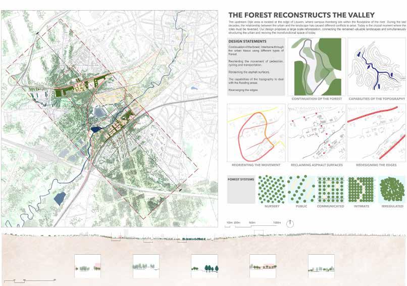
353
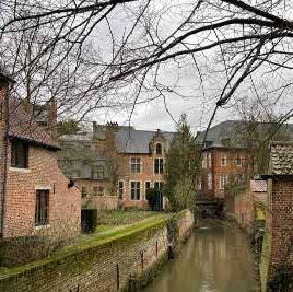
STAKEHOLDERS

355 06
© Zhongyan Zhang
Stakeholder Assignment
356
Office
A
Aws Samara, Edwin Kabugi, Taki Tahmid, Tzu-Chun Lin, Zhongyan Zhan


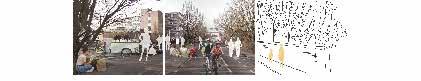
357
Anagha Pandit, Aliki Tzouvara, Noviantari, Shuting Li, Yasmine Baamal Ana Veronica Martinez, Axelle Haekens, Hubert Assante, Peiyang Huo
Stakeholder Assignment
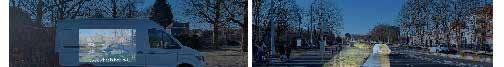

Dyle Park Office
358
Samantha Arbotante, Frank Bagenzi, Ermias Beyene, Jules Descampe, Arthur Van Lint
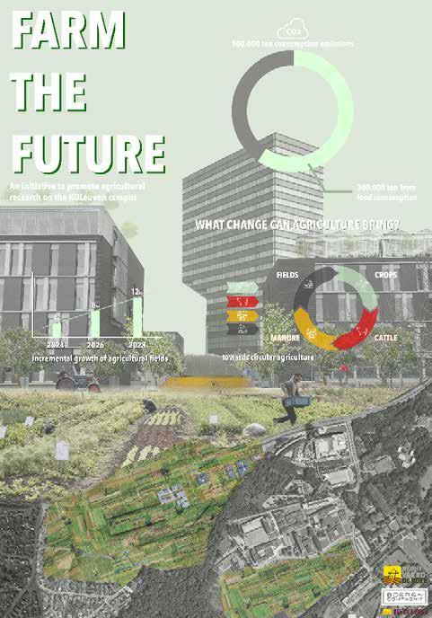
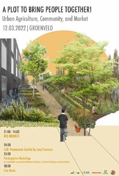
359
Rafaela Maria Armoutaki, Fatma Ben Hfaiedh, Shannon De Wandeler, Mazen Jubeihi, Selenge Dima Gilles Houben, Yue Hu, Kshitij Makhija, Alexander Van Gestel
Stakeholder Assignment
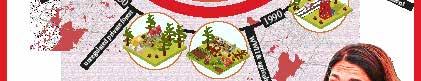
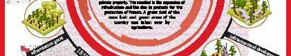
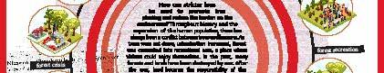
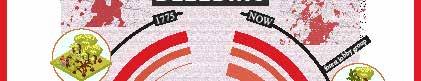
The Dyle Park - Office C
360
Majd El Achkar, Rula Elkhalili, Han Qin, Ellen De Wolf
Agnes Ayesiga, Shinta Kusumawardani, Nhung Pham, Yongxian Zhao
Basel Beshtawi, Chloé Poisseroux, Lakshiminaraayanan Sudhakar, Michelle Valladares
361
STRATEGIC PROJECTS
363 07
© Lakshiminaraayanan Sudhakar
364
OFFICE A
RECONNECTING THE VALLEY
365
Reconnecting the valley, rethinking the edges
Office A
Hubert Asante, Yasmine Baamal, Tzu Chun Lin, Axelle Haekens, Peiyang Huo, Edwin Kabugi Karanja, Shuting Li, Ana Veronica Martinez Reyna, Noviantari, Anagha Pandit, Aws Samara, Taki Tahmid Saurav, Aliki Tzouvara, Zhongyan Zhang
The aim of the office is to reconnect the valley in a longitudinal direction. Therefore, different water management systems on both sides of the valley are implemented in order to embrace the risk of flooding. Then, the landscape forms the main structure to guide future developments.
366
367
Inhabited Parks
Valley Meets City
Aws Samara, Edwin Kabugi, Taki Tahmid, Tzu-Chin Lin, Zhongyan Zhong
From the vision of restructuring Leuven in accordance of the Valley structure rather than the existing radial morphological urban growth, the powerful infrastructures between the centre and the university region is shifted to serve better for habitation rather than imperial capitalist society. The proposal is to impose a central wetland park as a conjunction of the city and the university where boundaries would be obselete.
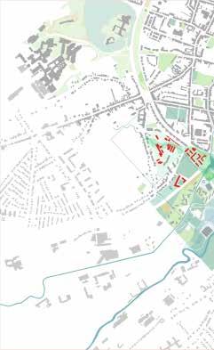
368
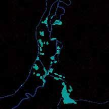
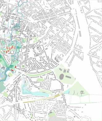
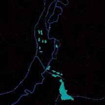
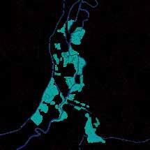
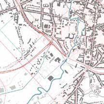
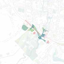
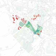
369 DRY SEASON RAINY SEASON FLOODING SCALE: 1:5000 URBAN STRUCTURE VALLEY RESTRUCTURING IMPOSING CENTRAL PARK
Inhabited Parks
meets City Tzu-Chin Lin
The residential park creates a residential environment adjacent to nature, with the forest on the university campus spilling over into the city and fragmenting into smaller scale forms that relate to the new urban residential fabric. At the same time, the water resources within the site are revitalized as dynamic landscape elements that are integrated into the daily living environment.
370
Valley
371
Parks for Nature
Valley meets City
Zhongyan Zhang
In addition to integrating new landscape and inhabitation, the landscape ur banism for the city strip focuses on two design strategies. It aims to
1. radically take off the city ring and transform it into a central park for the region
2. Creating new landscapes along the Dyle River with different urban forests and seasonal stormwater reservoirs considering the extreme drought and wet conditions.
372
373
Rebalancing Harmony of Habitation in the Valley, Redinghof
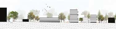
Valley Meets City
Taki Tahmid
From the vision of resturcturing Leuven in accordance of Valley structure rather than the existing radial morphological urban growth, the Redinghof site implicates a crutial perspective of living inside the valley. The design intervention focuses on co-habitation within the forest figure while there can still be rooms for nature and water retention beds and removal of shiftable amenities like storages and parkings to strengthen ecological aspects.
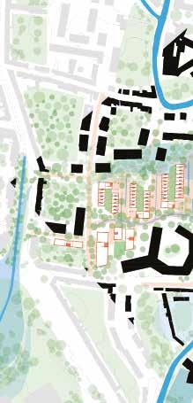
374
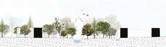
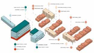
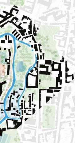
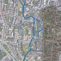
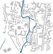
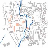
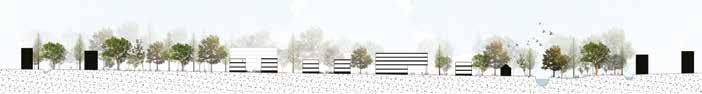
375 ARIAL VIEW BUILT FORM ORGANIZING LANDSCAPE EXISTING LANDSCAPE TYPOLOGY CLEARING MASSES BUILT FORM PROPOSAL Total Buildup 36920 sq.m Total housing proposed 461 units Row Houses 51 units 8856 sq.m Two storied 30 units 4320 sq.m Three storied 21 units 4536 sq.m Affordable apartments 143 units 16848 sq.m 14320 sq.m (-15% circula tion) Apartment Complex 253 units 13800 sq.m 11170 sq.m (-15% circula tion) Student Room 16 sq.m X 100units 1600 sq.m Student Studio 30 sq.m X 60units 1800 sq.m One bedroom 60 sq.m X 40units 2400 sq.m Two Bedroom 90 sq.m X 38units 3420 sq.m Three Bedroom 130 sq.m X 15units 1950 sq.m Row House (Apartments) 14 units 1650 sq.m 1400 sq.m (-15% circulation) Commercial 2 floors 2366 sq.m 2000 sq.m (-15% circulation)
Connected Landscape and Neighbourhoods
Kabugi Karanja
This proposal is structured around the landscape logic of the valley where the new housing typologies (mixed) are designed as connected neighbourhoods on the edges of the valley while its floor (between Voer and Dijle Rivers) is enhanced as a part of a park whose urban tissue adopts soft mobility and is re silient to flooding. Infrastructural barriers (Ring, Koning Boudewijnlaan, Be ginhof parking) are transformed and integrated into a high quality park system as smooth interfaces between different tissues, including the campus and the city. Housing typologies are mixed with different types of housing units and landscape figures such as backyards, courtyards, grasslands, forests, boulevrads interwoven between and around them.
376
Valley Meets City
Edwin
377
378
379
Transversal Narratives In the Dijle Valley
Valley meets campus
Reconnecting the valley, rethinking boundaries
In the valley meets campus, Celestijnenlaan is a barrier dividing the valley yet also an infrastructure that connects the campus and the adjacent suburban neighbourhoods. By rethinking the narratives of the street as a form of public space, the proposal tries to shift hard mobility to soft mobility that valorizes pedestrians and cyclists crisscrossing the valley. The historical axis of Arenberg Castle is another element reinforced to connect the chains of fragmented floodplain landscape and the historical relationship between the campus and the city.
Barriers in the floodplain
Reconnecting the floodplain
380
Aliki Tzouvara, Anagha Pandit, Noviantari, Shuting Li, Yasmine Baamal
Reclaiming the street as a Public space
Reconnecting the historical axis and framing the new connections of the Campus-Valley to its suburbs
Transversal narratives of the Dijle Valley across Celestijnenlaan with the three urban tissues act as hinges - in the north is a dialogue with the agricultural land of Groeneveld, in the middle north is a dialogue within the campus valley, in the south is a dialogue with the forest and mega-structure of Lerkeveld
0 200 m
the urban tissues and their public realms in relation to the framed historical axis
381
Connections between
Transversal Narratives in the Dijle Valley
Anagha Pandit
Landscape urbanism was focused on reintroducing the floodable valley as a continuous system through a rethinking of the infrastructure and the creation of floodable marshes to create catchment areas and floodable walkways, so that the river could take control over as and when necessary. By enhancing the existing network of boulevards and public spaces, that align with the historical axis it emphasizes the importance of existing public spaces within the urban tissues as well as introduces additions to this chain of systems.
382
Valley meets campus
383
Activating the landscape Connecting with the surroundings
Valley meets campus
Shuting Li
Embed a daycare center in this as well as improve the existing forest to increase human activities in this area then make it connext with surroundings.
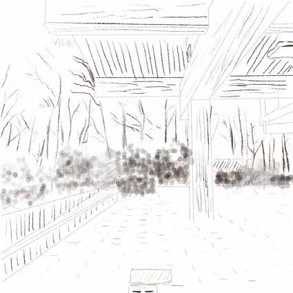
384
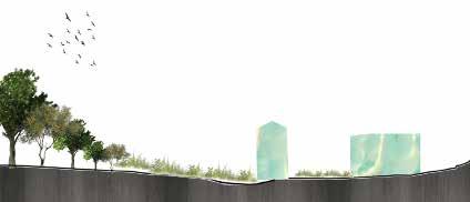
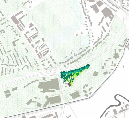

385
Groenveld Terraces
Valley meets campus
Terracing common spaces and buildings as a dialogue with the balcony topography, existing built forms and functions
The urban tissue of Groeneveld Terraces acts as a hinge to shift hard mobility to soft mobility and to weave the suburban neighbourhood and the campus. In the forms and functions, it is a dialogue with the terraces balcony of the up land valley topography, agricultural character, and the diverted axis of Celesti jnenlaan towards the historical axis of Arenberg Domain. At the same time, a mediation to the discordant existing urban forms and fragmented forests of the valley.
A mix of commercial, indoor and outdoor multifunctional spaces, housing typologies, and communal agricultures Common spaces as entrances
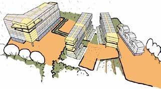
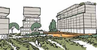
A mix of housing typologies; commercial/F&B terrace, courtyard, playground, and communal garden as entrances and an interface between typologies and the surrounding neighbourhood.
Indoor and outdoor multifunction spaces, rooftop terraces in form of lookouts and roof garden, merging with agricultural land of Groeneveld
386
Noviantari
Lookout
Playground Communal
Terraced
Communal
Communal
F&B terrace
Courtyard Public
Plaza
Communal farm & terrace Multifunction hall
orchard
garden
garden
garden Communal garden
Rooftop garden
outdoor hall
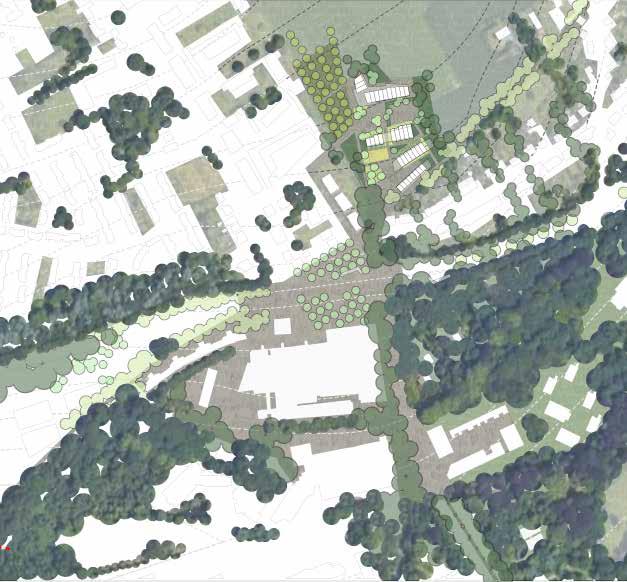
387 0 20 100 (m) Bike lane Bike lane Groeneveld agricultural land
Tree corridor to Arenberg Castle Arenberg forest Tree corridor Forest tree frove Forest tree frove Forest tree frove Univer-City urban tissue Science Park urban tissue Groeneveld urban tissue Upland forest of the Voer Pedestrian plaza
Celestijnenlaan
Weaving UniverCity
Valley meets campus
Yasmine Baamal
The site is approached as part of the system of public spaces shaped by the forest and landscape figures. The typology proposed strengthens the histori cal axis and provides, through the mix of functions, a new collective space in which the residents, working professionals, and students are brought together, bridging the gap between the city and the university.
388
389
The Lerkeveld Balcony
Valley meets Campus
Aliki Tzouvara
The Lerleveld Balcony opens up to the city and stops being an island. The forest structure indicates and guides the development of the new urban tissue. The urbanscape develops around public courtyards. The megastructure coexists with a smaller scale neighborhood, connected by the landscape.
390
391
Reconnecting the valley, rethinking the edges
Valley meets fringe
Where the valley meets the fringe, the aim is to reconnect the floodplane and strengthen the edges. The landscape is used to guide and structure future developments on both sides of the valley.
392
Ana Veronica Martinez, Axelle Haekens, Hubert Asante, Peiyang Huo
393
The water takes over
Valley meets fringe
Ana Veronica Martinez, Axelle Haekens
In Terbank, a green-blue network becomes the new structure for future devel opments in and around the existing science park. In the valley, we celebrate the flooding and create a new experience at the campus.
394
395
The green controls
Valley meets fringe
Ana Veronica Martinez, Axelle Haekens
In Heverlee, two landscape systems become a guiding structure and visual connection between different public spaces. Different landscape strategies are used to experience the transitions in the valley.
396
397
Regeneration of Arenberg II Campus
Valley meets fringe
Peiyang Huo
Currently, this campus have a weak connection with surrounding neighbour hood, forest, river and city centre. Also, internal urban tissue is impermeable, always make people confused and stop people exploring the campus and river. This plan aims to achieve regional connection by which encouraging people commuting by bike, and make this campus more coherent with forest, Dijle river and Heverlee. This plan based on three main mobility way, a boulevard connecting the forest to the river, regional bike paths along the river and along the railway, respectively. Along these three main mobilities, we proposed dif ferent forest pockets to rich landscape. Then these pockets restructure campus tissue and guide its new development. Finally, we believe this campus can be a permeable urban balcony.
398
399
Synergy between nature and urbanity
Valley meets fringe
Hubert Kofi Asante
The Arenberg science park is envisioned as a strong urban spine that connects the two landscapes currently separated by the oversized highway. Enhanced and redesigned blue-green connections together with the site’s topography are used to structure new mixed used urban forms.
400
401
402
OFFICE B DIJLE PARK
403
Reclaim the Dyle Park through a sequence of destinations
Dyle Park Office
Alexander Van Gestel, Arthur Van Lint, Ermias Tessema Beyene, Fatma Ben Hfaiedh, Frank Bagenzi, Gilles Houben, Jules Descampe, Kshitij Makhija, Maria Rafaela Armoutaki, Mazen Jubeihi, Samantha Arbotante, Selenge Dima, Shannon De Wandeler, Yue Hu
Built around the water network, the Dyle Park evolves accross the valley, from the large landscape figures to the urban fabric of the medieval city. A network of clearings within the reafforested campus, and within the dense built tissue of the city center acts as a sequence of adjoined destinations.
404
405
The Dyle park from a wetland forest to an urban maze
Reclaim the Dyle park through a sequence of destinations
Preserve the concistency of the Dyle park from the open to open field campus landscape to the dense city landscape through a network of destinations. These destinations form clearing into a dense land scape structure and are linked through close relationships along the waternetwork from wetland forest to an urban maze.
406
Ermias Tessema Beyene, Samantha Arbotante, Arthur Van Lint, Frank Bagenzi and Jules Descampe.
407
Complete the landscape structure to enhance the destinations of the park
The landscape interventions allow for the consolidation of the structure of the park’s destination system. In this perspective, the new design of the hydrolog ical system consolidates the park’s footprint, reinforces the programs of many destinations, ensures the park’s entry into the city center and strengthens the transition from the park’s landscape system to that of the urban center.
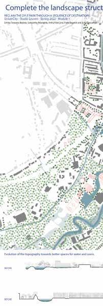
408
Valley meets city
Ermias Tessema Beyene, Jules Descampe.
409
Give Back Spaces to the Floodplane to Ensure the Continuity of the Park
The existing forest structure of the campus and medieval built structure of the city in the Dyle Valley follow a logic of clearing where the forest in the cam pus makes clearings to accommodate human intervention while the medieval built structure makes clearings to allow trees and vegetation. Consolidating this landscape logic enabled the creation of destinations in the envisioned park both for humans and nature.
410
Valley meets city Ermias Tessema Beyene, Jules Descampe.
411
Urban Maze
Arthur Van Lint
The Urban Maze is a mosaic of diverse courtyards that fit into a sequence of pocket parks along the Dyle river. These courtyards are surrounded by an educational soccle, on top of which a wide variety of housing units are oriented in the main direction of the Dyle valley.
412
Valley meets city
413
DYLE PARK ENTRANCES
Bagenzi
The main challenge was how to boost the community’s interaction with the park and strengthen the relationship between Dyle park and both new and existing urban tissues. The whole objective was to connect these familiar spaces of the city and the campus environment and adapt them to the opportunities presented by the water and forest scape in general. Housing units were de signed to have both a direct connection to the main landscape system and were formed around welcoming pocket open spaces. The combination of housing and open spaces act as the gateways to the sequences of open spaces along the water stream in the valley. The housing typologies were mixed with supporting commercial activities to boost the potential of the neighborhood.
414
Bodart (Valley Meets City)
Frank

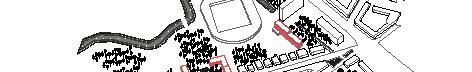

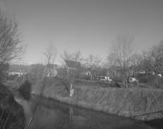
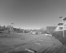
415
CROSSCAPE
Bodart (Valley Meets City)
Samantha Arbotante
From the various potentials surrounding the entire Bodart site, the Crosscape is a vision of living in diverse landscape systems. Through two main strategies, the introduction of the systems of clearings and pocket parks as “fore-garden” transitions to the forests and parks, these choreograph dynamic connections to numerous activities, housing typologies, and existing landscape in this intersection of the campus and the city.
416
417
The Dyle Valley - An Interlace of City and Neighborhood Parks
Valley Meets Campus
The vision proposes rethinking the valley systems as an interlace of seasonal parks and landscape corridors by introducing spatial elements that help in establishing further connections along the landscape, from Groenveld to the Lerkeveld. The vision seeks to reshape the surrounding suburbs by valorizing neighborhood parks by accentuating their role in social and urban development.
418
Fatma Ben Hafiedh - Mazen Jubeihi - Raphaela Armoutaki - Selenge DimaShannon De Wandeler
419
The Dyle City ParkRethinking the valley as an interlace of a
‘City Park’ and landscape corridors
Shannon De Wandeler
In order to give more space to water and protect the old trees and valuable activities from flooding, 2 systems were created: a marshland system along the rivers protects the old trees and a system of islands, based on a cut and fill principle, allows the water to forge its way in between and protects the valua ble activities from flooding. A third system, the watersystem at the Arenberg Castle, colmpletes the whole. Inspired by the ancient drainage system, this system reconnects both rivers and by doing so redistributes the water. In the end, different atmospheres are created within the city park through the differ ent activities that are held along the rivers, going from a ‘Sports Garden’ (most upper part), to a ‘Play Garden’ (middle part) and ending in a ‘Castle Garden’ (Arenberg Castle area).
420
Valley meets Campus
421
Emerging paths and urban figures among the borders
Valley meets Campus
Rafaela Maria Armoutaki
422
423
Two Neighborhood Parks as a Landscape Park
Reclaim the Dyle Park through a sequence of destinations
Selenge Dima
Two neighborhood parks that merge into one landscape park. Using open spaces as a way to revitalize existing neighborhoods and making them into destination places.
424
425
Valorizing Lerkeveld as a Divers Neighborhood
Valley Meets Campus
Fatma Ben Hfaiedh
426
427
Utilizing Intermediary Space to Restructure the Urban Fabric in Campus Arenberg
Valley Meets Campus
Mazen Jubeihi
The project proposes a series of open spaces that help establish a stronger con nection between Celestijnenlaan and Ijzerenmolenstraat through utilizing 3 areas that serve as intermediary spaces as well as spaces for focused densifica tion/development. Being situated in a forest and near a river requires a delicate approach in intervening in the landscape; the proposed interventions pay high attention to the existing situation by catering to the different needs of the site through different typologies.
428
429
Twofold of the valley
Hu
Two distinctive landscape arrangements define the valley structure : the dense Heverlee forest on the plateau, and an organized “rabatten” forest within the floodplain. By strengthening and extending both identities throughout the valley, it creates one coherent story that weaves the plateaus, the slopes, and the floodplains.
430
Valley meets Fringe
Alexander Van Gestel, Gilles Houben, Kshitij Makhija, Yue
431
Extending rigidity
Valley meets Fringe
Alexander Van Gestel, Gilles Houben, Kshitij Makhija, Yue Hu
Two distinctive landscape arrangements define the valley structure : the dense Heverlee forest on the plateau, and an organized “rabatten” forest within the floodplain. By strengthening and extending both identities throughout the valley, it creates one coherent story that weaves the plateaus, the slopes, and the floodplains.
432
433
Weaving density
Valley meets Fringe
Van Gestel, Gilles Houben, Kshitij Makhija, Yue Hu
Two distinctive landscape arrangements define the valley structure : the dense Heverlee forest on the plateau, and an organized “rabatten” forest within the floodplain. By strengthening and extending both identities throughout the valley, it creates one coherent story that weaves the plateaus, the slopes, and the floodplains.
434
Alexander
435
Rethinking the edge
Valley meets Fringe
Two distinctive landscape arrangements define the valley structure : the dense Heverlee forest on the plateau, and an organized “rabatten” forest within the floodplain. By strengthening and extending both identities throughout the valley, it creates one coherent story that weaves the plateaus, the slopes, and the floodplains.
436
Alexander Van Gestel, Gilles Houben, Kshitij Makhija, Yue Hu
437
The campus as new centrality
Valley meets Fringe
Two distinctive landscape arrangements define the valley structure : the dense Heverlee forest on the plateau, and an organized “rabatten” forest within the floodplain. By strengthening and extending both identities throughout the valley, it creates one coherent story that weaves the plateaus, the slopes, and the floodplains.
438
Alexander Van Gestel, Gilles Houben, Kshitij Makhija, Yue Hu
439
440
OFFICE C THE DIJLE VALLEY PARK
441
Office vision
The Dyle Valley Park
The Dyle park is one continuous figure that goes from the South West to the North East and is made of both green and blue structures. Nuances can be found within the park with different types of vegetation in regards to the topography and different levels of “blue” with temporary and permanent water.
442
Agnes Ayesiga, Basel Beshtawi , Ellen De Wolf, Majd El Achkar, Rula Elkhalili, Shinta Kusumawardani, Nhung Pham, Chloé Poisseroux, Han Qin, Lakshiminaraayanan Sudhakar, Michelle Valladares, Yongxian Zhao
443
Islands in the Park
Three main components led the project: the reopening and connecting the blue system while softening its edges; then uniting the green structure, from a very scattered patchwork of greenery to one strong figure that crosses the whole city. Finally, changing the mobility from a car-oriented city center to a car-free one, rethinking these liberated spaces for different common and individual activities.
444
Valley meets City Basel Beshtawi, Chloé Poisseroux, Lakshiminaraayanan Sudhakar, Michelle Valladares
445
Landscape Urbanism City
Valley meets City
Chloé Poisseroux
Two driving forces led the design of this zoom, the first one was to make the rivers accessible to the citizens by re-opening the Voer and the second was give more space to the water, by softening the edges and with punctual points where floods are accepted and welcomed. The design isn’t made just to suit humans but also the natural elements around.
446
447
Reclaiming The Riparian
Valley meets City
Basel Beshtawi
Between the two rivers inside the campus, the raparian area has been frag manted into a distracted urbanism of buildings, river and trees. Instead the design proposed a new urbanism typology that could reclaim the riparian zone through creating this new patchwork of wetlands, submargent wet shrubs areas, reforstration zones, retention basins, flooding plains and urban islands.
448
449
Redingenhof: Islands in the park
Valley meets City
Lakshiminaraayanan Sudhakar
The urban fabric is intertwined with green fingers throughout this the neighborhood. This helps in creating the urban islands in Dyle park, which otherwise were completely disconnected from each other. Built forms are strategically positioned to weave the green together and create a perpetual experience for the user. Hybridizing the urban fabric transforms otherwise monofunctional neighbourhoods into vibrant, bustling neighbourhoods.
450
451 0 30 50 100
The Dyle Park’s Edge
Valley meets City
In this site, the goals are to aim for a connected green figure while enhancing the blue system and retrieving the current urban connections as public spaces. For this, the intervention takes place: first, at the edge of the park, where the different modules for living articulate in the form of towers with heights that go according to the topography. Then, the intervention in the valley strives to condense the current dispersed aged volumes, enhancing the connection from the edge of the protected forest to the new proposed water figure.
452
Michelle Valladares
453
Living in the parks
Valley meets Campus
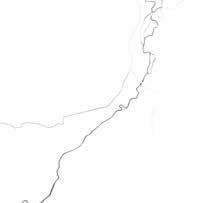
The Leuven flooding system is mitigated by a system of ponds from upstream of the Dyle and Voor river and the KU Leuven Arenberg campus, which is playing the role of a temporary flood control area for the city. To unveil and make use of the best potential from this important role, to transform the city and the university campus, the project’s ambition is to turn the whole campus into a large wetland park not only helping the city face the risk of climate change but also connecting the city and university life. Other fragmented greenery areas throughout the strip will also be connected to this wetland by a blue and green corridors system to create a parks system for the whole area.
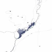
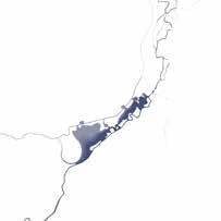
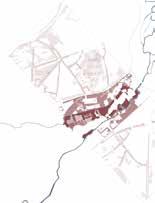
454
1
1
2
2
3
3
Agnes Ayesiga, Nhung Pham, Shinta Kusumawardani, Yongxian Zhao Water intervention Green intervention
The Dyle Park
The Dyle and Voor rivers
Fragmented greenery
Transform the Dyle park
Connection and strenthening
Strengthen the water system
A new Alma 3
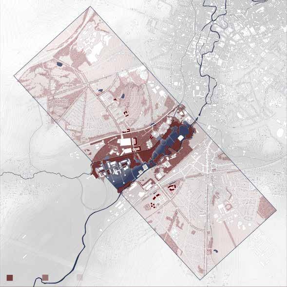


455 1 Erasing the egdes - Koning Boudewijnlaan conversion Wetland forest Valley forest Slope forest 0 100 300 500 1 | Health treatment park 2 | Agriculture park 3 | Sport park LU 2 LU 1 UT 1 UT 2 4 | Wetland park 5 | Sacred park 1 2 2 4 5 3
The Wetland Park
Valley meets Campus
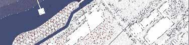
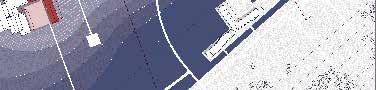
The challenge of the concept is how to connect the two rivers: the Voor and the Dyle with the fact that they have different cotes, therefore the solution is to create a level-changing water system, to transform the whole floodable area into a permanent wetland park. Thanks to this, the biodiversity and ecosystem services of Leuven will be strengthened with different landscape scenarios for both nature and human beings, open the door to a new dynamic univercity area where human can live hrmonically with nature.
456
B 50 250 0 150
Nhung Pham
A
Section B - Flooded period


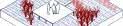

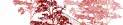

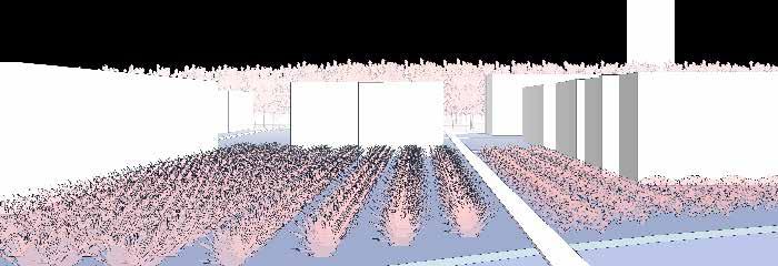
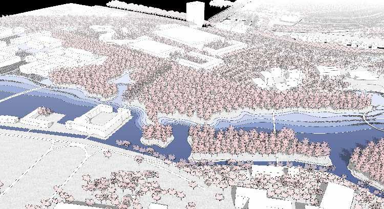
457
Section A - Flooded period Living with agriculture Section A - General condition 1. Valley forest 2. Floodable forest 3. Wetland plants 4. Living with agriculture 5. Spiritual connection
Section B - General condition Urban inside the park
The Agricultural Park
Valley meets Campus
Shinta Kusumawardani
The fragmented agricultural land is developed into a new agricultural park with three-compartment sparing system (forest, food forest, and agricultural landscape) which allows for maximum agricultural yield while still gives spaces for the natural habitat. Connection with the surrounding parks as well as res idential tissues is strengthened with a series of water system (retention ponds and waterways) and green pedestrian walkways.
458
459
Living in the park
Valley meets Campus
Agnes Ayesiga
The housing tissue adapts to the landscape intervention by creating islands of builds that define the edge of the park around the Alma site. The intervention also creates a relationship with the celestinjnenlaan by creating public squares to the buildings.
460
461
Living in the Parks Site Plan
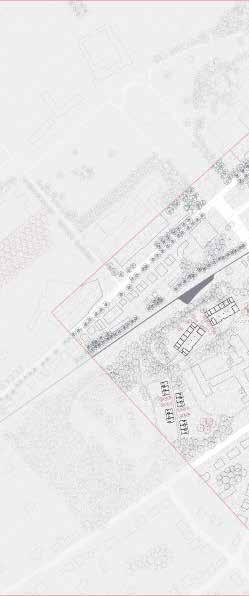 Valley meets Campus
Yongxian Zhao
Valley meets Campus
Yongxian Zhao
Section
Based on the landscape urbanism stretgies, the urban tissue will follow the green and blue corridors and form a new framework . The new housing typol ogy will be built along the contour lines, and 400 housing units will be divided into three types, so that people living here can feel the “living in the parks”.
462
Housing Typology
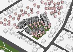
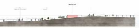
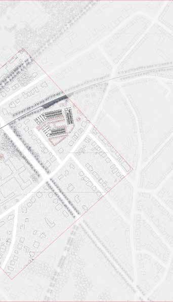
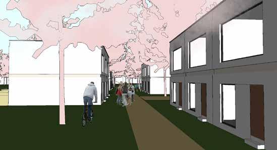
Family housing
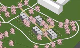
Courtyard housing Student housing
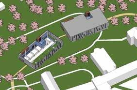
Diagram
Perspective
463
Blue Green Interweaving Urban
The site is between the urban, campus and nature with a large number of edges spaces in-between. These spaces are composed of a series of diversified and rich blue-green landscape spaces. our purposal is to interweave the urban , campus and nature, solve a series of urban and natural conflicts, and finally re-cognize the territory of Dilje Park by redefining, deconstructing and con necting the blue-green system based on local conditions.
NATURE
Colonization by Urban Inaccessibility Fragmentation
Landscape System
URBAN
Mobility Housing Shortage Flooding
Desgin Statement
Redefining Housing Edges
Restricting Colonization Concentrated Urban Development
Connecting Urban System and Forest System
Neigboring Forest Agricultural land Linear Infrastracture
Water Management
Permanent Water System
Temporary Water System
The Permeable Flooding Zone
Connecting Campus and City Soft Mobility Hard Mobility New Urban Funciton
Redefine the Valley Park Edges
464
Ellen De Wolf, Han Qin, Majd EI Achkar, Rula Elkhalili
Desgin Driver
Plateau Forest
Gentle Slope
Valley Forest Steep Forest
Valley meets Fringe
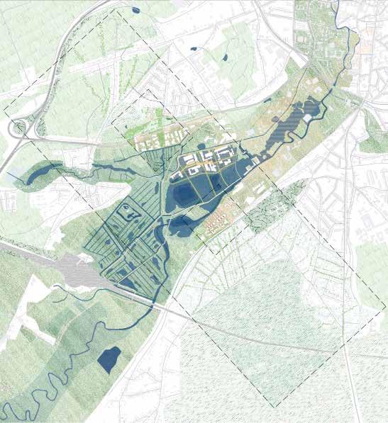
465 0 100 200 500m
Blue Green Interweaving Urban
Valley meets Fringe
Ellen De Wolf
The landscape urbanism proposal suggests a continuation of the forest through a diversity of forest types, defined by the different topographical contexts of the science park site. A gradient from dense wild forest on the steap slope, to a rigid system of trees in urban squares, or an open grassland on gentle slopes offer a large range of urban green environments, giving opportunity for urbanity to thrive.
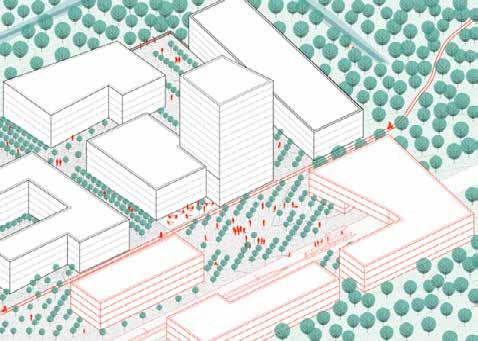
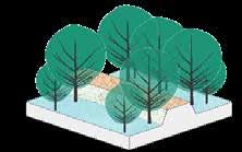
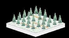
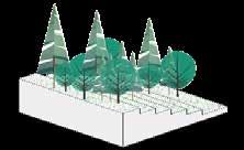
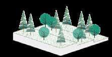
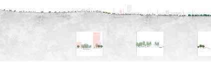
466
Steep Forest
Gentle Forest Public Forest
Flooding Forest
Communicated Forest Organic Forest
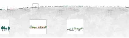
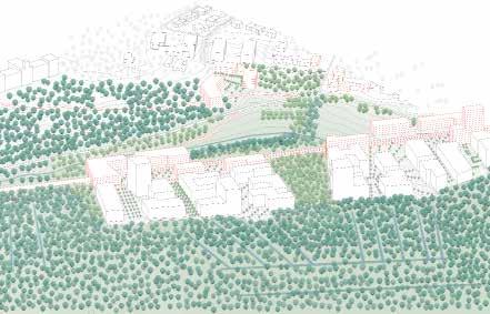
467
Blue Green Interweaving Urban
Valley meets Fringe
Han Qin
Dynamic Green and Blue Strategies
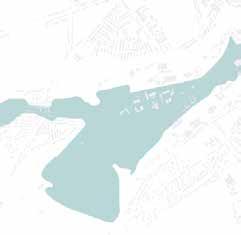
Through the filling and excavation strategy and the transfer of soil deposition of the dam, a dynamic flood control system is achieved, and the unique wetland system between the dry ditches and permanent water area is used to ex pand its influence to the whole range; At the same time, cultivate plants suitable for wetland growth.Also, the trees planting is obeyed same logics, from trees’ nursery, to low-density urban forest to organic natural forest.
Elevated Corridor in Flooding Seasons
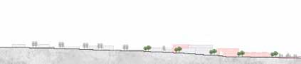
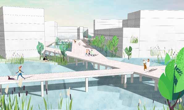
468
Forest Nursery
Public Forest Communicated Forest
of
Management
System
Three types
Water
Permanent Water
Temporary Water System The Permeable Flooding Zone
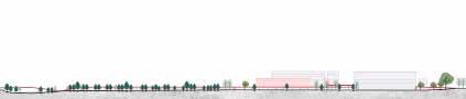
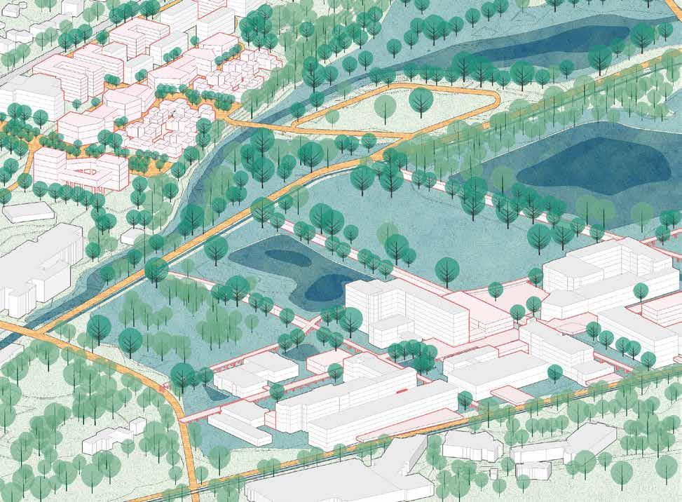
469 0 20 50 100m
Organic Forest Flooding Forest Dyke Forest
Blue Green Interweaving Urban
The design is aiming for reconnecting the site with the city, the university, and the valley, and transform it from a mono-functional enclaved zone into an ac tive part of the city. Attracting new users at different times of the day and year by injecting new functions into the site and designing the relation with the surrounding parts of the city are the general key drivers in this process.
The overall spatial configuration aims for enhancing the visual and physical relationship with the valley and enhancing continuity in the shape of the forest through the linear green active corridors. Moreover, the spatial configuration of housing units is seeking to inspire communal connections in the form of semi-public courtyards and corridors.
470
Rula Elkhalili
Valley meets Fringe
471
Blue Green Interweaving Urban
Valley meets Fringe
Majd El Achkar
When it comes to connecting sites and interacting with visitors, the science park has its limitations. Urban tissue and topography are emphasized in the design approach in three focal points. In the first design, the highway that con nects the city to the highway is built on the other side of the road. This further creates a connection and invitation to a new urban experience for the public. With the second intervention that adapts to the neighborhood’s height and respects its topography, the project is expanded into an isolated neighborhood, inviting the community directly into the project crease as the forest grows, adding to the number of housing units and setting an example for the future expansion of urban areas.
472
473

475 08 ACKNOWLEDGEMENTS © Axelle Haekens
STUDIO UNIVERCITY
Dijle Valley, Leuven, Belgium
Student Groups Office A Student Groups Office B Student Groups Office C
Group 1 Zhongyan Zhang Tzu-Chun Lin Aws Samara Taki Tahmid Edwin Kabugi Karanja
Group 2 Shuting Li Anagha Pandit Aliki Tzouvara Noviantari Yasmine Baamal
Group 1 Ermias Tessema Beyene Jules Descampe Arthur Van Lint Frank Bagenzi Samantha Arbotante
Group 2 Shannon De Wandeler Maria Rafaela Armoutaki Selenge Dima Mazen Jubeihi Fatma Ben Hfaiedh
Group 3 Axelle Haekens Ana Veronica Martinez Hubert Asante Peiyang Huo
Group 3 Gilles Houben Alexander Van Gestel Kshitij Makhija Yue Hu
Group 1 Chloé Poisseroux Lakshiminaraayanan Michelle Valladares Basel beshtawi
Group 2 Nhung Pham Shinta Kusumawardani Yongxian Zhao Agnes Ayesiga
Group 3 Ellen De Wolf Han Qin Majd El Achkar Rula Elkhalili
476
Teaching Team
Bruno De Meulder, KU Leuven
Kelly Shannon, KU Leuven
Pieter Van den Broeck, KU Leuven
Annelies De Nijs, Atelier Horizon Mircea Munteanu, Metapolis Thomas Willemse, Studio Thomas Willemse
Guests
Guest lectures
Daan Van Tassel, City Planning Department Leuven Wiet Vandaele, City Planning Department Leuven Cato Leuraers, KULeuven Jan Pauwels, Vlaamse Milieumaatschappij
Inspirational visits
Cati Vilquin, KULeuven Tom Boogaerts, Bogdan & Van Broeck Guido Geenen, WIT architecten
Jury members mid-review
Guido Geenen, KULeuven Martine Stoffyn, KULeuven Arnout Vandenbossche, BUUR part of Sweco Daan Van Tassel, City Planning Department Leuven
Jury members final review
Yuri Gerrits, KULeuven
Joris Moonen, KULeuven Jeroen Stevens, KULeuven Bo Billiet, Planning Department Province of Vlaams-Brabant
477
