
1
Agenda 2 Introduction Historical timeline and Current situation Group Persona City Comparison Layer Analysis Potato Plan and Intangible layers SWOT Analysis Urgency Strategies Conceptual vision Master plan Target group Future User Experience City guide Strategy 1 - Green corridors Strategy 2 - Enhance biodiversity Strategy 3 - Waterfront Development Strategy 4 - Freshwater Aquaculture Strategy 5 - Urban Agriculture
Name of the Person Brain storming done by Page Number Labdhi, Manasi Labdhi, Manasi Labdhi
members Shubhrata, Mayu
members Mayu Shubhrata Shubhrata Manasi
members Manasi Mayu Abhinav Labdhi Mayu Manasi Shubhrata Abhinav 3 4 – 5 6 7 8 9 10 11 12 13 14 15 16 17 – 23 24 – 35 36 – 46 47 – 57 58 – 66 67 – 76
Done by:
All group
All group
All group
HEERLEN is one of the most important cities in Dutch mining history which gathers 5 of 13 mines in Netherlands. It remained largely agrarian until coal mining began in the late 19th/early 20th century. In 1901, the national government stepped in and set up the State Mines. In a short period of time several large state-operated coal mines began production. The population rose sharply from 6646 in 1900 to 32,263 in 1930. The coal mines remained central to the development of Heerlen into a modern city until the early 1960s.
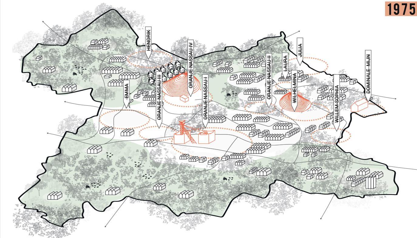
In the period 1965–1975 the coal mines were closed altogether. In the area around HeerlenKerkrade-Brunssum and Sittard-Geleen 60,000 people lost their jobs.

Statistics


Unemployment:


Unemployment in Netherlands vs in Heerlen
Crime
Heerlen as many shrinking towns is facing a lot of crime and drug use.
Education
Students leaving schools are expected to drop by 11% in 2030.
Introduction
https://www.kunstinkaart.nl/product/heerlen-black-city-map/
3
Historical timeline
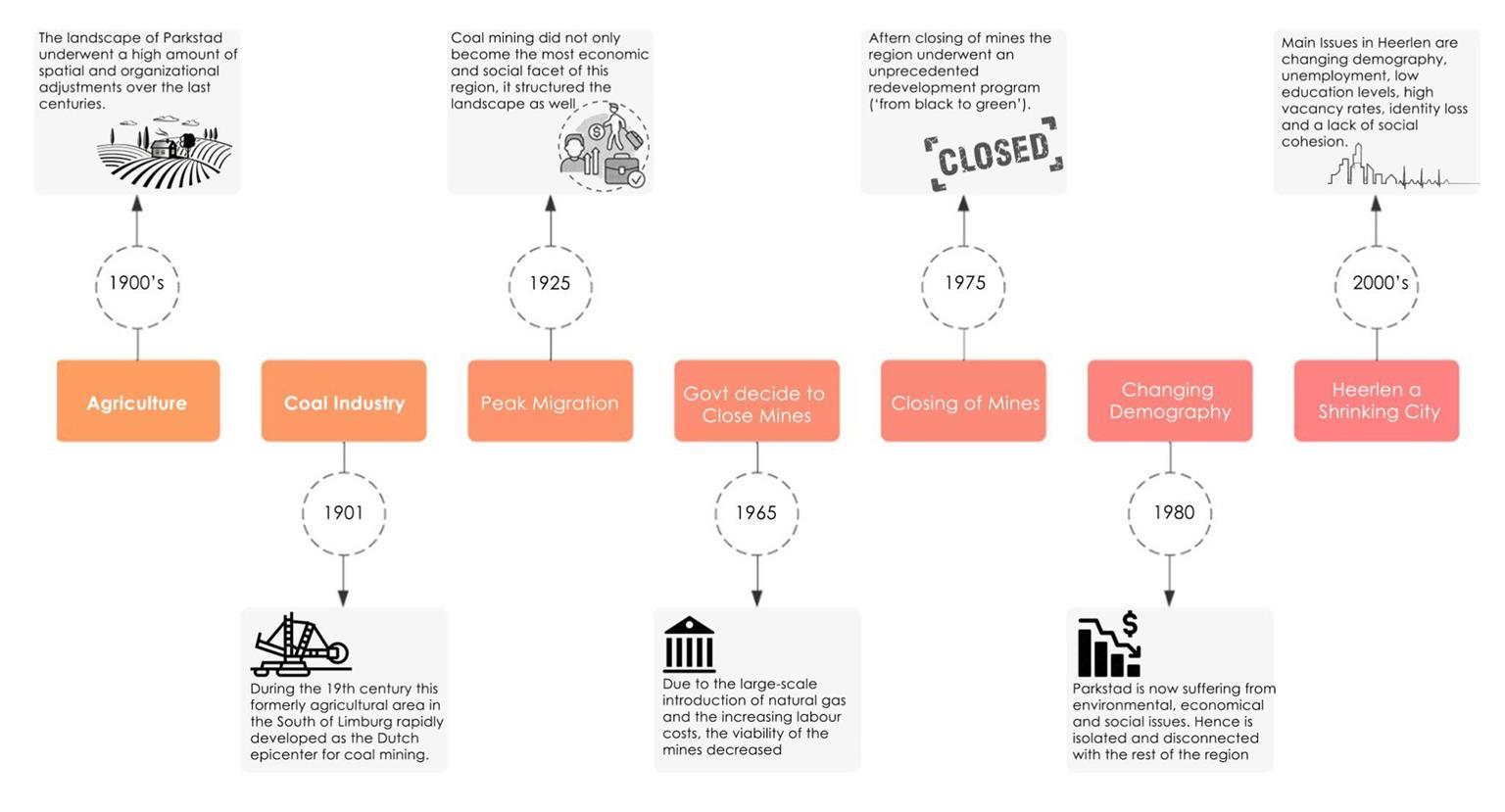
4
Current situation
RESOURCES ARE DEPLETING
ECOSYSTEMS ARE DISRUPTED

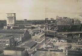
CURRENT SITUATION THE EXTRACTION REGION


BIODIVERSITY IS DAMAGED

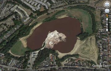
https://repository.tudelft.nl/islandora/object/uuid%3A03d60e26-3054-4873-8a9d-6a851b20f3aa
5
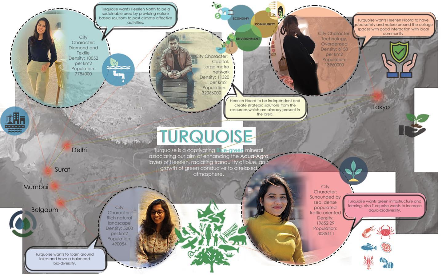
Group Persona
6
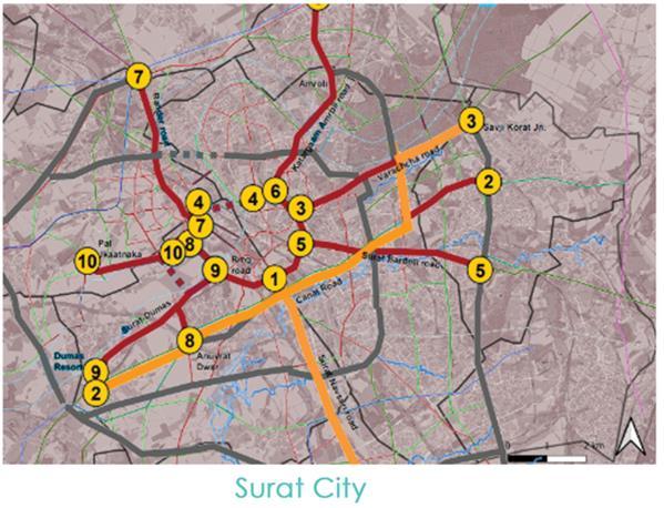
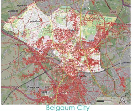
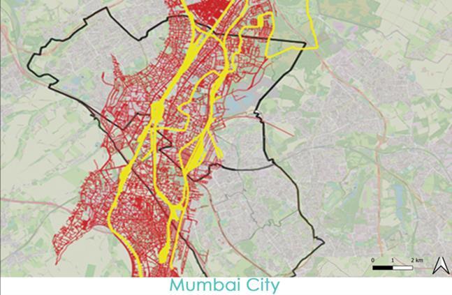
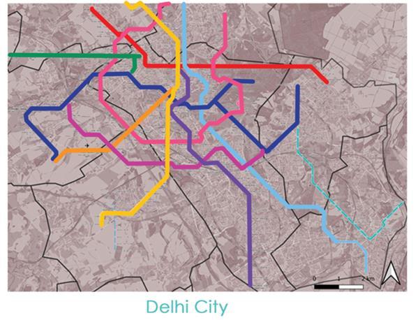
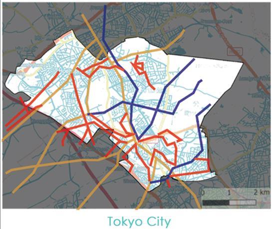
City Comparison 7
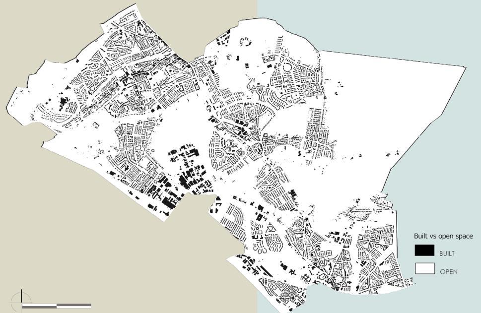


Layer Analysis 8
Potato Plan
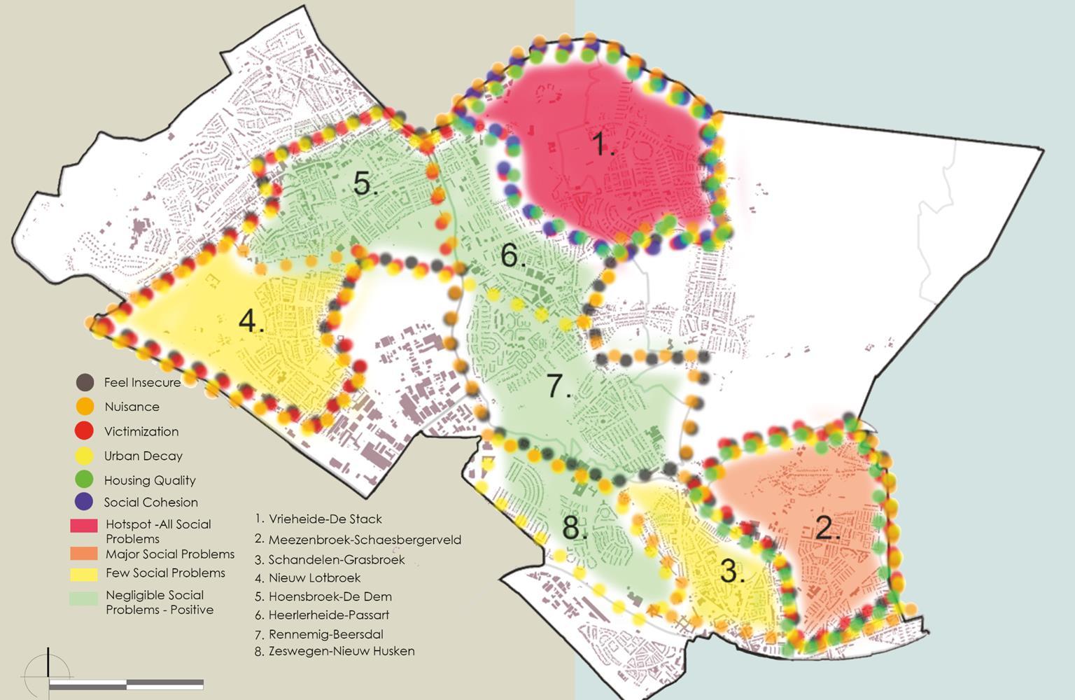
Analysis of intangible layers

9
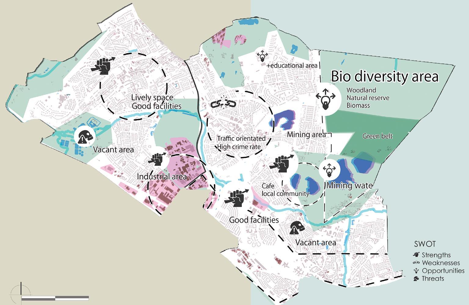
SWOT Analysis 10
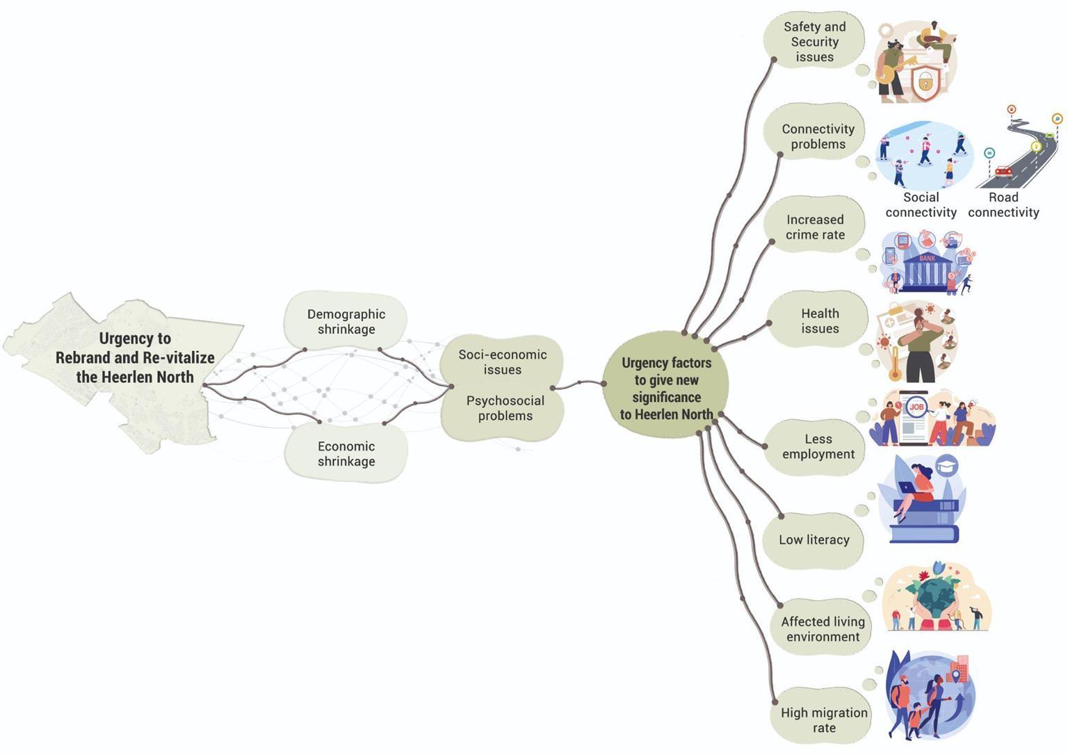
11
Urgency
To re-vitalize and rebrand Heerlen North, there are 5 strategies based on our theme that is water and green.
1st strategy is to create green corridors.
2nd strategy is to enhance biodiversity.
3rd strategy is to develop waterfront areas.
4th strategy is to propose freshwater Aquaculture.

5th strategy is to propose urban agriculture.

12

13
Master plan

14


15
Future User Experience

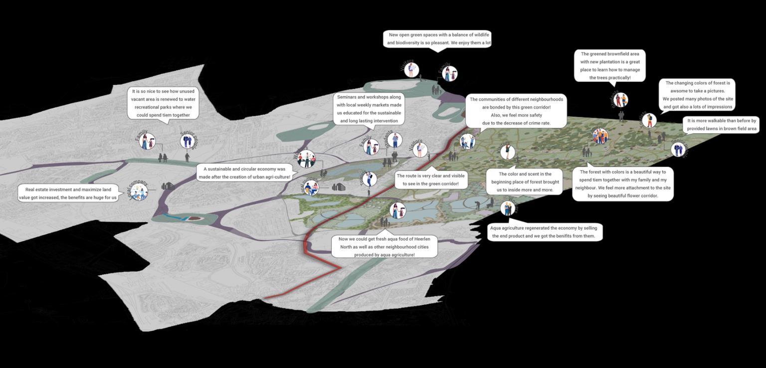
16
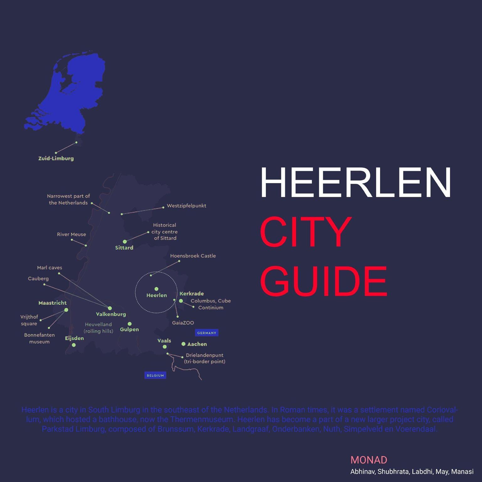
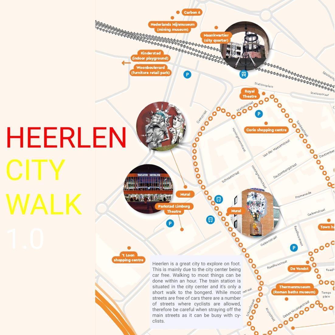
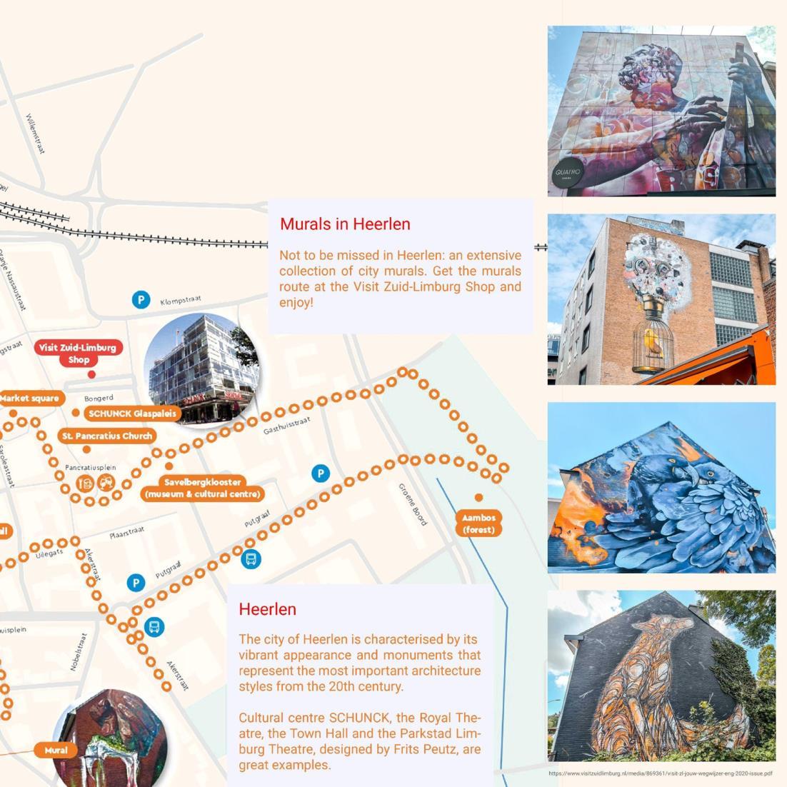
City Guide

17


18


19


20


21
22


23
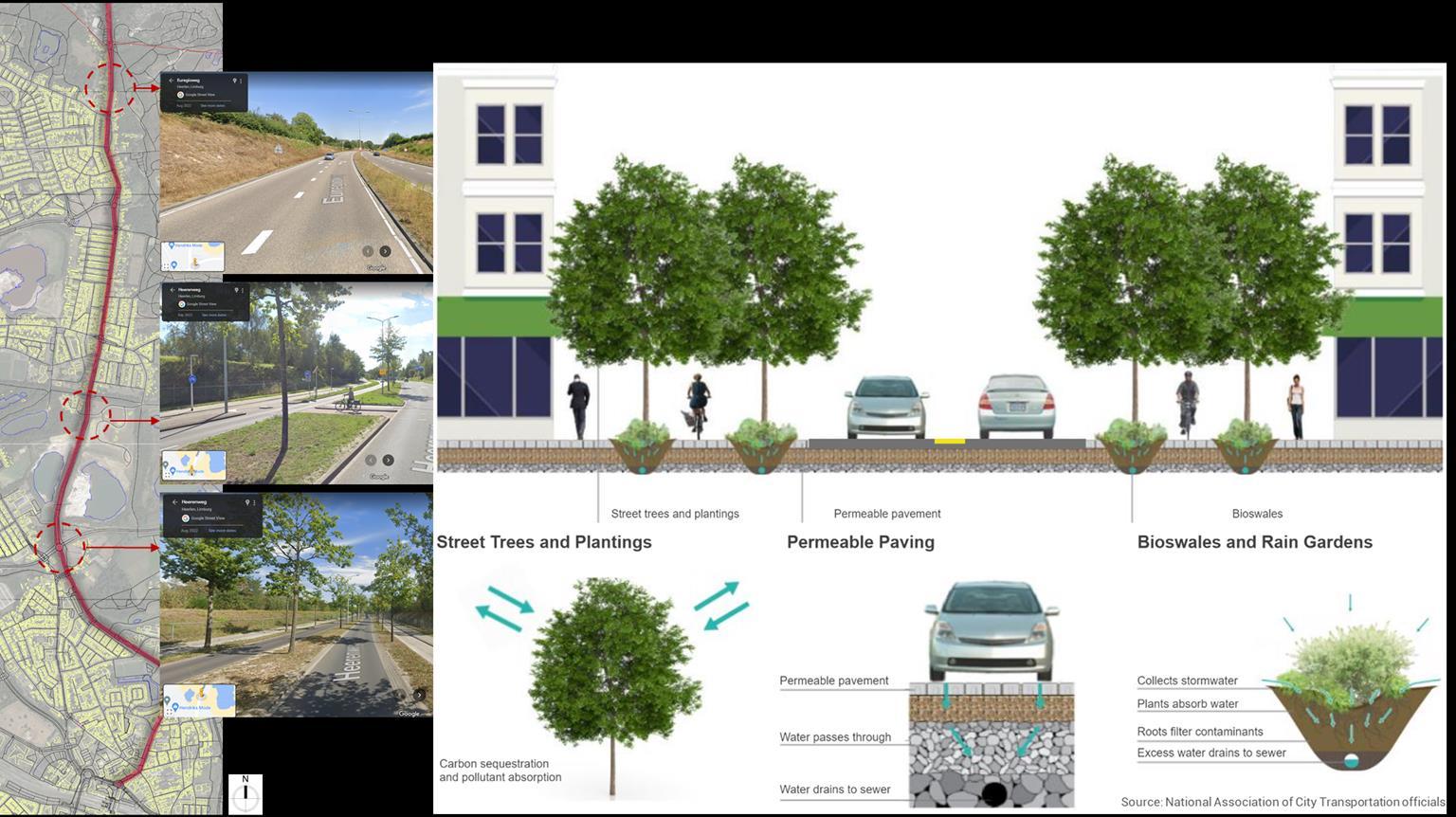
Strategy 1 Green corridors
24
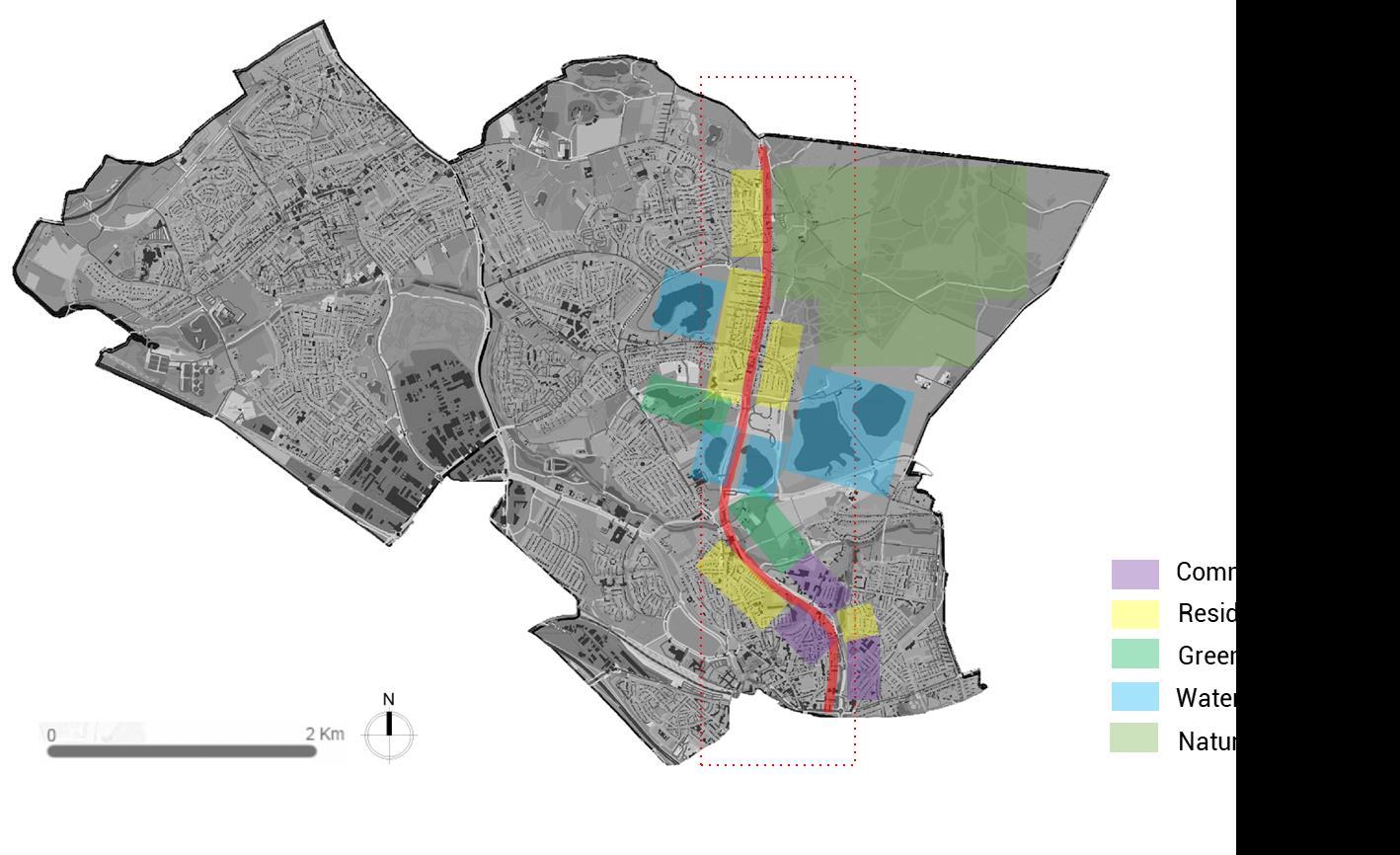
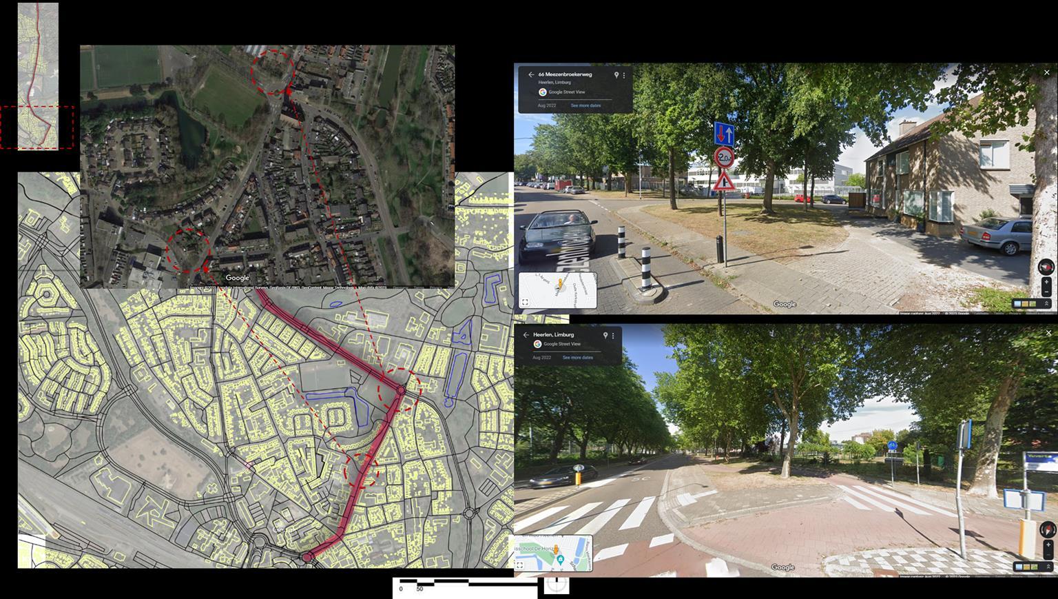
In terms of land use, The whole area showed here is mixed use with all types of neighbourhoods. For example, Residential, Commercial, Green lands, Nature reserve, waterbodies.. Etc. But the major weakness is these neighbourhoods are not well connected and that is why people who is living here are not able to use all these amenities at the most.
25
This path of corridor is selected to enhance the social communications as there is are many gaps and social problems like Urban Decay, Social Cohesion, Victimization, Etc. As we can see the area which is highlighted in red - vrieheide-de Stack area is hot-spot of all social problems and orange highlighted area - Meezenbroek has major problems.
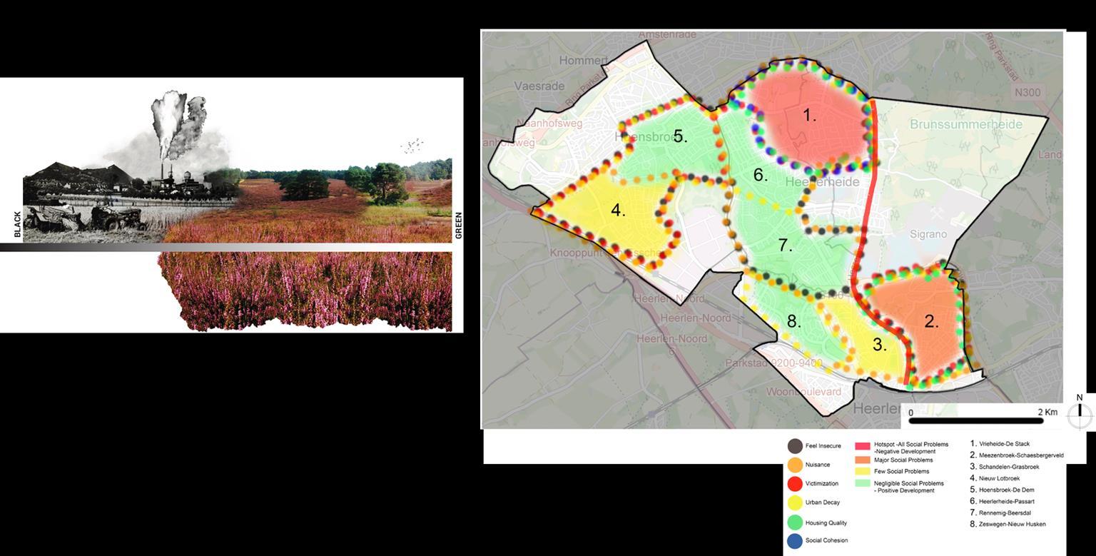
26
•Stitch & Boost
As west part of Heerlen Noord is already active in terms of social activities and tourist places and there are few negative points on east side. To unify the whole area we need to facilitate the problems and threats of east area and propose solutions.
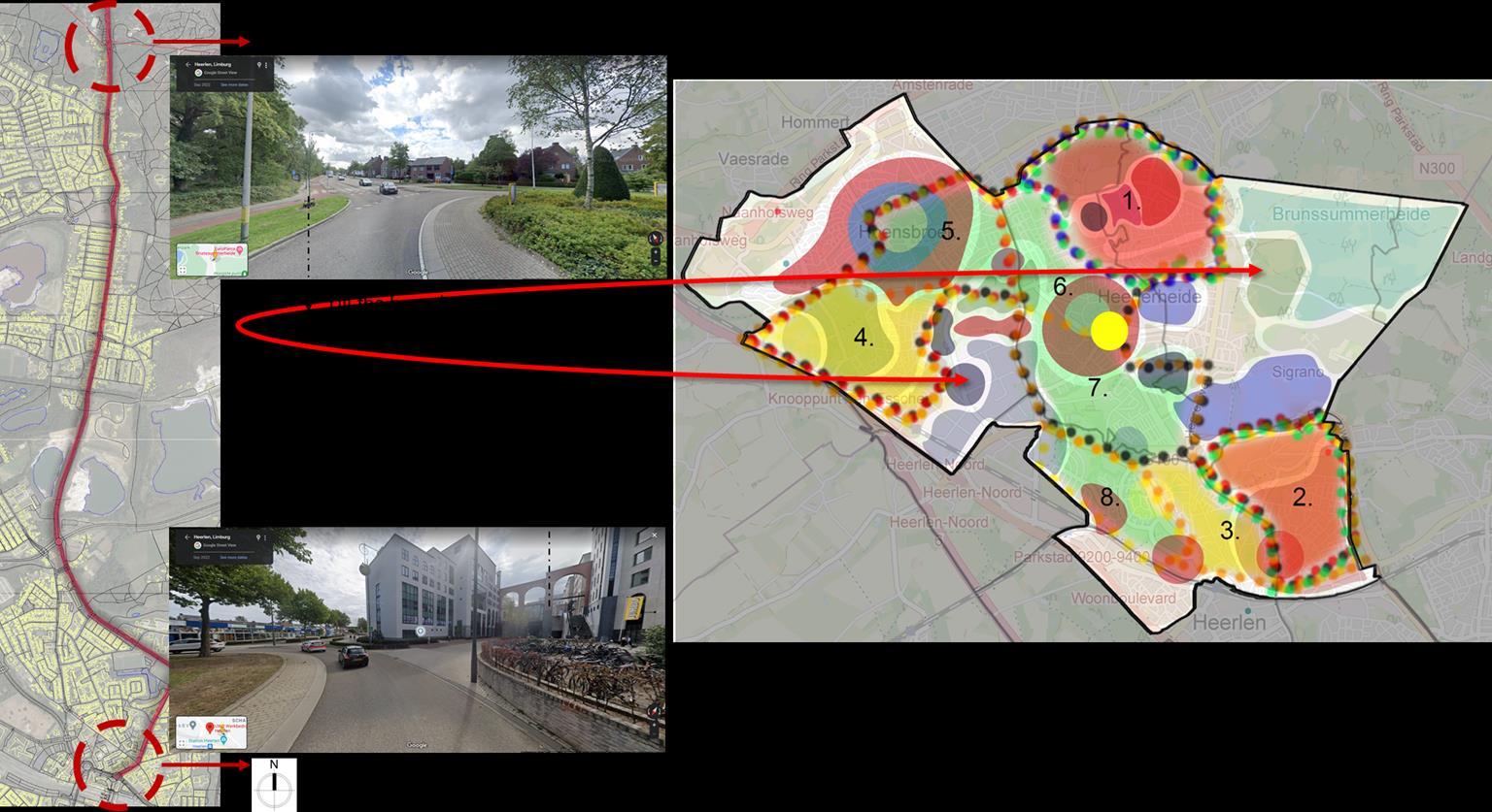
27

28
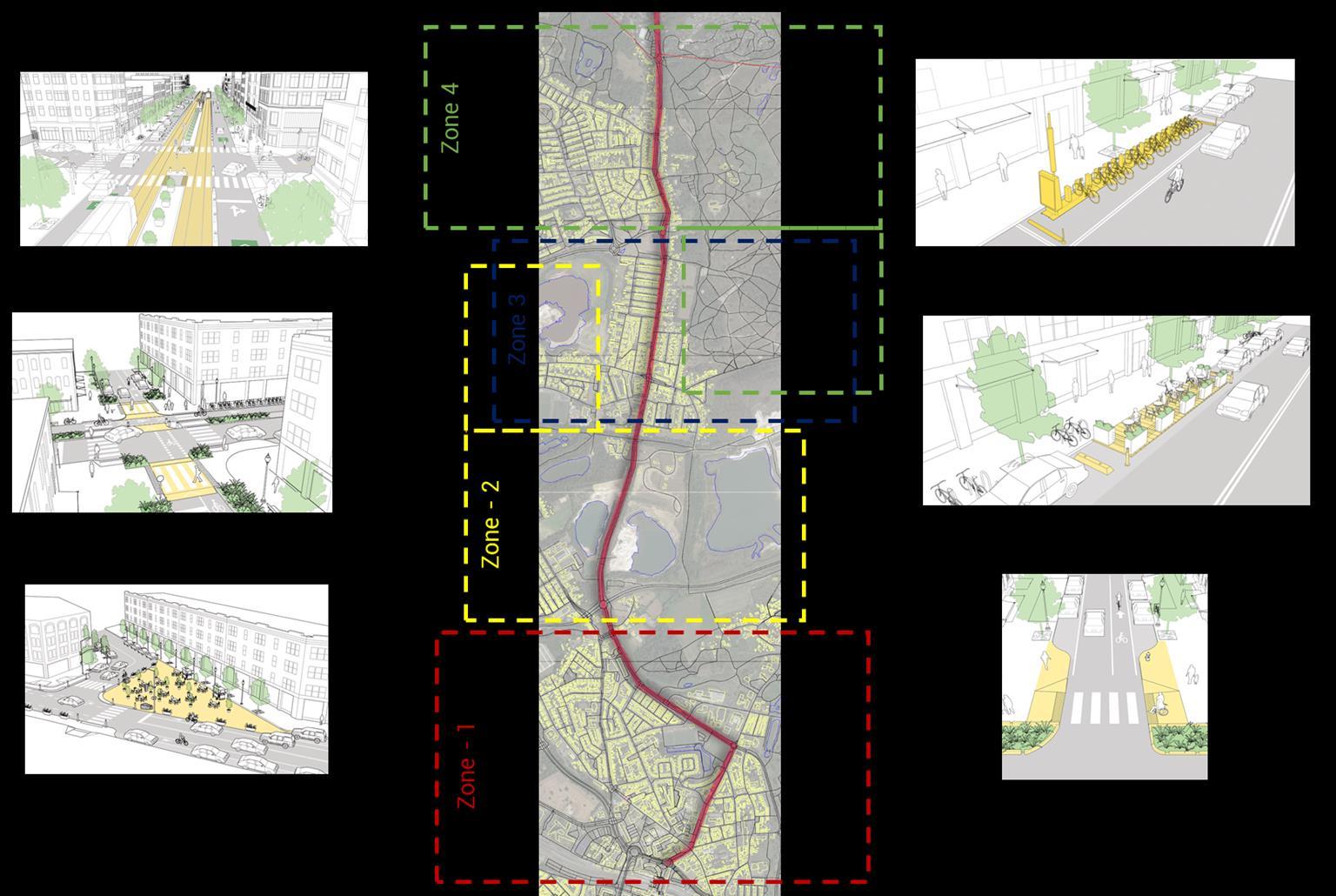
29
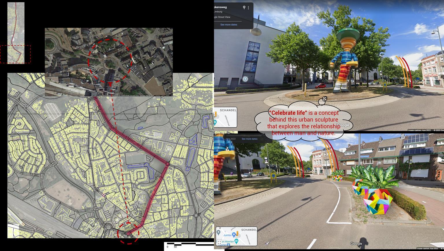
30
31

32
33

34

35
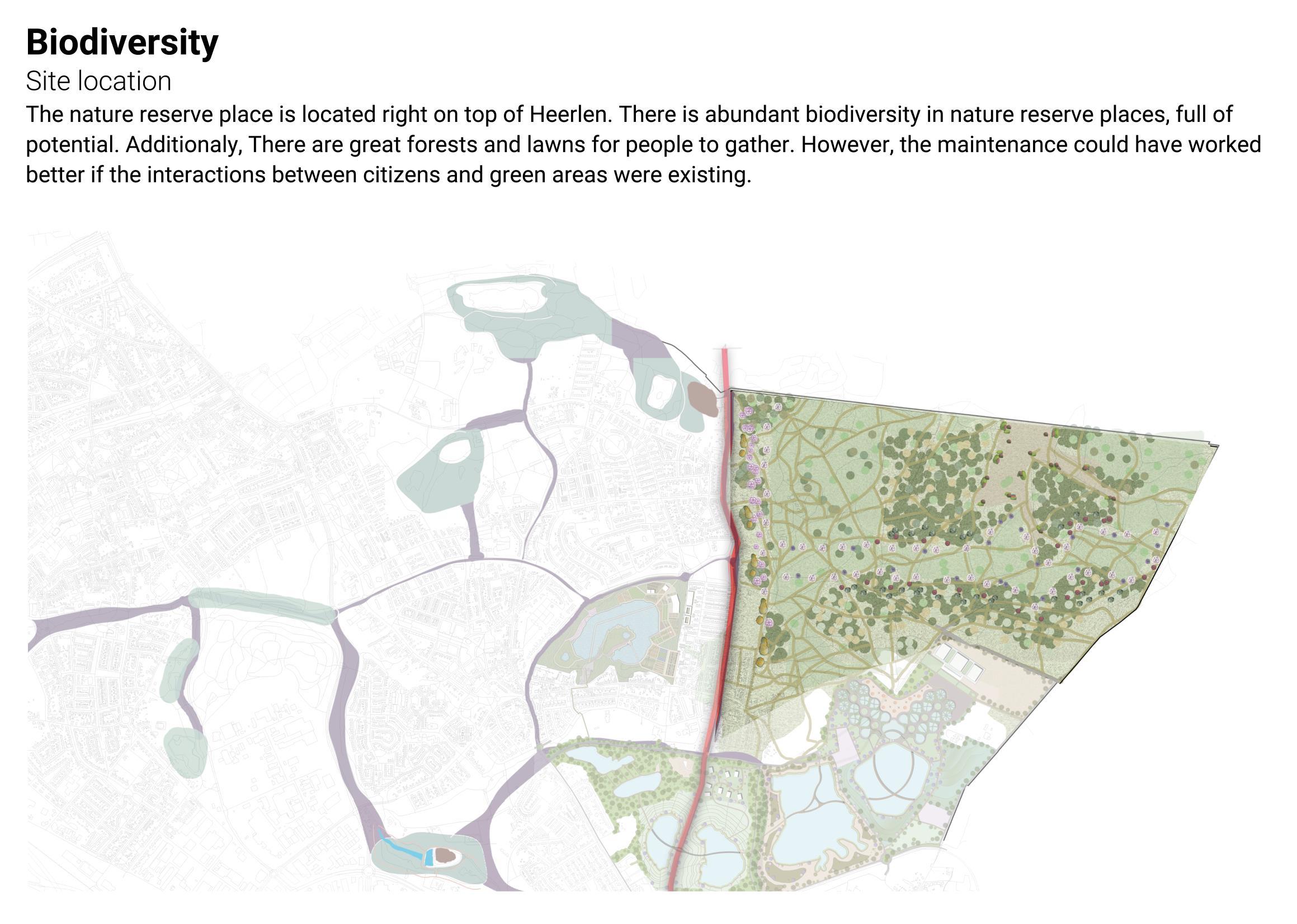
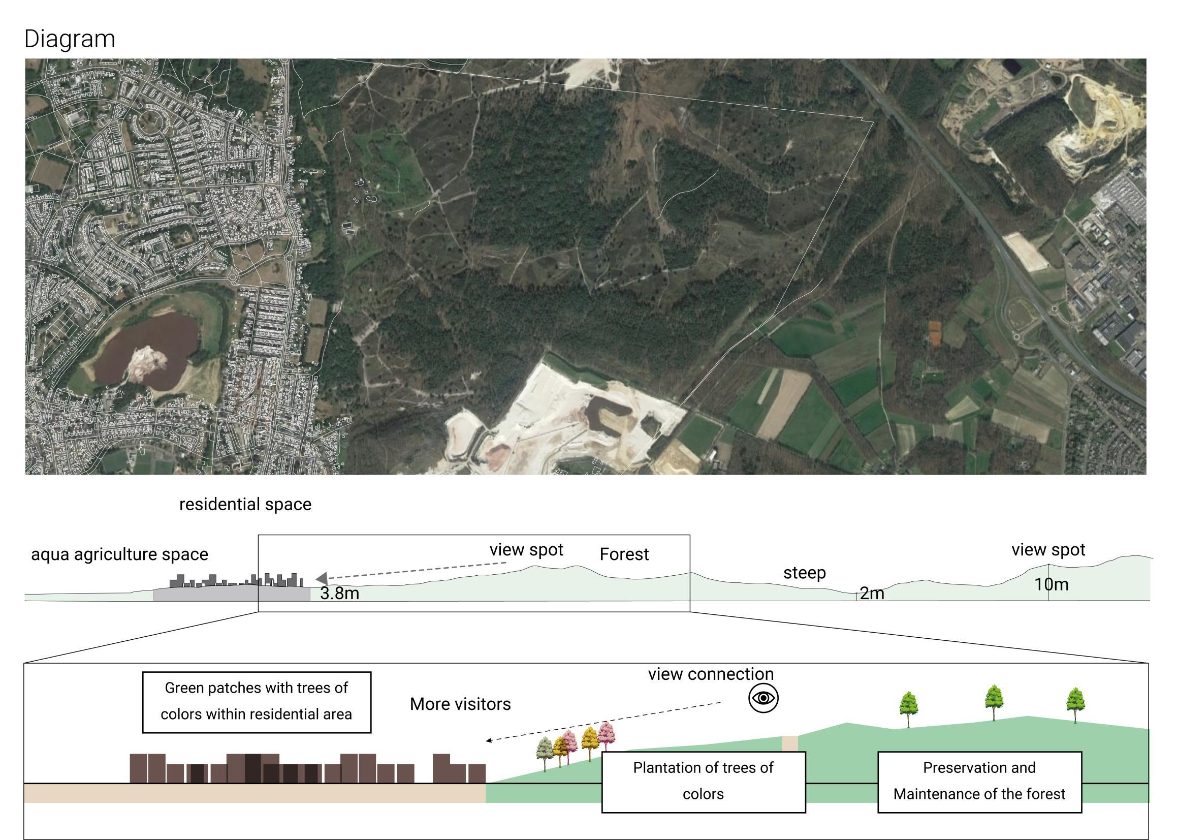
Strategy 2 Enhance biodiversity
36
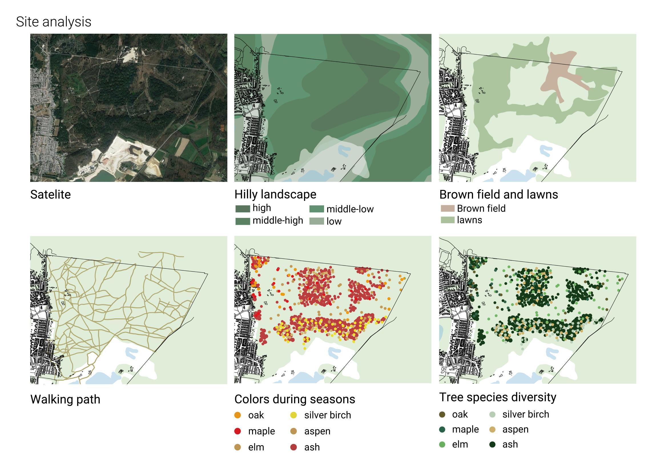
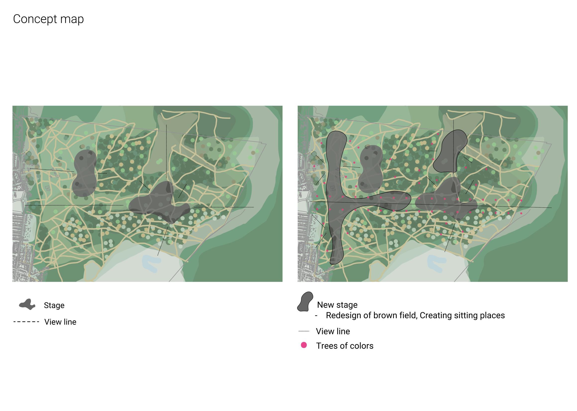


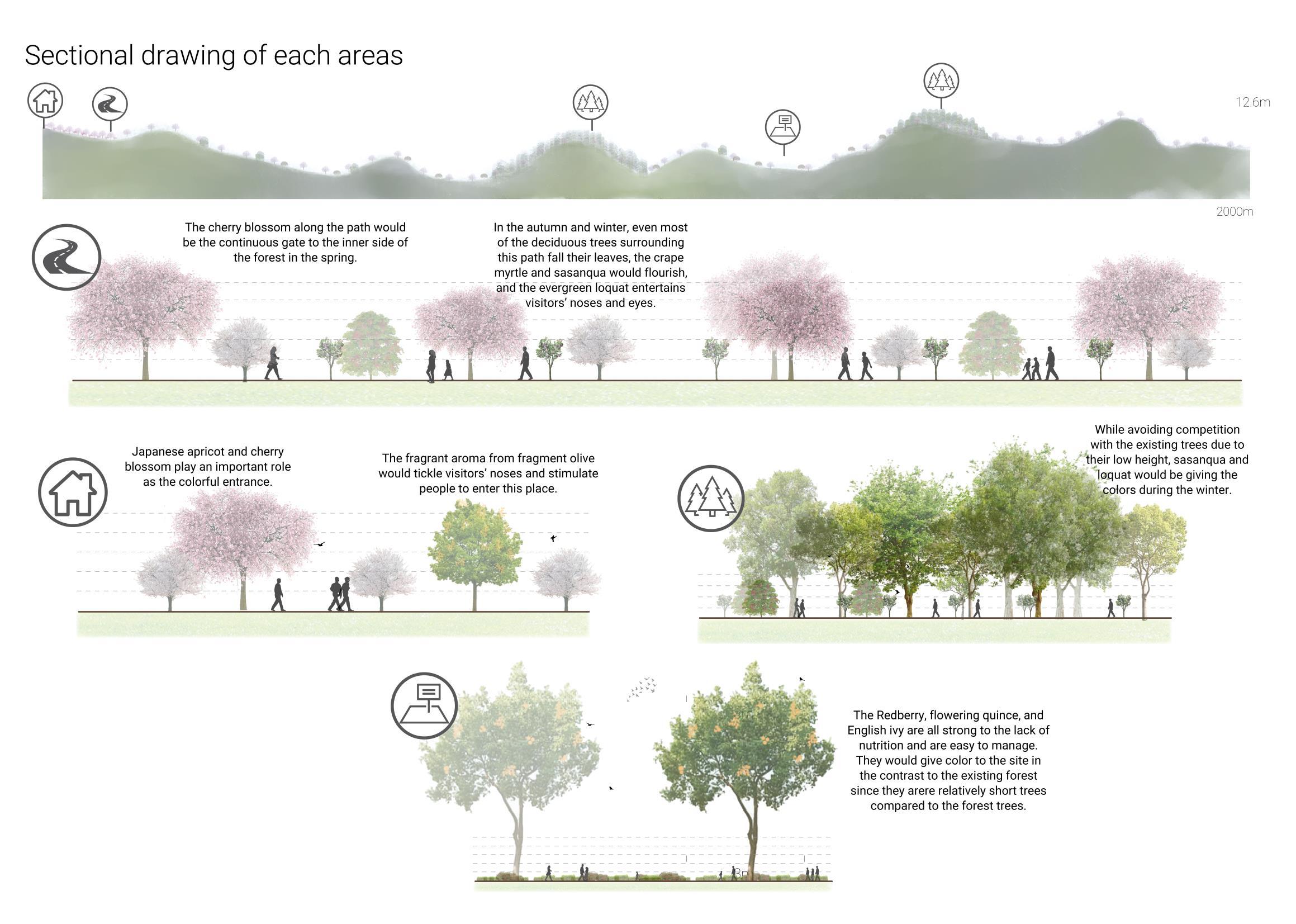
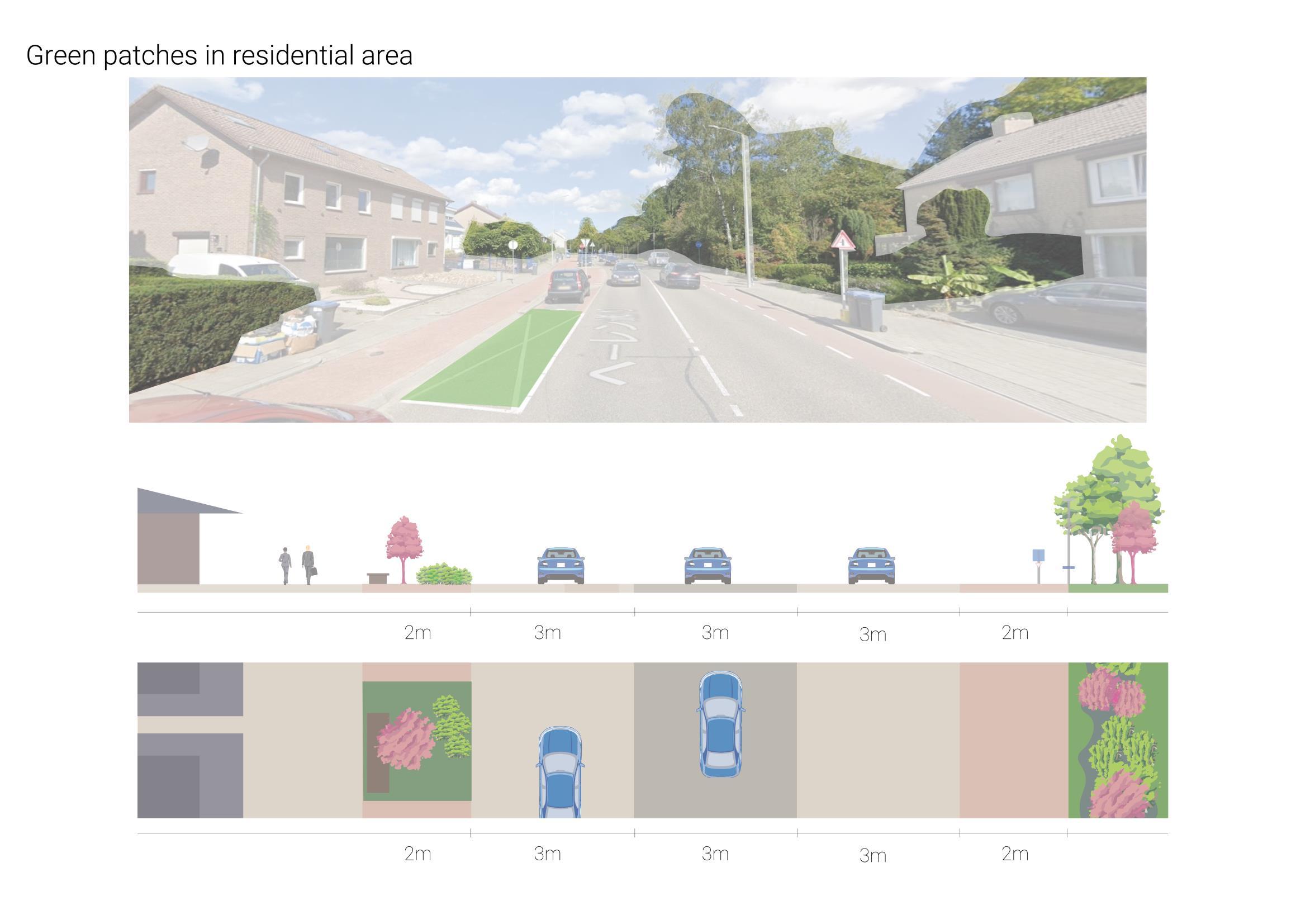


Strategy 3
Waterfront Development
47
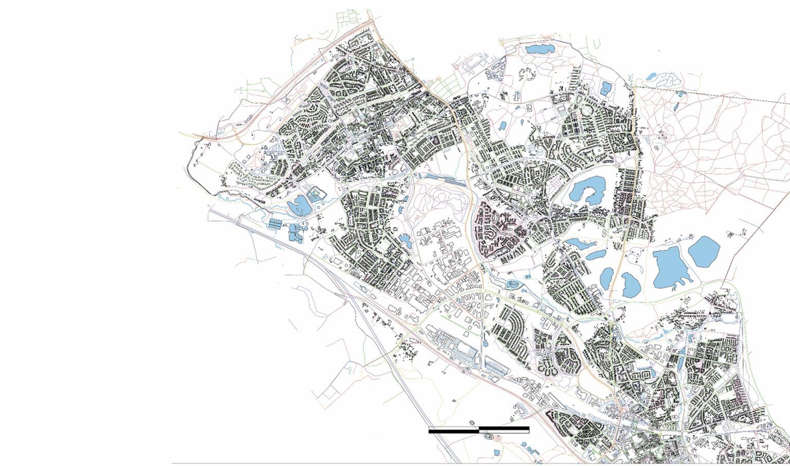
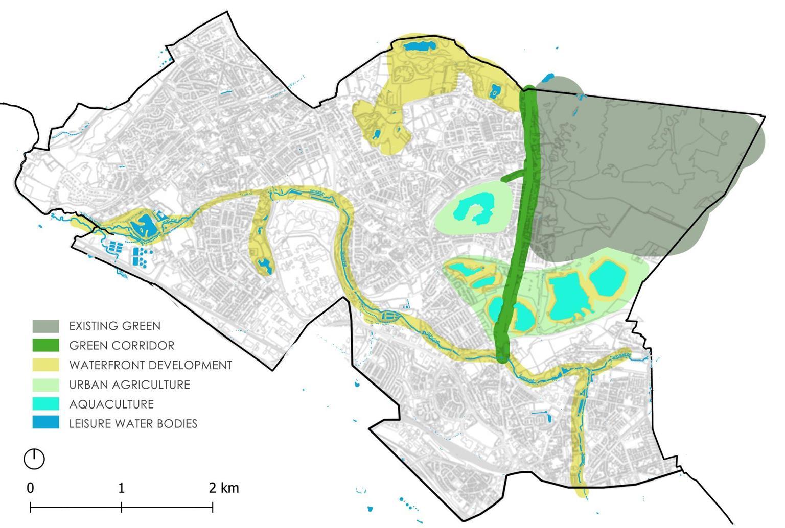
In the city of Heerlen Nord there are many open fresh water bodies found distributed throughout the city
These fresh water bodies act as a contextual identity of the place. Hence all the water bodies are mapped on the larger scale.
48
Conceptual Development
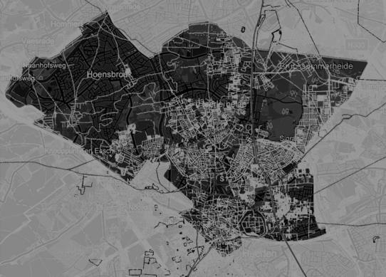
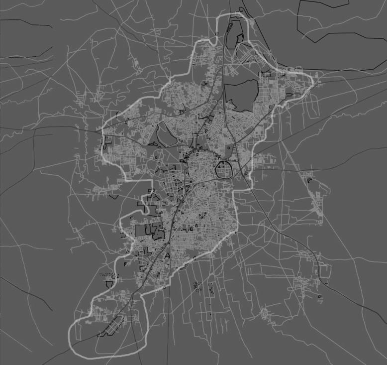
These fresh water bodies act as a contextual identity of the place. As seen in the city of belgaum. Hence all the water bodies are mapped on the city scale and connected together with a bicycle boulevard to create continuity and harmony


Map
Showing the Water bodies in belgaum city
North
OVERLAPPED ON BELGAUM
BELGAUM CITY
Conceptual Map
Showing the Water body connection in North Heerlen
HEERLEN
49
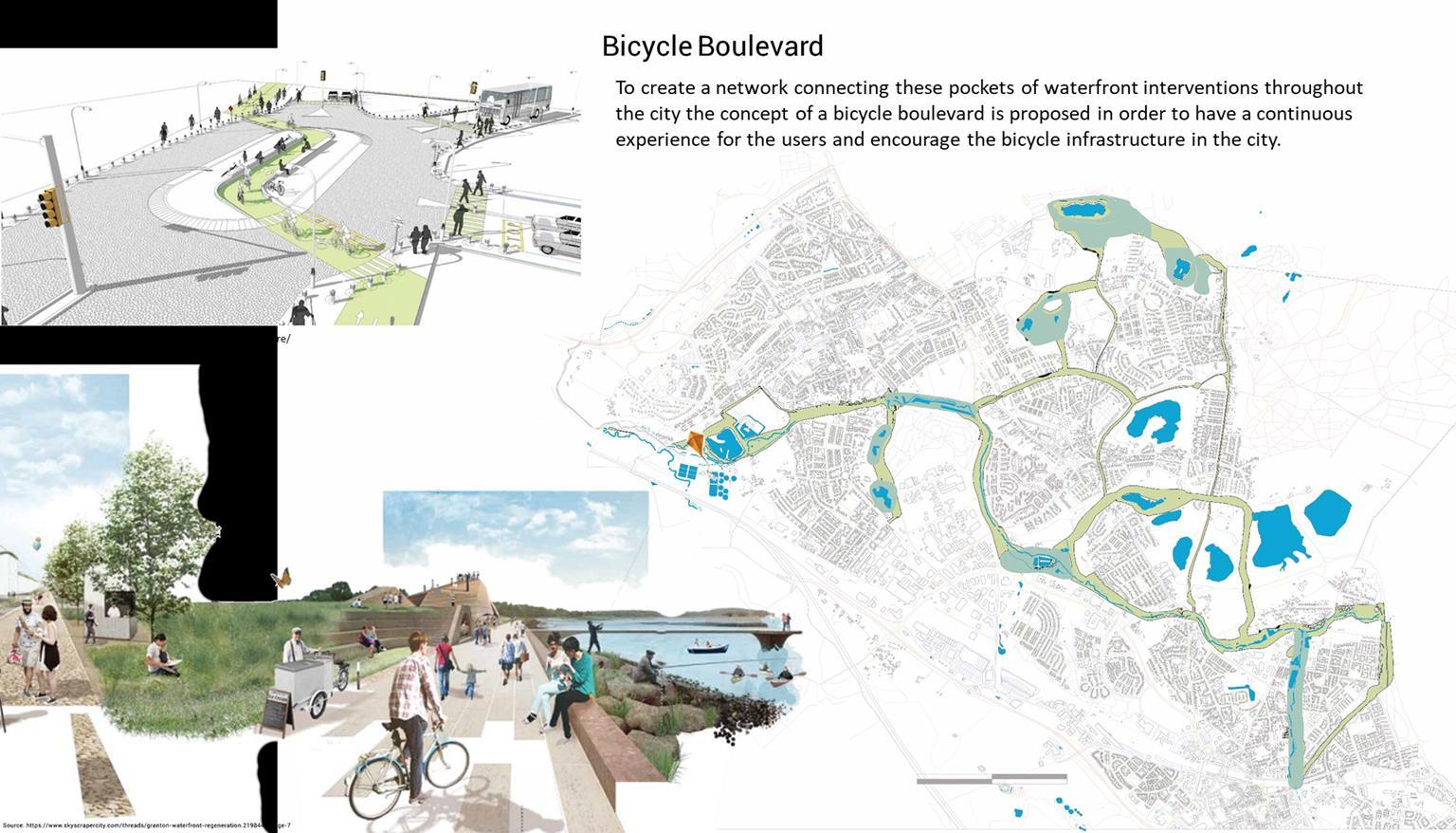
Strategies Implementation
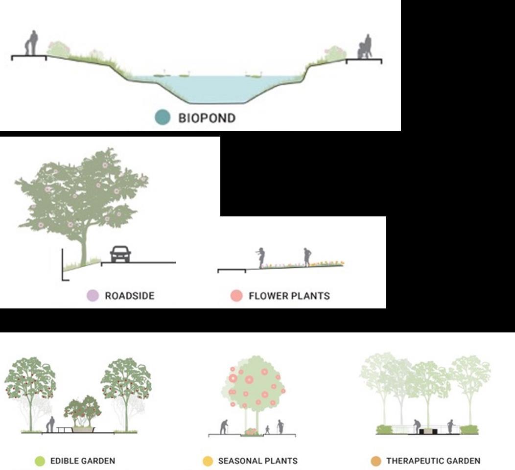
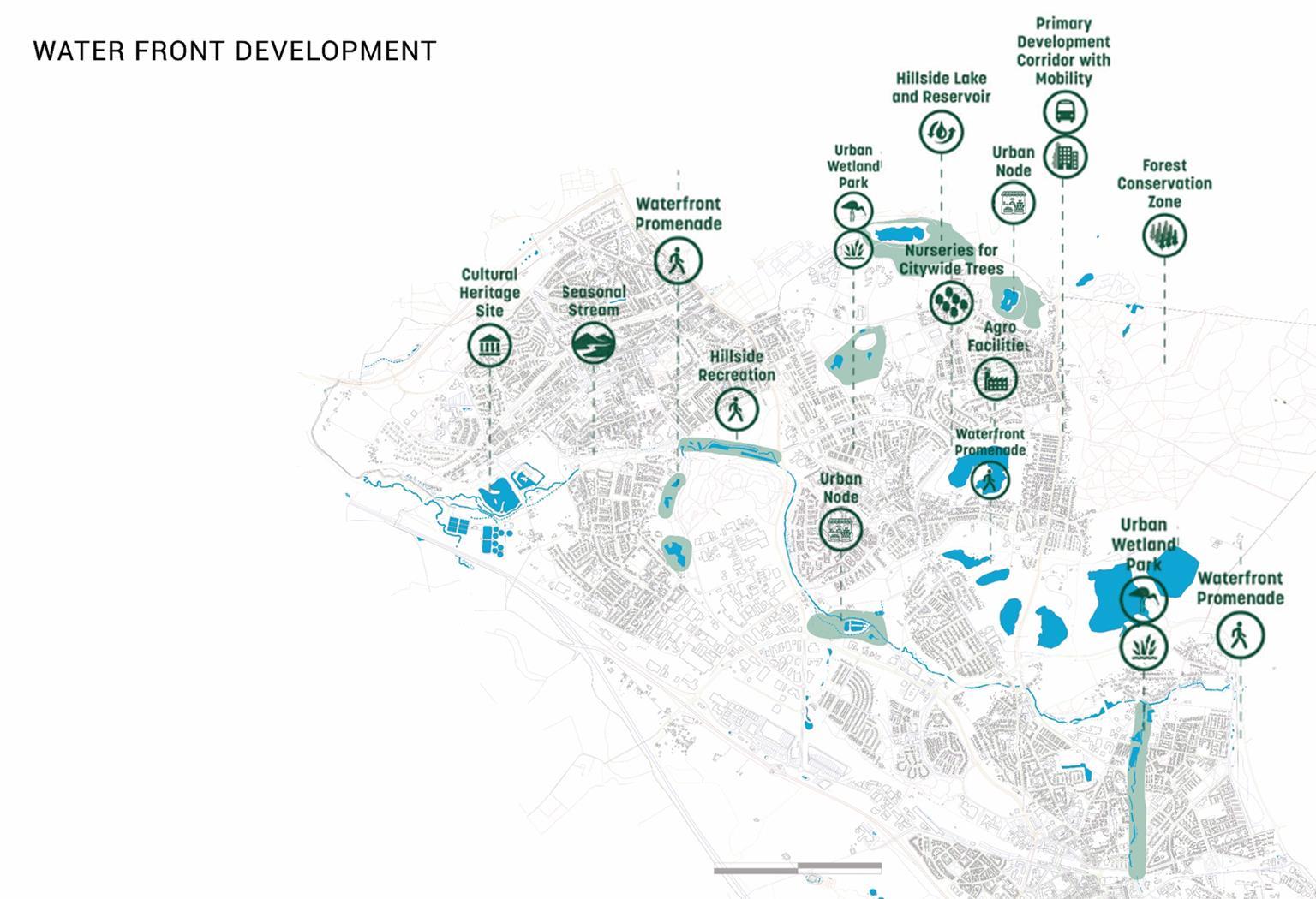
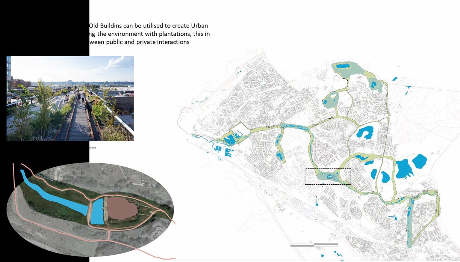
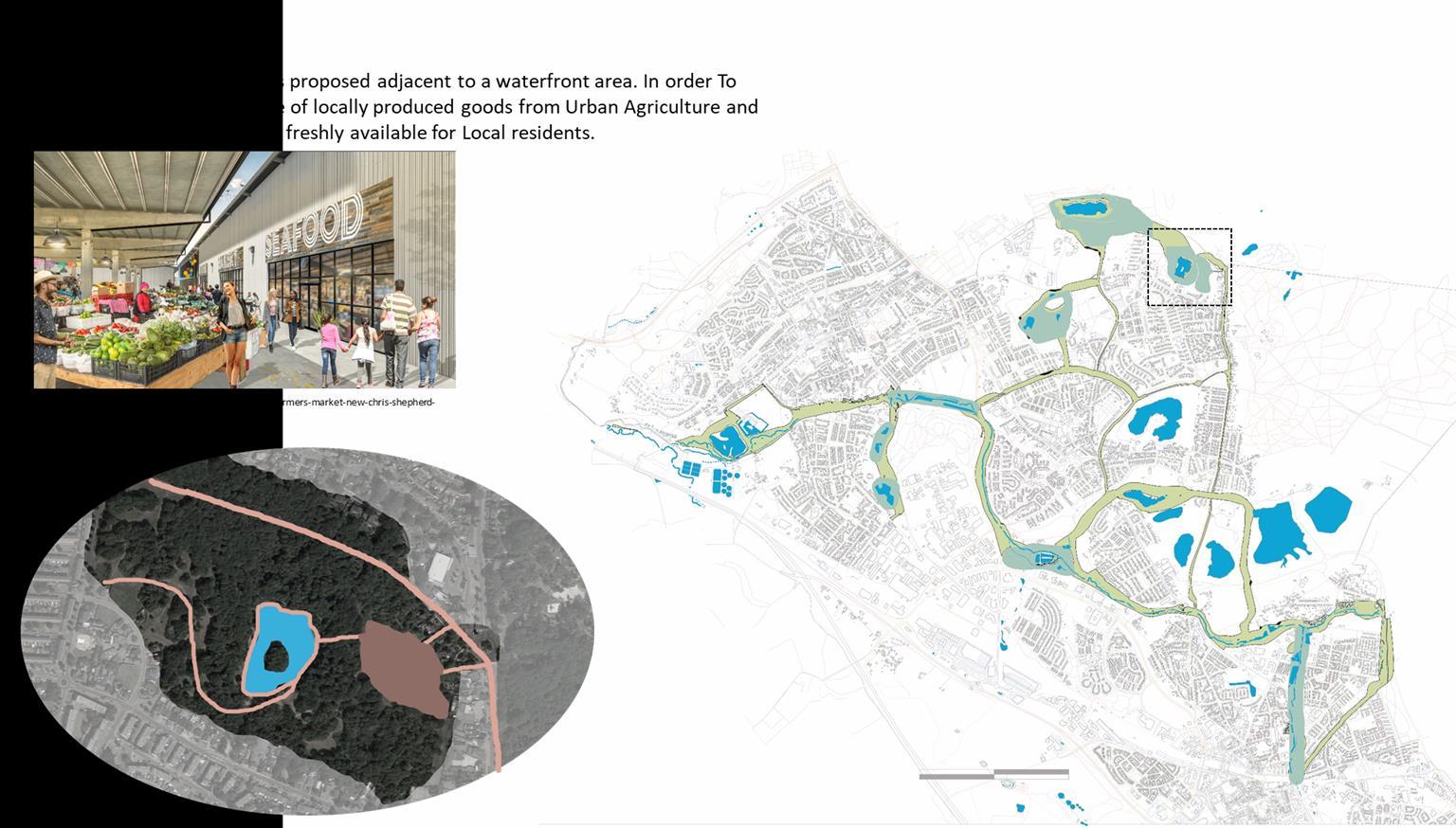
Small public interventions are provided in the pockets concerning potential sites.The sites are located such that they are in close proximity to the neighbourhood and are easily accessible by everyone
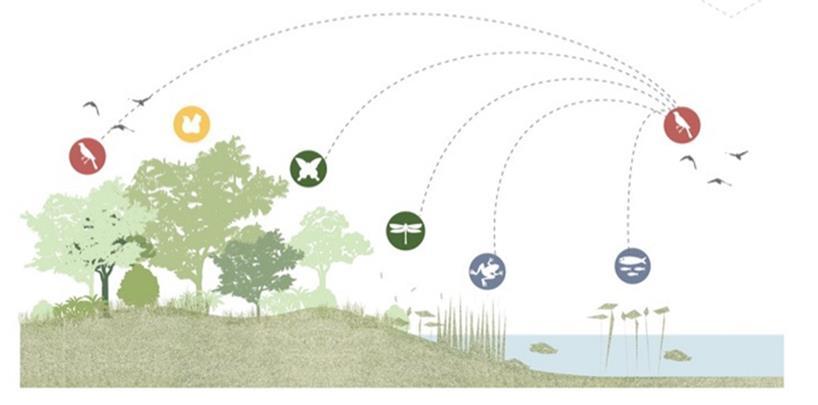
The entire waterfronts are strategically planned to enrich the existing biodiversity And to have an experiential connection with the nature

The waterfronts can be accessed by various Users and target groups
50
By creating this our utmost goal is to have a amalgamations of Habitants with Nature
This will improve the quality of life by Infusing biodiversity as a Habitat for Residents
51
Prototype Section
A typical Section Showing the different usage of spaces along the entire proposed wetland development

52
53

54
55
56

57
Strategy 4
Freshwater Aquaculture
58
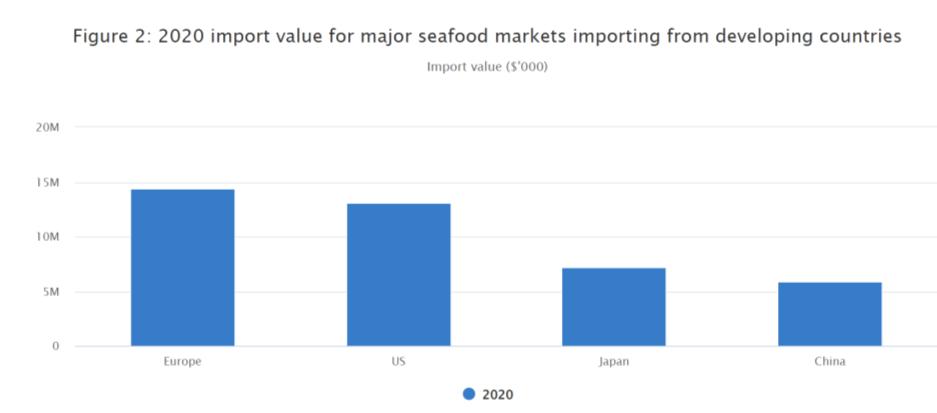
Heerlen North has lost its significance as a result of economic contraction after the closing of the mining industry, which also caused demographic shrinkage. To give Heerlen North a new identity, Sustainable fresh water aquaculture is an excellent way to strengthen the economy and prevent communities from moving out in search of employment. Additionally, it can improve ties among the community and enable people to eat nutritious seafood. Besides, it can meet the demand of seafood shortage, as the demand for seafood is consistently rising in the Netherlands, according to (Netherlands: Household Fresh Fish Consumption Volume 2021)
The proposal has divided into 3 major connected sites near Zilverzand Groeve and market area near Vrieheide to sell fresh food.

59
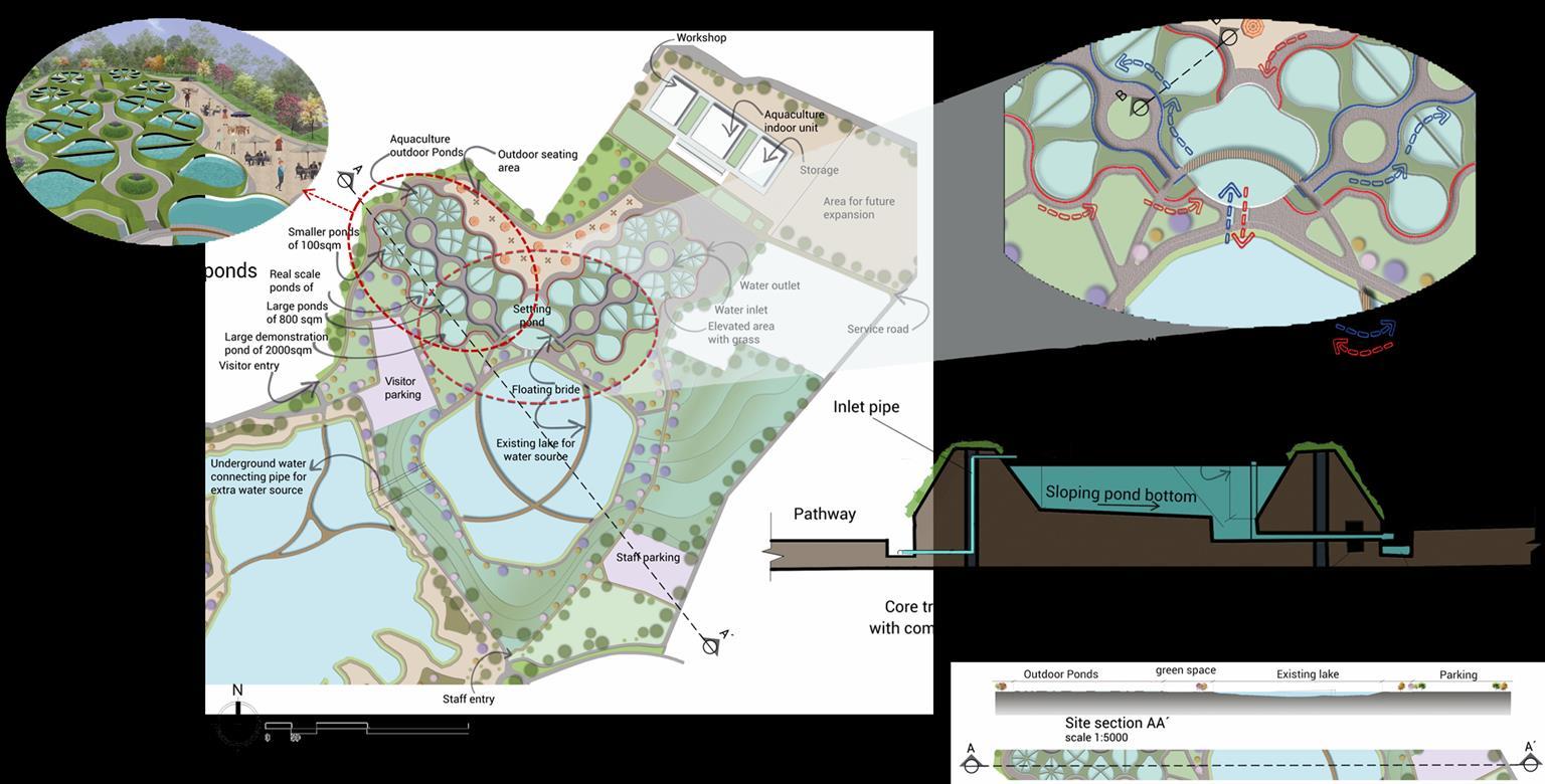
Aquaculture master layout
The site has three main functional areas
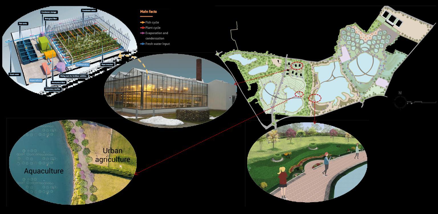
1st Integrated aquaculture farming systems
2nd Community based freshwater aquaculture + urban agriculture (experience areas)
3rd Aquaponics (Aquaculture + hydroponics)

60
Aquaculture master layout
61
1. Integrated farming systems has outdoor ponds, indoor units, research lab, workstation, workshop for training and storage.
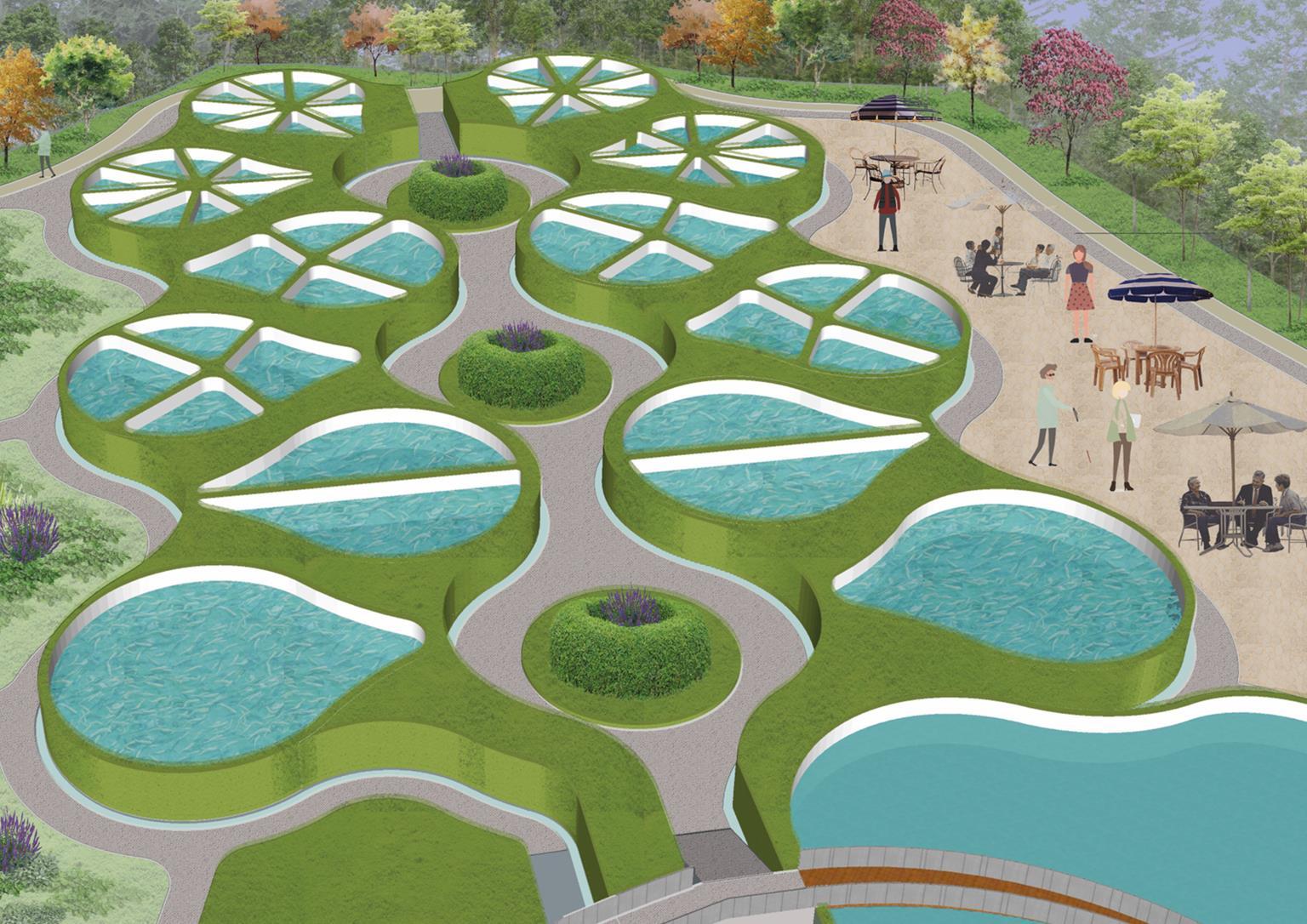
Integrated aquaculture farming ponds 62
2. Community based fresh water aquaculture + urban agriculture is segregated into two part in which the main route proposed for an ecological corridor is passing between these two sites. The area is designed in such a way neighborhood can cooperate and take part in the activities by crossing across the flyover bridge that runs through these locations.
3. Aquaponics (Aquaculture + hydroponics) proposal can be used to keep urban agriculture and aquaculture profitable year round, regardless of the weather. Since fish and vegetables are cultivated in these greenhouses, the weather outside will not be affected.
63
Types of freshwater Aquaculture used for Heerlen North


Public experience areas
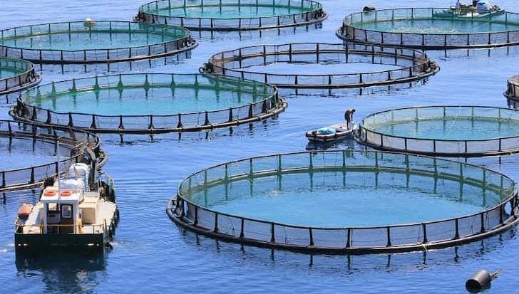
Water-based systems (cages and pens, inshore/offshore).
+ Urban agriculture
Integrated farming systems (e.g. livestock-fish, agriculture and fish dual use aquaculture and irrigation ponds).
+
Urban agriculture
Aquaponics(combined Aquaculture and urban agriculture)

Ponds, land, fish basins Greenhouse, enclosed space Locations

Lakes
Lakes fish basins (outdoor ) Greenhouse
https://www.conserve-energy-future.com/aquaculture-typesbenefits-importance.php
Integrating fish farming and crop production
64
Type
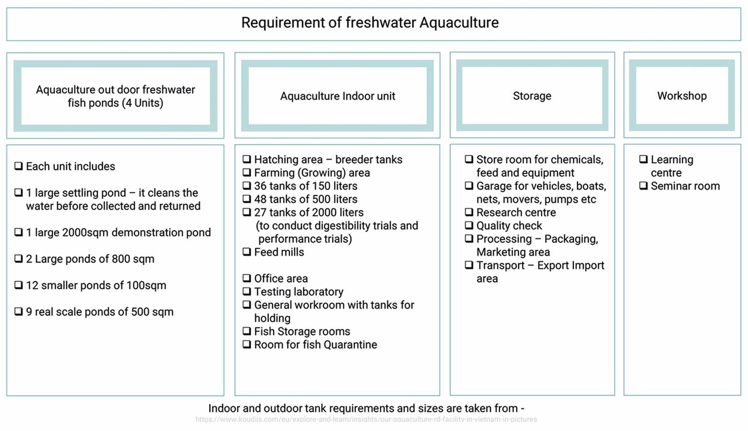
requirement
65
Findings for the necessity of Freshwater Aquaculture for Heerlen North
Household fresh fish consumption volume in the Netherlands from 2012 to 2021(in metric tons)
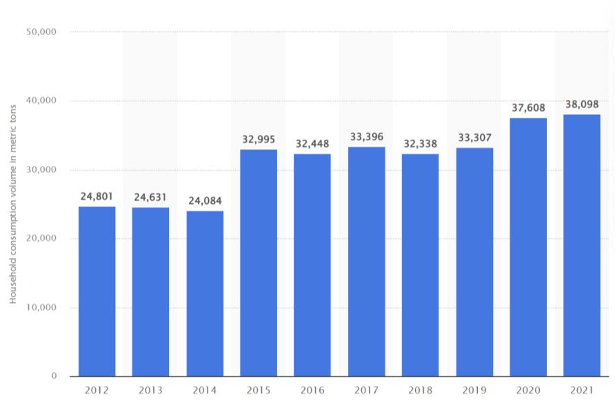
https://www.statista.com/statistics/757453/household-fresh-fish-consumption-volumein-the-netherlands/
https://www.cbi.eu/market-information/fish-seafood/what-demand


66
Strategy 5
Urban Agriculture
67
Site Location

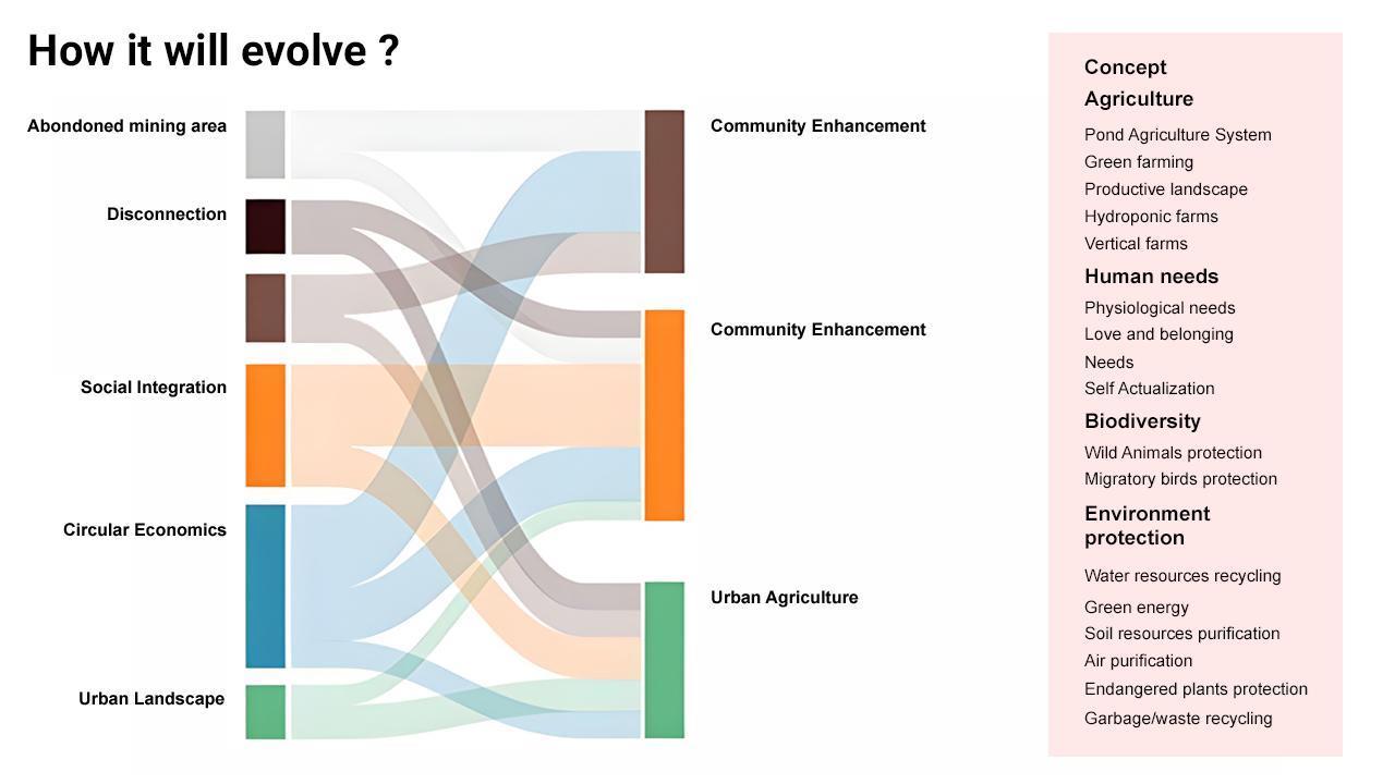
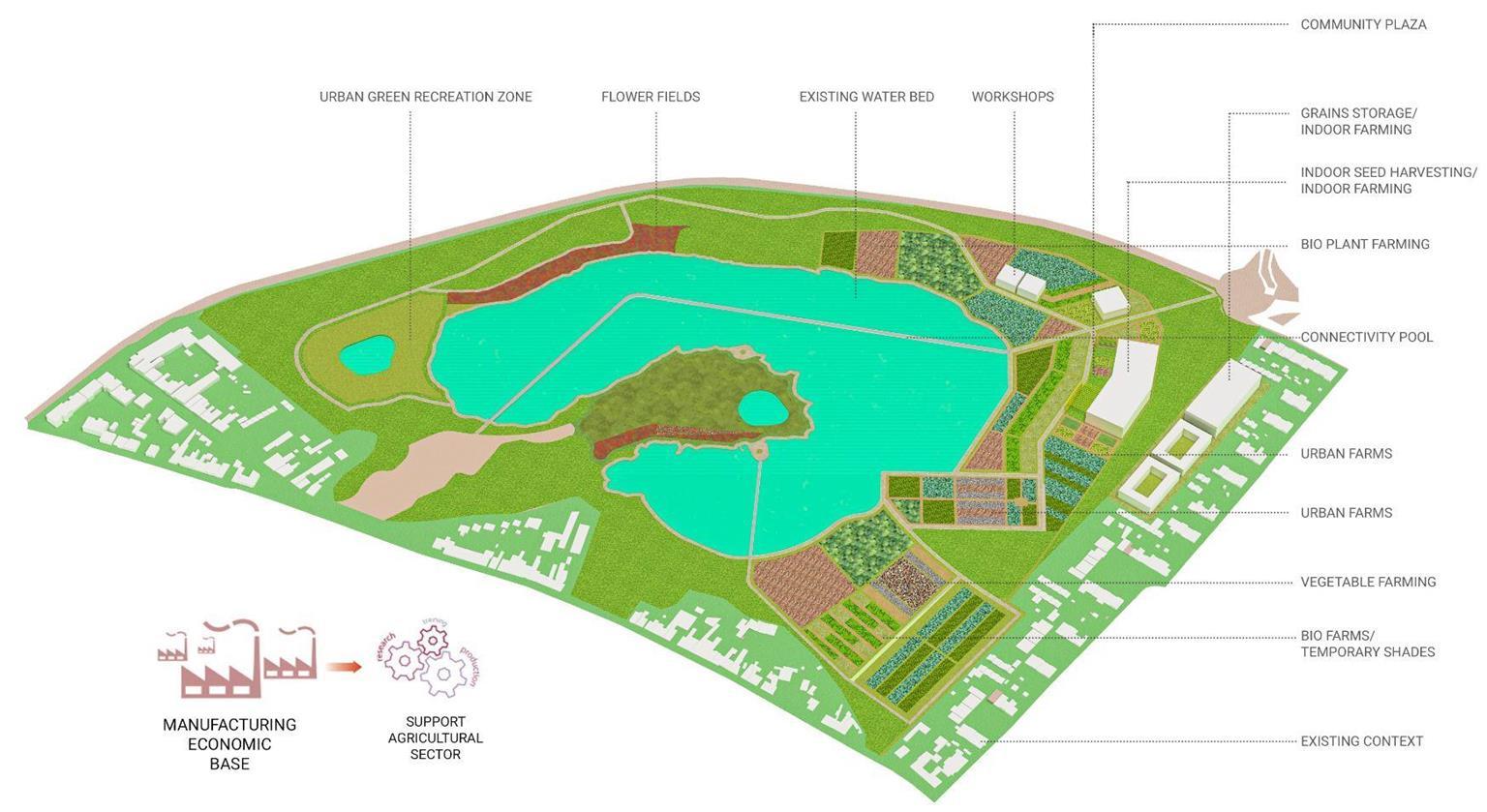
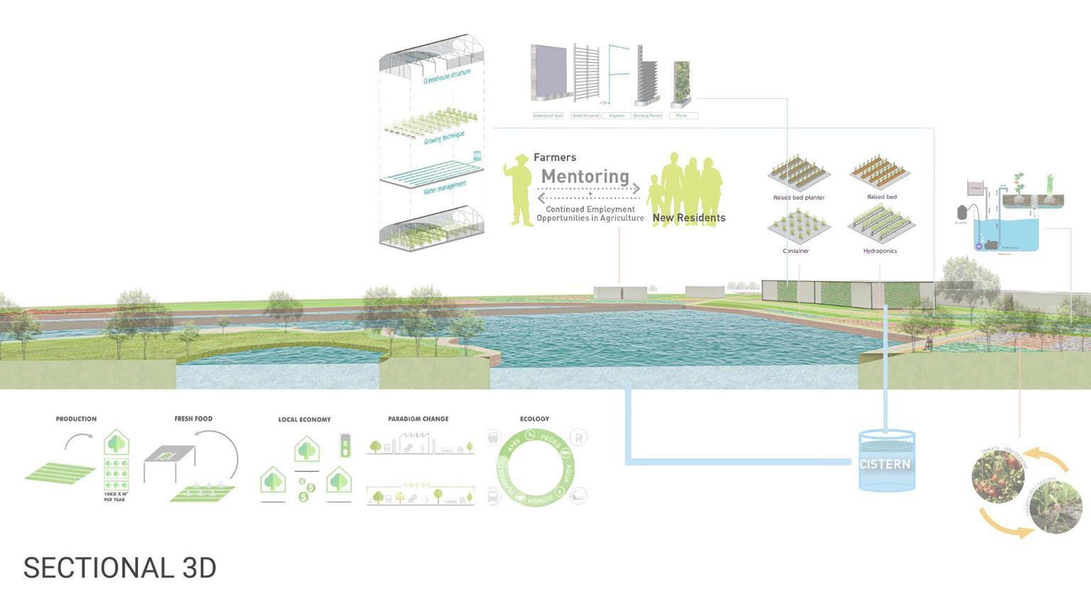
The site is located in the central part of Heerlen nord in the north direction of the city centre of the Heerlen and can be considered as a very critical area for the northern Heerlen. It acts as an important transition between the Green corridor and the Aqua Agricultural areas and provides a connectivity pool for the proper transition. The site is solely proposed for the Urban agricultural aspect which also caters the Urban green/ Community spaces along with the major driving force for the economy of the whole region.

68
69
70

71

72
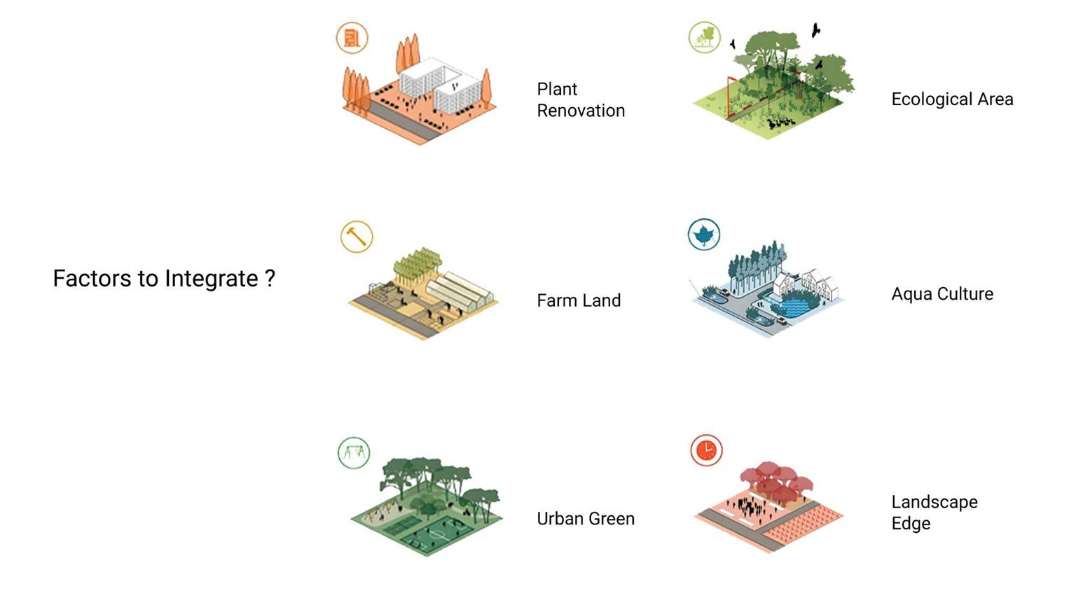
Factors integrated in site-
1. Community plaza
2. Existing green belt

3. Flower farm
4. Connectivity pool
6. Vegetable garden
7. Vertical Garden and Indoor Farming
8. Workshop centres
9. Pedestrian Corridors
10. Recreational zones
11. Bio plants and farming
12. Seed harvesting
73

74

75
76
References
- Aquaculture
- https://www.conserve-energy-future.com/aquaculture-types-benefits-importance.php
- https://www.statista.com/statistics/757453/household-fresh-fish-consumption-volume-in-the-netherlands/
- https://www.cbi.eu/market-information/fish-seafood/what-demand
- Indoor and outdoor fish tank requirements and sizes are taken from -
- https://www.koudijs.com/eu/explore-and-learn/insights/our-aquaculture-rd-facility-in-vietnam-in-pictures
- For Aquaponics
- INAPRO- Innovative Aquaponics for Professional Application
- https://www.igb-berlin.de/en/project/inapro-innovative-aquaponics-professional-application
- Green Corridor
- -National Association of city transportation officials
- https://nacto.org/publications/
- -https://ingesidee.de/de/?pgid=2&lang=de
- Waterfront Development
- -https://www.futurarc.com/project/diu-bicycle-infrastructure/
- -https://www.archdaily.com/514937/swedish-team-win-urban-design-competition-in-trencin
- -https://architizer.com/projects/high-line-at-the-rail-yards/?_ga=2.194528365.1343497570.1581007875-285187168.1567097922
- -https://www.papercitymag.com/restaurants/houston-farmers-market-new-chris-shepherd-nick-fine-restaurant-rc-ranch-green/
- -http://markoandplacemakers.com/projects/tren-n-pohoda-city-on-the-river-urban-design-masterplan-slovakia
77
78
Thank you


