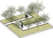
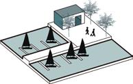
Sustainable & Transformable Urban Nodes


Sustainable & Transformable Urban Nodes
LANDSCAPE x ARCHITECTURE x PROJECT
MING HONG JHENG
SELECTED WORKS 2017 - 2022
Skills use: PS / AI / Skp / Vray / Rhino / Autocad
Personal Works:
+Design Concept & Strategy +Landscape Planning
+Building and Facades Design +Diagram & Perspective
Honour:
Taichung Overpass Student Design Competition Award, 2nd Prize
Skills use: PS / AI / Skp / Vray / Lumion / Rhino / GH
Personal Works:
+Site Analysis and Data Studies +Design Concept & Strategies
+Landscape Planning & Design +Collector Design
Resilient & Urban Green & Blue Solutions
Honour:
Academic Graduation Design Thesis Selection of NCUT Top10
Skills use: PS / AI / Skp / Lumion / Vray / Rhino / GH
Personal Works:
+Site Analysis and Data Studies +Diagram & Perspective
+Greenbelt System Strategy Development +Protector Design
Bionic & Traditional Shore Protector

State:
Competition Project

Skills use: PS / AI / Skp / Vray / Lumion / Rhino / Autocad
Personal Works:
+Site Analysis and Data Studies +Urban Strategies Development
+Master Plan and Detail Design +Section & Facades Design
Reshaped & Decorated Platform Facades
State:
Detail Design Phase
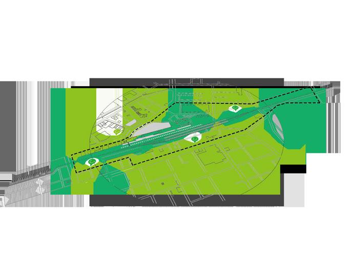
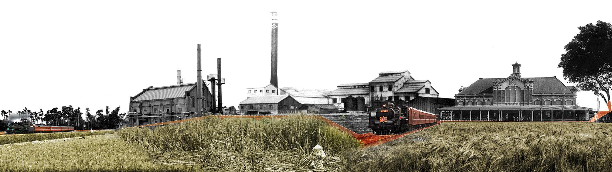
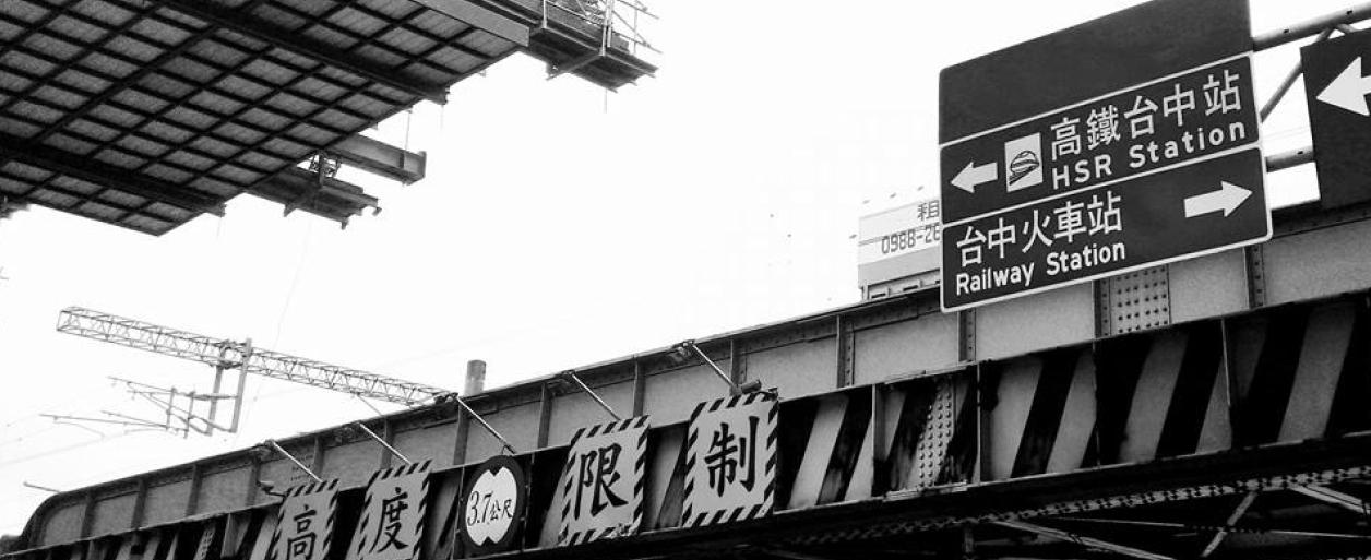
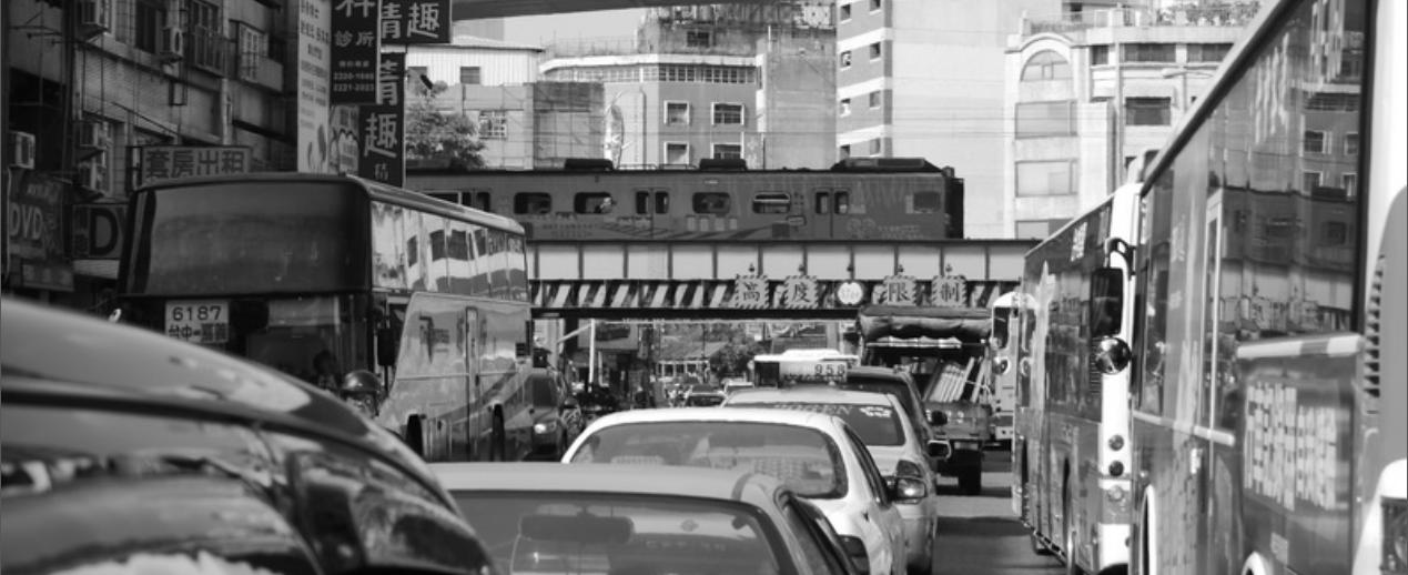
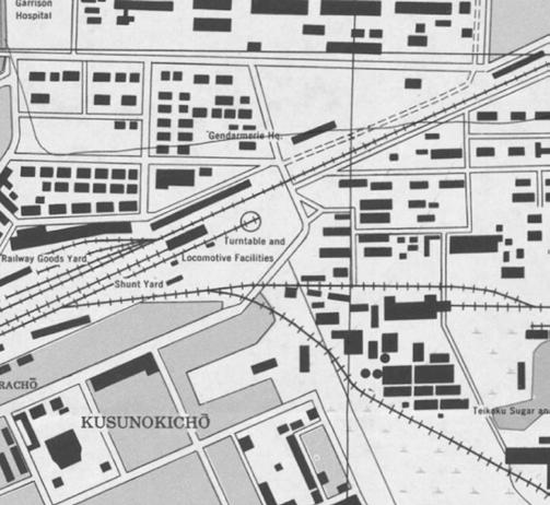
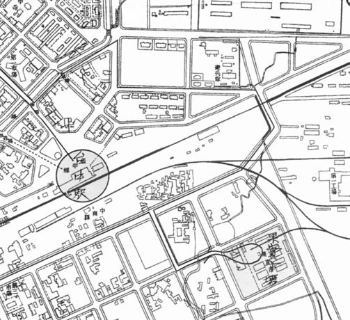
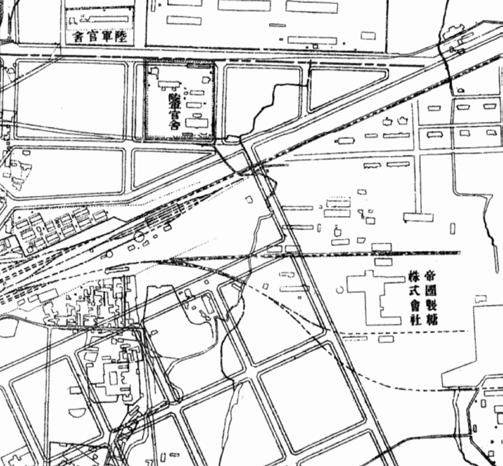
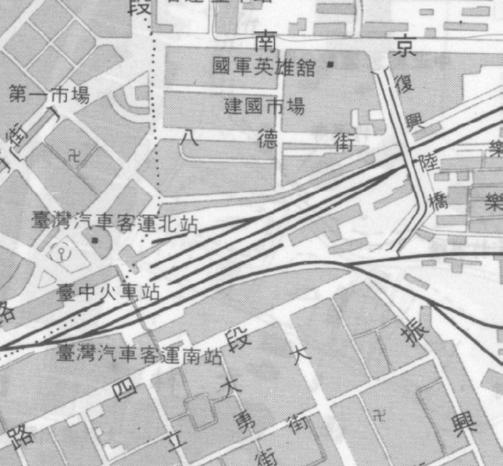
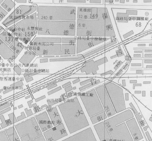
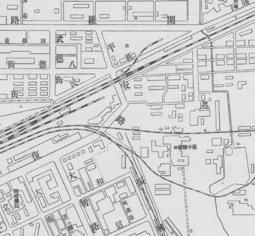
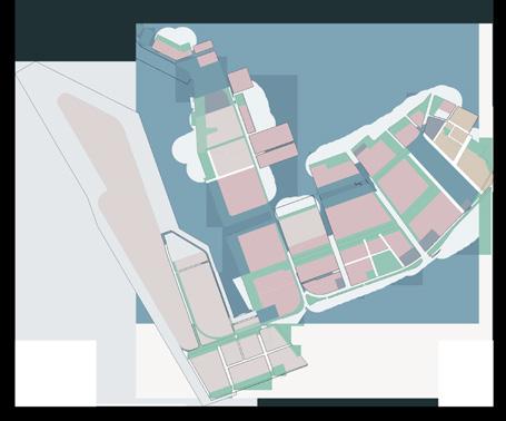
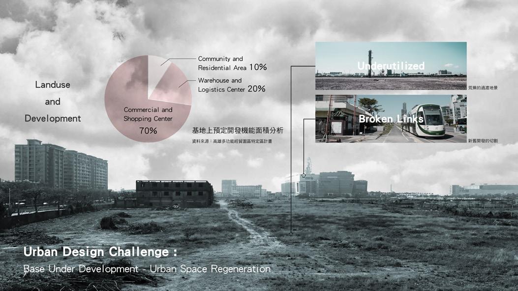
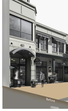
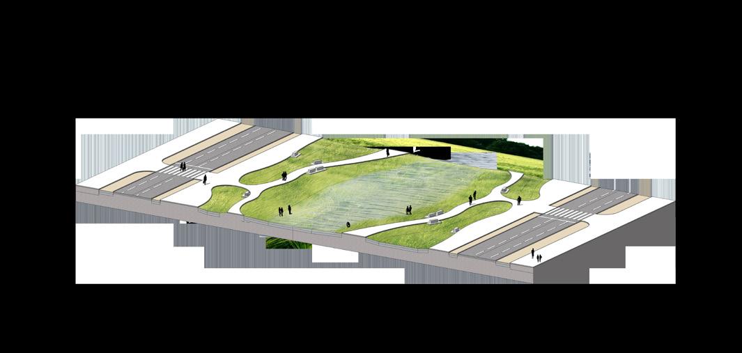
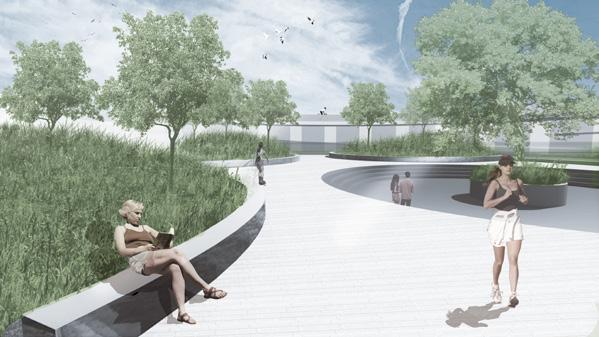
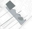
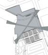
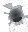
Taichung city is developed from the railway and its peripheral area, which was originally used to ship raw materials such as sugar, iron, rice, and wine, but now this city has become the most vital transportation hub in central Taiwan. However, as the city centre shifted, the central parts of Taichung and areas around the train station have experienced urban decay, leaving an "Empty Frame" as a result of its fast expansion.
The purpose of "Taichung Urban District Elevated Railway Project", which launched in 2006, aims to solve the issue of uneven development between the front and rear station areas. Besides that, this program also attempts to promote new opportunities in the regions by land readjustment and redevelopment.
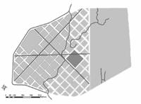
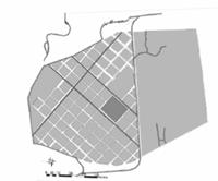
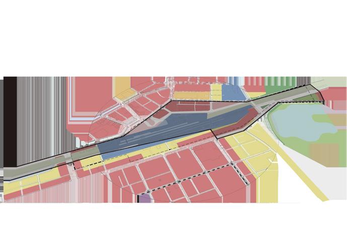
Site Location: Taichung City, Taiwan
Area: 19 ha
Instructor: Wu, Jing Yi
Collaborator: Fan, Yu Xuan; Liu, Chun Hao
Honour: "Reveal the light of Taichung City"-
Taichung Overpass Student Design Competition, 2nd Prize
Keywords: high line / urban space / revolution of node / facade studies / image of city / culture / sustainable green wall
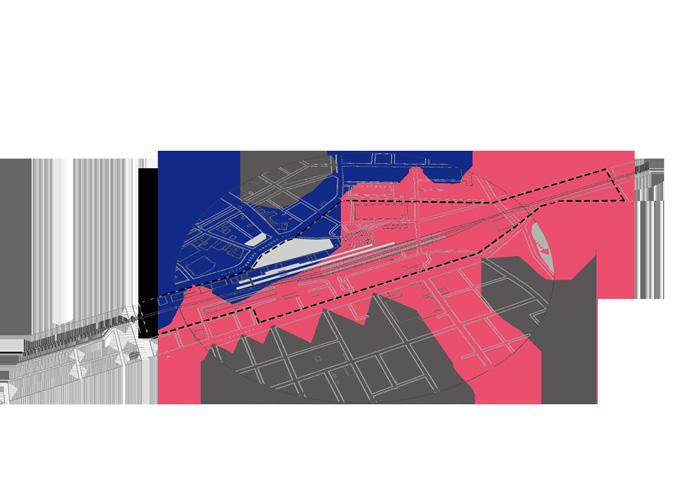
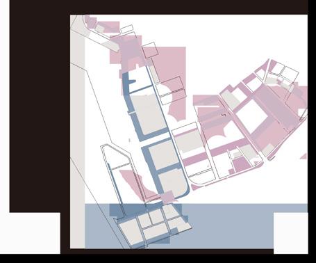
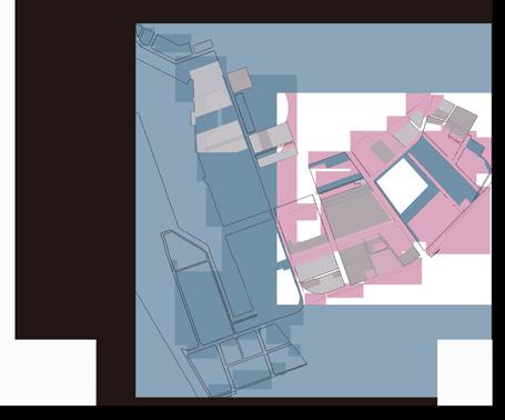
Vehicle circulation (include future)
Bikeway (include future)
Land use (include future)
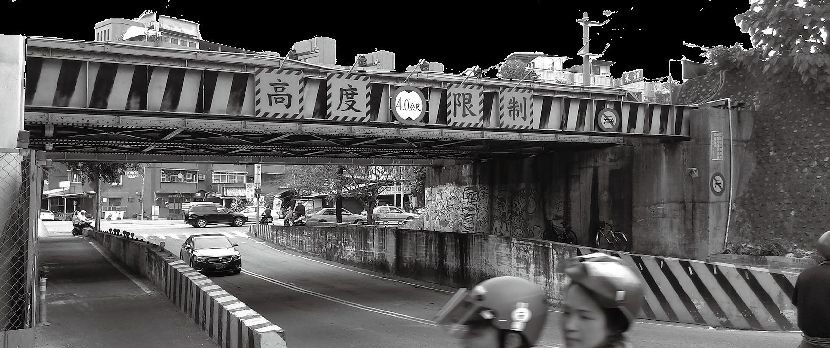
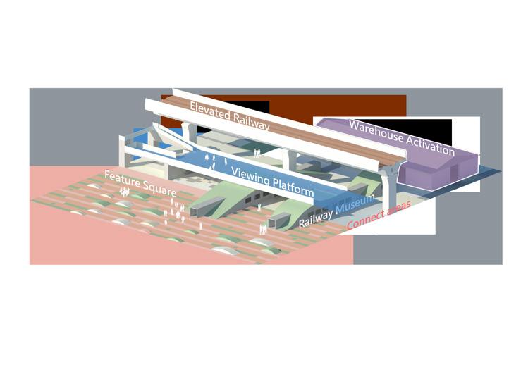
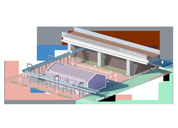
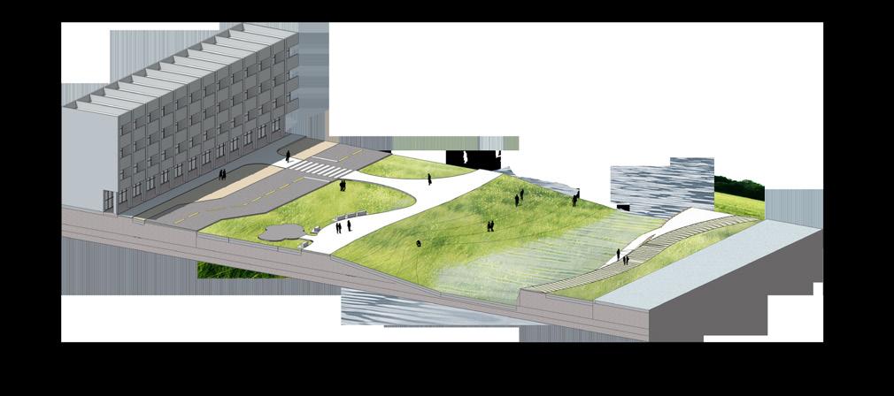
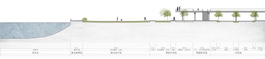
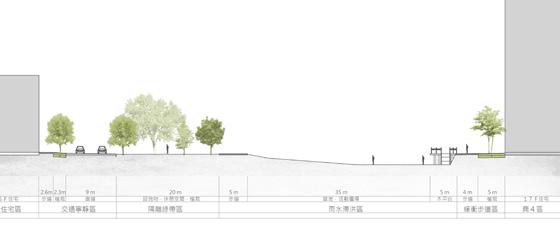
In the past, the railway in the city was designed as a “three-dimensional engineering” to layer circulations with several different elevations; the underpass for cars or what people called “lu-kong”, and the embankment for trains called” loo-khang” (in Taiwanese).
Position of the future plan
However, whether it is elevated railway or land readjustment, it can only fix superficial problems such as the traffic circulation and connecting the outskirts of the city; however, it's inefficient at developing a region without any regional planning. Therefore, we should reposition the overall city planning of these areas, preserving the memory that connects and resonates with the urban culture as well as integrating future city landscape.
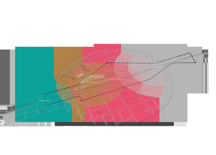
"空/Kong " means empty or sky or air in Chinese. In this project, it means a feature space called "the railway in mid-air".
Tourism
Commerce
Linked Station Areas
x
Sence of Place
“孔/khang " means a hole or frame in Chinese. In this project, it means "the underpass for cars/people".
“Into The Hole”
Commercial Zone
x 4
Historic of Place
Traffic
“Into the Railway”
Transportation Hub
Identity of Place
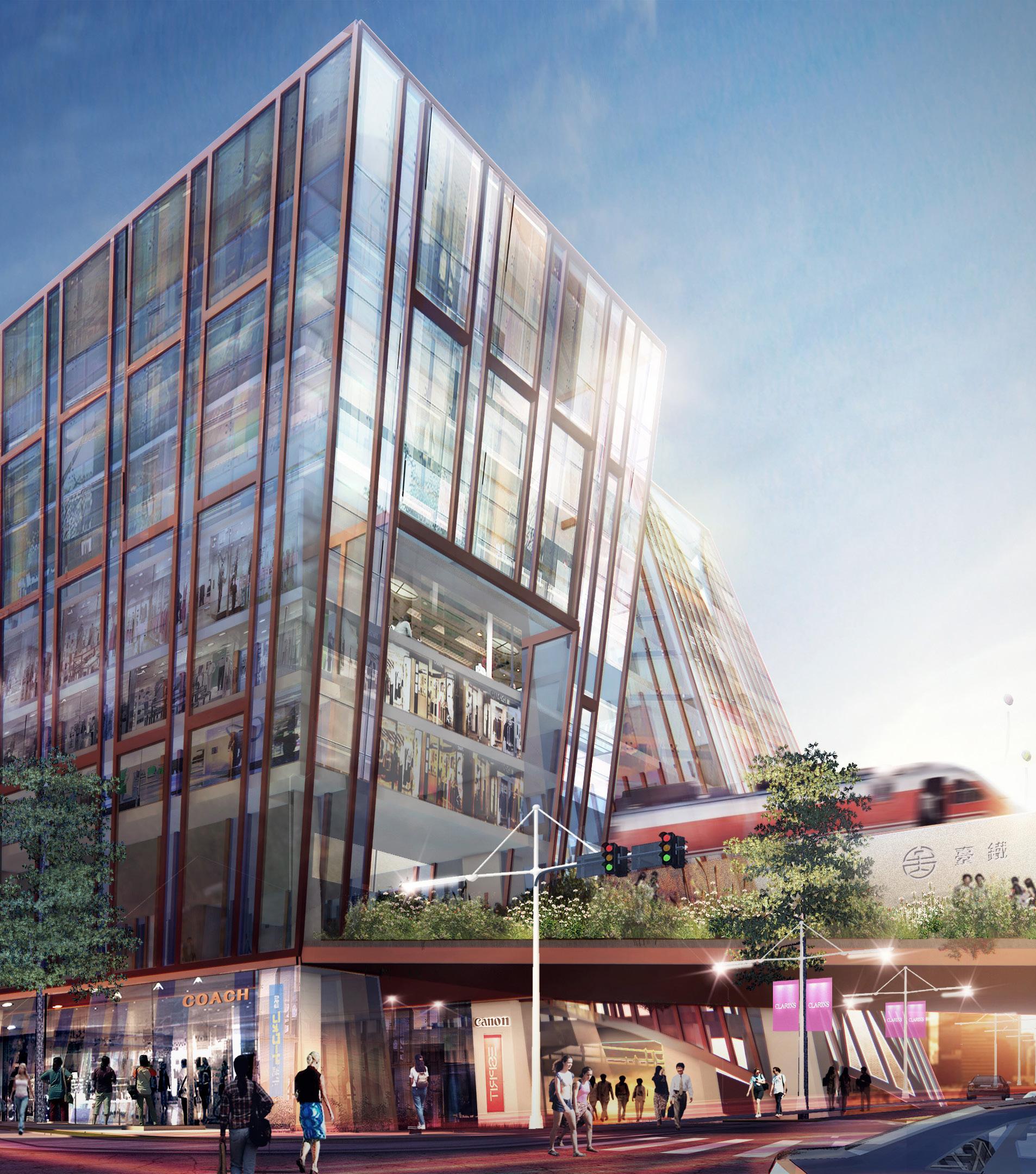
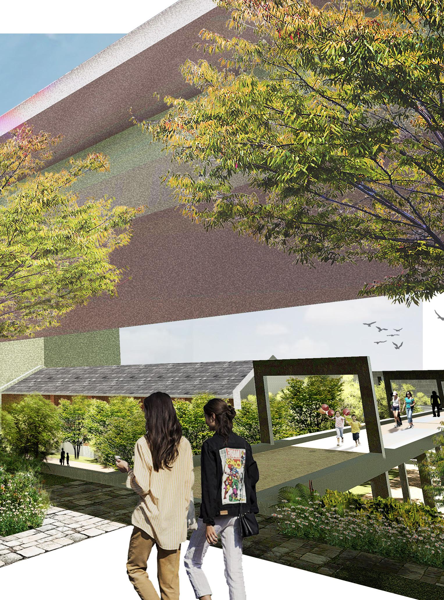
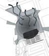
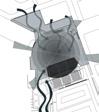
In an urban perspective, this type of deserted space can be regarded as an empty hole, surrounded by the roads in the city context, creating an “Empty Frame”. Our design concept is to reconnect the site to the old town areas and bring the railway's historic back to the site, by transforms the spaces of the railway such as the embankment and underpass into the sense of space.
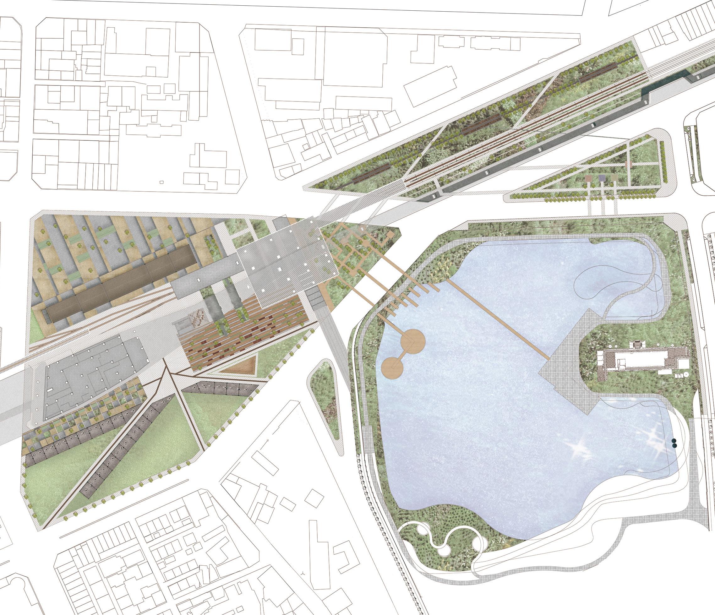
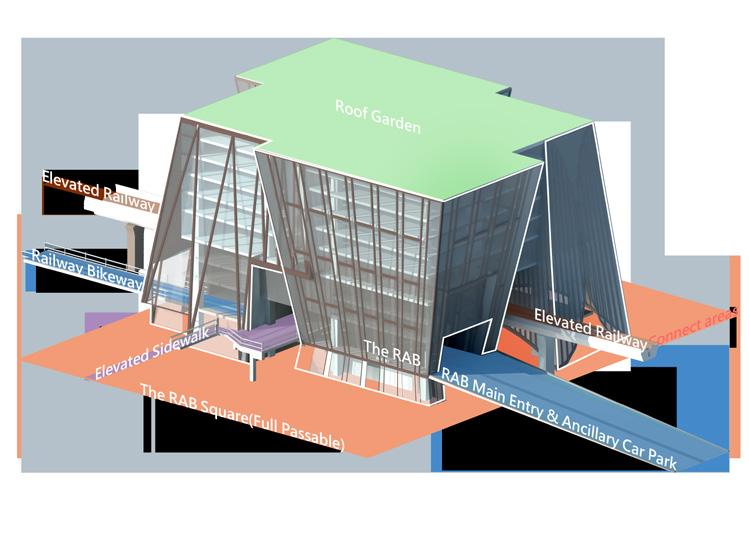
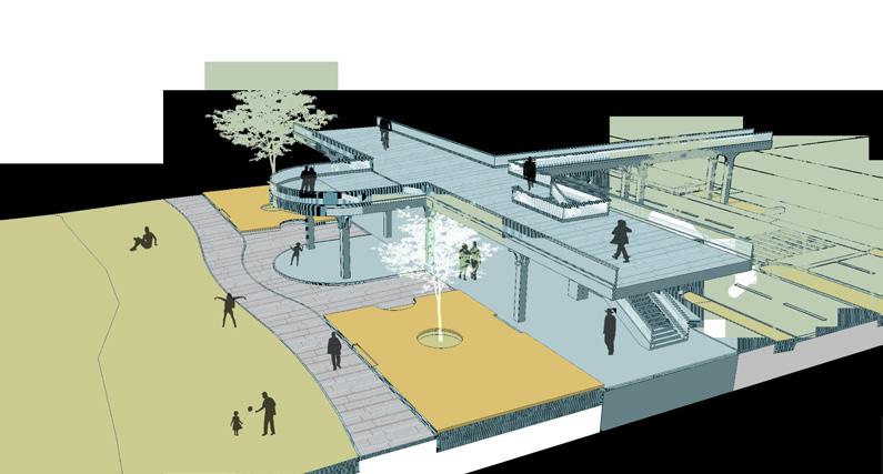
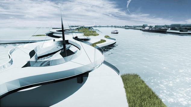
"The RAB - Railway Ancillary Building"
+
Round Me 360 Animated Ver. +

Railway Hotel
Restaurant
Structural Column A
Structural Column B
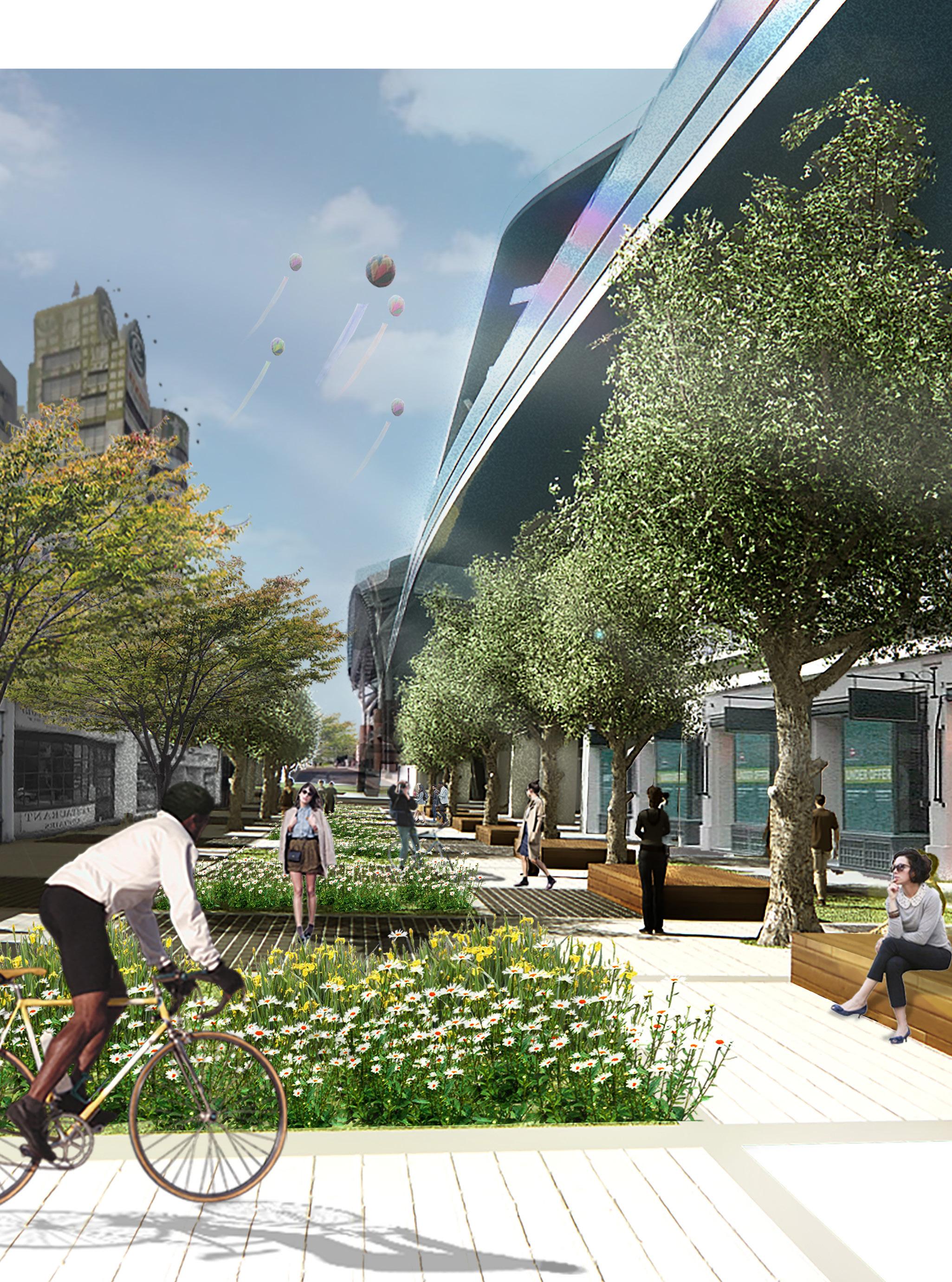
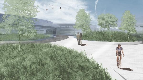
Elevated Bikeway & Park
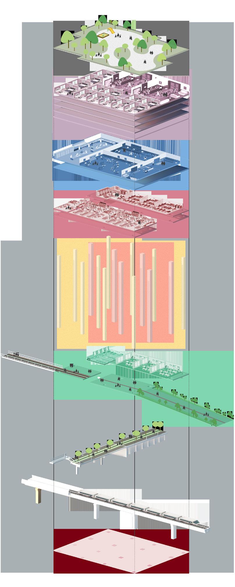
Roof Garden 1~RF 1F
Shopping Mall
Main Mullion
Vertical Greening
We create a buffer zone for the tourists who live in this building. It is a low-cost source of building cooling instead of the expensive infrastructure of temperature adjustment. Plants not only require water and sun but also need enough fresh air that passes through.
Exploded Views
Air For Plants
Vertical Mullions (main)
Composite System
Wall Fasteners
Wall Anchors
Transformable Window System
This building facade system could change the appearance of different window openings. These windows also muffle the noise of the urban area and bounce the radiation from outside.
Reflective Glass
"Sustainable and Transformable Wall System"
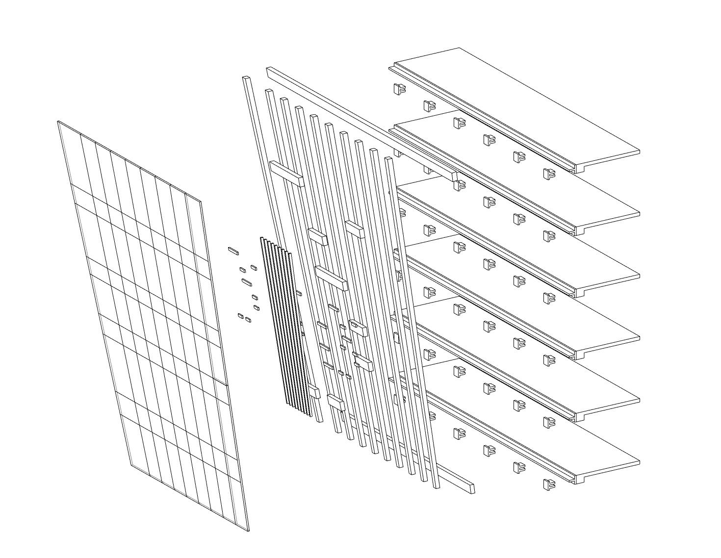
Horizontal Mullions (main)
Fresh Air Path
Because the building was constructed upper the elevated railway and main roads, its curtain wall needs to ensure the noise from transportation is reduced. Also, the summer in Taichung's urban areas is not cosy sometimes. Therefore, temperature control would be a vital issue in the wall design. We tried not to rely on the air conditioner. Instead, we used sustainable methods to solve the problem such as vertical greening.
Rod Resisting System
Highstrength tension rod connecting to the truss system of twelfth floor.


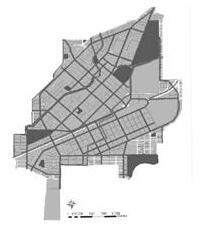
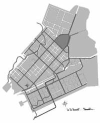
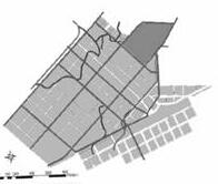
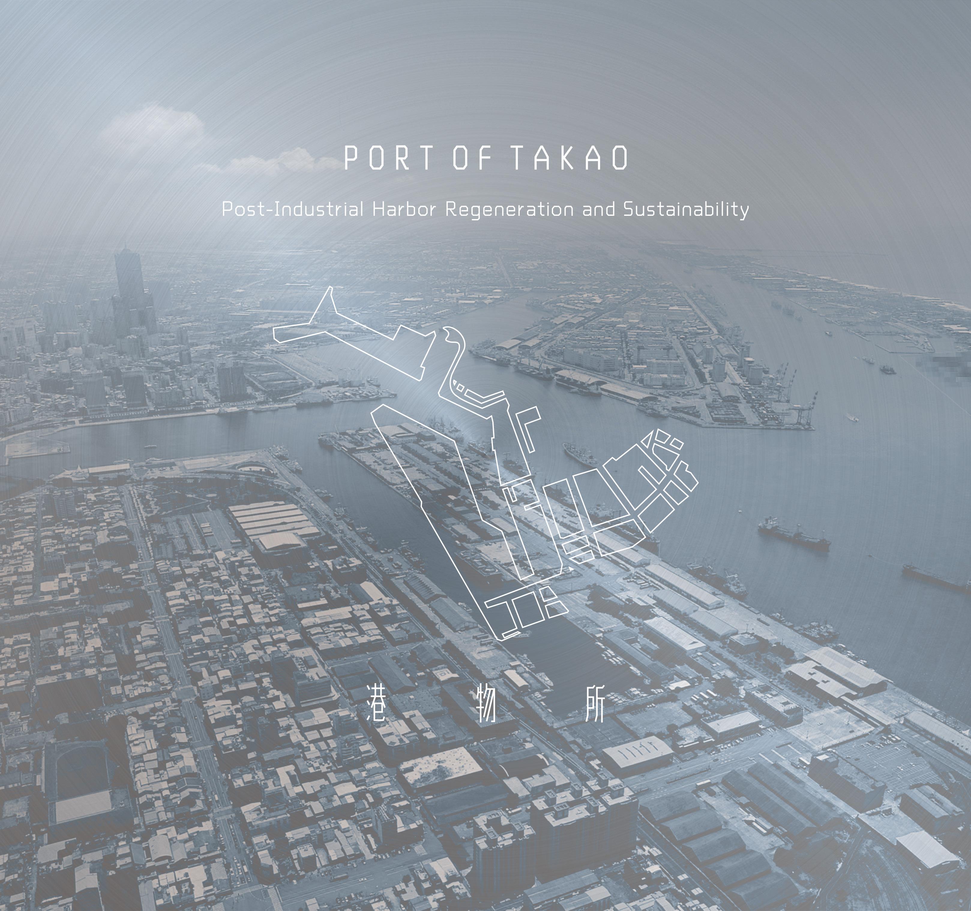
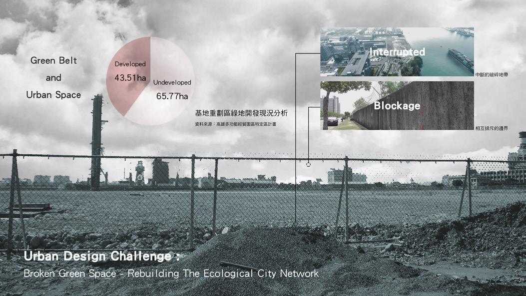
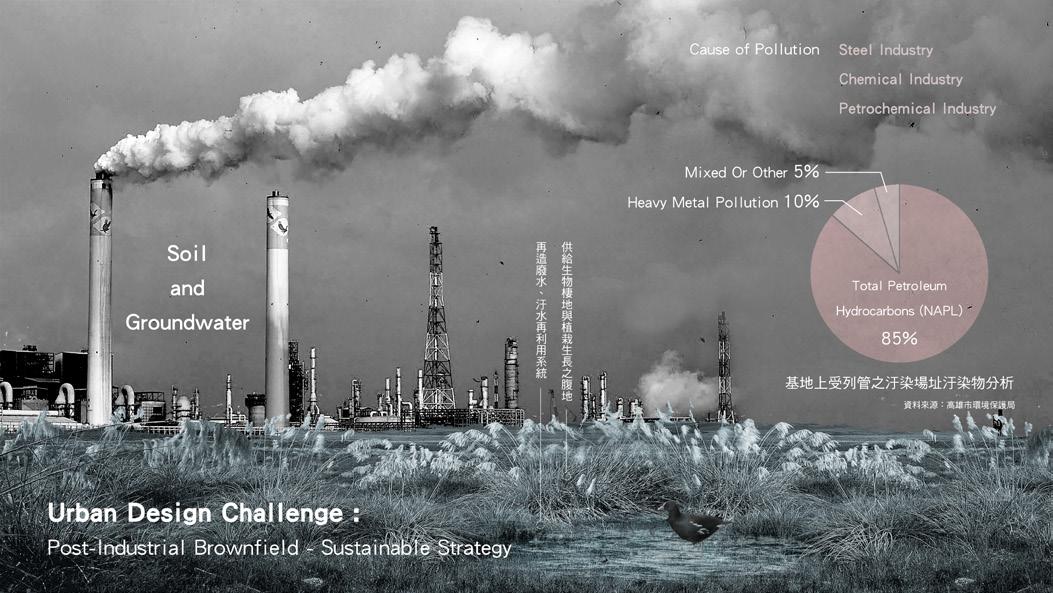
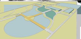
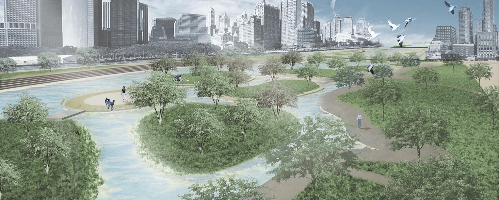
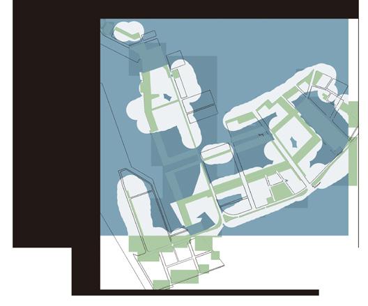
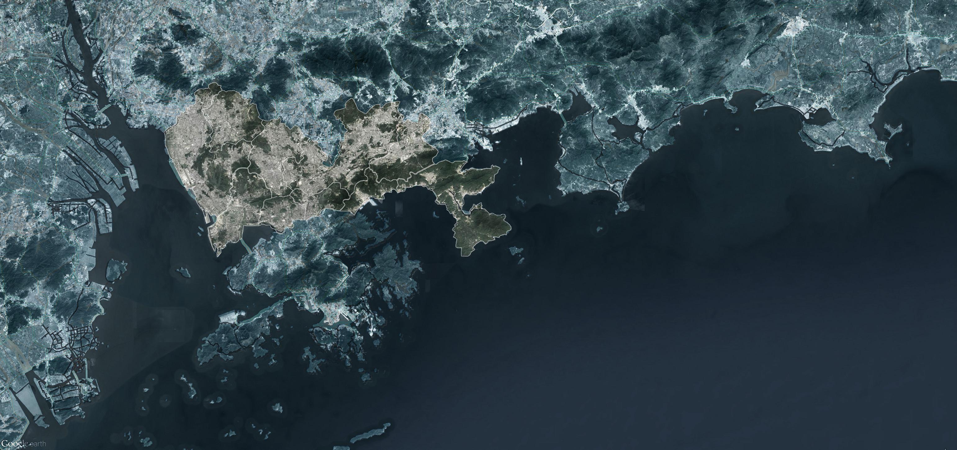
The site is located at Kaohsiung harbour, which was the first place to develop the heavy-chemical industry named Si Shih Jia area. Although these factories offer numerous employment opportunities and economic advantages, the industrial area inhibits connectivity between the city and the port.
Due to government policy and public outcry over air pollution, factories were relocated to northern Kaohsiung after 1990, which caused the harbour area's industry to decline. The "Kaohsiung Multifunctional Commerce and Trade Park" was established as a result.
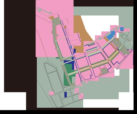
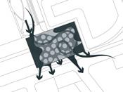
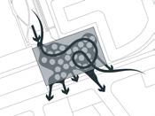
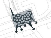
The original urban plan does not have a regulation about open spaces. This results in the number of green blocks being divided into various discarded spaces in urban centres. Our green system aims to solve the problem between buildings and urban spaces and reconnect each block by establishing a green corridor.
Site Location: Kaohsiung City, Taiwan
Area: 115.80 ha (only green areas)
Instructor: Chen, Yi Zhang
Collaborator: Zhong, Wen Chen
Honour: Academic Graduation Design Thesis
Selection of NCUT Top10
Keywords: green system / urban / connectivity / areas integration / sustainability / extreme climate / windbreaker
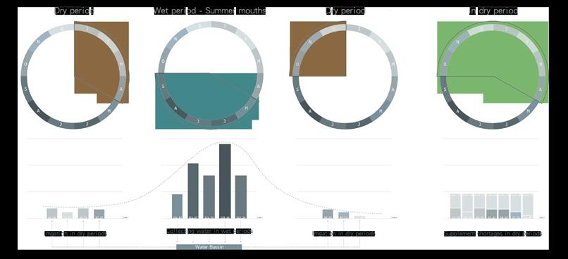
Changes in extreme weather and climate events, such as typhoons and droughts, are the primary way that most people experience climate change. Over the last 50 years, Human-induced climate change has already increased the number and strength of some of these extreme events.
Our flood systems were designed to withstand a once-in-50-year flood, or the deluge from Fanapi was previously estimated to occur only once every 200 years.
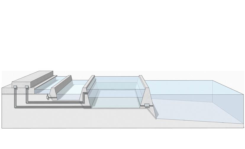
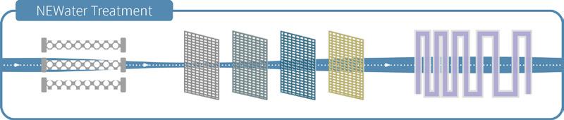
Due to the weather and dengue fever, it is hard to acquire or restore freshwater in Kaohsiung city. This system is designed for water reuse and regeneration, we used natural resources like the ocean and sun to create more freshwater. Through the system, we could solve water shortages and gain the energy that cities need.
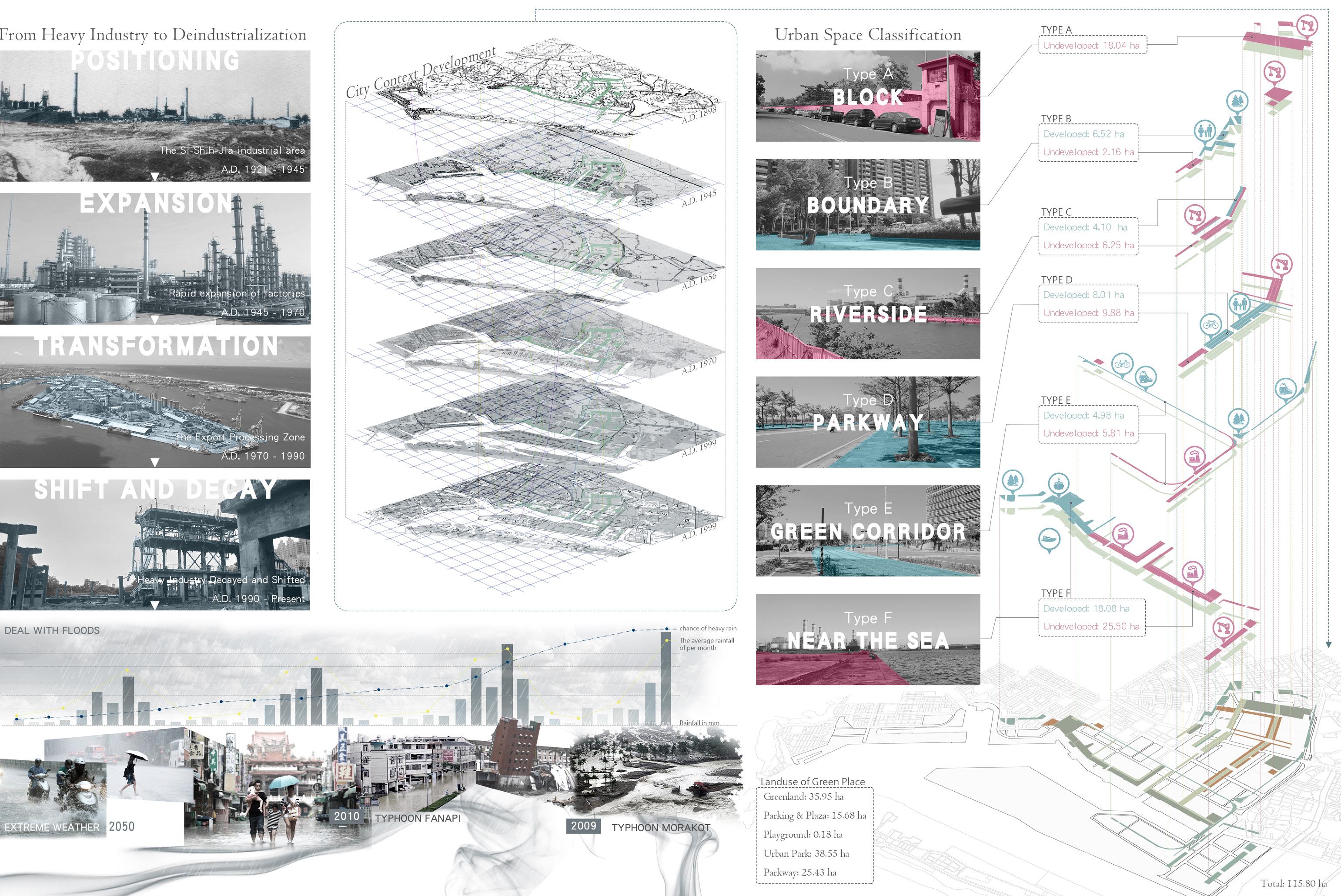
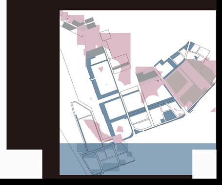
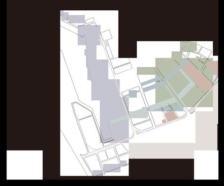
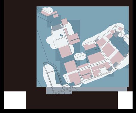
Before the overall planning, these urban spaces are classified into developed and undeveloped areas.
Designed a water recycling system to solve water reuse for the brownfields and residentials on the site.
STEP 1 - SELECT
Classify complex land use and select several vital spots on the site to develop the urban space.
STEP 1 - SELECT
STEP 2 - PLANNING
We formulate the various design roles for each green block with different properties.
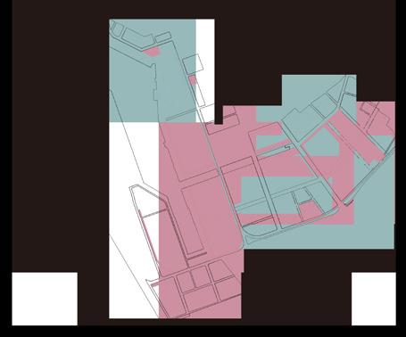
STEP 3 - CONNECT
Reconnect the interrupted green space and reconnect the border between the city and the port.
STEP 1 - SELECT
STEP 2 - RESTORE
Combine engineering and ecological remediation to promote the process of soil remediation.
STEP 3 - CYCLE
In the next 50 years, the system will continue to operate until the pollution remediation is completed.
STEP 1 - SELECT
STEP 2 - DRIVE
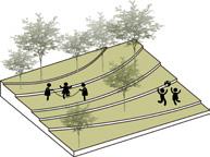
Extend the linear parks, green lands, and riverbanks to the nodes of the open space.
STEP 3 - COMMUNICATE
Create several leisure green belts for people living in the commercial block.
Kaohsiung has been suffering from floods for many years. Moreover, the chances of extreme climates were suggested that will increase in the next 50 years. This new green system is designed for a series of calamities such as typhoons, floods or saltwater intrusion.


Ocean
Wastewater
Types of Collector Models:
Foul Water
Algae Energy
Rainwater
High-Salinity Water
Seawater
Low-Salinity Water
VIA PIPE
Fresh Air
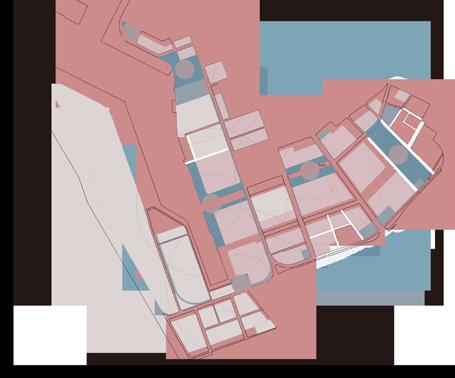
Development Area :
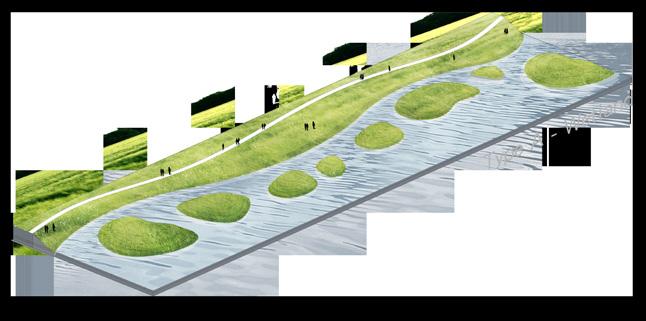
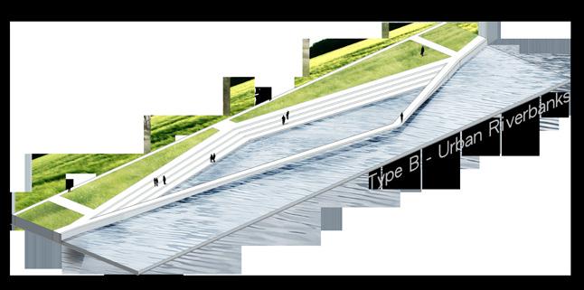
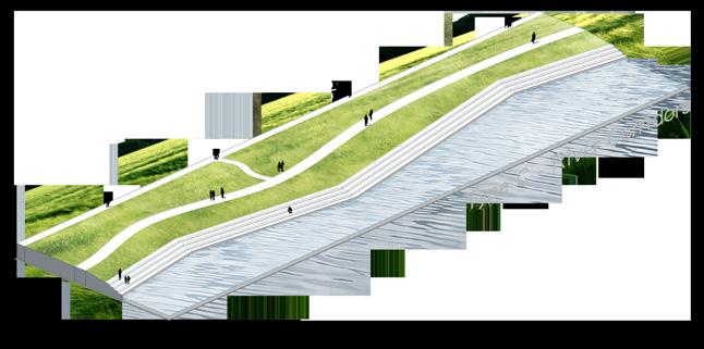
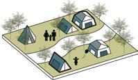
TYPE C - RIVERSIDE
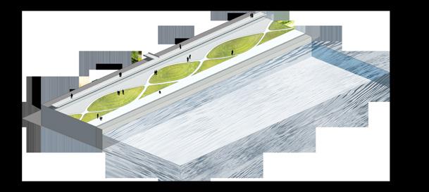
TYPE D - PARKWAY
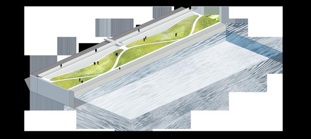
TYPE E - GREEN CORRIDORS
Biofuel
Cleanwater
NEWater
Industrial Water Recycled Water

TYPE A - BLOCK TYPE
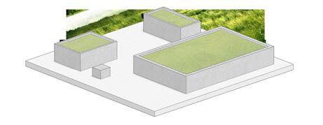
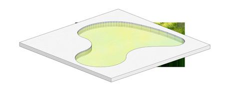
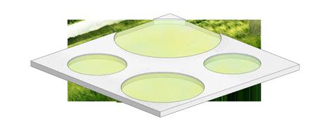
In response to the different sizes of urban spaces, we've designed several types of green algae ponds such as micro pools or the detention lake.
Electricity
Drinking Water Provide City
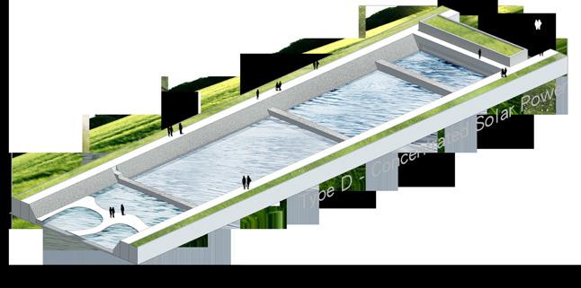
Solar Pond
A solar pond is a pool of saltwater which collects and stores solar thermal energy. This type of solar energy collector uses a salty lake as a kind of a flat plate collector that absorbs and stores energy from


Freshwater
MICROFILTRATION
REVERSE OSMOSIS UV DISINFECTION
Water For Remediation Phytoremediation
Development Area : Runoff

"The Renewable Resource Development & Water Cycle Solutions Network"


Although the annual rainfall of Kaohsiung city is twice higher as the world average, the dry period is as long as 5 to 8 months. This results in the water resource that can be used effici-ently in the urban area being less than the total annual rainfall. This system combines a series of engineering and ecosystems to establish a sustainable energy chain that can store and reuse water resources.
TYPE A - BLOCK
TYPE B - BOUNDARY


TYPE C - RIVERSIDE
TYPE F - NEAR THE SEA
Contaminated
Groundwater
Dual Phase Extraction
Wetland
Irrigation Water
Permeable Green


Groundwater BY RUNOFF

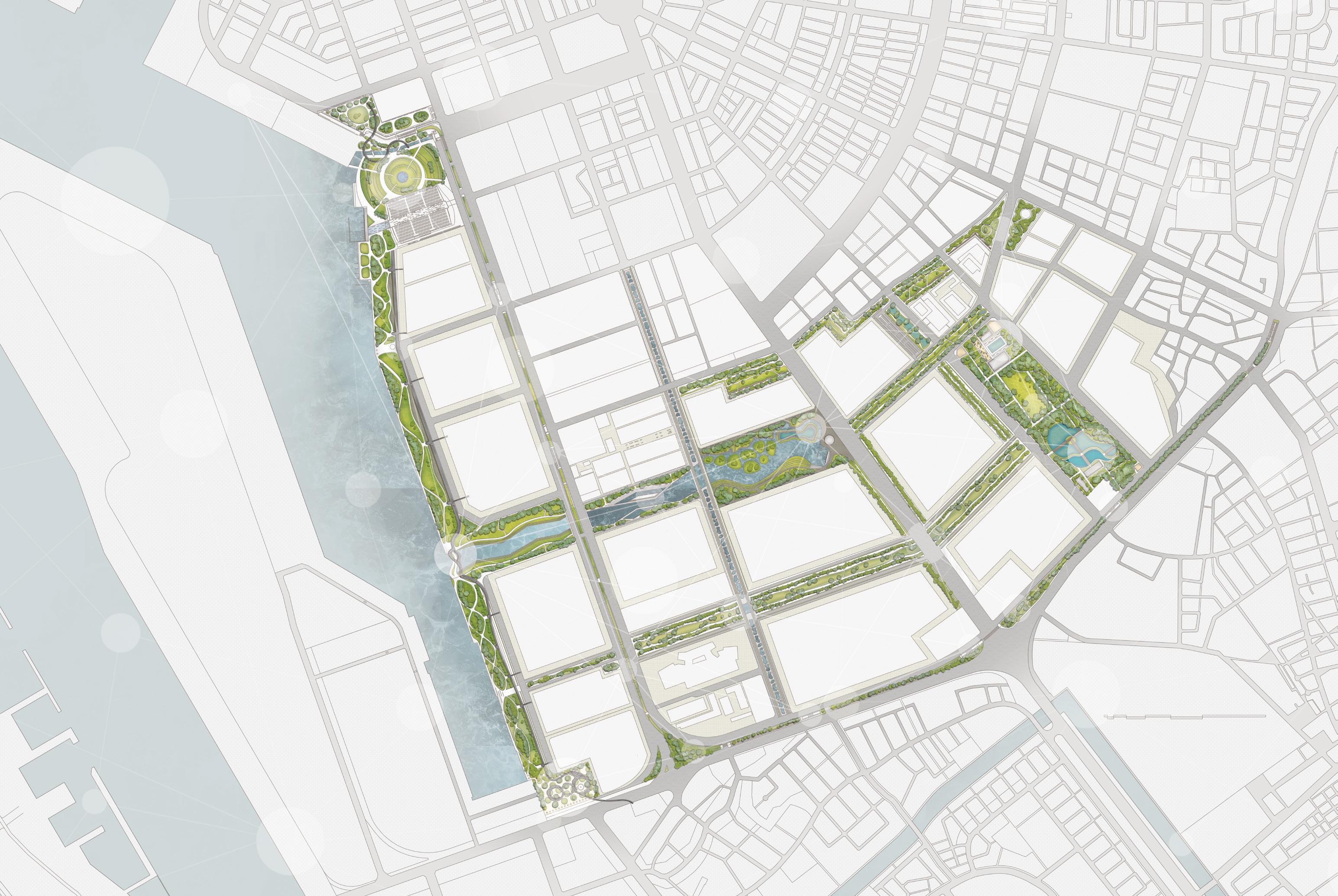


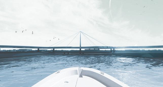


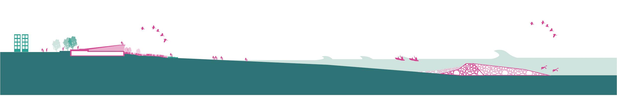
Dameisha is one of the vital components of the gateway to the coastal area of Shenzhen, which is designated to be a public facility in planning.
In 2018, the base was hit hard by Typhoon Mangroves. The role of typhoon waves brings two serious disasters in the Dameisha sea area, one is coastal erosion, and the other is flooding after the embankment caused by the waves.
Solution
The renovation of the park will solve the issues of outdated facilities, the impact of extreme climate and ecological uniformity:
1. Reshape resilient seashore park landscape;

2. Rejuvenate the park into a spot of Shenzhen city leisure;
3. Lead the Shenzhen East Golden Triangle down the pathway to sustainable development.
Site Location: Shenzhen, China
Area: 20 ha
Instructor: Chuang, Hsuen Neng
Project Team: 6 people participated in
AECOMSZ / EC - Data Analysis /1
AECOMTW&SZ / B+P - Master Plan /3
AECOMTW / WD - Marine Engineering /2
Keywords: coastline / green belt / sustainable / shore protector / digital solutions / public recreation
1 2 3

Under the overall requirements of establishing a “world-class green vitality coastal zone” in Shenzhen, the project construction pays more attention to the global driving, cultural connotation and international quality. However, the linkage effect of tourism consumption behaviour and surrounding businesses is weak.


In order to achieve this goal, we designed three different protections at various levels. Each protection has its own purpose such as wave control, flood control, and level control.
The current tourism products are mostly resource-based and have a high degree of homogeneity. By establishing unique shorelines such as infrastructures but having specialshaped attractions.
We add various sustainable elements to the construction. In wave control, we focus on making an ecological submerged reef. In flood control, we tried to create a wetland field. In level control, we turn most breakwaters on land into multifunctional seaside parks.
Non-Motorized
The
not only meet the needs of the service but also integrate into the landscape environment.


"An Energy Belt of Resilience and Ecology, A New Stage for Urban Leisure."


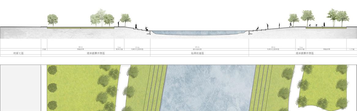
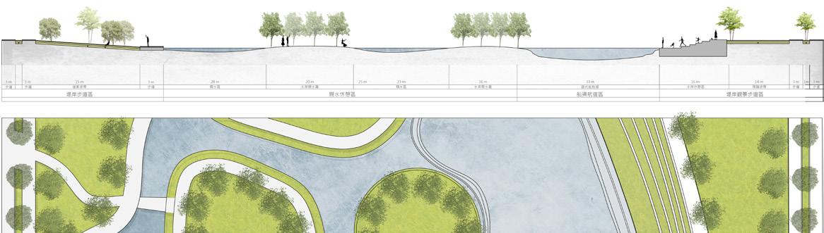
In response to coastal erosion, a line defence strategy can be applied to resist surface-wide loss. Three common approaches are available in international practi-ces, including an artificial beach, headland control and detached breakwater. With the EFDC model, the design is to ensure the stability of the overall flow field of the Dameisha sea area and the ecological reefs.


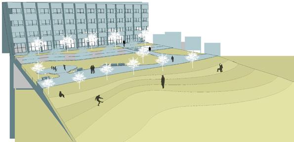
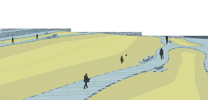
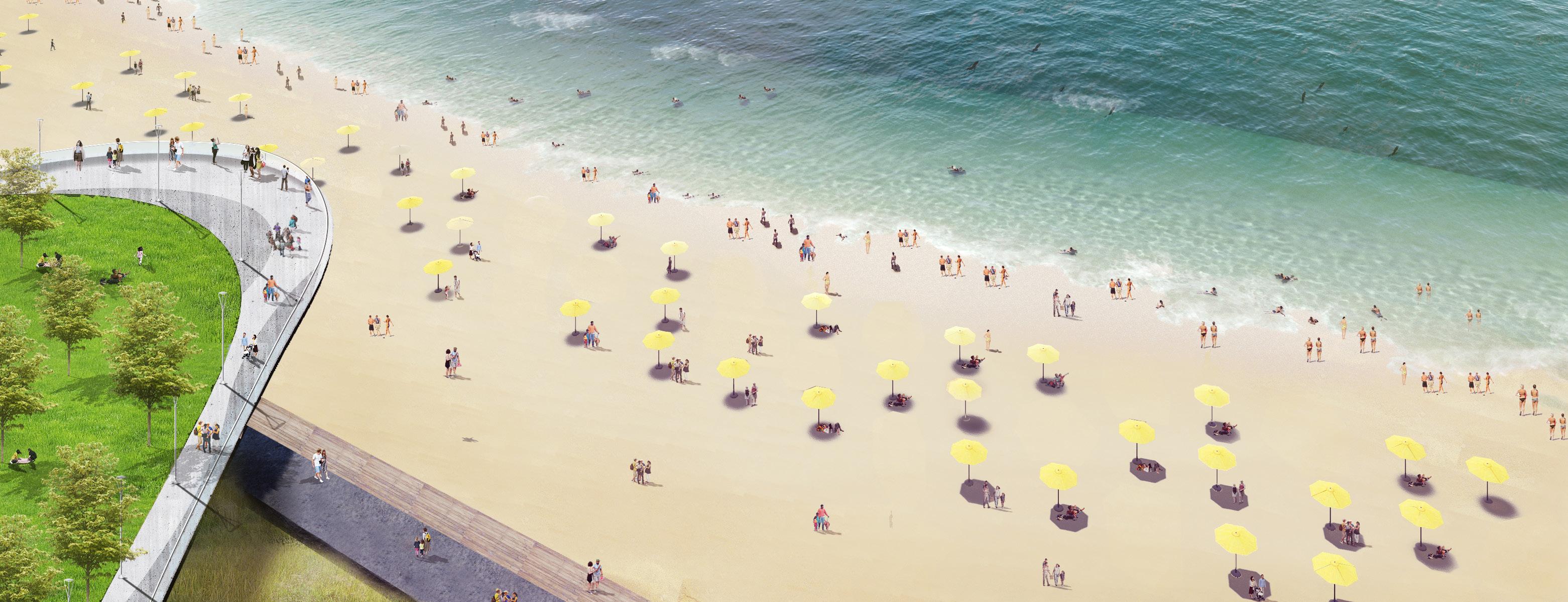
Not only beach protection, but also a string of green seas and an energy belt of resilient and ecological environment. Not only a park, but also a Meisha overlook a new stage for city leisure.

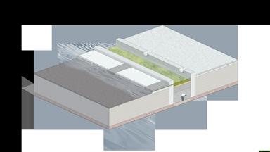
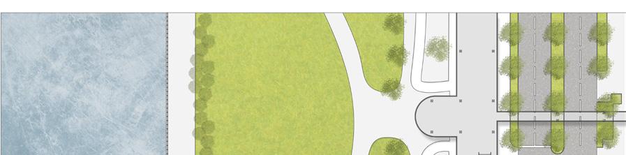
PROTECTION B : FLOOD CONTROL
We build the second line of defense for coastal protection using a green belt system in conjunction with hard engineering. We use modular design to streamline the dolosse’s body for a multi-activity plaza zone that we created for the general public. This will effectively expel flooding caused by storm surges, and as a buffer zone, it provides the extra benefit of wave energy dissipation.

Constructed Wetland Platform Details


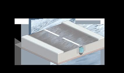
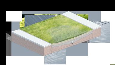
Platform Level (20 ~ 40cm)
Breakwater


Mixed Soil (Clay Loam)

Type

Type
Type
Type
Not only beach protection, but also a string of green seas and an energy belt of resilient and ecological environment. Not only a park, but also a Meisha overlook a new stage for city leisure.


Apply green belt system together and hard engineering to construct the second line of defence for coastal protection. This will effectively expel flooding caused by storm surges, and as a buffer zone, it provides the extra benefit of wave energy dissipation.

Meisha stage focuses on the immersive experience of the seaside space, showing the interaction between people and ecological. Create a multi-functional seaside park stage, connect the Dameisha area, emphasize the experience of different spatial changes, and create a lively stage.


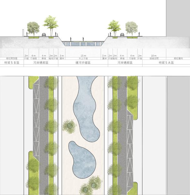
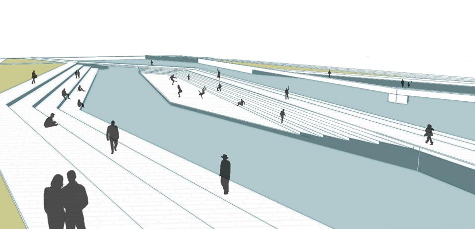
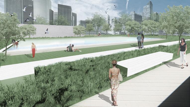
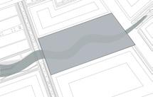
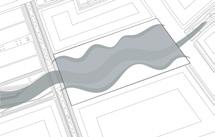
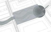
The Tianliao River is the first artificial canal in Taiwan, with a record of excavation a hundred years ago. The length of the river is about 3.5 kilometres, and the drainage basin is about 431 ha which passes through Xinyi District and Renai District.
In recent years, with changes in economic growth and urban population concentration, the sewage of city has been discharged into the Tianliao River without purification, making the water turbid and smelly, also hard to get close.
"From Keelung port to the city, finally into mountains and rivers." Tianliao River is still a vital part of the Keelung landscape and image today. Therefore, the main target of this project is to solve the problem of sewage discharge and improve the landscape space on both sides of the banks at the same time.
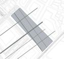
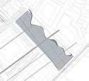
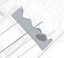
Site Location: Keelung, Taiwan
Area: 1.3 ha
Instructor: Yu, Chia Yang
Project Team: 4 people participated in
AECOMTW / B+P / River Restoration /3
AECOMTW / WD / Hydraulic Engineering /1
Keywords: canal / keelung culture / river restoration / platform facades / details design


In recent years, Keelung City has tried to change the original appearance of the city whose a messy water environment and old infrastructure. Several public space improvement plans were proposed, and then extended all the way east to the urban area.
The Tianliao River is the most vital link between the port area and the city boundary, the positioning of the canal is not only a floodway between cities but also an important corridor that carried the culture of the city and the sense of place. Travellers in Keelung usually enter from the port area, visit the city, and then go into the mountains and rivers around Keelung. Therefore, the Tianliao River is a part of the landscape that can achieve Keelung's image.


The length of the river is about 3.5 kilometres, and the drainage basin is about 431 ha which passes through Xinyi District and Renai District. The site location is at the top of the lower reach - the


Location of Water Infrastructure
Right Bank: R1, R2, R3, R4~R5, R6, R7, R8

Intercepting about 2,000 CMD to the right trunk line of Tianliao sewage sewer.
Left Bank: L1, L2~L4
Intercepting about 15,000 CMD, and about 4000 CMD into the water treatment plant.
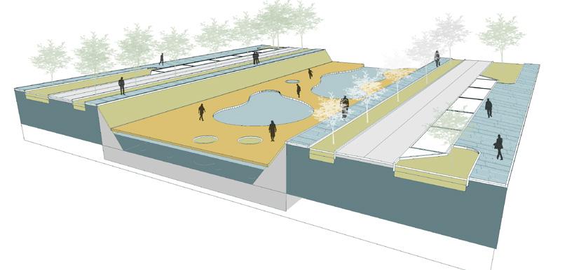
Remediation is the process that is used to treat polluted groundwater or river water by removing the pollutants or converting them into harmless resources.
Fundamental Structure
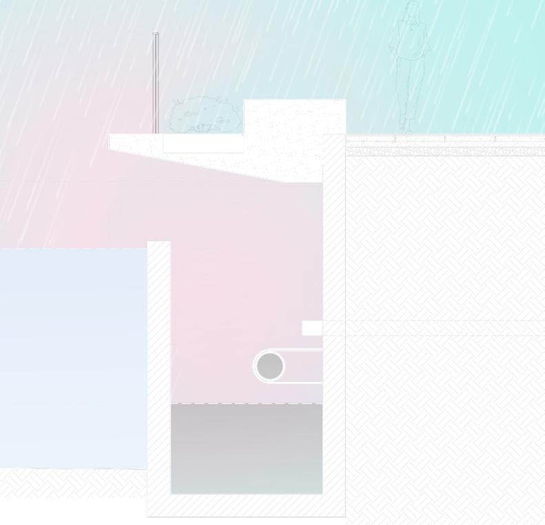
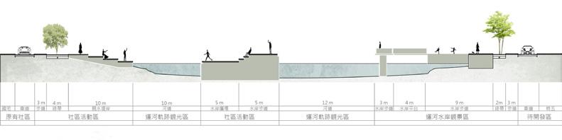
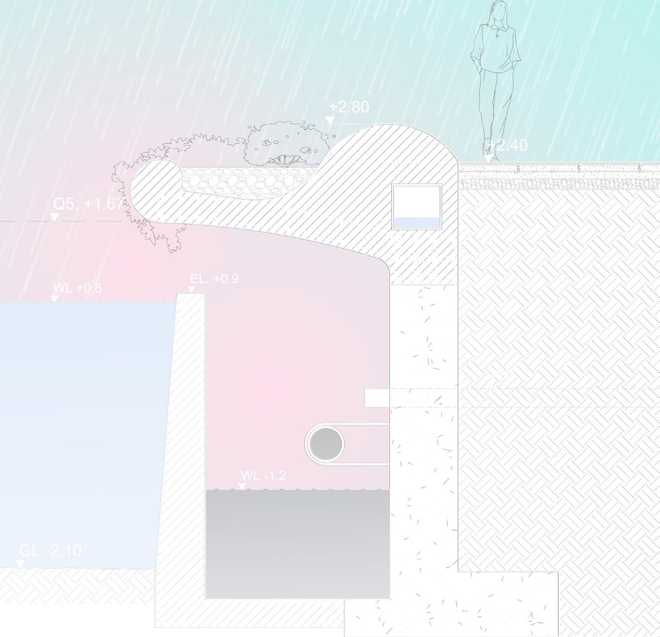
Spaces and facilities should be located above Q5 1.67m as much as possible. Most Boxes are integrated structure, which is constructed with landscape platform. To integrate both functions, we establish a series of platform facades based on two types of infrastructures:
1. Type A: Culvert Box


2. Type B: Large Culvert Box
The Aims of Facilities Facades:

Solving the problem of sewage discharge and improving the landscape space on both sides of the banks at the same time. There are three issues that need to solve:
1. Platform co-construction.
2. The prevention of water odour.
3. Integrated structure with river image.
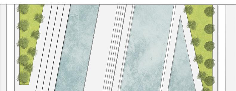
We attempt to create a continuous/interesting canal path, reflecting the life and historical trajectory of Keelung City and transferring from the functionality of transportation in the past into the living area with the city today.


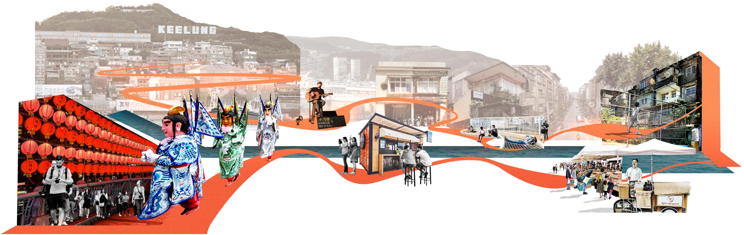


A Continuous/Interesting canal way, reflecting the life of people and the history of Keelung.


By using the continuity of the landscape to design infrastructures on both sides of the Tianliao River such as characteristic pavings, rain shelters, gazebos, bus stations. These Facilities can be integrated with the daily life of Keelung people.


TYPE A - STREET FURNITURE
Flowerbed
Concrete Seat
Covering Facilities

Community Activities
SCALE A - STREET FURNITURE SCALE B - PUBLIC FACILITIES SCALE C - SMALL STRUCTURES SCALE D - LARGE STRUCTURES

Corten Steel
TYPE B - TRANSFORMER BOX
Keep Old Trees
TYPE C - BUS STATION
Corten Steel
Corten Steel Red Brick Paving Red Brick Paving Concrete Seat

Red Brick Paving
TYPE D - WATER TREATMENT PLANT
Corten Steel View Deck
Planting
Engine Room
Red Brick Paving
The sewage drain brings a strong odour that could cause citizens to avoid walking on the bank. Besides, the rainfall in Keelung city is dramatically high, we have to not only deal with odour but also consider the runoff.
SECTION INDEX
Pervious Concrete with Expansion Joint
Concrete Polished Finish
Washed Finish Concrete
Cast Iron Grate of Rainwater Harvesting
Rainwater Harvesting
PVC Pipe #3
Sandy Loam (Lightweight Soil)
Drainage PVC #3
#4@20 D13 Rebar
Cement Mortar & Rebar Embed (at least 15 cm)
Reinforced Concrete
#4@20 D13 Rebar
Cement Mortar & Rebar Embed (at least 15 cm)
Main Sewage Drain (through pipe)
Existing Sewage Drain (direct)
Existing Riverbank
Sweet Osmanthus (Osmanthus fragrans)
Trailing Lantana (Lantana montevidensis Briq.)
Cement Mortar 10 cm
Because of the remediation, both riverbanks are constructed with the culvert box. However, the site does not have enough space to deliver a bank that is integrally formed, so we divide the bank into two parts. Each part is precast concrete and they will be assembled with the existing bank on the site. Besides, we overcome the odour issue by planting flowering vegetation which could reduce the odour spread such as sweet osmanthus and trailing lantana. These plants could become a buffer area between the leisure space and the culvert box.