URBAN DESIGN
Wolkite University
College of Engineering and Technology
Department of Architecture
BAUD 2023-06-16 Urban Design Final Jury. Group Two
Submitted To:Abreham G
Prepared by: Kirubel Zelalem Kaleb Negasi Molalign Misganaw
BAUD 2023-06-16 Urban Design Final Jury. Group Two
Submitted To:Abreham G
Prepared by: Kirubel Zelalem Kaleb Negasi Molalign MisganawTHE MAJOR ROAD THAT PASSES THROUGH CITY CENTER ACTIVE EDGES
GENTLE SLOPE TOPOGRAPHY
GOOD ACTIVITY AND INTERACTION
INVITING APPEARANCE OF MARKETS
EASILY ACCESSIBLE FROM DIFFERENT PART OF THE CITY
NO SPECIFIED PARKING SPACE
IMPROPER AND UNSPECIFIC ACCESS OF PEDESTRIAN
LACK OF LANDSCAPE TREATMENT
IMPROPER DRAINAGE SYSTEM
IRREGULAR URBAN PATTERN
UNPLANNED PUBLIC SPACE
STRATEGIC QUALITY OF THE SITE
POPULATION
Establishing the development framework and design principles for the redevelopment of the JNP region in Wolkite City, Ethiopia, is the goal of this urban design. The streets, parks, open areas, buildings, built form, and landscape components will all work together to produce a coherent development throughout the Site, as described in these design standards. They define the physical interaction between these elements and the public space as well as the design form, quality, and character of new structures. They also describe how parking maintenance, access, and construction phasing should work.

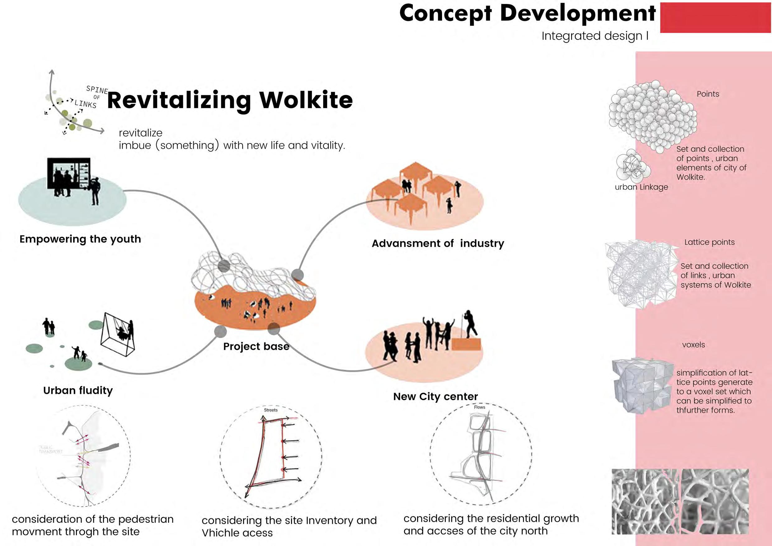

Revitalization is a conceptual term used in urban design to describe the process of improving or restoring the economic, social, and physical conditions of a neighborhood or urban area.

Revitalization can include a range of strategies, such as improving public infrastructure and transportation, creating new housing options, supporting small businesses and local industries, and fostering community engagement and participation.
the goal of revitalization is to create more vibrant, sustainable, and equitable communities that offer opportunities for all residents to thrive. By improving the physical and social infrastructure of urban areas, revitalization can help to attract new investment, stimulate economic growth, and improve the quality of life for residents.
Jefore refers to a traditional grass-covered road with households settled on both sides in the Gurage socio-ecological production landscape in Ethiopia. The Jefoure roads enhance the people’s quality of life and provide 12 contributions of nature to people, such as food, water, fuelwood, medicine, and cultural services1. Another source2 describes the Gurage people as a group that formed village settlements based on the ecological conditions linked to Jefoure roads and Enset culture. Enset is a root crop that is cultivated as a staple food by the Gurage people23.


To imitate the Gurage people settlement pattern to the urban settlement of Wolkite city JNP area, W e considered the following factors:
1. The availability and suitability of land for Enset cultivation and Jefoure roads
2. The socio-economic, cultural, and religious characteristics of the urban population
3. The potential benefits and challenges of integrating traditional and modern practices
4. The environmental impacts and sustainability of the settlement pattern

Gurage traditional houses are often arranged in clusters or compounds, with several houses sharing a common courtyard or open space. This helps to create a sense of community and provides a safe and secure environment for
Overall, the Gurage traditional house is a functional and practical design that is well-suited to the local climate and environment. It reflects the values and lifestyle of the Gurage people, who place a high value on community, family,
To adapt the Gurage traditional settlement to an urban context, significant modifications are needed to preserve its essential features. The settlement consists of houses arranged in clusters, with shared courtyards or open spaces. To accommodate urban living, one approach is to take inspiration from the traditional design and reinterpret it in a way that suits the needs and constraints of urban living.
For example, the traditional mud and thatch houses could be replaced by modern multi-story buildings, with shared communal spaces and amenities such as gardens, playgrounds, and community centers. The central courtyard or open space could be adapted to suit the urban context, perhaps by creating a shared green space, park, or public plaza.

The layout of the traditional settlement, with its narrow streets and alleys, could be reimagined as a pedestrian-friendly network of walkways and bike paths, with limited access for cars. This would create a safer and more pleasant environment for residents, while also reducing traffic congestion and air pollution.


Overall, imposing the Gurage traditional settlement in an urban context would require a balance between preserving its essential features and adapting it to suit the needs and constraints of modern urban living. By taking inspiration from the traditional design and reinterpreting it in a modern context, it is possible to create a unique and functional urban commu-
 Safe pedestrian movement free from vacahel movement
Communal Court yard as a central space for everyone
Playground and landscaping around the school facilities
Safe pedestrian movement free from vacahel movement
Safe pedestrian movement free from vacahel movement
Communal Court yard as a central space for everyone
Playground and landscaping around the school facilities
Maximize security & comfort of the community
Key Moves:
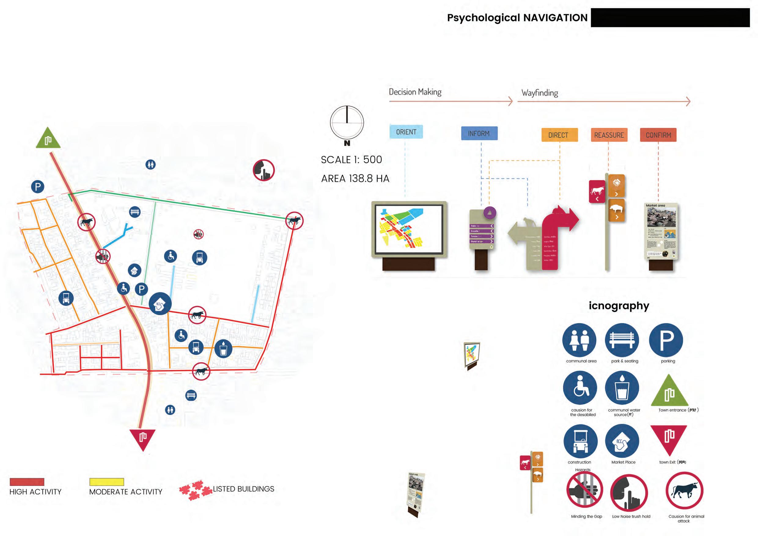
1. Review of pedestrians movement routes and Explore reducing threats in daily activities
2. Diversify uses and activity
3. Improve Legibility and Way finding.

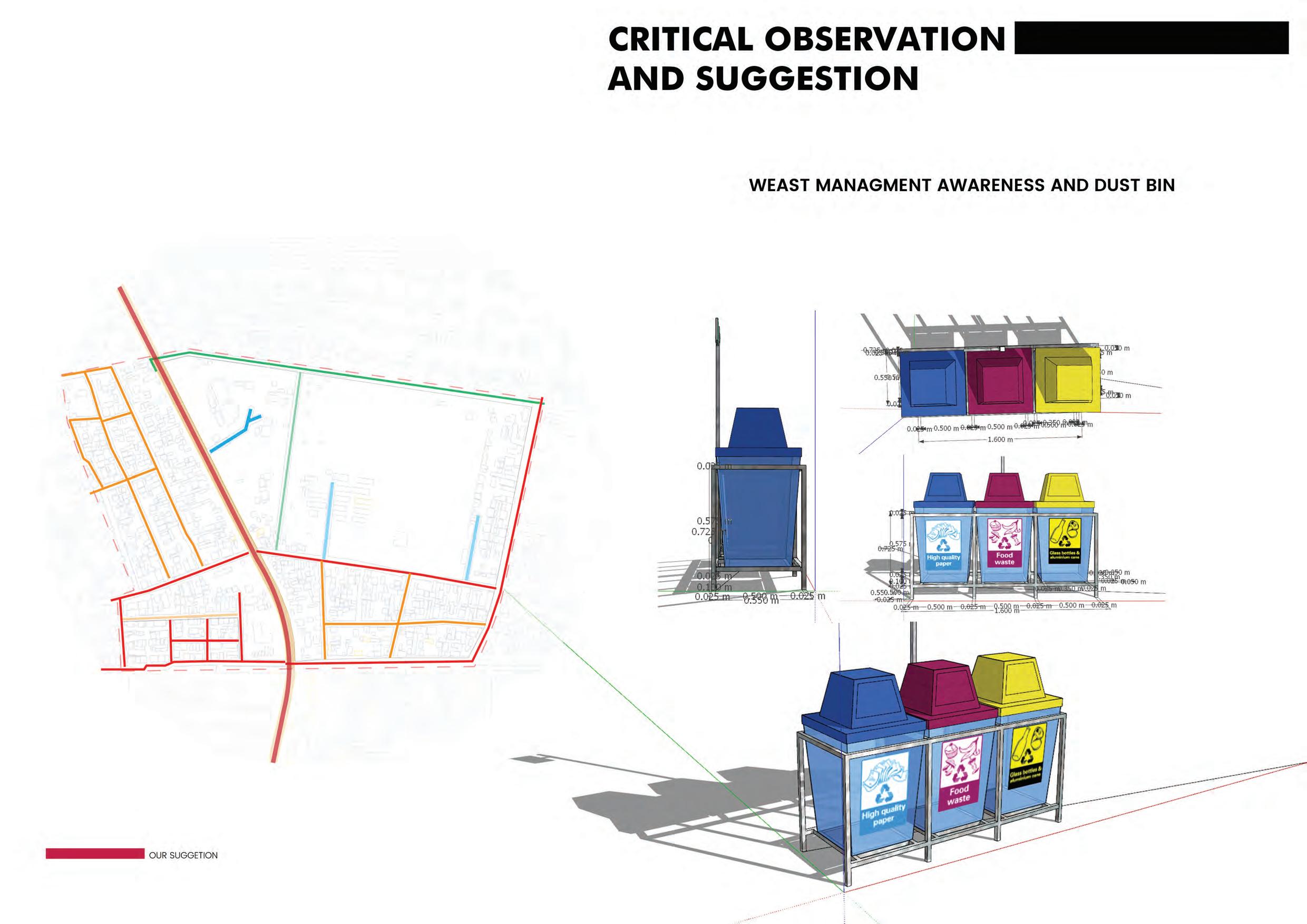
“I ties have the capability of providing something for everybody, Only because, and only when, they are created by everybody. Jane Jacobs, (The Death and Life of Great American Cities)
Key Moves:
1. Identify a series of projects to enhance the public realm.
2. Improve relation between districts.
3. Improve Legibility and Way finding.
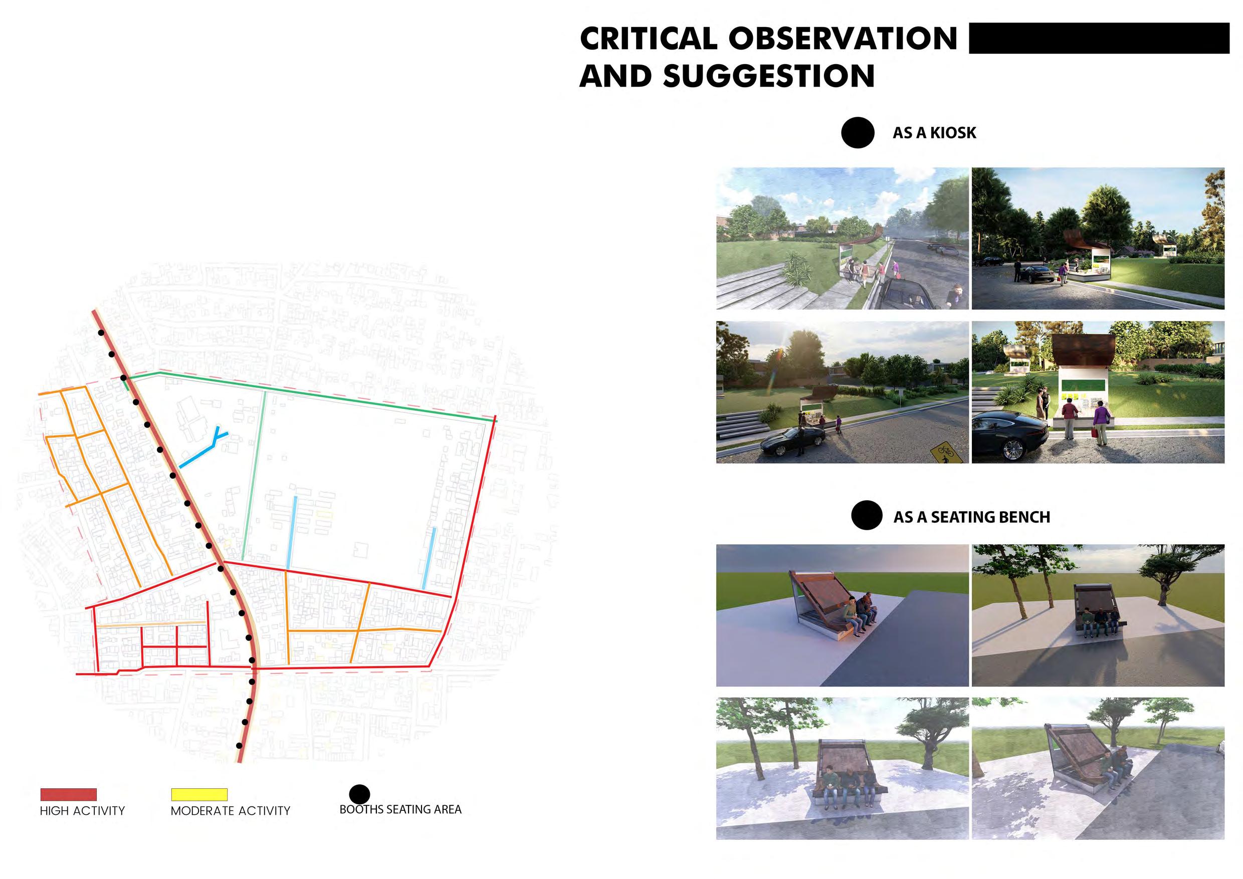
4. Create spaces that allow the community and businesses to Create a vibrant street scape, with outdoor seating and cafe Areas, public art and organized and impromptu event
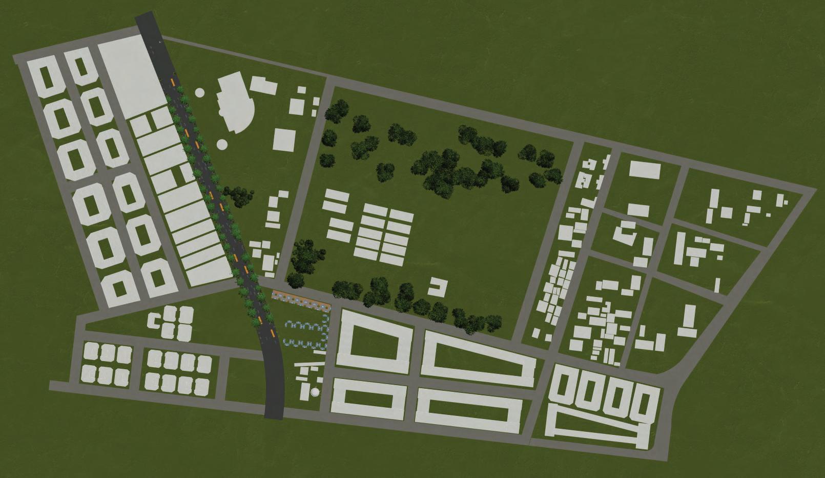
An urban layout plan is a design framework that outlines the arrangement of elements within a city or urban area, considering the social, economic, and cultural needs of the population. To integrate Gurage people settlement, the plan consider their unique cultural and social aspects, such as traditional settlement patterns, public spaces, markets, and agricultural land. The plan also consider the economic needs of the Gurage people, including commercial spaces and markets, as well as environmental and sustainability aspects. Green spaces, parks, and gardens are included to promote environmental conservation and recreational spaces. The urban layout plan should also integrate the Gurage people's settlement with the rest of the city, including transportation infrastructure, healthcare facilities, and educational institutions.


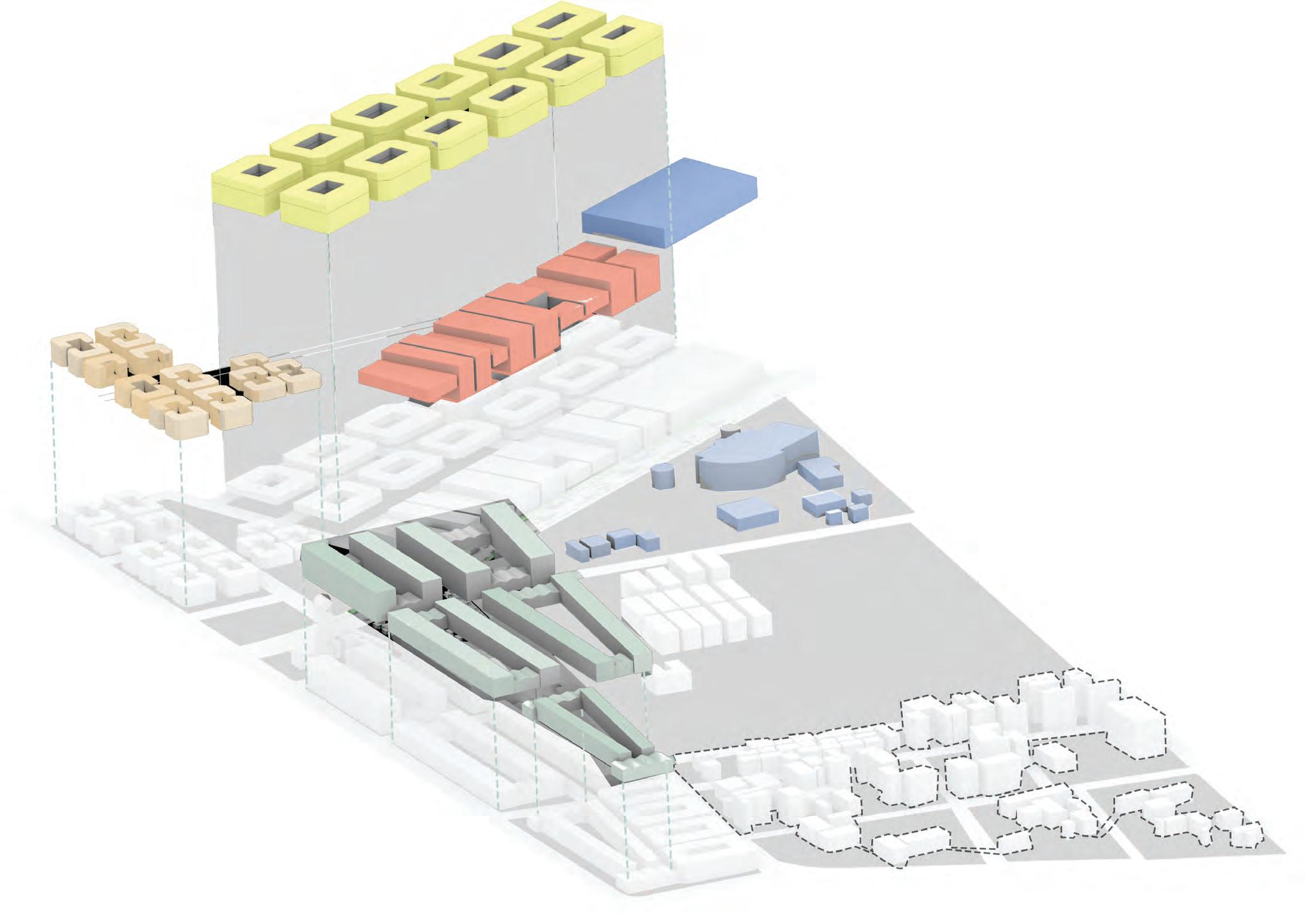
Residential zone
Service zone (garage and Auditorium)
Markets for transit vhiachels
Mixed use and industrial buildings
Compounds (+affordable housing)
Existing admin zone




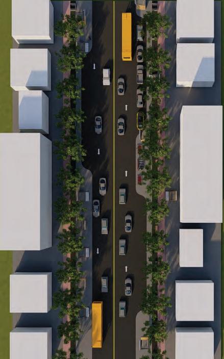


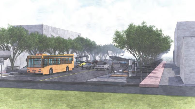
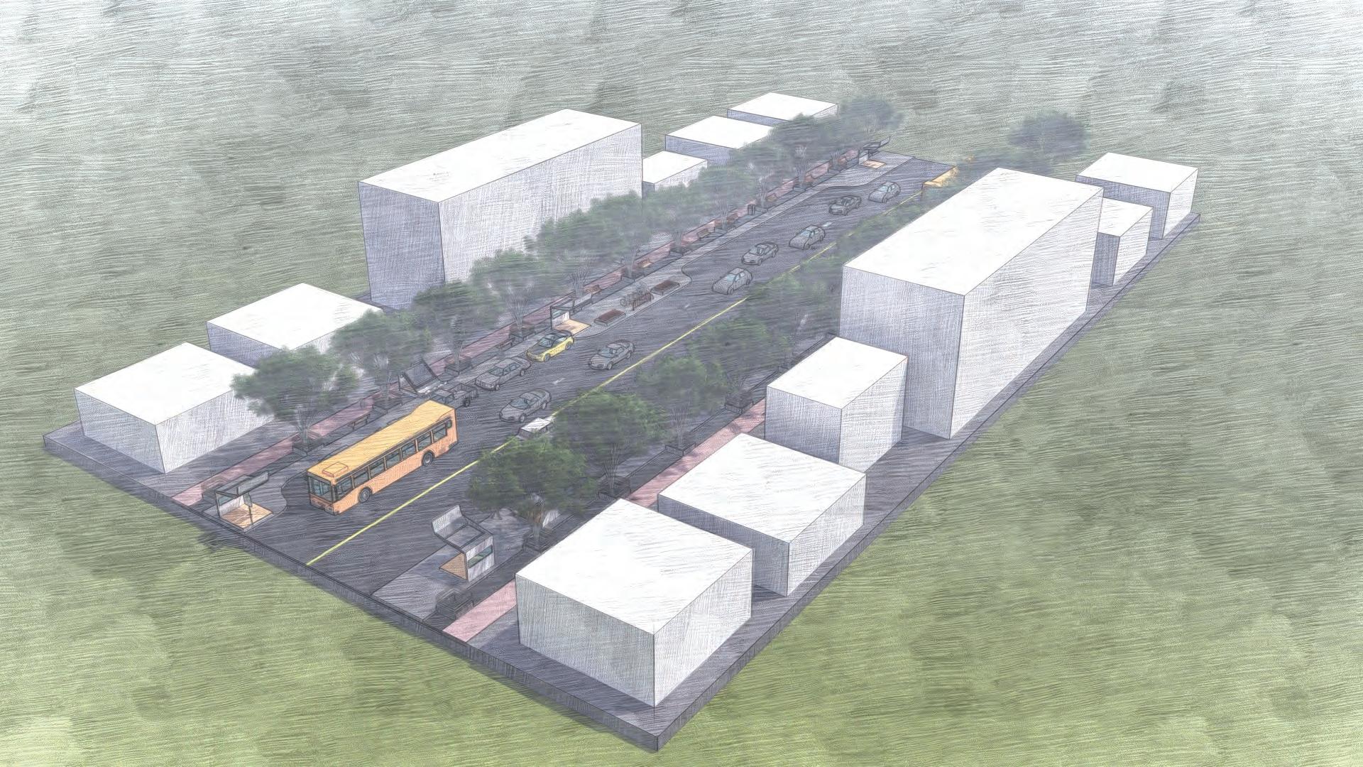
Open plaza
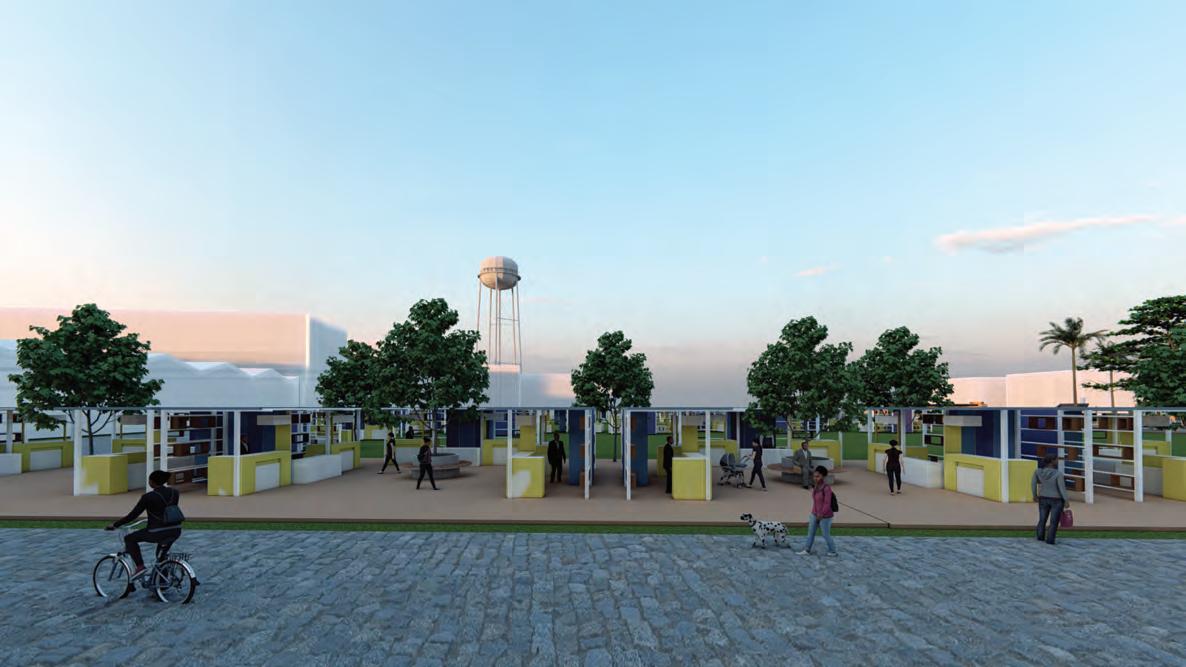
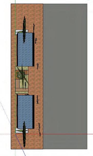
Existing Gulit markets


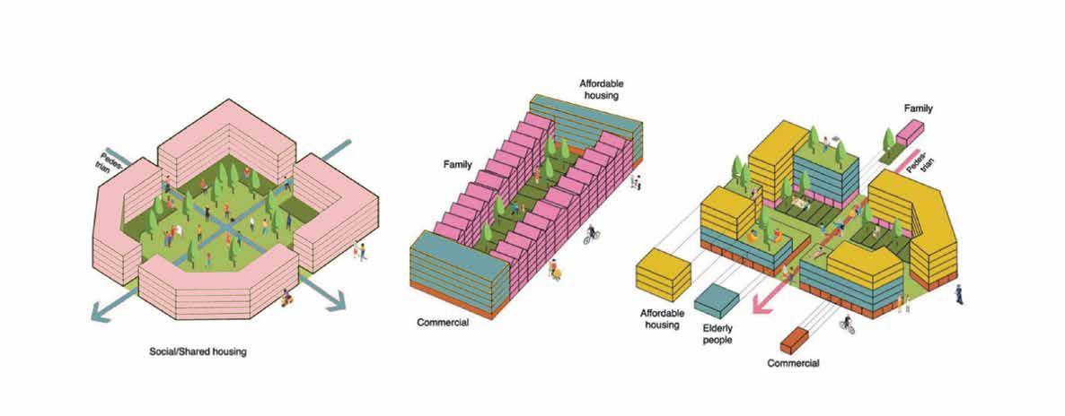
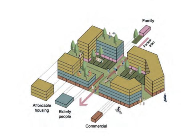
For private/social housing for family unit for affordable housing
Clear private and public real distiniction maximize large green space shared large green space high security and privacy for resudents
private garden unit for families diverse typologies for different use respect existing housing characters
active frontage participation with local activities interaction between different age groups mixed land use
Slab building type Terrace house type Mixed use type

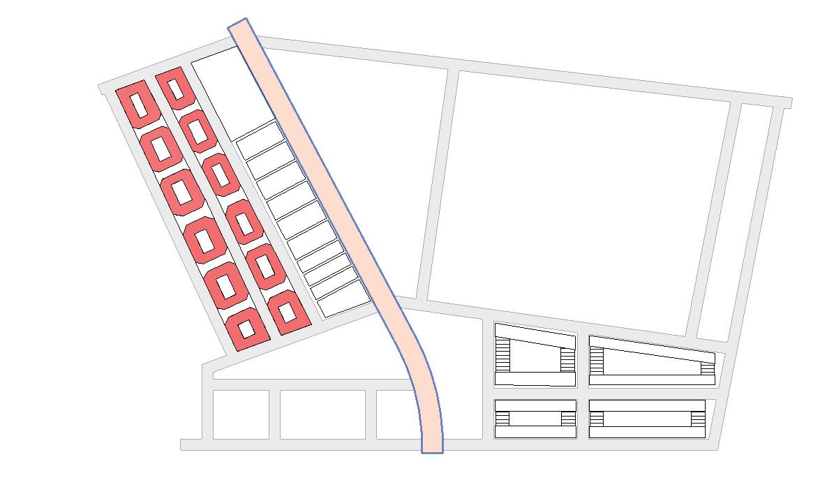


 New perimeter block replace on the selected area
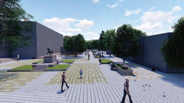

the central open park serves as the large green space for the community and is overlooked by the commercial and mixed use buildings on the perphery


