

Colin Montoute
Colin Montoute Architect
Colin Montoute has been an architect for 30 years, contributing to numerous award-winning projects. In the public sector, he enhances o en overlooked elements of the public realm to improve urban life. In the private sector, he emphasizes design's role in value creation. He has worked in Dubai, Saudi Arabia, Africa, Haiti, and China. Colin is a licensed architect in New York and Massachuse s, holding a Master of Urban Planning from the University of Southern California and a Bachelor of Architecture from the New York Institute of Technology.


The Walking City


One of my earliest memories that profoundly shaped my architectural thinking was encountering the work of Archigram. Their innovative use of comic-book-style graphics, particularly Ron Herron's iconic "Walking City," captivated me. The image of a city on the move, perched on colossal, adaptable stilts, resonated with me in ways I couldn't fully articulate then. Initially, the audacity of the sci-fi concept—a city not anchored to the earth but capable of moving across it—sparked my imagination. This vision of architecture, agile enough to transcend the conventional boundaries of place and time, introduced me to systems that thrive on change and can dynamically engage with their natural and social environments.


Though those early notions have since evolved in my thinking, the core themes of mobility, flexibility, and adaptability have remained constant in my pursuit of an architectural approach that provides a foundation for the communities I serve to live their most rewarding and vibrant lives.
These ideas have guided me toward developing a cross-disciplinary, cross-cultural practice that remains agile in identifying and addressing challenges by seeking solutions from the context in which they exist, rather than imposing external frameworks.


The Walking City unrooted in any specific location, could evade the limitations of geography, politics, and even climate—concepts that remain profoundly relevant today as we confront the realities of climate change and rising sea levels.


Transportation
Tong Zhou Transportation Center

China's capital, Beijing, is constructing a 1.3 million-square-meter underground transportation hub in the southeastern Tongzhou District. This mega project, which commenced on November 30, 2019, is set to be one of the world's largest underground transportation hubs upon its completion in five years.


AECOM
Client: Suning Real Estate Group Co., Ltd
Location: Tongzhou district, Beijing, China
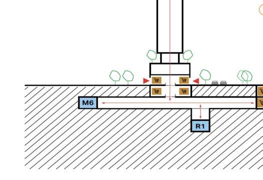
The interface of the transportation hub with Tong Zu Grand Plaza




Designed to handle around 450,000 commuters daily, the hub will connect three subway lines and two highspeed train lines, linking Beijing's airports and the Universal Studios theme park. The project embodies the concept of transit-oriented development (TOD). Spanning 1.3 million square meters in the southeastern Tongzhou District, this mega project, which commenced on November 30, 2019, is set to be one of the world's largest underground transportation hubs upon its completion in five years.


The TZ Hub station is landscaped, with the new central business district visible in the distance.

View of the underground waiting hall at TZ Hub.


Designed to handle around 450,000 commuters daily, the TZHub will connect three subway lines and two high-speed train lines, linking Beijing's airports and the Universal Studios theme park. This project embodies the concept of transit-oriented development (TOD).


The Penn Station Critical Improvements project aims to transform Penn Station into a modern, commuter-first transit hub. The improvements are designed to enhance passenger experience by increasing the station's capacity, improving safety, and making navigation easier.

This major overhaul is part of a broader effort to revitalize Penn Station, enhancing its functionality and aesthetics.
Key Station Enhancements:
New Entrances: A new entrance at 33rd Street and 7th Avenue opened in February 2021, providing direct access to the Long Island Rail Road (LIRR) concourse and the subway. This addition helps reduce pedestrian congestion and improves overall visibility.
Concourse Renovations: The LIRR concourse has been renovated, featuring higher ceilings, premium finishes, and enhanced way finding systems, improving the station's flow and safety.
Accessibility: The project will also introduce 18 new escalators and 11 new elevators, significantly enhancing visibility for passengers with disabilities.
Public Realm Enhancements: A 30,000-square-foot public plaza will be constructed outside the station, along with protected bike lanes and additional mixed-income housing in the surrounding area.
Project Status: Completed
Role: Senior Designer/Principal Firm: AECOM
Client: MTA Capital Projects
Location: Manhattan, New York
View of the redeveloped concourse with the new Seventh Avenue escalator entry.

View of the modern ticketing area alongside the redeveloped platforms.

Green Line Station

The Opera House Station is a proposed station on the Dubai Metro Green Line, located at the eastern shore of the planned Dubai Creek Sixth Bridge. This station will serve as a critical intermodal facility, linking Dubai International Airport with new developments to the south and east. The station accommodates bus and taxi drop-o areas, providing enhanced access to the surrounding cultural and commercial

Project Status: Unbuilt
Role: Senior Designer /Principal
Firm: FxFowle
Client: Dubai's Roads and Transport Authority
Location: Dubai, United Arab Emirates


The Green Line Station's exterior was designed using high-performance ETFE membranes that protect the region's harsh climate while adapting throughout the day to meet ventilation and solar protection needs. The skin, embossed with a mask pa ern integrated into the fabric's structure, can flex and reshape according to the building's and passengers' energy demands. At night, the station transforms into a glowing lantern, signaling the movement of trains and passengers, marking the flow of people through the city and time.
View of Station at bridge median on Opera House Island
Images of high performance “agile” station skin.

The Manha an Gondola projects were proposed to connect Manha an with rapidly growing urban areas across the river, including Williamsburg, Brooklyn, and Governors Island. Both projects were designed to utilize the well-established technology of aerial gondolas, widely used worldwide, as a quick, e cient, and easily constructible solution for urban mobility.


The key feature of the Manha an Gondolas was their ability to provide new mobility solutions to address the rapidly growing demand in an already dense city. At their station touchdown points, they added new public spaces to communities that might have otherwise only experienced the negative externalities of new transportation infrastructure. Gondolas were a form of agile infrastructure relatively common in Europe and South America. They were designed to generate urban vibrancy
Role: Senior Designer/Principal
Firm: AECOM
Client: EDC/Trust for Governors Island
Location: Lower Manha an/Governors Island
East River Skyway
Location: Proposed to connect Williamsburg, Brooklyn, to Lower Manha an, with extensions to other waterfront areas along the East River.
Concept: A network of aerial gondolas to ease subway congestion, especially during the L train shutdown, providing a scenic and e cient transport alternative.
Governors Island Gondola
Location: Designed to link Lower Manha an to Governors Island.
Concept: A gondola system to improve year-round access, providing an e cient alternative to limited ferry services and boosting tourism and accessibility.

Aerial view of gondola station at South Street Seaport. Project Status: Unbuilt
Governors Island Gondola Station at South Street Seaport
East River Skyway Station in New Manhattan Park
New Brunswick Mobility Hub
The New Brunswick Station and its surrounding area are envisioned as a vibrant, transit-oriented, pedestrian-prioritized civic space that enhances the existing station and adjacent development sites.
NJ TRANSIT will benefit from extended platforms, improved accessibility, and other necessary upgrades to optimize operations and reduce maintenance costs.

A Place to Gather, Not Just Pass Through

Project Status: Under Construction
Role: Senior Designer/Principal Firm: AECOM
Client: Devco
Location: New Brunswick New Jersey

The City of New Brunswick will benefit from this new mobility hub, which is designed as a transit, development, and public use center. The enhanced public realm will o er a variety of activities and uses throughout the day and across all seasons. Adjacent development sites will leverage the value created by this investment in transportation infrastructure, driving market-driven growth and development.
Image of connecting bridge between renovated station and adjacent mixed-use complex.
Views of the modern glass “wrapper” the flexes and bows to both accommodate new station programing and historic station elements.

Cultural
1969, Barilla opened the world's largest pasta factory in Parma, Italy. In 2018, the brand began expanding its campus to blend industrial production with culture and community.
Project Status: Unbuilt
Role: Director/ Senior Designer
Firm: MONTOUTE - Architects Planners
Client: Barilla Pasta
Location: Parma PR, Italy
The Barilla Pavilion is designed as a villa with a central courtyard and a tripartite layout across three levels. The lower level, buried three meters underground, contains core functions, storage, archival spaces, and an events space, known as the "dark program." The main level, or Piano Nobile, is a green mound supporting brick masonry volumes with glass infill, shaping the pavilion's form. The upper level features a glazed, cantilevered volume with an enclosed plaza, wrapped in a scalloped mesh screen for sun protection and added prominence. This design makes the building appear both grounded and ethereally light,


Al Tajeat Stadium


China's capital, Beijing, is constructing a 1.3 million-square-meter underground transportation hub in the southeastern Tongzhou District. This mega project, which commenced on November 30, 2019, is set to be one of the world's largest underground transportation hubs upon its completion in five years.
The Al Tajeat Stadium in Iraq focused on developing a significant sports complex in Baghdad, intended to accommodate over 60,000 spectators. Designed as part of a more significant sports center, this stadium was part of Iraq's e orts to enhance its infrastructure for major sporting events, including potential Olympic and World Cup events. The roof design explored several concepts, ultimately selecting a rigid steel frame for durability.
The stadium and complex were designed to meet World Cup and Olympic standards, featuring numerous practice fields, secondary stadiums, and housing for the world's athletes.
Project Status: Unbuilt
Role: Senior Designer
Firm: AECOM
Client: Withheld
Location: Tung Zhou,China
Ministry of Youth and Sports of the Republic of Iraq Baghdad, Iraq
Designed to handle around 450,000 commuters daily, the hub will connect three subway lines and two high-speed train lines, linking Beijing's airports and the Universal Studios theme park. The project embodies the concept of transit-oriented development (TOD). Spanning 1.3 million square meters in the southeastern Tongzhou District, this mega project, which commenced on November 30, 2019, is set to be one of the world's largest underground transportation hubs upon its completion in five years.
Unbuilt / Principal FxFowle


The project aimed to provide modern sports facilities in Iraq, supported by international collaborations, and featured architectural influences from Baghdad's traditional designs, including lozenge-shaped ornaments inspired by the city's historical bazaars. A vital design aspect was optimizing the facade to reduce overall construction costs by incorporating these traditional elements. The design successfully blended modern stadium functionality with cultural heritage, resulting in a cost-e ective and visually striking structure.

Interior view of the stadium, featuring a translucent skin roof.
View of solar studies and high-performance skin design elements.
View of massing and formal stadium design studies.
Overview of the stadium complex master plan.


Nelson Mandela’s Thembu family of the Xhosa tribe boasts a rich oral tradition, o en conveyed through music using drums, ra les, whistles, flutes, mouth harps, and stringed instruments. Mandela’s words, particularly during his 27-year imprisonment, have been a powerful force for global change. This memorial aims to give form to his words, continuing his legacy as a beacon of positive change.

Project Status: Unbuilt
Role: Director/ Senior Designer


Firm: MONTOUTE - Architects Planners
Client: Nelson Mandela Foundation
Location: San Mateo, California


The memorial comprises two key elements: an earthwork forming an oval “room” and figural trees creating a canopy. Constructed from Earth, Stone, Metal, and Sky, the memorial deeply connects the natural elements.
Six polished bronze trees, each bearing one of Mandela’s names—Nelson, Tata, Rolihlahla, Madiba, Khulu, Dalibhunga— represent di erent stages of his life, highlighting his multifaceted identity. Inscribed on the granite floor at the base of each tree trunk are quotes that encapsulate distinct periods of his life, o ering insights into his journey and the lives he has influenced.


Memorial Access Stairs from valley below.


View of memorial plaza
Tapio Wirkala - Rut Bryk Museum

Tapio Wirkkala (1915-1985) and Rut Bryk (1916-1999) were a dynamic duo in Finnish design, each making significant and lasting contributions to applied arts. Their combined influence helped shape the global perception of Finnish design, which is renowned for its elegance, innovation, and deep connection to nature.

Project Status: Unbuilt
Role: Director/ Senior Designer
Firm: MONTOUTE - Architects Planners
Client: Tapio Wirkkala Rut Bryk Foundation
Location: Espoo, Finland
This proposal for the Wirkkala-Bryk Archive envisions more than a collection of beautiful objects; it is a space for sharing, where objects are experienced as part of the flow of life and personal interactions. The open display shelving invites visitors to share their experiences, o en with strangers, challenging their understanding of both the objects and themselves. The shelving structure weaves and folds within the space, creating pockets for collective engagement—rooms that both enclose and open the archive to visitors. An interpretive theater allows for films and presentations about the artists' work, lives, and processes.
National Museum of Afghanistan

Museums have the responsibility to care for a people's cultural heritage, creating connections between tangible artifacts and intangible ideas while providing them with context and meaning. They achieve this through various thematic, systematic, and interactive approaches, all with the primary goal of allowing visitors to explore collections for inspiration, learning, and enjoyment. Museums collect, safeguard, and make history accessible, holding it in trust for society. They also must promote this heritage for everyone and protect it for future generations.
“A nation stays alive when its culture stays alive”
Project Status: Unbuilt
Role: Director/ Senior Designer
Firm: MONTOUTE - Architects Planners
Client: Islamic Republic of Afghanistan/U.S. Embassy
Location: Kabul, Afghanistan
The National Museum of Afghanistan has a unique opportunity to become a 21st-century institution that collects, studies, conserves, exhibits, and educates about the nation's rich and diverse cultural history. This history is represented in the nearly 100,000 objects that make up the museum's collection.




The museum's mission is to conserve, collect, study, and exhibit significant examples of the nation's uniquely rich and diverse cultural heritage while educating local and international communities and advancing global appreciation of Afghanistan's remarkable history and traditions.
Six key goals and strategies for the long-term success and viability of the National Museum of Afghanistan:
Preserve, interpret, and promote the natural and cultural heritage of humanity.
Maintain collections and hold them in trust to benefit society and its development.
Serve as a primary source of evidence to further knowledge on the art of Afghanistan.
Provide opportunities to appreciate, understand, and manage Afghanistan's natural and cultural heritage.
Hold resources that o er opportunities for public services and benefits.
Collaborate closely with the communities from which their collections originate and those they serve.
View of cast stone and perforated bonze skin detail.
View of cast stone and perforated bonze skin detail.
Section through museum gallery, with translucent toplight.
View of museum embedded in earth mound. The mound acts as a security buffer for the museum archive.


chives of rare artifacts to dynamic spaces for communication and interaction. Traditionally, museums were repositories of unique and valuable objects, primarily focused on preservation and showcasing rarity. However, they play a more active role in fostering dialogue, education, and community engagement today. Modern museums aim to connect people with culture, history, and each other by using their collections to provoke thought, encourage discourse, and explore contemporary issues. This shi reflects a broader trend where museums are seen not just as custodians of the past but as active participants in cultural exchange and social development.
Brooklyn Children Museum Master Plan
The Brooklyn Children’s Museum’s mission is to create experiences that ignite curiosity, celebrate identity, and cultivate joyful learning. The museum now has the opportunity to advance this mission and has determined the following goals to guide its future growth.
Founded in 1899 as the world’s first children’s museum, Brooklyn Children’s Museum (BCM) is New York City’s largest cultural institution designed especially for families. Proudly based in Crown Heights, Brooklyn, BCM serves 300,000 children and caregivers annually with exhibits and programs grounded in visual arts, music and performance, natural science, and world cultures. .

Project Status: Under Construction
Role: Senior Designer
Firm: WXY
Client: EDC
Location: NEW YORK CITY


The Brooklyn Children’s Museum Strategic Framework Plan endeavors to enhance the visitor experience for years to come. The museum has established goals to expand exhibits, ease navigation and enhance public space to achieve this mission. This visionary document will explore improvement opportunities for exhibits, accessibility and building systems and
Strategic Frameworks

Thematic Organization
The Brooklyn Children’s Museum Strategic Framework Plan endeavors to enhance the visitor experience for years to come. The museum has established goals to expand exhibits, ease navigation and enhance public space to achieve this mission. This visionary document will explore improvement opportunities for exhibits, accessibility and building systems and
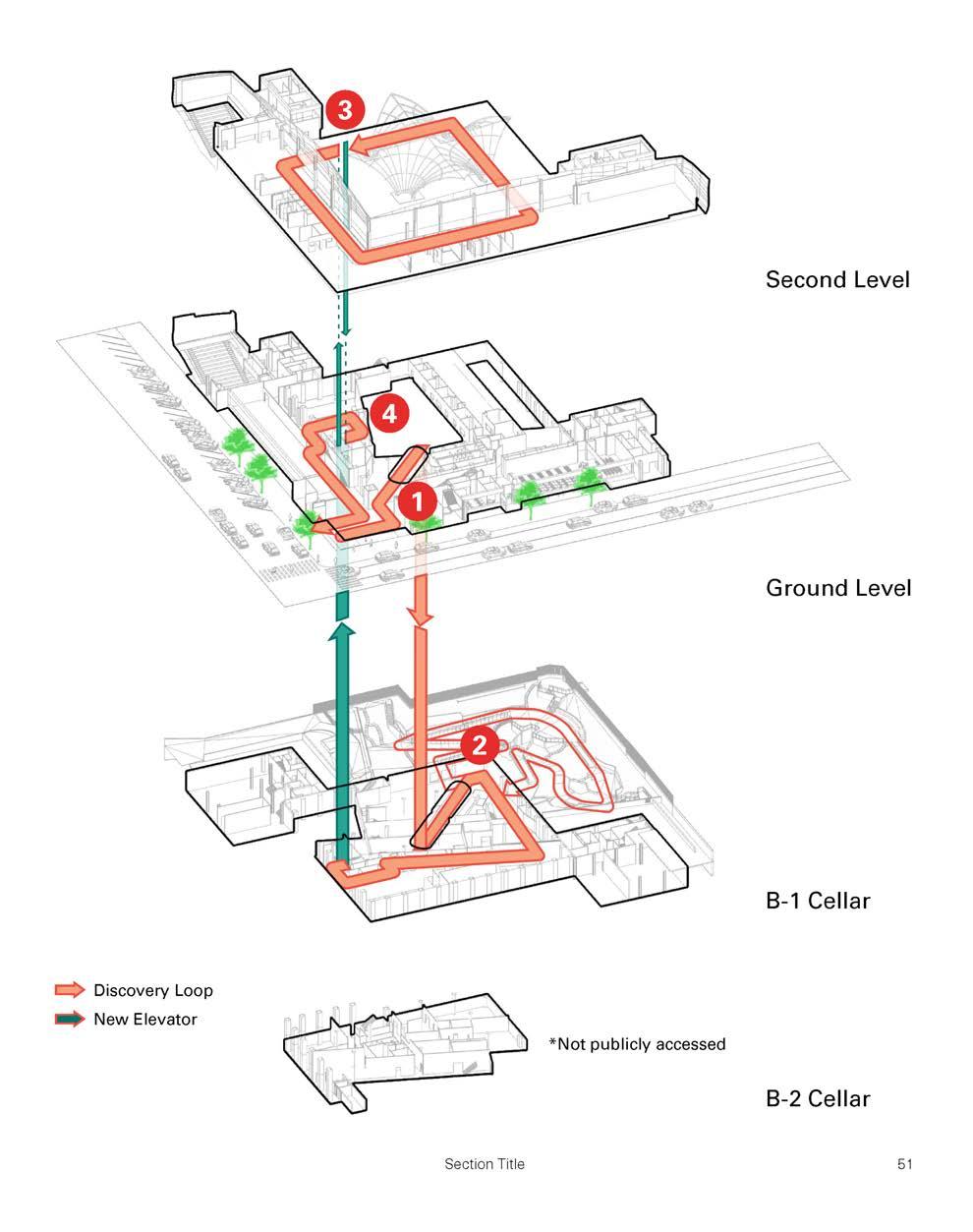
The key to an immersive museum experience is the ability to navigate space with ease and clarity. The set of new improvements to facilitate clearer circulation, including a new public elevator and wayfinding. Expanded accessibility facilitates a comfortable experience for visitors, where clear visual and cognitive cues within the space, alongside the physical improvements, ease museum exploration. These improvements will define the clear path of exhibits exploration, termed the 'Discovery Loop' (as shown in the figure.
Clear and Easy Navigation


The Instant City


The "Instant City" challenges the traditional process of city evolution, where urban environments grow over centuries, shaped by culture, economy, and society. In places like the UAE and Saudi Arabia, where I've contributed to city-scale masterplans, the goal is to create fully functioning cities almost overnight, responding to rapid urbanization and global demands. However, the idea that vibrant, sustainable urban environments can emerge so quickly raises important questions. While physical infrastructure can be built swi ly, developing the social fabric that gives cities their identity takes generations. Social infrastructure, in particular, presents a complex challenge. Whether these instant cities can achieve the same vibrancy as organically evolved cities remains uncertain.


KAFD integrates cultural and social elements such as museums, art galleries, mosques, and entertainment venues, enhancing the quality of life for residents and visitors. As part of Saudi Arabia’s Vision 2030 initiative, KAFD aims to a ract global financial institutions, support economic diversification, and promote Riyadh as an international financial center.


Residential

global financial hub. Parcel 209 specifically consists of two residential towers with retail spaces at street level. One of the key features of this

Role: Senior Designer ? Associate Principal
Client: Riyadh Investment Company
Location: Riyadh, Saudi Arabia
Designed to handle around 450,000 commuters daily, the hub will connect three subway lines and two high-speed train lines, linking Beijing's airports and the Universal Studios theme park. The project embodies the concept of transit-oriented development (TOD). Spanning 1.3 million square meters in the southeastern Tongzhou District, this mega project, which commenced on November 30, 2019, is set to be one of the world's largest underground transportation hubs upon its completion in five years.
Images of high performance “agile” station skin.
View of the mixed use residential complex.


The King Abdullah Financial District (KAFD) Parcel 209 is a mixed-use development located in the heart of Riyadh, Saudi Arabia. It is part of the larger KAFD project, which is designed to position Riyadh as a global financial hub. Parcel 209 specifically consists of two residential towers with retail spaces at street level. One of the key features of this project is its integration of landscaped courtyards, which create transitional spaces link-

Residential balconies and sunscreens
209 towers with connecting bridge.
From concept to reality!
Through a series of projects, I have been exploring ways to tap into regionalism that can fuel my private practice, deeply rooted in the history of the Berkshires in Western Massachuse s, where I now live and spend half my time working.

My work draws heavily from my background in contemporary architecture, primarily influenced by mid-century sensibilities. It also incorporates the industrial typology of the region’s mill buildings, factories, and barns. In conjunction with a focus on Shaker design and abstraction, this has provided a rich foundation for exploring what I refer to as a modern rural aesthetic. This approach allows me to merge the historical and industrial legacy of the area with modern design principles, creating spaces that are both functional and evocative of the region’s past.


Status: On the boards
Role: Director/ Senior Designer
Firm: MONTOUTE - Architects Planners
Client: Withheld
Location: Berkshires,Mass


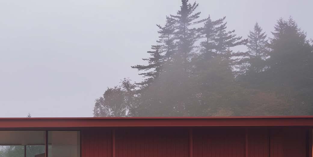


All the buildings are rendered in a signature red, which serves as a departure point, drawing historical reference to the red barns typical of the region. This color choice also acts as a regional counterpoint to the prevalent use of Shou Sugi Ban, the Japanese technique of charring wood. The red is meant to represent a linseed oil coating, which is historically accurate and connected to traditional methods of rendering and protecting buildings. This blend of regional history and modern design techniques reflects a deeper exploration of cultural heritage and functional beauty.


Project


The architecture of tobacco barns has left a lasting legacy in modern structures, particularly through their simple, practical design that emphasizes functionality and connection to the landscape. Traditionally, tobacco barns were designed with pragmatic needs—ventilation for curing tobacco, durability to withstand weather conditions, and ease of construction using local materials. These features, such as open slats for airflow and steep roofs, have inspired modern architects to embrace a minimalist, honest approach to design.
Interior view of bedroom.
Interior view of living area.
View house in forest setting.

story luxury condominium building features 108 units, o ering residents panoramic views of Brooklyn and Manha an.

Role: Senior Designer /Principal Firm: FxFowle
Client: The Clare Group
Location: Brooklyn, New York


The building includes many amenities, such as a fitness center, a roo op deck, parking facilities, and retail spaces on the ground floor. As one of the earlier residential towers in Fort Greene, it played a vital role in the neighborhood's ongoing transformation. Its design emphasizes aesthetic appeal and sustainable building practices, using materials and forms harmonizing with the local urban fabric.
House for an Ecologist

A HOME IN BALANCE
The House for an Ecologist is a live/work dwelling designed for an ecologist in residence at the U.S. Fish and Wildlife Service (FWS). This proposal emphasizes sustainable design by integrating innovative solutions that balance environmental responsibility with architectural excellence.

Project Status: Unbuilt
Role: Director/ Senior Designer
Firm: MONTOUTE - Architects Planners
Client: U.S. Fish and Wildlife Service
Location: Shepherds town, West Virginia
"Nature, like a loving mother, is ever trying to keep land and sea, mountain and valley, each in its place, to hush the angry winds and waves, balance the extremes of heat and cold, of rain and drought, that peace, harmony, and beauty may reign supreme."
Elizabeth Cady Stanton

The design features a small, e cient home that merges personal living space with areas for research and collaboration. It reflects the ecologist's mission to conserve and protect natural habitats, aligning with the FWS's goal of promoting environmental stewardship. The proposal incorporates sustainable materials, energy e ciency, and ecological sensitivity throughout.
The building is envisioned as a prefabricated modular structure constructed using a kit of parts. These components are flown in and assembled on-site, which, in this case, is an old, abandoned farmhouse found in the woods. The design is entirely o the grid, functioning as a perch from which the ecologist can observe and interact with the natural environment with minimal disturbance. The house is designed to have a light footprint, ensuring that, if removed, the site can quickly return to its natural state with li le to no lasting impact.


View of Building and stone barn foundation.
View of Building and modular skins facade with modular solar elements.
The building is designed to be off the grid.
View of building on existing barn foundation and high performance diagram.
Halic Residential Developments

The Halic residential developments in Istanbul are part of the more significant transformation of the historic Golden Horn (Haliç) region, which has been undergoing revitalization and urban redevelopment. Several vital projects highlight the area's modern residential o erings while maintaining a balance with the city's cultural and historical significance.




Housing is more than just a shelter; it is the foundation for building strong, connected communities. A well-designed home provides security and comfort and supports the social fabric by encouraging interactions and fostering a sense of belonging. A ordable, stable housing protects the ability to create a community.


Halic housing complex with a mix of market rate, affordable and student housing.


The Agile City


The "Agile City" represents a flexible, adaptive approach to urban development, responding to the dynamic needs of citizens, economies, and environments. Unlike traditional urban planning, which o en relies on rigid, long-term masterplans, the Agile City emphasizes the capacity to evolve and respond quickly to change. By adopting agile principles in urban design, cities can become more resilient, inclusive, and responsive to emerging challenges. This agility is achieved through critical frameworks such as blended use, mobility solutions, and alternative delivery methods.


Blended Use focuses on creating vibrant spaces for civic and economic interaction. It aims to develop safe, responsive third spaces for exchanging ideas, emphasizing place over mere space. These spaces are designed horizontally at grade, extending below and above ground to create a deep, interconnected city section.
Mobility Solutions addresses the challenges of space and time in moving people and goods. These solutions consider the quantitative aspects of movement and its qualitative socio-economic impacts, particularly on underserved and transportation-insecure communities.


Alternative Delivery seeks to maximize positive project outcomes and deliver the most significant benefit to society. This approach involves using tools that adapt to rapidly changing contexts and leveraging value-creation methods that work across diverse socio-economic environments.


Mixed - Use
AL FAISALIAH ll Riyadh


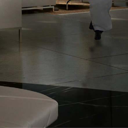
The Al Faisaliah II project in Riyadh is part of the broader Al Faisaliah District redevelopment, a high-profile initiative aimed at revitalizing the city's core. Building on the iconic Al Faisaliah Tower, the project adds new layers of functionality to the surrounding area, incorporating mixed-use developments that feature retail, commercial, and hospitality elements. This redevelopment integrates luxury hotels, o ce spaces, residential areas, and cultural amenities, positioning the district as a modern hub in Riyadh. At the heart of the project is a mosque, set within a serene water courtyard, o ering both spiritual and architectural significance to the space.


Role: Senior Designer /Principal Firm: FxFowle
Client: Khozama Management Company
Location: Riyadh, Saudi Arabia




Project Status: Unbuilt
View of the sky lobby at the Al Faisaliah II Hotel.


Nighttime view of the Al Faisaliah II Tower, with downtown Riyadh visible in the distance.
View of the master plan for the mixed-use complex, featuring the Al Faisaliah II mosque, floating on a body of water at the
Detailed sections of the mixed-use tower highlight the commercial and retail spaces in the lower levels.


A key feature of the Al Faisaliah II Tower design is its extradosed concrete skin, which incorporates varying perforations along its height to reflect both its structural function and use. This skin serves as a structural lateral support system, while also providing significant resistance to gravity loads. The design allows the skin to act as both a structural element and a highperformance screen, optimizing the properties of concrete and steel depending on the specific area of the building. This approach combines aesthetic appeal with engineering e ciency, using the materials to their fullest potential in di erent sections of the tower


A view of the translucent mosque structure elegantly floating on the water at the heart of the new mixed-use complex.
Aerial view of the Al Faisaliah II Tower, and complex.
Addis Ababa Exhibition Centre

The Addis Ababa Exhibition Centre was an ambitious project to create a significant cultural and exhibition venue in the heart of Ethiopia's capital, Addis Ababa. The project was envisioned as a state-of-the-art facility to host exhibitions, conferences, and events, showcasing Ethiopia's growth and emerging as a central hub in East Africa.


Project Status: Unbuilt
Role: Senior Designer /Principal
Firm: FxFowle
Client: EMAR
Location: Addis Abba, Ethiopia

The design features a fully integrated, pedestrian-centered, mixed-use development covering over 70,000 square meters and nearly 4.5 acres in Northeast Africa. O ering dynamic retail, food and beverage amenities, o ce space, cultural and entertainment facilities, and a business hotel, the development also incorporates the adjacent Addis Ababa Museum, creating a highly desirable retail, entertainment, and cultural environment. Serving both residents and visitors, the design aims to create a lively and informal ground-level experience connected to the natural landscape. In contrast, a more formal and structured experience rises from the lower levels through well-sculpted towers.
Aerial view of Mixed-Use complex.
Aerial view of the Al Faisaliah II Tower, and complex.

Planning
Tong Zhou Master Plan

The Tongzhou Master Plan is a large-scale urban development initiative located on the southeastern edge of Beijing. It is designed to create a sustainable, multi-use city that balances cultural, industrial, and residential needs. Covering a 42-square-kilometer area, the plan is anchored by crucial transportation infrastructure, including the BeijingShenyang Expressway and Xiguan Street, which serves as the central commercial axis.


Project Status: Unbuilt
Role: Senior Designer /Principal Firm: AECOM
Client: Suning Real Estate Group Co., Ltd
Location: Tongzhou district, Beijing, China
The master plan envisions transforming Tongzhou into a major subcenter for Beijing, with a strong emphasis on public transportation, mixed-use developments, and a protected residential zone. It incorporates a new transportation hub, commercial areas, and green development strategies to foster a balanced, future-oriented urban environment.
Tongzhou a model for future urban expansion in China. It is part of a broader e ort to decentralize Beijing and improve urban living standards in satellite cities like Tongzhou.
Key elements include e cient use of public transit (including metro and bus systems), green urban designs, and integrating commercial and residential spaces for a balanced, sustainable environment.
Aerial view of the Tongzhou Central Business District.


View of the master plan with interconnected green spaces and mixed-use towers.
View of the master plan showing multimodal nodes connecting the city internally and extending beyond its perimeter.
View of the master plan showcasing interconnected green spaces and mixed-use towers set atop green podiums.
View of the master plan featuring connective green spaces and mixed-use towers.

Aerial view of the Tongzhou Central Business District at night.
Waterfront Canal District

The Waterfront Canal District in Dubai is a major development located in the larger Dubai Waterfront project, which is part of one of the world's most ambitious urban development plans. The district is designed to be a vibrant, mixed-use area built around an artificial canal system, o ering a blend of residential, commercial, cultural, and entertainment spaces.

Role: Senior Designer /Principal
Firm: FxFowle
Client: Nakheel
Location: Dubai, UAE
The vision for the Dubai Waterfront—including the Canal District—is to develop it as an extension of Dubai's urban core, further transforming the city into a global metropolis with cu ing-edge architecture, design, and infrastructure.
Project Status: Under Construction


Key Features:
Waterfront Location: Built along a canal system, offering scenic views and water-related activities in an urban setting.
Mixed-Use Development: This type of development combines residential, commercial, and entertainment spaces, creating a lively environment for residents and visitors.
Sustainability: Incorporates green building practices, energy efficiency, and public spaces like parks and pedestrian zones.
Cultural and Recreational: This category includes cultural attractions like museums and galleries, as well as recreational options such as boating and promenades.
Tourism Hub: Attracts tourists with luxury hotels, restaurants, and waterfront experiences.
Connectivity: Well-connected to Dubai via major roadways and public transport.


Waterfront Masterplan
View of water inlet at residential district.
Night view of residential district with CBD in the background.


The Responsive City


The "Responsive City" reflects the need for cities to adapt to environmental, economic, and social challenges. Infrastructure is critical to this resilience, supporting transportation, energy, and waste management. Architects and designers play a vital role in ensuring e cient, functional, and equitable infrastructure. Historically, marginalized communities have su ered the negative impacts of infrastructure while benefiting the least. A genuinely responsive city must address these imbalances by distributing benefits and burdens fairly. Resilience isn't just disaster mitigation—it's about building systems that enrich all citizens' lives, especially the vulnerable, through adaptable public spaces, renewable energy, and sustainable mobility.


Urban Design

Penn Station Public Realm


As a pedestrian-forward mobility district, the Penn Public Realm Plan is composed of pedestrian-priority streets. For the purposes of the Penn Public Realm Plan, these streets are categorized as pedestrian streets & plazas, limited access streets, and limited access streets with freight to designate where and what kind of vehicles are allowed. These street types are supported through both physical design, such as surface materiality and vehicular restriction, and through policy, such as timed deliveries and freight access. The streets themselves can become destinations while adding more space for people walking and biking to and from Penn Station.


Project Status: Under Construction
Role: Senior Designer
Firm: WXY
Client: EDC
Location: NEW YORK CITY


Pedestrian-Priority Street Types
Pedestrian-priority streets create walkable, accessible, desirable and public spaces with ample room for pedestrians. Penn Station—which is the busiest transportation facility in the Western Hemisphere and sees hundreds of thousands of users per day—is a critical place to add additional pedestrian space. The streets

Midtown’s open space network has a critical gap: Penn Station and its surrounding streets. Penn Station sits between—to the west— Manhattan West, the High Line, Hudson Yards, the Javits Convention Center, and—to the east—Herald and Greeley Squares and an increasingly pedestrianized Broadway. With hundreds of thousands of pedestrians per day, Penn Station has by far the highest pedestrian

A unified approach to managing future systems of the Penn Station area by integrating them with the public realm plan.
A safer and more comfortable place that supports national, regional and local mobility needs by central planning of maintenance, security, sanitation, vehicular access, way-finding and information, and more.

A district that centers the importance of Penn Station’s civic identity as a regional asset. A model of access for all. A public realm that serves daily commuters and first-time visitors equally because finding where to go is intuitive and easy. A climate-aware space with trees and landscaping that responds to future needs, day and night.


Penn Station is the busiest transit hub in the Western Hemisphere, with hundreds of thousands of users per day. At the confluence of Amtrak, NJTransit, and LIRR trains; subways; buses; and bike and walking trips, Penn Station is a critical center of Midtown’s mobility network and Midtown’s neighborhoods. Everyone is a pedestrian at some point in their journey: the Penn Station area is primed to become a distinctive, unified pedestrian district, a neighborhood in its own right

Midtown’s open space network has a critical gap: Penn Station and its surrounding streets. Penn Station sits between—to the west—Manhattan West, the High Line, Hudson Yards, the Javits Convention Center, and—to the east—Herald and Greeley Squares and an increasingly pedestrianized Broadway. With hundreds of thousands of pedestrians per day, Penn Station has by far the highest pedestrian volumes of any landmark or location nearby. The Penn Station Public Realm Plan will link this pedes-
A Vital Center of Midtown’s Neighborhoods
Midtown’s Open Space Network
Midtown’s Open Space Network
Unified Systems Management
PENN Public Realm For Everyone

The public realm will be a managed district, starting with managed vehicular access to keep streets pedestrian-oriented. Pre-determined freight and deliveries will be allowed to access streets, notably for deliveries to Penn Station, the Farley Building, and MSG, as well as to local businesses. Delineated for-hire vehicle pick-up/drop-off lanes on 7th and 8th Aves create accessible, at-grade paths of travel to all station entrances. Cohesive systems of public space management serve to keep pedestrians prioritized while keeping space for all modes of


The future Penn Expansion project’s new station building on 31st St between 7th and 8th Aves would open onto the 31st St pedestrianpriority block. Generous station entrances, with wide stairs and accessible elevators and escalators, would easily connect pedestrians to stations and vice-versa, and allow generous space for the large volumes of people frequently entering and existing the station, especially during commuting hours and MSG events. Once it moves to the new station building, the current NJTransit entrance area on the intersection’s northwest corner can be repurposed to

W 31st St & 7th Ave Crossing
PENN Public Realm plan


The current interim sidewalk extension in front of Moynihan Station can be fully built out in the public realm’s distinctive paving pattern, including removing the existing line of bollards to create more and seamless pedestrian space. The existing bike lane can be upgraded with a concrete buffer. Moynihan Station’s large front steps, currently underutilized, can host enhanced public seating and landscaping amenities and become a showcase of the pedestrian district. Additional seating can also be integrated into Moynihan’s entrances and on 31st St. Generous station and subway en-

33rd St between 7th and 8th Aves would give pedestrians full access to this street and allow for for specific access by MSG-related trucks. These trucks would be managed by professional Pedestrian Safety Managers to ensure slow speeds, efficient movement, and parking only in allowed MSG-adjacent space. On 8th Ave, the current taxi pick-up stand near MSG would be maintained, with a taxionly waiting lane adjacent to the curb. For-hire vehicles could use a dedicated pick-up/drop-off lane on the Moynihan side of 8th Ave and on both side of 8th Ave north of 33rd St, with all lanes allowing accessible paths to station entrances.

W 33rd St & 8th Ave Crossing
W 31st St & 8th Ave Crossing
The ambition is to create a Mobility District that prioritizes pedestrians, encourages intermodal transfers, and creates a vibrant public realm experience while celebrating the rich and unique culture of East Harlem.

Project Status: Completed
Role: Principal, Senior Architect
Firm: WXY
Client: MTA Capital Projects
Location: Manha an, New York
This district of East Harlem has been a historic hub of transit from its early days when street cars ran through here along with the railroad. Today, many of those streetcar lines still exist in the form of bus routes. The site is also served by the 4,5,and 6 trains at Lexington Avenue, 2,and 3 trains at Malcolm X Boulevard, multiple bus services including the Select Bus Service and shu le to LA Guardia, a CitiBike station, and other private shu les. This wealth of transit options is going to be further enriched with the introduction of the Second Avenue Subway.
In the 1930’s the street level under the current viaduct used to be a vibrant and active public market. However, the urban fabric of this stretch of 125th Street and Park Avenue have changed quite a bit since then. Along

125th Street has a relatively mixed character with some retail, healthcare, social services and other programs. The district also currently has several underdeveloped parcels, which especially with the introduction of the new 2017 zoning may bring a lot of development to the area, some of which are already in the pipeline. The district holds the potential to be transformed into a vibrant Mobility District along with being a commercial corridor for economic development in the neighborhood.

Park Avenue Viaduct Retail Corridor


Framework Principles & Toolkits
The ambition we set was to create a Mobility District here that prioritizes pedestrians, encourages intermodal transfers, and creates a vibrant public realm experience while celebrating the rich and unique culture of East Harlem.

Framework Principles & Toolkits
The ambition we set was to create a Mobility District here that prioritizes pedestrians, encourages intermodal transfers, and creates a vibrant public realm experience while celebrating the rich and unique culture of East Harlem.

Framework Principles & Toolkits
The ambition we set was to create a Mobility District here that prioritizes pedestrians, encourages intermodal transfers, and creates a vibrant public realm experience while celebrating the rich and unique culture of East Harlem.

Framework Principles & Toolkits
The ambition we set was to create a Mobility District here that prioritizes pedestrians, encourages intermodal transfers, and creates a vibrant public realm experience while celebrating the rich and unique culture of East Harlem.


Framework Principles & Toolkits
The ambition we set was to create a Mobility District here that prioritizes pedestrians, encourages intermodal transfers, and creates a vibrant public realm experience while celebrating the rich and unique culture of East Harlem. This area within East Harlem is already a hub of mobility options, which will be further enhanced by the extension of the Second Avenue Subway terminating at 125th and Park Avenue and its corresponding stations. The stakeholder engagements and our studies of the area revealed four principles to frame the challenges and opportunities of this district that can help be transformative while trying to create a Mobility District. Each of these principles is first

Enhance connections and wayfinding between di erent modes of transit through the:
• Intermodal Connections Toolkit Connectivity
Alleviate pressure from the multitude of concentrated services through spatial reorganization of:
• Mobility Nodes
• Social Services Reorganization
Enhance connections and way finding between di erent modes of transit through the:
• Intermodal Connections Toolkit Placemaking & Activation
Identify entities responsible for championing and maintaining e orts in the district by understanding:
• Jurisdictions
• Implementation Matrix Framework Stewardship

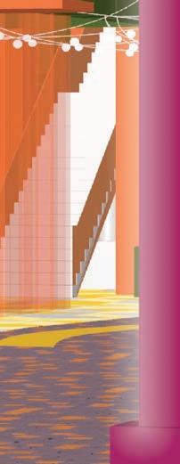
View of a vibrant new public realm.




View
Rochester Aqueduct Reimagined

The Rochester Aqueduct Reimagined project is a critical component of the broader ROC the Riverway initiative, which aims to revitalize Rochester’s waterfront along the Genesee River. The project aims to transform the historic Erie Canal Aqueduct and Broad Street Bridge into a vibrant, pedestrian-oriented public space that promotes inclusivity, connectivity, and cultural celebration.

The project emphasizes accessibility and inclusivity, ensuring these new public spaces are welcoming. It promotes social cohesion by creating shared spaces where people can gather and interact. Additionally, the transformation will bolster economic growth by encouraging tourism, new housing developments, and business opportunities while reinforcing local and regional identity.
By blending infrastructure upgrades with cultural and social elements, the Aqueduct Reimagined project revitalizes a vital part of the city, strengthens community ties, and provides a space that reflects Rochester’s past and future potential. This initiative underscores the city's commitment to creating a dynamic, livable urban environment that benefits all its residents.
Project Status: Under Construction
Role: Principal, Senior Architect
Firm: WXY
Client: City of Rochester
Location: Rochester, New York
A significant social infrastructure aspect of the project is the integration of pedestrian and bicycle pathways, which will enhance riverfront access and encourage active, sustainable modes of transportation. The project fosters community engagement and interaction by repurposing the former vehicular bridge, transforming the area into a central gathering space. Plans include public art installations, community events, and open spaces designed to be a cultural hub for residents and visitors, celebrating the city’s rich historical and cultural heritage.


View of repurposed canal viaduct.
Reconfiguration options.


The Collaborative City


The "Collaborative City" envisions a future where citizens are not just inhabitants of urban spaces but active participants in shaping and solving the city's challenges. As cities continue to grow and evolve, the complexity of urban issues—ranging from housing shortages to transportation ine ciencies, environmental degradation, and social inequality—demands innovative solutions. Experts and authorities have traditionally addressed these problems in top-down decision-making processes. However, in a collaborative city, citizens play a central role in addressing urban challenges, and architects and designers are tasked with developing processes that enhance citizen participation, increasing levels of agency, control, and power.


Infrastructure
Client: Connecticut Department of Transportation
Location: New Haven, Connecticut

The Pearl Harbor Memorial Bridge, also known as the Q Bridge, is an extradosed bridge in New Haven, Connecticut, carrying Interstate 95 over the Quinnipiac River and connecting the east and west sides of the city. Named in honor of the lives lost during the Pearl Harbor attack, it was commissioned by the Connecticut Department of Transportation (ConnDOT) as part of the $2 billion New Haven Harbor Crossing Improvement Program to reduce traffic congestion and improve safety on the I-95 corridor. Completed in phases between 2012 and 2015, the Bridge was the first Extradosed Bridge in the U.S. and served as a critical infrastructure element and visual landmark for the region.
Designed to handle around 450,000 commuters daily, the hub will connect three subway lines and two high-speed train lines, linking Beijing's airports and the Universal Studios theme park. The project embodies the concept of transit-oriented development (TOD). Spanning 1.3 million square meters in the southeastern Tongzhou District, this mega project, which commenced on November 30, 2019, is set to be one of the world's largest underground transportation hubs upon its completion in five years.
DUBAI FIFTH BRIDGE

The Dubai Fifth Bridge, designed as part of an ambitious infrastructure project, will connect the bustling Sheikh Zayed Road to Dubai Harbor, one of the city's central seafront districts. This 1.5 km long bridge is designed to ease traffic flow significantly, accommodating up to 6,000 vehicles per hour. With two lanes in each direction, it aims to reduce travel times from around 12 minutes to just 3 minutes, enhancing accessibility to Dubai Harbor.
Role: Senior Designer /Principal
Client: Dubai's Roads and Transport Authority
View of bridge spanning Dubai Creek.
Project Status: Unbuilt
Firm: FxFowle
Location: Dubai, United Arab Emirates


View of lighting scheme for bridge.
Structural design of bridge.
Dubai Sixth Bridge

Once completed, the "Dubai Sixth Bridge" (Sheikh Rashid bin Saeed Crossing) will become the world's longest single-arch bridge, stretching approximately 1.6 kilometers with a central arch span of 667 meters. The bridge will rise 64 meters high and feature six lanes of tra c in each direction, along with dedicated pedestrian walkways. It is designed to accommodate increasing tra c demands and enhance connectivity across Dubai Creek, linking vital areas such as Dubai International Airport and the Bur Dubai district.

Role: Senior Designer /Principal Firm: FxFowle
Client: Dubai's Roads and Transport Authority
Location: Dubai, United Arab Emirates
This project is crucial to Dubai's broader strategy to improve urban mobility and reduce congestion in the rapidly expanding city. The Sheikh Rashid bin Saeed Crossing will also ease pressure on existing crossings, such as the Al Garhoud and Business Bay bridges, playing a vital role in the city's overall transportation network.
View of Bridge spanning Dubai Creek
Project Status: Unbuilt


Night view of bridge and opera house island connector.
Night view of bridge, amphitheater and Dubai Opera House in the background.
View of bridge roadway with the high point of the bridge arch above.
South Brooklyn Marine Terminal

This proposal for the South Brooklyn Marine Terminal involves transforming the former layover area west of the main facility into a modern logistics center. The facility is designed as a multipurpose space, supporting both the logistics needs of the revitalized port and providing community amenities. A standout feature is a roo op sports facility and green roof, which are available for public use. It bridges the site's industrial past and future as a community-focused space. The building's translucent facade allows natural light to permeate the interior during the day, while at night, it will illuminate, symbolizing its role as a vibrant community hub for South Brooklyn.

Project Status: Unbuilt
Role: Senior Designer /Principal
Firm: AECOM
Client: NYC EDC
Location: Brooklyn, New York


The South Brooklyn Marine Terminal (SBMT) exemplifies agile infrastructure designed to prioritize flexibility and multimodal capabilities in response to growing resource scarcity and environmental challenges. With the accelerating climate crisis, infrastructure can no longer be single-purpose. We must invest in solutions that meet the evolving needs of the city and the private sector, ensuring they serve multiple economic, social, and environmental functions.
The SBMT embodies this vision by integrating various logistics, civic, and renewable energy initiatives. This versatile infrastructure operates sequentially and simultaneously, o ering multiple public and private uses. By combining these functions, SBMT fosters economic growth and addresses critical environmental and social objectives, making it a resilient and essential asset for the future.


The JetBlue Garage at JFK Airport's Terminal 5 is a multi-level parking facility designed for convenience and accessibility, o ering easy access to the terminal via walkways or shu le services. It provides ample space for short- and long-term parking, with features like electric vehicle (EV) charging stations, accessible parking, elevators, and advanced security systems. The garage also integrates innovative parking reservation and payment technology, enhancing the customer experience. With a focus on sustainability, it supports JetBlue's broader commitment to environmental responsibility while ensuring a seamless travel journey for passengers.

Project Status: Completed
Role: Senior Designer /Project Architect
Firm: STV
Client: Jet Blue
Location: Queens, New York
Images of high performance “agile” station skin.

Following several tragic incidents where students crossing at grade from dorms across a major highway were at risk, Connecticut College enlisted a design team to create a bridge that would mitigate these hazards and serve as a prominent gateway to the campus. The bridge design is part of a broader campus transformation to improve the pedestrian experience and accessibility. It plays a crucial role in unifying the campus by connecting its southern and northern sections, reinforcing Connecticut College's commitment to pedestrian safety, and enhancing connectivity across the entire campus.


Project Status: Unbuilt
Role: Senior Designer /Principal
Firm: AECOM
Client: Connecticut College
Location: New London, Connecticut

Educational

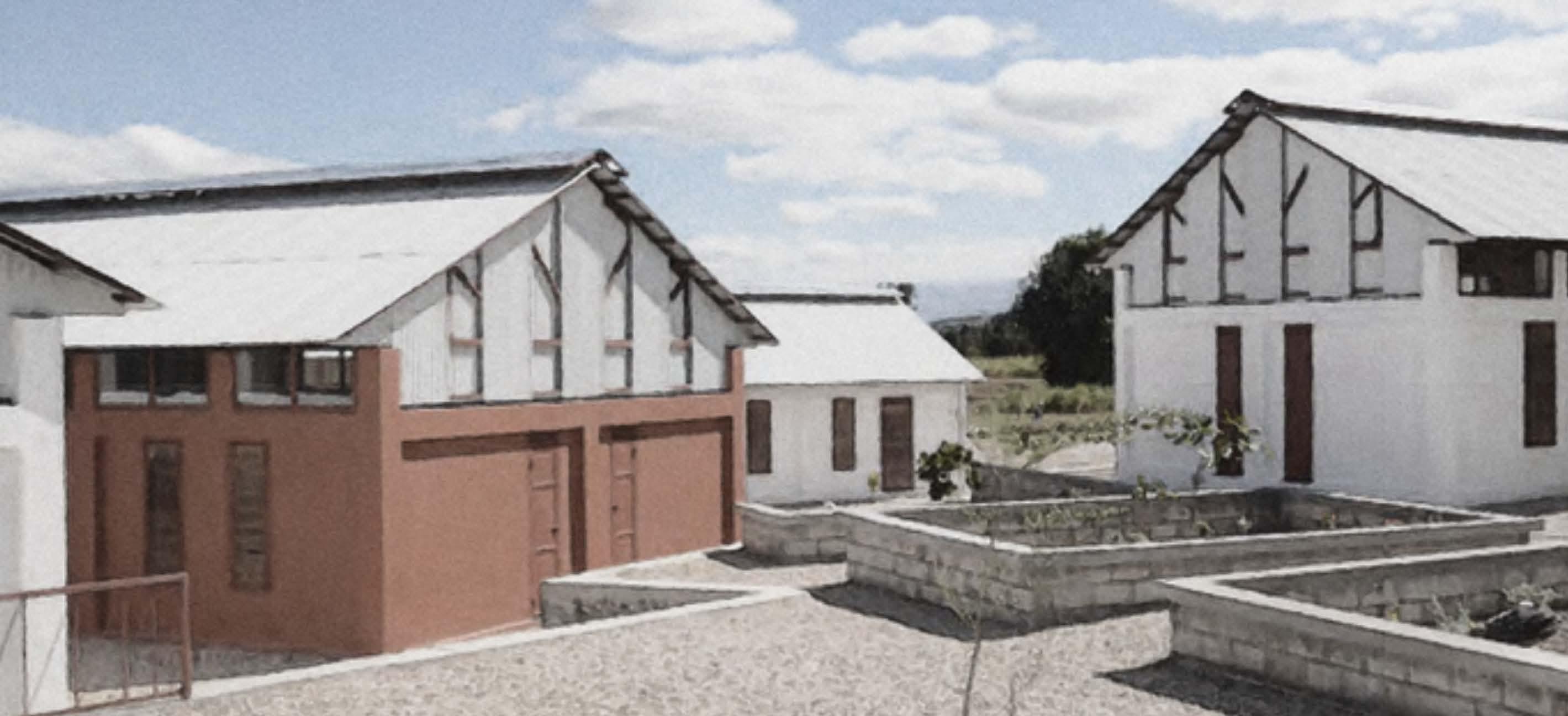
L’École de Choix (The School of Choice) is a pioneering educational institution in Mirebalais leadership skills and a strong sense of social responsibility, transforming future generations into community leaders and contributors to Haiti's development.
Project Status: Completed
Role: Director/ Senior Designer
Firm: MONTOUTE - Architects Planners
Client: The School of Choice Education Organization
Location: Mirebalais, Haiti

The innovative campus design fosters collaboration, with classrooms arranged in village-like clusters. Featured in Architectural Record in 2012, the school empowers students to become leaders in their communities


and in Haiti.
View of campus buildings.
View of campus buildings.

