VAN BUREN, MAINE CREATIVE PLACEKEEPING


With townspeople driving final recommendations, our intent for this project is to develop a creative arts framework that aids to the social fabric and active care of the Town of Van Buren.
It has been a great pleasure creating alongside Luke Dyer and the people of Van Buren. We hope to have made a positive contribution to the Town’s vision of preserving and sharing its history.
Thank you to everyone involved in this effort as the Town of Van Buren, Maine becomes the vision it imagines.
This book follows the team’s journey of collecting, synthesizing,andanalyzingdatatoproviderecommendations that speakstotheTownofVanBurenandit’speople.

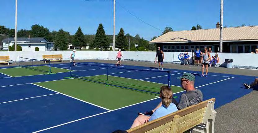

The ultimate goal is to produce a comprehensive capstone project, integrating elements of speculation, community engagement,anduser-centereddesign.

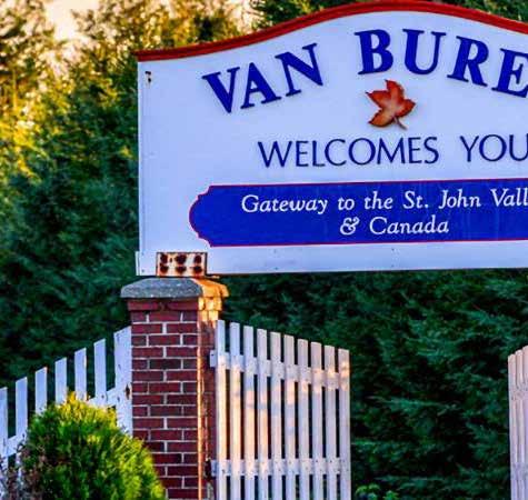
Design Challenge from Town Manager Luke Dyer:
“Our design challenge is to create a harmonious fusion of art and technology weaving its way through Van Buren’s scenic walking paths, offering a modern twist on celebrating Acadian heritage and community history. Each carefully crafted plaque or art piece, adorned with intricate designs and QR codes, serves as a gateway to the past, seamlessly blending tradition with innovation. As walkers traverse the landscape, they encounter these captivating installations, where artistry and technology converge to create something truly distinctive. With a simple scan, visitors unlock a wealth of historical insights, experiencing the beauty of Van Buren’s Acadian heritage through a lens that is both contemporary and timeless. This innovative approach to storytelling aims to captivate and inspire, enriching the cultural tapestry of the town while honoring its vibrant past.

This wayfinding project is an intervention aimed at placemaking in the town, enriching the experience of navigating a new walking path that traverses Main Street, a variety of green spaces including the Enchanted Forest, and the St. John River waterfront. Using the principles of design research, we intend to create a public interactive experience, with the goal of increasing community & visitor engagement in Van Buren and thus increasing economic viability of the town. The ultimate aspiration of this work is to build towards an enriching arts campus, welcoming residents and visitors alike.
This course, Thesis Research and Practicum, is designed as a resource for students pursuing a Master of Science in Design Research (DSRE) at Drexel University. Through a blend of theoretical exploration and practical application, students engage in documenting, investigating, and reflecting on a practicum experience. The ultimate goal is to produce a comprehensive capstone project, integrating elements of speculation, community engagement, and user-centered design across multiple disciplines. Design work in collaboration with the town of Van Buren guides students in a research-driven proposal for a placemaking intervention. Through iterative prototyping, literature review expansion, and data assessment, students will craft a compelling narrative that culminates in a final thesis publication and public presentation of our ideas to the Van Buren town board, commemorating our work and education in design research.
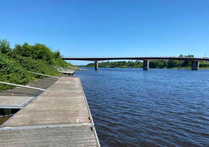

Van Buren was founded in 1881 along the St. John River, which acts as a border between Maine and New Brunswick, Canada. Named after U.S. President Martin Van Buren, this rural town boasts a small but strong community committed to preserving its legacy & beauty. A crucial part of that legacy is the region’s Acadian heritage, which is captured in the Acadian Village, a historic site and museum that features seventeenth-century buildings and a way of life unique to the Acadian settlers of northern Maine. (National Parks Service).
Many of the notable buildings in Van Buren’s downtown were constructed in the 1930s, including the Gayety Theatre and Northern National Bank. Due to decades of neglect and population decline, the historic downtown of Van Buren has suffered significant structural deterioration. The town, which was once dubbed “Christmas Town” due to its role as a holiday shopping destination for its Canadian
neighbors, is in the process of revitalizing its formerly vibrant commercial strip.
Efforts to restore and enrich Van Buren are underway. These initiatives include expansion of green spaces and social meeting places, rehab of historic buildings, and opening of new businesses. As a destination for outdoor enthusiasts, Van Buren offers 89 miles of snowmobile and ATV trails, providing stunning views of the forested natural landscape. To strengthen community ties, the town hosts public events including an annual Christmas-in-July party.

Derived from a variety of professional backgrounds, we believe our recommendations foster meaningful experiences.


Bringing together research, practice, and teaching, he leads and develops projects where students partner with local communities to design services and experiences for the public good.
Tyler is a systems-oriented researcher and designer with professional experience ranging from 3D Visualization, Building Information Modeling, and Graphic Design to MixedMethod Research, Project Coordination, and Community Engagement.
Nicole Germack is a graduate student at Drexel University, pursuing Design Research (MS) and Fashion Design Technology Certificate.


Maya Hillis is a graduate student at Drexel University, pursuing Peace Engineering (MS) and Environmental Engineering (PhD). Her research background focuses on addressing climate crises and environmental injustices. Her work spans from genetic implications of climate change, algal biotechnology, PFAS bioaccumulation, and communitybased climate-disaster resilience.
Zovinar Khrimian is a graduate student in Design Research at Drexel University. She currently works as a marketing and communications specialist in Drexel’s Department of Mechanical Engineering and freelances as a scientific illustrator for trade publications.
Kate Potyomkina is a graduate student in Design Research at Drexel University and a web designer who’s roficient in product designs from mockups to technical implementation. Currently works as a Creative Development Producer in the healthcare industry.
Gabriel Thayer is a food product designer & has a back ground in fine dinning as a chef. I have a bachelor’s degree in culinary arts with a focus in food science and am now working towards my master’s degree in Design Research.
Week Design Exercises
Initial Interviews
Focus Group
Studio Work
The following represents our task process and prioritization -- visualizing each milestone within our ten week period.

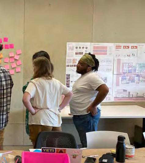
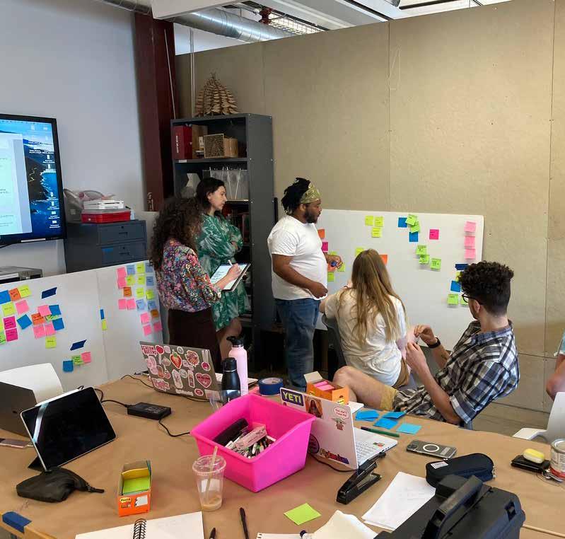
In identifying, refining, iterating and delivering design recommendations for this multifaceted, interdisciplinary project, design thinking strategies serve a crucial role.
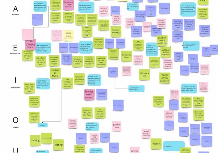
The AEIOU method serves as an organizational framework to explore the preliminary questions of the design challenge, coding information under the guiding taxonomy of Activities, Environment, Interactions, Objects, and Users (Martin and
Hannington, 2021). Activities are goal-directed sets of actions; Environments include the entire arena in which activities take place; Interactions occur between a person and someone or something else; Objects are the building blocks of the environment; and Users are the people whose behaviors, preferences, and needs are being observed. The elements of the framework are interrelated and interact, covering a wide range of crucial variables in the context of our design challenge: bringing an interactive wayfinding

intervention to a rural community.
The AEIOU method allows for identification of themes surrounding the design project. Many of these themes draw from the unique character of Van Buren and address the specifications of community design in rural communities. Through this collaborative design research process, we seek to address the unique position and changing conditions of rural communities, reflecting on both the material realities of rural life in a quickly urbanizing world and the idea of rurality in the American cultural imagination. Therefore, it is crucial to define what we mean by “rural” to maximize the impact of our approach in this distinctive context.
Conceptions of rurality in the field of sociology typically fall into one of two categories: a locational, or “place-based” approach or a social constructivist one (Brown and Schafft, 2018). In this context, understanding the rural community with which we are collaborating includes both the “material attributes” of being situated in a sparsely populated region with a distinctive natural landscape, as well as understanding of rurality as being a “socially constructed state of mind” (Brown and Schaft, 2018). The latter definition highlights the importance of the history of culture and industry in shaping the identity of Van Buren. In designing our wayfinding intervention within the rural community of Van Buren, Maine, we seek to integrate existing ways of living, navigating, and being together specific to the unique character of the small town to generate enriched connection to place by both the local community and visitors.


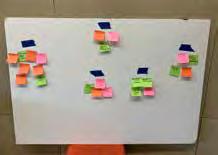

Our design project seeks to take steps towards placemaking within the Van Buren community. Placemaking is the transformative process of shaping public spaces to reflect the unique identity and aspirations of a community. In rural areas with dwindling populations, placemaking is a vital strategy for rejuvenation, whereby leveraging local heritage and resources, placemaking interventions create vibrant hubs that draw residents and visitors, fostering social cohesion and economic resilience. In these communities, placemaking preserves cultural legacy, inspires artistry, stimulates entrepreneurship, and fosters a sense of belonging. Through collaborative engagement and innovative design, placemaking not only enriches quality of life but also ignites optimism and pride in the face of demographic challenges.
Our intervention in Van Buren is a multifaceted wayfinding tool and creative intervention that
connects the user to the town, its history, and its people. Wayfinding refers to a set of guidelines and techniques that can be applied across environments to improve the navigation and experience of physical space, whether a town, building, or natural landscape. The principles of wayfinding are rooted in understanding human behavior, perception, and cognition.
Simplified graphics, concise language, and intuitive symbols help users quickly grasp information and make informed decisions about their route. Design solutions should be tailored to the unique characteristics of the space, considering factors such as architecture, cultural norms, and user demographics. To help users focus on the most relevant information and minimize cognitive overload, information should be presented hierarchically, with essential guidance prioritized over secondary or less critical details. Wayfinding
elements should be easily visible and accessible to all users, including those with disabilities or special needs. Considerations such as adequate lighting, clear sightlines, and tactile/auditory cues contribute to inclusivity and usability.
This design process will include a designing for policy approach throughout to yield a more effective intervention catered to the needs of Van Buren and its community members. Incorporating principles of co-design, participatory & speculative design will allow the team to formulate recommendations that fall in line with the requirements and aspirations of the community. As summarized in The Little Book of Design Policy, “Policy is expression of what society wants and thus it guides the creation of mechanisms used to achieve those wants,” in order to be effective and create better design, our wayfinding intervention should follow a similar vein in that it should address the community of Van Buren’s wants and these wants should guide us in our creation of the design intervention.
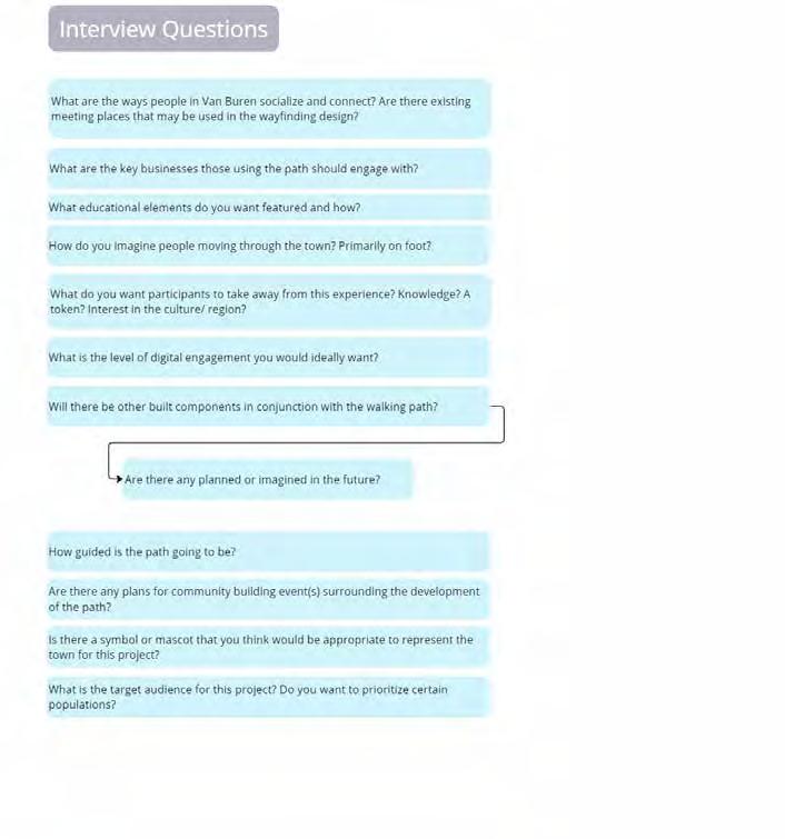
In preparation for our interview with our collaborator and Town Manager Luke Dyer, Peter Ashley (Van Buren Housing Authority), and Dean Gendreau (Recreation Director) we developed affinity diagrams for each of the five components of the AEIOU method. From this process emerged a set of questions addressing crucial intersections between life in Van Buren and the proposed placemaking intervention. Fifteen questions were selected for this initial interview process:
1. What are the ways people in Van Buren socialize and connect?
2. Are there existing meeting places that may be used in the wayfinding design?
3. What are the key businesses those using the path should engage with?
4. What educational elements do you want featured and how? W
5. How do you imagine people moving through the town? Primarily on foot?
6. What do you want par ticipants to take away from this experience? A token?
7. What about an Interest in the culture/region?
8. What is the level of digital engagement you would ideally want?
9. Will there be other built components in conjunction with the walking path?
10. Are there any planned or imagined in the future?
11. How guided is the path going to be?
12. Are there any plans for community building event(s) surrounding the development of the path?
13. Is there a symbol or mascot that you think would be appropriate to represent the town for this project?
14. What is the target audience for this project?
15. Do you want to prioritize certain populations?

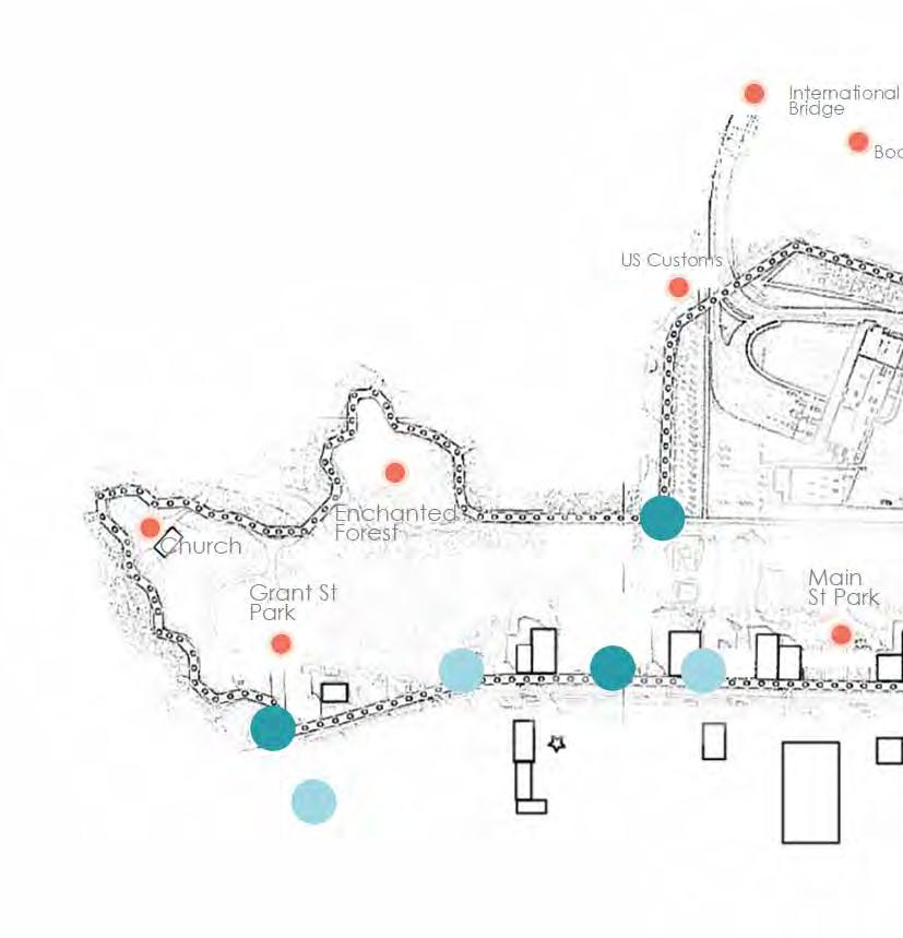
Answers to these questions revealed existing social and commercial networks in Van Buren and the ways ongoing projects are aligned with the needs of the community. For instance, when reflecting on the desired educational component of the project, Dyer considered not only the Acadian cultural history of the town, as captured by the Acadian Village, but also the history of recreation in Van Buren, which once housed a horseracing track and semipro baseball team. When addressing the existing social centers and meeting places in Van Buren, Dyer highlighted points of interest on the path, including the boat landing and Grant Street Park that would make good access points for full-service kiosks.
Accessibility and flexibility emerged as themes throughout the interview. For instance, the path is designed to be accessible on foot by all ages, thus, components of the project such as the artworks and user interface ought to follow suit. Taken together, the walking path, the artworks that designate points of interest, and the digital accompaniment offer a new, technologically enabled way to enjoy what Van Buren has to offer.
The interview highlighted the importance of the Wayfinder project not as a single intervention to enrich life in Van Buren but part of a larger community development initiative. While our project is designed to spark curiosity about the town’s rich history and aid in the navigation of its walking path, it is being considered alongside interventions to bring arts, culture, and enhance the livelihood of people in the town. As communicated by Dyer, through the integration of technology, this project is a step into the future for Van Buren while honoring and immortalizing its past.

Following the interview with key town administrators, we collected additional data from a focus group composed of Van Buren community members, many of whom own businesses and/or participate in development initiatives within the town. The focus group answered a set of loosely structured questions reminiscent of those we asked in the preliminary interview.
The focus group discussed several ideas to enhance community engagement in the wayfinding installation through local events and use of town resources. They emphasized school athletic events and civic activities, such as a food pantry, as an existing path of community connectivity. Organizing and highlighting town events was a key suggestion, particularly involving local businesses to create conversational spots for activities like snowmobiling, water skiing, and fishing. This approach could attract both locals and outsiders by highlighting available trails and fishing locations.
It was noted that the fire department hosts popular barbeque chicken events and was identified as a central hub. The group suggested installing signage to indicate food availability on Main Street and kiosks at strategic locations such as Grant Park and the start of the main street stretch. These kiosks would provide information about events, fishing locations, and historical sites, aiding both visitors and locals in navigation and staying informed. The focus group proposed using physical and digital bulletin boards at key spots like the boat dock and US Customs area.
They also discussed advertising the town’s rich history, such as the Gayety Theatre and historic houses on Popular Street, to attract interest. Engaging local merchants through initiatives like Van Buren Bucks and loyalty rewards programs was recommended to enhance community participation. Though this was also noted as less accessible to outsiders of the town.
For the non-tech-savvy, particularly seniors, physical pamphlets and simple, clear signage were deemed essential. These could be distributed at places like the farmers market, where tech use is low. Displaying historical information


and photos along interconnected park paths could make these areas more engaging, highlighting Acadian heritage and transformed buildings.
The group stressed the importance of family-friendly activities and creating a homey feel through family engagement initiatives, such as genealogy projects hosted by the public library. A combined physical and digital event listing system, potentially using kiosks with screens, was recommended to keep the community updated on current and upcoming events. This dual approach would cater to both tech-savvy and non-tech-savvy individuals, enhancing the overall communal and visitor experience.
In addition to a conversational interview-based focus group, we conducted several interactive activities to gage community preferences. The first interactive session engaged community leaders, residents, and business owners toward shaping the project’s branding and visual language. The session employed a zero-to-ten rating system to gauge preferences and gather insights. Participants provided valuable input regarding the direction of branding, offering diverse perspectives that reflected the town’s identity and aspirations. Additionally, discussions centered on the optimal placement of a three-dimensional object along the proposed trail, with stakeholders sharing ideas to enhance the trail’s appeal and significance.
The session fostered collaboration and community involvement, ensuring that
the project aligns with the town’s ethos while incorporating the input of its diverse stakeholders. Maya and Tyler’s leadership facilitated an inclusive dialogue, laying a foundation for a branding strategy and trail enhancement that resonates deeply with the community of Van Buren.

The second of these interactive sessions was a quick survey that explored aesthetic and material preferences for the art objects embedded along the path.
The steel statue of the logger was the favorite with 2 first place votes, 1 second place vote, & 0 third place votes. Focus group participants noted:
“it symbolizes the history of logging in our heritage.”
“I appreciate the tie to the history of logging in the area and the dynamic nature of the sculpture.”
The bronze log was the second favorite with 1 first place vote, 2 second place votes, & 1 third place vote and the wooden Snowmobile was third place with 1 first place vote, 0 second place votes, & 2 third place votes. A potential user highlighted the fact that it
“used natural products from our region & show cases one our recreational activates”
From this data, one potential avenue would be to make something out of wood commonly harvested in northern Maine. In food & fine dining the best restaurants use as much local product as possible. It adds to the business authenticity & identity, as well as providing the customers with a fresher and higher quality product. We can apply a similar mentality & mindset to our installation by using local woods or stone. One avenue towards approaching this problem would be designing a logger or sculpture tied to the logging industry as this theme/symbol was the most popular. This could serve as the centerpiece for the interactive pathway.
For the third and final activity we produced and distributed a survey inquiring about the UI style and key features. Of the six respondents, 3 indicated that their favorite style was the warmer, more illustrative style. A simpler, more traditional UI was ranked number two with 1 first place vote and 4 respondents indicating that it was their second choice. Finally, a “dark mode” style

was ranked last, with 3 of the 5 respondents indicating that it was their least favorite of the bunch.
Following this survey was a ranking exercise in which respondents indicated their preferences for certain features on the app. We received only 4 responses for this exercise. All the respondents ranked either the title or home page as the most important features on the app. This suggests that the way the app frames information is of particular importance. Visual elements of the app, the photographs, graphics, and maps, were also important to respondents. The denser informational aspects of the app like descriptions and hyperlinked pages where users can “learn more” were routinely ranked last.
When taken together, the preferences of the focus group point toward a friendly and warm design that leads with the most crucial information through titles, a strong homepage, and engaging visuals. The interviews and focus group activities were invaluable as they provided a touchpoint with the Van Buren community and gave our team the opportunity to get a better understanding of the wants and needs of those who will be engaging with and benefiting from the proposed intervention. Insights from these exercises also provide the context for design research strategies that identify users and highlight their experiences when engaging with this multifaceted project.


Personas are fictional characters used to describe target users in the design process. Multiple personas are developed when the project is intended to reach a wide audience and engage different types of users. For this project, three personas were developed to represent potential users for engagement. One persona included, Ashley Clark, a 34-year-old townsperson in Van Buren who works as a schoolteacher and is a mother to 5- and 7-year children who struggles to find fun things to do with her kids. She represents a townsperson who enjoys small-town life but needs more modern engagement to engage with her new home. Another developed persona was Freddy LeBlanc, a 75-year-old retired Vietnam veteran who has lived in Van Buren his whole life. He lives alone


but is visited often by his children and grandchildren. He represents an older demographic who wants to stay active, engage with his family, and benefit from the non-digital aspects of the trail. The third persona was Aiden, a 16-year-old from New Brunswick, visiting the US with his family. They are driving through Van Buren to grab some supplies and food before driving deeper into the state. He represents the visiting demographic who needs to be drawn into the town for economic benefit and national and international publicity. Each persona is used to highlight priorities for development in the design process.

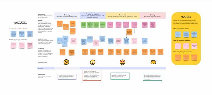
Journey maps are a tool for visualizing the experience of service or product over time (Stickdorn, Hormess, Larence & Schneider 2018). The Van Buren Wayfinder should allow for a customizable, choose-your-own adventure approach that can accommodate a variety of audiences, which is captured comprehensively with a journey map.
The availability of a non-digital option for users who would rather navigate the walking path without relying on their smart phone was brought up in our focus group interview, where community members highlighted the importance of reducing barriers to use for Van Buren community members.
The first step of our audience’s journey is the discovery of the walking path’s featured artwork and associated online informational guide. For residents of Van Buren, word of mouth, a successful launch event and signage would direct users to engage with the various components of the path. For visitors to the town, online forums and travel sites could recommend the path as a way to learn about and experience Van Buren for the first time. For both types of users, full-service kiosks in central locations as well as organic exploration of the path could lead to engagement with the web application and artworks.
Once users have either entered the web application or have collected a paper pamphlet from a kiosk, they would then start exploring with discovery of the artworks and their associated stories in mind, meaningfully engaging with the landscape of the town and learning more about its history. Direct, engaging content and compelling artistic works help maintain the user’s interest, and for those who seek to “complete” the walking path by scanning all 10
QR codes, the prospect of winning a coupon toward a purchase at a local business provides additional incentive to continuing exploration of the 1.7-mile trail.
One key challenge is creating something community members can return to repeatedly. Some parameters to consider are the frequency of updates to information, the rotation of partner businesses, maintenance of the trail, and the integration of “secret stops” not published on maps, which allow users to seek additional artworks in unmarked spots to collect limited-time rewards.


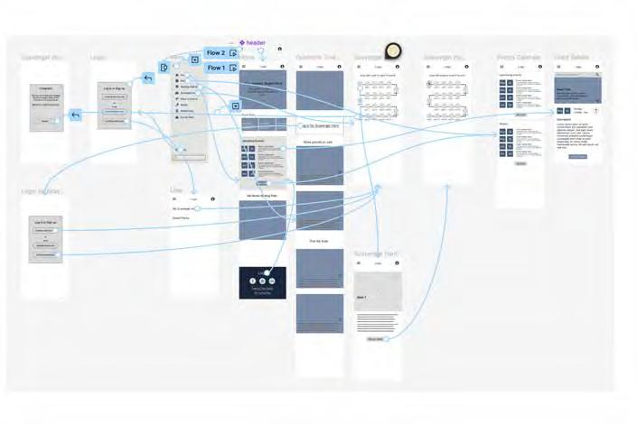
Wireframes are skeletal outlines or blueprints used in the early stages of website or app design. They serve as visual guides that outline the basic structure and layout of a digital interface, focusing on functionality and user experience rather than visual aesthetics. Wireframes typically consist of simple shapes, placeholders, and annotations, representing key elements such as navigation menus, content blocks, and interactive features. They help designers and stakeholders visualize the overall layout and flow of the interface, allowing for rapid iteration and feedback before moving on to more detailed design phases. Wireframes are essential tools for clarifying design concepts, identifying potential usability issues, and ensuring alignment between design goals and user needs.
When designing an app for wayfinding in a small town like Van Buren, it is crucial to focus on the needs of both local users and tourists, prioritizing features and amenities that cater to their specific needs and interests.
For local users, valuable features include those that enhance community engagement and provide easy access to local services and events. This could include features like community event calendars, local news updates, and directories of town services.
For tourists, amenities such as accessible restrooms, grocery stores, gas stations, hotels, and dining options are crucial for a positive experience of the town. Additionally, highlighting special events like Christmas in July and providing information on local attractions and activities can help enhance the tourist experience.
Given the importance of providing richer experiences for families, incorporating features or sections dedicated to family-friendly activities, parks, and events could further enrich the app’s offerings and appeal to families visiting
To ensure that people know about the app, leveraging physical kiosks and QR codes is a smart approach. Placing QR codes on kiosks, flyers, posters, and other physical materials around town can help direct people to download the app easily. Additionally, utilizing the town’s Facebook page to promote the app and its features can reach a wider audience and encourage social sharing.
Bringing together data collected from our interviews and focus group with community members living in van Buren, we determined some key features that could offer an enriched experience of the town for locals and visitors.
Events Calendar: Showcase upcoming public events for both locals and tourists.
Trail Maps: Provide detailed maps of hiking trails, along with information on difficulty levels, scenic spots, and safety tips.
Visitors’ Feedback: Allow users to leave reviews and feedback about their experiences in the town, helping others plan their visits.
Town Tips: Share interesting facts and stories about the town’s history, landmarks, and future developments to engage users and foster a sense of community pride.
Event Sharing: Enable users to easily share upcoming events with friends and family through social media or messaging platforms.
Scavenger Hunt: Incorporate a fun and interactive scavenger hunt feature that encourages exploration and discovery of the town’s hidden gems.
Integration with Facebook: Integrate the town’s Facebook page into the app to provide seamless access to updates, news, and community discussions.
Walking Path Map: Include a map of the town’s walking paths, along with navigation features and points of interest, to enhance the user experience for walkers and hikers.
By combining these features into a user-friendly and visually appealing app, you can create a valuable resource for both locals and tourists to explore and enjoy everything the town has to offer


In the second interview with Luke, we discussed the international ferry in Van Buren, delving into its historical context and its potential impact on the community. Luke presented ideas for incorporating historical and iconic elements, aiming to enhance community identity and attract tourism. The icons for certain stops along the walking trail presented by Luke during this interview included:
•An antique car, representing the first International Bridge, constructed in 1911, noting that the current bridge was built in 1972.
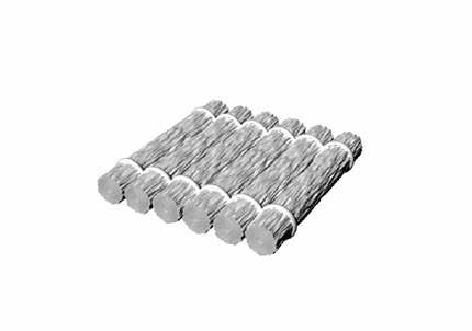
•A flat ferry raft or ferryman, representing the Ferry Street Crossing (now Bridge Street) where a cable ferry carried people, horses and carriages across the St. John River between the US & Canada.
•A Steeple, representing St. Bruno de Grand Riviere, which was built around 1828 and the St. Bruno parish church built in 1870 in the location of the current St. Peter Chanel Parish on Main Street.
•A book or apple, representing several schools from Van Buren’s past including St. Mary’s College, Van Buren Academy, Champlain School, Kindle School, Sacred Heart School, Keegan School, and St. John School.
•An antique telephone, representing Old Hammond Hotel, a luxury hotel converted from the Van Buren Mercantile in 1907. The building burnt to the ground in February 1932, so the stop would be on the location where it once stood.
• A logger or pile of logs on Lumber Mills & Drive, representing Van Buren’s long history with the lumber industry.
• A millstone or waterwheel, representing the first grist mill used to grind corn, wheat and buckwheat into flour, in Van Buren.
• An Acadian star or Sagots (clogs), representing Van Buren’s long history of Acadian and French culture.
• A person in period clothing, representing how several of Van Buren’s current revitalization projects revolve around ‘active transportation’ including the walking pathway that this project will adorn. Noting that having the ability to change up this information would give the opportunity to tell several stories.
He also noted a desire to have a placeholder type icon which could rotate information at a certain stop. He suggested this could be an owl, coming from a local school mascot.
Additionally, we showcased a wireframe of the proposed website design, which Luke reviewed and provided feedback on, particularly appreciating the “Upcoming Events” feature for its ability to engage and inform residents. It was also noted that Van Buren already has a live town website, VBcomeplay.com, and we considered how the new features and ideas could integrate with or complement the existing site.
