


Prepared For:
Steering Committee
John Parker Jr. - 1st Ward, City Council
Steve Richardson - City Council, At-large
Darren Heater - Warren County Board of Supervisors
Misty Soldwisch - Indianola Planning and Zoning Commission


Doug Bylund - Parks and Recreation Director
Akhilesh Pal - Public Works Director
Charlie Dissell - Community and Economic Development Director
Emily Rizvic - Associate Planner
Prepared By:
MSA Professional Services, Inc.

1555 SE Delaware Avenue, Suite F, Ankeny, IA50021
Ankeny, IA 50021
City Council
Stephanie Erickson, Mayor
John Parker Jr., First Ward
Ron Dalby, 2nd Ward
Gwen Schroder, 3rd Ward
Christina Beach, 4th Ward
Heather Hulen, At Large
Steve Richardson, At Large
Planning & Zoning Commission
Bob Ormsby
Al Farris
Misty Soldwisch
Erin Freeburg
Jeromy Pribil
Cortney Marmon
Lin Stecker
Josh Rabe
Sarah Ritchie
Chris Jansen, AICP
Shawn O’Shea, AICP
Shannon Gapp, AICP
Emily Huston
Chapter 1
Introduction
Chapter 2
Relevant Studies & Plans
Chapter 3
Existing Conditions Analysis
Chapter 4
Public Engagement
Chapter 5
Economic & Housing Market Review
Chapter 6
Public Works Space Needs Analysis
Chapter 7
Planning & Implementation Process
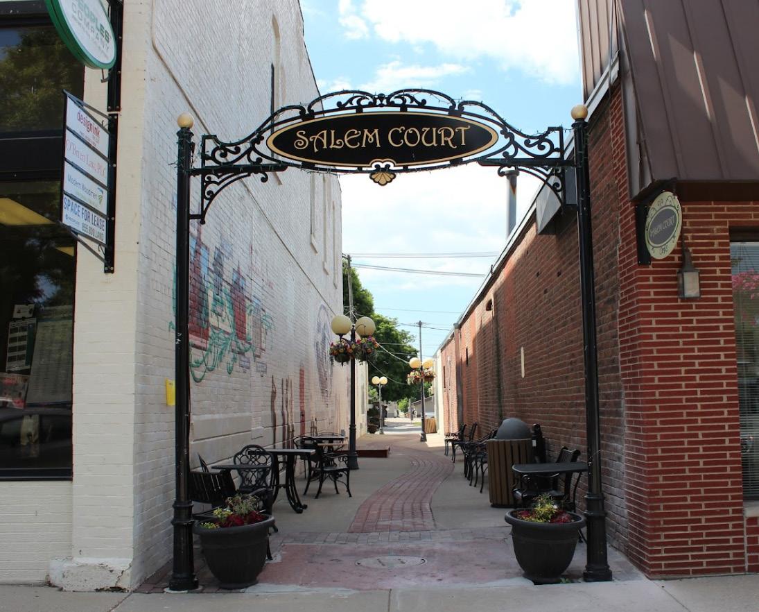
The City of Indianola recognizes the need to create a vision for the future of the Sub-Area to guide growth and development in the heart of the community. The current condition of the Sub-Area provides opportunity to change the site from light industrial to mixed-use commercial and residential. The visioning process for this plan was done with the goal of uniting a community towards the overall goal of improving the community at its core to benefit all community members.
Month(s) Tasks and Meetings
Phase 1: Background Analysis + Site Reconnaissance
• Kickoff Meeting
This is accomplished through a thriving district or town center that consists of pedestrian amenities, consumer locations that provide basic necessities, and areas of interest that give residents and visitors alike a reason to linger and stay in the heart of the community. This plan serves as the impetus for creating, focusing, and implementing that vision. This plan is to be used as a guide for the future of the Sub-Area and is not being used to buy or force business owners or residents out of their current establishments.
May - June
• Review Relevant Studies/Plans
• Existing Conditions Review/Analysis
• Economic and Housing Market Review
Phase 2: Concept Plans
• Conceptual Development Scenarios
This vision strives to meet the following objectives for Indianola: Objective 1 | Identify existing character and condition of the Sub-Area in Indianola. This was done through a windshield survey of the neighborhood and discussed with committee members at the first meeting.
Jun. - Aug.
• Detail Concepts
• Public Works Space Needs Analysis
• Preferred Vision Concept w/ Design Policies
Phase 3: Outreach Plan
Objective 2 | Identify the desired character of Indianola’s Sub-Area. The steering committee as well as conversations with community members helped to shape the desired vision of the neighborhood.
Jun. 30
Jul. 12
Jul. 18
Objective 3 | Create the idea of Placemaking, and how Indianola can fully establish the Sub-Area as a unique and desirable district and neighborhood for residents and visitors alike. Potential concepts for enhancements to the project area were developed using previous plans, public engagement, and meetings with a Project Steering Committee. Suggestions were given to roadway and infrastructure improvements, streetscape enhancements, mixed use development, and the overall appearance and function of the SubArea.
Sept. - Oct.
• Working Group Meeting #1
• Attend P&Z Meeting (#1)
• Attend City Council Meeting (#1)
Phase 4: Implementation Strategy
• Timeline
• Perform Analysis
• Regulating Plan
Phase 3: Outreach Plan
Aug. 31 • Working Group Meeting #2
Sept. 19 • Attend City Council Meeting (#2)
Oct . 6 • Community Input Workshop
Phase 5: Sub Area Plan Documents
• Plan Document
Nov. - Dec.
• Marketing Brochure
• Regulating Plan
Phase 3: Outreach Plan
Nov. 30
• Working Group Meeting #3
Dec. 13 • Attend P&Z Meeting (#2)
Jan. 3, 2023
• Attend City Council Meeting (#3) Adoption
Final Deliver Final Plan Document, Brochure, and Map Data
The project site today provides a unique opportunity for development. Surrounded by a developed residential neighborhood on the North, South, and East sides, the middle of the site feels at odds, as it currently favors light industrial buildings and businesses. With Jefferson Way to the West, this site provides a lot of variety in the way that it is currently serving the community, but also in the way that this can be expanded upon. The following plan and study identifies areas of commercial and residential growth in the City of Indianola as well as in the boundaries of this specific location.


Dayton Park is a well-loved public facility within the site boundaries. It is a small neighborhood park that features a ball field, a basketball court, a picnic area, playground, portable restrooms, and access to the current Summerset trail.


Heartland Co-op is located at the center of the site and plays a large role in the feel of the neighborhood. Residents that live in the surrounding homes have made comments that the noise, dust, and constant truck traffic is not ideal. The bike trail cutting through N 6th Street also currently lacks vegetation and is not very inviting.
The blocks to the east of the site consist of well-established singlefamily homes. The neighborhood is relatively quiet and is home to a range of families of different ages and stages of life. Emerson Elementary on the corner of E Euclid and N 8th Street is also a great asset to the neighborhood.


Indianola’s updated Comprehensive Plan, Elevate Indianola was prepared in 2020 by Snyder and Associates, along with the Citizens of Indianola. The Plan highlights the opportunities for growth in both commercial and residential, two areas that the Sub-Area Plan focuses on. With the population of Indinaola continuing to grow at a steady rate, there is opportunity to implement more housing and attraction to accomodate both current and future residents.Along with growth, the Comprehensive Plan shows the current zoning as light industrial in the project area, which does not align with the direction provided from this most recent public engagement process.

The Plan lists its current priority project as improvements to the library, sanitary and stormwater, street projects, and a few parks. The only project that currently interacts with the project site would be reconstruction and preventative maintenance to E Iowa Avenue running from N Jefferson Way to N 8th Street, which runs alongs the northern border of the project boundary.
Indianola’s 2022 Strategic Plan builds on many of the previously formed priorities stated in the 2020 Indianola Strategic Plan. The priorities for this plan include the completion of the public facilities study, road paving capital improvement plan, gateway and corridor improvements, public health and animal control, and a staffing plan. Similar to the previous Strategic Plan, this plan also considers integrity, equity, stewarship, transparency, and persistence.
The goals, objectives, and strategies of this plan have guided the overall recommendations identified for this sub area plan.


Esri Tapestry Segmentation system divides residential areas around the US into distinct segements based on their socioeconomic and demographic composition.

Knowing a community’s tapestry is helpful in knowing who is currently being served and may be helpful in identifying groups of people that are not.
Indianola has a large group of residents that are single or in small families, as well as a decent percentage that are below the age of 35.


14.3%
13.6%
22.7%
A market such as this can be found in the outskirts of urban metropolitan areas. One-third of the households are under the age of 35 and typically consist of more renters than buyers. This group tends to be very physically active and up to date on new technology.
Parks and Rec consists of homeowners and predominantly twoincome married couples approaching retirementage. Thismarket tendsto live in well-established, kid friendly neighborhoods.
This market consists predominantly of single households. These households are located within renter focused transitional neighborhoods full of residents that are either just beginning their career or are within their retirement stage of life.

11.4%
18%

A mix of singles and married couples, this market can often be found living in older single-family developments. Most residents in this group have lived, worked, and played in the same area for years.
The In Style market is an urban lifestyle that supports art, travel, and extensive reading. It consists of professional couples or single households without kids. Residents in this market tend to have spare time for their personal interests and homes.

The average working resident in Indianola has an average commute of 5-15 minutes. An interesting statistic is that the second most common commute time is 30-35 minutes, indicating that they most likely work in Des Moines. This indicates that there is a decent percentage of people living in Indianola that either cannot afford to live in the Des Moines Metropolitan Area or employment opportunities in their profession are unavailable in Indianola.
This infographic provides information about how population age 16+ travels to work. This data comes from the American Community Survey (ACS) from the US Census Bureau. Read an in-depth analysis on the ACS documentation page
This infographic contains data provided by American Community Survey (ACS). The vintage of the data is 2015-2019.
Source: This infographic contains data provided by American Community Survey (ACS). The vintage of the data is 2015-2019.
Parcel/structures are in great condition, well-kept, and clean.
Parcel/structures is in good condition but could use minor upkeep.
Parcel/structures is in fair condition but could notably use upkeep and cleaning.
Parcel/structures is in poor condition and requires major upkeep and cleaning.
Excellent Good Fair Stressed Dilapidated

Parcel/structures is in critical condition and requires severe upkeep or demolition.
Individual parcels/buildings can have a lasting impression on a person’s perception of an area, both positively and negatively. For instance, a building could be so well-designed, unique, or historically significant that it is the first thing someone thinks of when someone mentions Indianola. Examples of a parcels/buildings that can leave a negative impression would be a poorly designed or empty, public space, a dilapidated building, and a large vacant parcel. The current site is surrounded by a wealth of well-established and maintained residential parcels, while the middle of the site could benefit from some improvements, as there are quite a few dilapidated buildings currently in this area.


Current uses inside the Sub-Area include industrial in the center of the site. Commercial and retail can be found along N Jefferson Way to the west, while the east is predominantly residential. The Sub-Area is currently home to multiple automotive businesses to the south, with Summerset Trail cutting both in front and behind these buildings. Emerson Elementary is outside of the boundary of the site, but serves many of the families in the residential neighborhood.


During the first Steering Committee meeting, members were asked what areas of the site they believed to be strengths, weaknesses, opportunities, and threats. The members identified the following:
• Well-established single-family surrounding site
• Popular and successful commercial along Jefferson Way to the west.
• Current light industrial zoning limits development


• Need for mixed-use
• Summerset Trail
• Multi-family housing
• Removal of industrial business in area
• Relocation of helipad
• A few dangerous intersections for cars and bicyclists
• Heavy truck traffic in the area
An Open House was organized on October 6th. Resident and property owners within and in proximity of the project area were invited to review plan concepts and provide input. Approximately 12 residents and property owners attended the open house. The follow comments were provided:


Preferred/Likes:
• The idea of Rowhouses and examples shown.
• Bicycle centered businesses and Summerset Trail focus. Bringing more restaurants and retail into the neighborhood.
Concerns/Dislikes:
• Overcrowding of neighborhood if multi-family residential were to be developed.
• Emerson Elementary is currently full and may require expansion with more children attending.
• Traffic flow on Euclid and around Emerson Elementary during dropoff/pickup times is often bad.

Indianola is projected to grow at a percentage of .66 throughout the next 5 years, meaning that there is a need for additional housing to accomodate future residents. The current housing stock in Indianola is predominantly single-family detached units, which in todays market, is very limiting and often not affordable for a variety of individuals and families. Along with residents willing to commute to Des Moines for work, if affordable housing is not available in Indianola, buyers will seek it elsewhere.
The 2022 Elevate Indianola Comprehensive Plan has goals in place to “provide a variety of attractive housing options for residents, accomodating all income levels in all stages of life.” Providing more medium density and multi-family housing, which is a minority in Indianola, would align with this goal.
Total Housing Units - 6,014
Owner Occupied - 67%
Renter Occupied - 33%

Vacant - 523
Population - 15,833
Housing Units by Type
Total Housing Units - 6,014

Single Family, Detached - 3,804
Single Family, Attached - 453
Two Units / Duplex - 120
Multi-Family - 1,534
Mobile Home - 103

With the population of Indianola projected to continue increasing and a larger percentage of the population being under 40, there is room to expand the multi-family housing market in Indianola. Nationally, prices are continuing to rise and if Indianola hopes to be an attractive location for new graduates and young families, then it needs to be able to accomodate those buyers and renters by providing more affordable housing options.
The current population and projected population of Indianola has a large percentage of residents between the ages of 20 - 34. This demographic looks to enter the housing market at a lower price point. In order to provide accessible housing opportunities, multi-family units, whether attached or detached are a more affordable alternative to single-family detached homes.


According to the 2020 Comprehensive Plan, 23% of housing was attributed to multi-family units in Indianola in 2017. When looking at the Census data for 2020, that number has now increased to 28% and is expected to continue growing as single-family detached units continue to increase in price. These numbers show that there is a growing need for Multi-Family housing in Indianola. When at 23% there was a need for 1,161 Multi-Family units, but with a 5% increase, there is now a need for 1,414 units by 2040. The number of needed units will increase if this percentage continues to increase over the years.


The Retail Marketplace profile for Indianola displays the supply, demand, and retail gap within the retail and commercial market. Indianola has a surplus of other motor vehicle dealers, food & beverage stores, grocery stores, beer, wine, & liquor, health & personal care, general merchandise, and department stores. While these industries are bringing customers into the community for business, the majority of industries are under-supplied at this time.
Although Indianola has a demand for a variety of under-supplied industries, based on the location of the 6th Street Sub-Area and its surrounding neighborhood, industries such as clothing, restaurants, housewares, entertainment, and sporting goods would fit into the already established fabric of this area. N Jefferson Way to the west currently provides food & drink in both restaurants and grocery stores, along with general merchandise. It would be easy to expand and transition these markets into the Sub-Area without causing disruption.
ESRI’s Retail MarketPlace data was used to measure retail activity by trade area and to compare retail sales to consumer spending by NAICS industry classification. The retail marketplace analaysis is based on three trade areas: 5-minute, 20-minute, and 45-minute drive times from the middle Downtown Indianola. The 5-minute travel time encompasses the entire community of Indinaola, while the 20-minute drive time includes smaller communities such as Carlisle, Hartford, Summerset, etc. The 45-minute travel time reaches the metro area of Des Moines.
Based on this analysis, there are some areas of the retail market that have a local demand (customers spending money on that type of retail) that is not met in the area and leaking to other areas outside of Indianola (customers going to other areas to spend money on retail). There is an estimated $3.8 million in food & drink that is being spend by area residents outside of the City of Indianola.
The retail leakage / surplus factors for the Reference Area was pulled from Esri's Community Analyst. This analysis calculates supply (retail sales) estimates to consumers by establishments within the Reference Area. Demand (retail potential) for the Reference Area is also estimated, which is the expected amount spent by consumers at retail establishments with the area.
Per Esri, the Leakage/Surplus Factor presents a snapshot of retail opportunity. This is a measure of the relationship between supply and demand that ranges from +100 (total leakage) to -100 (total surplus). A positive value represents 'leakage' of retail opportunity outside the trade area. A negative value represents a surplus of retail sales, a market where customers are drawn in from outside the trade area.
Figure 1.13 shows the Leakage / Surplus Factor by Industry Sectors for the Reference Area. Table 1.9 summarizes the data by major industry groups.


The Reference Area is predominantly residential, which explains the positive "leakage" numbers present within each category. This provides Indianola with opportunity to bring in a variety of stores.

Some examples of retail that are currently in short supply in the City of Indianola are:

• Home Furnishing
• Specialty Food
• Clothing
• General Merchandise
• Restuarants

The Existing Facility Needs Assessment was completed by Martin Gardner Architecture. MGA worked closely with facility managers and department directors in both the Public Works Department and Parks Department to assess the existing and future space needs of these departments as it relates to the space currently located in the study area.
Currently, the public works facilities contain the streets department and parks department. The waste water department has recently constructed new facilities and that department’s needs are presumed to be accommodated except where noted in this report. The streets and parks departments are short on space in most areas for storage of vehicles, materials and equipment. Both departments currently store vehicles outside or under unheated cover. This leads to more exposure of equipment and less comfortable environments for staff operating the vehicles and equipment. Staff is forced to spend a lot of time rearranging equipment both seasonally and for everyday storage of equipment. Office, break room, and other support facilities are inadequate for size and indoor occupant health as these areas are exposed to fumes from the garage. Safety should be improved by providing gas monitoring systems and ventilation as well as proper fire suppression systems. Storage of paint and other chemicals is inadequate due partially to the type of structure it is housed in. Training and meeting facilities are inadequate and currently held in ad hoc space in the garage area. Fueling of vehicles takes place at the neighboring county facility. Should the public works department for the City relocate, it is anticipated that a new fueling station would be constructed at the new location. Both departments need additional dedicated space for executing projects whether it be sign repair, picnic table refurbishing, or other projects. It was noted that a dedicated sleeping area was not needed but having areas where staff can sleep when working long shifts would be helpful, particularly for staff who do not live nearby.
The existing brush facility does not currently have any structures on site and is anticipated to remain that way. Waste hauling is currently executed by a third party.
Pickard Park has a storage building that is used for storage of seasonal items for festivals and holidays as well as storage of items with lower use. A green house is utilized by the city’s horticulturalist whose scope and need for storage has increased due in part to a recent streetscape project in the downtown. This increased need for space will likely cause the phasing out of an annual plant sale. Pickard Park also has outdoor material storage.
PERSONNEL
Current staffing levels are as follows:
The existing facilities consist of primary buildings that house the activities listed above as well as several miscellaneous sheds and small outbuildings. In aggregate, the existing facilities add up to a total of approximately 27,500 SF. An inventory of the departments’ existing equipment was taken with dimensions for each piece of equipment. An example is shown below.
Indianola Public Works Space Needs
Buildings at Main Site including office/vehicle storage, and sheds
Buildings at main PW site and Storage, Greenhouse, and Concession/Storage buildings at Pickard Park

Concept A focuses on the development along the east side 6th street. Additional housing is recommended, along with the creation of vegetation barriers within the industrial areas and along Summerset Trail to soften the landscape.


Concept B focuses on the redevelopment and demolition of the Heartland Coop site. Medium density residential would go in its place, along with a small district surrounding Summerset Trail containing bicycle centered businesses.


Concept C works with Heartland Coop remaining in it’s current location and developing low and medium density housing to the east of 6th street. A small district is also created to the south, along Summerset Trail for bicycle centered businesses.

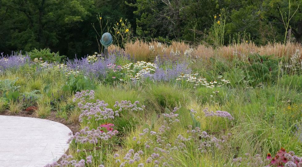


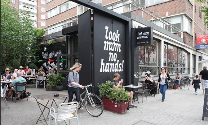
Concept D is a blank slate concept where Heartland Coop, Warren County Oil, and the City are all removed from the area. Here, there is opportunity for low and medium density housing along both sides of 6th street, as well as a mixed-use district to the south along Summerset Trail.


This concept depicts Heartland Co-op’s structures remaining intact, thus creating the need for a light industrial aesthetic throughout the site. Low and medium density housing is recommended along the east side of 6th street and a small strip of commercial businesses with parking are located along the rerouted Summerset Trail. Dayton Park is also expanded into the Warren County Oil site.

This concept depicts the site as starting from a blank-slate with all industrial removed. More opportunities for medium density can be seen placed along 6th Street as well as behind the single-family homes along E Iowa Avenue. A commercial plaza has been placed along the rerouted Summerset Trail with accomodating parking and Dayton Park is also expanded to the west a bit.

The 6th Street Sub-Area in Indianola is a unique area with a lot of potential for redevelopment. Due to the current zoning and businesses within the project area there is an element of unknown when it comes to who and what may choose to stay or leave over the next 20 years.
Many factors can influence how citizens perceive a neighborhood in their community. These factors combine to create the urban fabric, which can be simplified into three categories: districts, streets, and individual parcels & buildings. Studying the existing urban context provides insight on what properties are assets to enhance versus those that are strong candidates for redevelopment in order to revitalize the project site.


The biggest challenge in the Sub-Area are the current industrial buildings. These currently limit the potential use going forward and also disrupt the surrounding residential neighborhood. These areas do provide great opportunities for reuse and redevelopment, whether commercial or residential and the existing industrial atmosphere of this area is a unique feature that could be utilized to create the identifiable character that is needed to create a district.
A District is a cohesive area with an identifiable character. Building uses, types, and styles establish the overall character of this area. Indianola’s Sub-Area has a good mix of uses (i.e. residential, retail, light industrial, and automotive), although it cannot currently be called a district due to its lack of cohesiveness.Other disadvantages of this area include the building conditions for many of the structures are in fair condition or below, the dust and noise pollution from the current industrial businesses, and the lack of green areas and vegetation. The strengths of this area come from it’s location, being right off of N Jefferson Way, which has strong, succcessful commercial businesses, and the well-established single-family neighborhood, which quiets the traffic and allows for natural greenery.

Two final concepts were developed for the Sub-Area due to the unique conditions of the site. With Heartland Co-op having such a large prescence, it was important to develop both a concept with it entirely removed and also with its buildings remaining. The ultimate goal of the site would be to relocate the Co-op to outside of Indianola where it would have room to expand and would not interfere with the urban traffic and development of its current location. If Heartland Co-op were not able to be entirely removed due to cost or their desire to stay where they are, it would be important to embrace the industrial elemements, but do so in such a way that the rest of the area does not suffer because of it. Both concepts address the addition of multi-family and higher density housing, commercial and retail development opportunities, parking, greenspace and park expansion, and road and trail redevelopment.


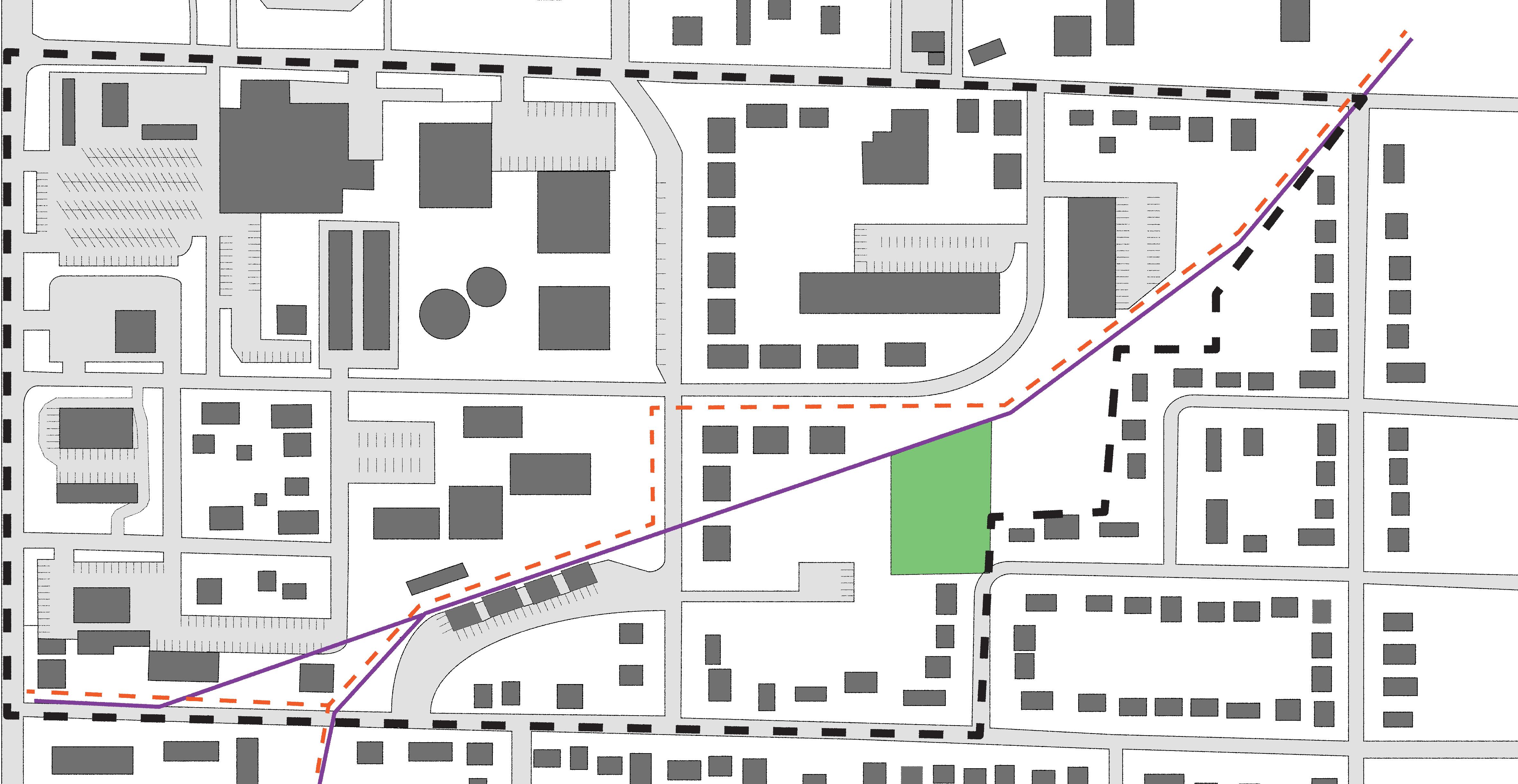
The following recommendations were made according to feedback received and data collected showing both a need and opportunity for the development of higher density housing within Indianola. The 6th Street Sub-Area provides a great opportunity for this housing as it’s location is ideal, due to the commercial to the west and single-family residential to the east.
• Encourage the development of multi-family residential such as row-houses or duplexes along N 6th Street.

• Encourage the development of lower-density apartment buildings (20 units or less per acre).


• Work to reduce housing barriers for current and future residents.
• Consider acquiring the lot on the corner of N 6th Street and E Iowa Avenue and sell to developer looking to do multi-family residential.

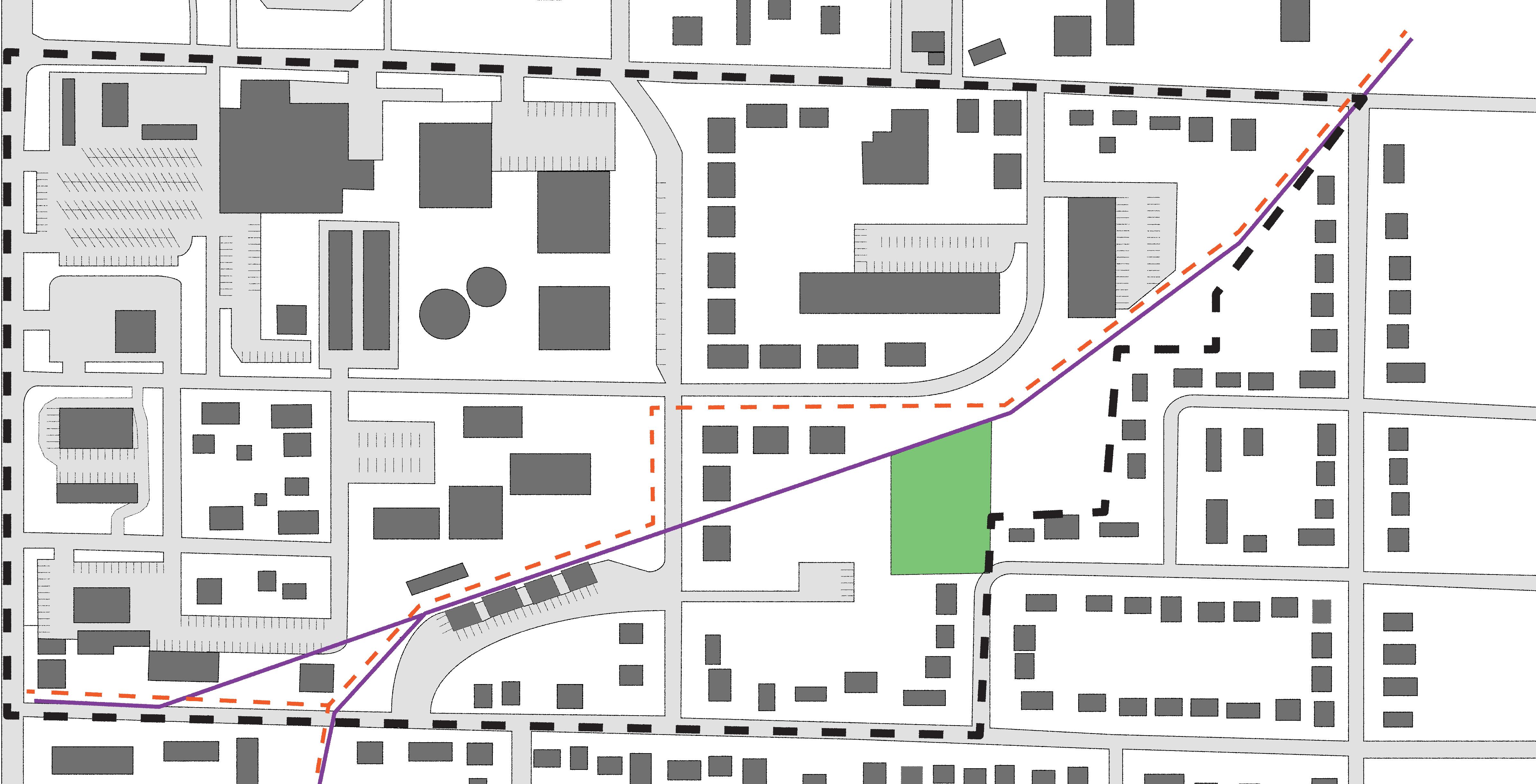
The following recommendations were made according to feedback received and data collected showing both a need and opportunity for commercial development within Indianola. The 6th Street Sub-Area is an ideal location due to its close proximity to commercial businesses along N Jefferway Way. Summerset Trail cutting through the site is an additional benefit as it provides the unique opportunity for the development of bicycle centered businesses as an attraction and destination.
• Work with Heartland Co-op to relocate and purchase their current parcels.
• Conduct a feasability study of the Co-op facilities to see how much work and money would need to go into repair.
• Promote the adaptive reuse of Co-op grain elevator and silos.


• Explore the idea of putting a mural on the grain elevator and/or silos.

• Work with business owners along E Euclid to consider moving or selling their parcel to allow for development of commercial businesses.
• Work with business owners along E Eucid to add landscaping/trees along property edge.
• Promote the area as having an industrial edge when appealing to developers.


The following recommendations were made according to feedback received and data collected showing both a need and opportunity for the development and expansion of green spaces within the 6th Street Sub-Area. Dayton Park is a well-loved facility that should expand with the growth of the rest of the site to accomodate the urban development.
• Consider expanding Dayton Park into the current Warren County Oil site.
• Work with a local artist to design an interactive sculpture, preferably metal or with an industrial flare.

• Implement prairie-style landscaping that requires low maintenance but adds character.

• Explore the idea of adding a walking path through the park.
• Add lighting along Summerset Trail and throughout Dayton Park.
• Consider additional benches and seating on the perimeter of the green space.
• Place trees and plantings along sidewalks where possible to soften the landscape.


• Place vegetation barriers along Summerset Trail and along N 6th Street.
• Consider shading devices overtop sections of Summerset Trail.


Church
School Proposed Trail Permanent Easement Longterm Lease


The following recommendations were made according to feedback received and data collected showing both a need and opportunity for the development of higher density housing within Indianola. The 6th Street SubArea provides a great opportunity for this housing as it’s location is ideal, due to the commercial to the west and single-family residential to the east.
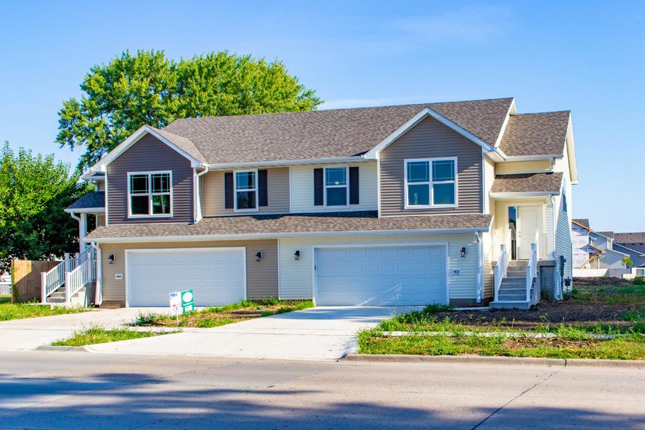
• Encourage the development of multi-family residential such as row-houses or duplexes.

• Encourage the development of lower-density apartment buildings (20 units or less per acre).


• Encourage the development of mixed-use buildings with residential above and commercial below.

• Work to reduce housing barriers for current and future residents.
• Develop the lot on the corner of N 6th Street and E Iowa Avenue with multi-family residential.

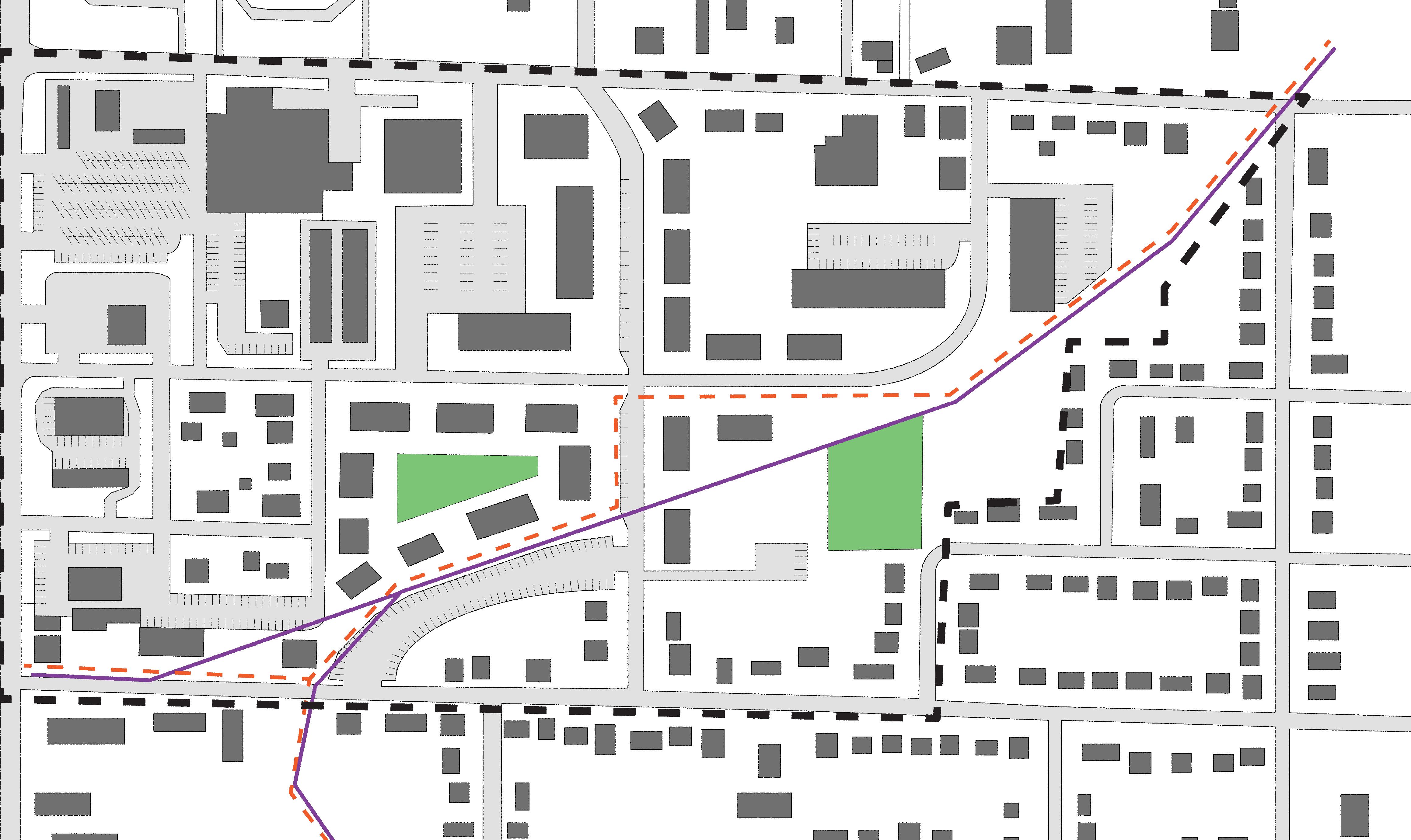
The following recommendations were made according to feedback received and data collected showing both a need and opportunity for commercial development within Indianola. The 6th Street Sub-Area is an ideal location due to its close proximity to commercial businesses along N Jefferway Way. Summerset Trail cutting through the site is an additional benefit as it provides the unique opportunity for the development of bicycle centered businesses as an attraction and destination.
• Develop Heartland Co-op parcel between N 6th Street and E Euclid Avenue with retail, entertainment opportunities, and food & drink establishments.


• Encourage development of a small pedestrian mall/district with retail and restaurants. Consider both chains and local restaurant options.

• Promote bicycle centered businesses i.e. repair, rental, bicycle themed restaurant, etc.
• Work with businesses owners along E Eucid to add landscaping/trees along property edge.
• Attain or assist in relocating the businesses along E Euclid Avenue and sell to developers looking for commercial opportunities that would fit better with the desired vision.
• Develop an identity and aesthetic for the area (industrial edge, modern stone, classic brick, etc.)


The following recommendations were made according to feedback received and data collected showing both a need and opportunity for the development and expansion of green spaces within the 6th Street Sub-Area. Dayton Park is a well-loved facility that should expand with the growth of the rest of the site to accomodate the urban development.

• Consider expanding Dayton Park into the current Warren County Oil site.
• Work with a local artist to design an interactive sculpture, preferably metal or with an industrial flare.
• Implement prairie-style landscaping that requires low maintenance but adds character.

• Explore the idea of adding a walking path through the park.
• Consider additional benches and seating on the perimeter of the green space.
• Place trees and plantings along sidewalks where possible to soften the landscape.

• Place vegetation barriers along Summerset Trail and along N 6th Street.

Commercial
New Housing
Established Housing
Mixed-Use
Park/Green Space
Church
School
Proposed Trail

Permanent Easement Longterm Lease

The following recommendations were made according to feedback received and data collected showing both a need and opportunity for the development and redevelopment of streets within the 6th Street Sub-Area. The current roads are narrow and in need of traffic calming to slow the speed of vehicles in the area. There are also safety concerns with multiple intersections due to a lack of signage and signals.
• Realign 6th Street to meet
• Reconstruct N 6th Street with a parking lane to slow traffic as well as provide on-street parking.

• Consider expanding E Girard Avenue to the east of N 6th Street and connecting it to E Iowa Avenue to create more accessibility and development opportunities.


• Add light flashes and pedestrian controlled signals to the intersection of N 6th Street and E Girard Avenue.

The following recommendations were made according to feedback received and data collected showing both a need and opportunity for the development and redevelopment of Summerset Trail within the 6th Street Sub-Area. Safety concerns have been brought up in regards to the trail crossing in the middle of 6th Street. The trail also lacks vegetation and lighting.

• Consider rerouting the Summerset Trail to connect at the intersection of N 6th Street and E Girard Avenue to improve safety and visibility.
Current trail alignment is on ground owned by Warren County and is part of Rails to Trails. The current corridor shall be preserved and is not eligible for redevelopment.
• Promote the development of bicycle centered businesses along Summerset Trail.

• Implement artistic and well-placed bike racks and lockable storage pods along Summerset trail and near popular businesses and destinations.

• Place lighting along Summerset Trail.
• Place signage along Summerset Trail.



706 North 6th Street
Indianola, Iowa 50125
Public Works Feasibility Study
City of Indianola
110 North 1st Street
Indianola, Iowa 50125
Akhilesh Pal 515-961-9415
apal@indianolaiowa.gov
Kyle Martin, AIA 319-200-8493
kylem@martingardnerarch.com

The method of calculation can be performed with known dimensions or desired occupancy Place a "1" in the field for the method
WHO should complete this form?
WHO should complete this form?
Each Bundle represents an option, phase, or variant of spaces that allow flexibility and choice within the program
WHEN is this form due?
WHY
Update the Gross Factor based on type of building. Complete space dimensions or SF/Person based on the calculation method for each
Each Bundle represents an option, phase, or variant of spaces that allow flexibility and choice within the program
Each Bundle represents an option, phase, or variant of spaces that allow flexibility and choice within the program
WHEN is this form due? WHEN is this form due?
WHY is this exercise important?
Update the Gross Factor based on type of building. Complete space dimensions or SF/Person based on the calculation method for each
WHY is this exercise important?
Update the Gross Factor based on type of building. Complete space dimensions or SF/Person based on the calculation method for each