2 minute read
Drone magnetometry and geophysical methods for mining exploration


When we talk about magnetometry with drones, we must consider the challenges presented by the applicaon of this geophysical method. When mounng a magnetometer on a drone, either total range or fluxgate, we find electrical components, magnec materials, even the movement of the drone motors, which generate magnec acvity that can easily cause alteraons in the acquision of data, prevenng accurate and useful results for the regional characterizaon of mineral resources.
The search for minerals with high magnete content such as iron or nickel, are the ideal scenario for this type of applicaons, however, the search for high value nonmagnec minerals such as gold and silver, find great benefits through the applicaon of geophysical methods such as magnetometry with drones.
Advertisement
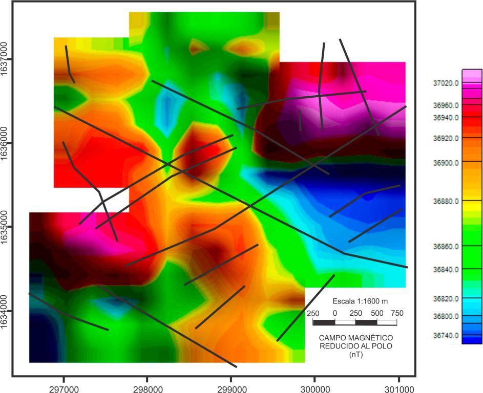
Therefore, our applicaon for the mining sector focuses on the regional characterizaon of magnec acvity, this means that we generate maps of magnec acvity of large extensions, adapng to the topography of the terrain and allowing its correct measurement despite topographic changes, at mid-en high altudes flights, and obtaining more accurate readings for its interpretaon; a maer in which most of the magnetometers that currently exist in the market are more limited. In this way we generate informaon that allows us to make a punctual exploraon planning, in a short period of me and with completely accessible costs.
Currently, we can inspect up to 600 hectares per day with a single operaon team and its processing and interpretaon, in addion, with our data cleaning soware we can deliver results in a maer of days. To date, AV3 AEROVISUAL has taken this soluon to different parts of Mexico and Lan America, having generated maps of magnec acvity over surfaces of thousands of hectares in extension.
· Dronesandcustomizedfluxgatemagnetometersforaerialdataacquision.
· Aerialinspeconwithdronesforlargeextensionsoflandanddifficultaccessareas.
· Reliableresults,inlessmeandatahighlycompevecost.
Magnetometry survey with drones is a disrupve soluon with great economic benefits for the mining sector since, once the area of interest has been determined, it is possible to densify the data grids to collect magnetometric informaon with more www.africamininginsight.co.za definion to further delimit the exploraon area or even, to apply other complementary geophysical methods such as AMT (audio magneto-telluric) soundings and gravimetry, to obtain greater certainty of the viable zones for exploraon and extracon of resources, besides giving the possibility of generang robust and reliable models for the planning and definion of zones of interest.

AV-MAG℠, OUR DRONE MAGNETOMETRY SOLUTION FOR MINING
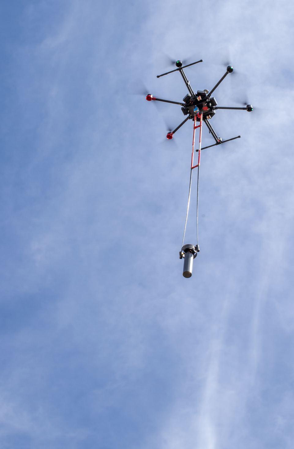
To solve the challenges posed by the applicaon of this geophysical method, since 2014 in AV3 AEROVISUAL the design and manufacture of the equipment we use today was carried out through the Naonal Autonomous University of Mexico and the "Laboratory for Electromagnec Innovaons" of Ukraine, specialized in the manufacture of magnetometers and electronics for satellites. Currently, we have developed two versions of fluxgate magnetometers with the capacity to perform independent measurements in the 3 components (X, Y and Z) in addion to measuring their geoposioning, date, me, inclinaon and other essenal measurements for a correct interpretaon of data. Likewise, these equipment have a design that eliminates the magnec interference that the drone generates on them. To ensure the inclinaon and posion of the magnetometer during the flight, a non-magnec stabilizer was designed and implemented that allows us to move the magnetometer up to 3 meters away from the drone; this stabilizer allows us to keep the sensor vercal with respect to the ground, in this way the wind tracon and drag by the movement of the drone during the flight, does not generate loss or need to remove data not useful for interpretaon, resulng in reliable informaon of great value for decision making.