8 minute read
2.3. Informal Settlements and Vulnerability

from Master thesis in Regeneration of Heritage Coastal Sites. Al Max, Alexandria, Egypt.
by Nancy Morsy

The basic idea is that informal settlements have become a constant issue, with severe environmental consequences. People and the land they occupy are exposed and vulnerable to environmental risks when they live in informal settlements. Lack of essential facilities, pollution, overpopulation, and inadequate waste management define informal communities. These traits have a detrimental influence on the environment, increasing the likelihood of health issues linked with informal settlements. Aside from the living circumstances in informal settlements, the concept of informal settlements being self-built by people and utilizing temporary materials has its own environmental impact. Service delivery is difficult for those living in informal settlements. This is mostly due to unlawful land occupation, which has had a harmful influence on the ecology. Informal settlements have an environmental effect due to a lack of fundamental necessities and services. This includes poor sanitation, which exposes residents to pollutants, as well as the use of coal and biomass fuels for lighting, which pollute the air and contribute to greenhouse gas emissions. Waste disposal is a problem that informal settlers face, and it leads to soil contamination and the emergence and reemergence of infectious disease threats. [Skidmore, M.; Lim, J; 2020]
2.3.1. Disaster risk in informal settlements
Advertisement
Informal settlements are prone to natural disasters due to their location (flood plains, marshy regions, low-lying areas, and river courses), rapid population development, poor planning and housing quality, and the unpredictable strike of natural hazard. Informal settlement residents, who are largely in-migrants, have little financial resources, making it difficult for them to fully prepare for a natural disaster. Because a large majority of in-migrants are low-income or jobless, they are unable to rent a house or room in a well-planned residential neighborhood. Their financial situation forces them to rent flats in less formal areas, where housing is less expensive. Furthermore, such people's low-income status limits their capacity to invest in structural mitigation measures to mitigate hazard consequences. Increased demand for natural resources such as land for both residential and industrial development is triggered by the expansion of informal settlements in terms of people and industry. As a result of the increased building operations, natural vegetation is being destroyed in these places, increasing settlers' sensitivity to various natural risks. Changes in land-use patterns are another occurrence that occurs when cities grow in population. The most common transitions are from agriculture to residential or industrial land use. Infiltration and permeability of run-off water through the soil are reduced by features of urban architecture such as paving of surfaces. [Skidmore, M.; Lim, J; 2020]
ban development in these countries is socially segregated, characterized by unequal access to urban areas, infrastructure, services and security. Low-income households in particular are often forced to occupy exposed areas with low land values, with deficient or non-existent infrastructure and social protection, and high levels of environmental degradation. The result is a pattern of spatially and socially segregated disaster risk. 90% of people in urban areas in low-income countries live in unsafe, exposed housing. [UNDRR, 2015]
2.3.2. Urban development and disaster risk
Disaster risk may be increasing faster in rapidly growing small- and medium-sized urban centres than in either rural areas or larger cities. [UNDRR, 2011]
As cities grow wealthier, investments in infrastructure and services tend to reduce extensive risks. By contrast, in most low and middle-income countries, urban development is driving new patterns of both extensive and intensive risk, particularly in informal settlements, along with high levels of environmental degradation. Ur-
2.3.3. The case of Al-max village in Alexandria, Egypt
Alexandria, founded by Alexander the Great, was once the capital of ancient Egypt. The water that surrounds it has always dictated its history and destiny. Earthquakes throughout the middle ages buried most of the city's topography: Cleopatra's royal palace is 16 feet below the surface of the current Alexandria's shoreline, and the remains of the celebrated Lighthouse of Alexandria, a marvel of the ancient world, are submerged beneath the waters of the city's east port. Despite its proximity to the sea, the floods that wreaked havoc on Alexandria in 2015 caught the administration off guard.
Alexandria is mostly built on low-lying locations. Sea levels are expected to rise by as much as two feet by 2050, putting parts of the city at risk of flooding. The vast Nile delta, the country's breadbasket, is likewise in grave danger. According to AR5, groundwater inundation by saltwater could reduce Egypt's agricultural sector by as much as 47 percent by 2060, and "hundreds of billions of Egyptian pounds, about two to six percent of future gross domestic product (GDP), could be lost from effects on water resources, agriculture, coastal resources, and tourism," according to the UN report. Egypt is in the midst of a historic catastrophe, exacerbated by a financial crisis and a fast rising population.
The Alexandria government believes it’s doing all it can to stave off disaster given the limited resources that are at its disposal. “We have a lot of protection when it comes to sea-level rise,” Dr. Walid Hakiki, advisor of water resource planning and management to the governor of Alexandria told CityLab. “But, right now our main focus in our city is trying to prevent more flooding like we had in 2015.”
Figure 35: Image from Google Maps website. / Image credit: anonymous
Alexandria gets about eight inches of rain each year on average. The city received more than eight inches of rain in only two days during the 2015 floods. The Al-Max canal is especially vulnerable because heavy rain overwhelms the city's pumping station, which discharges the overflow into Lake Mariout, which divides the lake from the Mediterranean. The lake lies nine feet below sea level and is connected to the Mediterranean by two canals that go through Alexandria. When water is thrown into the lake, water levels in the canals vary, posing a threat to the Al-Max fishing village (the banks of the other canal were largely unoccupied). The government's approach to rising flood fears as a result of climate change is to outrun rather than prepare.
“We have already transferred people who are most in danger from sea-level rise and also ensuring them to have a better quality of life,” said Dr. Walid Hakiki, advisor of water resource planning and management to the governor of Alexandria. “In Egypt, we have a lot of slum areas with unsafe construction, and we want to make it more safe for residents.” But some activists say this is not the answer. “Resettlement, especially when forced, heavily disrupts communities,” said Yahia Shawkat, an Egyptian housing rights organizer. “Many of the clearances could have been avoided with much cheaper upgrading, while many others still live in inadequate housing and are not part of the government’s plans.” [Will Egypt’s Ancient City Succumb to Rising Seas? - Bloomberg; 2019]
To understand the current state of AlMax, its regions, and how each area is used, we must first examine its history and evolution. The term "al-max" in Arabic means "tax," according to the "Lisan Al-Ari" dictionary. The name refers to a previous role of this place. According to historical maps, Al-Max was located on the western outskirts of Alexandria. Some accounts describe a sea-to-lake wall, while others place Al-Max in the context of a harbor (Al-Max, or Bab al-Arab, Gulf). The maps also include Al-Shafkhana Fort as a historic site, despite the fact that forts and castles are often found around the city's ports.

Figure 36: Image from online news article (Azab News) - “Developing the Max area in Alexandria within the state’s plan to develop the slums and turn it into an attractive area for tourism” / Image credit: Walid H.

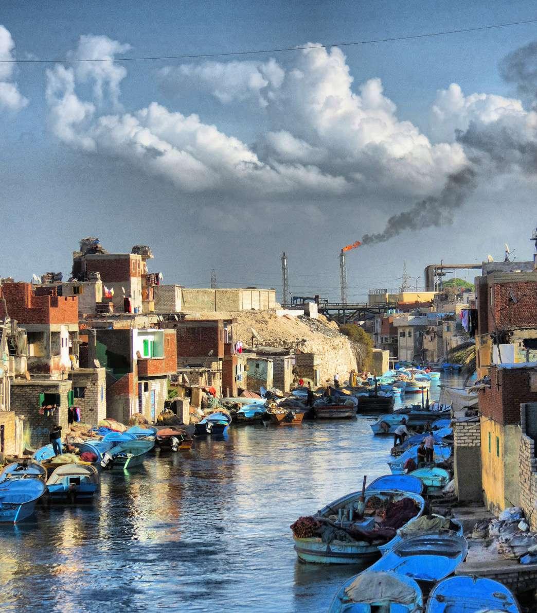
Figure 37: Image of Al-Max village in Alexandria, Egypt. / Image credit: anonymous

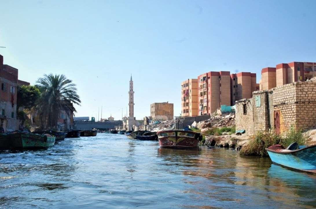
Figure 38: After floods overwhelmed the fishing community living on the banks of Al-Max canal in Alexandria, the government relocated families to high-rises, transforming their way of life. / Image credit: Amir Khafagy

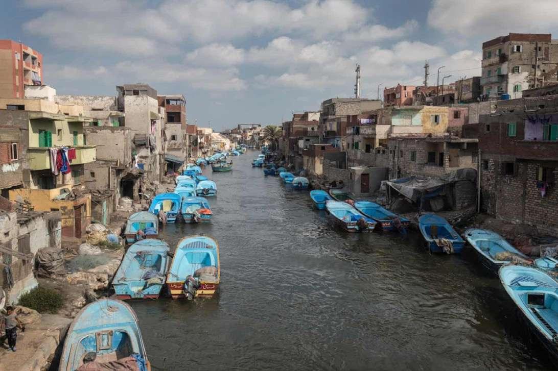
Figure 40: The rubble left after demolition of houses on the waterfront at El Max, near Alexandria, where homes are regularly flooded. / Image credit: Sima Diab
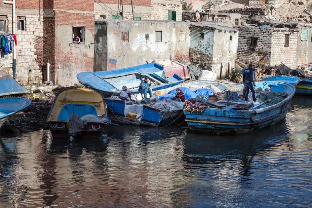
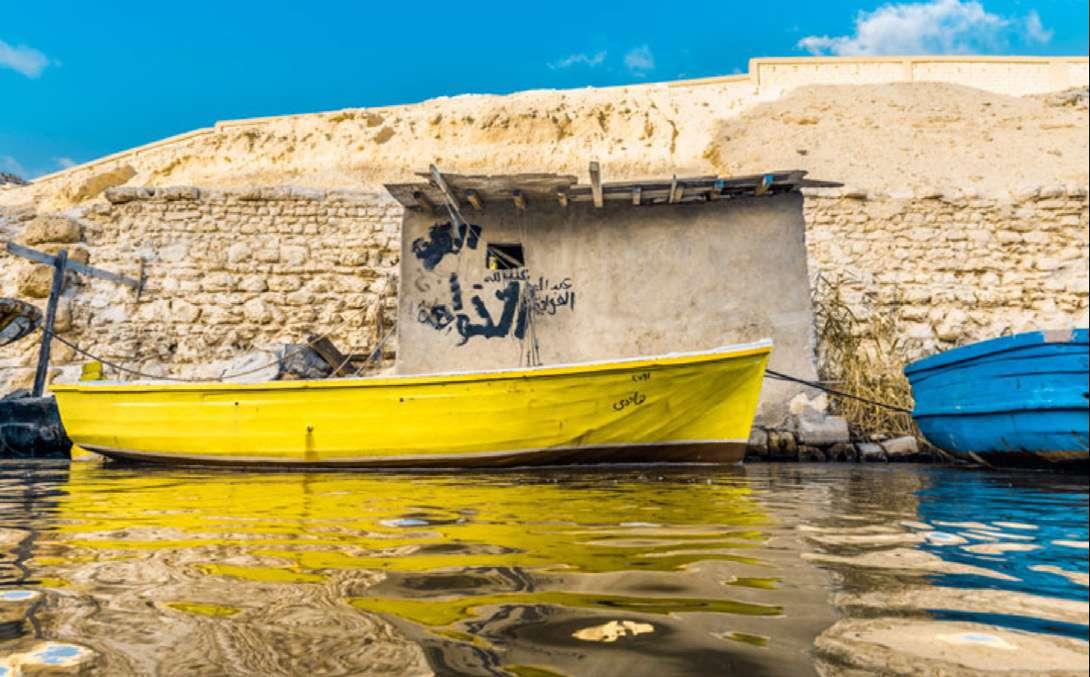
Figure 42: Al-Max area in Alexandria, Egypt. / Image credit: Mohamed Osama
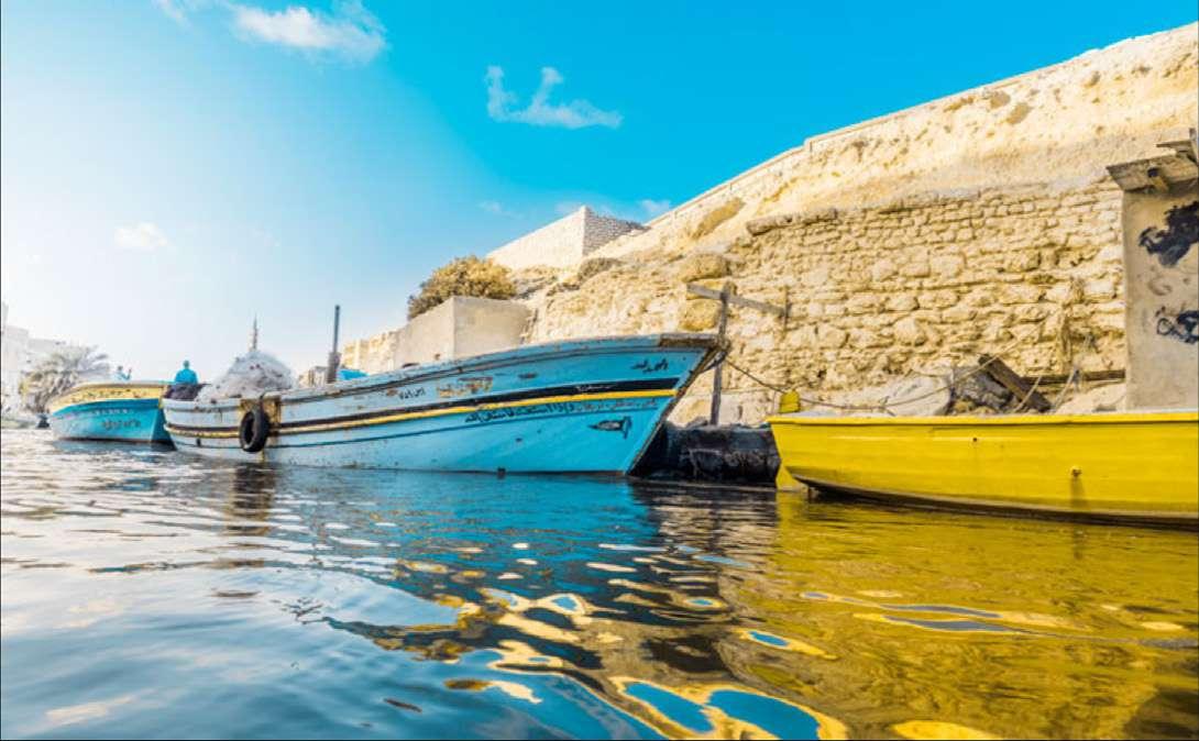
Figure 43: Al-Max area in Alexandria, Egypt. / Image credit: Mohamed Osama


