Final publication project ISTER
ConnectIng hiSTorical Danube rEgions Roman routes
Project co-funded by European Union funds (ERDF, IPA)
©MNIT
ISTER
Authors
BULGARIA ECONOMIC FORUM
Radostina Medvedeva
Christina Zlatanova
Graphics
CM Advertising Ltd.
Photos
ISTER project
Print run: 1000 copies
Not for sale
Overall budget: 2 067 958,95 EUR
ERDF Contribution: 1 663 585,10 EUR
IPA Contribution: 94 180,00 EUR


Foreword ISTER Project Partnership Outputs Multi-Layered Stakeholders’ Group Setup Catalogue on Roman Routes & Settlements along the DR Common Branding Strategy GIS-based Territorial Atlas of Roman Routes Legacy in DR Transnational Interactive Tool (ISTER App) and Pilot Actions Policy Handbook Memorandum of Maintenance Aerial photography, field trips and excavation works ISTER International Best Practices Awards Capacity-Building Workshops Development and tools Practical guide for stakeholders mapping Policy and regulatory report Common Benchmarking Toolkit Cross-learning Modules Toolkit ISTER Video Documentary Small-scale investments Communication, dissemination and capitalisation Transnational Capitalisation Workshops Contents 1 2 3 4 5 7 9 11 13 15 16 19 21 25 25 26 27 27 28 29 31 33
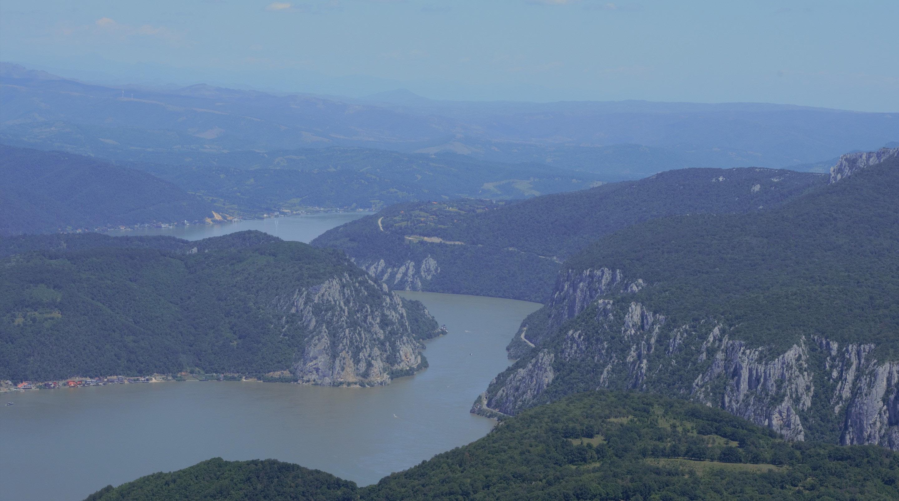
The ISTER project has the great ambition of defining a domain of common reflection, starting precisely from the cultural heritage, where concrete experiences can be found for sustainable development with an impact on the trans-regional scale.
Territorial cooperation between the various Danube regions does not always take place easily. Local interests are often not vectors of bottom-up development but tend claims for rights that result in a selfish localism that does not know how to build bridges towards the other, and this is accentuated in cross-border regions.
ISTER wants to give a new meaning to the local level, that of the development engine. An engine whose pieces are the city networks. The cultural heritage left in inheritance by the Roman roads is the pretext through which to rediscover the ability to think beyond one's own local interest and learn to build perspectives of a European character.
Dr. Ing. Pietro Elisei URBASOFIA, Director ISOCARP, President

“
ISTER is, first of all, a project that teaches how to think and act in an integrated way, which uses cultural heritage as a trigger to generate local clusters of sustainable development based on variety of different economies (experiential tourism, quality agriculture, craftsmanship, high level hospitality ...).
ISTER's tools are based on the ability to cooperate, to understanding that development is always a positive sum and not a zero sumgame. The tools developed in this experience are the first step, they have opened a new road, not Roman now, but European starting from the values of unity in the difference that perhaps have roots in Roman thought, there is still a lot to do, and therefore: ad maiora! ”
Working on Roman roads has been both a pool of inexhaustible resources and a challenge for an archaeologist. For most Roman roads, we have literary and cartographic resources at hand. Perhaps the most famous of them is the Tabula Peutingeriana, an illustrated map of the road network of the Roman Empire.
Nevertheless, literary and map accounts do not precisely pinpoint the Roman roads on the contemporary scene. In this sense, ISTER provided the much-needed ‘а bird's-eye view’ to help the researcher in Roman archaeology better understand Roman roads. And it did so through more than one ‘instrument’.

“
George Cupcea MNIT - Lead Partner
Felix Marcu MNIT - Lead Partner
Unanimously established by now, aerial photography is an invaluable tool for the modern archaeologist, enabling the researcher to remotely detect traces in and below ground level that otherwise would remain invisible. In this sense, ISTER has offered a massive opportunity for an in the premiere, large-scale aerial archaeological investigation on the Roman roads on the Danube, from Germany to Romania and Bulgaria. Thousands of pictures were taken, and hundreds of locations of roads and sites were documented, all in the framework of the project.
Another much-needed tool is the geophysical survey. ISTER has offered us a rare opportunity to purchase and use a last-generation magnetometer, perfectly usable on the terrain ‘hiding’ Roman sites. And finally, the essence of the work of an archaeologist, the excavation, was possible due to development projects affecting the areas where Roman roads passed, offering us the opportunity to see and document their itinerary and state of preservation.”
ISTER Project
ISTER project addresses the challenge of Roman heritage discontinuity, which reflects both in a territorial dimension related to a low level of investment and connection between heritage resources and local/ regional productive sectors, as well as in visualisation and attractiveness dimensions regarding the promotion and awareness raising on the importance of heritage resources.
ISTER’s main objective focus es on rediscovering and revitalising the ancient Roman Roads Network along the DR as a key driver in promoting territorial development based on sustainable use of cultural and natural heritage (precisely, Roman routes).
ISTER tackles the Roman Routes territorial dimensions as a continuous transnational element that passes DR states’ borders and provides a relevant scale for exchange and joint development.
1


Logo RAUSK V R B V S O F I V 2
Partnership
Outputs

Relevance
3
of stakeholders
Multi-Layered Stakeholders’ Group Setup
The constellation of partners in the ISTER project is very diverse. Their geographical scope, knowledge, experiences and skill set in stakeholder analysis and engagement differ from case to case. Therefore, a Methodological framework for Stakeholders Mapping was developed based on empirical and analytical methods proposed by stakeholder theorists and scholars using a selected practical method. Overall, this methodology aimed to provide a simplified stakeholder analysis method with tailor-made practices by considering 1) accessibility and approachability for all the partners and 2) project scope.
Stakeholder identification and analysis were used for prioritization reasons based on an importance/impact matrix used to select the best approach for each stakeholder group following transnational guidelines. Based on the transnational methodological guidelines and tools, each territorial partner provided a local stakeholder map, which became the basis for creating the Multilayered Stakeholder Group (MLSG).
4
Catalogue on Roman Routes & Settlements along the DR
The data collected in the Catalogue extended the current knowledge framework by providing a comprehensive picture of the existing data-base, laid the foundation for developing a GIS-based territorial atlas of the heritage of Roman routes in the Danube Region, and helped deepen the understanding of this heritage.
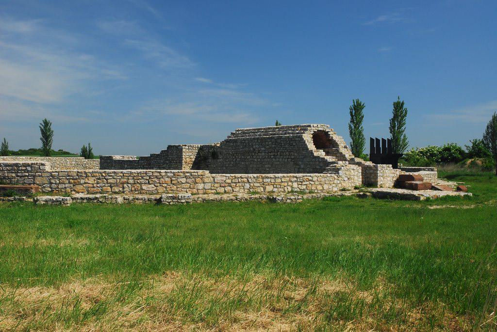
It provides information as:
• Starting & Ending points of the Routes;
• Category;
• Type of Roman heritage;
• Dating (century / period / date range);
• Protection status;
• Boundaries (of immovable cultural assets)
• Type of ownership & owners;
• Location;
• Physical state / condition;
• Type of restoration;
• Plans of the site / sites;
5
Nemesvámos - római halomsí
Source: mapio.net
Lussonium A Villa Romana Baláca légi felvételen

Source: paks.hu
Source: hu.wikipedia.org
Zeiselmauer - Körnerkasten
Source: commons.wikimedia.org
The hunger tower
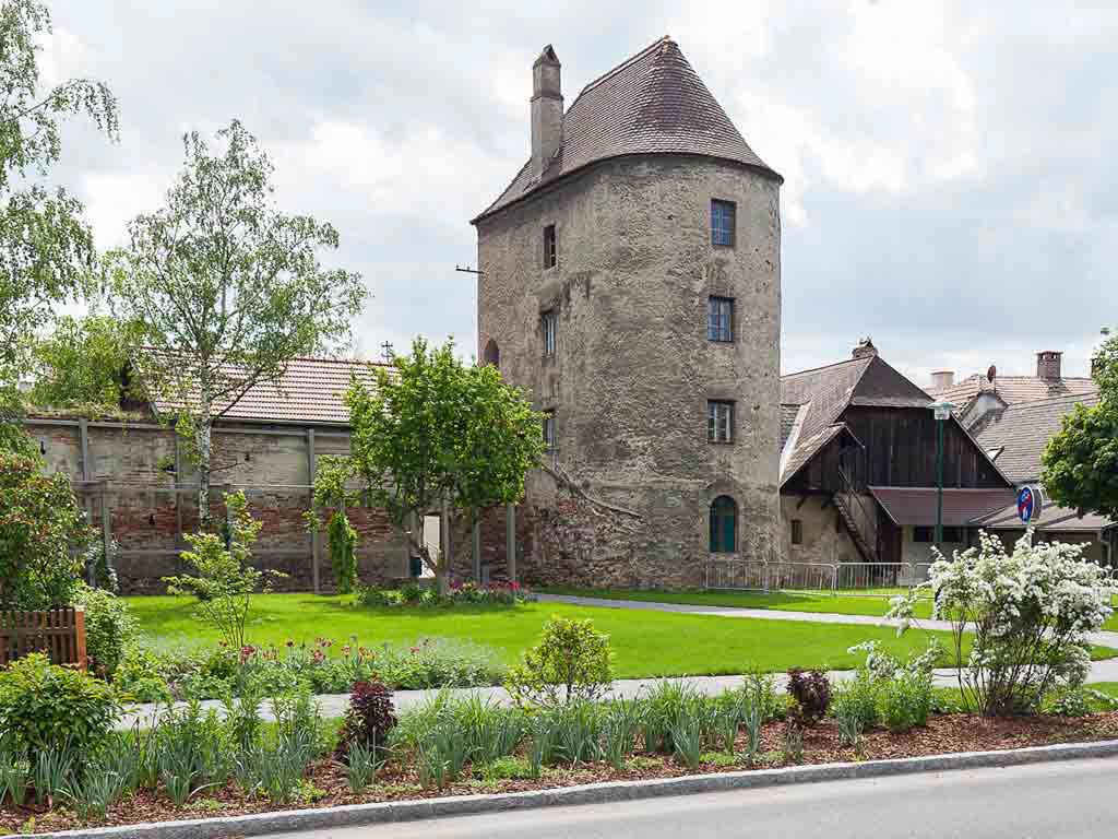
Source: donau-limes.at
6
Common Branding Strategy
Cultural Routes are a driver of economic development, social cohesion and transnational cooperation. The Common Branding Strategy of VIA ISTER in the Danube Region is developed to create impact and open new opportunities for regional development in the countries crossed by the Roman Roads.


7
It consists of recommendations, suggestions, opportunities and best practices that help build brand awareness and visibility at the Danube Region level. The activities, thematic campaigns, tools and tactics recommended for the launch and promotion of the brand are subject to adaptation to the local context and the availability of resources for implementation and validation.


8
Follow the Romans in the Danube Region
GIS-based Territorial Atlas of Roman Routes Legacy in DR
The GIS Atlas of Roman routes in DR represents an innovative cartographic web application of the Roman routes in the entire DR. It provides a spatial representation of the open inventory of Roman routes legacy in DR and relevant information regarding protection limits applicable to both Roman Settlements and Roads Network, retracing the history of the Roman Empire through Roman Roads Network in Danube Region (DR) and its relation with the natural environment.
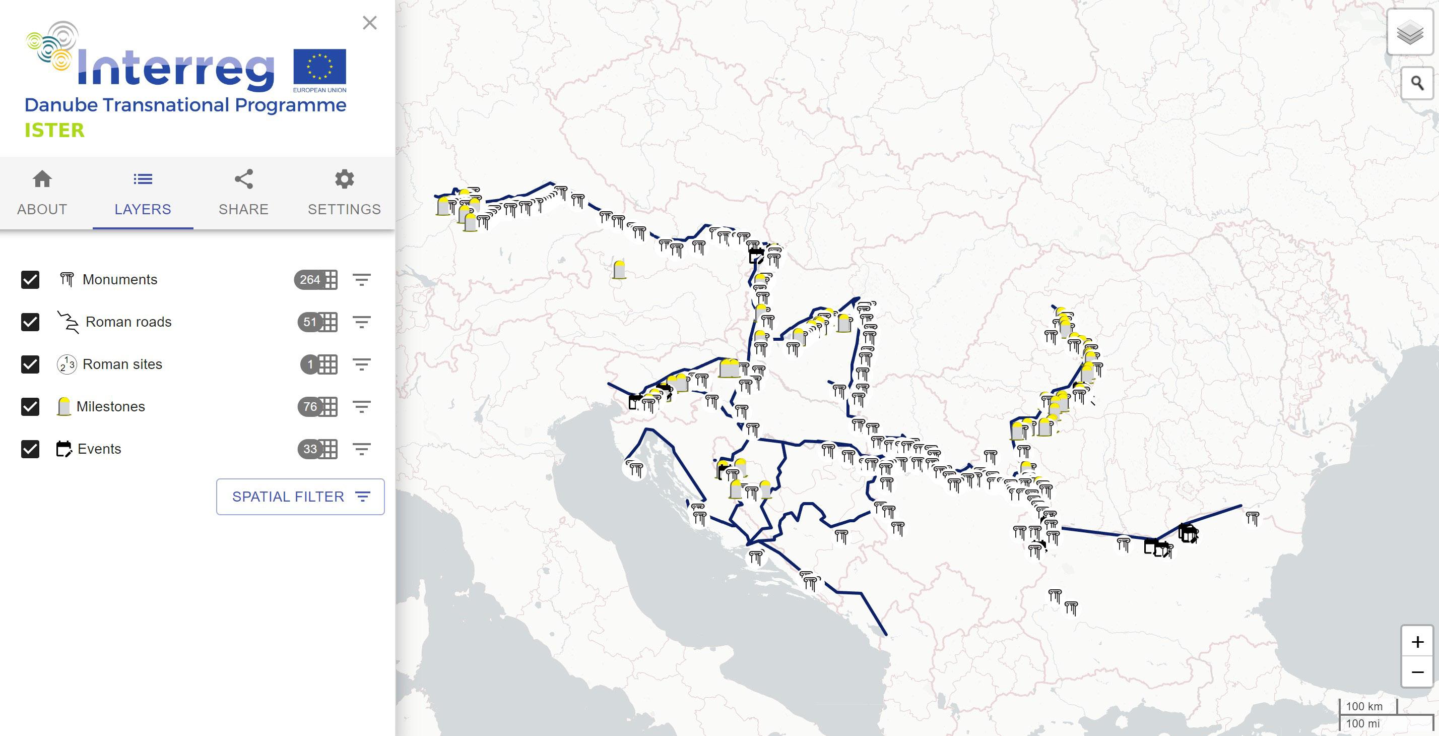
The atlas provides:
• Query tool over database items;
• Possibility to share the predefined queries;
• API interface for sharing the data (machine access and download of the data);
• Ability to add multimedia material for individual features (e.g. photos, articles, descriptions);
• Overview of the database and associated media material.
9
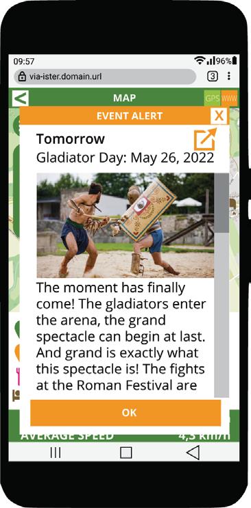
Transnational Interactive Tool (ISTER
App)
VIA ISTER transnational interactive tool is designed to promote the geo-referenced information on Roman sites and routes collected and stored in Territorial Atlas based on interactive maps.

ISTER app provides:
• Interactive geo-referenced maps of Roman Cultural Heritage (sites and monuments, roads and routes);
• Descriptions, pictures, illustrations and mulmultimedia elements of Roman Cultural Heritage;
• Up-to-date information about the surroundings, especially tourist information (places to eat, places to stay, potable water sources, toilets, public transport, events and other attractions);
• Walking and cycling routes related to Roman Cultural Heritage.
https://www.via-ister.eu/
11
Pilot Actions
Pilot actions are the results of the testing phase of the Interactive digital tool - ISTER App for the Roman eco-cultural route. They aim at connecting the digital app with the physical investments in the pilot sites. The Roman Milliars will exist in both digital and physical environments and will help the users customize their trip and monitor the physical progress in the digital environment.


12
Policy Handbook
Based on the experience of the ISTER project, the handbook shares findings and recommendations to the communities in the Danube Region and at the EU level.
It contributes to building the capacity of multi-level stakeholders and formulating the conditions of the regulatory framework through policy integration measures.
It contains good transnational practices regarding practical, technical and organisational/management aspects of (Roman) cultural heritage asset management, aiming to create homogeneous tools and strategies for protecting, valorising and sustainable use of cultural heritage and resources.
Horizontally
Cross-sectoral
Vertically
Territorially
Challenges and Opportunities at Danube Region level
Challenges and Opportunities for each partner country
CBW conclusions
Policy survey answers
13
Policy Integration
Policy Design
Policy Communication
Best practices / Documented Cases (from the partners countries / other european examples)
Connection between Policy and Regulatory Framework and Common Benchmarking Toolkit
(1) What are the links/potential links between cultural heritage (RCH) and other domains?
(2) How this links can be strengthened in order to achieve an eco-cultural route?
(3) How different policies at the same level (DR, national, regional, local) can be connected in order to assure truly sustainable development?
(1) Why is neccessary the coordination between different decision-making levels (transnational, national,regional,local) in the process of policy development for a cultural route?
(2) How this coordination can be ensured? What potential governance schemes can be applied?
What concrete measures can be taken for the integration of the policies at the territorial level?
Guidelines for successful practices at Danube Region level ( Protection, Preservation, Management, Sustainable Use)
Guidelines for successful practices for each country ( Protection, Preservation, Management, Sustainable Use )
(1) How the communication to wider group of stakeholders can be assured to support inter-institutional dialogue ?
(2) What are the communication channels/platforms?
(3) How to communicate the policy implications both to the groups of stakeholders “affected” by the policy measures and the authorities body (in charge of policies/strategies implementation at different levels)?
(4) How to bridge the gap between different groups of stakeholders and public administration bodies in order to increase multi-level capabilities and skils for policy implementation?
14
Memorandum of Maintenance
The project outputs, platforms, handbooks and tools were developed in close collaboration with target users. However, priorities, needs, and requirements can change over time. The further sustainability of ISTER's digital tools depends on the continuation of the collaboration and updating after the end of the project.

One of the instruments to ensure the project sustainability is the Memorandum of maintenance of the ISTER-GIS based Atlas and Interactive App.
By signing the Memorandum of maintenance for the two ISTER tools, relevant stakeholders (museums, cultural organisations, public bodies etc) show the intention of integrating these tools into their local, regional and national-level policies.
15
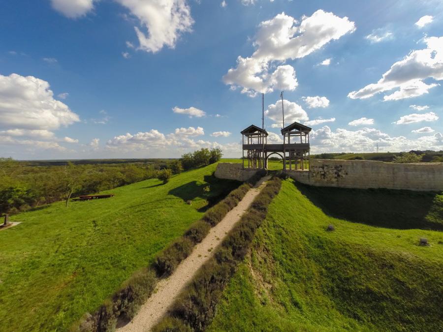
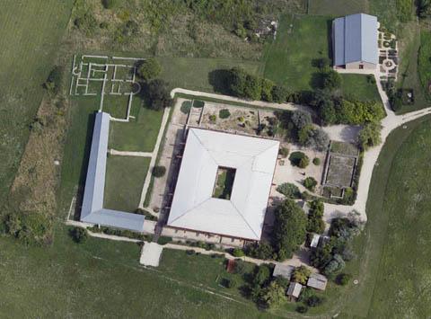
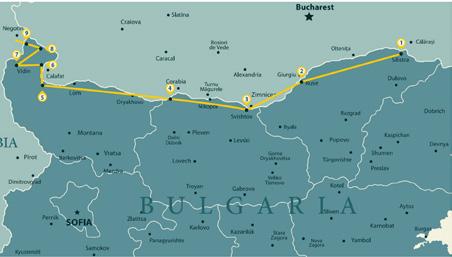
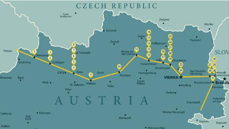
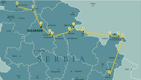
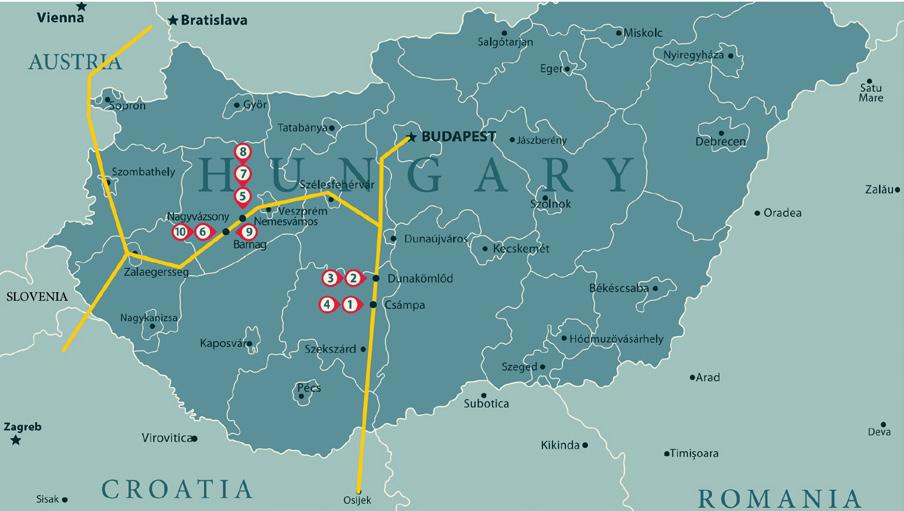
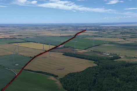
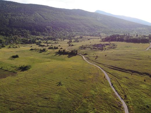
Aerial photography, field trips and excavation work
The ISTER project identified sectors of Roman roads from selected areas in partner countries that are too faint, too large or too discontinuous to be assessed at ground level using non-invasive research methods in modern archaeology.
Aerial photography provided valuable visual information and contributed to a better understanding of Roman roads' territorial layout and the landscape's features. It was carried out by a light plane and a drone equipped with a camera and thermovision to get lovely bird's-eye views. Alongside the aerial photography activities, the ISTER project carried out a series of field trips and excavations to identify the preserved Roman road sectors that meet the conditions for valorisation.
16 ©MNIT
- Oštrelj


17
Kolunić
Kulen Vakuf - Kalati
1.
2.
3.


18
Prnjavor
4.
5.
6.
1. Parndorf (AT)
2. Amber Road, Gyöngyösfalu (HU)
3. Crumerum (HU)
4. Ercsi (HU)
5. Decea (RO)
6. Nădășelu (RO)
7. Sutor (RO)
6.
©MNIT
7.


19
Category 1 – Protection and Preservation of Roman Heritage
1st Prize Winner: National Museum of Uzice,
Project: Protection and Preservation of ancient monuments in the Lapidarium
Category 2 – Promotion and Valorisation of Roman Heritage
1st Prize Winner: National Museum of Unification in Alba Iulia (Romania)
Project: PANTHEON 3D
Category 3 –Sustainable Use and Development of Roman Heritage
1st Prize Winner: Regional Administration Vidin (Bulgaria)
Project: Network for Sustainable Mobility along the Danube/ Transdanube.Pearls
The ISTER Awards Ceremony took place on 23rd of February 2022, in Aalen (Germany).
20
Workshops
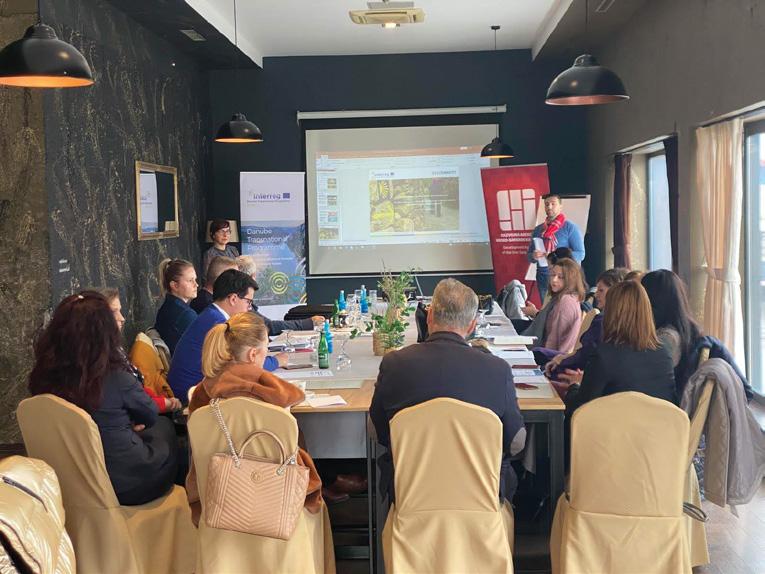
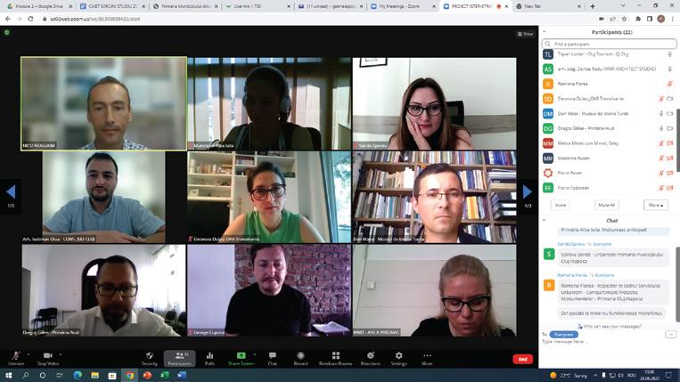
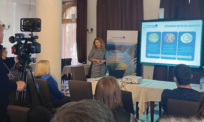
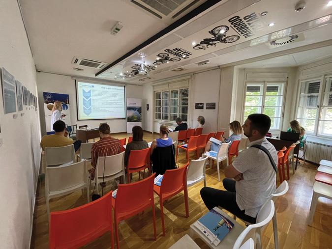
30 Local capacity-building workshops (CBW) were organized to enhance the capabilities of local multi-layered stakeholders to create a capable, strong horizontal governance chain.

Module 1: Roman Route heritage as a driver for tourist, local/ regional development
Module 2: Roman Route heritage as an enabler for policy and regulatory framework


Module 3: Roman Route heritage as a means for exchange and collaboration
9th of February 2022, Hangvilla Multifunctional
of February 2022,
21
8th of December 2021, SRC BISTRA Ptuj (Slovenia)
11th
City Museum of Ljubljana (Slovenia)
Community Space in Veszprém (Hungary)
©Attila Domján
17th of January 2022, Belgrade (Serbia)

28th
22
3rd of May 2022, the village hall in Buch Rainau (Germany)
14th December 2021, Development Agency of the Una-Sana Canton (Bosnia and Herzegovina)
15th of December 2021, city of Vidin (Bulgaria)
26th of May 2022, in cultural institution Parobrod in Belgrade (Serbia)
of June 2022, AIM and MNIT, zoom (Romania)
16th of March 2022, SRC BISTRA Ptuj (Slovenia)

5th of May 2022, Museum of Paks (Hungary)

15th of November 2021, Veszprém (Hungary)
1st of June 2022, SRC BISTRA Ptuj (Slovenia)


3 module training in 8 DR countries organised by 10 project partners

18th of May 2022, Veszprém (Hungary)

23
©Attila Domján
©Attila Domján

 15th of November 2021, Laczkó Dezső Museum, Veszprém (Hungary)
12th of July 2022, Adult Education Centre in Aalen (Germany)
15th of November 2021, Laczkó Dezső Museum, Veszprém (Hungary)
12th of July 2022, Adult Education Centre in Aalen (Germany)
24
11th of May 2022, Belgrade (Serbia)
©Attila Domján
Development and tools
Practical guide for stakeholders mapping
The guide reveals different methodological guidelines and tools for identifying stakeholders in the field of Roman Routes and settlements’ heritage at the local level of the consortium territories.
The framework provides a deeper understanding of stakeholders’ interests, influences, and information exchange relationship linkages based on an importance/ influence matrix and interest analysis.

•
25
• Policy and regulatory report analyses the trends and conditions for the protection and valorisation of Cultural Heritage (Danube Region and EU level), the current policy framework in partner cities / regions / countries regarding the protection and valorisation of heritage values, with an emphasis on the physical heritage of the Roman network of routes and settlements.
The report provides a set of best practices / successful examples regarding current policies, plans and regulatory instruments for the protection, development and valorisation of Roman routes and the network of settlements as a cultural route.

26
Common Benchmarking Toolkit encloses a series of practical methods, policy guidelines, mechanisms and recommendations with high potential for testing, replication and creative pictures for increasing competencies in identifications and evaluation of cultural routes, as well as establishing new common approaches toward Roman eco-cultural routes development, use and valorisation in Danube Region.

Cross-learning Modules Toolkit includes a set of materials to provide support to the partners conducting the local CBW addressed to the MLSG.
The tutoring guidelines successfully address the gaps and challenges related to the accessibility, use and valorisation of Roman routes and settlements network in DR and align sectoral visions and documents related to spatial planning, land use and environmental protection.

•
•
• ISTER Video Documentary
The video-documentary ISTER was developed as a transnational marketing tool for broader use and distribution, including a collection of footage from different moments during the project, and promotes the connection between the individual and collective identity of the Roman Eco-Cultural Route, emphasising the local products and experiences in ISTER partner cities and countries.
28
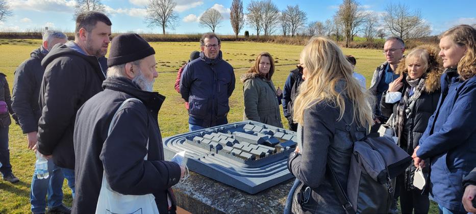
Small-scale investments

Small-scale investment within the ISTER project involves areas from all partner countries and responds to transnational and local/regional challenges related to the network of Roman Routes and settlements valorisation. As part of the ISTER project, 8 partners from 6 countries installed 40 milestones or metal plates along ancient Roman roads. A QR code for the ISTER app is engraved on the bevelled side of the metal plate.
Placing a Roman-inspired milestone along the Ancient Roman Road (called miliarium) aims to increase the visibility of the remaining heritage, especially in the unexcavated areas and contribute to the transnational branding for the entire Danube Region, as the Roman milestones will be recurrent elements along the route.


Milestone prototype in Hungary 30
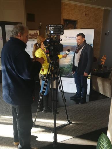
Communication, dissemination and capitalisation
All consortium partners implemented communication, dissemination and awareness-raising activities during the project's life cycle. The promotion of project results, initiatives and events was carried out by providing consistent and targeted messages in English and the national languages of the consortium countries through the existing DTP website, project and partner communication channels and active interaction with appropriate traditional and social media.

Impact:
• networking and stakeholders’ involvement;

• intensive cooperation with other synergistic projects and initiatives;
• interaction with the press and media;
• involvement in the local communities development;
• contribution to active social inclusion.
23rd
(Hungary) 31
of July - “Csikasz Picnic, Veszprem
7-10th of September 2021, REAL CORP 2021 Conference, Viena (Austria)

9th of September 2021 - Ecology Fair EKOBIS 2021, Bihać (Bosnia and Herzegovina)
28th of June 2022 - Introducing the ISTER project during a DTP AGORA Workshop Slavonski Brod (Croatia)


32
©Attila Domján
Results
• 1 final publication
• 2 scientific publications
• 2 non-scientific publications
• 5 e-newsletters
• 17 awareness-raising events
• 40 promotions of the ISTER project on external events

• 1000 publications in traditional and social media in 8 languages
• оver 300 000 views and impressions
Тransnational Capitalisation Workshops
The consortium partners participated in the three transnational capitalisation workshops held in Alba Iulia (Romania), Aalen (Germany) and Carnuntum (Austria) during the project duration. The events facilitated better understanding and internal collaboration. The workshops expanded the ISTER network on a broader scale by establishing links outside it with synergistic projects / initiatives and designing a joint roadmap for follow-up opportunities.

22-24th
4 – 6th of July 2022, Carnuntum
(Austria)
15 - 16th of September 2021, Alba Iulia (Romania)
19
of February 2022,Aalen (Germany)

22 – 24th of February, 2022 Aalen (Germany)

Special thanks to the project consortium! 26 project partners 15 financing project partners 11 associated strategic partners
©Attila Domján
Consortium meeting
13-15th of September 2022, Veszprem (Hungary)
ISTER aims to revive a 2000-year-old heritage by putting the “Roman roads” back on the map and developing a pedestrian-friendly route by following the traces of Romans. The route aims to revive the local rural economy, connect communities with the heritage and transform neglected areas into focal, vivid points on an eco-cultural corridor along the Danube Region.
www.interreg-danube.eu/approved-projects/ister www.facebook.com/ISTER
www.twitter.com/interregISTER
www.linkedin.com/in/interreg-ister-2610741b7
Project co-funded by European Union funds (ERDF, IPA)
©MNIT ISTER

