91 minute read
Chapter 3 Coastal change and management
Coastal change and management Coasts are areas where the land meets the sea. Home to more than one billion people around the world, coastal areas are some of the most visited and heavily populated areas on the planet. Human activities in coastal areas have affected many of the natural environmental processes there. This has led to a wide range of issues including a loss of biodiversity, high levels of pollution, erosion, and rising sea levels due to climate change. In fact, coasts are one of the Earth’s most threatened environments. Coasts are critically important – not only to the people who live along them, but also to the health of the planet. Around the world, geographers are playing a vital role in developing strategies to manage these problems and protect coasts for future generations. 3CHAPTER DRAFT ONLY - NOT FOR SALE
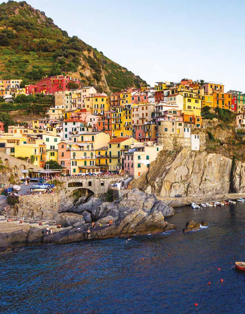
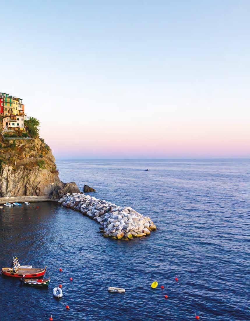
Source 1 The Cinque Terre coast in Italy faces a range of management issues. The most pressing of these is the impact of the 2.5 million tourists who visit the area’s five villages each year.
3A How is the coastal environment changing? 3B How can coastal changes be managed? 3C DRAFT ONLY - NOT FOR SALE How can geographers help to manage coastal changes?
3.1
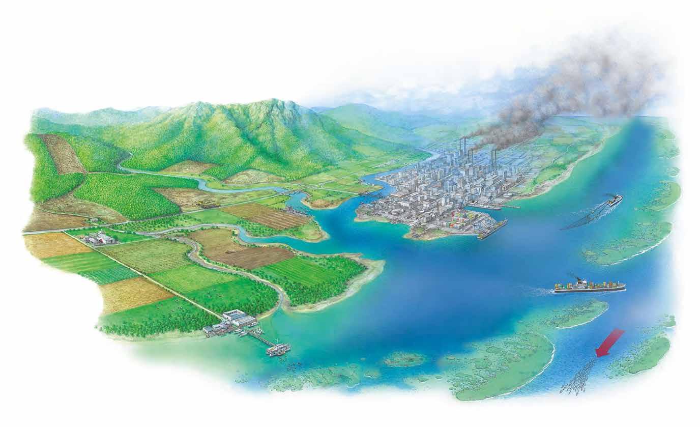
Declining freshwater flows in rivers, due to water extraction for farming and by urban users, impact on coastal lagoons and estuaries. Sea levels are rising as a result of climate change. This increases coastal erosion particularly during storms, and reduces habitat for coastal plants and animals.
Increasing populations, particularly in coastal areas, bring widespread and significant change to the coastal environment. Examples include building marinas, harbours, ports and breakwaters. Coastal visitors may impact on the coast, with activities such as snorkelling and scuba diving.
In this topic, you will: » identify and describe the changing features of coastal environments. Flat, fertile land near the coast is often intensively farmed.
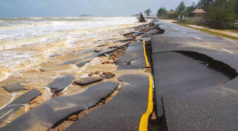
Coasts are very dynamic places – they are constantly changing. Crashing waves, strong currents, tidal waters and hazards (such as storms and tsunamis) all transform coastal environments. People also bring about many changes to these environments. From simple activities, such as walking between villages on the Cinque Terre coast (see Source 1 on the previous page), to complex activities, such as the construction of shipping ports and sea walls, humans have serious effects on coastal areas. In many cases, these activities are responsible for sea wall coastal degradation. a solid wall built along the coast to protect the land from erosion by the sea coastal degradation the deterioration of a coastline due to human effects such as pollution, population change and tourism
Change in coastal environments DRAFT ONLY - NOT FOR SALE
Pollution from inland sources such as farms, cities and industries is carried to coastal estuaries and river mouths by rivers.
Desalination plants change the salinity of water in the local area.
Warmer waters means that fish that thrive in cooler waters move away from their usual habitats.
This can cause the starvation of other animals and birds and the death of coral.
Coastal degradation can be observed on many scales. It may be local, such as when litter is dropped on a popular holiday beach, or regional, such as when an oil spill washes ashore along hundreds of kilometres of coastline. The effects of coastal degradation are varied and can include the loss of plant and animal species, or the arrival of an invasive species that permanently affects biodiversity in the area. Examples of coastal degradation can include sand dunes being washed into the sea and changing the coastline, or blooms of toxic algae damaging the marine environment. Source 1 provides an overview of some common forms of coastal degradation.
Over the course of this chapter, we will be exploring some of the changes that are having the greatest impact on coastal environments. These include climate change, population growth in coastal areas, and the loss of coastal biodiversity. Land is often reclaimed from the sea in areas where flat land is in short supply. Overfishing of certain species by commercial trawlers destroys natural ecosystems. Invasive species from both the land and the sea impact on coastal ecosystems. Ballast water carried in ships can transport invasive species around the world. Harbours are dredged to allow larger ships to reach ports.

invasive species a plant, animal or other organism that is not native to an area and whose introduction has negative effects on its new environment biodiversity the variety of living organisms (e.g. plants, animals, bacteria and fungi) found in an environment 3.1 CHECK YOUR LEARNING Review and understand 1 Identify two of the changes currently affecting coastal environments. 2 Are coastal environments close to cities more at risk from degradation than those in remote areas? Explain your answer. Apply and analyse 3 The three main indirect drivers of environmental degradation at the coast are climate change, population growth and economic growth. Look closely at Source 1. a Classify each of the examples of coastal degradation shown according to one of these three drivers. b Are there any changes to the environment in Source 1 that could not be classified in this way? Explain your answer. c Identify the type of driver that appears to be responsible for most of the changes shown. d Classify each of the changes shown according to whether they are taking place on a local, regional, national, international or global scale. 4 Apply the geographical concept of interconnection and describe the links between changes on the land and changes at the coast. Evaluate and create 5 a Select one of the causes of coastal degradation shown in Source 1. Suggest DRAFT ONLY - NOT FOR SALE one strategy to solve the problems this creates. b Evaluate the strengths and weaknesses of the strategy that you proposed in question 5a.
3.2
Natural coastal processes
In this topic, you will: » develop your understanding of the natural processes that shape and change coastal environments » evaluate the effects of environmental change on these natural processes.

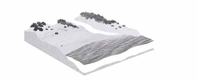
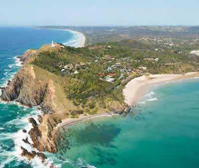
While this chapter focuses primarily on the ways in which human activities bring about changes to coastal environments, it is important to remember that natural processes are also constantly shaping and changing the coast. Rocks are eroded and material such as sand is transported by the energy of waves, tides and currents, creating a dynamic landscape that is constantly evolving. All this change means that coasts are very complex environments to study and understand. A dynamic balance Geographers often use models – such as the systems model – to understand environments, study the relationships between environments, and learn more about the intricate forces that cause changes. To apply a systems model to a coastline, each individual landform is considered to be a separate compartment. Energy (such as wind and waves) and matter (such as water and sand) are studied as they arrive at and leave each compartment. Arriving energy and matter are referred to as inputs, and leaving energy and matter are outputs. If the inputs of matter are greater than the outputs, then landforms – such as dunes and spits – increase in size and the coast grows outwards. If the outputs are greater than the inputs, then landforms decrease in size and the coast retreats (see Source 3). mining removes sand from the beach longshore drift transports sand away from the beach sand sand is lost through rips, especially during storms
wind erodes sand from dune forming rivers bring silt, mud and sand, especially during floods management bodies replenish the beach blow-outs cliff erosion waves erode dunes during storms loose rock rip current
destructive waves
longshore drift transports sand onto beach from sand is deposited into another part of the coast bays and estuaries
constructive waveslongshore Source 2 Cape Byron, the easternmost point on the Australian mainland, is a dynamic coast. On the eastern side of the cape, large waves are eroding the coast, while on the more sheltered western side, smaller waves are depositing sand on a series on beaches. DRAFT ONLY - NOT FOR SALE drift current
Dynamic equilibrium
Energy inputs on the coast – the waves and wind – often erode and transport matter, particularly sand. When matter is transported, the shape of the beach changes. When inputs and outputs are in balance, the shapes of landforms remain unchanged. This is known as dynamic equilibrium. When dynamic equilibrium does not exist, inputs and outputs do not remain in balance, and the landscape changes.
During a storm, energy inputs increase and so erosion occurs. Matter – such as sand and rock – is eroded and transported offshore, and the shape of the beach changes. Once the storm ends and the energy inputs return to ‘normal’ again, dynamic equilibrium returns. The beach will remain unchanged for as long as the energy inputs remain constant.
For more information on this key concept, refer to page 11 of ‘The geography toolkit’.
KEY CONCEPT
Change
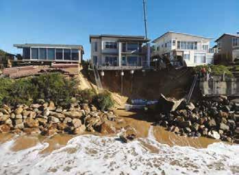
Source 4 In July 2020, a series of storms hit the east coast of Australia, eroding large areas of coastline. In the town of Wamberal, New South Wales, several homes had their foundations washed away and became uninhabitable. These storms are an example of how the dynamic equilibrium in this environment was disrupted by an increase in energy. 3.2 CHECK YOUR LEARNING Review and understand 1 Identify the main energy and matter inputs in coastal environments. Apply and analyse 2 Apply a systems model to describe the changes that are taking place in Source 2. 3 Look at Source 4. a Identify and describe the evidence present for the movement of sand. b Explain how this movement has changed the shape and location of the coastline. c Describe evidence in this photo that shows people have tried to control the movement of sand. 4 Select a coast that you know well (or one that you have visited on a field trip).
Describe the energy and matter inputs
and outputs in this environment and explain how these have shaped the coastline. (For example, a series of sand dunes may have been formed by low-energy waves bringing sand from a river mouth.) Evaluate and create 5 While many coastlines were heavily eroded by the east coast storms in 2020, others hardly changed. a Brainstorm some reasons why variations exist in the way coasts change. b Rank your reasons from the one most likely to explain these variations to the one least likely. Justify (give reasons for) your rankings. 6 Create a field sketch of Source 2. On your sketch, label the individual compartments that geographers would study.
landform a natural geographical feature or shape on the Earth’s surface (e.g. a dune, hill, valley, beach or cave) spit a narrow, low-lying tongue of sand or other eroded material attached to the coastline at one end erosion the wearing away of the Earth’s surface by water, wind and ice Key skill worksheet Conducting fieldwork: Measuring longshore drift DRAFT ONLY - NOT FOR SALE
3.3
Climate change and coasts
In this topic, you will: » describe the causes and consequences of climate change on coastal environments.
The world’s climate is changing. Human activities such as land clearing and fossil fuel burning have increased the amounts of carbon dioxide in the atmosphere. This is leading to a global increase in the temperature of both the atmosphere and ocean.
Coastal systems are undergoing greater change than virtually any other environment. As the interface between the land and the sea, coasts face pressures from changes in both of these places. Source 5 summarises the effects of climate change on coastal areas.
One of the greatest concerns for Australian coastal areas is the rising of sea levels. climate change a change in global or regional climate patterns; in particular, a change apparent from the mid to late twentieth century onwards and attributed largely to the increased levels of atmospheric carbon dioxide produced by the use of fossil fuels
Changing rainfall patterns
Rising sea levels Erosion & accretion Storm surge Infrastructure damage
Rising sea surface temperatures Ocean circulation Storminess Algal blooms Coral bleaching
More carbon dioxide absorbed in the oceans Ocean acidification Habitat loss Coral reefs are or altered bleaching & distribution reef-building animals are dying
Saltwater intrusion changes ecosystems (e.g. wetlands become salt marshes) Increased coastal erosion
Increased storm intensity Mangrove erosion beach mangrove salt marsh Source 5 The influence of climate change on the coast Australia’s rising seas It can be difficult to convince people that sea levels are rising. This is because ocean and coastal waters are constantly changing, as waves, tides and currents keep them in movement. DRAFT ONLY - NOT FOR SALE Also, sea levels are rising very slowly. This does not mean that they are not rising. In fact, sea levels have been rising for at least a century. Scientists use a combination of tide gauges and new technologies such as satellite altimeters (instruments used to measure altitude) to monitor and measure sea level changes. These measures show that sea levels have risen by about 30 centimetres since 1900, with about one-third of that rise occurring since the year 2000. 92 OXFORD HUMANITIES 10 VICTORIAN CURRICULUMNo part of this publication may be reproduced, stored in OXFORD UNIVERSITY PRESSa retrieval system or transmitted in any form or by any means.
aUsTRalIa: sea leVel RIse, 1993–2019
LEGEN D
Sea level rise (cm/decade) Over 7 6 to 7 5 to 6 4 to 5 3 to 4 2 to 3 Under 2 0 750 1500 km Source 6 Sea levels have risen around Australia. Source: Oxford University Press The physical impact of rising seas An Australian Government report in 2011 stated: Sea levels are rising around Australia. A sea-level rise of a metre or more during this century is plausible. It could be less or much more. Between 16 000 and 250 000 individual homes are potentially at risk of inundation from a 1.1 metre rise in sea level.
As well as the risk to homes situated on the coastline, rising sea levels are causing: • an increase in the erosion of beaches, with some beaches at risk of disappearing completely • an increase in the incidence of flooding in low-lying coastal areas • salt water to enter coastal aquifers, destroying freshwater sources • an increase in the severity of extreme weather events such as cyclones, bringing with them increased incidences of serious storm damage. Coastal squeeze As sea levels rise, important coastal ecosystems such as mangroves and salt marshes respond by retreating inland. However, in many places, sea walls and other coastal structures mean they cannot move and are therefore trapped in a narrowing strip of land. This process is known as coastal squeeze. It has led to healthy salt marshes and mangrove forests – which are highly effective natural barriers to erosion – being killed off by built structures that, in many cases, are much less effective at controlling erosion.
ecosystem a complex community made up of living organisms that interact with each other and with their environment 3.3 CHECK YOUR LEARNING Review and understand 1 In your own words, define coastal squeeze. What causes this problem? 2 Explain why coastal erosion is expected to increase as sea levels continue to rise. Apply and analyse 3 Look closely at Source 6. Describe the regions of
Australia that experienced the greatest rises in sea levels from 1993 to 2019. 4 Create four further annotations for Source 5. They should provide additional examples of the impacts that rising sea levels and sea surface temperatures will have on natural and human environments. 5 Visit the Coastal Risk Australia website (a link can be accessed via your obook pro) and use its maps to: a identify the predicted sea level rise in a capital city or region of your choice b describe what impacts the predicted sea level rise by 2100 would have.
Weblink Coastal Risk Australia DRAFT ONLY - NOT FOR SALE
3.4
In this topic, you will: » examine the impact of climate change on australia’s great
Barrier Reef. Queensland’s Great Barrier Reef (GBR) is not only one of the world’s most beautiful natural treasures, but also one of its most important. Extending over 2300 kilometres and 14 degrees of latitude, the reef contains over 2900 separate coral reefs and some of the world’s most extensive mangrove and seagrass ecosystems. But the combined effects of a changing climate – ocean acidification rising sea temperatures, rising sea levels, ocean acidification and extreme weather events – are the ongoing decease in causing problems for this remarkable natural environment.the pH level (a measure of acidity and alkalinity) of the Earth’s oceans, Rising sea temperaturescaused by the uptake of carbon dioxide from the The GBR lies in the Coral Sea off the Queensland coast. Studies show that the current atmosphere by the water temperatures of this sea are warmer now than at any time over the past 300 years. On average, temperatures are 1.0°C warmer than they were in the late 1800s. As average temperatures rise, warm weather events heat the sea surface to a temperature that coral polyps (the tiny organisms that construct the coral reef) cannot tolerate. The coral polyps feed on algae, but the warmer water temperature causes a build-up of poisons in the algae. To survive, the polyps expel the algae on which they feed, as well as some of their own tissue. This process turns the coral white and is known as coral bleaching.
The impact of climate change on the Great Barrier Reef mass BleaChIng eVenTs on The gBR In 2016 and 2020 Cairns Townsville
Queensland
Mackay
Cairns Townsville Mackay G r e a t B a r r i r R e e f Coral Sea Queensland G r e a t B a r r i e r R e e f Coral Sea 2016 2020 Key skill worksheet Analysing maps: Analysing change over time e DRAFT ONLY - NOT FOR SALE LEGEN D
Most severe bleaching No or negligible bleaching Rockhampton
0 200 400 km Rockhampton
In 2016, a mass bleaching event associated with a marine heatwave killed over a quarter of the GBR’s coral. A similar heat wave occurred in 2020 (see Source 7). As bleaching events become more frequent, the corals will not have time to recover and whole reef ecosystems will collapse (see page 50 for more information on Australia’s collapsing ecosystems). Rising sea levels As the climate warms, land ice is melting. The water from this melting ice ends up in our oceans. Rising sea temperatures are also causing the ocean to expand because of the warmer water.
In the Coral Sea, sea levels are rising by about 3 millimetres per year. This is expected to have little impact on the coral reefs as they can grow upwards by about 6 millimetres per year. Surrounding ecosystems, however, are likely to be severely affected. As salt water intrudes further 3.4 CHECK YOUR LEARNING inland, environments such as mangroves and freshwater lakes are expected to change significantly. Low-lying islands are also expected to Review and understand disappear beneath the rising seas, changing the distribution of nesting 1 Identify four effects of climate change. birds and turtles, and hastening the extinction of mammals and reptiles. 2 Describe the impact of climate change The Bramble Cay melomys became the first mammal made extinct by on the following: climate change when its tiny island in the GBR was inundated with a nesting birds sea water. b reef-building animals c coral polyps. Ocean acidification Apply and analyse Ocean acidification can have dire consequences for a coral reef. As 3 Examine Source 7. carbon dioxide is absorbed into the ocean, it reduces the amount a Describe the distribution of most of carbonate (a kind of salt) in the water. Marine animals need this severe bleaching in 2016. carbonate to make their shells and skeletons. Reef-building animals such b Compare this to the 2020 mass as coral polyps then use these shells and skeletons to create a reef. With bleaching event. fewer shells and skeletons available, construction of the reef is seriously c Brainstorm possible reasons why the limited. Over the long term, ocean acidification is expected to be the distribution of the areas most severely greatest challenge facing the GBR. bleached in 2016 and 2020 differs. Evaluate and create Extreme weather events 4 Rank the four impacts of climate change Increases in the severity and frequency of flooding and tropical cyclones also pose serious threats to the reef. Flooding brings increased described in this topic from the one likely to have the greatest impact on the GBR to the one likely to have the least impact. sediment to the GBR, and this sediment smothers plants. Pesticides and Write a paragraph justifying your ranking. other chemicals are also carried by floodwaters, adding to the levels of 5 Imagine that the GBR disappeared pollution in the water around the reef. due to the combined effects of climate
Cyclones generate large and powerful waves that damage corals and change. How would this affect the the reef structure. Reefs are able to recover from these natural events, Queensland coast and the Queensland but they need time to do so. As extreme weather events become more economy? Justify your answer. frequent, reefs have less recovery time.
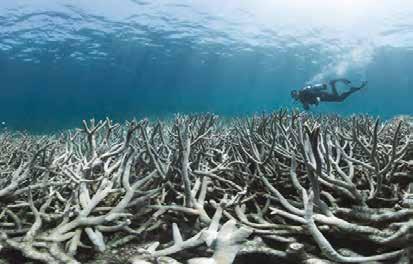
Source 8 An example of mass coral bleaching on the GBR DRAFT ONLY - NOT FOR SALE
3.5
In this topic, you will: » examine the impact of population growth on coastal landscapes.
Over one-third of the world’s population – that is, nearly 2.4 billion people – live within 100 kilometres of the coast. Most of the world’s megacities in both the developed and developing world are located on the coast, and many of them are growing rapidly. In China, for example, 1000 people per day move to coastal cities from the country’s interior. The impact of billions of people in millions of coastal cities, towns, villages and farms has megacity a city with a population caused one United Nations expert to state that ‘humankind is in the process of annihilating of more than 10 million coastal and ocean ecosystems.’ people The coast has always been an attractive place for human settlement. Coastal regions groyne provide access to food and water, and people have long used ocean-going boats and ships for a human-made barrier transportation. But the growing number of people along the coast – together with increasing that juts out from the beach into the water, built levels of trade and movement between settlements – have had many detrimental effects on to prevent erosion of the coastal ecosystems: beach from the power of • Engineering structures such as sea walls, groynes, breakwaters, training walls and marinas destructive waves and longshore drift have hardened the coast and changed natural cycles of erosion and deposition. breakwater • Changing the natural flow of water by deepening channels, diverting rivers and building a wall built out into the sea dams has altered the amount of fresh water and sediment arriving at the coast, impacting on to help prevent large waves natural ecosystems and landforms.from reaching the coastline and causing erosion • The discharge of sewage into the ocean, the run-off of fertilisers from farms, and other deposition contaminants entering coastal waters have caused pollution in the oceans. the laying down of solid • Increased numbers of people in coastal areas have led to over-fishing of fish and shellfish. material that has been eroded and transported In some places, coastal fish stocks have fallen by 90 per cent in the past 30 years. from another part of the • Ports are often an entry point for invasive species that bring dramatic changes to coastal Earth’s surface ecosystems. • The presence of large numbers of people on beaches has an impact: people leave litter on beaches, they walk over native plants and impose walkways, they can destroy breeding areas estuary of sea birds and bring predators such as dogs into the environment. a wide tidal mouth of a river Continued growth and competition for land land reclamation the process of creating new Many coasts have been converted from natural ecosystems to human landscapes. Cities need land from oceans, bays, space to grow and harbours for trade and transport. Mangroves, marshes and estuaries have been harbours and estuaries by dumping rocks, silt drained and filled in, sand dunes flattened and built over, and communities of coastal plants from the sea bed or other cleared. In some places, land for expansion has been so scarce that new land has been built in bays materials into the water and estuaries from rocks, rubbish and silt from the sea bed. This is known as land reclamation.
The impact of population growth on coasts Source 9 Mangroves DRAFT ONLY - NOT FOR SALE once covered most of Singapore’s coast; now only 5 per cent remains.

Singapore
CASE STUDY
3.5 CHECK YOUR LEARNING Review and understand 1 In your own words, define land reclamation and explain why it is used. 2 Describe the changes to coastal ecosystems as a result of coastal city growth. Apply and analyse 3 Use an atlas to locate the world’s megacities and identify the following: a megacities located on the coast b megacities located on river mouths or estuaries. 4 Suggest two reasons why the impacts described in this topic would be particularly serious for small island communities. Evaluate and create 5 Would the population impact on coasts be greatest in developing or developed countries? Discuss this with a partner and then with the class. 6 Create an overlay map of Singapore, using Source 10. On the base map, show the natural outline of the island. On the overlay, show the total area of reclaimed land. Describe the spatial change over time shown on your map. 7 Use Google Earth to explore the coastline of Singapore (a link can be accessed via your obook pro). Estimate the percentage of the coastline that is: a heavily modified (for example, reclaimed land) b lightly modified (for example, where sea walls or groynes have been constructed) c not modified.
In the past 50 years, one of the world’s smallest countries has grown in size by almost a quarter. In the island nation of Singapore, 85 square kilometres of land has been reclaimed from the sea.
In the beginning, walls were built from rocks in the shallow bays and estuaries surrounding the island, enclosing areas that were then filled with sand. However, Singapore soon ran out of sand for this project and began importing it from neighbouring countries, such as Indonesia, Malaysia and Cambodia. It imported millions of tonnes of sand from these countries over a period of several decades. Concerned with the environmental impacts of dredging sand from rivers and beaches, the exporting countries banned the practice.
As a result, Singapore changed its method of reclaiming land. Now, huge Weblink Google Earth
concrete walls are built in the sea and enclose the area to be reclaimed. The sea water is then pumped out, and a smaller amount of sand and other materials is used to bring the new land above sea level. Singapore plans to reclaim another 60 square kilometres of land by 2030. sIngaPoRe: eXTenT oF ReClaImed land Jurong Jurong River Jurong Island Seletar Pulau Ubin Pulau Tekong East Coast Sentosa Kallang Basin Pasir Panjang Punggol Pasir Ris Changi Tuas
MALAYSIA MALAYSIA
Johor
SINGAPORE
Clementi SingaporeRiver
Marina Bat Keppel Harbour Singapore Strait INDONESIA
Strait Land reclamation projects Completed Planned LEGEN D 0 500 1000 km Source 10 Source: Oxford University Press DRAFT ONLY - NOT FOR SALE
3.6
In this topic, you will: » examine the loss of coastal biodiversity as a result of coastal change.
The number of plant and animal species on a global scale is in decline because of human activities. Recent studies of three key coastal ecosystems – explored in detail below – reveal that all are declining in size and biodiversity. Coral reefs Coral reefs are home to one-quarter of the world’s fish species. Up to a billion people rely on ecosystem services the ecosystem services provided by coral reefs, including food, protection from waves and a term used to describe storms, and income from reef-based tourism. Despite their importance, the coral reefs are a range of important resources, processes under threat. One-fifth of all the world’s coral has died since 2015. and benefits that healthy As well as the threats from warmer sea temperatures causing coral bleaching, coral reefs ecosystems provide to are in danger from human activities (such as land-based industries that increase the levels humans of sediment and pesticides in the ocean) and invasive species (such as the crown-of-thorns starfish). Coastal development for tourism and cities, including land reclamation (see page 96), are also impacting on this vital ecosystem.
Loss of coastal biodiversity WoRld: CoRal ReeFs PRoJeCTed To Be aT RIsK In 2030 and 2050 2030 2050 0 2000 3000 km Risk level to coral reefs Low Medium High Very high Critical LEGEN D DRAFT ONLY - NOT FOR SALE
Source 11
Source: Oxford University Press
Geographers estimate that the world will lose 70 per cent of its living coral by 2030 unless there are significant changes to human activities.
Mangroves
Mangroves provide a wide range of crucial ecosystem services in many tropical areas, including supplying wood, protecting communities from the effects of offshore storms and providing a breeding ground for fish and crustaceans. Despite their importance, at least onefifth of the world’s mangroves have been lost since 1980 – an estimated area of 36 000 square kilometres. Countries such as Kenya, Liberia and Puerto Rico have already lost over 70 per cent of their mangrove forests. Mangroves have been cleared to make way for agricultural land (including palm oil plantations), harbours, housing and fish farms.
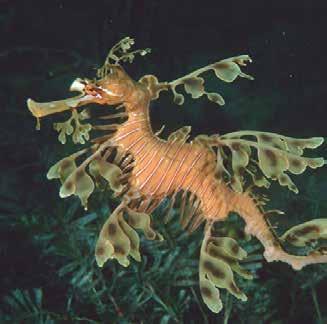
Mangroves provide natural protection from wave erosion. Geographers have voiced concerns that clearing them makes communities more vulnerable to the impacts of rising sea levels. Seagrass beds Seagrass beds are an important ecosystem for dugongs and manatees (both large sea mammals) and the leafy seadragon (see Source 13), as well as providing food for hundreds of other species. Seagrass beds are also important for stabilising sediments in the water, absorbing carbon dioxide and protecting against erosion. Over the past 200 years, about 30 per cent of the world’s seagrass beds have disappeared, many of them within the past few decades.
The main threats to seagrass beds and the biodiversity they support are the dredging of the sea bed, the development of tourist marinas, and water pollution from rivers and streams. 3.6 CHECK YOUR LEARNING
Review and understand 1 Describe the important role of mangroves in coastal landscapes.
Apply and analyse 2 What ecosystem services are provided by the three coastal habitats discussed?
Classify these as sinks, sources, services or spiritual functions (see page 48). 3 Examine Source 11. a Describe the distribution of the world’s coral reefs using the PQE method (see page 24 of ‘The geography toolkit’). b Identify the reefs that are projected to be most at risk by 2030. c Identify the reefs that are projected to be most at risk by 2050. 4 Refer to Source 10 on page 56. Identify the key drivers of biodiversity loss in coastal environments. Evaluate and create 5 Research the threats faced by one coastal species in Australia such as the dugong, orange-bellied parrot, coastal emu, grey nurse shark, marine turtle or sea snake, and present your findings to the class.
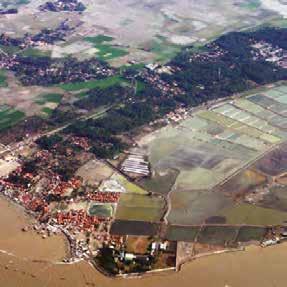
Source 12 Mangrove forests in Indonesia have been substantially cleared to make way for rice fields and shrimp farms. DRAFT ONLY - NOT FOR SALE Source 13 The amazing leafy seadragon is threatened by a loss of seagrass near Australia’s southern cities.
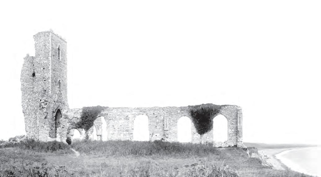
3A Dunwich’s disappearing RICH churches TASK Dunwich is a small coastal village located in south-eastern England. In the thirteenth century, it was one of England’s largest towns. Merchants traded wool, grain, fish, wine and furs across the North Sea to Iceland, the Netherlands and France. Dunwich had eight churches, three chapels and two hospitals. Large storms in 1286 and 1328 swept large areas of the town into the sea. Because so much material was deposited in the sea, the harbour was blocked by the growth of a large spit. Trade and fishing were ruined and the population declined. By 1347, a quarter of the town had been lost, and the remainder of Dunwich collapsed into the sea over the next few hundred years. Most of the original buildings have gone, including all eight churches. The last one disappeared early in the twentieth century (see Source 14). The coastline at Dunwich has receded, on average, 1 metre per year. Buildings that sit on top of the present-day cliffs above the eroding waves were once 2 kilometres inland. Storms, tides and longshore drift have all combined to make Dunwich a very different place today. Mapping environmental change using multiple overlays Creating overlay maps is a useful technique for showing and measuring environmental change. To complete a multiple overlay map, follow these steps: Step 1 Construct a base map of the region using the current topographic map. This should be traced rather than drawn freehand, to make it as accurate as possible. Include key natural and human features, such as the coastline, towns, roads and the extent of marshes. Step 2 Add labels such as the names of rivers and towns. Add a north arrow, legend, title, scale and source. Step 3 On a plastic sheet or piece of tracing paper, construct a map of the same region from the earliest map you
have at the same scale. Remember that this map will sit on top of your base map, so features such as rivers that have remained the same should line up. Step 4 Place the overlay map carefully on top of the base map and use a piece of tape like a hinge along one side to anchor the overlay in place. Step 5 Add a title to the overlay map that does not cover the one on the base map. A north arrow, legend, scale and source should not be needed as these are the same as for the base map. Step 6 Repeat steps 3–5 to complete an overlay from another map of the same region from another time. Hinge this KEY SKILL Collecting & representing data Source 14 The last of Dunwich’s old churches – photographed in 1908, shortly before it collapsed into the sea Revise the key terms you have learnt so far.DRAFT ONLY - NOT FOR SALE at the opposite side of the base map with a piece of sticky tape. For more information on this key skill, refer to page 26 of ‘The geography toolkit’.
Practise the skill
1 Construct a multiple overlay map using the current topographic map in Source 16 as the base map. For the first overlay, use the map from the year 200 ce in
Source 15. For the second overlay, use the map from 1587 (also in Source 15). Larger versions of these maps are available on your obook pro. 2 Describe the changes that occurred to this coastline between 200 ce and 1587. Was the dominant process during this time erosion or deposition? 3 Identify other features on the 200 ce map that might help to explain the dominant process that occurred between 200 ce and 1587. 4 Describe the changes that have occurred to this coastline since 1587. Is the dominant process erosion or deposition? 5 Estimate the area of lost land since 1587. Do this by multiplying the length of this strip of land by its average width.
Extend your understanding 1 Some ways to manage coastal change include building sea walls, groynes and breakwaters (see page 102).
Which of these measures would you recommend the local authorities adopt to manage erosion on this coastline?
Justify your answer. 2 Some Dunwich residents have voiced their support for a managed retreat to protect the coast. Research what a managed retreat is and decide if you agree with the residents that this is a solution. Use evidence from your research to support your decision. Map Dunwich: Changing coastline dUnWICh: ToPogRaPhIC maP 10 10 10
10 Blythe 0 BlytheRiver Water 0 10 20 NORTH SEA Westwood Marshes 20 Dingle 20 10 Dunwich River Marshes 20 20 30 Canal Southwold London Road(165km)A12 Blythburgh The Street B1387 Southwold Harbour Caravan Park Walberswick Ferry Blythe River
Dunwich RoadB1125 Westleton Road Dunwich
dUnWICh: ChangIng CoasTlIne NORTH SEA Roman Fort Eastwood 0 1 2 km Area of map
current coastline Dunwich River
200
River Blyth Walberswick NORTH SEA
Dunwich Southwold
The HavenKingsholme Dunwich River
1250
River Blyth Walberswick NORTH SEA
Dunwich Southwold Dunwich
1587
River
River Blyth 0 1 2 km Swamp or marsh Watercourse Urban area Road LEGEN D Area of map Source 15 These maps show the coastline in the region of Dunwich in 200 ce, 1250 and 1587. Source: Oxford University Press 0 DRAFT ONLY - NOT FOR SALE
LEGEN D
Map Dunwich: Topographic map
Open land Forest or woodland Urban area Swamp or marsh Major road Secondary road
10 Minor road Contour (interval 10 metres) Watercourse
Source 16 Source: Oxford University Press
3.7
In this topic, you will: » apply environmental, economic and social criteria to evaluate management responses to coastal change.
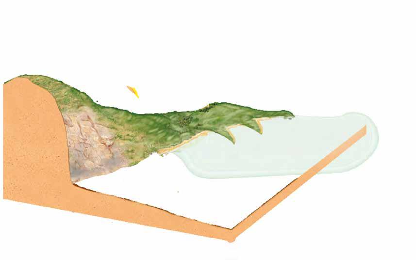
Many attempts have been made by people in the past to try to control the natural coastal processes of erosion, transportation and deposition. Unfortunately, due to a poor understanding of these processes, attempts have often made problems worse or simply moved them to another part of the coast. In addition, issues were often managed on a local scale without regard for the broader environments that influence the coast, such as river catchments and marine ecosystems. More recently, a greater understanding of natural processes, as well as a recognition of the widespread impacts of coastal management, has led to new approaches. These include soft engineering (using natural processes), Integrated Coastal Zone Management (ICZM; see page 110) and the protection of coastal ecosystems with special marine reserves (see page 104). Managing natural processes: Hard vs soft engineering techniques One of the key principles underpinning effective coastal management is to work with natural processes. In the past, coastal management has tended to use ‘hard engineering’. Hard rock armour rocks piled along the coast engineering refers to the building of structures such as sea walls, groynes, artificial reefs, to protect the shore from rock armour and breakwaters to protect coastlines from the erosive effects of waves or to trap erosion sand. The main hard engineering techniques are shown in Source 1.
New ways of managing coasts
Sea wall Artificial reefs Groynes Worksheet Protecting and managing the coastDRAFT ONLY - NOT FOR SALE Rock armour
Breakwater
Many people in coastal areas like these hard options, as the results are obvious and immediate. The structures tend to be expensive, however, and tend to have a high impact on natural environments. In many cases, they create other problems – or just move the problem further along the coast.
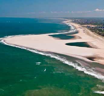
By comparison, ‘soft engineering’ coastal management techniques use the natural processes of the coast. They are often less expensive than hard engineering options and are considered to be more sustainable as they have less impact on the natural environment. There are two main types of soft engineering – beach nourishment and managed retreat. • Beach nourishment replaces beach material such as sand that has been removed by erosion or longshore drift (see Source 2). Beaches are a natural defence against erosion and coastal flooding, and are a desirable feature of the landscape for residents and tourists alike. The natural process that eroded the beach in the first place will continue, however, so the beach needs to be nourished again and again. • Managed retreat involves the relocation of human settlements and hard engineering defences, such as sea walls and groynes, so that the natural processes of erosion and deposition can take place. In many cases, low-lying areas flood, allowing salt marshes, wetlands and mudflats to re-establish themselves in these areas (see Source 3). Over time, these habitats provide a natural defence against further erosion. Unlike many hard engineering techniques, managed retreat can be relatively inexpensive. However, people living in these regions can be unwilling to relocate and need to be compensated for the loss of their properties. 3.7 CHECK YOUR LEARNING
Review and understand 1 Explain why many people in coastal areas like hard engineering techniques. 2 Describe the process that is occurring at Abbotts Hall Farm (see Source 3).
Apply and analyse 3 Distinguish between hard and soft engineering techniques.
4 Outline some of the possible positive and negative environmental impacts of beach nourishment. Evaluate and create 5 Examine Source 4 on page 91. Source 2 Beach nourishment in the Netherlands; a vast sand peninsula – dubbed the ‘sand engine’ – 2 kilometres long and 1 kilometre wide has been constructed. Waves and currents are redistributing this peninsula along the shore, where it is expected to nourish the beaches and form sand dunes. Source 3 Managed retreat at Abbotts Hall Farm in Essex, England, has allowed salt marshes to be re-established. DRAFT ONLY - NOT FOR SALE a Which management strategy would you recommend in response to erosion of this coast? Explain your answer. b Evaluate the strengths and weaknesses of your strategy. What other information would you need to be able to make a more informed recommendation?
3.8
Protecting the coast
In this topic, you will: » examine the impact of legal protections on coastal environments.
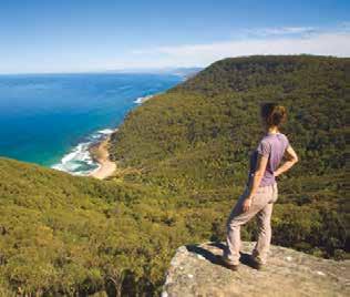
An effective way to manage and protect natural environments such as coasts is to give them legal protection. This helps ensure that harmful activities are banned or limited. In Australia, this is achieved mainly through a system of national parks (on land) and marine reserves (in the surrounding seas and oceans). National parks Each state and territory of Australia has a large number of special places, both coastal and inland, that the government has decided to protect. These might be as small as a single historic house or beach, or as large as a wilderness. Despite the name, virtually all of Australia’s more than 550 national parks are the responsibility of the individual state and territory governments. Although management strategies differ between states and territories, the common ideals are that the land, plants and animals within the parks should have protection from activities that threaten their existence, and that people should be able to visit these special places. This can lead to problems, as visitors who come to see these areas in all their natural beauty may threaten the very environment they are visiting. The managers of the national parks have the task of controlling what visitors do in each one by limiting or restricting certain activities in sensitive areas. Marine reserves While national parks protect special places on land, Australia’s diverse marine environments also need to be protected. In 2012, the Australian Government announced the creation of one of the world’s largest marine reserve networks. Around 3.1 million square kilometres of our oceans are now managed mainly for the purposes of biodiversity conservation. This is an area roughly equivalent to the land area of Queensland and the Northern Territory combined. Managing a marine reserve is particularly challenging because, unlike national parks on land, fences and signs are not easily erected to limit access to particularly sensitive areas. Instead, marine reserves are divided into zones, and certain activities are allowed, banned or limited in each zone. It is the responsibility of anyone who enters a marine reserve to be aware of the activities permitted within each zone. Every marine reserve in Australia – except for the Great Barrier Reef, which is recognised as a special case – has been assigned a particular management category (see Source 5). These are the same as those adopted in other countries, and have been developed by the International Union for the Conservation of Nature (IUCN). national park an area of natural beauty that is protected by law for the use of the general public and the protection of the natural environment Source 4 Royal National Park in New South Wales is Australia’s oldest national park. Established in 1879, it protects large areas of coastal rainforest and ancient sand dunes. Source 5 The IUCN management categories for the conservation of marine reserves IUCN number Name of reserve type Purpose of the reserve Ia Strict nature reserve Managed primarily for scientific research or environmental monitoring DRAFT ONLY - NOT FOR SALE
II National park Protected and managed to preserve its natural condition
IV Habitat/species management area Managed primarily to ensure the maintenance of habitats or to meet the requirements of specific species
VI Managed resource protected area Managed to ensure long-term protection and maintenance of biological diversity, with a sustainable flow of natural products and services to meet community needs
aUsTRalIa: naTIonal PaRKs and maRIne ReseRVes, 2018
Cobourg Marine Park
Gurig
Ashmore Reef Litchfield Kakadu
Drysdale River Keep
River Purnululu
Mungkan Kandju Mitchell and Alice Rivers Staaten River
3.12 CHECK YOUR LEARNING Review and understand 1 Outline how natural environments are protected in Australia. 2 Describe the ideals that are behind the management strategies implemented in national parks. Apply and analyse 3 Examine Source 6. a Where are Australia’s largest marine reserves located? b Describe the location of marine reserves in the state in which you live. 4 Source 7 is a photo taken by a hiker in a protected coastal area. a Describe how the hiker may impact on the natural environment. b Propose two ways park managers in this area could limit these impacts.
Jardine River
Great Barrier Reef Iron Range
Cape Melville
Lakefield Ningaloo Cape Range Kennedy Range
Evaluate and create 5 There were many objections to the Australian Government announcement in 2012 that millions of square kilometres of ocean were to become marine reserves. In small groups, consider which
Australian groups would be likely to support this announcement and which would be likely to oppose it.
Brainstorm the arguments that each of these groups would use to support their points of view. 6 Source 6 shows the extent of Australia’s
Exclusive Economic Zone (EEZ). Research this area and find out the benefits for
Australia in having such a large EEZ. You may also like to find out about the Timor
Gap EEZ and how this was created.
Karlamilyi Bernier and Dore Island
Shark Bay Kalbarri
Alexander Morrison Lesueur Nambung Yalgorup Moore River Cape Le Grande
Leeuwin Naturaliste
D’Entrecasteaux
Francois Peron
Nullarbor Lake Gairdner Shannon Stirling Range Fitzgerald River Coffin Bay Innes Flinders Chase Wyperfeld Kosciuszko Mount Frankland Canunda Lower Glenelg Otway Wilsons Promontory Alpine Mt Buffalo Mitchell R Snowy River Croajingolong Coopracambra Wadbilliga Mount William Walls of Jerusalem Franklin-Lower Gordon Wild Rivers Douglas-Apsley Maria Island Southwest
Lumholtz Bowling Green Bay Repulse Eungella Blackdown Tableland Goodedulla Carnarvon Kroombit Tops Burrum Coast Great Sandy Moreton Island
Flinders
Ranges Mt Remarkable
Uluru Simpson Desert Lamington Border Ranges
Kings Plains Gibraltar Range
Cathedral Rock Nymboida Hat Head Blue Mtns Nattai Myall Lakes Dharug Ku-ring-gai Chase Lord Howe Island Budawang
Great Barrier Reef
Wooroonooran Daintree Coringa-Herald Undara Volcanic Hinchinbrook Lihou Reef Island Great Barrier Reef Millstream-Chichester
PACIFIC OCEAN INDIAN OCEAN
0 500 1000 km
LEGEN D Recreational use zone (IUCN II and IV)
Marine park Australian Exclusive Special purpose zone (IUCN VI) Economic Zone (EEZ)
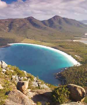
Multiple use zone (IUCN VI) National park General use zone (IUCN VI) Special purpose zone (oil and gas exclusion) (IUCN VI) Habitat protection zone (Coral Sea IUCN IV) Habitat protection and conservation park zone (IUCN IV) Santuary and marine national park zone (IUCN Ia and ll) Source 6 Source: Oxford University Press Source 7 Freycinet Marine Reserve on Tasmania’s east coast includes large DRAFT ONLY - NOT FOR SALE areas designated as ‘strict nature reserves’ due to the biodiversity of the coast’s offshore seamounts (undersea mountains) and bird populations.
3.9
In this topic, you will: » explain traditional methods of managing coastal landscapes. Aboriginal management of the coast Prior to European colonisation in 1788, the coastal areas of Australia supported large numbers of Aboriginal and Torres Strait Islander peoples. The coasts provided a reliable source of food both from the sea and the surrounding land.
Today, nearly half of all Aboriginal and Torres Strait Islander peoples in Australia live near the coast. Many maintain a close association with the coast through cultural and historic connections, through continued use of coastal resources and by law. In the Northern Territory, for example, Aboriginal communities own and manage approximately 85 per cent of the coastal land.
Coastal places with special significance to Aboriginal and Torres Strait Islander peoples are under the same environmental threats as other coastal places, from: • population and economic growth • land use changes • climate change • the arrival of invasive species.
Aboriginal and Torres Strait Islander communities are now working with government to restore lands that are important to them. This joint approach means that factors of Aboriginal and Torres Strait Islander heritage are taken into account when decisions are made about the use and restoration of degraded areas.
Aboriginal management of the Coorong
Source 8
The land and waters is a living body.
We the Ngarrindjeri people are a part of its existence. The land and waters must be healthy for the Ngarrindjeri people to be healthy. We are hurting for our Country. The Land is dying, the River is dying, the Kurangk (Coorong) is dying and the Murray Mouth is closing. What does the future hold for us? Tom Trevorrow, Ngarrindjeri Elder, Camp Coorong, 2002
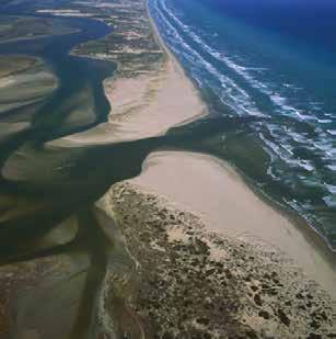
The region known as the Coorong, where the Murray River reaches the sea, covers an area of 14 000 square kilometres. The Coorong was recognised as a ‘Wetland of International Importance’ and as a breeding ground for many bird and fish species by the Ramsar Convention on Wetlands in 1985. Due to a combination of factors – including water extraction in the Murray–Darling Basin, drought, and barrages (dams) built across the Murray to hold back sea water – the region has become severely degraded. In particular, the waters of the Coorong Lagoon and lakes have become saltier than the sea, wetlands have dried out and acidic soils have become exposed. Another cause of this degradation has been the building of dams that collect water during wet seasons CASE STUDY Quiz me! A quick quiz on Aboriginal management of the coastDRAFT ONLY - NOT FOR SALE Source 9 An oblique aerial and then release this water during dry photograph of the Coorong, Lower seasons. This has disrupted the natural cycle Lakes (including Lake Alexandrina and of the Murray River of floods and droughts, Lake Albert) and Murray Mouth region of South Australia and has had a dramatic effect on the natural
ecosystems of the river, particularly at its mouth. In some years, so little water flows through the mouth that it closes, cutting off the lakes of the region from the sea.
The traditional owners of the region, the Ngarrindjeri people, maintain a strong connection with the lands and water of the Coorong. The Ngarrindjeri people believe that the health of their nation is closely linked to the environmental health of the region, and that a freshwater flow that allows plants and animals to thrive must be maintained.
The Ngarrindjeri community, through the Ngarrindjeri Regional Authority (NRA), has formed a close relationship with the South Australian Department of Environment, Water and Natural Resources (DEWNR) to deal with short-term crises in the region and to plan for a sustainable future. This has resulted in the adoption of a long-term plan that aims to secure a future for the region as a ‘healthy, productive and resilient wetland system that maintains its international importance’. The plan includes a number of specific goals: • to protect and restore natural habitats • to restore viable populations of native bird, fish and other animal species; restoring the natural flow of fresh water to the Coorong and Lower Lakes are seen as a key component of this goal • to improve water quality and increase flows through the wetlands; it is proposed, for example, that very salty water be pumped out of the lagoon to the sea • to recognise the Ngarrindjeri community’s association with the area.
Large areas of dunes, wetlands and farmland have already been replanted using native plant species as the first step in this plan to restore the Coorong area. 3.14 CHECK YOUR LEARNING Review and understand 1 Identify why many Aboriginal and Torres Strait Islander peoples lived near the coast in the past. 2 Suggest reasons why Ngarrindjeri people are particularly concerned about the health of the Coorong ecosystems. Apply and analyse 3 Use Source 9 to describe the natural environment of the
Coorong and Lower Lakes. Include the water and land features that you can identify. 4 Examine Source 10. a Describe and account for the location of Aboriginal lands. CooRong: aBoRIgInal lands and naTIonal PaRKs Lake Alexandrina The Coorong b Describe the locations of the barrages. Why have the barrages been built in these places? How would they change the natural environment of Lake Alexandrina and the Coorong? 5 Based on Tom Trevorrow’s statement (Source 8), how would you classify his environmental world view? Justify your answer. Evaluate and create 6 Research the Ramsar Convention on Wetlands and its goals. Identify which other wetlands in Australia are listed in the Ramsar Convention.
Goolwa
Murray Mouth Lake Albert
Strathalbyn Tailem Bend
Milang Sir Richard Peninsula
Younghusband Peninsula Meningie
Langhorne Creek Wellington Currency Creek
Clayton Narrung Murray River
Urban area Aboriginal land National park or reserve
Road Railway Barrage or dam LEGEN D Area of map 0 5 10 km Source 10 Source: Oxford University Press DRAFT ONLY - NOT FOR SALE
3.10
In this topic, you will: » evaluate an example of a coastal change management response from australia.
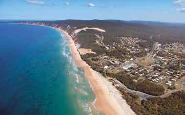
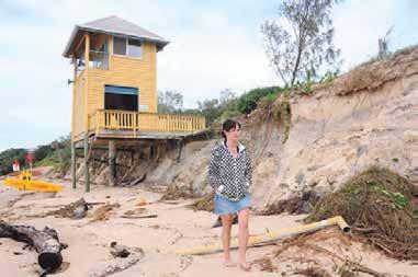
Change at Rainbow Beach Rainbow Beach is a small community located on a massive dune system that runs along the Queensland coast on the mainland, near the southern tip of Fraser Island. Formed over 2 million years, the dunes are part of one of the world’s greatest sand dune complexes, which includes Fraser Island – the world’s largest sand island. In places, the dune system is 200-metres high and is held in place by large areas of scrub, forest and grasses. While Aboriginal ownership of the region dates back thousands of years, European occupation began with a sand-mining operation north of the town in the mid-1960s. A road built to reach the sand mine was soon used by tourists to access Fraser Island and the new town of Rainbow Beach (see Source 11). The sand-mining operation finished in 1976, but the population of the small town continued to grow slowly. Now home to about 1200 fulltime residents, visitor numbers swell in summer holiday periods as people arrive to use the camping ground, as well as several motels and resorts. The key management issue faced by the region is the erosion of the sand dunes, particularly during storms. This is an example of a potential conflict between natural processes and human activities. Sand dunes naturally change in response to long-term and short-term changes in wind patterns, sand supply and sea levels. The erosion of the foredune (a dune ridge running parallel to the ocean) at Rainbow Beach is a natural event. However, as the erosion is now putting buildings at risk and making the beach unsuitable for recreation activities, some local residents and the Gympie Regional Council are proposing to try to control the erosion. A study of the region found that the risk of severe dune erosion at Rainbow Beach is very low, but some people are still concerned that during a severe storm important buildings could be lost. The council plans to install 260 metres of large sandbags at the base of the dunes in front of the surf lifesaving tower, to slow erosion and protect a new amenity block that has been built on top of the dunes. Source 11 An oblique aerial photograph of Rainbow Beach, looking south; the foredune and two blowout dunes – known locally as the Carlo Sand Blow (in the background) and the Little Sand Blow (closer to the camera) – can be seen to the south of the town. blowout dune a dune that is moving inland as onshore winds carry grains of sand away from the beachDRAFT ONLY - NOT FOR SALE Source 12 A 2009 storm severely eroded the Rainbow Beach foredune, placing the surf lifesaving tower at risk of collapse.
Coastcare at Rainbow Beach
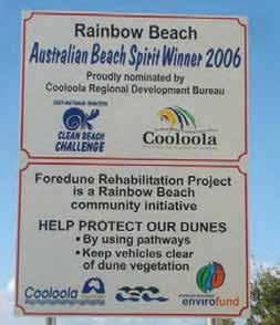
Source 13 Rainbow Beach has a very active Coastcare group.
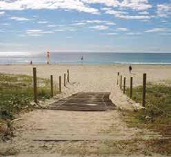
There are 2000 Coastcare groups in Australia. Each group is made up of volunteers who work together with local governments to identify problems and then solve them. At Rainbow Beach, the local group has identified the key issues in the area as: loss of native vegetation, the trampling of dune vegetation by visitors Source 14 A range of management strategies are in place at the main beach in Rainbow Beach. The fencing and walkway direct people to enter the beach on this path, protecting surrounding dunes.
accessing the beach, sand skiing on the sand blows, coastal erosion, environmental weeds, beach parking and rising sea levels due to climate change.
Some of the projects the Coastcare group at Rainbow Beach has undertaken include restoring native plants and removing weeds, protecting the dunes, monitoring bird populations and improving wetland areas.
KEY CONCEPT
Place
3.10 CHECK YOUR LEARNING Review and understand 1 Describe the natural environment of Rainbow Beach. 2 Describe the human activities bringing about change to this place. 3 Explain the purpose of Coastcare. Apply and analyse 4 Is the plan to place sandbags at the base of the dunes an example of hard or soft engineering? Justify your answer. 5 Examine Sources 13 and 14. a What management strategies can you identify in these sources? b What is each strategy designed to achieve? Explain how effective you think each will be in achieving its aims. 6 Compare the changes at Rainbow Beach and the changes at Abbotts Hall Farm in Essex (see Source 3 on page 103). What are the similarities and differences? Evaluate and create 7 The Little Sand Blow (see Source 11) is increasing in size as it moves westward. Create a flow diagram or field sketch that shows: • the natural processes responsible for this movement • the human activities that may be contributing to the movement • the impacts of this movement on the environment • the possible responses by the local government and Coastcare group.
Explore it! A virtual field trip to Rainbow Beach DRAFT ONLY - NOT FOR SALE
3.11
Integrated Coastal
Bangladesh.
Integrated Coastal Zone Management In response to the serious issues facing coastal and marine ecosystems, a major United Nations conference held in 1992, called the Earth Summit, proposed a new system for managing coastal environments. Known as Integrated Coastal Zone Management (ICZM), it is now a widespread practice in many coastal nations, such as New Zealand, India, Canada, Bangladesh and the Netherlands. The United Nations recognises that one of the common issues associated with coastal management is that government departments and interest groups often propose very different solutions to issues depending on their own needs and interests. In many cases, these solutions ignore the needs of other coastal users. Coastal interest groups include those relating to residents, the tourism industry, fisheries, farmers, forestry, manufacturing, mining, waste disposal, marine transportation and real estate developers. The key to ICZM is that it seeks to pull together the many groups and individuals with an interest in the coast in an integrated way when devising a management plan (see Source 15). The success of ICZM is dependent on funding, consistent government priorities and the expertise available to organise and manage large projects. Involve all relevant governments Take a long-term view Use a holistic approach Consider local conditions Work with natural processes Get people involved Use a range of approaches Be prepared to change strategy Eight principles of Integrated Coastal Zone Management Source 15 The eight key principles of ICZM Source 16 The challenges facing many coastal environments require an integrated approach. Quiz me! A quick quiz on Integrated Coastal Zone ManagementDRAFT ONLY - NOT FOR SALE
ICZM in Bangladesh
CASE STUDY
3.11 CHECK YOUR LEARNING Review and understand 1 In your own words, define ICZM. 2 Explain how and why ICZM has been implemented in
Bangladesh. Apply and analyse 3 Source 1 on page 88 illustrates a range of significant problems that occur in coastal areas. Work with a partner to: • select one of the examples of coastal degradation shown in this source • using the eight key principles of ICZM, suggest how people could manage this issue • present your ideas as a set of written proposals.
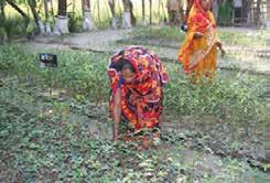
Each ICZM plan is designed to best address the issues of the country for which it has been developed. In Bangladesh, for example, the key issues are rising sea levels that bring saltwater floods to low-lying communities, and the impacts of cyclones and storm surges. It is estimated that a 1-metre rise in sea level would leave 17 000 square kilometres of land in Bangladesh submerged and 30 million people without a home (see Source 18). It would affect 1 million hectares of farmland and threaten the freshwater supplies of three major cities.
In response to these threats the Bangladeshi Government, with the assistance of the World Bank and expertise from the Netherlands, has developed an ICZM strategy that focuses on disaster mitigation. To date, 4 Compare the management strategies at Rainbow Beach (on page 108) and Bangladesh. What lesson could each community teach the other about dealing with coastal issues? Evaluate and create 5 Evaluate the implementation of ICZM principles in
Bangladesh. Write your evaluation in the form of a short report, addressing the following: • What do you see as some of the barriers to ICZM being adopted in Bangladesh? • What do you see as some of the advantages in managing coastal changes using this approach? • What is your overall impression of ICZM being adopted in Bangladesh?
150 000 hectares of mangroves have been replanted and more than 2500 cyclone shelters constructed. Bangladesh: PRedICTed ImPaCT oF 1-meTRe sea-leVel RIse
Ganges Dhaka Chittagong
Brahmaputra River River
BANGLADESH INDIA INDIA
Bay of Bengal
Area of map Heavily populated areas Land submerged after 1-metre rise in sea level LEGEN D 0 50 100 km Source 18 Source: Oxford University PressSource 17 A nursery for mangrove trees DRAFT ONLY - NOT FOR SALE
3.12
ICZM in the Netherlands
In this topic, you will: » evaluate an example of a coastal change management response from the netherlands.
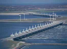
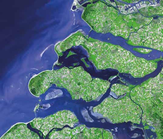
The province of Zeeland in the Netherlands is a large agricultural area that is home to more than 380 000 people. Much of the region lies below sea level. The land has been drained and reclaimed, creating new islands that are linked by bridges and tunnels. The area has an intricate series of levees (known as dykes) and dams that hold back the waters of the North Sea and regulate the flow of the rivers into the sea. The province also supports a large fishing industry, and is home to the largest national park in the Netherlands. In Zeeland, ICZM is used to reduce flooding from storm surges. The largest of the flood protection dams, the 9-kilometre-long Oosterscheldekering, links two of the largest islands in Zeeland. The 62 steel doors that make up the barrier can be lowered or raised in response to tides, storms and other sea level changes (see Source 19). For most of the year, sea water can flow freely beneath the dam, so that marine ecosystems in the bays and estuaries of the delta can be maintained. The dam, which was opened in 1986, has been declared one of the Seven Wonders of the Modern World and bears a plaque with the words: ‘Here the tide is ruled by the wind, the moon and us [the Dutch].’ However, long-term changes in sea level due to climate change place great pressure on this region and on these amazing engineering works. The series of dams, storm surge barriers and bridges have provided many benefits for the people of the Zeeland region. As well as protecting them from storm surges and flooding, large areas of former saltwater estuaries have been converted into freshwater lakes, creating a reliable supply of water. The dams and bridges also link together island communities that had been isolated for hundreds of years, and the calmer waters of the river mouths and estuaries are safe for shipping and recreational boating. levee a long wall or embankment built to prevent flooding from the sea NORTH SEA ZEELAND Source 19 The Oosterscheldekering storm surge barrier in Zeeland Key skill worksheet Analysing topographic mapsDRAFT ONLY - NOT FOR SALE Source 20 An aerial photograph of Zeeland showing a number of dams and storm surge barriers (including Oosterscheldekering)
Oosterscheldekering
Zeeland: ToPogRaPhIC maP
North Sea
Scale 1:150 000
kilometres 0 1 2 3 4 5 kilometres
Brouwers Dam
N57 N57
Port Zelande
De Punt
Ossehoek + Hompelvoet LEGEN D
Principal road Secondary road Contour with value (interval 5 metres) GrevelingenmeerMinor road
(Lake Grevelingen)
Wind turbine
10
Glass house cultivation Built-up area Cultivated land Park or recreation area
Open area
Lake/dam
Watercourse
Rijksweg 57 5 10
10 20 15 48 49 50 51 52 53 54 55 56 57 58 59 60 61 3°45’E
+++++++++ +++ ++ ++ 4°00’E
Schelphoek Stampersplaat Dwars in de Weg
Veermansplaat Schouwen-Duiveland Grevelingenmeer (Lake Grevelingen) Dijkwater Sirjansland Westenschouwen
Colijnsplaat
Burghsluis Serooskerke Schouwen Moriaanshoofd Zierikzee Ouwerkerk Viane
Nieuwerkerk Oosterland
Scharendijke Renesse Ellemeet Looperskapelle Brouwershaven
Elkerzee Noordwelle Brijdorpe Nieuw- Zonnemaire Haamstede Nieuwerkerke Haamstede Noordgouwe Burgh Kerkwerve Schuddebeurs Bruinisse
Capelle Duiveland
Den Osse Zeeland Village Dreischor
Kop van Schouwen Beldert Grevelingenhout Golf Course
Sport Fields Zeeland Bridge
Oosterscheldekering
(Eastern Scheldt Storm Surge Barrier) Oosterschelde (Eastern Scheldt)
Delta Park Neeltje Jans (Water Park)
(Eastern Scheldt)
Seawater access
Roompotsluis (Cream Pot Locks) Keeten-Mastgat
Herkingen
Inundated areas from 1953 ood
Rijksweg 57 Stavenisse
Kraaijensteinweg Stoofweg Delingsdyk Delingsdyk
Zuidweg Provincialeweg Nieuwe Koolweg Kloosterweg L a ng e BlokwegHeuveisweg Weg naar de Val Weg naar de Val Rijksweg Rijksweg
Strandweg N652 Rijksweg
N652 N651 N57 N57 P r ovincialestraatweg
Serooskerkseweg
Building/s Forest Source 21 Source: Oxford University Press 3.12 CHECK YOUR LEARNING
Review and understand 1 Explain why Oosterscheldekering was constructed. 2 Use an atlas to locate the province of Zeeland. Describe its location.
Apply and analyse 3 Use the eight key principles of ICZM (see Source 15 on page 110) to explain the flood protection provided by Oosterscheldekering. For example, how does this barrier take local conditions into account? 4 Examine Sources 20 and 21. a What factors do you think may be responsible for the large sandbanks forming in the Oosterschelde?
b Identify the different land uses on the island of Schouwen-Duiveland. c Describe the relief of Schouwen-Duiveland using the contour lines on the map. d Describe the southern shore of Schouwen-Duiveland. Evaluate and create 5 Create a sketch map of the vertical aerial photograph in 5 DRAFT ONLY - NOT FOR SALE Source 20. On your map, label the key natural and human features of the landscape. 6 Oosterscheldekering is only one part of a much larger flood protection scheme. Use Google Earth to examine the region and find other examples of flood protection.
3B Ningaloo Coast
RICH TASK
On the north-west tip of Western Australia is one of the world’s most spectacular coastal environments: the Ningaloo Coast. Long white beaches run along the shore, and visitors can swim out from the beach to Australia’s longest fringing reef (a reef that lies extremely close to shore). The region is also home to dugongs and visited by humpback whales and greenback turtles.
Much of the region is under some form of legal protection as part of the Ningaloo Marine Reserve and Cape Range National Park. It was also added to the UNESCO World Heritage List in 2011. However, the Ningaloo Coast faces a number of potential environmental threats. These include: • oil and gas exploration off the coast • damage to coral reefs from boat owners anchoring in the fragile reef areas • illegal fishing • plastic bags killing turtles and whales by intestinal blockage • vegetation damage from off-road driving • waste disposal and pollution • increasing level of water consumption • potential for bushfires • invasive species (foxes, goats, cats) destroying or attacking native plants and animals.
Analysing complex maps Complex maps contain more than one set of information. Geographers use complex maps to analyse different features, reveal patterns and explain links between features in a given area. You can analyse a complex map by following these steps: Step 1 Look carefully at the map and read its title to make sure you understand what is being shown. Step 2 Examine the map’s legend. Complex maps can have more than one part to a legend, which will be represented on the map in different ways. For example, in Source 23, areas of colour are used to show recreational use zones and state marine reserves. Different symbols are also used – to show roads and coastal water boundaries.
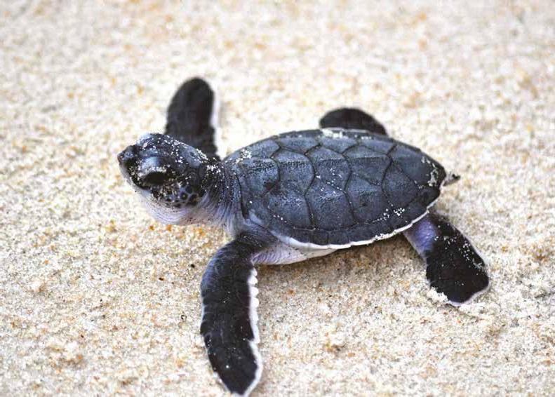
Step 3 Train your eyes to look for one set of information at a time. For example, look at solid blocks of colour on the map and work out what they tell you. Step 4 Move to a different set of information by selecting another symbol or block of colour from the legend. Examine the map to identify this symbol or colour. Step 5 Look for concentrations of the same symbol in areas, to see if patterns exist. Step 6 Note any patterns you can find on the map between different features and locations. Step 7 Describe the degree to which patterns are connected. Step 8 Try to suggest reasons for the KEY SKILL Analysing maps Source 22 A newborn green sea turtle makes its way across the sand to the ocean for the first time. Climate change has caused frequent flooding of sea turtle nests. Revise the key terms you have learnt so far.DRAFT ONLY - NOT FOR SALE connection between the two patterns. For more information on this key skill, refer to page 18 of ‘The geography toolkit’.
Practise the skill
nIngaloo: maRIne ReseRVe aReas
Look at the map of Ningaloo marine reserve areas (Source 23). 1 Identify the symbol for ‘multiple use marine zones’ in the legend, and then locate these areas on the map. 2 Describe the concentration of multiple use marine zones. 3 Describe the relationship between the multiple use marine zones and the location of recreational use marine zones. 4 Describe the location of the Ningaloo
World Heritage area.
Lake MacLeod North West Cape Learmonth
Lefroy Bay Giralia
Maud’s Landing Coral Bay
Turquoise Bay
Winderabandi Point Cape Farquhar Red Blu Ningaloo
Point Cloates Ningaloo Reef
Reef Exmouth
Area of map Muiron Islands Exmouth GulfCape Range Giralia Range Nor t h West Coastal Hwy Tropic of Capricorn INDIAN OCEAN Defence Reserve Coral reef Urban area World Heritage area boundary Coastal waters boundary State marine reserve Recreational use marine zone (IUCN II) Multiple use marine zone (IUCN VI) Cape Range National Park LEGEN D Extend your understanding Do some further reading on the internet to complete the following tasks. 1 Research Ningaloo’s World Heritage listing. a What does ‘World Heritage’ mean? b Why are sites placed on the World Heritage List? c Why was the Ningaloo Coast added to the list? 2 In the early 2000s, a large resort and marina called Coral Coast Resort was planned for the coastal area to the north of Coral Bay known as Maud’s Landing. Write a 250-word report that explains why this resort was not built. 3 ‘It is impossible to preserve a natural coastal environment while tourists continue to visit it.’ To what extent do you agree with this statement: A lot (strongly), a little bit (somewhat) or not at all? Write a short paragraph explaining your position. DRAFT ONLY - NOT FOR SALE Main road
Minor road
0 15 30 km 4WD track
Camping area
Source 23
source: oxford University Press
3.13
In this topic, you will: » explain how geographers can manage environmental change.
Geographers have an important role to play in the management of environmental change. Because they draw on knowledge and skills from the natural sciences (such as geology, biology, chemistry and physics), the social sciences (such as psychology, history and economics) and humanities (such as philosophy) they are uniquely placed to see the ‘whole picture’ when examining environmental change. Geographers can, for example, consider the reasons why people act in a certain way, and consider the impacts of these actions on the environment. They can also help to explain why people respond to change in different ways and, most importantly, recommend a course of action that is beneficial to both the natural environment and people. Fieldwork When examining environmental change such as coastal erosion, geographers often begin by developing a set of geographical questions. They then set out to answer these questions using a fieldwork range of geographic tools. One of the most useful tools is fieldwork – visiting the environment geographical study that being studied and observing it first-hand.takes place outside the classroom, at the site of When exploring changes at the coast, geographers use a range of specific techniques. inquiry These include constructing cross-sections of dunes, cliffs and other landforms, photographing evidence of change and measuring longshore drift. By visiting the same site at regular intervals (for example, once a year) geographers can also observe changes that have occurred between their visits. It may also be important to visit the site at different times of the year to observe seasonal changes, such as the effects of storm waves during winter or the impacts of holidaymakers during summer. The following case study is an example of the sort of environmental issues that might be explored by a geographer completing fieldwork.
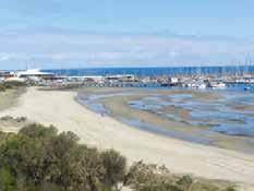
The role of geographers in managing coastal change CASE STUDY Coastal issues at Hampton Beach, Victoria Hampton Beach lies on Port Phillip Bay, about 15 kilometres south-east of the Melbourne CBD (see Source 1). Over the past century, human interference in the natural processes of erosion, transportation and deposition have brought about dramatic changes in the amount of sand on the beach. To protect roads and homes from coastal erosion, a sea wall was built along the coast in the 1930s. Later, in the 1950s, a breakwater was built at Sandringham Harbour to protect boats from storm waves. The adoption of these management strategies stole the supply of sand to the beach. The sea wall meant that sand from
the dunes no longer fell to the beach, and the breakwater trapped sand moving along the coast under the power of longshore drift. The local council has responded to the concerns of residents about their disappearing beach by building a series of groynes to trap sand, and by dredging sand from the sea floor and pumping it onto the beach (see Source 2). This top-up of sand Key skill worksheet Conducting successful fieldworkDRAFT ONLY - NOT FOR SALE needs to be carried out regularly and is an expensive solution to the problem of erosion. Studies show that rising sea levels are adding to the threat of erosion at Australian sandy beaches such as Hampton Beach.
Melbourne CBD
sea wall
3.13 CHECK YOUR LEARNING Review and understand 1 Explain why fieldwork is an essential tool for geographers. 2 Explain why geographers are uniquely placed to help describe and manage environmental change. Apply and analyse 3 Determine how successful the groynes at Hampton
Beach have been. (You may need to refer to the information about groynes on page 96.) 4 Examine the photographs in Sources 1 to 3. What evidence can you find in these sources that the
Sandringham breakwater interrupts the natural process of longshore drift?
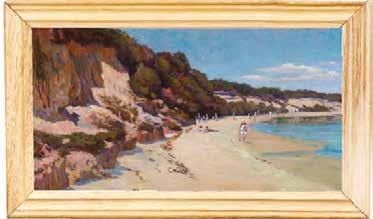
groynes Sandringham Harbour and breakwater Source 1 An oblique aerial photograph of the Hampton Beach area being investigated for fieldwork; labels have been added by the geographer. Source 3 A view of Sandringham Harbour from the Source 4 An artist’s impression of Hampton Beach painted between 1885 top of the existing dune and 1914 Evaluate and create 5 Look carefully at the photographs on this page. Create a series of geographical questions that could be used as the basis of a field trip to Hampton Beach. You may like to begin your questions with the words ‘what’, ‘where’, ‘how’, ‘why’, ‘what impact’ and ‘what should’. Share your questions with a partner and then with the class. 6 Use the guide to conducting successful fieldwork (available on your obook pro) to design a fieldwork investigation at Hampton Beach. Be sure to investigate: a the causes of coastal erosion b the effects of coastal erosion c the responses to coastal erosion.
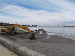
Source 2 Sand is dredged from the bay and pumped onto the beach in a process known as beach renourishment. DRAFT ONLY - NOT FOR SALE
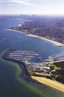
3.14
Using spatial technologies
In this topic, you will: » identify the tools geographers to investigate and predict environmental change.
Geographers use a range of tools to describe and predict environmental change. These tools may be as simple as direct observation, or measuring and recording the changing width of a beach with a tape measure. Increasingly, however, digital tools are being used to measure change and to help manage dynamic environments such as coasts, forests and farms (see Source 5). These tools rely on the collection of data from sources such as global positioning systems (GPSs), aerial photographs, ships and tide meters. The data collected is then analysed by computer programs and made available for use by geographic information systems (GISs) and digital elevation models (DEMs), as well as other applications. global positioning system (GPS) a device that uses satellites to accurately pinpoint the location of an object on the Earth’s surface (e.g. a car, a mobile phone) and provide data and directions to help with navigation geographic information system (GIS) a software application designed to capture, store, manipulate, analyse, manage and present all kinds of geographical information digital elevation model (DEM) a topographic illustration (or digital model) that uses a range of data to generate a 3D representation of the Earth’s surface
Global Positioning
System (GPS) satellites provide location information anywhere on Earth Research vessel
Side scan sonars create images of the sea floor Seismic reflection systems bounce waves off the sea Echosounders measure the ground Sampling floor, providing information about the surface underwater Airborne laser scanners produce a digital image of the land while in flight
Ground-based GPS reference stations measure satellite signals Source 5 Geographers use a range of digital data collection methods. As more and more coastal communities become concerned about the impacts of rising sea levels due to climate change, there is a greater demand for more advanced methods of monitoring the coastline. This is driving a boom in coastline monitoring through spatial technologies, and is making more data and information about coastal changes available to geographers than ever before. Digital elevation models (DEMs) A DEM shows the relief (or shape) of the land in three dimensions (see Source 6). Much of the data needed to create a DEM is collected from special sensors on satellites or in planes. Key skill worksheet Identifying patterns & relationships: Comparing spatial patternsDRAFT ONLY - NOT FOR SALE This data is represented as a raster (grid of squares) and manipulated by technicians to form a model of the Earth’s surface. These models can help geographers ‘see through’ features of the environment, such as coastal waters and forests, to examine the terrain below. They can also be used to predict areas at risk from erosion and other hazards, such as coastal flooding. This information can then be used to help manage the environment and limit the effects of these potential hazards and disasters. 118 OXFORD HUMANITIES 10 VICTORIAN CURRICULUMNo part of this publication may be reproduced, stored in OXFORD UNIVERSITY PRESSa retrieval system or transmitted in any form or by any means.
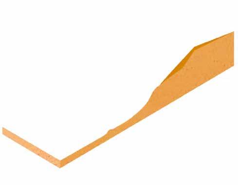
Geographic information systems (GISs)
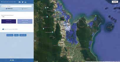
Source 7 A GIS image of the Abrolhos Islands in Western Australia 3.14 CHECK YOUR LEARNING Review and understand 1 Identify three reasons why geographers use digital tools. 2 Outline the process by which data is collected to create
GISs and DEMs. Apply and analyse 3 Examine Source 6 and answer the following questions. a What evidence is there that Cairns is under threat of flooding due to a rise in sea levels? b How could this DEM be useful to city planners? c Who else would find this model useful?
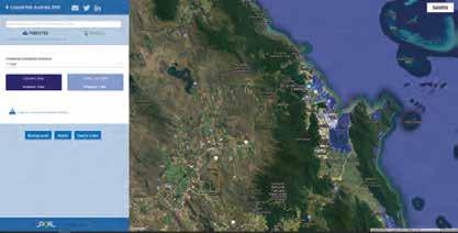
A GIS uses digital data to create a series of maps of a particular landscape. Each map focuses on a different aspect of the environment, such as the ocean depth, salinity, roads, settlements and relief. Using a GIS program, the maps are presented as a series of layers that can be switched on and off. This enables geographers to compare different aspects of the environment and look Evaluate and create 4 Examine the images of Hampton Beach on page 117 before completing the following tasks. a Imagine that the local council at Hampton Beach has asked you to suggest a range of digital data collection methods to create a GIS that will assist the council Source 6 This DEM of Cairns shows the areas that will be flooded by high tides in 2100 if sea levels rise by the predicted 0.74 metres. for interconnections between them. A GIS is particularly useful in examining and managing change in coastal environments. It allows geographers to isolate different and competing land uses, to see beyond political and physical boundaries, and to measure change over time. In the Netherlands, the entire 350-kilometre-long Dutch coastline is digitally mapped and measured each year using methods similar to those shown in Source 5. The maps and crosssections produced in this annual survey are compared to the first survey of this kind, which was undertaken in 1990. Areas of coastal erosion and accretion (growth) are clearly displayed on GIS maps, and are used by coastal managers to make changes in coastal defence strategies, such as beach nourishment and sea walls.DRAFT ONLY - NOT FOR SALE with its management of sand movement and loss at the beach. Describe the most relevant data collection methods to use. b Sketch the map layers that you think the council would most like to see included in the program.
3.15
In this topic, you will: » use the four spheres model to describe the australian coastal environment » describe the natural and human factors that impact the coast.
Each place on the Earth’s surface is unique. In the same way that no two people are exactly alike, natural environments such as forests, glaciers and coasts all differ. The reasons for these spatial variations may be complex, but recognising them is a critical part of understanding why different places have different problems. Geographers examine these differences and use what they find to propose solutions and responses to environmental change and/or issues. These solutions and responses need to be site-specific. They may work in one place but not work in another. Some environments are also more resilient to change than others.
The factors that need to be looked at when considering spatial variations in environments can be divided into two groups – natural factors and human factors.
spatial variations a term used to describe the way built and natural Natural factors features (e.g. towns, cities, Geographers often use models to help them understand processes in the natural world. The rivers, mountain ranges, farming regions) are four spheres model is particularly useful when investigating the natural factors that influence arranged on the Earth’s spatial variations. The four spheres that interact to form unique landscapes are: surface 1 the atmosphere – all the gases that surround the Earth 2 the biosphere – all living things on the Earth (that is, plants, animals, humans and other organisms) and the features they create 3 the hydrosphere – all the water on the Earth (in solid, liquid and gaseous forms) 4 the lithosphere – the outer rocky layer of the Earth (the crust). Source 8 provides an example of how the four spheres model can be used to investigate and describe how natural factors interact to shape coastal environments.
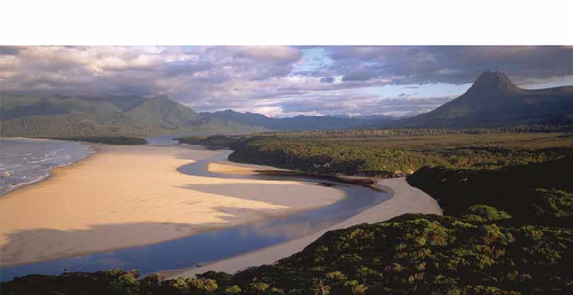
Understanding spatial variations anthropogenic created or caused by humans
Atmosphere Biosphere Hydrosphere Lithosphere Rivers carry water and sediments to Currents, tides and storms shape the coast Waves are responsible for most of the natural the coast; the volume of the sediment load is determined by factors such as rainfall, the size of shaping of the coast the river basin and its rock type
Temperature influences plant and animal growth Wind moves soft materials, such as sand Coastal vegetation supports biodiversity, filters sediments and stabilises loose sediments such as sand Marine organisms such as coral polyps shape the coastDRAFT ONLY - NOT FOR SALE
The shape of the ocean floor, such as the location of the continental shelf or coral reefs, influences the environment Ocean bottom type: this may be hard and rocky or soft, sandy and muddy Up to 80% of the world’s coasts are rocky and steep; the remainder are made up of loose materials, such as sand, mud or gravel
Human factors
Features of an anthropogenic coast
People have always been drawn to the coast. Coastal environments provide us with many services that we need to live and thrive, such as food, shelter, transport, recreation and flat land for building. Areas near the mouths of rivers also provide fresh water and fertile soil. Human influence tends to be concentrated in certain places on the coast where these services are most available. In these places, the coastlines are now so altered by human activities that some geographers refer to them as anthropogenic coasts (see Source 10), meaning humans have become the dominant force in these environments. 3.15 CHECK YOUR LEARNING
Review and understand 1 Identify the four interconnected spheres that make up the Earth.
Apply and analyse 2 Identify four ecosystem services that the coast provides us with. 3 Would rocky coasts be more resilient to change than sandy coasts? Explain your answer. 4 Choose a section of coastline you have visited or know well. Describe the natural and human processes that have shaped it.
Evaluate and create 5 In the same way that natural factors can be classified, so too can human factors. One method to classify them is the SHEEPT method. Use this method to classify the human factors listed in Source 10. For more information
Coastal protection constructions, such as sea walls Cleared vegetation on the SHEEPT method, refer to page 23 of ‘The geography toolkit’. 6 Select two of the coasts shown in the images in this chapter, for example: • the Cinque Terre coast (Source 1 on page 86) • Wamberal (Source 4 on page 91) • the Coorong (Source 9 on page 106) • Rainbow Beach (Source 12 on page 108) • Hampton Beach (Source 1 on page 117). Write a short report that explains: • how these two coastal landscapes differ • why these two coastal landscapes differ. In your report, be sure to consider the natural and Dredged shipping channels Mining operations including sand mining and oil drilling Fishing and aquaculture Coastal agriculture Forestry Shipbuilding and other industries Shipping and port facilities Dammed rivers for hydroelectric power generation Naval and other defence operations Tourism and recreation Roads Drained coastal wetlands and salt marshes Land reclamation Cities Source 10 Features of an anthropogenic coast Source 9 The Gold Coast in Queensland is an example of an anthropogenic coast.DRAFT ONLY - NOT FOR SALE human factors that account for the differences between these two places.
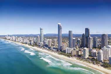
3.16
In this topic, you will: » explain how geographers assess environmental impact in australia. The Ichthys Project The Ichthys Project (named after the classical Greek word for ‘fish’) is the largest oil and gas mining project in the Northern Territory and one of the largest in the world. It was built by INPEX (a worldwide gas exploration company) and its partners, and includes construction in the Timor Sea and Darwin. Natural gas, an extremely valuable energy
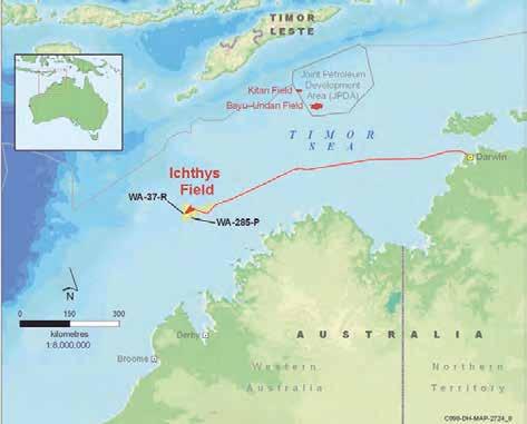
Assessing environmental change source, is extracted from beneath the Timor Sea and then transported to Darwin through a pipeline laid on the seabed. The massive project delivers significant social and economic benefits to Australia, bringing jobs, training, business opportunities and advancement for the energy industry. The three stages of the project – the offshore wells, the pipeline and the onshore facilities at Darwin – were all assessed for their environmental impacts before the project was allowed to proceed. The onshore processing plant was constructed on Middle Arm Peninsula – to the south of Darwin and close to an existing natural gas plant. The following factors were studied as part of the threeyear environmental assessment of the project: • the impact of dredging parts of the harbour and the disposal of the dredged material on corals, sea grass and marine animals such as dolphins, dugongs and turtles; this In Australia, and in many other countries, building projects that are likely to impact on the natural environment must go through a process of environmental assessment. This involves a study of the likely impacts of the proposed project on the environment. The resulting document is called an Environmental Impact Statement (EIS) and is generally prepared by a geographer with specialised training. When completed, the EIS is submitted to the relevant authority; for example, the state planning ministry. This body then has the authority to stop the project if it believes it will have too great an impact on the environment. Alternatively, the body may request changes to aspects of the project in order to minimise the environmental impacts. CASE STUDY IChThYs PRoJeCT: loCaTIon oF The oFFshoRe Wells, PIPelIne and onshoRe PlanT Map it! Ichthys projectDRAFT ONLY - NOT FOR SALE dredging involves the removal of a large rock shoal by methods such as using explosives (three explosions per day for 57 weeks) or specialised dredging machinery
• an increase in underwater noise and the impact of this on dolphins, which use sound to navigate • impacts on shore birds and wading birds, particularly from the loss of mudflat habitat and the potential for oil spills • impacts on fish species, including the commercially important barramundi, and on crustaceans, especially mud crabs • the removal of areas of mangrove forest, including plants listed as vulnerable to extinction, and the possible impacts of increased sedimentation on other areas of mangrove • disposal of waste water, including sewage from the plant and the village built to house up to 3500 construction workers • air and noise pollution, and the effects of these on Darwin residents • greenhouse gas emissions – the project, when completed, will be the largest emitter of greenhouse gases in the Northern
Territory and one of the largest in Australia.
Based on its assessment of the impacts and potential benefits of the project, the Northern Territory Government allowed it to go ahead, as long as INPEX made a number of changes to reduce the potential environmental impact and agreed to a range of recommendations. These included: • monitoring and researching the health of
Darwin Harbour for 40 years • long-term research into coastal dolphins to assist with their conservation • a $3 million donation to Charles Darwin
University to assist in oil and gas research • an extensive mapping project covering the natural habitats of the Darwin region. 3.16 CHECK YOUR LEARNING Review and understand 1 Explain what an Environmental Impact
Statement (EIS) is used for. 2 Identify the potential benefits as well as potential negative impacts of the Ichthys
Project. Apply and analyse 3 Examine Source 11. a Estimate the total length of the pipeline. b Predict three potential impacts of the pipeline. Explain your answer. 4 Describe the changes to the natural environment caused by the building and operation of the plant pictured in
Source 12. 5 Explain why INPEX would agree to the range of recommendations put forward by
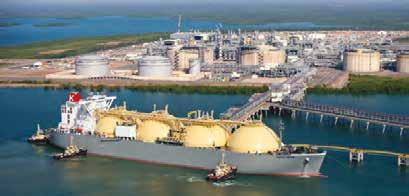
the Northern Territory government. 6 Explain the importance of each of the Northern Territory Government’s recommendations for the natural environment. Evaluate and create 7 Brainstorm with your classmates what cultural, economic and environmental factors a government would need to consider when deciding whether or not to approve a project like the Ichthys Project. 8 The Adani-owned coal mine in the Queensland Carmichael coal basin is one Source 12 The onshore processing plant near Darwin DRAFT ONLY - NOT FOR SALE of the most controversial mining projects ever proposed in Australia. Research this project to find out what makes it so controversial, with a particular focus on environmental impacts.
3.17
In this topic, you will: » explain how geographers propose responses to environmental change.
Responding to environmental issues Once an environmental issue has been identified and assessed, it is often necessary to come up with a suitable response. The environmental response must be individually designed for that particular environment. Management responses that are effective in one place may be ineffective or even damaging in other places. When considering a suitable response to environmental issues, important questions to ask include: • Does the response deal with the causes of the issue as well as its effects? • Is the response affordable in both the short and long term? • Is the response beneficial to all natural environments, or does it just move the problem and perhaps result in greater environmental changes in another place? • Is the response fair to all of the relevant stakeholders? CASE STUDY Sierra Leone’s disappearing beaches Sand mining is having a serious environmental impact on the coastal environment in the African nation of Sierra Leone. The capital city, Freetown, is experiencing a population and building boom. The population is growing by about 70 000 people per year and there is a growing demand for new housing, as well as for commercial and industrial buildings. Many of these buildings are made from concrete, which requires vast quantities of cheap, good-quality sand. Sand-mining operations can involve up to 40 trucks at a time, each with a team of diggers, who shovel sand from a beach. This process is creating changes in both the natural environment (as the sea is able to penetrate further inland) and the human environment. Local residents are being affected as the remaining dunes are eroding rapidly and houses are falling into the sea. Possible responses Sierra Leone is trying to build a viable tourism industry to boost the nation’s economy, but tourist resorts are in danger of losing their beaches.
A possible response to this problem would be to declare sand mining illegal and arrest those who continue to take sand from the beaches. Another possible response would be to import sand from other places. Some of the factors to consider when planning a response to the issue of sand mining in Sierra Leone are: • Sierra Leone is one of the world’s poorest countries. Sand mining provides a source of income for hundreds of men and their families. • As Sierra Leone is a developing country, the levels of technology in industries such as transport and mining are low. • Coastal areas are often heavily used for many purposes: for fishing, residences, tourism and recreation, as well as a source of building materials. • As dunes disappear, coastal erosion is accelerating and is now up to 6 metres per year in some places. • Global climate change is expected to raise sea levels on this coast and to increase the number and severity of storms generating Source 13 Sand mining on Hamilton Beach, Freetown, Sierra Leone Quiz me! A quick quiz on responding to environmental issuesDRAFT ONLY - NOT FOR SALE large, destructive waves. • Corrupt local officials accept payments from the construction companies to continue sand mining.
Part of a geographer’s role is to evaluate the strengths and weaknesses of responses to environmental, economic and social issues.
When evaluating possible responses to environmental issues such as the one in Sierra Leone, follow these steps: Step 1 Read the background information carefully and make sure that you understand it. Conduct some additional research on the issue if anything is unclear. Step 2 In some cases, you may need to suggest your own responses to environmental issues. In other cases, you will evaluate responses suggested by others; for example, in the case of Sierra Leone, consider the following responses: • Response 1 – Declare sand mining illegal and arrest those who continue to take sand from beaches • Response 2 – Import sand from other places. Step 3 Develop a set of criteria to evaluate each of the suggested responses. These criteria should consider all sides of the issue; for example, economic viability, environmental sustainability and social justice. Step 4 Create a table to evaluate each response against each criterion. You may like to use symbols, such as: • ✓ – criterion met • % – criterion partly met • × – criterion not met • ? – unsure. Step 5 Use the data in your table to select the best response to the issue. You may need to reconsider particular aspects of the response (and make modifications), or combine aspects of more than one response, to come up with the best solution. Step 6 Based on your evaluation, present your final recommendation. Include maps and diagrams to help describe the proposal and the intended benefits. Practise the skill 1 Follow the steps to develop a sustainable response to beach sand mining in Sierra
Leone.
For more information on this key skill, refer to page 33 of ‘The geography toolkit’.
KEY SKILL
Communicating & reflecting 3.17 CHECK YOUR LEARNING Review and understand 1 Explain why beach sand mining is a problem. 2 Explain why the Sierra Leone Government does not simply ban beach sand mining. Apply and analyse 3 a Identify the effects of sand mining. b Rank them from the most to least significant in terms of the severity of environmental impact. c Using the information in this topic and your own knowledge, analyse one of the highest-ranking effects of sand mining that you identified in question 3a.
Evaluate and create 4 Using Source 10 on page 121, identify the human factors that are shaping the coastline of Sierra Leone. a Compare these to the human factors shaping the coastline at Hampton Beach (see page 116). b Propose one strategy to combat the effects of these human factors in both places. DRAFT ONLY - NOT FOR SALE c Evaluate your strategy by listing its strengths and weaknesses before making an overall judgment about how strong it is.
3C Gulf of Mexico oil spill
RICH TASK
The Gulf of Mexico lies between the United States, Mexico and Cuba, and contains one of the world’s busiest oilfields. There are almost 3200 active oil wells in the Gulf, along with a further 27 000 abandoned oil wells.
In April 2010, the Deepwater Horizon – an active oil well operated by British Petroleum (BP) – exploded and sank to the sea floor, 1500 metres below the surface. Oil gushed from the well for three months, while BP and American authorities tried desperately to plug the hole. The results were catastrophic. An oil slick covering 1500 square kilometres started moving towards the American coastline. Thousands of sea birds, fish, dolphins and turtles were covered in oil and died. Other animals along the shoreline, such as crabs and molluscs, were also badly affected. Local industries such as fishing and tourism collapsed, and many people lost their livelihoods.
Analysing environmental issues using complex maps
In the case of an environmental accident, the impacts of the accident usually have multiple causes. Geographers try to go beyond the direct cause (the oil well blew up) to explore other indirect factors that influenced the course and extent of the impacts. These are generally a combination of natural processes and human activities.
As we saw in Rich task 3B on page 114, complex maps are maps that contain more than one set of information. Geographers use complex maps to analyse different features, reveal patterns and explain links between features in a given area. You can analyse a complex map by following these steps:
Step 1 Look carefully at the map and read its title to make sure you understand what is being shown.
Step 2 Examine the map’s legend. Complex maps can have more than one part to a legend, and these parts will
be represented on the map in different ways. Step 3 Train your eyes to look for one set of information at a time. For example, look at solid blocks of colour on the map and work out what they tell you. Step 4 Move to a different set of information by selecting another symbol or block of colour from the legend. Examine the map to identify this symbol or colour. Step 5 Look for concentrations of the same symbol in areas, to see if patterns exist. Step 6 Note any patterns you can find on the map between different features and locations. Step 7 Describe the degree to which patterns are connected. Step 8 Try to suggest reasons for the connection between the two patterns. For more information on this key skill, refer to page 18 of ‘The geography toolkit’. KEY SKILL Analysing maps Revise the key terms you have learnt so far.DRAFT ONLY - NOT FOR SALE
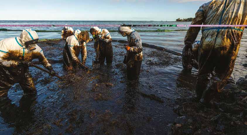
Practise the skill
1 Using Source 14, analyse the causes and effects of the Gulf of Mexico oil spill. A larger version is available on your obook pro. Once you have completed your analysis, fill in a table like the one in Source 15 as a way of organising your results. An example has been done for you. Extend your understanding In addition to complex maps, geographers use information from a range of other sources to explain how the impacts of the accident progressed and to look at the longer-term impacts on the environment. Research the Gulf of Mexico oil spill on the internet before answering the following questions. 1 Can you identify any contributing factors to the accident that are not shown on Source 14 (for example, any economic or technological factors)? What was their role in the accident? Add these factors to a table like the one in Source 16. 2 Since 2000, more oil wells have been drilled in much deeper water than in the past. Some experts believe that this was an important factor in this disaster. Why do you think wells are now being drilled in much deeper water? Source 15 Geographic factor Possible contributing feature Description of feature Physical environment Shape of the coastline The Gulf of Mexico is an extensive broad bay that opens to the Atlantic Ocean and Caribbean Sea in the east. Features of the seabed Location of coastal marshes Natural processes Ocean currents in the Gulf Demographics Distribution of towns and cities Location of oil refineries and oil rigs Source 14 Source: Oxford University Press Source 16 Contributing factors Possible contributing feature Description of feature Economic factors Level of development of the United States DRAFT ONLY - NOT FOR SALE Importance of oil in the US economy Importance of tourism and fishing industries
Technological factors Operation of oil refineries and oil rigs Technical failure of oil rig
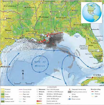
Map Gulf of Mexico: Extent of oil spill from Deepwater Horizon, 2010
Review questions 3A How is the coastal environment changing? 1 Identify two natural processes that change the coastal environment. (2 marks) 2 Using specific examples, explain how the reduction of biodiversity in coastal environments occurs. (5 marks) 3 Analyse why coasts are particularly vulnerable to the impacts of climate change. (3 marks) (Total: 10 marks) 3B How can coastal changes be managed? 1 Outline why groynes are built in some coastal environments. (2 marks) 2 Summarise the valuable role played by Aboriginal and Torres Strait Islander peoples in the management of coastal environments in Australia. Use one specific example to support your answer. (2 marks) 3 Discuss why Integrated Coastal Zone Management (ICZM) is a better way to manage change at the coast than methods that were used in the past. Use specific examples of management strategies in your answer. (6 marks) (Total: 10 marks) 3C How can geographers help to manage coastal changes? 1 Outline what GIS mapping is. (2 marks) 2 Explain the ways in which decisions made in the past are impacting the coastal environment of Hampton Beach today. (3 marks) 3 Compare the coastal changes at Hampton Beach in Melbourne and Hamilton Beach in Sierra Leone. What are some of the key similarities and key differences? (5 marks) (Total: 10 marks) 3 CHAPTER REVIEWDRAFT ONLY - NOT FOR SALE
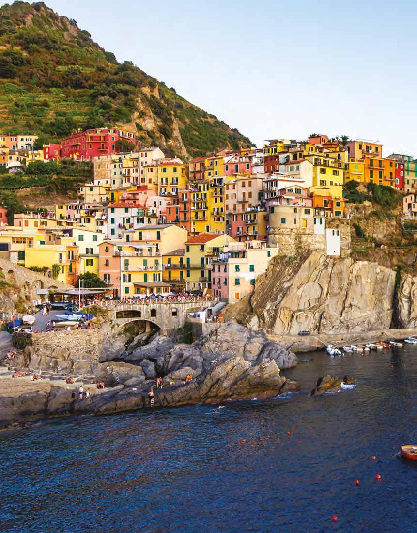
Review activity
Booming Busan
Examine Source 17 and use your skills in interpreting satellite images to answer the questions below.
Check your Student obook pro for these digital resources and more: Student book questions Chapter 3 Key skill worksheet Communicating & reflecting: Chapter 3 Play a game of Quizlet on Coastal change and management.
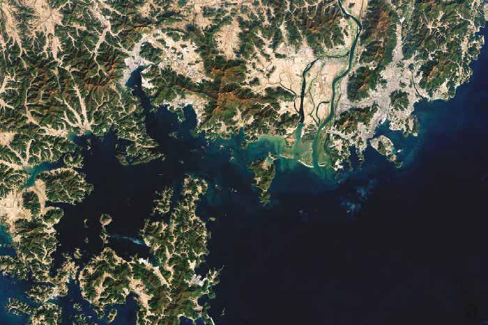
1 Locate the Nakdong River in Source 17. Describe the changes that have occurred to the three small islands at the mouth of the river between 1988 and 2017. (2 marks) 2 Identify and describe the natural process that has been responsible for the change in these islands. (3 marks) 3 Locate Gadeok Island in Source 17.
Describe the changes that have occurred on the northern tip of this island between 1988 and 2017. (3 marks) 4 Identify and describe the human activity that has been responsible for these changes. (3 marks) 5 Identify and describe three coastal changes that have occured to the coastline at the port of Busan between 1988 and 2017. (3 marks) 6 In a carefully worded paragraph, explain the probable causes of these coastal changes. Include both direct and indirect causes of change. (6 marks) (Total: 20 marks) Source 17 The port of Busan in 1988 (left) and 2017 (right)
Chapter review quiz Chapter 3
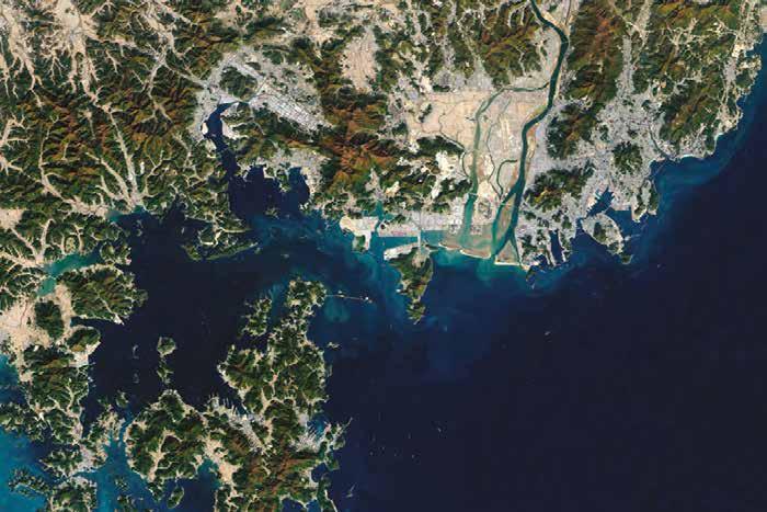
Nakdong River Busan New Port
Gamcheon Port
Gadeok Island KOREA STRAIT 5km
Nakdong River Gadeok Island 5km
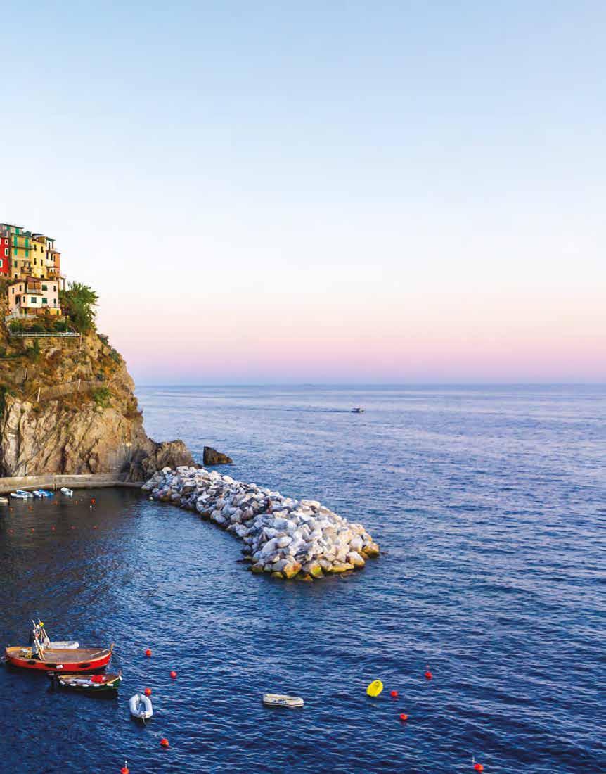
North Port Yeong Island KOREA STRAIT DRAFT ONLY - NOT FOR SALE


