9 minute read
The mystery of the shells at the river bank
THE MYSTERY OF THE SHELLS IN THE RIVER BANK
Angélica Ballesteros-Prada
Advertisement
Hi, nice to meet you! My name is Magnita. A few days ago, I was taking a walk along Samborombón Bay. It’s a beautiful place in Argentina (Fig. 1), there are many canals and rivers that empty into the Atlantic Ocean. When I was walking, I looked at the river bank, and something surprised me. In the sediment, I could see a line of marine shells. Wow! That was surprising because I wasn’t anywhere near the sea! I wondered: how did these shells get here? Do you know what could have happened? I had no idea.
When I got back home, I talked about this with my friend Maria. She’s a biologist, and she studies what Samborombón Bay was like in the past. She explained to me that Samborombón Bay is a great place to study the climate and the environment of the Quaternary* (period of time from about 2.5 million years ago to the present). The evolution of the bay is related to variations in sea level, particularly between 11,650 and 7,000 years before present (BP), a time period called the early Holocene.
She told me about microfossils, too: how she uses them to do environmental reconstructions of the past, and how microfossils could help me solve this riddle. I had never
heard about microfossils before – have you?
Figure 1. The location of Samborombón Bay (red circle), where I saw a line of marine shells ( ) and a picture of these.
“It’s okay, don’t worry – I’ll explain everything.” Microfossils are small organisms that can live in the sediment or in the water (Fig. 2). They are smaller than a pinhead, so you can’t see them without magnification: you need a microscope. The most important thing is that these organisms are difficult to decompose, which means they can be preserved in the sediment for hundreds, even thousands, of years!


Figure 2. Look! In a few grams of sand, there are many microfossils, but these are so tiny that you need a microscope to see them. Figure 3. Pictures of different microfossils taken with a scanning electron microscope. The smallest microfossils are called nanofossils, and charophytes are some of the biggest.
Around the world, there are many kinds of microfossils, for example, coccolithophores, radiolaria, foraminifera (for short, scientists often called these “forams”), ostracods, testate amoebae, and charophytes (Fig. 3). In this case, Maria told me about the forams and ostracods. (WOW! Difficult names to remember.)
We can use these microfossils to reconstruct the environment of the past because we can find them in the present, and we know where they live. Today, forams usually prefer to live in salty waters, such as the sea, or between the open ocean and the mouth of a river (salt marsh or estuary), but different types of forams live in different places. As for the ostracods, they prefer to live in freshwater, such as in lagoons, while some also live in brackish water (a mix between freshwater and seawater) and marine environments.
To understand this, we can see how the foraminifera and ostracods are distributed throughout the estuarine marsh (Fig. 4). This is a place with a wide range of salinity (a measure of the amount of salt dissolved in the water). The saltiest area of a salt marsh is shallow seawater: this is an area between the coast and the open sea and is permanently covered with water. There, we can find forams such as Buccella and ostracods such as Coquimba. Low and high marshes are located in the middle section. This is a coastal area and is divided into zones, which are usually at different elevations. This controls how often the different zones are flooded. This area is dominated by plants that can tolerate water with high salinity. Low salt marshes with marine influence are flooded daily but have no river or stream flowing through. Low-growing plant species can be found in this zone. Low salt marshes with freshwater influence are frequently flooded and have fewer plant species. The water in this area is a mix of freshwater, from rivers, and seawater. Ammonia and Elphidium species can tolerate low-to-medium salinity water, such as low marshes and tidal flats. However, Ammonia is more abundant in low salt marshes with freshwater influence, and Elphidium is more abundant in low salt marshes with marine influence.
High salt marshes are rarely flooded – only during periods of extreme high tide and storms, and has many tall plant species. Jadammina can only live in the sediment below bodies of water with low salinity, so it prefers to live in high-to-middle marsh sediments. Limnocythere can generally live in freshwater environments like lagoons.
Figure 4. Foraminifera and ostracod distribution through the estuarine marsh. The black lines represent where the different organisms live.

This was fascinating, but I still didn’t understand how we could use all of this information to actually reconstruct the past climate. Maria gave me some clues. Okay. Do you want to help us? Don’t worry – it’s gonna be easy.
1. We take a sample of sediment at different points in the river bank: A, B, C, and D. The sample at the base of the wall (A) is the oldest of all the samples, and the sample at the top of the wall (D) is the youngest (Fig. 5).

2. We wash the sample through a sieve, dry it, and put it on the counting tray (Fig. 5).
Now we need you!
Figure 5. In this picture you can see the place where we take the samples and Mariel, who also studies the past of Samborombón Bay. Here we’re washing the samples, and Maria is looking at the samples through the microscope.
3. Find 10 microfossils in each counting tray (samples A, B, C, and D).
4. Count and classify the different microfossils in each sample according to the images.
3 5 0 0 0 2


5. Use the information from step 4 to find the type of environment corresponding to each sample. Use the following table and match each sample from the wall of the river to its environment.
What do you think happened at Samborombón bay?
A. This place was a desert in the past. B. Seawater flooded this place in the past. C. These sea animals moved to the sea from the river because this place was better for them.
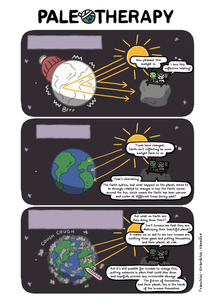
Okay. I’ll tell you a little bit more about the Samborombón Bay history. The Earth went through periods where the climate alternated between warm and cold. The cold, dry, and dusty periods with large ice sheets* are called glacial periods or ice ages*, and warmer periods with smaller ice sheets are called interglacial periods1 .

These climate changes affected marine and continental environments. For example, the temperature variation influenced global sea level. During glacial periods, the low temperature allowed large ice sheets to grow, and as water was stored on the continent in the form of snow and ice, sea level decreased. On the other hand, during interglacial periods with smaller ice sheets, sea level was higher. The most recent glacial period occurred between about 120,000 and 11,500 years BP, and the Last Glacial Maximum occurred about 20,000 years BP. During the Last Glacial Maximum, global sea level was 120–135 m (390–440 ft) lower than at present, with large ice sheets in North America and Eurasia (Fig. 6). Big mammals lived during this period, like mammoths, giant ground sloths, saber tooth tigers, glyptodonts, and others (these remind me of a movie…).
A
Figure 6. A comparison between summer ice coverage from 18,000 years before the present and recent observations (modified from ref. 1).

Approximately 19,000 years BP2, the ice sheets and glaciers began to melt. This event affected the coastline in different places of the world, such as Samborombón Bay. Between 6000 and 5500 years BP, sea level reached a maximum here. Sea level was about 4 m (13 ft) higher than present sea level and covered the bay (marine transgression); then the sea retreated to the current position (marine regression).
At our site, to ~10 km (~6 mi) from the line coast (Fig. 7): (A) First, between ~6700 and 6500 years BP (a period of ~200 years), the area around the bay was a low-energy salt marsh. Then, (B) between ~6500 and ~6220 years BP (~280 years), seawater covered the bay and transformed this place into a shallow marine environment. (C) Between ~5200 and 4150 years BP, the regressive sea-level phase began, and this place transformed into a salt marsh again, but with more rivers and freshwater influence. However, this is not a normal regression; this is forced regression that is the result of other factors different to glaciation and deglaciation events. For example, in Samboronbón Bay, the rivers moved a lot of sediment, and it was deposited on the coast, this contribution of sediments causes the sea to recede and the continental area to advance3. (D) Recently this region turned back into a high marsh near a freshwater canal. This means that sea-level rise in Samborombón Bay was due to deglaciation events, but local factors also influenced in decreasing sea level, such as contribution of sediment. Wow! This is amazing! I never thought that this area could have been in the ocean. Now I understand what happened in the past with the sea level when it was warmer. I think that we can use this information to understand how the recent global warming can affect changes in the environment and, in particular, sea level.
Figure 7. Evolution model of the Bahía Samborombón central. You can see when the sea level rose and covered the bay, and also when it retreated to the current position.
Do you know what your city was like in the past? At some point, it may have been in the ocean, a desert, or even covered by a glacier.

Related publications: 1. NCEI (2021) Glacial-Interglacial Cycles | National Centers for Environmental Information (NCEI) formerly known as National Climatic Data Center (NCDC). ncei.noaa. gov/sites/default/files/2021-11/1%20Glacial-Interglacial%20Cycles-Final-OCT%202021.pdf. Accessed: 20 Nov 2021 2. Mendelova M et al. (2017) Cuadernos de investigación geográfica 43: 719-750 3. Luengo MS et al. (2021) Quat Int 602: 4-14


