2 minute read
Figure 4.7: Population and Employment Served by Transit


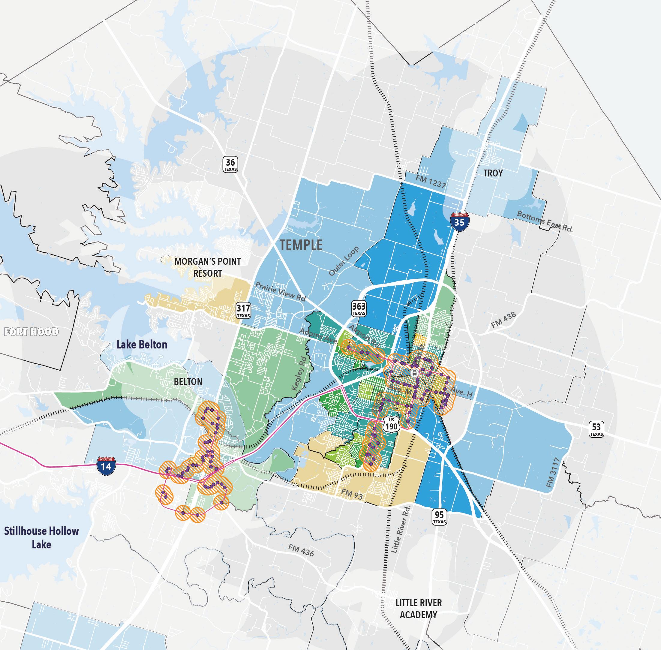
Figure 4.7: Population and Employment Served by Transit Population and Employment Served
High
Population
Low
Employment High
Quarter-Mile Stop Buffer Existing Hop Route Existing Hop Stops Amtrak Stations Figure 4.7 illustrates the levels of total population and employment in the study area in comparison to the quarter-mile buffer generated around the existing transit stops. The map shows that areas of both high population and employment are being served in Temple, Belton, Harker Heights, and south Killeen. However, there are still many block groups with medium-to-high levels of population and employment that are not currently served by the fixed route transit system.
0 0.75 1.5 3 miles
Key Findings
Key Findings from the overview of the existing transit network and available ridership data include:
• The existing fixed route transit system in the study area is estimated to serve just over a third of the total population and just under half of all employment. • The highest levels of ridership activity tend to occur at major destinations such as transfer stations, medical facilities, supermarkets, and higher education facilities. • All of the HOP routes apart from the 200 Express route operate with 60-minute headways. • There are block groups with high levels of TTR around Temple and west-central Bell County south and east of Killeen/Harker
Heights that fall outside of the existing system’s service area. • The data analysis and feedback garnered through this study indicated that there is a transit service gap between central/ east Temple and employment opportunities in the Industrial
Park.
4.2.2 Active Transportation
Active transportation infrastructure is an important component of a balanced transportation system that supports mobility for non-motorized modes of travel such as walking, biking, and wheeling. Pedestrian and bicycle-supportive infrastructure help provide facilities that enable travelers to choose non-motorized travel throughout the study area and provide key accessibility connections to people with mobility challenges. Accessibility and connectivity for people who walk and bike or use other active transportation modes is a primary goal of the Temple Comprehensive Plan 2020 and the Temple MMP.
Existing Facilities
Sidewalks Within the City of Temple, there are 173 miles of existing sidewalk. This means that over 84% of roadways that should typically have sidewalks currently lack this transportation resource. An analysis of the sidewalk data from the City’s GIS database and Google Street View imagery determined the proportion of sidewalks in each of the six sidewalk condition rankings. Results are summarized below:
• 40% of existing sidewalk is in good condition or better • 6% of sidewalk is in Fair condition • 40% of sidewalk is in Poor or Very Poor condition • Fair, Poor, and Very Poor sidewalks are concentrated in the gridded central portion of Temple • 14% of existing sidewalk did not have a reported condition ranking
Multi-Use Trails and Sidepaths Within the project study area, there are just over 31 miles of multi-use trails and sidepath paved facilities. Currently, there are minimal designated on-street bicycle facilities, such as bike lanes or protected bike lanes, within the City of Temple. Figure 4.8 provides a snapshot of existing active transportation facilities in the study area.


