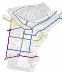
Nelson Bay Public Domain
Nelson Bay Public Domain Plan
council@portstephens.nsw.gov.au (02) 4988 0255 portstephens.nsw.gov.au
Prepared by Tract Consultants for Port Stephens Council June 2019
01 Nelson Bay Public Domain Plan 2019
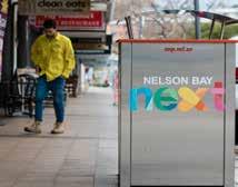
NEXT Tract
Port Stephens Council Nelson Bay
Consultants
NELSON BAY.
This project was funded by Port Stephens Council and the Australian Government, and administered on behalf of the NSW Government by the NSW Department of Industry.

Contents.
1. INTRODUCTION. 1.1 BACKGROUND 05 1.2 AIM OF PUBLIC DOMAIN PLAN 05 1.3 DOCUMENT STRUCTURE 05 1.4 DESIGN PHILOSOPHY & PROCESS 05
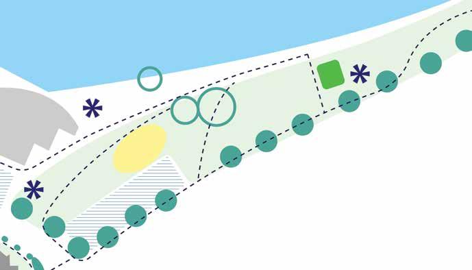
2. VISION. 3. UNDERSTANDING CONTEXT. 3.1 REGIONAL CONTEXT 09 3.2 LOCAL CONTEXT 09 4. UNDERSTANDING
4.1 UNDERSTANDING NATURAL ENVIRONMENT 11 4.2 UNDERSTANDING PEDESTRIAN & CYCLE MOVEMENT 12 4.3 UNDERSTANDING PLACE CHARACTER 13
02 Nelson Bay Public Domain Plan 2019 Port Stephens Council Nelson Bay NEXT Tract Consultants
5.
8. IMPLEMENTATION.
APPENDIX.
APPENDIX A SITE ANALYSIS STUDY 48
APPENDIX B COMMUNITY CONSULTATION WORKSHOP 1 52 APPENDIX C COMMUNITY CONSULTATION WORKSHOP 2 54 APPENDIX D STOCKTON STREET PEDESTRIAN MALL_ ALTERNATIVE CONCEPT 56
THREE BIG MOVES
6.1 STRUCTURE PLAN
6.2
6.3
6.4
6.5 CYCLE NETWORK
6.6 PUBLIC
CHARACTER
6.7 EVENTS & ACTIVATION OVERLAY
6.8 PUBLIC ART OVERLAY
6.9
6.10 STREET
7. KEY PLACES & SPACES. 7.1 KEY PLACES OVERVIEW 29 7.2 STOCKTON STREET SHARED ZONE & MAGNUS STREET VILLAGE PRECINCT
7.3 APEX PARK & VICTORIA PARADE INTERFACE 34 7.4 EASTERN FORESHORE
7.5 NELSON BAY GATEWAYS 40
STRATEGIC DIRECTION. 5.1
15 6. DESIGN STRATEGIES.
17
ENVIRONMENT & ECOLOGY OVERLAY — GREEN NETWORK 18
ENVIRONMENT & ECOLOGY OVERLAY — BLUE NETWORK 19
STREET TYPOLOGY 20
21
DOMAIN
& MATERIALS 22
24
25
PEDESTRIAN WAYFINDING OVERLAY 26
LIGHTING 27
30
38
8.1 STAGING APPROACH 43 8.2 DETAILED STAGING SCOPE 44
03 Nelson Bay Public Domain Plan 2019 Port Stephens Council Nelson Bay NEXT Tract Consultants Contents
1. Introduction.
Nelson Bay hosts pristine sheltered bays and a stunning natural environment. In order to remain attractive and competitive as a key tourism destination, as well as a sustainable and unique place to live, the Town Centre public domain requires rejuvenation. This Public Domain Plan will guide future improvement works, aligning previous strategies, expectations and strategic implementation.
Introduction Tract Consultants Nelson Bay NEXT Port Stephens Council 04 Nelson Bay Public Domain Plan 2018
1.1 Background
1.2 Aim Of Public Domain Plan 1.3 Document Structure
1.4 Design Philosophy & Process
Nelson Bay is a primary town centre of Port Stephens, and a major tourism and service centre of the Tomaree Peninsula, due to its position and outstanding natural environment.
In competition with other coastal centres elsewhere in NSW, like Port Macquarie and Coffs Harbour, and increasingly overseas, Nelson Bay has been left behind in terms of attracting investment and residents. The town experiences high seasonal variations in tourism.
In order for Nelson Bay to remain competitive and attractive, it is important to rejuvenate the Town Centre and Foreshore to make it an unique destination with high quality amenity.
In 2012 Port Stephens Council adopted the Nelson Bay Town Centre and Foreshore Strategy (the Strategy) seeking to guide Nelson Bay towards a more attractive place for tourists, local businesses and residents.
Port Stephens Council further undertook a series of supporting studies and adopted several planning policies and controls between 2012 and 2017, such as:
· Nelson Bay Town Centre and Foreshore Improvement Program, April 2012
· Development Control Plan, 2014
· Apex Park Masterplan, 2015
· Public Art Policy and Guidelines, 2015
· Heritage Policy, 2015
· Nelson Bay/Shoal Bay Pathways Plan, 2016
· Nelson Bay Traffic and Parking Study Update, 2017
· Capital Works Program, 2017-2018
However there has been limited private investment in the Town Centre since the Strategy’s adoption.
Council therefore undertook a review of the Strategy and the supporting Improvement Program. On 25 September 2018, Council adopted the ‘Progressing the Nelson Bay Town Centre and Foreshore Strategy: A Revised Implementation and Delivery Program’ (Delivery Program). A key recommendation of the Delivery Program is to prepare a Public Domain Plan (the Plan).
The Nelson Bay Public Domain Plan is a 20 year vision to guide all future public domain improvement works necessary to revitalise the Nelson Bay Town Centre and Foreshore. The Plan is to ensure investment in the public domain contributes to the overarching vision for the Town, and in turn encourages investment.
The improvement works, as mostly identified in the Strategy, include:
· Upgrading streetscapes, better defining and improving view corridors, improving pedestrian connectivity, and creating a strong pedestrian “spine” along Stockton Street to the waterfront;
· Upgrading wayfinding to improve the visitor’s experience of Nelson Bay and to bring the Town Centre and the waterfront closer together;
· Reinforcing the character of key places;
· Reviewing the Apex Park Masterplan and Apex Park interface;
· Establishing public art and events locations and developing a coherent strategy for street elements.
Through the Public Domain Plan, we aim to achieve:
· A well preserved natural environment;
· A friendly walking and cycling environment to reinforce pedestrian and cyclists’ connection between the Town Centre and Foreshore, and minimise the impact of vehicular traffic on pedestrians;
· A welcoming and convenient, evocative and memorable place, which supports the social and cultural history of Nelson Bay and enhances its character, public amenity and safety.
The Plan is to establish the design coordination and technical links necessary to facilitate integration between council’s vision, community expectations, design strategies, guidelines and implementation.
The deliverables of the Nelson Bay Public Domain Plan include five components, which are one primary document and four supporting documents.
The primary document, being the Nelson Bay Public Domain Plan Report, incorporates the vision, analysis and high level design responses and strategies. It is to be used as an overarching element and in coordination with the technical links elaborated in the supporting documents.
Supporting documents are:
· Wayfinding Strategy and Signage Suite
· Streetscape Design Guideline
· Street Tree Master Plan
· Public Domain Improvements Implementation Plan
The nature of the Public Domain Plan and the supporting documents is such that they are living documents. They address the main issues and set the framework and tone for future design activities. The development of works for actual construction is an extension of this process and will need to be undertaken on a similar rigorous basis. Nevertheless, this Plan and supporting documents, together with community support and Council’s initiatives, provide a sound platform from which to embark.
Creating an outstanding public domain environment is dependent upon the implementation of successful placemaking. It requires an understanding of the natural environment and ecological value of the Peninsula, the patterns of urban development and the cultural heritage of the town, as well as the local community who are passionate about Nelson Bay.
It’s important to further understand the influences of public domain upon natural environment, people and place. Environmental and ecological, physical, cultural, social and commercial factors need to be taken into account during the analysis. A synthesis of the issues and a rational and innovative design process needs to result.
The development of the Plan has been undertaken in 6 stages, commencing in April 2018:
Stage 1 Background Research and Analysis
Stage 2 Development of Vision, Design Principles and Concept Ideas
Stage 3 Workshop and Community Consultation
Stage 4 Draft Nelson Bay Public Domain Plan and supporting documents
Stage 5 Public Exhibition
Stage 6 Review feedback and finalisation of the Nelson Bay Public Domain Plan Note
Images within this document are representations of a 20 year vision. Subject to further detailed design requirements that may result from consideration of;
-Underground services - tree root zones, service corridors and utilities
-Overhead services - power lines
- Topography, WSUD or sustainability principles in the design
05 Nelson Bay Public Domain Plan 2019 Port Stephens Council Nelson Bay NEXT Tract Consultants Introduction
2. Vision.
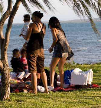
Nelson Bay will become a unique destination for both tourists and local residents, to live, work, play and stay. The Town Centre and Foreshore is envisaged as an interlinked active place that celebrates its unique identity as a Town by the Bay.
It will continue to play its vital role as a tourist centre within the Tomaree Tourism and Lifestyle Growth Area in Port Stephens LGA, sustaining population and employment growth over the next 20 years.
As a Town by the Bay, it will continue to celebrate its unique land-form, rich biodiversity and outstanding marine and coastal environment. Nelson Bay offers diverse fun-filled water-based activities and a relaxing coastal lifestyle.
Nelson Bay will lead as an example for environmental sustainability, preserving and enhancing its natural environment for generations to come.
It will celebrate the region’s culture and heritage, from the aboriginal village green of the Worimi people, to the town’s rich fishing and military history.
As a Town by the Bay, it will provide seamless connections between the Town Centre and Foreshore, where cafés and boutique retail destinations meet high quality marina restaurants. The streets and public spaces will be convenient, exciting and safe for people to use, and visually vibrant, both day and night all year-round.
Nelson Bay, a thriving place that is leaping forward into its NEXT chapter.
Vision Tract Consultants Nelson Bay NEXT Port Stephens Council 06 Nelson Bay Public Domain Plan 2018
07 Nelson Bay Public Domain Plan 2018 Port Stephens Council Nelson Bay NEXT Tract Consultants Vision
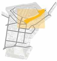
3. Understanding Context.
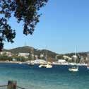
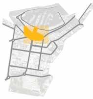
Nelson Bay, one of the largest towns in the Port Stephens area, is located on the Tomaree Peninsula, just inside the mouth of Port Stephens, a large natural harbour along the east coast of New South Wales.
Nelson Bay is the main entry point for enjoying the pristine Port Stephens waterway, particularly for dolphin and whale watching, fishing and other recreational aquatic activities.
Understanding Context Tract Consultants Nelson Bay NEXT Port Stephens Council 08 Nelson Bay Public Domain Plan 2018
3.1 Regional Context

3.2 Local Context

Nelson Bay is located 60 km north-east of Newcastle and 200 km from Sydney, on the Tomaree Peninsula of Port Stephens.
Nelson Bay is joined along the Peninsula with the coastal settlements of Anna Bay, Fishermans Bay, Fingal Bay, Shoal Bay, Salamander Bay and Soldiers Point. These distinct areas are separated by natural bush land and hilly topography, which provides a dramatic backdrop to picturesque coastal views.
Preserving and enhancing this sensitive and unique regional context, which contributes to the distinct character of each bay within the Peninsula, is a fundamental consideration.
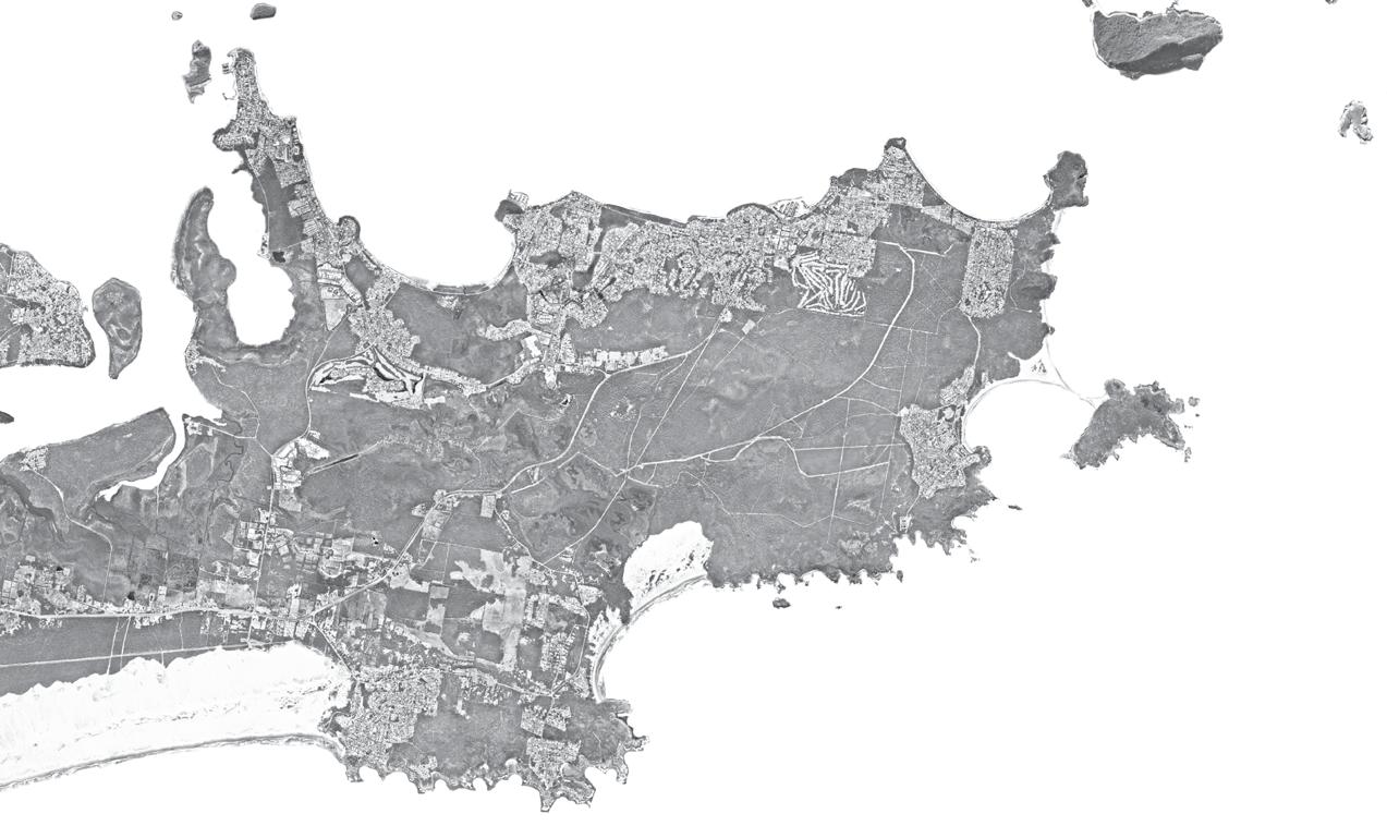
The main access to Nelson Bay is via Nelson Bay Road. Traffic passes either through or around Nelson Bay Town Centre in order to reach the smaller centres to the east, such as Shoal Bay and Fingal Bay.
Nelson Bay is located within the Tomaree Tourism and Lifestyle Growth Area as identified in Port Stephens Planning Strategy 2011. Nelson Bay Tourism Precinct has been identified as a “strategic centre” by the Hunter Regional Plan, which will be “the focus for population and/or economic growth over the next 20 years”.
Nelson Bay serves as the primary tourism and service centre for the Tomaree Peninsula and Port Stephens Local Government Area.
It contains a number of retail and hospitality venues. However, activation of the Town Centre is seasonal, with high variation in the tourism population.
Prior to Nelson Bay’s Woolworths supermarket, the Salamander Centre was the main destination for the Tomaree Peninsula’s weekly shopping, whilst Nelson Bay’s retail focused on leisure shopping, cafés and restaurants and tourist services.
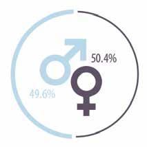
There is a substantial local population of approximately 5,000 in the suburb, with a significant proportion of retirees.
PORT STEPHENS
Nelson Bay
Shoal Bay
TOMAREE PENINSULA
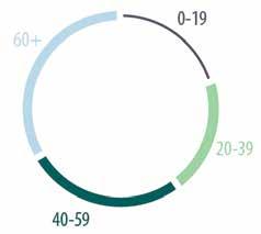
Average Age (2016 ABS Census)
Currently there are not many community facilities and services within the Town Centre. Salamander Bay provides Tomaree Library and Community Centre, which are 8km away.
The Bowling Club, Tennis Courts and Golf Club, which are located just to the south of the Town Centre, are widely used recreational facilities.
Wreck Beach Shark Island
Fingal Bay Samurai Beach
Salamander Bay Lemon Tree Passage
Soldiers Point Port Stephens
Worimi
Boondelbah Tomaree Mountain
Mount Yacaaba tomaree national park
Nelson Bay Road
Lighthouse
gan gan lookout
Anna Bay Fishmans Bay
Newcastle
Male:Female Ratio (2016 ABS Census)
09 Nelson Bay Public Domain Plan 2019 Port
Council Nelson Bay NEXT Tract Consultants Understanding Context
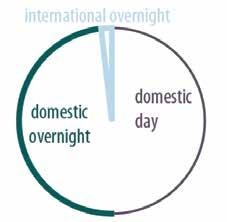
Tourism Breakdown & Average Nights (Port Stephens Economic Profile 2017)
Stephens
4. Understanding Nelson Bay.
To better understand Nelson Bay, we undertook a thorough site analysis study, as well as community consultation with stakeholders.
The key findings are summarised in this section, with detailed results included in the Appendix.
Understanding Nelson Bay Tract Consultants Nelson Bay NEXT Port Stephens Council 10 Nelson Bay Public Domain Plan 2018
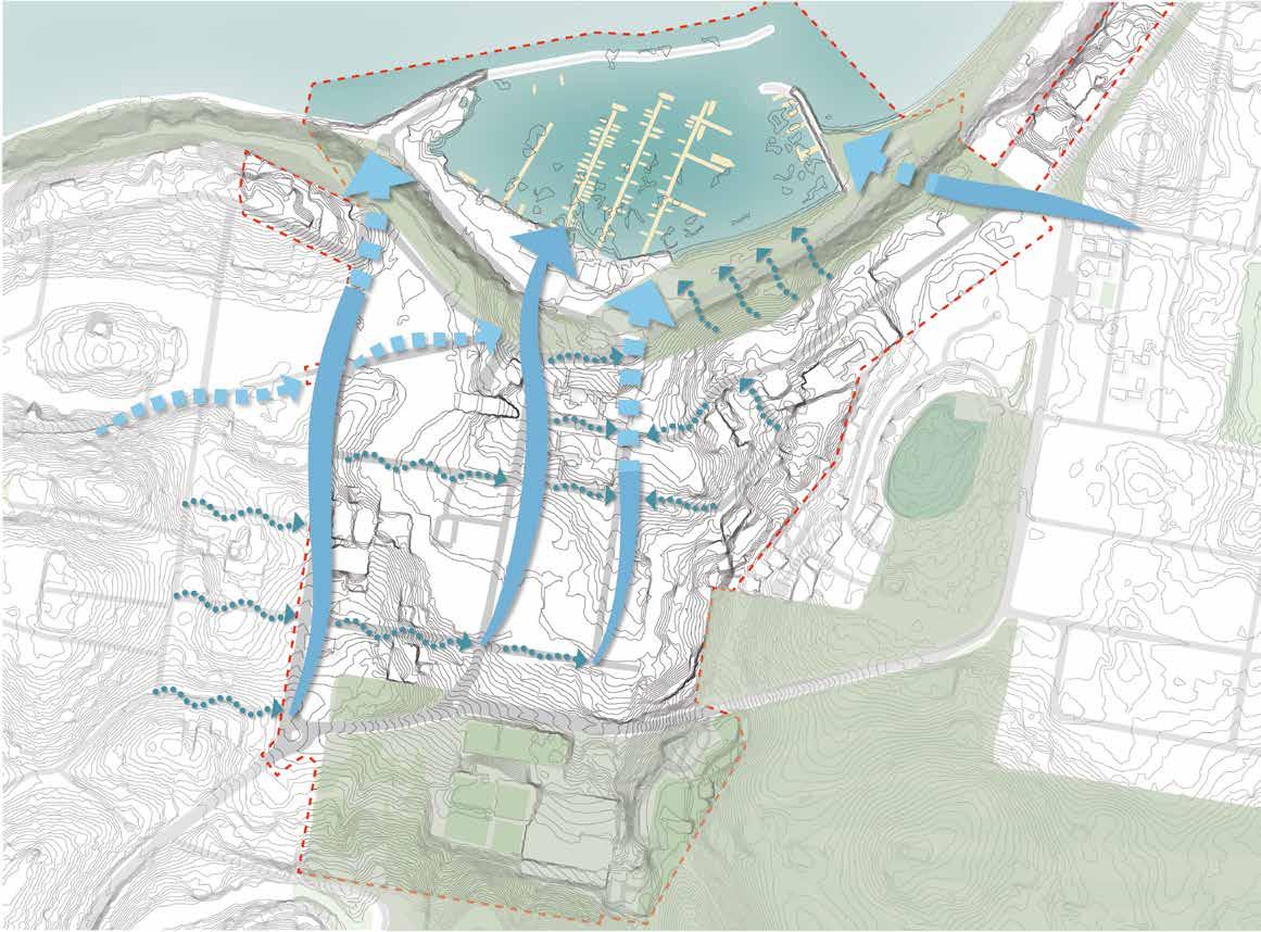
4.1 Understanding Natural Environment
EXISTING SCENIC VALUE
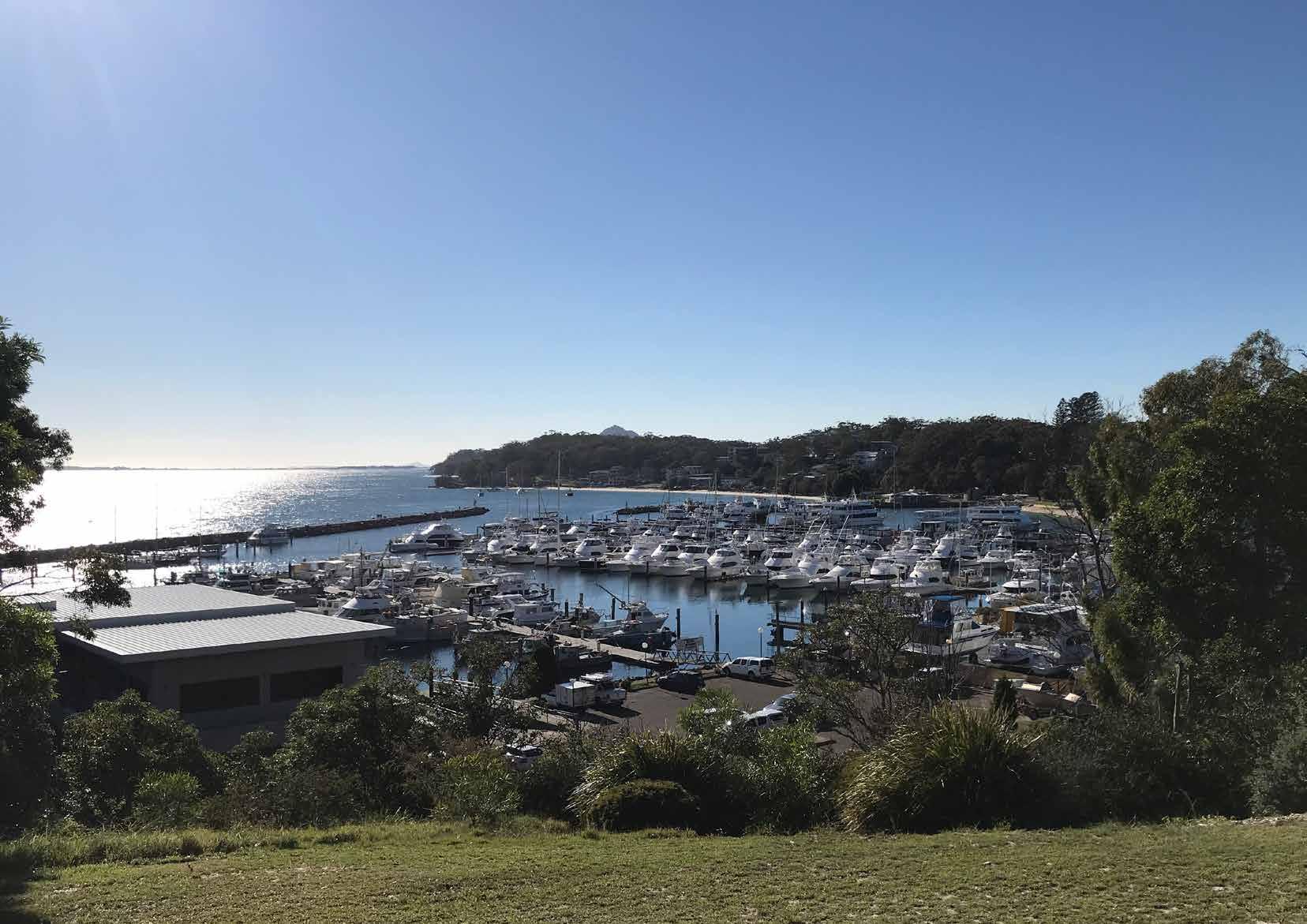
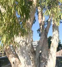
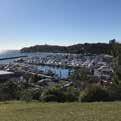
Nelson Bay is surrounded by outstanding natural beauty, with Port Stephens water body and the marina to the north and the forested hills of Tomaree National Park to the south. Its rich, unique marine and bush environment provides the major attraction for tourists and residents.
The ancient volcanic topography provides a slow reveal of picturesque water views whilst approaching the Town Centre and the Foreshore, either from the main axis of Stockton Street or along Government Road.
EXISTING ECOLOGICAL VALUE
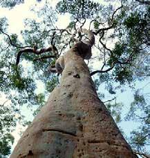
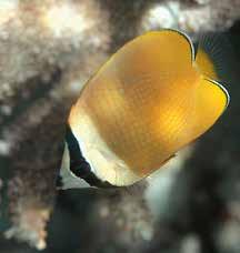
Nelson Bay is adjacent to Port Stephens Great Lakes Marine Park’s rich marine biodiversity, harbouring dolphins, turtles, fish, invertebrates, sea birds and seaweeds along with threatened species such as Gould’s petrel, little tern, grey nurse sharks and green turtles. Humpback whales also pass on their annual migration along the coast. Meanwhile, Tomaree National Park to the south contains a wide variety of flora habitats from coastal headlands to volcanic peaks and sub-coastal swamps, with a high density of native species, several of which are threatened.
PRESERVE & CELEBRATE NATURAL ENVIRONMENT OPPORTUNITIES & RESPONSE
It is important to preserve and celebrate the existing natural environment through:
· Connecting the waterfront with vegetated hilly backdrop through the urban fabric both visually and physically;

· Enhancing the Green Network, e.g. street tree planting, through the Town Centre;
· Implementing a Blue Network, i.e. storm water management via Water Sensitive Urban Design (WSUD) between the Town Centre and the Foreshore.

“It’s important to preserve our natural environment.”
“It’s good to have WSUD in place.”
- Stakeholder / Community Comments
Kurrara Hill
Tomaree National Park
Kurrara Hill Tomaree National Park
Green & Blue Network Connection View out to Nelson Bay marina View back to Foreshore with Kurrara Hill backdrop Government Road Stockton Street 11 Nelson Bay Public Domain Plan 2019 Port Stephens Council Nelson Bay NEXT Tract Consultants Understanding Nelson Bay
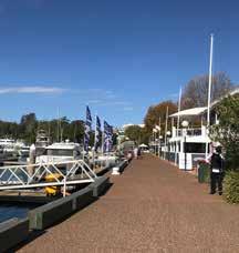
Nelson Bay Marina Nelson Bay Marina
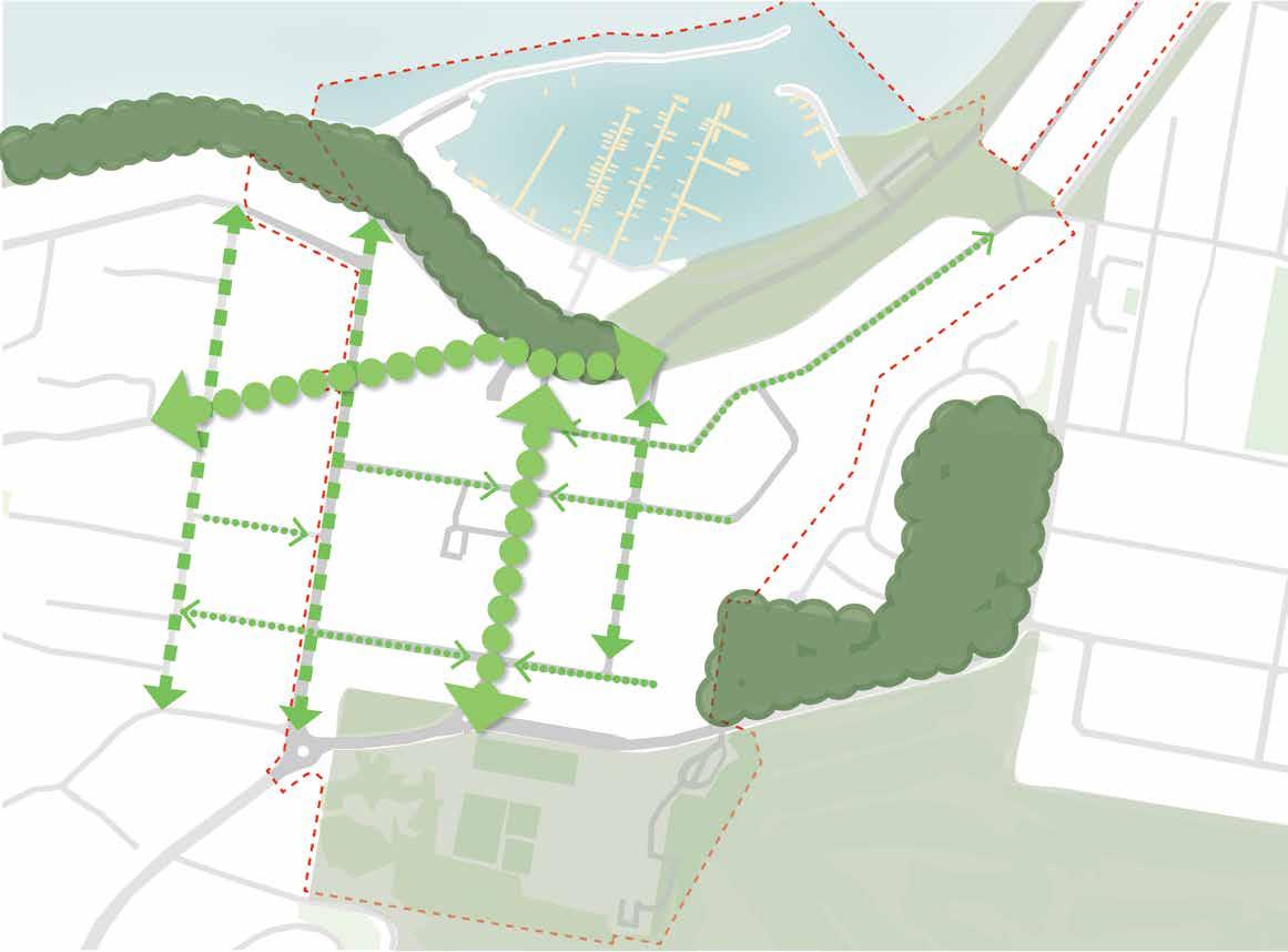
4.2 Understanding Pedestrian & Cycle Movement
EXISTING CONNECTIVITY ISSUES
Nelson Bay is currently heavily car dependant. Existing pedestrian and cycle movements are either disconnected or discouraged by a poor user environment.
· High volume by-pass traffic along Victoria Parade/ Government Road forms a pedestrian barrier between the Town Centre and the Foreshore.
· Traffic congestion happens at high pedestrian-volume areas, such as Magnus Street and the north end of Stockton Street, particularly during the peak tourist season. This is caused by limited and constrained street connections between the Town Centre and the Foreshore.
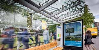
· Lack of alternative transit modes, such as public transport and cycle facilities. Public transport services and facilities are poor quality and limited.
· Disconnected footpath and cycle path around Town Centre and Foreshore area.
· Lack of disabled access, especially approaching the Foreshore area where the ground level changes.
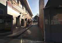
· Laneways in the Town Centre are either in poor condition or feel unsafe for people to use.
· Lack of wayfinding signage, especially at key nodes and arrival points.
IMPROVE CONNECTIVITY & WALKABILITY OPPORTUNITIES & RESPONSE
The environment needs to be pedestrian and cycle friendly. Safe, weatherprotected and well conncected linkages will promote and improve non-vehicular movement both at the Town Centre and the Foreshore. A few responses include:
· Prioritising pedestrians in the Town Centre Core and diverting traffic movements;
· Allowing for slow-medium speed traffic in the Town Centre;
· Marginalising fast traffic to the Town Centre periphery;
· Improving public transport and cycle facilities;
· Providing universally accessible environment for people of all ages and different needs and interests;
· Encourage revitalising of laneways to improve Town Centre permeability;
· Providing clear and legible wayfinding signage.
Pedestrian-priority Town Centre Core
Pedestrian Prioritised Town Centre Slow Traffic Zone (10-25kmph)
Pedestrian and Cycle Friendly Local Area Medium Traffic Zone (40kmph)
Peripheral/By-Pass Traffic Zone (50+kmph)
“Remove overhead bridge [on Victoria Parade] & Stockton Stage”
“Really like Stockton St being a ‘Boulevard’.”
- Stakeholder / Community Comments
Kurrara Hill
Tomaree National Park
Kurrara Hill
Tomaree National Park
Lack
Disabled Access
Nelson Bay Marina
of
Traffic Barrier Traffic Congestions Area Existing Dull Laneway Existing Bus Stop requiring upgrade
12 Nelson Bay Public Domain Plan 2019 Port Stephens Council Nelson Bay NEXT Tract Consultants
Nelson Bay Marina
4.3 Understanding Place Character
EXISTING CHARM
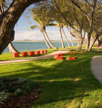
Situated among a stunning natural setting, Nelson Bay has evolved from a fishing village into a popular coastal holiday destination and lifestyle town with a relaxed character.
At the Foreshore, it features:
· A large marina, particularly a busy working marian for fishing industry at western foreshore;
· Waterfront walkways and beaches;
· Restaurants and cafés specialising in fresh local produce and seafood;
· Green foreshore parklands;
· Water-based tourism activities and facilities;
· Heritage items, such the ANZAC war memorial.
At the Town Centre, it features:
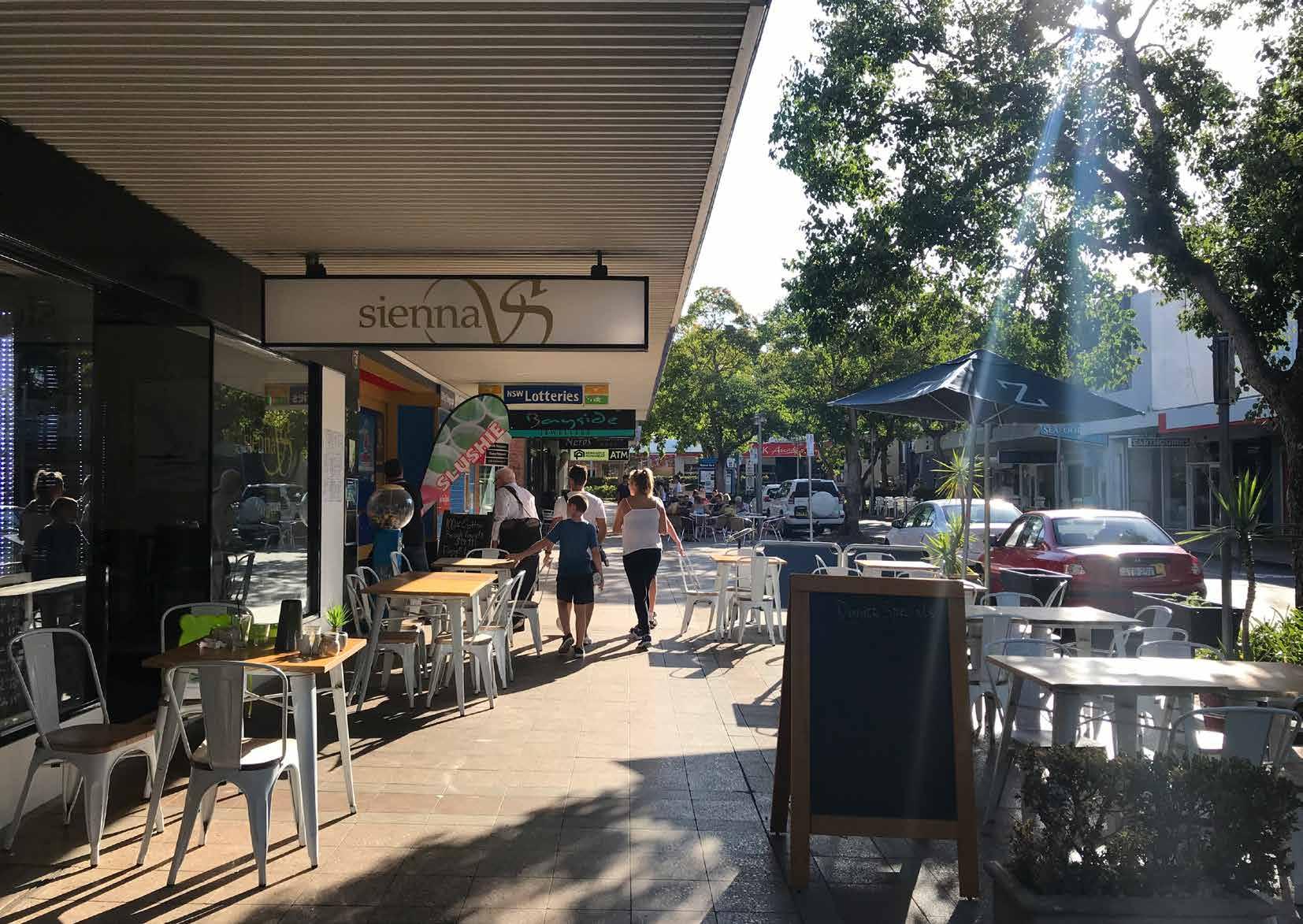
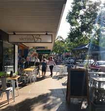
· Magnus Street with a village character, offering boutique shops and restaurants/cafés, where people love to eat, drink, linger and mingle;
· Stockton Street as the main axis, providing direct connection to the Foreshore.
EXISTING ISSUES
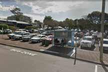
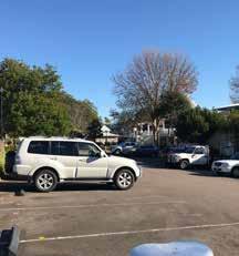
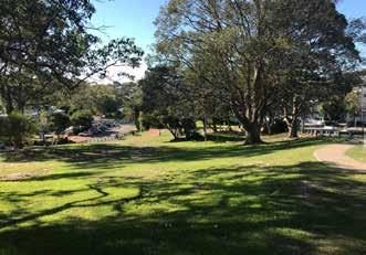
There are a large number of open air car parks dispersedly located along the Foreshore which dominate, constraining tourist activity and public domain opportunities at the waterfront.
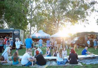
Also Nelson Bay Town Centre currently lacks night-time activation and activities. The Foreshore hosts the Sacred Tree markets, however this is limited to the peak summer season.

ENHANCE & ENLIVEN CHARACTER OPPORTUNITIES & RESPONSE
To further enhance and enliven the existing local charm and place character, there are opportunities, such as:
· Advocating Western Foreshore as a working marina while keeping Eastern Foreshore focused on recreational functions;

· Freeing up more foreshore open space for tourism, public recreation and event opportunities by relocating foreshore parking to nearby Town Centre multi-level facilities if available;
· Promoting Stockton Street into a pedestrian boulevard with a special focus at its northern end;
· Enhancing the village character at Magnus Street and Stockton Street Village Precinct via upgraded streetscape;
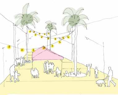
· Considering a year-round calendar of events, as well as the activation of streets in the evenings, such as bar and restaurant offerings, which boost the local economy and attract both tourists and permanent residents to the Bay.
“Move Info Centre & have building as Art Gallery.”
“Consider multi-level parking in conjunction with other commercial functions e.g. educational facility.”
- Stakeholder / Community Comments
Kurrara Hill
Tomaree National Park
Nelson Bay Marina
Foreshore Promenade
Apex Park
Sacred Tree Markets at the foreshore Source: Visit NSW
13 Nelson Bay Public Domain Plan 2019 Port
Tract
Understanding Nelson Bay
Village Character on Magnus Street Foreshore On Grade Car Park
Stephens Council Nelson Bay NEXT
Consultants
5. Strategic Direction.
Three “Big Moves” underpin the vision for Nelson Bay Town Centre and Foreshore: - Green & Blue Network
- Streets for People
- Places for People
Strategic Direction Tract Consultants Nelson Bay NEXT Port Stephens Council 14 Nelson Bay Public Domain Plan 2018
5.1 Three Big Moves
These are the strategic design directions for the public domain, developed from our understanding of the existing natural environment, connectivity and place character.
Any future improvements to the public domain to achieve the vision for Nelson Bay should be underpinned by these Big Moves.
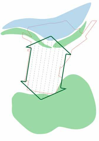
GREEN & BLUE NETWORK
Provide an integrated green and blue network connecting Nelson Bay to Tomaree National Park, that will reduce environmental impacts, improve public health and contribute to a beautiful urban environment.
STREETS FOR PEOPLE
Create pedestrian- and cycle-friendly street environments that are easily accessible for all users. Prioritise people, by creating a traffic environment where priority is given to pedestrian movement, cycling infrastructure and public activity.
PLACES FOR PEOPLE
Offer places with a diverse range of year-round uses, high public amenity and distinct design quality, where the stories of Nelson Bay are represented and enhanced.
· Establish street tree canopies and under-storey planting that will reinforce hierarchy of the street network and improve the urban ecology.
· Integrate the management of storm water and Water Sensitive Urban Design into the design of upgraded streets and public open spaces.
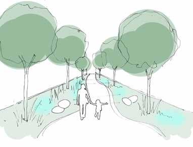
· Interpretive water features and landmark public art, which are ecologically sustainable, to create a more visually interesting and culturally diverse public domain.
· Ensure streets and intersections are designed for pedestrian priority.
· Reduce traffic speed & congestion in high pedestrian areas.
· Improve physical and visual access through safe, activated and well connected streets and laneways.
· Improve footpath amenity, such as upgraded street furniture, lighting and paving.
· Provide weather protection for pedestrians.
· Provide clear and informative wayfinding.
· Restore character of Town Centre and Foreshore with enhancement of existing charm, celebrating Indigenous and European heritage.
· Achieve desirable public open spaces with high level of amenity, addressing climate, safety, circulation, and activity.
· Provide a variety of spaces that are inclusive of particular needs and desires of different groups of people.
· Create an adaptable public domain, capable of accommodating a broad range of uses, events, experiences and public activities throughout different times of the day and year.
15 Nelson Bay Public Domain Plan 2019 Port Stephens Council Nelson Bay NEXT Tract Consultants Strategic Direction
6. Design Strategies.
Each of the following public domain typologies and overlays, when coordinated, will provide the elements necessary to develop a consistent high quality public domain.
An overarching Structure Plan is developed to underpin the “Three Big Moves” set in Chapter 5.
This Structure Plan is further broken down into a series of design strategies and overlays, including:
ENVIRONMENT & ECOLOGY OVERLAY
· Green Network Overlay
· Blue Network Overlay
CYCLE NETWORK
STREET TYPOLOGY
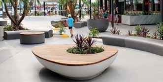
PUBLIC DOMAIN CHARACTER & MATERIALS
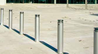
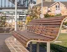
· Public Domain Furniture
· Hardscape Treatment
· Public Domain Lighting
EVENTS & ACTIVATION OVERLAY
PUBLIC ART OVERLAY
PEDESTRIAN WAYFINDING OVERLAY
STREET LIGHTING
These public domain strategies and overlays support the “LARGE Vision Concept”.
Design Strategies Tract Consultants Nelson Bay NEXT Port Stephens Council 16 Nelson Bay Public Domain Plan 2018
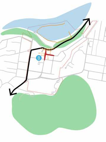
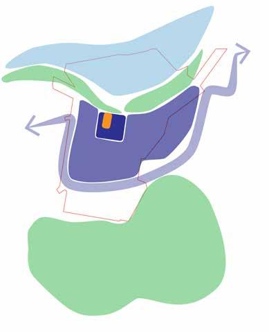
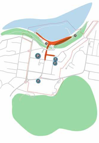
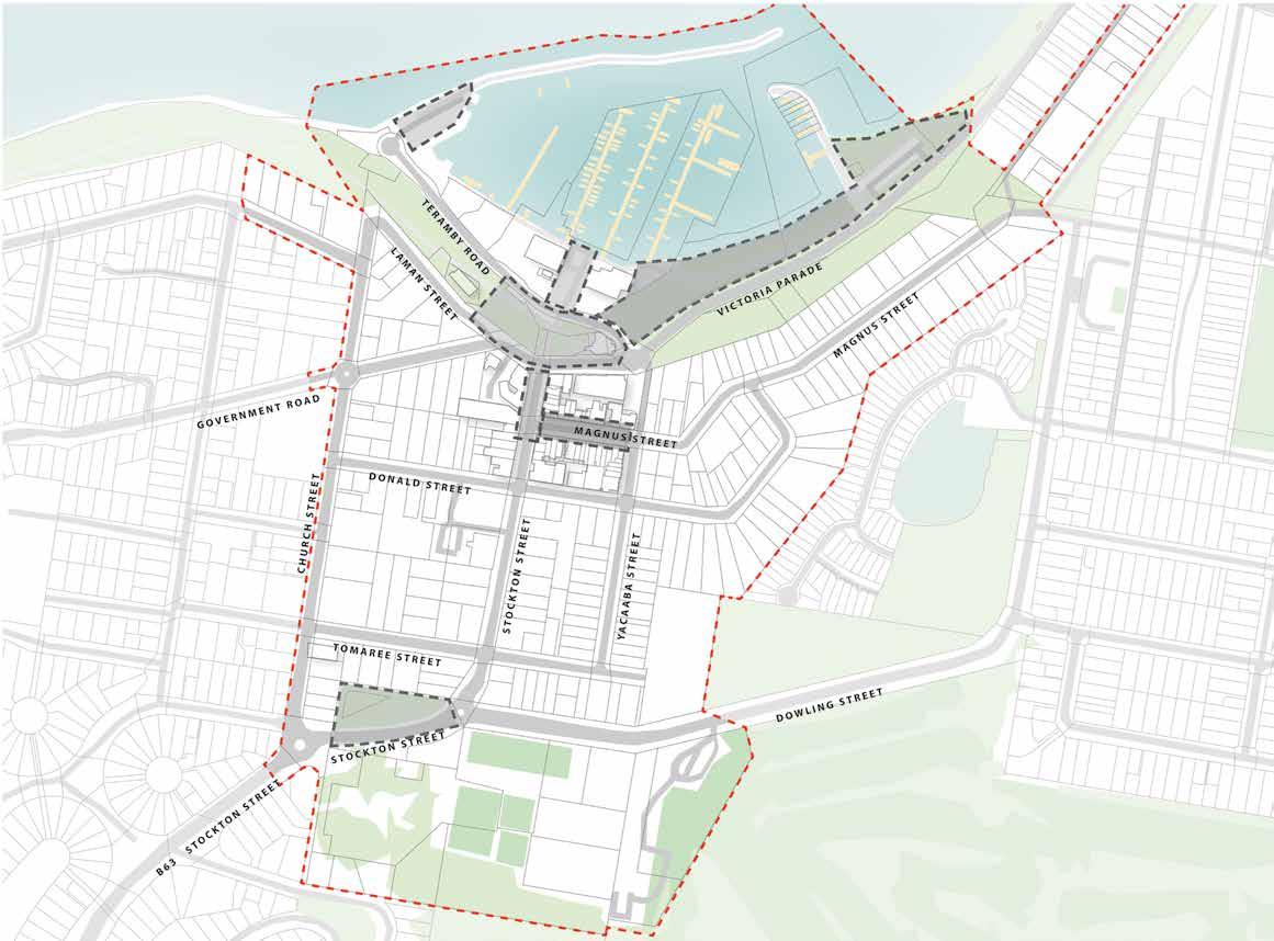
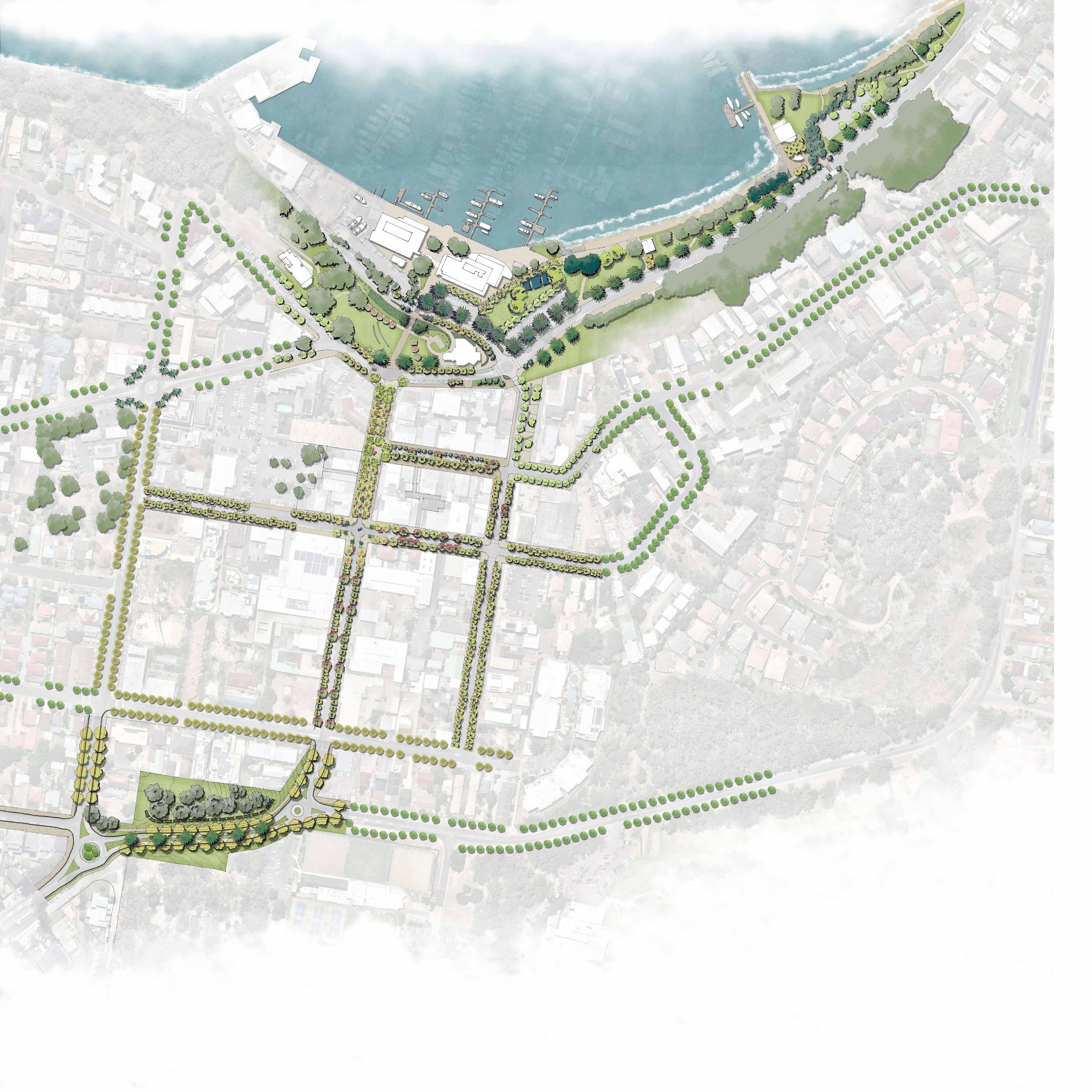
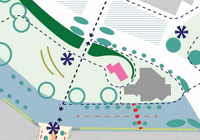
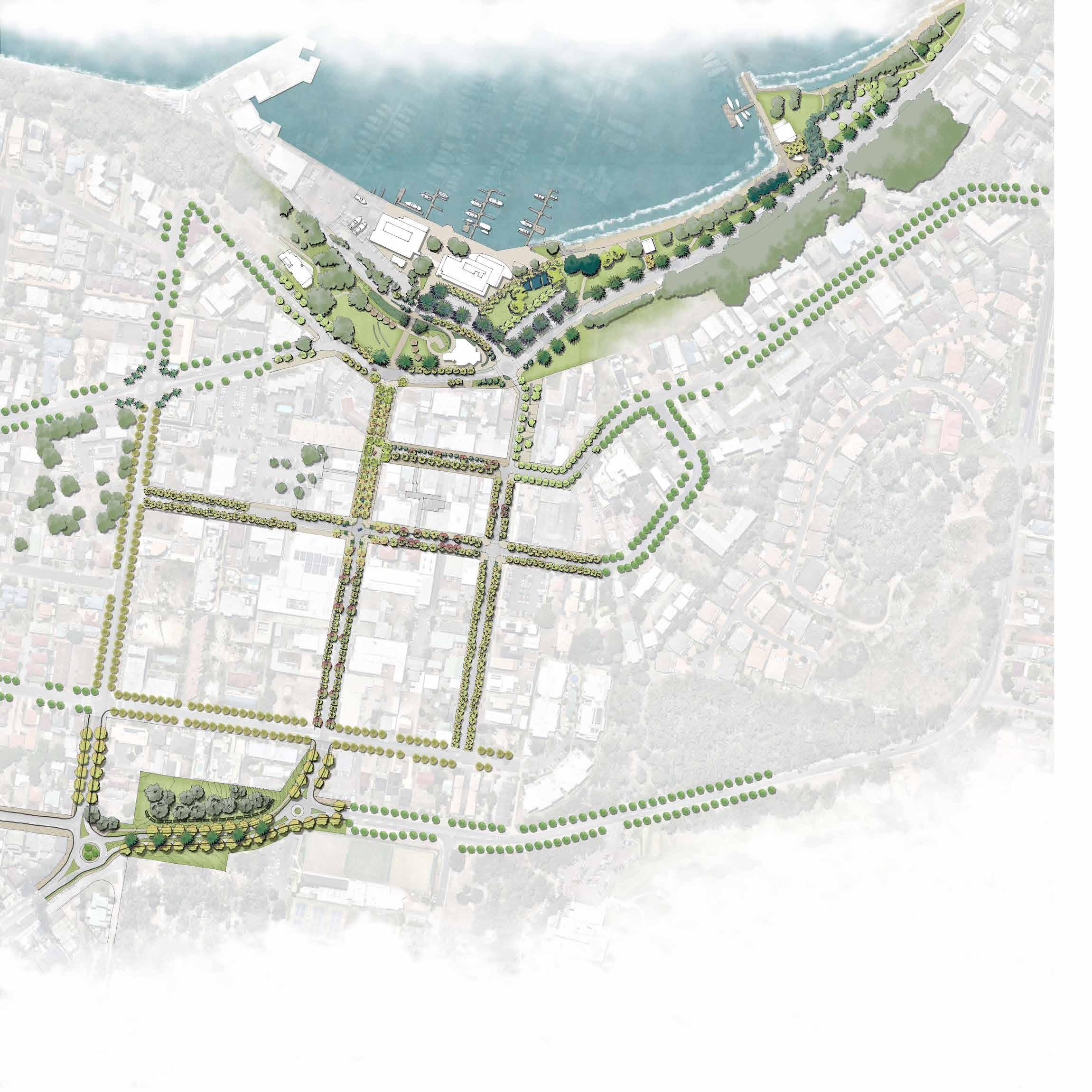
6.1 Structure Plan
Study Boundary Gateway Signalised Intersection
Foreshore Open Space/Apex Park Periphery Zone Road
Medium Zone Road
Town Centre Street (with Primary & Secondary Green/Blue Network Application)

Slow/Shared Zone Road (with Primary & Secondary Green/Blue Network Application)
Street Frontage Activation
P
Continuous Street Awnings Public Parking
Crown land - potential for additional parking to be investigated
B 1 2 3 4 5
Public Transport Shared Cycle/Foot Path Separated Cycleway
Laneway Connection
Foreshore Promenade
Stockton Street Shared Zone
Apex Park
Eastern Foreshore
Central Foreshore Plaza Western Foreshore
Concept Only: Final design subject to technical design considerations, detailed investigation of services and relevant approvals 17 Nelson Bay Public Domain Plan 2019 Port Stephens Council Nelson Bay NEXT Tract Consultants Design Strategies
6.2 Environment & Ecology
Overlay — Green Network
Streets can provide an interlinked green network, with planting and street trees offering a variety of benefits to the environment, people and places within the public realm, including:
· Conserving and enhancing biodiversity and increasing access to nature;
· Improving air quality and filtering pollutants;
· Providing canopy coverage for shade, encouraging pedestrian movement;
· Facilitating adaptation to climate extremes;
· Enhancing ‘sense of place’, providing distinctive destinations for visitors and residents;
· Providing a buffer between pedestrians and car movement; and

· Providing seasonal interest and natural beauty through foliage.
Primary and Secondary links reinforce street typology and character, and link the north-south axis from Tomaree National Park to the Bay. Tertiary links connect the local streets in an east-west axis, providing for a full network of green corridors.
Study Boundary
Primary Green Connections - Stockton Street & Government Road
Secondary Green Connections - Church Street & Yacaaba Street
Tertiary Green Connections
LEGEND
Apex Park
Nelson Bay Marina
Nelson Bay Golf Club
Nelson
Bay Bowling & Recreation Club
Government Road Stockton Street Church Street Yacaaba Street Donald Street Magnus Street
18 Nelson Bay Public Domain Plan 2019 Port Stephens Council Nelson Bay NEXT Tract Consultants
Concept Only: Final design subject to technical design considerations, detailed investigation of services and relevant approvals
6.3 Environment & Ecology
Overlay — Blue Network
A blue network works in conjunction with the green network, with Water Sensitive Urban Design (WSUD) practices, to bring a variety of benefits, including:
· Minimising impervious surfaces to mitigate changes to the water balance;
· Reducing overland storm water runoff by providing temporary rainfall storage and re-use along streets;
· Protecting the sensitive marine environs by filtering pollution out of storm water, including litter, heavy metals and hydrocarbons (oil and grease);
· Supporting wildlife habitats and increasing biodiversity; and
· Contributing to the distinctive character and amenity of streets.
The primary blue connections play the major role of collecting the storm water from the secondary and tertiary blue connections, filtering it before it runs off into the natural system.
Study Boundary Primary Blue Connections Secondary Blue Connections Tertiary Blue Connections LEGEND
Nelson Bay Marina
Recreation
Government Road
Street Church Street
Donald
Concept only, final design subject to technical design considerations, detailed investigation of services and relevant approvals 19 Nelson Bay Public Domain Plan 2019 Port Stephens Council Nelson Bay NEXT Tract Consultants Design Strategies
Nelson
Bay Golf Club Nelson Bay Bowling &
Club
Stockton
Yacaaba Street
Street Magnus Street
6.4 Street Typology
Streets are the fundamental elements of the public domain.
They are critical to the liveability and sustainability of the urban environment and are important places for people to meet and socialise. Street typology must clearly reflect the street hierarchy and define the character.
PEDESTRIAN ZONE
Pedestrian Shared Zone: Level street treatment, one-way vehicle movement with capacity to close to vehiclesdedicated to pedestrian movement from Town Centre to Foreshore, with varied hardscape and ecological corridor
Pedestrian/Cycle Shared Path: finishes to be upgraded where necessary to integrate with Foreshore
Foreshore Promenade: Dedicated pedestrian zone, incorporates shared path along eastern section
Laneways: encourage activation
SLOW ZONE (10-25KMPH)
Village Boulevard: Shared zone with level treatment for road and footpath, giving priority to pedestrians and allowing for closure for events
Pedestrian Priority Boulevard: Pedestrian priority to maximise permeability - into Town Centre and to Foreshore
MEDIUM ZONE (40KMPH)
Foreshore Service Road
Pedestrian Priority Road
Collector Road - Town Centre Treatment
PERIPHERAL ZONE (50+KMPH)
Collector Road
Sub-Arterial Road - By-Pass: Re-routed from the waterfront to allow for traffic to by-pass the Town Centre, reducing vehicular movements and thereby increasing pedestrian connectivity

Sub-Arterial Road - Gateway Treatment
Arterial Road
Local Street
Quality of Finishes Level
1 = Highest treatment quality for key public space
5 = Lowest treatment quality for public space
Study Boundary
Signalised Intersection
Intersection of Donald St & Stockton St - options include:
- Installation of traffic lights
- Extended shared zone
- Relocation of one or both crossings and construction of kerb extensions
One-way - Proposed direction
Concept Only: Final design subject to technical design considerations, detailed investigation of services and relevant approvals
1 3 1 1 2 3 2
2 3 5 4 5 4
LEGEND
20 Nelson Bay Public Domain Plan 2019 Port Stephens Council Nelson Bay NEXT Tract Consultants
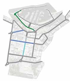
6.5 Cycle Network
Concept Only: Final design subject to technical design considerations, detailed investigation of services and relevant approvals
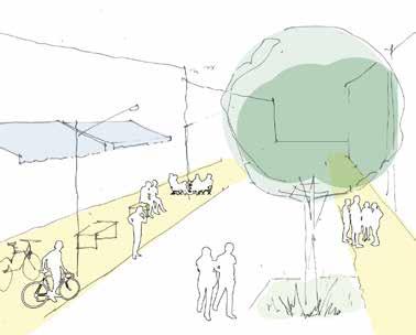
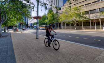
Cycling, as a recreational activity and an alternative transit mode, is a low-cost, sustainable and healthy way to travel
In order to facilitate a cycle friendly environment, it is important to improve the cycle network with safer and better connected paths, which are designed to minimise conflicts with pedestrians and vehicles.
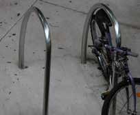
CYCLE ROUTE AND FACILITY
Extent of Existing Shared Path to be retained and upgraded
Removal of conflict between pedestrians and cyclists at steep section in Apex Park - ‘wiggle pathway’
Proposed Shared Path, specially designed for family cycling, widened footpath on one side of the road allowing for pedestrians and two-way cycling
Proposed Shared Zone, specially designed for Magnus Street Village Boulevard and Stockton Street, flush level treatment, cyclists give way to pedestrians
Proposed On-Road Separated Cycleway, mostly as an extension of the existing separated cycleway, mainly caters for daily commuter
Proposed On-Road Cycleway, generally throughout all Town Centre streets
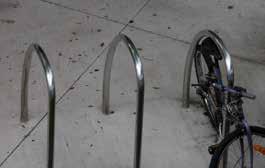
Proposed Cyclist Facilities, including bicycle storage/ racks generally located near public transport or shop fronts as part of the street furniture, and shower rooms/ lockers can be co-located with foreshore amenities and Visitor Centre, which is to be refurbished.

Study Boundary Signalised Intersection
Intersection of Donald St & Stockton St - options include:
- Installation of traffic lights
- Extended shared zone
- Relocation of one or both crossings and construction of kerb extensions
One-way - Proposed direction
LEGEND
21 Nelson Bay Public Domain Plan 2019 Port Stephens Council Nelson Bay NEXT Tract Consultants Design Strategies
Public Domain Character & Materials
FORESHORE
The Foreshore celebrates the prime waterfront location of the Town with high-quality materials and elements that enhance the colours and textures of the natural environment of the Marina.
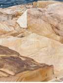

Quality of Finishes Level 1: high-quality paving and some bespoke elements/ foreshore lighting
PEDESTRIAN ZONE + SLOW ZONE (10-25KMPH)
The Town Centre accommodates and prioritises pedestrians, with high-quality, distinctive, contemporary features which reflect the NEXT Nelson Bay.
Quality of Finishes Level 1: high-quality paving and special integrated seating/feature lighting
6.6
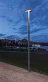
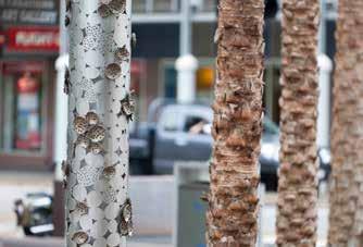
Public Domain Furniture Hardscape Elements Public Domain Lighting Sandstone Elements Lights By The Bay Integrated Lighting Opportunity for installations of feature lighting/integrated with public art Pedestrian Scale Lighting Smart Pole Lighting Pedestrian Scale Lighting Seating with Integrated Planting Seating with Integrated Planting Urban Furniture for Streets - Bollards Stone Paving Setts PSC Nelson Bay Next Bins PSC Nelson Bay Next Bins Exposed Aggregate Paving
22 Nelson Bay Public Domain Plan 2019 Port Stephens Council Nelson Bay NEXT Tract Consultants
MEDIUM ZONE (40KMPH)
Areas surrounding the Town Centre will reflect a similar language of contemporary design features, and a consistent palette of upgraded elements.
Quality of Finishes Level 2-3: medium-quality paving, durable stainless steel street furniture
PERIPHERAL ZONE (50+KMPH)
Peripheral areas surrounding the Town Centre will also have a consistent palette of upgraded elements of street furniture and lighting where necessary.
Quality of Finishes Level 3-5: lowest priority for quality, durable stainless steel furniture and concrete paving
Domain Furniture Hardscape Elements Street Lighting
Public
Precast Concrete Paving Timber furniture Smart Pole Lighting Smart Pole Lighting PSC Nelson Bay Next Bins Bus Stops PSC Nelson Bay Next Bins Insitu Concrete Paving Bike Racks Bike Racks
23 Nelson Bay Public Domain Plan 2019 Port Stephens Council Nelson Bay NEXT Tract Consultants Design Strategies
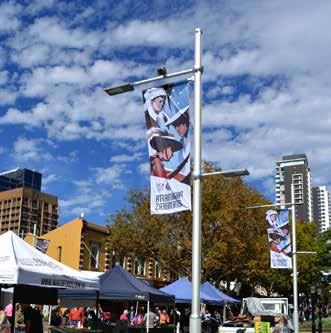
6.7 Events & Activation Overlay
Regular community events and activation of the public domain provide social and economic benefits, supporting the local economy and contributing to the identity of place and community.
These should be programmed to activate the Town Centre and support local businesses throughout the year, with a variety of events that enliven public spaces during the day and evenings.
EVENT AREAS & ROLE/FUNCTIONS
Apex Park Existing ANZAC and Remembrance Day services, as well as other festival and market events
Stockton Street Proposed shared zone in heart of CBD gives opportunity for everyday/weekend popup activities and events that incorporate and celebrate local businesses and encourage late night activation
Magnus Street, Village Precinct Proposed shared zone with level street treatment and potential for closure for year-round weekly or monthly market events and other pop-up activities such as Food and Wine Festivals

Yacaaba Street Infrastructure for events (water, power, lighting) was added in the recent Yacaaba St Extension
Foreshore Central Plaza Existing sculpture festival and other events, potential to link with Stockton St to reinforce connection from Marina to Town Centre
Eastern Foreshore Focus on recreational activities and facilities for all ages, potential for educational programme/ events, such as a wide range of educational programs that are designed and offered by Port Stephens Council to increase environmental awareness for the community
LEGEND
Study Boundary
24 Nelson Bay Public Domain Plan 2019 Port Stephens Council Nelson Bay NEXT Tract Consultants
Concept Only: Final design subject to technical design considerations, detailed investigation of services and relevant approvals
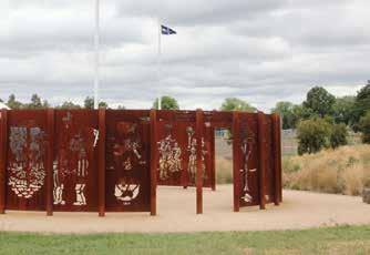
6.8 Public Art Overlay
3 6 7
Public art provides the opportunity to interpret the Town’s rich history and look to the future whilst shaping our collective consciousness, creating inspiring, welcoming places.
1 4 5
2 5 6
It is essential that public art is programmed and located correctly, and is reflective of history and place, whilst also providing for ownership by the local community. It should be location specific and integrated with street lighting and signage.
A community-led procurement and design process will give opportunities to celebrate local artists. Port Stephens Cultural Plan recognises the importance of prioritising and integrating such cultural infrastructure.
PUBLIC ART LOCATIONS
Gateway Park Opportunity for art work to form landmark entrance to Nelson Bay, celebrating the culture and history of the town. Gateway Art to boast boldly and to be visible from distance
Stockton Street & Magnus Street Linear art work to reinforce identity of Stockton Street as heart of Town Centre and celebrate views and proximity to Bay. Magnus Street artworks to be inkeeping with ‘Village Precinct’ designation, celebrating history and character of Town
Apex Park : Art work to reinforce transition between Town Centre and Foreshore. Potential opportunity to highlight ANZAC memorial and eastern axis
Foreshore Central Plaza Gateway artwork to celebrate arrival at Nelson Bay Foreshore and link back to Apex Park and Stockton Street
Existing Artworks Whale tails trail
Eastern Foreshore: Opportunity for artwork to celebrate activities and unique marine environment along Foreshore and at Ferry location
7 Concept Only: Final design subject to technical design considerations, detailed investigation of services and relevant approvals 25 Nelson Bay Public Domain Plan 2019 Port Stephens Council Nelson Bay NEXT Tract Consultants Design Strategies
LEGEND Study Boundary
1
2
Western Foreshore: Opportunity for artwork to celebrate Nelson Bay’s fishing and maritime heritage 3 4
6.9 Pedestrian Wayfinding Overlay
An intuitive wayfinding system allows the delivery of a more legible public domain that encourages people to walk with comfort and confidence around Nelson Bay Town Centre and Foreshore and beyond.

Clear wayfinding will allow people to reach their destination easily and quickly by providing the cues and information to know: where you are, where you are headed, how to get there, and how long it will take.
Information, mapping and pedestrian direction signs together form a pedestrian wayfinding network throughout the Town Centre and the Foreshore.
The wayfinding system will be as inclusive as possible by providing information in formats accessible to mobility impaired, visually impaired and hearing impaired users.
i
PEDESTRIAN WAYFINDING NETWORK
Pedestrian Route throughout the Town Centre and Foreshore, along which wayfinding signs are provided for connected navigation
Informal Foreshore Walking and Cycle Track, linking Nelson Bay and beyond
Laneways and Through-Site Links within Town Centre improve site walkability and permeability. Direction signs at each end of the laneways/through site links are necessary to highlight destinations.
Public Car Parks will be heavily used during the peak season. Directions are especially important for visitors and tourists.
Information and Mapping Signs are located at the entry points of the central gathering areas, e.g. the Town Centre Village Precinct, Apex Park, the Foreshore central plaza and the ferry wharf, where people tend to stop, read, understand and make decisions for travel.
Pedestrian Directional Signs are located at:
· Areas with change of direction, e.g. street intersections;
· Car Park entry/exits;
· End of laneways/through-site links;
· Mid-point of long routes. Proposed Public Amenities
LEGEND Study Boundary
26 Nelson Bay Public Domain Plan 2019 Port Stephens Council Nelson Bay NEXT Tract Consultants
Concept Only: Final design subject to technical design considerations, detailed investigation of services and relevant approvals
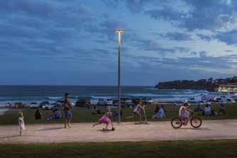
6.10 Street Lighting
1
Street lighting works in conjunction with other street elements as an organising factor to establish the hierarchy of the streetscape.
Lighting design also contributes to public domain character and safety. Nelson Bay public domain lighting strategy specifies four overall treatments, which are serving four different character areas and purposes. Upgrading the lighting across the Town Centre provides an opportunity to integrate a consistent contemporary suite of products which employ sustainable low-energy technology and modular adaption for future flexibility.
LIGHTING TYPES
Stockton Street Shared Zone lighting will celebrate an active and bustling Town Centre heart, with increased hours of activation year-round. A range of street lighting will be incorporated, including playful feature lights and lighting of public art & wayfinding
Village Precinct lighting at Magnus Street and Stockton Street shared zone and laneways will reflect the ‘village’ character. Smaller, pedestrian-scale street poles will support the finer grain of the streetscape
Town Centre street lighting will be upgraded with increased frequency and contemporary design to improve pedestrian amenity and safety. Smart poles will provide a modular system for future flexibility and upgrade.
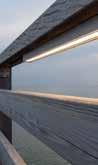
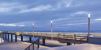
Foreshore Lighting will reinforce connection to the Town Centre through Apex Park, whilst also celebrating the special character of the waterfront promenade. This will include pedestrian-scale lighting elements and lighting integrated into the promenade environment, such as timber handrails or sleepers.
Study
LEGEND
Boundary
2 3 4 1 2 3 4
27 Nelson Bay Public Domain Plan 2019 Port Stephens Council Nelson Bay NEXT Tract Consultants Design Strategies
Concept Only: Final design subject to technical design considerations, detailed investigation of services and relevant approvals
7. Key Places & Spaces.
Four key places have been identified and considered in further detail in order to guide the delivery of the overarching vision. These places will reflect the nature of Nelson Bay as a Peninsula gateway, waterfront destination, and bustling Town Centre.
Key Places & Spaces Tract Consultants Nelson Bay NEXT Port Stephens Council 28 Nelson Bay Public Domain Plan 2018

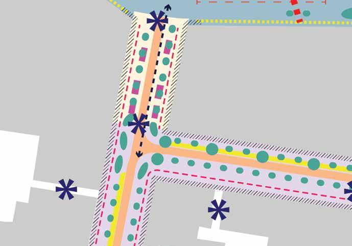
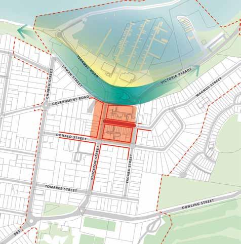
7.1 Key Places Overview Stockton Street Shared Zone & Magnus Street Village Precinct Apex Park & Victoria Parade Interface Eastern Foreshore Nelson Bay Gateways 1 1 2 2 3 3 4 4 4 LEGEND Magnus Street LamanStreet TerambyStreet Dowling Street MagnusStreet DowlingStreet VictoriaParade Donald Street Tomaree Street Stockton Street Church Street Yacaaba Street Government Road Victoria Parade Concept Only: Final design subject to technical design considerations, detailed investigation of services and relevant approvals 29 Nelson Bay Public Domain Plan 2019 Port Stephens Council Nelson Bay NEXT Tract Consultants Key Places & Spaces
7.2
Stockton Street
Shared Zone & Magnus Street Village Precinct
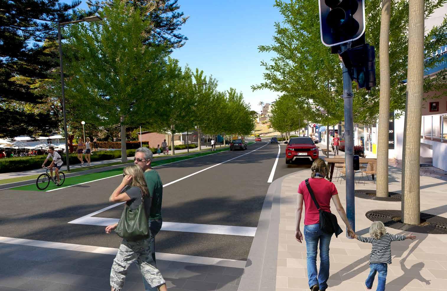
The northern portion of Stockton Street is reinforced as the heart of the Town Centre, activated by boutique retail and cafes, with space to spill out onto a pedestrian priority low-speed shared environment.
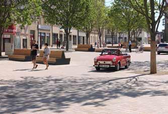
Pedestrian priority is achieved here with a level street threshold, and a slow shared zone between, pedestrians, cyclists and vehicles, with respective priority. This allows for a connected, walk-able street, with activities spilling from cafés and the potential opportunity to close the street for certain pop-up events, such as village markets. Full pedestrianisation of the northern portion of Stockton Street is considered a long-term vision.
This northern portion is celebrated with a planting and paving design which celebrates the connection with the Foreshore, as well as public art opportunities to create a unique, memorable place.
Pedestrian wayfinding reinforces the more seamless connection through to Apex Park and the Foreshore, which is enhanced by upgraded landscaping.
Complementing and connecting with the wide shared zone on Stockton Street, Magnus Street in contrast is to have a finer-grain and proportion.
Finer-grain retail and cafés have the ability to spill out onto the wider southern side of Magnus Street, taking advantage of the northern aspect. Parallel parking will only be available along northern side of Magnus Street. However the removal of the southern side street parking will depend on the availability of a commensurate number of additional car spaces in the town centre.
Note: Shared zone design would be subject to further detailed investigation in relation to drainage and stormwater design
Stockton Street
Victoria Parade
Magnus Street
Source: Wikipedia Source: Wikimedia
Shared Zone with Pedestrian Mall Capacity Shared Zone Feature Planting Street Tree Planting Key Axis of Pedestrian Flow Street Furniture Zone Vehicle Zone Street Parking Public Art Opportunity Outdoor Seating Zone Continuous Street Awning (to be built in to DA requirements) Concept Only: Final design subject to technical design considerations, detailed investigation of services and relevant approvals 30 Nelson Bay Public Domain Plan 2019 Port Stephens Council Nelson Bay NEXT Tract Consultants
FUNCTION DIAGRAM
Stockton Street Shared Zone
· Shared Zone with capacity to close as a Pedestrian Mall
· Feature planting
· Variety of seating with integrated planting
· Smart pole street lighting & feature lighting
· New public domain elements to include fountains, bike racks, bins, cafe umbrellas
· Wayfinding signage
Magnus Street Village Precinct
· Fine-grain stone paving sets, with level threshold creating shared zone
· Slow-speed environment, one-way west
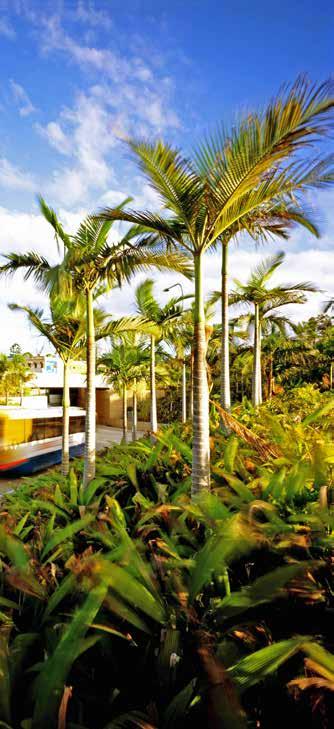
· Parallel parking along northern side with new feature Palm planting
· 9m wide footpath along southern side for outdoor dining, with new tree planting & garden beds
· New street and pedestrian lights
· New public domain elements
Signalised Scramble Crossing
Donald St & Stockton St Intersection options to be investigated:
- Signalised Intersection
- Extended shared zone - Relocation of one or both crossings and construction of kerb extensions
1 1 2 2 KEY
Magnus Street Donald Street Stockton Street Yacaaba Street Victoria
VictoriaParade KEY PLAN View 01 View 02 Concept Only: Final design subject to technical design considerations, detailed investigation of services and relevant approvals 31 Nelson Bay Public Domain Plan 2019 Port Stephens Council Nelson Bay NEXT Tract Consultants Key Places & Spaces
SPACES
Parade
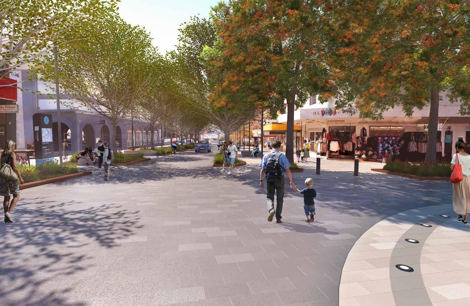 STREET PERSPECTIVE [View 01]: Stockton Street Shared Zone
32
Bay Public
Plan 2019
Stephens Council Nelson Bay NEXT Tract Consultants
Concept Only: Final design subject to technical design considerations, detailed investigation of services and relevant approvals
Nelson
Domain
Port
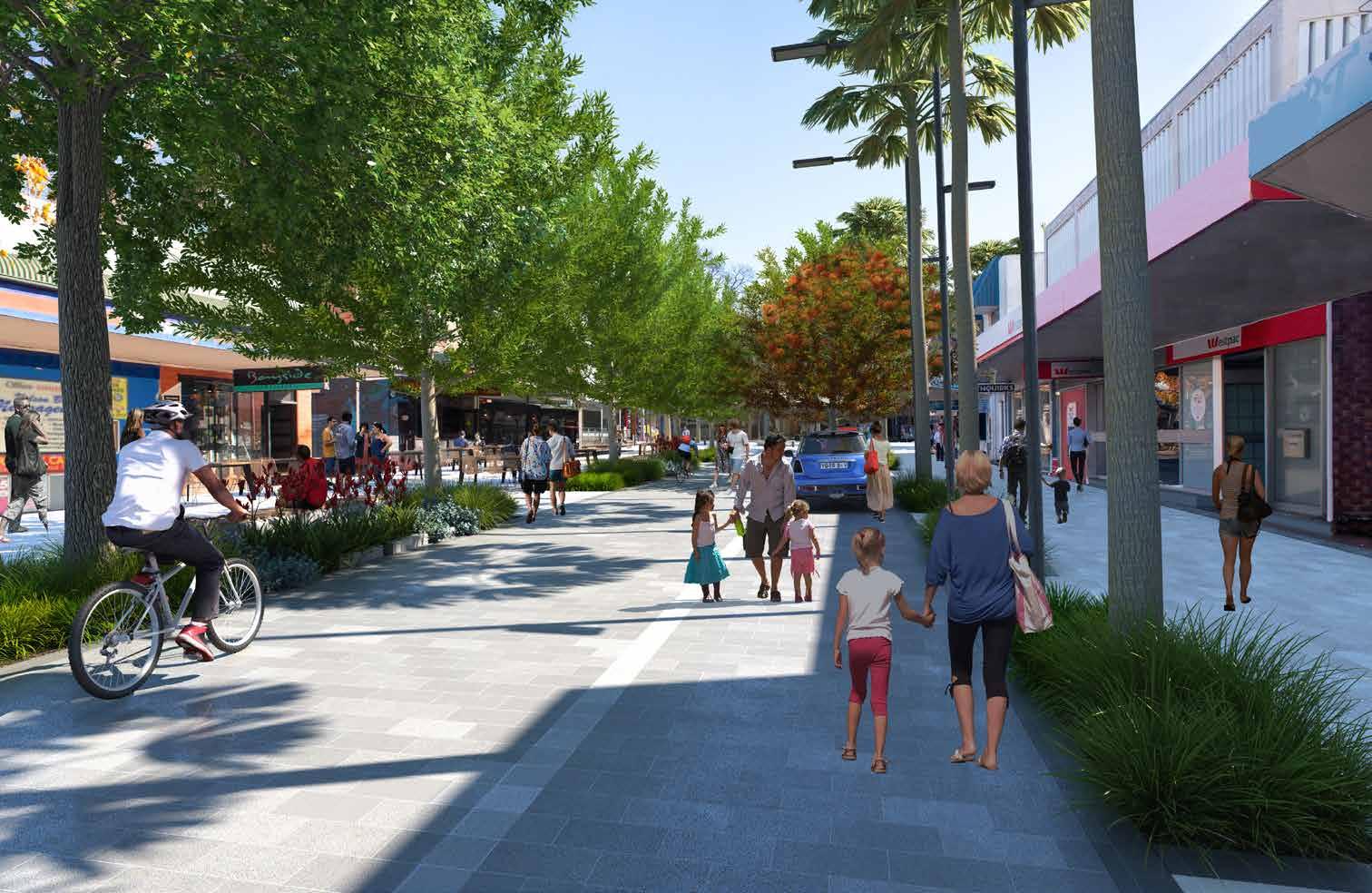 STREET PERSPECTIVE [View 02]: Magnus Street Shared Zone
33
Bay Public Domain Plan 2019
Concept Only: Final design subject to technical design considerations, detailed investigation of services and relevant approvals
Nelson
Key Places & Spaces
Port Stephens Council Nelson Bay NEXT Tract Consultants
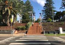
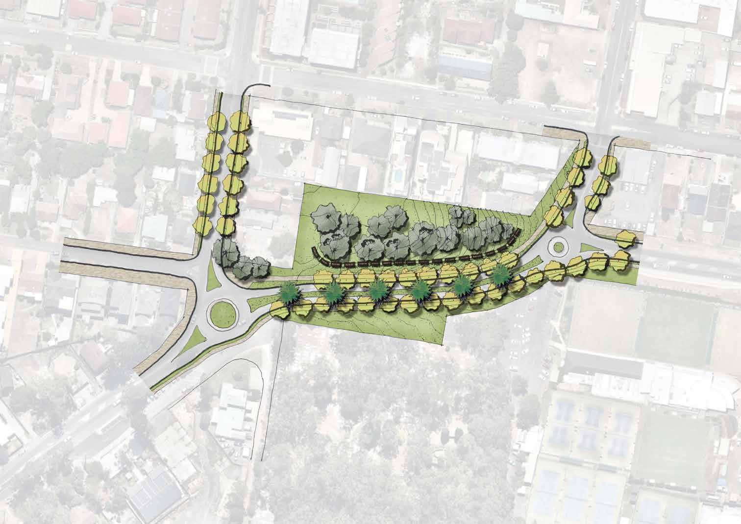
7.3 Apex Park & Victoria Parade Interface
FUNCTION DIAGRAM
A key identified aim is to better connect the Town Centre with the Foreshore. The treatment of Victoria Parade, and its connection with Stockton Street and Apex Park, is crucial to encourage walkability and improve connection.
Cafés have the opportunity to spill onto the southern side of Victoria Parade, which is to be enhanced as an attractive, walk-able street with increased planting and drop-off zones provided at street frontages. A section of Victoria Parade is categorised as a slow (25kmph) Pedestrian Priority Boulevard, with signalised scramble crossings at the end of Stockton St and Yacaaba St.
Removal of the existing Skybridge and median creates a more generous pedestrian environment around the existing Information Centre, which is proposed to be transformed into a community facility, with café and upgraded public toilets.
This Plan is largely in-keeping with the 2015 Apex Park masterplan, which is extended to include the currently underutilised car parking space to the north east of Teramby Road. The ANZAC war memorial is retained and enhanced, with eastern facing seating and upgraded landscaping. Wayfinding and historical interpretation signage is to be provided throughout the Park.
Apex Park Open Space
Pedestrian Priority Boulevard (Slow Zone 25kmph)
Cafe & Gallery Space converted from Existing Information Centre
ANZAC Memorial
Steep Bank
Foreshore On-Grade Parking
Existing Trees
Feature Planting
Street Tree Planting Key Connection

Street Furniture Zone
Potential Public Art Location
Removal of the Existing Skybridge
Removal of the Existing Median
Street Frontage Activation with increased planting and drop-off zones
TerambyRoad
Victoria Parade
34 Nelson Bay Public Domain Plan 2019 Port Stephens Council Nelson Bay NEXT Tract Consultants
Concept Only: Final design subject to technical design considerations, detailed investigation of services and relevant approvals
Victoria Parade
· Pedestrian-priority boulevard to encourage pedestrian movement, with reduced traffic speed and new cycleway on northern edge.
· Revitalise footpaths with new tree planting and street furniture elements
· Remove existing Skybridge and central concrete median
· Drop-off zone on southern edge of Victoria Parade
Apex Park
Design generally aligns with Apex Park Masterplan 2015. Reinforce existing park planting with new feature planting to enhance the green connections to Foreshore
· Widened upgraded footpath and stairs
· Sandstone terraced seating
· Existing Visitor Centre building to be refurbished with public toilet upgrades and new cafe
· Reinstate existing embankment with new low shrub and ground cover planting to prevent erosion
· Narrow Teramby Road to slow traffic and improve pedestrian footpaths
· Increase tree planting at the edges of the existing car park to provide separation between the foreshore building and parking, as well as to form the entry plaza to the foreshore
· Existing foreshore parking to remain
· Reduced foreshore parking (relies on availability of additional public parking in other locations)
TerambyRoad
VictoriaParade
3 4 6 8 7 5 10 9 9 2 1
KEY SPACES 2 3 4 5 6 7 8 9 10
Signalised Scramble Crossing
1 Victoria Parade
KEY PLAN
View 04 Concept Only: Final design subject to technical design considerations, detailed investigation of services and relevant approvals 35 Nelson Bay Public Domain Plan 2019 Port Stephens Council Nelson Bay NEXT Tract Consultants Key Places & Spaces
View 03
 STREET PERSPECTIVE [View 03]: Victoria Parade Interface Between Town Centre and Foreshore
36
2019
NEXT Tract Consultants
Concept Only: Final design subject to technical design considerations, detailed investigation of services and relevant approvals
Nelson Bay Public Domain Plan
Port Stephens Council Nelson Bay
OPEN SPACE PERSPECTIVE [View 04]: Eastern Foreshore Playground & Recreation Zone Concept Only: Final design subject to technical design considerations, detailed investigation of services and relevant approvals 37 Nelson Bay Public Domain Plan 2019 Port Stephens Council Nelson Bay NEXT Tract Consultants Key Places & Spaces
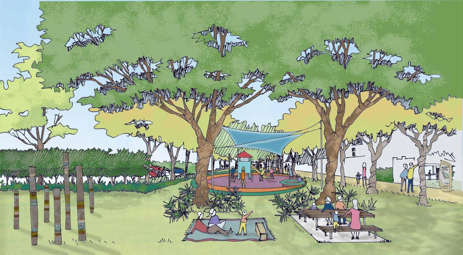
7.4 Eastern Foreshore
FUNCTION DIAGRAM
Apex Park is the defining major public space within the Nelson Bay Town Centre and Foreshore, however it is relatively constrained due to its topography and existing features. The Western Foreshore contains working elements of an existing boat yard, and whilst we propose better walkability through this area, it is understood that car parking and marina functions are essential to its function as an active boat yard and fishing marina.
The Eastern Foreshore area, which extends from the intersection of Victoria Parade and Teramby Road to the ferry wharf, is a popular waterfront destination including a children’s play park and a linear reserve. It also contains a large amount of car parking. Should additional car parking capacity become available in other locations in Nelson Bay, there is potential for utilisation as public open space.
A series of improvements in this area is proposed to create a memorable waterfront destination with a varied programme of activities that will attract residents and visitors of all ages.
Some detailed proposals include: reducing the existing car park in size. However the removal of the car parking will depend on the availability of a commensurate number of additional car spaces in the town centre.
creating new foreshore park by providing facilities / attractions suitable for all ages, such as half basketball court, shared shaded zone for recreational and educational uses and new BBQ and amenities block.
We propose this Foreshore area to be exemplary in its approach to protecting and conserving the marine ecology, and educating users and visitors to the issues affecting the Bay, and the role that their public domain plays in addressing these issues. This might include public artworks and educational displays, as well as celebrating Water Sensitive Urban Design (WSUD) features.
Eastern Foreshore Open Space
Existing Foreshore Building
Playground relocateed to free up open space on foreshore
Upgrade BBQ area
Foreshore On-Grade Parking (to be reduced dependant on availability of additional public parking elsewhere)
Existing Trees
Street Tree Planting
Pedestrian Route
Potential Public Art Location
Nelson Bay Marina
VictoriaParade
TerambyRoad
Concept Only: Final design subject to technical design considerations, detailed investigation of services and relevant approvals
38 Nelson Bay Public Domain Plan 2019 Port Stephens Council Nelson Bay NEXT Tract Consultants
Waterfront Promenade East
• Reduce existing foreshore parking and change parking entry/exit to Victoria Parade (relies on availability of additional public parking in other locations becoming available)
• Playground relocated to provide more open space along foreshore
• Retain existing trees along Foreshore
• Upgrade & expand existing playground with new equipment & shade canopies
• Upgrade BBQ shelter, BBQ amenities and install new picnic settings along Foreshore reserve
• New feature Araucaria planting along Victoria Parade
• Upgrade shared path to reinforce pedestrian connections along Foreshore
• New planting to existing gathering area to reinforce the meeting point for tour groups
• Consolidate car park entries
KEY SPACES 1 2 3 4 5 6 7 8 9 2 3 4 5 6 7 8 9 1 KEY PLAN TerambyRoad View 03 View 04 Concept Only: Final design subject to technical design considerations, detailed investigation of services and relevant approvals MagnusStreet VictoriaParade Victoria Parade Magnus Street Yacaaba Street Stockton Street 39 Nelson Bay Public Domain Plan 2019 Port Stephens Council Nelson Bay NEXT Tract Consultants Key Places & Spaces
7.5 Nelson Bay Gateways
NELSON BAY GATEWAY PARK
This reserve will provide an iconic gateway into Nelson Bay, celebrating the unique character and history of the Town, with public art, lighting and tree planting celebrating the arrival to the Town by the Bay.
The gateway can be either a public art element or a signage element or an integration of both. It is a great opportunity for the local artists’ involvement.

This gateway park will provide clear wayfinding to delineate the direction to the Town Centre and to the by-pass continuing along Dowling Street to Shoal Bay and Fingal Bay.
CHURCH STREET & GOVERNMENT ROAD INTERSECTION
This intersection serves as a secondary Gateway into Nelson Bay.
People approaches Nelson Bay Foreshore and Town Centre via this threshold mostly have gained their knowledge of direction once passed the primary Gateway Park.
There is limited public land to introduce a gateway statement and relatively understated but friendly wayfinding strategies are proposed in this area.
2 2
3 3
4 4
1 1
5 6 5 6
Nelson Bay Gateway Park
Lighting and wayfinding on roundabout to be upgraded to signify entry to Nelson Bay
New interpretive public art/signage to celebrate arrival along Stockton St
Existing trees retained
New street trees and central median planting along Stockton St as part of arrival route
New street tree planting along Church St
Consider improved pedestrian crossings at this intersection to link public car park with Town Centre via Stockton St
Church Street & Government Road Intersection
Options to increase pedestrian connectivity and safety to be explored
Gateway Palm planting, as a low-key gateway statement, at four corners of this intersection
New Nelson Bay Directional Sign
Improved vehicular wayfinding to car park
Increase street tree planting along Government Road to provide more shade and wind protection for pedestrian and cyclist
New street tree planting along Church St
 KEY SPACES
40 Nelson Bay Public Domain Plan 2019 Port Stephens Council Nelson Bay NEXT Tract Consultants
Source: Flickr
1 1 1 2 2 3 3 4 4 5 6 5 6 Church Street & Government Road Intersection Nelson Bay Gateway Park KEY PLAN KEY PLAN Concept Only: Final design subject to technical design considerations, detailed investigation of services and relevant approvals P Stockton Street Government Road Church Street Tomaree Street Church Street 41 Nelson Bay Public Domain Plan 2019 Port Stephens Council Nelson Bay NEXT Tract Consultants Key Places & Spaces
8. Implementation.
Whilst this Plan has developed a long-term vision for Nelson Bay’s public domain, we have considered a staged approach to implementation, with Small, Medium and Large moves.
Implementation Tract Consultants Nelson Bay NEXT Port Stephens Council 42 Nelson Bay Public Domain Plan 2018
8.1 Staging Approach
VISION CONCEPT BALANCED CONCEPT BASE CONCEPT
We understand that in some areas of the public domain, a staged incremental approach may be necessary. It allows for practical and effective steps to be taken in the immediate short-term, with restructuring and long-term investment to achieve the vision.
Three levels and/or stages of design and development are proposed for Nelson Bay public domain, which are:
SMALL
Base Concept: practical actions, short-term investment, improvements and upgrades
MEDIUM
Balanced Concept: feasible actions, mid-term investment, value adds
LARGE
Vision Concept: bold actions, longerterm investment, re-structuring
This approach has been supported by Council and community stakeholders whilst developing the Plan, although support is for implementing the ‘Vision’ LARGE concept as soon as practicable.
For the purpose of this Plan and its supporting documents, the focus is on developing the LARGE concept. However the SMALL , MEDIUM and LARGE steps are outlined indicatively in this section, with the detailed staging scopes elaborated and compared in the following section.
Gateway markers, i.e. wayfinding signage and feature tree planting, at key arrival intersections
Remove Stockton Street Stage; Activate street frontages and increase pop-up activities in Village Precinct
Connect Information Centre to the Foreshore and formalise perimeter footpath and connections to allow accessible pathways; Improve signage and lighting to assist visitor wayfinding
Apex Park interface: upgrade crossings at northern end of Stockton St and Yacaaba st to signalised scramble crossings.
Yacaaba Street Extension, is One-Way NORTH only, providing additional traffic access from the Town Centre to the Foreshore.
Upgrade/complete existing missing footpath in Town Centre and Foreshore
Create a Gateway park at the primary arrival point of Nelson Bay Road and Church Street intersection; Re-configure and upgrade streetscape along Stockton St and Government Rd
Undertake public domain upgrades to Magnus Street & Stockton Street intersection threshold and the shared zone of Magnus Street and Stockton Street (section between Donald Street and Victoria Parade)
Relocate Information Centre to centralised locations; Refurbishment of existing building for community use; Upgrade existing public amenities building;
Apex Park interface: Remove Skybridge and widen footpath along Victoria Parade; Remove median barrier and upgrade footpath paving
Yacaaba Street Extension remains as One-Way NORTH ONLY
Design and implement new Foreshore Central Plaza between existing buildings to improve pedestrian circulation and visual connection to the water
Undertake public domain upgrades to the Town Centre including consistent pavement, treatment, installation of street furniture and street tree planting; Underground existing overhead power-lines in the Town Centre
Design and implement art signage/gateway installation to Gateway Park
North end of Stockton Street revitalised into a Shared Zone, with potential to close off as Pedestrian Mall (Town Square)
Apex Park: Implement Apex Park Masterplan 2015
Apex Park interface: Implement 25kmph slow zone as a pedestrian prioritised boulevard on Victoria Parade between Yacaaba and Laman Street; Implement separated cycleway and widen footpaths along Victoria Parade
Design and implement new waterfront promenade connecting the Foreshore Central Plaza to the working marina
Reduce existing car park in size to allow construction of a new Eastern Foreshore park (if additional parking available elsewhere)
Consider options for Stockton Street and Donald Street intersection to improve traffic flow and improve pedestrian connectivity and safety
Consider converting Yacaaba Street Ext. to OneWay SOUTHBOUND, if north Stockton Street closed to traf fi c;
Redirect by-pass traffic to periphery of Town Centre along Dowling Street allowing pedestrian priority in the Town Centre and along the Foreshore
Undertake public domain upgrades and apply WSUD in Town Centre and Foreshore
1 1 1 1 1 1 2 2 2 5 5 6 5 6 8 9 7 3 3 4 4 4 3
LEGEND Study Boundary Arterial Road Sub-Arterial Road Collector Road Local Street One-Way Shared way Signalised Intersection Shared Zone Slow Zone in S & M schemes; Pedestrian Prioritised Boulevard in L scheme S M L 1 1 1 2 2 2 3 3 3 4 4 4 5 5 5 6 6 6 7 7 8 9 10 Concept Only: Final design subject to technical design considerations, detailed investigation of services and relevant approvals 43 Nelson Bay Public Domain Plan 2019 Port Stephens Council Nelson Bay NEXT Tract Consultants Implementation
8.2 Detailed Staging Scope
Time Frame
Order of Priority 1 2 3 4 5 6
Proposal / Location Village Precinct: Magnus Street; Stockton & Magnus Threshold; & Stockton Street (Between Magnus Street & Donald Street)
SMALL Base Concept
Remove Stockton Street Stage to remove bottleneck at intersection and open the view corridor between town centre and Apex Park;
Activate street frontages; Increase pop-up activities; Potential for temporary improvements to vacant shops, i.e. use space/windows for tourist information
Stockton Street (Between Victoria Parade & Magnus Street)
Activate street frontages; Increase pop-up activities; Potential for temporary improvements to vacant shops, i.e. use space/windows for tourist information
Apex Park Victoria Parade (Between Yacaaba Street & Laman Street)
Visitor Information Centre Stockton Street Pedestrian Boulevard
MEDIUM Balanced Concept
Re-align parking and kerb extensions along Magnus Street shared zone to slow traffic;
Upgrade existing lighting to encourage night time use of the Village; Selective removal of trees; pruning and maintenance and improvement of existing trees
Upgrade existing lighting to encourage night time use of the Village;
Selective removal of trees; pruning and maintenance and improvement of existing trees
Investigate methods to assist in stabilising northern embankment by use of planting; Strengthen the ‘green edge’ along Teramby Road whilst maintaining view corridors to the water.
Signalised scramble crossing at Yacaaba Street Extension; Convert existing Stockton Street traffic signals to allow pedestrian scramble and widen crossing;
Formalise perimeter footpath and connections to allow accessible pathways;
Improve signage and lighting to assist visitor wayfinding
Complete missing footpath connections to provide safe, consistent and comfortable connections to the town centre;
LARGE Vision Concept Design and implement the revitalisation of Magnus Street shared zone and threshold; Install feature lighting, bespoke furniture, stone paving, flush kerbs at Magnus and Stockton threshold, wayfinding, public art and new feature planting
Design and implement the revitalisation of north end of Stockton Street into a slowspeed Shared Zone, bespoke furniture and stone paving, wayfinding maps, public art, Incorporate feature tree planting which are sensitive to the visual links (i.e. tall trunks.)
Consider closing off Stockton Street north to vehicular traffic and implement Pedestrian-only Mall;
Formalise perimeter footpath and connections to allow accessible pathways; Improve lighting and wayfinding; Replace existing retaining walls with sandstone walls;
Detailed design of interpretive signage and public art as interpretive of cultural and natural heritage of Nelson Bay; Reinforce the significance of the Anzac Memorial
Remove Skybridge (pending structural assessment) and widen footpath along Victoria Parade
Remove median barrier and upgrade footpath paving; install street trees and feature tree planting
Refurbishment of existing building with new cafe. Upgrade existing public toilets; improve access and surveillance
Investigate the relocation of the Visitor Information Centre to a location with parking available for caravans, campers & trailers. If relocated, consider active uses for the building to contribute to the public domain.
Improve pedestrian crossing amenities at Tomaree intersection;
Implement WSUD garden beds and street tree planting where possible to improve the green corridor connections
Implement “east” facing sandstone terraces to strengthen visual and physical connections to Anzac Memorial and the foreshore park beyond; Provide greater “level paved area” to assist with ceremonial events within Apex Park; Consider implementation of Apex Masterplan
Reduce speed along Victoria Parade to 25kmph between Yacaaba & Laman St; Slow traffic to “flip” priority to pedestrian movements
Implement a safe 3m wide separated cycleway to remove conflict with pedestrians in Apex Park; Cycleway to connect with shared path along Government Road and the foreshore promenade to the east.
Detailed Design for total renovation of current brick building to allow for a new transparent building structure which improves frontage and connection to Apex Park and Victoria Parade.
Attract long term tenant i.e. cafe / restaurant to assist with the activation of Apex Park and surrounds whilst maintaining community use of “flexible floor space” within building
Underground existing overhead power lines;
Re-align parking and kerb extensions to complete public domain footpath upgrades;
Street tree planting and install new multifunction streetlights
10 14 9 1 5 11 12 13 16 17 18 15 10 6 7 8 8 7 6 4 3 1 2
44 Nelson Bay Public Domain Plan 2019 Port Stephens Council Nelson Bay NEXT Tract Consultants
7 8 9 10 11 12 13 14 15 16 17 18
Yacaaba Street & Extension Donald Street & intersection with Stockton Street
Primary Gateway Church Street/Nelson Bay Road Intersection
Secondary Gateway Government Road & Government Road /Church Street Intersection:
Secondary Gateway Teramby Road/ Victoria Parade Intersection:
Yacaaba Street Extension: as constructed OneWay NORTH traffic movement;
Increase Tree planting to adjoining pedestrian shared area to provide more shade and wind protection
Upgrade and complete missing footpath connections; Selective removal of trees; pruning and maintenance and improvement of existing trees condition
Install feature gateway planting and upgrade wayfinding signage at gateway
Foreshore Central Plaza & Western Foreshore
Eastern Foreshore Church Street Laman Street Teramby Road Laneway off Stockton Street Laneway linking off Magnus Street
Consider pedestrianising Stockton Street north to traffic, and reconfigure Yacaaba Street as One-Way SOUTHBOUND; Provide suitable wayfinding signage to town centre parking areas
Re-align parking and kerb extensions to complete public domain footpath upgrades, street tree planting and install new multifunction streetlights;
Upgrade streetscape and apply WSUD garden beds
Create Gateway Park; Re-configure traffic lanes to allow inclusion of shared path; Underground overhead power lines; New verge planting, median treatments, new street lighting and banners
Install feature gateway planting and upgrade wayfinding signage at gateway
Install feature gateway planting and upgrade wayfinding signage at gateway
Removed existing clutter to plaza area directly adjacent to Teramby Roadincluding relocating waste bins, poster signage;
Upgrade existing signage to D’Albora Marinas; Upgrade footpath paving and complete missing connections along Teramby Road
Upgrade/create a safe well lit pedestrian connection from the existing information centre to the eastern promenade adjacent existing car park;
Linking Apex Park and the Ferry Wharf via the open spaces along eastern foreshore
Upgrade/complete existing missing footpath and install street trees where possible
Upgrade/ complete existing missing footpath
Upgrade/ complete existing missing footpath and provide new pedestrian lighting to increase safety and surveillance
Encourage activation and upgrades to laneways - subject to private funding
Encourage activation and upgrades to laneways - subject to private funding
Consider options for Donald Street and Stockton Street intersection to improve traffic flow and improve pedestrian connectivity
Design and implement art signage / gateway installation to Gateway Park
Re-configure and upgrade streetscape along Government Road to allow inclusion for shared path.
Underground overhead power lines
Re-configure and upgrade streetscape along Victoria Parade to allow inclusion for shared path; Underground overhead power lines
Design and implement new gateway plaza between exiting buildings to improve pedestrian circulation and visual connection to the water; Consider new feature lighting; New public domain furniture; New planting, and large grass area for users
Upgrade promenade; Implement wayfinding and interpretative signage; Upgrade promenade lighting;
Upgrade and expand existing playground, provide shade canopies, install new public domain furniture including picnic tables, litter bins and water station
Re-configure and upgrade streetscape along Church Street to allow inclusion for shared path
Implement street tree planting or low / median shrub planting in verges to maintain views
Teramby Road works to align with Apex Park and Marina upgrades; Stabilistation of existing planting embankment
Encourage activation of laneways during the day and after hours with pop-up activities to draw locals and visitors into the town
Encourage activation of laneways during the day and after hours with pop-up activities to draw locals and visitors into the town
Consider options for improving pedestrian connectivity and safety at Church Street and Government Road intersection
Signalised scramble crossing at Victoria Parade / Yacaaba intersection
Design and implement new waterfront promenade; connecting the new central plaza to the working docks at the CO-OP and existing breakwall;
Consider cantilevered timber boardwalk where space is restricted and bridge over existing boat ramp (bridge to swing opwn when ramp is in use); Upgrade promenade paving and lighting; Implement the art trail /wayfinding
Reduce existing carpark in size to allow construction of a new foreshore park by providing facilities / attractions suitable for all ages including half basketball court and new BBQ / amenities block;
Reinforce connections and extend foreshore park to include the Ferry Wharf, Cafe and meeting point
Underground overhead powerlines and complete street tree planting;
Install news streetlights
Formalisation of existing informal “goat track” access from Bridle Path to Teramby Road (timber steps)
Provide short lease tenancies to allow activation of laneways during high season;
Encourage new small bars and wine bars
Provide short lease tenancies to allow activation of laneways during high season;
Encourage new small bars and wine bars
45 Nelson Bay Public Domain Plan 2019 Port Stephens Council Nelson Bay NEXT Tract Consultants Implementation
APPENDIX A SITE ANALYSIS STUDY 48
APPENDIX B COMMUNITY CONSULTATION WORKSHOP 1 52
APPENDIX C COMMUNITY CONSULTATION WORKSHOP 2 54
APPENDIX D STOCKTON STREET PEDESTRIAN MALL_ ALTERNATIVE CONCEPT 56
Appendix.
46 Nelson Bay Public Domain Plan 2019 Port Stephens Council Nelson Bay NEXT Tract Consultants
This page is intentionally left blank.
47 Nelson Bay Public Domain Plan 2019 Port Stephens Council Nelson Bay NEXT Tract Consultants Appendix
Appendix A Site Analysis Study
PEDESTRIAN CONNECTIVITY
· Stockton Street features strongly as the northsouth axis across the Town Centre, providing pedestrians with direct physical and visual connection between the Town Centre and the Foreshore.
· The Yacaaba Street Extension, as an additional pedestrian and traffic link, has recently been constructed to increase accessibility from the Town Centre to the Foreshore. An opportunity exists to review its traffic arrangement so that the place character of Stockton Street as a central spine/ pedestrian boulevard can be further enhanced.
· A few existing laneways/through-site links within the Town Centre core area are identified. Activation of these can be encouraged to increase site permeability and to create safe, vibrant destinations for tourists and local residents.
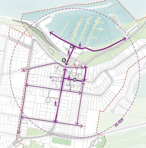
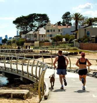
· The promenade provides a great opportunity for pedestrian access along the Foreshore, but could be improved and extended to increase connectivity.
· The existing Skybridge is currently under-utilised. Removing it provides an opportunity to free up more public space as well as to open up a better street view.
APPEALING LOCAL CHARACTER
The following Character Areas are identified in the Nelson Bay Town Centre and Foreshore Strategy 2012 and also within the DCP Section D ‘Specific Areas’.
We see particular opportunities to enhance the public domain in:
· Existing Village Character on Magnus Street
· Foreshore area
LEGEND
LEGEND
Pedestrian Destination
400m Walking Radius
Primary Pedestrian Access
Secondary Pedestrian Access
Laneway Access
Skybridge
Bank - No pedestrian link
Foreshore
Village Precinct
Existing Village Character on Magnus Street
Green Link along Foreshore
Existing Active Frontage
Existing Foreshore Promenade Existing Apex Park Along Foreshore Existing Village Character on Magnus Street
48 Nelson Bay Public Domain Plan 2019 Port Stephens Council Nelson Bay NEXT Tract Consultants
GENEROUS OPEN SPACE, HERITAGE & COMMUNITY FACILITIES
· Apex Park, a significant public park located between the Town Centre and the Foreshore, is not currently able to provide a good connection between the two major functions. An opportunity exists to improve it into an attractive transition.
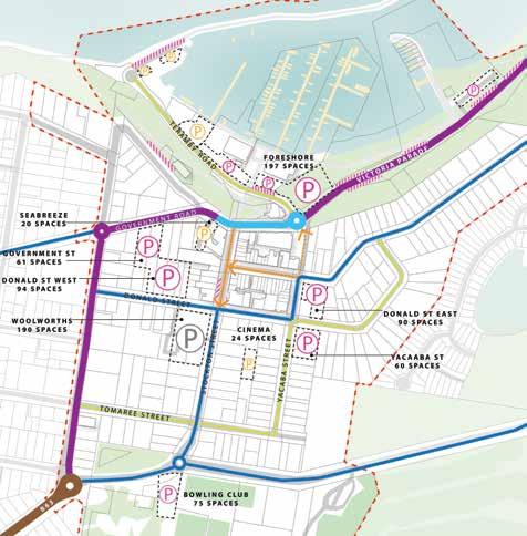
· Council owned public open space, which is located on the northern side of Stockton Street, near the round-about intersection of Nelson Bay Road and Church Street, has a potential to be transformed into a Gateway Park to provide a sense of arrival.
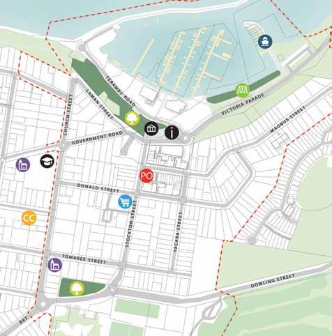
· Existing heritage items at Apex Park should be retained.
· Council owned Information Centre has potential to be either upgraded or relocated to the Town Centre.
· Existing community facilities (including public park, playground, community college, child-care) provide good community services for local residents, which is to be enhanced to attract future population growth.
VEHICULAR CONNECTIVITY
· By-pass traffic along Victoria Parade forms a traffic barrier for pedestrians between Town Centre and the Foreshore.
· One-way traffic together with high volume of pedestrian movements on Magnus Street and north end of Stockton Street leads to significant traffic congestion, especially during peak periods. Cars circulating through the Town Centre looking for available parking or certain destinations further exacerbate the congestion.
· Yacaaba Street Extension provides additional traffic and pedestrian access from the Town Centre to the Foreshore. This one-way north access may help the traffic
flow out of the Town Centre, however it also puts the traffic pressure back onto Victoria Parade and therefore aggravates it as a traffic barrier for pedestrians.
· Large number of open air car parks dispersedly located along Foreshore which constrains the activity/commercial opportunities at the waterfront. There is a opportunity to intensify the parking within the Town Centre so as to free up the waterfront spaces for tourism and commercial activities.
LEGEND LEGEND
i
PO
Existing Arterial Road
Existing Sub-Arterial Road
Post Office
Visitor Centre (to be refurbished) Educational Facilities (Tomaree Community College)
Heritage/Historical Site Place of Worship
Supermarket
Childcare/Pre-School Foreshore Playground Public Park
P
Existing Traffic Barrier between Town Centre and Foreshore Existing Collector Road
Existing Local Street
Existing One Way Yacaaba St Extension (One Way North) Public Car Park
Private Underground CP Dedicated Street Parking
49 Nelson Bay Public Domain Plan 2019 Port Stephens Council Nelson Bay NEXT Tract Consultants Appendix A - Site Analysis Study
cc P P
Ferry Terminal
Private Car Park
EXISTING TOPOGRAPHY
· Disconnection both visually and functionally between Town Centre and Foreshore
· Lack of disabled access to Waterfront via Apex Park due to existing topography/ level change
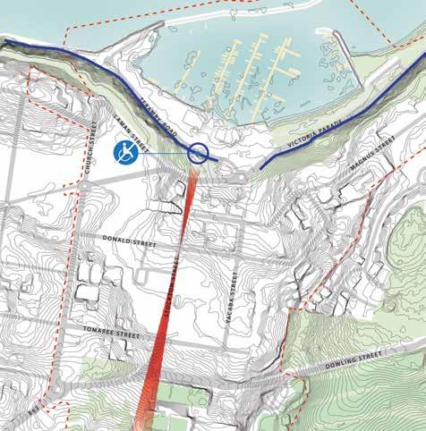
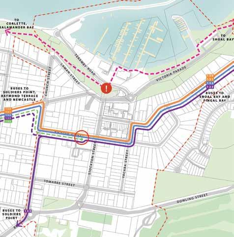
LIMITED CYCLE PATH & PUBLIC TRANSPORT
· Heavily car dependent, causing traffic congestion and parking issues during peak tourism time
· Poor public transport service
· Disconnected cycle path which discourage alternative transport modes, e.g. walking and cycling
LEGEND
LEGEND
0.5m Contours
Existing Bank/ Steep Level Change
Lack of Disabled Access
Visual Connection
Foreshore Cycle Route
Level ChangeDisconnected Cycle Path
Bus Routes
Bus Interchange
50 Nelson Bay Public Domain Plan 2019 Port Stephens Council Nelson Bay NEXT Tract Consultants
EXISTING INFRASTRUCTURE SERVICES
· Overhead power lines restrain the opportunities for street tree planting
· Substation constraints at Apex Park
LEGEND
NIGHT-TIME ECONOMY

Currently, the Nelson Bay Town Centre lacks night-time activation and activities. We interpret this as a challenge which must be addressed to aid our vision for Nelson Bay to become a more attractive place for residents and visitors alike.
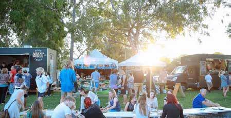
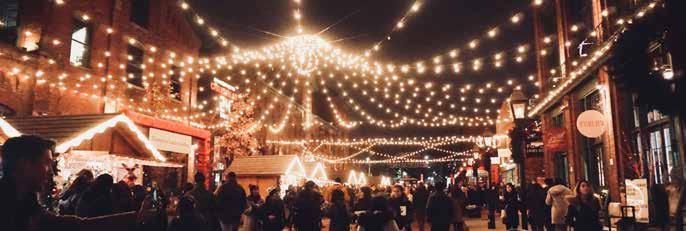
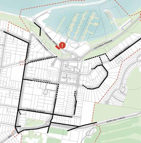
Currently, the Foreshore hosts seasonal Sacred Tree markets during the summer season (top left), but we propose to consider a year-round calendar of events, as well as the activation of streets in the evenings, with some bar and restaurant offerings which boost the local economy and attract both tourists and permanent residents to the Bay.
Overhead full power lines
Overhead communications or bunched power lines Apex Park sub-station
51 Nelson Bay Public Domain Plan 2019 Port Stephens Council Nelson Bay NEXT Tract Consultants Appendix A - Site Analysis Study
Sacred Tree Markets at the foreshore Source: Visit NSW
Consultation with key stakeholders was carried out in May 2018, with Tract and Dot Dash presenting their initial findings and ideas or ‘Key Moves’ to various stakeholders.


This session proved to be invaluable to the design team, with positive feedback and comments to guide the next steps in developing the Plan.


Green, amber and red dots were provided, with only the ‘positive’ green dots being utilised by stakeholders to demonstrate their preferences - see green star locations on following page. All comments captured on sticky notes are also included overleaf.
SUMMARY


The community stakeholders overwhelmingly supported the ‘L’: Large Moves which presented visionary concepts for adapting the public realm.
Many comments praised the removal of the Skybridge and the pedestrianisation of Stockton Street, as well as the adaption of the information centre and the landscaping of Apex Park.
Appendix
B Community Consultation Workshop 1
52 Nelson Bay Public Domain Plan 2019 Port Stephens Council Nelson Bay NEXT Tract Consultants


KEY MOVE 1: Celebrate Stockton Street KEY MOVE 2: Revitalise Village Precinct KEY MOVE 3: Connect Town Centre, Apex Park & Foreshore Promenade KEY MOVE 4: Reconsider Sky Bridge & Visitor Centre KEY MOVE 5: Create Gateway Park “Car Parking Behind” “Signage only” “Info Centre to be easily accessed” “Open visitor centre to other side?” “Move info centre and have building as Art Gallery” “What about upgrading the roundabout e.g. Welcome to Nelson Bay banner poles in the centre creating sense of arrival” “Not a huge priority as it’s only linked to NB via the roadpeople don’t walk here” “Get rid of bridge” “Retaining walls need to reflect the natural contours and work towards facing the Cenotaph” “I agree” “Remove overhead bridge” “Anzac Rising Sun - terracing should face due east” “Love amphitheatre/tiered seating at Apex Park” “If the Northern end of Stockton St was closed off, traffic would still be able to flow” “Really like Stockton St being a ‘Boulevard’” “PSC to buy Post Officecreate town square” Agreed Neutral Disagreed “D’Albora Marina need to be involved now in developmental stage” “Remove Stage” “Get rid of stage” 53 Nelson Bay Public Domain Plan 2019 Port Stephens Council Nelson Bay NEXT Tract Consultants Appendix B - Community Consultation
The second consultation with the community representatives and the key stakeholders was carried out on 5th July 2018.
Tract Consultants presented their draft Nelson Bay Public Domain Plan and Streetscape Design Guidelines, as well as the draft Wayfinding and Signage Design on behalf of Dot Dash.


The community and key stakeholders were well informed on the draft design approaches and concepts proposed to the Nelson Bay Public Domain. An A4 feedback booklet was distributed to each individual at the end of the presentation for their comments. Seven A1 boards were also on display for the stakeholders’ votes and comments.
All comments captured on the A4 booklets and A1 boards are to be provided separatly, with some key notes included overleaf.
SUMMARY

This session proved to be successful. The community stakeholders in general supported the draft Public Domain Plan.
Many comments praised the pedestrian friendly response and the proposals of the upgraded streetscape to the Town Centre and the Foreshore public domain. However, concerns of the traffic management and parking issues were also expressed.
Some detail comments on the tree planting, material and color selections and the wayfinding signage design were furthered communicated.
Appendix C
2
Community Consultation Workshop
54 Nelson Bay Public Domain Plan 2019 Port Stephens Council Nelson Bay NEXT Tract Consultants
“Overall support for the revision of Nelson’s Bay”
“Preference for the Gateway from Stockton St down to the marina to better allow foot traffic to flow down.”

“Discourage large vehicles from Victoria Parade, priority via Dowling St and encourage large vehicles to use this route”
“Overall very good design, the streetscapes would vastly improve the look and feel of the town. ”
“Public spaces along the eastern foreshore - water features, nice places to sit and watch, interactive spaces, street art either temporary or permanent ”


“Apex Park and Eastern Foreshore proposal results in a significant loss of parking east of the marina buildings – if implemented needs alternative provision”


“Village Precinct and Stockton Street Pedestrian Mall as a priority, priority of pedestrians and environment ”


“Positive and pedestrian friendly response to Stockton St Pedestrian Mall”
“Stockton St Pedestrian Mall long term potentially but may be better as a shared zone initially ”
“Tree lined streets are brilliant”
“Awnings should be continuous, coverage of Pedestrian Mall, shelter is a must, lots of rain!”
“Very important to do all of this planting- love it”

“Yes to deciduous trees”
“Palms good for the subtropical feel.”
“Excellent proposal to increase planting – reserve on species – needs combination of professionals/ experts advice and local community preference”
“Natural stone paving is a great idea for pedestrian dedicated areas such as Stockton Pedestrian Mall or Eastern Foreshore”
“Precedent used for natural stone paving of the different coloured pavers gradient is favoured and reflects the “beach identity” and would be nicely. paired with timber bench seating”
“Seating is great, there is a big lack of seating for a tourist area.’”
“Bus stop outside Woolworths unsatisfactory – limited shelter and shade”
“Local stone (granite pinkish, see marina breakwater walls)
“Timber (history of bay as a port)”
“More signage is needed, but presented in a more natural form”
“Clearly legible from a distance and no confusing symbols for wayfinding”
“Encourage local artists to be involved in the wayfinding not just visual artists but local graphic designers too.
55 Nelson Bay Public Domain Plan 2019 Port Stephens Council Nelson Bay NEXT Tract Consultants Appendix B - Community Consultation
Appendix D Stockton Street Pedestrian Mall_ Alternative Concept

As a long-term vision, a bold concept is included for the closure of the northern portion of Stockton Street to vehicles, creating a Pedestrian Mall.

Rather than a street, this portion then becomes a town square. This treatment allows for a planting and paving design which celebrates the connection with the Foreshore, as well as public art and water play opportunities to create a unique, memorable place.
 Magnus Street
Stockton Street
Victoria Parade
Magnus Street
Stockton Street
Victoria Parade
Only: Final design subject to technical design considerations, detailed investigation of services and relevant approvals
STOCKTON STREET NORTHERN PORTION _ PEDESTRIAN MALL
Concept
· Pedestrianised zone with bespoke stone paving & integrated public art · Central Water Play Feature · Feature Palm planting · Variety of seating with integrated planting · Smart pole street lighting with feature lighting · New public domain elements to include fountains, bike racks, bins, cafe umbrellas · Wayfinding signage
Stockton Street Pedestrian Mall
56 Nelson Bay Public Domain Plan 2019 Port Stephens Council Nelson Bay NEXT Tract Consultants
Manly Corso Source: Wikimedia
 STREET PERSPECTIVE
[View
01]: Stockton Street Pedestrian Mall
57
Bay Public Domain Plan 2019
Appendix B - Community Consultation
Concept Only: Final design subject to technical design considerations, detailed investigation of services and relevant approvals
Nelson
Port Stephens Council Nelson Bay NEXT Tract Consultants
For more information please contact Development Services
council@portstephens.nsw.gov.au (02) 4988 0255 portstephens.nsw.gov.au
58 Nelson Bay Public Domain Plan 2019 Port Stephens Council Nelson Bay NEXT Tract Consultants
